| Critical Data with Normal Counts |
|---|
| Type | Description | Hourly Count | Monthly Average | Percent (%) of Monthly Mean | UTC Time Window |
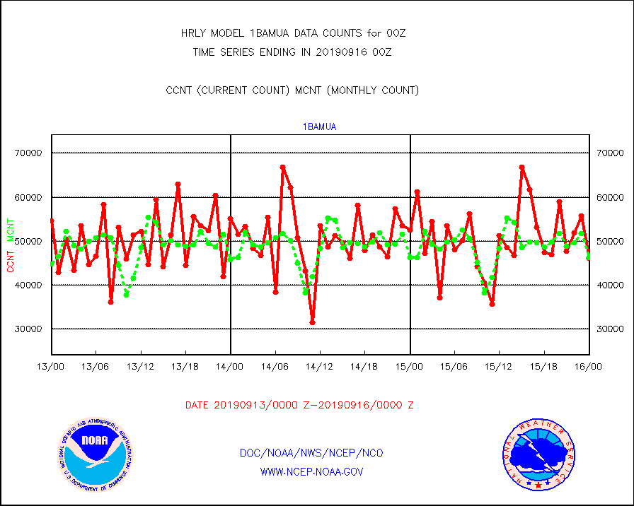
1bamua |
NOAA 15-19 & METOP 1-2 AMSU-A NCEP-proc. br.temps |
46056 |
46219 |
99.6 % |
1522.00-1522.99 |
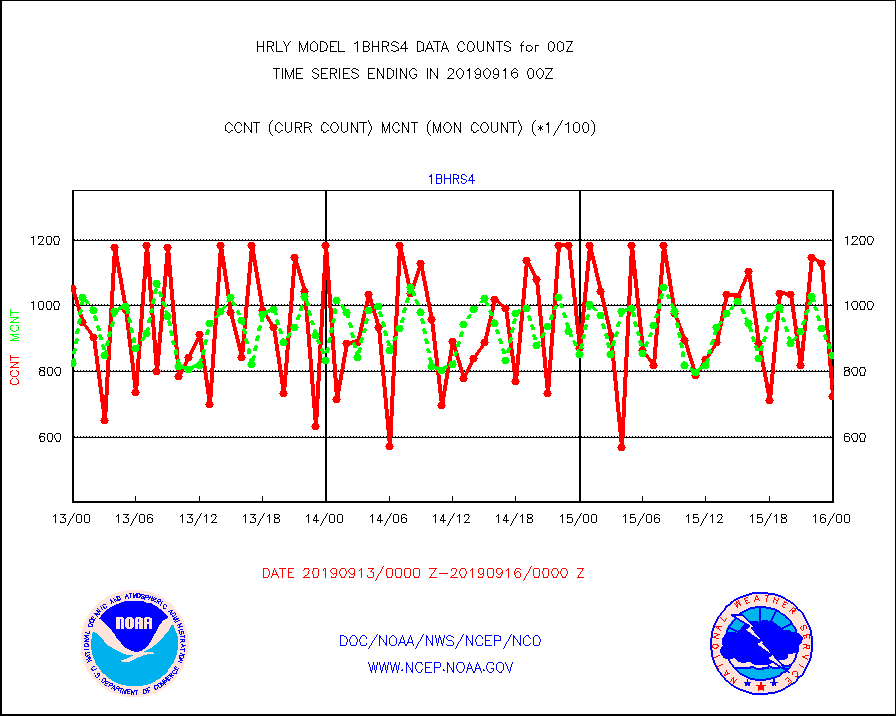
1bhrs4 |
NOAA 18-19 & METOP 1-2 HIRS-4 NCEP-proc. br.temps |
72454 |
85053 |
85.2 % |
1522.00-1522.99 |
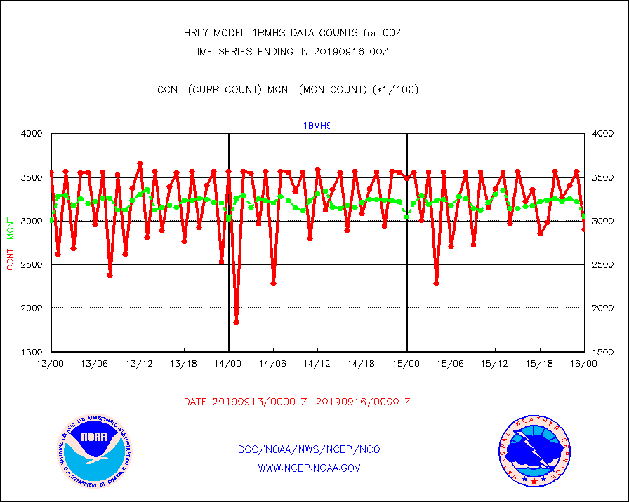
1bmhs |
NOAA 18-19 & METOP 1-2 MHS NCEP-proces. br. temps |
290371 |
304473 |
95.4 % |
1522.00-1522.99 |
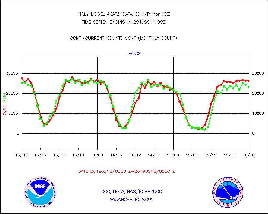
acars |
MDCRS ACARS acft data from ARINC(dcded from BUFR) |
26208 |
23005 |
113.9 % |
1523.50-1600.49 |
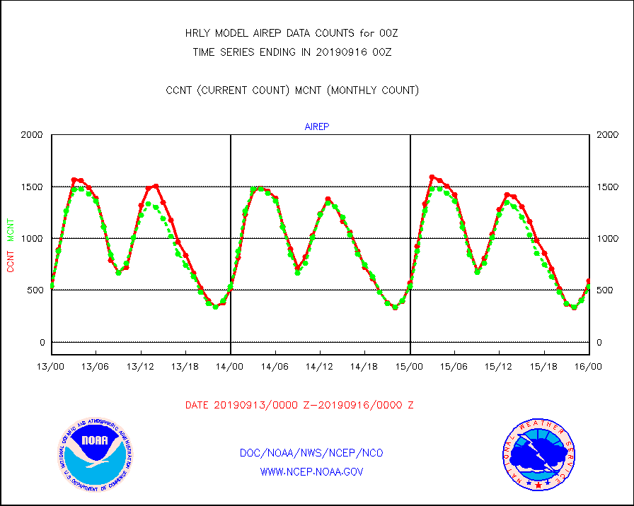
airep |
Manual AIREP aircraft data (dcded from AIREP fmt) |
593 |
537 |
110.4 % |
1523.50-1600.49 |
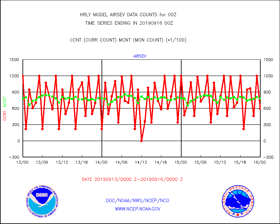
airsev |
AQUA AIRS/AMSU-A/HSB brightness temps- every FOV |
59566 |
78702 |
75.7 % |
1521.50-1522.49 |
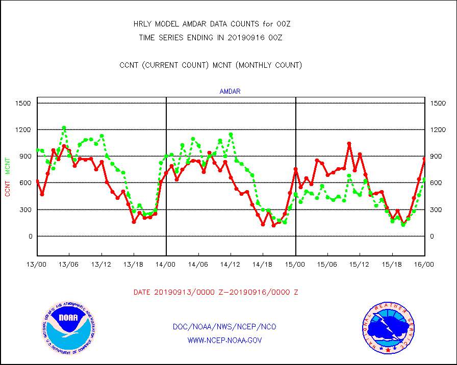
amdar |
AMDAR aircraft data (decoded from AMDAR format) |
873 |
641 |
136.2 % |
1523.50-1600.49 |
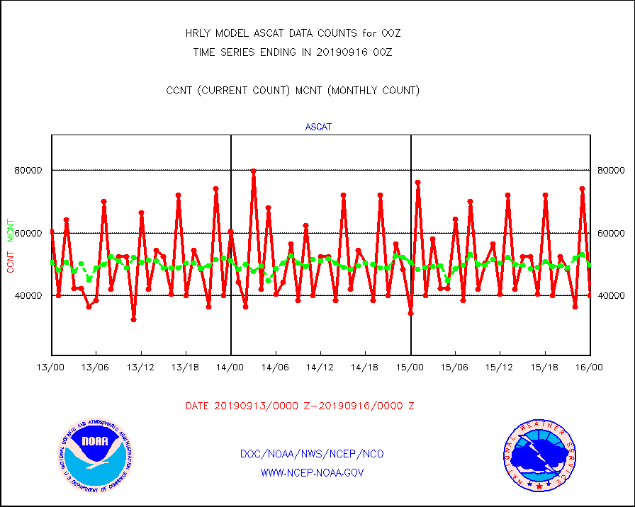
ascat |
METOP 1-2 ASCAT products |
39942 |
49644 |
80.5 % |
1522.50-1523.49 |
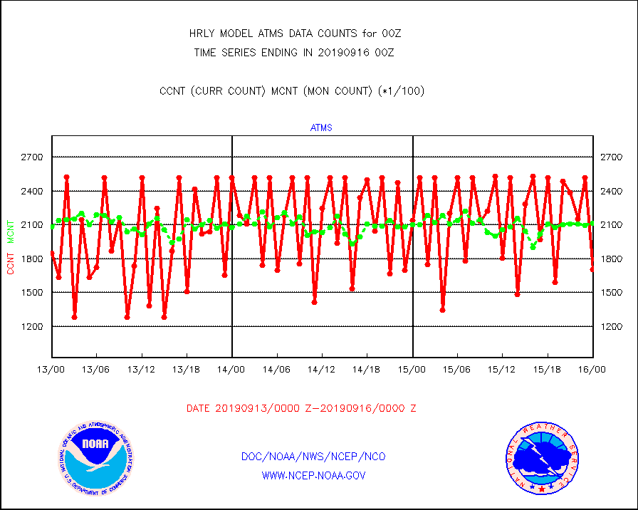
atms |
NPP Adv. Tech. Microwave Sounder (ATMS) br. temps |
170304 |
211673 |
80.5 % |
1522.50-1523.49 |
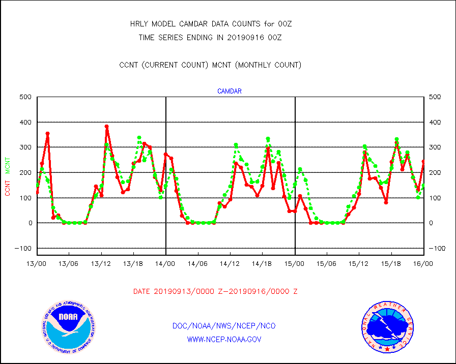
camdar |
Canadian AMDAR aircraft data (decoded from BUFR) |
244 |
149 |
163.8 % |
1523.50-1600.49 |
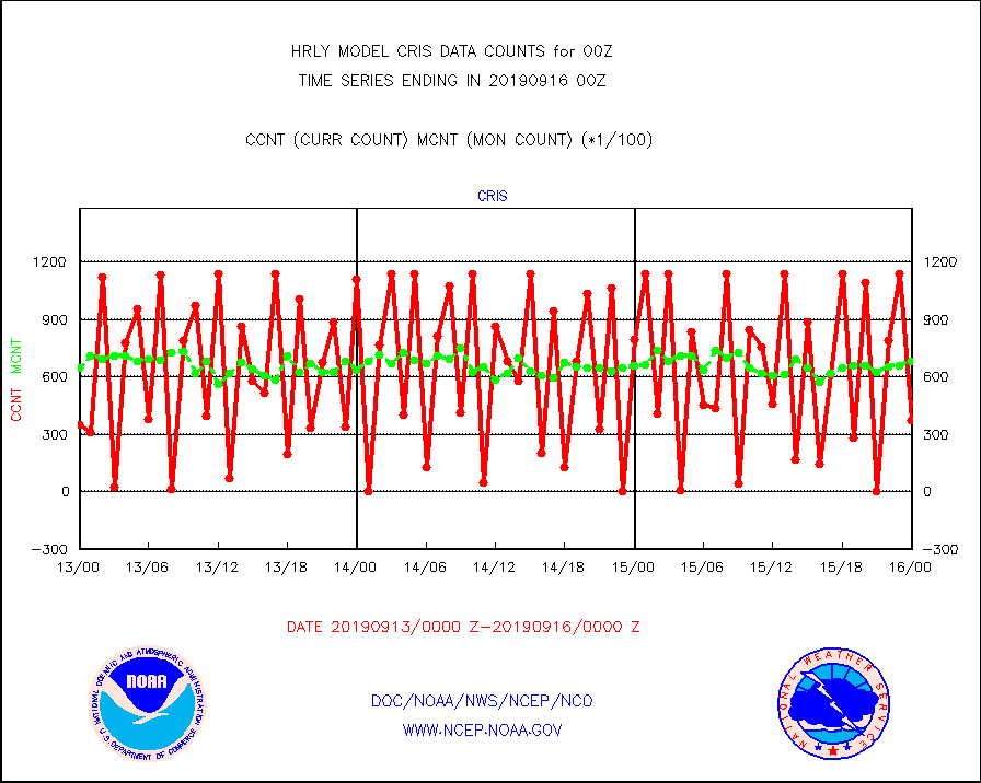
cris |
NPP Cross-track Infrared Sounder (CrIS) radiances |
37251 |
68252 |
54.6 % |
1522.50-1523.49 |
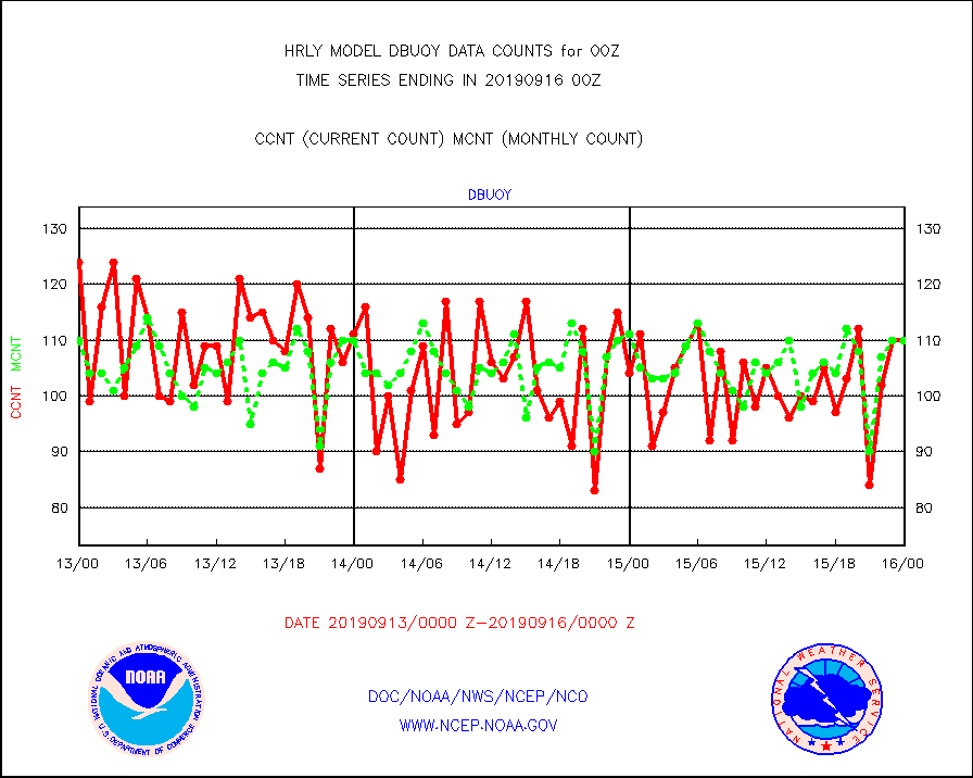
dbuoy |
Buoys decoded from FM-18 fmt (moored or drifting) |
110 |
110 |
100.0 % |
1523.50-1600.49 |
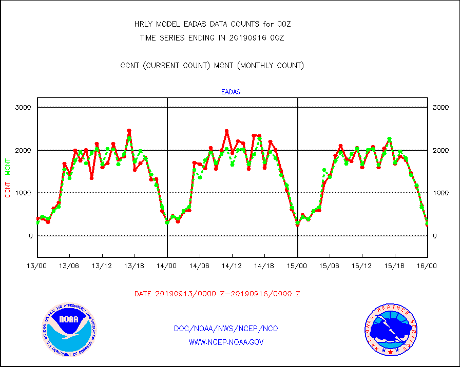
eadas |
E-AMDAR (European AMDAR acft decoded from BUFR) |
255 |
299 |
85.3 % |
1523.50-1600.49 |
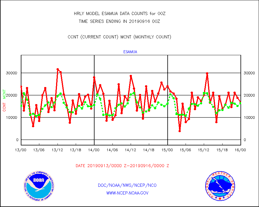
esamua |
NOAA 15-19 & METOP 1-2 AMSU-A proc btmps frm RARS |
16758 |
16520 |
101.4 % |
1523.50-1600.49 |
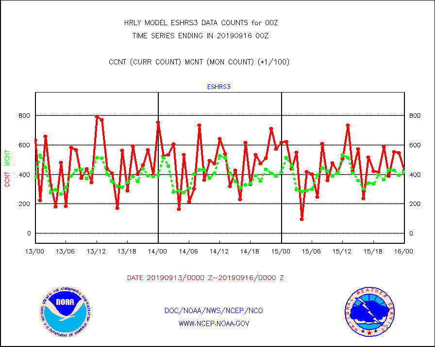
eshrs3 |
NOAA 15-19 & METOP 1-2 HIRS-3/4 pr btmps frm RARS |
42540 |
41961 |
101.4 % |
1523.50-1600.49 |
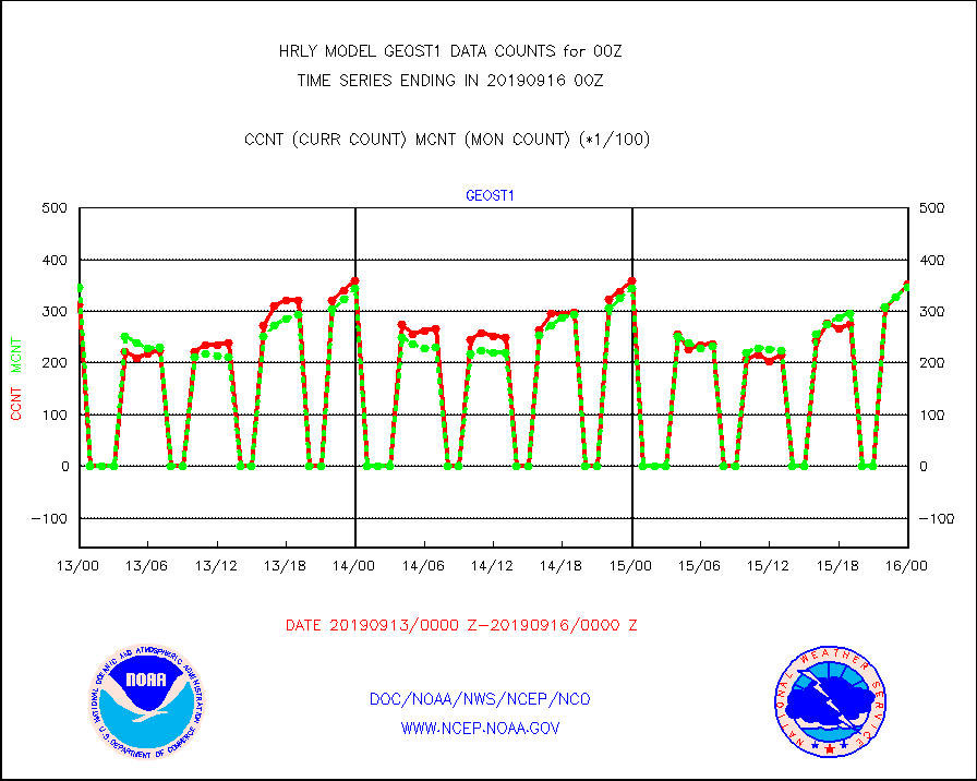
geost1 |
GOES/NESDIS hi-resol. (1x1 f-o-v) sndgs/radiances |
35491 |
34727 |
102.2 % |
1523.50-1600.49 |
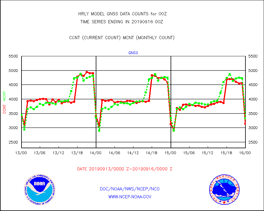
gnss |
Grnd-based Gbl Navigation Sat System (GNSS) data |
3148 |
3336 |
94.4 % |
1523.00-1523.99 |
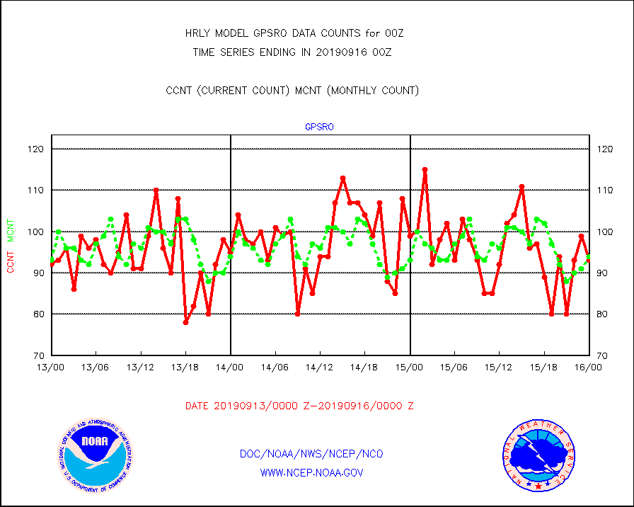
gpsro |
GPS radio occultation data |
93 |
94 |
98.9 % |
1521.50-1522.49 |
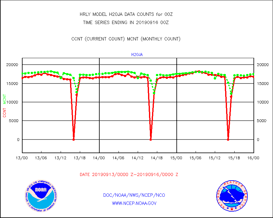
h20ja |
MTSAT/JMA water vapor imager derived cloud motion |
16776 |
17508 |
95.8 % |
1521.50-1522.49 |
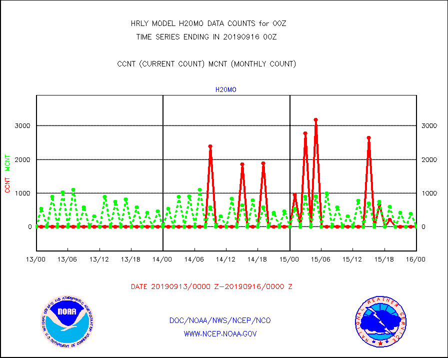
h20mo |
MODIS (AQUA/TERRA) wvpr imager derived cld motion |
0 |
0 |
n/a |
1520.00-1520.99 |
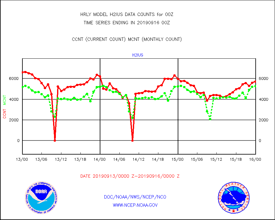
h2ius |
GOES/NESDIS water vapor imager derived cld motion |
5716 |
5269 |
108.5 % |
1523.00-1523.99 |
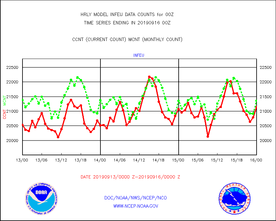
infeu |
METEOSAT/EUMETSAT ir lg-wave derived cloud motion |
21149 |
21364 |
99.0 % |
1522.50-1523.49 |
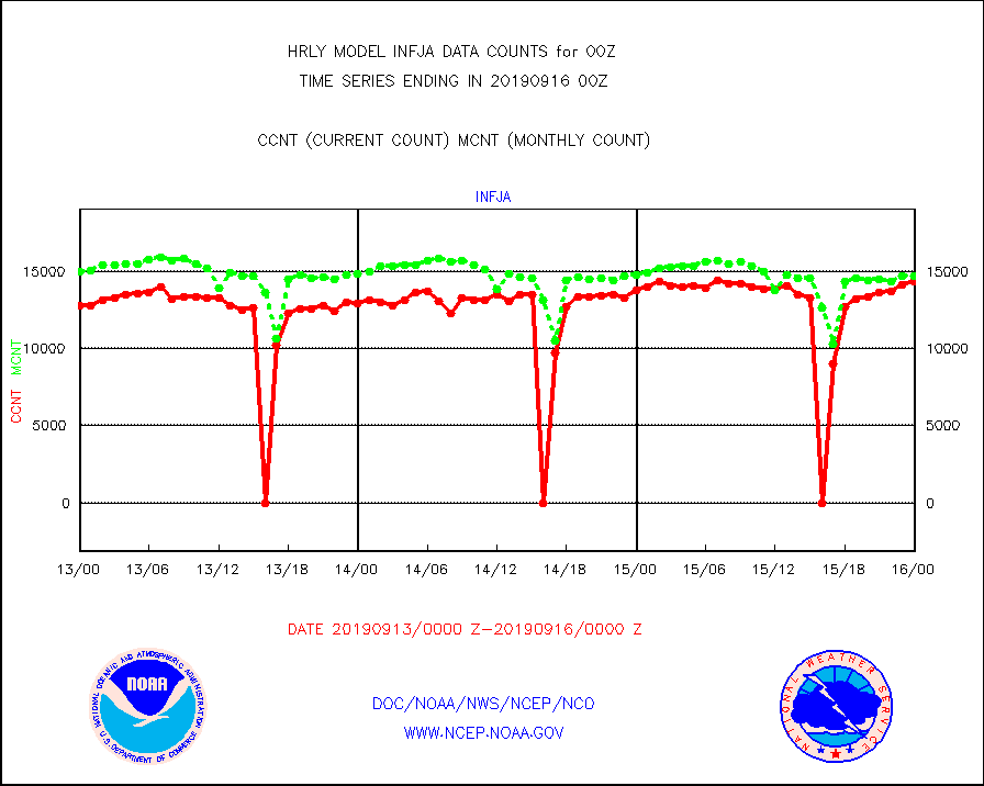
infja |
MTSAT/JMA infrared long-wave derived cloud motion |
14327 |
14688 |
97.5 % |
1521.50-1522.49 |
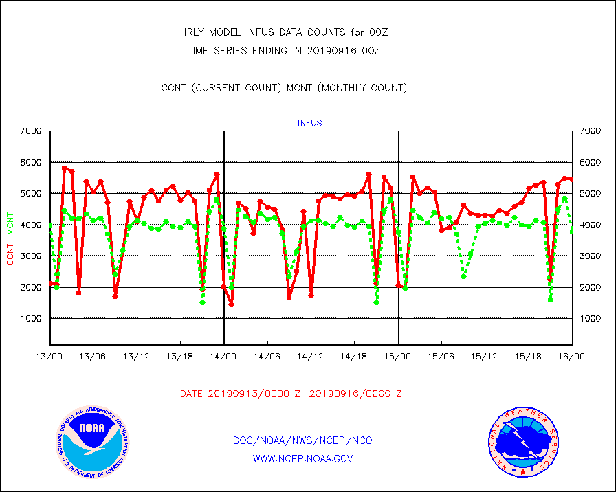
infus |
GOES/NESDIS infrared lg-wave derived cloud motion |
5452 |
3780 |
144.2 % |
1523.00-1523.99 |
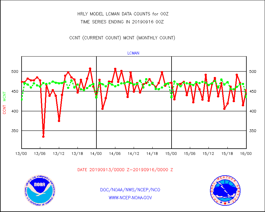
lcman |
Land-based CMAN stations decoded from CMAN format |
453 |
436 |
103.9 % |
1523.50-1600.49 |
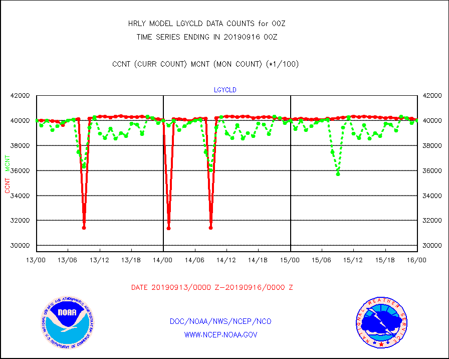
lgycld |
GOES/NASA(Langley) hi-res. (1x1 f-o-v) cloud data |
4004605 |
4000501 |
100.1 % |
1523.50-1600.49 |
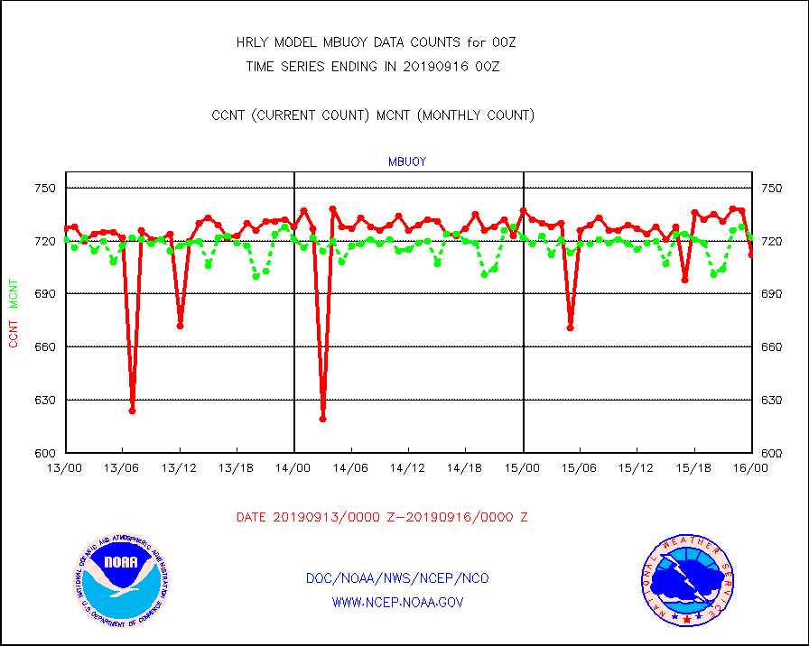
mbuoy |
Buoys decoded from FM-13 format (moored) |
712 |
722 |
98.6 % |
1523.50-1600.49 |
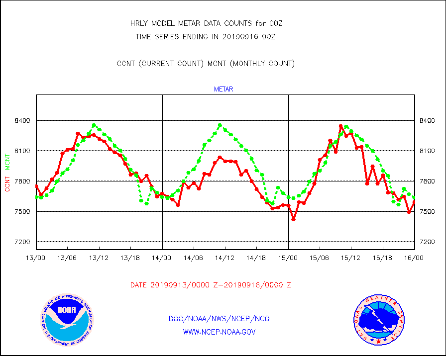
metar |
Aviation - METAR |
7595 |
7637 |
99.5 % |
1523.50-1600.49 |
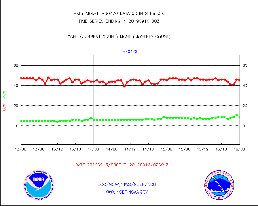
mso470 |
Mesonet/MADIS Colorado E-470 (Interstate 470) |
45 |
9 |
500.0 % |
1523.50-1600.49 |
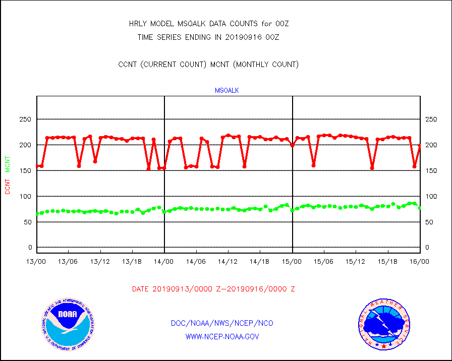
msoalk |
Mesonet/MADIS Alaska Department of Transportation |
199 |
77 |
258.4 % |
1523.50-1600.49 |
msoapg |
Mesonet/MADIS U.S. Army Aberdeen Proving Grounds |
0 |
0 |
n/a |
1523.50-1600.49 |
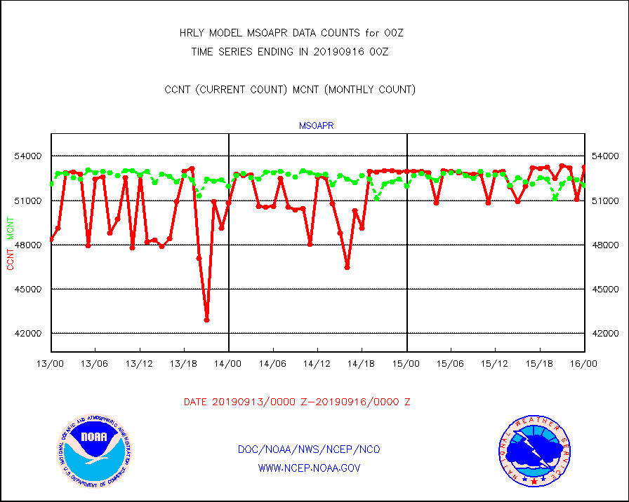
msoapr |
Mesonet/MADIS Citizen Weather Observers Program |
53271 |
52001 |
102.4 % |
1523.50-1600.49 |
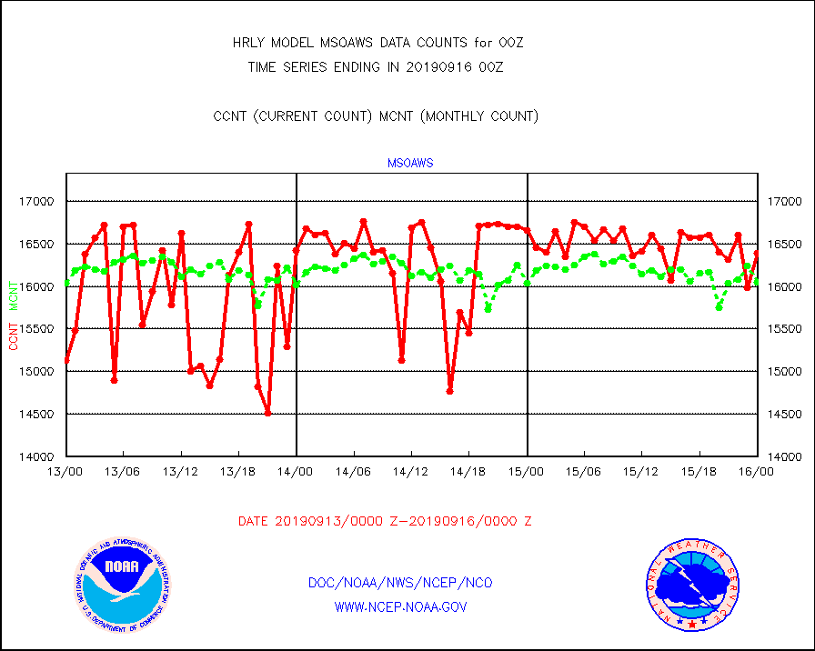
msoaws |
Mesonet/MADIS AWS Convergence Technologies, Inc. |
16396 |
16054 |
102.1 % |
1523.50-1600.49 |
msoawx |
Mesonet/MADIS "Anything Weather" |
0 |
0 |
n/a |
1523.50-1600.49 |
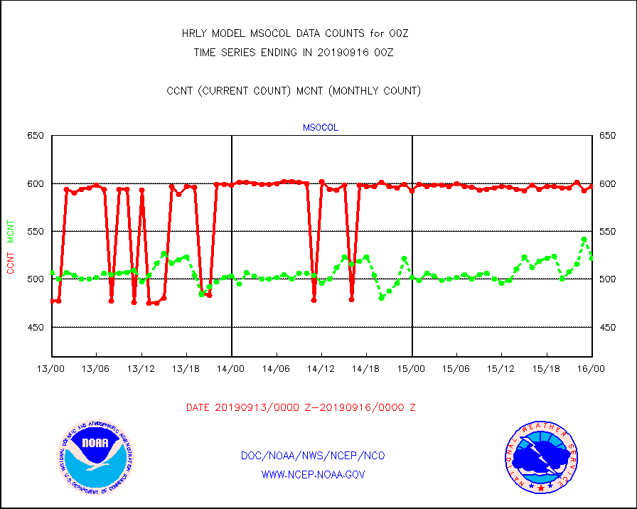
msocol |
Mesonet/MADIS Colorado Dept. of Transportation |
597 |
522 |
114.4 % |
1523.50-1600.49 |
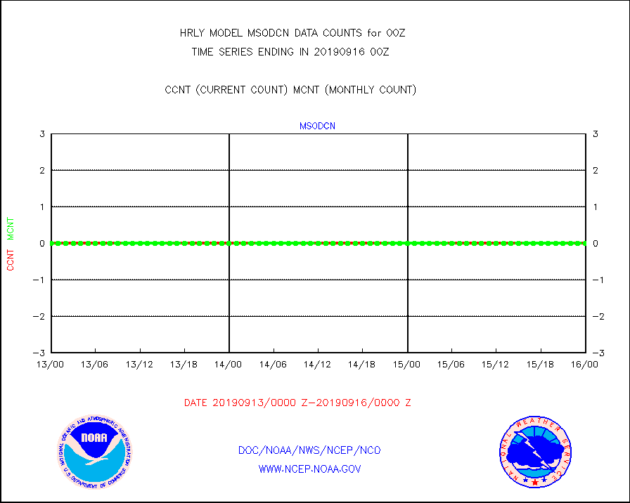
msodcn |
Mesonet/MADIS DC Net |
0 |
0 |
n/a |
1523.50-1600.49 |
msoden |
Mesonet/MADIS Denver Urban Drainage & Flood Cntrl |
0 |
0 |
n/a |
1523.50-1600.49 |
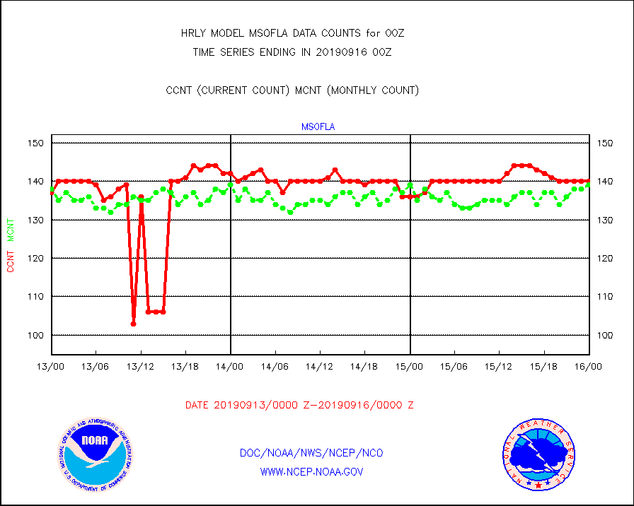
msofla |
Mesonet/MADIS Florida (FAWN & USF) |
140 |
139 |
100.7 % |
1523.50-1600.49 |
msoflt |
Mesonet/MADIS Florida Dept. of Transportation |
0 |
0 |
n/a |
1523.50-1600.49 |
msogeo |
Mesonet/MADIS Georgia Dept. of Transportation |
256 |
52 |
492.3 % |
1523.50-1600.49 |
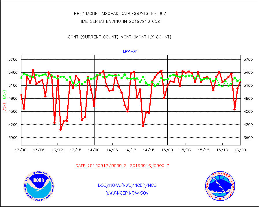
msohad |
Mesonet/MADIS NWS Hydromet Auto Data System(HADS) |
5221 |
5234 |
99.8 % |
1523.50-1600.49 |
msoien |
Mesonet/MADIS Iowa Environmental |
24 |
4 |
600.0 % |
1523.50-1600.49 |
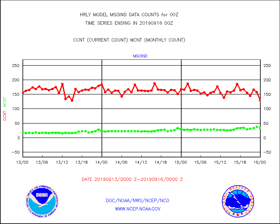
msoind |
Mesonet/MADIS Indiana Dept. of Transportation |
129 |
34 |
379.4 % |
1523.50-1600.49 |
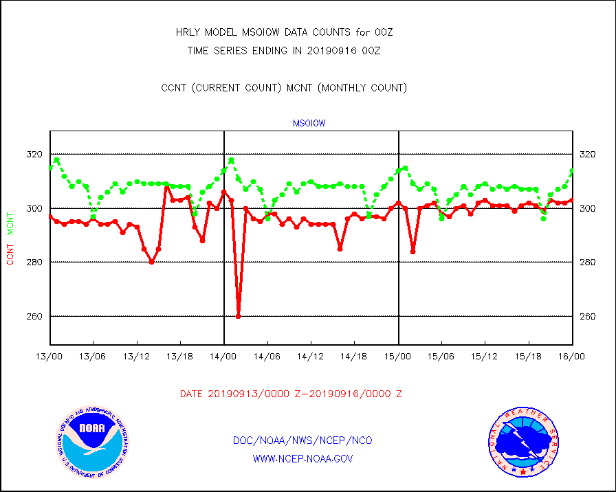
msoiow |
Mesonet/MADIS Iowa Department of Transportation |
303 |
314 |
96.5 % |
1523.50-1600.49 |
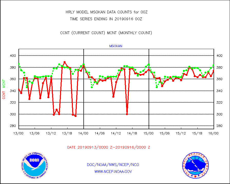
msokan |
Mesonet/MADIS Kansas Department of Transportation |
374 |
384 |
97.4 % |
1523.50-1600.49 |
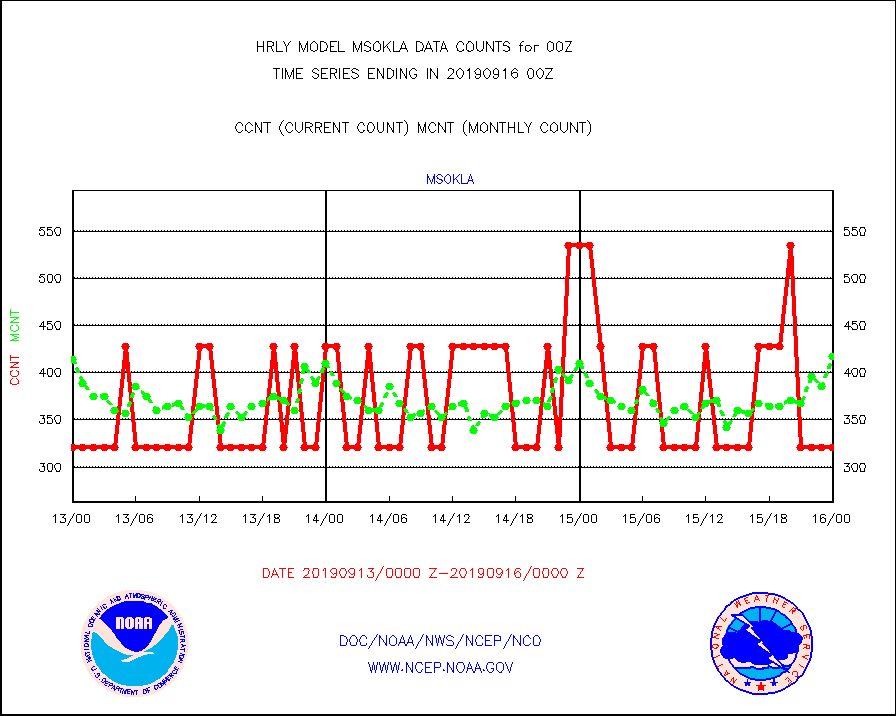
msokla |
Mesonet/MADIS Oklahoma Mesonet |
321 |
417 |
77.0 % |
1523.50-1600.49 |
msolju |
Mesonet/MADIS Louisiana State/Jackson State Univ. |
0 |
0 |
n/a |
1523.50-1600.49 |
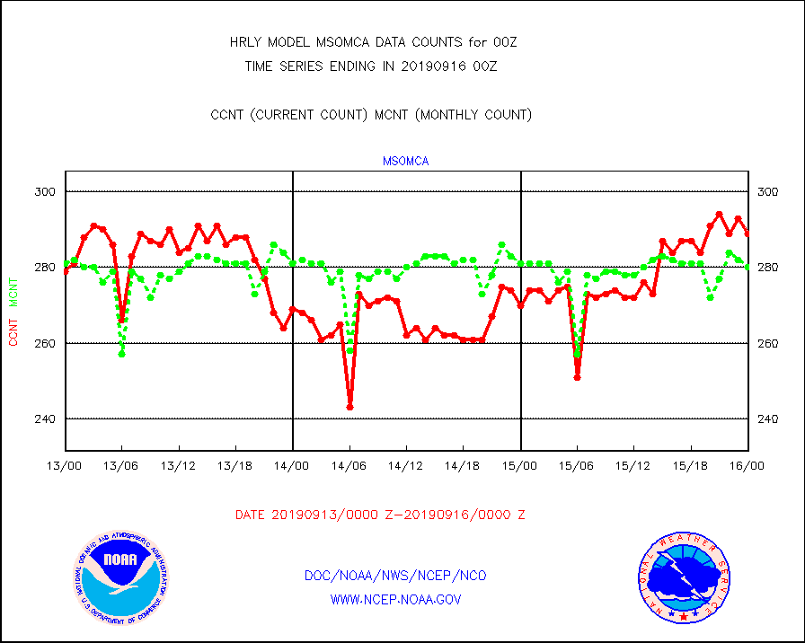
msomca |
Mesonet/MADIS Missouri Commercial Agricult Wx Net |
289 |
280 |
103.2 % |
1523.50-1600.49 |
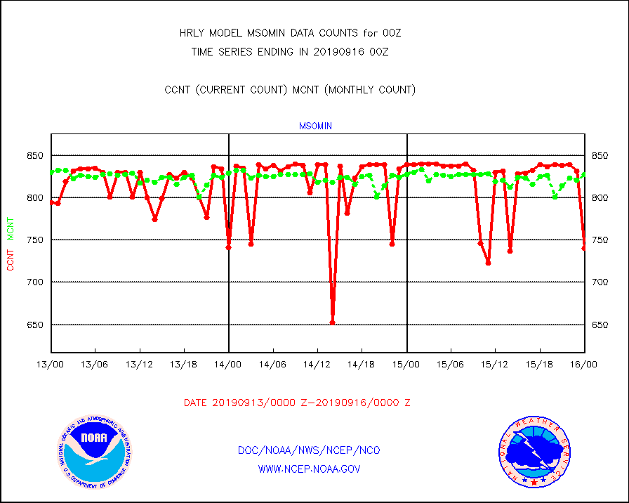
msomin |
Mesonet/MADIS Minnesota Dept. of Transportation |
740 |
827 |
89.5 % |
1523.50-1600.49 |
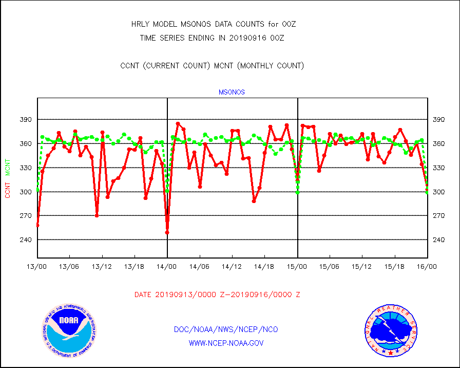
msonos |
Mesonet/MADIS NOS-Phys Oceanographic Realtime Sys |
303 |
299 |
101.3 % |
1523.50-1600.49 |
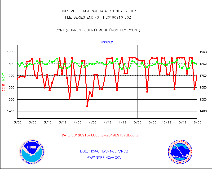
msoraw |
Mesonet/MADIS NFIC Remote Automated Wx Stns(RAWS) |
1703 |
1794 |
94.9 % |
1523.50-1600.49 |
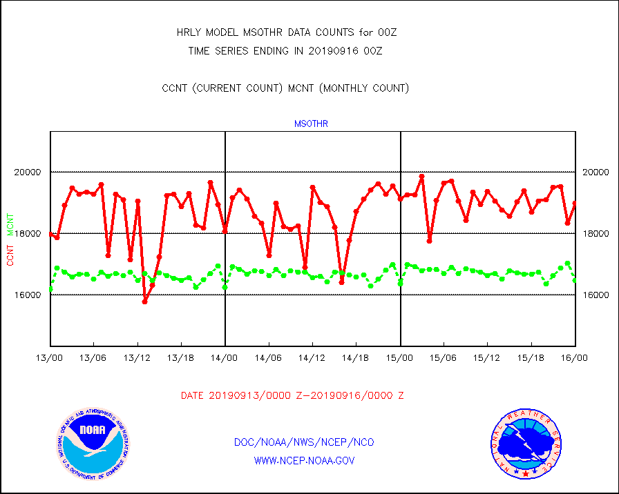
msothr |
Mesonet/MADIS many providers, not separated out |
18983 |
16463 |
115.3 % |
1523.50-1600.49 |
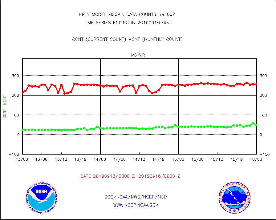
msovir |
Mesonet/MADIS Virginia Dept. of Transportation |
257 |
49 |
524.5 % |
1523.50-1600.49 |
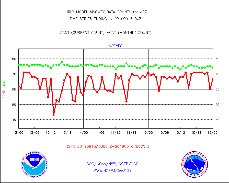
msowfy |
Mesonet/MADIS "Weather for You" |
67 |
74 |
90.5 % |
1523.50-1600.49 |
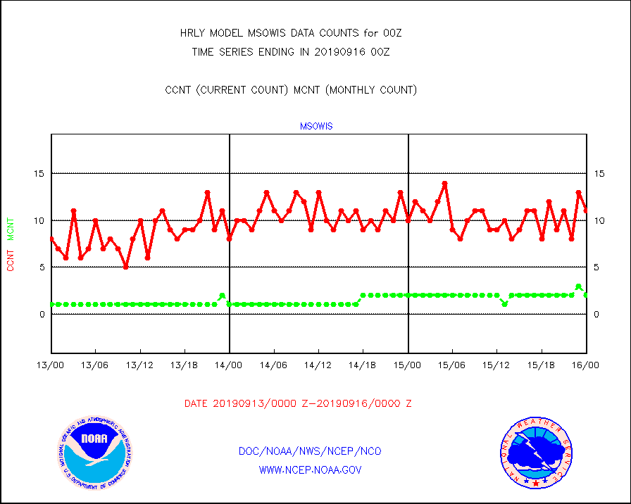
msowis |
Mesonet/MADIS Wisconsin Dept. of Transportation |
11 |
2 |
550.0 % |
1523.50-1600.49 |
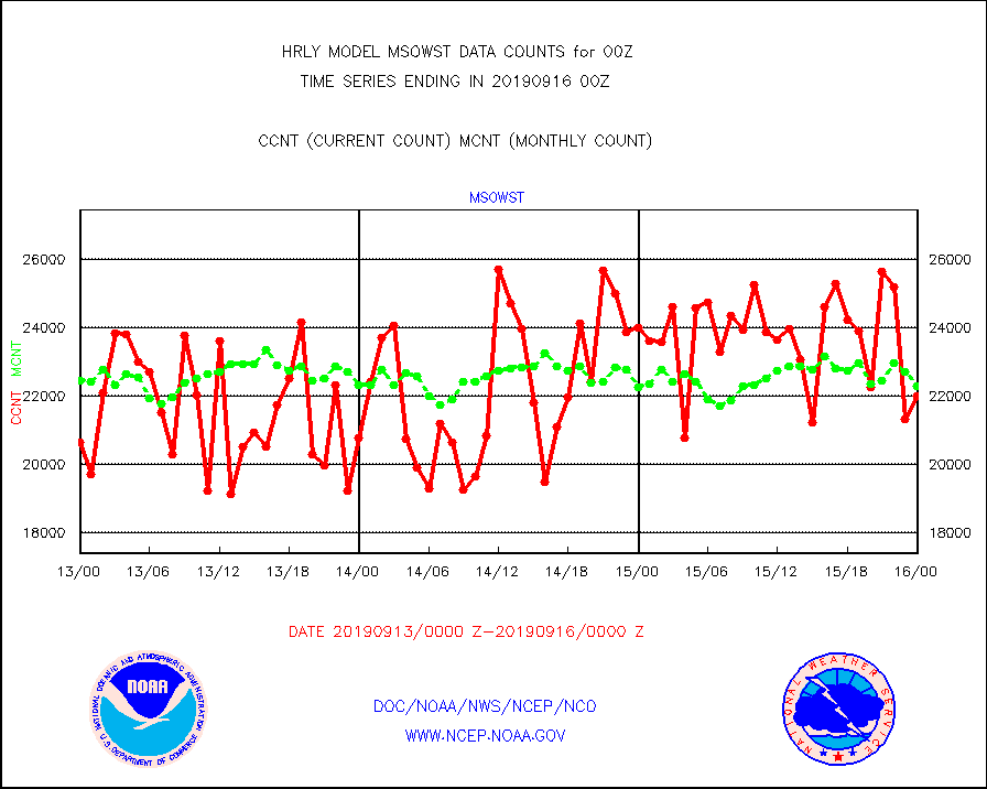
msowst |
Mesonet/MADIS MesoWest (many subproviders) |
21991 |
22294 |
98.6 % |
1523.50-1600.49 |
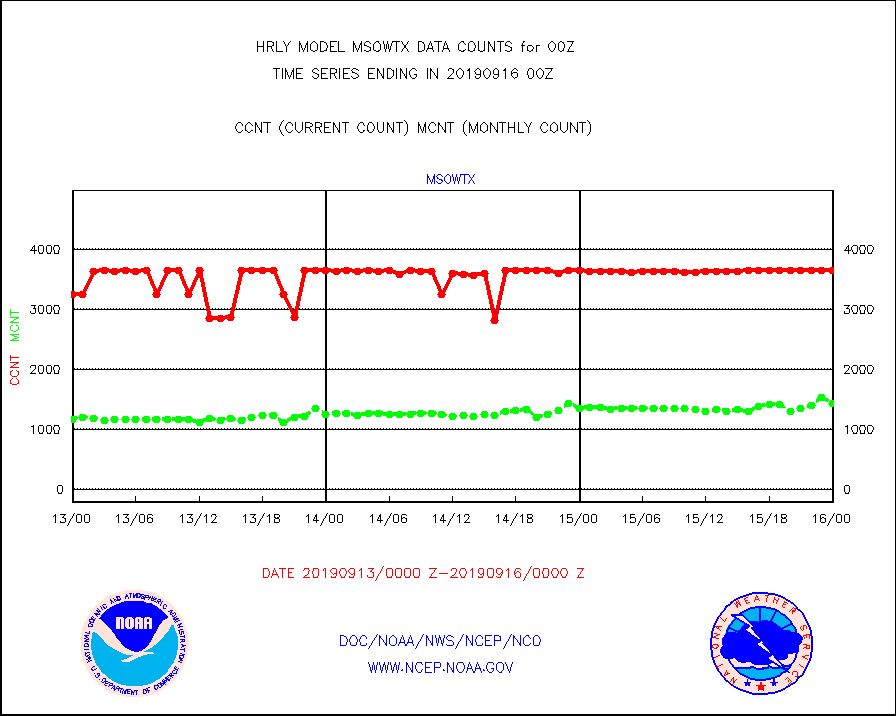
msowtx |
Mesonet/MADIS West Texas |
3642 |
1434 |
254.0 % |
1523.50-1600.49 |
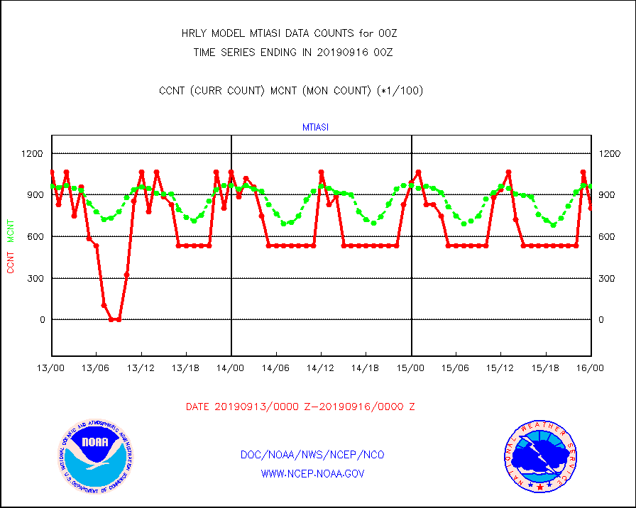
mtiasi |
METOP 1-2 IASI 1C radiance data (varbl. channels) |
80336 |
96657 |
83.1 % |
1522.00-1522.99 |
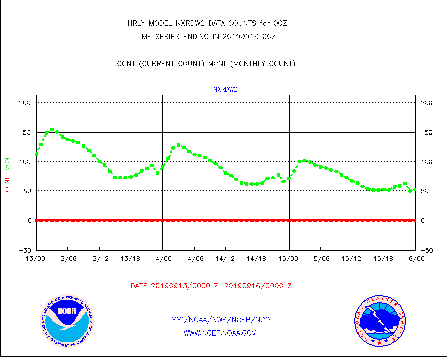
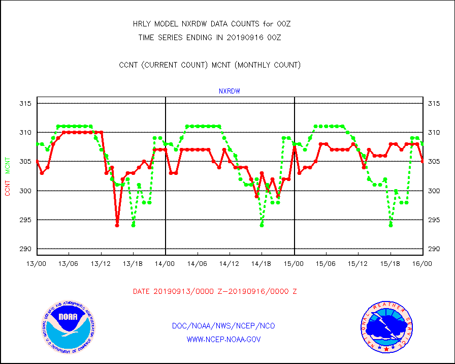
nxrdw |
NEXRAD Vel Azm Dsp(VAD) winds via radar coded msg |
305 |
308 |
99.0 % |
1523.50-1600.49 |
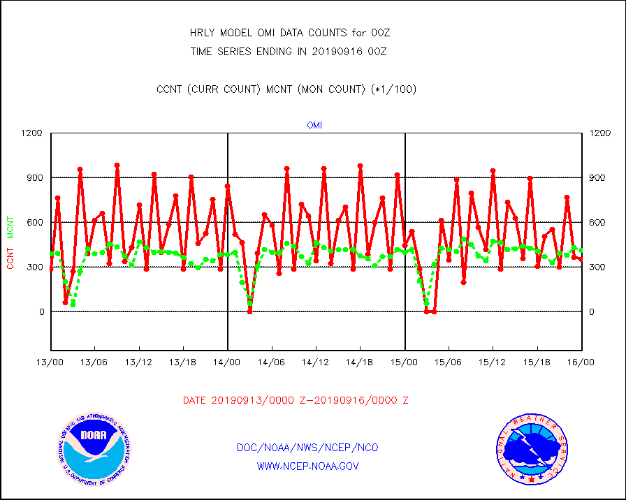
omi |
Aura Ozone Monitoring Instrument (OMI) data |
35100 |
41204 |
85.2 % |
1521.50-1522.49 |
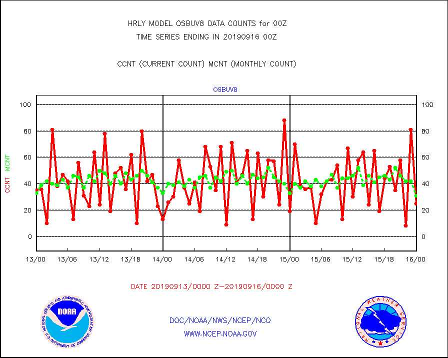
osbuv8 |
NOAA 16-19 Solar Backscatter UV-2 rad frm V8 BUFR |
25 |
31 |
80.6 % |
1522.00-1522.99 |
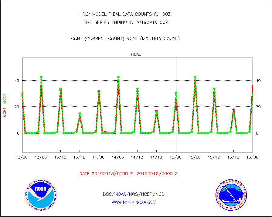
pibal |
PIBAL (from PILOT, PILOT SHIP, PILOT MOBIL) |
36 |
30 |
120.0 % |
1523.50-1600.49 |
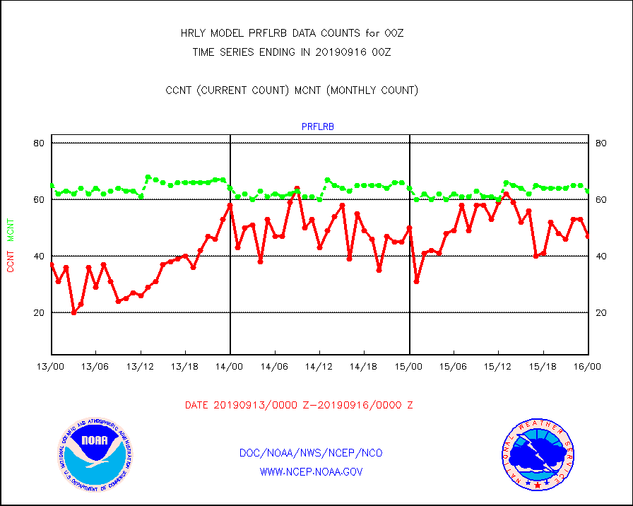
prflrb |
Multi-Agency Profiler (MAP) and SODAR winds |
47 |
63 |
74.6 % |
1523.50-1600.49 |
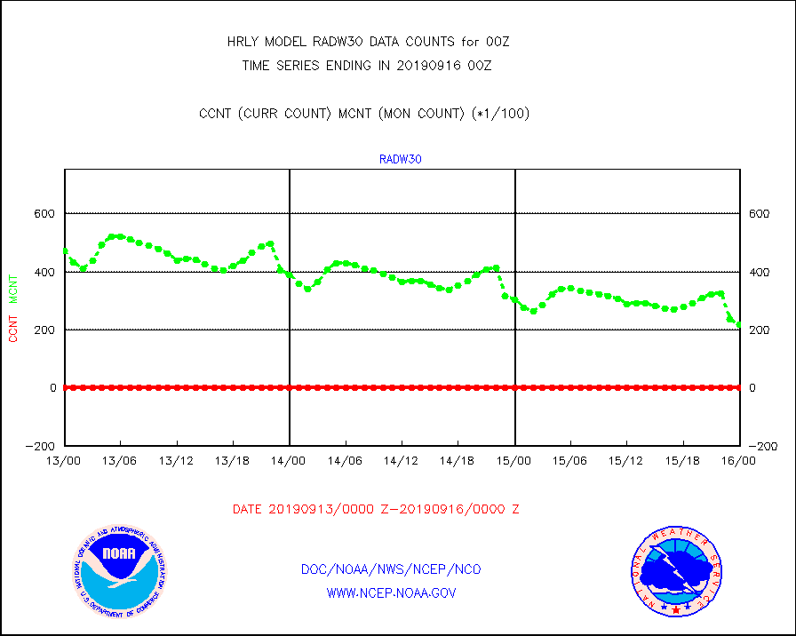
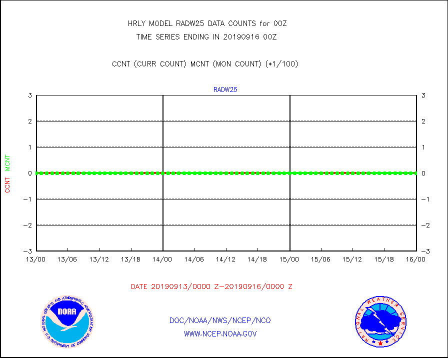
radw25 |
NEXRAD radial wind superobs (Level 2.5 - ORPG) |
0 |
0 |
n/a |
1522.50-1523.49 |
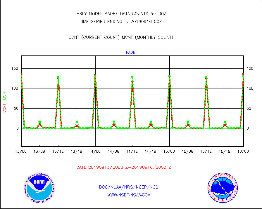
raobf |
Rawinsonde - fixed land (from TEMP or PILOT) |
136 |
131 |
103.8 % |
1523.50-1600.49 |
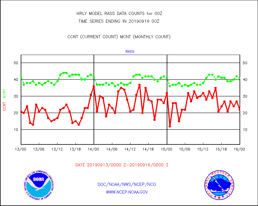
rass |
RASS temperatures (NOAA and Multi-Agency) |
22 |
41 |
53.7 % |
1523.50-1600.49 |
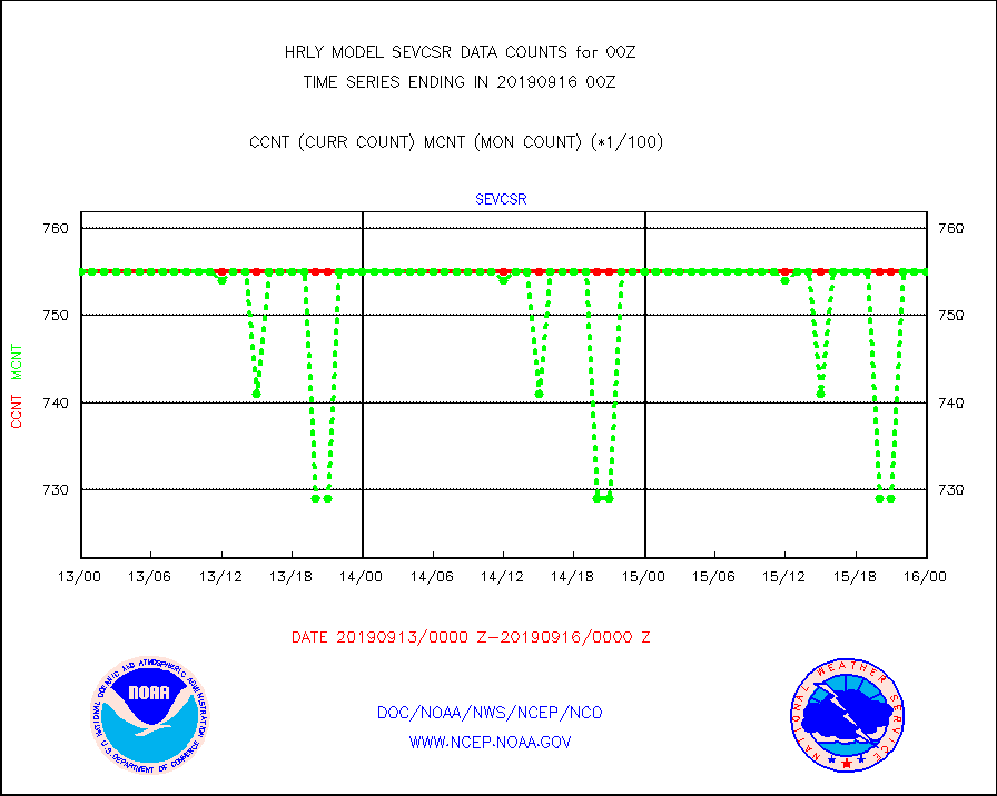
sevcsr |
METEOSAT-10 2nd Gen SEVIRI Clr Sky Radiance(proc) |
75512 |
75512 |
100.0 % |
1523.50-1600.49 |
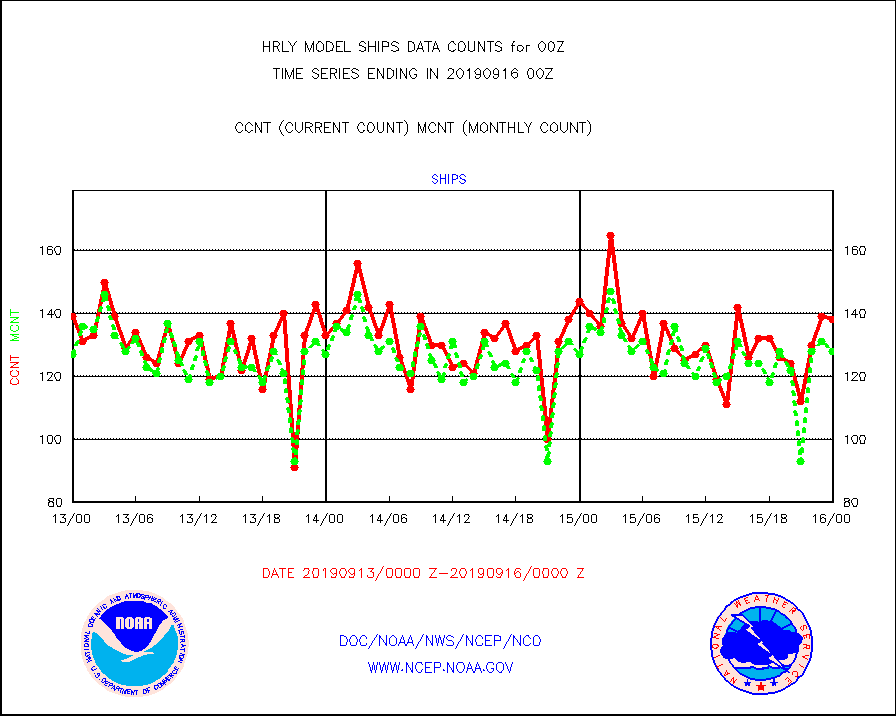
ships |
Ship - manual and automatic, restricted |
138 |
128 |
107.8 % |
1523.50-1600.49 |
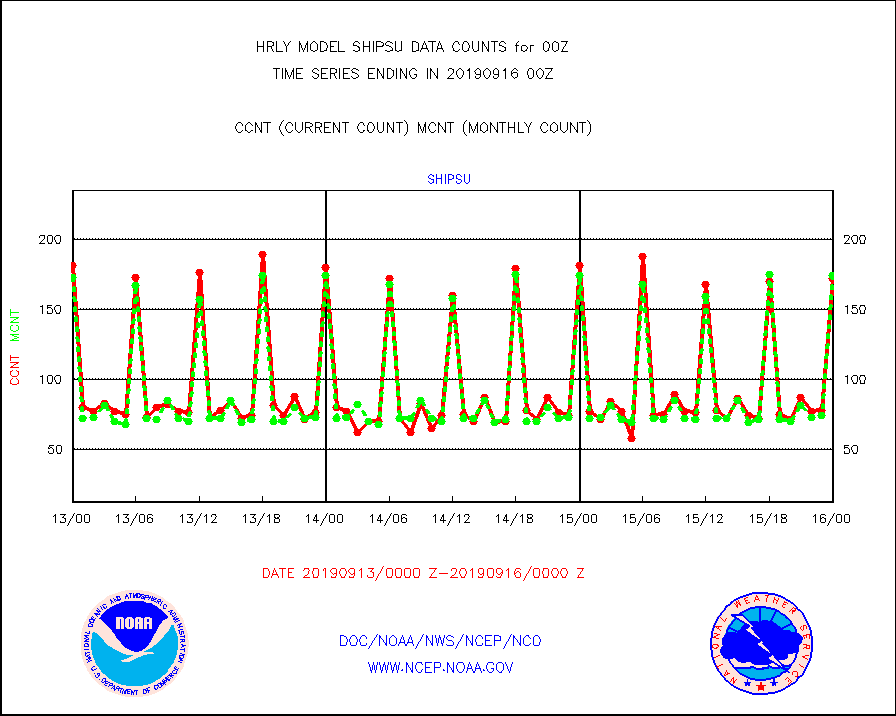
shipsu |
Ship - manual and automatic, unrestricted |
172 |
174 |
98.9 % |
1523.50-1600.50 |
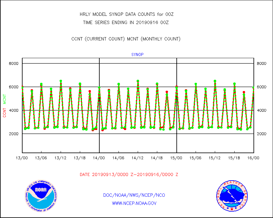
synop |
Synoptic - fixed manual and automatic |
5934 |
5940 |
99.9 % |
1523.50-1600.49 |
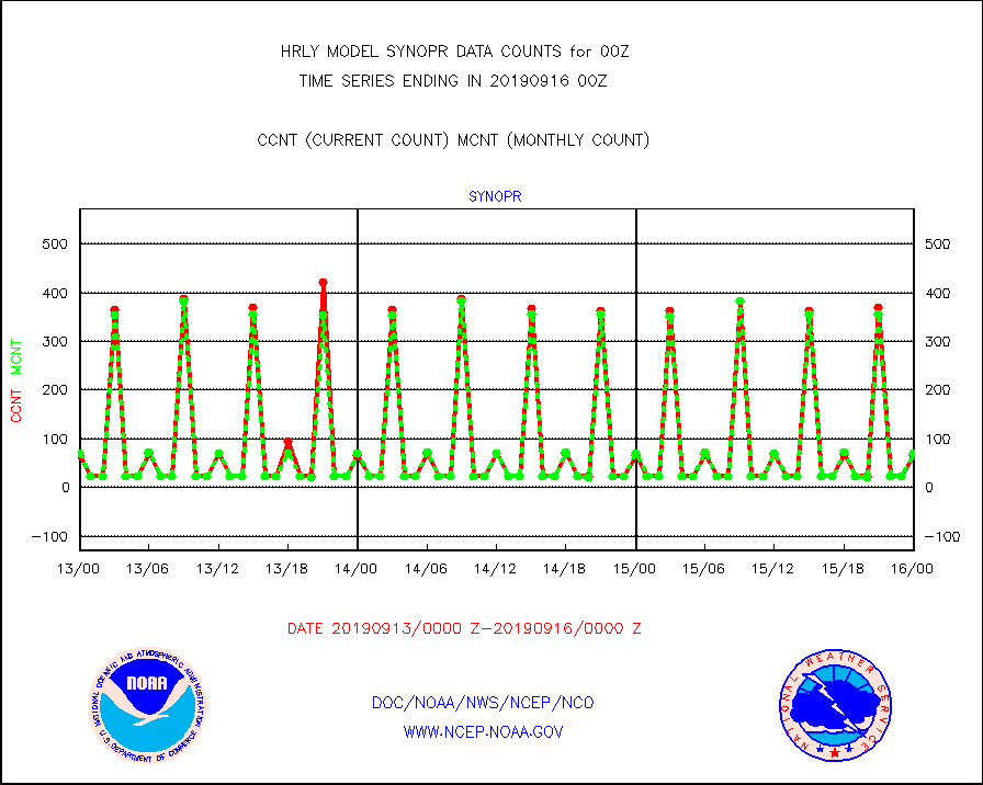
synopr |
Synoptic - restricted (WMO Res 40) manual & auto. |
67 |
70 |
95.7 % |
1523.50-1600.49 |
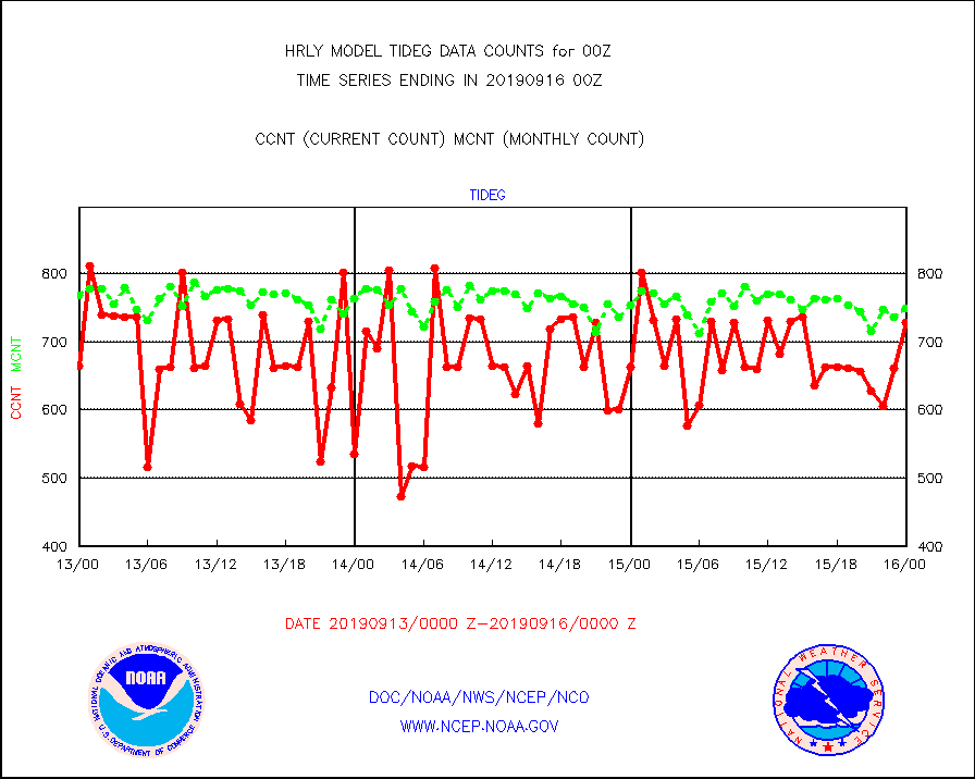
tideg |
Tide gauge reports decoded from CREX format |
728 |
749 |
97.2 % |
1523.00-1523.99 |
| Data Types of Opportunity with Normal Counts |
|---|
| Type | Description | Hourly Count | Monthly Average | Percent (%) of Monthly Mean | UTC Time Window |
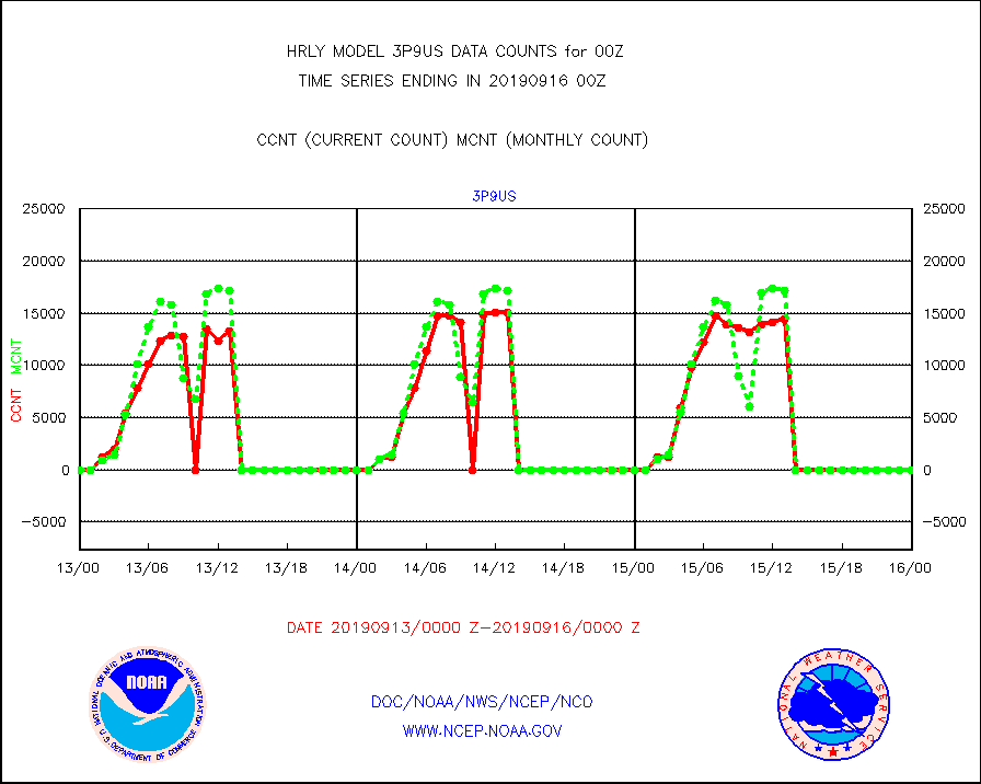
3p9us |
GOES/NESDIS infrared shrt-wave derived cld motion |
0 |
0 |
n/a |
1523.00-1523.99 |
acarsa |
MDCRS ACARS acft data (ARINC via AFWA)(AIREP fmt) |
0 |
0 |
n/a |
1523.50-1600.49 |
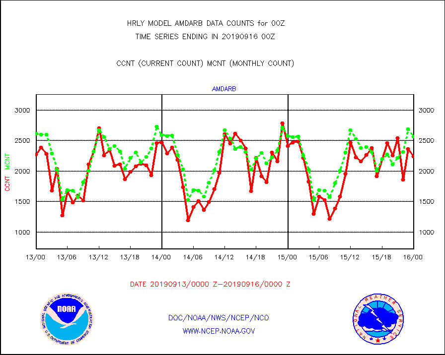
amdarb |
AMDAR aircraft data (decoded from BUFR) |
2243 |
2570 |
87.3 % |
1523.50-1600.49 |
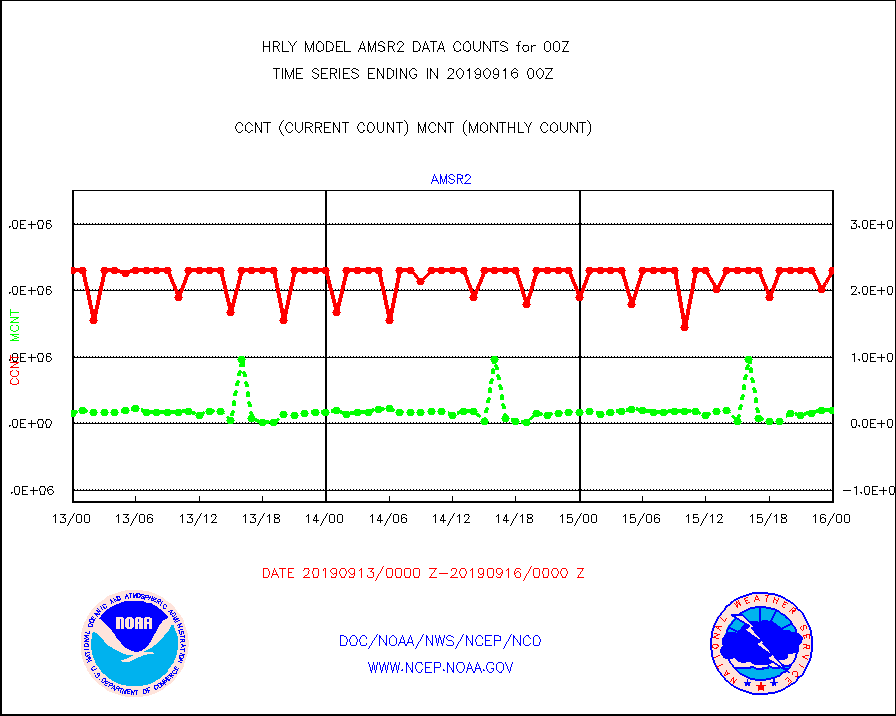
amsr2 |
GCOM-W AMSR2 1B brightness temperatures |
2309472 |
2191277 |
105.4 % |
1522.00-1522.99 |
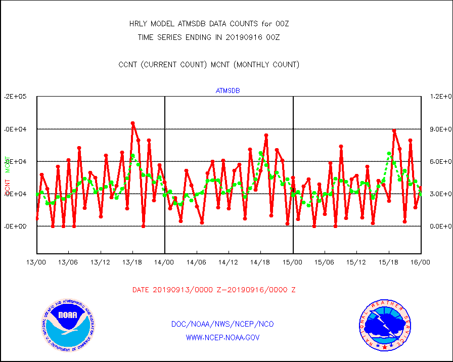
atmsdb |
NPP Adv Tech MW Sndr(ATMS) b. temps-dir bcst SSEC |
35717 |
29734 |
120.1 % |
1522.50-1523.49 |
atovs |
POES/NESDIS - processed ATOVS soundings/radiances |
12542 |
12350 |
101.6 % |
1522.00-1522.99 |
avcsam |
A.M.(N17,M2) AVHRR GAC NCEP-proc clr & sea btemps |
1475569 |
1680940 |
87.8 % |
1521.50-1522.49 |
avcspm |
P.M.(N18-19) AVHRR GAC NCEP-proc clr & sea btemps |
902954 |
865657 |
104.3 % |
1521.50-1522.49 |
bathy |
Bathythermal |
0 |
0 |
n/a |
1517.00-1517.99 |
coopmd |
Coop/MADIS NEPP & HCN-Modernization NOAA COOP Obs |
149 |
149 |
100.0 % |
1523.50-1600.49 |
crisdb |
NPP Crss-trk IR Sndr(CrIS) radiance-dir bcst SSEC |
27000 |
17361 |
155.5 % |
1522.50-1523.49 |
cstgd |
Coast Guard |
4 |
5 |
80.0 % |
1523.50-1600.50 |
dropw |
Dropwinsonde (from TEMP DROP) |
2 |
2 |
100.0 % |
1523.50-1600.49 |
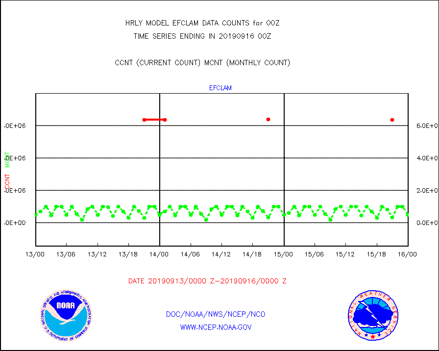
efclam |
GOES imager effective cloud amount data (U.Wisc.) |
8474064 |
8474647 |
100.0 % |
1523.50-1600.49 |
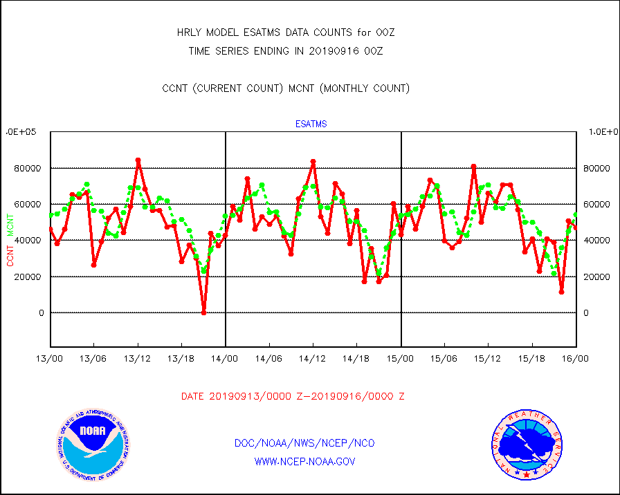
esatms |
NPP Adv. Tech. MW Sndr (ATMS) br. temps from RARS |
47136 |
54046 |
87.2 % |
1522.50-1523.49 |
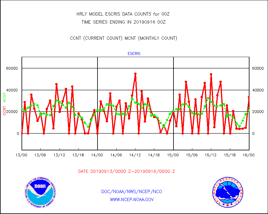
escris |
NPP Crss-track IR Sndr (CrIS) radiances from RARS |
33480 |
21217 |
157.8 % |
1522.50-1523.49 |
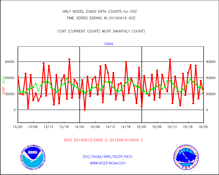
esiasi |
METOP 1-2 IASI 1C radiance data vbl chn from RARS |
30945 |
35799 |
86.4 % |
1523.00-1523.99 |
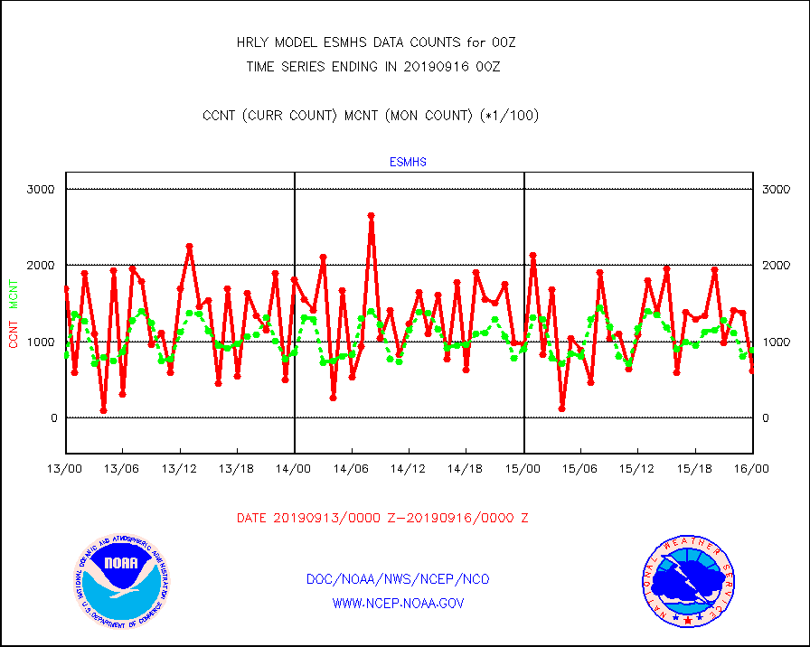
esmhs |
NOAA 18-19 & METOP 1-2 MHS proc. btemps from RARS |
62280 |
88855 |
70.1 % |
1523.50-1600.49 |
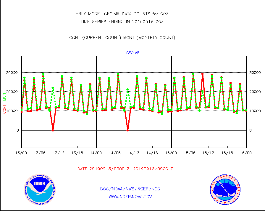
geoimr |
GOES/NESDIS (11x17 f-o-v) imager clear radiances |
10237 |
10411 |
98.3 % |
1523.00-1523.99 |
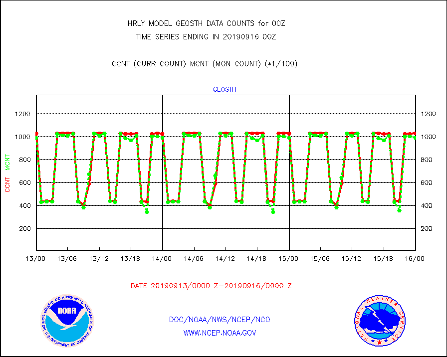
geosth |
GOES/NESDIS hi-resol. (1x1 f-o-v) cloud data |
102818 |
98868 |
104.0 % |
1523.00-1523.99 |
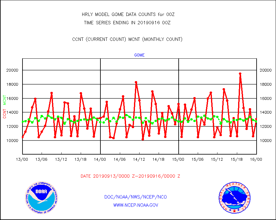
gome |
METOP 1-2 Global Ozone Monitoring Exp.-2 (GOME-2) |
13052 |
12715 |
102.7 % |
1522.50-1523.49 |
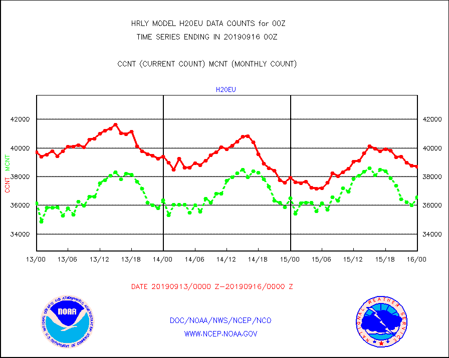
h20eu |
METEOSAT/EUMETSAT wvpr imager derived cld motion |
38701 |
36583 |
105.8 % |
1522.50-1523.49 |
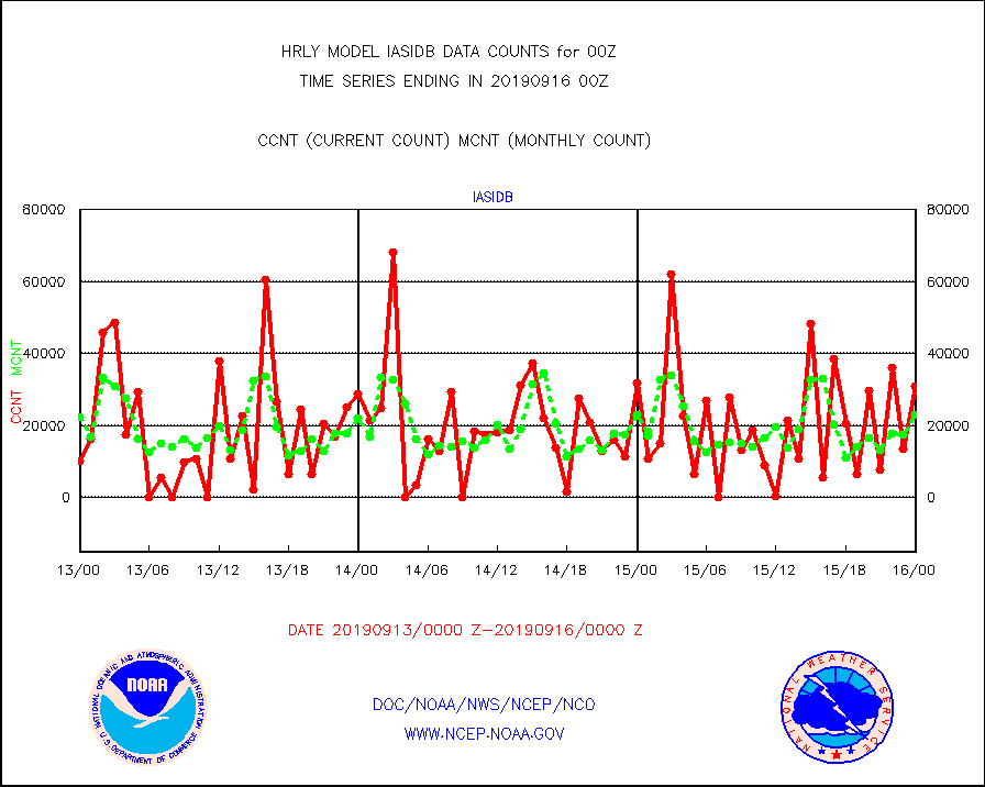
iasidb |
METOP 1-2 IASI 1C radiances-direct broadcast SSEC |
30972 |
22962 |
134.9 % |
1522.50-1523.49 |
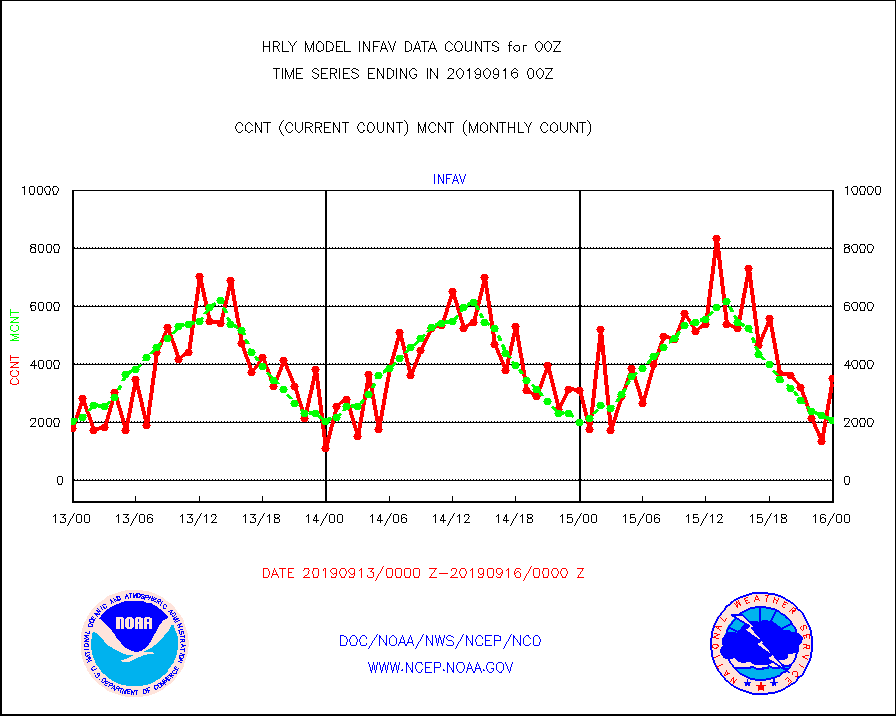
infav |
AVHRR (NOAA/METOP) ir lg-wave derived cld motion |
3542 |
2088 |
169.6 % |
1520.00-1520.99 |
infin |
INSAT/KALPANA India ir lg-wave derived cld motion |
0 |
0 |
n/a |
1521.50-1522.49 |
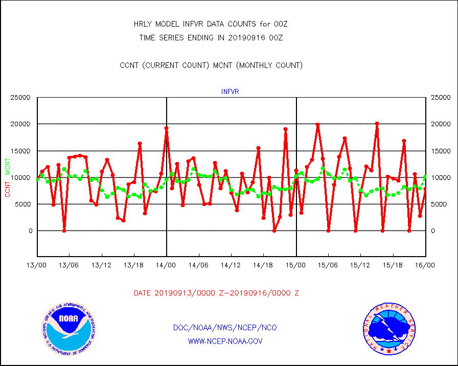
infvr |
VIIRS (NPP) infrared lg-wave derived cloud motion |
7814 |
10180 |
76.8 % |
1520.00-1520.99 |
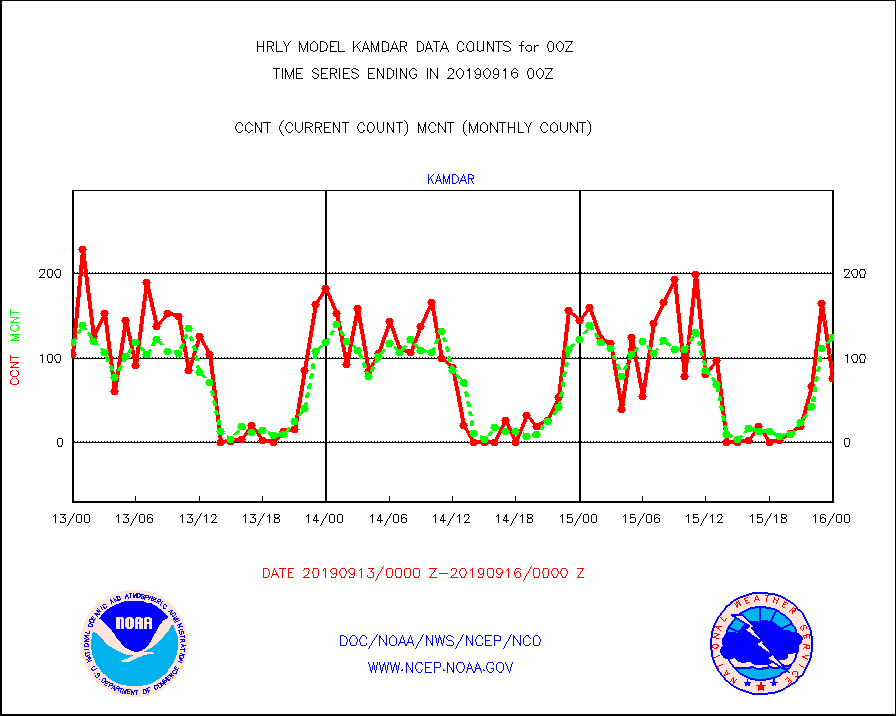
kamdar |
Korean AMDAR aircraft data (decoded from BUFR) |
76 |
124 |
61.3 % |
1523.50-1600.49 |
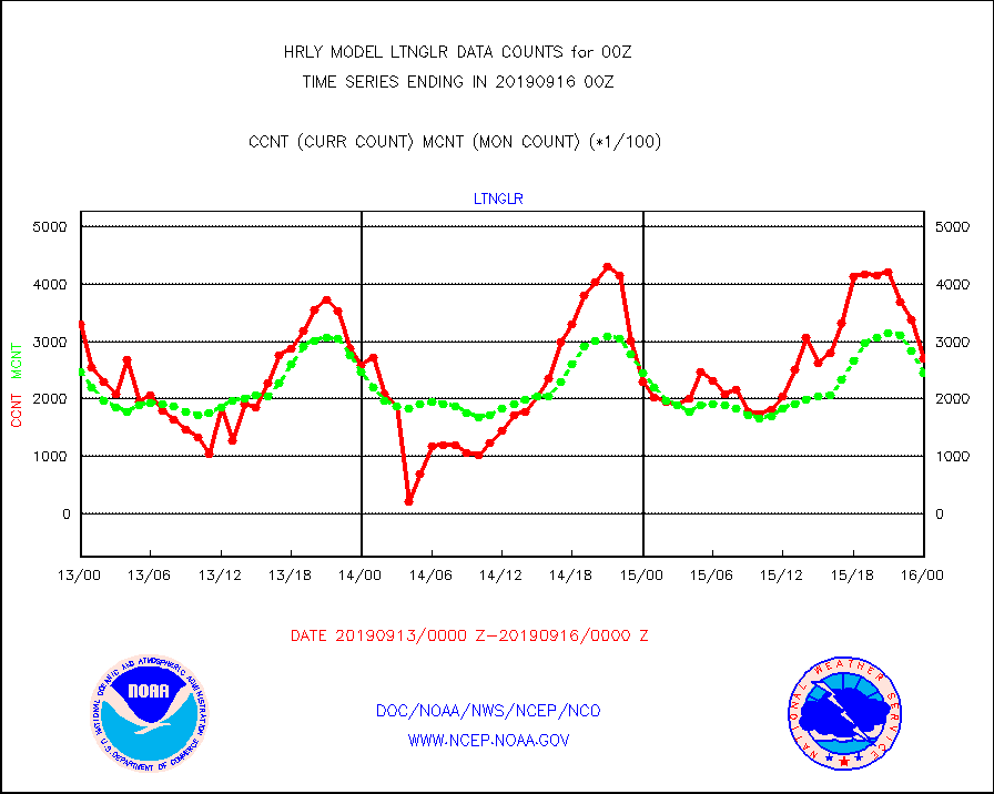
ltnglr |
LLDN Long-rng lightning from Vaisala via NOAAPORT |
269892 |
245158 |
110.1 % |
1523.50-1600.49 |
mls |
Aura Microwave Limb Sounder (MLS) ozone data |
0 |
0 |
n/a |
1522.00-1522.99 |
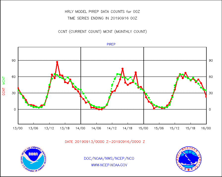
pirep |
Manual PIREP aircraft data (dcded from AIREP fmt) |
23 |
35 |
65.7 % |
1523.50-1600.49 |
prflrj |
Japanese Meteorological Agency profiler winds |
0 |
0 |
n/a |
1523.50-1600.49 |
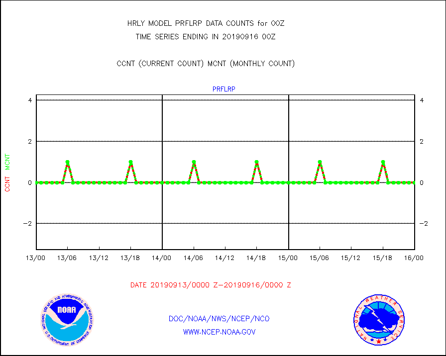
prflrp |
Profilr winds from PIBAL (PILOT,PILOT SHIP/MOBIL) |
0 |
0 |
n/a |
1523.50-1600.49 |
raobm |
Rawinsonde - mobile land (from TEMP/PILOT MOBIL) |
0 |
0 |
n/a |
1523.50-1600.49 |
raobs |
Rawinsonde - ship (from TEMP SHIP, PILOT SHIP) |
2 |
0 |
n/a |
1523.50-1600.49 |
recco |
Flight level reconnaissance aircraft data |
0 |
1 |
0.0 % |
1523.50-1600.49 |
sevasr |
METEOSAT-10 2nd Gen SEVIRI All Sky Radiance(proc) |
75512 |
75467 |
100.1 % |
1523.50-1600.49 |
ssmisu |
DMSP SSM/IS 1C radiance data (Unified Pre-Proc.) |
140880 |
126152 |
111.7 % |
1522.50-1523.49 |
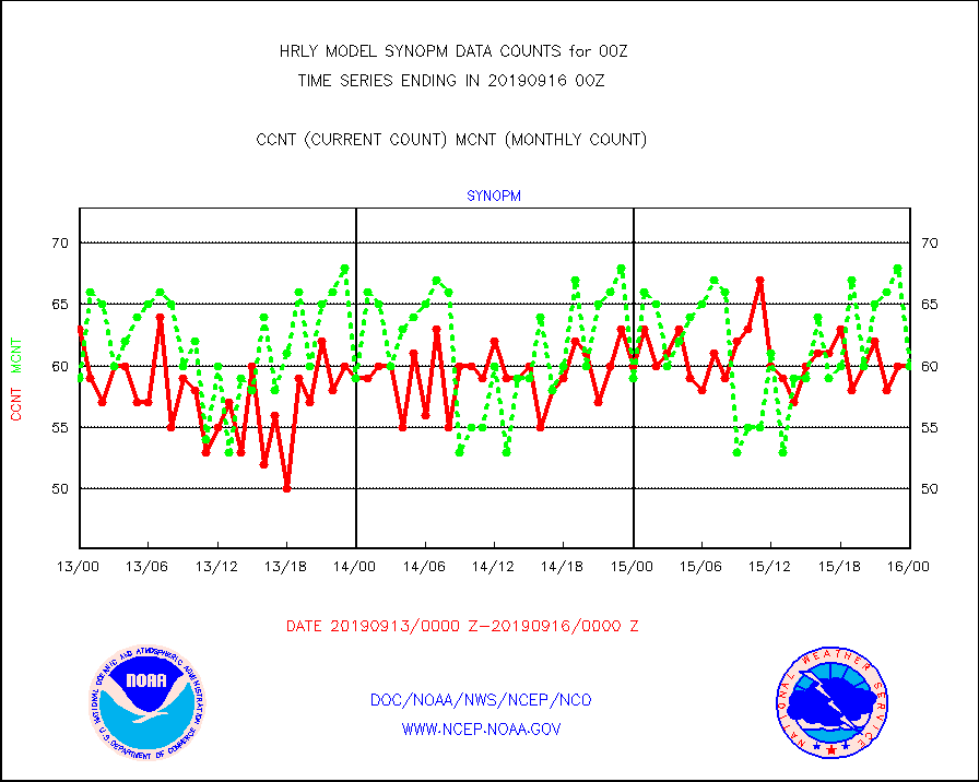
synopm |
Synoptic - mobile manual and automatic |
60 |
60 |
100.0 % |
1523.50-1600.49 |
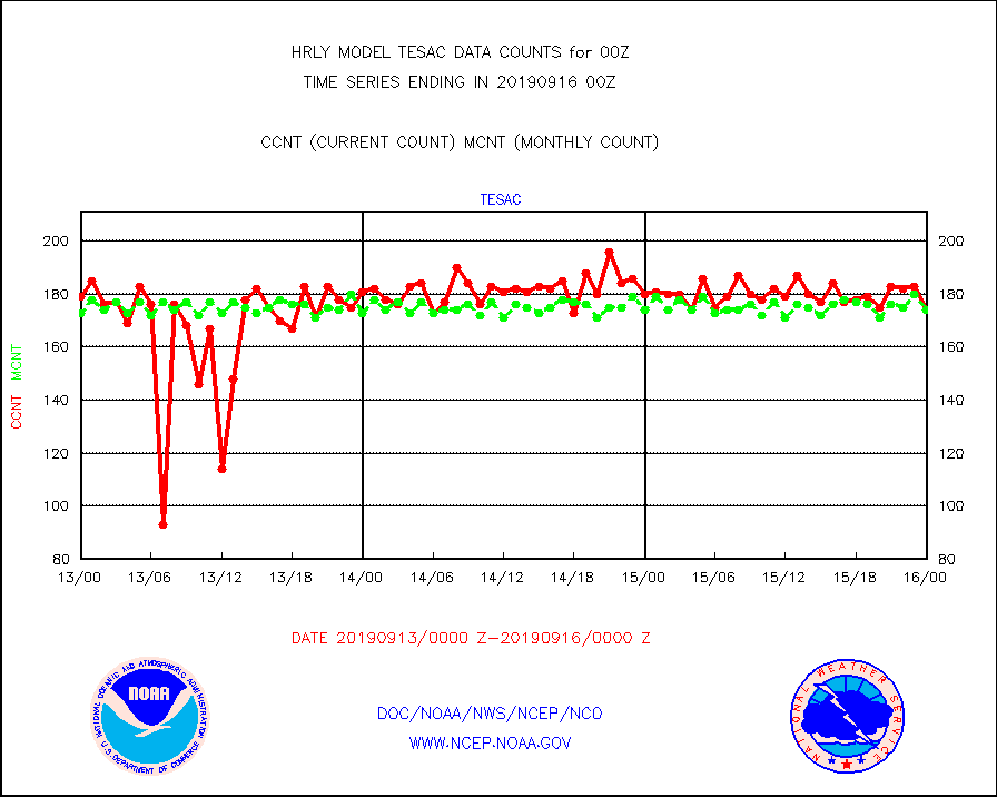
tesac |
TESAC |
174 |
174 |
100.0 % |
1523.50-1600.49 |
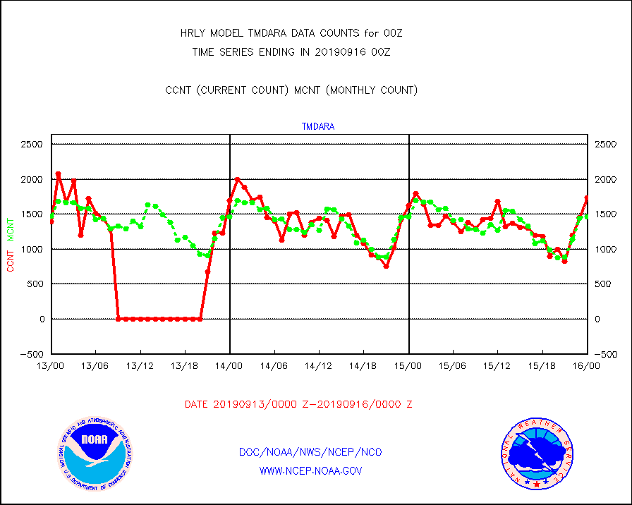
tmdara |
TAMDAR aircft data-all types(from Panasonic,BUFR) |
1731 |
1459 |
118.6 % |
1523.50-1600.49 |
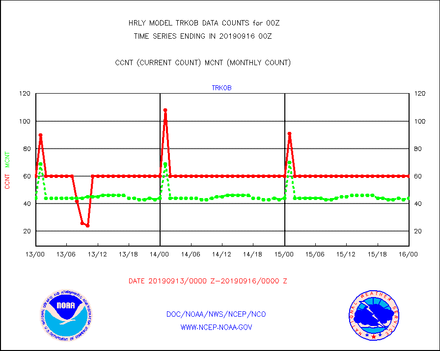
trkob |
TRACKOB |
60 |
44 |
136.4 % |
1522.50-1523.49 |
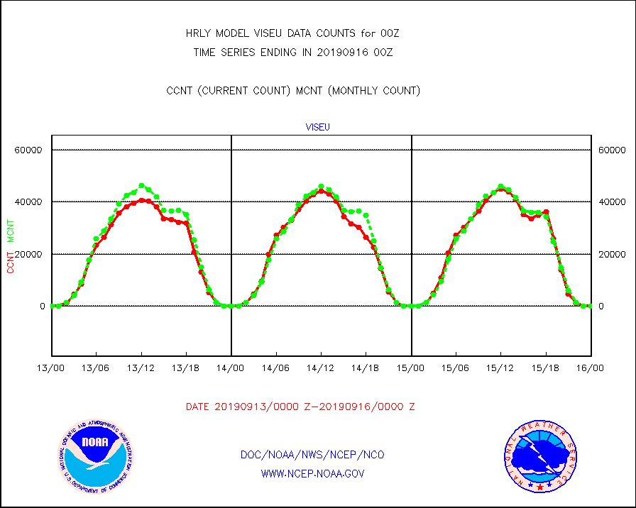
viseu |
METEOSAT/EUMETSAT visible derived cloud motion |
0 |
0 |
n/a |
1522.50-1523.49 |
visin |
INSAT/KALPANA India visible derived cloud motion |
0 |
0 |
n/a |
1521.50-1522.49 |
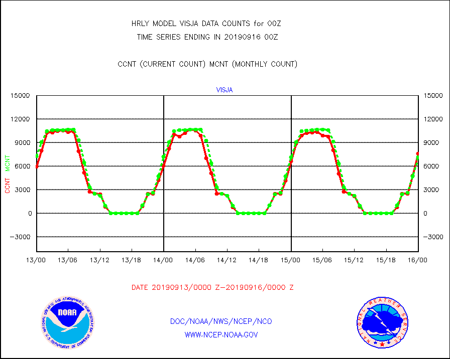
visja |
MTSAT/JMA visible derived cloud motion |
7622 |
7164 |
106.4 % |
1521.50-1522.49 |
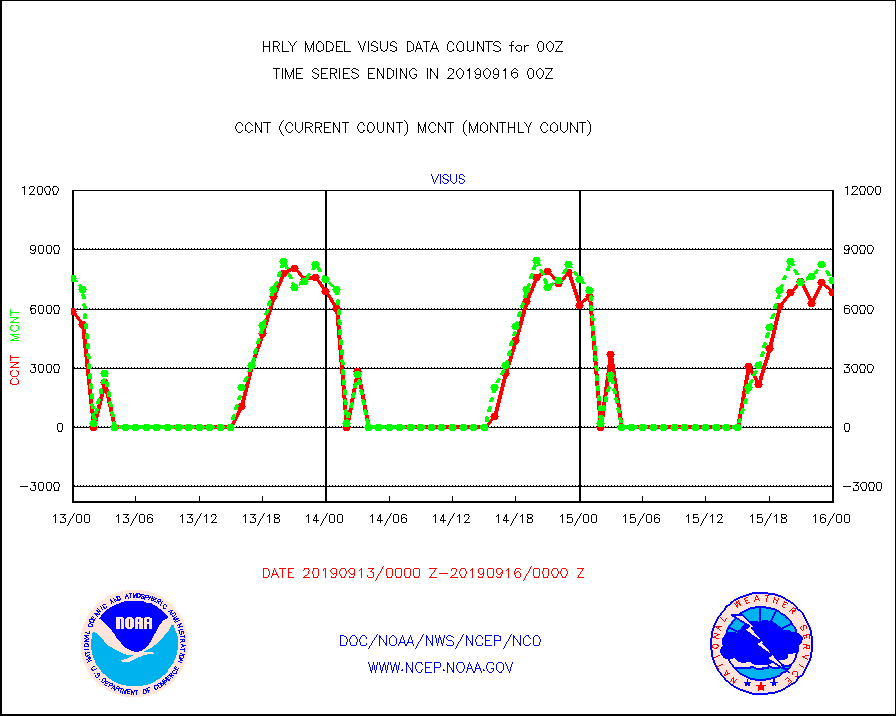
visus |
GOES/NESDIS visible derived cloud motion |
6855 |
7462 |
91.9 % |
1523.00-1523.99 |


