| Critical Data with Normal Counts |
|---|
| Type | Description | Hourly Count | Monthly Average | Percent (%) of Monthly Mean | UTC Time Window |
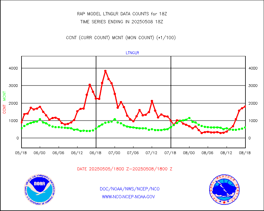
1bamua |
NOAA 15-19 & METOP 1-2 AMSU-A NCEP-proc. br.temps |
31244 |
26552 |
117.7 % |
2515.00-2520.99 |
1bhrs4 |
NOAA 18-19 & METOP 1-2 HIRS-4 NCEP-proc. br.temps |
23186 |
21450 |
108.1 % |
2515.00-2520.99 |
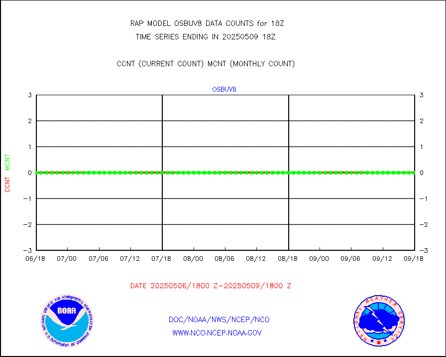
1bmhs |
NOAA 18-19 & METOP 1-2 MHS NCEP-proces. br. temps |
177492 |
142927 |
124.2 % |
2515.00-2520.99 |
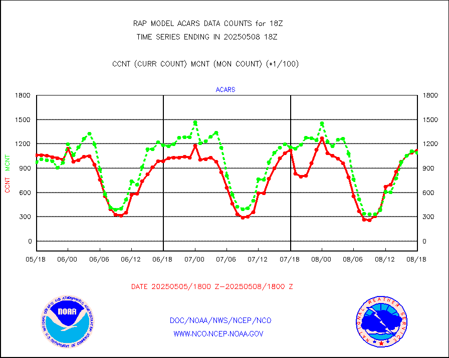
acars |
MDCRS ACARS acft data from ARINC(dcded from BUFR) |
96355 |
83251 |
115.7 % |
2514.75-2521.25 |
camdar |
Canadian AMDAR aircraft data (decoded from BUFR) |
102 |
148 |
68.9 % |
2514.75-2521.25 |
cmanb |
Surface Marine CMAN rpts decoded from BUFR format |
1698 |
1614 |
105.2 % |
2517.50-2518.50 |
dbuoy |
Buoys decoded from FM-18 fmt (moored or drifting) |
0 |
0 |
n/a |
2517.50-2518.50 |
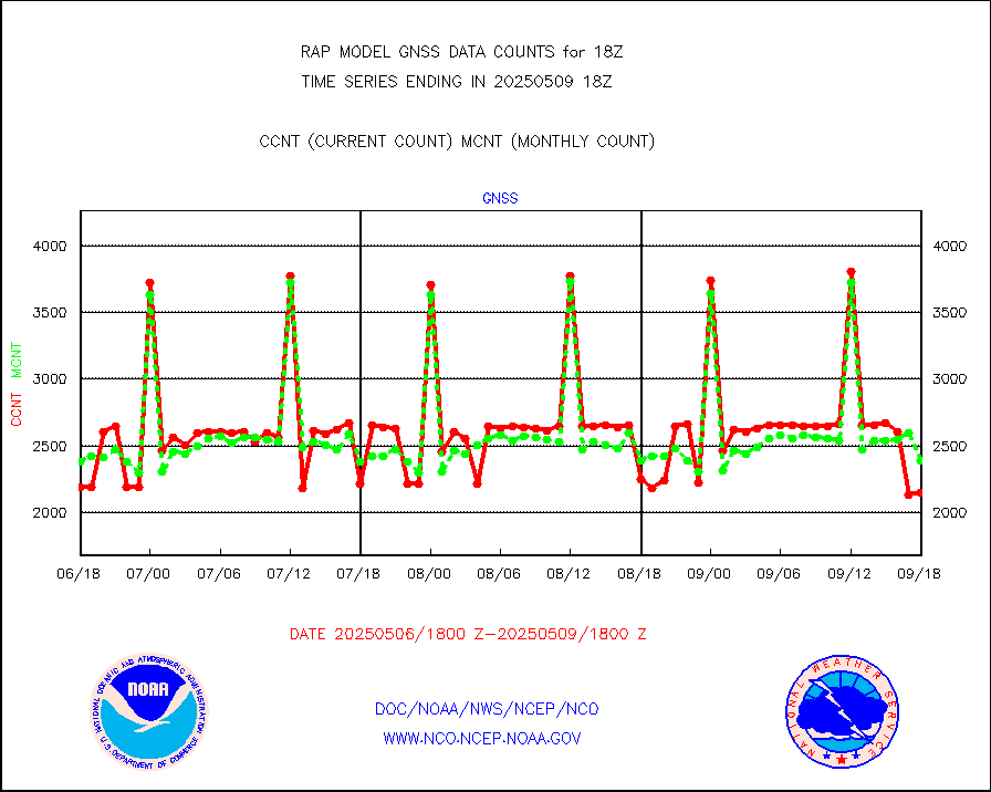
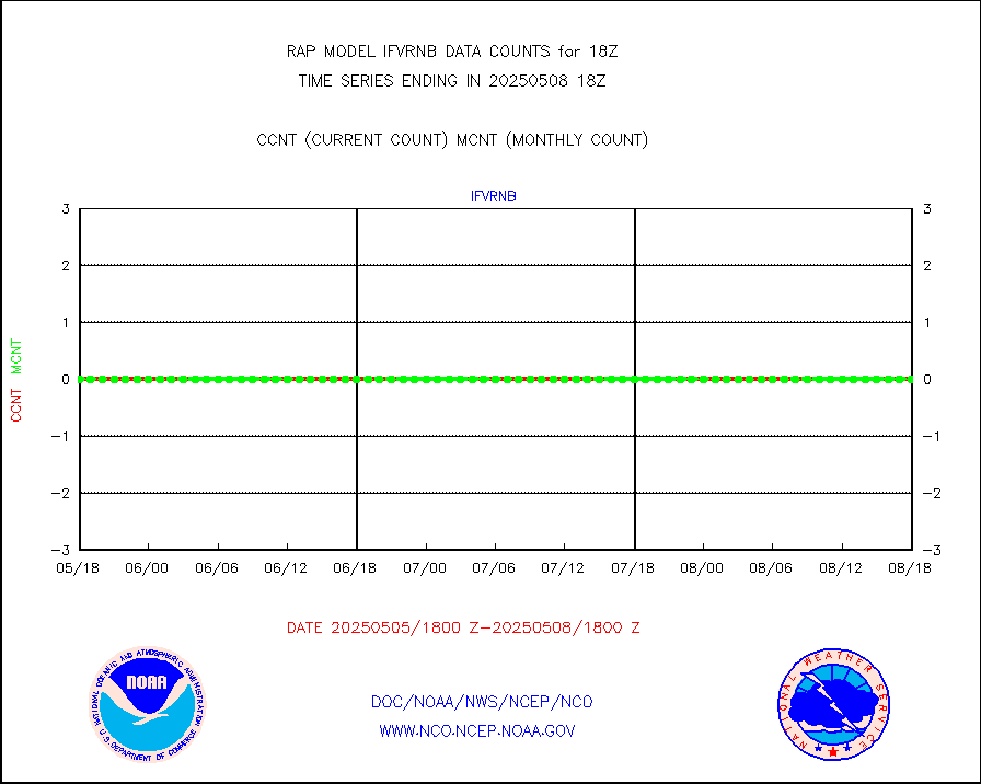
gnss |
Grnd-based Gbl Navigation Sat System (GNSS) data |
2708 |
2454 |
110.4 % |
2516.95-2517.05 |
h20mo |
MODIS (AQUA/TERRA) wvpr imager derived cld motion |
0 |
0 |
n/a |
2515.50-2520.50 |
infmo |
MODIS (AQUA/TERRA) ir l-wave derived cloud motion |
0 |
0 |
n/a |
2515.50-2520.50 |
lgycld |
GOES/NASA(Langley) hi-res. (1x1 f-o-v) cloud data |
3719427 |
3195130 |
116.4 % |
2517.50-2518.50 |
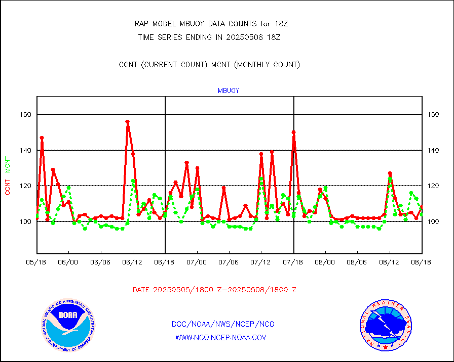
mbuoy |
Buoys decoded from FM-13 format (moored) |
33 |
53 |
62.3 % |
2517.50-2518.50 |
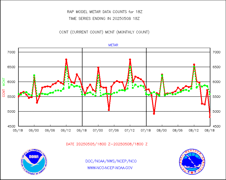
metar |
Aviation - METAR |
5258 |
5885 |
89.3 % |
2517.50-2518.50 |
nxrdw |
NEXRAD Vel Azm Dsp(VAD) winds via radar coded msg |
0 |
0 |
n/a |
2517.00-2519.00 |
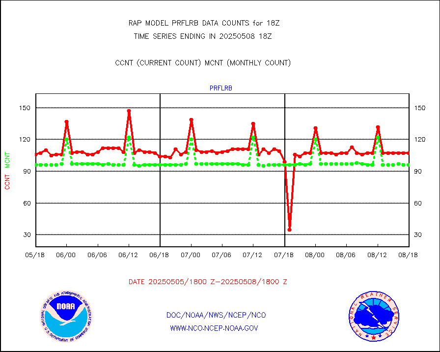
prflrb |
Multi-Agency Profiler (MAP) and SODAR winds |
100 |
83 |
120.5 % |
2516.50-2519.50 |
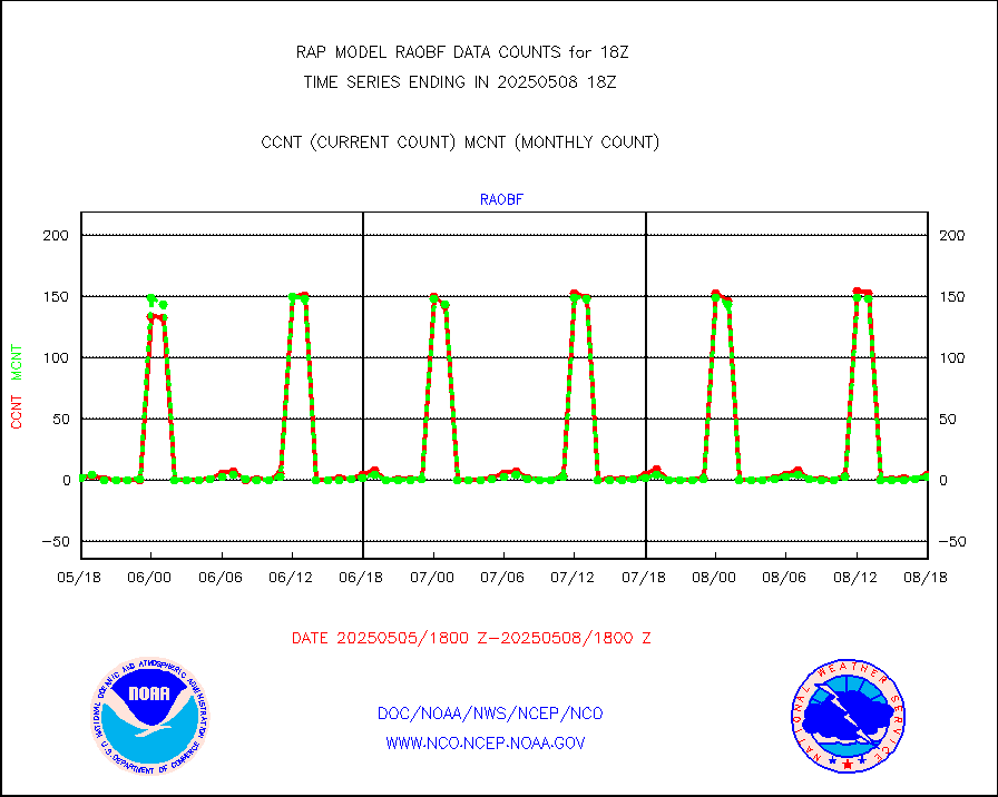
raobf |
Rawinsonde - fixed land (from TEMP or PILOT) |
2 |
3 |
66.7 % |
2517.00-2519.00 |
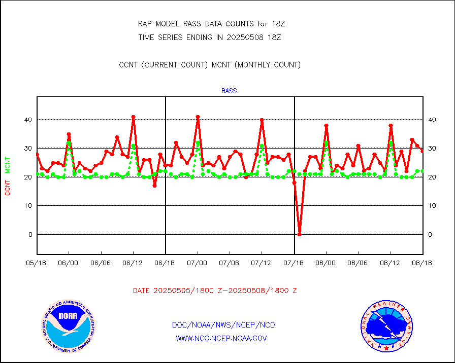
rass |
RASS temperatures (NOAA and Multi-Agency) |
20 |
20 |
100.0 % |
2517.50-2518.50 |
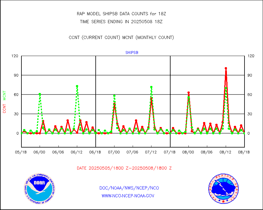
shipsb |
Ship - manual and automatic, restricted (BUFR) |
0 |
0 |
n/a |
2517.50-2518.50 |
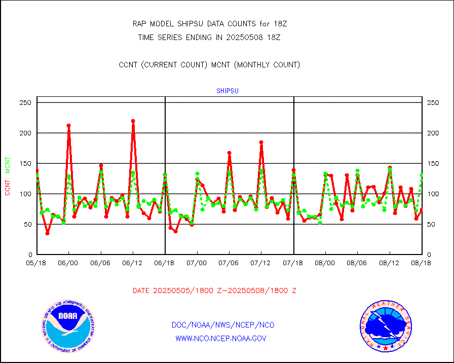
shipsu |
Ship - manual and automatic, unrestricted |
59 |
59 |
100.0 % |
2517.50-2518.50 |
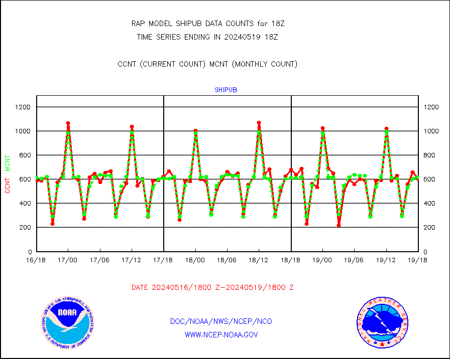
shipub |
Ship - manual and automatic, unrestricted (BUFR) |
652 |
591 |
110.3 % |
2517.50-2518.50 |
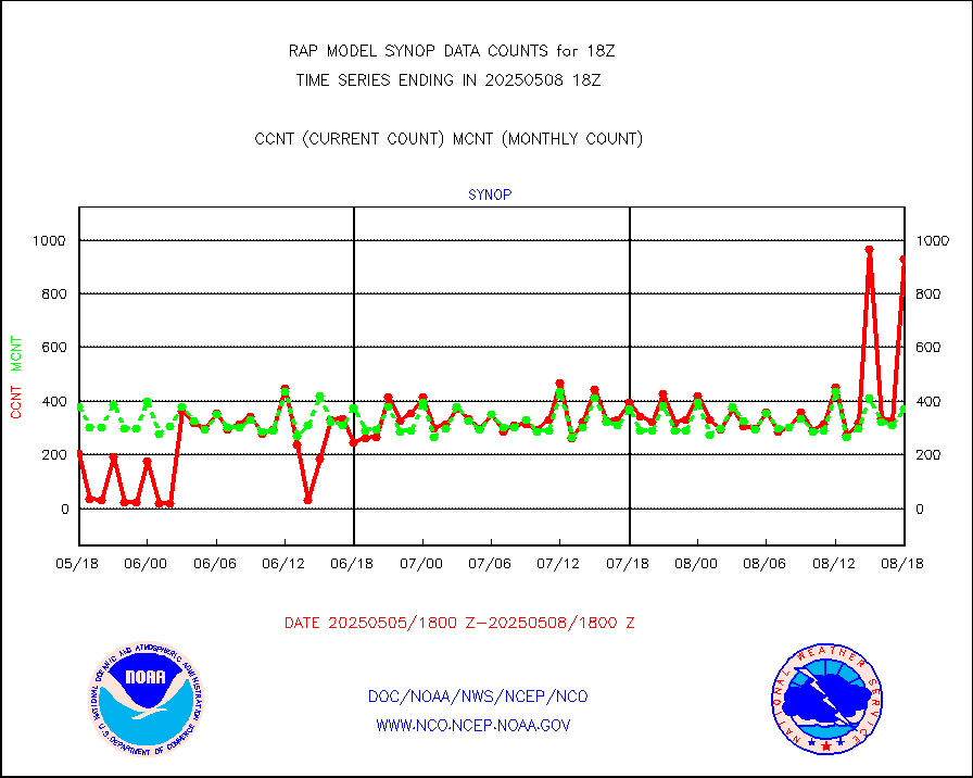
synop |
Synoptic - fixed manual and automatic |
1000 |
546 |
183.2 % |
2517.50-2518.50 |
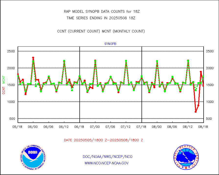
synopb |
Synoptic - fixed manual & auto (decoded fr BUFR) |
1131 |
1726 |
65.5 % |
2517.50-2518.50 |
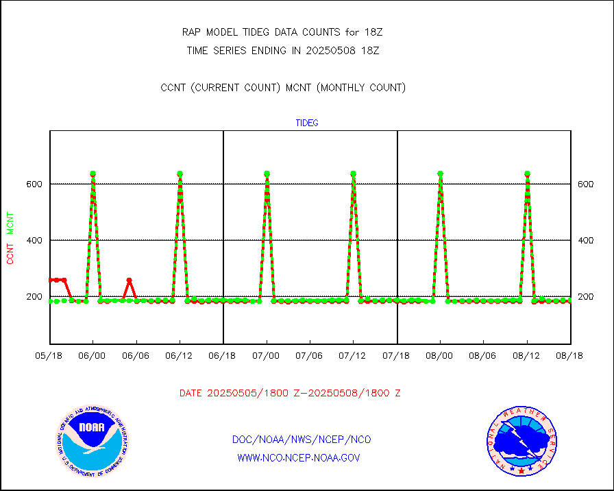
tideg |
Tide gauge reports decoded from CREX format |
181 |
177 |
102.3 % |
2517.50-2518.50 |
| Data Types of Opportunity with Normal Counts |
|---|
| Type | Description | Hourly Count | Monthly Average | Percent (%) of Monthly Mean | UTC Time Window |
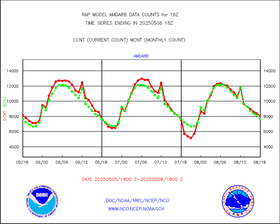
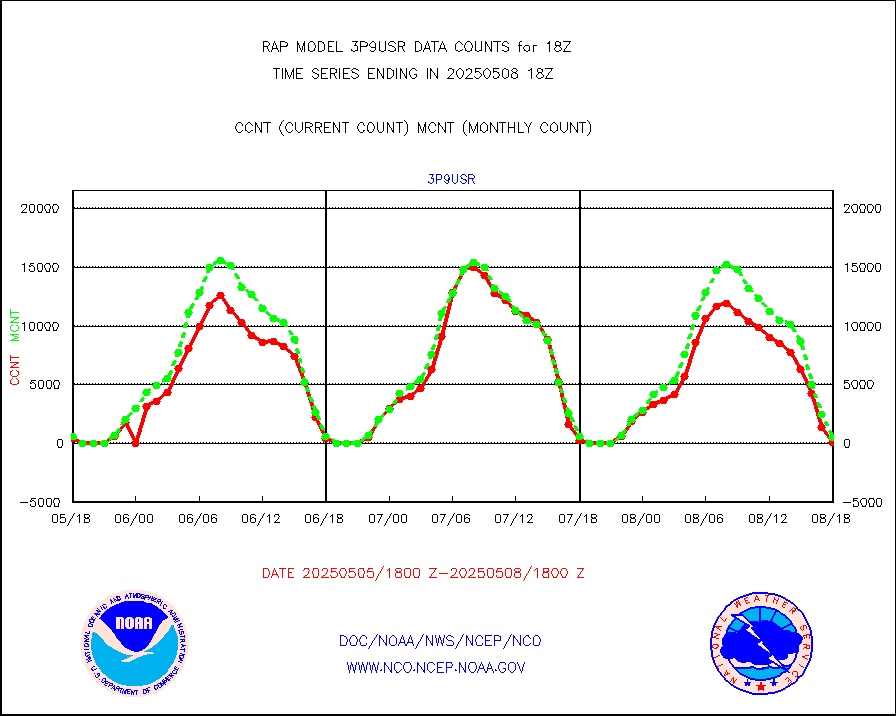
3p9usr |
GOES-16&up/NESDIS ir short-wv derived cld motion |
625 |
905 |
69.1 % |
2517.00-2517.99 |
acarsa |
MDCRS ACARS acft data (ARINC via AFWA)(AIREP fmt) |
0 |
0 |
n/a |
2514.75-2521.25 |
airep |
Manual AIREP aircraft data (dcded from AIREP fmt) |
3835 |
3849 |
99.6 % |
2514.75-2521.25 |
airsev |
AQUA AIRS/AMSU-A/HSB brightness temps- every FOV |
0 |
0 |
n/a |
2515.00-2520.99 |
amdar |
AMDAR aircraft data (decoded from AMDAR format) |
239 |
316 |
75.6 % |
2514.75-2521.25 |
amdarb |
AMDAR aircraft data (decoded from BUFR) |
1192 |
1325 |
90.0 % |
2514.75-2521.25 |
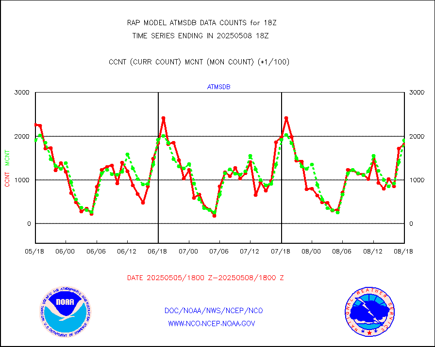
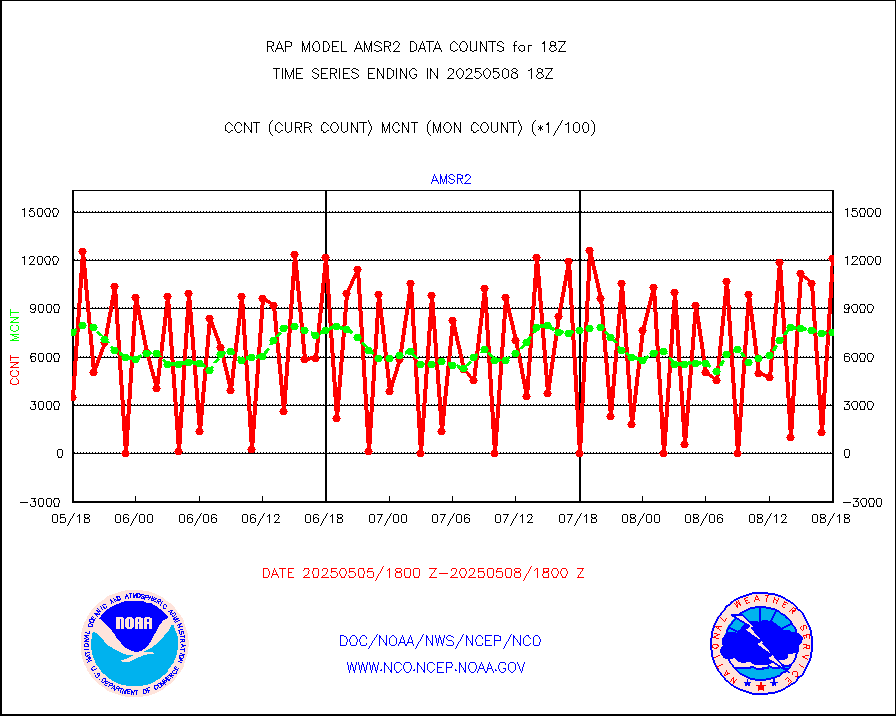
amsr2 |
GCOM-W AMSR2 1B brightness temperatures |
107012 |
761556 |
14.1 % |
2515.00-2515.99 |
ascat |
METOP 1-2 ASCAT products |
17451 |
15390 |
113.4 % |
2516.00-2520.00 |
atms |
NPP/NOAA-20 ATMS brightness temperatures |
235507 |
224494 |
104.9 % |
2516.00-2519.99 |
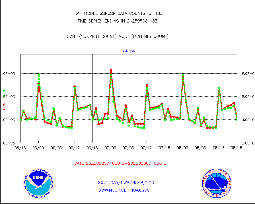
atmsdb |
NPP/NOAA-20 ATMS bright. temps-direct b-cast SSEC |
208361 |
177940 |
117.1 % |
2516.00-2519.99 |
coopmd |
Coop/MADIS NEPP & HCN-Modernization NOAA COOP Obs |
27 |
23 |
117.4 % |
2517.50-2518.50 |
crisf4 |
NPP/NOAA-20 CrIS full spctrl radn (431 ch subset) |
146827 |
124858 |
117.6 % |
2516.00-2519.99 |
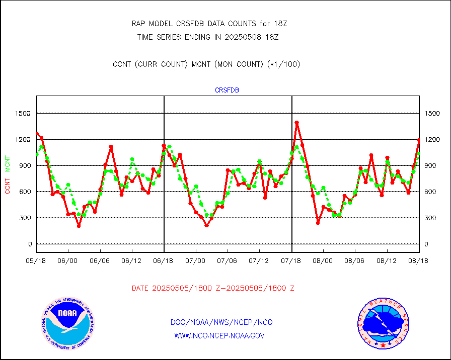
crsfdb |
NPP/NOAA-20 CrIS full spctrl radn dir brdcst SSEC |
177116 |
142614 |
124.2 % |
2516.00-2519.99 |
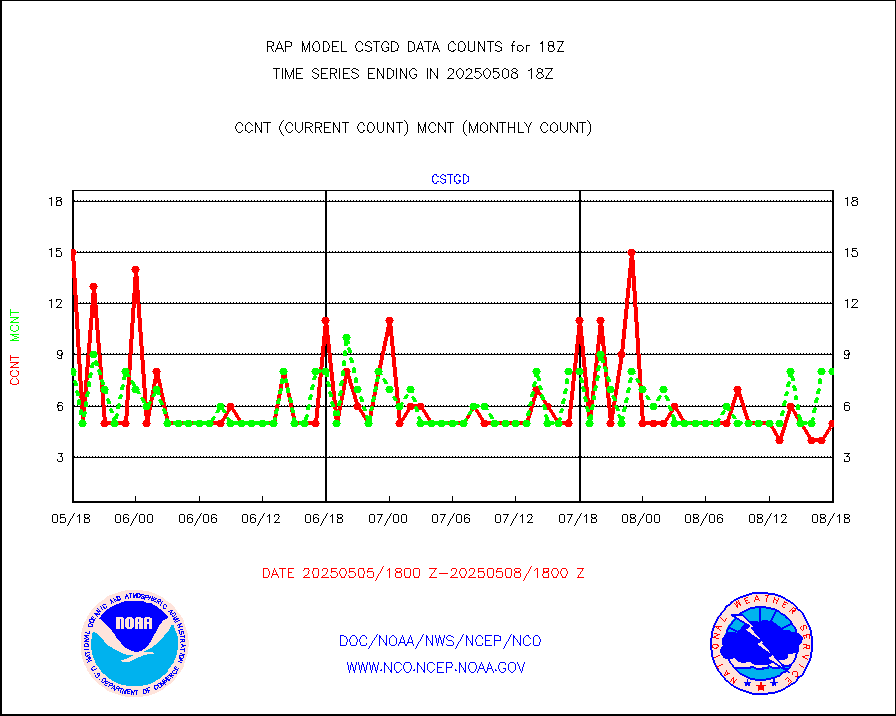
cstgd |
Coast Guard |
7 |
7 |
100.0 % |
2517.50-2518.50 |
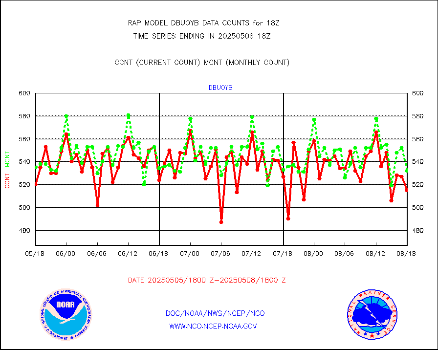
dbuoyb |
Drifting buoys (decoded from BUFR) |
559 |
594 |
94.1 % |
2517.50-2518.50 |
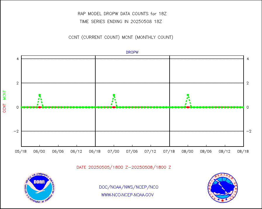
dropw |
Dropwinsonde (from TEMP DROP) |
0 |
0 |
n/a |
2517.00-2519.00 |
eadas |
E-AMDAR (European AMDAR acft decoded from BUFR) |
9411 |
9344 |
100.7 % |
2514.75-2521.25 |
esamua |
NOAA 15-19 & METOP 1-2 AMSU-A proc btmps frm RARS |
10716 |
14379 |
74.5 % |
2517.00-2519.00 |
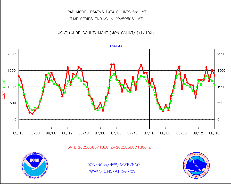
esatms |
NPP Adv. Tech. MW Sndr (ATMS) br. temps from RARS |
133175 |
99849 |
133.4 % |
2516.00-2519.99 |
eshrs3 |
NOAA 15-19 & METOP 1-2 HIRS-3/4 pr btmps frm RARS |
14785 |
30105 |
49.1 % |
2517.00-2519.00 |
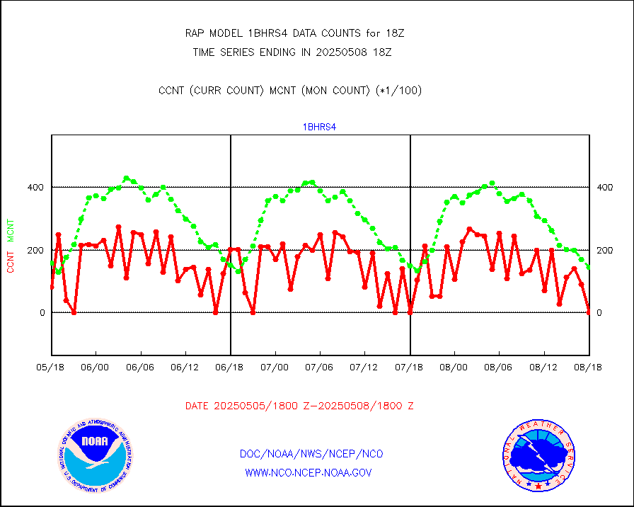
esiasi |
METOP 1-2 IASI 1C radiance data vbl chn from RARS |
63778 |
54299 |
117.5 % |
2516.00-2519.99 |
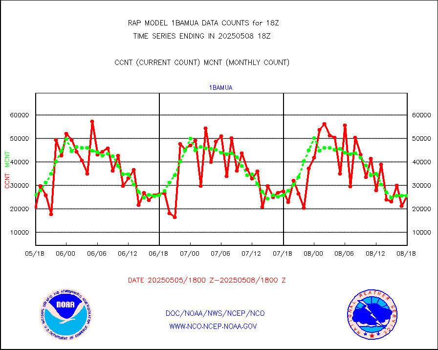
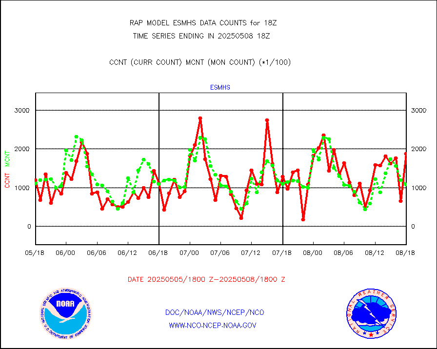
esmhs |
NOAA 18-19 & METOP 1-2 MHS proc. btemps from RARS |
114013 |
114201 |
99.8 % |
2517.00-2519.00 |
gmi1cr |
GPM GMI Level 1C-R brightness temperatures |
244096 |
433032 |
56.4 % |
2515.00-2520.99 |
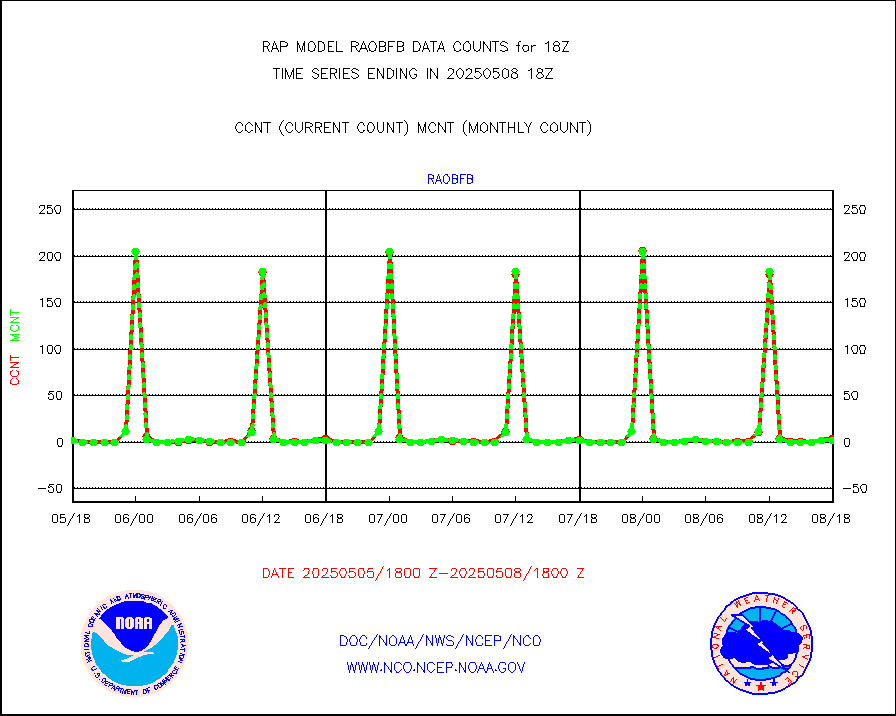
gpsro |
GPS radio occultation data |
119 |
101 |
117.8 % |
2516.00-2519.99 |
gsrasr |
GOES-16/17 All Sky Radiances (proc.) |
812080 |
780569 |
104.0 % |
2516.00-2519.99 |
gsrcsr |
GOES-16/17 Clear Sky Radiances (proc.) |
415357 |
399478 |
104.0 % |
2516.00-2519.99 |
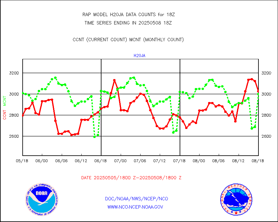
h20ja |
MTSAT/JMA water vapor imager derived cloud motion |
3332 |
2796 |
119.2 % |
2515.50-2520.50 |
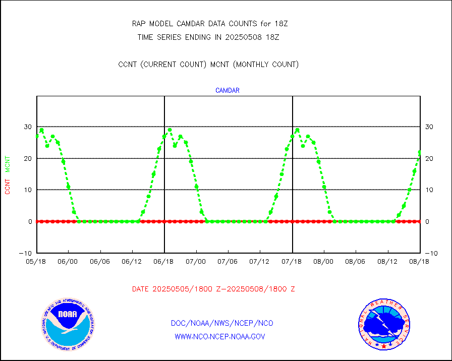
h2dusr |
GOES-16&up/NESDIS wv imgr/deep-lyr derivd cld mtn |
8284 |
6592 |
125.7 % |
2517.00-2517.99 |
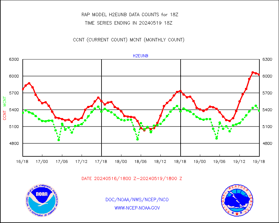
h2eunb |
METEOSAT/EUMETSAT wvpr imgr drv cld motion NBseq |
4509 |
5248 |
85.9 % |
2516.50-2519.49 |
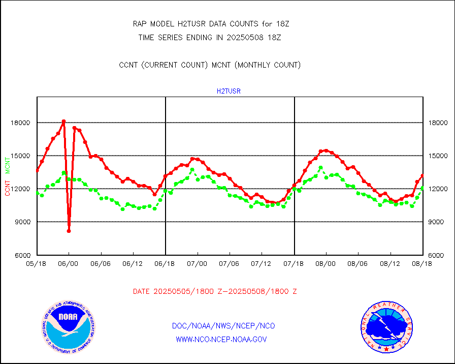
h2tusr |
GOES-16&up/NESDIS wv imgr/cld-top derived cld mtn |
11792 |
10108 |
116.7 % |
2517.00-2517.99 |
iasidb |
METOP 1-2 IASI 1C radiances-direct broadcast SSEC |
49396 |
47347 |
104.3 % |
2516.00-2519.99 |
ifeunb |
METEOSAT/EUMETSAT ir lg-wave drv cld motion NBseq |
3368 |
3277 |
102.8 % |
2516.50-2519.49 |
ifvrnb |
VIIRS (NPP/NOAA-20) ir lg-wv drv cloud motion(NB) |
0 |
0 |
n/a |
2515.50-2520.50 |
infav |
AVHRR (NOAA/METOP) ir lg-wave derived cld motion |
0 |
0 |
n/a |
2515.50-2520.50 |
infav1 |
AVHRR (METOP) ir lg-wave derived cld motion |
0 |
0 |
n/a |
2516.50-2519.49 |
infja |
MTSAT/JMA infrared long-wave derived cloud motion |
3063 |
2442 |
125.4 % |
2515.50-2520.50 |
infusr |
GOES-16&up/NESDIS ir long-wave derived cld motion |
33389 |
30162 |
110.7 % |
2517.00-2517.99 |
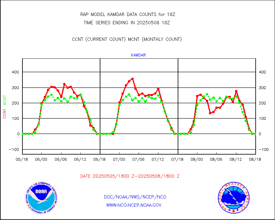
kamdar |
Korean AMDAR aircraft data (decoded from BUFR) |
0 |
1 |
0.0 % |
2514.75-2521.25 |
lcman |
Land-based CMAN stations decoded from CMAN format |
73 |
86 |
84.9 % |
2517.50-2518.50 |
ltnglr |
LLDN Long-rng lightning from Vaisala via NOAAPORT |
53831 |
41980 |
128.2 % |
2517.00-2518.50 |
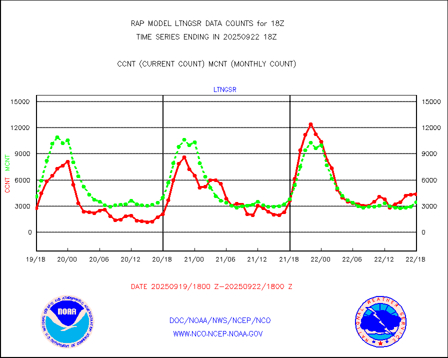
ltngsr |
NLDN Shrt-rng lightning from Vaisala via NOAAPORT |
2487 |
1619 |
153.6 % |
2517.00-2518.50 |
mbuoyb |
Moored buoys (decoded from BUFR) |
530 |
460 |
115.2 % |
2517.50-2518.50 |
mso470 |
Mesonet/MADIS Colorado E-470 (Interstate 470) |
14 |
19 |
73.7 % |
2517.50-2518.50 |
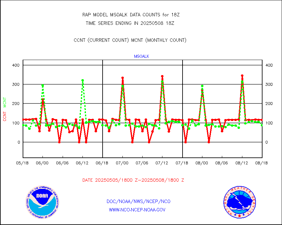
msoalk |
Mesonet/MADIS Alaska Department of Transportation |
51 |
110 |
46.4 % |
2517.50-2518.50 |
msoapg |
Mesonet/MADIS U.S. Army Aberdeen Proving Grounds |
0 |
0 |
n/a |
2517.50-2518.50 |
msoapr |
Mesonet/MADIS Citizen Weather Observers Program |
41558 |
43864 |
94.7 % |
2517.50-2518.50 |
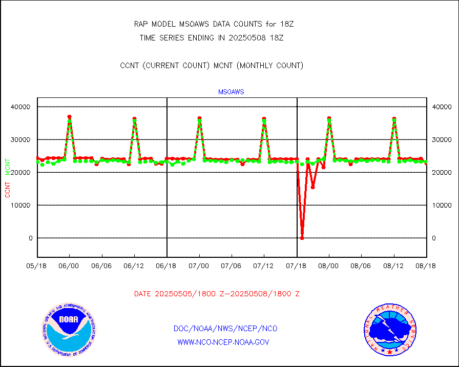
msoaws |
Mesonet/MADIS AWS Convergence Technologies, Inc. |
24889 |
25717 |
96.8 % |
2517.50-2518.50 |
msoawx |
Mesonet/MADIS "Anything Weather" |
0 |
0 |
n/a |
2517.50-2518.50 |
msocol |
Mesonet/MADIS Colorado Dept. of Transportation |
0 |
0 |
n/a |
2517.50-2518.50 |
msodcn |
Mesonet/MADIS DC Net |
0 |
0 |
n/a |
2517.50-2518.50 |
msoden |
Mesonet/MADIS Denver Urban Drainage & Flood Cntrl |
200 |
201 |
99.5 % |
2517.50-2518.50 |
msofla |
Mesonet/MADIS Florida (FAWN & USF) |
3 |
3 |
100.0 % |
2517.50-2518.50 |
msoflt |
Mesonet/MADIS Florida Dept. of Transportation |
0 |
0 |
n/a |
2517.50-2518.50 |
msogeo |
Mesonet/MADIS Georgia Dept. of Transportation |
0 |
0 |
n/a |
2517.50-2518.50 |
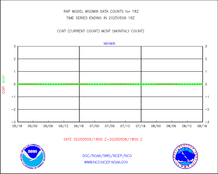
msohad |
Mesonet/MADIS NWS Hydromet Auto Data System(HADS) |
5049 |
5492 |
91.9 % |
2517.50-2518.50 |
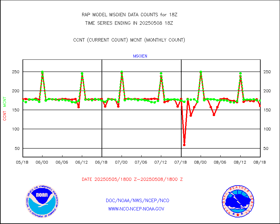
msoien |
Mesonet/MADIS Iowa Environmental |
178 |
169 |
105.3 % |
2517.50-2518.50 |
msoind |
Mesonet/MADIS Indiana Dept. of Transportation |
0 |
0 |
n/a |
2517.50-2518.50 |
msoiow |
Mesonet/MADIS Iowa Department of Transportation |
0 |
0 |
n/a |
2517.50-2518.50 |
msokan |
Mesonet/MADIS Kansas Department of Transportation |
351 |
305 |
115.1 % |
2517.50-2518.50 |
msokla |
Mesonet/MADIS Oklahoma Mesonet |
318 |
329 |
96.7 % |
2517.50-2518.50 |
msolju |
Mesonet/MADIS Louisiana State/Jackson State Univ. |
0 |
0 |
n/a |
2517.50-2518.50 |
msomca |
Mesonet/MADIS Missouri Commercial Agricult Wx Net |
272 |
243 |
111.9 % |
2517.50-2518.50 |
msomin |
Mesonet/MADIS Minnesota Dept. of Transportation |
0 |
0 |
n/a |
2517.50-2518.50 |
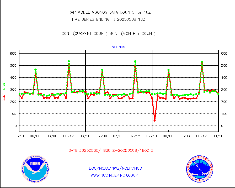
msonos |
Mesonet/MADIS NOS-Phys Oceanographic Realtime Sys |
238 |
270 |
88.1 % |
2517.50-2518.50 |
msoraw |
Mesonet/MADIS NFIC Remote Automated Wx Stns(RAWS) |
1202 |
1532 |
78.5 % |
2517.50-2518.50 |
msourb |
Mesonet/MADIS UrbaNet |
3999 |
3950 |
101.2 % |
2517.50-2518.50 |
msovir |
Mesonet/MADIS Virginia Dept. of Transportation |
232 |
235 |
98.7 % |
2517.50-2518.50 |
msowfy |
Mesonet/MADIS "Weather for You" |
0 |
0 |
n/a |
2517.50-2518.50 |
msowis |
Mesonet/MADIS Wisconsin Dept. of Transportation |
0 |
0 |
n/a |
2517.50-2518.50 |
msowst |
Mesonet/MADIS MesoWest (many subproviders) |
30908 |
38652 |
80.0 % |
2517.50-2518.50 |
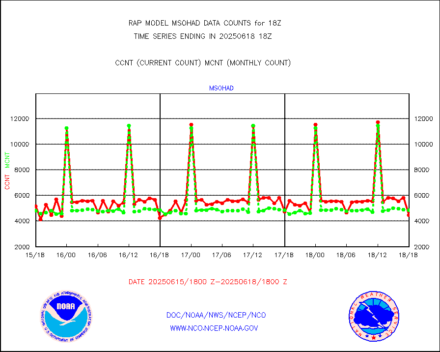
msowtx |
Mesonet/MADIS West Texas |
4833 |
4940 |
97.8 % |
2517.50-2518.50 |
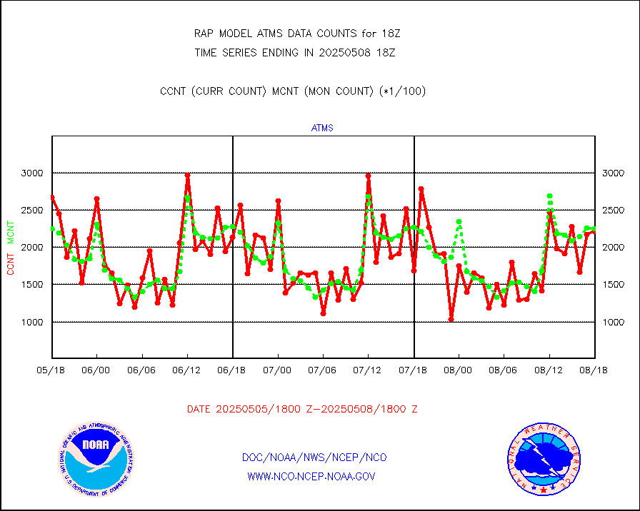
mtiasi |
METOP 1-2 IASI 1C radiance data (varbl. channels) |
23397 |
13060 |
179.2 % |
2516.00-2519.99 |
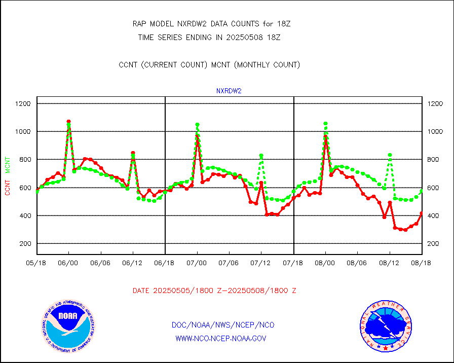
nxrdw2 |
NEXRAD Vel Azm Dsp(VAD) winds via Level 2 decoder |
537 |
608 |
88.3 % |
2517.00-2519.00 |
osbuv8 |
NOAA 16-19 Solar Backscatter UV-2 rad frm V8 BUFR |
0 |
0 |
n/a |
2516.00-2518.99 |
pibal |
PIBAL (from PILOT, PILOT SHIP, PILOT MOBIL) |
0 |
0 |
n/a |
2517.00-2519.00 |
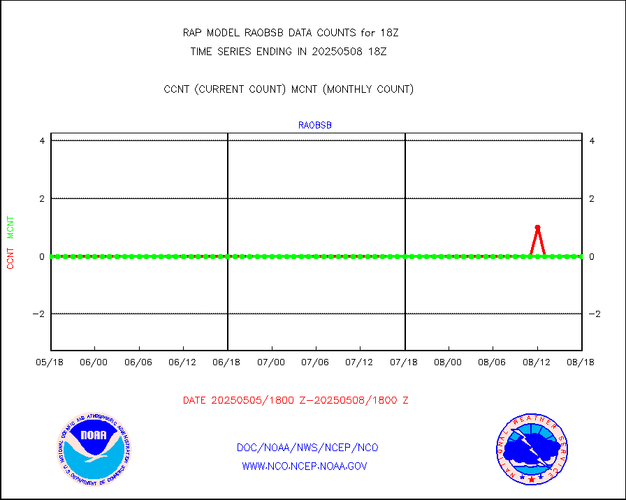
pirep |
Manual PIREP aircraft data (dcded from AIREP fmt) |
441 |
637 |
69.2 % |
2514.75-2521.25 |
prflrp |
Profilr winds from PIBAL (PILOT,PILOT SHIP/MOBIL) |
0 |
0 |
n/a |
2516.50-2519.50 |
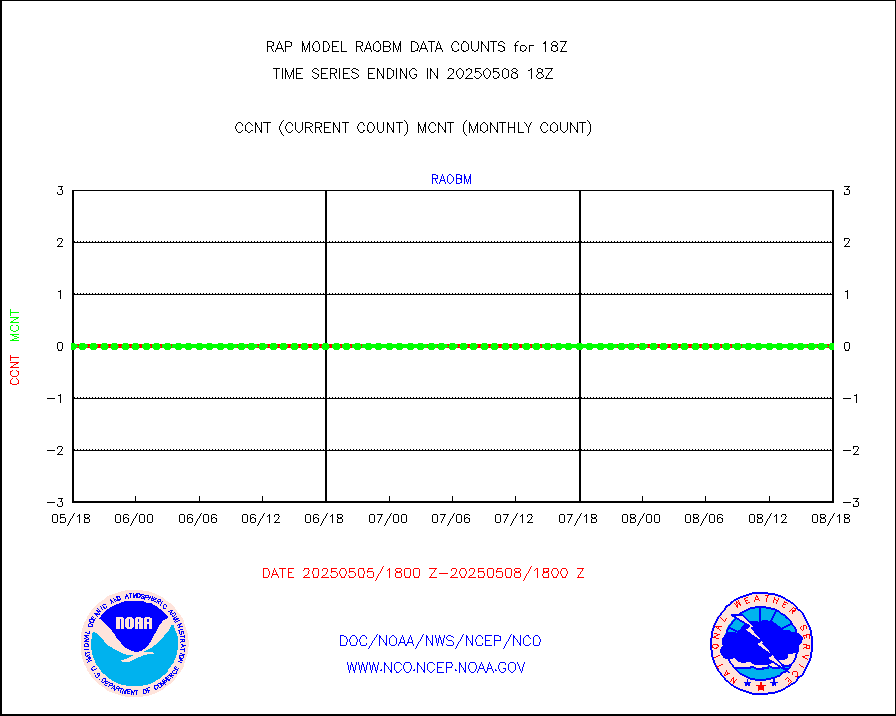
raobm |
Rawinsonde - mobile land (from TEMP/PILOT MOBIL) |
0 |
0 |
n/a |
2517.00-2519.00 |
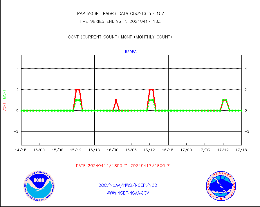
raobs |
Rawinsonde - ship (from TEMP SHIP, PILOT SHIP) |
0 |
0 |
n/a |
2517.00-2519.00 |
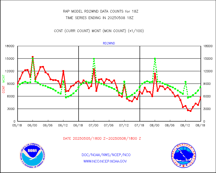
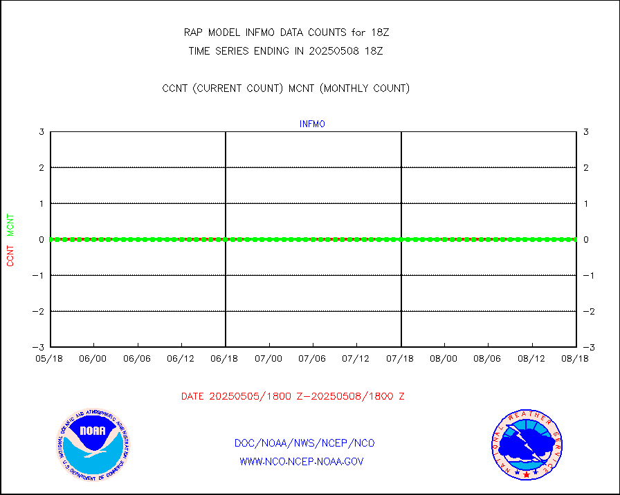
rd2wnd |
NEXRAD radial wind (Level 2 - GTS) |
799653 |
895835 |
89.3 % |
2517.50-2518.49 |
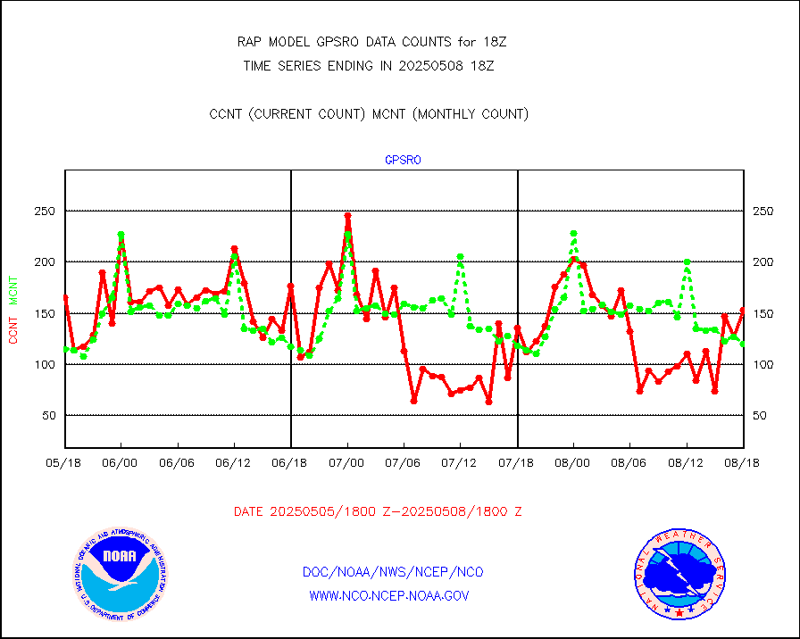
recco |
Flight level reconnaissance aircraft data |
0 |
0 |
n/a |
2517.00-2519.00 |
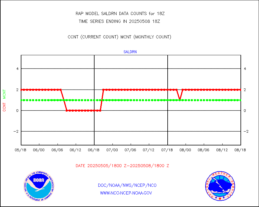
saldrn |
Surface Marine Saildrone (decoded from BUFR) |
2 |
2 |
100.0 % |
2516.00-2519.99 |
saphir |
Megha-Tropiques SAPHIR L1A2 brightness temps |
0 |
0 |
n/a |
2515.00-2520.99 |
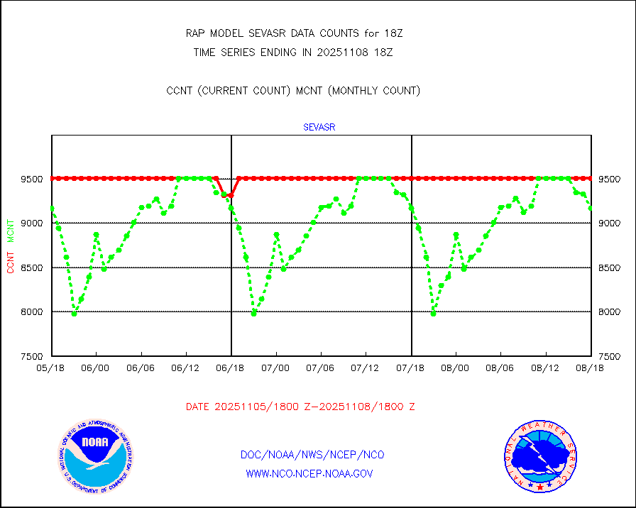
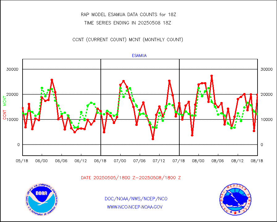
sevasr |
METEOSAT-10 2nd Gen SEVIRI All Sky Radiance(proc) |
9469 |
9512 |
99.5 % |
2516.00-2519.99 |
sevcsr |
METEOSAT-10 2nd Gen SEVIRI Clr Sky Radiance(proc) |
0 |
0 |
n/a |
2516.00-2519.99 |
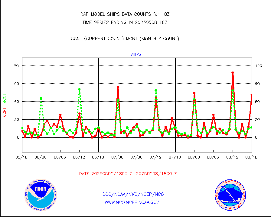
ships |
Ship - manual and automatic, restricted |
0 |
8 |
0.0 % |
2517.50-2518.50 |
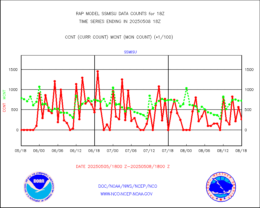
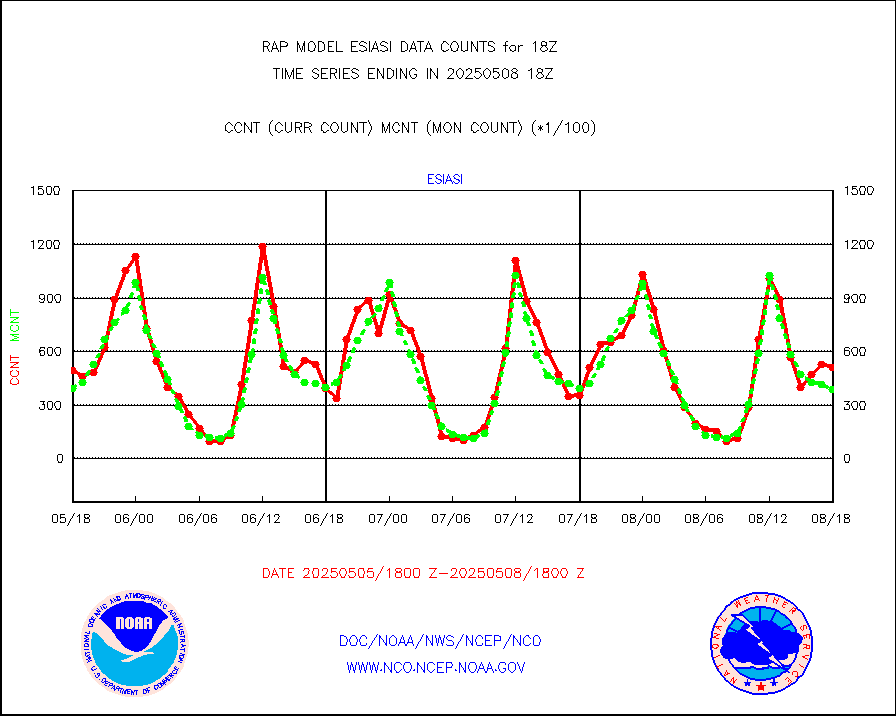
ssmisu |
DMSP SSM/IS 1C radiance data (Unified Pre-Proc.) |
21855 |
67370 |
32.4 % |
2516.00-2519.99 |
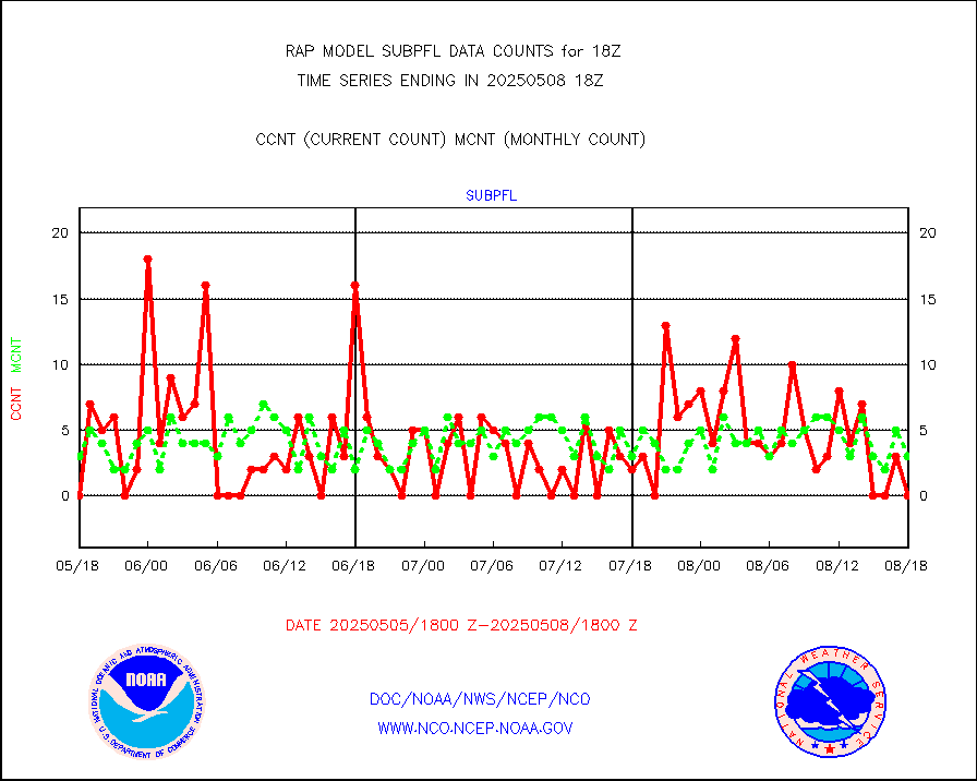
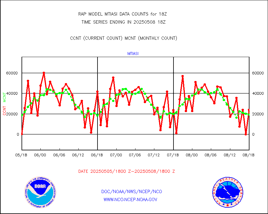
subpfl |
Sub-surface float and glider profile (BUFR) |
3 |
1 |
300.0 % |
2516.00-2519.99 |
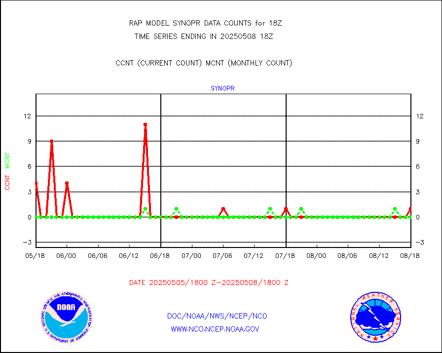
synopr |
Synoptic - restricted (WMO Res 40) manual & auto. |
1 |
0 |
n/a |
2517.50-2518.50 |
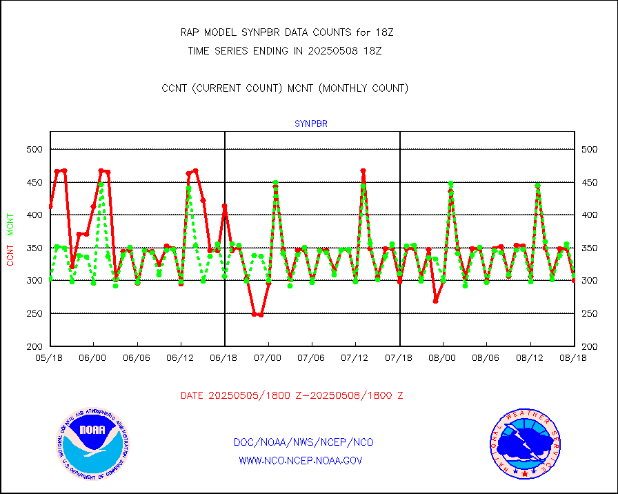
synpbr |
Synoptic - restricted (WMO Res 40)(decoded BUFR) |
298 |
300 |
99.3 % |
2517.50-2518.50 |
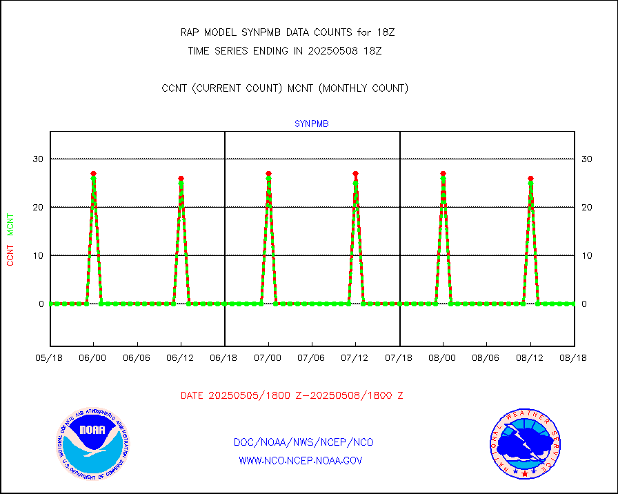
synpmb |
Synoptic - mobile manual & auto (decoded fr BUFR) |
0 |
0 |
n/a |
2517.50-2518.50 |
tmdara |
TAMDAR aircft data-all types(from Panasonic,BUFR) |
797 |
952 |
83.7 % |
2514.75-2521.25 |
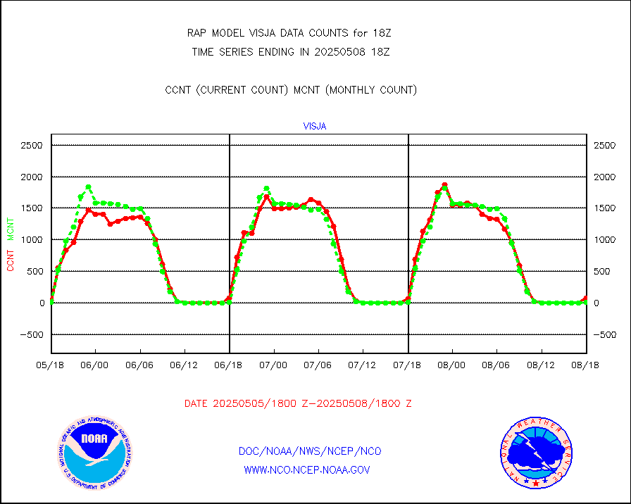
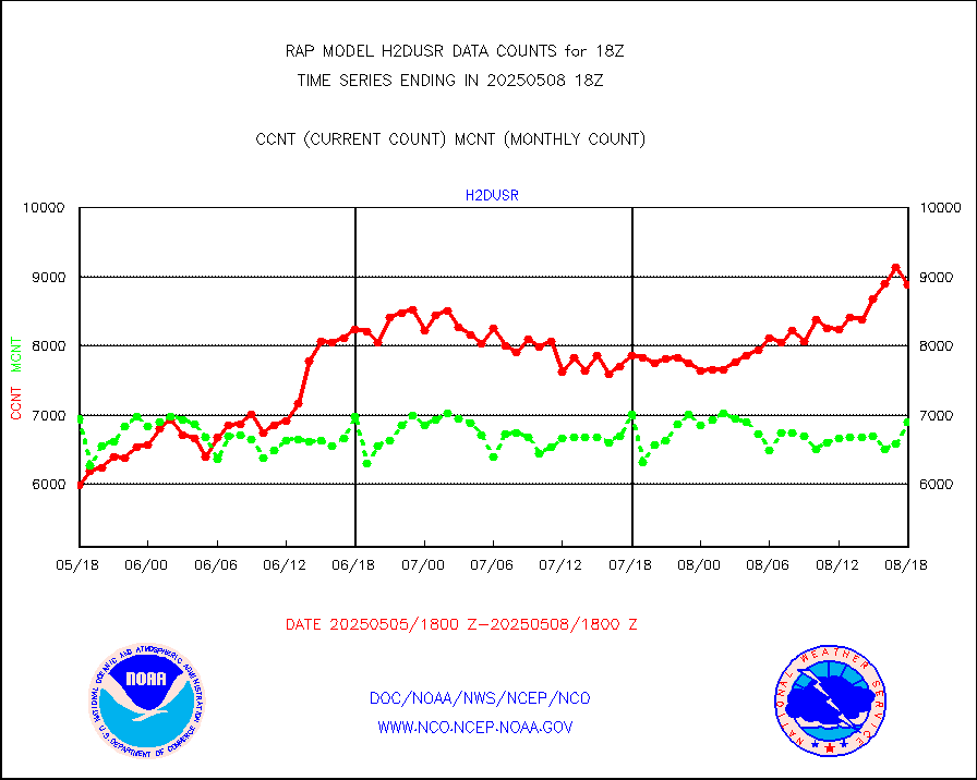
visja |
MTSAT/JMA visible derived cloud motion |
9 |
1 |
900.0 % |
2515.50-2520.50 |
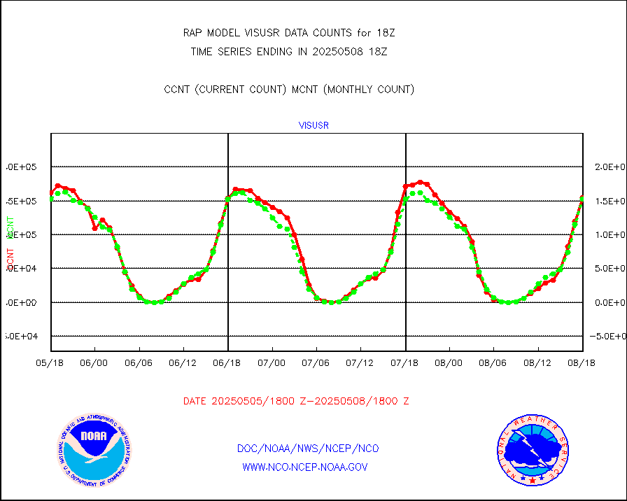
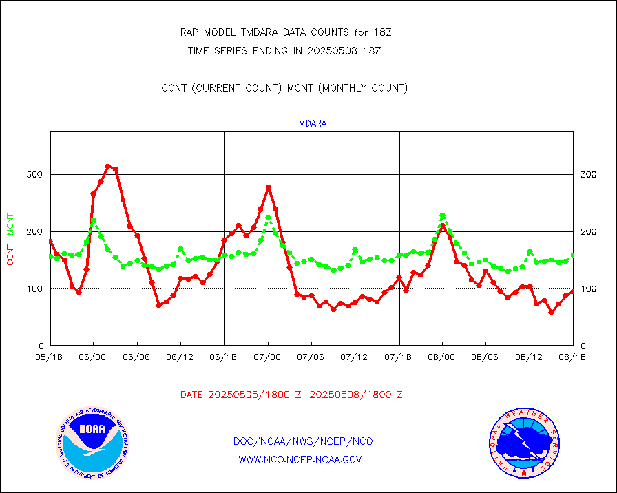
visusr |
GOES-16&up/NESDIS visible derived cloud motion |
149453 |
145246 |
102.9 % |
2517.00-2517.99 |
vseunb |
METEOSAT/EUMETSAT visible drv cld motion NBseq |
10767 |
7252 |
148.5 % |
2516.50-2519.49 |


