| Critical Data with Normal Counts |
|---|
| Type | Description | Hourly Count | Monthly Average | Percent (%) of Monthly Mean | UTC Time Window |
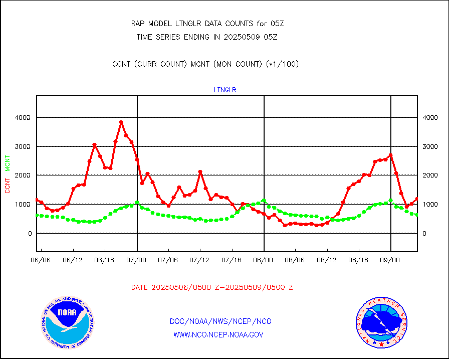
1bamua |
NOAA 15-19 & METOP 1-2 AMSU-A NCEP-proc. br.temps |
41718 |
46467 |
89.8 % |
0102.00-0107.99 |
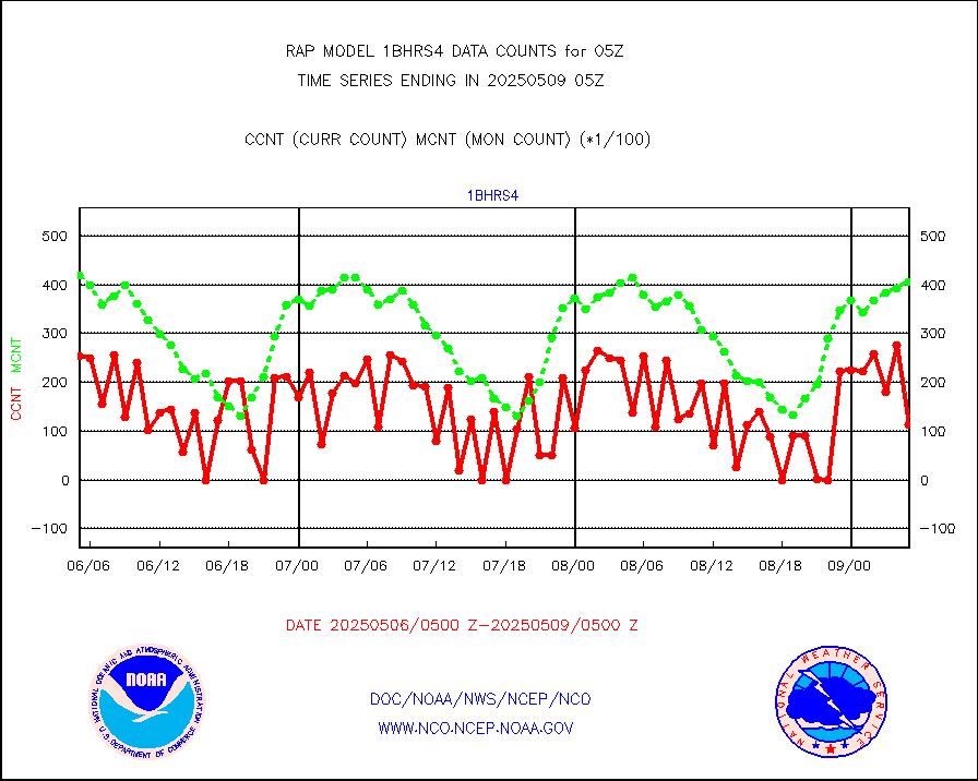
1bhrs4 |
NOAA 18-19 & METOP 1-2 HIRS-4 NCEP-proc. br.temps |
28535 |
42291 |
67.5 % |
0102.00-0107.99 |
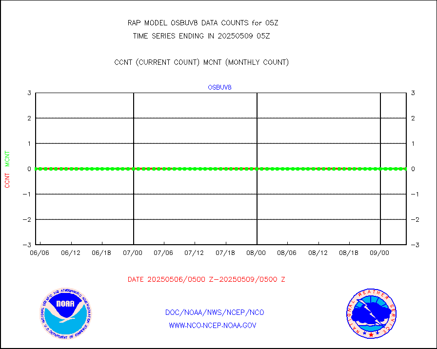
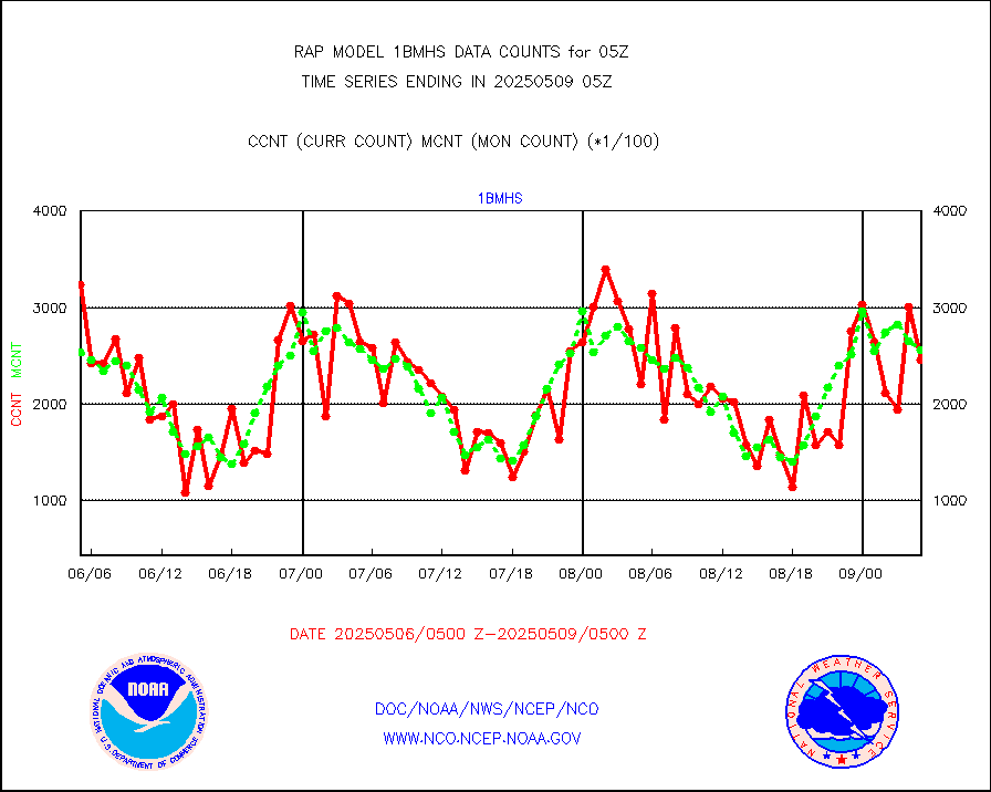
1bmhs |
NOAA 18-19 & METOP 1-2 MHS NCEP-proces. br. temps |
238509 |
270568 |
88.2 % |
0102.00-0107.99 |
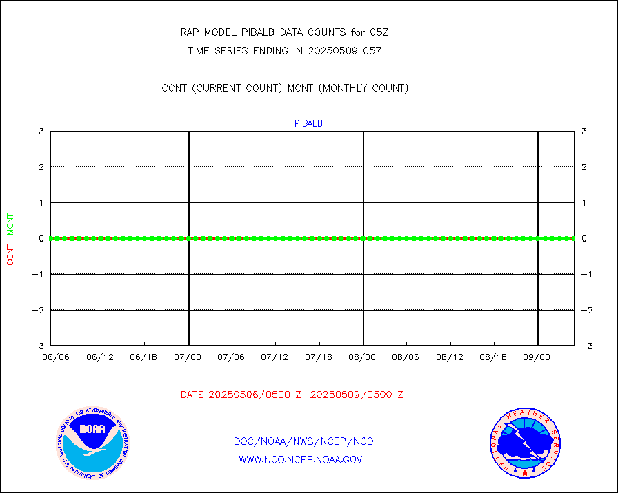
acars |
MDCRS ACARS acft data from ARINC(dcded from BUFR) |
66934 |
91015 |
73.5 % |
0101.75-0108.25 |
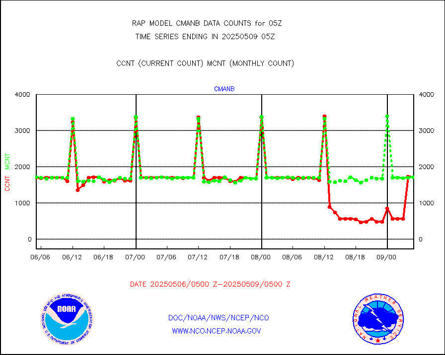
cmanb |
Surface Marine CMAN rpts decoded from BUFR format |
1707 |
1692 |
100.9 % |
0104.50-0105.50 |
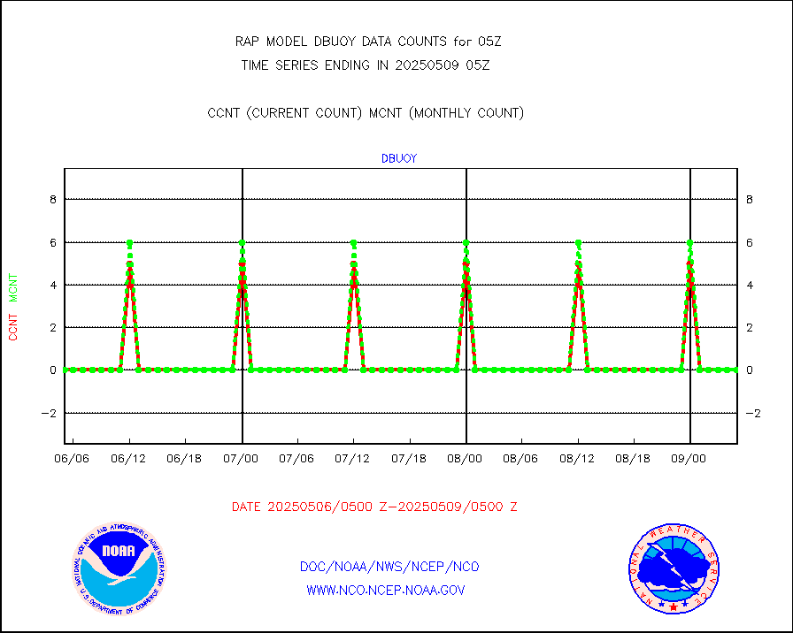
dbuoy |
Buoys decoded from FM-18 fmt (moored or drifting) |
0 |
0 |
n/a |
0104.50-0105.50 |
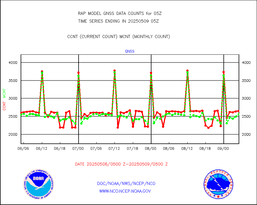
gnss |
Grnd-based Gbl Navigation Sat System (GNSS) data |
2662 |
2361 |
112.7 % |
0103.95-0104.05 |
h20mo |
MODIS (AQUA/TERRA) wvpr imager derived cld motion |
0 |
0 |
n/a |
0102.50-0107.50 |
infmo |
MODIS (AQUA/TERRA) ir l-wave derived cloud motion |
0 |
0 |
n/a |
0102.50-0107.50 |
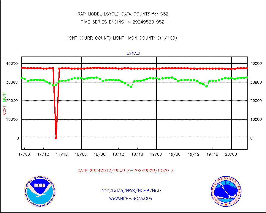
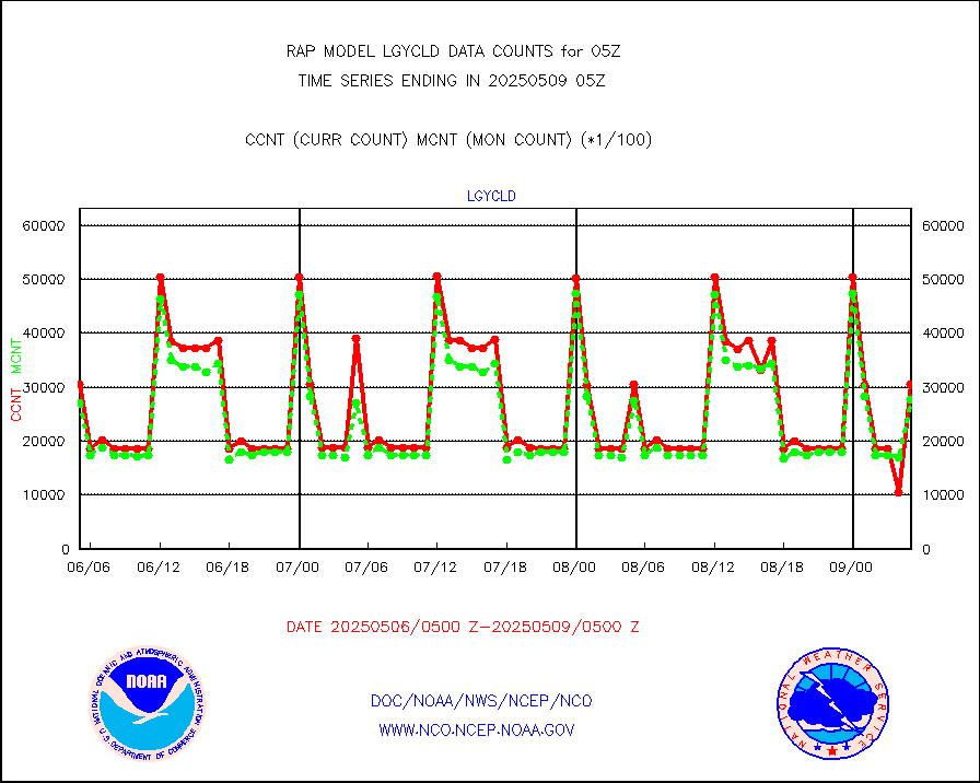
lgycld |
GOES/NASA(Langley) hi-res. (1x1 f-o-v) cloud data |
3744558 |
3133711 |
119.5 % |
0104.50-0105.50 |
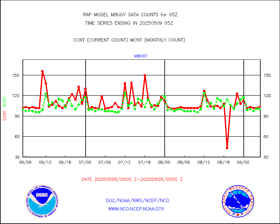
mbuoy |
Buoys decoded from FM-13 format (moored) |
37 |
47 |
78.7 % |
0104.50-0105.50 |
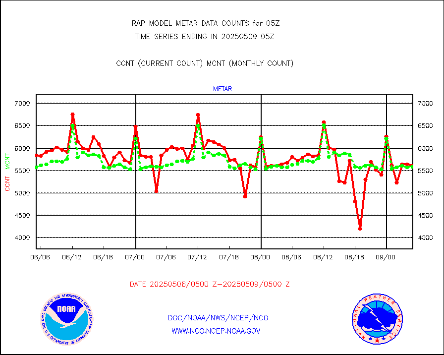
metar |
Aviation - METAR |
5831 |
5713 |
102.1 % |
0104.50-0105.50 |
nxrdw |
NEXRAD Vel Azm Dsp(VAD) winds via radar coded msg |
0 |
0 |
n/a |
0104.00-0106.00 |
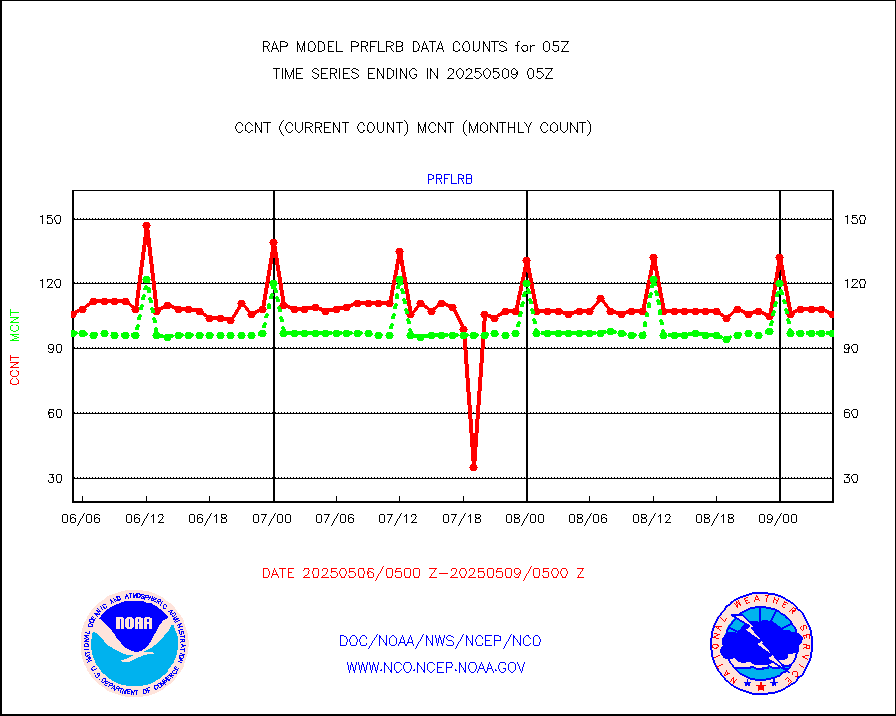
prflrb |
Multi-Agency Profiler (MAP) and SODAR winds |
87 |
79 |
110.1 % |
0103.50-0106.50 |
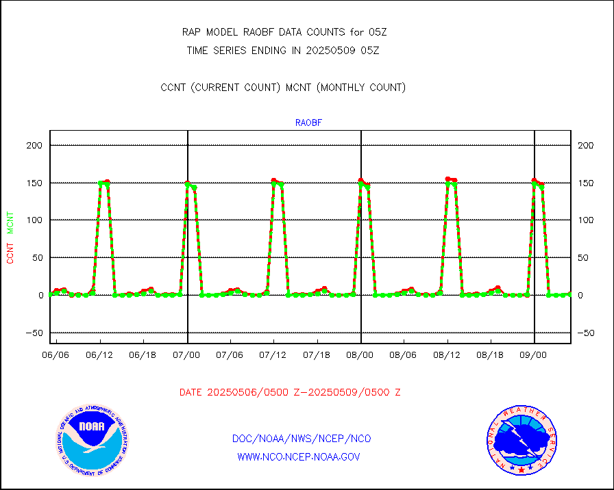
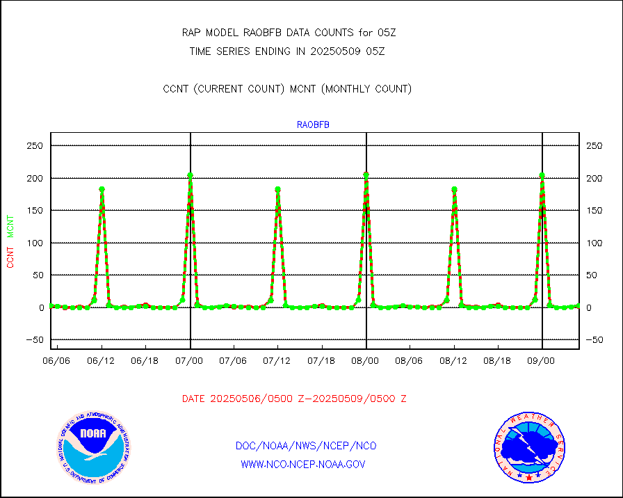
raobf |
Rawinsonde - fixed land (from TEMP or PILOT) |
1 |
1 |
100.0 % |
0104.00-0106.00 |
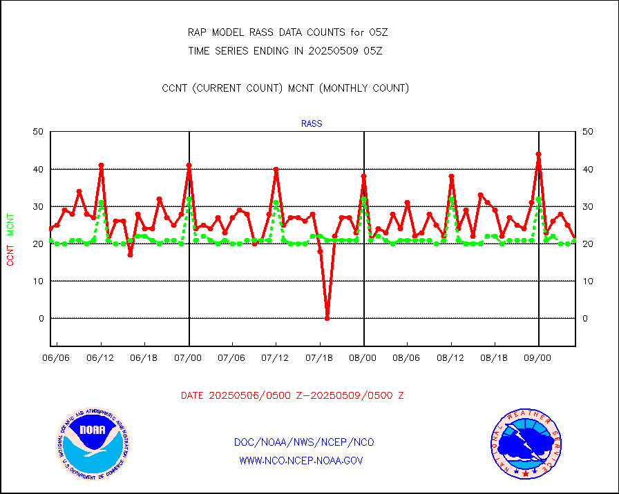
rass |
RASS temperatures (NOAA and Multi-Agency) |
19 |
20 |
95.0 % |
0104.50-0105.50 |
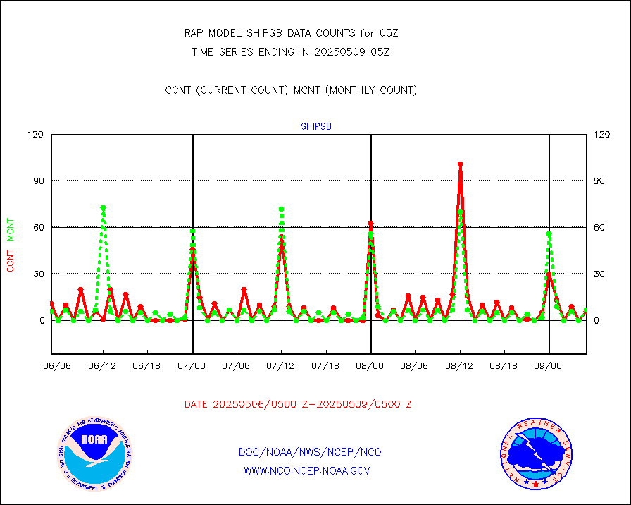
shipsb |
Ship - manual and automatic, restricted (BUFR) |
0 |
0 |
n/a |
0104.50-0105.50 |
shipsu |
Ship - manual and automatic, unrestricted |
46 |
46 |
100.0 % |
0104.50-0105.50 |
shipub |
Ship - manual and automatic, unrestricted (BUFR) |
631 |
600 |
105.2 % |
0104.50-0105.50 |
synop |
Synoptic - fixed manual and automatic |
329 |
294 |
111.9 % |
0104.50-0105.50 |
synopb |
Synoptic - fixed manual & auto (decoded fr BUFR) |
1713 |
1612 |
106.3 % |
0104.50-0105.50 |
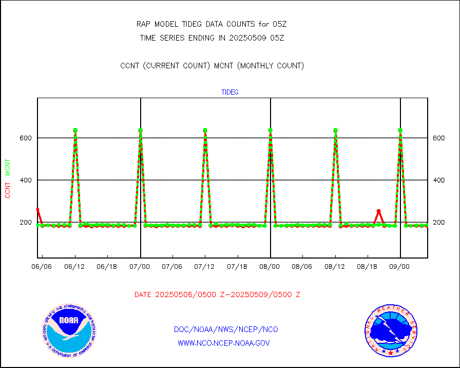
tideg |
Tide gauge reports decoded from CREX format |
180 |
178 |
101.1 % |
0104.50-0105.50 |
| Data Types of Opportunity with Normal Counts |
|---|
| Type | Description | Hourly Count | Monthly Average | Percent (%) of Monthly Mean | UTC Time Window |
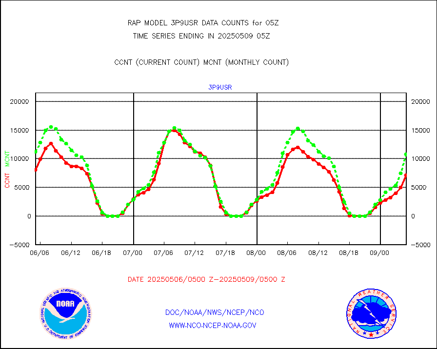
3p9usr |
GOES-16&up/NESDIS ir short-wv derived cld motion |
10890 |
11828 |
92.1 % |
0104.00-0104.99 |
acarsa |
MDCRS ACARS acft data (ARINC via AFWA)(AIREP fmt) |
0 |
0 |
n/a |
0101.75-0108.25 |
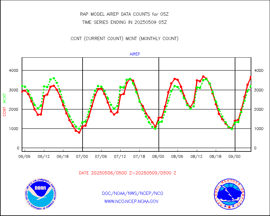
airep |
Manual AIREP aircraft data (dcded from AIREP fmt) |
4503 |
4315 |
104.4 % |
0101.75-0108.25 |
airsev |
AQUA AIRS/AMSU-A/HSB brightness temps- every FOV |
0 |
0 |
n/a |
0102.00-0107.99 |
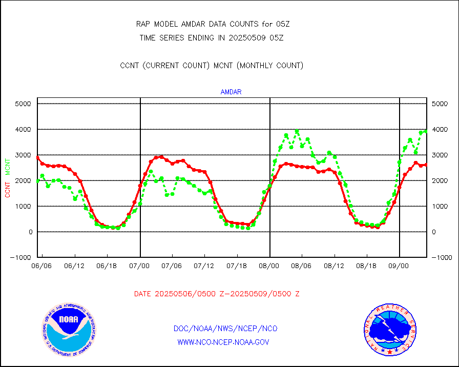
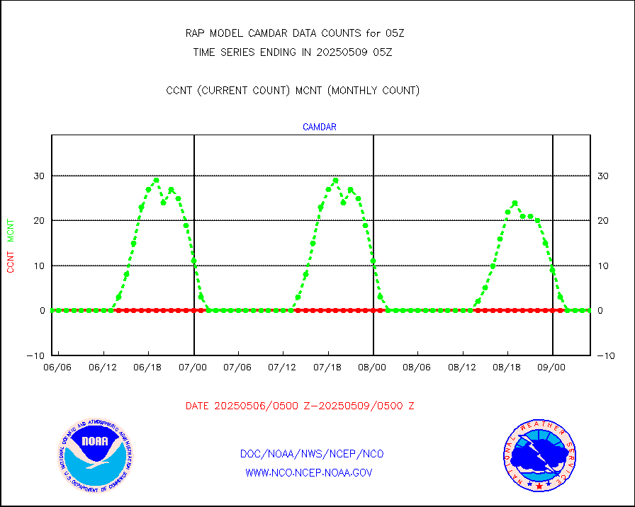
amdar |
AMDAR aircraft data (decoded from AMDAR format) |
2633 |
1489 |
176.8 % |
0101.75-0108.25 |
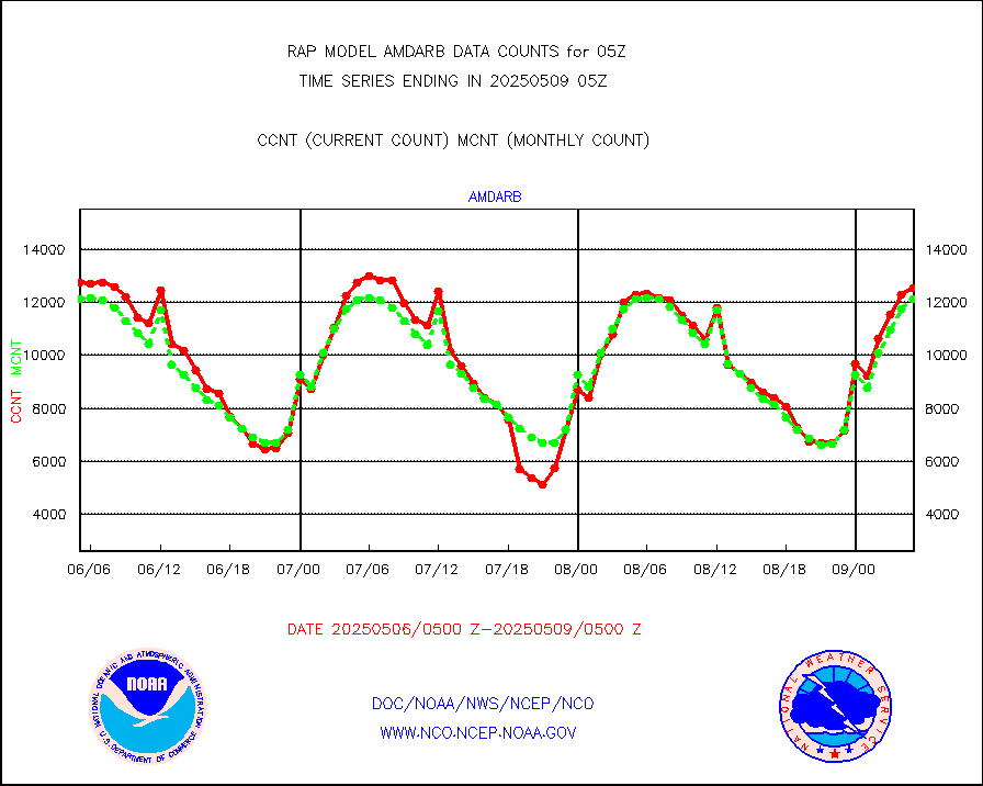
amdarb |
AMDAR aircraft data (decoded from BUFR) |
6019 |
6326 |
95.1 % |
0101.75-0108.25 |
amsr2 |
GCOM-W AMSR2 1B brightness temperatures |
997047 |
560510 |
177.9 % |
0102.00-0102.99 |
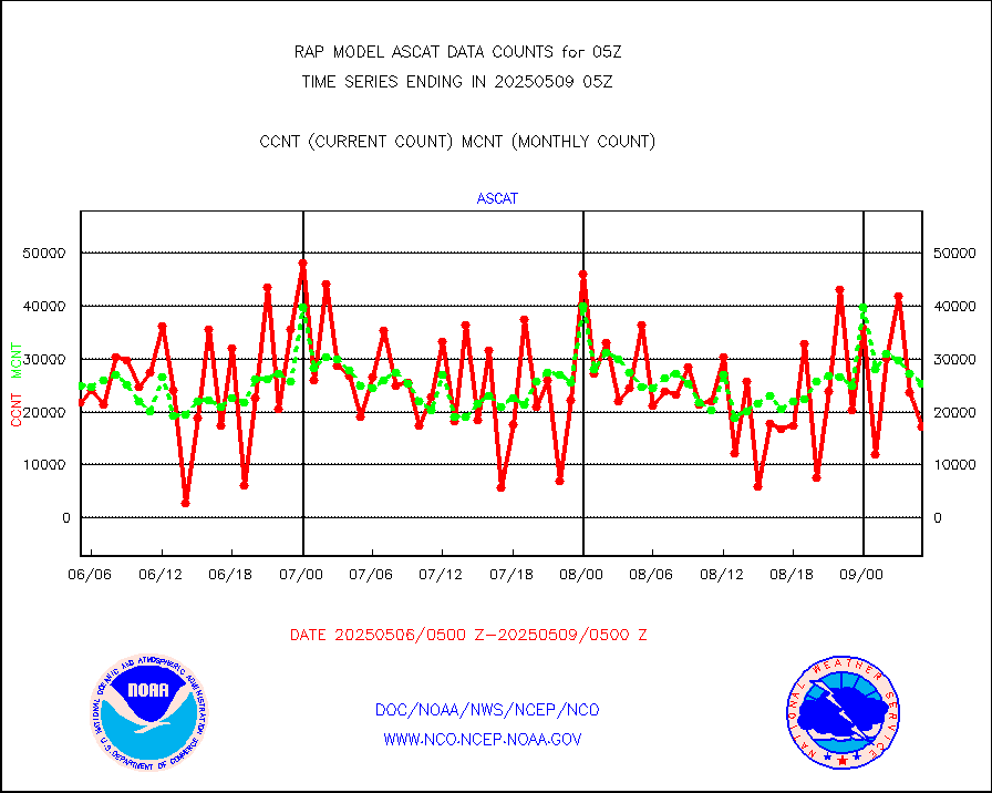
ascat |
METOP 1-2 ASCAT products |
34005 |
20116 |
169.0 % |
0103.00-0107.00 |
atms |
NPP/NOAA-20 ATMS brightness temperatures |
143284 |
136412 |
105.0 % |
0103.00-0106.99 |
atmsdb |
NPP/NOAA-20 ATMS bright. temps-direct b-cast SSEC |
34107 |
26306 |
129.7 % |
0103.00-0106.99 |
coopmd |
Coop/MADIS NEPP & HCN-Modernization NOAA COOP Obs |
27 |
24 |
112.5 % |
0104.50-0105.50 |
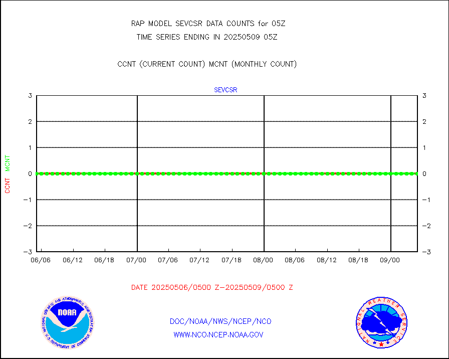
crisf4 |
NPP/NOAA-20 CrIS full spctrl radn (431 ch subset) |
103956 |
80808 |
128.6 % |
0103.00-0106.99 |
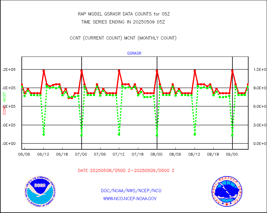
crsfdb |
NPP/NOAA-20 CrIS full spctrl radn dir brdcst SSEC |
85155 |
73269 |
116.2 % |
0103.00-0106.99 |
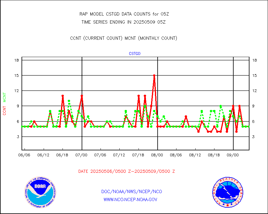
cstgd |
Coast Guard |
4 |
4 |
100.0 % |
0104.50-0105.50 |
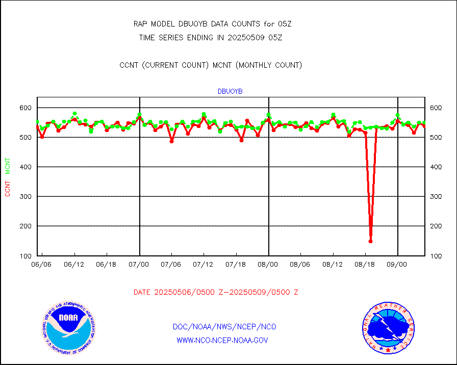
dbuoyb |
Drifting buoys (decoded from BUFR) |
583 |
596 |
97.8 % |
0104.50-0105.50 |
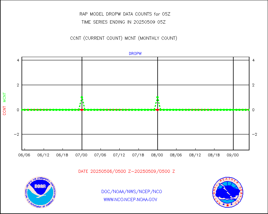
dropw |
Dropwinsonde (from TEMP DROP) |
0 |
0 |
n/a |
0104.00-0106.00 |
eadas |
E-AMDAR (European AMDAR acft decoded from BUFR) |
4010 |
3974 |
100.9 % |
0101.75-0108.25 |
esamua |
NOAA 15-19 & METOP 1-2 AMSU-A proc btmps frm RARS |
16440 |
17440 |
94.3 % |
0104.00-0106.00 |
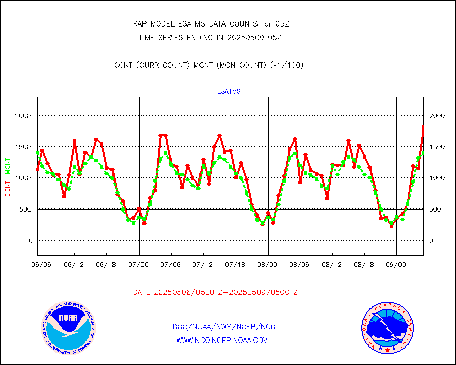
esatms |
NPP Adv. Tech. MW Sndr (ATMS) br. temps from RARS |
157490 |
140724 |
111.9 % |
0103.00-0106.99 |
eshrs3 |
NOAA 15-19 & METOP 1-2 HIRS-3/4 pr btmps frm RARS |
27804 |
39595 |
70.2 % |
0104.00-0106.00 |
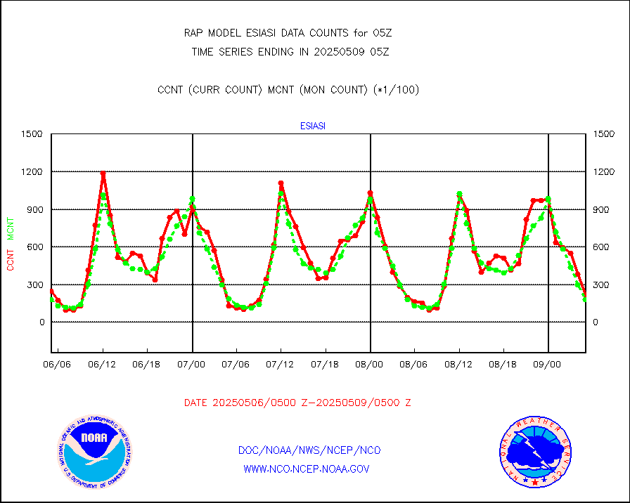
esiasi |
METOP 1-2 IASI 1C radiance data vbl chn from RARS |
39842 |
29986 |
132.9 % |
0103.00-0106.99 |
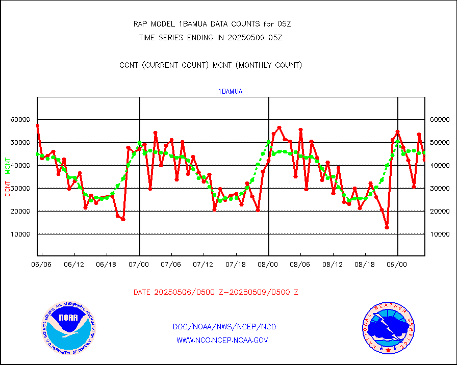
esmhs |
NOAA 18-19 & METOP 1-2 MHS proc. btemps from RARS |
69398 |
119666 |
58.0 % |
0104.00-0106.00 |
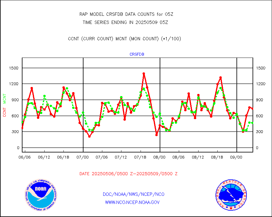
gmi1cr |
GPM GMI Level 1C-R brightness temperatures |
399192 |
913110 |
43.7 % |
0102.00-0107.99 |
gpsro |
GPS radio occultation data |
139 |
115 |
120.9 % |
0103.00-0106.99 |
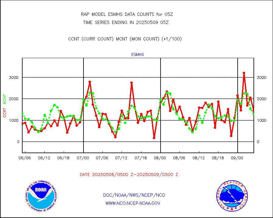
gsrasr |
GOES-16/17 All Sky Radiances (proc.) |
959751 |
950041 |
101.0 % |
0103.00-0106.99 |
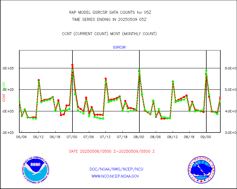
gsrcsr |
GOES-16/17 Clear Sky Radiances (proc.) |
441447 |
438692 |
100.6 % |
0103.00-0106.99 |
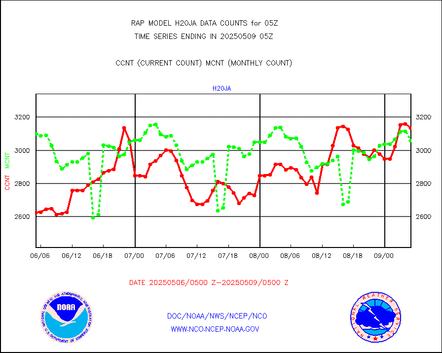
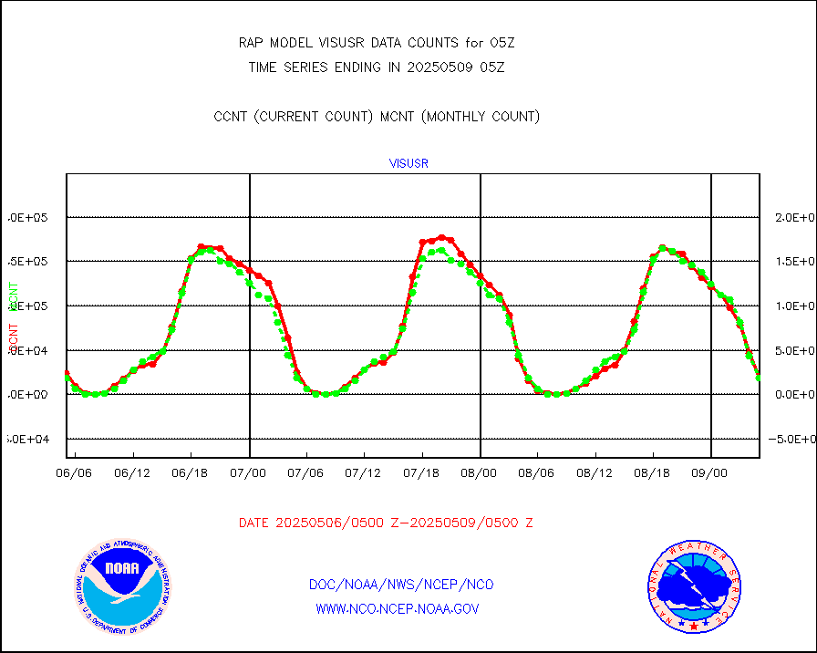
h20ja |
MTSAT/JMA water vapor imager derived cloud motion |
3927 |
3029 |
129.6 % |
0102.50-0107.50 |
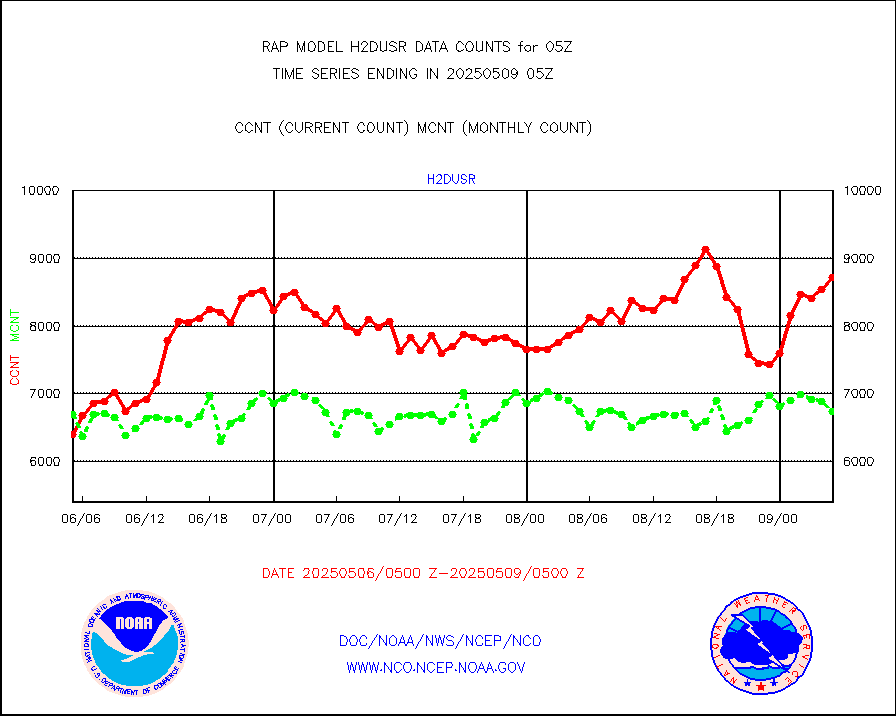
h2dusr |
GOES-16&up/NESDIS wv imgr/deep-lyr derivd cld mtn |
8249 |
6326 |
130.4 % |
0104.00-0104.99 |
h2eunb |
METEOSAT/EUMETSAT wvpr imgr drv cld motion NBseq |
5478 |
4694 |
116.7 % |
0103.50-0106.49 |
h2tusr |
GOES-16&up/NESDIS wv imgr/cld-top derived cld mtn |
12153 |
11146 |
109.0 % |
0104.00-0104.99 |
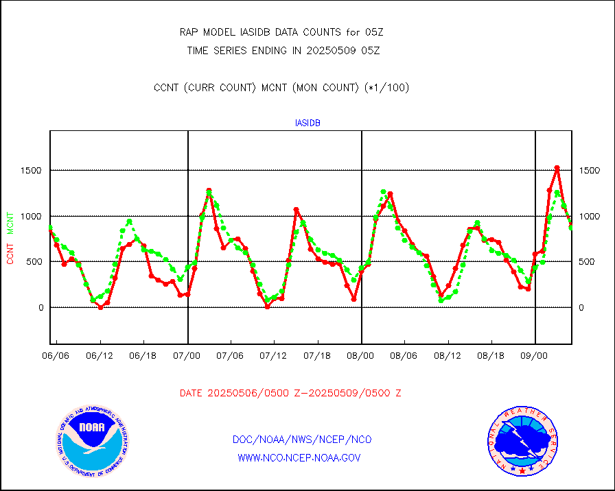
iasidb |
METOP 1-2 IASI 1C radiances-direct broadcast SSEC |
87648 |
71824 |
122.0 % |
0103.00-0106.99 |
ifeunb |
METEOSAT/EUMETSAT ir lg-wave drv cld motion NBseq |
3492 |
2984 |
117.0 % |
0103.50-0106.49 |
ifvrnb |
VIIRS (NPP/NOAA-20) ir lg-wv drv cloud motion(NB) |
0 |
0 |
n/a |
0102.50-0107.50 |
infav |
AVHRR (NOAA/METOP) ir lg-wave derived cld motion |
0 |
0 |
n/a |
0102.50-0107.50 |
infav1 |
AVHRR (METOP) ir lg-wave derived cld motion |
0 |
0 |
n/a |
0103.50-0106.49 |
infja |
MTSAT/JMA infrared long-wave derived cloud motion |
2356 |
2487 |
94.7 % |
0102.50-0107.50 |
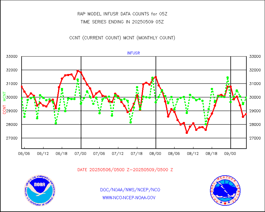
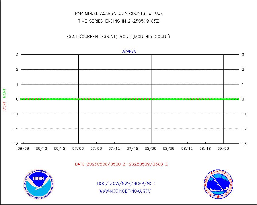
infusr |
GOES-16&up/NESDIS ir long-wave derived cld motion |
29652 |
30461 |
97.3 % |
0104.00-0104.99 |
kamdar |
Korean AMDAR aircraft data (decoded from BUFR) |
251 |
301 |
83.4 % |
0101.75-0108.25 |
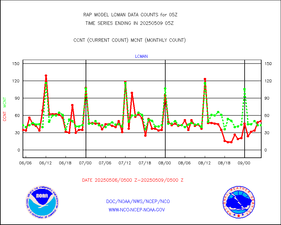
lcman |
Land-based CMAN stations decoded from CMAN format |
72 |
77 |
93.5 % |
0104.50-0105.50 |
ltnglr |
LLDN Long-rng lightning from Vaisala via NOAAPORT |
120104 |
53362 |
225.1 % |
0104.00-0105.50 |
ltngsr |
NLDN Shrt-rng lightning from Vaisala via NOAAPORT |
4288 |
2826 |
151.7 % |
0104.00-0105.50 |
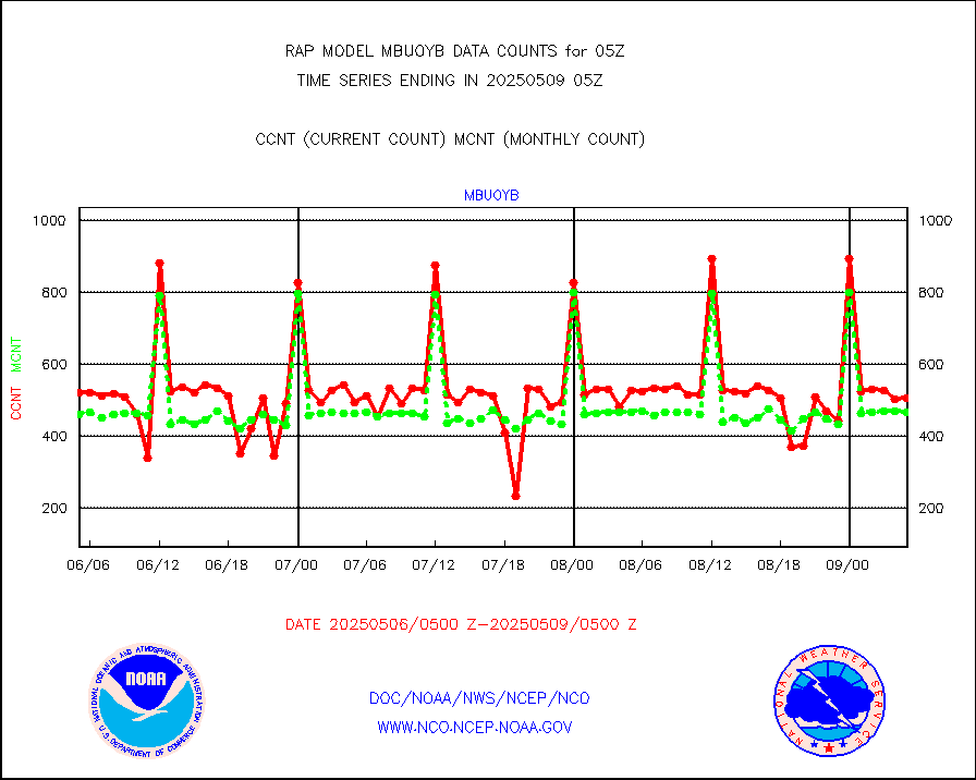
mbuoyb |
Moored buoys (decoded from BUFR) |
610 |
478 |
127.6 % |
0104.50-0105.50 |
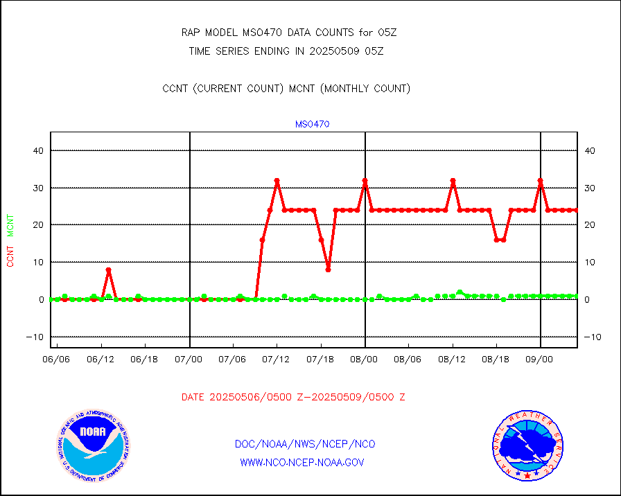
mso470 |
Mesonet/MADIS Colorado E-470 (Interstate 470) |
21 |
18 |
116.7 % |
0104.50-0105.50 |
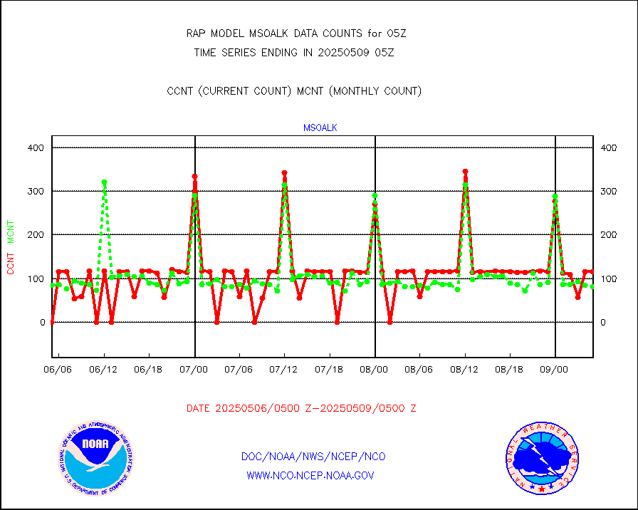
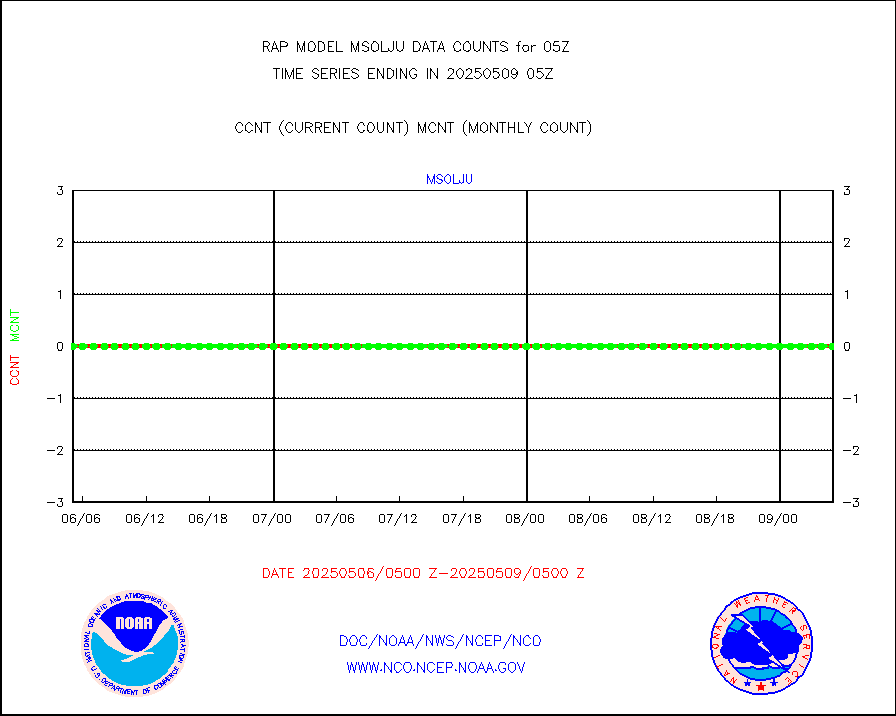
msoalk |
Mesonet/MADIS Alaska Department of Transportation |
106 |
100 |
106.0 % |
0104.50-0105.50 |
msoapg |
Mesonet/MADIS U.S. Army Aberdeen Proving Grounds |
0 |
0 |
n/a |
0104.50-0105.50 |
msoapr |
Mesonet/MADIS Citizen Weather Observers Program |
46248 |
43347 |
106.7 % |
0104.50-0105.50 |
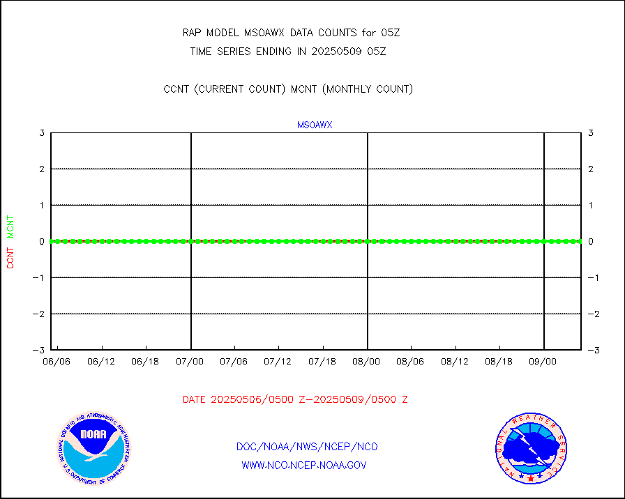
msoaws |
Mesonet/MADIS AWS Convergence Technologies, Inc. |
25760 |
25381 |
101.5 % |
0104.50-0105.50 |
msoawx |
Mesonet/MADIS "Anything Weather" |
0 |
0 |
n/a |
0104.50-0105.50 |
msocol |
Mesonet/MADIS Colorado Dept. of Transportation |
0 |
0 |
n/a |
0104.50-0105.50 |
msodcn |
Mesonet/MADIS DC Net |
0 |
0 |
n/a |
0104.50-0105.50 |
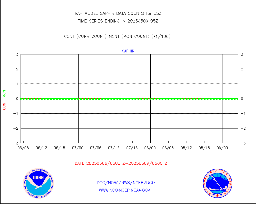
msoden |
Mesonet/MADIS Denver Urban Drainage & Flood Cntrl |
225 |
203 |
110.8 % |
0104.50-0105.50 |
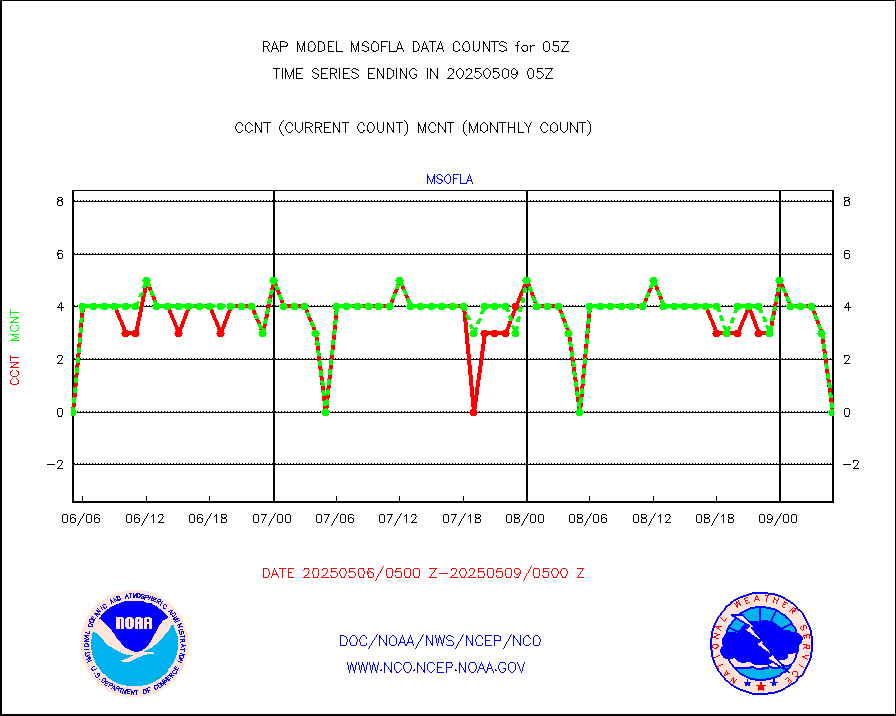
msofla |
Mesonet/MADIS Florida (FAWN & USF) |
0 |
0 |
n/a |
0104.50-0105.50 |
msoflt |
Mesonet/MADIS Florida Dept. of Transportation |
0 |
0 |
n/a |
0104.50-0105.50 |
msogeo |
Mesonet/MADIS Georgia Dept. of Transportation |
0 |
0 |
n/a |
0104.50-0105.50 |
msohad |
Mesonet/MADIS NWS Hydromet Auto Data System(HADS) |
5866 |
5437 |
107.9 % |
0104.50-0105.50 |
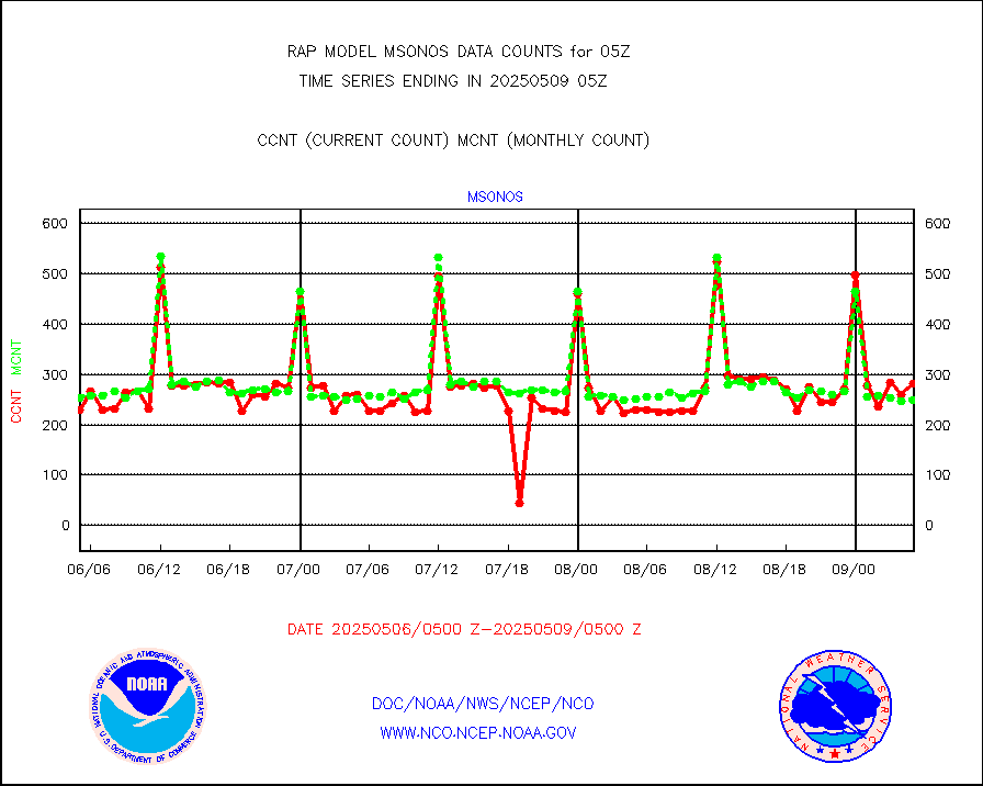
msoien |
Mesonet/MADIS Iowa Environmental |
167 |
167 |
100.0 % |
0104.50-0105.50 |
msoind |
Mesonet/MADIS Indiana Dept. of Transportation |
0 |
0 |
n/a |
0104.50-0105.50 |
msoiow |
Mesonet/MADIS Iowa Department of Transportation |
0 |
0 |
n/a |
0104.50-0105.50 |
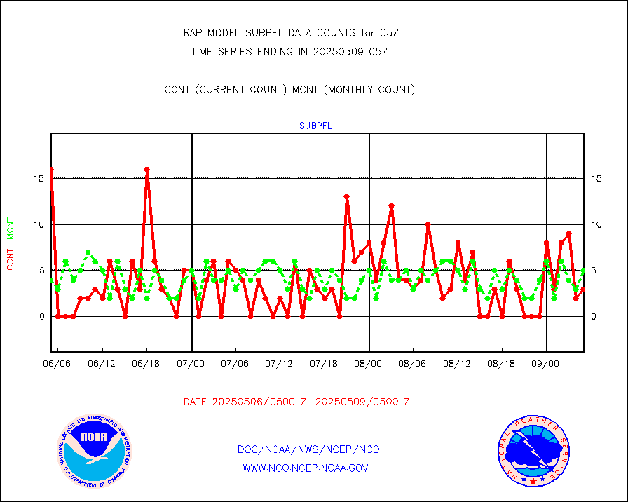
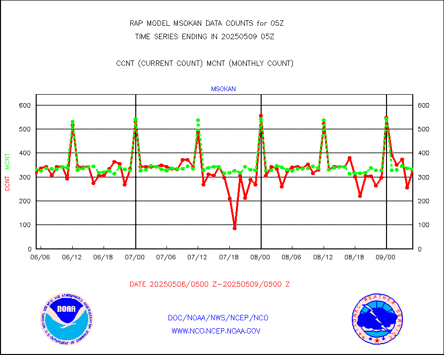
msokan |
Mesonet/MADIS Kansas Department of Transportation |
384 |
323 |
118.9 % |
0104.50-0105.50 |
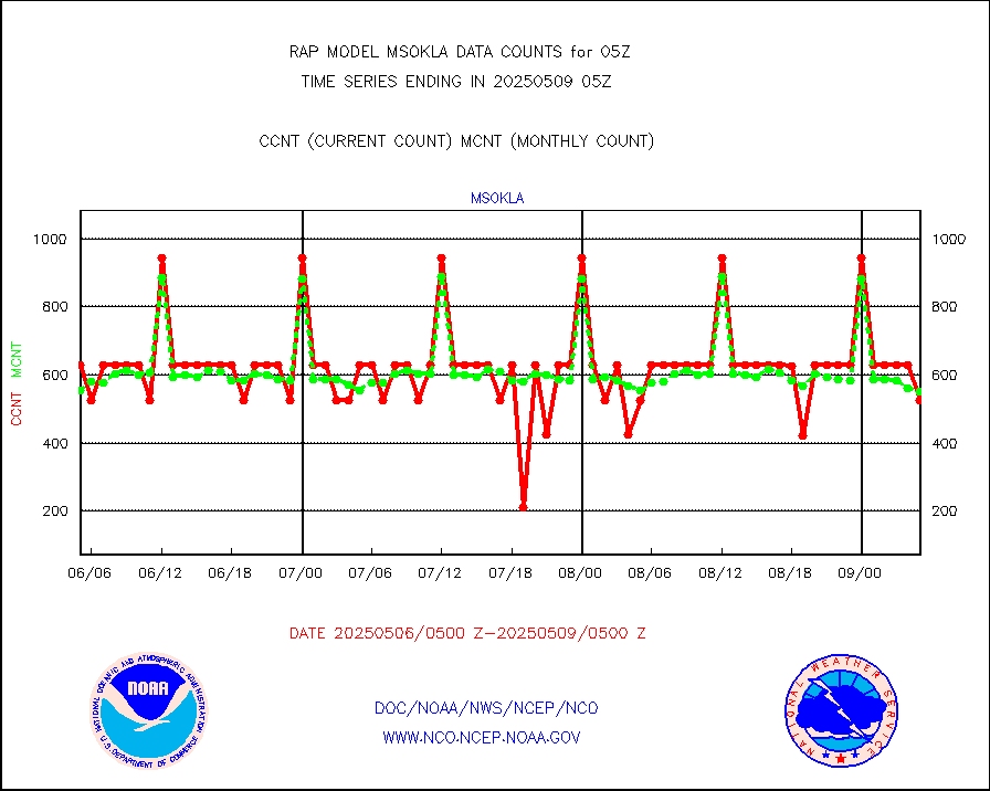
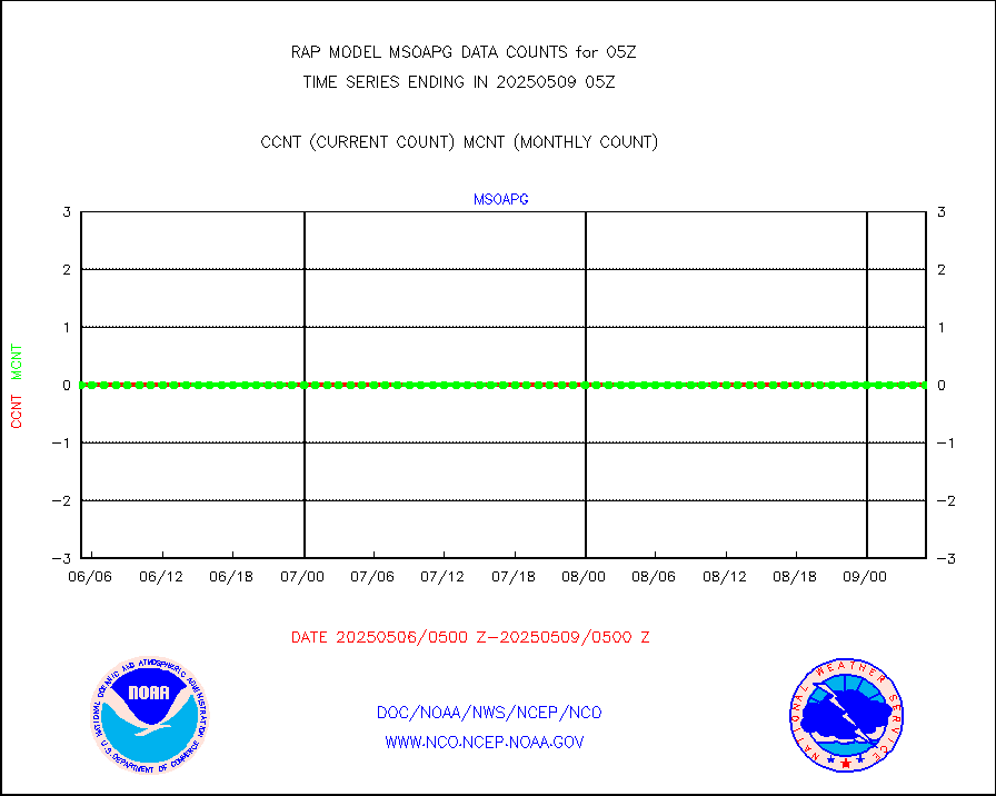
msokla |
Mesonet/MADIS Oklahoma Mesonet |
318 |
329 |
96.7 % |
0104.50-0105.50 |
msolju |
Mesonet/MADIS Louisiana State/Jackson State Univ. |
0 |
0 |
n/a |
0104.50-0105.50 |
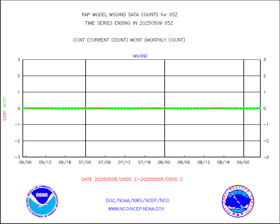
msomca |
Mesonet/MADIS Missouri Commercial Agricult Wx Net |
247 |
255 |
96.9 % |
0104.50-0105.50 |
msomin |
Mesonet/MADIS Minnesota Dept. of Transportation |
0 |
0 |
n/a |
0104.50-0105.50 |
msonos |
Mesonet/MADIS NOS-Phys Oceanographic Realtime Sys |
285 |
274 |
104.0 % |
0104.50-0105.50 |
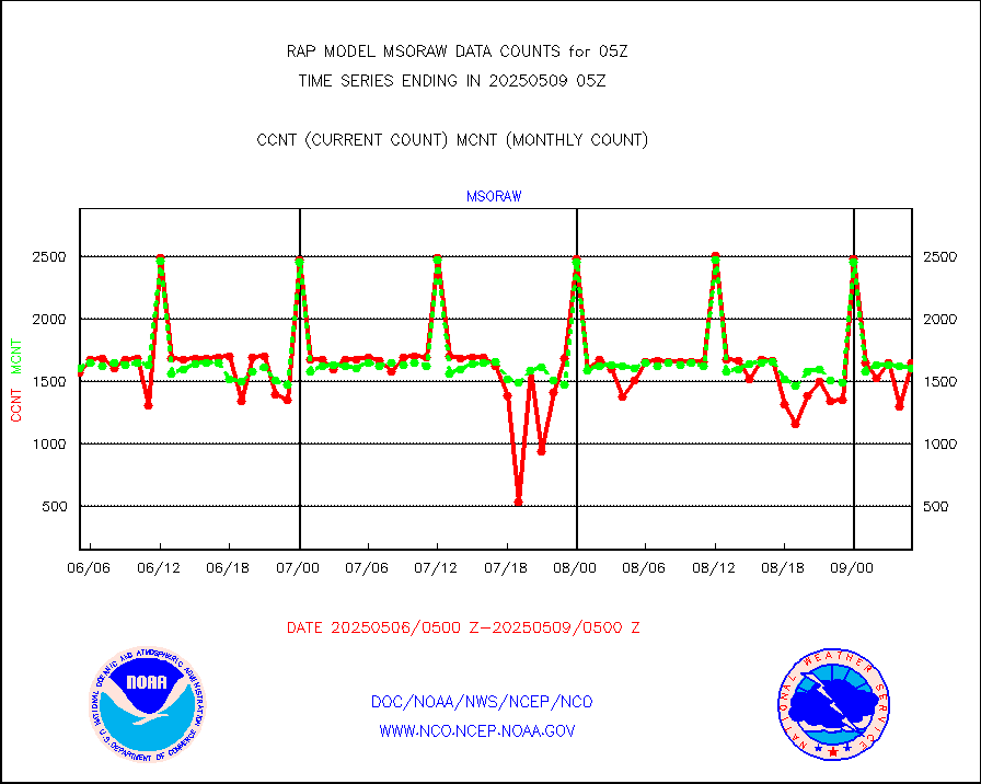
msoraw |
Mesonet/MADIS NFIC Remote Automated Wx Stns(RAWS) |
1671 |
1472 |
113.5 % |
0104.50-0105.50 |
msourb |
Mesonet/MADIS UrbaNet |
3977 |
3902 |
101.9 % |
0104.50-0105.50 |
msovir |
Mesonet/MADIS Virginia Dept. of Transportation |
232 |
234 |
99.1 % |
0104.50-0105.50 |
msowfy |
Mesonet/MADIS "Weather for You" |
0 |
0 |
n/a |
0104.50-0105.50 |
msowis |
Mesonet/MADIS Wisconsin Dept. of Transportation |
0 |
0 |
n/a |
0104.50-0105.50 |
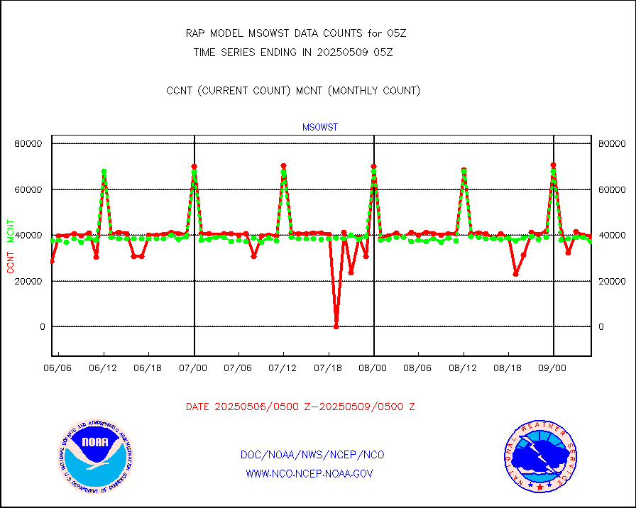
msowst |
Mesonet/MADIS MesoWest (many subproviders) |
41348 |
38693 |
106.9 % |
0104.50-0105.50 |
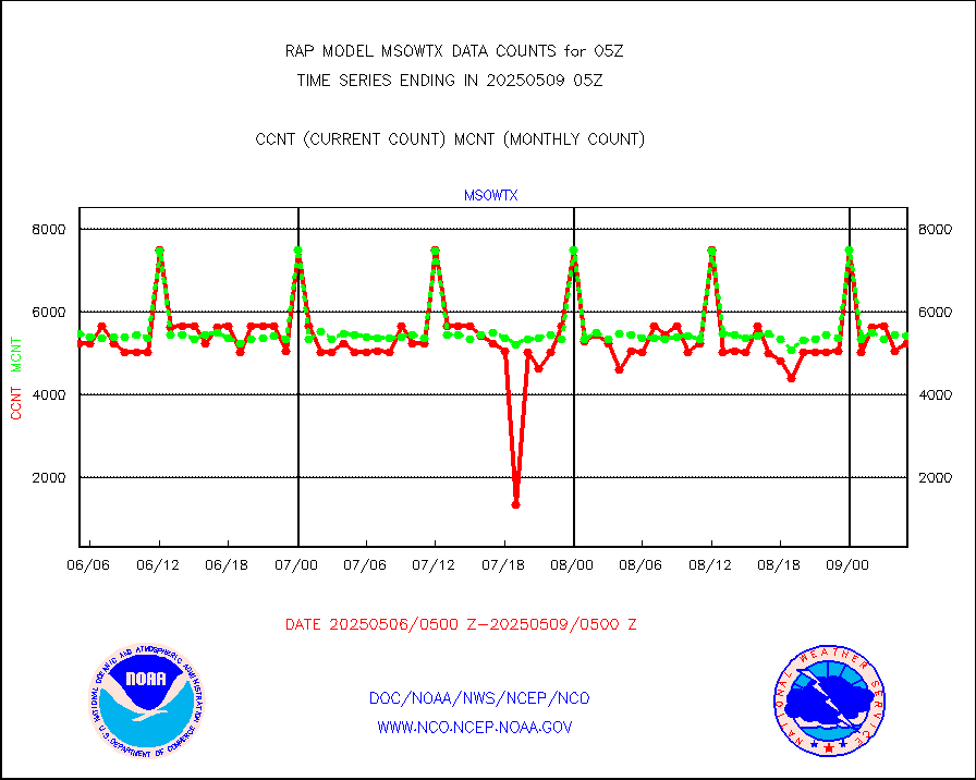
msowtx |
Mesonet/MADIS West Texas |
5033 |
4899 |
102.7 % |
0104.50-0105.50 |
mtiasi |
METOP 1-2 IASI 1C radiance data (varbl. channels) |
39969 |
36205 |
110.4 % |
0103.00-0106.99 |
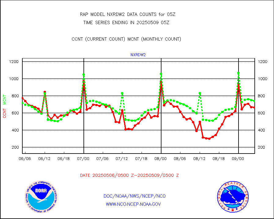
nxrdw2 |
NEXRAD Vel Azm Dsp(VAD) winds via Level 2 decoder |
774 |
777 |
99.6 % |
0104.00-0106.00 |
osbuv8 |
NOAA 16-19 Solar Backscatter UV-2 rad frm V8 BUFR |
0 |
0 |
n/a |
0103.00-0105.99 |
pibal |
PIBAL (from PILOT, PILOT SHIP, PILOT MOBIL) |
0 |
0 |
n/a |
0104.00-0106.00 |
pirep |
Manual PIREP aircraft data (dcded from AIREP fmt) |
118 |
140 |
84.3 % |
0101.75-0108.25 |
prflrp |
Profilr winds from PIBAL (PILOT,PILOT SHIP/MOBIL) |
0 |
0 |
n/a |
0103.50-0106.50 |
raobm |
Rawinsonde - mobile land (from TEMP/PILOT MOBIL) |
0 |
0 |
n/a |
0104.00-0106.00 |
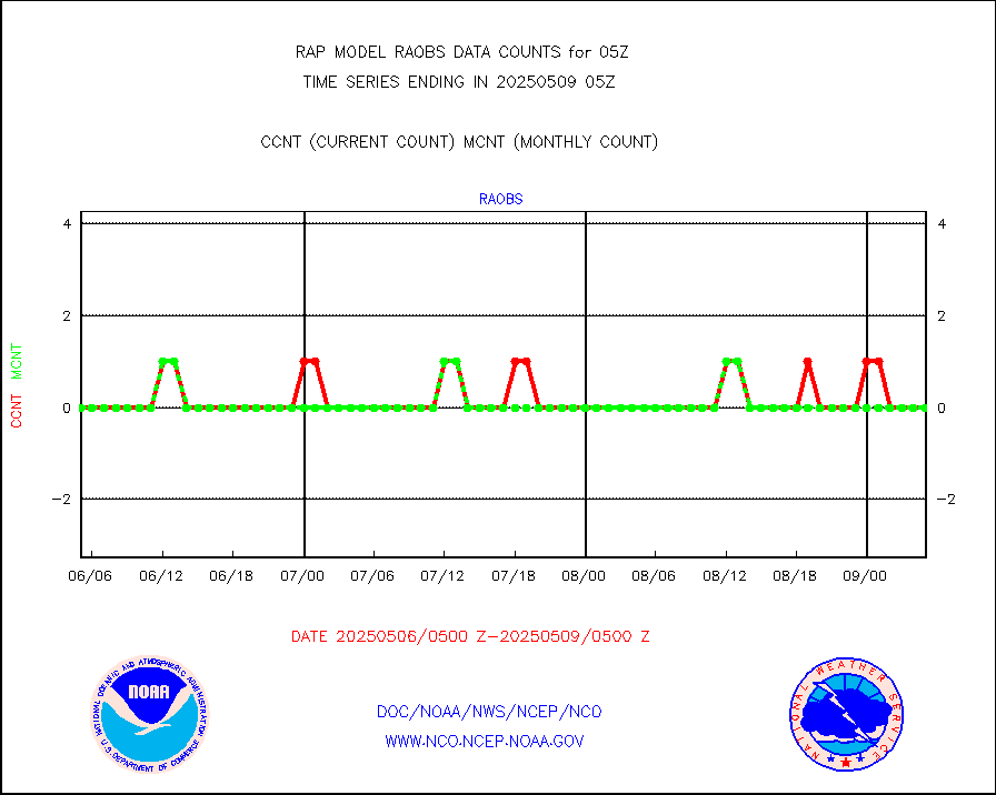
raobs |
Rawinsonde - ship (from TEMP SHIP, PILOT SHIP) |
0 |
0 |
n/a |
0104.00-0106.00 |
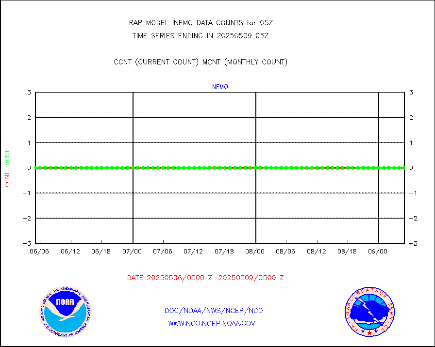
rd2wnd |
NEXRAD radial wind (Level 2 - GTS) |
906855 |
889123 |
102.0 % |
0104.50-0105.49 |
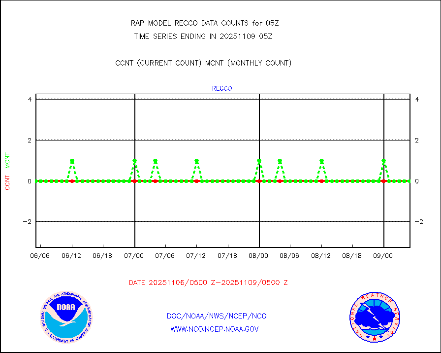
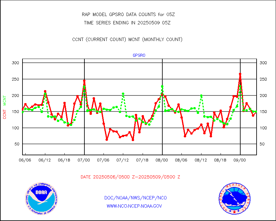
recco |
Flight level reconnaissance aircraft data |
0 |
0 |
n/a |
0104.00-0106.00 |
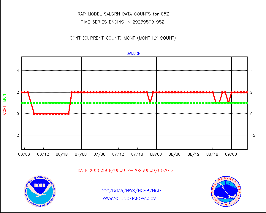
saldrn |
Surface Marine Saildrone (decoded from BUFR) |
2 |
2 |
100.0 % |
0103.00-0106.99 |
saphir |
Megha-Tropiques SAPHIR L1A2 brightness temps |
0 |
0 |
n/a |
0102.00-0107.99 |
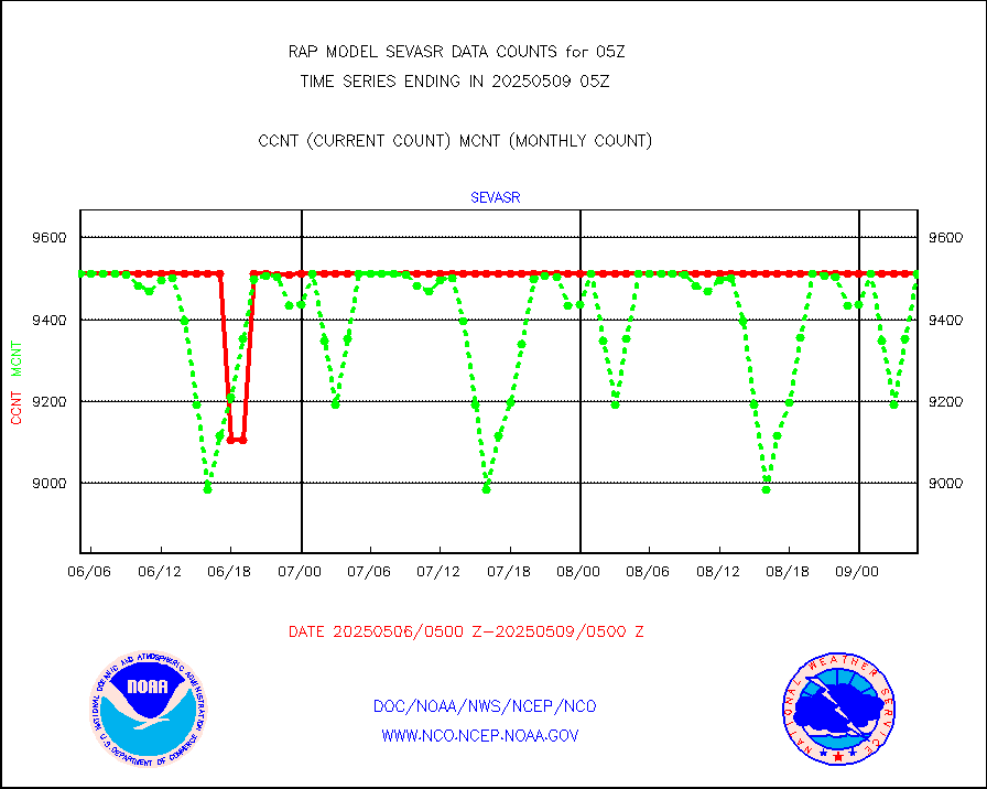
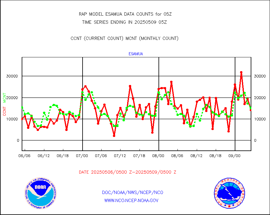
sevasr |
METEOSAT-10 2nd Gen SEVIRI All Sky Radiance(proc) |
9512 |
8878 |
107.1 % |
0103.00-0106.99 |
sevcsr |
METEOSAT-10 2nd Gen SEVIRI Clr Sky Radiance(proc) |
0 |
0 |
n/a |
0103.00-0106.99 |
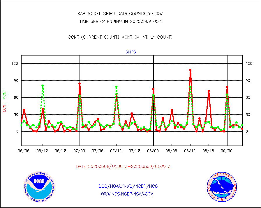
ships |
Ship - manual and automatic, restricted |
4 |
4 |
100.0 % |
0104.50-0105.50 |
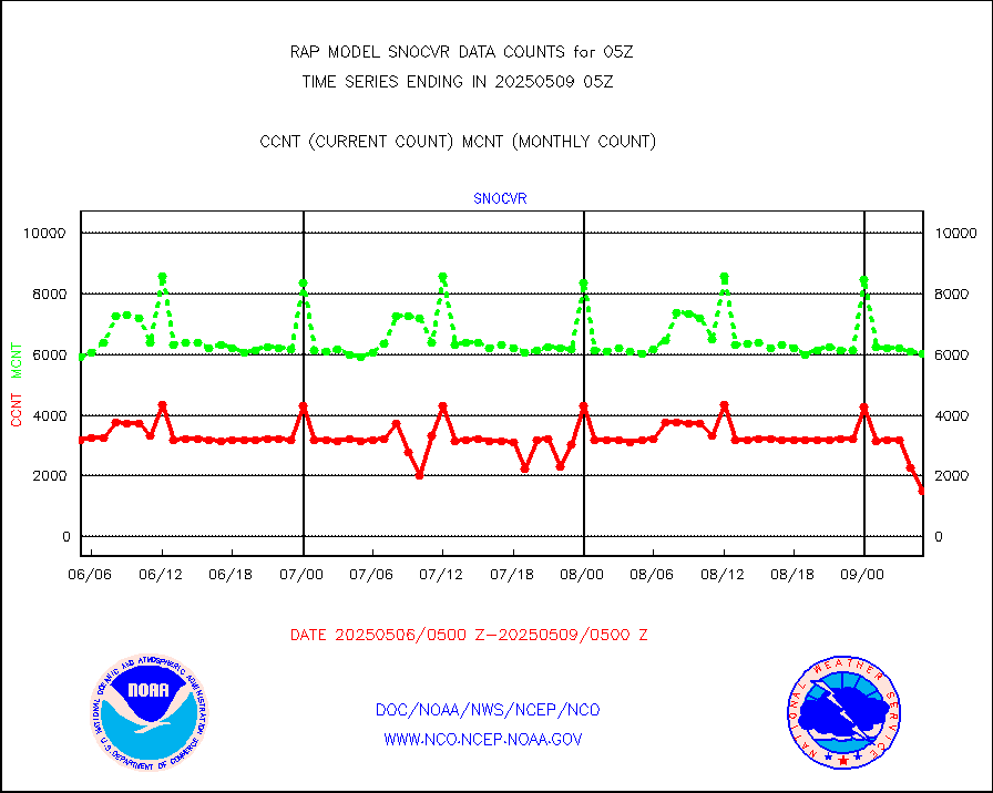
snocvr |
NOW COVER, DEPTH/DENSITY AND WATER EQUIVALENT |
3084 |
5981 |
51.6 % |
0103.00-0107.00 |
ssmisu |
DMSP SSM/IS 1C radiance data (Unified Pre-Proc.) |
25584 |
44583 |
57.4 % |
0103.00-0106.99 |
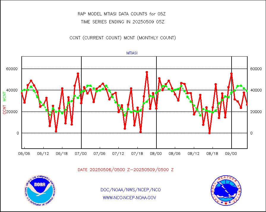
subpfl |
Sub-surface float and glider profile (BUFR) |
6 |
8 |
75.0 % |
0103.00-0106.99 |
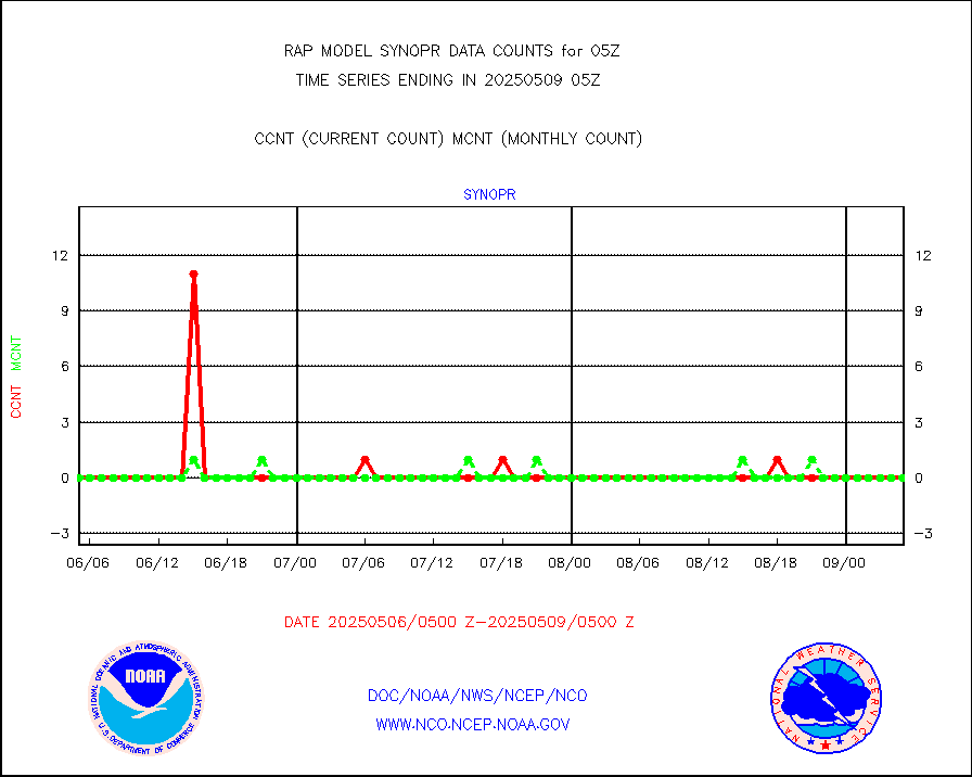
synopr |
Synoptic - restricted (WMO Res 40) manual & auto. |
0 |
0 |
n/a |
0104.50-0105.50 |
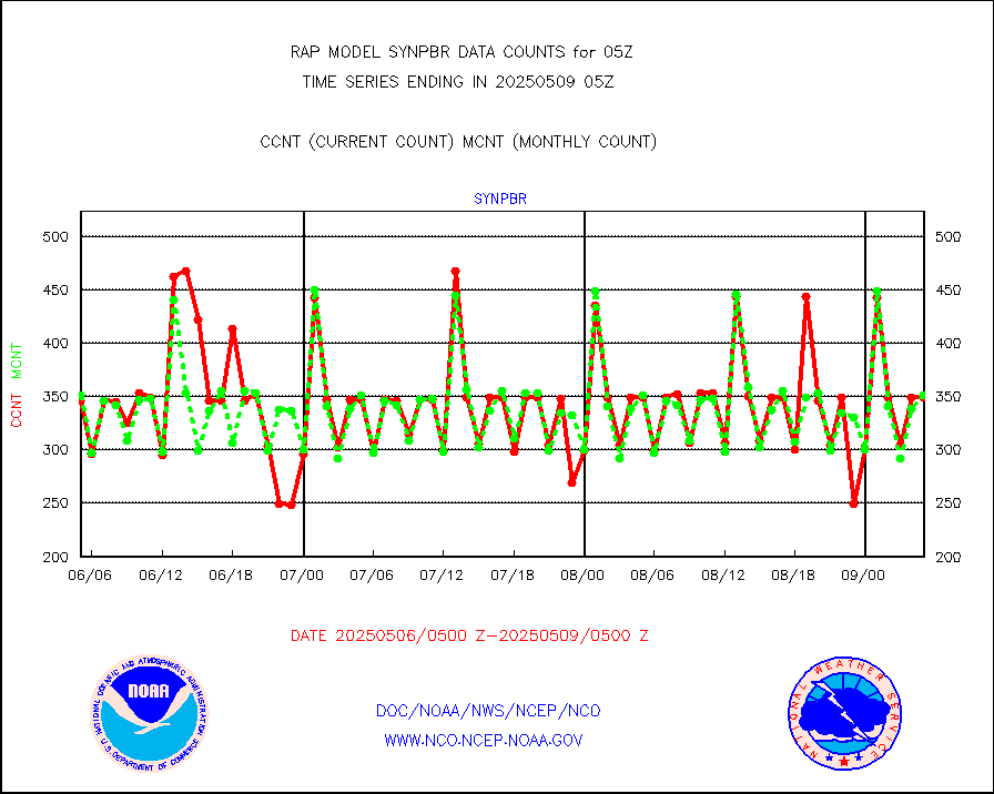
synpbr |
Synoptic - restricted (WMO Res 40)(decoded BUFR) |
341 |
349 |
97.7 % |
0104.50-0105.50 |
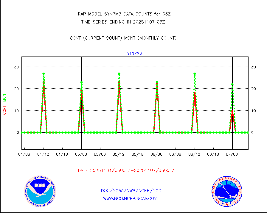
synpmb |
Synoptic - mobile manual & auto (decoded fr BUFR) |
0 |
0 |
n/a |
0104.50-0105.50 |
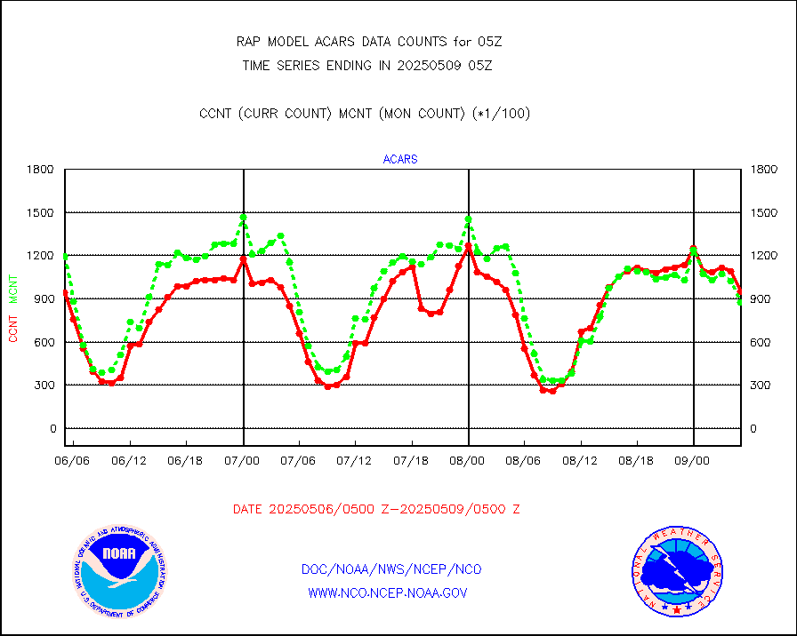
tmdara |
TAMDAR aircft data-all types(from Panasonic,BUFR) |
1289 |
1511 |
85.3 % |
0101.75-0108.25 |
visja |
MTSAT/JMA visible derived cloud motion |
1226 |
1523 |
80.5 % |
0102.50-0107.50 |
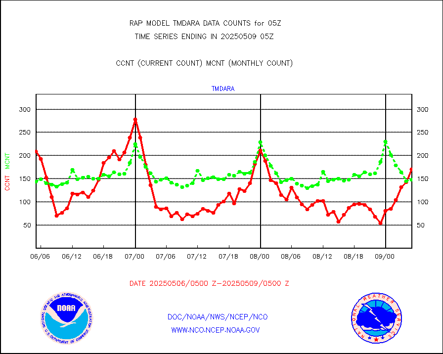
visusr |
GOES-16&up/NESDIS visible derived cloud motion |
16674 |
20407 |
81.7 % |
0104.00-0104.99 |
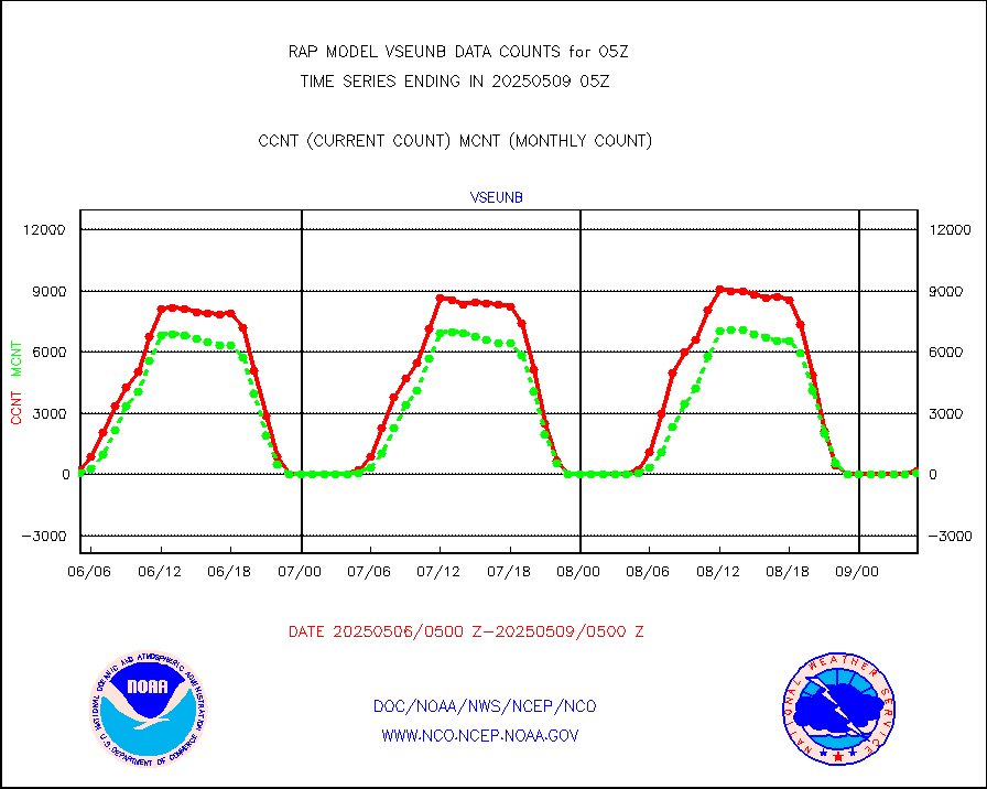
vseunb |
METEOSAT/EUMETSAT visible drv cld motion NBseq |
81 |
46 |
176.1 % |
0103.50-0106.49 |


