| Critical Data with Normal Counts |
|---|
| Type | Description | Hourly Count | Monthly Average | Percent (%) of Monthly Mean | UTC Time Window |
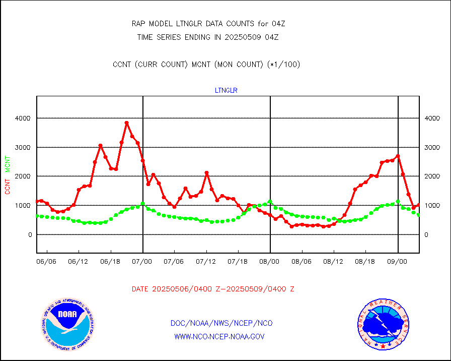
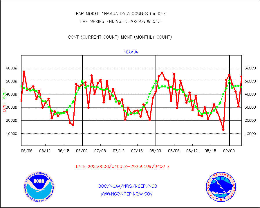
1bamua |
NOAA 15-19 & METOP 1-2 AMSU-A NCEP-proc. br.temps |
49981 |
47829 |
104.5 % |
2601.00-2606.99 |
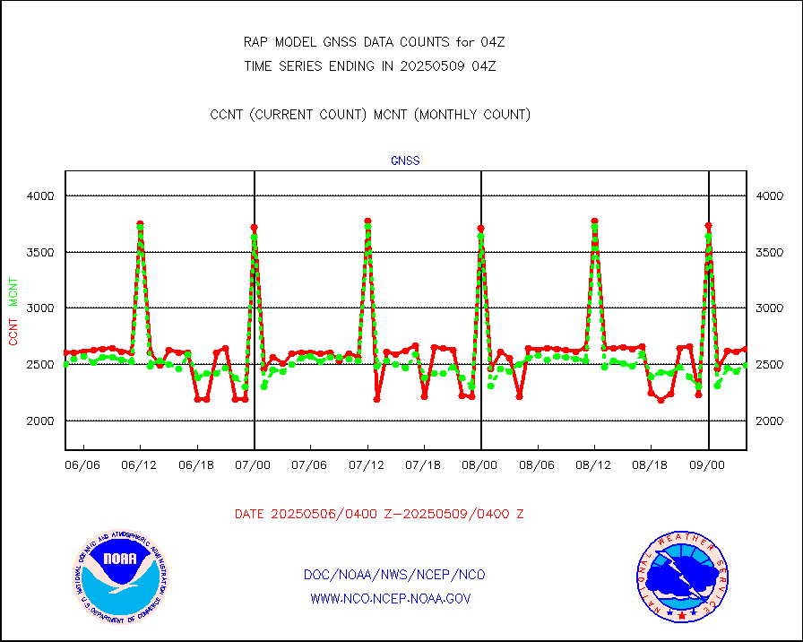
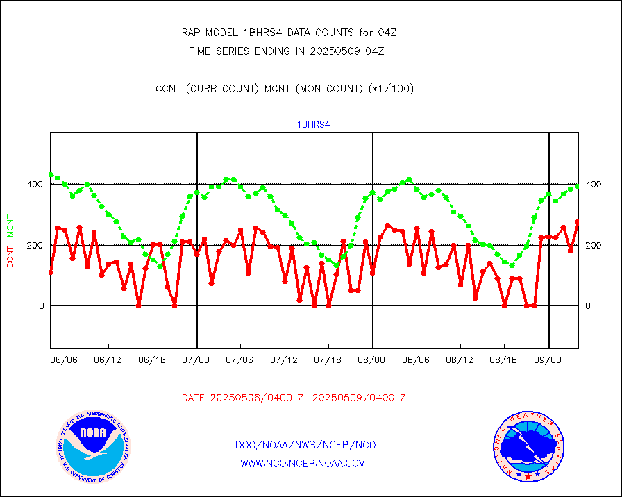
1bhrs4 |
NOAA 18-19 & METOP 1-2 HIRS-4 NCEP-proc. br.temps |
47003 |
44533 |
105.5 % |
2601.00-2606.99 |
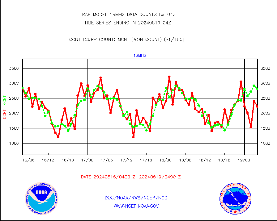
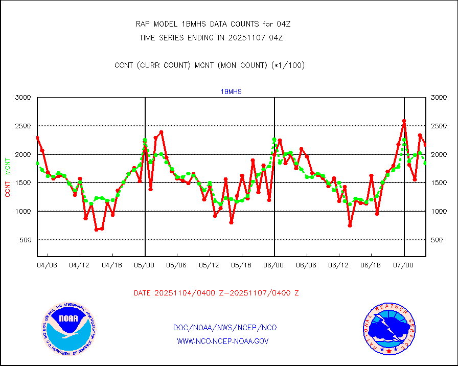
1bmhs |
NOAA 18-19 & METOP 1-2 MHS NCEP-proces. br. temps |
294210 |
283146 |
103.9 % |
2601.00-2606.99 |
acars |
MDCRS ACARS acft data from ARINC(dcded from BUFR) |
93190 |
77567 |
120.1 % |
2600.75-2607.25 |
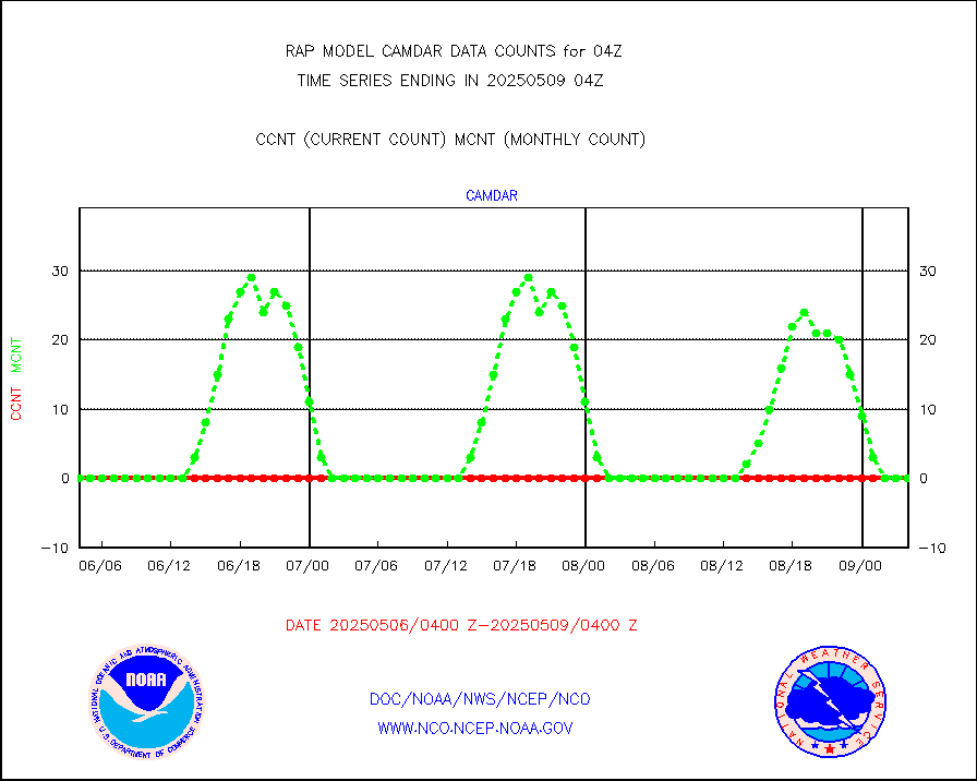
camdar |
Canadian AMDAR aircraft data (decoded from BUFR) |
0 |
11 |
0.0 % |
2600.75-2607.25 |
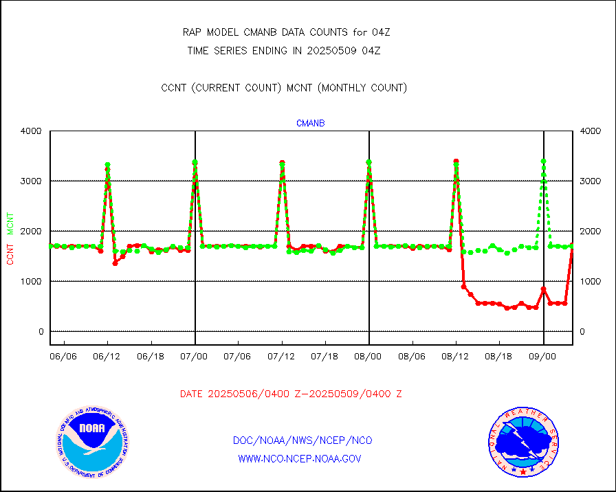
cmanb |
Surface Marine CMAN rpts decoded from BUFR format |
1690 |
1681 |
100.5 % |
2603.50-2604.50 |
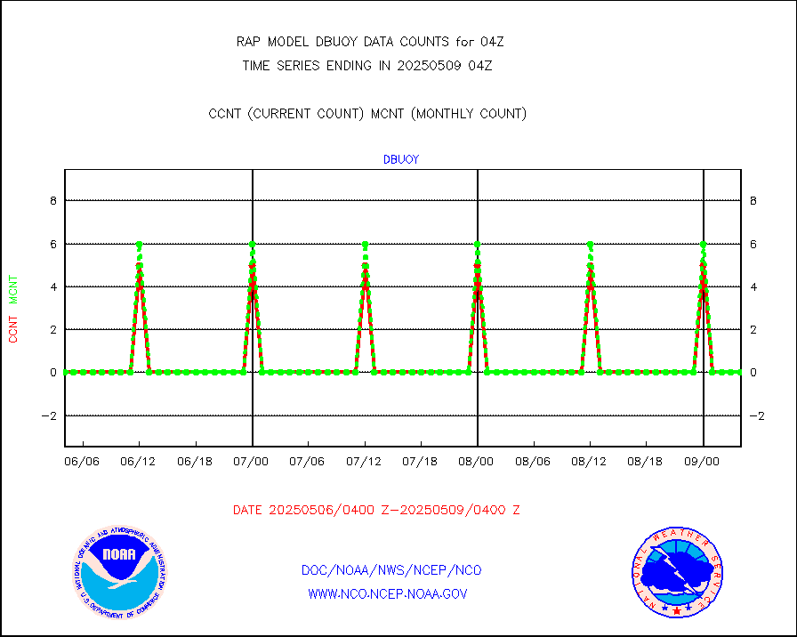
dbuoy |
Buoys decoded from FM-18 fmt (moored or drifting) |
0 |
0 |
n/a |
2603.50-2604.50 |
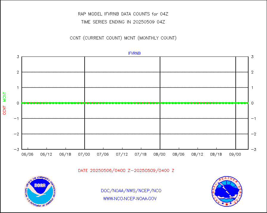
gnss |
Grnd-based Gbl Navigation Sat System (GNSS) data |
994 |
2402 |
41.4 % |
2602.95-2603.05 |
h20mo |
MODIS (AQUA/TERRA) wvpr imager derived cld motion |
0 |
0 |
n/a |
2601.50-2606.50 |
infmo |
MODIS (AQUA/TERRA) ir l-wave derived cloud motion |
0 |
0 |
n/a |
2601.50-2606.50 |
lgycld |
GOES/NASA(Langley) hi-res. (1x1 f-o-v) cloud data |
3717612 |
3338223 |
111.4 % |
2603.50-2604.50 |
mbuoy |
Buoys decoded from FM-13 format (moored) |
59 |
48 |
122.9 % |
2603.50-2604.50 |
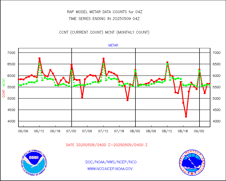
metar |
Aviation - METAR |
5686 |
5743 |
99.0 % |
2603.50-2604.50 |
nxrdw |
NEXRAD Vel Azm Dsp(VAD) winds via radar coded msg |
0 |
0 |
n/a |
2603.00-2605.00 |
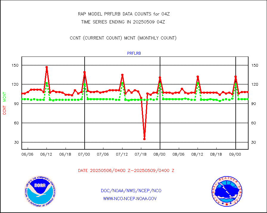
prflrb |
Multi-Agency Profiler (MAP) and SODAR winds |
59 |
84 |
70.2 % |
2602.50-2605.50 |
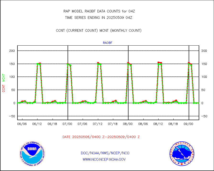
raobf |
Rawinsonde - fixed land (from TEMP or PILOT) |
0 |
0 |
n/a |
2603.00-2605.00 |
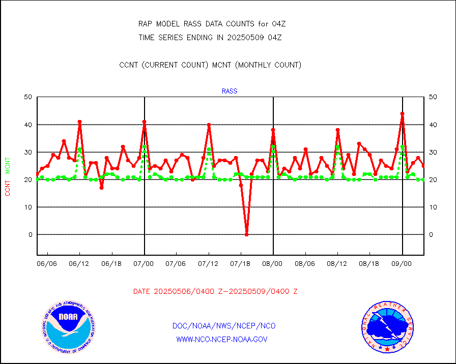
rass |
RASS temperatures (NOAA and Multi-Agency) |
18 |
22 |
81.8 % |
2603.50-2604.50 |
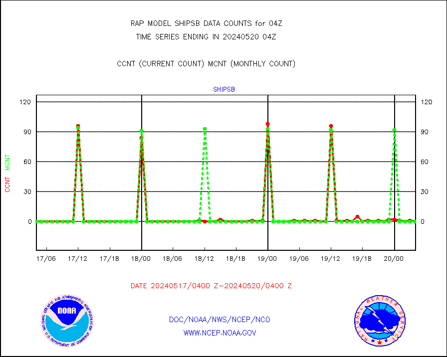
shipsb |
Ship - manual and automatic, restricted (BUFR) |
0 |
0 |
n/a |
2603.50-2604.50 |
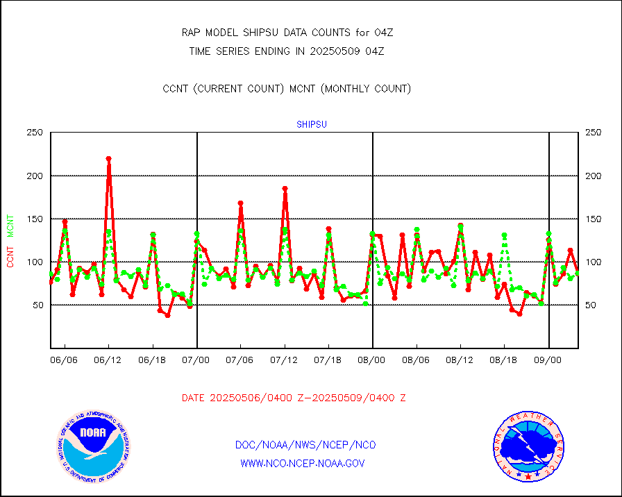
shipsu |
Ship - manual and automatic, unrestricted |
41 |
47 |
87.2 % |
2603.50-2604.50 |
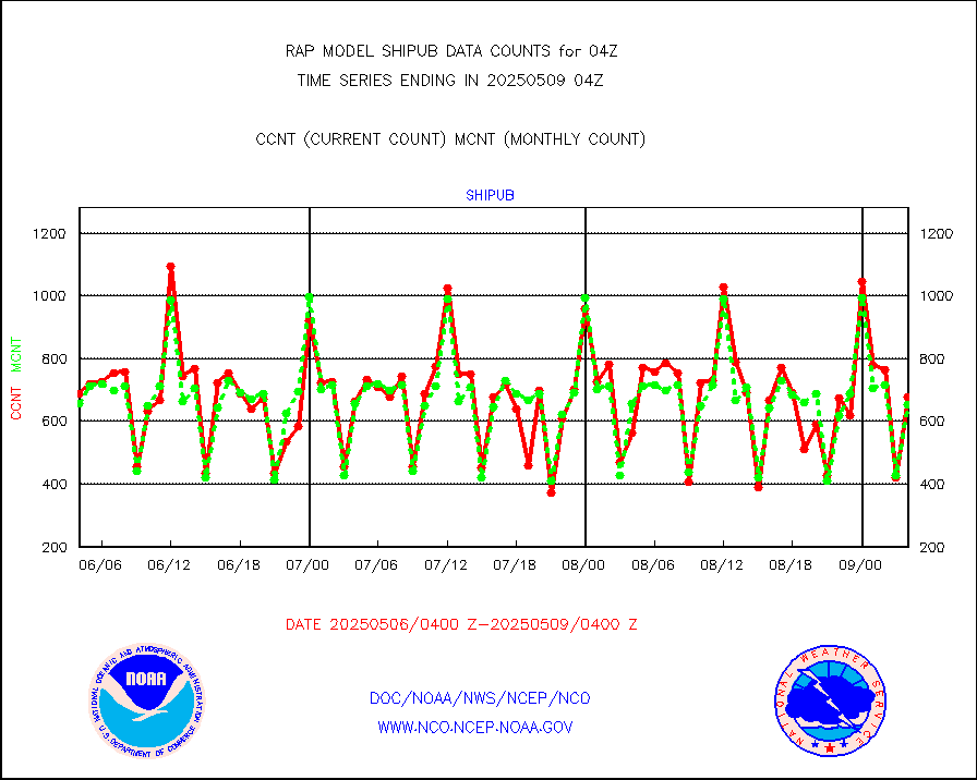
shipub |
Ship - manual and automatic, unrestricted (BUFR) |
531 |
538 |
98.7 % |
2603.50-2604.50 |
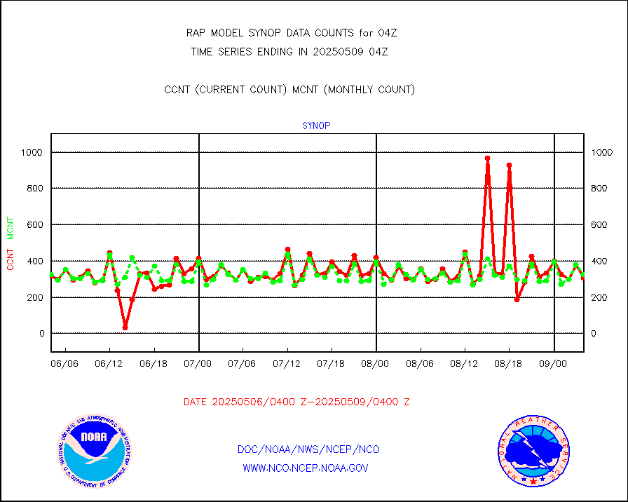
synop |
Synoptic - fixed manual and automatic |
329 |
312 |
105.4 % |
2603.50-2604.50 |
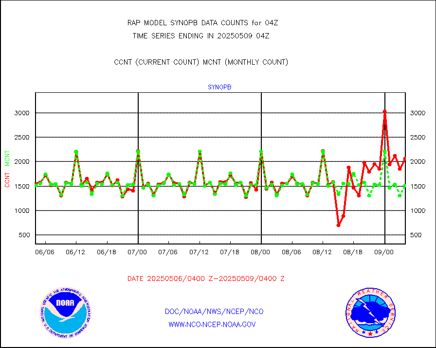
synopb |
Synoptic - fixed manual & auto (decoded fr BUFR) |
1686 |
1622 |
103.9 % |
2603.50-2604.50 |
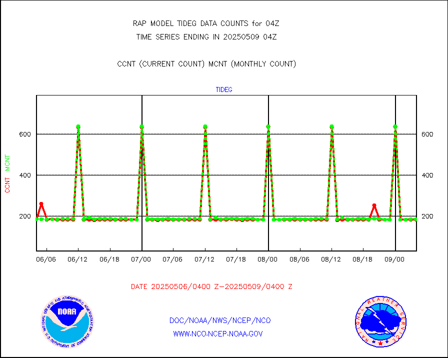
tideg |
Tide gauge reports decoded from CREX format |
181 |
178 |
101.7 % |
2603.50-2604.50 |
| Data Types of Opportunity with Normal Counts |
|---|
| Type | Description | Hourly Count | Monthly Average | Percent (%) of Monthly Mean | UTC Time Window |
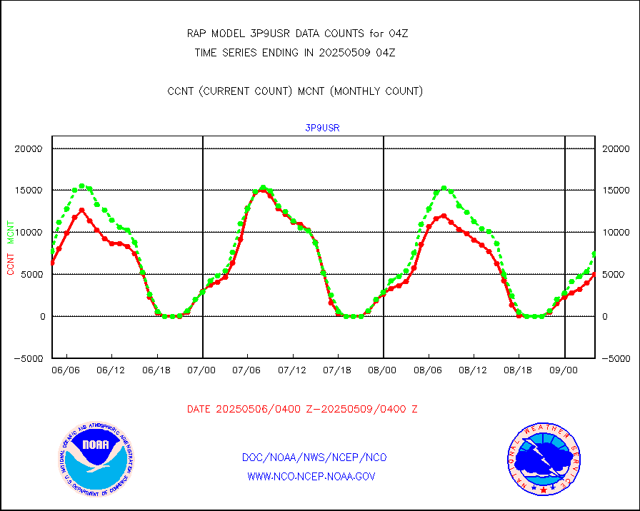
3p9usr |
GOES-16&up/NESDIS ir short-wv derived cld motion |
8619 |
8821 |
97.7 % |
2603.00-2603.99 |
acarsa |
MDCRS ACARS acft data (ARINC via AFWA)(AIREP fmt) |
0 |
0 |
n/a |
2600.75-2607.25 |
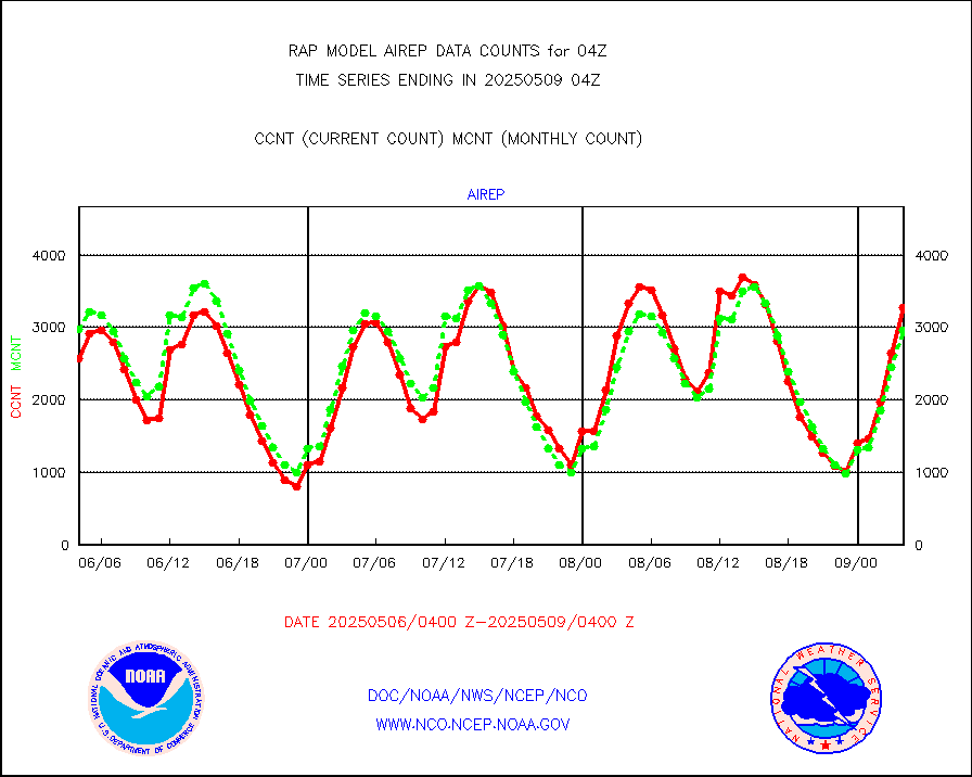
airep |
Manual AIREP aircraft data (dcded from AIREP fmt) |
4434 |
3962 |
111.9 % |
2600.75-2607.25 |
airsev |
AQUA AIRS/AMSU-A/HSB brightness temps- every FOV |
0 |
0 |
n/a |
2601.00-2606.99 |
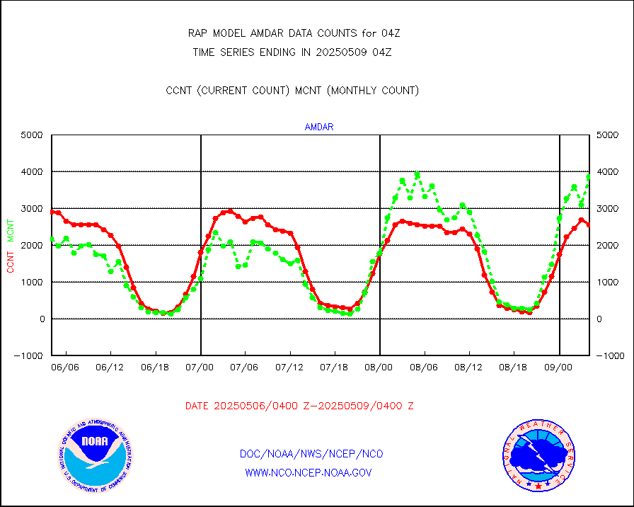
amdar |
AMDAR aircraft data (decoded from AMDAR format) |
2936 |
3979 |
73.8 % |
2600.75-2607.25 |
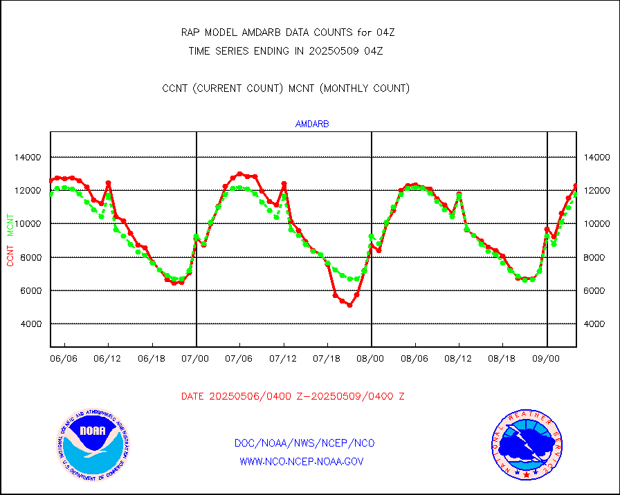
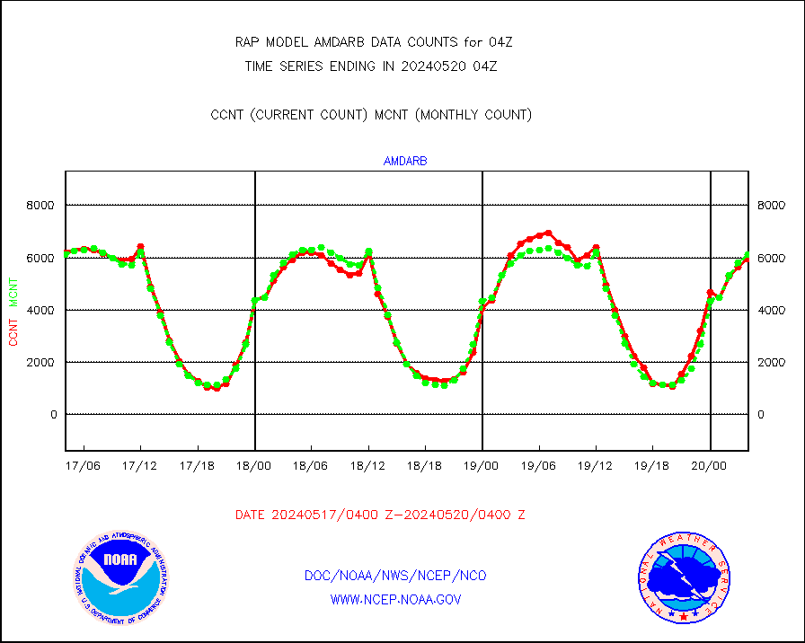
amdarb |
AMDAR aircraft data (decoded from BUFR) |
6373 |
6115 |
104.2 % |
2600.75-2607.25 |
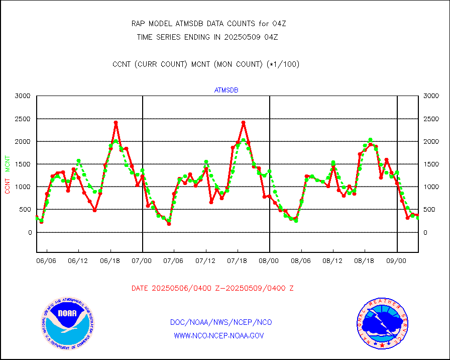
amsr2 |
GCOM-W AMSR2 1B brightness temperatures |
0 |
552172 |
0.0 % |
2601.00-2601.99 |
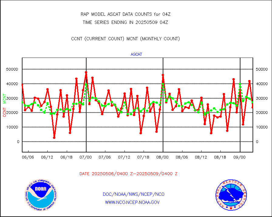
ascat |
METOP 1-2 ASCAT products |
22073 |
20474 |
107.8 % |
2602.00-2606.00 |
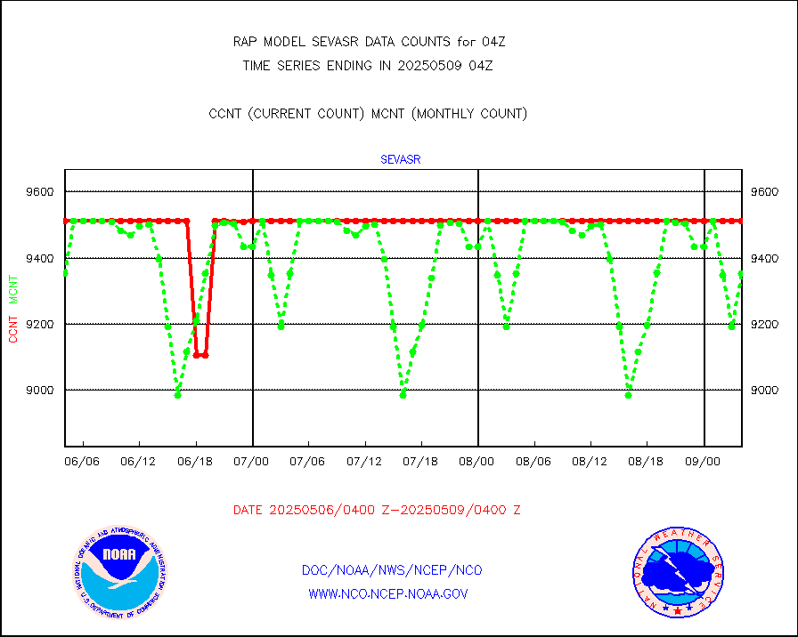
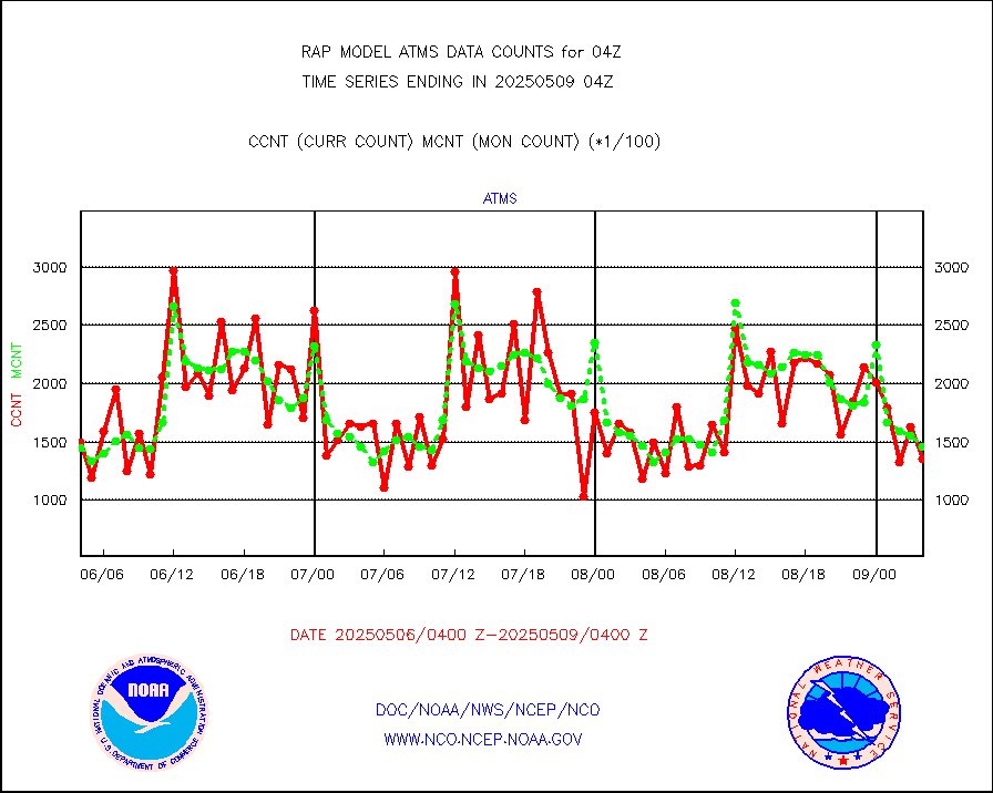
atms |
NPP/NOAA-20 ATMS brightness temperatures |
158703 |
143368 |
110.7 % |
2602.00-2605.99 |
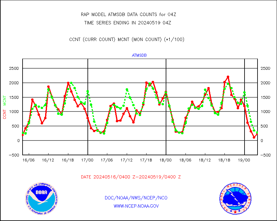
atmsdb |
NPP/NOAA-20 ATMS bright. temps-direct b-cast SSEC |
31167 |
21769 |
143.2 % |
2602.00-2605.99 |
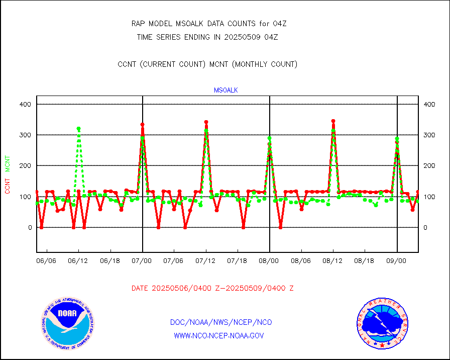
coopmd |
Coop/MADIS NEPP & HCN-Modernization NOAA COOP Obs |
27 |
24 |
112.5 % |
2603.50-2604.50 |
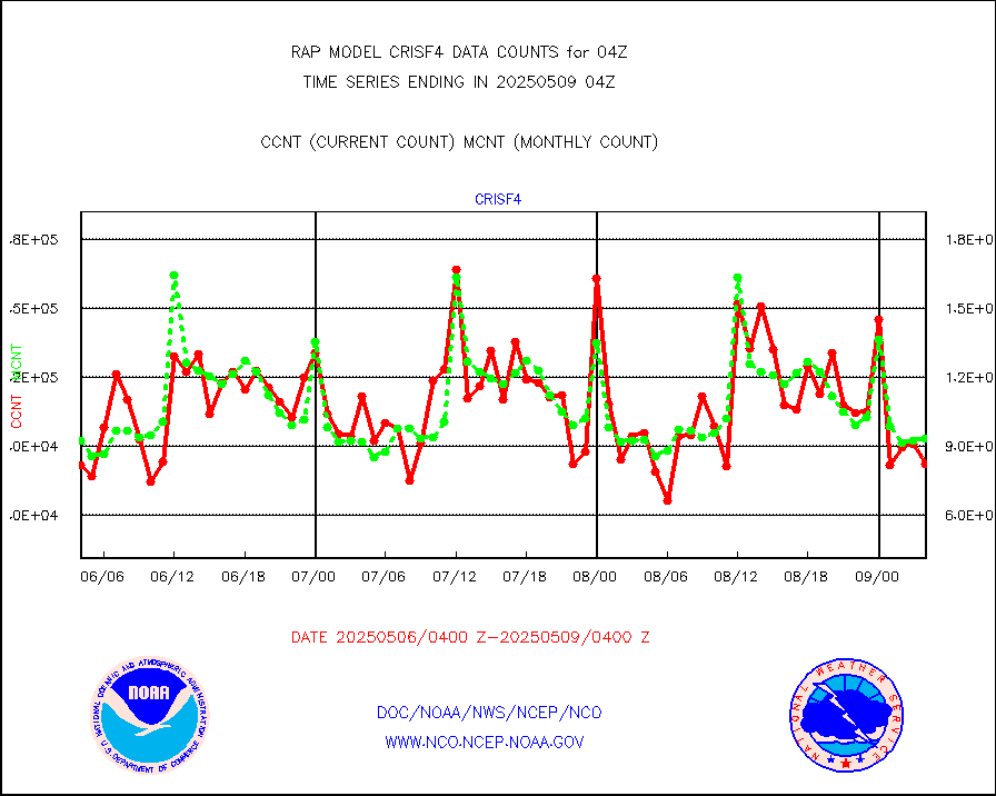
crisf4 |
NPP/NOAA-20 CrIS full spctrl radn (431 ch subset) |
92664 |
90140 |
102.8 % |
2602.00-2605.99 |
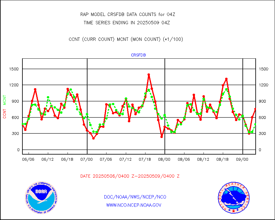
crsfdb |
NPP/NOAA-20 CrIS full spctrl radn dir brdcst SSEC |
83934 |
67385 |
124.6 % |
2602.00-2605.99 |
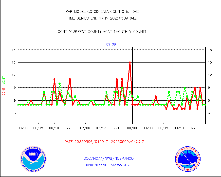
cstgd |
Coast Guard |
3 |
4 |
75.0 % |
2603.50-2604.50 |
dbuoyb |
Drifting buoys (decoded from BUFR) |
547 |
609 |
89.8 % |
2603.50-2604.50 |
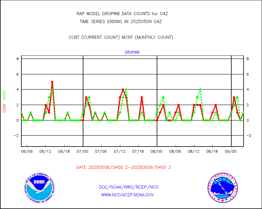
dropw |
Dropwinsonde (from TEMP DROP) |
0 |
0 |
n/a |
2603.00-2605.00 |
eadas |
E-AMDAR (European AMDAR acft decoded from BUFR) |
2542 |
2253 |
112.8 % |
2600.75-2607.25 |
esamua |
NOAA 15-19 & METOP 1-2 AMSU-A proc btmps frm RARS |
20347 |
21608 |
94.2 % |
2603.00-2605.00 |
esatms |
NPP Adv. Tech. MW Sndr (ATMS) br. temps from RARS |
140092 |
130634 |
107.2 % |
2602.00-2605.99 |
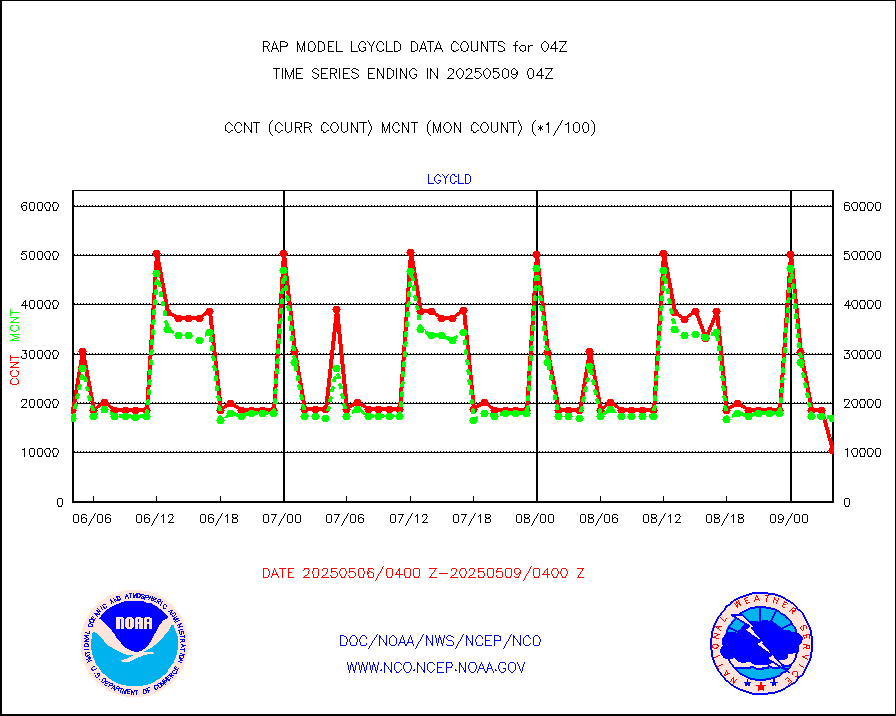
eshrs3 |
NOAA 15-19 & METOP 1-2 HIRS-3/4 pr btmps frm RARS |
35478 |
47047 |
75.4 % |
2603.00-2605.00 |
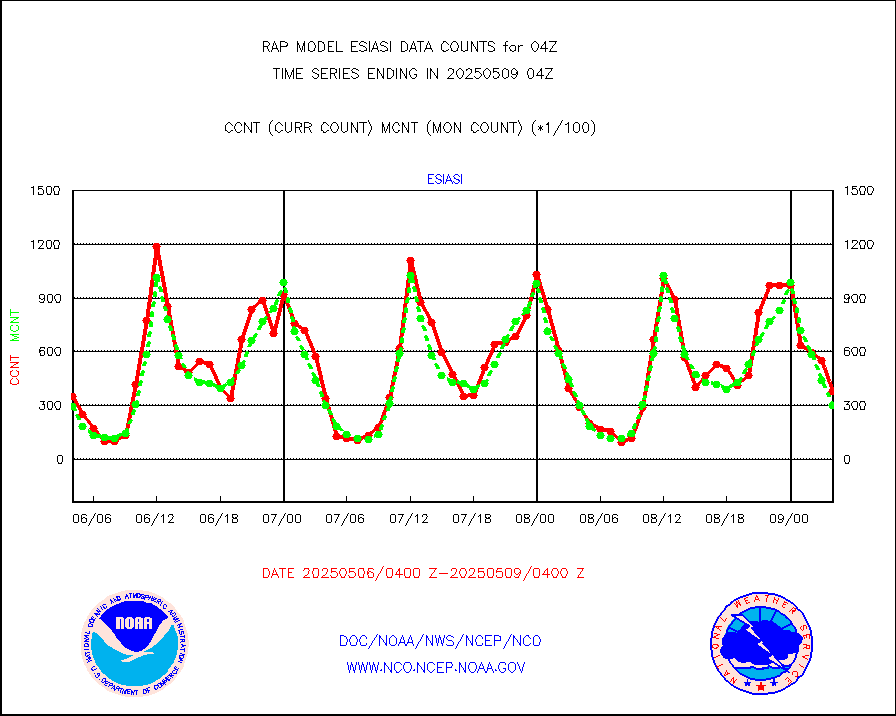
esiasi |
METOP 1-2 IASI 1C radiance data vbl chn from RARS |
49595 |
43473 |
114.1 % |
2602.00-2605.99 |
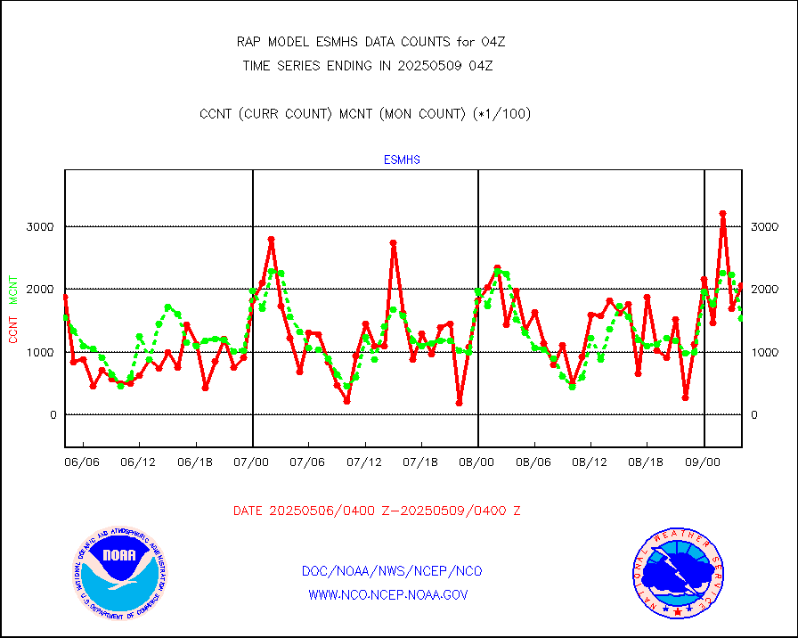
esmhs |
NOAA 18-19 & METOP 1-2 MHS proc. btemps from RARS |
191489 |
153575 |
124.7 % |
2603.00-2605.00 |
gmi1cr |
GPM GMI Level 1C-R brightness temperatures |
471249 |
838156 |
56.2 % |
2601.00-2606.99 |
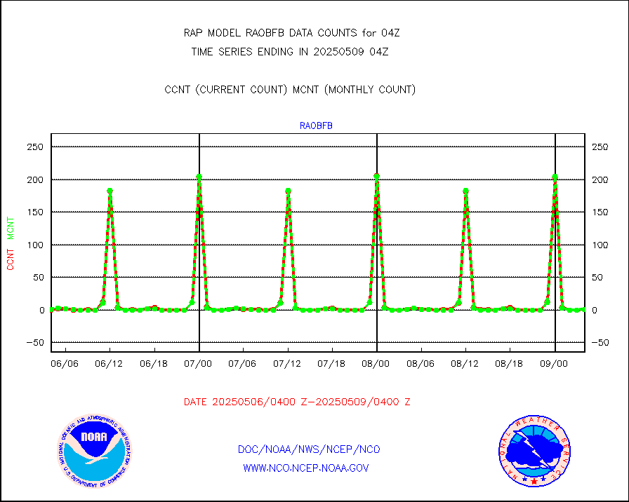
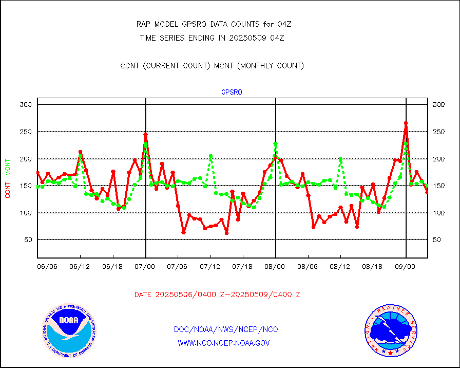
gpsro |
GPS radio occultation data |
153 |
107 |
143.0 % |
2602.00-2605.99 |
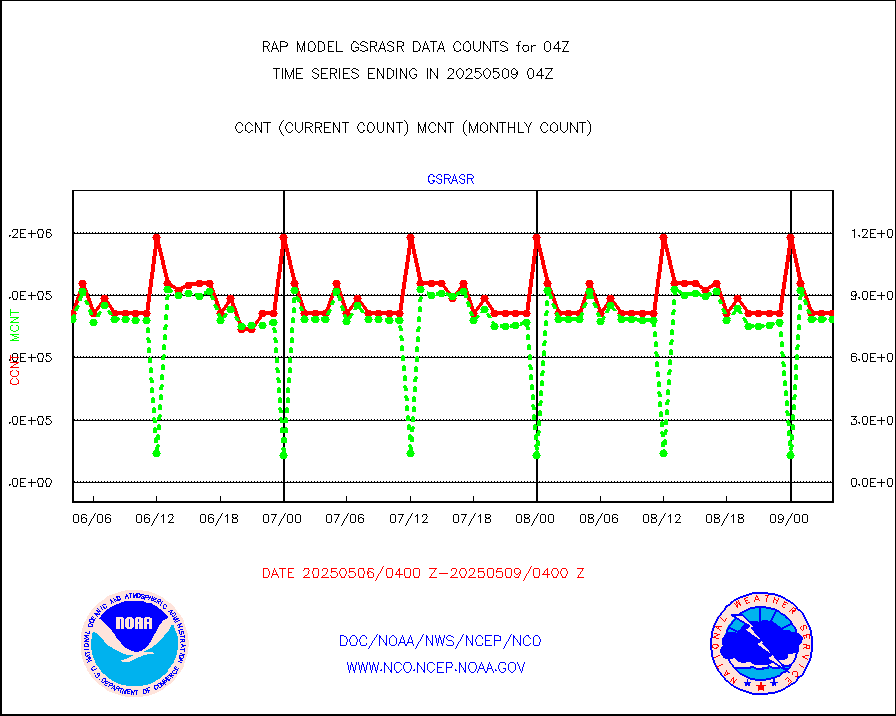
gsrasr |
GOES-16/17 All Sky Radiances (proc.) |
812097 |
809480 |
100.3 % |
2602.00-2605.99 |
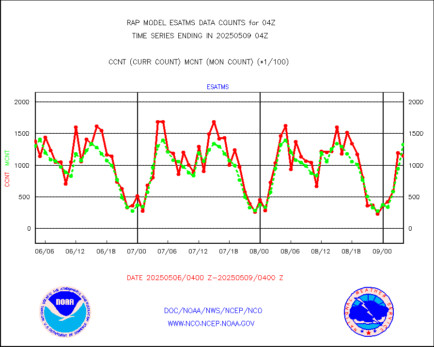
gsrcsr |
GOES-16/17 Clear Sky Radiances (proc.) |
364085 |
390172 |
93.3 % |
2602.00-2605.99 |
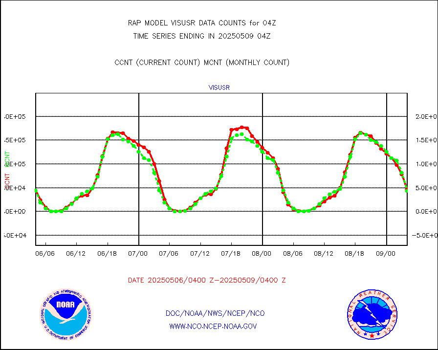
h20ja |
MTSAT/JMA water vapor imager derived cloud motion |
3916 |
2892 |
135.4 % |
2601.50-2606.50 |
h2dusr |
GOES-16&up/NESDIS wv imgr/deep-lyr derivd cld mtn |
6871 |
6478 |
106.1 % |
2603.00-2603.99 |
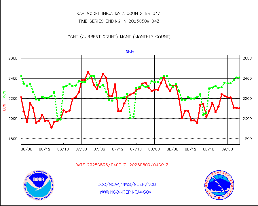
h2eunb |
METEOSAT/EUMETSAT wvpr imgr drv cld motion NBseq |
4886 |
4880 |
100.1 % |
2602.50-2605.49 |
h2tusr |
GOES-16&up/NESDIS wv imgr/cld-top derived cld mtn |
12549 |
10811 |
116.1 % |
2603.00-2603.99 |
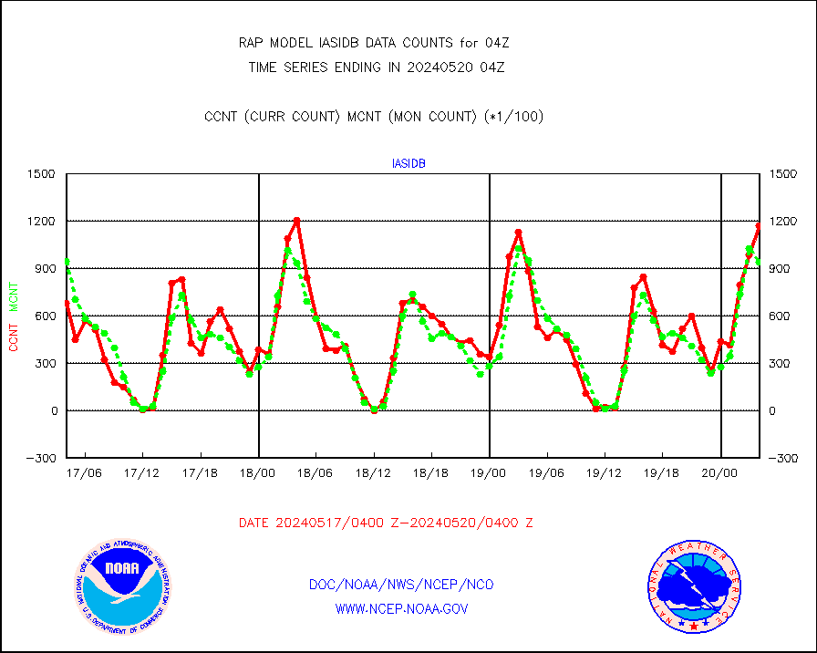
iasidb |
METOP 1-2 IASI 1C radiances-direct broadcast SSEC |
122069 |
98317 |
124.2 % |
2602.00-2605.99 |
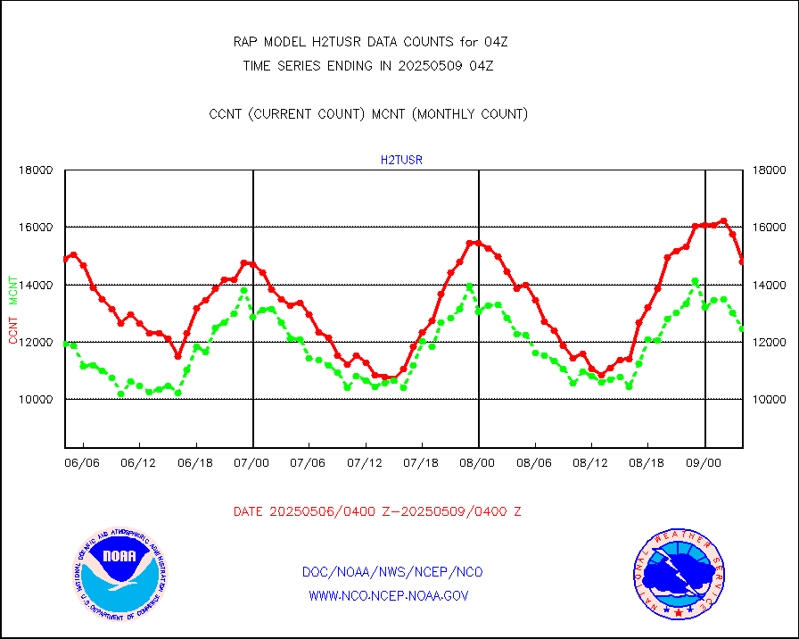
ifeunb |
METEOSAT/EUMETSAT ir lg-wave drv cld motion NBseq |
3425 |
3105 |
110.3 % |
2602.50-2605.49 |
ifvrnb |
VIIRS (NPP/NOAA-20) ir lg-wv drv cloud motion(NB) |
0 |
0 |
n/a |
2601.50-2606.50 |
infav |
AVHRR (NOAA/METOP) ir lg-wave derived cld motion |
0 |
4 |
0.0 % |
2601.50-2606.50 |
infav1 |
AVHRR (METOP) ir lg-wave derived cld motion |
0 |
0 |
n/a |
2602.50-2605.49 |
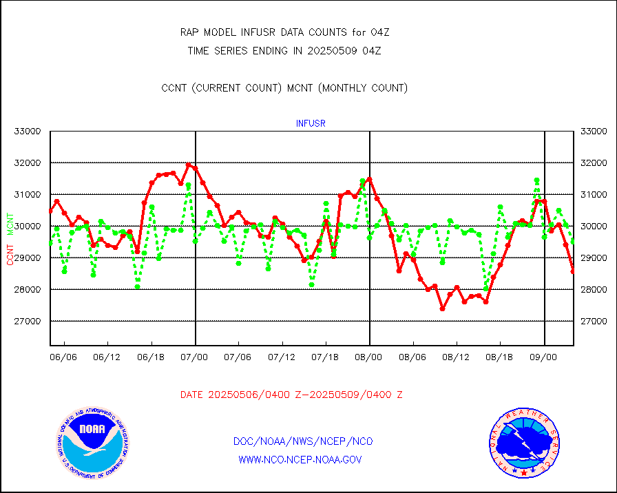
infja |
MTSAT/JMA infrared long-wave derived cloud motion |
3053 |
2472 |
123.5 % |
2601.50-2606.50 |
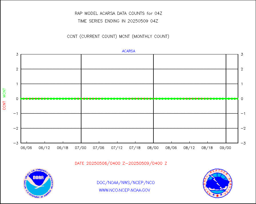
infusr |
GOES-16&up/NESDIS ir long-wave derived cld motion |
32516 |
30078 |
108.1 % |
2603.00-2603.99 |
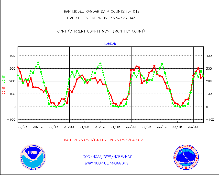
kamdar |
Korean AMDAR aircraft data (decoded from BUFR) |
222 |
260 |
85.4 % |
2600.75-2607.25 |
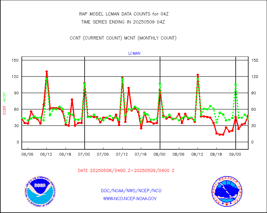
lcman |
Land-based CMAN stations decoded from CMAN format |
73 |
76 |
96.1 % |
2603.50-2604.50 |
ltnglr |
LLDN Long-rng lightning from Vaisala via NOAAPORT |
83623 |
45534 |
183.6 % |
2603.00-2604.50 |
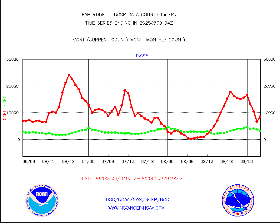
ltngsr |
NLDN Shrt-rng lightning from Vaisala via NOAAPORT |
4911 |
2151 |
228.3 % |
2603.00-2604.50 |
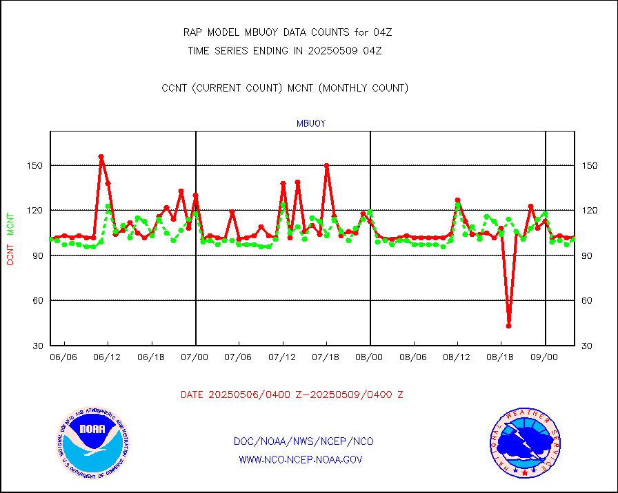
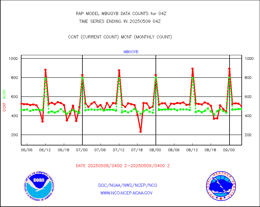
mbuoyb |
Moored buoys (decoded from BUFR) |
577 |
470 |
122.8 % |
2603.50-2604.50 |
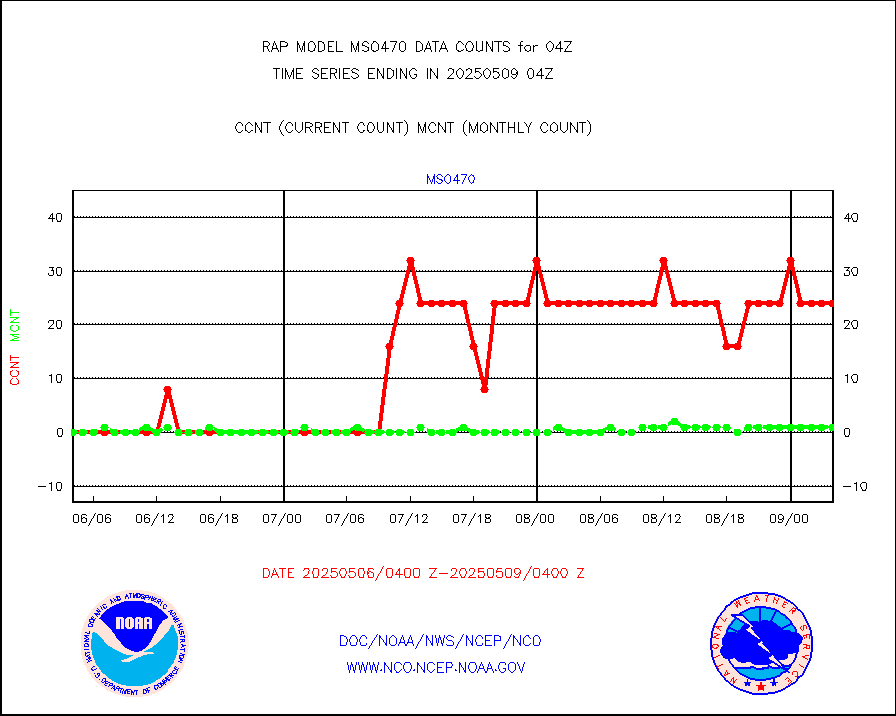
mso470 |
Mesonet/MADIS Colorado E-470 (Interstate 470) |
21 |
19 |
110.5 % |
2603.50-2604.50 |
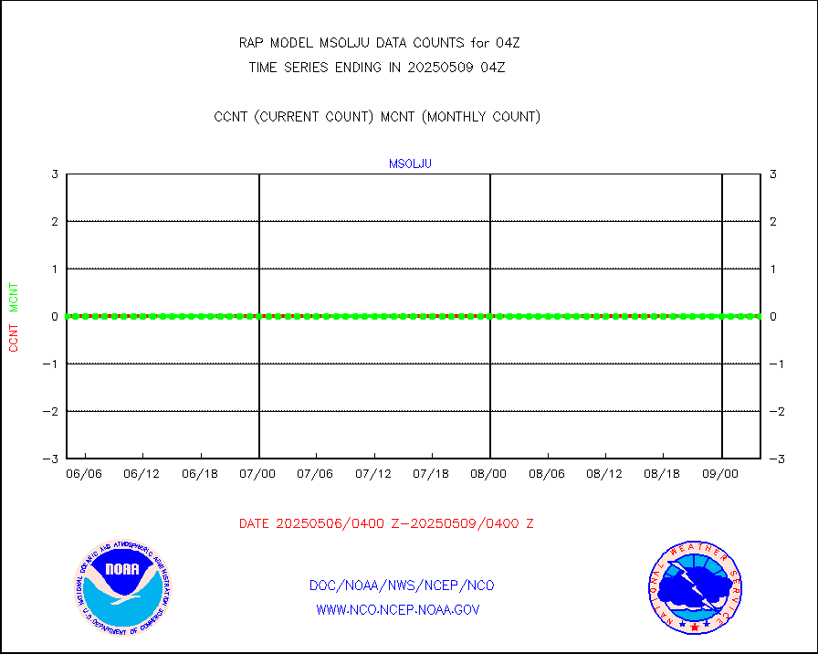
msoalk |
Mesonet/MADIS Alaska Department of Transportation |
109 |
98 |
111.2 % |
2603.50-2604.50 |
msoapg |
Mesonet/MADIS U.S. Army Aberdeen Proving Grounds |
0 |
0 |
n/a |
2603.50-2604.50 |
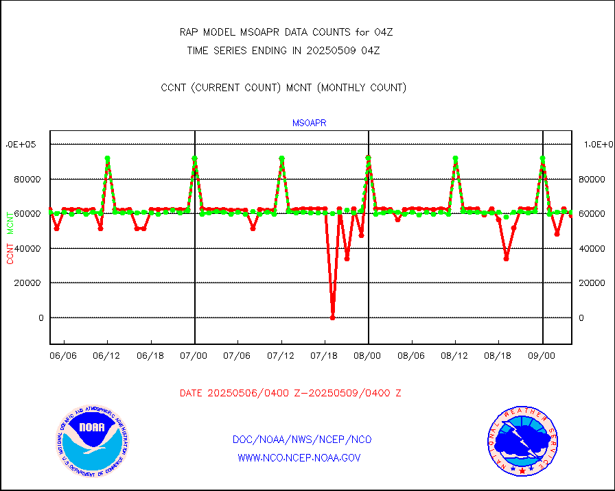
msoapr |
Mesonet/MADIS Citizen Weather Observers Program |
46569 |
43293 |
107.6 % |
2603.50-2604.50 |
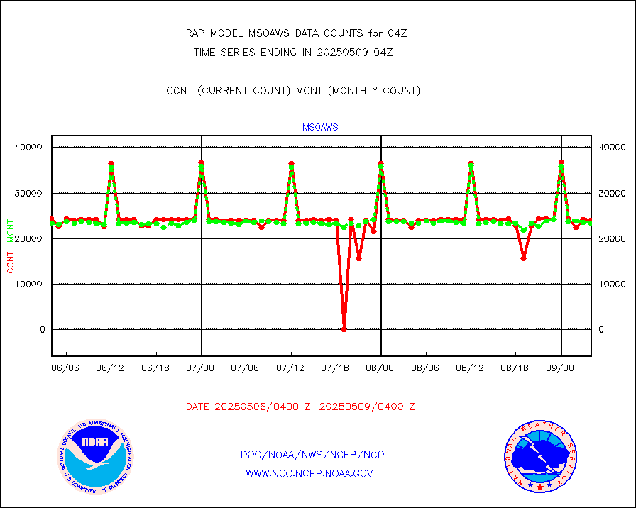
msoaws |
Mesonet/MADIS AWS Convergence Technologies, Inc. |
26304 |
25480 |
103.2 % |
2603.50-2604.50 |
msoawx |
Mesonet/MADIS "Anything Weather" |
0 |
0 |
n/a |
2603.50-2604.50 |
msocol |
Mesonet/MADIS Colorado Dept. of Transportation |
0 |
0 |
n/a |
2603.50-2604.50 |
msodcn |
Mesonet/MADIS DC Net |
0 |
0 |
n/a |
2603.50-2604.50 |
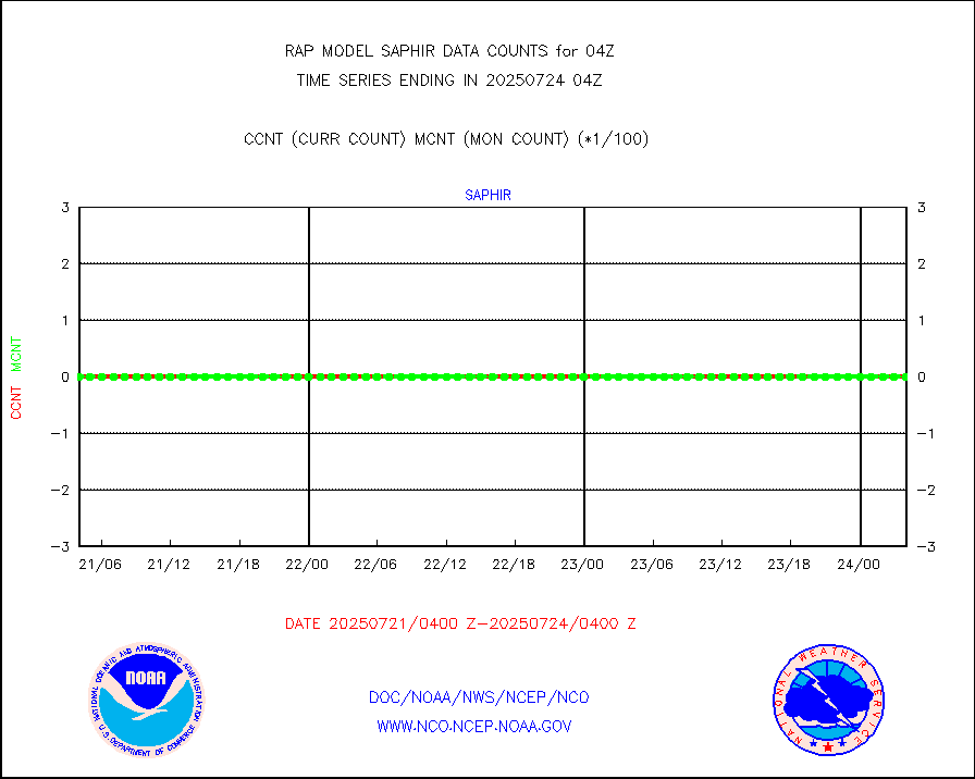
msoden |
Mesonet/MADIS Denver Urban Drainage & Flood Cntrl |
225 |
201 |
111.9 % |
2603.50-2604.50 |
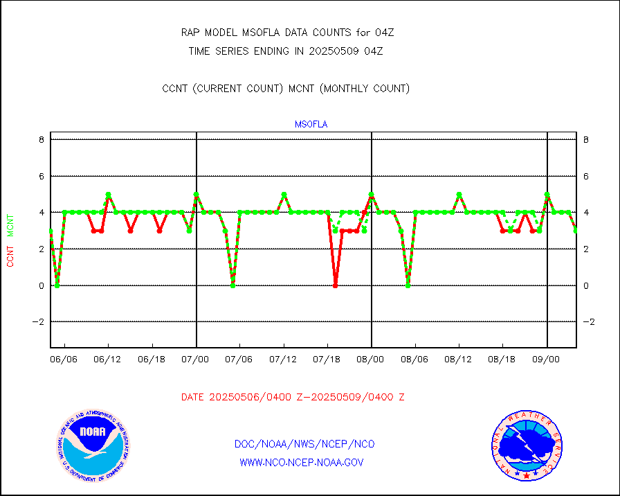
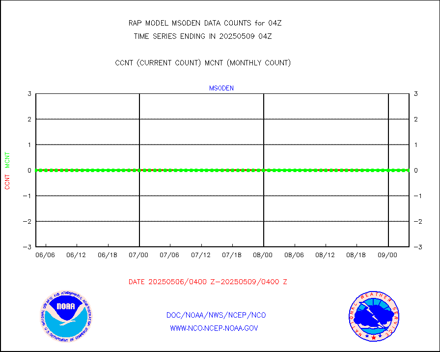
msofla |
Mesonet/MADIS Florida (FAWN & USF) |
3 |
3 |
100.0 % |
2603.50-2604.50 |
msoflt |
Mesonet/MADIS Florida Dept. of Transportation |
0 |
0 |
n/a |
2603.50-2604.50 |
msogeo |
Mesonet/MADIS Georgia Dept. of Transportation |
0 |
0 |
n/a |
2603.50-2604.50 |
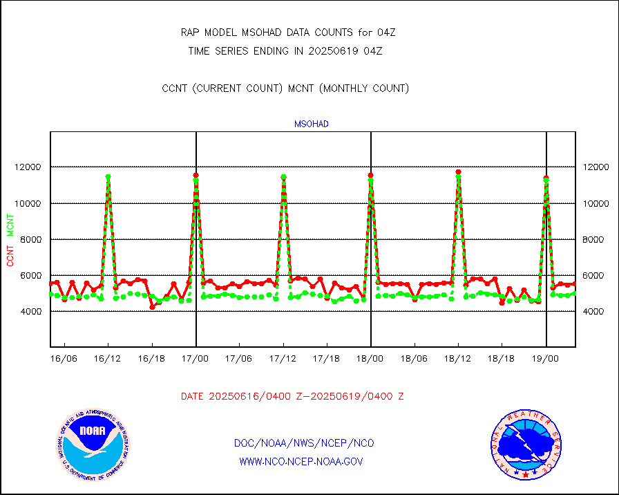
msohad |
Mesonet/MADIS NWS Hydromet Auto Data System(HADS) |
5924 |
5544 |
106.9 % |
2603.50-2604.50 |
msoien |
Mesonet/MADIS Iowa Environmental |
178 |
168 |
106.0 % |
2603.50-2604.50 |
msoind |
Mesonet/MADIS Indiana Dept. of Transportation |
0 |
0 |
n/a |
2603.50-2604.50 |
msoiow |
Mesonet/MADIS Iowa Department of Transportation |
0 |
0 |
n/a |
2603.50-2604.50 |
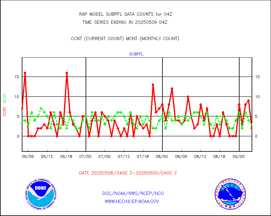
msokan |
Mesonet/MADIS Kansas Department of Transportation |
352 |
330 |
106.7 % |
2603.50-2604.50 |
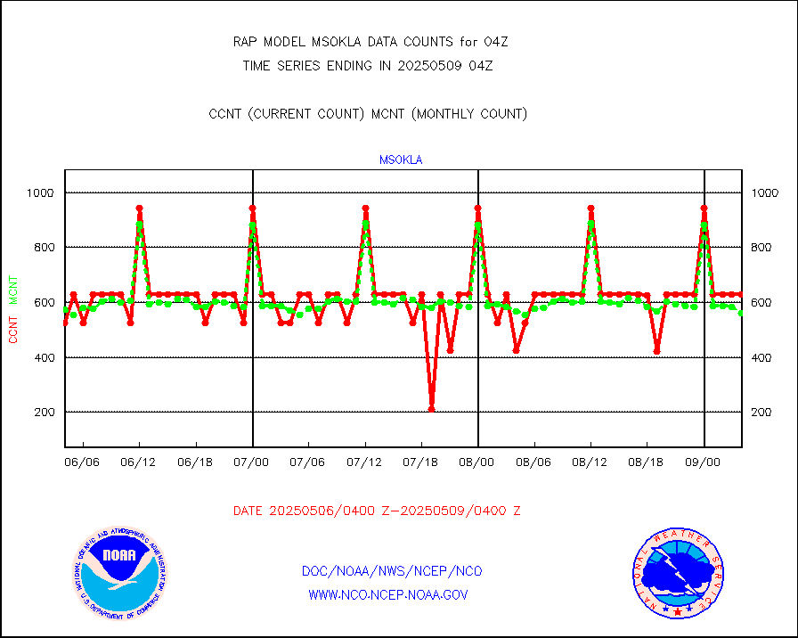
msokla |
Mesonet/MADIS Oklahoma Mesonet |
318 |
329 |
96.7 % |
2603.50-2604.50 |
msolju |
Mesonet/MADIS Louisiana State/Jackson State Univ. |
0 |
0 |
n/a |
2603.50-2604.50 |
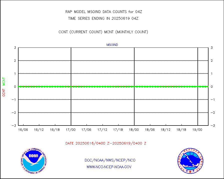
msomca |
Mesonet/MADIS Missouri Commercial Agricult Wx Net |
275 |
248 |
110.9 % |
2603.50-2604.50 |
msomin |
Mesonet/MADIS Minnesota Dept. of Transportation |
0 |
0 |
n/a |
2603.50-2604.50 |
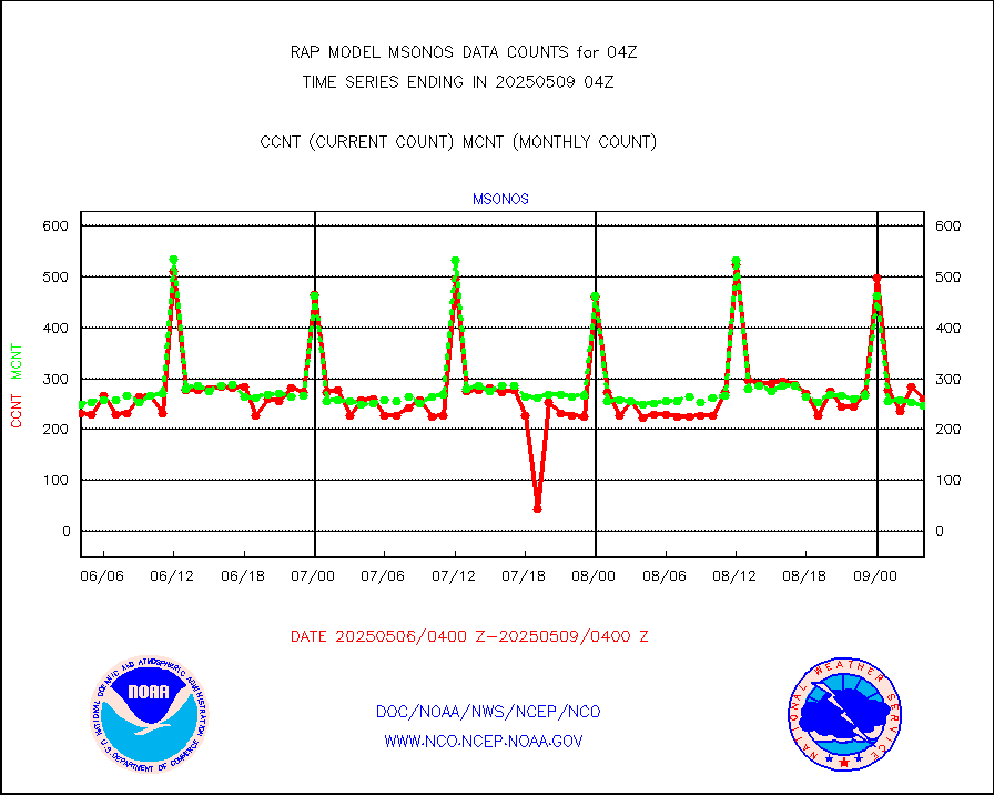
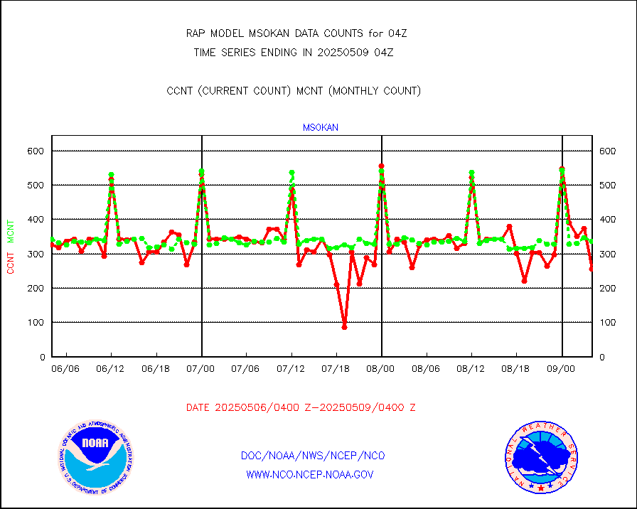
msonos |
Mesonet/MADIS NOS-Phys Oceanographic Realtime Sys |
276 |
268 |
103.0 % |
2603.50-2604.50 |
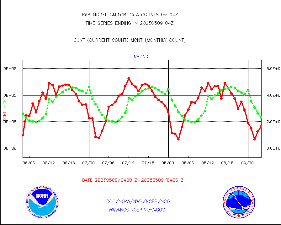
msoraw |
Mesonet/MADIS NFIC Remote Automated Wx Stns(RAWS) |
1668 |
1497 |
111.4 % |
2603.50-2604.50 |
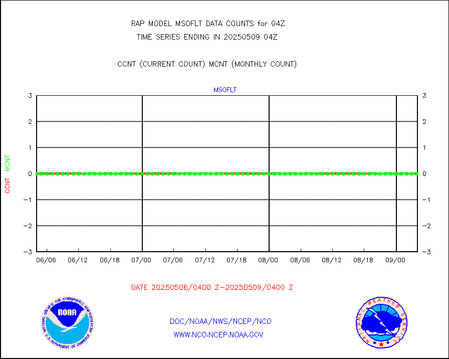
msourb |
Mesonet/MADIS UrbaNet |
4040 |
3902 |
103.5 % |
2603.50-2604.50 |
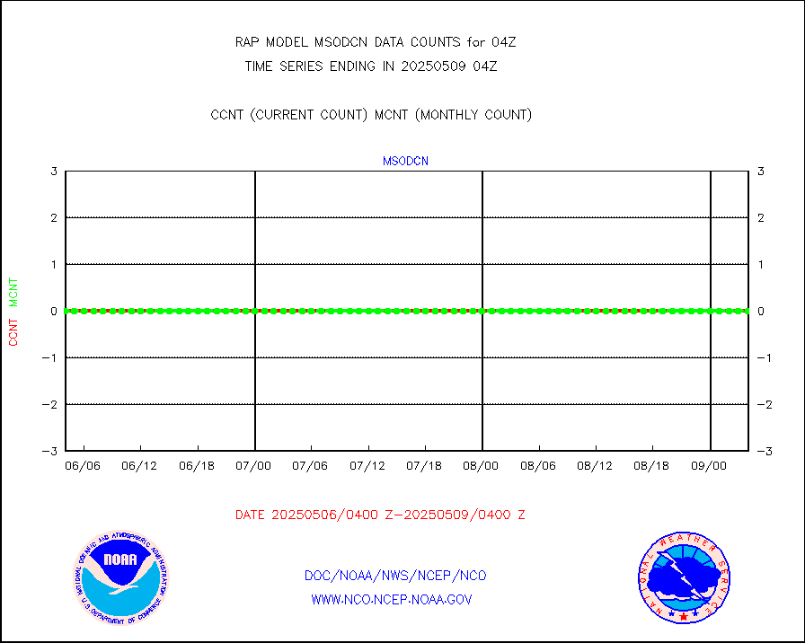
msovir |
Mesonet/MADIS Virginia Dept. of Transportation |
235 |
233 |
100.9 % |
2603.50-2604.50 |
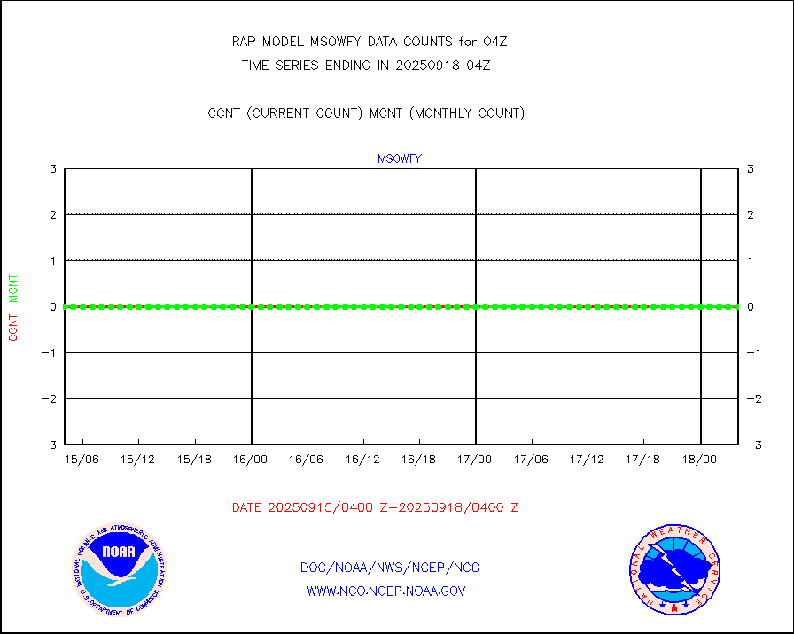
msowfy |
Mesonet/MADIS "Weather for You" |
0 |
0 |
n/a |
2603.50-2604.50 |
msowis |
Mesonet/MADIS Wisconsin Dept. of Transportation |
0 |
0 |
n/a |
2603.50-2604.50 |
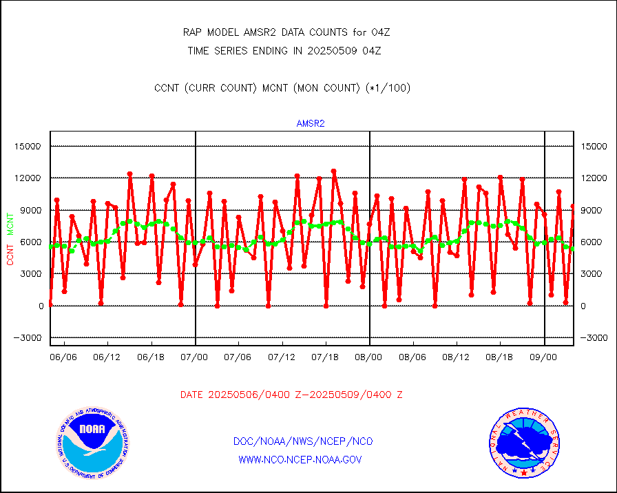
msowst |
Mesonet/MADIS MesoWest (many subproviders) |
40262 |
39114 |
102.9 % |
2603.50-2604.50 |
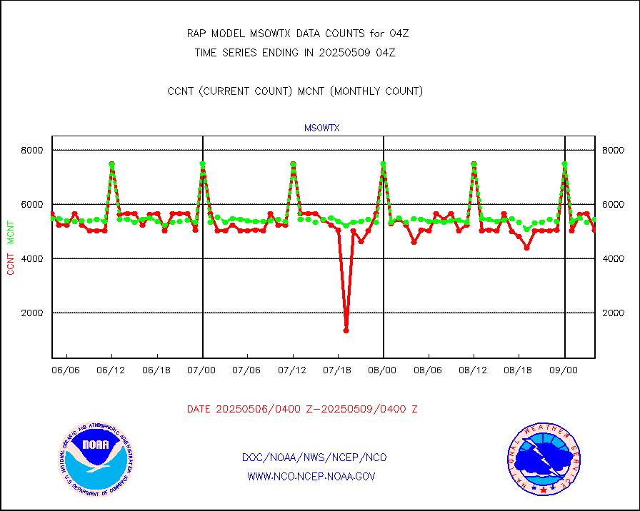
msowtx |
Mesonet/MADIS West Texas |
5043 |
4929 |
102.3 % |
2603.50-2604.50 |
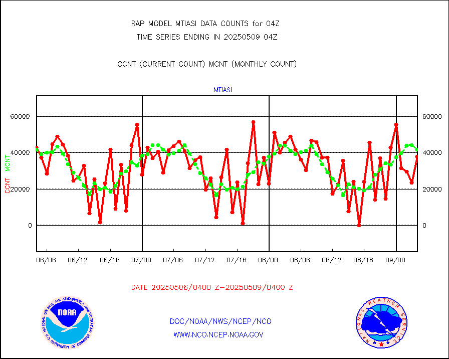
mtiasi |
METOP 1-2 IASI 1C radiance data (varbl. channels) |
42739 |
39732 |
107.6 % |
2602.00-2605.99 |
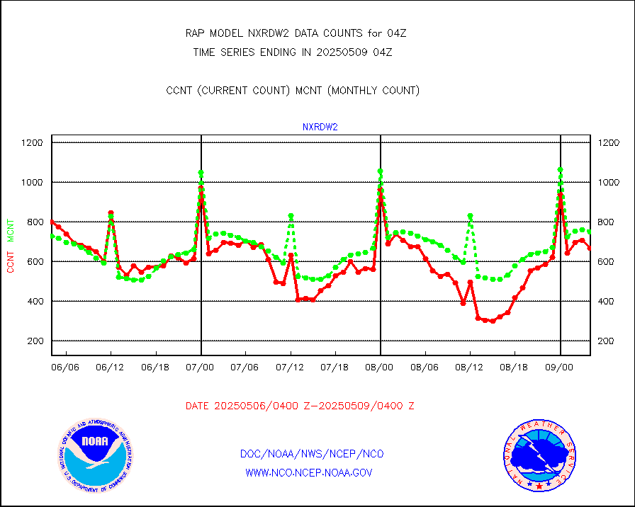
nxrdw2 |
NEXRAD Vel Azm Dsp(VAD) winds via Level 2 decoder |
942 |
746 |
126.3 % |
2603.00-2605.00 |
osbuv8 |
NOAA 16-19 Solar Backscatter UV-2 rad frm V8 BUFR |
0 |
0 |
n/a |
2602.00-2604.99 |
pibal |
PIBAL (from PILOT, PILOT SHIP, PILOT MOBIL) |
0 |
0 |
n/a |
2603.00-2605.00 |
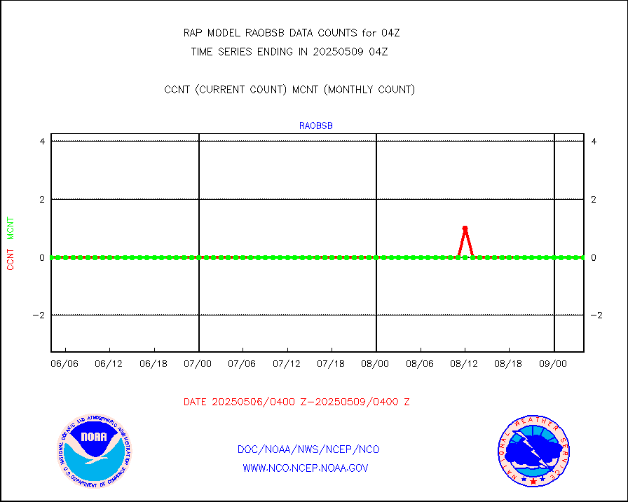
pirep |
Manual PIREP aircraft data (dcded from AIREP fmt) |
239 |
204 |
117.2 % |
2600.75-2607.25 |
prflrp |
Profilr winds from PIBAL (PILOT,PILOT SHIP/MOBIL) |
0 |
0 |
n/a |
2602.50-2605.50 |
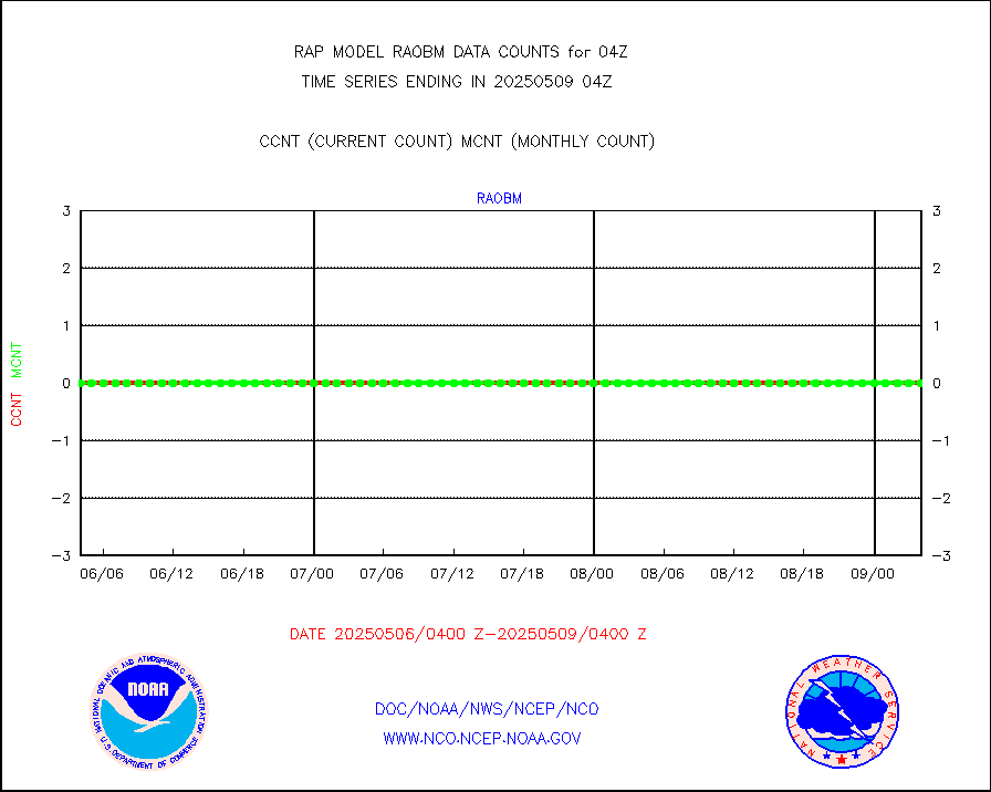
raobm |
Rawinsonde - mobile land (from TEMP/PILOT MOBIL) |
0 |
0 |
n/a |
2603.00-2605.00 |
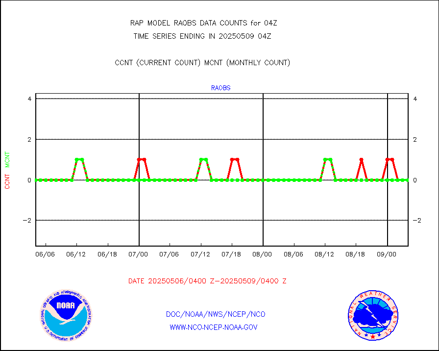
raobs |
Rawinsonde - ship (from TEMP SHIP, PILOT SHIP) |
0 |
0 |
n/a |
2603.00-2605.00 |
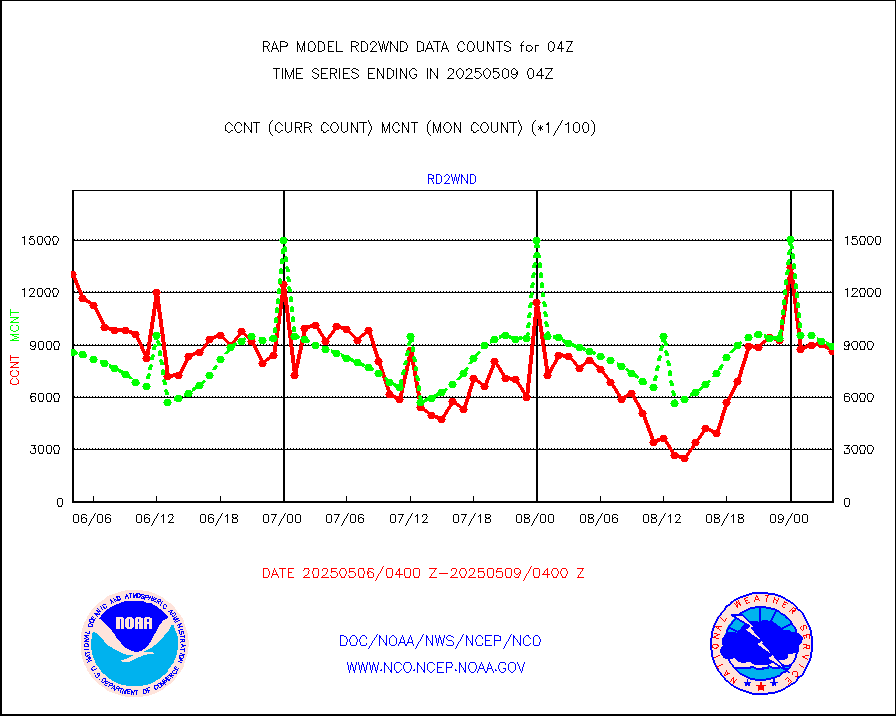
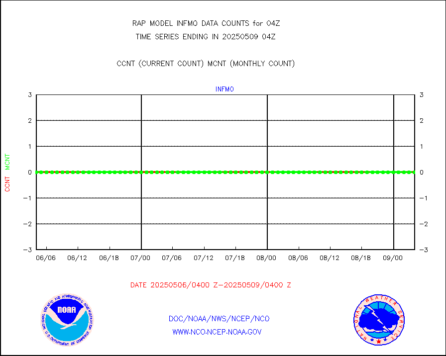
rd2wnd |
NEXRAD radial wind (Level 2 - GTS) |
1297193 |
864276 |
150.1 % |
2603.50-2604.49 |
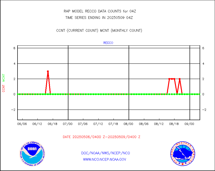
recco |
Flight level reconnaissance aircraft data |
0 |
0 |
n/a |
2603.00-2605.00 |
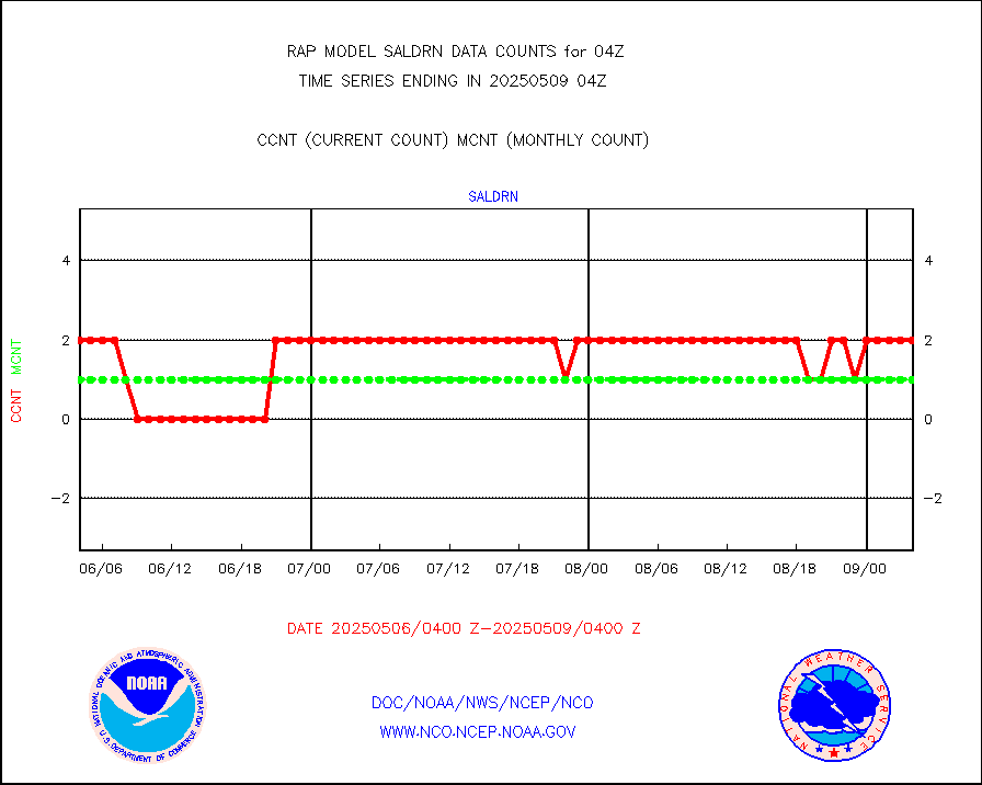
saldrn |
Surface Marine Saildrone (decoded from BUFR) |
2 |
2 |
100.0 % |
2602.00-2605.99 |
saphir |
Megha-Tropiques SAPHIR L1A2 brightness temps |
0 |
0 |
n/a |
2601.00-2606.99 |
sevasr |
METEOSAT-10 2nd Gen SEVIRI All Sky Radiance(proc) |
9512 |
9051 |
105.1 % |
2602.00-2605.99 |
sevcsr |
METEOSAT-10 2nd Gen SEVIRI Clr Sky Radiance(proc) |
0 |
0 |
n/a |
2602.00-2605.99 |
ships |
Ship - manual and automatic, restricted |
0 |
2 |
0.0 % |
2603.50-2604.50 |
snocvr |
NOW COVER, DEPTH/DENSITY AND WATER EQUIVALENT |
3111 |
5979 |
52.0 % |
2602.00-2606.00 |
ssmisu |
DMSP SSM/IS 1C radiance data (Unified Pre-Proc.) |
23961 |
44331 |
54.1 % |
2602.00-2605.99 |
subpfl |
Sub-surface float and glider profile (BUFR) |
3 |
7 |
42.9 % |
2602.00-2605.99 |
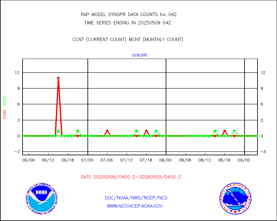
synopr |
Synoptic - restricted (WMO Res 40) manual & auto. |
0 |
0 |
n/a |
2603.50-2604.50 |
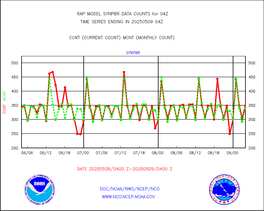
synpbr |
Synoptic - restricted (WMO Res 40)(decoded BUFR) |
345 |
347 |
99.4 % |
2603.50-2604.50 |
synpmb |
Synoptic - mobile manual & auto (decoded fr BUFR) |
0 |
0 |
n/a |
2603.50-2604.50 |
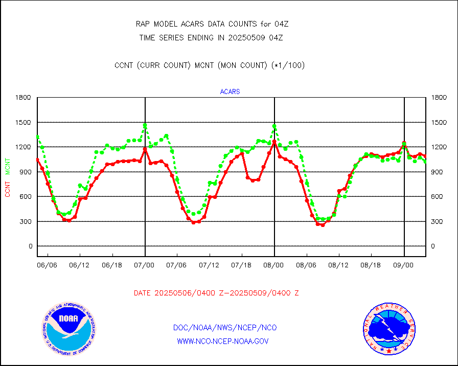
tmdara |
TAMDAR aircft data-all types(from Panasonic,BUFR) |
1344 |
1440 |
93.3 % |
2600.75-2607.25 |
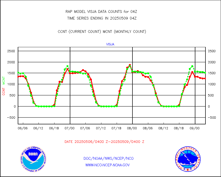
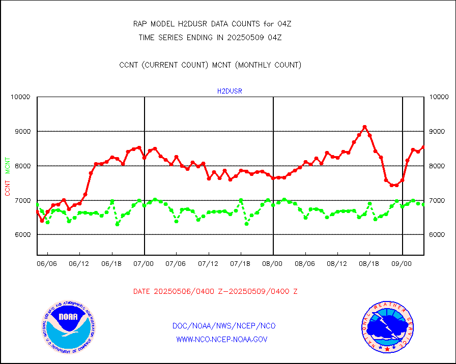
visja |
MTSAT/JMA visible derived cloud motion |
1657 |
1545 |
107.2 % |
2601.50-2606.50 |
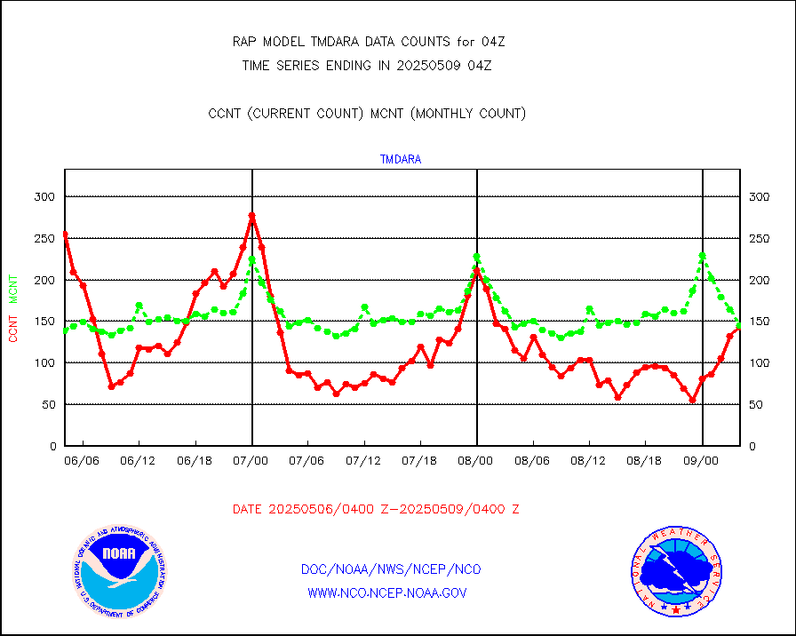
visusr |
GOES-16&up/NESDIS visible derived cloud motion |
52668 |
45743 |
115.1 % |
2603.00-2603.99 |
vseunb |
METEOSAT/EUMETSAT visible drv cld motion NBseq |
2 |
0 |
n/a |
2602.50-2605.49 |


