| Critical Data with Normal Counts |
|---|
| Type | Description | Hourly Count | Monthly Average | Percent (%) of Monthly Mean | UTC Time Window |
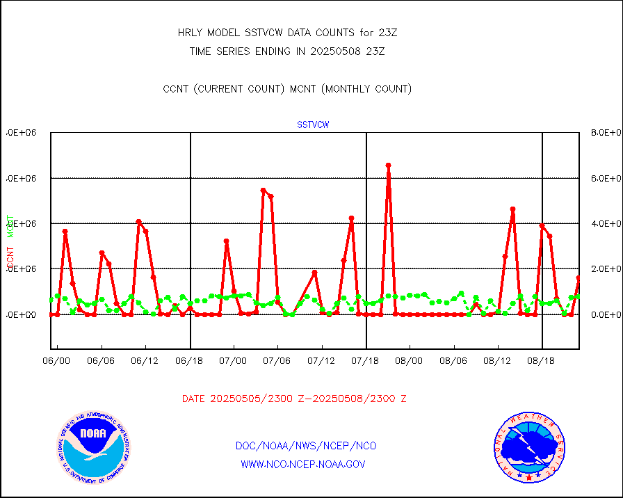
1bamua |
NOAA 15-19 & METOP 1-2 AMSU-A NCEP-proc. br.temps |
51824 |
52641 |
98.4 % |
2521.00-2521.99 |
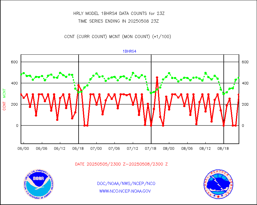
1bhrs4 |
NOAA 18-19 & METOP 1-2 HIRS-4 NCEP-proc. br.temps |
45938 |
44676 |
102.8 % |
2521.00-2521.99 |
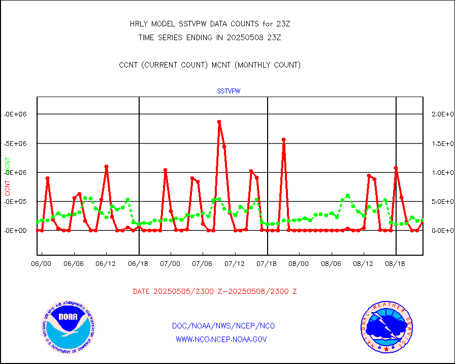
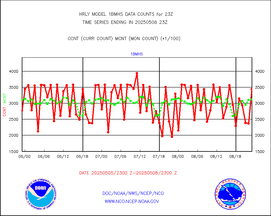
1bmhs |
NOAA 18-19 & METOP 1-2 MHS NCEP-proces. br. temps |
282371 |
299575 |
94.3 % |
2521.00-2521.99 |
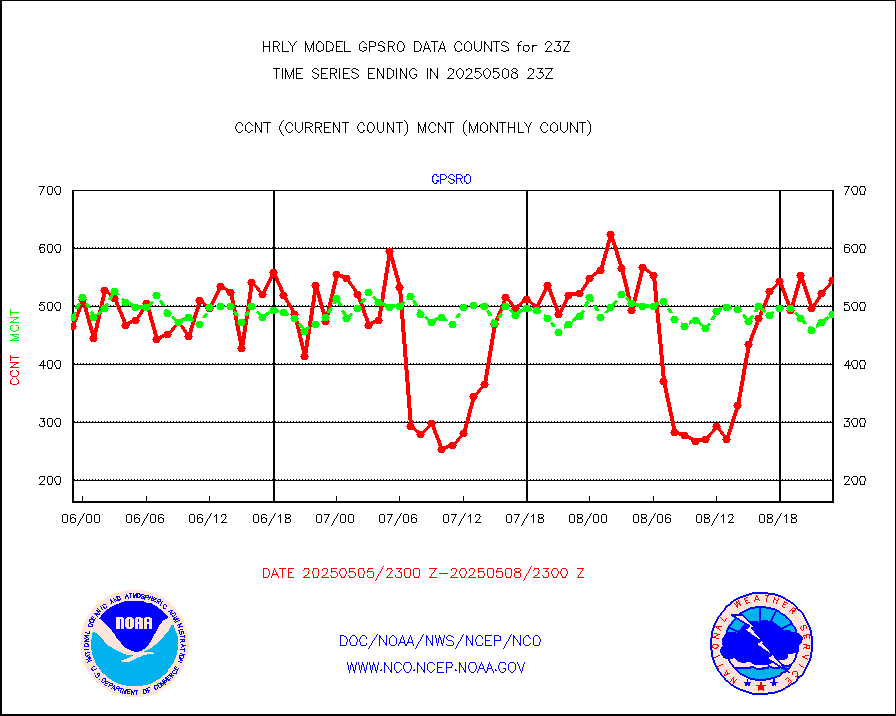
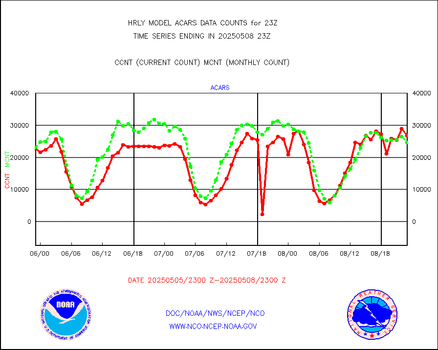
acars |
MDCRS ACARS acft data from ARINC(dcded from BUFR) |
25245 |
19351 |
130.5 % |
2522.50-2523.49 |
airep |
Manual AIREP aircraft data (dcded from AIREP fmt) |
534 |
410 |
130.2 % |
2522.50-2523.49 |
airsev |
AQUA AIRS/AMSU-A/HSB brightness temps- every FOV |
0 |
0 |
n/a |
2520.50-2521.49 |
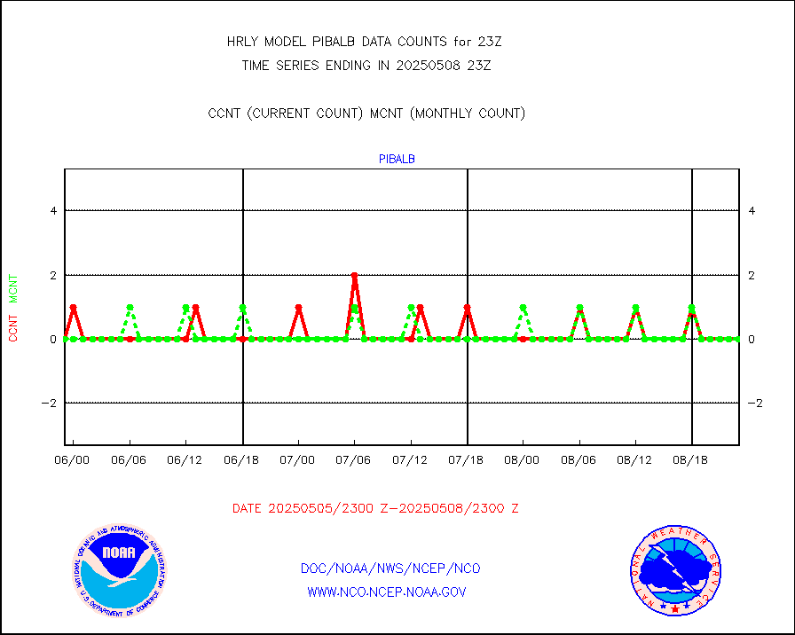
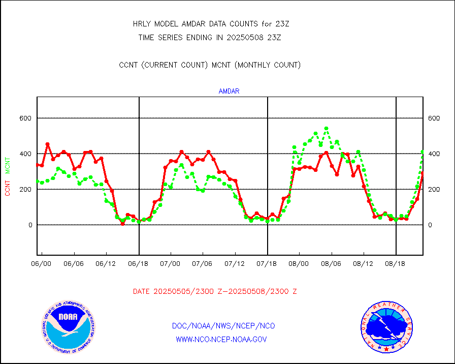
amdar |
AMDAR aircraft data (decoded from AMDAR format) |
341 |
405 |
84.2 % |
2522.50-2523.49 |
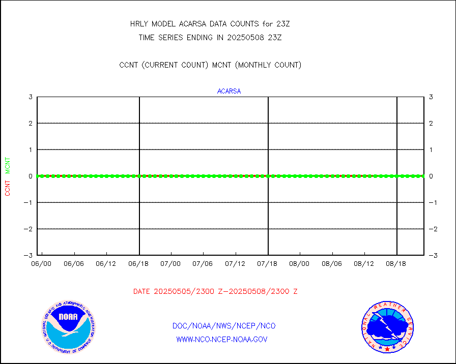
amdarb |
AMDAR aircraft data (decoded from BUFR) |
877 |
968 |
90.6 % |
2522.50-2523.49 |
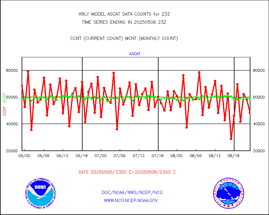
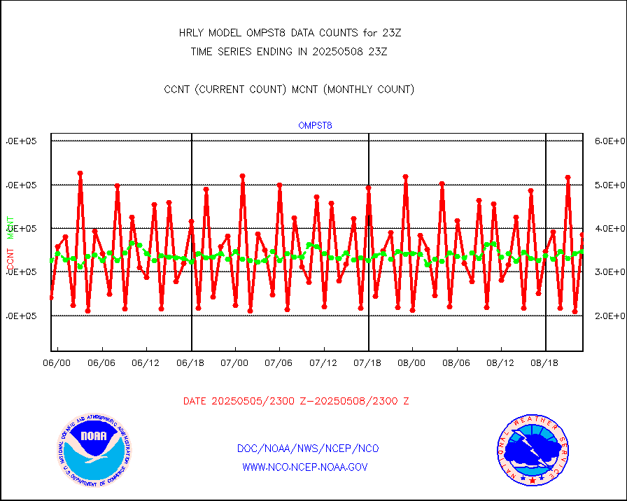
ascat |
METOP 1-2 ASCAT products |
32760 |
37724 |
86.8 % |
2521.50-2522.49 |
atms |
NPP/NOAA-20 ATMS brightness temperatures |
375936 |
341174 |
110.2 % |
2521.50-2522.49 |
camdar |
Canadian AMDAR aircraft data (decoded from BUFR) |
0 |
11 |
0.0 % |
2522.50-2523.49 |
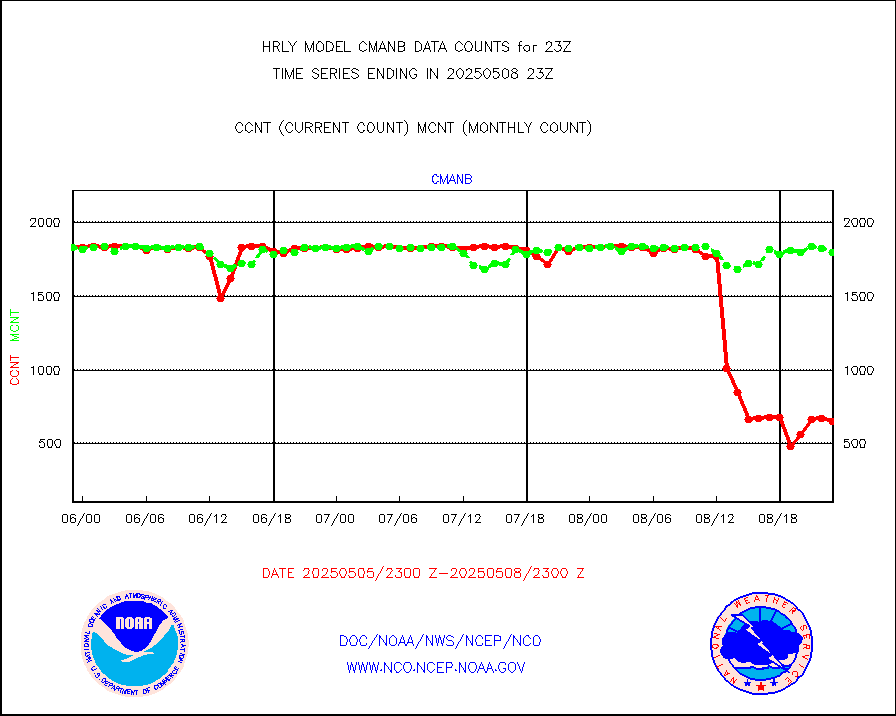
cmanb |
Surface Marine CMAN rpts decoded from BUFR format |
1831 |
1784 |
102.6 % |
2522.50-2523.50 |
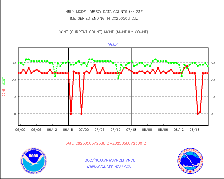
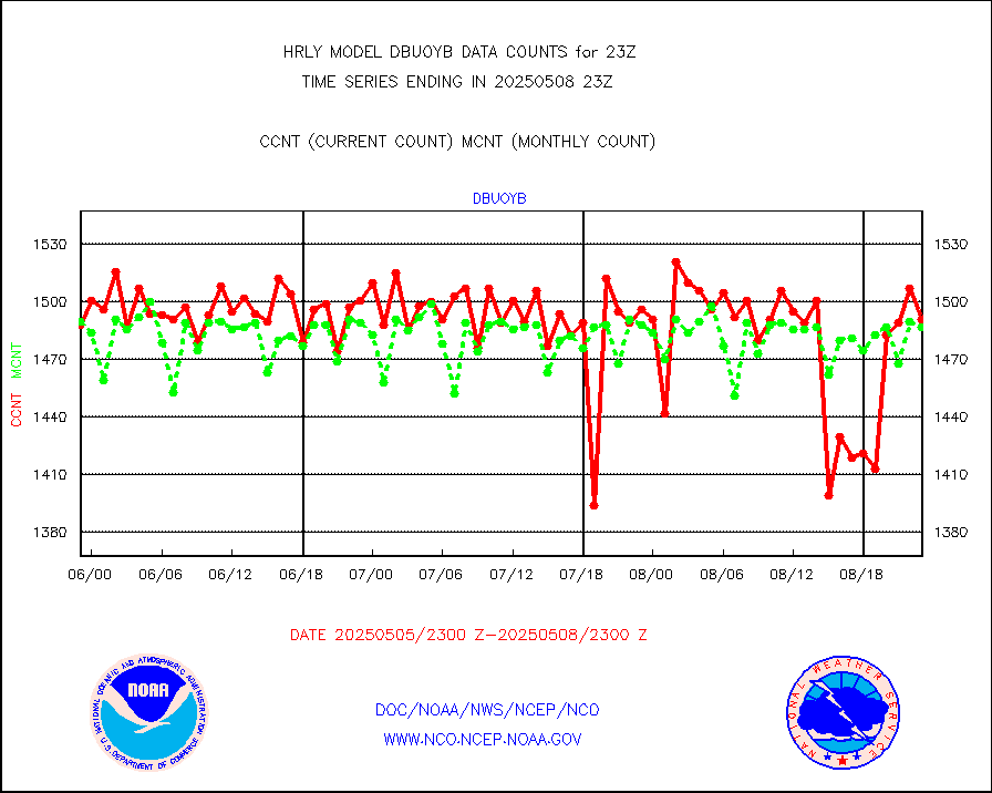
dbuoy |
Buoys decoded from FM-18 fmt (moored or drifting) |
40 |
32 |
125.0 % |
2522.50-2523.49 |
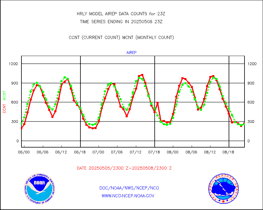
eadas |
E-AMDAR (European AMDAR acft decoded from BUFR) |
535 |
594 |
90.1 % |
2522.50-2523.49 |
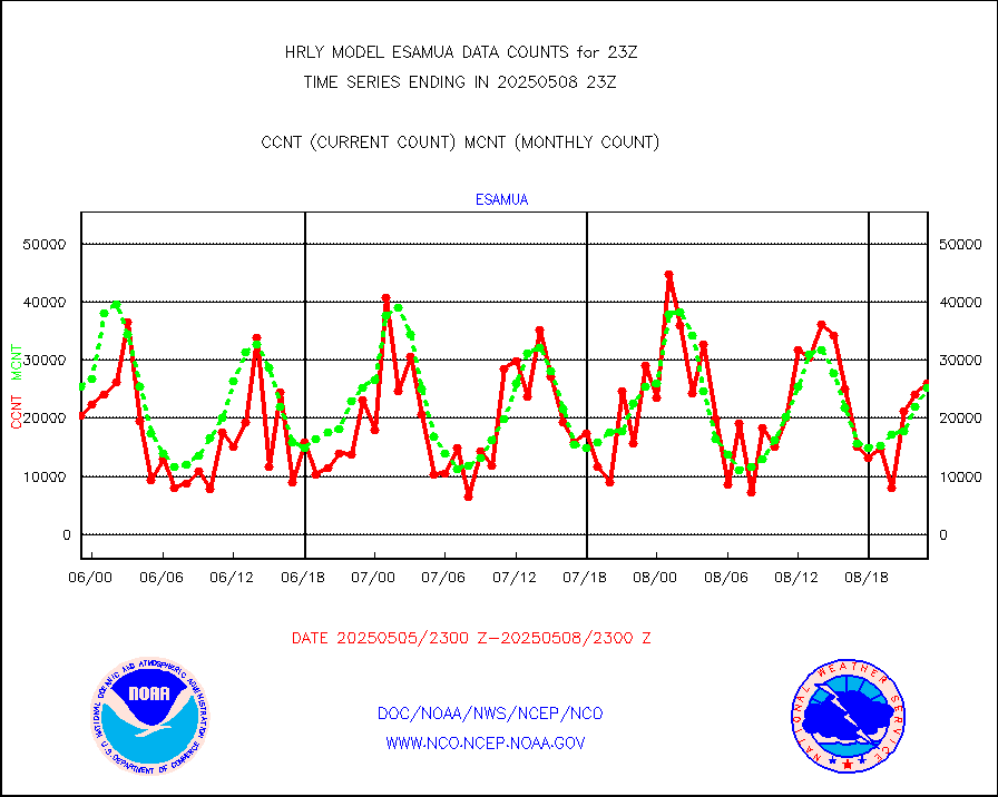
esamua |
NOAA 15-19 & METOP 1-2 AMSU-A proc btmps frm RARS |
29760 |
32624 |
91.2 % |
2522.50-2523.49 |
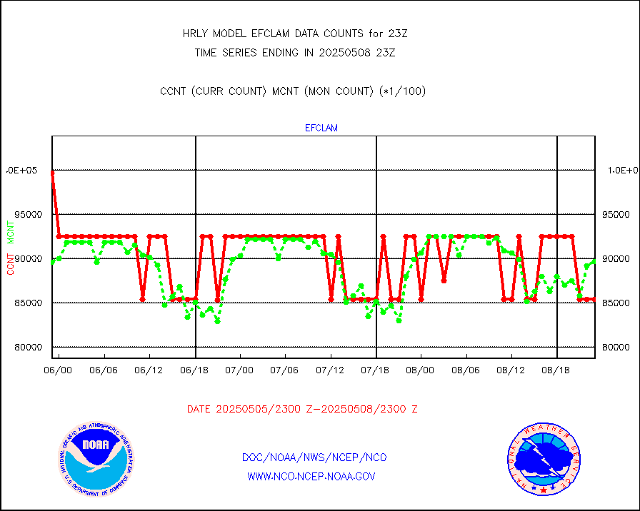
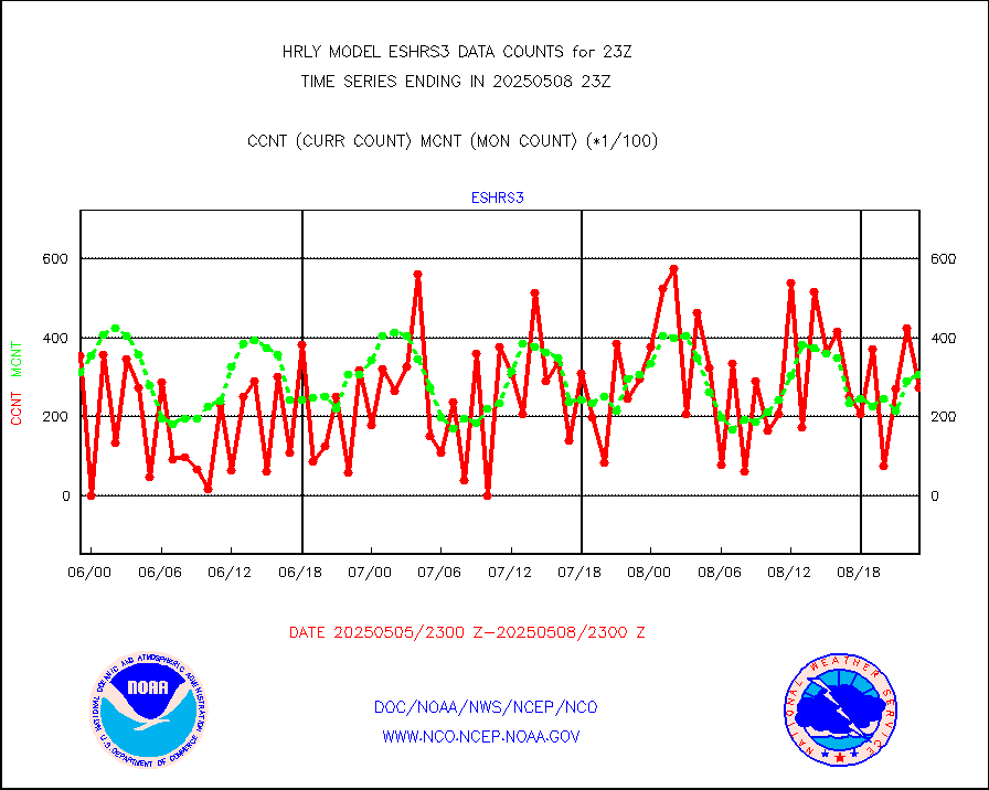
eshrs3 |
NOAA 15-19 & METOP 1-2 HIRS-3/4 pr btmps frm RARS |
53471 |
65537 |
81.6 % |
2522.50-2523.49 |
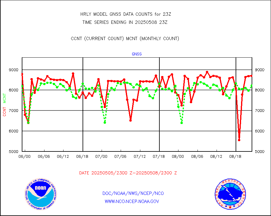
gnss |
Grnd-based Gbl Navigation Sat System (GNSS) data |
6957 |
8440 |
82.4 % |
2522.00-2522.99 |
gpsro |
GPS radio occultation data |
478 |
417 |
114.6 % |
2520.50-2521.49 |
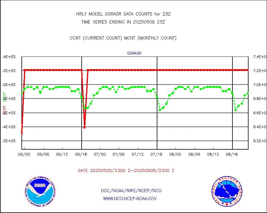
gsrasr |
GOES-16/17 All Sky Radiances (proc.) |
360476 |
354468 |
101.7 % |
2522.50-2523.49 |
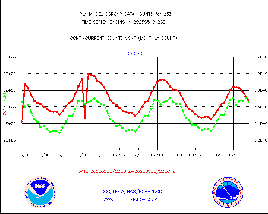
gsrcsr |
GOES-16/17 Clear Sky Radiances (proc.) |
185320 |
182588 |
101.5 % |
2522.50-2523.49 |
h20ja |
MTSAT/JMA water vapor imager derived cloud motion |
19343 |
18992 |
101.8 % |
2520.50-2521.49 |
h20mo |
MODIS (AQUA/TERRA) wvpr imager derived cld motion |
0 |
0 |
n/a |
2519.00-2519.99 |
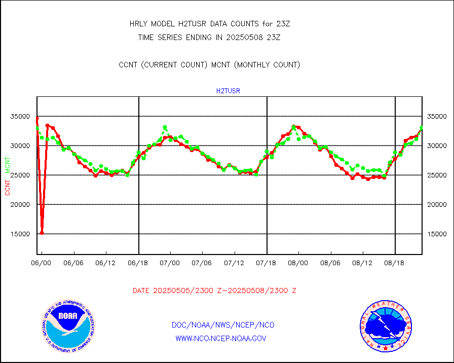
h2tusr |
GOES-16&up/NESDIS wv imgr/cld-top derived cld mtn |
31875 |
30651 |
104.0 % |
2522.00-2522.99 |
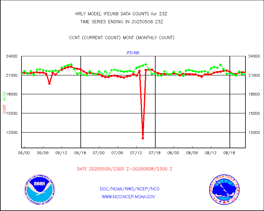
ifeunb |
METEOSAT/EUMETSAT ir lg-wave drv cld motion NBseq |
22251 |
21832 |
101.9 % |
2521.50-2522.49 |
infja |
MTSAT/JMA infrared long-wave derived cloud motion |
16193 |
15896 |
101.9 % |
2520.50-2521.49 |
infmo |
MODIS (AQUA/TERRA) ir l-wave derived cloud motion |
0 |
0 |
n/a |
2519.00-2519.99 |
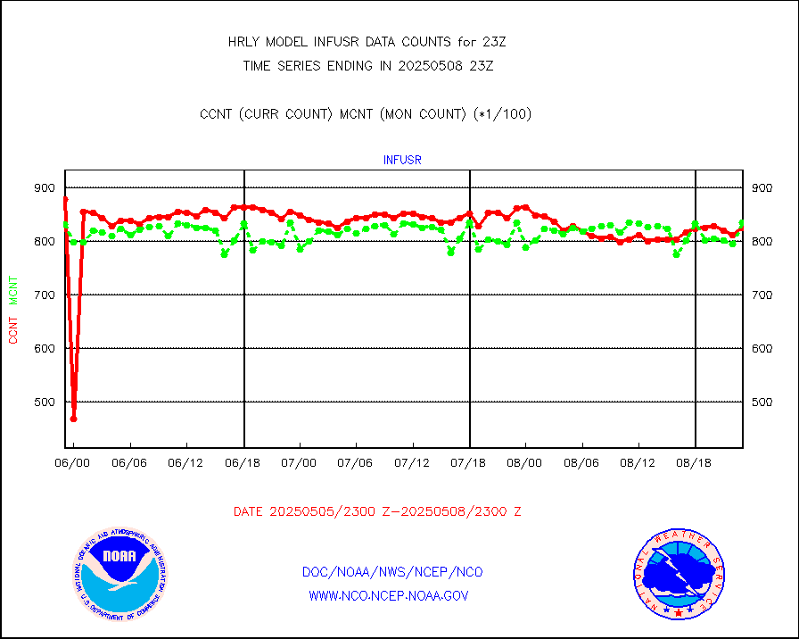
infusr |
GOES-16&up/NESDIS ir long-wave derived cld motion |
87137 |
82557 |
105.5 % |
2522.00-2522.99 |
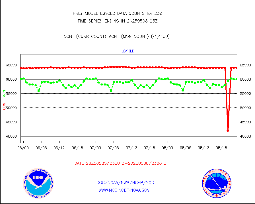
lgycld |
GOES/NASA(Langley) hi-res. (1x1 f-o-v) cloud data |
4191263 |
3721425 |
112.6 % |
2522.50-2523.49 |
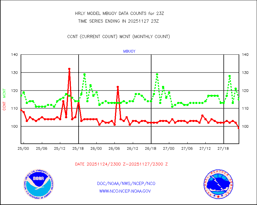
mbuoy |
Buoys decoded from FM-13 format (moored) |
115 |
111 |
103.6 % |
2522.50-2523.49 |
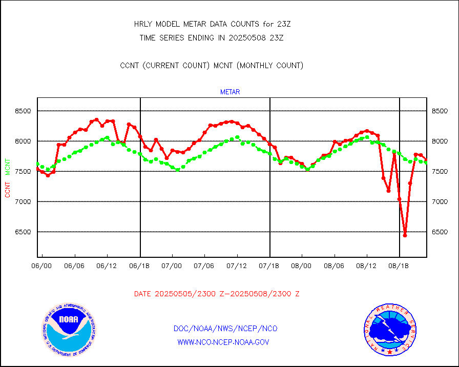
metar |
Aviation - METAR |
7627 |
7607 |
100.3 % |
2522.50-2523.49 |
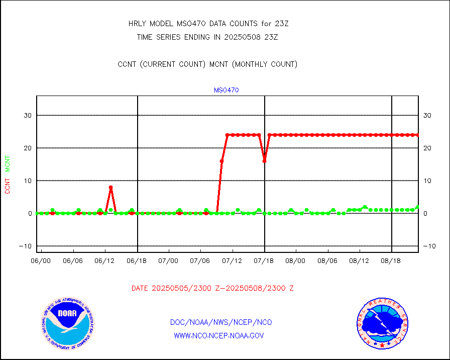
mso470 |
Mesonet/MADIS Colorado E-470 (Interstate 470) |
21 |
20 |
105.0 % |
2522.50-2523.49 |
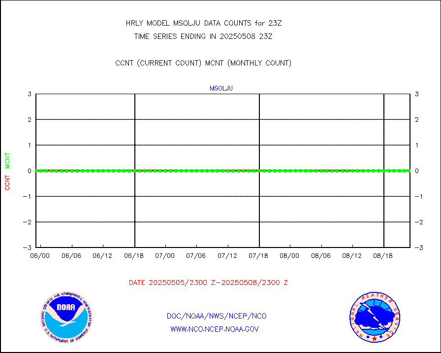
msoalk |
Mesonet/MADIS Alaska Department of Transportation |
106 |
112 |
94.6 % |
2522.50-2523.49 |
msoapg |
Mesonet/MADIS U.S. Army Aberdeen Proving Grounds |
0 |
0 |
n/a |
2522.50-2523.49 |
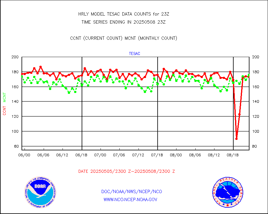
msoapr |
Mesonet/MADIS Citizen Weather Observers Program |
46647 |
47298 |
98.6 % |
2522.50-2523.49 |
msoaws |
Mesonet/MADIS AWS Convergence Technologies, Inc. |
25219 |
25763 |
97.9 % |
2522.50-2523.49 |
msoawx |
Mesonet/MADIS "Anything Weather" |
0 |
0 |
n/a |
2522.50-2523.49 |
msocol |
Mesonet/MADIS Colorado Dept. of Transportation |
0 |
0 |
n/a |
2522.50-2523.49 |
msodcn |
Mesonet/MADIS DC Net |
0 |
0 |
n/a |
2522.50-2523.49 |
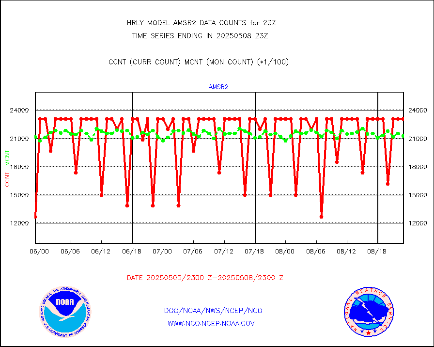
msoden |
Mesonet/MADIS Denver Urban Drainage & Flood Cntrl |
250 |
230 |
108.7 % |
2522.50-2523.49 |
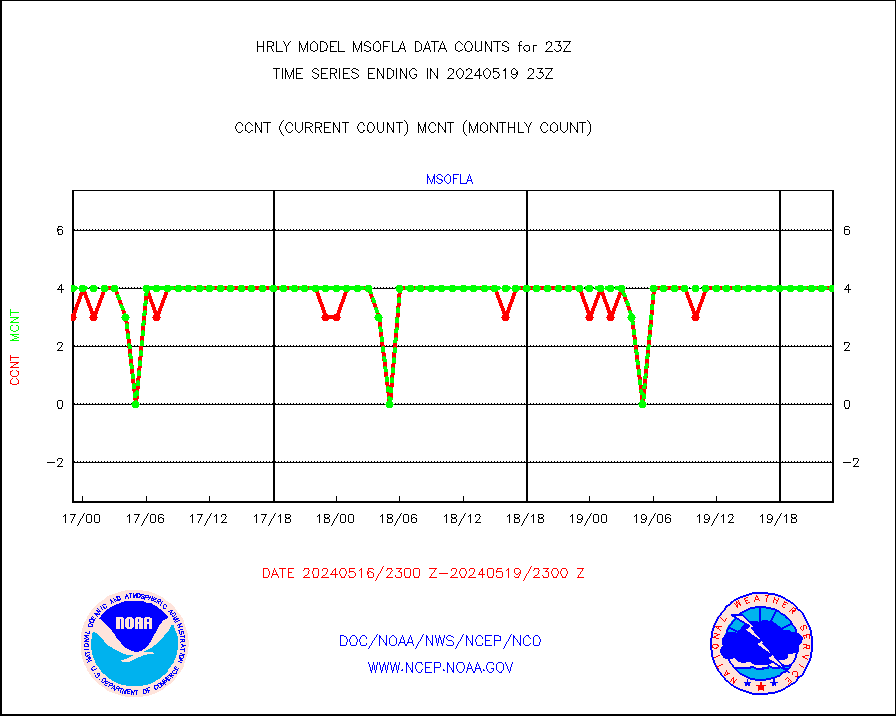
msofla |
Mesonet/MADIS Florida (FAWN & USF) |
4 |
4 |
100.0 % |
2522.50-2523.49 |
msoflt |
Mesonet/MADIS Florida Dept. of Transportation |
0 |
0 |
n/a |
2522.50-2523.49 |
msogeo |
Mesonet/MADIS Georgia Dept. of Transportation |
0 |
0 |
n/a |
2522.50-2523.49 |
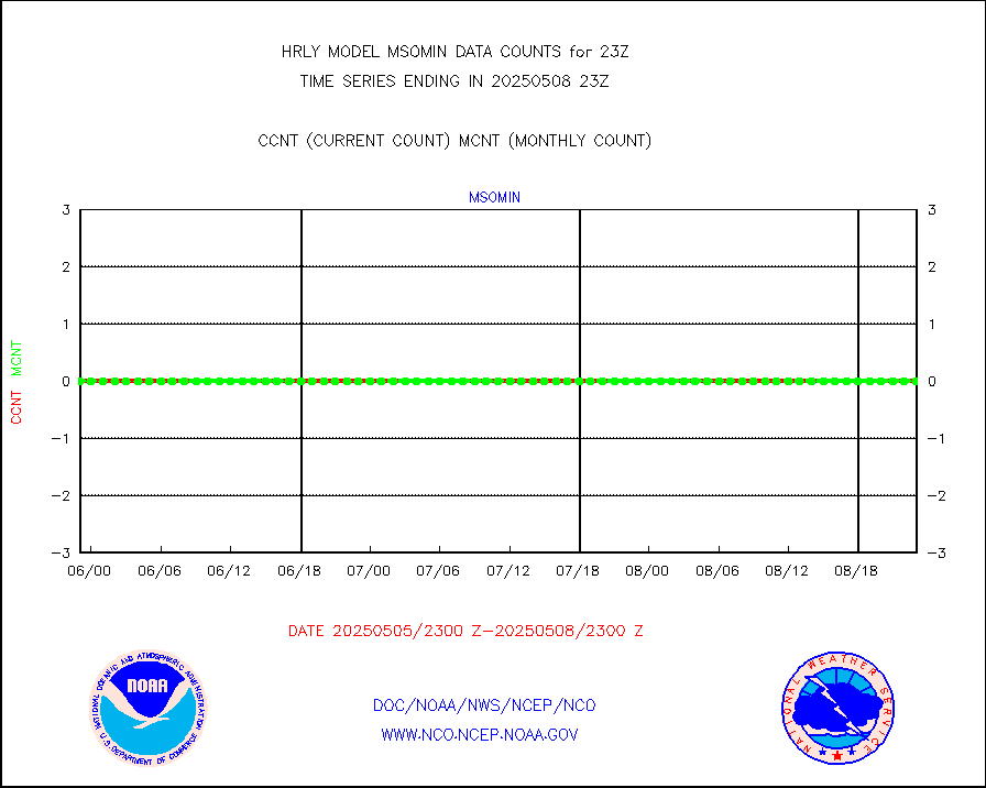
msohad |
Mesonet/MADIS NWS Hydromet Auto Data System(HADS) |
6399 |
6548 |
97.7 % |
2522.50-2523.49 |
msoien |
Mesonet/MADIS Iowa Environmental |
196 |
190 |
103.2 % |
2522.50-2523.49 |
msoind |
Mesonet/MADIS Indiana Dept. of Transportation |
0 |
0 |
n/a |
2522.50-2523.49 |
msoiow |
Mesonet/MADIS Iowa Department of Transportation |
0 |
0 |
n/a |
2522.50-2523.49 |
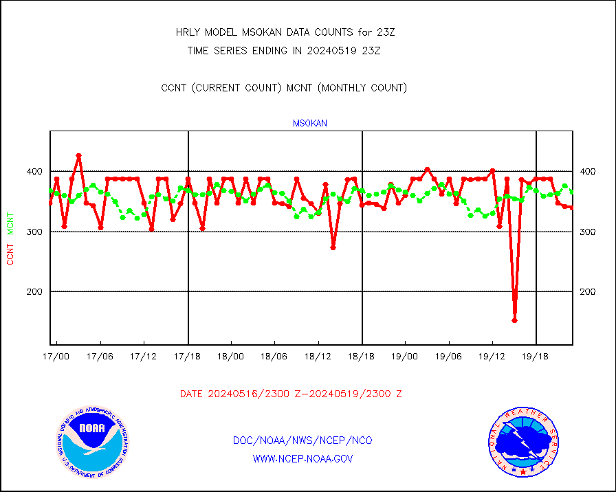
msokan |
Mesonet/MADIS Kansas Department of Transportation |
392 |
347 |
113.0 % |
2522.50-2523.49 |
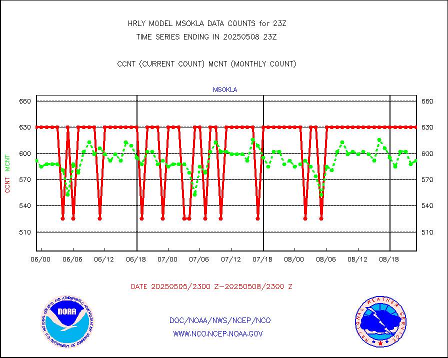
msokla |
Mesonet/MADIS Oklahoma Mesonet |
318 |
329 |
96.7 % |
2522.50-2523.49 |
msolju |
Mesonet/MADIS Louisiana State/Jackson State Univ. |
0 |
0 |
n/a |
2522.50-2523.49 |
msomca |
Mesonet/MADIS Missouri Commercial Agricult Wx Net |
301 |
281 |
107.1 % |
2522.50-2523.49 |
msomin |
Mesonet/MADIS Minnesota Dept. of Transportation |
0 |
0 |
n/a |
2522.50-2523.49 |
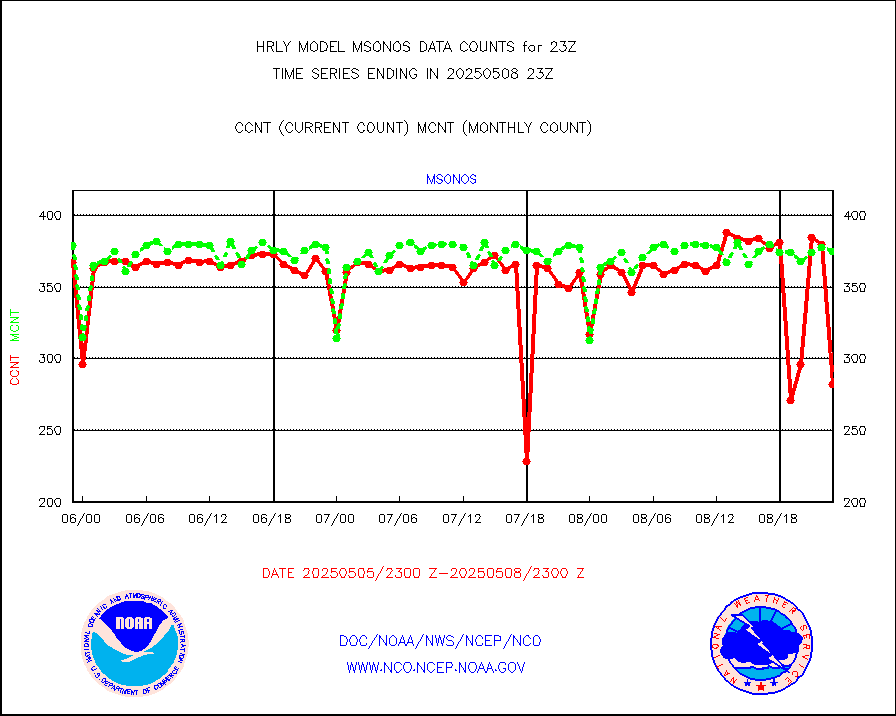
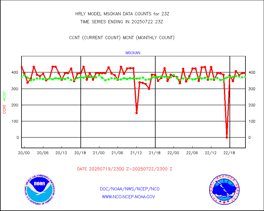
msonos |
Mesonet/MADIS NOS-Phys Oceanographic Realtime Sys |
376 |
359 |
104.7 % |
2522.50-2523.49 |
msoraw |
Mesonet/MADIS NFIC Remote Automated Wx Stns(RAWS) |
1841 |
1831 |
100.5 % |
2522.50-2523.49 |
msovir |
Mesonet/MADIS Virginia Dept. of Transportation |
238 |
235 |
101.3 % |
2522.50-2523.49 |
msowfy |
Mesonet/MADIS "Weather for You" |
0 |
0 |
n/a |
2522.50-2523.49 |
msowis |
Mesonet/MADIS Wisconsin Dept. of Transportation |
0 |
0 |
n/a |
2522.50-2523.49 |
msowst |
Mesonet/MADIS MesoWest (many subproviders) |
44464 |
44719 |
99.4 % |
2522.50-2523.49 |
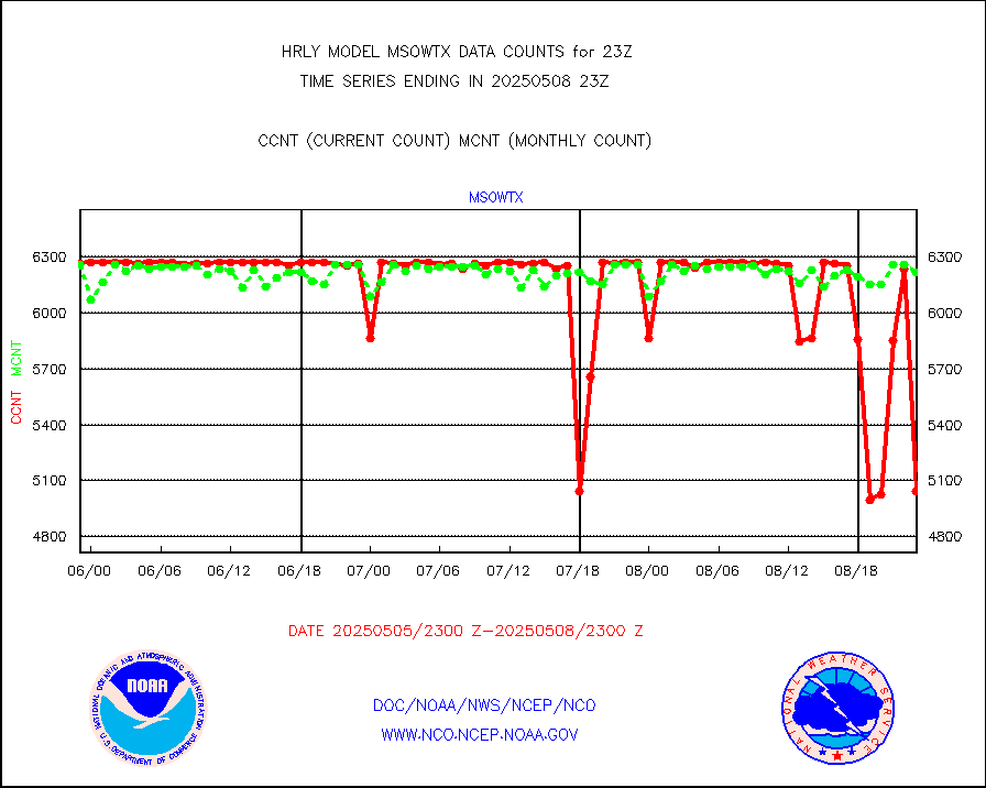
msowtx |
Mesonet/MADIS West Texas |
5648 |
5638 |
100.2 % |
2522.50-2523.49 |
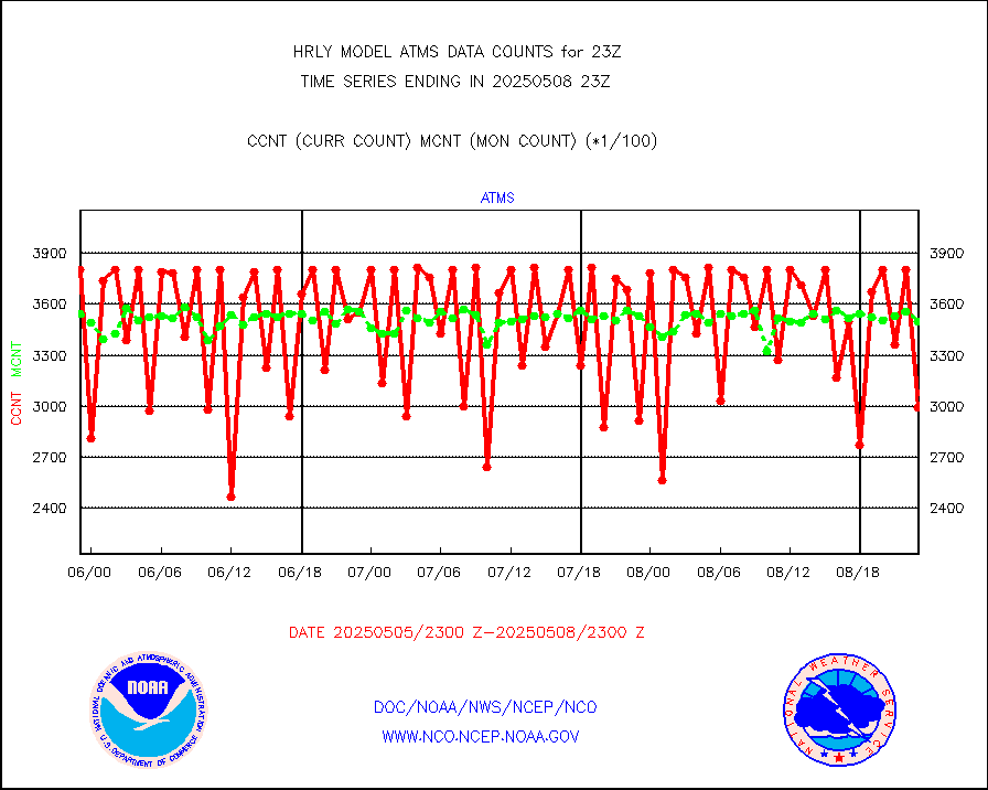
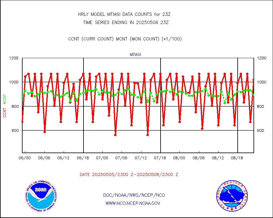
mtiasi |
METOP 1-2 IASI 1C radiance data (varbl. channels) |
72316 |
83051 |
87.1 % |
2521.00-2521.99 |
nxrdw |
NEXRAD Vel Azm Dsp(VAD) winds via radar coded msg |
0 |
0 |
n/a |
2522.50-2523.49 |
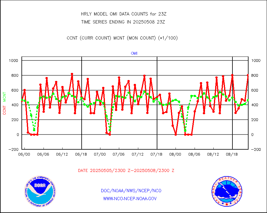
omi |
Aura Ozone Monitoring Instrument (OMI) data |
53280 |
45712 |
116.6 % |
2520.50-2521.49 |
osbuv8 |
NOAA 16-19 Solar Backscatter UV-2 rad frm V8 BUFR |
0 |
0 |
n/a |
2521.00-2521.99 |
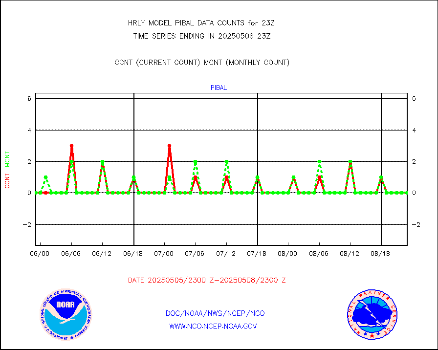
pibal |
PIBAL (from PILOT, PILOT SHIP, PILOT MOBIL) |
0 |
0 |
n/a |
2522.50-2523.49 |
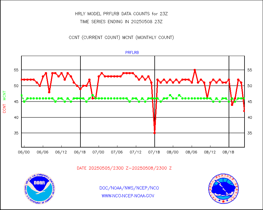
prflrb |
Multi-Agency Profiler (MAP) and SODAR winds |
24 |
40 |
60.0 % |
2522.50-2523.49 |
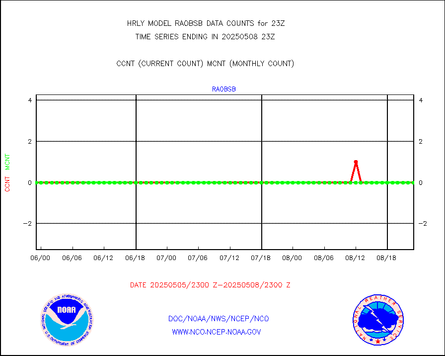
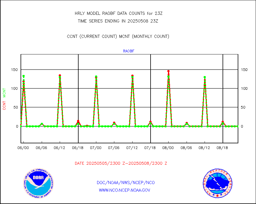
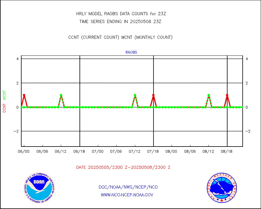
raobf |
Rawinsonde - fixed land (from TEMP or PILOT) |
0 |
0 |
n/a |
2522.50-2523.49 |
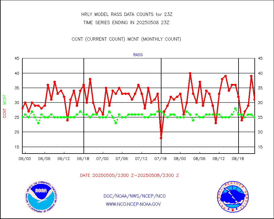
rass |
RASS temperatures (NOAA and Multi-Agency) |
19 |
26 |
73.1 % |
2522.50-2523.49 |
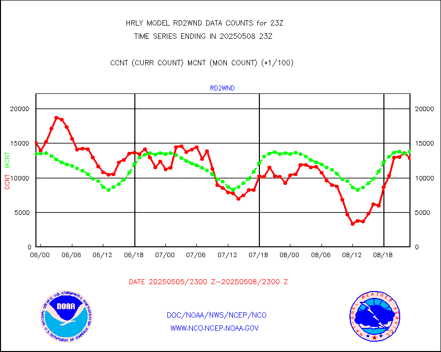
rd2rft |
NEXRAD reflectivity (Lvl 2 - GTS) |
3864497 |
3751893 |
103.0 % |
2522.50-2523.49 |
rd2wnd |
NEXRAD radial wind (Level 2 - GTS) |
1411011 |
1450028 |
97.3 % |
2522.50-2523.49 |
sevcsr |
METEOSAT-10 2nd Gen SEVIRI Clr Sky Radiance(proc) |
0 |
0 |
n/a |
2522.50-2523.49 |
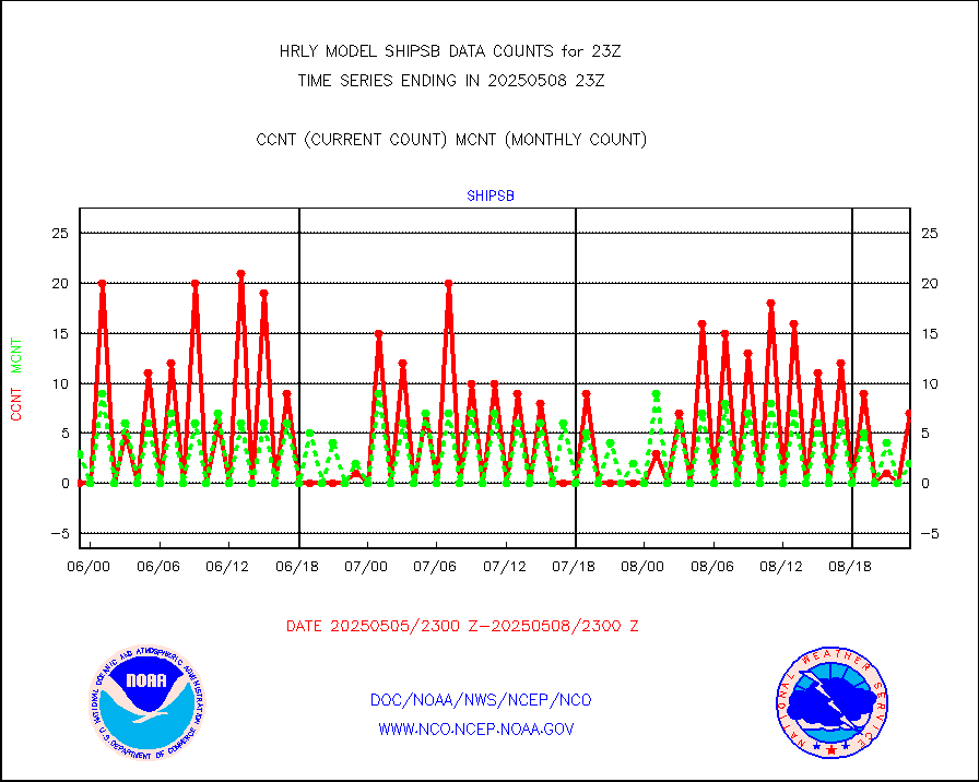
shipsb |
Ship - manual and automatic, restricted (BUFR) |
1 |
1 |
100.0 % |
2522.50-2523.50 |
shipsu |
Ship - manual and automatic, unrestricted |
129 |
113 |
114.2 % |
2522.50-2523.50 |
shipub |
Ship - manual and automatic, unrestricted (BUFR) |
773 |
829 |
93.2 % |
2522.50-2523.50 |
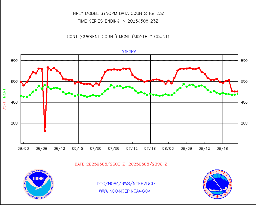
synop |
Synoptic - fixed manual and automatic |
822 |
816 |
100.7 % |
2522.50-2523.49 |
synopb |
Synoptic - fixed manual & auto (decoded fr BUFR) |
4214 |
4093 |
103.0 % |
2522.50-2523.49 |
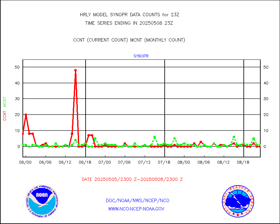
synopr |
Synoptic - restricted (WMO Res 40) manual & auto. |
0 |
1 |
0.0 % |
2522.50-2523.49 |
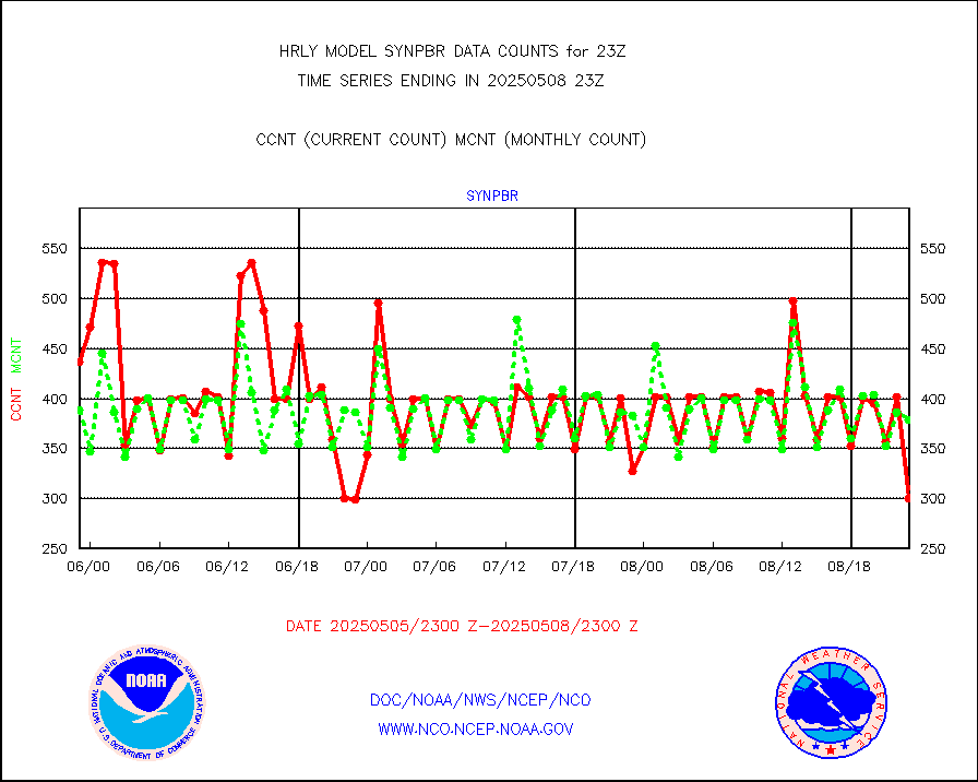
synpbr |
Synoptic - restricted (WMO Res 40)(decoded BUFR) |
397 |
401 |
99.0 % |
2522.50-2523.49 |
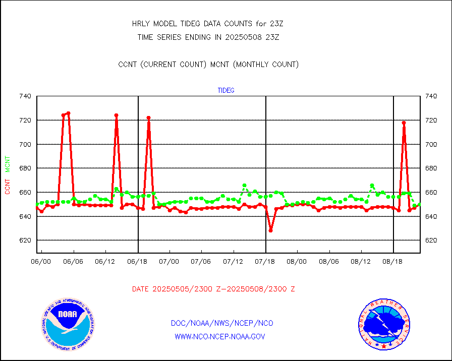
tideg |
Tide gauge reports decoded from CREX format |
641 |
633 |
101.3 % |
2522.00-2522.99 |
| Data Types of Opportunity with Normal Counts |
|---|
| Type | Description | Hourly Count | Monthly Average | Percent (%) of Monthly Mean | UTC Time Window |
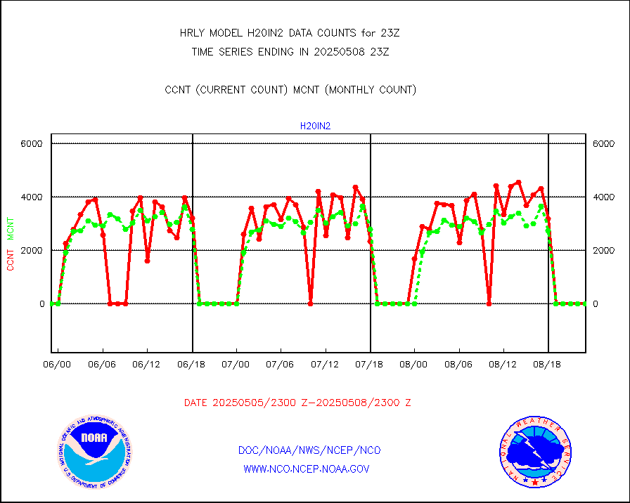
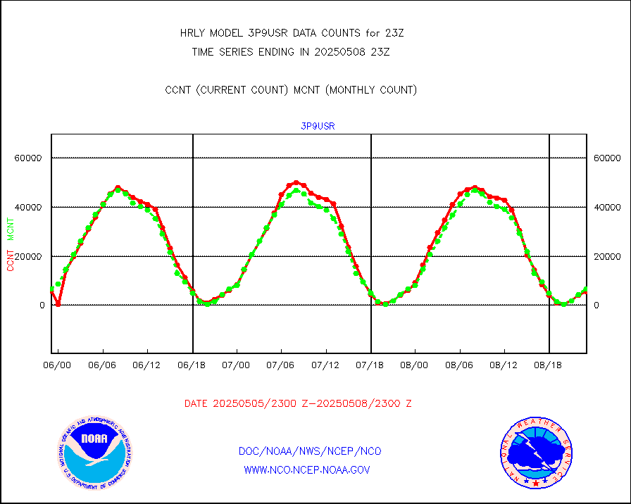
3p9usr |
GOES-16&up/NESDIS ir short-wv derived cld motion |
6813 |
6000 |
113.5 % |
2522.00-2522.99 |
acarsa |
MDCRS ACARS acft data (ARINC via AFWA)(AIREP fmt) |
0 |
0 |
n/a |
2522.50-2523.49 |
ahicsr |
Himawari Clear Sky Radiance |
0 |
0 |
n/a |
2522.00-2522.99 |
amsr2 |
GCOM-W AMSR2 1B brightness temperatures |
2309472 |
2134285 |
108.2 % |
2521.00-2521.99 |
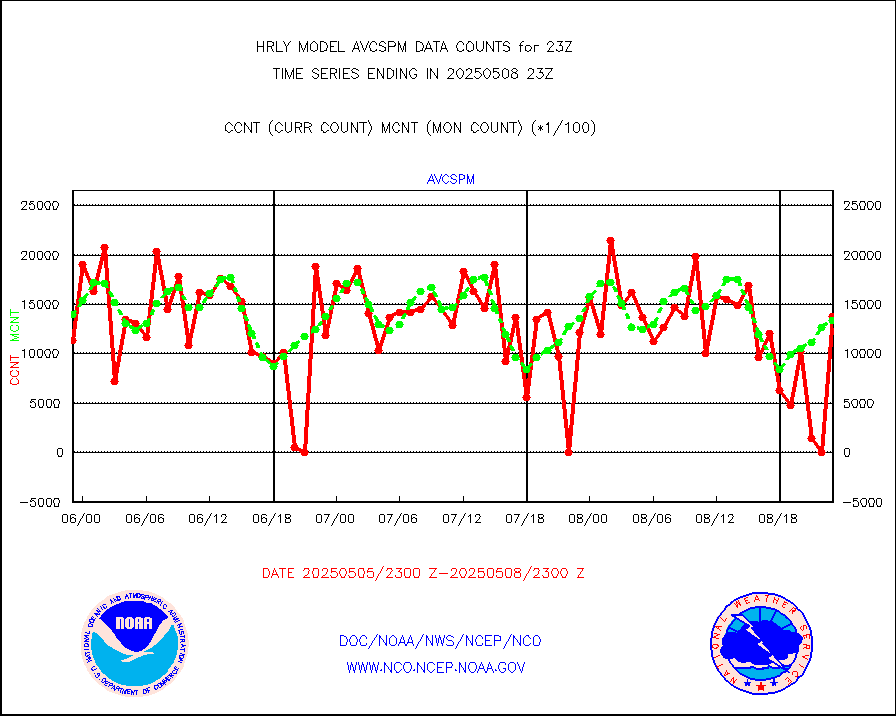
atmsdb |
NPP/NOAA-20 ATMS bright. temps-direct b-cast SSEC |
64512 |
67263 |
95.9 % |
2521.50-2522.49 |
atovs |
POES/NESDIS - processed ATOVS soundings/radiances |
0 |
0 |
n/a |
2521.00-2521.99 |
avcsam |
A.M.(N17,M2,M3) AVHRR GAC NCEP-proc clr&sea btmps |
1259039 |
1249738 |
100.7 % |
2520.50-2521.49 |
avcspm |
P.M.(N18-19) AVHRR GAC NCEP-proc clr & sea btemps |
1465820 |
1290548 |
113.6 % |
2520.50-2521.49 |
bathy |
eXpendable BathyThermograph, mooring (BATHY fmt) |
2 |
0 |
n/a |
2516.00-2516.99 |
coopmd |
Coop/MADIS NEPP & HCN-Modernization NOAA COOP Obs |
27 |
24 |
112.5 % |
2522.50-2523.49 |
crisf4 |
NPP/NOAA-20 CrIS full spctrl radn (431 ch subset) |
212580 |
223907 |
94.9 % |
2521.50-2522.49 |
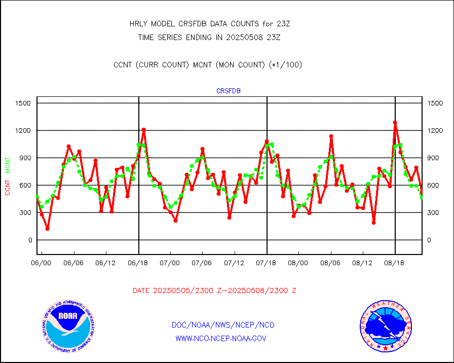
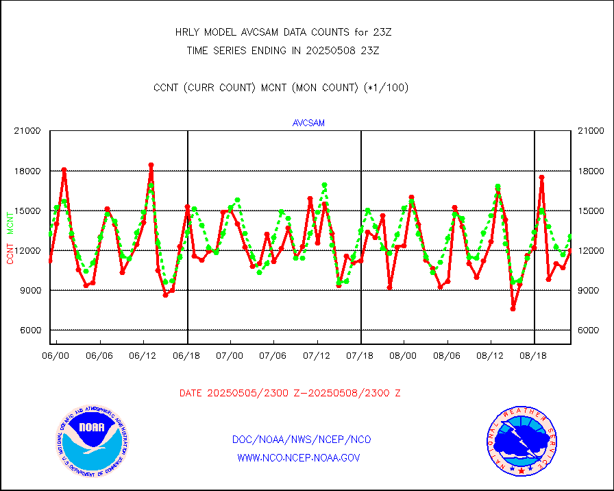
crsfdb |
NPP/NOAA-20 CrIS full spctrl radn dir brdcst SSEC |
56389 |
50240 |
112.2 % |
2521.50-2522.49 |
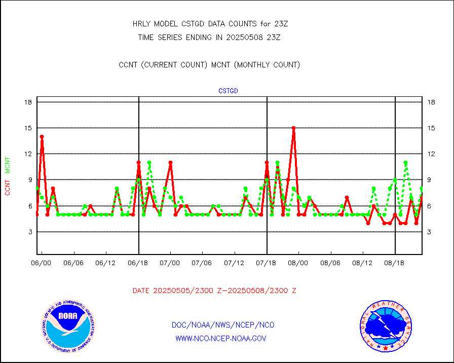
cstgd |
Coast Guard |
6 |
8 |
75.0 % |
2522.50-2523.50 |
dbuoyb |
Drifting buoys (decoded from BUFR) |
1344 |
1407 |
95.5 % |
2522.50-2523.50 |
dropw |
Dropwinsonde (from TEMP DROP) |
0 |
0 |
n/a |
2522.50-2523.49 |
efclam |
GOES imager effective cloud amount data (U.Wisc.) |
8300424 |
8294224 |
100.1 % |
2522.50-2523.49 |
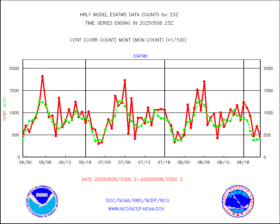
esatms |
NPP Adv. Tech. MW Sndr (ATMS) br. temps from RARS |
52993 |
40857 |
129.7 % |
2521.50-2522.49 |
esiasi |
METOP 1-2 IASI 1C radiance data vbl chn from RARS |
76504 |
58768 |
130.2 % |
2522.00-2522.99 |
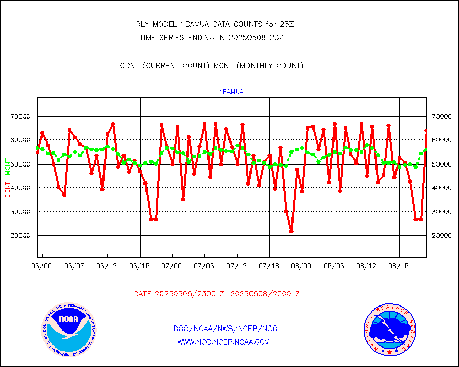
esmhs |
NOAA 18-19 & METOP 1-2 MHS proc. btemps from RARS |
211667 |
252624 |
83.8 % |
2522.50-2523.49 |
geoimr |
GOES/NESDIS (11x17 f-o-v) imager clear radiances |
0 |
0 |
n/a |
2522.00-2522.99 |
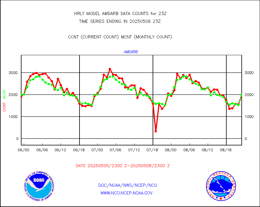
h20in2 |
INDIA SATWIND, INSAT WV channel |
0 |
0 |
n/a |
2522.00-2522.99 |
h2dusr |
GOES-16&up/NESDIS wv imgr/deep-lyr derivd cld mtn |
18609 |
17472 |
106.5 % |
2522.00-2522.99 |
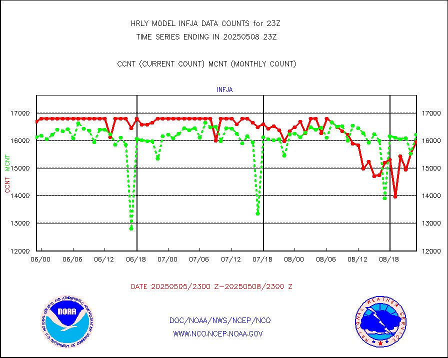
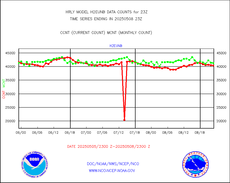
h2eunb |
METEOSAT/EUMETSAT wvpr imgr drv cld motion NBseq |
42819 |
42496 |
100.8 % |
2521.50-2522.49 |
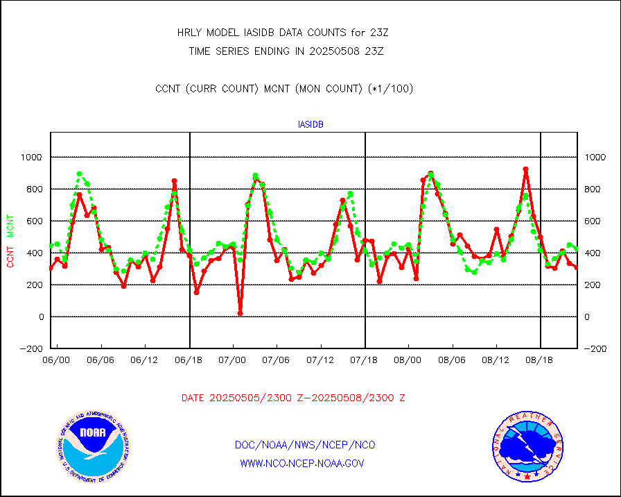
iasidb |
METOP 1-2 IASI 1C radiances-direct broadcast SSEC |
41815 |
37774 |
110.7 % |
2521.50-2522.49 |
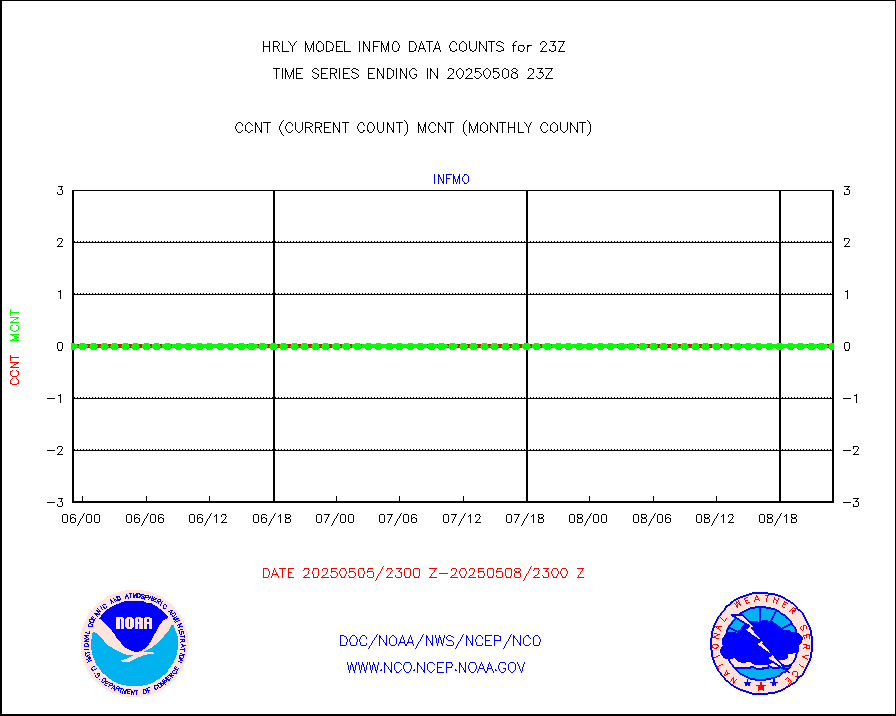
ifvrnb |
VIIRS (NPP/NOAA-20) ir lg-wv drv cloud motion(NB) |
15807 |
15143 |
104.4 % |
2519.00-2519.99 |
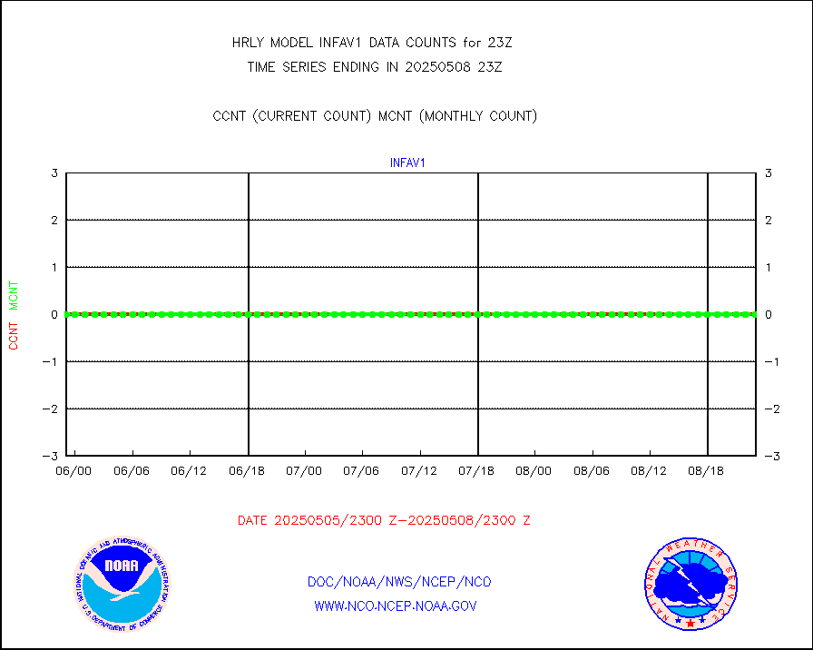
infav1 |
AVHRR (METOP) ir lg-wave derived cld motion |
0 |
0 |
n/a |
2522.50-2523.50 |
infin |
INSAT/KALPANA India ir lg-wave derived cld motion |
0 |
0 |
n/a |
2520.50-2521.49 |
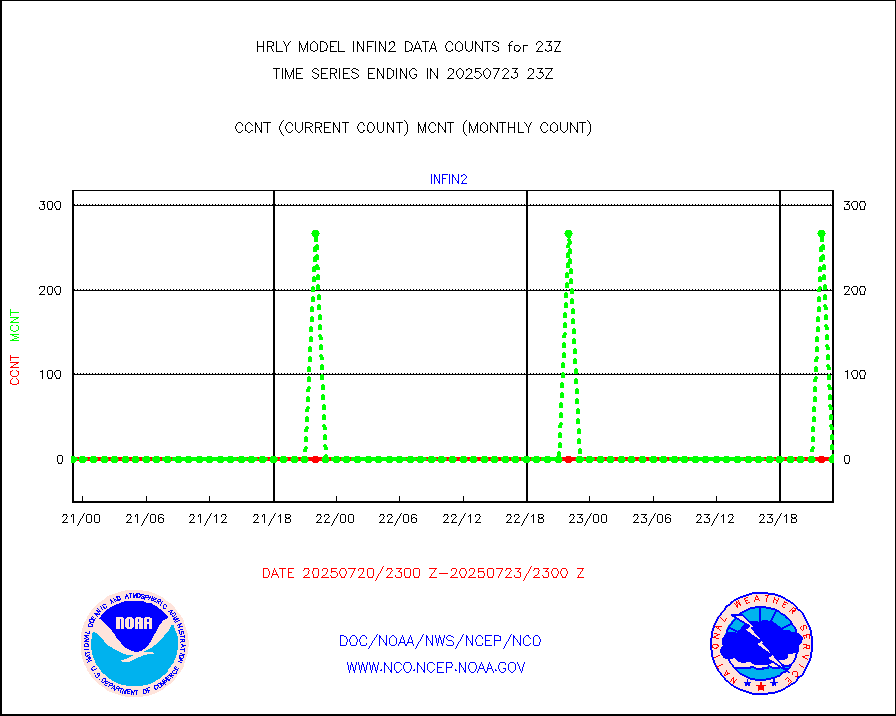
infin2 |
INDIA SATWIND, INSAT IR channel |
0 |
0 |
n/a |
2522.00-2522.99 |
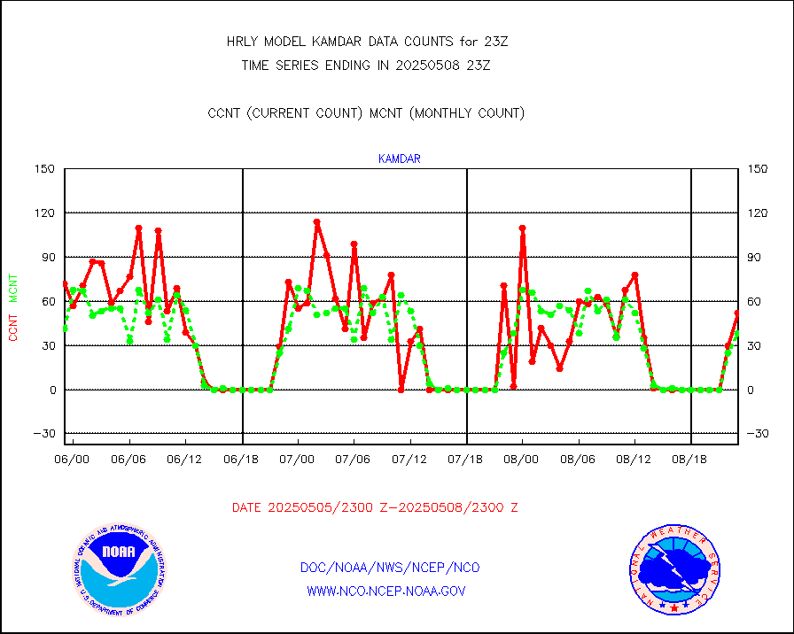
kamdar |
Korean AMDAR aircraft data (decoded from BUFR) |
62 |
59 |
105.1 % |
2522.50-2523.49 |
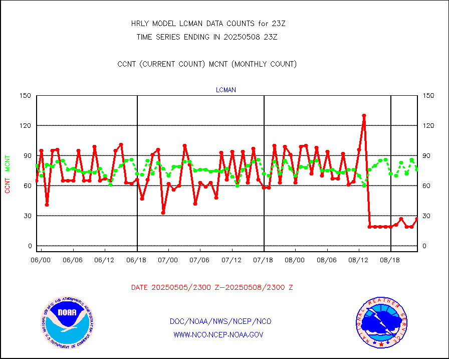
lcman |
Land-based CMAN stations decoded from CMAN format |
75 |
82 |
91.5 % |
2522.50-2523.49 |
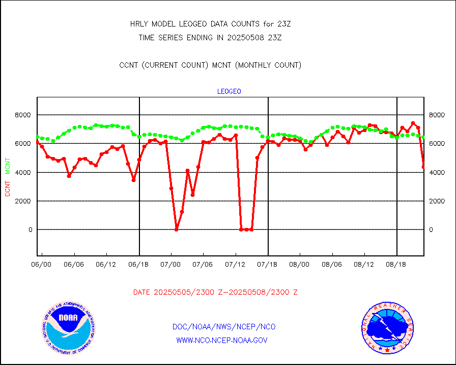
leogeo |
LEO-GEO satellite AMVs from UWisc. |
6558 |
219 |
n/a |
2519.00-2519.99 |
ltnglr |
LLDN Long-rng lightning from Vaisala via NOAAPORT |
159393 |
131750 |
121.0 % |
2522.50-2523.49 |
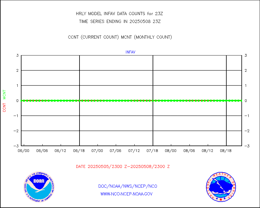
ltngsr |
NLDN Shrt-rng lightning from Vaisala via NOAAPORT |
5740 |
1833 |
313.1 % |
2522.50-2523.49 |
mbuoyb |
Moored buoys (decoded from BUFR) |
673 |
653 |
103.1 % |
2522.50-2523.50 |
mls |
Aura Microwave Limb Sounder (MLS) ozone data |
0 |
0 |
n/a |
2521.00-2521.99 |
msourb |
Mesonet/MADIS UrbaNet |
4166 |
4339 |
96.0 % |
2522.50-2523.49 |
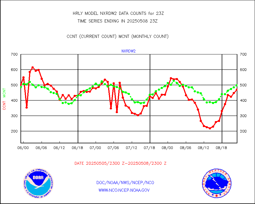
nxrdw2 |
NEXRAD Vel Azm Dsp(VAD) winds via Level 2 decoder |
537 |
534 |
100.6 % |
2522.50-2523.49 |
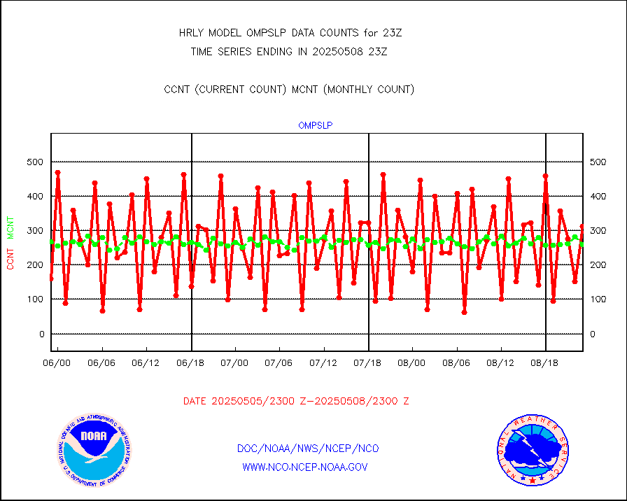
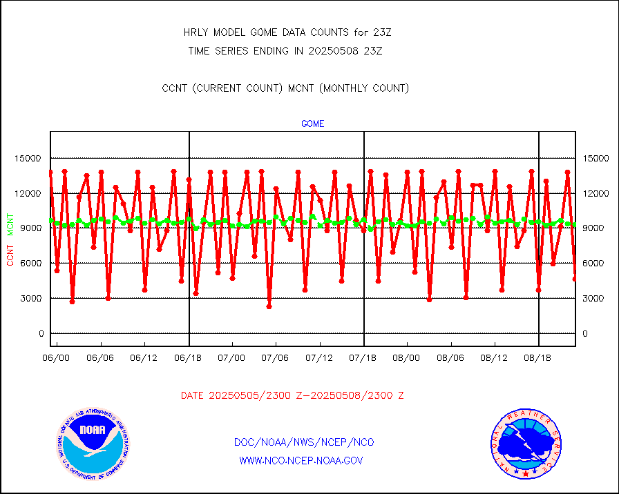
ompslp |
OMPS Limb Profiler ozone data (NPP) |
420 |
275 |
152.7 % |
2516.00-2516.99 |
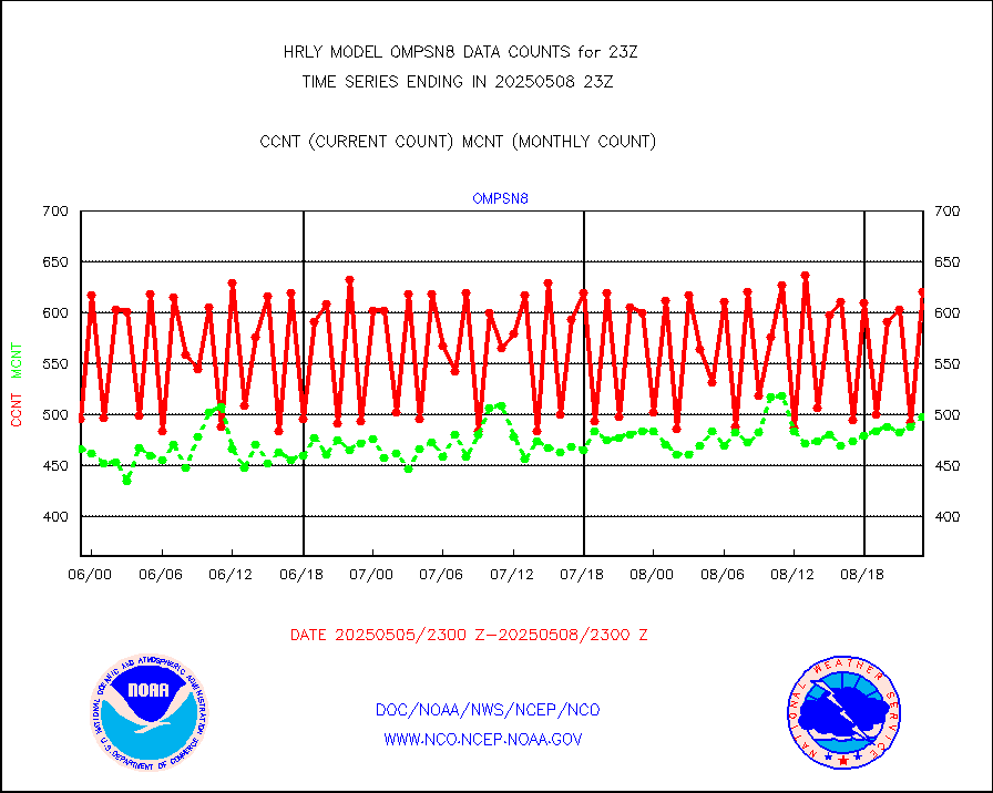
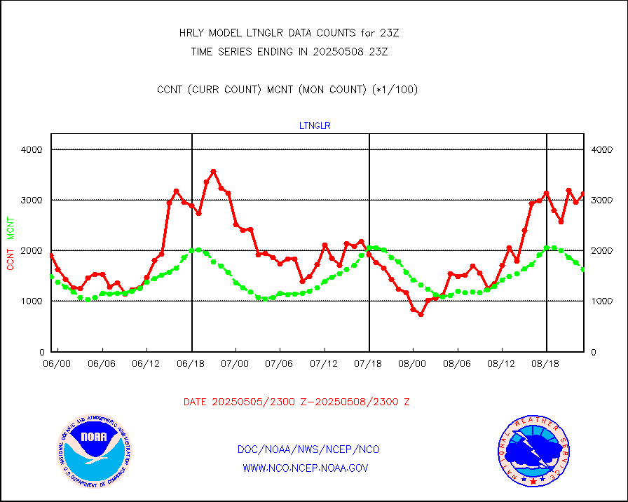
ompsn8 |
OMPS nadir profile ozone (Version 8 BUFR) |
598 |
561 |
106.6 % |
2521.00-2521.99 |
ompst8 |
OMPS total column ozone (Version 8 BUFR) |
269812 |
346758 |
77.8 % |
2521.00-2521.99 |
pirep |
Manual PIREP aircraft data (dcded from AIREP fmt) |
98 |
117 |
83.8 % |
2522.50-2523.49 |
prflrp |
Profilr winds from PIBAL (PILOT,PILOT SHIP/MOBIL) |
0 |
0 |
n/a |
2522.50-2523.49 |
raobm |
Rawinsonde - mobile land (from TEMP/PILOT MOBIL) |
0 |
0 |
n/a |
2522.50-2523.49 |
raobs |
Rawinsonde - ship (from TEMP SHIP, PILOT SHIP) |
0 |
0 |
n/a |
2522.50-2523.49 |
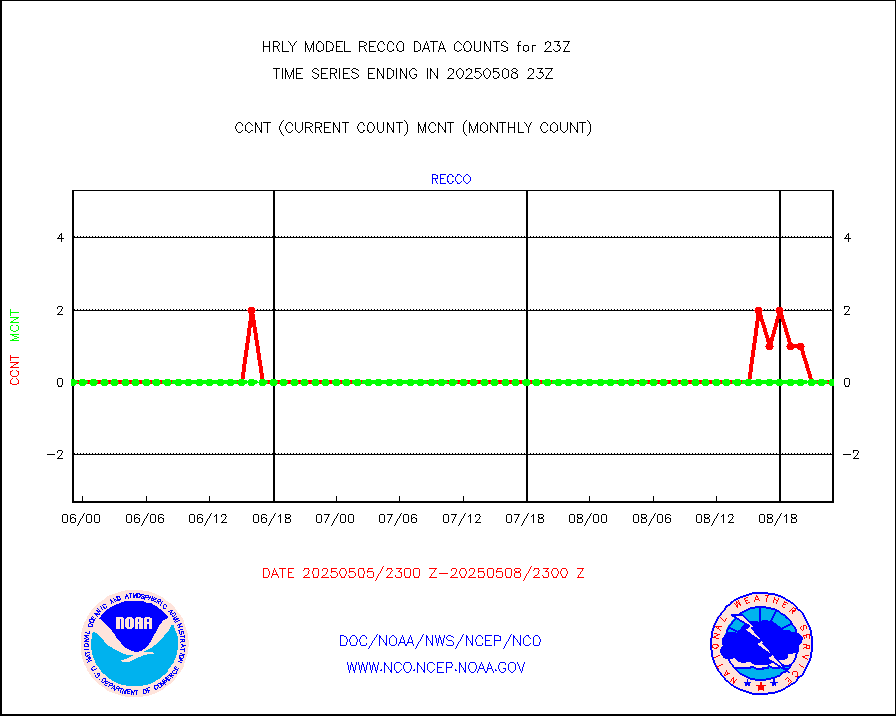
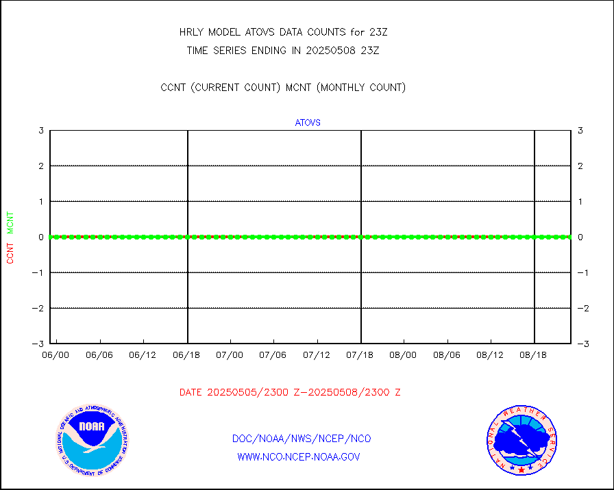
recco |
Flight level reconnaissance aircraft data |
0 |
0 |
n/a |
2522.50-2523.49 |
saphir |
Megha-Tropiques SAPHIR L1A2 brightness temps |
0 |
0 |
n/a |
2520.50-2521.49 |
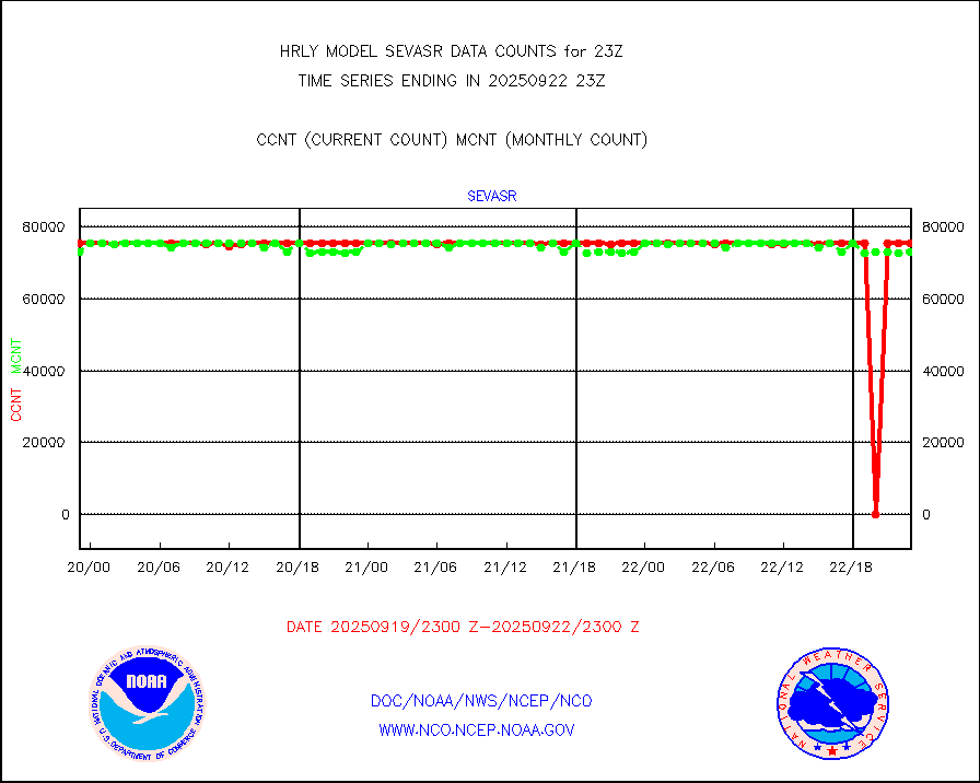
sevasr |
METEOSAT-10 2nd Gen SEVIRI All Sky Radiance(proc) |
75512 |
75422 |
100.1 % |
2522.50-2523.49 |
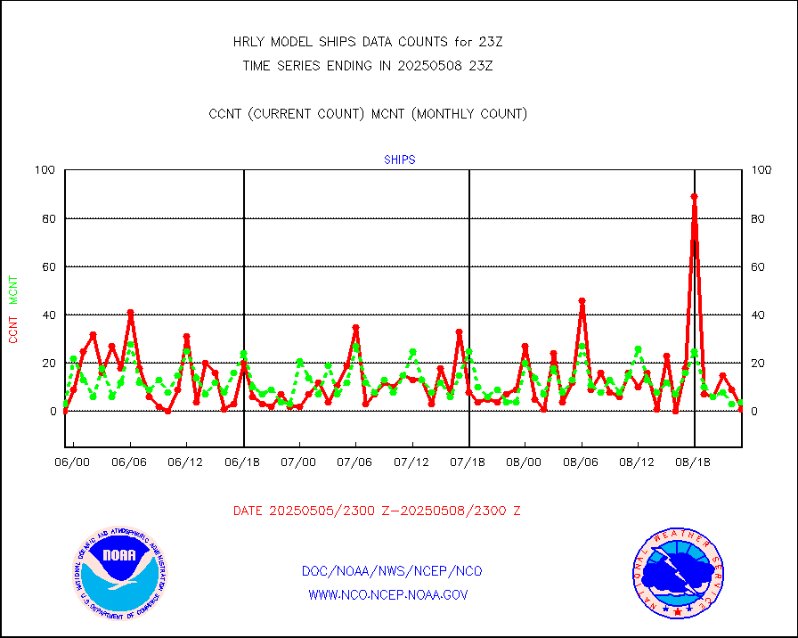
ships |
Ship - manual and automatic, restricted |
5 |
4 |
125.0 % |
2522.50-2523.49 |
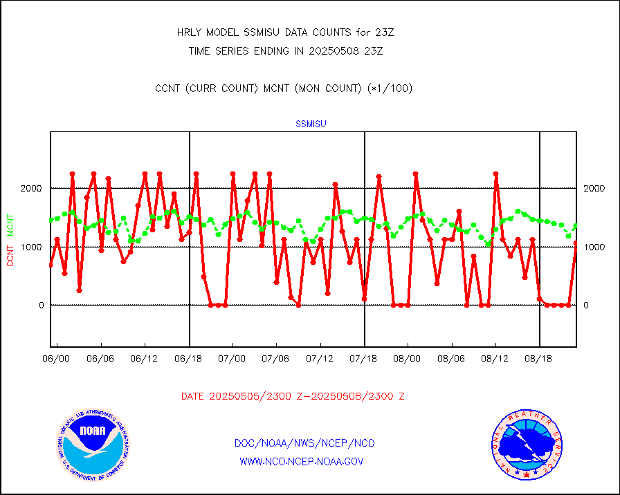
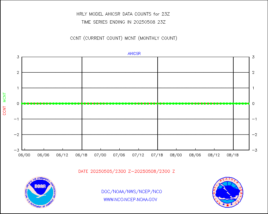
ssmisu |
DMSP SSM/IS 1C radiance data (Unified Pre-Proc.) |
102420 |
121992 |
84.0 % |
2521.50-2522.49 |
synopm |
Synoptic - mobile manual and automatic |
584 |
460 |
127.0 % |
2522.50-2523.49 |
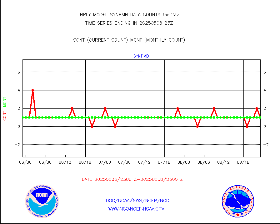
synpmb |
Synoptic - mobile manual & auto (decoded fr BUFR) |
1 |
1 |
100.0 % |
2522.50-2523.49 |
tesac |
CTD probe, Argo prflng float, mooring (TESAC fmt) |
143 |
174 |
82.2 % |
2522.50-2523.49 |
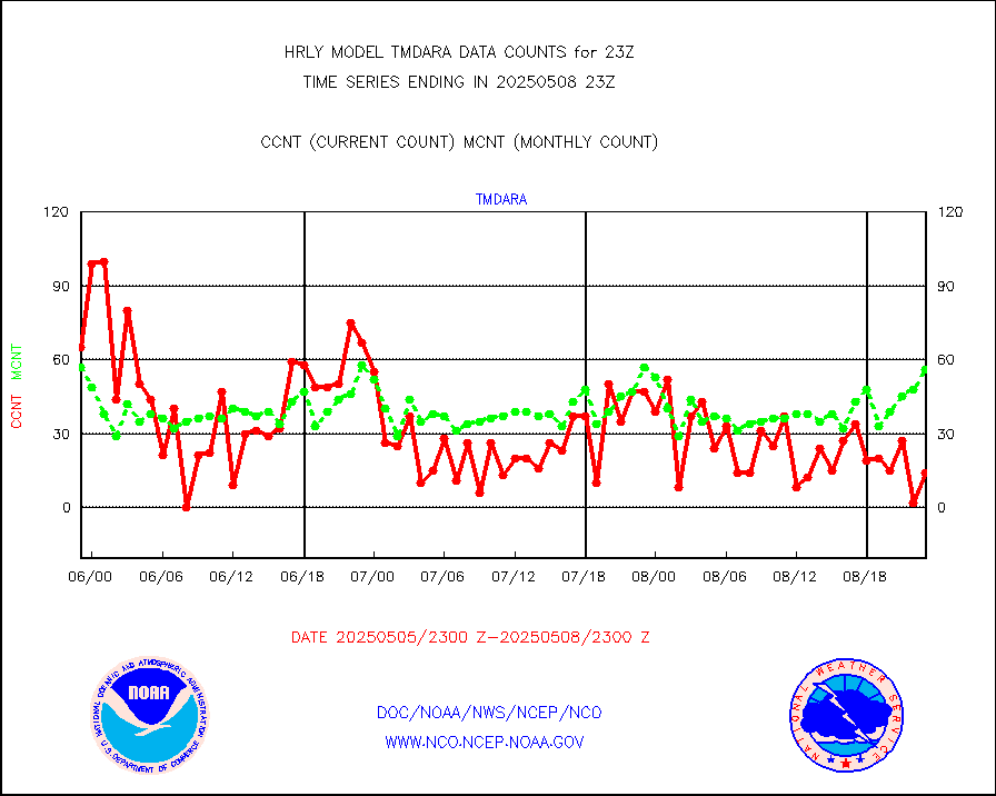
tmdara |
TAMDAR aircft data-all types(from Panasonic,BUFR) |
257 |
291 |
88.3 % |
2522.50-2523.49 |
visin |
INSAT/KALPANA India visible derived cloud motion |
0 |
0 |
n/a |
2520.50-2521.49 |
visin2 |
INDIA SATWIND, INSAT VIS channel |
0 |
0 |
n/a |
2522.00-2522.99 |
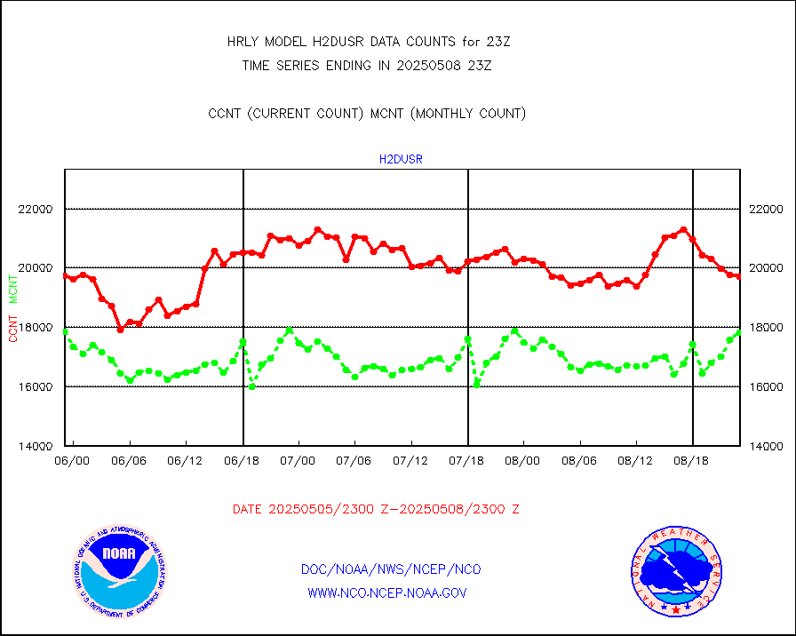
visja |
MTSAT/JMA visible derived cloud motion |
6540 |
6170 |
106.0 % |
2520.50-2521.49 |
visusr |
GOES-16&up/NESDIS visible derived cloud motion |
372661 |
375701 |
99.2 % |
2522.00-2522.99 |
vseunb |
METEOSAT/EUMETSAT visible drv cld motion NBseq |
0 |
16 |
0.0 % |
2521.50-2522.49 |


