| Critical Data with Normal Counts |
|---|
| Type | Description | Hourly Count | Monthly Average | Percent (%) of Monthly Mean | UTC Time Window |
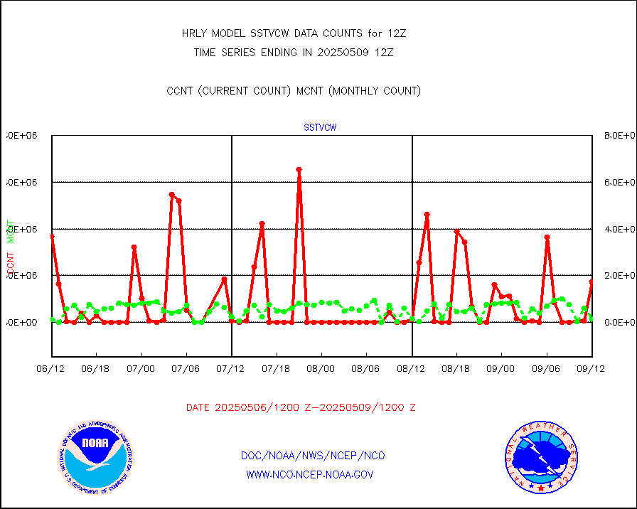
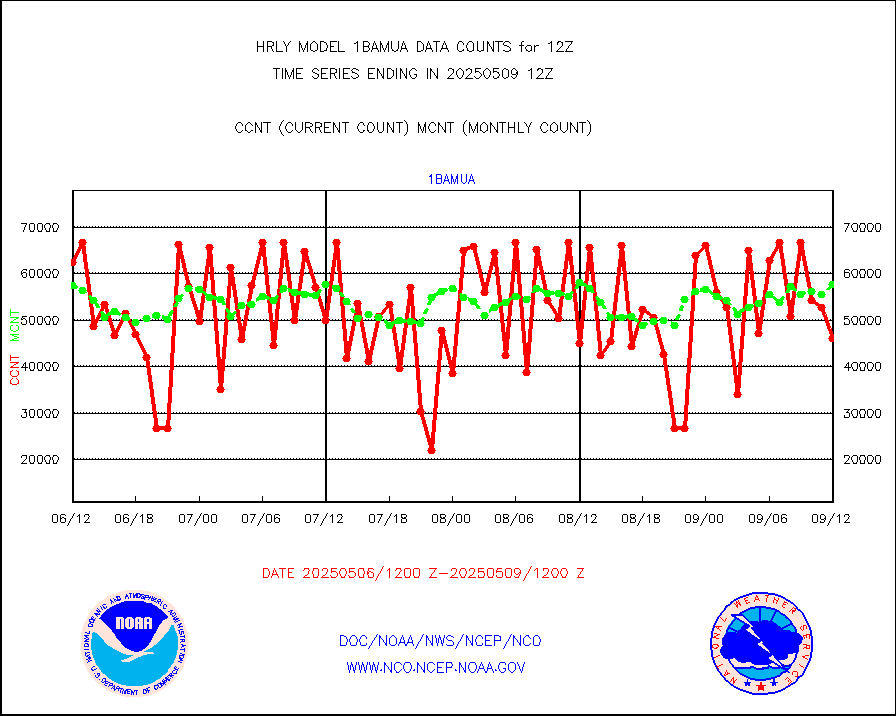
1bamua |
NOAA 15-19 & METOP 1-2 AMSU-A NCEP-proc. br.temps |
58676 |
56788 |
103.3 % |
2610.00-2610.99 |
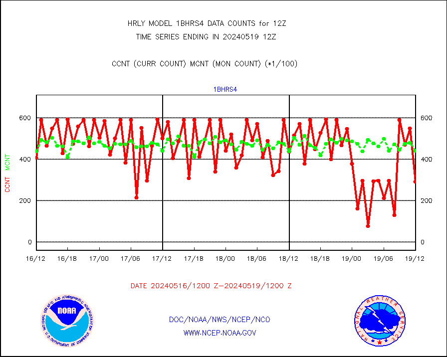
1bhrs4 |
NOAA 18-19 & METOP 1-2 HIRS-4 NCEP-proc. br.temps |
52157 |
47426 |
110.0 % |
2610.00-2610.99 |
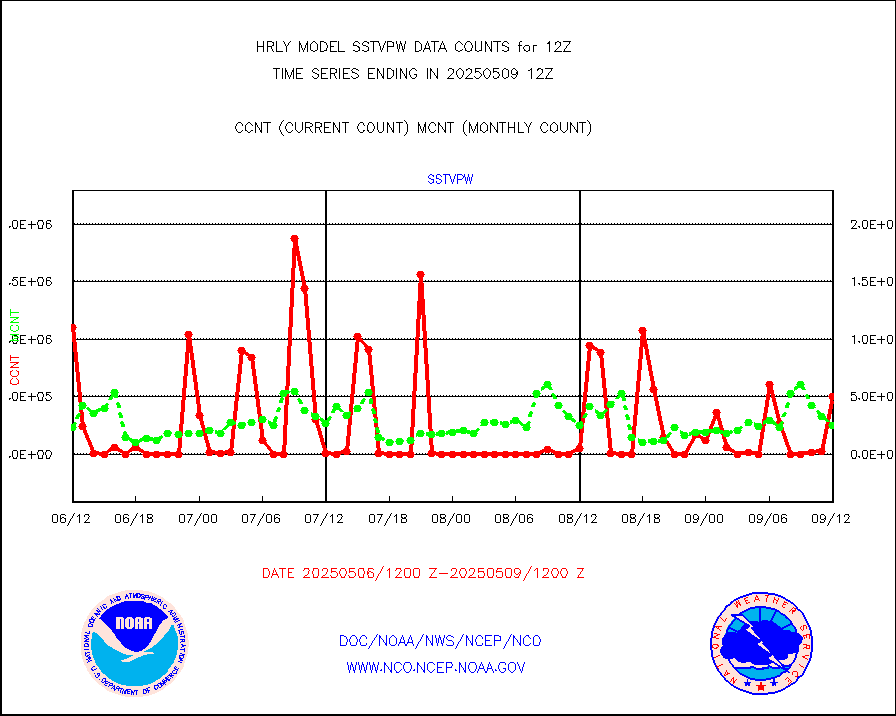
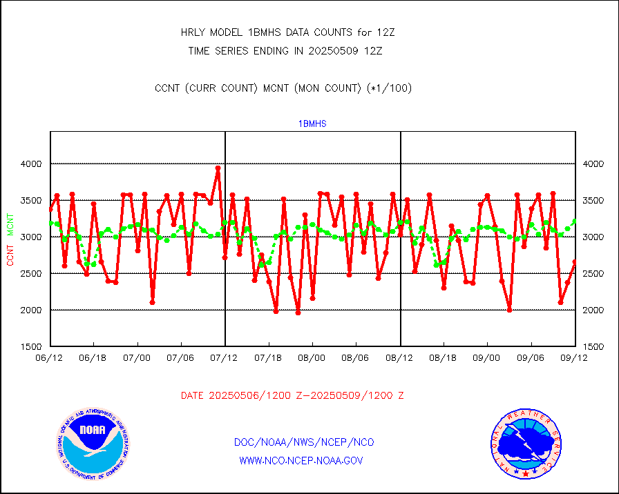
1bmhs |
NOAA 18-19 & METOP 1-2 MHS NCEP-proces. br. temps |
307865 |
305902 |
100.6 % |
2610.00-2610.99 |
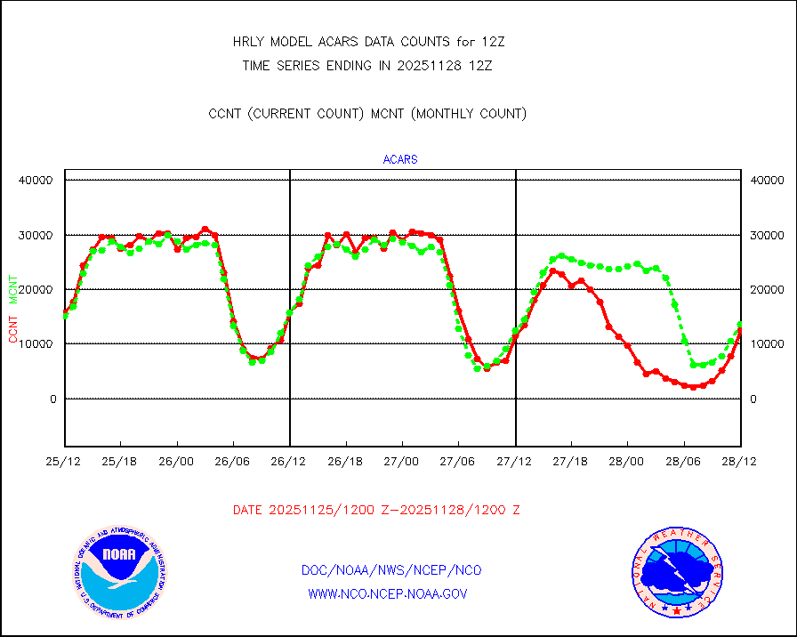
acars |
MDCRS ACARS acft data from ARINC(dcded from BUFR) |
13890 |
15015 |
92.5 % |
2611.50-2612.49 |
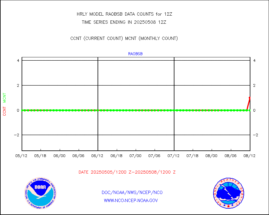
airep |
Manual AIREP aircraft data (dcded from AIREP fmt) |
1280 |
1242 |
103.1 % |
2611.50-2612.49 |
airsev |
AQUA AIRS/AMSU-A/HSB brightness temps- every FOV |
0 |
0 |
n/a |
2609.50-2610.49 |
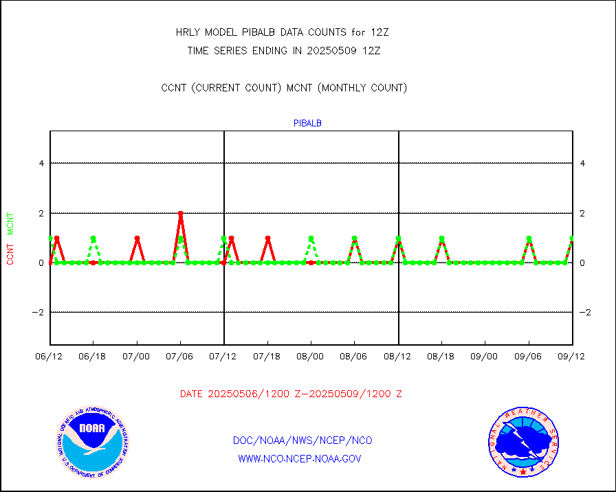
amdar |
AMDAR aircraft data (decoded from AMDAR format) |
158 |
358 |
44.1 % |
2611.50-2612.49 |
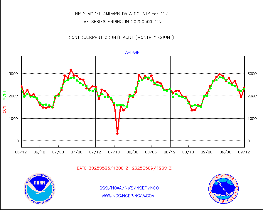
amdarb |
AMDAR aircraft data (decoded from BUFR) |
1059 |
992 |
106.8 % |
2611.50-2612.49 |
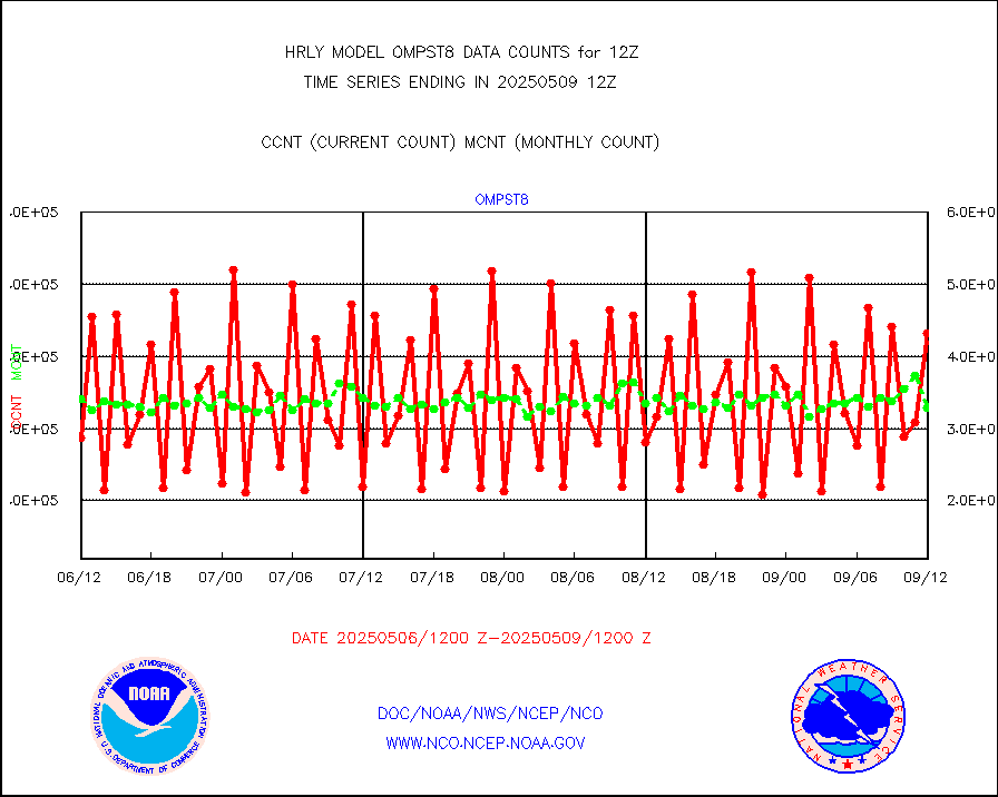
ascat |
METOP 1-2 ASCAT products |
43764 |
48703 |
89.9 % |
2610.50-2611.49 |
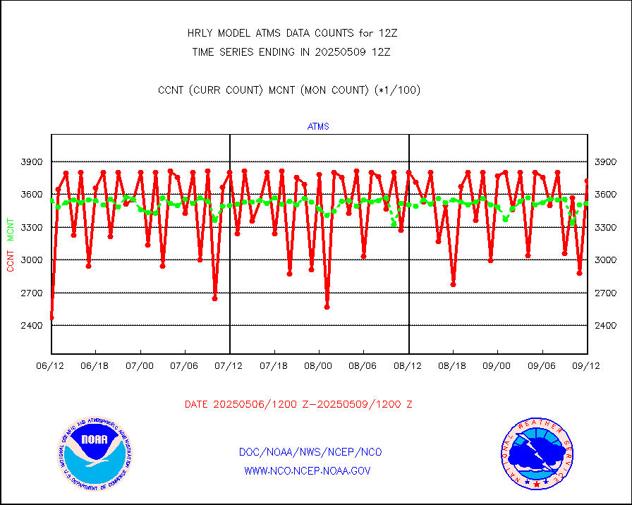
atms |
NPP/NOAA-20 ATMS brightness temperatures |
256704 |
313296 |
81.9 % |
2610.50-2611.49 |
camdar |
Canadian AMDAR aircraft data (decoded from BUFR) |
0 |
1 |
0.0 % |
2611.50-2612.49 |
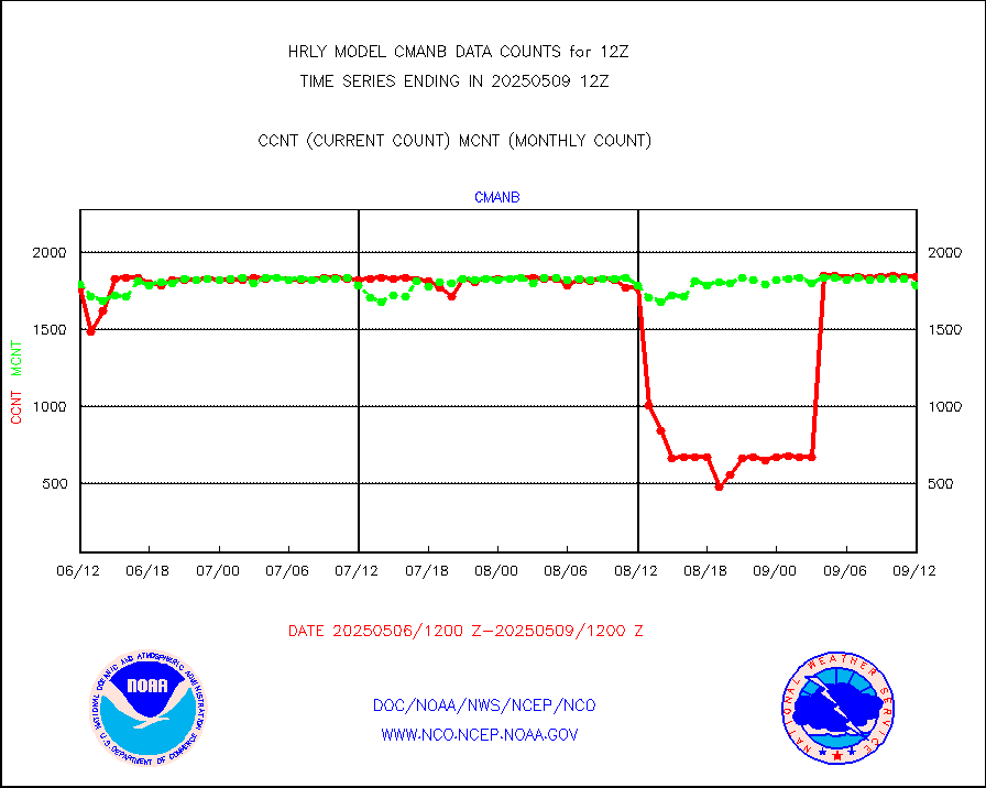
cmanb |
Surface Marine CMAN rpts decoded from BUFR format |
1842 |
1824 |
101.0 % |
2611.50-2612.50 |
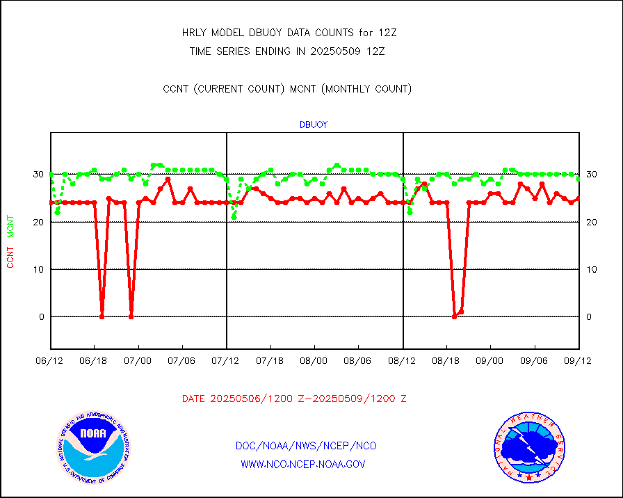
dbuoy |
Buoys decoded from FM-18 fmt (moored or drifting) |
37 |
36 |
102.8 % |
2611.50-2612.49 |
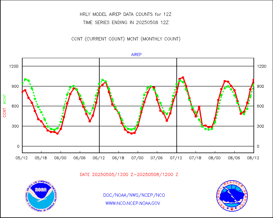
eadas |
E-AMDAR (European AMDAR acft decoded from BUFR) |
2147 |
1994 |
107.7 % |
2611.50-2612.49 |
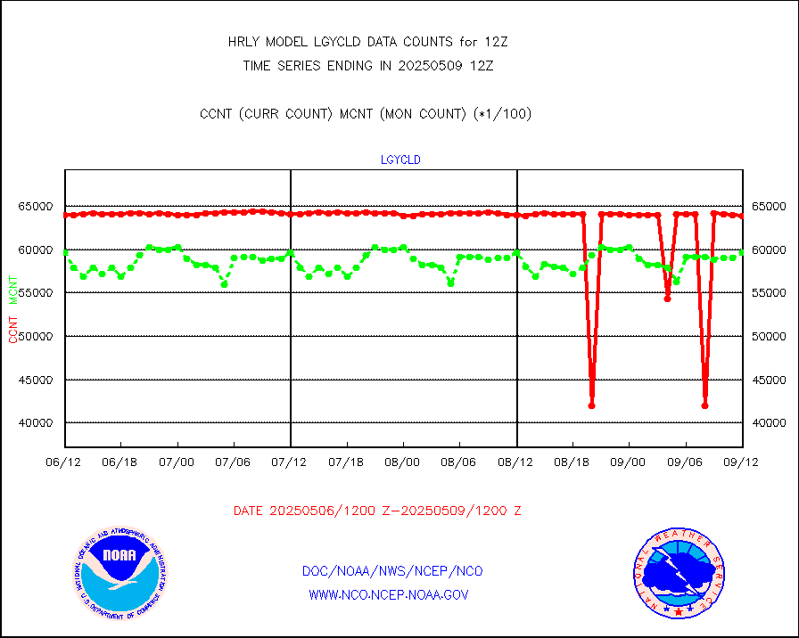
esamua |
NOAA 15-19 & METOP 1-2 AMSU-A proc btmps frm RARS |
41536 |
36209 |
114.7 % |
2611.50-2612.49 |
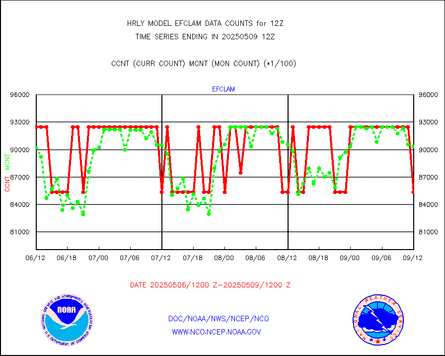
eshrs3 |
NOAA 15-19 & METOP 1-2 HIRS-3/4 pr btmps frm RARS |
75690 |
73741 |
102.6 % |
2611.50-2612.49 |
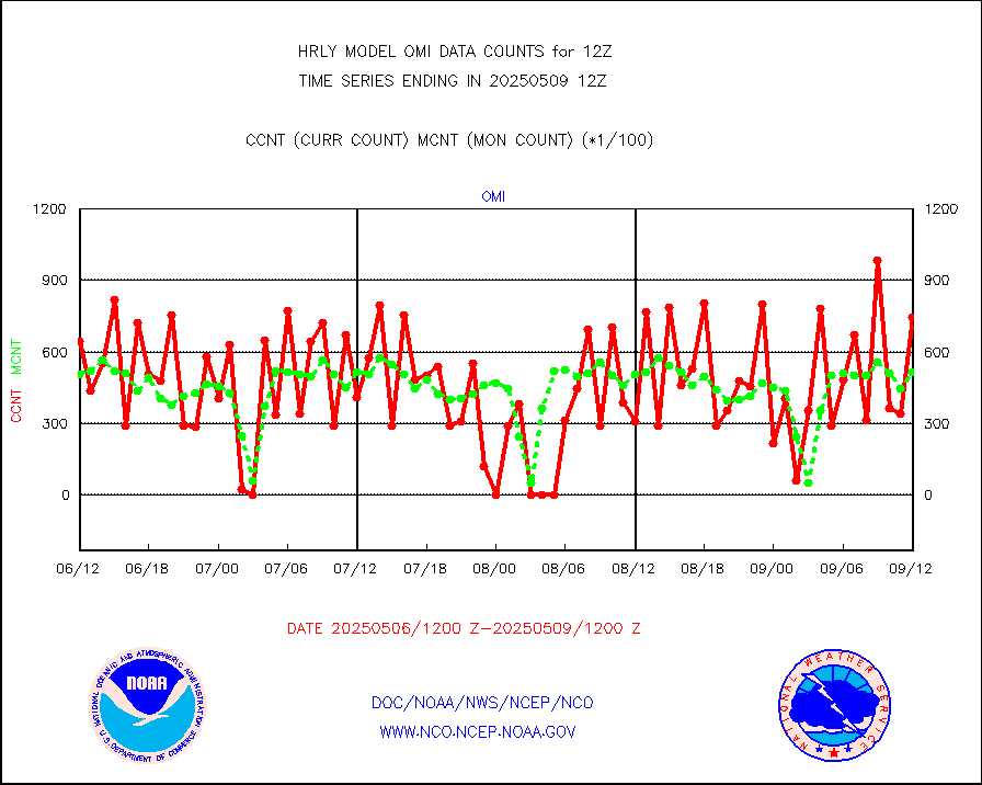
gnss |
Grnd-based Gbl Navigation Sat System (GNSS) data |
9043 |
7453 |
121.3 % |
2611.00-2611.99 |
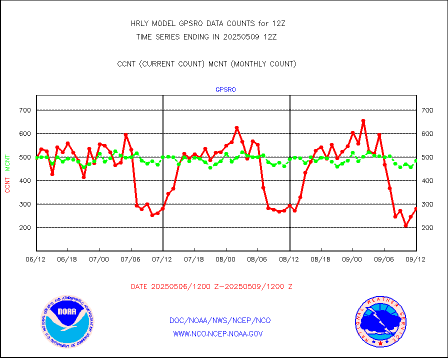
gpsro |
GPS radio occultation data |
564 |
517 |
109.1 % |
2609.50-2610.49 |
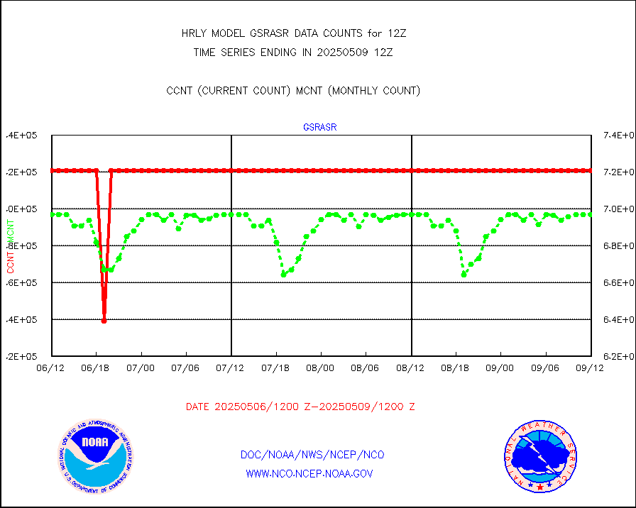
gsrasr |
GOES-16/17 All Sky Radiances (proc.) |
360476 |
360476 |
100.0 % |
2611.50-2612.49 |
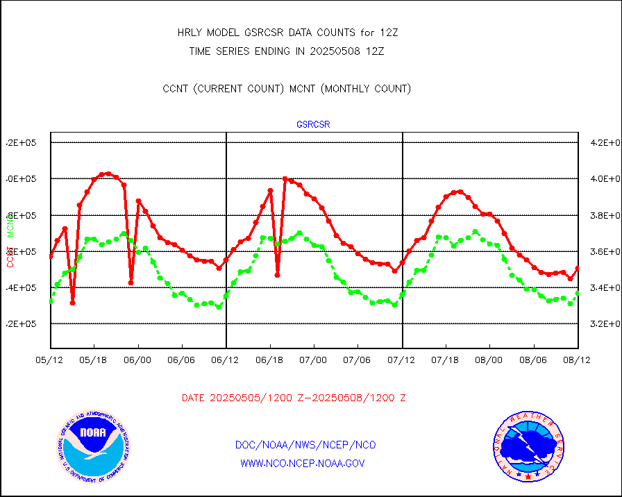
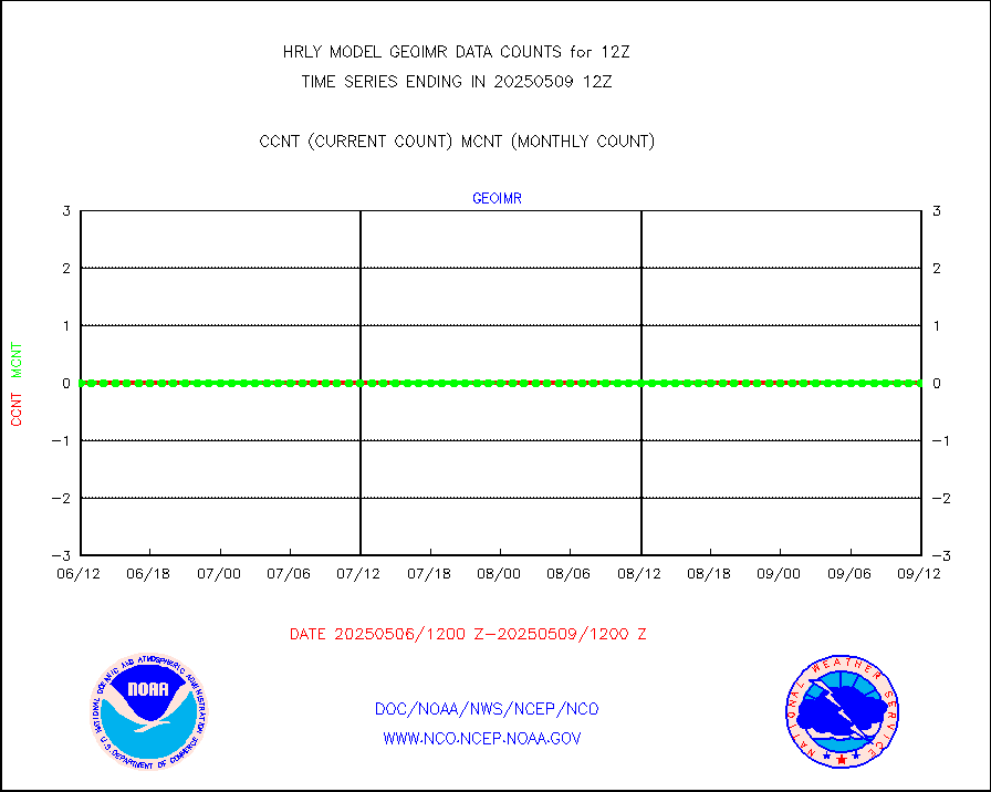
gsrcsr |
GOES-16/17 Clear Sky Radiances (proc.) |
167401 |
167937 |
99.7 % |
2611.50-2612.49 |
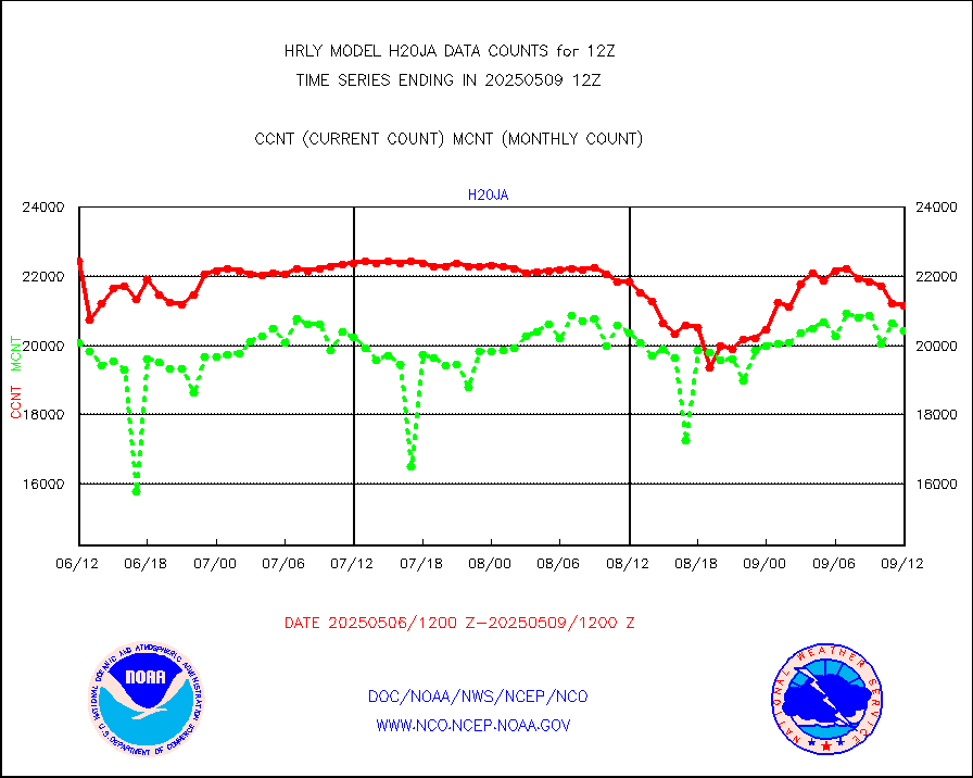
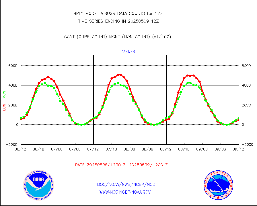
h20ja |
MTSAT/JMA water vapor imager derived cloud motion |
17448 |
17961 |
97.1 % |
2609.50-2610.49 |
h20mo |
MODIS (AQUA/TERRA) wvpr imager derived cld motion |
0 |
0 |
n/a |
2608.00-2608.99 |
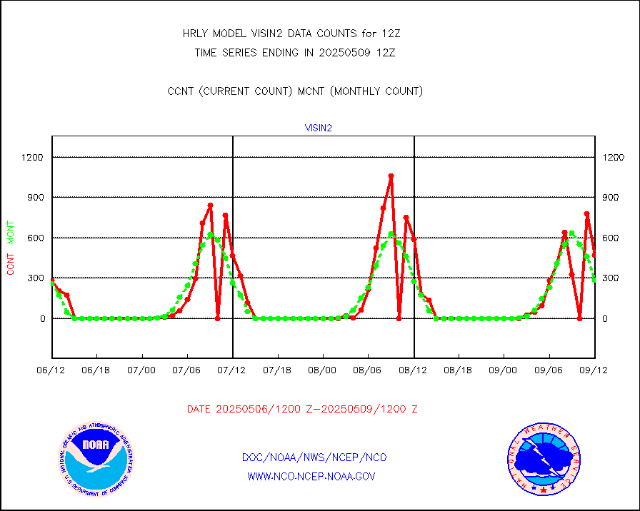
h2tusr |
GOES-16&up/NESDIS wv imgr/cld-top derived cld mtn |
24376 |
19630 |
124.2 % |
2611.00-2611.99 |
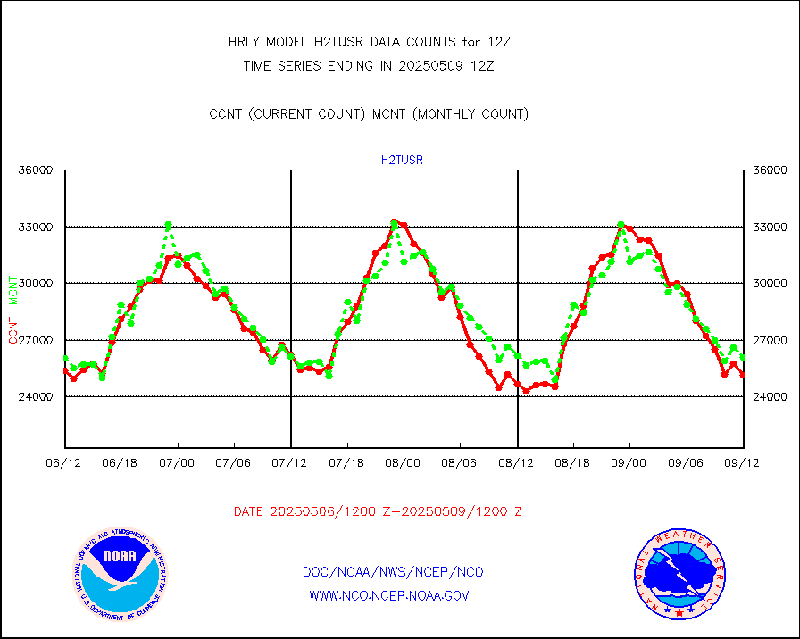
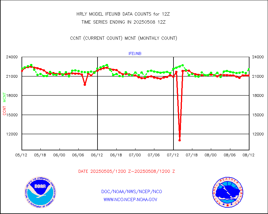
ifeunb |
METEOSAT/EUMETSAT ir lg-wave drv cld motion NBseq |
20932 |
20162 |
103.8 % |
2610.50-2611.49 |
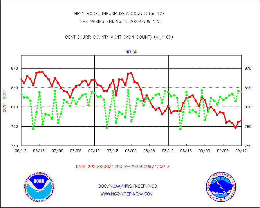
infja |
MTSAT/JMA infrared long-wave derived cloud motion |
15511 |
15433 |
100.5 % |
2609.50-2610.49 |
infmo |
MODIS (AQUA/TERRA) ir l-wave derived cloud motion |
0 |
0 |
n/a |
2608.00-2608.99 |
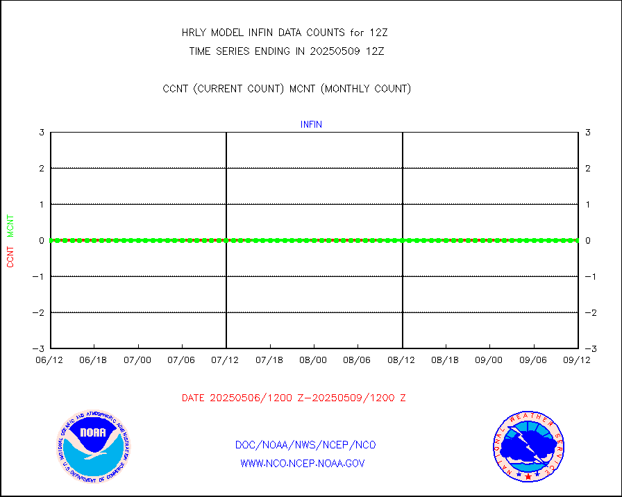
infusr |
GOES-16&up/NESDIS ir long-wave derived cld motion |
84058 |
77703 |
108.2 % |
2611.00-2611.99 |
lgycld |
GOES/NASA(Langley) hi-res. (1x1 f-o-v) cloud data |
4215170 |
4077806 |
103.4 % |
2611.50-2612.49 |
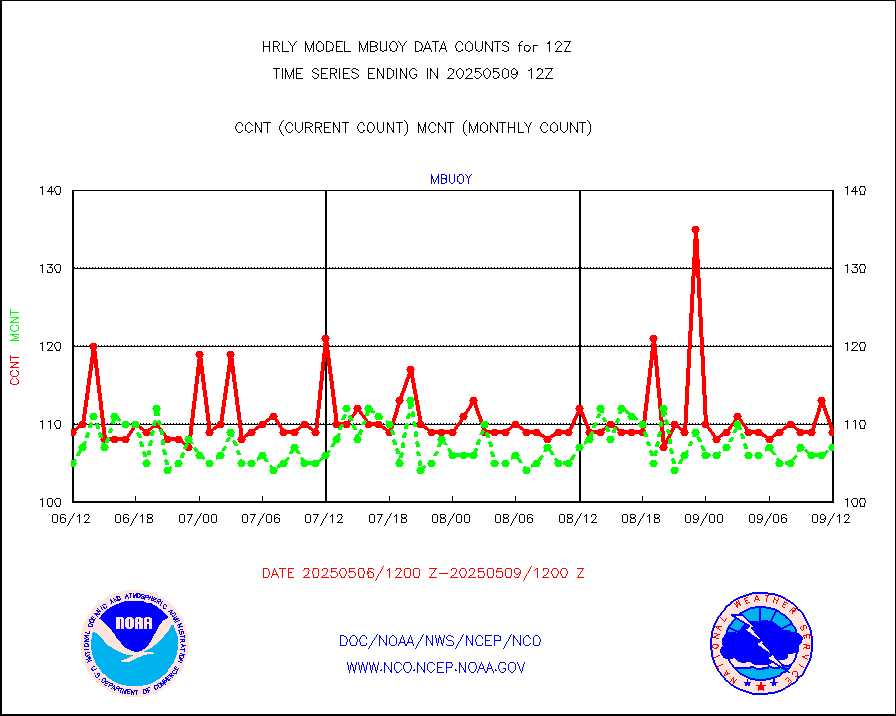
mbuoy |
Buoys decoded from FM-13 format (moored) |
127 |
122 |
104.1 % |
2611.50-2612.49 |
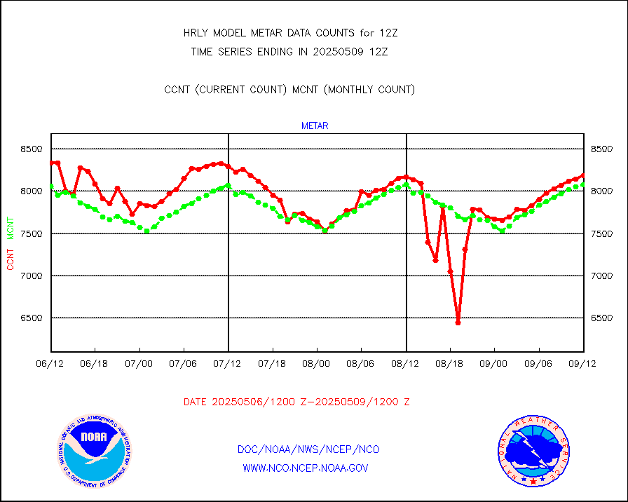
metar |
Aviation - METAR |
8210 |
7764 |
105.7 % |
2611.50-2612.49 |
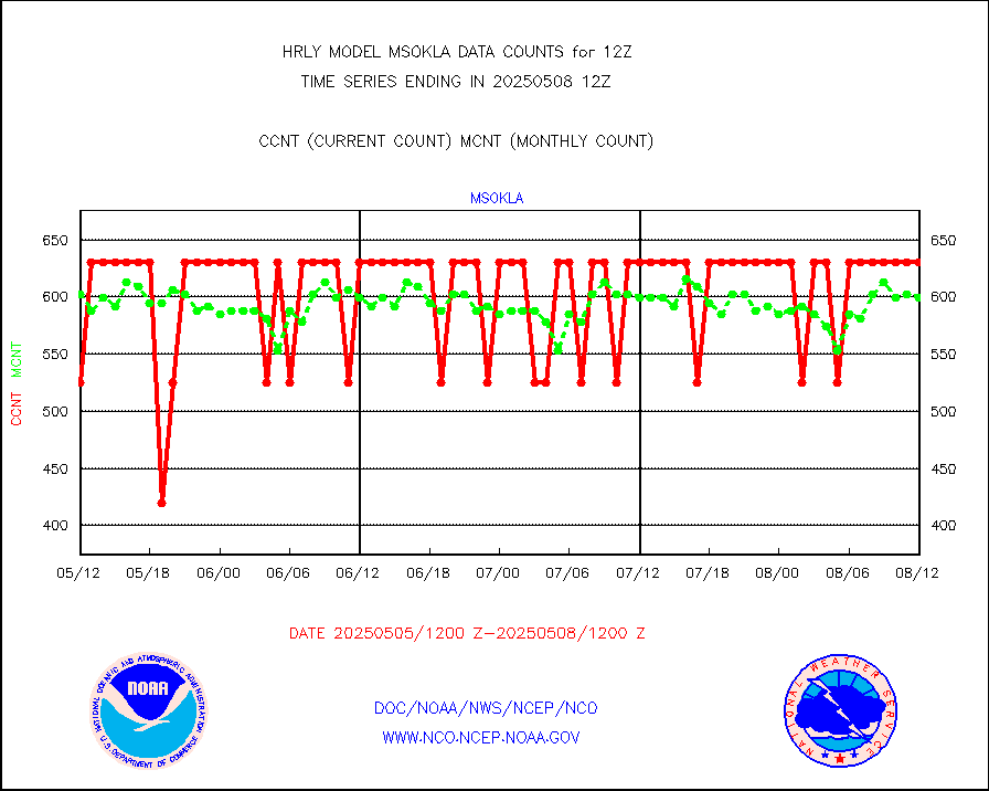
mso470 |
Mesonet/MADIS Colorado E-470 (Interstate 470) |
21 |
19 |
110.5 % |
2611.50-2612.49 |
msoalk |
Mesonet/MADIS Alaska Department of Transportation |
110 |
107 |
102.8 % |
2611.50-2612.49 |
msoapg |
Mesonet/MADIS U.S. Army Aberdeen Proving Grounds |
0 |
0 |
n/a |
2611.50-2612.49 |
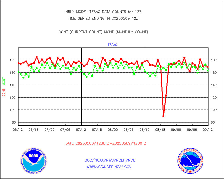
msoapr |
Mesonet/MADIS Citizen Weather Observers Program |
65551 |
52447 |
125.0 % |
2611.50-2612.49 |
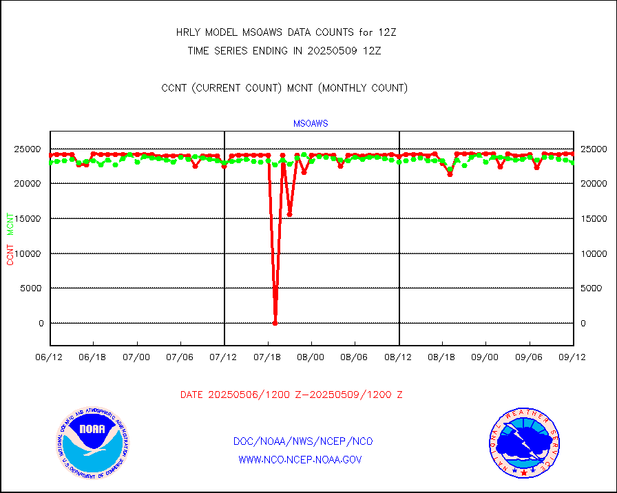
msoaws |
Mesonet/MADIS AWS Convergence Technologies, Inc. |
25310 |
24586 |
102.9 % |
2611.50-2612.49 |
msoawx |
Mesonet/MADIS "Anything Weather" |
0 |
0 |
n/a |
2611.50-2612.49 |
msocol |
Mesonet/MADIS Colorado Dept. of Transportation |
0 |
0 |
n/a |
2611.50-2612.49 |
msodcn |
Mesonet/MADIS DC Net |
0 |
0 |
n/a |
2611.50-2612.49 |
msoden |
Mesonet/MADIS Denver Urban Drainage & Flood Cntrl |
250 |
250 |
100.0 % |
2611.50-2612.49 |
msofla |
Mesonet/MADIS Florida (FAWN & USF) |
4 |
4 |
100.0 % |
2611.50-2612.49 |
msoflt |
Mesonet/MADIS Florida Dept. of Transportation |
0 |
0 |
n/a |
2611.50-2612.49 |
msogeo |
Mesonet/MADIS Georgia Dept. of Transportation |
0 |
0 |
n/a |
2611.50-2612.49 |
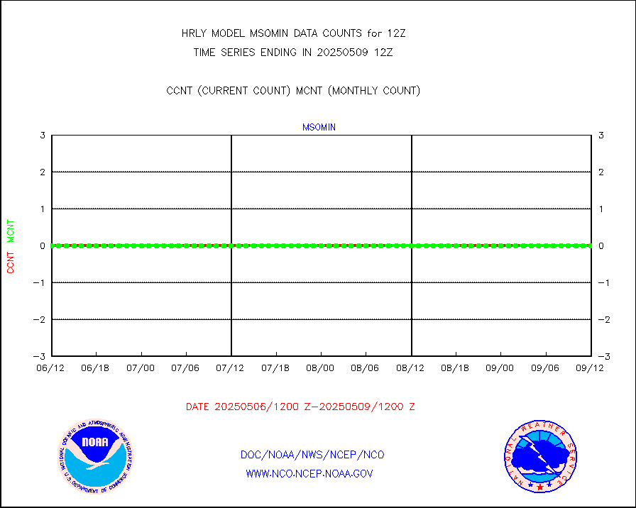
msohad |
Mesonet/MADIS NWS Hydromet Auto Data System(HADS) |
6308 |
6557 |
96.2 % |
2611.50-2612.49 |
msoien |
Mesonet/MADIS Iowa Environmental |
187 |
183 |
102.2 % |
2611.50-2612.49 |
msoind |
Mesonet/MADIS Indiana Dept. of Transportation |
0 |
0 |
n/a |
2611.50-2612.49 |
msoiow |
Mesonet/MADIS Iowa Department of Transportation |
0 |
0 |
n/a |
2611.50-2612.49 |
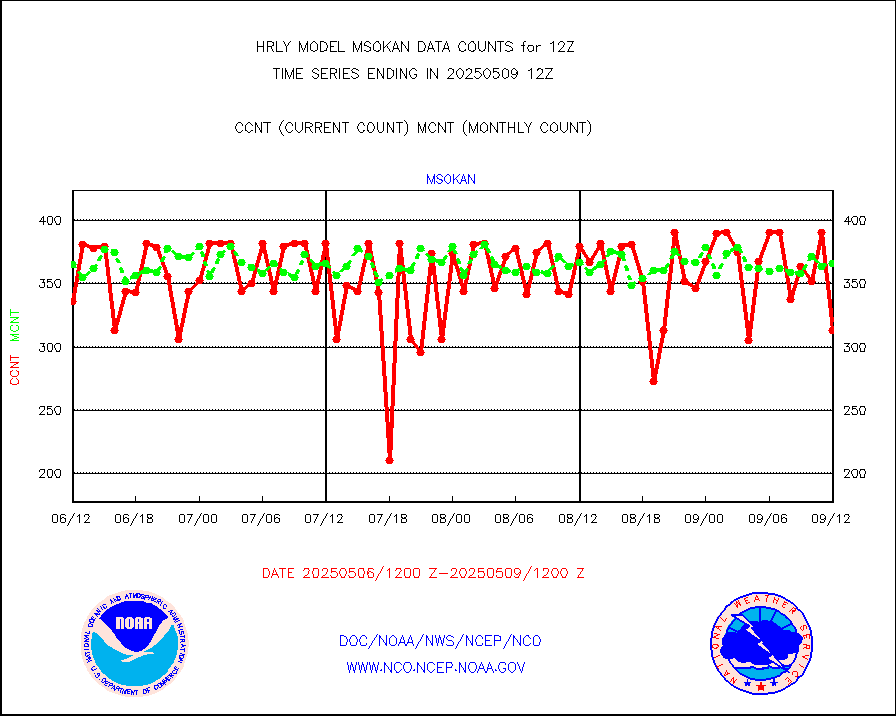
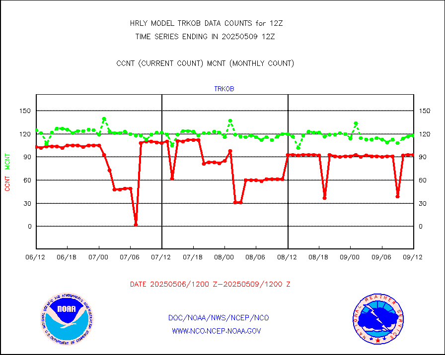
msokan |
Mesonet/MADIS Kansas Department of Transportation |
340 |
312 |
109.0 % |
2611.50-2612.49 |
msokla |
Mesonet/MADIS Oklahoma Mesonet |
636 |
583 |
109.1 % |
2611.50-2612.49 |
msolju |
Mesonet/MADIS Louisiana State/Jackson State Univ. |
0 |
0 |
n/a |
2611.50-2612.49 |
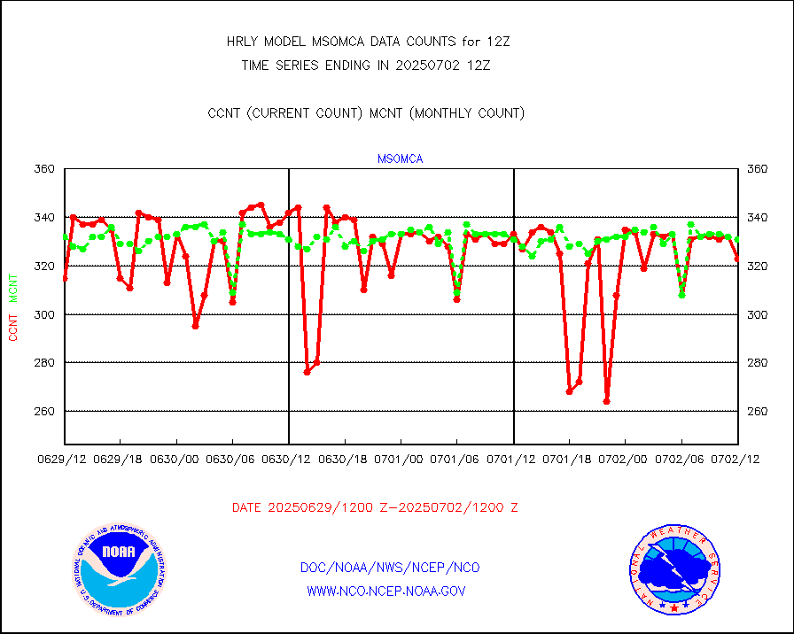
msomca |
Mesonet/MADIS Missouri Commercial Agricult Wx Net |
294 |
285 |
103.2 % |
2611.50-2612.49 |
msomin |
Mesonet/MADIS Minnesota Dept. of Transportation |
0 |
0 |
n/a |
2611.50-2612.49 |
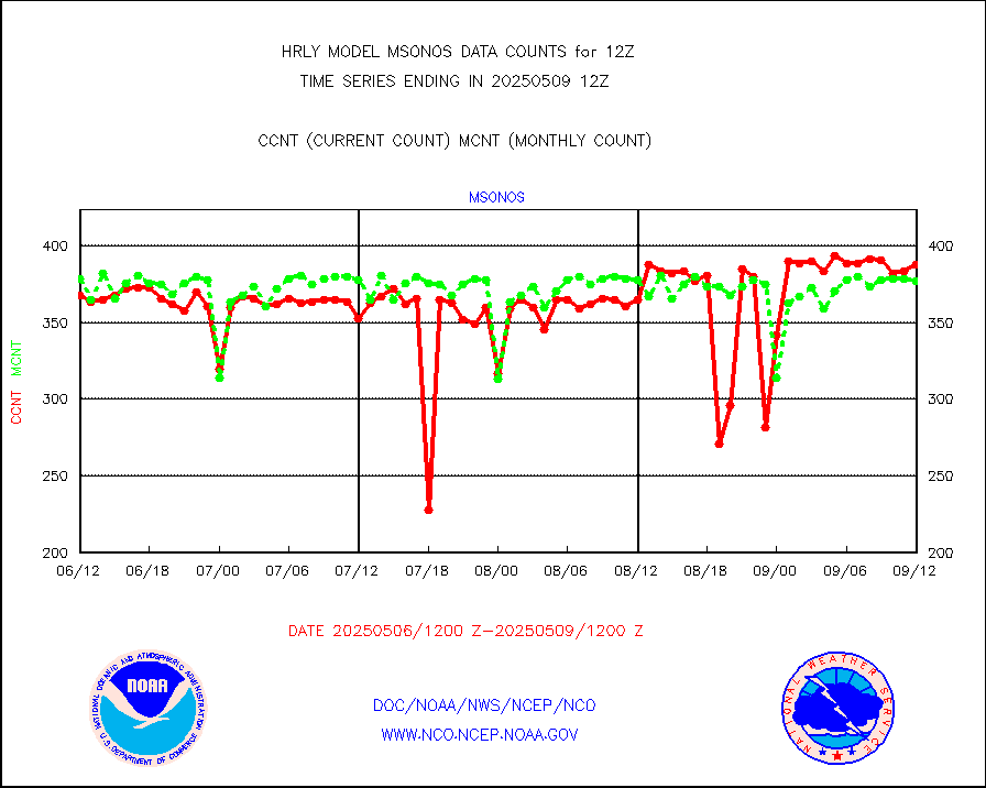
msonos |
Mesonet/MADIS NOS-Phys Oceanographic Realtime Sys |
402 |
394 |
102.0 % |
2611.50-2612.49 |
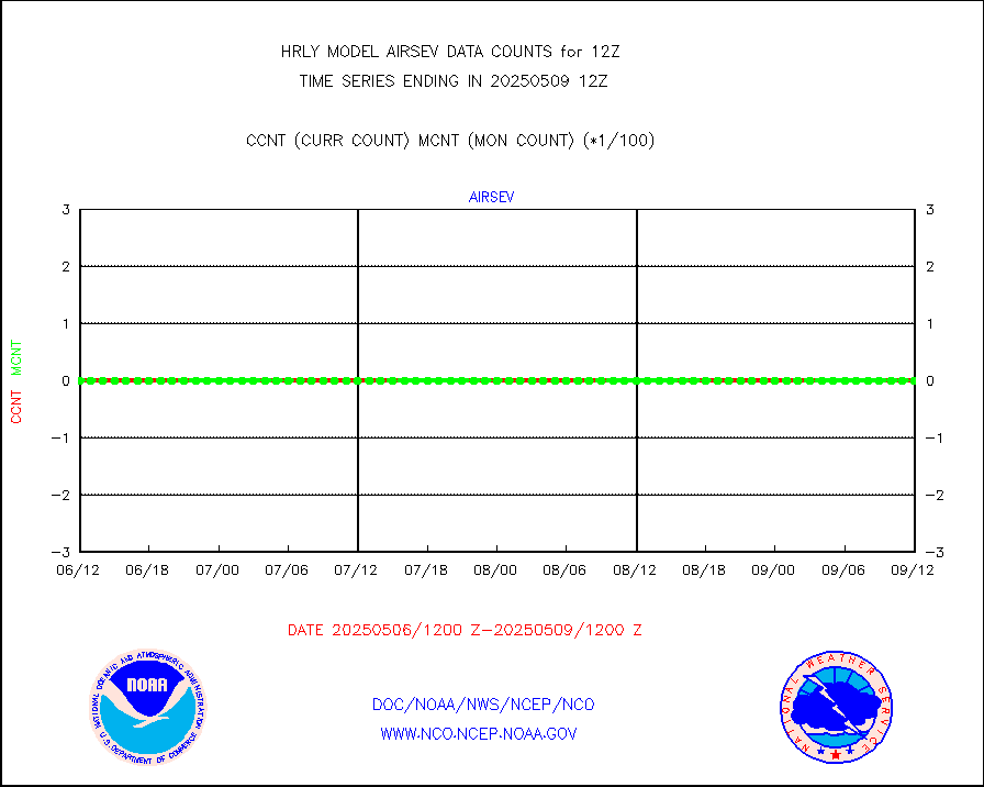
msoraw |
Mesonet/MADIS NFIC Remote Automated Wx Stns(RAWS) |
2043 |
1840 |
111.0 % |
2611.50-2612.49 |
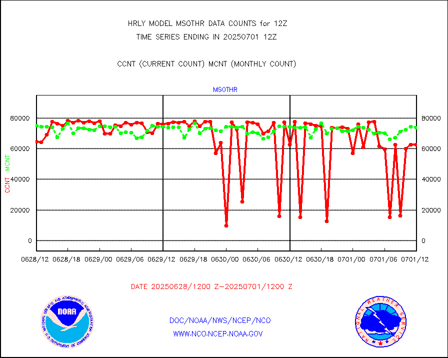
msothr |
Mesonet/MADIS many providers, not separated out |
85501 |
81717 |
104.6 % |
2611.00-2612.49 |
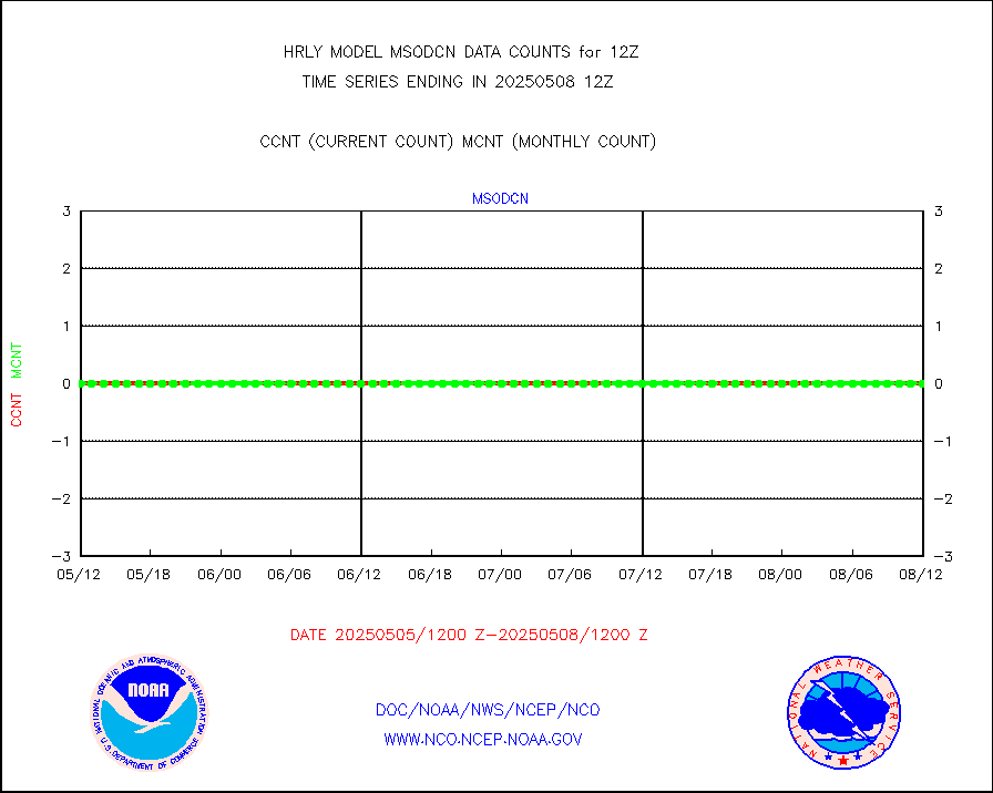
msovir |
Mesonet/MADIS Virginia Dept. of Transportation |
141 |
92 |
153.3 % |
2611.50-2612.49 |
msowfy |
Mesonet/MADIS "Weather for You" |
0 |
0 |
n/a |
2611.50-2612.49 |
msowis |
Mesonet/MADIS Wisconsin Dept. of Transportation |
0 |
0 |
n/a |
2611.50-2612.49 |
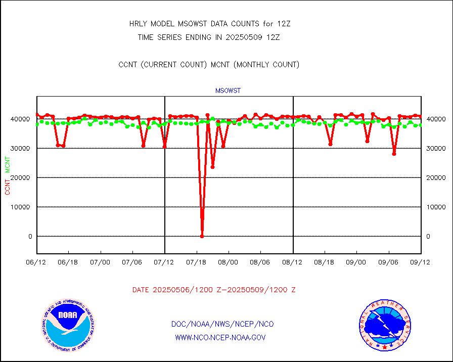
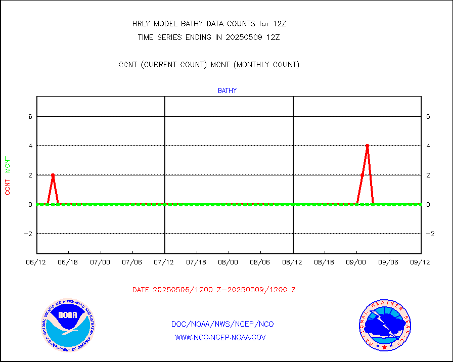
msowst |
Mesonet/MADIS MesoWest (many subproviders) |
38220 |
35261 |
108.4 % |
2611.50-2612.49 |
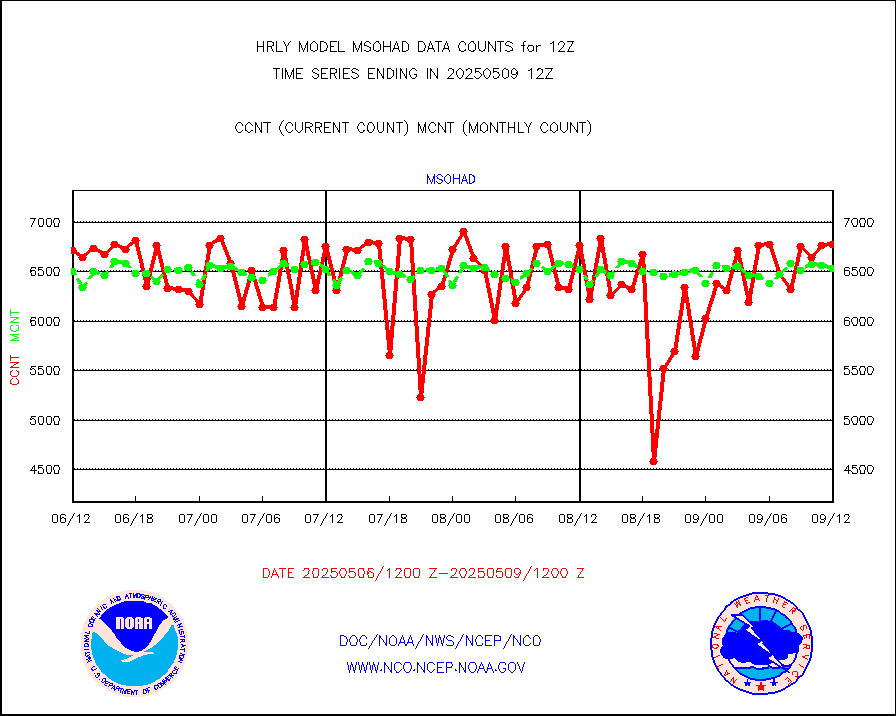
msowtx |
Mesonet/MADIS West Texas |
5658 |
5709 |
99.1 % |
2611.50-2612.49 |
mtiasi |
METOP 1-2 IASI 1C radiance data (varbl. channels) |
80380 |
84750 |
94.8 % |
2610.00-2610.99 |
nxrdw |
NEXRAD Vel Azm Dsp(VAD) winds via radar coded msg |
0 |
0 |
n/a |
2611.50-2612.49 |
omi |
Aura Ozone Monitoring Instrument (OMI) data |
46020 |
48810 |
94.3 % |
2609.50-2610.49 |
osbuv8 |
NOAA 16-19 Solar Backscatter UV-2 rad frm V8 BUFR |
0 |
0 |
n/a |
2610.00-2610.99 |
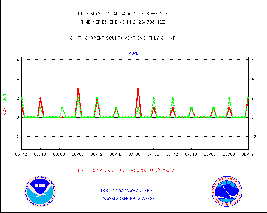
pibal |
PIBAL (from PILOT, PILOT SHIP, PILOT MOBIL) |
33 |
32 |
103.1 % |
2611.50-2612.49 |
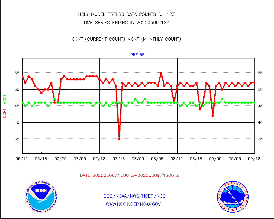
prflrb |
Multi-Agency Profiler (MAP) and SODAR winds |
50 |
43 |
116.3 % |
2611.50-2612.49 |
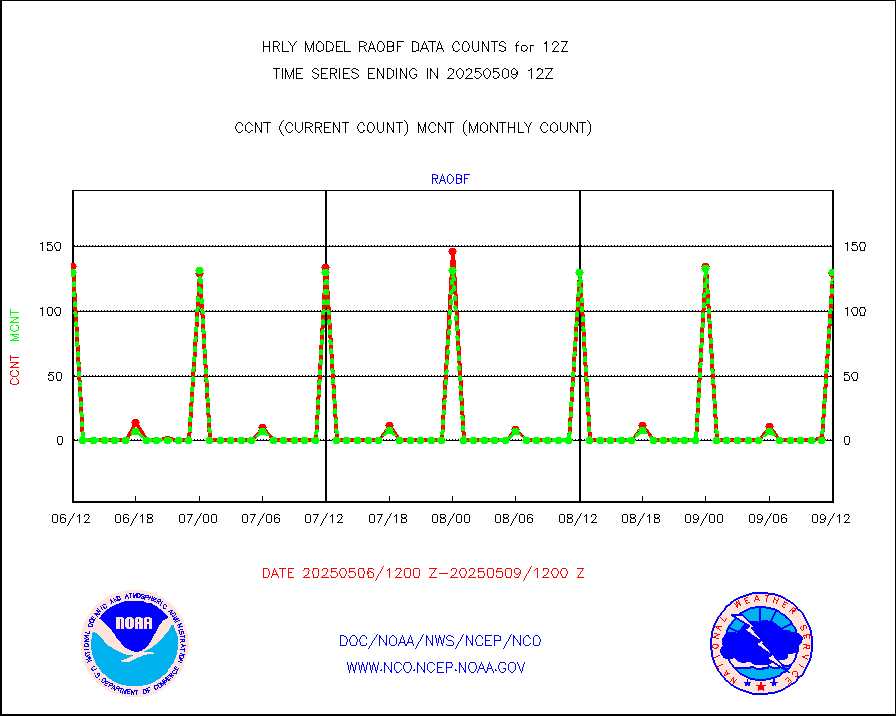
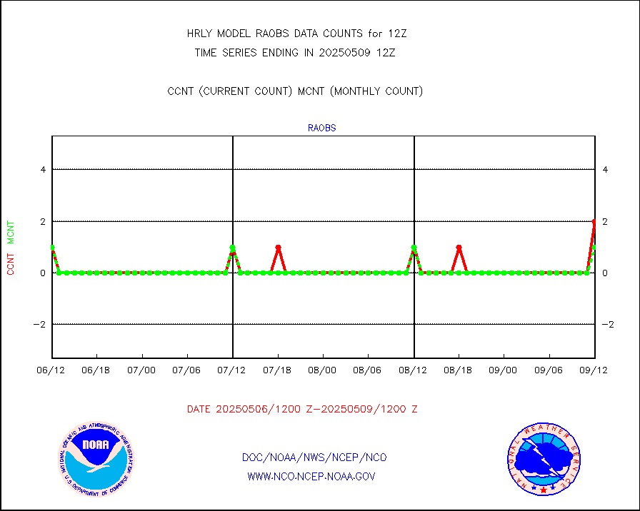
raobf |
Rawinsonde - fixed land (from TEMP or PILOT) |
135 |
134 |
100.7 % |
2611.50-2612.49 |
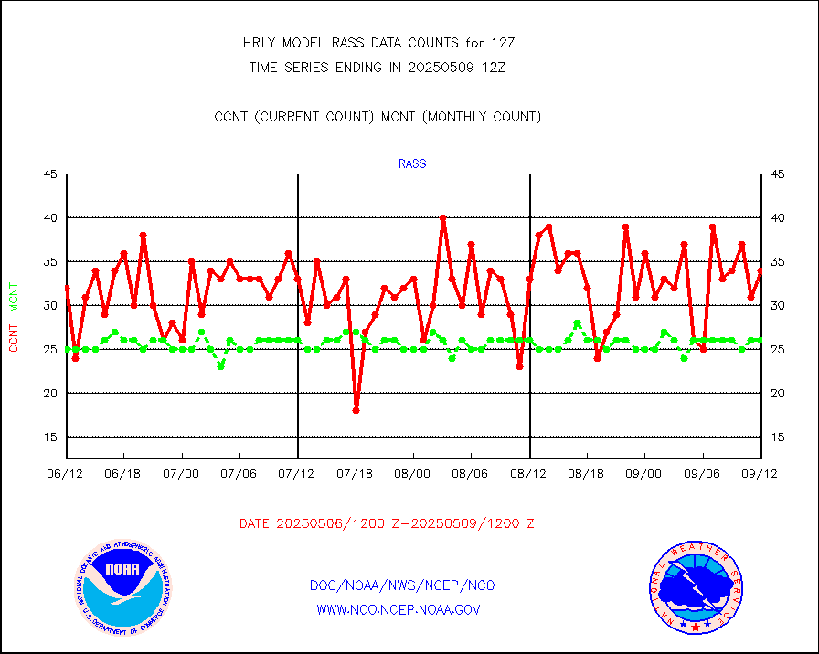
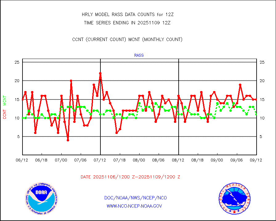
rass |
RASS temperatures (NOAA and Multi-Agency) |
29 |
25 |
116.0 % |
2611.50-2612.49 |
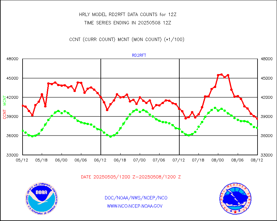
rd2rft |
NEXRAD reflectivity (Lvl 2 - GTS) |
3960580 |
4184540 |
94.6 % |
2611.50-2612.49 |
rd2wnd |
NEXRAD radial wind (Level 2 - GTS) |
1017362 |
1240520 |
82.0 % |
2611.50-2612.49 |
sevcsr |
METEOSAT-10 2nd Gen SEVIRI Clr Sky Radiance(proc) |
0 |
0 |
n/a |
2611.50-2612.49 |
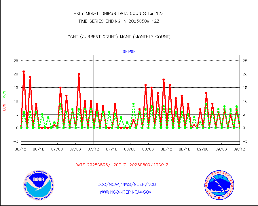
shipsb |
Ship - manual and automatic, restricted (BUFR) |
0 |
0 |
n/a |
2611.50-2612.50 |
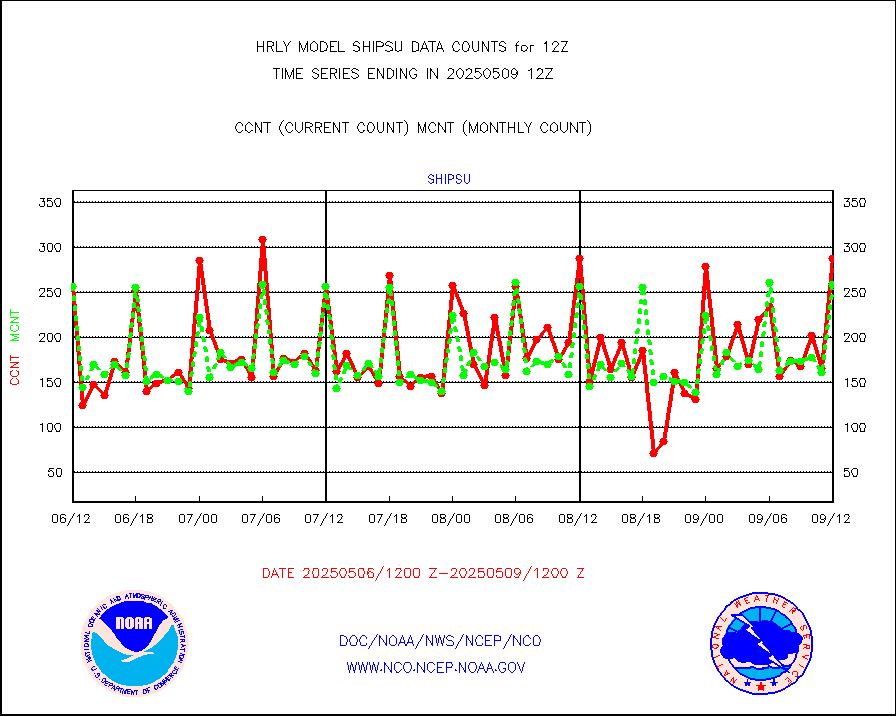
shipsu |
Ship - manual and automatic, unrestricted |
189 |
174 |
108.6 % |
2611.50-2612.50 |
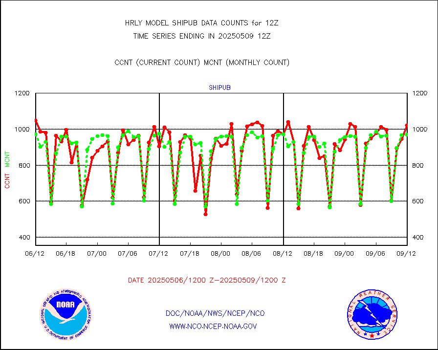
shipub |
Ship - manual and automatic, unrestricted (BUFR) |
859 |
886 |
97.0 % |
2611.50-2612.50 |
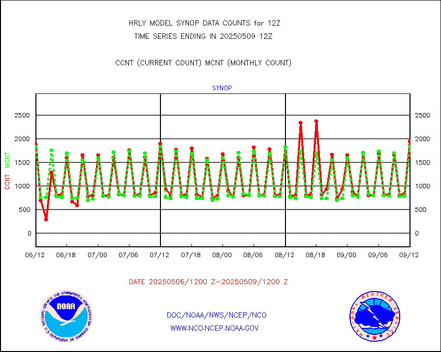
synop |
Synoptic - fixed manual and automatic |
2191 |
2277 |
96.2 % |
2611.50-2612.49 |
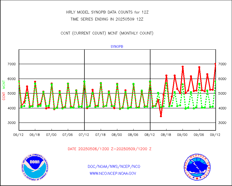
synopb |
Synoptic - fixed manual & auto (decoded fr BUFR) |
5994 |
5781 |
103.7 % |
2611.50-2612.49 |
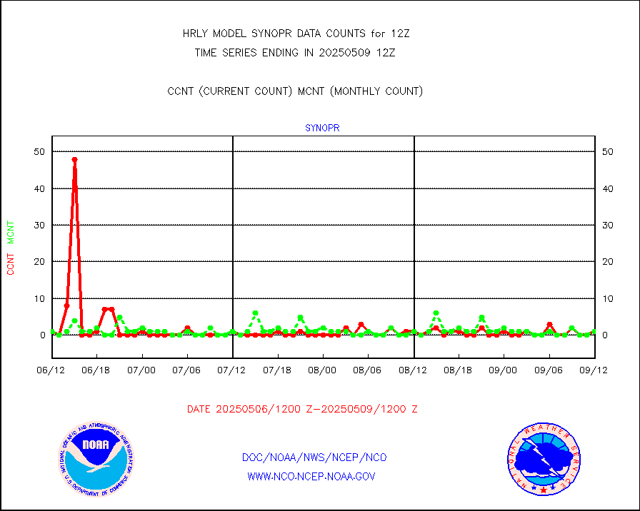
synopr |
Synoptic - restricted (WMO Res 40) manual & auto. |
1 |
1 |
100.0 % |
2611.50-2612.49 |
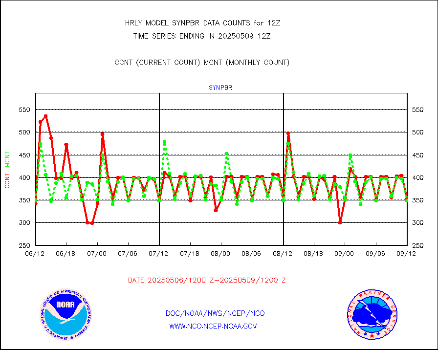
synpbr |
Synoptic - restricted (WMO Res 40)(decoded BUFR) |
348 |
337 |
103.3 % |
2611.50-2612.49 |
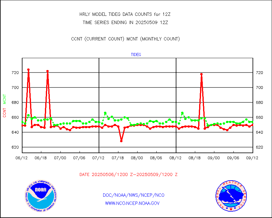
tideg |
Tide gauge reports decoded from CREX format |
642 |
653 |
98.3 % |
2611.00-2611.99 |
| Data Types of Opportunity with Normal Counts |
|---|
| Type | Description | Hourly Count | Monthly Average | Percent (%) of Monthly Mean | UTC Time Window |
3p9usr |
GOES-16&up/NESDIS ir short-wv derived cld motion |
43155 |
44935 |
96.0 % |
2611.00-2611.99 |
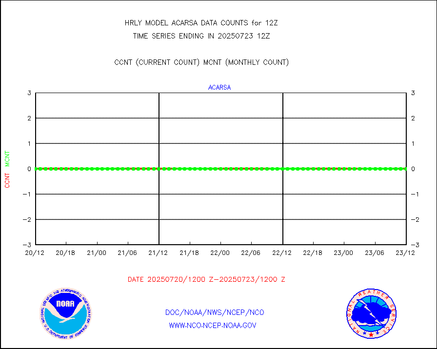
acarsa |
MDCRS ACARS acft data (ARINC via AFWA)(AIREP fmt) |
0 |
0 |
n/a |
2611.50-2612.49 |
ahicsr |
Himawari Clear Sky Radiance |
0 |
0 |
n/a |
2611.00-2611.99 |
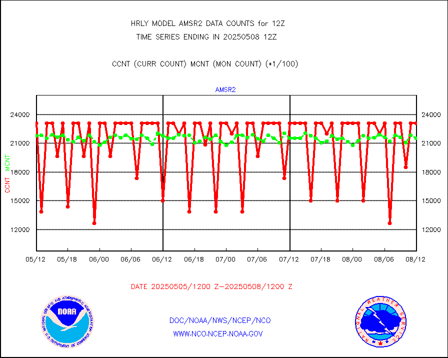
amsr2 |
GCOM-W AMSR2 1B brightness temperatures |
2309472 |
2140279 |
107.9 % |
2610.00-2610.99 |
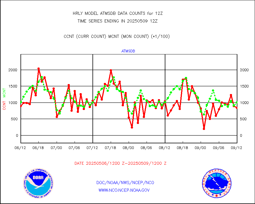
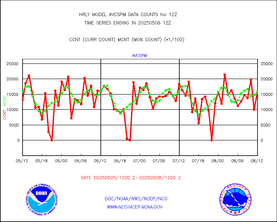
atmsdb |
NPP/NOAA-20 ATMS bright. temps-direct b-cast SSEC |
56447 |
82965 |
68.0 % |
2610.50-2611.49 |
atovs |
POES/NESDIS - processed ATOVS soundings/radiances |
0 |
0 |
n/a |
2610.00-2610.99 |
avcsam |
A.M.(N17,M2,M3) AVHRR GAC NCEP-proc clr&sea btmps |
1363016 |
1451427 |
93.9 % |
2609.50-2610.49 |
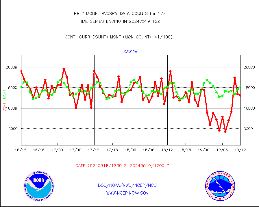
avcspm |
P.M.(N18-19) AVHRR GAC NCEP-proc clr & sea btemps |
1469802 |
1540813 |
95.4 % |
2609.50-2610.49 |
bathy |
eXpendable BathyThermograph, mooring (BATHY fmt) |
0 |
0 |
n/a |
2605.00-2605.99 |
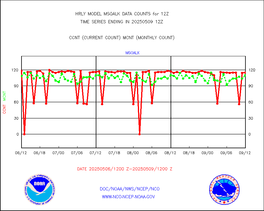
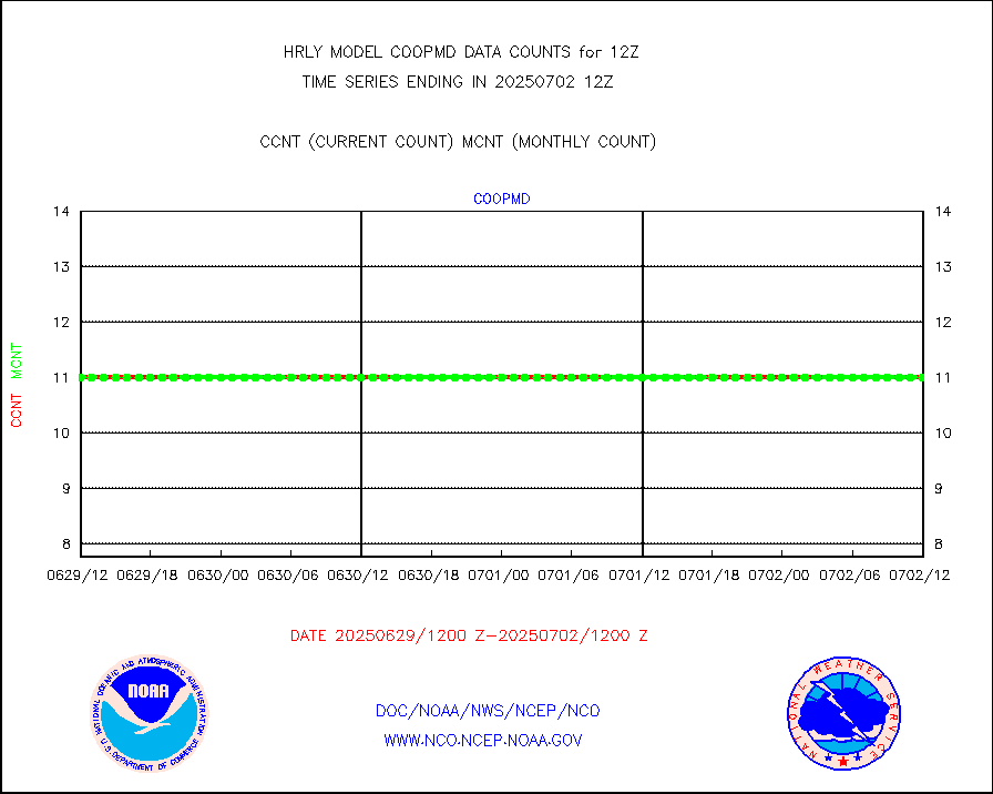
coopmd |
Coop/MADIS NEPP & HCN-Modernization NOAA COOP Obs |
27 |
27 |
100.0 % |
2611.50-2612.49 |
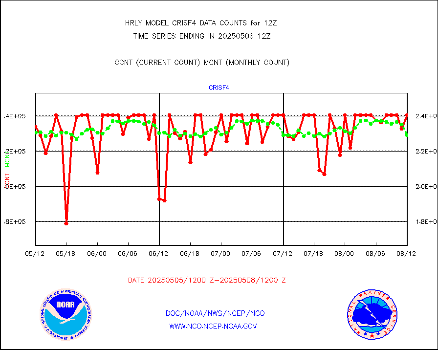
crisf4 |
NPP/NOAA-20 CrIS full spctrl radn (431 ch subset) |
236214 |
227207 |
104.0 % |
2610.50-2611.49 |
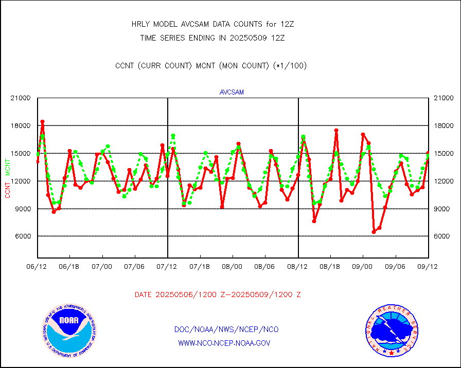
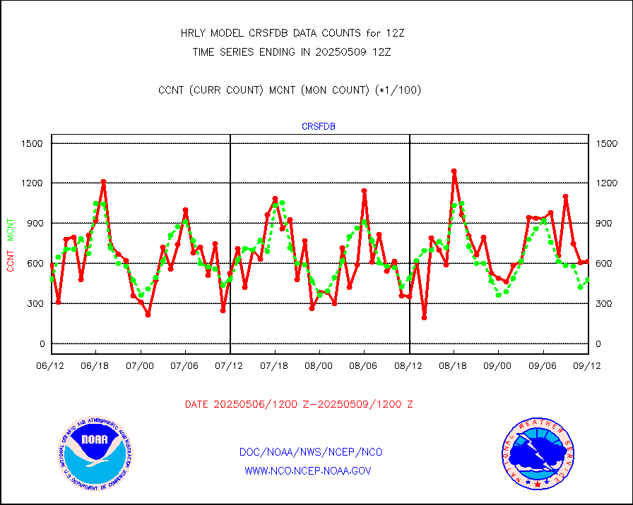
crsfdb |
NPP/NOAA-20 CrIS full spctrl radn dir brdcst SSEC |
58644 |
54282 |
108.0 % |
2610.50-2611.49 |
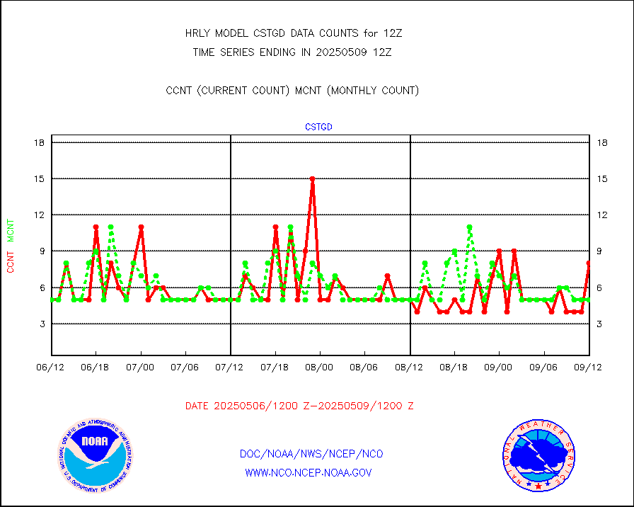
cstgd |
Coast Guard |
3 |
3 |
100.0 % |
2611.50-2612.50 |
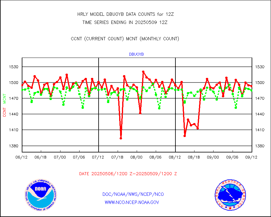
dbuoyb |
Drifting buoys (decoded from BUFR) |
1398 |
1419 |
98.5 % |
2611.50-2612.50 |
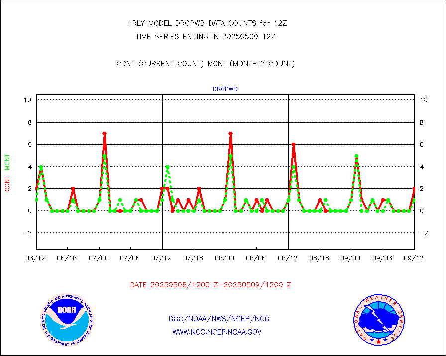
dropw |
Dropwinsonde (from TEMP DROP) |
0 |
1 |
0.0 % |
2611.50-2612.49 |
dropwb |
Dropwinsonde (decoded from BUFR) |
2 |
4 |
50.0 % |
2611.51-2612.49 |
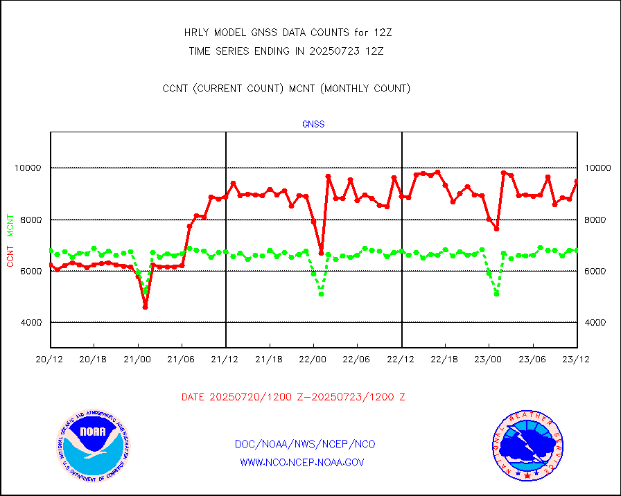
efclam |
GOES imager effective cloud amount data (U.Wisc.) |
8166509 |
8206535 |
99.5 % |
2611.50-2612.49 |
esatms |
NPP Adv. Tech. MW Sndr (ATMS) br. temps from RARS |
79289 |
80394 |
98.6 % |
2610.50-2611.49 |
esiasi |
METOP 1-2 IASI 1C radiance data vbl chn from RARS |
94073 |
87192 |
107.9 % |
2611.00-2611.99 |
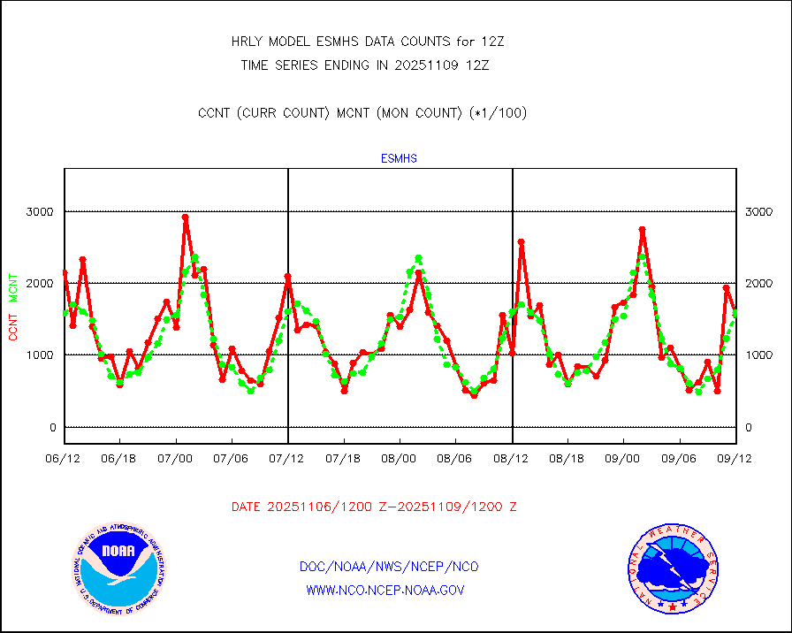
esmhs |
NOAA 18-19 & METOP 1-2 MHS proc. btemps from RARS |
325000 |
274297 |
118.5 % |
2611.50-2612.49 |
geoimr |
GOES/NESDIS (11x17 f-o-v) imager clear radiances |
0 |
0 |
n/a |
2611.00-2611.99 |
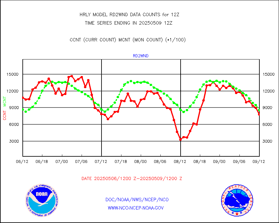
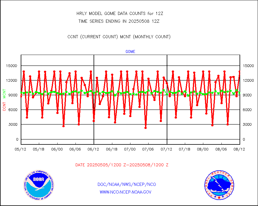
gome |
METOP 1-2 Global Ozone Monitoring Exp.-2 (GOME-2) |
11001 |
8223 |
133.8 % |
2610.50-2611.49 |
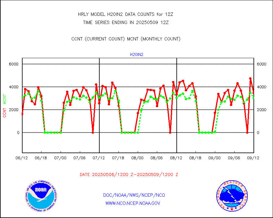
h20in2 |
INDIA SATWIND, INSAT WV channel |
2233 |
2603 |
85.8 % |
2611.00-2611.99 |
h2dusr |
GOES-16&up/NESDIS wv imgr/deep-lyr derivd cld mtn |
20942 |
18090 |
115.8 % |
2611.00-2611.99 |
h2eunb |
METEOSAT/EUMETSAT wvpr imgr drv cld motion NBseq |
37493 |
35664 |
105.1 % |
2610.50-2611.49 |
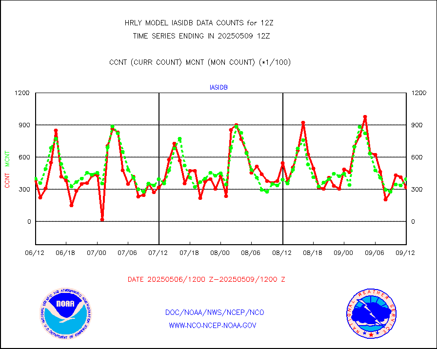
iasidb |
METOP 1-2 IASI 1C radiances-direct broadcast SSEC |
19715 |
28344 |
69.6 % |
2610.50-2611.49 |
ifvrnb |
VIIRS (NPP/NOAA-20) ir lg-wv drv cloud motion(NB) |
21596 |
14051 |
153.7 % |
2608.00-2608.99 |
infav |
AVHRR (NOAA/METOP) ir lg-wave derived cld motion |
0 |
0 |
n/a |
2608.00-2608.99 |
infav1 |
AVHRR (METOP) ir lg-wave derived cld motion |
0 |
0 |
n/a |
2611.50-2612.50 |
infin |
INSAT/KALPANA India ir lg-wave derived cld motion |
0 |
0 |
n/a |
2609.50-2610.49 |
infin2 |
INDIA SATWIND, INSAT IR channel |
3793 |
2878 |
131.8 % |
2611.00-2611.99 |
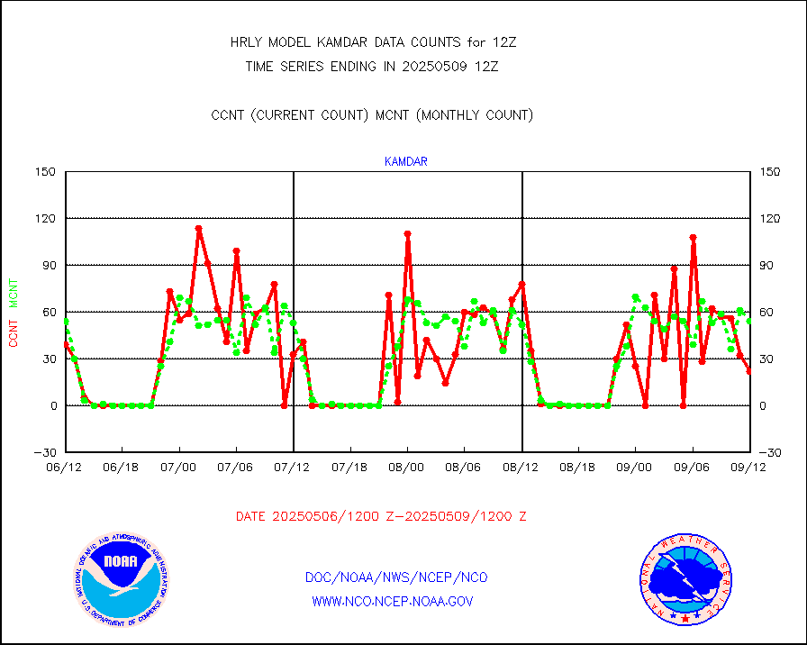
kamdar |
Korean AMDAR aircraft data (decoded from BUFR) |
33 |
60 |
55.0 % |
2611.50-2612.49 |
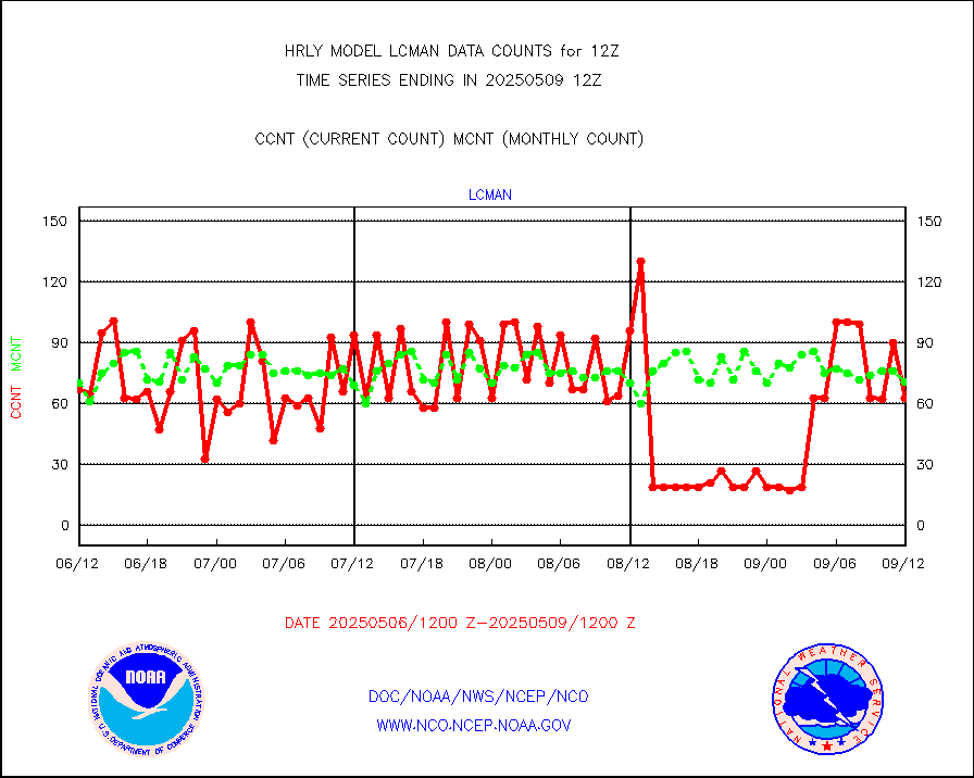
lcman |
Land-based CMAN stations decoded from CMAN format |
68 |
77 |
88.3 % |
2611.50-2612.49 |
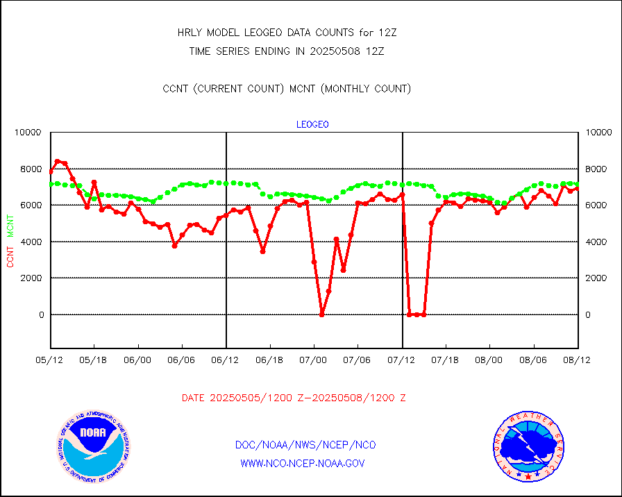
leogeo |
LEO-GEO satellite AMVs from UWisc. |
7480 |
6355 |
117.7 % |
2608.00-2608.99 |
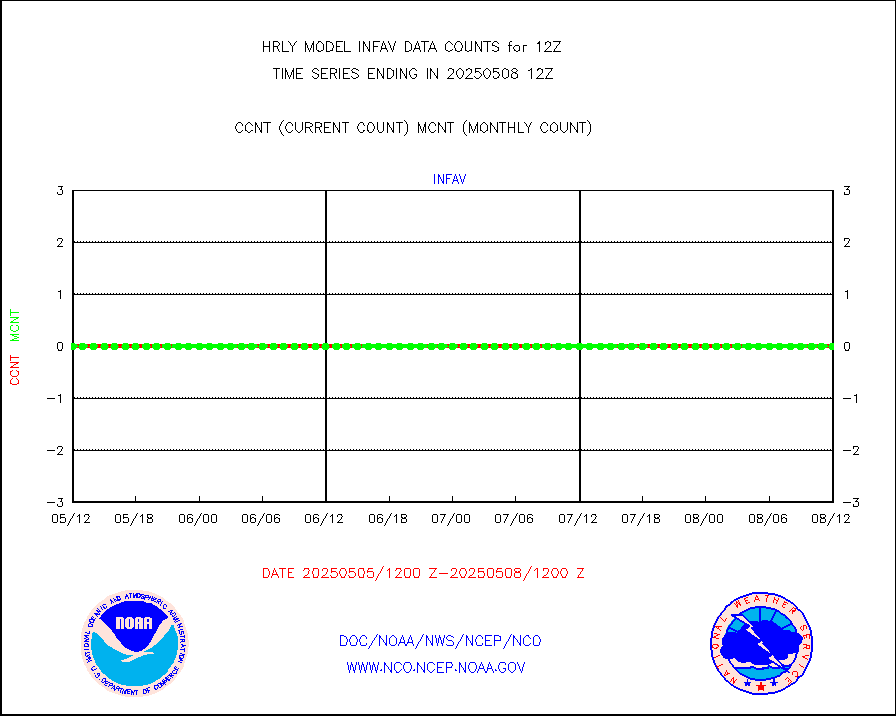
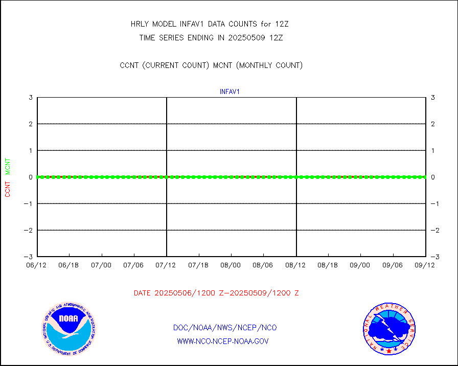
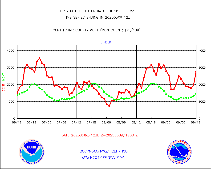
ltnglr |
LLDN Long-rng lightning from Vaisala via NOAAPORT |
89729 |
138727 |
64.7 % |
2611.50-2612.49 |
mbuoyb |
Moored buoys (decoded from BUFR) |
839 |
857 |
97.9 % |
2611.50-2612.50 |
mls |
Aura Microwave Limb Sounder (MLS) ozone data |
0 |
0 |
n/a |
2610.00-2610.99 |
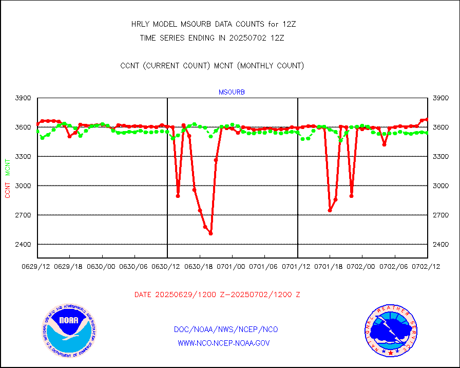
msourb |
Mesonet/MADIS UrbaNet |
4062 |
3822 |
106.3 % |
2611.50-2612.49 |
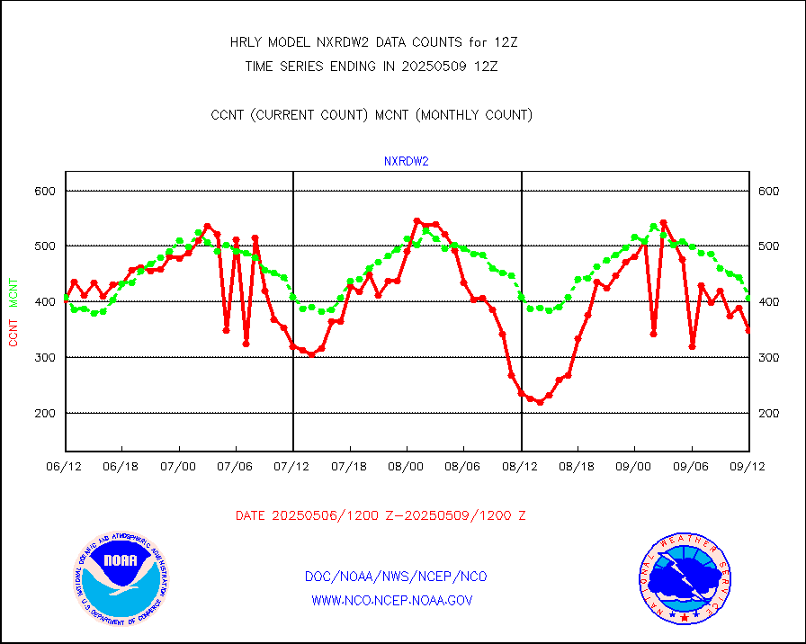
nxrdw2 |
NEXRAD Vel Azm Dsp(VAD) winds via Level 2 decoder |
443 |
494 |
89.7 % |
2611.50-2612.49 |
ompsn8 |
OMPS nadir profile ozone (Version 8 BUFR) |
549 |
413 |
132.9 % |
2610.00-2610.99 |
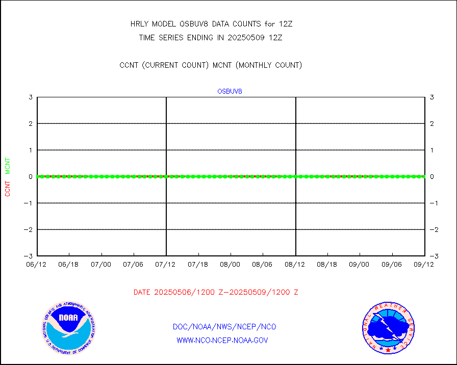
ompst8 |
OMPS total column ozone (Version 8 BUFR) |
473259 |
255224 |
185.4 % |
2610.00-2610.99 |
pibalb |
PIBAL (decoded from BUFR) |
1 |
1 |
100.0 % |
2611.51-2612.49 |
pirep |
Manual PIREP aircraft data (dcded from AIREP fmt) |
72 |
84 |
85.7 % |
2611.50-2612.49 |
prflrp |
Profilr winds from PIBAL (PILOT,PILOT SHIP/MOBIL) |
0 |
0 |
n/a |
2611.50-2612.49 |
raobfb |
Rawinsonde - fixed land (decoded from BUFR) |
2 |
2 |
100.0 % |
2611.51-2612.49 |
raobm |
Rawinsonde - mobile land (from TEMP/PILOT MOBIL) |
0 |
0 |
n/a |
2611.50-2612.49 |
raobmb |
Rawinsonde - mobile land (decoded from BUFR) |
0 |
0 |
n/a |
2611.51-2612.49 |
raobs |
Rawinsonde - ship (from TEMP SHIP, PILOT SHIP) |
2 |
1 |
200.0 % |
2611.50-2612.49 |
raobsb |
Rawinsonde - ship (decoded from BUFR) |
0 |
0 |
n/a |
2611.51-2612.49 |
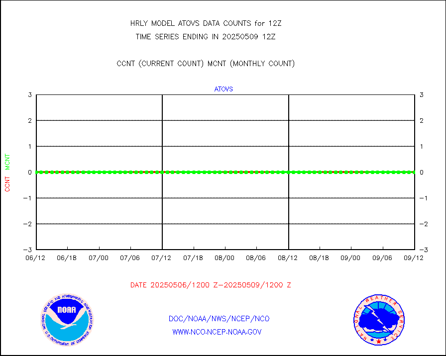
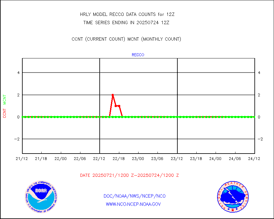
recco |
Flight level reconnaissance aircraft data |
0 |
0 |
n/a |
2611.50-2612.49 |
saphir |
Megha-Tropiques SAPHIR L1A2 brightness temps |
0 |
0 |
n/a |
2609.50-2610.49 |
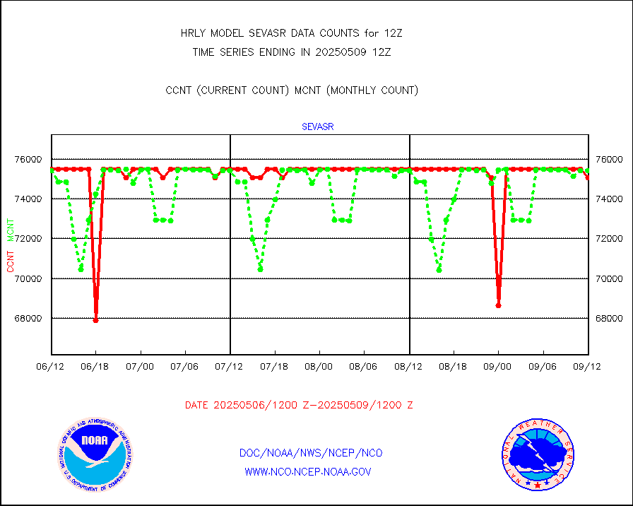
sevasr |
METEOSAT-10 2nd Gen SEVIRI All Sky Radiance(proc) |
75512 |
72950 |
103.5 % |
2611.50-2612.49 |
ships |
Ship - manual and automatic, restricted |
0 |
5 |
0.0 % |
2611.50-2612.49 |
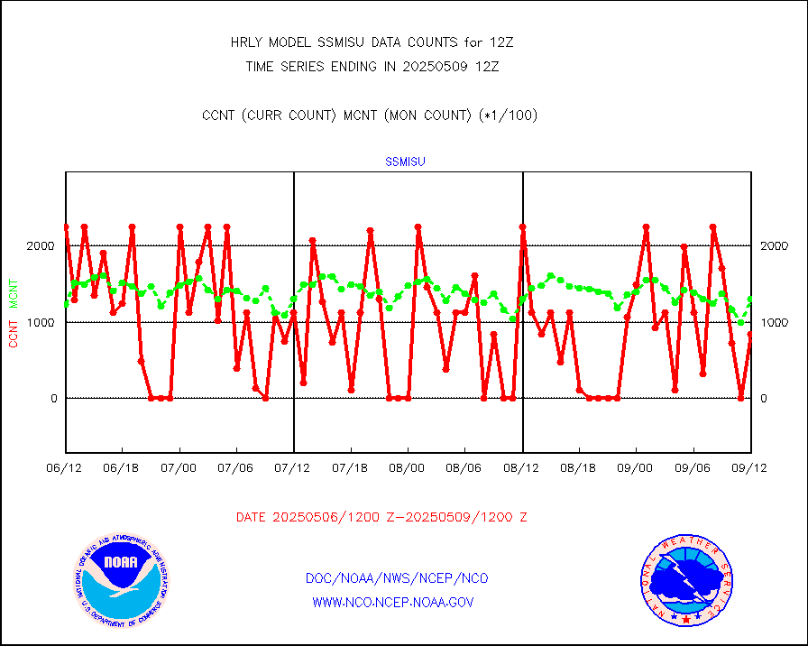
ssmisu |
DMSP SSM/IS 1C radiance data (Unified Pre-Proc.) |
157980 |
94480 |
167.2 % |
2610.50-2611.49 |
synopm |
Synoptic - mobile manual and automatic |
275 |
408 |
67.4 % |
2611.50-2612.49 |
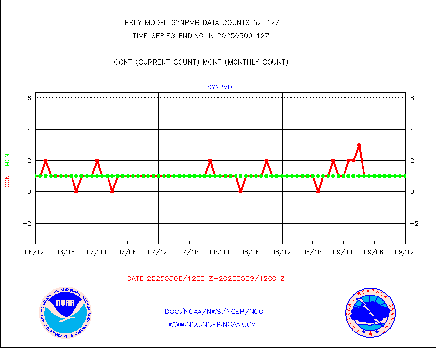
synpmb |
Synoptic - mobile manual & auto (decoded fr BUFR) |
1 |
0 |
n/a |
2611.50-2612.49 |
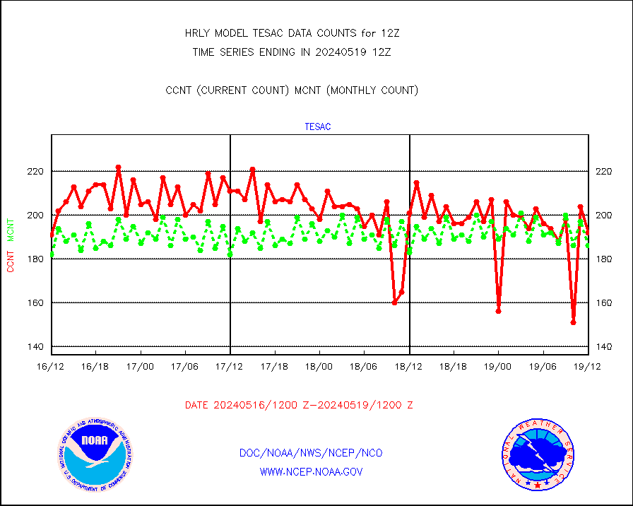
tesac |
CTD probe, Argo prflng float, mooring (TESAC fmt) |
206 |
229 |
90.0 % |
2611.50-2612.49 |
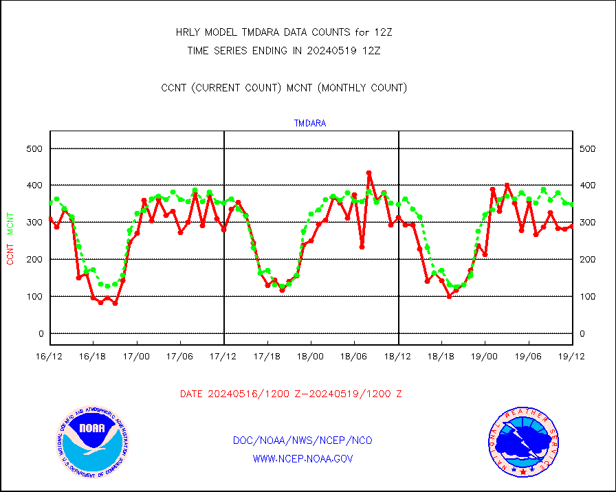
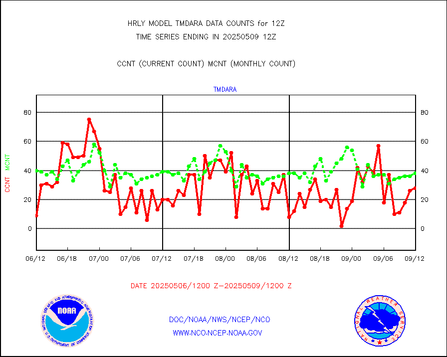
tmdara |
TAMDAR aircft data-all types(from Panasonic,BUFR) |
26 |
80 |
32.5 % |
2611.50-2612.49 |
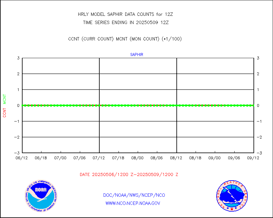
trkob |
ThermoSalinoGraph (TSG) TRACKOB format) |
31 |
35 |
88.6 % |
2610.50-2611.49 |
visin |
INSAT/KALPANA India visible derived cloud motion |
0 |
0 |
n/a |
2609.50-2610.49 |
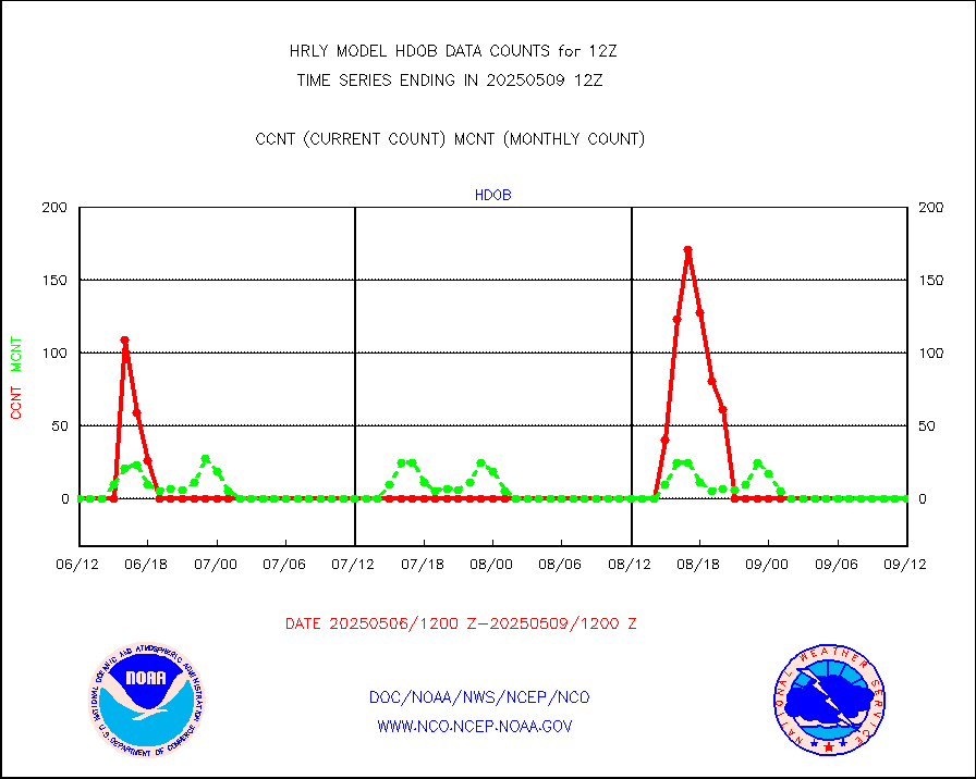
visin2 |
INDIA SATWIND, INSAT VIS channel |
318 |
234 |
135.9 % |
2611.00-2611.99 |
visja |
MTSAT/JMA visible derived cloud motion |
2520 |
2281 |
110.5 % |
2609.50-2610.49 |
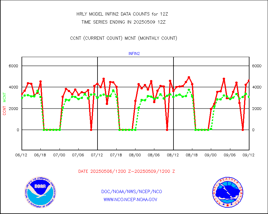
visusr |
GOES-16&up/NESDIS visible derived cloud motion |
60561 |
68669 |
88.2 % |
2611.00-2611.99 |
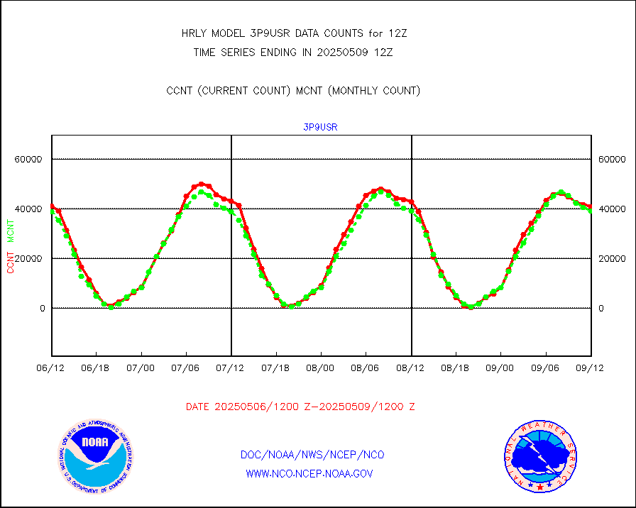
vseunb |
METEOSAT/EUMETSAT visible drv cld motion NBseq |
42154 |
38779 |
108.7 % |
2610.50-2611.49 |


