| Critical Data with Normal Counts |
|---|
| Type | Description | Hourly Count | Monthly Average | Percent (%) of Monthly Mean | UTC Time Window |
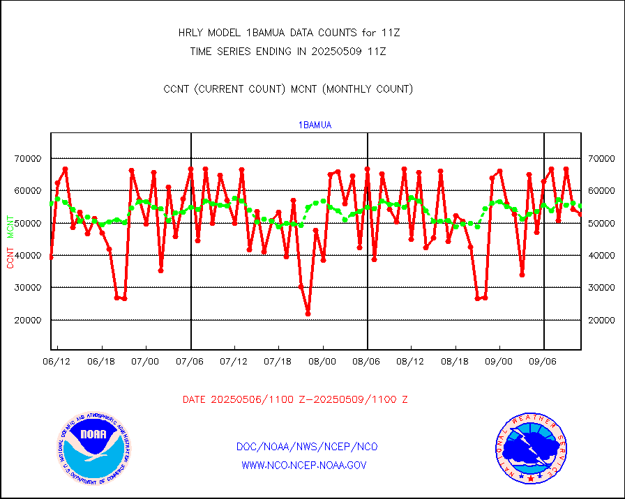
1bamua |
NOAA 15-19 & METOP 1-2 AMSU-A NCEP-proc. br.temps |
49184 |
57383 |
85.7 % |
2609.00-2609.99 |
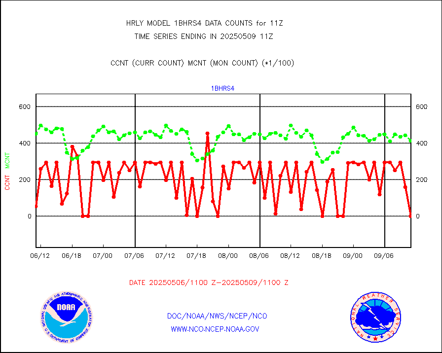
1bhrs4 |
NOAA 18-19 & METOP 1-2 HIRS-4 NCEP-proc. br.temps |
29624 |
48393 |
61.2 % |
2609.00-2609.99 |
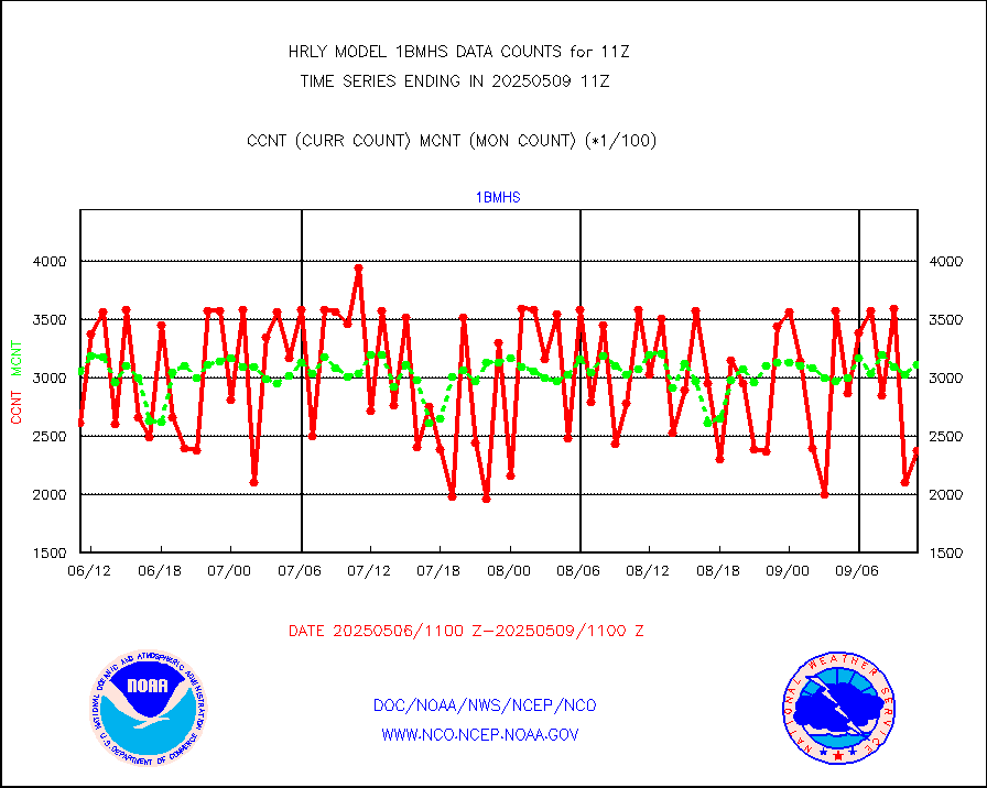
1bmhs |
NOAA 18-19 & METOP 1-2 MHS NCEP-proces. br. temps |
234022 |
319867 |
73.2 % |
2609.00-2609.99 |
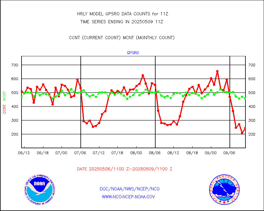
acars |
MDCRS ACARS acft data from ARINC(dcded from BUFR) |
11776 |
13987 |
84.2 % |
2610.50-2611.49 |
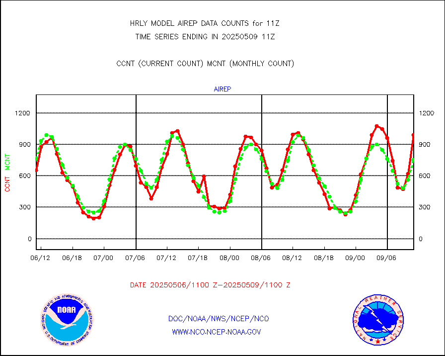
airep |
Manual AIREP aircraft data (dcded from AIREP fmt) |
1003 |
1016 |
98.7 % |
2610.50-2611.49 |
airsev |
AQUA AIRS/AMSU-A/HSB brightness temps- every FOV |
0 |
0 |
n/a |
2608.50-2609.49 |
amdar |
AMDAR aircraft data (decoded from AMDAR format) |
299 |
425 |
70.4 % |
2610.50-2611.49 |
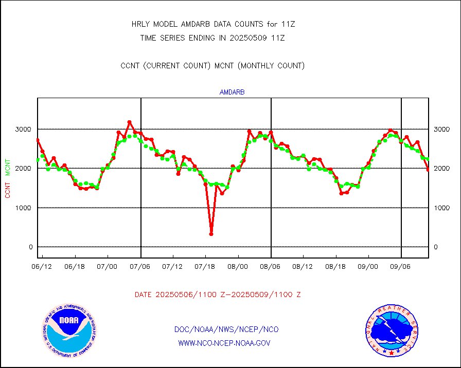
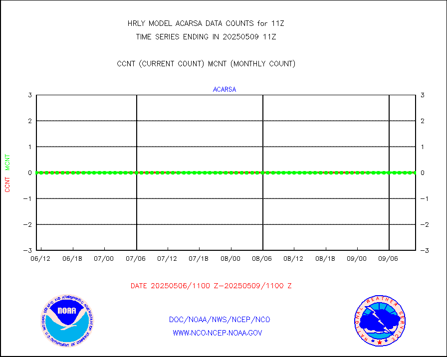
amdarb |
AMDAR aircraft data (decoded from BUFR) |
1032 |
1143 |
90.3 % |
2610.50-2611.49 |
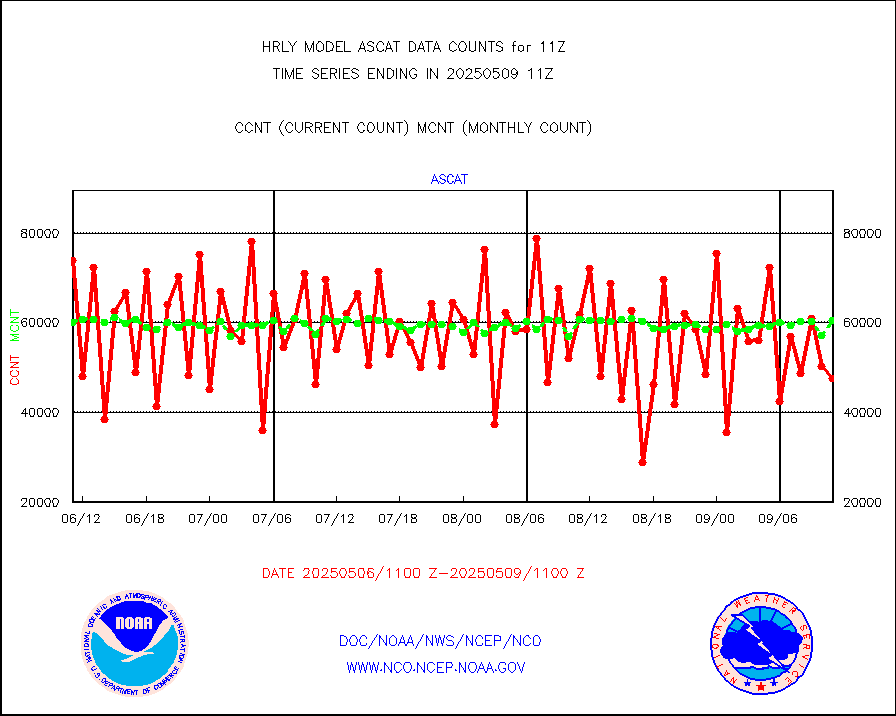
ascat |
METOP 1-2 ASCAT products |
63588 |
50865 |
125.0 % |
2609.50-2610.49 |
atms |
NPP/NOAA-20 ATMS brightness temperatures |
256704 |
311413 |
82.4 % |
2609.50-2610.49 |
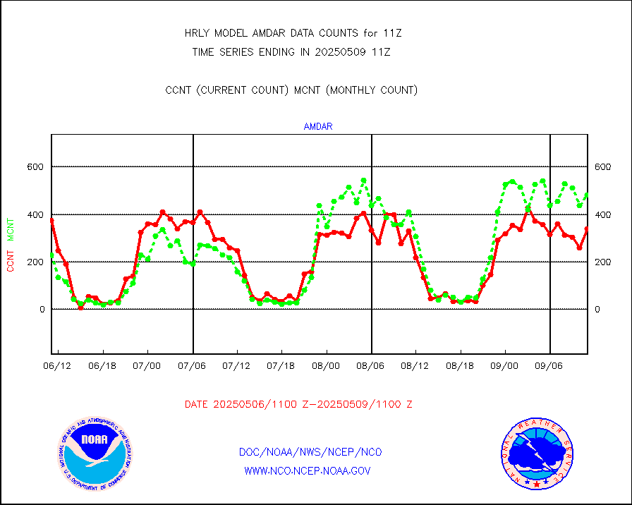
camdar |
Canadian AMDAR aircraft data (decoded from BUFR) |
0 |
1 |
0.0 % |
2610.50-2611.49 |
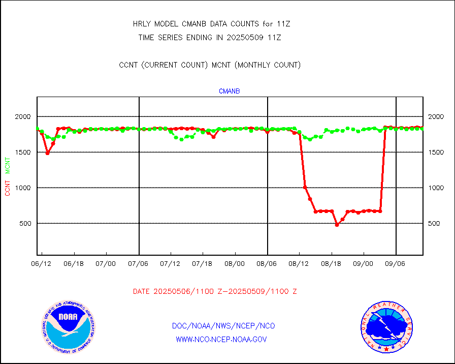
cmanb |
Surface Marine CMAN rpts decoded from BUFR format |
1854 |
1835 |
101.0 % |
2610.50-2611.50 |
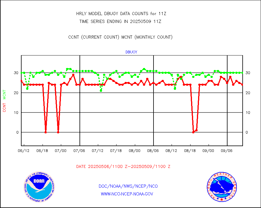
dbuoy |
Buoys decoded from FM-18 fmt (moored or drifting) |
37 |
38 |
97.4 % |
2610.50-2611.49 |
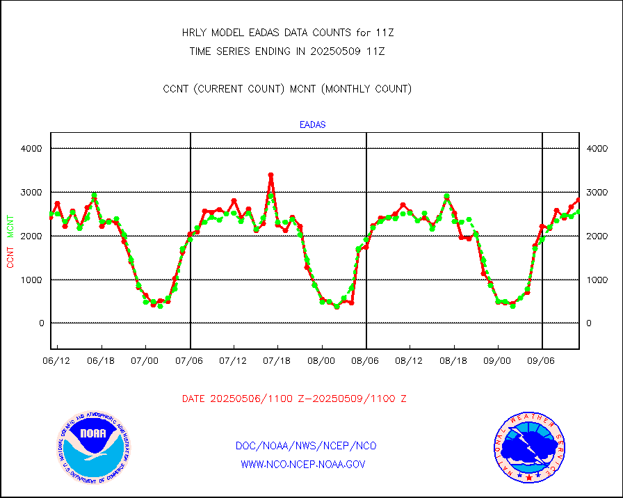
eadas |
E-AMDAR (European AMDAR acft decoded from BUFR) |
2018 |
1961 |
102.9 % |
2610.50-2611.49 |
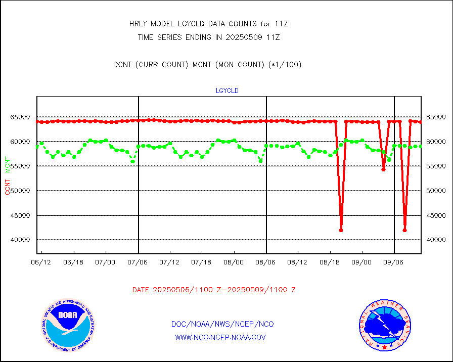
esamua |
NOAA 15-19 & METOP 1-2 AMSU-A proc btmps frm RARS |
33760 |
25324 |
133.3 % |
2610.50-2611.49 |
eshrs3 |
NOAA 15-19 & METOP 1-2 HIRS-3/4 pr btmps frm RARS |
79276 |
53955 |
146.9 % |
2610.50-2611.49 |
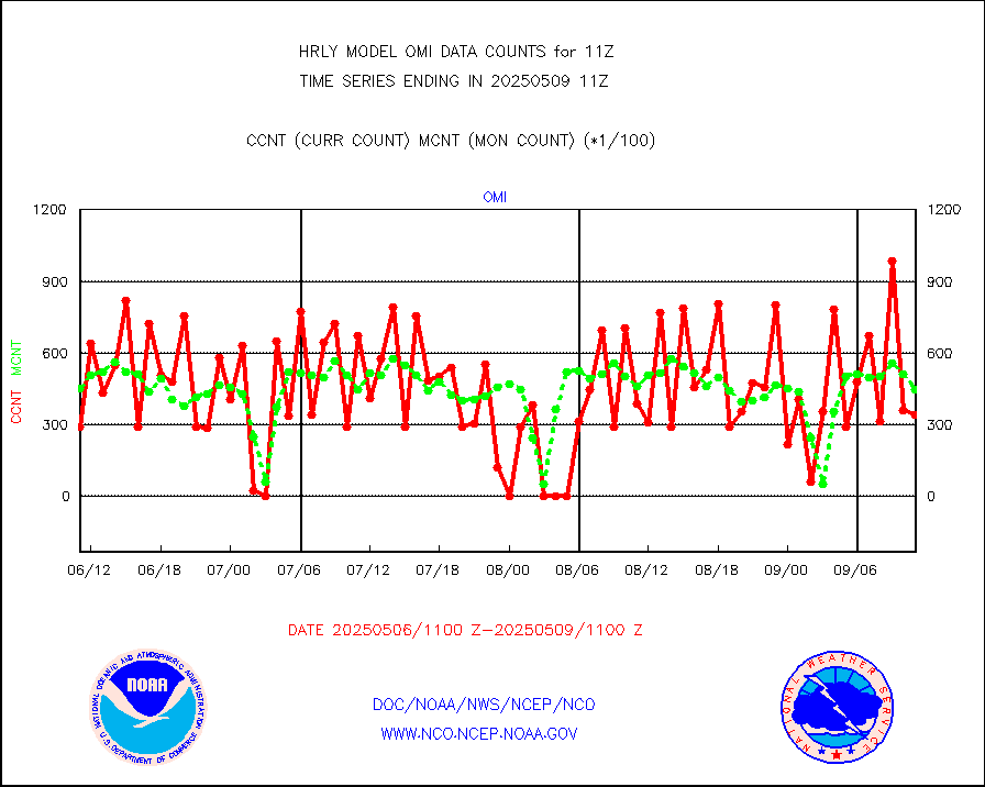
gnss |
Grnd-based Gbl Navigation Sat System (GNSS) data |
9017 |
7396 |
121.9 % |
2610.00-2610.99 |
gpsro |
GPS radio occultation data |
499 |
480 |
104.0 % |
2608.50-2609.49 |
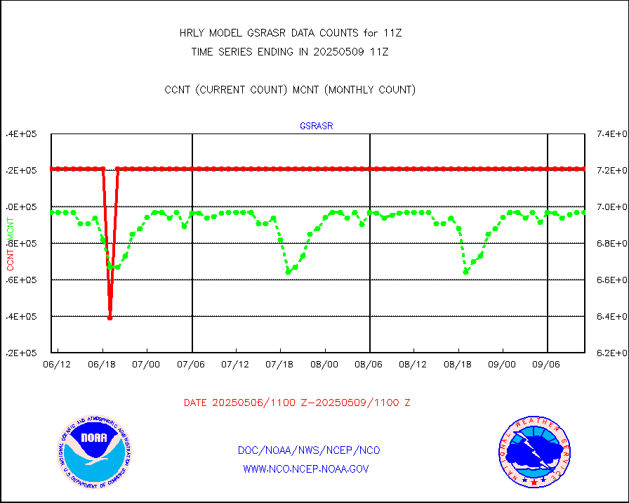
gsrasr |
GOES-16/17 All Sky Radiances (proc.) |
360476 |
360476 |
100.0 % |
2610.50-2611.49 |
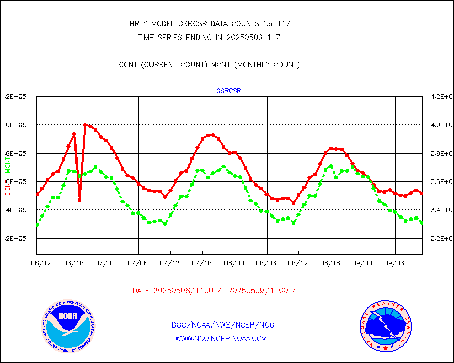
gsrcsr |
GOES-16/17 Clear Sky Radiances (proc.) |
164630 |
164551 |
100.0 % |
2610.50-2611.49 |
h20ja |
MTSAT/JMA water vapor imager derived cloud motion |
18474 |
18611 |
99.3 % |
2608.50-2609.49 |
h20mo |
MODIS (AQUA/TERRA) wvpr imager derived cld motion |
0 |
0 |
n/a |
2607.00-2607.99 |
h2tusr |
GOES-16&up/NESDIS wv imgr/cld-top derived cld mtn |
24453 |
20685 |
118.2 % |
2610.00-2610.99 |
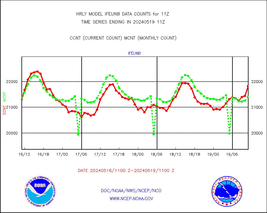
ifeunb |
METEOSAT/EUMETSAT ir lg-wave drv cld motion NBseq |
20653 |
20369 |
101.4 % |
2609.50-2610.49 |
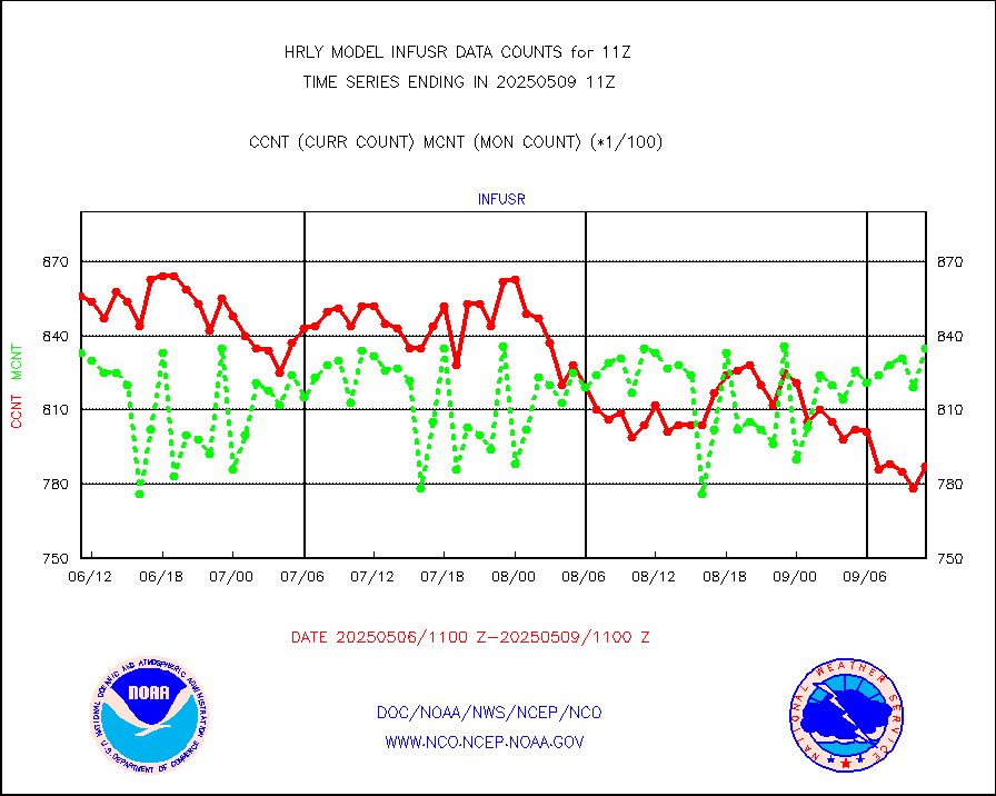
infja |
MTSAT/JMA infrared long-wave derived cloud motion |
16447 |
15838 |
103.8 % |
2608.50-2609.49 |
infmo |
MODIS (AQUA/TERRA) ir l-wave derived cloud motion |
0 |
0 |
n/a |
2607.00-2607.99 |
infusr |
GOES-16&up/NESDIS ir long-wave derived cld motion |
83675 |
80154 |
104.4 % |
2610.00-2610.99 |
lgycld |
GOES/NASA(Langley) hi-res. (1x1 f-o-v) cloud data |
4228235 |
4083519 |
103.5 % |
2610.50-2611.49 |
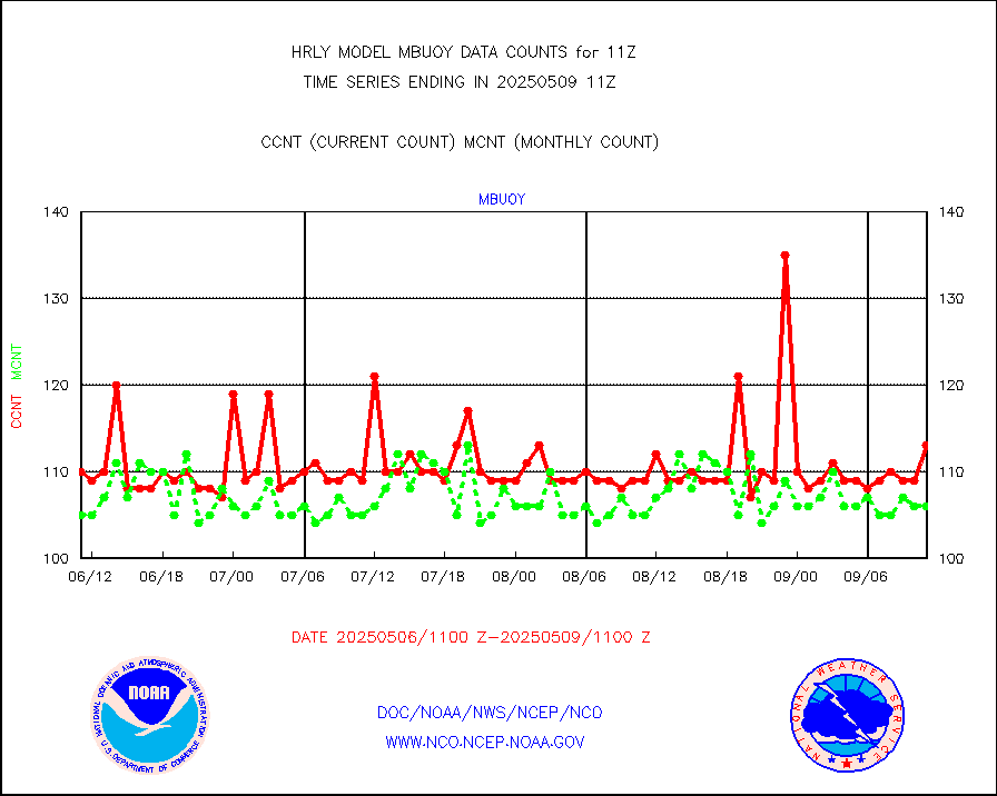
mbuoy |
Buoys decoded from FM-13 format (moored) |
128 |
120 |
106.7 % |
2610.50-2611.49 |
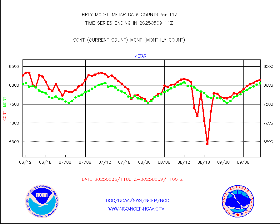
metar |
Aviation - METAR |
8026 |
7866 |
102.0 % |
2610.50-2611.49 |
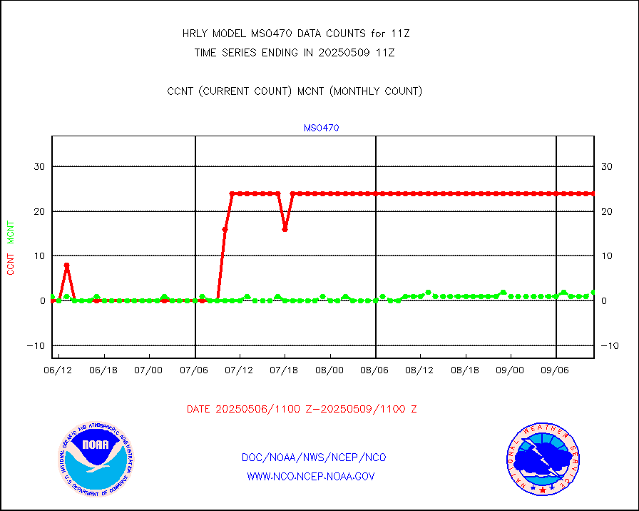
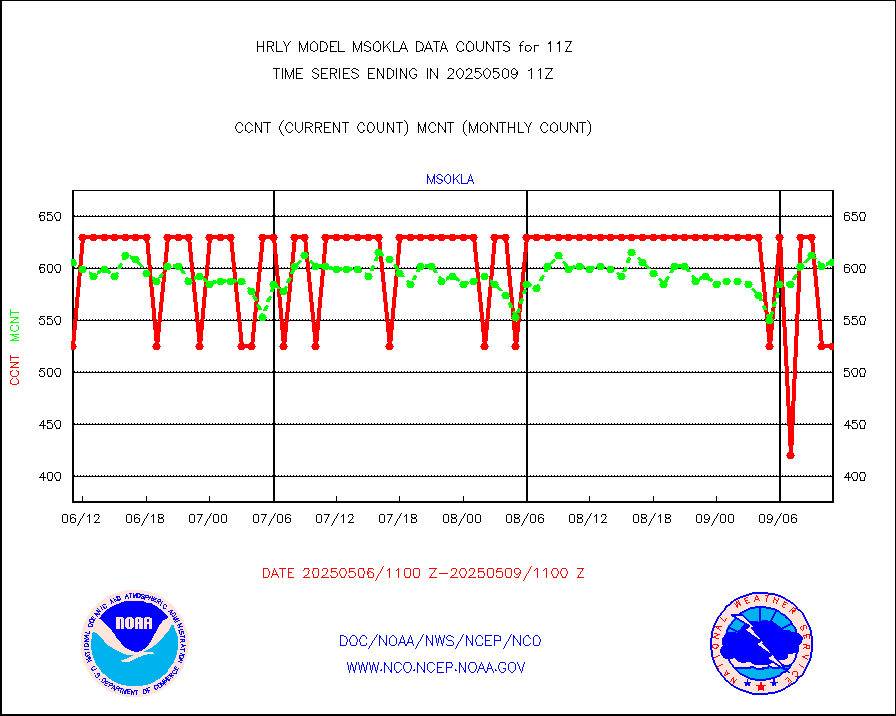
mso470 |
Mesonet/MADIS Colorado E-470 (Interstate 470) |
21 |
19 |
110.5 % |
2610.50-2611.49 |
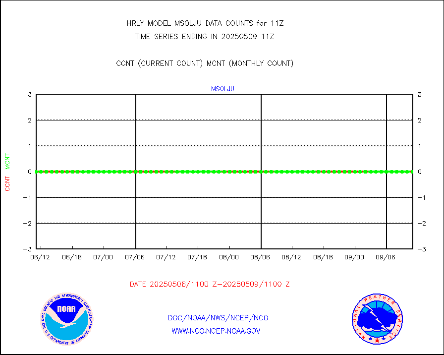
msoalk |
Mesonet/MADIS Alaska Department of Transportation |
109 |
107 |
101.9 % |
2610.50-2611.49 |
msoapg |
Mesonet/MADIS U.S. Army Aberdeen Proving Grounds |
0 |
0 |
n/a |
2610.50-2611.49 |
msoapr |
Mesonet/MADIS Citizen Weather Observers Program |
60857 |
51717 |
117.7 % |
2610.50-2611.49 |
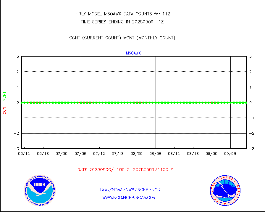
msoaws |
Mesonet/MADIS AWS Convergence Technologies, Inc. |
24737 |
23765 |
104.1 % |
2610.50-2611.49 |
msoawx |
Mesonet/MADIS "Anything Weather" |
0 |
0 |
n/a |
2610.50-2611.49 |
msocol |
Mesonet/MADIS Colorado Dept. of Transportation |
0 |
0 |
n/a |
2610.50-2611.49 |
msodcn |
Mesonet/MADIS DC Net |
0 |
0 |
n/a |
2610.50-2611.49 |
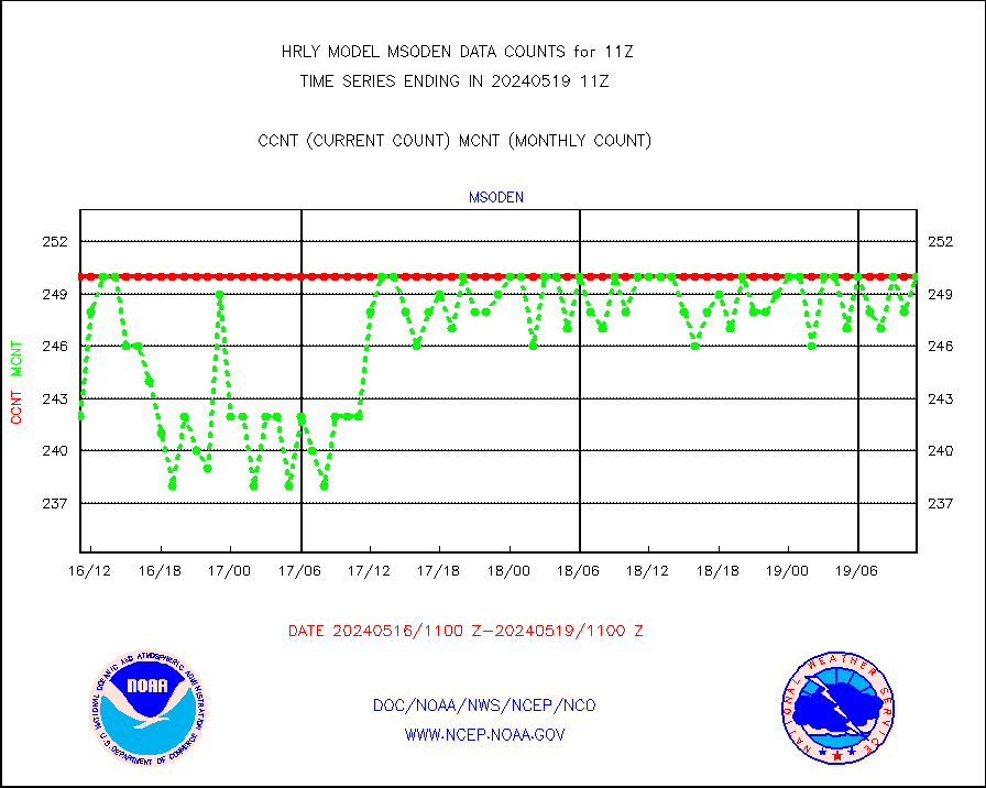
msoden |
Mesonet/MADIS Denver Urban Drainage & Flood Cntrl |
250 |
248 |
100.8 % |
2610.50-2611.49 |
msofla |
Mesonet/MADIS Florida (FAWN & USF) |
4 |
4 |
100.0 % |
2610.50-2611.49 |
msoflt |
Mesonet/MADIS Florida Dept. of Transportation |
0 |
0 |
n/a |
2610.50-2611.49 |
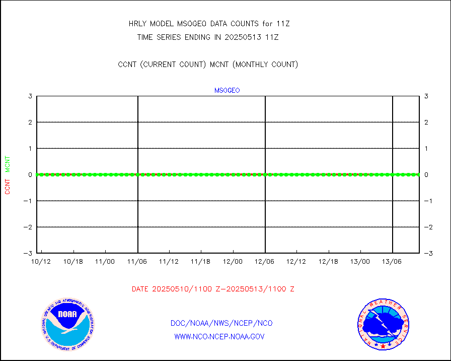
msogeo |
Mesonet/MADIS Georgia Dept. of Transportation |
0 |
0 |
n/a |
2610.50-2611.49 |
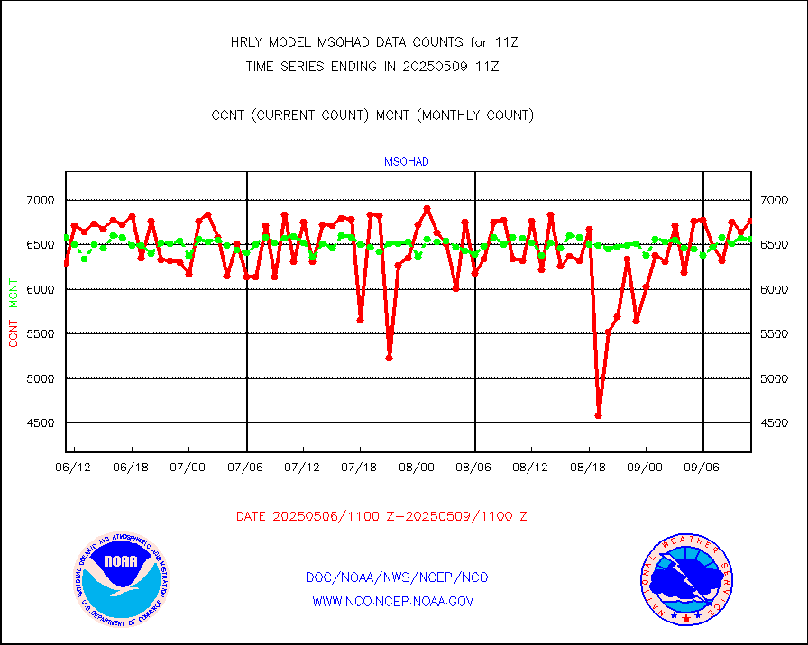
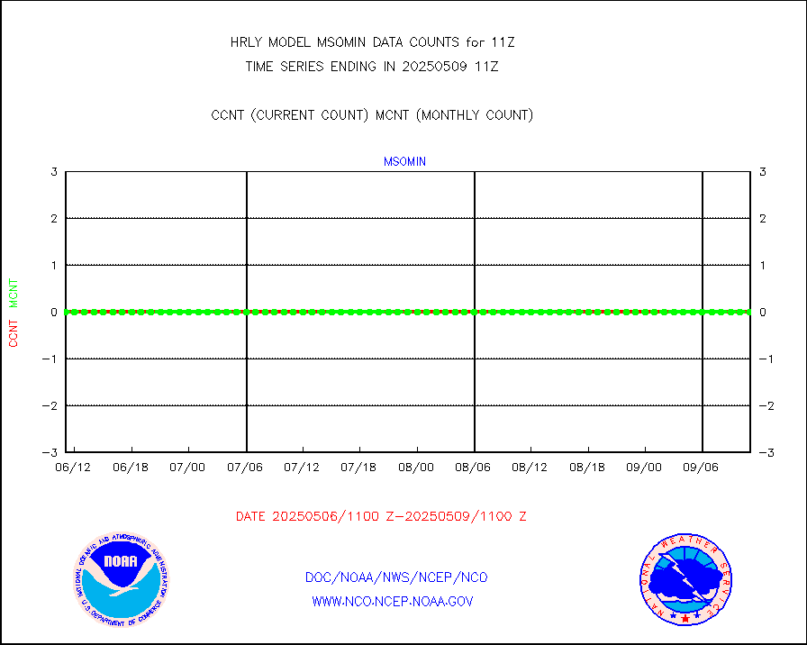
msohad |
Mesonet/MADIS NWS Hydromet Auto Data System(HADS) |
6782 |
6593 |
102.9 % |
2610.50-2611.49 |
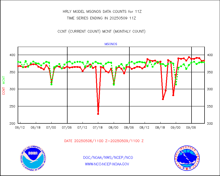
msoien |
Mesonet/MADIS Iowa Environmental |
184 |
177 |
104.0 % |
2610.50-2611.49 |
msoind |
Mesonet/MADIS Indiana Dept. of Transportation |
0 |
0 |
n/a |
2610.50-2611.49 |
msoiow |
Mesonet/MADIS Iowa Department of Transportation |
0 |
0 |
n/a |
2610.50-2611.49 |
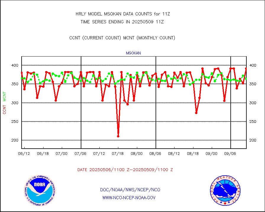
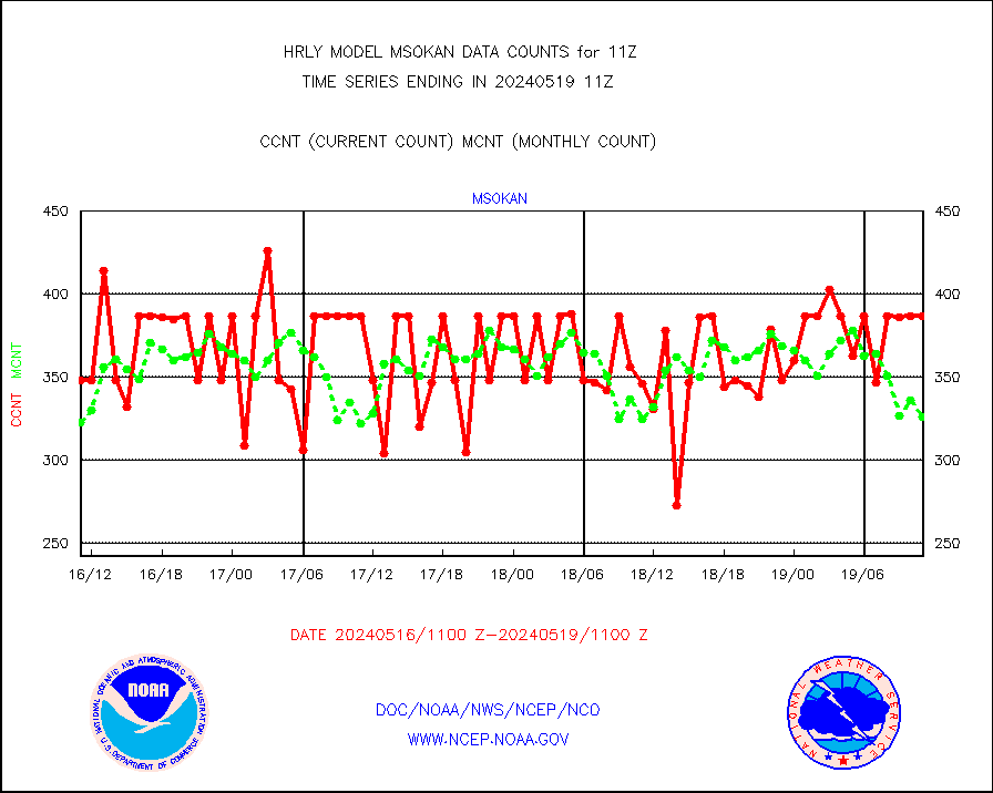
msokan |
Mesonet/MADIS Kansas Department of Transportation |
377 |
303 |
124.4 % |
2610.50-2611.49 |
msokla |
Mesonet/MADIS Oklahoma Mesonet |
636 |
576 |
110.4 % |
2610.50-2611.49 |
msolju |
Mesonet/MADIS Louisiana State/Jackson State Univ. |
0 |
0 |
n/a |
2610.50-2611.49 |
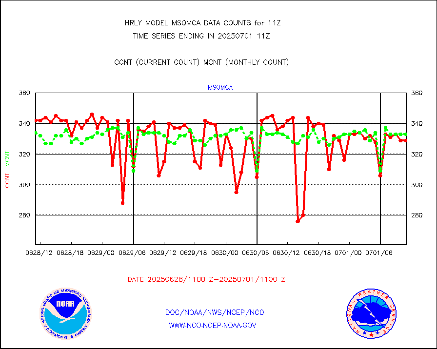
msomca |
Mesonet/MADIS Missouri Commercial Agricult Wx Net |
294 |
286 |
102.8 % |
2610.50-2611.49 |
msomin |
Mesonet/MADIS Minnesota Dept. of Transportation |
0 |
0 |
n/a |
2610.50-2611.49 |
msonos |
Mesonet/MADIS NOS-Phys Oceanographic Realtime Sys |
397 |
394 |
100.8 % |
2610.50-2611.49 |
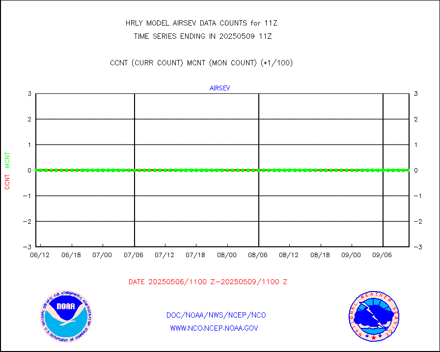
msoraw |
Mesonet/MADIS NFIC Remote Automated Wx Stns(RAWS) |
2040 |
1877 |
108.7 % |
2610.50-2611.49 |
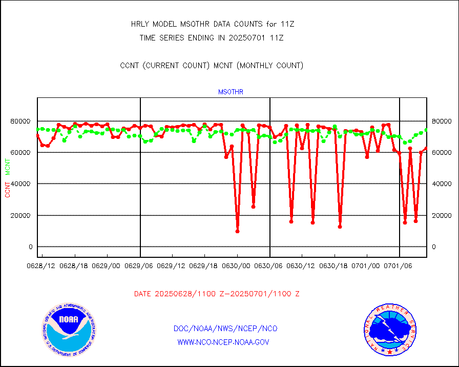
msothr |
Mesonet/MADIS many providers, not separated out |
83113 |
80565 |
103.2 % |
2610.00-2611.49 |
msovir |
Mesonet/MADIS Virginia Dept. of Transportation |
196 |
122 |
160.7 % |
2610.50-2611.49 |
msowfy |
Mesonet/MADIS "Weather for You" |
0 |
0 |
n/a |
2610.50-2611.49 |
msowis |
Mesonet/MADIS Wisconsin Dept. of Transportation |
0 |
0 |
n/a |
2610.50-2611.49 |
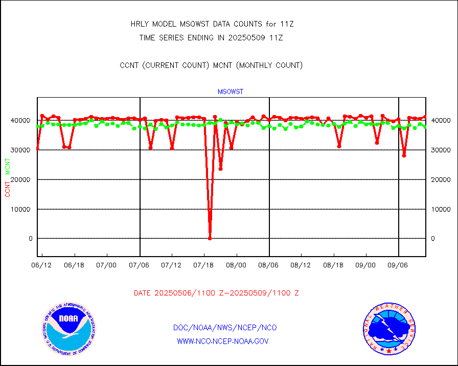
msowst |
Mesonet/MADIS MesoWest (many subproviders) |
35262 |
34603 |
101.9 % |
2610.50-2611.49 |
msowtx |
Mesonet/MADIS West Texas |
5638 |
5666 |
99.5 % |
2610.50-2611.49 |
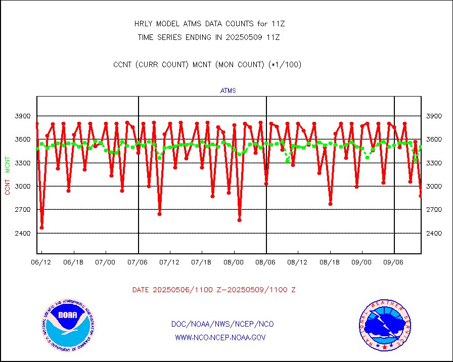
mtiasi |
METOP 1-2 IASI 1C radiance data (varbl. channels) |
93824 |
85179 |
110.1 % |
2609.00-2609.99 |
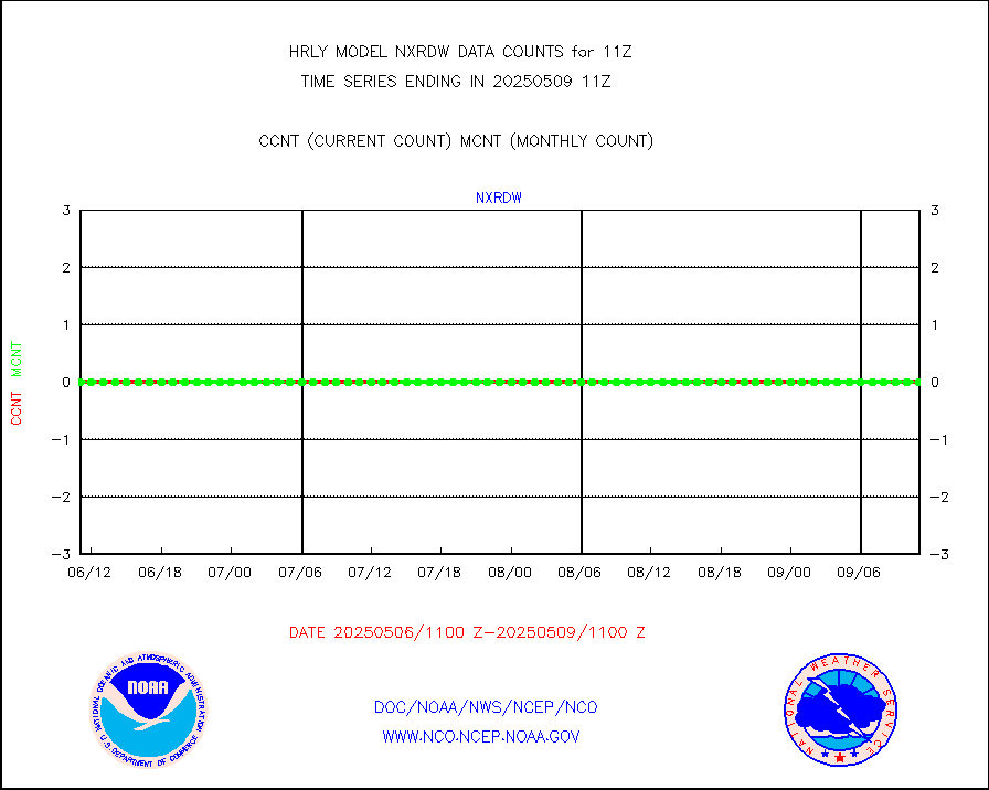
nxrdw |
NEXRAD Vel Azm Dsp(VAD) winds via radar coded msg |
0 |
0 |
n/a |
2610.50-2611.49 |
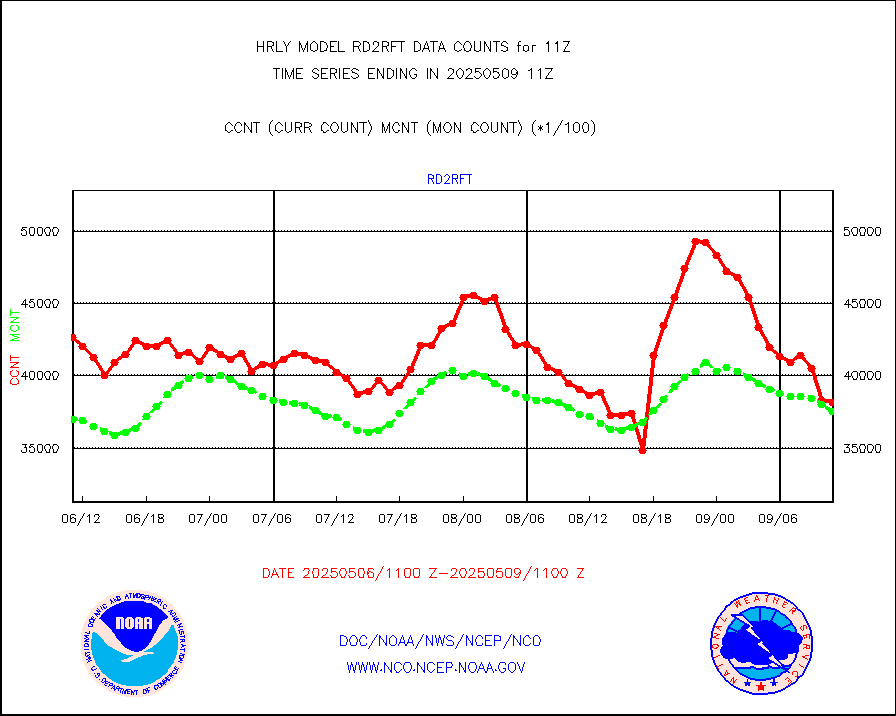
omi |
Aura Ozone Monitoring Instrument (OMI) data |
28800 |
45806 |
62.9 % |
2608.50-2609.49 |
osbuv8 |
NOAA 16-19 Solar Backscatter UV-2 rad frm V8 BUFR |
0 |
0 |
n/a |
2609.00-2609.99 |
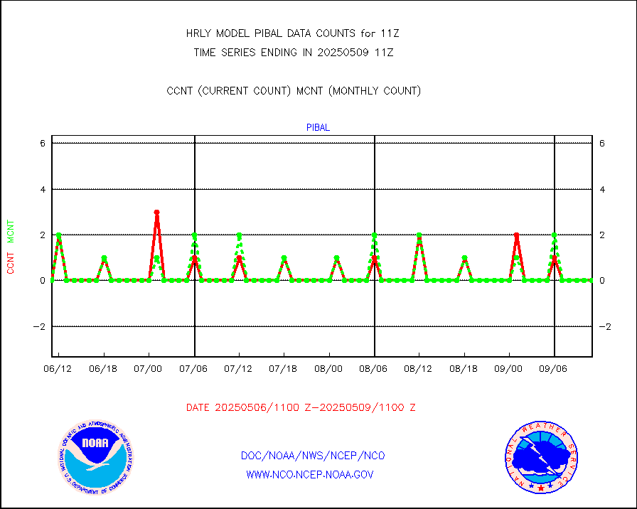
pibal |
PIBAL (from PILOT, PILOT SHIP, PILOT MOBIL) |
0 |
0 |
n/a |
2610.50-2611.49 |
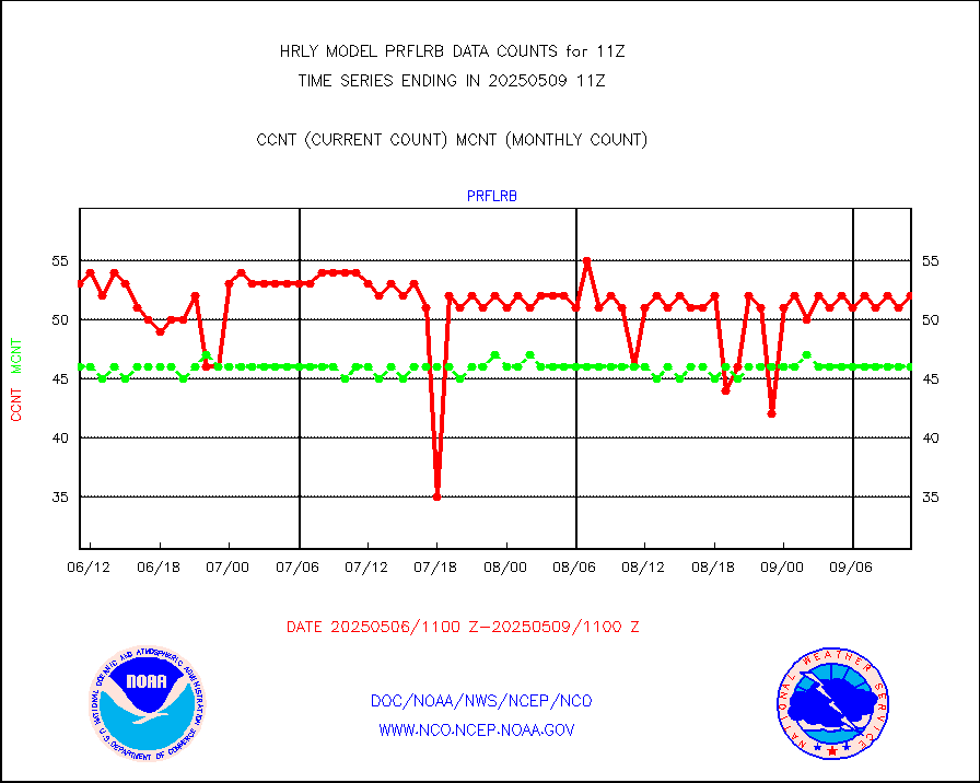
prflrb |
Multi-Agency Profiler (MAP) and SODAR winds |
52 |
44 |
118.2 % |
2610.50-2611.49 |
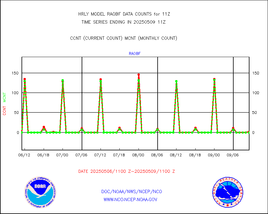
raobf |
Rawinsonde - fixed land (from TEMP or PILOT) |
0 |
0 |
n/a |
2610.50-2611.49 |
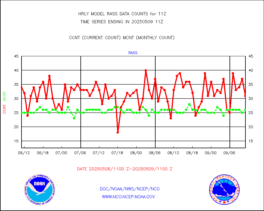
rass |
RASS temperatures (NOAA and Multi-Agency) |
29 |
23 |
126.1 % |
2610.50-2611.49 |
rd2rft |
NEXRAD reflectivity (Lvl 2 - GTS) |
3944288 |
4191954 |
94.1 % |
2610.50-2611.49 |
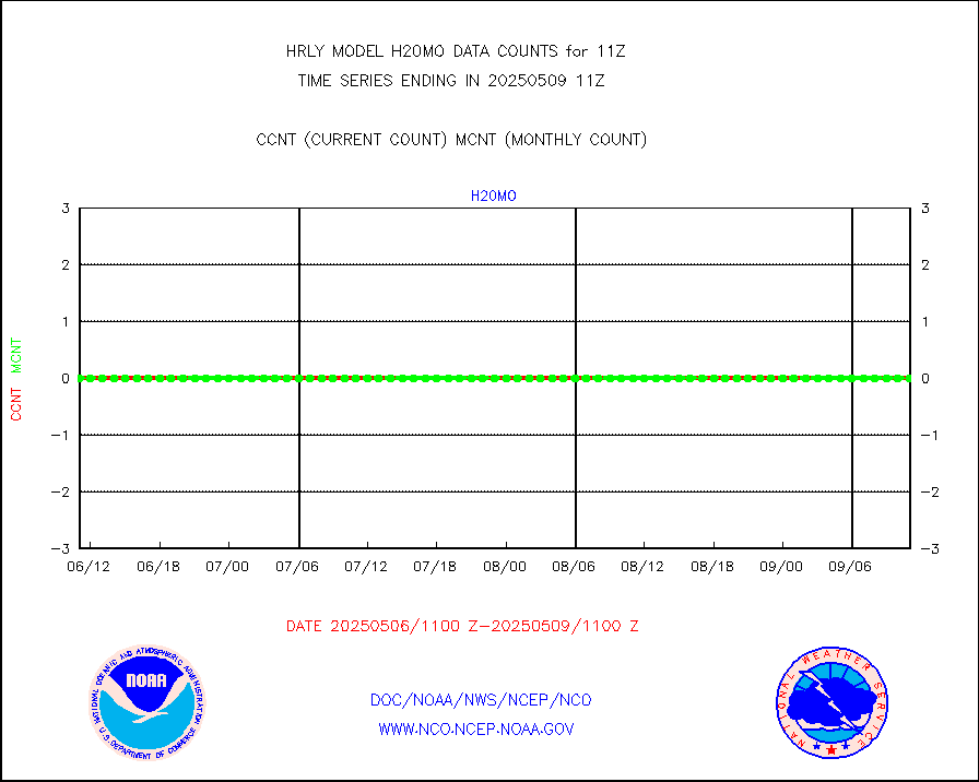
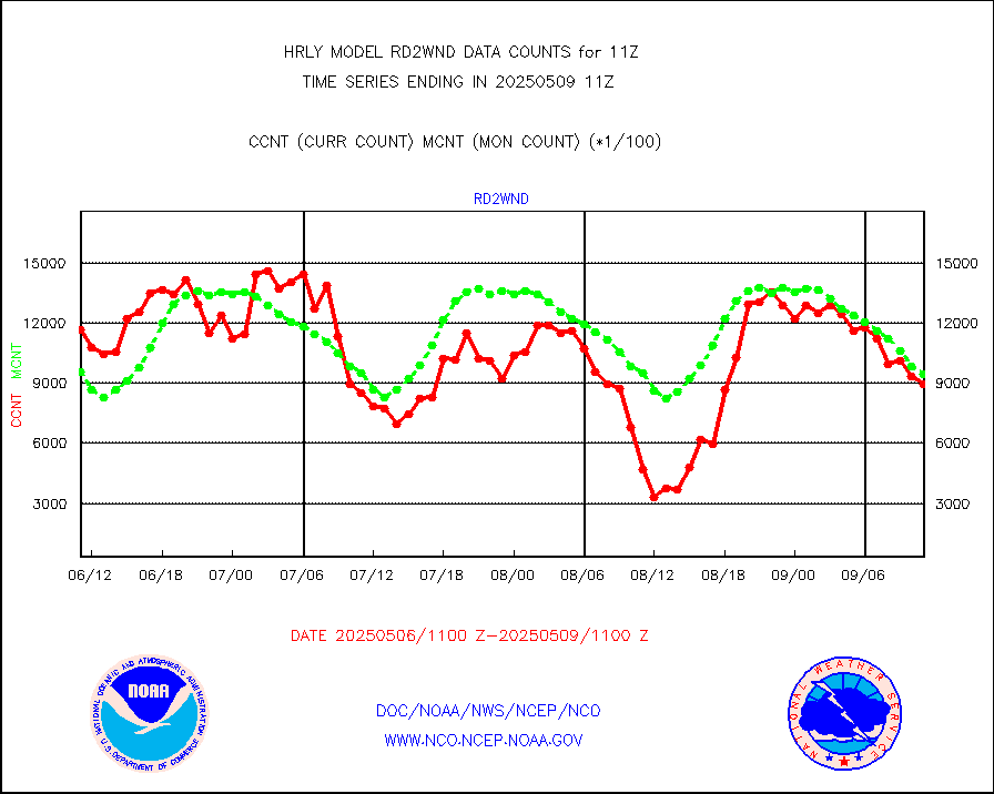
rd2wnd |
NEXRAD radial wind (Level 2 - GTS) |
1058894 |
1387481 |
76.3 % |
2610.50-2611.49 |
sevcsr |
METEOSAT-10 2nd Gen SEVIRI Clr Sky Radiance(proc) |
0 |
0 |
n/a |
2610.50-2611.49 |
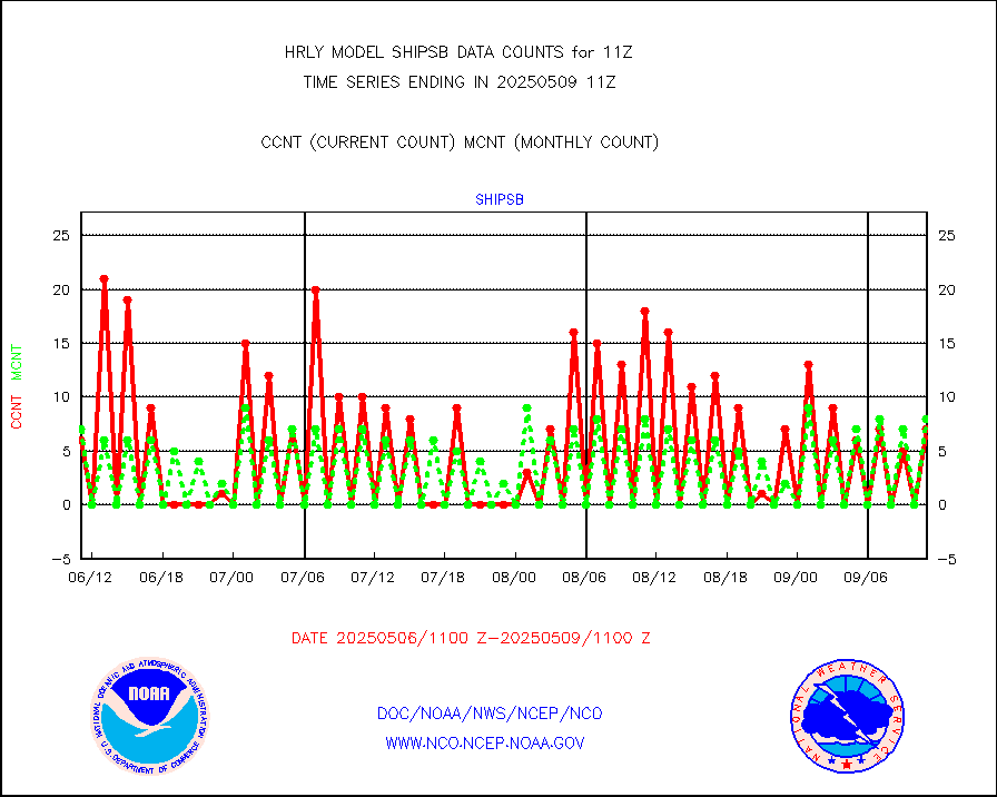
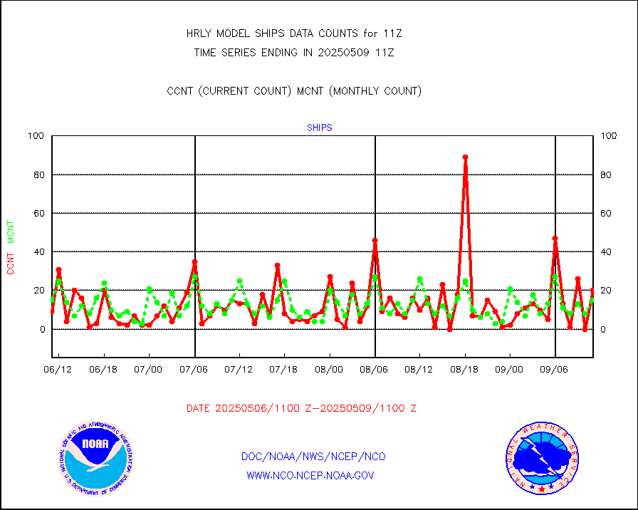
shipsb |
Ship - manual and automatic, restricted (BUFR) |
1 |
1 |
100.0 % |
2610.50-2611.50 |
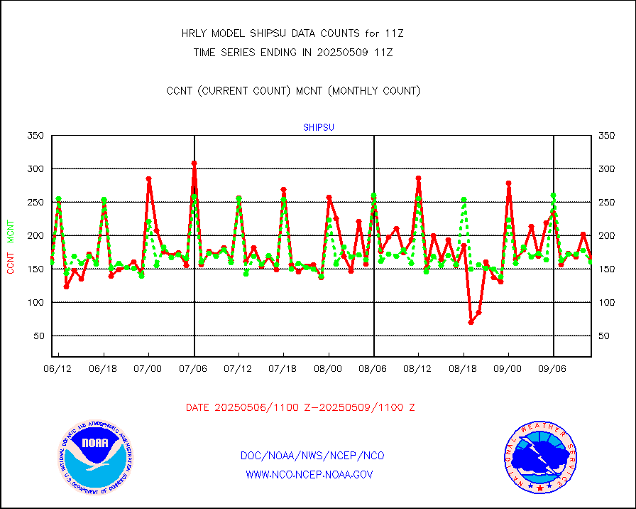
shipsu |
Ship - manual and automatic, unrestricted |
120 |
114 |
105.3 % |
2610.50-2611.50 |
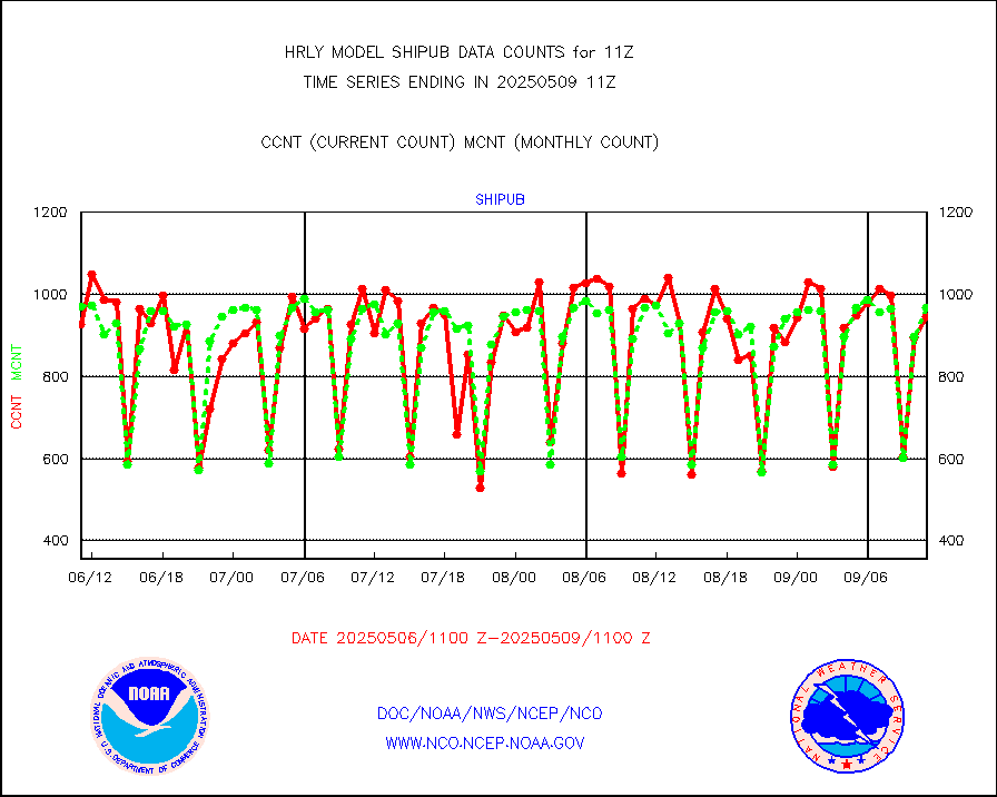
shipub |
Ship - manual and automatic, unrestricted (BUFR) |
826 |
849 |
97.3 % |
2610.50-2611.50 |
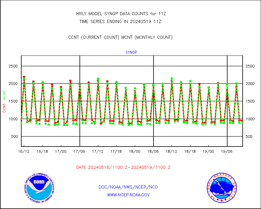
synop |
Synoptic - fixed manual and automatic |
957 |
973 |
98.4 % |
2610.50-2611.49 |
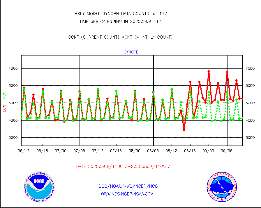
synopb |
Synoptic - fixed manual & auto (decoded fr BUFR) |
4255 |
4042 |
105.3 % |
2610.50-2611.49 |
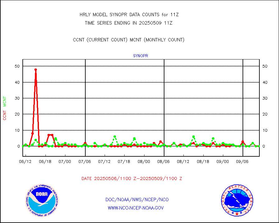
synopr |
Synoptic - restricted (WMO Res 40) manual & auto. |
0 |
1 |
0.0 % |
2610.50-2611.49 |
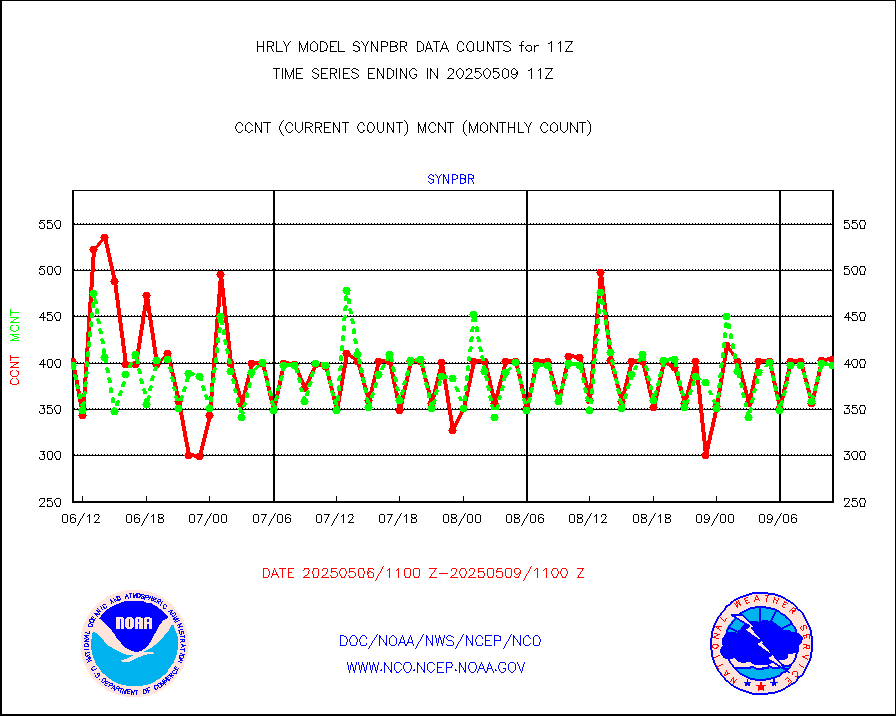
synpbr |
Synoptic - restricted (WMO Res 40)(decoded BUFR) |
398 |
388 |
102.6 % |
2610.50-2611.49 |
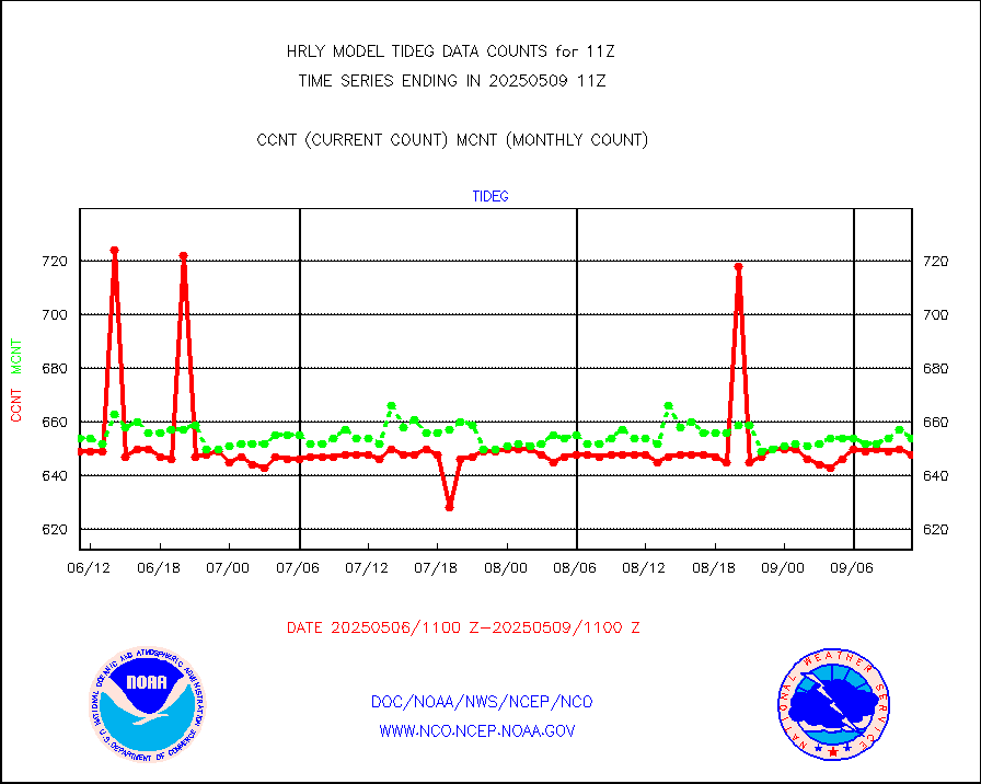
tideg |
Tide gauge reports decoded from CREX format |
643 |
652 |
98.6 % |
2610.00-2610.99 |
| Data Types of Opportunity with Normal Counts |
|---|
| Type | Description | Hourly Count | Monthly Average | Percent (%) of Monthly Mean | UTC Time Window |
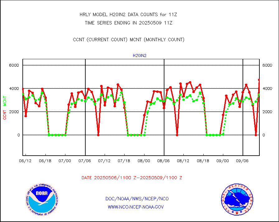
3p9usr |
GOES-16&up/NESDIS ir short-wv derived cld motion |
43599 |
46566 |
93.6 % |
2610.00-2610.99 |
acarsa |
MDCRS ACARS acft data (ARINC via AFWA)(AIREP fmt) |
0 |
0 |
n/a |
2610.50-2611.49 |
ahicsr |
Himawari Clear Sky Radiance |
0 |
0 |
n/a |
2610.00-2610.99 |
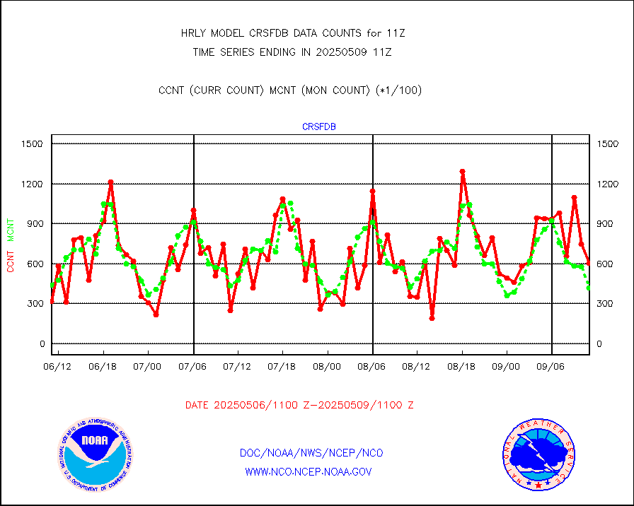
amsr2 |
GCOM-W AMSR2 1B brightness temperatures |
2309472 |
2171513 |
106.4 % |
2609.00-2609.99 |
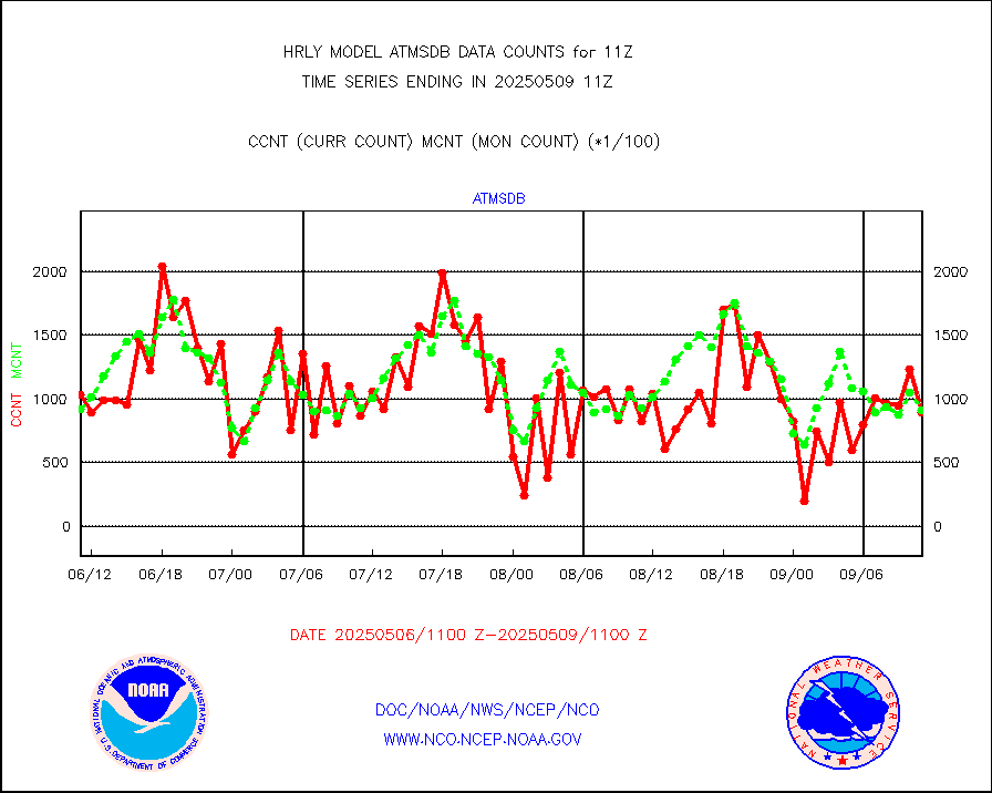
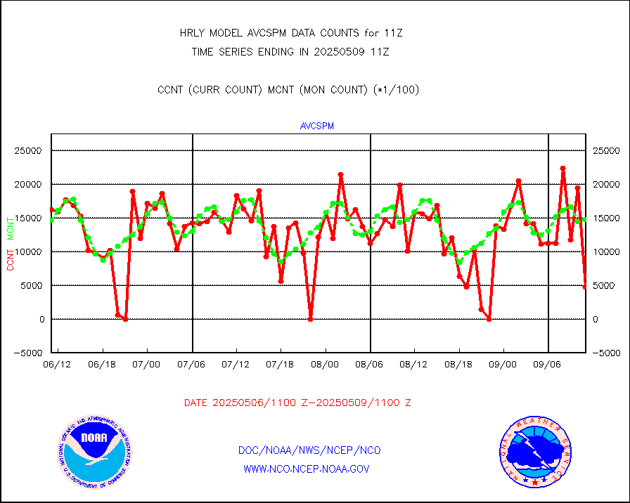
atmsdb |
NPP/NOAA-20 ATMS bright. temps-direct b-cast SSEC |
35712 |
61950 |
57.6 % |
2609.50-2610.49 |
atovs |
POES/NESDIS - processed ATOVS soundings/radiances |
0 |
0 |
n/a |
2609.00-2609.99 |
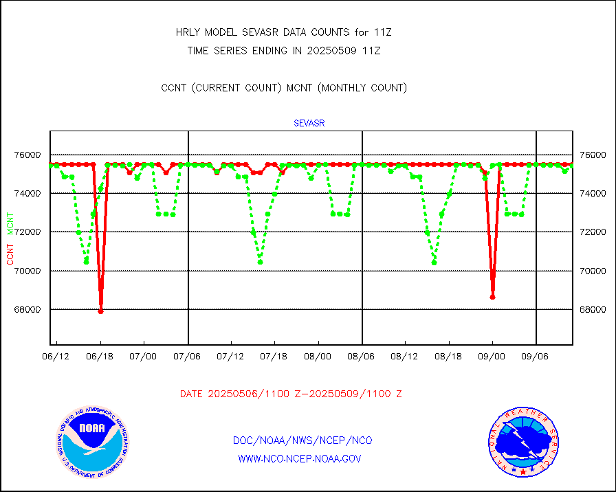
avcsam |
A.M.(N17,M2,M3) AVHRR GAC NCEP-proc clr&sea btmps |
1417647 |
1368494 |
103.6 % |
2608.50-2609.49 |
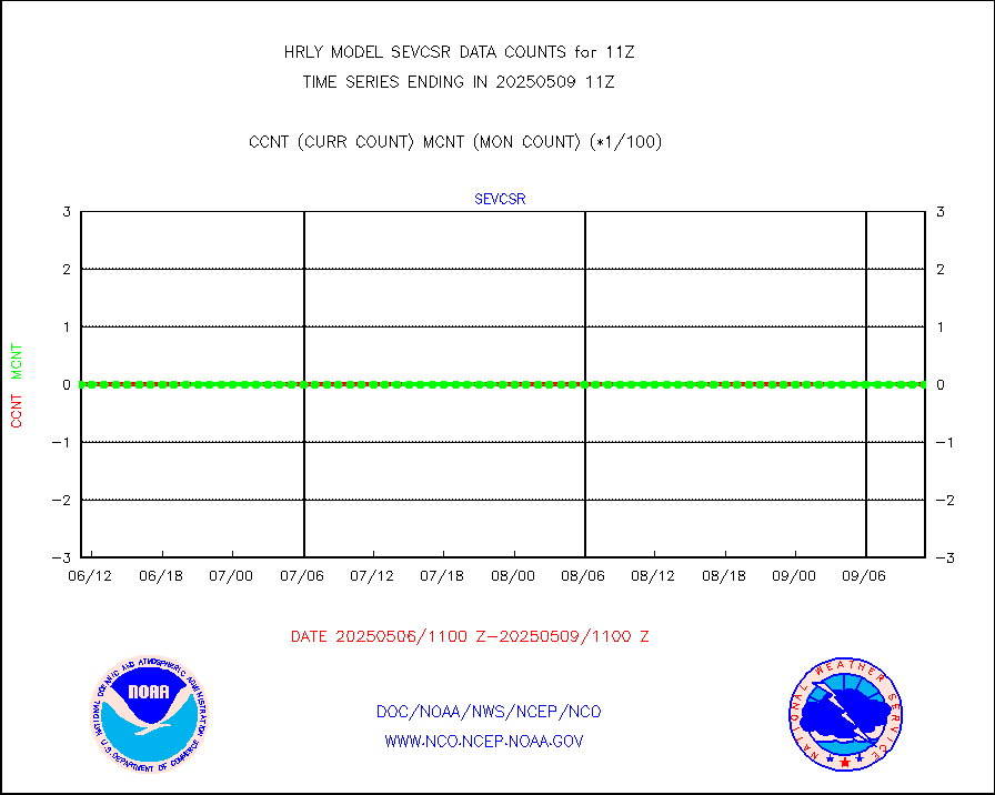
avcspm |
P.M.(N18-19) AVHRR GAC NCEP-proc clr & sea btemps |
823232 |
1464922 |
56.2 % |
2608.50-2609.49 |
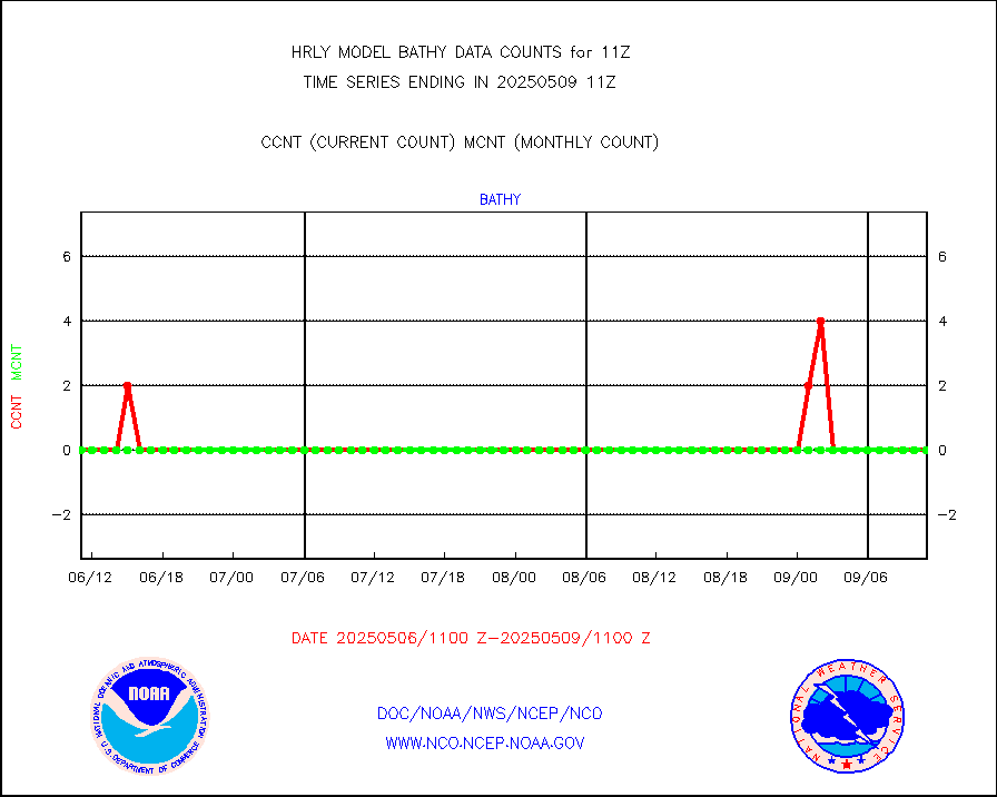
bathy |
eXpendable BathyThermograph, mooring (BATHY fmt) |
0 |
0 |
n/a |
2604.00-2604.99 |
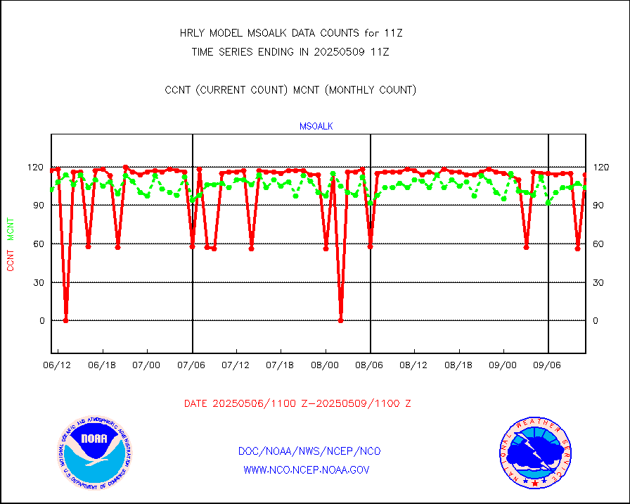
coopmd |
Coop/MADIS NEPP & HCN-Modernization NOAA COOP Obs |
27 |
27 |
100.0 % |
2610.50-2611.49 |
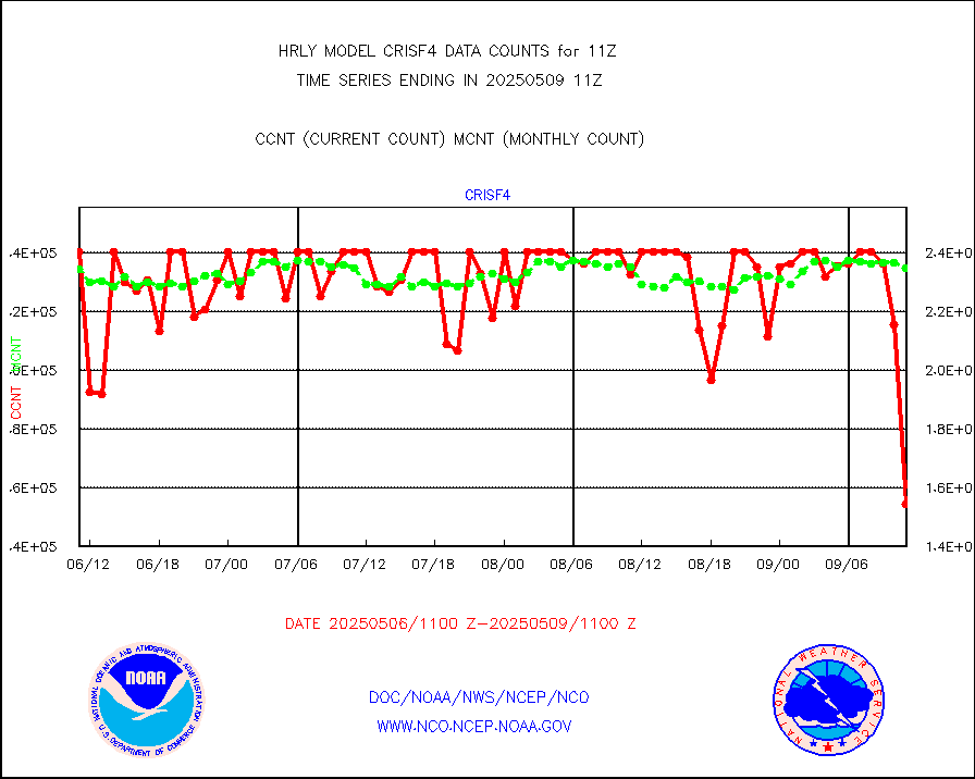
crisf4 |
NPP/NOAA-20 CrIS full spctrl radn (431 ch subset) |
240534 |
231434 |
103.9 % |
2609.50-2610.49 |
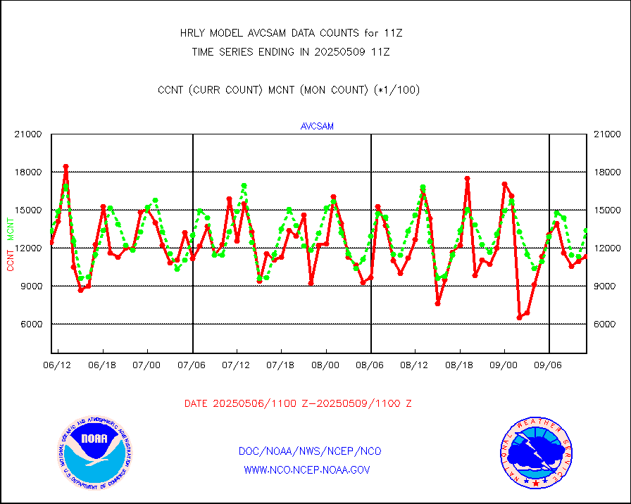
crsfdb |
NPP/NOAA-20 CrIS full spctrl radn dir brdcst SSEC |
51840 |
44143 |
117.4 % |
2609.50-2610.49 |
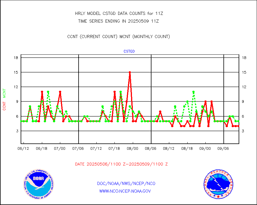
cstgd |
Coast Guard |
4 |
4 |
100.0 % |
2610.50-2611.50 |
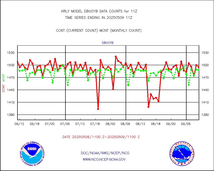
dbuoyb |
Drifting buoys (decoded from BUFR) |
1412 |
1429 |
98.8 % |
2610.50-2611.50 |
dropw |
Dropwinsonde (from TEMP DROP) |
0 |
1 |
0.0 % |
2610.50-2611.49 |
dropwb |
Dropwinsonde (decoded from BUFR) |
0 |
1 |
0.0 % |
2610.51-2611.49 |
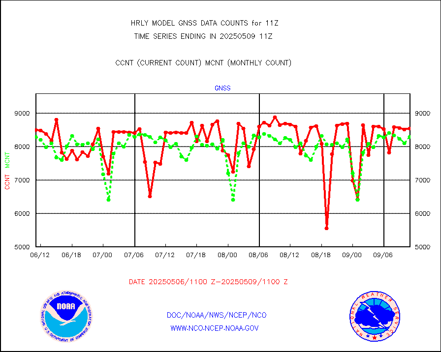
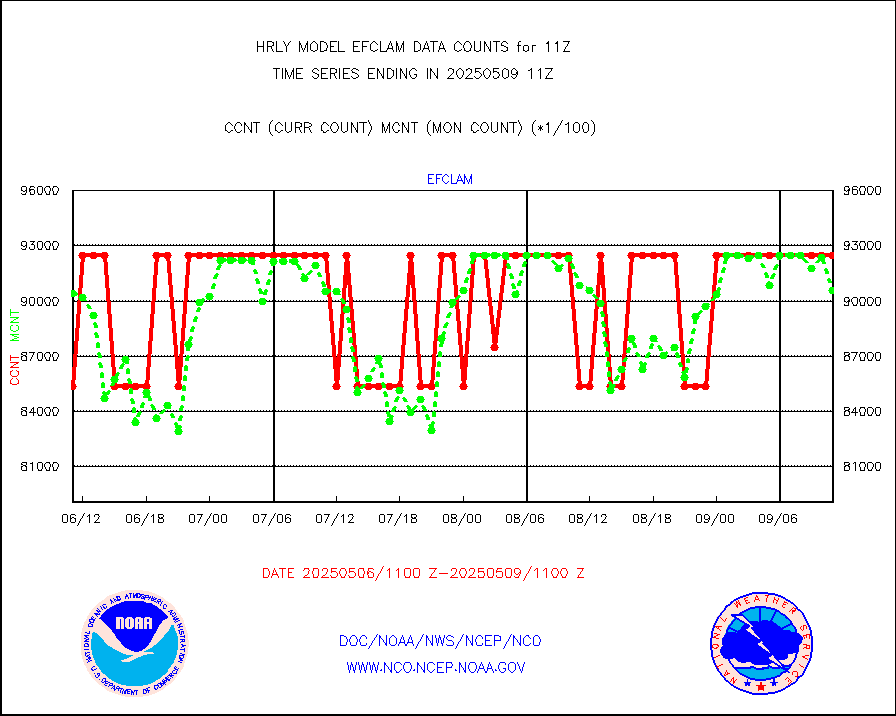
efclam |
GOES imager effective cloud amount data (U.Wisc.) |
8177398 |
8248156 |
99.1 % |
2610.50-2611.49 |
esatms |
NPP Adv. Tech. MW Sndr (ATMS) br. temps from RARS |
63313 |
76018 |
83.3 % |
2609.50-2610.49 |
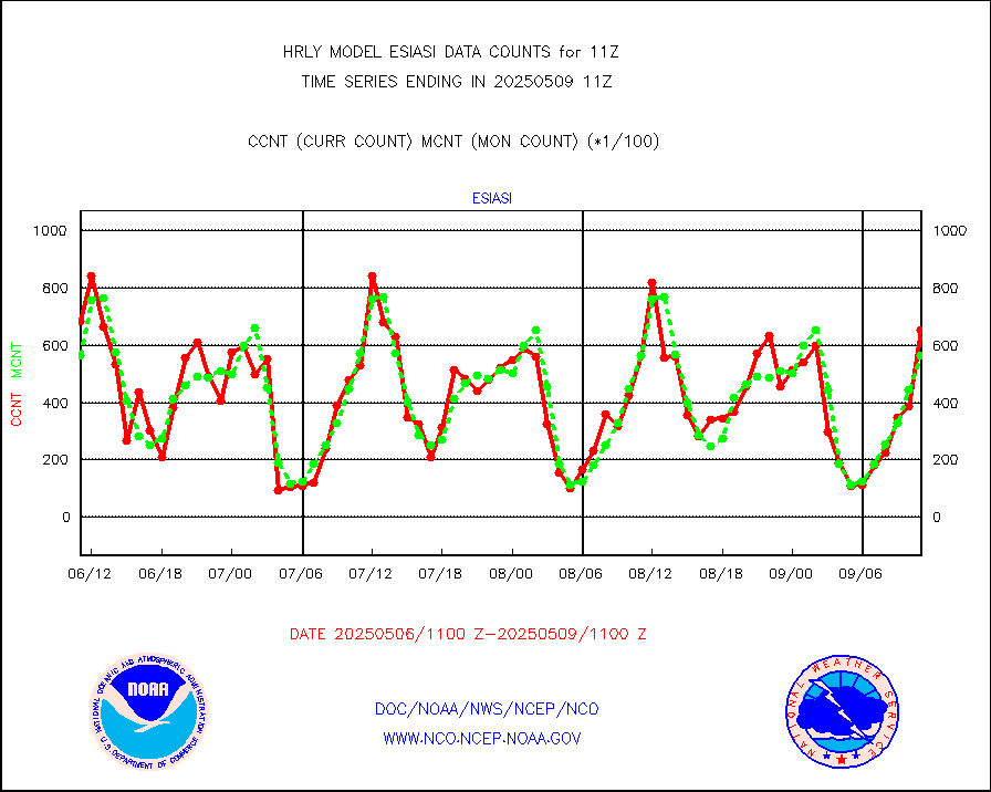
esiasi |
METOP 1-2 IASI 1C radiance data vbl chn from RARS |
56331 |
58235 |
96.7 % |
2610.00-2610.99 |
esmhs |
NOAA 18-19 & METOP 1-2 MHS proc. btemps from RARS |
260551 |
197101 |
132.2 % |
2610.50-2611.49 |
geoimr |
GOES/NESDIS (11x17 f-o-v) imager clear radiances |
0 |
0 |
n/a |
2610.00-2610.99 |
gome |
METOP 1-2 Global Ozone Monitoring Exp.-2 (GOME-2) |
11806 |
8716 |
135.5 % |
2609.50-2610.49 |
h20in2 |
INDIA SATWIND, INSAT WV channel |
3148 |
2593 |
121.4 % |
2610.00-2610.99 |
h2dusr |
GOES-16&up/NESDIS wv imgr/deep-lyr derivd cld mtn |
20966 |
18540 |
113.1 % |
2610.00-2610.99 |
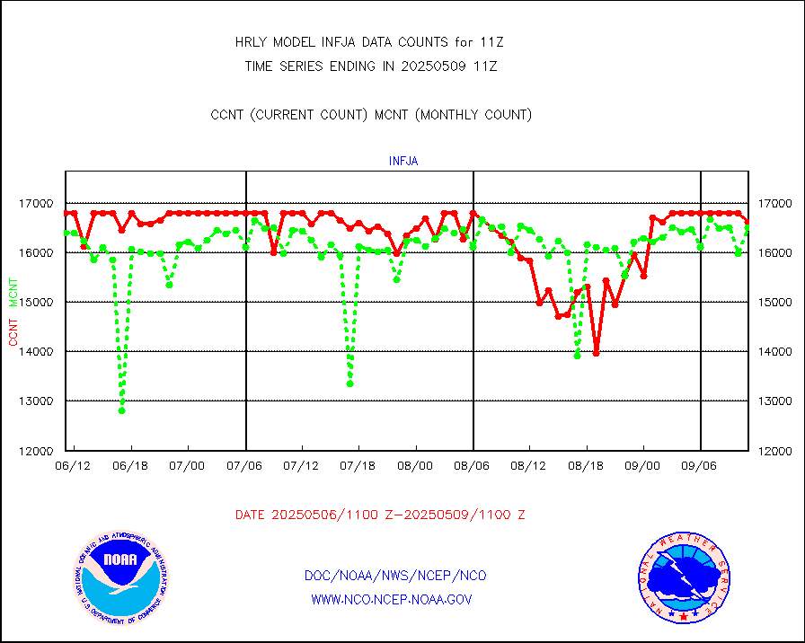
h2eunb |
METEOSAT/EUMETSAT wvpr imgr drv cld motion NBseq |
37205 |
35886 |
103.7 % |
2609.50-2610.49 |
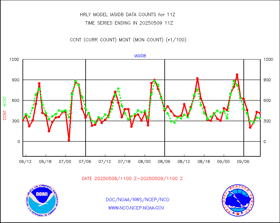
iasidb |
METOP 1-2 IASI 1C radiances-direct broadcast SSEC |
11520 |
29543 |
39.0 % |
2609.50-2610.49 |
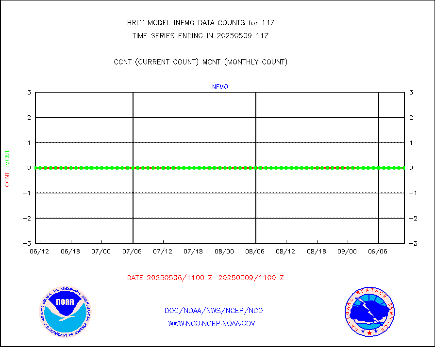
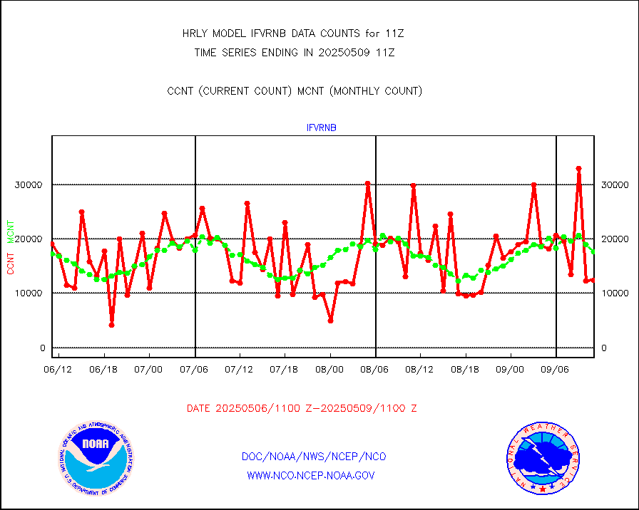
ifvrnb |
VIIRS (NPP/NOAA-20) ir lg-wv drv cloud motion(NB) |
11327 |
14822 |
76.4 % |
2607.00-2607.99 |
infav |
AVHRR (NOAA/METOP) ir lg-wave derived cld motion |
0 |
0 |
n/a |
2607.00-2607.99 |
infav1 |
AVHRR (METOP) ir lg-wave derived cld motion |
0 |
0 |
n/a |
2610.50-2611.50 |
infin |
INSAT/KALPANA India ir lg-wave derived cld motion |
0 |
0 |
n/a |
2608.50-2609.49 |
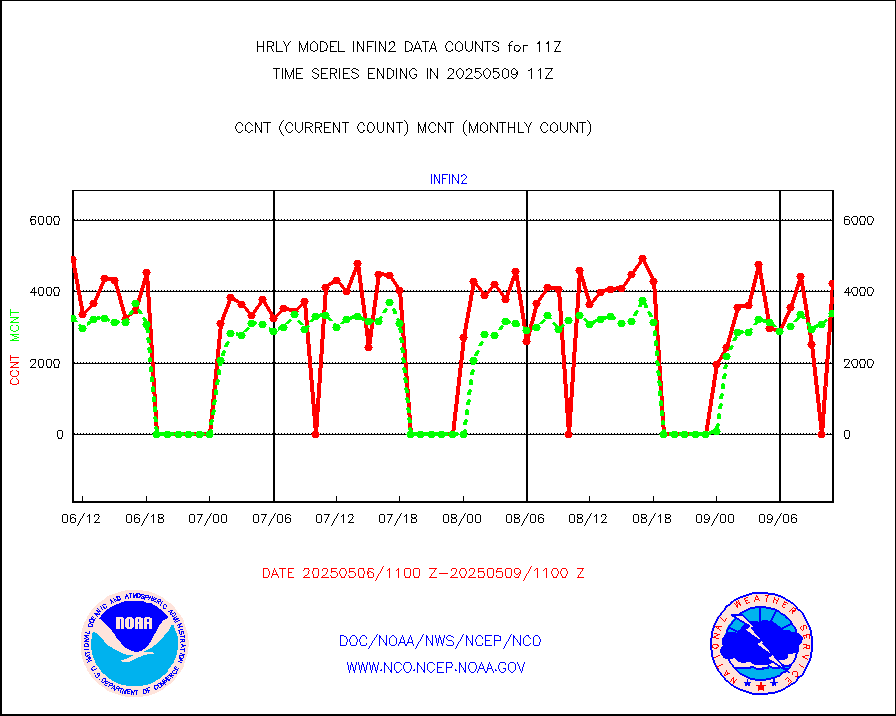
infin2 |
INDIA SATWIND, INSAT IR channel |
4314 |
2889 |
149.3 % |
2610.00-2610.99 |
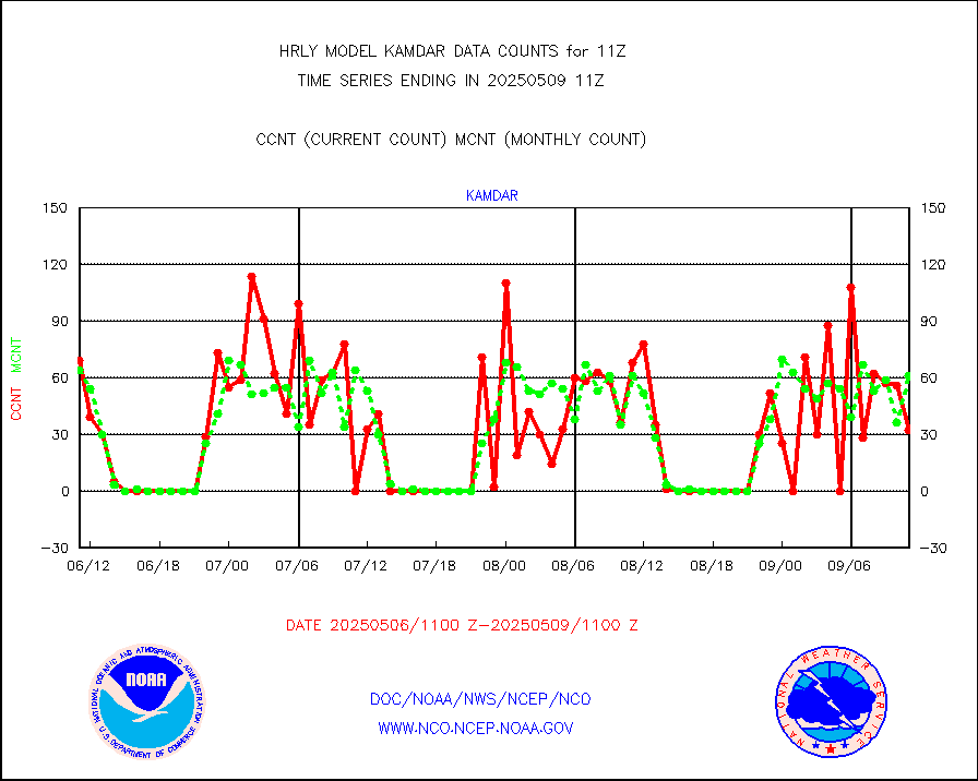
kamdar |
Korean AMDAR aircraft data (decoded from BUFR) |
40 |
47 |
85.1 % |
2610.50-2611.49 |
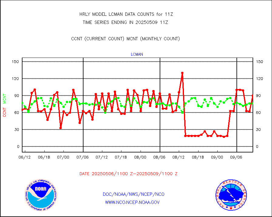
lcman |
Land-based CMAN stations decoded from CMAN format |
68 |
75 |
90.7 % |
2610.50-2611.49 |
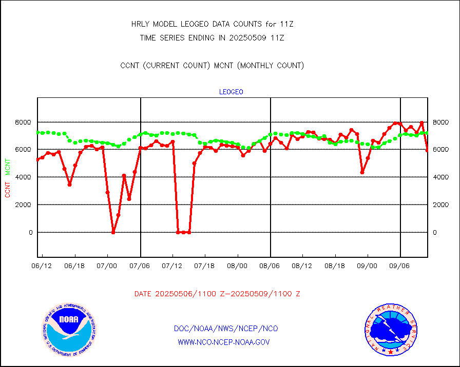
leogeo |
LEO-GEO satellite AMVs from UWisc. |
7599 |
6591 |
115.3 % |
2607.00-2607.99 |
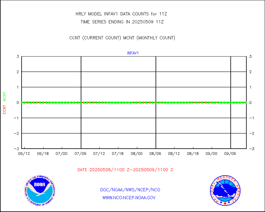
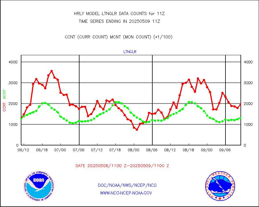
ltnglr |
LLDN Long-rng lightning from Vaisala via NOAAPORT |
93360 |
133940 |
69.7 % |
2610.50-2611.49 |
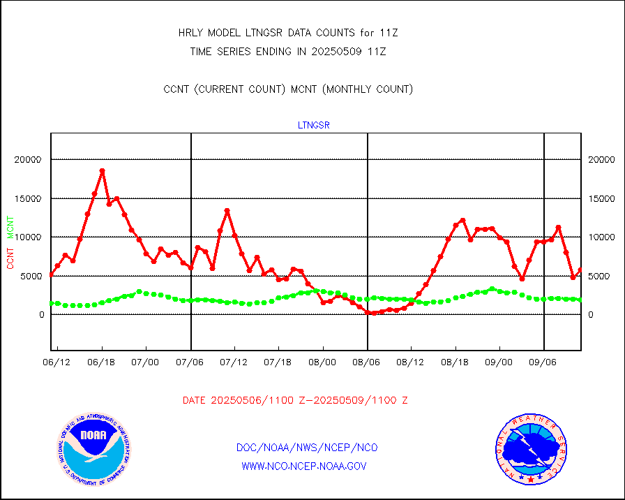
ltngsr |
NLDN Shrt-rng lightning from Vaisala via NOAAPORT |
799 |
2729 |
29.3 % |
2610.50-2611.49 |
mbuoyb |
Moored buoys (decoded from BUFR) |
844 |
856 |
98.6 % |
2610.50-2611.50 |
mls |
Aura Microwave Limb Sounder (MLS) ozone data |
0 |
0 |
n/a |
2609.00-2609.99 |
msourb |
Mesonet/MADIS UrbaNet |
4070 |
3777 |
107.8 % |
2610.50-2611.49 |
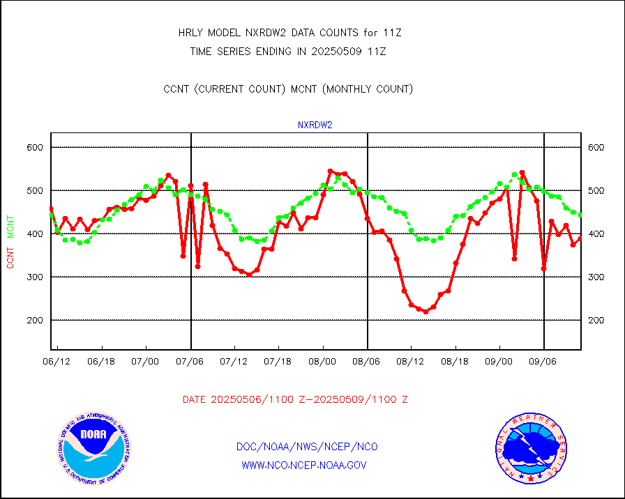
nxrdw2 |
NEXRAD Vel Azm Dsp(VAD) winds via Level 2 decoder |
505 |
541 |
93.3 % |
2610.50-2611.49 |
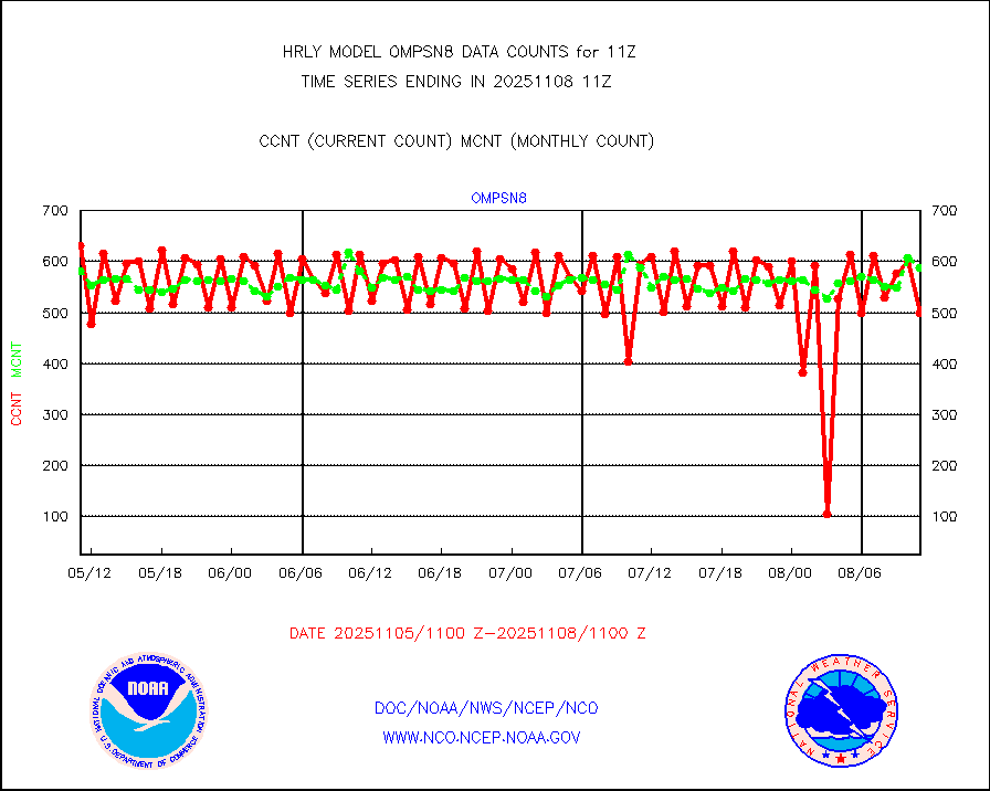
ompsn8 |
OMPS nadir profile ozone (Version 8 BUFR) |
550 |
448 |
122.8 % |
2609.00-2609.99 |
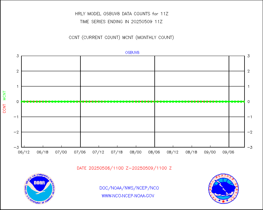
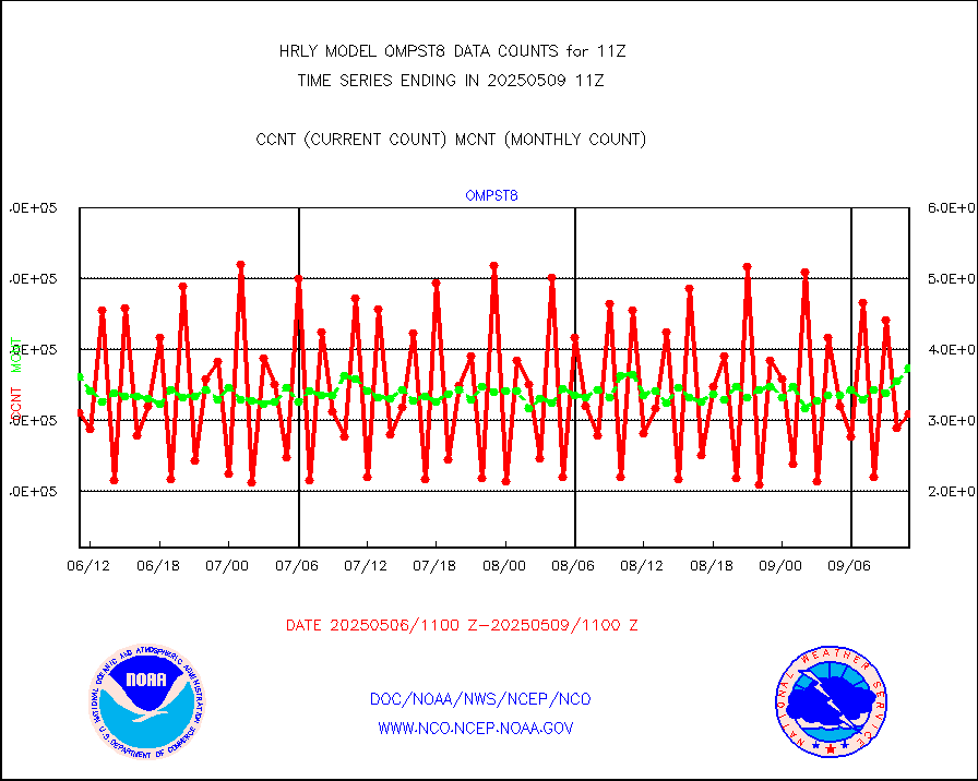
ompst8 |
OMPS total column ozone (Version 8 BUFR) |
212770 |
298477 |
71.3 % |
2609.00-2609.99 |
pibalb |
PIBAL (decoded from BUFR) |
0 |
0 |
n/a |
2610.51-2611.49 |
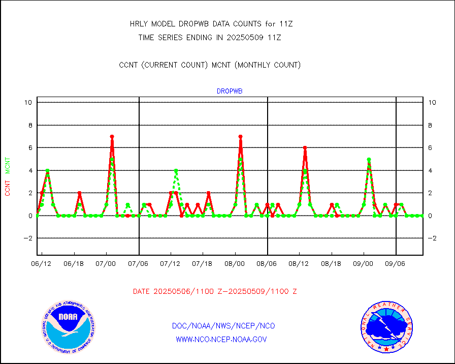
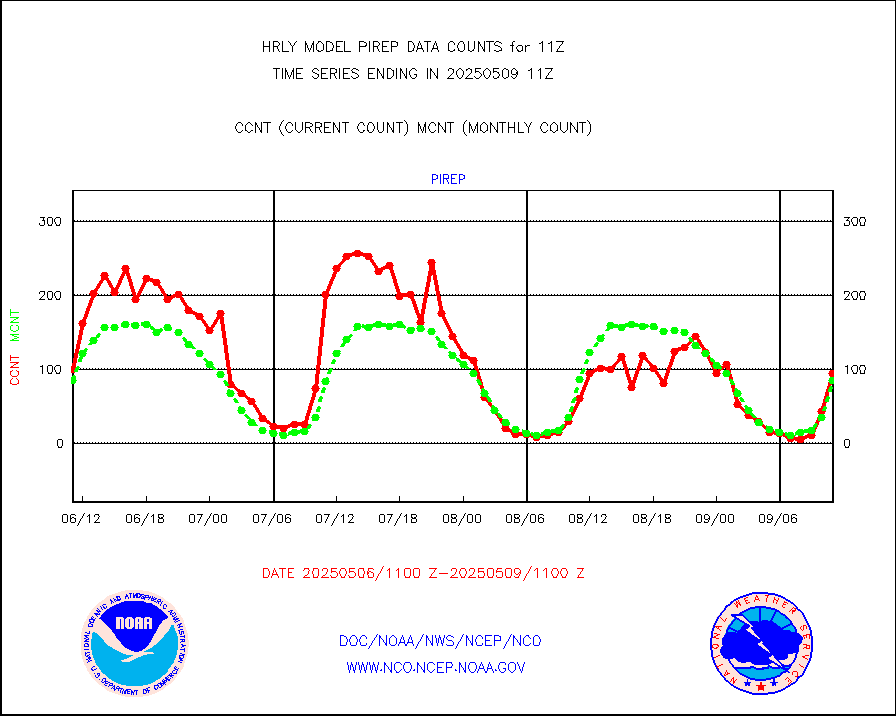
pirep |
Manual PIREP aircraft data (dcded from AIREP fmt) |
47 |
59 |
79.7 % |
2610.50-2611.49 |
prflrp |
Profilr winds from PIBAL (PILOT,PILOT SHIP/MOBIL) |
0 |
0 |
n/a |
2610.50-2611.49 |
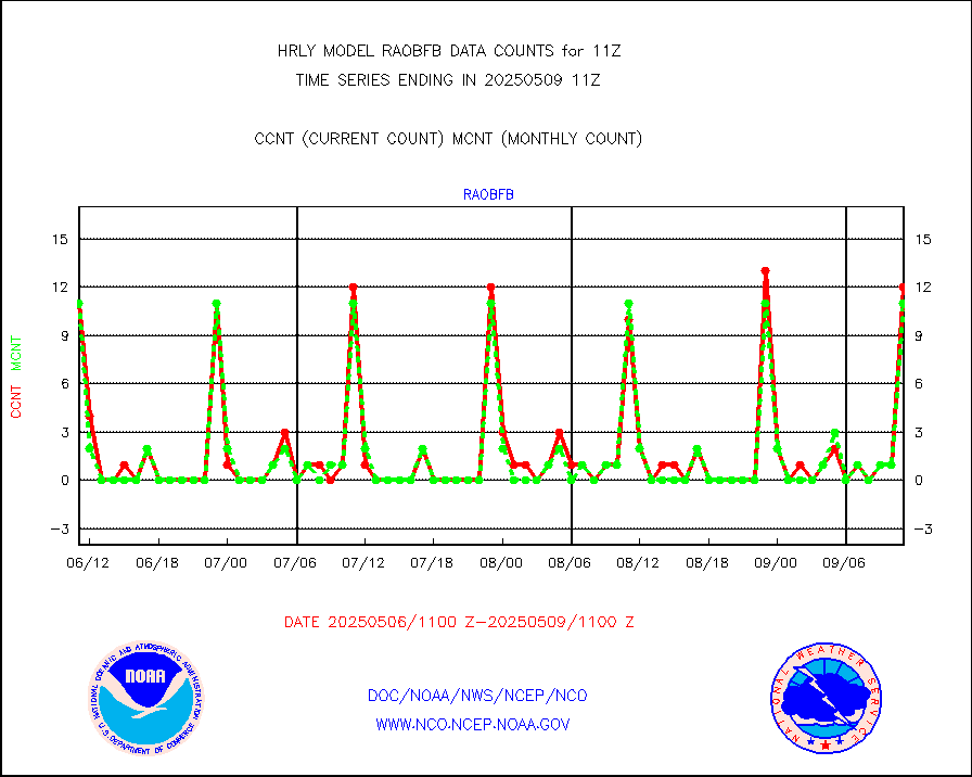
raobfb |
Rawinsonde - fixed land (decoded from BUFR) |
12 |
10 |
120.0 % |
2610.51-2611.49 |
raobm |
Rawinsonde - mobile land (from TEMP/PILOT MOBIL) |
0 |
0 |
n/a |
2610.50-2611.49 |
raobmb |
Rawinsonde - mobile land (decoded from BUFR) |
0 |
0 |
n/a |
2610.51-2611.49 |
raobs |
Rawinsonde - ship (from TEMP SHIP, PILOT SHIP) |
0 |
0 |
n/a |
2610.50-2611.49 |
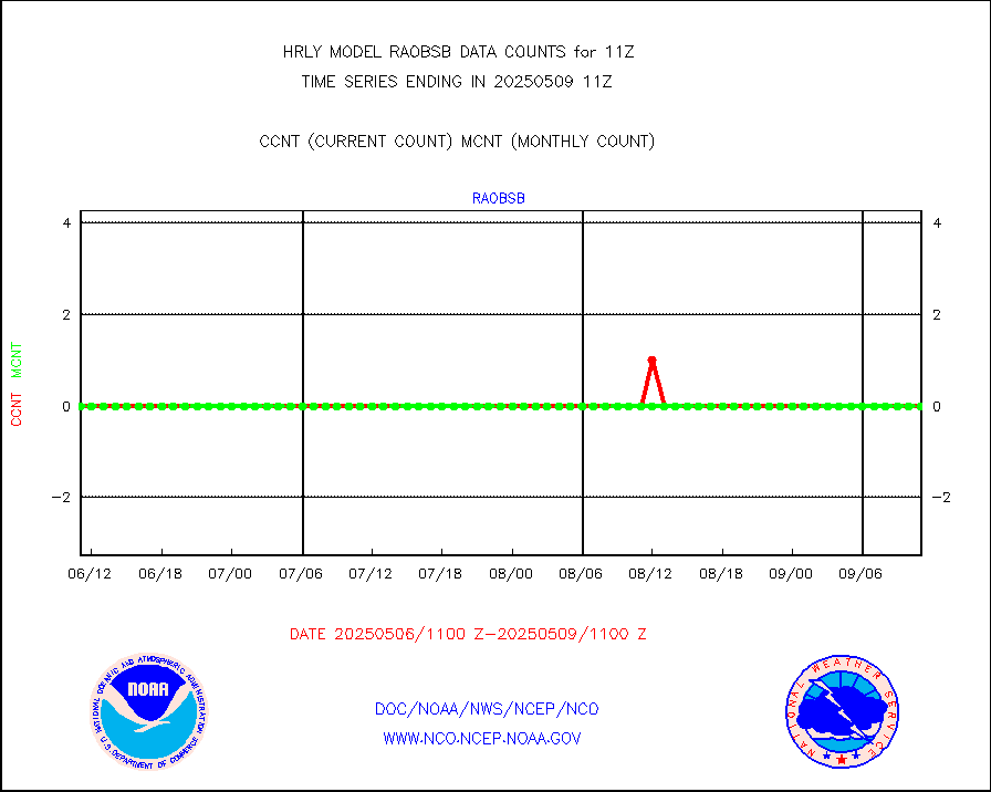
raobsb |
Rawinsonde - ship (decoded from BUFR) |
0 |
0 |
n/a |
2610.51-2611.49 |
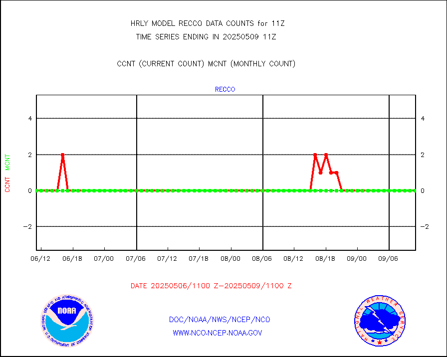
recco |
Flight level reconnaissance aircraft data |
0 |
0 |
n/a |
2610.50-2611.49 |
saphir |
Megha-Tropiques SAPHIR L1A2 brightness temps |
0 |
0 |
n/a |
2608.50-2609.49 |
sevasr |
METEOSAT-10 2nd Gen SEVIRI All Sky Radiance(proc) |
75090 |
72961 |
102.9 % |
2610.50-2611.49 |
ships |
Ship - manual and automatic, restricted |
3 |
4 |
75.0 % |
2610.50-2611.49 |
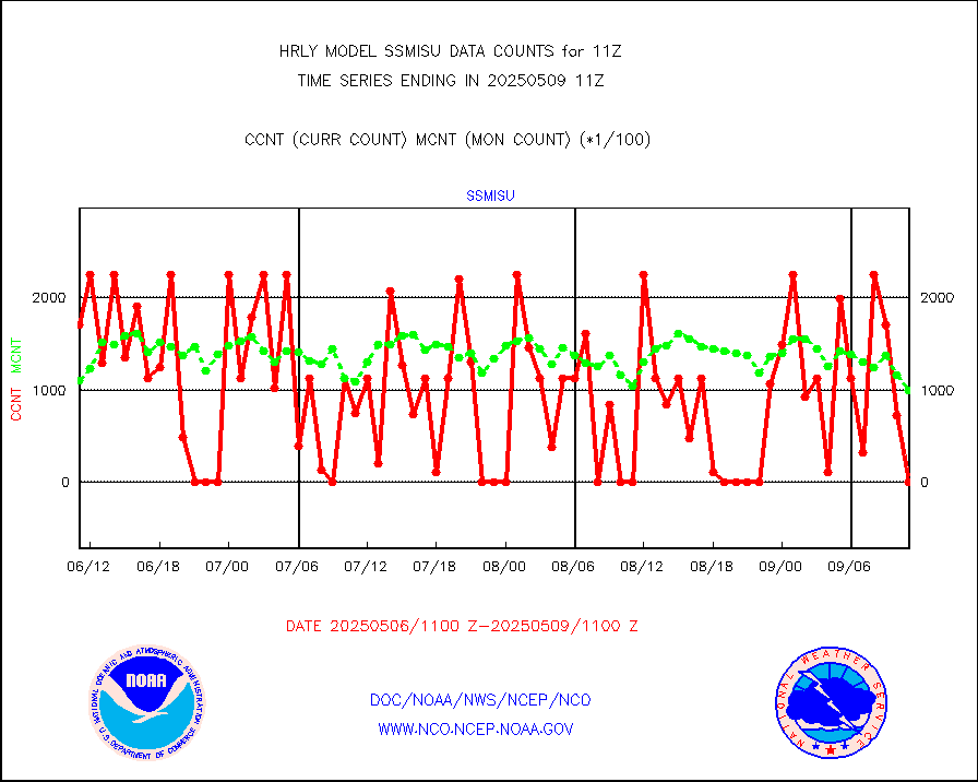
ssmisu |
DMSP SSM/IS 1C radiance data (Unified Pre-Proc.) |
135120 |
108398 |
124.7 % |
2609.50-2610.49 |
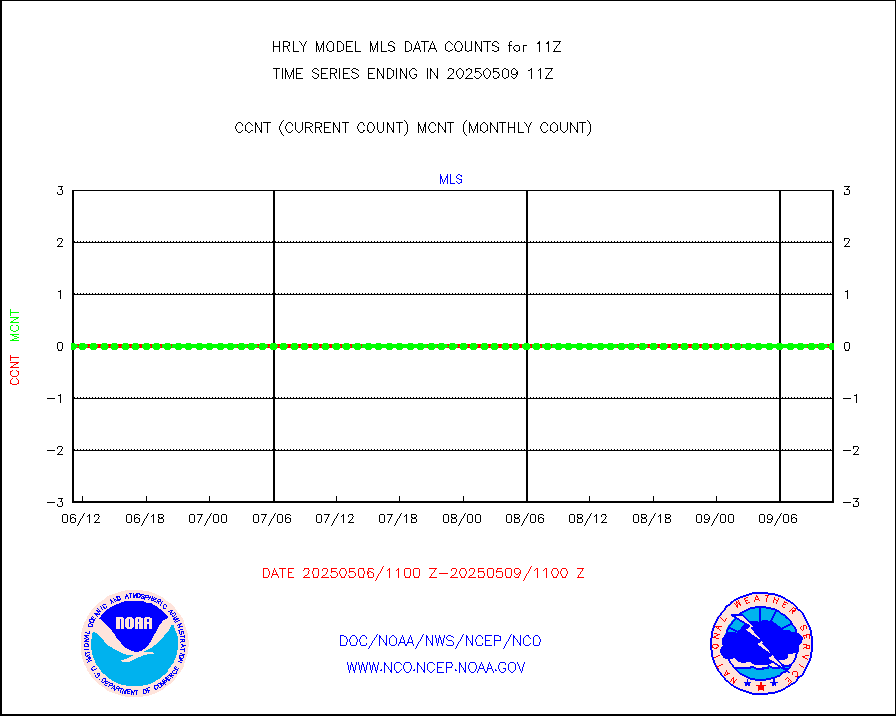
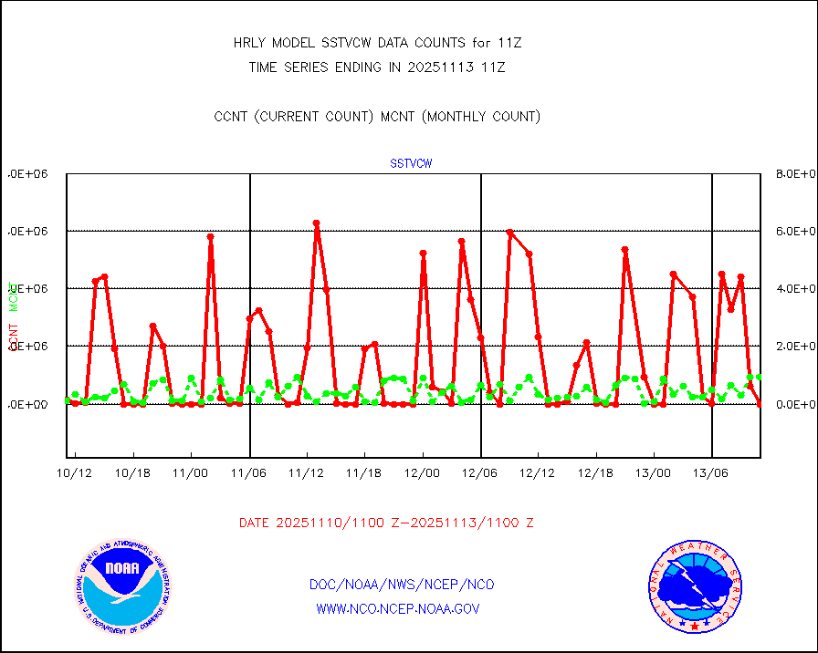
sstvcw |
NPP/NOAA-20 VIIRS SST - CLEAR & OVER WATER |
28775 |
884276 |
3.3 % |
2610.50-2611.49 |
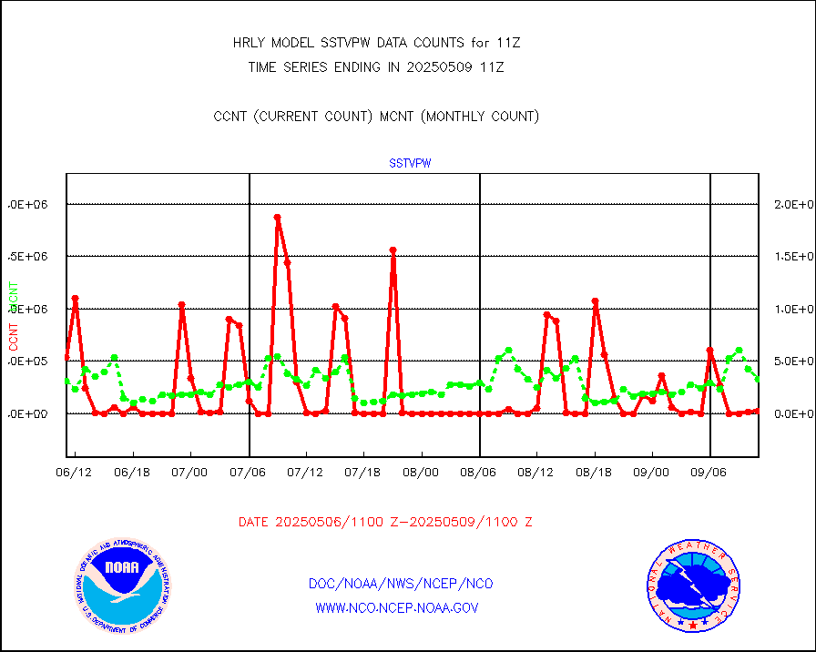
sstvpw |
NPP/NOAA-20 VIIRS SST - PROBABLY CLR & OVER WATER |
12582 |
186059 |
6.8 % |
2610.50-2611.49 |
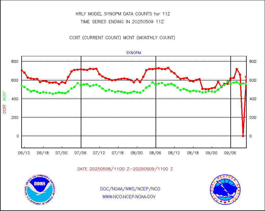
synopm |
Synoptic - mobile manual and automatic |
300 |
398 |
75.4 % |
2610.50-2611.49 |
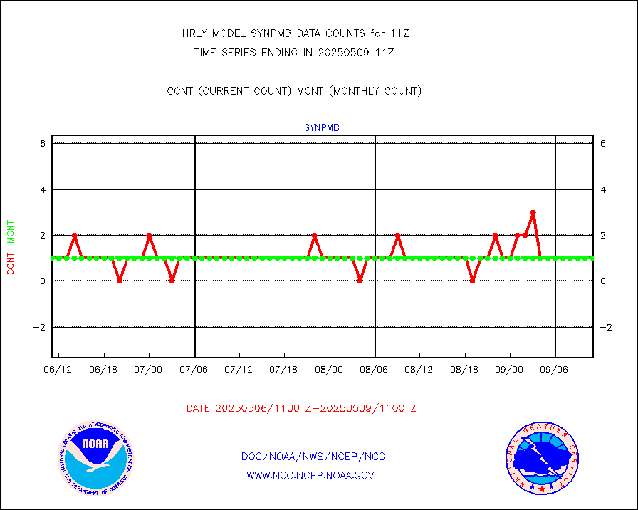
synpmb |
Synoptic - mobile manual & auto (decoded fr BUFR) |
1 |
0 |
n/a |
2610.50-2611.49 |
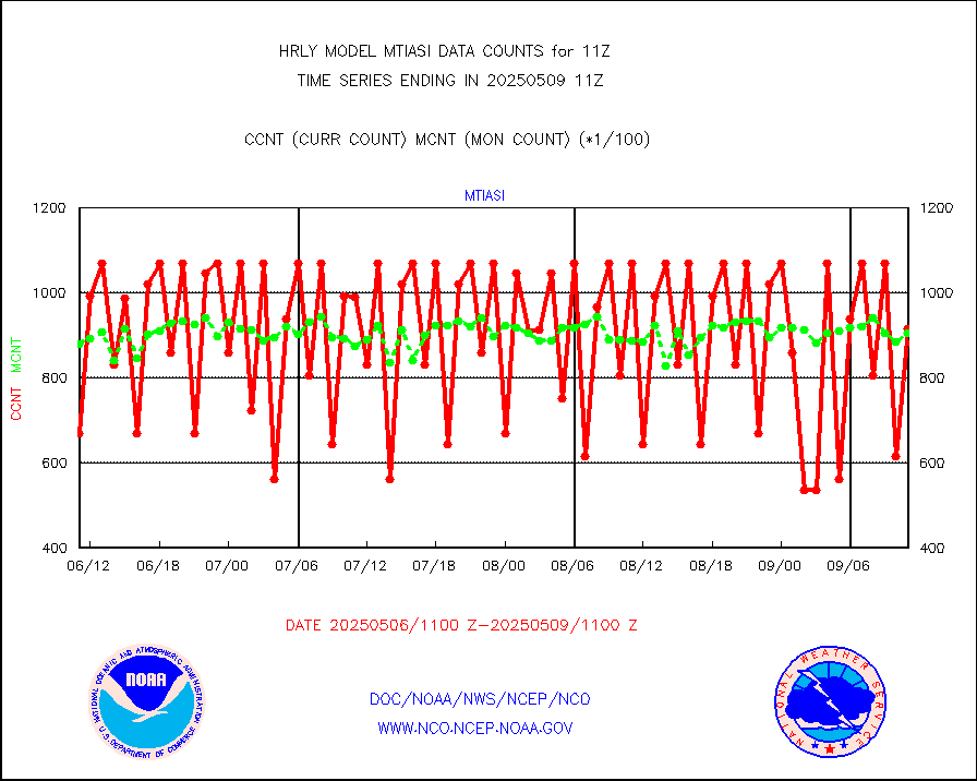
tesac |
CTD probe, Argo prflng float, mooring (TESAC fmt) |
230 |
240 |
95.8 % |
2610.50-2611.49 |
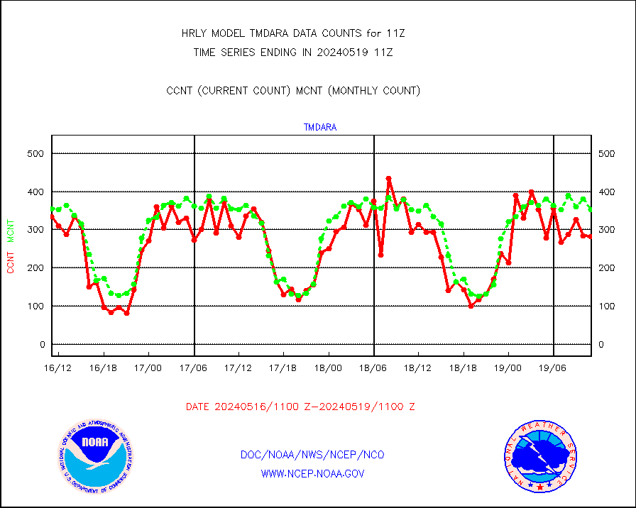
tmdara |
TAMDAR aircft data-all types(from Panasonic,BUFR) |
62 |
93 |
66.7 % |
2610.50-2611.49 |
trkob |
ThermoSalinoGraph (TSG) TRACKOB format) |
31 |
36 |
86.1 % |
2609.50-2610.49 |
visin |
INSAT/KALPANA India visible derived cloud motion |
0 |
0 |
n/a |
2608.50-2609.49 |
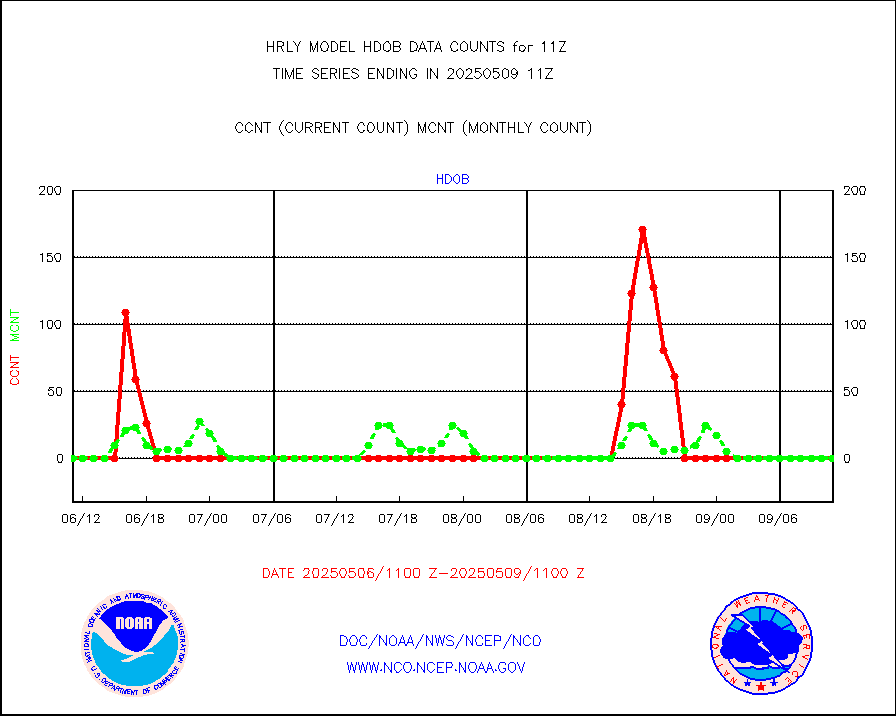
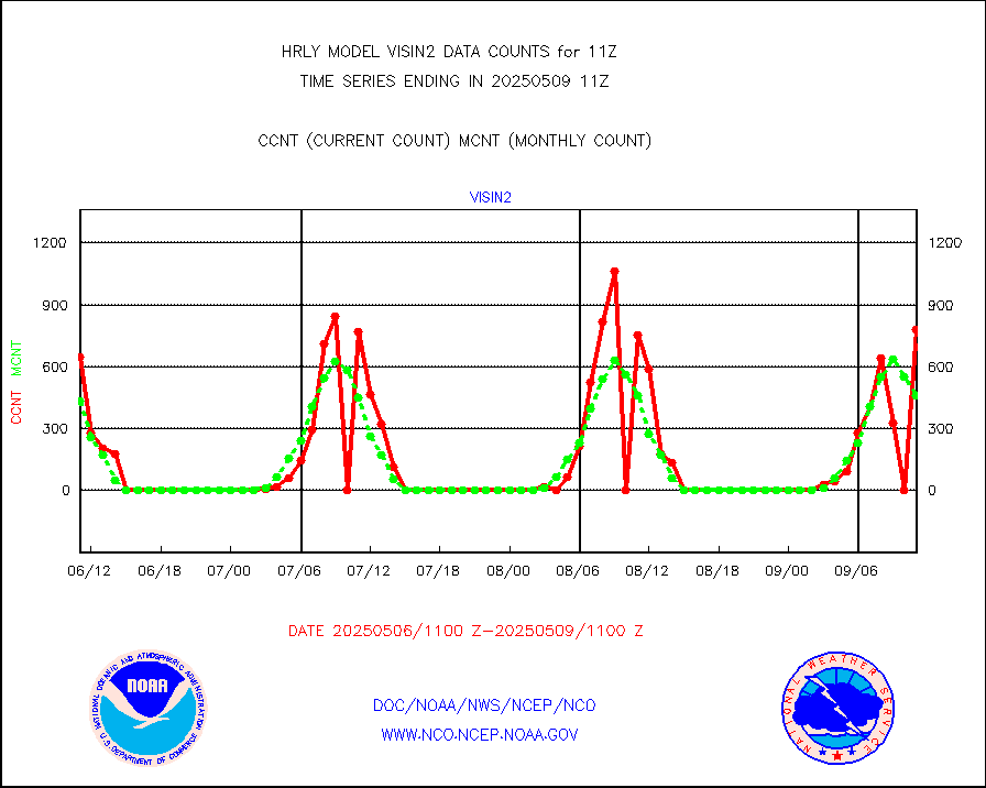
visin2 |
INDIA SATWIND, INSAT VIS channel |
681 |
316 |
215.5 % |
2610.00-2610.99 |
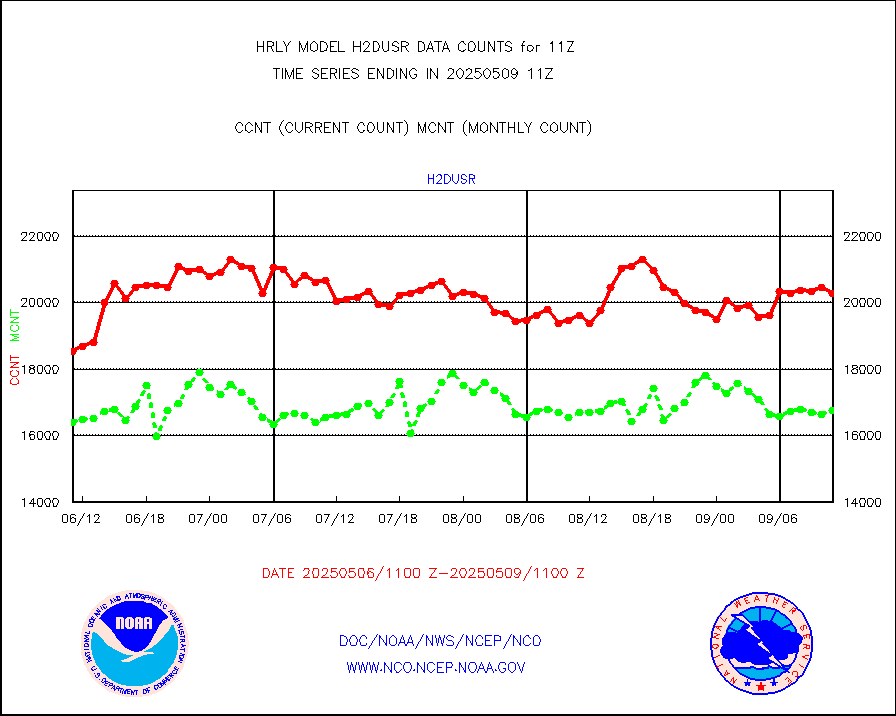
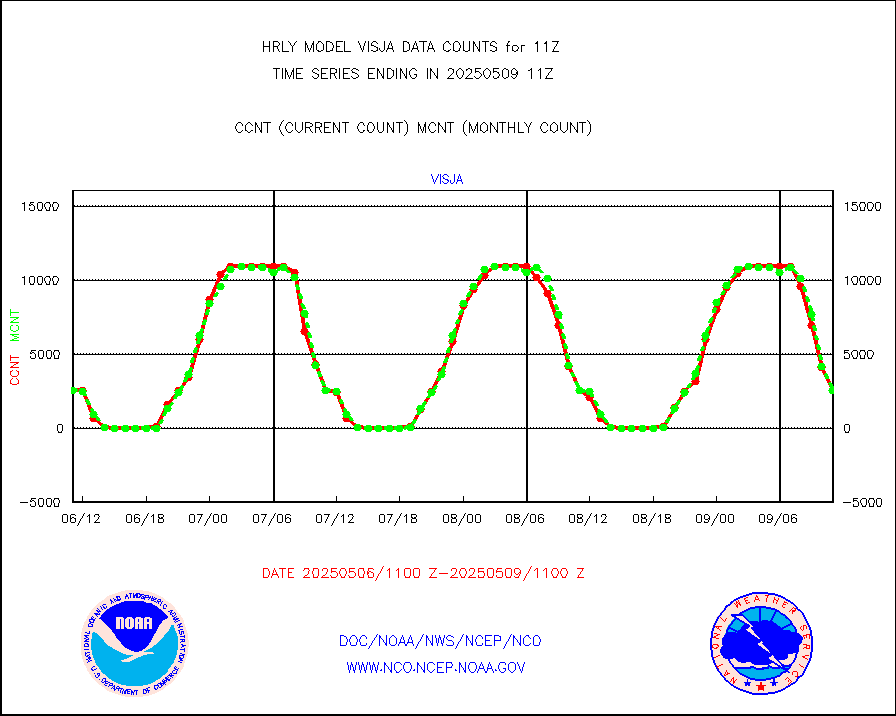
visja |
MTSAT/JMA visible derived cloud motion |
2520 |
2601 |
96.9 % |
2608.50-2609.49 |
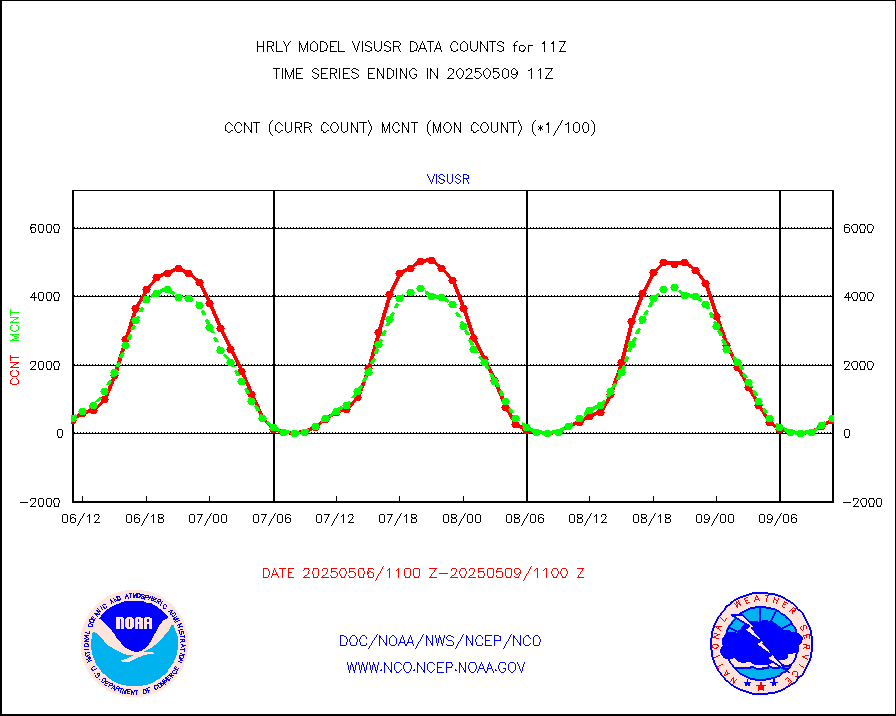
visusr |
GOES-16&up/NESDIS visible derived cloud motion |
44063 |
55559 |
79.3 % |
2610.00-2610.99 |
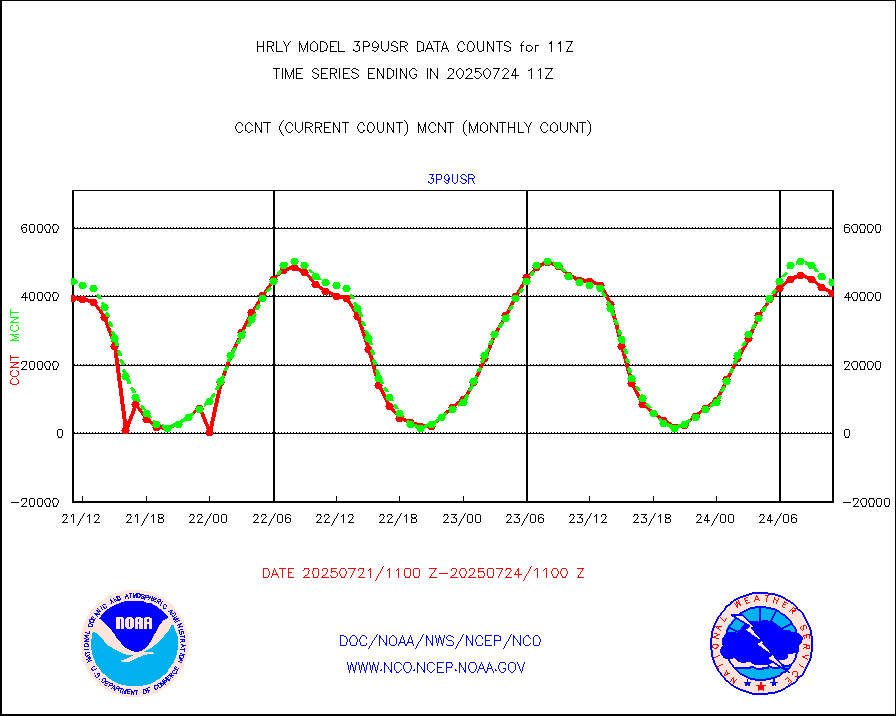
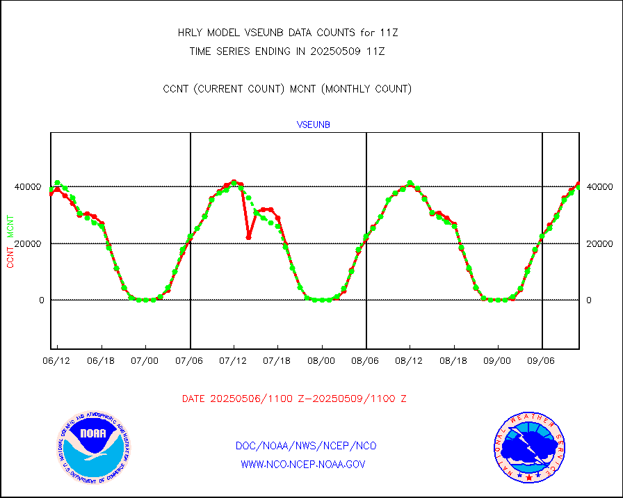
vseunb |
METEOSAT/EUMETSAT visible drv cld motion NBseq |
41275 |
38799 |
106.4 % |
2609.50-2610.49 |


