| Critical Data with Normal Counts |
|---|
| Type | Description | Hourly Count | Monthly Average | Percent (%) of Monthly Mean | UTC Time Window |
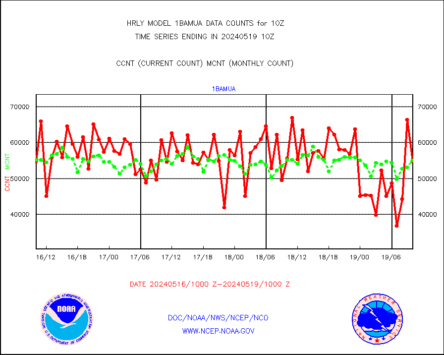
1bamua |
NOAA 15-19 & METOP 1-2 AMSU-A NCEP-proc. br.temps |
53421 |
54080 |
98.8 % |
2608.00-2608.99 |
1bhrs4 |
NOAA 18-19 & METOP 1-2 HIRS-4 NCEP-proc. br.temps |
59242 |
46517 |
127.4 % |
2608.00-2608.99 |
1bmhs |
NOAA 18-19 & METOP 1-2 MHS NCEP-proces. br. temps |
304830 |
305907 |
99.6 % |
2608.00-2608.99 |
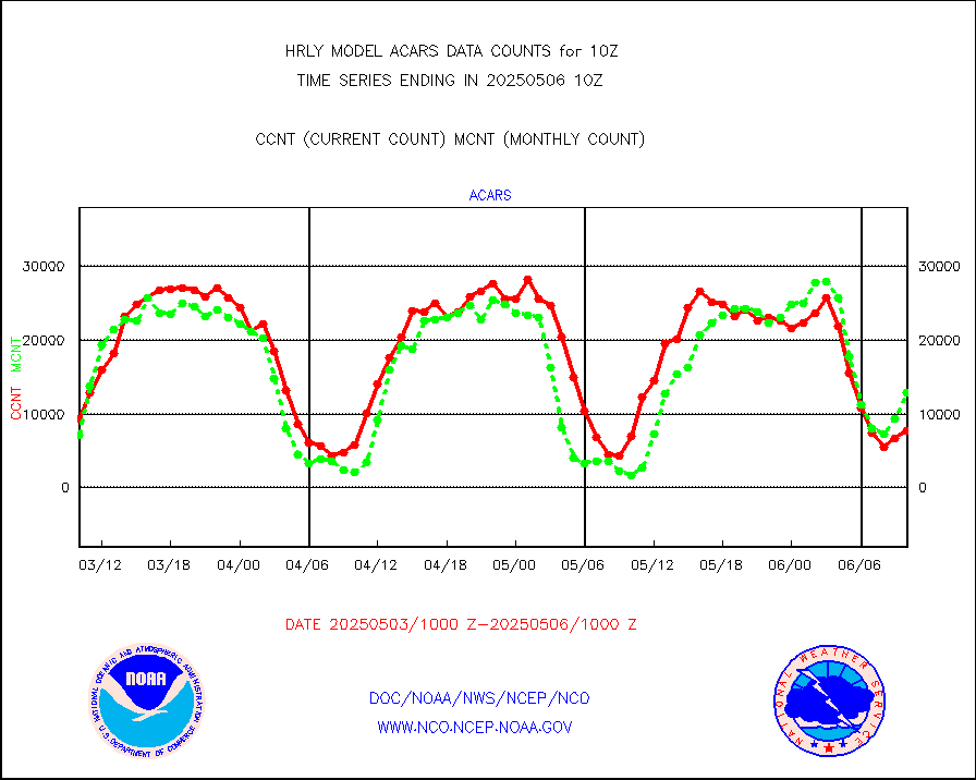
acars |
MDCRS ACARS acft data from ARINC(dcded from BUFR) |
7518 |
8549 |
87.9 % |
2609.50-2610.49 |
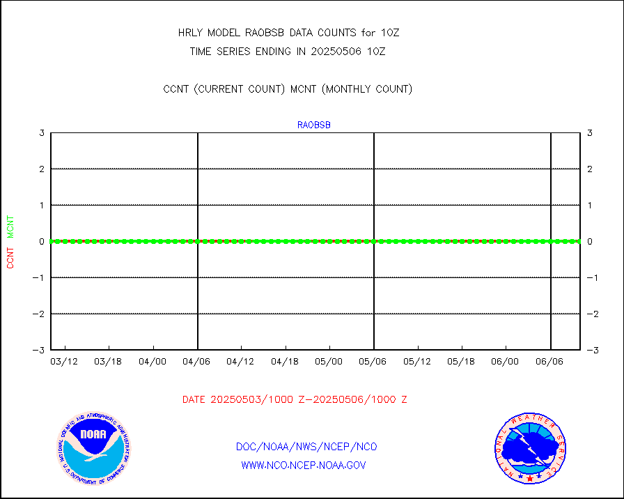
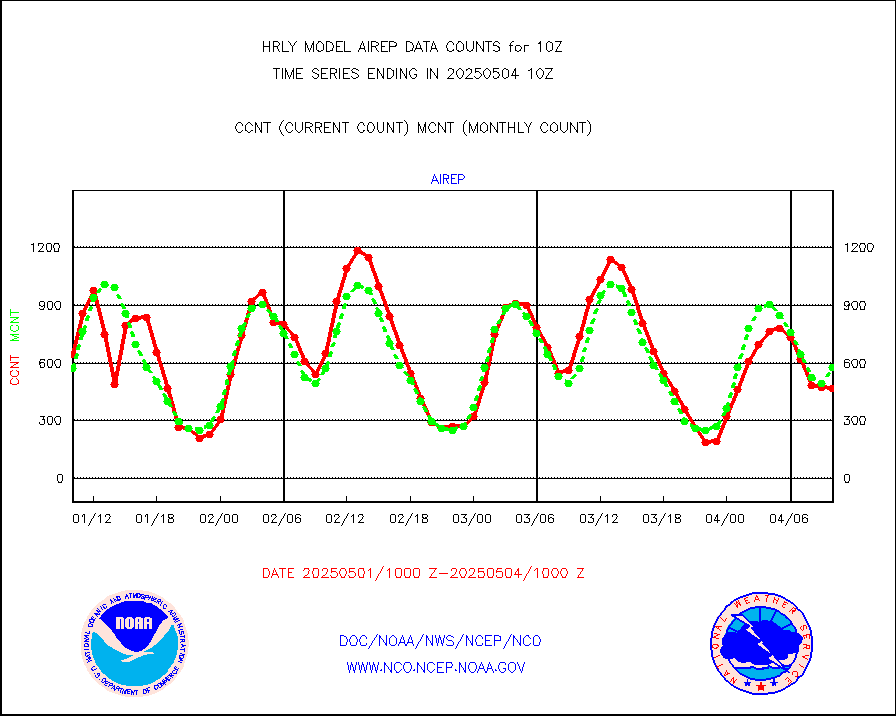
airep |
Manual AIREP aircraft data (dcded from AIREP fmt) |
653 |
693 |
94.2 % |
2609.50-2610.49 |
airsev |
AQUA AIRS/AMSU-A/HSB brightness temps- every FOV |
0 |
0 |
n/a |
2607.50-2608.49 |
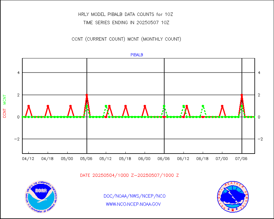
amdar |
AMDAR aircraft data (decoded from AMDAR format) |
302 |
453 |
66.7 % |
2609.50-2610.49 |
amdarb |
AMDAR aircraft data (decoded from BUFR) |
1125 |
1167 |
96.4 % |
2609.50-2610.49 |
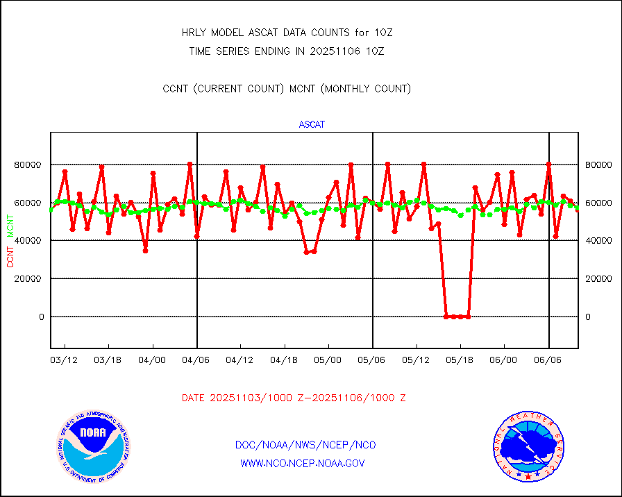
ascat |
METOP 1-2 ASCAT products |
39060 |
32424 |
120.5 % |
2608.50-2609.49 |
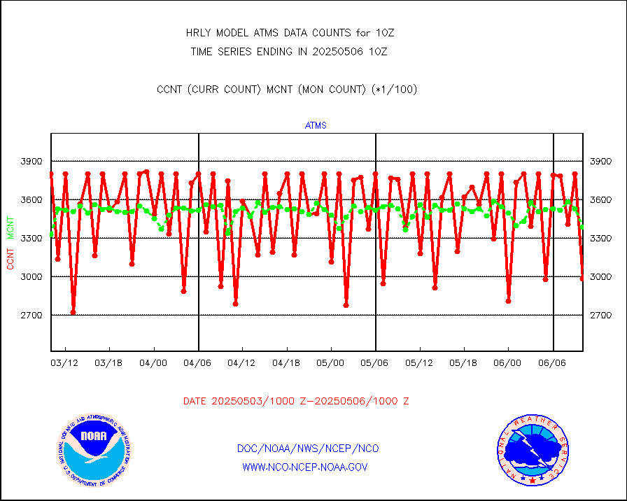
atms |
NPP/NOAA-20 ATMS brightness temperatures |
361440 |
328582 |
110.0 % |
2608.50-2609.49 |
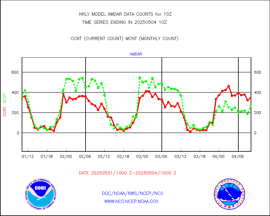
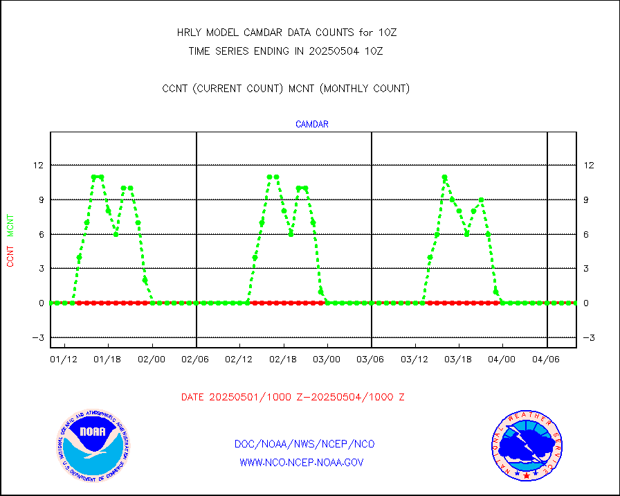
camdar |
Canadian AMDAR aircraft data (decoded from BUFR) |
0 |
5 |
0.0 % |
2609.50-2610.49 |
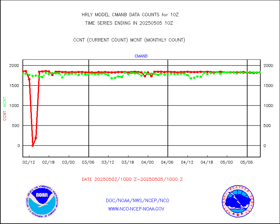
cmanb |
Surface Marine CMAN rpts decoded from BUFR format |
1823 |
1793 |
101.7 % |
2609.50-2610.50 |
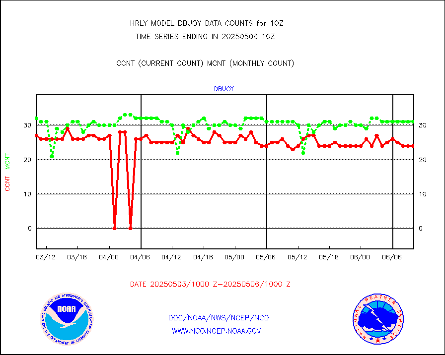
dbuoy |
Buoys decoded from FM-18 fmt (moored or drifting) |
42 |
22 |
190.9 % |
2609.50-2610.49 |
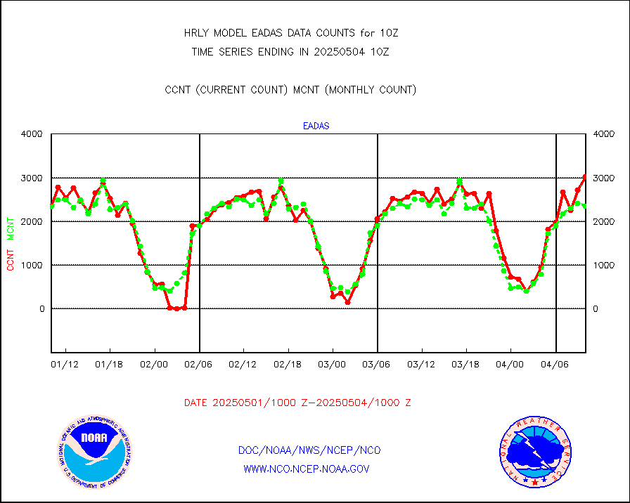
eadas |
E-AMDAR (European AMDAR acft decoded from BUFR) |
2010 |
1724 |
116.6 % |
2609.50-2610.49 |
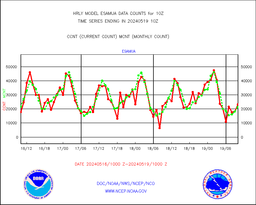
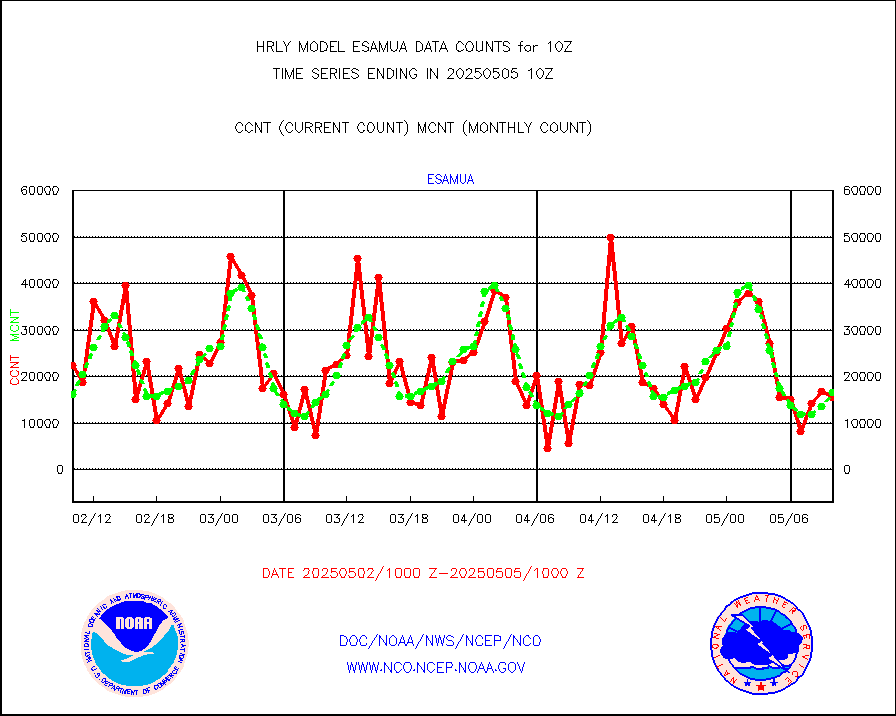
esamua |
NOAA 15-19 & METOP 1-2 AMSU-A proc btmps frm RARS |
26640 |
20102 |
132.5 % |
2609.50-2610.49 |
eshrs3 |
NOAA 15-19 & METOP 1-2 HIRS-3/4 pr btmps frm RARS |
66184 |
43908 |
150.7 % |
2609.50-2610.49 |
gnss |
Grnd-based Gbl Navigation Sat System (GNSS) data |
9466 |
8314 |
113.9 % |
2609.00-2609.99 |
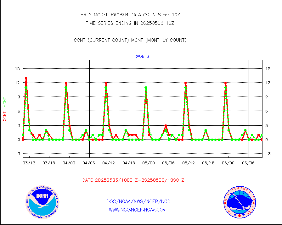
gpsro |
GPS radio occultation data |
444 |
424 |
104.7 % |
2607.50-2608.49 |
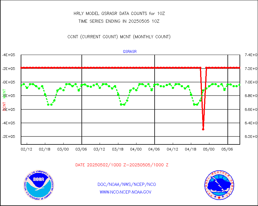
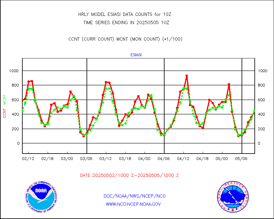
gsrasr |
GOES-16/17 All Sky Radiances (proc.) |
360476 |
357292 |
100.9 % |
2609.50-2610.49 |
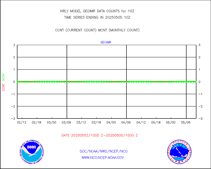
gsrcsr |
GOES-16/17 Clear Sky Radiances (proc.) |
161709 |
158318 |
102.1 % |
2609.50-2610.49 |
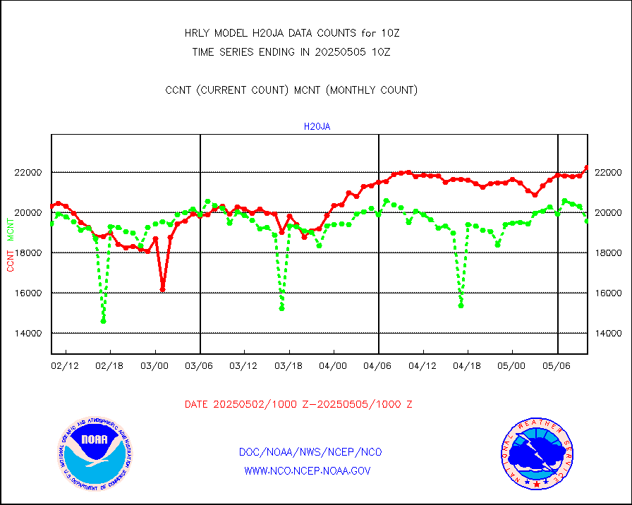
h20ja |
MTSAT/JMA water vapor imager derived cloud motion |
20993 |
19079 |
110.0 % |
2607.50-2608.49 |
h20mo |
MODIS (AQUA/TERRA) wvpr imager derived cld motion |
0 |
0 |
n/a |
2606.00-2606.99 |
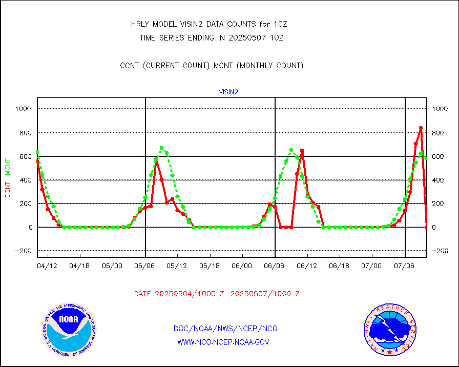
h2tusr |
GOES-16&up/NESDIS wv imgr/cld-top derived cld mtn |
25278 |
24972 |
101.2 % |
2609.00-2609.99 |
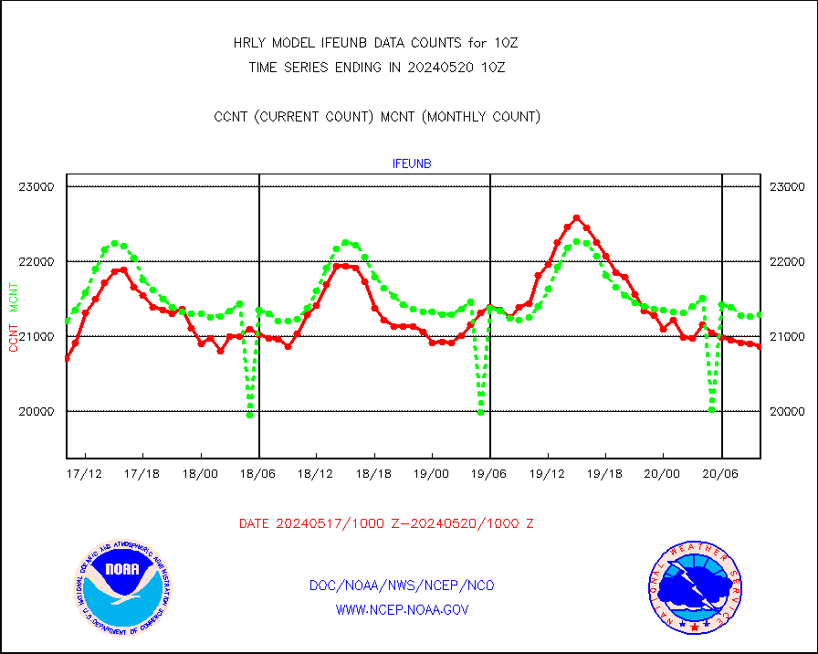
ifeunb |
METEOSAT/EUMETSAT ir lg-wave drv cld motion NBseq |
22373 |
21754 |
102.8 % |
2608.50-2609.49 |
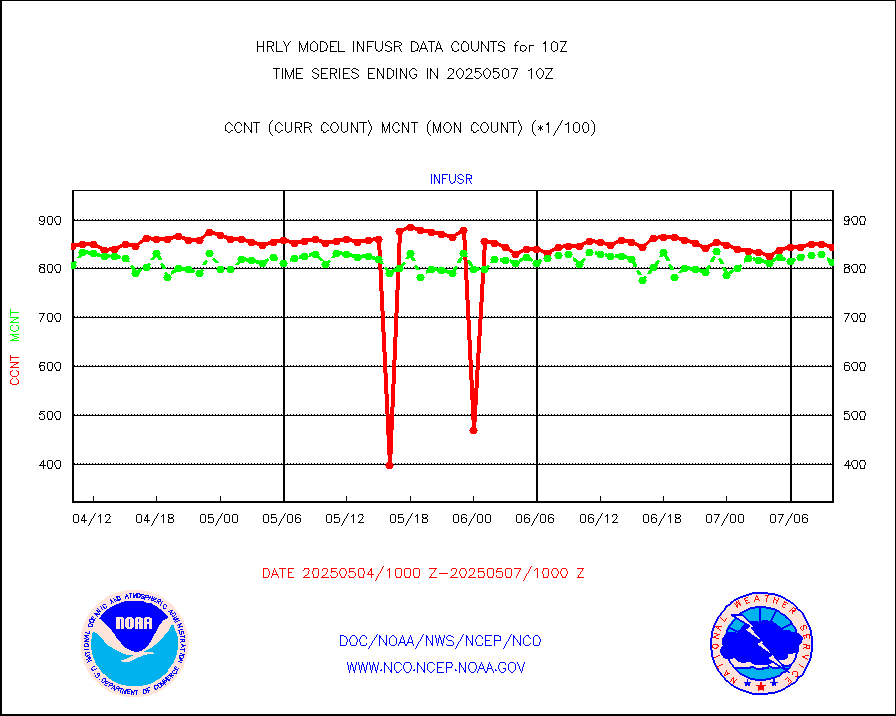
infja |
MTSAT/JMA infrared long-wave derived cloud motion |
16800 |
15548 |
108.1 % |
2607.50-2608.49 |
infmo |
MODIS (AQUA/TERRA) ir l-wave derived cloud motion |
0 |
0 |
n/a |
2606.00-2606.99 |
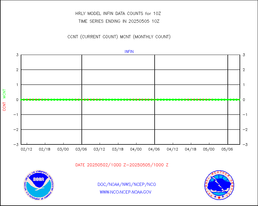
infusr |
GOES-16&up/NESDIS ir long-wave derived cld motion |
84055 |
80569 |
104.3 % |
2609.00-2609.99 |
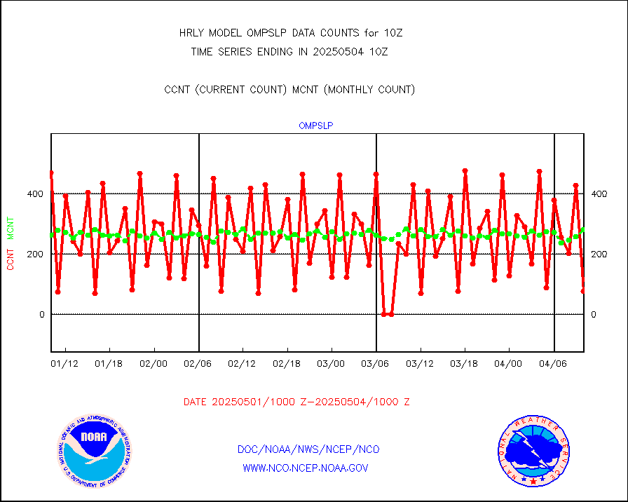
lgycld |
GOES/NASA(Langley) hi-res. (1x1 f-o-v) cloud data |
4205143 |
3730041 |
112.7 % |
2609.50-2610.49 |
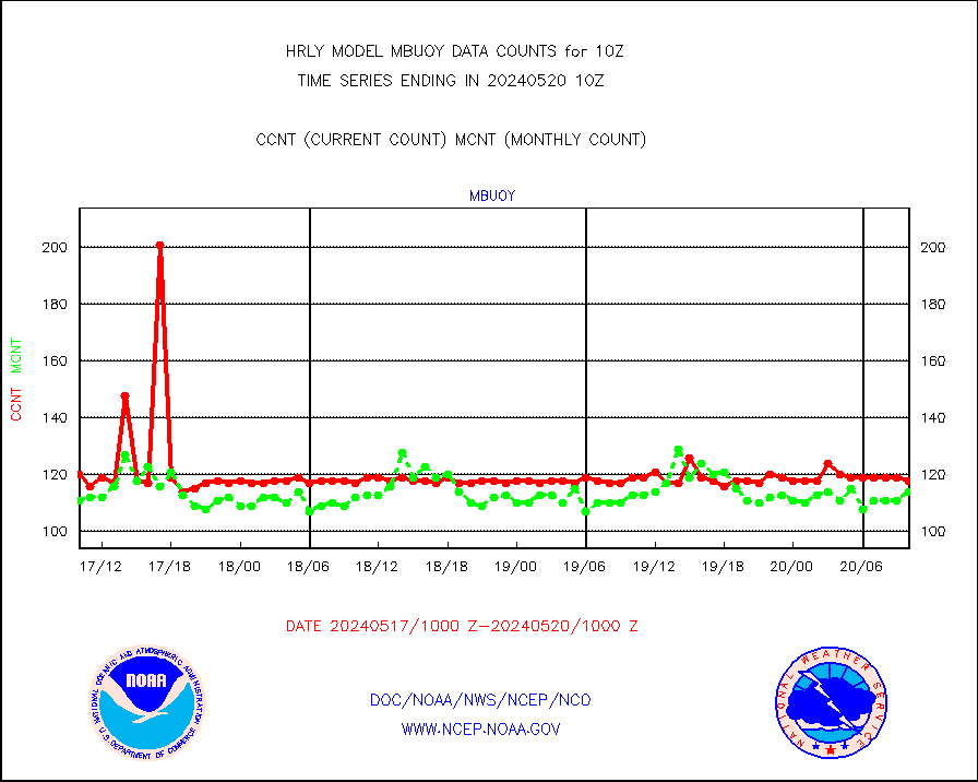
mbuoy |
Buoys decoded from FM-13 format (moored) |
118 |
113 |
104.4 % |
2609.50-2610.49 |
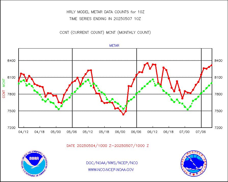
metar |
Aviation - METAR |
8088 |
7916 |
102.2 % |
2609.50-2610.49 |
mso470 |
Mesonet/MADIS Colorado E-470 (Interstate 470) |
15 |
19 |
78.9 % |
2609.50-2610.49 |
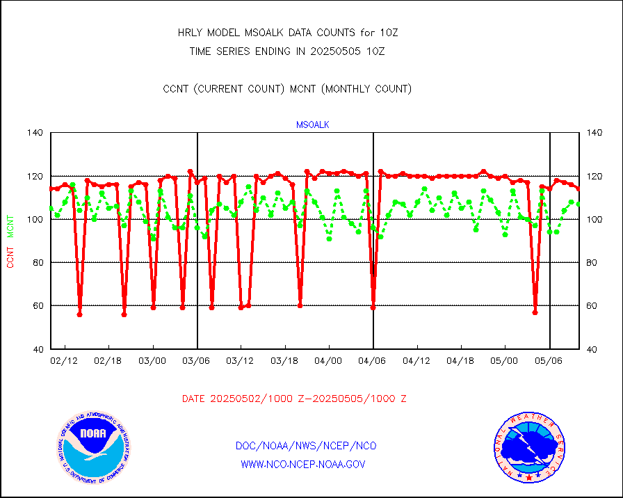
msoalk |
Mesonet/MADIS Alaska Department of Transportation |
107 |
108 |
99.1 % |
2609.50-2610.49 |
msoapg |
Mesonet/MADIS U.S. Army Aberdeen Proving Grounds |
0 |
0 |
n/a |
2609.50-2610.49 |
msoapr |
Mesonet/MADIS Citizen Weather Observers Program |
43468 |
47585 |
91.3 % |
2609.50-2610.49 |
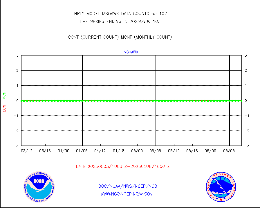
msoaws |
Mesonet/MADIS AWS Convergence Technologies, Inc. |
24742 |
25556 |
96.8 % |
2609.50-2610.49 |
msoawx |
Mesonet/MADIS "Anything Weather" |
0 |
0 |
n/a |
2609.50-2610.49 |
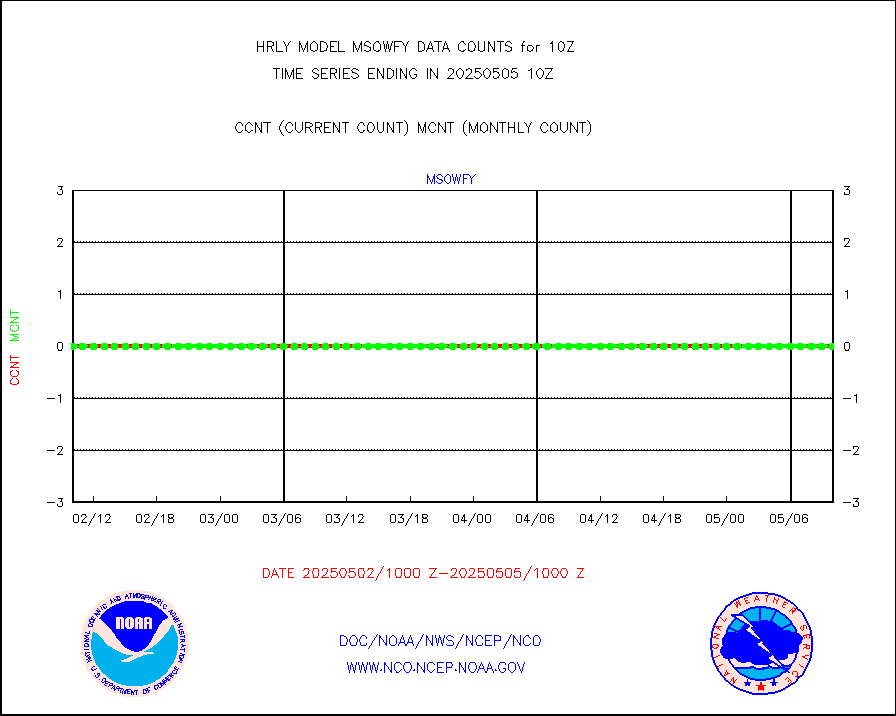
msocol |
Mesonet/MADIS Colorado Dept. of Transportation |
0 |
0 |
n/a |
2609.50-2610.49 |
msodcn |
Mesonet/MADIS DC Net |
0 |
0 |
n/a |
2609.50-2610.49 |
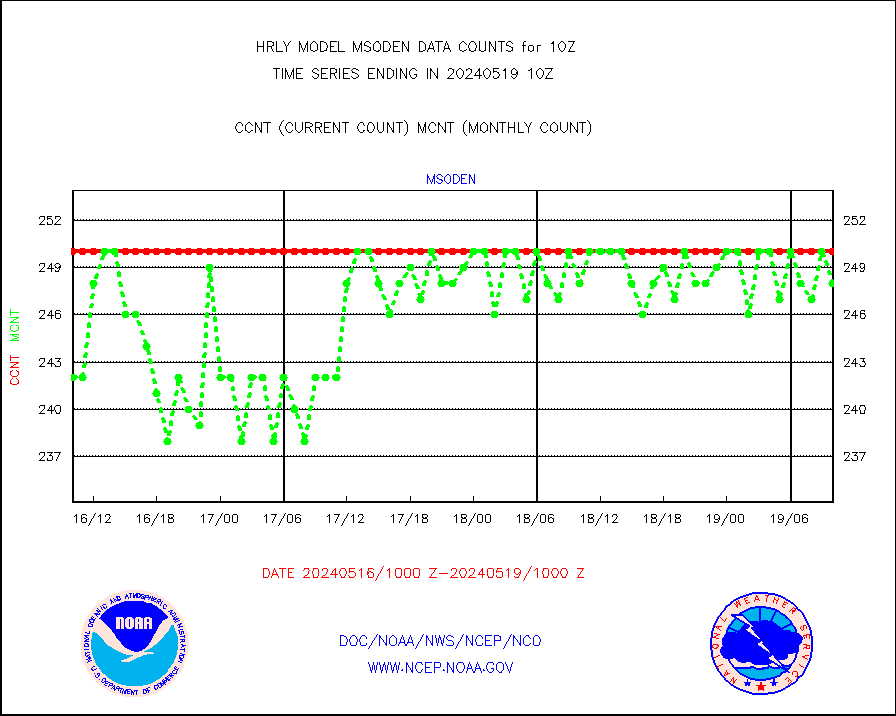
msoden |
Mesonet/MADIS Denver Urban Drainage & Flood Cntrl |
200 |
233 |
85.8 % |
2609.50-2610.49 |
msofla |
Mesonet/MADIS Florida (FAWN & USF) |
4 |
4 |
100.0 % |
2609.50-2610.49 |
msoflt |
Mesonet/MADIS Florida Dept. of Transportation |
0 |
0 |
n/a |
2609.50-2610.49 |
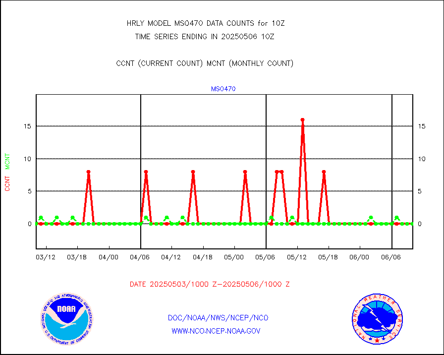
msogeo |
Mesonet/MADIS Georgia Dept. of Transportation |
0 |
0 |
n/a |
2609.50-2610.49 |
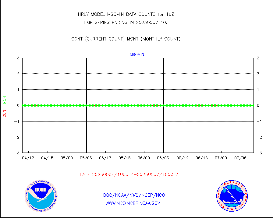
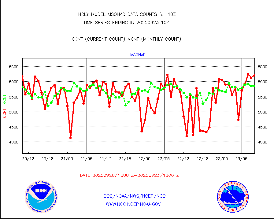
msohad |
Mesonet/MADIS NWS Hydromet Auto Data System(HADS) |
6460 |
6558 |
98.5 % |
2609.50-2610.49 |
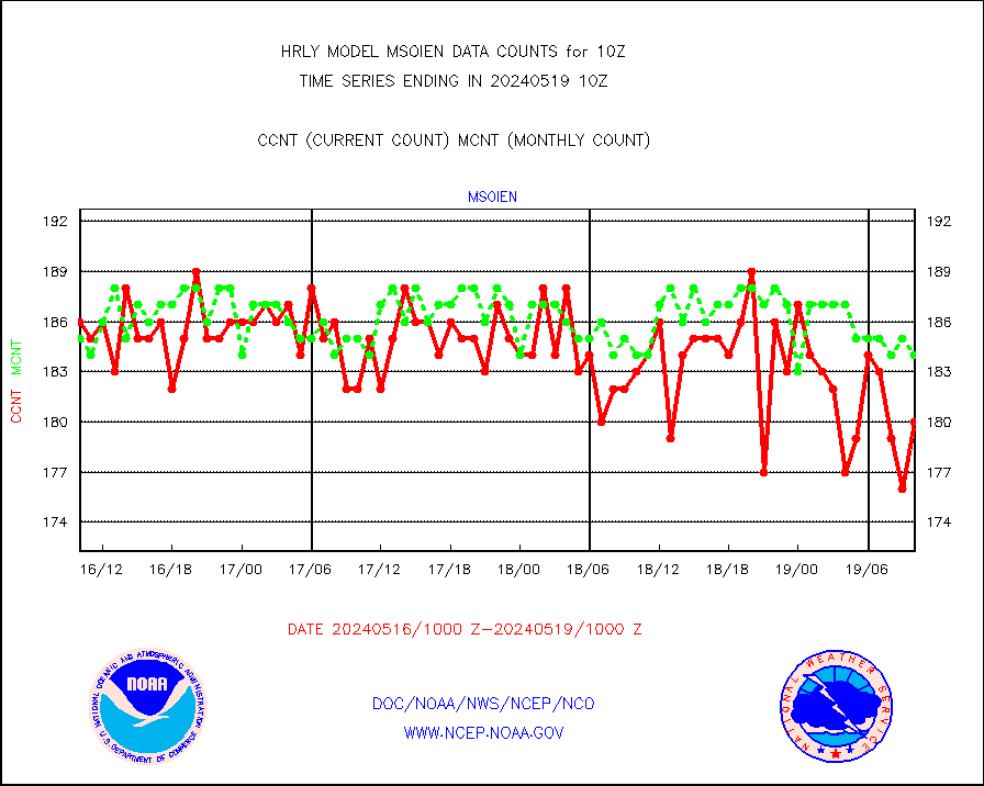
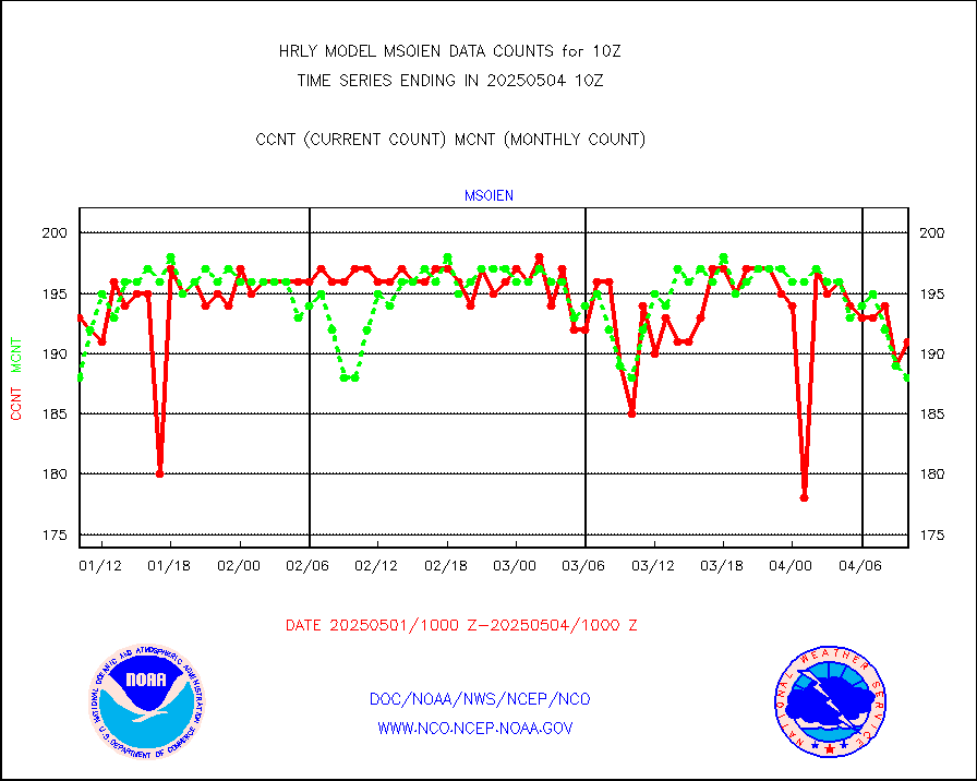
msoien |
Mesonet/MADIS Iowa Environmental |
193 |
188 |
102.7 % |
2609.50-2610.49 |
msoind |
Mesonet/MADIS Indiana Dept. of Transportation |
0 |
0 |
n/a |
2609.50-2610.49 |
msoiow |
Mesonet/MADIS Iowa Department of Transportation |
0 |
0 |
n/a |
2609.50-2610.49 |
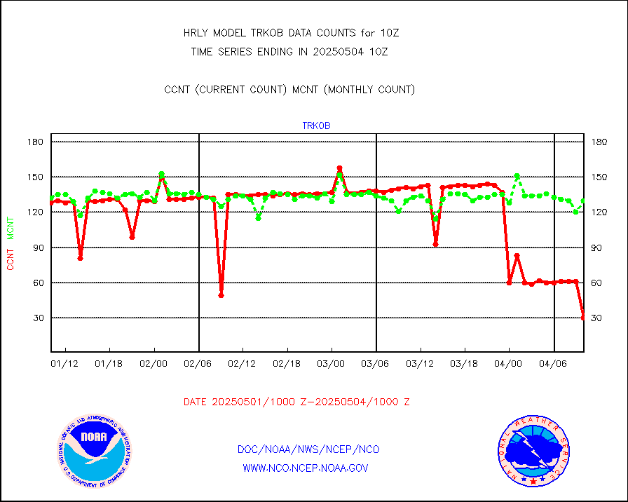
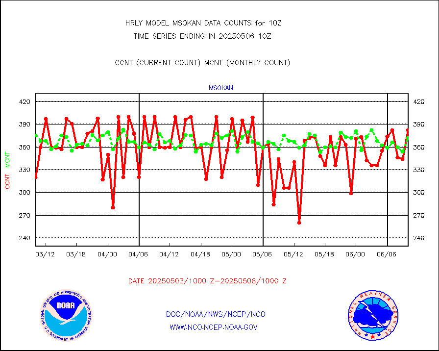
msokan |
Mesonet/MADIS Kansas Department of Transportation |
351 |
322 |
109.0 % |
2609.50-2610.49 |
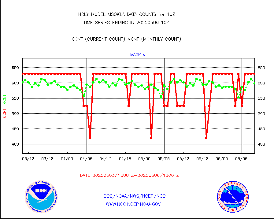
msokla |
Mesonet/MADIS Oklahoma Mesonet |
318 |
329 |
96.7 % |
2609.50-2610.49 |
msolju |
Mesonet/MADIS Louisiana State/Jackson State Univ. |
0 |
0 |
n/a |
2609.50-2610.49 |
msomca |
Mesonet/MADIS Missouri Commercial Agricult Wx Net |
303 |
279 |
108.6 % |
2609.50-2610.49 |
msomin |
Mesonet/MADIS Minnesota Dept. of Transportation |
0 |
0 |
n/a |
2609.50-2610.49 |
msonos |
Mesonet/MADIS NOS-Phys Oceanographic Realtime Sys |
378 |
366 |
103.3 % |
2609.50-2610.49 |
msoraw |
Mesonet/MADIS NFIC Remote Automated Wx Stns(RAWS) |
1568 |
1866 |
84.0 % |
2609.50-2610.49 |
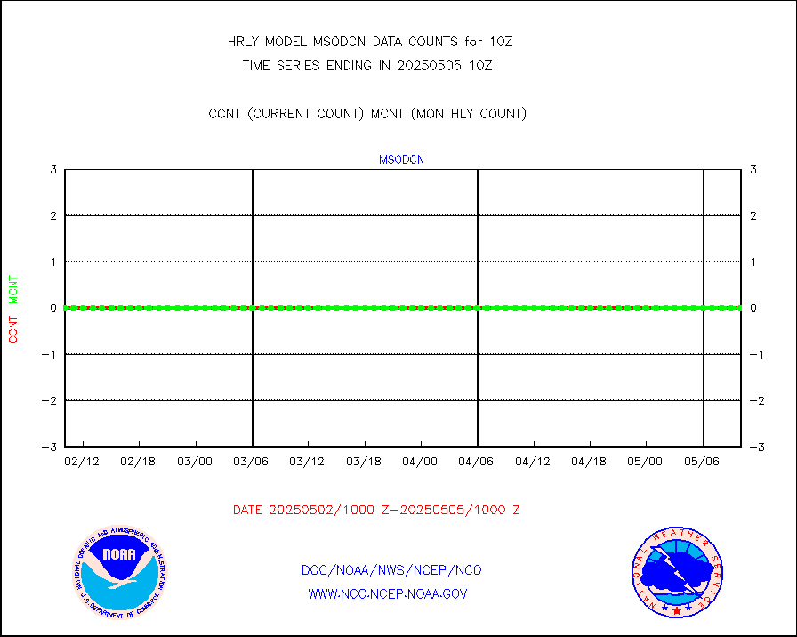
msovir |
Mesonet/MADIS Virginia Dept. of Transportation |
237 |
226 |
104.9 % |
2609.50-2610.49 |
msowfy |
Mesonet/MADIS "Weather for You" |
0 |
0 |
n/a |
2609.50-2610.49 |
msowis |
Mesonet/MADIS Wisconsin Dept. of Transportation |
0 |
0 |
n/a |
2609.50-2610.49 |
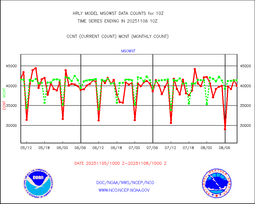
msowst |
Mesonet/MADIS MesoWest (many subproviders) |
42289 |
45645 |
92.6 % |
2609.50-2610.49 |
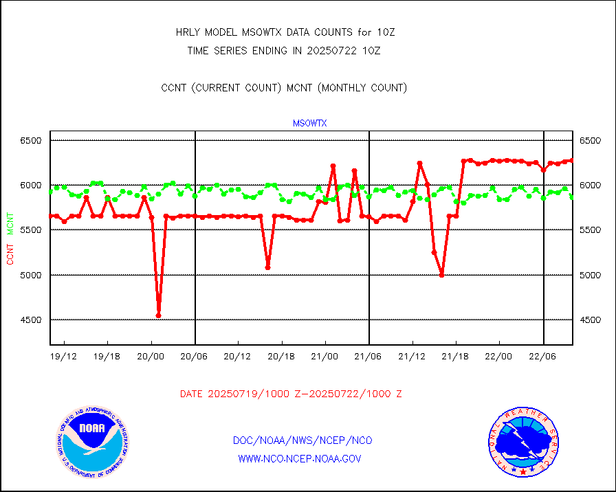
msowtx |
Mesonet/MADIS West Texas |
5228 |
5603 |
93.3 % |
2609.50-2610.49 |
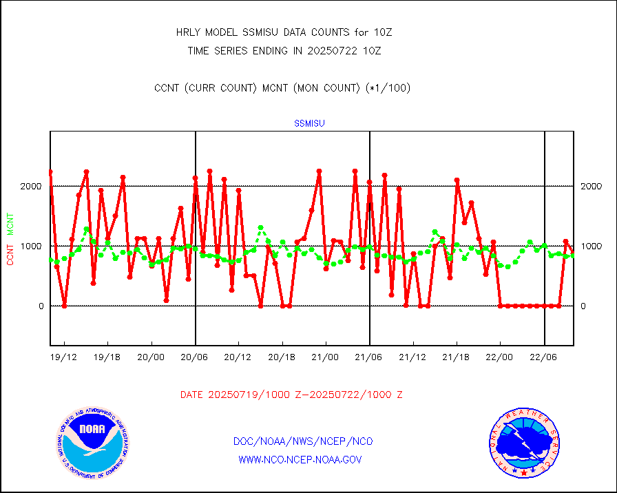
mtiasi |
METOP 1-2 IASI 1C radiance data (varbl. channels) |
66880 |
80341 |
83.2 % |
2608.00-2608.99 |
nxrdw |
NEXRAD Vel Azm Dsp(VAD) winds via radar coded msg |
0 |
0 |
n/a |
2609.50-2610.49 |
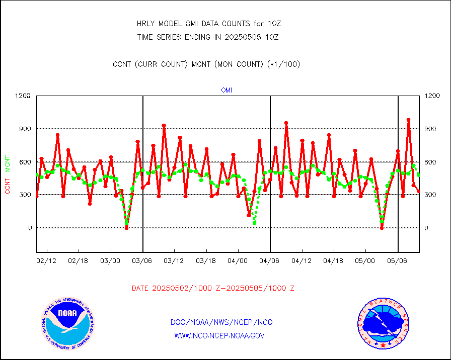
omi |
Aura Ozone Monitoring Instrument (OMI) data |
8580 |
51726 |
16.6 % |
2607.50-2608.49 |
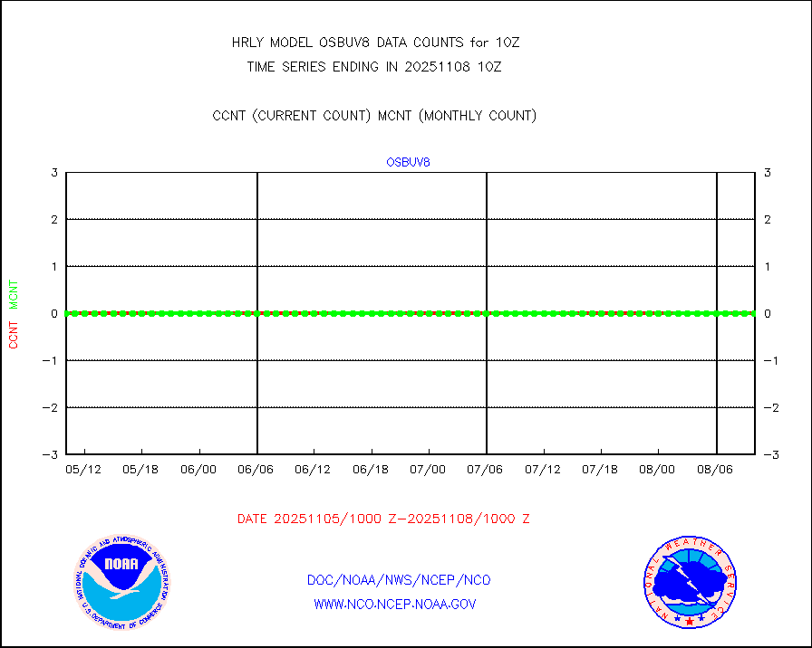
osbuv8 |
NOAA 16-19 Solar Backscatter UV-2 rad frm V8 BUFR |
0 |
0 |
n/a |
2608.00-2608.99 |
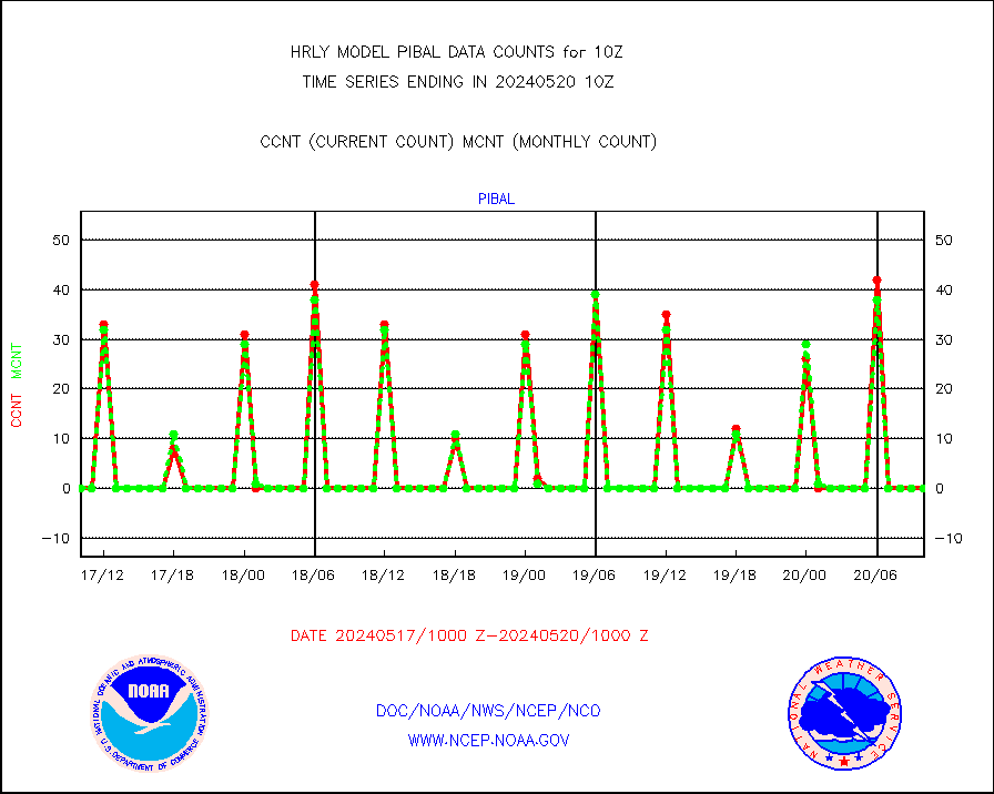
pibal |
PIBAL (from PILOT, PILOT SHIP, PILOT MOBIL) |
0 |
0 |
n/a |
2609.50-2610.49 |
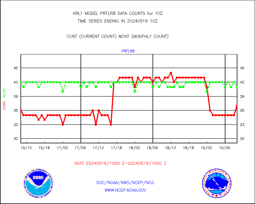
prflrb |
Multi-Agency Profiler (MAP) and SODAR winds |
30 |
41 |
73.2 % |
2609.50-2610.49 |
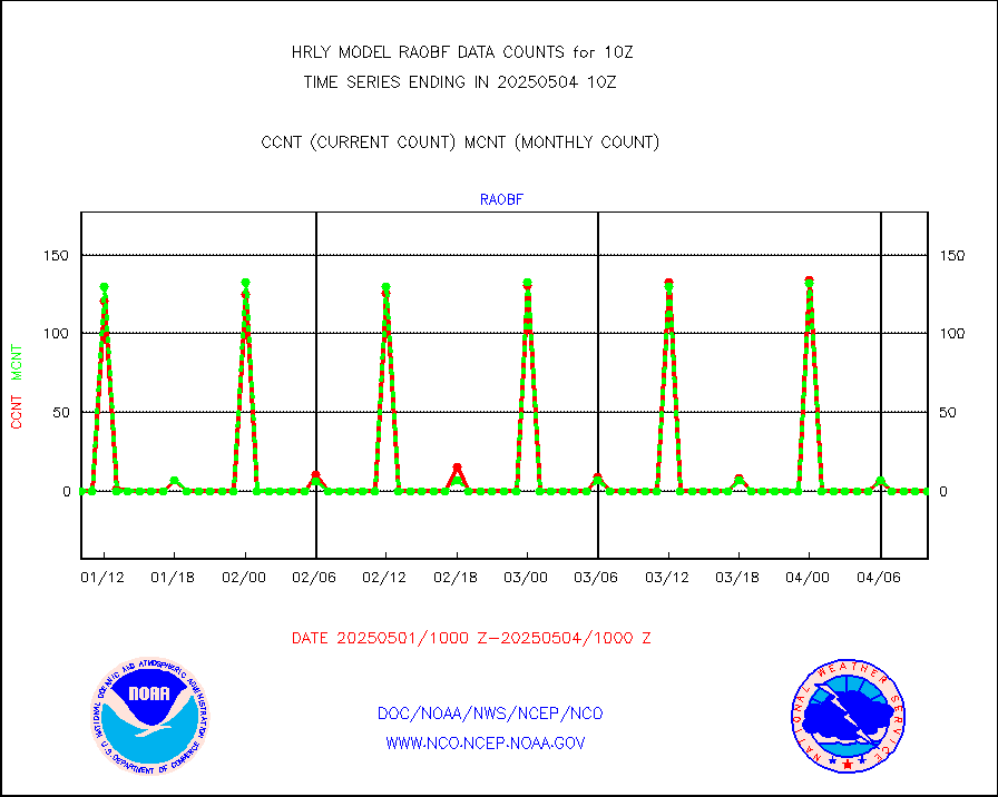
raobf |
Rawinsonde - fixed land (from TEMP or PILOT) |
0 |
0 |
n/a |
2609.50-2610.49 |
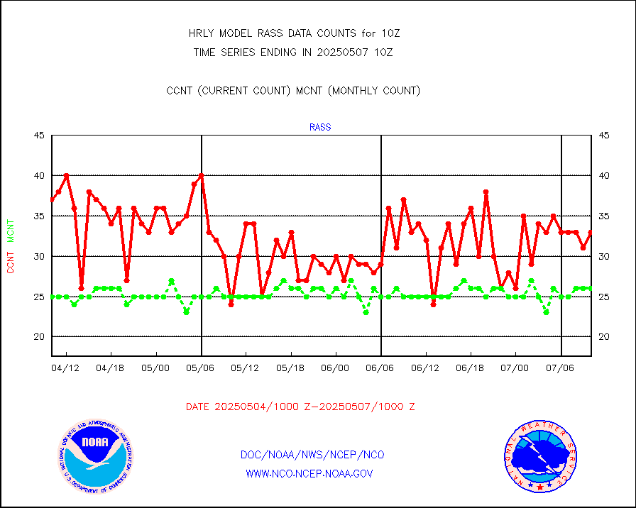
rass |
RASS temperatures (NOAA and Multi-Agency) |
23 |
25 |
92.0 % |
2609.50-2610.49 |
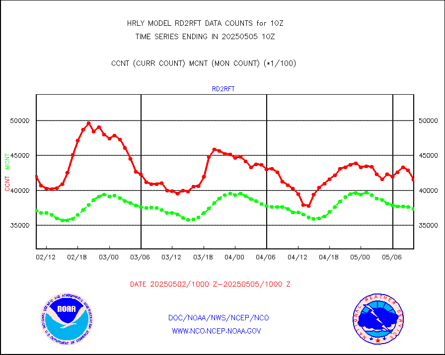
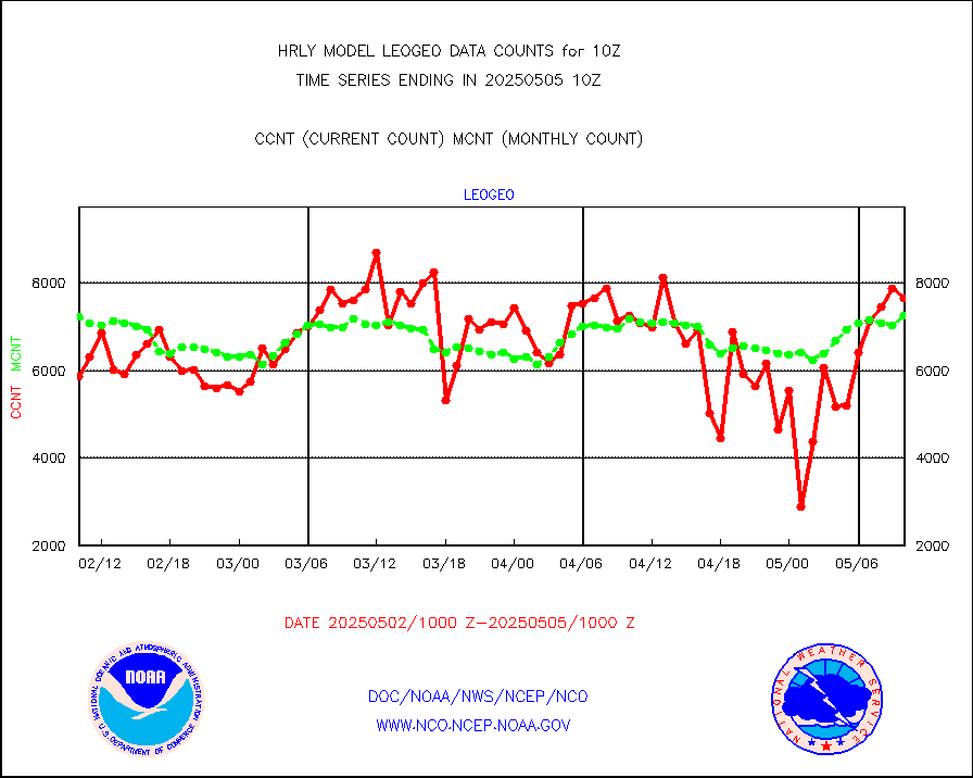
rd2rft |
NEXRAD reflectivity (Lvl 2 - GTS) |
4183007 |
3511566 |
119.1 % |
2609.50-2610.49 |
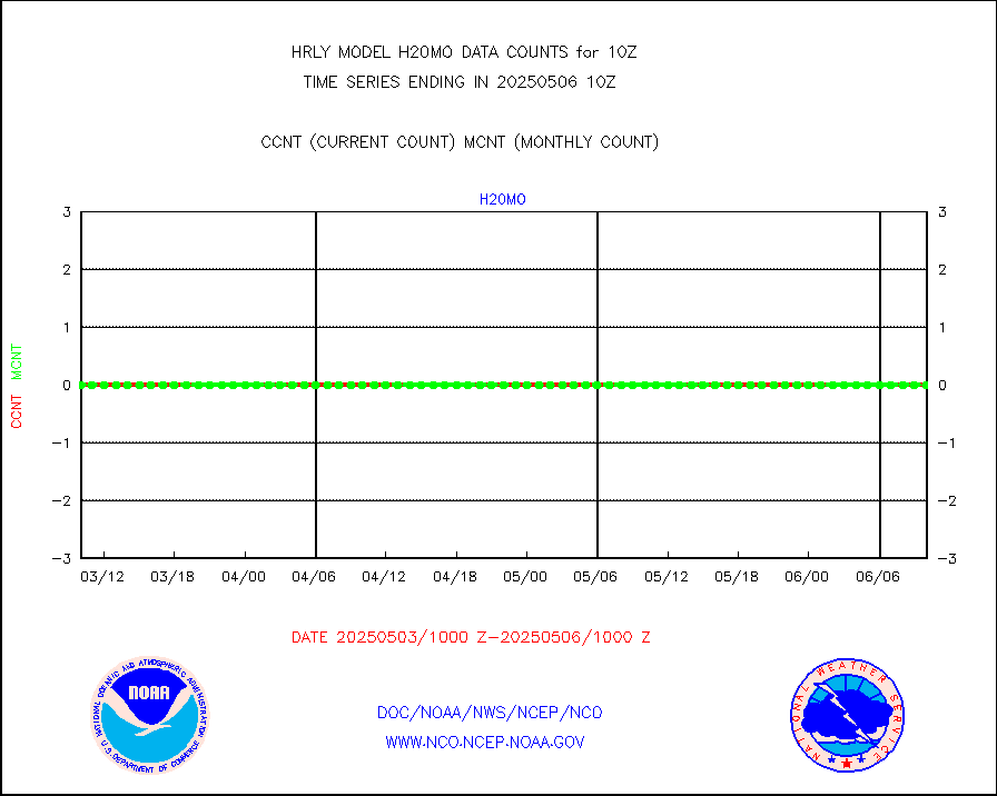
rd2wnd |
NEXRAD radial wind (Level 2 - GTS) |
1737828 |
1036573 |
167.7 % |
2609.50-2610.49 |
sevcsr |
METEOSAT-10 2nd Gen SEVIRI Clr Sky Radiance(proc) |
0 |
0 |
n/a |
2609.50-2610.49 |
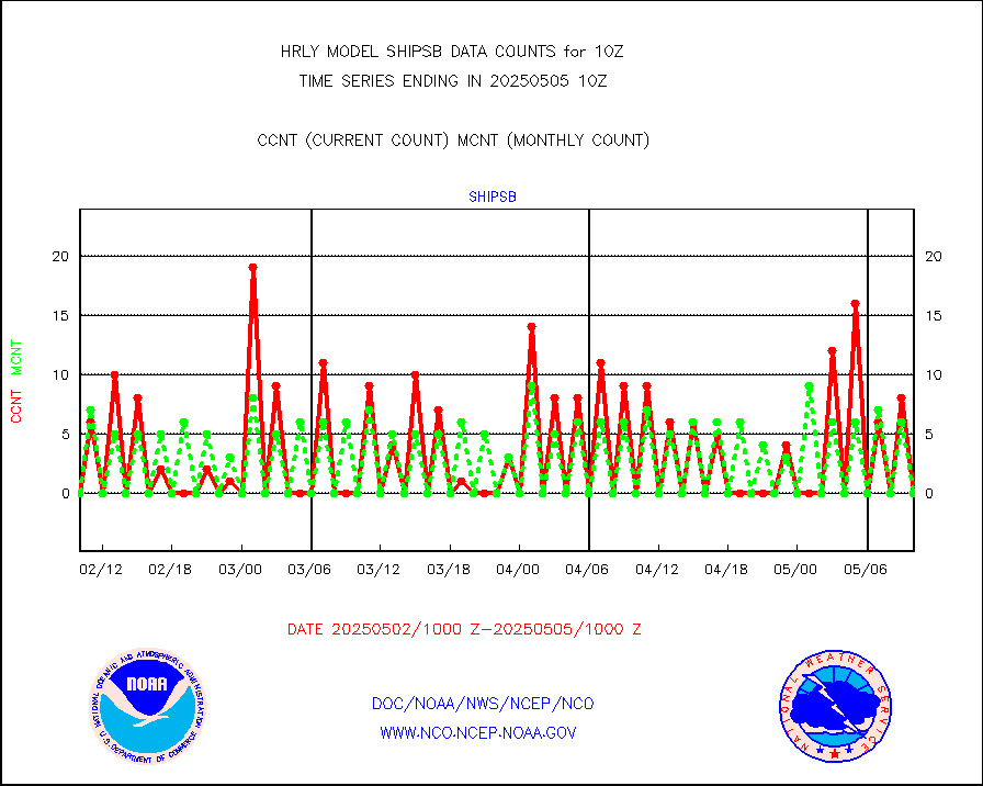
shipsb |
Ship - manual and automatic, restricted (BUFR) |
0 |
0 |
n/a |
2609.50-2610.50 |
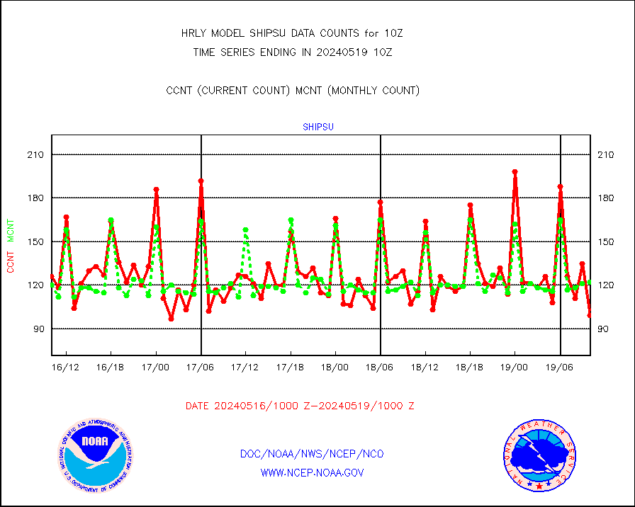
shipsu |
Ship - manual and automatic, unrestricted |
136 |
110 |
123.6 % |
2609.50-2610.50 |
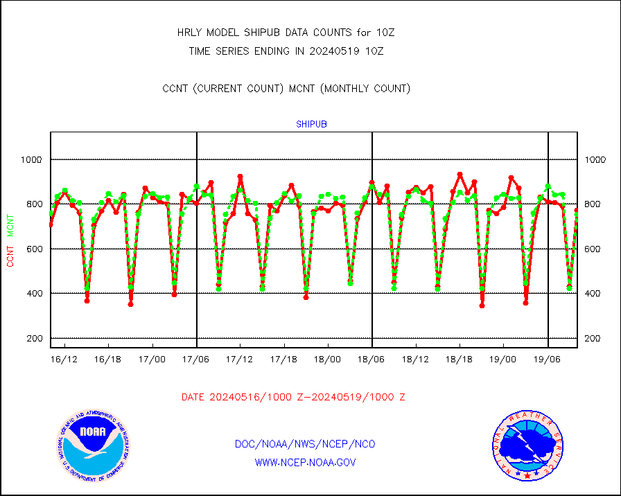
shipub |
Ship - manual and automatic, unrestricted (BUFR) |
687 |
737 |
93.2 % |
2609.50-2610.50 |
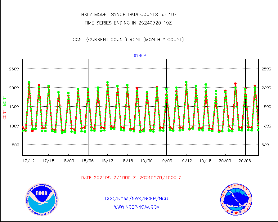
synop |
Synoptic - fixed manual and automatic |
832 |
811 |
102.6 % |
2609.50-2610.49 |
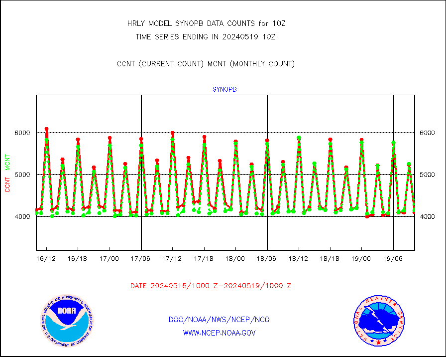
synopb |
Synoptic - fixed manual & auto (decoded fr BUFR) |
4142 |
4094 |
101.2 % |
2609.50-2610.49 |
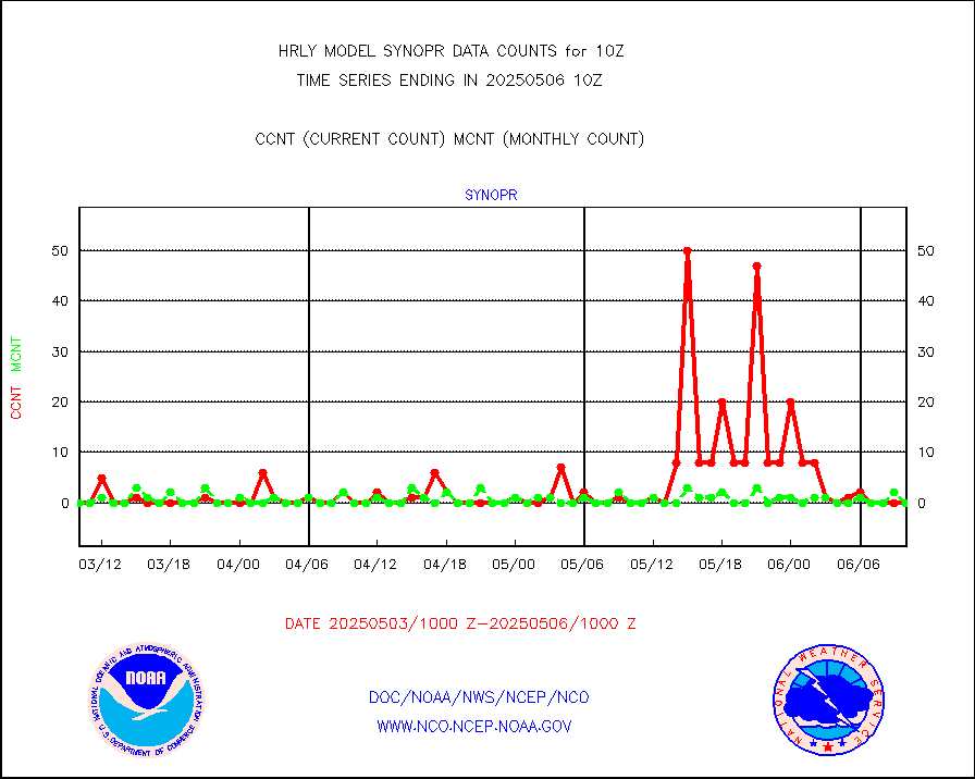
synopr |
Synoptic - restricted (WMO Res 40) manual & auto. |
0 |
1 |
0.0 % |
2609.50-2610.49 |
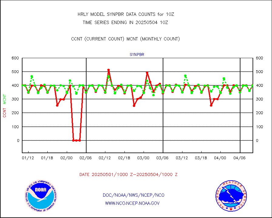
synpbr |
Synoptic - restricted (WMO Res 40)(decoded BUFR) |
402 |
403 |
99.8 % |
2609.50-2610.49 |
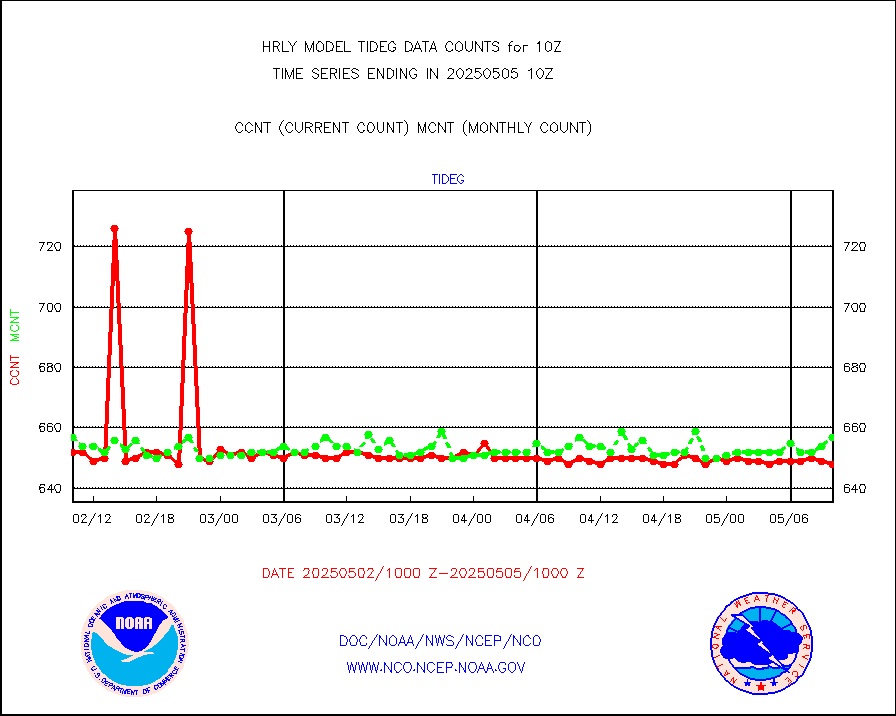
tideg |
Tide gauge reports decoded from CREX format |
641 |
635 |
100.9 % |
2609.00-2609.99 |
| Data Types of Opportunity with Normal Counts |
|---|
| Type | Description | Hourly Count | Monthly Average | Percent (%) of Monthly Mean | UTC Time Window |
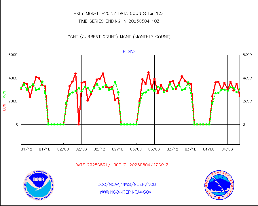
3p9usr |
GOES-16&up/NESDIS ir short-wv derived cld motion |
41829 |
41887 |
99.9 % |
2609.00-2609.99 |
acarsa |
MDCRS ACARS acft data (ARINC via AFWA)(AIREP fmt) |
0 |
0 |
n/a |
2609.50-2610.49 |
ahicsr |
Himawari Clear Sky Radiance |
0 |
0 |
n/a |
2609.00-2609.99 |
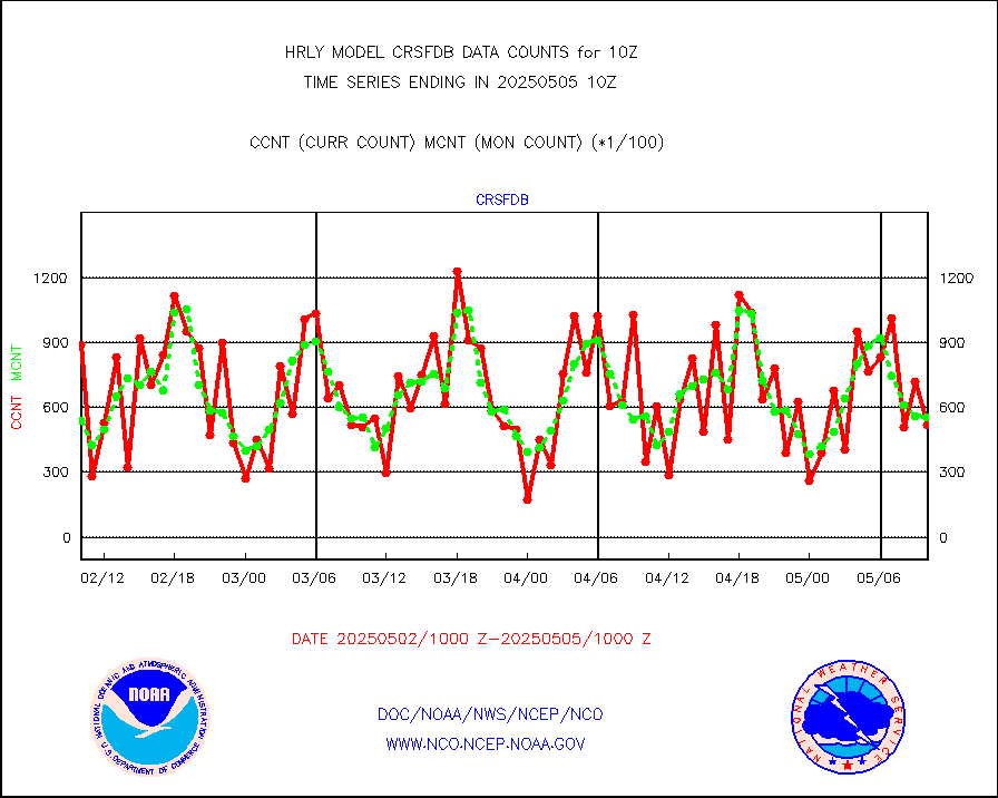
amsr2 |
GCOM-W AMSR2 1B brightness temperatures |
2137428 |
2175207 |
98.3 % |
2608.00-2608.99 |
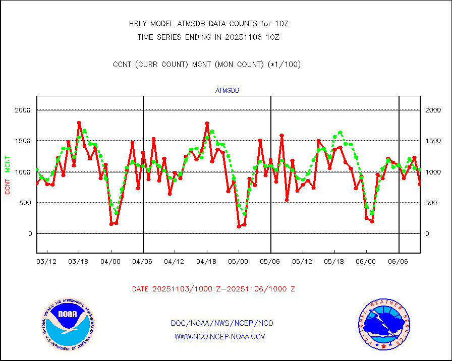
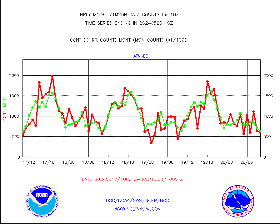
atmsdb |
NPP/NOAA-20 ATMS bright. temps-direct b-cast SSEC |
49018 |
59362 |
82.6 % |
2608.50-2609.49 |
atovs |
POES/NESDIS - processed ATOVS soundings/radiances |
0 |
0 |
n/a |
2608.00-2608.99 |
avcsam |
A.M.(N17,M2,M3) AVHRR GAC NCEP-proc clr&sea btmps |
1001446 |
1169823 |
85.6 % |
2607.50-2608.49 |
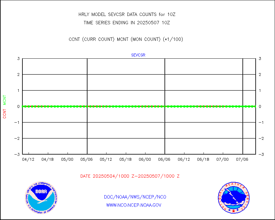
avcspm |
P.M.(N18-19) AVHRR GAC NCEP-proc clr & sea btemps |
1378824 |
1361459 |
101.3 % |
2607.50-2608.49 |
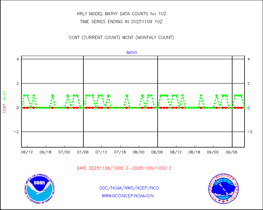
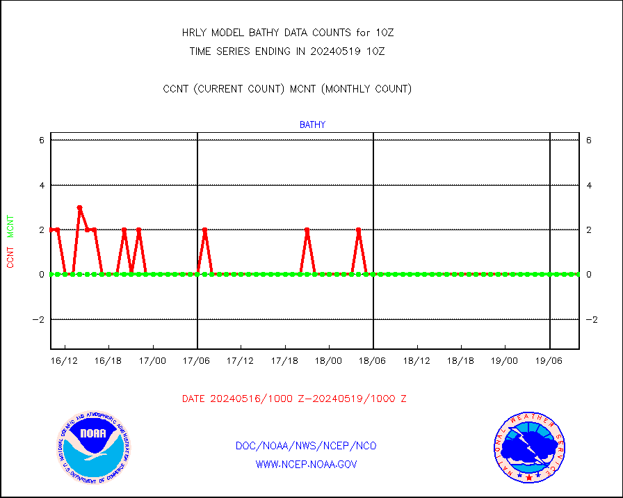
bathy |
eXpendable BathyThermograph, mooring (BATHY fmt) |
0 |
0 |
n/a |
2603.00-2603.99 |
coopmd |
Coop/MADIS NEPP & HCN-Modernization NOAA COOP Obs |
27 |
24 |
112.5 % |
2609.50-2610.49 |
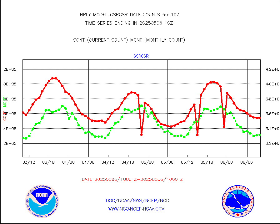
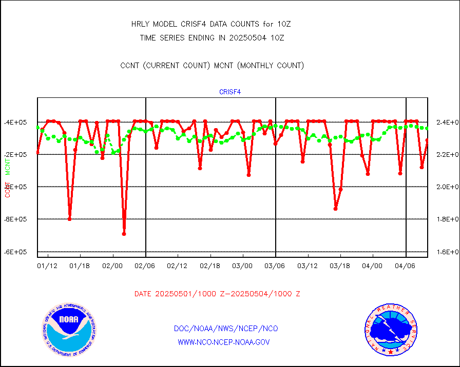
crisf4 |
NPP/NOAA-20 CrIS full spctrl radn (431 ch subset) |
240534 |
233060 |
103.2 % |
2608.50-2609.49 |
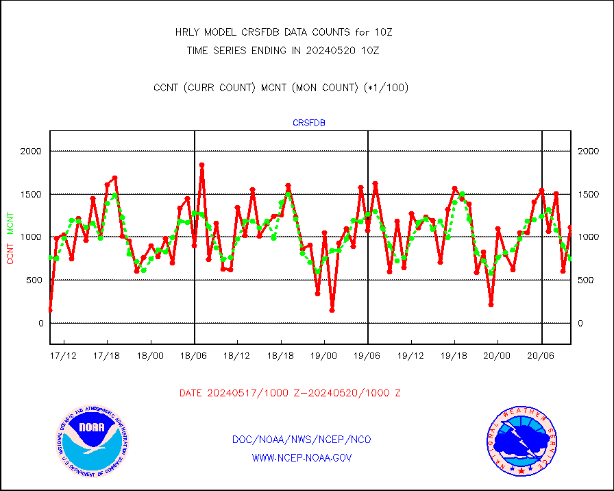
crsfdb |
NPP/NOAA-20 CrIS full spctrl radn dir brdcst SSEC |
40307 |
66127 |
61.0 % |
2608.50-2609.49 |
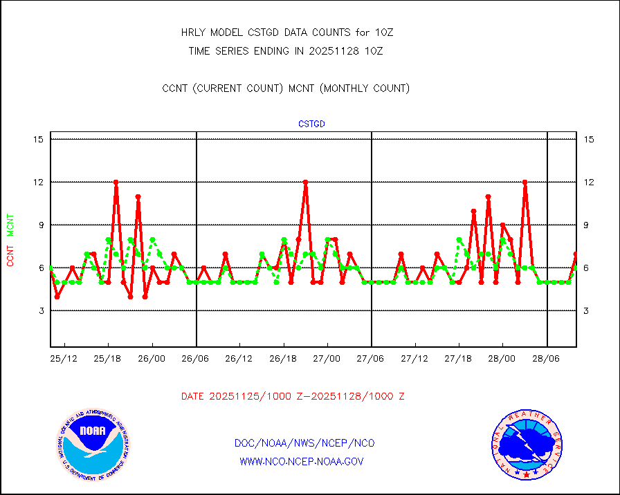
cstgd |
Coast Guard |
3 |
4 |
75.0 % |
2609.50-2610.50 |
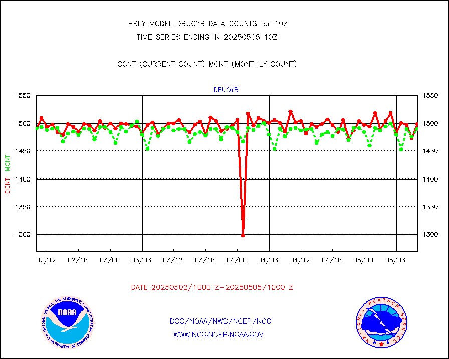
dbuoyb |
Drifting buoys (decoded from BUFR) |
1344 |
1412 |
95.2 % |
2609.50-2610.50 |
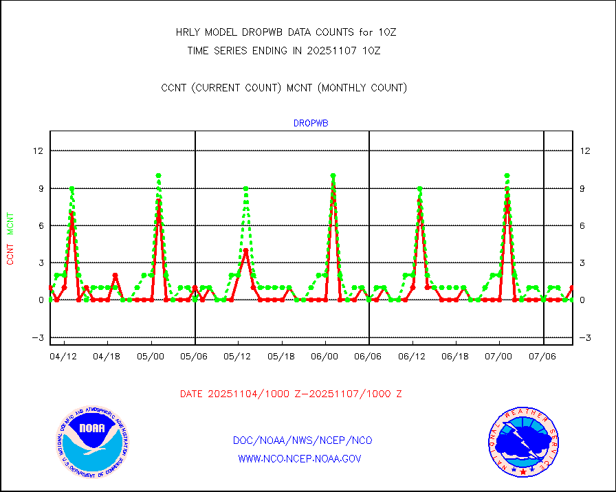
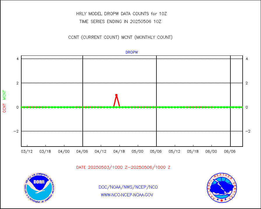
dropw |
Dropwinsonde (from TEMP DROP) |
0 |
0 |
n/a |
2609.50-2610.49 |
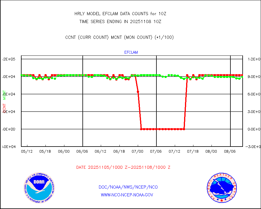
efclam |
GOES imager effective cloud amount data (U.Wisc.) |
8263578 |
8083878 |
102.2 % |
2609.50-2610.49 |
esatms |
NPP Adv. Tech. MW Sndr (ATMS) br. temps from RARS |
68538 |
65116 |
105.3 % |
2608.50-2609.49 |
esiasi |
METOP 1-2 IASI 1C radiance data vbl chn from RARS |
46244 |
46081 |
100.4 % |
2609.00-2609.99 |
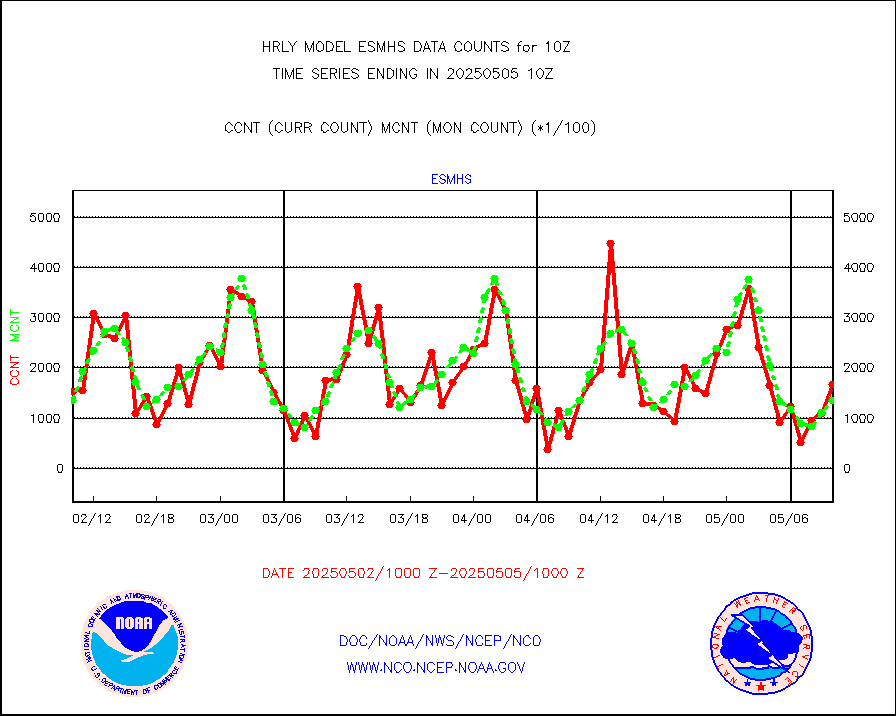
esmhs |
NOAA 18-19 & METOP 1-2 MHS proc. btemps from RARS |
199423 |
152701 |
130.6 % |
2609.50-2610.49 |
geoimr |
GOES/NESDIS (11x17 f-o-v) imager clear radiances |
0 |
0 |
n/a |
2609.00-2609.99 |
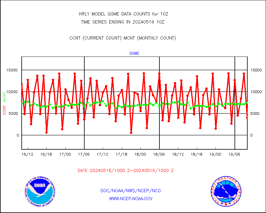
gome |
METOP 1-2 Global Ozone Monitoring Exp.-2 (GOME-2) |
3576 |
6734 |
53.1 % |
2608.50-2609.49 |
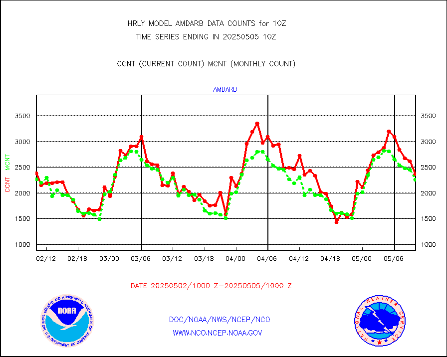
h20in2 |
INDIA SATWIND, INSAT WV channel |
4908 |
4962 |
98.9 % |
2609.00-2609.99 |
h2dusr |
GOES-16&up/NESDIS wv imgr/deep-lyr derivd cld mtn |
14469 |
15106 |
95.8 % |
2609.00-2609.99 |
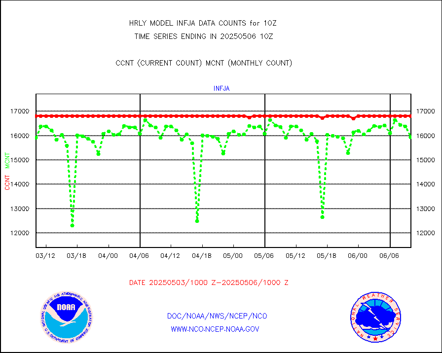
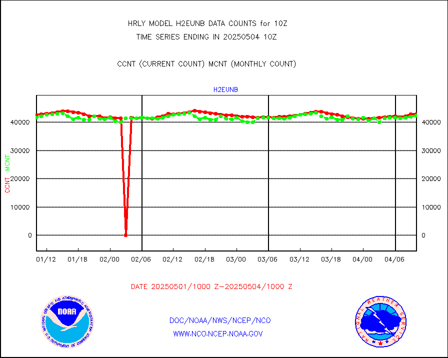
h2eunb |
METEOSAT/EUMETSAT wvpr imgr drv cld motion NBseq |
43247 |
42878 |
100.9 % |
2608.50-2609.49 |
hdob |
High Density OBs from reconnaissance acft data |
0 |
0 |
n/a |
2609.50-2610.49 |
iasidb |
METOP 1-2 IASI 1C radiances-direct broadcast SSEC |
17829 |
28803 |
61.9 % |
2608.50-2609.49 |
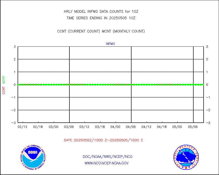
ifvrnb |
VIIRS (NPP/NOAA-20) ir lg-wv drv cloud motion(NB) |
20922 |
16388 |
127.7 % |
2606.00-2606.99 |
infav1 |
AVHRR (METOP) ir lg-wave derived cld motion |
0 |
0 |
n/a |
2609.50-2610.50 |
infin |
INSAT/KALPANA India ir lg-wave derived cld motion |
0 |
0 |
n/a |
2607.50-2608.49 |
infin2 |
INDIA SATWIND, INSAT IR channel |
3621 |
4816 |
75.2 % |
2609.00-2609.99 |
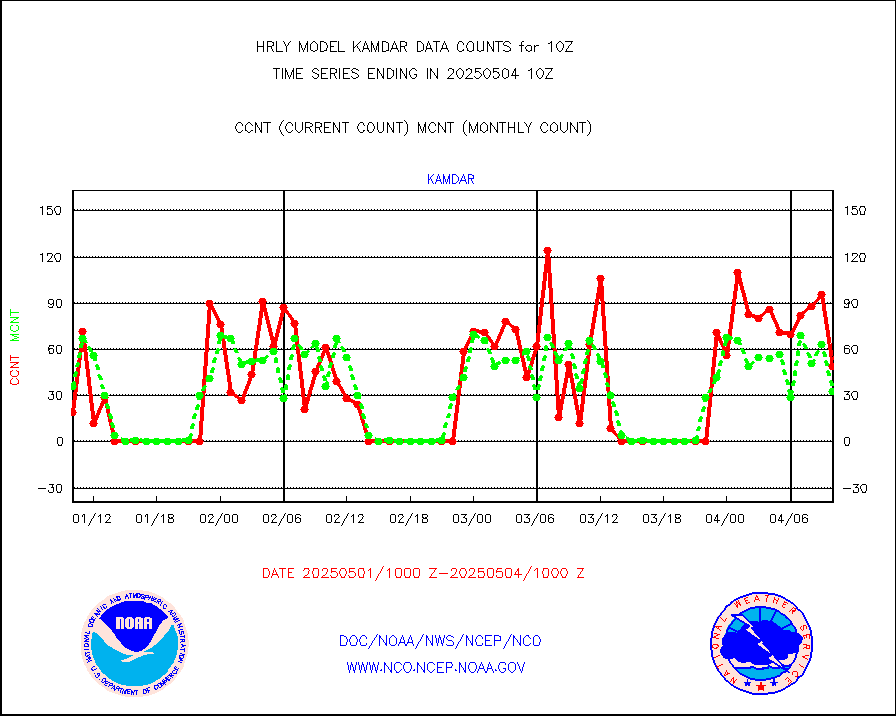
kamdar |
Korean AMDAR aircraft data (decoded from BUFR) |
70 |
58 |
120.7 % |
2609.50-2610.49 |
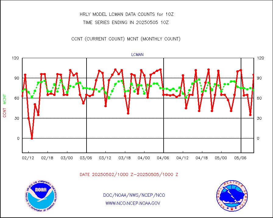
lcman |
Land-based CMAN stations decoded from CMAN format |
75 |
80 |
93.8 % |
2609.50-2610.49 |
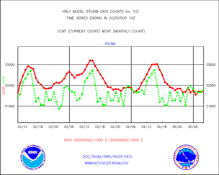
leogeo |
LEO-GEO satellite AMVs from UWisc. |
8611 |
322 |
n/a |
2606.00-2606.99 |
ltnglr |
LLDN Long-rng lightning from Vaisala via NOAAPORT |
172648 |
107858 |
160.1 % |
2609.50-2610.49 |
ltngsr |
NLDN Shrt-rng lightning from Vaisala via NOAAPORT |
5333 |
1584 |
336.7 % |
2609.50-2610.49 |
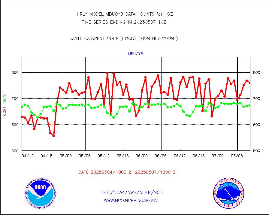
mbuoyb |
Moored buoys (decoded from BUFR) |
725 |
638 |
113.6 % |
2609.50-2610.50 |
mls |
Aura Microwave Limb Sounder (MLS) ozone data |
0 |
0 |
n/a |
2608.00-2608.99 |
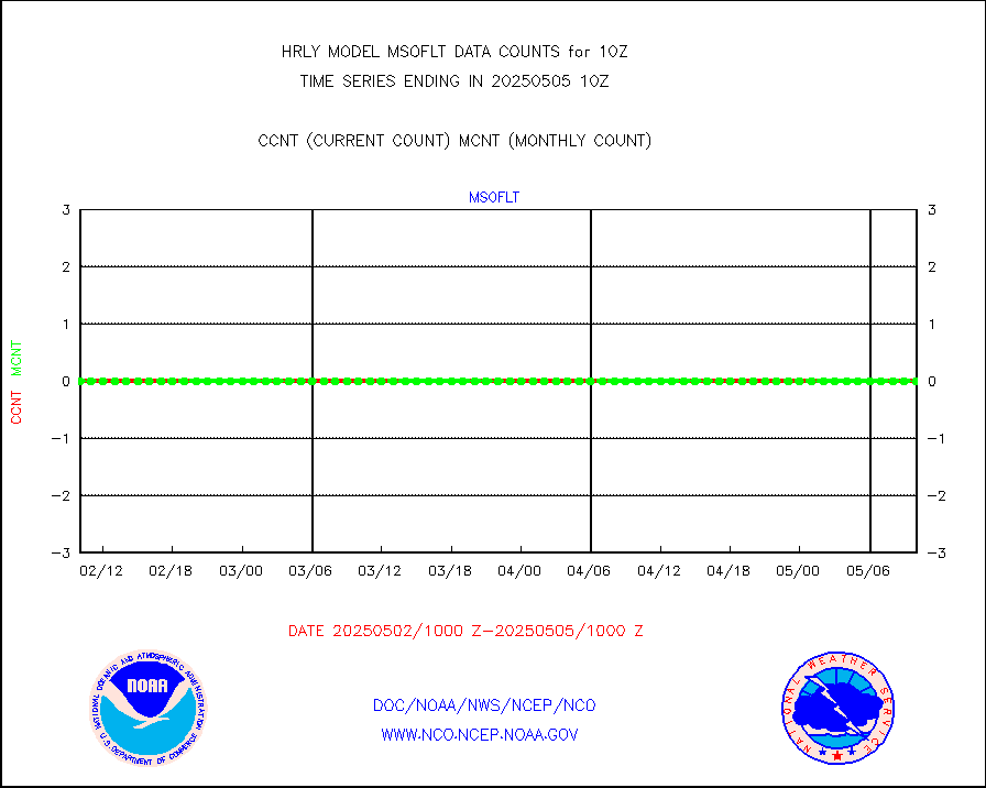
msourb |
Mesonet/MADIS UrbaNet |
4441 |
4343 |
102.3 % |
2609.50-2610.49 |
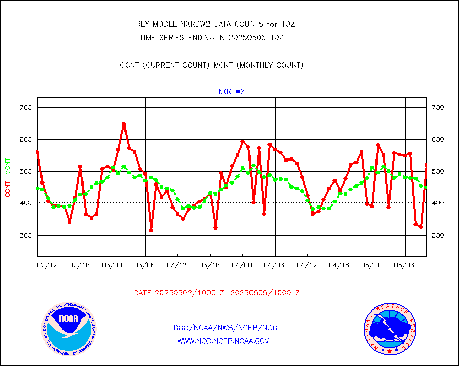
nxrdw2 |
NEXRAD Vel Azm Dsp(VAD) winds via Level 2 decoder |
637 |
459 |
138.8 % |
2609.50-2610.49 |
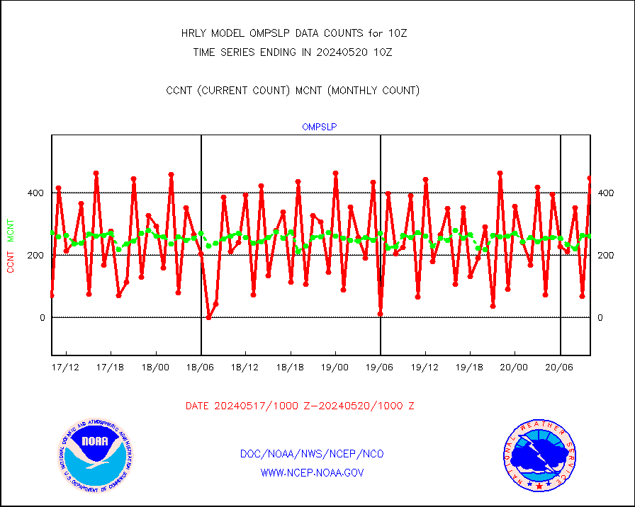
ompslp |
OMPS Limb Profiler ozone data (NPP) |
113 |
263 |
43.0 % |
2603.00-2603.99 |
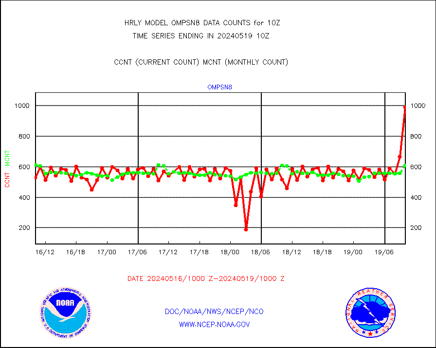
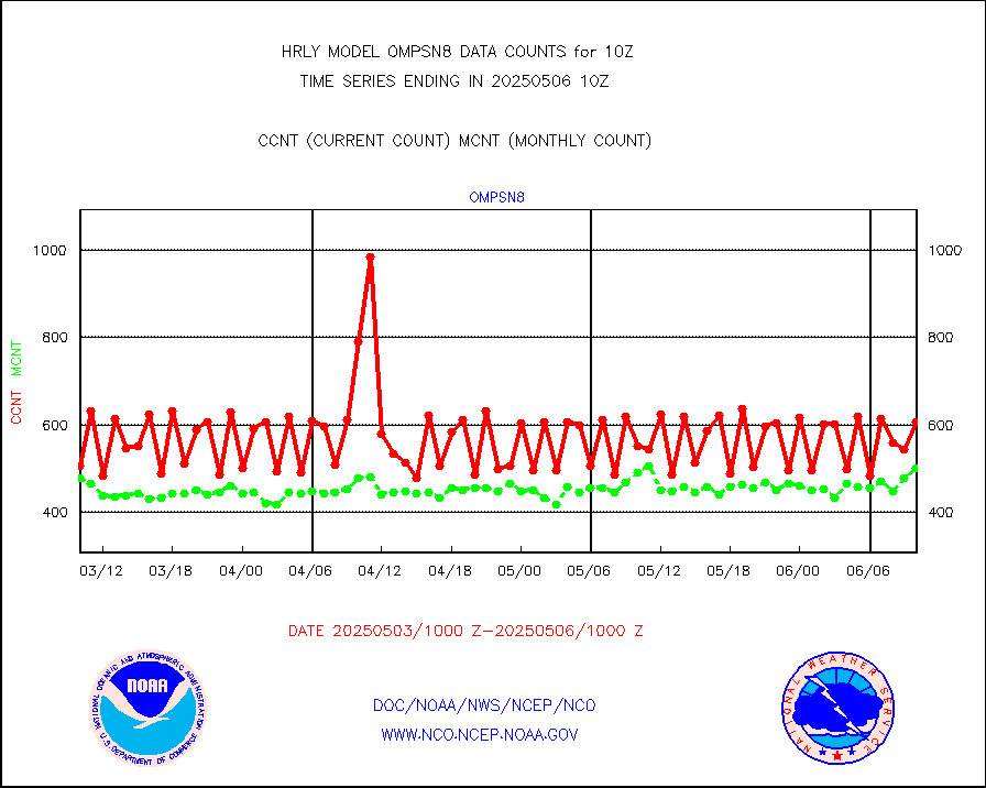
ompsn8 |
OMPS nadir profile ozone (Version 8 BUFR) |
525 |
602 |
87.2 % |
2608.00-2608.99 |
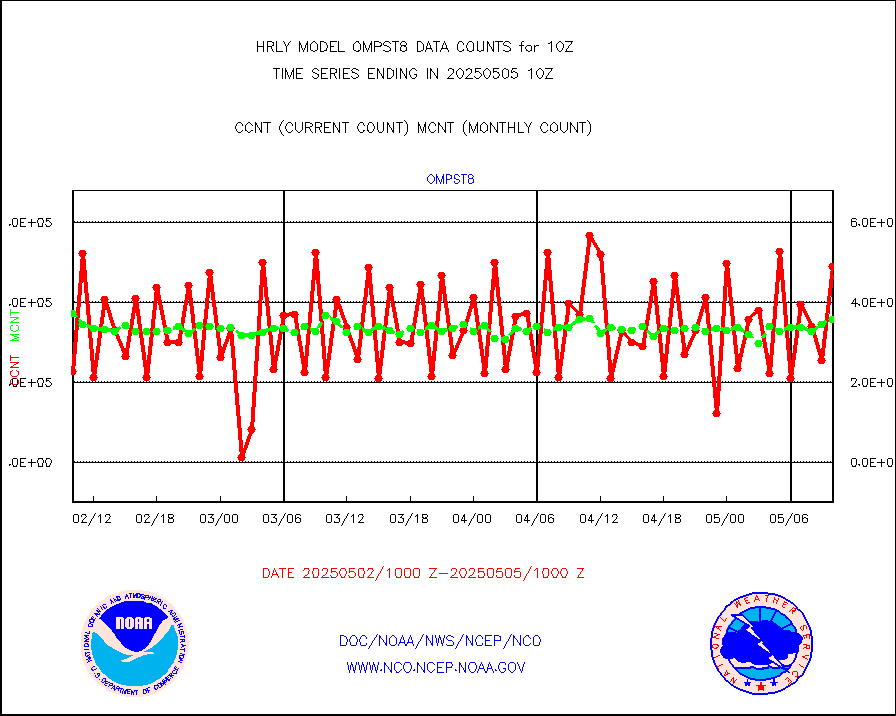
ompst8 |
OMPS total column ozone (Version 8 BUFR) |
403501 |
357351 |
112.9 % |
2608.00-2608.99 |
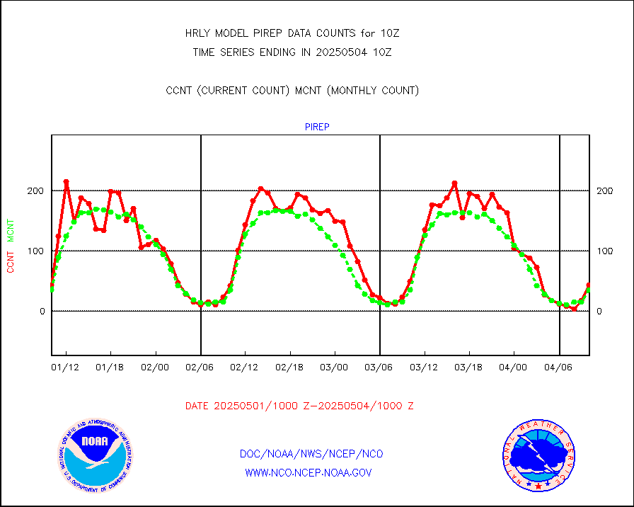
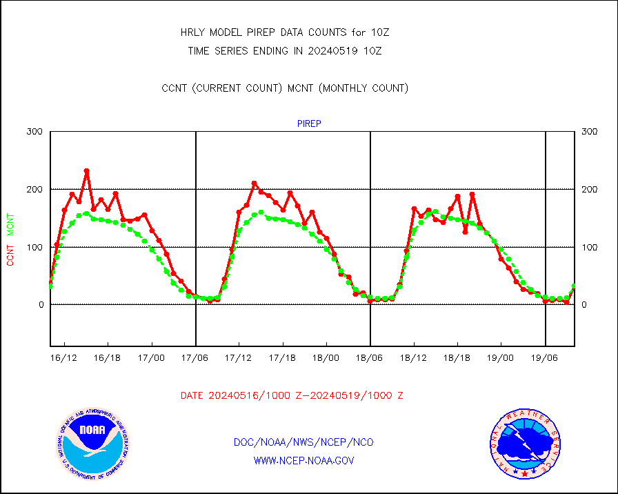
pirep |
Manual PIREP aircraft data (dcded from AIREP fmt) |
17 |
32 |
53.1 % |
2609.50-2610.49 |
prflrp |
Profilr winds from PIBAL (PILOT,PILOT SHIP/MOBIL) |
0 |
0 |
n/a |
2609.50-2610.49 |
raobm |
Rawinsonde - mobile land (from TEMP/PILOT MOBIL) |
0 |
0 |
n/a |
2609.50-2610.49 |
raobs |
Rawinsonde - ship (from TEMP SHIP, PILOT SHIP) |
0 |
0 |
n/a |
2609.50-2610.49 |
recco |
Flight level reconnaissance aircraft data |
0 |
0 |
n/a |
2609.50-2610.49 |
saphir |
Megha-Tropiques SAPHIR L1A2 brightness temps |
0 |
0 |
n/a |
2607.50-2608.49 |
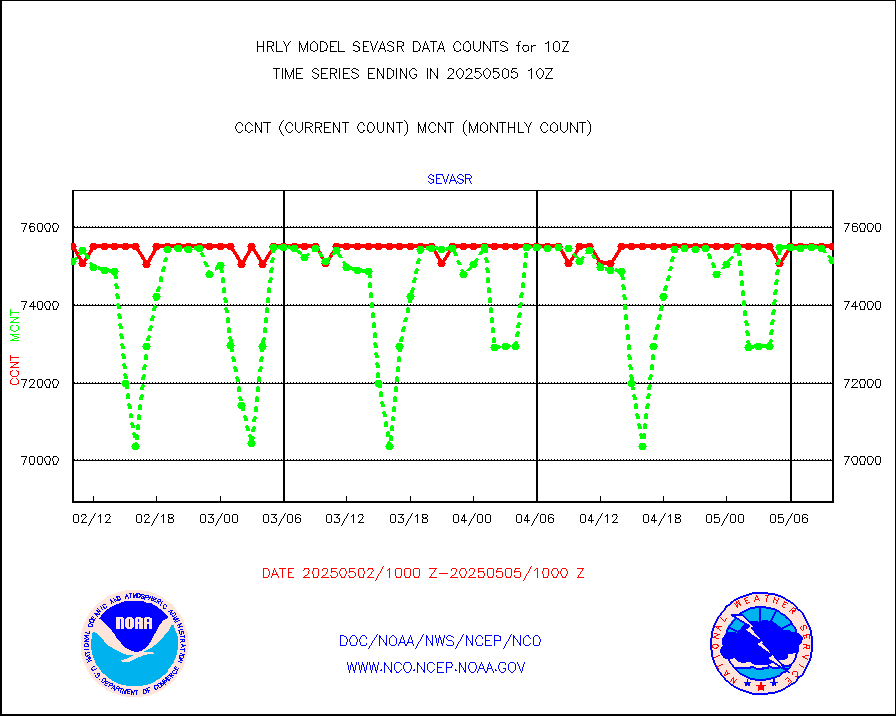
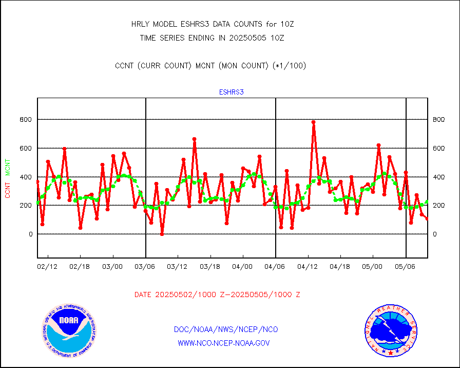
sevasr |
METEOSAT-10 2nd Gen SEVIRI All Sky Radiance(proc) |
75512 |
75410 |
100.1 % |
2609.50-2610.49 |
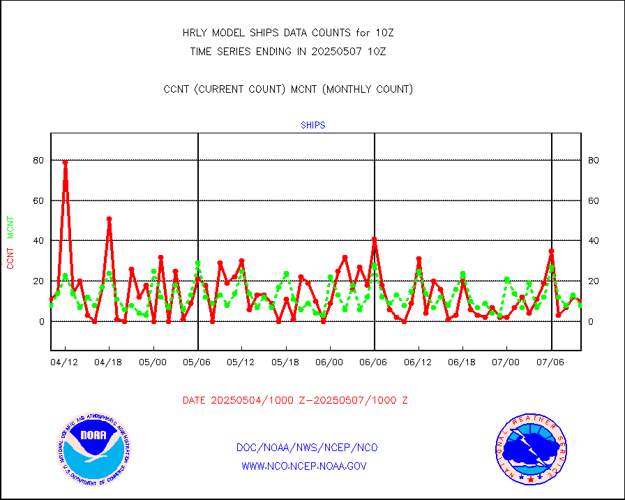
ships |
Ship - manual and automatic, restricted |
0 |
4 |
0.0 % |
2609.50-2610.49 |
ssmisu |
DMSP SSM/IS 1C radiance data (Unified Pre-Proc.) |
225120 |
140920 |
159.8 % |
2608.50-2609.49 |
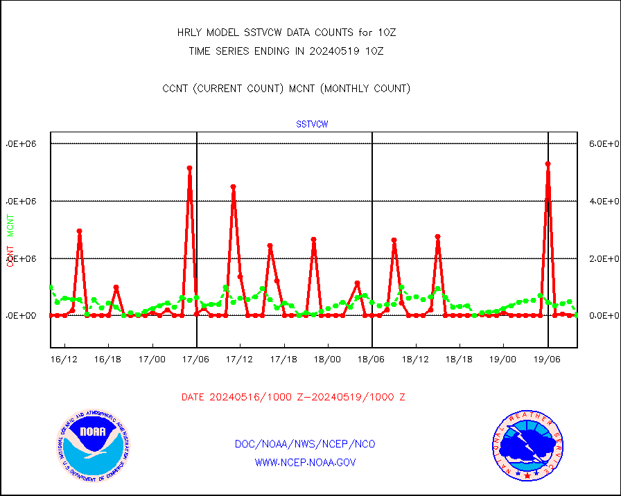
sstvcw |
NPP/NOAA-20 VIIRS SST - CLEAR & OVER WATER |
2837352 |
536822 |
528.5 % |
2609.50-2610.49 |
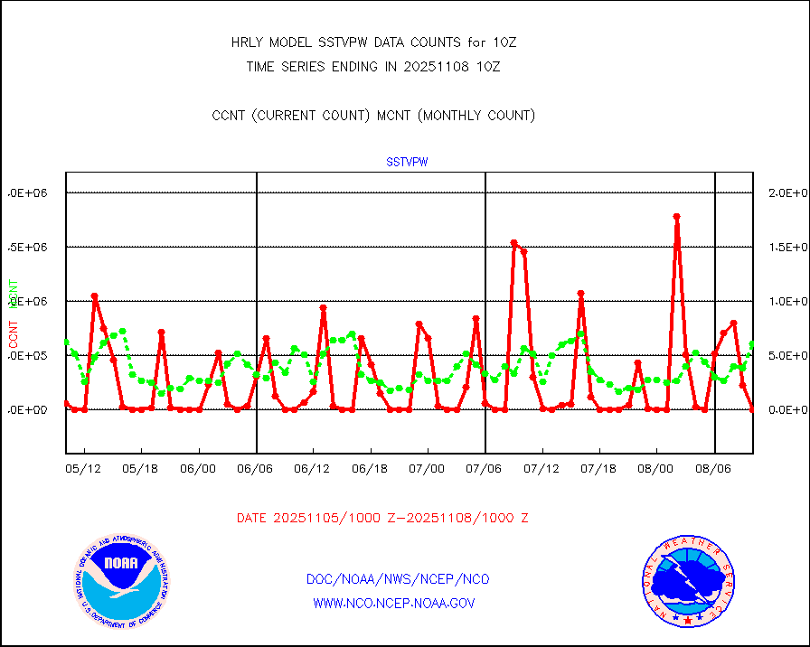
sstvpw |
NPP/NOAA-20 VIIRS SST - PROBABLY CLR & OVER WATER |
488453 |
283223 |
172.5 % |
2609.50-2610.49 |
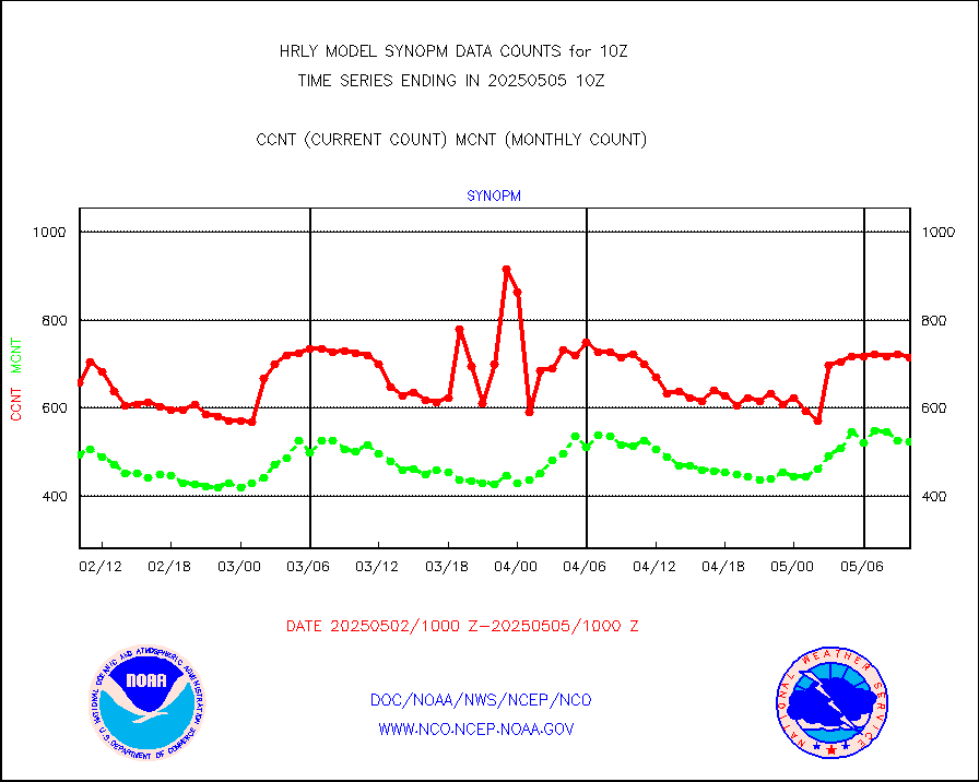
synopm |
Synoptic - mobile manual and automatic |
668 |
511 |
130.7 % |
2609.50-2610.49 |
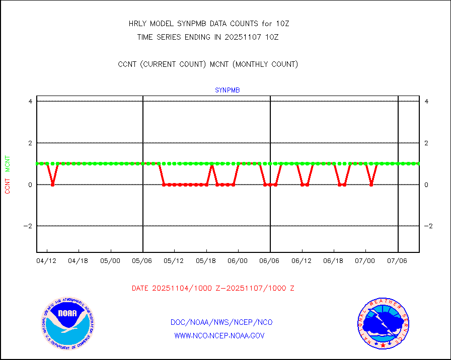
synpmb |
Synoptic - mobile manual & auto (decoded fr BUFR) |
1 |
1 |
100.0 % |
2609.50-2610.49 |
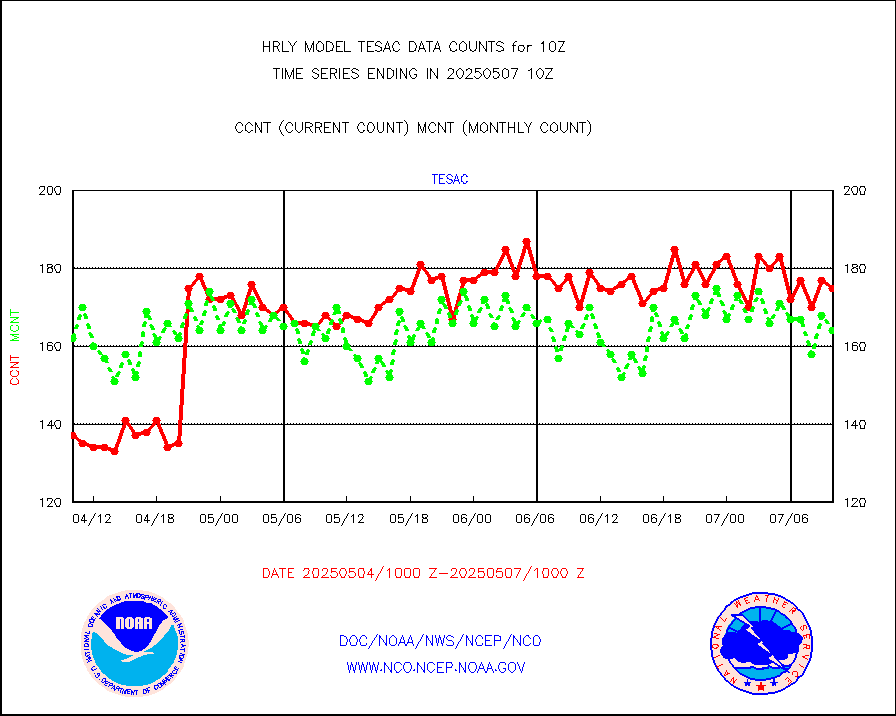
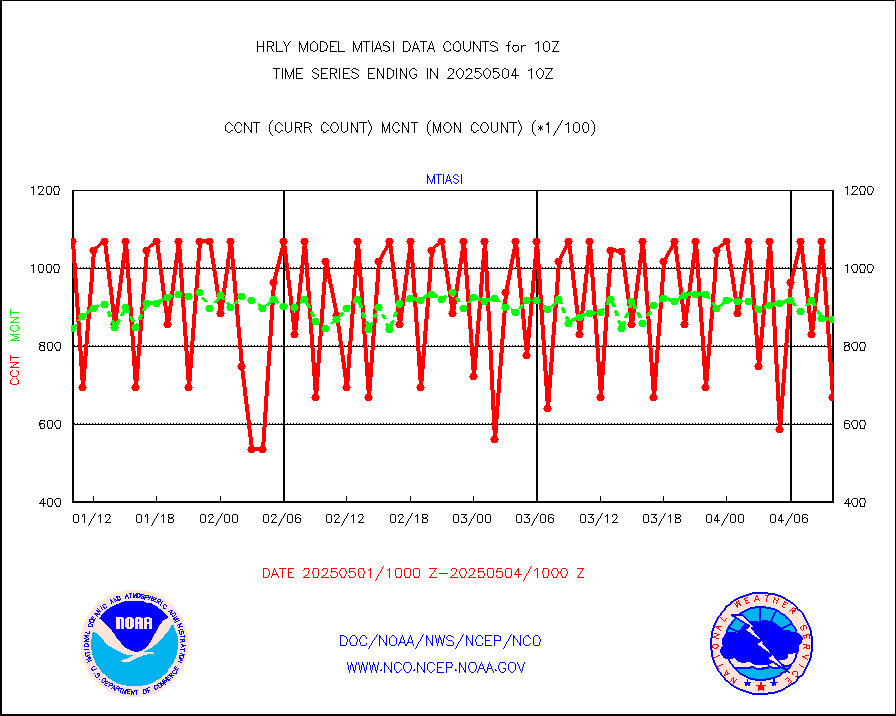
tesac |
CTD probe, Argo prflng float, mooring (TESAC fmt) |
186 |
161 |
115.5 % |
2609.50-2610.49 |
tmdara |
TAMDAR aircft data-all types(from Panasonic,BUFR) |
331 |
404 |
81.9 % |
2609.50-2610.49 |
visin |
INSAT/KALPANA India visible derived cloud motion |
0 |
0 |
n/a |
2607.50-2608.49 |
visin2 |
INDIA SATWIND, INSAT VIS channel |
770 |
988 |
77.9 % |
2609.00-2609.99 |
visja |
MTSAT/JMA visible derived cloud motion |
3799 |
3950 |
96.2 % |
2607.50-2608.49 |
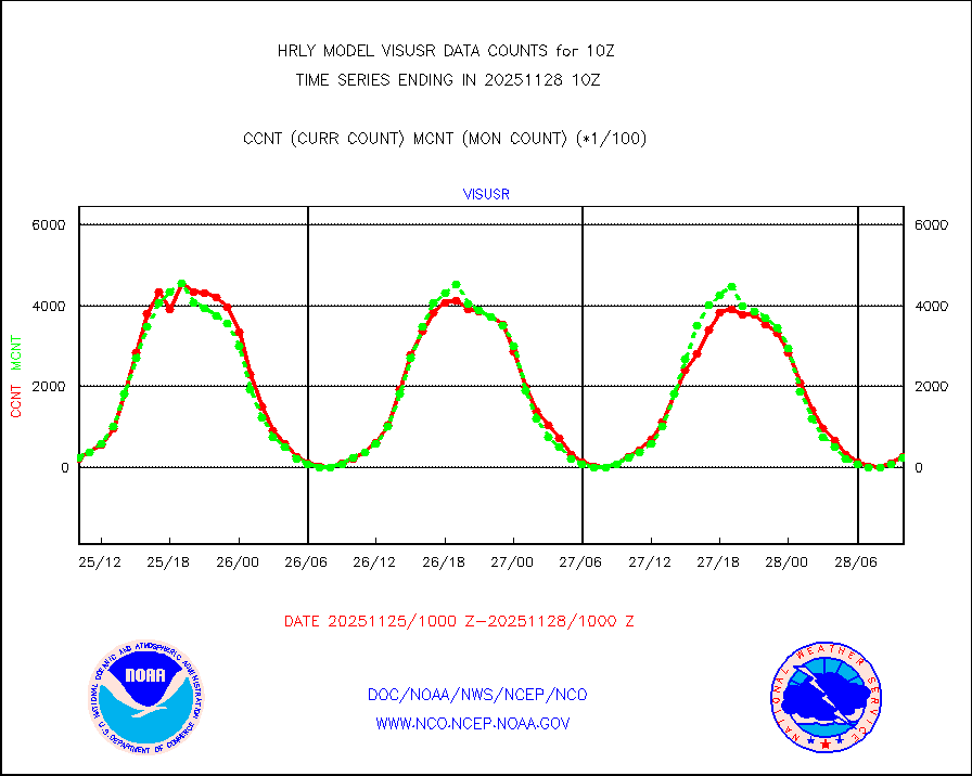
visusr |
GOES-16&up/NESDIS visible derived cloud motion |
21788 |
19272 |
113.1 % |
2609.00-2609.99 |
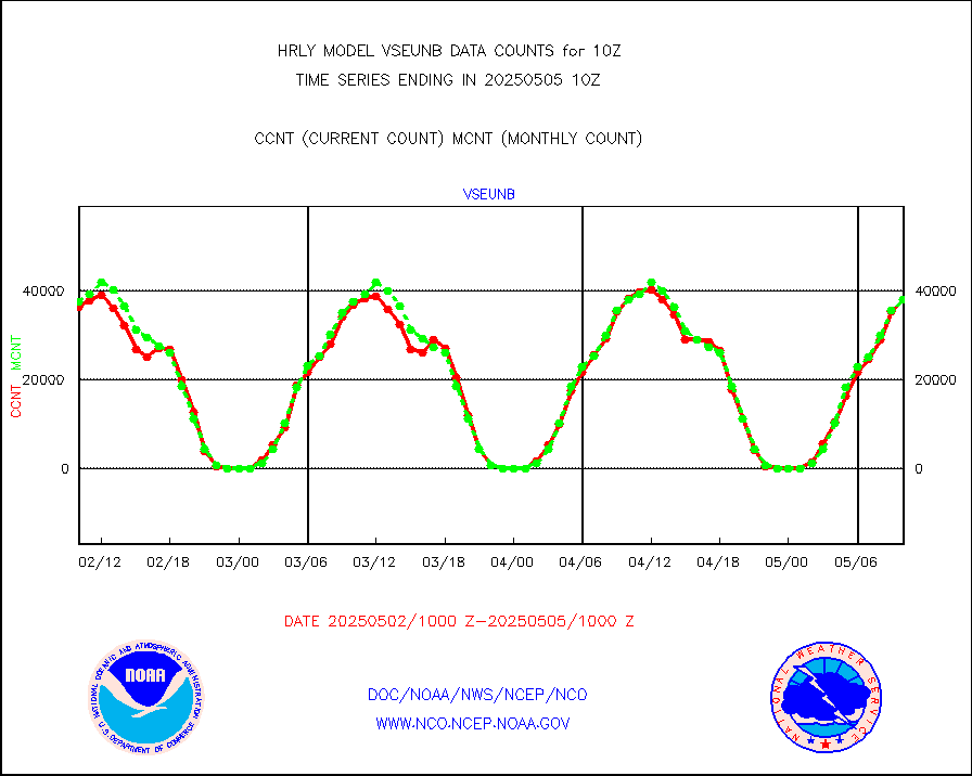
vseunb |
METEOSAT/EUMETSAT visible drv cld motion NBseq |
36242 |
33863 |
107.0 % |
2608.50-2609.49 |


