| Critical Data with Normal Counts |
|---|
| Type | Description | Hourly Count | Monthly Average | Percent (%) of Monthly Mean |
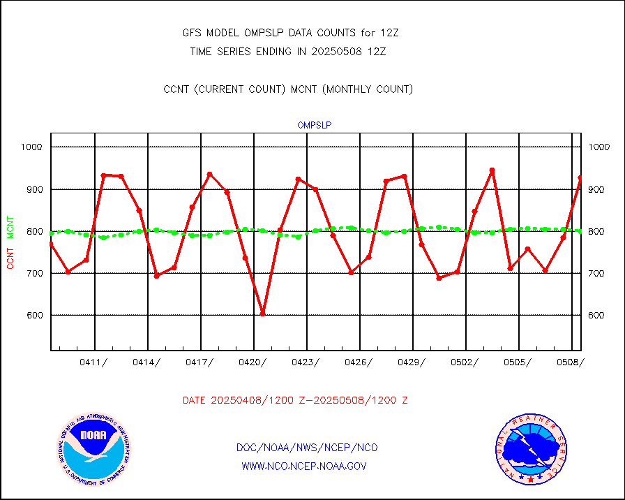
1bamua |
NOAA 15-19 & METOP 1-2 AMSU-A NCEP-proc. br.temps |
270421 |
285479 |
94.7 % |
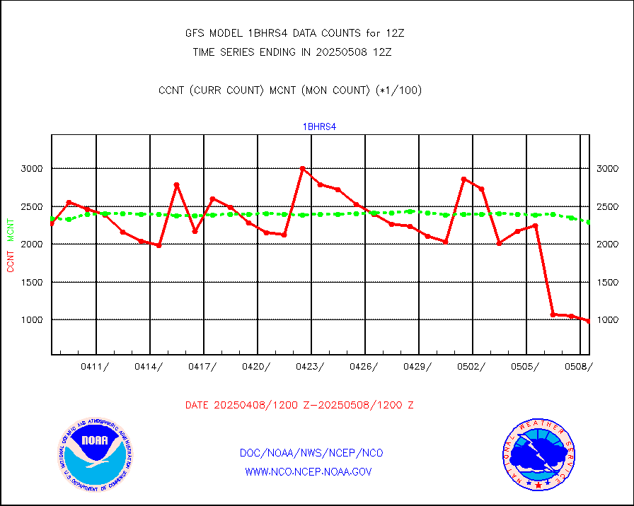
1bhrs4 |
NOAA 18-19 & METOP 1-2 HIRS-4 NCEP-proc. br.temps |
213757 |
240228 |
89.0 % |
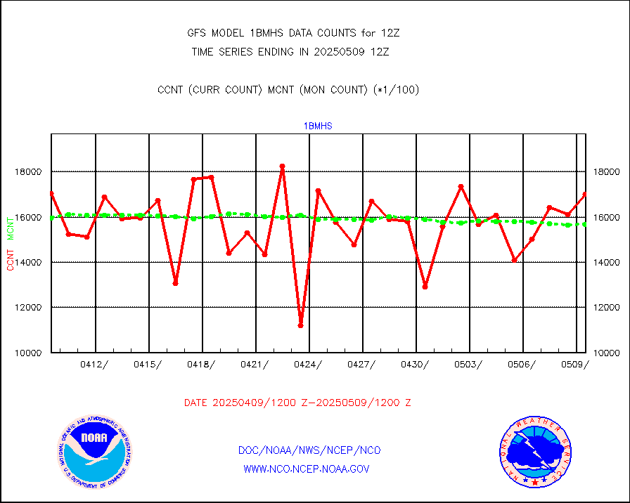
1bmhs |
NOAA 18-19 & METOP 1-2 MHS NCEP-proces. br. temps |
1597350 |
1587332 |
100.6 % |
acars |
MDCRS ACARS acft data from ARINC(dcded from BUFR) |
95750 |
86169 |
111.1 % |
ahicsr |
Himawari Clear Sky Radiance |
226192 |
238800 |
94.7 % |
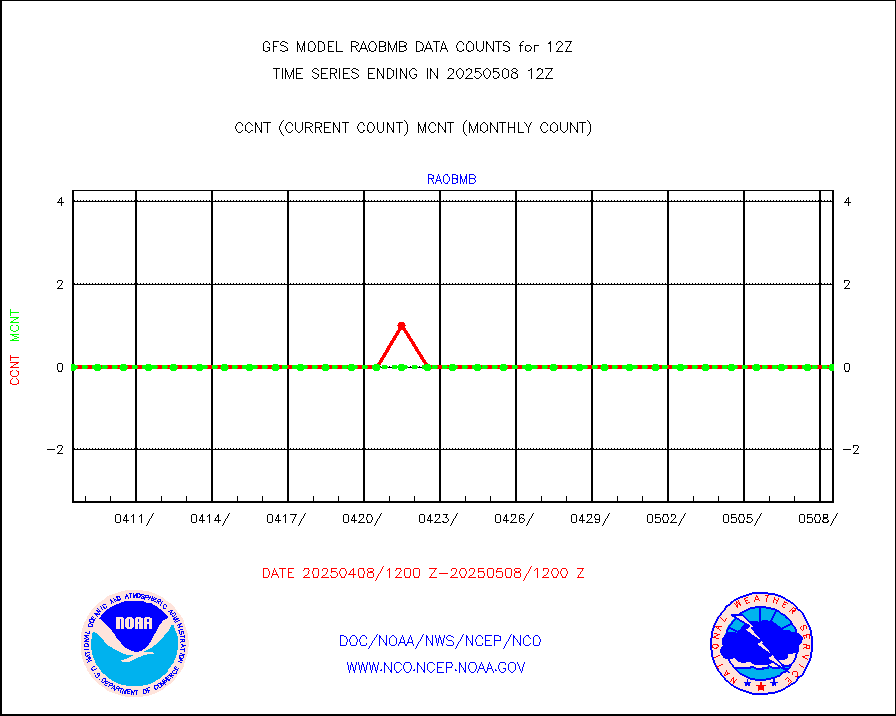
airep |
Manual AIREP aircraft data (dcded from AIREP fmt) |
7443 |
7265 |
102.5 % |
airsev |
AQUA AIRS/AMSU-A/HSB brightness temps- every FOV |
0 |
0 |
n/a |
amdar |
AMDAR aircraft data (decoded from AMDAR format) |
2059 |
2684 |
76.7 % |
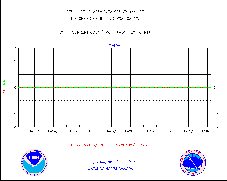
amdarb |
AMDAR aircraft data (decoded from BUFR) |
7945 |
7640 |
104.0 % |
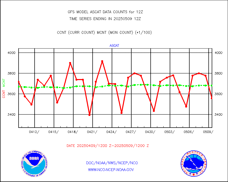
ascat |
METOP 1-2 ASCAT products |
367752 |
328854 |
111.8 % |
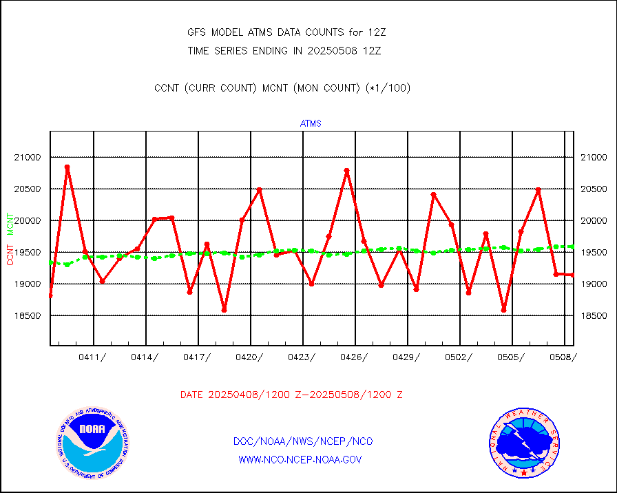
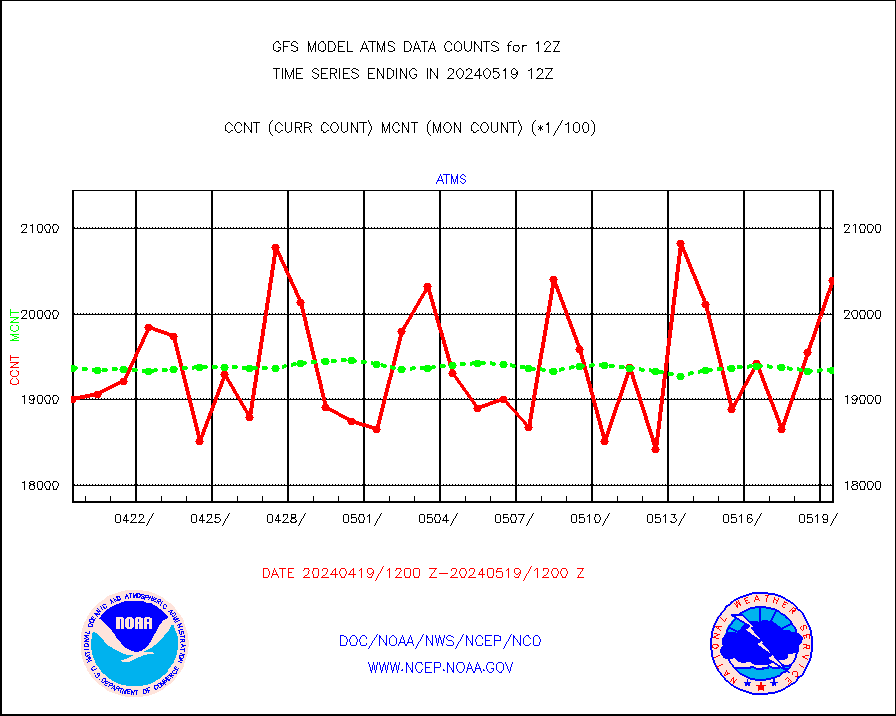
atms |
NPP/NOAA-20 ATMS brightness temperatures |
1307712 |
1718933 |
76.1 % |
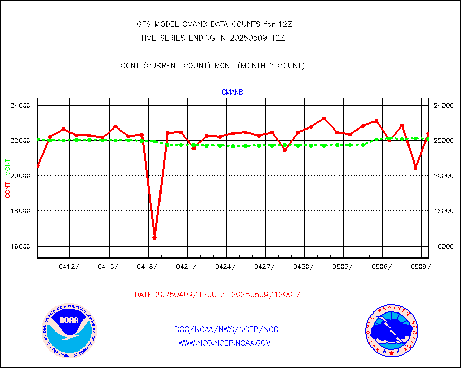
cmanb |
Surface Marine CMAN rpts decoded from BUFR format |
22230 |
22347 |
99.5 % |
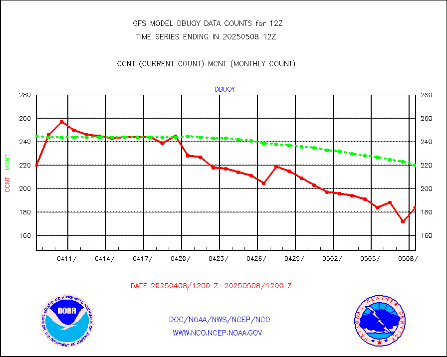
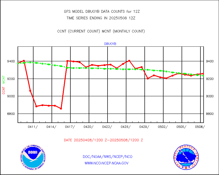
dbuoy |
Buoys decoded from FM-18 fmt (moored or drifting) |
269 |
272 |
98.9 % |
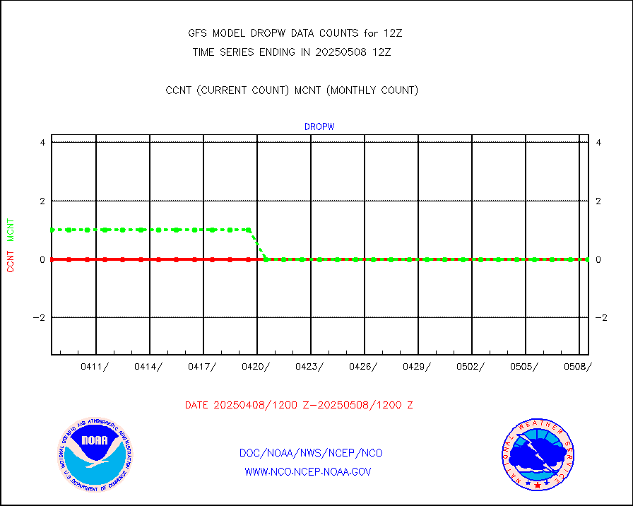
dropw |
Dropwinsonde (from TEMP DROP) |
0 |
7 |
0.0 % |
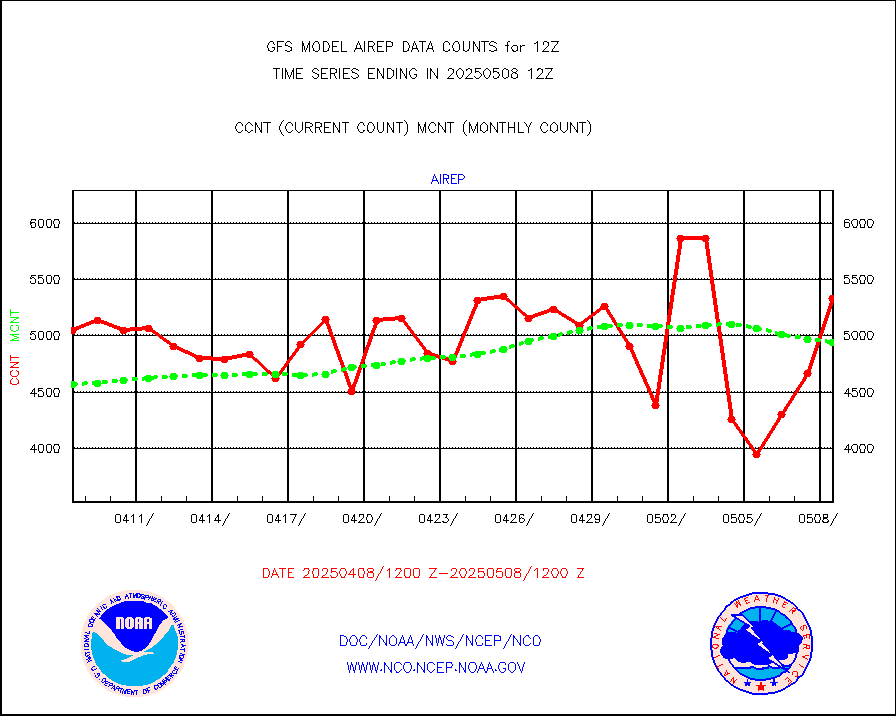
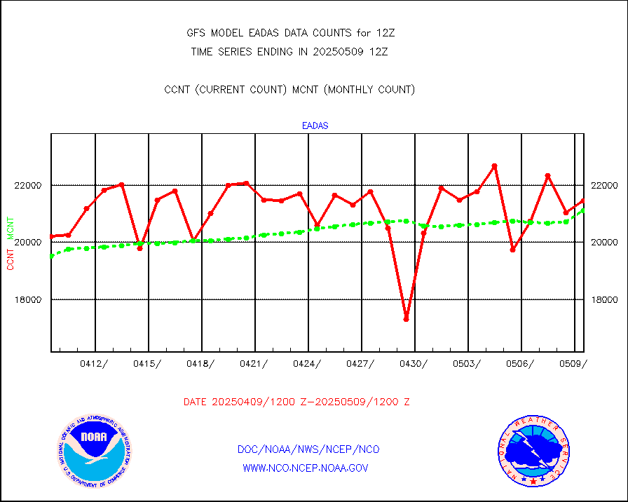
eadas |
E-AMDAR (European AMDAR acft decoded from BUFR) |
16281 |
16850 |
96.6 % |
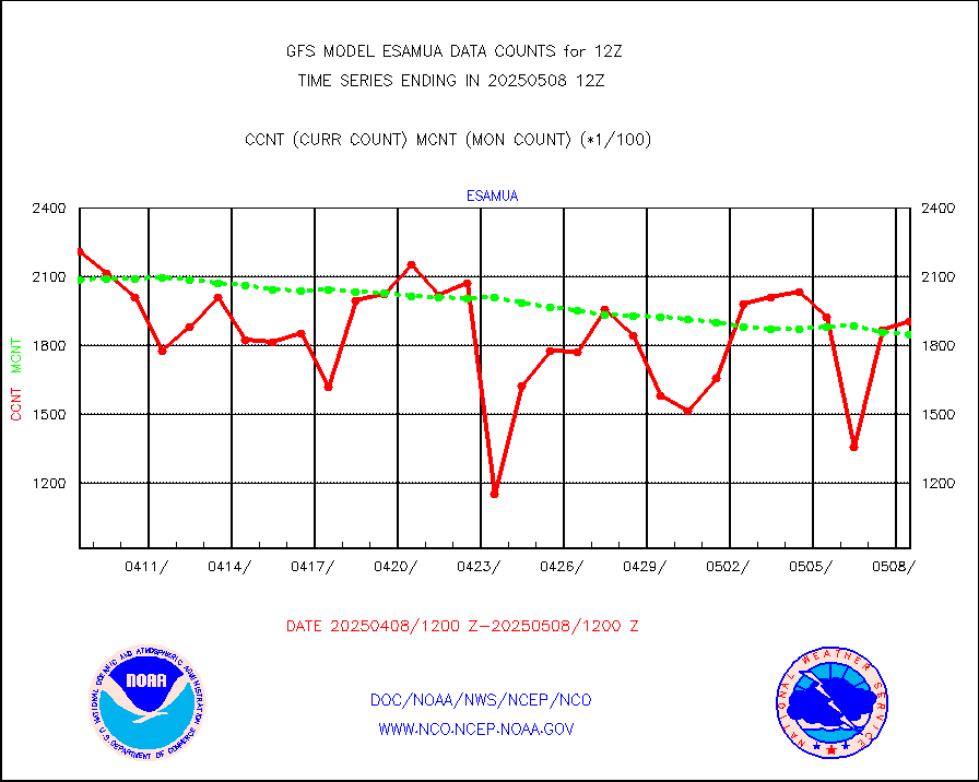
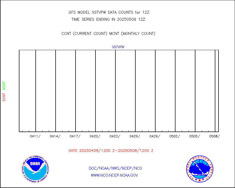
esamua |
NOAA 15-19 & METOP 1-2 AMSU-A proc btmps frm RARS |
244322 |
244870 |
99.8 % |
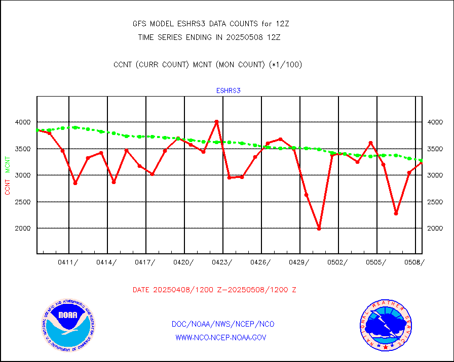
eshrs3 |
NOAA 15-19 & METOP 1-2 HIRS-3/4 pr btmps frm RARS |
616941 |
604215 |
102.1 % |
gpsro |
GPS radio occultation data |
2885 |
2521 |
114.4 % |
gsrasr |
GOES-16/17 All Sky Radiances (proc.) |
6037976 |
5996243 |
100.7 % |
gsrcsr |
GOES-16/17 Clear Sky Radiances (proc.) |
2822079 |
2804672 |
100.6 % |
h20ja |
MTSAT/JMA water vapor imager derived cloud motion |
54269 |
52727 |
102.9 % |
h20mo |
MODIS (AQUA/TERRA) wvpr imager derived cld motion |
0 |
0 |
n/a |
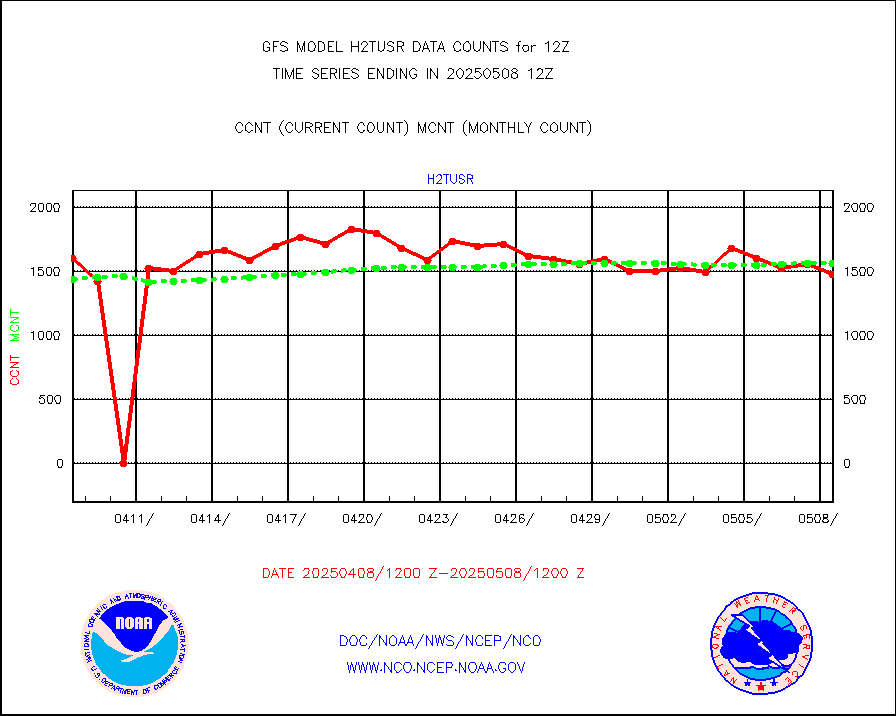
h2tusr |
GOES-16&up/NESDIS wv imgr/cld-top derived cld mtn |
144717 |
119469 |
121.1 % |
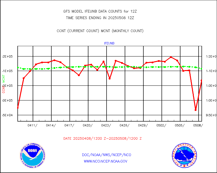
ifeunb |
METEOSAT/EUMETSAT ir lg-wave drv cld motion NBseq |
104987 |
103326 |
101.6 % |
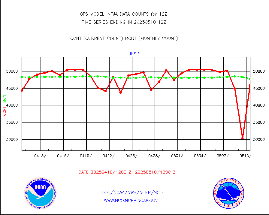
infja |
MTSAT/JMA infrared long-wave derived cloud motion |
48823 |
45357 |
107.6 % |
infmo |
MODIS (AQUA/TERRA) ir l-wave derived cloud motion |
0 |
0 |
n/a |
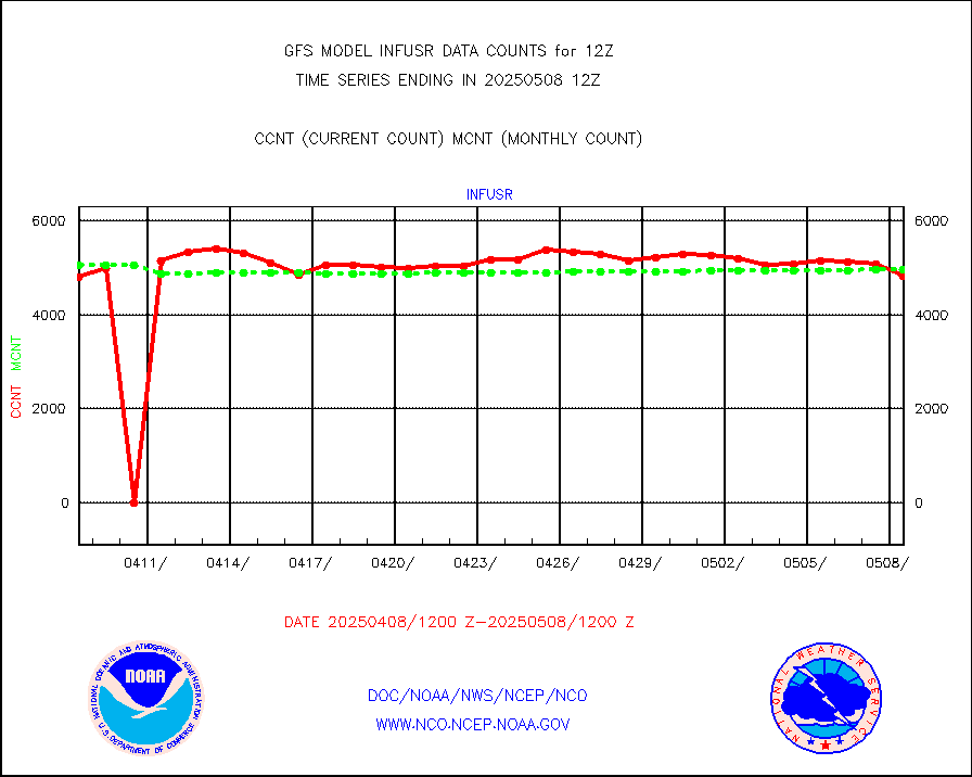
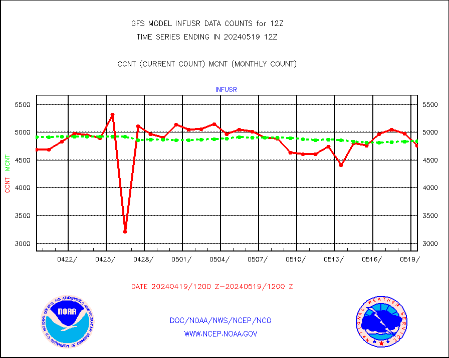
infusr |
GOES-16&up/NESDIS ir long-wave derived cld motion |
500574 |
473069 |
105.8 % |
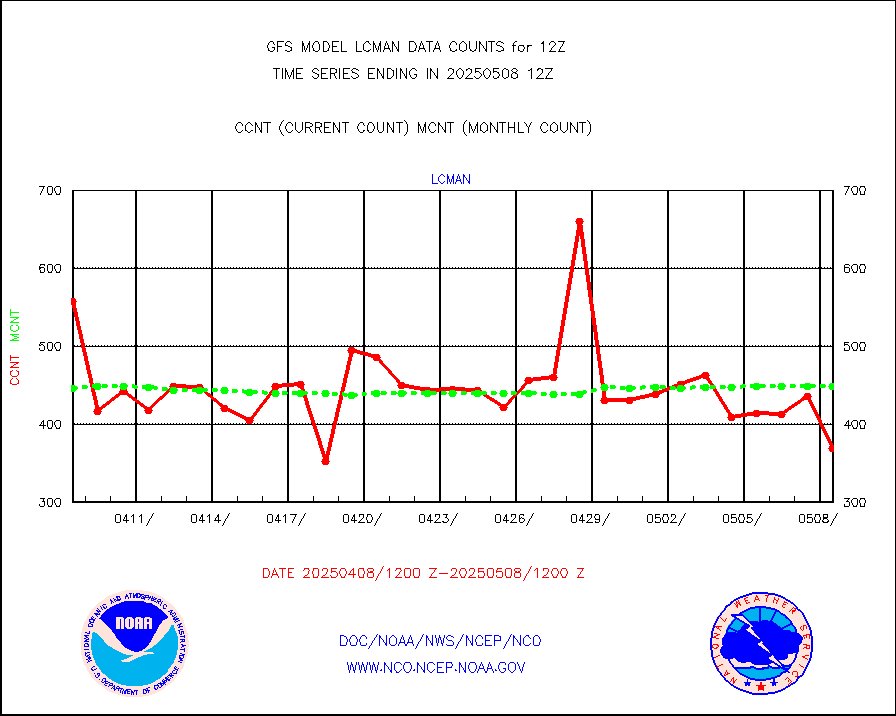
lcman |
Land-based CMAN stations decoded from CMAN format |
539 |
531 |
101.5 % |
leogeo |
LEO-GEO satellite AMVs from UWisc. |
22037 |
18176 |
121.2 % |
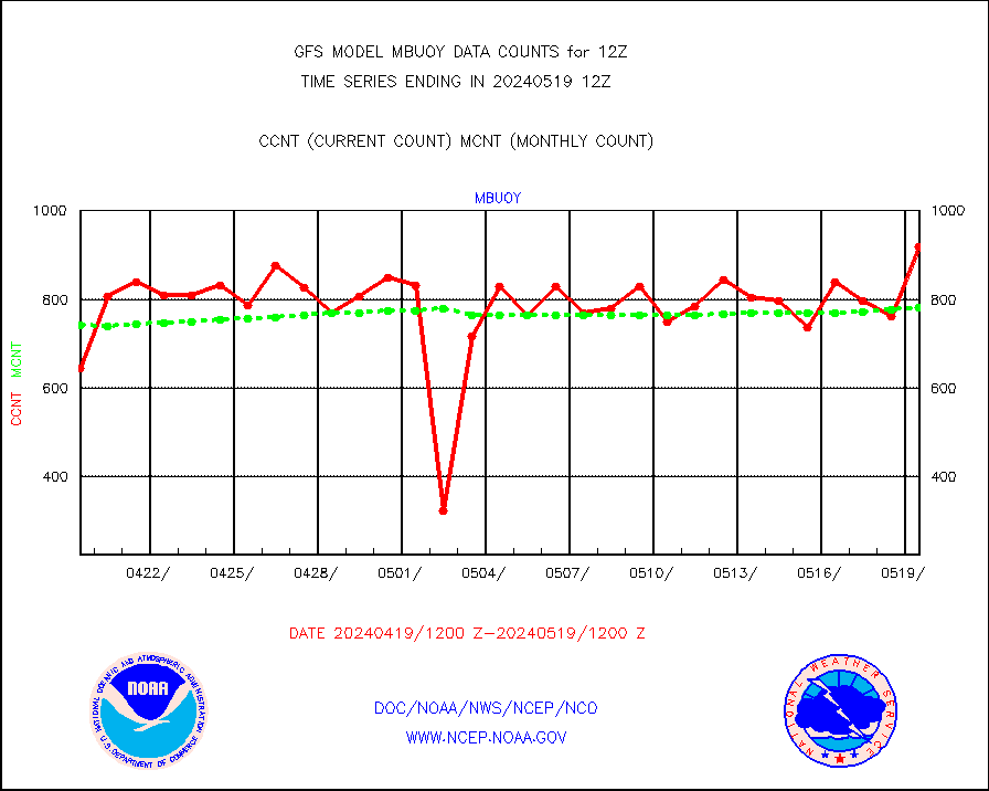
mbuoy |
Buoys decoded from FM-13 format (moored) |
894 |
835 |
107.1 % |
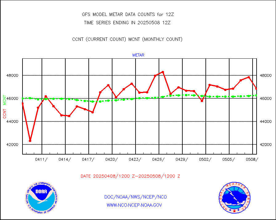
metar |
Aviation - METAR |
46526 |
45248 |
102.8 % |
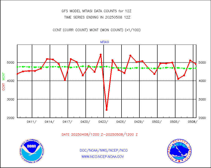
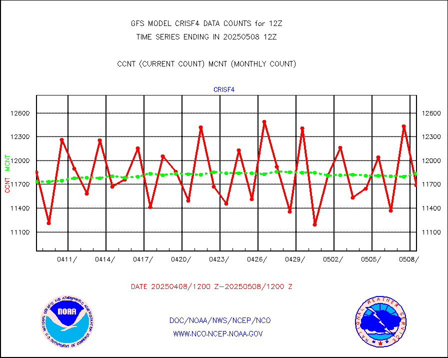
mtiasi |
METOP 1-2 IASI 1C radiance data (varbl. channels) |
496664 |
446732 |
111.2 % |
nxrdw |
NEXRAD Vel Azm Dsp(VAD) winds via radar coded msg |
0 |
0 |
n/a |
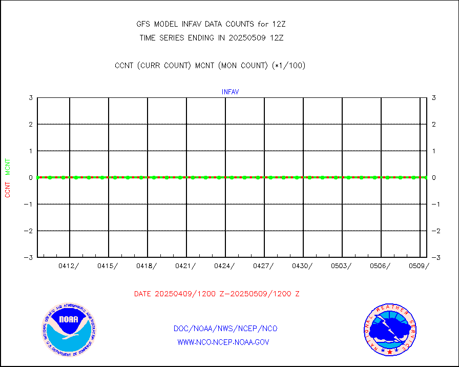
omi |
Aura Ozone Monitoring Instrument (OMI) data |
282902 |
239357 |
118.2 % |
osbuv8 |
NOAA 16-19 Solar Backscatter UV-2 rad frm V8 BUFR |
0 |
0 |
n/a |
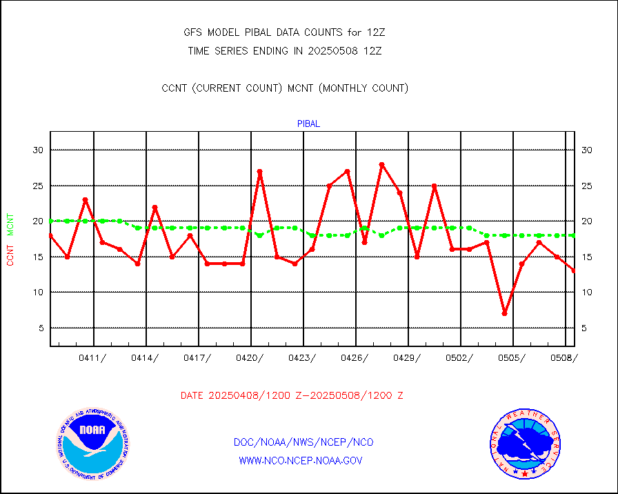
pibal |
PIBAL (from PILOT, PILOT SHIP, PILOT MOBIL) |
49 |
53 |
92.5 % |
prflrp |
Profilr winds from PIBAL (PILOT,PILOT SHIP/MOBIL) |
0 |
0 |
n/a |
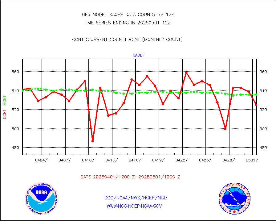
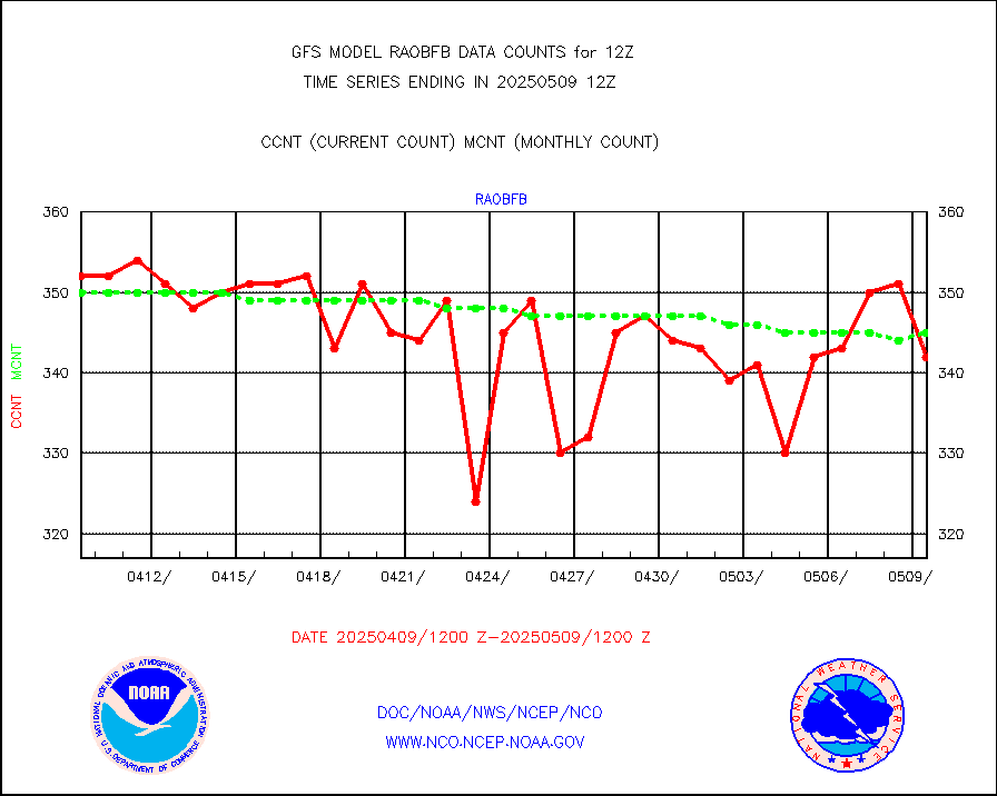
raobf |
Rawinsonde - fixed land (from TEMP or PILOT) |
584 |
567 |
103.0 % |
raobm |
Rawinsonde - mobile land (from TEMP/PILOT MOBIL) |
0 |
0 |
n/a |
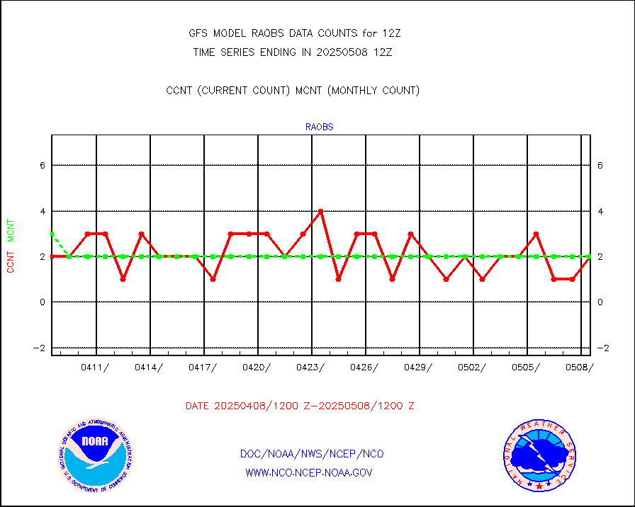
raobs |
Rawinsonde - ship (from TEMP SHIP, PILOT SHIP) |
5 |
5 |
100.0 % |
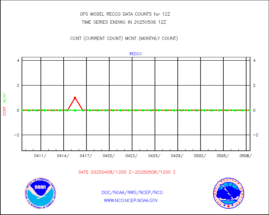
recco |
Flight level reconnaissance aircraft data |
0 |
2 |
0.0 % |
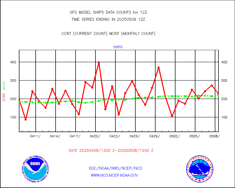
ships |
Ship - manual and automatic, restricted |
49 |
92 |
53.3 % |
shipsb |
Ship - manual and automatic, restricted (BUFR) |
738 |
711 |
103.8 % |
shipsu |
Ship - manual and automatic, unrestricted |
715 |
679 |
105.3 % |
shipub |
Ship - manual and automatic, unrestricted (BUFR) |
5783 |
6039 |
95.8 % |
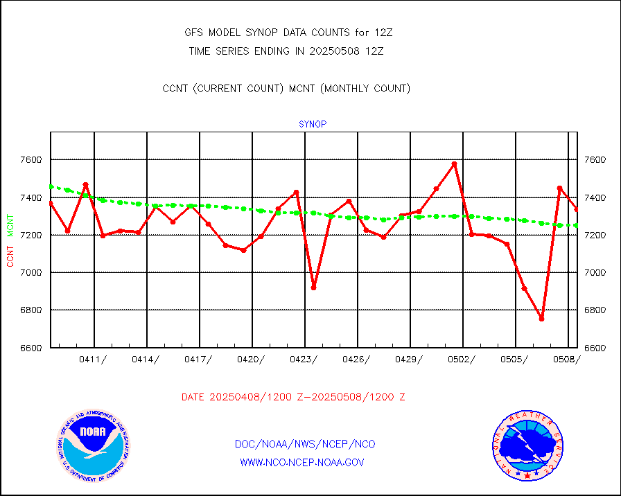
synopb |
Synoptic - fixed manual & auto (decoded fr BUFR) |
33101 |
31687 |
104.5 % |
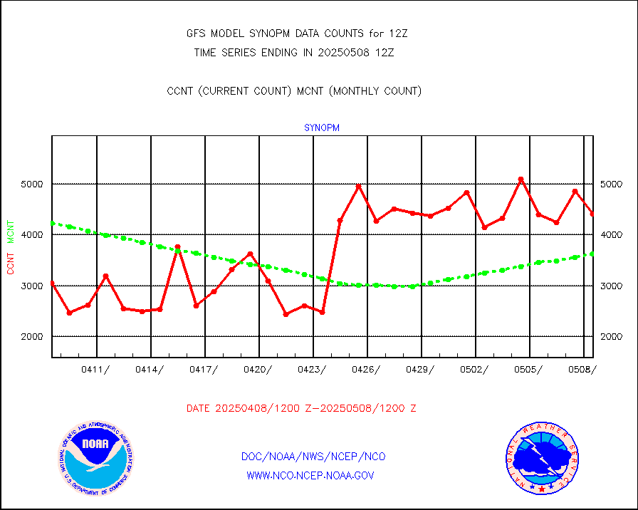
synopm |
Synoptic - mobile manual and automatic |
5253 |
5236 |
100.3 % |
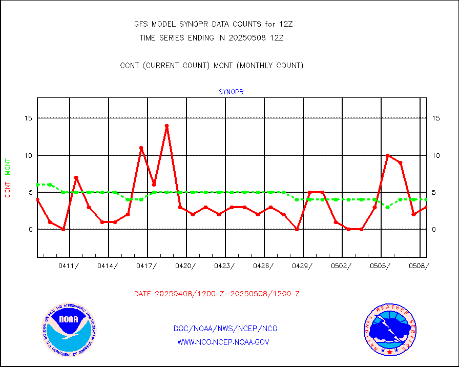
synopr |
Synoptic - restricted (WMO Res 40) manual & auto. |
8 |
6 |
133.3 % |
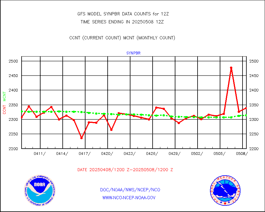
synpbr |
Synoptic - restricted (WMO Res 40)(decoded BUFR) |
2315 |
2224 |
104.1 % |
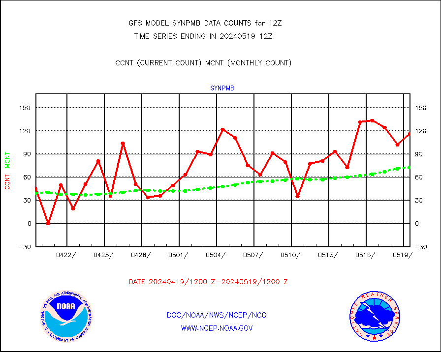
synpmb |
Synoptic - mobile manual & auto (decoded fr BUFR) |
182 |
140 |
130.0 % |
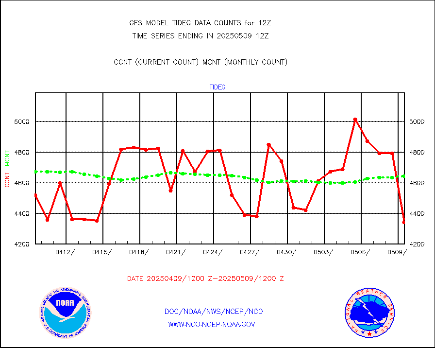
tideg |
Tide gauge reports decoded from CREX format |
4298 |
4669 |
92.1 % |
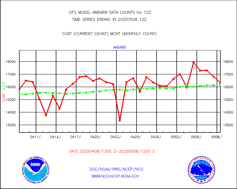
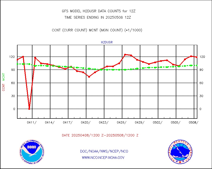
visja |
MTSAT/JMA visible derived cloud motion |
1612 |
1473 |
109.4 % |
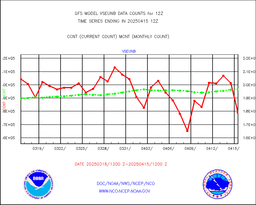
vseunb |
METEOSAT/EUMETSAT visible drv cld motion NBseq |
191371 |
176864 |
108.2 % |
| Data Types of Opportunity with Normal Counts |
|---|
| Type | Description | Hourly Count | Monthly Average | Percent (%) of Monthly Mean |
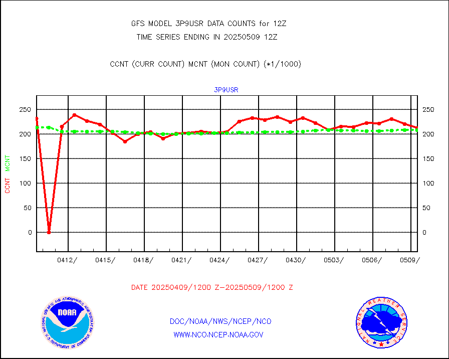
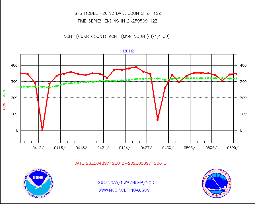
3p9usr |
GOES-16&up/NESDIS ir short-wv derived cld motion |
237301 |
251045 |
94.5 % |
acarsa |
MDCRS ACARS acft data (ARINC via AFWA)(AIREP fmt) |
0 |
0 |
n/a |
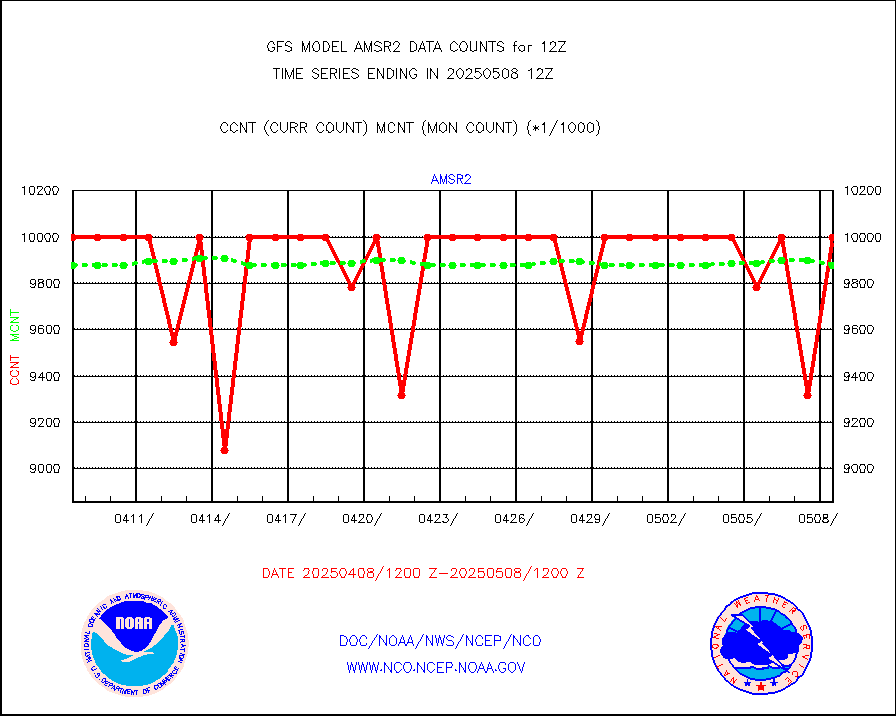
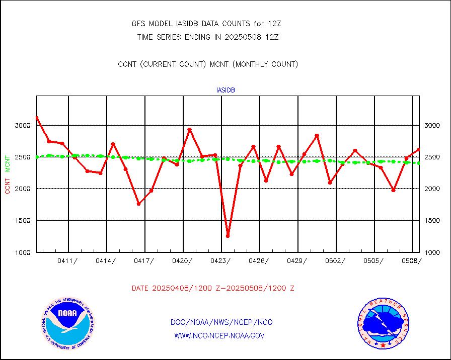
amsr2 |
GCOM-W AMSR2 1B brightness temperatures |
9999999 |
9796508 |
102.1 % |
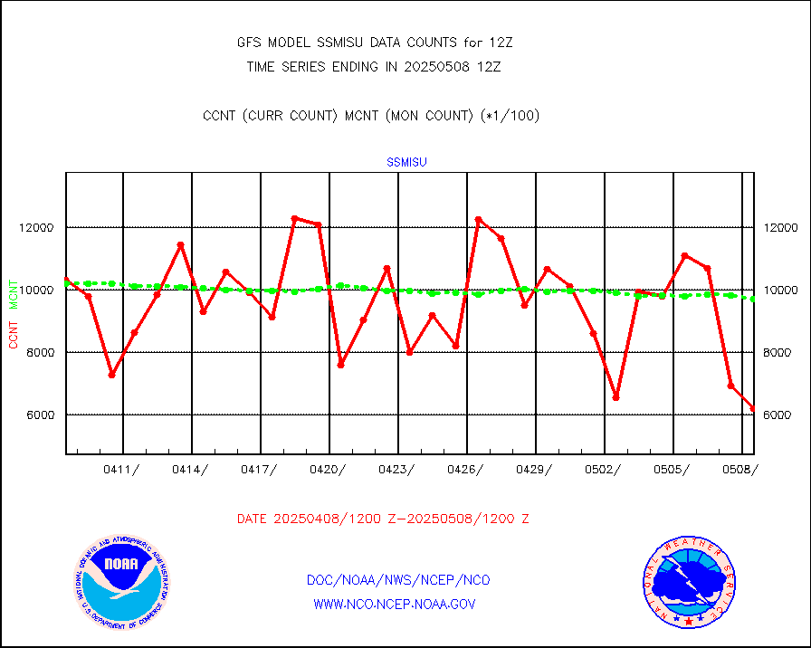
atmsdb |
NPP/NOAA-20 ATMS bright. temps-direct b-cast SSEC |
338206 |
478110 |
70.7 % |
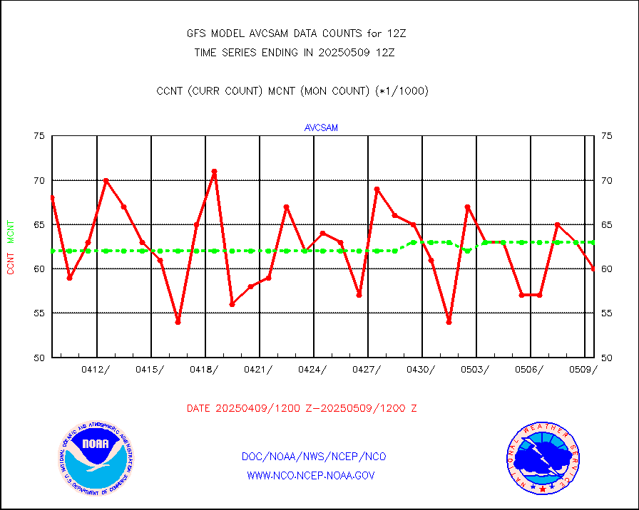
avcsam |
A.M.(N17,M2,M3) AVHRR GAC NCEP-proc clr&sea btmps |
6583780 |
6199762 |
106.2 % |
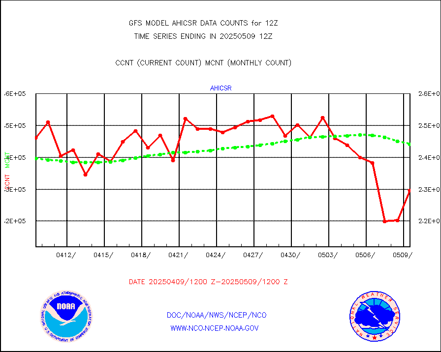
avcspm |
P.M.(N18-19) AVHRR GAC NCEP-proc clr & sea btemps |
5499626 |
6395094 |
86.0 % |
bathy |
eXpendable BathyThermograph, mooring (BATHY fmt) |
2 |
1 |
200.0 % |
crisf4 |
NPP/NOAA-20 CrIS full spctrl radn (431 ch subset) |
1215306 |
1159587 |
104.8 % |
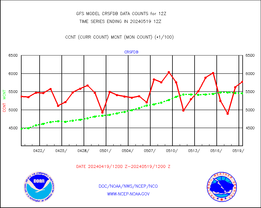
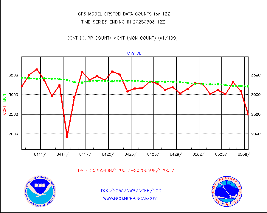
crsfdb |
NPP/NOAA-20 CrIS full spctrl radn dir brdcst SSEC |
271889 |
324255 |
83.9 % |
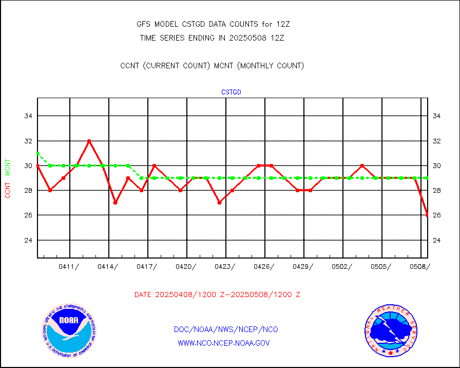
cstgd |
Coast Guard |
20 |
19 |
105.3 % |
dbuoyb |
Drifting buoys (decoded from BUFR) |
8887 |
8886 |
100.0 % |
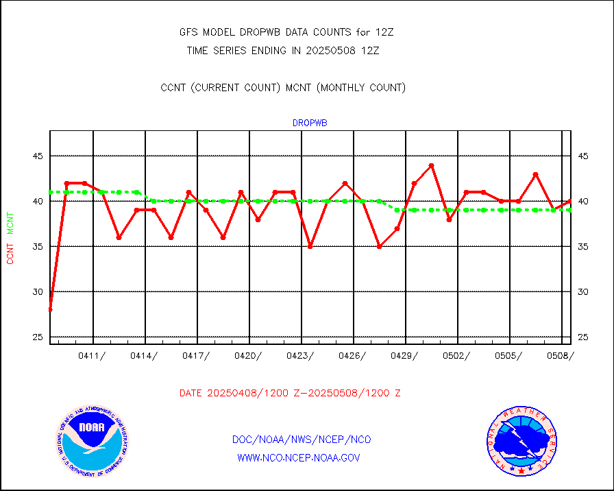
dropwb |
Dropwinsonde (decoded from BUFR) |
42 |
48 |
87.5 % |
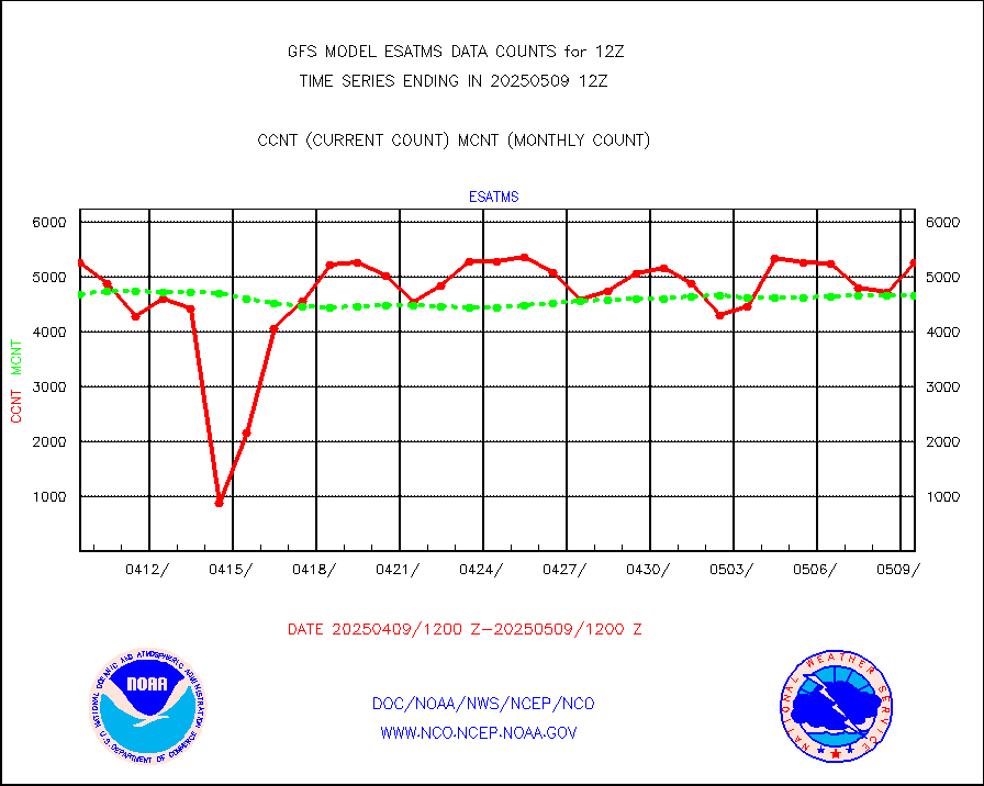
esatms |
NPP Adv. Tech. MW Sndr (ATMS) br. temps from RARS |
339617 |
447074 |
76.0 % |
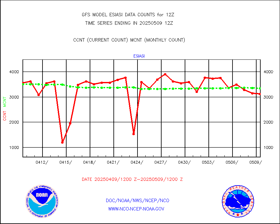
esiasi |
METOP 1-2 IASI 1C radiance data vbl chn from RARS |
411428 |
397197 |
103.6 % |
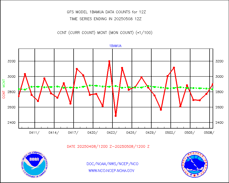
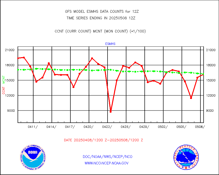
esmhs |
NOAA 18-19 & METOP 1-2 MHS proc. btemps from RARS |
1826717 |
1870630 |
97.7 % |
geoimr |
GOES/NESDIS (11x17 f-o-v) imager clear radiances |
0 |
0 |
n/a |
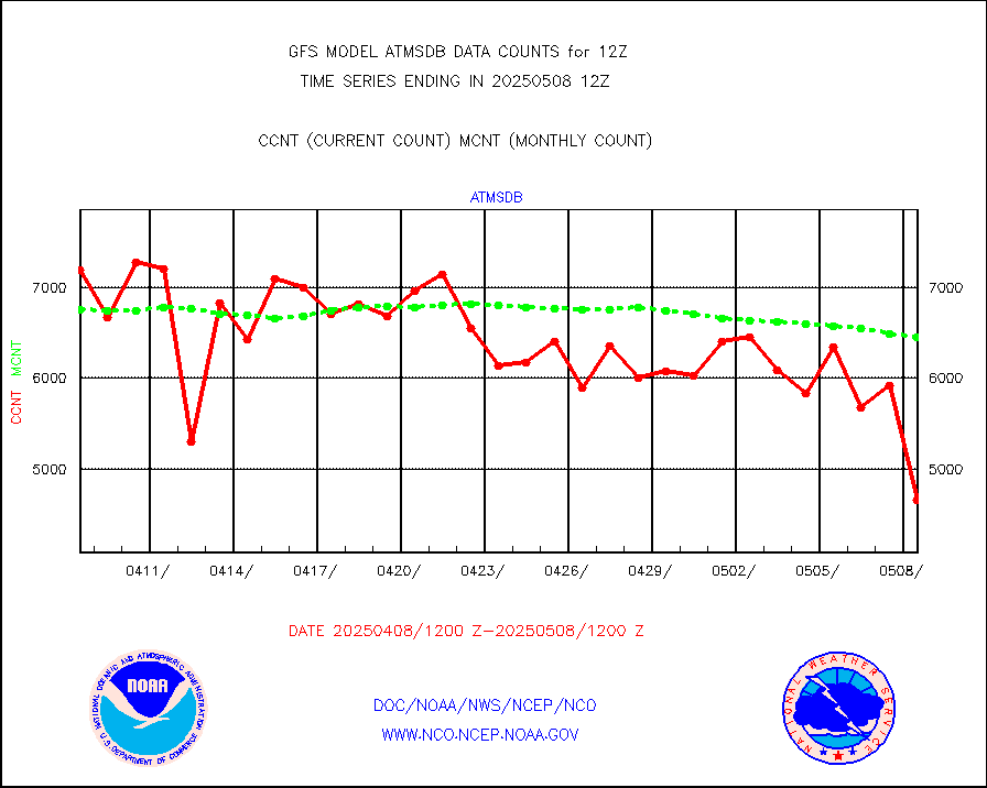
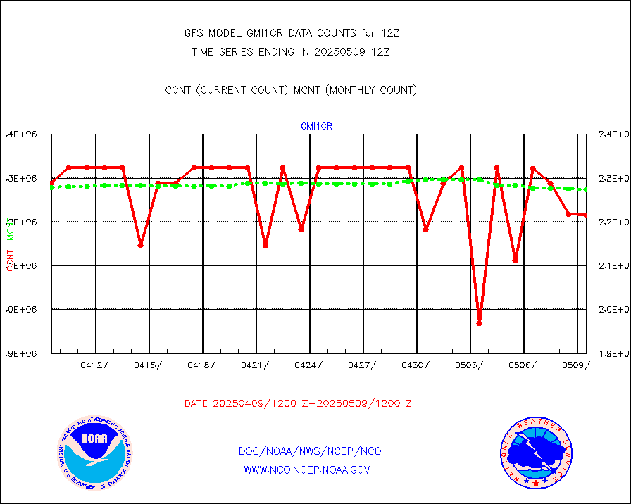
gmi1cr |
GPM GMI Level 1C-R brightness temperatures |
2290665 |
2293104 |
99.9 % |
gnss |
Grnd-based Gbl Navigation Sat System (GNSS) data |
6070 |
5494 |
110.5 % |
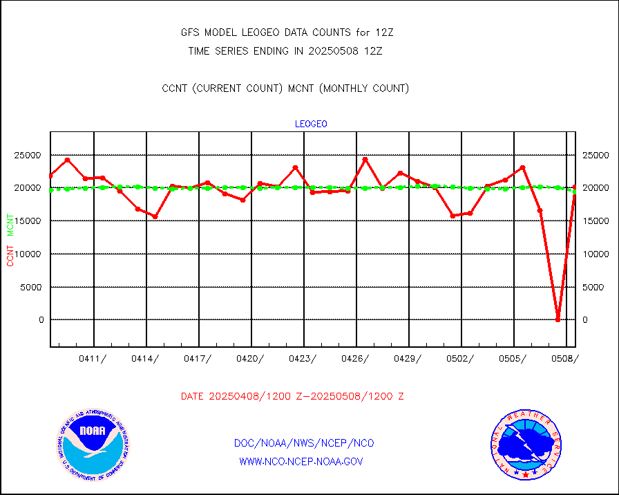
gome |
METOP 1-2 Global Ozone Monitoring Exp.-2 (GOME-2) |
63513 |
55860 |
113.7 % |
h20in |
INSAT/KALPANA India wvpr derived cloud motion |
0 |
0 |
n/a |
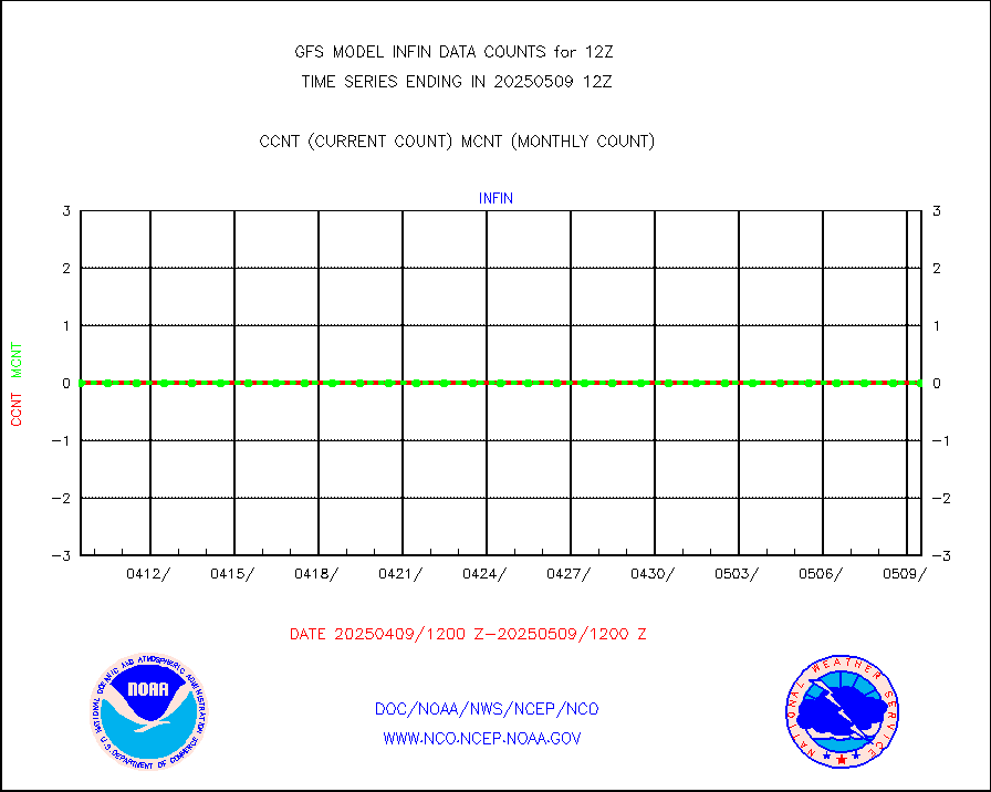
h20in2 |
INDIA SATWIND, INSAT WV channel |
26066 |
19388 |
134.4 % |
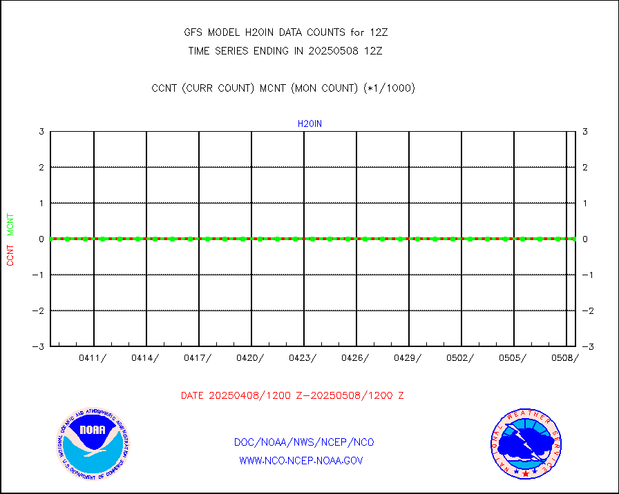
h2dusr |
GOES-16&up/NESDIS wv imgr/deep-lyr derivd cld mtn |
128656 |
112612 |
114.2 % |
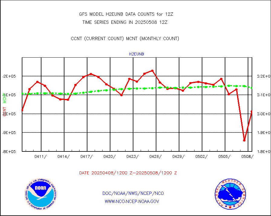
h2eunb |
METEOSAT/EUMETSAT wvpr imgr drv cld motion NBseq |
188188 |
182529 |
103.1 % |
iasidb |
METOP 1-2 IASI 1C radiances-direct broadcast SSEC |
122526 |
184994 |
66.2 % |
infav |
AVHRR (NOAA/METOP) ir lg-wave derived cld motion |
0 |
0 |
n/a |
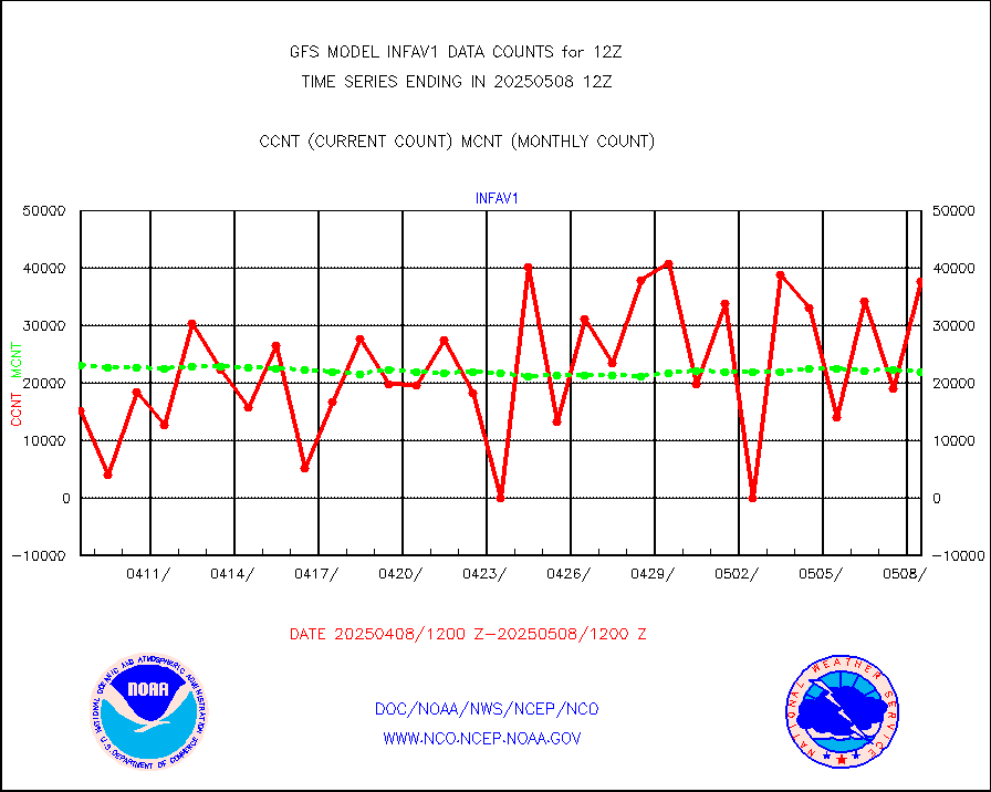
infav1 |
AVHRR (METOP) ir lg-wave derived cld motion |
22588 |
28824 |
78.4 % |
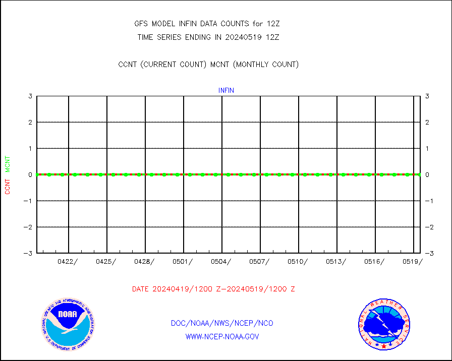
infin |
INSAT/KALPANA India ir lg-wave derived cld motion |
0 |
0 |
n/a |
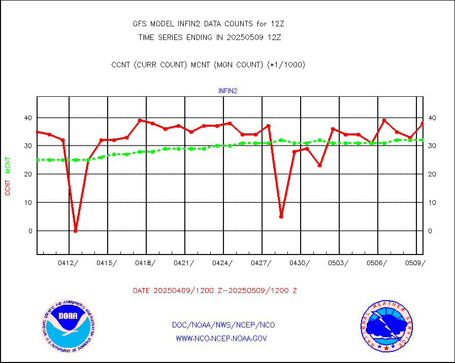
infin2 |
INDIA SATWIND, INSAT IR channel |
31036 |
21182 |
146.5 % |
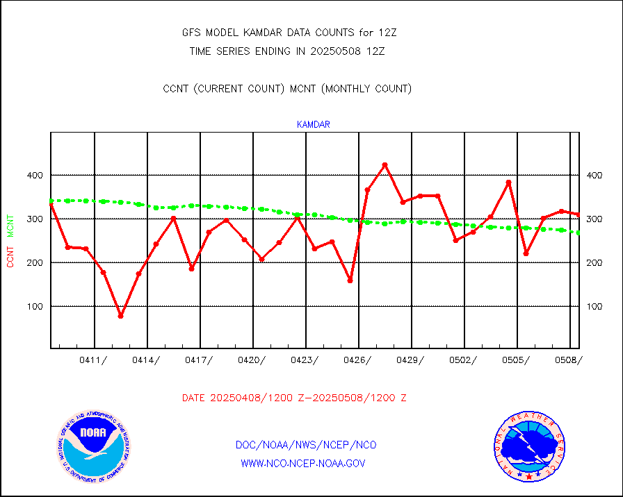
kamdar |
Korean AMDAR aircraft data (decoded from BUFR) |
359 |
311 |
115.4 % |
mbuoyb |
Moored buoys (decoded from BUFR) |
6145 |
6330 |
97.1 % |
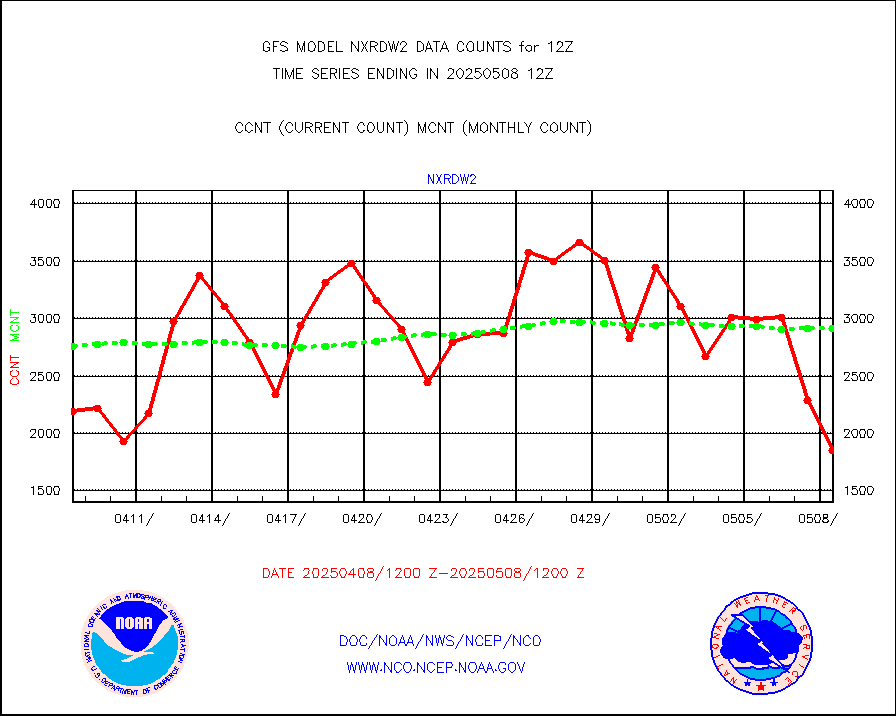
nxrdw2 |
NEXRAD Vel Azm Dsp(VAD) winds via Level 2 decoder |
3166 |
3782 |
83.7 % |
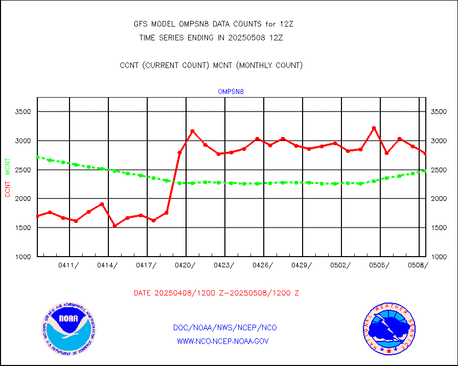
ompsn8 |
OMPS nadir profile ozone (Version 8 BUFR) |
2625 |
2152 |
122.0 % |
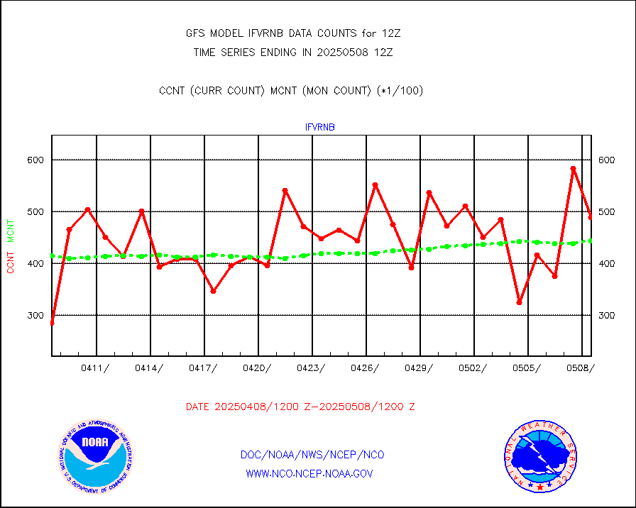
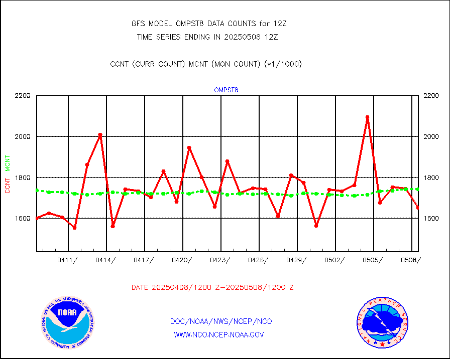
ompst8 |
OMPS total column ozone (Version 8 BUFR) |
1685218 |
1373828 |
122.7 % |
pibalb |
PIBAL (decoded from BUFR) |
6 |
5 |
120.0 % |
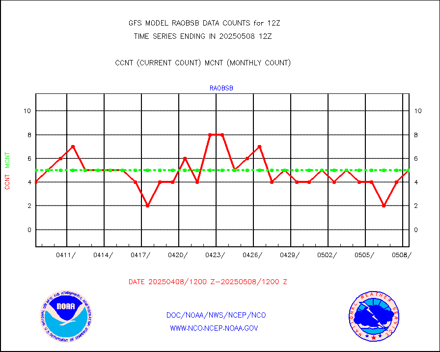
pirep |
Manual PIREP aircraft data (dcded from AIREP fmt) |
434 |
472 |
91.9 % |
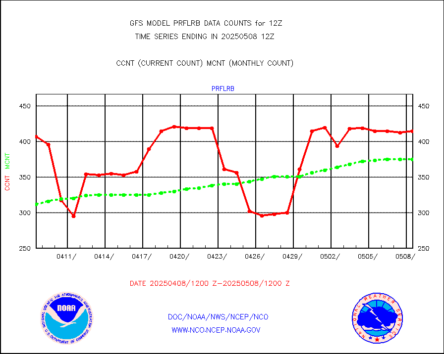
prflrb |
Multi-Agency Profiler (MAP) and SODAR winds |
408 |
340 |
120.0 % |
raobfb |
Rawinsonde - fixed land (decoded from BUFR) |
351 |
340 |
103.2 % |
raobmb |
Rawinsonde - mobile land (decoded from BUFR) |
0 |
0 |
n/a |
raobsb |
Rawinsonde - ship (decoded from BUFR) |
7 |
6 |
116.7 % |
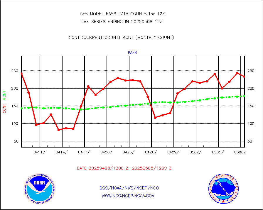
rass |
RASS temperatures (NOAA and Multi-Agency) |
193 |
176 |
109.7 % |
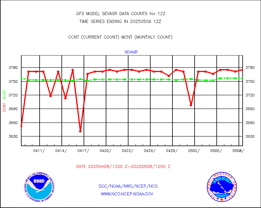
sevasr |
METEOSAT-10 2nd Gen SEVIRI All Sky Radiance(proc) |
377138 |
364750 |
103.4 % |
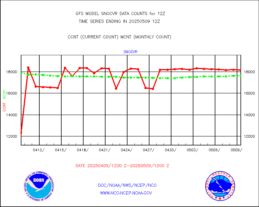
snocvr |
NOW COVER, DEPTH/DENSITY AND WATER EQUIVALENT |
19776 |
18558 |
106.6 % |
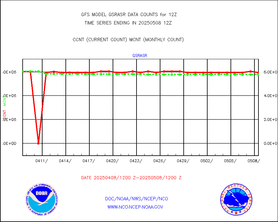
ssmisu |
DMSP SSM/IS 1C radiance data (Unified Pre-Proc.) |
895561 |
861748 |
103.9 % |
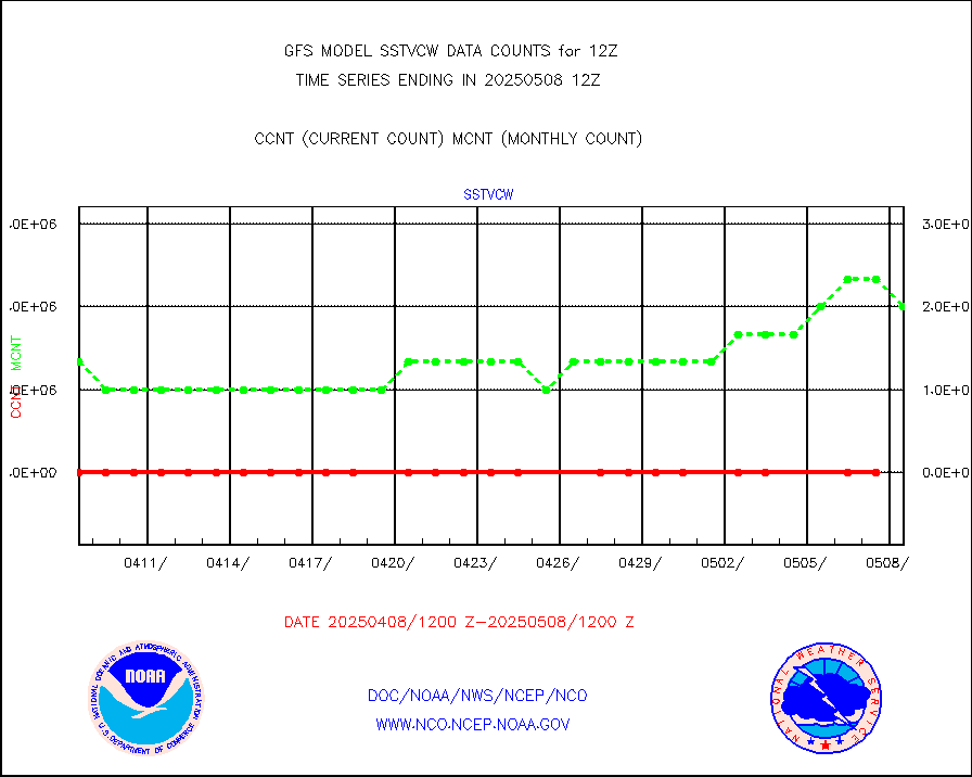
sstvcw |
NPP/NOAA-20 VIIRS SST - CLEAR & OVER WATER |
9999999 |
9333334 |
107.1 % |
sstvpw |
NPP/NOAA-20 VIIRS SST - PROBABLY CLR & OVER WATER |
5493114 |
9977991 |
55.1 % |
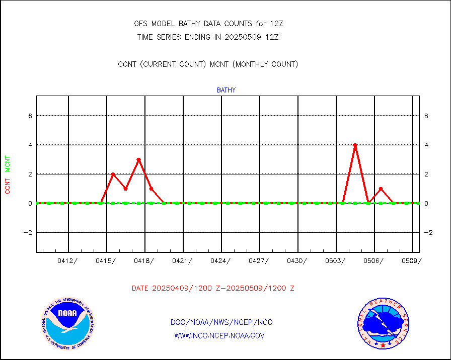
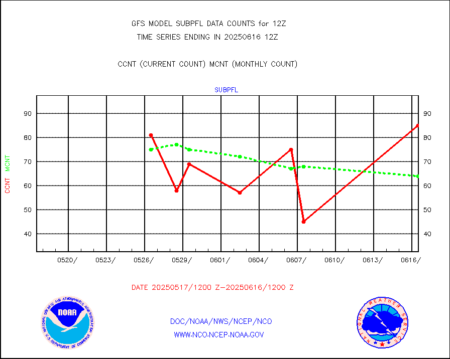
subpfl |
Sub-surface float and glider profile (BUFR) |
84 |
86 |
97.7 % |
synop |
Synoptic - fixed manual and automatic |
8315 |
8813 |
94.3 % |
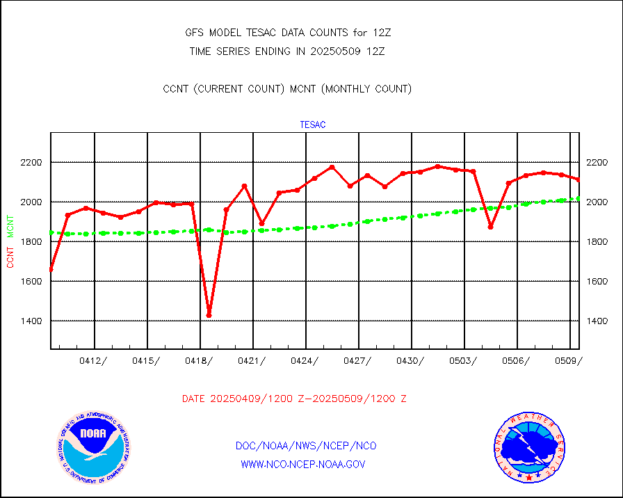
tesac |
CTD probe, Argo prflng float, mooring (TESAC fmt) |
2282 |
2423 |
94.2 % |
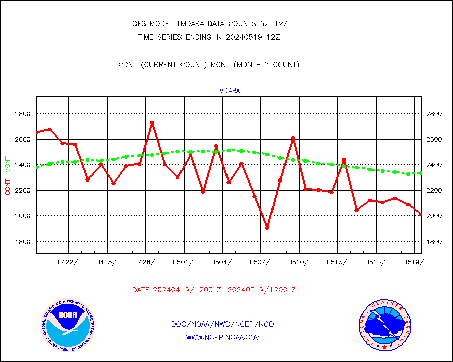
tmdara |
TAMDAR aircft data-all types(from Panasonic,BUFR) |
414 |
571 |
72.5 % |
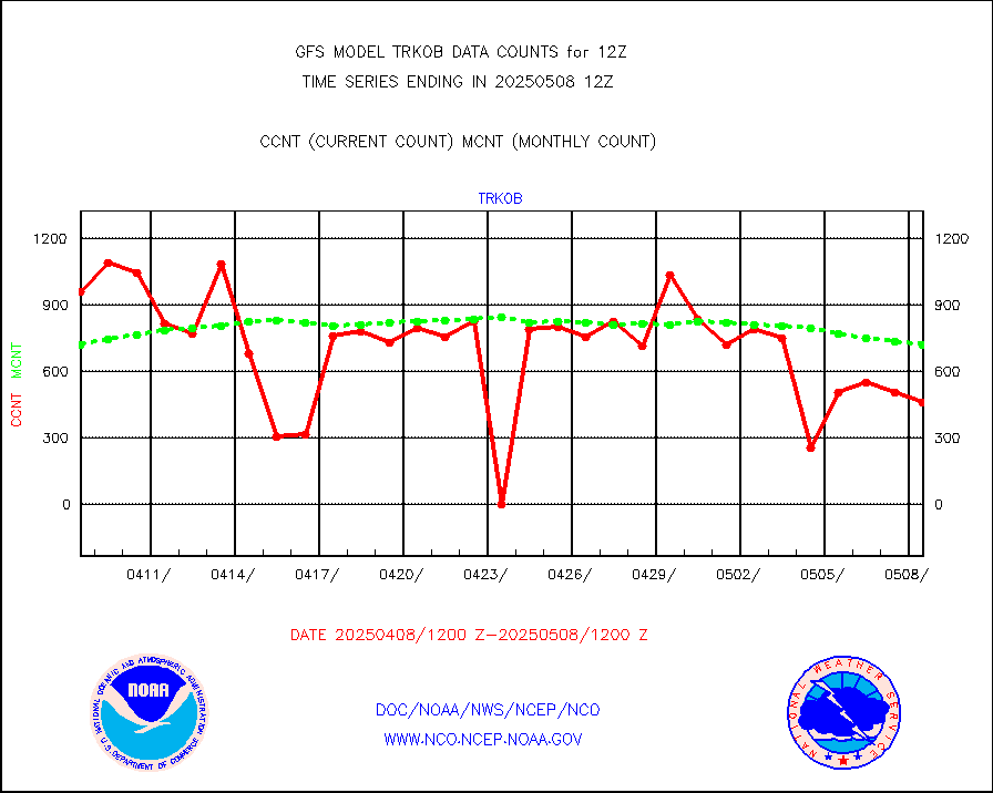
trkob |
ThermoSalinoGraph (TSG) TRACKOB format) |
306 |
270 |
113.3 % |
visin |
INSAT/KALPANA India visible derived cloud motion |
0 |
0 |
n/a |
visin2 |
INDIA SATWIND, INSAT VIS channel |
2793 |
1613 |
173.2 % |
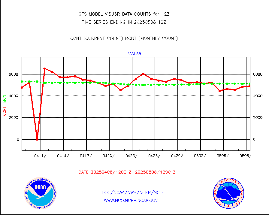
visusr |
GOES-16&up/NESDIS visible derived cloud motion |
566074 |
592488 |
95.5 % |


