| Critical Data with Normal Counts |
|---|
| Type | Description | Hourly Count | Monthly Average | Percent (%) of Monthly Mean | UTC Time Window |
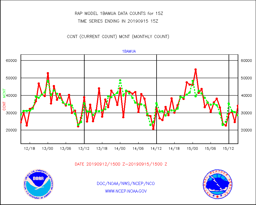
1bamua |
NOAA 15-19 & METOP 1-2 AMSU-A NCEP-proc. br.temps |
34102 |
28616 |
119.2 % |
1512.00-1517.99 |
1bhrs4 |
NOAA 18-19 & METOP 1-2 HIRS-4 NCEP-proc. br.temps |
60775 |
58415 |
104.0 % |
1512.00-1517.99 |
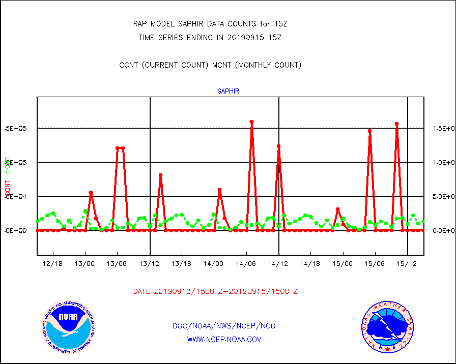
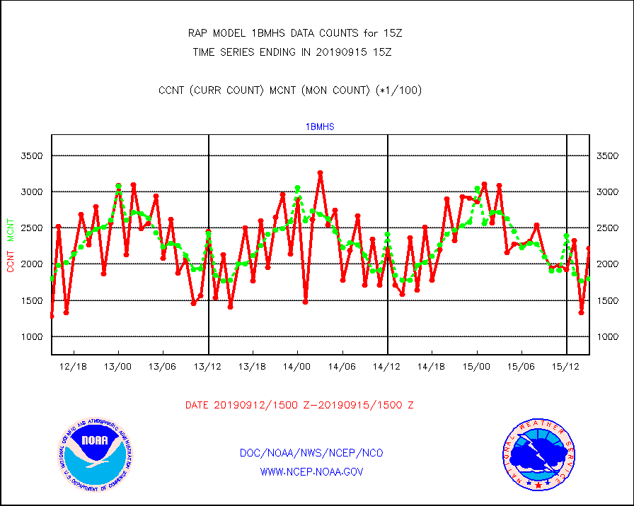
1bmhs |
NOAA 18-19 & METOP 1-2 MHS NCEP-proces. br. temps |
222381 |
179744 |
123.7 % |
1512.00-1517.99 |
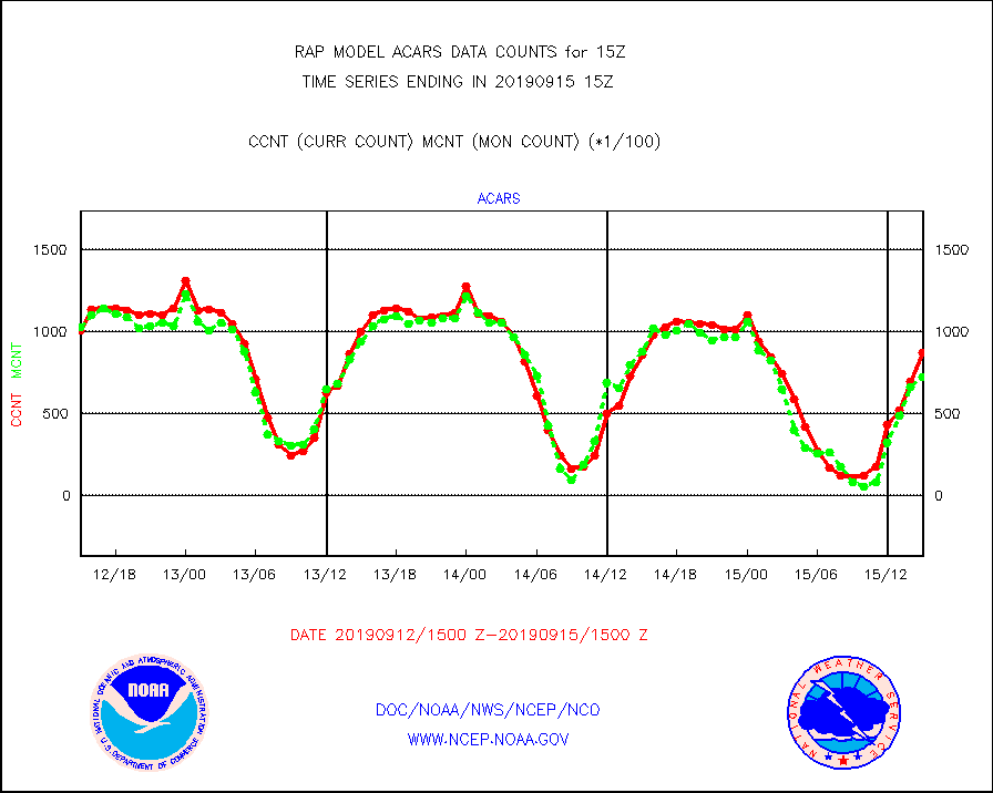
acars |
MDCRS ACARS acft data from ARINC(dcded from BUFR) |
87117 |
72779 |
119.7 % |
1511.75-1518.25 |
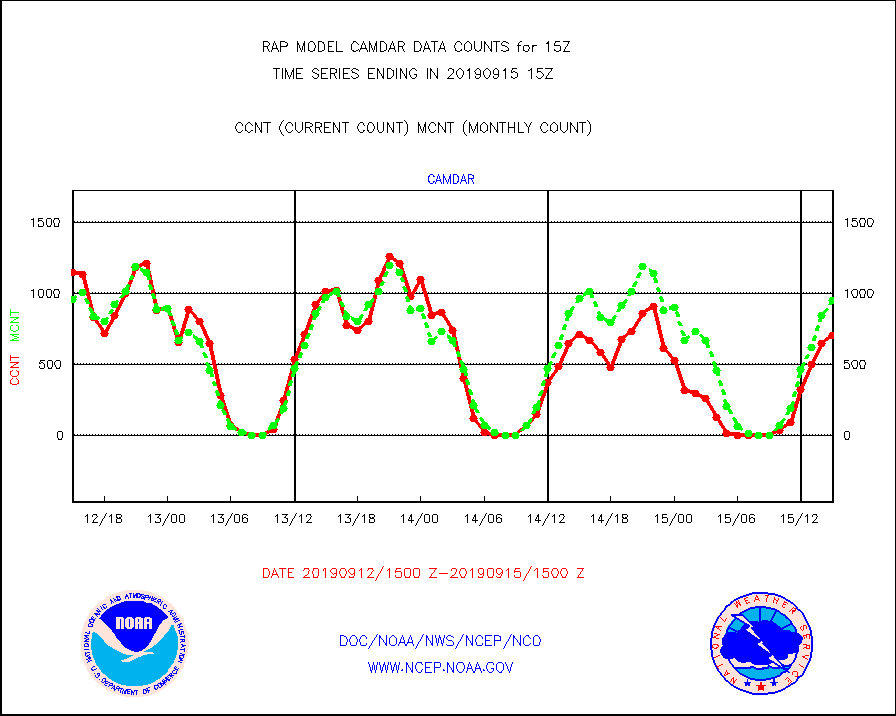
camdar |
Canadian AMDAR aircraft data (decoded from BUFR) |
706 |
952 |
74.2 % |
1511.75-1518.25 |
dbuoy |
Buoys decoded from FM-18 fmt (moored or drifting) |
46 |
30 |
153.3 % |
1514.50-1515.50 |
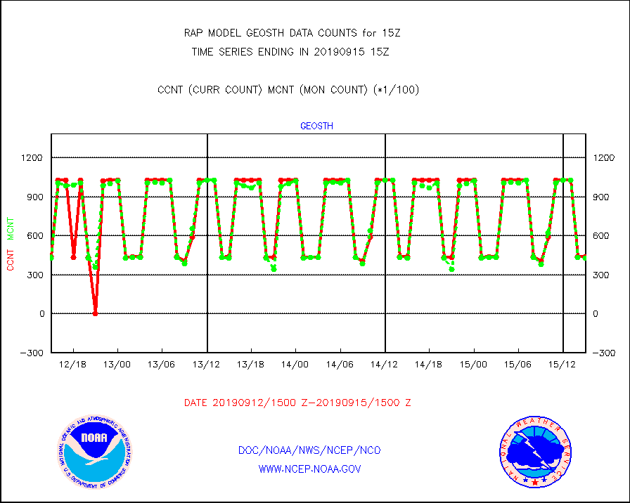
geosth |
GOES/NESDIS hi-resol. (1x1 f-o-v) cloud data |
43731 |
43008 |
101.7 % |
1513.75-1514.99 |
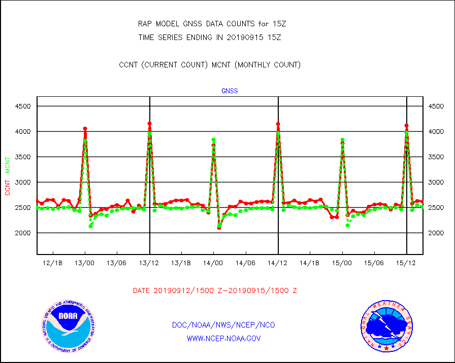
gnss |
Grnd-based Gbl Navigation Sat System (GNSS) data |
2615 |
2508 |
104.3 % |
1513.95-1514.05 |
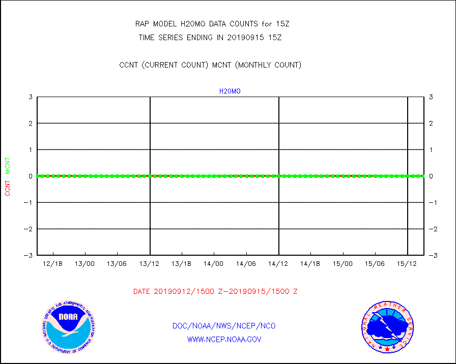
h20mo |
MODIS (AQUA/TERRA) wvpr imager derived cld motion |
0 |
0 |
n/a |
1512.50-1517.50 |
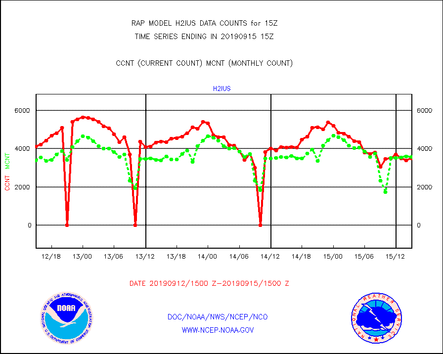
h2ius |
GOES/NESDIS water vapor imager derived cld motion |
3495 |
3573 |
97.8 % |
1514.00-1514.99 |
infmo |
MODIS (AQUA/TERRA) ir l-wave derived cloud motion |
0 |
0 |
n/a |
1512.50-1517.50 |
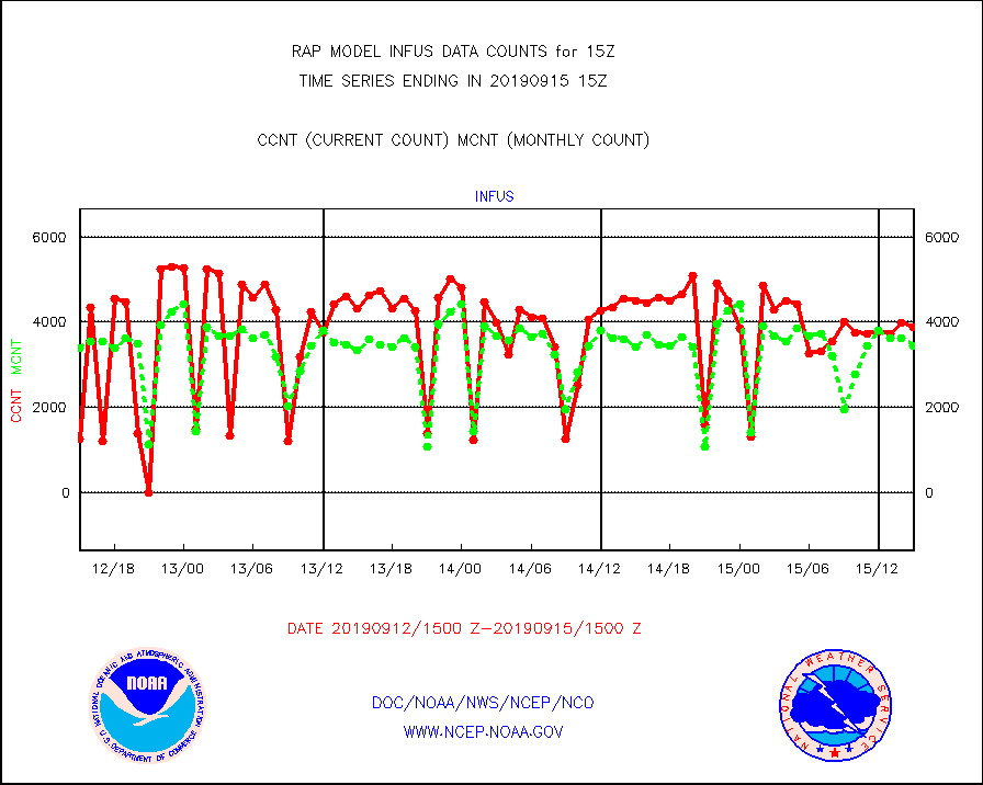
infus |
GOES/NESDIS infrared lg-wave derived cloud motion |
3891 |
3448 |
112.8 % |
1514.00-1514.99 |
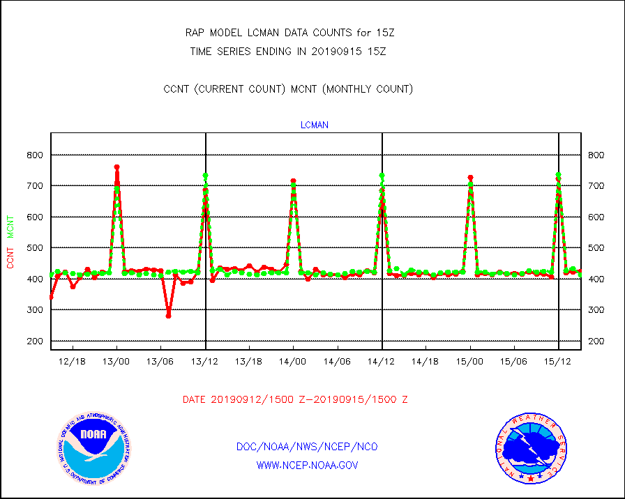
lcman |
Land-based CMAN stations decoded from CMAN format |
425 |
413 |
102.9 % |
1514.50-1515.50 |
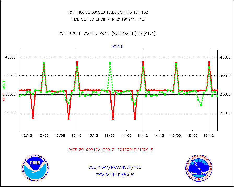
lgycld |
GOES/NASA(Langley) hi-res. (1x1 f-o-v) cloud data |
3613979 |
3456007 |
104.6 % |
1514.50-1515.50 |
mbuoy |
Buoys decoded from FM-13 format (moored) |
578 |
569 |
101.6 % |
1514.50-1515.50 |
metar |
Aviation - METAR |
5791 |
6144 |
94.3 % |
1514.50-1515.50 |
nxrdw |
NEXRAD Vel Azm Dsp(VAD) winds via radar coded msg |
448 |
436 |
102.8 % |
1514.00-1516.00 |
prflrb |
Multi-Agency Profiler (MAP) and SODAR winds |
120 |
138 |
87.0 % |
1513.50-1516.50 |
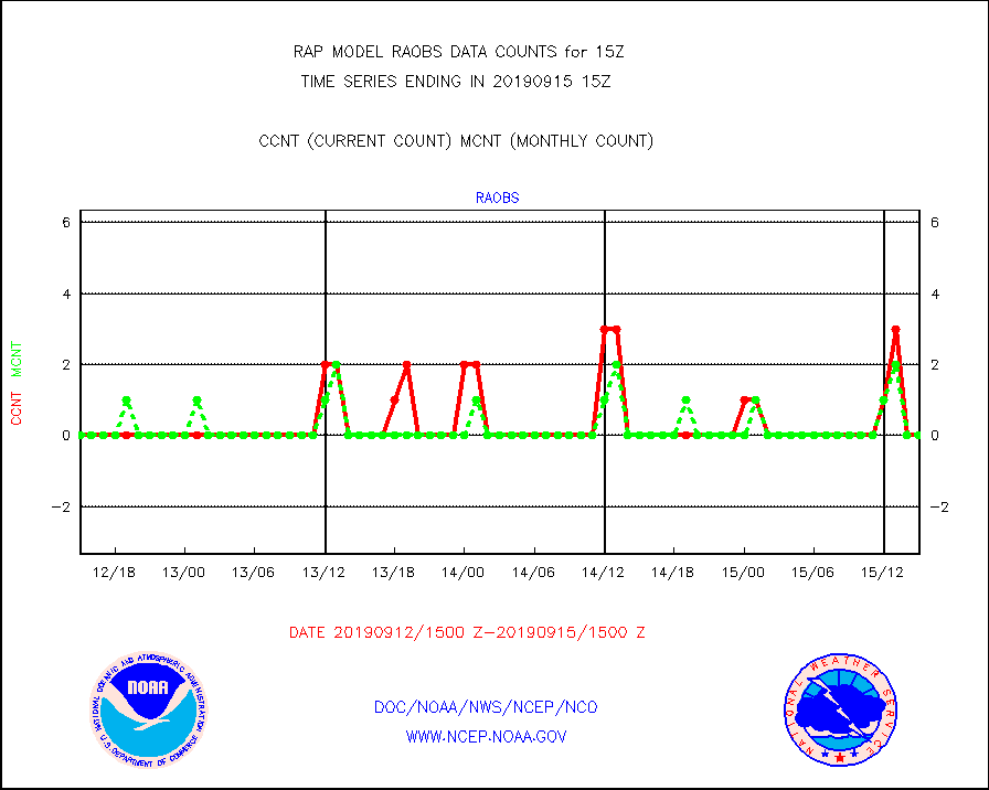
raobf |
Rawinsonde - fixed land (from TEMP or PILOT) |
0 |
0 |
n/a |
1514.00-1516.00 |
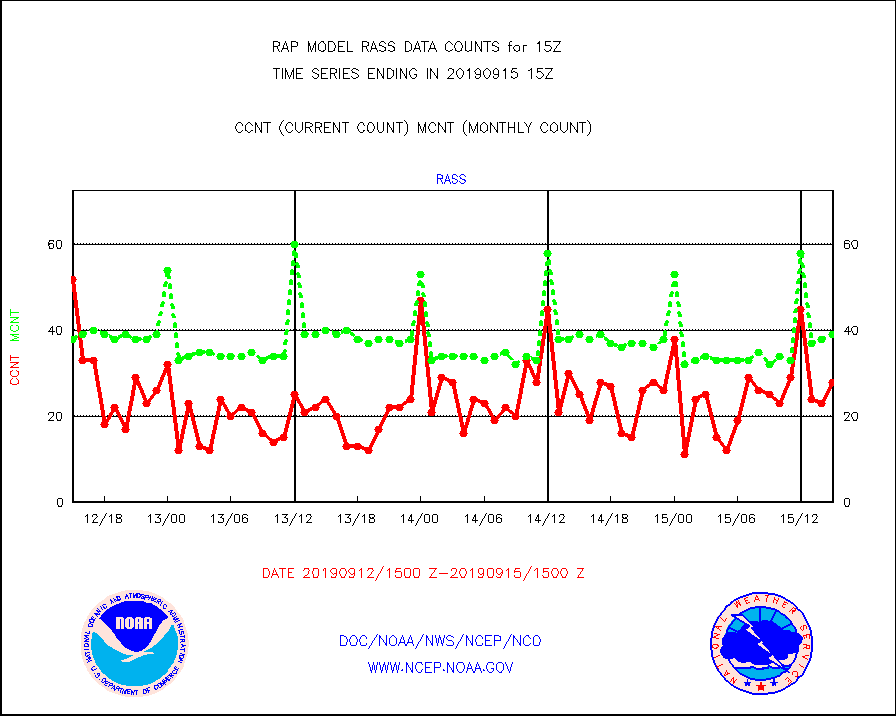
rass |
RASS temperatures (NOAA and Multi-Agency) |
28 |
39 |
71.8 % |
1514.50-1515.50 |
ships |
Ship - manual and automatic, restricted |
110 |
94 |
117.0 % |
1514.50-1515.50 |
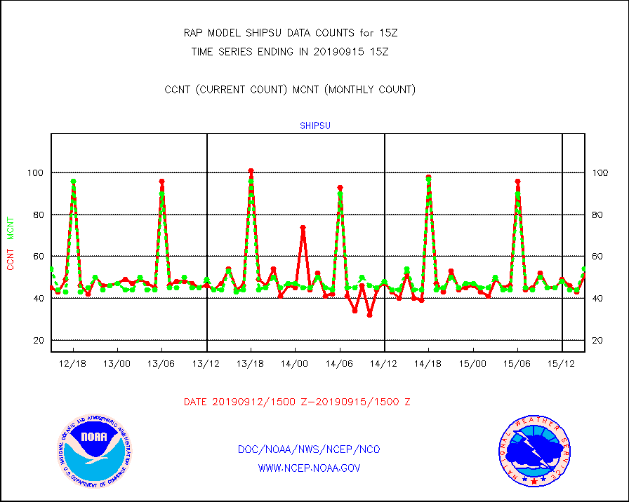
shipsu |
Ship - manual and automatic, unrestricted |
51 |
54 |
94.4 % |
1514.50-1515.50 |
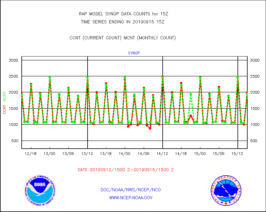
synop |
Synoptic - fixed manual and automatic |
1990 |
1951 |
102.0 % |
1514.50-1515.50 |
tideg |
Tide gauge reports decoded from CREX format |
258 |
225 |
114.7 % |
1514.50-1515.50 |
| Data Types of Opportunity with Normal Counts |
|---|
| Type | Description | Hourly Count | Monthly Average | Percent (%) of Monthly Mean | UTC Time Window |
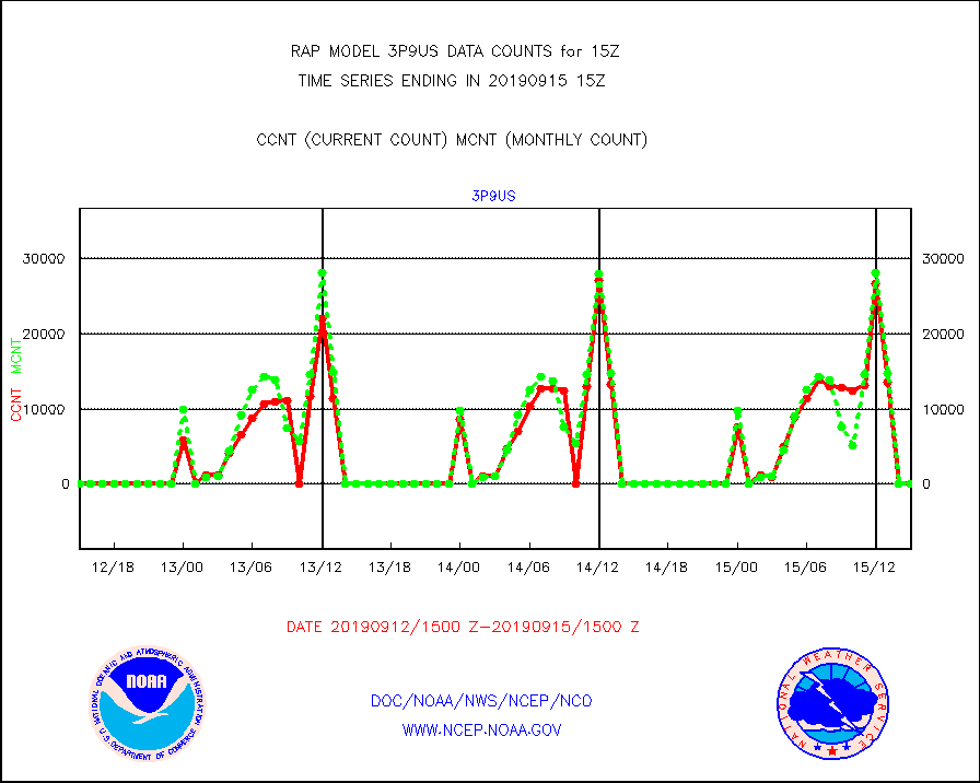
3p9us |
GOES/NESDIS infrared shrt-wave derived cld motion |
0 |
0 |
n/a |
1514.00-1514.99 |
acarsa |
MDCRS ACARS acft data (ARINC via AFWA)(AIREP fmt) |
0 |
0 |
n/a |
1511.75-1518.25 |
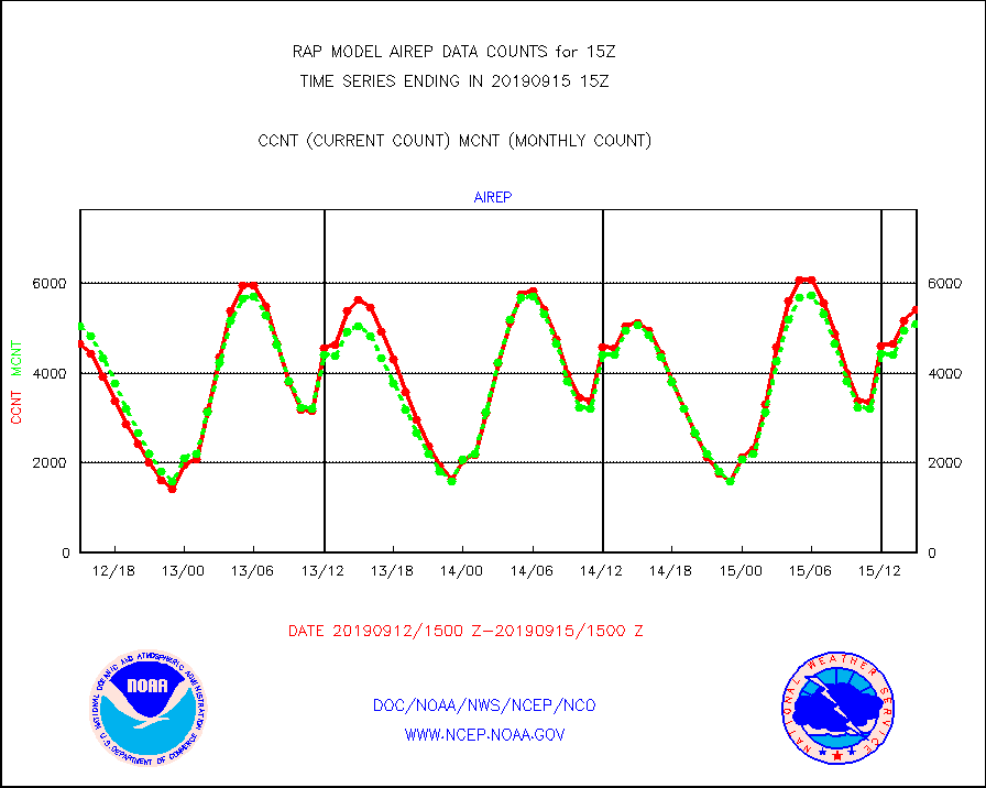
airep |
Manual AIREP aircraft data (dcded from AIREP fmt) |
5413 |
5092 |
106.3 % |
1511.75-1518.25 |
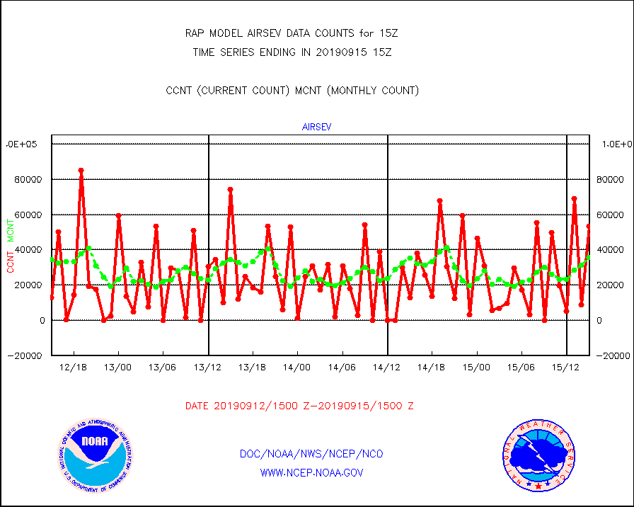
airsev |
AQUA AIRS/AMSU-A/HSB brightness temps- every FOV |
53421 |
35591 |
150.1 % |
1512.00-1517.99 |
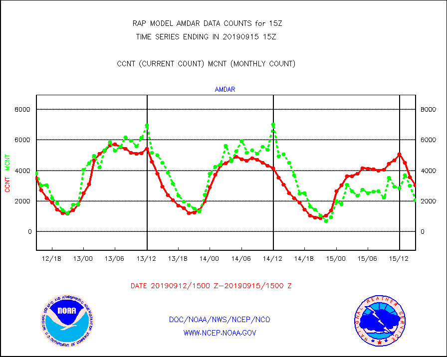
amdar |
AMDAR aircraft data (decoded from AMDAR format) |
3050 |
2059 |
148.1 % |
1511.75-1518.25 |
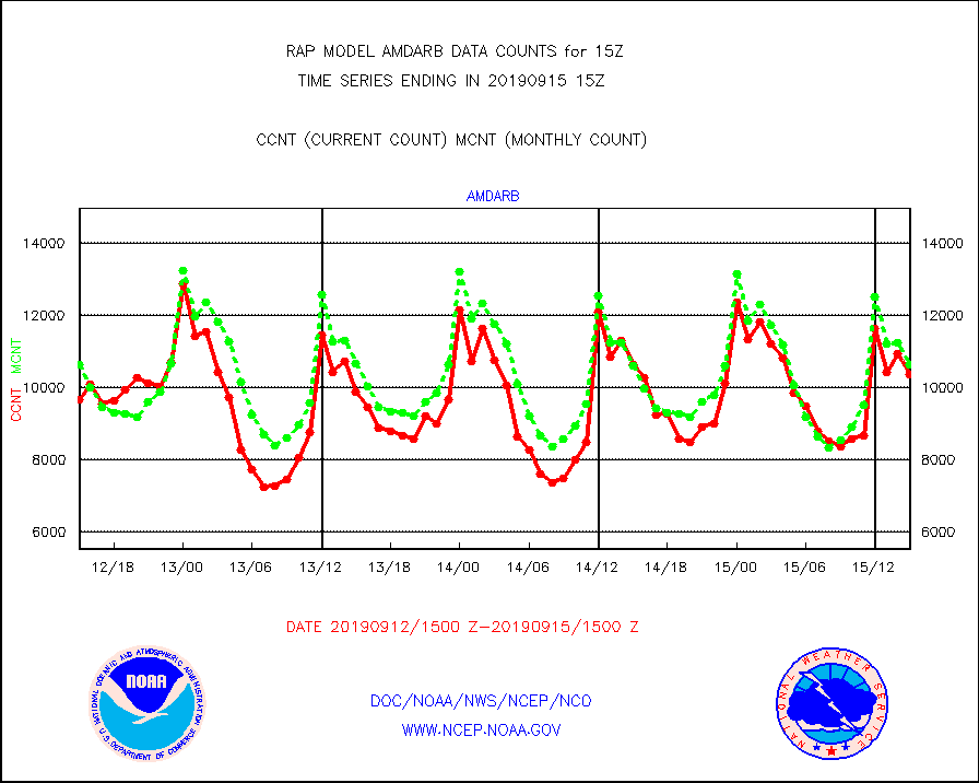
amdarb |
AMDAR aircraft data (decoded from BUFR) |
10356 |
10631 |
97.4 % |
1511.75-1518.25 |
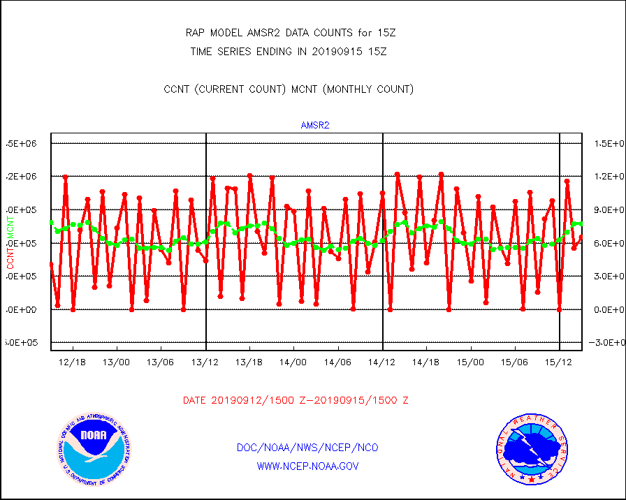
amsr2 |
GCOM-W AMSR2 1B brightness temperatures |
652847 |
775734 |
84.2 % |
1512.00-1512.99 |
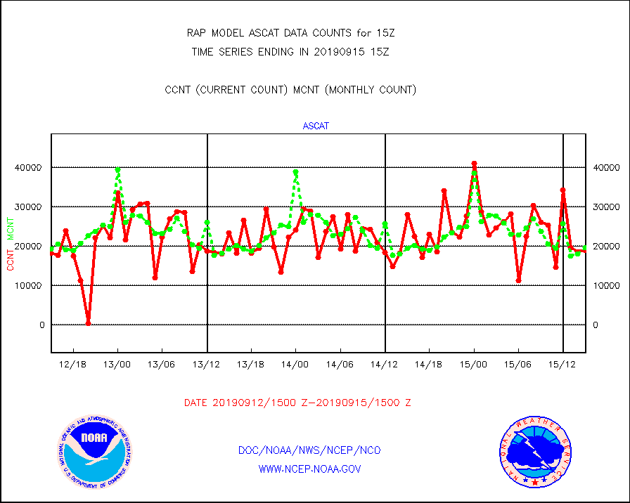
ascat |
METOP 1-2 ASCAT products |
18878 |
19612 |
96.3 % |
1513.00-1517.00 |
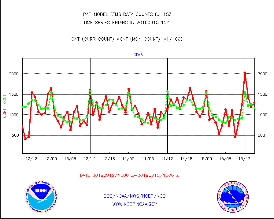
atms |
NPP Adv. Tech. Microwave Sounder (ATMS) br. temps |
130336 |
117477 |
110.9 % |
1513.00-1516.99 |
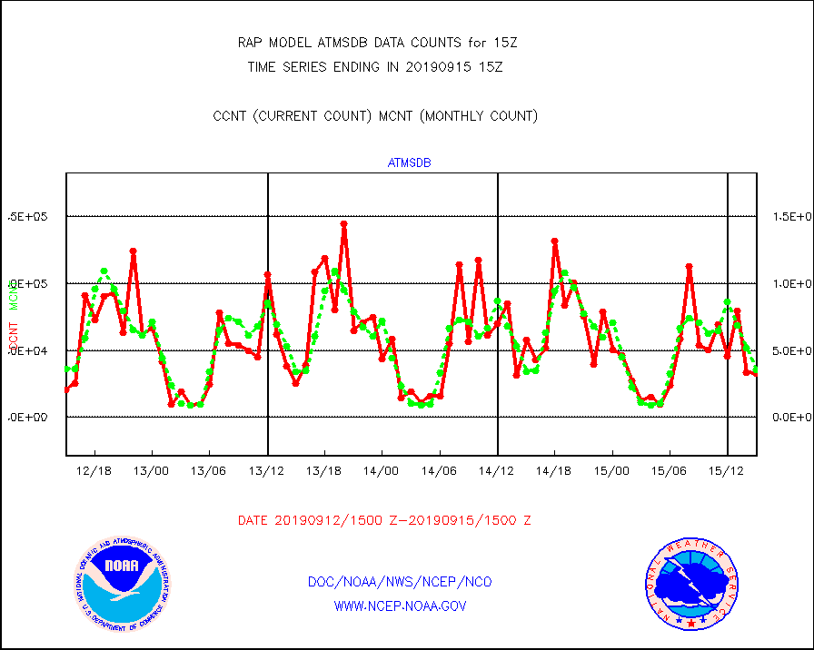
atmsdb |
NPP Adv Tech MW Sndr(ATMS) b. temps-dir bcst SSEC |
33101 |
35294 |
93.8 % |
1513.00-1516.99 |
cris |
NPP Cross-track Infrared Sounder (CrIS) radiances |
22676 |
28146 |
80.6 % |
1513.00-1516.99 |
crisdb |
NPP Crss-trk IR Sndr(CrIS) radiance-dir bcst SSEC |
23575 |
19275 |
122.3 % |
1513.00-1516.99 |
cstgd |
Coast Guard |
4 |
4 |
100.0 % |
1514.50-1515.50 |
dropw |
Dropwinsonde (from TEMP DROP) |
0 |
3 |
0.0 % |
1514.00-1516.00 |
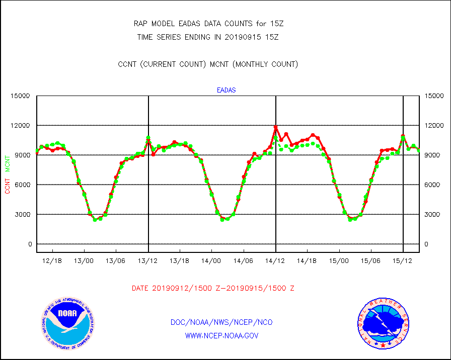
eadas |
E-AMDAR (European AMDAR acft decoded from BUFR) |
9574 |
9483 |
101.0 % |
1511.75-1518.25 |
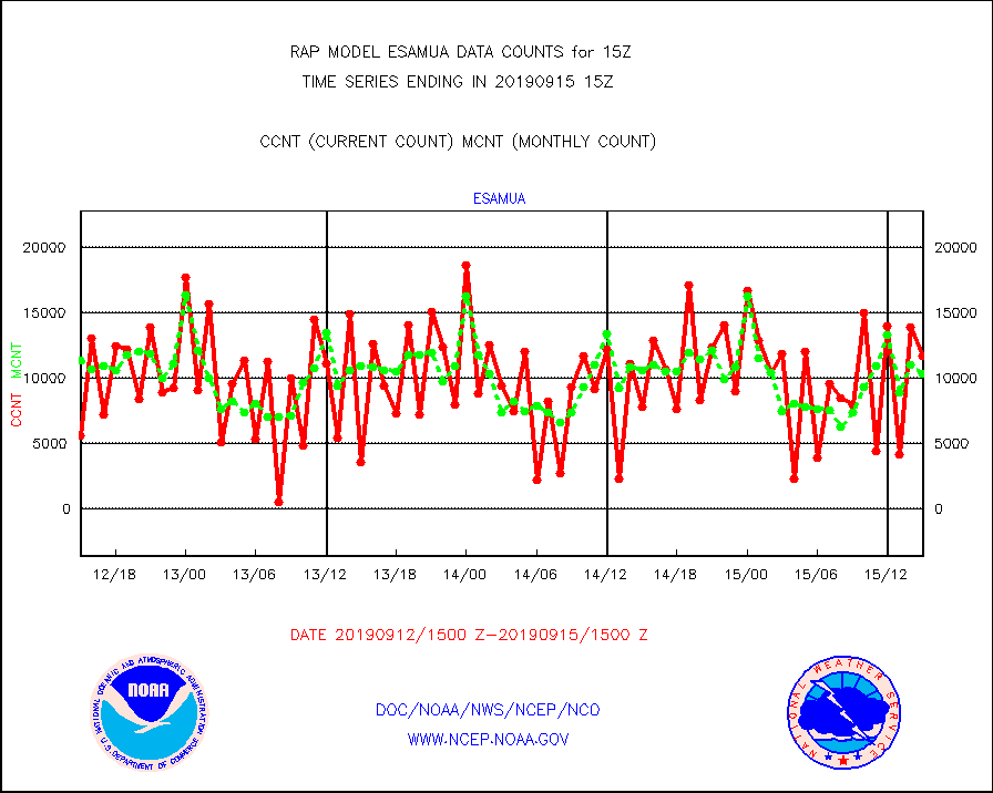
esamua |
NOAA 15-19 & METOP 1-2 AMSU-A proc btmps frm RARS |
11754 |
10383 |
113.2 % |
1514.00-1516.00 |
esatms |
NPP Adv. Tech. MW Sndr (ATMS) br. temps from RARS |
92698 |
95758 |
96.8 % |
1513.00-1516.99 |
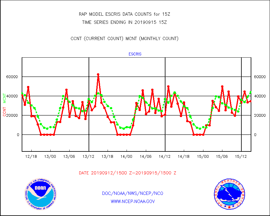
escris |
NPP Crss-track IR Sndr (CrIS) radiances from RARS |
34553 |
44201 |
78.2 % |
1513.00-1516.99 |
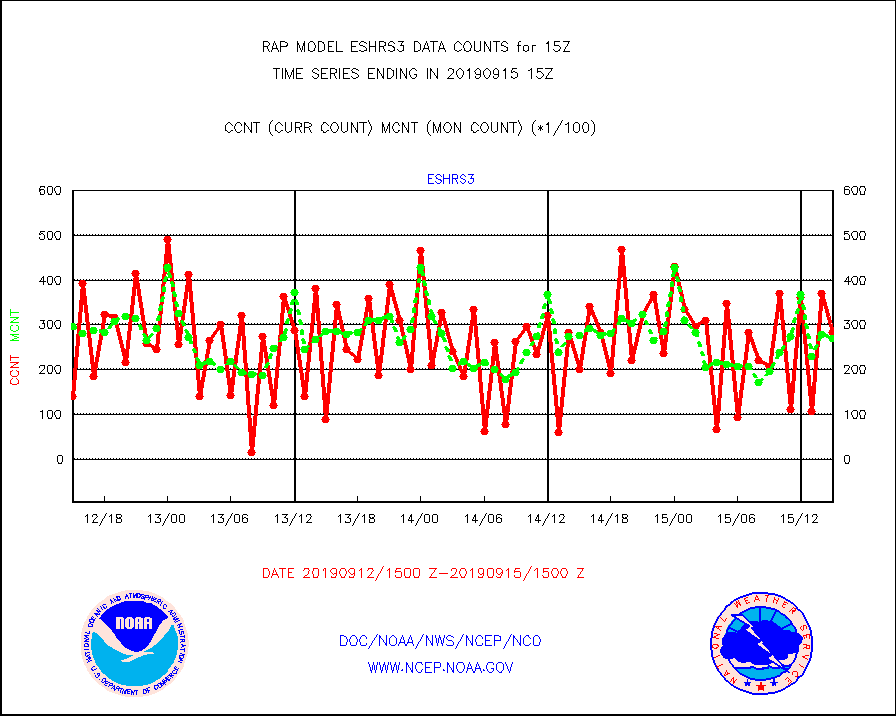
eshrs3 |
NOAA 15-19 & METOP 1-2 HIRS-3/4 pr btmps frm RARS |
28290 |
27032 |
104.7 % |
1514.00-1516.00 |
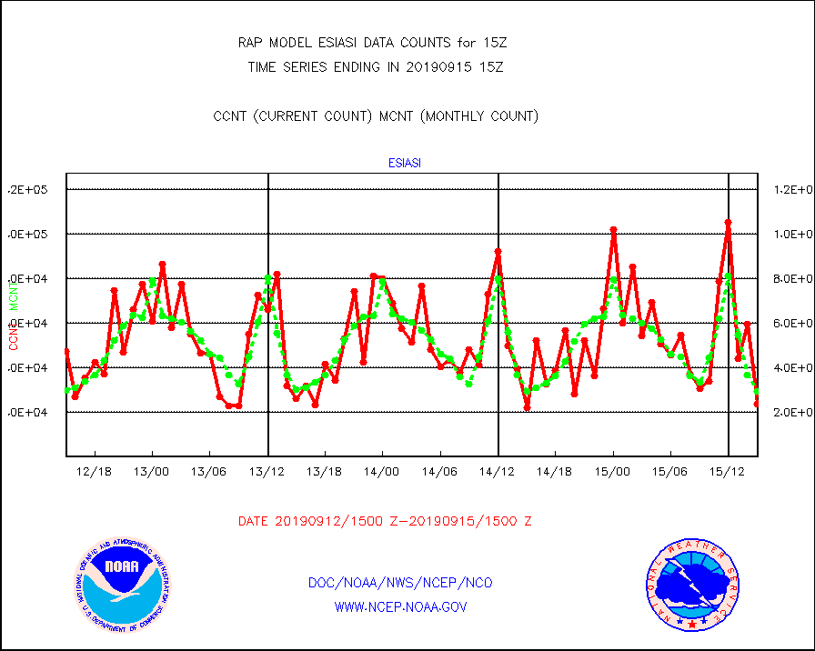
esiasi |
METOP 1-2 IASI 1C radiance data vbl chn from RARS |
23751 |
29451 |
80.6 % |
1513.00-1516.99 |
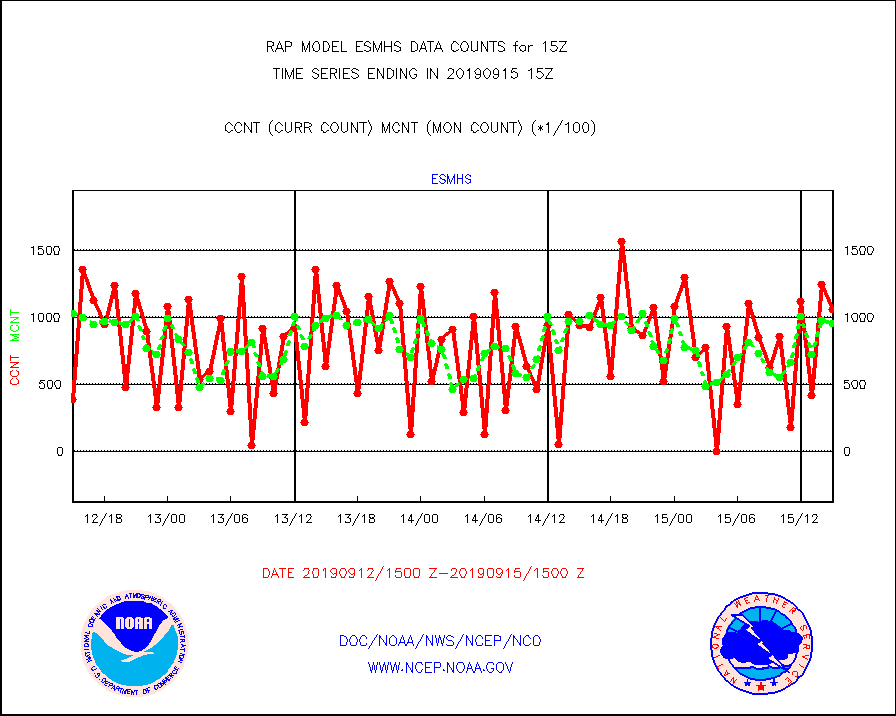
esmhs |
NOAA 18-19 & METOP 1-2 MHS proc. btemps from RARS |
105422 |
95568 |
110.3 % |
1514.00-1516.00 |
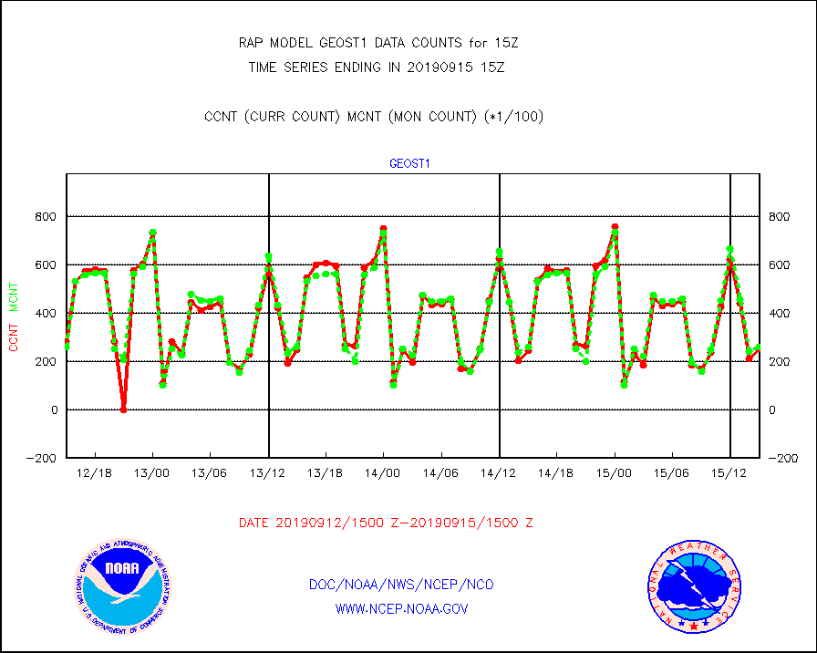
geost1 |
GOES/NESDIS hi-resol. (1x1 f-o-v) sndgs/radiances |
25133 |
25970 |
96.8 % |
1514.00-1516.00 |
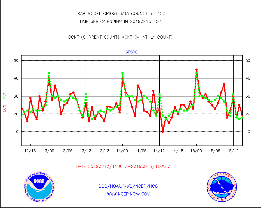
gpsro |
GPS radio occultation data |
18 |
18 |
100.0 % |
1513.00-1516.99 |
h20eu |
METEOSAT/EUMETSAT wvpr imager derived cld motion |
5841 |
5694 |
102.6 % |
1513.50-1516.49 |
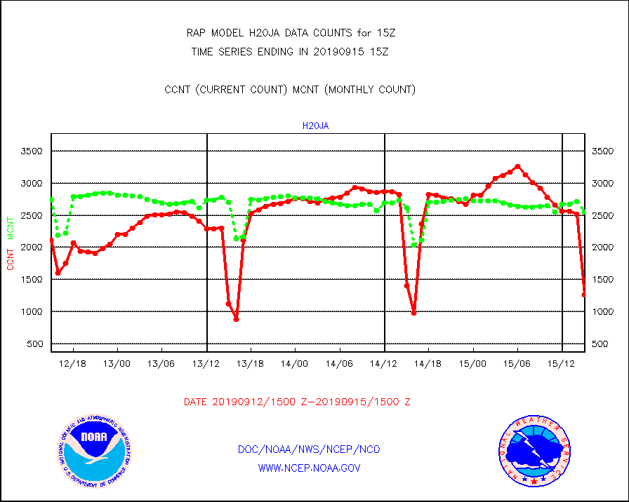
h20ja |
MTSAT/JMA water vapor imager derived cloud motion |
1266 |
2546 |
49.7 % |
1512.50-1517.50 |
iasidb |
METOP 1-2 IASI 1C radiances-direct broadcast SSEC |
54445 |
68559 |
79.4 % |
1513.00-1516.99 |
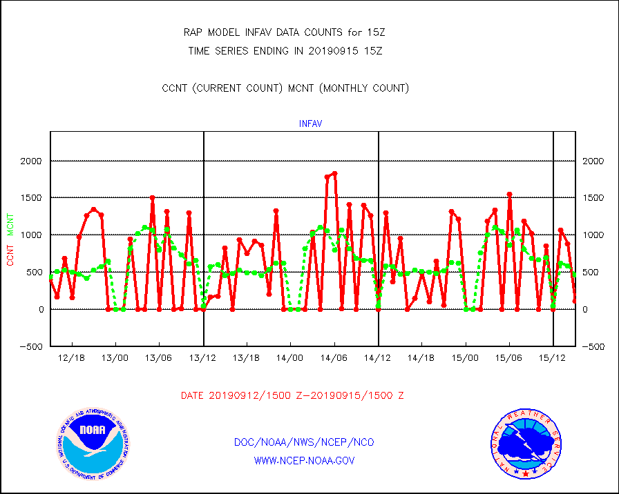
infav |
AVHRR (NOAA/METOP) ir lg-wave derived cld motion |
105 |
459 |
22.9 % |
1512.50-1517.50 |
infeu |
METEOSAT/EUMETSAT ir lg-wave derived cloud motion |
3089 |
3224 |
95.8 % |
1513.50-1516.49 |
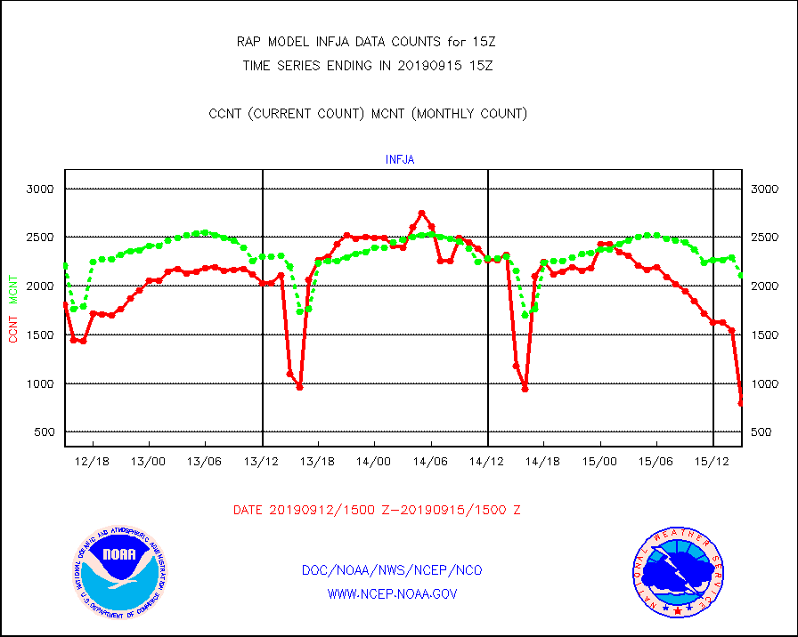
infja |
MTSAT/JMA infrared long-wave derived cloud motion |
792 |
2108 |
37.6 % |
1512.50-1517.50 |
infvr |
VIIRS (NPP) infrared lg-wave derived cloud motion |
0 |
266 |
0.0 % |
1512.50-1517.50 |
kamdar |
Korean AMDAR aircraft data (decoded from BUFR) |
203 |
209 |
97.1 % |
1511.75-1518.25 |
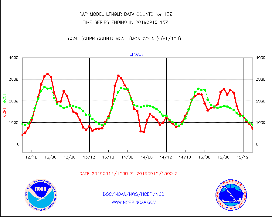
ltnglr |
LLDN Long-rng lightning from Vaisala via NOAAPORT |
71520 |
89512 |
79.9 % |
1514.00-1515.50 |
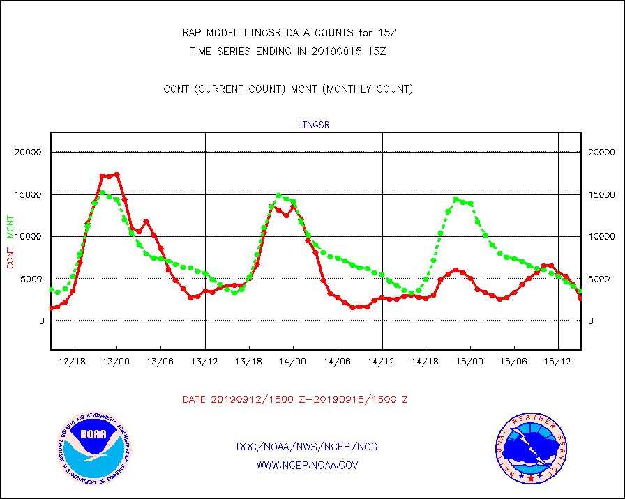
ltngsr |
NLDN Shrt-rng lightning from Vaisala via NOAAPORT |
2707 |
3602 |
75.2 % |
1514.00-1515.50 |
mso470 |
Mesonet/MADIS Colorado E-470 (Interstate 470) |
44 |
7 |
628.6 % |
1514.50-1515.50 |
msoalk |
Mesonet/MADIS Alaska Department of Transportation |
155 |
73 |
212.3 % |
1514.50-1515.50 |
msoapg |
Mesonet/MADIS U.S. Army Aberdeen Proving Grounds |
0 |
0 |
n/a |
1514.50-1515.50 |
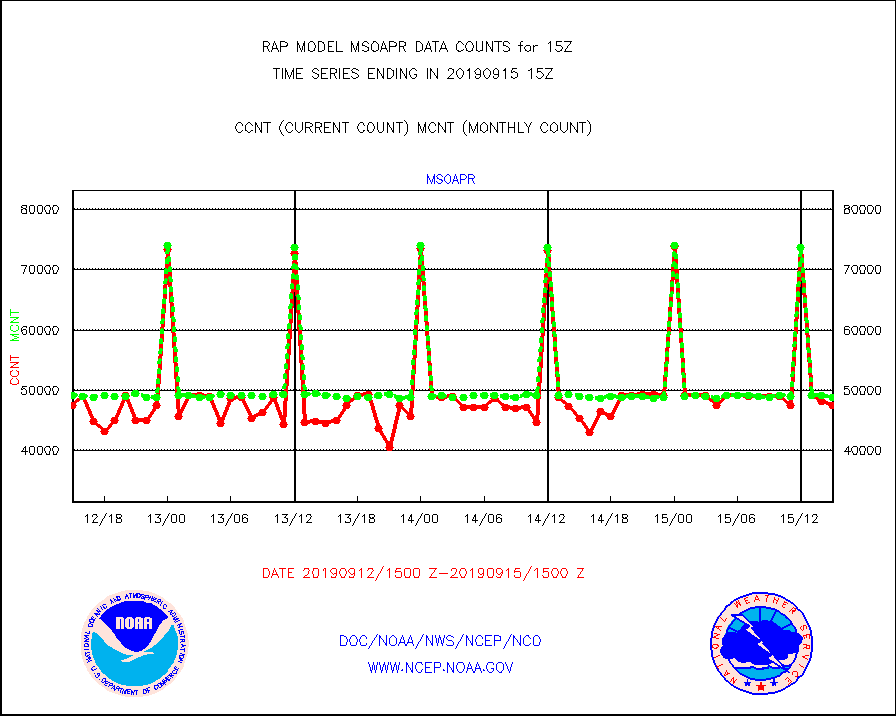
msoapr |
Mesonet/MADIS Citizen Weather Observers Program |
47542 |
48912 |
97.2 % |
1514.50-1515.50 |
msoaws |
Mesonet/MADIS AWS Convergence Technologies, Inc. |
16076 |
16196 |
99.3 % |
1514.50-1515.50 |
msoawx |
Mesonet/MADIS "Anything Weather" |
0 |
0 |
n/a |
1514.50-1515.50 |
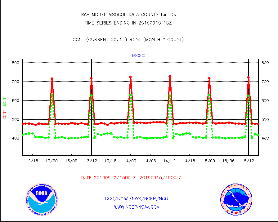
msocol |
Mesonet/MADIS Colorado Dept. of Transportation |
477 |
417 |
114.4 % |
1514.50-1515.50 |
msodcn |
Mesonet/MADIS DC Net |
0 |
0 |
n/a |
1514.50-1515.50 |
msoden |
Mesonet/MADIS Denver Urban Drainage & Flood Cntrl |
0 |
0 |
n/a |
1514.50-1515.50 |
msofla |
Mesonet/MADIS Florida (FAWN & USF) |
108 |
124 |
87.1 % |
1514.50-1515.50 |
msoflt |
Mesonet/MADIS Florida Dept. of Transportation |
0 |
0 |
n/a |
1514.50-1515.50 |
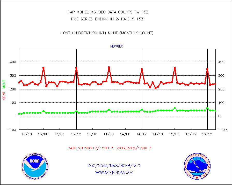
msogeo |
Mesonet/MADIS Georgia Dept. of Transportation |
239 |
41 |
582.9 % |
1514.50-1515.50 |
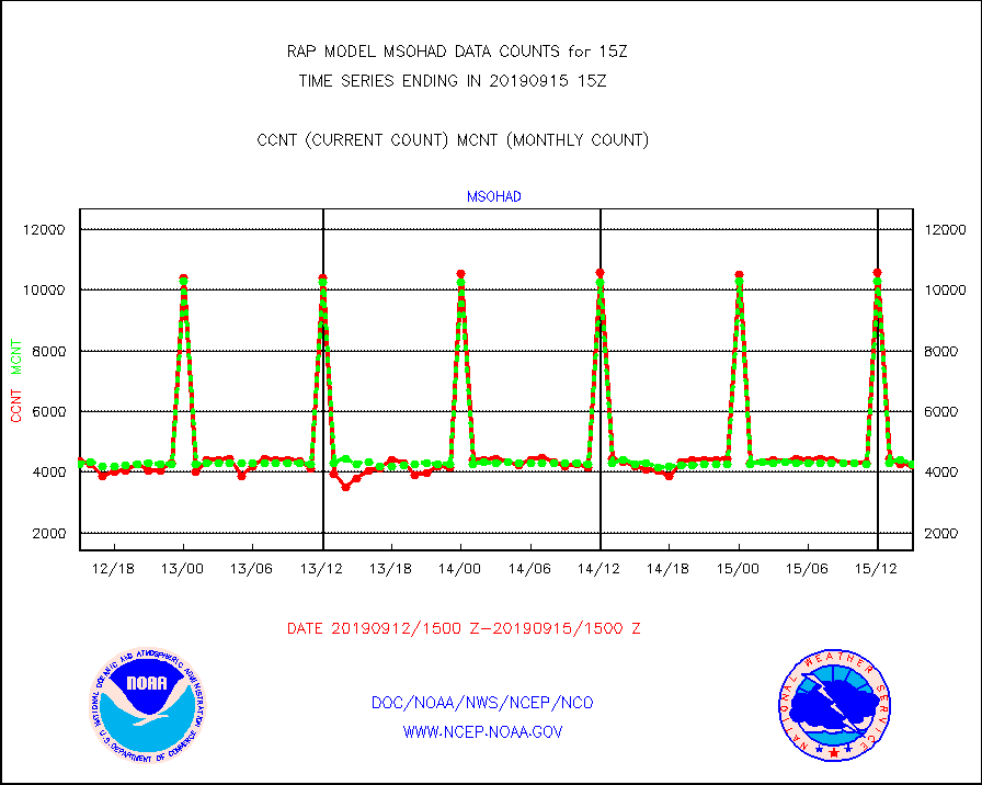
msohad |
Mesonet/MADIS NWS Hydromet Auto Data System(HADS) |
4237 |
4243 |
99.9 % |
1514.50-1515.50 |
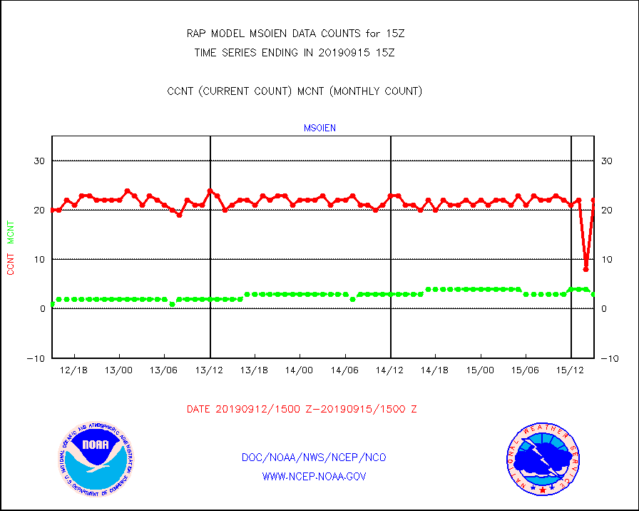
msoien |
Mesonet/MADIS Iowa Environmental |
22 |
3 |
733.3 % |
1514.50-1515.50 |
msoind |
Mesonet/MADIS Indiana Dept. of Transportation |
128 |
23 |
556.5 % |
1514.50-1515.50 |
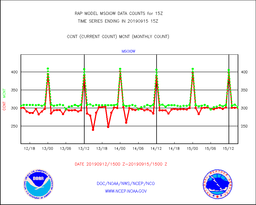
msoiow |
Mesonet/MADIS Iowa Department of Transportation |
301 |
303 |
99.3 % |
1514.50-1515.50 |
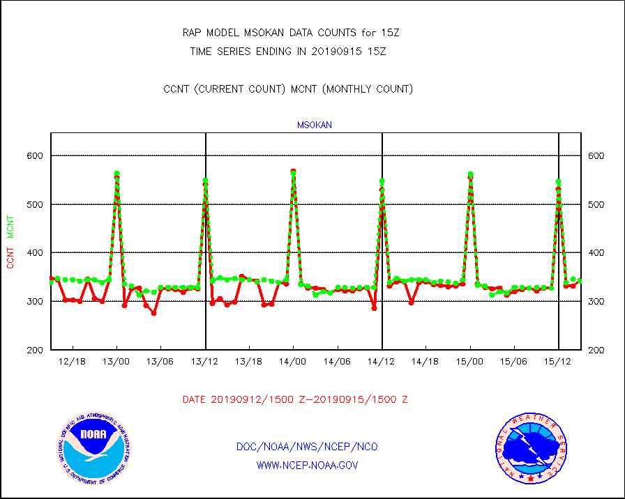
msokan |
Mesonet/MADIS Kansas Department of Transportation |
343 |
341 |
100.6 % |
1514.50-1515.50 |
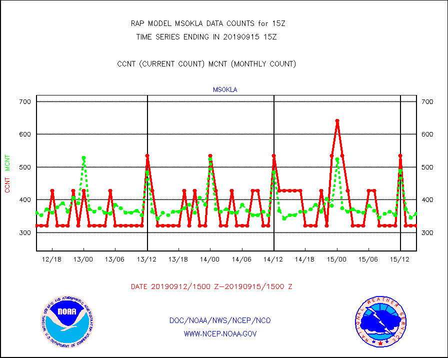
msokla |
Mesonet/MADIS Oklahoma Mesonet |
321 |
357 |
89.9 % |
1514.50-1515.50 |
msolju |
Mesonet/MADIS Louisiana State/Jackson State Univ. |
0 |
0 |
n/a |
1514.50-1515.50 |
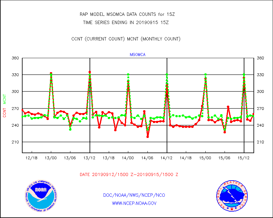
msomca |
Mesonet/MADIS Missouri Commercial Agricult Wx Net |
260 |
256 |
101.6 % |
1514.50-1515.50 |
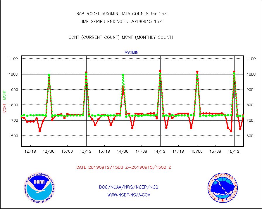
msomin |
Mesonet/MADIS Minnesota Dept. of Transportation |
734 |
726 |
101.1 % |
1514.50-1515.50 |
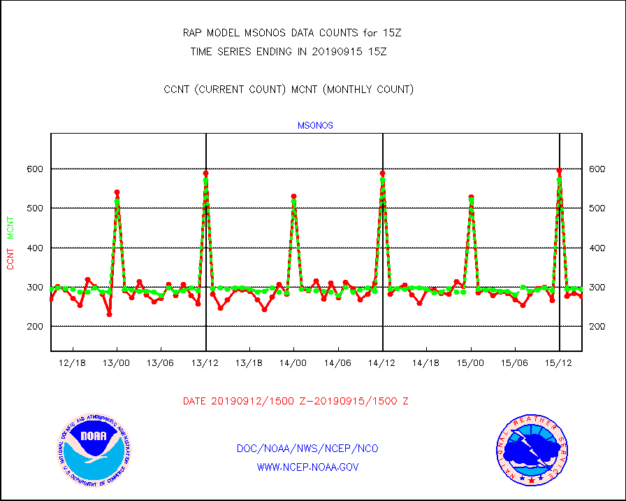
msonos |
Mesonet/MADIS NOS-Phys Oceanographic Realtime Sys |
277 |
294 |
94.2 % |
1514.50-1515.50 |
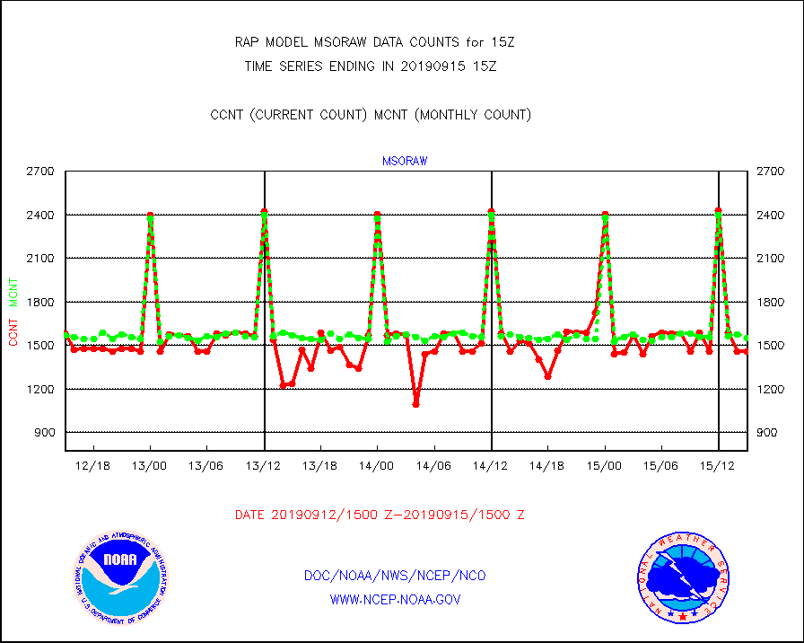
msoraw |
Mesonet/MADIS NFIC Remote Automated Wx Stns(RAWS) |
1457 |
1550 |
94.0 % |
1514.50-1515.50 |
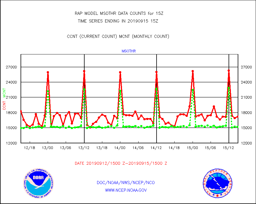
msothr |
Mesonet/MADIS many providers, not separated out |
17186 |
15154 |
113.4 % |
1514.50-1515.50 |
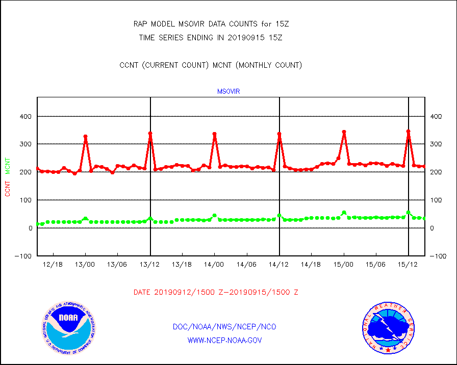
msovir |
Mesonet/MADIS Virginia Dept. of Transportation |
221 |
35 |
631.4 % |
1514.50-1515.50 |
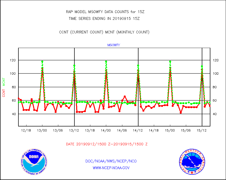
msowfy |
Mesonet/MADIS "Weather for You" |
52 |
57 |
91.2 % |
1514.50-1515.50 |
msowis |
Mesonet/MADIS Wisconsin Dept. of Transportation |
9 |
1 |
900.0 % |
1514.50-1515.50 |
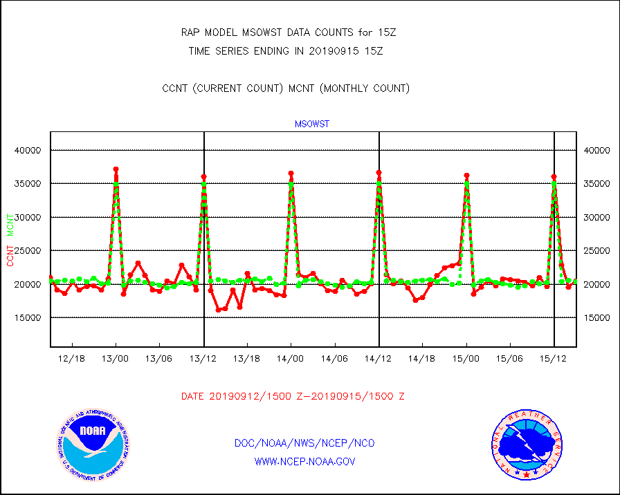
msowst |
Mesonet/MADIS MesoWest (many subproviders) |
20468 |
20316 |
100.7 % |
1514.50-1515.50 |
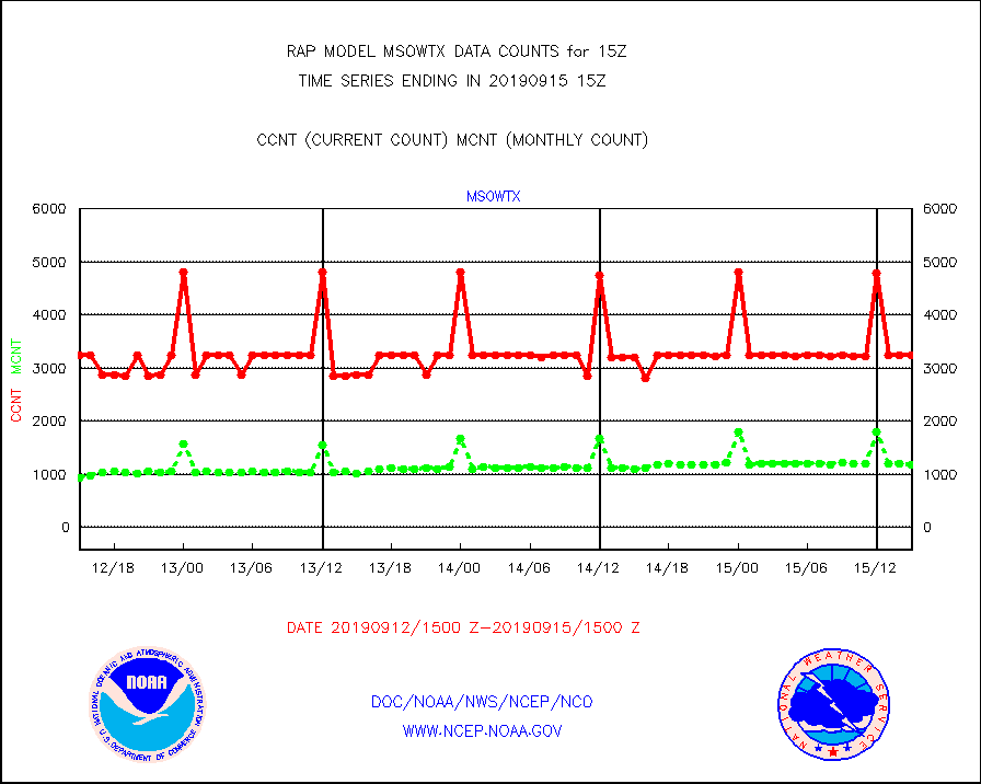
msowtx |
Mesonet/MADIS West Texas |
3249 |
1168 |
278.2 % |
1514.50-1515.50 |
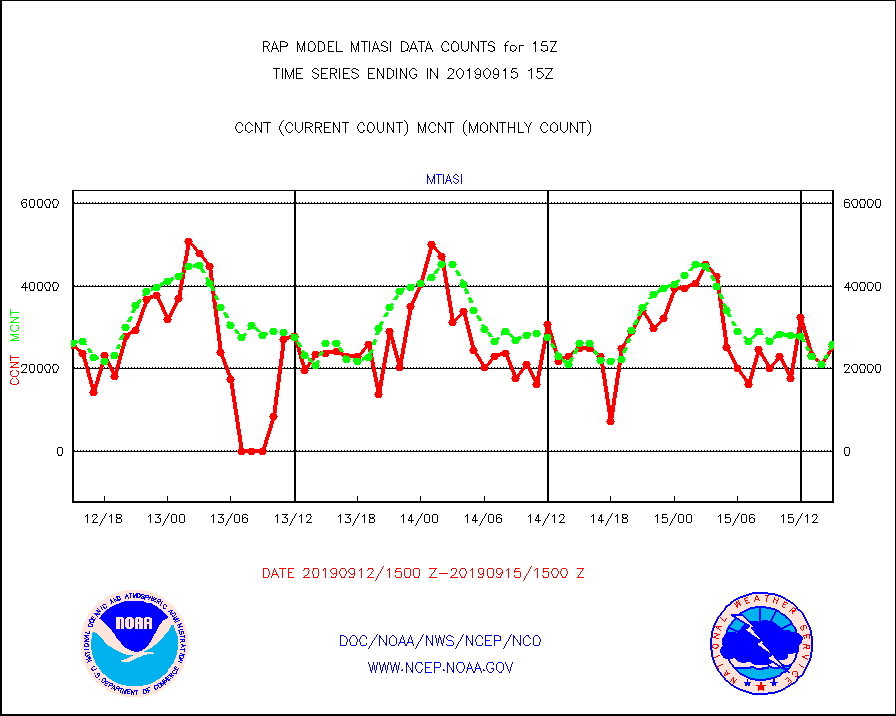
mtiasi |
METOP 1-2 IASI 1C radiance data (varbl. channels) |
25406 |
25919 |
98.0 % |
1513.00-1516.99 |
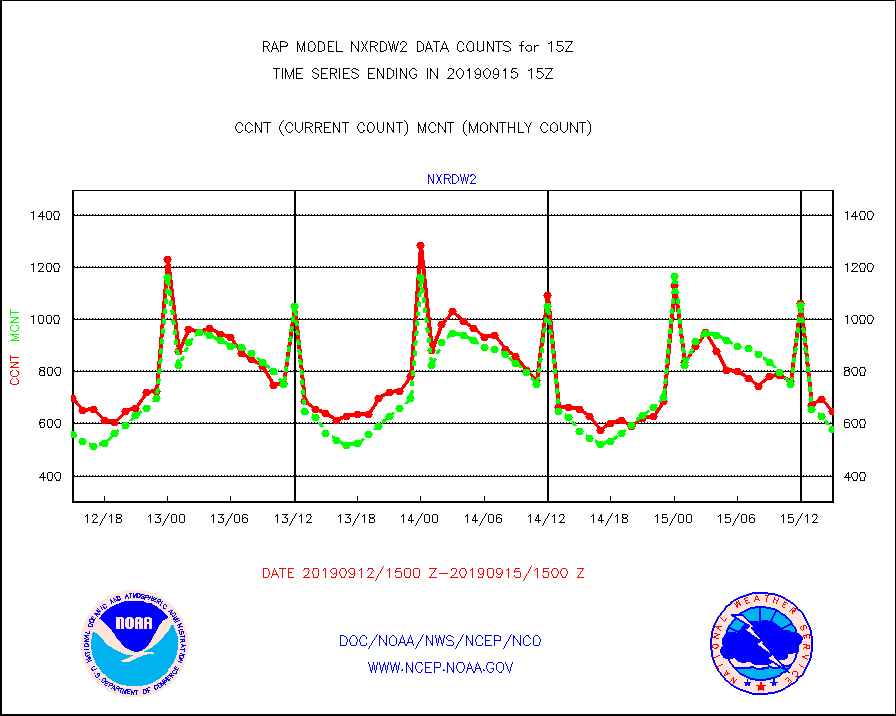
nxrdw2 |
NEXRAD Vel Azm Dsp(VAD) winds via Level 2 decoder |
649 |
580 |
111.9 % |
1514.00-1516.00 |
osbuv8 |
NOAA 16-19 Solar Backscatter UV-2 rad frm V8 BUFR |
35 |
16 |
218.8 % |
1513.00-1515.99 |
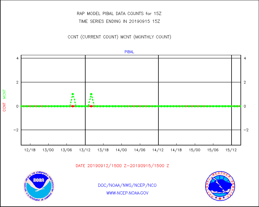
pibal |
PIBAL (from PILOT, PILOT SHIP, PILOT MOBIL) |
0 |
0 |
n/a |
1514.00-1516.00 |
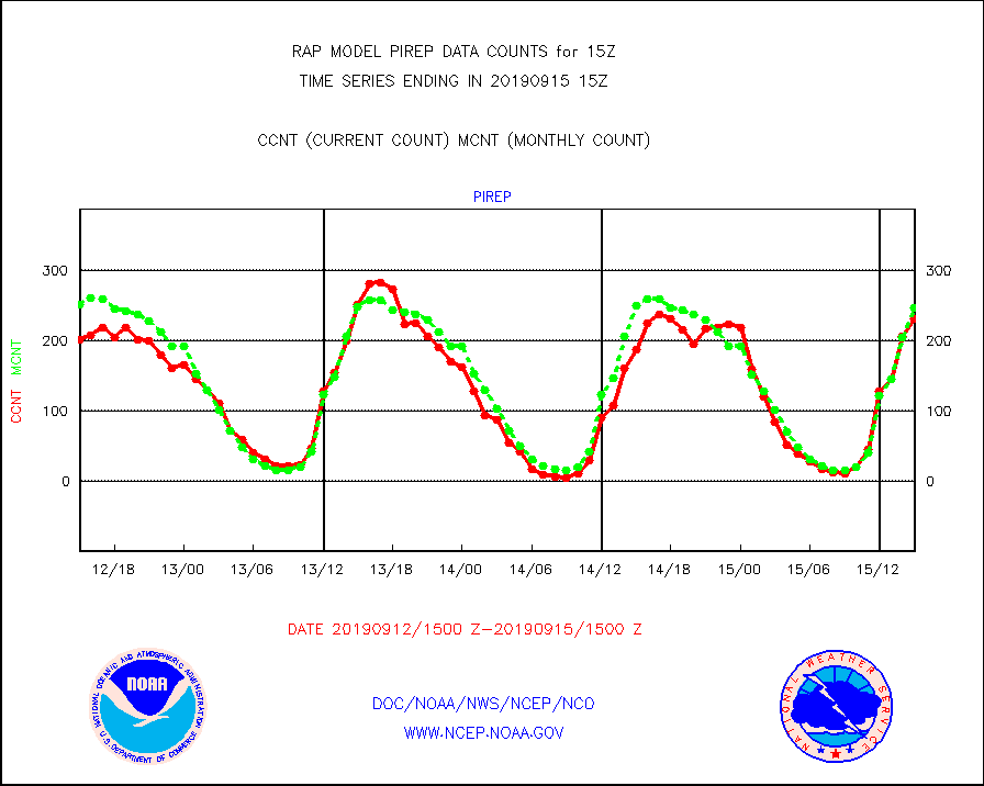
pirep |
Manual PIREP aircraft data (dcded from AIREP fmt) |
231 |
247 |
93.5 % |
1511.75-1518.25 |
prflrp |
Profilr winds from PIBAL (PILOT,PILOT SHIP/MOBIL) |
0 |
0 |
n/a |
1513.50-1516.50 |
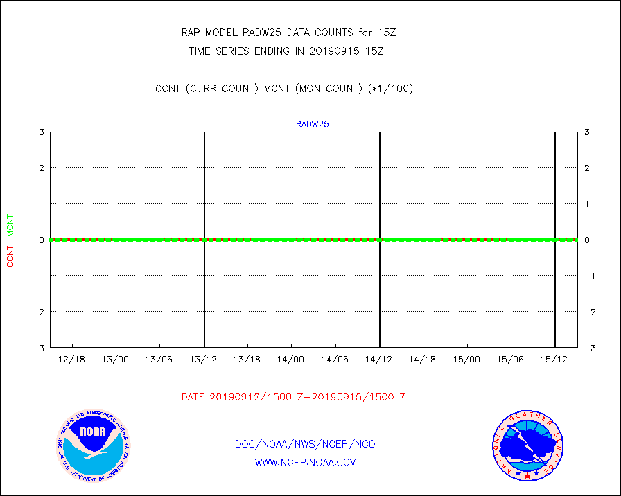
radw25 |
NEXRAD radial wind superobs (Level 2.5 - ORPG) |
0 |
0 |
n/a |
1514.00-1516.00 |
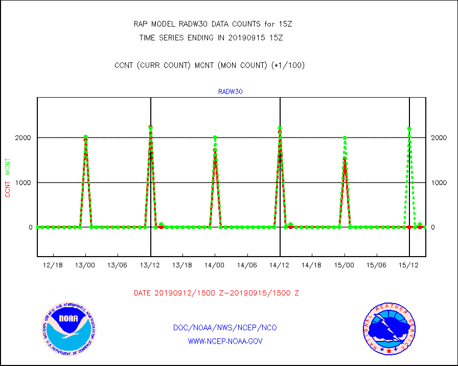
radw30 |
NEXRAD radial wind superobs (Level 3 - NIDS) |
0 |
0 |
n/a |
1514.00-1516.00 |
raobm |
Rawinsonde - mobile land (from TEMP/PILOT MOBIL) |
0 |
0 |
n/a |
1514.00-1516.00 |
raobs |
Rawinsonde - ship (from TEMP SHIP, PILOT SHIP) |
0 |
0 |
n/a |
1514.00-1516.00 |
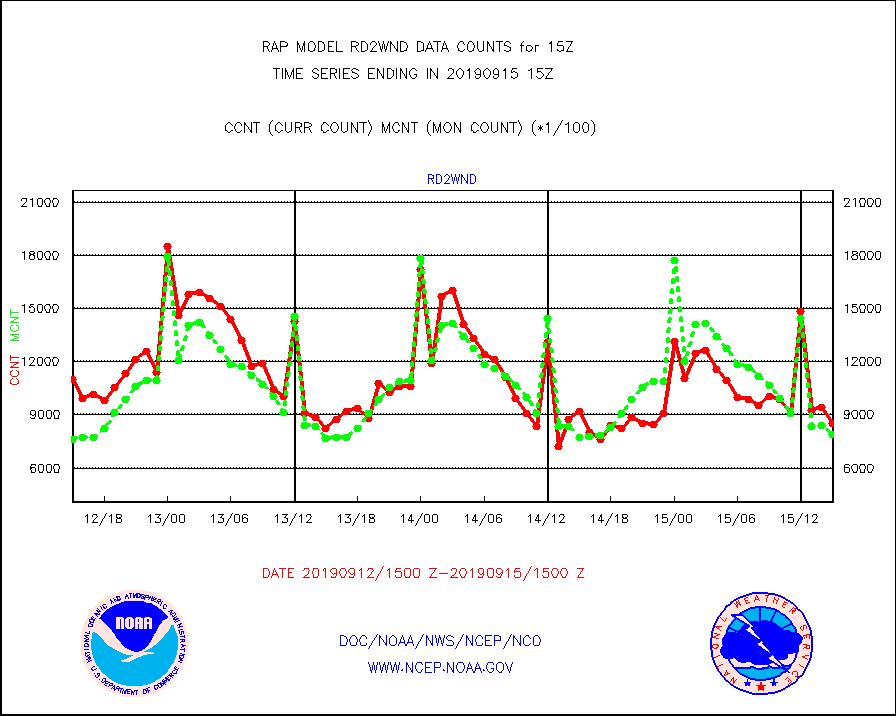
rd2wnd |
NEXRAD radial wind (Level 2 - GTS) |
852099 |
787007 |
108.3 % |
1514.50-1515.49 |
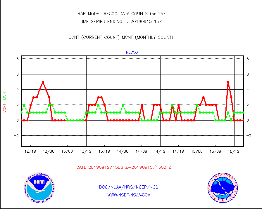
recco |
Flight level reconnaissance aircraft data |
0 |
1 |
0.0 % |
1514.00-1516.00 |
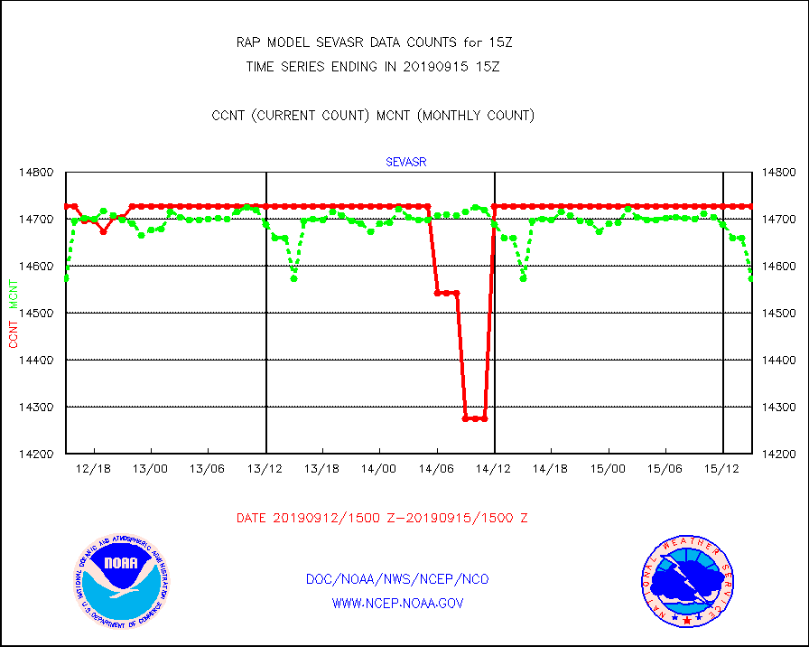
sevasr |
METEOSAT-10 2nd Gen SEVIRI All Sky Radiance(proc) |
14727 |
14574 |
101.0 % |
1513.00-1516.99 |
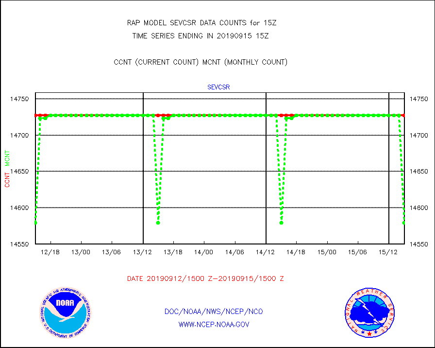
sevcsr |
METEOSAT-10 2nd Gen SEVIRI Clr Sky Radiance(proc) |
14727 |
14579 |
101.0 % |
1513.00-1516.99 |
ssmisu |
DMSP SSM/IS 1C radiance data (Unified Pre-Proc.) |
32236 |
45248 |
71.2 % |
1513.00-1516.99 |
synopr |
Synoptic - restricted (WMO Res 40) manual & auto. |
48 |
46 |
104.3 % |
1514.50-1515.50 |
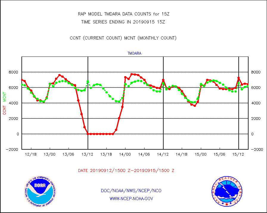
tmdara |
TAMDAR aircft data-all types(from Panasonic,BUFR) |
6407 |
6194 |
103.4 % |
1511.75-1518.25 |
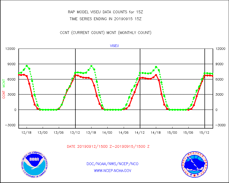
viseu |
METEOSAT/EUMETSAT visible derived cloud motion |
6629 |
7069 |
93.8 % |
1513.50-1516.49 |
visja |
MTSAT/JMA visible derived cloud motion |
0 |
0 |
n/a |
1512.50-1517.50 |
visus |
GOES/NESDIS visible derived cloud motion |
0 |
0 |
n/a |
1514.00-1514.99 |


