| Critical Data with Normal Counts |
|---|
| Type | Description | Hourly Count | Monthly Average | Percent (%) of Monthly Mean | UTC Time Window |
1bamua |
NOAA 15-19 & METOP 1-2 AMSU-A NCEP-proc. br.temps |
29294 |
35304 |
83.0 % |
1509.00-1514.99 |
1bhrs4 |
NOAA 18-19 & METOP 1-2 HIRS-4 NCEP-proc. br.temps |
47842 |
61663 |
77.6 % |
1509.00-1514.99 |
1bmhs |
NOAA 18-19 & METOP 1-2 MHS NCEP-proces. br. temps |
192138 |
239505 |
80.2 % |
1509.00-1514.99 |
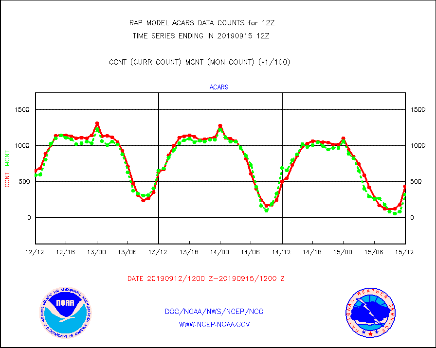
acars |
MDCRS ACARS acft data from ARINC(dcded from BUFR) |
43131 |
32252 |
133.7 % |
1508.75-1515.25 |
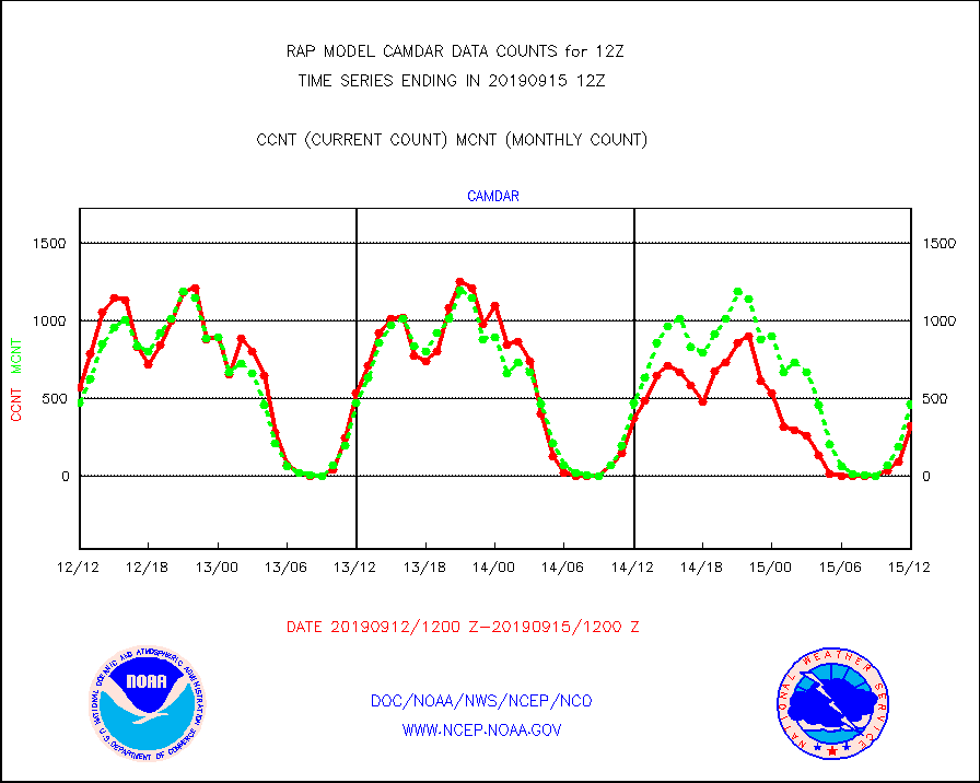
camdar |
Canadian AMDAR aircraft data (decoded from BUFR) |
327 |
468 |
69.9 % |
1508.75-1515.25 |
dbuoy |
Buoys decoded from FM-18 fmt (moored or drifting) |
47 |
43 |
109.3 % |
1511.50-1512.50 |
geosth |
GOES/NESDIS hi-resol. (1x1 f-o-v) cloud data |
102990 |
102879 |
100.1 % |
1510.75-1511.99 |
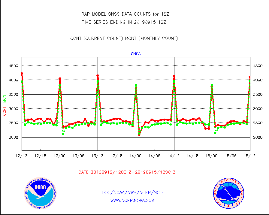
gnss |
Grnd-based Gbl Navigation Sat System (GNSS) data |
4114 |
3979 |
103.4 % |
1510.95-1511.05 |
h20mo |
MODIS (AQUA/TERRA) wvpr imager derived cld motion |
0 |
0 |
n/a |
1510.50-1513.50 |
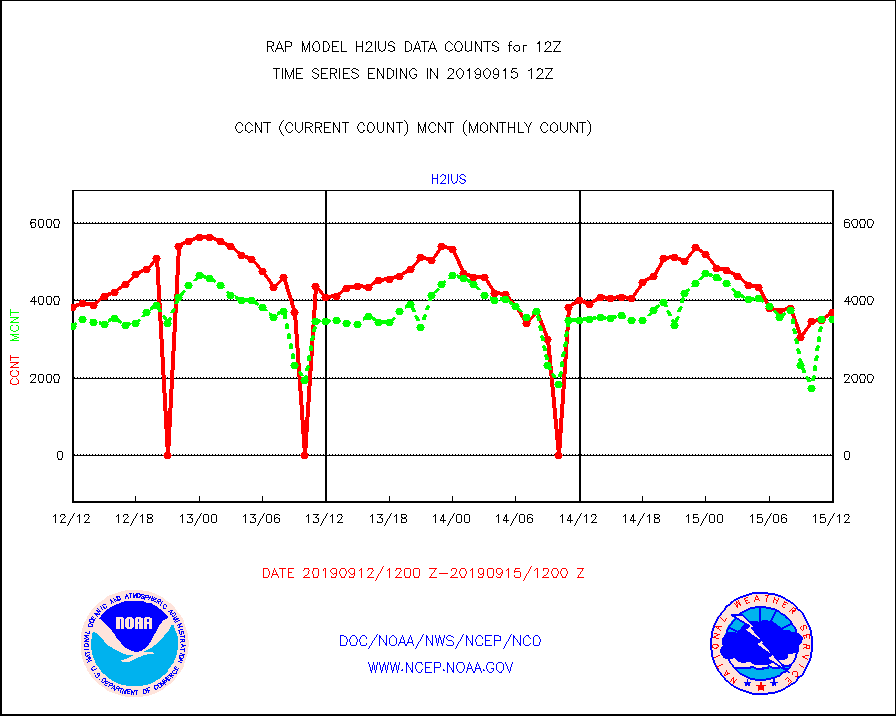
h2ius |
GOES/NESDIS water vapor imager derived cld motion |
3697 |
3511 |
105.3 % |
1511.00-1511.99 |
infmo |
MODIS (AQUA/TERRA) ir l-wave derived cloud motion |
0 |
0 |
n/a |
1510.50-1513.50 |
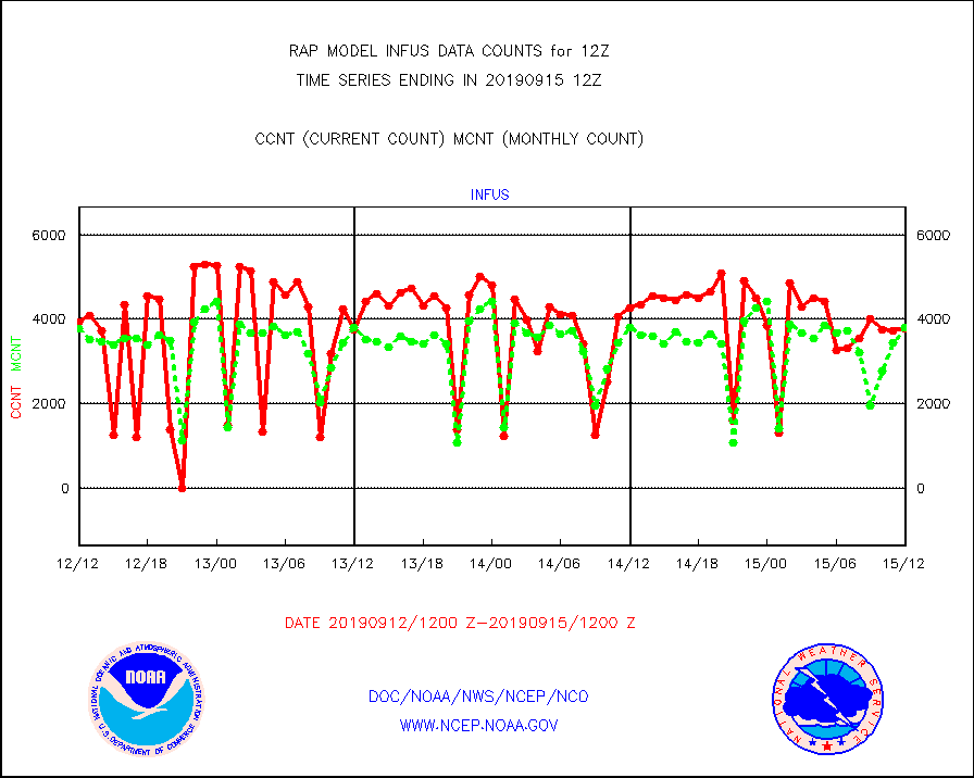
infus |
GOES/NESDIS infrared lg-wave derived cloud motion |
3788 |
3804 |
99.6 % |
1511.00-1511.99 |
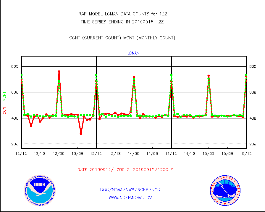
lcman |
Land-based CMAN stations decoded from CMAN format |
724 |
736 |
98.4 % |
1511.50-1512.50 |
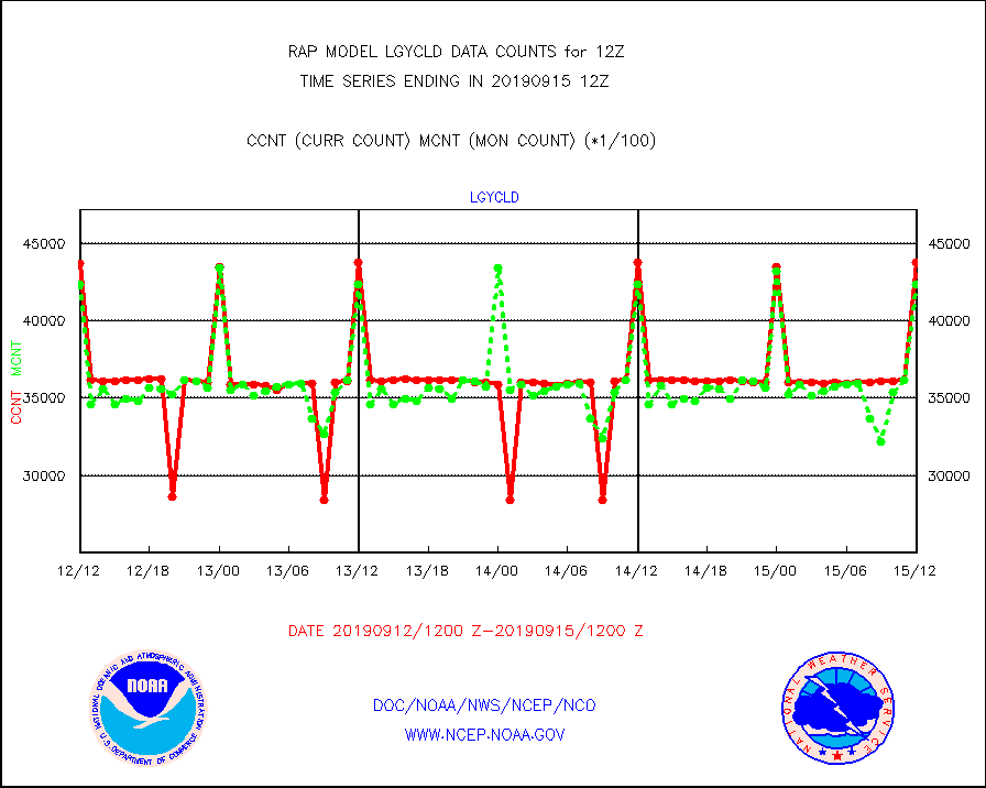
lgycld |
GOES/NASA(Langley) hi-res. (1x1 f-o-v) cloud data |
4376004 |
4231668 |
103.4 % |
1511.50-1512.50 |
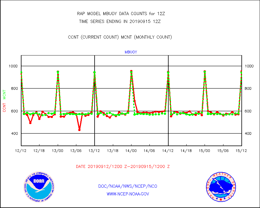
mbuoy |
Buoys decoded from FM-13 format (moored) |
952 |
943 |
101.0 % |
1511.50-1512.50 |
metar |
Aviation - METAR |
6751 |
6686 |
101.0 % |
1511.50-1512.50 |
nxrdw |
NEXRAD Vel Azm Dsp(VAD) winds via radar coded msg |
596 |
602 |
99.0 % |
1511.00-1513.00 |
prflrb |
Multi-Agency Profiler (MAP) and SODAR winds |
160 |
176 |
90.9 % |
1510.50-1513.50 |
raobf |
Rawinsonde - fixed land (from TEMP or PILOT) |
171 |
170 |
100.6 % |
1511.00-1513.00 |
rass |
RASS temperatures (NOAA and Multi-Agency) |
45 |
58 |
77.6 % |
1511.50-1512.50 |
ships |
Ship - manual and automatic, restricted |
189 |
186 |
101.6 % |
1511.50-1512.50 |
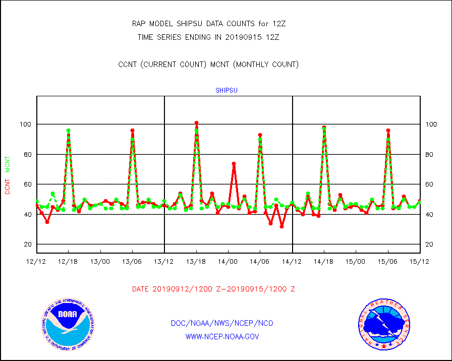
shipsu |
Ship - manual and automatic, unrestricted |
49 |
48 |
102.1 % |
1511.50-1512.50 |
synop |
Synoptic - fixed manual and automatic |
2463 |
2472 |
99.6 % |
1511.50-1512.50 |
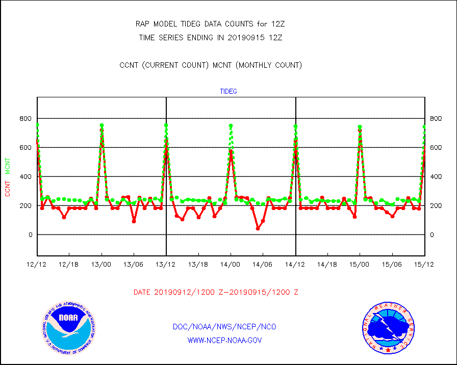
tideg |
Tide gauge reports decoded from CREX format |
602 |
744 |
80.9 % |
1511.50-1512.50 |
| Data Types of Opportunity with Normal Counts |
|---|
| Type | Description | Hourly Count | Monthly Average | Percent (%) of Monthly Mean | UTC Time Window |
3p9us |
GOES/NESDIS infrared shrt-wave derived cld motion |
26722 |
28040 |
95.3 % |
1511.00-1511.99 |
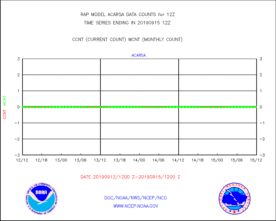
acarsa |
MDCRS ACARS acft data (ARINC via AFWA)(AIREP fmt) |
0 |
0 |
n/a |
1508.75-1515.25 |
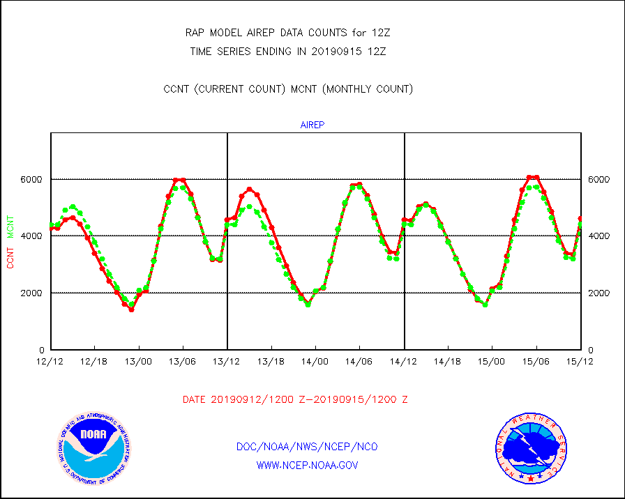
airep |
Manual AIREP aircraft data (dcded from AIREP fmt) |
4610 |
4422 |
104.3 % |
1508.75-1515.25 |
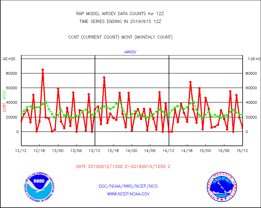
airsev |
AQUA AIRS/AMSU-A/HSB brightness temps- every FOV |
5133 |
23316 |
22.0 % |
1509.00-1514.99 |
amdar |
AMDAR aircraft data (decoded from AMDAR format) |
5078 |
2842 |
178.7 % |
1508.75-1515.25 |
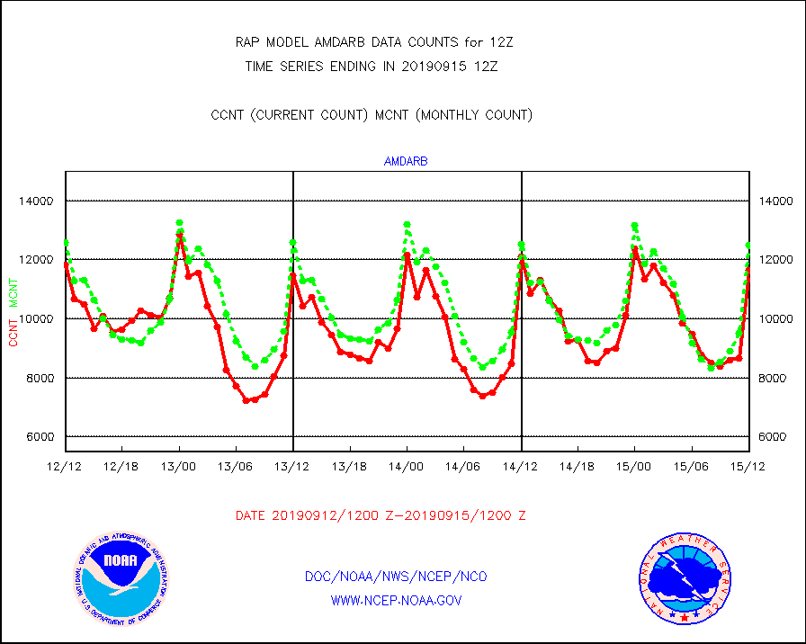
amdarb |
AMDAR aircraft data (decoded from BUFR) |
11654 |
12514 |
93.1 % |
1508.75-1515.25 |
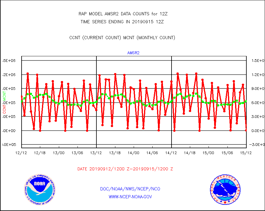
amsr2 |
GCOM-W AMSR2 1B brightness temperatures |
524 |
625875 |
0.1 % |
1509.00-1509.99 |
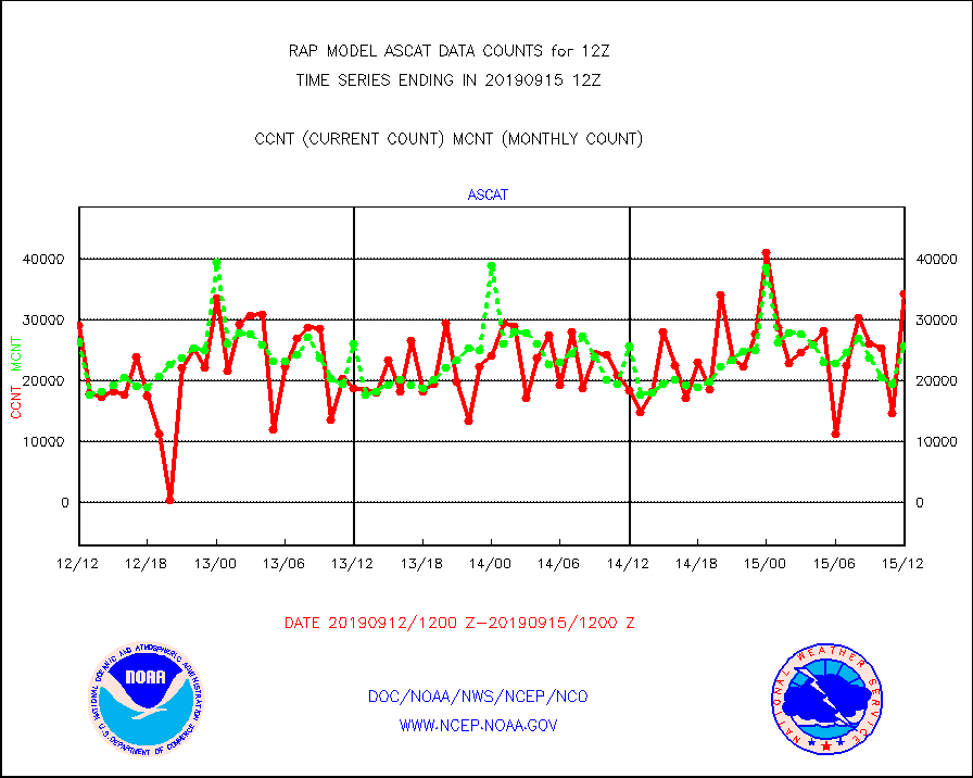
ascat |
METOP 1-2 ASCAT products |
34319 |
25799 |
133.0 % |
1510.00-1514.00 |
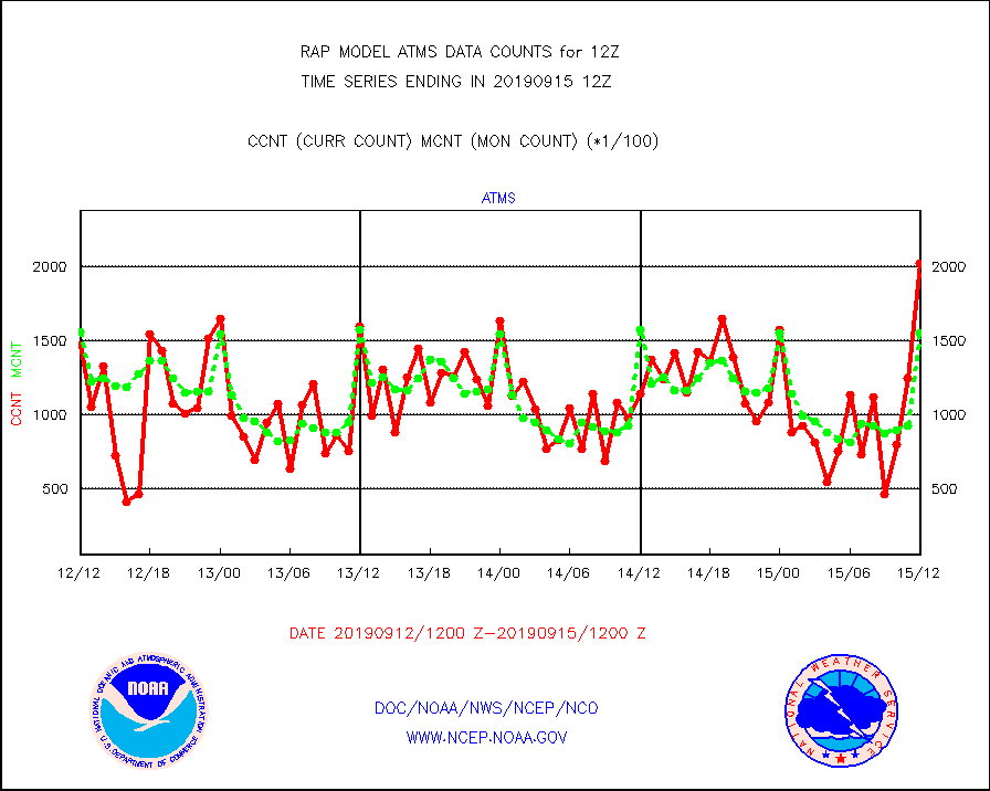
atms |
NPP Adv. Tech. Microwave Sounder (ATMS) br. temps |
202807 |
155126 |
130.7 % |
1510.00-1513.99 |
atmsdb |
NPP Adv Tech MW Sndr(ATMS) b. temps-dir bcst SSEC |
45908 |
86244 |
53.2 % |
1510.00-1513.99 |
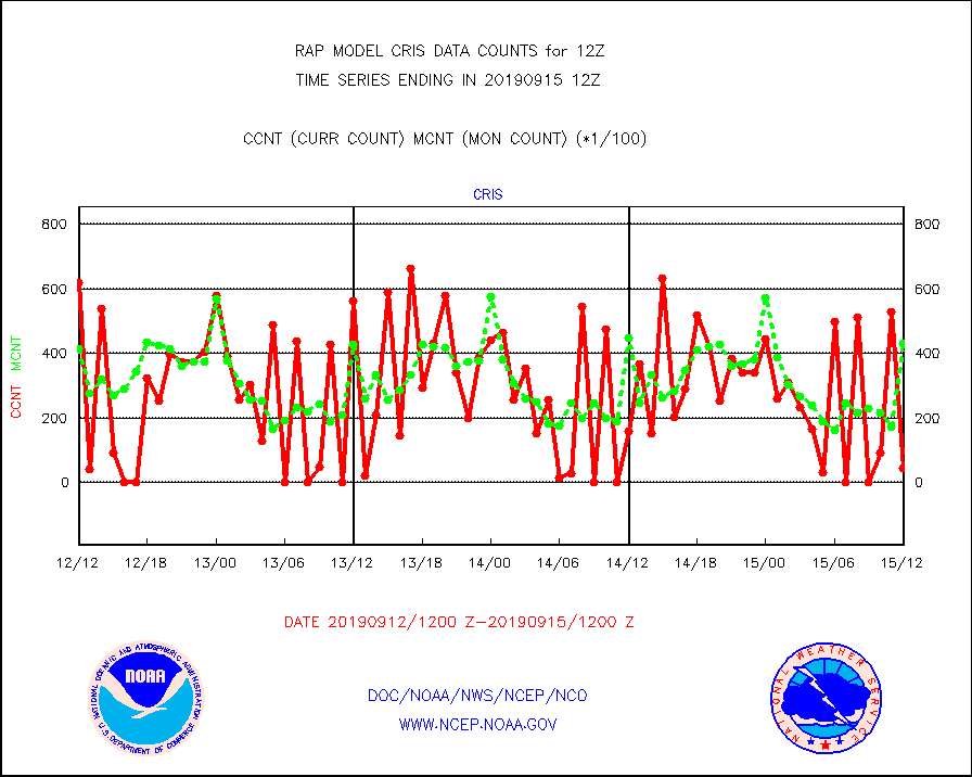
cris |
NPP Cross-track Infrared Sounder (CrIS) radiances |
4400 |
43276 |
10.2 % |
1510.00-1513.99 |
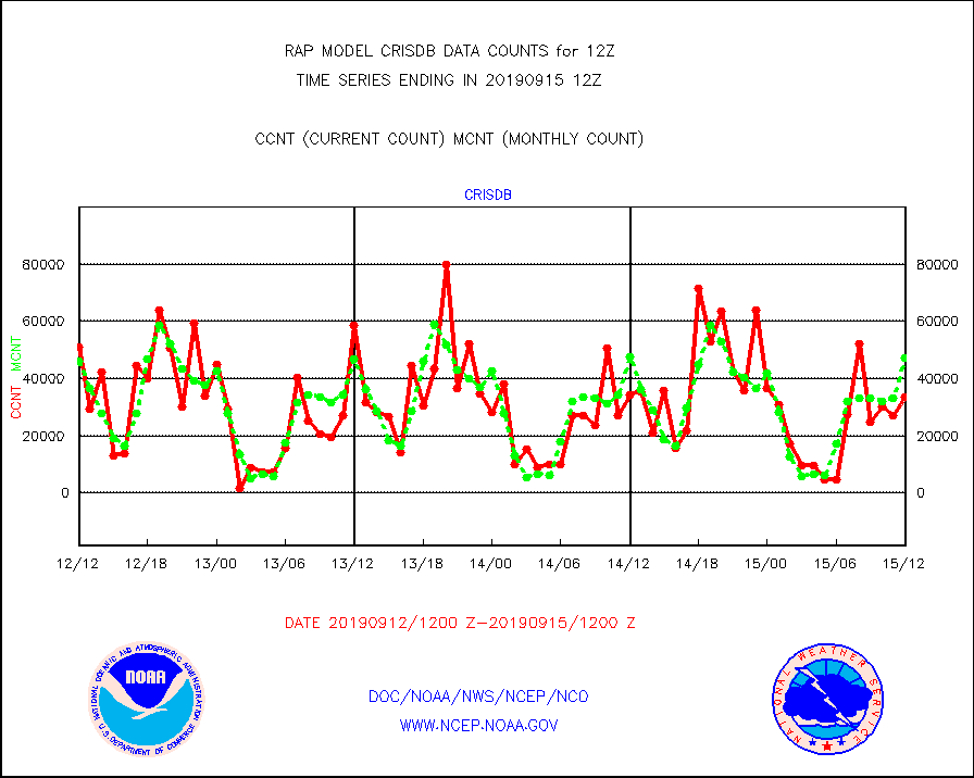
crisdb |
NPP Crss-trk IR Sndr(CrIS) radiance-dir bcst SSEC |
33480 |
47156 |
71.0 % |
1510.00-1513.99 |
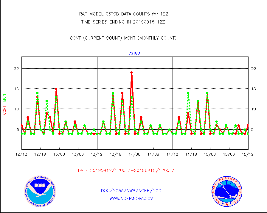
cstgd |
Coast Guard |
6 |
4 |
150.0 % |
1511.50-1512.50 |
dropw |
Dropwinsonde (from TEMP DROP) |
1 |
3 |
33.3 % |
1511.00-1513.00 |
eadas |
E-AMDAR (European AMDAR acft decoded from BUFR) |
10960 |
10811 |
101.4 % |
1508.75-1515.25 |
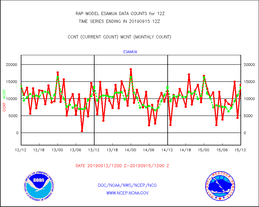
esamua |
NOAA 15-19 & METOP 1-2 AMSU-A proc btmps frm RARS |
13976 |
13369 |
104.5 % |
1511.00-1513.00 |
esatms |
NPP Adv. Tech. MW Sndr (ATMS) br. temps from RARS |
85363 |
84228 |
101.3 % |
1510.00-1513.99 |
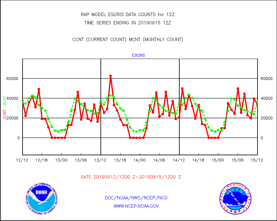
escris |
NPP Crss-track IR Sndr (CrIS) radiances from RARS |
33272 |
36252 |
91.8 % |
1510.00-1513.99 |
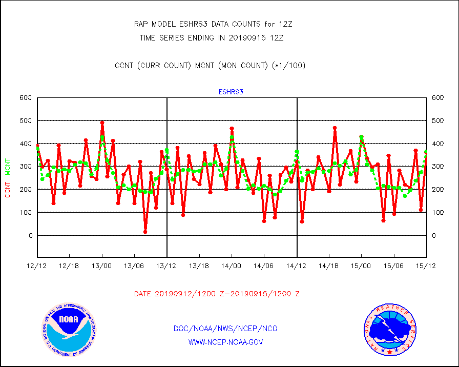
eshrs3 |
NOAA 15-19 & METOP 1-2 HIRS-3/4 pr btmps frm RARS |
36296 |
36792 |
98.7 % |
1511.00-1513.00 |
esiasi |
METOP 1-2 IASI 1C radiance data vbl chn from RARS |
105374 |
81178 |
129.8 % |
1510.00-1513.99 |
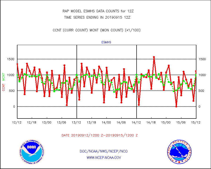
esmhs |
NOAA 18-19 & METOP 1-2 MHS proc. btemps from RARS |
111942 |
100538 |
111.3 % |
1511.00-1513.00 |
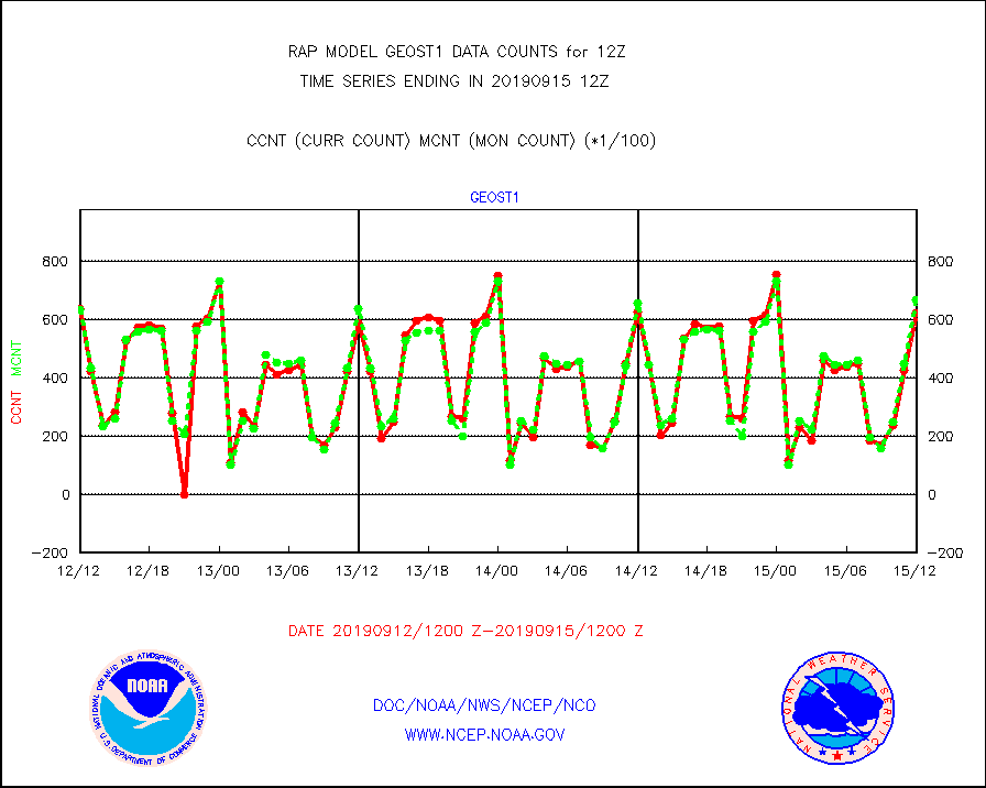
geost1 |
GOES/NESDIS hi-resol. (1x1 f-o-v) sndgs/radiances |
62304 |
66866 |
93.2 % |
1511.00-1513.00 |
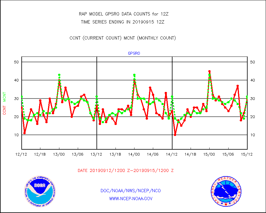
gpsro |
GPS radio occultation data |
30 |
31 |
96.8 % |
1510.00-1513.99 |
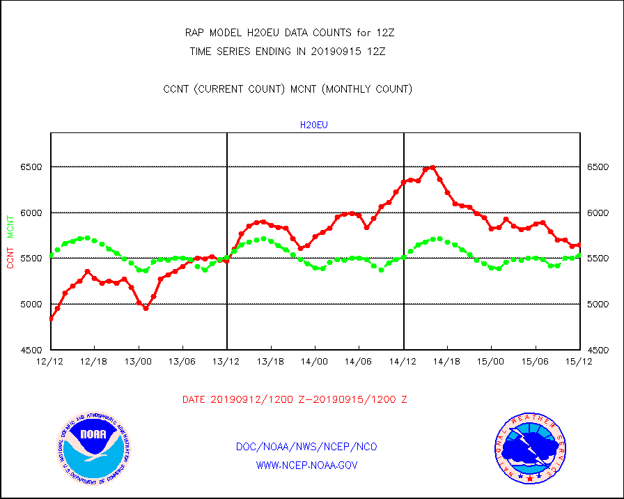
h20eu |
METEOSAT/EUMETSAT wvpr imager derived cld motion |
5649 |
5532 |
102.1 % |
1510.50-1513.49 |
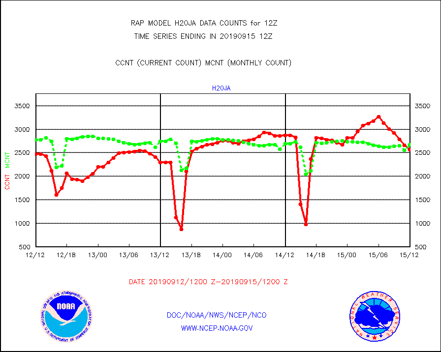
h20ja |
MTSAT/JMA water vapor imager derived cloud motion |
2562 |
2671 |
95.9 % |
1510.50-1513.50 |
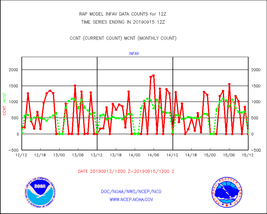
infav |
AVHRR (NOAA/METOP) ir lg-wave derived cld motion |
0 |
43 |
0.0 % |
1510.50-1513.50 |
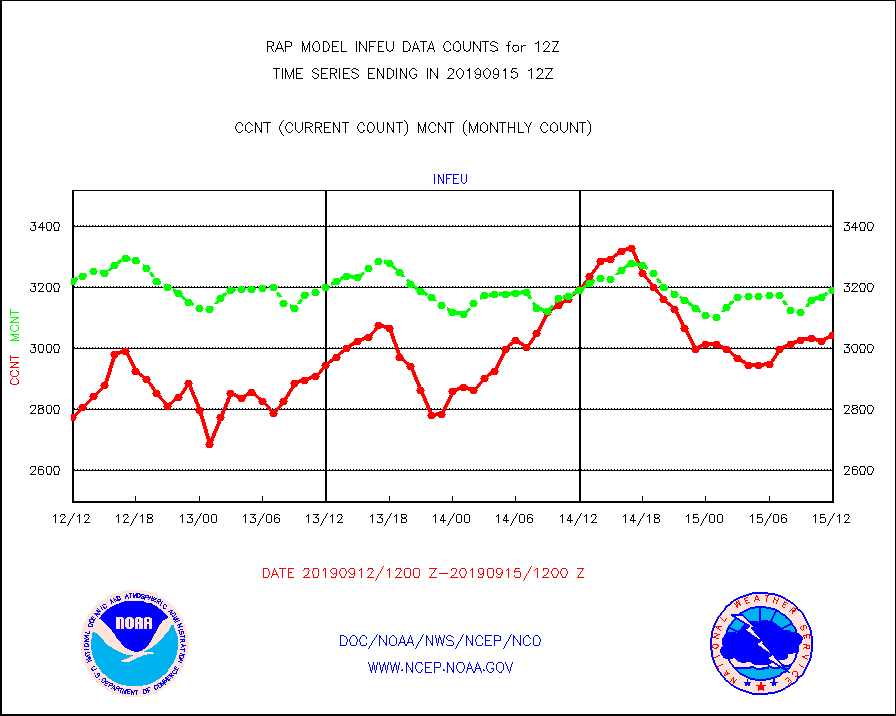
infeu |
METEOSAT/EUMETSAT ir lg-wave derived cloud motion |
3042 |
3189 |
95.4 % |
1510.50-1513.49 |
infja |
MTSAT/JMA infrared long-wave derived cloud motion |
1625 |
2270 |
71.6 % |
1510.50-1513.50 |
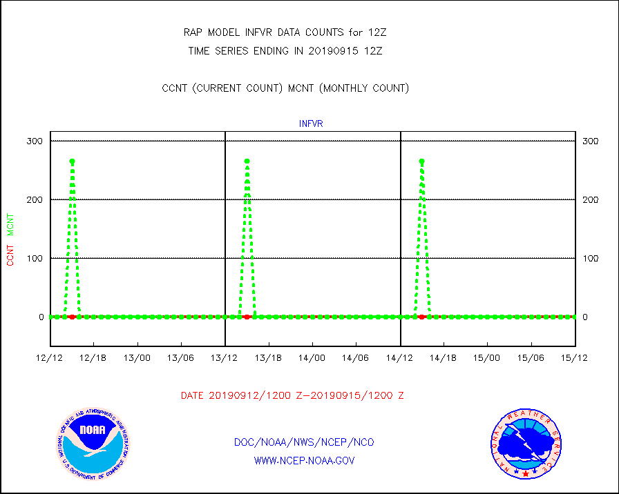
infvr |
VIIRS (NPP) infrared lg-wave derived cloud motion |
0 |
0 |
n/a |
1510.50-1513.50 |
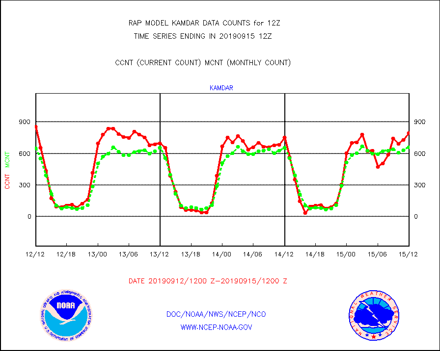
kamdar |
Korean AMDAR aircraft data (decoded from BUFR) |
793 |
659 |
120.3 % |
1508.75-1515.25 |
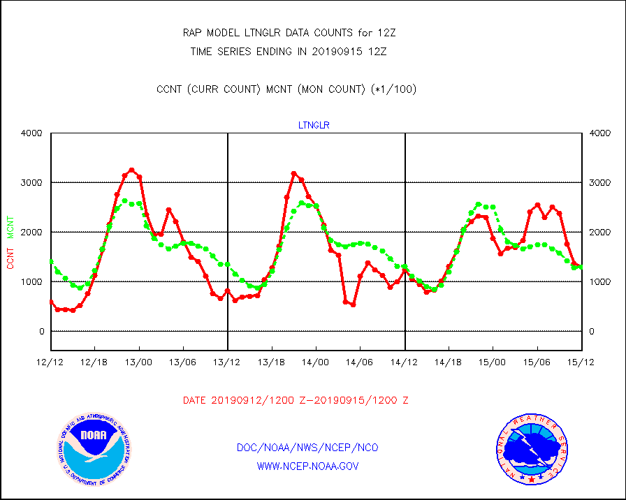
ltnglr |
LLDN Long-rng lightning from Vaisala via NOAAPORT |
130252 |
130638 |
99.7 % |
1511.00-1512.50 |
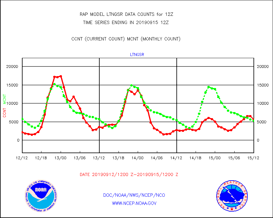
ltngsr |
NLDN Shrt-rng lightning from Vaisala via NOAAPORT |
5659 |
5342 |
105.9 % |
1511.00-1512.50 |
mso470 |
Mesonet/MADIS Colorado E-470 (Interstate 470) |
66 |
11 |
600.0 % |
1511.50-1512.50 |
msoalk |
Mesonet/MADIS Alaska Department of Transportation |
370 |
154 |
240.3 % |
1511.50-1512.50 |
msoapg |
Mesonet/MADIS U.S. Army Aberdeen Proving Grounds |
0 |
0 |
n/a |
1511.50-1512.50 |
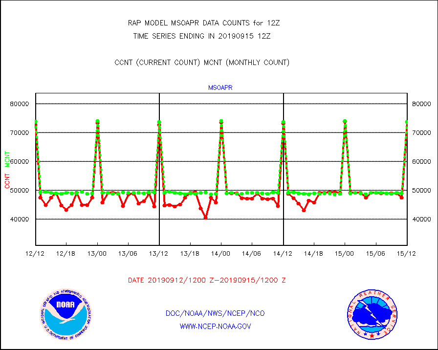
msoapr |
Mesonet/MADIS Citizen Weather Observers Program |
73601 |
73739 |
99.8 % |
1511.50-1512.50 |
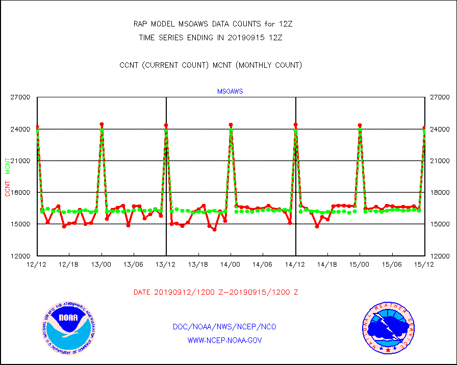
msoaws |
Mesonet/MADIS AWS Convergence Technologies, Inc. |
24104 |
23854 |
101.0 % |
1511.50-1512.50 |
msoawx |
Mesonet/MADIS "Anything Weather" |
0 |
0 |
n/a |
1511.50-1512.50 |
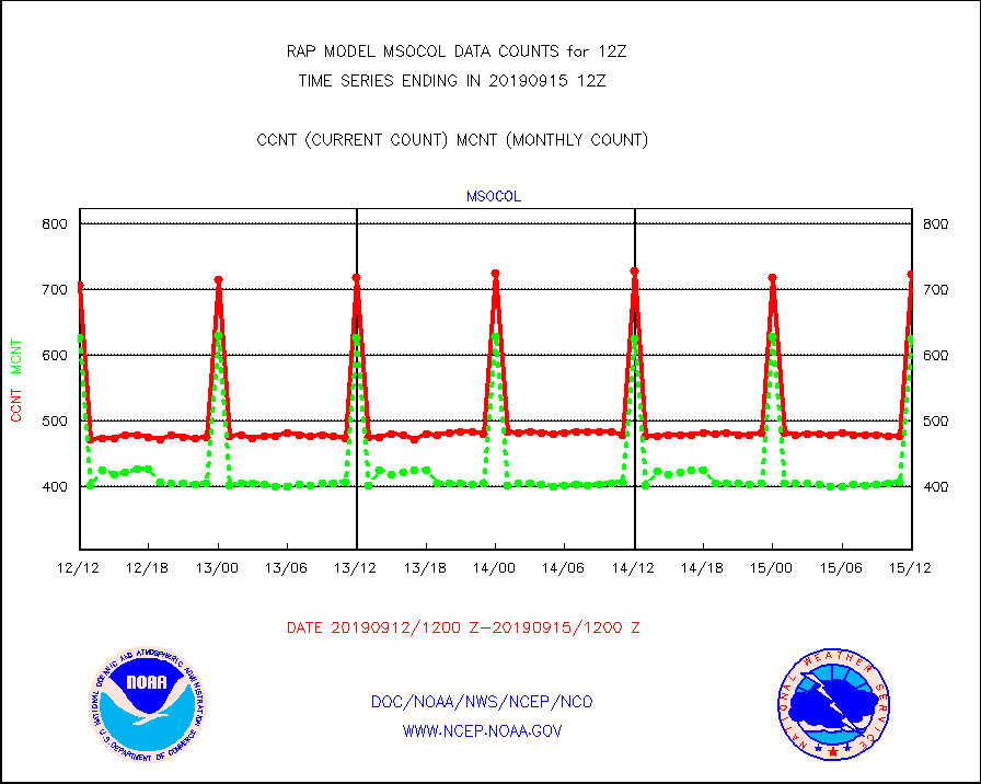
msocol |
Mesonet/MADIS Colorado Dept. of Transportation |
723 |
626 |
115.5 % |
1511.50-1512.50 |
msodcn |
Mesonet/MADIS DC Net |
0 |
0 |
n/a |
1511.50-1512.50 |
msoden |
Mesonet/MADIS Denver Urban Drainage & Flood Cntrl |
0 |
0 |
n/a |
1511.50-1512.50 |
msofla |
Mesonet/MADIS Florida (FAWN & USF) |
175 |
170 |
102.9 % |
1511.50-1512.50 |
msoflt |
Mesonet/MADIS Florida Dept. of Transportation |
0 |
0 |
n/a |
1511.50-1512.50 |
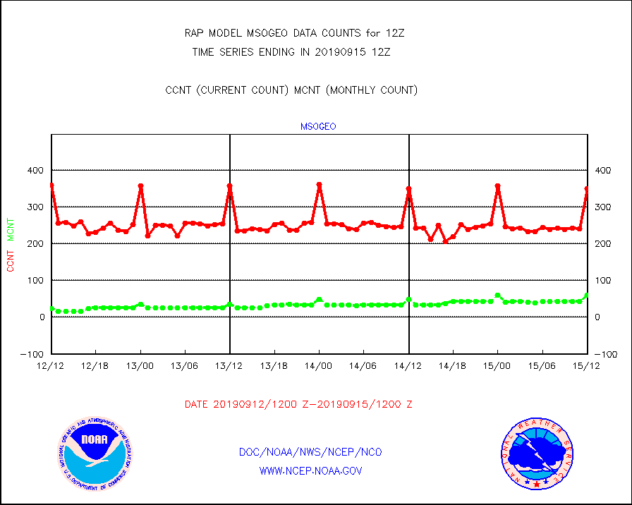
msogeo |
Mesonet/MADIS Georgia Dept. of Transportation |
349 |
60 |
581.7 % |
1511.50-1512.50 |
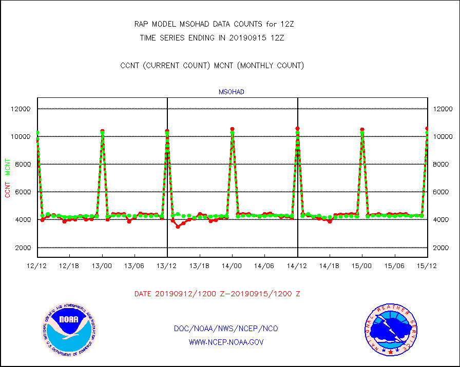
msohad |
Mesonet/MADIS NWS Hydromet Auto Data System(HADS) |
10586 |
10277 |
103.0 % |
1511.50-1512.50 |
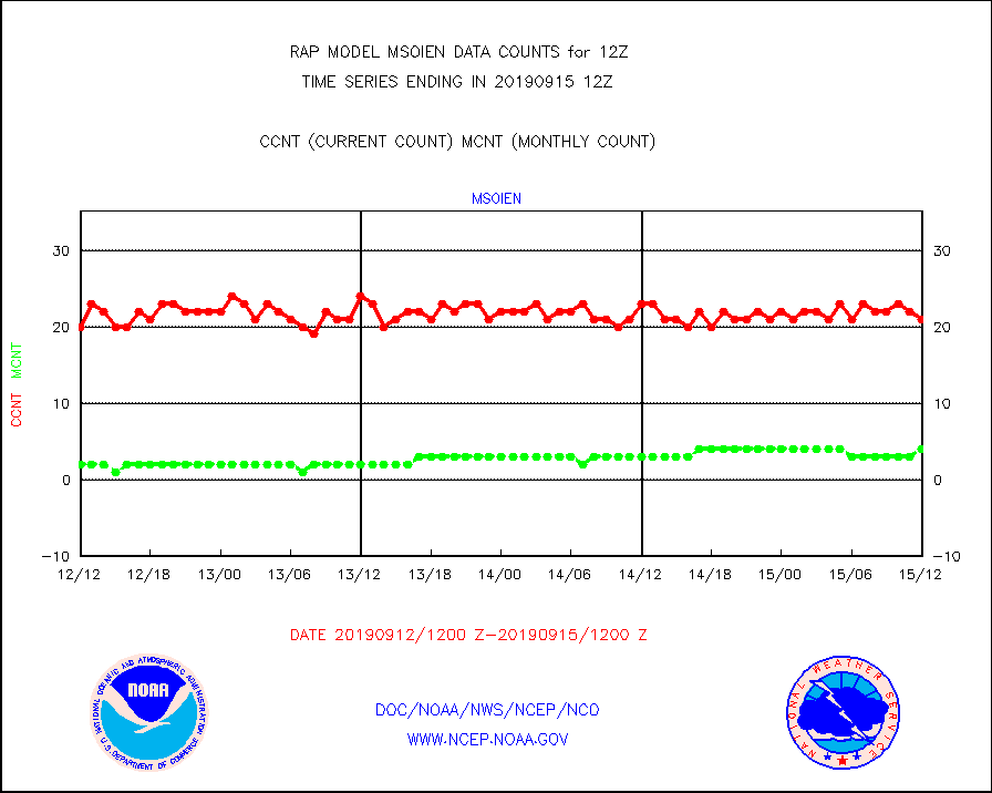
msoien |
Mesonet/MADIS Iowa Environmental |
21 |
4 |
525.0 % |
1511.50-1512.50 |
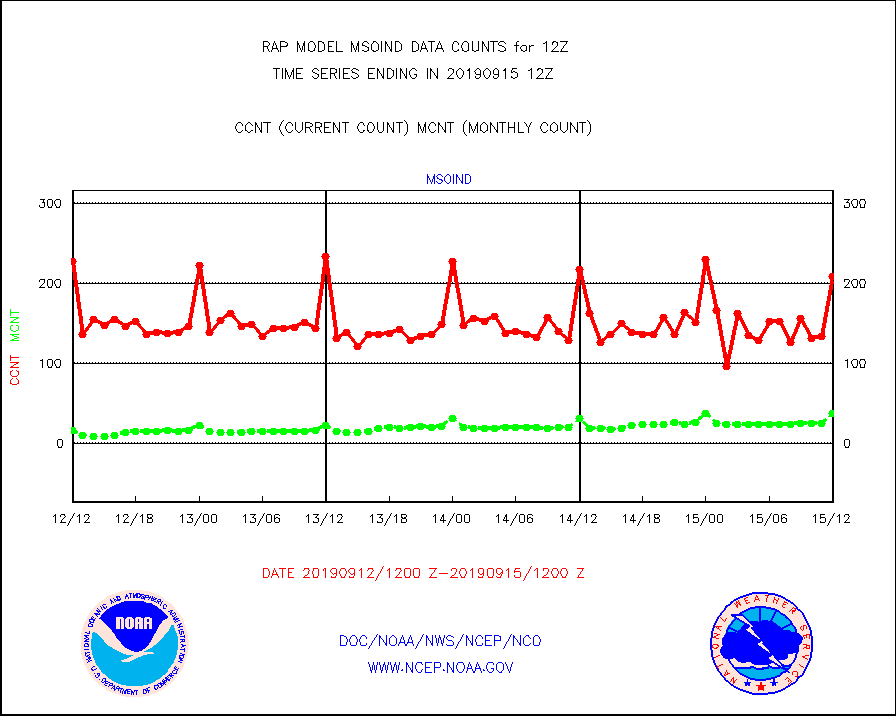
msoind |
Mesonet/MADIS Indiana Dept. of Transportation |
209 |
38 |
550.0 % |
1511.50-1512.50 |
msoiow |
Mesonet/MADIS Iowa Department of Transportation |
399 |
406 |
98.3 % |
1511.50-1512.50 |
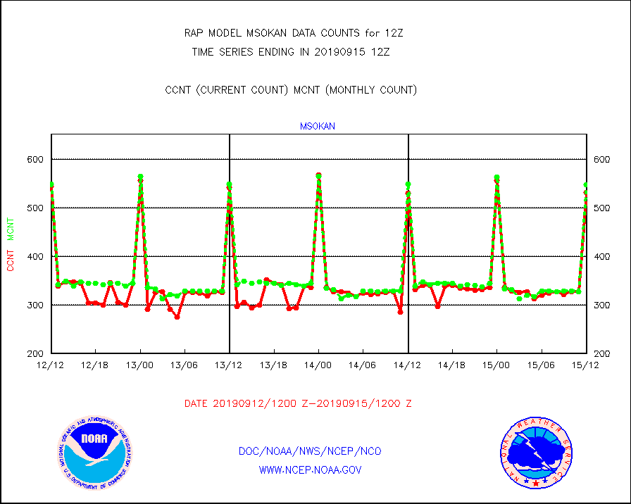
msokan |
Mesonet/MADIS Kansas Department of Transportation |
531 |
547 |
97.1 % |
1511.50-1512.50 |
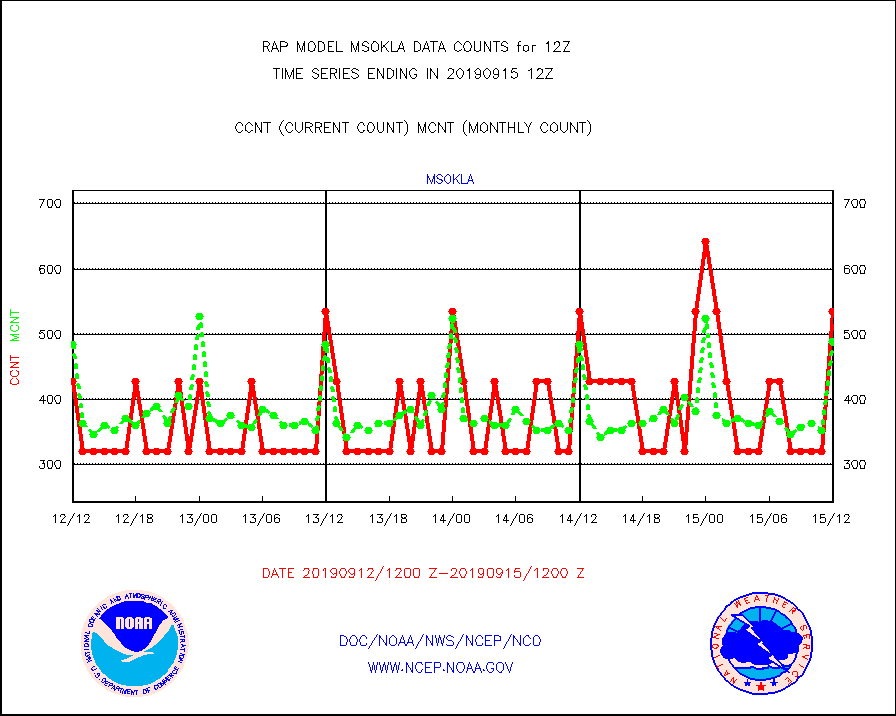
msokla |
Mesonet/MADIS Oklahoma Mesonet |
535 |
489 |
109.4 % |
1511.50-1512.50 |
msolju |
Mesonet/MADIS Louisiana State/Jackson State Univ. |
0 |
0 |
n/a |
1511.50-1512.50 |
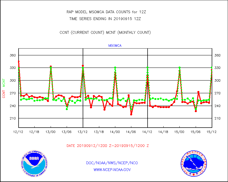
msomca |
Mesonet/MADIS Missouri Commercial Agricult Wx Net |
325 |
331 |
98.2 % |
1511.50-1512.50 |
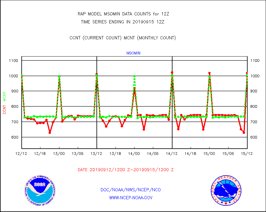
msomin |
Mesonet/MADIS Minnesota Dept. of Transportation |
1018 |
1005 |
101.3 % |
1511.50-1512.50 |
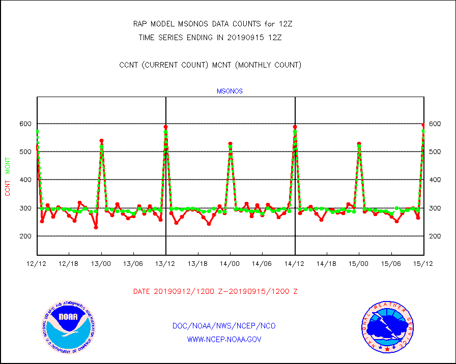
msonos |
Mesonet/MADIS NOS-Phys Oceanographic Realtime Sys |
596 |
574 |
103.8 % |
1511.50-1512.50 |
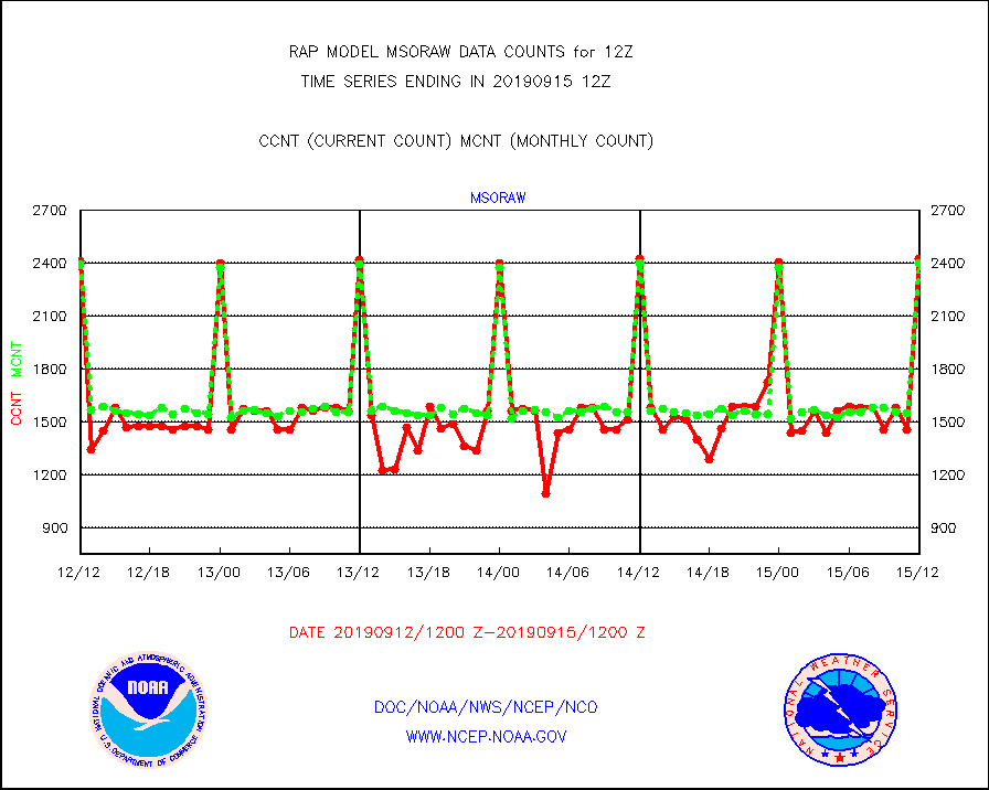
msoraw |
Mesonet/MADIS NFIC Remote Automated Wx Stns(RAWS) |
2430 |
2400 |
101.2 % |
1511.50-1512.50 |
msothr |
Mesonet/MADIS many providers, not separated out |
26322 |
22865 |
115.1 % |
1511.50-1512.50 |
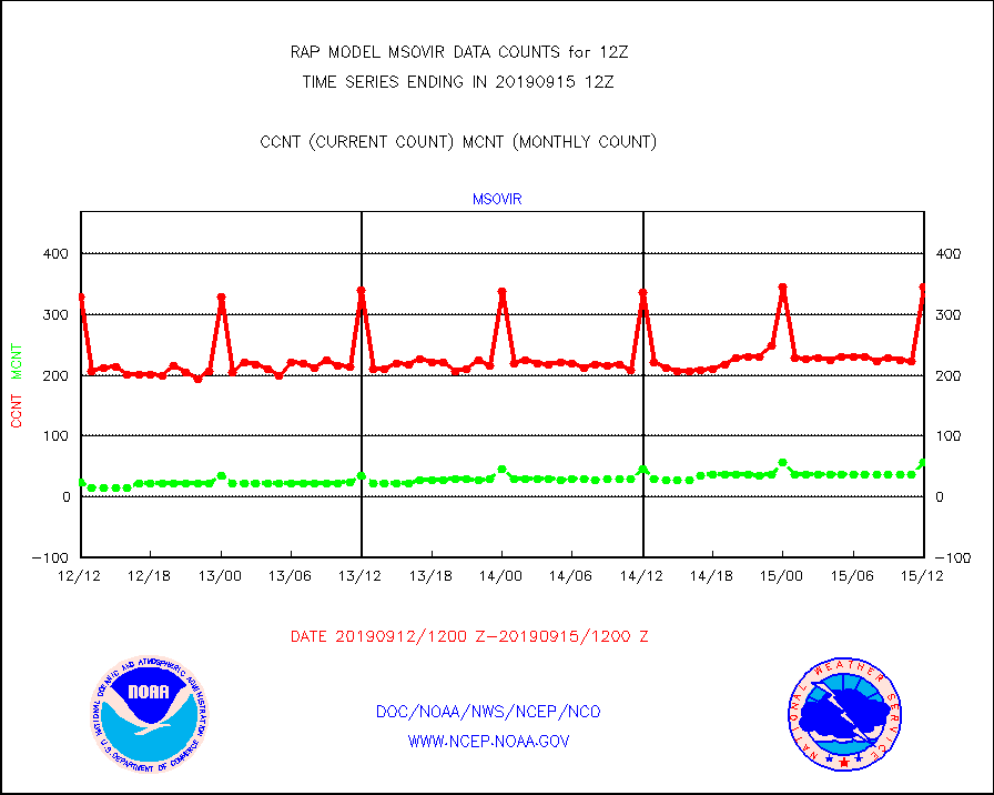
msovir |
Mesonet/MADIS Virginia Dept. of Transportation |
346 |
56 |
617.9 % |
1511.50-1512.50 |
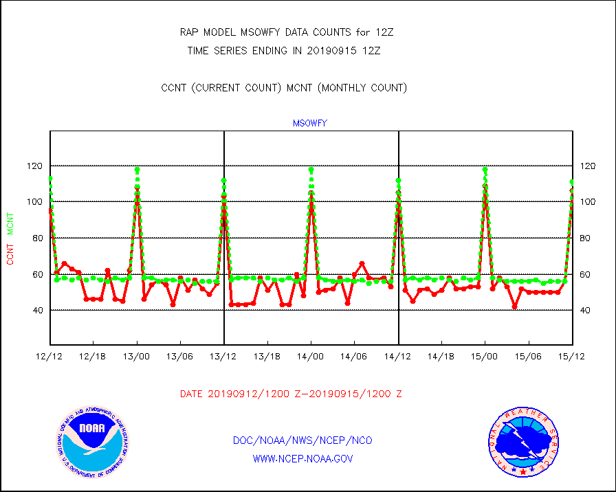
msowfy |
Mesonet/MADIS "Weather for You" |
106 |
111 |
95.5 % |
1511.50-1512.50 |
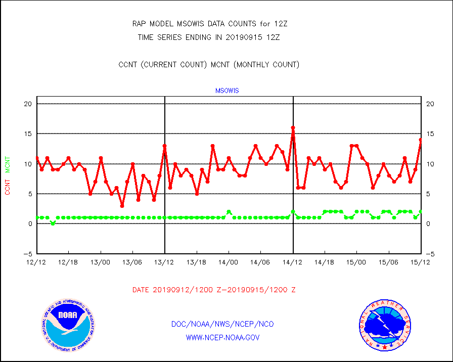
msowis |
Mesonet/MADIS Wisconsin Dept. of Transportation |
14 |
2 |
700.0 % |
1511.50-1512.50 |
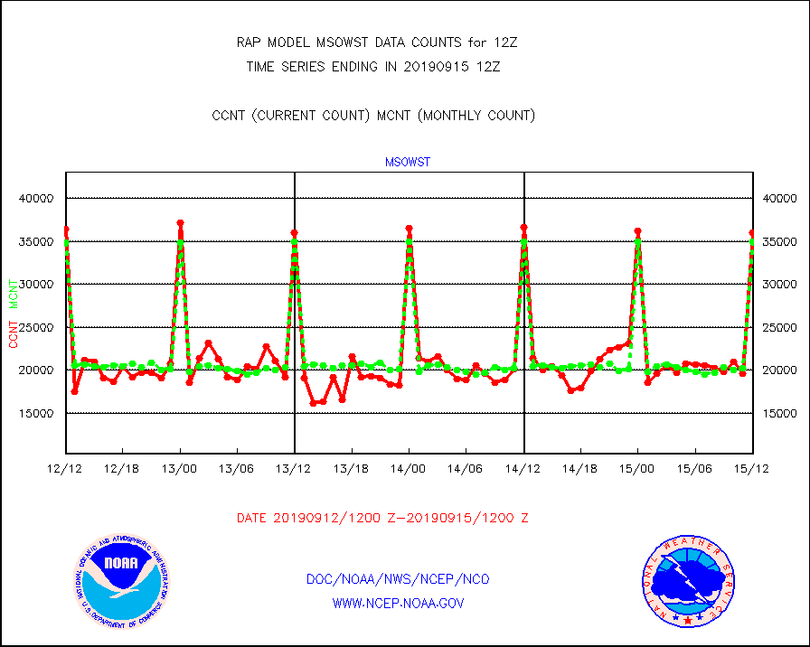
msowst |
Mesonet/MADIS MesoWest (many subproviders) |
36024 |
35030 |
102.8 % |
1511.50-1512.50 |
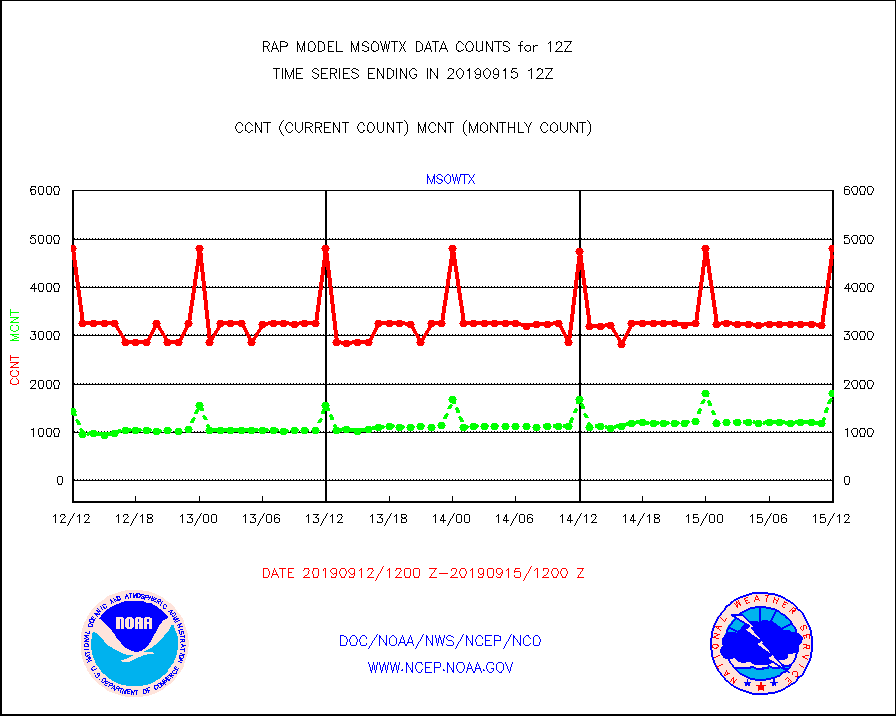
msowtx |
Mesonet/MADIS West Texas |
4799 |
1797 |
267.1 % |
1511.50-1512.50 |
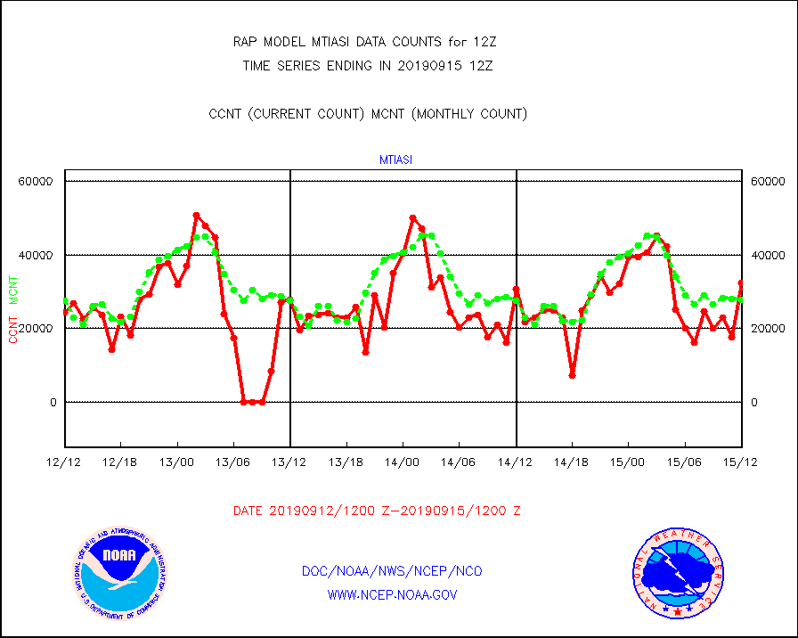
mtiasi |
METOP 1-2 IASI 1C radiance data (varbl. channels) |
32336 |
27773 |
116.4 % |
1510.00-1513.99 |
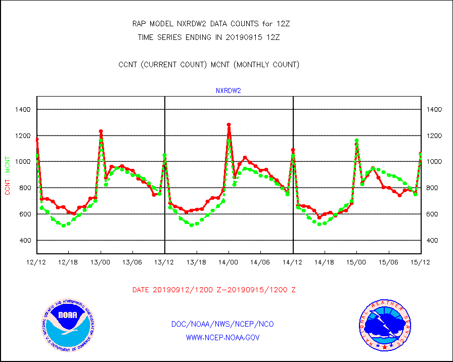
nxrdw2 |
NEXRAD Vel Azm Dsp(VAD) winds via Level 2 decoder |
1063 |
1054 |
100.9 % |
1511.00-1513.00 |
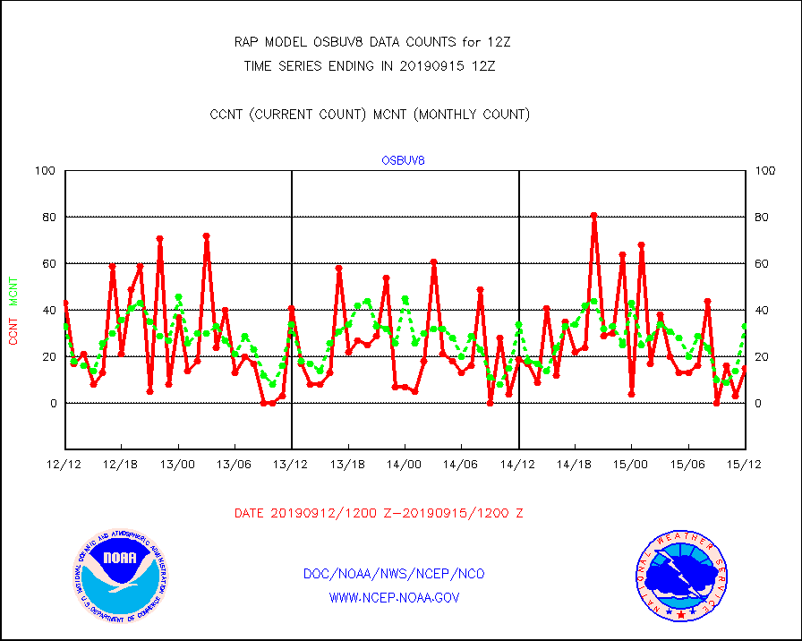
osbuv8 |
NOAA 16-19 Solar Backscatter UV-2 rad frm V8 BUFR |
15 |
33 |
45.5 % |
1510.00-1512.99 |
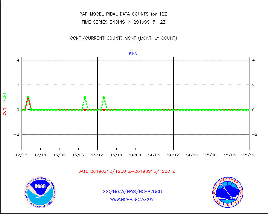
pibal |
PIBAL (from PILOT, PILOT SHIP, PILOT MOBIL) |
0 |
0 |
n/a |
1511.00-1513.00 |
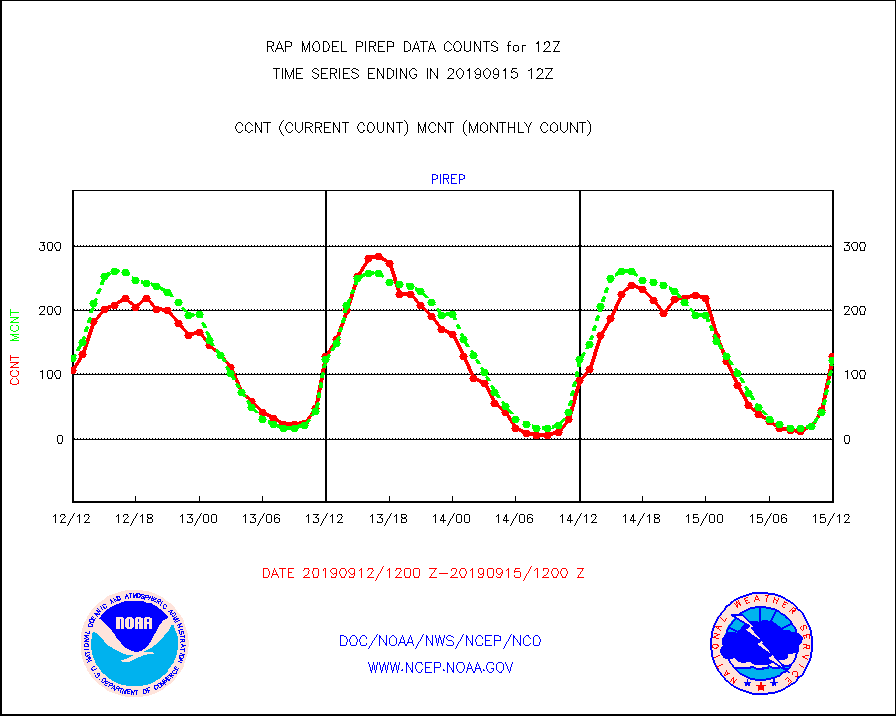
pirep |
Manual PIREP aircraft data (dcded from AIREP fmt) |
129 |
122 |
105.7 % |
1508.75-1515.25 |
prflrp |
Profilr winds from PIBAL (PILOT,PILOT SHIP/MOBIL) |
0 |
0 |
n/a |
1510.50-1513.50 |
radw25 |
NEXRAD radial wind superobs (Level 2.5 - ORPG) |
0 |
0 |
n/a |
1511.00-1513.00 |
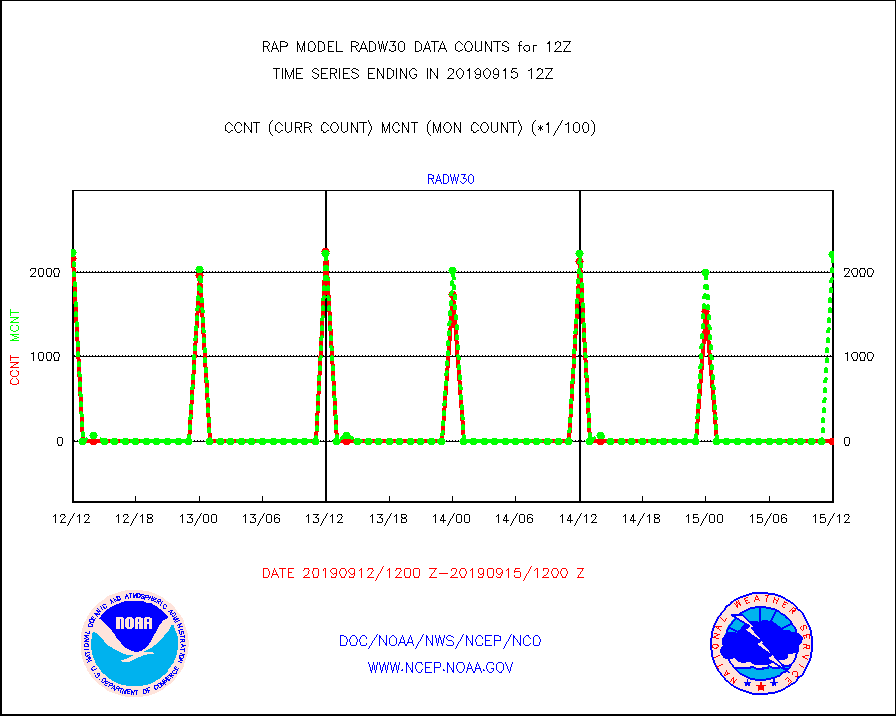
radw30 |
NEXRAD radial wind superobs (Level 3 - NIDS) |
0 |
221290 |
0.0 % |
1511.00-1513.00 |
raobm |
Rawinsonde - mobile land (from TEMP/PILOT MOBIL) |
0 |
0 |
n/a |
1511.00-1513.00 |
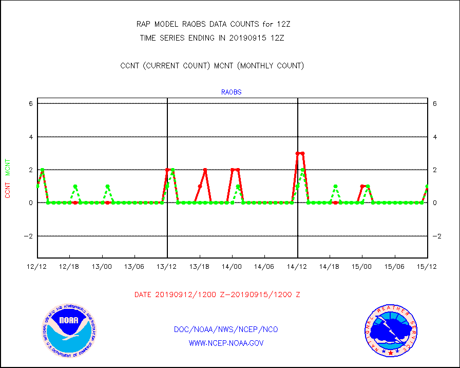
raobs |
Rawinsonde - ship (from TEMP SHIP, PILOT SHIP) |
1 |
1 |
100.0 % |
1511.00-1513.00 |
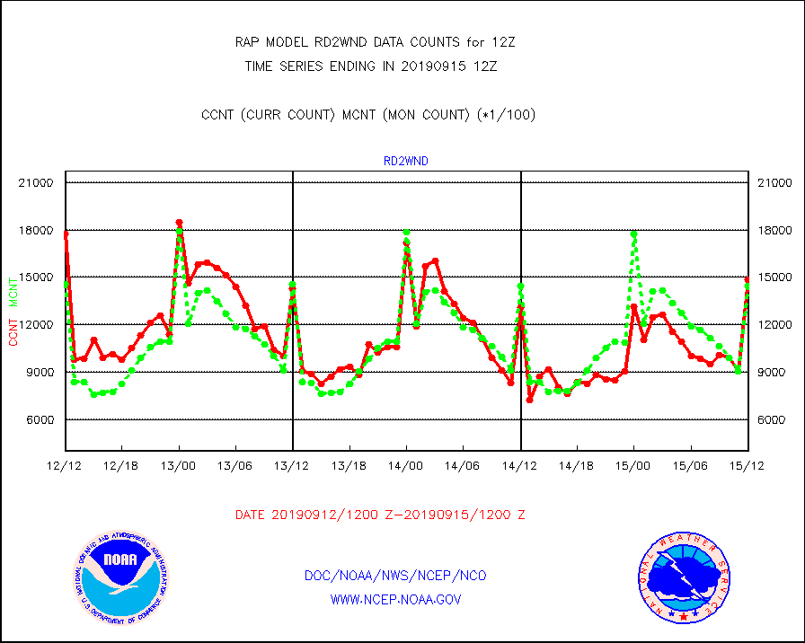
rd2wnd |
NEXRAD radial wind (Level 2 - GTS) |
1483696 |
1446527 |
102.6 % |
1511.50-1512.49 |
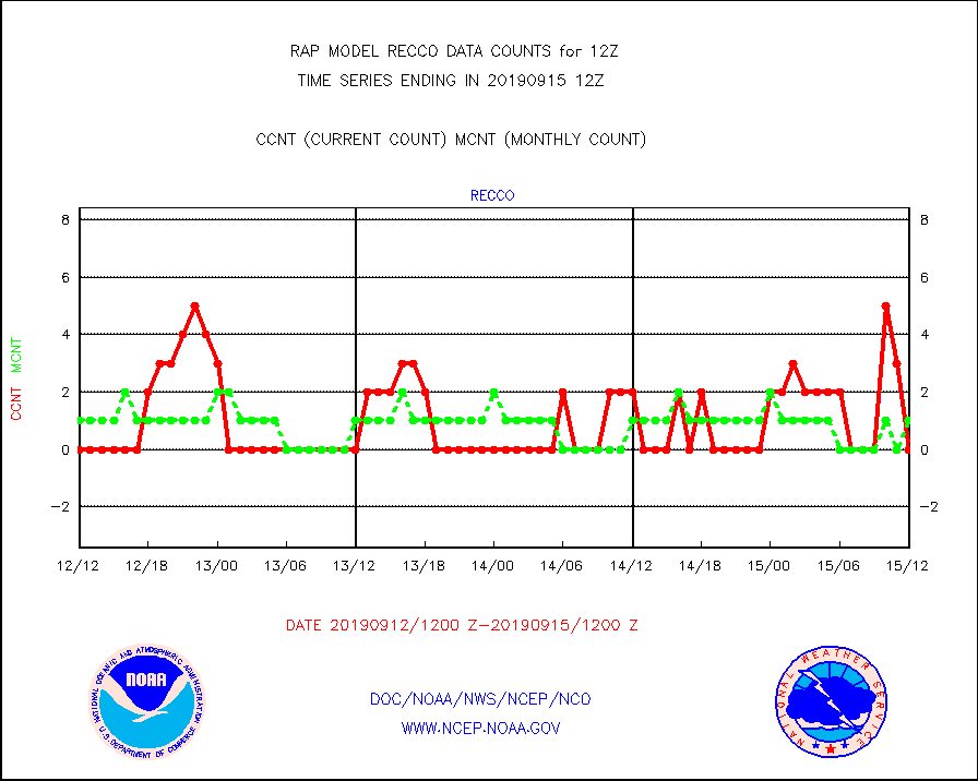
recco |
Flight level reconnaissance aircraft data |
0 |
1 |
0.0 % |
1511.00-1513.00 |
sevasr |
METEOSAT-10 2nd Gen SEVIRI All Sky Radiance(proc) |
14727 |
14688 |
100.3 % |
1510.00-1513.99 |
sevcsr |
METEOSAT-10 2nd Gen SEVIRI Clr Sky Radiance(proc) |
14727 |
14727 |
100.0 % |
1510.00-1513.99 |
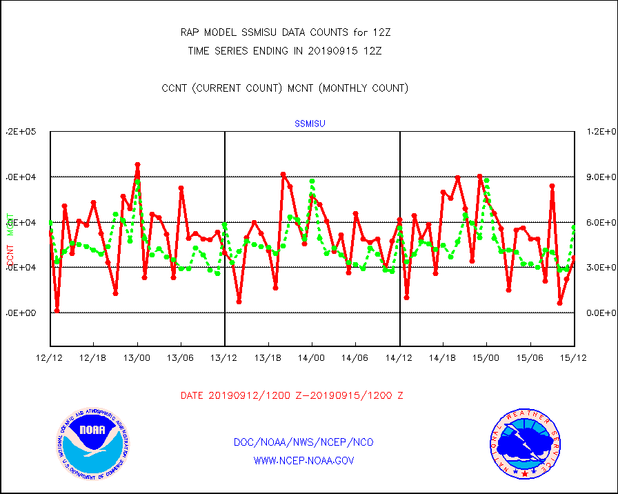
ssmisu |
DMSP SSM/IS 1C radiance data (Unified Pre-Proc.) |
36579 |
56487 |
64.8 % |
1510.00-1513.99 |
synopr |
Synoptic - restricted (WMO Res 40) manual & auto. |
14 |
16 |
87.5 % |
1511.50-1512.50 |
tmdara |
TAMDAR aircft data-all types(from Panasonic,BUFR) |
7248 |
6555 |
110.6 % |
1508.75-1515.25 |
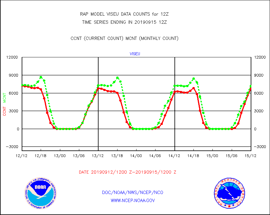
viseu |
METEOSAT/EUMETSAT visible derived cloud motion |
6759 |
7188 |
94.0 % |
1510.50-1513.49 |
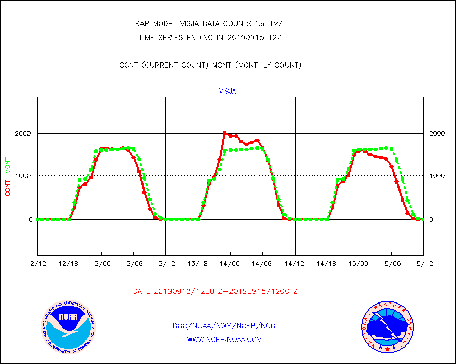
visja |
MTSAT/JMA visible derived cloud motion |
0 |
0 |
n/a |
1510.50-1513.50 |
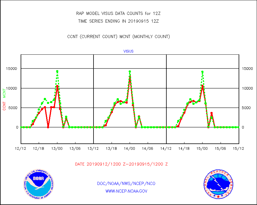
visus |
GOES/NESDIS visible derived cloud motion |
0 |
0 |
n/a |
1511.00-1511.99 |


