| Critical Data with Normal Counts |
|---|
| Type | Description | Hourly Count | Monthly Average | Percent (%) of Monthly Mean |
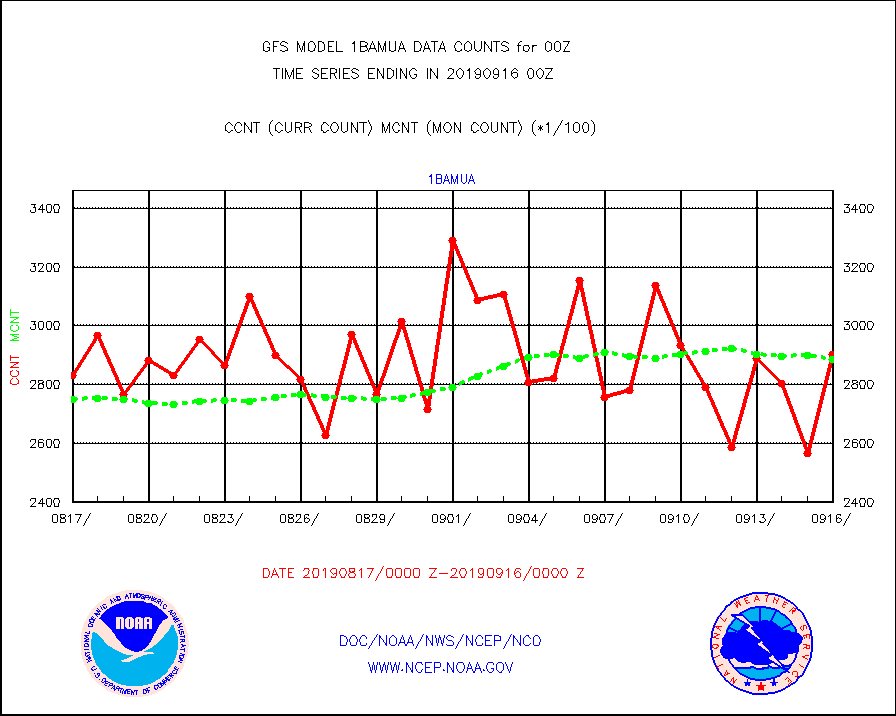
1bamua |
NOAA 15-19 & METOP 1-2 AMSU-A NCEP-proc. br.temps |
290477 |
288459 |
100.7 % |
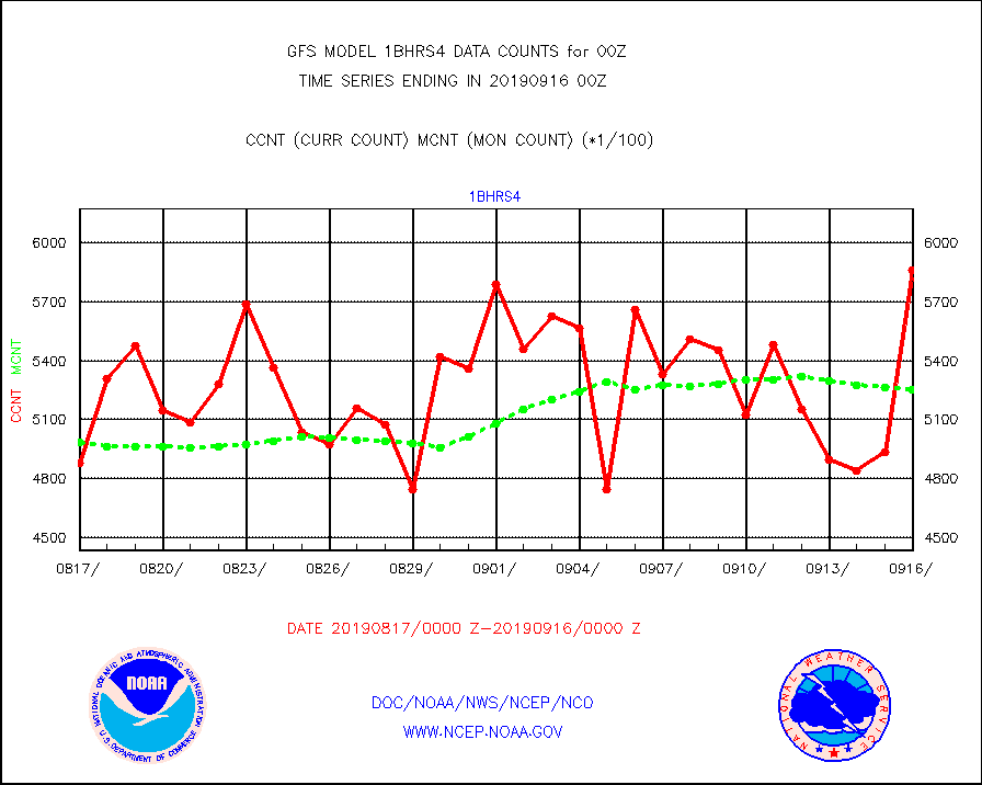
1bhrs4 |
NOAA 18-19 & METOP 1-2 HIRS-4 NCEP-proc. br.temps |
586258 |
525178 |
111.6 % |
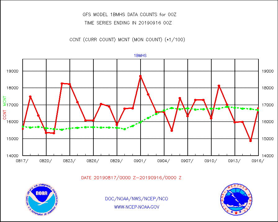
1bmhs |
NOAA 18-19 & METOP 1-2 MHS NCEP-proces. br. temps |
1680286 |
1669108 |
100.7 % |
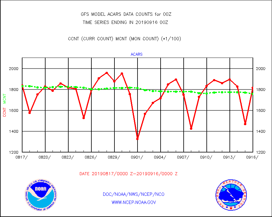
acars |
MDCRS ACARS acft data from ARINC(dcded from BUFR) |
181500 |
175813 |
103.2 % |
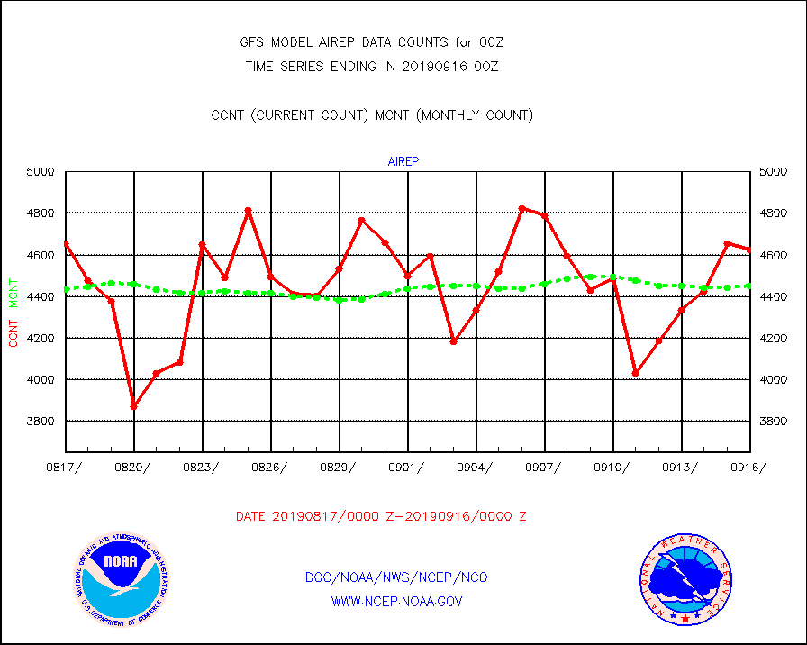
airep |
Manual AIREP aircraft data (dcded from AIREP fmt) |
4623 |
4453 |
103.8 % |
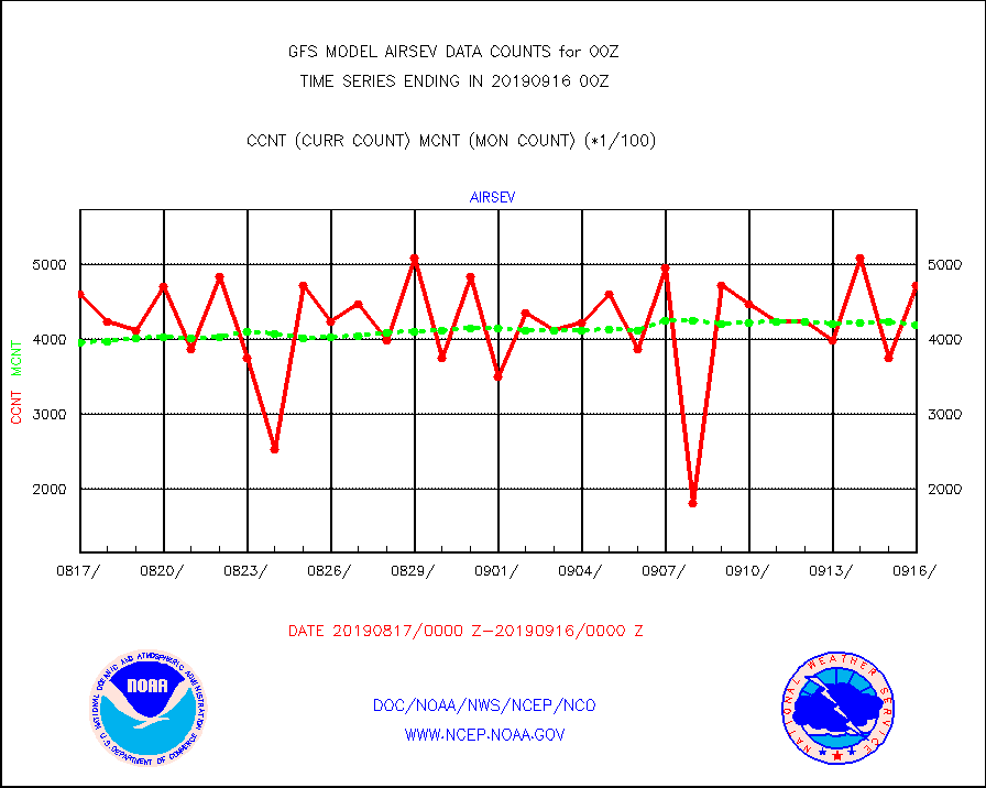
airsev |
AQUA AIRS/AMSU-A/HSB brightness temps- every FOV |
471639 |
418503 |
112.7 % |
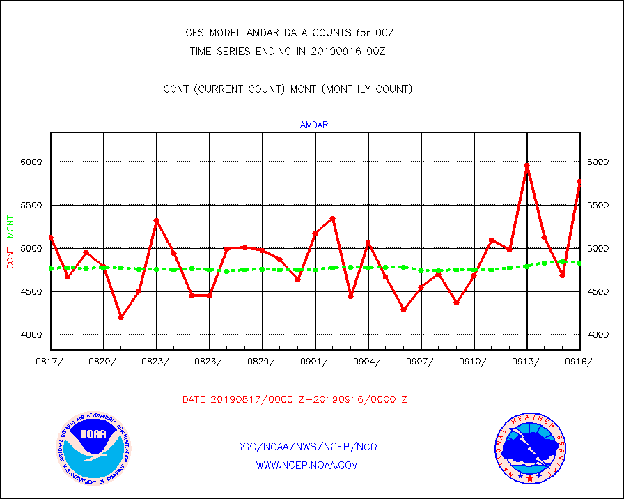
amdar |
AMDAR aircraft data (decoded from AMDAR format) |
5779 |
4833 |
119.6 % |
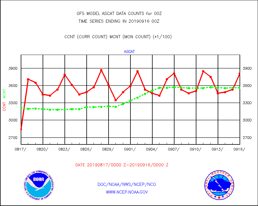
ascat |
METOP 1-2 ASCAT products |
381024 |
355958 |
107.0 % |
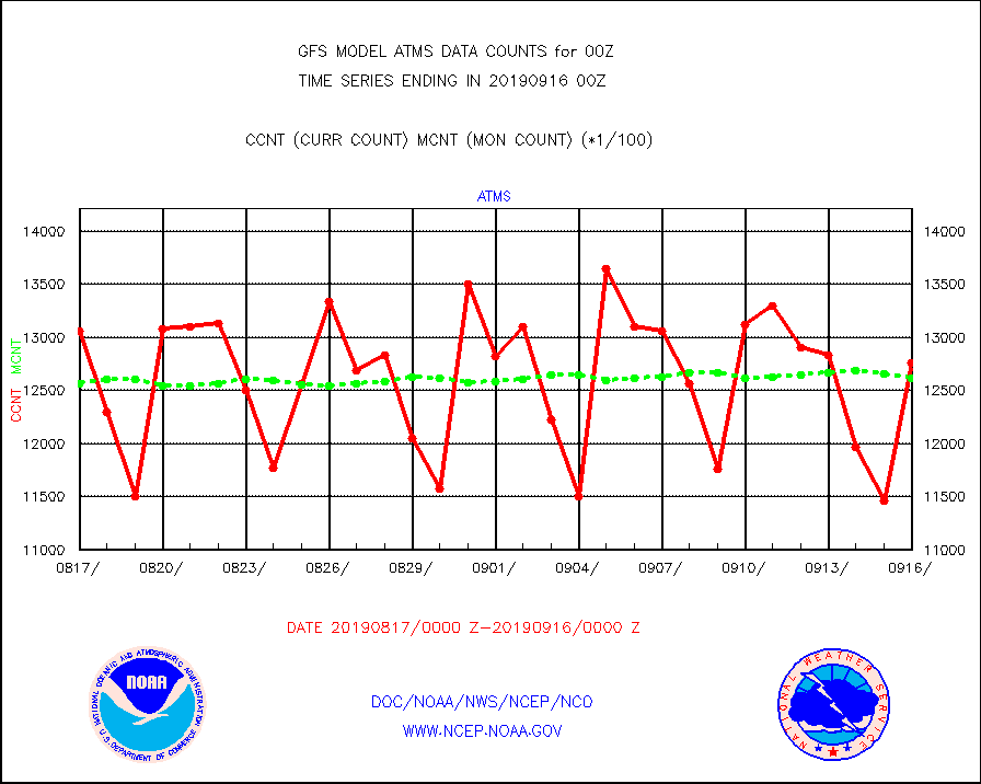
atms |
NPP/NOAA-20 ATMS brightness temperatures |
1275456 |
1260993 |
101.1 % |
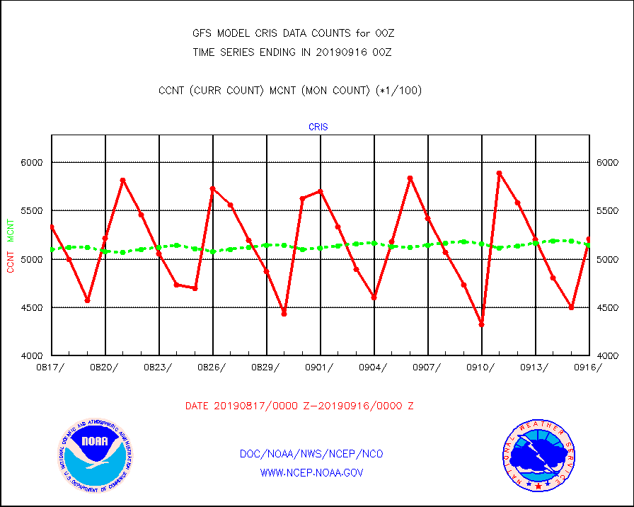
cris |
NPP CrIS apodized radiances (399 channel) |
520821 |
514611 |
101.2 % |
dbuoy |
Buoys decoded from FM-18 fmt (moored or drifting) |
929 |
952 |
97.6 % |
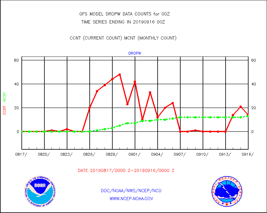
dropw |
Dropwinsonde (from TEMP DROP) |
14 |
13 |
107.7 % |
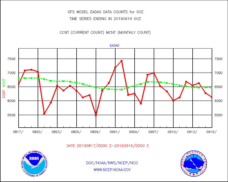
eadas |
E-AMDAR (European AMDAR acft decoded from BUFR) |
6135 |
6466 |
94.9 % |
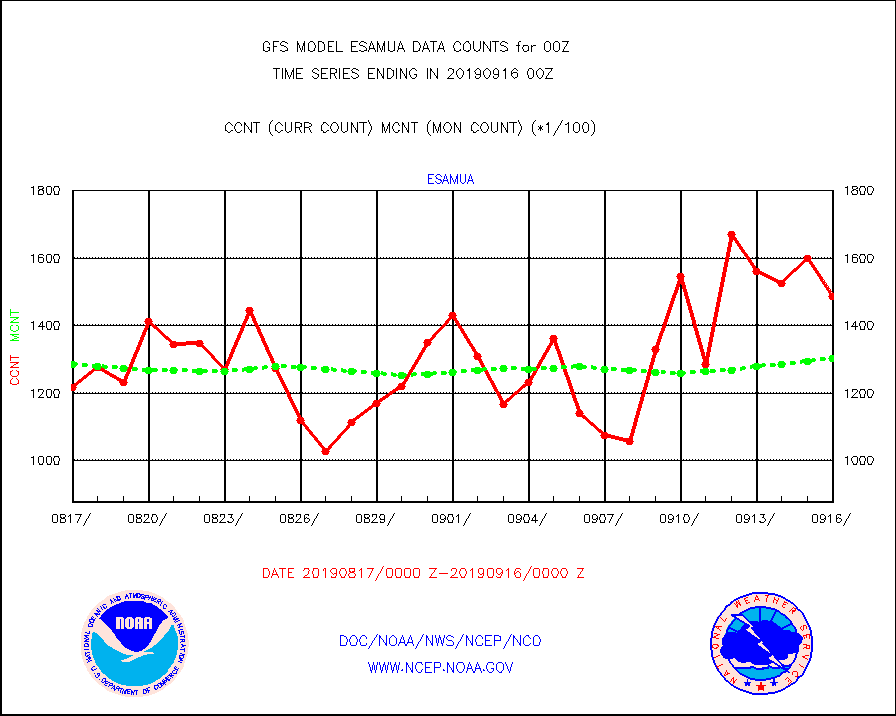
esamua |
NOAA 15-19 & METOP 1-2 AMSU-A proc btmps frm RARS |
148874 |
130446 |
114.1 % |
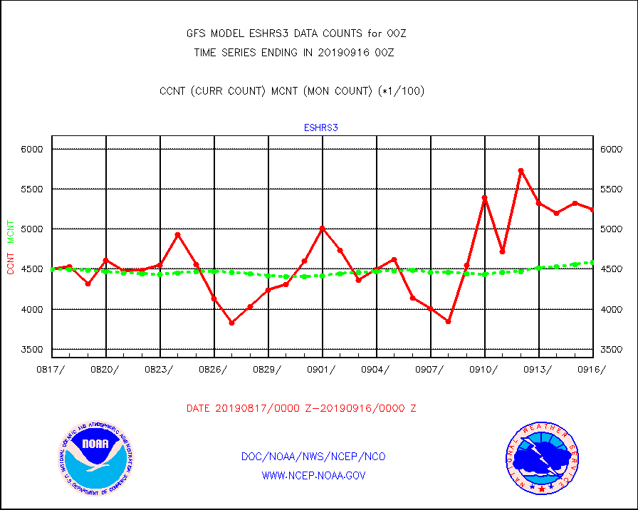
eshrs3 |
NOAA 15-19 & METOP 1-2 HIRS-3/4 pr btmps frm RARS |
524540 |
458434 |
114.4 % |
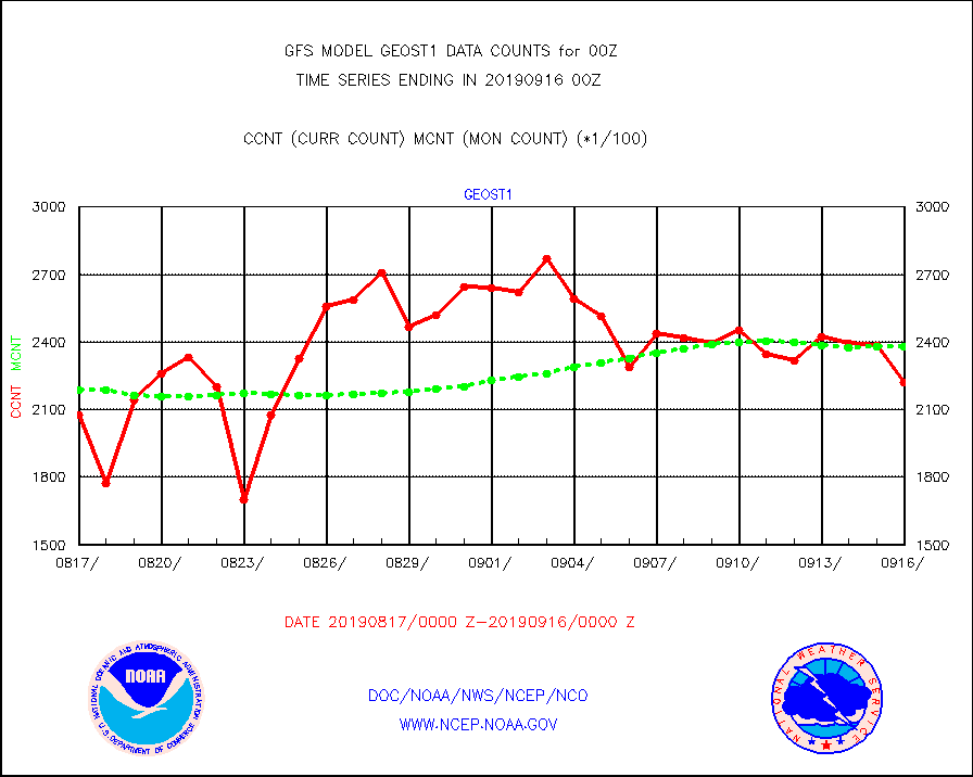
geost1 |
GOES/NESDIS hi-resol. (1x1 f-o-v) sndgs/radiances |
222005 |
237943 |
93.3 % |
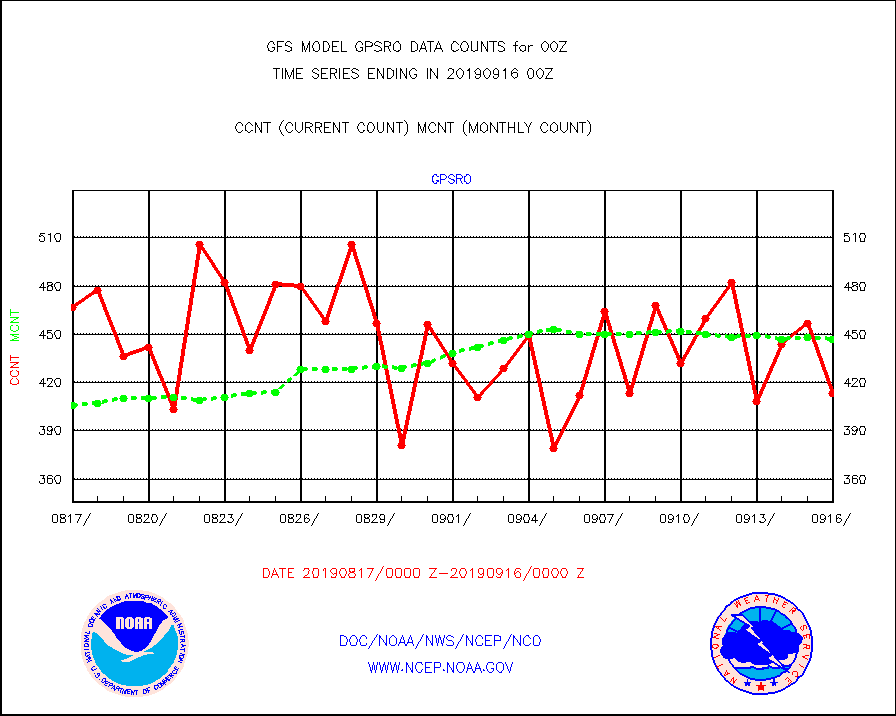
gpsro |
GPS radio occultation data |
413 |
447 |
92.4 % |
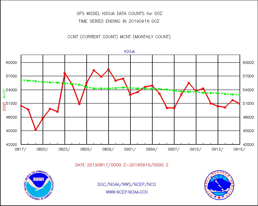
h20ja |
MTSAT/JMA water vapor imager derived cloud motion |
50981 |
52880 |
96.4 % |
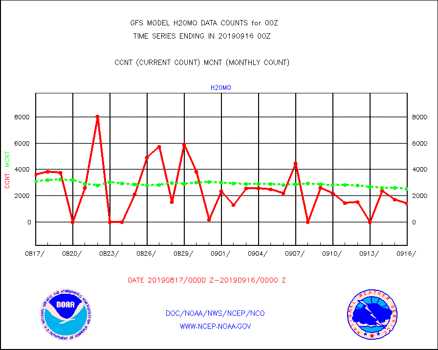
h20mo |
MODIS (AQUA/TERRA) wvpr imager derived cld motion |
1414 |
2526 |
56.0 % |
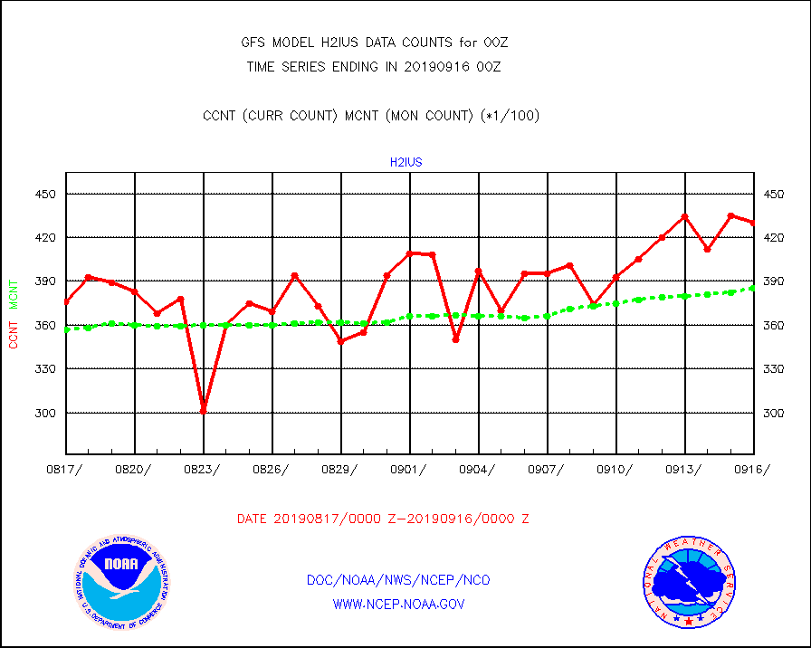
h2ius |
GOES-15&dn/NESDIS wv imager derived cloud motion |
43043 |
38568 |
111.6 % |
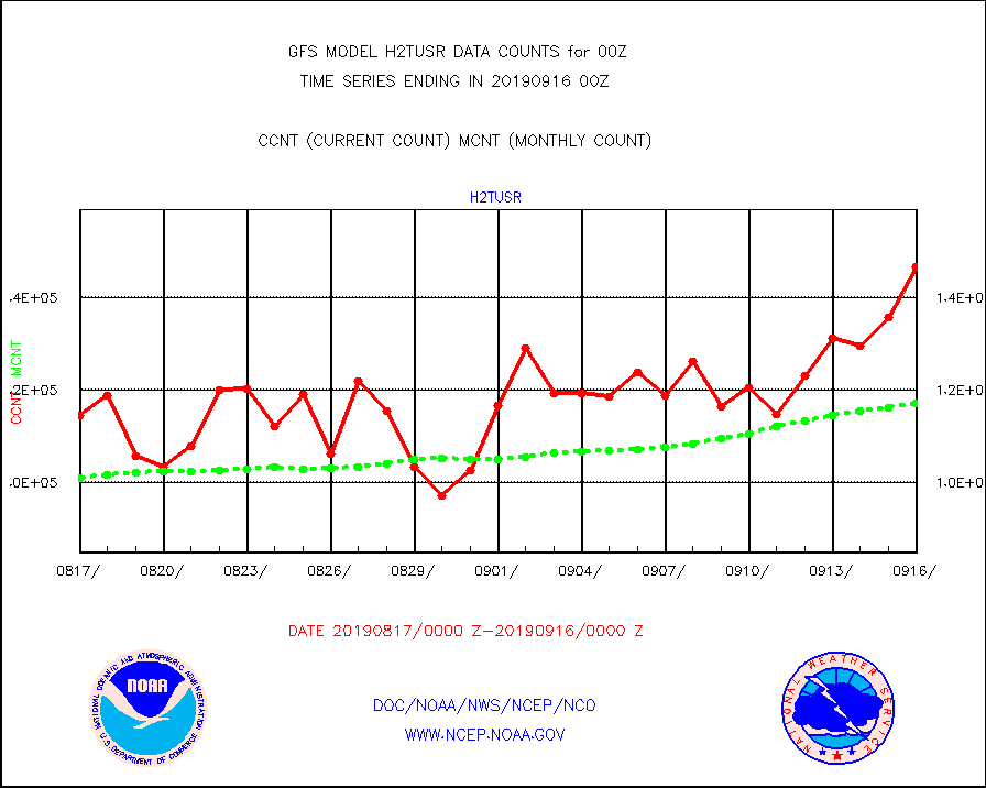
h2tusr |
GOES-16&up/NESDIS wv imgr/cld-top derived cld mtn |
146497 |
117021 |
125.2 % |
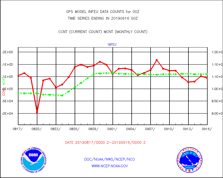
infeu |
METEOSAT/EUMETSAT ir lg-wave derived cloud motion |
104408 |
106003 |
98.5 % |
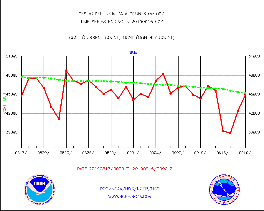
infja |
MTSAT/JMA infrared long-wave derived cloud motion |
44921 |
45162 |
99.5 % |
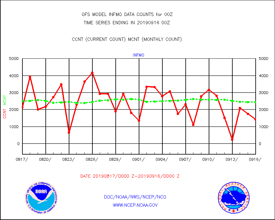
infmo |
MODIS (AQUA/TERRA) ir l-wave derived cloud motion |
1425 |
2441 |
58.4 % |
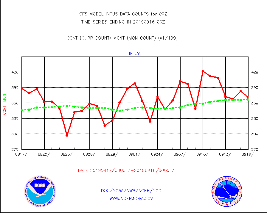
infus |
GOES-15&dn/NESDIS ir long-wave derived cld motion |
37105 |
36723 |
101.0 % |
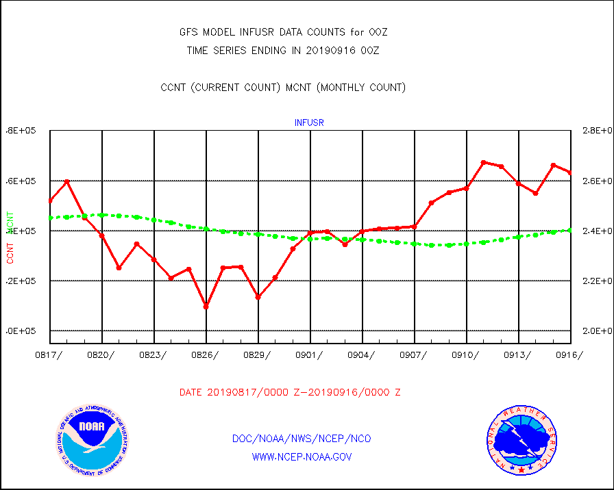
infusr |
GOES-16&up/NESDIS ir long-wave derived cld motion |
263085 |
240327 |
109.5 % |
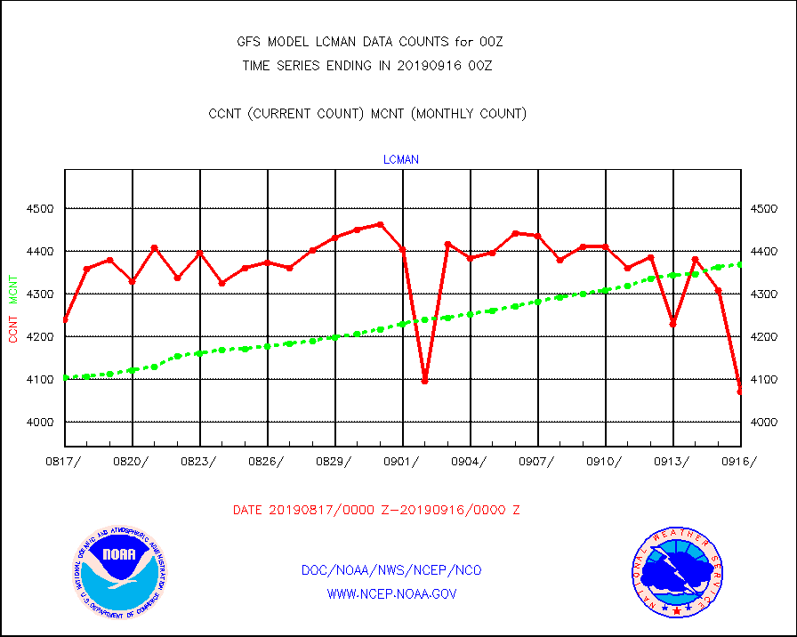
lcman |
Land-based CMAN stations decoded from CMAN format |
4072 |
4369 |
93.2 % |
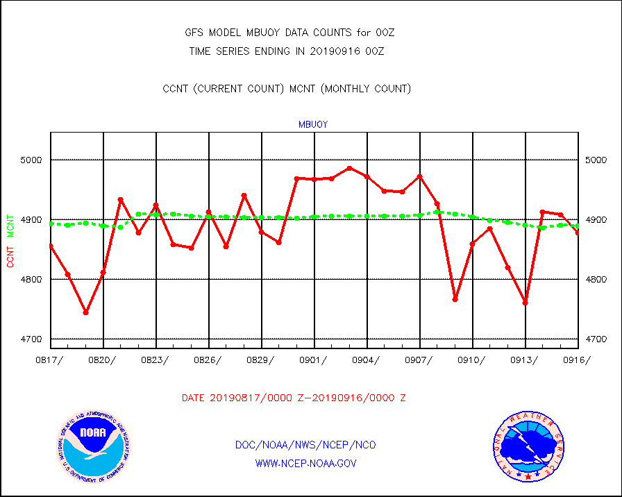
mbuoy |
Buoys decoded from FM-13 format (moored) |
4878 |
4889 |
99.8 % |
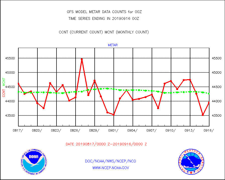
metar |
Aviation - METAR |
43952 |
44265 |
99.3 % |
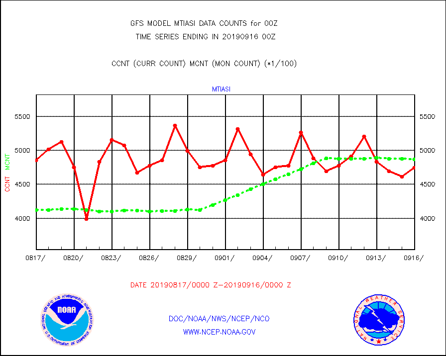
mtiasi |
METOP 1-2 IASI 1C radiance data (varbl. channels) |
474988 |
487289 |
97.5 % |
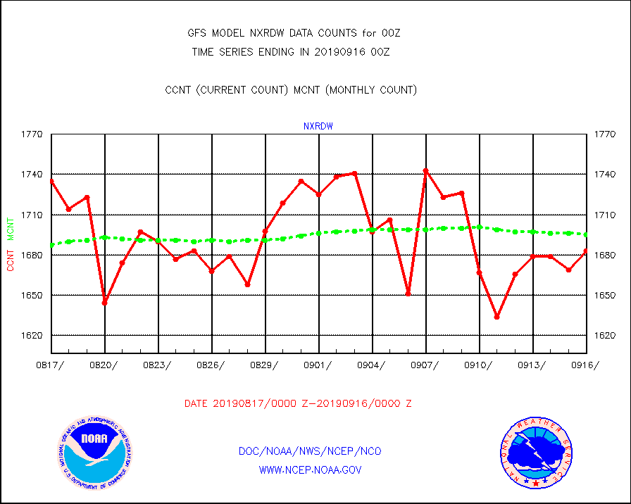
nxrdw |
NEXRAD Vel Azm Dsp(VAD) winds via radar coded msg |
1683 |
1695 |
99.3 % |
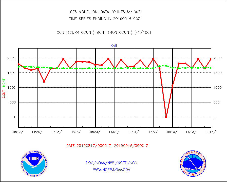
omi |
Aura Ozone Monitoring Instrument (OMI) data |
197280 |
167152 |
118.0 % |
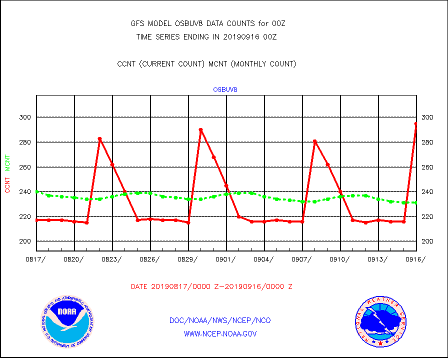
osbuv8 |
NOAA 16-19 Solar Backscatter UV-2 rad frm V8 BUFR |
295 |
231 |
127.7 % |
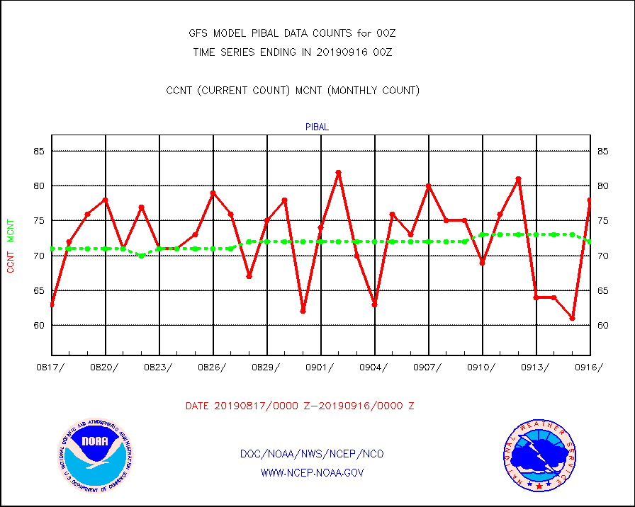
pibal |
PIBAL (from PILOT, PILOT SHIP, PILOT MOBIL) |
78 |
72 |
108.3 % |
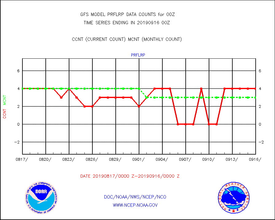
prflrp |
Profilr winds from PIBAL (PILOT,PILOT SHIP/MOBIL) |
4 |
3 |
133.3 % |
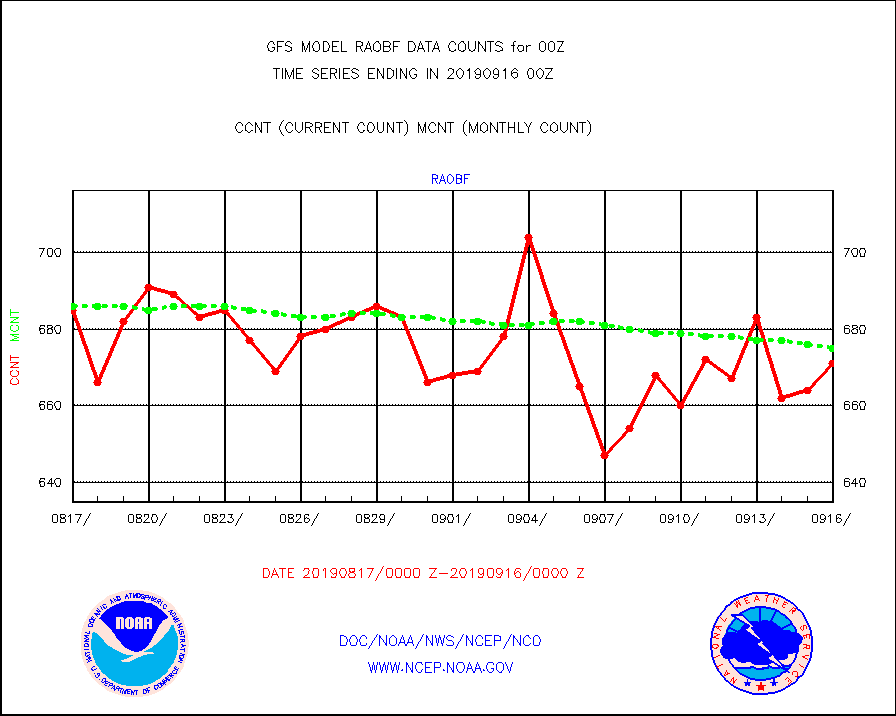
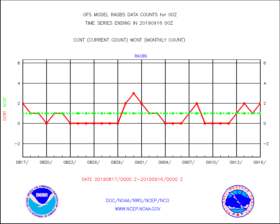
raobf |
Rawinsonde - fixed land (from TEMP or PILOT) |
671 |
675 |
99.4 % |
raobm |
Rawinsonde - mobile land (from TEMP/PILOT MOBIL) |
0 |
0 |
n/a |
raobs |
Rawinsonde - ship (from TEMP SHIP, PILOT SHIP) |
2 |
1 |
200.0 % |
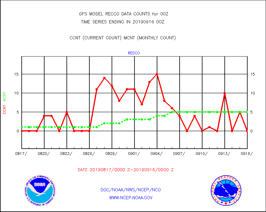
recco |
Flight level reconnaissance aircraft data |
0 |
5 |
0.0 % |
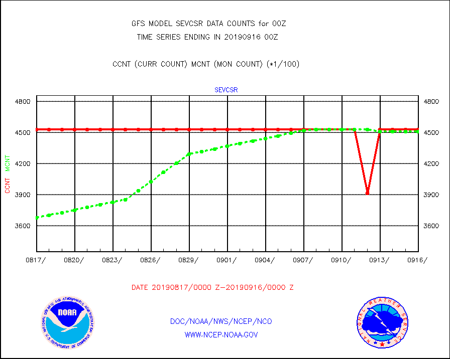
sevcsr |
METEOSAT-10 2nd Gen SEVIRI Clr Sky Radiance(proc) |
453072 |
451018 |
100.5 % |
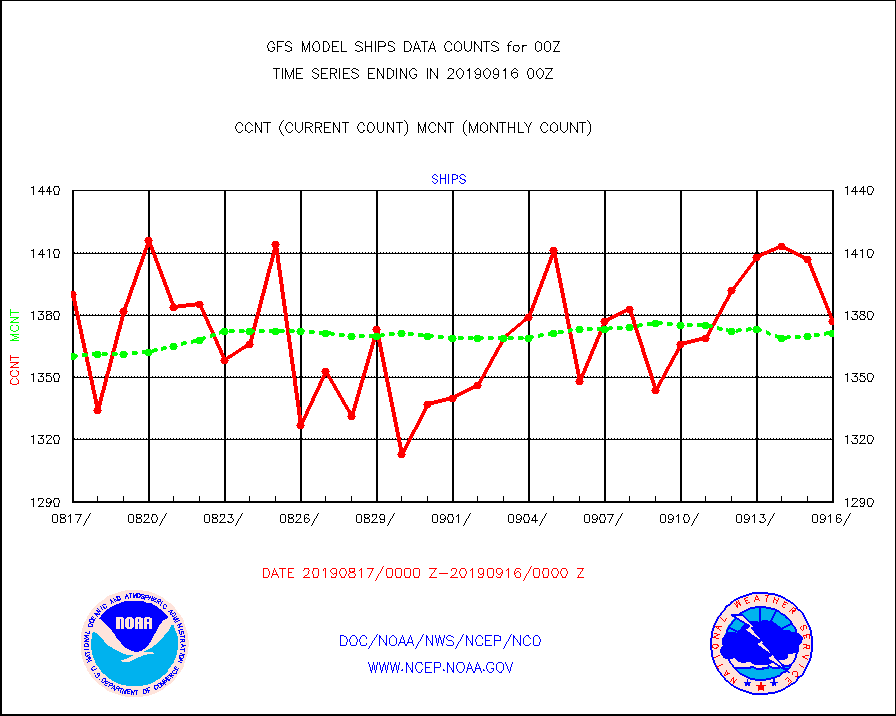
ships |
Ship - manual and automatic, restricted |
1377 |
1371 |
100.4 % |
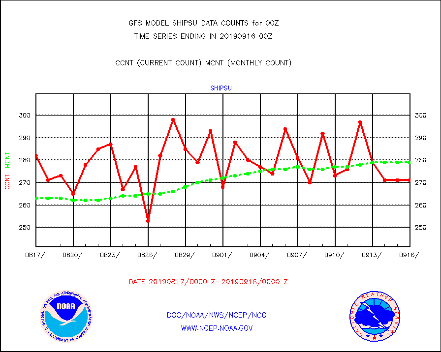
shipsu |
Ship - manual and automatic, unrestricted |
271 |
279 |
97.1 % |
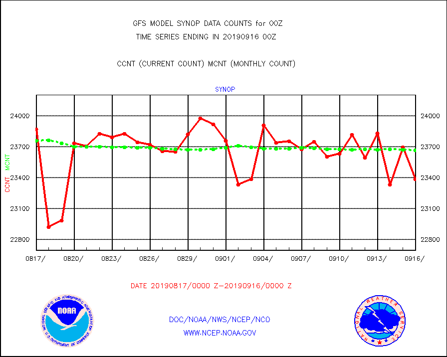
synop |
Synoptic - fixed manual and automatic |
23384 |
23666 |
98.8 % |
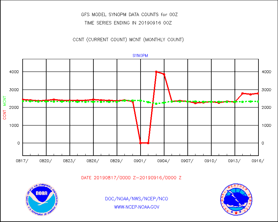
synopm |
Synoptic - mobile manual and automatic |
2787 |
2335 |
119.4 % |
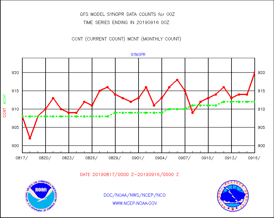
synopr |
Synoptic - restricted (WMO Res 40) manual & auto. |
920 |
912 |
100.9 % |
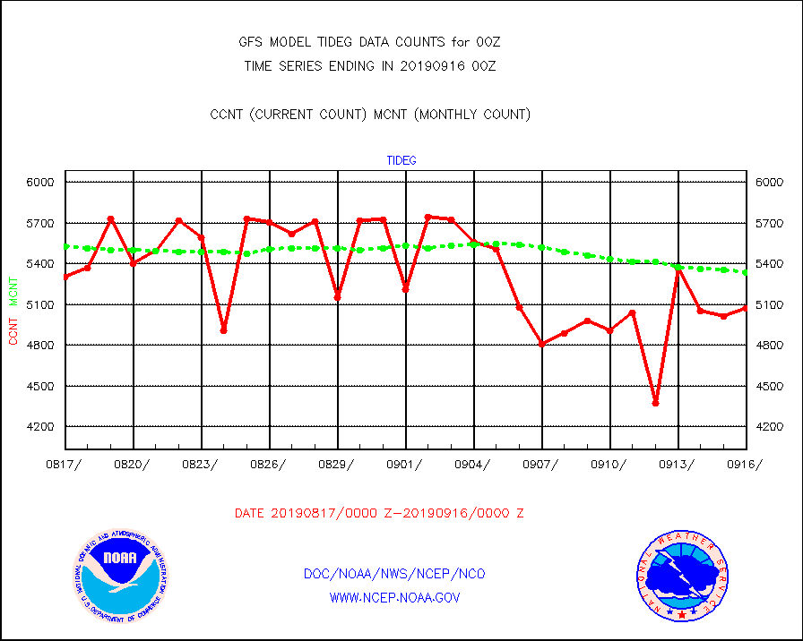
tideg |
Tide gauge reports decoded from CREX format |
5072 |
5338 |
95.0 % |
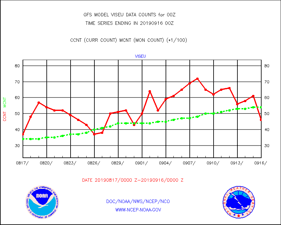
viseu |
METEOSAT/EUMETSAT visible derived cloud motion |
4627 |
5494 |
84.2 % |
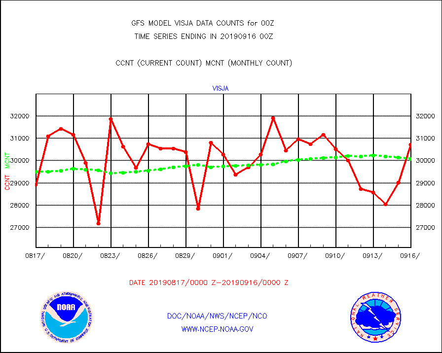
visja |
MTSAT/JMA visible derived cloud motion |
30704 |
30077 |
102.1 % |
| Data Types of Opportunity with Normal Counts |
|---|
| Type | Description | Hourly Count | Monthly Average | Percent (%) of Monthly Mean |
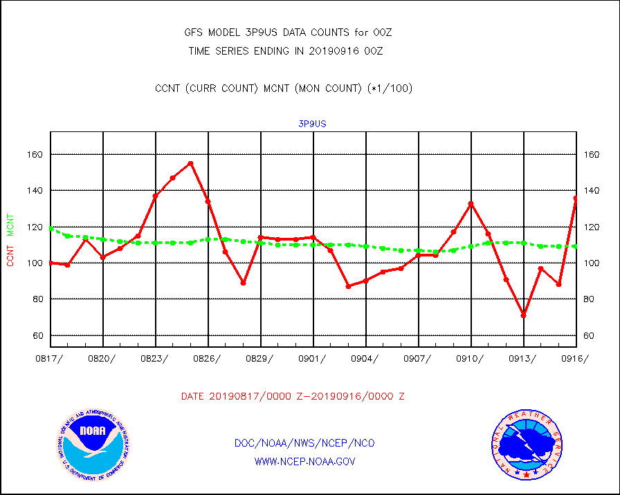
3p9us |
GOES-15&dn/NESDIS ir short-wv derived cld motion |
13681 |
10900 |
125.5 % |
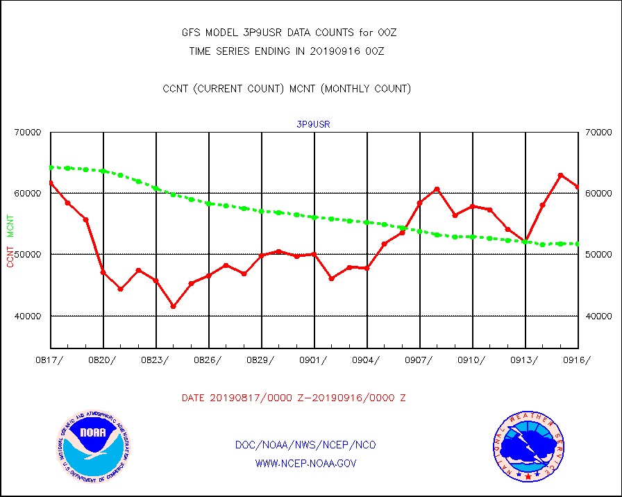
3p9usr |
GOES-16&up/NESDIS ir short-wv derived cld motion |
61013 |
51809 |
117.8 % |
acarsa |
MDCRS ACARS acft data (ARINC via AFWA)(AIREP fmt) |
0 |
0 |
n/a |
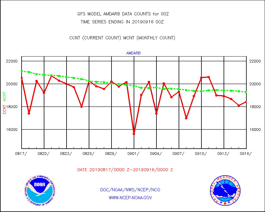
amdarb |
AMDAR aircraft data (decoded from BUFR) |
18437 |
19277 |
95.6 % |
amsr2 |
GCOM-W AMSR2 1B brightness temperatures |
9720972 |
9903011 |
98.2 % |
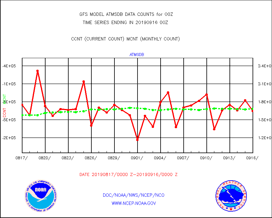
atmsdb |
NPP/NOAA-20 ATMS bright. temps-direct b-cast SSEC |
165125 |
168391 |
98.1 % |
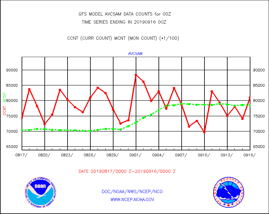
avcsam |
A.M.(N17,M2) AVHRR GAC NCEP-proc clr & sea btemps |
8099985 |
7850642 |
103.2 % |
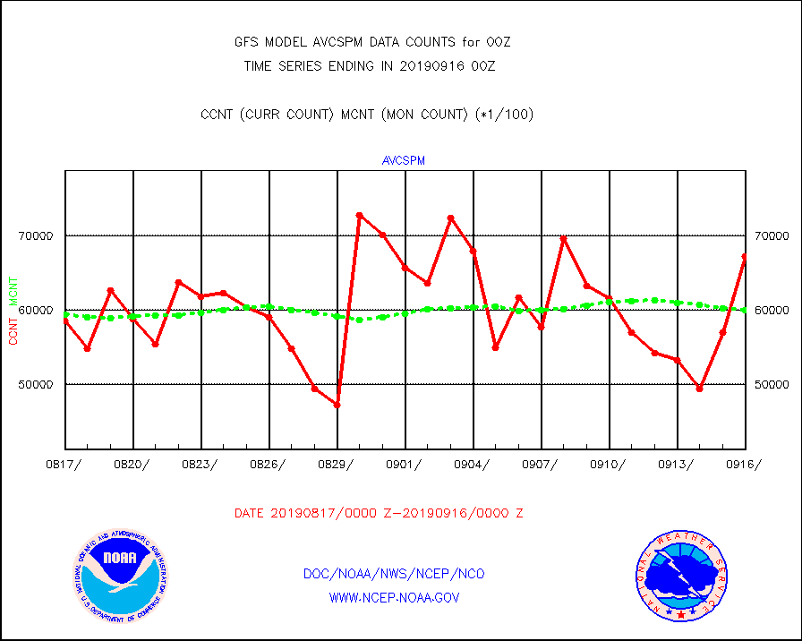
avcspm |
P.M.(N18-19) AVHRR GAC NCEP-proc clr & sea btemps |
6728385 |
6004720 |
112.1 % |
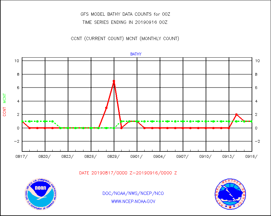
bathy |
eXpendable BathyThermograph, mooring (BATHY fmt) |
1 |
1 |
100.0 % |
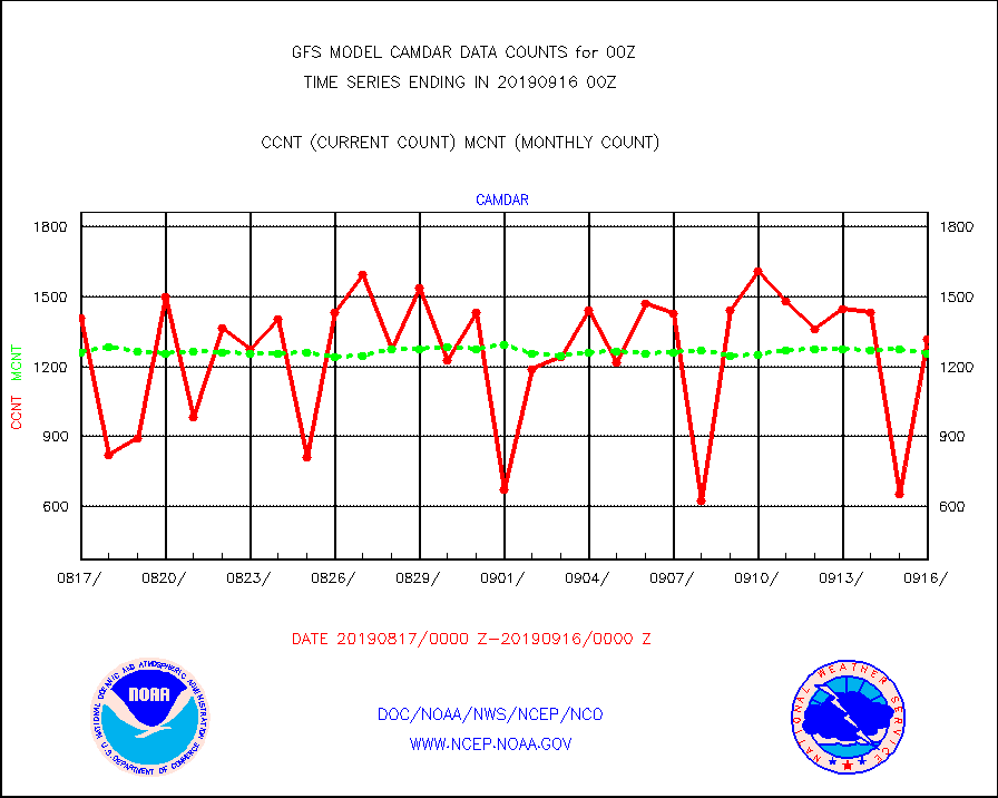
camdar |
Canadian AMDAR aircraft data (decoded from BUFR) |
1316 |
1255 |
104.9 % |
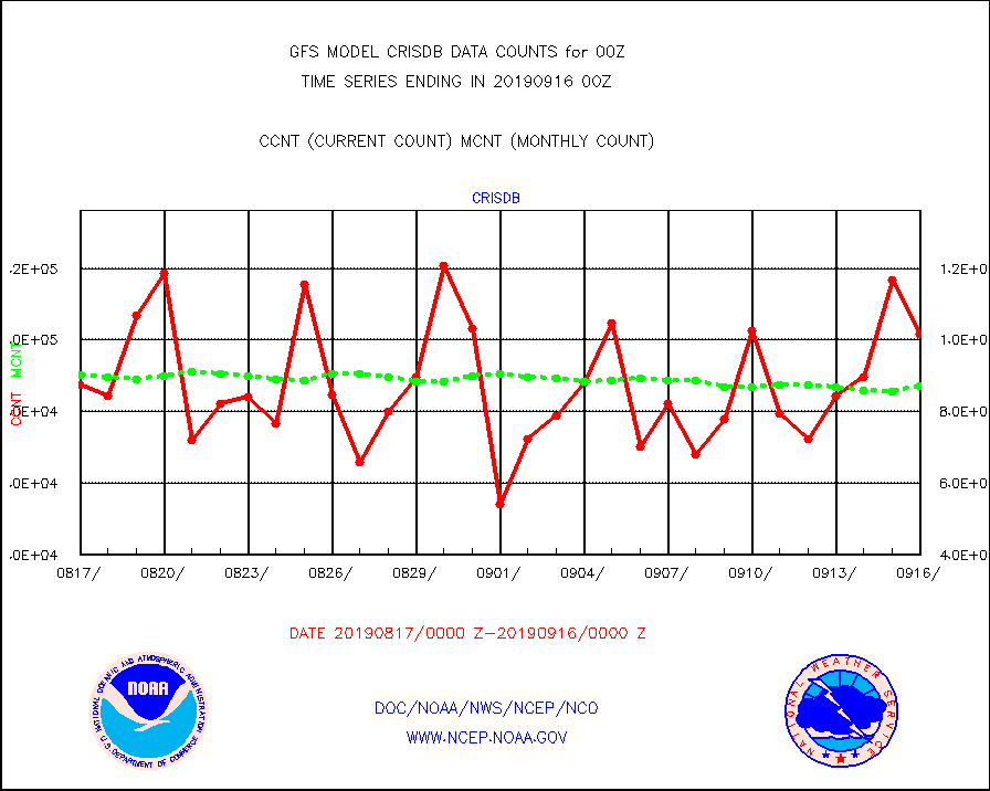
crisdb |
NPP/NOAA-20 CrIS radiances- direct broadcast SSEC |
101781 |
87121 |
116.8 % |
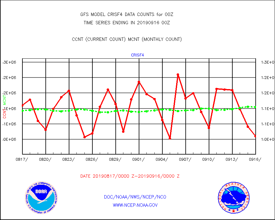
crisf4 |
NPP/NOAA-20 CrIS full spctrl radn (431 ch subset) |
1010322 |
1104453 |
91.5 % |
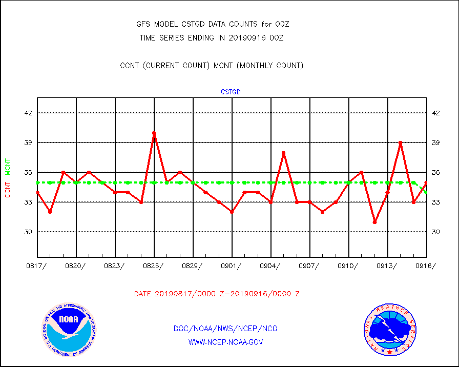
cstgd |
Coast Guard |
35 |
34 |
102.9 % |
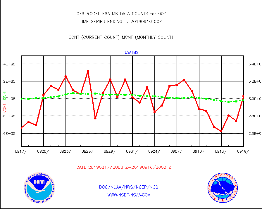
esatms |
NPP Adv. Tech. MW Sndr (ATMS) br. temps from RARS |
302881 |
298250 |
101.6 % |
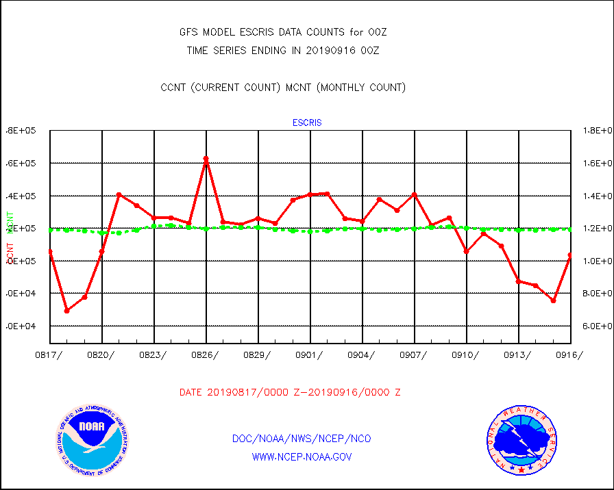
escris |
NPP Crss-track IR Sndr (CrIS) radiances from RARS |
103500 |
119111 |
86.9 % |
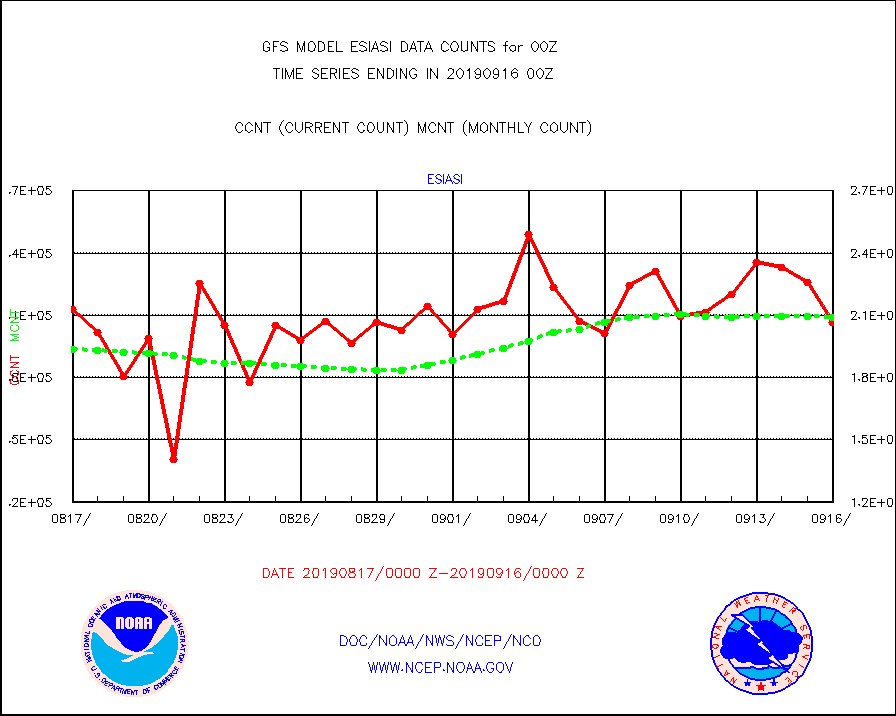
esiasi |
METOP 1-2 IASI 1C radiance data vbl chn from RARS |
206575 |
209168 |
98.8 % |
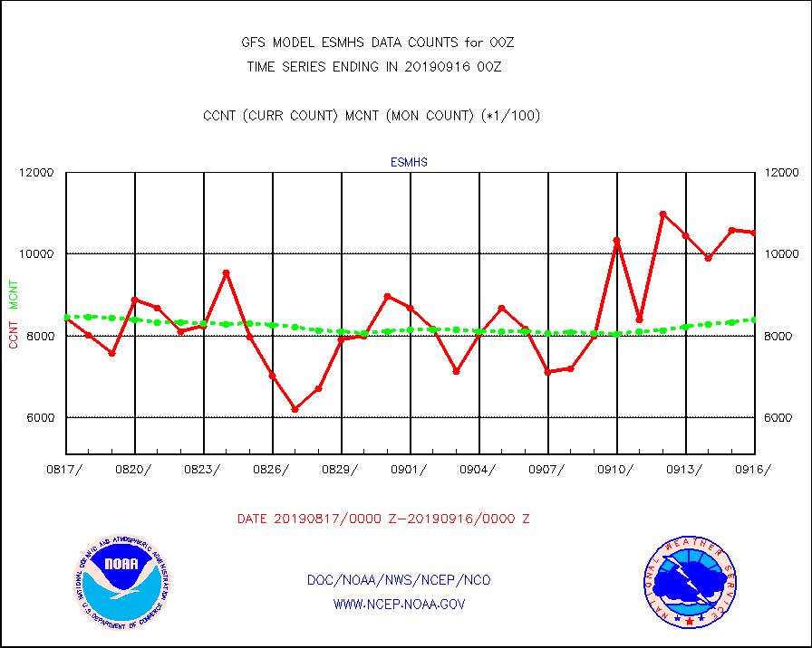
esmhs |
NOAA 18-19 & METOP 1-2 MHS proc. btemps from RARS |
1051429 |
839906 |
125.2 % |
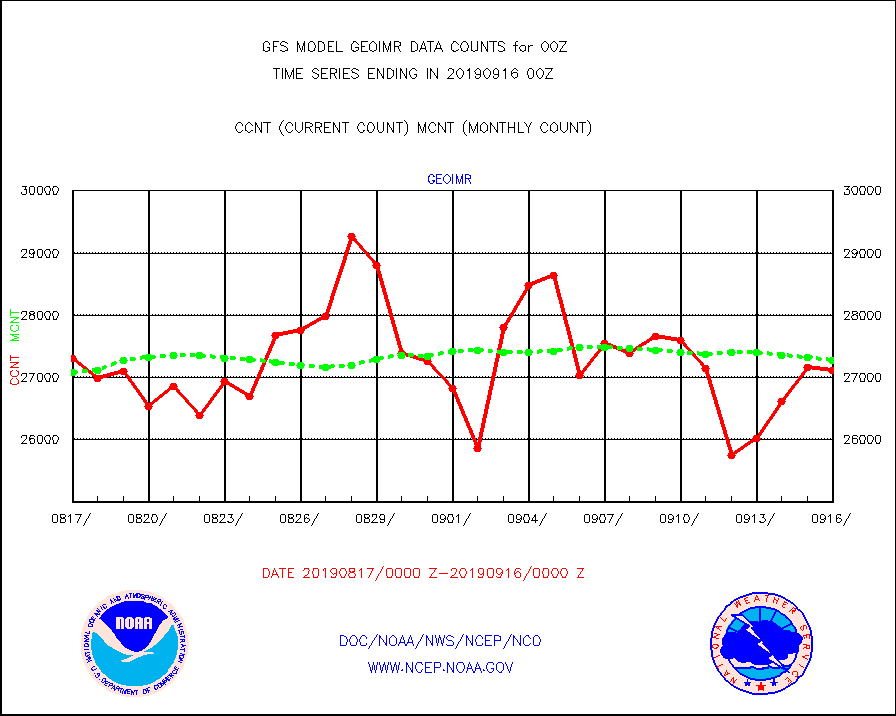
geoimr |
GOES/NESDIS (11x17 f-o-v) imager clear radiances |
27109 |
27281 |
99.4 % |
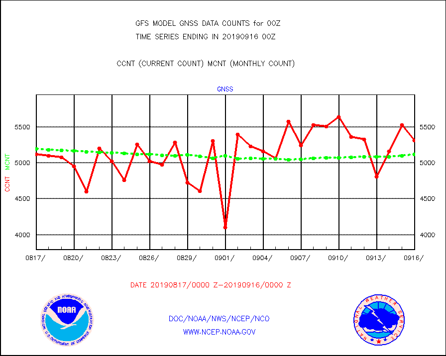
gnss |
Grnd-based Gbl Navigation Sat System (GNSS) data |
5316 |
5122 |
103.8 % |
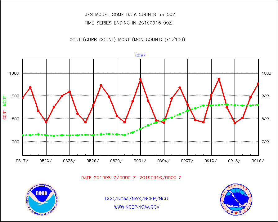
gome |
METOP 1-2 Global Ozone Monitoring Exp.-2 (GOME-2) |
95400 |
86103 |
110.8 % |
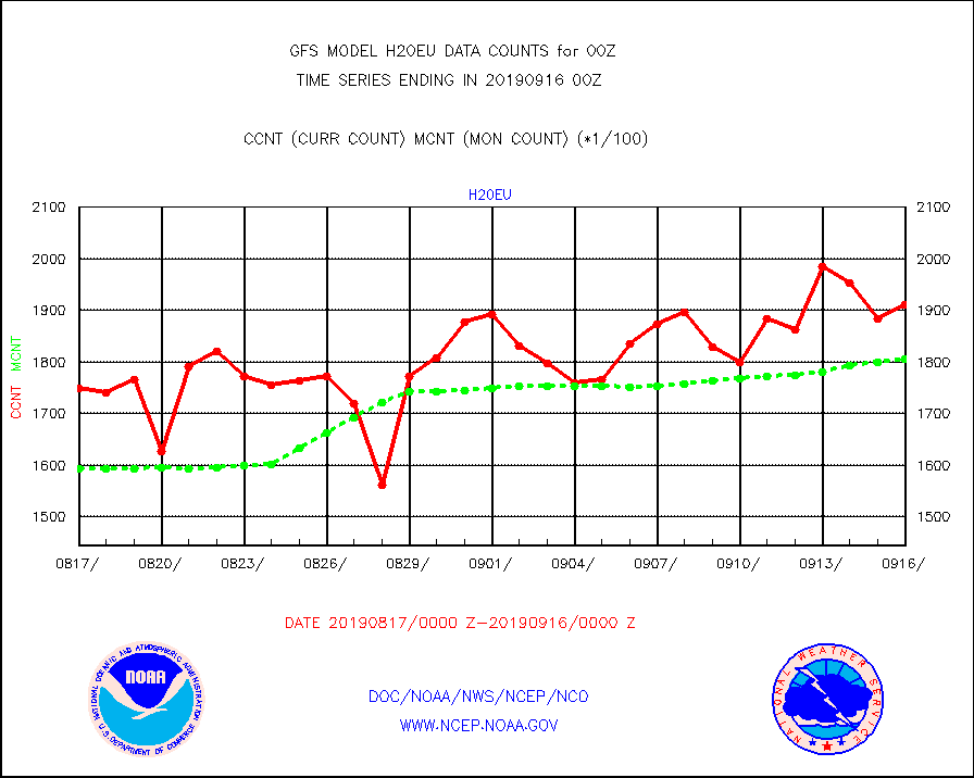
h20eu |
METEOSAT/EUMETSAT wvpr imager derived cld motion |
191157 |
180506 |
105.9 % |
h20in |
INSAT/KALPANA India wvpr derived cloud motion |
0 |
0 |
n/a |
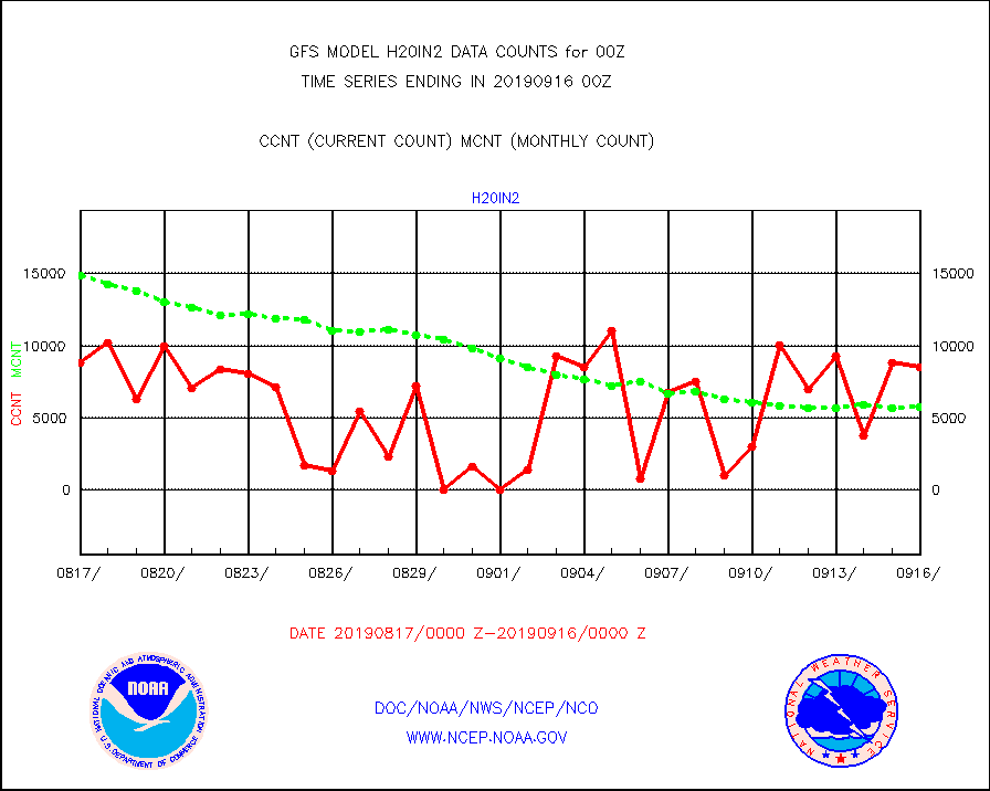
h20in2 |
INDIA SATWIND, INSAT WV channel |
8526 |
5790 |
147.3 % |
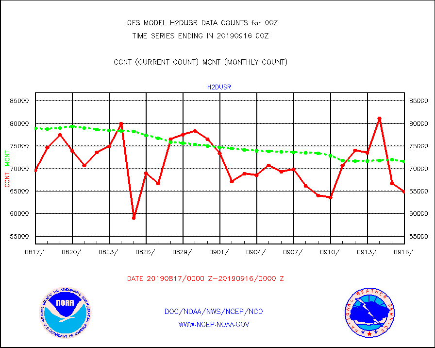
h2dusr |
GOES-16&up/NESDIS wv imgr/deep-lyr derivd cld mtn |
64919 |
71532 |
90.8 % |
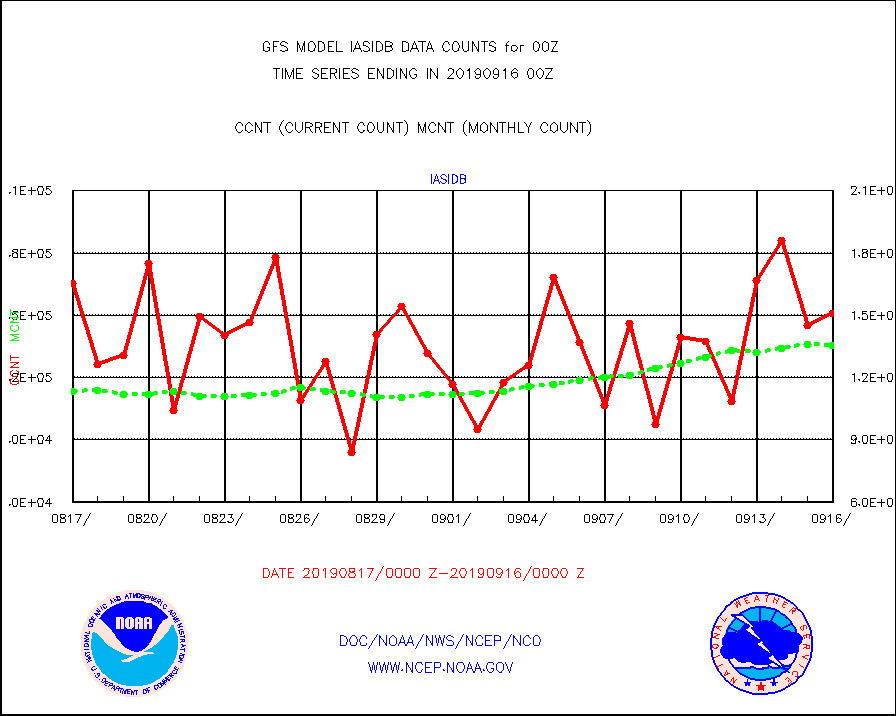
iasidb |
METOP 1-2 IASI 1C radiances-direct broadcast SSEC |
150812 |
135219 |
111.5 % |
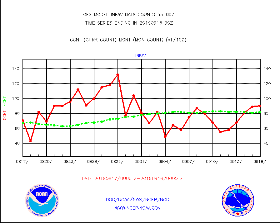
infav |
AVHRR (NOAA/METOP) ir lg-wave derived cld motion |
9066 |
8226 |
110.2 % |
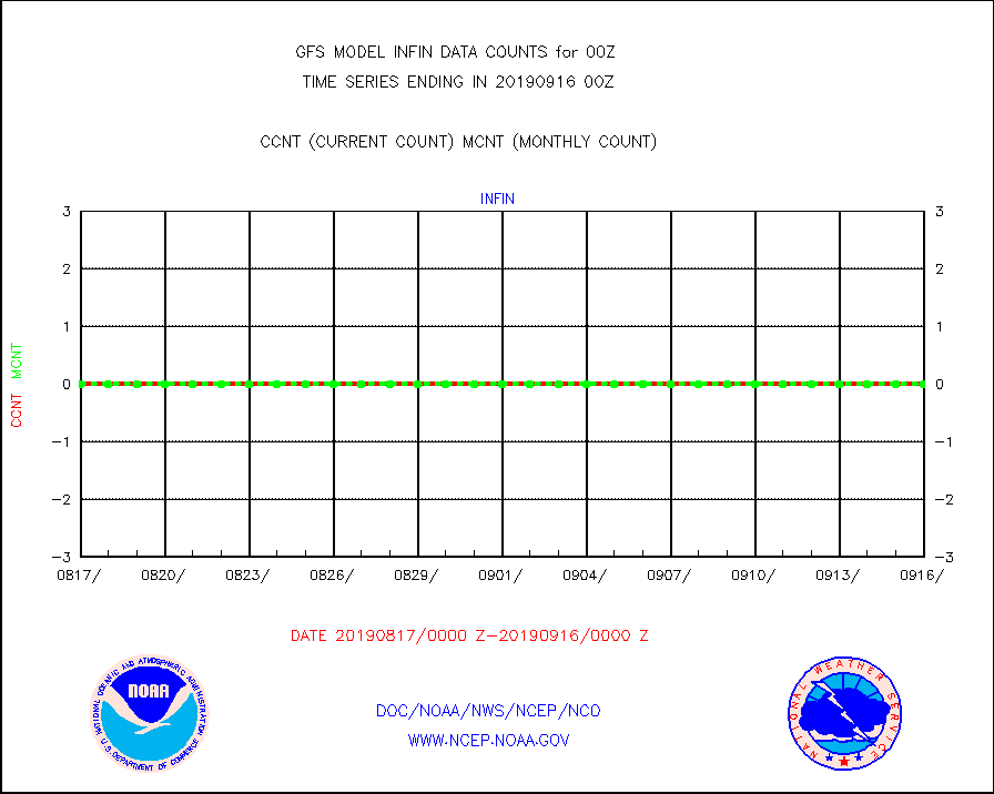
infin |
INSAT/KALPANA India ir lg-wave derived cld motion |
0 |
0 |
n/a |
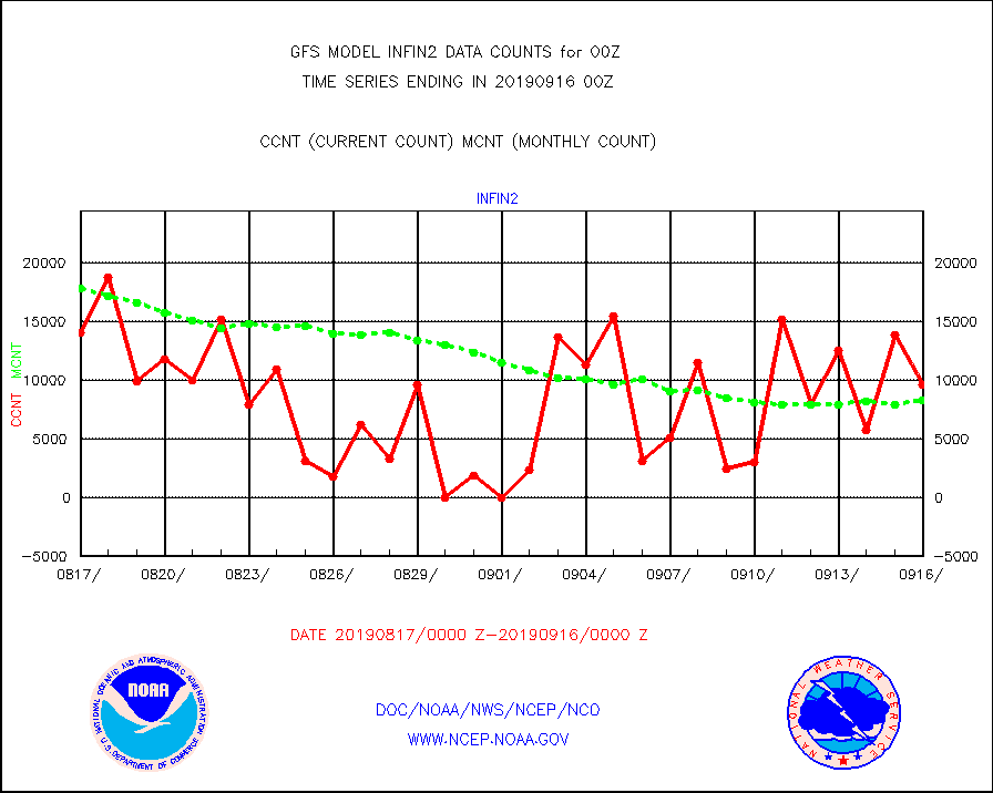
infin2 |
INDIA SATWIND, INSAT IR channel |
9580 |
8250 |
116.1 % |
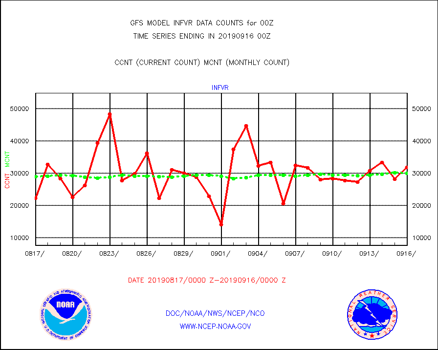
infvr |
VIIRS (NPP) infrared lg-wave derived cloud motion |
31835 |
29987 |
106.2 % |
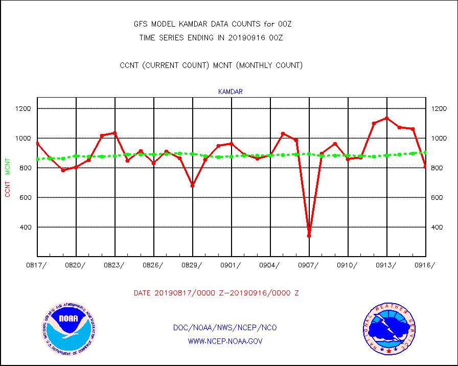
kamdar |
Korean AMDAR aircraft data (decoded from BUFR) |
804 |
901 |
89.2 % |
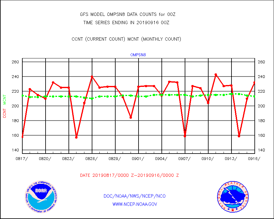
ompsn8 |
OMPS nadir profile ozone (Version 8 BUFR) |
232 |
213 |
108.9 % |
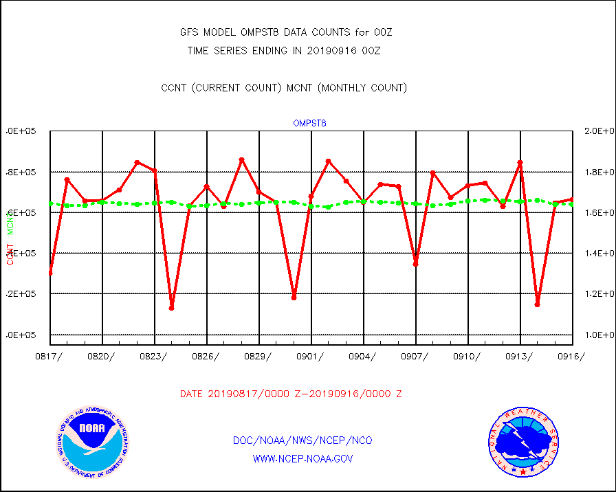
ompst8 |
OMPS total column ozone (Version 8 BUFR) |
166223 |
164056 |
101.3 % |
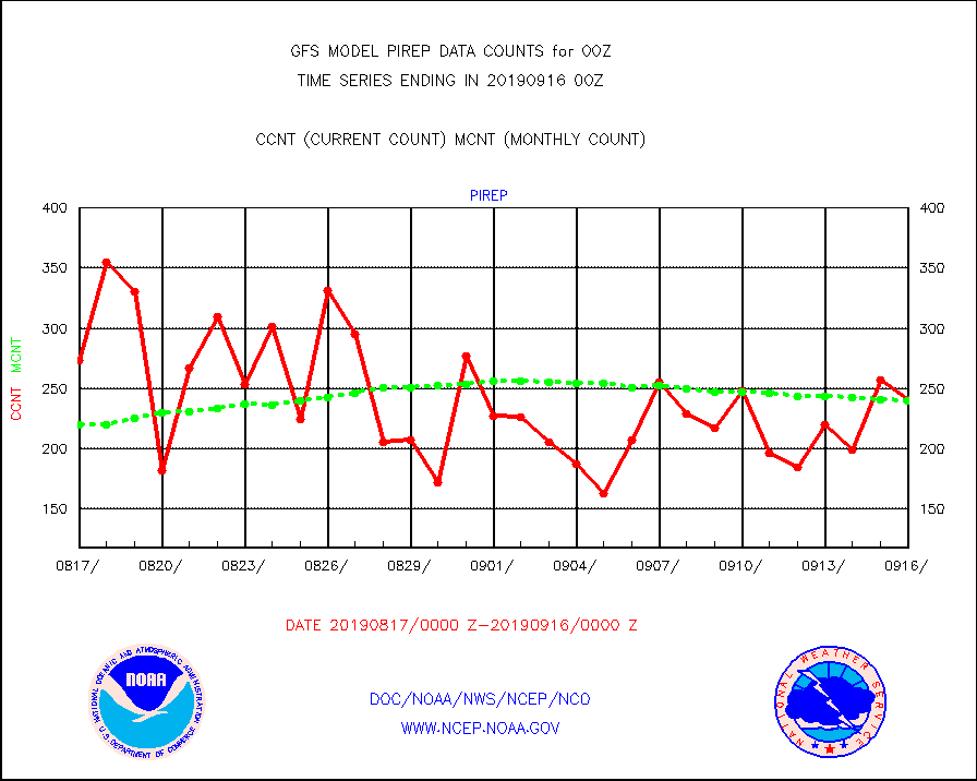
pirep |
Manual PIREP aircraft data (dcded from AIREP fmt) |
241 |
240 |
100.4 % |
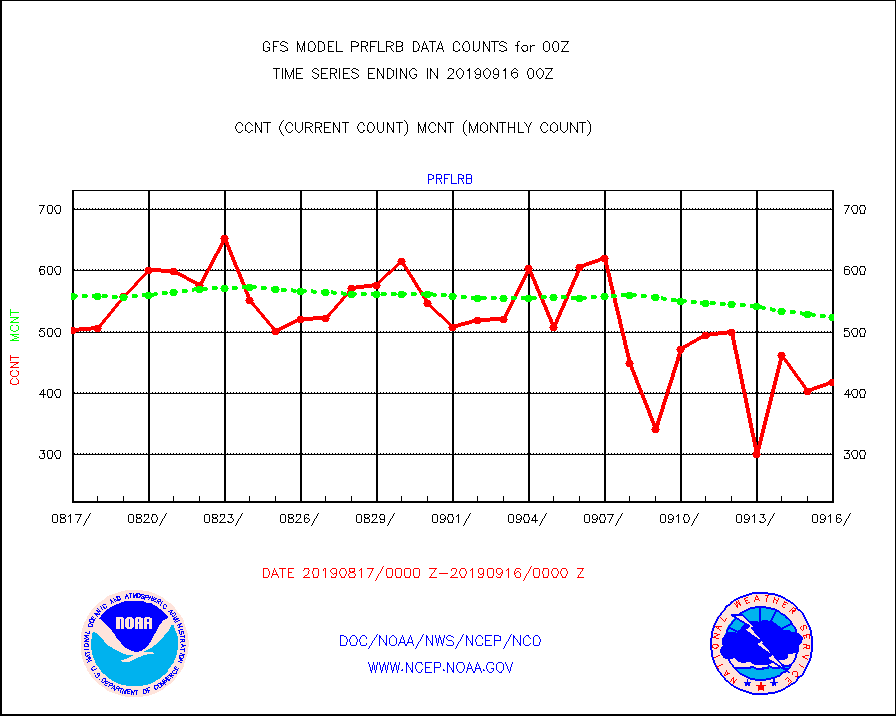
prflrb |
Multi-Agency Profiler (MAP) and SODAR winds |
418 |
524 |
79.8 % |
prflrj |
Japanese Meteorological Agency profiler winds |
0 |
0 |
n/a |
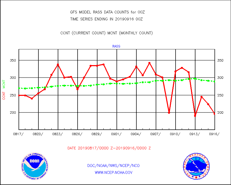
rass |
RASS temperatures (NOAA and Multi-Agency) |
196 |
289 |
67.8 % |
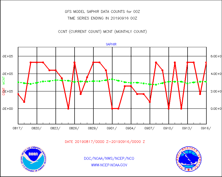
saphir |
Megha-Tropiques SAPHIR L1A2 brightness temps |
528320 |
308494 |
171.3 % |
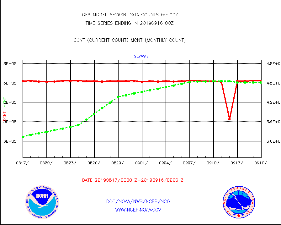
sevasr |
METEOSAT-10 2nd Gen SEVIRI All Sky Radiance(proc) |
453072 |
450630 |
100.5 % |
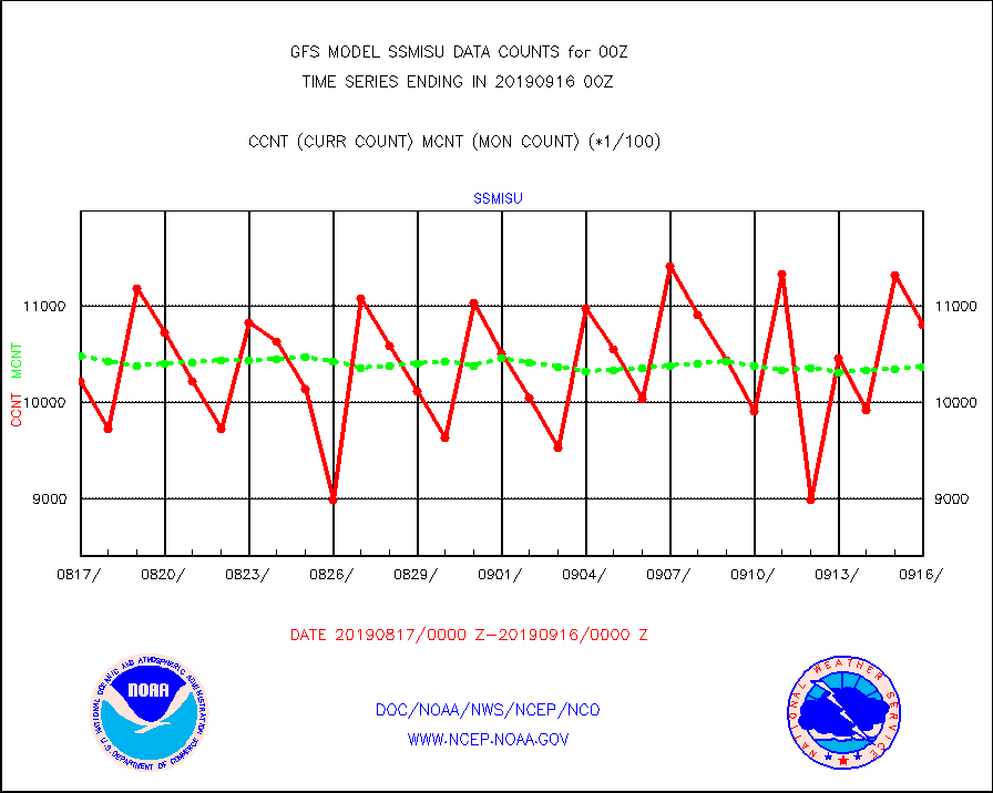
ssmisu |
DMSP SSM/IS 1C radiance data (Unified Pre-Proc.) |
1080120 |
1036742 |
104.2 % |
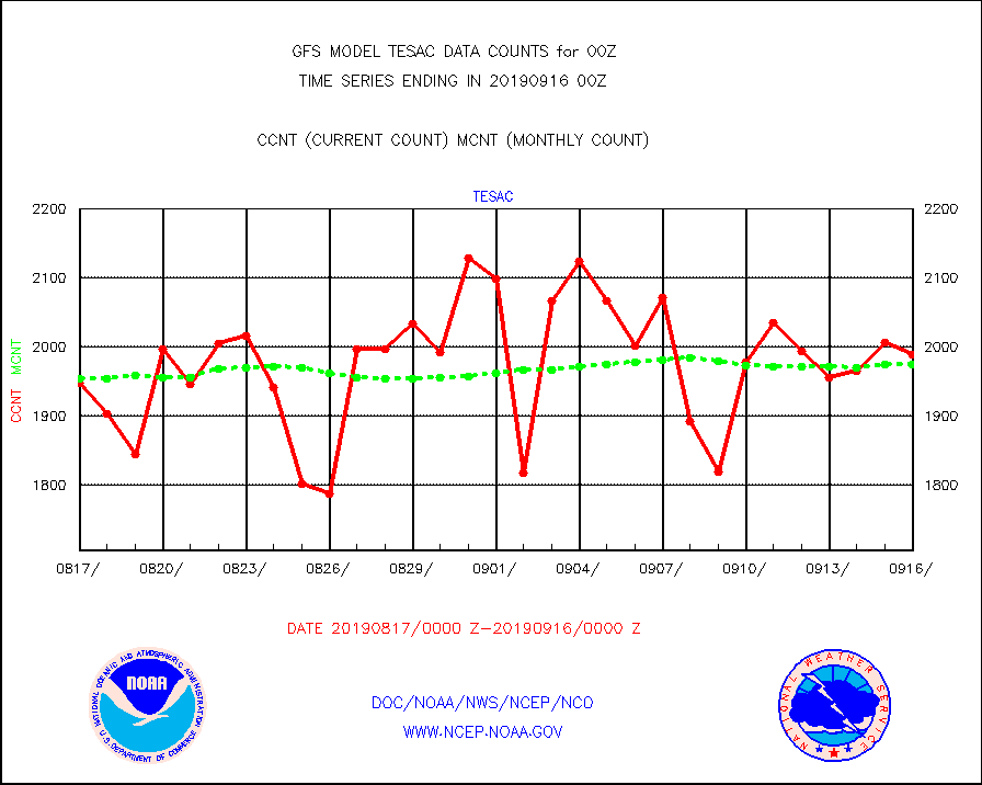
tesac |
CTD probe, Argo prflng float, mooring (TESAC fmt) |
1988 |
1974 |
100.7 % |
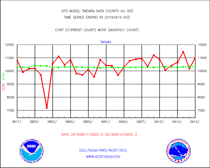
tmdara |
TAMDAR aircft data-all types(from Panasonic,BUFR) |
11014 |
10320 |
106.7 % |
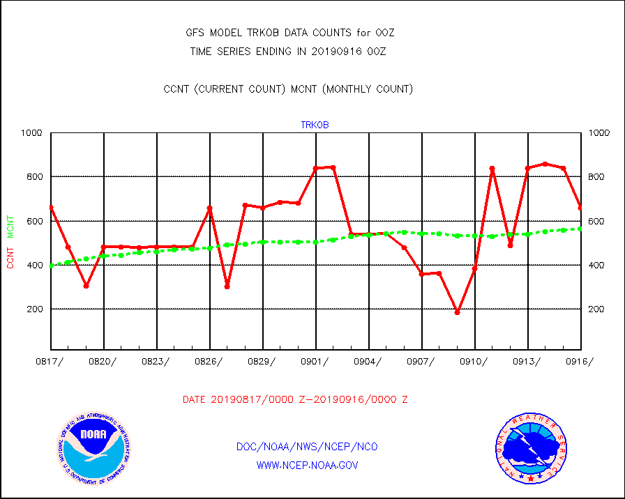
trkob |
ThermoSalinoGraph (TSG) TRACKOB format) |
659 |
564 |
116.8 % |
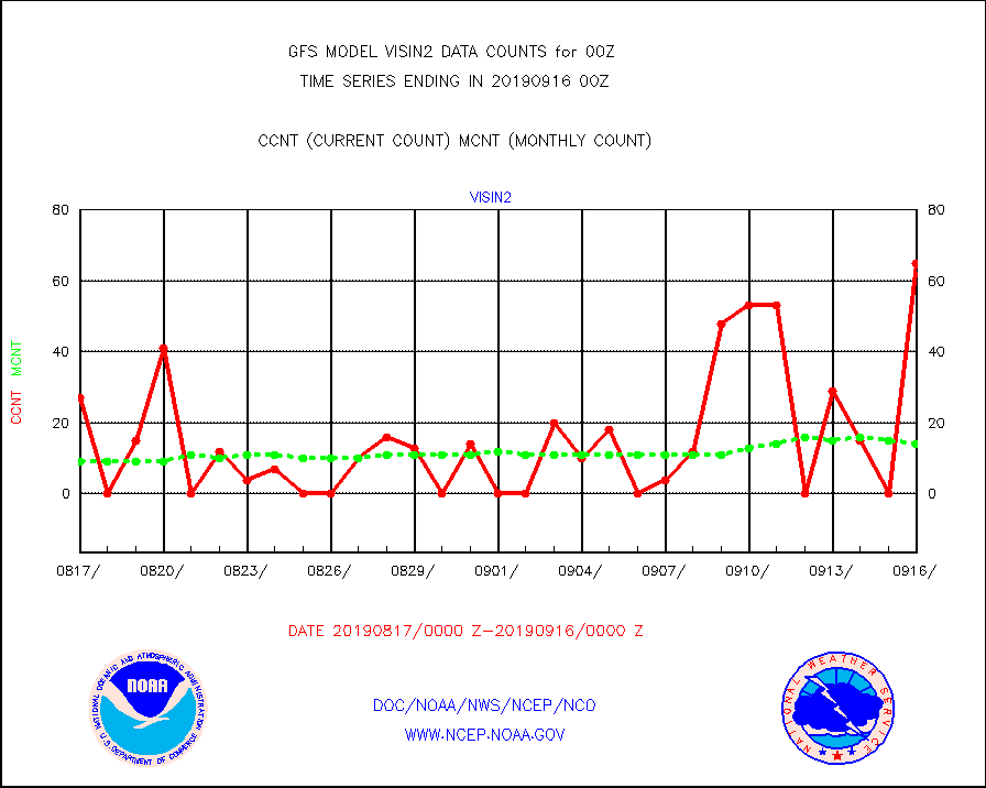
visin |
INSAT/KALPANA India visible derived cloud motion |
0 |
0 |
n/a |
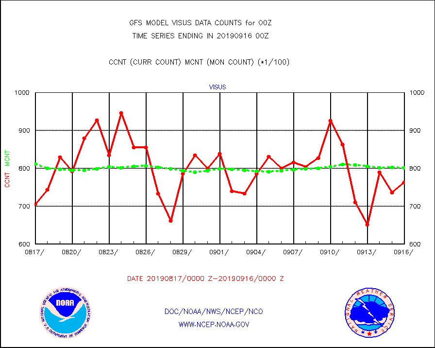
visus |
GOES-15&dn/NESDIS visible derived cloud motion |
76344 |
80148 |
95.3 % |
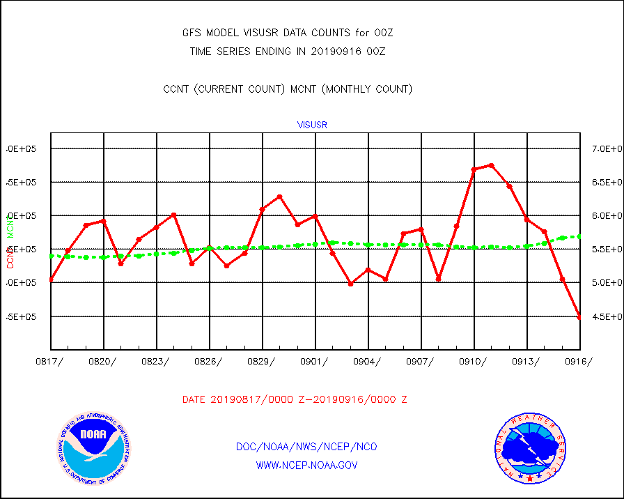
visusr |
GOES-16&up/NESDIS visible derived cloud motion |
448577 |
568369 |
78.9 % |


