| Critical Data with Normal Counts |
|---|
| Type | Description | Hourly Count | Monthly Average | Percent (%) of Monthly Mean | UTC Time Window |
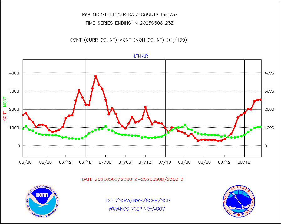
1bamua |
NOAA 15-19 & METOP 1-2 AMSU-A NCEP-proc. br.temps |
52785 |
42245 |
124.9 % |
2420.00-2501.99 |
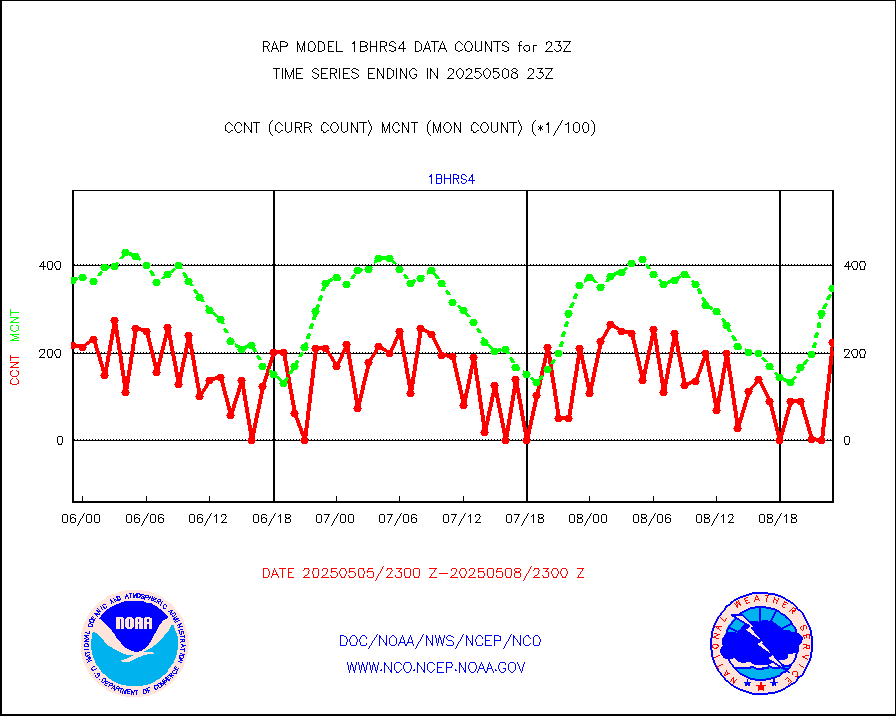
1bhrs4 |
NOAA 18-19 & METOP 1-2 HIRS-4 NCEP-proc. br.temps |
40567 |
32767 |
123.8 % |
2420.00-2501.99 |
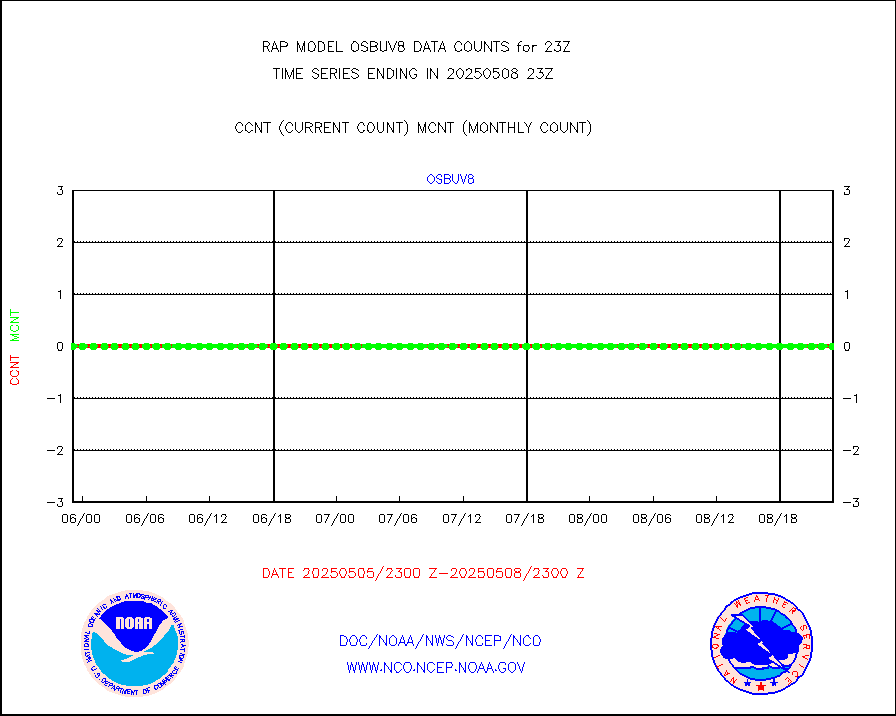
1bmhs |
NOAA 18-19 & METOP 1-2 MHS NCEP-proces. br. temps |
300451 |
242408 |
123.9 % |
2420.00-2501.99 |
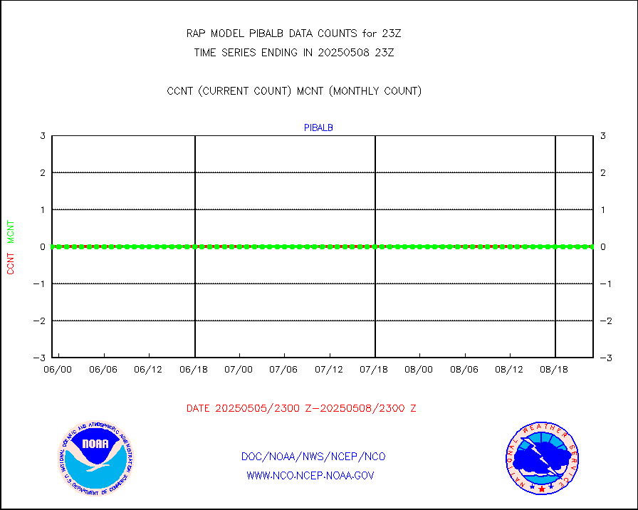
acars |
MDCRS ACARS acft data from ARINC(dcded from BUFR) |
98188 |
91115 |
107.8 % |
2419.75-2502.25 |
camdar |
Canadian AMDAR aircraft data (decoded from BUFR) |
143 |
90 |
158.9 % |
2419.75-2502.25 |
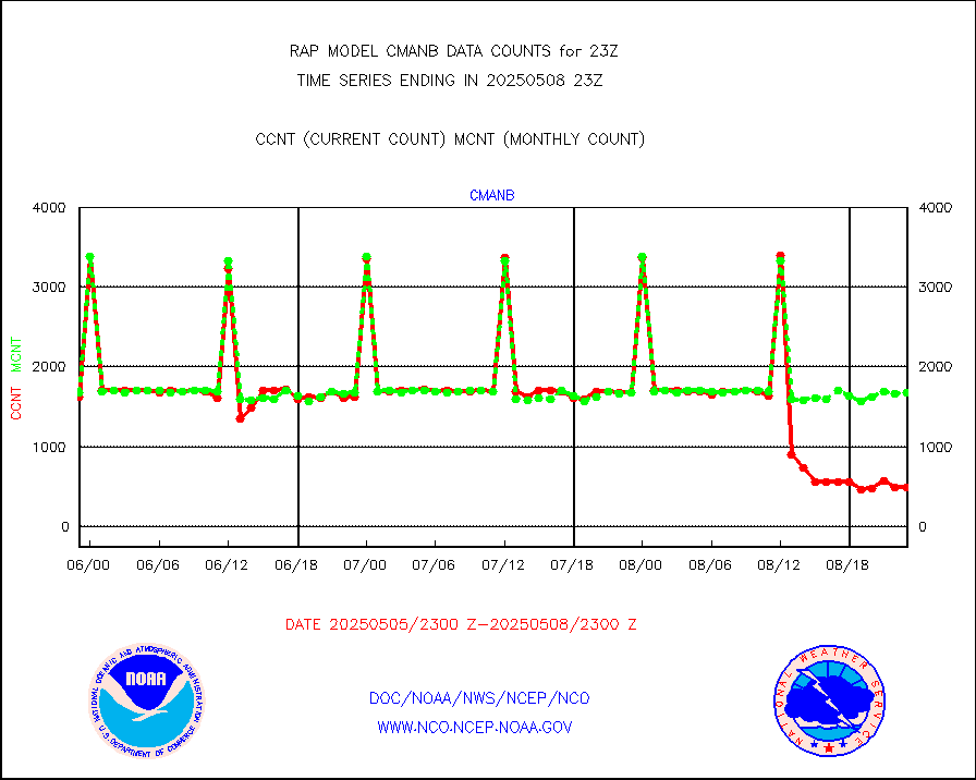
cmanb |
Surface Marine CMAN rpts decoded from BUFR format |
1699 |
1652 |
102.8 % |
2422.50-2423.50 |
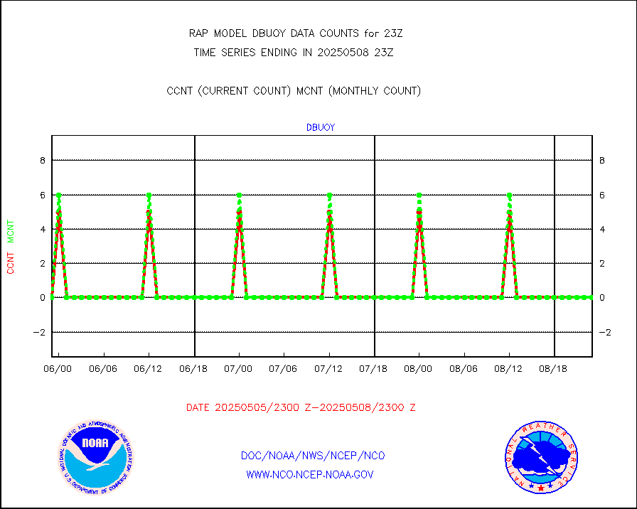
dbuoy |
Buoys decoded from FM-18 fmt (moored or drifting) |
0 |
0 |
n/a |
2422.50-2423.50 |
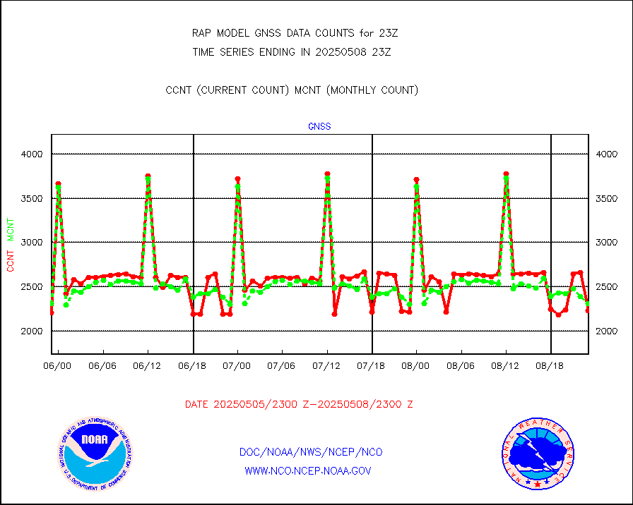
gnss |
Grnd-based Gbl Navigation Sat System (GNSS) data |
2449 |
2329 |
105.2 % |
2421.95-2422.05 |
h20mo |
MODIS (AQUA/TERRA) wvpr imager derived cld motion |
0 |
0 |
n/a |
2420.50-2501.50 |
infmo |
MODIS (AQUA/TERRA) ir l-wave derived cloud motion |
0 |
0 |
n/a |
2420.50-2501.50 |
lgycld |
GOES/NASA(Langley) hi-res. (1x1 f-o-v) cloud data |
3719068 |
3293104 |
112.9 % |
2422.50-2423.50 |
mbuoy |
Buoys decoded from FM-13 format (moored) |
37 |
43 |
86.0 % |
2422.50-2423.50 |
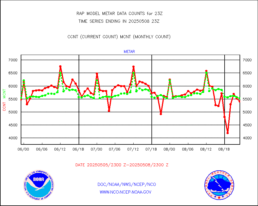
metar |
Aviation - METAR |
5746 |
5770 |
99.6 % |
2422.50-2423.50 |
nxrdw |
NEXRAD Vel Azm Dsp(VAD) winds via radar coded msg |
0 |
0 |
n/a |
2422.00-2500.00 |
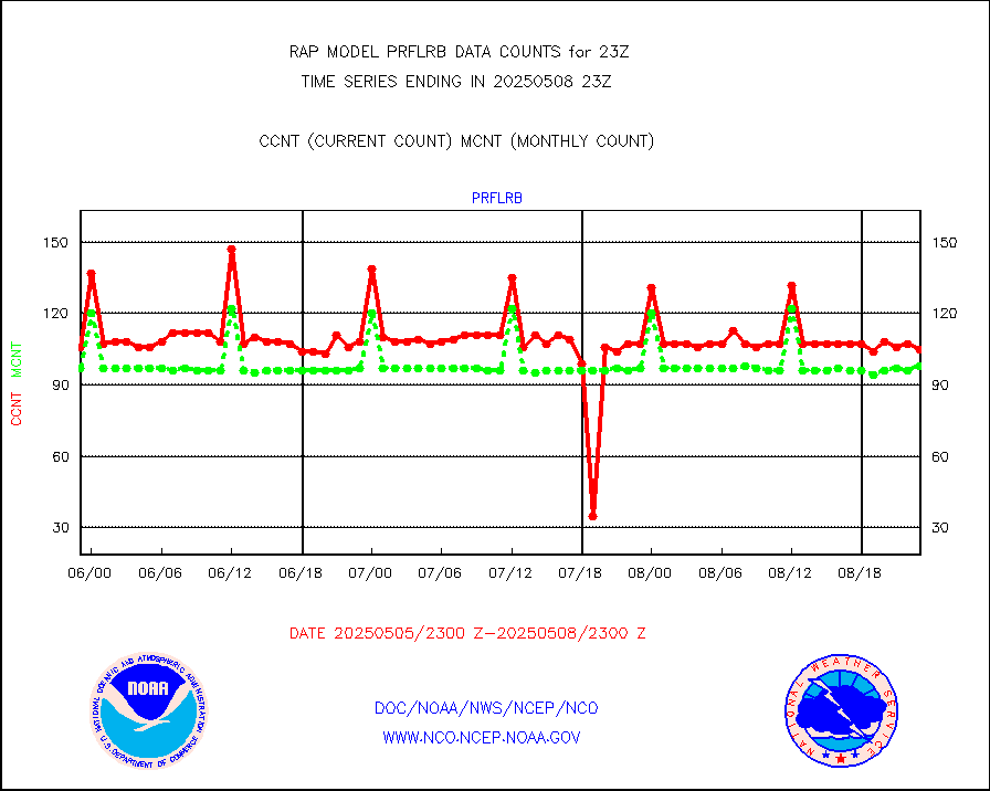
prflrb |
Multi-Agency Profiler (MAP) and SODAR winds |
102 |
83 |
122.9 % |
2421.50-2500.50 |
raobf |
Rawinsonde - fixed land (from TEMP or PILOT) |
0 |
1 |
0.0 % |
2422.00-2500.00 |
rass |
RASS temperatures (NOAA and Multi-Agency) |
27 |
21 |
128.6 % |
2422.50-2423.50 |
shipsb |
Ship - manual and automatic, restricted (BUFR) |
0 |
0 |
n/a |
2422.50-2423.50 |
shipsu |
Ship - manual and automatic, unrestricted |
45 |
46 |
97.8 % |
2422.50-2423.50 |
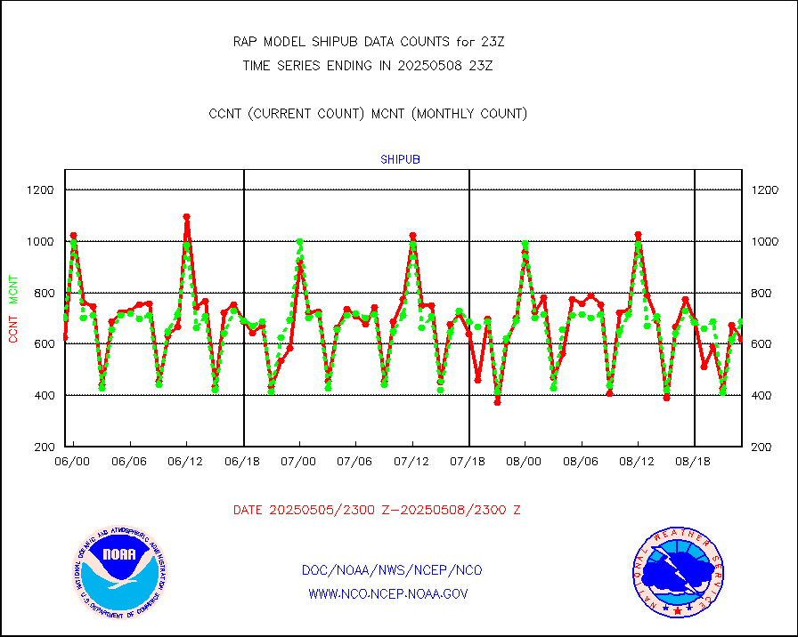
shipub |
Ship - manual and automatic, unrestricted (BUFR) |
636 |
614 |
103.6 % |
2422.50-2423.50 |
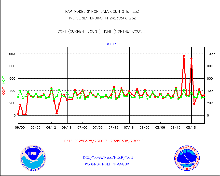
synop |
Synoptic - fixed manual and automatic |
281 |
304 |
92.4 % |
2422.50-2423.50 |
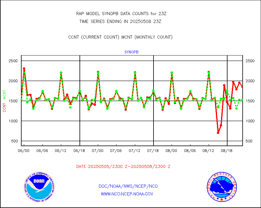
synopb |
Synoptic - fixed manual & auto (decoded fr BUFR) |
1694 |
1635 |
103.6 % |
2422.50-2423.50 |
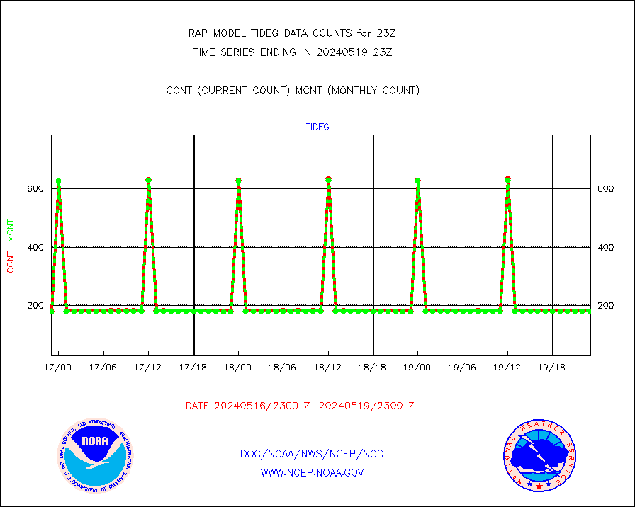
tideg |
Tide gauge reports decoded from CREX format |
179 |
177 |
101.1 % |
2422.50-2423.50 |
| Data Types of Opportunity with Normal Counts |
|---|
| Type | Description | Hourly Count | Monthly Average | Percent (%) of Monthly Mean | UTC Time Window |
3p9usr |
GOES-16&up/NESDIS ir short-wv derived cld motion |
2759 |
2282 |
120.9 % |
2422.00-2422.99 |
acarsa |
MDCRS ACARS acft data (ARINC via AFWA)(AIREP fmt) |
0 |
0 |
n/a |
2419.75-2502.25 |
airep |
Manual AIREP aircraft data (dcded from AIREP fmt) |
1782 |
1619 |
110.1 % |
2419.75-2502.25 |
airsev |
AQUA AIRS/AMSU-A/HSB brightness temps- every FOV |
0 |
0 |
n/a |
2420.00-2501.99 |
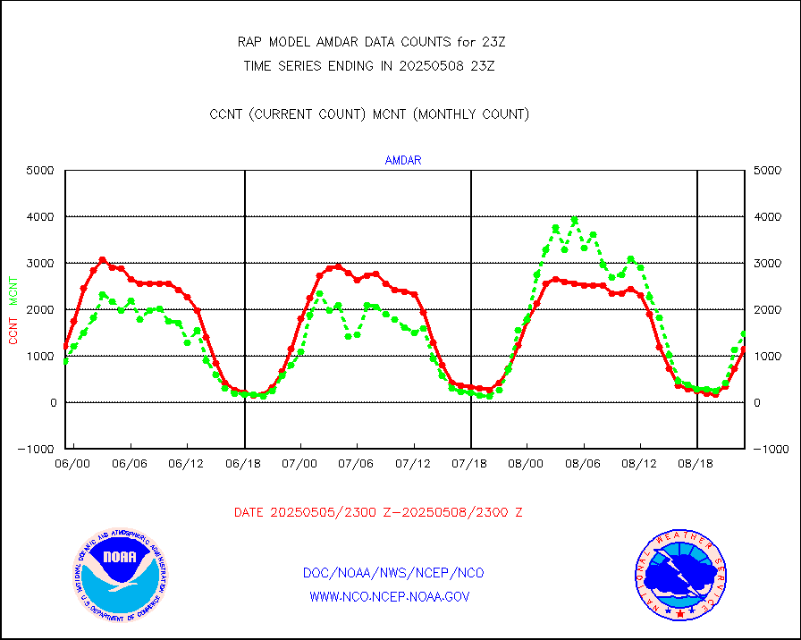
amdar |
AMDAR aircraft data (decoded from AMDAR format) |
1434 |
1707 |
84.0 % |
2419.75-2502.25 |
amdarb |
AMDAR aircraft data (decoded from BUFR) |
2941 |
2909 |
101.1 % |
2419.75-2502.25 |
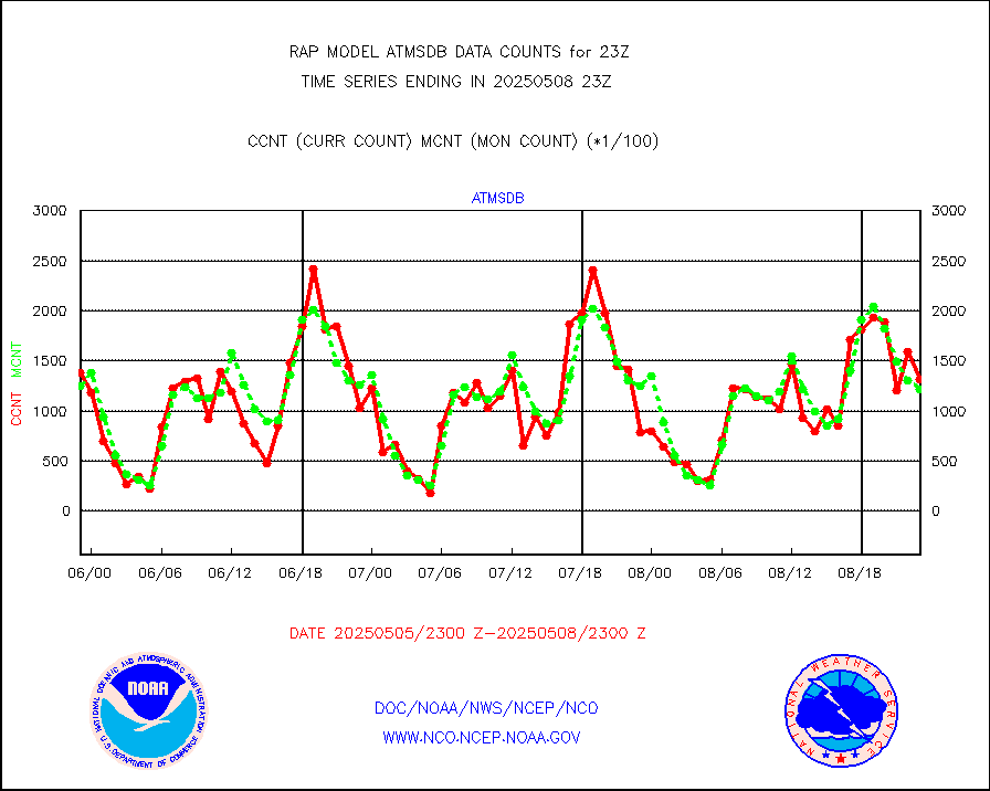
amsr2 |
GCOM-W AMSR2 1B brightness temperatures |
982916 |
600238 |
163.8 % |
2420.00-2420.99 |
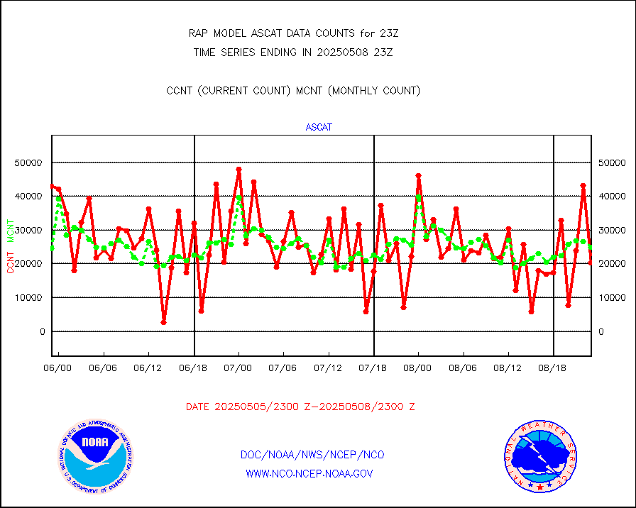
ascat |
METOP 1-2 ASCAT products |
34234 |
19504 |
175.5 % |
2421.00-2501.00 |
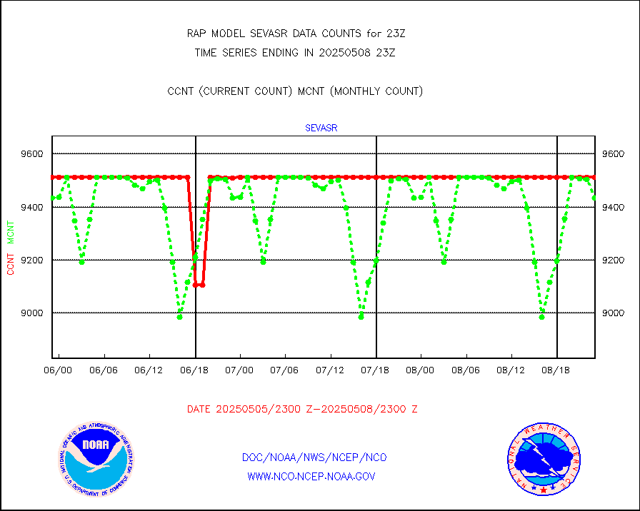
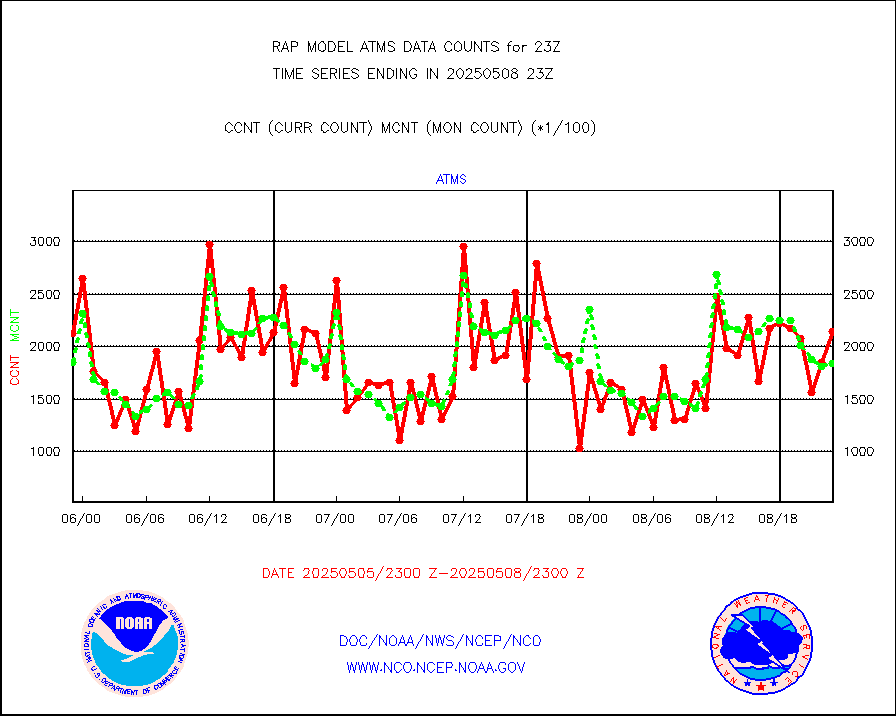
atms |
NPP/NOAA-20 ATMS brightness temperatures |
173270 |
173873 |
99.7 % |
2421.00-2500.99 |
atmsdb |
NPP/NOAA-20 ATMS bright. temps-direct b-cast SSEC |
130176 |
122449 |
106.3 % |
2421.00-2500.99 |
coopmd |
Coop/MADIS NEPP & HCN-Modernization NOAA COOP Obs |
24 |
23 |
104.3 % |
2422.50-2423.50 |
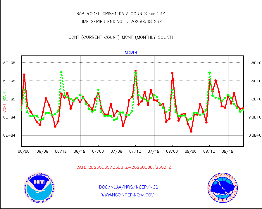
crisf4 |
NPP/NOAA-20 CrIS full spctrl radn (431 ch subset) |
105770 |
101785 |
103.9 % |
2421.00-2500.99 |
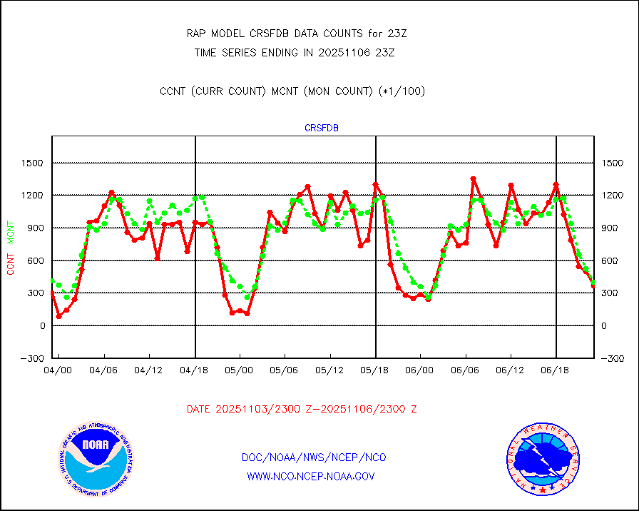
crsfdb |
NPP/NOAA-20 CrIS full spctrl radn dir brdcst SSEC |
95895 |
86183 |
111.3 % |
2421.00-2500.99 |
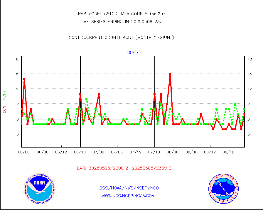
cstgd |
Coast Guard |
8 |
8 |
100.0 % |
2422.50-2423.50 |
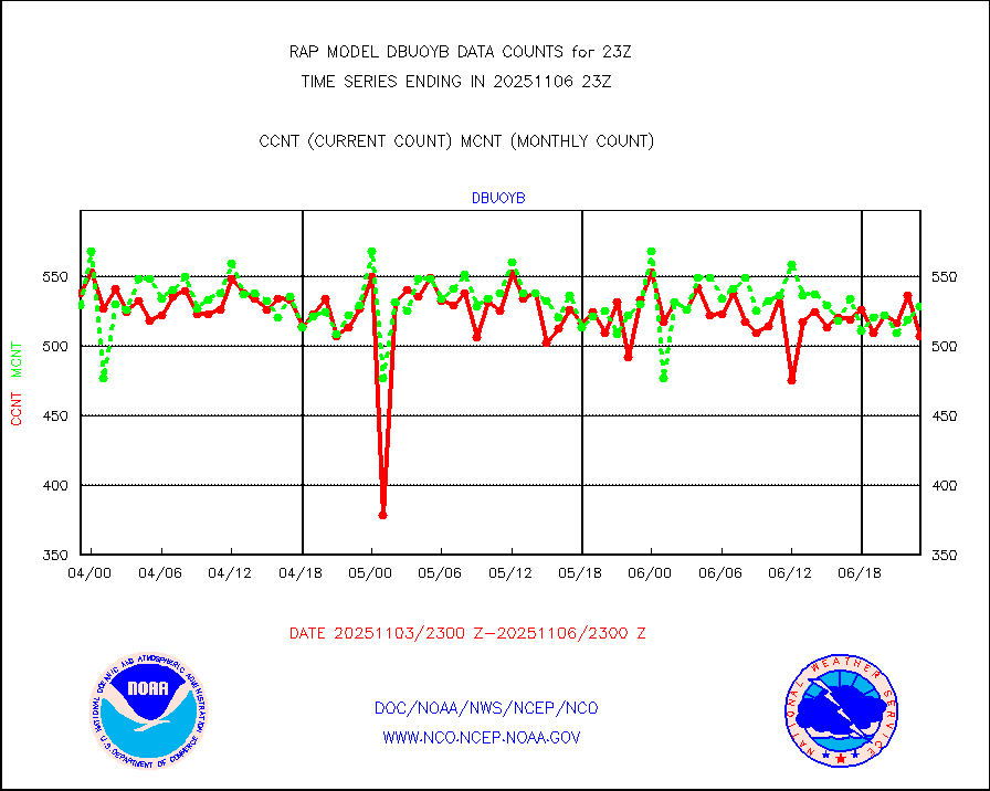
dbuoyb |
Drifting buoys (decoded from BUFR) |
576 |
599 |
96.2 % |
2422.50-2423.50 |
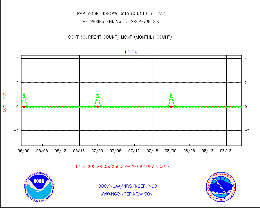
dropw |
Dropwinsonde (from TEMP DROP) |
0 |
0 |
n/a |
2422.00-2500.00 |
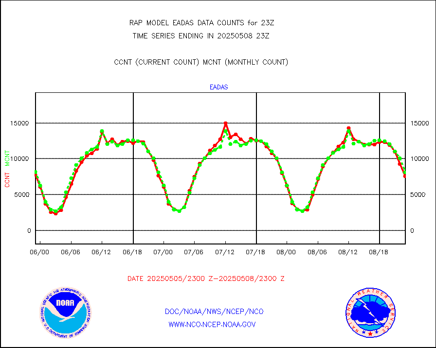
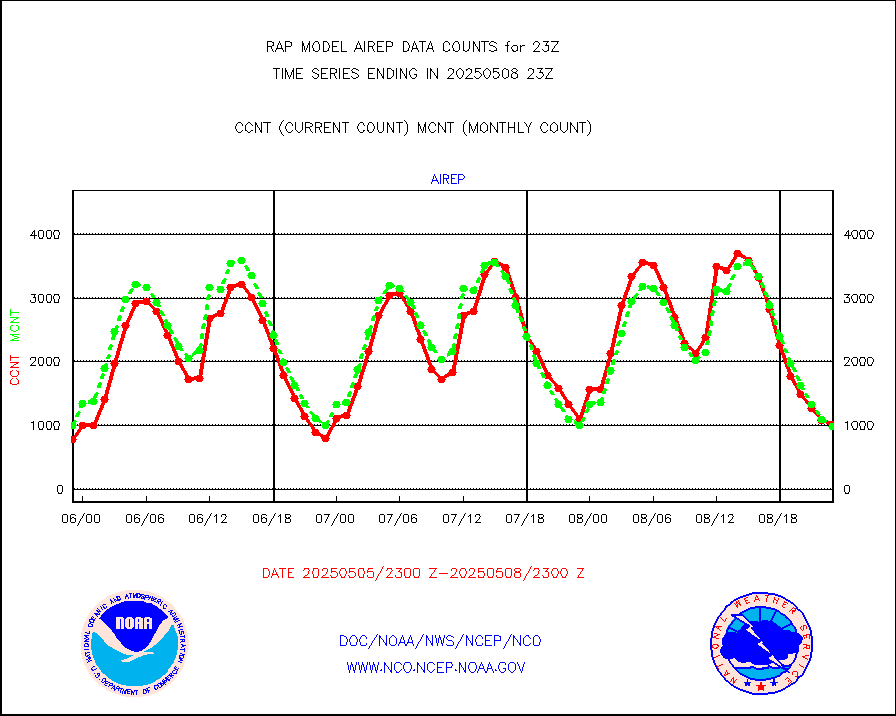
eadas |
E-AMDAR (European AMDAR acft decoded from BUFR) |
5818 |
6097 |
95.4 % |
2419.75-2502.25 |
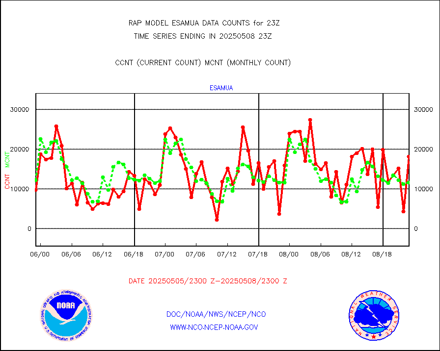
esamua |
NOAA 15-19 & METOP 1-2 AMSU-A proc btmps frm RARS |
12941 |
12433 |
104.1 % |
2422.00-2500.00 |
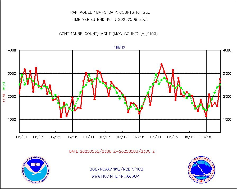
esatms |
NPP Adv. Tech. MW Sndr (ATMS) br. temps from RARS |
26076 |
27559 |
94.6 % |
2421.00-2500.99 |
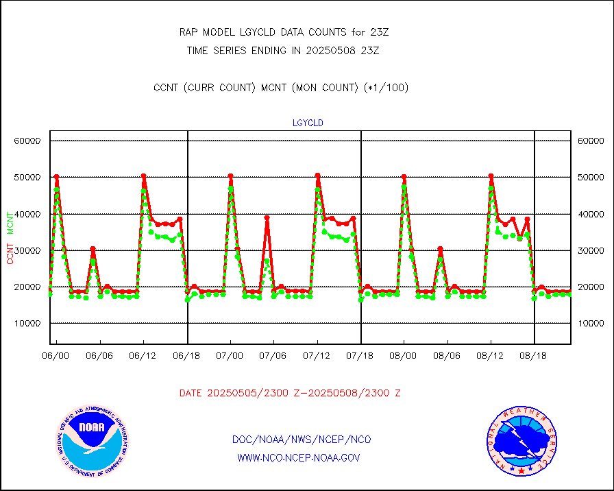
eshrs3 |
NOAA 15-19 & METOP 1-2 HIRS-3/4 pr btmps frm RARS |
29481 |
30562 |
96.5 % |
2422.00-2500.00 |
esiasi |
METOP 1-2 IASI 1C radiance data vbl chn from RARS |
77820 |
93273 |
83.4 % |
2421.00-2500.99 |
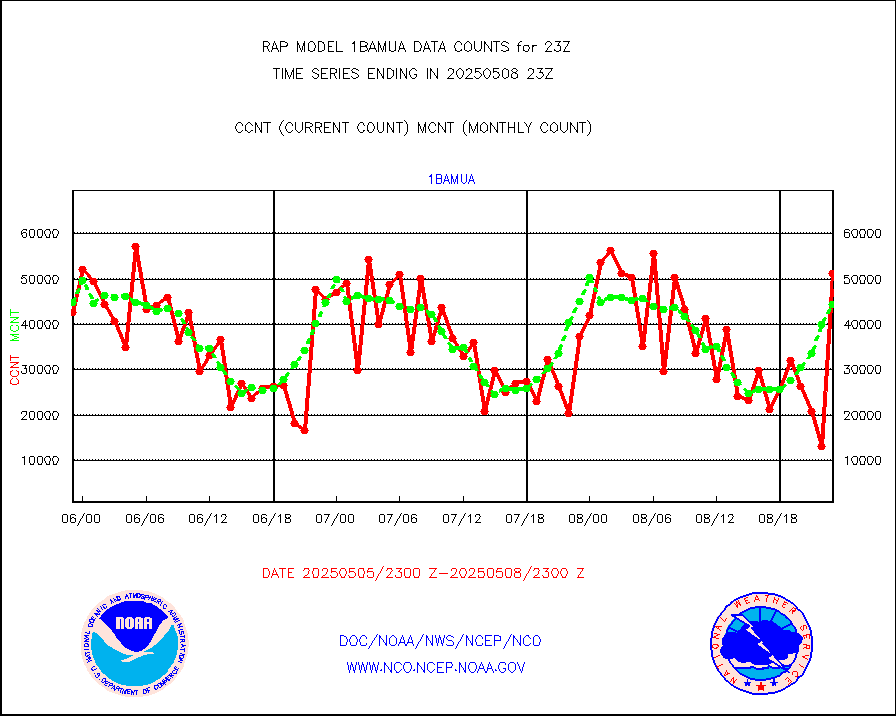
esmhs |
NOAA 18-19 & METOP 1-2 MHS proc. btemps from RARS |
134479 |
94083 |
142.9 % |
2422.00-2500.00 |
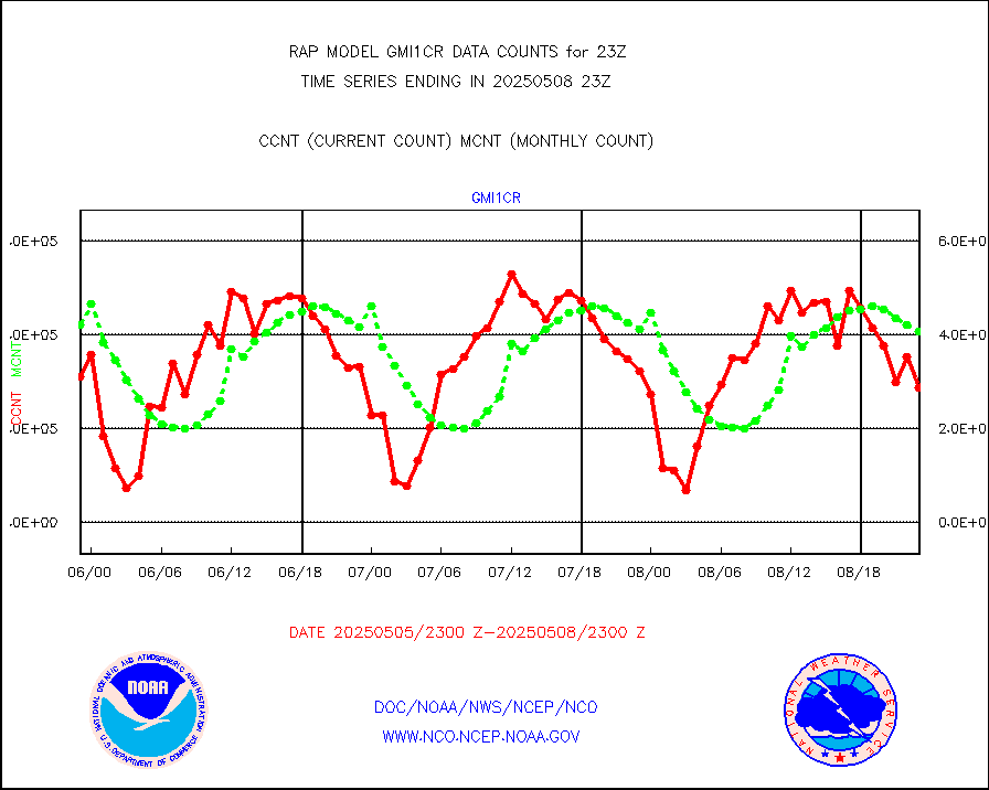
gmi1cr |
GPM GMI Level 1C-R brightness temperatures |
406727 |
460637 |
88.3 % |
2420.00-2501.99 |
gpsro |
GPS radio occultation data |
116 |
112 |
103.6 % |
2421.00-2500.99 |
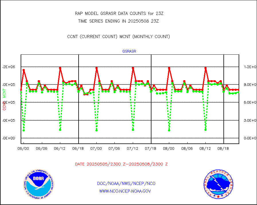
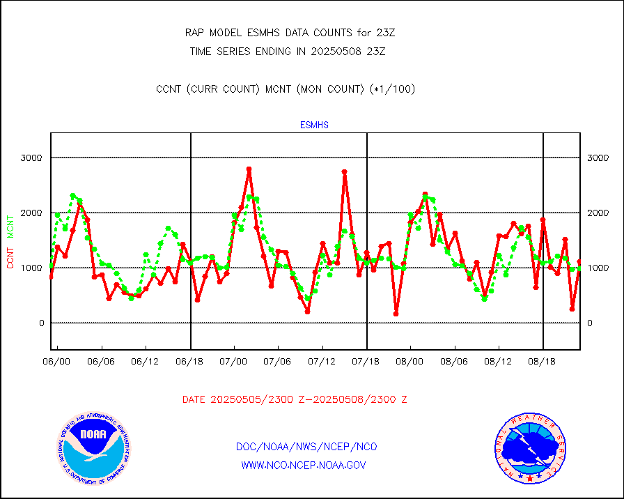
gsrasr |
GOES-16/17 All Sky Radiances (proc.) |
775205 |
794822 |
97.5 % |
2421.00-2500.99 |
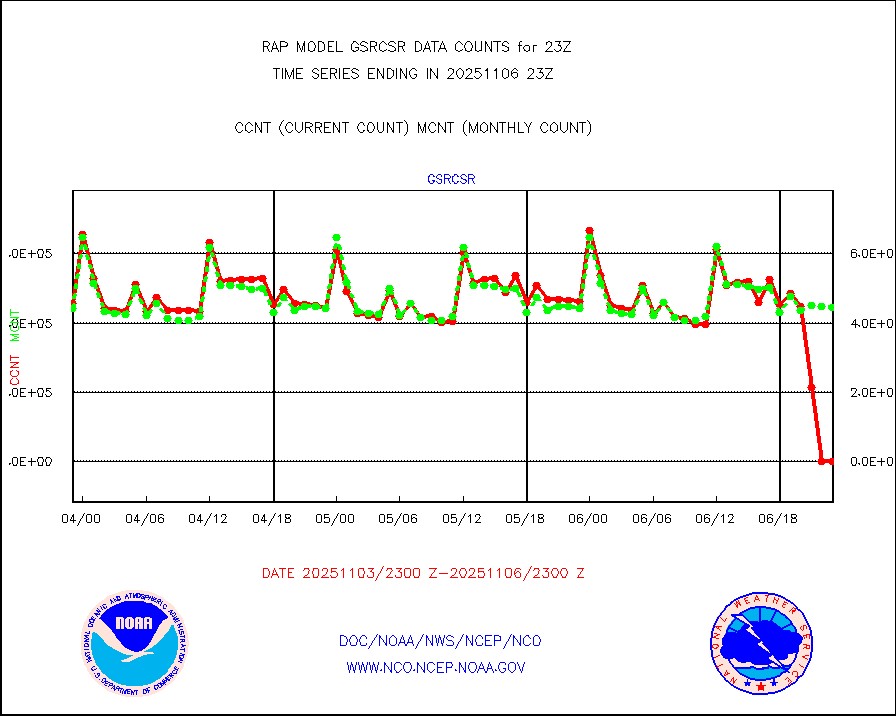
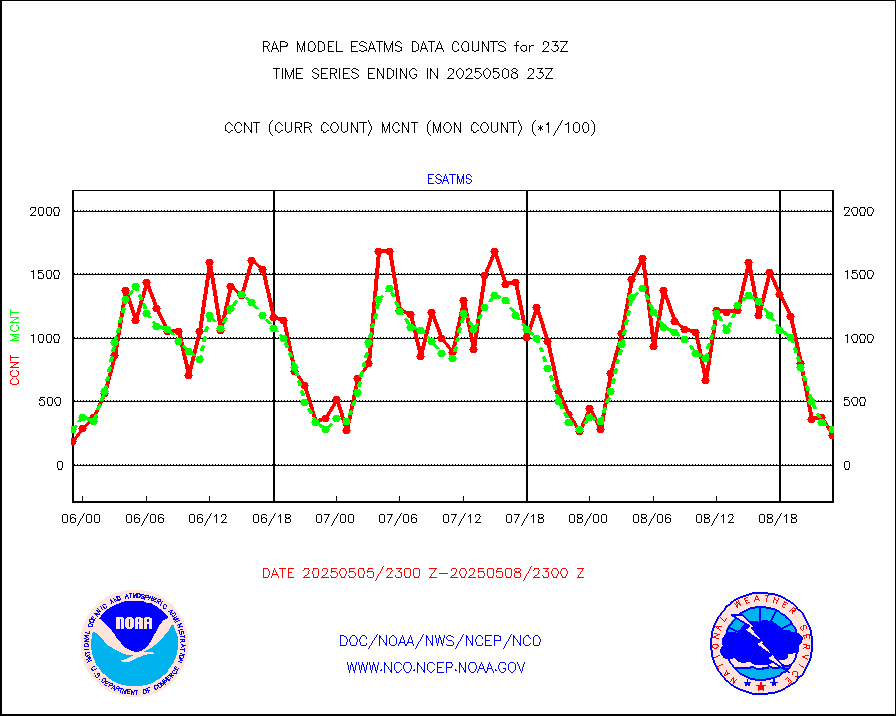
gsrcsr |
GOES-16/17 Clear Sky Radiances (proc.) |
428307 |
410264 |
104.4 % |
2421.00-2500.99 |
h20ja |
MTSAT/JMA water vapor imager derived cloud motion |
3045 |
2755 |
110.5 % |
2420.50-2501.50 |
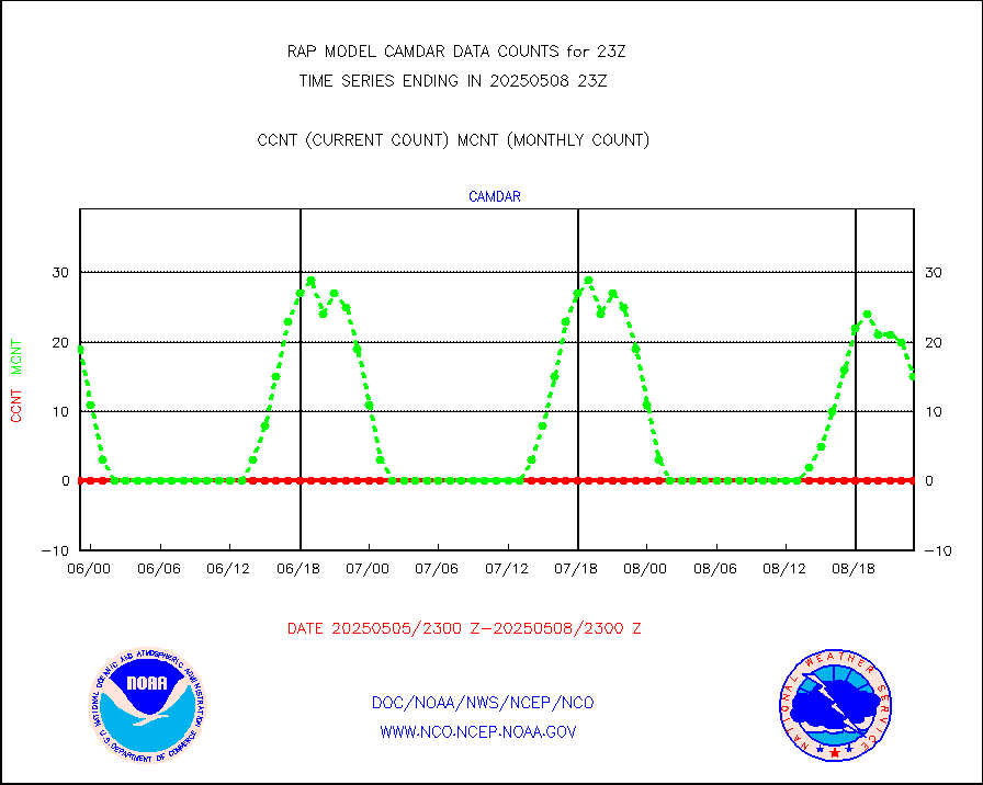
h2dusr |
GOES-16&up/NESDIS wv imgr/deep-lyr derivd cld mtn |
8752 |
6466 |
135.4 % |
2422.00-2422.99 |
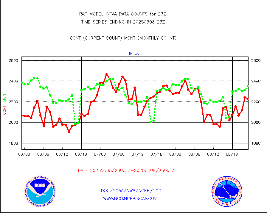
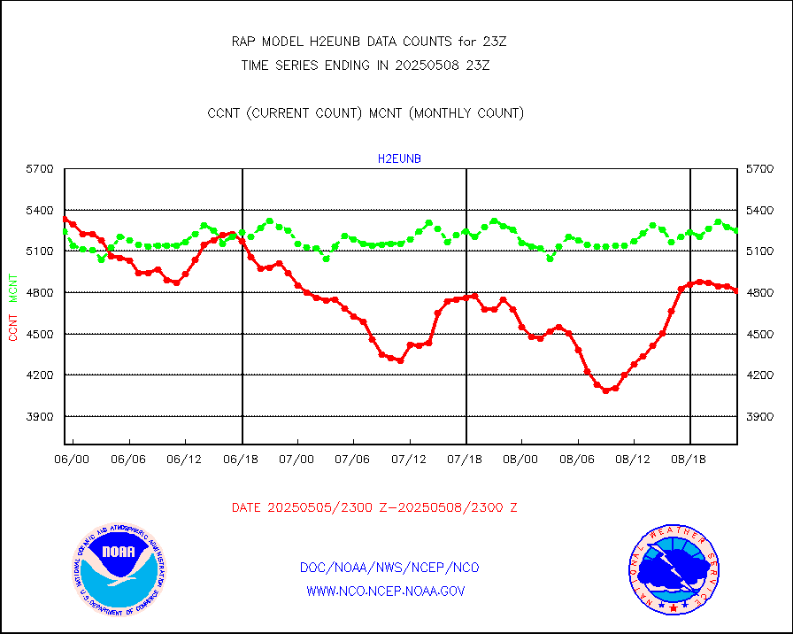
h2eunb |
METEOSAT/EUMETSAT wvpr imgr drv cld motion NBseq |
4676 |
5096 |
91.8 % |
2421.50-2500.49 |
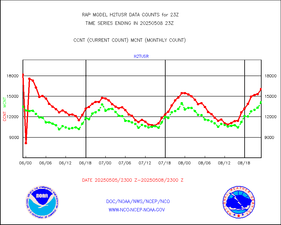
h2tusr |
GOES-16&up/NESDIS wv imgr/cld-top derived cld mtn |
12660 |
11777 |
107.5 % |
2422.00-2422.99 |
iasidb |
METOP 1-2 IASI 1C radiances-direct broadcast SSEC |
35859 |
23777 |
150.8 % |
2421.00-2500.99 |
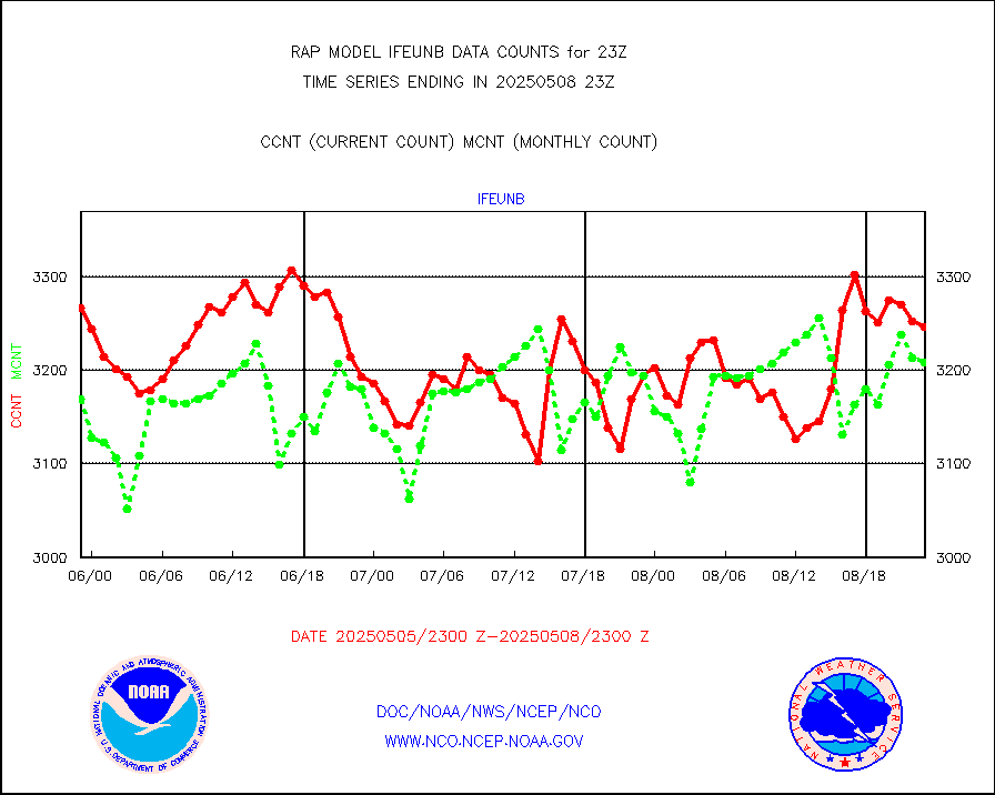
ifeunb |
METEOSAT/EUMETSAT ir lg-wave drv cld motion NBseq |
3263 |
3203 |
101.9 % |
2421.50-2500.49 |
ifvrnb |
VIIRS (NPP/NOAA-20) ir lg-wv drv cloud motion(NB) |
0 |
0 |
n/a |
2420.50-2501.50 |
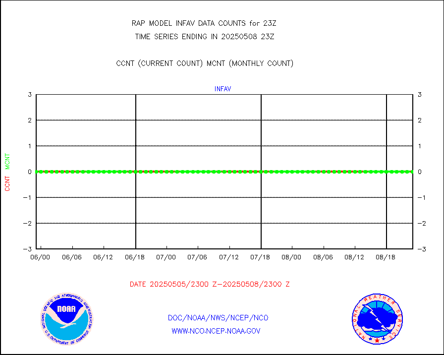
infav |
AVHRR (NOAA/METOP) ir lg-wave derived cld motion |
0 |
2 |
0.0 % |
2420.50-2501.50 |
infav1 |
AVHRR (METOP) ir lg-wave derived cld motion |
0 |
0 |
n/a |
2421.50-2500.49 |
infja |
MTSAT/JMA infrared long-wave derived cloud motion |
2932 |
2443 |
120.0 % |
2420.50-2501.50 |
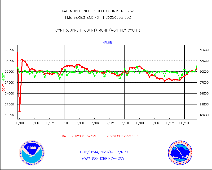
infusr |
GOES-16&up/NESDIS ir long-wave derived cld motion |
33678 |
31273 |
107.7 % |
2422.00-2422.99 |
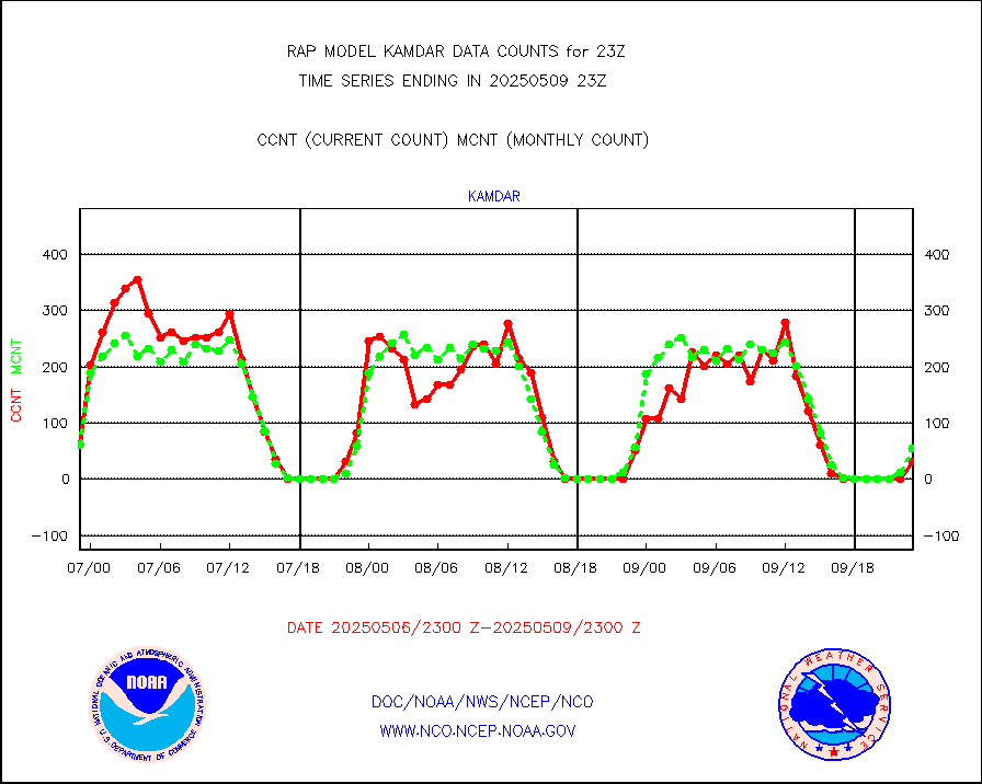
kamdar |
Korean AMDAR aircraft data (decoded from BUFR) |
131 |
108 |
121.3 % |
2419.75-2502.25 |
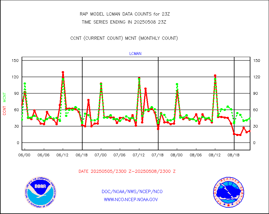
lcman |
Land-based CMAN stations decoded from CMAN format |
74 |
75 |
98.7 % |
2422.50-2423.50 |
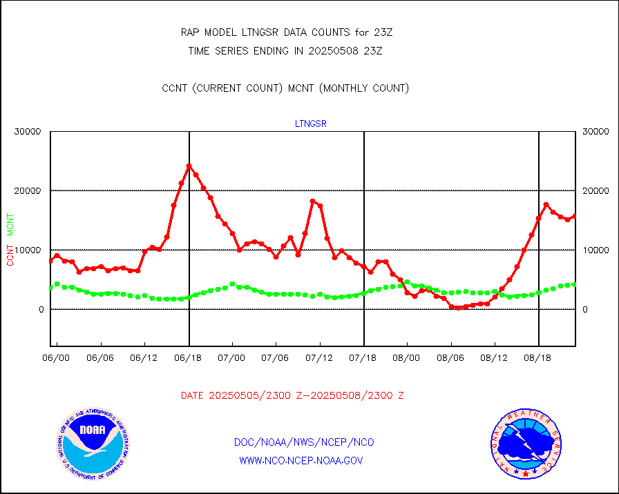
ltnglr |
LLDN Long-rng lightning from Vaisala via NOAAPORT |
40653 |
66779 |
60.9 % |
2422.00-2423.50 |
ltngsr |
NLDN Shrt-rng lightning from Vaisala via NOAAPORT |
922 |
2385 |
38.7 % |
2422.00-2423.50 |
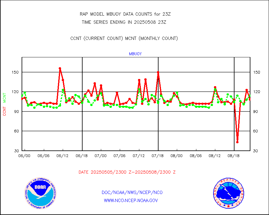
mbuoyb |
Moored buoys (decoded from BUFR) |
557 |
472 |
118.0 % |
2422.50-2423.50 |
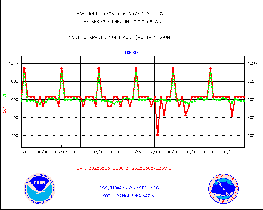
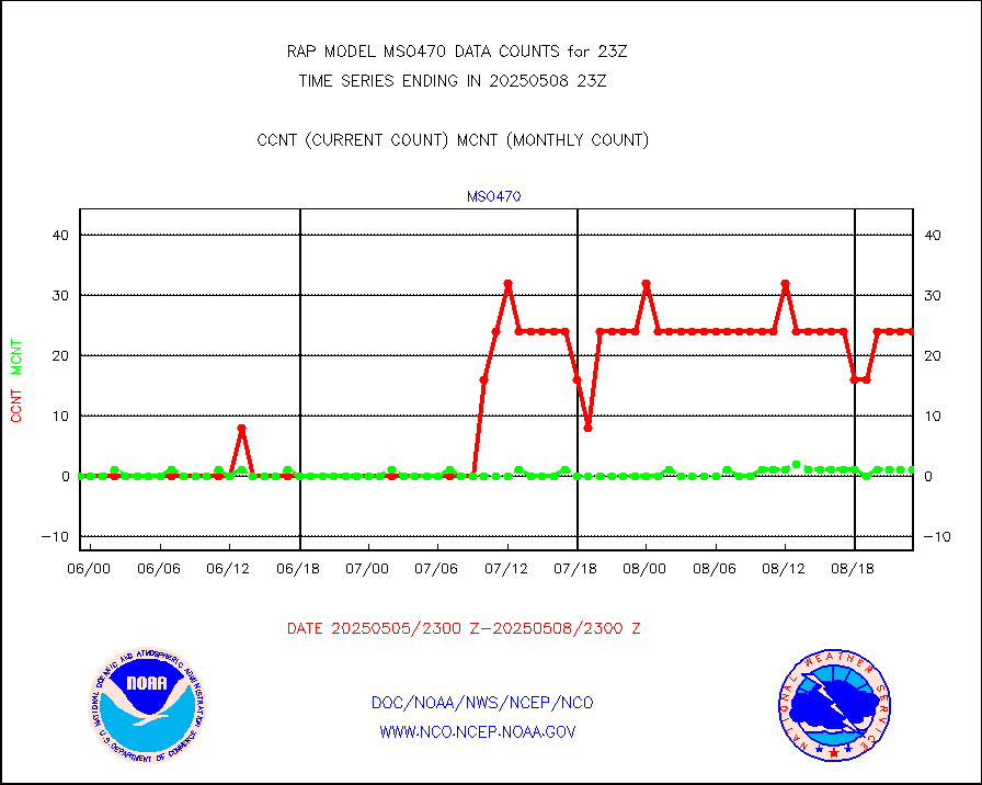
mso470 |
Mesonet/MADIS Colorado E-470 (Interstate 470) |
18 |
19 |
94.7 % |
2422.50-2423.50 |
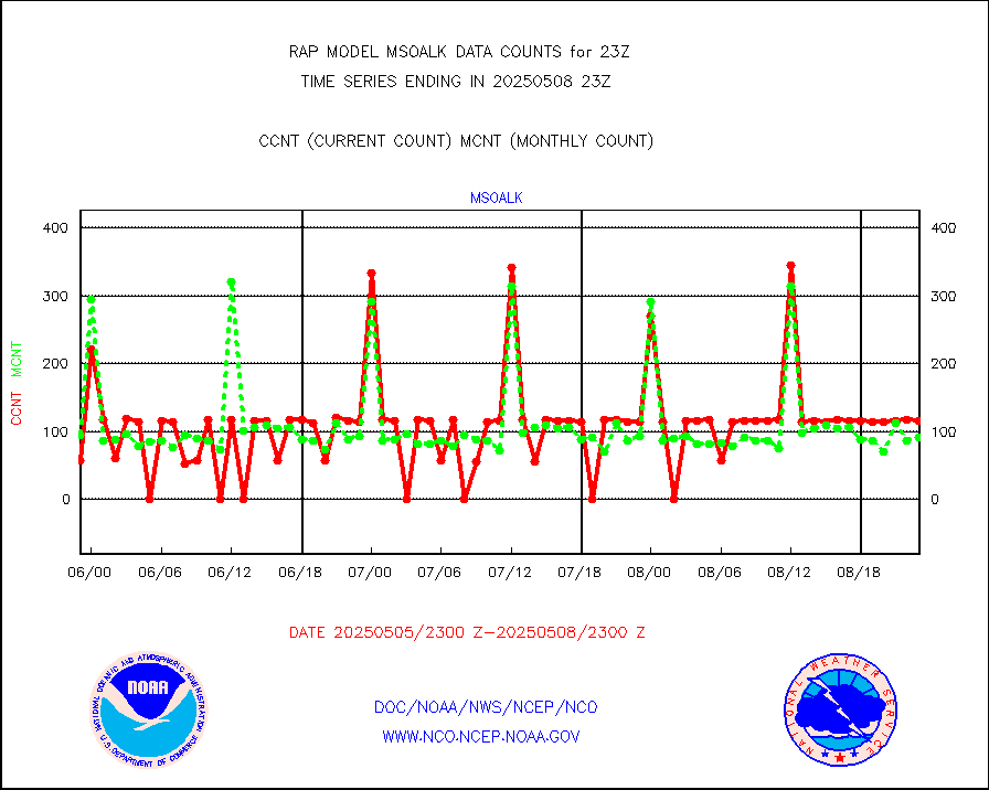
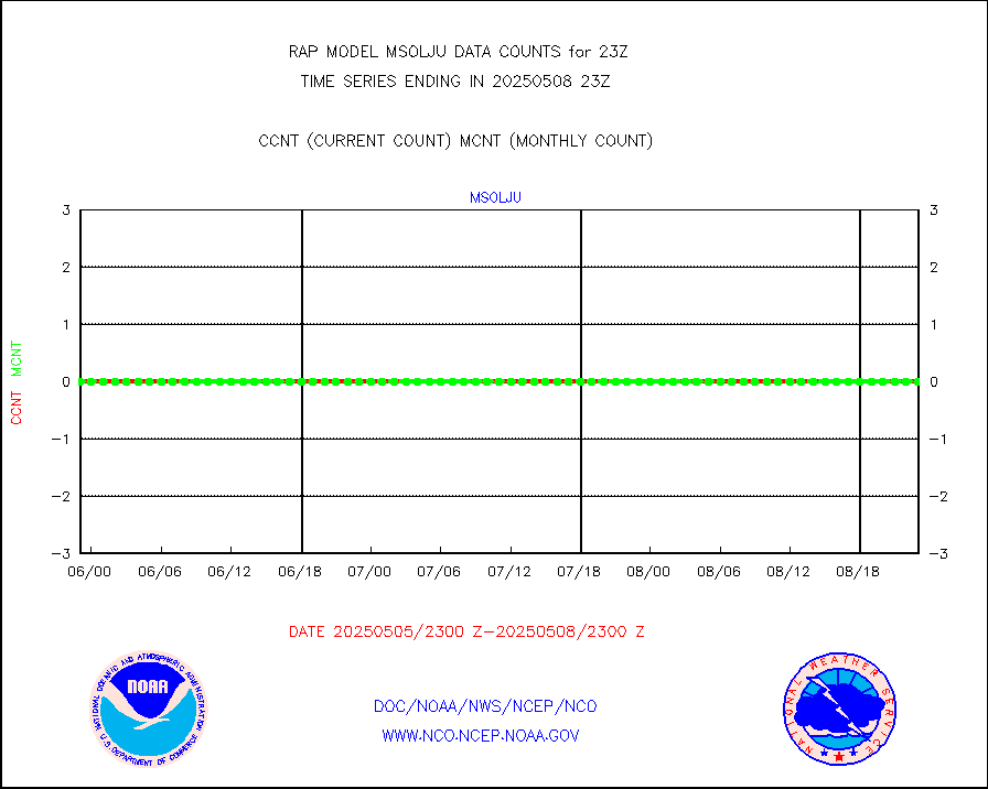
msoalk |
Mesonet/MADIS Alaska Department of Transportation |
106 |
108 |
98.1 % |
2422.50-2423.50 |
msoapg |
Mesonet/MADIS U.S. Army Aberdeen Proving Grounds |
0 |
0 |
n/a |
2422.50-2423.50 |
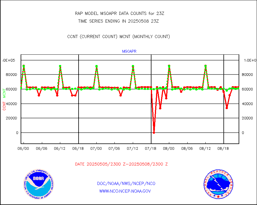
msoapr |
Mesonet/MADIS Citizen Weather Observers Program |
46804 |
44122 |
106.1 % |
2422.50-2423.50 |
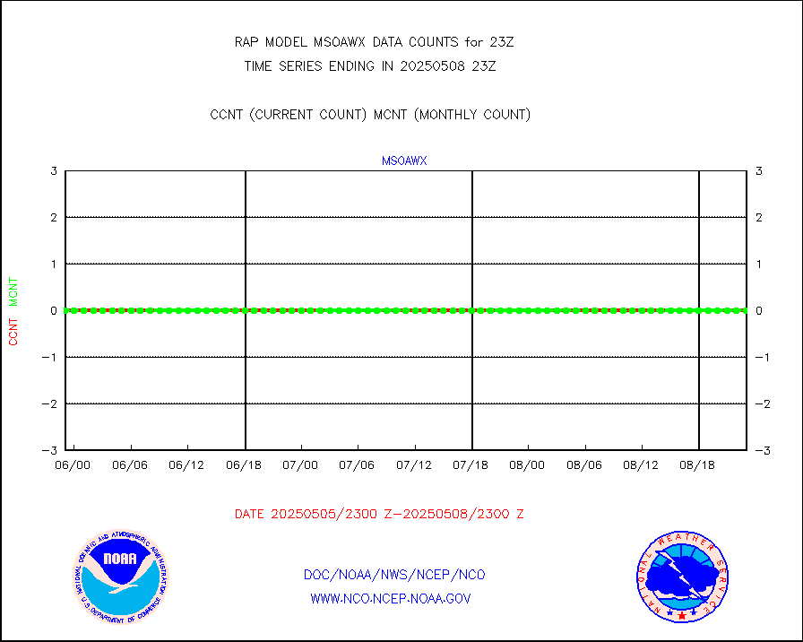
msoaws |
Mesonet/MADIS AWS Convergence Technologies, Inc. |
26418 |
25755 |
102.6 % |
2422.50-2423.50 |
msoawx |
Mesonet/MADIS "Anything Weather" |
0 |
0 |
n/a |
2422.50-2423.50 |
msocol |
Mesonet/MADIS Colorado Dept. of Transportation |
0 |
0 |
n/a |
2422.50-2423.50 |
msodcn |
Mesonet/MADIS DC Net |
0 |
0 |
n/a |
2422.50-2423.50 |
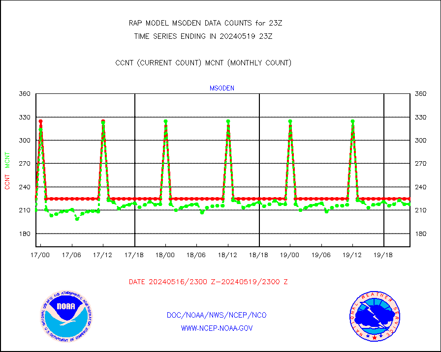
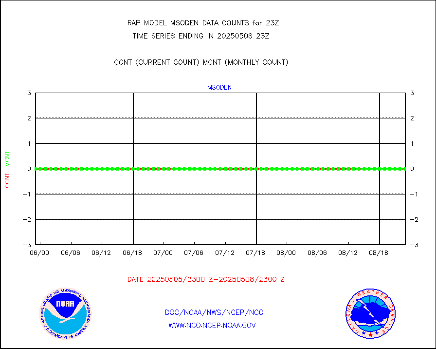
msoden |
Mesonet/MADIS Denver Urban Drainage & Flood Cntrl |
225 |
200 |
112.5 % |
2422.50-2423.50 |
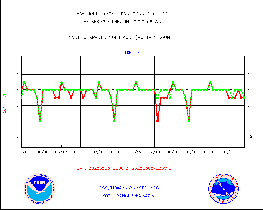
msofla |
Mesonet/MADIS Florida (FAWN & USF) |
3 |
3 |
100.0 % |
2422.50-2423.50 |
msoflt |
Mesonet/MADIS Florida Dept. of Transportation |
0 |
0 |
n/a |
2422.50-2423.50 |
msogeo |
Mesonet/MADIS Georgia Dept. of Transportation |
0 |
0 |
n/a |
2422.50-2423.50 |
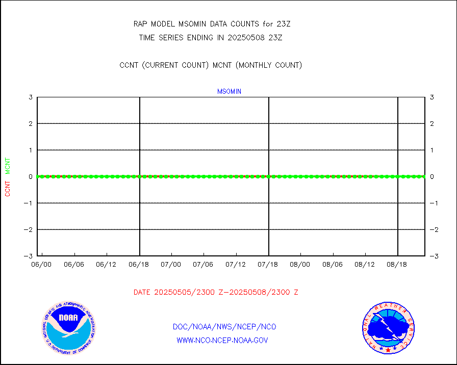
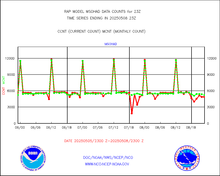
msohad |
Mesonet/MADIS NWS Hydromet Auto Data System(HADS) |
5867 |
5552 |
105.7 % |
2422.50-2423.50 |
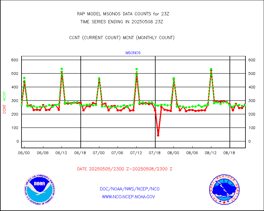
msoien |
Mesonet/MADIS Iowa Environmental |
178 |
173 |
102.9 % |
2422.50-2423.50 |
msoind |
Mesonet/MADIS Indiana Dept. of Transportation |
0 |
0 |
n/a |
2422.50-2423.50 |
msoiow |
Mesonet/MADIS Iowa Department of Transportation |
0 |
0 |
n/a |
2422.50-2423.50 |
msokan |
Mesonet/MADIS Kansas Department of Transportation |
348 |
319 |
109.1 % |
2422.50-2423.50 |
msokla |
Mesonet/MADIS Oklahoma Mesonet |
318 |
332 |
95.8 % |
2422.50-2423.50 |
msolju |
Mesonet/MADIS Louisiana State/Jackson State Univ. |
0 |
0 |
n/a |
2422.50-2423.50 |
msomca |
Mesonet/MADIS Missouri Commercial Agricult Wx Net |
271 |
254 |
106.7 % |
2422.50-2423.50 |
msomin |
Mesonet/MADIS Minnesota Dept. of Transportation |
0 |
0 |
n/a |
2422.50-2423.50 |
msonos |
Mesonet/MADIS NOS-Phys Oceanographic Realtime Sys |
288 |
269 |
107.1 % |
2422.50-2423.50 |
msoraw |
Mesonet/MADIS NFIC Remote Automated Wx Stns(RAWS) |
1605 |
1564 |
102.6 % |
2422.50-2423.50 |
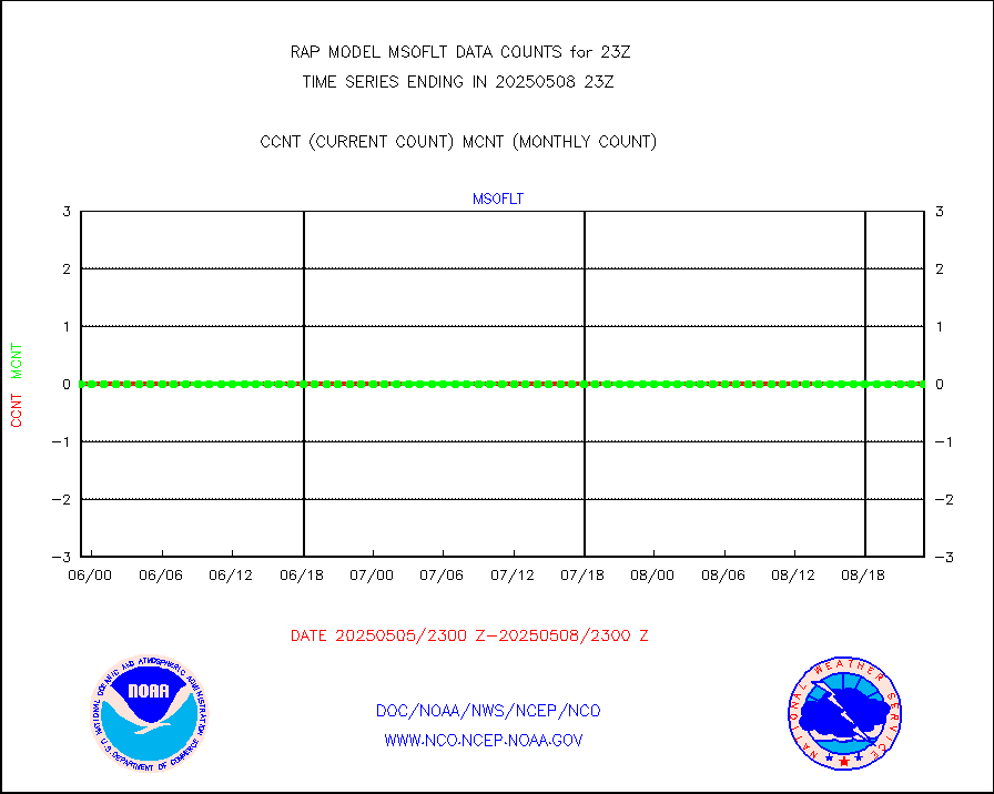
msourb |
Mesonet/MADIS UrbaNet |
4070 |
3936 |
103.4 % |
2422.50-2423.50 |
msovir |
Mesonet/MADIS Virginia Dept. of Transportation |
230 |
235 |
97.9 % |
2422.50-2423.50 |
msowfy |
Mesonet/MADIS "Weather for You" |
0 |
0 |
n/a |
2422.50-2423.50 |
msowis |
Mesonet/MADIS Wisconsin Dept. of Transportation |
0 |
0 |
n/a |
2422.50-2423.50 |
msowst |
Mesonet/MADIS MesoWest (many subproviders) |
40462 |
39260 |
103.1 % |
2422.50-2423.50 |
msowtx |
Mesonet/MADIS West Texas |
5043 |
5006 |
100.7 % |
2422.50-2423.50 |
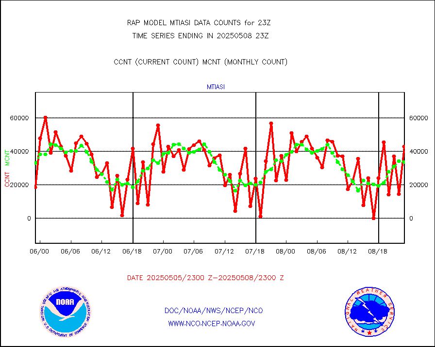
mtiasi |
METOP 1-2 IASI 1C radiance data (varbl. channels) |
42954 |
26973 |
159.2 % |
2421.00-2500.99 |
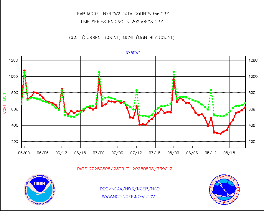
nxrdw2 |
NEXRAD Vel Azm Dsp(VAD) winds via Level 2 decoder |
639 |
700 |
91.3 % |
2422.00-2500.00 |
osbuv8 |
NOAA 16-19 Solar Backscatter UV-2 rad frm V8 BUFR |
0 |
0 |
n/a |
2421.00-2423.99 |
pibal |
PIBAL (from PILOT, PILOT SHIP, PILOT MOBIL) |
0 |
0 |
n/a |
2422.00-2500.00 |
pirep |
Manual PIREP aircraft data (dcded from AIREP fmt) |
289 |
566 |
51.1 % |
2419.75-2502.25 |
prflrp |
Profilr winds from PIBAL (PILOT,PILOT SHIP/MOBIL) |
0 |
0 |
n/a |
2421.50-2500.50 |
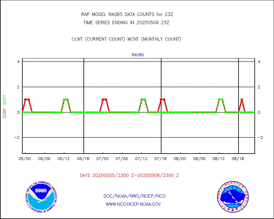
raobm |
Rawinsonde - mobile land (from TEMP/PILOT MOBIL) |
0 |
0 |
n/a |
2422.00-2500.00 |
raobs |
Rawinsonde - ship (from TEMP SHIP, PILOT SHIP) |
0 |
0 |
n/a |
2422.00-2500.00 |
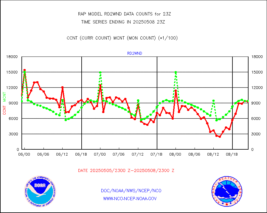
rd2wnd |
NEXRAD radial wind (Level 2 - GTS) |
718075 |
1003084 |
71.6 % |
2422.50-2423.49 |
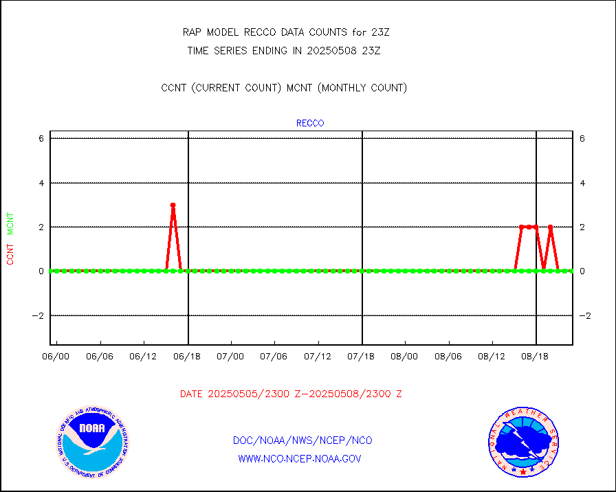
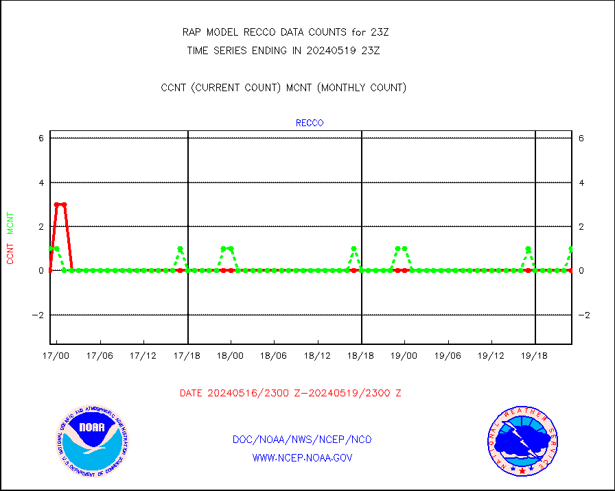
recco |
Flight level reconnaissance aircraft data |
3 |
1 |
300.0 % |
2422.00-2500.00 |
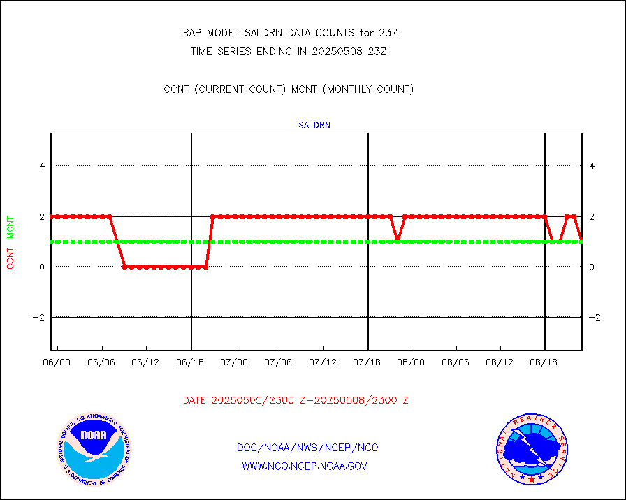
saldrn |
Surface Marine Saildrone (decoded from BUFR) |
2 |
2 |
100.0 % |
2421.00-2500.99 |
saphir |
Megha-Tropiques SAPHIR L1A2 brightness temps |
0 |
0 |
n/a |
2420.00-2501.99 |
sevasr |
METEOSAT-10 2nd Gen SEVIRI All Sky Radiance(proc) |
9512 |
9504 |
100.1 % |
2421.00-2500.99 |
sevcsr |
METEOSAT-10 2nd Gen SEVIRI Clr Sky Radiance(proc) |
0 |
0 |
n/a |
2421.00-2500.99 |
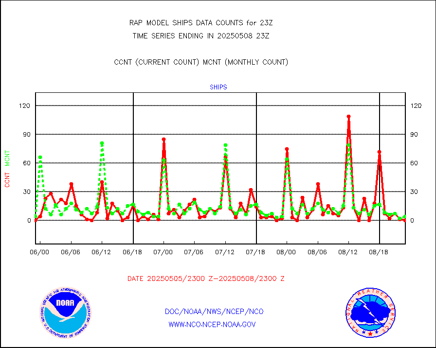
ships |
Ship - manual and automatic, restricted |
3 |
3 |
100.0 % |
2422.50-2423.50 |
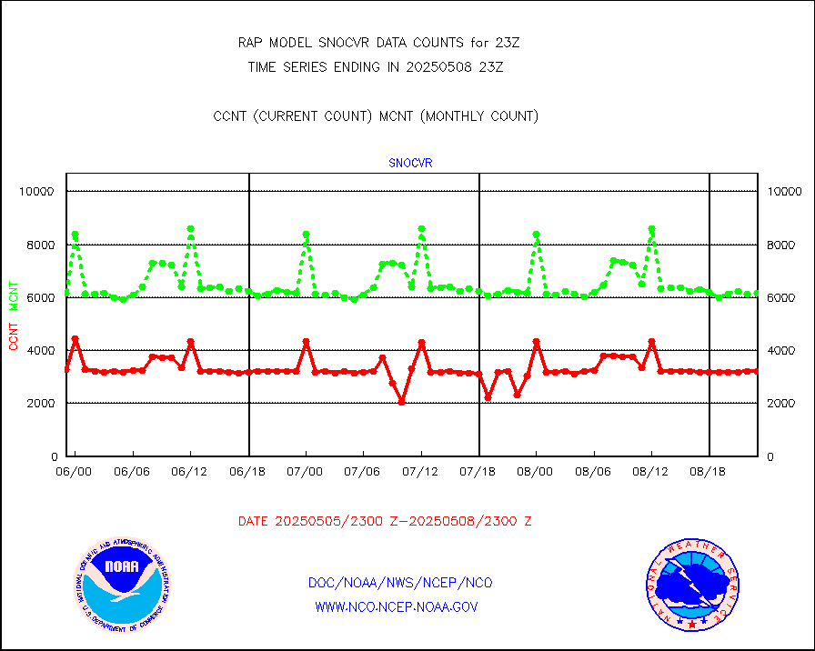
snocvr |
NOW COVER, DEPTH/DENSITY AND WATER EQUIVALENT |
4237 |
6331 |
66.9 % |
2421.00-2501.00 |
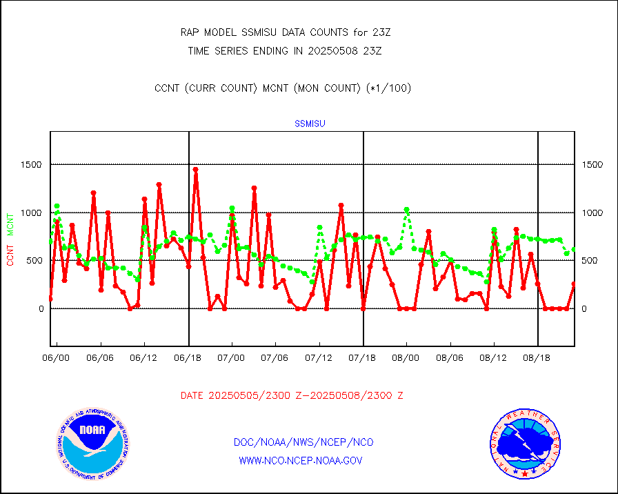
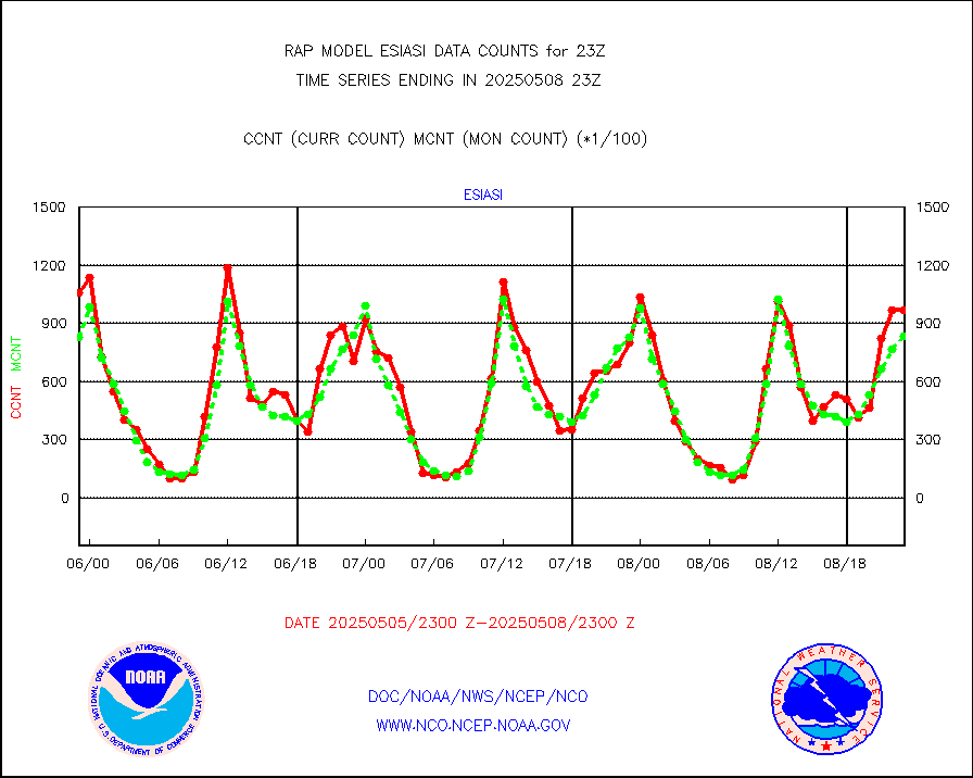
ssmisu |
DMSP SSM/IS 1C radiance data (Unified Pre-Proc.) |
67867 |
62681 |
108.3 % |
2421.00-2500.99 |
subpfl |
Sub-surface float and glider profile (BUFR) |
5 |
4 |
125.0 % |
2421.00-2500.99 |
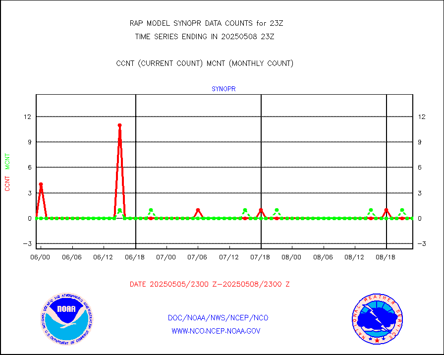
synopr |
Synoptic - restricted (WMO Res 40) manual & auto. |
0 |
0 |
n/a |
2422.50-2423.50 |
synpbr |
Synoptic - restricted (WMO Res 40)(decoded BUFR) |
344 |
349 |
98.6 % |
2422.50-2423.50 |
synpmb |
Synoptic - mobile manual & auto (decoded fr BUFR) |
0 |
0 |
n/a |
2422.50-2423.50 |
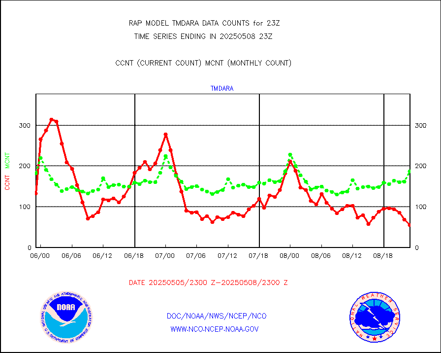
tmdara |
TAMDAR aircft data-all types(from Panasonic,BUFR) |
825 |
713 |
115.7 % |
2419.75-2502.25 |
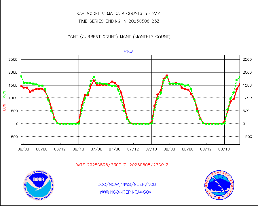
visja |
MTSAT/JMA visible derived cloud motion |
2065 |
1877 |
110.0 % |
2420.50-2501.50 |
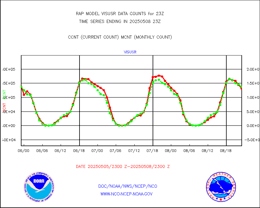
visusr |
GOES-16&up/NESDIS visible derived cloud motion |
121224 |
142740 |
84.9 % |
2422.00-2422.99 |
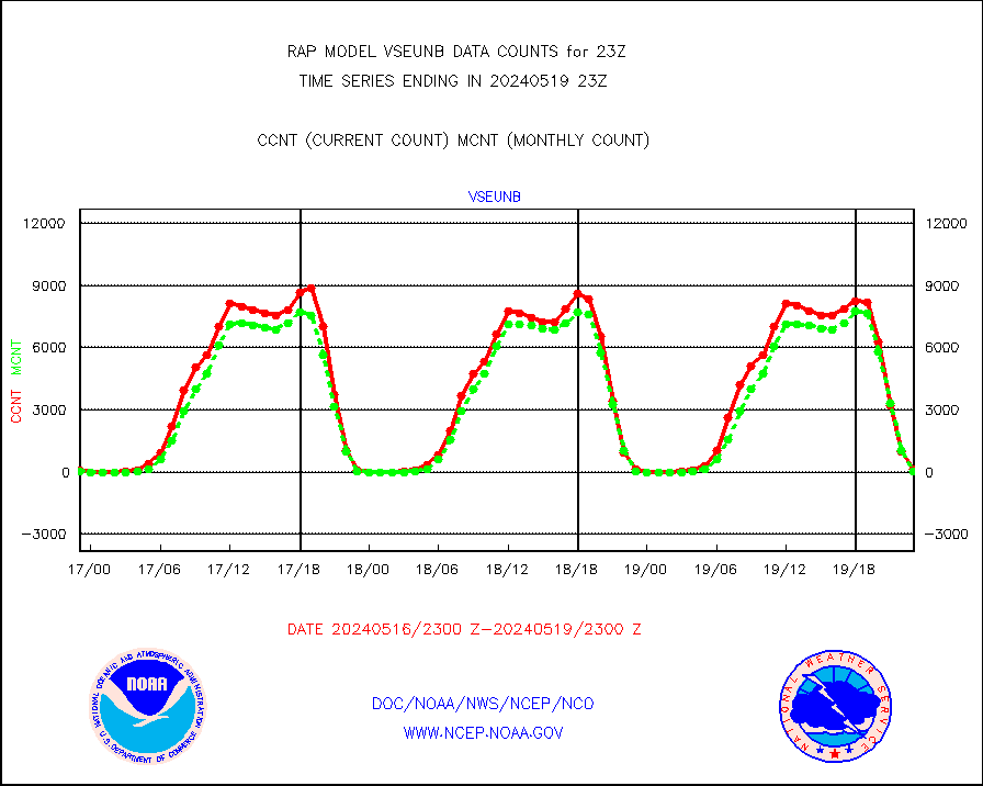
vseunb |
METEOSAT/EUMETSAT visible drv cld motion NBseq |
0 |
17 |
0.0 % |
2421.50-2500.49 |


