| Critical Data with Normal Counts |
|---|
| Type | Description | Hourly Count | Monthly Average | Percent (%) of Monthly Mean | UTC Time Window |
1bamua |
NOAA 15-19 & METOP 1-2 AMSU-A NCEP-proc. br.temps |
48428 |
42551 |
113.8 % |
2219.00-2300.99 |
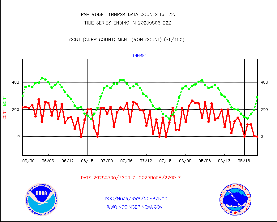
1bhrs4 |
NOAA 18-19 & METOP 1-2 HIRS-4 NCEP-proc. br.temps |
31282 |
33323 |
93.9 % |
2219.00-2300.99 |
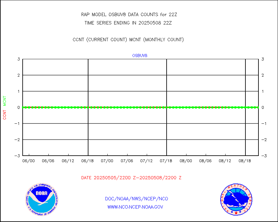
1bmhs |
NOAA 18-19 & METOP 1-2 MHS NCEP-proces. br. temps |
296495 |
238790 |
124.2 % |
2219.00-2300.99 |
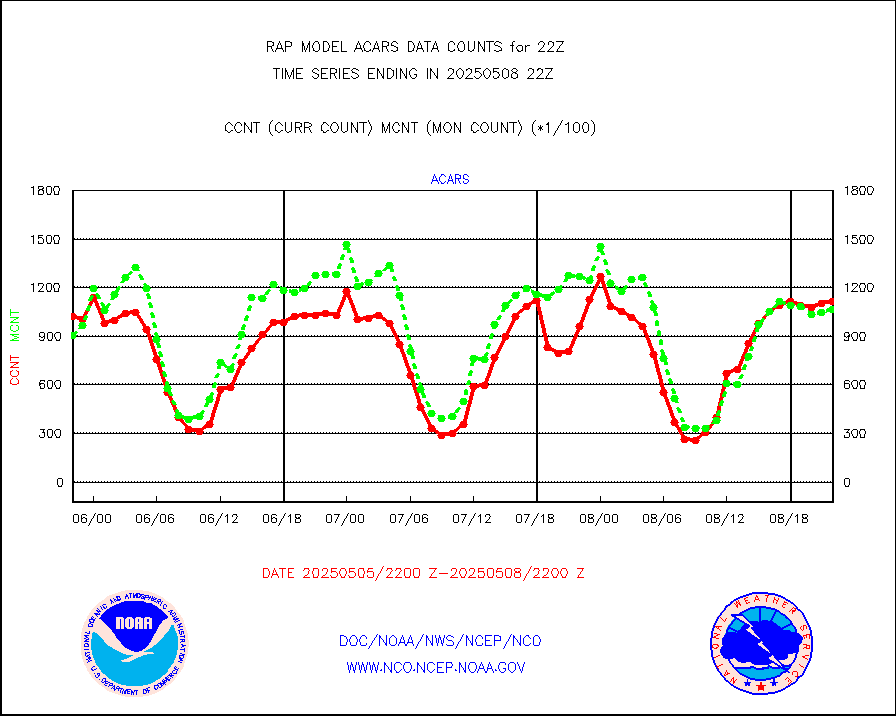
acars |
MDCRS ACARS acft data from ARINC(dcded from BUFR) |
96843 |
63851 |
151.7 % |
2218.75-2301.25 |
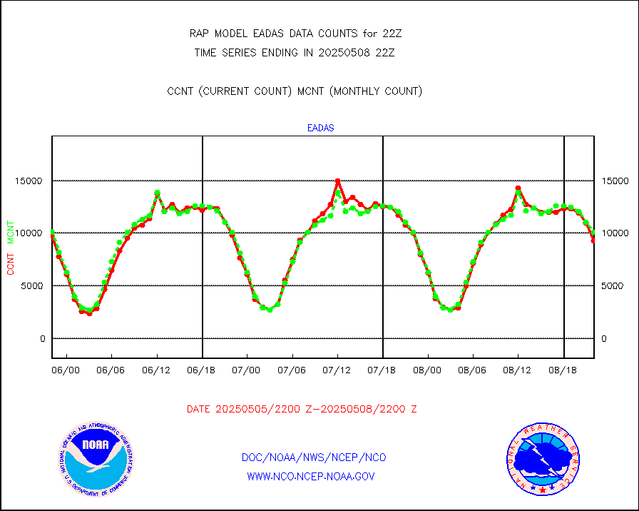
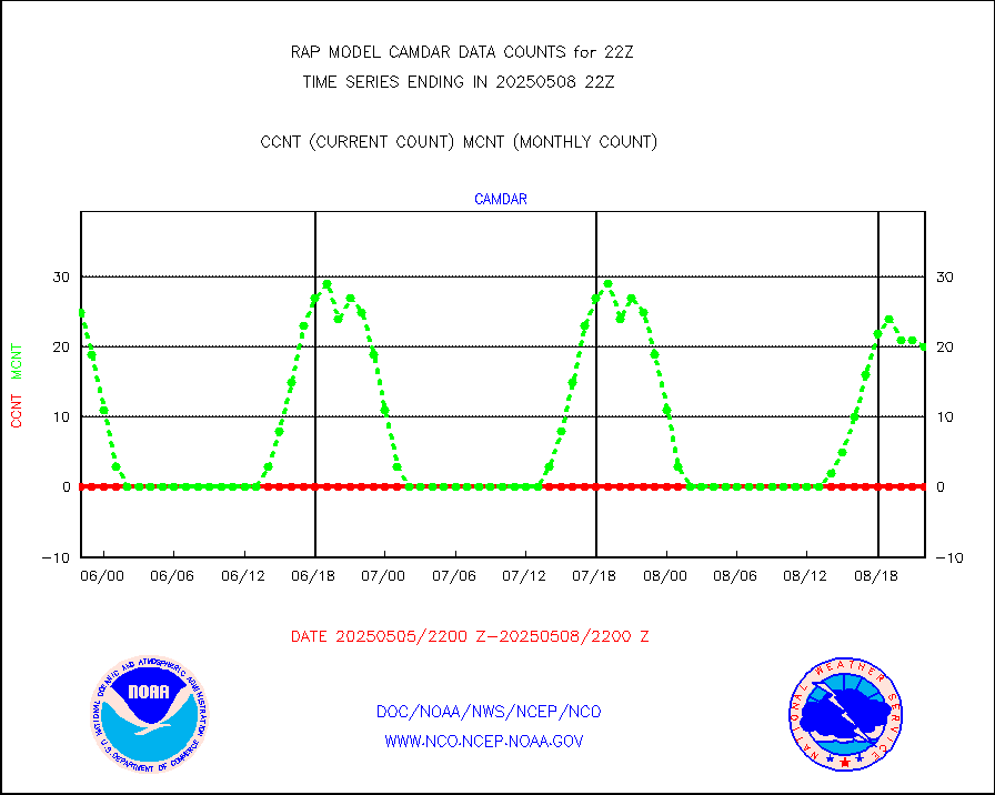
camdar |
Canadian AMDAR aircraft data (decoded from BUFR) |
178 |
104 |
171.2 % |
2218.75-2301.25 |
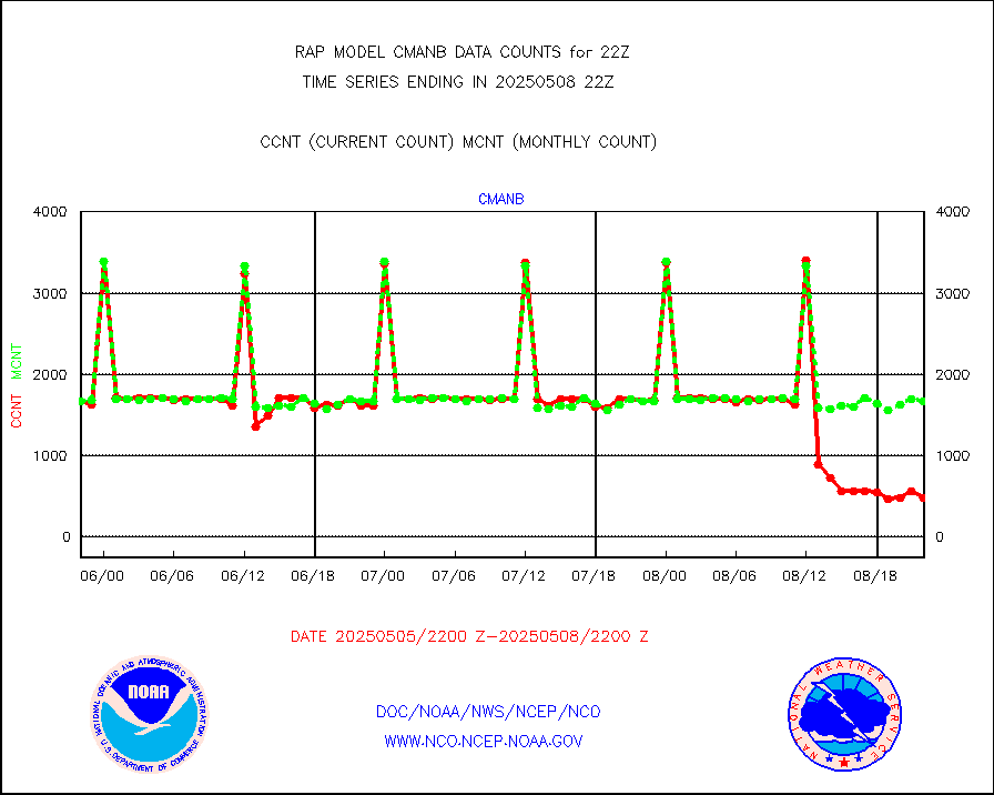
cmanb |
Surface Marine CMAN rpts decoded from BUFR format |
1662 |
1641 |
101.3 % |
2221.50-2222.50 |
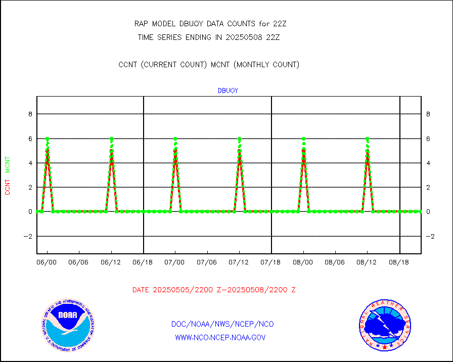
dbuoy |
Buoys decoded from FM-18 fmt (moored or drifting) |
0 |
0 |
n/a |
2221.50-2222.50 |
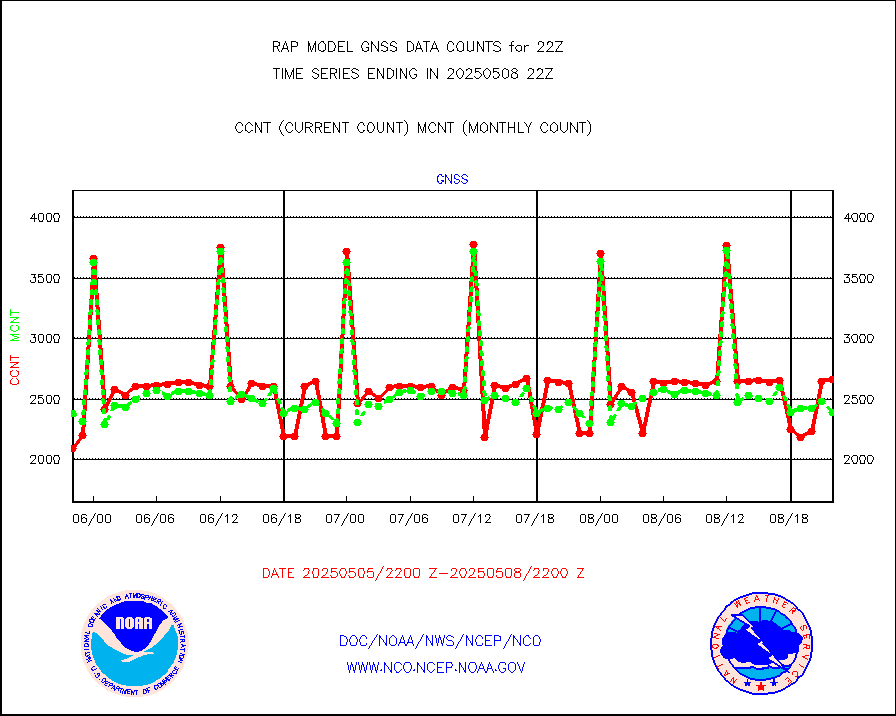
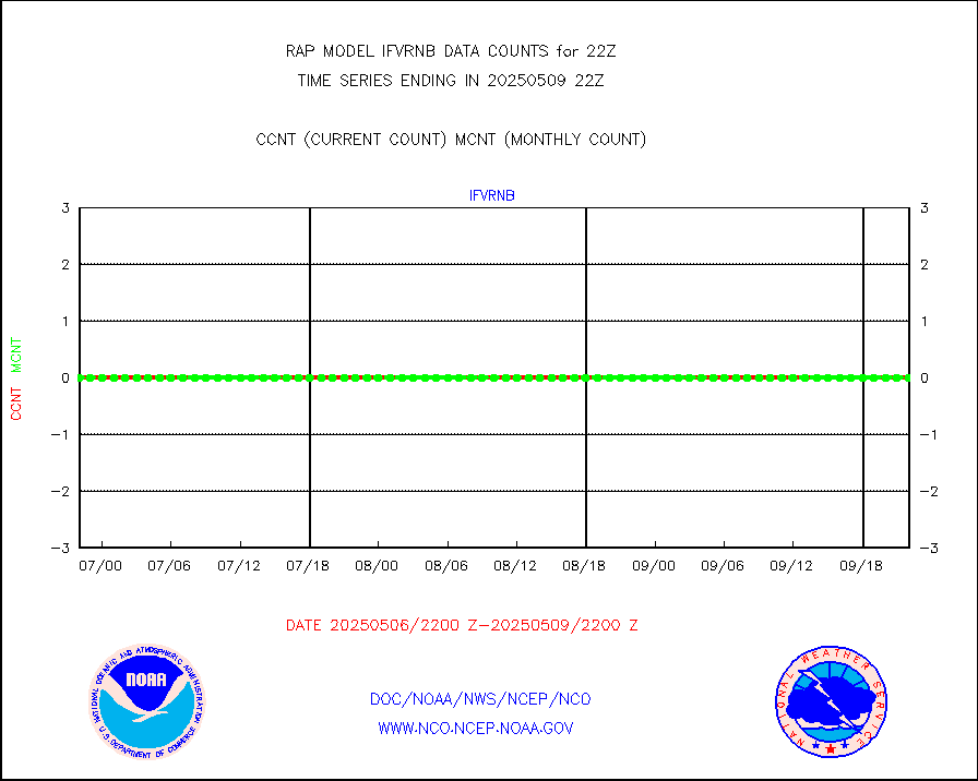
gnss |
Grnd-based Gbl Navigation Sat System (GNSS) data |
2456 |
2260 |
108.7 % |
2220.95-2221.05 |
h20mo |
MODIS (AQUA/TERRA) wvpr imager derived cld motion |
0 |
0 |
n/a |
2219.50-2300.50 |
infmo |
MODIS (AQUA/TERRA) ir l-wave derived cloud motion |
0 |
0 |
n/a |
2219.50-2300.50 |
lgycld |
GOES/NASA(Langley) hi-res. (1x1 f-o-v) cloud data |
3711940 |
3289465 |
112.8 % |
2221.50-2222.50 |
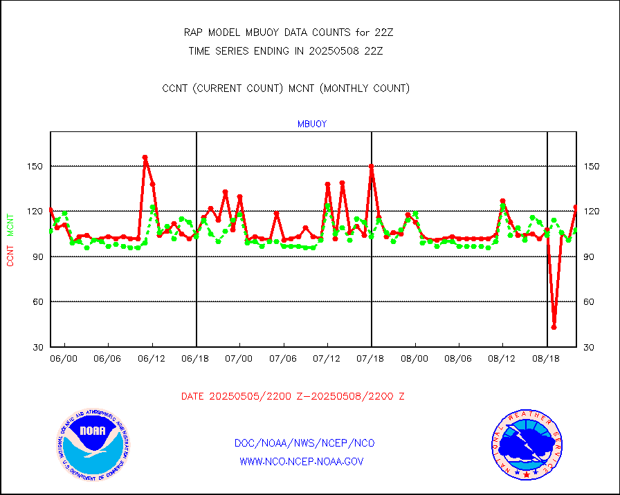
mbuoy |
Buoys decoded from FM-13 format (moored) |
47 |
42 |
111.9 % |
2221.50-2222.50 |
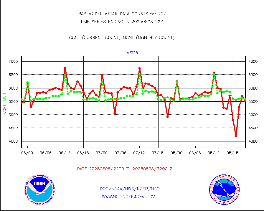
metar |
Aviation - METAR |
5657 |
5822 |
97.2 % |
2221.50-2222.50 |
nxrdw |
NEXRAD Vel Azm Dsp(VAD) winds via radar coded msg |
0 |
0 |
n/a |
2221.00-2223.00 |
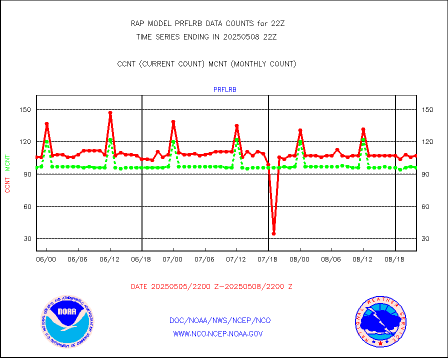
prflrb |
Multi-Agency Profiler (MAP) and SODAR winds |
90 |
82 |
109.8 % |
2220.50-2223.50 |
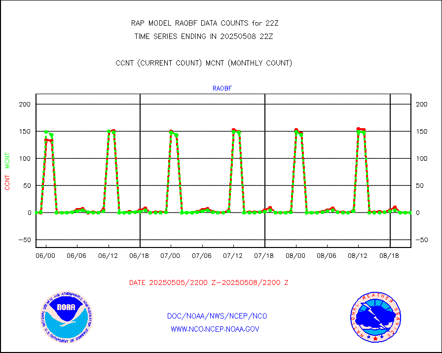
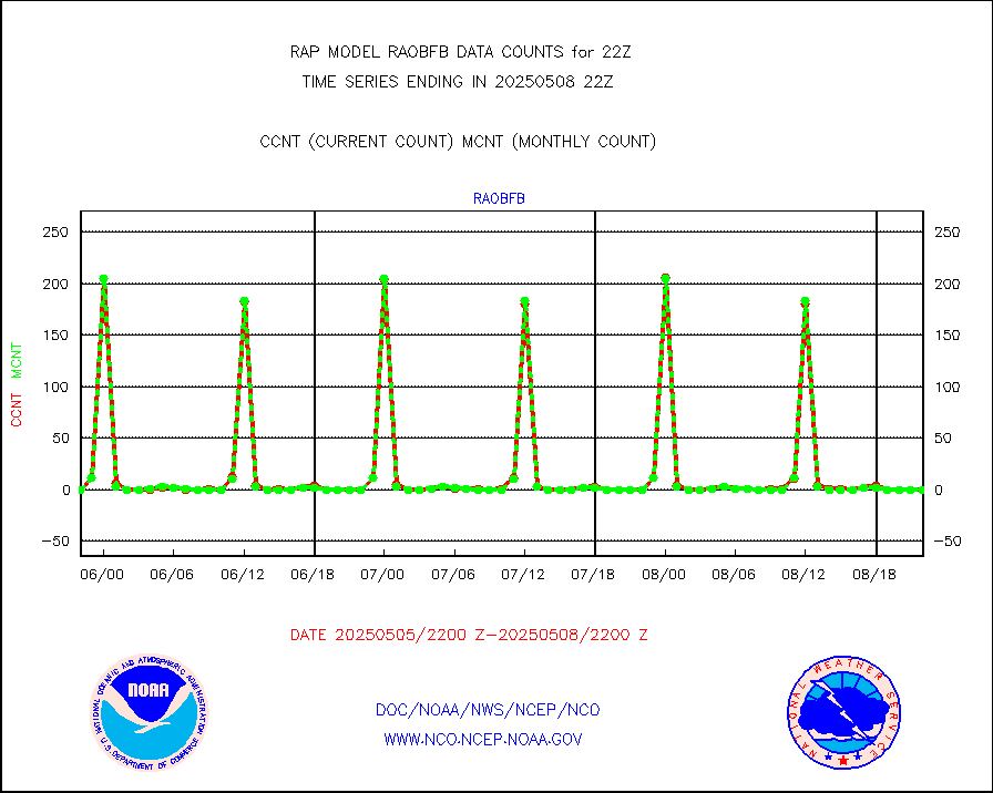
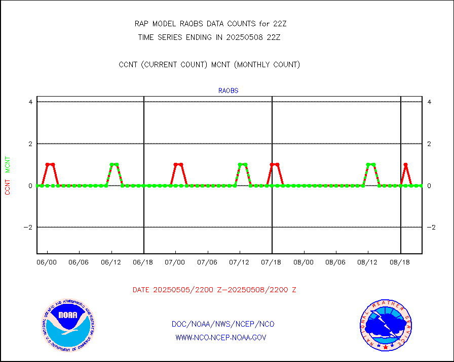
raobf |
Rawinsonde - fixed land (from TEMP or PILOT) |
1 |
0 |
n/a |
2221.00-2223.00 |
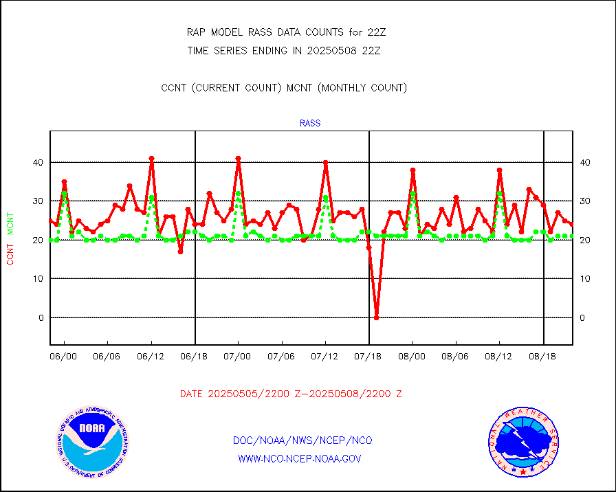
rass |
RASS temperatures (NOAA and Multi-Agency) |
19 |
20 |
95.0 % |
2221.50-2222.50 |
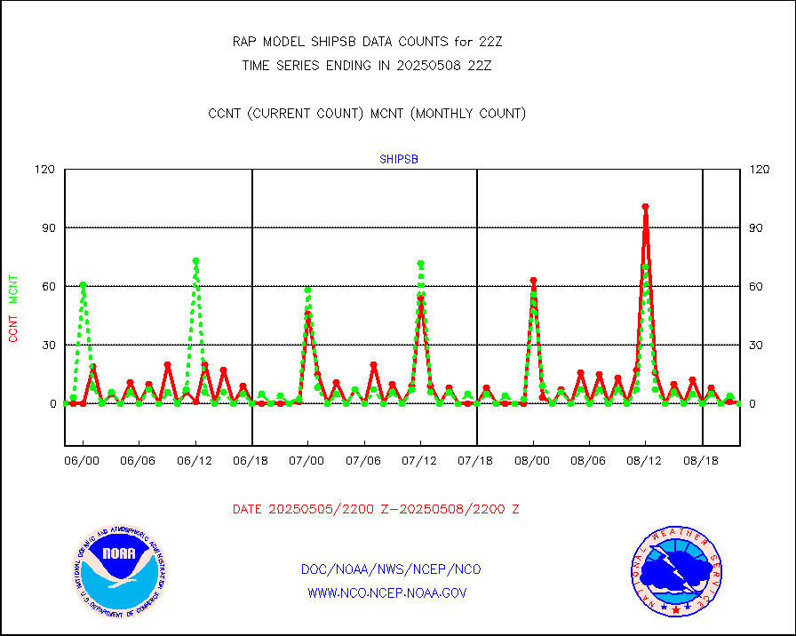
shipsb |
Ship - manual and automatic, restricted (BUFR) |
0 |
0 |
n/a |
2221.50-2222.50 |
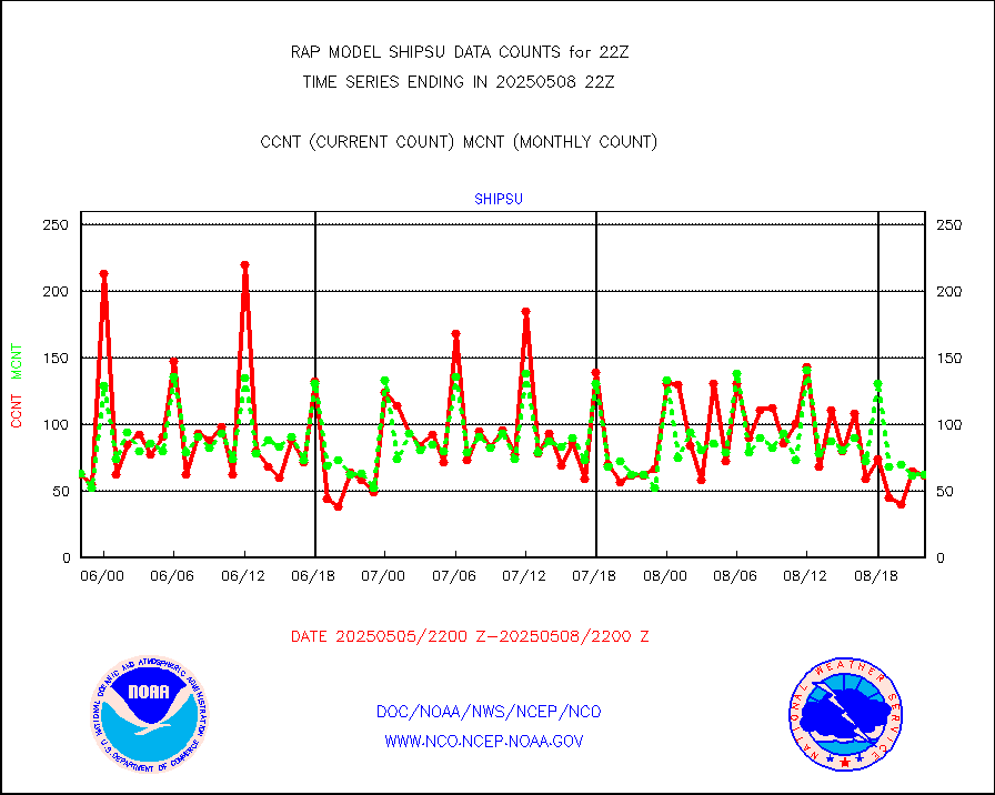
shipsu |
Ship - manual and automatic, unrestricted |
49 |
47 |
104.3 % |
2221.50-2222.50 |
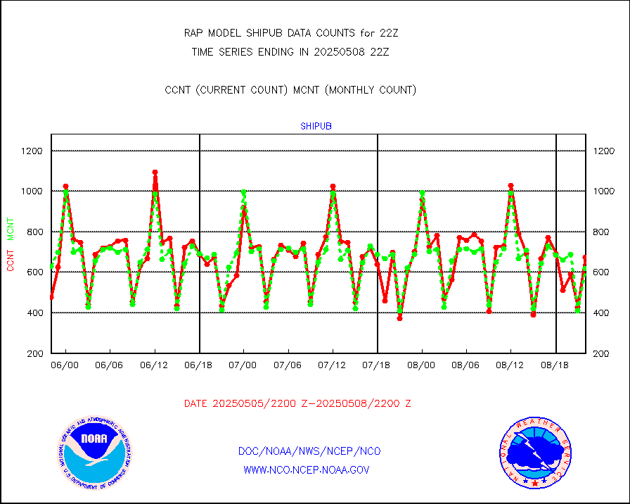
shipub |
Ship - manual and automatic, unrestricted (BUFR) |
511 |
535 |
95.5 % |
2221.50-2222.50 |
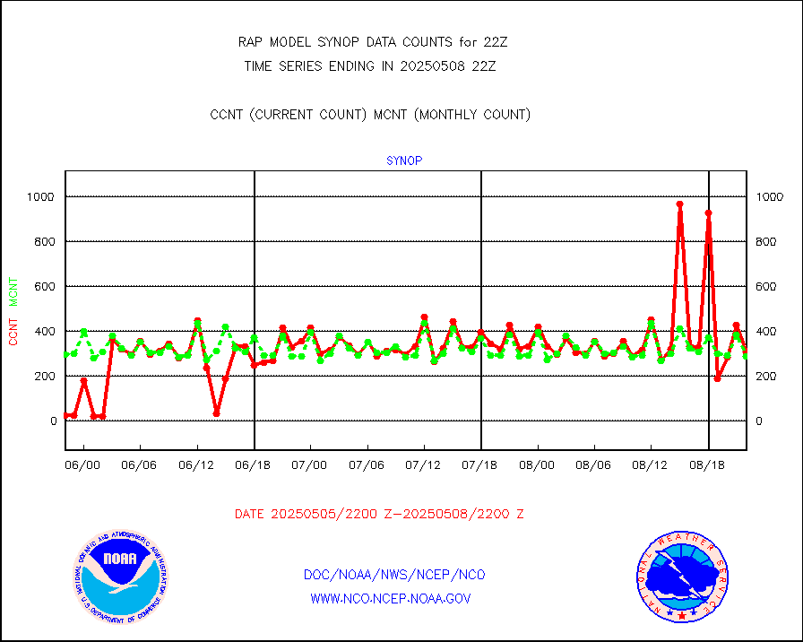
synop |
Synoptic - fixed manual and automatic |
255 |
312 |
81.7 % |
2221.50-2222.50 |
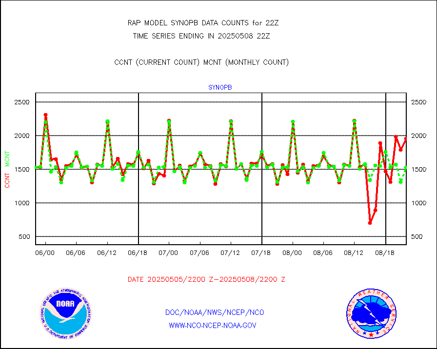
synopb |
Synoptic - fixed manual & auto (decoded fr BUFR) |
1681 |
1616 |
104.0 % |
2221.50-2222.50 |
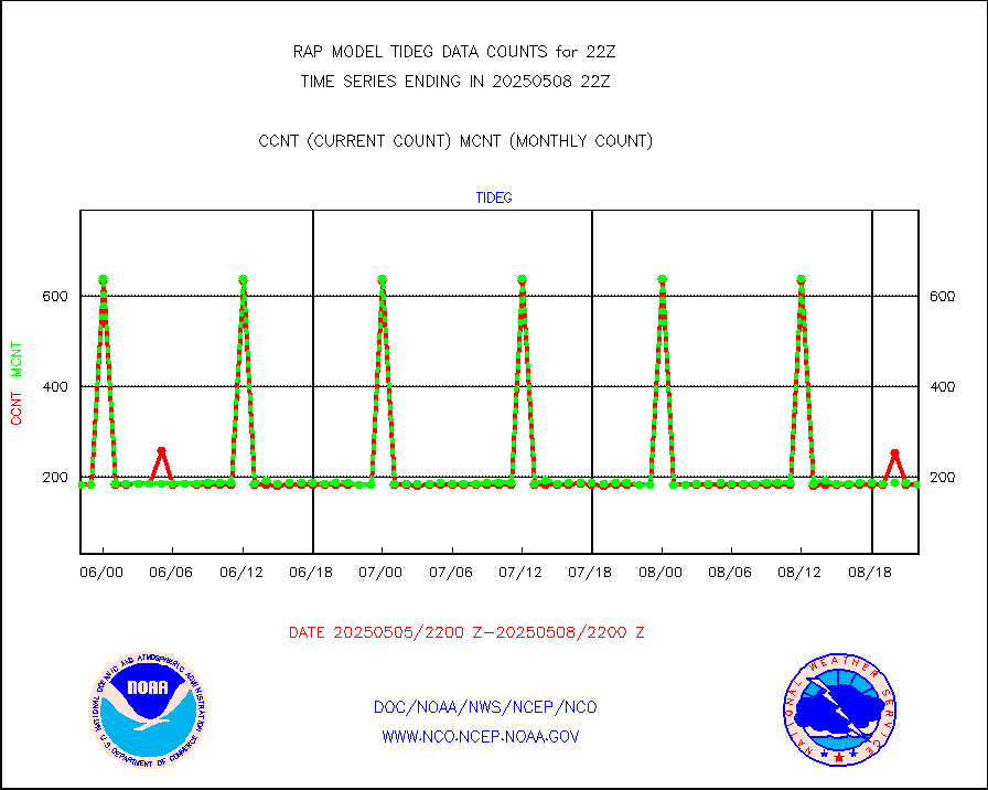
tideg |
Tide gauge reports decoded from CREX format |
180 |
177 |
101.7 % |
2221.50-2222.50 |
| Data Types of Opportunity with Normal Counts |
|---|
| Type | Description | Hourly Count | Monthly Average | Percent (%) of Monthly Mean | UTC Time Window |
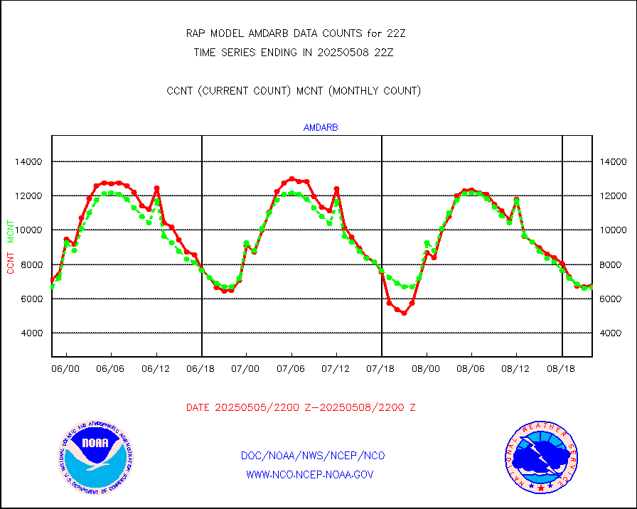
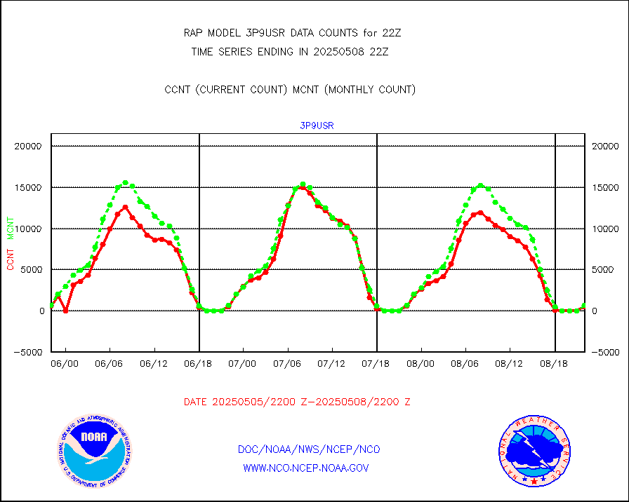
3p9usr |
GOES-16&up/NESDIS ir short-wv derived cld motion |
672 |
708 |
94.9 % |
2221.00-2221.99 |
acarsa |
MDCRS ACARS acft data (ARINC via AFWA)(AIREP fmt) |
0 |
0 |
n/a |
2218.75-2301.25 |
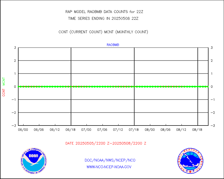
airep |
Manual AIREP aircraft data (dcded from AIREP fmt) |
1406 |
1926 |
73.0 % |
2218.75-2301.25 |
airsev |
AQUA AIRS/AMSU-A/HSB brightness temps- every FOV |
0 |
0 |
n/a |
2219.00-2300.99 |
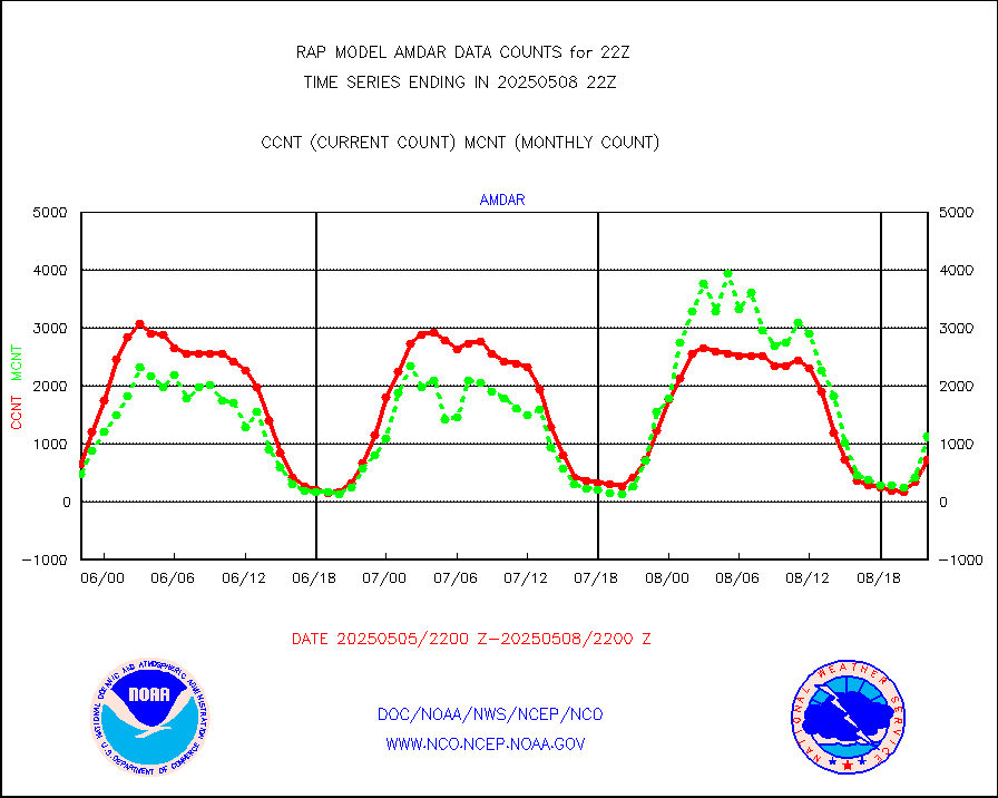
amdar |
AMDAR aircraft data (decoded from AMDAR format) |
815 |
563 |
144.8 % |
2218.75-2301.25 |
amdarb |
AMDAR aircraft data (decoded from BUFR) |
1795 |
2048 |
87.6 % |
2218.75-2301.25 |
amsr2 |
GCOM-W AMSR2 1B brightness temperatures |
682168 |
620204 |
110.0 % |
2219.00-2219.99 |
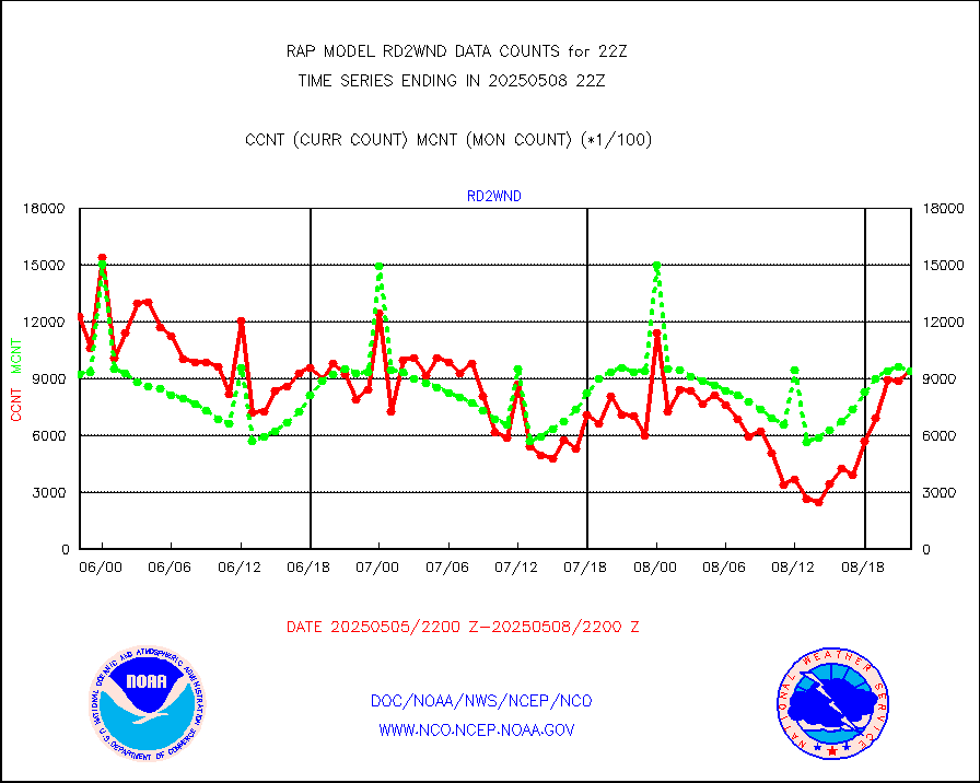
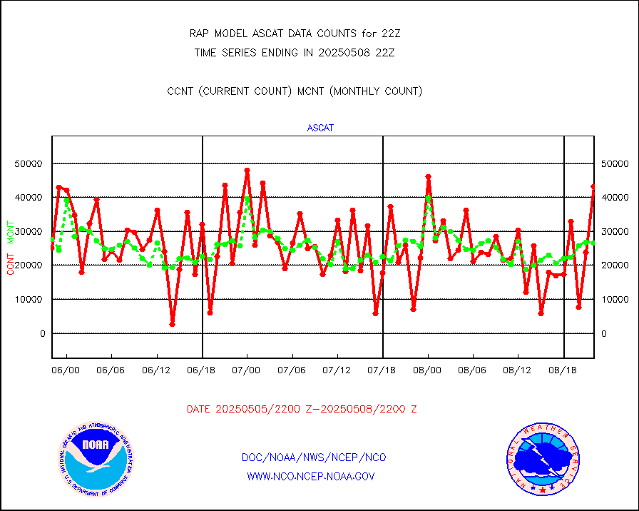
ascat |
METOP 1-2 ASCAT products |
31419 |
18537 |
169.5 % |
2220.00-2300.00 |
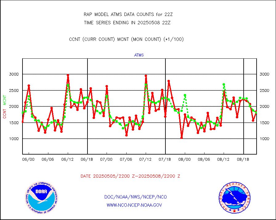
atms |
NPP/NOAA-20 ATMS brightness temperatures |
151965 |
169307 |
89.8 % |
2220.00-2223.99 |
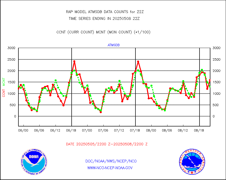
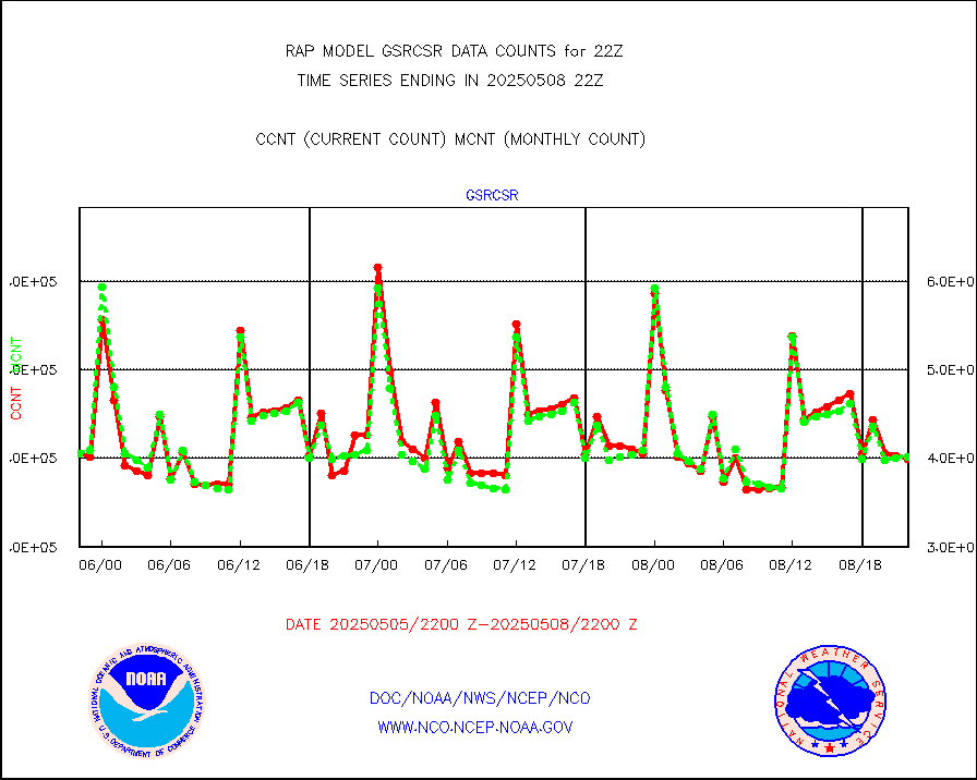
atmsdb |
NPP/NOAA-20 ATMS bright. temps-direct b-cast SSEC |
127872 |
127213 |
100.5 % |
2220.00-2223.99 |
coopmd |
Coop/MADIS NEPP & HCN-Modernization NOAA COOP Obs |
27 |
23 |
117.4 % |
2221.50-2222.50 |
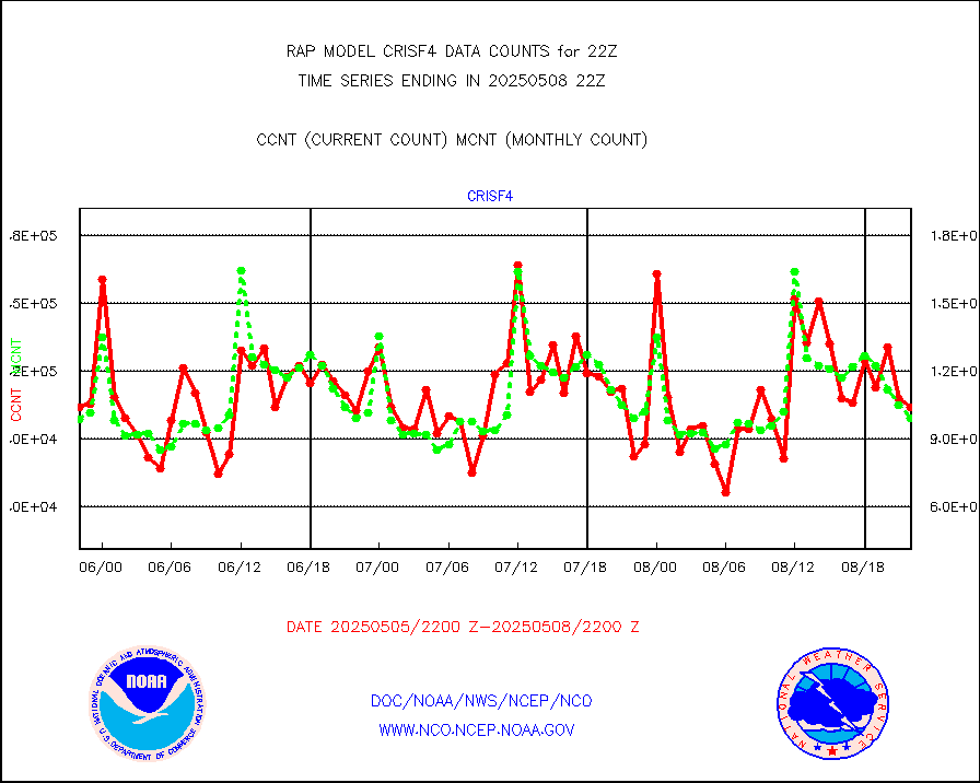
crisf4 |
NPP/NOAA-20 CrIS full spctrl radn (431 ch subset) |
104601 |
100974 |
103.6 % |
2220.00-2223.99 |
crsfdb |
NPP/NOAA-20 CrIS full spctrl radn dir brdcst SSEC |
99085 |
92568 |
107.0 % |
2220.00-2223.99 |
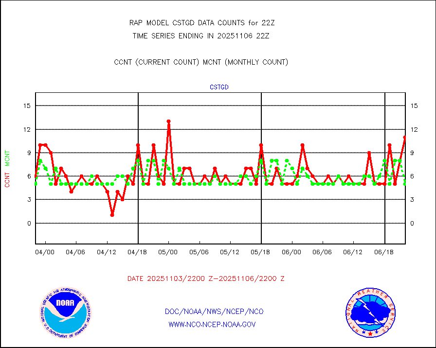
cstgd |
Coast Guard |
4 |
3 |
133.3 % |
2221.50-2222.50 |
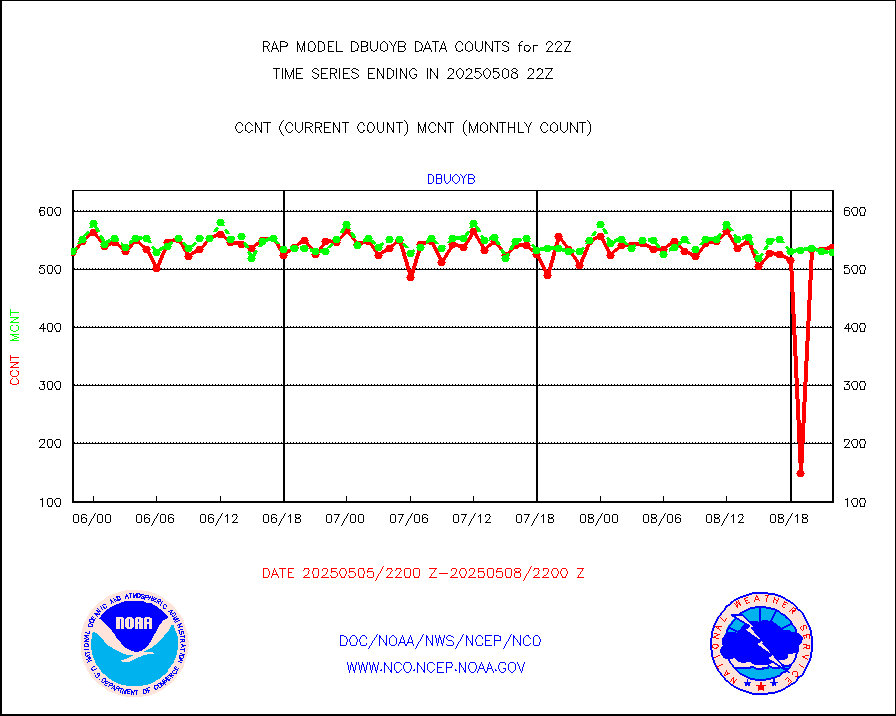
dbuoyb |
Drifting buoys (decoded from BUFR) |
582 |
604 |
96.4 % |
2221.50-2222.50 |
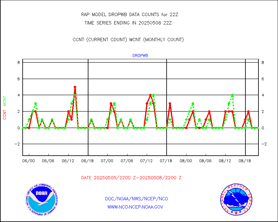
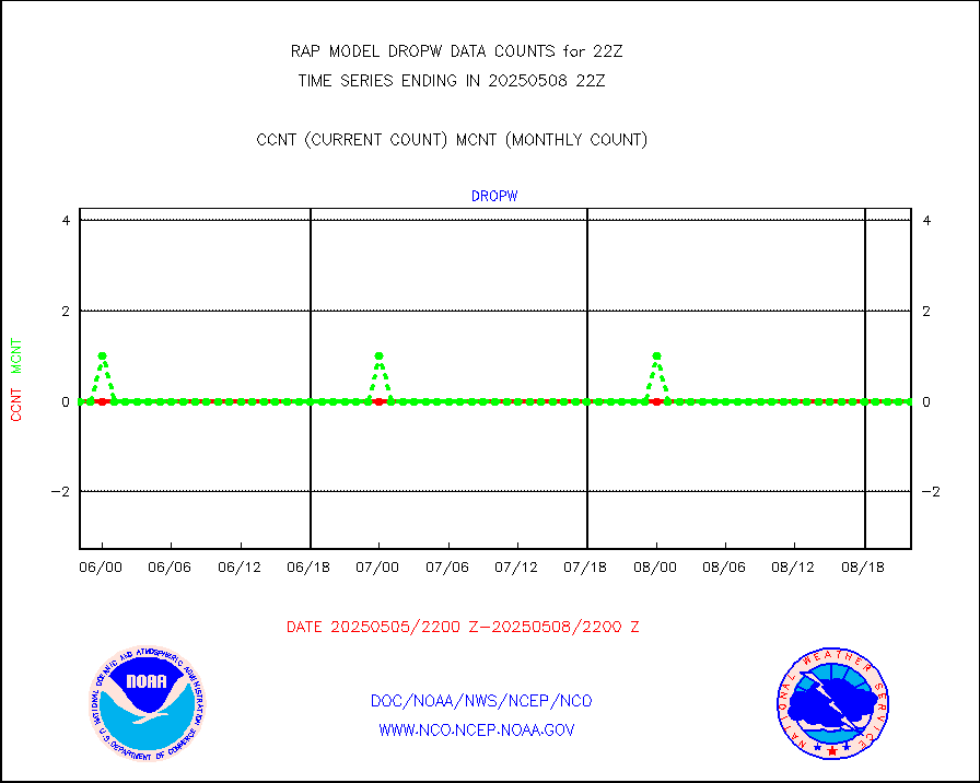
dropw |
Dropwinsonde (from TEMP DROP) |
0 |
0 |
n/a |
2221.00-2223.00 |
eadas |
E-AMDAR (European AMDAR acft decoded from BUFR) |
7599 |
8018 |
94.8 % |
2218.75-2301.25 |
esamua |
NOAA 15-19 & METOP 1-2 AMSU-A proc btmps frm RARS |
8943 |
13860 |
64.5 % |
2221.00-2223.00 |
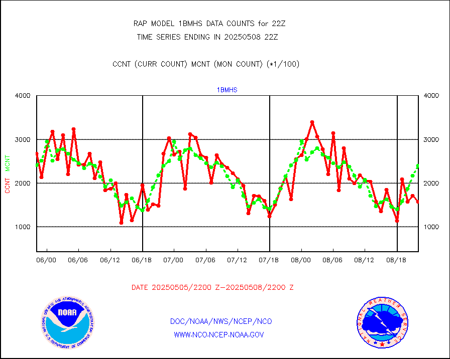
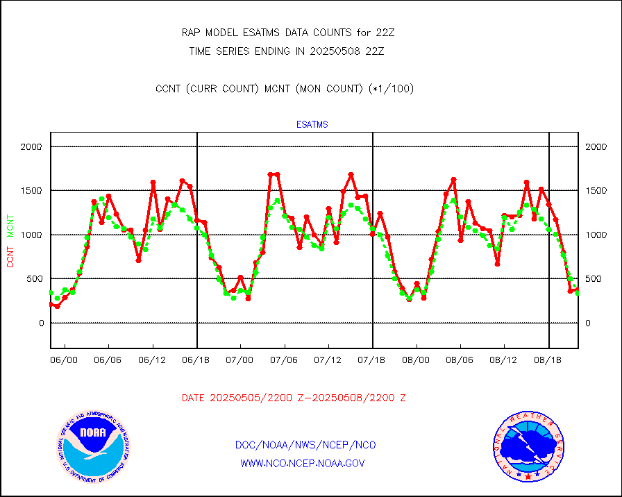
esatms |
NPP Adv. Tech. MW Sndr (ATMS) br. temps from RARS |
31724 |
30234 |
104.9 % |
2220.00-2223.99 |
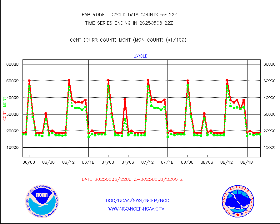
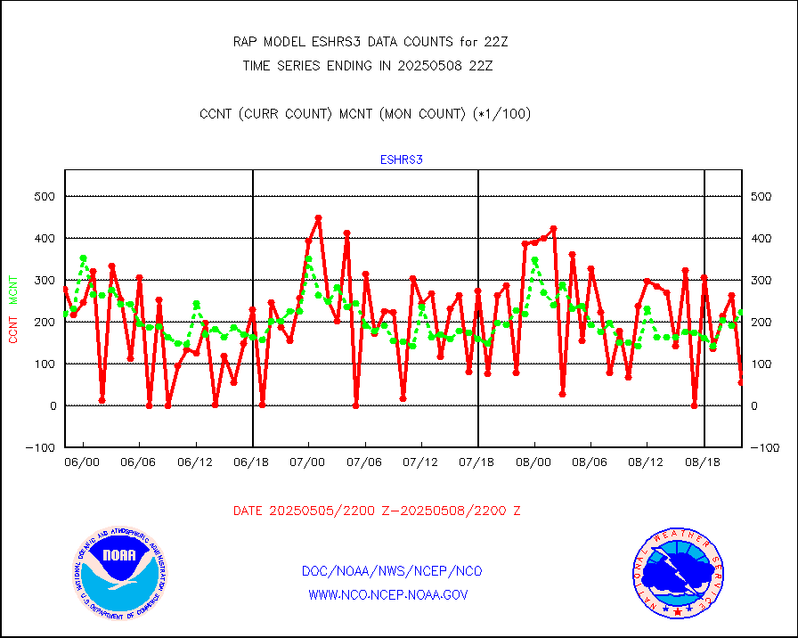
eshrs3 |
NOAA 15-19 & METOP 1-2 HIRS-3/4 pr btmps frm RARS |
16628 |
32853 |
50.6 % |
2221.00-2223.00 |
esiasi |
METOP 1-2 IASI 1C radiance data vbl chn from RARS |
78277 |
87770 |
89.2 % |
2220.00-2223.99 |
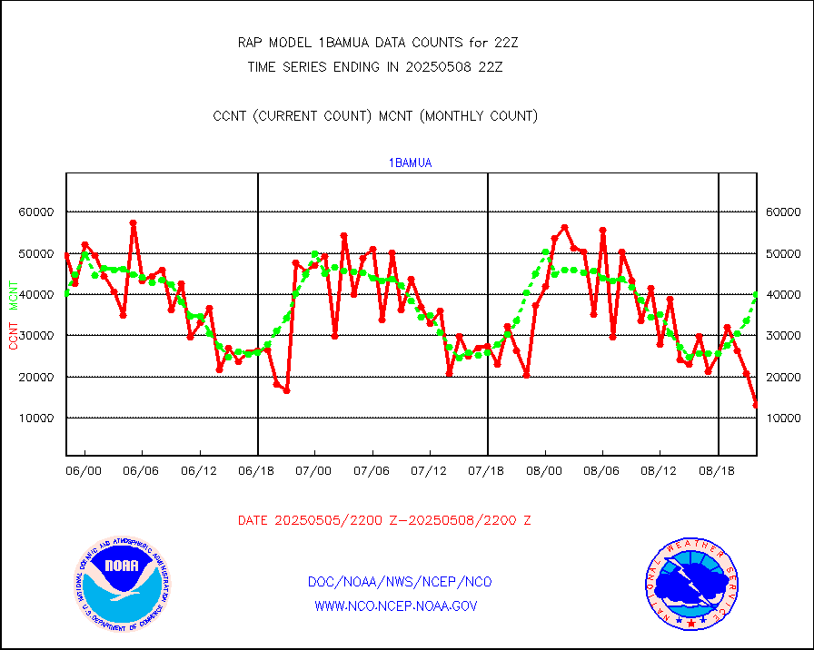
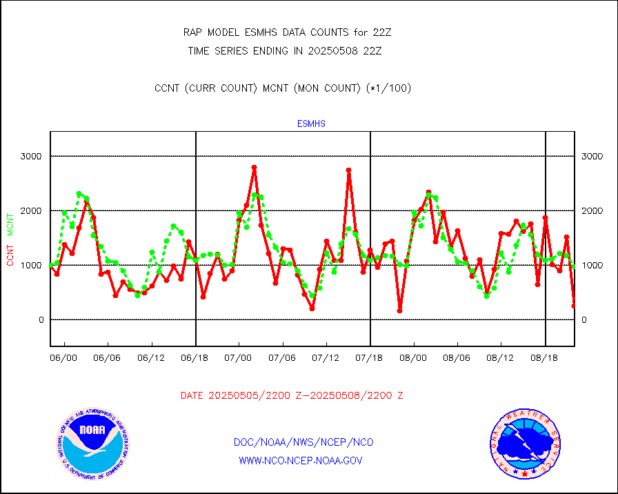
esmhs |
NOAA 18-19 & METOP 1-2 MHS proc. btemps from RARS |
68106 |
98602 |
69.1 % |
2221.00-2223.00 |
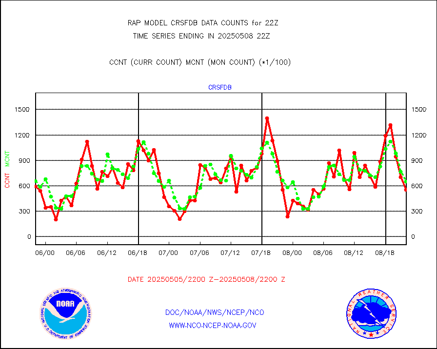
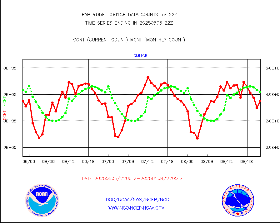
gmi1cr |
GPM GMI Level 1C-R brightness temperatures |
349686 |
409132 |
85.5 % |
2219.00-2300.99 |
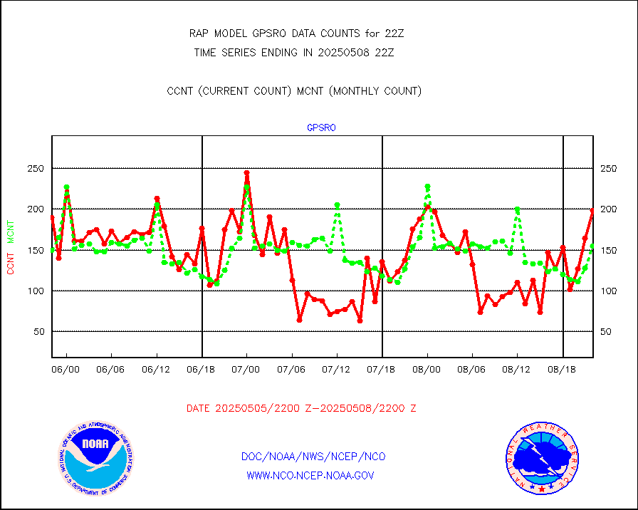
gpsro |
GPS radio occultation data |
133 |
108 |
123.1 % |
2220.00-2223.99 |
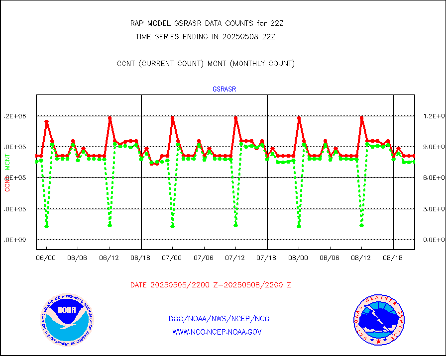
gsrasr |
GOES-16/17 All Sky Radiances (proc.) |
627637 |
803440 |
78.1 % |
2220.00-2223.99 |
gsrcsr |
GOES-16/17 Clear Sky Radiances (proc.) |
360928 |
415506 |
86.9 % |
2220.00-2223.99 |
h20ja |
MTSAT/JMA water vapor imager derived cloud motion |
3272 |
2628 |
124.5 % |
2219.50-2300.50 |
h2dusr |
GOES-16&up/NESDIS wv imgr/deep-lyr derivd cld mtn |
9250 |
6316 |
146.5 % |
2221.00-2221.99 |
h2eunb |
METEOSAT/EUMETSAT wvpr imgr drv cld motion NBseq |
4680 |
5136 |
91.1 % |
2220.50-2223.49 |
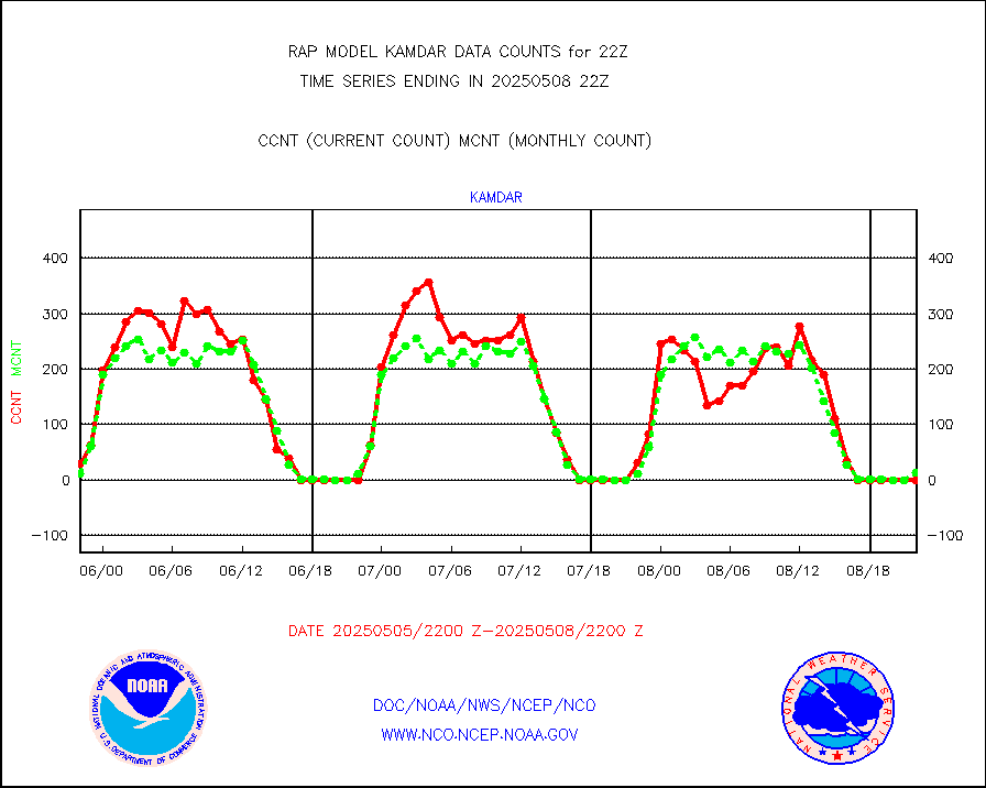
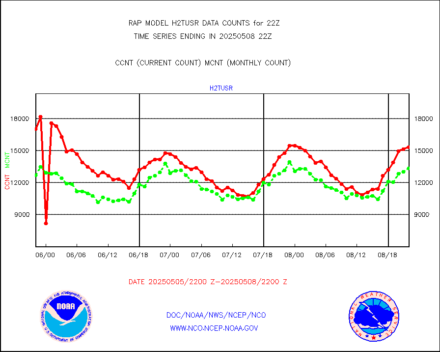
h2tusr |
GOES-16&up/NESDIS wv imgr/cld-top derived cld mtn |
11554 |
11755 |
98.3 % |
2221.00-2221.99 |
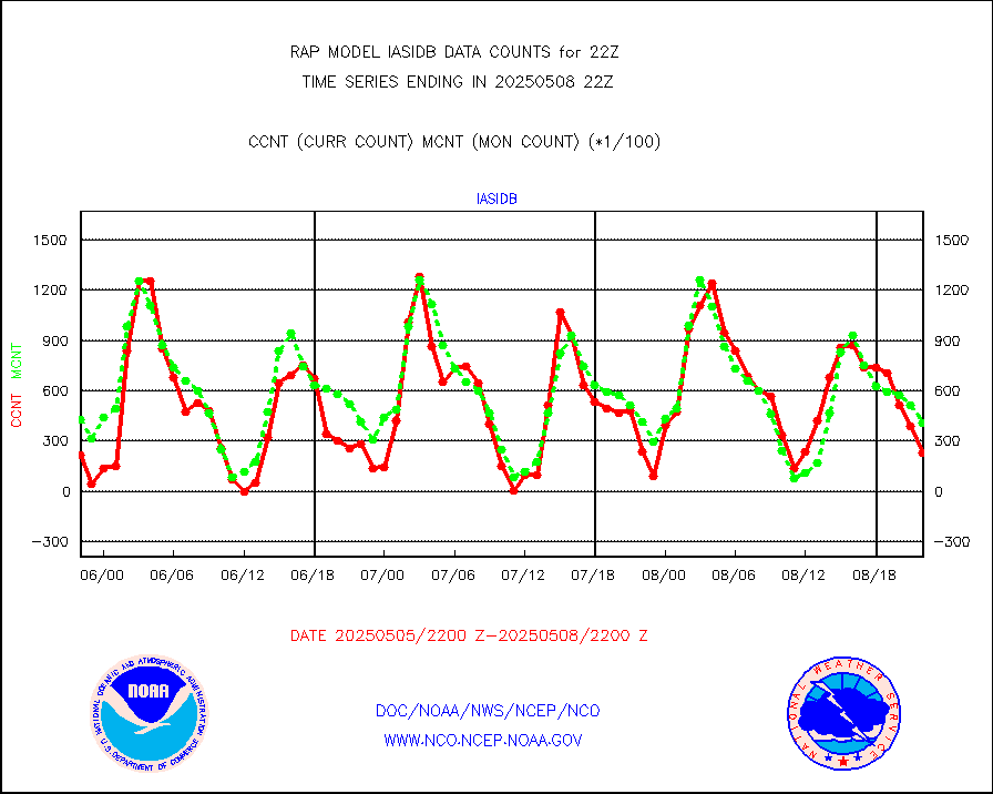
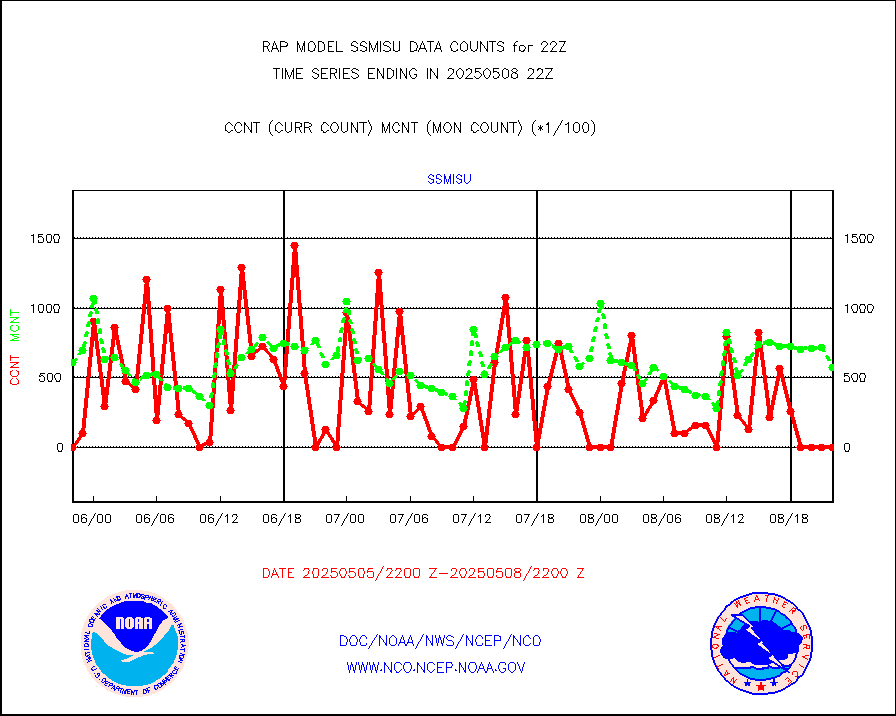
iasidb |
METOP 1-2 IASI 1C radiances-direct broadcast SSEC |
46075 |
30930 |
149.0 % |
2220.00-2223.99 |
ifeunb |
METEOSAT/EUMETSAT ir lg-wave drv cld motion NBseq |
2914 |
3215 |
90.6 % |
2220.50-2223.49 |
ifvrnb |
VIIRS (NPP/NOAA-20) ir lg-wv drv cloud motion(NB) |
0 |
0 |
n/a |
2219.50-2300.50 |
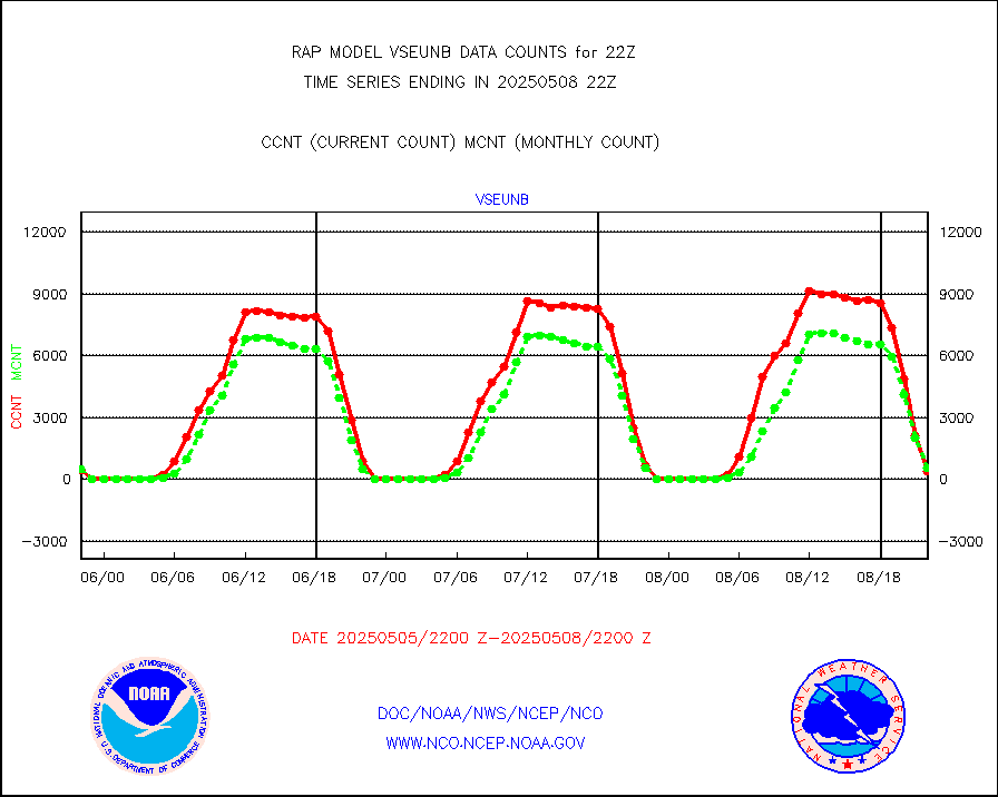
infav |
AVHRR (NOAA/METOP) ir lg-wave derived cld motion |
0 |
2 |
0.0 % |
2219.50-2300.50 |
infav1 |
AVHRR (METOP) ir lg-wave derived cld motion |
0 |
0 |
n/a |
2220.50-2223.49 |
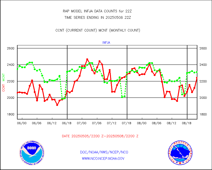
infja |
MTSAT/JMA infrared long-wave derived cloud motion |
2587 |
2412 |
107.3 % |
2219.50-2300.50 |
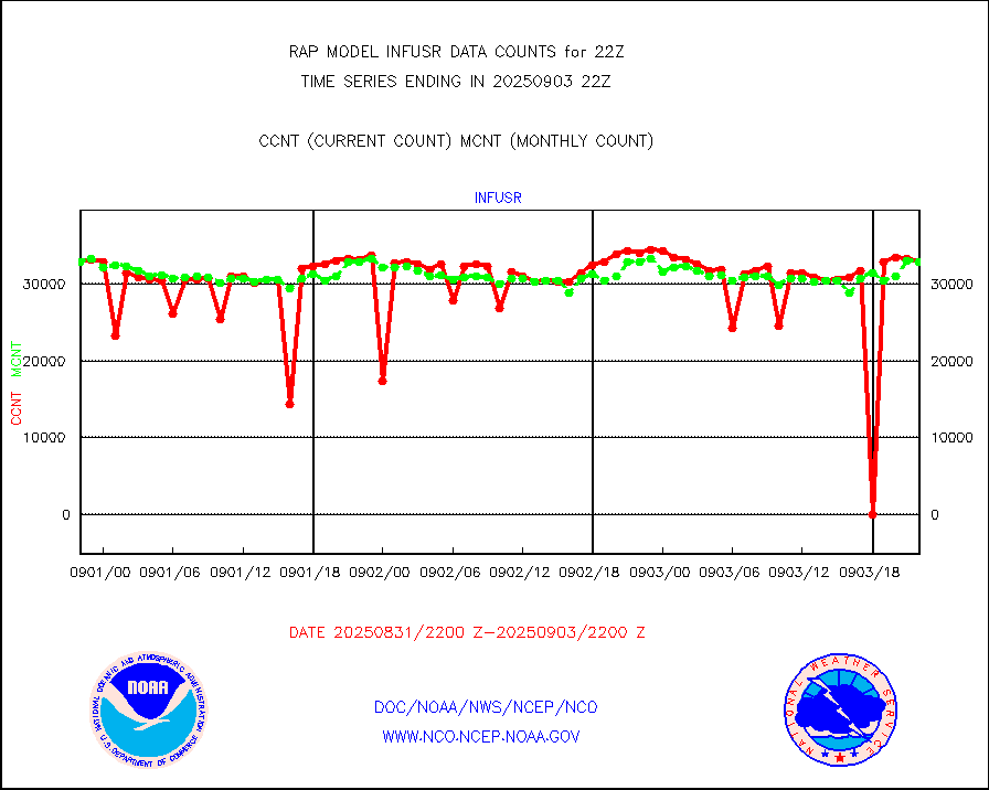
infusr |
GOES-16&up/NESDIS ir long-wave derived cld motion |
29911 |
31519 |
94.9 % |
2221.00-2221.99 |
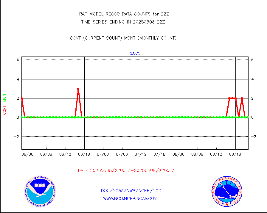
kamdar |
Korean AMDAR aircraft data (decoded from BUFR) |
0 |
4 |
0.0 % |
2218.75-2301.25 |
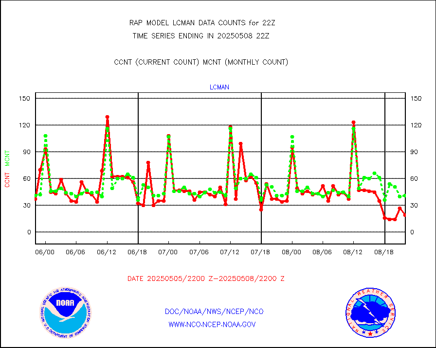
lcman |
Land-based CMAN stations decoded from CMAN format |
63 |
73 |
86.3 % |
2221.50-2222.50 |
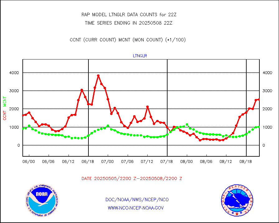
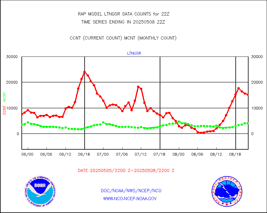
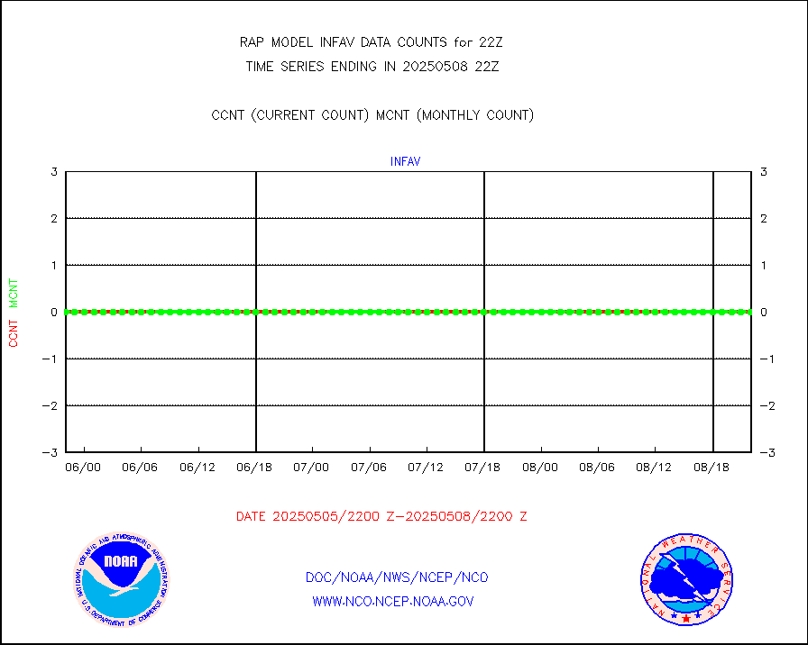
ltnglr |
LLDN Long-rng lightning from Vaisala via NOAAPORT |
46500 |
68307 |
68.1 % |
2221.00-2222.50 |
ltngsr |
NLDN Shrt-rng lightning from Vaisala via NOAAPORT |
1234 |
2377 |
51.9 % |
2221.00-2222.50 |
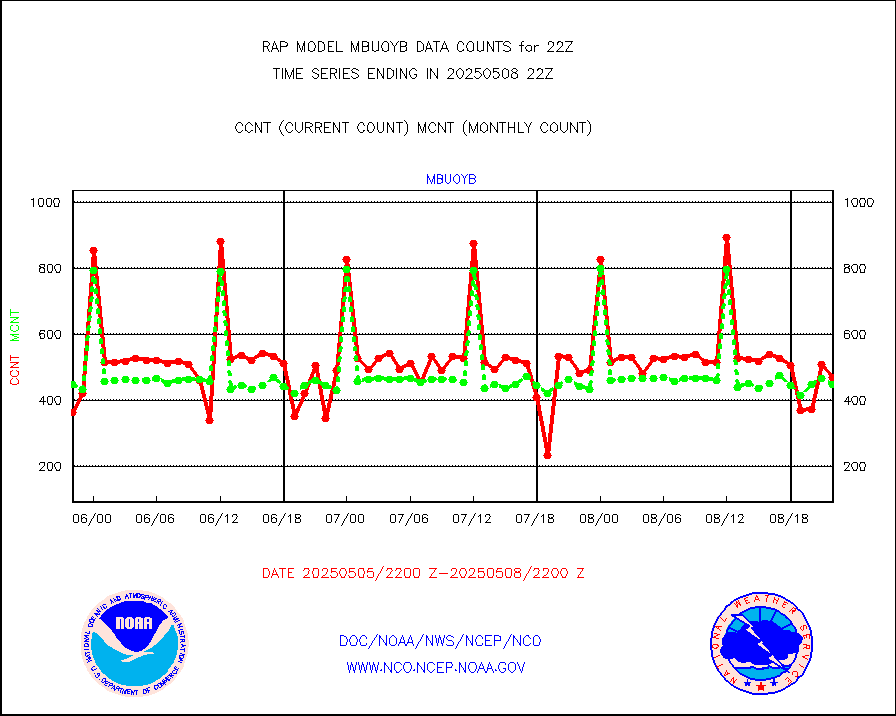
mbuoyb |
Moored buoys (decoded from BUFR) |
485 |
469 |
103.4 % |
2221.50-2222.50 |
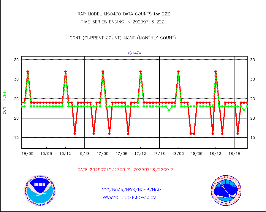
mso470 |
Mesonet/MADIS Colorado E-470 (Interstate 470) |
18 |
19 |
94.7 % |
2221.50-2222.50 |
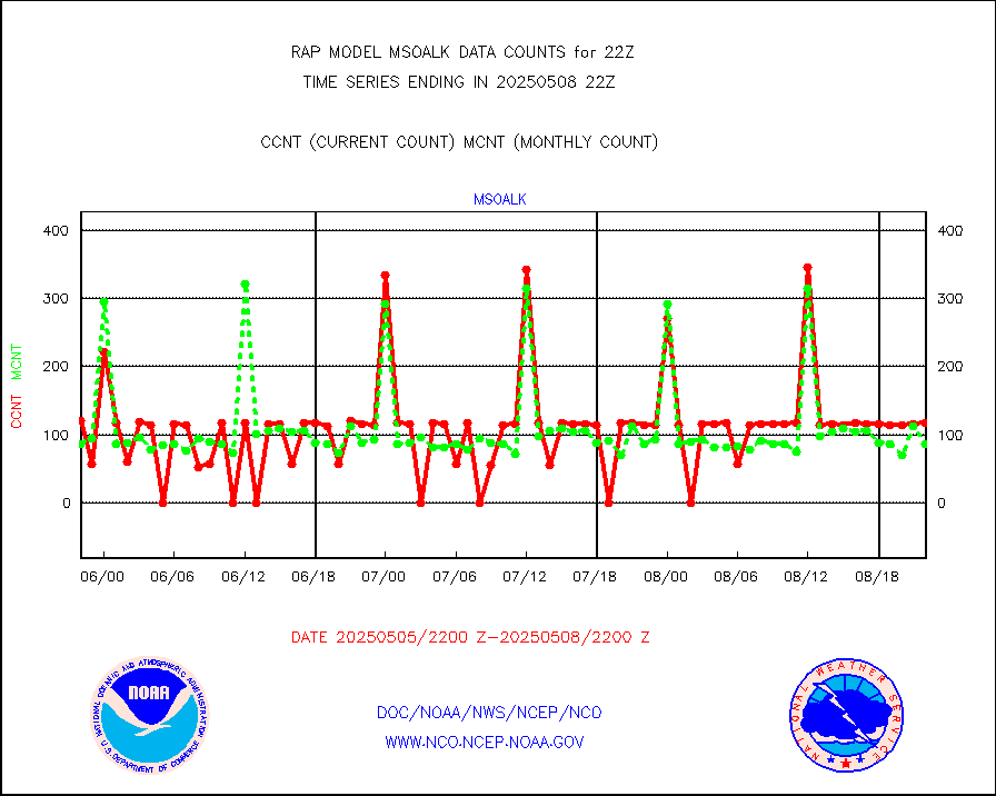
msoalk |
Mesonet/MADIS Alaska Department of Transportation |
109 |
107 |
101.9 % |
2221.50-2222.50 |
msoapg |
Mesonet/MADIS U.S. Army Aberdeen Proving Grounds |
0 |
0 |
n/a |
2221.50-2222.50 |
msoapr |
Mesonet/MADIS Citizen Weather Observers Program |
43594 |
43399 |
100.4 % |
2221.50-2222.50 |
msoaws |
Mesonet/MADIS AWS Convergence Technologies, Inc. |
25665 |
25267 |
101.6 % |
2221.50-2222.50 |
msoawx |
Mesonet/MADIS "Anything Weather" |
0 |
0 |
n/a |
2221.50-2222.50 |
msocol |
Mesonet/MADIS Colorado Dept. of Transportation |
0 |
0 |
n/a |
2221.50-2222.50 |
msodcn |
Mesonet/MADIS DC Net |
0 |
0 |
n/a |
2221.50-2222.50 |
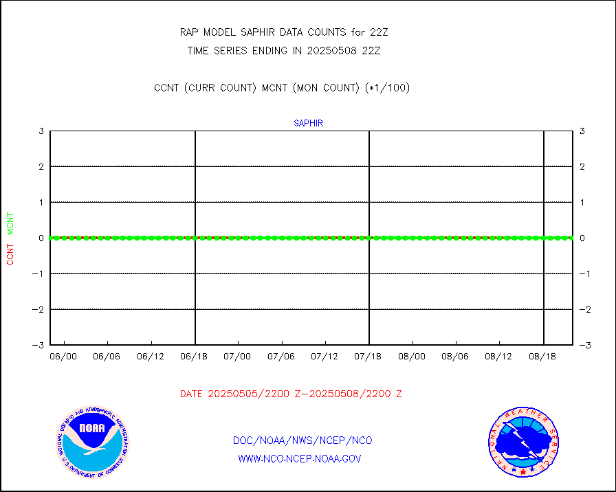
msoden |
Mesonet/MADIS Denver Urban Drainage & Flood Cntrl |
225 |
196 |
114.8 % |
2221.50-2222.50 |
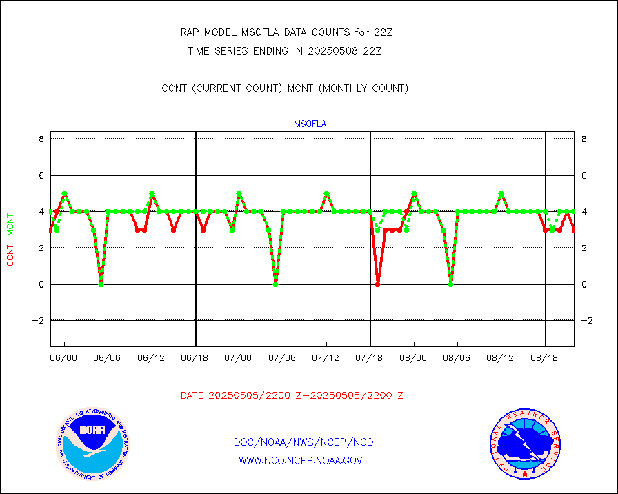
msofla |
Mesonet/MADIS Florida (FAWN & USF) |
3 |
3 |
100.0 % |
2221.50-2222.50 |
msoflt |
Mesonet/MADIS Florida Dept. of Transportation |
0 |
0 |
n/a |
2221.50-2222.50 |
msogeo |
Mesonet/MADIS Georgia Dept. of Transportation |
0 |
0 |
n/a |
2221.50-2222.50 |
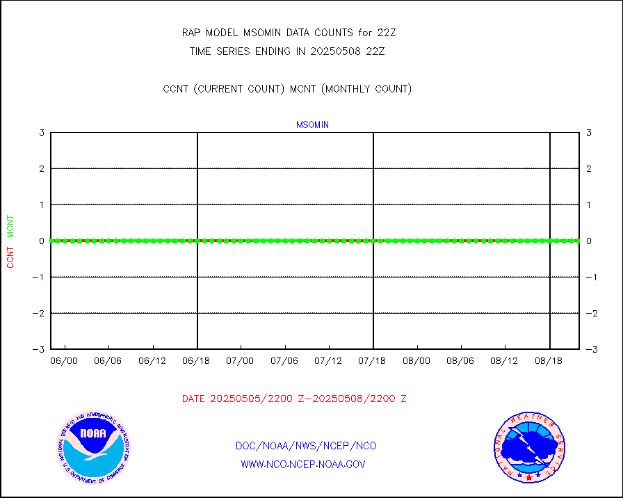
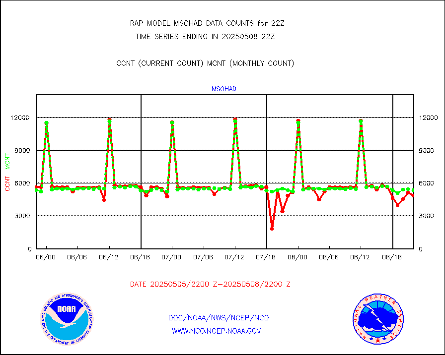
msohad |
Mesonet/MADIS NWS Hydromet Auto Data System(HADS) |
5794 |
5300 |
109.3 % |
2221.50-2222.50 |
msoien |
Mesonet/MADIS Iowa Environmental |
179 |
169 |
105.9 % |
2221.50-2222.50 |
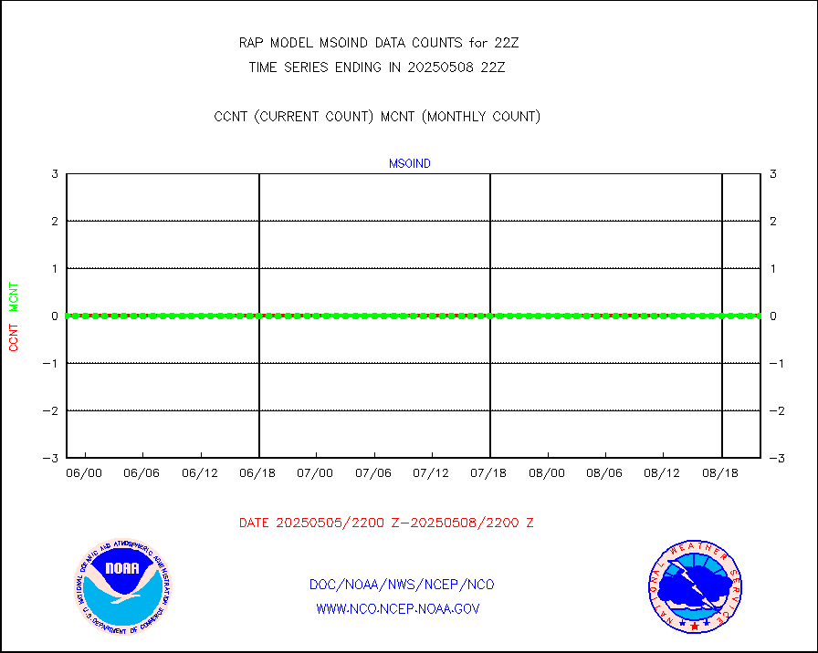
msoind |
Mesonet/MADIS Indiana Dept. of Transportation |
0 |
0 |
n/a |
2221.50-2222.50 |
msoiow |
Mesonet/MADIS Iowa Department of Transportation |
0 |
0 |
n/a |
2221.50-2222.50 |
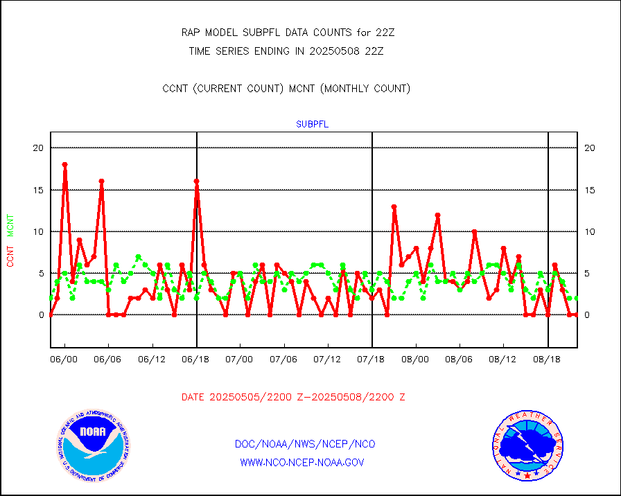
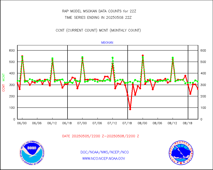
msokan |
Mesonet/MADIS Kansas Department of Transportation |
301 |
323 |
93.2 % |
2221.50-2222.50 |
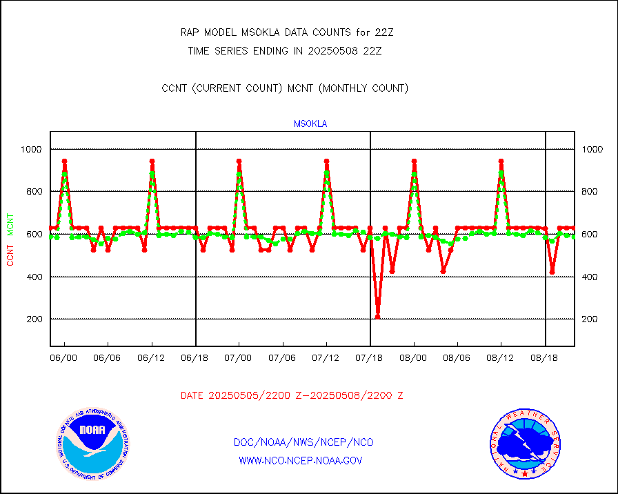
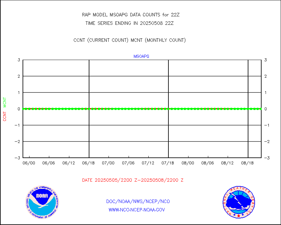
msokla |
Mesonet/MADIS Oklahoma Mesonet |
318 |
329 |
96.7 % |
2221.50-2222.50 |
msolju |
Mesonet/MADIS Louisiana State/Jackson State Univ. |
0 |
0 |
n/a |
2221.50-2222.50 |
msomca |
Mesonet/MADIS Missouri Commercial Agricult Wx Net |
276 |
248 |
111.3 % |
2221.50-2222.50 |
msomin |
Mesonet/MADIS Minnesota Dept. of Transportation |
0 |
0 |
n/a |
2221.50-2222.50 |
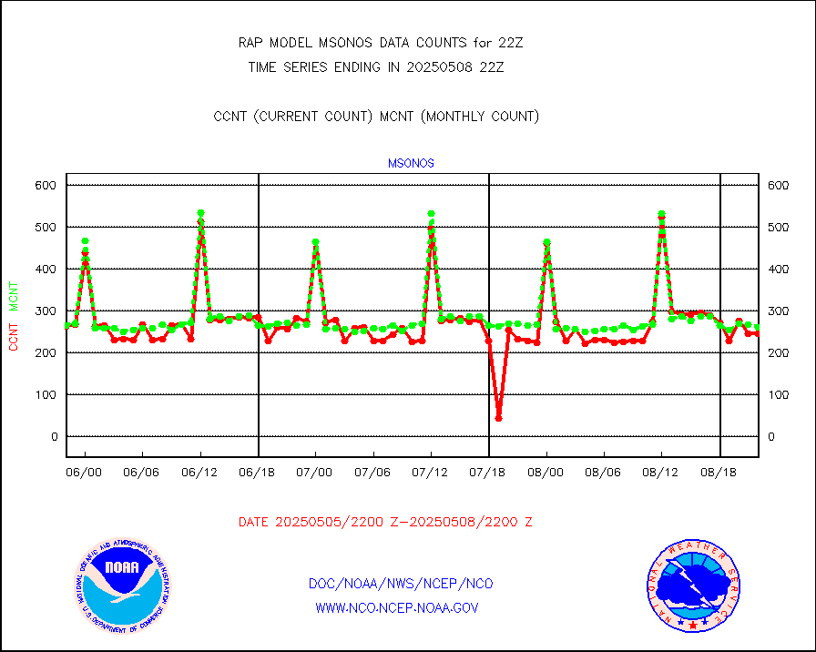
msonos |
Mesonet/MADIS NOS-Phys Oceanographic Realtime Sys |
286 |
272 |
105.1 % |
2221.50-2222.50 |
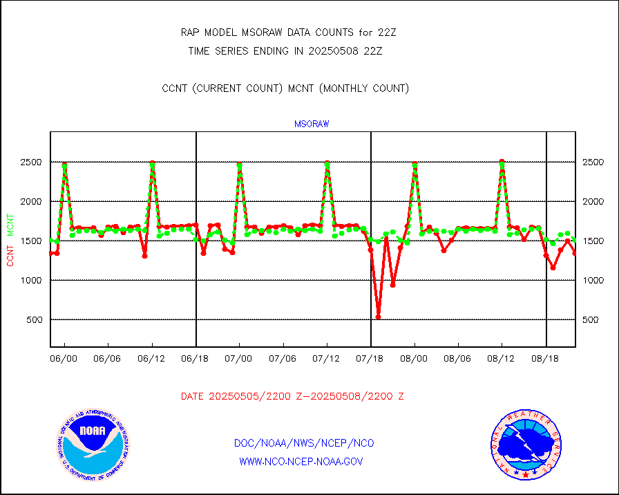
msoraw |
Mesonet/MADIS NFIC Remote Automated Wx Stns(RAWS) |
1708 |
1578 |
108.2 % |
2221.50-2222.50 |
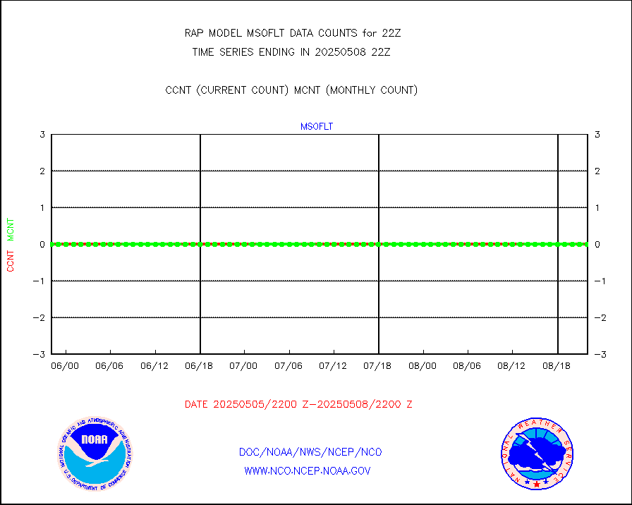
msourb |
Mesonet/MADIS UrbaNet |
3923 |
3939 |
99.6 % |
2221.50-2222.50 |
msovir |
Mesonet/MADIS Virginia Dept. of Transportation |
231 |
235 |
98.3 % |
2221.50-2222.50 |
msowfy |
Mesonet/MADIS "Weather for You" |
0 |
0 |
n/a |
2221.50-2222.50 |
msowis |
Mesonet/MADIS Wisconsin Dept. of Transportation |
0 |
0 |
n/a |
2221.50-2222.50 |
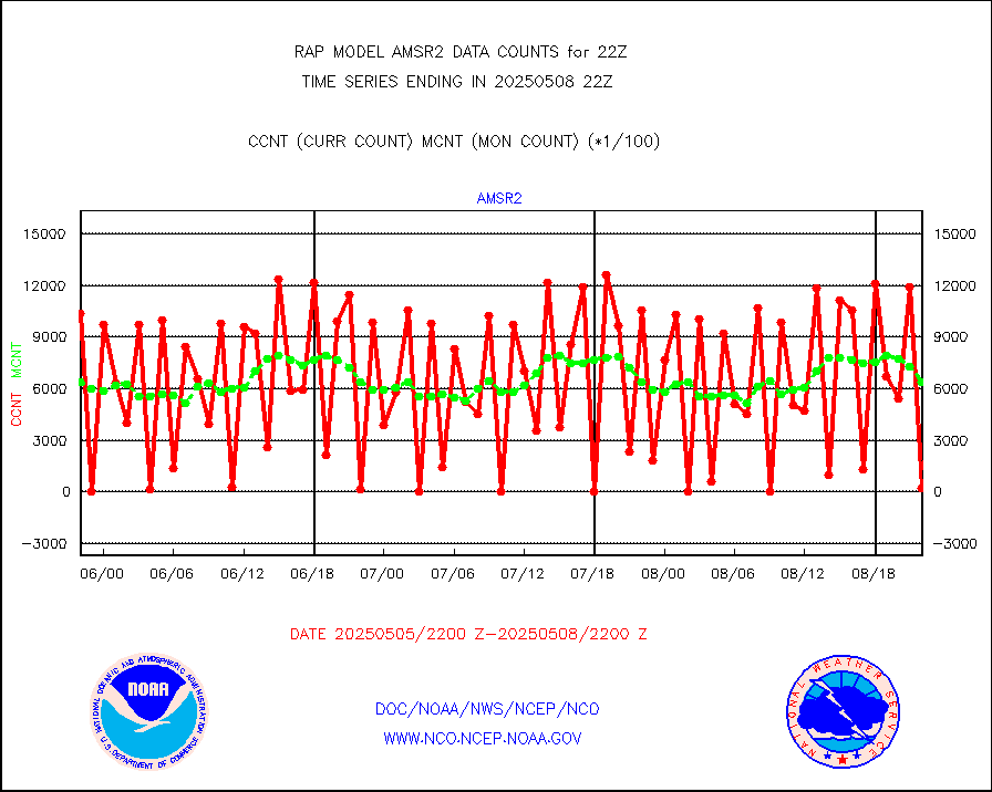
msowst |
Mesonet/MADIS MesoWest (many subproviders) |
40820 |
39629 |
103.0 % |
2221.50-2222.50 |
msowtx |
Mesonet/MADIS West Texas |
4997 |
4917 |
101.6 % |
2221.50-2222.50 |
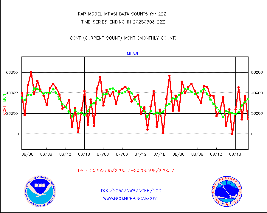
mtiasi |
METOP 1-2 IASI 1C radiance data (varbl. channels) |
50082 |
26914 |
186.1 % |
2220.00-2223.99 |
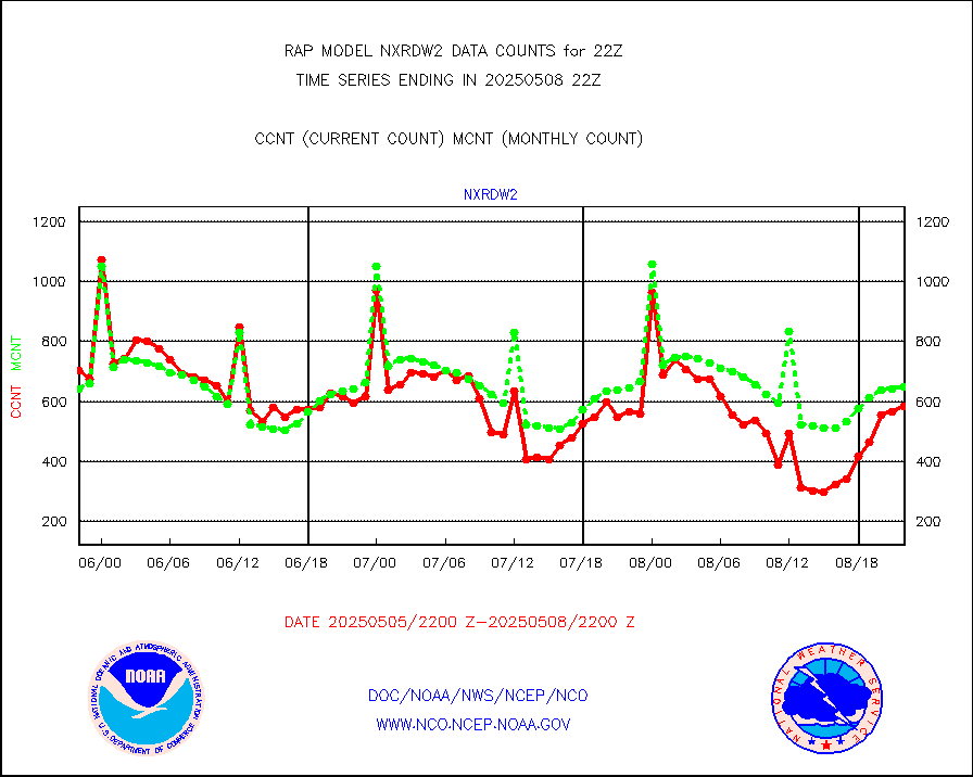
nxrdw2 |
NEXRAD Vel Azm Dsp(VAD) winds via Level 2 decoder |
616 |
683 |
90.2 % |
2221.00-2223.00 |
osbuv8 |
NOAA 16-19 Solar Backscatter UV-2 rad frm V8 BUFR |
0 |
0 |
n/a |
2220.00-2222.99 |
pibal |
PIBAL (from PILOT, PILOT SHIP, PILOT MOBIL) |
0 |
0 |
n/a |
2221.00-2223.00 |
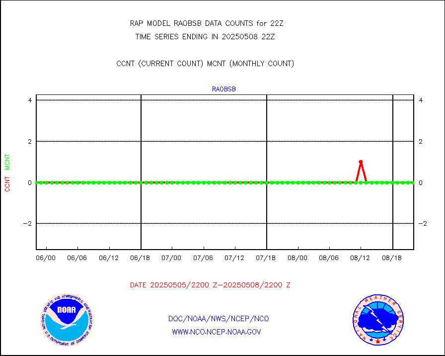
pirep |
Manual PIREP aircraft data (dcded from AIREP fmt) |
399 |
620 |
64.4 % |
2218.75-2301.25 |
prflrp |
Profilr winds from PIBAL (PILOT,PILOT SHIP/MOBIL) |
0 |
0 |
n/a |
2220.50-2223.50 |
raobm |
Rawinsonde - mobile land (from TEMP/PILOT MOBIL) |
0 |
0 |
n/a |
2221.00-2223.00 |
raobs |
Rawinsonde - ship (from TEMP SHIP, PILOT SHIP) |
0 |
0 |
n/a |
2221.00-2223.00 |
rd2wnd |
NEXRAD radial wind (Level 2 - GTS) |
717221 |
1018935 |
70.4 % |
2221.50-2222.49 |
recco |
Flight level reconnaissance aircraft data |
0 |
0 |
n/a |
2221.00-2223.00 |
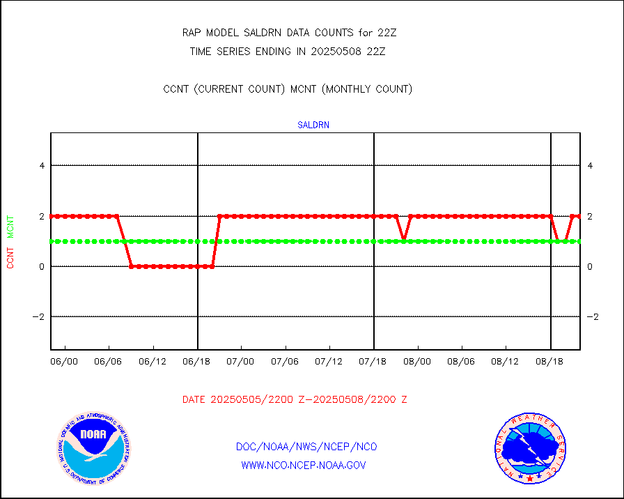
saldrn |
Surface Marine Saildrone (decoded from BUFR) |
2 |
2 |
100.0 % |
2220.00-2223.99 |
saphir |
Megha-Tropiques SAPHIR L1A2 brightness temps |
0 |
0 |
n/a |
2219.00-2300.99 |
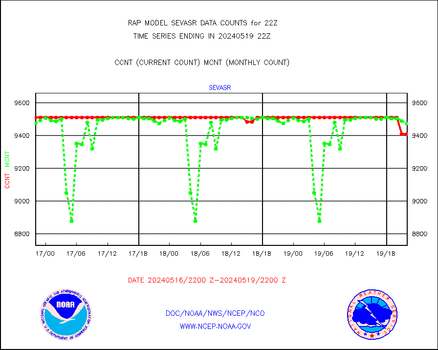
sevasr |
METEOSAT-10 2nd Gen SEVIRI All Sky Radiance(proc) |
9512 |
9512 |
100.0 % |
2220.00-2223.99 |
sevcsr |
METEOSAT-10 2nd Gen SEVIRI Clr Sky Radiance(proc) |
0 |
0 |
n/a |
2220.00-2223.99 |
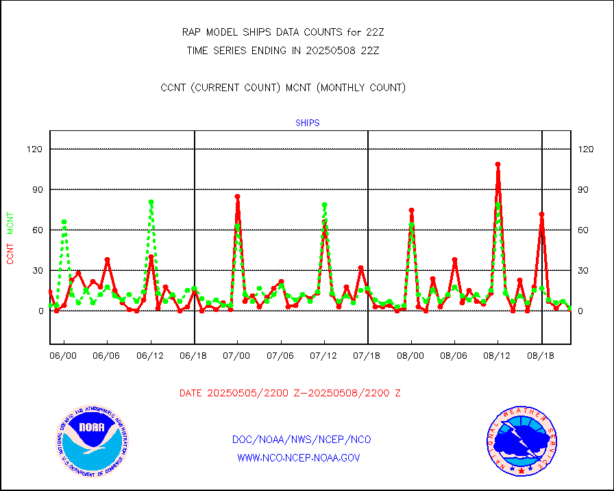
ships |
Ship - manual and automatic, restricted |
0 |
3 |
0.0 % |
2221.50-2222.50 |
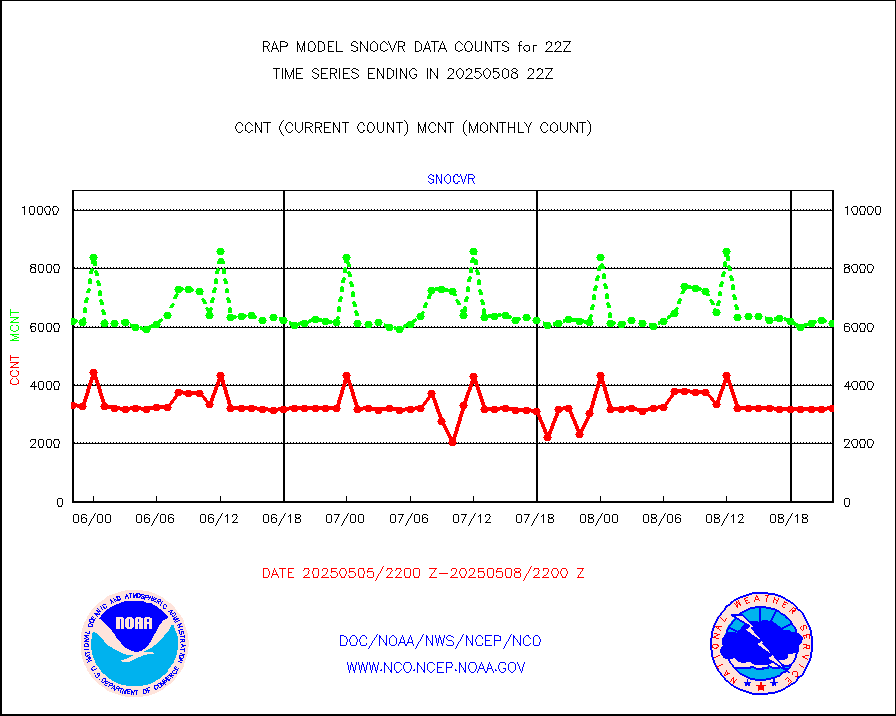
snocvr |
NOW COVER, DEPTH/DENSITY AND WATER EQUIVALENT |
3305 |
6763 |
48.9 % |
2220.00-2300.00 |
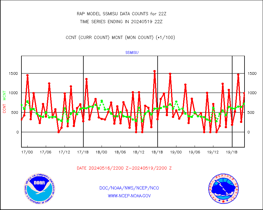
ssmisu |
DMSP SSM/IS 1C radiance data (Unified Pre-Proc.) |
44283 |
70360 |
62.9 % |
2220.00-2223.99 |
subpfl |
Sub-surface float and glider profile (BUFR) |
0 |
1 |
0.0 % |
2220.00-2223.99 |
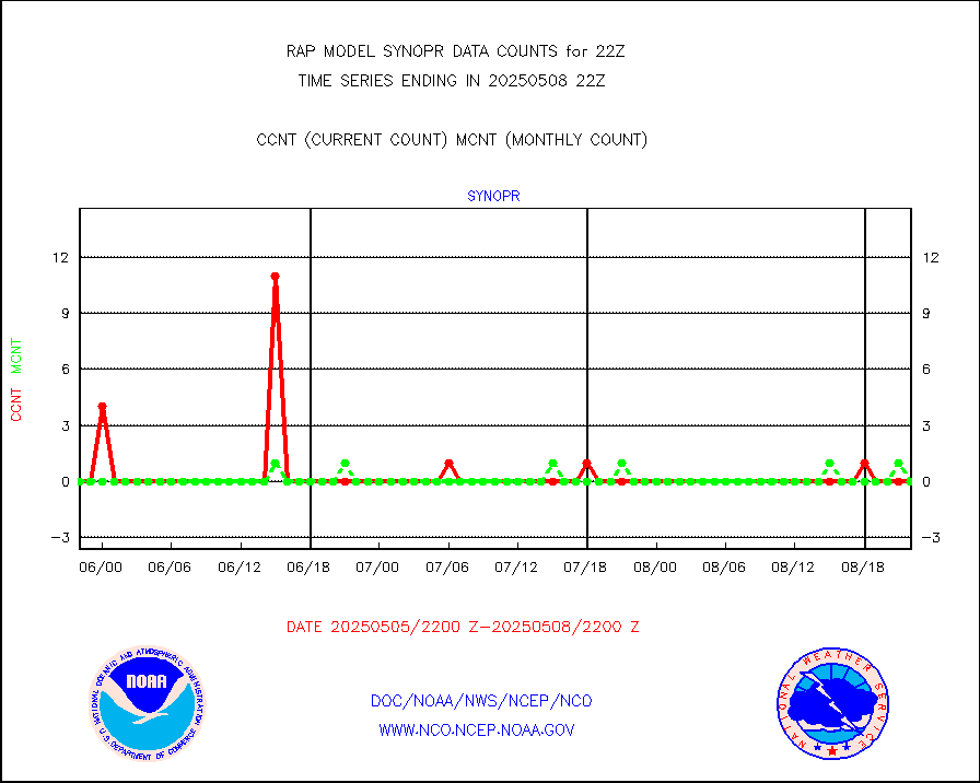
synopr |
Synoptic - restricted (WMO Res 40) manual & auto. |
0 |
0 |
n/a |
2221.50-2222.50 |
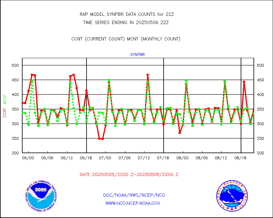
synpbr |
Synoptic - restricted (WMO Res 40)(decoded BUFR) |
371 |
347 |
106.9 % |
2221.50-2222.50 |
synpmb |
Synoptic - mobile manual & auto (decoded fr BUFR) |
0 |
0 |
n/a |
2221.50-2222.50 |
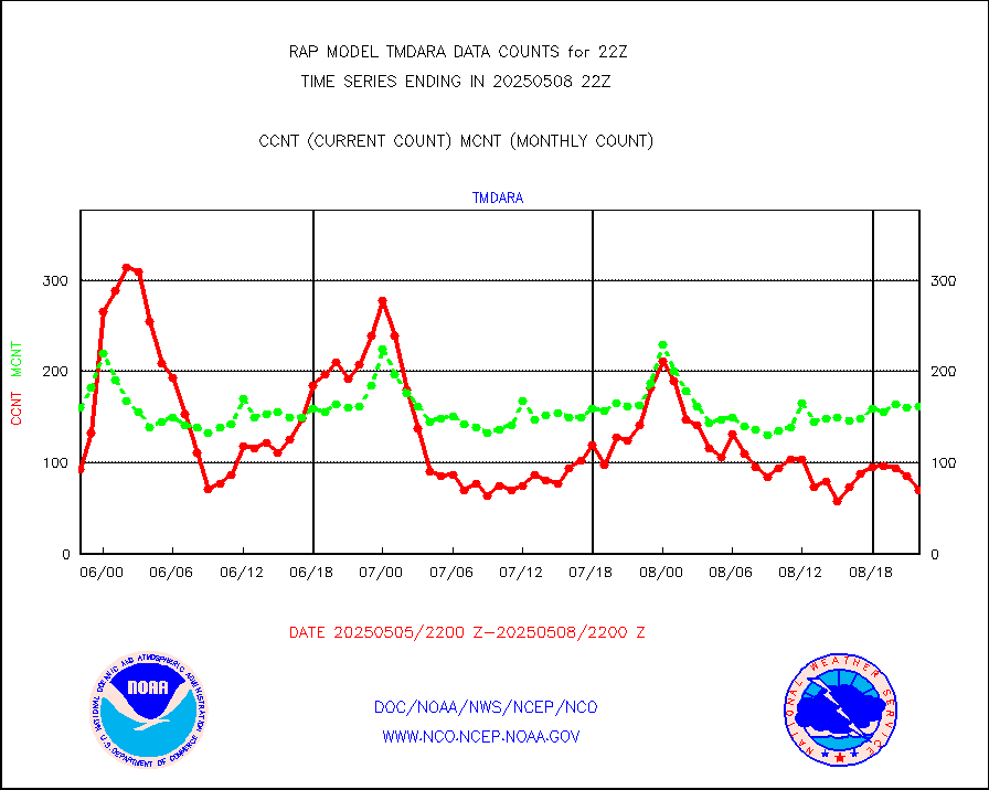
tmdara |
TAMDAR aircft data-all types(from Panasonic,BUFR) |
618 |
567 |
109.0 % |
2218.75-2301.25 |
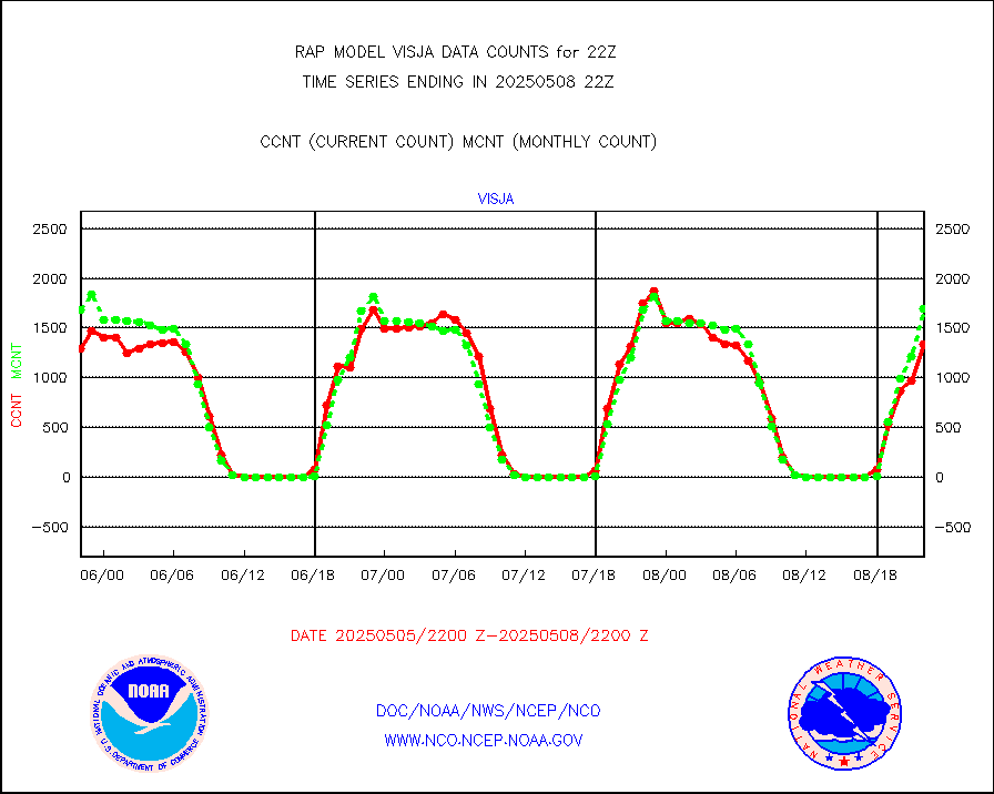
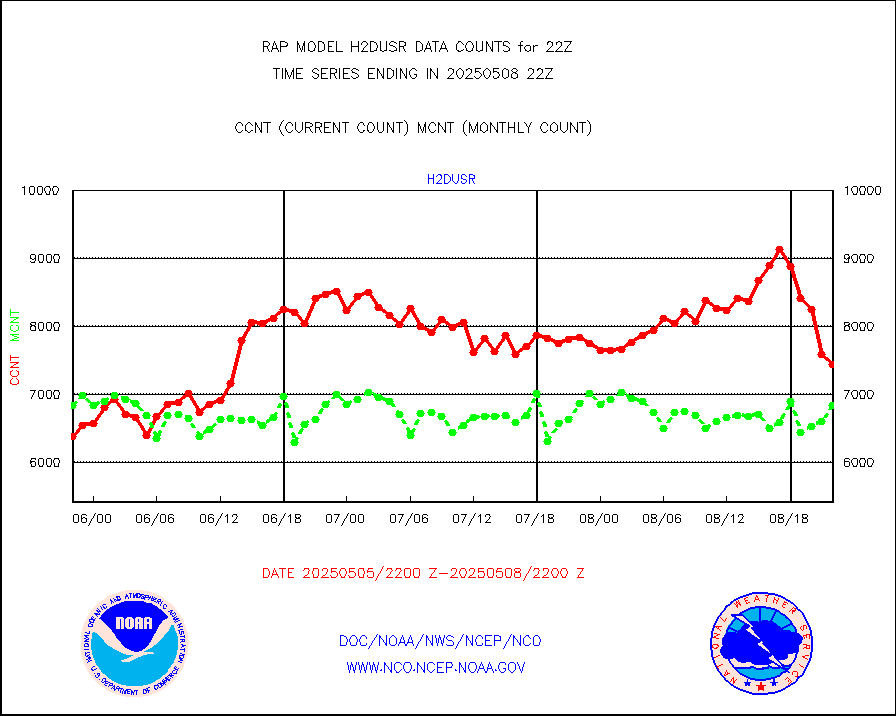
visja |
MTSAT/JMA visible derived cloud motion |
1566 |
1637 |
95.7 % |
2219.50-2300.50 |
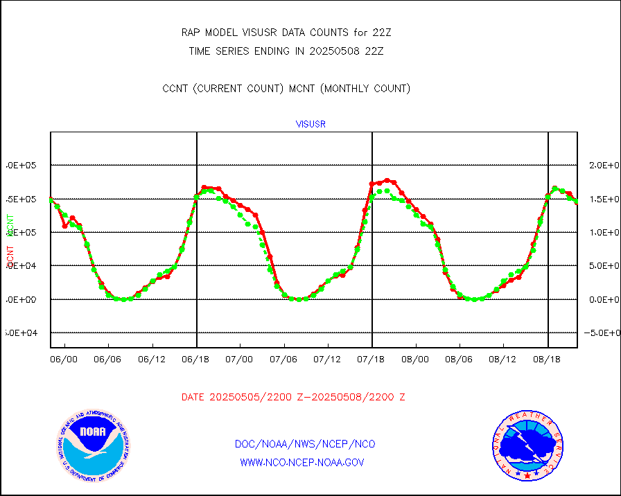
visusr |
GOES-16&up/NESDIS visible derived cloud motion |
162621 |
155062 |
104.9 % |
2221.00-2221.99 |
vseunb |
METEOSAT/EUMETSAT visible drv cld motion NBseq |
1283 |
841 |
152.6 % |
2220.50-2223.49 |


