| Critical Data with Normal Counts |
|---|
| Type | Description | Hourly Count | Monthly Average | Percent (%) of Monthly Mean | UTC Time Window |
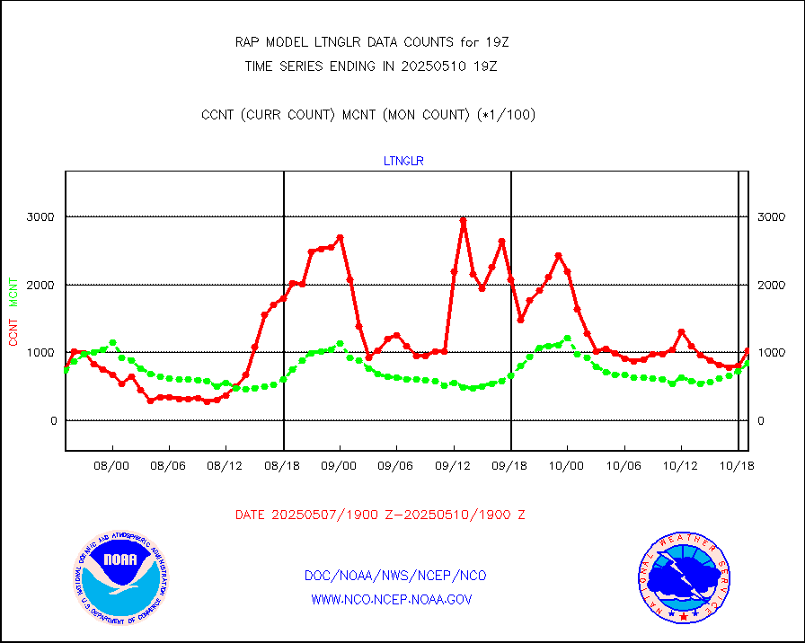
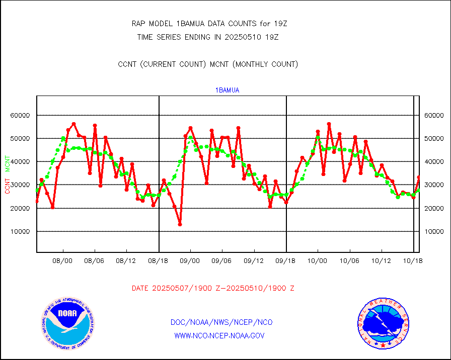
1bamua |
NOAA 15-19 & METOP 1-2 AMSU-A NCEP-proc. br.temps |
38058 |
30295 |
125.6 % |
1716.00-1721.99 |
1bhrs4 |
NOAA 18-19 & METOP 1-2 HIRS-4 NCEP-proc. br.temps |
26813 |
22530 |
119.0 % |
1716.00-1721.99 |
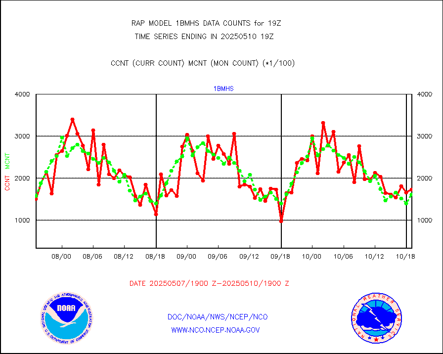
1bmhs |
NOAA 18-19 & METOP 1-2 MHS NCEP-proces. br. temps |
193909 |
163290 |
118.8 % |
1716.00-1721.99 |
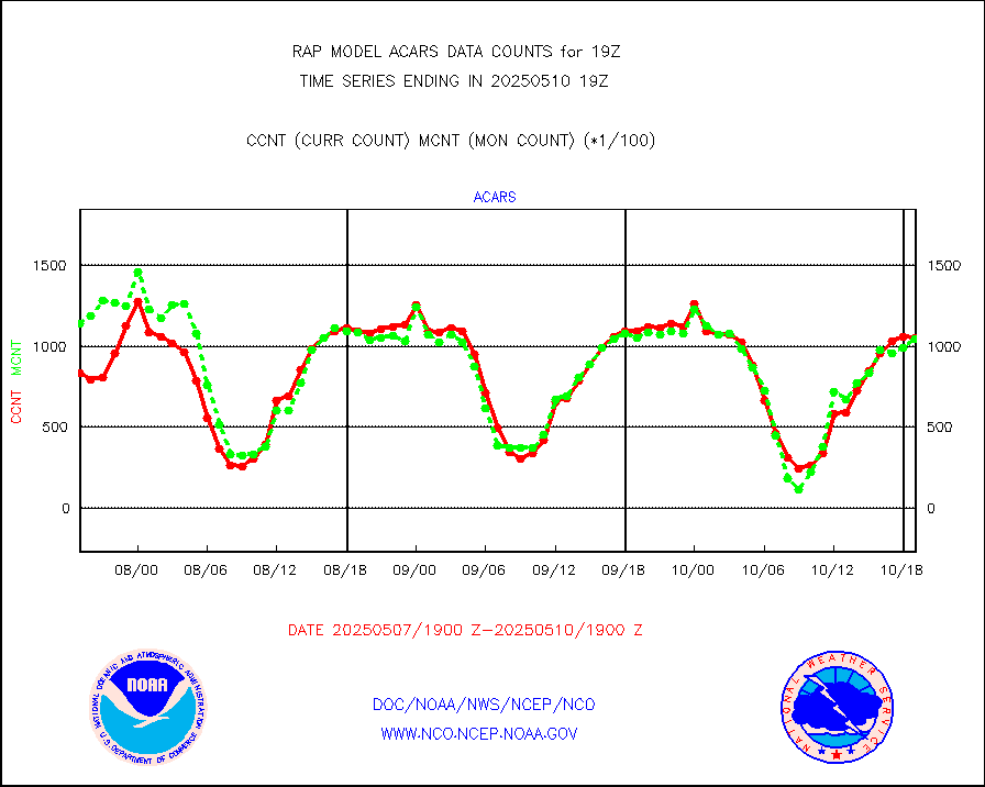
acars |
MDCRS ACARS acft data from ARINC(dcded from BUFR) |
93965 |
82093 |
114.5 % |
1715.75-1722.25 |
cmanb |
Surface Marine CMAN rpts decoded from BUFR format |
1687 |
1602 |
105.3 % |
1718.50-1719.50 |
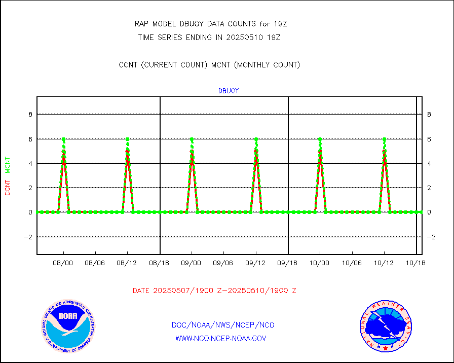
dbuoy |
Buoys decoded from FM-18 fmt (moored or drifting) |
0 |
0 |
n/a |
1718.50-1719.50 |
gnss |
Grnd-based Gbl Navigation Sat System (GNSS) data |
2683 |
2158 |
124.3 % |
1717.95-1718.05 |
h20mo |
MODIS (AQUA/TERRA) wvpr imager derived cld motion |
0 |
0 |
n/a |
1716.50-1721.50 |
infmo |
MODIS (AQUA/TERRA) ir l-wave derived cloud motion |
0 |
0 |
n/a |
1716.50-1721.50 |
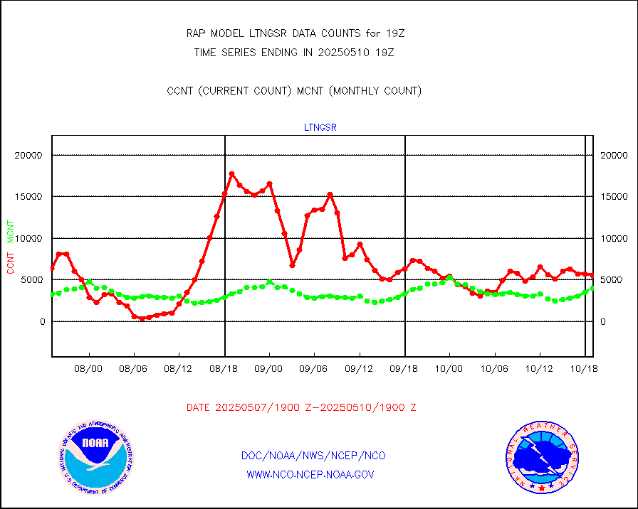
lgycld |
GOES/NASA(Langley) hi-res. (1x1 f-o-v) cloud data |
3697088 |
3596481 |
102.8 % |
1718.50-1719.50 |
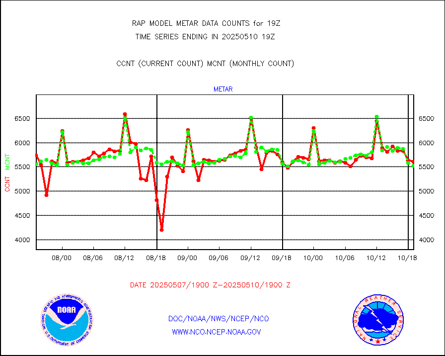
metar |
Aviation - METAR |
4981 |
5945 |
83.8 % |
1718.50-1719.50 |
nxrdw |
NEXRAD Vel Azm Dsp(VAD) winds via radar coded msg |
0 |
0 |
n/a |
1718.00-1720.00 |
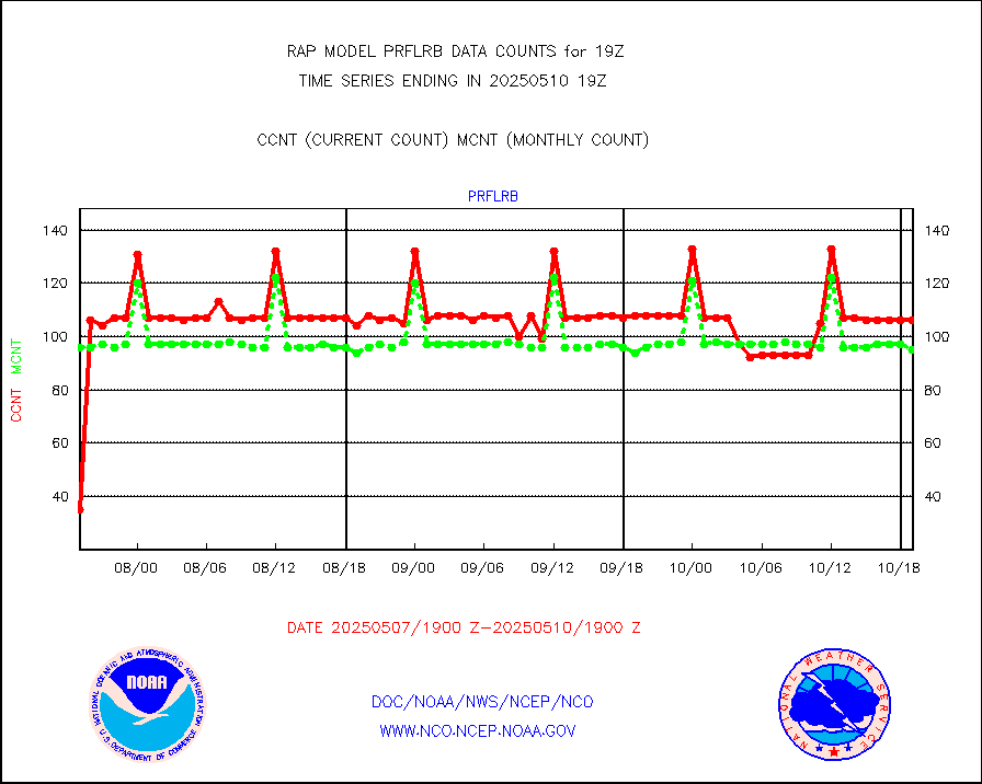
prflrb |
Multi-Agency Profiler (MAP) and SODAR winds |
89 |
82 |
108.5 % |
1717.50-1720.50 |
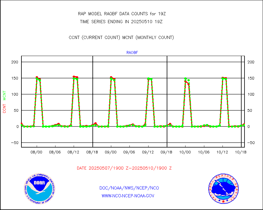
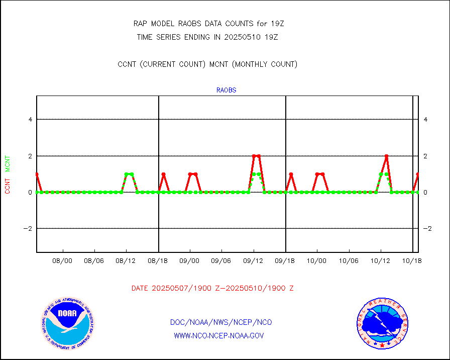
raobf |
Rawinsonde - fixed land (from TEMP or PILOT) |
2 |
6 |
33.3 % |
1718.00-1720.00 |
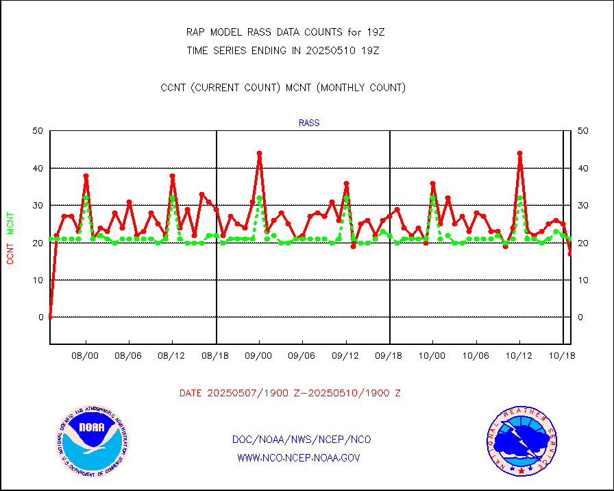
rass |
RASS temperatures (NOAA and Multi-Agency) |
24 |
19 |
126.3 % |
1718.50-1719.50 |
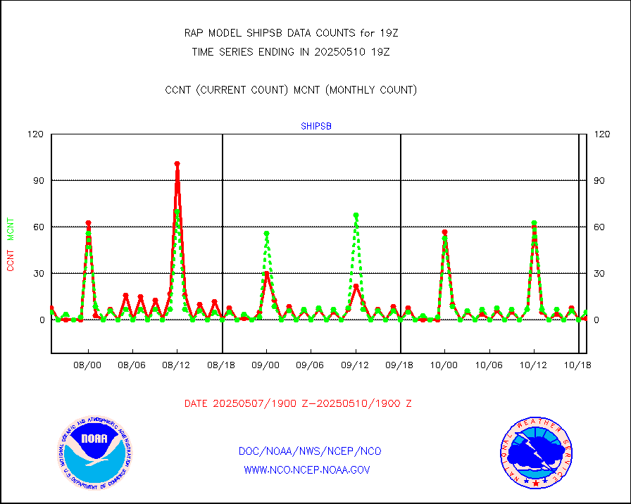
shipsb |
Ship - manual and automatic, restricted (BUFR) |
0 |
1 |
0.0 % |
1718.50-1719.50 |
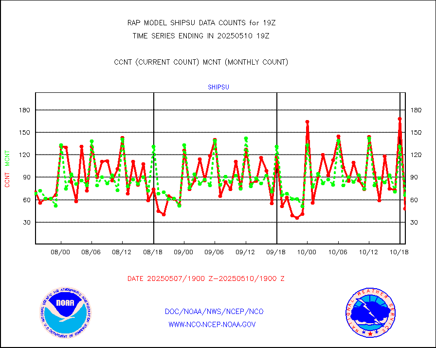
shipsu |
Ship - manual and automatic, unrestricted |
28 |
45 |
62.2 % |
1718.50-1719.50 |
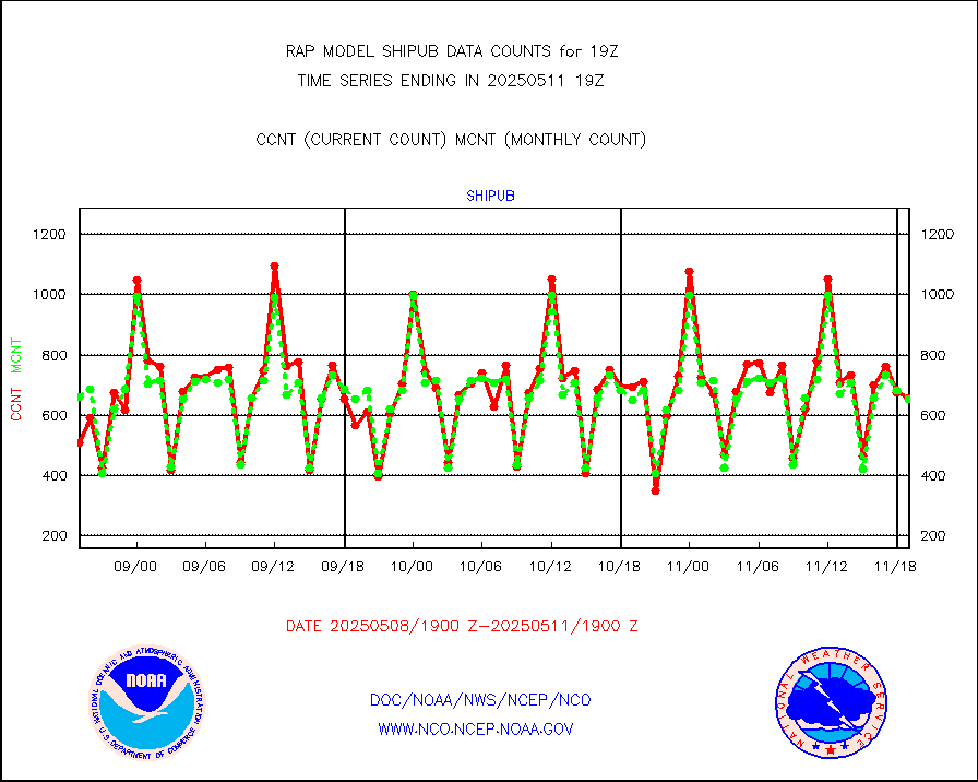
shipub |
Ship - manual and automatic, unrestricted (BUFR) |
580 |
597 |
97.2 % |
1718.50-1719.50 |
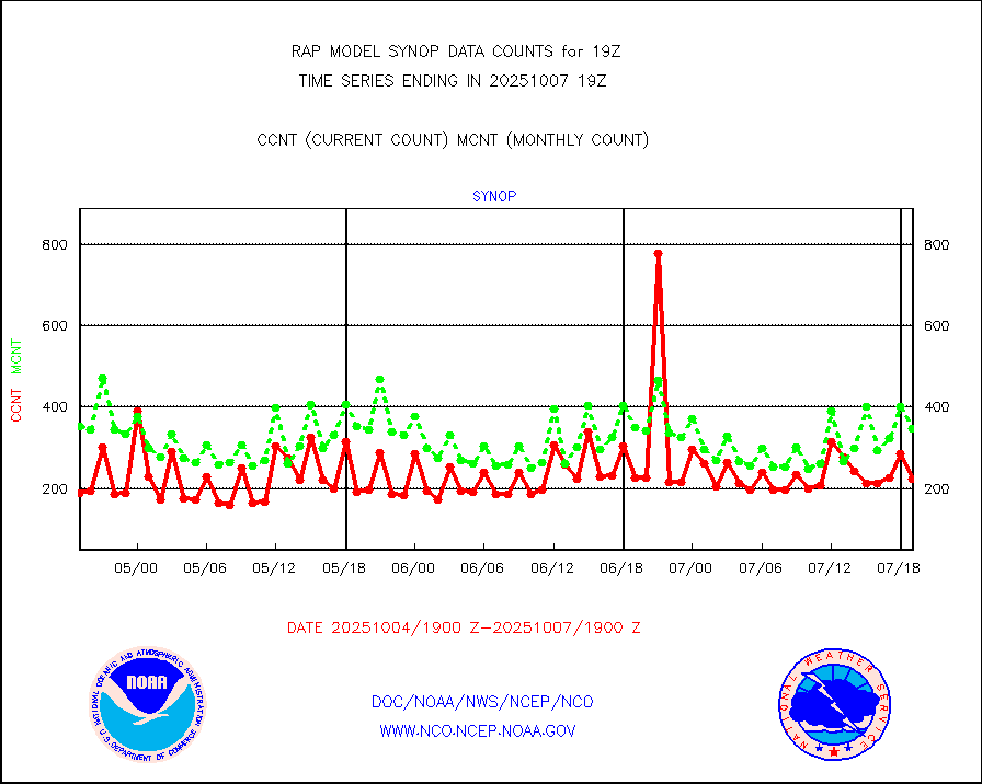
synop |
Synoptic - fixed manual and automatic |
99 |
324 |
30.6 % |
1718.50-1719.50 |
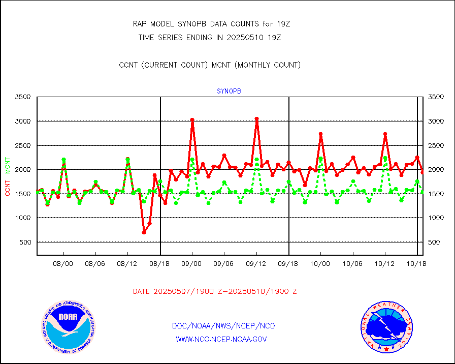
synopb |
Synoptic - fixed manual & auto (decoded fr BUFR) |
842 |
1705 |
49.4 % |
1718.50-1719.50 |
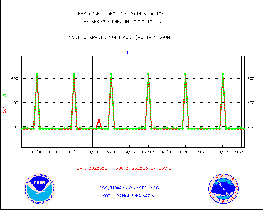
tideg |
Tide gauge reports decoded from CREX format |
178 |
177 |
100.6 % |
1718.50-1719.50 |
| Data Types of Opportunity with Normal Counts |
|---|
| Type | Description | Hourly Count | Monthly Average | Percent (%) of Monthly Mean | UTC Time Window |
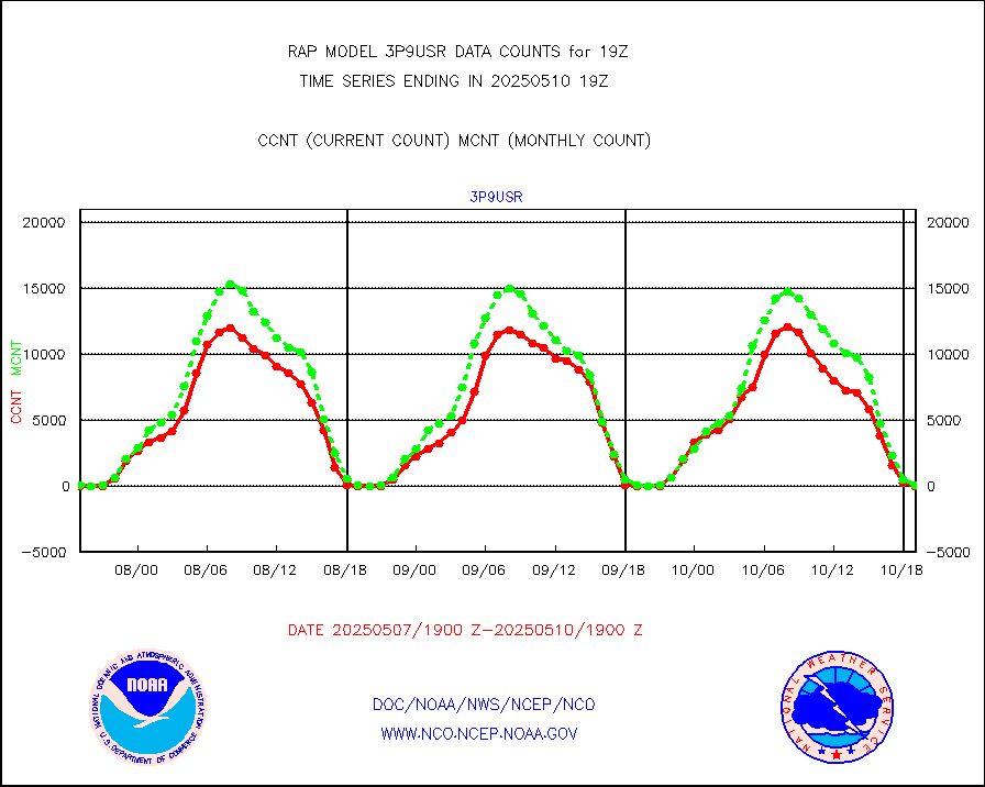
3p9usr |
GOES-16&up/NESDIS ir short-wv derived cld motion |
0 |
152 |
0.0 % |
1718.00-1718.99 |
acarsa |
MDCRS ACARS acft data (ARINC via AFWA)(AIREP fmt) |
0 |
0 |
n/a |
1715.75-1722.25 |
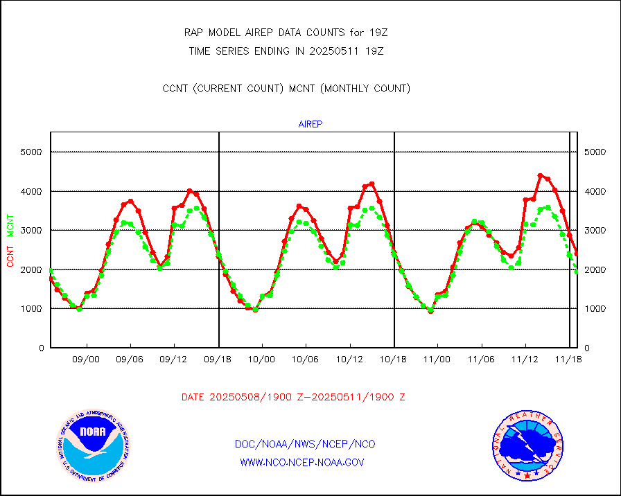
airep |
Manual AIREP aircraft data (dcded from AIREP fmt) |
1336 |
3310 |
40.4 % |
1715.75-1722.25 |
airsev |
AQUA AIRS/AMSU-A/HSB brightness temps- every FOV |
0 |
0 |
n/a |
1716.00-1721.99 |
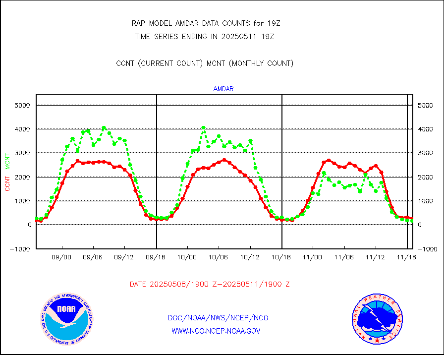
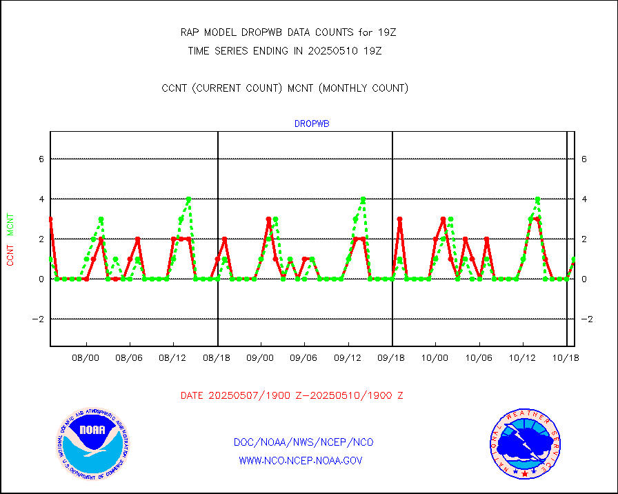
amdar |
AMDAR aircraft data (decoded from AMDAR format) |
221 |
161 |
137.3 % |
1715.75-1722.25 |
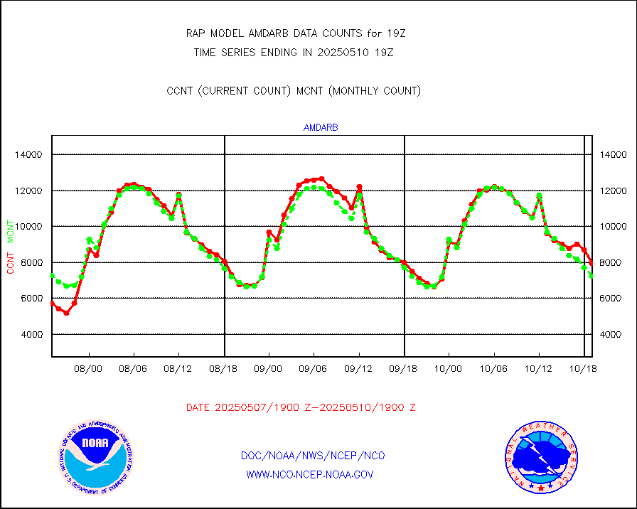
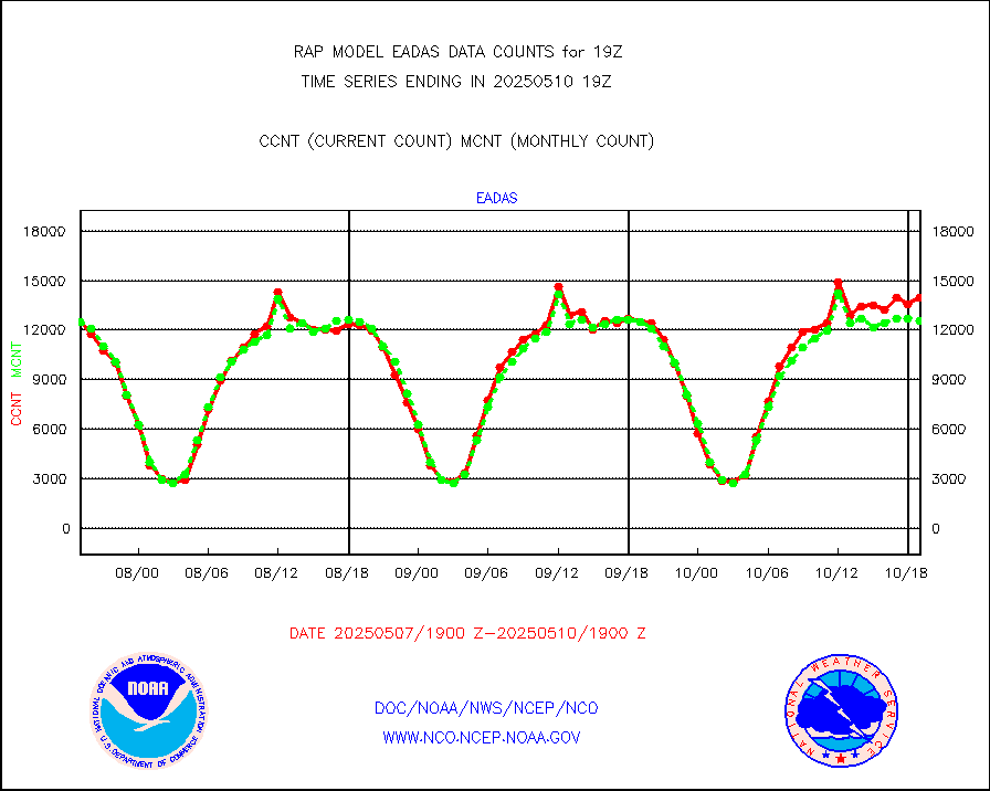
amdarb |
AMDAR aircraft data (decoded from BUFR) |
1390 |
1231 |
112.9 % |
1715.75-1722.25 |
amsr2 |
GCOM-W AMSR2 1B brightness temperatures |
224605 |
751418 |
29.9 % |
1716.00-1716.99 |
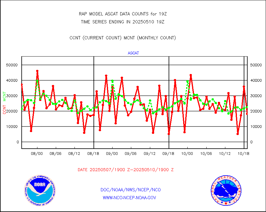
ascat |
METOP 1-2 ASCAT products |
20972 |
12412 |
169.0 % |
1717.00-1721.00 |
atms |
NPP/NOAA-20 ATMS brightness temperatures |
212474 |
218064 |
97.4 % |
1717.00-1720.99 |
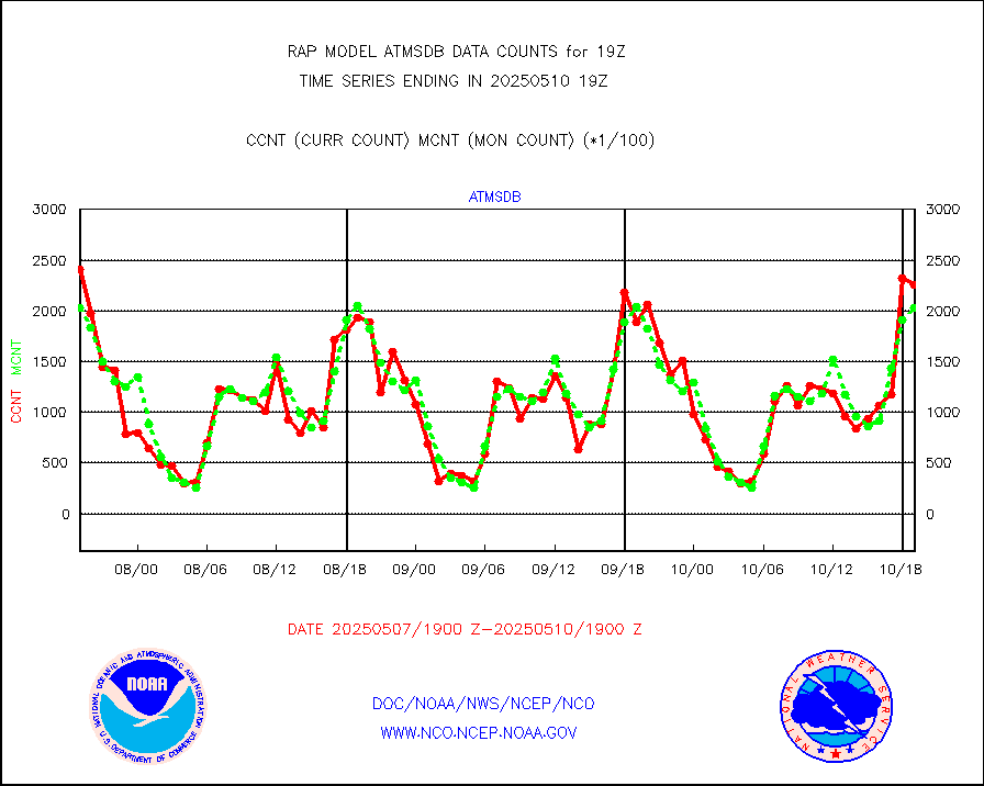
atmsdb |
NPP/NOAA-20 ATMS bright. temps-direct b-cast SSEC |
228846 |
193851 |
118.1 % |
1717.00-1720.99 |
coopmd |
Coop/MADIS NEPP & HCN-Modernization NOAA COOP Obs |
23 |
22 |
104.5 % |
1718.50-1719.50 |
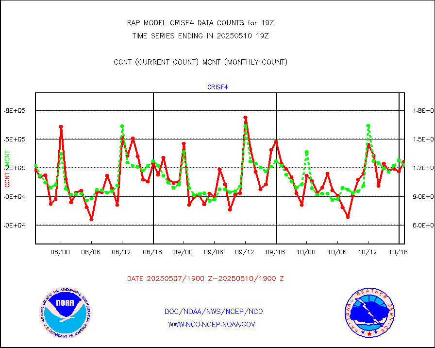
crisf4 |
NPP/NOAA-20 CrIS full spctrl radn (431 ch subset) |
108170 |
121662 |
88.9 % |
1717.00-1720.99 |
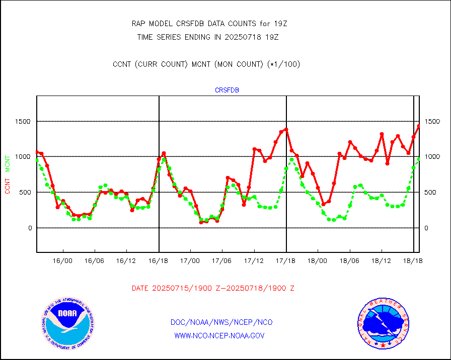
crsfdb |
NPP/NOAA-20 CrIS full spctrl radn dir brdcst SSEC |
189855 |
158777 |
119.6 % |
1717.00-1720.99 |
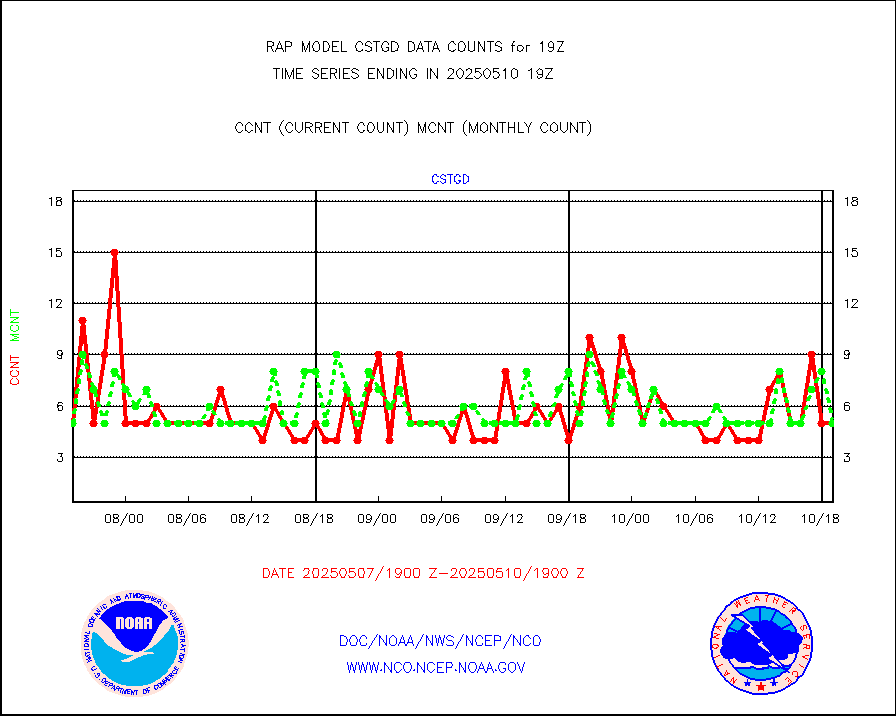
cstgd |
Coast Guard |
4 |
3 |
133.3 % |
1718.50-1719.50 |
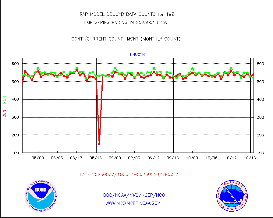
dbuoyb |
Drifting buoys (decoded from BUFR) |
576 |
623 |
92.5 % |
1718.50-1719.50 |
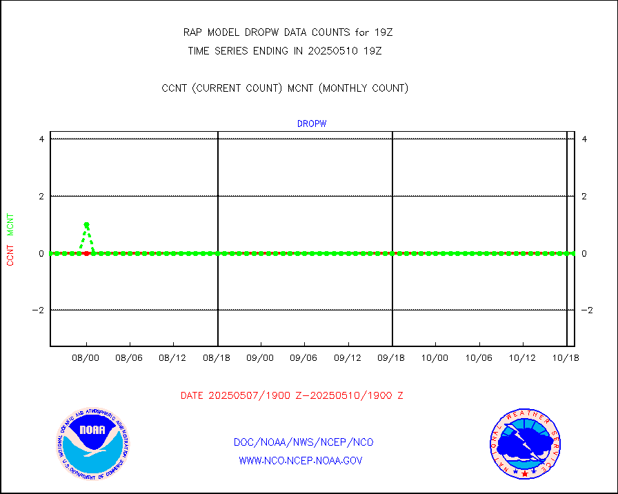
dropw |
Dropwinsonde (from TEMP DROP) |
0 |
0 |
n/a |
1718.00-1720.00 |
eadas |
E-AMDAR (European AMDAR acft decoded from BUFR) |
9634 |
9485 |
101.6 % |
1715.75-1722.25 |
esamua |
NOAA 15-19 & METOP 1-2 AMSU-A proc btmps frm RARS |
18374 |
15009 |
122.4 % |
1718.00-1720.00 |
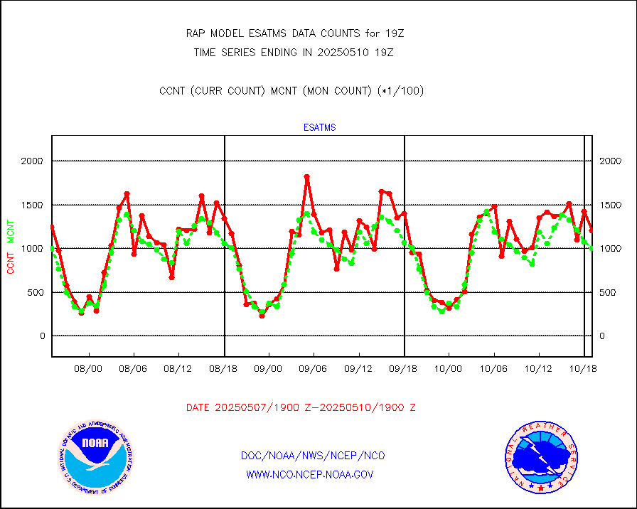
esatms |
NPP Adv. Tech. MW Sndr (ATMS) br. temps from RARS |
115854 |
90117 |
128.6 % |
1717.00-1720.99 |
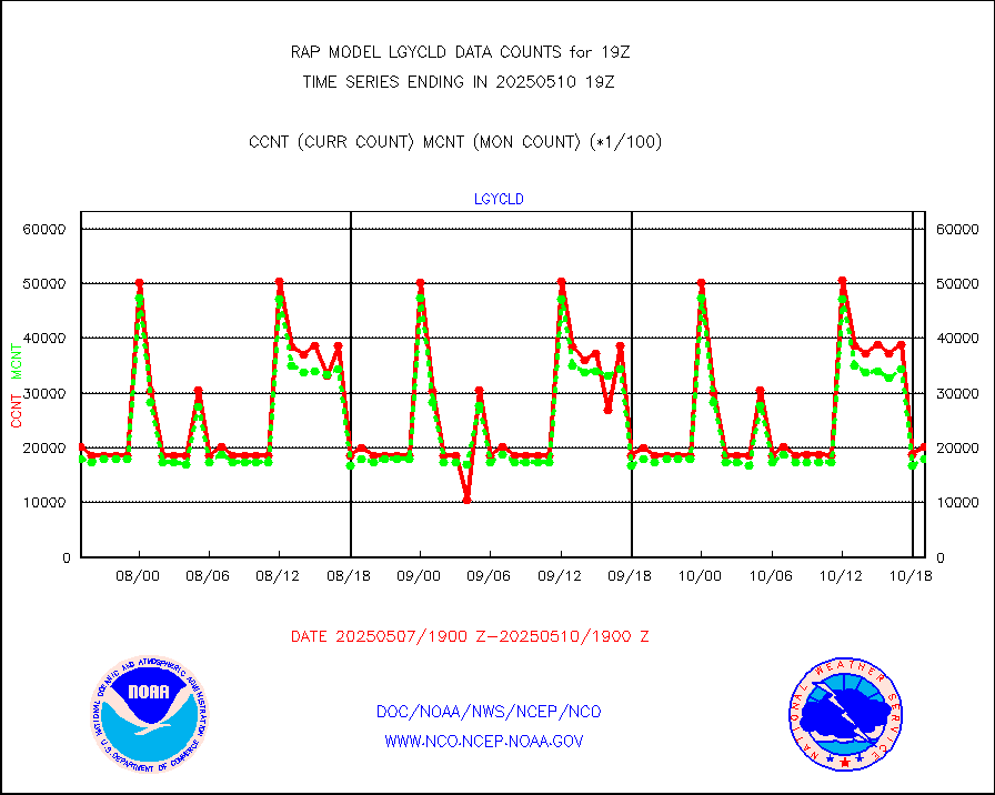
eshrs3 |
NOAA 15-19 & METOP 1-2 HIRS-3/4 pr btmps frm RARS |
33972 |
30406 |
111.7 % |
1718.00-1720.00 |
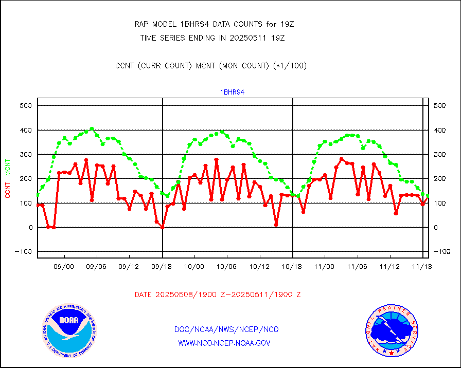
esiasi |
METOP 1-2 IASI 1C radiance data vbl chn from RARS |
50096 |
58140 |
86.2 % |
1717.00-1720.99 |
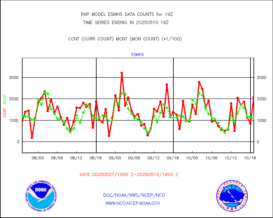
esmhs |
NOAA 18-19 & METOP 1-2 MHS proc. btemps from RARS |
169464 |
112657 |
150.4 % |
1718.00-1720.00 |
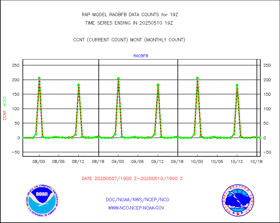
gpsro |
GPS radio occultation data |
78 |
102 |
76.5 % |
1717.00-1720.99 |
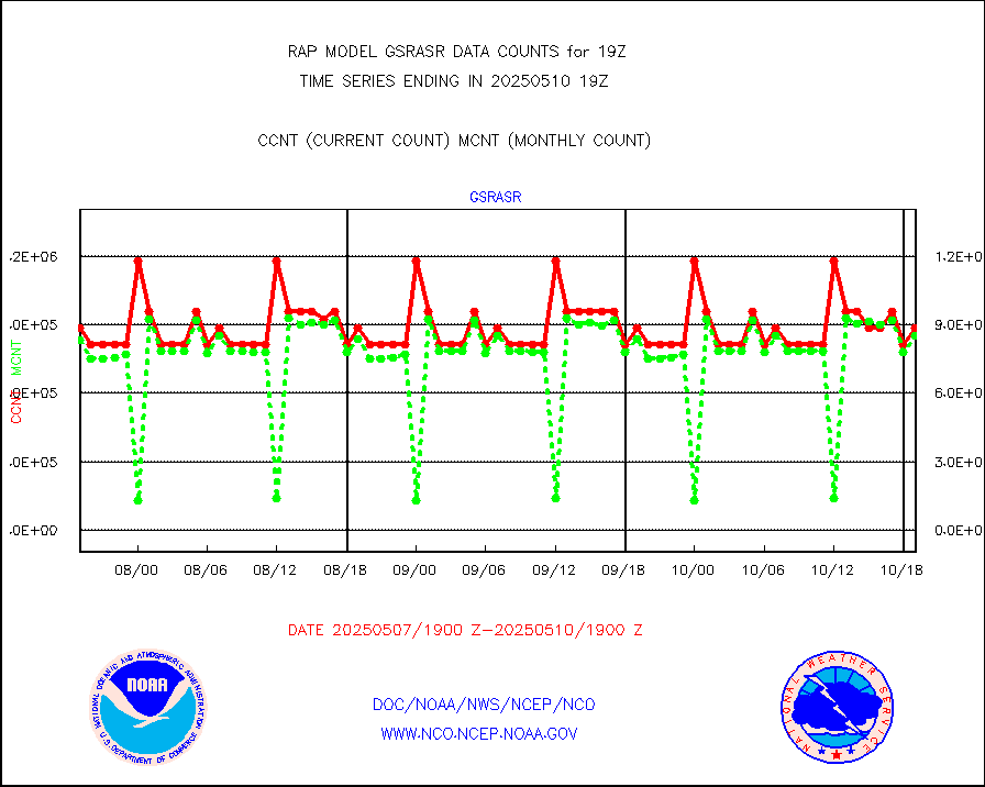
gsrasr |
GOES-16/17 All Sky Radiances (proc.) |
885924 |
842838 |
105.1 % |
1717.00-1720.99 |
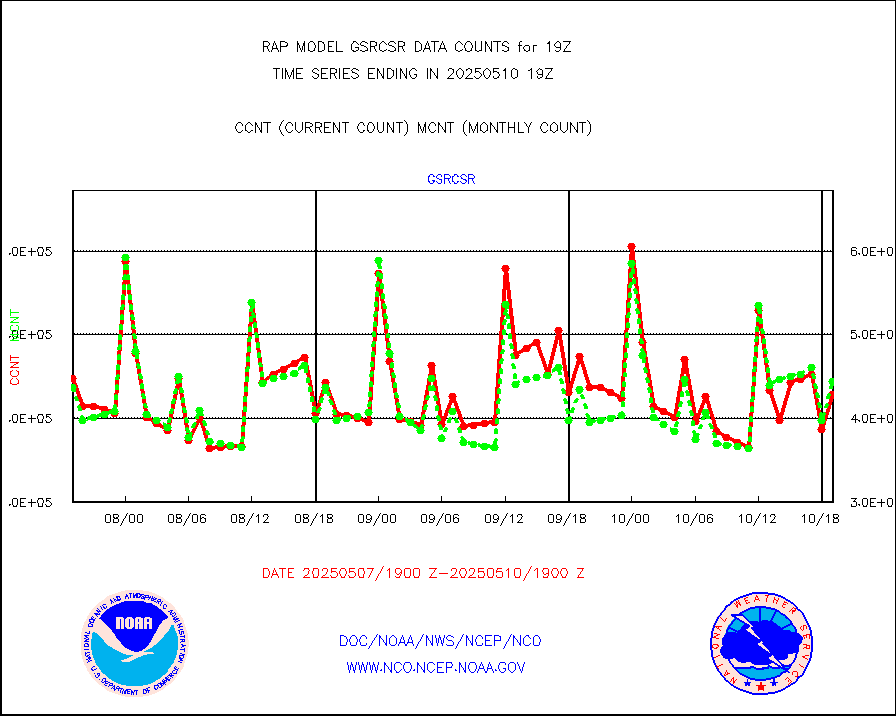
gsrcsr |
GOES-16/17 Clear Sky Radiances (proc.) |
425041 |
438243 |
97.0 % |
1717.00-1720.99 |
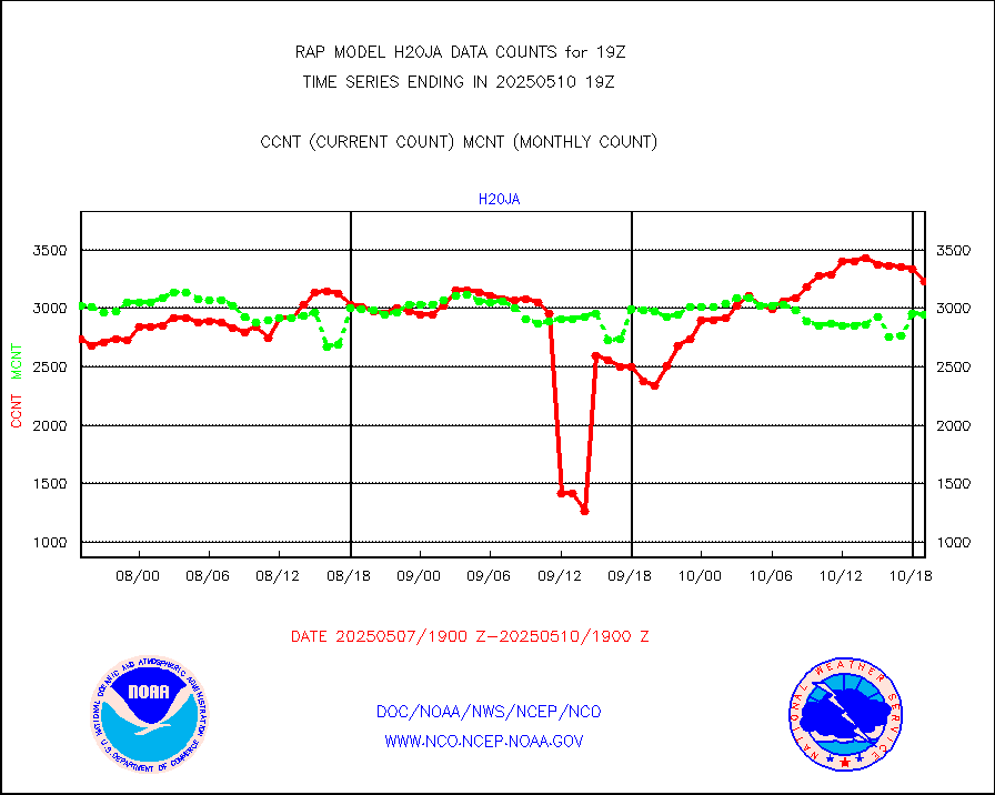
h20ja |
MTSAT/JMA water vapor imager derived cloud motion |
3799 |
2510 |
151.4 % |
1716.50-1721.50 |
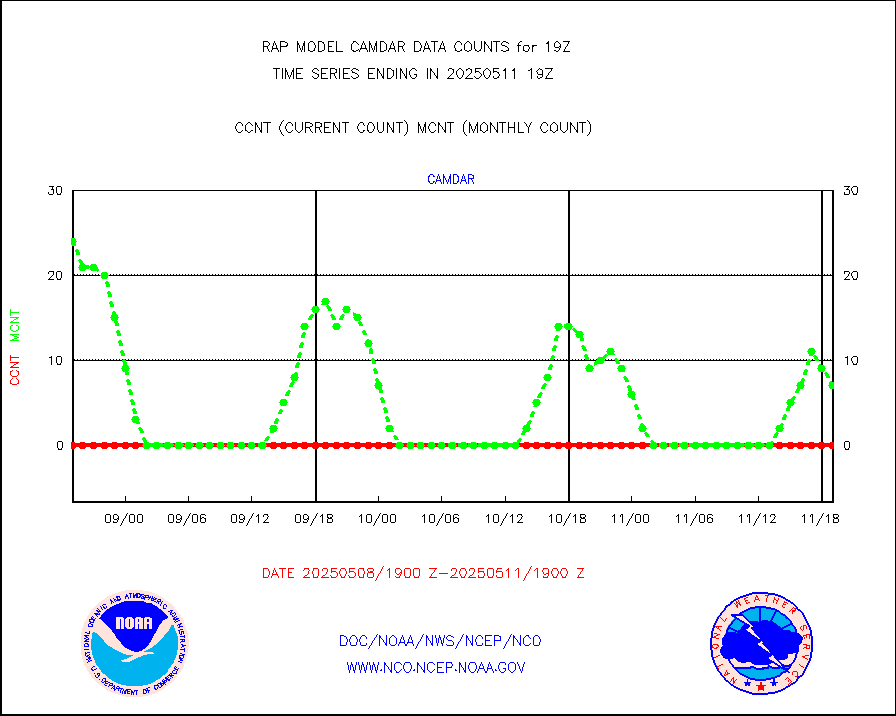
h2dusr |
GOES-16&up/NESDIS wv imgr/deep-lyr derivd cld mtn |
6586 |
5741 |
114.7 % |
1718.00-1718.99 |
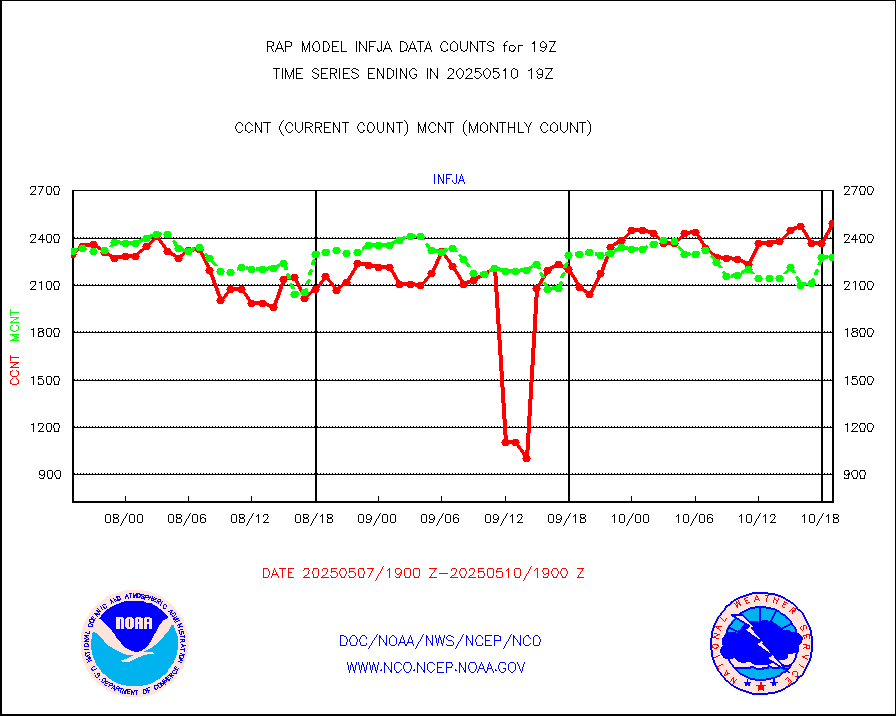
h2eunb |
METEOSAT/EUMETSAT wvpr imgr drv cld motion NBseq |
5304 |
5210 |
101.8 % |
1717.50-1720.49 |
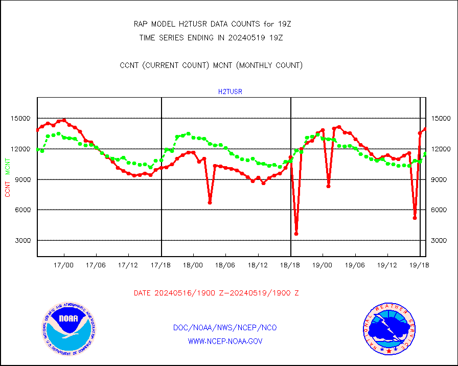
h2tusr |
GOES-16&up/NESDIS wv imgr/cld-top derived cld mtn |
13489 |
10024 |
134.6 % |
1718.00-1718.99 |
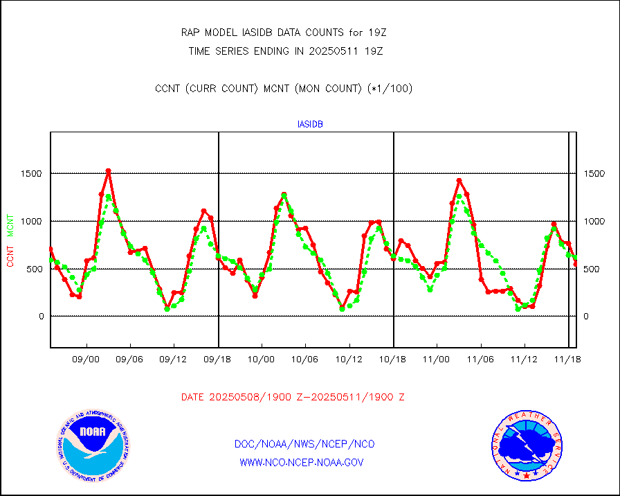
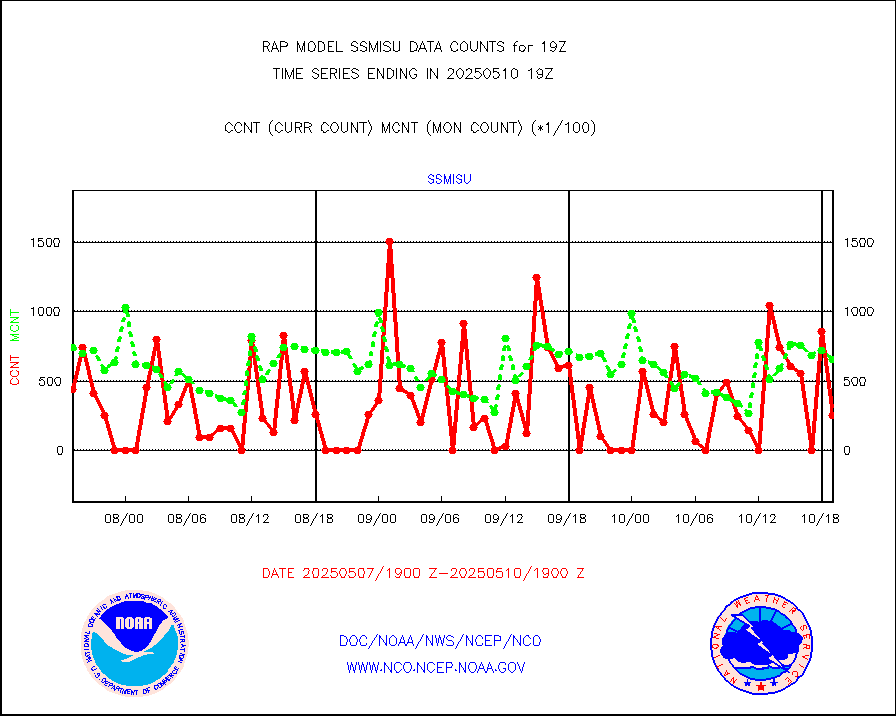
iasidb |
METOP 1-2 IASI 1C radiances-direct broadcast SSEC |
41136 |
46748 |
88.0 % |
1717.00-1720.99 |
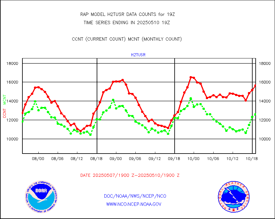
ifeunb |
METEOSAT/EUMETSAT ir lg-wave drv cld motion NBseq |
3284 |
3280 |
100.1 % |
1717.50-1720.49 |
ifvrnb |
VIIRS (NPP/NOAA-20) ir lg-wv drv cloud motion(NB) |
0 |
0 |
n/a |
1716.50-1721.50 |
infav |
AVHRR (NOAA/METOP) ir lg-wave derived cld motion |
0 |
0 |
n/a |
1716.50-1721.50 |
infav1 |
AVHRR (METOP) ir lg-wave derived cld motion |
0 |
0 |
n/a |
1717.50-1720.49 |
infja |
MTSAT/JMA infrared long-wave derived cloud motion |
3059 |
2455 |
124.6 % |
1716.50-1721.50 |
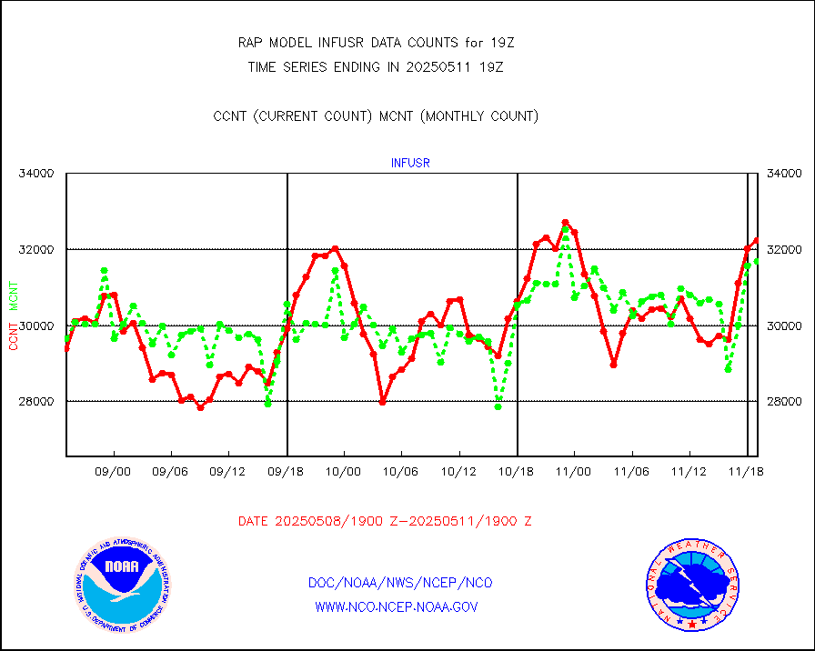
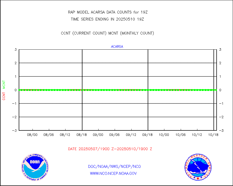
infusr |
GOES-16&up/NESDIS ir long-wave derived cld motion |
29678 |
29698 |
99.9 % |
1718.00-1718.99 |
kamdar |
Korean AMDAR aircraft data (decoded from BUFR) |
0 |
4 |
0.0 % |
1715.75-1722.25 |
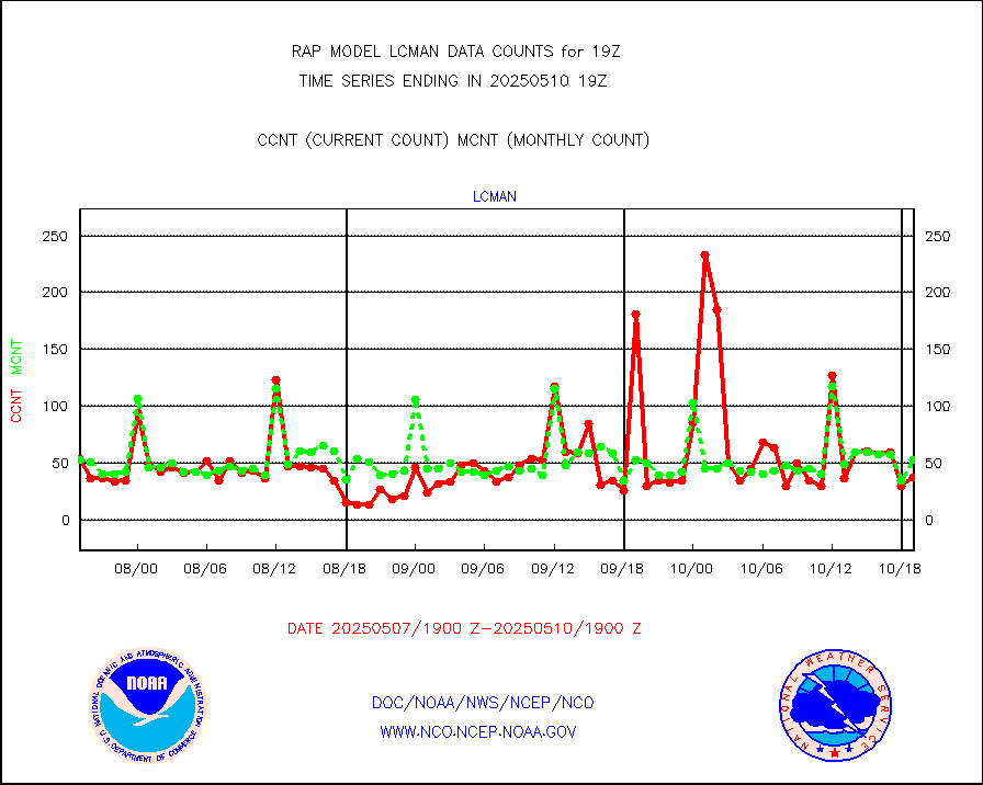
lcman |
Land-based CMAN stations decoded from CMAN format |
60 |
84 |
71.4 % |
1718.50-1719.50 |
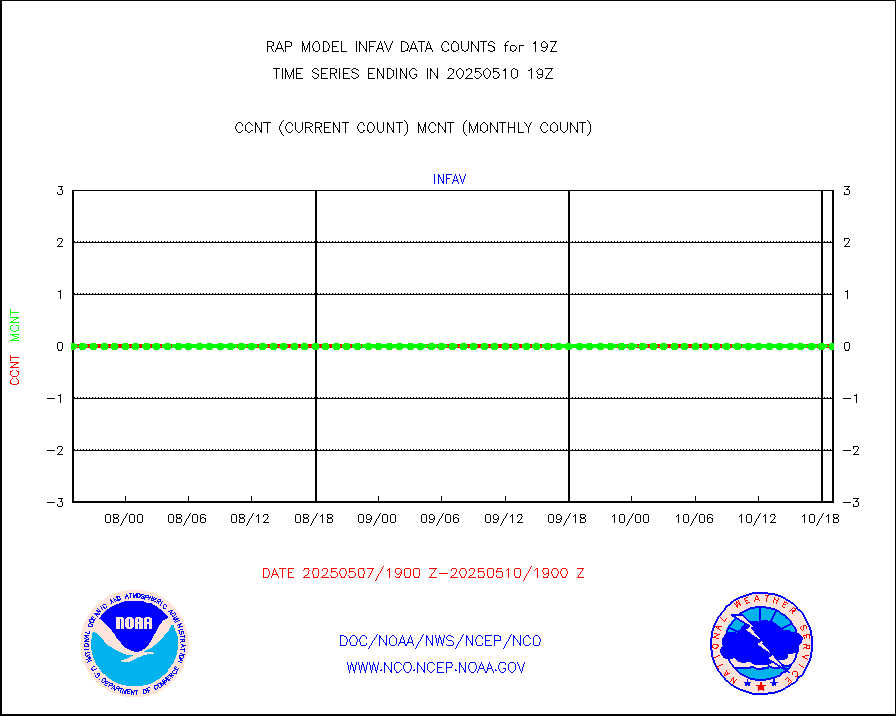
ltnglr |
LLDN Long-rng lightning from Vaisala via NOAAPORT |
63098 |
60573 |
104.2 % |
1718.00-1719.50 |
ltngsr |
NLDN Shrt-rng lightning from Vaisala via NOAAPORT |
1409 |
2219 |
63.5 % |
1718.00-1719.50 |
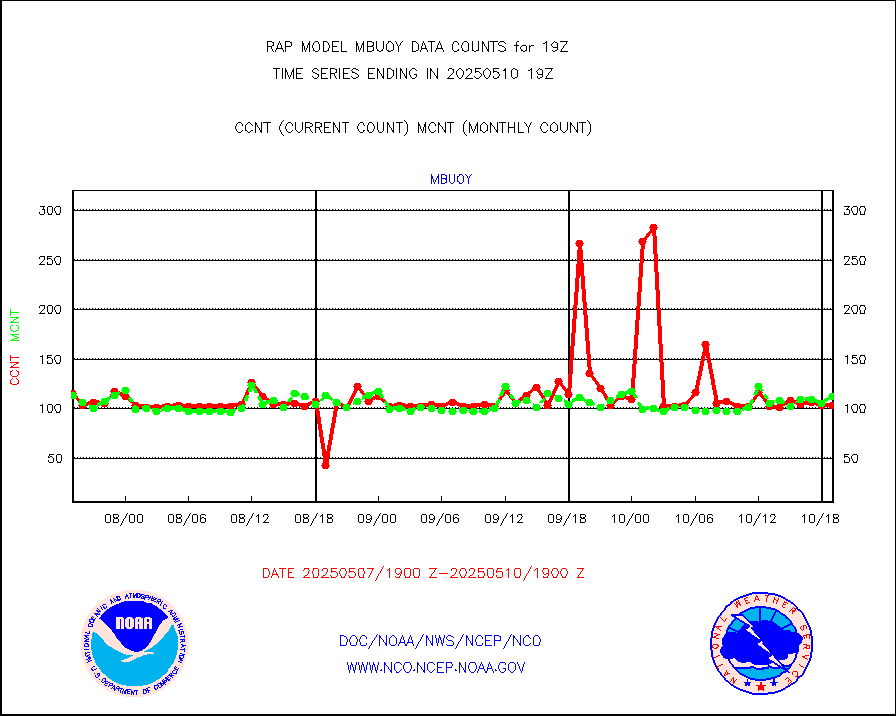
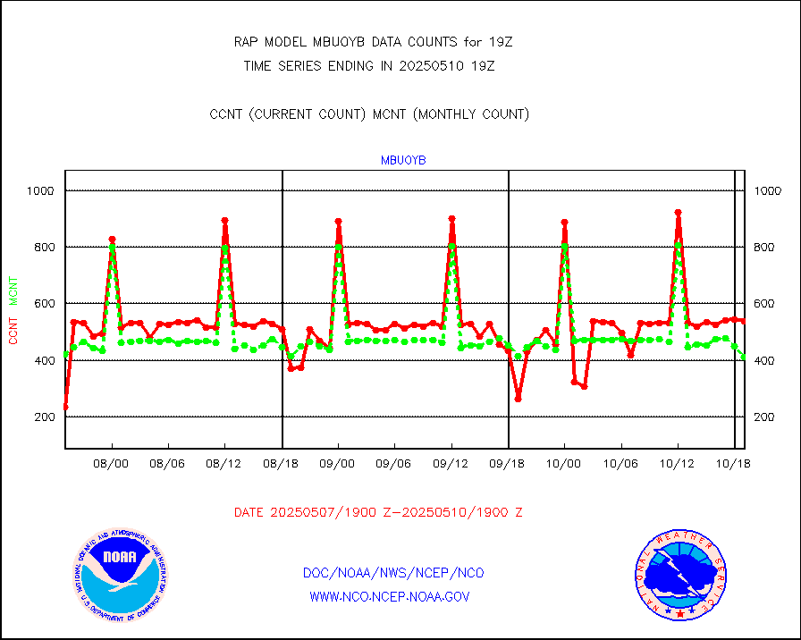
mbuoyb |
Moored buoys (decoded from BUFR) |
459 |
450 |
102.0 % |
1718.50-1719.50 |
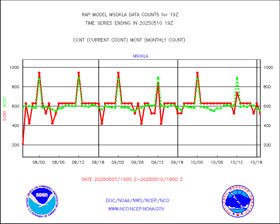
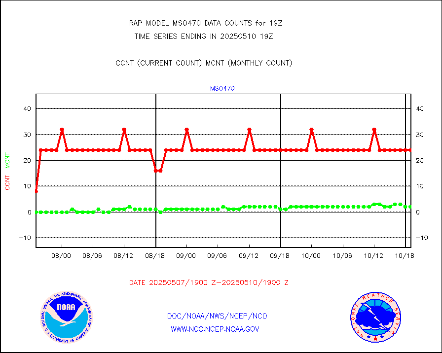
mso470 |
Mesonet/MADIS Colorado E-470 (Interstate 470) |
12 |
20 |
60.0 % |
1718.50-1719.50 |
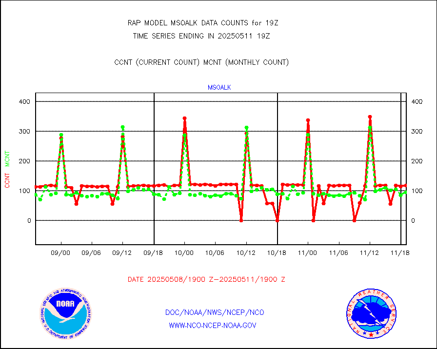
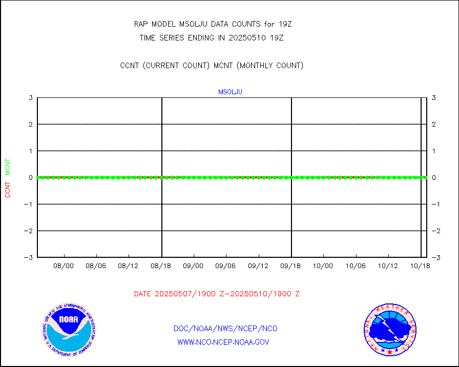
msoalk |
Mesonet/MADIS Alaska Department of Transportation |
110 |
111 |
99.1 % |
1718.50-1719.50 |
msoapg |
Mesonet/MADIS U.S. Army Aberdeen Proving Grounds |
0 |
0 |
n/a |
1718.50-1719.50 |
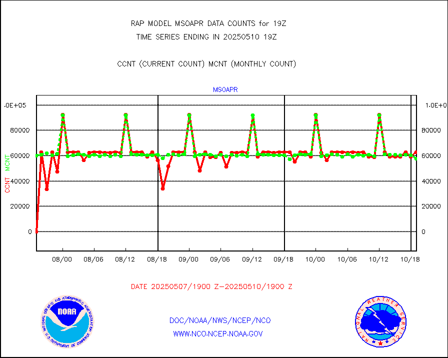
msoapr |
Mesonet/MADIS Citizen Weather Observers Program |
46594 |
43473 |
107.2 % |
1718.50-1719.50 |
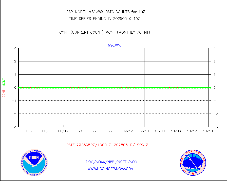
msoaws |
Mesonet/MADIS AWS Convergence Technologies, Inc. |
25814 |
24920 |
103.6 % |
1718.50-1719.50 |
msoawx |
Mesonet/MADIS "Anything Weather" |
0 |
0 |
n/a |
1718.50-1719.50 |
msocol |
Mesonet/MADIS Colorado Dept. of Transportation |
0 |
0 |
n/a |
1718.50-1719.50 |
msodcn |
Mesonet/MADIS DC Net |
0 |
0 |
n/a |
1718.50-1719.50 |
msoden |
Mesonet/MADIS Denver Urban Drainage & Flood Cntrl |
200 |
194 |
103.1 % |
1718.50-1719.50 |
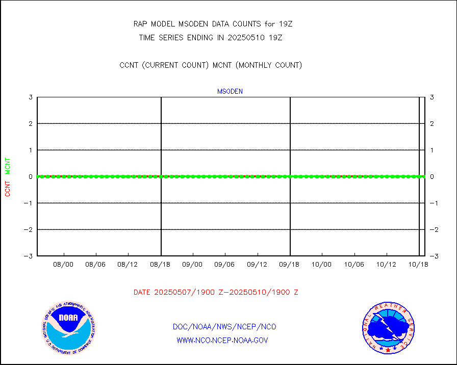
msofla |
Mesonet/MADIS Florida (FAWN & USF) |
3 |
3 |
100.0 % |
1718.50-1719.50 |
msoflt |
Mesonet/MADIS Florida Dept. of Transportation |
0 |
0 |
n/a |
1718.50-1719.50 |
msogeo |
Mesonet/MADIS Georgia Dept. of Transportation |
0 |
0 |
n/a |
1718.50-1719.50 |
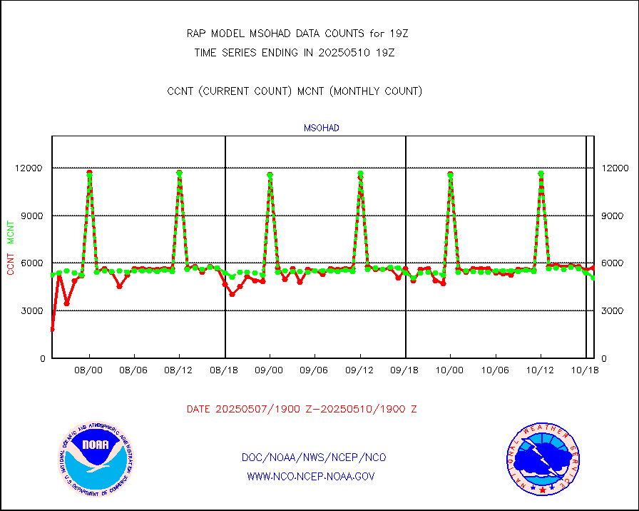
msohad |
Mesonet/MADIS NWS Hydromet Auto Data System(HADS) |
5447 |
5275 |
103.3 % |
1718.50-1719.50 |
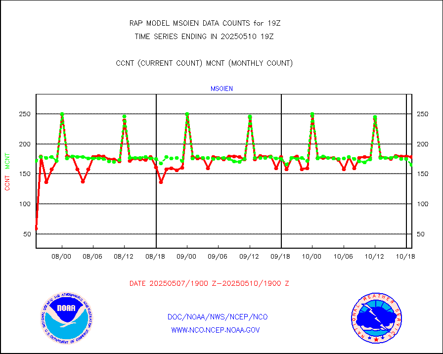
msoien |
Mesonet/MADIS Iowa Environmental |
170 |
170 |
100.0 % |
1718.50-1719.50 |
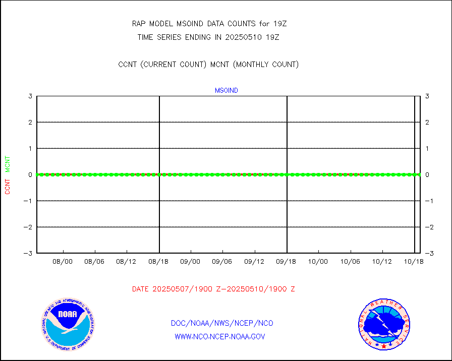
msoind |
Mesonet/MADIS Indiana Dept. of Transportation |
0 |
0 |
n/a |
1718.50-1719.50 |
msoiow |
Mesonet/MADIS Iowa Department of Transportation |
0 |
0 |
n/a |
1718.50-1719.50 |
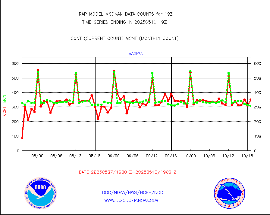
msokan |
Mesonet/MADIS Kansas Department of Transportation |
356 |
318 |
111.9 % |
1718.50-1719.50 |
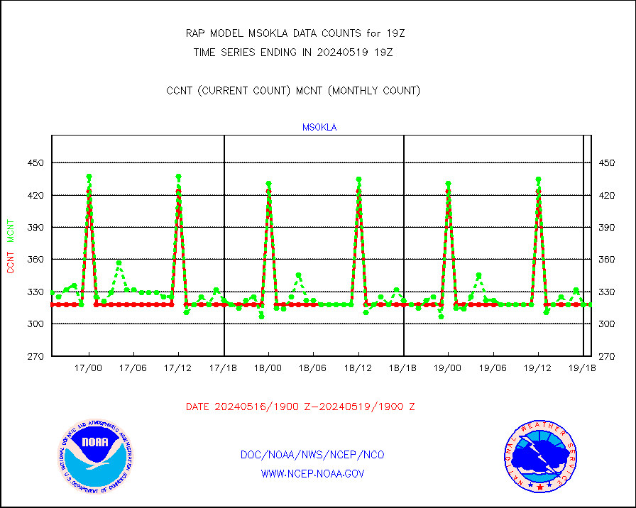
msokla |
Mesonet/MADIS Oklahoma Mesonet |
318 |
325 |
97.8 % |
1718.50-1719.50 |
msolju |
Mesonet/MADIS Louisiana State/Jackson State Univ. |
0 |
0 |
n/a |
1718.50-1719.50 |
msomca |
Mesonet/MADIS Missouri Commercial Agricult Wx Net |
260 |
243 |
107.0 % |
1718.50-1719.50 |
msomin |
Mesonet/MADIS Minnesota Dept. of Transportation |
0 |
0 |
n/a |
1718.50-1719.50 |
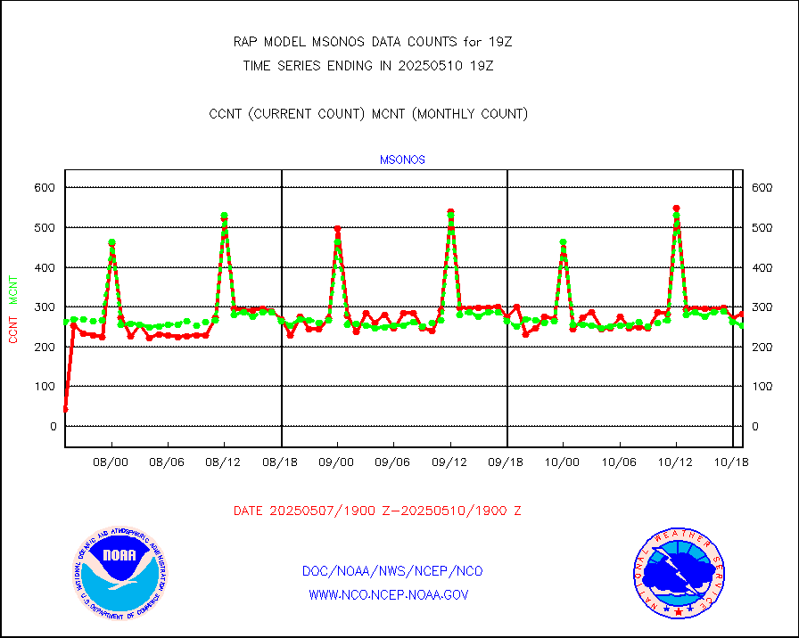
msonos |
Mesonet/MADIS NOS-Phys Oceanographic Realtime Sys |
283 |
270 |
104.8 % |
1718.50-1719.50 |
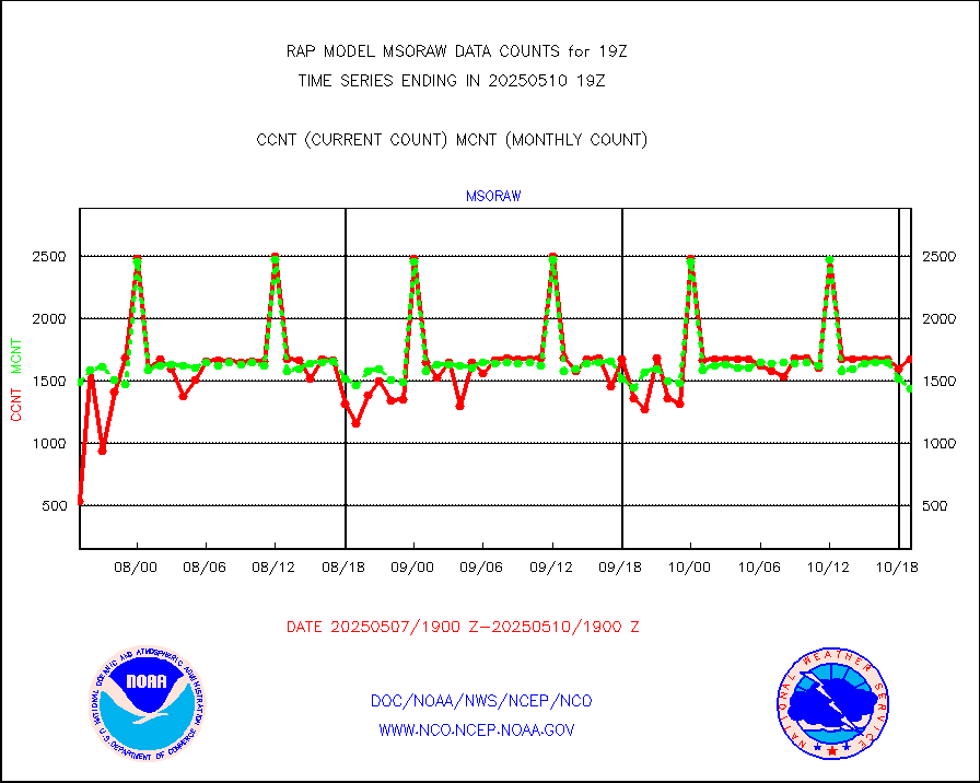
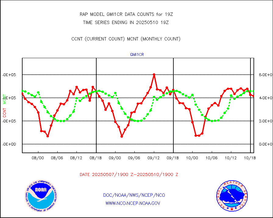
msoraw |
Mesonet/MADIS NFIC Remote Automated Wx Stns(RAWS) |
1512 |
1600 |
94.5 % |
1718.50-1719.50 |
msourb |
Mesonet/MADIS UrbaNet |
3908 |
3926 |
99.5 % |
1718.50-1719.50 |
msovir |
Mesonet/MADIS Virginia Dept. of Transportation |
233 |
234 |
99.6 % |
1718.50-1719.50 |
msowfy |
Mesonet/MADIS "Weather for You" |
0 |
0 |
n/a |
1718.50-1719.50 |
msowis |
Mesonet/MADIS Wisconsin Dept. of Transportation |
0 |
0 |
n/a |
1718.50-1719.50 |
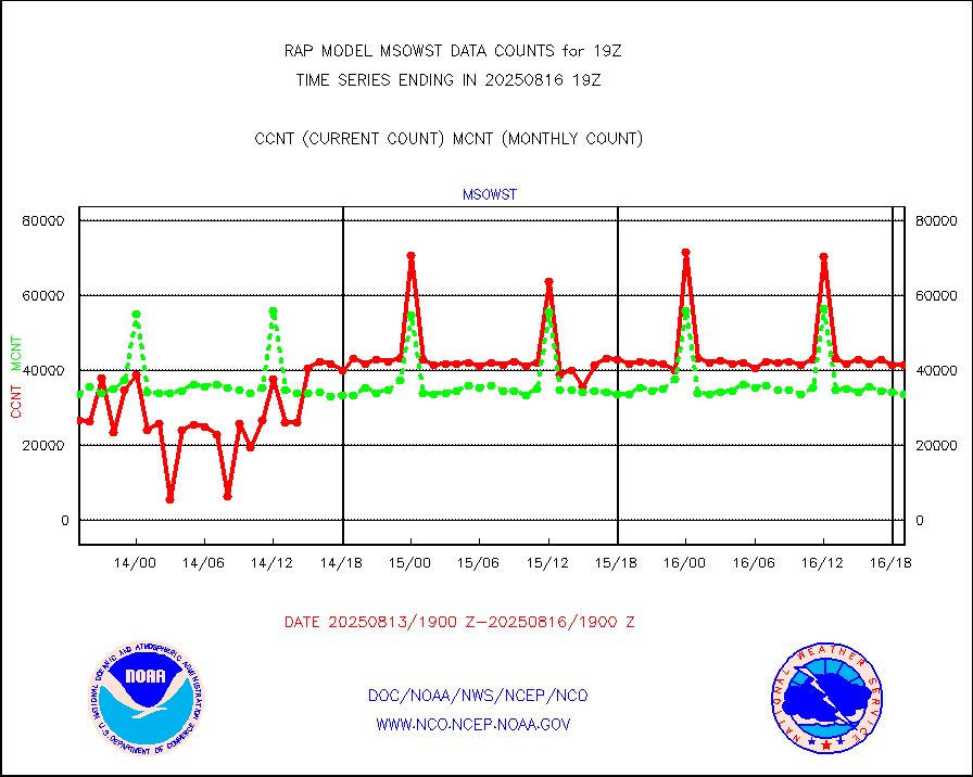
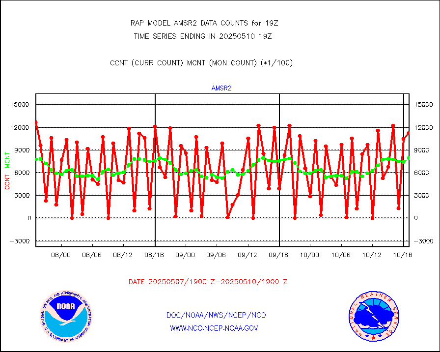
msowst |
Mesonet/MADIS MesoWest (many subproviders) |
37786 |
40017 |
94.4 % |
1718.50-1719.50 |
msowtx |
Mesonet/MADIS West Texas |
4838 |
4929 |
98.2 % |
1718.50-1719.50 |
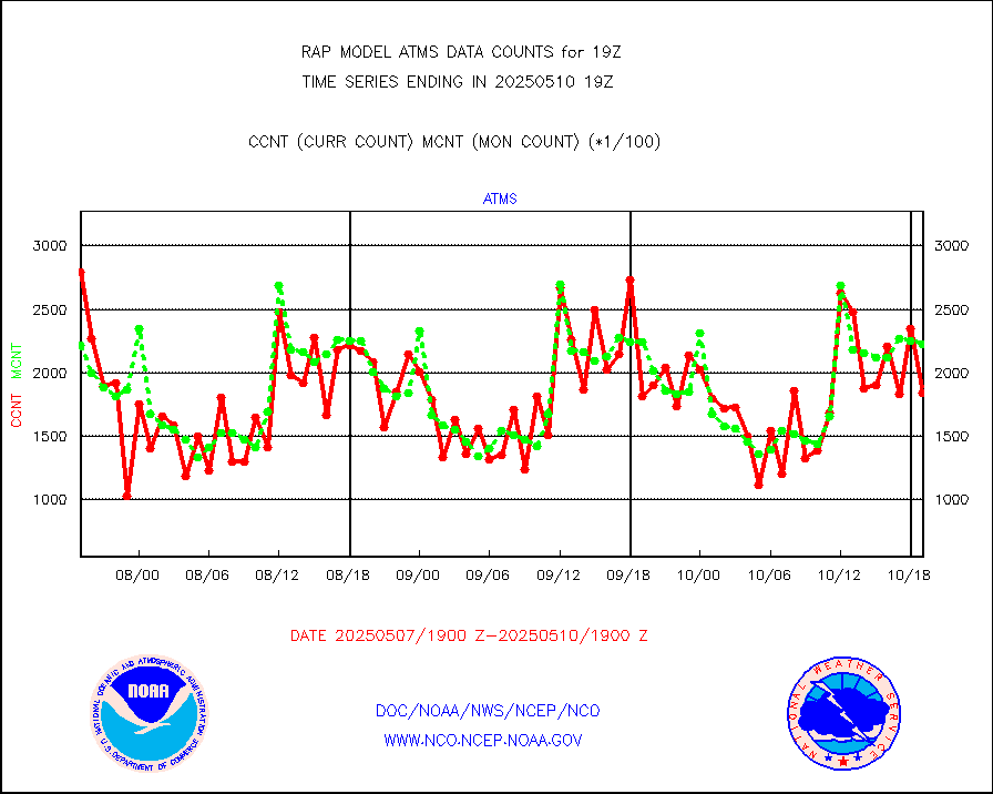
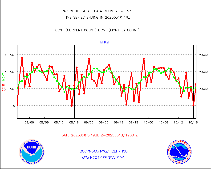
mtiasi |
METOP 1-2 IASI 1C radiance data (varbl. channels) |
29499 |
17302 |
170.5 % |
1717.00-1720.99 |
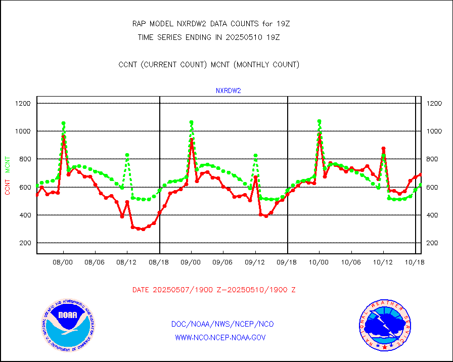
nxrdw2 |
NEXRAD Vel Azm Dsp(VAD) winds via Level 2 decoder |
659 |
639 |
103.1 % |
1718.00-1720.00 |
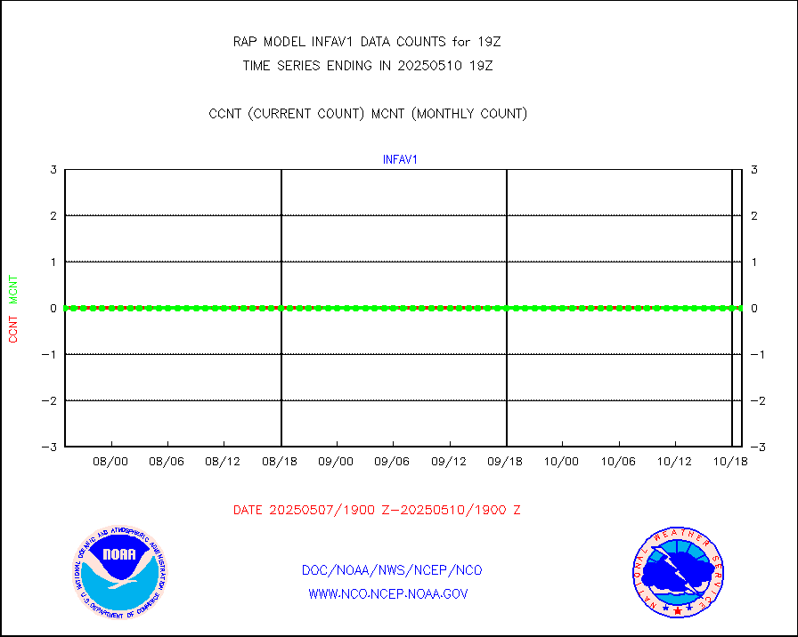
osbuv8 |
NOAA 16-19 Solar Backscatter UV-2 rad frm V8 BUFR |
0 |
0 |
n/a |
1717.00-1719.99 |
pibal |
PIBAL (from PILOT, PILOT SHIP, PILOT MOBIL) |
0 |
0 |
n/a |
1718.00-1720.00 |
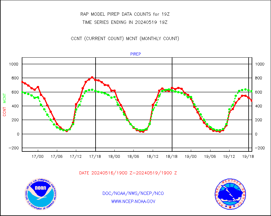
pirep |
Manual PIREP aircraft data (dcded from AIREP fmt) |
639 |
668 |
95.7 % |
1715.75-1722.25 |
prflrp |
Profilr winds from PIBAL (PILOT,PILOT SHIP/MOBIL) |
0 |
0 |
n/a |
1717.50-1720.50 |
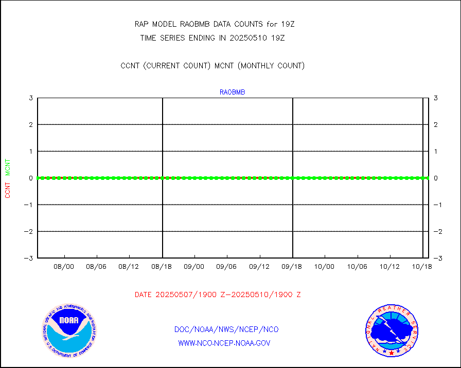
raobm |
Rawinsonde - mobile land (from TEMP/PILOT MOBIL) |
0 |
0 |
n/a |
1718.00-1720.00 |
raobs |
Rawinsonde - ship (from TEMP SHIP, PILOT SHIP) |
0 |
0 |
n/a |
1718.00-1720.00 |
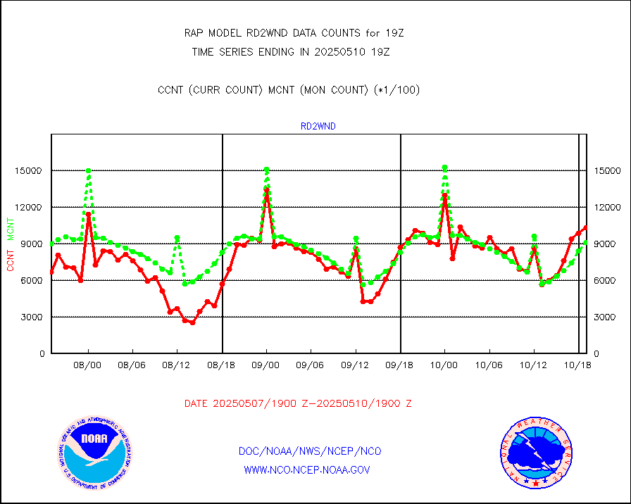
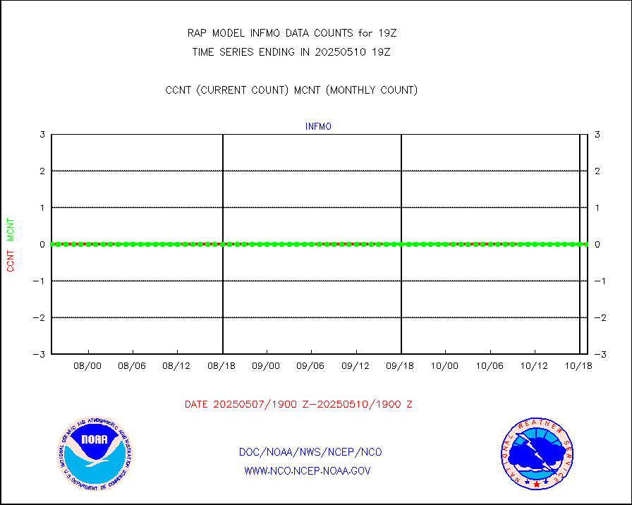
rd2wnd |
NEXRAD radial wind (Level 2 - GTS) |
1148226 |
959795 |
119.6 % |
1718.50-1719.49 |
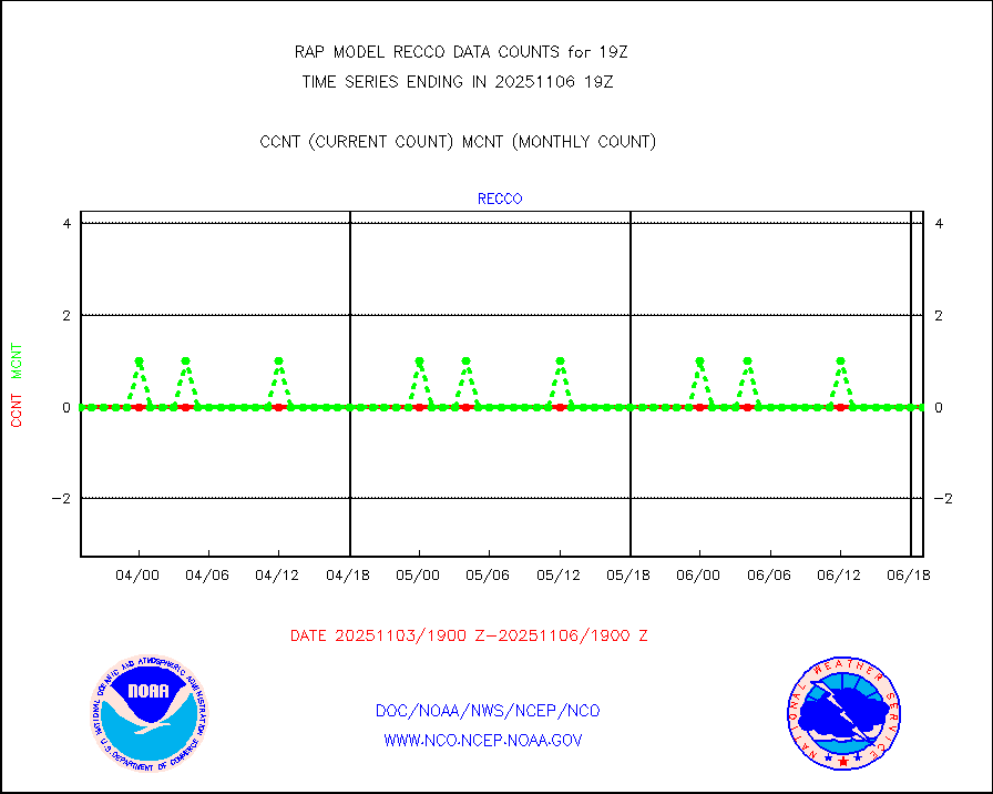
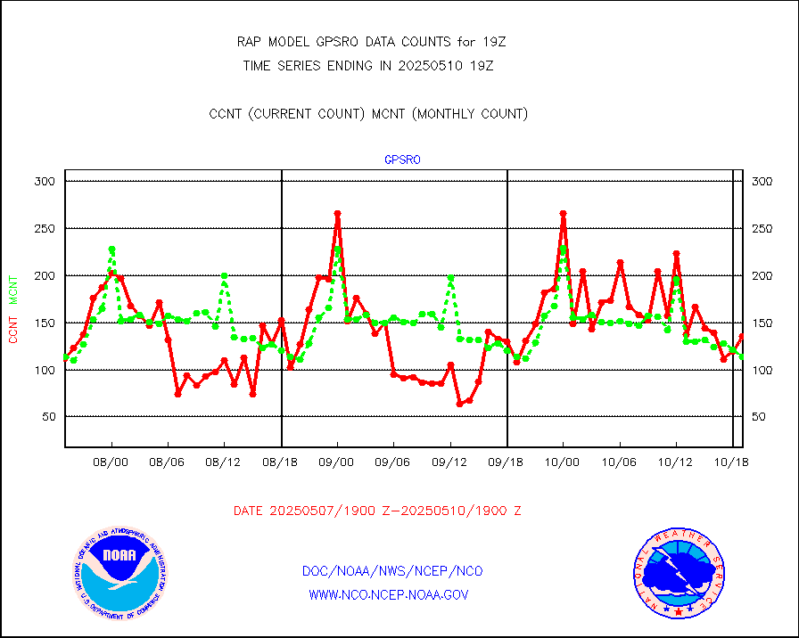
recco |
Flight level reconnaissance aircraft data |
0 |
0 |
n/a |
1718.00-1720.00 |
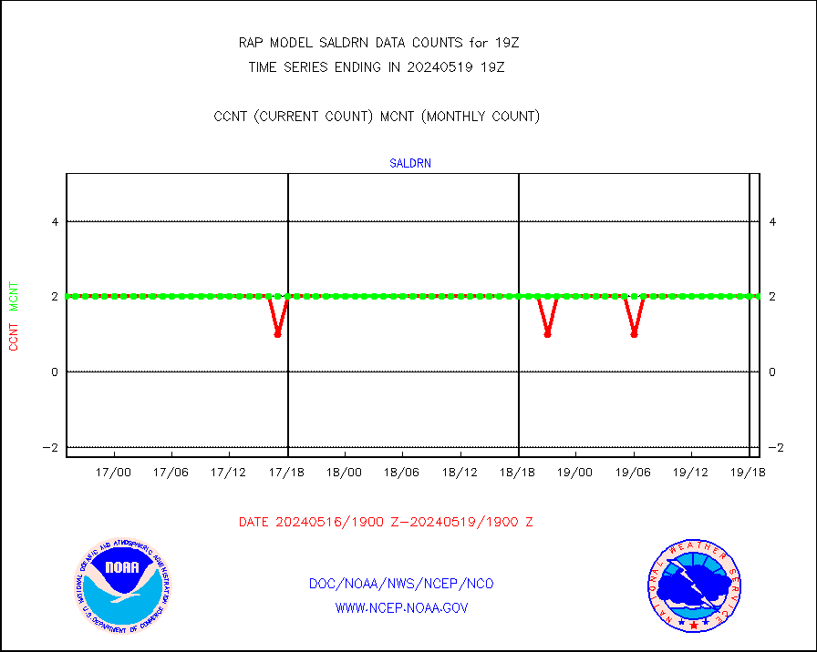
saldrn |
Surface Marine Saildrone (decoded from BUFR) |
2 |
2 |
100.0 % |
1717.00-1720.99 |
saphir |
Megha-Tropiques SAPHIR L1A2 brightness temps |
0 |
0 |
n/a |
1716.00-1721.99 |
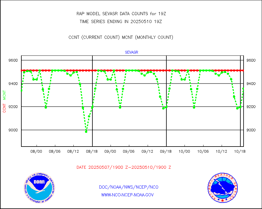
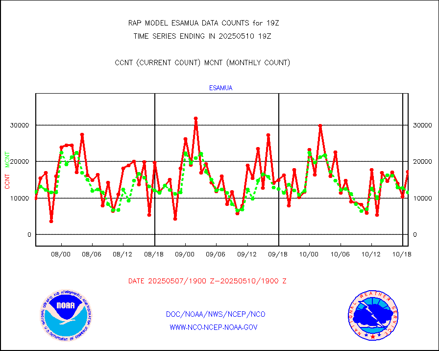
sevasr |
METEOSAT-10 2nd Gen SEVIRI All Sky Radiance(proc) |
9512 |
9512 |
100.0 % |
1717.00-1720.99 |
sevcsr |
METEOSAT-10 2nd Gen SEVIRI Clr Sky Radiance(proc) |
0 |
0 |
n/a |
1717.00-1720.99 |
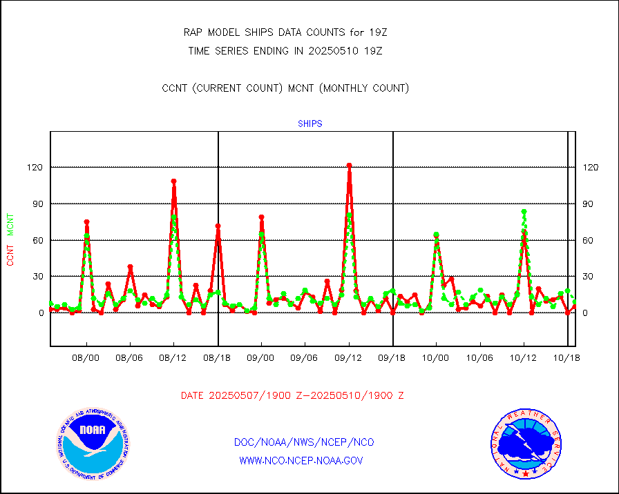
ships |
Ship - manual and automatic, restricted |
8 |
3 |
266.7 % |
1718.50-1719.50 |
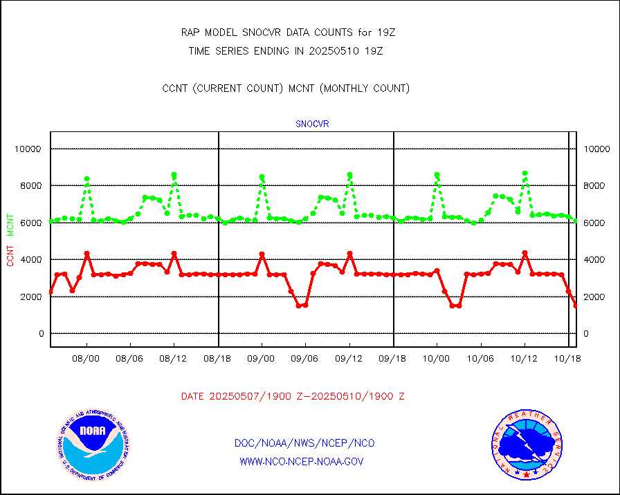
snocvr |
NOW COVER, DEPTH/DENSITY AND WATER EQUIVALENT |
3270 |
6866 |
47.6 % |
1717.00-1721.00 |
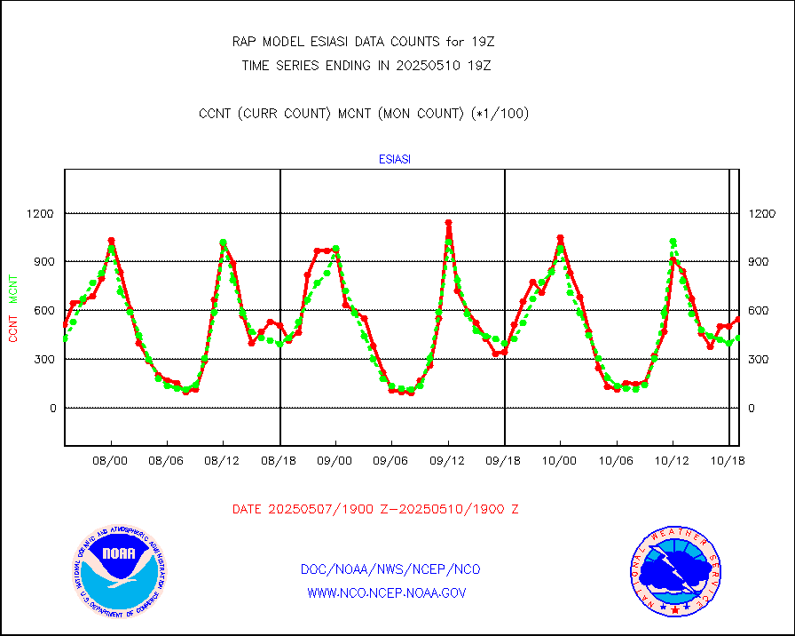
ssmisu |
DMSP SSM/IS 1C radiance data (Unified Pre-Proc.) |
101004 |
89054 |
113.4 % |
1717.00-1720.99 |
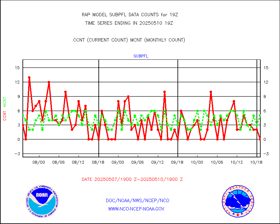
subpfl |
Sub-surface float and glider profile (BUFR) |
6 |
6 |
100.0 % |
1717.00-1720.99 |
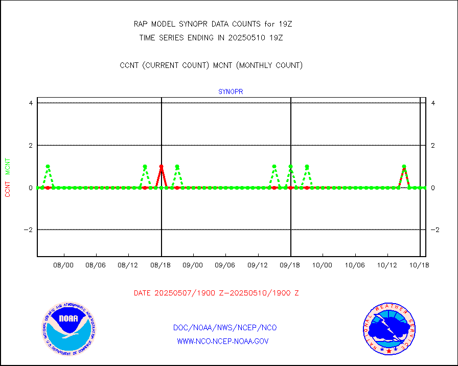
synopr |
Synoptic - restricted (WMO Res 40) manual & auto. |
0 |
0 |
n/a |
1718.50-1719.50 |
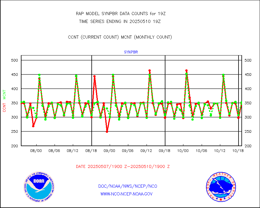
synpbr |
Synoptic - restricted (WMO Res 40)(decoded BUFR) |
472 |
350 |
134.9 % |
1718.50-1719.50 |
synpmb |
Synoptic - mobile manual & auto (decoded fr BUFR) |
0 |
0 |
n/a |
1718.50-1719.50 |
tmdara |
TAMDAR aircft data-all types(from Panasonic,BUFR) |
635 |
729 |
87.1 % |
1715.75-1722.25 |
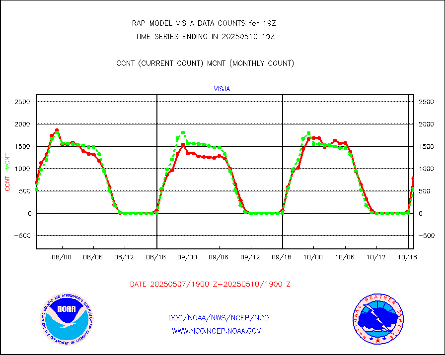
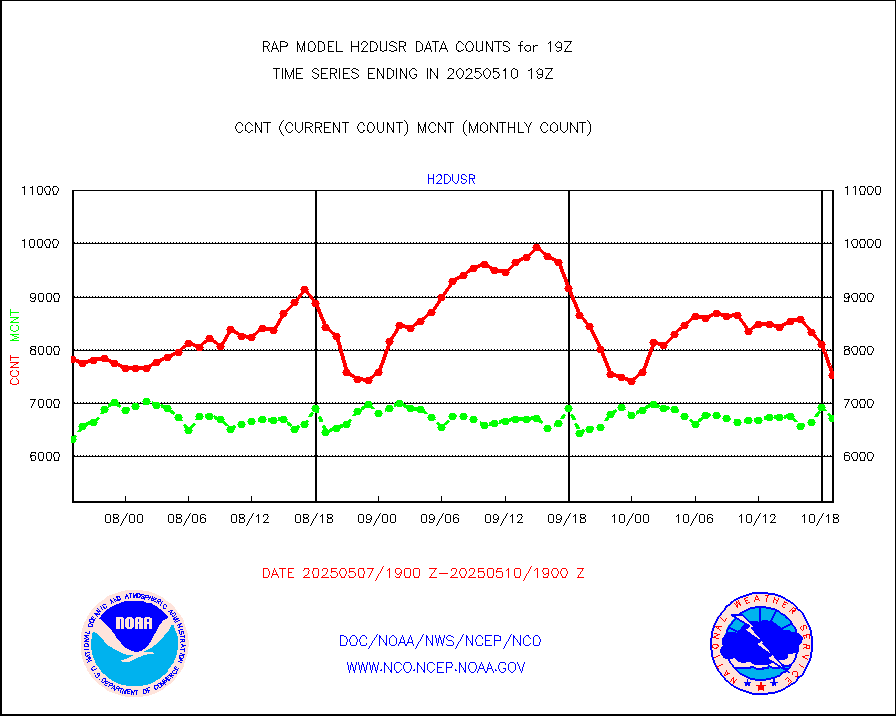
visja |
MTSAT/JMA visible derived cloud motion |
489 |
367 |
133.2 % |
1716.50-1721.50 |
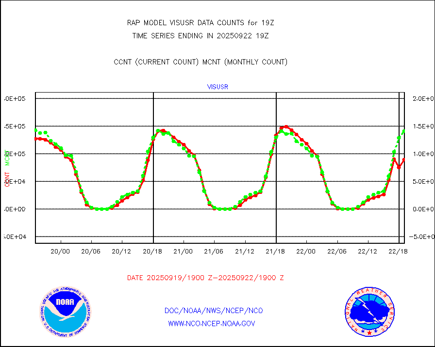
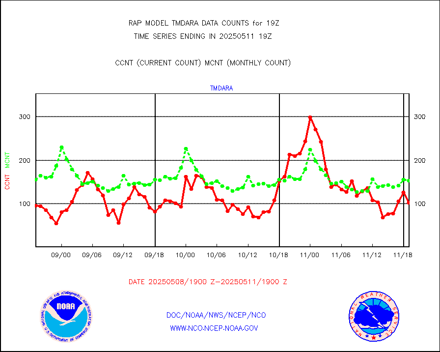
visusr |
GOES-16&up/NESDIS visible derived cloud motion |
143552 |
150041 |
95.7 % |
1718.00-1718.99 |
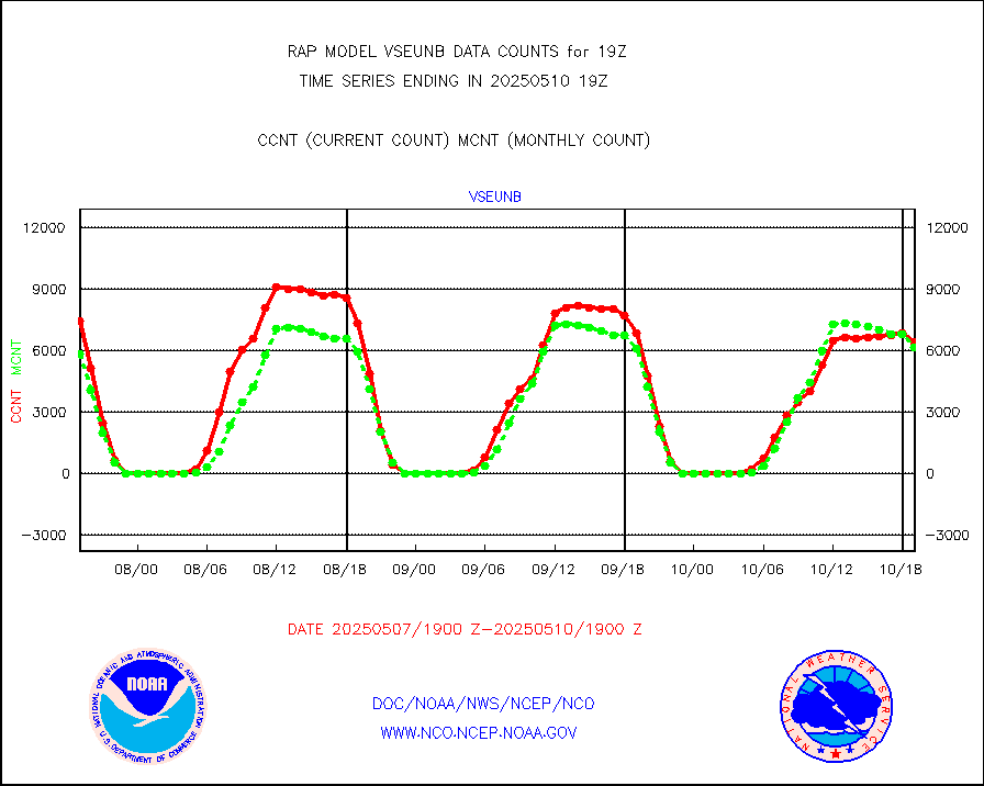
vseunb |
METEOSAT/EUMETSAT visible drv cld motion NBseq |
7061 |
6811 |
103.7 % |
1717.50-1720.49 |


