| Critical Data with Normal Counts |
|---|
| Type | Description | Hourly Count | Monthly Average | Percent (%) of Monthly Mean | UTC Time Window |
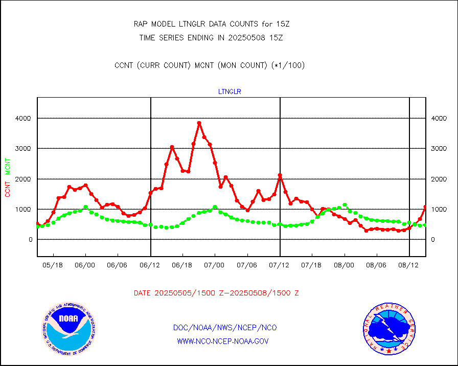
1bamua |
NOAA 15-19 & METOP 1-2 AMSU-A NCEP-proc. br.temps |
25256 |
27251 |
92.7 % |
2412.00-2417.99 |
1bhrs4 |
NOAA 18-19 & METOP 1-2 HIRS-4 NCEP-proc. br.temps |
13453 |
21283 |
63.2 % |
2412.00-2417.99 |
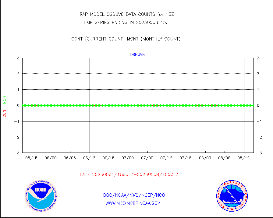
1bmhs |
NOAA 18-19 & METOP 1-2 MHS NCEP-proces. br. temps |
165435 |
154652 |
107.0 % |
2412.00-2417.99 |
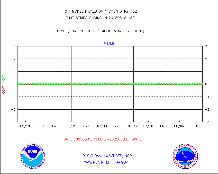
acars |
MDCRS ACARS acft data from ARINC(dcded from BUFR) |
81877 |
82457 |
99.3 % |
2411.75-2418.25 |
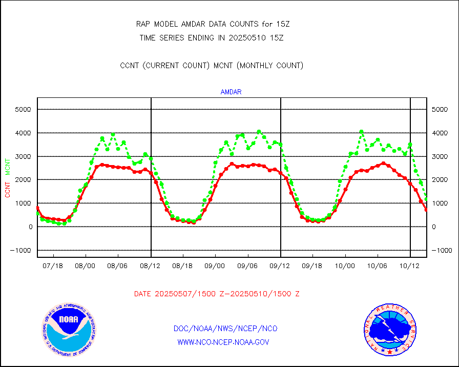
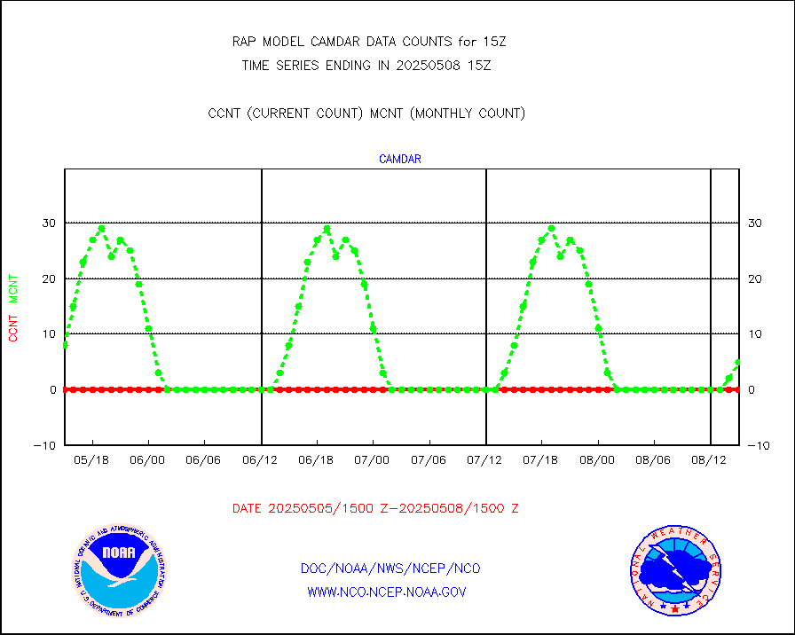
camdar |
Canadian AMDAR aircraft data (decoded from BUFR) |
177 |
100 |
177.0 % |
2411.75-2418.25 |
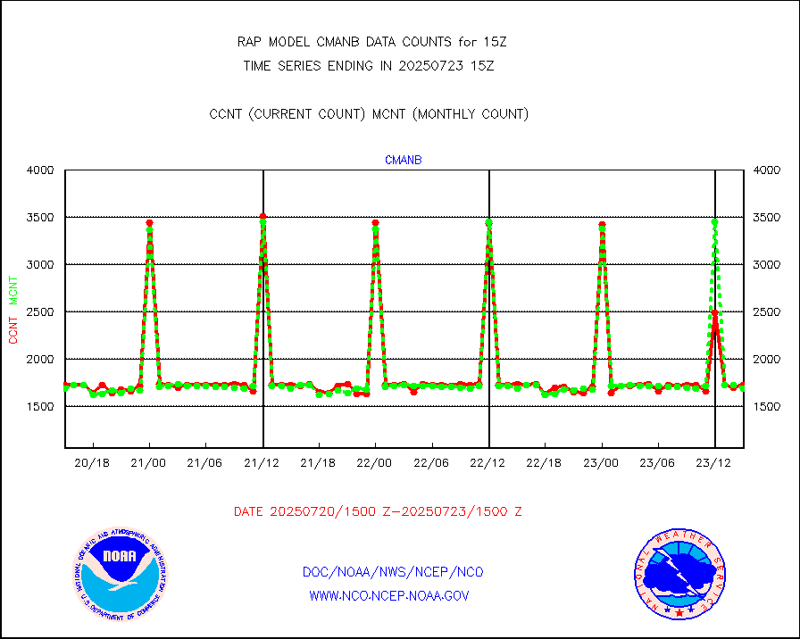
cmanb |
Surface Marine CMAN rpts decoded from BUFR format |
1702 |
1627 |
104.6 % |
2414.50-2415.50 |
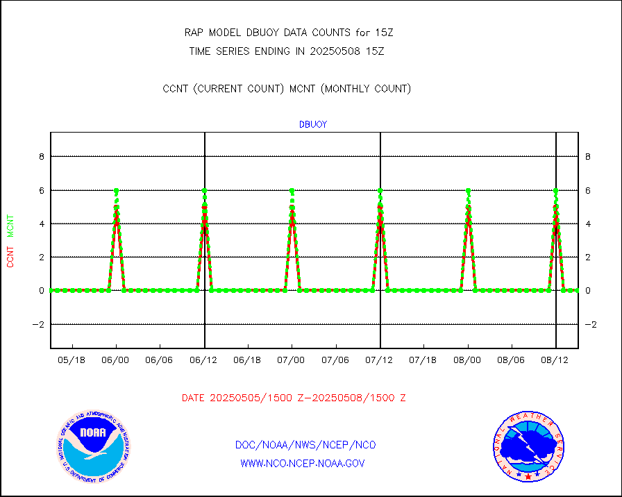
dbuoy |
Buoys decoded from FM-18 fmt (moored or drifting) |
0 |
0 |
n/a |
2414.50-2415.50 |
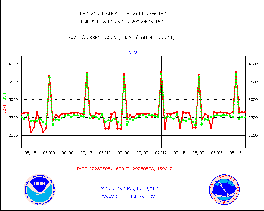
gnss |
Grnd-based Gbl Navigation Sat System (GNSS) data |
2053 |
2395 |
85.7 % |
2413.95-2414.05 |
h20mo |
MODIS (AQUA/TERRA) wvpr imager derived cld motion |
0 |
0 |
n/a |
2412.50-2417.50 |
infmo |
MODIS (AQUA/TERRA) ir l-wave derived cloud motion |
0 |
0 |
n/a |
2412.50-2417.50 |
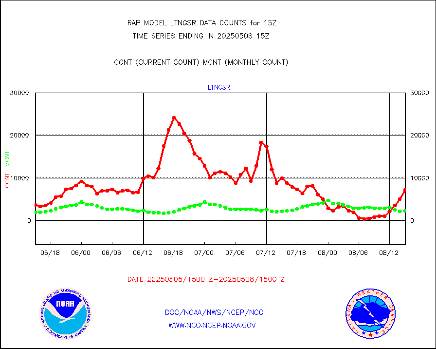
lgycld |
GOES/NASA(Langley) hi-res. (1x1 f-o-v) cloud data |
3718209 |
3144120 |
118.3 % |
2414.50-2415.50 |
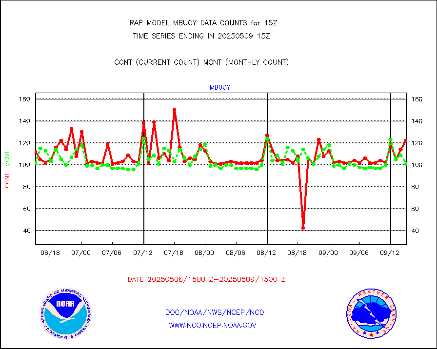
mbuoy |
Buoys decoded from FM-13 format (moored) |
40 |
53 |
75.5 % |
2414.50-2415.50 |
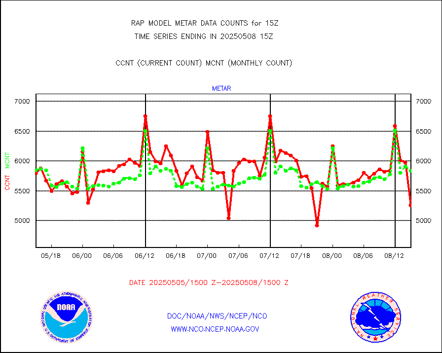
metar |
Aviation - METAR |
5990 |
5961 |
100.5 % |
2414.50-2415.50 |
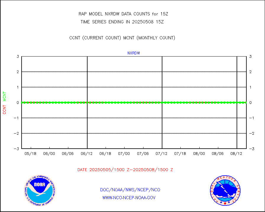
nxrdw |
NEXRAD Vel Azm Dsp(VAD) winds via radar coded msg |
0 |
0 |
n/a |
2414.00-2416.00 |
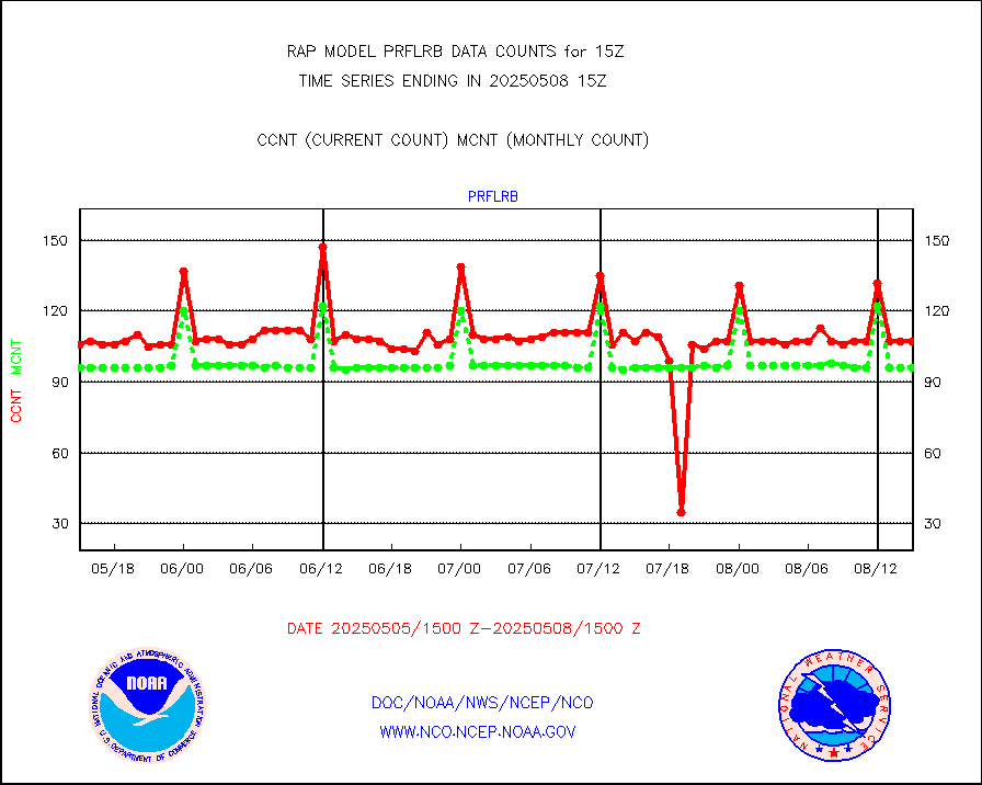
prflrb |
Multi-Agency Profiler (MAP) and SODAR winds |
102 |
82 |
124.4 % |
2413.50-2416.50 |
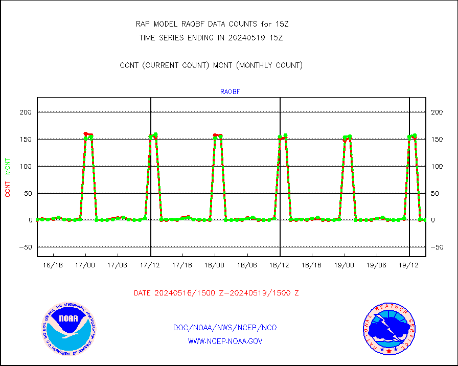
raobf |
Rawinsonde - fixed land (from TEMP or PILOT) |
2 |
1 |
200.0 % |
2414.00-2416.00 |
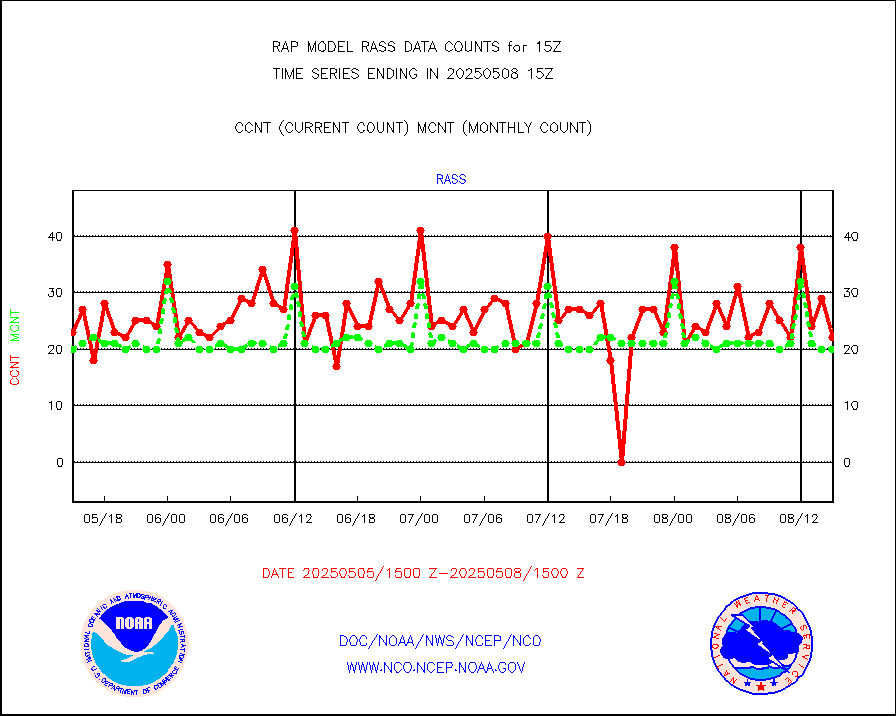
rass |
RASS temperatures (NOAA and Multi-Agency) |
20 |
21 |
95.2 % |
2414.50-2415.50 |
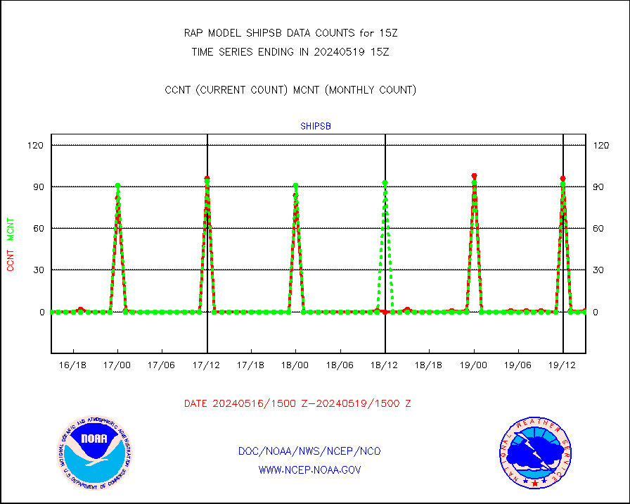
shipsb |
Ship - manual and automatic, restricted (BUFR) |
2 |
0 |
n/a |
2414.50-2415.50 |
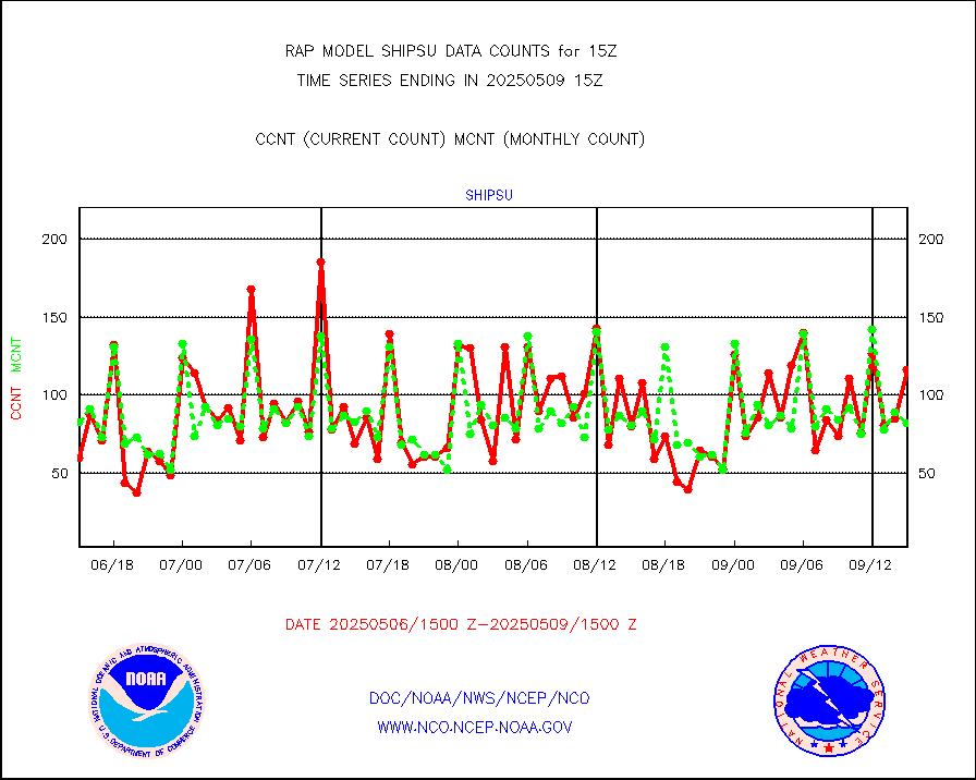
shipsu |
Ship - manual and automatic, unrestricted |
54 |
47 |
114.9 % |
2414.50-2415.50 |
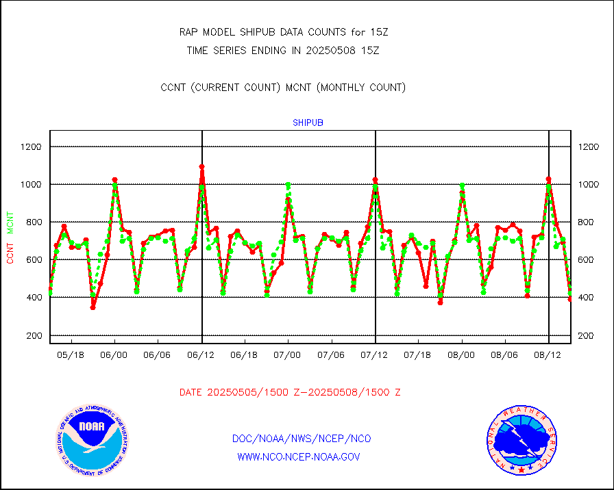
shipub |
Ship - manual and automatic, unrestricted (BUFR) |
248 |
281 |
88.3 % |
2414.50-2415.50 |
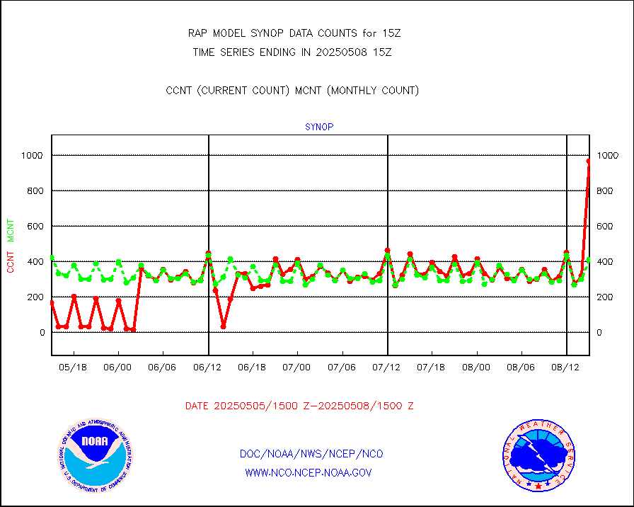
synop |
Synoptic - fixed manual and automatic |
514 |
516 |
99.6 % |
2414.50-2415.50 |
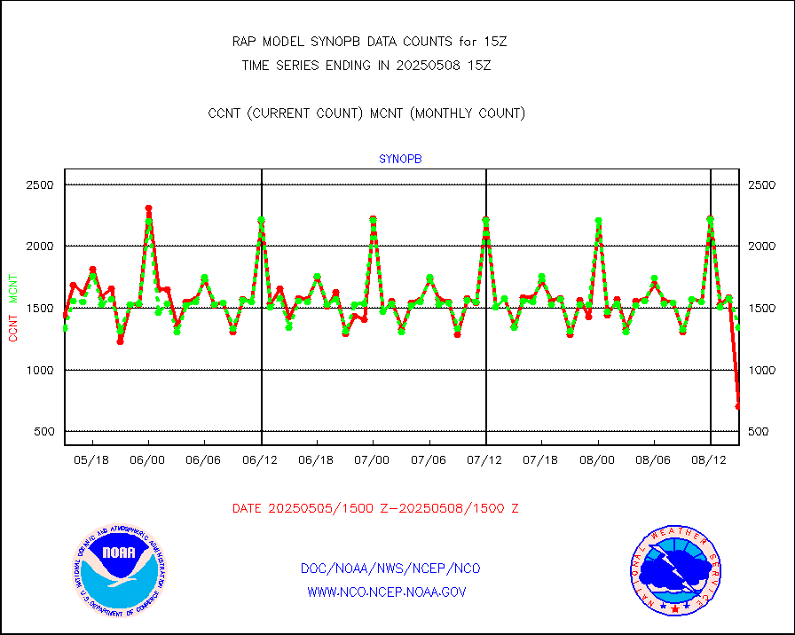
synopb |
Synoptic - fixed manual & auto (decoded fr BUFR) |
1369 |
1307 |
104.7 % |
2414.50-2415.50 |
tideg |
Tide gauge reports decoded from CREX format |
181 |
177 |
102.3 % |
2414.50-2415.50 |
| Data Types of Opportunity with Normal Counts |
|---|
| Type | Description | Hourly Count | Monthly Average | Percent (%) of Monthly Mean | UTC Time Window |
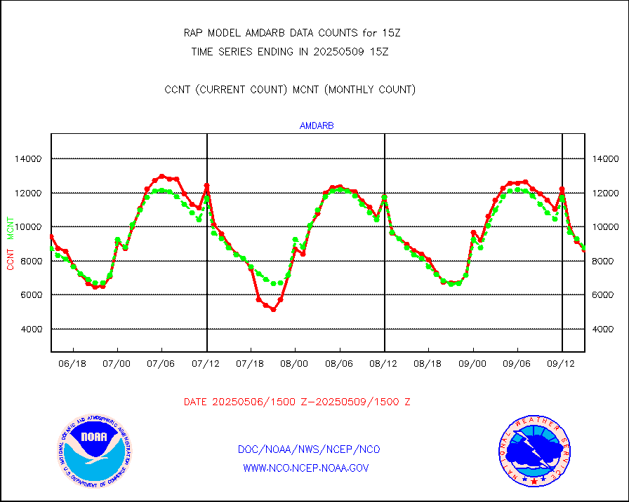
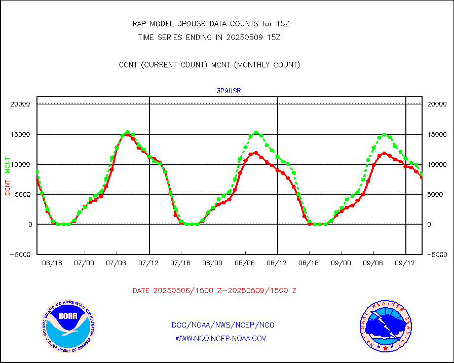
3p9usr |
GOES-16&up/NESDIS ir short-wv derived cld motion |
8114 |
9292 |
87.3 % |
2414.00-2414.99 |
acarsa |
MDCRS ACARS acft data (ARINC via AFWA)(AIREP fmt) |
0 |
0 |
n/a |
2411.75-2418.25 |
airep |
Manual AIREP aircraft data (dcded from AIREP fmt) |
4977 |
5135 |
96.9 % |
2411.75-2418.25 |
airsev |
AQUA AIRS/AMSU-A/HSB brightness temps- every FOV |
0 |
0 |
n/a |
2412.00-2417.99 |
amdar |
AMDAR aircraft data (decoded from AMDAR format) |
819 |
538 |
152.2 % |
2411.75-2418.25 |
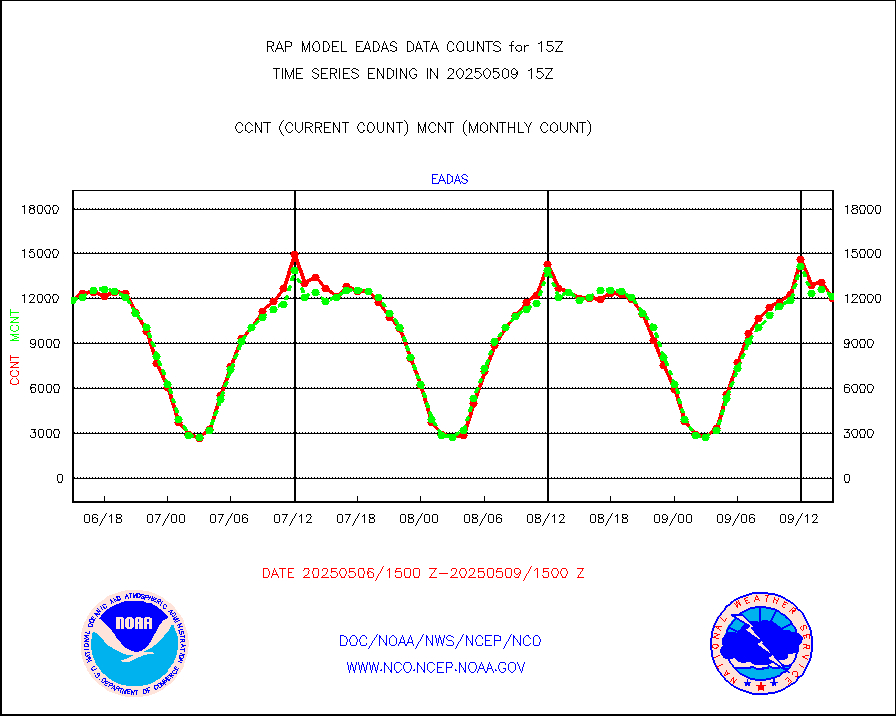
amdarb |
AMDAR aircraft data (decoded from BUFR) |
2755 |
2742 |
100.5 % |
2411.75-2418.25 |
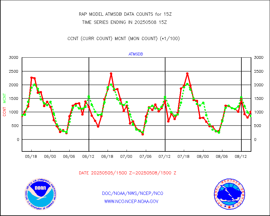
amsr2 |
GCOM-W AMSR2 1B brightness temperatures |
1242338 |
798650 |
155.6 % |
2412.00-2412.99 |
ascat |
METOP 1-2 ASCAT products |
18666 |
15864 |
117.7 % |
2413.00-2417.00 |
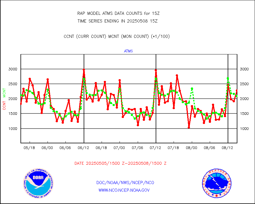
atms |
NPP/NOAA-20 ATMS brightness temperatures |
217922 |
196967 |
110.6 % |
2413.00-2416.99 |
atmsdb |
NPP/NOAA-20 ATMS bright. temps-direct b-cast SSEC |
100390 |
88780 |
113.1 % |
2413.00-2416.99 |
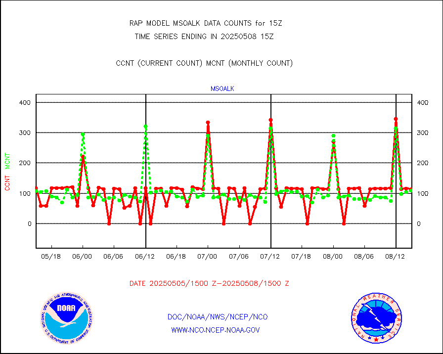
coopmd |
Coop/MADIS NEPP & HCN-Modernization NOAA COOP Obs |
27 |
23 |
117.4 % |
2414.50-2415.50 |
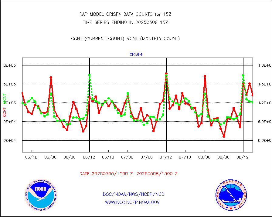
crisf4 |
NPP/NOAA-20 CrIS full spctrl radn (431 ch subset) |
126341 |
119604 |
105.6 % |
2413.00-2416.99 |
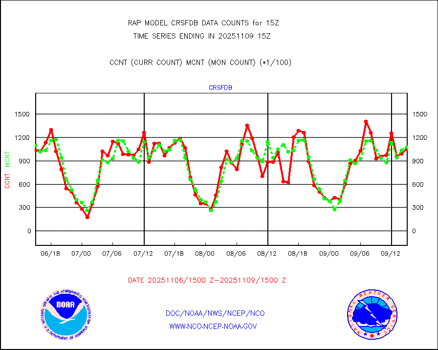
crsfdb |
NPP/NOAA-20 CrIS full spctrl radn dir brdcst SSEC |
120973 |
105810 |
114.3 % |
2413.00-2416.99 |
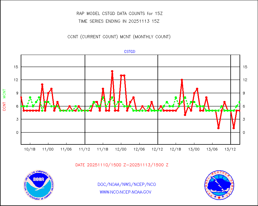
cstgd |
Coast Guard |
4 |
4 |
100.0 % |
2414.50-2415.50 |
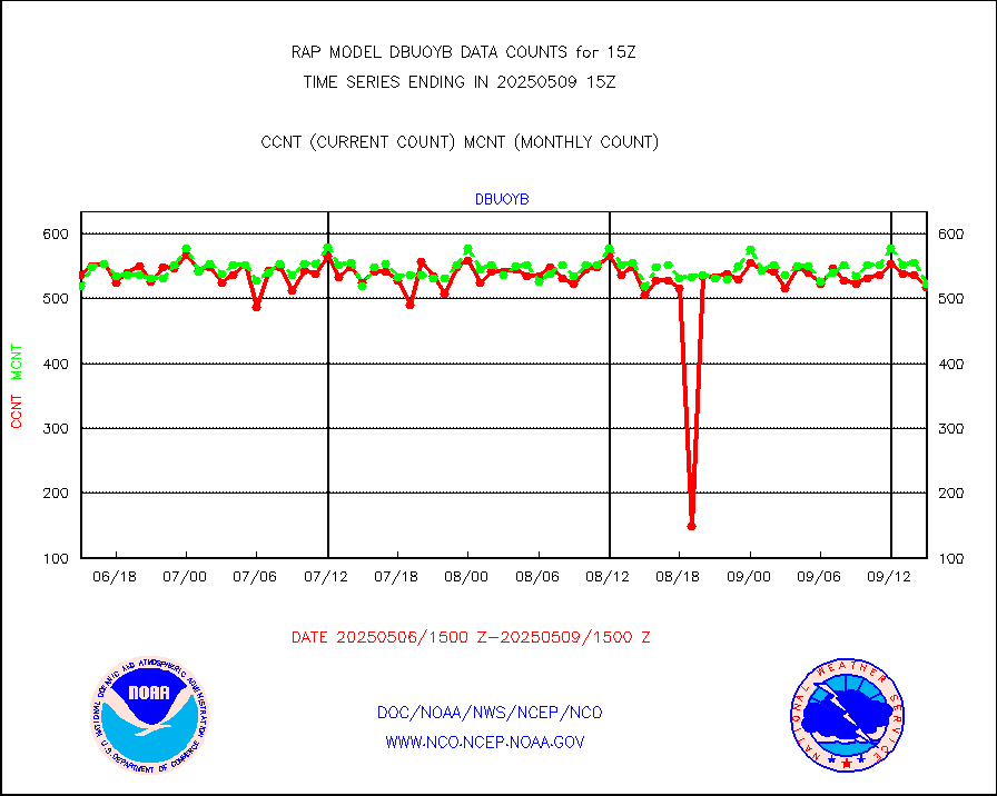
dbuoyb |
Drifting buoys (decoded from BUFR) |
573 |
586 |
97.8 % |
2414.50-2415.50 |
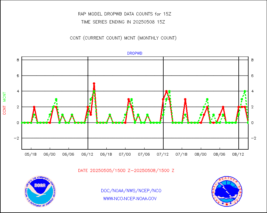
dropw |
Dropwinsonde (from TEMP DROP) |
0 |
0 |
n/a |
2414.00-2416.00 |
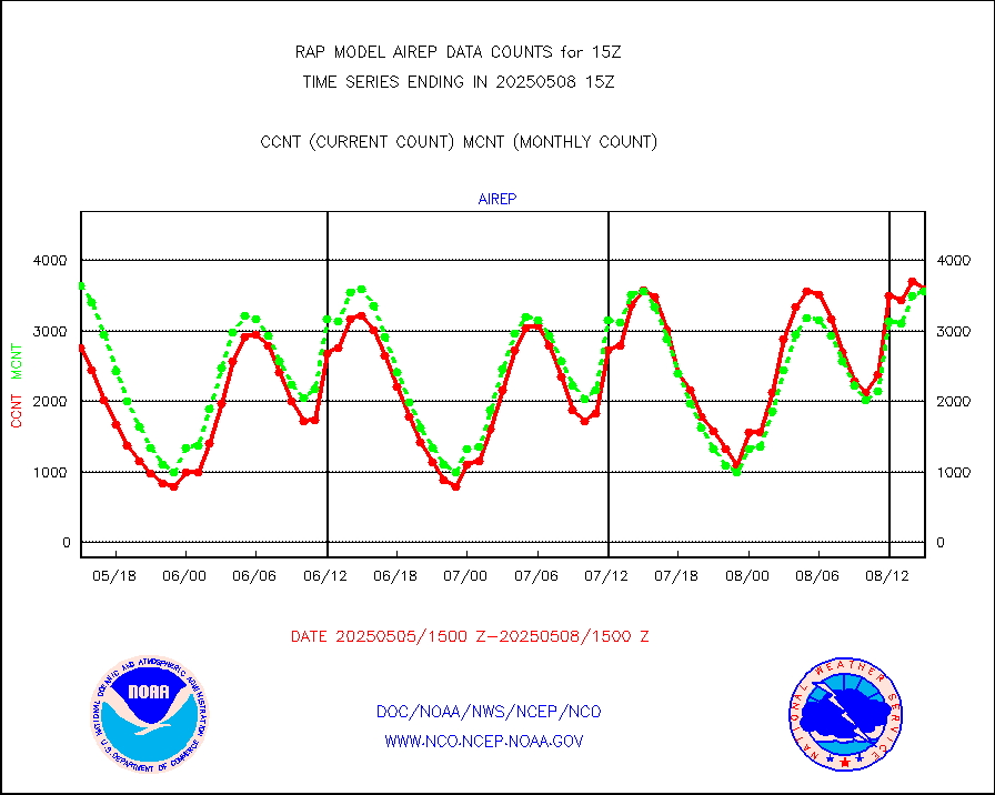
eadas |
E-AMDAR (European AMDAR acft decoded from BUFR) |
8751 |
9000 |
97.2 % |
2411.75-2418.25 |
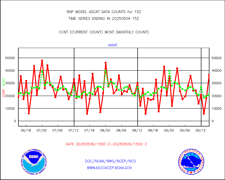
esamua |
NOAA 15-19 & METOP 1-2 AMSU-A proc btmps frm RARS |
11879 |
17881 |
66.4 % |
2414.00-2416.00 |
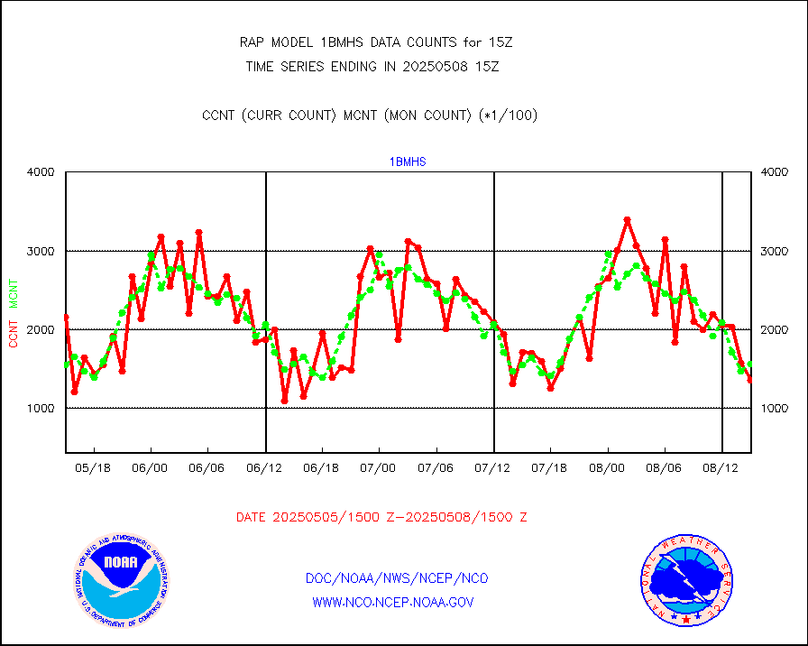
esatms |
NPP Adv. Tech. MW Sndr (ATMS) br. temps from RARS |
164531 |
128238 |
128.3 % |
2413.00-2416.99 |
eshrs3 |
NOAA 15-19 & METOP 1-2 HIRS-3/4 pr btmps frm RARS |
13517 |
35182 |
38.4 % |
2414.00-2416.00 |
esiasi |
METOP 1-2 IASI 1C radiance data vbl chn from RARS |
56162 |
59422 |
94.5 % |
2413.00-2416.99 |
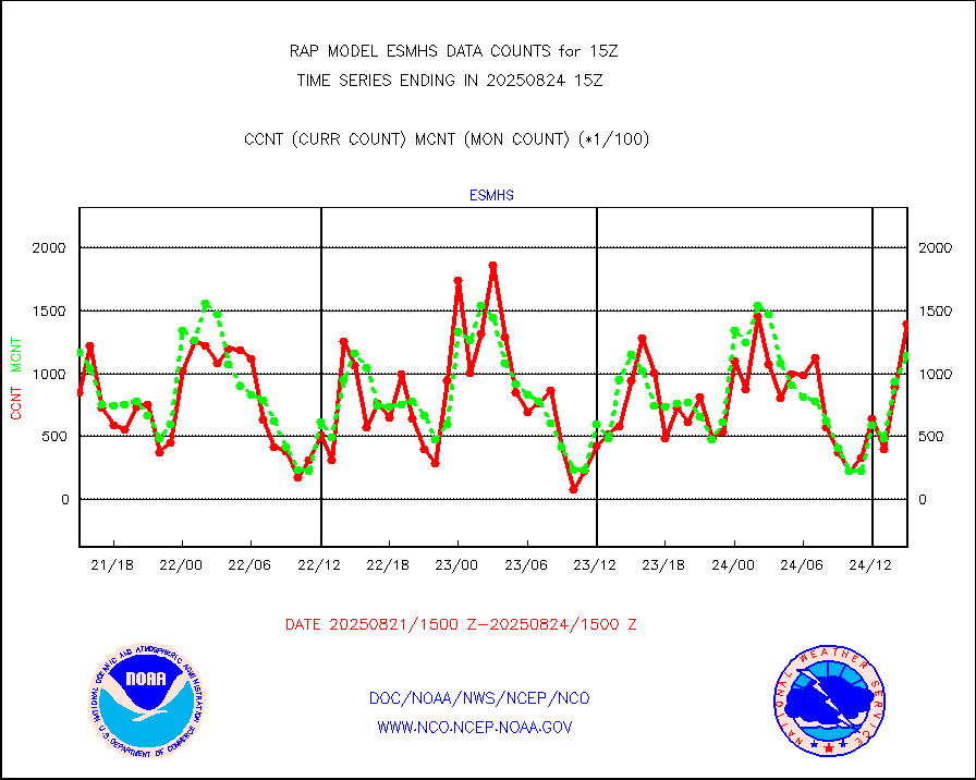
esmhs |
NOAA 18-19 & METOP 1-2 MHS proc. btemps from RARS |
123870 |
168768 |
73.4 % |
2414.00-2416.00 |
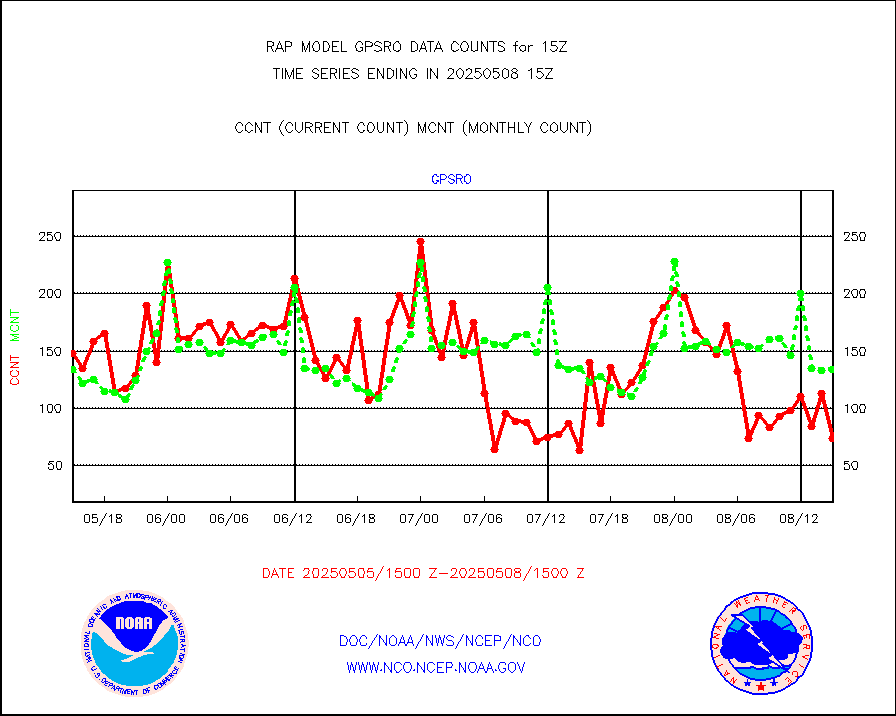
gpsro |
GPS radio occultation data |
101 |
113 |
89.4 % |
2413.00-2416.99 |
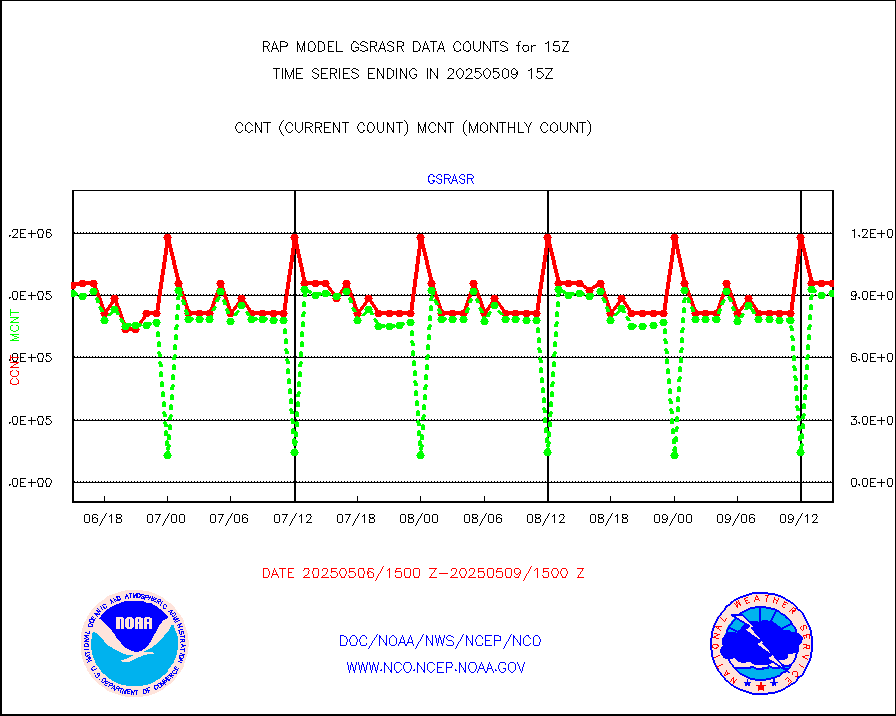
gsrasr |
GOES-16/17 All Sky Radiances (proc.) |
812097 |
805779 |
100.8 % |
2413.00-2416.99 |
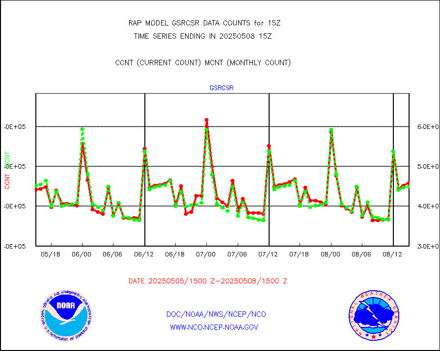
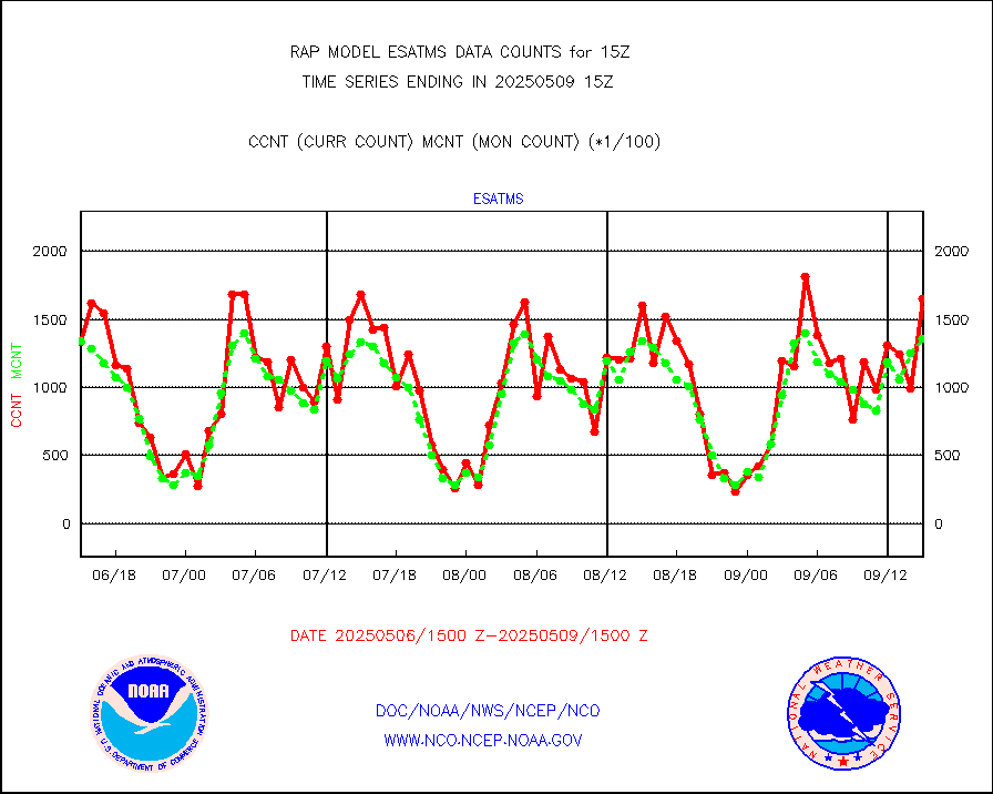
gsrcsr |
GOES-16/17 Clear Sky Radiances (proc.) |
421704 |
385244 |
109.5 % |
2413.00-2416.99 |
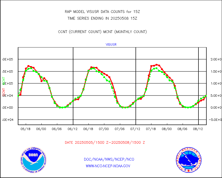
h20ja |
MTSAT/JMA water vapor imager derived cloud motion |
2559 |
2512 |
101.9 % |
2412.50-2417.50 |
h2dusr |
GOES-16&up/NESDIS wv imgr/deep-lyr derivd cld mtn |
8543 |
6282 |
136.0 % |
2414.00-2414.99 |
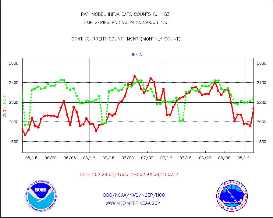
h2eunb |
METEOSAT/EUMETSAT wvpr imgr drv cld motion NBseq |
4743 |
5211 |
91.0 % |
2413.50-2416.49 |
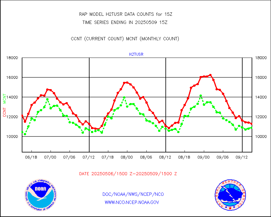
h2tusr |
GOES-16&up/NESDIS wv imgr/cld-top derived cld mtn |
8404 |
9165 |
91.7 % |
2414.00-2414.99 |
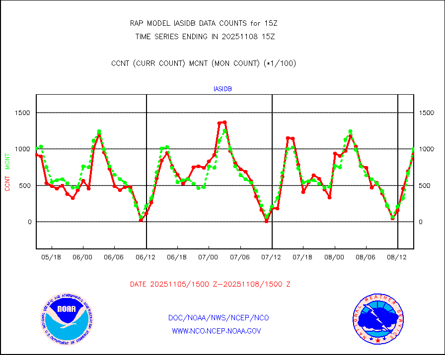
iasidb |
METOP 1-2 IASI 1C radiances-direct broadcast SSEC |
57781 |
65969 |
87.6 % |
2413.00-2416.99 |
ifeunb |
METEOSAT/EUMETSAT ir lg-wave drv cld motion NBseq |
3357 |
3267 |
102.8 % |
2413.50-2416.49 |
ifvrnb |
VIIRS (NPP/NOAA-20) ir lg-wv drv cloud motion(NB) |
0 |
0 |
n/a |
2412.50-2417.50 |
infav |
AVHRR (NOAA/METOP) ir lg-wave derived cld motion |
0 |
0 |
n/a |
2412.50-2417.50 |
infav1 |
AVHRR (METOP) ir lg-wave derived cld motion |
0 |
0 |
n/a |
2413.50-2416.49 |
infja |
MTSAT/JMA infrared long-wave derived cloud motion |
2741 |
2148 |
127.6 % |
2412.50-2417.50 |
infusr |
GOES-16&up/NESDIS ir long-wave derived cld motion |
30611 |
29907 |
102.4 % |
2414.00-2414.99 |
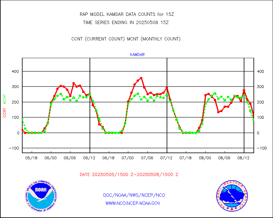
kamdar |
Korean AMDAR aircraft data (decoded from BUFR) |
162 |
131 |
123.7 % |
2411.75-2418.25 |
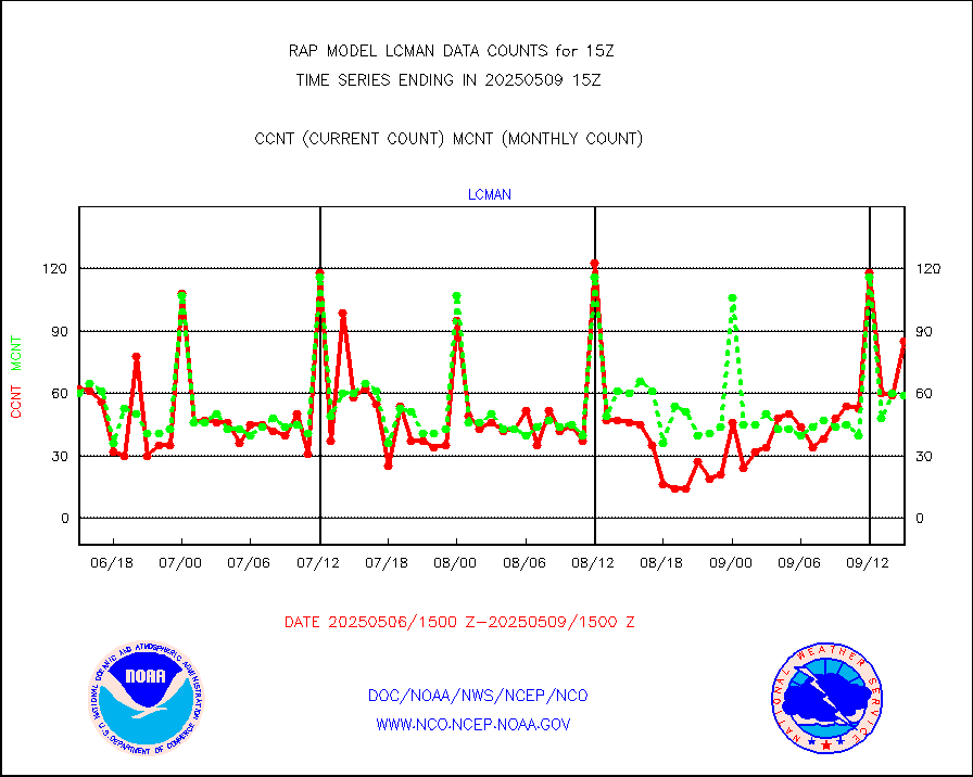
lcman |
Land-based CMAN stations decoded from CMAN format |
69 |
86 |
80.2 % |
2414.50-2415.50 |
mbuoyb |
Moored buoys (decoded from BUFR) |
535 |
457 |
117.1 % |
2414.50-2415.50 |
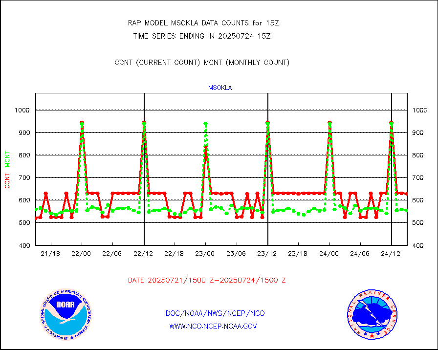
mso470 |
Mesonet/MADIS Colorado E-470 (Interstate 470) |
18 |
18 |
100.0 % |
2414.50-2415.50 |
msoalk |
Mesonet/MADIS Alaska Department of Transportation |
107 |
105 |
101.9 % |
2414.50-2415.50 |
msoapg |
Mesonet/MADIS U.S. Army Aberdeen Proving Grounds |
0 |
0 |
n/a |
2414.50-2415.50 |
msoapr |
Mesonet/MADIS Citizen Weather Observers Program |
42217 |
44942 |
93.9 % |
2414.50-2415.50 |
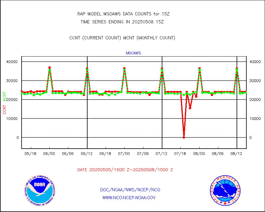
msoaws |
Mesonet/MADIS AWS Convergence Technologies, Inc. |
25703 |
25344 |
101.4 % |
2414.50-2415.50 |
msoawx |
Mesonet/MADIS "Anything Weather" |
0 |
0 |
n/a |
2414.50-2415.50 |
msocol |
Mesonet/MADIS Colorado Dept. of Transportation |
0 |
0 |
n/a |
2414.50-2415.50 |
msodcn |
Mesonet/MADIS DC Net |
0 |
0 |
n/a |
2414.50-2415.50 |
msoden |
Mesonet/MADIS Denver Urban Drainage & Flood Cntrl |
225 |
203 |
110.8 % |
2414.50-2415.50 |
msofla |
Mesonet/MADIS Florida (FAWN & USF) |
3 |
3 |
100.0 % |
2414.50-2415.50 |
msoflt |
Mesonet/MADIS Florida Dept. of Transportation |
0 |
0 |
n/a |
2414.50-2415.50 |
msogeo |
Mesonet/MADIS Georgia Dept. of Transportation |
0 |
0 |
n/a |
2414.50-2415.50 |
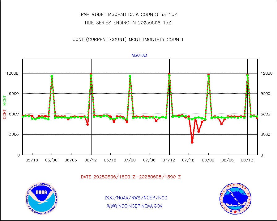
msohad |
Mesonet/MADIS NWS Hydromet Auto Data System(HADS) |
5733 |
5439 |
105.4 % |
2414.50-2415.50 |
msoien |
Mesonet/MADIS Iowa Environmental |
178 |
172 |
103.5 % |
2414.50-2415.50 |
msoind |
Mesonet/MADIS Indiana Dept. of Transportation |
0 |
0 |
n/a |
2414.50-2415.50 |
msoiow |
Mesonet/MADIS Iowa Department of Transportation |
0 |
0 |
n/a |
2414.50-2415.50 |
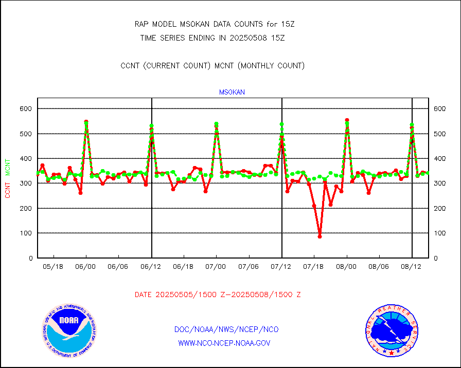
msokan |
Mesonet/MADIS Kansas Department of Transportation |
112 |
294 |
38.1 % |
2414.50-2415.50 |
msokla |
Mesonet/MADIS Oklahoma Mesonet |
318 |
325 |
97.8 % |
2414.50-2415.50 |
msolju |
Mesonet/MADIS Louisiana State/Jackson State Univ. |
0 |
0 |
n/a |
2414.50-2415.50 |
msomca |
Mesonet/MADIS Missouri Commercial Agricult Wx Net |
269 |
253 |
106.3 % |
2414.50-2415.50 |
msomin |
Mesonet/MADIS Minnesota Dept. of Transportation |
0 |
0 |
n/a |
2414.50-2415.50 |
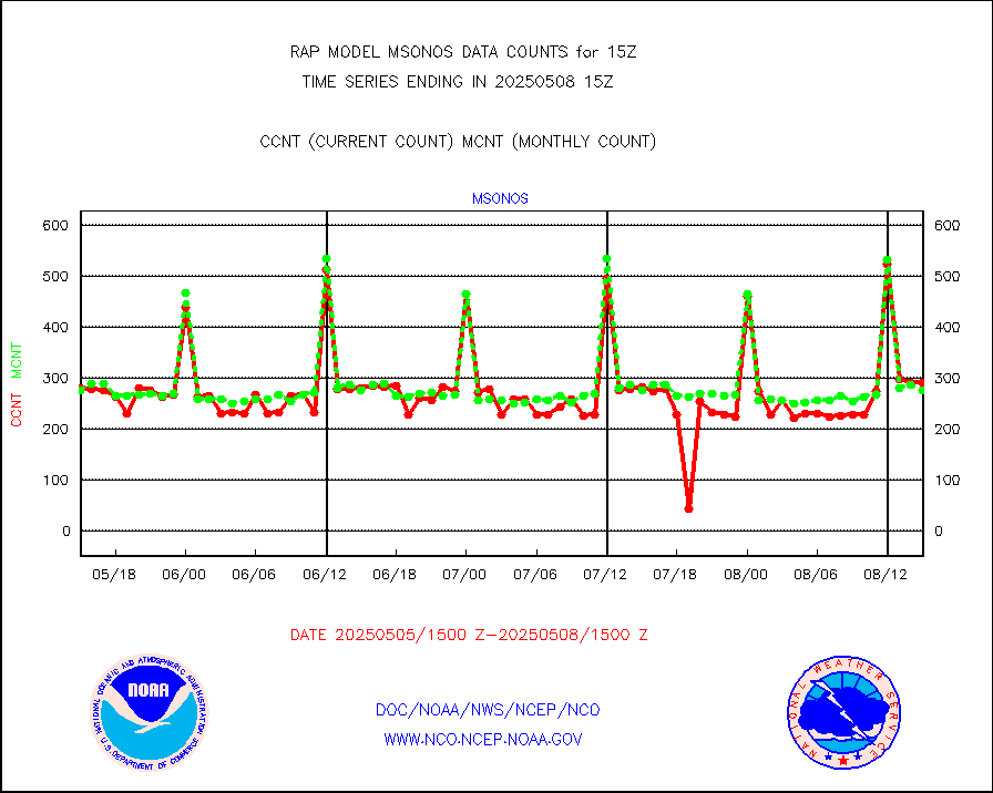
msonos |
Mesonet/MADIS NOS-Phys Oceanographic Realtime Sys |
288 |
259 |
111.2 % |
2414.50-2415.50 |
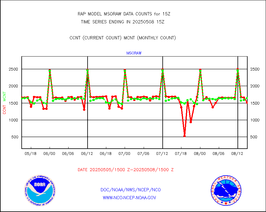
msoraw |
Mesonet/MADIS NFIC Remote Automated Wx Stns(RAWS) |
1705 |
1586 |
107.5 % |
2414.50-2415.50 |
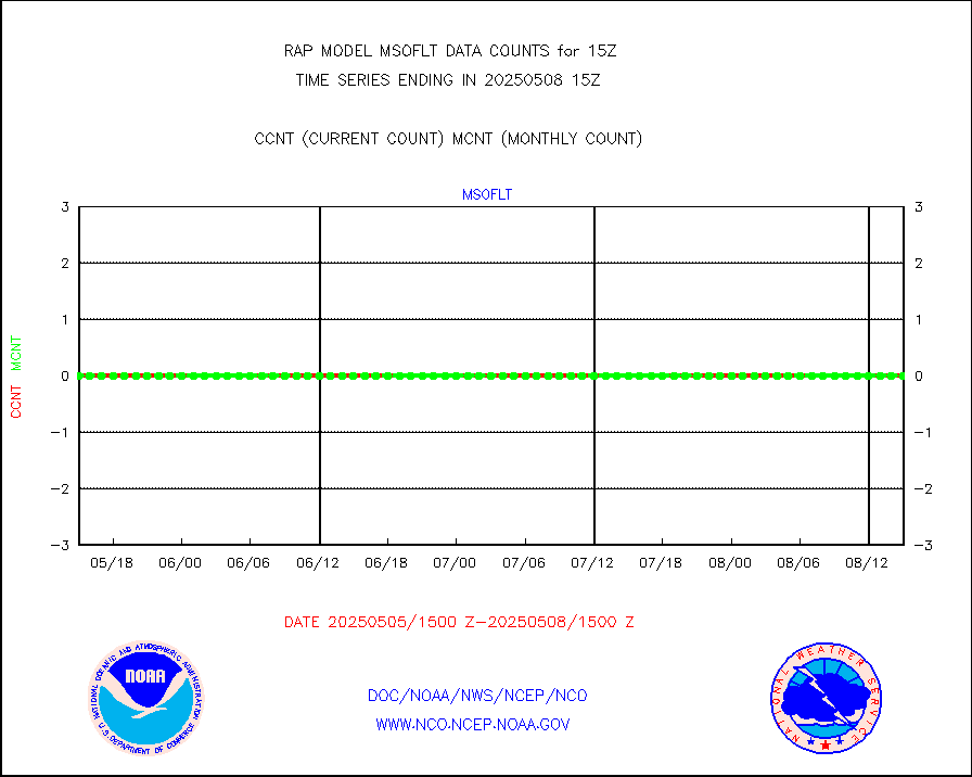
msourb |
Mesonet/MADIS UrbaNet |
4064 |
4001 |
101.6 % |
2414.50-2415.50 |
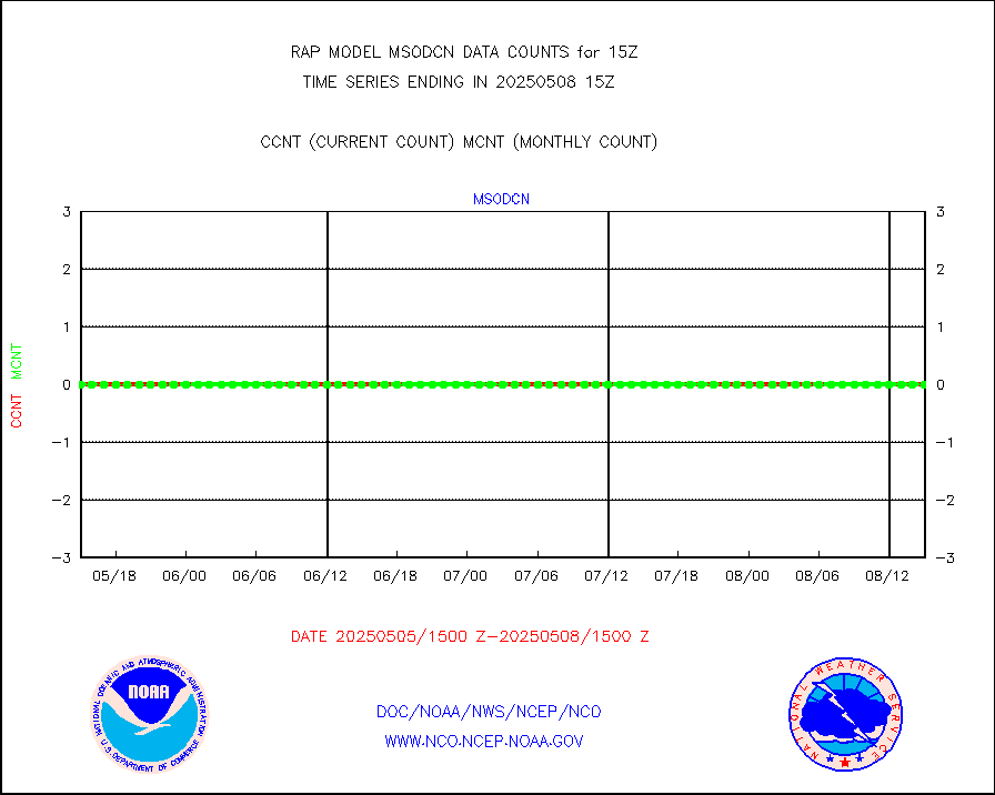
msovir |
Mesonet/MADIS Virginia Dept. of Transportation |
232 |
228 |
101.8 % |
2414.50-2415.50 |
msowfy |
Mesonet/MADIS "Weather for You" |
0 |
0 |
n/a |
2414.50-2415.50 |
msowis |
Mesonet/MADIS Wisconsin Dept. of Transportation |
0 |
0 |
n/a |
2414.50-2415.50 |
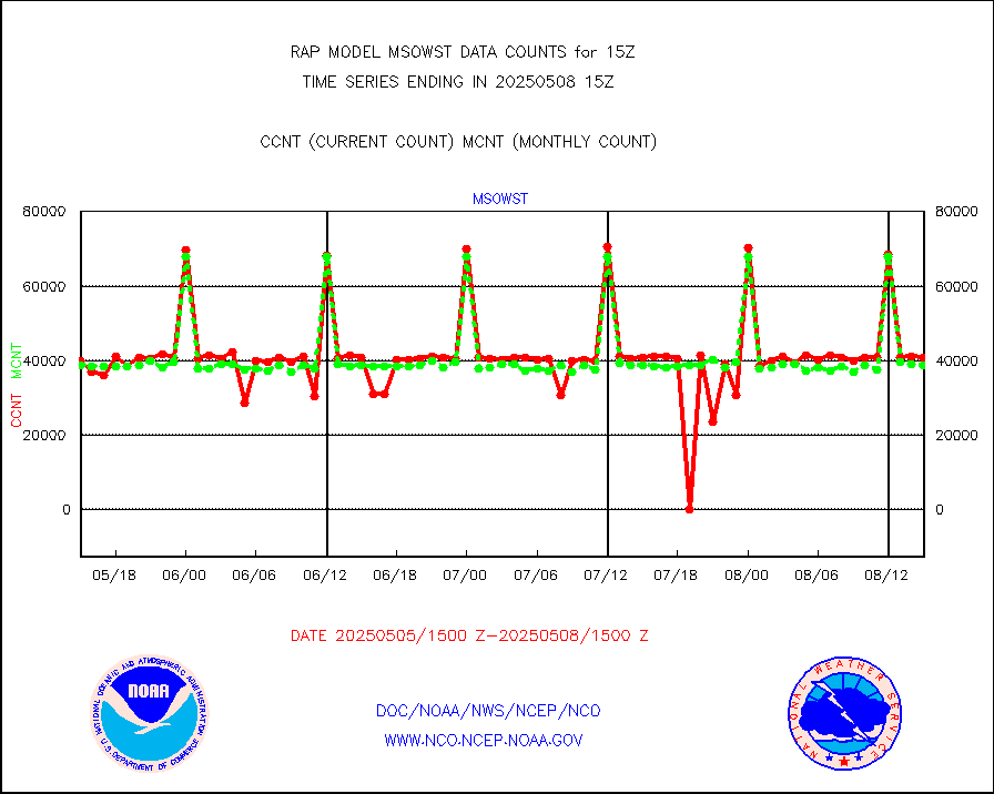
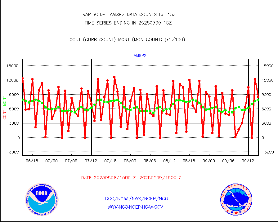
msowst |
Mesonet/MADIS MesoWest (many subproviders) |
39646 |
39412 |
100.6 % |
2414.50-2415.50 |
msowtx |
Mesonet/MADIS West Texas |
5043 |
4959 |
101.7 % |
2414.50-2415.50 |
mtiasi |
METOP 1-2 IASI 1C radiance data (varbl. channels) |
25656 |
17852 |
143.7 % |
2413.00-2416.99 |
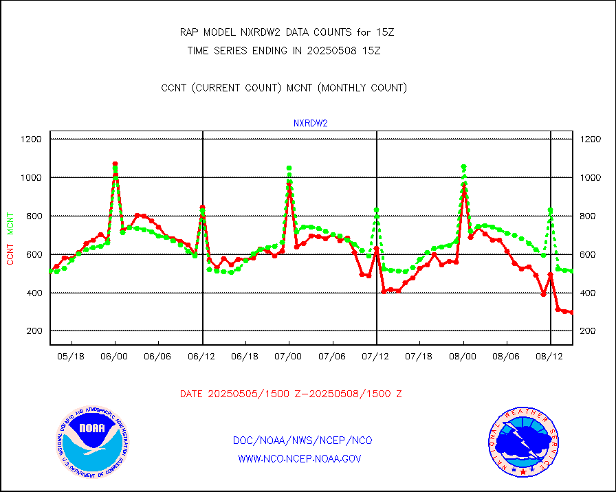
nxrdw2 |
NEXRAD Vel Azm Dsp(VAD) winds via Level 2 decoder |
481 |
558 |
86.2 % |
2414.00-2416.00 |
osbuv8 |
NOAA 16-19 Solar Backscatter UV-2 rad frm V8 BUFR |
0 |
0 |
n/a |
2413.00-2415.99 |
pibal |
PIBAL (from PILOT, PILOT SHIP, PILOT MOBIL) |
0 |
0 |
n/a |
2414.00-2416.00 |
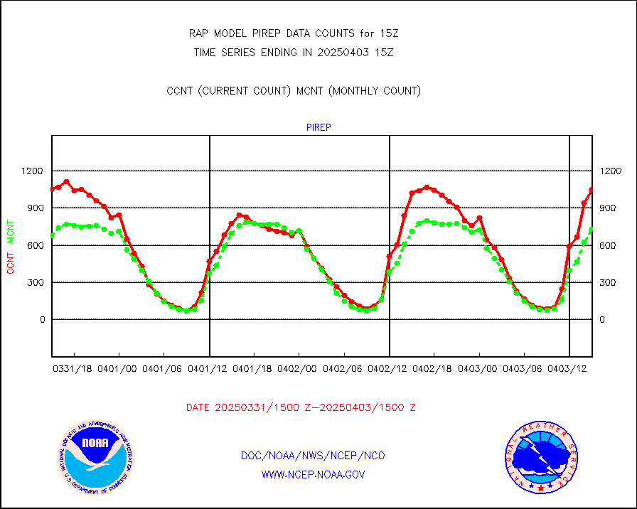
pirep |
Manual PIREP aircraft data (dcded from AIREP fmt) |
388 |
617 |
62.9 % |
2411.75-2418.25 |
prflrp |
Profilr winds from PIBAL (PILOT,PILOT SHIP/MOBIL) |
0 |
0 |
n/a |
2413.50-2416.50 |
raobm |
Rawinsonde - mobile land (from TEMP/PILOT MOBIL) |
0 |
0 |
n/a |
2414.00-2416.00 |
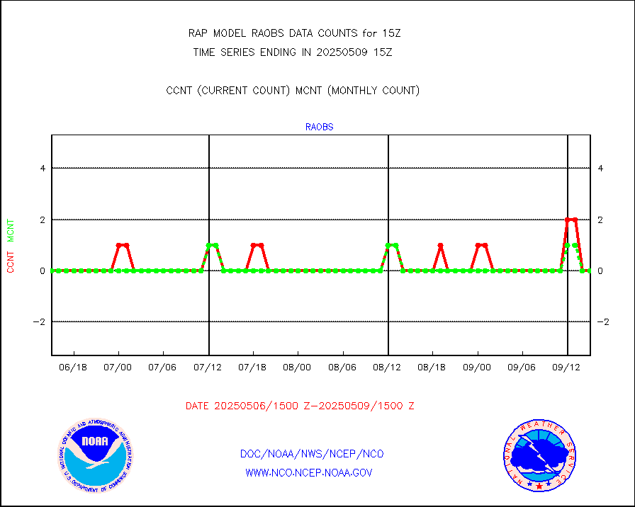
raobs |
Rawinsonde - ship (from TEMP SHIP, PILOT SHIP) |
0 |
0 |
n/a |
2414.00-2416.00 |
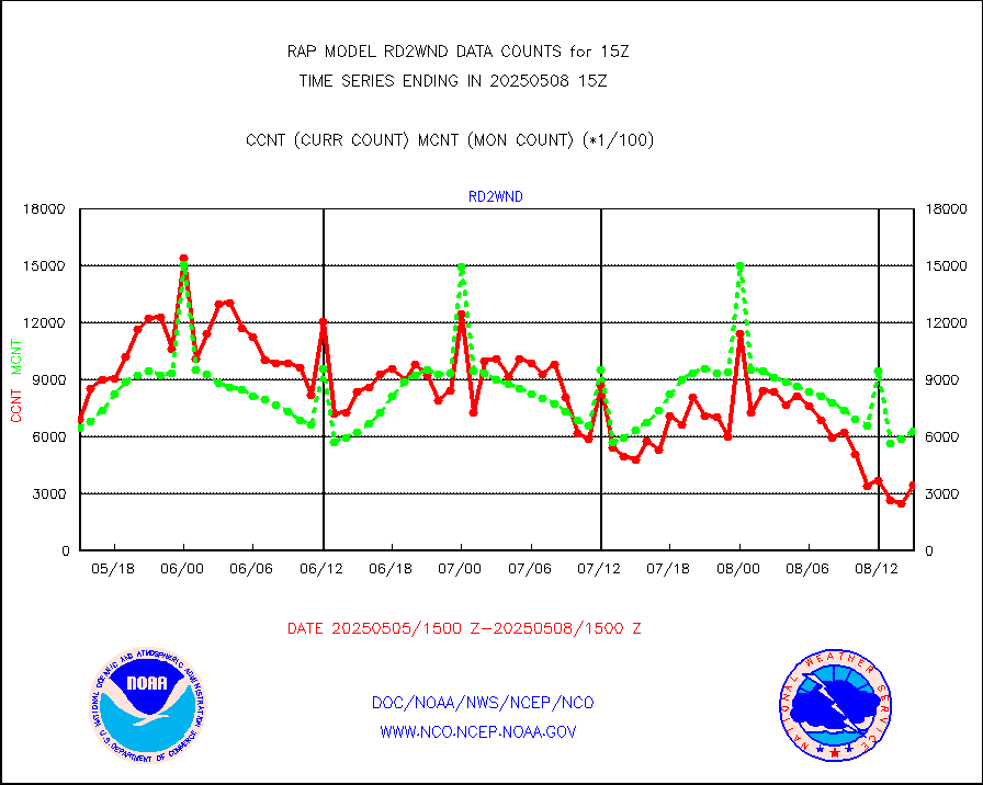
rd2wnd |
NEXRAD radial wind (Level 2 - GTS) |
533758 |
713073 |
74.9 % |
2414.50-2415.49 |
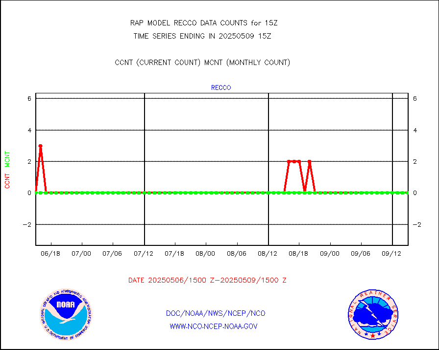
recco |
Flight level reconnaissance aircraft data |
0 |
0 |
n/a |
2414.00-2416.00 |
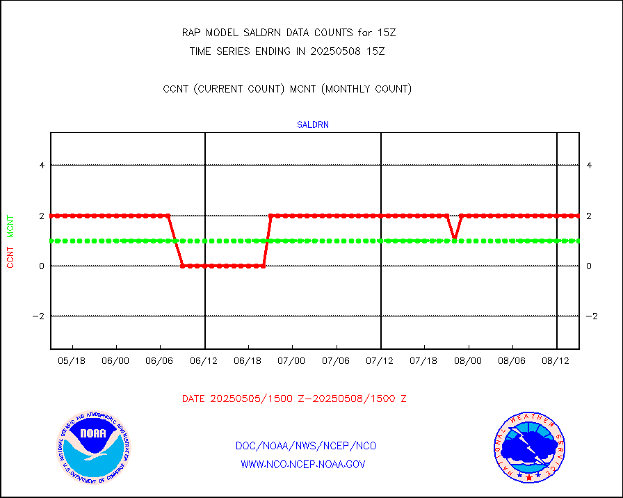
saldrn |
Surface Marine Saildrone (decoded from BUFR) |
2 |
2 |
100.0 % |
2413.00-2416.99 |
saphir |
Megha-Tropiques SAPHIR L1A2 brightness temps |
0 |
0 |
n/a |
2412.00-2417.99 |
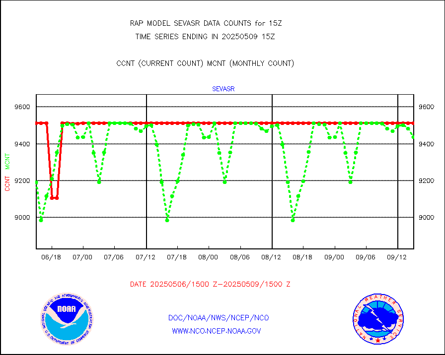
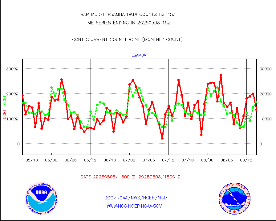
sevasr |
METEOSAT-10 2nd Gen SEVIRI All Sky Radiance(proc) |
9512 |
9495 |
100.2 % |
2413.00-2416.99 |
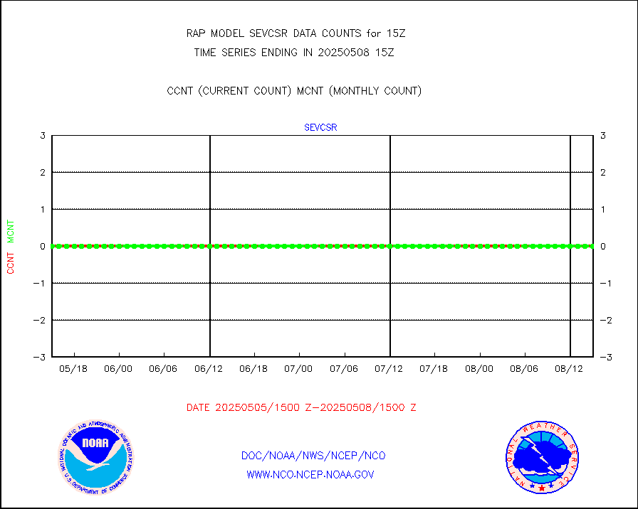
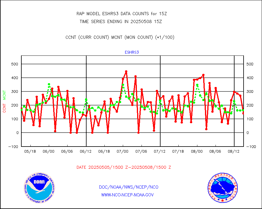
sevcsr |
METEOSAT-10 2nd Gen SEVIRI Clr Sky Radiance(proc) |
0 |
0 |
n/a |
2413.00-2416.99 |
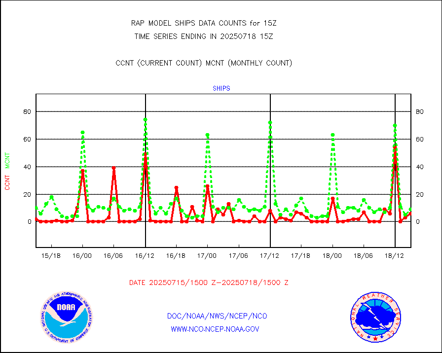
ships |
Ship - manual and automatic, restricted |
0 |
3 |
0.0 % |
2414.50-2415.50 |
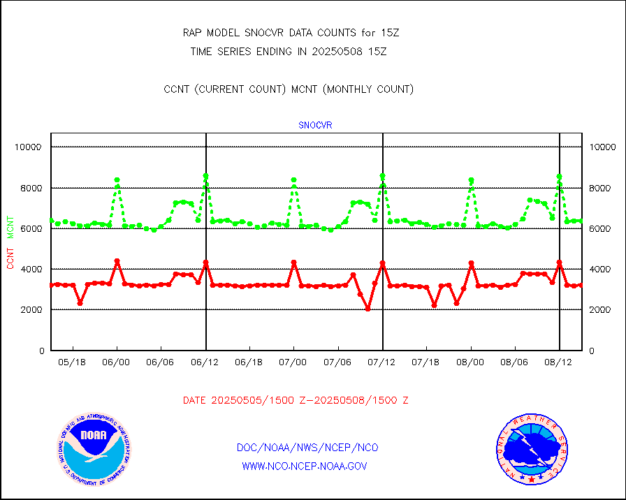
snocvr |
NOW COVER, DEPTH/DENSITY AND WATER EQUIVALENT |
3089 |
6917 |
44.7 % |
2413.00-2417.00 |
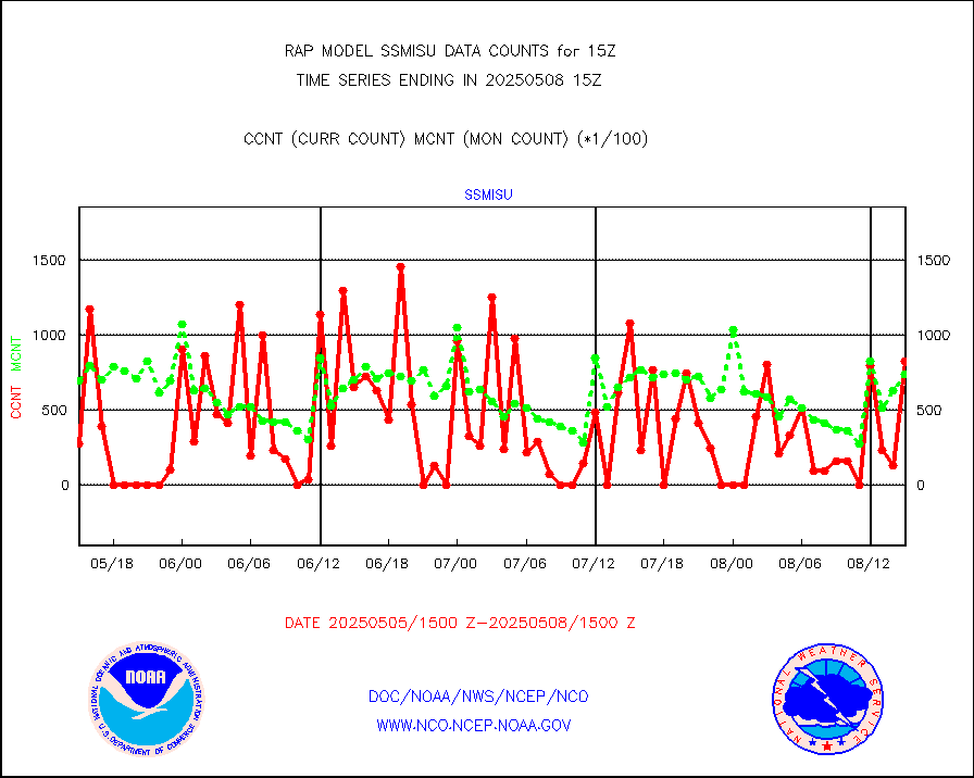
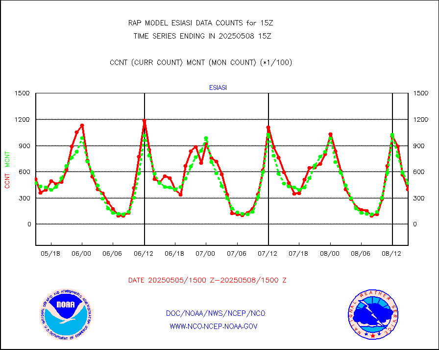
ssmisu |
DMSP SSM/IS 1C radiance data (Unified Pre-Proc.) |
16597 |
56405 |
29.4 % |
2413.00-2416.99 |
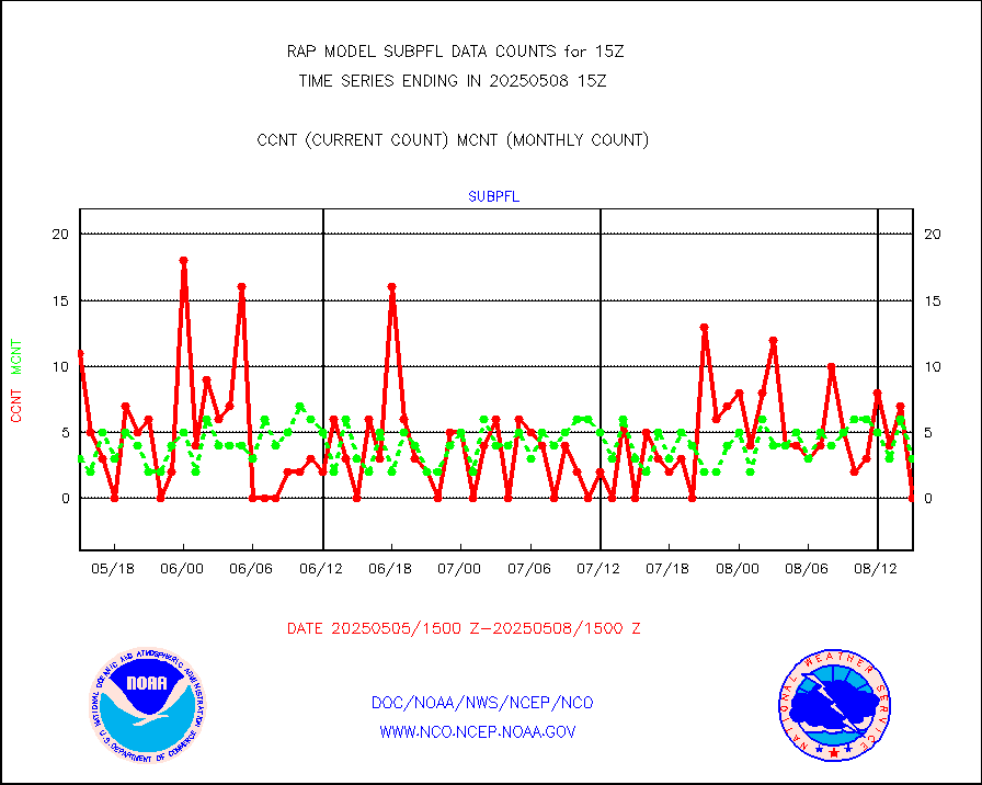
subpfl |
Sub-surface float and glider profile (BUFR) |
0 |
3 |
0.0 % |
2413.00-2416.99 |
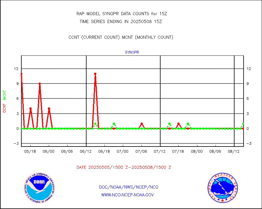
synopr |
Synoptic - restricted (WMO Res 40) manual & auto. |
0 |
1 |
0.0 % |
2414.50-2415.50 |
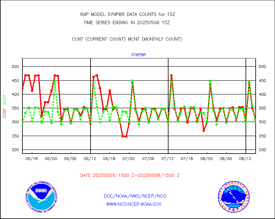
synpbr |
Synoptic - restricted (WMO Res 40)(decoded BUFR) |
304 |
311 |
97.7 % |
2414.50-2415.50 |
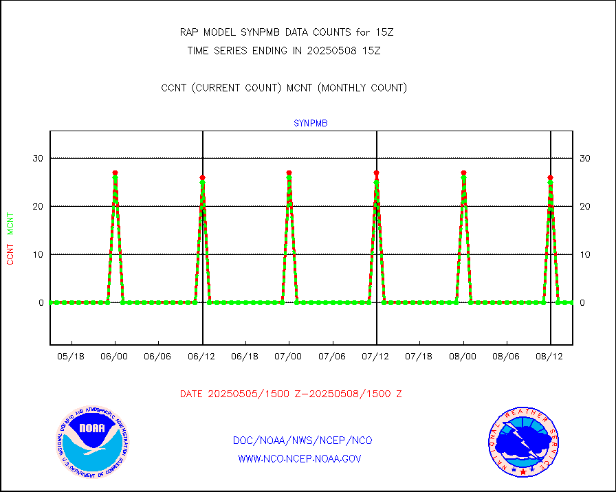
synpmb |
Synoptic - mobile manual & auto (decoded fr BUFR) |
0 |
0 |
n/a |
2414.50-2415.50 |
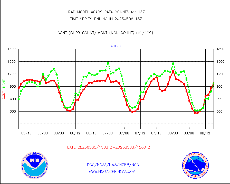
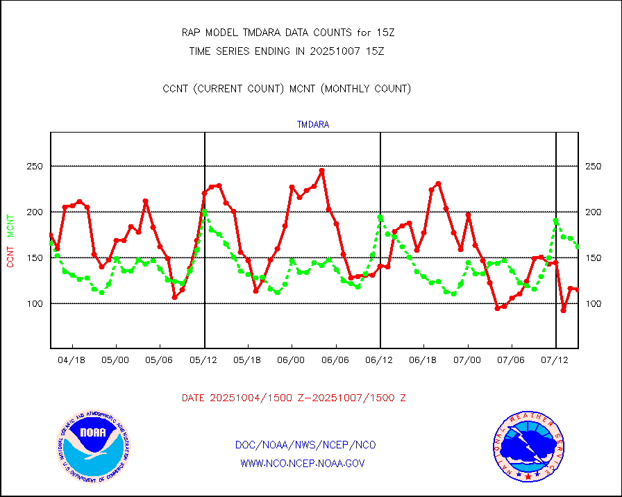
tmdara |
TAMDAR aircft data-all types(from Panasonic,BUFR) |
1237 |
1437 |
86.1 % |
2411.75-2418.25 |
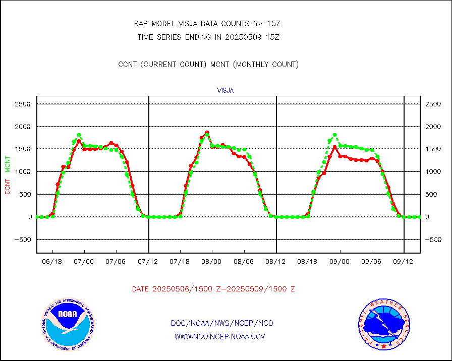
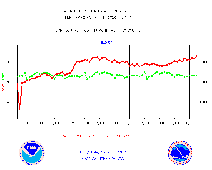
visja |
MTSAT/JMA visible derived cloud motion |
0 |
0 |
n/a |
2412.50-2417.50 |
visusr |
GOES-16&up/NESDIS visible derived cloud motion |
56512 |
48655 |
116.1 % |
2414.00-2414.99 |
vseunb |
METEOSAT/EUMETSAT visible drv cld motion NBseq |
8489 |
6309 |
134.6 % |
2413.50-2416.49 |


