| Critical Data with Normal Counts |
|---|
| Type | Description | Hourly Count | Monthly Average | Percent (%) of Monthly Mean | UTC Time Window |
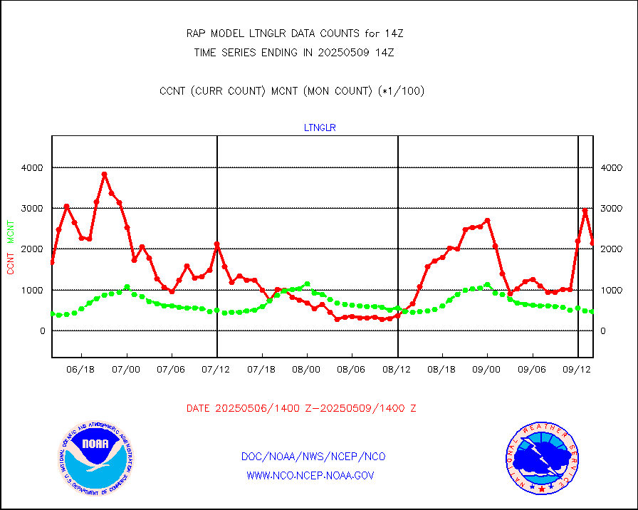
1bamua |
NOAA 15-19 & METOP 1-2 AMSU-A NCEP-proc. br.temps |
32690 |
26267 |
124.5 % |
1711.00-1716.99 |
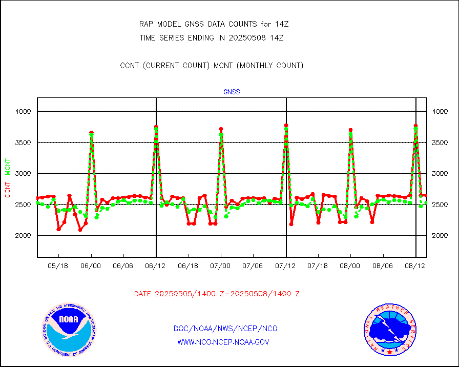
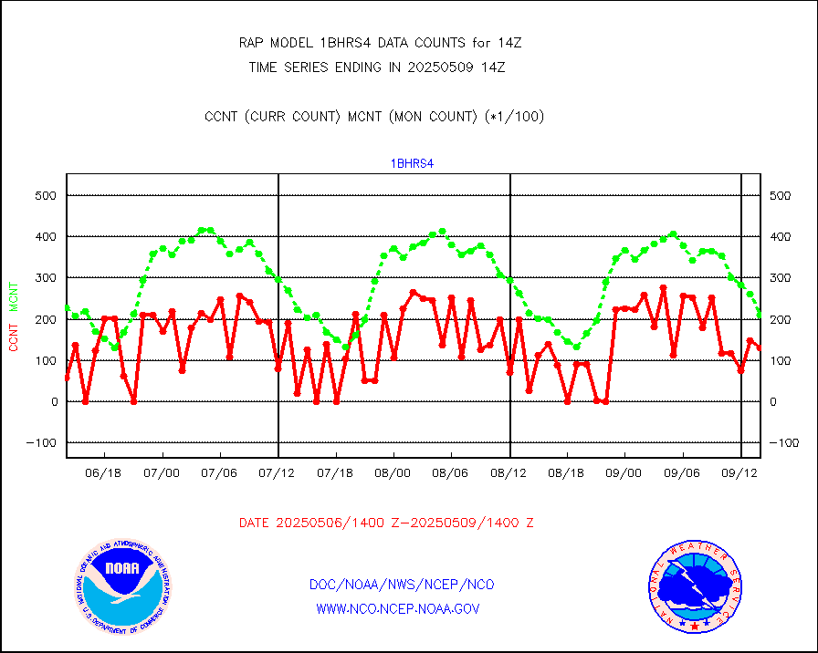
1bhrs4 |
NOAA 18-19 & METOP 1-2 HIRS-4 NCEP-proc. br.temps |
29439 |
21097 |
139.5 % |
1711.00-1716.99 |
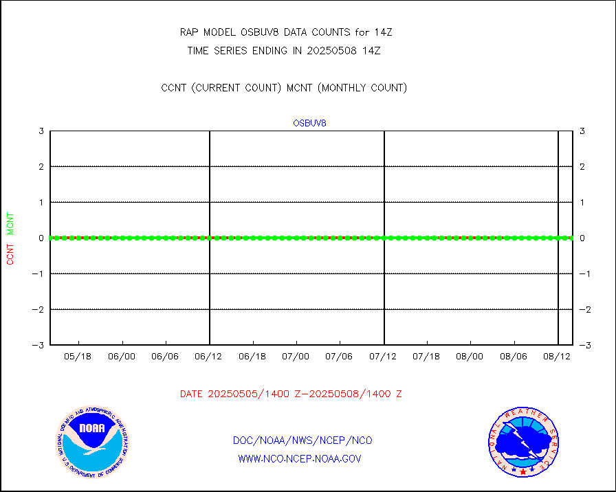
1bmhs |
NOAA 18-19 & METOP 1-2 MHS NCEP-proces. br. temps |
167294 |
144498 |
115.8 % |
1711.00-1716.99 |
acars |
MDCRS ACARS acft data from ARINC(dcded from BUFR) |
59654 |
69191 |
86.2 % |
1710.75-1717.25 |
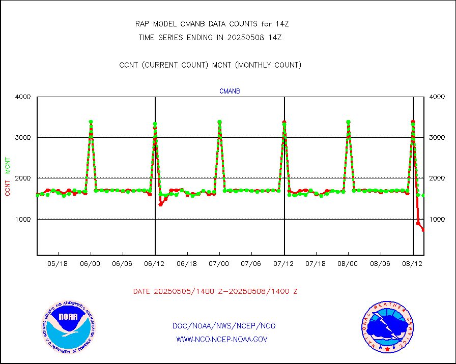
cmanb |
Surface Marine CMAN rpts decoded from BUFR format |
1713 |
1627 |
105.3 % |
1713.50-1714.50 |
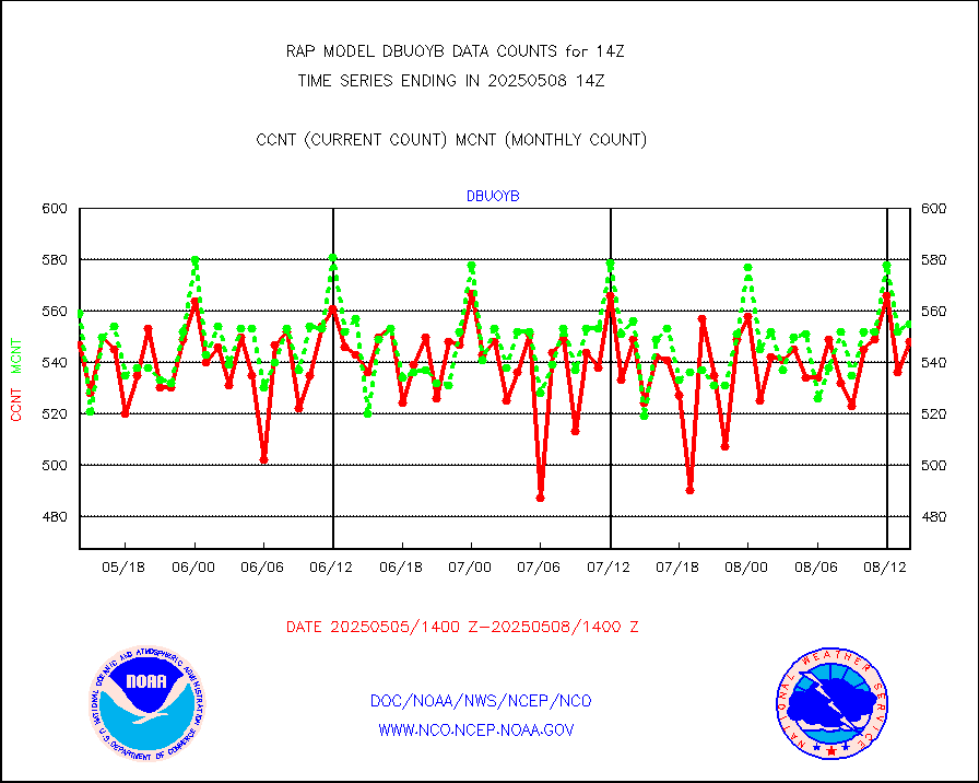
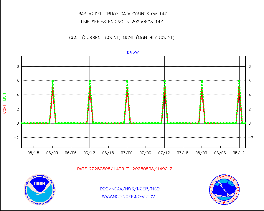
dbuoy |
Buoys decoded from FM-18 fmt (moored or drifting) |
0 |
0 |
n/a |
1713.50-1714.50 |
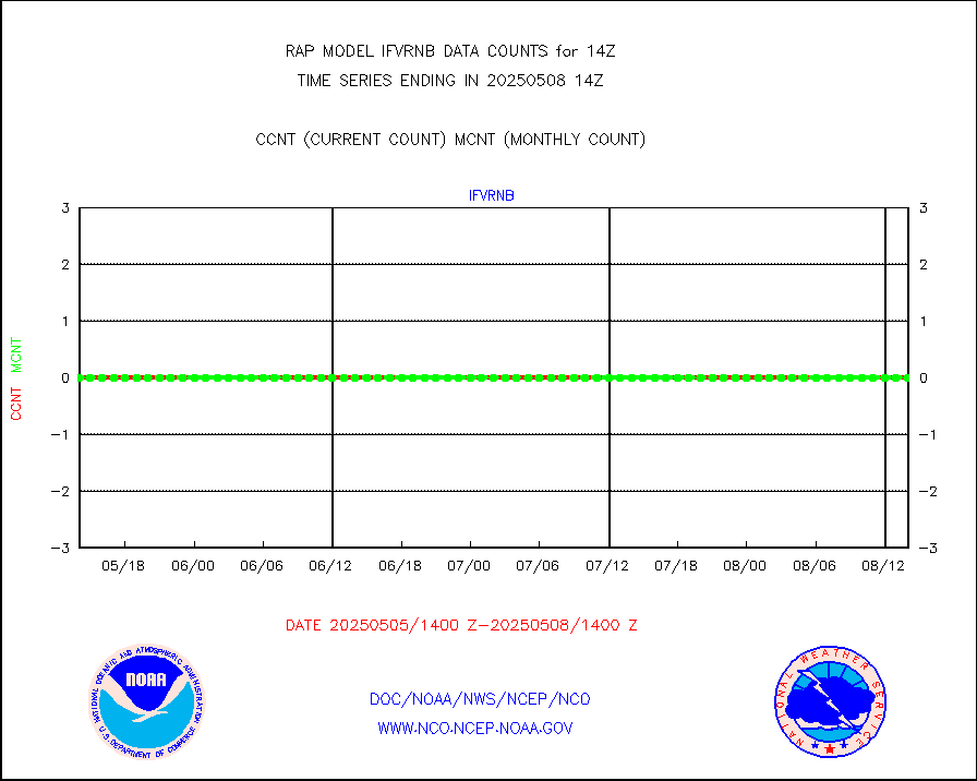
gnss |
Grnd-based Gbl Navigation Sat System (GNSS) data |
2635 |
2154 |
122.3 % |
1712.95-1713.05 |
h20mo |
MODIS (AQUA/TERRA) wvpr imager derived cld motion |
0 |
0 |
n/a |
1711.50-1716.50 |
infmo |
MODIS (AQUA/TERRA) ir l-wave derived cloud motion |
0 |
0 |
n/a |
1711.50-1716.50 |
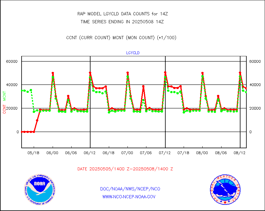
lgycld |
GOES/NASA(Langley) hi-res. (1x1 f-o-v) cloud data |
3691157 |
3686484 |
100.1 % |
1713.50-1714.50 |
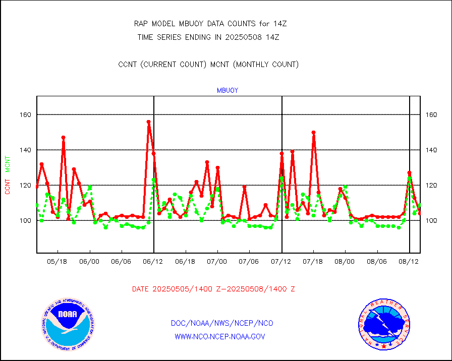
mbuoy |
Buoys decoded from FM-13 format (moored) |
19 |
50 |
38.0 % |
1713.50-1714.50 |
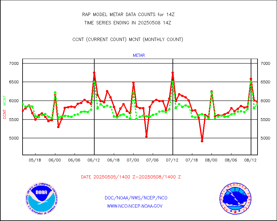
metar |
Aviation - METAR |
5267 |
6087 |
86.5 % |
1713.50-1714.50 |
nxrdw |
NEXRAD Vel Azm Dsp(VAD) winds via radar coded msg |
0 |
0 |
n/a |
1713.00-1715.00 |
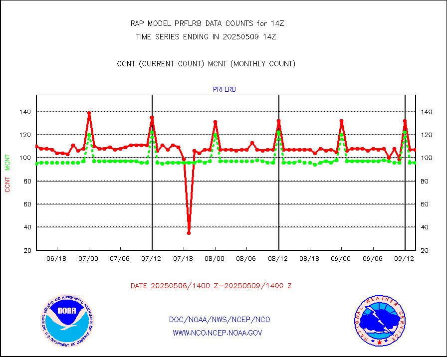
prflrb |
Multi-Agency Profiler (MAP) and SODAR winds |
90 |
81 |
111.1 % |
1712.50-1715.50 |
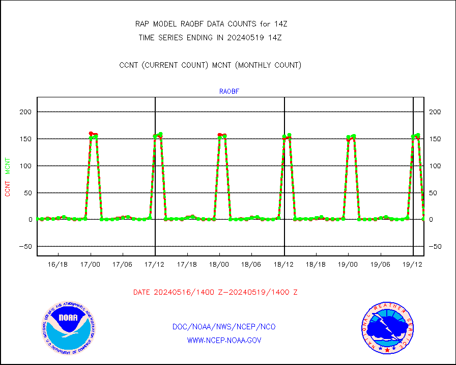
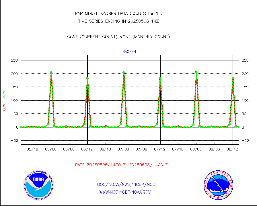
raobf |
Rawinsonde - fixed land (from TEMP or PILOT) |
0 |
0 |
n/a |
1713.00-1715.00 |
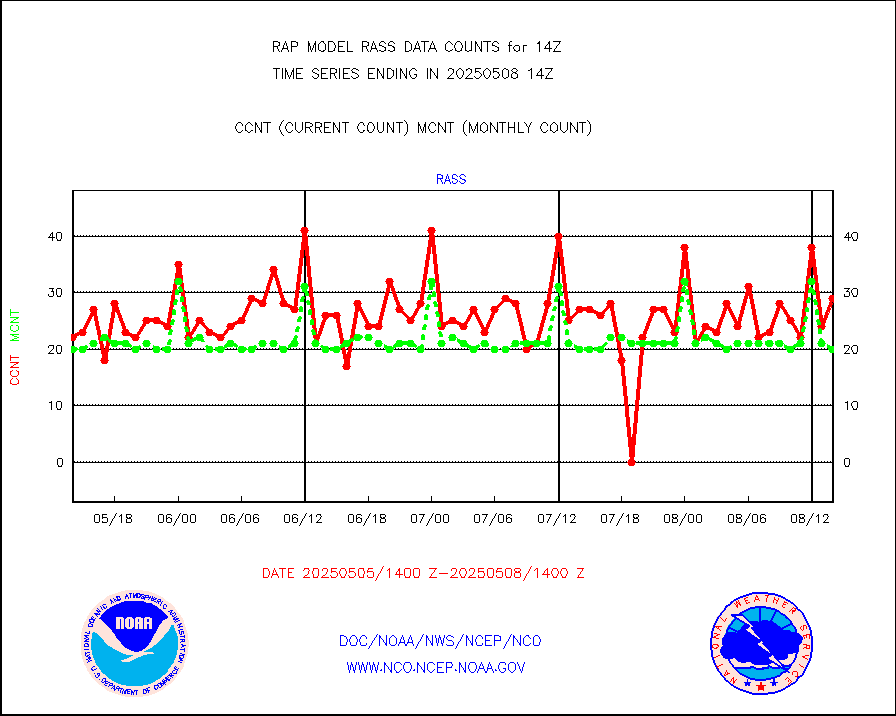
rass |
RASS temperatures (NOAA and Multi-Agency) |
22 |
19 |
115.8 % |
1713.50-1714.50 |
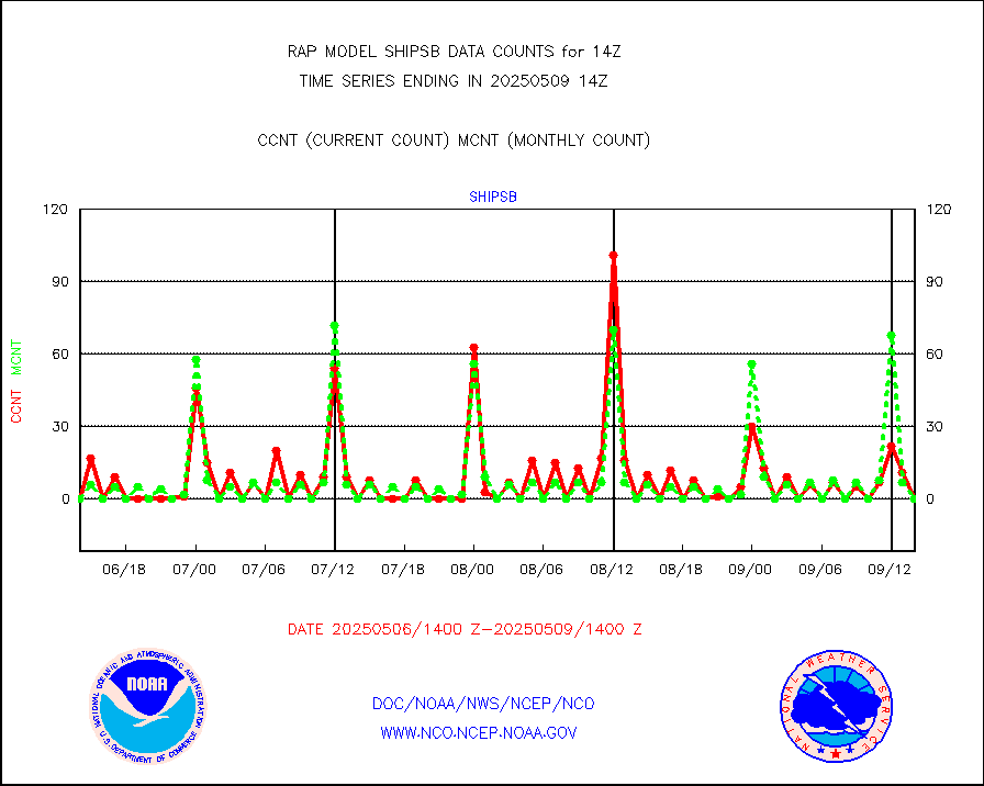
shipsb |
Ship - manual and automatic, restricted (BUFR) |
0 |
0 |
n/a |
1713.50-1714.50 |
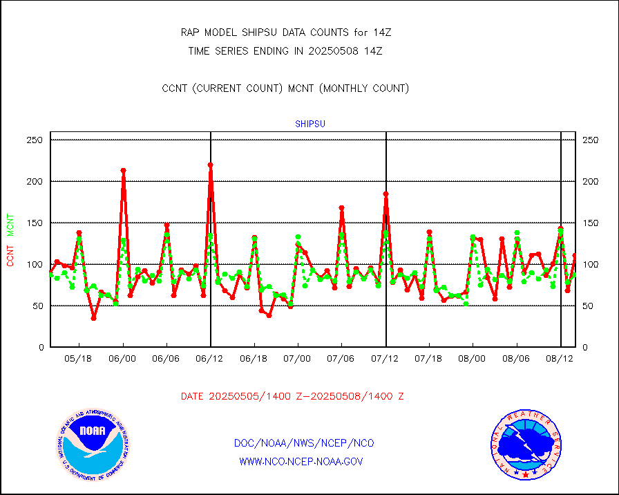
shipsu |
Ship - manual and automatic, unrestricted |
28 |
45 |
62.2 % |
1713.50-1714.50 |
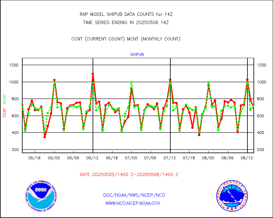
shipub |
Ship - manual and automatic, unrestricted (BUFR) |
587 |
587 |
100.0 % |
1713.50-1714.50 |
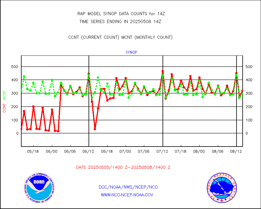
synop |
Synoptic - fixed manual and automatic |
290 |
309 |
93.9 % |
1713.50-1714.50 |
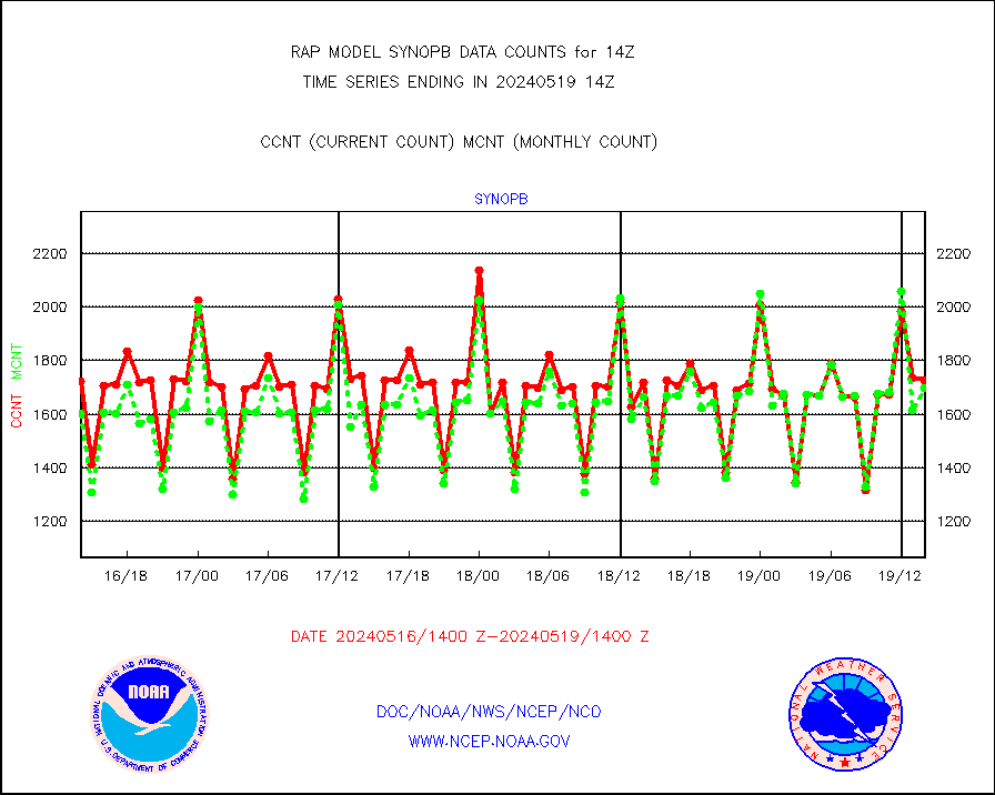
synopb |
Synoptic - fixed manual & auto (decoded fr BUFR) |
791 |
1721 |
46.0 % |
1713.50-1714.50 |
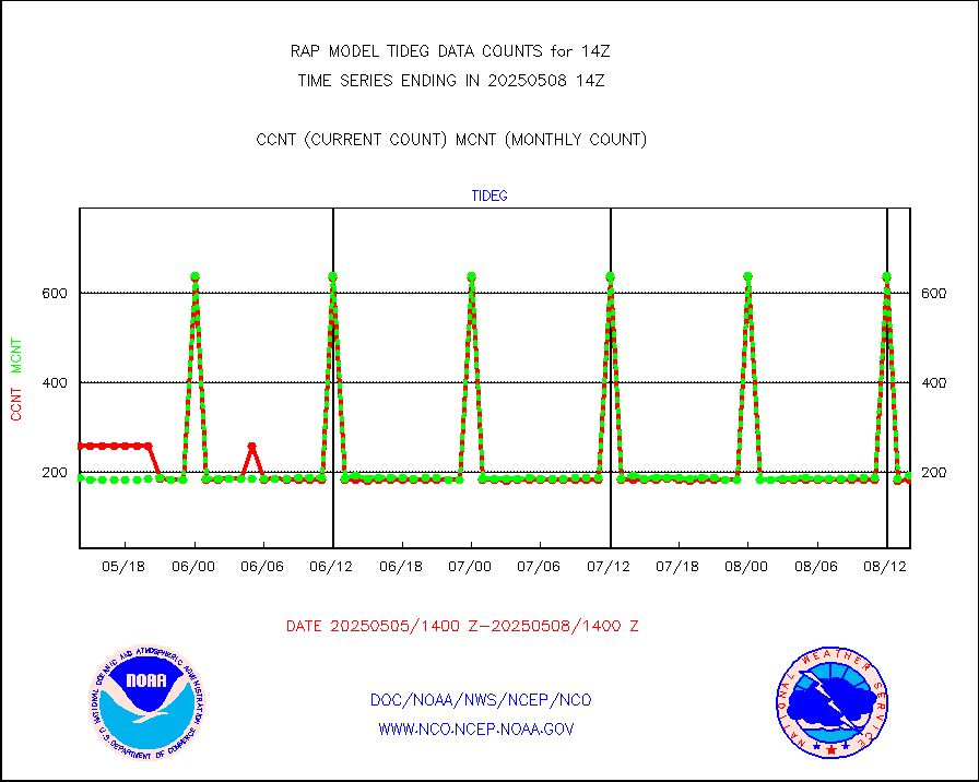
tideg |
Tide gauge reports decoded from CREX format |
180 |
177 |
101.7 % |
1713.50-1714.50 |
| Data Types of Opportunity with Normal Counts |
|---|
| Type | Description | Hourly Count | Monthly Average | Percent (%) of Monthly Mean | UTC Time Window |
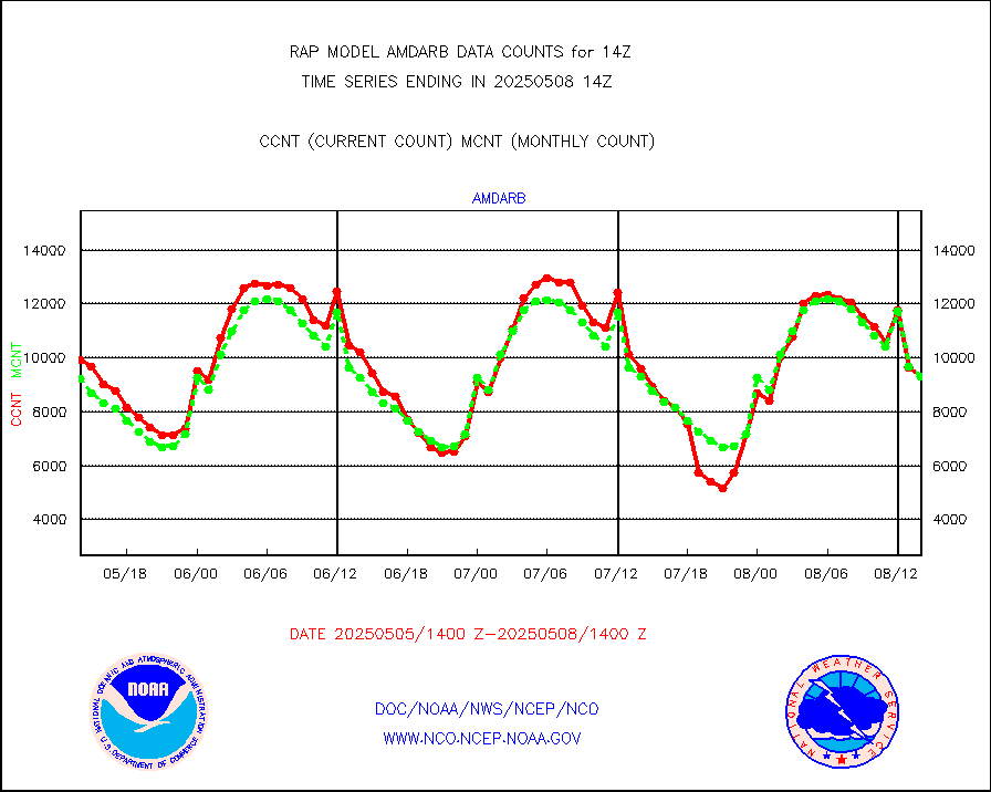
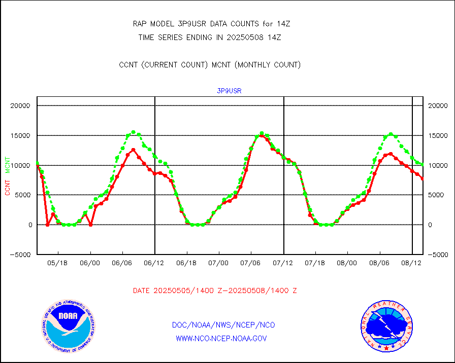
3p9usr |
GOES-16&up/NESDIS ir short-wv derived cld motion |
7365 |
10454 |
70.5 % |
1713.00-1713.99 |
acarsa |
MDCRS ACARS acft data (ARINC via AFWA)(AIREP fmt) |
0 |
0 |
n/a |
1710.75-1717.25 |
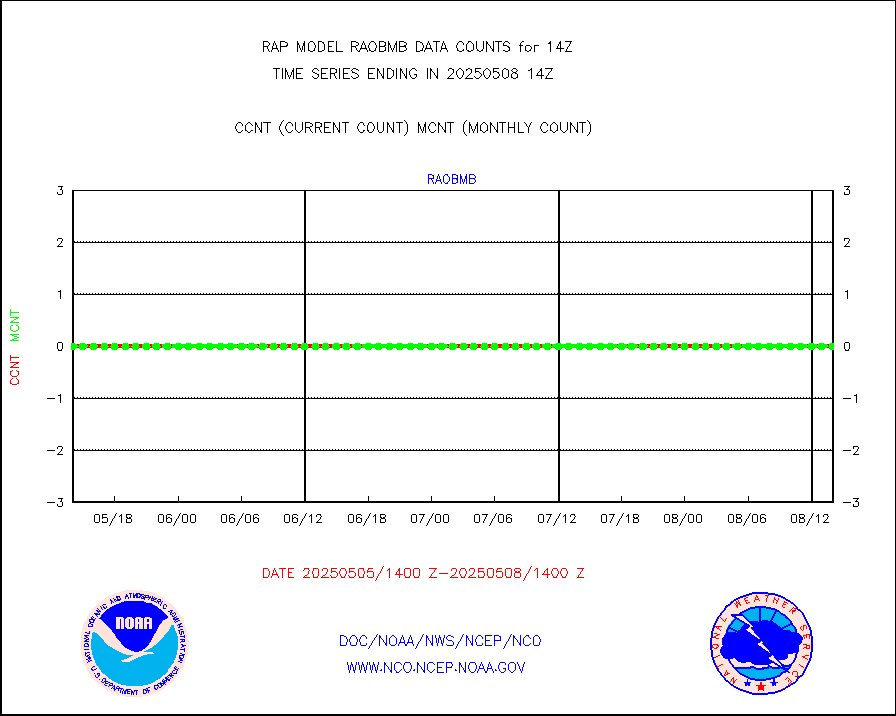
airep |
Manual AIREP aircraft data (dcded from AIREP fmt) |
3825 |
4568 |
83.7 % |
1710.75-1717.25 |
airsev |
AQUA AIRS/AMSU-A/HSB brightness temps- every FOV |
0 |
0 |
n/a |
1711.00-1716.99 |
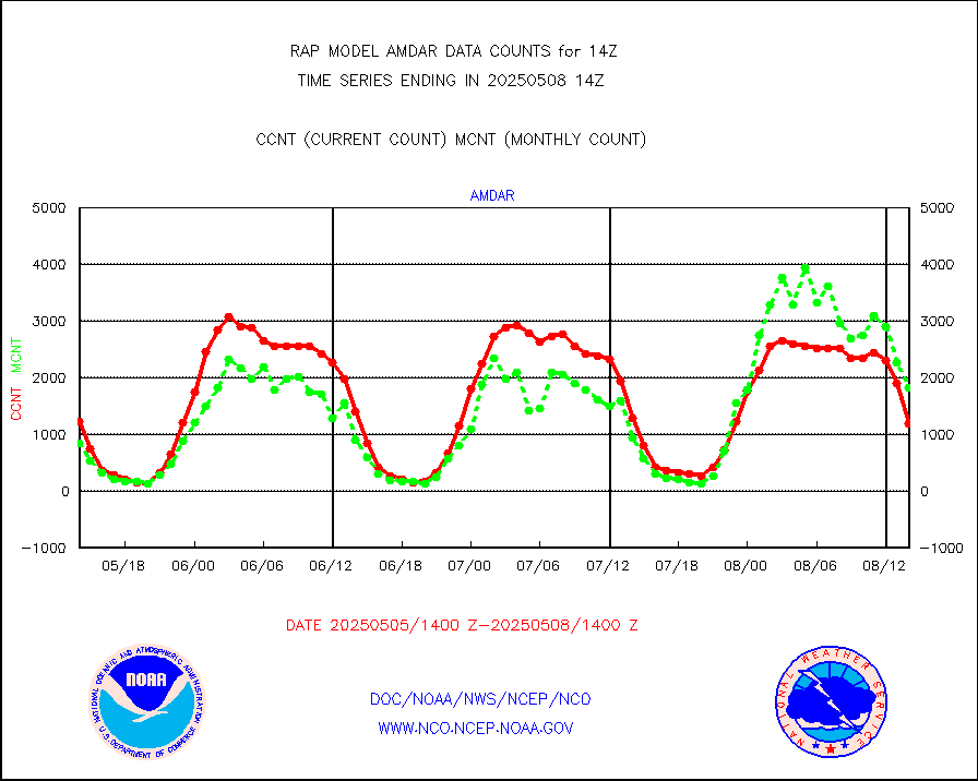
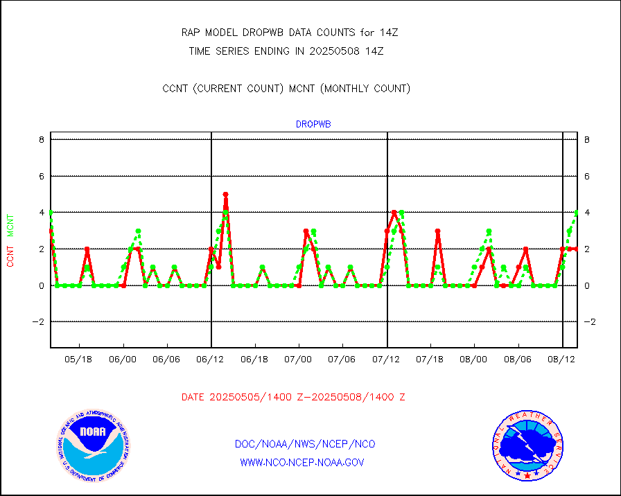
amdar |
AMDAR aircraft data (decoded from AMDAR format) |
1384 |
883 |
156.7 % |
1710.75-1717.25 |
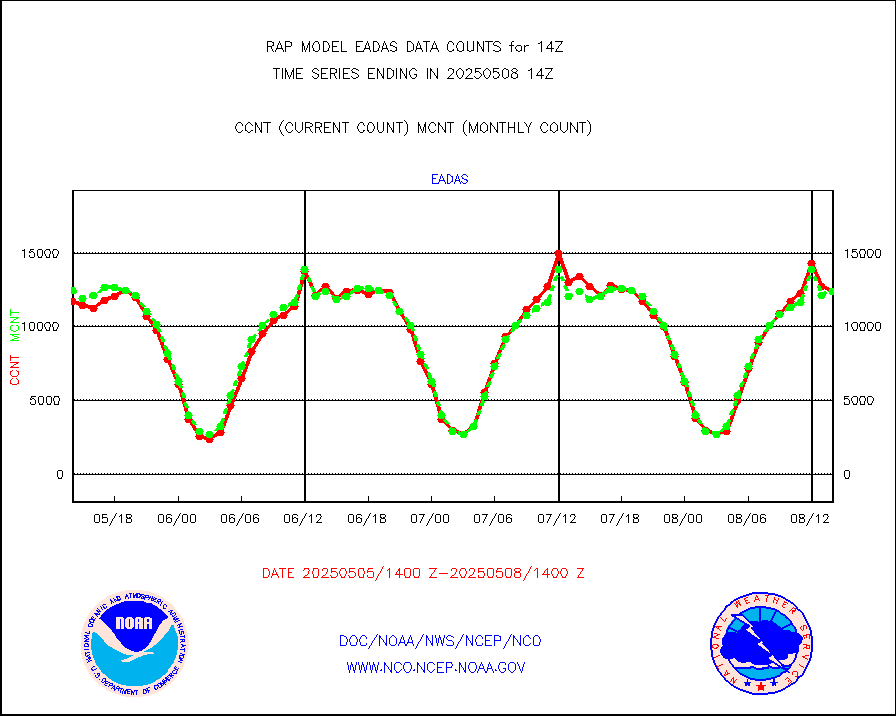
amdarb |
AMDAR aircraft data (decoded from BUFR) |
3629 |
3719 |
97.6 % |
1710.75-1717.25 |
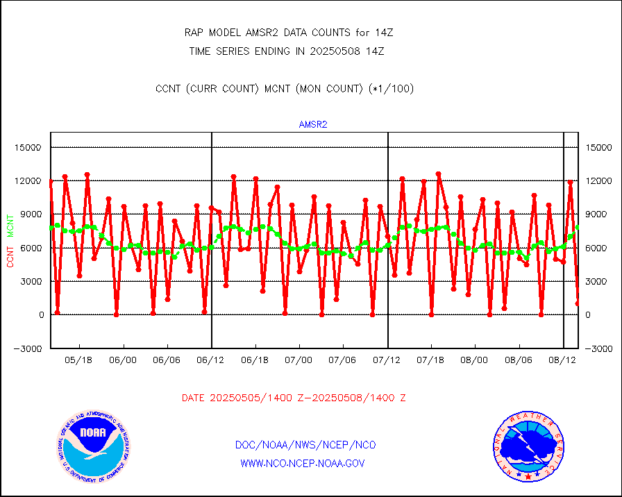
amsr2 |
GCOM-W AMSR2 1B brightness temperatures |
251955 |
755563 |
33.3 % |
1711.00-1711.99 |
ascat |
METOP 1-2 ASCAT products |
18229 |
11771 |
154.9 % |
1712.00-1716.00 |
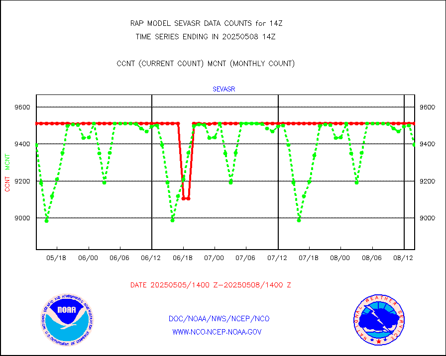
atms |
NPP/NOAA-20 ATMS brightness temperatures |
240034 |
210015 |
114.3 % |
1712.00-1715.99 |
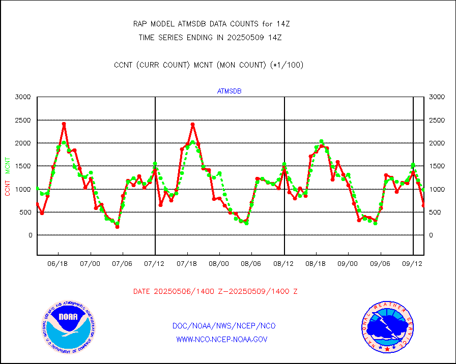
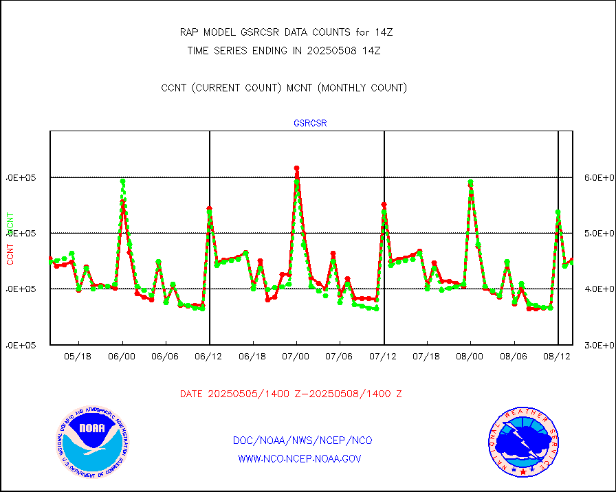
atmsdb |
NPP/NOAA-20 ATMS bright. temps-direct b-cast SSEC |
89745 |
110472 |
81.2 % |
1712.00-1715.99 |
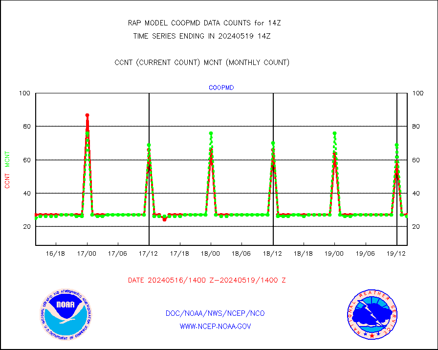
coopmd |
Coop/MADIS NEPP & HCN-Modernization NOAA COOP Obs |
23 |
22 |
104.5 % |
1713.50-1714.50 |
crisf4 |
NPP/NOAA-20 CrIS full spctrl radn (431 ch subset) |
117574 |
123323 |
95.3 % |
1712.00-1715.99 |
crsfdb |
NPP/NOAA-20 CrIS full spctrl radn dir brdcst SSEC |
115821 |
119593 |
96.8 % |
1712.00-1715.99 |
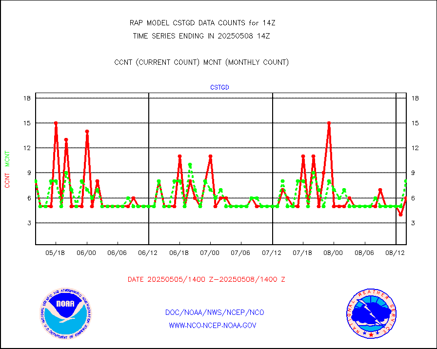
cstgd |
Coast Guard |
6 |
5 |
120.0 % |
1713.50-1714.50 |
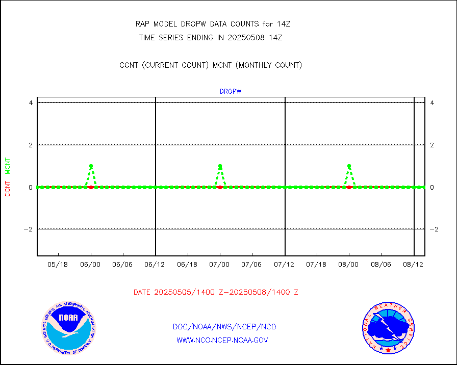
dropw |
Dropwinsonde (from TEMP DROP) |
0 |
0 |
n/a |
1713.00-1715.00 |
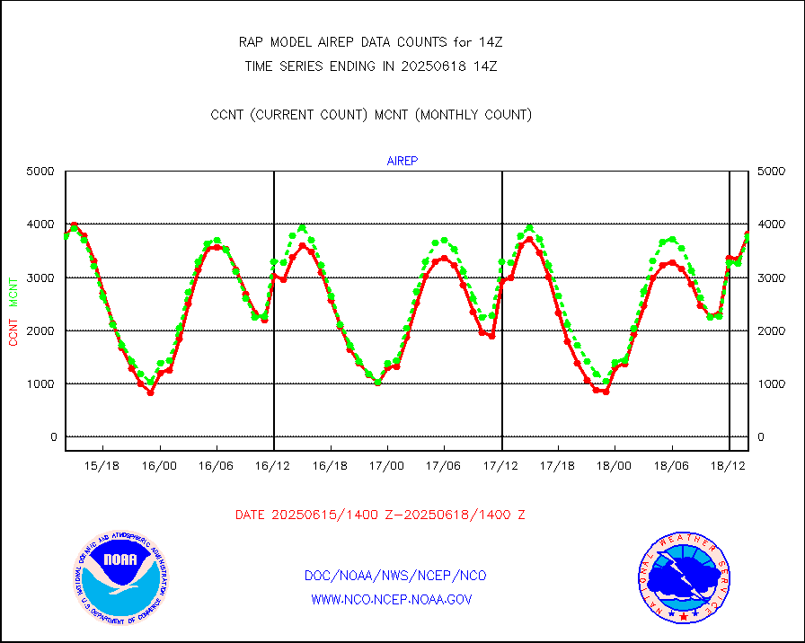
eadas |
E-AMDAR (European AMDAR acft decoded from BUFR) |
9874 |
9263 |
106.6 % |
1710.75-1717.25 |
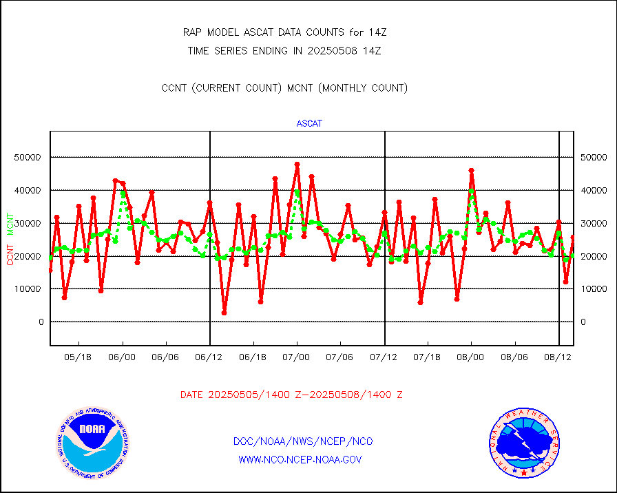
esamua |
NOAA 15-19 & METOP 1-2 AMSU-A proc btmps frm RARS |
18482 |
14161 |
130.5 % |
1713.00-1715.00 |
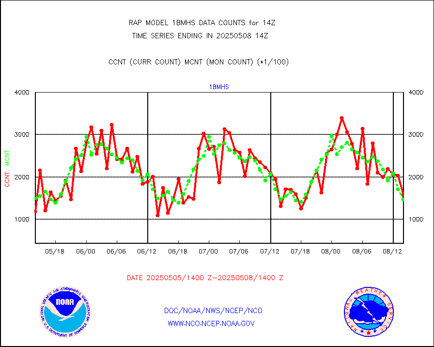
esatms |
NPP Adv. Tech. MW Sndr (ATMS) br. temps from RARS |
125320 |
112793 |
111.1 % |
1712.00-1715.99 |
eshrs3 |
NOAA 15-19 & METOP 1-2 HIRS-3/4 pr btmps frm RARS |
38365 |
29395 |
130.5 % |
1713.00-1715.00 |
esiasi |
METOP 1-2 IASI 1C radiance data vbl chn from RARS |
68446 |
70629 |
96.9 % |
1712.00-1715.99 |
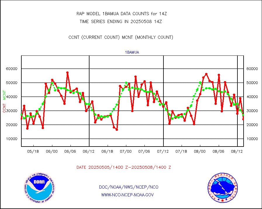
esmhs |
NOAA 18-19 & METOP 1-2 MHS proc. btemps from RARS |
162394 |
130320 |
124.6 % |
1713.00-1715.00 |
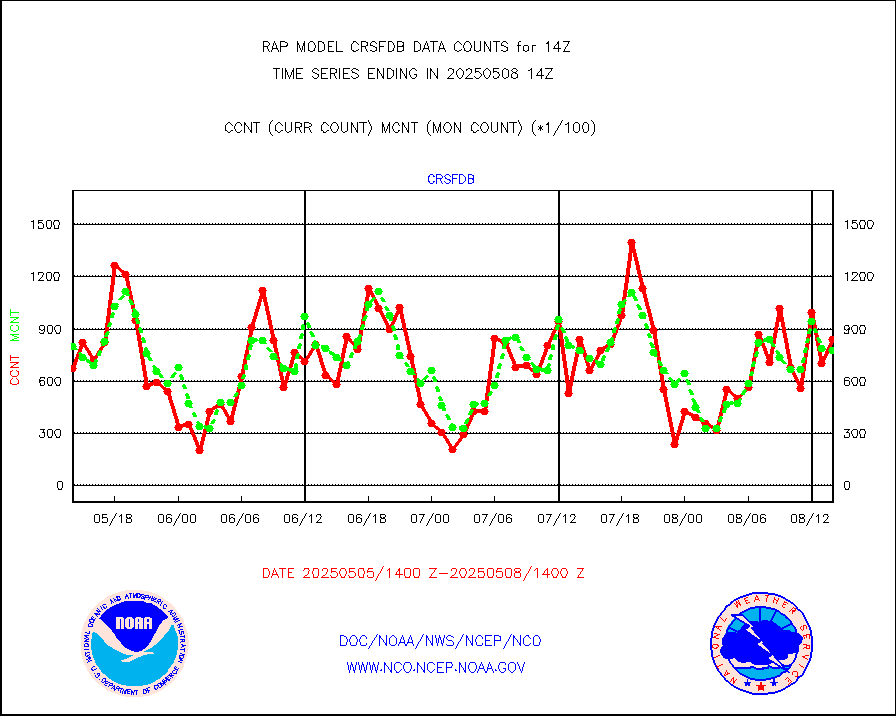
gmi1cr |
GPM GMI Level 1C-R brightness temperatures |
336684 |
829571 |
40.6 % |
1711.00-1716.99 |
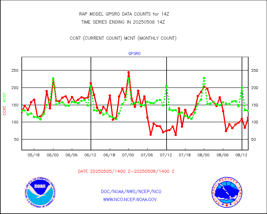
gpsro |
GPS radio occultation data |
111 |
102 |
108.8 % |
1712.00-1715.99 |
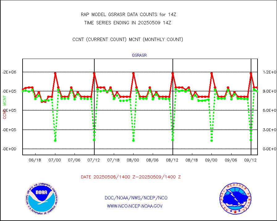
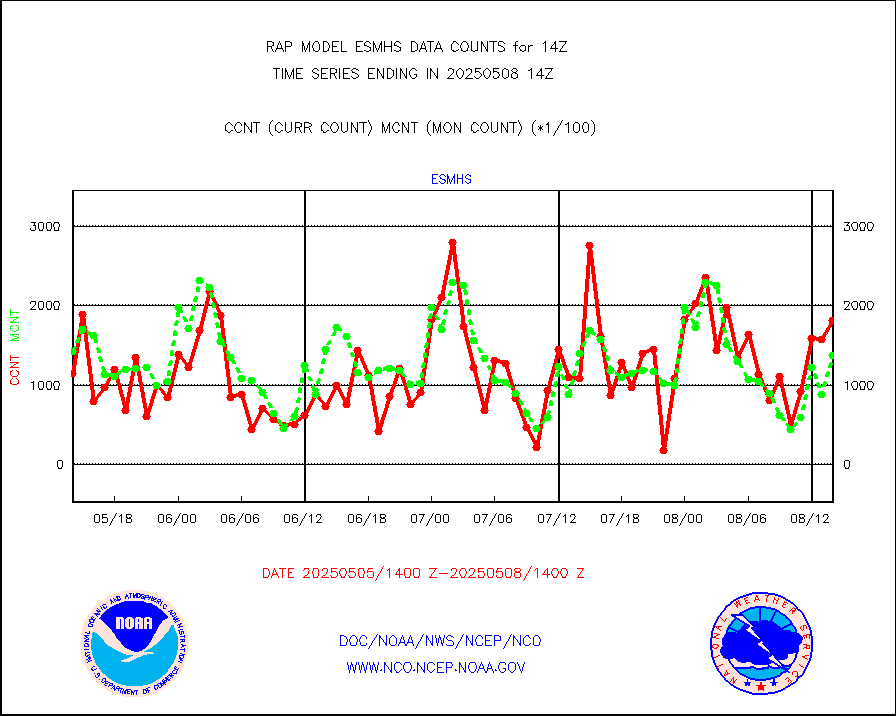
gsrasr |
GOES-16/17 All Sky Radiances (proc.) |
812097 |
803531 |
101.1 % |
1712.00-1715.99 |
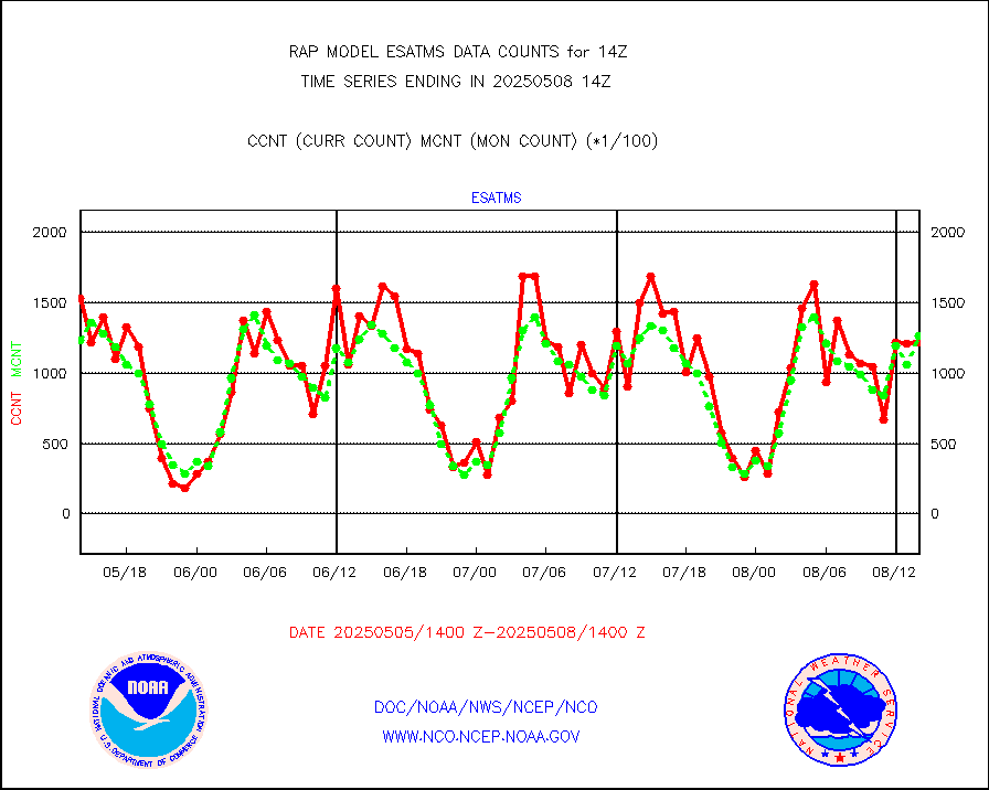
gsrcsr |
GOES-16/17 Clear Sky Radiances (proc.) |
346587 |
383244 |
90.4 % |
1712.00-1715.99 |
h20ja |
MTSAT/JMA water vapor imager derived cloud motion |
3625 |
2443 |
148.4 % |
1711.50-1716.50 |
h2dusr |
GOES-16&up/NESDIS wv imgr/deep-lyr derivd cld mtn |
5783 |
5711 |
101.3 % |
1713.00-1713.99 |
h2eunb |
METEOSAT/EUMETSAT wvpr imgr drv cld motion NBseq |
5299 |
5098 |
103.9 % |
1712.50-1715.49 |
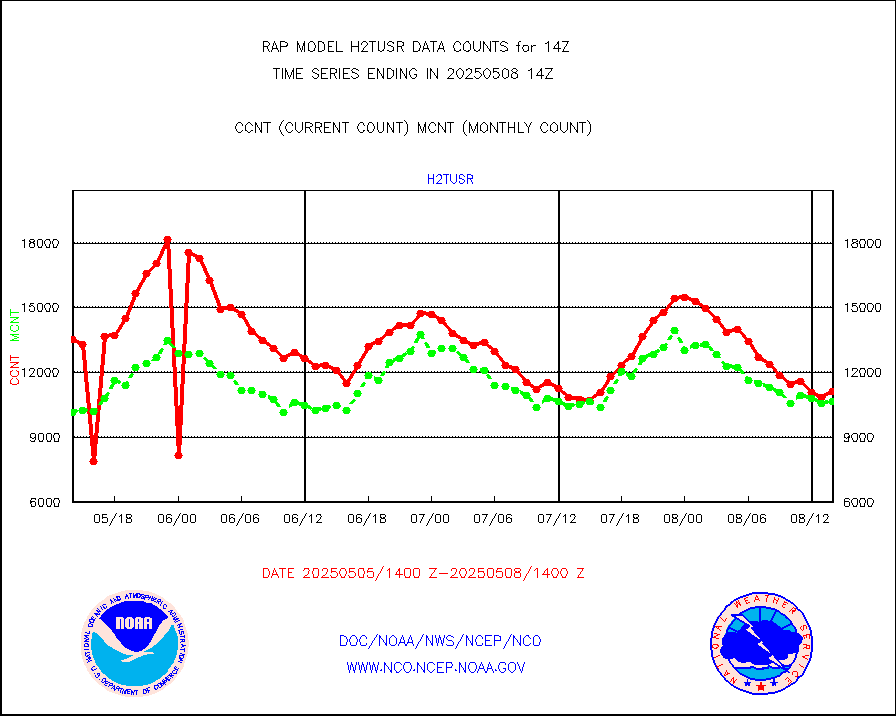
h2tusr |
GOES-16&up/NESDIS wv imgr/cld-top derived cld mtn |
11822 |
8973 |
131.8 % |
1713.00-1713.99 |
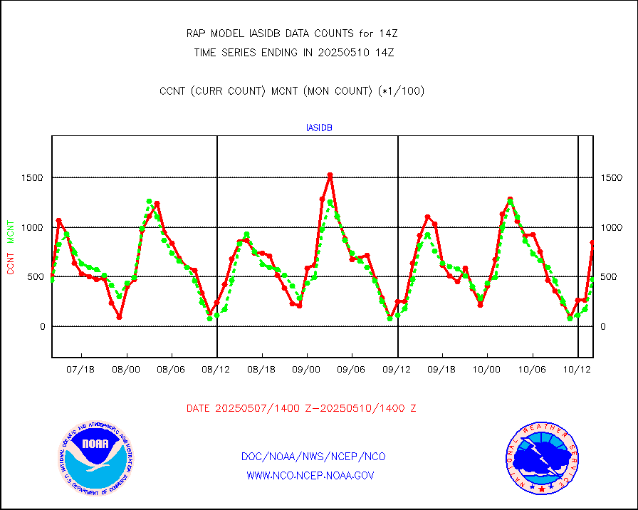
iasidb |
METOP 1-2 IASI 1C radiances-direct broadcast SSEC |
19542 |
29314 |
66.7 % |
1712.00-1715.99 |
ifeunb |
METEOSAT/EUMETSAT ir lg-wave drv cld motion NBseq |
3242 |
3231 |
100.3 % |
1712.50-1715.49 |
ifvrnb |
VIIRS (NPP/NOAA-20) ir lg-wv drv cloud motion(NB) |
0 |
0 |
n/a |
1711.50-1716.50 |
infav |
AVHRR (NOAA/METOP) ir lg-wave derived cld motion |
0 |
2 |
0.0 % |
1711.50-1716.50 |
infav1 |
AVHRR (METOP) ir lg-wave derived cld motion |
0 |
0 |
n/a |
1712.50-1715.49 |
infja |
MTSAT/JMA infrared long-wave derived cloud motion |
2765 |
2375 |
116.4 % |
1711.50-1716.50 |
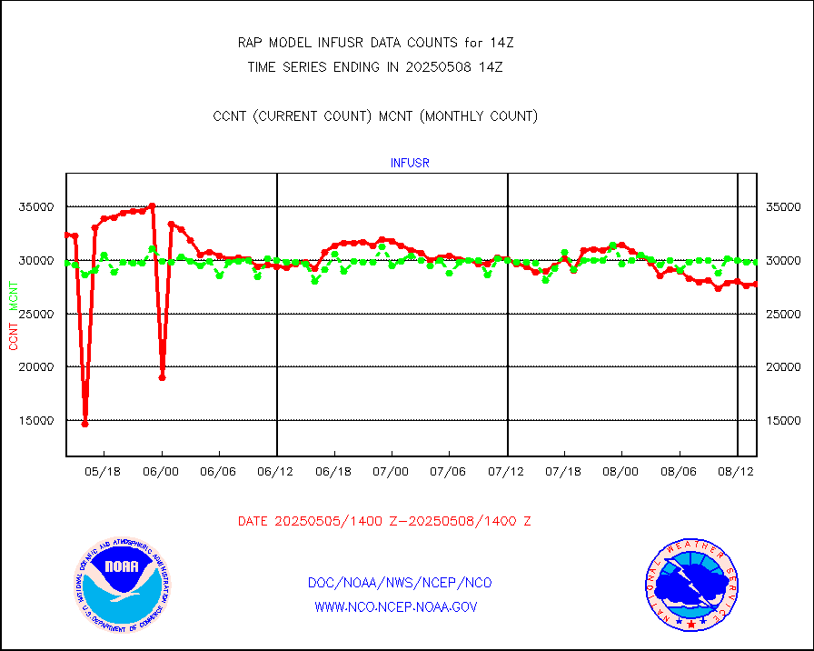
infusr |
GOES-16&up/NESDIS ir long-wave derived cld motion |
28344 |
29676 |
95.5 % |
1713.00-1713.99 |
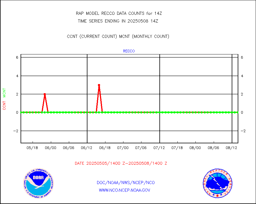
kamdar |
Korean AMDAR aircraft data (decoded from BUFR) |
167 |
192 |
87.0 % |
1710.75-1717.25 |
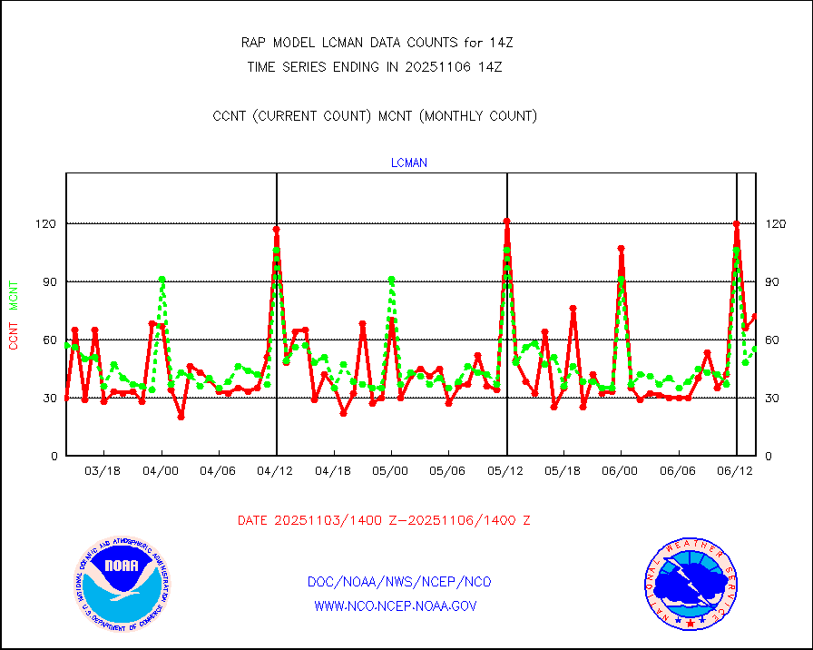
lcman |
Land-based CMAN stations decoded from CMAN format |
79 |
85 |
92.9 % |
1713.50-1714.50 |
ltnglr |
LLDN Long-rng lightning from Vaisala via NOAAPORT |
29589 |
41921 |
70.6 % |
1713.00-1714.50 |
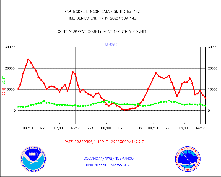
ltngsr |
NLDN Shrt-rng lightning from Vaisala via NOAAPORT |
835 |
2379 |
35.1 % |
1713.00-1714.50 |
mbuoyb |
Moored buoys (decoded from BUFR) |
446 |
454 |
98.2 % |
1713.50-1714.50 |
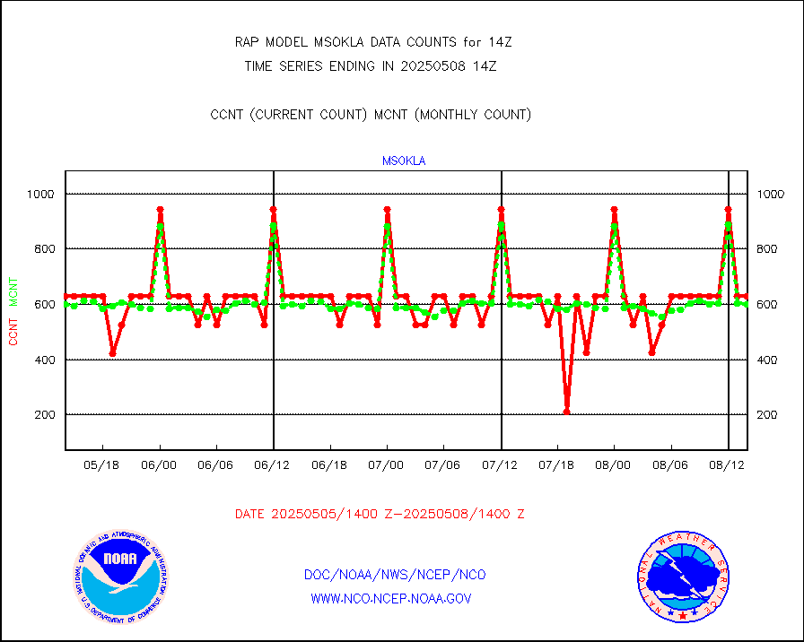
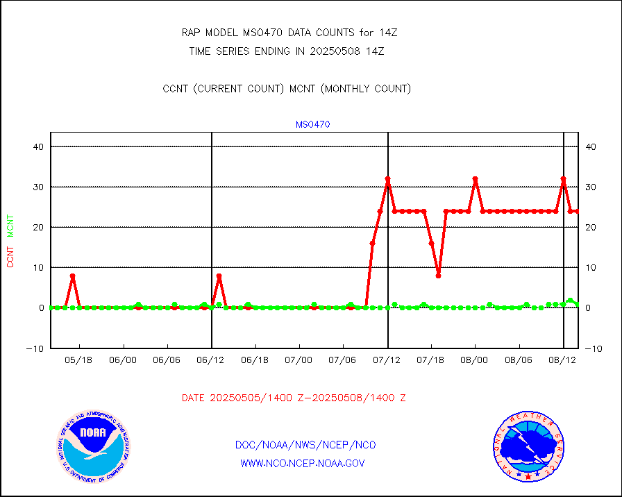
mso470 |
Mesonet/MADIS Colorado E-470 (Interstate 470) |
21 |
20 |
105.0 % |
1713.50-1714.50 |
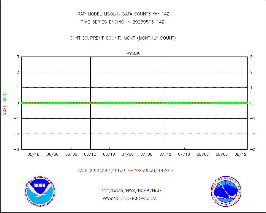
msoalk |
Mesonet/MADIS Alaska Department of Transportation |
107 |
104 |
102.9 % |
1713.50-1714.50 |
msoapg |
Mesonet/MADIS U.S. Army Aberdeen Proving Grounds |
0 |
0 |
n/a |
1713.50-1714.50 |
msoapr |
Mesonet/MADIS Citizen Weather Observers Program |
46702 |
44839 |
104.2 % |
1713.50-1714.50 |
msoaws |
Mesonet/MADIS AWS Convergence Technologies, Inc. |
25255 |
25307 |
99.8 % |
1713.50-1714.50 |
msoawx |
Mesonet/MADIS "Anything Weather" |
0 |
0 |
n/a |
1713.50-1714.50 |
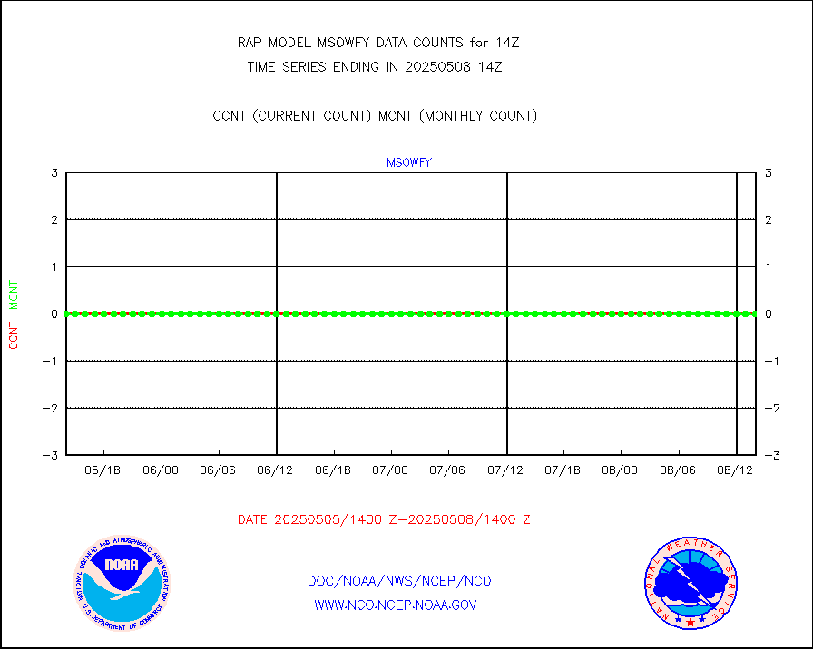
msocol |
Mesonet/MADIS Colorado Dept. of Transportation |
0 |
0 |
n/a |
1713.50-1714.50 |
msodcn |
Mesonet/MADIS DC Net |
0 |
0 |
n/a |
1713.50-1714.50 |
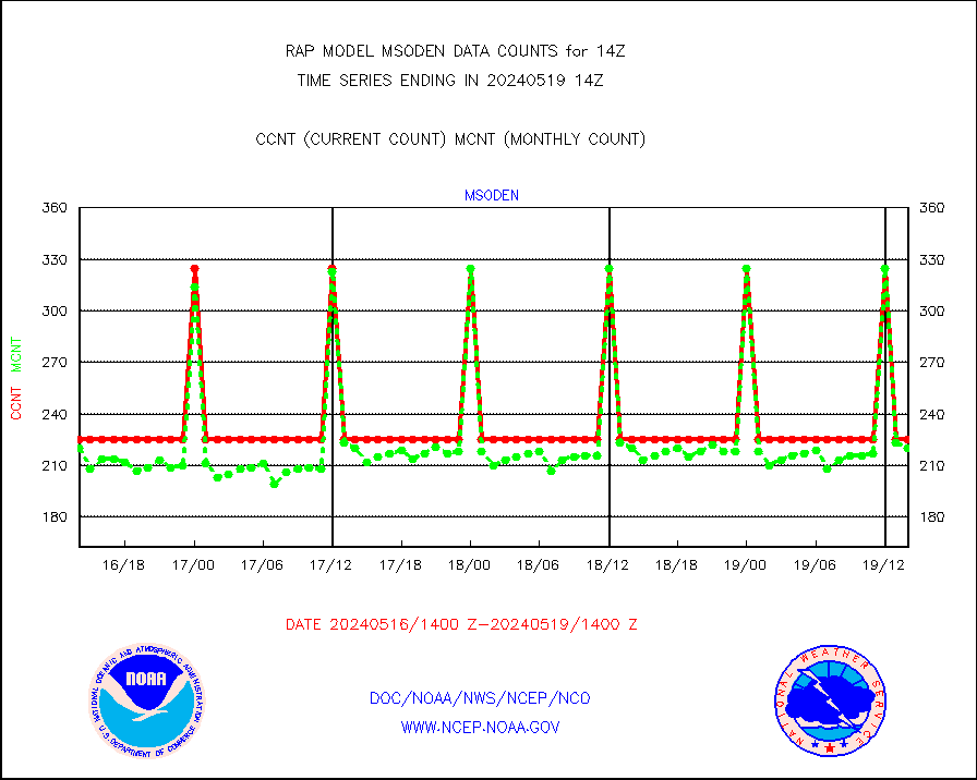
msoden |
Mesonet/MADIS Denver Urban Drainage & Flood Cntrl |
225 |
204 |
110.3 % |
1713.50-1714.50 |
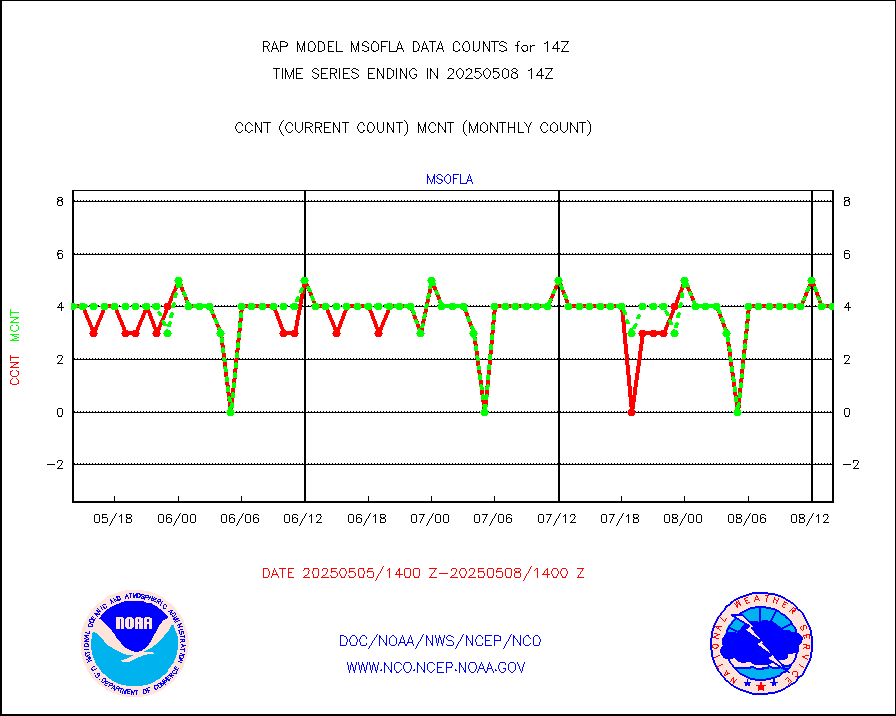
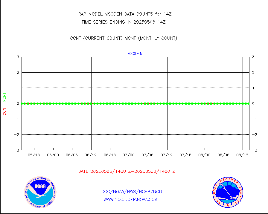
msofla |
Mesonet/MADIS Florida (FAWN & USF) |
3 |
3 |
100.0 % |
1713.50-1714.50 |
msoflt |
Mesonet/MADIS Florida Dept. of Transportation |
0 |
0 |
n/a |
1713.50-1714.50 |
msogeo |
Mesonet/MADIS Georgia Dept. of Transportation |
0 |
0 |
n/a |
1713.50-1714.50 |
msohad |
Mesonet/MADIS NWS Hydromet Auto Data System(HADS) |
5596 |
5575 |
100.4 % |
1713.50-1714.50 |
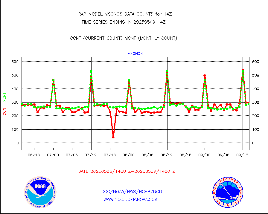
msoien |
Mesonet/MADIS Iowa Environmental |
170 |
173 |
98.3 % |
1713.50-1714.50 |
msoind |
Mesonet/MADIS Indiana Dept. of Transportation |
0 |
0 |
n/a |
1713.50-1714.50 |
msoiow |
Mesonet/MADIS Iowa Department of Transportation |
0 |
0 |
n/a |
1713.50-1714.50 |
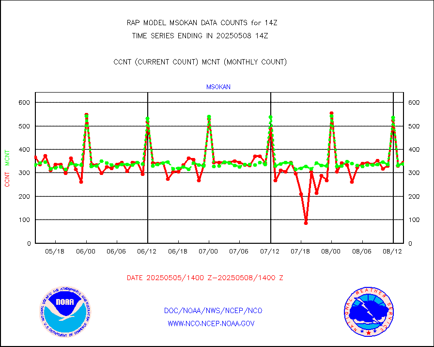
msokan |
Mesonet/MADIS Kansas Department of Transportation |
351 |
319 |
110.0 % |
1713.50-1714.50 |
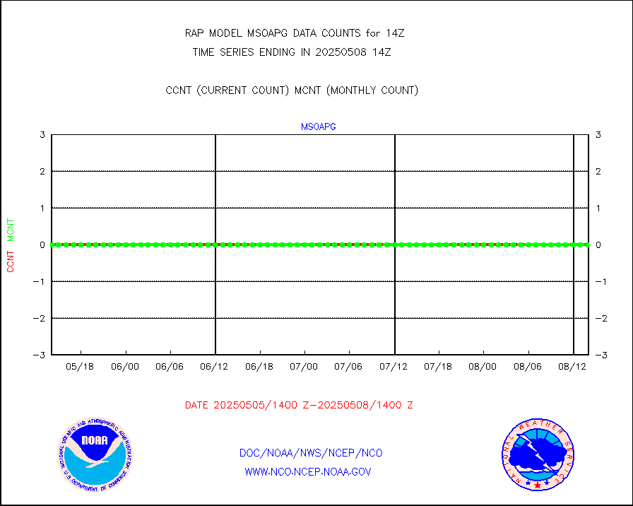
msokla |
Mesonet/MADIS Oklahoma Mesonet |
318 |
318 |
100.0 % |
1713.50-1714.50 |
msolju |
Mesonet/MADIS Louisiana State/Jackson State Univ. |
0 |
0 |
n/a |
1713.50-1714.50 |
msomca |
Mesonet/MADIS Missouri Commercial Agricult Wx Net |
263 |
249 |
105.6 % |
1713.50-1714.50 |
msomin |
Mesonet/MADIS Minnesota Dept. of Transportation |
0 |
0 |
n/a |
1713.50-1714.50 |
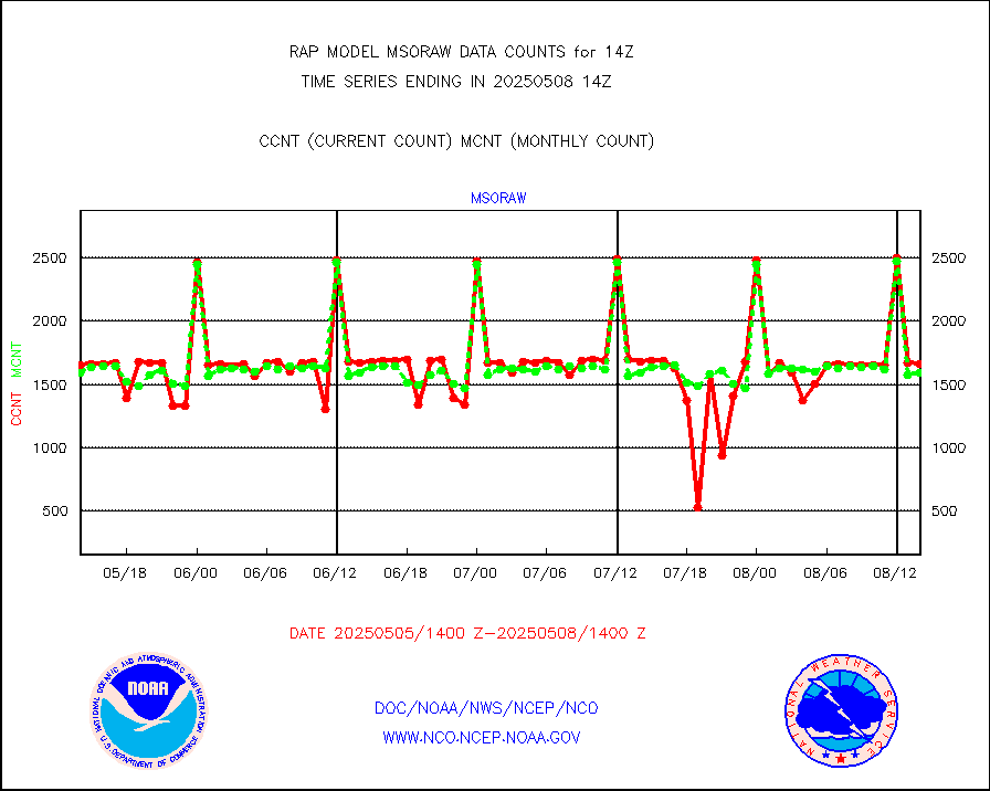
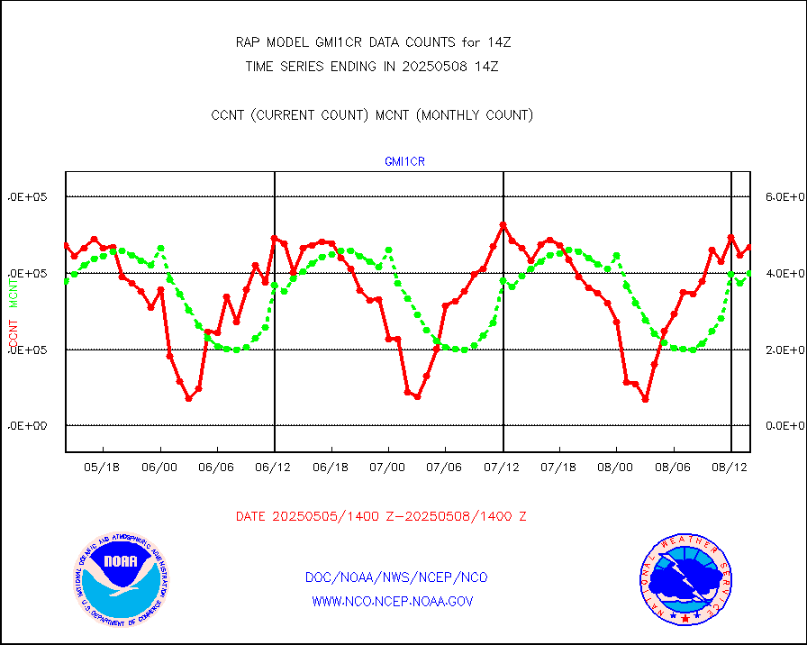
msoraw |
Mesonet/MADIS NFIC Remote Automated Wx Stns(RAWS) |
1554 |
1577 |
98.5 % |
1713.50-1714.50 |
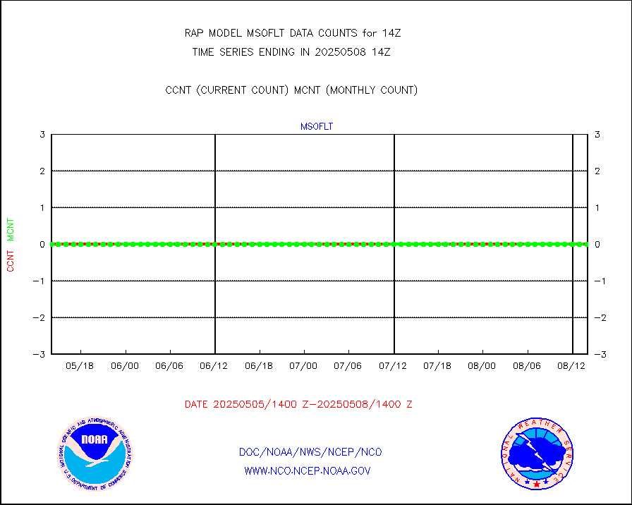
msourb |
Mesonet/MADIS UrbaNet |
3899 |
3986 |
97.8 % |
1713.50-1714.50 |
msovir |
Mesonet/MADIS Virginia Dept. of Transportation |
236 |
227 |
104.0 % |
1713.50-1714.50 |
msowfy |
Mesonet/MADIS "Weather for You" |
0 |
0 |
n/a |
1713.50-1714.50 |
msowis |
Mesonet/MADIS Wisconsin Dept. of Transportation |
0 |
0 |
n/a |
1713.50-1714.50 |
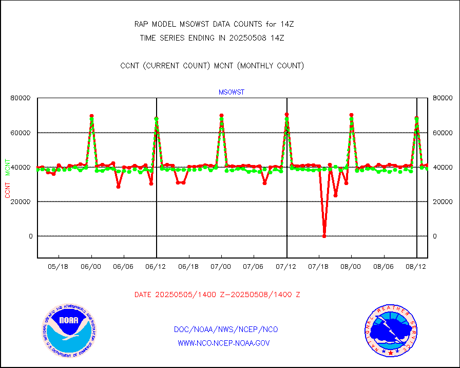
msowst |
Mesonet/MADIS MesoWest (many subproviders) |
39744 |
39810 |
99.8 % |
1713.50-1714.50 |
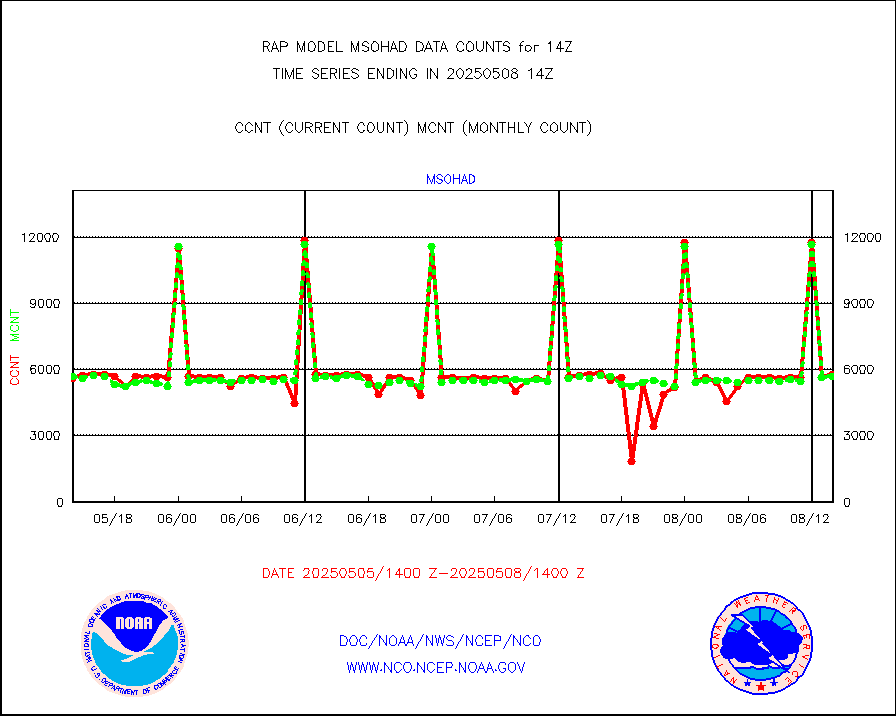
msowtx |
Mesonet/MADIS West Texas |
4977 |
4995 |
99.6 % |
1713.50-1714.50 |
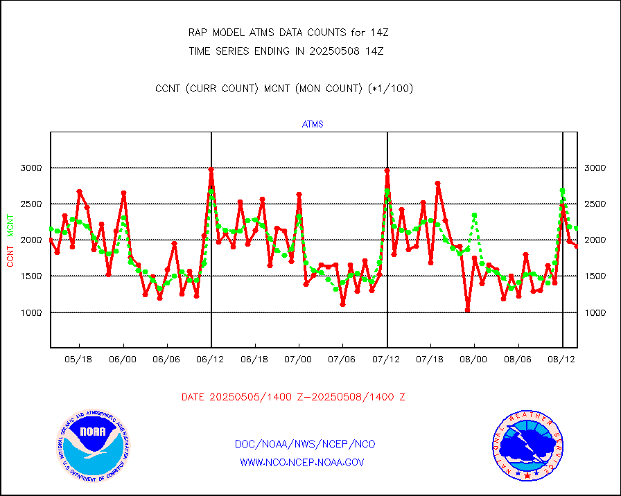
mtiasi |
METOP 1-2 IASI 1C radiance data (varbl. channels) |
24659 |
14128 |
174.5 % |
1712.00-1715.99 |
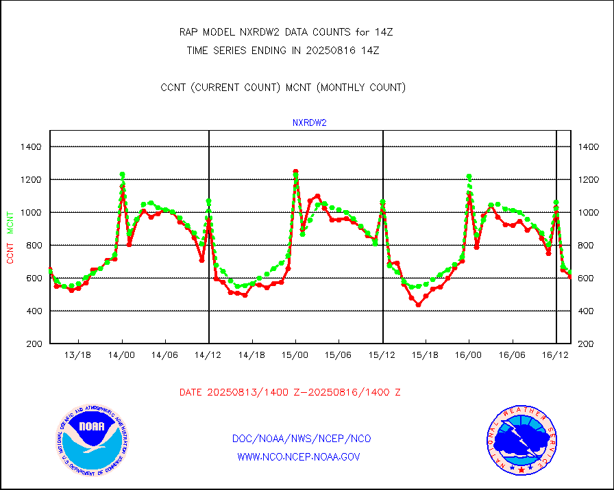
nxrdw2 |
NEXRAD Vel Azm Dsp(VAD) winds via Level 2 decoder |
671 |
549 |
122.2 % |
1713.00-1715.00 |
osbuv8 |
NOAA 16-19 Solar Backscatter UV-2 rad frm V8 BUFR |
0 |
0 |
n/a |
1712.00-1714.99 |
pibal |
PIBAL (from PILOT, PILOT SHIP, PILOT MOBIL) |
0 |
0 |
n/a |
1713.00-1715.00 |
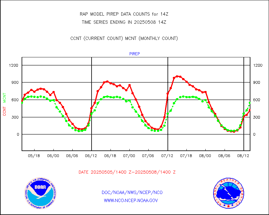
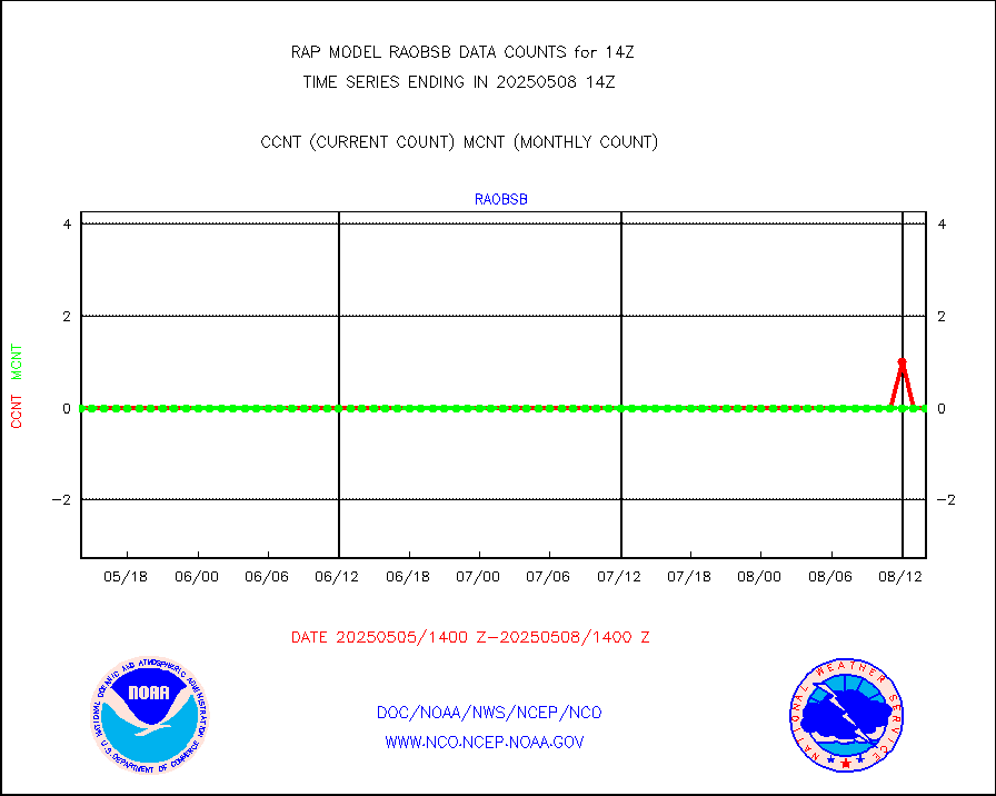
pirep |
Manual PIREP aircraft data (dcded from AIREP fmt) |
597 |
562 |
106.2 % |
1710.75-1717.25 |
prflrp |
Profilr winds from PIBAL (PILOT,PILOT SHIP/MOBIL) |
0 |
0 |
n/a |
1712.50-1715.50 |
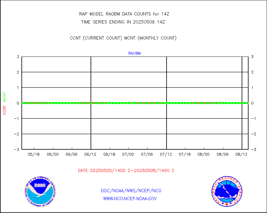
raobm |
Rawinsonde - mobile land (from TEMP/PILOT MOBIL) |
0 |
0 |
n/a |
1713.00-1715.00 |
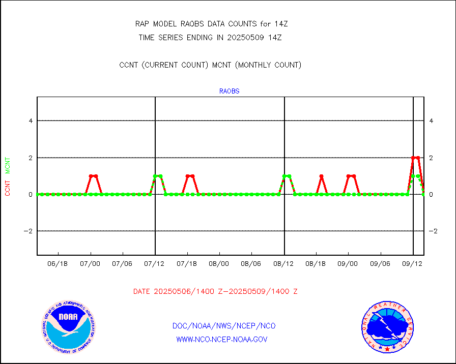
raobs |
Rawinsonde - ship (from TEMP SHIP, PILOT SHIP) |
0 |
0 |
n/a |
1713.00-1715.00 |
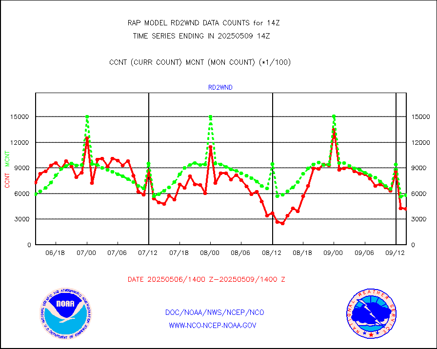
rd2wnd |
NEXRAD radial wind (Level 2 - GTS) |
953229 |
669670 |
142.3 % |
1713.50-1714.49 |
recco |
Flight level reconnaissance aircraft data |
0 |
0 |
n/a |
1713.00-1715.00 |
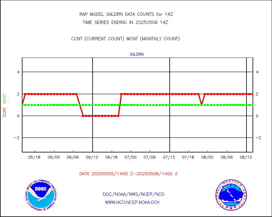
saldrn |
Surface Marine Saildrone (decoded from BUFR) |
2 |
2 |
100.0 % |
1712.00-1715.99 |
saphir |
Megha-Tropiques SAPHIR L1A2 brightness temps |
0 |
0 |
n/a |
1711.00-1716.99 |
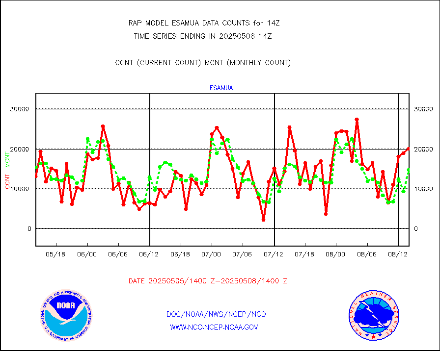
sevasr |
METEOSAT-10 2nd Gen SEVIRI All Sky Radiance(proc) |
9512 |
9337 |
101.9 % |
1712.00-1715.99 |
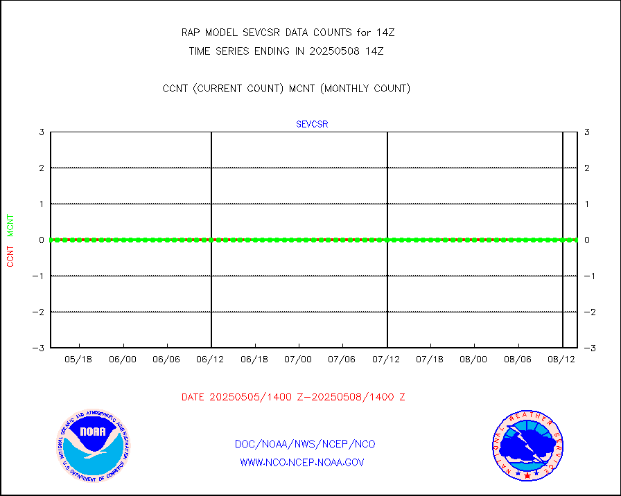
sevcsr |
METEOSAT-10 2nd Gen SEVIRI Clr Sky Radiance(proc) |
0 |
0 |
n/a |
1712.00-1715.99 |
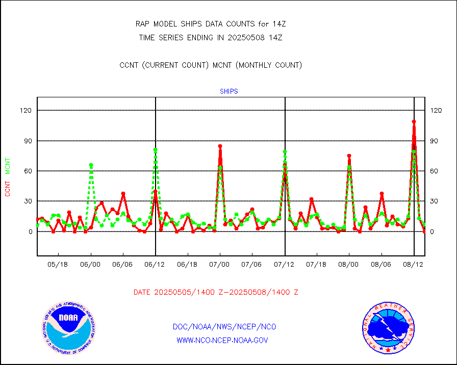
ships |
Ship - manual and automatic, restricted |
4 |
2 |
200.0 % |
1713.50-1714.50 |
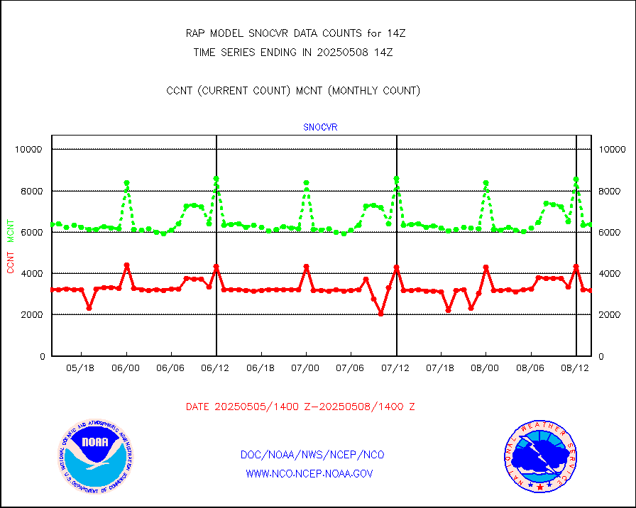
snocvr |
NOW COVER, DEPTH/DENSITY AND WATER EQUIVALENT |
3039 |
6880 |
44.2 % |
1712.00-1716.00 |
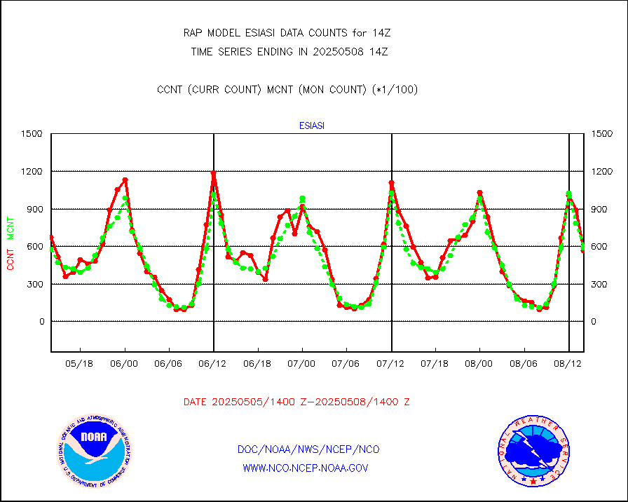
ssmisu |
DMSP SSM/IS 1C radiance data (Unified Pre-Proc.) |
114733 |
51199 |
224.1 % |
1712.00-1715.99 |
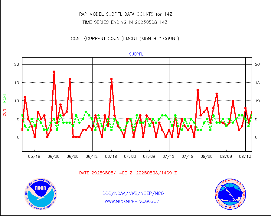
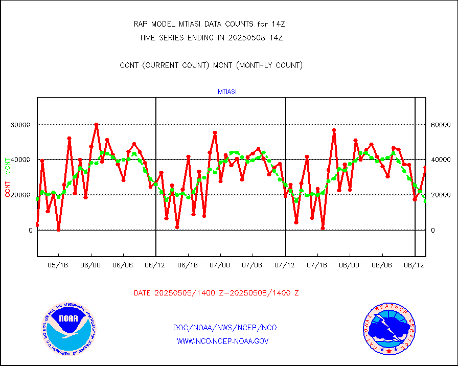
subpfl |
Sub-surface float and glider profile (BUFR) |
10 |
13 |
76.9 % |
1712.00-1715.99 |
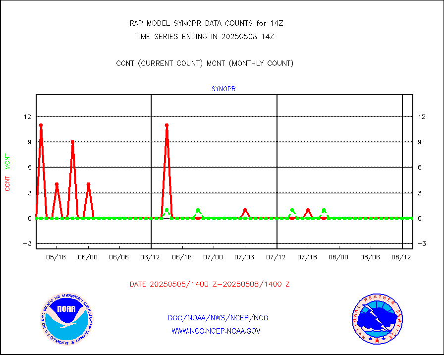
synopr |
Synoptic - restricted (WMO Res 40) manual & auto. |
0 |
0 |
n/a |
1713.50-1714.50 |
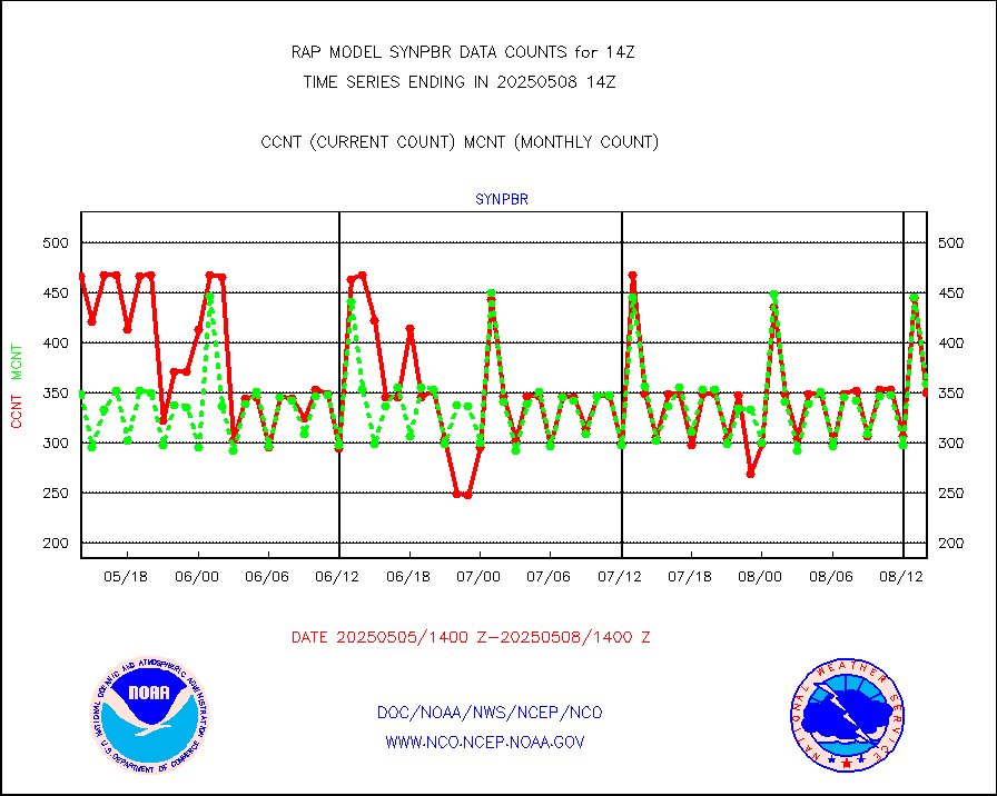
synpbr |
Synoptic - restricted (WMO Res 40)(decoded BUFR) |
345 |
358 |
96.4 % |
1713.50-1714.50 |
synpmb |
Synoptic - mobile manual & auto (decoded fr BUFR) |
0 |
0 |
n/a |
1713.50-1714.50 |
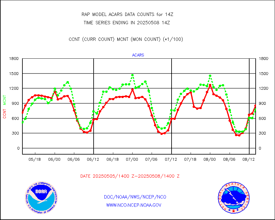
tmdara |
TAMDAR aircft data-all types(from Panasonic,BUFR) |
1529 |
1409 |
108.5 % |
1710.75-1717.25 |
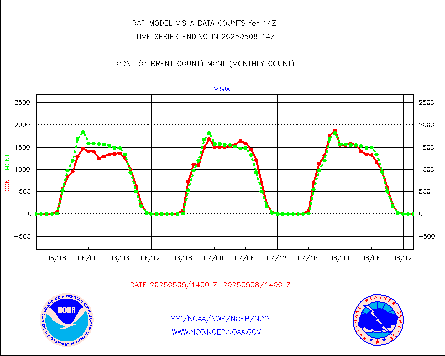
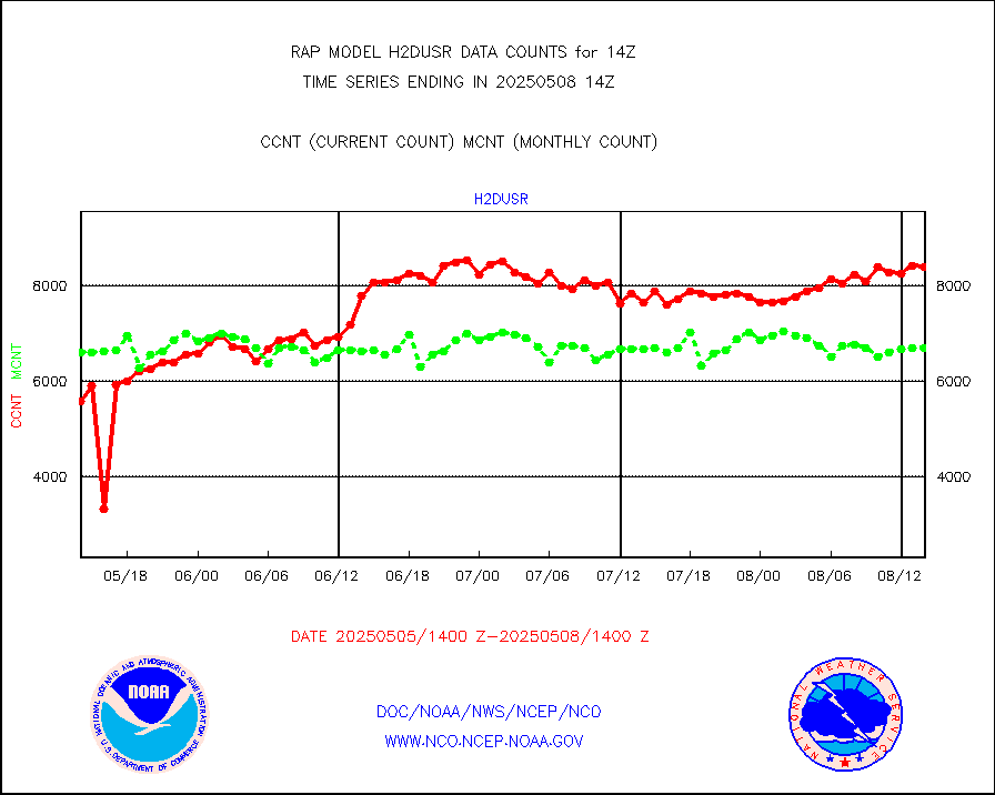
visja |
MTSAT/JMA visible derived cloud motion |
0 |
0 |
n/a |
1711.50-1716.50 |
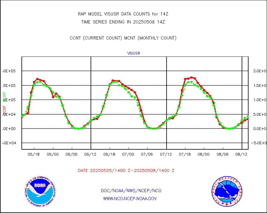
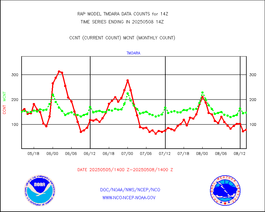
visusr |
GOES-16&up/NESDIS visible derived cloud motion |
37140 |
42633 |
87.1 % |
1713.00-1713.99 |
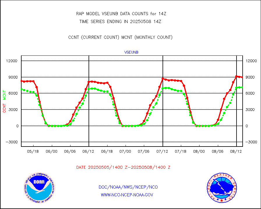
vseunb |
METEOSAT/EUMETSAT visible drv cld motion NBseq |
8310 |
6137 |
135.4 % |
1712.50-1715.49 |


