| Critical Data with Normal Counts |
|---|
| Type | Description | Hourly Count | Monthly Average | Percent (%) of Monthly Mean | UTC Time Window |
1bamua |
NOAA 15-19 & METOP 1-2 AMSU-A NCEP-proc. br.temps |
42454 |
38160 |
111.3 % |
2407.00-2412.99 |
1bhrs4 |
NOAA 18-19 & METOP 1-2 HIRS-4 NCEP-proc. br.temps |
34564 |
35619 |
97.0 % |
2407.00-2412.99 |
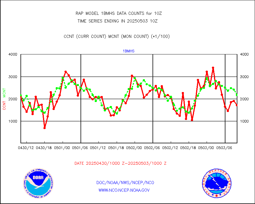
1bmhs |
NOAA 18-19 & METOP 1-2 MHS NCEP-proces. br. temps |
226927 |
222022 |
102.2 % |
2407.00-2412.99 |
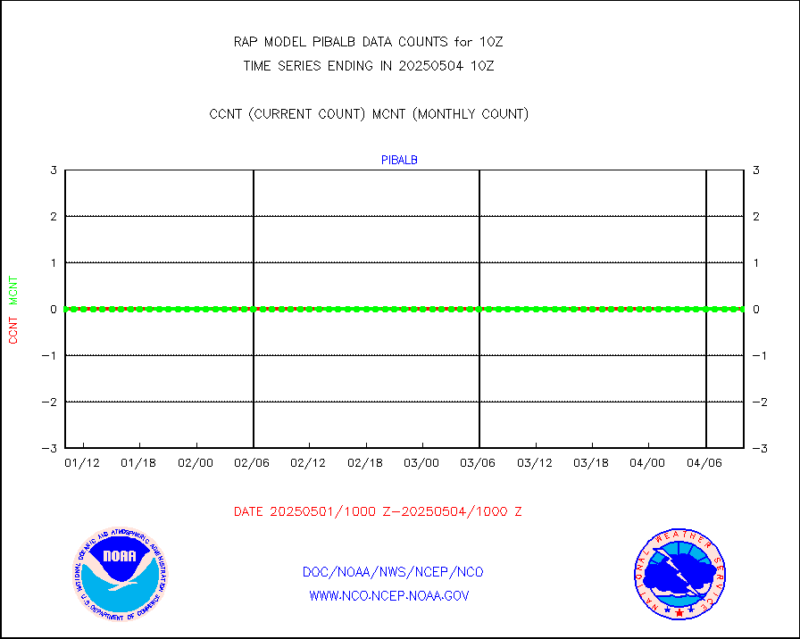
acars |
MDCRS ACARS acft data from ARINC(dcded from BUFR) |
22334 |
25283 |
88.3 % |
2406.75-2413.25 |
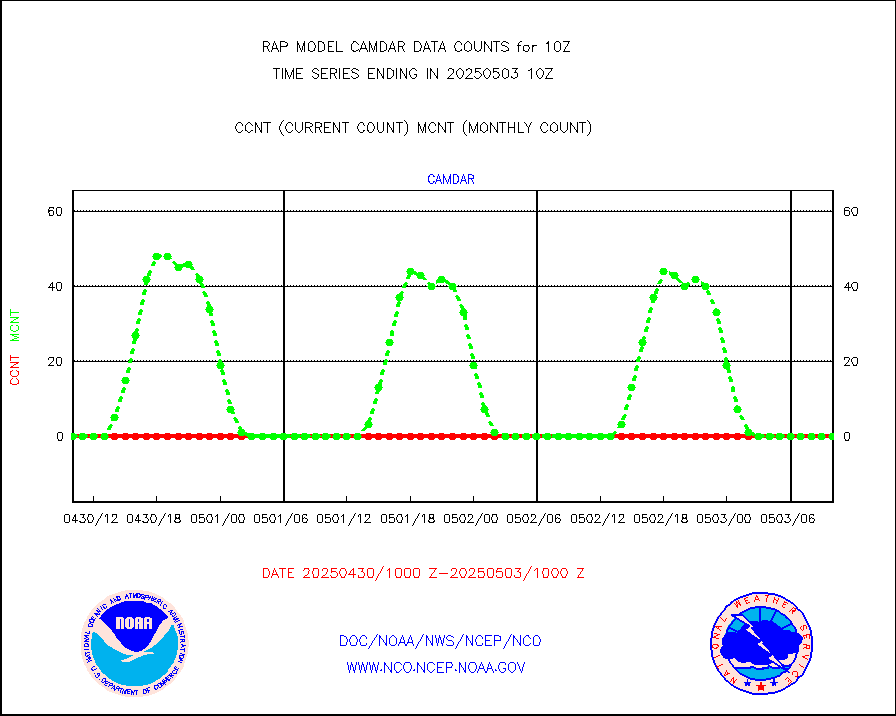
camdar |
Canadian AMDAR aircraft data (decoded from BUFR) |
0 |
3 |
0.0 % |
2406.75-2413.25 |
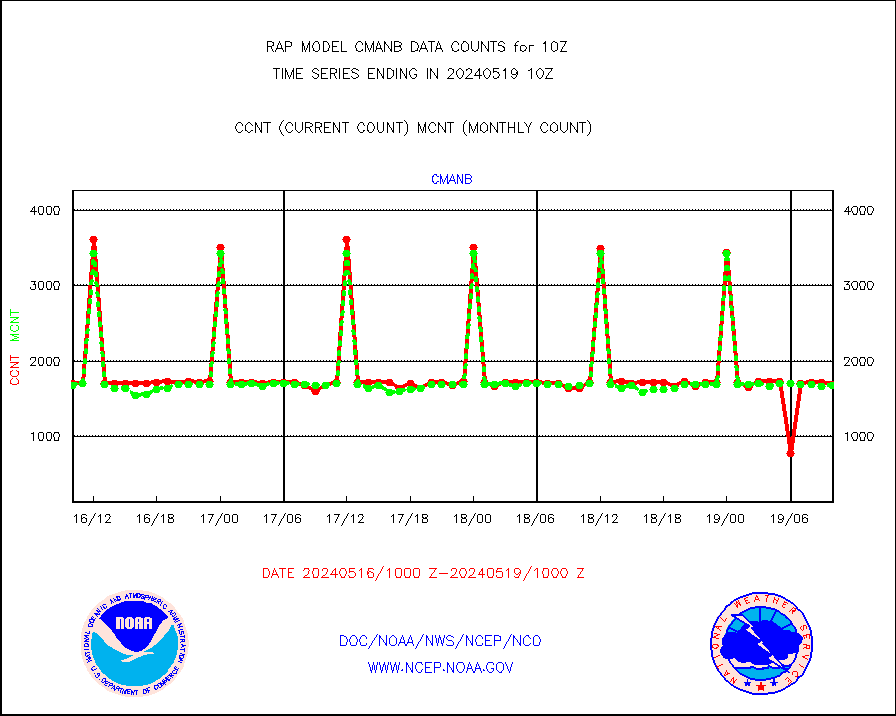
cmanb |
Surface Marine CMAN rpts decoded from BUFR format |
1697 |
1677 |
101.2 % |
2409.50-2410.50 |
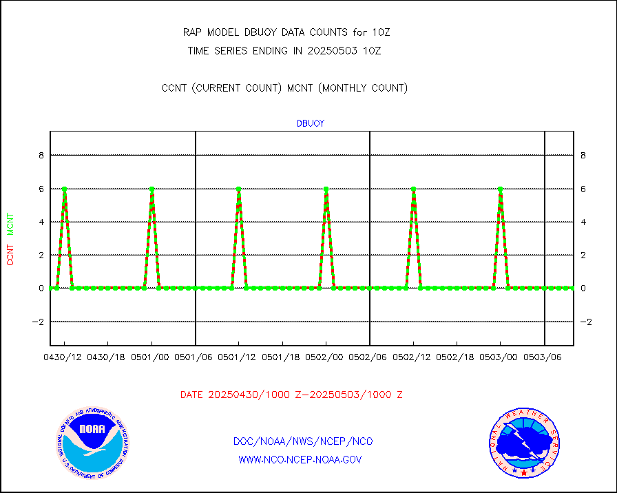
dbuoy |
Buoys decoded from FM-18 fmt (moored or drifting) |
0 |
0 |
n/a |
2409.50-2410.50 |
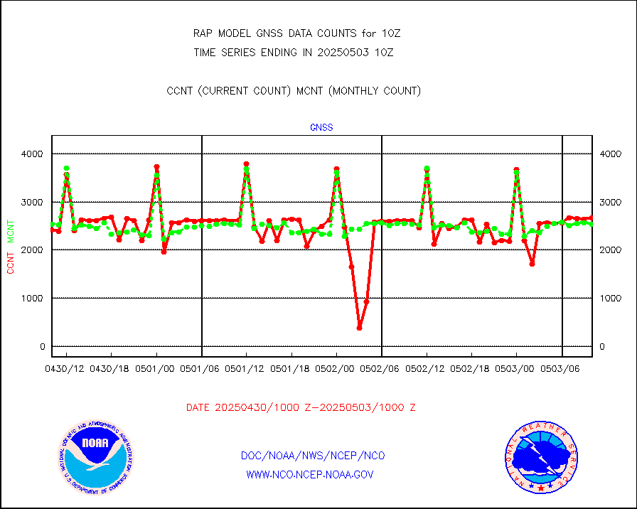
gnss |
Grnd-based Gbl Navigation Sat System (GNSS) data |
2760 |
2348 |
117.5 % |
2408.95-2409.05 |
h20mo |
MODIS (AQUA/TERRA) wvpr imager derived cld motion |
0 |
0 |
n/a |
2407.50-2412.50 |
infmo |
MODIS (AQUA/TERRA) ir l-wave derived cloud motion |
0 |
0 |
n/a |
2407.50-2412.50 |
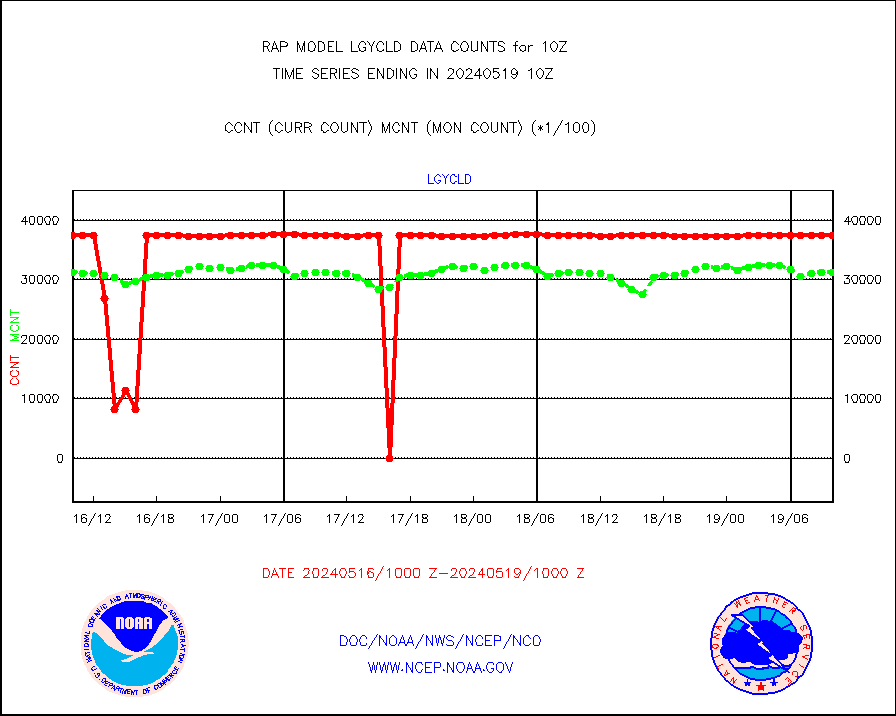
lgycld |
GOES/NASA(Langley) hi-res. (1x1 f-o-v) cloud data |
3724105 |
3269365 |
113.9 % |
2409.50-2410.50 |
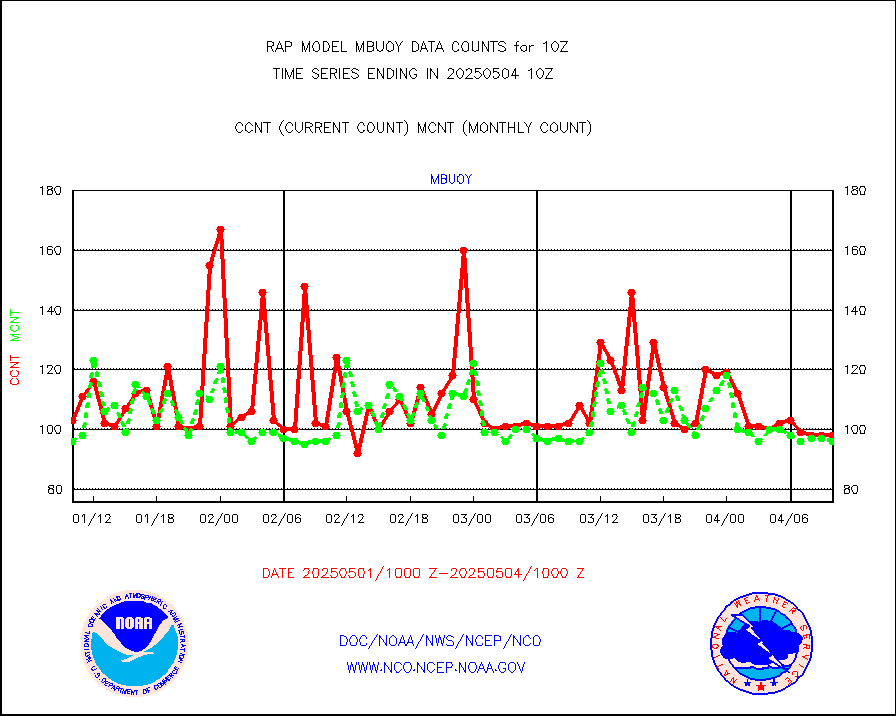
mbuoy |
Buoys decoded from FM-13 format (moored) |
33 |
45 |
73.3 % |
2409.50-2410.50 |
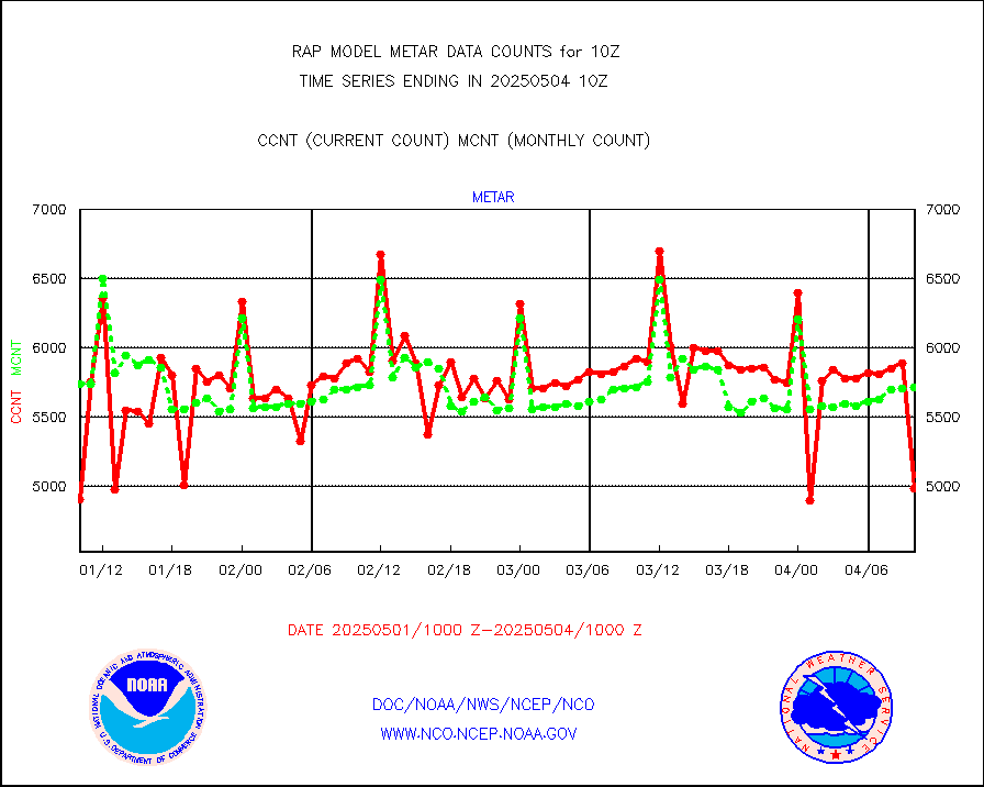
metar |
Aviation - METAR |
5806 |
5883 |
98.7 % |
2409.50-2410.50 |
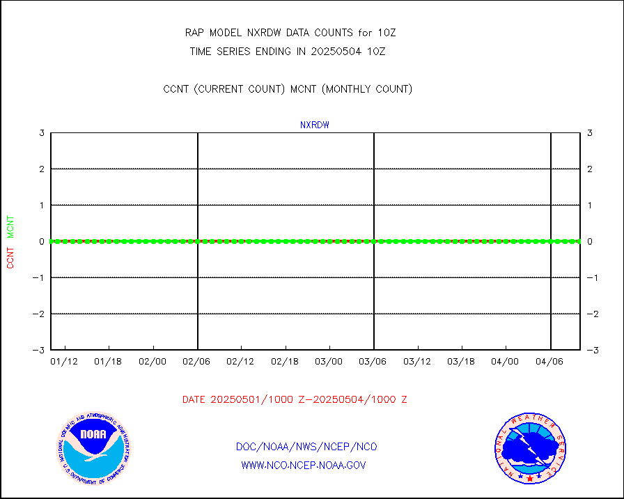
nxrdw |
NEXRAD Vel Azm Dsp(VAD) winds via radar coded msg |
0 |
0 |
n/a |
2409.00-2411.00 |
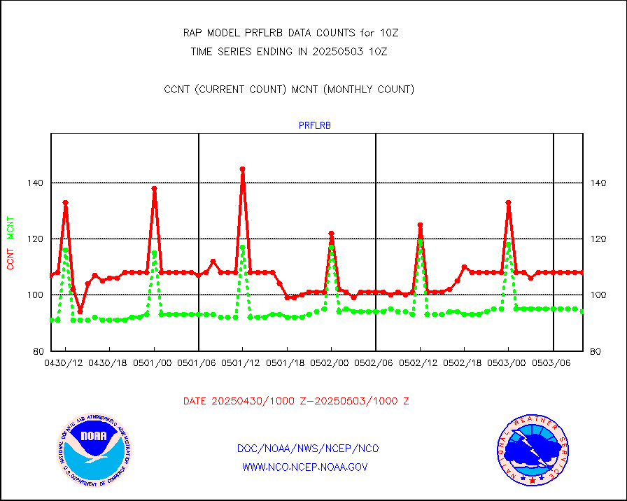
prflrb |
Multi-Agency Profiler (MAP) and SODAR winds |
102 |
83 |
122.9 % |
2408.50-2411.50 |
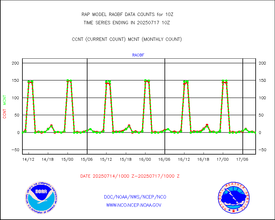
raobf |
Rawinsonde - fixed land (from TEMP or PILOT) |
1 |
0 |
n/a |
2409.00-2411.00 |
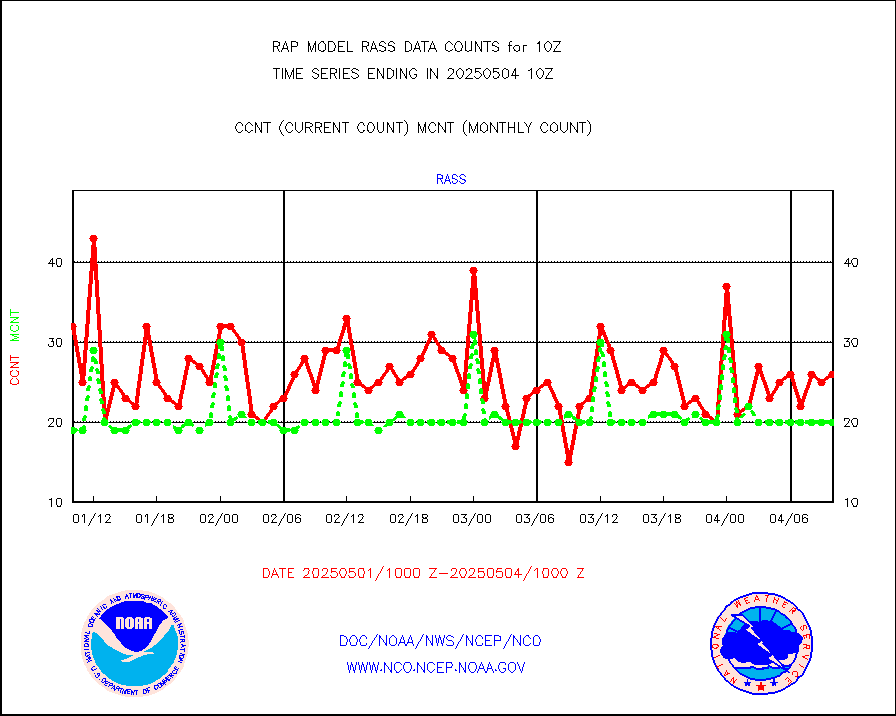
rass |
RASS temperatures (NOAA and Multi-Agency) |
26 |
20 |
130.0 % |
2409.50-2410.50 |
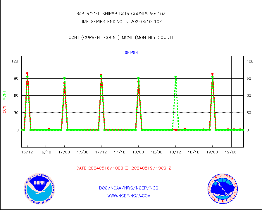
shipsb |
Ship - manual and automatic, restricted (BUFR) |
0 |
0 |
n/a |
2409.50-2410.50 |
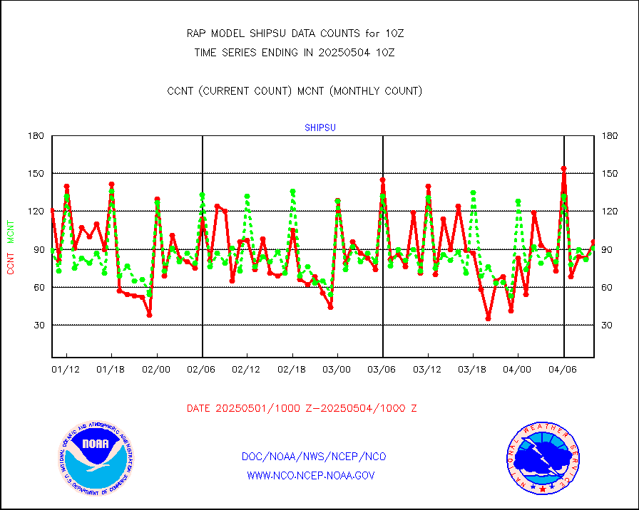
shipsu |
Ship - manual and automatic, unrestricted |
52 |
44 |
118.2 % |
2409.50-2410.50 |
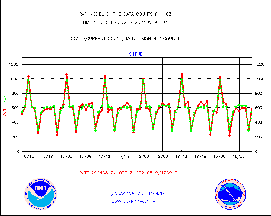
shipub |
Ship - manual and automatic, unrestricted (BUFR) |
472 |
532 |
88.7 % |
2409.50-2410.50 |
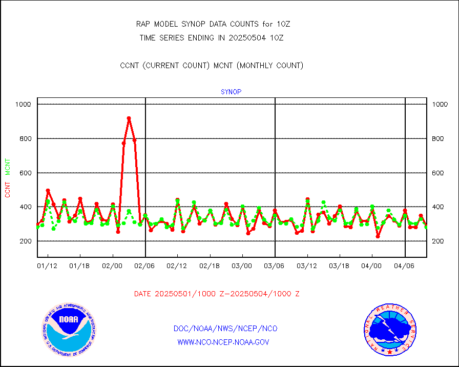
synop |
Synoptic - fixed manual and automatic |
288 |
288 |
100.0 % |
2409.50-2410.50 |
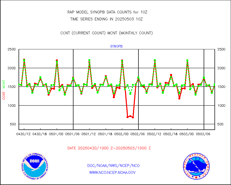
synopb |
Synoptic - fixed manual & auto (decoded fr BUFR) |
1695 |
1623 |
104.4 % |
2409.50-2410.50 |
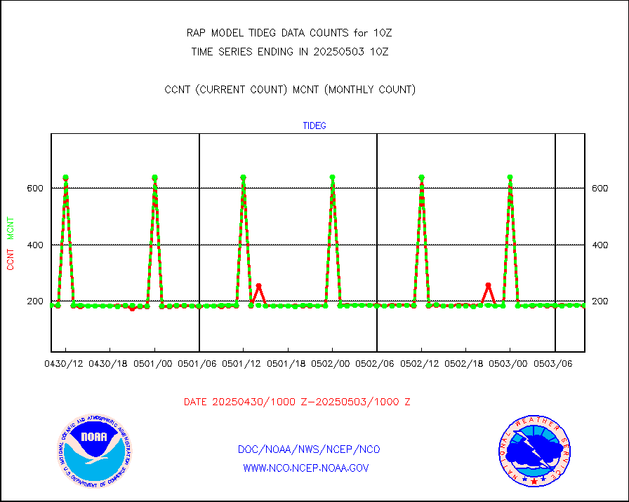
tideg |
Tide gauge reports decoded from CREX format |
169 |
179 |
94.4 % |
2409.50-2410.50 |
| Data Types of Opportunity with Normal Counts |
|---|
| Type | Description | Hourly Count | Monthly Average | Percent (%) of Monthly Mean | UTC Time Window |
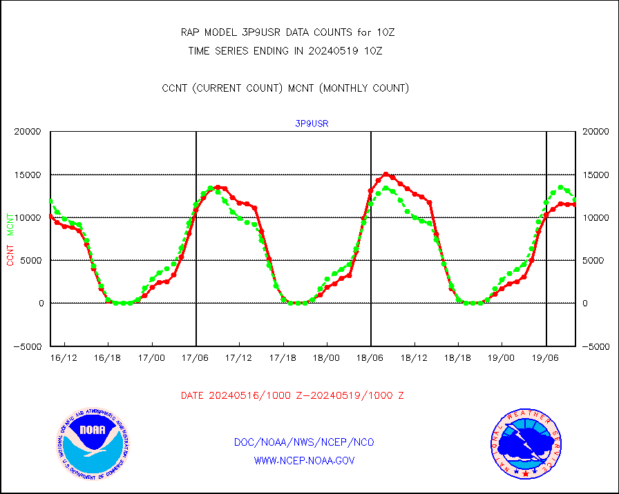
3p9usr |
GOES-16&up/NESDIS ir short-wv derived cld motion |
13475 |
14025 |
96.1 % |
2409.00-2409.99 |
acarsa |
MDCRS ACARS acft data (ARINC via AFWA)(AIREP fmt) |
0 |
0 |
n/a |
2406.75-2413.25 |
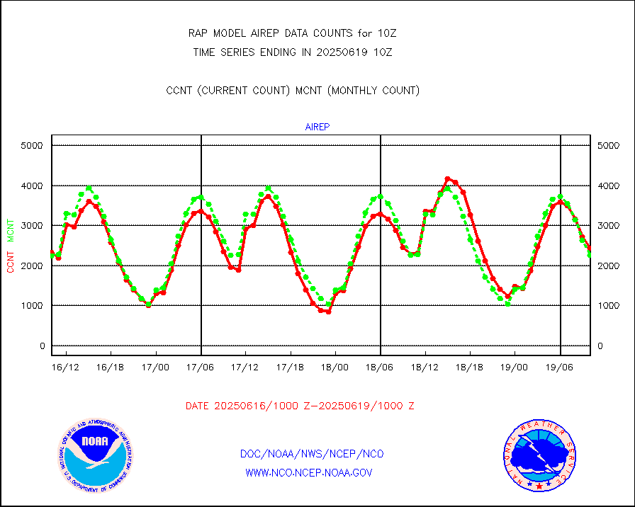
airep |
Manual AIREP aircraft data (dcded from AIREP fmt) |
3058 |
2961 |
103.3 % |
2406.75-2413.25 |
airsev |
AQUA AIRS/AMSU-A/HSB brightness temps- every FOV |
0 |
0 |
n/a |
2407.00-2412.99 |
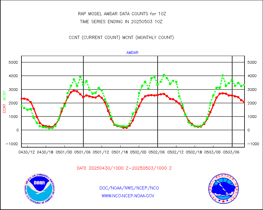
amdar |
AMDAR aircraft data (decoded from AMDAR format) |
2506 |
1781 |
140.7 % |
2406.75-2413.25 |
amdarb |
AMDAR aircraft data (decoded from BUFR) |
6234 |
5732 |
108.8 % |
2406.75-2413.25 |
amsr2 |
GCOM-W AMSR2 1B brightness temperatures |
977122 |
607340 |
160.9 % |
2407.00-2407.99 |
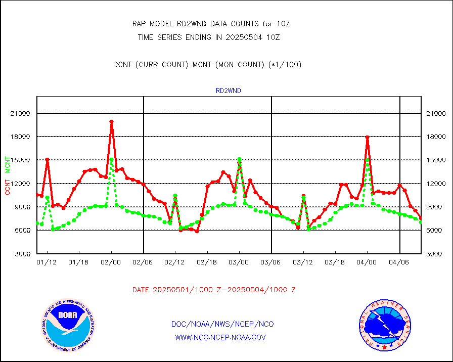
ascat |
METOP 1-2 ASCAT products |
20903 |
15626 |
133.8 % |
2408.00-2412.00 |
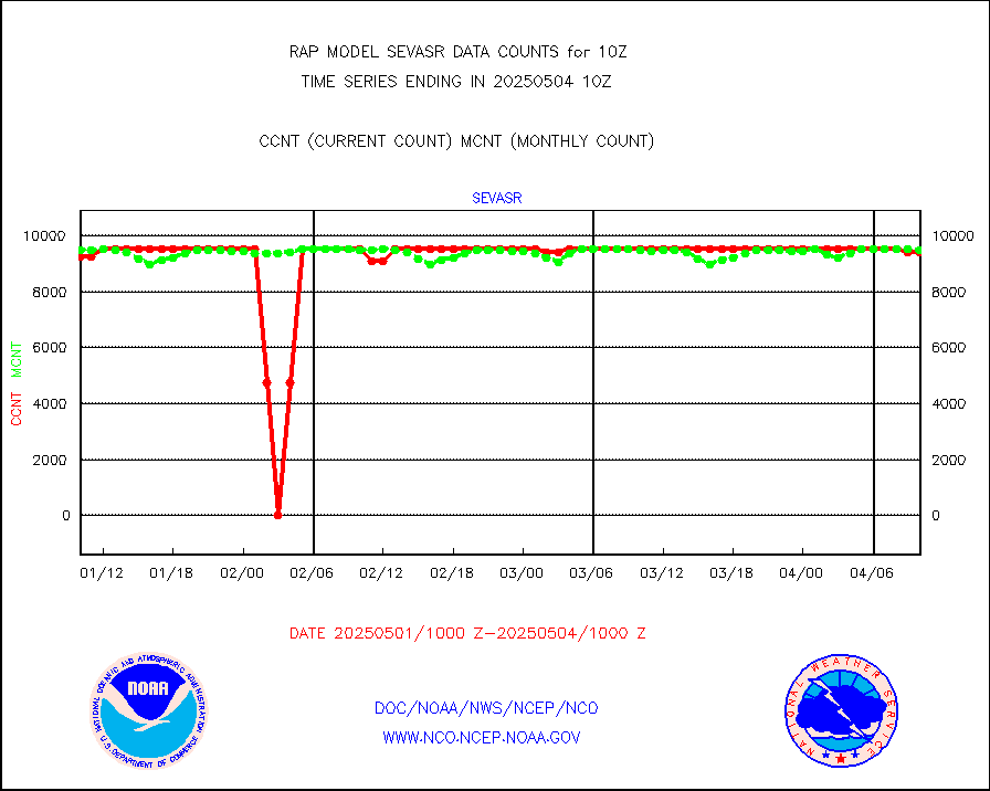
atms |
NPP/NOAA-20 ATMS brightness temperatures |
139572 |
141409 |
98.7 % |
2408.00-2411.99 |
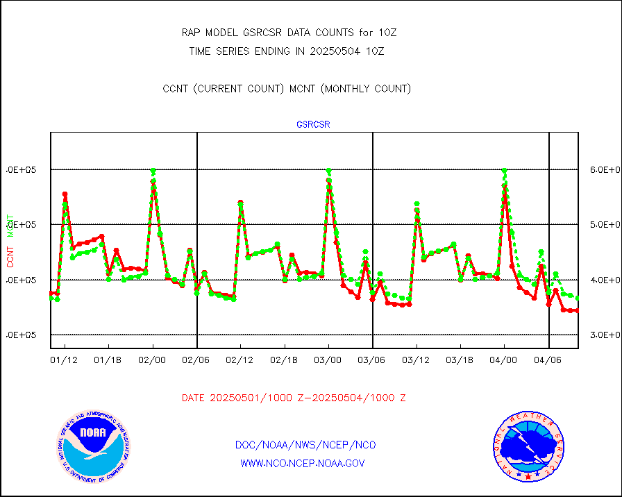
atmsdb |
NPP/NOAA-20 ATMS bright. temps-direct b-cast SSEC |
106473 |
108602 |
98.0 % |
2408.00-2411.99 |
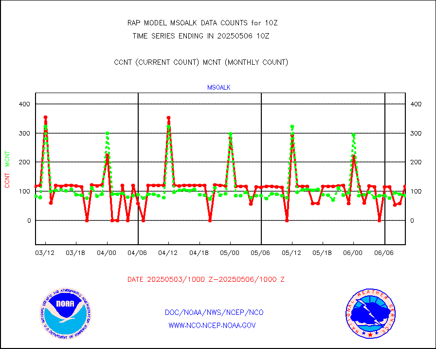
coopmd |
Coop/MADIS NEPP & HCN-Modernization NOAA COOP Obs |
27 |
23 |
117.4 % |
2409.50-2410.50 |
crisf4 |
NPP/NOAA-20 CrIS full spctrl radn (431 ch subset) |
110283 |
92771 |
118.9 % |
2408.00-2411.99 |
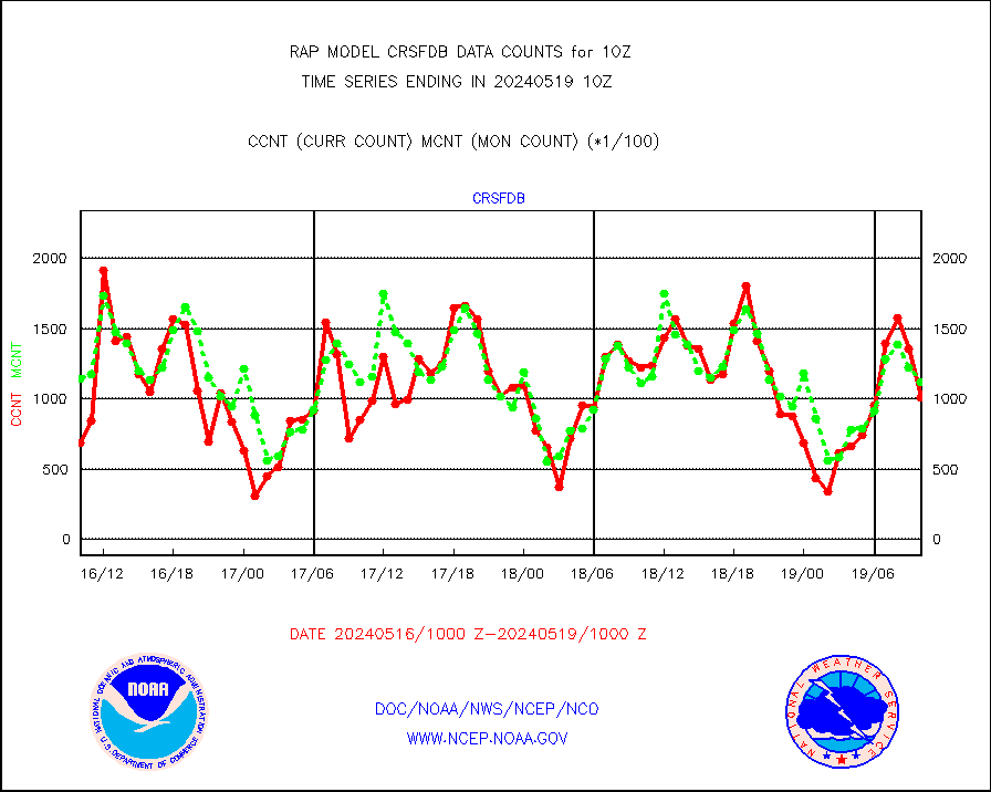
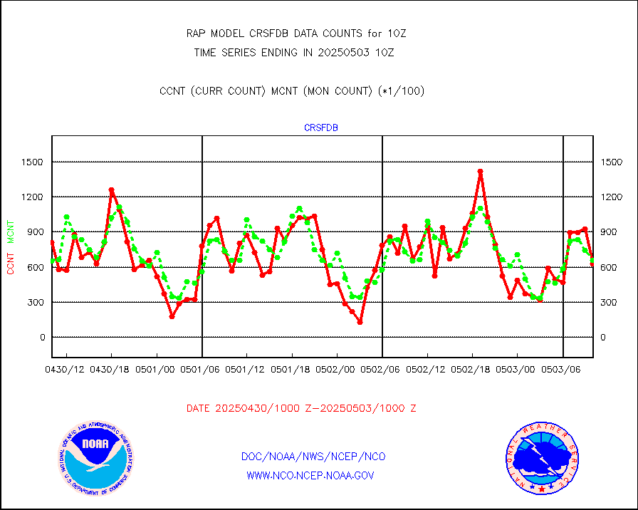
crsfdb |
NPP/NOAA-20 CrIS full spctrl radn dir brdcst SSEC |
111234 |
99375 |
111.9 % |
2408.00-2411.99 |
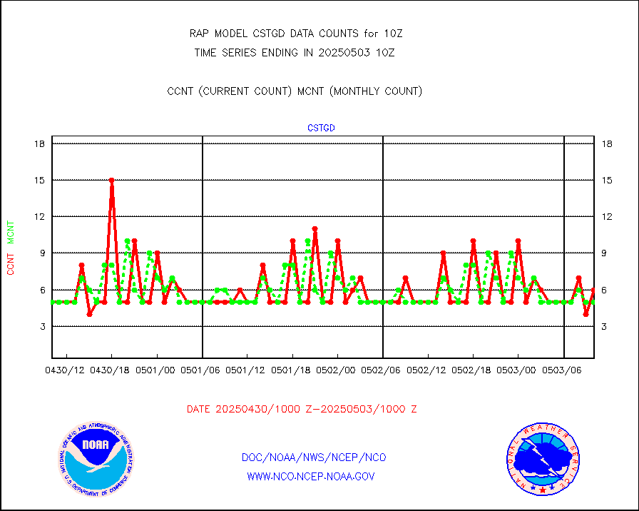
cstgd |
Coast Guard |
4 |
3 |
133.3 % |
2409.50-2410.50 |
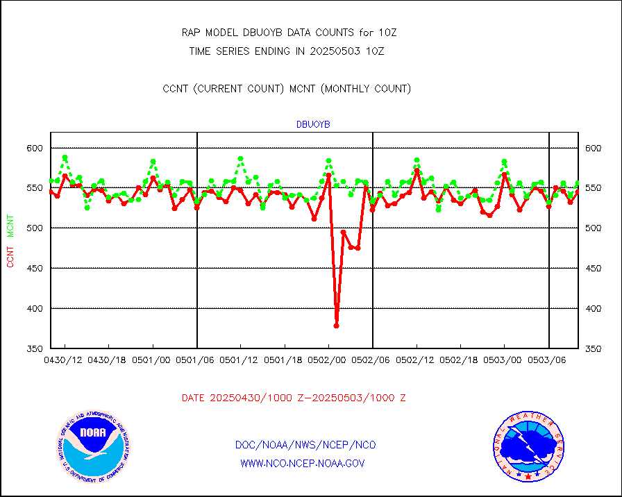
dbuoyb |
Drifting buoys (decoded from BUFR) |
581 |
612 |
94.9 % |
2409.50-2410.50 |
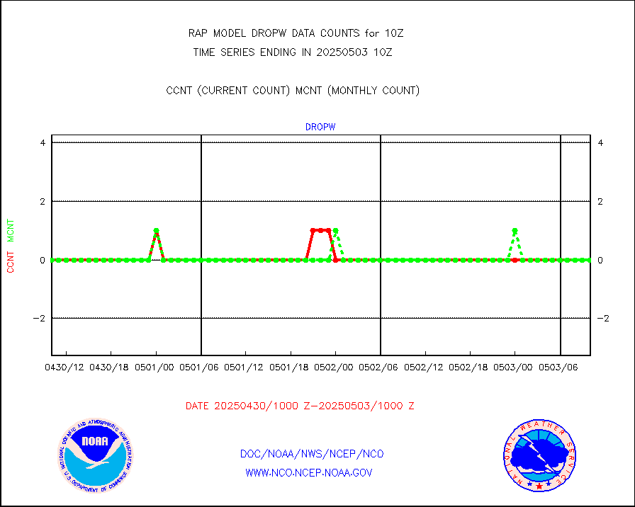
dropw |
Dropwinsonde (from TEMP DROP) |
0 |
0 |
n/a |
2409.00-2411.00 |
eadas |
E-AMDAR (European AMDAR acft decoded from BUFR) |
8215 |
8488 |
96.8 % |
2406.75-2413.25 |
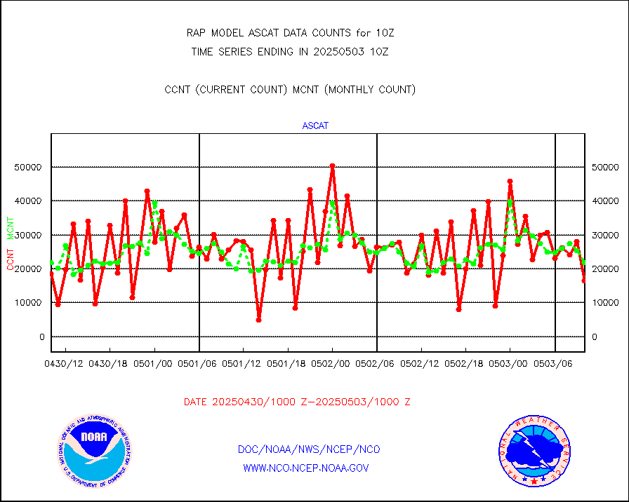
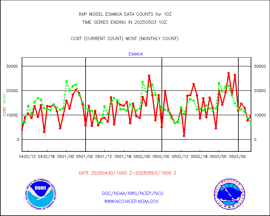
esamua |
NOAA 15-19 & METOP 1-2 AMSU-A proc btmps frm RARS |
7494 |
7104 |
105.5 % |
2409.00-2411.00 |
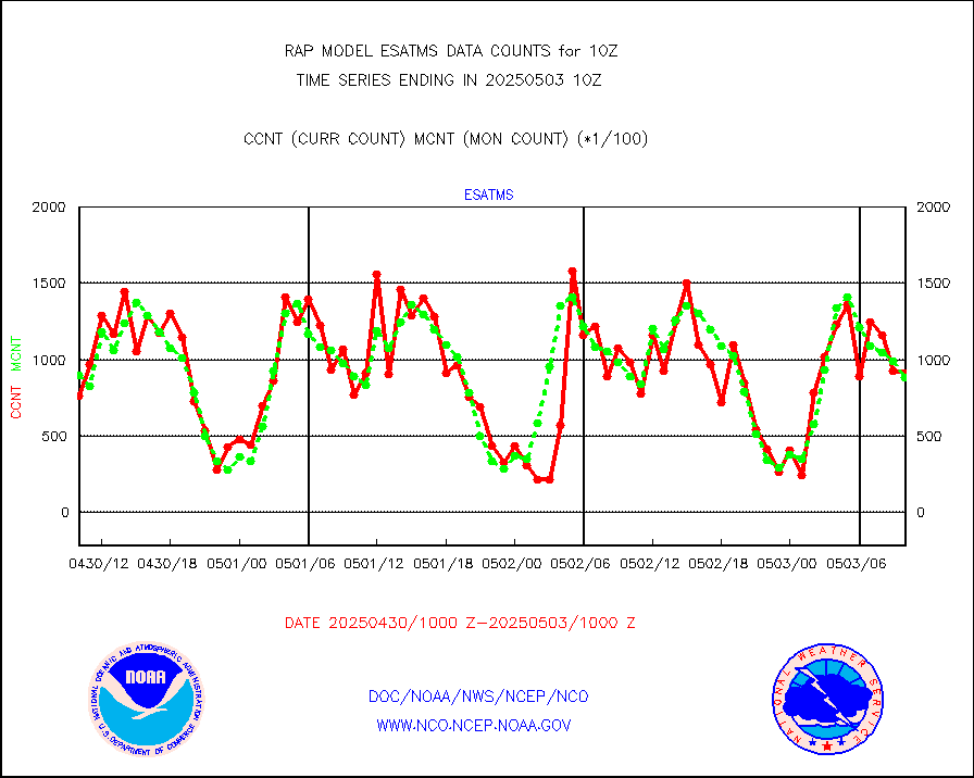
esatms |
NPP Adv. Tech. MW Sndr (ATMS) br. temps from RARS |
112988 |
80829 |
139.8 % |
2408.00-2411.99 |
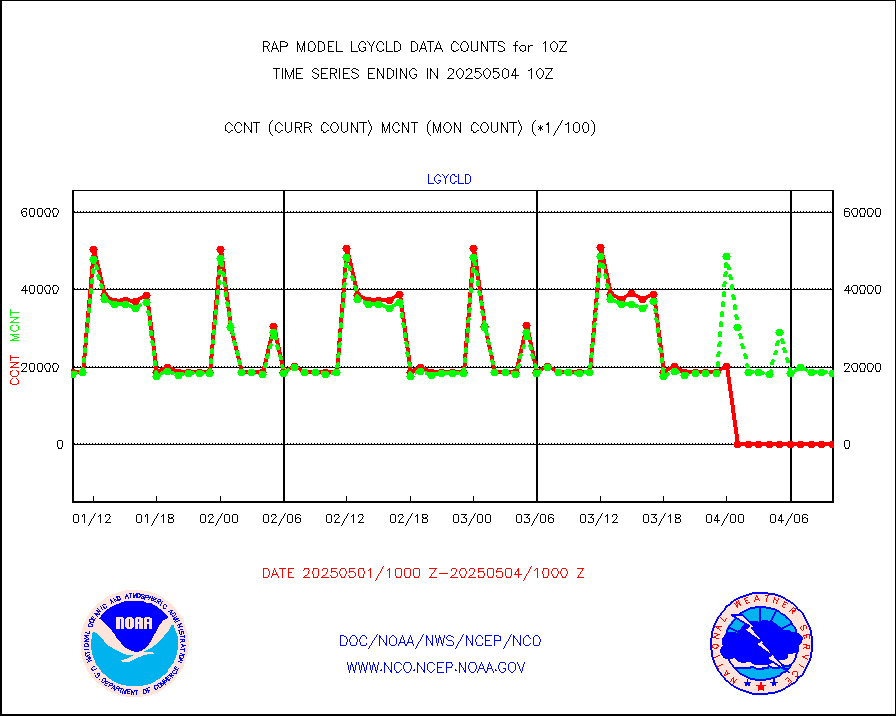
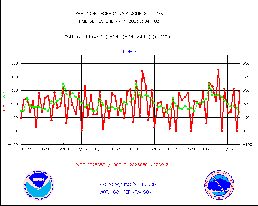
eshrs3 |
NOAA 15-19 & METOP 1-2 HIRS-3/4 pr btmps frm RARS |
16969 |
18869 |
89.9 % |
2409.00-2411.00 |
esiasi |
METOP 1-2 IASI 1C radiance data vbl chn from RARS |
33293 |
31073 |
107.1 % |
2408.00-2411.99 |
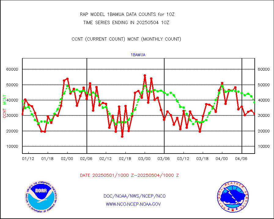
esmhs |
NOAA 18-19 & METOP 1-2 MHS proc. btemps from RARS |
35869 |
52825 |
67.9 % |
2409.00-2411.00 |
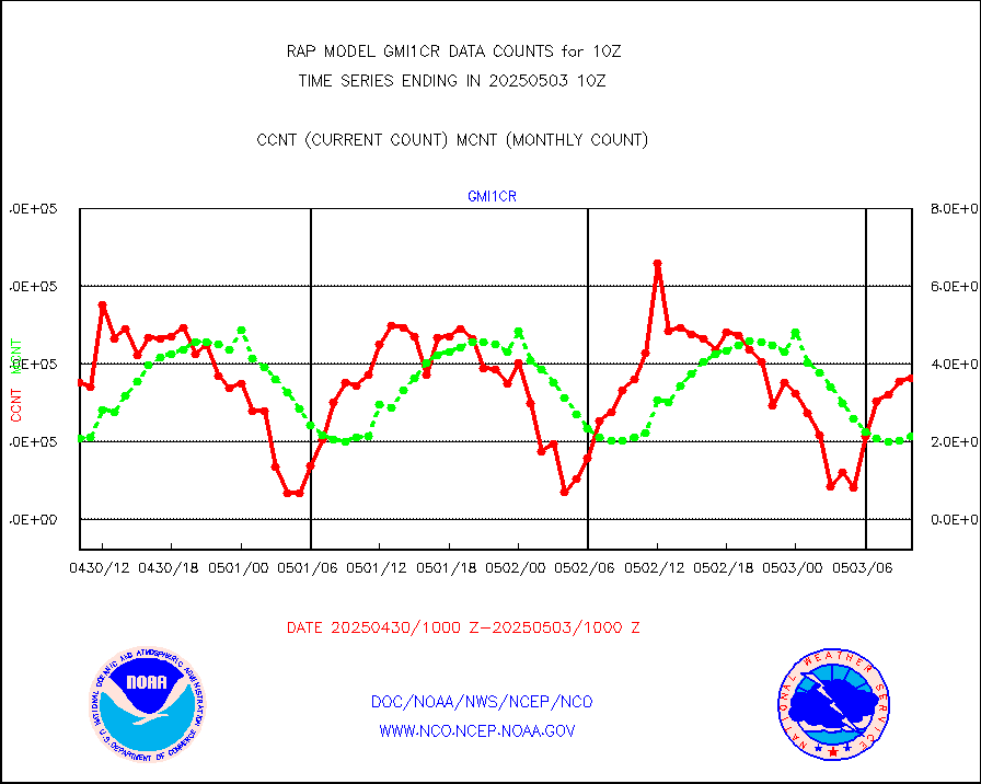
gmi1cr |
GPM GMI Level 1C-R brightness temperatures |
330053 |
894883 |
36.9 % |
2407.00-2412.99 |
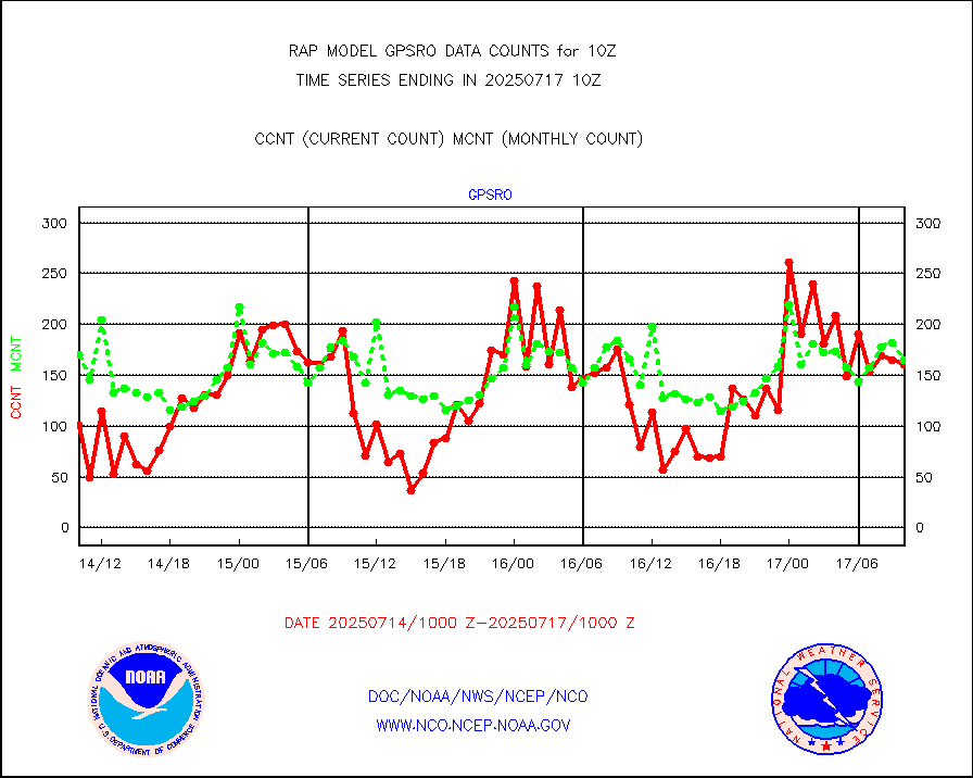
gpsro |
GPS radio occultation data |
54 |
112 |
48.2 % |
2408.00-2411.99 |
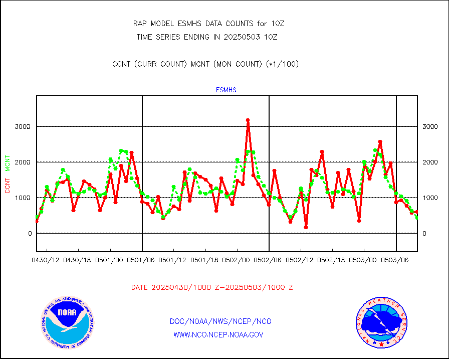
gsrasr |
GOES-16/17 All Sky Radiances (proc.) |
812097 |
793361 |
102.4 % |
2408.00-2411.99 |
gsrcsr |
GOES-16/17 Clear Sky Radiances (proc.) |
401110 |
359803 |
111.5 % |
2408.00-2411.99 |
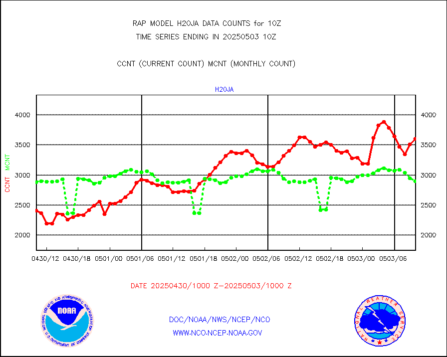
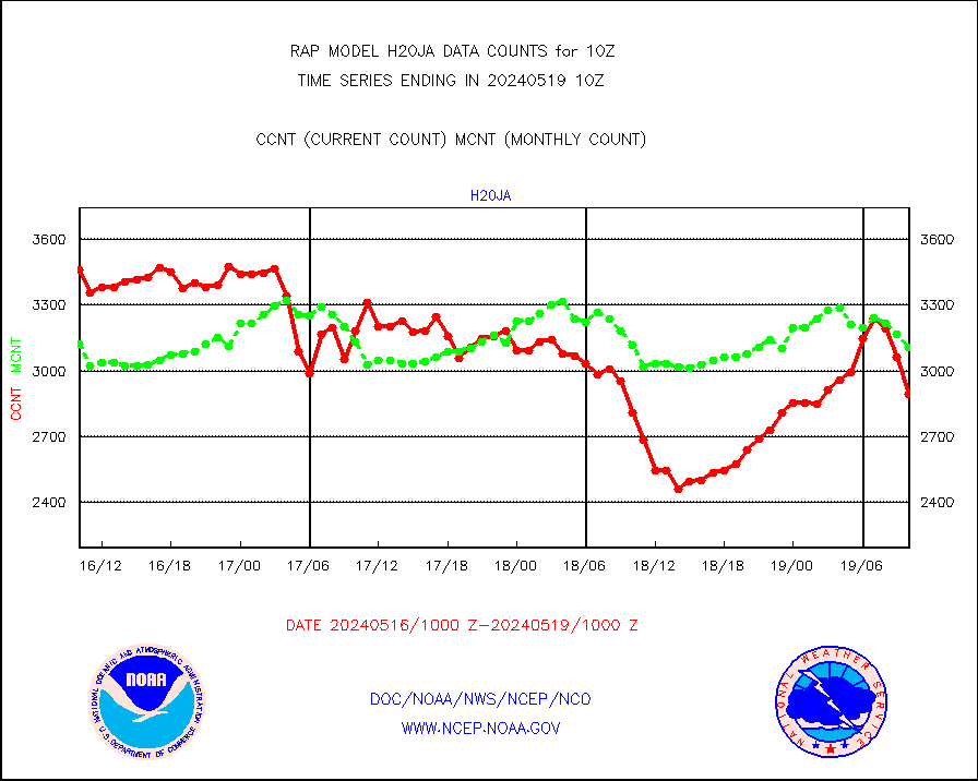
h20ja |
MTSAT/JMA water vapor imager derived cloud motion |
2702 |
2698 |
100.1 % |
2407.50-2412.50 |
h2dusr |
GOES-16&up/NESDIS wv imgr/deep-lyr derivd cld mtn |
8167 |
5737 |
142.4 % |
2409.00-2409.99 |
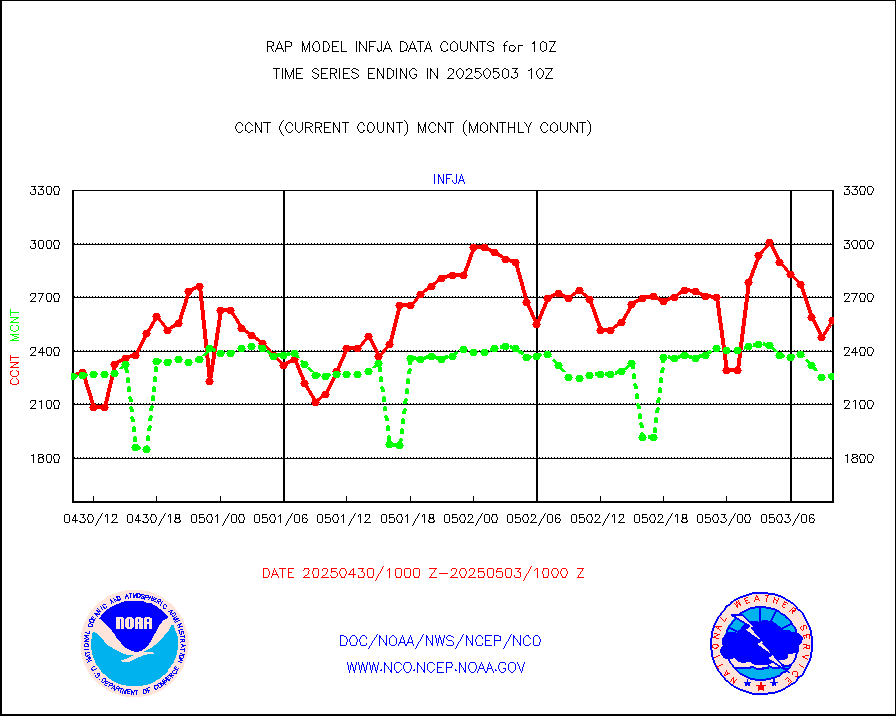
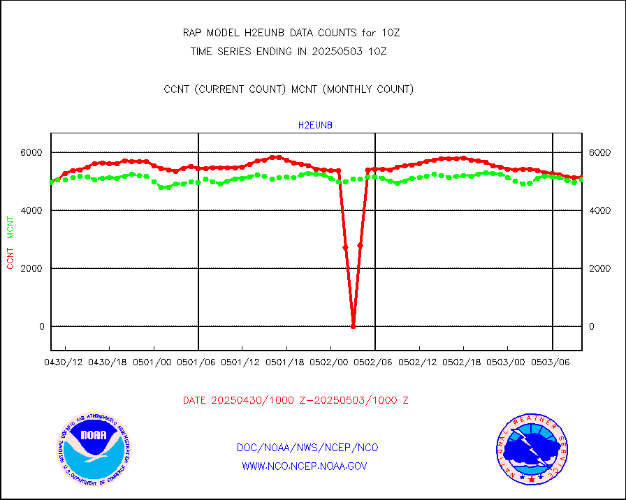
h2eunb |
METEOSAT/EUMETSAT wvpr imgr drv cld motion NBseq |
4585 |
4988 |
91.9 % |
2408.50-2411.49 |
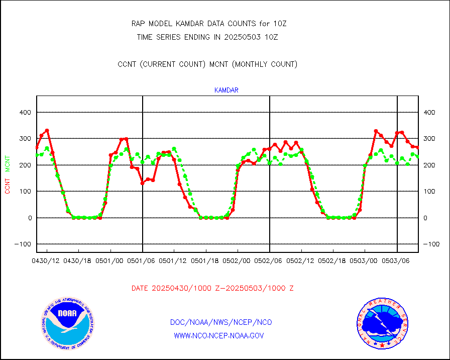
h2tusr |
GOES-16&up/NESDIS wv imgr/cld-top derived cld mtn |
9150 |
9105 |
100.5 % |
2409.00-2409.99 |
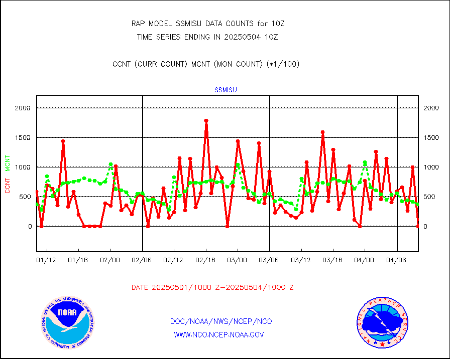
iasidb |
METOP 1-2 IASI 1C radiances-direct broadcast SSEC |
22024 |
20146 |
109.3 % |
2408.00-2411.99 |
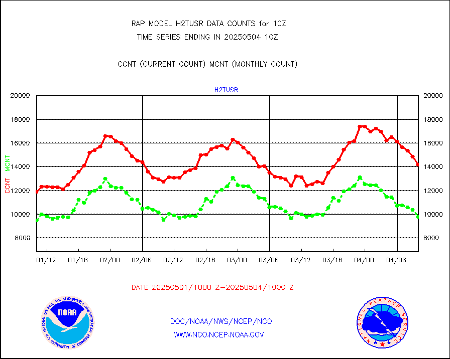
ifeunb |
METEOSAT/EUMETSAT ir lg-wave drv cld motion NBseq |
3240 |
3209 |
101.0 % |
2408.50-2411.49 |
ifvrnb |
VIIRS (NPP/NOAA-20) ir lg-wv drv cloud motion(NB) |
0 |
0 |
n/a |
2407.50-2412.50 |
infav |
AVHRR (NOAA/METOP) ir lg-wave derived cld motion |
0 |
6 |
0.0 % |
2407.50-2412.50 |
infav1 |
AVHRR (METOP) ir lg-wave derived cld motion |
0 |
0 |
n/a |
2408.50-2411.49 |
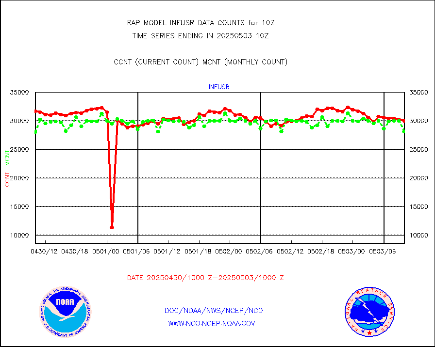
infja |
MTSAT/JMA infrared long-wave derived cloud motion |
2935 |
2357 |
124.5 % |
2407.50-2412.50 |
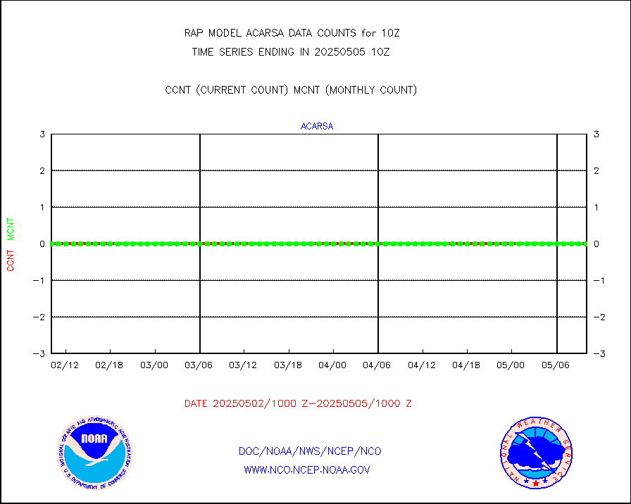
infusr |
GOES-16&up/NESDIS ir long-wave derived cld motion |
29659 |
28385 |
104.5 % |
2409.00-2409.99 |
kamdar |
Korean AMDAR aircraft data (decoded from BUFR) |
275 |
261 |
105.4 % |
2406.75-2413.25 |
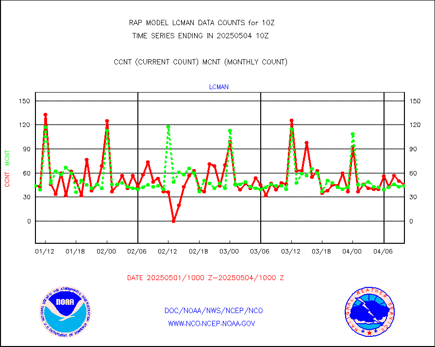
lcman |
Land-based CMAN stations decoded from CMAN format |
75 |
73 |
102.7 % |
2409.50-2410.50 |
mbuoyb |
Moored buoys (decoded from BUFR) |
540 |
471 |
114.6 % |
2409.50-2410.50 |
mso470 |
Mesonet/MADIS Colorado E-470 (Interstate 470) |
12 |
18 |
66.7 % |
2409.50-2410.50 |
msoalk |
Mesonet/MADIS Alaska Department of Transportation |
104 |
101 |
103.0 % |
2409.50-2410.50 |
msoapg |
Mesonet/MADIS U.S. Army Aberdeen Proving Grounds |
0 |
0 |
n/a |
2409.50-2410.50 |
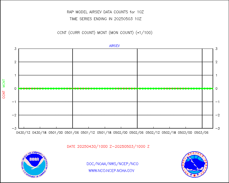
msoapr |
Mesonet/MADIS Citizen Weather Observers Program |
46458 |
44259 |
105.0 % |
2409.50-2410.50 |
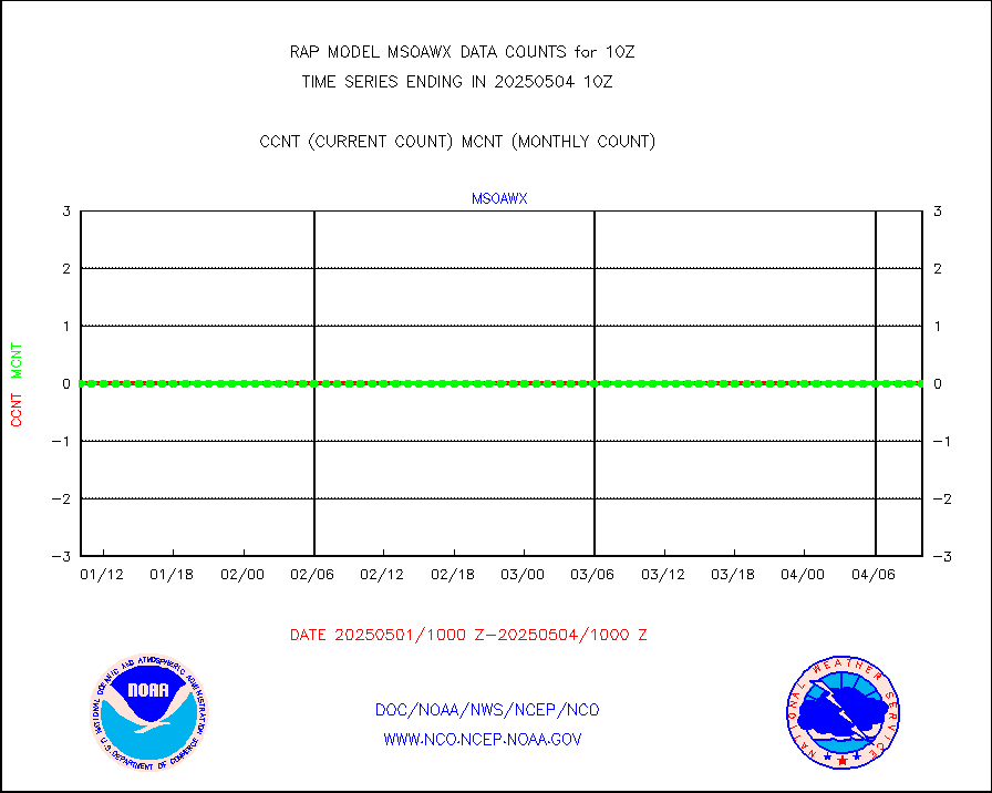
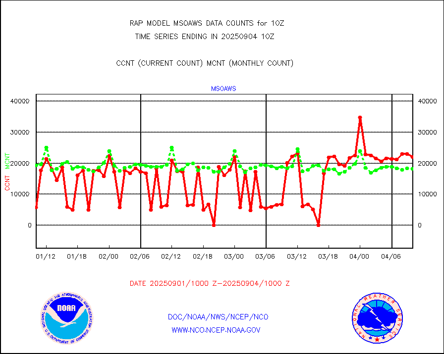
msoaws |
Mesonet/MADIS AWS Convergence Technologies, Inc. |
26192 |
25523 |
102.6 % |
2409.50-2410.50 |
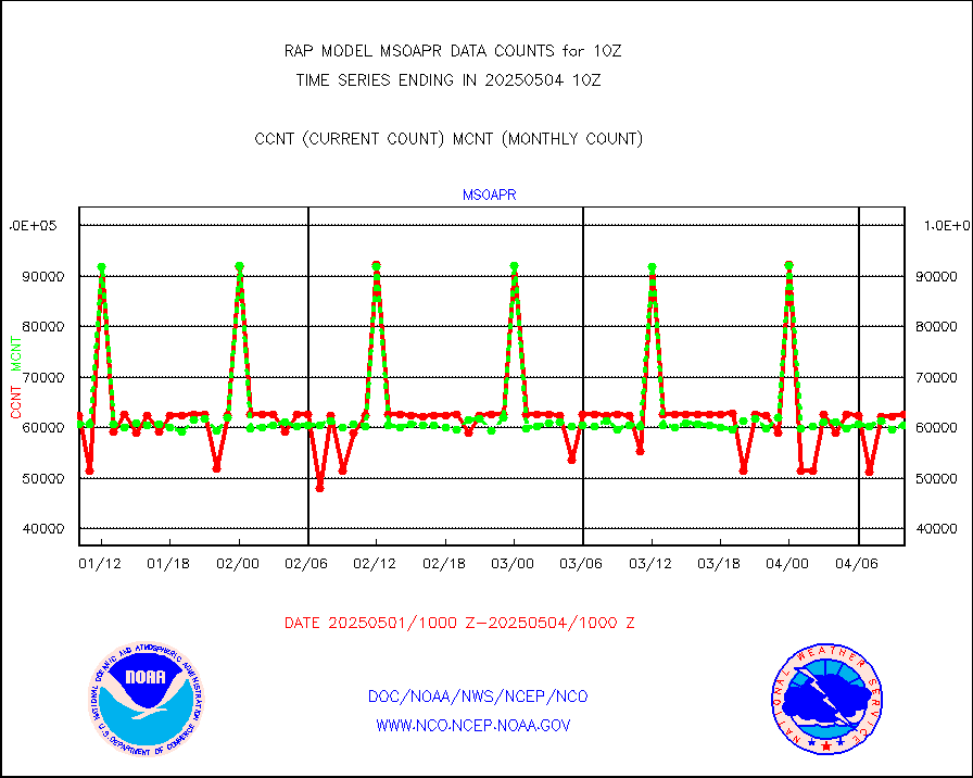
msoawx |
Mesonet/MADIS "Anything Weather" |
0 |
0 |
n/a |
2409.50-2410.50 |
msocol |
Mesonet/MADIS Colorado Dept. of Transportation |
0 |
0 |
n/a |
2409.50-2410.50 |
msodcn |
Mesonet/MADIS DC Net |
0 |
0 |
n/a |
2409.50-2410.50 |
msoden |
Mesonet/MADIS Denver Urban Drainage & Flood Cntrl |
200 |
200 |
100.0 % |
2409.50-2410.50 |
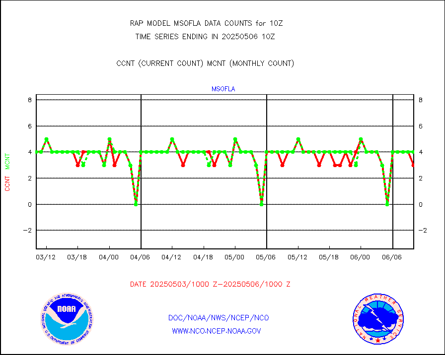
msofla |
Mesonet/MADIS Florida (FAWN & USF) |
3 |
3 |
100.0 % |
2409.50-2410.50 |
msoflt |
Mesonet/MADIS Florida Dept. of Transportation |
0 |
0 |
n/a |
2409.50-2410.50 |
msogeo |
Mesonet/MADIS Georgia Dept. of Transportation |
0 |
0 |
n/a |
2409.50-2410.50 |
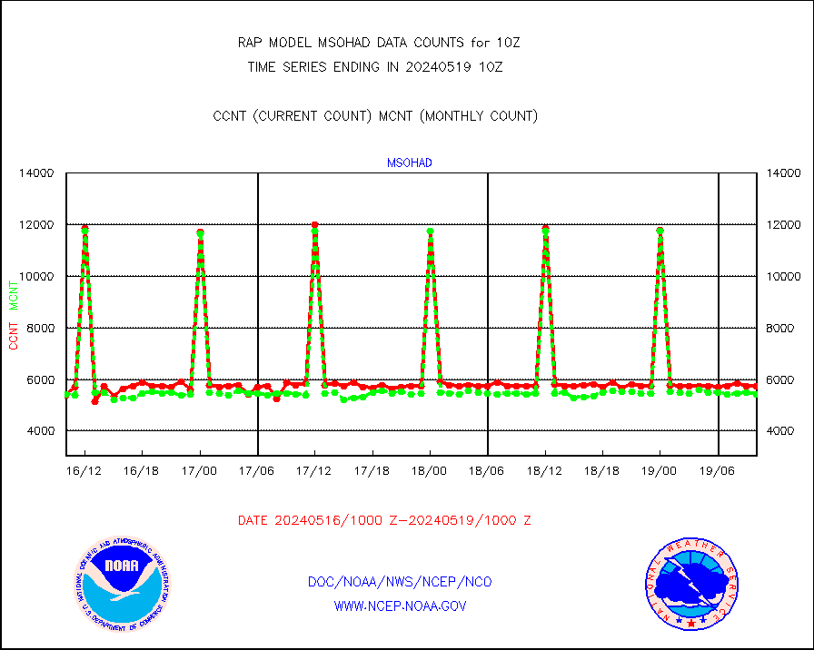
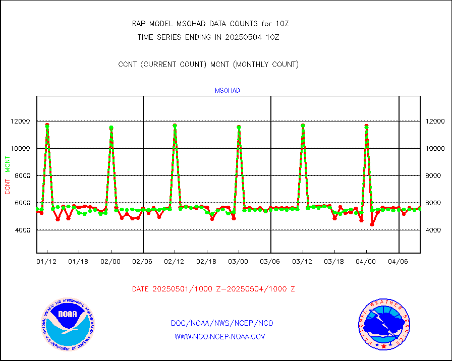
msohad |
Mesonet/MADIS NWS Hydromet Auto Data System(HADS) |
5499 |
5505 |
99.9 % |
2409.50-2410.50 |
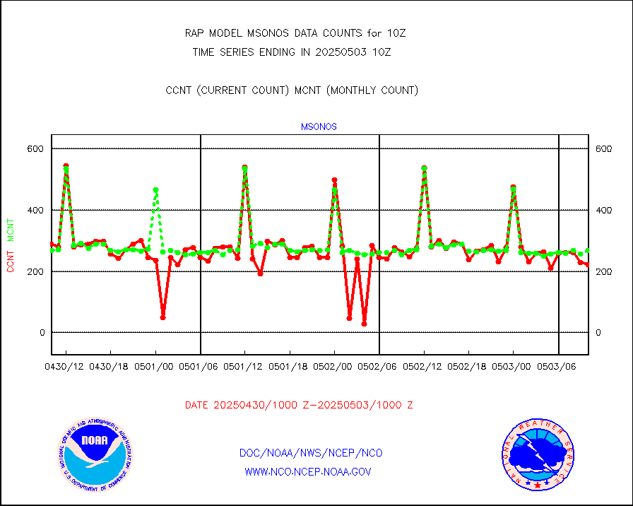
msoien |
Mesonet/MADIS Iowa Environmental |
178 |
168 |
106.0 % |
2409.50-2410.50 |
msoind |
Mesonet/MADIS Indiana Dept. of Transportation |
0 |
0 |
n/a |
2409.50-2410.50 |
msoiow |
Mesonet/MADIS Iowa Department of Transportation |
0 |
0 |
n/a |
2409.50-2410.50 |
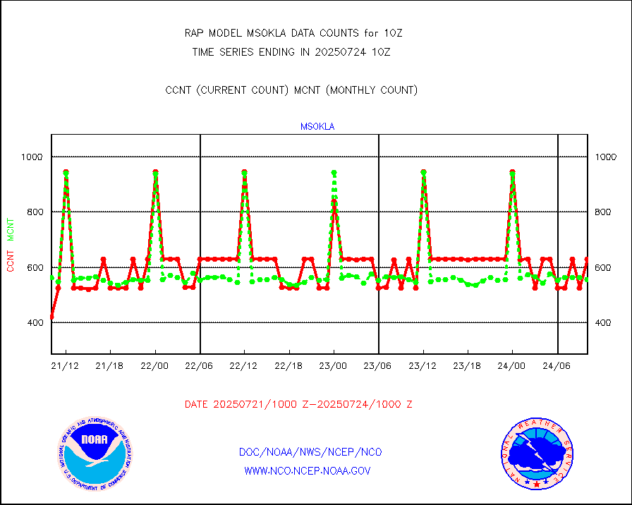
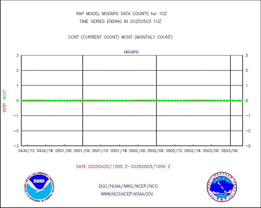
msokla |
Mesonet/MADIS Oklahoma Mesonet |
318 |
325 |
97.8 % |
2409.50-2410.50 |
msolju |
Mesonet/MADIS Louisiana State/Jackson State Univ. |
0 |
0 |
n/a |
2409.50-2410.50 |
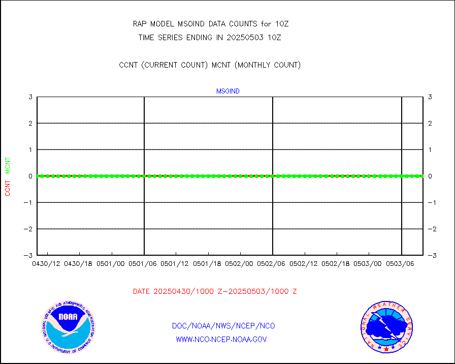
msomca |
Mesonet/MADIS Missouri Commercial Agricult Wx Net |
274 |
249 |
110.0 % |
2409.50-2410.50 |
msomin |
Mesonet/MADIS Minnesota Dept. of Transportation |
0 |
0 |
n/a |
2409.50-2410.50 |
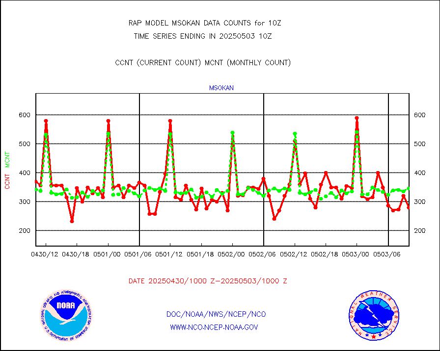
msonos |
Mesonet/MADIS NOS-Phys Oceanographic Realtime Sys |
290 |
273 |
106.2 % |
2409.50-2410.50 |
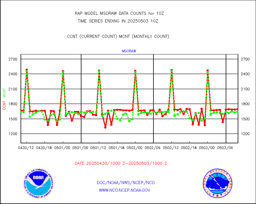
msoraw |
Mesonet/MADIS NFIC Remote Automated Wx Stns(RAWS) |
1513 |
1566 |
96.6 % |
2409.50-2410.50 |
msourb |
Mesonet/MADIS UrbaNet |
4055 |
3920 |
103.4 % |
2409.50-2410.50 |
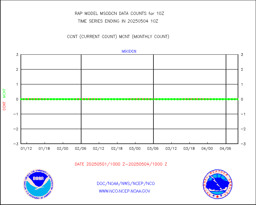
msovir |
Mesonet/MADIS Virginia Dept. of Transportation |
230 |
226 |
101.8 % |
2409.50-2410.50 |
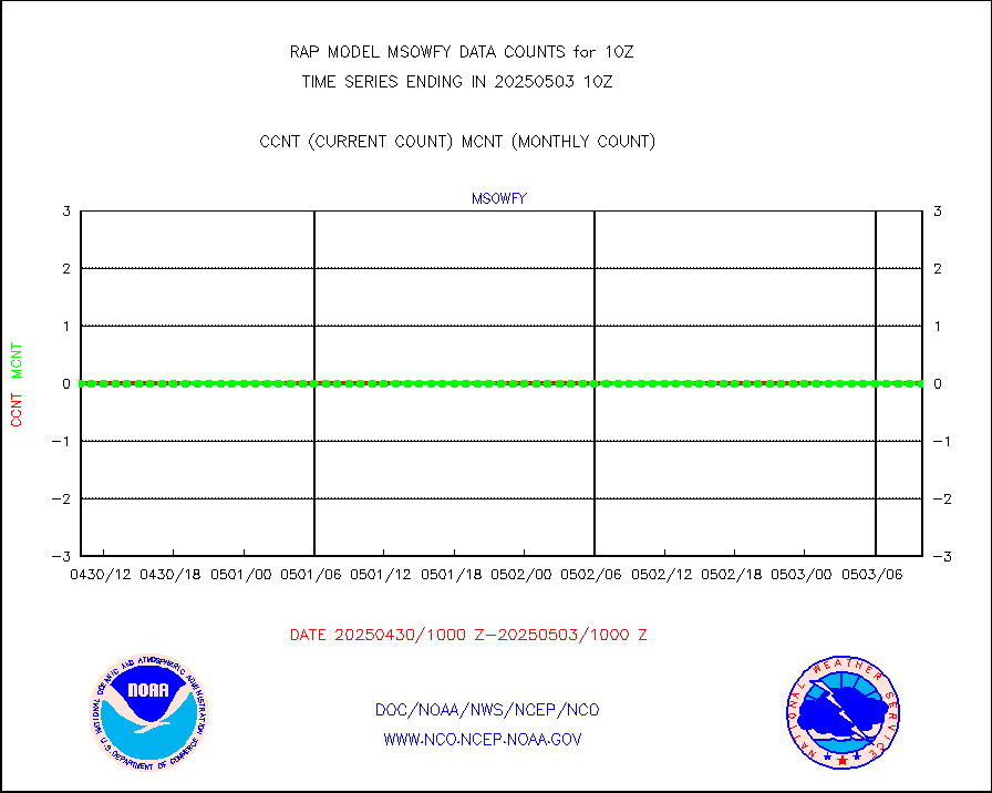
msowfy |
Mesonet/MADIS "Weather for You" |
0 |
0 |
n/a |
2409.50-2410.50 |
msowis |
Mesonet/MADIS Wisconsin Dept. of Transportation |
0 |
0 |
n/a |
2409.50-2410.50 |
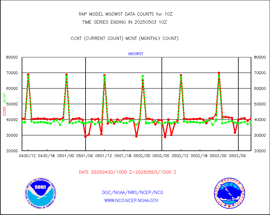
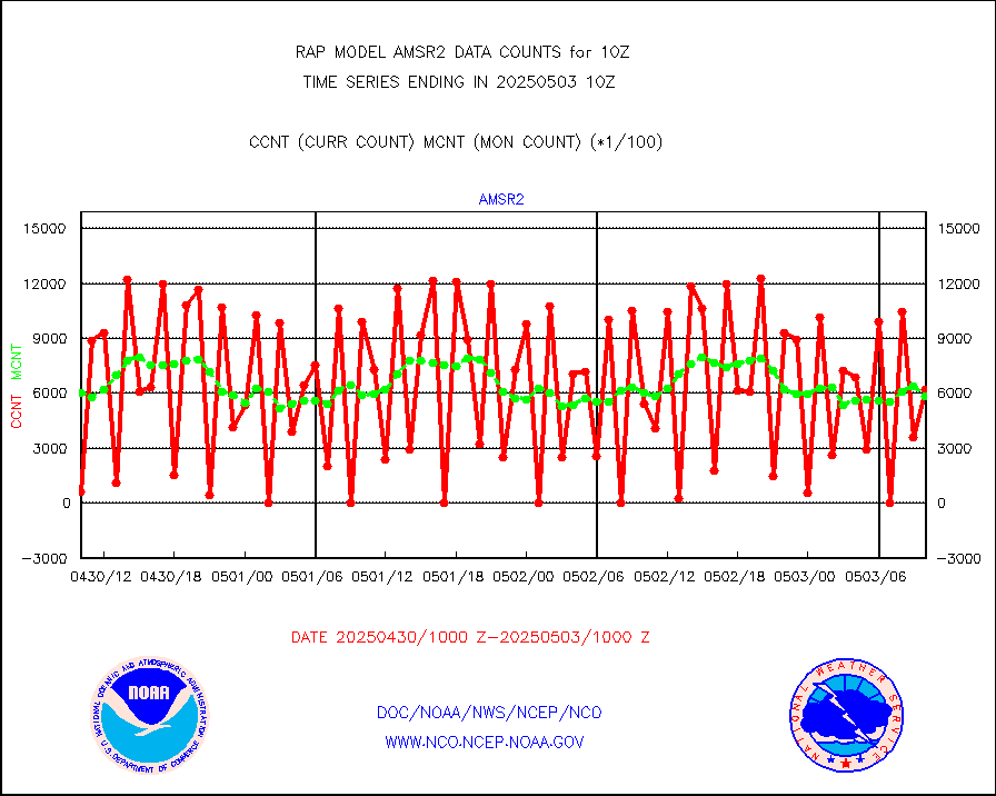
msowst |
Mesonet/MADIS MesoWest (many subproviders) |
35775 |
39358 |
90.9 % |
2409.50-2410.50 |
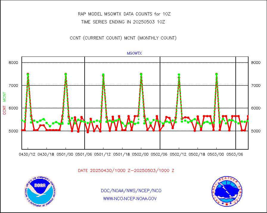
msowtx |
Mesonet/MADIS West Texas |
4833 |
4947 |
97.7 % |
2409.50-2410.50 |
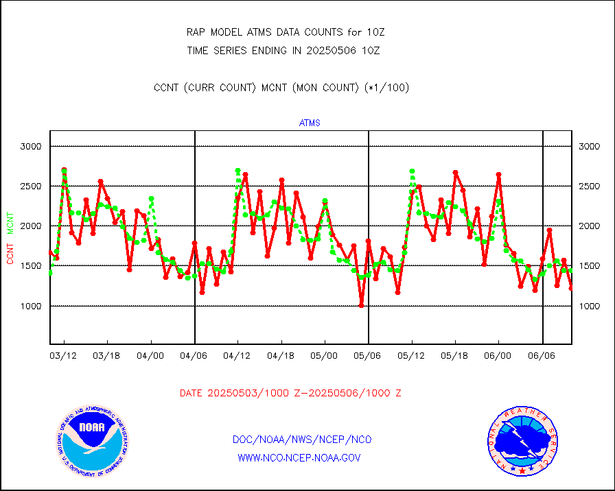
mtiasi |
METOP 1-2 IASI 1C radiance data (varbl. channels) |
34264 |
30199 |
113.5 % |
2408.00-2411.99 |
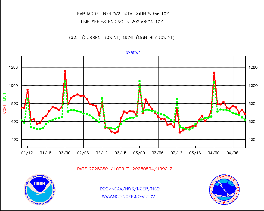
nxrdw2 |
NEXRAD Vel Azm Dsp(VAD) winds via Level 2 decoder |
672 |
624 |
107.7 % |
2409.00-2411.00 |
osbuv8 |
NOAA 16-19 Solar Backscatter UV-2 rad frm V8 BUFR |
0 |
0 |
n/a |
2408.00-2410.99 |
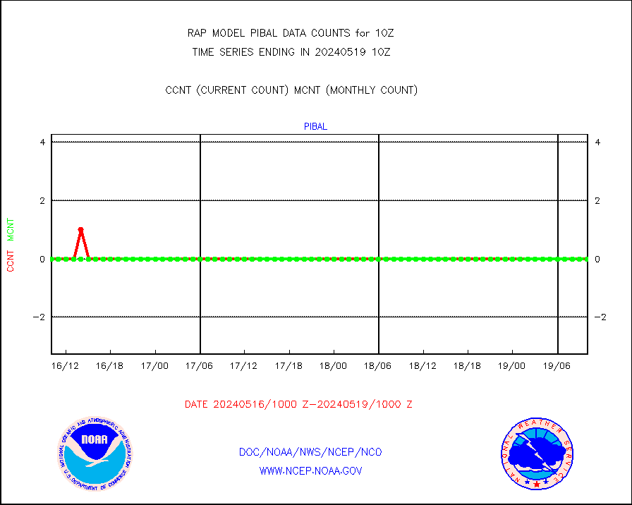
pibal |
PIBAL (from PILOT, PILOT SHIP, PILOT MOBIL) |
0 |
0 |
n/a |
2409.00-2411.00 |
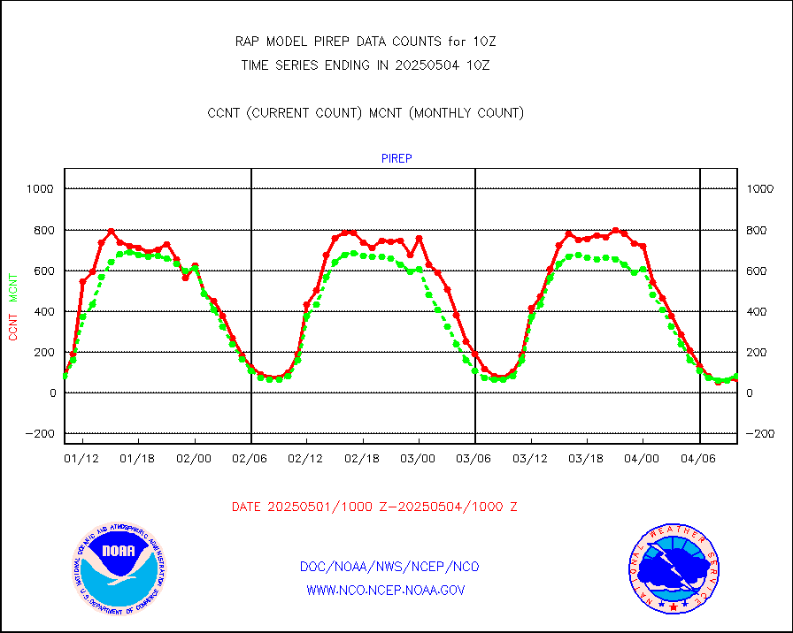
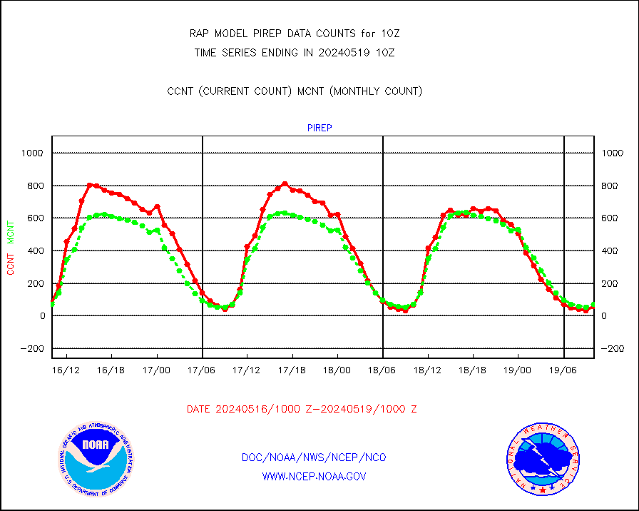
pirep |
Manual PIREP aircraft data (dcded from AIREP fmt) |
49 |
76 |
64.5 % |
2406.75-2413.25 |
prflrp |
Profilr winds from PIBAL (PILOT,PILOT SHIP/MOBIL) |
0 |
0 |
n/a |
2408.50-2411.50 |
raobm |
Rawinsonde - mobile land (from TEMP/PILOT MOBIL) |
0 |
0 |
n/a |
2409.00-2411.00 |
raobs |
Rawinsonde - ship (from TEMP SHIP, PILOT SHIP) |
0 |
0 |
n/a |
2409.00-2411.00 |
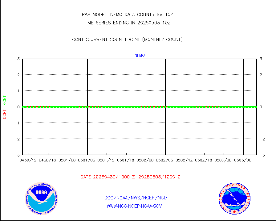
rd2wnd |
NEXRAD radial wind (Level 2 - GTS) |
741339 |
719108 |
103.1 % |
2409.50-2410.49 |
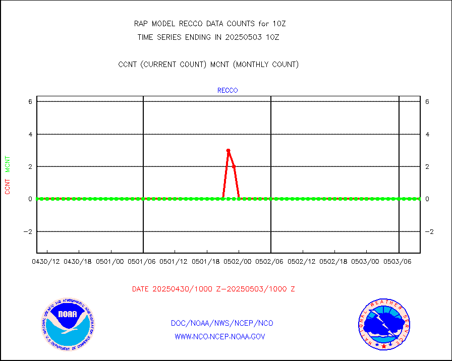
recco |
Flight level reconnaissance aircraft data |
0 |
0 |
n/a |
2409.00-2411.00 |
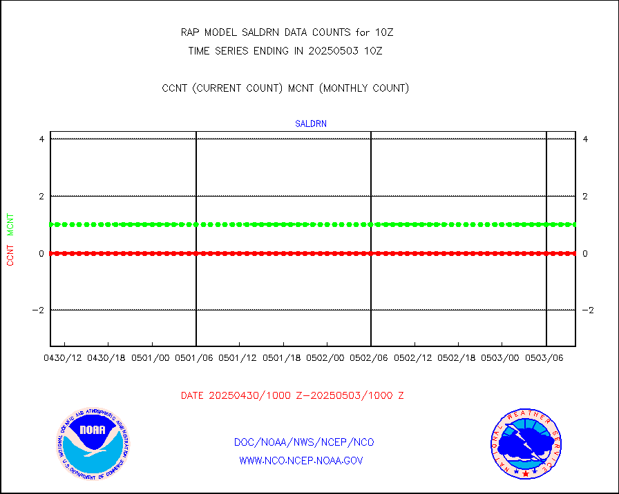
saldrn |
Surface Marine Saildrone (decoded from BUFR) |
2 |
2 |
100.0 % |
2408.00-2411.99 |
saphir |
Megha-Tropiques SAPHIR L1A2 brightness temps |
0 |
0 |
n/a |
2407.00-2412.99 |
sevasr |
METEOSAT-10 2nd Gen SEVIRI All Sky Radiance(proc) |
9512 |
9512 |
100.0 % |
2408.00-2411.99 |
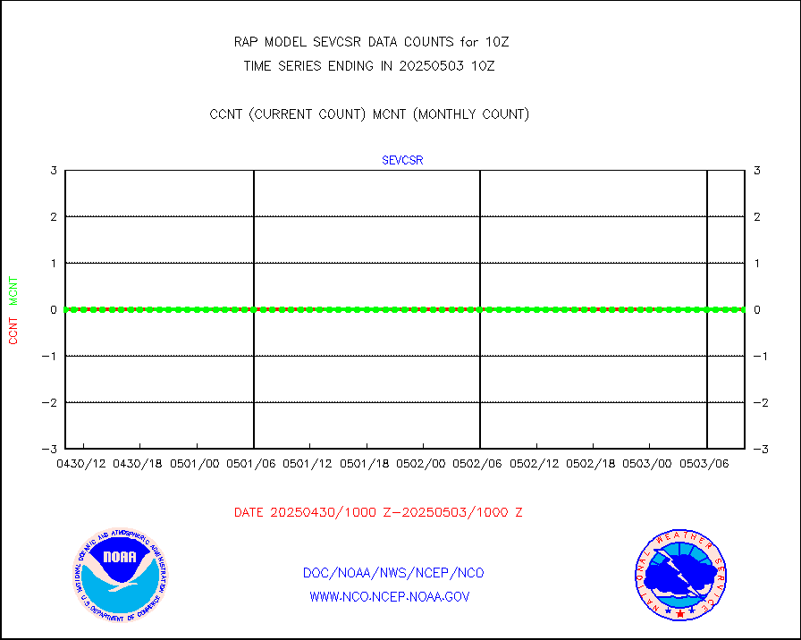
sevcsr |
METEOSAT-10 2nd Gen SEVIRI Clr Sky Radiance(proc) |
0 |
0 |
n/a |
2408.00-2411.99 |
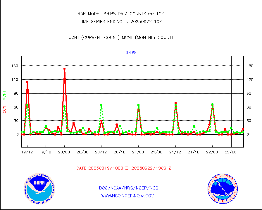
ships |
Ship - manual and automatic, restricted |
2 |
3 |
66.7 % |
2409.50-2410.50 |
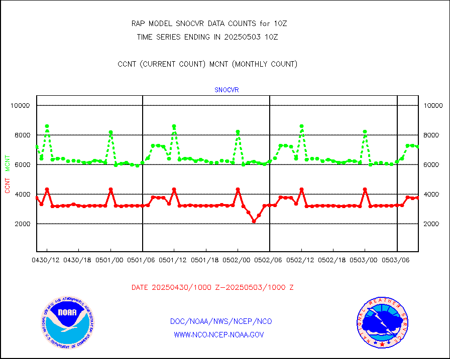
snocvr |
NOW COVER, DEPTH/DENSITY AND WATER EQUIVALENT |
3729 |
7448 |
50.1 % |
2408.00-2412.00 |
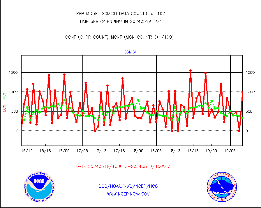
ssmisu |
DMSP SSM/IS 1C radiance data (Unified Pre-Proc.) |
0 |
40805 |
0.0 % |
2408.00-2411.99 |
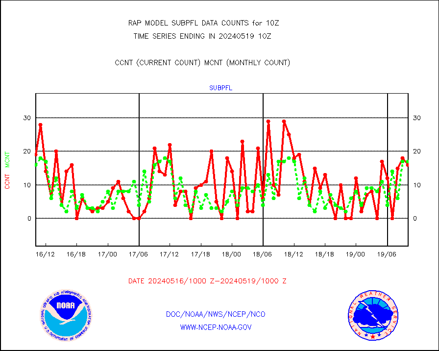
subpfl |
Sub-surface float and glider profile (BUFR) |
6 |
16 |
37.5 % |
2408.00-2411.99 |
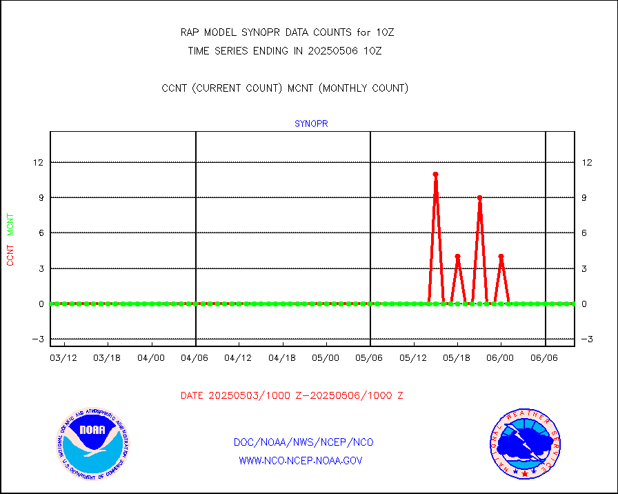
synopr |
Synoptic - restricted (WMO Res 40) manual & auto. |
0 |
0 |
n/a |
2409.50-2410.50 |
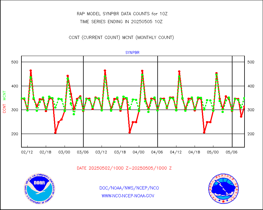
synpbr |
Synoptic - restricted (WMO Res 40)(decoded BUFR) |
351 |
349 |
100.6 % |
2409.50-2410.50 |
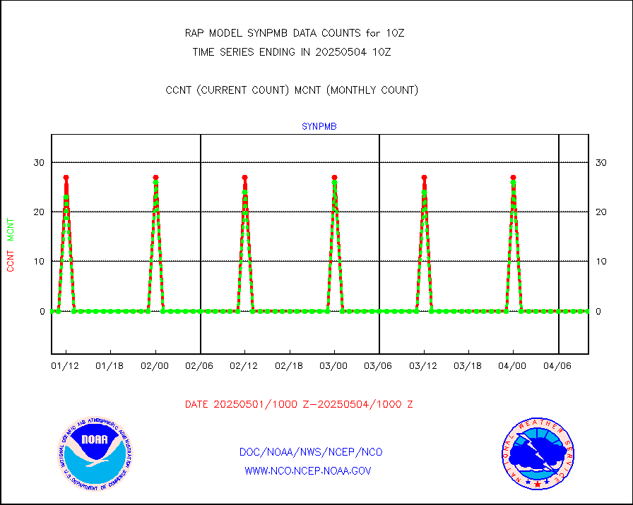
synpmb |
Synoptic - mobile manual & auto (decoded fr BUFR) |
0 |
0 |
n/a |
2409.50-2410.50 |
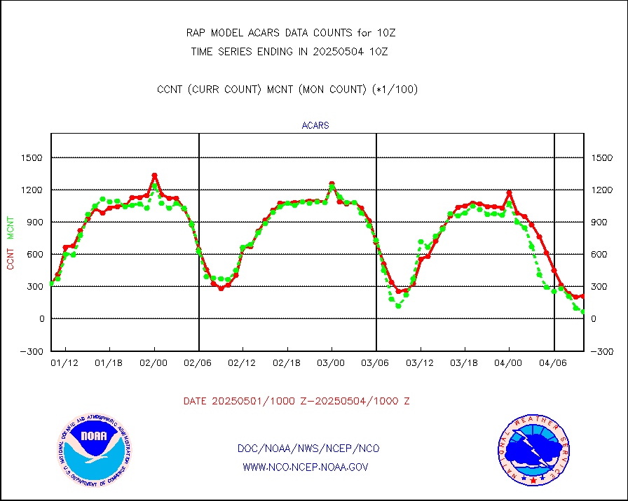
tmdara |
TAMDAR aircft data-all types(from Panasonic,BUFR) |
1631 |
1523 |
107.1 % |
2406.75-2413.25 |
visja |
MTSAT/JMA visible derived cloud motion |
245 |
97 |
252.6 % |
2407.50-2412.50 |
visusr |
GOES-16&up/NESDIS visible derived cloud motion |
8223 |
4291 |
191.6 % |
2409.00-2409.99 |
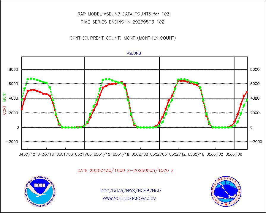
vseunb |
METEOSAT/EUMETSAT visible drv cld motion NBseq |
5667 |
3854 |
147.0 % |
2408.50-2411.49 |


