| Critical Data with Normal Counts |
|---|
| Type | Description | Hourly Count | Monthly Average | Percent (%) of Monthly Mean | UTC Time Window |
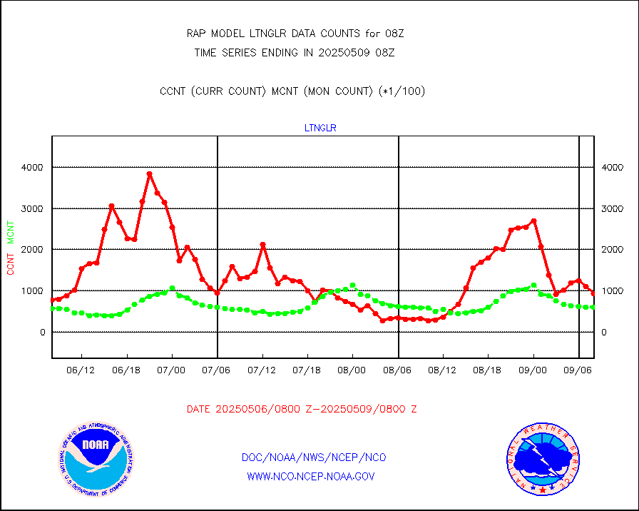
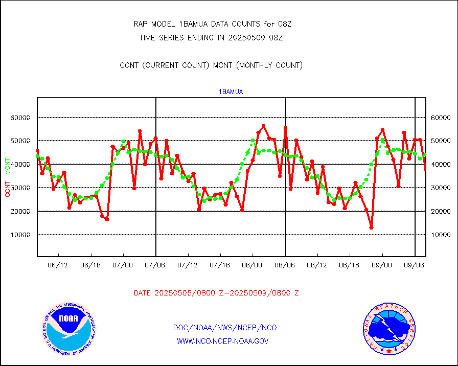
1bamua |
NOAA 15-19 & METOP 1-2 AMSU-A NCEP-proc. br.temps |
42118 |
43105 |
97.7 % |
2505.00-2510.99 |
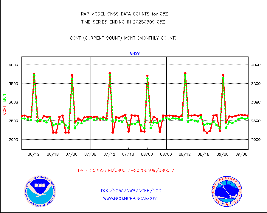
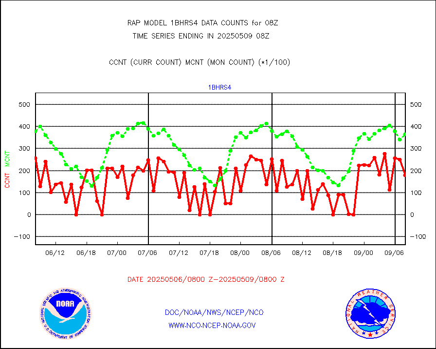
1bhrs4 |
NOAA 18-19 & METOP 1-2 HIRS-4 NCEP-proc. br.temps |
27114 |
39443 |
68.7 % |
2505.00-2510.99 |
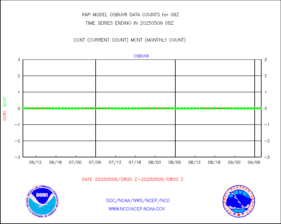
1bmhs |
NOAA 18-19 & METOP 1-2 MHS NCEP-proces. br. temps |
279039 |
249837 |
111.7 % |
2505.00-2510.99 |
acars |
MDCRS ACARS acft data from ARINC(dcded from BUFR) |
18381 |
22931 |
80.2 % |
2504.75-2511.25 |
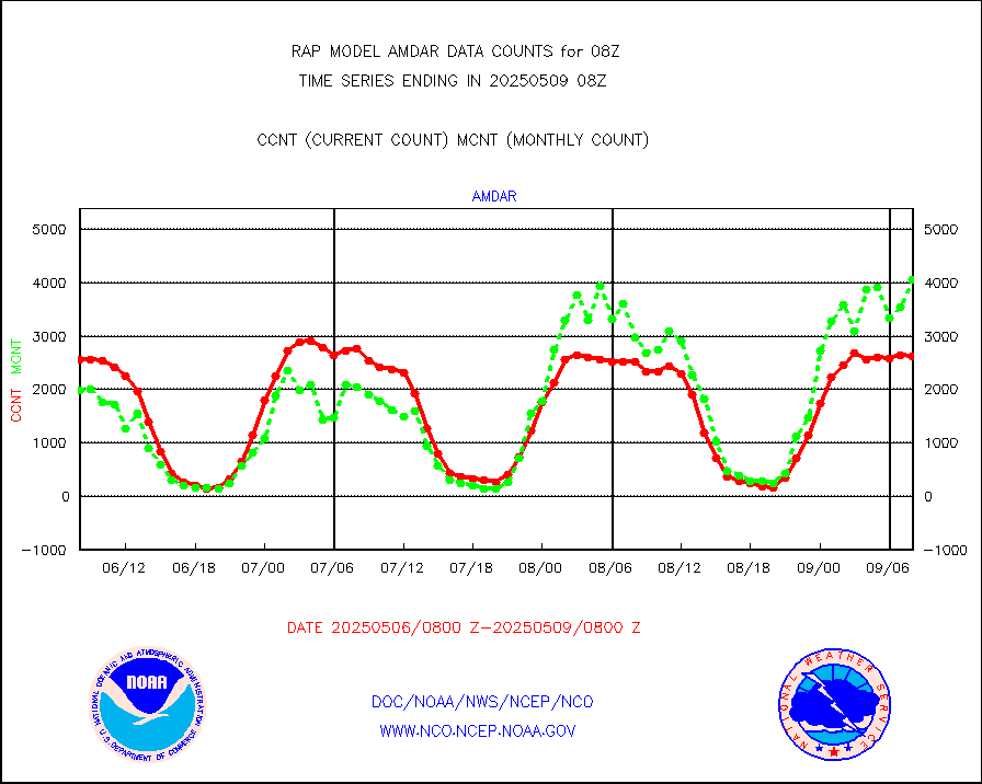
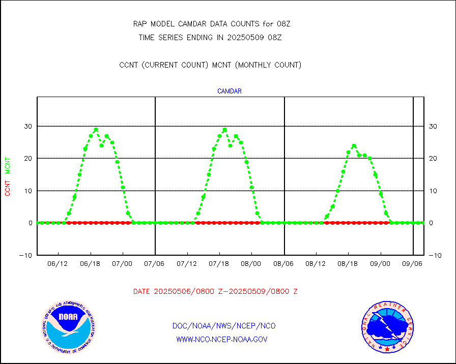
camdar |
Canadian AMDAR aircraft data (decoded from BUFR) |
0 |
0 |
n/a |
2504.75-2511.25 |
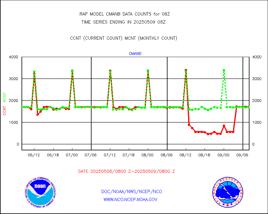
cmanb |
Surface Marine CMAN rpts decoded from BUFR format |
1530 |
1673 |
91.5 % |
2507.50-2508.50 |
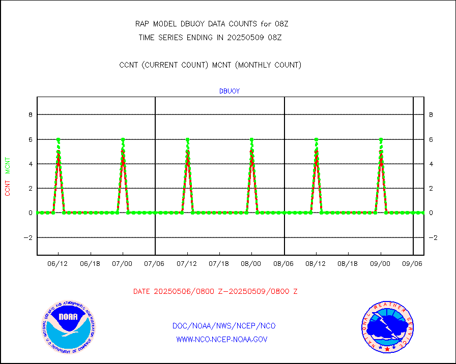
dbuoy |
Buoys decoded from FM-18 fmt (moored or drifting) |
0 |
0 |
n/a |
2507.50-2508.50 |
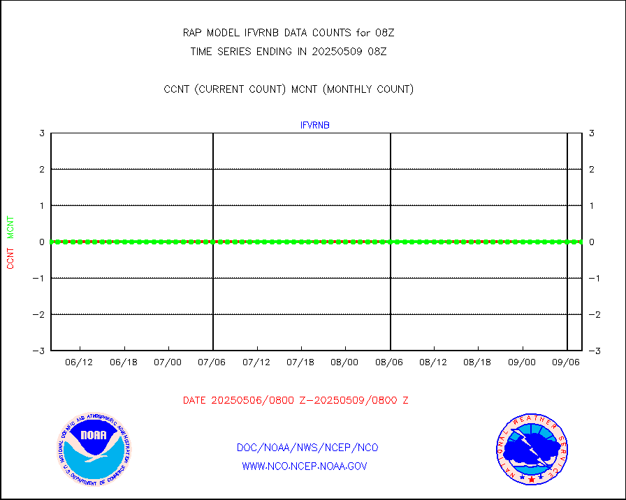
gnss |
Grnd-based Gbl Navigation Sat System (GNSS) data |
2703 |
2415 |
111.9 % |
2506.95-2507.05 |
h20mo |
MODIS (AQUA/TERRA) wvpr imager derived cld motion |
0 |
0 |
n/a |
2505.50-2510.50 |
infmo |
MODIS (AQUA/TERRA) ir l-wave derived cloud motion |
0 |
0 |
n/a |
2505.50-2510.50 |
lgycld |
GOES/NASA(Langley) hi-res. (1x1 f-o-v) cloud data |
3729229 |
3343871 |
111.5 % |
2507.50-2508.50 |
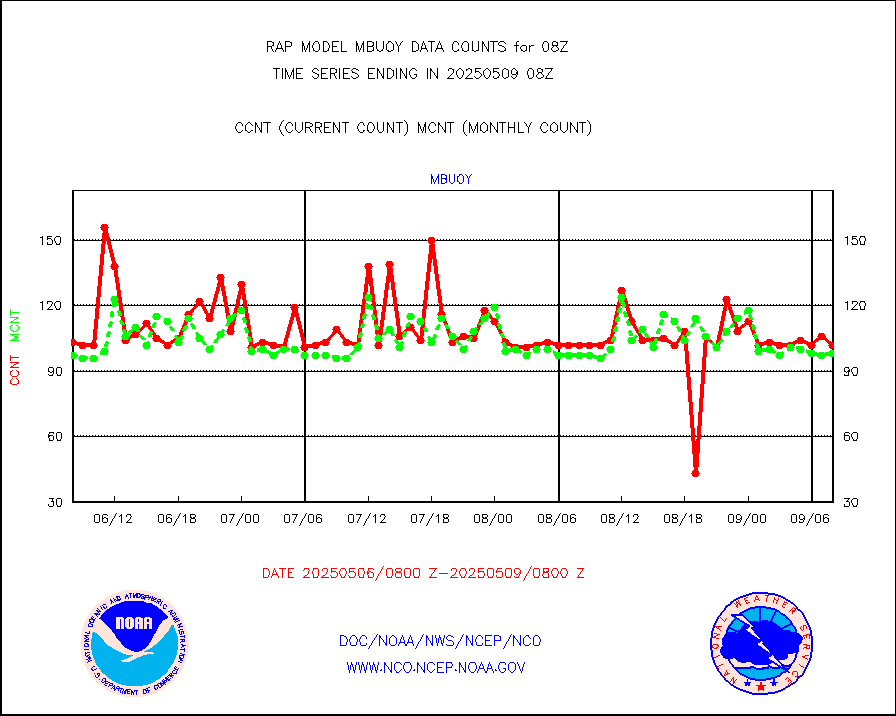
mbuoy |
Buoys decoded from FM-13 format (moored) |
34 |
54 |
63.0 % |
2507.50-2508.50 |
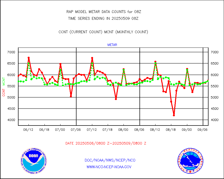
metar |
Aviation - METAR |
5819 |
5860 |
99.3 % |
2507.50-2508.50 |
nxrdw |
NEXRAD Vel Azm Dsp(VAD) winds via radar coded msg |
0 |
0 |
n/a |
2507.00-2509.00 |
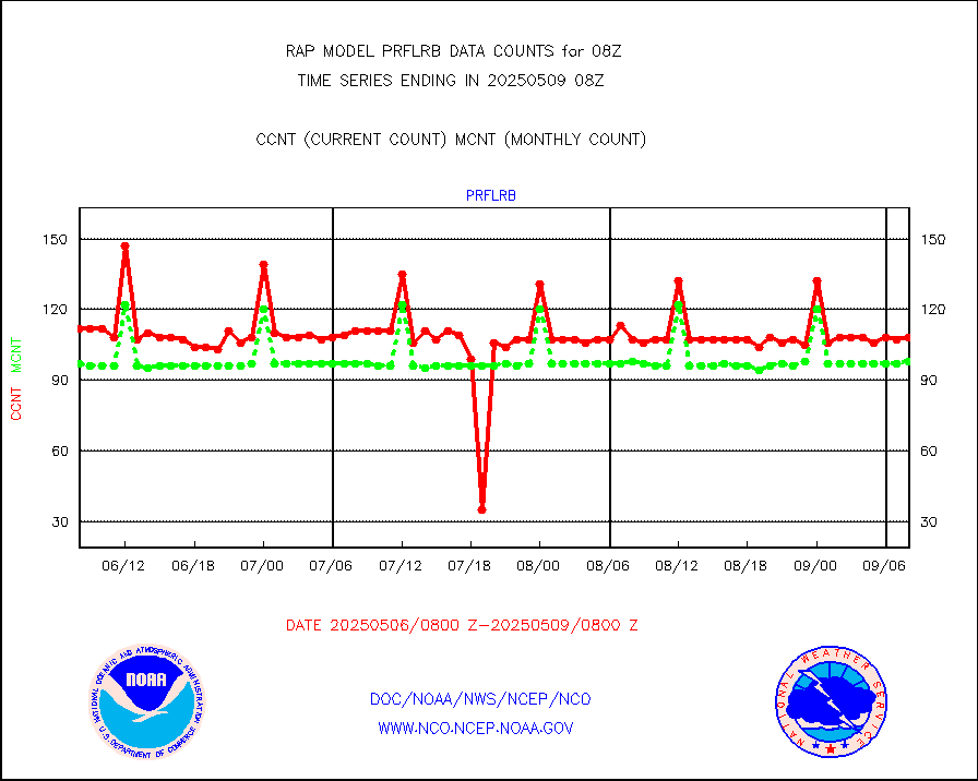
prflrb |
Multi-Agency Profiler (MAP) and SODAR winds |
100 |
83 |
120.5 % |
2506.50-2509.50 |
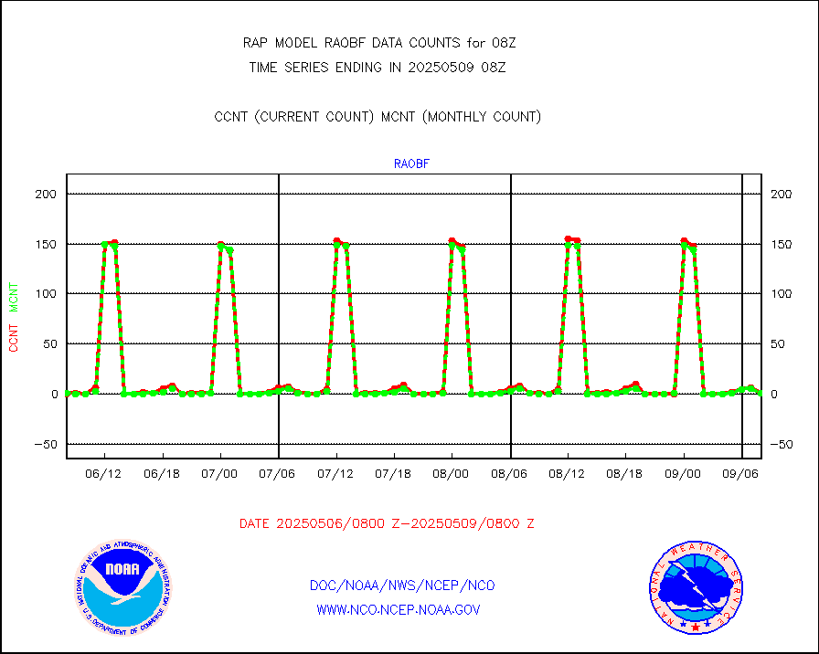
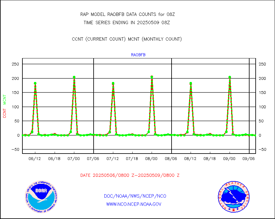
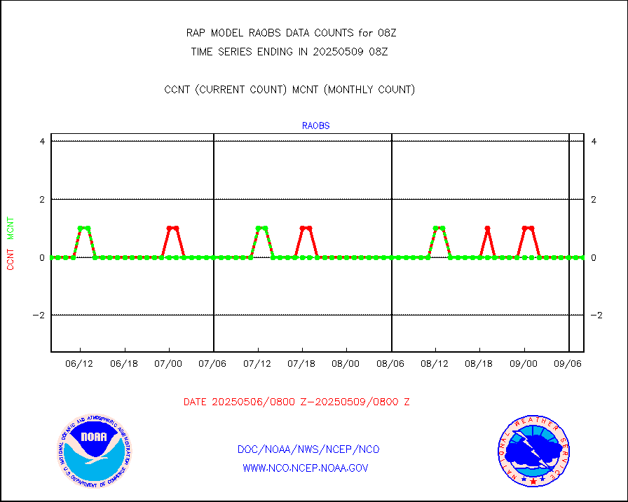
raobf |
Rawinsonde - fixed land (from TEMP or PILOT) |
3 |
1 |
300.0 % |
2507.00-2509.00 |
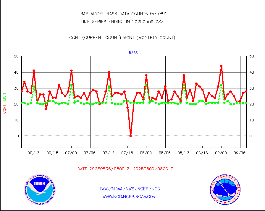
rass |
RASS temperatures (NOAA and Multi-Agency) |
26 |
22 |
118.2 % |
2507.50-2508.50 |
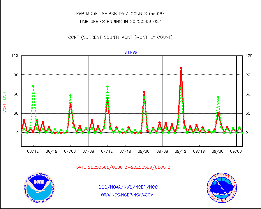
shipsb |
Ship - manual and automatic, restricted (BUFR) |
0 |
0 |
n/a |
2507.50-2508.50 |
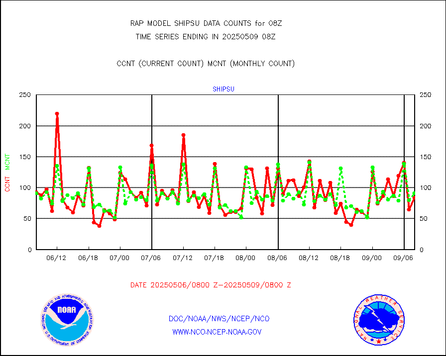
shipsu |
Ship - manual and automatic, unrestricted |
47 |
50 |
94.0 % |
2507.50-2508.50 |
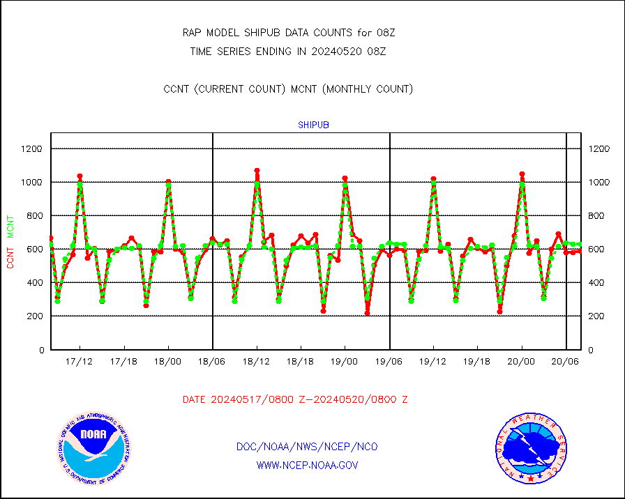
shipub |
Ship - manual and automatic, unrestricted (BUFR) |
529 |
600 |
88.2 % |
2507.50-2508.50 |
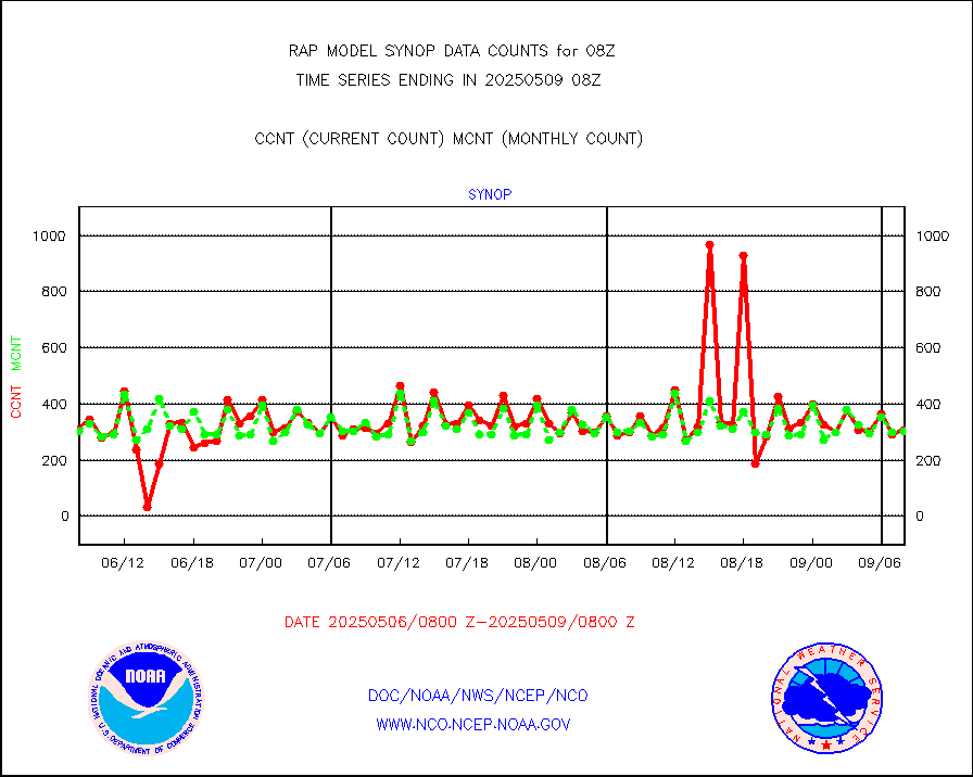
synop |
Synoptic - fixed manual and automatic |
288 |
296 |
97.3 % |
2507.50-2508.50 |
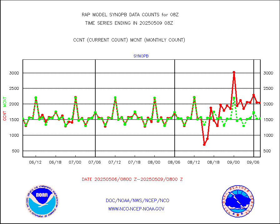
synopb |
Synoptic - fixed manual & auto (decoded fr BUFR) |
1688 |
1622 |
104.1 % |
2507.50-2508.50 |
tideg |
Tide gauge reports decoded from CREX format |
178 |
178 |
100.0 % |
2507.50-2508.50 |
| Data Types of Opportunity with Normal Counts |
|---|
| Type | Description | Hourly Count | Monthly Average | Percent (%) of Monthly Mean | UTC Time Window |
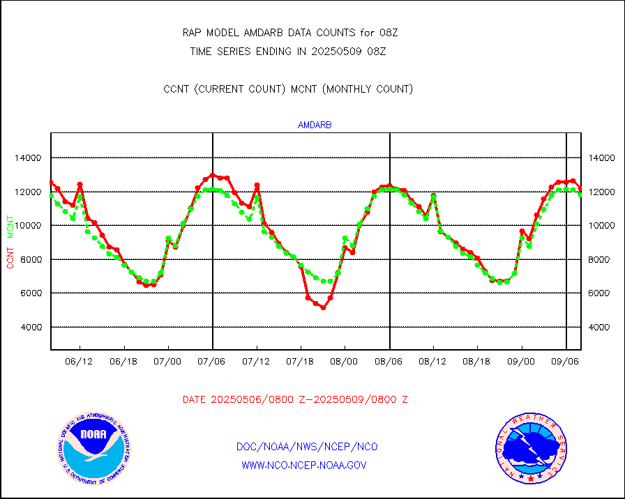
3p9usr |
GOES-16&up/NESDIS ir short-wv derived cld motion |
16483 |
16764 |
98.3 % |
2507.00-2507.99 |
acarsa |
MDCRS ACARS acft data (ARINC via AFWA)(AIREP fmt) |
0 |
0 |
n/a |
2504.75-2511.25 |
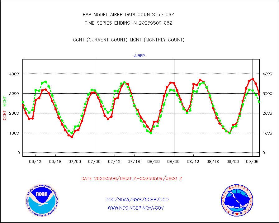
airep |
Manual AIREP aircraft data (dcded from AIREP fmt) |
4294 |
3768 |
114.0 % |
2504.75-2511.25 |
airsev |
AQUA AIRS/AMSU-A/HSB brightness temps- every FOV |
0 |
0 |
n/a |
2505.00-2510.99 |
amdar |
AMDAR aircraft data (decoded from AMDAR format) |
2607 |
2992 |
87.1 % |
2504.75-2511.25 |
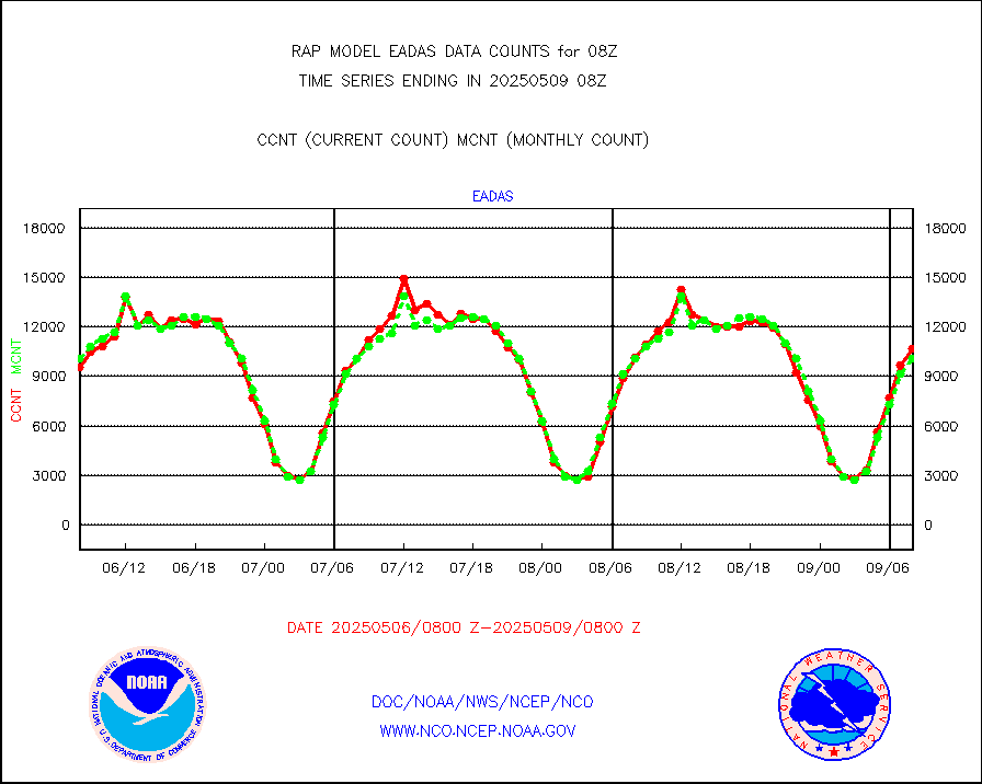
amdarb |
AMDAR aircraft data (decoded from BUFR) |
6135 |
6154 |
99.7 % |
2504.75-2511.25 |
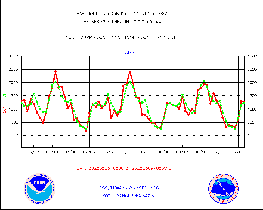
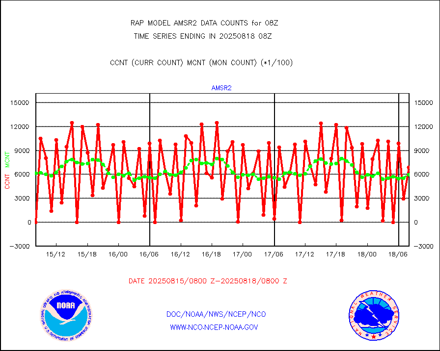
amsr2 |
GCOM-W AMSR2 1B brightness temperatures |
703591 |
596987 |
117.9 % |
2505.00-2505.99 |
ascat |
METOP 1-2 ASCAT products |
24121 |
19666 |
122.7 % |
2506.00-2510.00 |
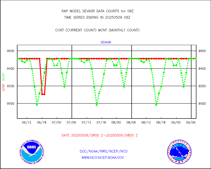
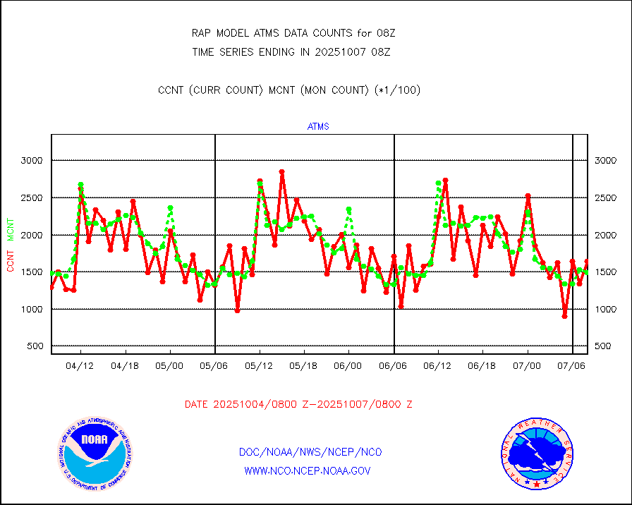
atms |
NPP/NOAA-20 ATMS brightness temperatures |
180244 |
144111 |
125.1 % |
2506.00-2509.99 |
atmsdb |
NPP/NOAA-20 ATMS bright. temps-direct b-cast SSEC |
129821 |
125035 |
103.8 % |
2506.00-2509.99 |
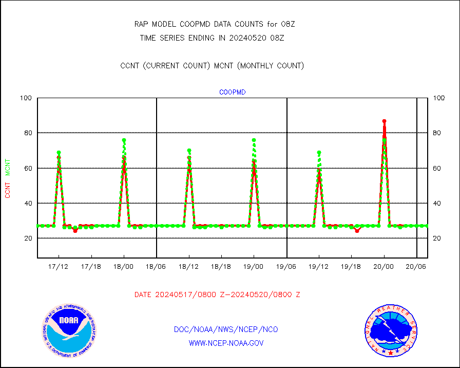
coopmd |
Coop/MADIS NEPP & HCN-Modernization NOAA COOP Obs |
27 |
23 |
117.4 % |
2507.50-2508.50 |
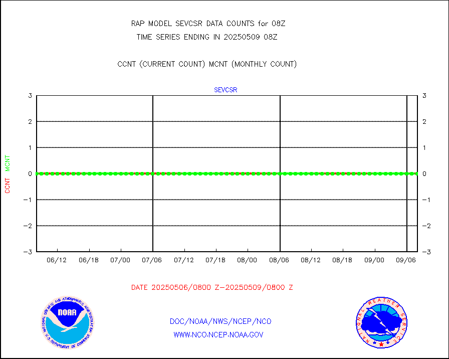
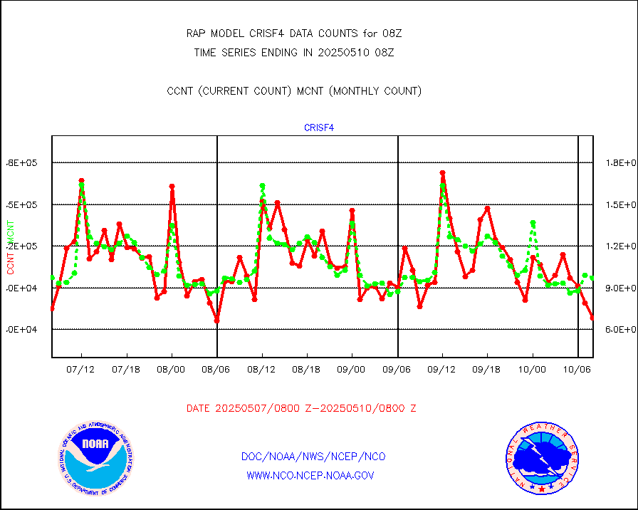
crisf4 |
NPP/NOAA-20 CrIS full spctrl radn (431 ch subset) |
113847 |
90378 |
126.0 % |
2506.00-2509.99 |
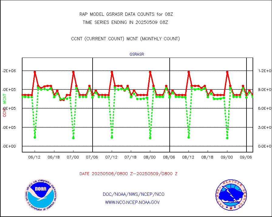
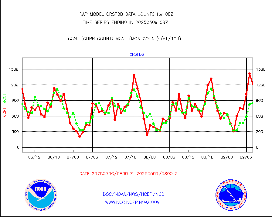
crsfdb |
NPP/NOAA-20 CrIS full spctrl radn dir brdcst SSEC |
144846 |
130443 |
111.0 % |
2506.00-2509.99 |
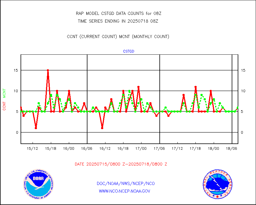
cstgd |
Coast Guard |
5 |
4 |
125.0 % |
2507.50-2508.50 |
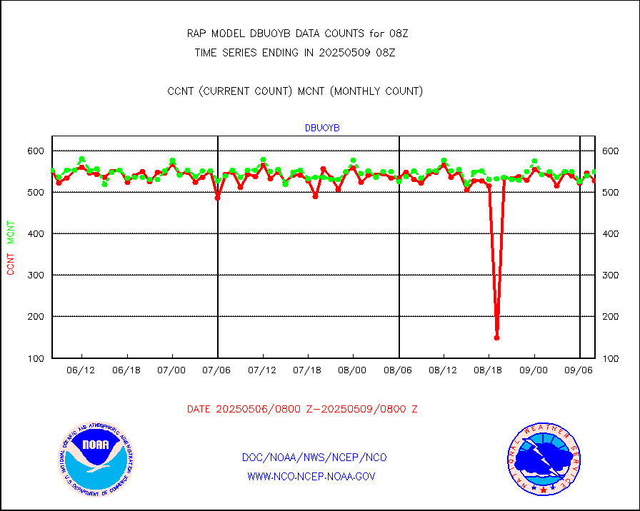
dbuoyb |
Drifting buoys (decoded from BUFR) |
578 |
600 |
96.3 % |
2507.50-2508.50 |
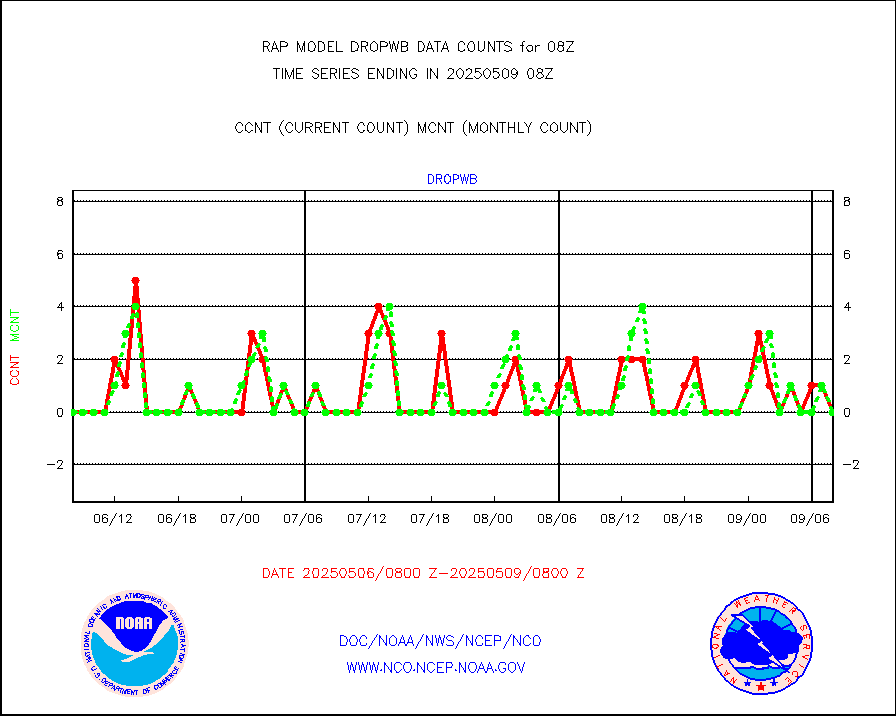
dropw |
Dropwinsonde (from TEMP DROP) |
0 |
0 |
n/a |
2507.00-2509.00 |
eadas |
E-AMDAR (European AMDAR acft decoded from BUFR) |
7741 |
7835 |
98.8 % |
2504.75-2511.25 |
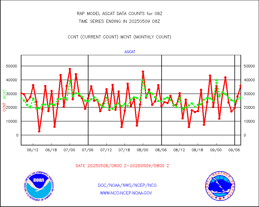
esamua |
NOAA 15-19 & METOP 1-2 AMSU-A proc btmps frm RARS |
11436 |
11822 |
96.7 % |
2507.00-2509.00 |
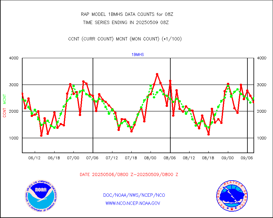
esatms |
NPP Adv. Tech. MW Sndr (ATMS) br. temps from RARS |
133844 |
94327 |
141.9 % |
2506.00-2509.99 |
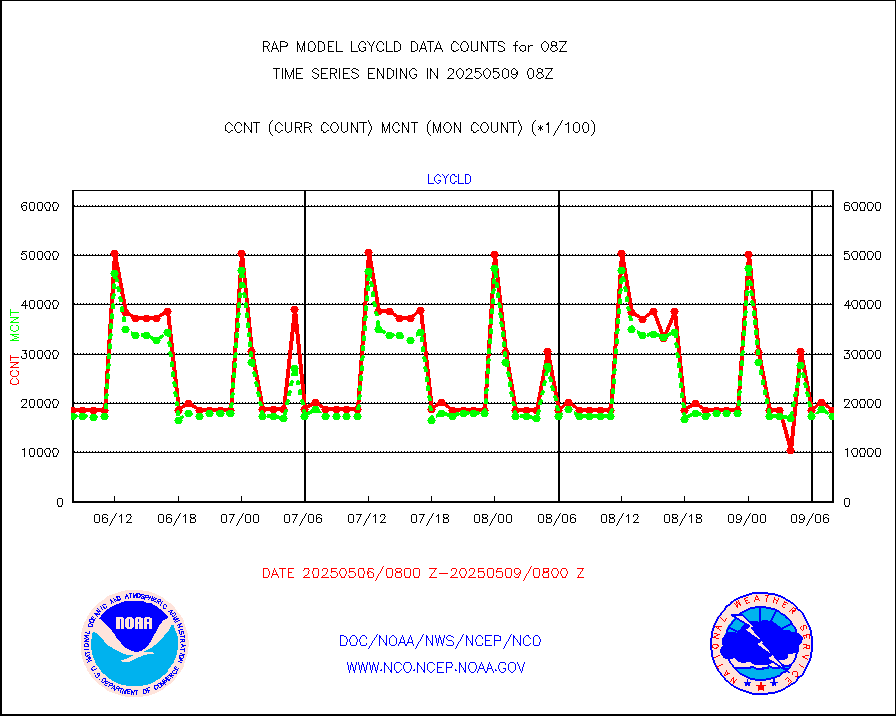
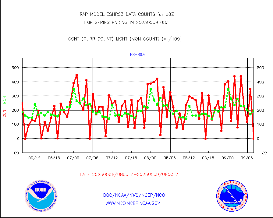
eshrs3 |
NOAA 15-19 & METOP 1-2 HIRS-3/4 pr btmps frm RARS |
26053 |
28348 |
91.9 % |
2507.00-2509.00 |
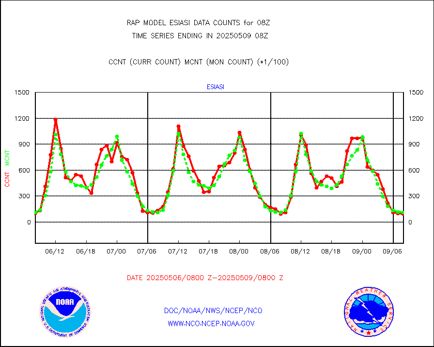
esiasi |
METOP 1-2 IASI 1C radiance data vbl chn from RARS |
23146 |
16942 |
136.6 % |
2506.00-2509.99 |
esmhs |
NOAA 18-19 & METOP 1-2 MHS proc. btemps from RARS |
64797 |
75712 |
85.6 % |
2507.00-2509.00 |
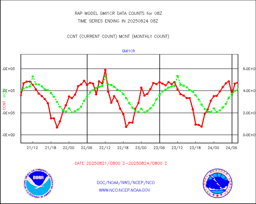
gmi1cr |
GPM GMI Level 1C-R brightness temperatures |
424806 |
920779 |
46.1 % |
2505.00-2510.99 |
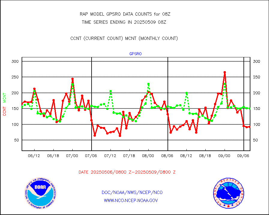
gpsro |
GPS radio occultation data |
138 |
115 |
120.0 % |
2506.00-2509.99 |
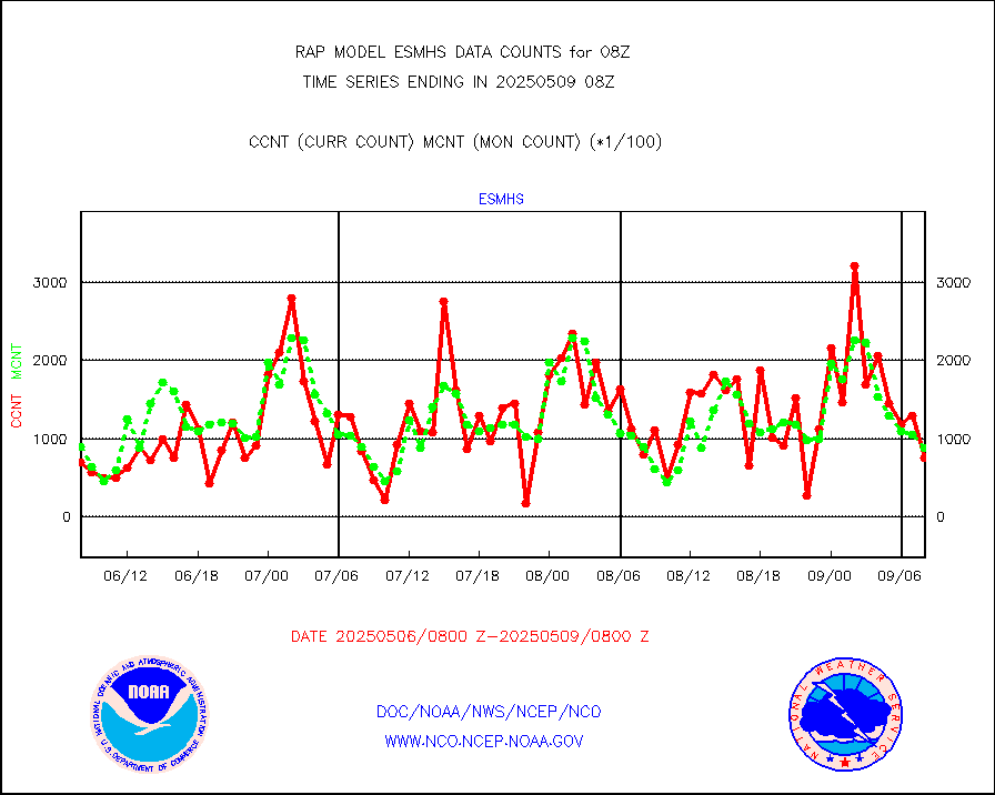
gsrasr |
GOES-16/17 All Sky Radiances (proc.) |
812097 |
810831 |
100.2 % |
2506.00-2509.99 |
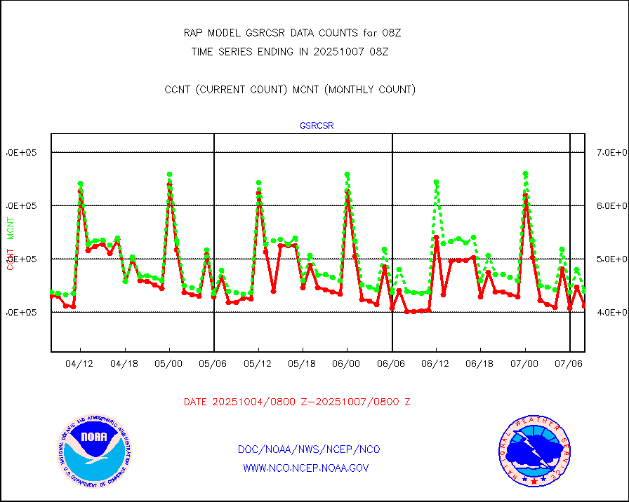
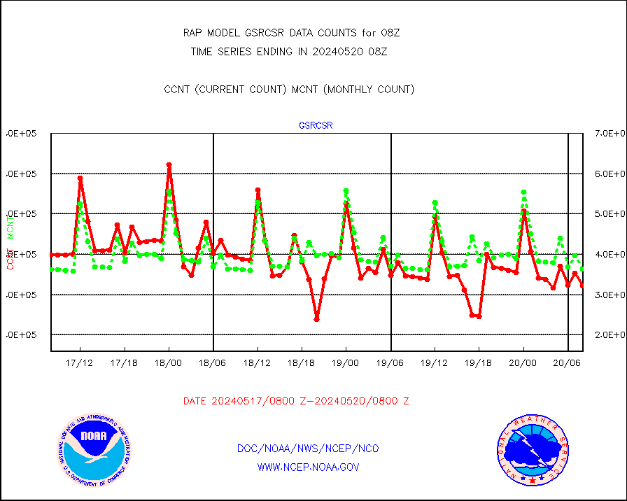
gsrcsr |
GOES-16/17 Clear Sky Radiances (proc.) |
388667 |
373763 |
104.0 % |
2506.00-2509.99 |
h20ja |
MTSAT/JMA water vapor imager derived cloud motion |
3329 |
2837 |
117.3 % |
2505.50-2510.50 |
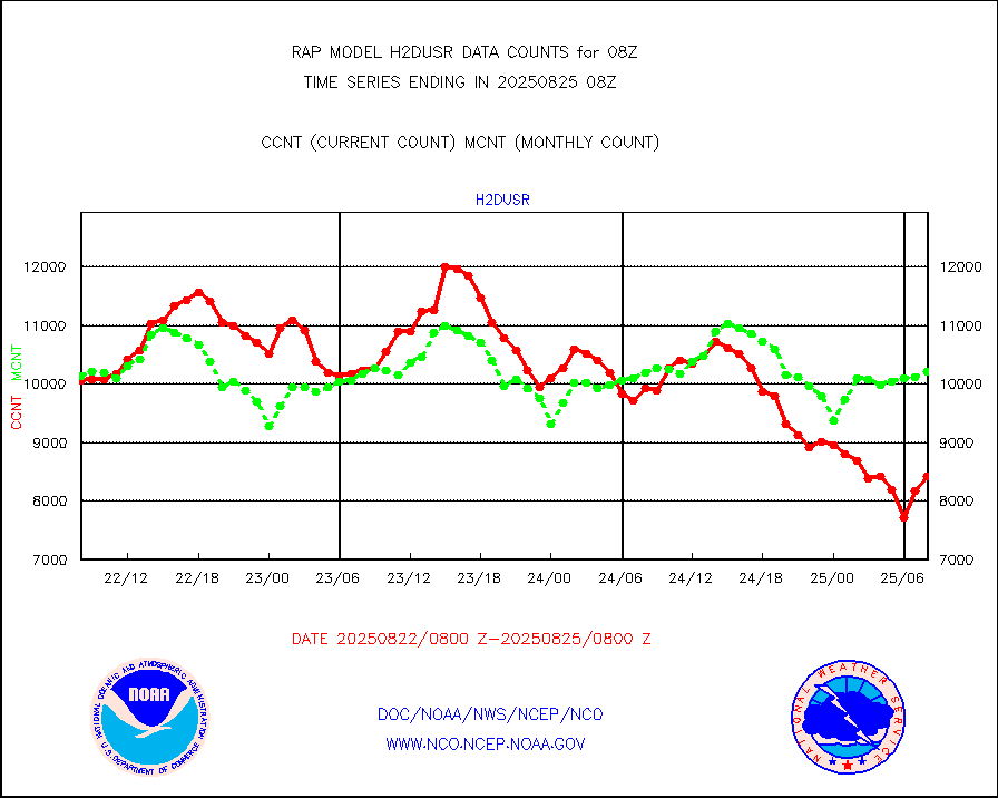
h2dusr |
GOES-16&up/NESDIS wv imgr/deep-lyr derivd cld mtn |
8377 |
6217 |
134.7 % |
2507.00-2507.99 |
h2eunb |
METEOSAT/EUMETSAT wvpr imgr drv cld motion NBseq |
4415 |
4985 |
88.6 % |
2506.50-2509.49 |
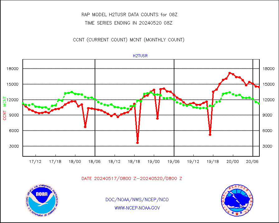
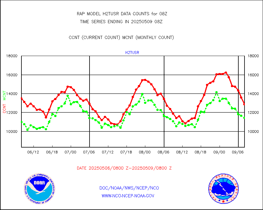
h2tusr |
GOES-16&up/NESDIS wv imgr/cld-top derived cld mtn |
10961 |
9906 |
110.7 % |
2507.00-2507.99 |
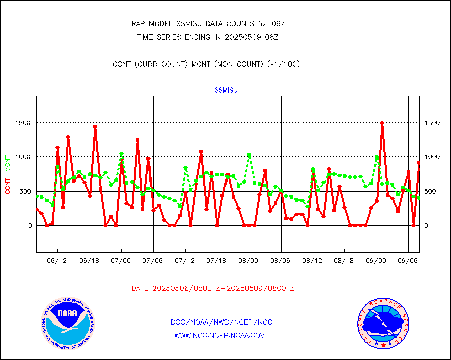
iasidb |
METOP 1-2 IASI 1C radiances-direct broadcast SSEC |
53075 |
45116 |
117.6 % |
2506.00-2509.99 |
ifeunb |
METEOSAT/EUMETSAT ir lg-wave drv cld motion NBseq |
3405 |
3207 |
106.2 % |
2506.50-2509.49 |
ifvrnb |
VIIRS (NPP/NOAA-20) ir lg-wv drv cloud motion(NB) |
0 |
0 |
n/a |
2505.50-2510.50 |
infav1 |
AVHRR (METOP) ir lg-wave derived cld motion |
0 |
0 |
n/a |
2506.50-2509.49 |
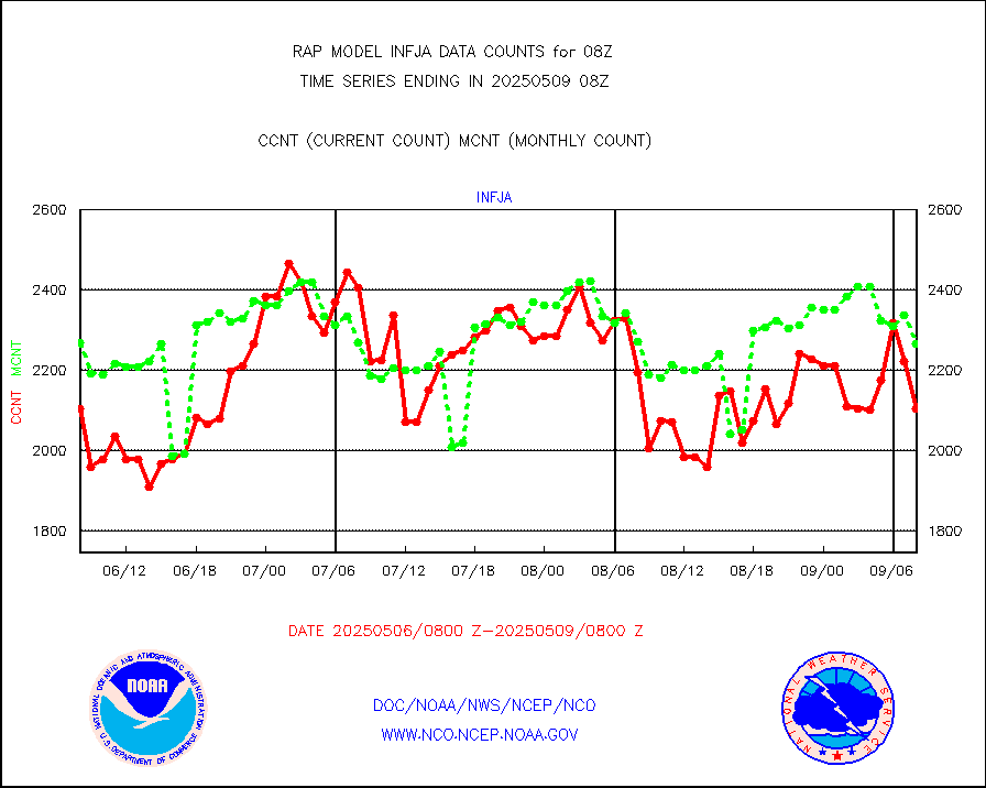
infja |
MTSAT/JMA infrared long-wave derived cloud motion |
3064 |
2471 |
124.0 % |
2505.50-2510.50 |
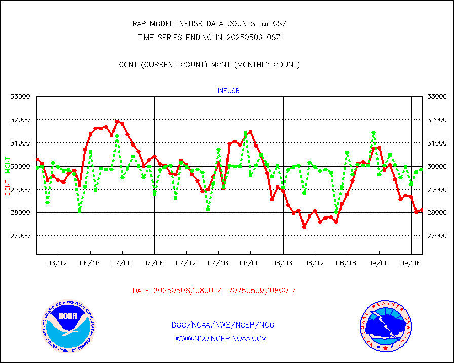
infusr |
GOES-16&up/NESDIS ir long-wave derived cld motion |
32879 |
30514 |
107.8 % |
2507.00-2507.99 |
kamdar |
Korean AMDAR aircraft data (decoded from BUFR) |
217 |
252 |
86.1 % |
2504.75-2511.25 |
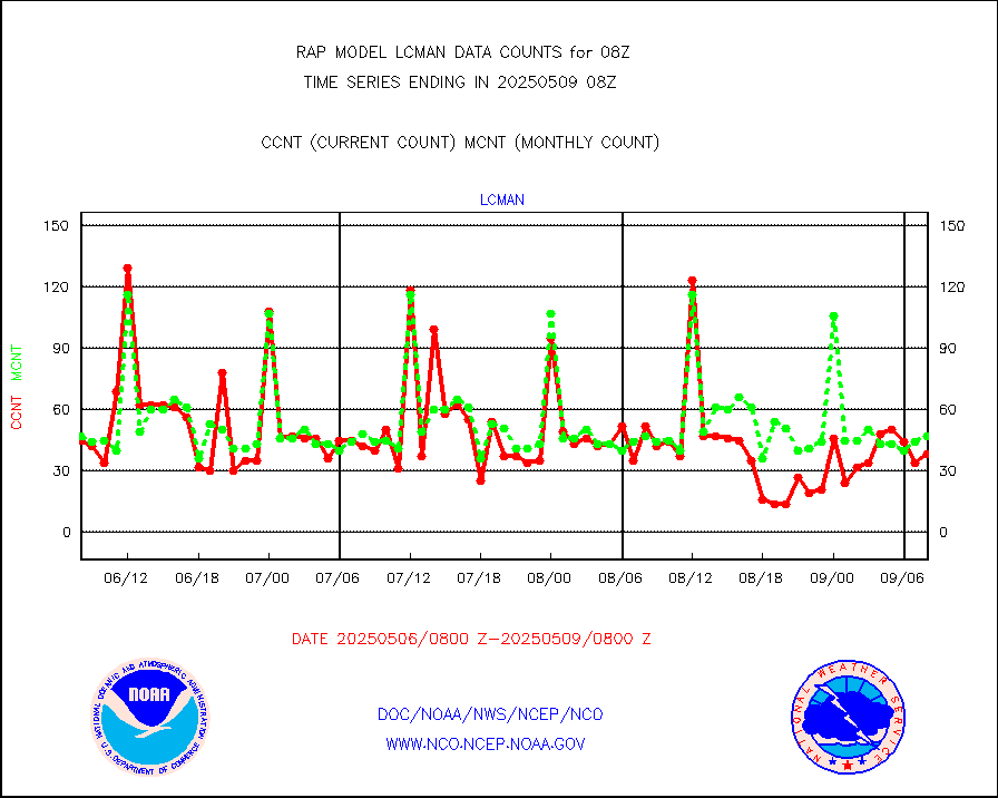
lcman |
Land-based CMAN stations decoded from CMAN format |
81 |
75 |
108.0 % |
2507.50-2508.50 |
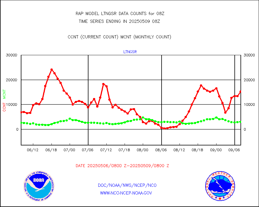
ltnglr |
LLDN Long-rng lightning from Vaisala via NOAAPORT |
47075 |
44169 |
106.6 % |
2507.00-2508.50 |
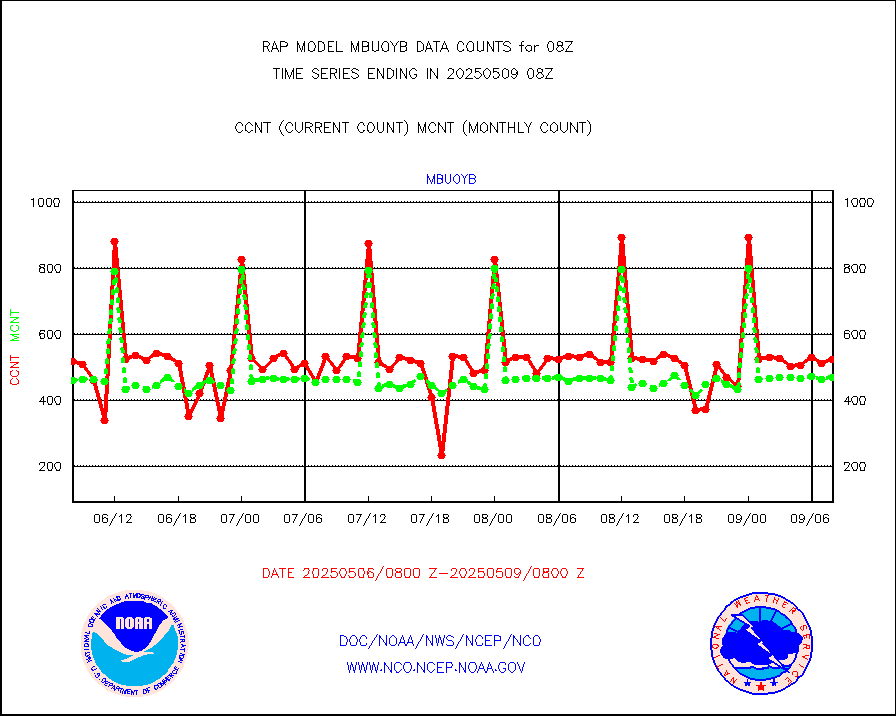
mbuoyb |
Moored buoys (decoded from BUFR) |
522 |
477 |
109.4 % |
2507.50-2508.50 |
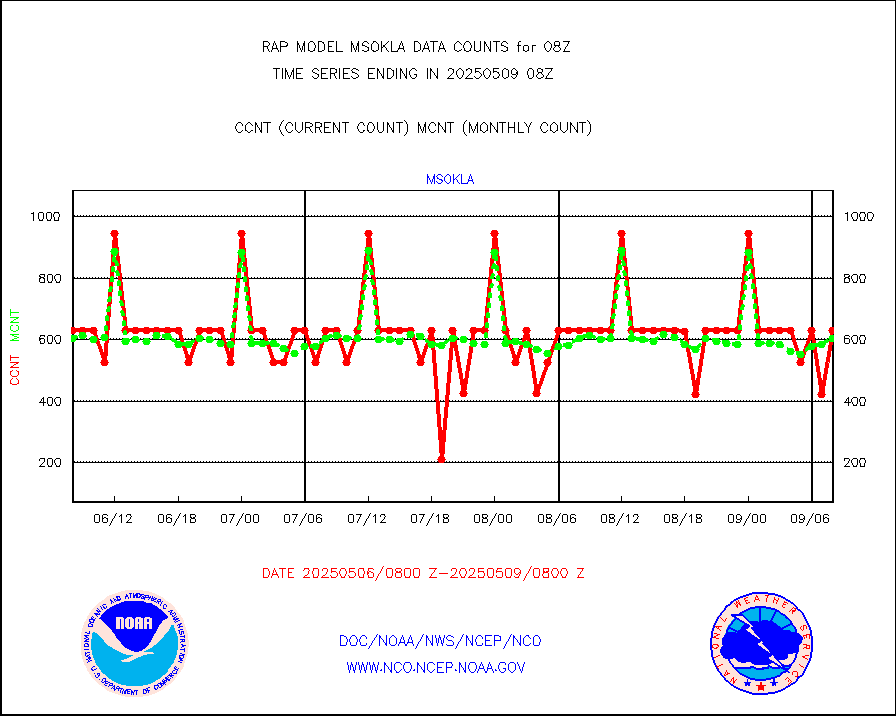
mso470 |
Mesonet/MADIS Colorado E-470 (Interstate 470) |
21 |
18 |
116.7 % |
2507.50-2508.50 |
msoalk |
Mesonet/MADIS Alaska Department of Transportation |
106 |
101 |
105.0 % |
2507.50-2508.50 |
msoapg |
Mesonet/MADIS U.S. Army Aberdeen Proving Grounds |
0 |
0 |
n/a |
2507.50-2508.50 |
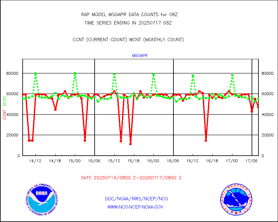
msoapr |
Mesonet/MADIS Citizen Weather Observers Program |
46523 |
43547 |
106.8 % |
2507.50-2508.50 |
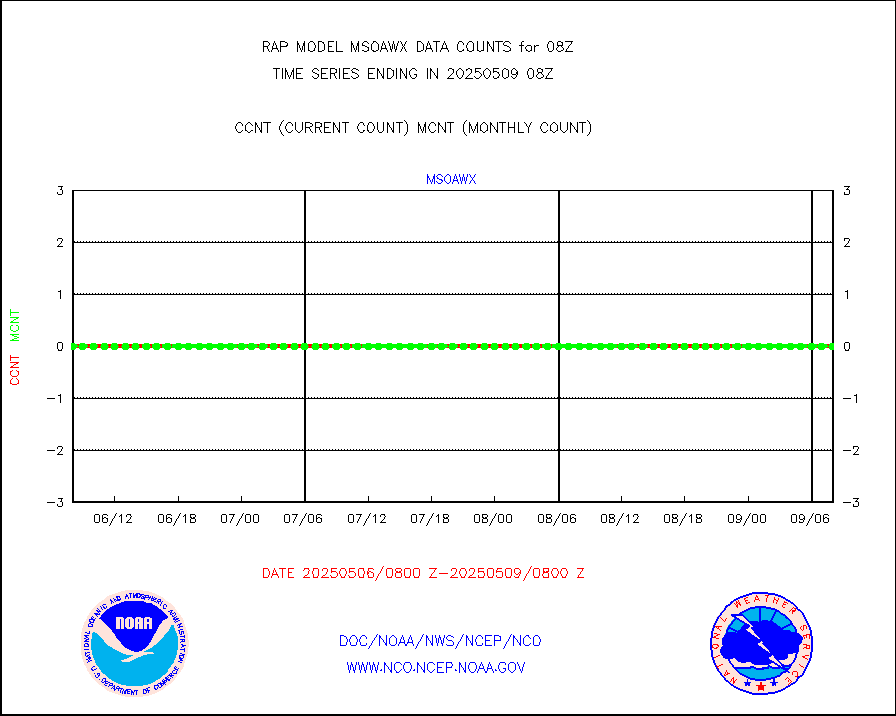
msoaws |
Mesonet/MADIS AWS Convergence Technologies, Inc. |
25824 |
25370 |
101.8 % |
2507.50-2508.50 |
msoawx |
Mesonet/MADIS "Anything Weather" |
0 |
0 |
n/a |
2507.50-2508.50 |
msocol |
Mesonet/MADIS Colorado Dept. of Transportation |
0 |
0 |
n/a |
2507.50-2508.50 |
msodcn |
Mesonet/MADIS DC Net |
0 |
0 |
n/a |
2507.50-2508.50 |
msoden |
Mesonet/MADIS Denver Urban Drainage & Flood Cntrl |
225 |
199 |
113.1 % |
2507.50-2508.50 |
msofla |
Mesonet/MADIS Florida (FAWN & USF) |
3 |
3 |
100.0 % |
2507.50-2508.50 |
msoflt |
Mesonet/MADIS Florida Dept. of Transportation |
0 |
0 |
n/a |
2507.50-2508.50 |
msogeo |
Mesonet/MADIS Georgia Dept. of Transportation |
0 |
0 |
n/a |
2507.50-2508.50 |
msohad |
Mesonet/MADIS NWS Hydromet Auto Data System(HADS) |
5844 |
5488 |
106.5 % |
2507.50-2508.50 |
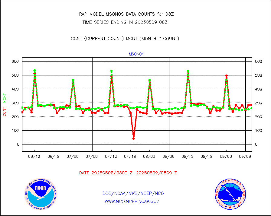
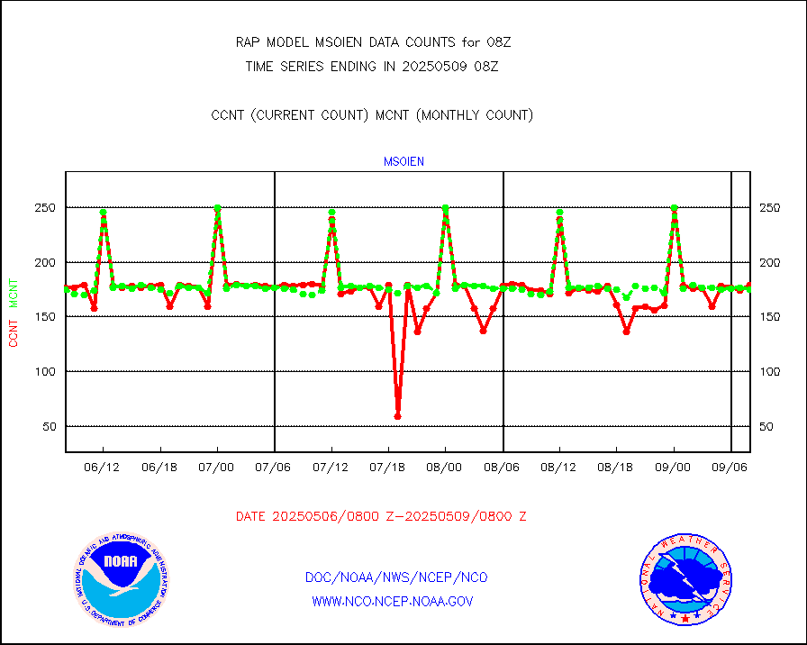
msoien |
Mesonet/MADIS Iowa Environmental |
175 |
172 |
101.7 % |
2507.50-2508.50 |
msoind |
Mesonet/MADIS Indiana Dept. of Transportation |
0 |
0 |
n/a |
2507.50-2508.50 |
msoiow |
Mesonet/MADIS Iowa Department of Transportation |
0 |
0 |
n/a |
2507.50-2508.50 |
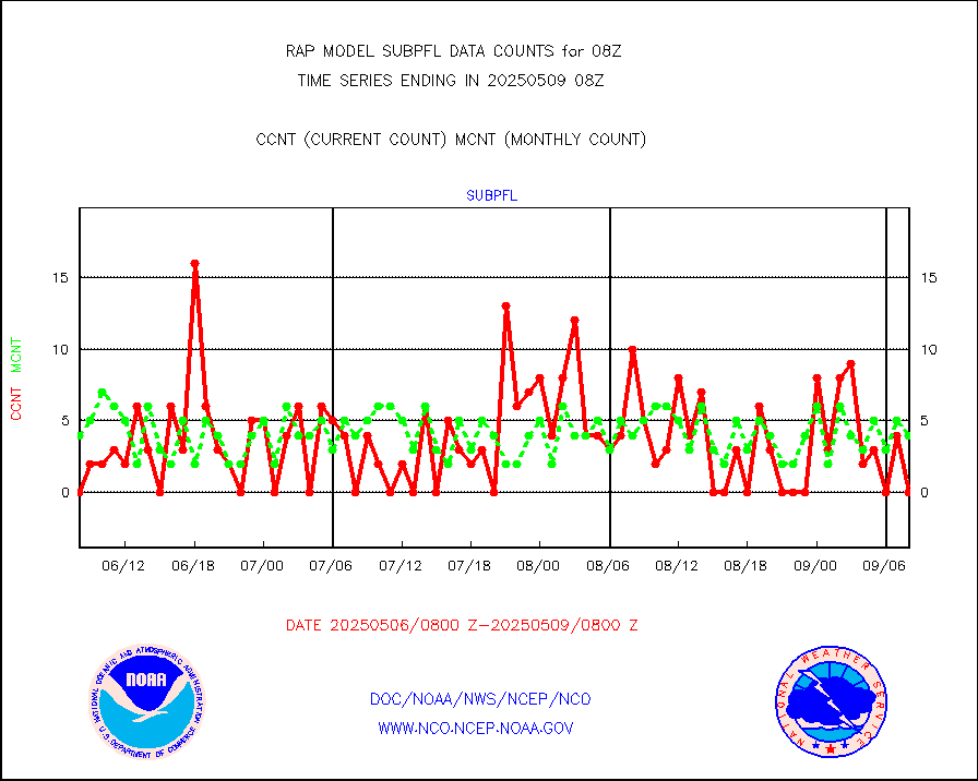
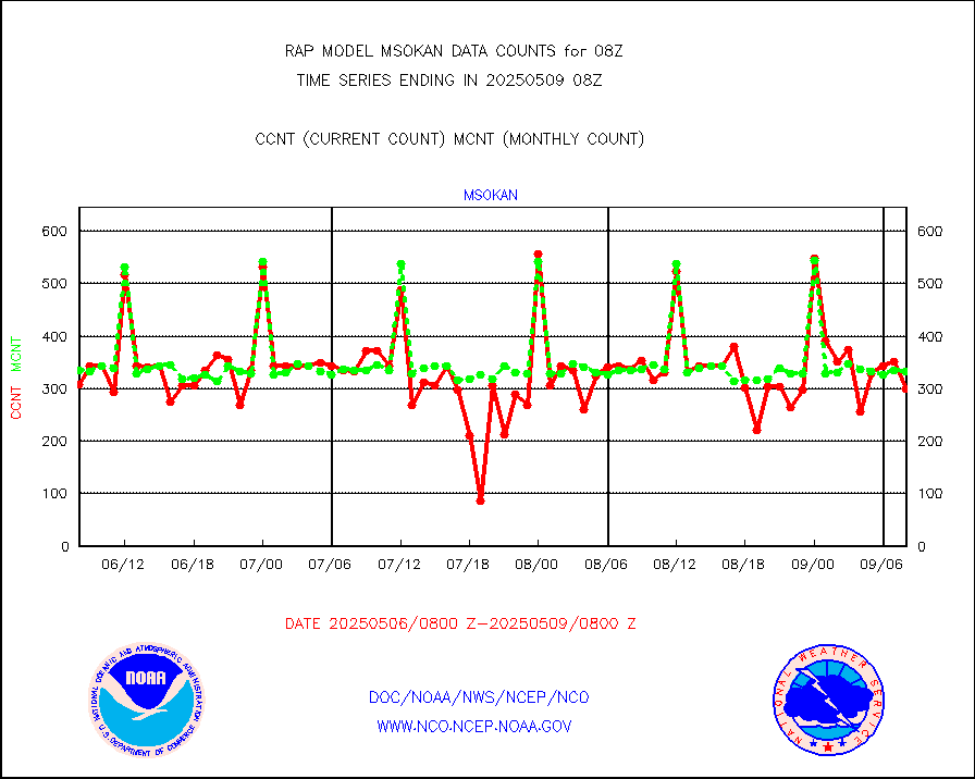
msokan |
Mesonet/MADIS Kansas Department of Transportation |
32 |
323 |
9.9 % |
2507.50-2508.50 |
msokla |
Mesonet/MADIS Oklahoma Mesonet |
318 |
329 |
96.7 % |
2507.50-2508.50 |
msolju |
Mesonet/MADIS Louisiana State/Jackson State Univ. |
0 |
0 |
n/a |
2507.50-2508.50 |
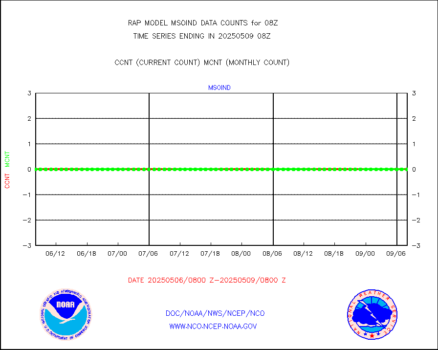
msomca |
Mesonet/MADIS Missouri Commercial Agricult Wx Net |
275 |
254 |
108.3 % |
2507.50-2508.50 |
msomin |
Mesonet/MADIS Minnesota Dept. of Transportation |
0 |
0 |
n/a |
2507.50-2508.50 |
msonos |
Mesonet/MADIS NOS-Phys Oceanographic Realtime Sys |
286 |
274 |
104.4 % |
2507.50-2508.50 |
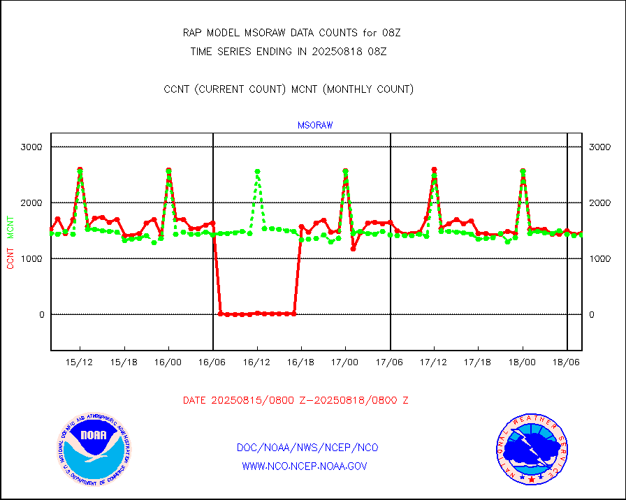
msoraw |
Mesonet/MADIS NFIC Remote Automated Wx Stns(RAWS) |
1663 |
1549 |
107.4 % |
2507.50-2508.50 |
msourb |
Mesonet/MADIS UrbaNet |
4040 |
3938 |
102.6 % |
2507.50-2508.50 |
msovir |
Mesonet/MADIS Virginia Dept. of Transportation |
229 |
233 |
98.3 % |
2507.50-2508.50 |
msowfy |
Mesonet/MADIS "Weather for You" |
0 |
0 |
n/a |
2507.50-2508.50 |
msowis |
Mesonet/MADIS Wisconsin Dept. of Transportation |
0 |
0 |
n/a |
2507.50-2508.50 |
msowst |
Mesonet/MADIS MesoWest (many subproviders) |
39845 |
39105 |
101.9 % |
2507.50-2508.50 |
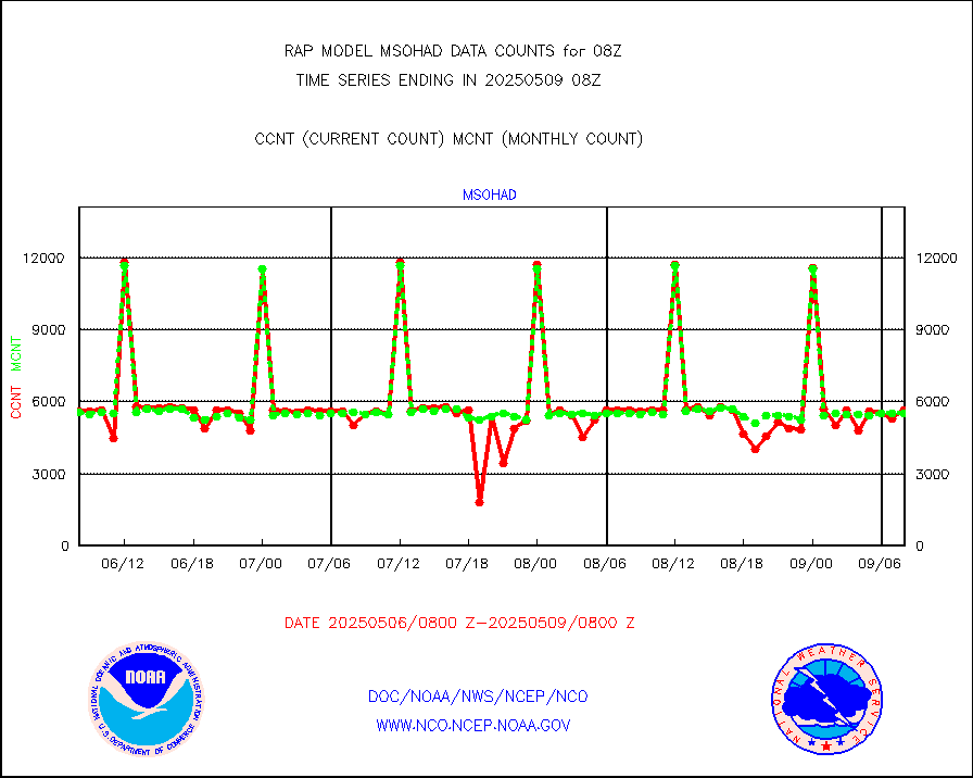
msowtx |
Mesonet/MADIS West Texas |
5038 |
4955 |
101.7 % |
2507.50-2508.50 |
mtiasi |
METOP 1-2 IASI 1C radiance data (varbl. channels) |
39526 |
35944 |
110.0 % |
2506.00-2509.99 |
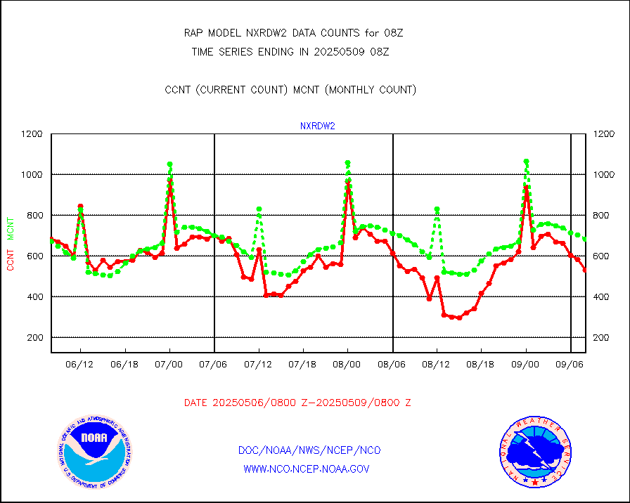
nxrdw2 |
NEXRAD Vel Azm Dsp(VAD) winds via Level 2 decoder |
815 |
651 |
125.2 % |
2507.00-2509.00 |
osbuv8 |
NOAA 16-19 Solar Backscatter UV-2 rad frm V8 BUFR |
0 |
0 |
n/a |
2506.00-2508.99 |
pibal |
PIBAL (from PILOT, PILOT SHIP, PILOT MOBIL) |
0 |
0 |
n/a |
2507.00-2509.00 |
pirep |
Manual PIREP aircraft data (dcded from AIREP fmt) |
27 |
51 |
52.9 % |
2504.75-2511.25 |
prflrp |
Profilr winds from PIBAL (PILOT,PILOT SHIP/MOBIL) |
0 |
0 |
n/a |
2506.50-2509.50 |
raobm |
Rawinsonde - mobile land (from TEMP/PILOT MOBIL) |
0 |
0 |
n/a |
2507.00-2509.00 |
raobs |
Rawinsonde - ship (from TEMP SHIP, PILOT SHIP) |
0 |
0 |
n/a |
2507.00-2509.00 |
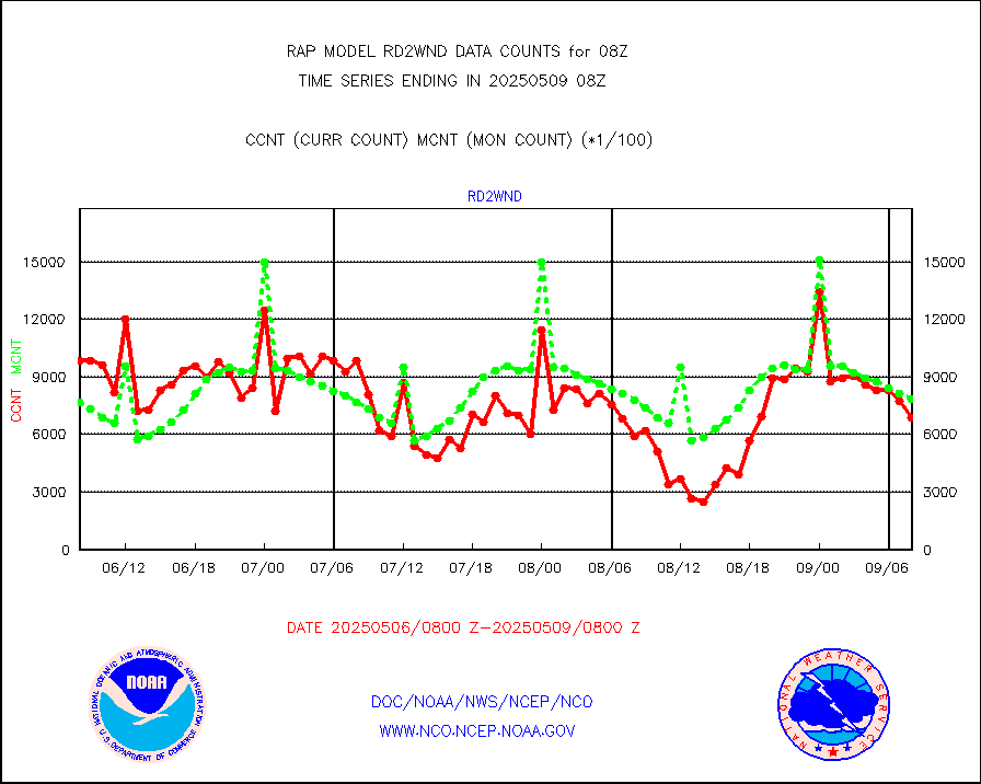
rd2wnd |
NEXRAD radial wind (Level 2 - GTS) |
808329 |
723878 |
111.7 % |
2507.50-2508.49 |
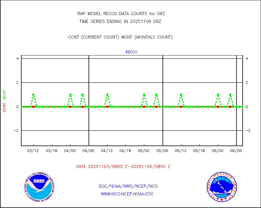
recco |
Flight level reconnaissance aircraft data |
0 |
0 |
n/a |
2507.00-2509.00 |
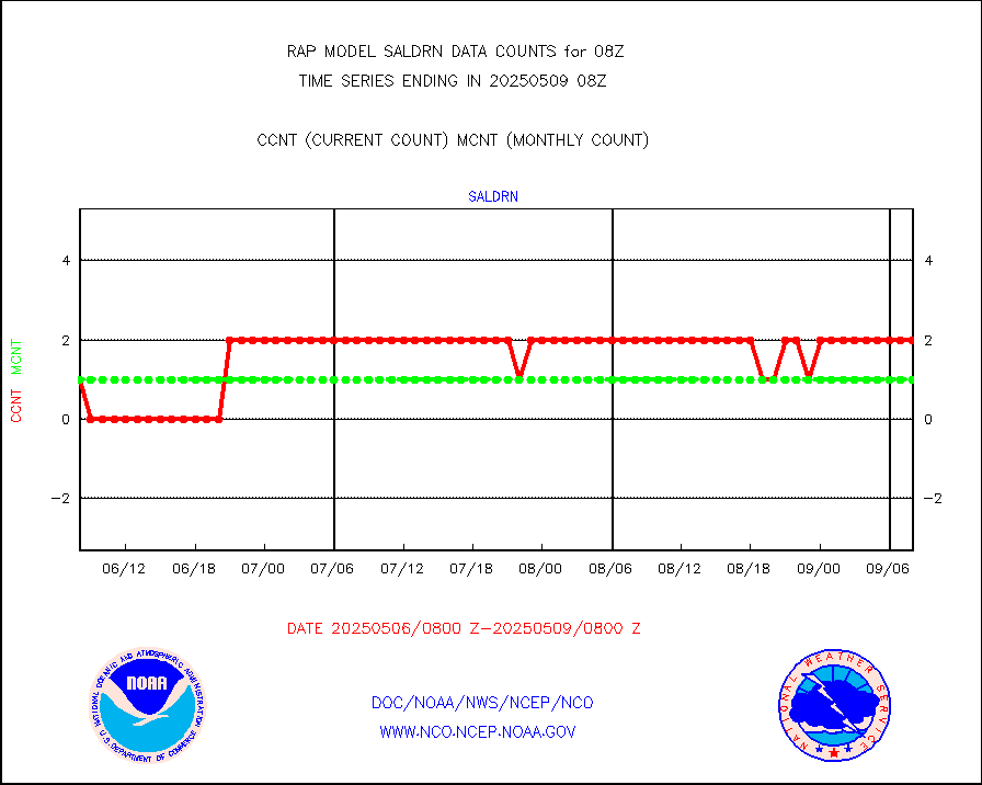
saldrn |
Surface Marine Saildrone (decoded from BUFR) |
2 |
2 |
100.0 % |
2506.00-2509.99 |
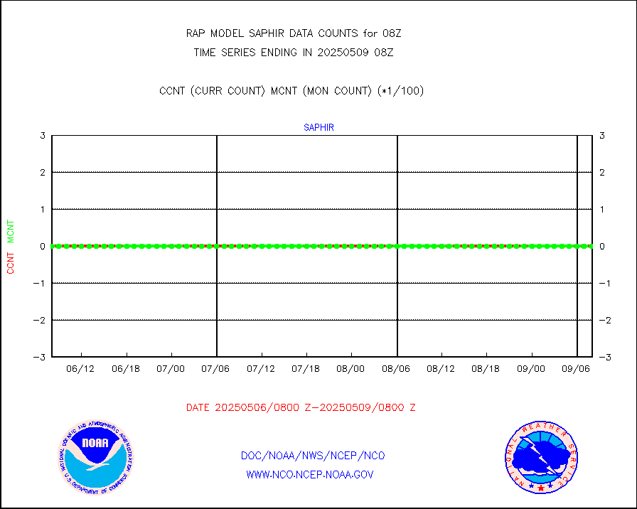
saphir |
Megha-Tropiques SAPHIR L1A2 brightness temps |
0 |
0 |
n/a |
2505.00-2510.99 |
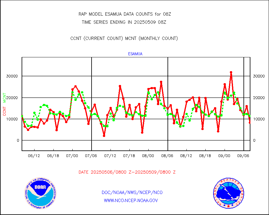
sevasr |
METEOSAT-10 2nd Gen SEVIRI All Sky Radiance(proc) |
9512 |
9495 |
100.2 % |
2506.00-2509.99 |
sevcsr |
METEOSAT-10 2nd Gen SEVIRI Clr Sky Radiance(proc) |
0 |
0 |
n/a |
2506.00-2509.99 |
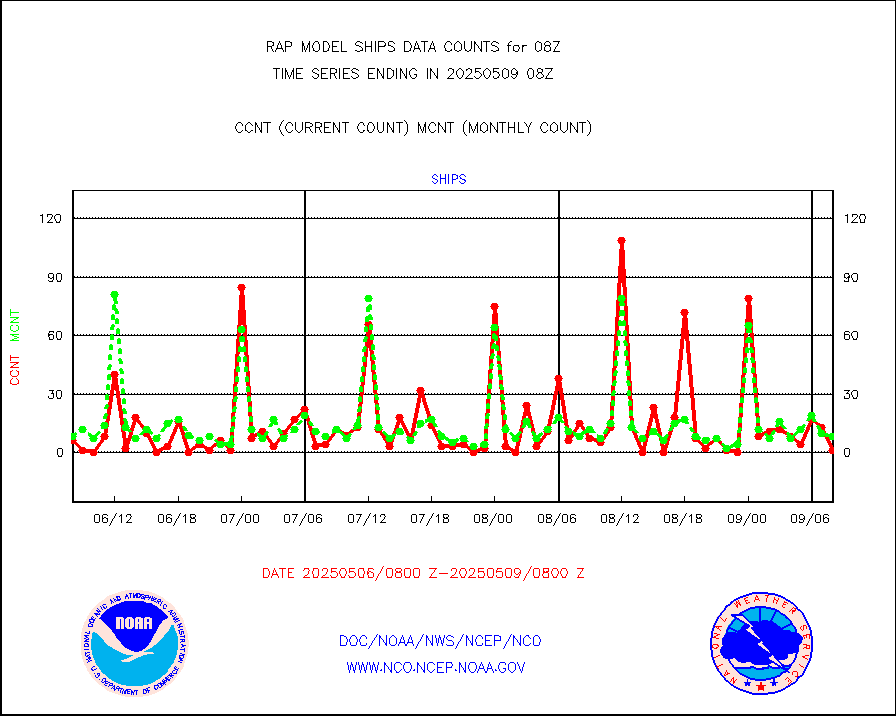
ships |
Ship - manual and automatic, restricted |
0 |
2 |
0.0 % |
2507.50-2508.50 |
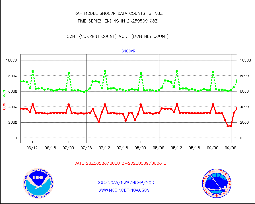
snocvr |
NOW COVER, DEPTH/DENSITY AND WATER EQUIVALENT |
3697 |
7376 |
50.1 % |
2506.00-2510.00 |
ssmisu |
DMSP SSM/IS 1C radiance data (Unified Pre-Proc.) |
24281 |
49536 |
49.0 % |
2506.00-2509.99 |
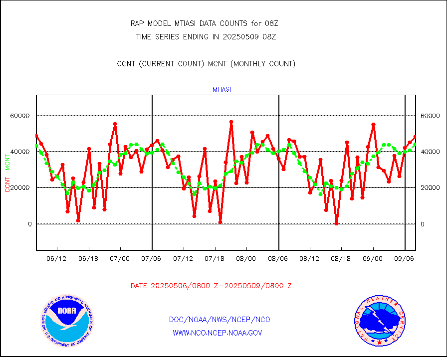
subpfl |
Sub-surface float and glider profile (BUFR) |
4 |
4 |
100.0 % |
2506.00-2509.99 |
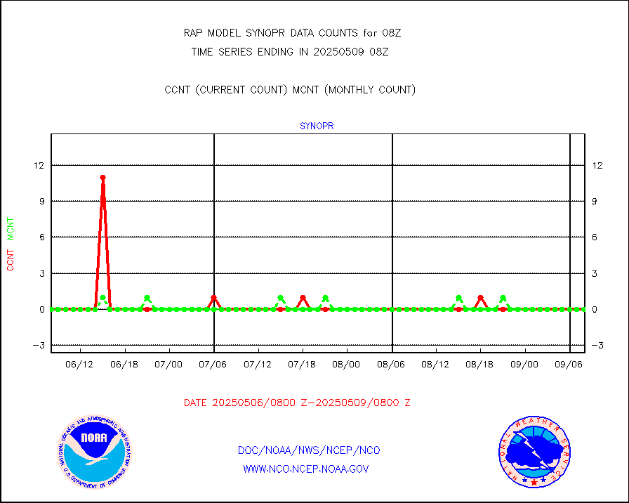
synopr |
Synoptic - restricted (WMO Res 40) manual & auto. |
0 |
0 |
n/a |
2507.50-2508.50 |
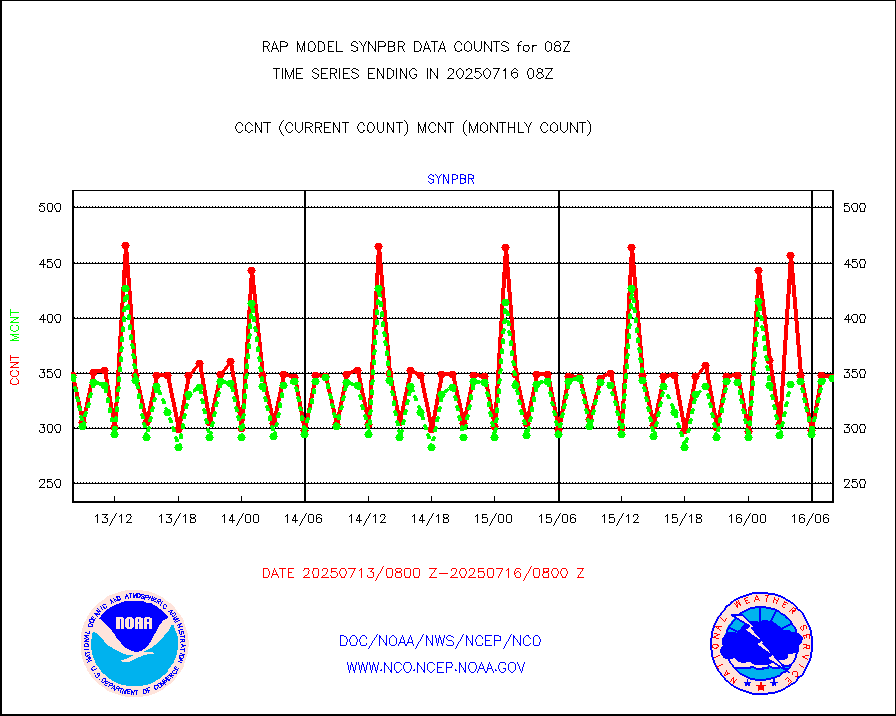
synpbr |
Synoptic - restricted (WMO Res 40)(decoded BUFR) |
348 |
348 |
100.0 % |
2507.50-2508.50 |
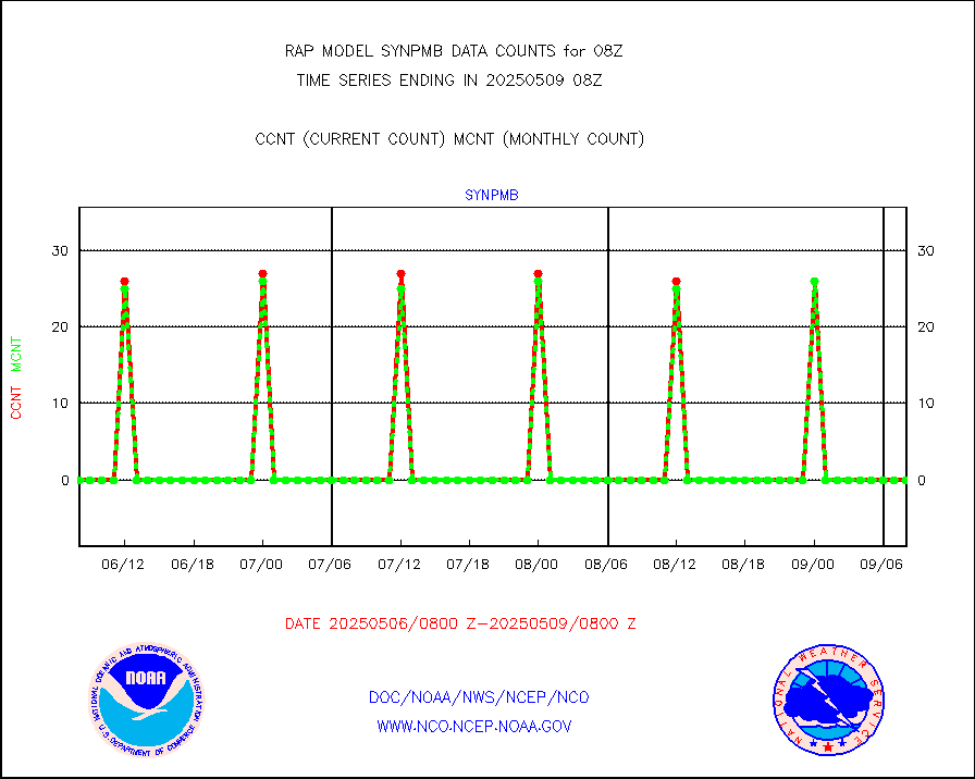
synpmb |
Synoptic - mobile manual & auto (decoded fr BUFR) |
0 |
0 |
n/a |
2507.50-2508.50 |
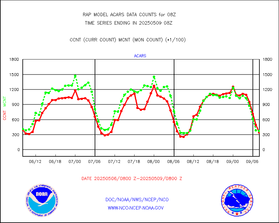
tmdara |
TAMDAR aircft data-all types(from Panasonic,BUFR) |
1491 |
1513 |
98.5 % |
2504.75-2511.25 |
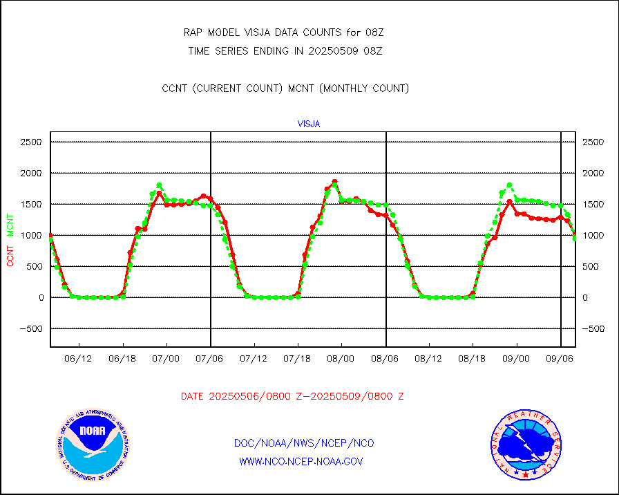
visja |
MTSAT/JMA visible derived cloud motion |
1497 |
881 |
169.9 % |
2505.50-2510.50 |
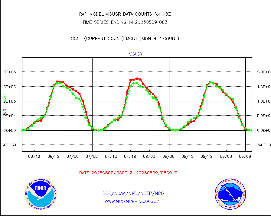
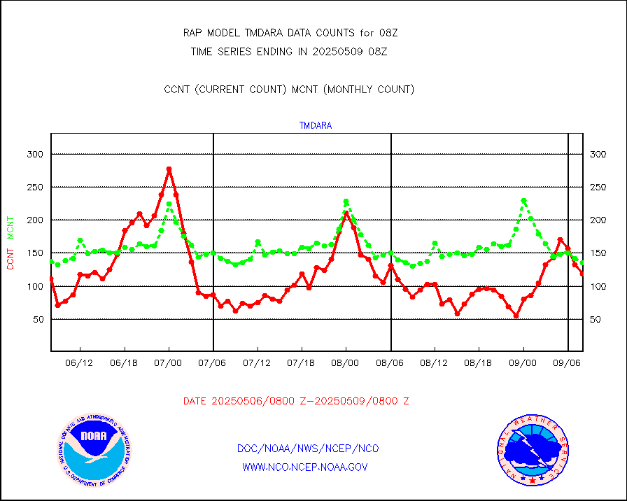
visusr |
GOES-16&up/NESDIS visible derived cloud motion |
0 |
0 |
n/a |
2507.00-2507.99 |
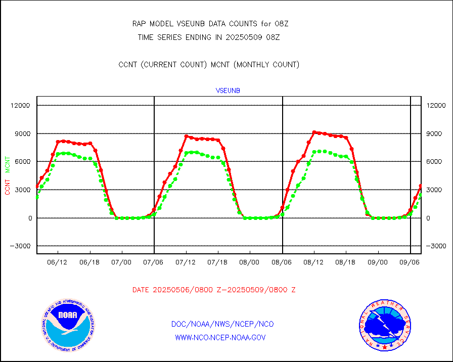
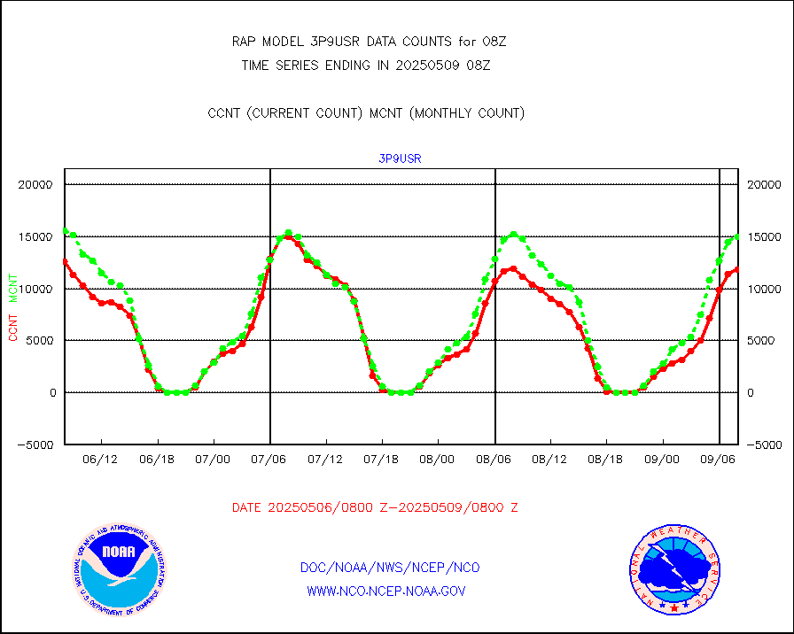
vseunb |
METEOSAT/EUMETSAT visible drv cld motion NBseq |
3546 |
1812 |
195.7 % |
2506.50-2509.49 |


