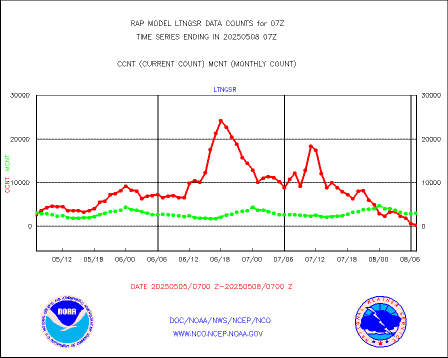
| Critical Data with Normal Counts |
|---|
| Type | Description | Hourly Count | Monthly Average | Percent (%) of Monthly Mean | UTC Time Window |
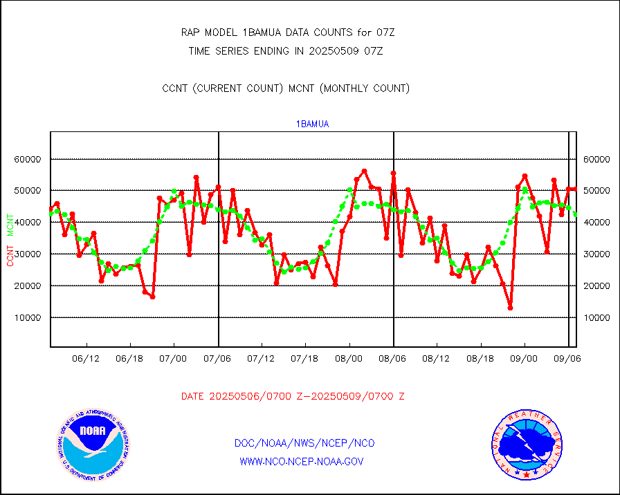
1bamua |
NOAA 15-19 & METOP 1-2 AMSU-A NCEP-proc. br.temps |
46022 |
43124 |
106.7 % |
2404.00-2409.99 |
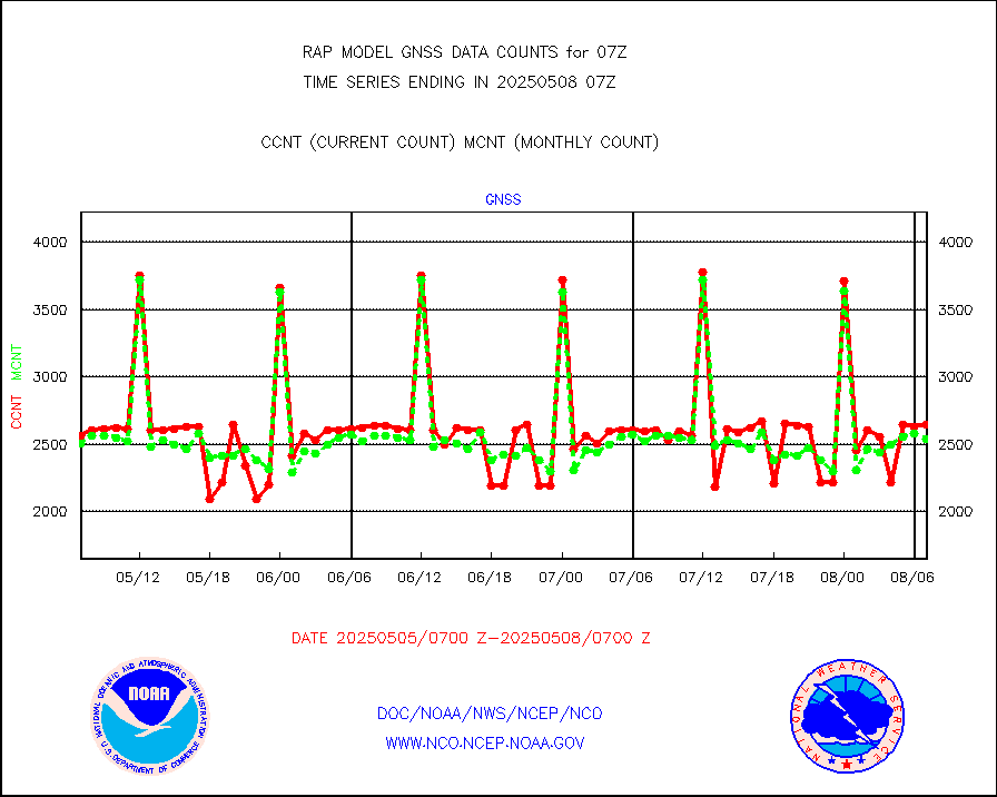
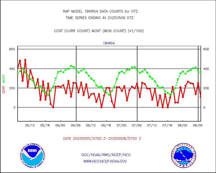
1bhrs4 |
NOAA 18-19 & METOP 1-2 HIRS-4 NCEP-proc. br.temps |
51109 |
37554 |
136.1 % |
2404.00-2409.99 |
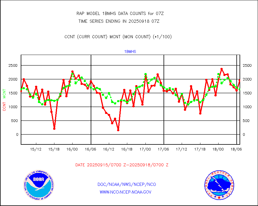
1bmhs |
NOAA 18-19 & METOP 1-2 MHS NCEP-proces. br. temps |
280402 |
245864 |
114.0 % |
2404.00-2409.99 |
acars |
MDCRS ACARS acft data from ARINC(dcded from BUFR) |
27933 |
43730 |
63.9 % |
2403.75-2410.25 |
camdar |
Canadian AMDAR aircraft data (decoded from BUFR) |
0 |
0 |
n/a |
2403.75-2410.25 |
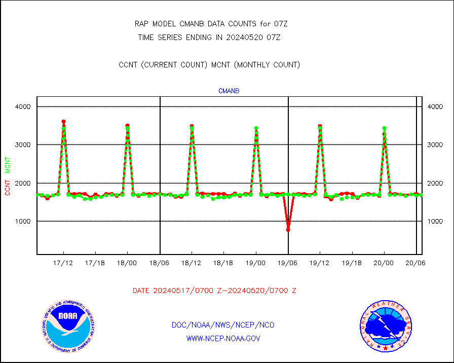
cmanb |
Surface Marine CMAN rpts decoded from BUFR format |
1663 |
1684 |
98.8 % |
2406.50-2407.50 |
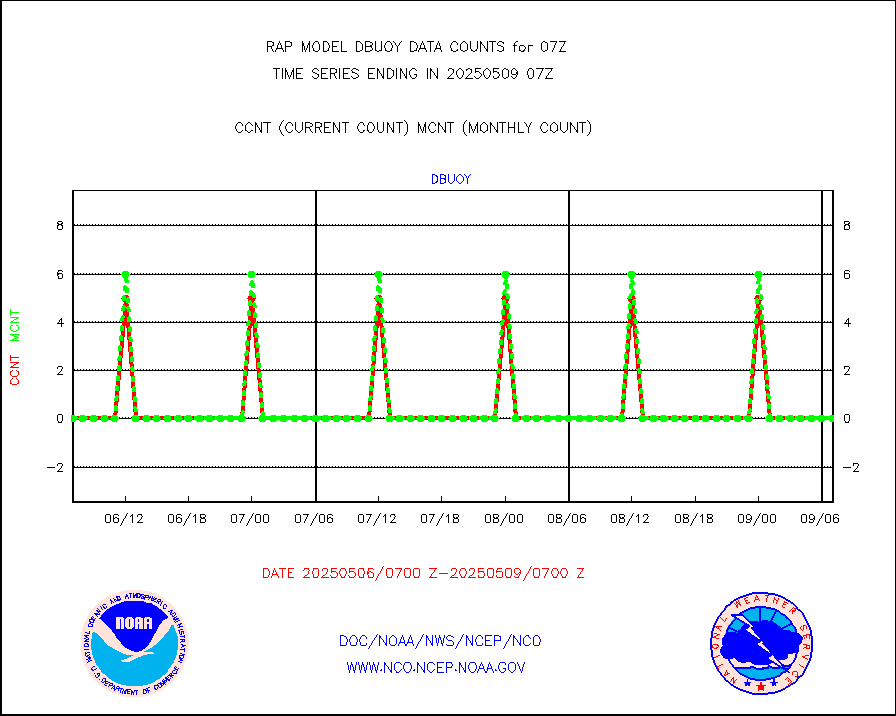
dbuoy |
Buoys decoded from FM-18 fmt (moored or drifting) |
0 |
0 |
n/a |
2406.50-2407.50 |
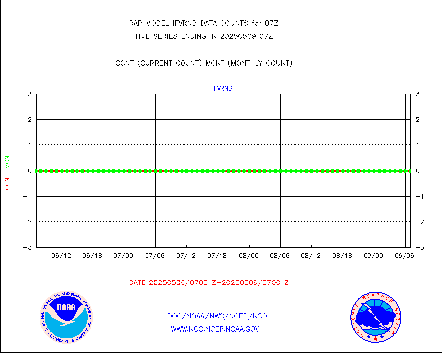
gnss |
Grnd-based Gbl Navigation Sat System (GNSS) data |
2773 |
2333 |
118.9 % |
2405.95-2406.05 |
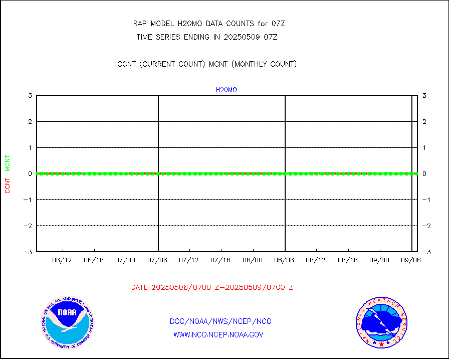
h20mo |
MODIS (AQUA/TERRA) wvpr imager derived cld motion |
0 |
0 |
n/a |
2404.50-2409.50 |
infmo |
MODIS (AQUA/TERRA) ir l-wave derived cloud motion |
0 |
0 |
n/a |
2404.50-2409.50 |
lgycld |
GOES/NASA(Langley) hi-res. (1x1 f-o-v) cloud data |
2897986 |
3223823 |
89.9 % |
2406.50-2407.50 |
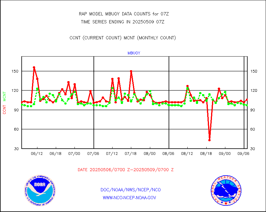
mbuoy |
Buoys decoded from FM-13 format (moored) |
29 |
53 |
54.7 % |
2406.50-2407.50 |
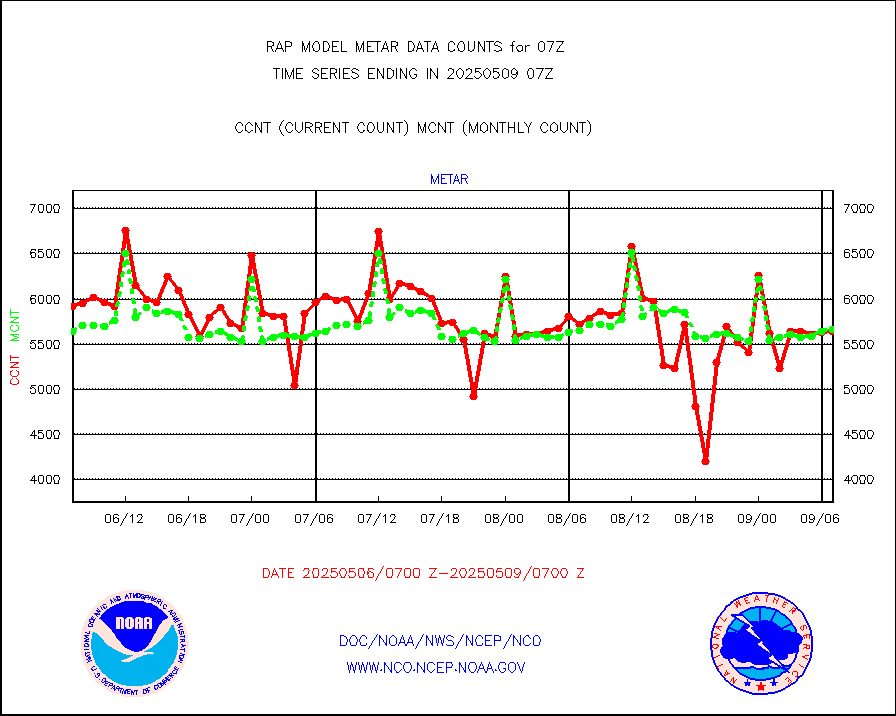
metar |
Aviation - METAR |
5798 |
5813 |
99.7 % |
2406.50-2407.50 |
nxrdw |
NEXRAD Vel Azm Dsp(VAD) winds via radar coded msg |
0 |
0 |
n/a |
2406.00-2408.00 |
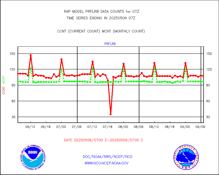
prflrb |
Multi-Agency Profiler (MAP) and SODAR winds |
102 |
82 |
124.4 % |
2405.50-2408.50 |
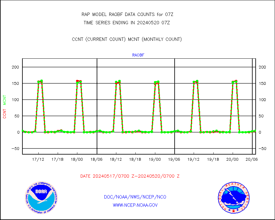
raobf |
Rawinsonde - fixed land (from TEMP or PILOT) |
6 |
6 |
100.0 % |
2406.00-2408.00 |
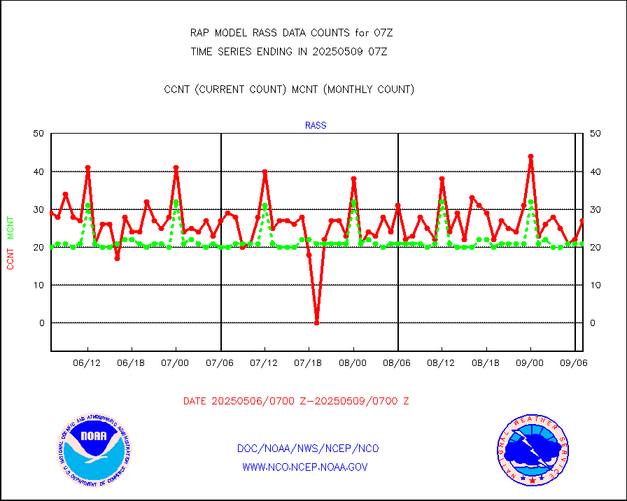
rass |
RASS temperatures (NOAA and Multi-Agency) |
22 |
21 |
104.8 % |
2406.50-2407.50 |
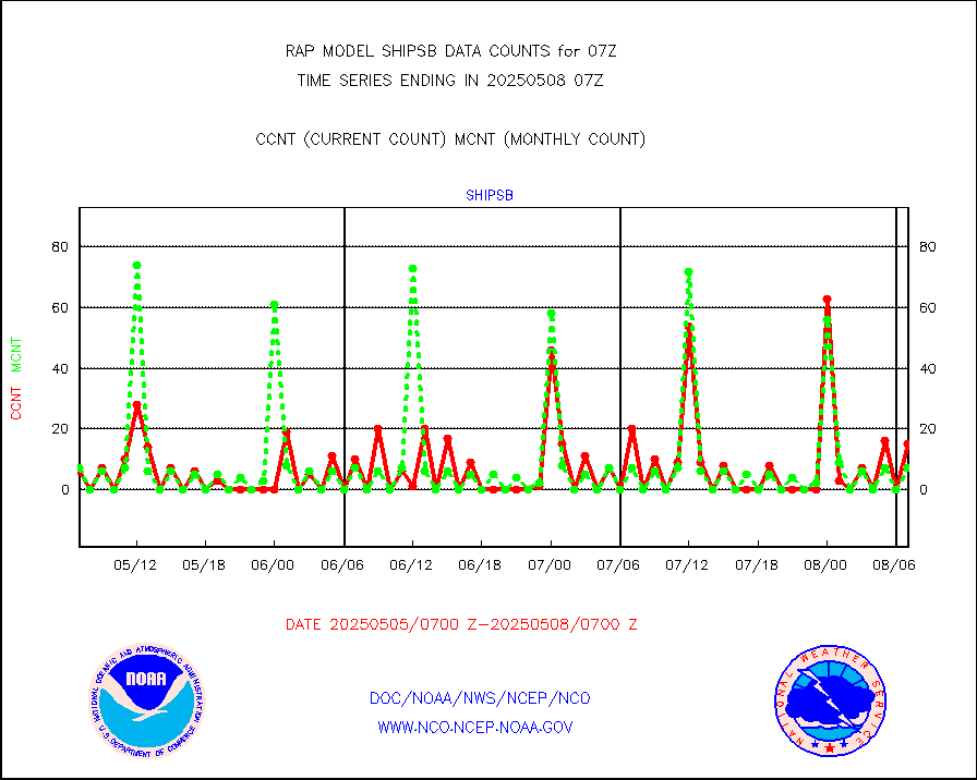
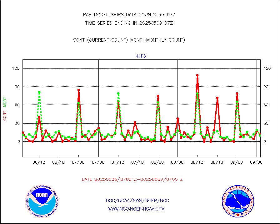
shipsb |
Ship - manual and automatic, restricted (BUFR) |
0 |
0 |
n/a |
2406.50-2407.50 |
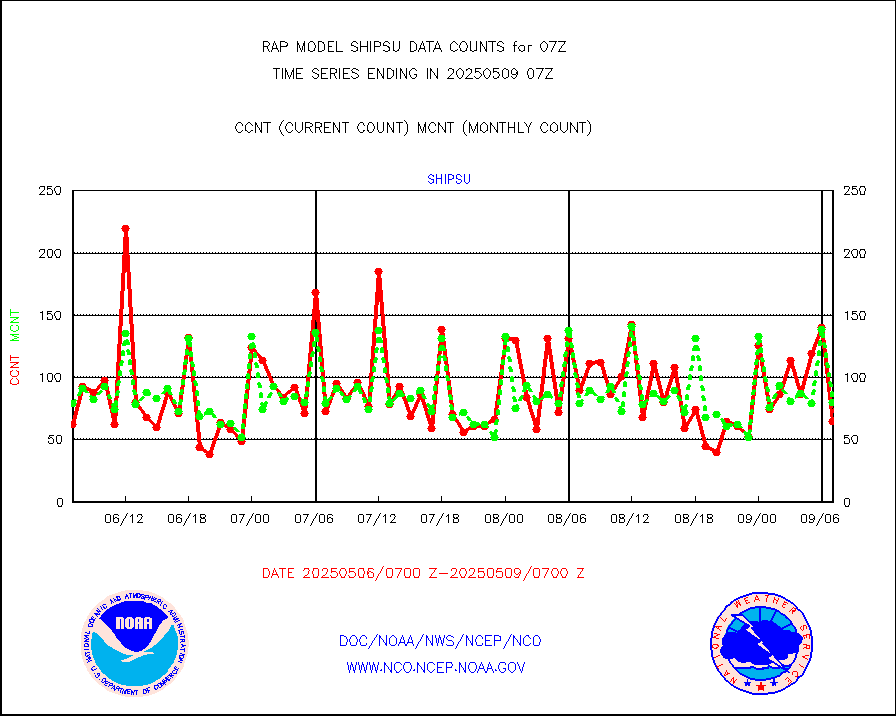
shipsu |
Ship - manual and automatic, unrestricted |
68 |
47 |
144.7 % |
2406.50-2407.50 |
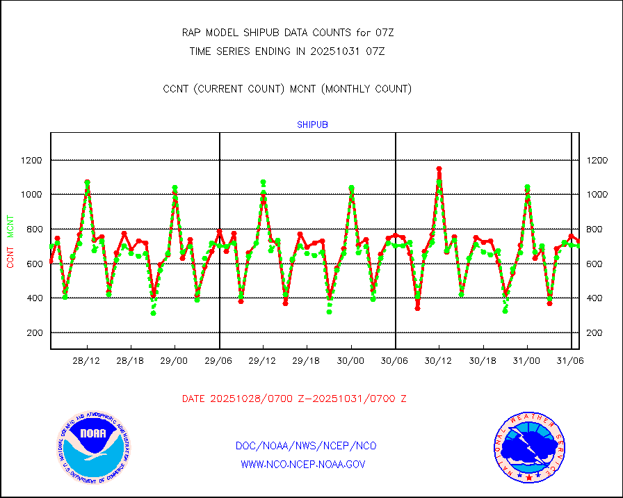
shipub |
Ship - manual and automatic, unrestricted (BUFR) |
568 |
617 |
92.1 % |
2406.50-2407.50 |
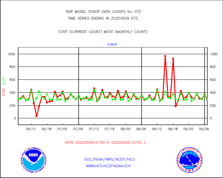
synop |
Synoptic - fixed manual and automatic |
291 |
306 |
95.1 % |
2406.50-2407.50 |
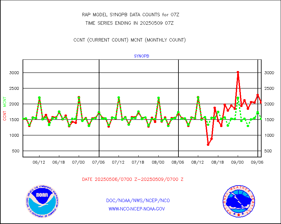
synopb |
Synoptic - fixed manual & auto (decoded fr BUFR) |
1675 |
1615 |
103.7 % |
2406.50-2407.50 |
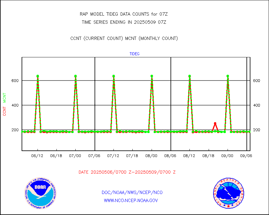
tideg |
Tide gauge reports decoded from CREX format |
181 |
178 |
101.7 % |
2406.50-2407.50 |
| Data Types of Opportunity with Normal Counts |
|---|
| Type | Description | Hourly Count | Monthly Average | Percent (%) of Monthly Mean | UTC Time Window |
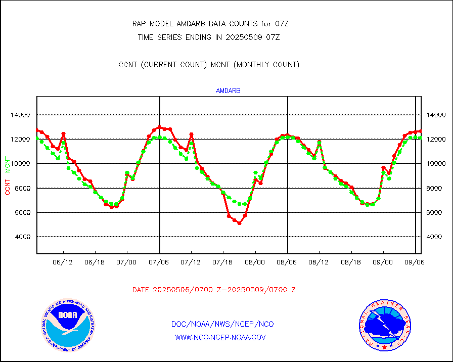
3p9usr |
GOES-16&up/NESDIS ir short-wv derived cld motion |
14557 |
16296 |
89.3 % |
2406.00-2406.99 |
acarsa |
MDCRS ACARS acft data (ARINC via AFWA)(AIREP fmt) |
0 |
0 |
n/a |
2403.75-2410.25 |
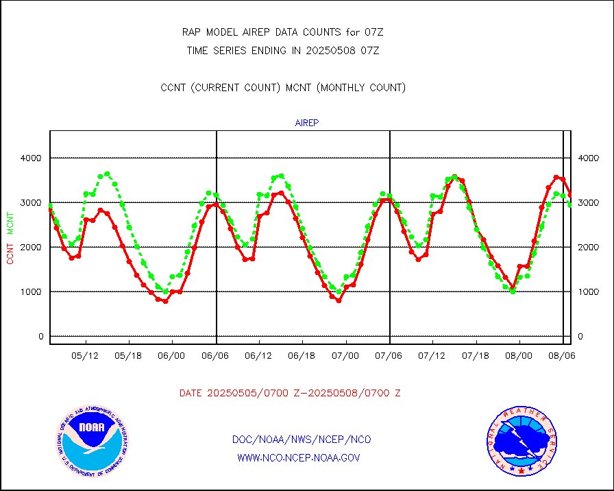
airep |
Manual AIREP aircraft data (dcded from AIREP fmt) |
4450 |
4126 |
107.9 % |
2403.75-2410.25 |
airsev |
AQUA AIRS/AMSU-A/HSB brightness temps- every FOV |
0 |
0 |
n/a |
2404.00-2409.99 |
amdar |
AMDAR aircraft data (decoded from AMDAR format) |
2711 |
2151 |
126.0 % |
2403.75-2410.25 |
amdarb |
AMDAR aircraft data (decoded from BUFR) |
6569 |
6356 |
103.4 % |
2403.75-2410.25 |
amsr2 |
GCOM-W AMSR2 1B brightness temperatures |
946839 |
543354 |
174.3 % |
2404.00-2404.99 |
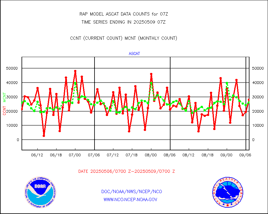
ascat |
METOP 1-2 ASCAT products |
21407 |
18304 |
117.0 % |
2405.00-2409.00 |
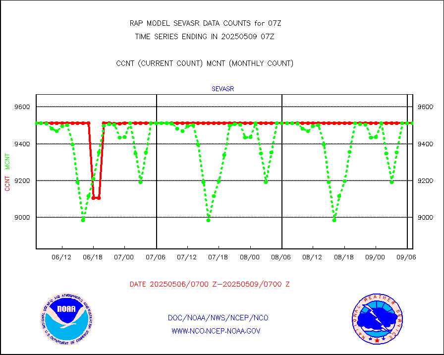
atms |
NPP/NOAA-20 ATMS brightness temperatures |
177541 |
152917 |
116.1 % |
2405.00-2408.99 |
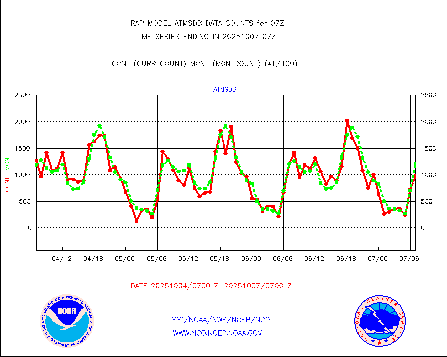
atmsdb |
NPP/NOAA-20 ATMS bright. temps-direct b-cast SSEC |
125813 |
117375 |
107.2 % |
2405.00-2408.99 |
coopmd |
Coop/MADIS NEPP & HCN-Modernization NOAA COOP Obs |
27 |
23 |
117.4 % |
2406.50-2407.50 |
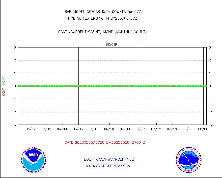
crisf4 |
NPP/NOAA-20 CrIS full spctrl radn (431 ch subset) |
99485 |
95147 |
104.6 % |
2405.00-2408.99 |
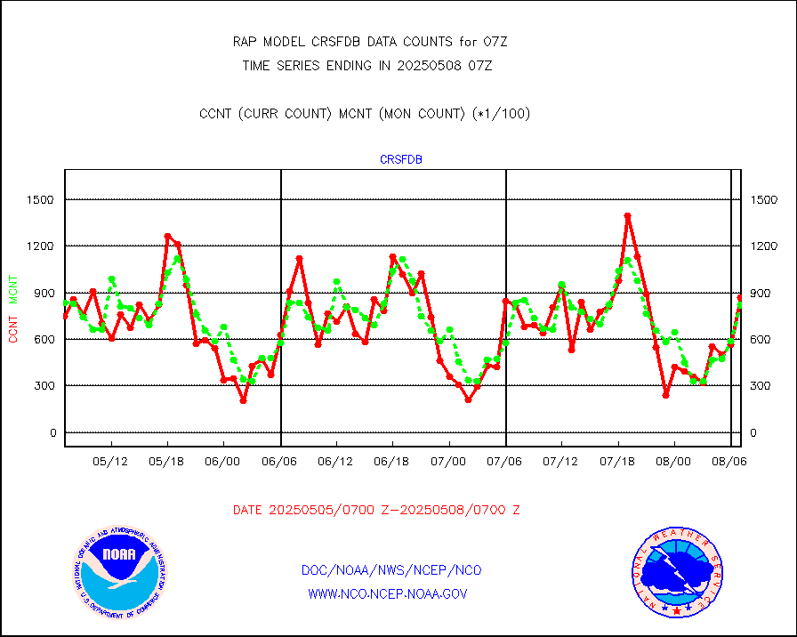
crsfdb |
NPP/NOAA-20 CrIS full spctrl radn dir brdcst SSEC |
144210 |
123393 |
116.9 % |
2405.00-2408.99 |
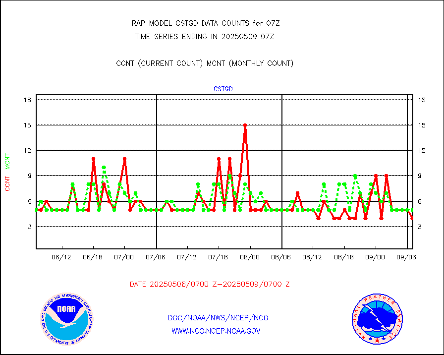
cstgd |
Coast Guard |
5 |
3 |
166.7 % |
2406.50-2407.50 |
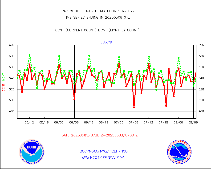
dbuoyb |
Drifting buoys (decoded from BUFR) |
555 |
609 |
91.1 % |
2406.50-2407.50 |
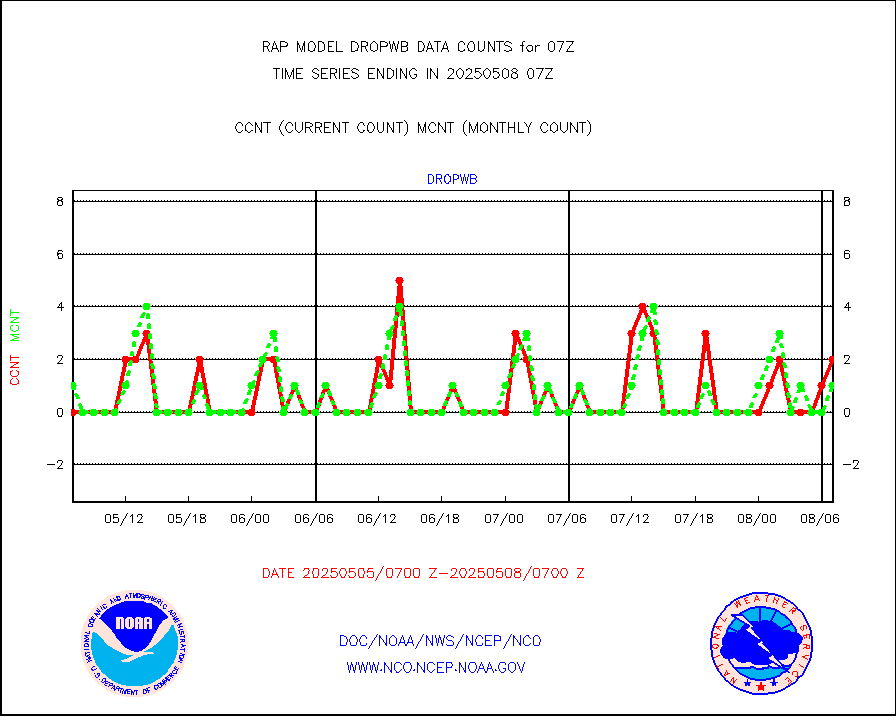
dropw |
Dropwinsonde (from TEMP DROP) |
0 |
0 |
n/a |
2406.00-2408.00 |
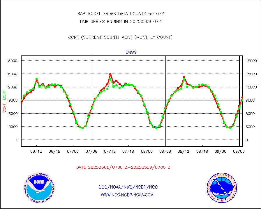
eadas |
E-AMDAR (European AMDAR acft decoded from BUFR) |
7075 |
6628 |
106.7 % |
2403.75-2410.25 |
esamua |
NOAA 15-19 & METOP 1-2 AMSU-A proc btmps frm RARS |
15509 |
13621 |
113.9 % |
2406.00-2408.00 |
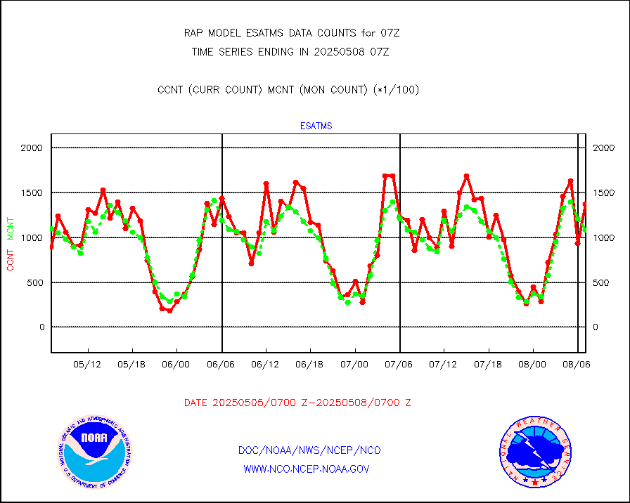
esatms |
NPP Adv. Tech. MW Sndr (ATMS) br. temps from RARS |
117110 |
99945 |
117.2 % |
2405.00-2408.99 |
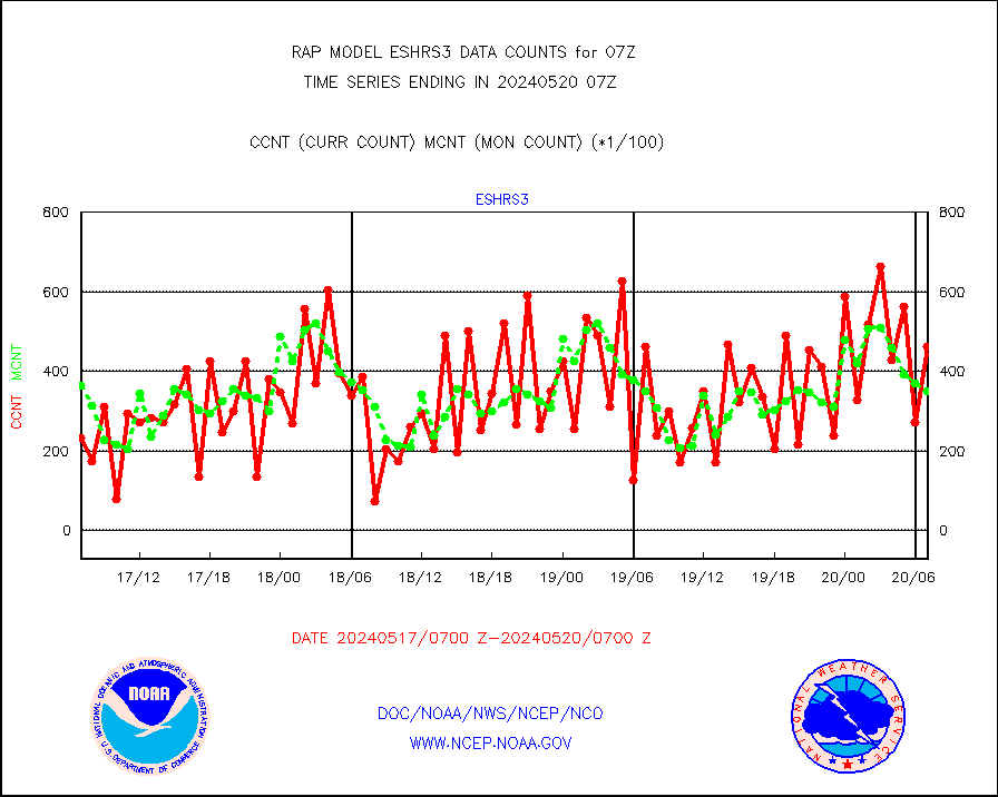
eshrs3 |
NOAA 15-19 & METOP 1-2 HIRS-3/4 pr btmps frm RARS |
53840 |
31730 |
169.7 % |
2406.00-2408.00 |
esiasi |
METOP 1-2 IASI 1C radiance data vbl chn from RARS |
19676 |
22785 |
86.4 % |
2405.00-2408.99 |
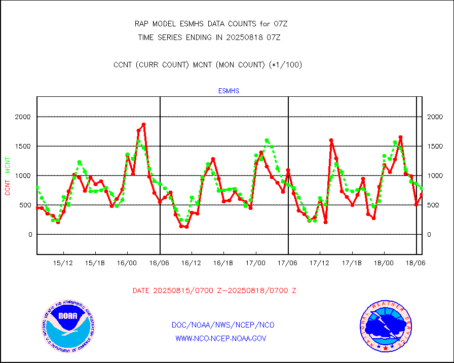
esmhs |
NOAA 18-19 & METOP 1-2 MHS proc. btemps from RARS |
125590 |
86886 |
144.5 % |
2406.00-2408.00 |
gmi1cr |
GPM GMI Level 1C-R brightness temperatures |
436331 |
903398 |
48.3 % |
2404.00-2409.99 |
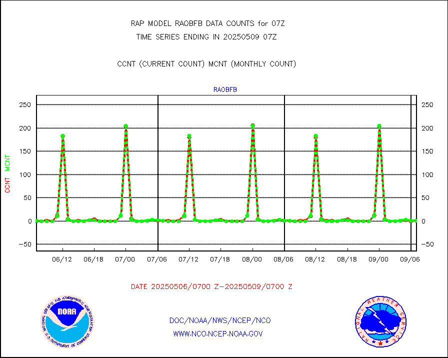
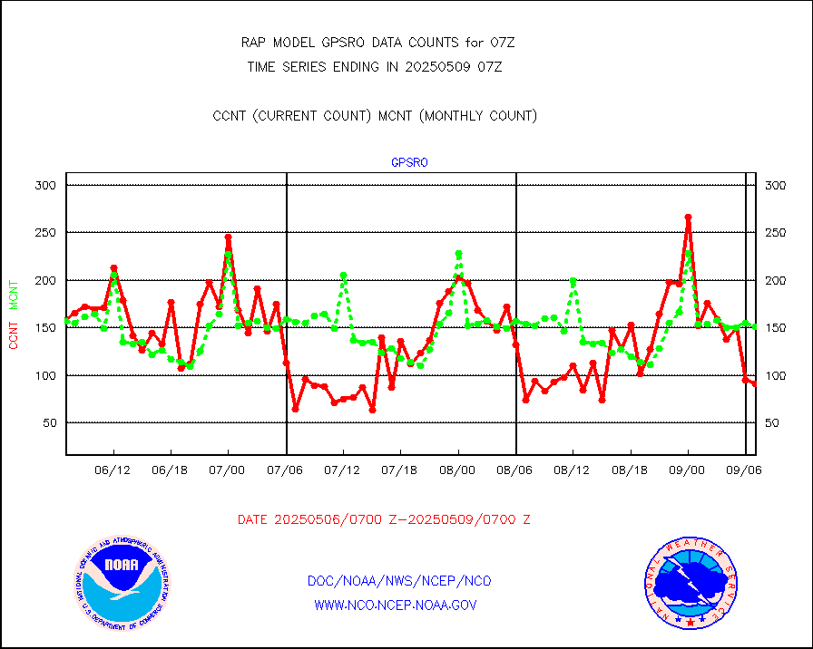
gpsro |
GPS radio occultation data |
109 |
109 |
100.0 % |
2405.00-2408.99 |
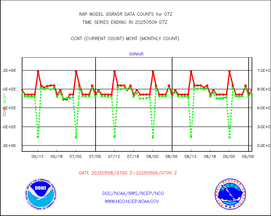
gsrasr |
GOES-16/17 All Sky Radiances (proc.) |
885924 |
875452 |
101.2 % |
2405.00-2408.99 |
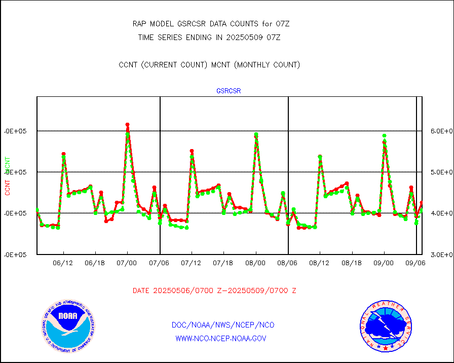
gsrcsr |
GOES-16/17 Clear Sky Radiances (proc.) |
446125 |
404118 |
110.4 % |
2405.00-2408.99 |
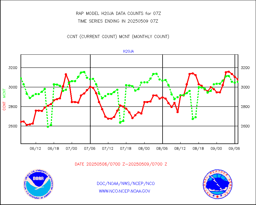
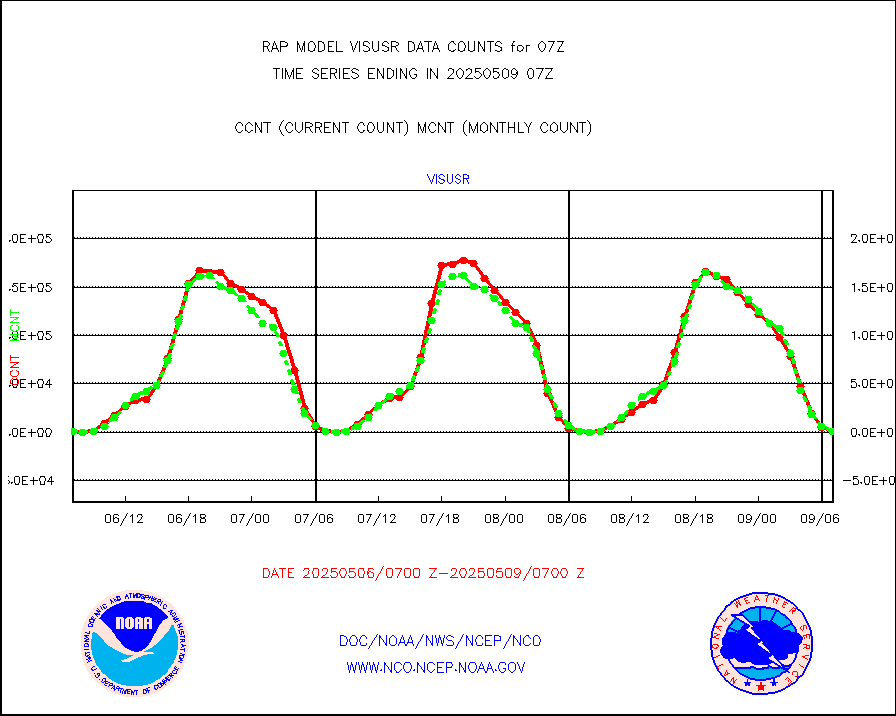
h20ja |
MTSAT/JMA water vapor imager derived cloud motion |
2692 |
2835 |
95.0 % |
2404.50-2409.50 |
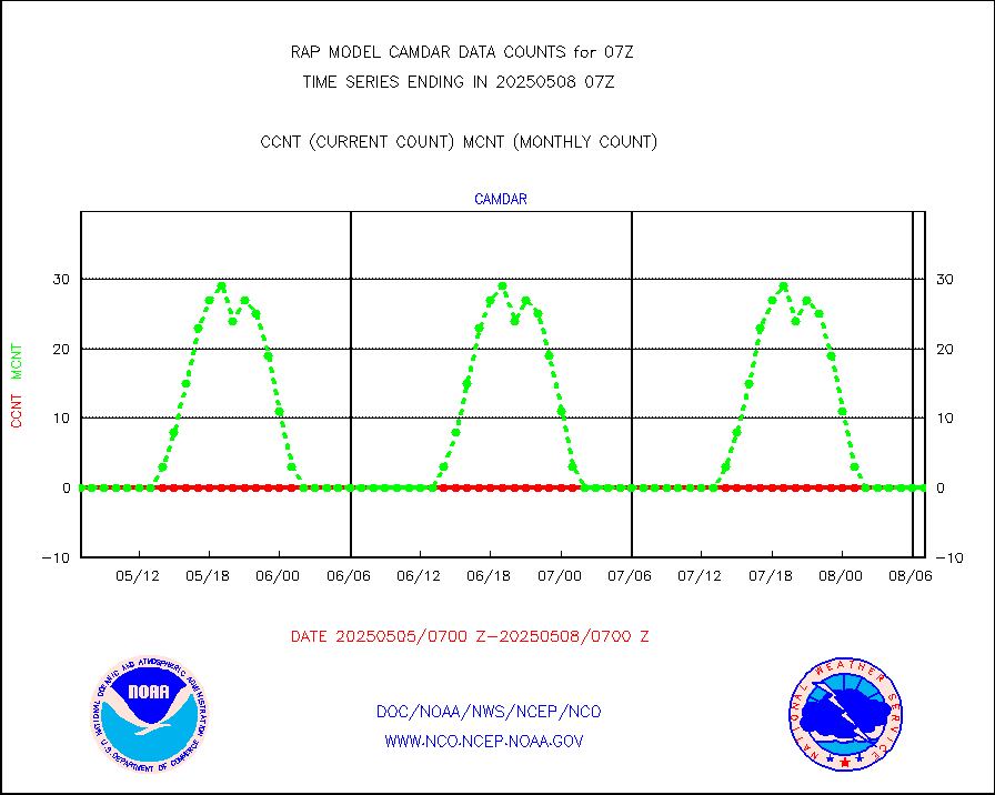
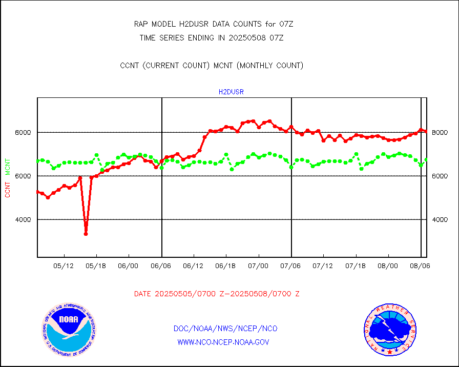
h2dusr |
GOES-16&up/NESDIS wv imgr/deep-lyr derivd cld mtn |
8446 |
5914 |
142.8 % |
2406.00-2406.99 |
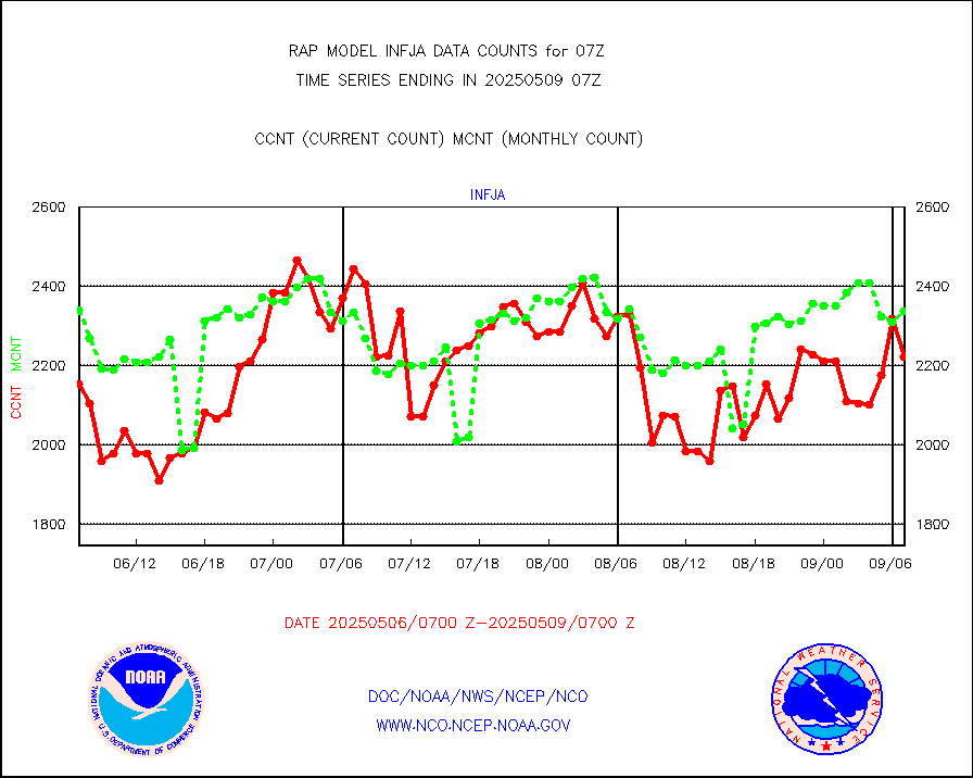
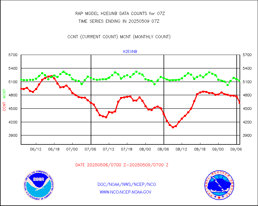
h2eunb |
METEOSAT/EUMETSAT wvpr imgr drv cld motion NBseq |
4475 |
5011 |
89.3 % |
2405.50-2408.49 |
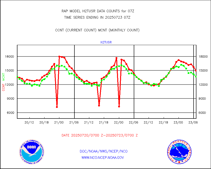
h2tusr |
GOES-16&up/NESDIS wv imgr/cld-top derived cld mtn |
9647 |
10220 |
94.4 % |
2406.00-2406.99 |
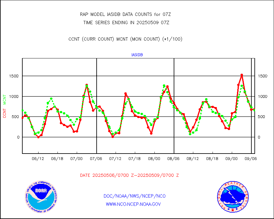
iasidb |
METOP 1-2 IASI 1C radiances-direct broadcast SSEC |
47142 |
48551 |
97.1 % |
2405.00-2408.99 |
ifeunb |
METEOSAT/EUMETSAT ir lg-wave drv cld motion NBseq |
3248 |
3204 |
101.4 % |
2405.50-2408.49 |
ifvrnb |
VIIRS (NPP/NOAA-20) ir lg-wv drv cloud motion(NB) |
0 |
0 |
n/a |
2404.50-2409.50 |
infav1 |
AVHRR (METOP) ir lg-wave derived cld motion |
0 |
0 |
n/a |
2405.50-2408.49 |
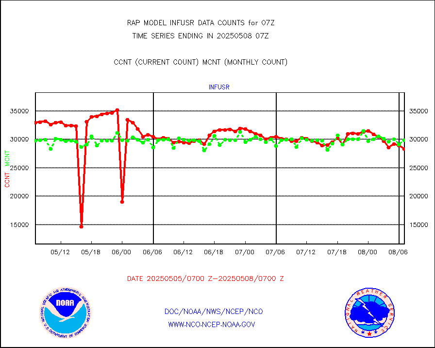
infja |
MTSAT/JMA infrared long-wave derived cloud motion |
2781 |
2485 |
111.9 % |
2404.50-2409.50 |
infusr |
GOES-16&up/NESDIS ir long-wave derived cld motion |
29311 |
30077 |
97.5 % |
2406.00-2406.99 |
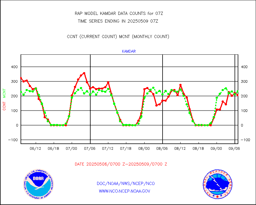
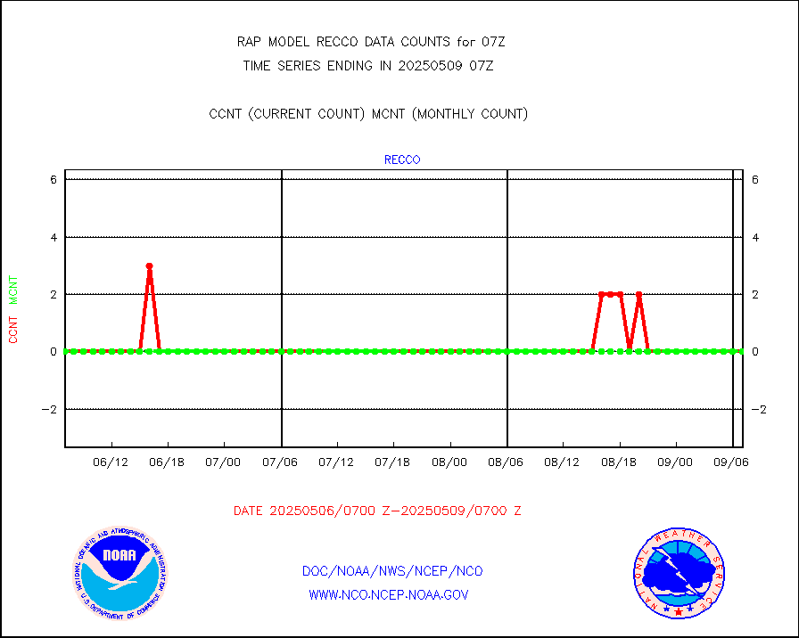
kamdar |
Korean AMDAR aircraft data (decoded from BUFR) |
210 |
278 |
75.5 % |
2403.75-2410.25 |
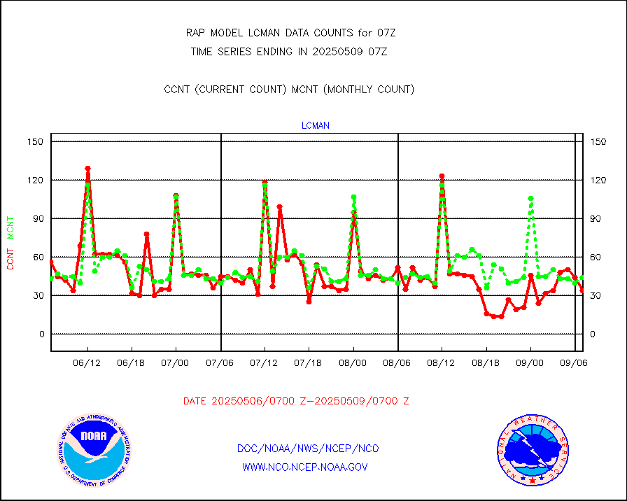
lcman |
Land-based CMAN stations decoded from CMAN format |
72 |
74 |
97.3 % |
2406.50-2407.50 |
mbuoyb |
Moored buoys (decoded from BUFR) |
527 |
472 |
111.7 % |
2406.50-2407.50 |
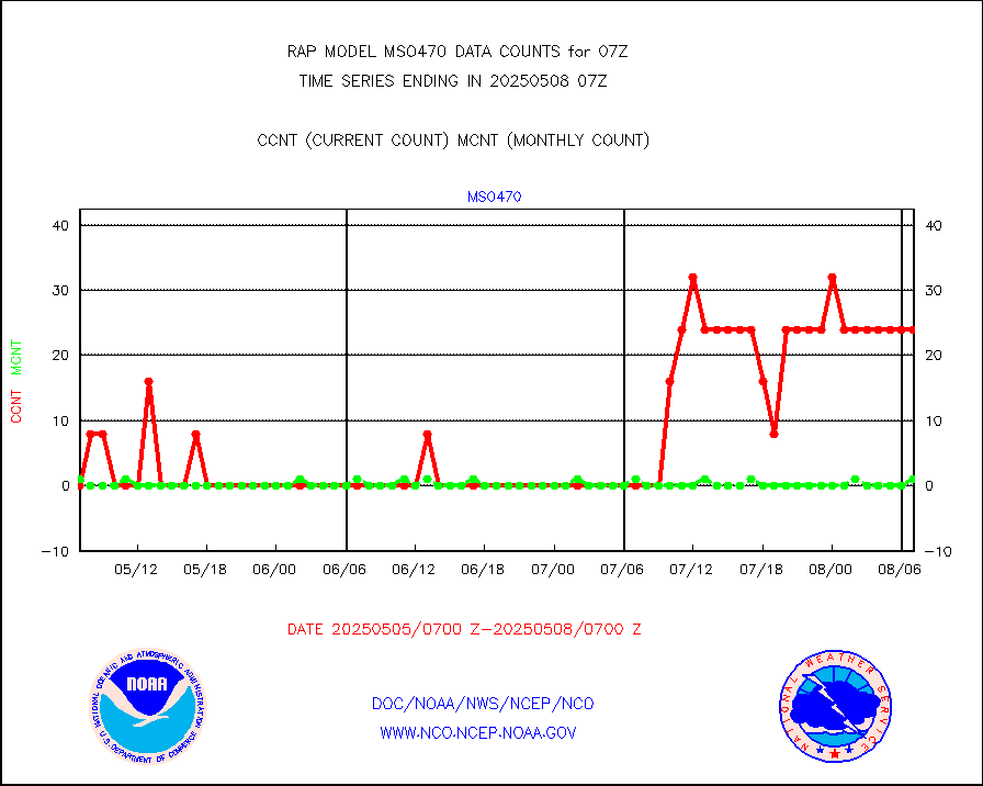
mso470 |
Mesonet/MADIS Colorado E-470 (Interstate 470) |
6 |
18 |
33.3 % |
2406.50-2407.50 |
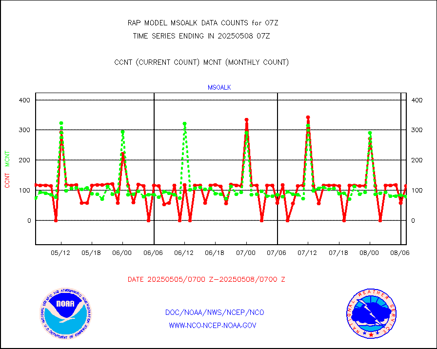
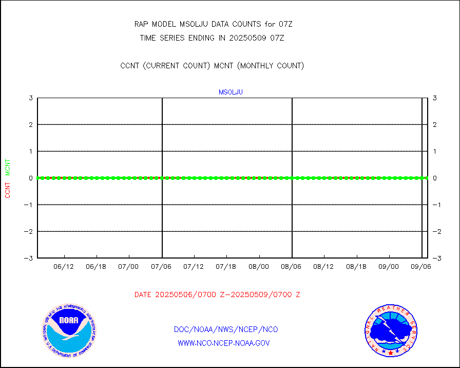
msoalk |
Mesonet/MADIS Alaska Department of Transportation |
0 |
95 |
0.0 % |
2406.50-2407.50 |
msoapg |
Mesonet/MADIS U.S. Army Aberdeen Proving Grounds |
0 |
0 |
n/a |
2406.50-2407.50 |
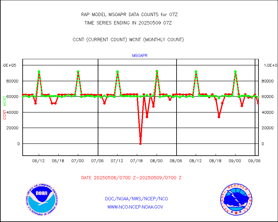
msoapr |
Mesonet/MADIS Citizen Weather Observers Program |
40158 |
43277 |
92.8 % |
2406.50-2407.50 |
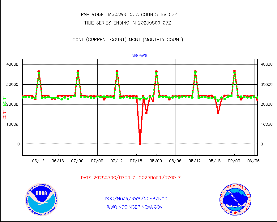
msoaws |
Mesonet/MADIS AWS Convergence Technologies, Inc. |
25172 |
25353 |
99.3 % |
2406.50-2407.50 |
msoawx |
Mesonet/MADIS "Anything Weather" |
0 |
0 |
n/a |
2406.50-2407.50 |
msocol |
Mesonet/MADIS Colorado Dept. of Transportation |
0 |
0 |
n/a |
2406.50-2407.50 |
msodcn |
Mesonet/MADIS DC Net |
0 |
0 |
n/a |
2406.50-2407.50 |
msoden |
Mesonet/MADIS Denver Urban Drainage & Flood Cntrl |
150 |
198 |
75.8 % |
2406.50-2407.50 |
msofla |
Mesonet/MADIS Florida (FAWN & USF) |
3 |
3 |
100.0 % |
2406.50-2407.50 |
msoflt |
Mesonet/MADIS Florida Dept. of Transportation |
0 |
0 |
n/a |
2406.50-2407.50 |
msogeo |
Mesonet/MADIS Georgia Dept. of Transportation |
0 |
0 |
n/a |
2406.50-2407.50 |
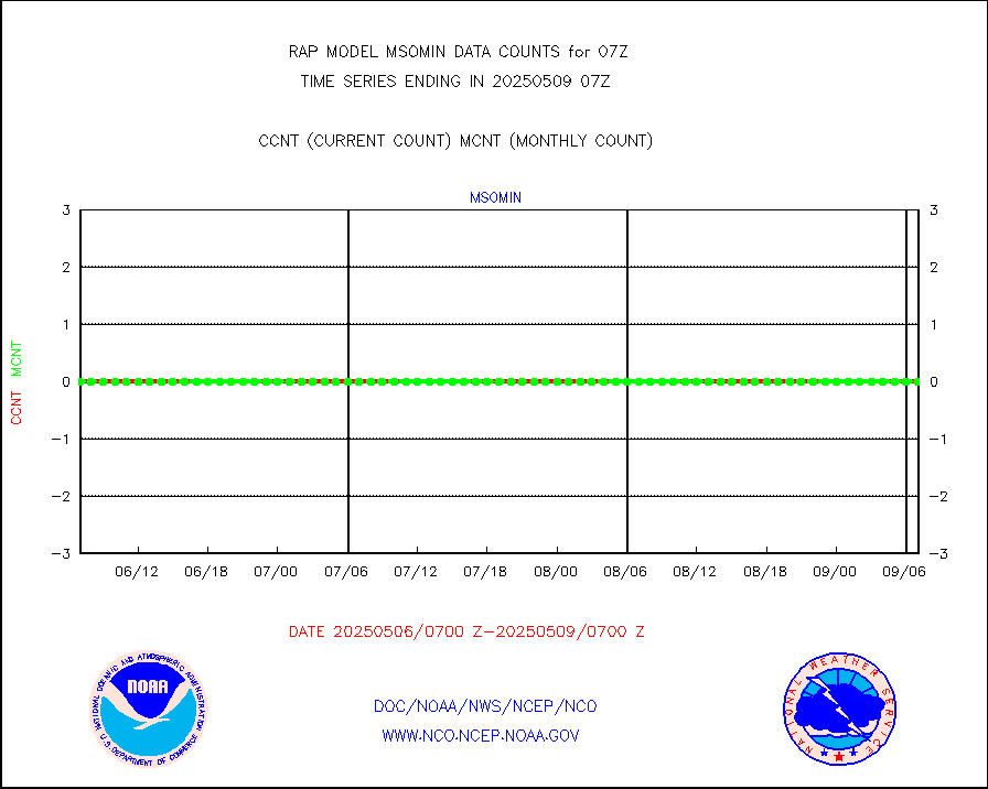
msohad |
Mesonet/MADIS NWS Hydromet Auto Data System(HADS) |
4922 |
5356 |
91.9 % |
2406.50-2407.50 |
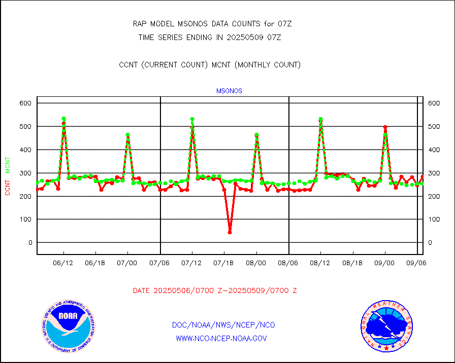
msoien |
Mesonet/MADIS Iowa Environmental |
179 |
170 |
105.3 % |
2406.50-2407.50 |
msoind |
Mesonet/MADIS Indiana Dept. of Transportation |
0 |
0 |
n/a |
2406.50-2407.50 |
msoiow |
Mesonet/MADIS Iowa Department of Transportation |
0 |
0 |
n/a |
2406.50-2407.50 |
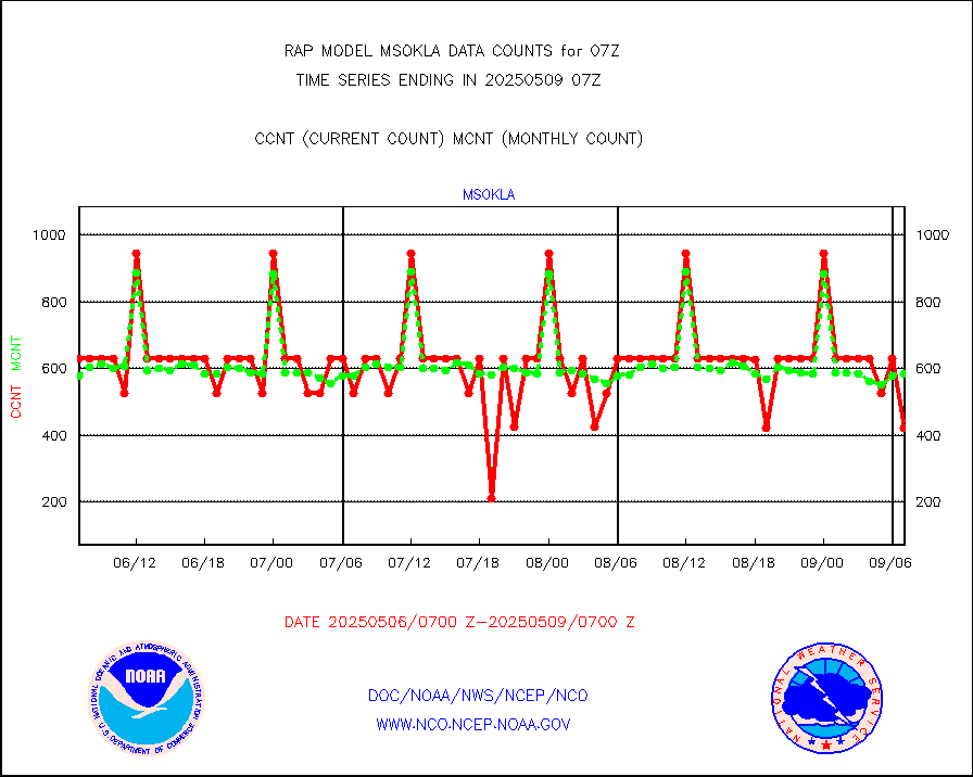
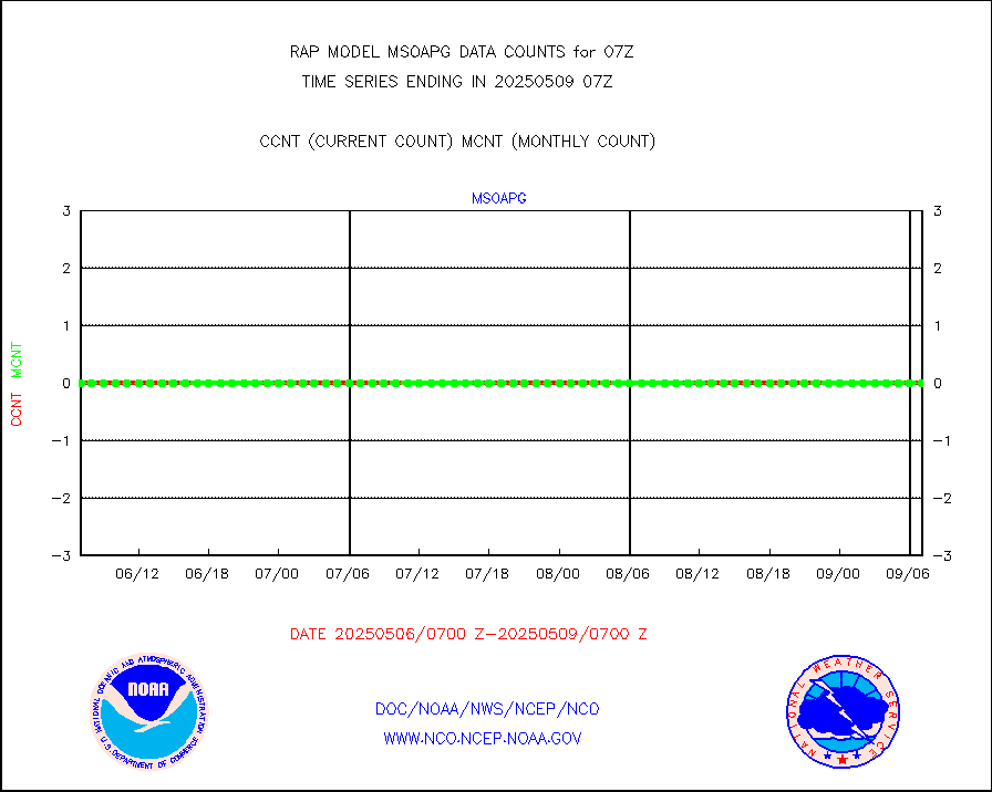
msokla |
Mesonet/MADIS Oklahoma Mesonet |
318 |
329 |
96.7 % |
2406.50-2407.50 |
msolju |
Mesonet/MADIS Louisiana State/Jackson State Univ. |
0 |
0 |
n/a |
2406.50-2407.50 |
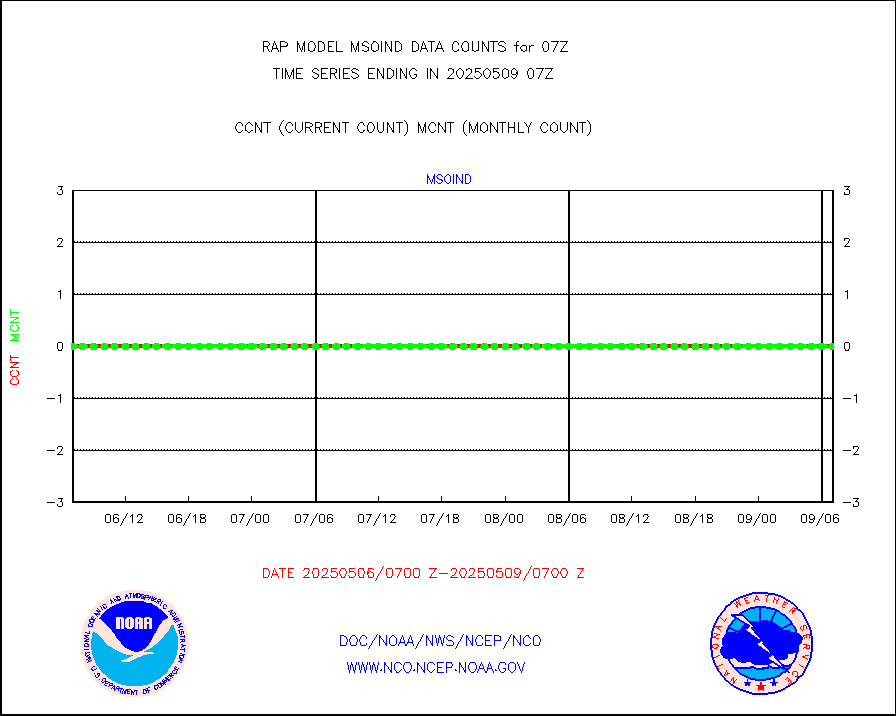
msomca |
Mesonet/MADIS Missouri Commercial Agricult Wx Net |
274 |
251 |
109.2 % |
2406.50-2407.50 |
msomin |
Mesonet/MADIS Minnesota Dept. of Transportation |
0 |
0 |
n/a |
2406.50-2407.50 |
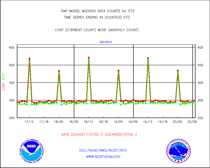
msonos |
Mesonet/MADIS NOS-Phys Oceanographic Realtime Sys |
242 |
264 |
91.7 % |
2406.50-2407.50 |
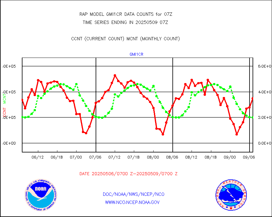
msoraw |
Mesonet/MADIS NFIC Remote Automated Wx Stns(RAWS) |
1108 |
1552 |
71.4 % |
2406.50-2407.50 |
msourb |
Mesonet/MADIS UrbaNet |
3908 |
3927 |
99.5 % |
2406.50-2407.50 |
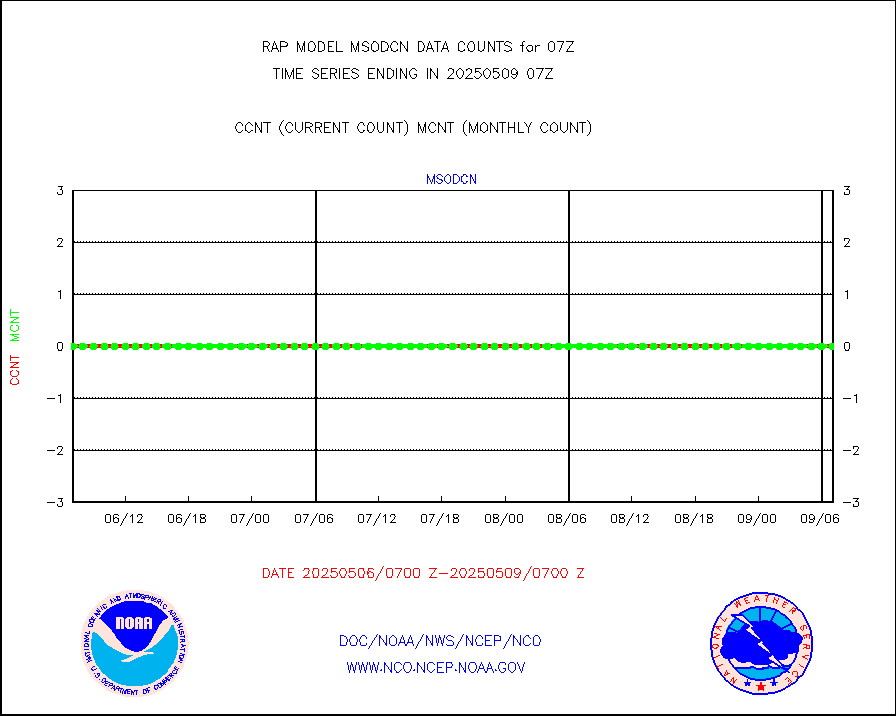
msovir |
Mesonet/MADIS Virginia Dept. of Transportation |
230 |
232 |
99.1 % |
2406.50-2407.50 |
msowfy |
Mesonet/MADIS "Weather for You" |
0 |
0 |
n/a |
2406.50-2407.50 |
msowis |
Mesonet/MADIS Wisconsin Dept. of Transportation |
0 |
0 |
n/a |
2406.50-2407.50 |
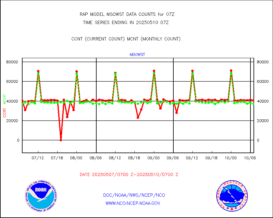
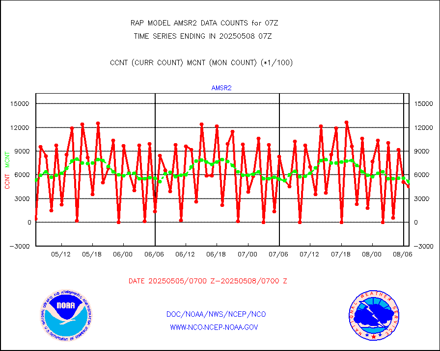
msowst |
Mesonet/MADIS MesoWest (many subproviders) |
28147 |
38577 |
73.0 % |
2406.50-2407.50 |
msowtx |
Mesonet/MADIS West Texas |
4459 |
4916 |
90.7 % |
2406.50-2407.50 |
mtiasi |
METOP 1-2 IASI 1C radiance data (varbl. channels) |
44762 |
35229 |
127.1 % |
2405.00-2408.99 |
nxrdw2 |
NEXRAD Vel Azm Dsp(VAD) winds via Level 2 decoder |
784 |
670 |
117.0 % |
2406.00-2408.00 |
osbuv8 |
NOAA 16-19 Solar Backscatter UV-2 rad frm V8 BUFR |
0 |
0 |
n/a |
2405.00-2407.99 |
pibal |
PIBAL (from PILOT, PILOT SHIP, PILOT MOBIL) |
0 |
0 |
n/a |
2406.00-2408.00 |
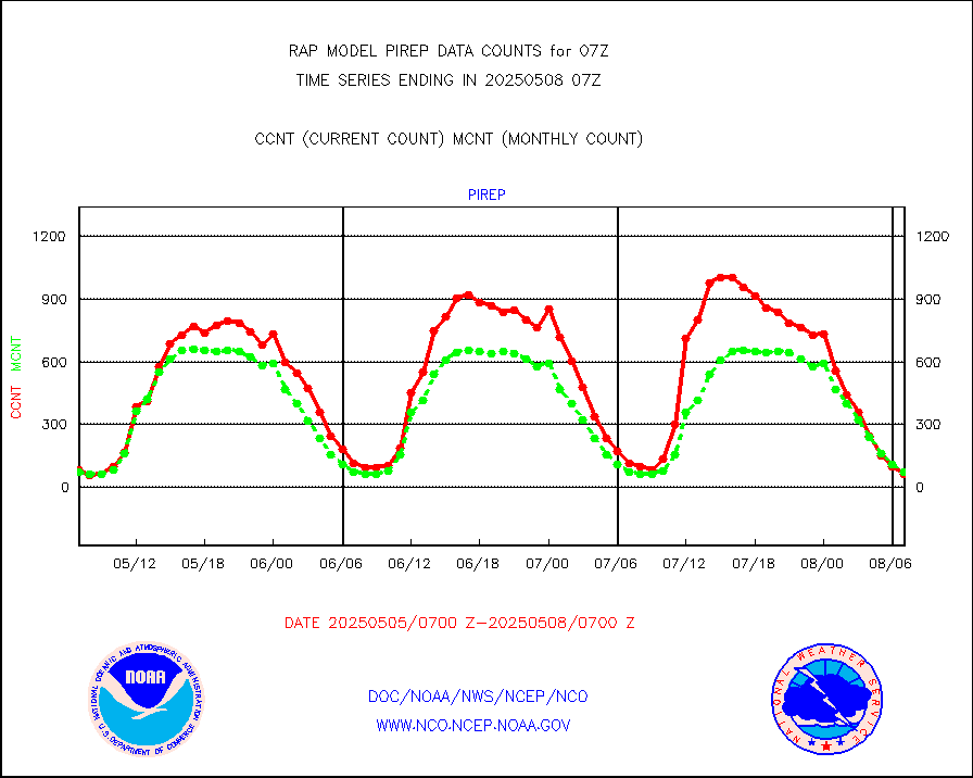
pirep |
Manual PIREP aircraft data (dcded from AIREP fmt) |
33 |
66 |
50.0 % |
2403.75-2410.25 |
prflrp |
Profilr winds from PIBAL (PILOT,PILOT SHIP/MOBIL) |
0 |
0 |
n/a |
2405.50-2408.50 |
raobm |
Rawinsonde - mobile land (from TEMP/PILOT MOBIL) |
0 |
0 |
n/a |
2406.00-2408.00 |
raobs |
Rawinsonde - ship (from TEMP SHIP, PILOT SHIP) |
0 |
0 |
n/a |
2406.00-2408.00 |
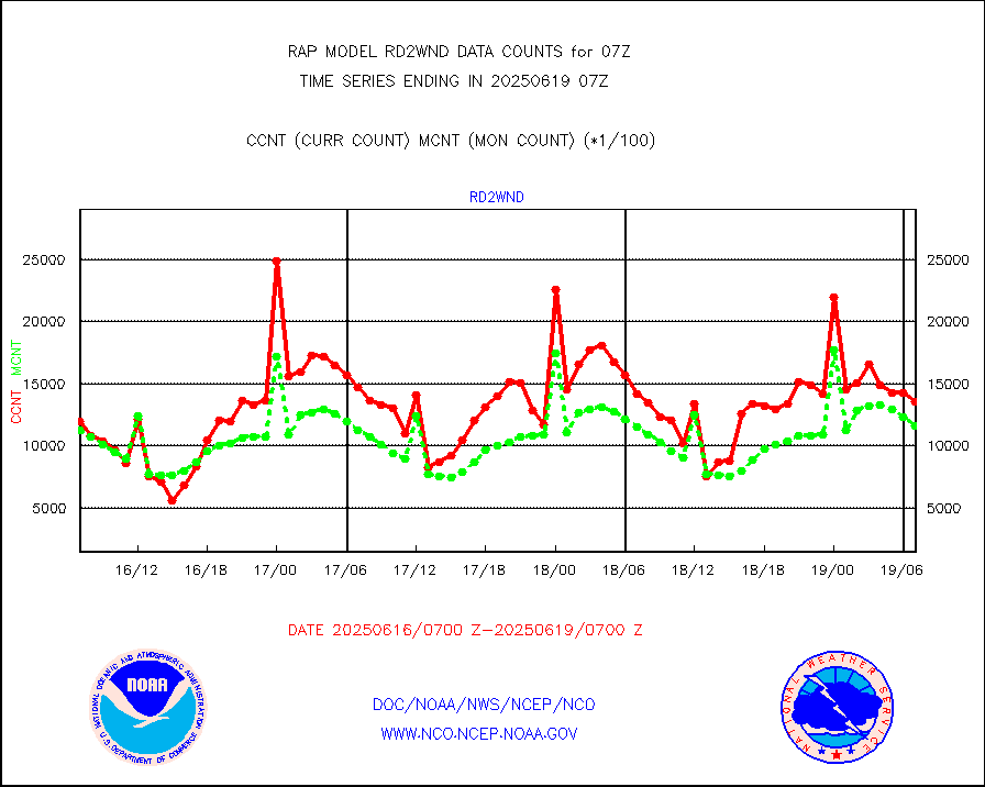
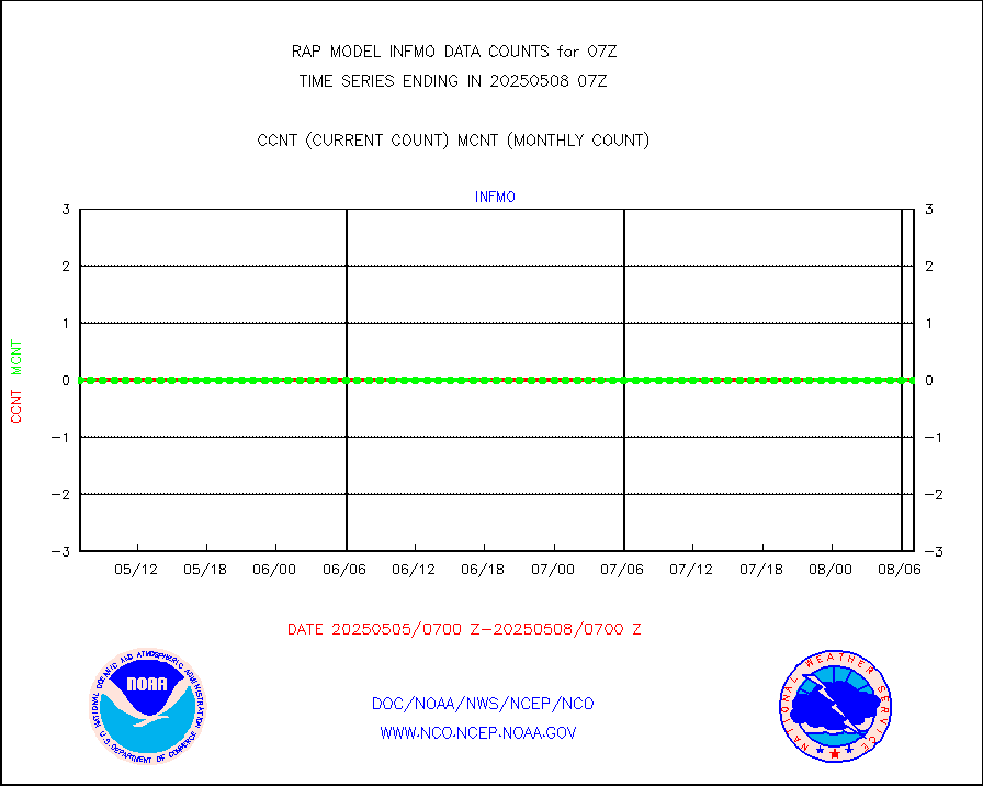
rd2wnd |
NEXRAD radial wind (Level 2 - GTS) |
880772 |
762597 |
115.5 % |
2406.50-2407.49 |
recco |
Flight level reconnaissance aircraft data |
0 |
0 |
n/a |
2406.00-2408.00 |
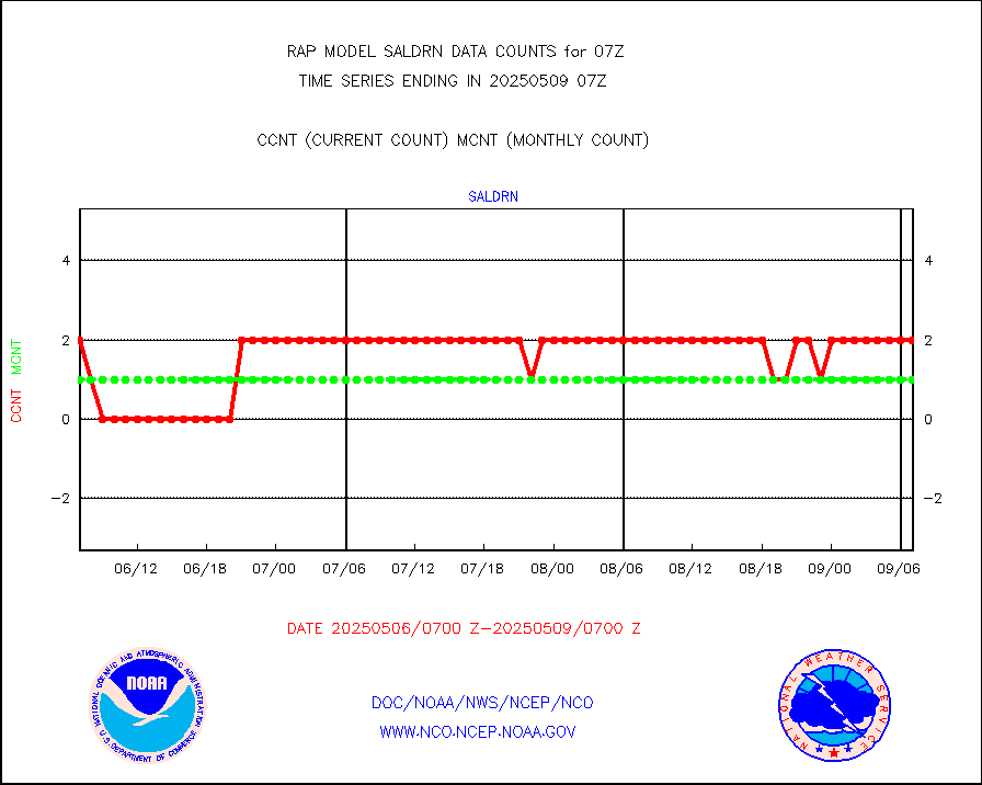
saldrn |
Surface Marine Saildrone (decoded from BUFR) |
2 |
2 |
100.0 % |
2405.00-2408.99 |
saphir |
Megha-Tropiques SAPHIR L1A2 brightness temps |
0 |
0 |
n/a |
2404.00-2409.99 |
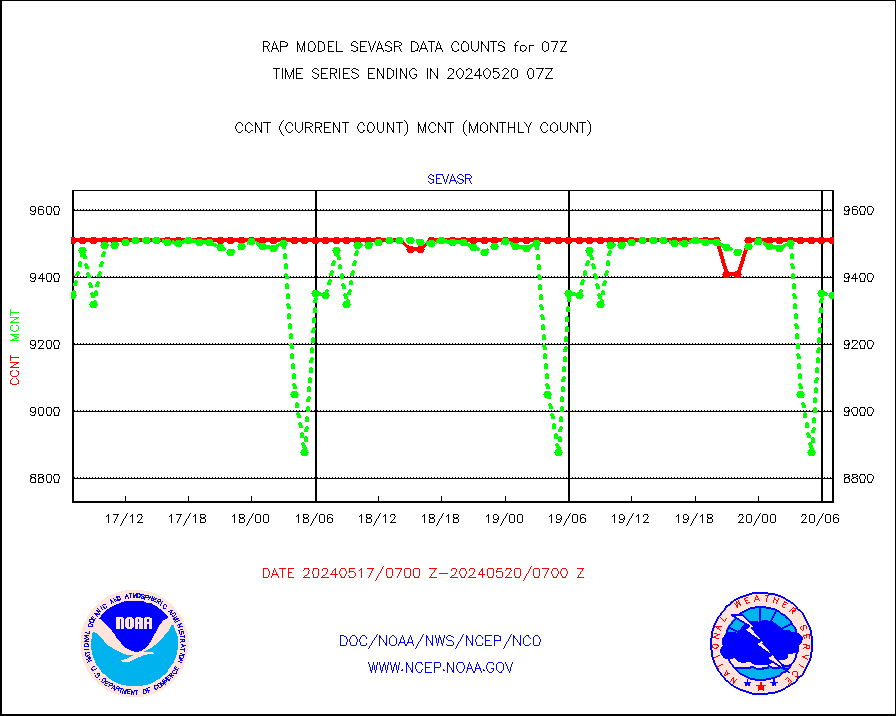
sevasr |
METEOSAT-10 2nd Gen SEVIRI All Sky Radiance(proc) |
9512 |
9503 |
100.1 % |
2405.00-2408.99 |
sevcsr |
METEOSAT-10 2nd Gen SEVIRI Clr Sky Radiance(proc) |
0 |
0 |
n/a |
2405.00-2408.99 |
ships |
Ship - manual and automatic, restricted |
0 |
2 |
0.0 % |
2406.50-2407.50 |
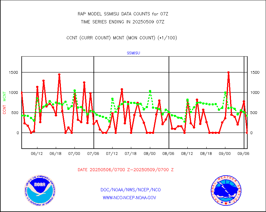
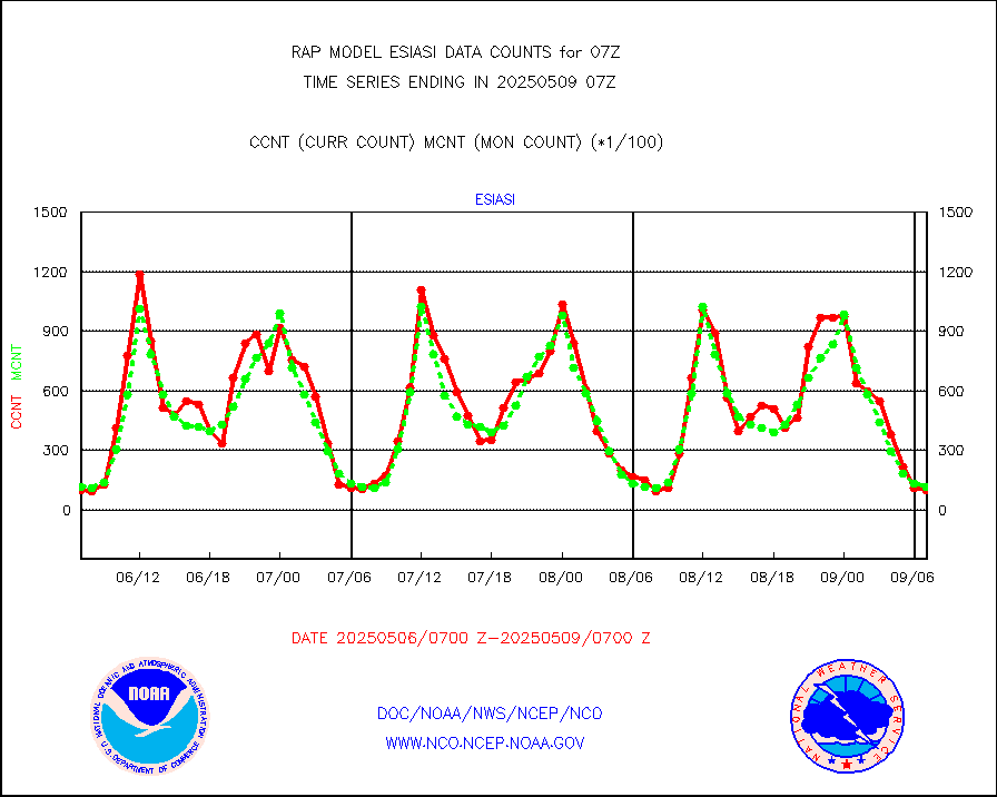
ssmisu |
DMSP SSM/IS 1C radiance data (Unified Pre-Proc.) |
18813 |
35655 |
52.8 % |
2405.00-2408.99 |
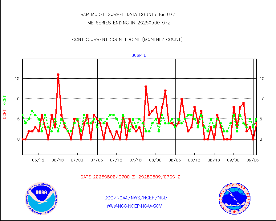
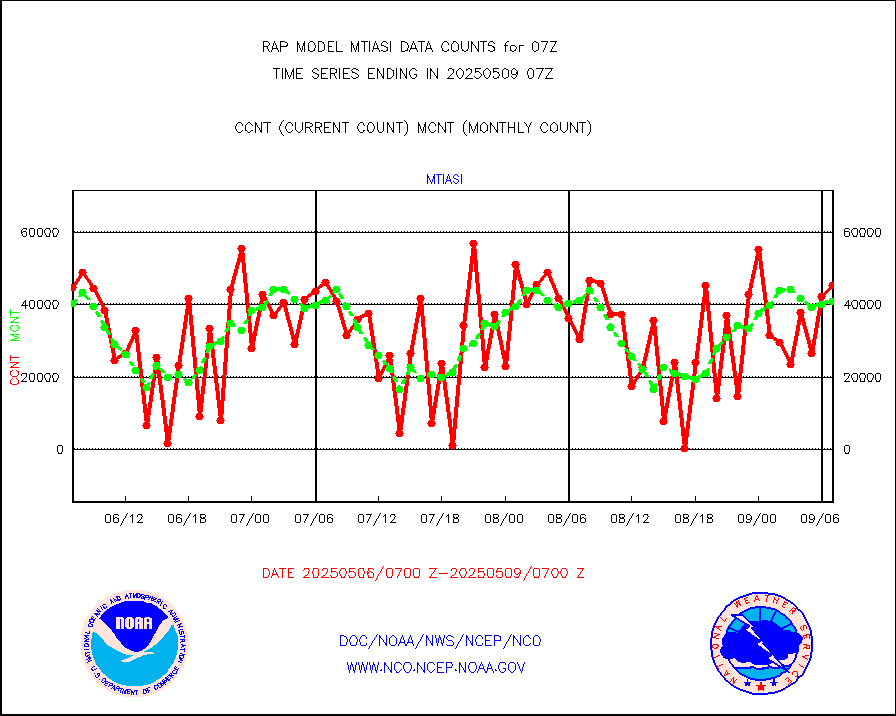
subpfl |
Sub-surface float and glider profile (BUFR) |
13 |
13 |
100.0 % |
2405.00-2408.99 |
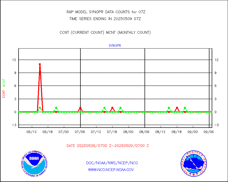
synopr |
Synoptic - restricted (WMO Res 40) manual & auto. |
0 |
0 |
n/a |
2406.50-2407.50 |
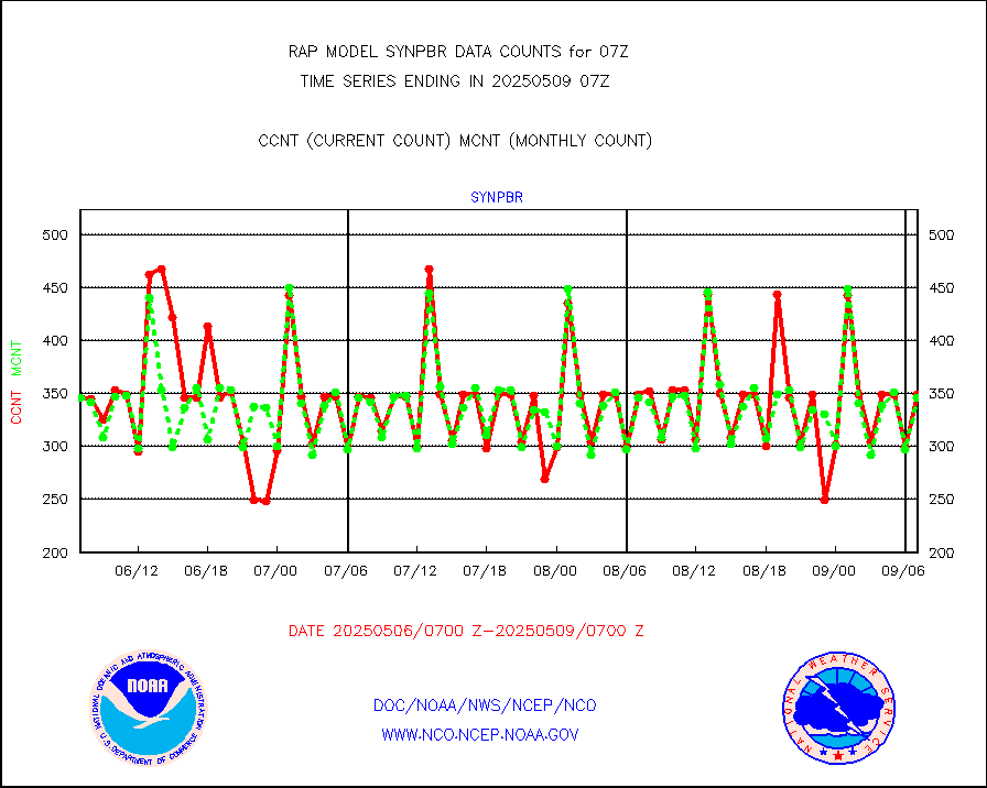
synpbr |
Synoptic - restricted (WMO Res 40)(decoded BUFR) |
345 |
344 |
100.3 % |
2406.50-2407.50 |
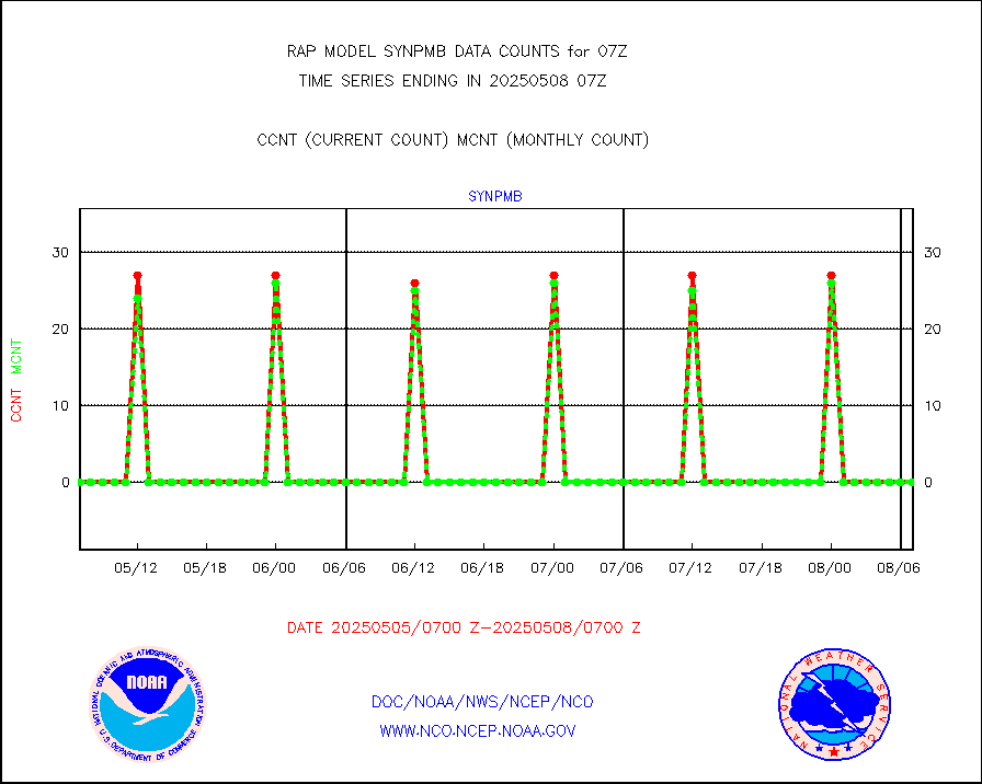
synpmb |
Synoptic - mobile manual & auto (decoded fr BUFR) |
0 |
0 |
n/a |
2406.50-2407.50 |
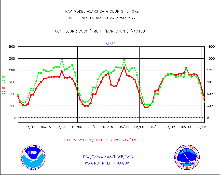
tmdara |
TAMDAR aircft data-all types(from Panasonic,BUFR) |
1699 |
1510 |
112.5 % |
2403.75-2410.25 |
visja |
MTSAT/JMA visible derived cloud motion |
1849 |
1303 |
141.9 % |
2404.50-2409.50 |
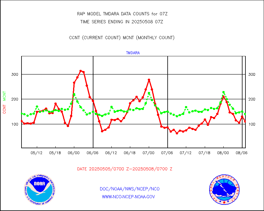
visusr |
GOES-16&up/NESDIS visible derived cloud motion |
551 |
226 |
243.8 % |
2406.00-2406.99 |
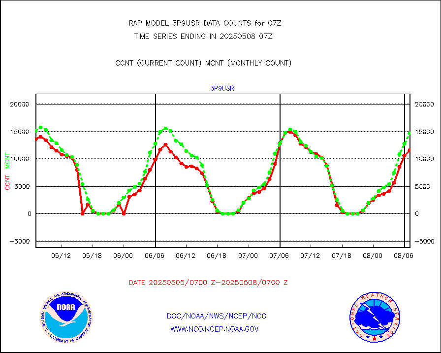
vseunb |
METEOSAT/EUMETSAT visible drv cld motion NBseq |
2306 |
739 |
312.0 % |
2405.50-2408.49 |


