| Critical Data with Normal Counts |
|---|
| Type | Description | Hourly Count | Monthly Average | Percent (%) of Monthly Mean | UTC Time Window |
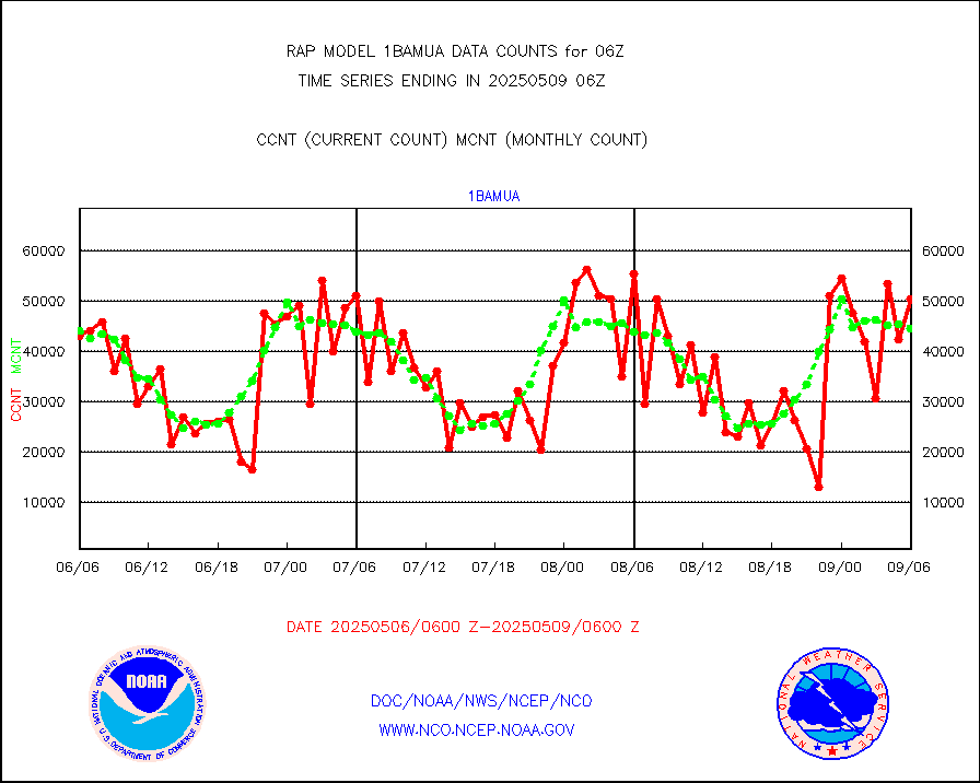
1bamua |
NOAA 15-19 & METOP 1-2 AMSU-A NCEP-proc. br.temps |
45606 |
43377 |
105.1 % |
2303.00-2308.99 |
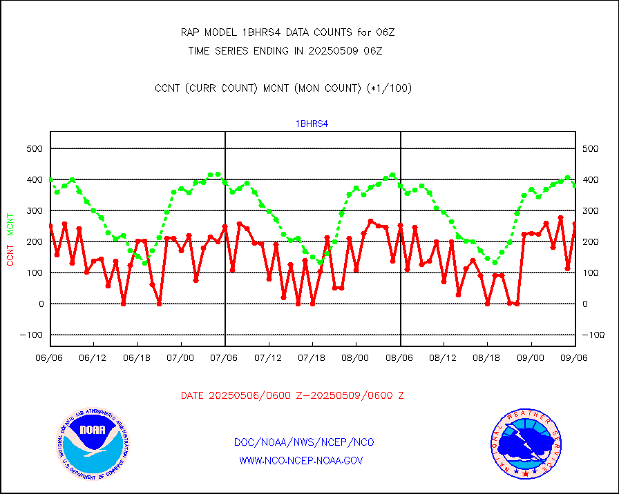
1bhrs4 |
NOAA 18-19 & METOP 1-2 HIRS-4 NCEP-proc. br.temps |
51428 |
38415 |
133.9 % |
2303.00-2308.99 |
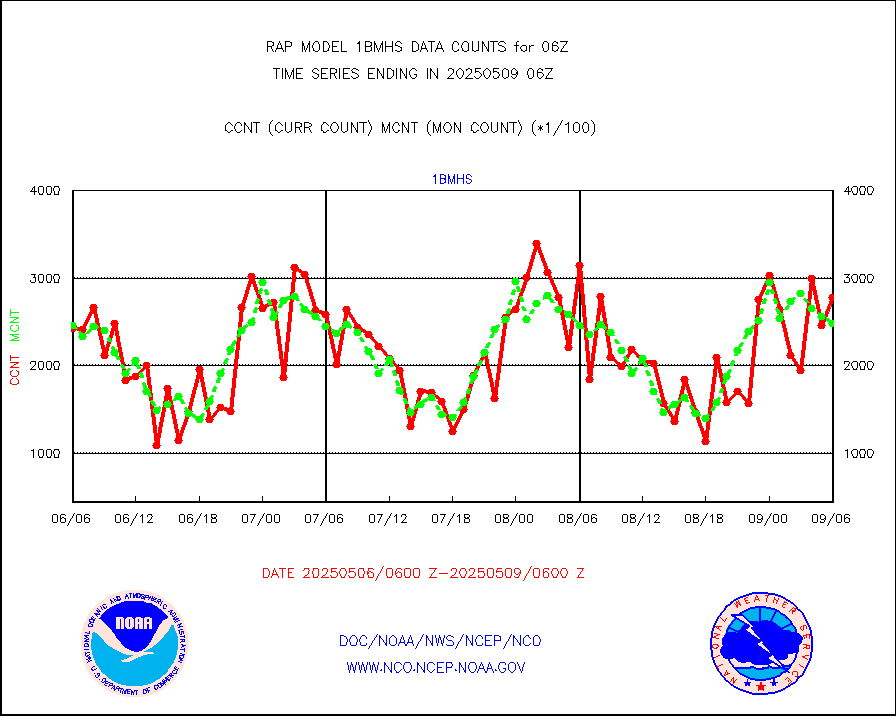
1bmhs |
NOAA 18-19 & METOP 1-2 MHS NCEP-proces. br. temps |
258657 |
246459 |
104.9 % |
2303.00-2308.99 |
acars |
MDCRS ACARS acft data from ARINC(dcded from BUFR) |
58625 |
69445 |
84.4 % |
2302.75-2309.25 |
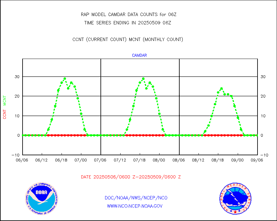
camdar |
Canadian AMDAR aircraft data (decoded from BUFR) |
0 |
0 |
n/a |
2302.75-2309.25 |
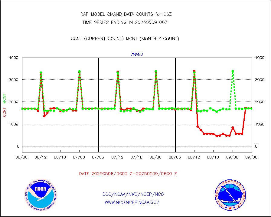
cmanb |
Surface Marine CMAN rpts decoded from BUFR format |
1694 |
1689 |
100.3 % |
2305.50-2306.50 |
dbuoy |
Buoys decoded from FM-18 fmt (moored or drifting) |
0 |
0 |
n/a |
2305.50-2306.50 |
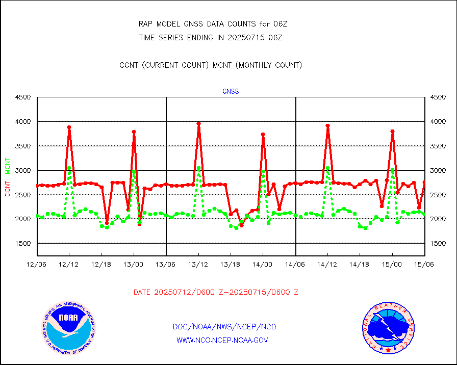
gnss |
Grnd-based Gbl Navigation Sat System (GNSS) data |
2675 |
2294 |
116.6 % |
2304.95-2305.05 |
h20mo |
MODIS (AQUA/TERRA) wvpr imager derived cld motion |
0 |
0 |
n/a |
2303.50-2308.50 |
infmo |
MODIS (AQUA/TERRA) ir l-wave derived cloud motion |
0 |
0 |
n/a |
2303.50-2308.50 |
lgycld |
GOES/NASA(Langley) hi-res. (1x1 f-o-v) cloud data |
3719270 |
3270677 |
113.7 % |
2305.50-2306.50 |
mbuoy |
Buoys decoded from FM-13 format (moored) |
52 |
39 |
133.3 % |
2305.50-2306.50 |
metar |
Aviation - METAR |
5664 |
5793 |
97.8 % |
2305.50-2306.50 |
nxrdw |
NEXRAD Vel Azm Dsp(VAD) winds via radar coded msg |
0 |
0 |
n/a |
2305.00-2307.00 |
prflrb |
Multi-Agency Profiler (MAP) and SODAR winds |
92 |
82 |
112.2 % |
2304.50-2307.50 |
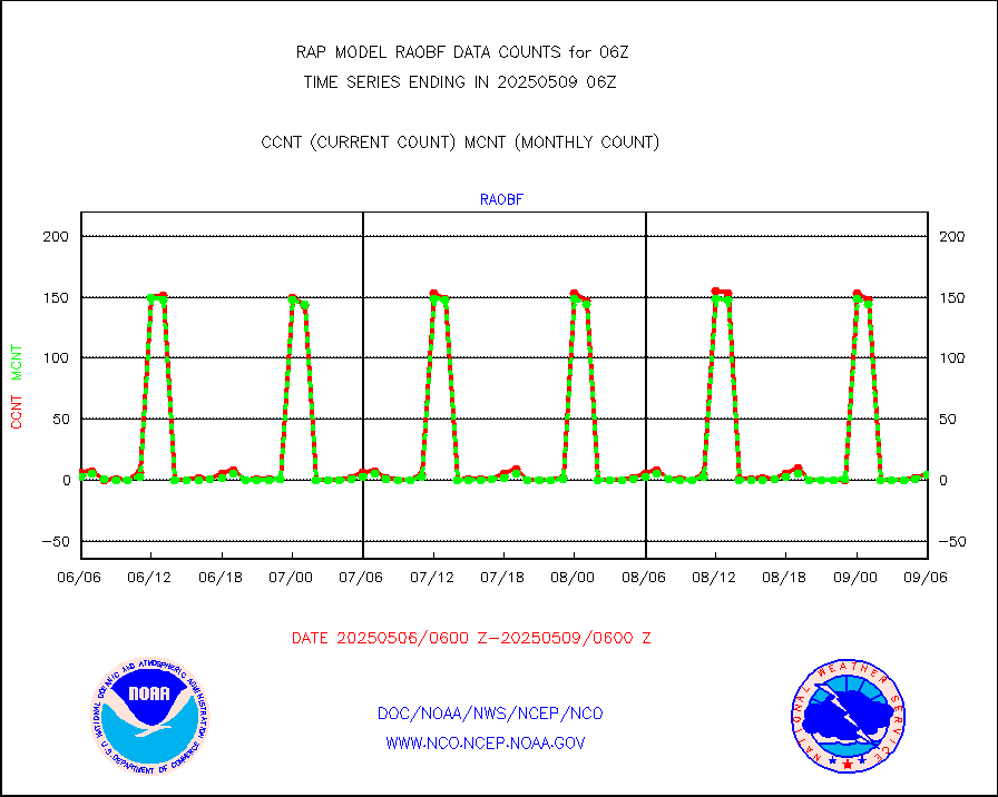
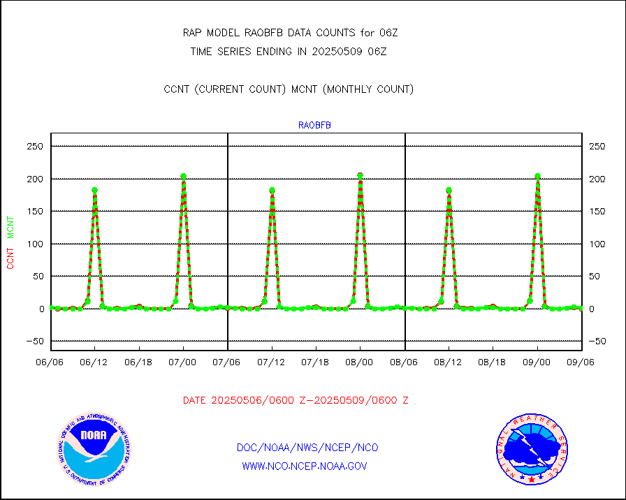
raobf |
Rawinsonde - fixed land (from TEMP or PILOT) |
3 |
4 |
75.0 % |
2305.00-2307.00 |
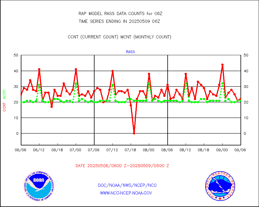
rass |
RASS temperatures (NOAA and Multi-Agency) |
23 |
21 |
109.5 % |
2305.50-2306.50 |
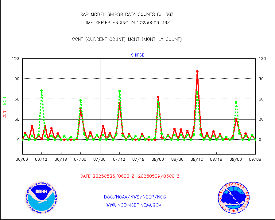
shipsb |
Ship - manual and automatic, restricted (BUFR) |
0 |
0 |
n/a |
2305.50-2306.50 |
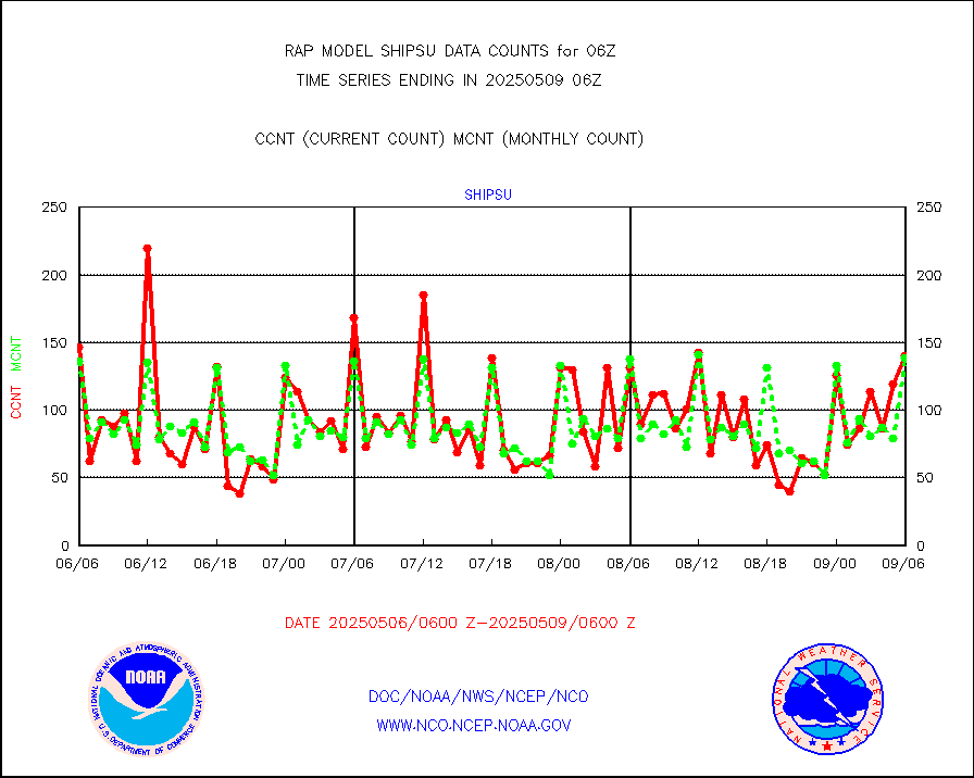
shipsu |
Ship - manual and automatic, unrestricted |
50 |
64 |
78.1 % |
2305.50-2306.50 |
shipub |
Ship - manual and automatic, unrestricted (BUFR) |
623 |
610 |
102.1 % |
2305.50-2306.50 |
synop |
Synoptic - fixed manual and automatic |
421 |
462 |
91.1 % |
2305.50-2306.50 |
synopb |
Synoptic - fixed manual & auto (decoded fr BUFR) |
1806 |
1740 |
103.8 % |
2305.50-2306.50 |
tideg |
Tide gauge reports decoded from CREX format |
181 |
177 |
102.3 % |
2305.50-2306.50 |
| Data Types of Opportunity with Normal Counts |
|---|
| Type | Description | Hourly Count | Monthly Average | Percent (%) of Monthly Mean | UTC Time Window |
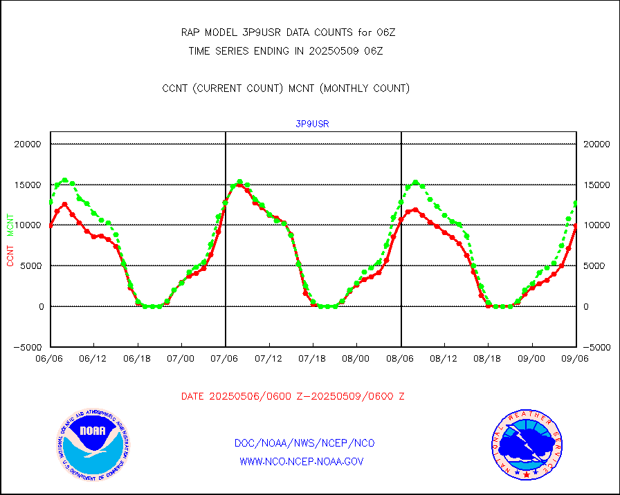
3p9usr |
GOES-16&up/NESDIS ir short-wv derived cld motion |
13468 |
14008 |
96.1 % |
2305.00-2305.99 |
acarsa |
MDCRS ACARS acft data (ARINC via AFWA)(AIREP fmt) |
0 |
0 |
n/a |
2302.75-2309.25 |
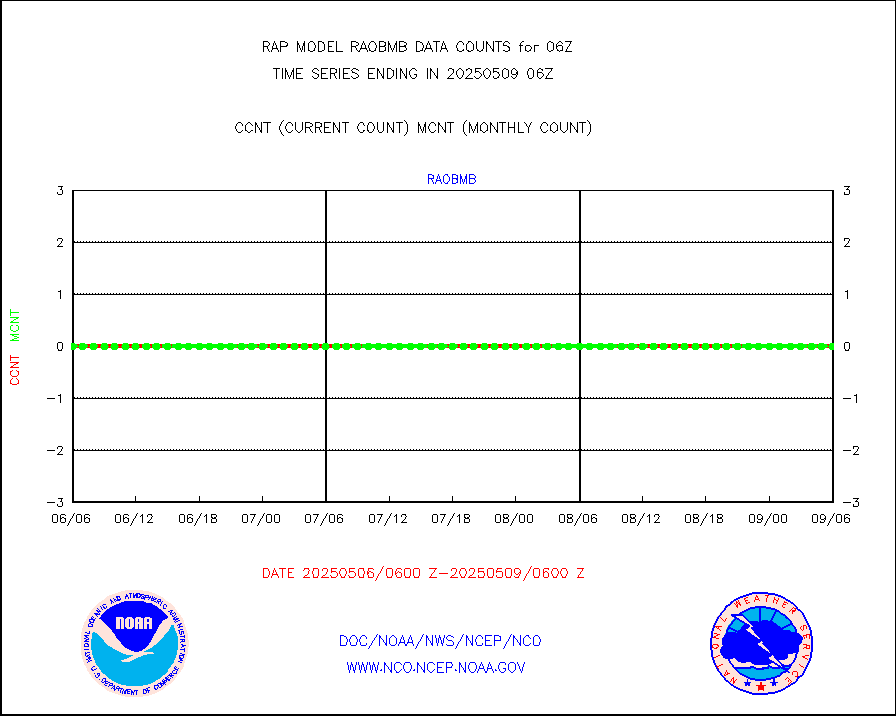
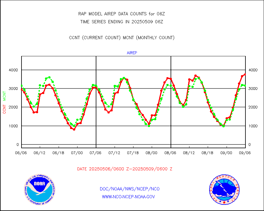
airep |
Manual AIREP aircraft data (dcded from AIREP fmt) |
4350 |
4284 |
101.5 % |
2302.75-2309.25 |
airsev |
AQUA AIRS/AMSU-A/HSB brightness temps- every FOV |
0 |
0 |
n/a |
2303.00-2308.99 |
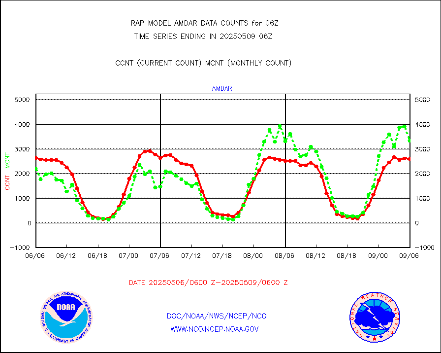
amdar |
AMDAR aircraft data (decoded from AMDAR format) |
2503 |
2299 |
108.9 % |
2302.75-2309.25 |
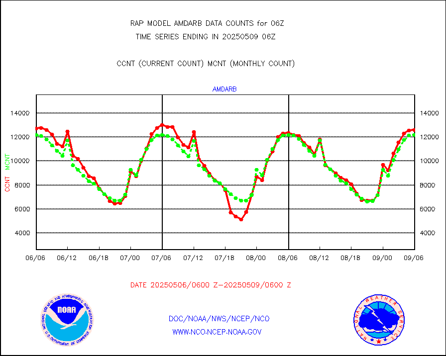
amdarb |
AMDAR aircraft data (decoded from BUFR) |
6670 |
6266 |
106.4 % |
2302.75-2309.25 |
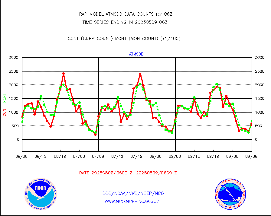
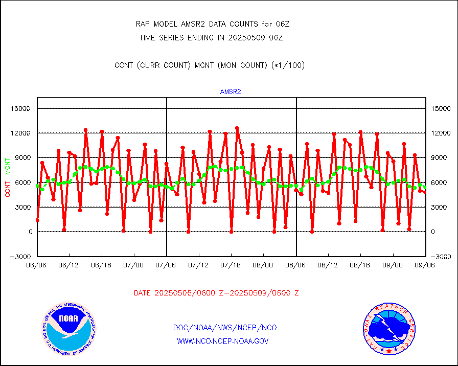
amsr2 |
GCOM-W AMSR2 1B brightness temperatures |
989576 |
556995 |
177.7 % |
2303.00-2303.99 |
ascat |
METOP 1-2 ASCAT products |
29101 |
16935 |
171.8 % |
2304.00-2308.00 |
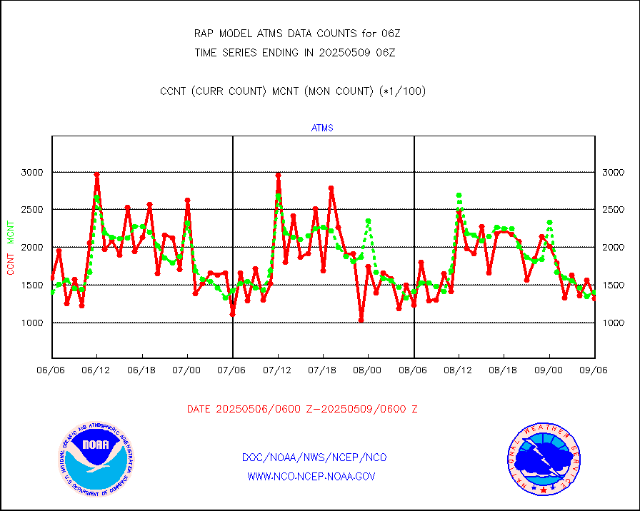
atms |
NPP/NOAA-20 ATMS brightness temperatures |
124363 |
138545 |
89.8 % |
2304.00-2307.99 |
atmsdb |
NPP/NOAA-20 ATMS bright. temps-direct b-cast SSEC |
84956 |
67007 |
126.8 % |
2304.00-2307.99 |
coopmd |
Coop/MADIS NEPP & HCN-Modernization NOAA COOP Obs |
24 |
23 |
104.3 % |
2305.50-2306.50 |
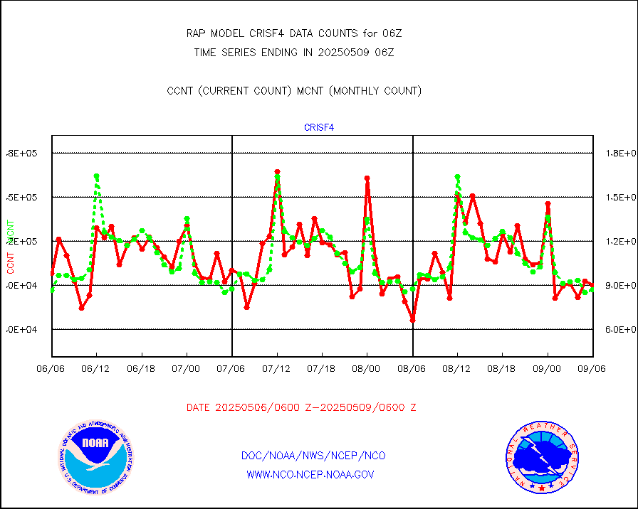
crisf4 |
NPP/NOAA-20 CrIS full spctrl radn (431 ch subset) |
101050 |
84380 |
119.8 % |
2304.00-2307.99 |
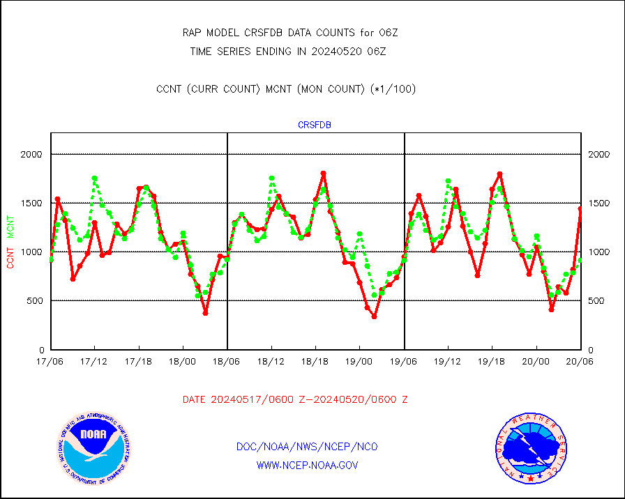
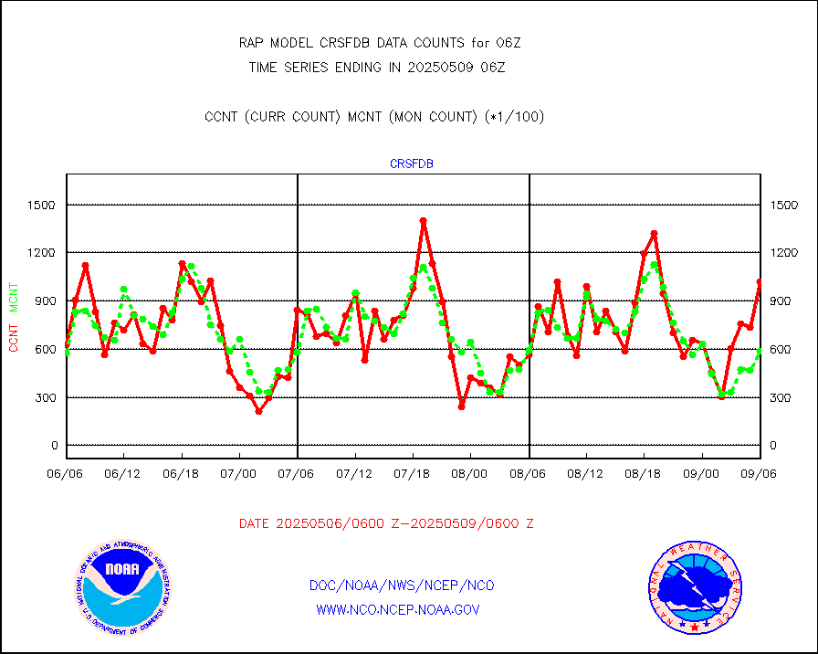
crsfdb |
NPP/NOAA-20 CrIS full spctrl radn dir brdcst SSEC |
117684 |
88646 |
132.8 % |
2304.00-2307.99 |
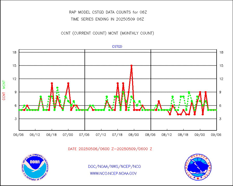
cstgd |
Coast Guard |
5 |
4 |
125.0 % |
2305.50-2306.50 |
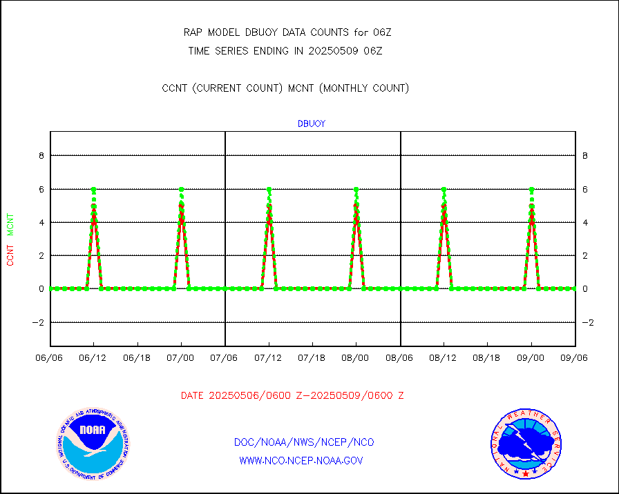
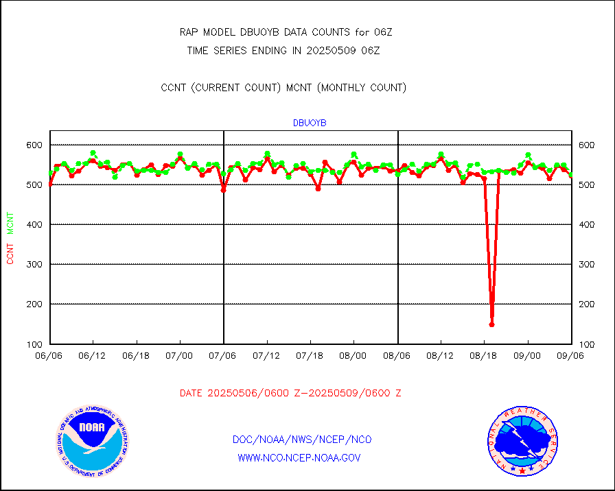
dbuoyb |
Drifting buoys (decoded from BUFR) |
585 |
608 |
96.2 % |
2305.50-2306.50 |
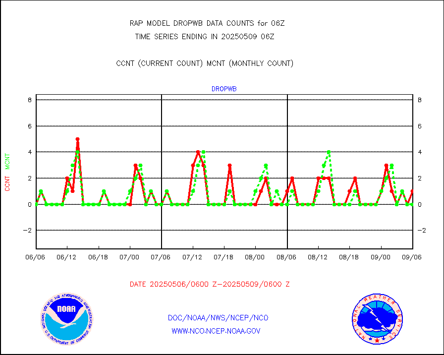
dropw |
Dropwinsonde (from TEMP DROP) |
0 |
0 |
n/a |
2305.00-2307.00 |
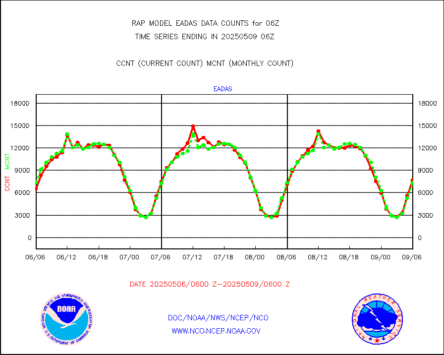
eadas |
E-AMDAR (European AMDAR acft decoded from BUFR) |
5092 |
5099 |
99.9 % |
2302.75-2309.25 |
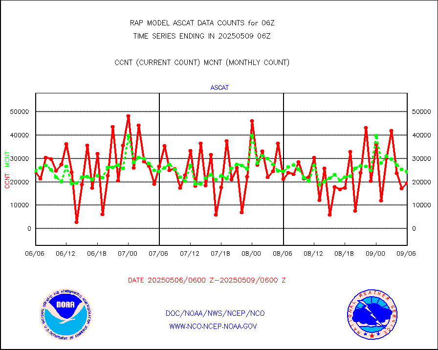
esamua |
NOAA 15-19 & METOP 1-2 AMSU-A proc btmps frm RARS |
17062 |
15213 |
112.2 % |
2305.00-2307.00 |
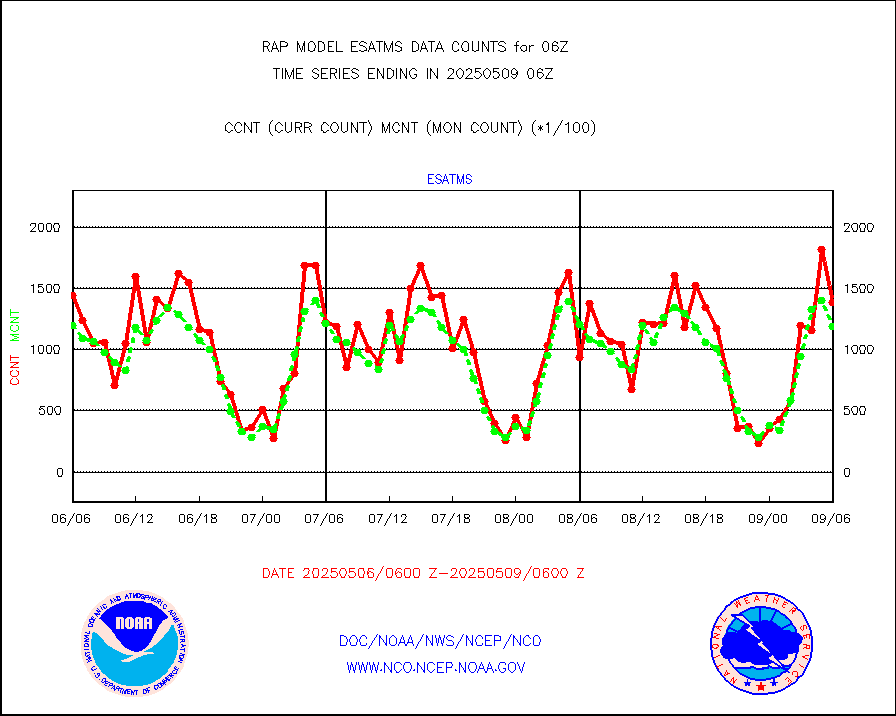
esatms |
NPP Adv. Tech. MW Sndr (ATMS) br. temps from RARS |
133952 |
113103 |
118.4 % |
2304.00-2307.99 |
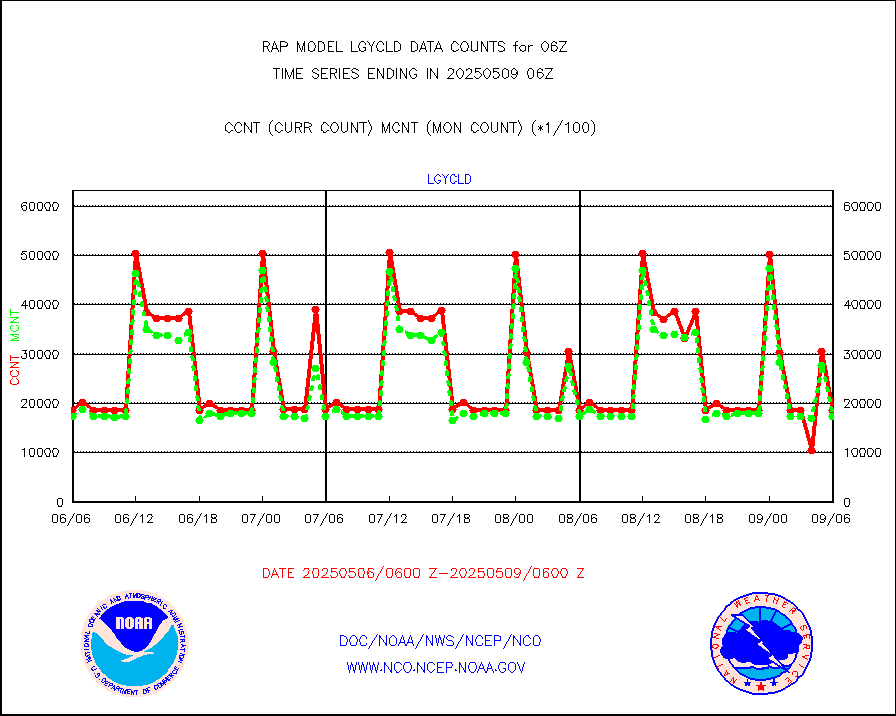
eshrs3 |
NOAA 15-19 & METOP 1-2 HIRS-3/4 pr btmps frm RARS |
42509 |
36166 |
117.5 % |
2305.00-2307.00 |
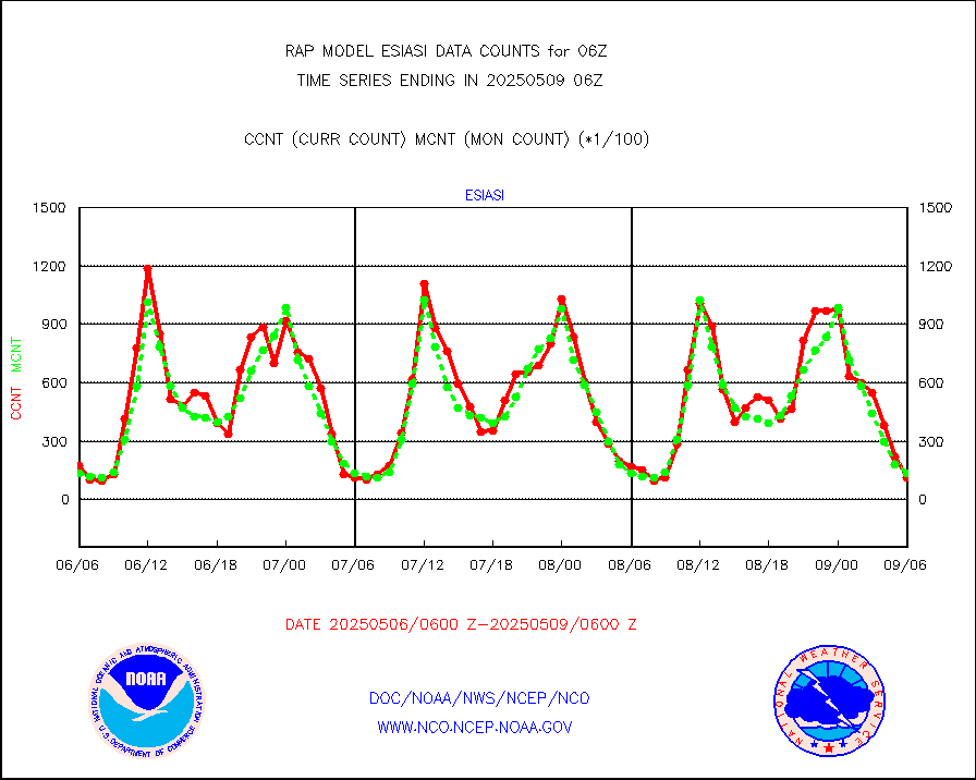
esiasi |
METOP 1-2 IASI 1C radiance data vbl chn from RARS |
11689 |
24935 |
46.9 % |
2304.00-2307.99 |
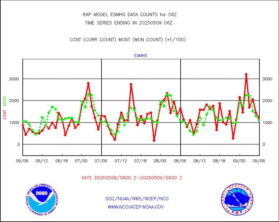
esmhs |
NOAA 18-19 & METOP 1-2 MHS proc. btemps from RARS |
135390 |
93496 |
144.8 % |
2305.00-2307.00 |
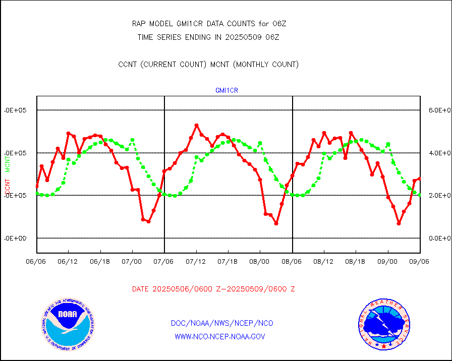
gmi1cr |
GPM GMI Level 1C-R brightness temperatures |
492223 |
872108 |
56.4 % |
2303.00-2308.99 |
gpsro |
GPS radio occultation data |
109 |
109 |
100.0 % |
2304.00-2307.99 |
gsrasr |
GOES-16/17 All Sky Radiances (proc.) |
775205 |
796851 |
97.3 % |
2304.00-2307.99 |
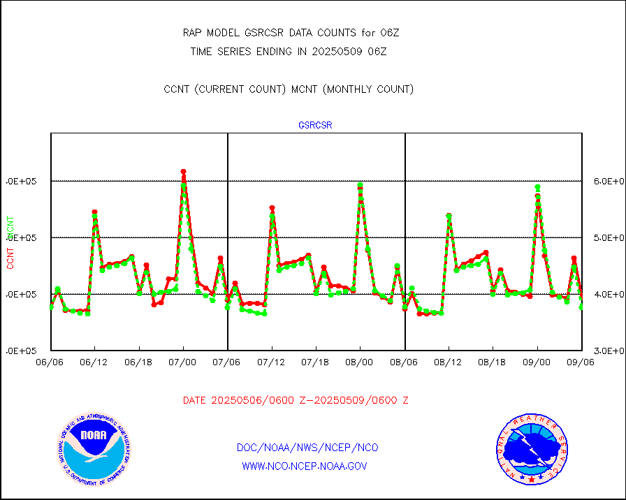
gsrcsr |
GOES-16/17 Clear Sky Radiances (proc.) |
398158 |
368021 |
108.2 % |
2304.00-2307.99 |
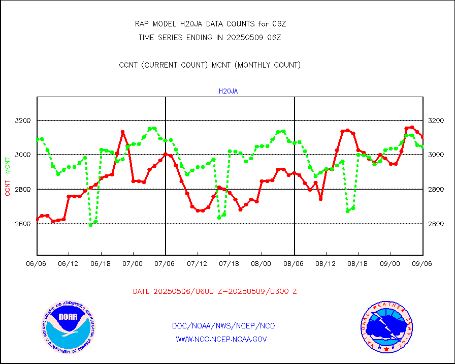
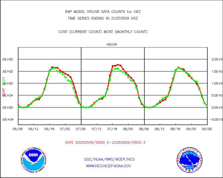
h20ja |
MTSAT/JMA water vapor imager derived cloud motion |
3195 |
2809 |
113.7 % |
2303.50-2308.50 |
h2dusr |
GOES-16&up/NESDIS wv imgr/deep-lyr derivd cld mtn |
8823 |
5466 |
161.4 % |
2305.00-2305.99 |
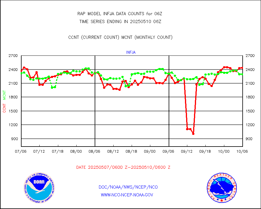
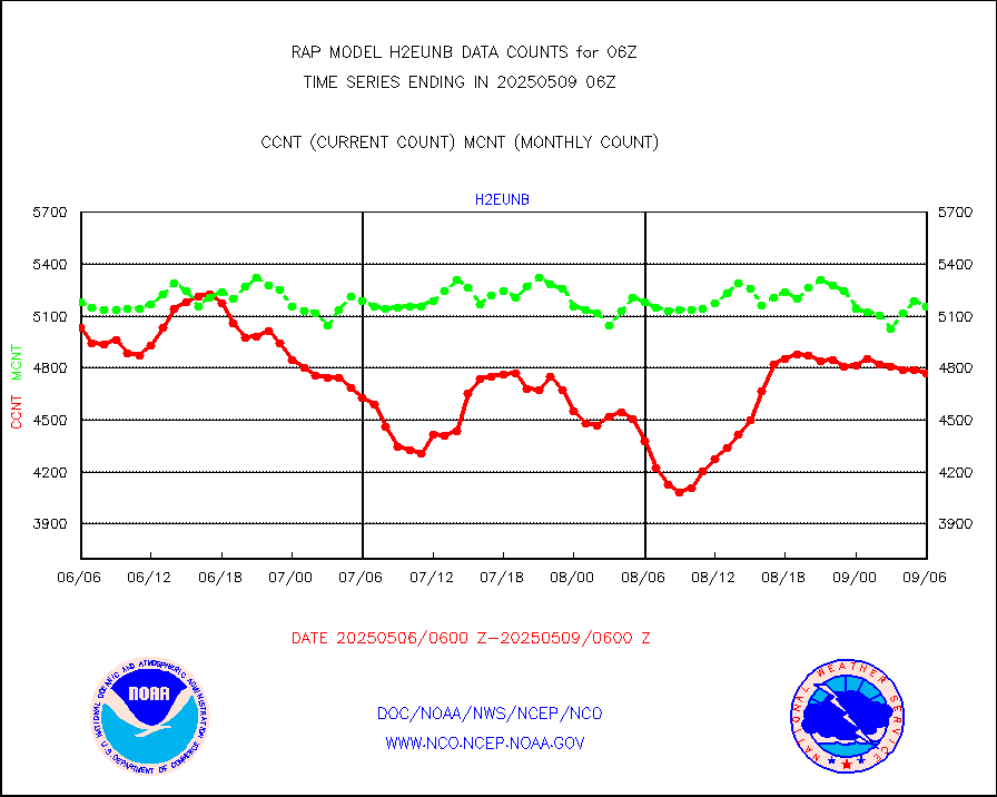
h2eunb |
METEOSAT/EUMETSAT wvpr imgr drv cld motion NBseq |
4703 |
5024 |
93.6 % |
2304.50-2307.49 |
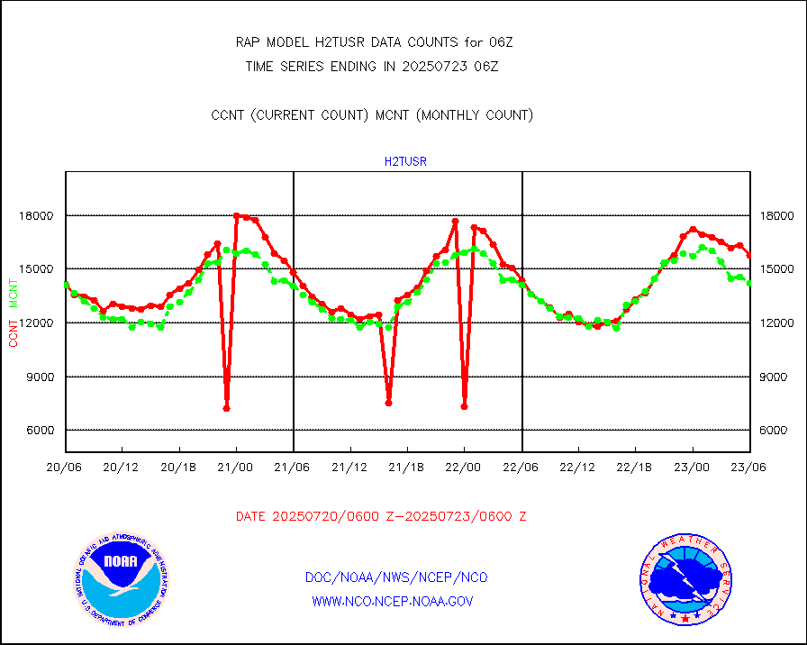
h2tusr |
GOES-16&up/NESDIS wv imgr/cld-top derived cld mtn |
10293 |
10155 |
101.4 % |
2305.00-2305.99 |
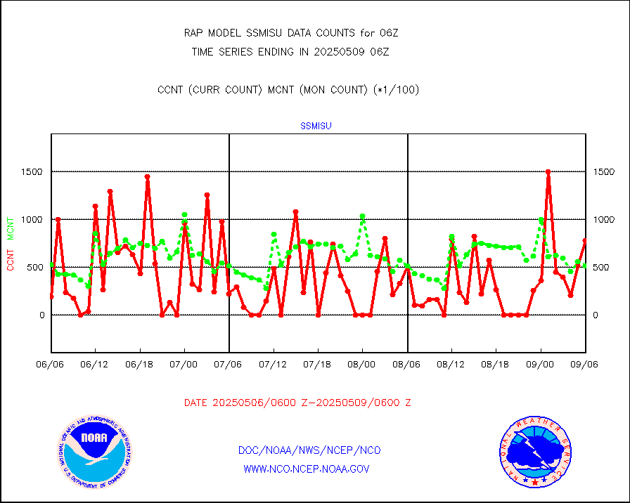
iasidb |
METOP 1-2 IASI 1C radiances-direct broadcast SSEC |
76673 |
55277 |
138.7 % |
2304.00-2307.99 |
ifeunb |
METEOSAT/EUMETSAT ir lg-wave drv cld motion NBseq |
3062 |
3204 |
95.6 % |
2304.50-2307.49 |
ifvrnb |
VIIRS (NPP/NOAA-20) ir lg-wv drv cloud motion(NB) |
0 |
0 |
n/a |
2303.50-2308.50 |
infav |
AVHRR (NOAA/METOP) ir lg-wave derived cld motion |
0 |
10 |
0.0 % |
2303.50-2308.50 |
infav1 |
AVHRR (METOP) ir lg-wave derived cld motion |
0 |
0 |
n/a |
2304.50-2307.49 |
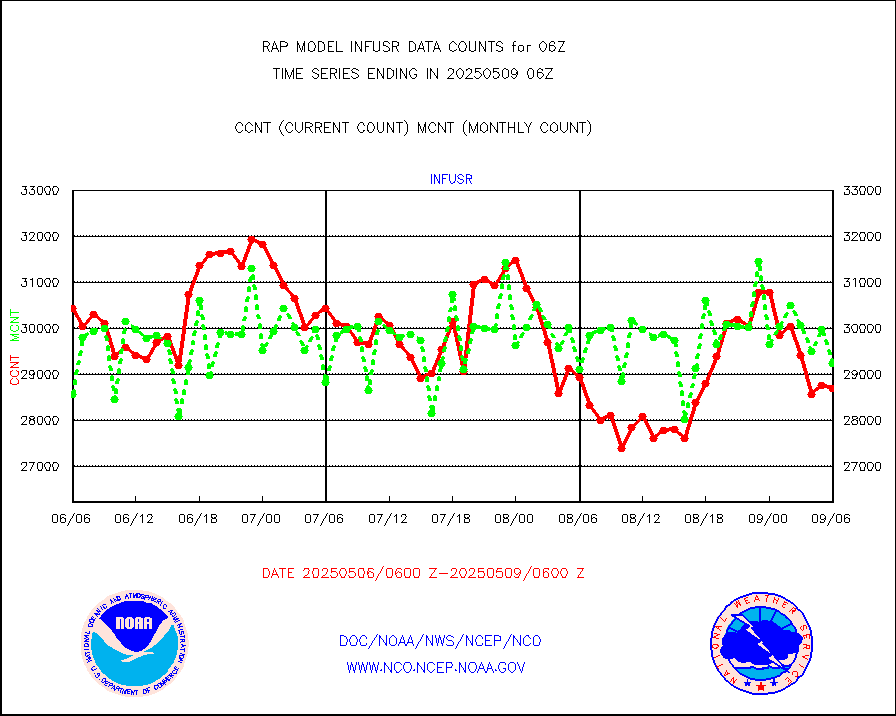
infja |
MTSAT/JMA infrared long-wave derived cloud motion |
2364 |
2502 |
94.5 % |
2303.50-2308.50 |
infusr |
GOES-16&up/NESDIS ir long-wave derived cld motion |
29197 |
28964 |
100.8 % |
2305.00-2305.99 |
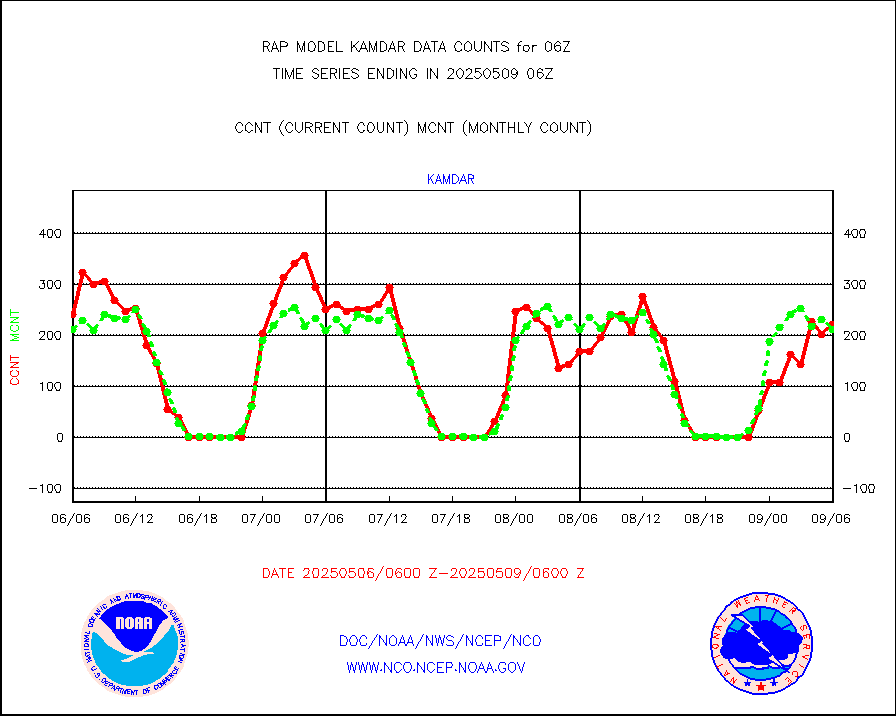
kamdar |
Korean AMDAR aircraft data (decoded from BUFR) |
314 |
258 |
121.7 % |
2302.75-2309.25 |
lcman |
Land-based CMAN stations decoded from CMAN format |
73 |
75 |
97.3 % |
2305.50-2306.50 |
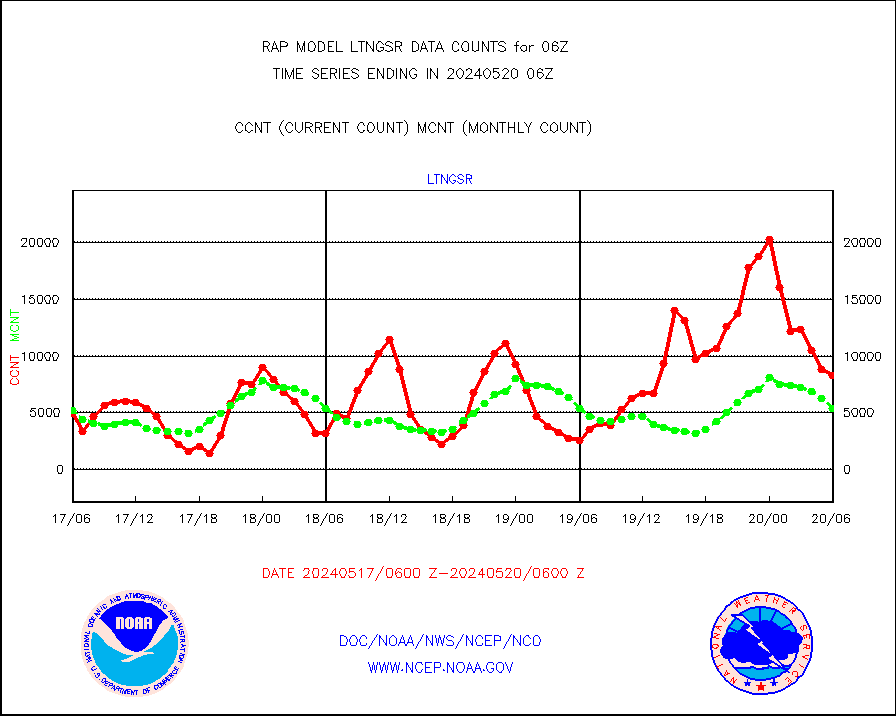
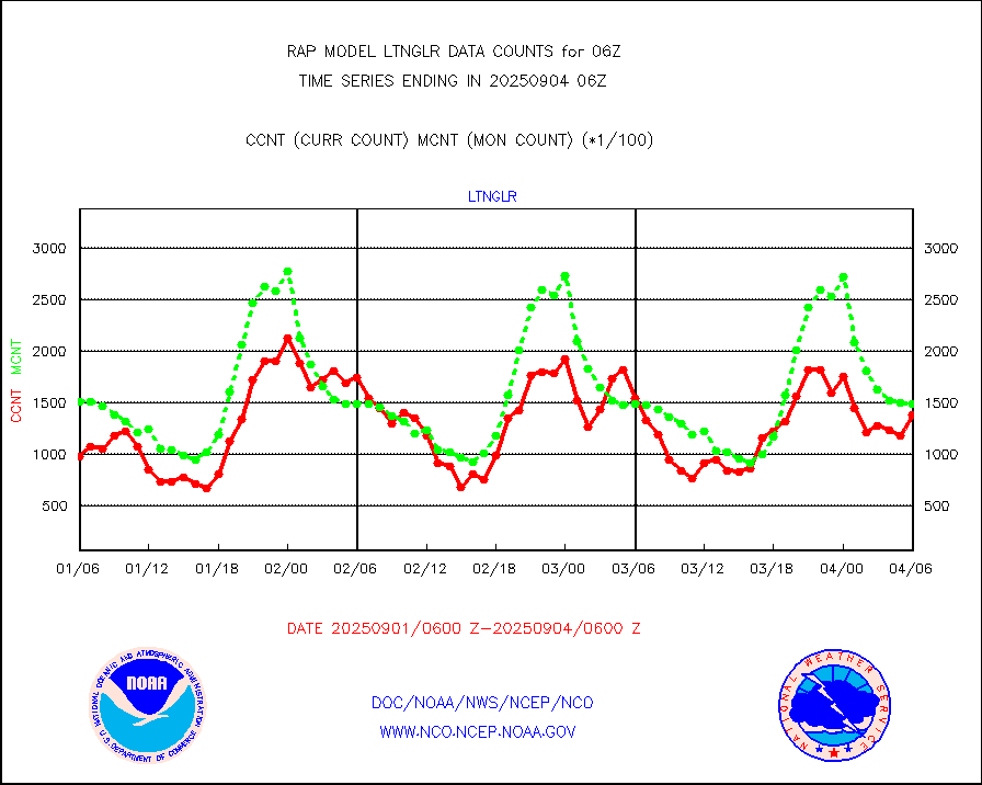
ltnglr |
LLDN Long-rng lightning from Vaisala via NOAAPORT |
20960 |
45013 |
46.6 % |
2305.00-2306.50 |
mbuoyb |
Moored buoys (decoded from BUFR) |
517 |
471 |
109.8 % |
2305.50-2306.50 |
mso470 |
Mesonet/MADIS Colorado E-470 (Interstate 470) |
12 |
19 |
63.2 % |
2305.50-2306.50 |
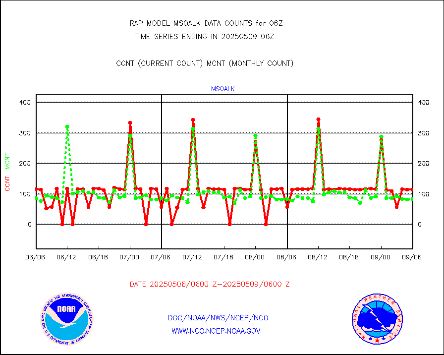
msoalk |
Mesonet/MADIS Alaska Department of Transportation |
106 |
106 |
100.0 % |
2305.50-2306.50 |
msoapg |
Mesonet/MADIS U.S. Army Aberdeen Proving Grounds |
0 |
0 |
n/a |
2305.50-2306.50 |
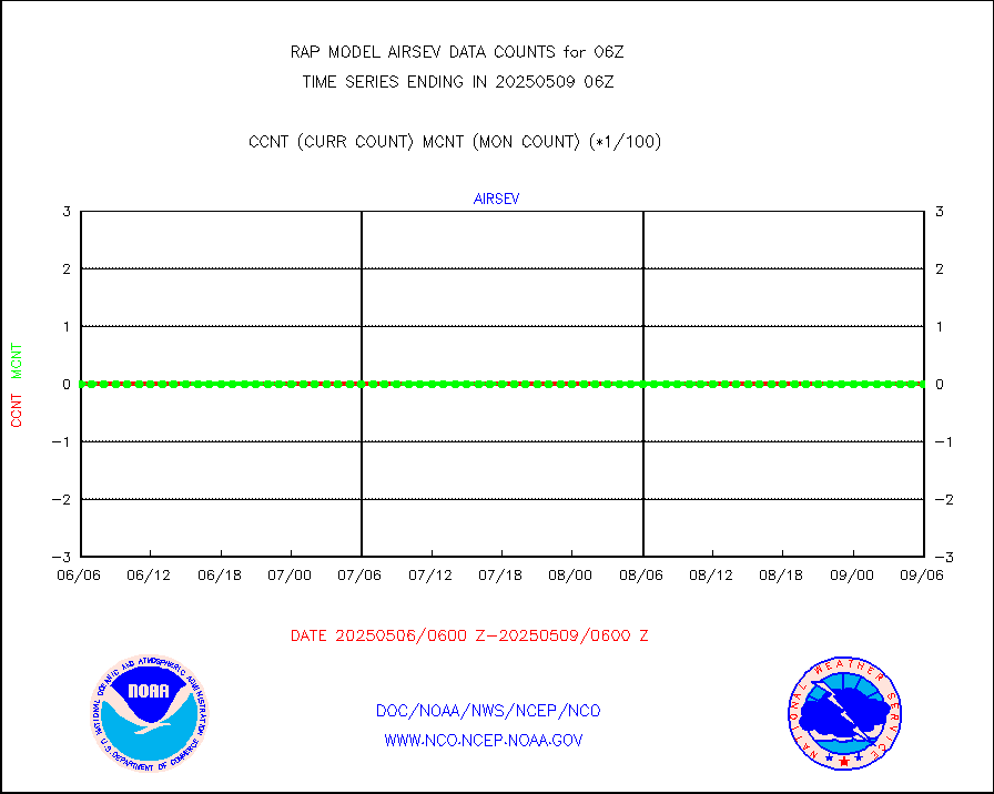
msoapr |
Mesonet/MADIS Citizen Weather Observers Program |
46484 |
42941 |
108.3 % |
2305.50-2306.50 |
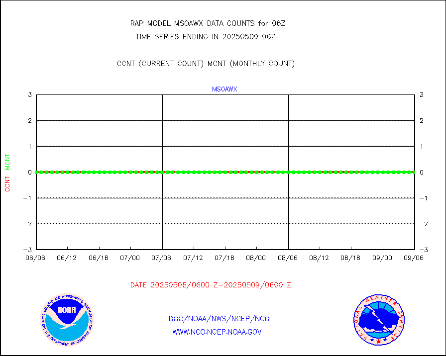
msoaws |
Mesonet/MADIS AWS Convergence Technologies, Inc. |
26305 |
24948 |
105.4 % |
2305.50-2306.50 |
msoawx |
Mesonet/MADIS "Anything Weather" |
0 |
0 |
n/a |
2305.50-2306.50 |
msocol |
Mesonet/MADIS Colorado Dept. of Transportation |
0 |
0 |
n/a |
2305.50-2306.50 |
msodcn |
Mesonet/MADIS DC Net |
0 |
0 |
n/a |
2305.50-2306.50 |
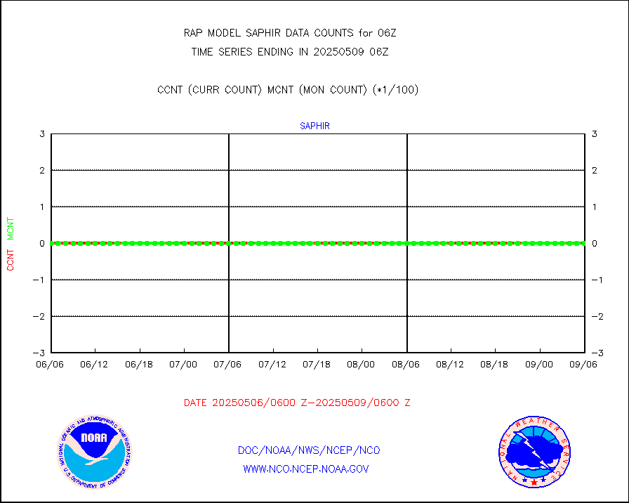
msoden |
Mesonet/MADIS Denver Urban Drainage & Flood Cntrl |
200 |
198 |
101.0 % |
2305.50-2306.50 |
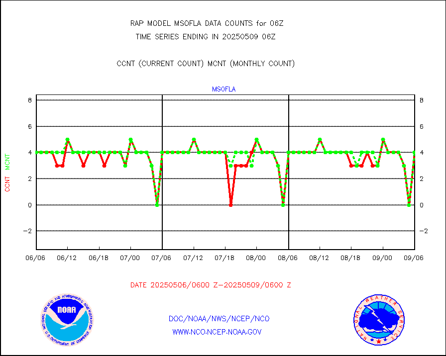
msofla |
Mesonet/MADIS Florida (FAWN & USF) |
3 |
2 |
150.0 % |
2305.50-2306.50 |
msoflt |
Mesonet/MADIS Florida Dept. of Transportation |
0 |
0 |
n/a |
2305.50-2306.50 |
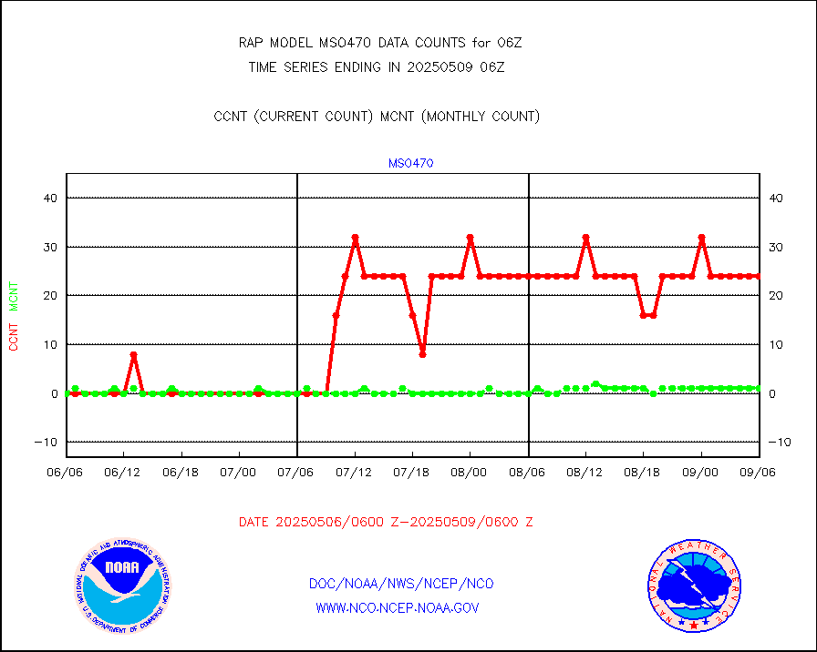
msogeo |
Mesonet/MADIS Georgia Dept. of Transportation |
0 |
0 |
n/a |
2305.50-2306.50 |
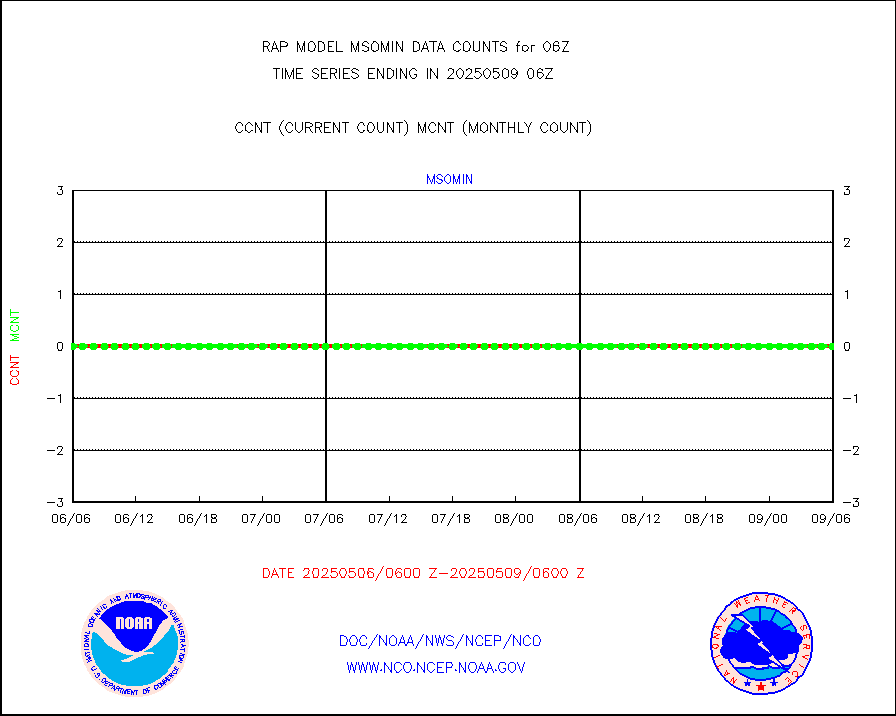
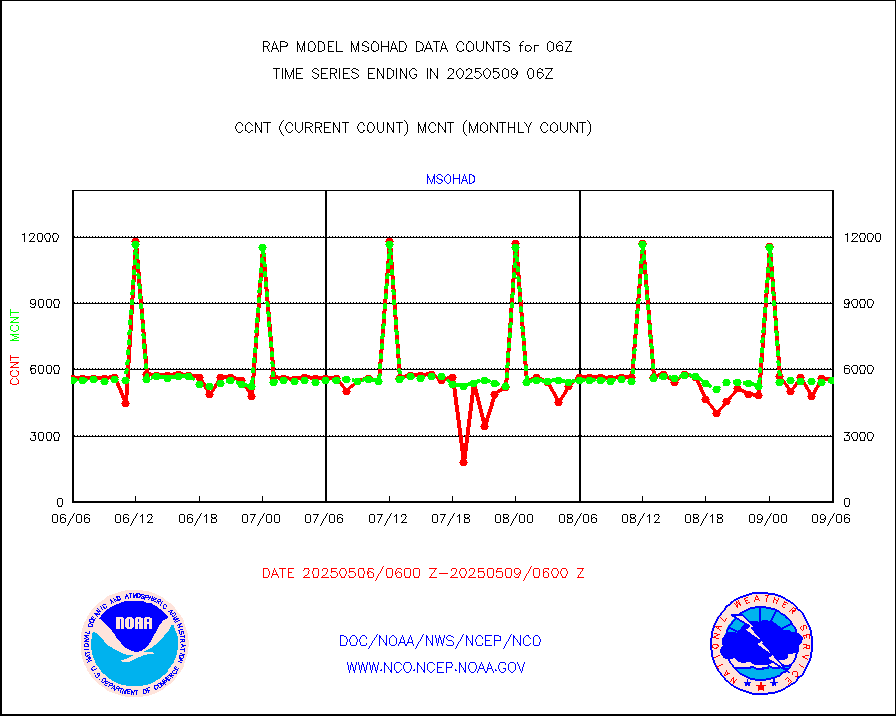
msohad |
Mesonet/MADIS NWS Hydromet Auto Data System(HADS) |
4775 |
5428 |
88.0 % |
2305.50-2306.50 |
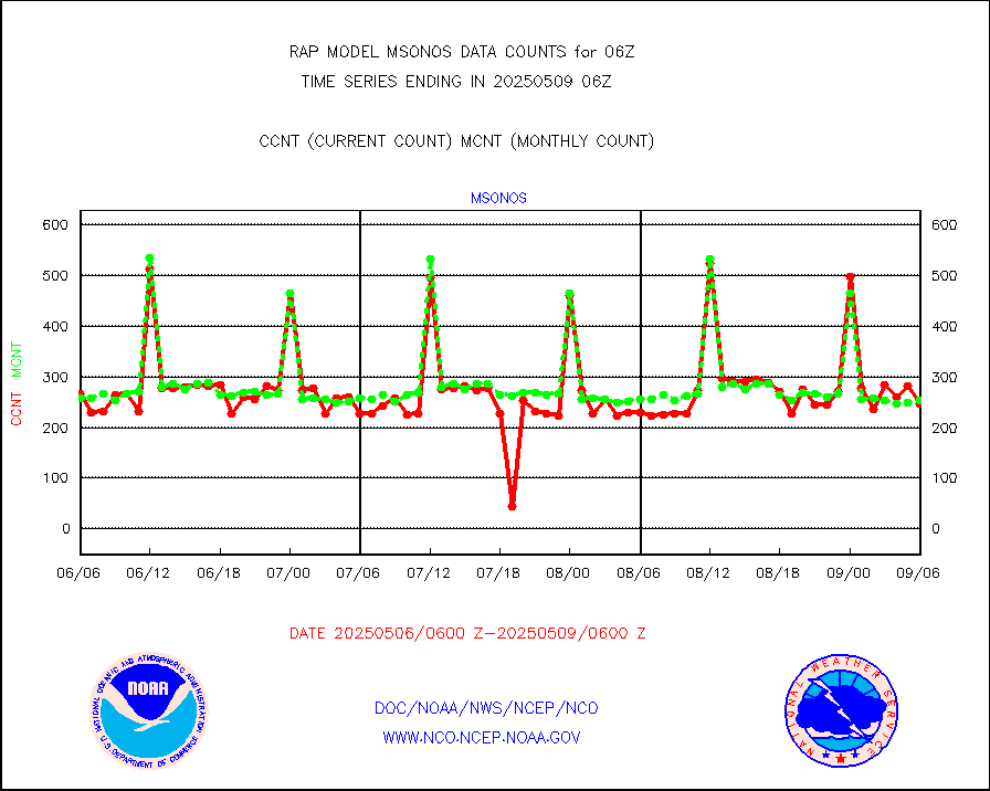
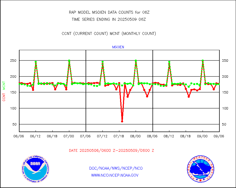
msoien |
Mesonet/MADIS Iowa Environmental |
152 |
169 |
89.9 % |
2305.50-2306.50 |
msoind |
Mesonet/MADIS Indiana Dept. of Transportation |
0 |
0 |
n/a |
2305.50-2306.50 |
msoiow |
Mesonet/MADIS Iowa Department of Transportation |
0 |
0 |
n/a |
2305.50-2306.50 |
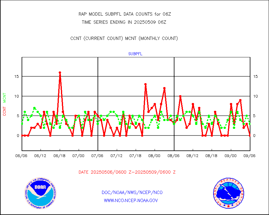
msokan |
Mesonet/MADIS Kansas Department of Transportation |
336 |
317 |
106.0 % |
2305.50-2306.50 |
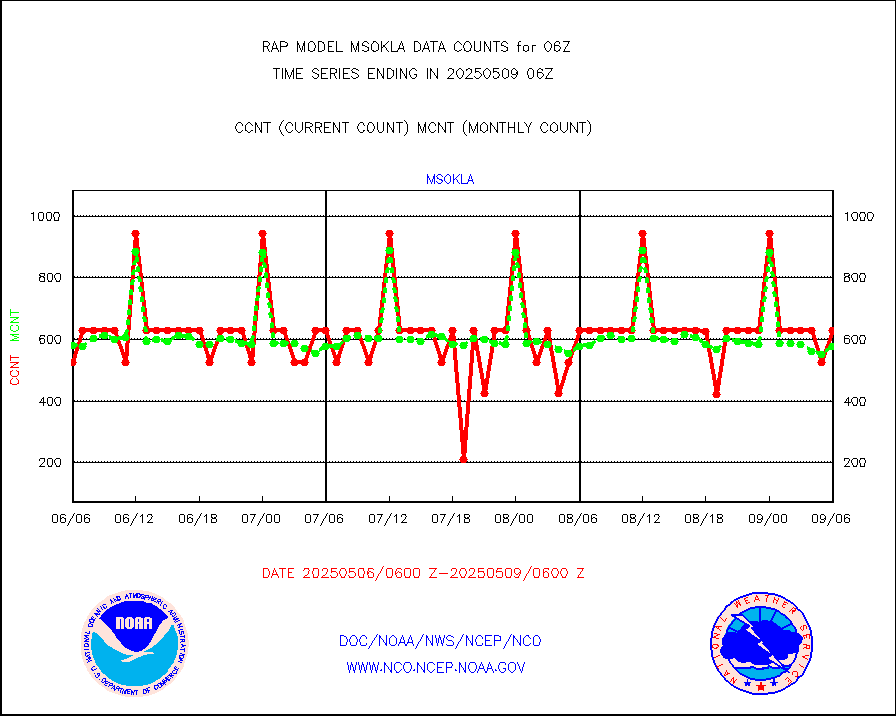
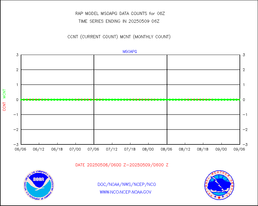
msokla |
Mesonet/MADIS Oklahoma Mesonet |
318 |
332 |
95.8 % |
2305.50-2306.50 |
msolju |
Mesonet/MADIS Louisiana State/Jackson State Univ. |
0 |
0 |
n/a |
2305.50-2306.50 |
msomca |
Mesonet/MADIS Missouri Commercial Agricult Wx Net |
227 |
228 |
99.6 % |
2305.50-2306.50 |
msomin |
Mesonet/MADIS Minnesota Dept. of Transportation |
0 |
0 |
n/a |
2305.50-2306.50 |
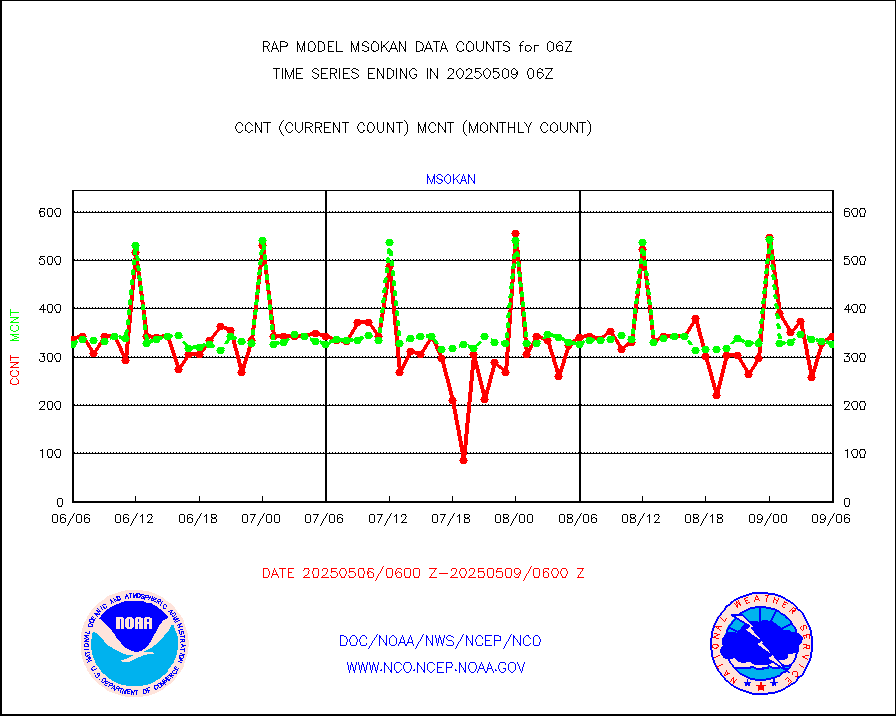
msonos |
Mesonet/MADIS NOS-Phys Oceanographic Realtime Sys |
294 |
272 |
108.1 % |
2305.50-2306.50 |
msoraw |
Mesonet/MADIS NFIC Remote Automated Wx Stns(RAWS) |
1409 |
1489 |
94.6 % |
2305.50-2306.50 |
msourb |
Mesonet/MADIS UrbaNet |
3931 |
3913 |
100.5 % |
2305.50-2306.50 |
msovir |
Mesonet/MADIS Virginia Dept. of Transportation |
229 |
234 |
97.9 % |
2305.50-2306.50 |
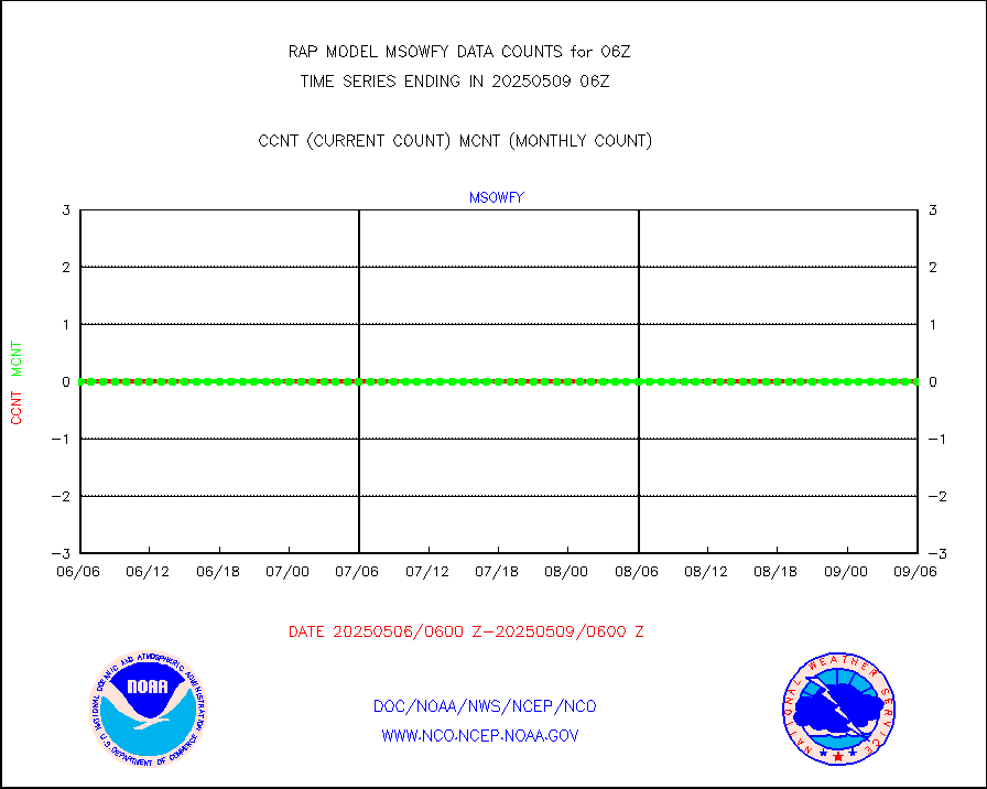
msowfy |
Mesonet/MADIS "Weather for You" |
0 |
0 |
n/a |
2305.50-2306.50 |
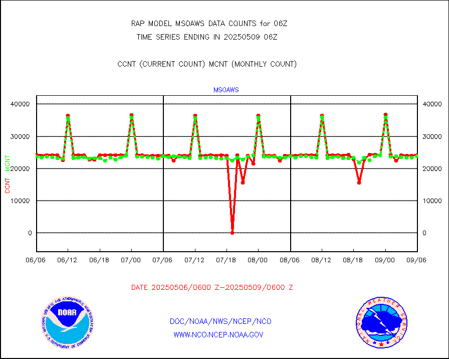
msowis |
Mesonet/MADIS Wisconsin Dept. of Transportation |
0 |
0 |
n/a |
2305.50-2306.50 |
msowst |
Mesonet/MADIS MesoWest (many subproviders) |
34715 |
38590 |
90.0 % |
2305.50-2306.50 |
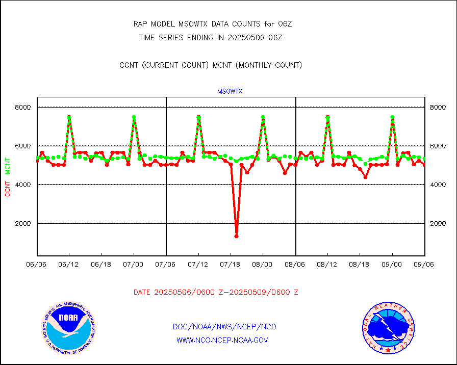
msowtx |
Mesonet/MADIS West Texas |
4392 |
4935 |
89.0 % |
2305.50-2306.50 |
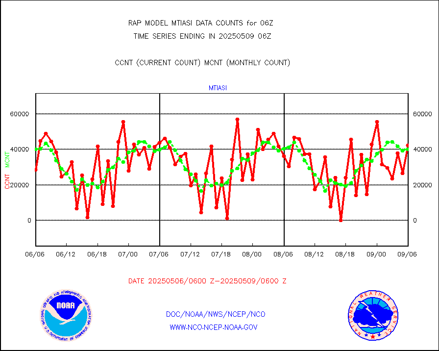
mtiasi |
METOP 1-2 IASI 1C radiance data (varbl. channels) |
44067 |
35536 |
124.0 % |
2304.00-2307.99 |
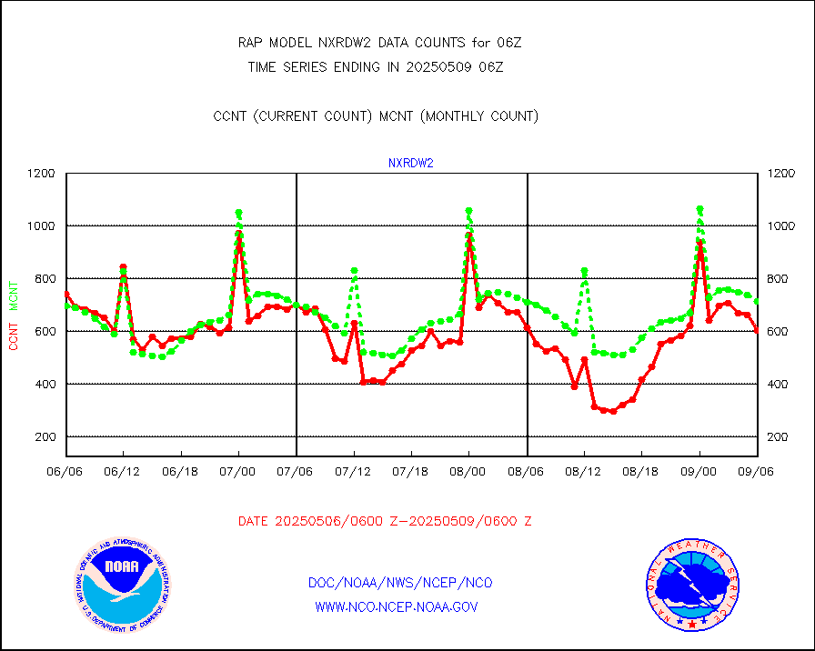
nxrdw2 |
NEXRAD Vel Azm Dsp(VAD) winds via Level 2 decoder |
778 |
675 |
115.3 % |
2305.00-2307.00 |
osbuv8 |
NOAA 16-19 Solar Backscatter UV-2 rad frm V8 BUFR |
0 |
0 |
n/a |
2304.00-2306.99 |
pibal |
PIBAL (from PILOT, PILOT SHIP, PILOT MOBIL) |
0 |
0 |
n/a |
2305.00-2307.00 |
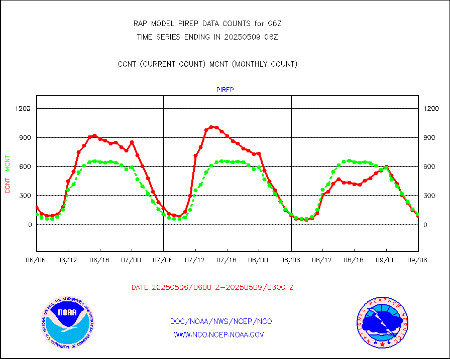
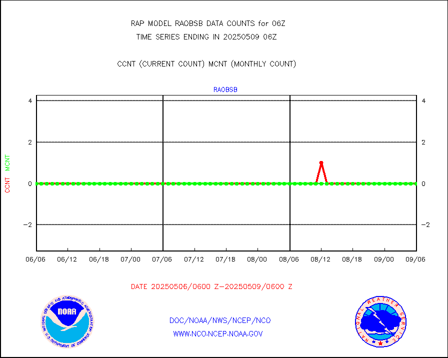
pirep |
Manual PIREP aircraft data (dcded from AIREP fmt) |
57 |
99 |
57.6 % |
2302.75-2309.25 |
prflrp |
Profilr winds from PIBAL (PILOT,PILOT SHIP/MOBIL) |
0 |
0 |
n/a |
2304.50-2307.50 |
raobm |
Rawinsonde - mobile land (from TEMP/PILOT MOBIL) |
0 |
0 |
n/a |
2305.00-2307.00 |
raobs |
Rawinsonde - ship (from TEMP SHIP, PILOT SHIP) |
0 |
0 |
n/a |
2305.00-2307.00 |
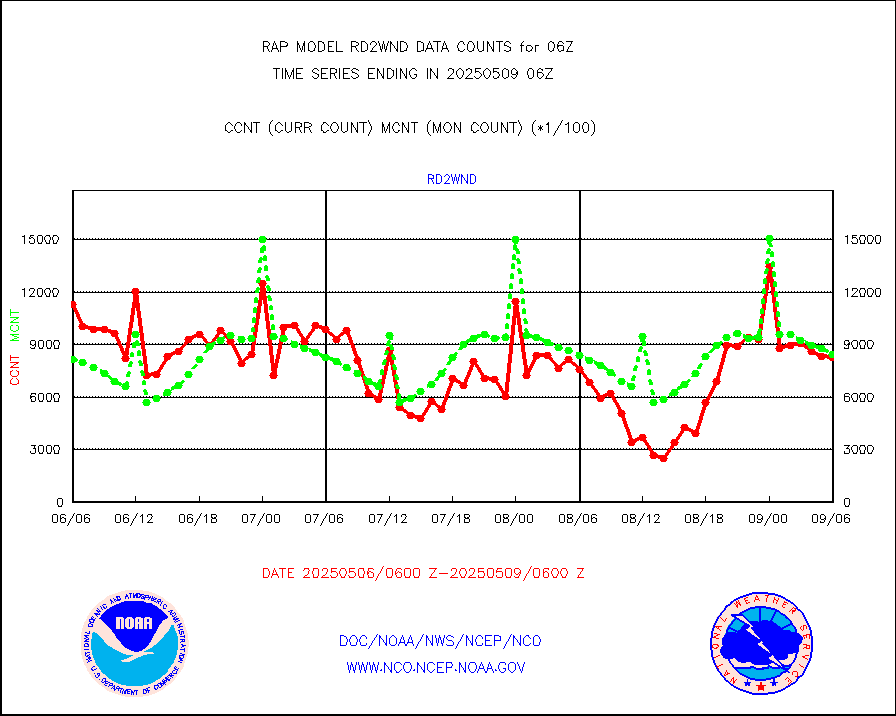
rd2wnd |
NEXRAD radial wind (Level 2 - GTS) |
784813 |
764193 |
102.7 % |
2305.50-2306.49 |
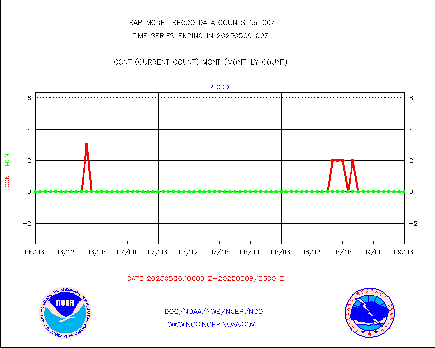
recco |
Flight level reconnaissance aircraft data |
0 |
0 |
n/a |
2305.00-2307.00 |
saldrn |
Surface Marine Saildrone (decoded from BUFR) |
2 |
2 |
100.0 % |
2304.00-2307.99 |
saphir |
Megha-Tropiques SAPHIR L1A2 brightness temps |
0 |
0 |
n/a |
2303.00-2308.99 |
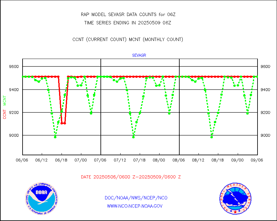
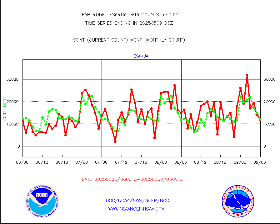
sevasr |
METEOSAT-10 2nd Gen SEVIRI All Sky Radiance(proc) |
9512 |
9512 |
100.0 % |
2304.00-2307.99 |
sevcsr |
METEOSAT-10 2nd Gen SEVIRI Clr Sky Radiance(proc) |
0 |
0 |
n/a |
2304.00-2307.99 |
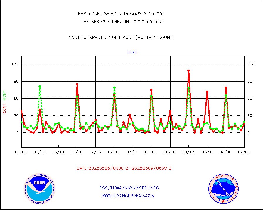
ships |
Ship - manual and automatic, restricted |
0 |
6 |
0.0 % |
2305.50-2306.50 |
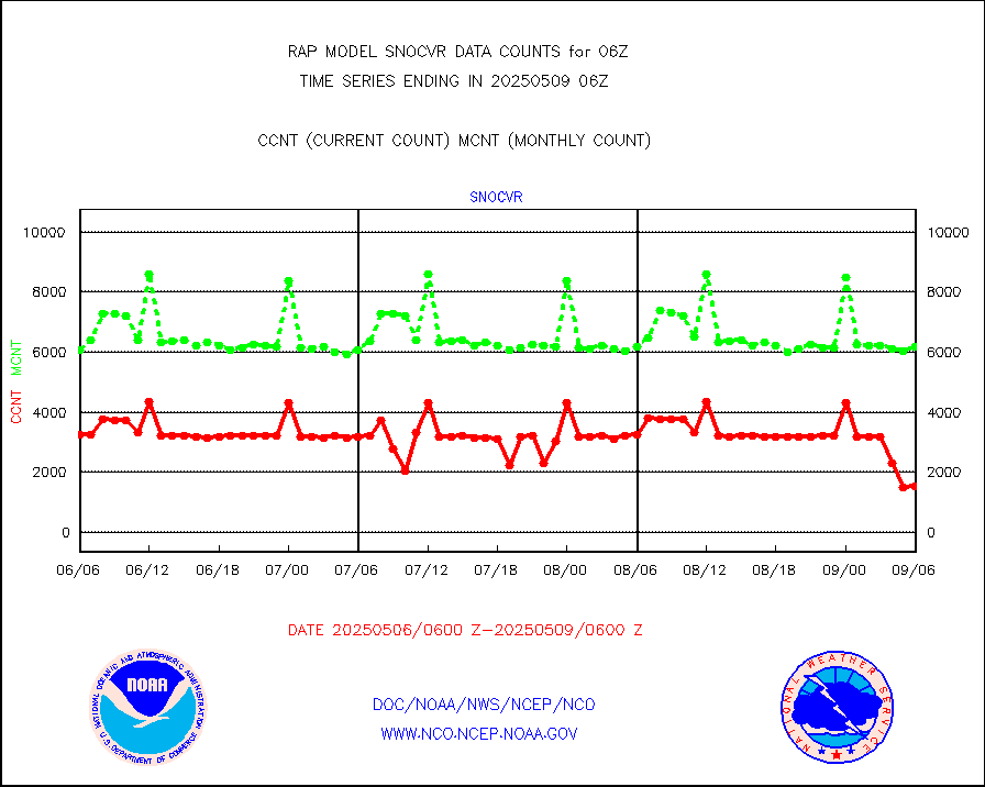
snocvr |
NOW COVER, DEPTH/DENSITY AND WATER EQUIVALENT |
3052 |
5958 |
51.2 % |
2304.00-2308.00 |
ssmisu |
DMSP SSM/IS 1C radiance data (Unified Pre-Proc.) |
53817 |
54069 |
99.5 % |
2304.00-2307.99 |
subpfl |
Sub-surface float and glider profile (BUFR) |
0 |
2 |
0.0 % |
2304.00-2307.99 |
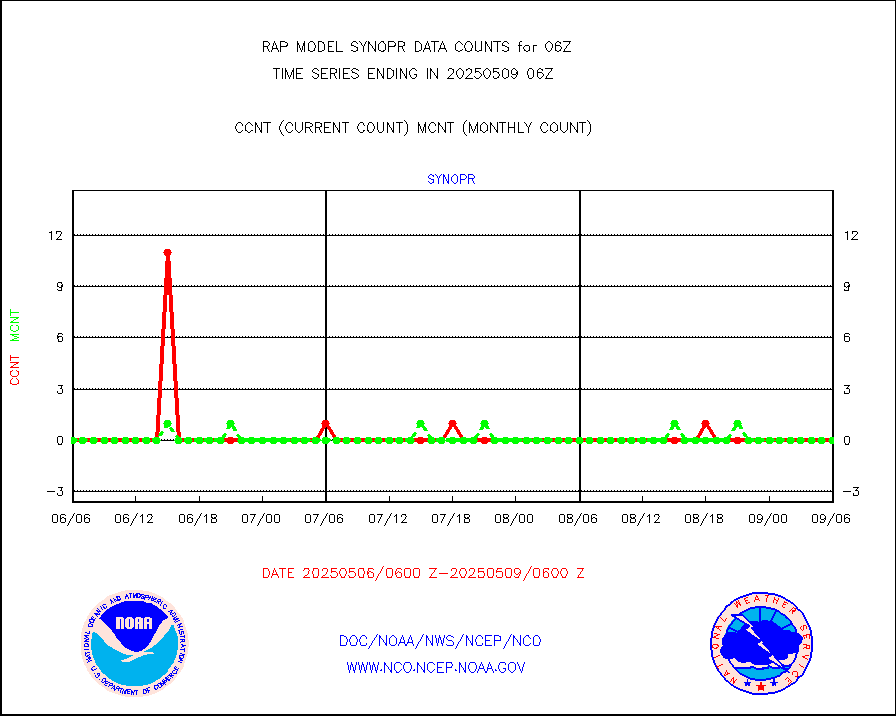
synopr |
Synoptic - restricted (WMO Res 40) manual & auto. |
0 |
0 |
n/a |
2305.50-2306.50 |
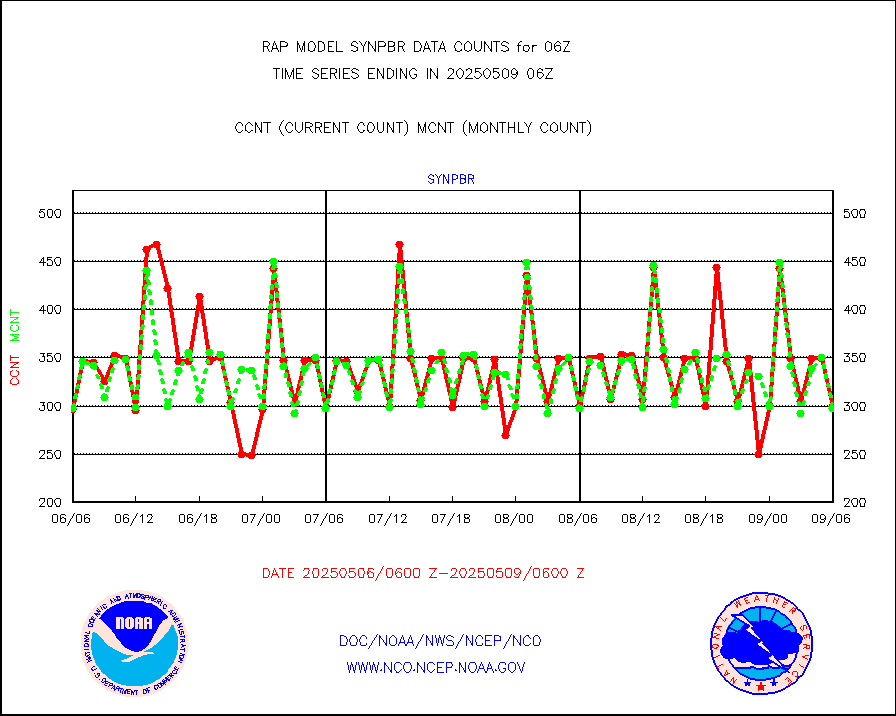
synpbr |
Synoptic - restricted (WMO Res 40)(decoded BUFR) |
307 |
297 |
103.4 % |
2305.50-2306.50 |
synpmb |
Synoptic - mobile manual & auto (decoded fr BUFR) |
0 |
0 |
n/a |
2305.50-2306.50 |
tmdara |
TAMDAR aircft data-all types(from Panasonic,BUFR) |
1496 |
1507 |
99.3 % |
2302.75-2309.25 |
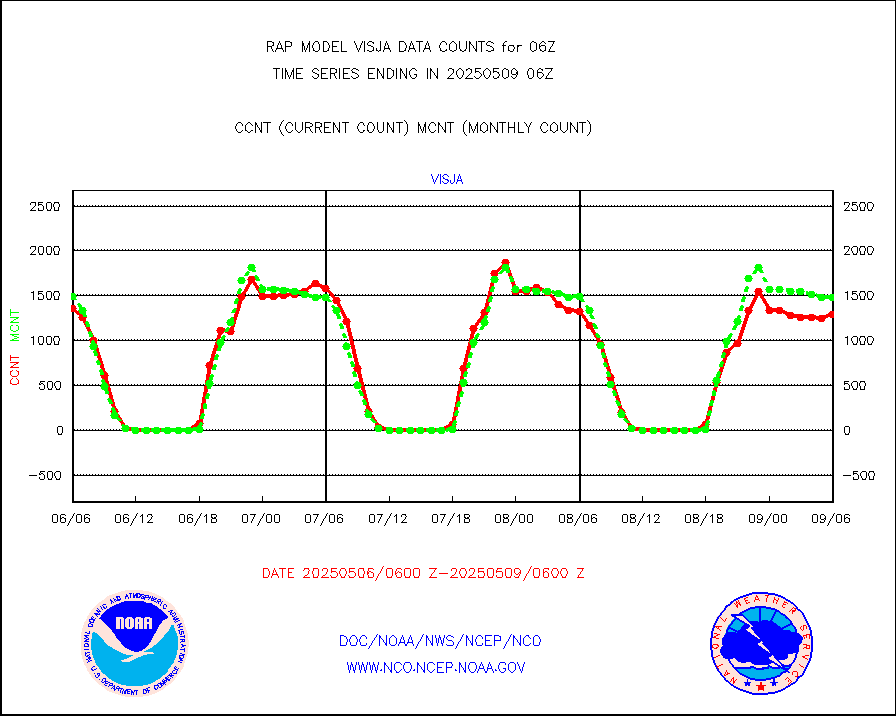
visja |
MTSAT/JMA visible derived cloud motion |
1603 |
1520 |
105.5 % |
2303.50-2308.50 |
visusr |
GOES-16&up/NESDIS visible derived cloud motion |
3739 |
5495 |
68.0 % |
2305.00-2305.99 |
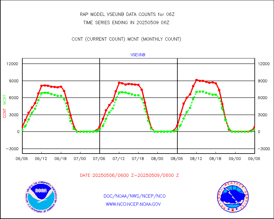
vseunb |
METEOSAT/EUMETSAT visible drv cld motion NBseq |
660 |
206 |
320.4 % |
2304.50-2307.49 |


