| Critical Data with Normal Counts |
|---|
| Type | Description | Hourly Count | Monthly Average | Percent (%) of Monthly Mean | UTC Time Window |
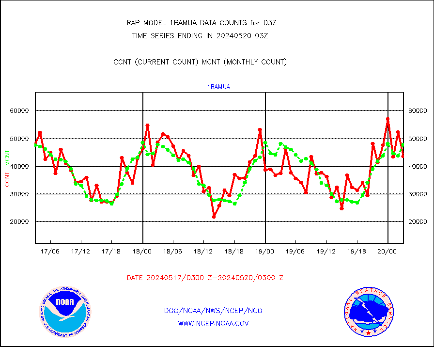
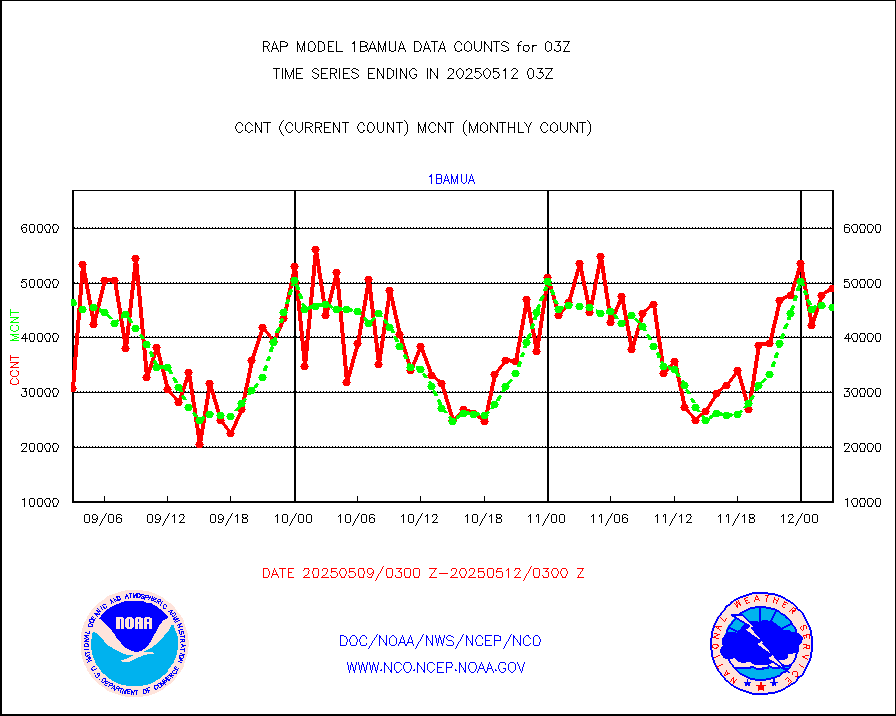
1bamua |
NOAA 15-19 & METOP 1-2 AMSU-A NCEP-proc. br.temps |
42095 |
48284 |
87.2 % |
1800.00-1805.99 |
1bhrs4 |
NOAA 18-19 & METOP 1-2 HIRS-4 NCEP-proc. br.temps |
17181 |
41679 |
41.2 % |
1800.00-1805.99 |
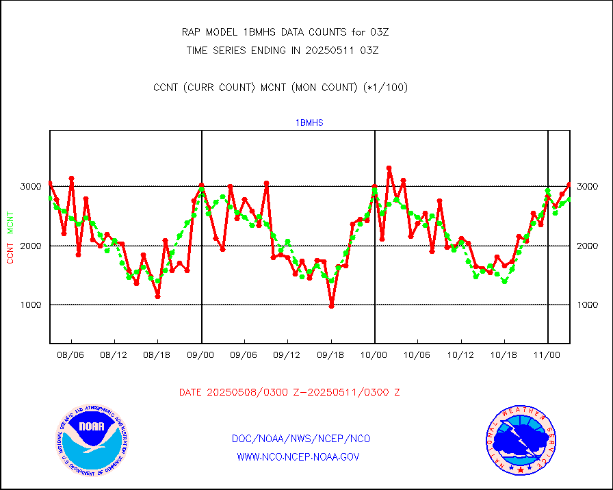
1bmhs |
NOAA 18-19 & METOP 1-2 MHS NCEP-proces. br. temps |
283208 |
296485 |
95.5 % |
1800.00-1805.99 |
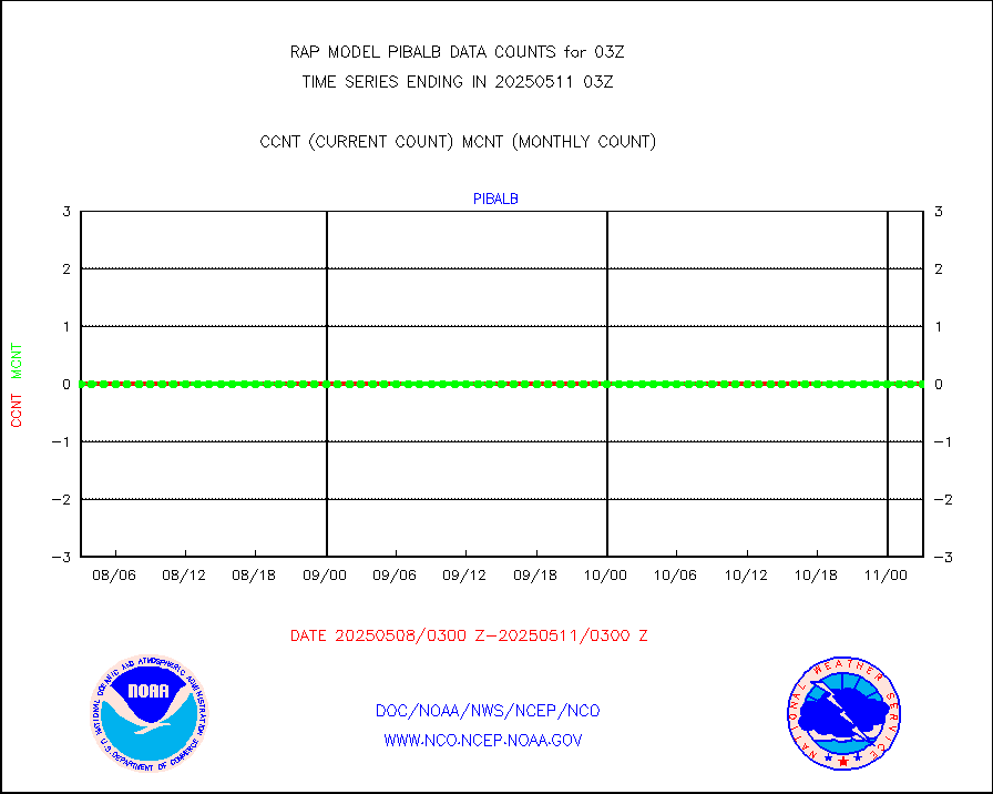
acars |
MDCRS ACARS acft data from ARINC(dcded from BUFR) |
92536 |
86843 |
106.6 % |
1723.75-1806.25 |
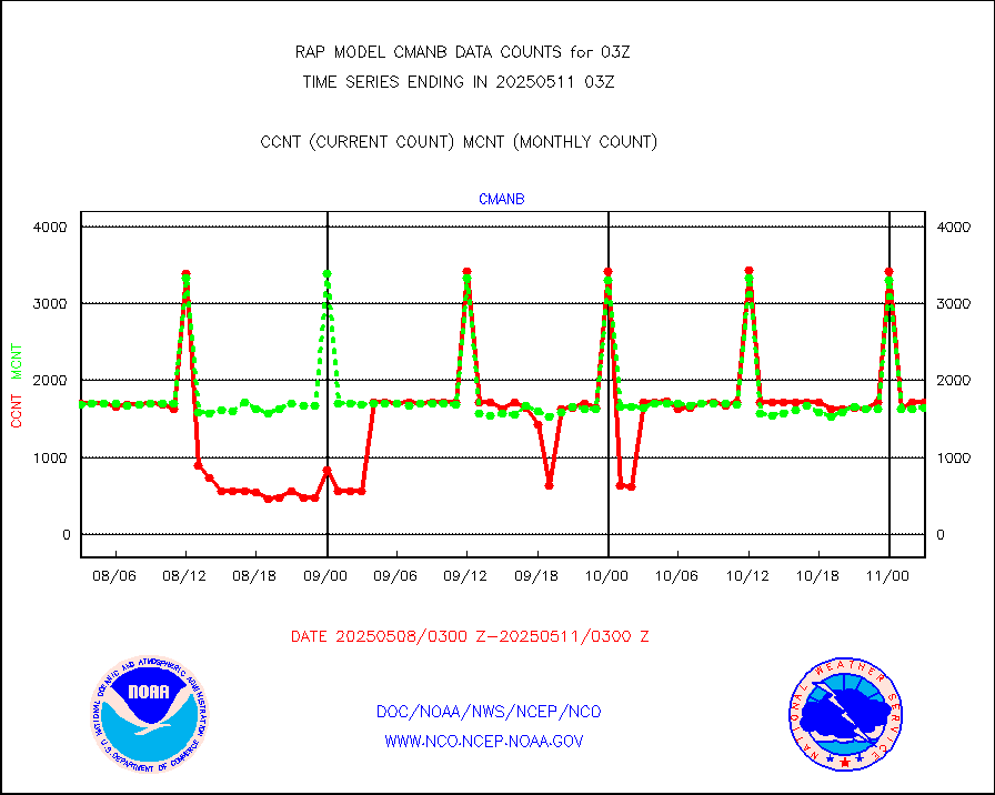
cmanb |
Surface Marine CMAN rpts decoded from BUFR format |
1692 |
1694 |
99.9 % |
1802.50-1803.50 |
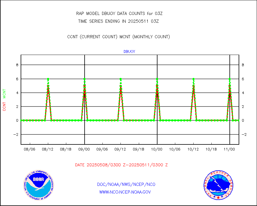
dbuoy |
Buoys decoded from FM-18 fmt (moored or drifting) |
0 |
0 |
n/a |
1802.50-1803.50 |
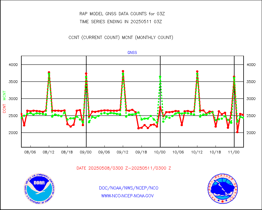
gnss |
Grnd-based Gbl Navigation Sat System (GNSS) data |
2640 |
2137 |
123.5 % |
1801.95-1802.05 |
h20mo |
MODIS (AQUA/TERRA) wvpr imager derived cld motion |
0 |
0 |
n/a |
1800.50-1805.50 |
infmo |
MODIS (AQUA/TERRA) ir l-wave derived cloud motion |
0 |
0 |
n/a |
1800.50-1805.50 |
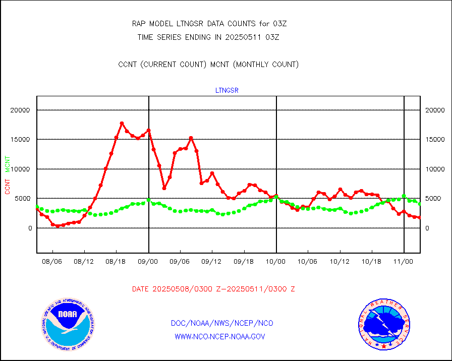
lgycld |
GOES/NASA(Langley) hi-res. (1x1 f-o-v) cloud data |
3728101 |
3690167 |
101.0 % |
1802.50-1803.50 |
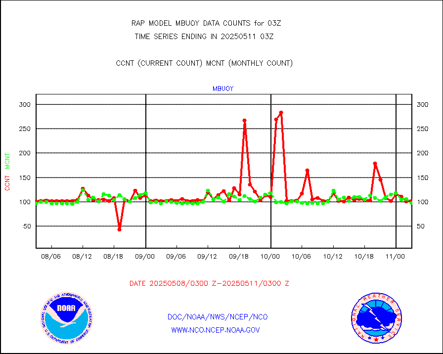
mbuoy |
Buoys decoded from FM-13 format (moored) |
25 |
51 |
49.0 % |
1802.50-1803.50 |
metar |
Aviation - METAR |
4831 |
5827 |
82.9 % |
1802.50-1803.50 |
nxrdw |
NEXRAD Vel Azm Dsp(VAD) winds via radar coded msg |
0 |
0 |
n/a |
1802.00-1804.00 |
prflrb |
Multi-Agency Profiler (MAP) and SODAR winds |
93 |
81 |
114.8 % |
1801.50-1804.50 |
raobf |
Rawinsonde - fixed land (from TEMP or PILOT) |
0 |
0 |
n/a |
1802.00-1804.00 |
rass |
RASS temperatures (NOAA and Multi-Agency) |
21 |
20 |
105.0 % |
1802.50-1803.50 |
shipsb |
Ship - manual and automatic, restricted (BUFR) |
0 |
0 |
n/a |
1802.50-1803.50 |
shipsu |
Ship - manual and automatic, unrestricted |
13 |
49 |
26.5 % |
1802.50-1803.50 |
shipub |
Ship - manual and automatic, unrestricted (BUFR) |
272 |
308 |
88.3 % |
1802.50-1803.50 |
synop |
Synoptic - fixed manual and automatic |
102 |
504 |
20.2 % |
1802.50-1803.50 |
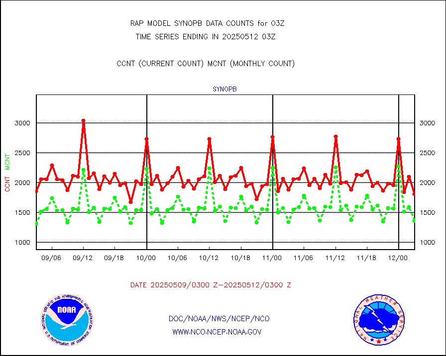
synopb |
Synoptic - fixed manual & auto (decoded fr BUFR) |
770 |
1348 |
57.1 % |
1802.50-1803.50 |
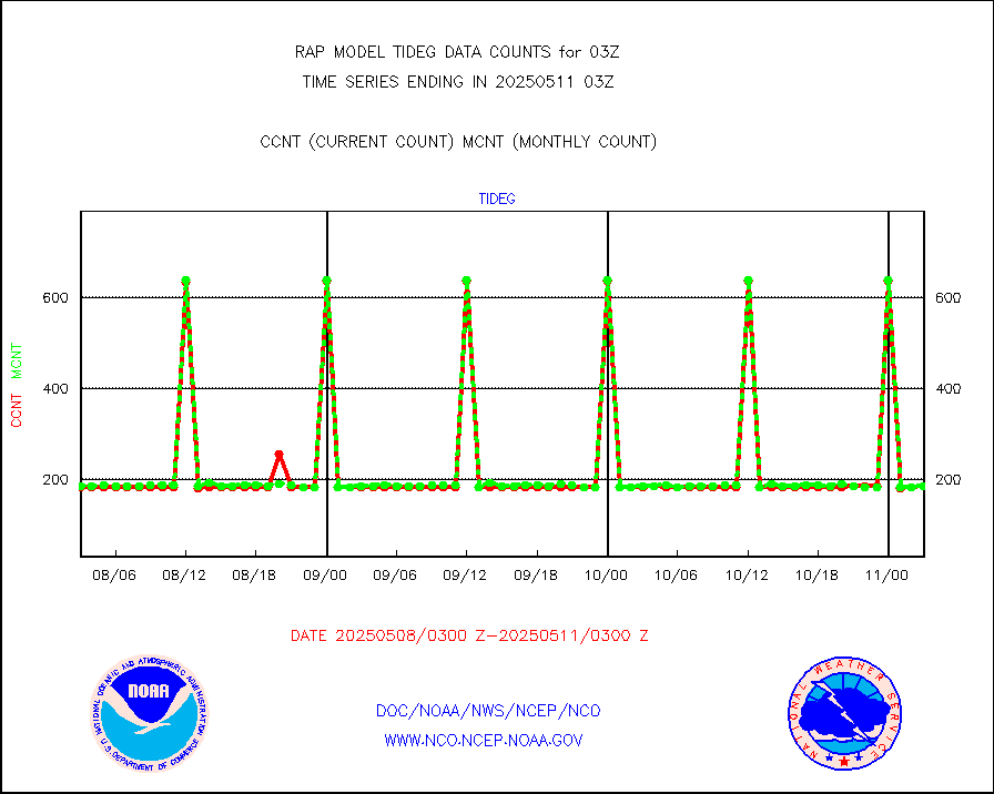
tideg |
Tide gauge reports decoded from CREX format |
180 |
177 |
101.7 % |
1802.50-1803.50 |
| Data Types of Opportunity with Normal Counts |
|---|
| Type | Description | Hourly Count | Monthly Average | Percent (%) of Monthly Mean | UTC Time Window |
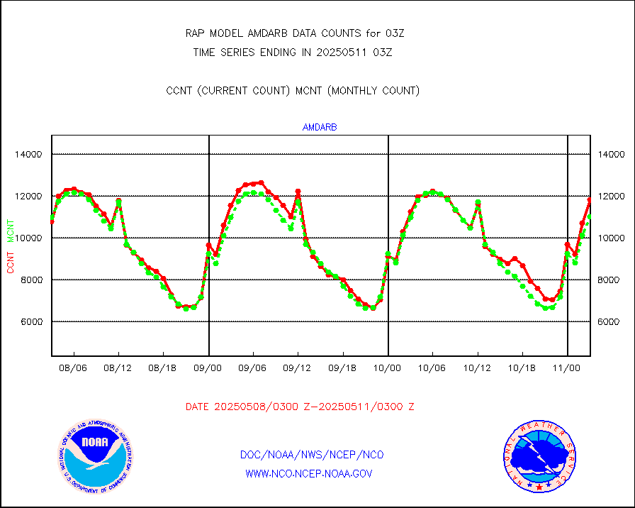
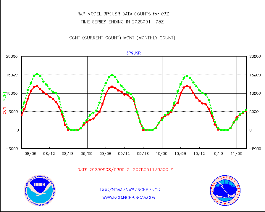
3p9usr |
GOES-16&up/NESDIS ir short-wv derived cld motion |
4116 |
6447 |
63.8 % |
1802.00-1802.99 |
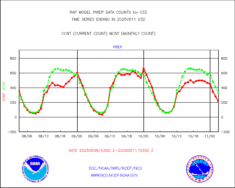
acarsa |
MDCRS ACARS acft data (ARINC via AFWA)(AIREP fmt) |
0 |
0 |
n/a |
1723.75-1806.25 |
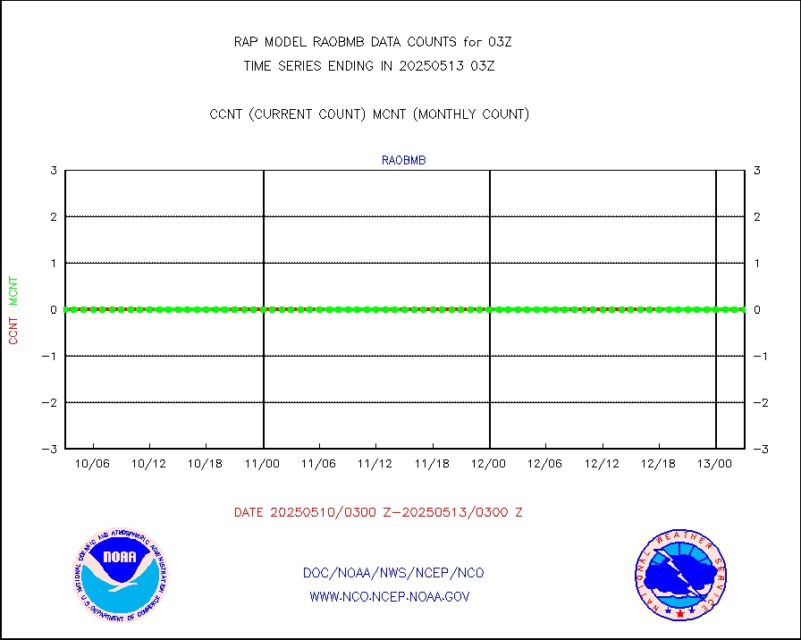
airep |
Manual AIREP aircraft data (dcded from AIREP fmt) |
1154 |
3288 |
35.1 % |
1723.75-1806.25 |
airsev |
AQUA AIRS/AMSU-A/HSB brightness temps- every FOV |
0 |
0 |
n/a |
1800.00-1805.99 |
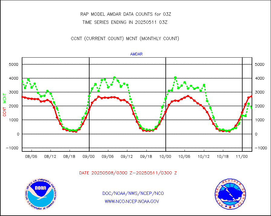
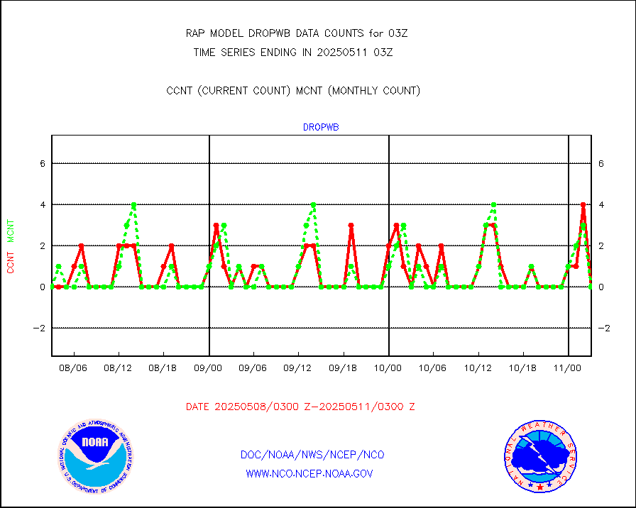
amdar |
AMDAR aircraft data (decoded from AMDAR format) |
2986 |
3847 |
77.6 % |
1723.75-1806.25 |
amdarb |
AMDAR aircraft data (decoded from BUFR) |
5979 |
5748 |
104.0 % |
1723.75-1806.25 |
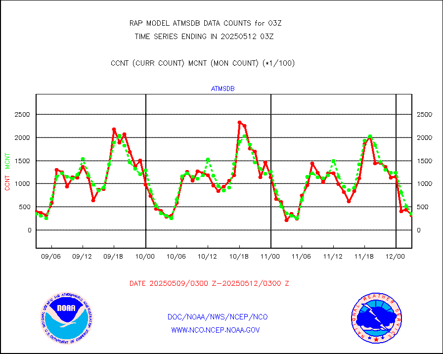
amsr2 |
GCOM-W AMSR2 1B brightness temperatures |
0 |
556307 |
0.0 % |
1800.00-1800.99 |
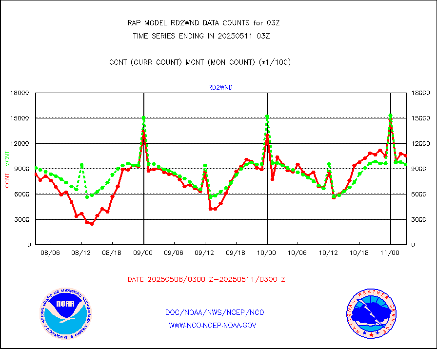
ascat |
METOP 1-2 ASCAT products |
32521 |
20423 |
159.2 % |
1801.00-1805.00 |
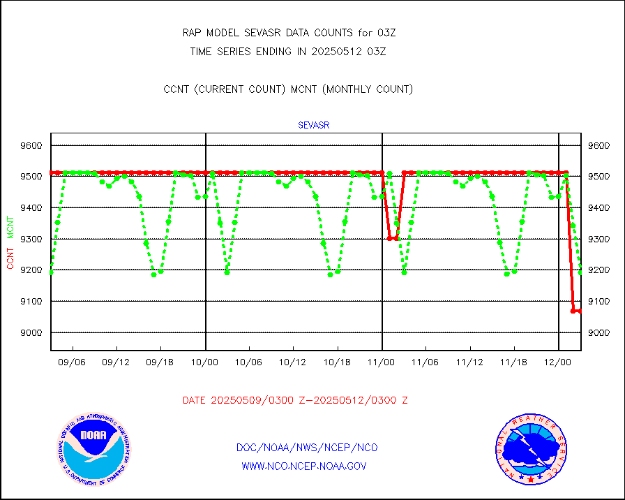
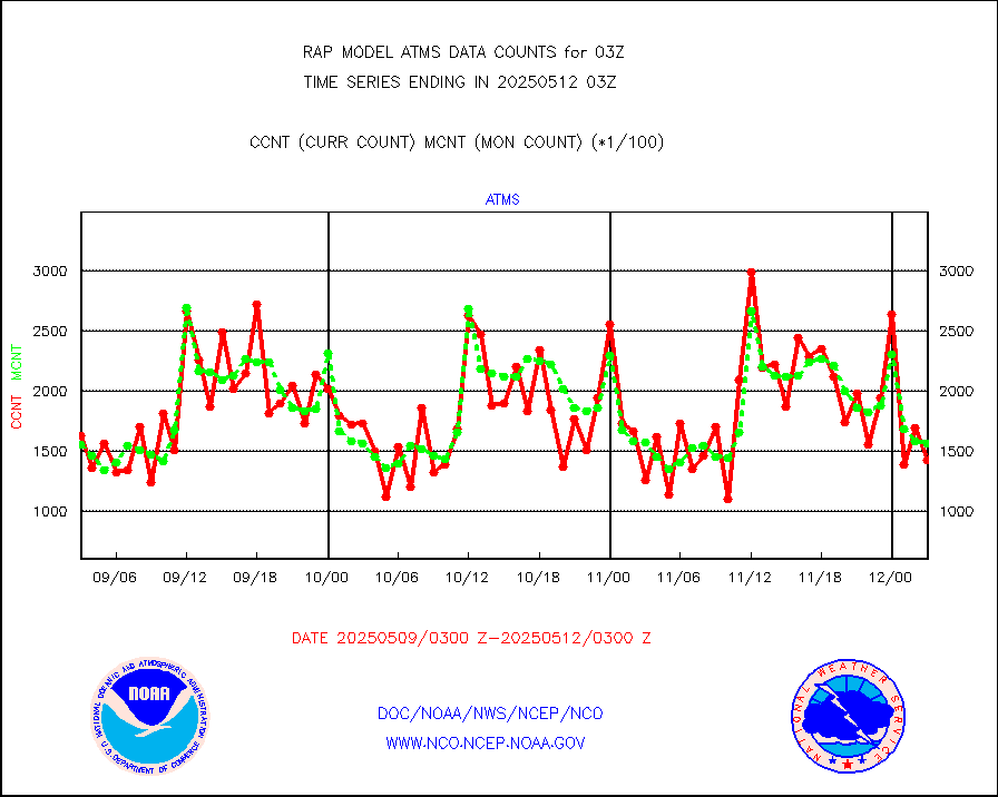
atms |
NPP/NOAA-20 ATMS brightness temperatures |
168141 |
152310 |
110.4 % |
1801.00-1804.99 |
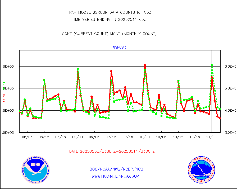
atmsdb |
NPP/NOAA-20 ATMS bright. temps-direct b-cast SSEC |
14030 |
29444 |
47.6 % |
1801.00-1804.99 |
coopmd |
Coop/MADIS NEPP & HCN-Modernization NOAA COOP Obs |
20 |
23 |
87.0 % |
1802.50-1803.50 |
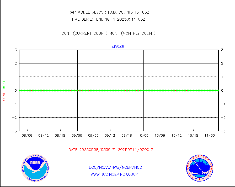
crisf4 |
NPP/NOAA-20 CrIS full spctrl radn (431 ch subset) |
85973 |
89948 |
95.6 % |
1801.00-1804.99 |
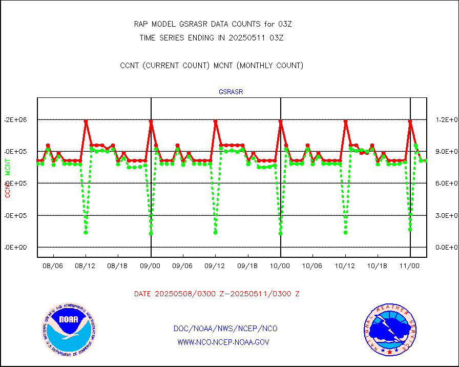
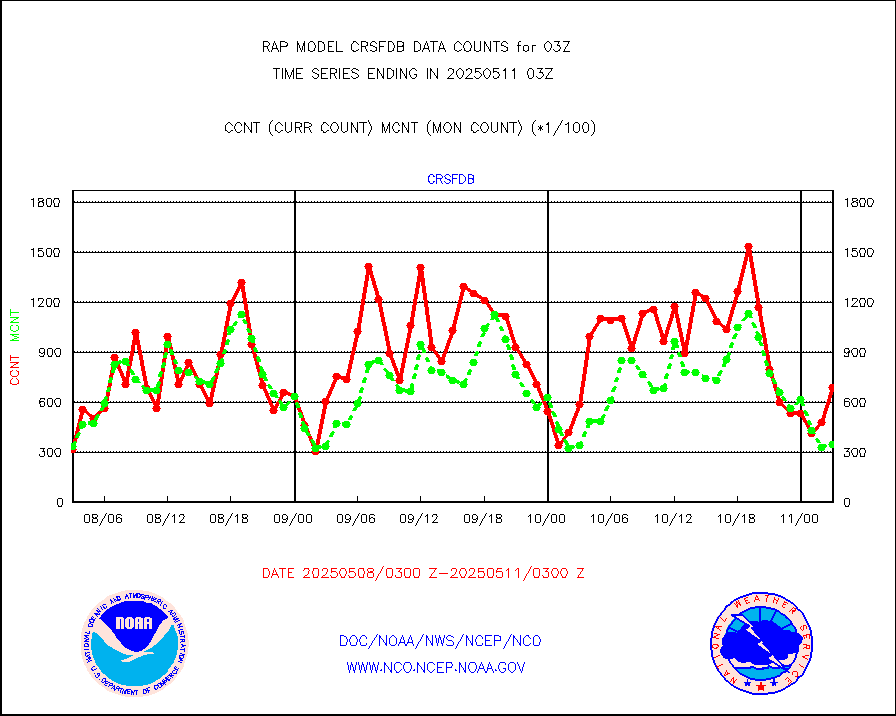
crsfdb |
NPP/NOAA-20 CrIS full spctrl radn dir brdcst SSEC |
62044 |
51402 |
120.7 % |
1801.00-1804.99 |
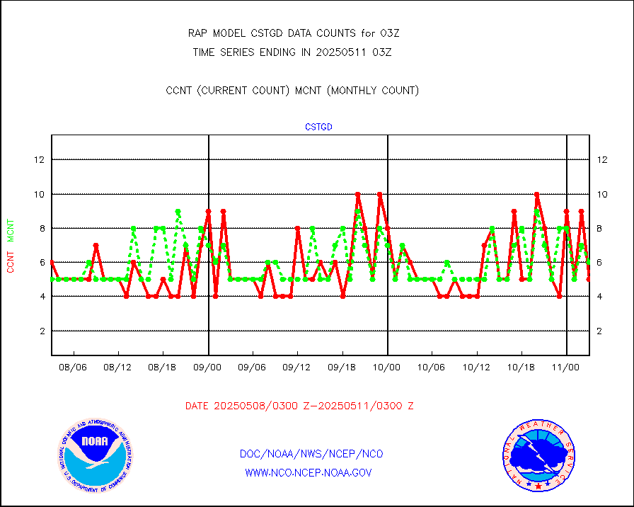
cstgd |
Coast Guard |
4 |
4 |
100.0 % |
1802.50-1803.50 |
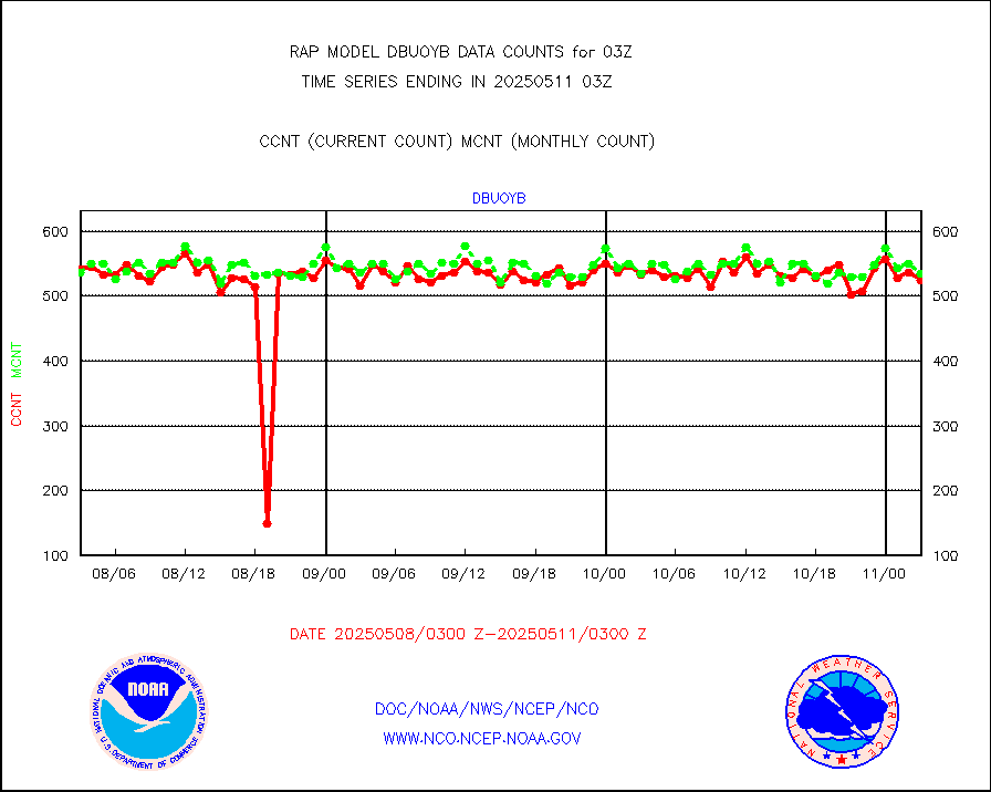
dbuoyb |
Drifting buoys (decoded from BUFR) |
564 |
621 |
90.8 % |
1802.50-1803.50 |
dropw |
Dropwinsonde (from TEMP DROP) |
0 |
0 |
n/a |
1802.00-1804.00 |
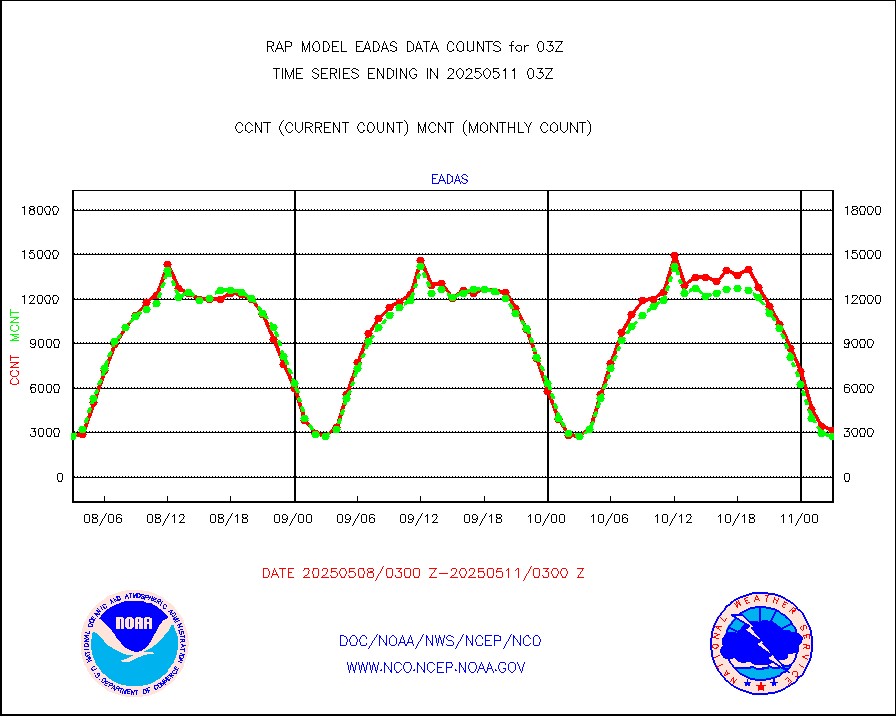
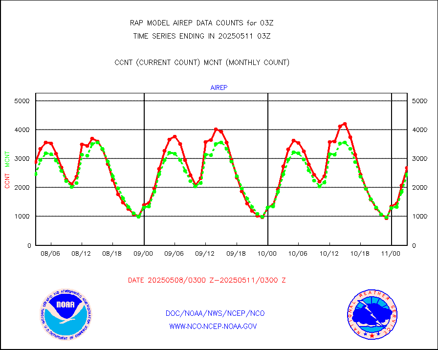
eadas |
E-AMDAR (European AMDAR acft decoded from BUFR) |
1821 |
2069 |
88.0 % |
1723.75-1806.25 |
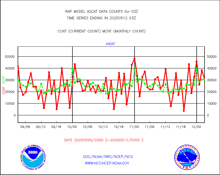
esamua |
NOAA 15-19 & METOP 1-2 AMSU-A proc btmps frm RARS |
23303 |
25012 |
93.2 % |
1802.00-1804.00 |
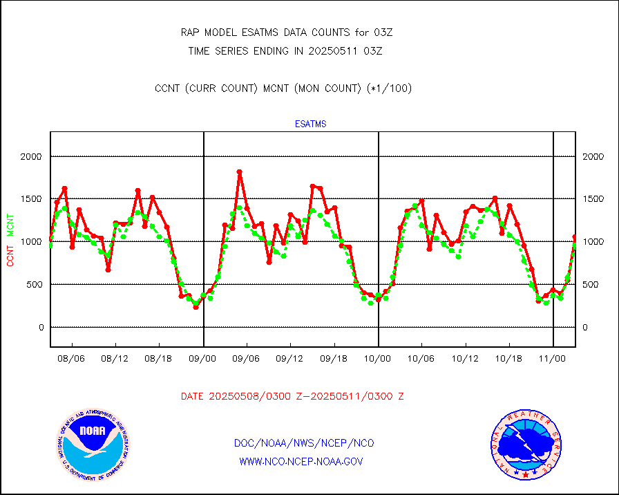
esatms |
NPP Adv. Tech. MW Sndr (ATMS) br. temps from RARS |
72450 |
91508 |
79.2 % |
1801.00-1804.99 |
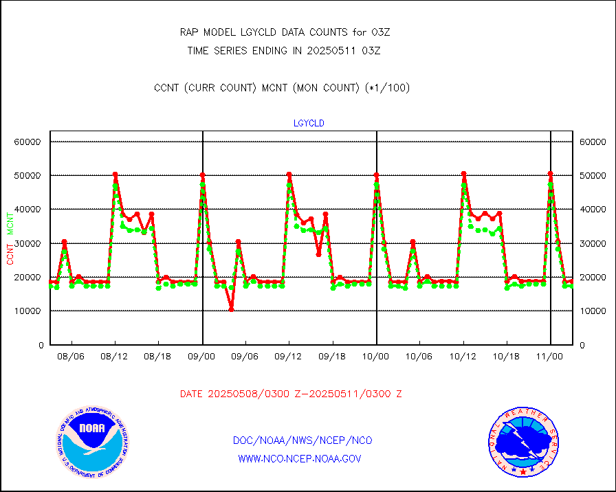
eshrs3 |
NOAA 15-19 & METOP 1-2 HIRS-3/4 pr btmps frm RARS |
37219 |
51431 |
72.4 % |
1802.00-1804.00 |
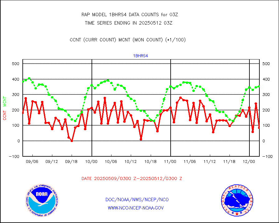
esiasi |
METOP 1-2 IASI 1C radiance data vbl chn from RARS |
74719 |
65114 |
114.8 % |
1801.00-1804.99 |
esmhs |
NOAA 18-19 & METOP 1-2 MHS proc. btemps from RARS |
239425 |
213089 |
112.4 % |
1802.00-1804.00 |
gmi1cr |
GPM GMI Level 1C-R brightness temperatures |
502480 |
642477 |
78.2 % |
1800.00-1805.99 |
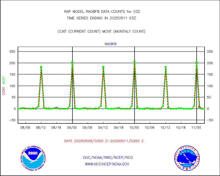
gpsro |
GPS radio occultation data |
108 |
111 |
97.3 % |
1801.00-1804.99 |
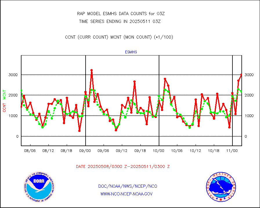
gsrasr |
GOES-16/17 All Sky Radiances (proc.) |
812097 |
809160 |
100.4 % |
1801.00-1804.99 |
gsrcsr |
GOES-16/17 Clear Sky Radiances (proc.) |
382980 |
398512 |
96.1 % |
1801.00-1804.99 |
h20ja |
MTSAT/JMA water vapor imager derived cloud motion |
3867 |
2607 |
148.3 % |
1800.50-1805.50 |
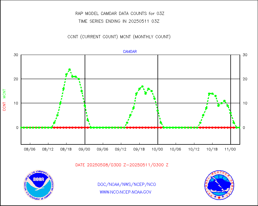
h2dusr |
GOES-16&up/NESDIS wv imgr/deep-lyr derivd cld mtn |
7272 |
6001 |
121.2 % |
1802.00-1802.99 |
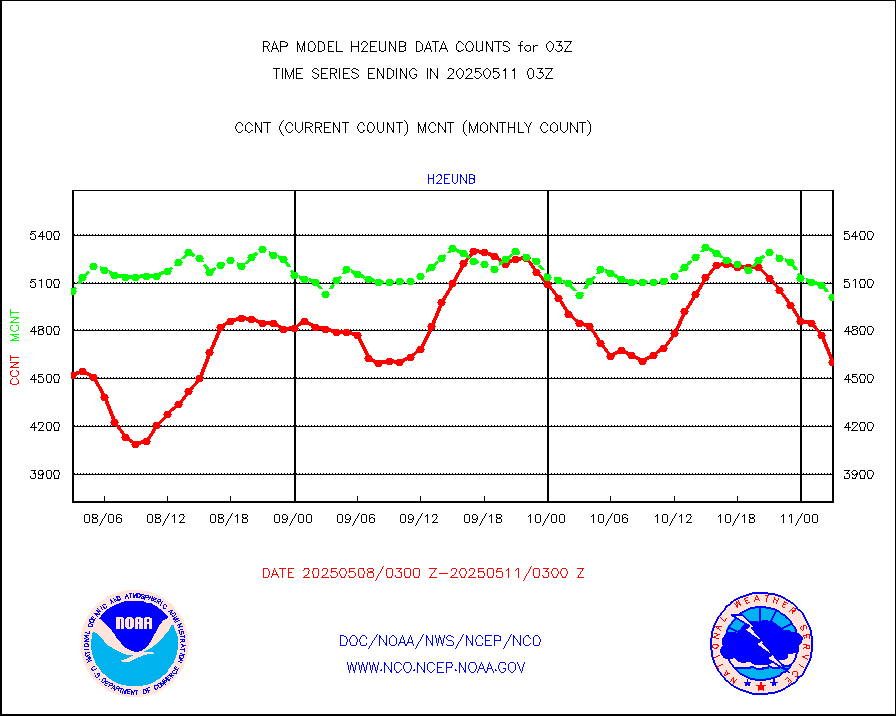
h2eunb |
METEOSAT/EUMETSAT wvpr imgr drv cld motion NBseq |
4873 |
5048 |
96.5 % |
1801.50-1804.49 |
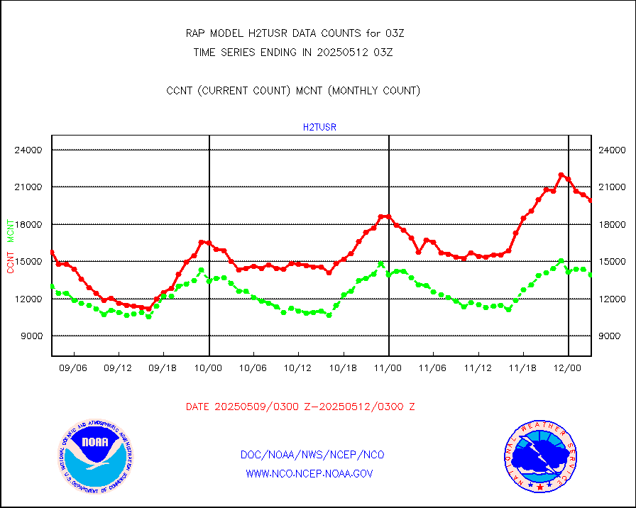
h2tusr |
GOES-16&up/NESDIS wv imgr/cld-top derived cld mtn |
12617 |
11053 |
114.2 % |
1802.00-1802.99 |
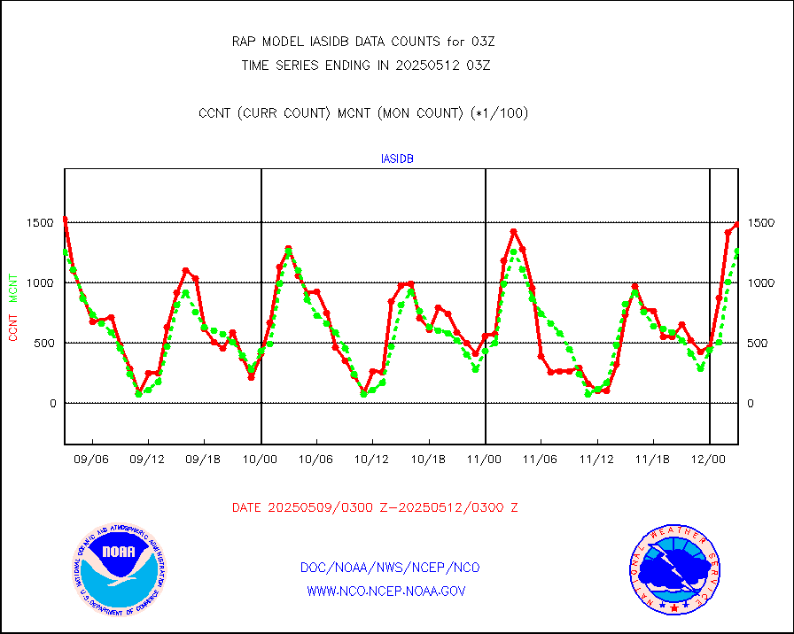
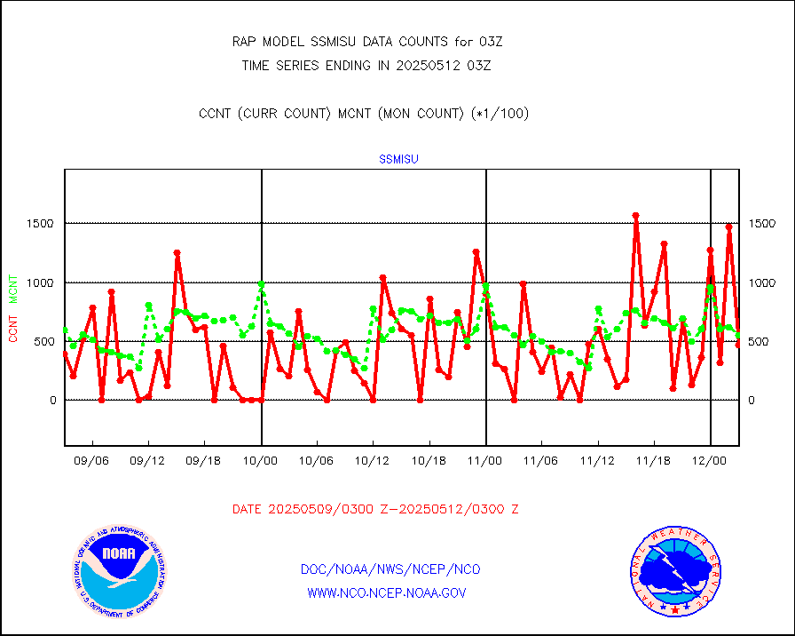
iasidb |
METOP 1-2 IASI 1C radiances-direct broadcast SSEC |
79628 |
111595 |
71.4 % |
1801.00-1804.99 |
ifeunb |
METEOSAT/EUMETSAT ir lg-wave drv cld motion NBseq |
3173 |
3245 |
97.8 % |
1801.50-1804.49 |
ifvrnb |
VIIRS (NPP/NOAA-20) ir lg-wv drv cloud motion(NB) |
0 |
0 |
n/a |
1800.50-1805.50 |
infav |
AVHRR (NOAA/METOP) ir lg-wave derived cld motion |
0 |
11 |
0.0 % |
1800.50-1805.50 |
infav1 |
AVHRR (METOP) ir lg-wave derived cld motion |
0 |
0 |
n/a |
1801.50-1804.49 |
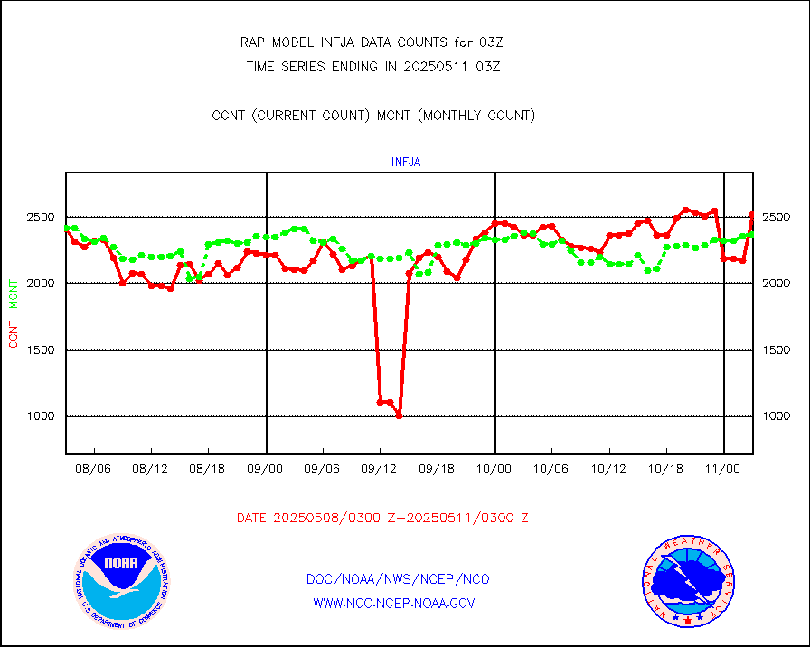
infja |
MTSAT/JMA infrared long-wave derived cloud motion |
2907 |
2496 |
116.5 % |
1800.50-1805.50 |
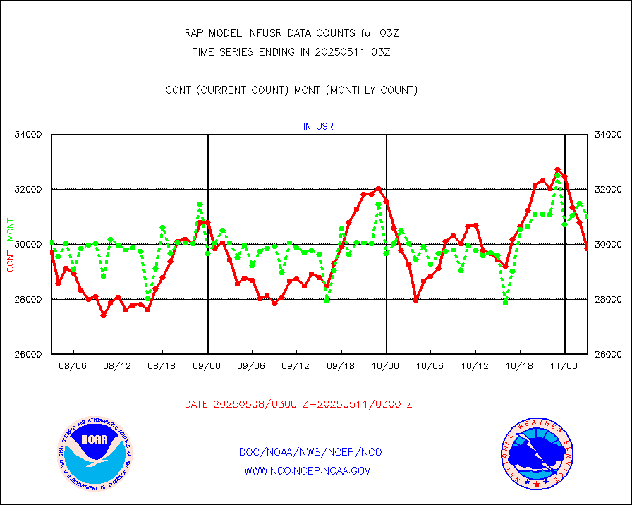
infusr |
GOES-16&up/NESDIS ir long-wave derived cld motion |
27799 |
30595 |
90.9 % |
1802.00-1802.99 |
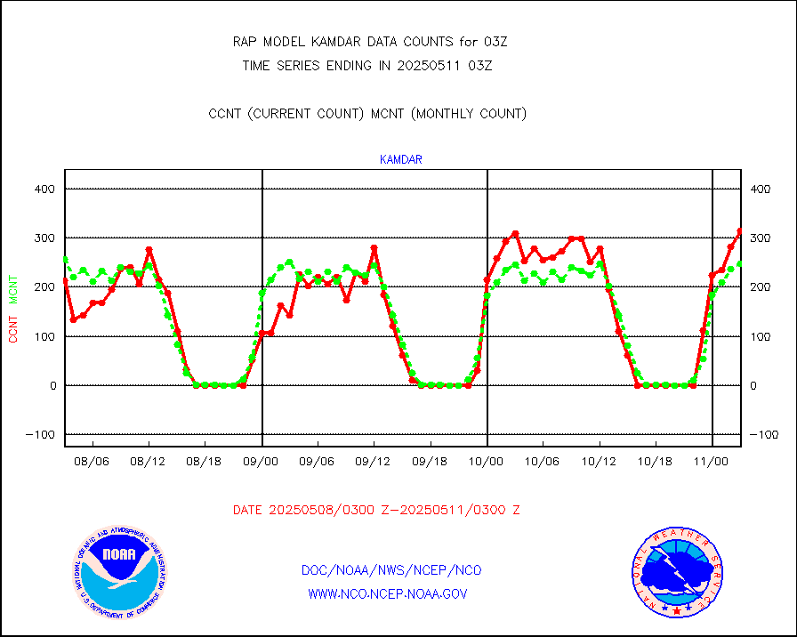
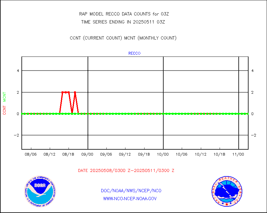
kamdar |
Korean AMDAR aircraft data (decoded from BUFR) |
434 |
297 |
146.1 % |
1723.75-1806.25 |
lcman |
Land-based CMAN stations decoded from CMAN format |
74 |
74 |
100.0 % |
1802.50-1803.50 |
ltnglr |
LLDN Long-rng lightning from Vaisala via NOAAPORT |
55037 |
51125 |
107.7 % |
1802.00-1803.50 |
ltngsr |
NLDN Shrt-rng lightning from Vaisala via NOAAPORT |
979 |
2401 |
40.8 % |
1802.00-1803.50 |
mbuoyb |
Moored buoys (decoded from BUFR) |
457 |
460 |
99.3 % |
1802.50-1803.50 |
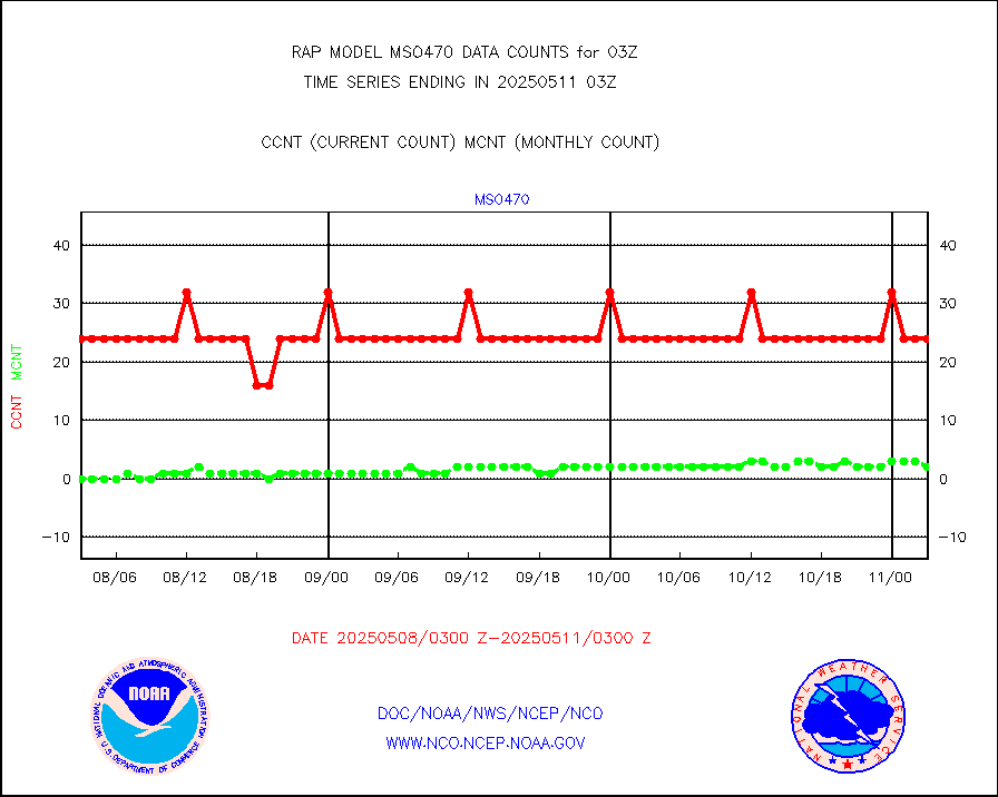
mso470 |
Mesonet/MADIS Colorado E-470 (Interstate 470) |
12 |
21 |
57.1 % |
1802.50-1803.50 |
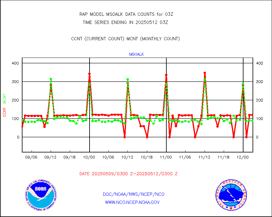
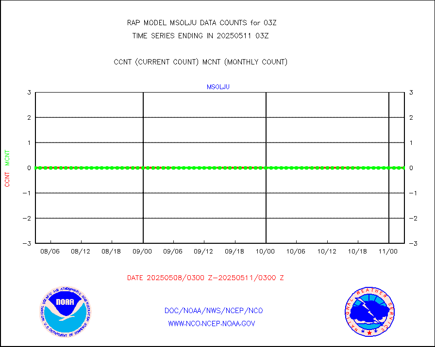
msoalk |
Mesonet/MADIS Alaska Department of Transportation |
0 |
104 |
0.0 % |
1802.50-1803.50 |
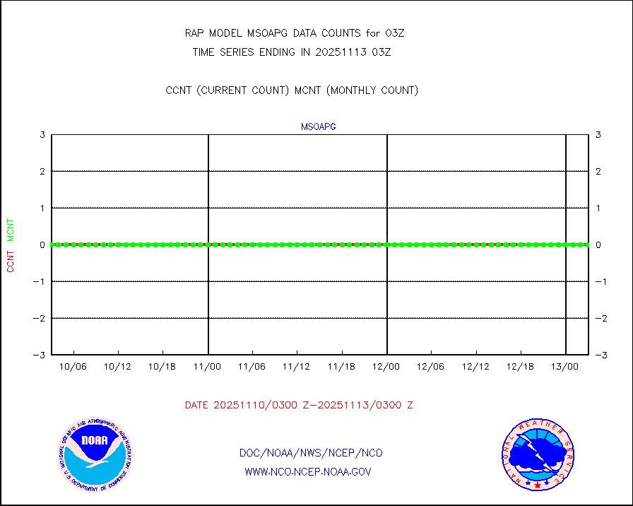
msoapg |
Mesonet/MADIS U.S. Army Aberdeen Proving Grounds |
0 |
0 |
n/a |
1802.50-1803.50 |
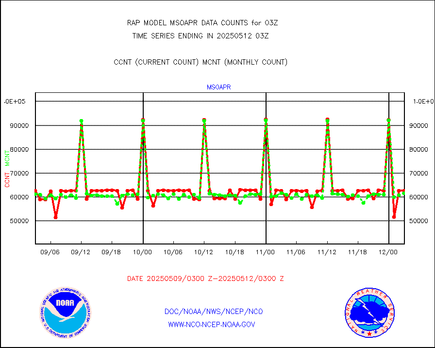
msoapr |
Mesonet/MADIS Citizen Weather Observers Program |
41422 |
43803 |
94.6 % |
1802.50-1803.50 |
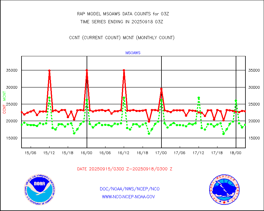
msoaws |
Mesonet/MADIS AWS Convergence Technologies, Inc. |
25119 |
25226 |
99.6 % |
1802.50-1803.50 |
msoawx |
Mesonet/MADIS "Anything Weather" |
0 |
0 |
n/a |
1802.50-1803.50 |
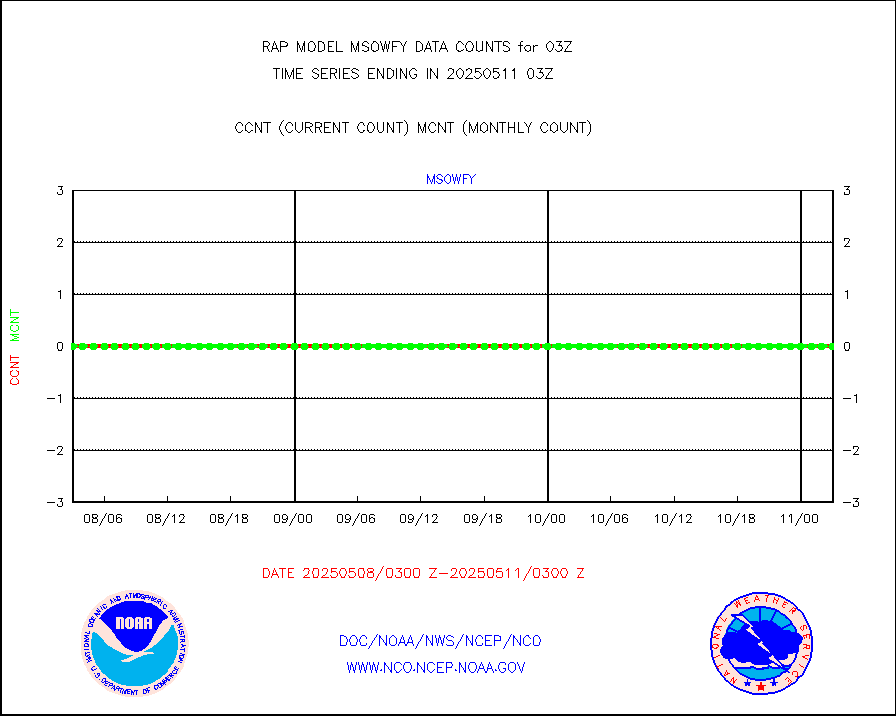
msocol |
Mesonet/MADIS Colorado Dept. of Transportation |
0 |
0 |
n/a |
1802.50-1803.50 |
msodcn |
Mesonet/MADIS DC Net |
0 |
0 |
n/a |
1802.50-1803.50 |
msoden |
Mesonet/MADIS Denver Urban Drainage & Flood Cntrl |
200 |
200 |
100.0 % |
1802.50-1803.50 |
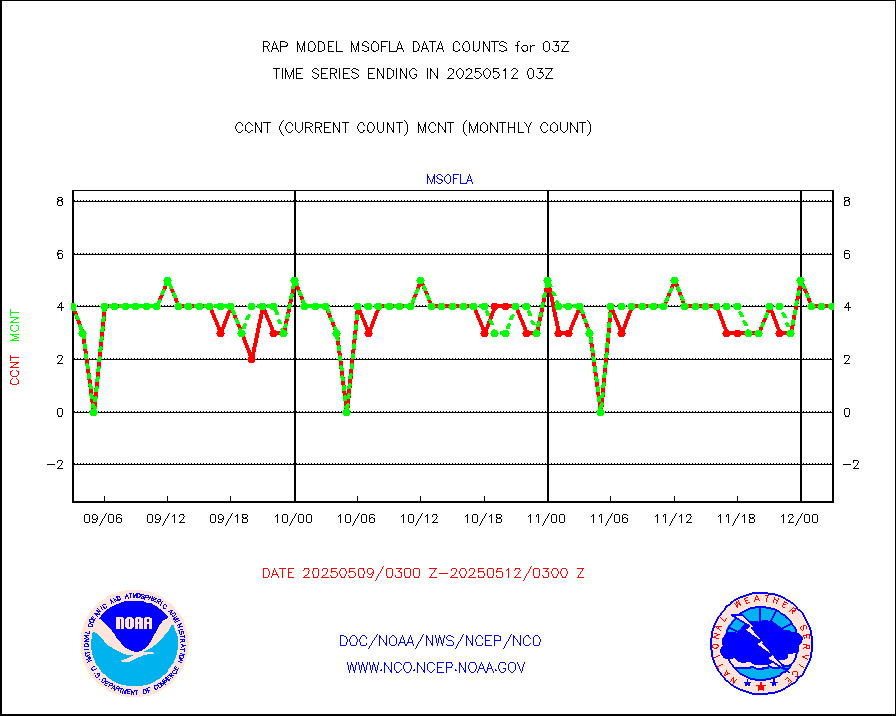
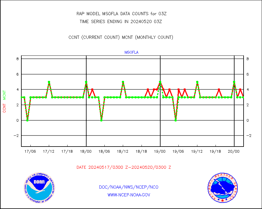
msofla |
Mesonet/MADIS Florida (FAWN & USF) |
3 |
3 |
100.0 % |
1802.50-1803.50 |
msoflt |
Mesonet/MADIS Florida Dept. of Transportation |
0 |
0 |
n/a |
1802.50-1803.50 |
msogeo |
Mesonet/MADIS Georgia Dept. of Transportation |
0 |
0 |
n/a |
1802.50-1803.50 |
msohad |
Mesonet/MADIS NWS Hydromet Auto Data System(HADS) |
4594 |
5578 |
82.4 % |
1802.50-1803.50 |
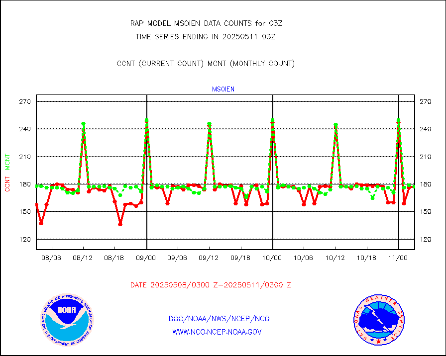
msoien |
Mesonet/MADIS Iowa Environmental |
153 |
172 |
89.0 % |
1802.50-1803.50 |
msoind |
Mesonet/MADIS Indiana Dept. of Transportation |
0 |
0 |
n/a |
1802.50-1803.50 |
msoiow |
Mesonet/MADIS Iowa Department of Transportation |
0 |
0 |
n/a |
1802.50-1803.50 |
msokan |
Mesonet/MADIS Kansas Department of Transportation |
266 |
354 |
75.1 % |
1802.50-1803.50 |
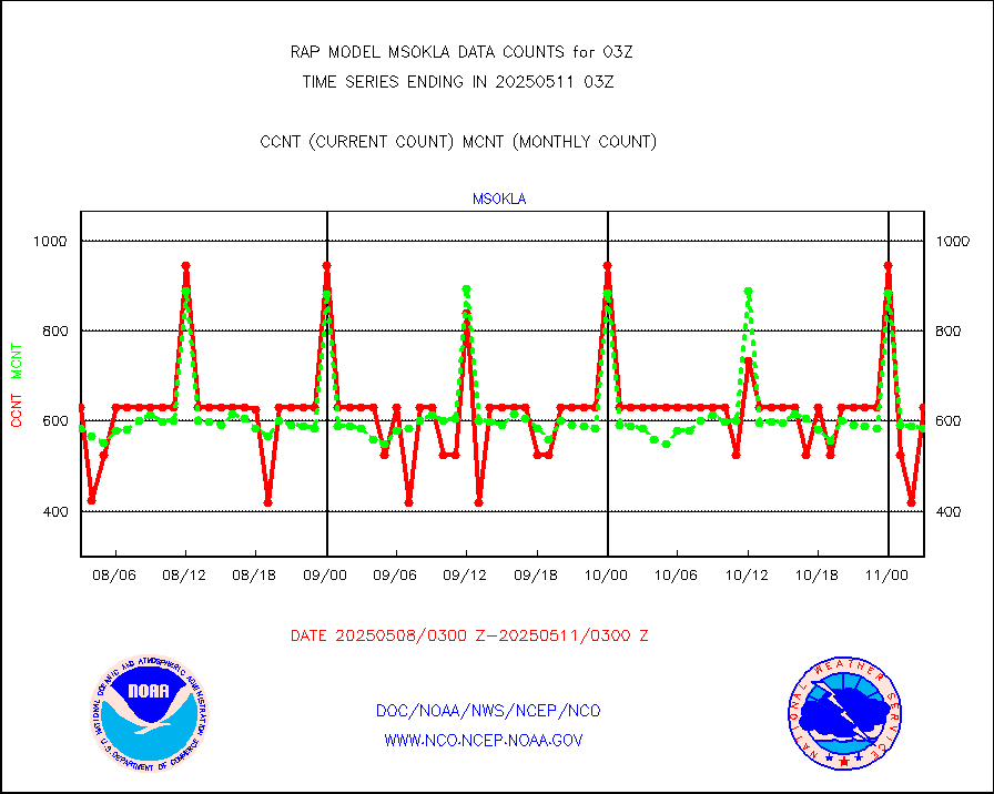
msokla |
Mesonet/MADIS Oklahoma Mesonet |
318 |
325 |
97.8 % |
1802.50-1803.50 |
msolju |
Mesonet/MADIS Louisiana State/Jackson State Univ. |
0 |
0 |
n/a |
1802.50-1803.50 |
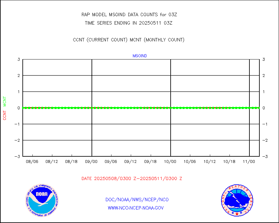
msomca |
Mesonet/MADIS Missouri Commercial Agricult Wx Net |
239 |
249 |
96.0 % |
1802.50-1803.50 |
msomin |
Mesonet/MADIS Minnesota Dept. of Transportation |
0 |
0 |
n/a |
1802.50-1803.50 |
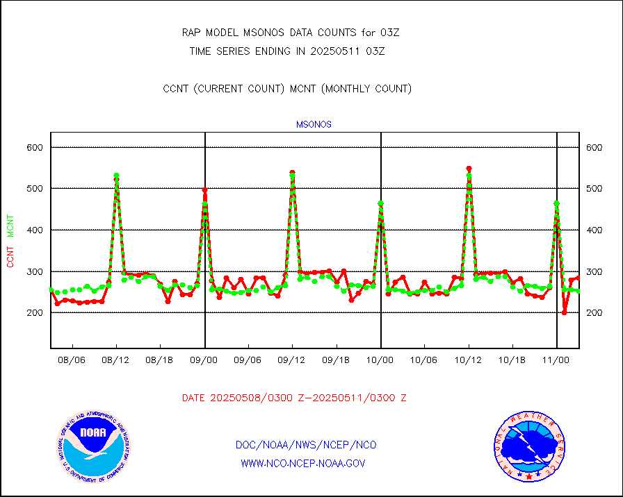
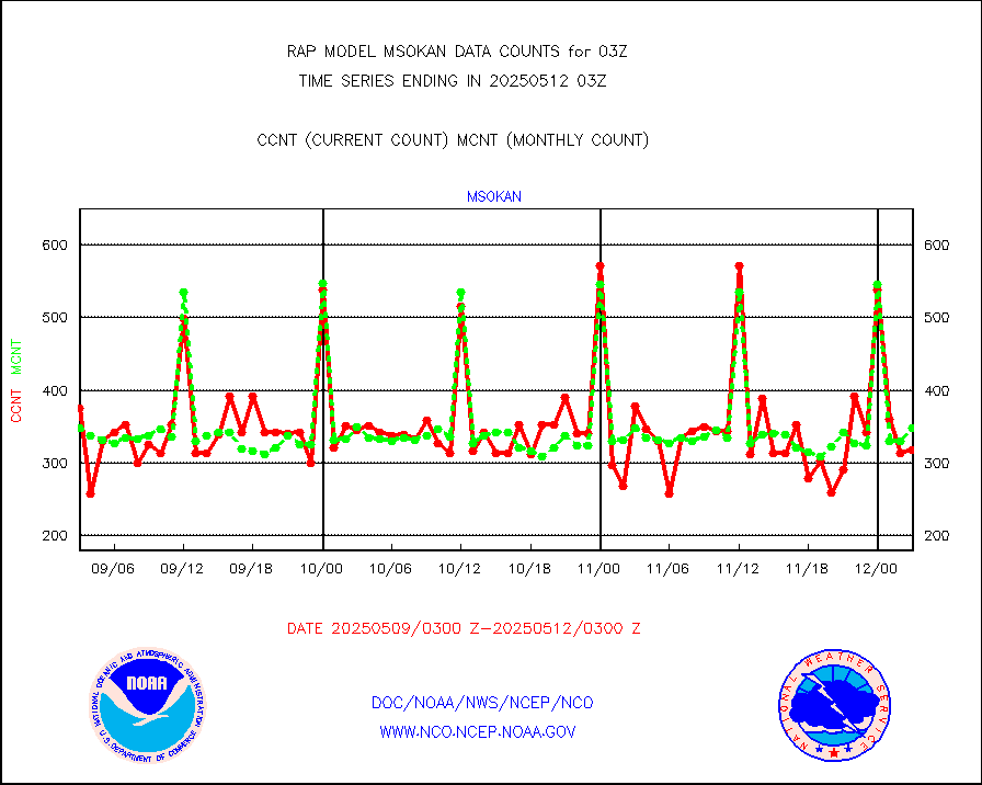
msonos |
Mesonet/MADIS NOS-Phys Oceanographic Realtime Sys |
238 |
273 |
87.2 % |
1802.50-1803.50 |
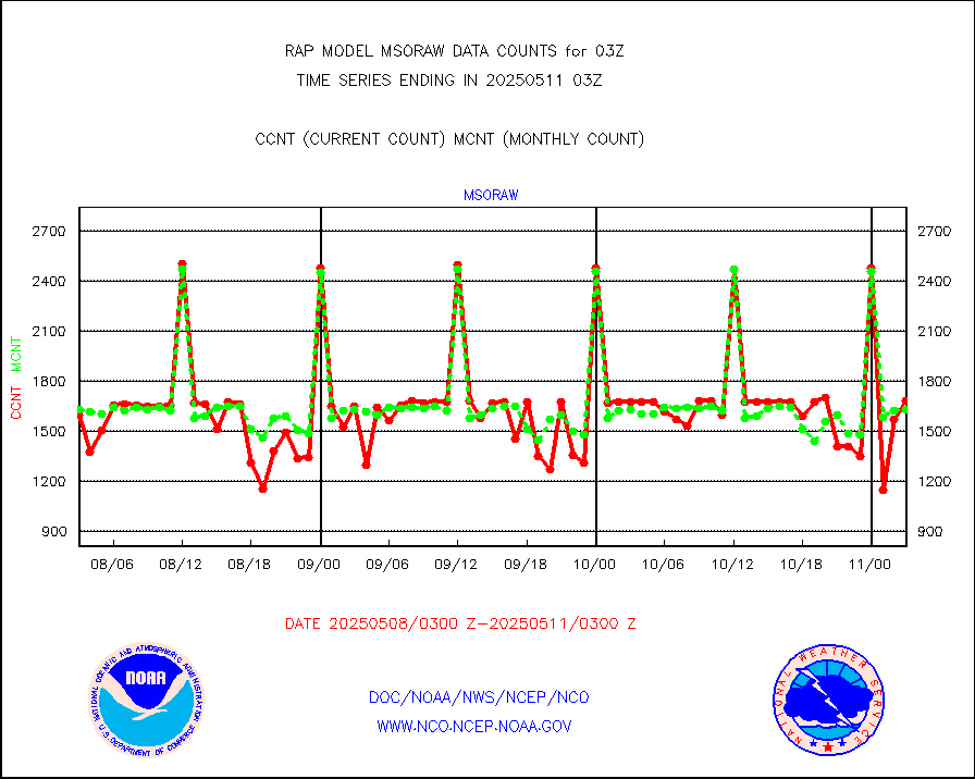
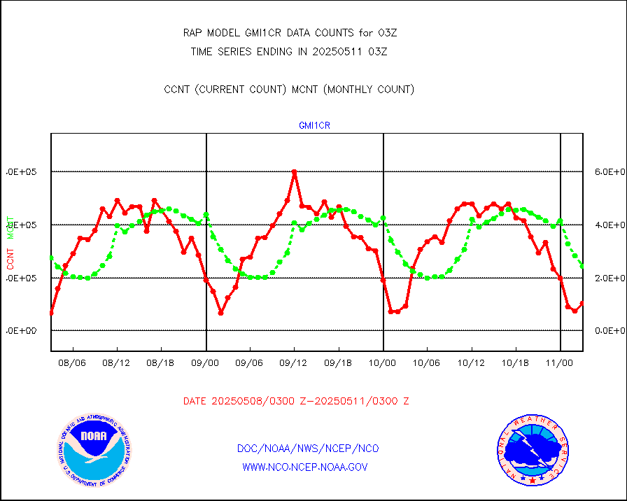
msoraw |
Mesonet/MADIS NFIC Remote Automated Wx Stns(RAWS) |
1200 |
1589 |
75.5 % |
1802.50-1803.50 |
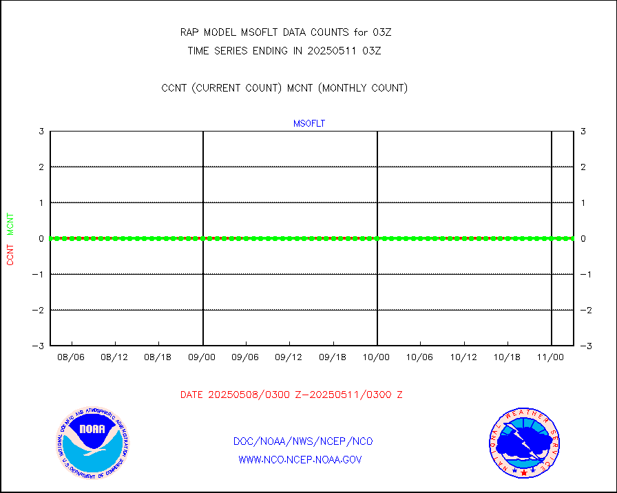
msourb |
Mesonet/MADIS UrbaNet |
3923 |
3887 |
100.9 % |
1802.50-1803.50 |
msovir |
Mesonet/MADIS Virginia Dept. of Transportation |
237 |
234 |
101.3 % |
1802.50-1803.50 |
msowfy |
Mesonet/MADIS "Weather for You" |
0 |
0 |
n/a |
1802.50-1803.50 |
msowis |
Mesonet/MADIS Wisconsin Dept. of Transportation |
0 |
0 |
n/a |
1802.50-1803.50 |
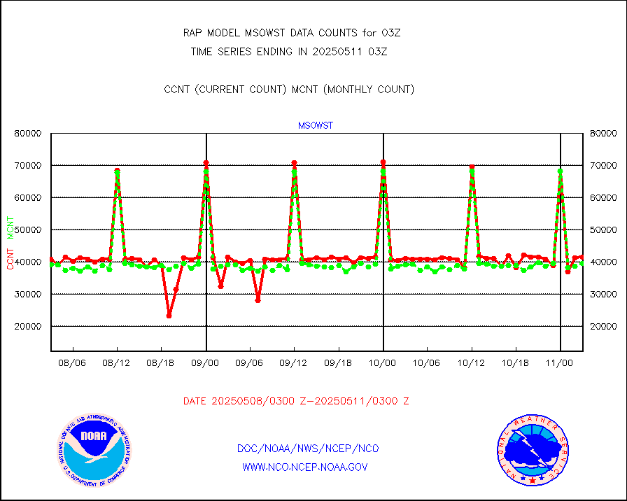
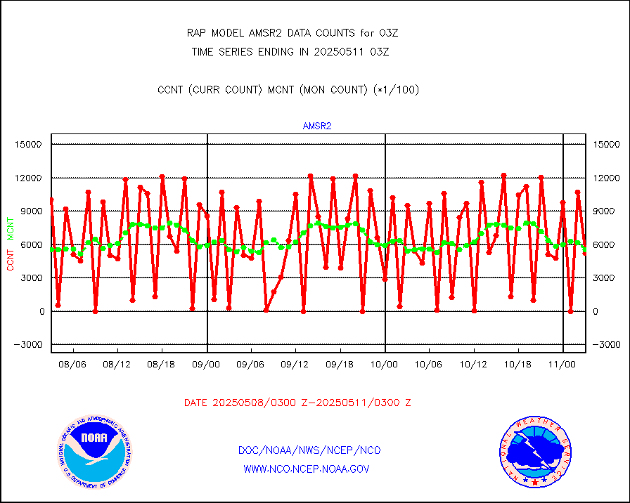
msowst |
Mesonet/MADIS MesoWest (many subproviders) |
31278 |
40170 |
77.9 % |
1802.50-1803.50 |
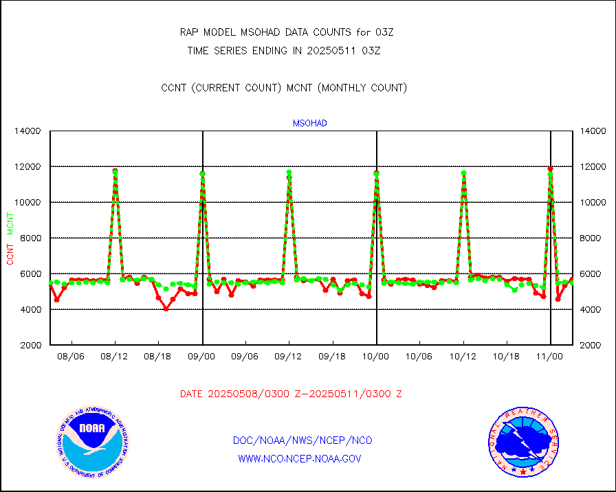
msowtx |
Mesonet/MADIS West Texas |
4423 |
4996 |
88.5 % |
1802.50-1803.50 |
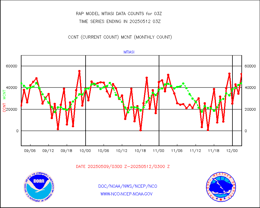
mtiasi |
METOP 1-2 IASI 1C radiance data (varbl. channels) |
26497 |
39963 |
66.3 % |
1801.00-1804.99 |
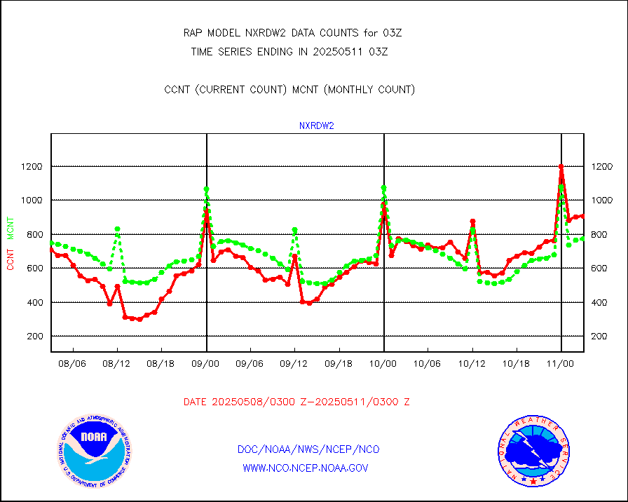
nxrdw2 |
NEXRAD Vel Azm Dsp(VAD) winds via Level 2 decoder |
844 |
713 |
118.4 % |
1802.00-1804.00 |
osbuv8 |
NOAA 16-19 Solar Backscatter UV-2 rad frm V8 BUFR |
0 |
0 |
n/a |
1801.00-1803.99 |
pibal |
PIBAL (from PILOT, PILOT SHIP, PILOT MOBIL) |
0 |
0 |
n/a |
1802.00-1804.00 |
pirep |
Manual PIREP aircraft data (dcded from AIREP fmt) |
300 |
315 |
95.2 % |
1723.75-1806.25 |
prflrp |
Profilr winds from PIBAL (PILOT,PILOT SHIP/MOBIL) |
0 |
0 |
n/a |
1801.50-1804.50 |
raobm |
Rawinsonde - mobile land (from TEMP/PILOT MOBIL) |
0 |
0 |
n/a |
1802.00-1804.00 |
raobs |
Rawinsonde - ship (from TEMP SHIP, PILOT SHIP) |
0 |
0 |
n/a |
1802.00-1804.00 |
rd2wnd |
NEXRAD radial wind (Level 2 - GTS) |
1068721 |
864010 |
123.7 % |
1802.50-1803.49 |
recco |
Flight level reconnaissance aircraft data |
0 |
0 |
n/a |
1802.00-1804.00 |
saldrn |
Surface Marine Saildrone (decoded from BUFR) |
2 |
2 |
100.0 % |
1801.00-1804.99 |
saphir |
Megha-Tropiques SAPHIR L1A2 brightness temps |
0 |
0 |
n/a |
1800.00-1805.99 |
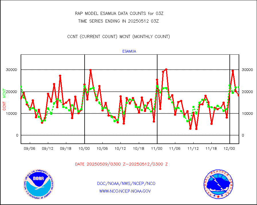
sevasr |
METEOSAT-10 2nd Gen SEVIRI All Sky Radiance(proc) |
9512 |
9505 |
100.1 % |
1801.00-1804.99 |
sevcsr |
METEOSAT-10 2nd Gen SEVIRI Clr Sky Radiance(proc) |
0 |
0 |
n/a |
1801.00-1804.99 |
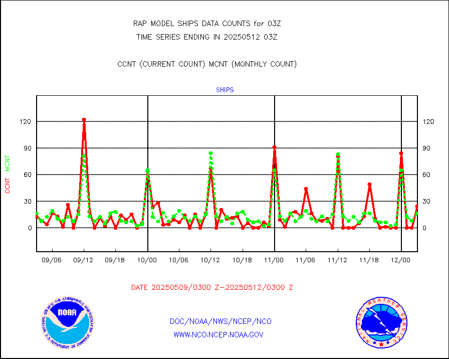
ships |
Ship - manual and automatic, restricted |
2 |
3 |
66.7 % |
1802.50-1803.50 |
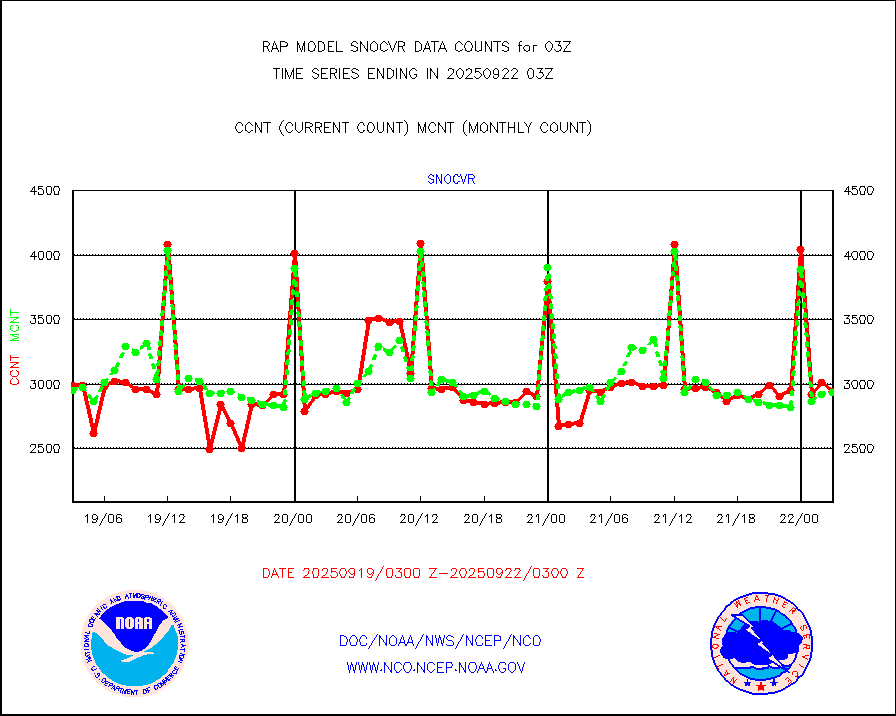
snocvr |
NOW COVER, DEPTH/DENSITY AND WATER EQUIVALENT |
2880 |
6100 |
47.2 % |
1801.00-1805.00 |
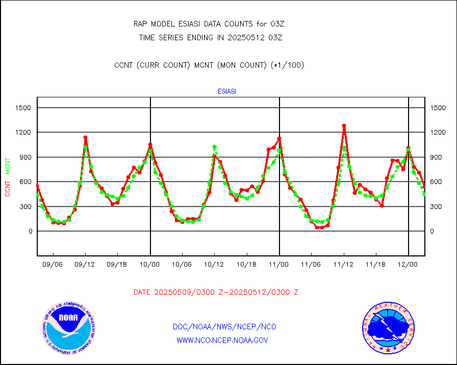
ssmisu |
DMSP SSM/IS 1C radiance data (Unified Pre-Proc.) |
74990 |
53784 |
139.4 % |
1801.00-1804.99 |
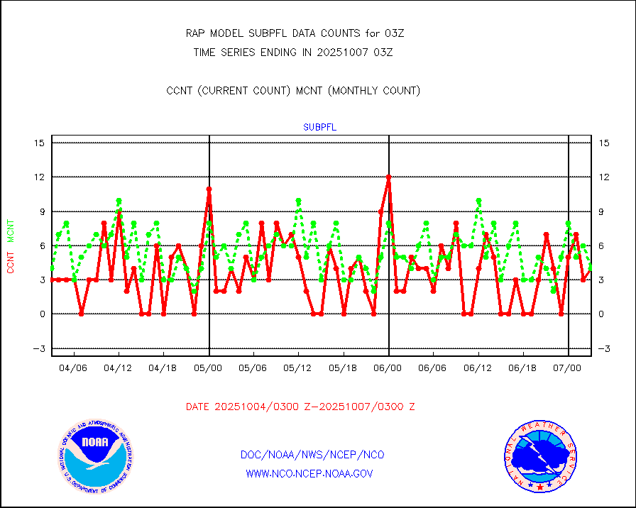
subpfl |
Sub-surface float and glider profile (BUFR) |
0 |
6 |
0.0 % |
1801.00-1804.99 |
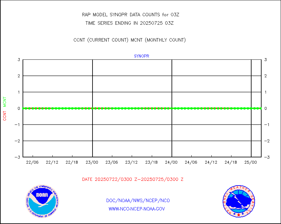
synopr |
Synoptic - restricted (WMO Res 40) manual & auto. |
10 |
1 |
n/a |
1802.50-1803.50 |
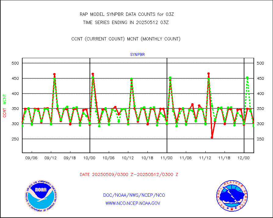
synpbr |
Synoptic - restricted (WMO Res 40)(decoded BUFR) |
427 |
302 |
141.4 % |
1802.50-1803.50 |
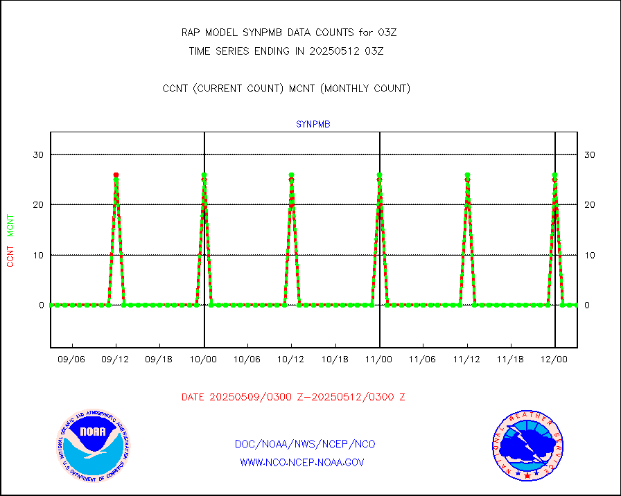
synpmb |
Synoptic - mobile manual & auto (decoded fr BUFR) |
0 |
0 |
n/a |
1802.50-1803.50 |
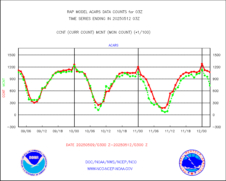
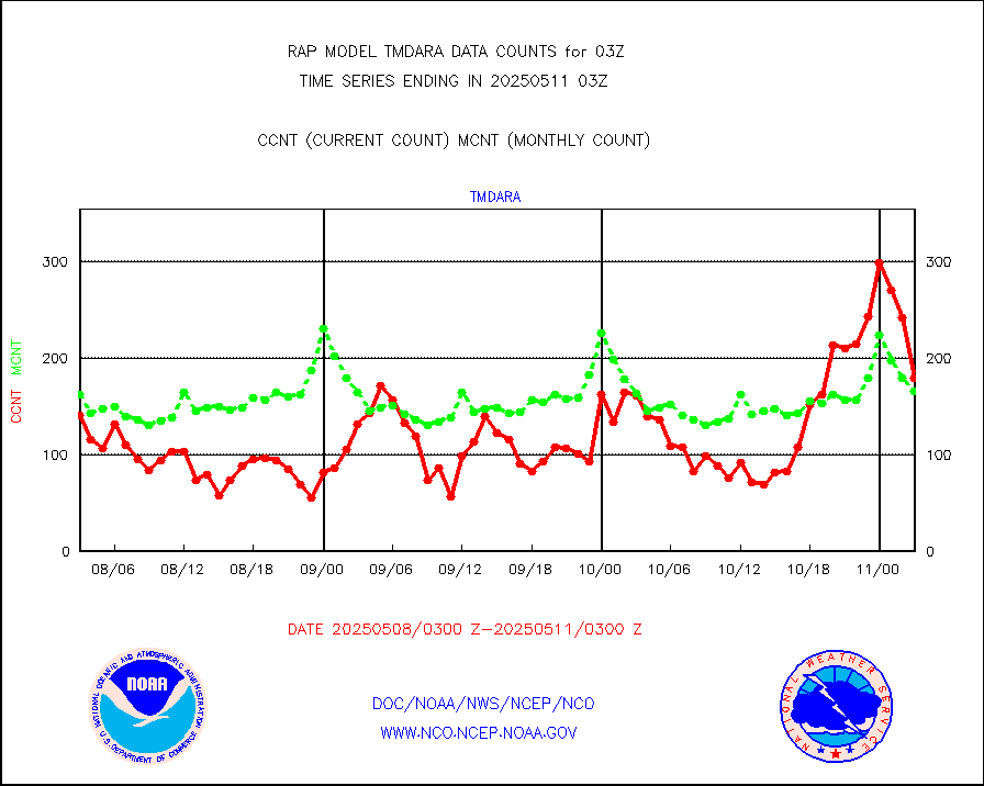
tmdara |
TAMDAR aircft data-all types(from Panasonic,BUFR) |
1262 |
1366 |
92.4 % |
1723.75-1806.25 |
visja |
MTSAT/JMA visible derived cloud motion |
1584 |
1615 |
98.1 % |
1800.50-1805.50 |
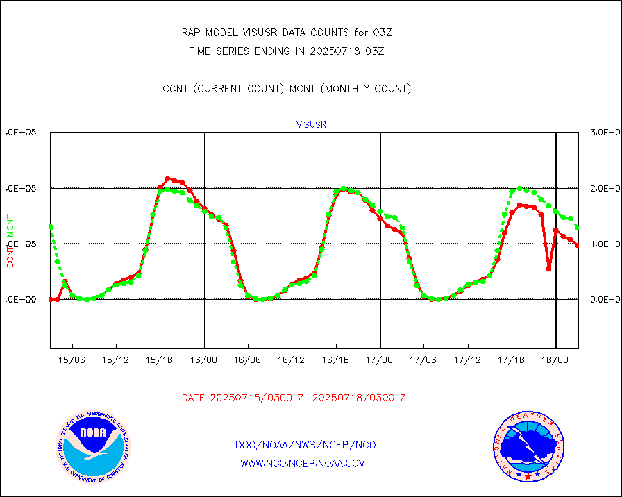
visusr |
GOES-16&up/NESDIS visible derived cloud motion |
72109 |
76156 |
94.7 % |
1802.00-1802.99 |
vseunb |
METEOSAT/EUMETSAT visible drv cld motion NBseq |
0 |
0 |
n/a |
1801.50-1804.49 |


