| Critical Data with Normal Counts |
|---|
| Type | Description | Hourly Count | Monthly Average | Percent (%) of Monthly Mean | UTC Time Window |
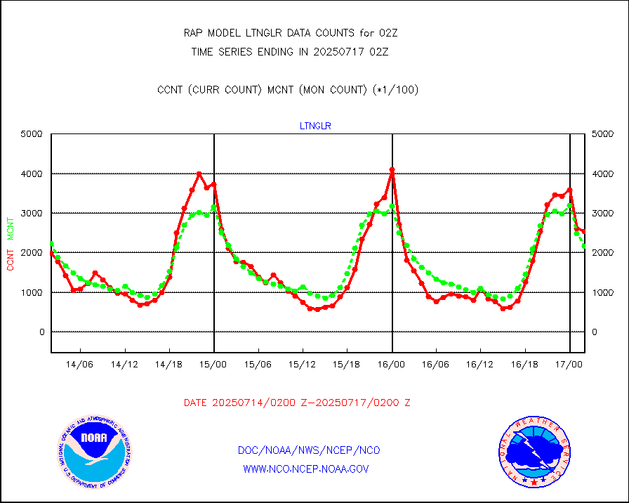
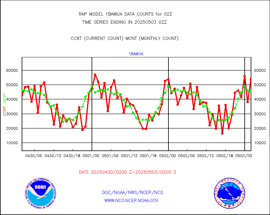
1bamua |
NOAA 15-19 & METOP 1-2 AMSU-A NCEP-proc. br.temps |
57635 |
45945 |
125.4 % |
1723.00-1804.99 |
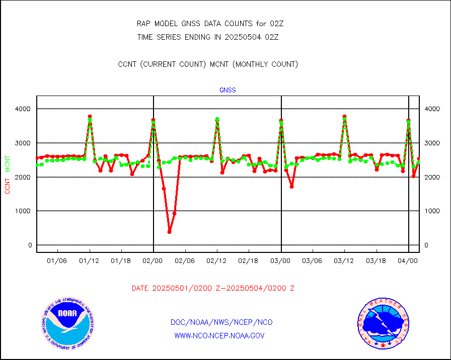
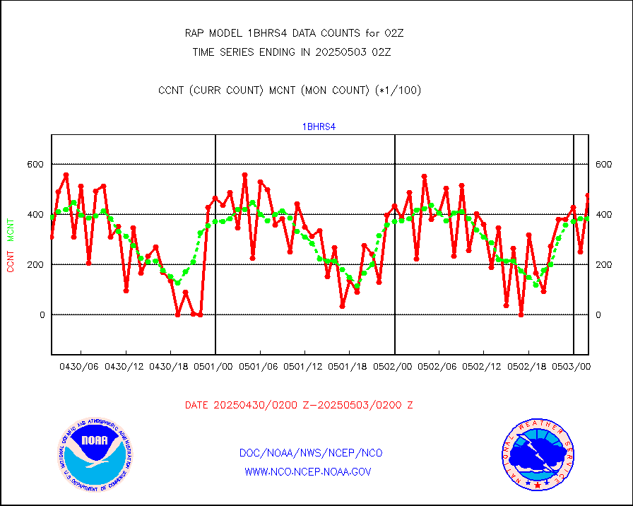
1bhrs4 |
NOAA 18-19 & METOP 1-2 HIRS-4 NCEP-proc. br.temps |
49487 |
38699 |
127.9 % |
1723.00-1804.99 |
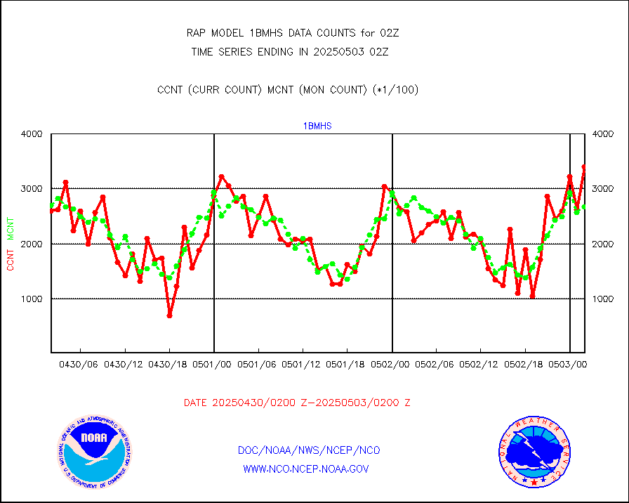
1bmhs |
NOAA 18-19 & METOP 1-2 MHS NCEP-proces. br. temps |
336539 |
278829 |
120.7 % |
1723.00-1804.99 |
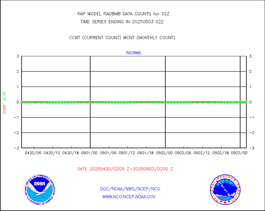
acars |
MDCRS ACARS acft data from ARINC(dcded from BUFR) |
94339 |
83344 |
113.2 % |
1722.75-1805.25 |
cmanb |
Surface Marine CMAN rpts decoded from BUFR format |
1671 |
1682 |
99.3 % |
1801.50-1802.50 |
dbuoy |
Buoys decoded from FM-18 fmt (moored or drifting) |
0 |
0 |
n/a |
1801.50-1802.50 |
gnss |
Grnd-based Gbl Navigation Sat System (GNSS) data |
2574 |
2013 |
127.9 % |
1800.95-1801.05 |
h20mo |
MODIS (AQUA/TERRA) wvpr imager derived cld motion |
0 |
0 |
n/a |
1723.50-1804.50 |
infmo |
MODIS (AQUA/TERRA) ir l-wave derived cloud motion |
0 |
0 |
n/a |
1723.50-1804.50 |
lgycld |
GOES/NASA(Langley) hi-res. (1x1 f-o-v) cloud data |
3727497 |
3691230 |
101.0 % |
1801.50-1802.50 |
mbuoy |
Buoys decoded from FM-13 format (moored) |
58 |
51 |
113.7 % |
1801.50-1802.50 |
metar |
Aviation - METAR |
4766 |
5801 |
82.2 % |
1801.50-1802.50 |
nxrdw |
NEXRAD Vel Azm Dsp(VAD) winds via radar coded msg |
0 |
0 |
n/a |
1801.00-1803.00 |
prflrb |
Multi-Agency Profiler (MAP) and SODAR winds |
92 |
82 |
112.2 % |
1800.50-1803.50 |
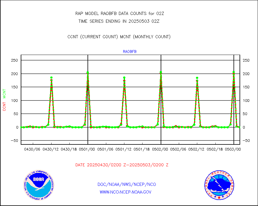
raobf |
Rawinsonde - fixed land (from TEMP or PILOT) |
0 |
0 |
n/a |
1801.00-1803.00 |
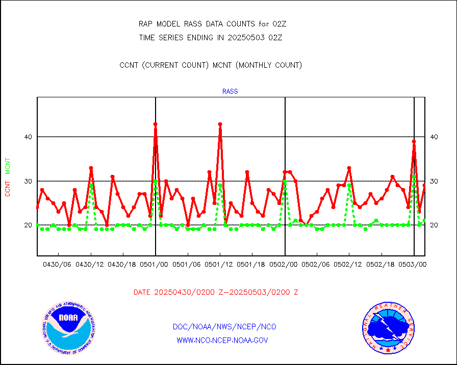
rass |
RASS temperatures (NOAA and Multi-Agency) |
26 |
19 |
136.8 % |
1801.50-1802.50 |
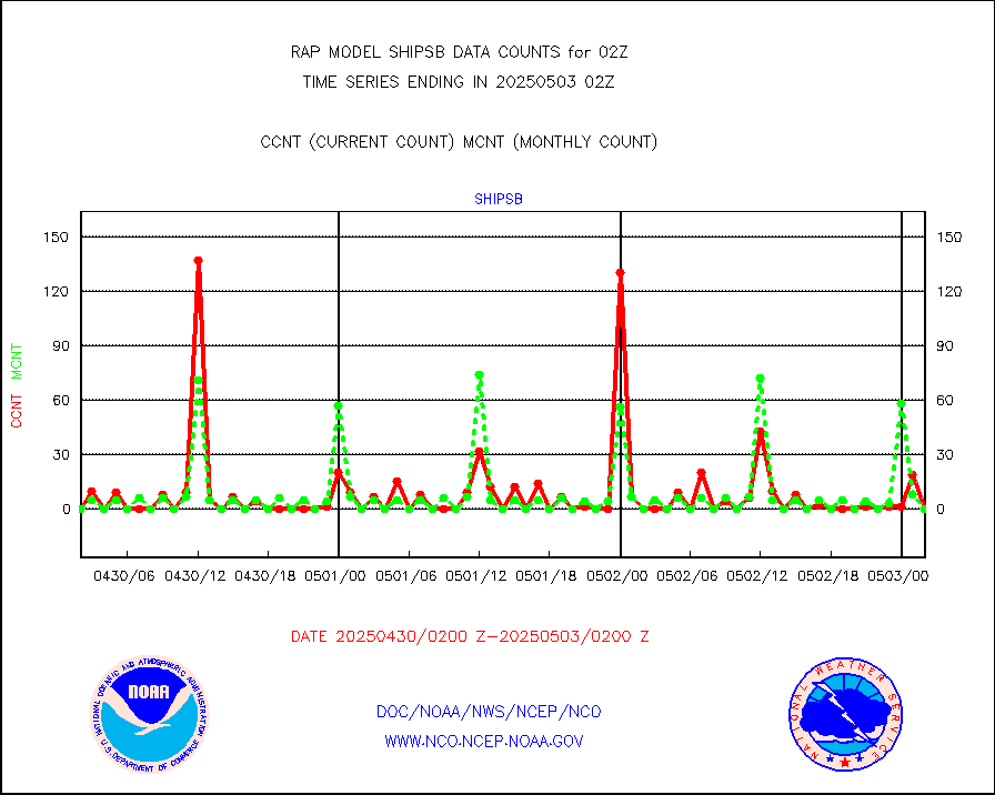
shipsb |
Ship - manual and automatic, restricted (BUFR) |
0 |
0 |
n/a |
1801.50-1802.50 |
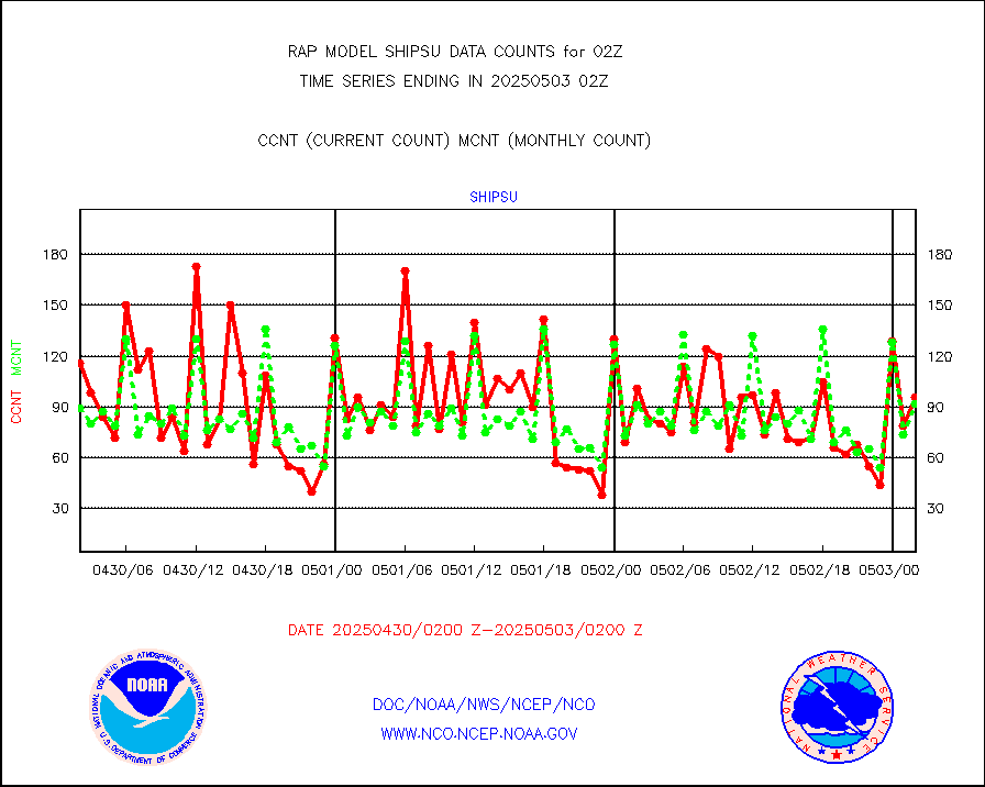
shipsu |
Ship - manual and automatic, unrestricted |
19 |
46 |
41.3 % |
1801.50-1802.50 |
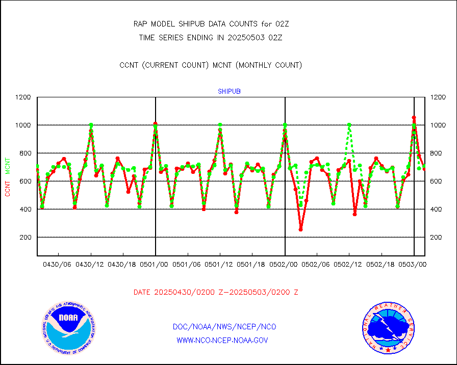
shipub |
Ship - manual and automatic, unrestricted (BUFR) |
663 |
618 |
107.3 % |
1801.50-1802.50 |
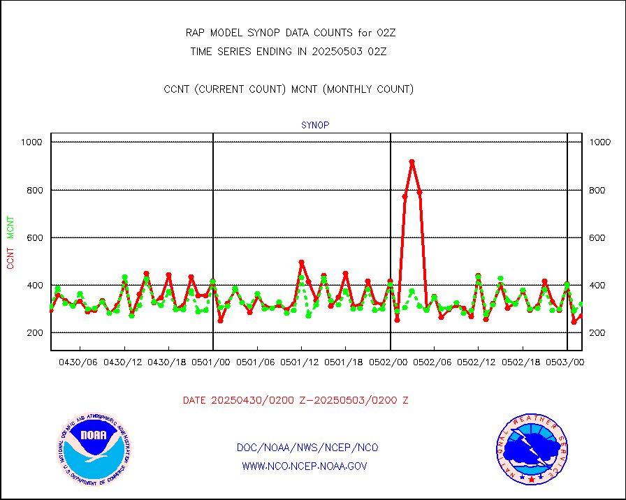
synop |
Synoptic - fixed manual and automatic |
73 |
310 |
23.5 % |
1801.50-1802.50 |
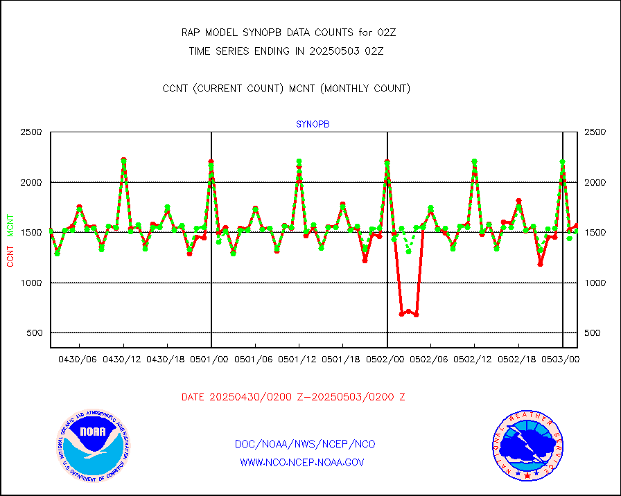
synopb |
Synoptic - fixed manual & auto (decoded fr BUFR) |
846 |
1695 |
49.9 % |
1801.50-1802.50 |
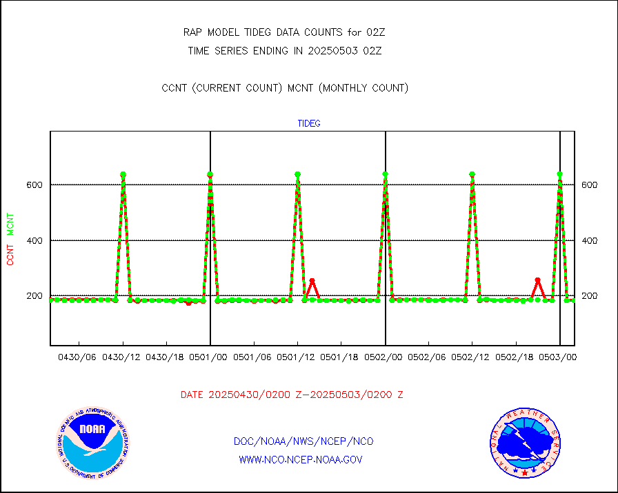
tideg |
Tide gauge reports decoded from CREX format |
179 |
177 |
101.1 % |
1801.50-1802.50 |
| Data Types of Opportunity with Normal Counts |
|---|
| Type | Description | Hourly Count | Monthly Average | Percent (%) of Monthly Mean | UTC Time Window |
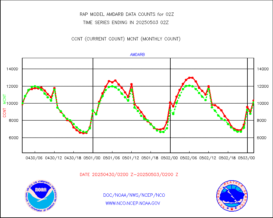
3p9usr |
GOES-16&up/NESDIS ir short-wv derived cld motion |
3878 |
5552 |
69.8 % |
1801.00-1801.99 |
acarsa |
MDCRS ACARS acft data (ARINC via AFWA)(AIREP fmt) |
0 |
0 |
n/a |
1722.75-1805.25 |
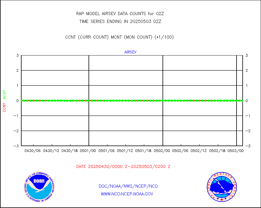
airsev |
AQUA AIRS/AMSU-A/HSB brightness temps- every FOV |
0 |
0 |
n/a |
1723.00-1804.99 |
amdar |
AMDAR aircraft data (decoded from AMDAR format) |
2875 |
3451 |
83.3 % |
1722.75-1805.25 |
amdarb |
AMDAR aircraft data (decoded from BUFR) |
5459 |
5336 |
102.3 % |
1722.75-1805.25 |
amsr2 |
GCOM-W AMSR2 1B brightness temperatures |
1060896 |
635446 |
167.0 % |
1723.00-1723.99 |
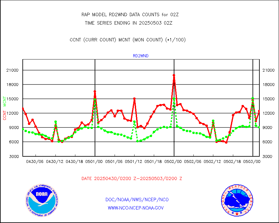
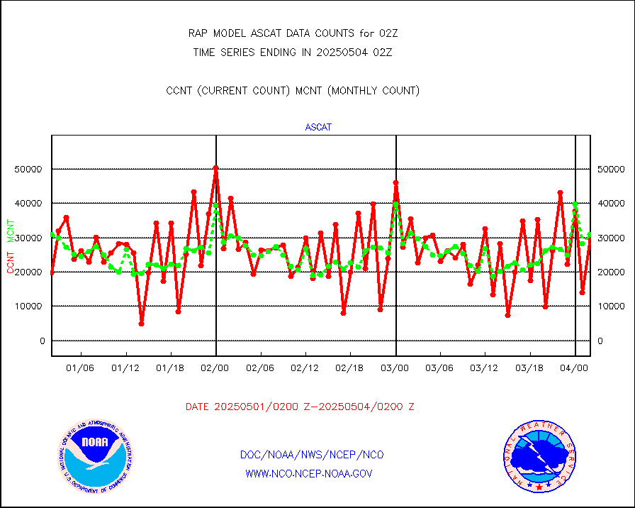
ascat |
METOP 1-2 ASCAT products |
25709 |
21507 |
119.5 % |
1800.00-1804.00 |
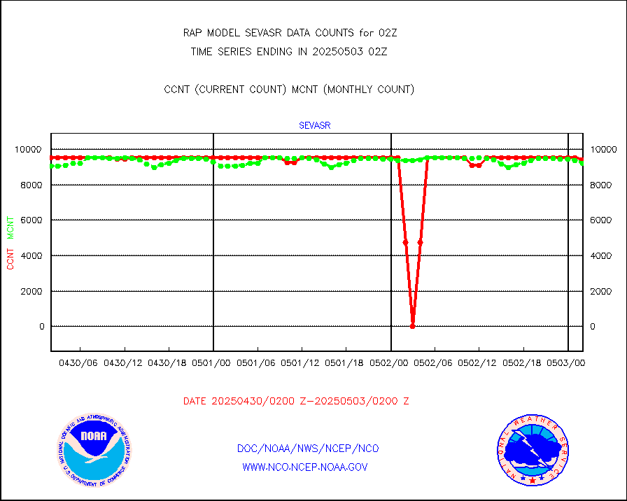
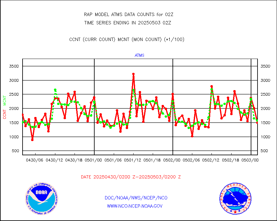
atms |
NPP/NOAA-20 ATMS brightness temperatures |
158811 |
154718 |
102.6 % |
1800.00-1803.99 |
atmsdb |
NPP/NOAA-20 ATMS bright. temps-direct b-cast SSEC |
60982 |
61990 |
98.4 % |
1800.00-1803.99 |
coopmd |
Coop/MADIS NEPP & HCN-Modernization NOAA COOP Obs |
23 |
23 |
100.0 % |
1801.50-1802.50 |
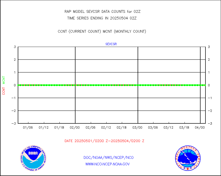
crisf4 |
NPP/NOAA-20 CrIS full spctrl radn (431 ch subset) |
93939 |
87413 |
107.5 % |
1800.00-1803.99 |
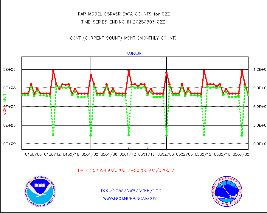
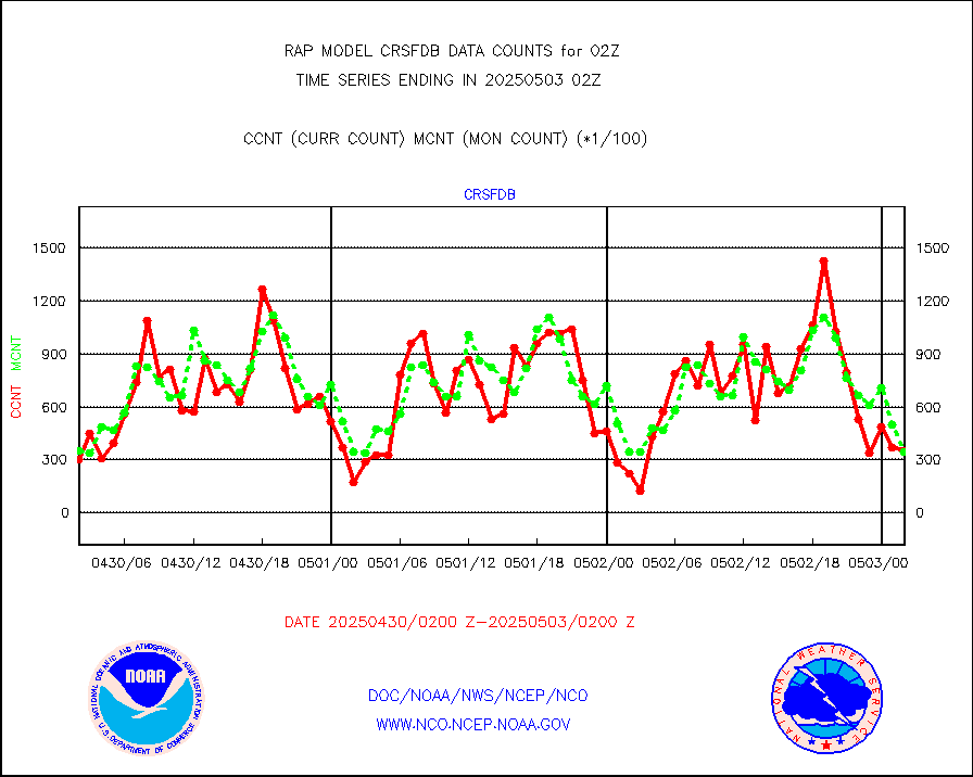
crsfdb |
NPP/NOAA-20 CrIS full spctrl radn dir brdcst SSEC |
50559 |
51364 |
98.4 % |
1800.00-1803.99 |
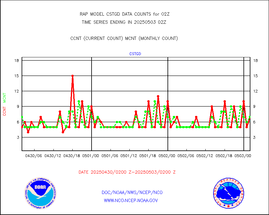
cstgd |
Coast Guard |
6 |
5 |
120.0 % |
1801.50-1802.50 |
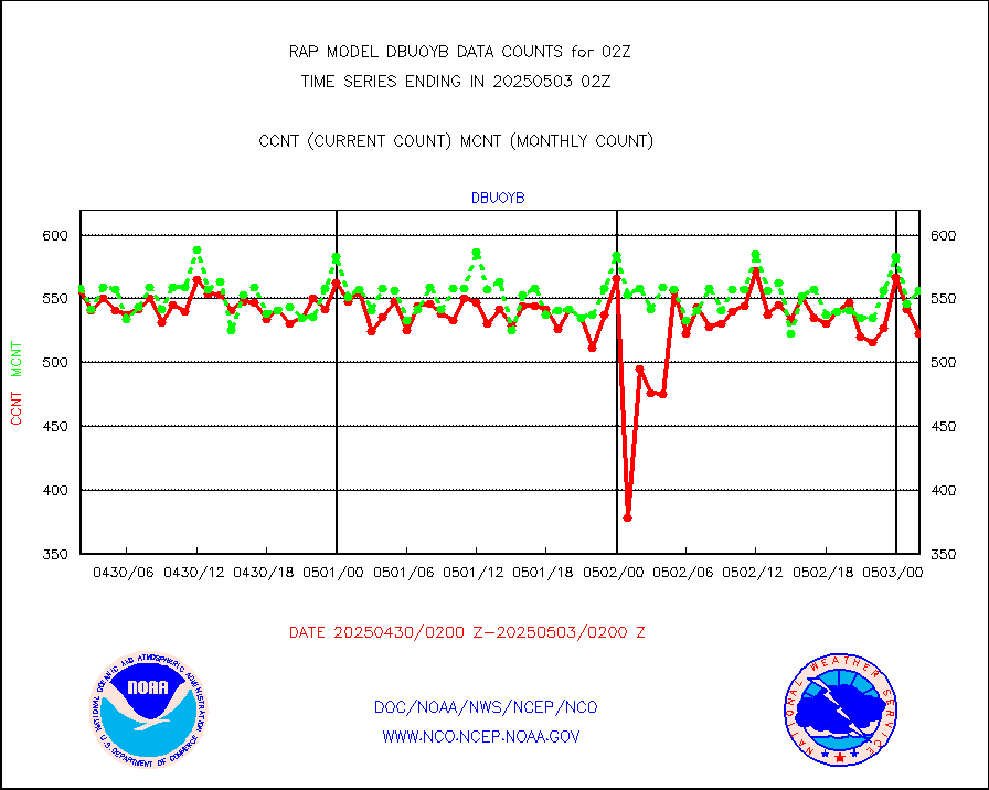
dbuoyb |
Drifting buoys (decoded from BUFR) |
544 |
623 |
87.3 % |
1801.50-1802.50 |
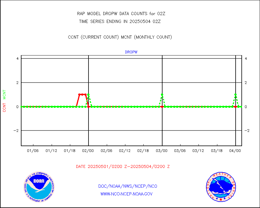
dropw |
Dropwinsonde (from TEMP DROP) |
0 |
0 |
n/a |
1801.00-1803.00 |
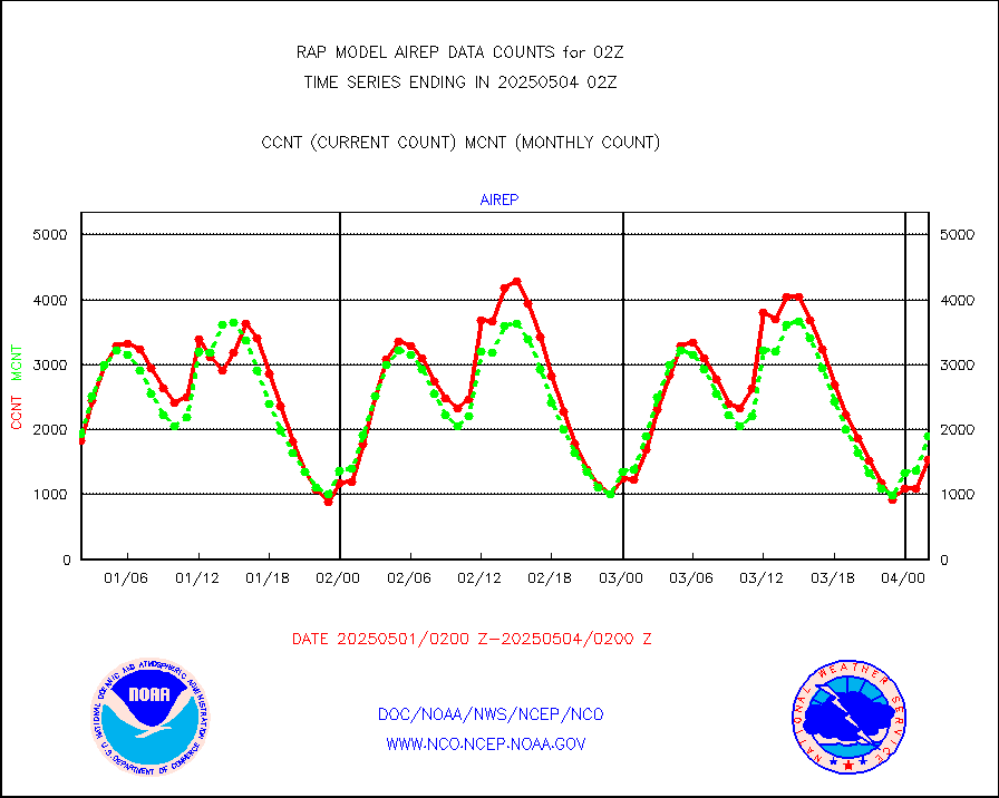
eadas |
E-AMDAR (European AMDAR acft decoded from BUFR) |
1746 |
2160 |
80.8 % |
1722.75-1805.25 |
esamua |
NOAA 15-19 & METOP 1-2 AMSU-A proc btmps frm RARS |
22740 |
24356 |
93.4 % |
1801.00-1803.00 |
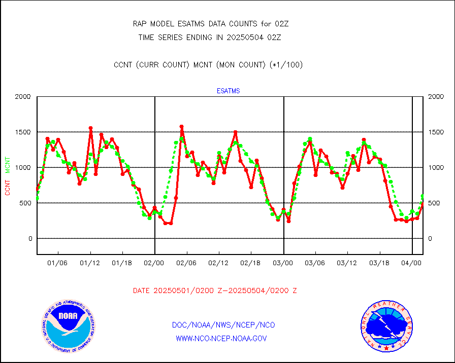
esatms |
NPP Adv. Tech. MW Sndr (ATMS) br. temps from RARS |
64286 |
54806 |
117.3 % |
1800.00-1803.99 |
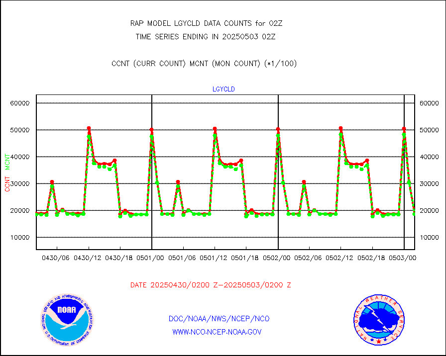
eshrs3 |
NOAA 15-19 & METOP 1-2 HIRS-3/4 pr btmps frm RARS |
58096 |
51335 |
113.2 % |
1801.00-1803.00 |
esiasi |
METOP 1-2 IASI 1C radiance data vbl chn from RARS |
100912 |
77533 |
130.2 % |
1800.00-1803.99 |
esmhs |
NOAA 18-19 & METOP 1-2 MHS proc. btemps from RARS |
253443 |
214303 |
118.3 % |
1801.00-1803.00 |
gmi1cr |
GPM GMI Level 1C-R brightness temperatures |
467424 |
545666 |
85.7 % |
1723.00-1804.99 |
gpsro |
GPS radio occultation data |
106 |
117 |
90.6 % |
1800.00-1803.99 |
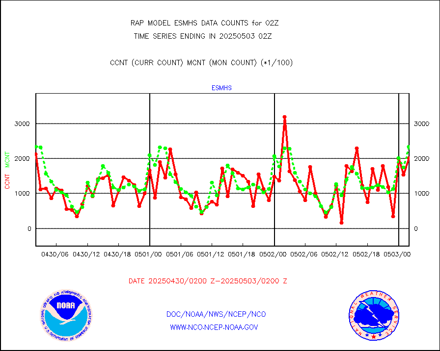
gsrasr |
GOES-16/17 All Sky Radiances (proc.) |
812097 |
798987 |
101.6 % |
1800.00-1803.99 |
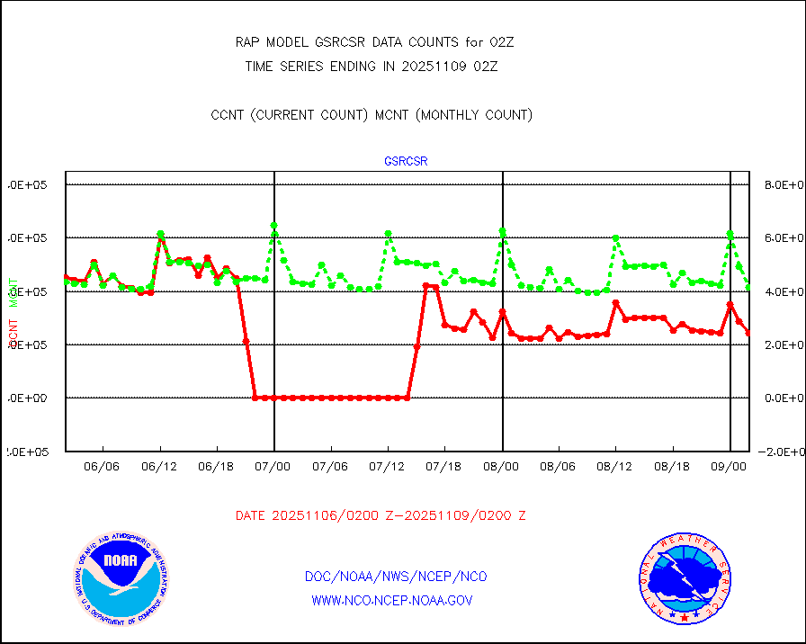
gsrcsr |
GOES-16/17 Clear Sky Radiances (proc.) |
388021 |
399674 |
97.1 % |
1800.00-1803.99 |
h20ja |
MTSAT/JMA water vapor imager derived cloud motion |
3882 |
2572 |
150.9 % |
1723.50-1804.50 |
h2dusr |
GOES-16&up/NESDIS wv imgr/deep-lyr derivd cld mtn |
6749 |
6001 |
112.5 % |
1801.00-1801.99 |
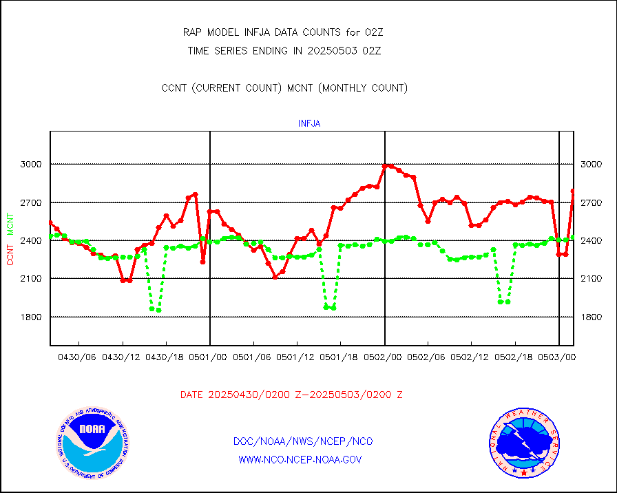
h2eunb |
METEOSAT/EUMETSAT wvpr imgr drv cld motion NBseq |
4904 |
5008 |
97.9 % |
1800.50-1803.49 |
h2tusr |
GOES-16&up/NESDIS wv imgr/cld-top derived cld mtn |
13468 |
11317 |
119.0 % |
1801.00-1801.99 |
iasidb |
METOP 1-2 IASI 1C radiances-direct broadcast SSEC |
71352 |
76537 |
93.2 % |
1800.00-1803.99 |
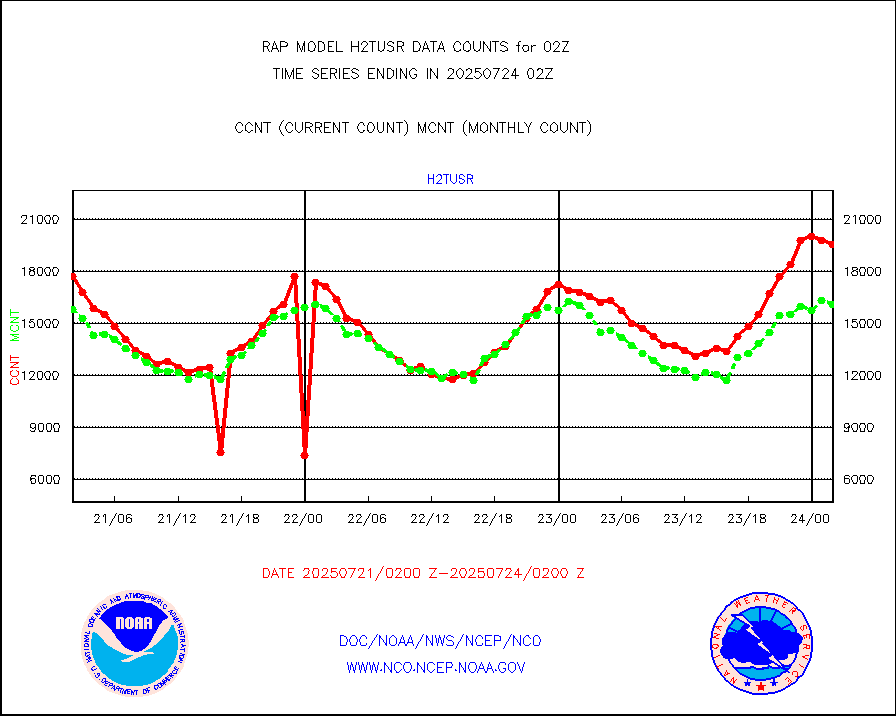
ifeunb |
METEOSAT/EUMETSAT ir lg-wave drv cld motion NBseq |
3168 |
3208 |
98.8 % |
1800.50-1803.49 |
ifvrnb |
VIIRS (NPP/NOAA-20) ir lg-wv drv cloud motion(NB) |
0 |
0 |
n/a |
1723.50-1804.50 |
infav |
AVHRR (NOAA/METOP) ir lg-wave derived cld motion |
0 |
0 |
n/a |
1723.50-1804.50 |
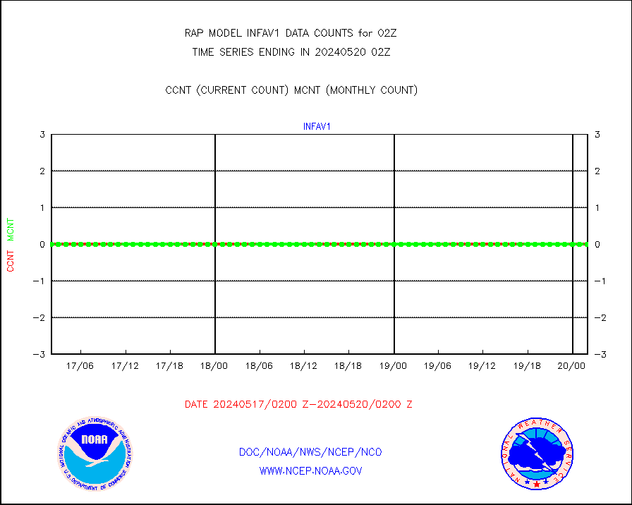
infav1 |
AVHRR (METOP) ir lg-wave derived cld motion |
0 |
0 |
n/a |
1800.50-1803.49 |
infja |
MTSAT/JMA infrared long-wave derived cloud motion |
2944 |
2482 |
118.6 % |
1723.50-1804.50 |
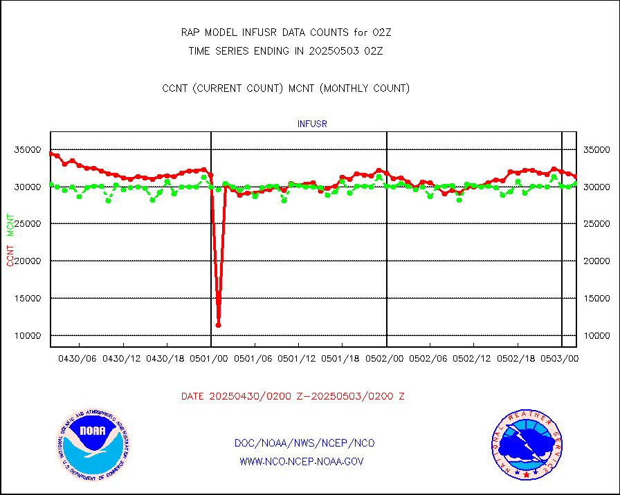
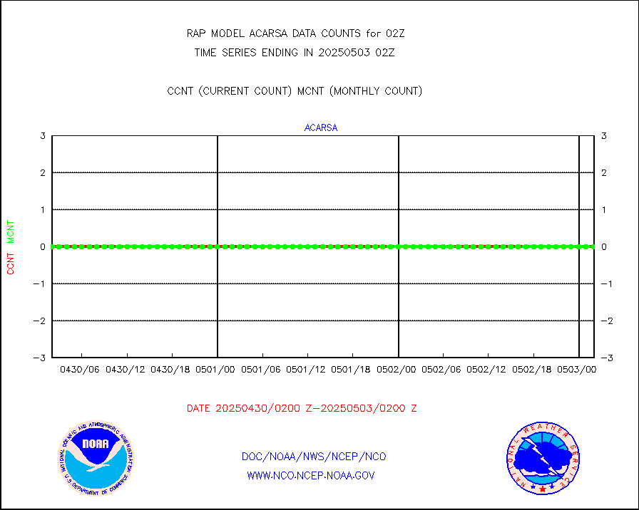
infusr |
GOES-16&up/NESDIS ir long-wave derived cld motion |
29157 |
30974 |
94.1 % |
1801.00-1801.99 |
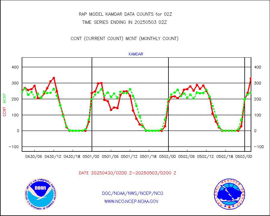
kamdar |
Korean AMDAR aircraft data (decoded from BUFR) |
375 |
255 |
147.1 % |
1722.75-1805.25 |
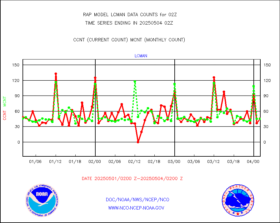
lcman |
Land-based CMAN stations decoded from CMAN format |
70 |
76 |
92.1 % |
1801.50-1802.50 |
ltnglr |
LLDN Long-rng lightning from Vaisala via NOAAPORT |
53993 |
56579 |
95.4 % |
1801.00-1802.50 |
ltngsr |
NLDN Shrt-rng lightning from Vaisala via NOAAPORT |
1906 |
2450 |
77.8 % |
1801.00-1802.50 |
mbuoyb |
Moored buoys (decoded from BUFR) |
446 |
460 |
97.0 % |
1801.50-1802.50 |
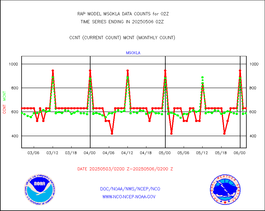
mso470 |
Mesonet/MADIS Colorado E-470 (Interstate 470) |
18 |
19 |
94.7 % |
1801.50-1802.50 |
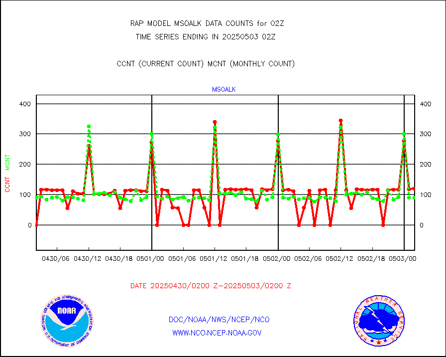
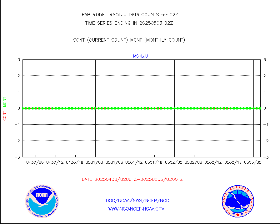
msoalk |
Mesonet/MADIS Alaska Department of Transportation |
107 |
102 |
104.9 % |
1801.50-1802.50 |
msoapg |
Mesonet/MADIS U.S. Army Aberdeen Proving Grounds |
0 |
0 |
n/a |
1801.50-1802.50 |
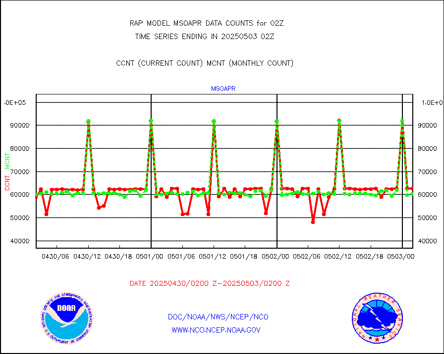
msoapr |
Mesonet/MADIS Citizen Weather Observers Program |
46681 |
44222 |
105.6 % |
1801.50-1802.50 |
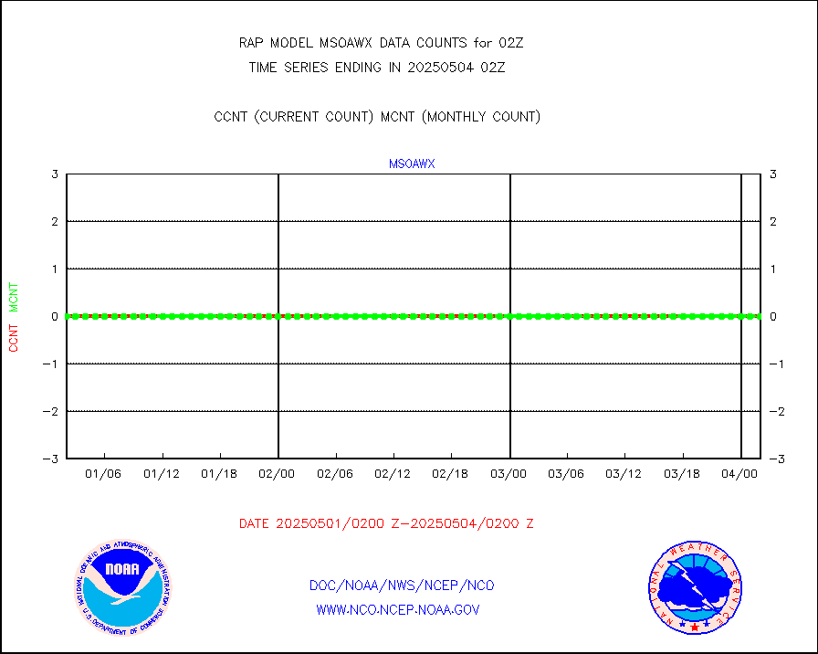
msoaws |
Mesonet/MADIS AWS Convergence Technologies, Inc. |
25337 |
25502 |
99.4 % |
1801.50-1802.50 |
msoawx |
Mesonet/MADIS "Anything Weather" |
0 |
0 |
n/a |
1801.50-1802.50 |
msocol |
Mesonet/MADIS Colorado Dept. of Transportation |
0 |
0 |
n/a |
1801.50-1802.50 |
msodcn |
Mesonet/MADIS DC Net |
0 |
0 |
n/a |
1801.50-1802.50 |
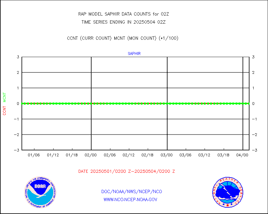
msoden |
Mesonet/MADIS Denver Urban Drainage & Flood Cntrl |
225 |
194 |
116.0 % |
1801.50-1802.50 |
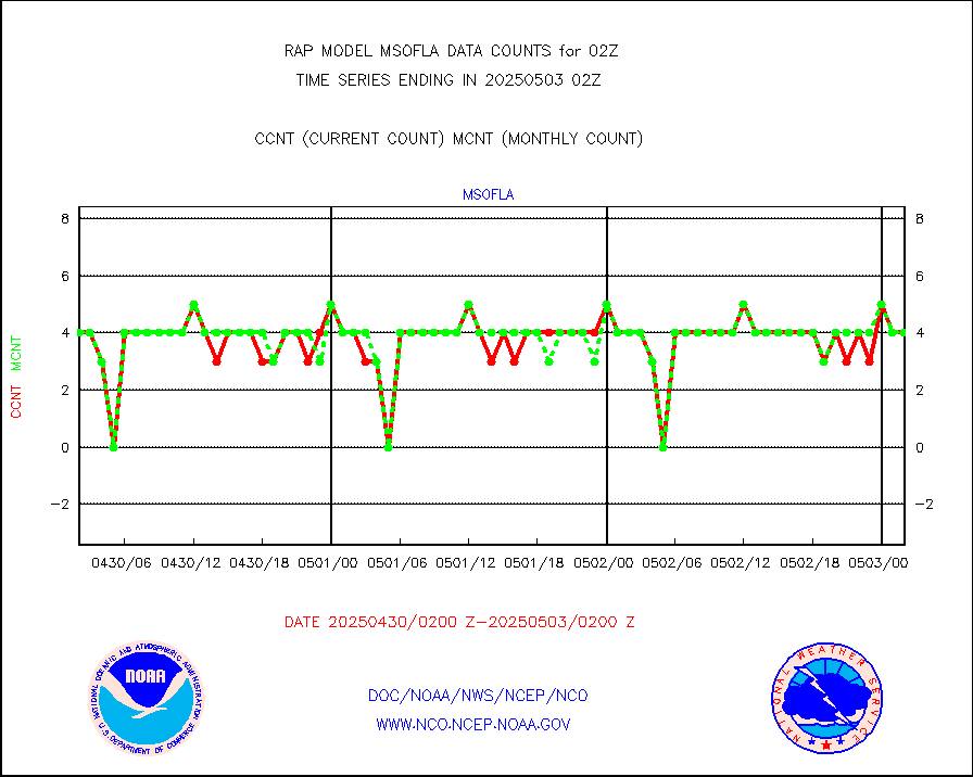
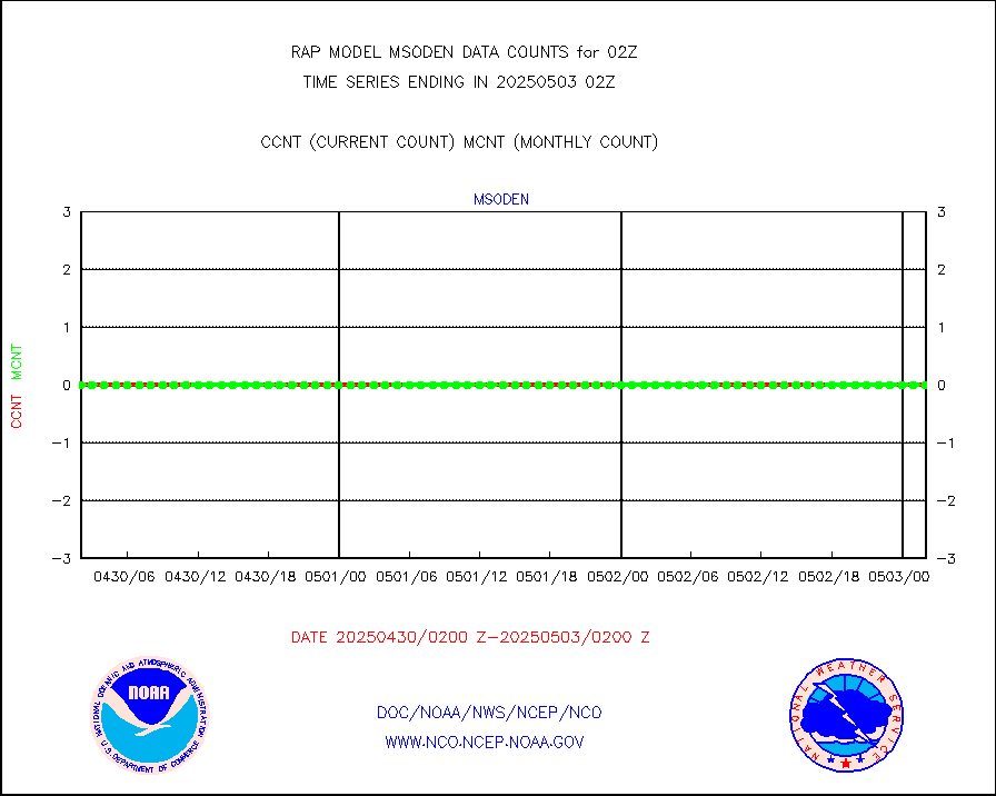
msofla |
Mesonet/MADIS Florida (FAWN & USF) |
3 |
3 |
100.0 % |
1801.50-1802.50 |
msoflt |
Mesonet/MADIS Florida Dept. of Transportation |
0 |
0 |
n/a |
1801.50-1802.50 |
msogeo |
Mesonet/MADIS Georgia Dept. of Transportation |
0 |
0 |
n/a |
1801.50-1802.50 |
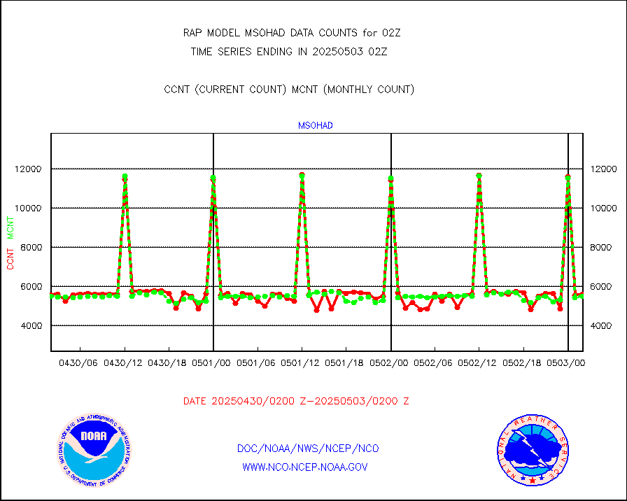
msohad |
Mesonet/MADIS NWS Hydromet Auto Data System(HADS) |
5467 |
5489 |
99.6 % |
1801.50-1802.50 |
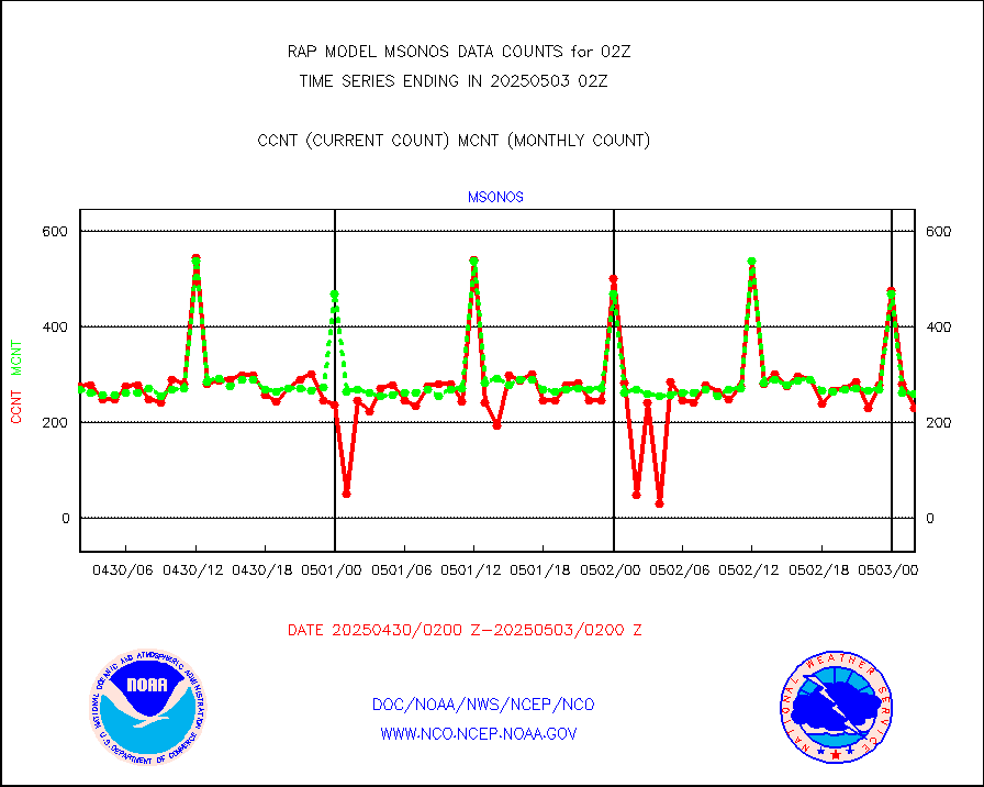
msoien |
Mesonet/MADIS Iowa Environmental |
152 |
173 |
87.9 % |
1801.50-1802.50 |
msoind |
Mesonet/MADIS Indiana Dept. of Transportation |
0 |
0 |
n/a |
1801.50-1802.50 |
msoiow |
Mesonet/MADIS Iowa Department of Transportation |
0 |
0 |
n/a |
1801.50-1802.50 |
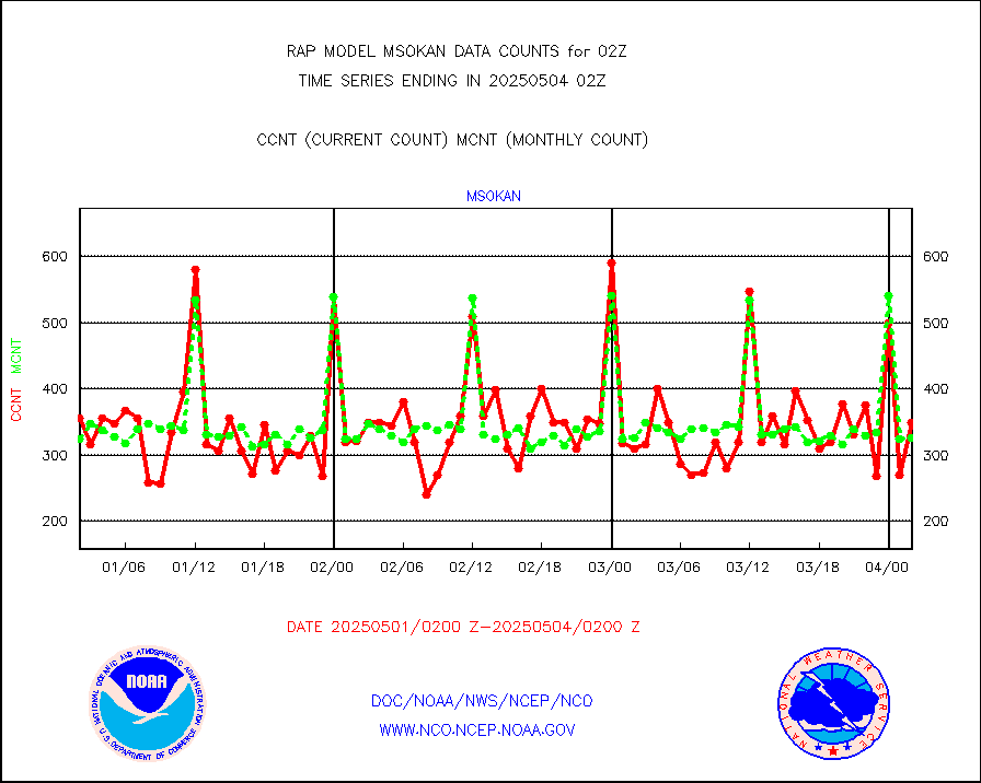
msokan |
Mesonet/MADIS Kansas Department of Transportation |
307 |
328 |
93.6 % |
1801.50-1802.50 |
msokla |
Mesonet/MADIS Oklahoma Mesonet |
318 |
332 |
95.8 % |
1801.50-1802.50 |
msolju |
Mesonet/MADIS Louisiana State/Jackson State Univ. |
0 |
0 |
n/a |
1801.50-1802.50 |
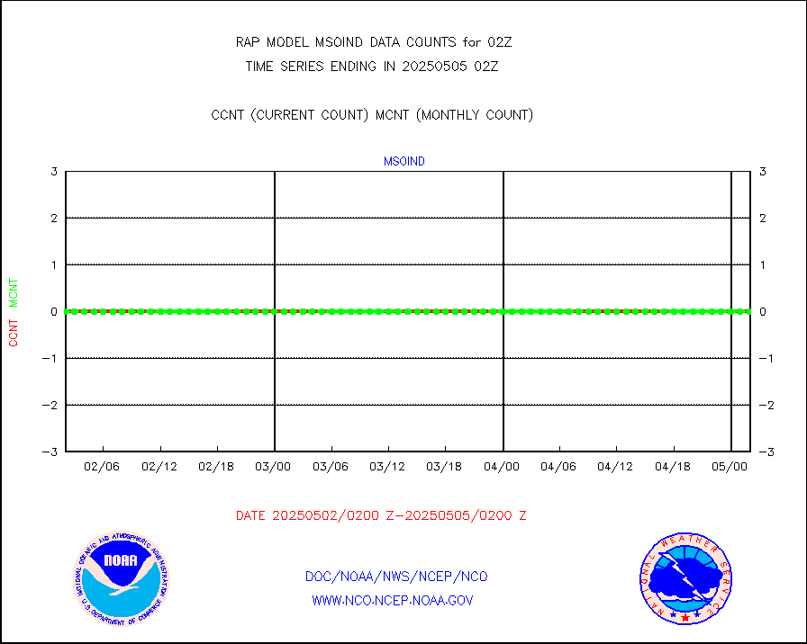
msomca |
Mesonet/MADIS Missouri Commercial Agricult Wx Net |
240 |
248 |
96.8 % |
1801.50-1802.50 |
msomin |
Mesonet/MADIS Minnesota Dept. of Transportation |
0 |
0 |
n/a |
1801.50-1802.50 |
msonos |
Mesonet/MADIS NOS-Phys Oceanographic Realtime Sys |
283 |
272 |
104.0 % |
1801.50-1802.50 |
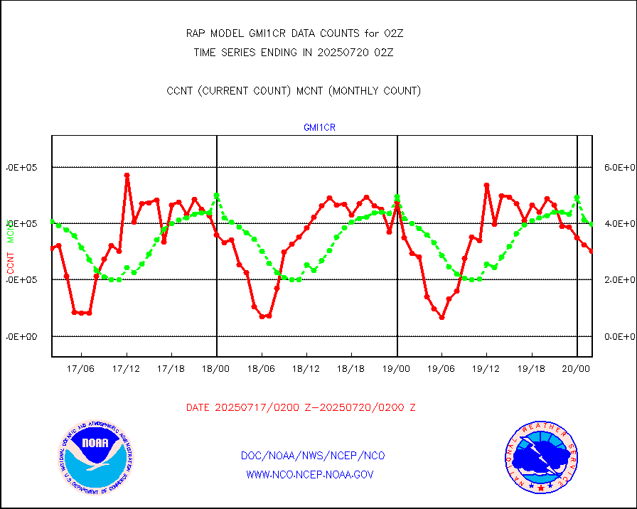
msoraw |
Mesonet/MADIS NFIC Remote Automated Wx Stns(RAWS) |
1596 |
1480 |
107.8 % |
1801.50-1802.50 |
msourb |
Mesonet/MADIS UrbaNet |
3972 |
3891 |
102.1 % |
1801.50-1802.50 |
msovir |
Mesonet/MADIS Virginia Dept. of Transportation |
238 |
234 |
101.7 % |
1801.50-1802.50 |
msowfy |
Mesonet/MADIS "Weather for You" |
0 |
0 |
n/a |
1801.50-1802.50 |
msowis |
Mesonet/MADIS Wisconsin Dept. of Transportation |
0 |
0 |
n/a |
1801.50-1802.50 |
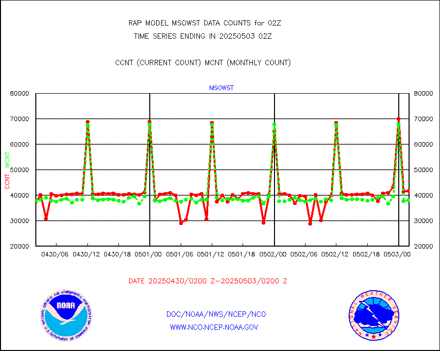
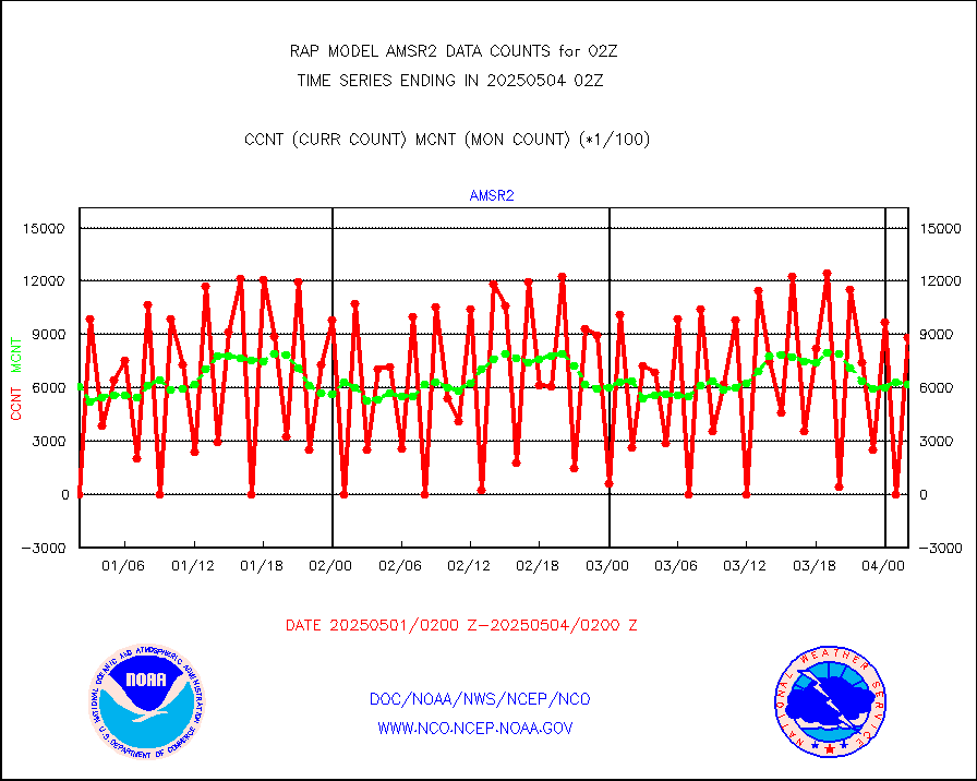
msowst |
Mesonet/MADIS MesoWest (many subproviders) |
40807 |
38113 |
107.1 % |
1801.50-1802.50 |
msowtx |
Mesonet/MADIS West Texas |
4633 |
4957 |
93.5 % |
1801.50-1802.50 |
mtiasi |
METOP 1-2 IASI 1C radiance data (varbl. channels) |
41438 |
35938 |
115.3 % |
1800.00-1803.99 |
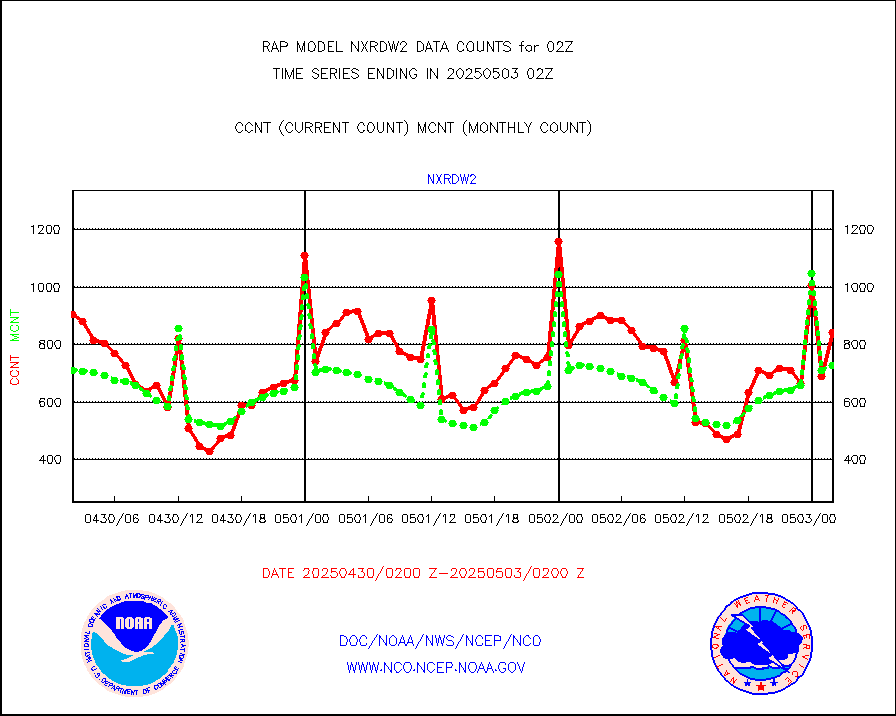
nxrdw2 |
NEXRAD Vel Azm Dsp(VAD) winds via Level 2 decoder |
898 |
717 |
125.2 % |
1801.00-1803.00 |
osbuv8 |
NOAA 16-19 Solar Backscatter UV-2 rad frm V8 BUFR |
0 |
0 |
n/a |
1800.00-1802.99 |
pibal |
PIBAL (from PILOT, PILOT SHIP, PILOT MOBIL) |
0 |
0 |
n/a |
1801.00-1803.00 |
pirep |
Manual PIREP aircraft data (dcded from AIREP fmt) |
401 |
406 |
98.8 % |
1722.75-1805.25 |
prflrp |
Profilr winds from PIBAL (PILOT,PILOT SHIP/MOBIL) |
0 |
0 |
n/a |
1800.50-1803.50 |
raobm |
Rawinsonde - mobile land (from TEMP/PILOT MOBIL) |
0 |
0 |
n/a |
1801.00-1803.00 |
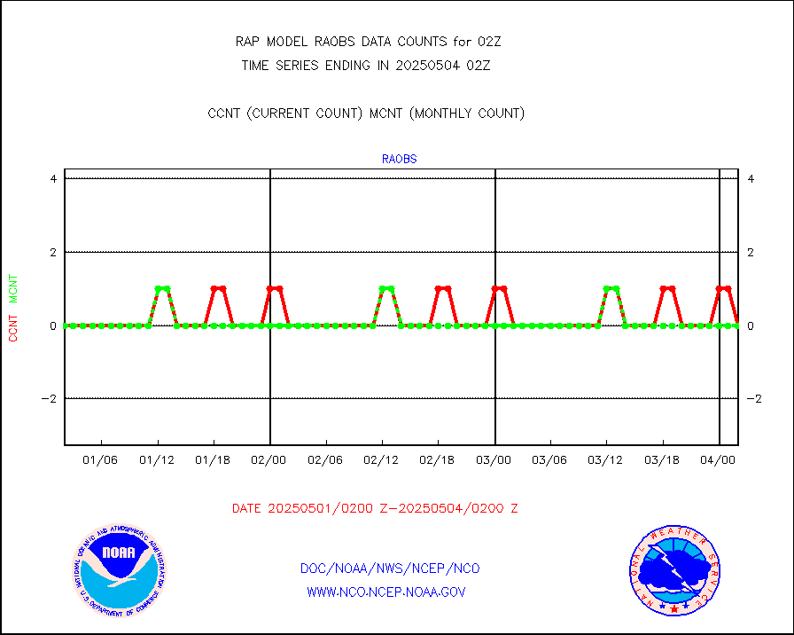
raobs |
Rawinsonde - ship (from TEMP SHIP, PILOT SHIP) |
0 |
0 |
n/a |
1801.00-1803.00 |
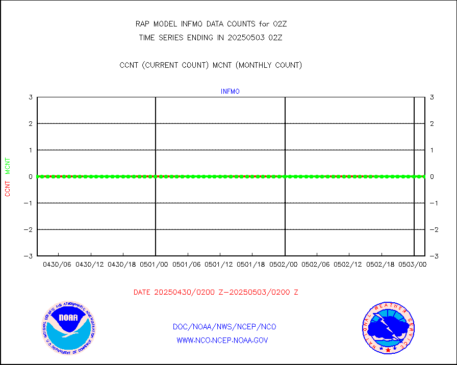
rd2wnd |
NEXRAD radial wind (Level 2 - GTS) |
1215515 |
912351 |
133.2 % |
1801.50-1802.49 |
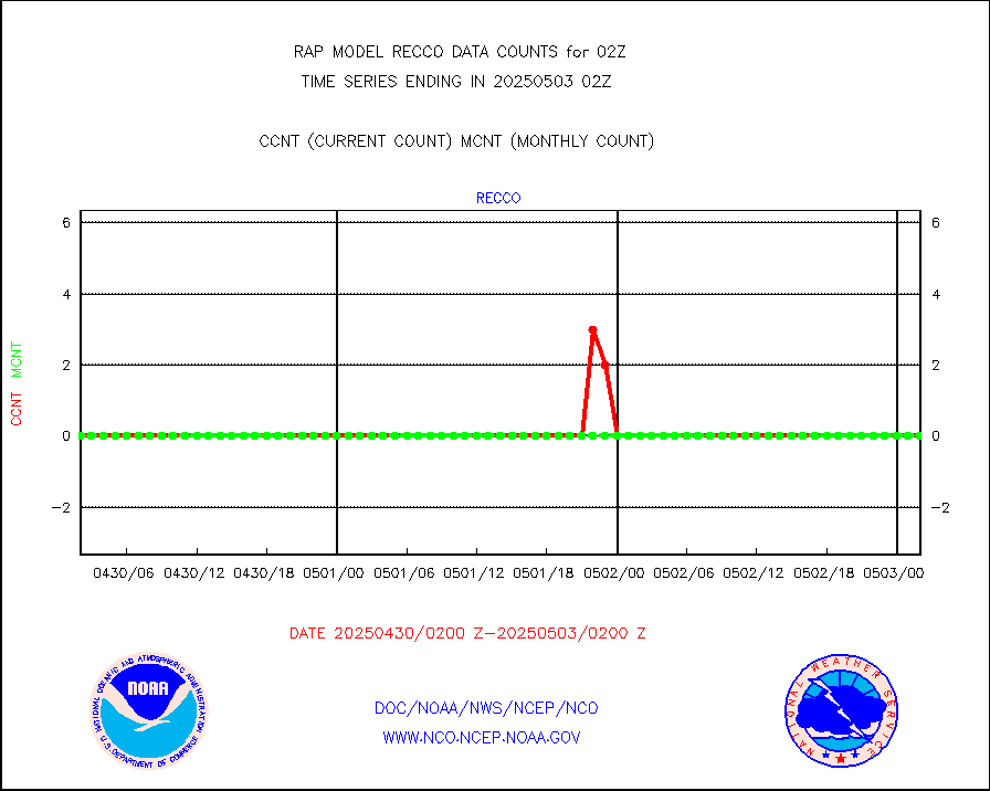
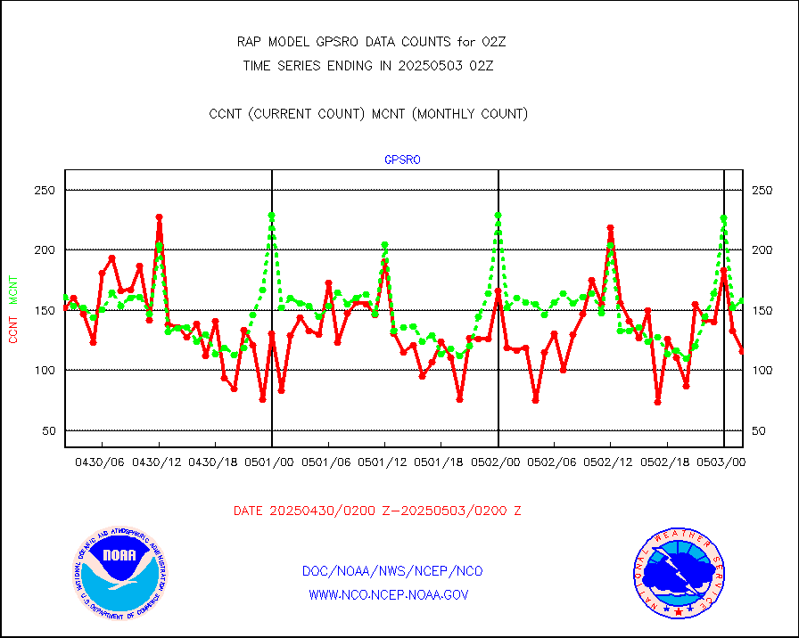
recco |
Flight level reconnaissance aircraft data |
0 |
0 |
n/a |
1801.00-1803.00 |
saldrn |
Surface Marine Saildrone (decoded from BUFR) |
1 |
2 |
50.0 % |
1800.00-1803.99 |
saphir |
Megha-Tropiques SAPHIR L1A2 brightness temps |
0 |
0 |
n/a |
1723.00-1804.99 |
sevasr |
METEOSAT-10 2nd Gen SEVIRI All Sky Radiance(proc) |
9512 |
9500 |
100.1 % |
1800.00-1803.99 |
sevcsr |
METEOSAT-10 2nd Gen SEVIRI Clr Sky Radiance(proc) |
0 |
0 |
n/a |
1800.00-1803.99 |
ships |
Ship - manual and automatic, restricted |
4 |
2 |
200.0 % |
1801.50-1802.50 |
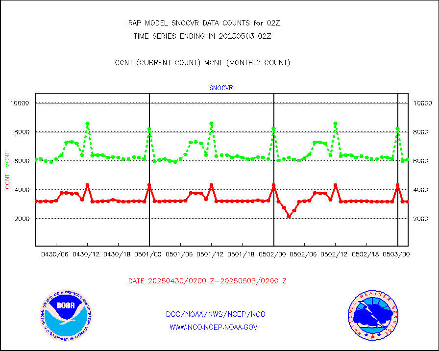
snocvr |
NOW COVER, DEPTH/DENSITY AND WATER EQUIVALENT |
2863 |
6159 |
46.5 % |
1800.00-1804.00 |
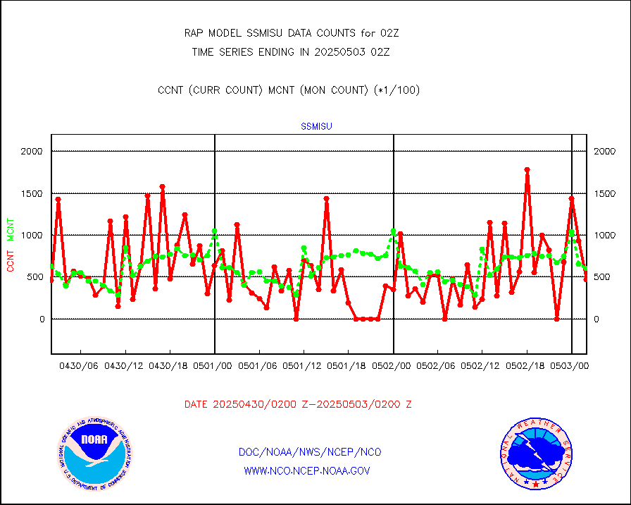
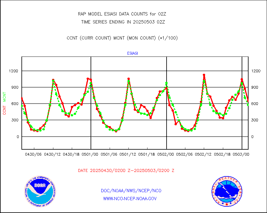
ssmisu |
DMSP SSM/IS 1C radiance data (Unified Pre-Proc.) |
25609 |
70886 |
36.1 % |
1800.00-1803.99 |
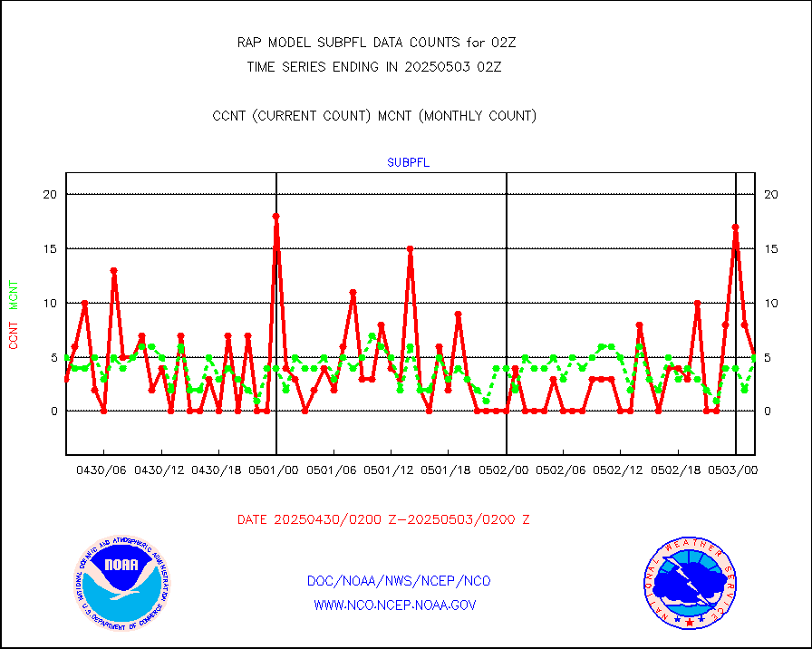
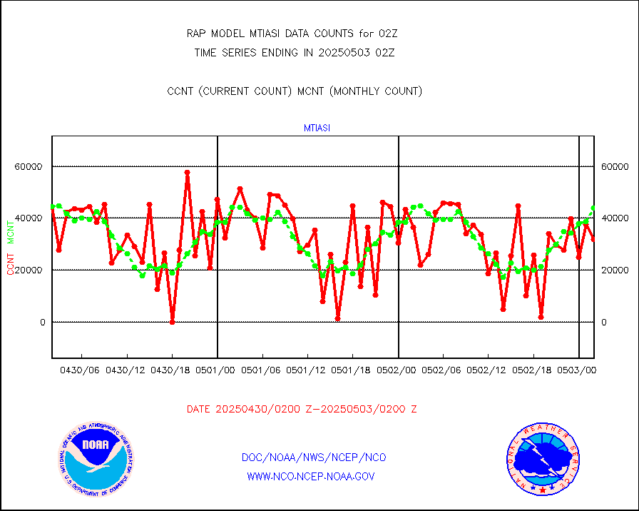
subpfl |
Sub-surface float and glider profile (BUFR) |
8 |
8 |
100.0 % |
1800.00-1803.99 |
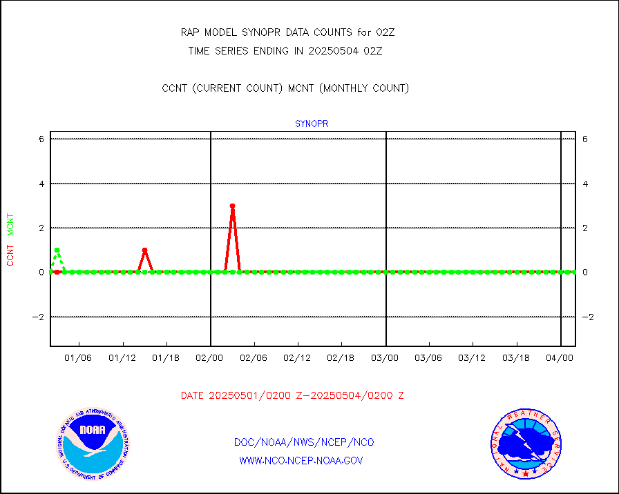
synopr |
Synoptic - restricted (WMO Res 40) manual & auto. |
0 |
0 |
n/a |
1801.50-1802.50 |
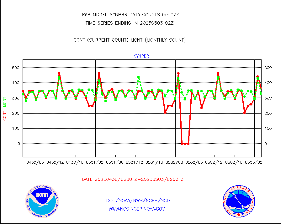
synpbr |
Synoptic - restricted (WMO Res 40)(decoded BUFR) |
472 |
344 |
137.2 % |
1801.50-1802.50 |
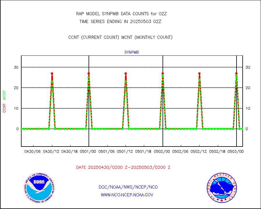
synpmb |
Synoptic - mobile manual & auto (decoded fr BUFR) |
0 |
0 |
n/a |
1801.50-1802.50 |
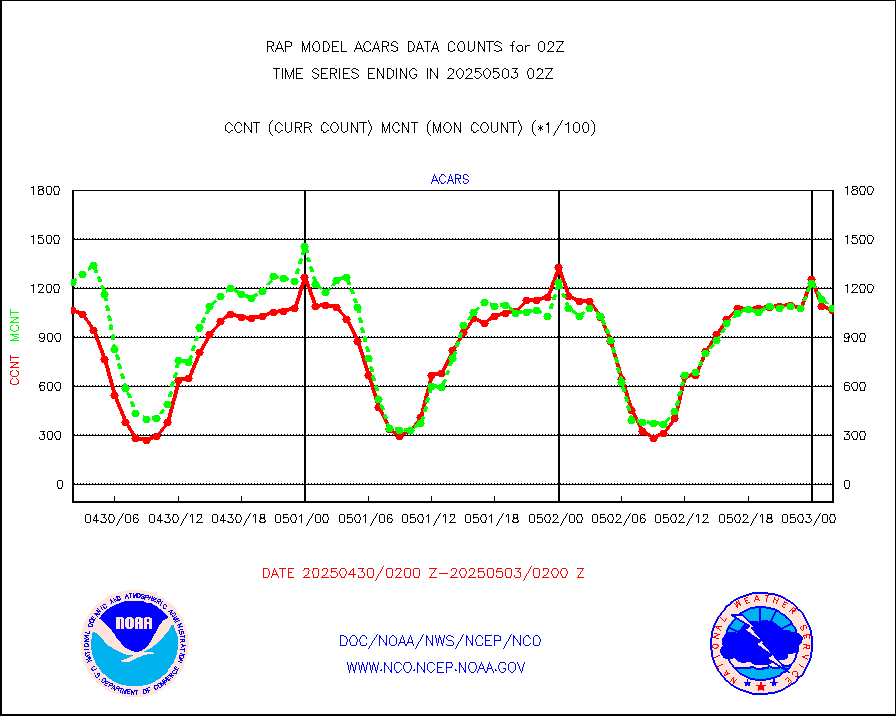
tmdara |
TAMDAR aircft data-all types(from Panasonic,BUFR) |
1175 |
1266 |
92.8 % |
1722.75-1805.25 |
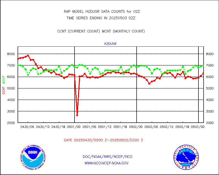
visja |
MTSAT/JMA visible derived cloud motion |
1599 |
1628 |
98.2 % |
1723.50-1804.50 |
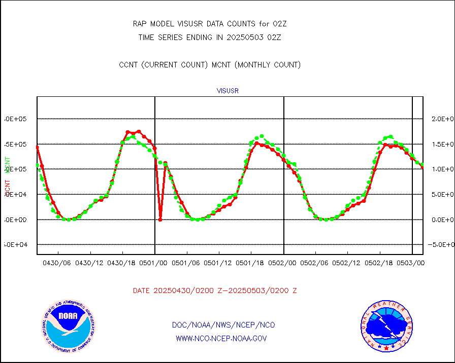
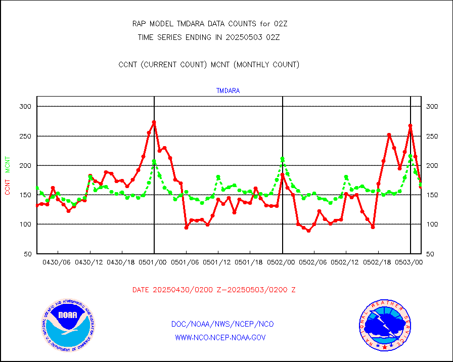
visusr |
GOES-16&up/NESDIS visible derived cloud motion |
102976 |
104810 |
98.3 % |
1801.00-1801.99 |
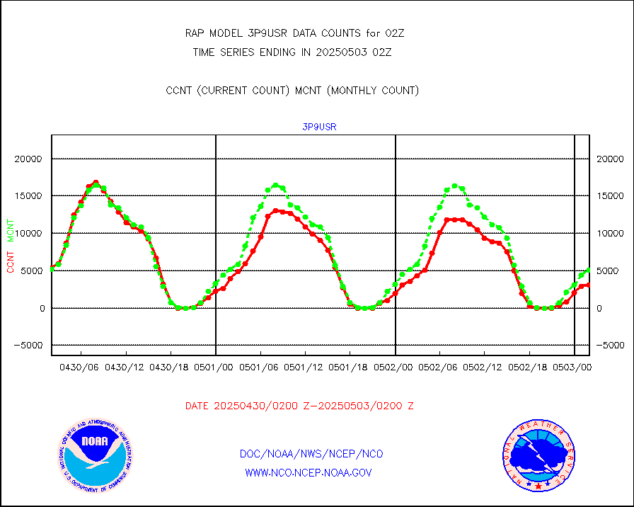
vseunb |
METEOSAT/EUMETSAT visible drv cld motion NBseq |
0 |
0 |
n/a |
1800.50-1803.49 |


