| Critical Data with Normal Counts |
|---|
| Type | Description | Hourly Count | Monthly Average | Percent (%) of Monthly Mean | UTC Time Window |
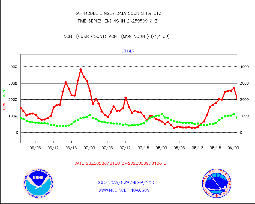
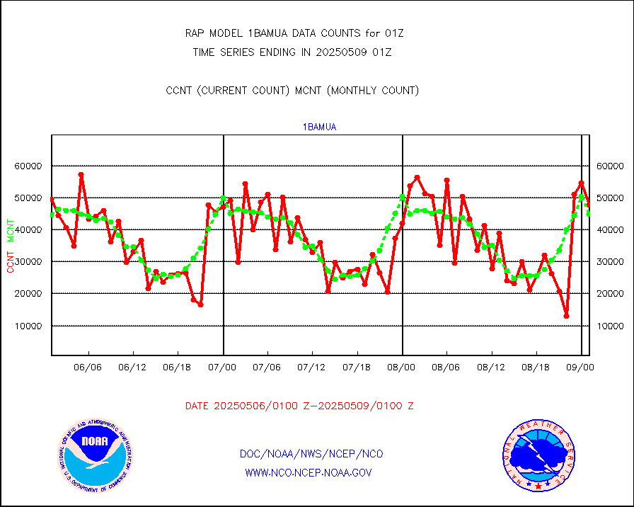
1bamua |
NOAA 15-19 & METOP 1-2 AMSU-A NCEP-proc. br.temps |
39228 |
44478 |
88.2 % |
2422.00-2503.99 |
1bhrs4 |
NOAA 18-19 & METOP 1-2 HIRS-4 NCEP-proc. br.temps |
35293 |
38045 |
92.8 % |
2422.00-2503.99 |
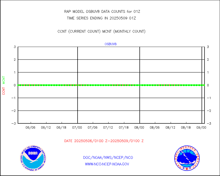
1bmhs |
NOAA 18-19 & METOP 1-2 MHS NCEP-proces. br. temps |
268898 |
256182 |
105.0 % |
2422.00-2503.99 |
acars |
MDCRS ACARS acft data from ARINC(dcded from BUFR) |
97519 |
90623 |
107.6 % |
2421.75-2504.25 |
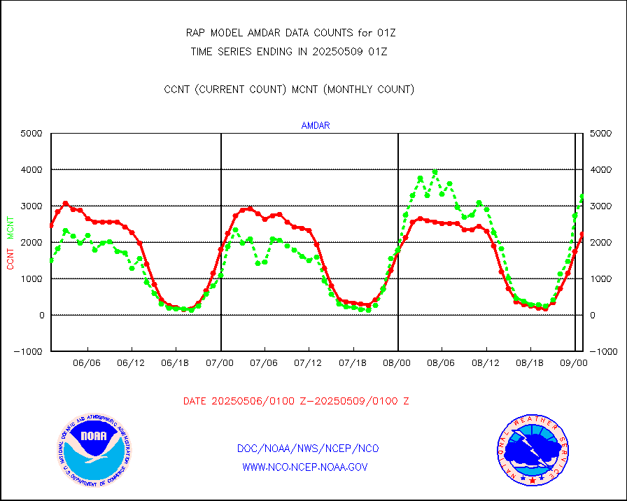
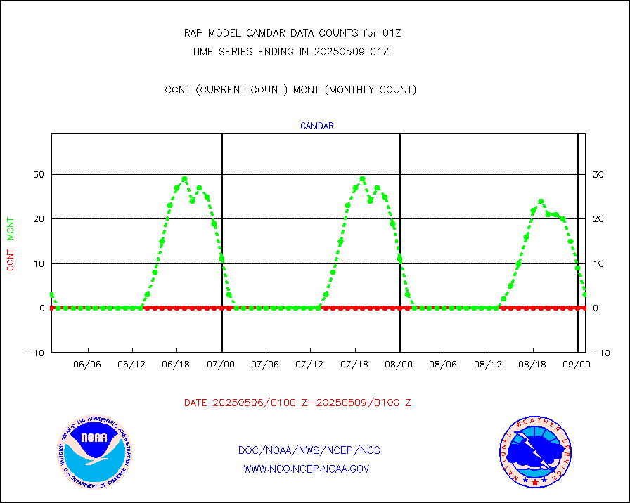
camdar |
Canadian AMDAR aircraft data (decoded from BUFR) |
0 |
69 |
0.0 % |
2421.75-2504.25 |
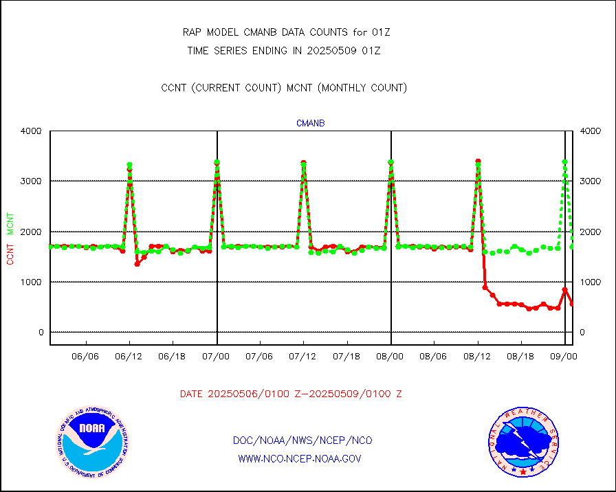
cmanb |
Surface Marine CMAN rpts decoded from BUFR format |
1700 |
1677 |
101.4 % |
2500.50-2501.50 |
dbuoy |
Buoys decoded from FM-18 fmt (moored or drifting) |
0 |
0 |
n/a |
2500.50-2501.50 |
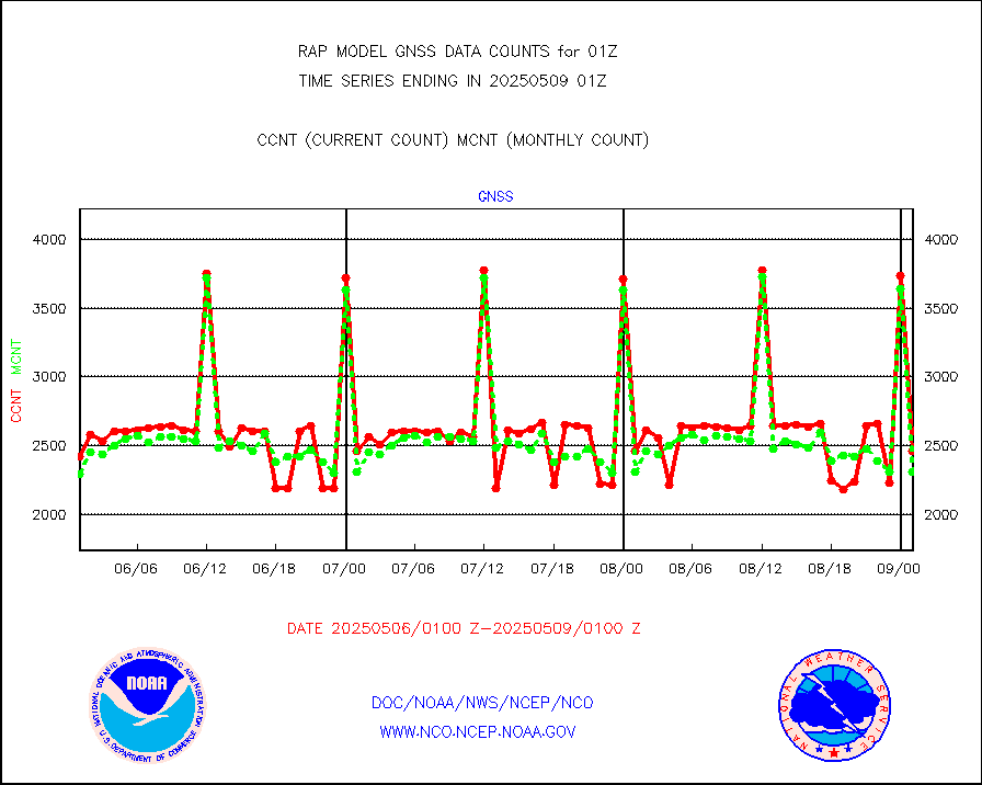
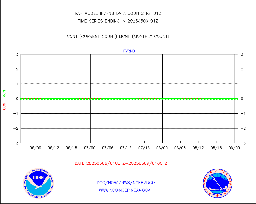
gnss |
Grnd-based Gbl Navigation Sat System (GNSS) data |
2261 |
2216 |
102.0 % |
2423.95-2500.05 |
h20mo |
MODIS (AQUA/TERRA) wvpr imager derived cld motion |
0 |
0 |
n/a |
2422.50-2503.50 |
infmo |
MODIS (AQUA/TERRA) ir l-wave derived cloud motion |
0 |
0 |
n/a |
2422.50-2503.50 |
lgycld |
GOES/NASA(Langley) hi-res. (1x1 f-o-v) cloud data |
3716427 |
3332019 |
111.5 % |
2500.50-2501.50 |
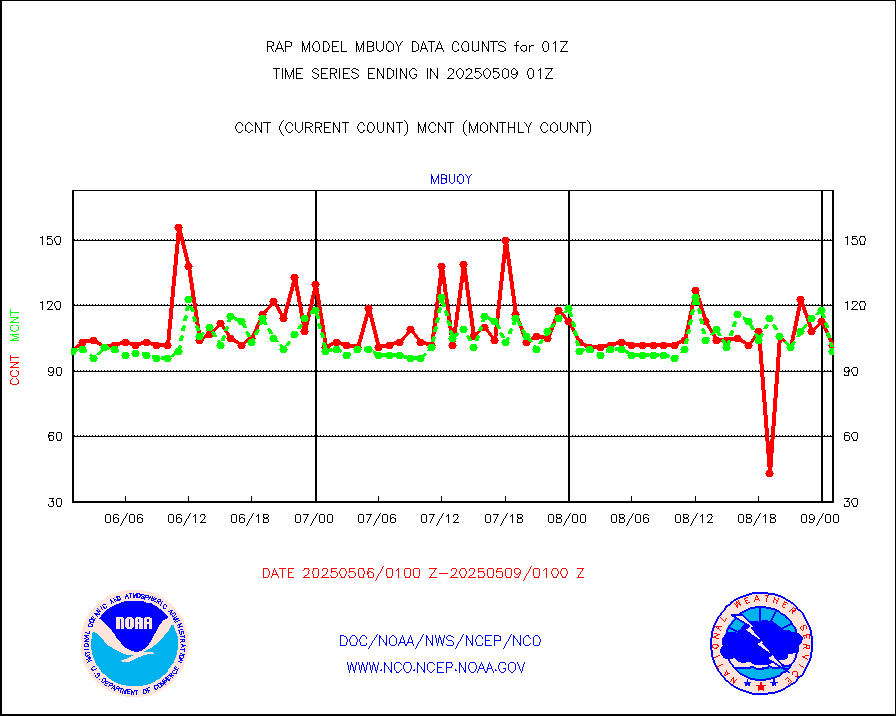
mbuoy |
Buoys decoded from FM-13 format (moored) |
72 |
50 |
144.0 % |
2500.50-2501.50 |
metar |
Aviation - METAR |
5604 |
5706 |
98.2 % |
2500.50-2501.50 |
nxrdw |
NEXRAD Vel Azm Dsp(VAD) winds via radar coded msg |
0 |
0 |
n/a |
2500.00-2502.00 |
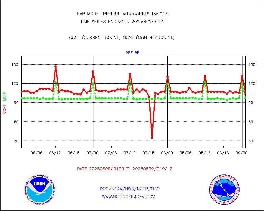
prflrb |
Multi-Agency Profiler (MAP) and SODAR winds |
102 |
82 |
124.4 % |
2423.50-2502.50 |
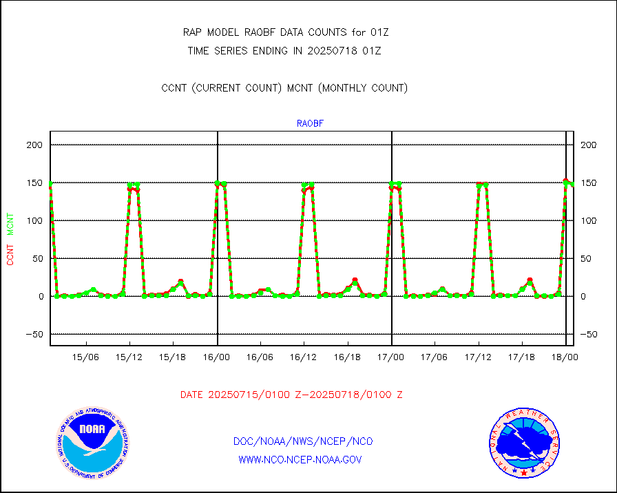
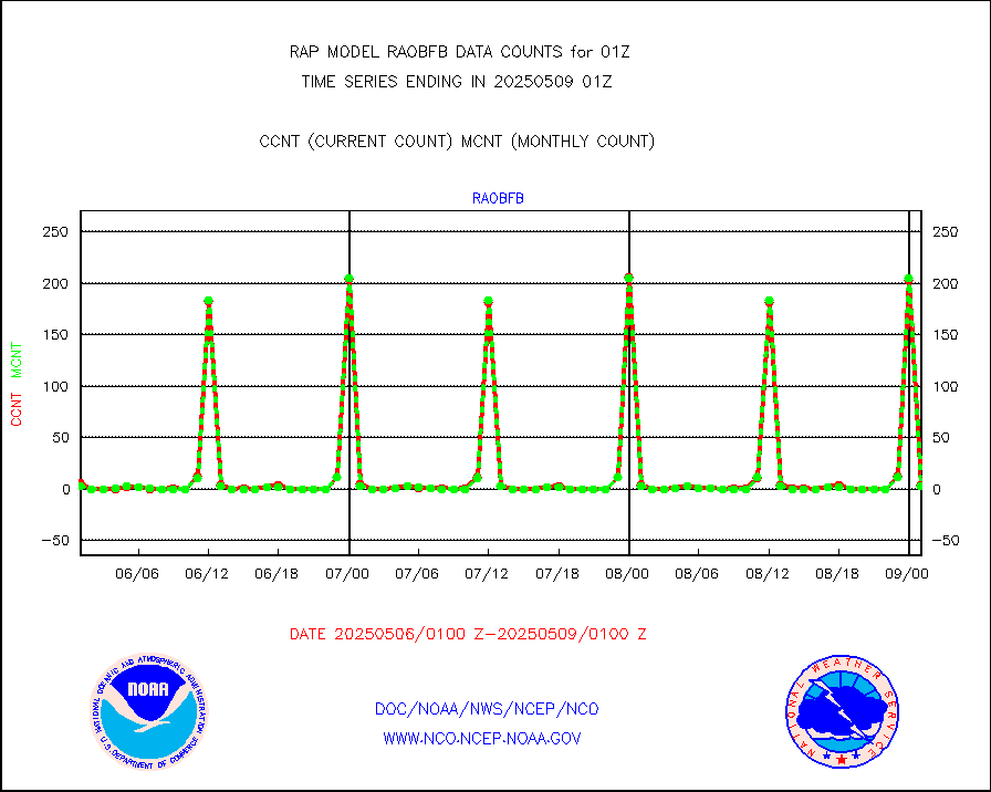
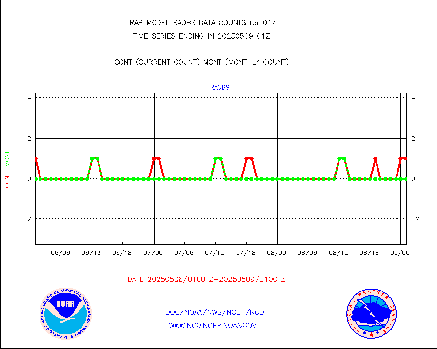
raobf |
Rawinsonde - fixed land (from TEMP or PILOT) |
156 |
156 |
100.0 % |
2500.00-2502.00 |
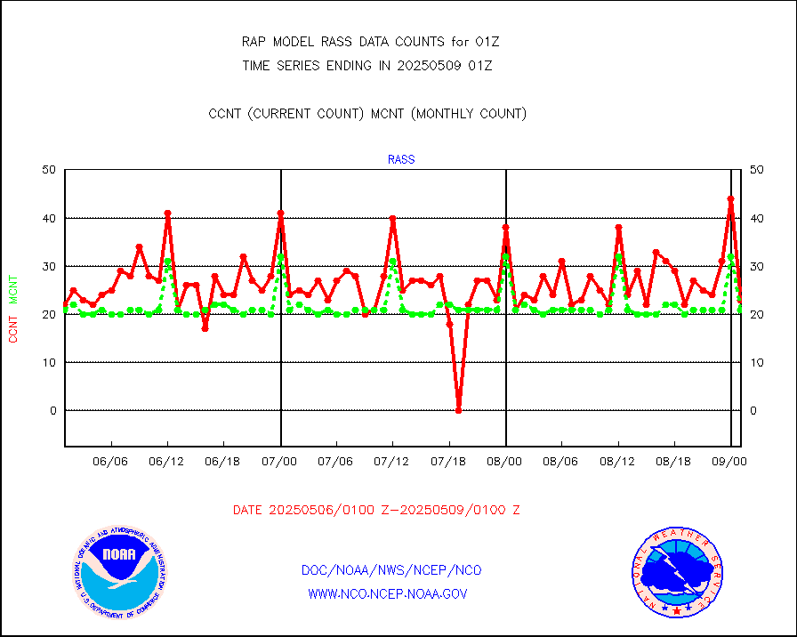
rass |
RASS temperatures (NOAA and Multi-Agency) |
23 |
22 |
104.5 % |
2500.50-2501.50 |
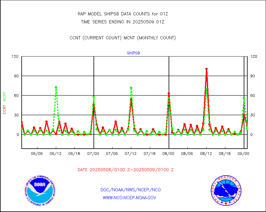
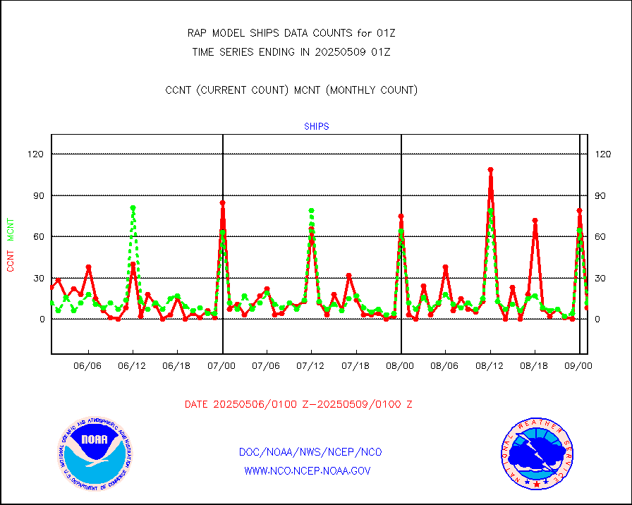
shipsb |
Ship - manual and automatic, restricted (BUFR) |
0 |
0 |
n/a |
2500.50-2501.50 |
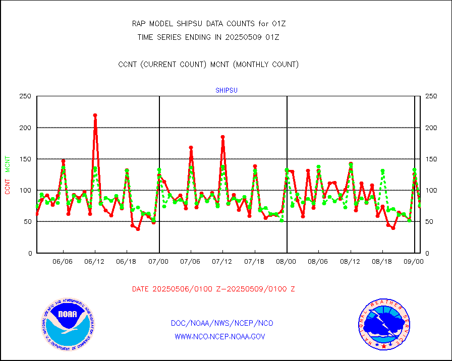
shipsu |
Ship - manual and automatic, unrestricted |
35 |
46 |
76.1 % |
2500.50-2501.50 |
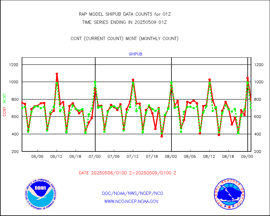
shipub |
Ship - manual and automatic, unrestricted (BUFR) |
613 |
610 |
100.5 % |
2500.50-2501.50 |
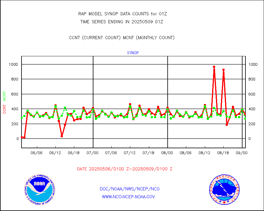
synop |
Synoptic - fixed manual and automatic |
331 |
302 |
109.6 % |
2500.50-2501.50 |
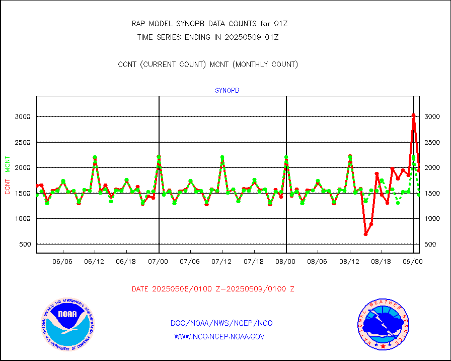
synopb |
Synoptic - fixed manual & auto (decoded fr BUFR) |
1682 |
1583 |
106.3 % |
2500.50-2501.50 |
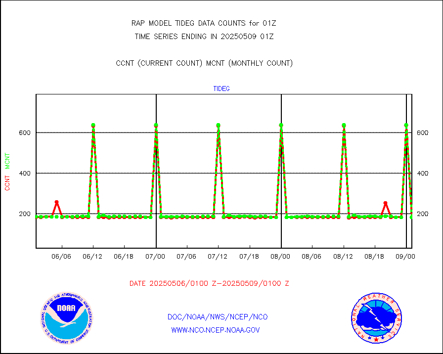
tideg |
Tide gauge reports decoded from CREX format |
181 |
177 |
102.3 % |
2500.50-2501.50 |
| Data Types of Opportunity with Normal Counts |
|---|
| Type | Description | Hourly Count | Monthly Average | Percent (%) of Monthly Mean | UTC Time Window |
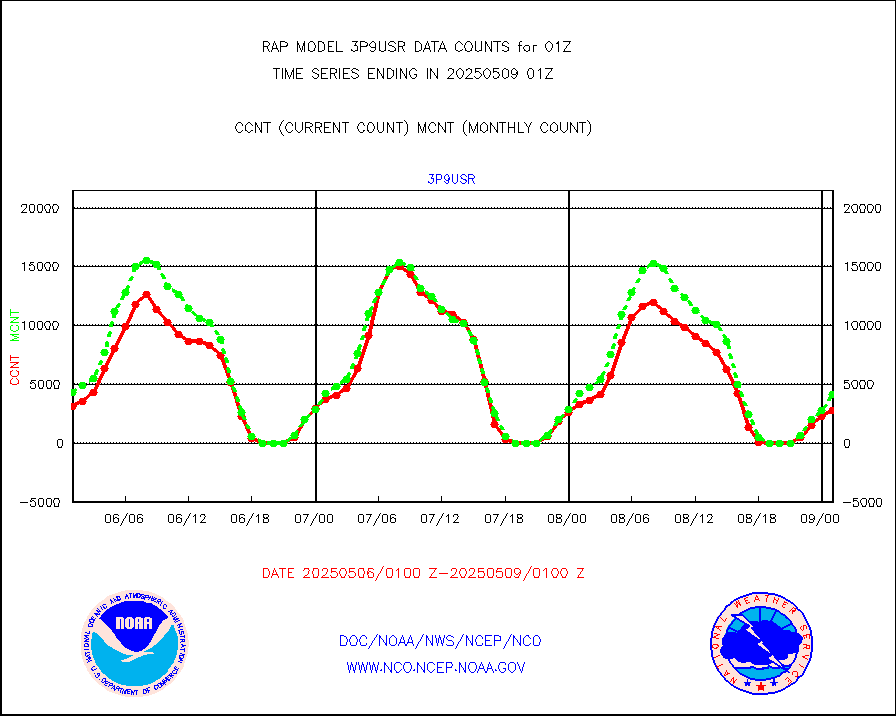
3p9usr |
GOES-16&up/NESDIS ir short-wv derived cld motion |
5300 |
4686 |
113.1 % |
2500.00-2500.99 |
acarsa |
MDCRS ACARS acft data (ARINC via AFWA)(AIREP fmt) |
0 |
0 |
n/a |
2421.75-2504.25 |
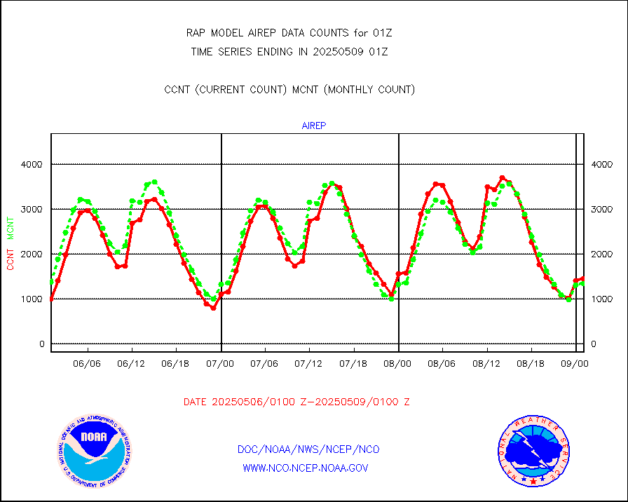
airep |
Manual AIREP aircraft data (dcded from AIREP fmt) |
2550 |
1992 |
128.0 % |
2421.75-2504.25 |
airsev |
AQUA AIRS/AMSU-A/HSB brightness temps- every FOV |
0 |
0 |
n/a |
2422.00-2503.99 |
amdar |
AMDAR aircraft data (decoded from AMDAR format) |
2488 |
2882 |
86.3 % |
2421.75-2504.25 |
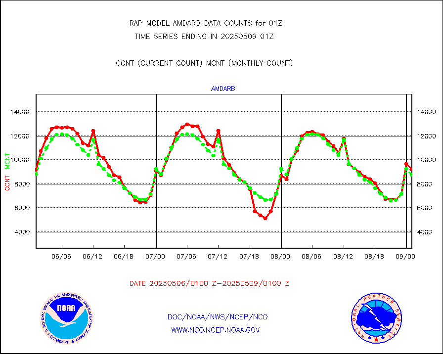
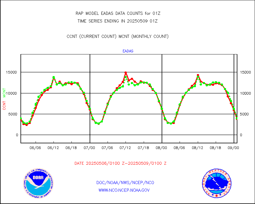
amdarb |
AMDAR aircraft data (decoded from BUFR) |
4706 |
4571 |
103.0 % |
2421.75-2504.25 |
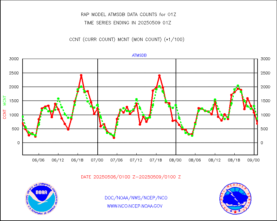
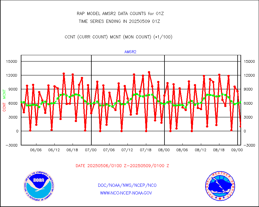
amsr2 |
GCOM-W AMSR2 1B brightness temperatures |
811357 |
611677 |
132.6 % |
2422.00-2422.99 |
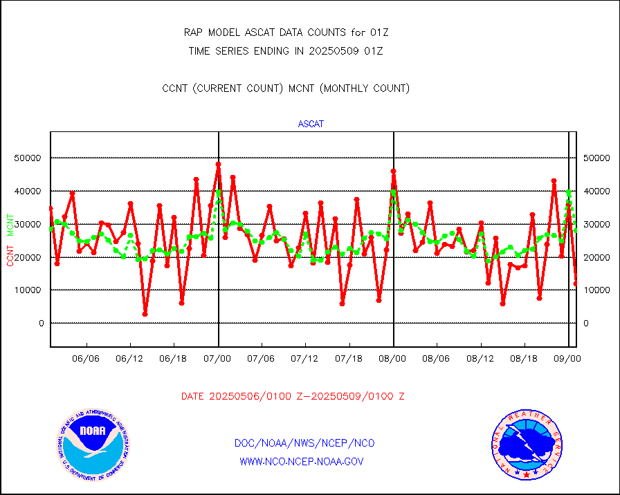
ascat |
METOP 1-2 ASCAT products |
22445 |
21754 |
103.2 % |
2423.00-2503.00 |
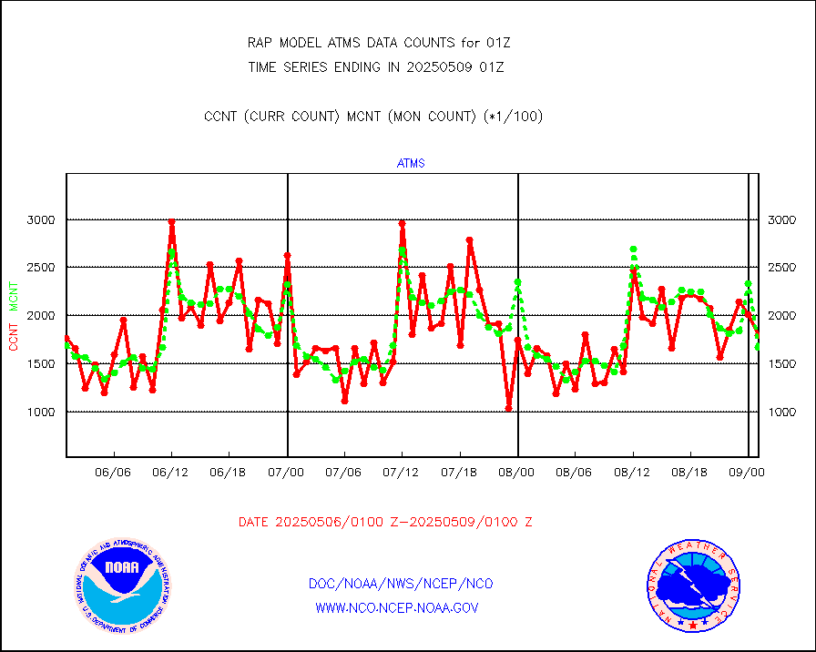
atms |
NPP/NOAA-20 ATMS brightness temperatures |
170399 |
163865 |
104.0 % |
2423.00-2502.99 |
atmsdb |
NPP/NOAA-20 ATMS bright. temps-direct b-cast SSEC |
115344 |
108307 |
106.5 % |
2423.00-2502.99 |
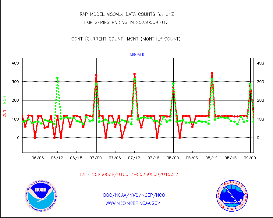
coopmd |
Coop/MADIS NEPP & HCN-Modernization NOAA COOP Obs |
27 |
24 |
112.5 % |
2500.50-2501.50 |
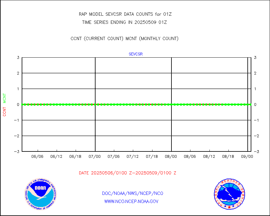
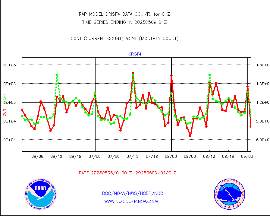
crisf4 |
NPP/NOAA-20 CrIS full spctrl radn (431 ch subset) |
90980 |
98825 |
92.1 % |
2423.00-2502.99 |
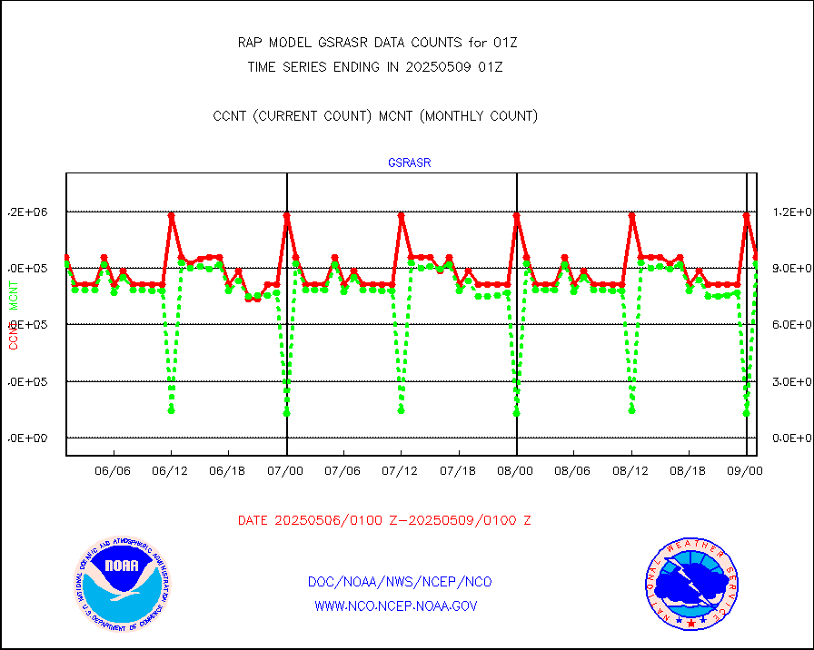
crsfdb |
NPP/NOAA-20 CrIS full spctrl radn dir brdcst SSEC |
81450 |
75500 |
107.9 % |
2423.00-2502.99 |
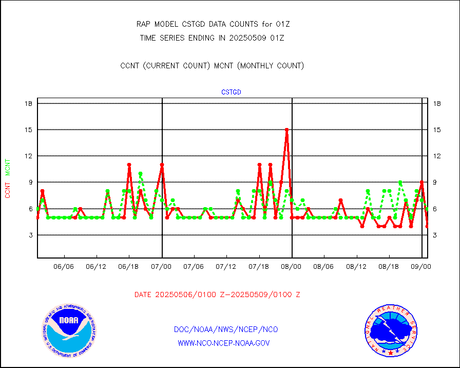
cstgd |
Coast Guard |
3 |
4 |
75.0 % |
2500.50-2501.50 |
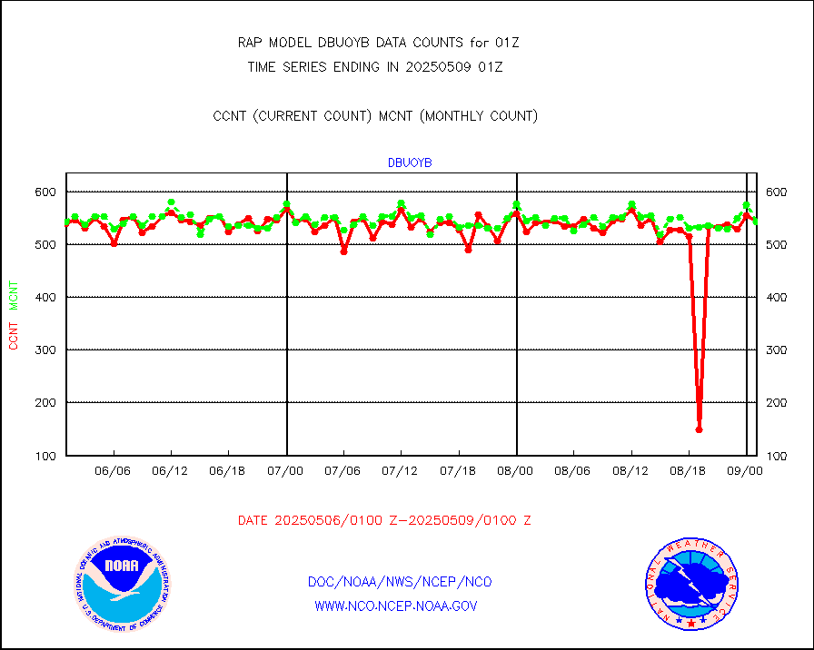
dbuoyb |
Drifting buoys (decoded from BUFR) |
564 |
603 |
93.5 % |
2500.50-2501.50 |
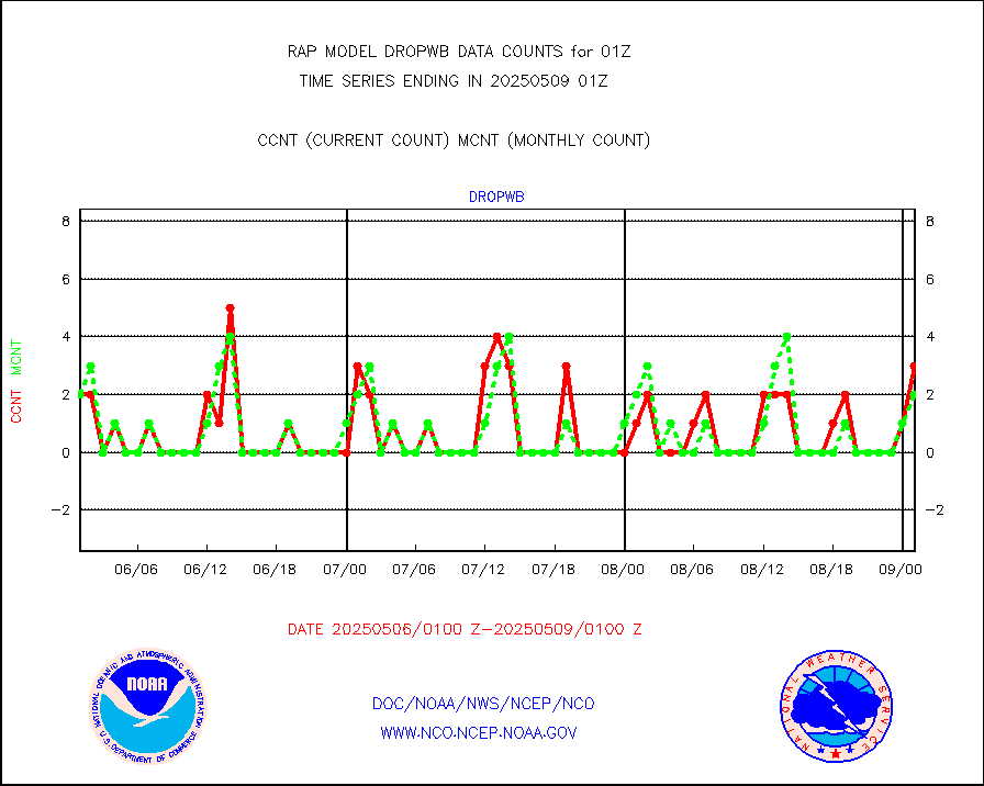
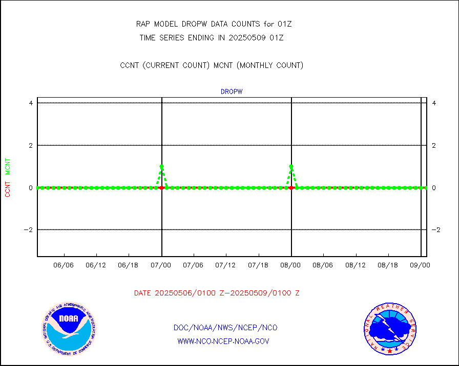
dropw |
Dropwinsonde (from TEMP DROP) |
0 |
0 |
n/a |
2500.00-2502.00 |
eadas |
E-AMDAR (European AMDAR acft decoded from BUFR) |
3065 |
2961 |
103.5 % |
2421.75-2504.25 |
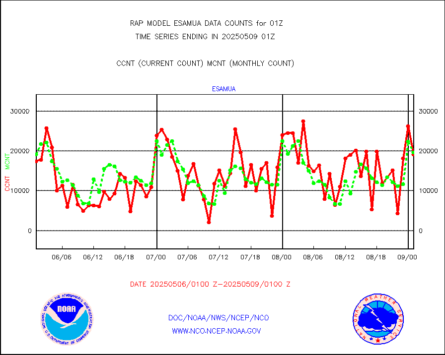
esamua |
NOAA 15-19 & METOP 1-2 AMSU-A proc btmps frm RARS |
12303 |
20192 |
60.9 % |
2500.00-2502.00 |
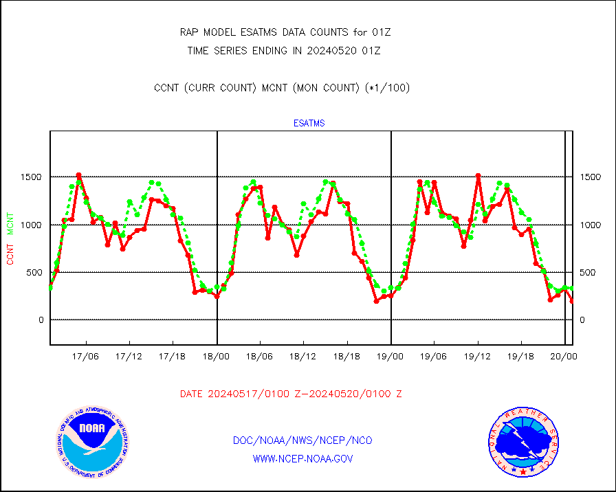
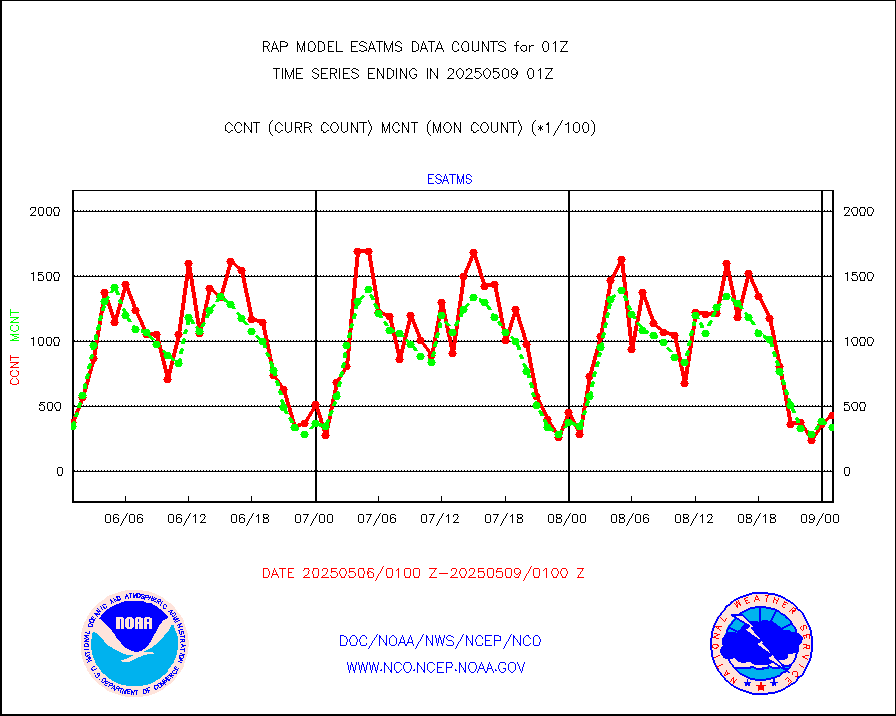
esatms |
NPP Adv. Tech. MW Sndr (ATMS) br. temps from RARS |
37317 |
30923 |
120.7 % |
2423.00-2502.99 |
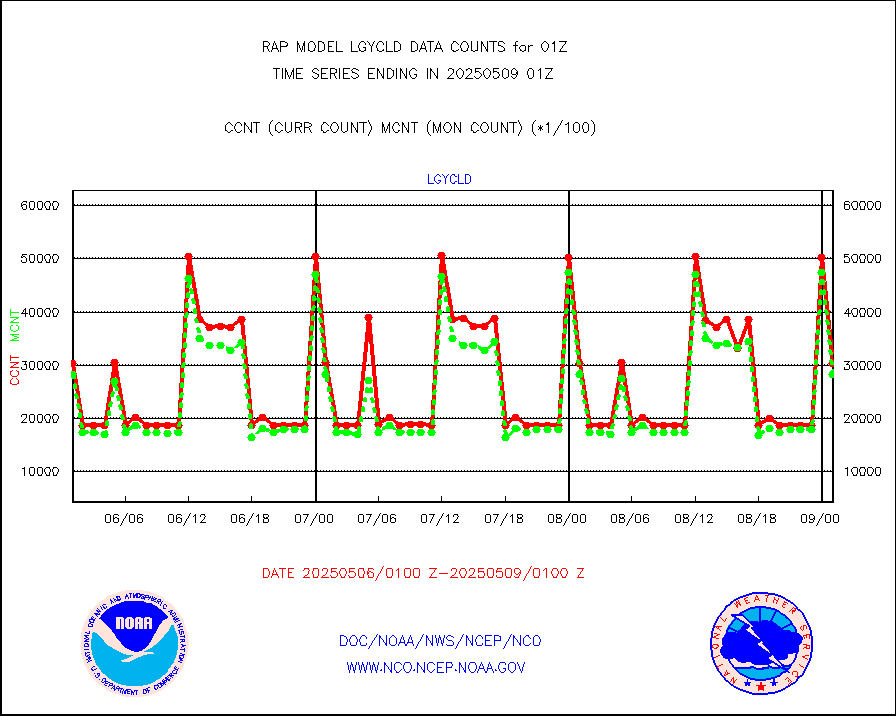
eshrs3 |
NOAA 15-19 & METOP 1-2 HIRS-3/4 pr btmps frm RARS |
22890 |
44440 |
51.5 % |
2500.00-2502.00 |
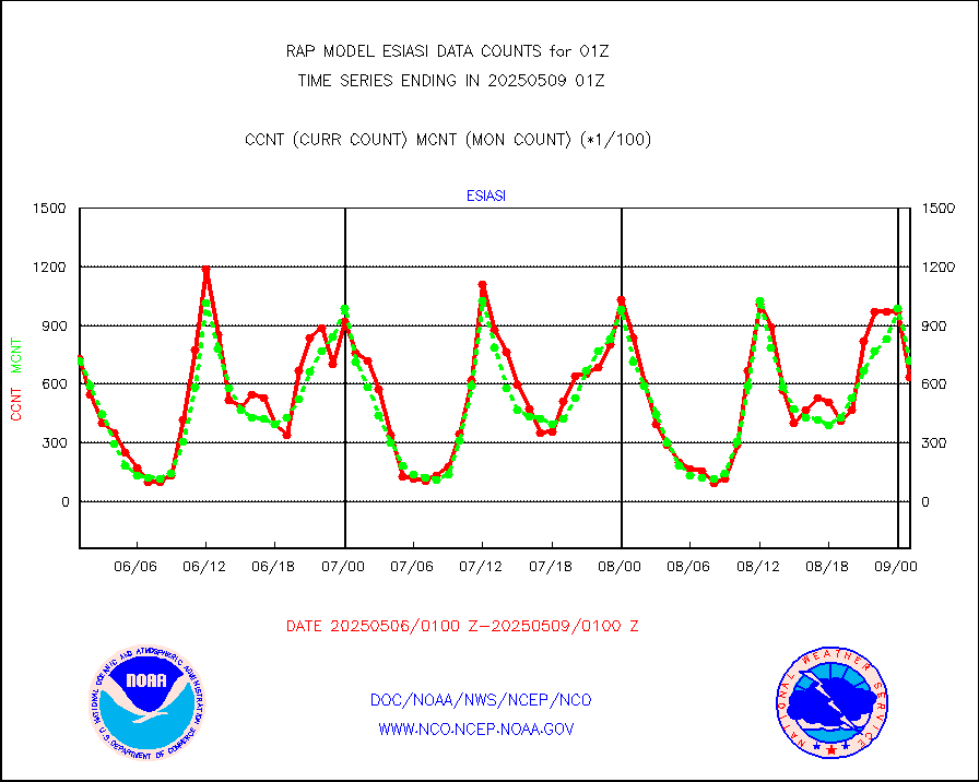
esiasi |
METOP 1-2 IASI 1C radiance data vbl chn from RARS |
105402 |
82529 |
127.7 % |
2423.00-2502.99 |
esmhs |
NOAA 18-19 & METOP 1-2 MHS proc. btemps from RARS |
133240 |
174861 |
76.2 % |
2500.00-2502.00 |
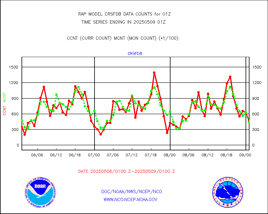
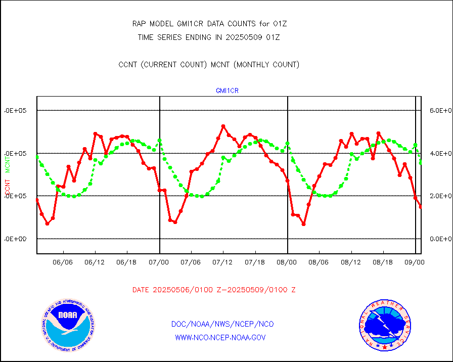
gmi1cr |
GPM GMI Level 1C-R brightness temperatures |
394547 |
619925 |
63.6 % |
2422.00-2503.99 |
gpsro |
GPS radio occultation data |
141 |
105 |
134.3 % |
2423.00-2502.99 |
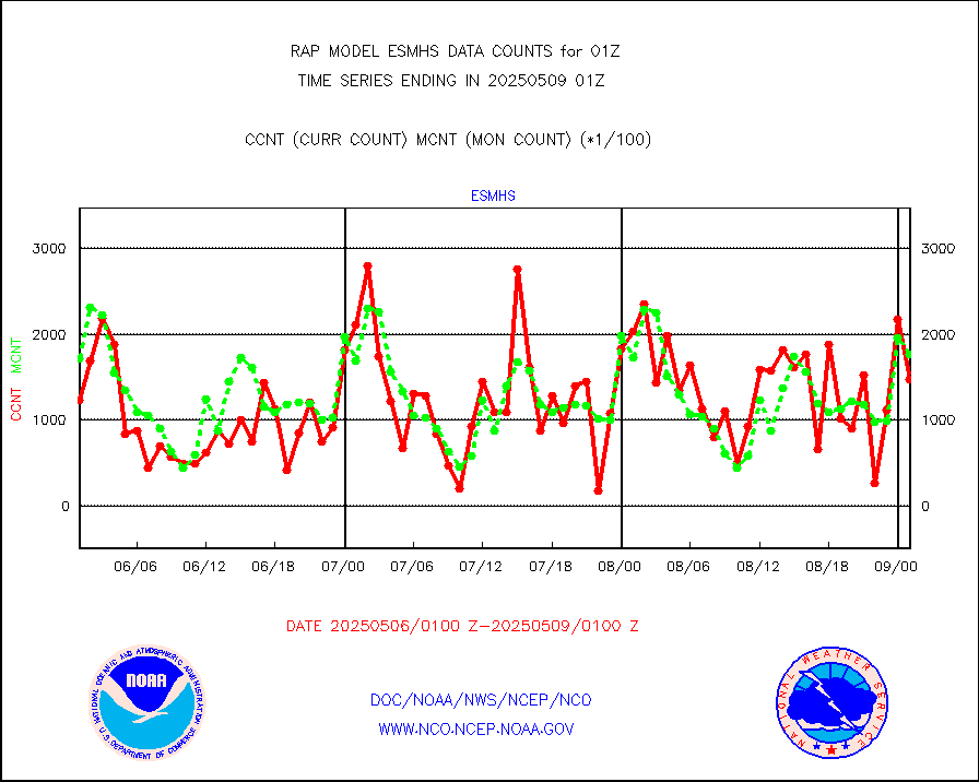
gsrasr |
GOES-16/17 All Sky Radiances (proc.) |
959751 |
937352 |
102.4 % |
2423.00-2502.99 |
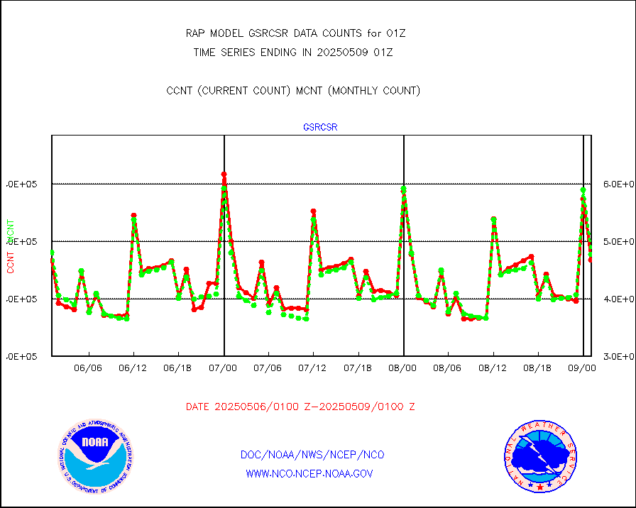
gsrcsr |
GOES-16/17 Clear Sky Radiances (proc.) |
509389 |
471499 |
108.0 % |
2423.00-2502.99 |
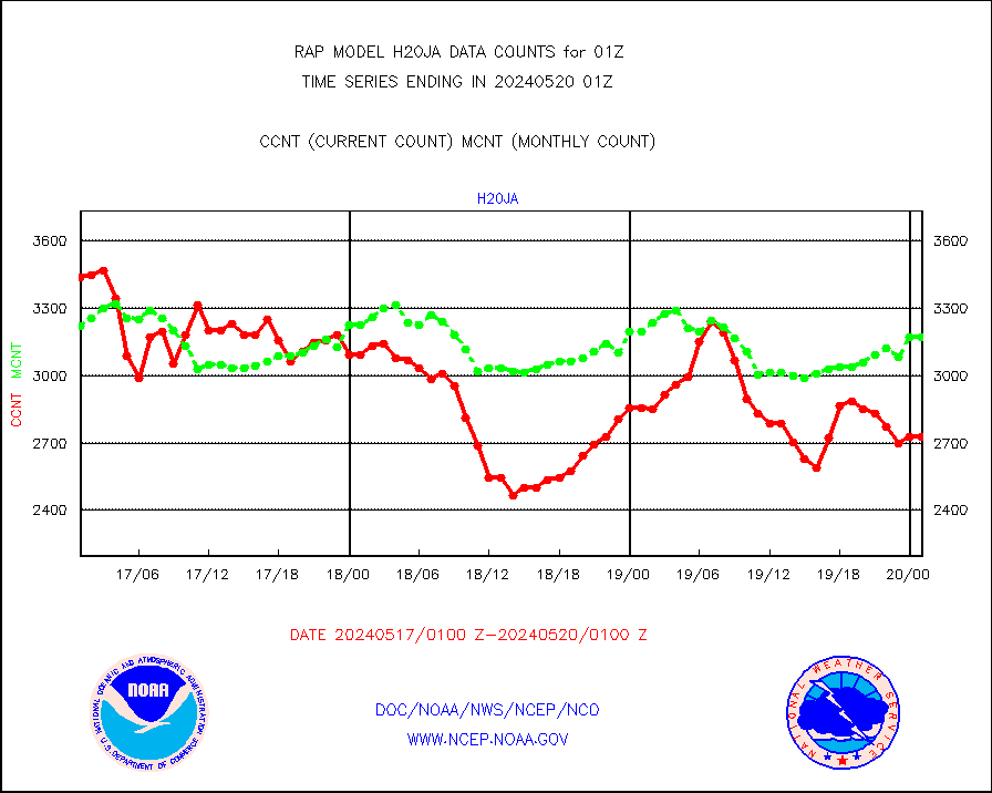
h20ja |
MTSAT/JMA water vapor imager derived cloud motion |
3221 |
2801 |
115.0 % |
2422.50-2503.50 |
h2dusr |
GOES-16&up/NESDIS wv imgr/deep-lyr derivd cld mtn |
8775 |
6517 |
134.6 % |
2500.00-2500.99 |
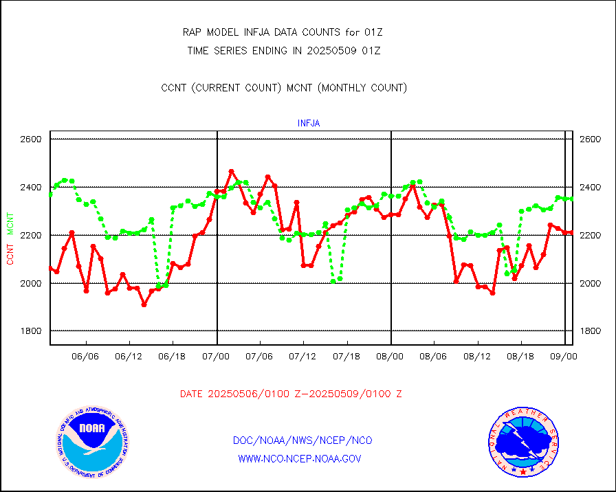
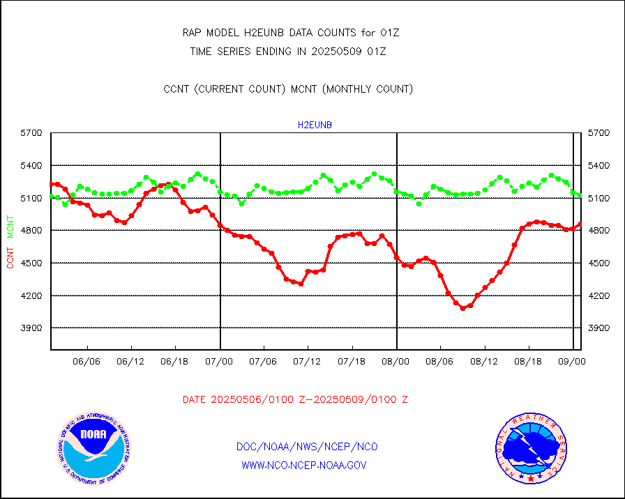
h2eunb |
METEOSAT/EUMETSAT wvpr imgr drv cld motion NBseq |
4566 |
4964 |
92.0 % |
2423.50-2502.49 |
h2tusr |
GOES-16&up/NESDIS wv imgr/cld-top derived cld mtn |
12366 |
11518 |
107.4 % |
2500.00-2500.99 |
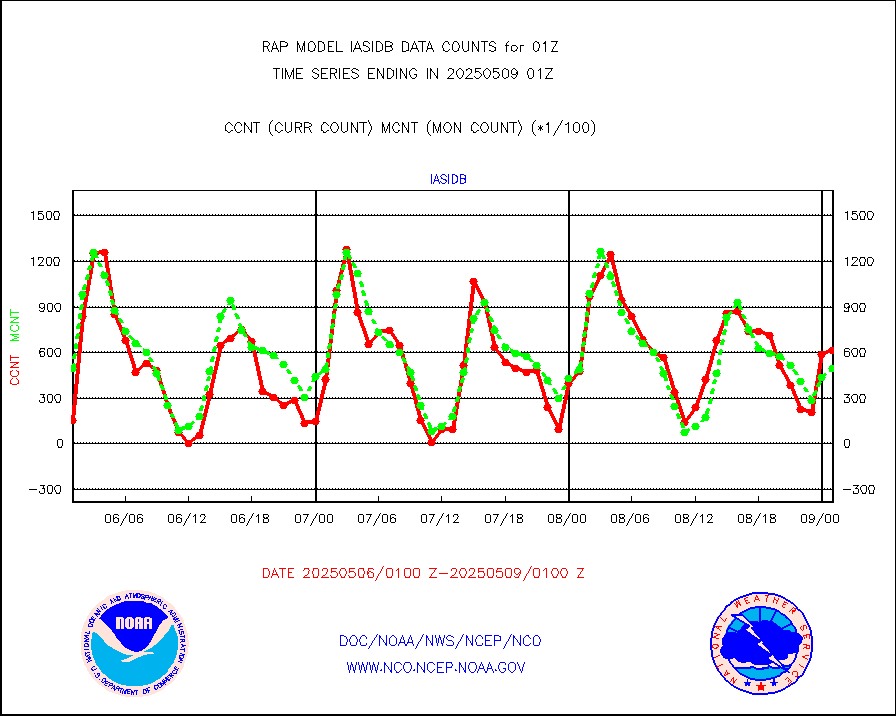
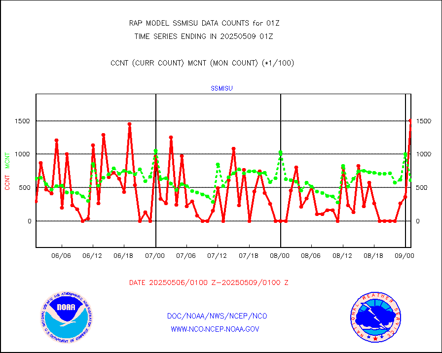
iasidb |
METOP 1-2 IASI 1C radiances-direct broadcast SSEC |
50040 |
36233 |
138.1 % |
2423.00-2502.99 |
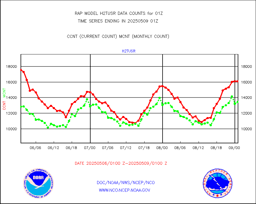
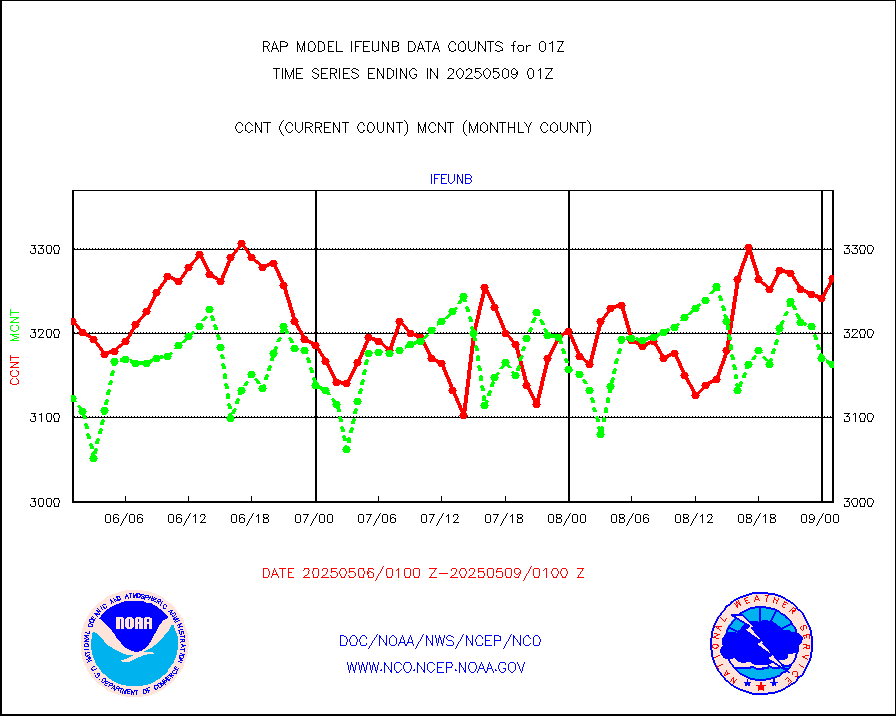
ifeunb |
METEOSAT/EUMETSAT ir lg-wave drv cld motion NBseq |
3299 |
3145 |
104.9 % |
2423.50-2502.49 |
ifvrnb |
VIIRS (NPP/NOAA-20) ir lg-wv drv cloud motion(NB) |
0 |
0 |
n/a |
2422.50-2503.50 |
infav |
AVHRR (NOAA/METOP) ir lg-wave derived cld motion |
0 |
0 |
n/a |
2422.50-2503.50 |
infav1 |
AVHRR (METOP) ir lg-wave derived cld motion |
0 |
0 |
n/a |
2423.50-2502.49 |
infja |
MTSAT/JMA infrared long-wave derived cloud motion |
3006 |
2458 |
122.3 % |
2422.50-2503.50 |
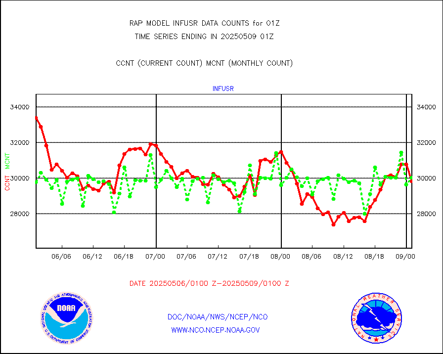
infusr |
GOES-16&up/NESDIS ir long-wave derived cld motion |
32922 |
31041 |
106.1 % |
2500.00-2500.99 |
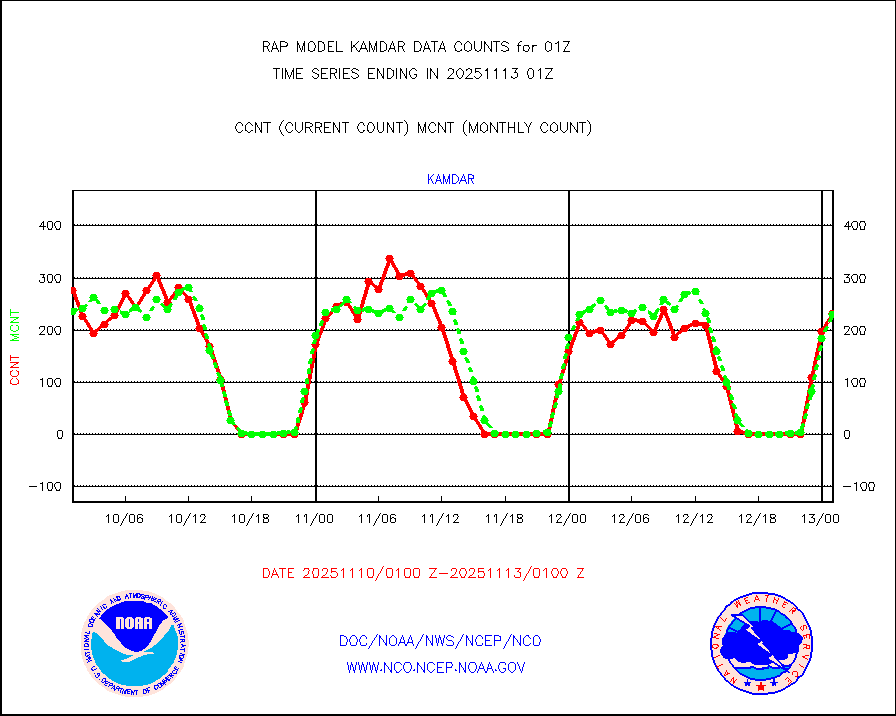
kamdar |
Korean AMDAR aircraft data (decoded from BUFR) |
300 |
272 |
110.3 % |
2421.75-2504.25 |
lcman |
Land-based CMAN stations decoded from CMAN format |
75 |
77 |
97.4 % |
2500.50-2501.50 |
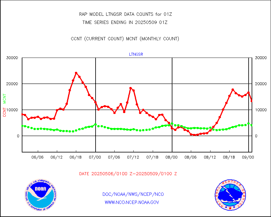
ltnglr |
LLDN Long-rng lightning from Vaisala via NOAAPORT |
40336 |
59027 |
68.3 % |
2500.00-2501.50 |
mbuoyb |
Moored buoys (decoded from BUFR) |
536 |
464 |
115.5 % |
2500.50-2501.50 |
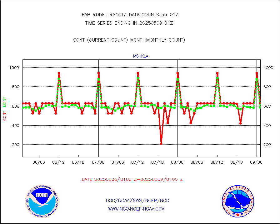
mso470 |
Mesonet/MADIS Colorado E-470 (Interstate 470) |
17 |
19 |
89.5 % |
2500.50-2501.50 |
msoalk |
Mesonet/MADIS Alaska Department of Transportation |
107 |
96 |
111.5 % |
2500.50-2501.50 |
msoapg |
Mesonet/MADIS U.S. Army Aberdeen Proving Grounds |
0 |
0 |
n/a |
2500.50-2501.50 |
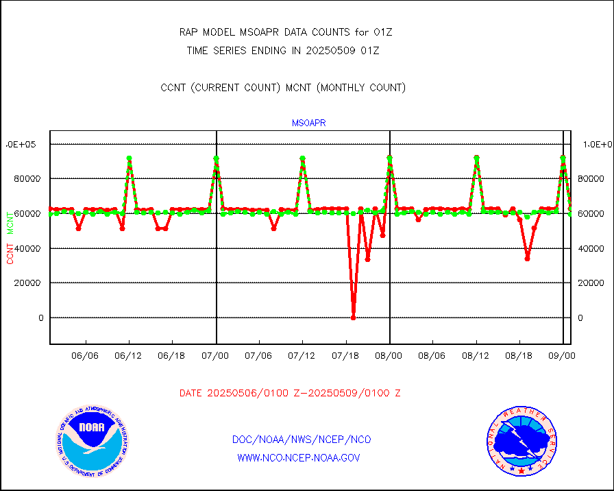
msoapr |
Mesonet/MADIS Citizen Weather Observers Program |
46450 |
43258 |
107.4 % |
2500.50-2501.50 |
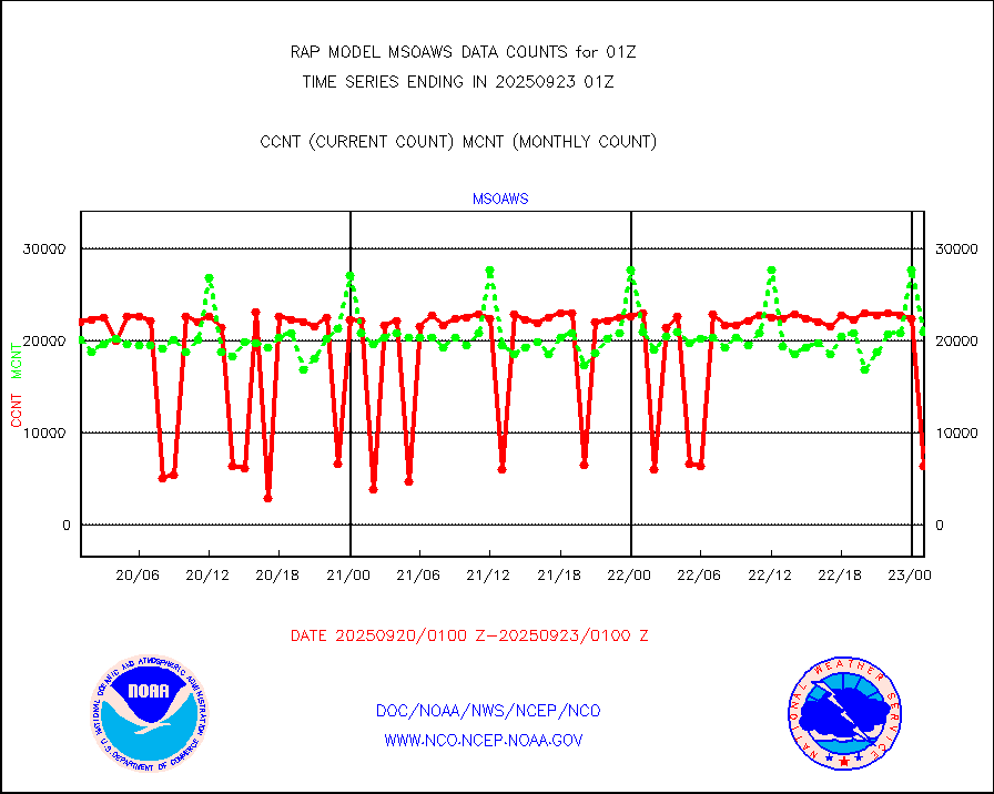
msoaws |
Mesonet/MADIS AWS Convergence Technologies, Inc. |
25980 |
25329 |
102.6 % |
2500.50-2501.50 |
msoawx |
Mesonet/MADIS "Anything Weather" |
0 |
0 |
n/a |
2500.50-2501.50 |
msocol |
Mesonet/MADIS Colorado Dept. of Transportation |
0 |
0 |
n/a |
2500.50-2501.50 |
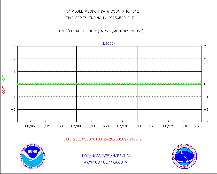
msodcn |
Mesonet/MADIS DC Net |
0 |
0 |
n/a |
2500.50-2501.50 |
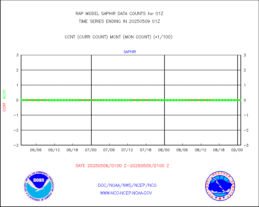
msoden |
Mesonet/MADIS Denver Urban Drainage & Flood Cntrl |
225 |
202 |
111.4 % |
2500.50-2501.50 |
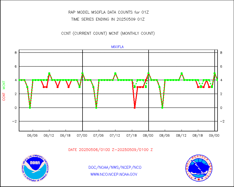
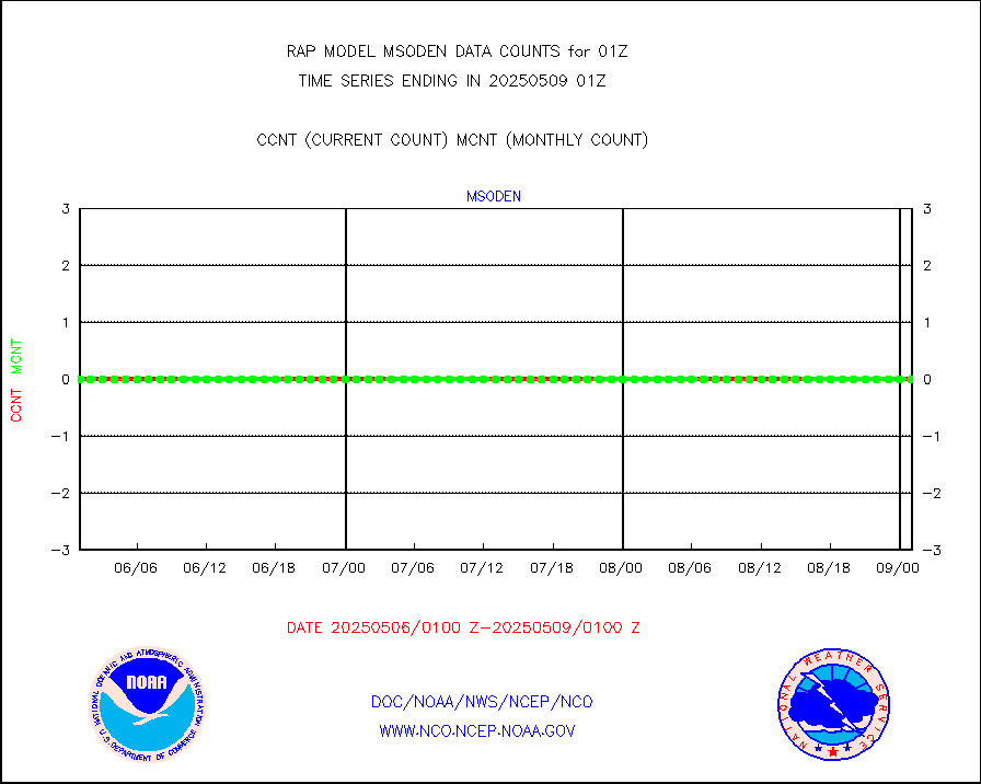
msofla |
Mesonet/MADIS Florida (FAWN & USF) |
3 |
3 |
100.0 % |
2500.50-2501.50 |
msoflt |
Mesonet/MADIS Florida Dept. of Transportation |
0 |
0 |
n/a |
2500.50-2501.50 |
msogeo |
Mesonet/MADIS Georgia Dept. of Transportation |
0 |
0 |
n/a |
2500.50-2501.50 |
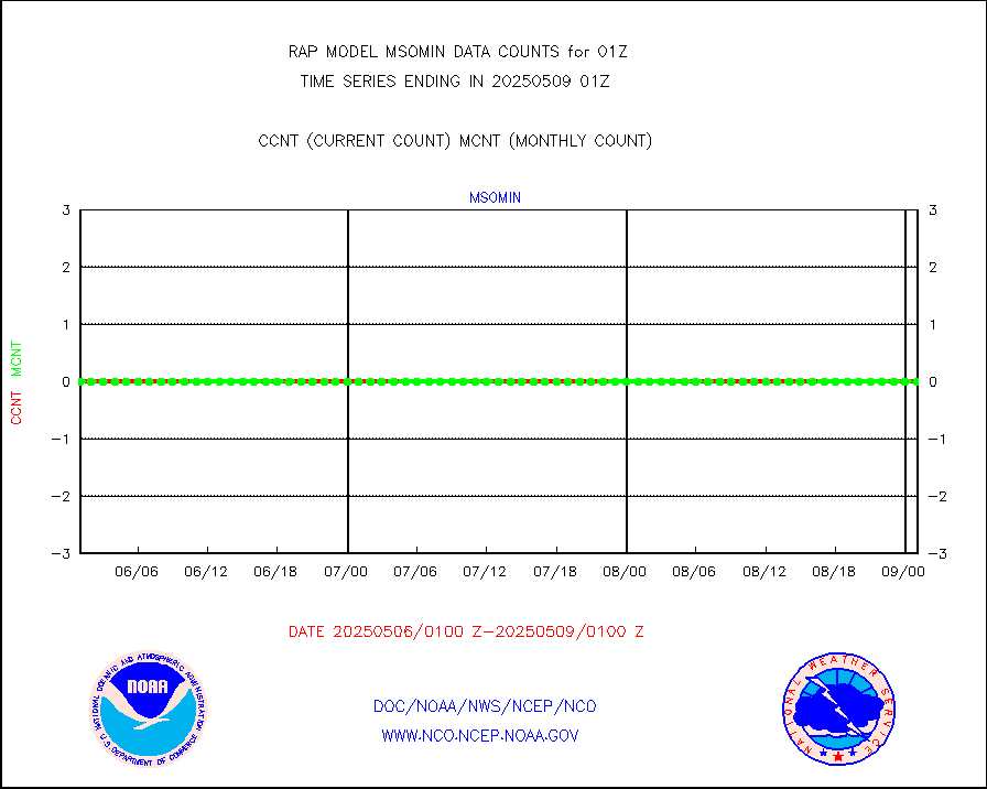
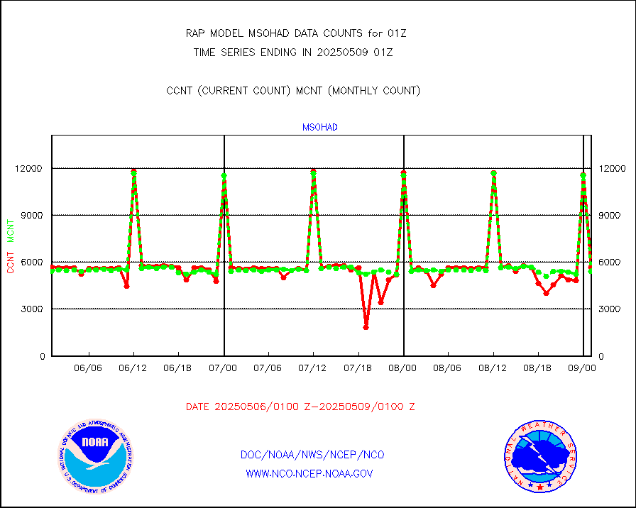
msohad |
Mesonet/MADIS NWS Hydromet Auto Data System(HADS) |
5490 |
5409 |
101.5 % |
2500.50-2501.50 |
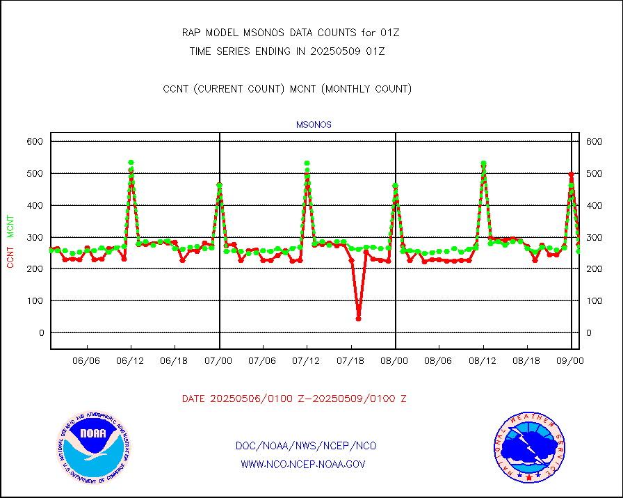
msoien |
Mesonet/MADIS Iowa Environmental |
160 |
170 |
94.1 % |
2500.50-2501.50 |
msoind |
Mesonet/MADIS Indiana Dept. of Transportation |
0 |
0 |
n/a |
2500.50-2501.50 |
msoiow |
Mesonet/MADIS Iowa Department of Transportation |
0 |
0 |
n/a |
2500.50-2501.50 |
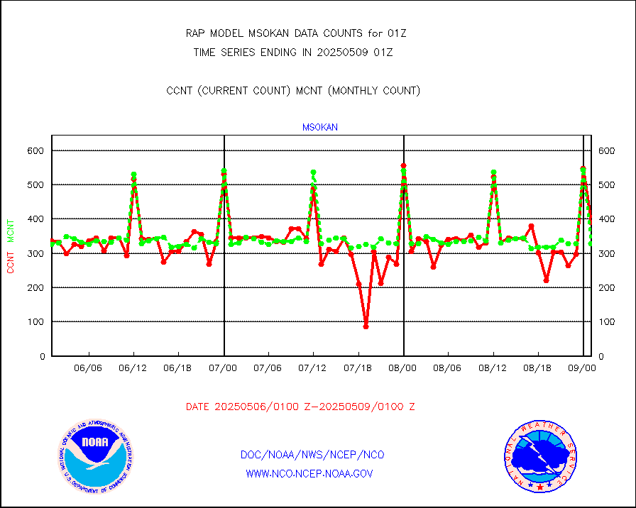
msokan |
Mesonet/MADIS Kansas Department of Transportation |
24 |
340 |
7.1 % |
2500.50-2501.50 |
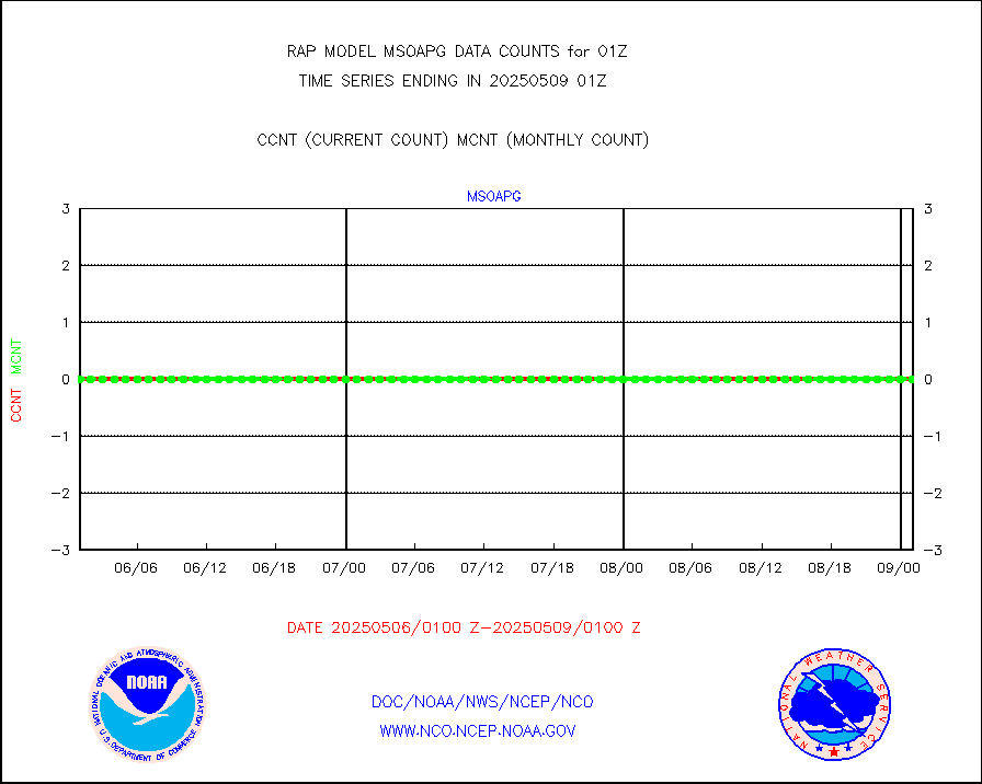
msokla |
Mesonet/MADIS Oklahoma Mesonet |
318 |
329 |
96.7 % |
2500.50-2501.50 |
msolju |
Mesonet/MADIS Louisiana State/Jackson State Univ. |
0 |
0 |
n/a |
2500.50-2501.50 |
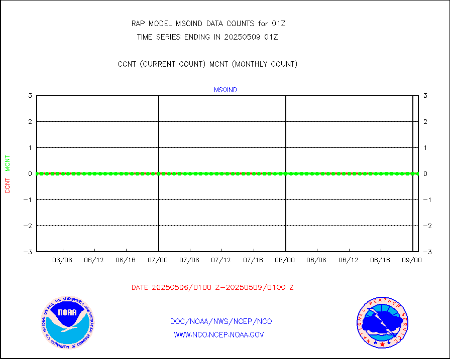
msomca |
Mesonet/MADIS Missouri Commercial Agricult Wx Net |
246 |
251 |
98.0 % |
2500.50-2501.50 |
msomin |
Mesonet/MADIS Minnesota Dept. of Transportation |
0 |
0 |
n/a |
2500.50-2501.50 |
msonos |
Mesonet/MADIS NOS-Phys Oceanographic Realtime Sys |
285 |
258 |
110.5 % |
2500.50-2501.50 |
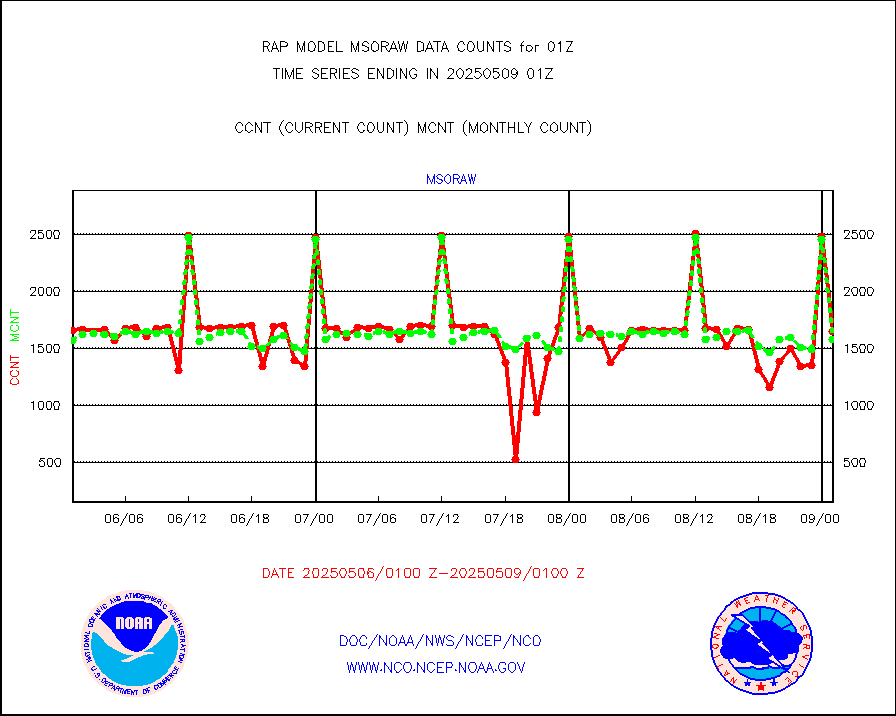
msoraw |
Mesonet/MADIS NFIC Remote Automated Wx Stns(RAWS) |
1621 |
1494 |
108.5 % |
2500.50-2501.50 |
msourb |
Mesonet/MADIS UrbaNet |
4069 |
3926 |
103.6 % |
2500.50-2501.50 |
msovir |
Mesonet/MADIS Virginia Dept. of Transportation |
234 |
235 |
99.6 % |
2500.50-2501.50 |
msowfy |
Mesonet/MADIS "Weather for You" |
0 |
0 |
n/a |
2500.50-2501.50 |
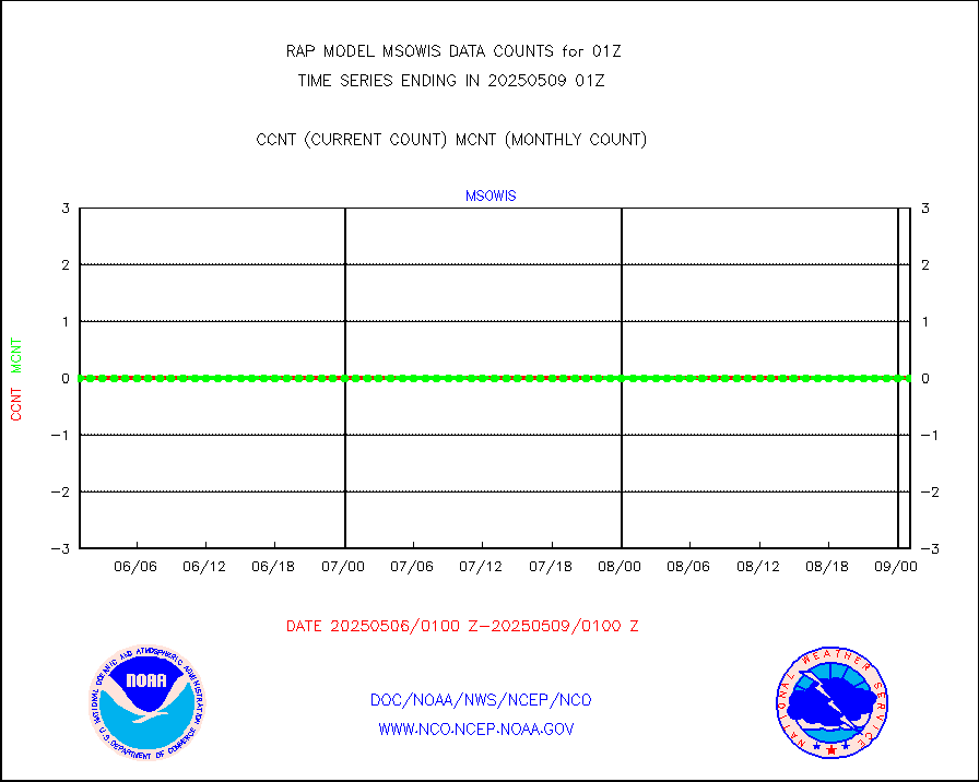
msowis |
Mesonet/MADIS Wisconsin Dept. of Transportation |
0 |
0 |
n/a |
2500.50-2501.50 |
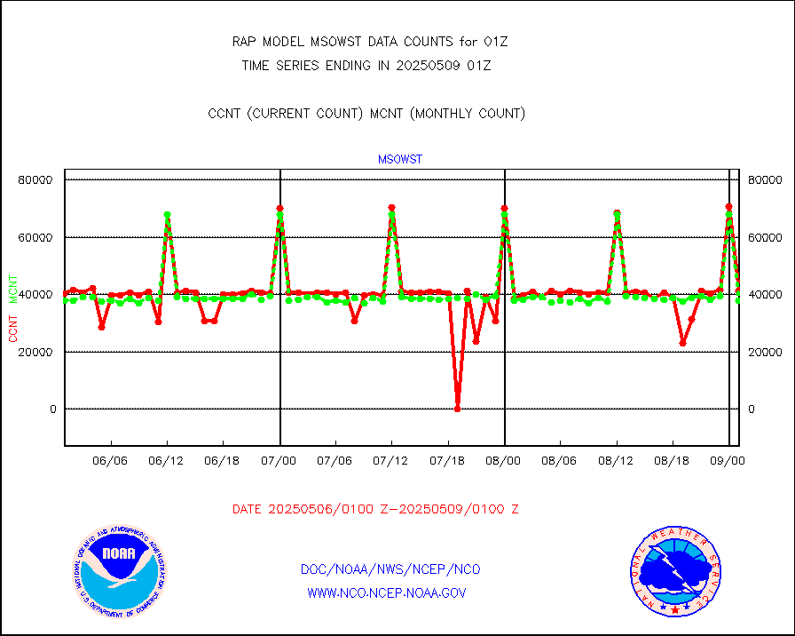
msowst |
Mesonet/MADIS MesoWest (many subproviders) |
40096 |
37837 |
106.0 % |
2500.50-2501.50 |
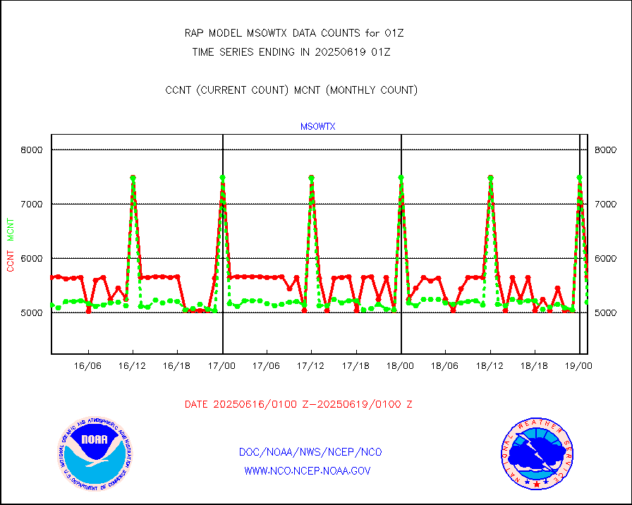
msowtx |
Mesonet/MADIS West Texas |
4623 |
4930 |
93.8 % |
2500.50-2501.50 |
mtiasi |
METOP 1-2 IASI 1C radiance data (varbl. channels) |
43575 |
31742 |
137.3 % |
2423.00-2502.99 |
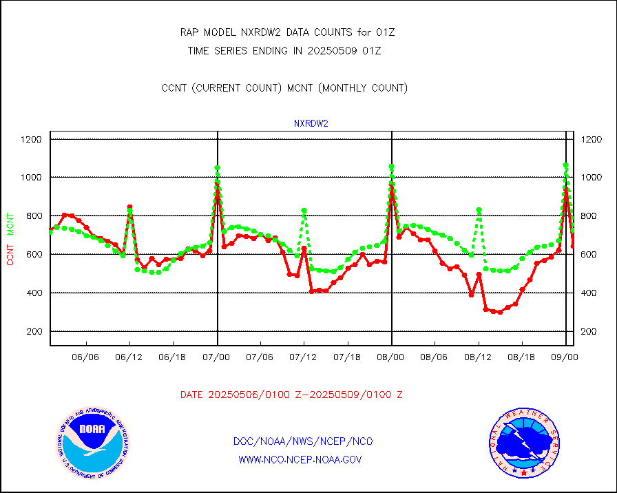
nxrdw2 |
NEXRAD Vel Azm Dsp(VAD) winds via Level 2 decoder |
733 |
735 |
99.7 % |
2500.00-2502.00 |
osbuv8 |
NOAA 16-19 Solar Backscatter UV-2 rad frm V8 BUFR |
0 |
0 |
n/a |
2423.00-2501.99 |
pibal |
PIBAL (from PILOT, PILOT SHIP, PILOT MOBIL) |
0 |
0 |
n/a |
2500.00-2502.00 |
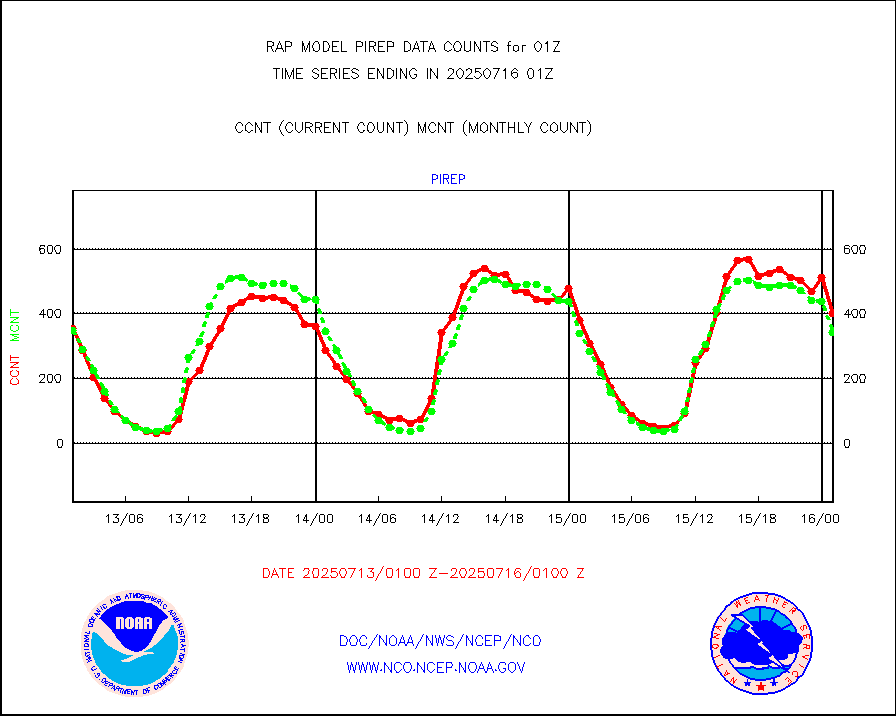
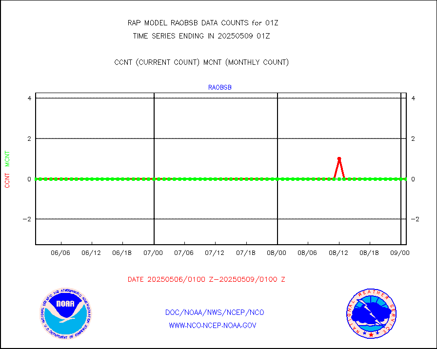
pirep |
Manual PIREP aircraft data (dcded from AIREP fmt) |
212 |
458 |
46.3 % |
2421.75-2504.25 |
prflrp |
Profilr winds from PIBAL (PILOT,PILOT SHIP/MOBIL) |
0 |
0 |
n/a |
2423.50-2502.50 |
raobm |
Rawinsonde - mobile land (from TEMP/PILOT MOBIL) |
0 |
0 |
n/a |
2500.00-2502.00 |
raobs |
Rawinsonde - ship (from TEMP SHIP, PILOT SHIP) |
1 |
0 |
n/a |
2500.00-2502.00 |
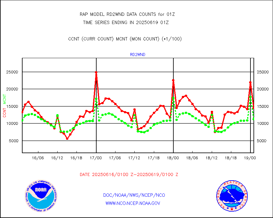
rd2wnd |
NEXRAD radial wind (Level 2 - GTS) |
795393 |
956599 |
83.1 % |
2500.50-2501.49 |
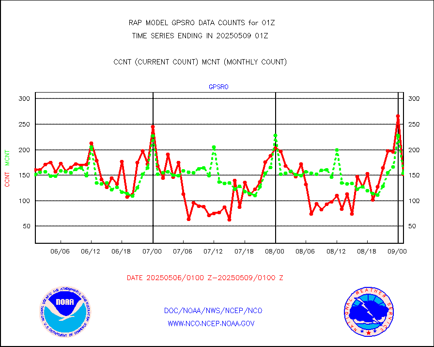
recco |
Flight level reconnaissance aircraft data |
2 |
0 |
n/a |
2500.00-2502.00 |
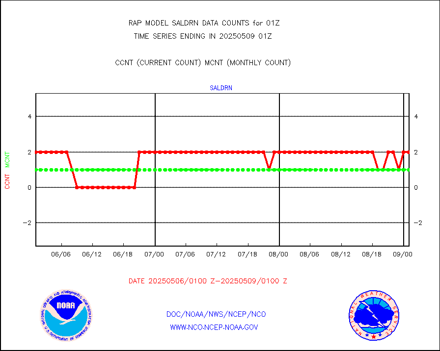
saldrn |
Surface Marine Saildrone (decoded from BUFR) |
2 |
2 |
100.0 % |
2423.00-2502.99 |
saphir |
Megha-Tropiques SAPHIR L1A2 brightness temps |
0 |
0 |
n/a |
2422.00-2503.99 |
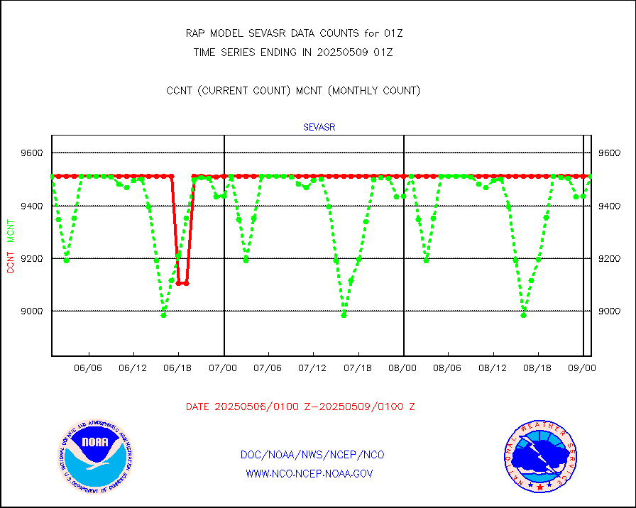
sevasr |
METEOSAT-10 2nd Gen SEVIRI All Sky Radiance(proc) |
9512 |
9508 |
100.0 % |
2423.00-2502.99 |
sevcsr |
METEOSAT-10 2nd Gen SEVIRI Clr Sky Radiance(proc) |
0 |
0 |
n/a |
2423.00-2502.99 |
ships |
Ship - manual and automatic, restricted |
10 |
2 |
500.0 % |
2500.50-2501.50 |
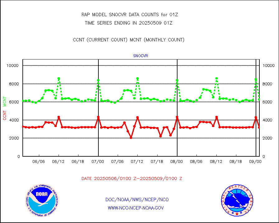
snocvr |
NOW COVER, DEPTH/DENSITY AND WATER EQUIVALENT |
3115 |
6443 |
48.3 % |
2423.00-2503.00 |
ssmisu |
DMSP SSM/IS 1C radiance data (Unified Pre-Proc.) |
30484 |
62631 |
48.7 % |
2423.00-2502.99 |
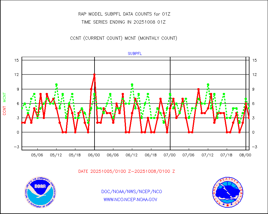
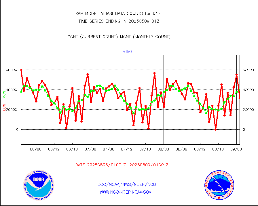
subpfl |
Sub-surface float and glider profile (BUFR) |
0 |
2 |
0.0 % |
2423.00-2502.99 |
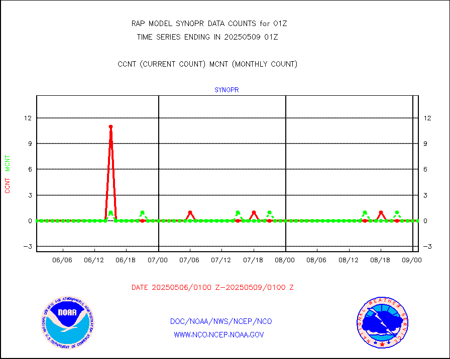
synopr |
Synoptic - restricted (WMO Res 40) manual & auto. |
0 |
0 |
n/a |
2500.50-2501.50 |
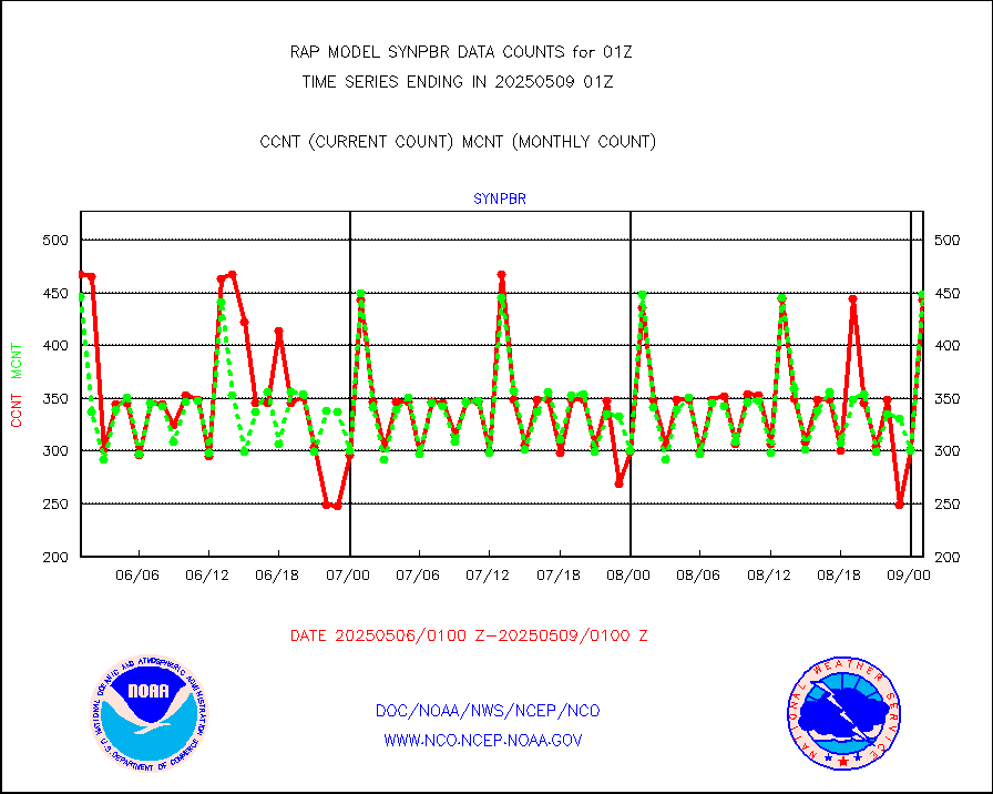
synpbr |
Synoptic - restricted (WMO Res 40)(decoded BUFR) |
345 |
382 |
90.3 % |
2500.50-2501.50 |
synpmb |
Synoptic - mobile manual & auto (decoded fr BUFR) |
0 |
0 |
n/a |
2500.50-2501.50 |
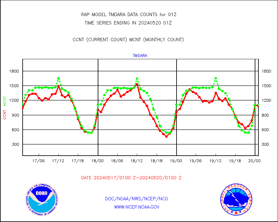
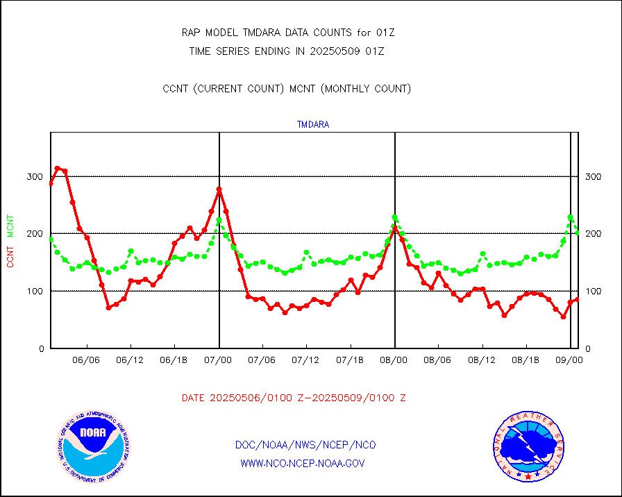
tmdara |
TAMDAR aircft data-all types(from Panasonic,BUFR) |
1250 |
1147 |
109.0 % |
2421.75-2504.25 |
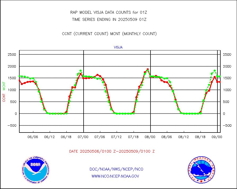
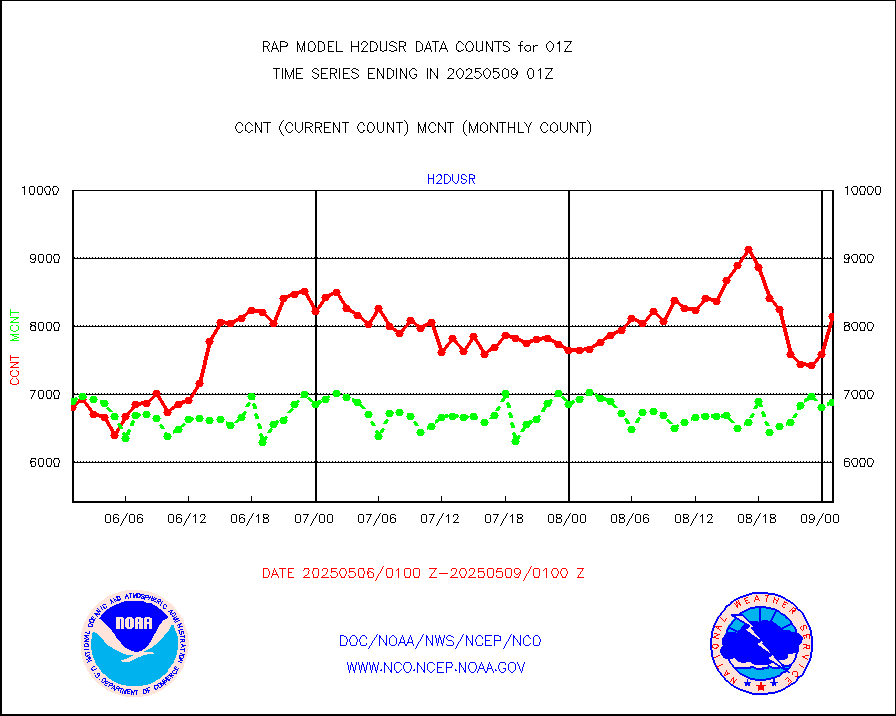
visja |
MTSAT/JMA visible derived cloud motion |
1972 |
1619 |
121.8 % |
2422.50-2503.50 |
visusr |
GOES-16&up/NESDIS visible derived cloud motion |
100470 |
120930 |
83.1 % |
2500.00-2500.99 |
vseunb |
METEOSAT/EUMETSAT visible drv cld motion NBseq |
0 |
0 |
n/a |
2423.50-2502.49 |


