| Critical Data with Normal Counts |
|---|
| Type | Description | Hourly Count | Monthly Average | Percent (%) of Monthly Mean | UTC Time Window |
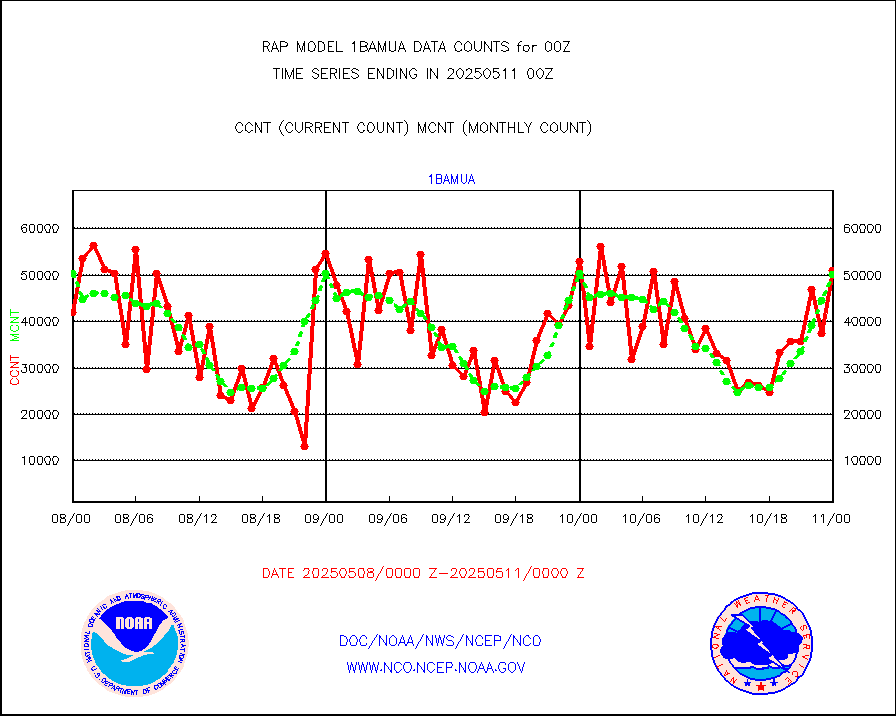
1bamua |
NOAA 15-19 & METOP 1-2 AMSU-A NCEP-proc. br.temps |
44765 |
47097 |
95.0 % |
1721.00-1802.99 |
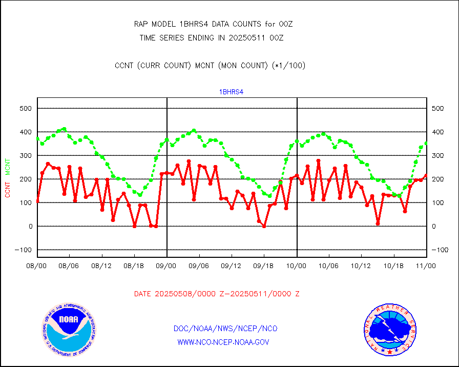
1bhrs4 |
NOAA 18-19 & METOP 1-2 HIRS-4 NCEP-proc. br.temps |
43765 |
33200 |
131.8 % |
1721.00-1802.99 |
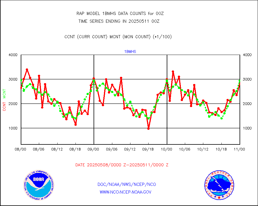
1bmhs |
NOAA 18-19 & METOP 1-2 MHS NCEP-proces. br. temps |
314258 |
286897 |
109.5 % |
1721.00-1802.99 |
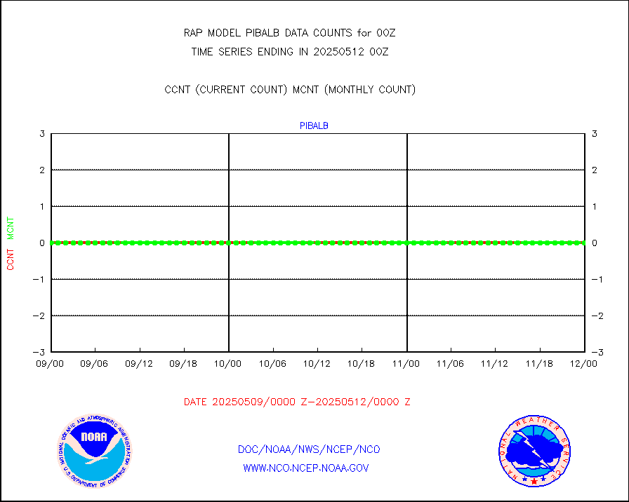
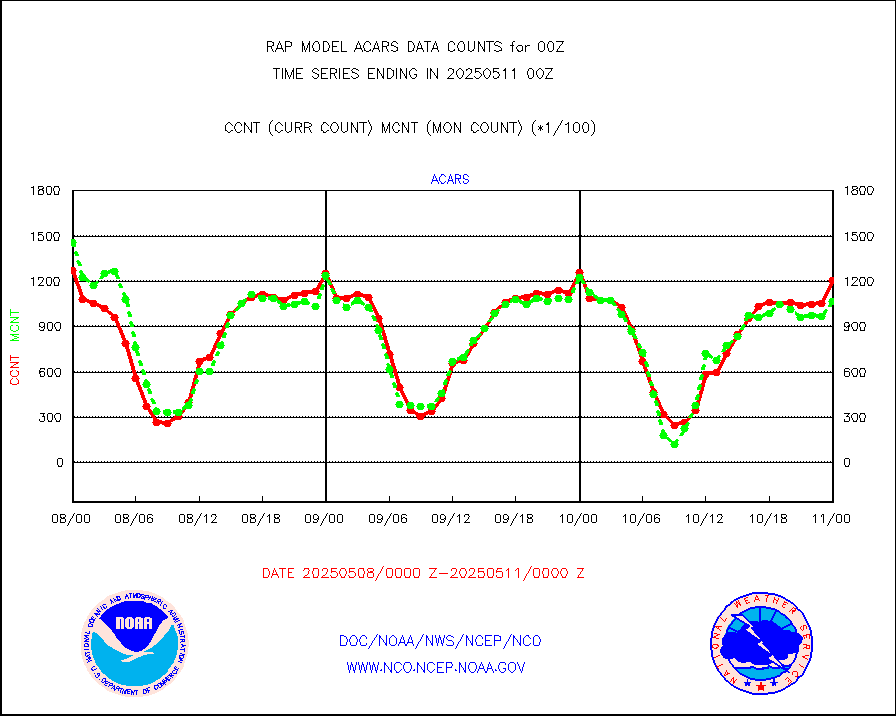
acars |
MDCRS ACARS acft data from ARINC(dcded from BUFR) |
109979 |
101292 |
108.6 % |
1720.75-1803.25 |
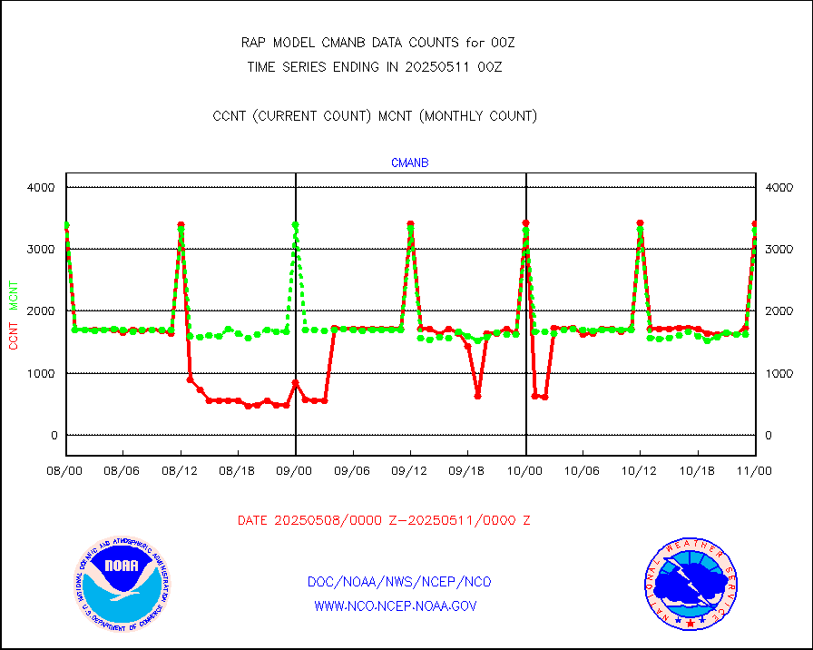
cmanb |
Surface Marine CMAN rpts decoded from BUFR format |
3488 |
3424 |
101.9 % |
1723.50-1800.50 |
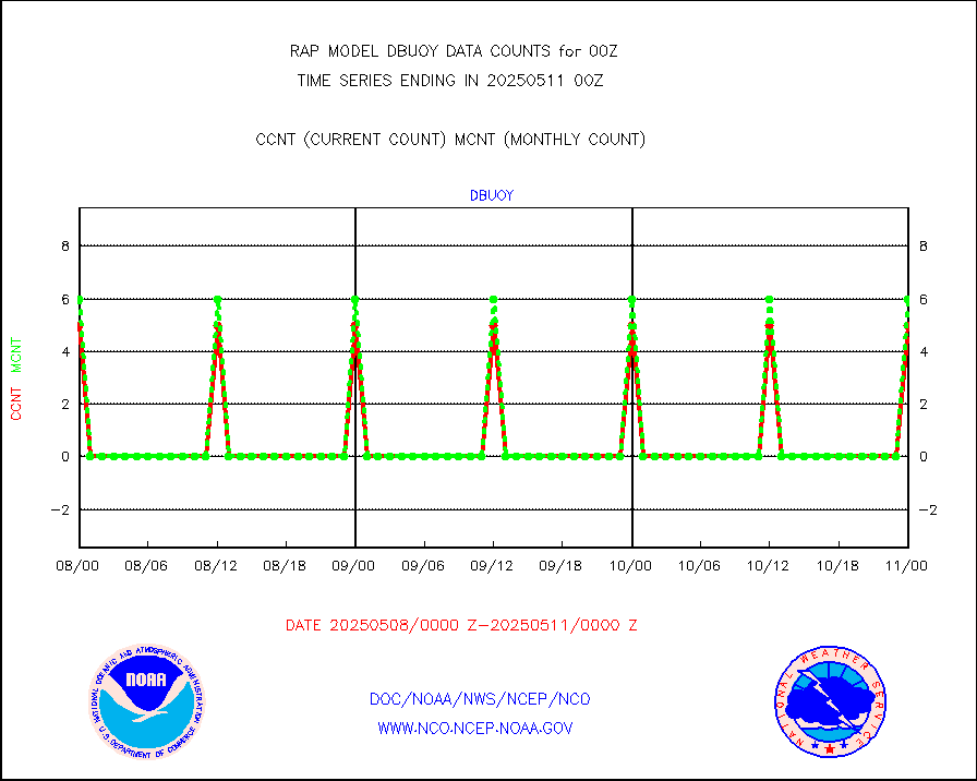
dbuoy |
Buoys decoded from FM-18 fmt (moored or drifting) |
4 |
4 |
100.0 % |
1723.50-1800.50 |
gnss |
Grnd-based Gbl Navigation Sat System (GNSS) data |
3574 |
2898 |
123.3 % |
1722.95-1723.05 |
h20mo |
MODIS (AQUA/TERRA) wvpr imager derived cld motion |
0 |
0 |
n/a |
1722.50-1801.50 |
infmo |
MODIS (AQUA/TERRA) ir l-wave derived cloud motion |
0 |
0 |
n/a |
1722.50-1801.50 |
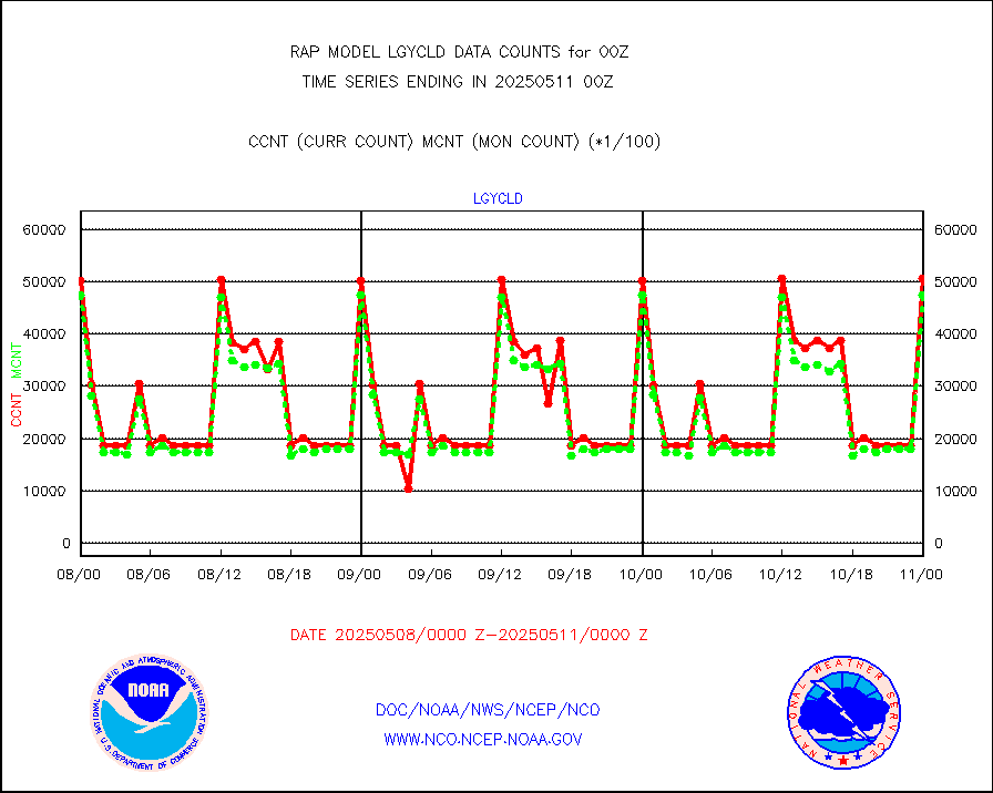
lgycld |
GOES/NASA(Langley) hi-res. (1x1 f-o-v) cloud data |
3697679 |
3676340 |
100.6 % |
1723.50-1800.50 |
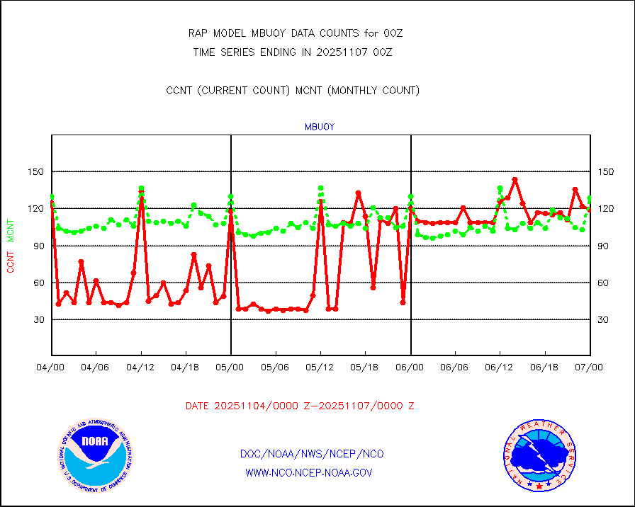
mbuoy |
Buoys decoded from FM-13 format (moored) |
107 |
124 |
86.3 % |
1723.50-1800.50 |
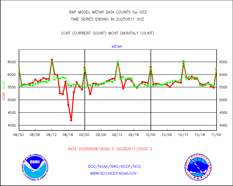
metar |
Aviation - METAR |
5169 |
6293 |
82.1 % |
1723.50-1800.50 |
nxrdw |
NEXRAD Vel Azm Dsp(VAD) winds via radar coded msg |
0 |
0 |
n/a |
1723.00-1801.00 |
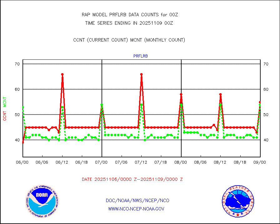
prflrb |
Multi-Agency Profiler (MAP) and SODAR winds |
121 |
104 |
116.3 % |
1722.50-1801.50 |
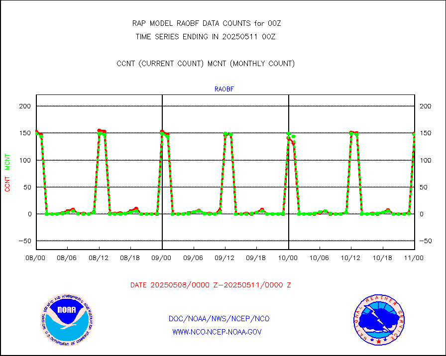
raobf |
Rawinsonde - fixed land (from TEMP or PILOT) |
109 |
158 |
69.0 % |
1723.00-1801.00 |
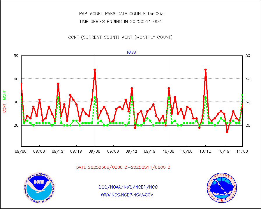
rass |
RASS temperatures (NOAA and Multi-Agency) |
39 |
31 |
125.8 % |
1723.50-1800.50 |
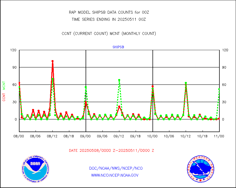
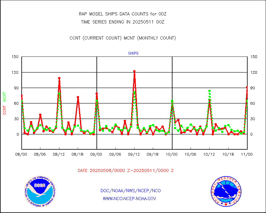
shipsb |
Ship - manual and automatic, restricted (BUFR) |
34 |
90 |
37.8 % |
1723.50-1800.50 |
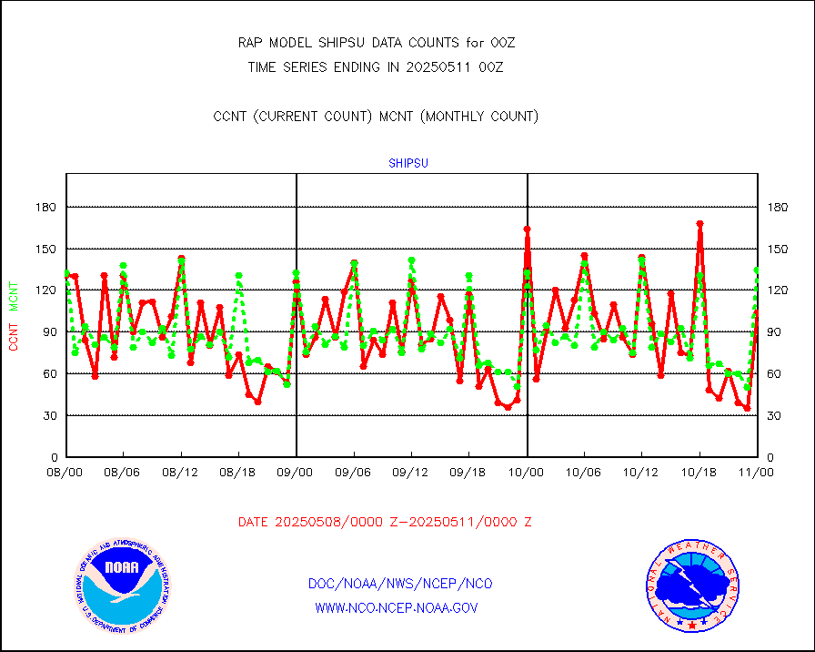
shipsu |
Ship - manual and automatic, unrestricted |
80 |
89 |
89.9 % |
1723.50-1800.50 |
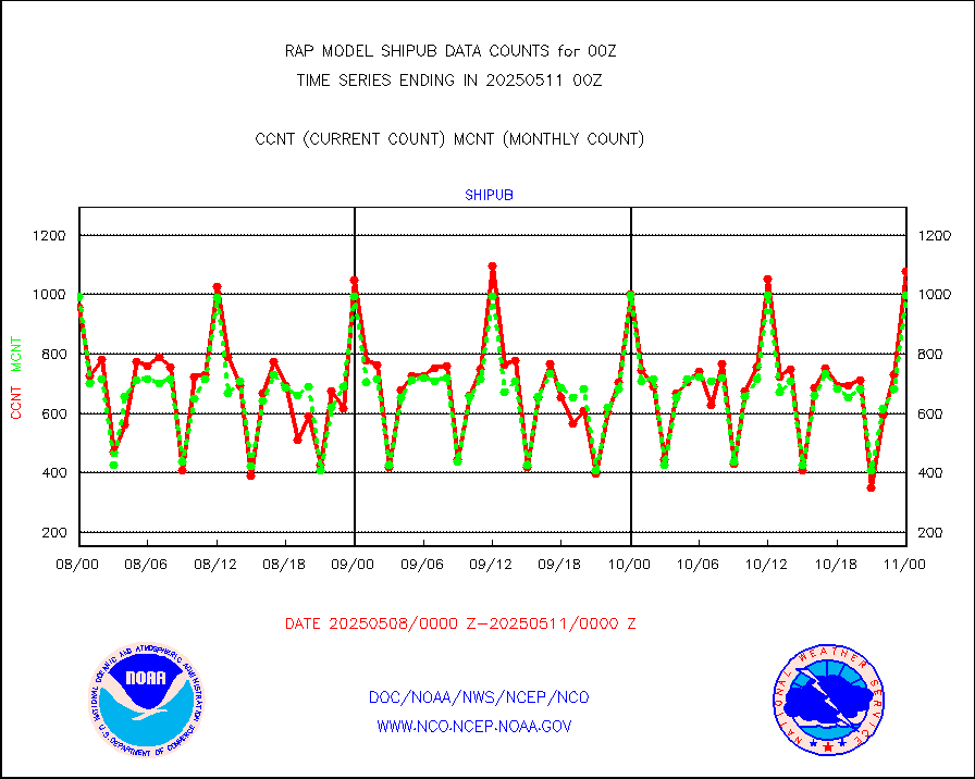
shipub |
Ship - manual and automatic, unrestricted (BUFR) |
992 |
987 |
100.5 % |
1723.50-1800.50 |
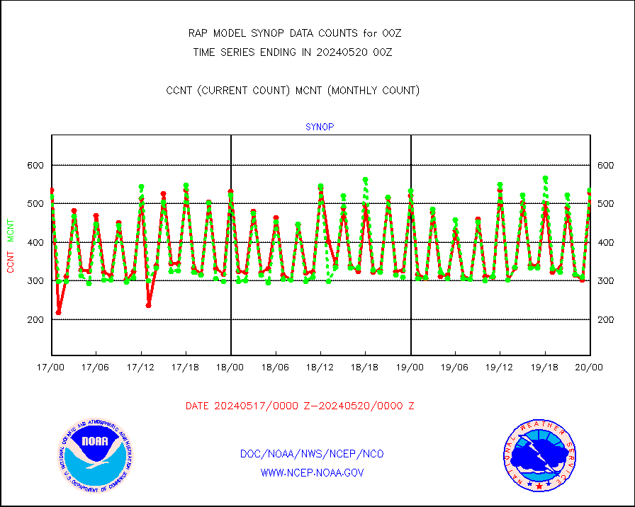
synop |
Synoptic - fixed manual and automatic |
181 |
550 |
32.9 % |
1723.50-1800.50 |
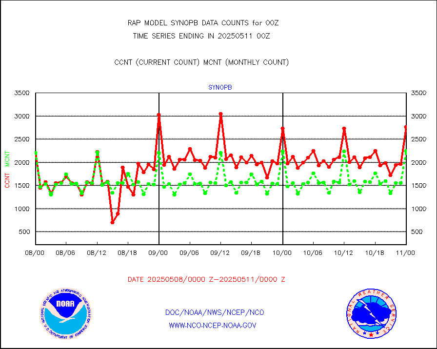
synopb |
Synoptic - fixed manual & auto (decoded fr BUFR) |
1375 |
2054 |
66.9 % |
1723.50-1800.50 |
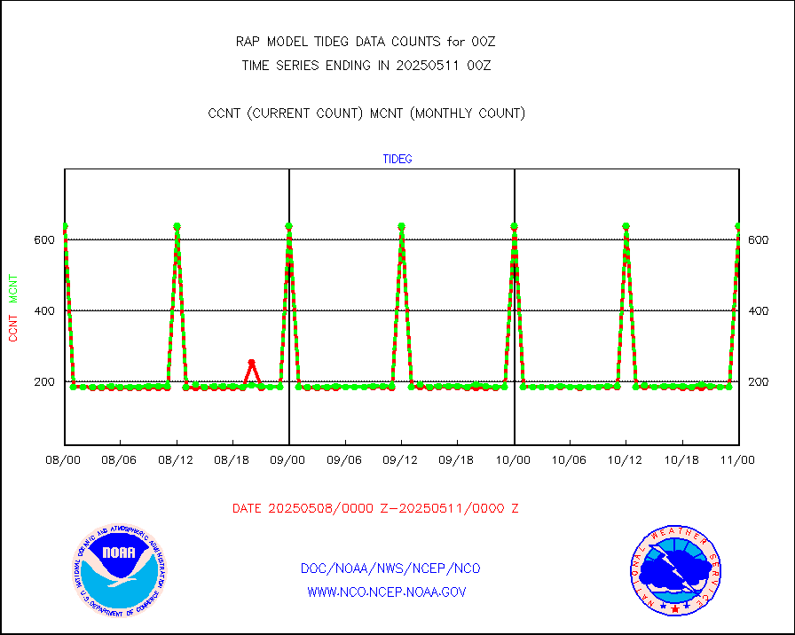
tideg |
Tide gauge reports decoded from CREX format |
624 |
618 |
101.0 % |
1723.50-1800.50 |
| Data Types of Opportunity with Normal Counts |
|---|
| Type | Description | Hourly Count | Monthly Average | Percent (%) of Monthly Mean | UTC Time Window |
3p9usr |
GOES-16&up/NESDIS ir short-wv derived cld motion |
2383 |
3988 |
59.8 % |
1723.00-1723.99 |
acarsa |
MDCRS ACARS acft data (ARINC via AFWA)(AIREP fmt) |
0 |
0 |
n/a |
1720.75-1803.25 |
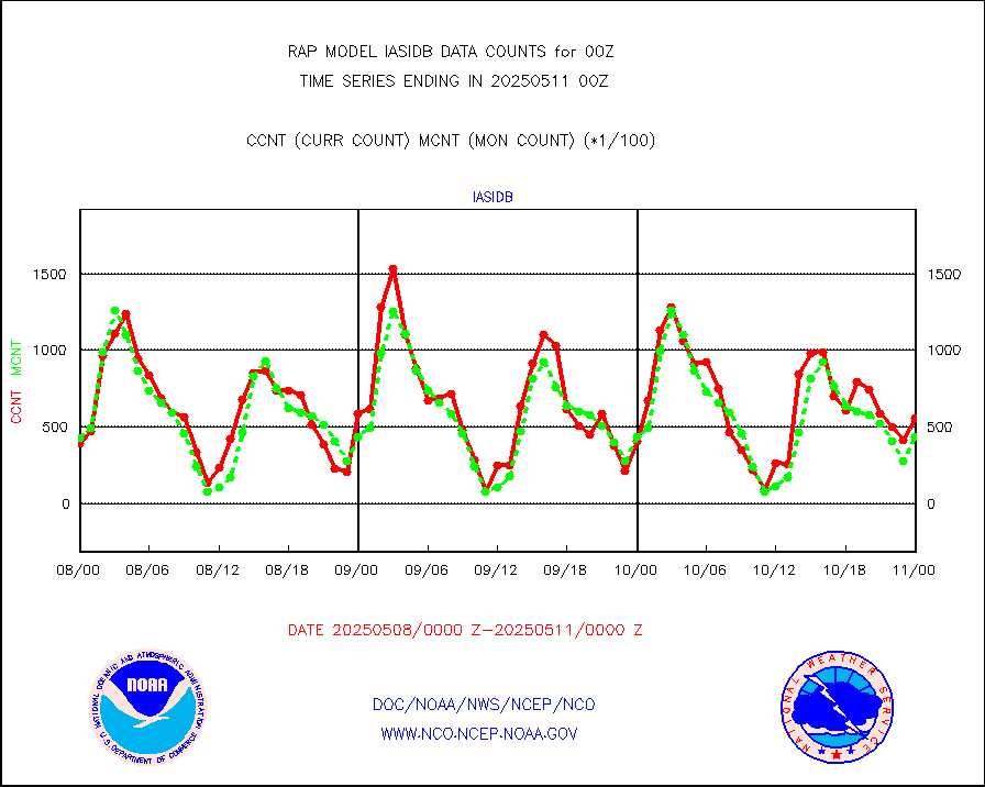
airsev |
AQUA AIRS/AMSU-A/HSB brightness temps- every FOV |
0 |
0 |
n/a |
1721.00-1802.99 |
amdar |
AMDAR aircraft data (decoded from AMDAR format) |
1899 |
1863 |
101.9 % |
1720.75-1803.25 |
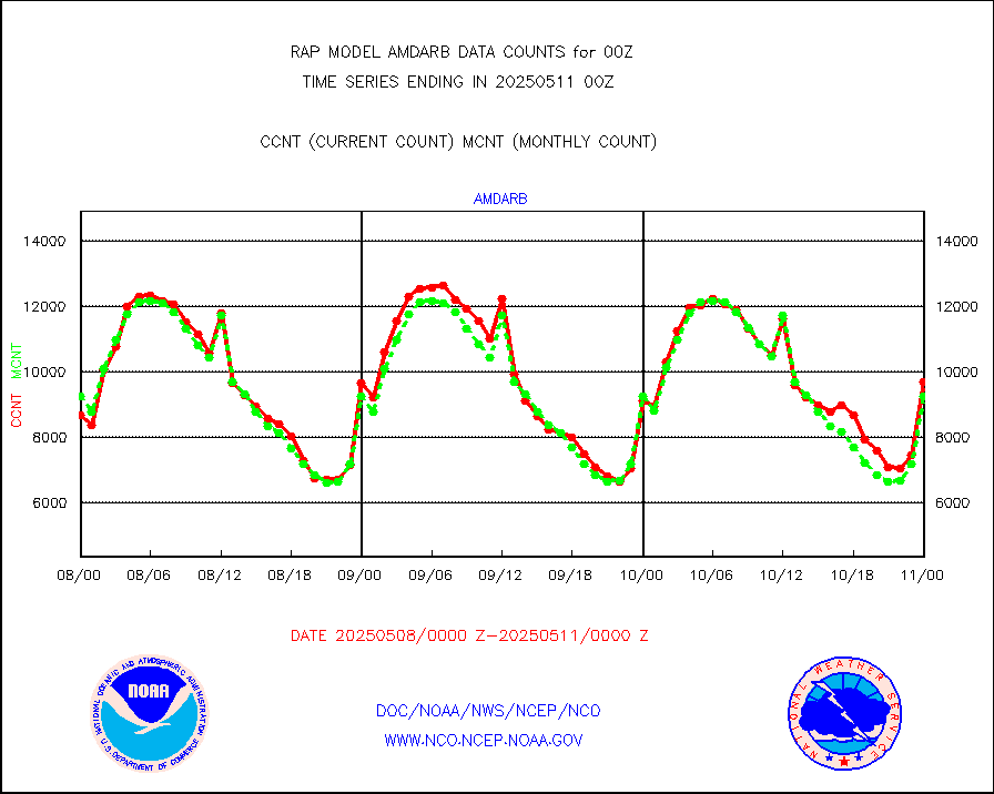
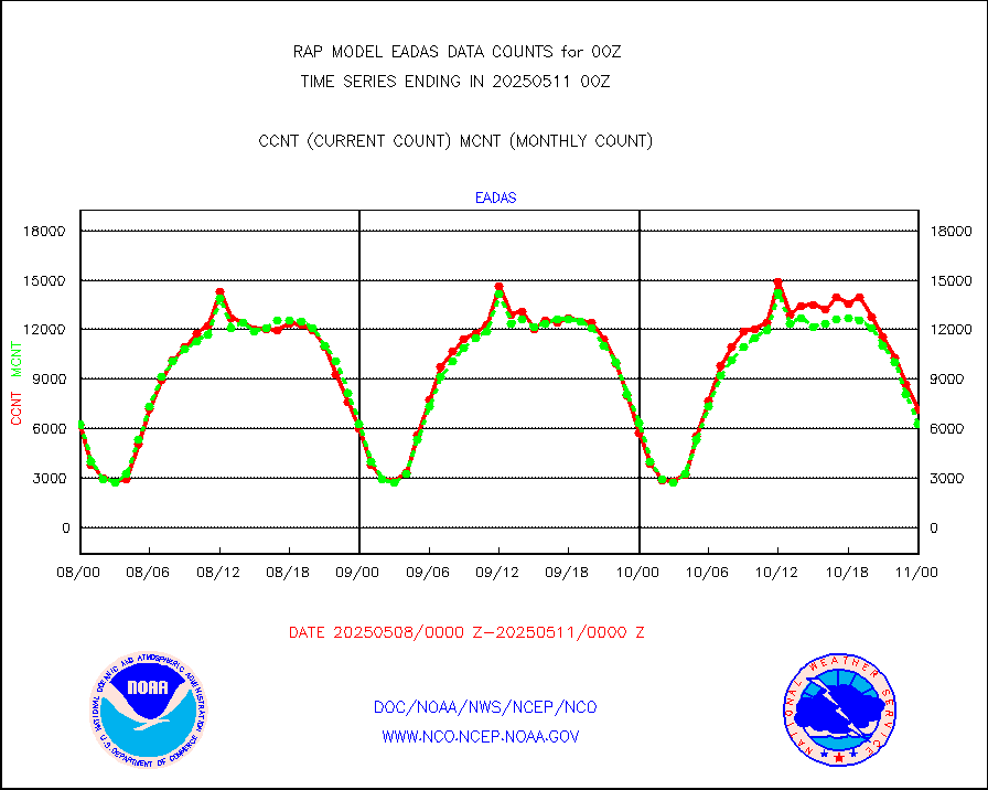
amdarb |
AMDAR aircraft data (decoded from BUFR) |
4883 |
4458 |
109.5 % |
1720.75-1803.25 |
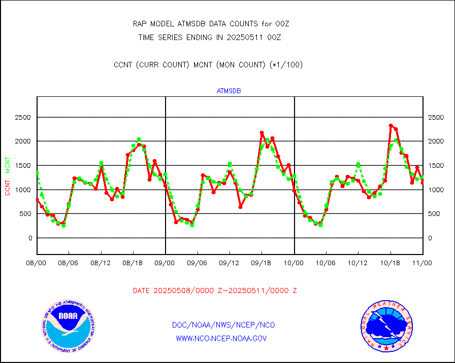
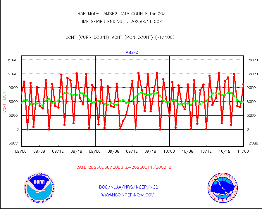
amsr2 |
GCOM-W AMSR2 1B brightness temperatures |
393792 |
594314 |
66.3 % |
1721.00-1721.99 |
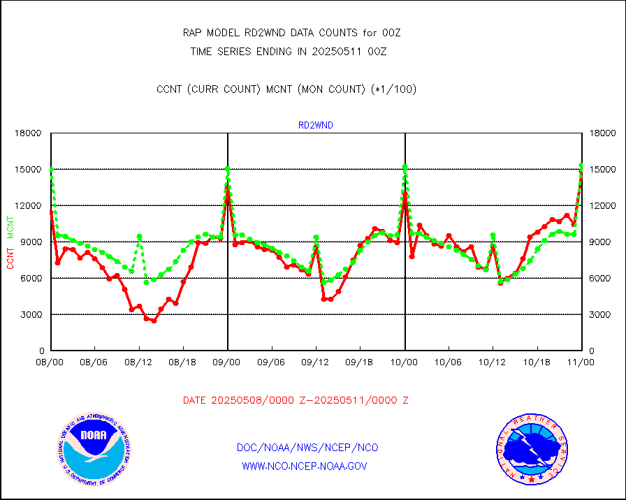
ascat |
METOP 1-2 ASCAT products |
31072 |
31414 |
98.9 % |
1722.00-1802.00 |
atms |
NPP/NOAA-20 ATMS brightness temperatures |
246919 |
227608 |
108.5 % |
1722.00-1801.99 |
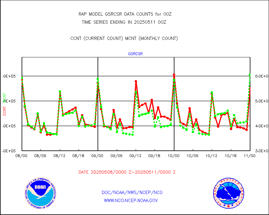
atmsdb |
NPP/NOAA-20 ATMS bright. temps-direct b-cast SSEC |
189300 |
152961 |
123.8 % |
1722.00-1801.99 |
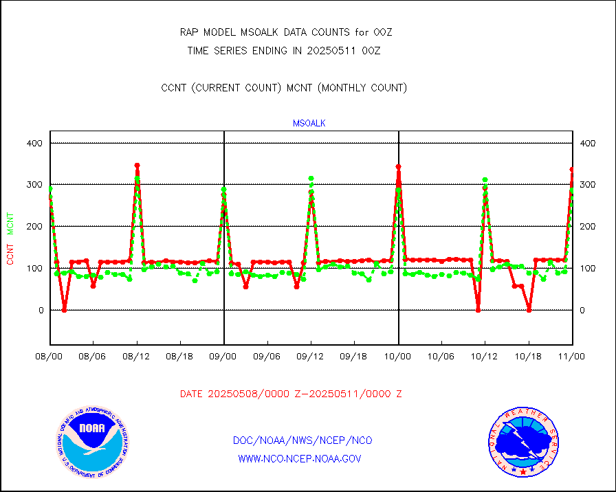
coopmd |
Coop/MADIS NEPP & HCN-Modernization NOAA COOP Obs |
69 |
67 |
103.0 % |
1723.50-1800.50 |
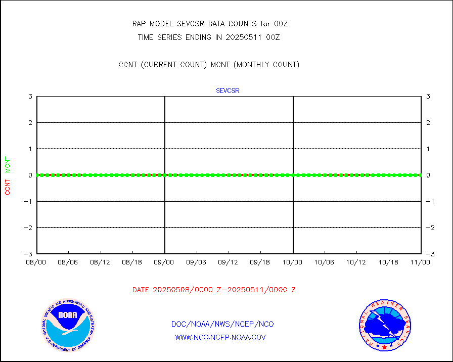
crisf4 |
NPP/NOAA-20 CrIS full spctrl radn (431 ch subset) |
122523 |
137145 |
89.3 % |
1722.00-1801.99 |
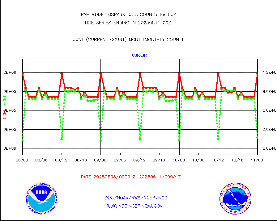
crsfdb |
NPP/NOAA-20 CrIS full spctrl radn dir brdcst SSEC |
130704 |
105325 |
124.1 % |
1722.00-1801.99 |
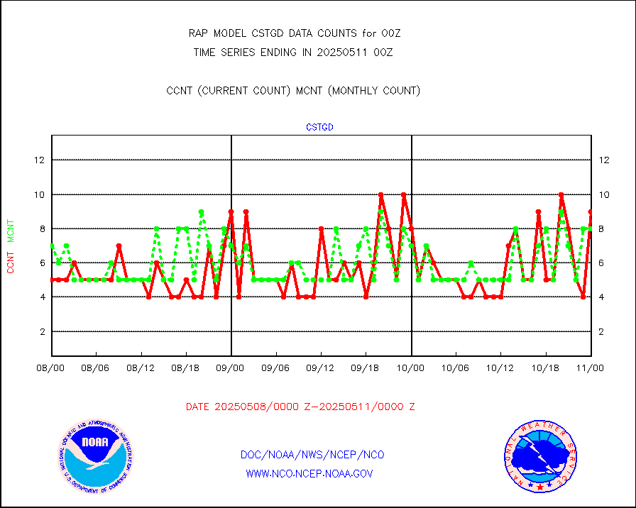
cstgd |
Coast Guard |
4 |
5 |
80.0 % |
1723.50-1800.50 |
dbuoyb |
Drifting buoys (decoded from BUFR) |
577 |
650 |
88.8 % |
1723.50-1800.50 |
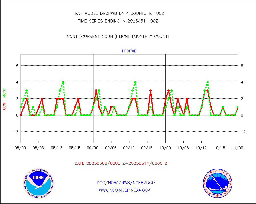
dropw |
Dropwinsonde (from TEMP DROP) |
0 |
1 |
0.0 % |
1723.00-1801.00 |
eadas |
E-AMDAR (European AMDAR acft decoded from BUFR) |
4106 |
4822 |
85.2 % |
1720.75-1803.25 |
esamua |
NOAA 15-19 & METOP 1-2 AMSU-A proc btmps frm RARS |
20947 |
22093 |
94.8 % |
1723.00-1801.00 |
esatms |
NPP Adv. Tech. MW Sndr (ATMS) br. temps from RARS |
45301 |
32029 |
141.4 % |
1722.00-1801.99 |
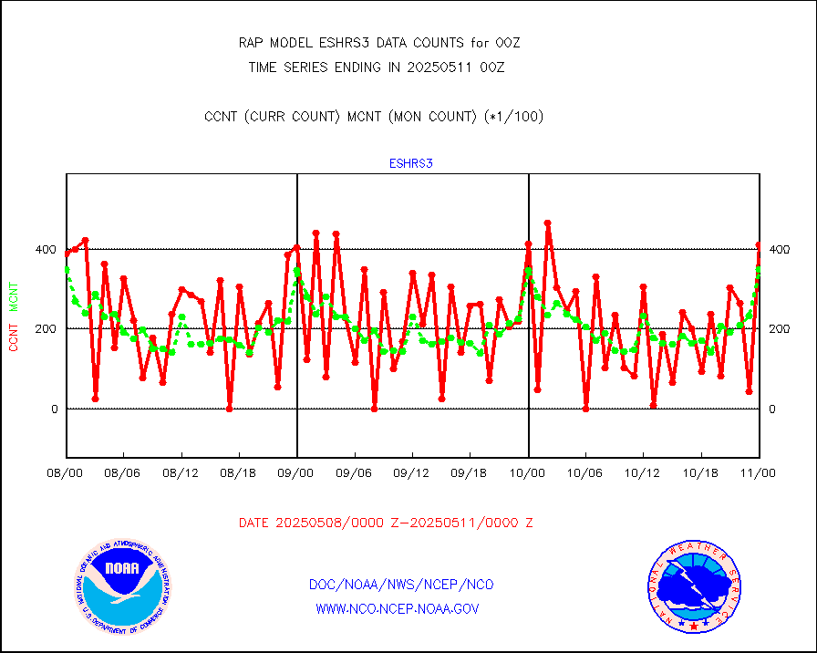
eshrs3 |
NOAA 15-19 & METOP 1-2 HIRS-3/4 pr btmps frm RARS |
54244 |
48718 |
111.3 % |
1723.00-1801.00 |
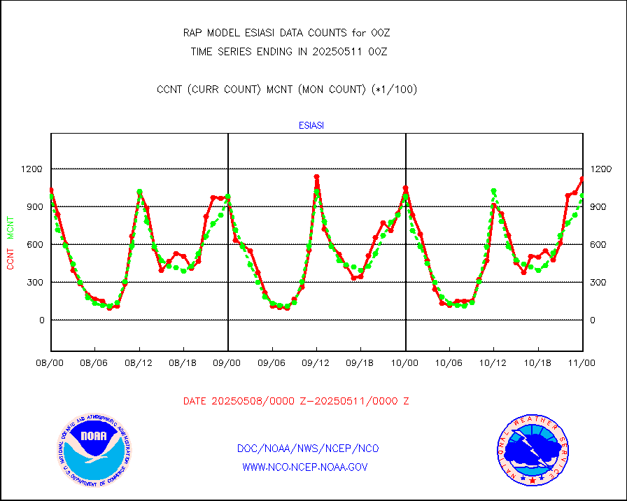
esiasi |
METOP 1-2 IASI 1C radiance data vbl chn from RARS |
114780 |
111991 |
102.5 % |
1722.00-1801.99 |
esmhs |
NOAA 18-19 & METOP 1-2 MHS proc. btemps from RARS |
161682 |
166705 |
97.0 % |
1723.00-1801.00 |
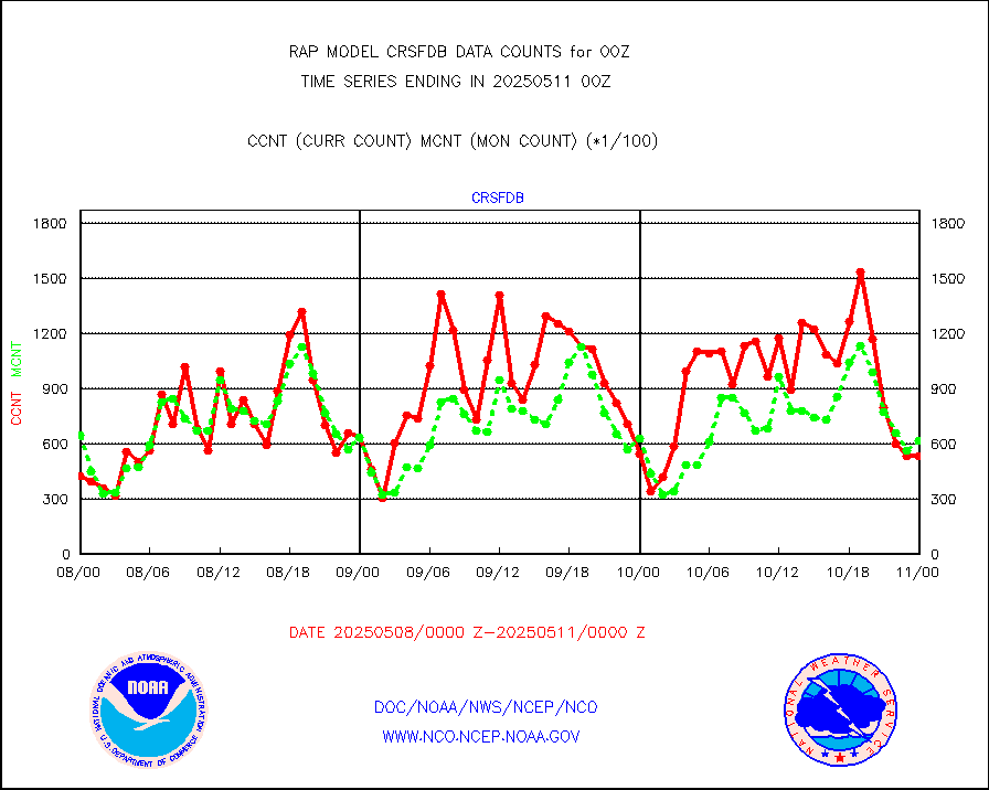
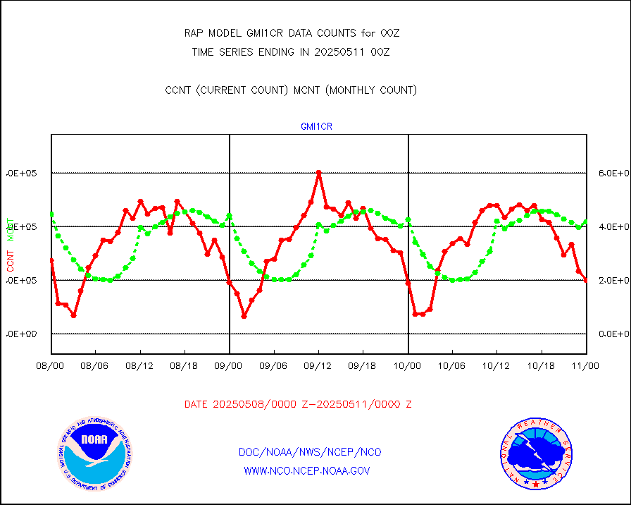
gmi1cr |
GPM GMI Level 1C-R brightness temperatures |
392379 |
517881 |
75.8 % |
1721.00-1802.99 |
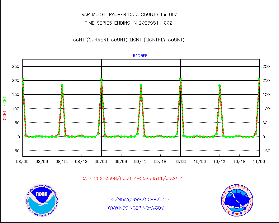
gpsro |
GPS radio occultation data |
117 |
176 |
66.5 % |
1722.00-1801.99 |
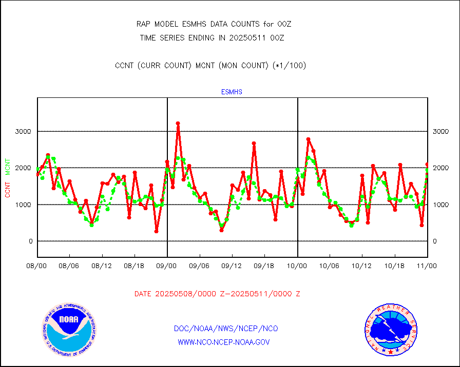
gsrasr |
GOES-16/17 All Sky Radiances (proc.) |
1181232 |
1169869 |
101.0 % |
1722.00-1801.99 |
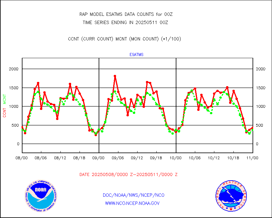
gsrcsr |
GOES-16/17 Clear Sky Radiances (proc.) |
564004 |
594254 |
94.9 % |
1722.00-1801.99 |
h20ja |
MTSAT/JMA water vapor imager derived cloud motion |
3951 |
2546 |
155.2 % |
1722.50-1801.50 |
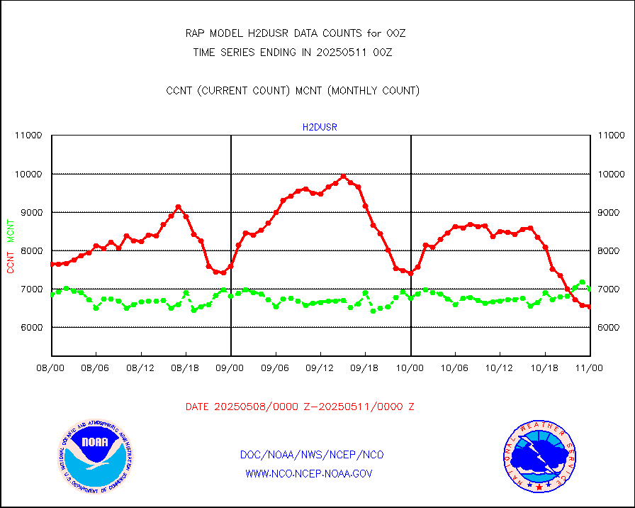
h2dusr |
GOES-16&up/NESDIS wv imgr/deep-lyr derivd cld mtn |
6834 |
5990 |
114.1 % |
1723.00-1723.99 |
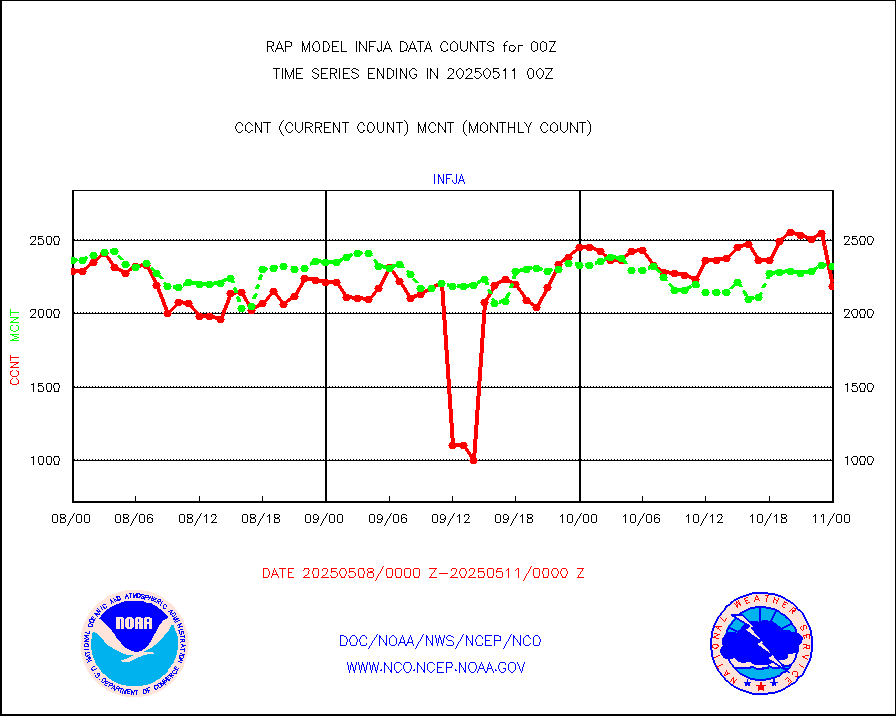
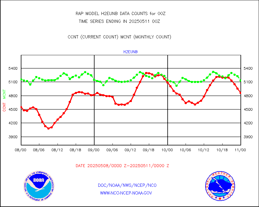
h2eunb |
METEOSAT/EUMETSAT wvpr imgr drv cld motion NBseq |
4864 |
4984 |
97.6 % |
1722.50-1801.49 |
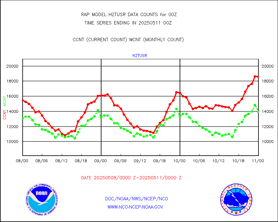
h2tusr |
GOES-16&up/NESDIS wv imgr/cld-top derived cld mtn |
14186 |
11748 |
120.8 % |
1723.00-1723.99 |
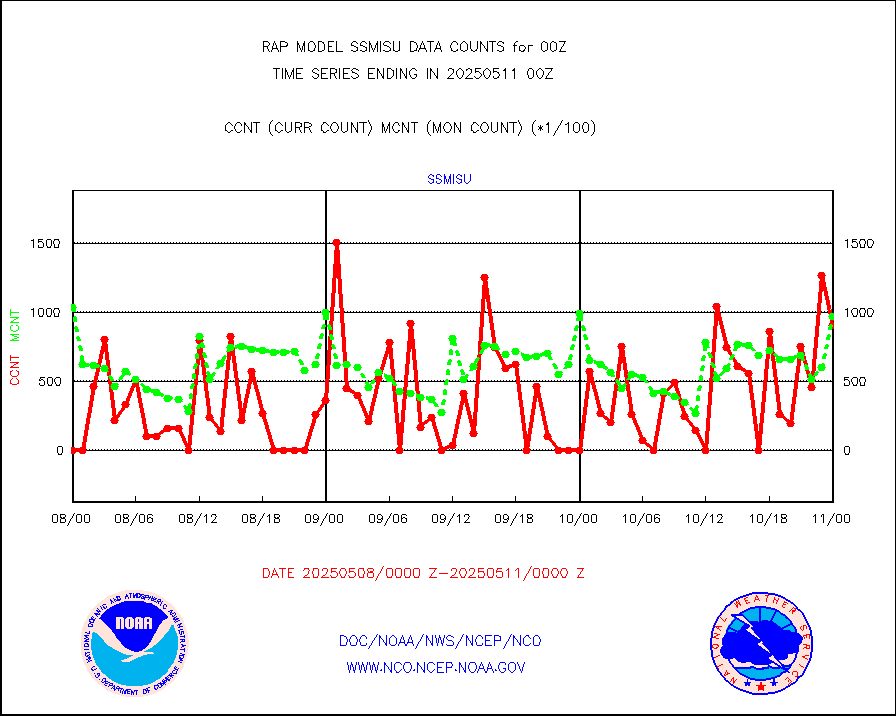
iasidb |
METOP 1-2 IASI 1C radiances-direct broadcast SSEC |
25294 |
28127 |
89.9 % |
1722.00-1801.99 |
ifeunb |
METEOSAT/EUMETSAT ir lg-wave drv cld motion NBseq |
3188 |
3197 |
99.7 % |
1722.50-1801.49 |
ifvrnb |
VIIRS (NPP/NOAA-20) ir lg-wv drv cloud motion(NB) |
0 |
0 |
n/a |
1722.50-1801.50 |
infav |
AVHRR (NOAA/METOP) ir lg-wave derived cld motion |
0 |
0 |
n/a |
1722.50-1801.50 |
infav1 |
AVHRR (METOP) ir lg-wave derived cld motion |
0 |
0 |
n/a |
1722.50-1801.49 |
infja |
MTSAT/JMA infrared long-wave derived cloud motion |
2977 |
2461 |
121.0 % |
1722.50-1801.50 |
infusr |
GOES-16&up/NESDIS ir long-wave derived cld motion |
30399 |
31522 |
96.4 % |
1723.00-1723.99 |
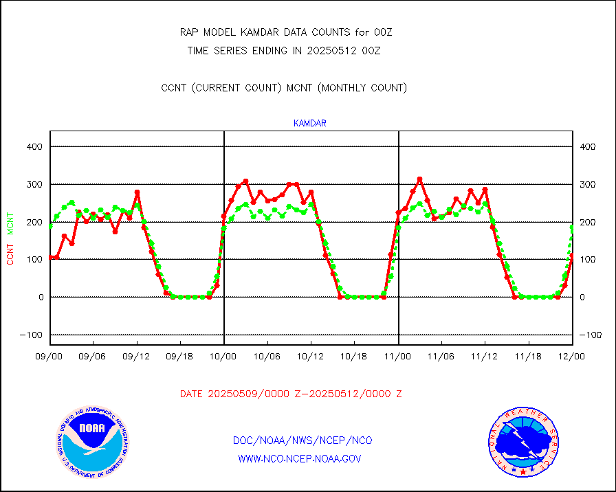
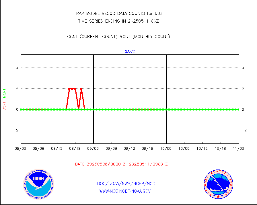
kamdar |
Korean AMDAR aircraft data (decoded from BUFR) |
304 |
211 |
144.1 % |
1720.75-1803.25 |
lcman |
Land-based CMAN stations decoded from CMAN format |
121 |
116 |
104.3 % |
1723.50-1800.50 |
ltnglr |
LLDN Long-rng lightning from Vaisala via NOAAPORT |
87306 |
71310 |
122.4 % |
1723.00-1800.50 |
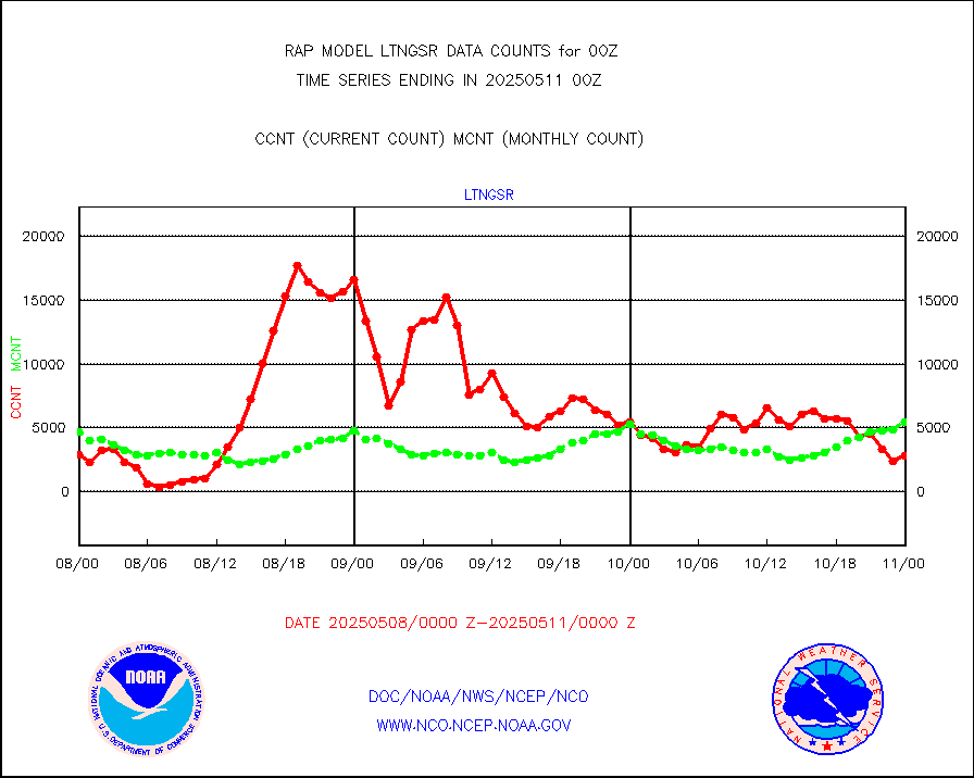
ltngsr |
NLDN Shrt-rng lightning from Vaisala via NOAAPORT |
3945 |
2631 |
149.9 % |
1723.00-1800.50 |
mbuoyb |
Moored buoys (decoded from BUFR) |
815 |
829 |
98.3 % |
1723.50-1800.50 |
mso470 |
Mesonet/MADIS Colorado E-470 (Interstate 470) |
24 |
28 |
85.7 % |
1723.50-1800.50 |
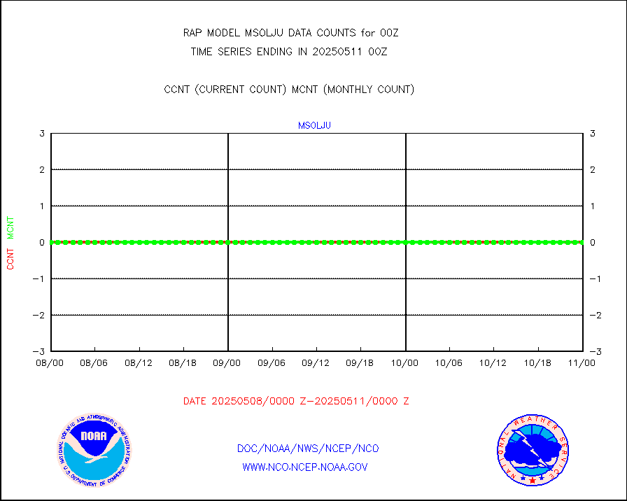
msoalk |
Mesonet/MADIS Alaska Department of Transportation |
199 |
286 |
69.6 % |
1723.50-1800.50 |
msoapg |
Mesonet/MADIS U.S. Army Aberdeen Proving Grounds |
0 |
0 |
n/a |
1723.50-1800.50 |
msoapr |
Mesonet/MADIS Citizen Weather Observers Program |
68337 |
65690 |
104.0 % |
1723.50-1800.50 |
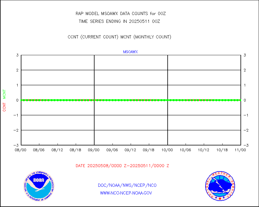
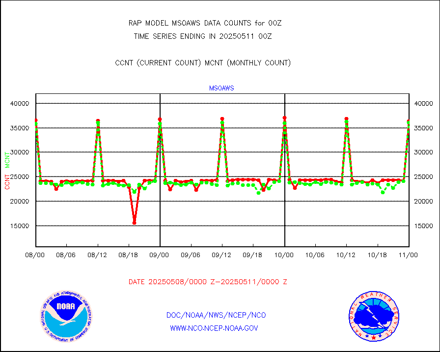
msoaws |
Mesonet/MADIS AWS Convergence Technologies, Inc. |
38463 |
38779 |
99.2 % |
1723.50-1800.50 |
msoawx |
Mesonet/MADIS "Anything Weather" |
0 |
0 |
n/a |
1723.50-1800.50 |
msocol |
Mesonet/MADIS Colorado Dept. of Transportation |
0 |
0 |
n/a |
1723.50-1800.50 |
msodcn |
Mesonet/MADIS DC Net |
0 |
0 |
n/a |
1723.50-1800.50 |
msoden |
Mesonet/MADIS Denver Urban Drainage & Flood Cntrl |
325 |
298 |
109.1 % |
1723.50-1800.50 |
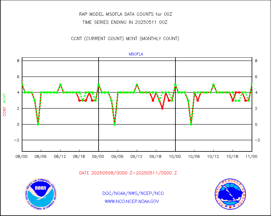
msofla |
Mesonet/MADIS Florida (FAWN & USF) |
5 |
5 |
100.0 % |
1723.50-1800.50 |
msoflt |
Mesonet/MADIS Florida Dept. of Transportation |
0 |
0 |
n/a |
1723.50-1800.50 |
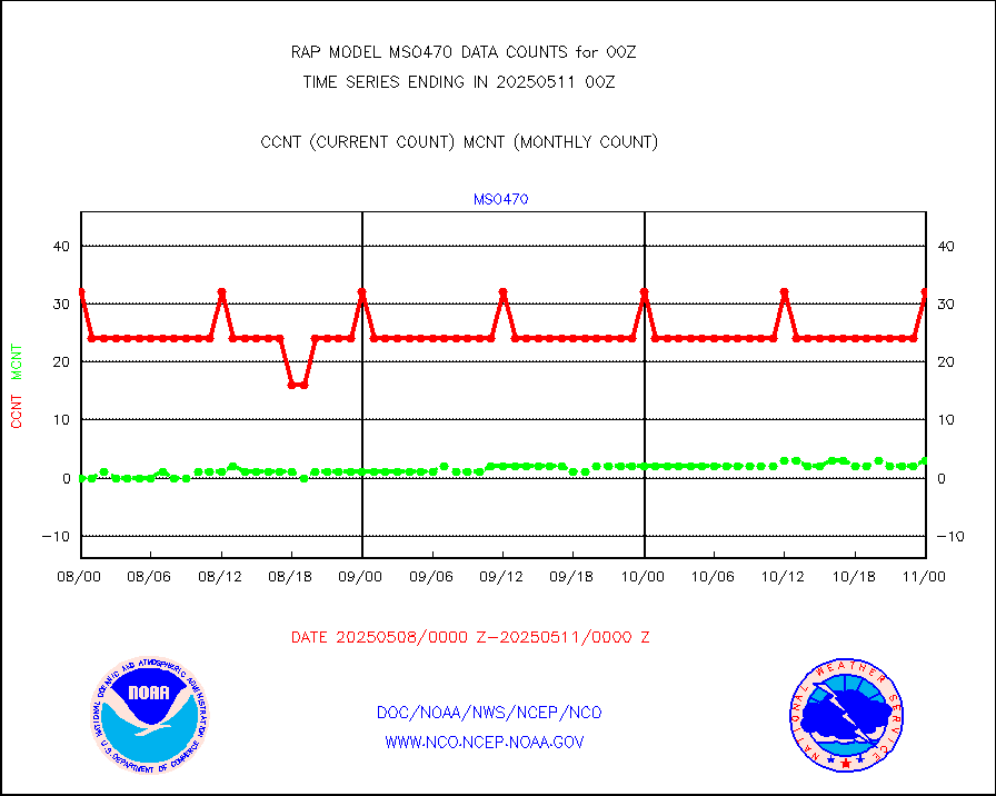
msogeo |
Mesonet/MADIS Georgia Dept. of Transportation |
0 |
0 |
n/a |
1723.50-1800.50 |
msohad |
Mesonet/MADIS NWS Hydromet Auto Data System(HADS) |
11651 |
11328 |
102.9 % |
1723.50-1800.50 |
msoien |
Mesonet/MADIS Iowa Environmental |
242 |
246 |
98.4 % |
1723.50-1800.50 |
msoind |
Mesonet/MADIS Indiana Dept. of Transportation |
0 |
0 |
n/a |
1723.50-1800.50 |
msoiow |
Mesonet/MADIS Iowa Department of Transportation |
0 |
0 |
n/a |
1723.50-1800.50 |
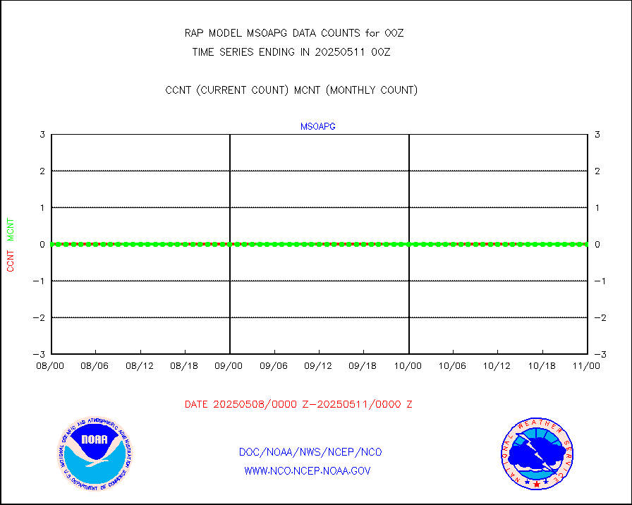
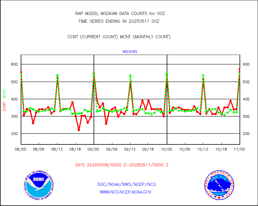
msokan |
Mesonet/MADIS Kansas Department of Transportation |
534 |
518 |
103.1 % |
1723.50-1800.50 |
msokla |
Mesonet/MADIS Oklahoma Mesonet |
424 |
435 |
97.5 % |
1723.50-1800.50 |
msolju |
Mesonet/MADIS Louisiana State/Jackson State Univ. |
0 |
0 |
n/a |
1723.50-1800.50 |
msomca |
Mesonet/MADIS Missouri Commercial Agricult Wx Net |
350 |
334 |
104.8 % |
1723.50-1800.50 |
msomin |
Mesonet/MADIS Minnesota Dept. of Transportation |
0 |
0 |
n/a |
1723.50-1800.50 |
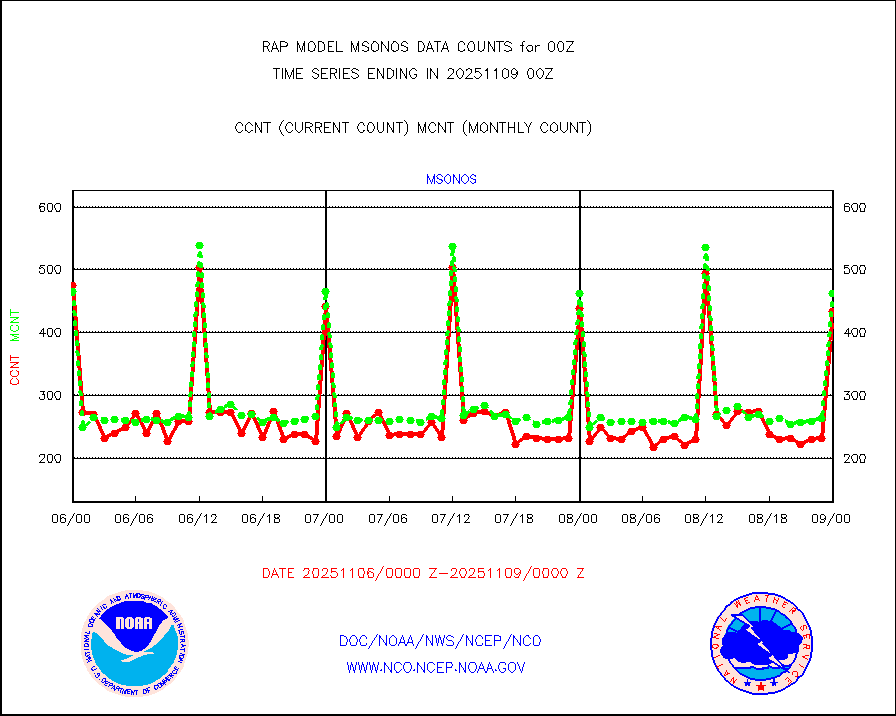
msonos |
Mesonet/MADIS NOS-Phys Oceanographic Realtime Sys |
446 |
426 |
104.7 % |
1723.50-1800.50 |
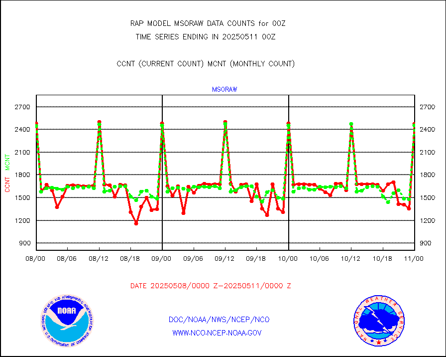
msoraw |
Mesonet/MADIS NFIC Remote Automated Wx Stns(RAWS) |
2429 |
2259 |
107.5 % |
1723.50-1800.50 |
msourb |
Mesonet/MADIS UrbaNet |
5222 |
5184 |
100.7 % |
1723.50-1800.50 |
msovir |
Mesonet/MADIS Virginia Dept. of Transportation |
355 |
350 |
101.4 % |
1723.50-1800.50 |
msowfy |
Mesonet/MADIS "Weather for You" |
0 |
0 |
n/a |
1723.50-1800.50 |
msowis |
Mesonet/MADIS Wisconsin Dept. of Transportation |
0 |
0 |
n/a |
1723.50-1800.50 |
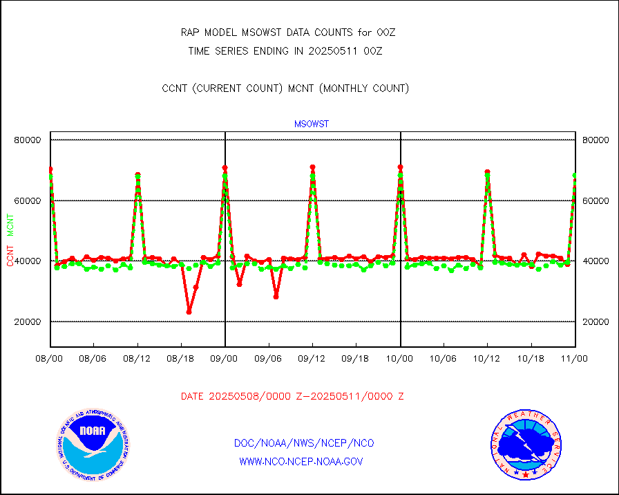
msowst |
Mesonet/MADIS MesoWest (many subproviders) |
69097 |
64854 |
106.5 % |
1723.50-1800.50 |
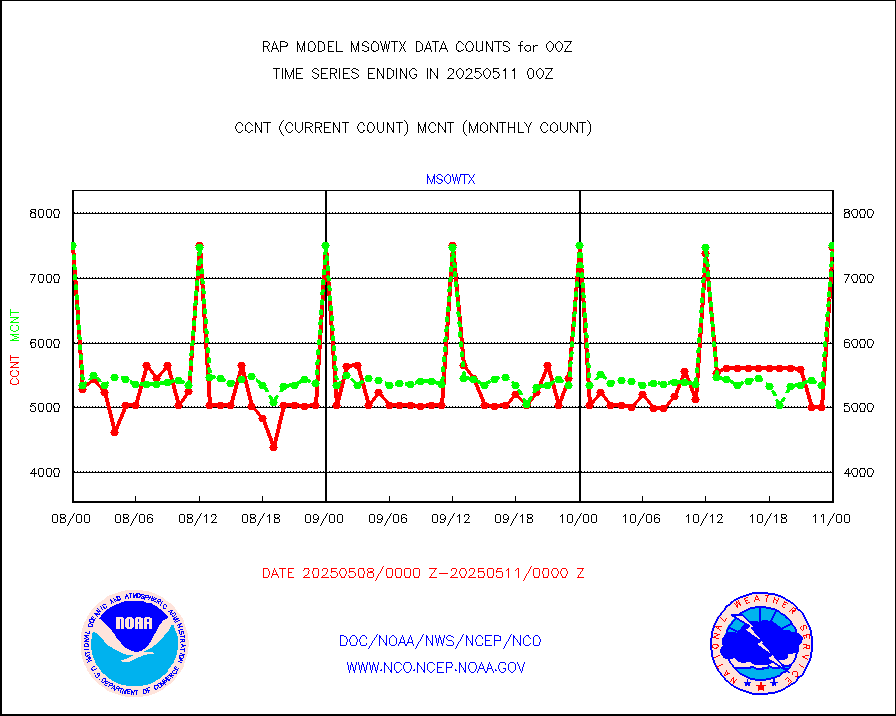
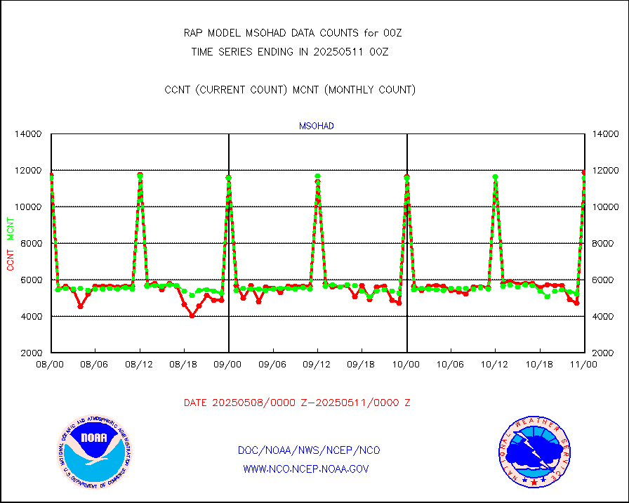
msowtx |
Mesonet/MADIS West Texas |
7503 |
7488 |
100.2 % |
1723.50-1800.50 |
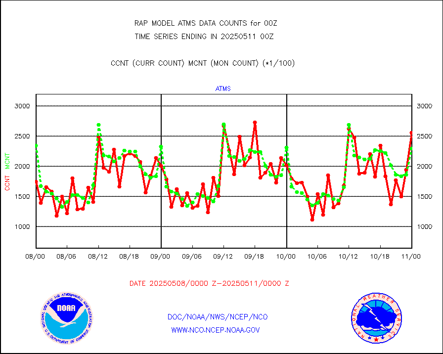
mtiasi |
METOP 1-2 IASI 1C radiance data (varbl. channels) |
41675 |
31690 |
131.5 % |
1722.00-1801.99 |
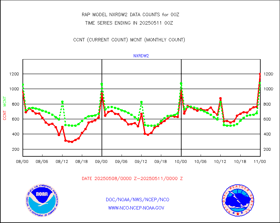
nxrdw2 |
NEXRAD Vel Azm Dsp(VAD) winds via Level 2 decoder |
1242 |
1094 |
113.5 % |
1723.00-1801.00 |
osbuv8 |
NOAA 16-19 Solar Backscatter UV-2 rad frm V8 BUFR |
0 |
0 |
n/a |
1722.00-1800.99 |
pibal |
PIBAL (from PILOT, PILOT SHIP, PILOT MOBIL) |
0 |
0 |
n/a |
1723.00-1801.00 |
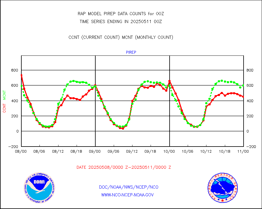
pirep |
Manual PIREP aircraft data (dcded from AIREP fmt) |
579 |
596 |
97.1 % |
1720.75-1803.25 |
prflrp |
Profilr winds from PIBAL (PILOT,PILOT SHIP/MOBIL) |
0 |
0 |
n/a |
1722.50-1801.50 |
raobm |
Rawinsonde - mobile land (from TEMP/PILOT MOBIL) |
0 |
0 |
n/a |
1723.00-1801.00 |
raobs |
Rawinsonde - ship (from TEMP SHIP, PILOT SHIP) |
0 |
0 |
n/a |
1723.00-1801.00 |
rd2wnd |
NEXRAD radial wind (Level 2 - GTS) |
1912875 |
1595586 |
119.9 % |
1723.50-1800.49 |
recco |
Flight level reconnaissance aircraft data |
0 |
1 |
0.0 % |
1723.00-1801.00 |
saldrn |
Surface Marine Saildrone (decoded from BUFR) |
2 |
2 |
100.0 % |
1722.00-1801.99 |
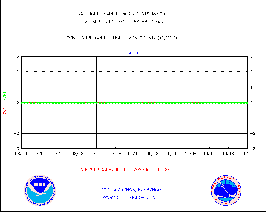
saphir |
Megha-Tropiques SAPHIR L1A2 brightness temps |
0 |
0 |
n/a |
1721.00-1802.99 |
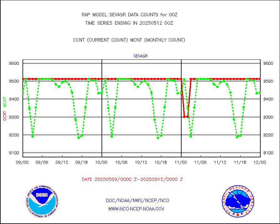
sevasr |
METEOSAT-10 2nd Gen SEVIRI All Sky Radiance(proc) |
9512 |
9503 |
100.1 % |
1722.00-1801.99 |
sevcsr |
METEOSAT-10 2nd Gen SEVIRI Clr Sky Radiance(proc) |
0 |
0 |
n/a |
1722.00-1801.99 |
ships |
Ship - manual and automatic, restricted |
25 |
23 |
108.7 % |
1723.50-1800.50 |
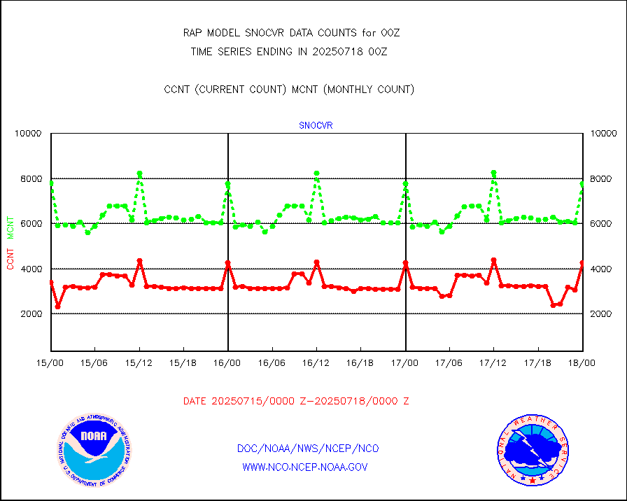
snocvr |
NOW COVER, DEPTH/DENSITY AND WATER EQUIVALENT |
4343 |
8758 |
49.6 % |
1722.00-1802.00 |
ssmisu |
DMSP SSM/IS 1C radiance data (Unified Pre-Proc.) |
92376 |
97588 |
94.7 % |
1722.00-1801.99 |
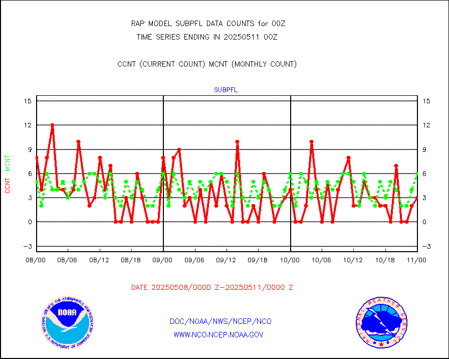
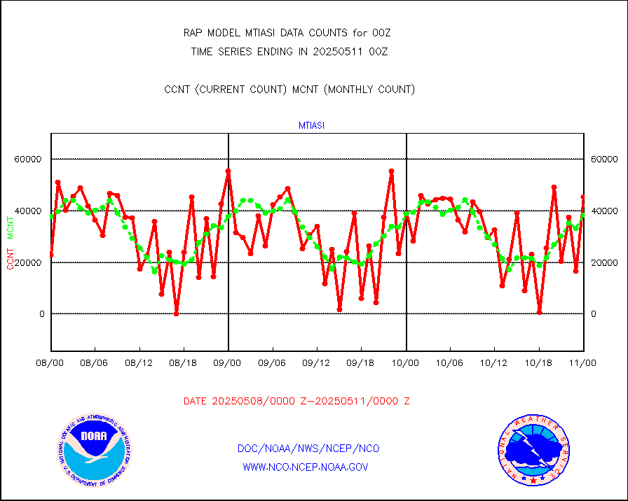
subpfl |
Sub-surface float and glider profile (BUFR) |
7 |
7 |
100.0 % |
1722.00-1801.99 |
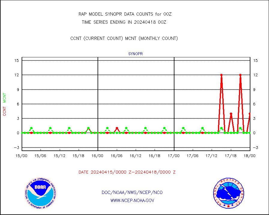
synopr |
Synoptic - restricted (WMO Res 40) manual & auto. |
4 |
0 |
n/a |
1723.50-1800.50 |
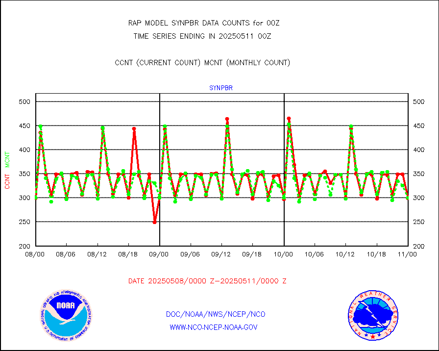
synpbr |
Synoptic - restricted (WMO Res 40)(decoded BUFR) |
418 |
297 |
140.7 % |
1723.50-1800.50 |
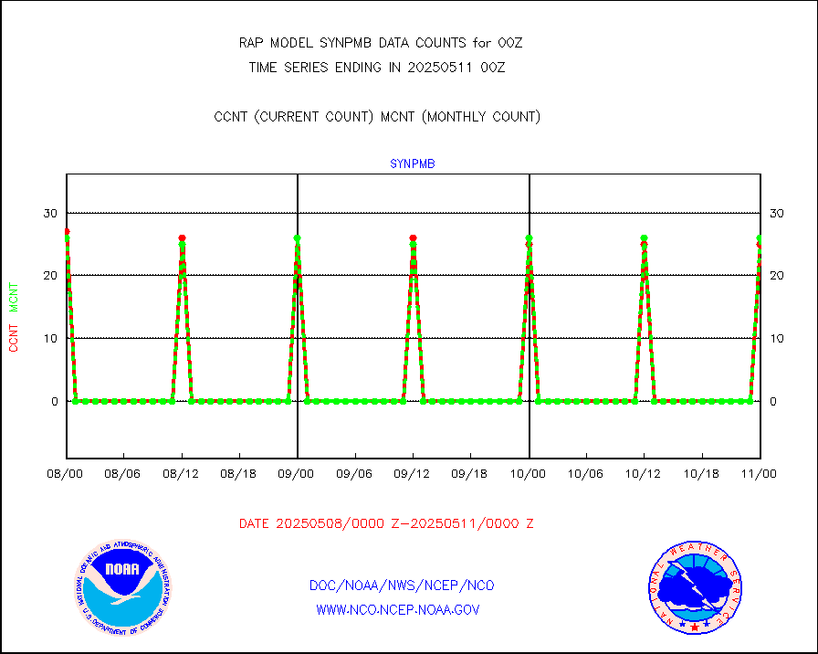
synpmb |
Synoptic - mobile manual & auto (decoded fr BUFR) |
0 |
0 |
n/a |
1723.50-1800.50 |
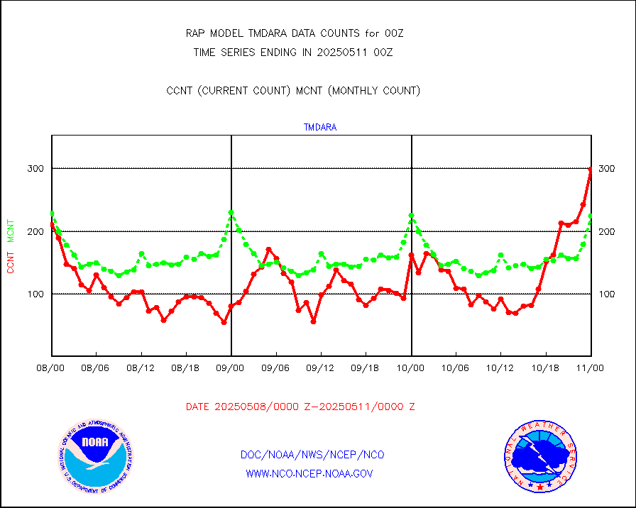
tmdara |
TAMDAR aircft data-all types(from Panasonic,BUFR) |
1129 |
1083 |
104.2 % |
1720.75-1803.25 |
visja |
MTSAT/JMA visible derived cloud motion |
1639 |
1679 |
97.6 % |
1722.50-1801.50 |
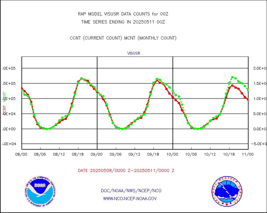
visusr |
GOES-16&up/NESDIS visible derived cloud motion |
118194 |
123550 |
95.7 % |
1723.00-1723.99 |
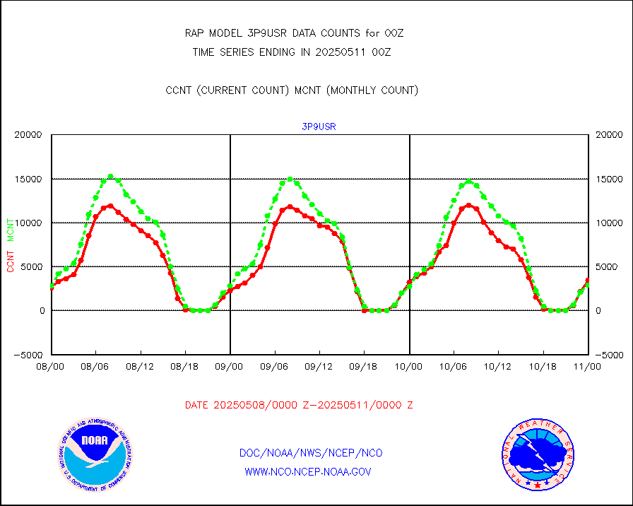
vseunb |
METEOSAT/EUMETSAT visible drv cld motion NBseq |
0 |
0 |
n/a |
1722.50-1801.49 |


