| Critical Data with Normal Counts |
|---|
| Type | Description | Hourly Count | Monthly Average | Percent (%) of Monthly Mean |
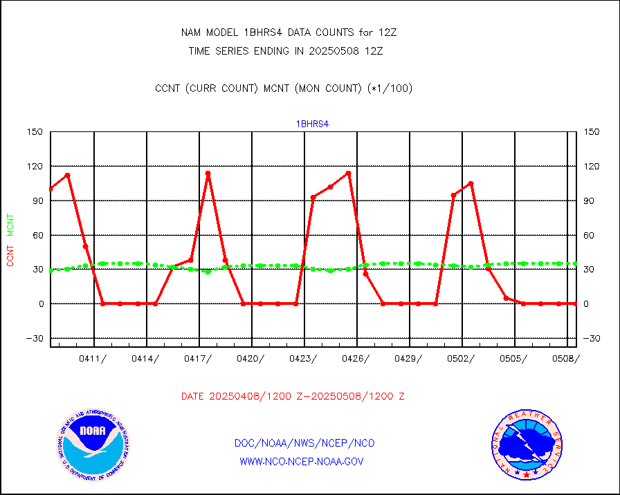
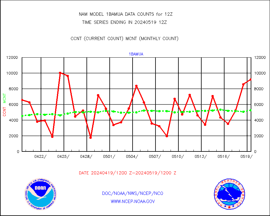
1bamua |
NOAA 15-19 & METOP 1-2 AMSU-A NCEP-proc. br.temps |
7495 |
4389 |
170.8 % |
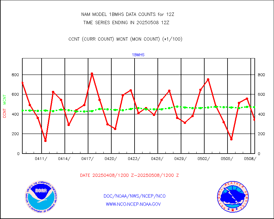
1bmhs |
NOAA 18-19 & METOP 1-2 MHS NCEP-proces. br. temps |
41941 |
36308 |
115.5 % |
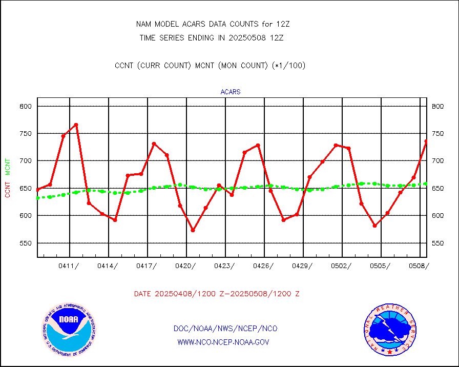
acars |
MDCRS ACARS acft data from ARINC(dcded from BUFR) |
47227 |
44031 |
107.3 % |
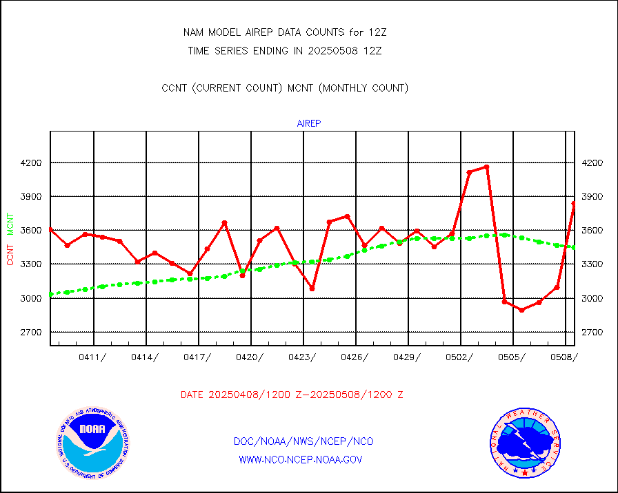
airep |
Manual AIREP aircraft data (dcded from AIREP fmt) |
3895 |
4352 |
89.5 % |
airsev |
AQUA AIRS/AMSU-A/HSB brightness temps- every FOV |
0 |
0 |
n/a |
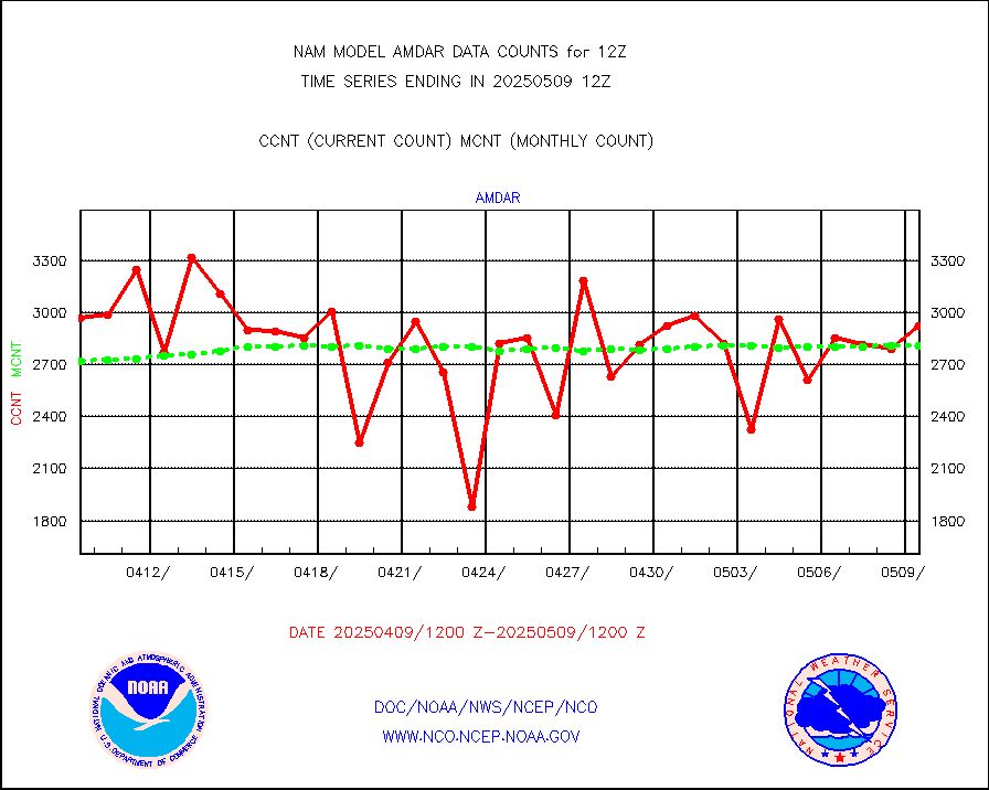
amdar |
AMDAR aircraft data (decoded from AMDAR format) |
2762 |
2732 |
101.1 % |
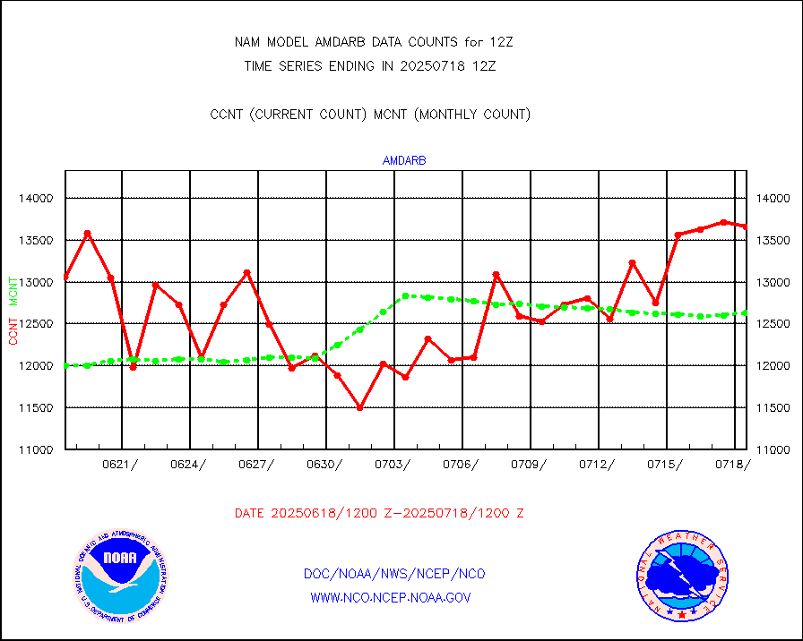
amdarb |
AMDAR aircraft data (decoded from BUFR) |
6209 |
6119 |
101.5 % |
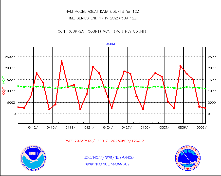
ascat |
METOP 1-2 ASCAT products |
2961 |
5077 |
58.3 % |
camdar |
Canadian AMDAR aircraft data (decoded from BUFR) |
0 |
45 |
0.0 % |
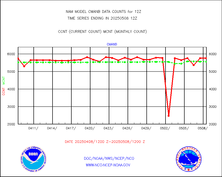
cmanb |
Surface Marine CMAN rpts decoded from BUFR format |
5268 |
5499 |
95.8 % |
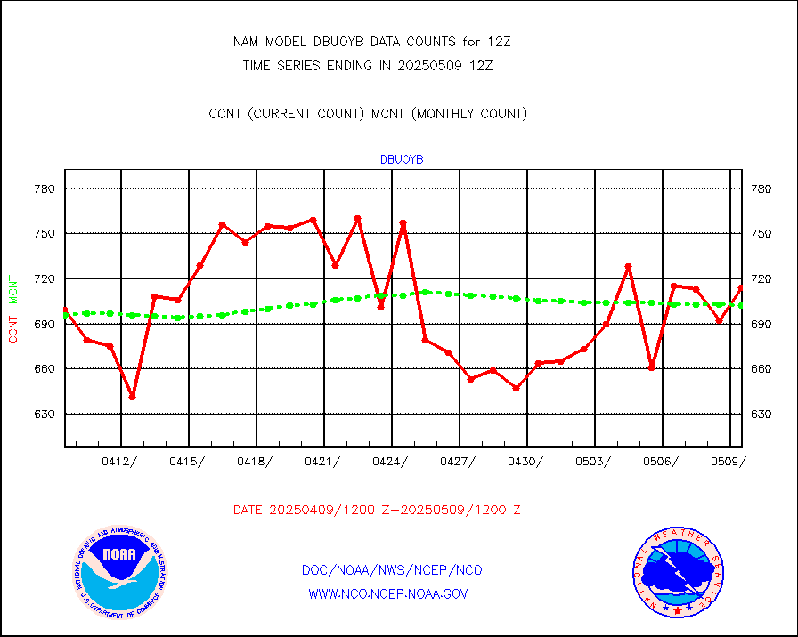
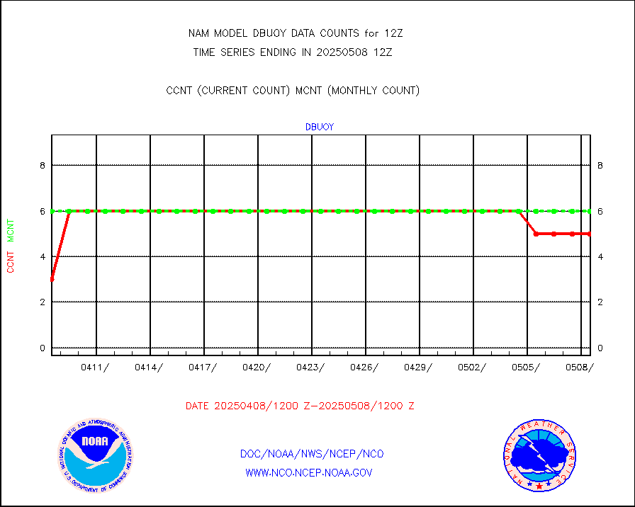
dbuoy |
Buoys decoded from FM-18 fmt (moored or drifting) |
4 |
4 |
100.0 % |
dropw |
Dropwinsonde (from TEMP DROP) |
0 |
0 |
n/a |
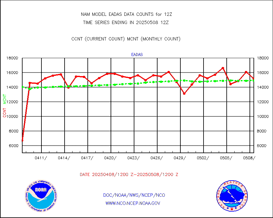
eadas |
E-AMDAR (European AMDAR acft decoded from BUFR) |
11476 |
11234 |
102.2 % |
geost1 |
GOES/NESDIS hi-resol. (1x1 f-o-v) sndgs/radiances |
0 |
0 |
n/a |
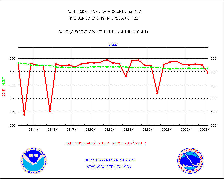
gnss |
Grnd-based Gbl Navigation Sat System (GNSS) data |
982 |
838 |
117.2 % |
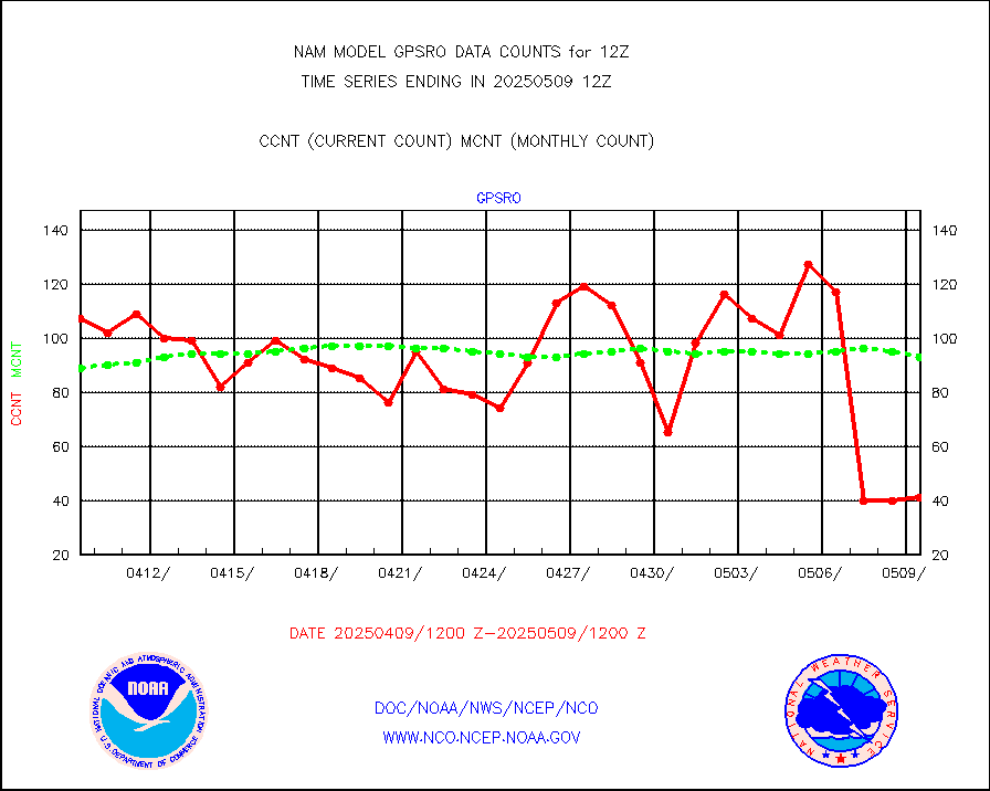
gpsro |
GPS radio occultation data |
79 |
73 |
108.2 % |
h20mo |
MODIS (AQUA/TERRA) wvpr imager derived cld motion |
0 |
0 |
n/a |
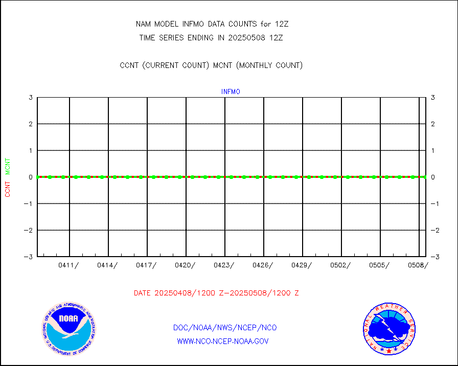
infmo |
MODIS (AQUA/TERRA) ir l-wave derived cloud motion |
0 |
0 |
n/a |
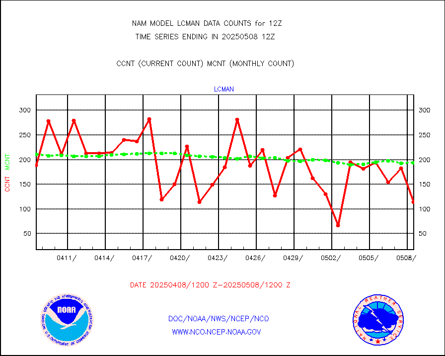
lcman |
Land-based CMAN stations decoded from CMAN format |
261 |
231 |
113.0 % |
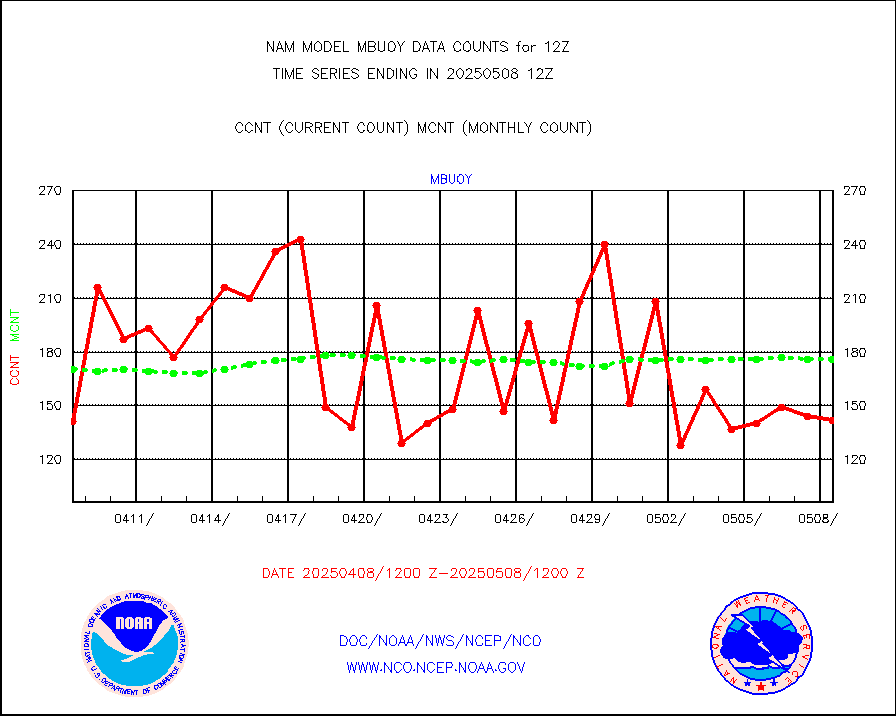
mbuoy |
Buoys decoded from FM-13 format (moored) |
188 |
193 |
97.4 % |
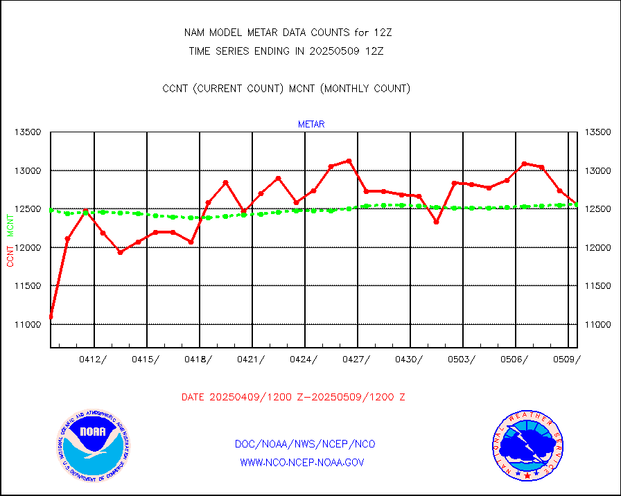
metar |
Aviation - METAR |
11078 |
12667 |
87.5 % |
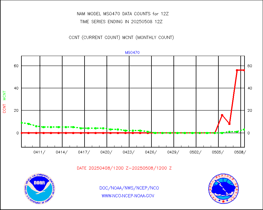
mso470 |
Mesonet/MADIS Colorado E-470 (Interstate 470) |
42 |
46 |
91.3 % |
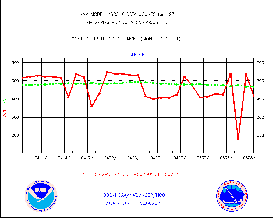
msoalk |
Mesonet/MADIS Alaska Department of Transportation |
487 |
442 |
110.2 % |
msoapg |
Mesonet/MADIS U.S. Army Aberdeen Proving Grounds |
0 |
0 |
n/a |
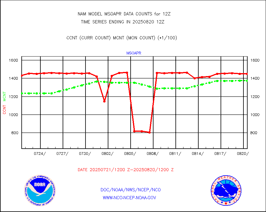
msoapr |
Mesonet/MADIS Citizen Weather Observers Program |
107702 |
107033 |
100.6 % |
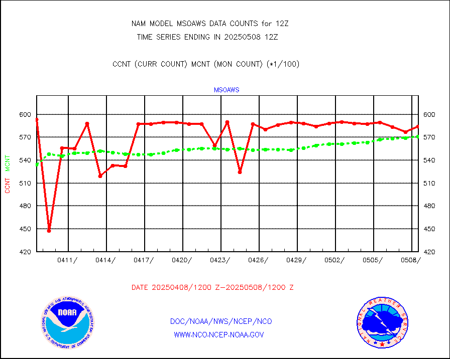
msoaws |
Mesonet/MADIS AWS Convergence Technologies, Inc. |
61951 |
60895 |
101.7 % |
msoawx |
Mesonet/MADIS "Anything Weather" |
0 |
0 |
n/a |
msocol |
Mesonet/MADIS Colorado Dept. of Transportation |
0 |
0 |
n/a |
msodcn |
Mesonet/MADIS DC Net |
0 |
0 |
n/a |
msoden |
Mesonet/MADIS Denver Urban Drainage & Flood Cntrl |
375 |
506 |
74.1 % |
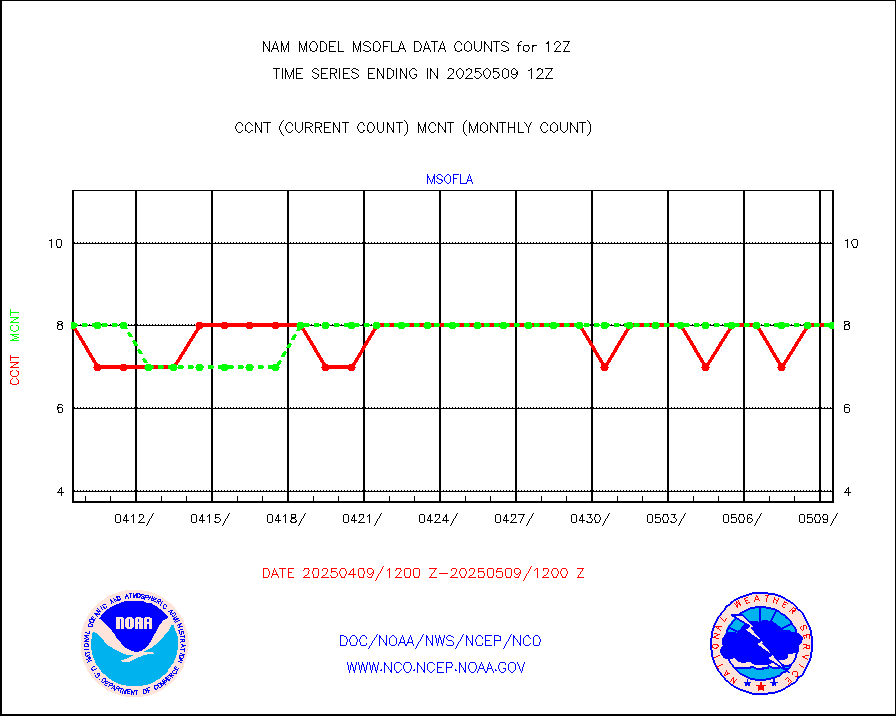
msofla |
Mesonet/MADIS Florida (FAWN & USF) |
8 |
8 |
100.0 % |
msoflt |
Mesonet/MADIS Florida Dept. of Transportation |
0 |
0 |
n/a |
msogeo |
Mesonet/MADIS Georgia Dept. of Transportation |
0 |
0 |
n/a |
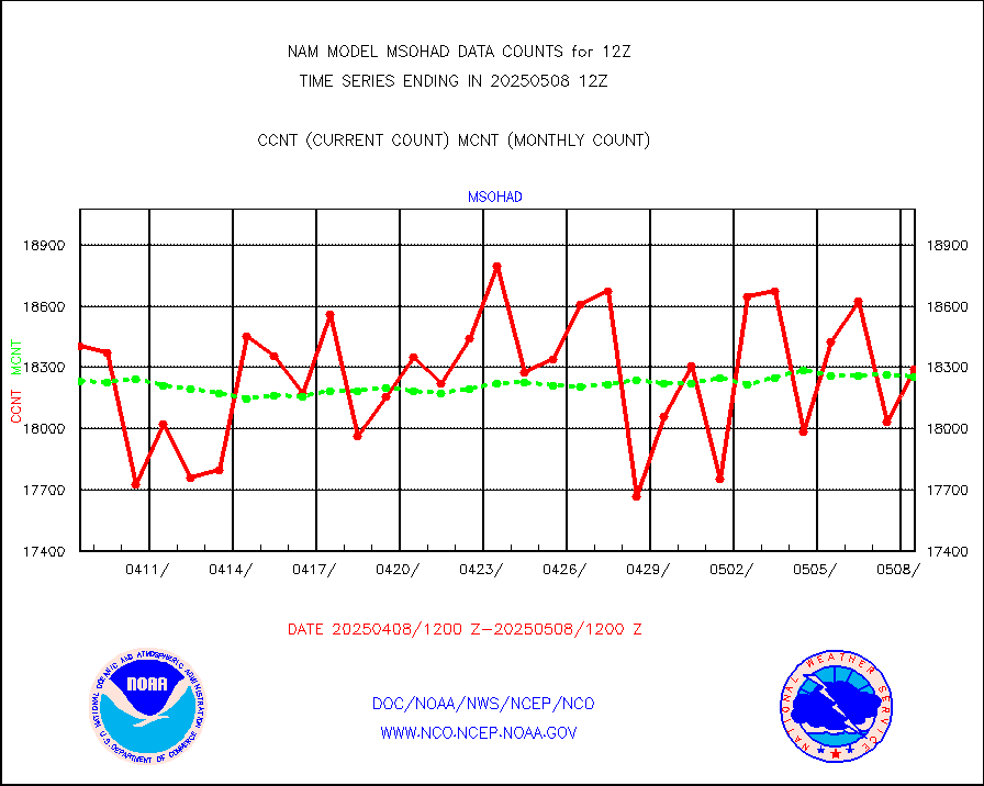
msohad |
Mesonet/MADIS NWS Hydromet Auto Data System(HADS) |
18219 |
17881 |
101.9 % |
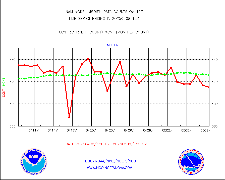
msoien |
Mesonet/MADIS Iowa Environmental |
415 |
420 |
98.8 % |
msoind |
Mesonet/MADIS Indiana Dept. of Transportation |
0 |
0 |
n/a |
msoiow |
Mesonet/MADIS Iowa Department of Transportation |
0 |
0 |
n/a |
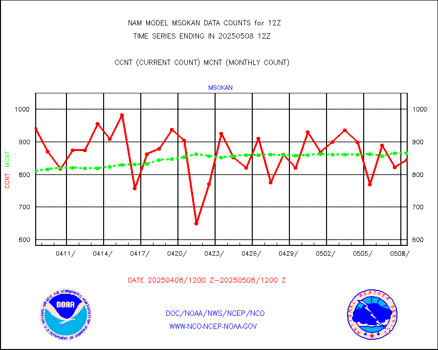
msokan |
Mesonet/MADIS Kansas Department of Transportation |
765 |
841 |
91.0 % |
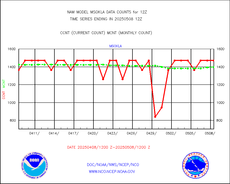
msokla |
Mesonet/MADIS Oklahoma Mesonet |
954 |
745 |
128.1 % |
msolju |
Mesonet/MADIS Louisiana State/Jackson State Univ. |
0 |
0 |
n/a |
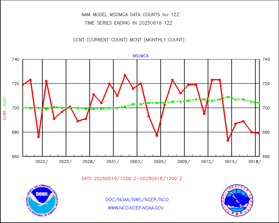
msomca |
Mesonet/MADIS Missouri Commercial Agricult Wx Net |
602 |
582 |
103.4 % |
msomin |
Mesonet/MADIS Minnesota Dept. of Transportation |
0 |
0 |
n/a |
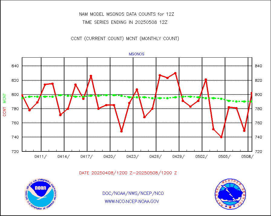
msonos |
Mesonet/MADIS NOS-Phys Oceanographic Realtime Sys |
229 |
742 |
30.9 % |
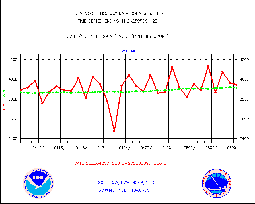
msoraw |
Mesonet/MADIS NFIC Remote Automated Wx Stns(RAWS) |
3646 |
3688 |
98.9 % |
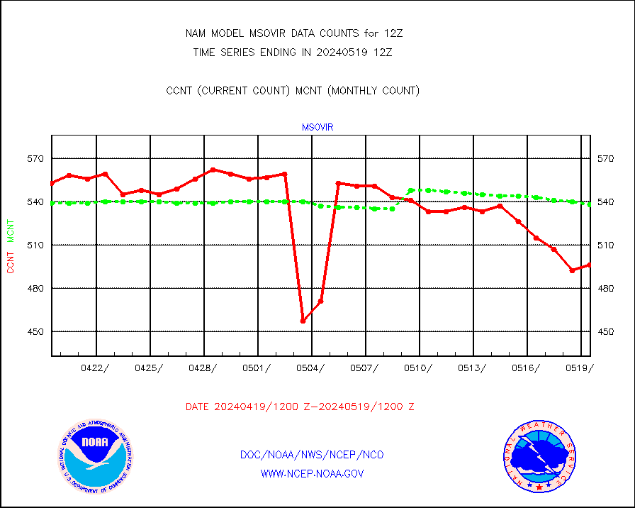
msovir |
Mesonet/MADIS Virginia Dept. of Transportation |
555 |
539 |
103.0 % |
msowfy |
Mesonet/MADIS "Weather for You" |
0 |
0 |
n/a |
msowis |
Mesonet/MADIS Wisconsin Dept. of Transportation |
0 |
0 |
n/a |
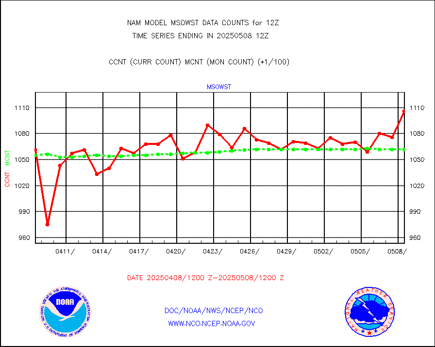
msowst |
Mesonet/MADIS MesoWest (many subproviders) |
103225 |
102468 |
100.7 % |
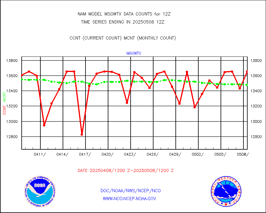
msowtx |
Mesonet/MADIS West Texas |
12613 |
13225 |
95.4 % |
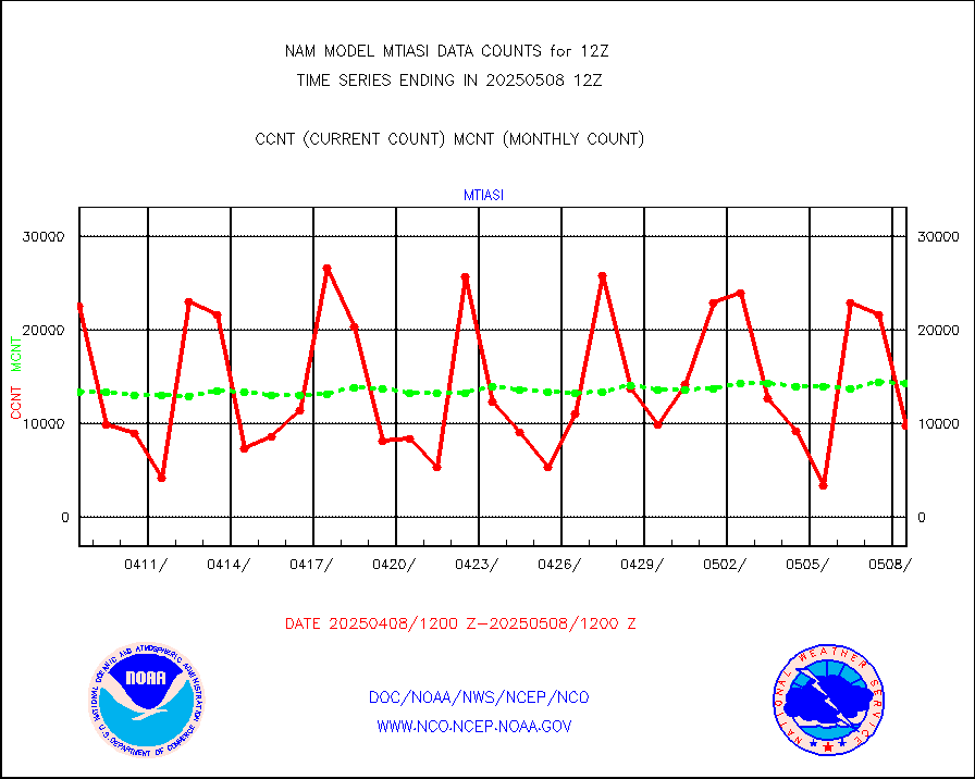
mtiasi |
METOP 1-2 IASI 1C radiance data (varbl. channels) |
9347 |
9894 |
94.5 % |
nxrdw |
NEXRAD Vel Azm Dsp(VAD) winds via radar coded msg |
0 |
0 |
n/a |
pibal |
PIBAL (from PILOT, PILOT SHIP, PILOT MOBIL) |
0 |
0 |
n/a |
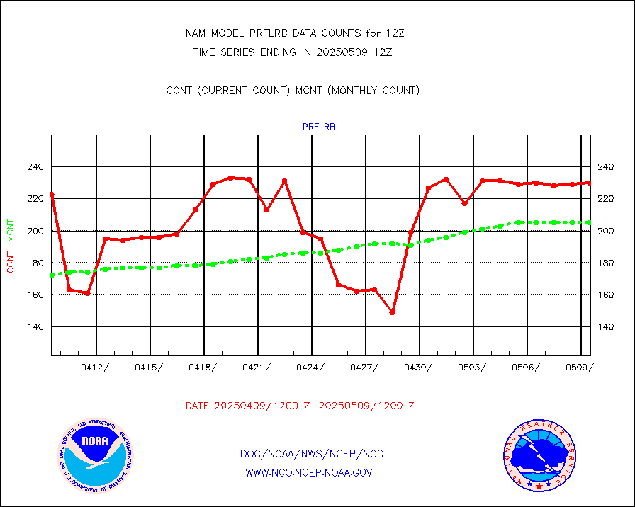
prflrb |
Multi-Agency Profiler (MAP) and SODAR winds |
196 |
175 |
112.0 % |
prflrp |
Profilr winds from PIBAL (PILOT,PILOT SHIP/MOBIL) |
0 |
0 |
n/a |
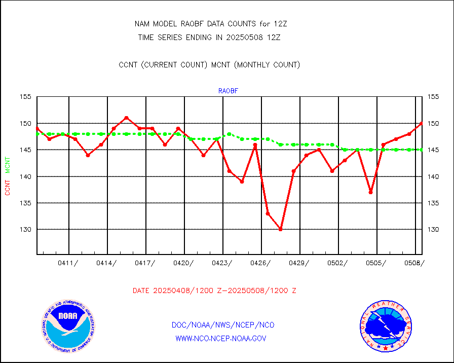
raobf |
Rawinsonde - fixed land (from TEMP or PILOT) |
158 |
152 |
103.9 % |
raobm |
Rawinsonde - mobile land (from TEMP/PILOT MOBIL) |
0 |
0 |
n/a |
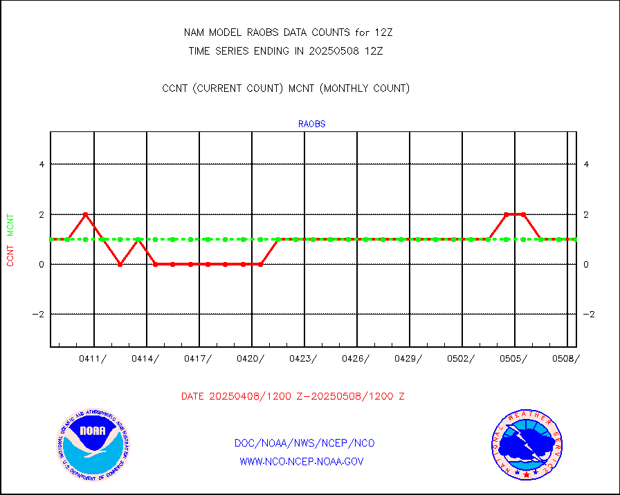
raobs |
Rawinsonde - ship (from TEMP SHIP, PILOT SHIP) |
1 |
1 |
100.0 % |
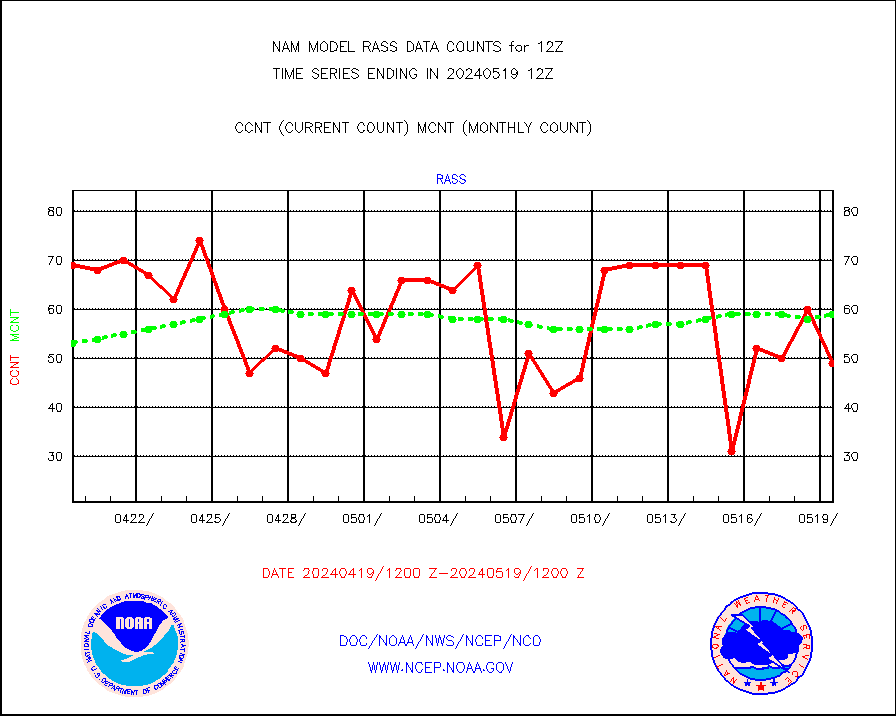
rass |
RASS temperatures (NOAA and Multi-Agency) |
69 |
52 |
132.7 % |
recco |
Flight level reconnaissance aircraft data |
0 |
0 |
n/a |
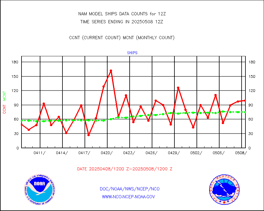
ships |
Ship - manual and automatic, restricted |
24 |
17 |
141.2 % |
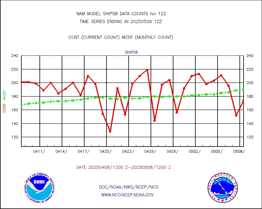
shipsb |
Ship - manual and automatic, restricted (BUFR) |
129 |
113 |
114.2 % |
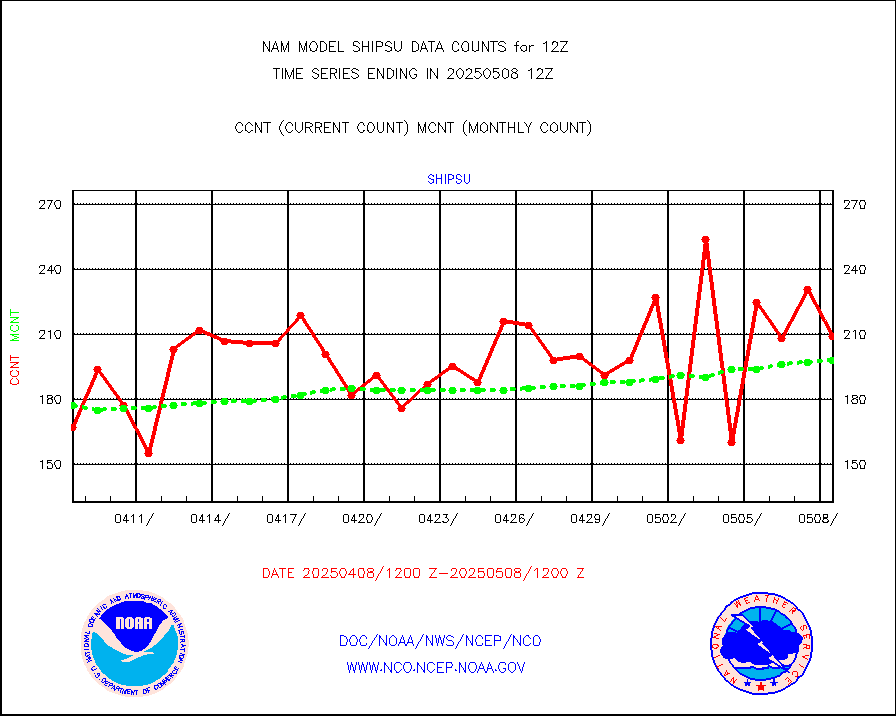
shipsu |
Ship - manual and automatic, unrestricted |
115 |
135 |
85.2 % |
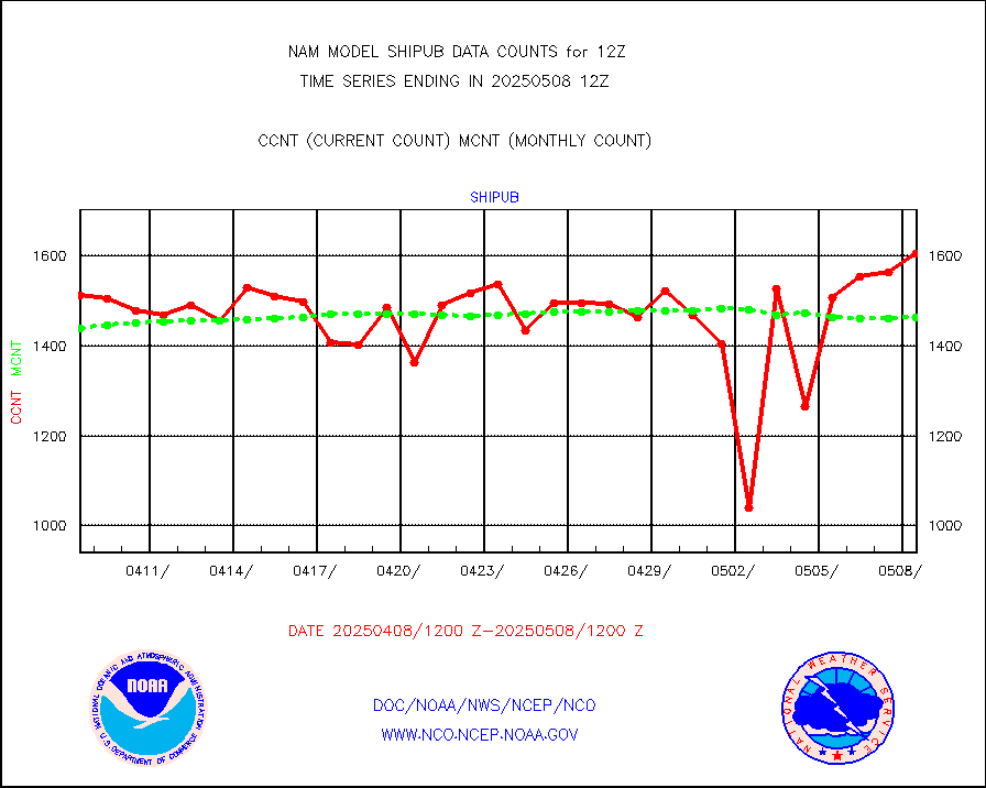
shipub |
Ship - manual and automatic, unrestricted (BUFR) |
1437 |
1465 |
98.1 % |
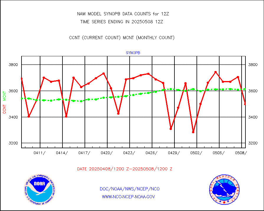
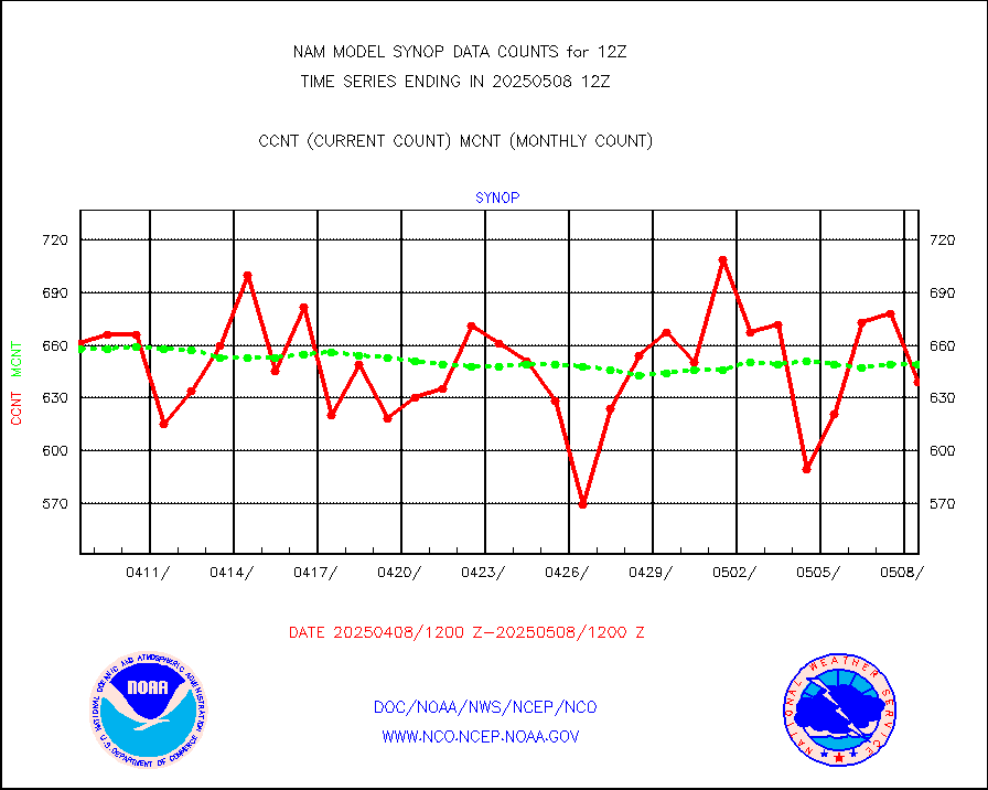
synopb |
Synoptic - fixed manual & auto (decoded fr BUFR) |
1951 |
3646 |
53.5 % |
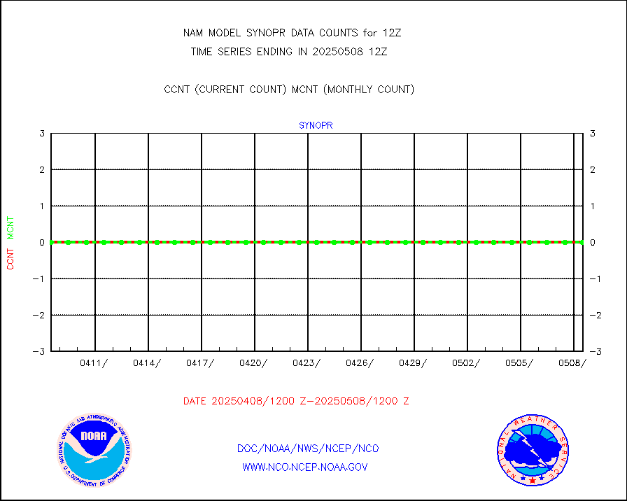
synopr |
Synoptic - restricted (WMO Res 40) manual & auto. |
0 |
0 |
n/a |
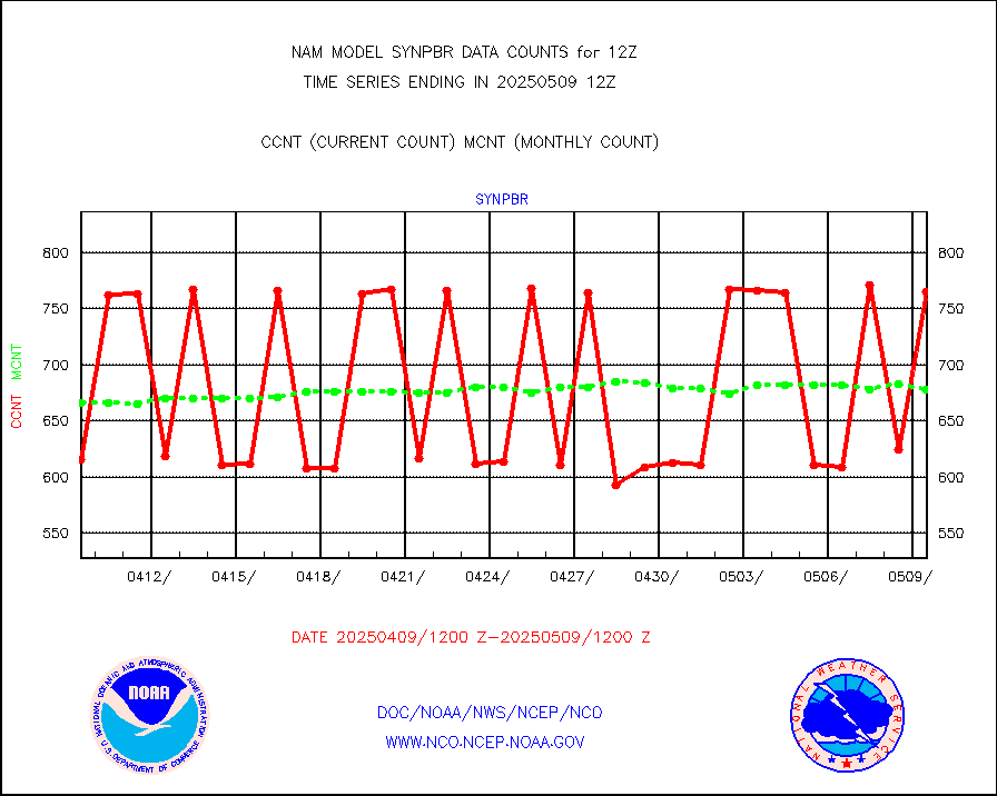
synpbr |
Synoptic - restricted (WMO Res 40)(decoded BUFR) |
614 |
664 |
92.5 % |
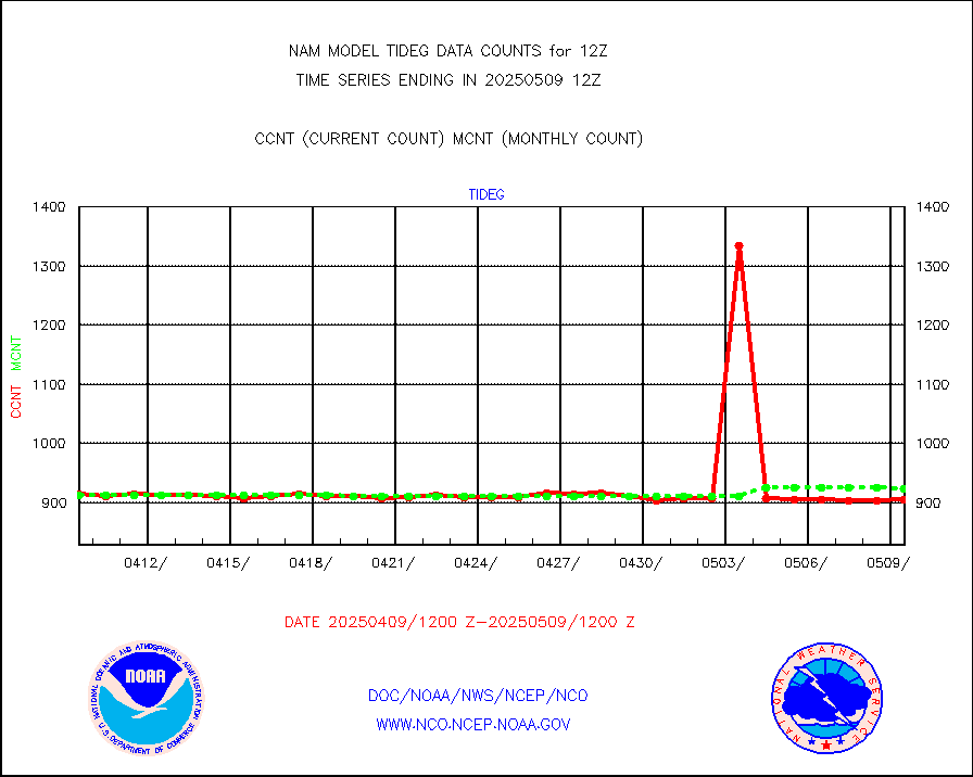
tideg |
Tide gauge reports decoded from CREX format |
899 |
881 |
102.0 % |
| Data Types of Opportunity with Normal Counts |
|---|
| Type | Description | Hourly Count | Monthly Average | Percent (%) of Monthly Mean |
acarsa |
MDCRS ACARS acft data (ARINC via AFWA)(AIREP fmt) |
0 |
0 |
n/a |
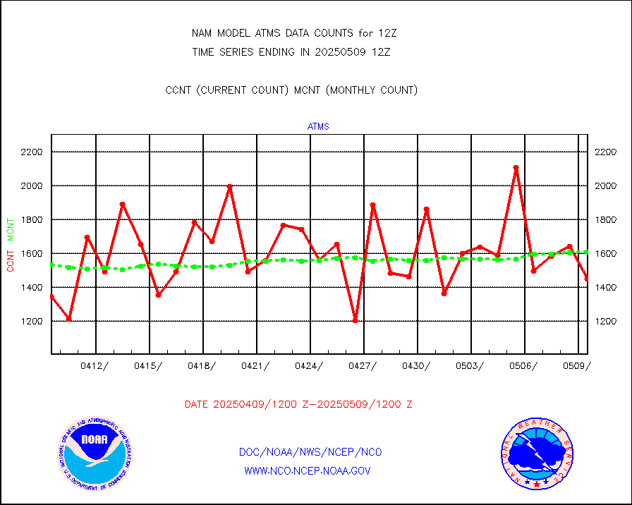
atms |
NPP/NOAA-20 ATMS brightness temperatures |
155832 |
148980 |
104.6 % |
cris |
NPP CrIS apodized radiances (399 channel) |
0 |
0 |
n/a |
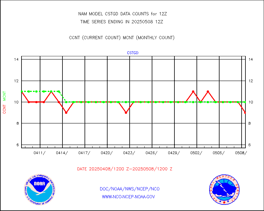
cstgd |
Coast Guard |
8 |
7 |
114.3 % |
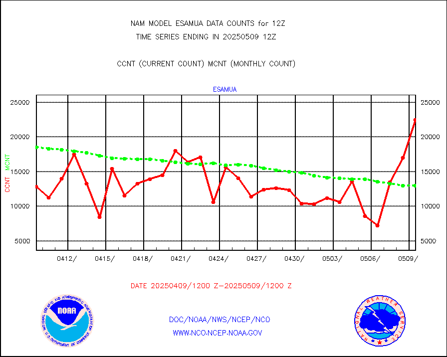
esamua |
NOAA 15-19 & METOP 1-2 AMSU-A proc btmps frm RARS |
17089 |
13719 |
124.6 % |
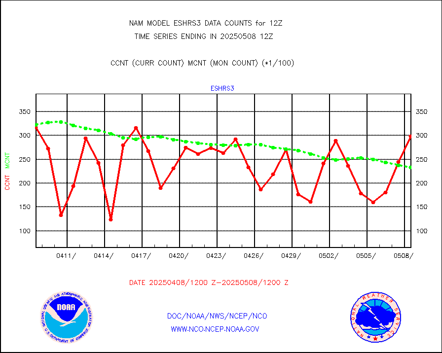
eshrs3 |
NOAA 15-19 & METOP 1-2 HIRS-3/4 pr btmps frm RARS |
40718 |
32535 |
125.2 % |
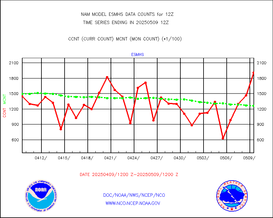
esmhs |
NOAA 18-19 & METOP 1-2 MHS proc. btemps from RARS |
135358 |
100602 |
134.5 % |
geosth |
GOES/NESDIS hi-resol. (1x1 f-o-v) cloud data |
0 |
0 |
n/a |
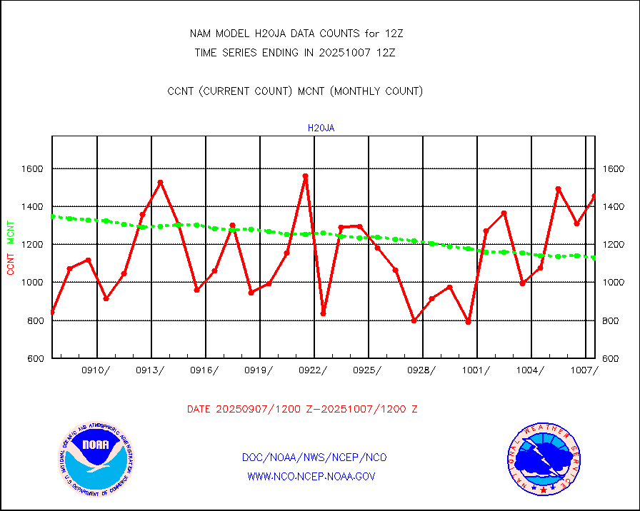
h20ja |
MTSAT/JMA water vapor imager derived cloud motion |
1765 |
1225 |
144.1 % |
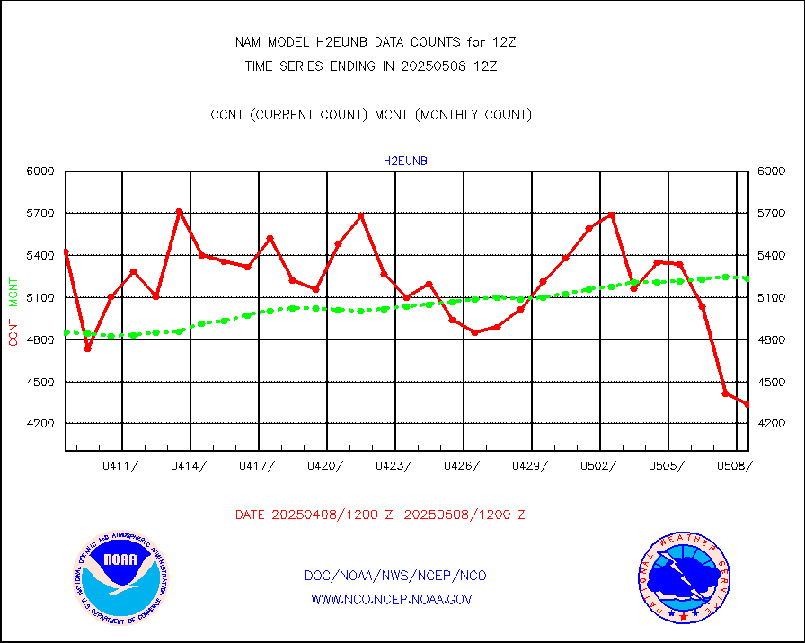
h2eunb |
METEOSAT/EUMETSAT wvpr imgr drv cld motion NBseq |
5160 |
5118 |
100.8 % |
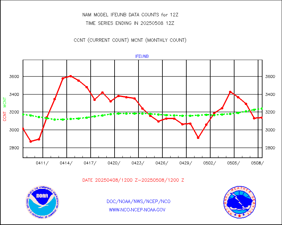
ifeunb |
METEOSAT/EUMETSAT ir lg-wave drv cld motion NBseq |
3226 |
3277 |
98.4 % |
ifvrnb |
VIIRS (NPP/NOAA-20) ir lg-wv drv cloud motion(NB) |
0 |
0 |
n/a |
infav |
AVHRR (NOAA/METOP) ir lg-wave derived cld motion |
0 |
0 |
n/a |
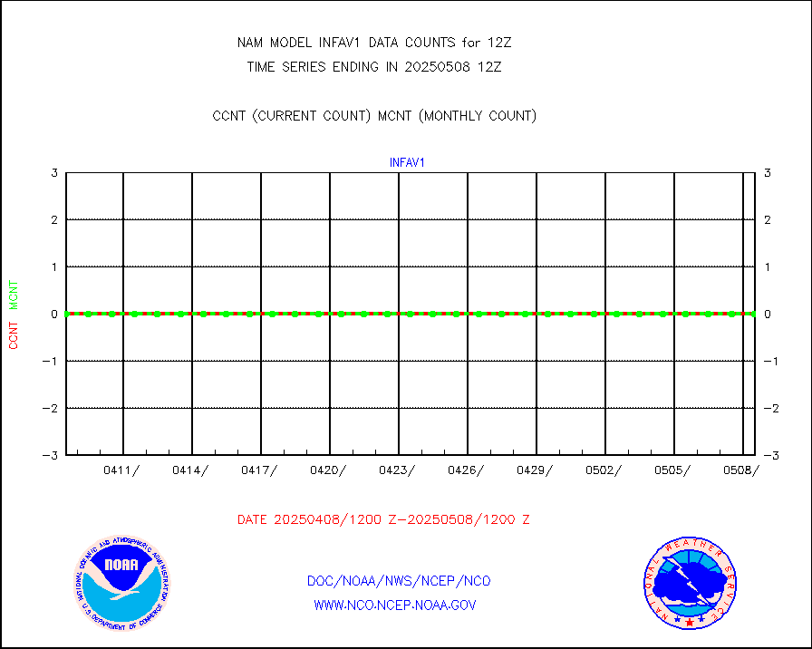
infav1 |
AVHRR (METOP) ir lg-wave derived cld motion |
0 |
0 |
n/a |
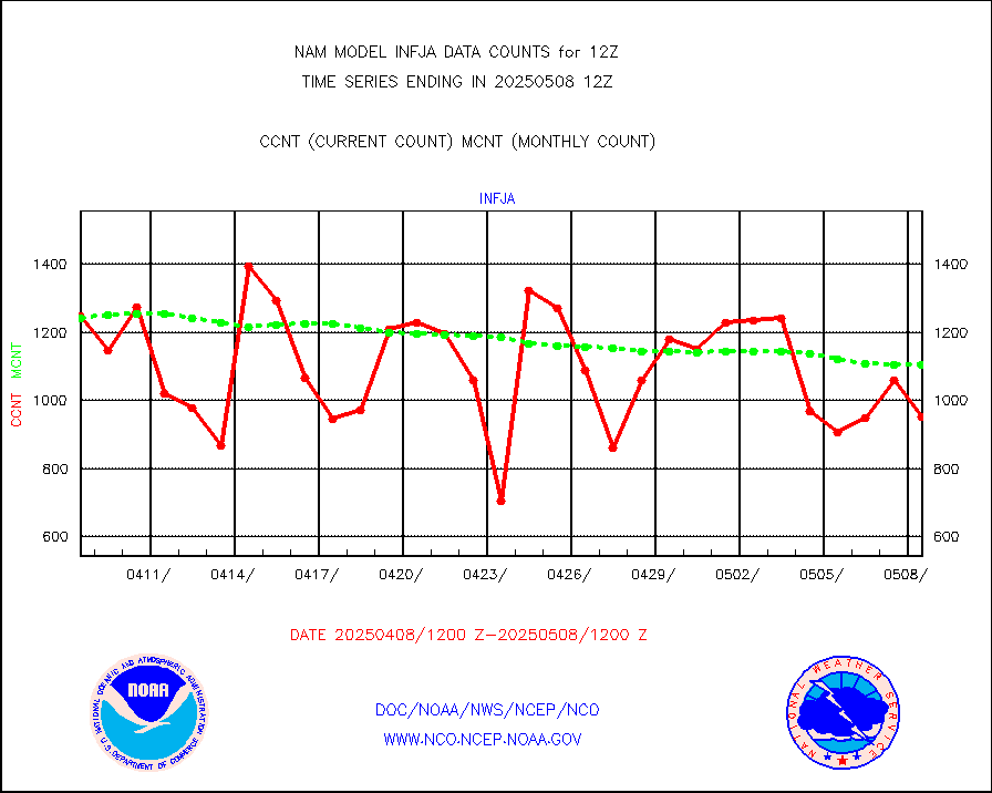
infja |
MTSAT/JMA infrared long-wave derived cloud motion |
1368 |
1189 |
115.1 % |
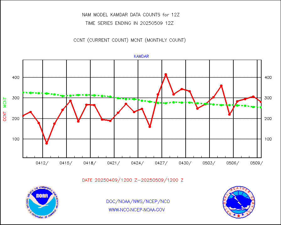
kamdar |
Korean AMDAR aircraft data (decoded from BUFR) |
323 |
339 |
95.3 % |
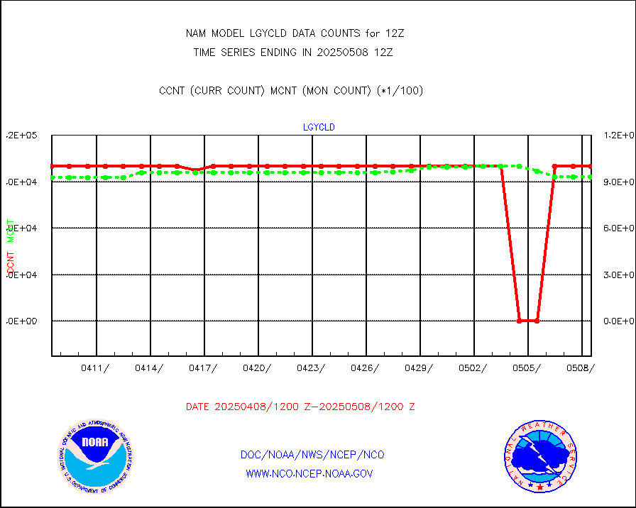
lgycld |
GOES/NASA(Langley) hi-res. (1x1 f-o-v) cloud data |
4191754 |
4170365 |
100.5 % |
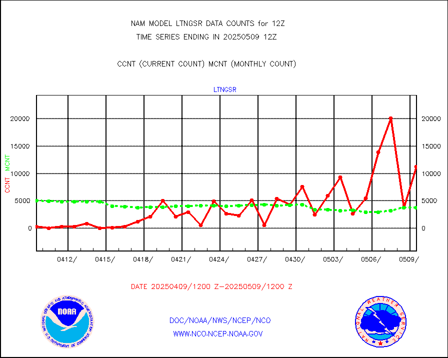
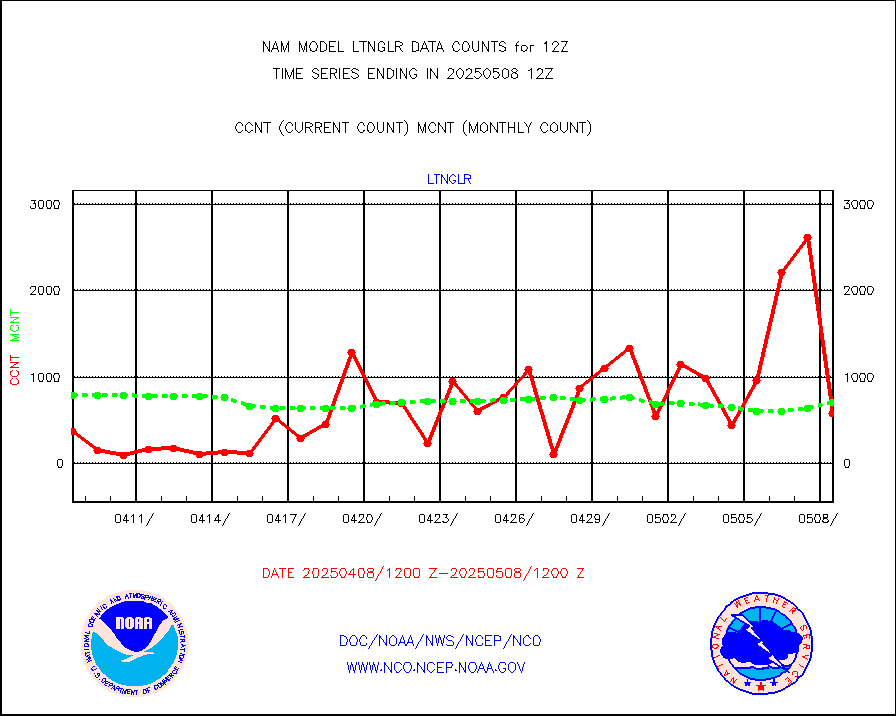
ltnglr |
LLDN Long-rng lightning from Vaisala via NOAAPORT |
36235 |
56504 |
64.1 % |
mbuoyb |
Moored buoys (decoded from BUFR) |
1156 |
1146 |
100.9 % |
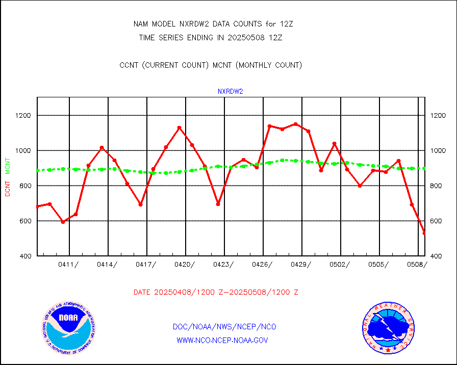
nxrdw2 |
NEXRAD Vel Azm Dsp(VAD) winds via Level 2 decoder |
1104 |
942 |
117.2 % |
osbuv8 |
NOAA 16-19 Solar Backscatter UV-2 rad frm V8 BUFR |
0 |
0 |
n/a |
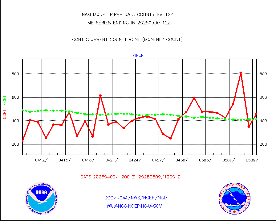
pirep |
Manual PIREP aircraft data (dcded from AIREP fmt) |
446 |
427 |
104.4 % |
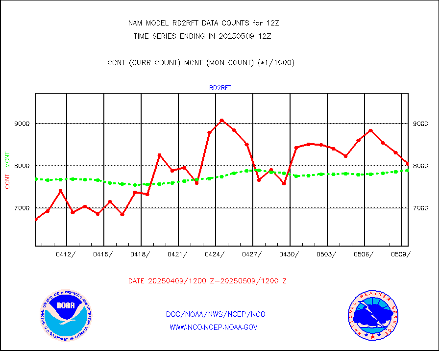
rd2rft |
NEXRAD reflectivity (Lvl 2 - GTS) |
8090355 |
7485479 |
108.1 % |
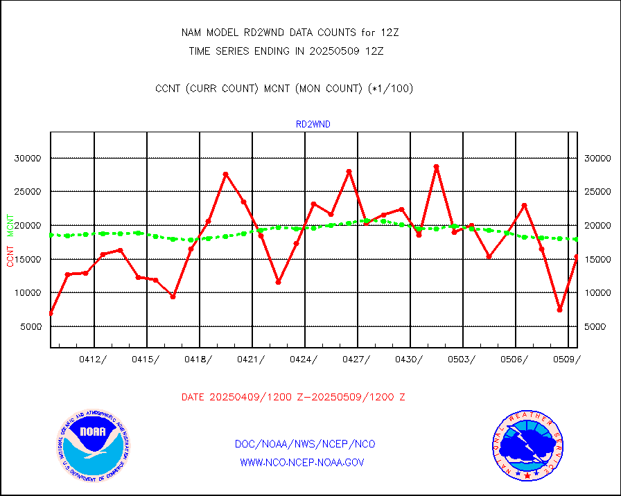
rd2wnd |
NEXRAD radial wind (Level 2 - GTS) |
2883098 |
2043567 |
141.1 % |
sevcsr |
METEOSAT-10 2nd Gen SEVIRI Clr Sky Radiance(proc) |
0 |
0 |
n/a |
synop |
Synoptic - fixed manual and automatic |
624 |
770 |
81.0 % |
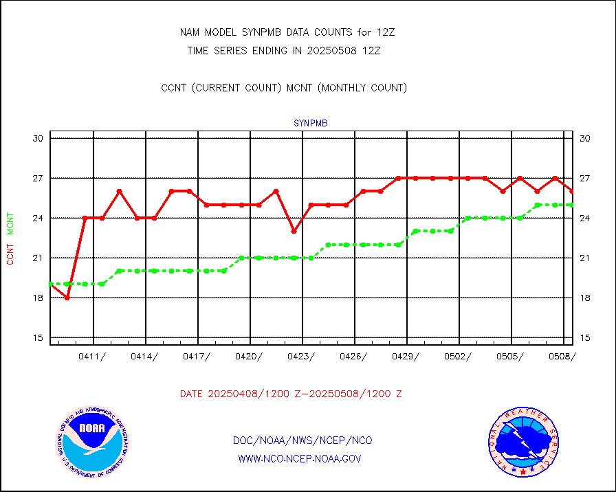
synpmb |
Synoptic - mobile manual & auto (decoded fr BUFR) |
0 |
0 |
n/a |
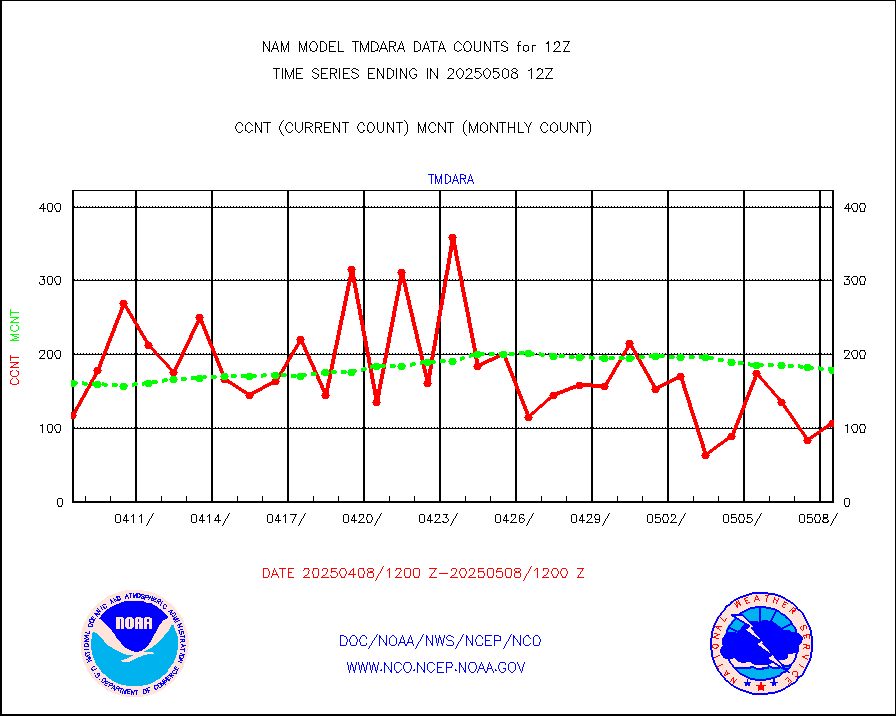
tmdara |
TAMDAR aircft data-all types(from Panasonic,BUFR) |
1944 |
1774 |
109.6 % |
visja |
MTSAT/JMA visible derived cloud motion |
0 |
0 |
n/a |
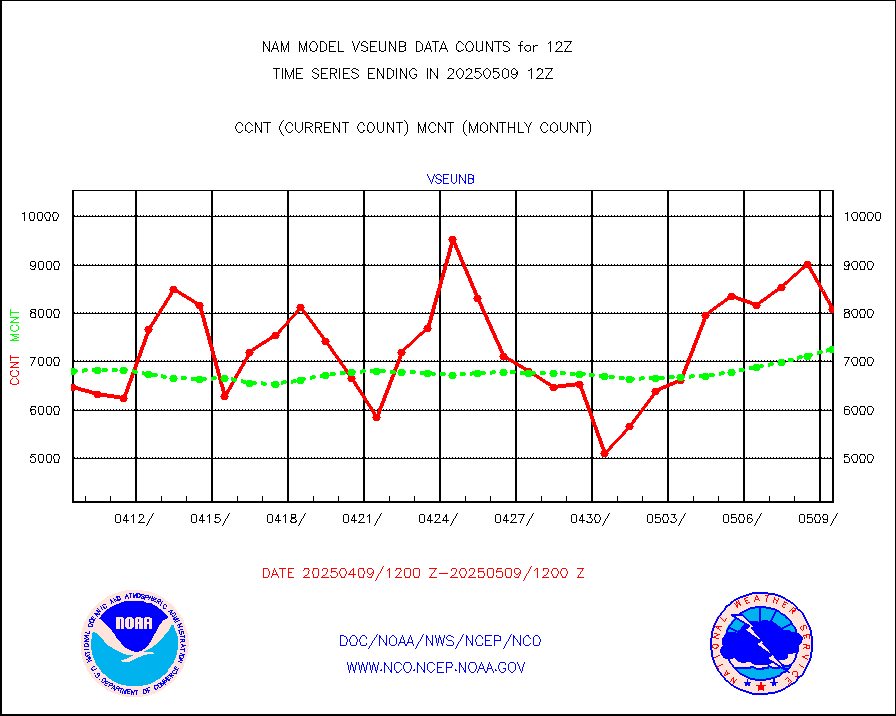
vseunb |
METEOSAT/EUMETSAT visible drv cld motion NBseq |
8480 |
6313 |
134.3 % |


