| Critical Data with Normal Counts |
|---|
| Type | Description | Hourly Count | Monthly Average | Percent (%) of Monthly Mean |
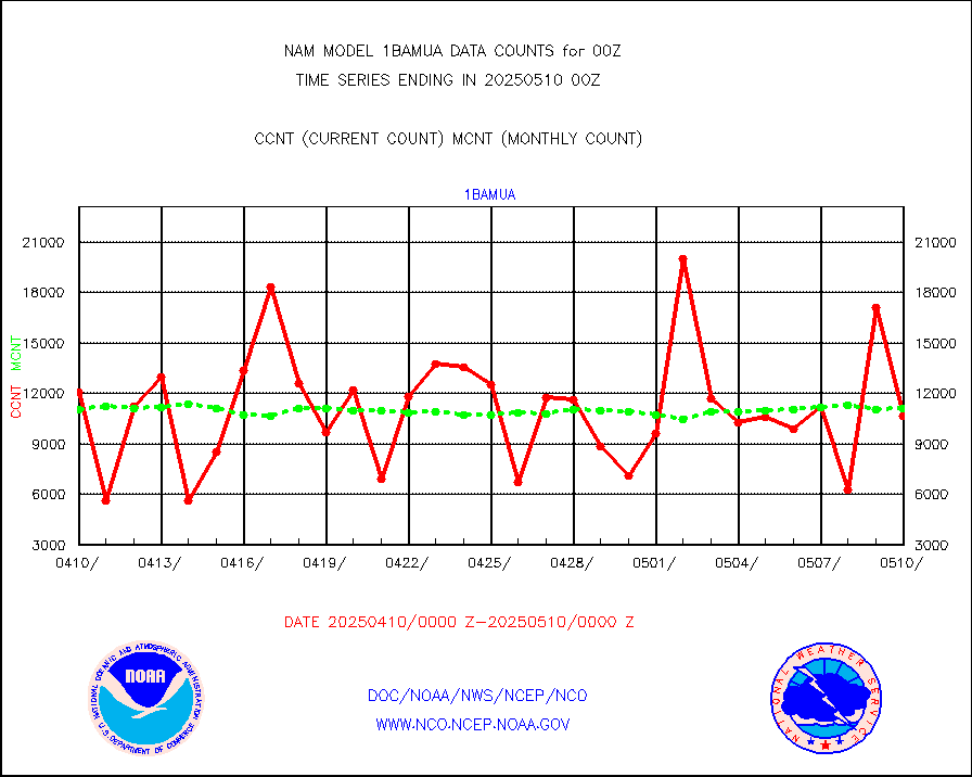
1bamua |
NOAA 15-19 & METOP 1-2 AMSU-A NCEP-proc. br.temps |
10107 |
9711 |
104.1 % |
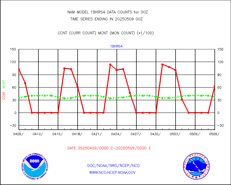
1bmhs |
NOAA 18-19 & METOP 1-2 MHS NCEP-proces. br. temps |
87857 |
76859 |
114.3 % |
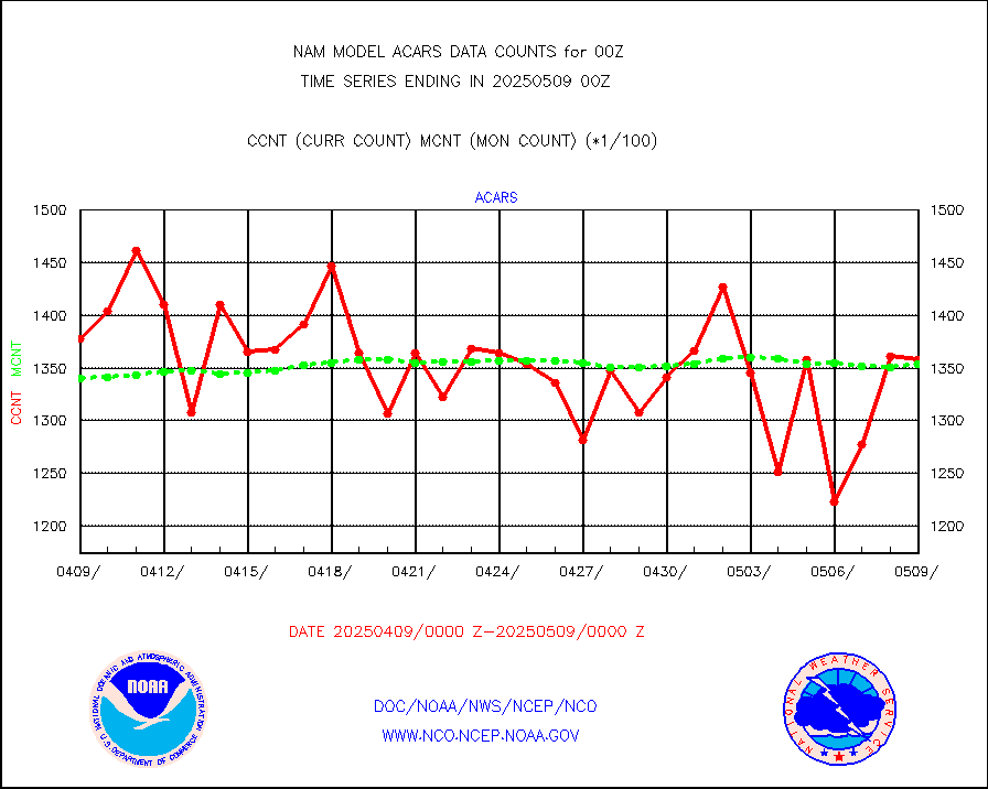
acars |
MDCRS ACARS acft data from ARINC(dcded from BUFR) |
117489 |
93029 |
126.3 % |
airsev |
AQUA AIRS/AMSU-A/HSB brightness temps- every FOV |
0 |
0 |
n/a |
amdar |
AMDAR aircraft data (decoded from AMDAR format) |
3045 |
2957 |
103.0 % |
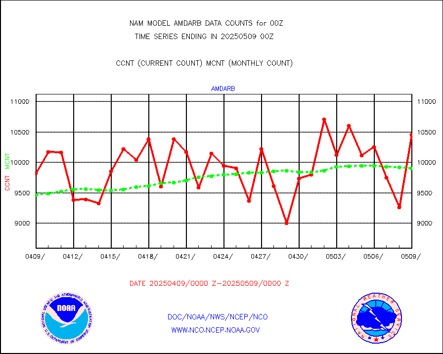
amdarb |
AMDAR aircraft data (decoded from BUFR) |
4980 |
4632 |
107.5 % |
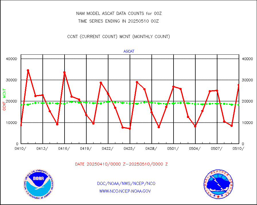
ascat |
METOP 1-2 ASCAT products |
8181 |
9671 |
84.6 % |
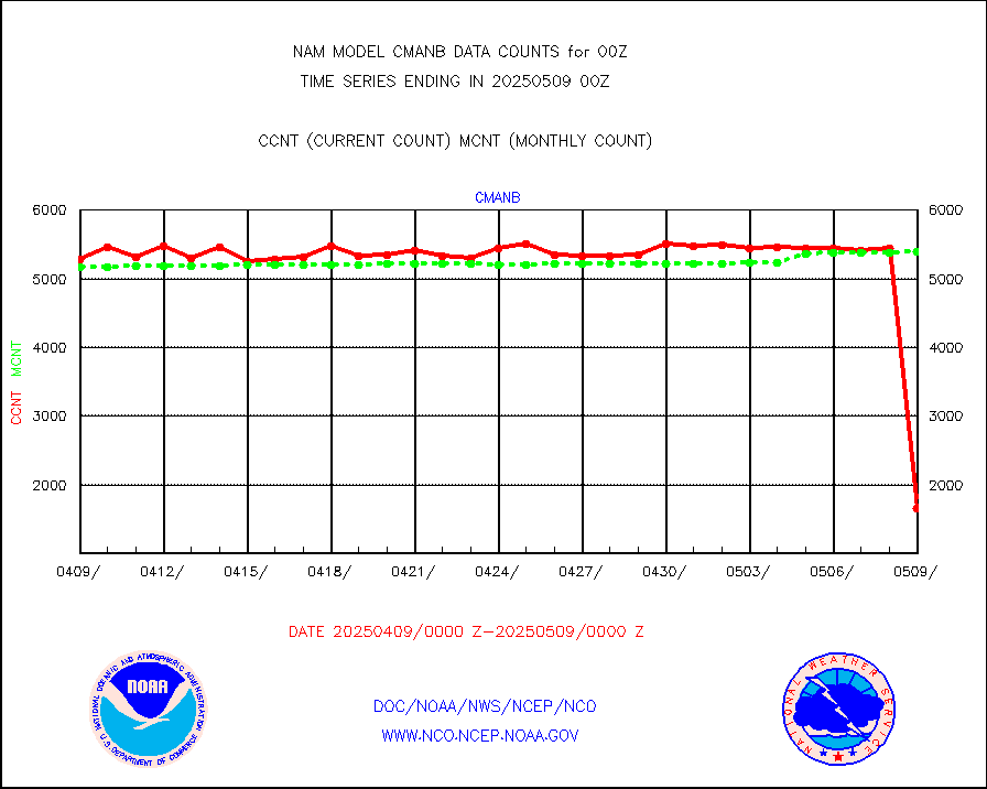
cmanb |
Surface Marine CMAN rpts decoded from BUFR format |
5149 |
5264 |
97.8 % |
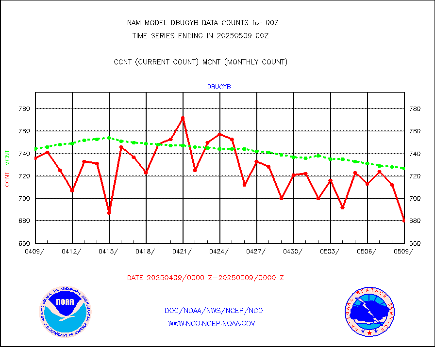
dbuoy |
Buoys decoded from FM-18 fmt (moored or drifting) |
4 |
4 |
100.0 % |
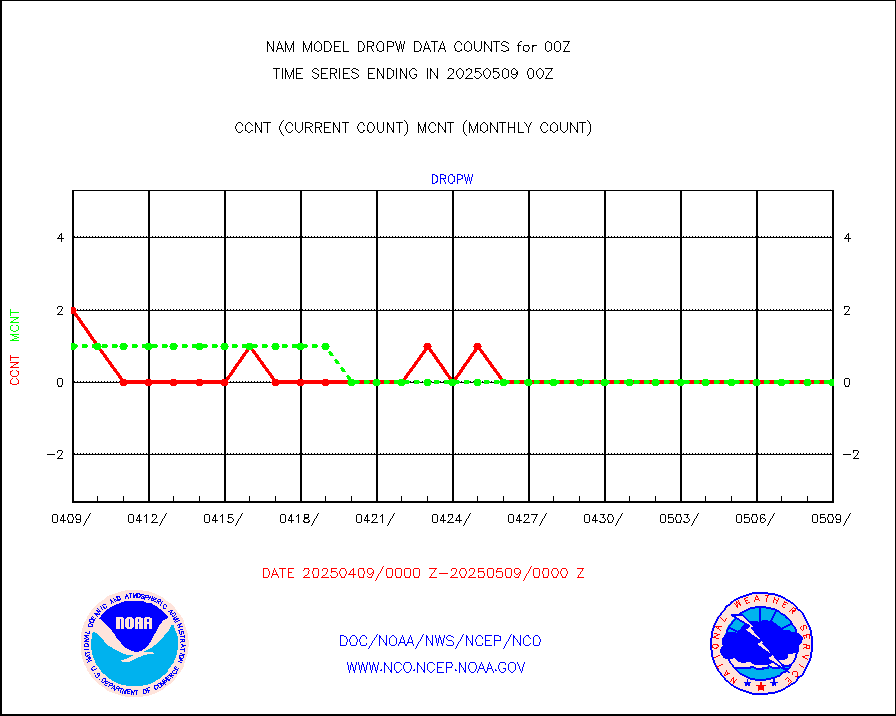
dropw |
Dropwinsonde (from TEMP DROP) |
0 |
0 |
n/a |
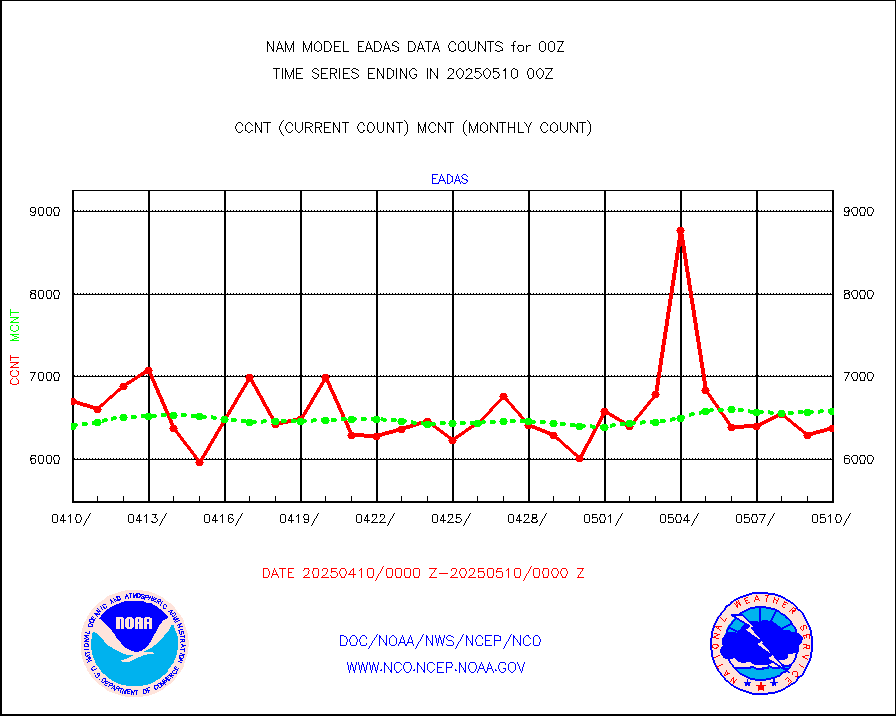
eadas |
E-AMDAR (European AMDAR acft decoded from BUFR) |
4250 |
4991 |
85.2 % |
geost1 |
GOES/NESDIS hi-resol. (1x1 f-o-v) sndgs/radiances |
0 |
0 |
n/a |
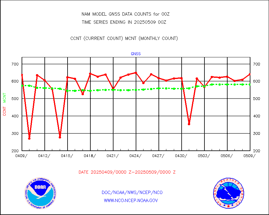
gnss |
Grnd-based Gbl Navigation Sat System (GNSS) data |
765 |
687 |
111.4 % |
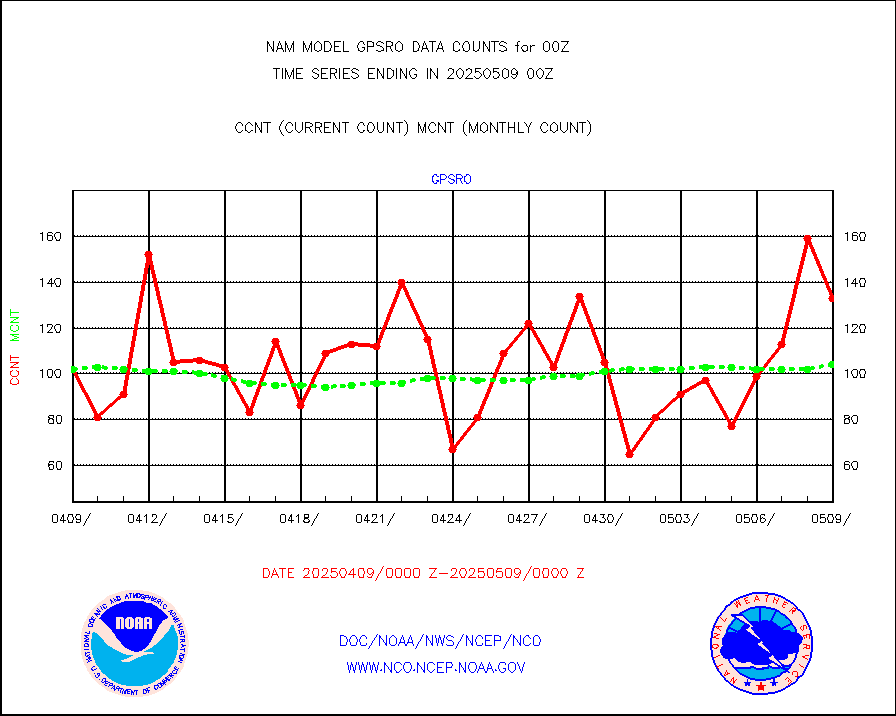
gpsro |
GPS radio occultation data |
68 |
75 |
90.7 % |
h20mo |
MODIS (AQUA/TERRA) wvpr imager derived cld motion |
0 |
0 |
n/a |
infmo |
MODIS (AQUA/TERRA) ir l-wave derived cloud motion |
0 |
0 |
n/a |
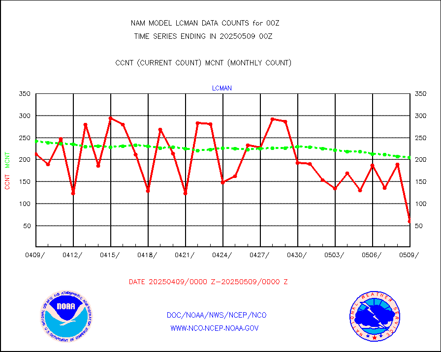
lcman |
Land-based CMAN stations decoded from CMAN format |
244 |
218 |
111.9 % |
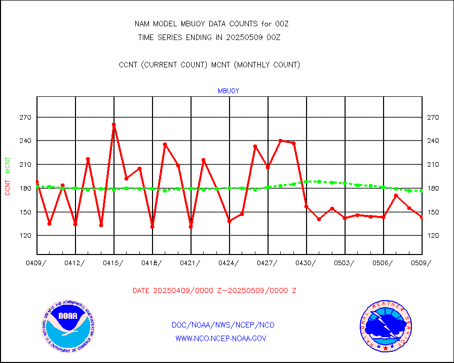
mbuoy |
Buoys decoded from FM-13 format (moored) |
174 |
183 |
95.1 % |
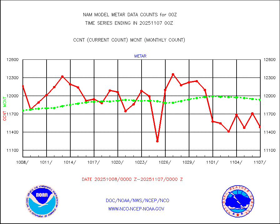
metar |
Aviation - METAR |
9991 |
12133 |
82.3 % |
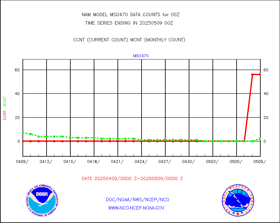
mso470 |
Mesonet/MADIS Colorado E-470 (Interstate 470) |
42 |
48 |
87.5 % |
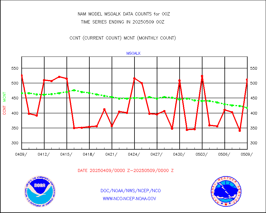
msoalk |
Mesonet/MADIS Alaska Department of Transportation |
480 |
438 |
109.6 % |
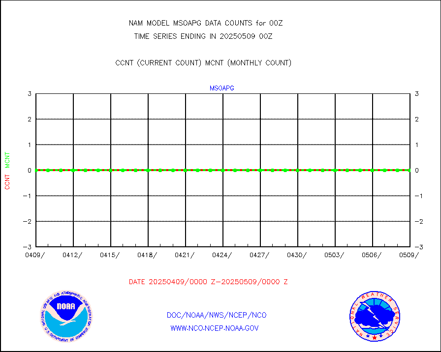
msoapg |
Mesonet/MADIS U.S. Army Aberdeen Proving Grounds |
0 |
0 |
n/a |
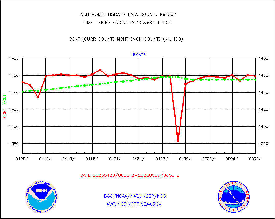
msoapr |
Mesonet/MADIS Citizen Weather Observers Program |
110013 |
105602 |
104.2 % |
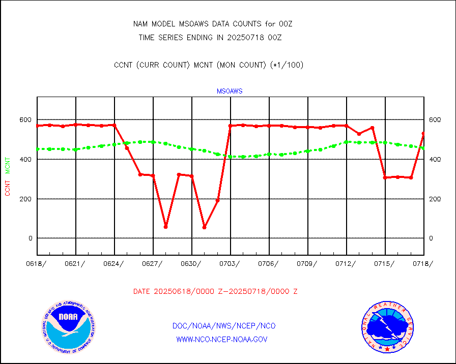
msoaws |
Mesonet/MADIS AWS Convergence Technologies, Inc. |
62439 |
62082 |
100.6 % |
msoawx |
Mesonet/MADIS "Anything Weather" |
0 |
0 |
n/a |
msocol |
Mesonet/MADIS Colorado Dept. of Transportation |
0 |
0 |
n/a |
msodcn |
Mesonet/MADIS DC Net |
0 |
0 |
n/a |
msoden |
Mesonet/MADIS Denver Urban Drainage & Flood Cntrl |
500 |
498 |
100.4 % |
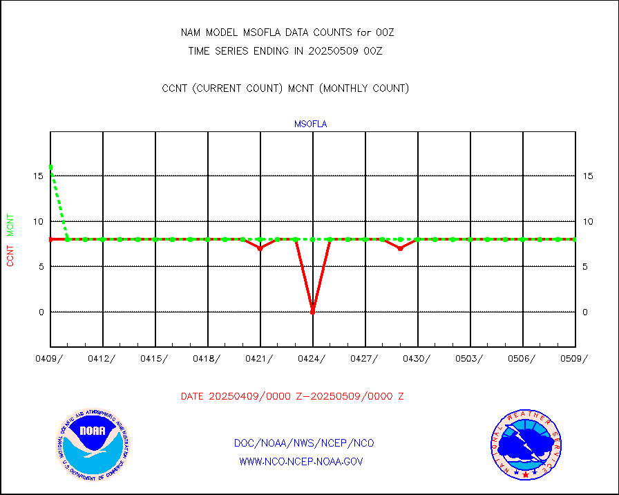
msofla |
Mesonet/MADIS Florida (FAWN & USF) |
8 |
8 |
100.0 % |
msoflt |
Mesonet/MADIS Florida Dept. of Transportation |
0 |
0 |
n/a |
msogeo |
Mesonet/MADIS Georgia Dept. of Transportation |
0 |
0 |
n/a |
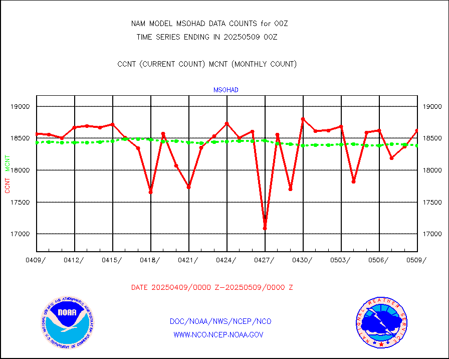
msohad |
Mesonet/MADIS NWS Hydromet Auto Data System(HADS) |
18835 |
17570 |
107.2 % |
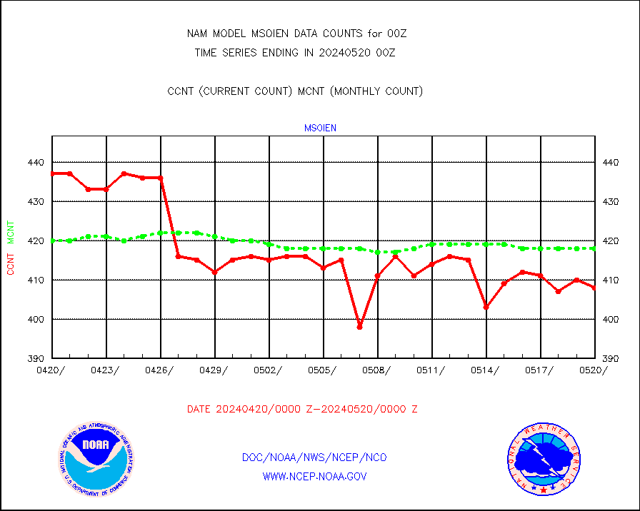
msoien |
Mesonet/MADIS Iowa Environmental |
415 |
421 |
98.6 % |
msoind |
Mesonet/MADIS Indiana Dept. of Transportation |
0 |
0 |
n/a |
msoiow |
Mesonet/MADIS Iowa Department of Transportation |
0 |
0 |
n/a |
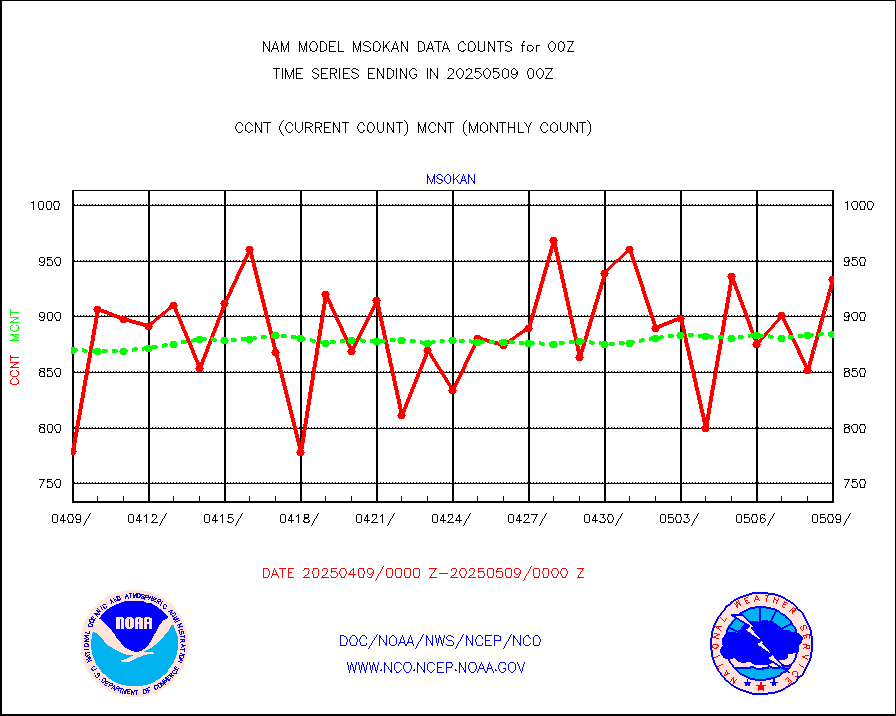
msokan |
Mesonet/MADIS Kansas Department of Transportation |
930 |
863 |
107.8 % |
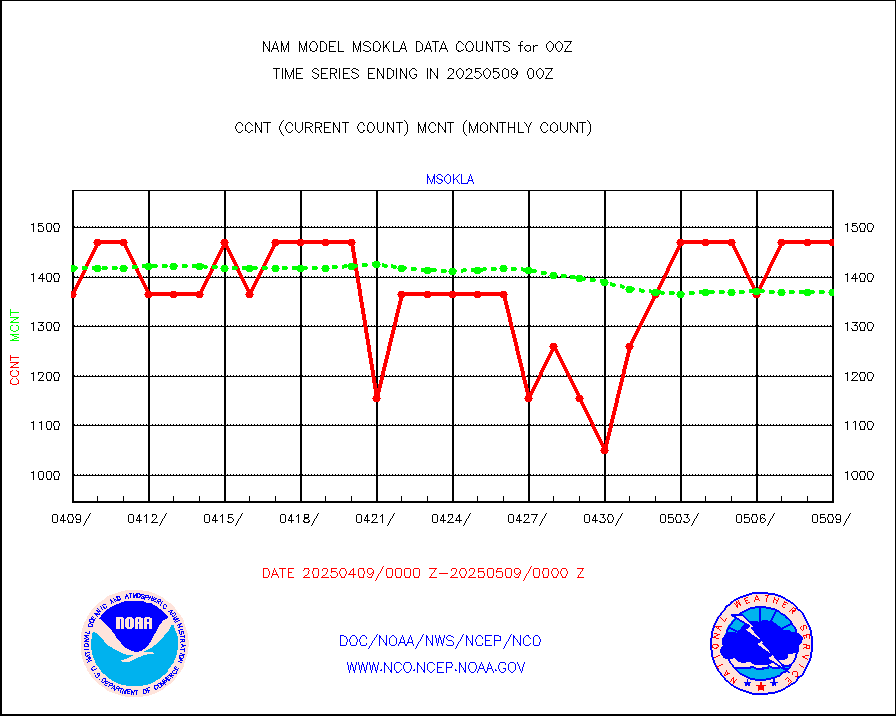
msokla |
Mesonet/MADIS Oklahoma Mesonet |
742 |
763 |
97.2 % |
msolju |
Mesonet/MADIS Louisiana State/Jackson State Univ. |
0 |
0 |
n/a |
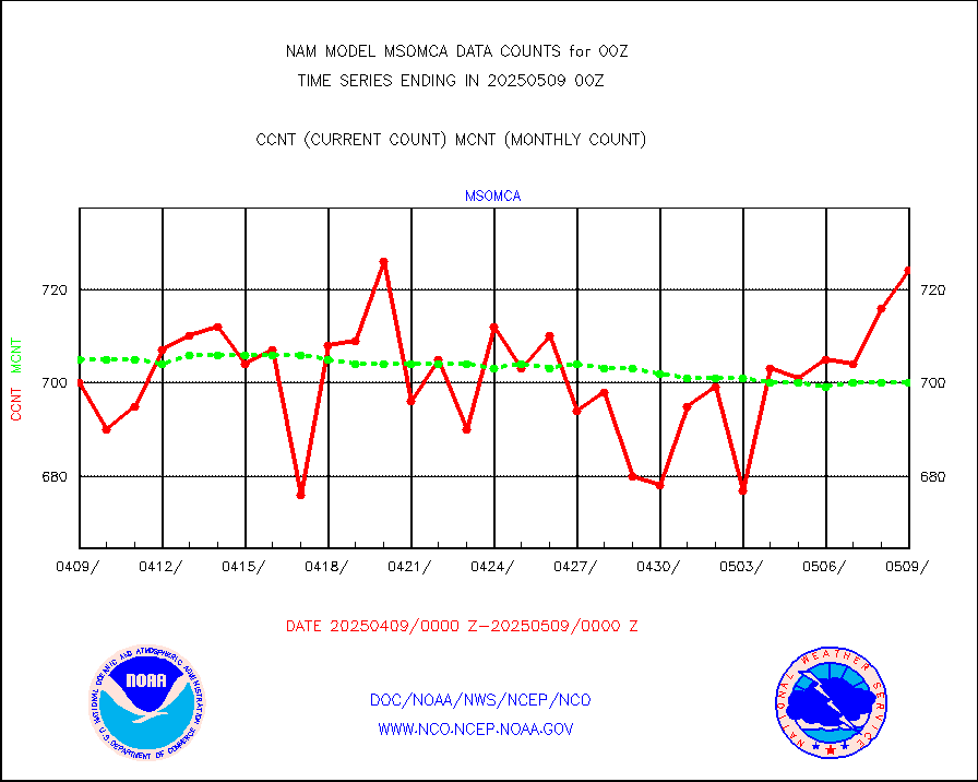
msomca |
Mesonet/MADIS Missouri Commercial Agricult Wx Net |
614 |
582 |
105.5 % |
msomin |
Mesonet/MADIS Minnesota Dept. of Transportation |
0 |
0 |
n/a |
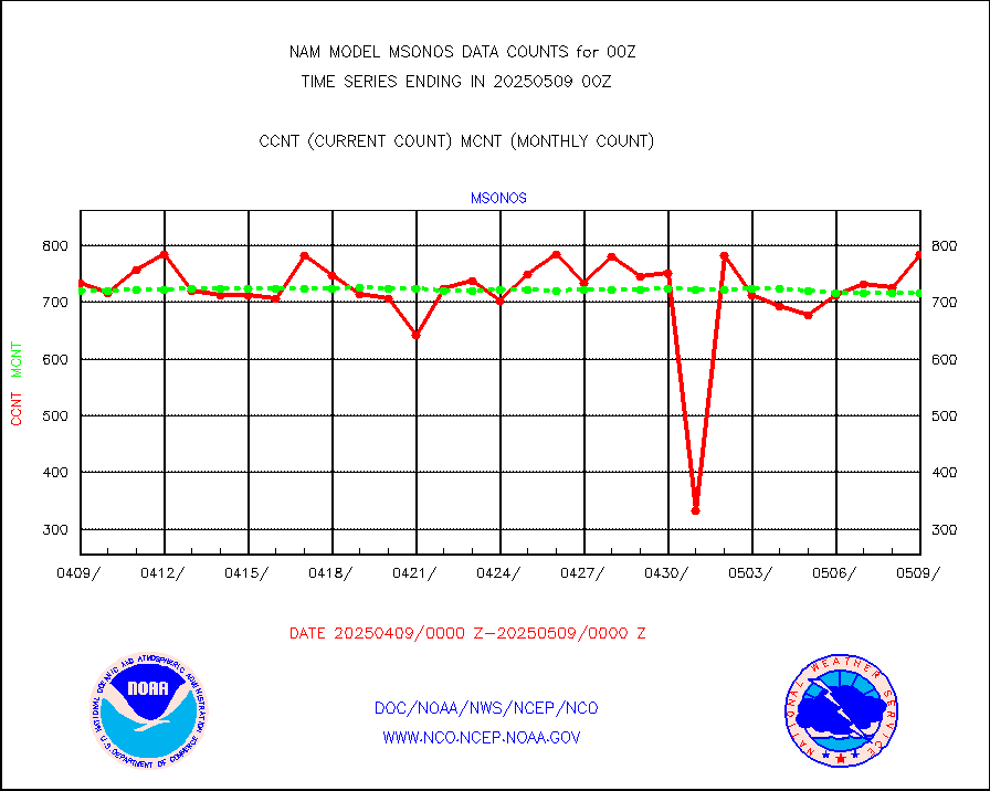
msonos |
Mesonet/MADIS NOS-Phys Oceanographic Realtime Sys |
686 |
651 |
105.4 % |
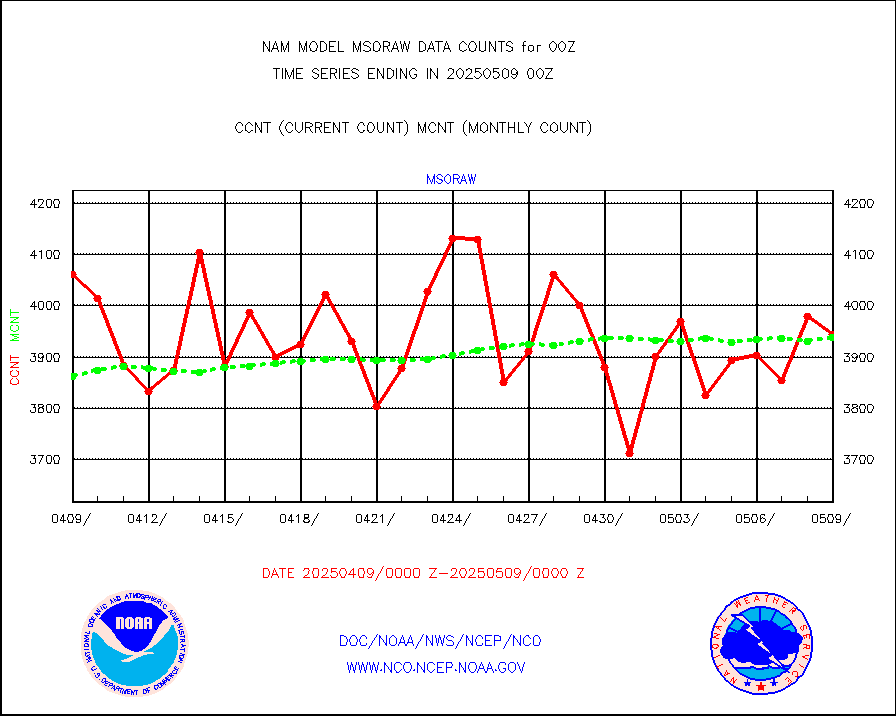
msoraw |
Mesonet/MADIS NFIC Remote Automated Wx Stns(RAWS) |
3675 |
3577 |
102.7 % |
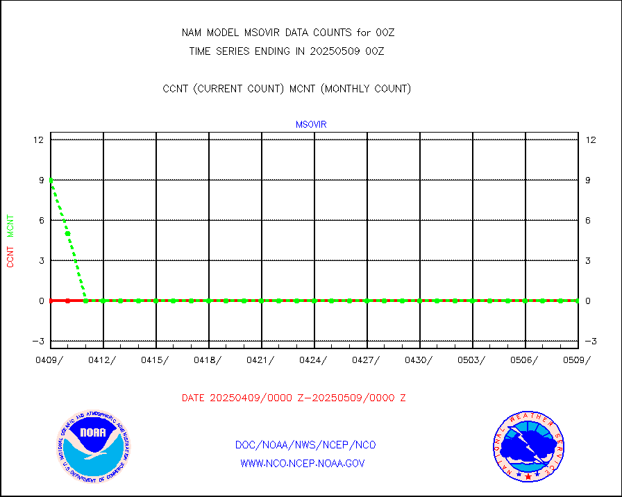
msovir |
Mesonet/MADIS Virginia Dept. of Transportation |
564 |
559 |
100.9 % |
msowfy |
Mesonet/MADIS "Weather for You" |
0 |
0 |
n/a |
msowis |
Mesonet/MADIS Wisconsin Dept. of Transportation |
0 |
0 |
n/a |
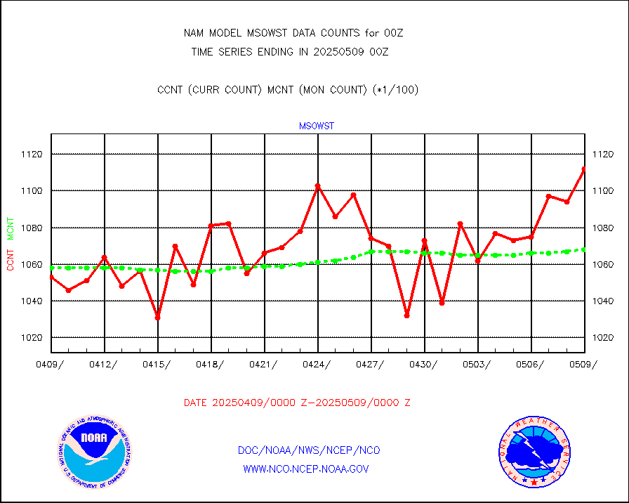
msowst |
Mesonet/MADIS MesoWest (many subproviders) |
108237 |
99640 |
108.6 % |
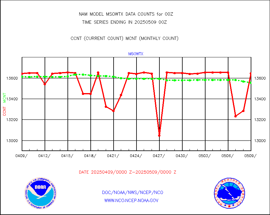
msowtx |
Mesonet/MADIS West Texas |
13243 |
13246 |
100.0 % |
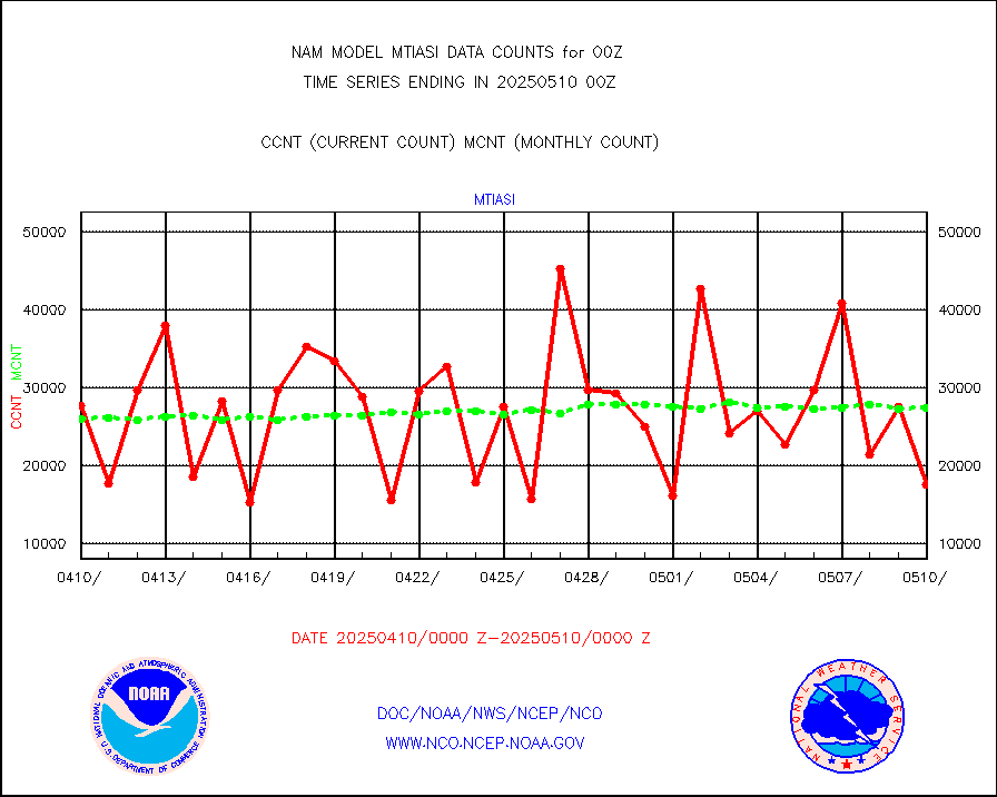
mtiasi |
METOP 1-2 IASI 1C radiance data (varbl. channels) |
20902 |
20029 |
104.4 % |
nxrdw |
NEXRAD Vel Azm Dsp(VAD) winds via radar coded msg |
0 |
0 |
n/a |
pibal |
PIBAL (from PILOT, PILOT SHIP, PILOT MOBIL) |
0 |
0 |
n/a |
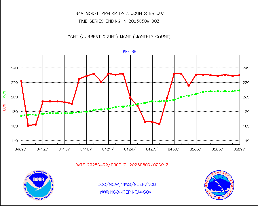
prflrb |
Multi-Agency Profiler (MAP) and SODAR winds |
197 |
176 |
111.9 % |
prflrp |
Profilr winds from PIBAL (PILOT,PILOT SHIP/MOBIL) |
0 |
0 |
n/a |
raobm |
Rawinsonde - mobile land (from TEMP/PILOT MOBIL) |
0 |
0 |
n/a |
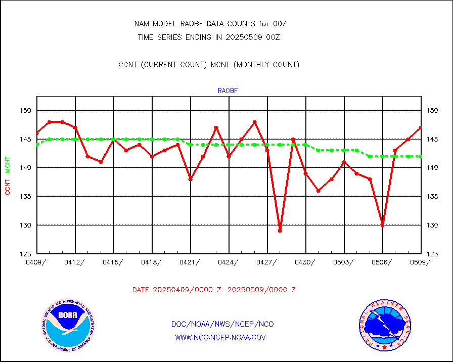
raobs |
Rawinsonde - ship (from TEMP SHIP, PILOT SHIP) |
0 |
0 |
n/a |
rass |
RASS temperatures (NOAA and Multi-Agency) |
64 |
54 |
118.5 % |
recco |
Flight level reconnaissance aircraft data |
0 |
1 |
0.0 % |
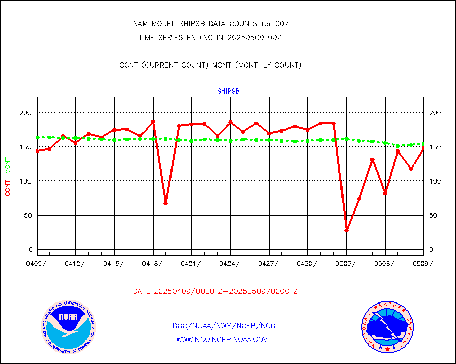
ships |
Ship - manual and automatic, restricted |
18 |
19 |
94.7 % |
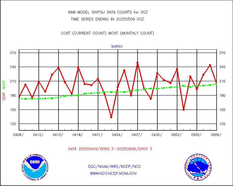
shipsu |
Ship - manual and automatic, unrestricted |
118 |
140 |
84.3 % |
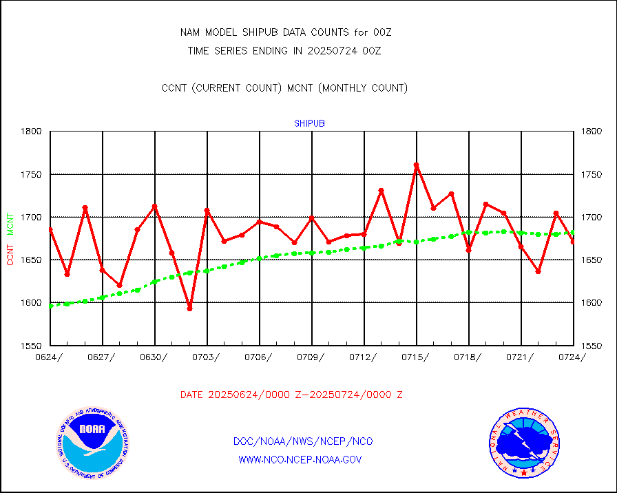
shipub |
Ship - manual and automatic, unrestricted (BUFR) |
1472 |
1480 |
99.5 % |
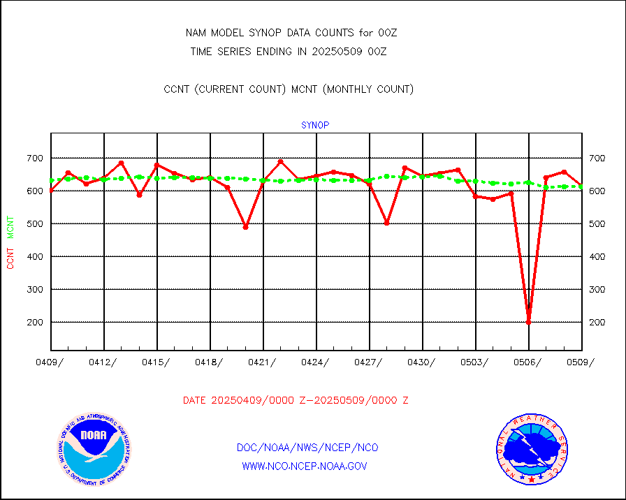
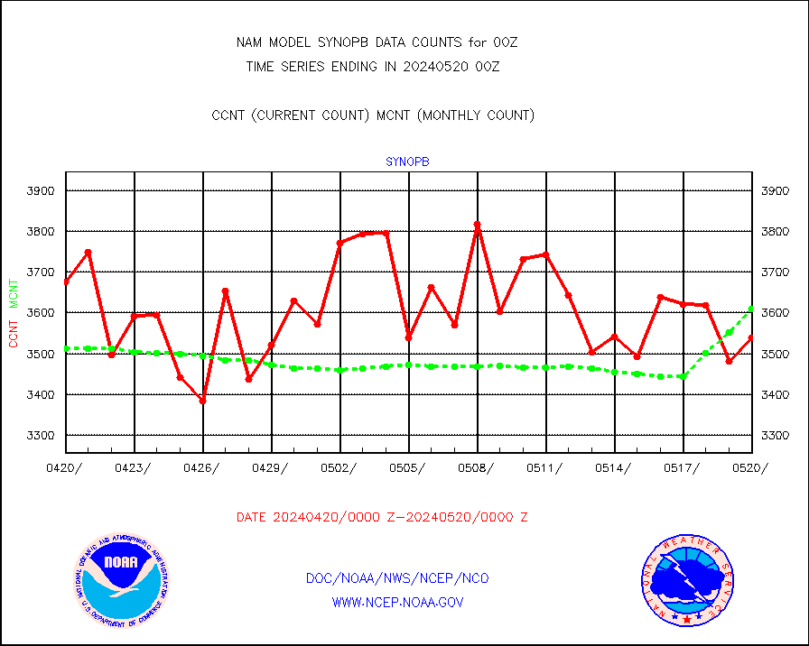
synopb |
Synoptic - fixed manual & auto (decoded fr BUFR) |
2072 |
3623 |
57.2 % |
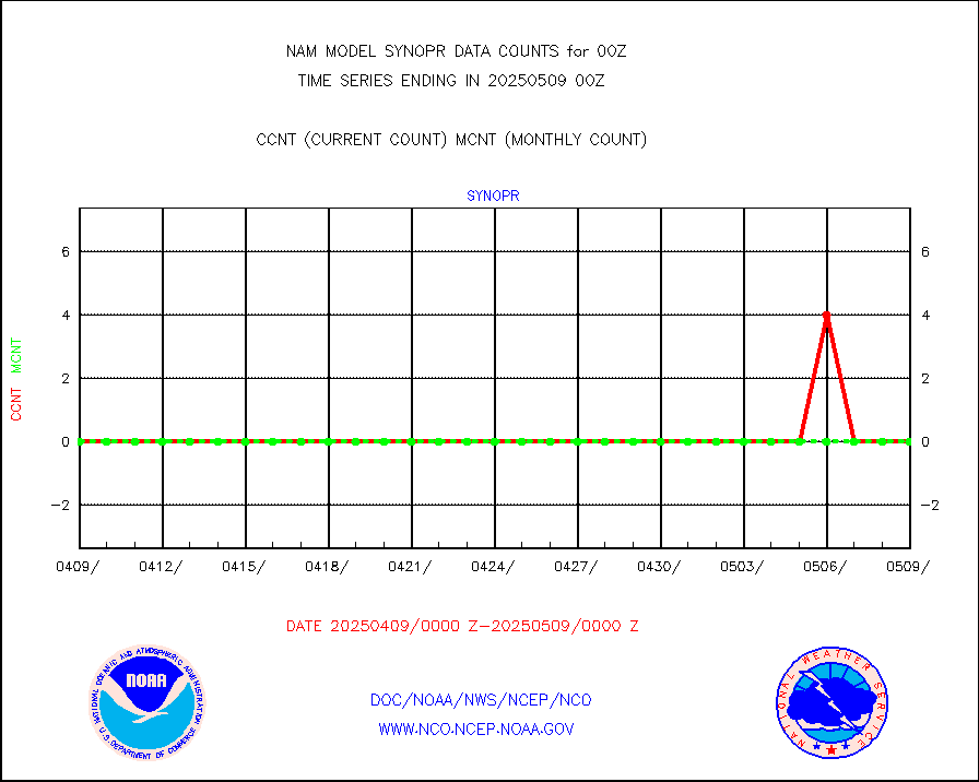
synopr |
Synoptic - restricted (WMO Res 40) manual & auto. |
4 |
0 |
n/a |
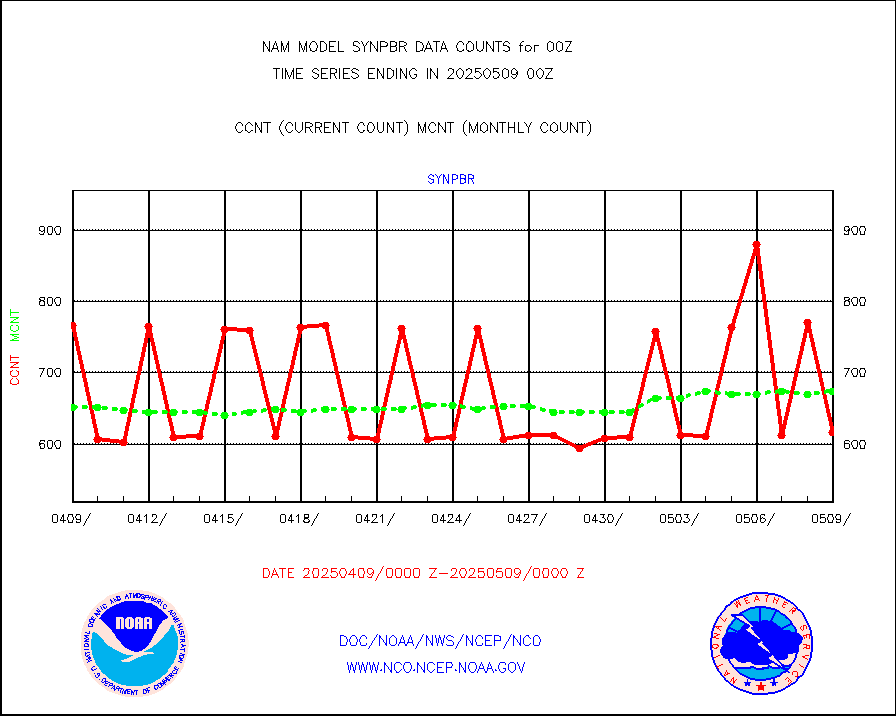
synpbr |
Synoptic - restricted (WMO Res 40)(decoded BUFR) |
736 |
690 |
106.7 % |
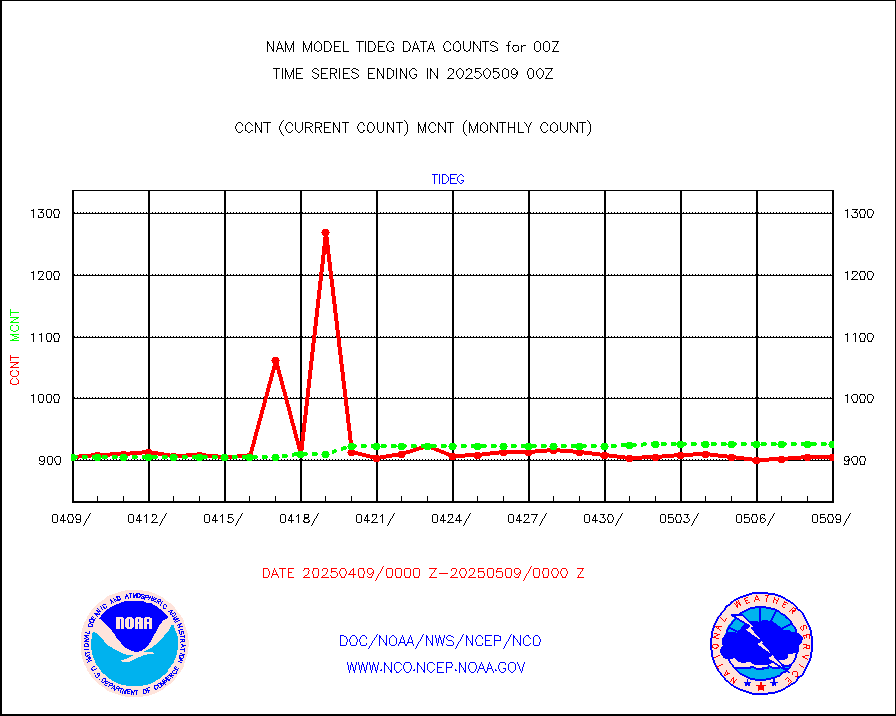
tideg |
Tide gauge reports decoded from CREX format |
892 |
883 |
101.0 % |
| Data Types of Opportunity with Normal Counts |
|---|
| Type | Description | Hourly Count | Monthly Average | Percent (%) of Monthly Mean |
acarsa |
MDCRS ACARS acft data (ARINC via AFWA)(AIREP fmt) |
0 |
0 |
n/a |
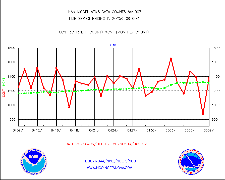
atms |
NPP/NOAA-20 ATMS brightness temperatures |
137926 |
122864 |
112.3 % |
cris |
NPP CrIS apodized radiances (399 channel) |
0 |
0 |
n/a |
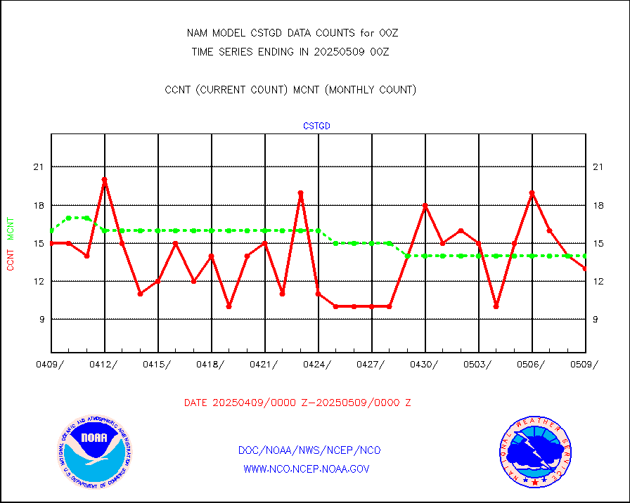
cstgd |
Coast Guard |
13 |
10 |
130.0 % |
dbuoyb |
Drifting buoys (decoded from BUFR) |
732 |
852 |
85.9 % |
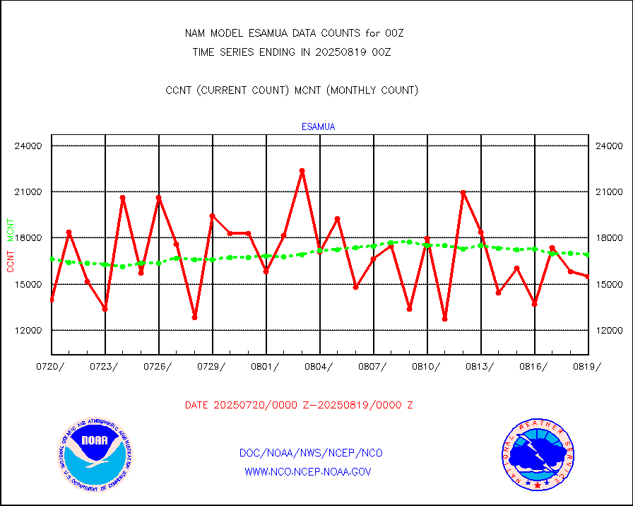
esamua |
NOAA 15-19 & METOP 1-2 AMSU-A proc btmps frm RARS |
24074 |
24107 |
99.9 % |
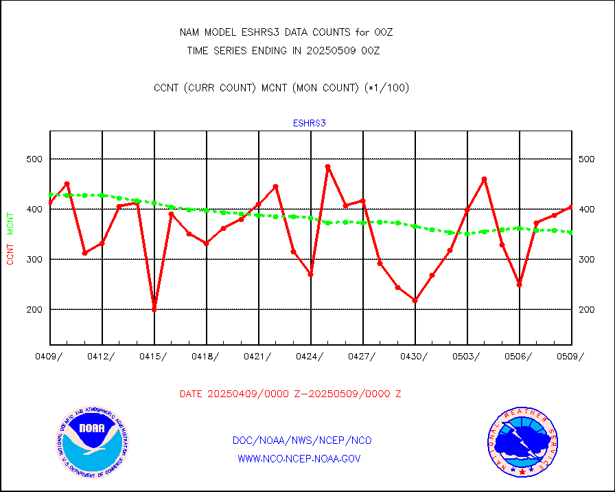
eshrs3 |
NOAA 15-19 & METOP 1-2 HIRS-3/4 pr btmps frm RARS |
55510 |
51501 |
107.8 % |
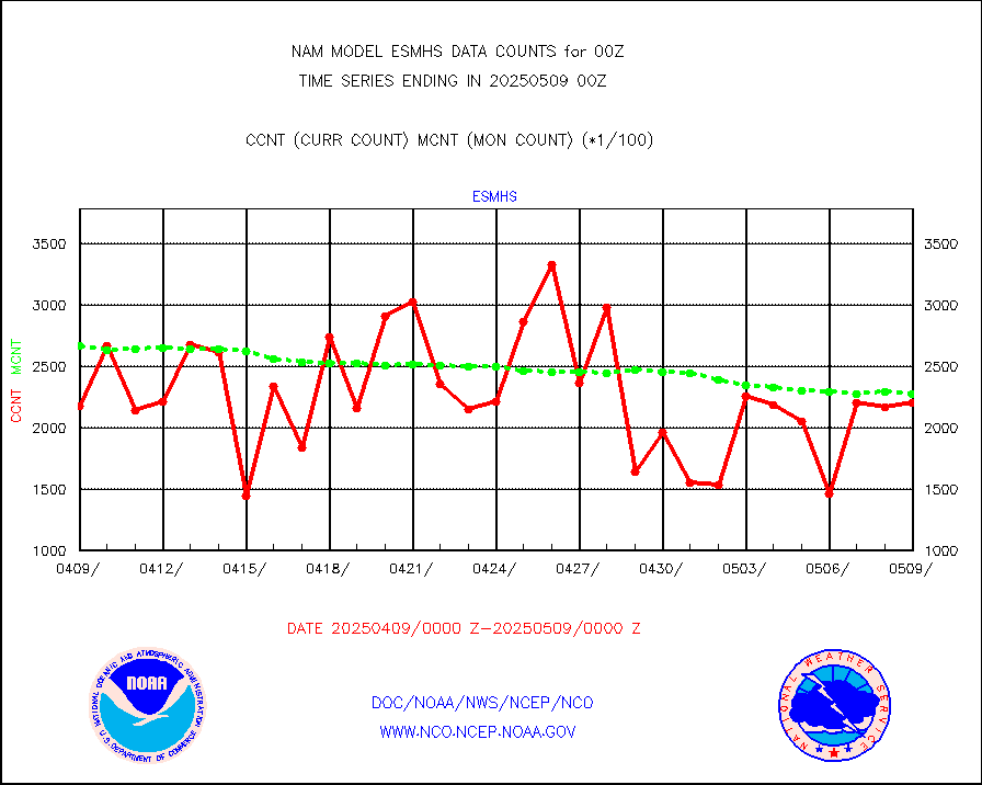
esmhs |
NOAA 18-19 & METOP 1-2 MHS proc. btemps from RARS |
182151 |
192671 |
94.5 % |
geosth |
GOES/NESDIS hi-resol. (1x1 f-o-v) cloud data |
0 |
0 |
n/a |
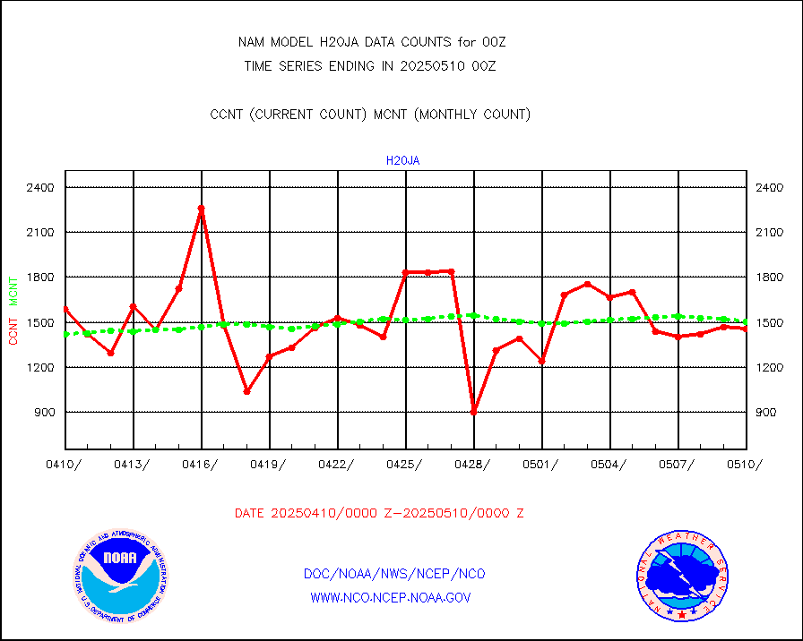
h20ja |
MTSAT/JMA water vapor imager derived cloud motion |
1960 |
1282 |
152.9 % |
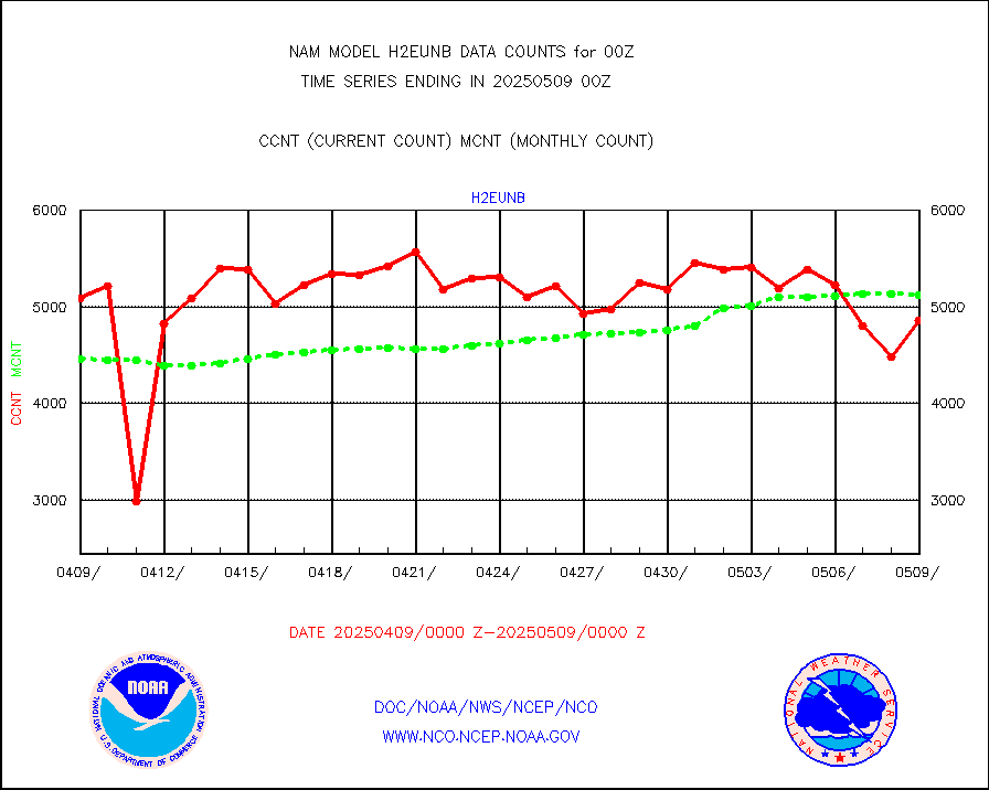
h2eunb |
METEOSAT/EUMETSAT wvpr imgr drv cld motion NBseq |
4909 |
4932 |
99.5 % |
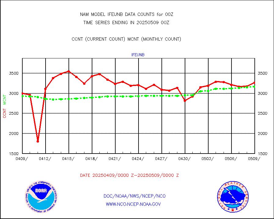
ifeunb |
METEOSAT/EUMETSAT ir lg-wave drv cld motion NBseq |
3186 |
3167 |
100.6 % |
ifvrnb |
VIIRS (NPP/NOAA-20) ir lg-wv drv cloud motion(NB) |
0 |
0 |
n/a |
infav |
AVHRR (NOAA/METOP) ir lg-wave derived cld motion |
0 |
0 |
n/a |
infav1 |
AVHRR (METOP) ir lg-wave derived cld motion |
0 |
0 |
n/a |
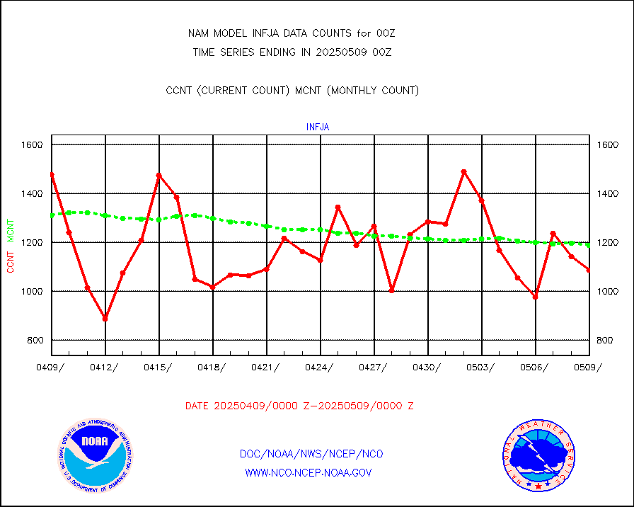
infja |
MTSAT/JMA infrared long-wave derived cloud motion |
1484 |
1236 |
120.1 % |
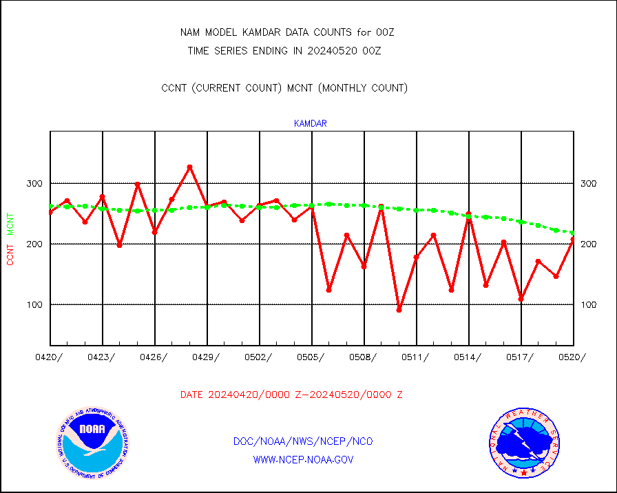
kamdar |
Korean AMDAR aircraft data (decoded from BUFR) |
368 |
254 |
144.9 % |
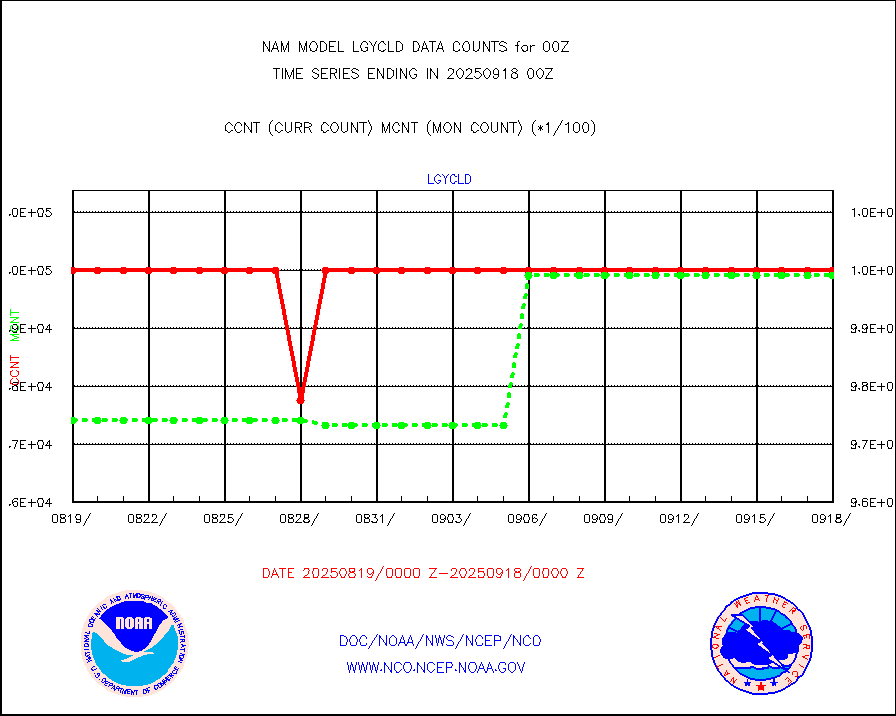
lgycld |
GOES/NASA(Langley) hi-res. (1x1 f-o-v) cloud data |
4174433 |
4152205 |
100.5 % |
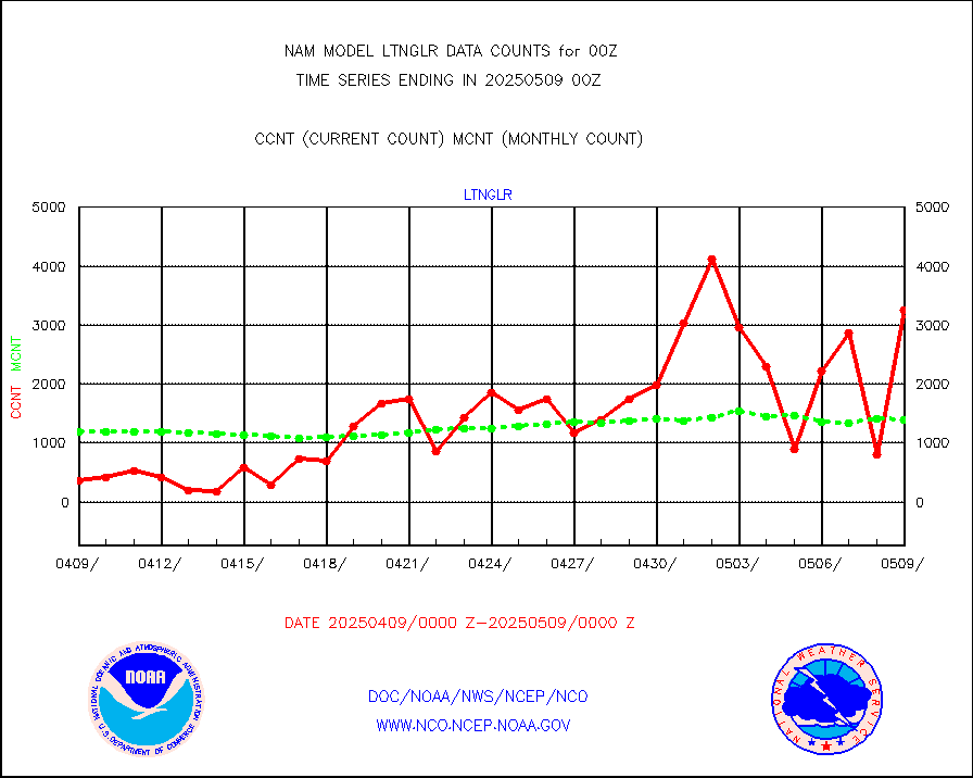
ltnglr |
LLDN Long-rng lightning from Vaisala via NOAAPORT |
103012 |
89225 |
115.5 % |
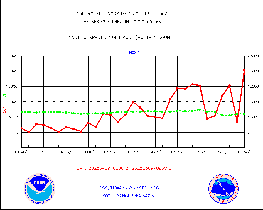
ltngsr |
NLDN Shrt-rng lightning from Vaisala via NOAAPORT |
4966 |
3359 |
147.8 % |
mbuoyb |
Moored buoys (decoded from BUFR) |
1119 |
1160 |
96.5 % |
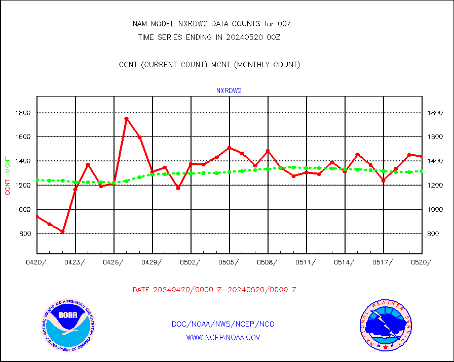
nxrdw2 |
NEXRAD Vel Azm Dsp(VAD) winds via Level 2 decoder |
1399 |
1207 |
115.9 % |
osbuv8 |
NOAA 16-19 Solar Backscatter UV-2 rad frm V8 BUFR |
0 |
0 |
n/a |
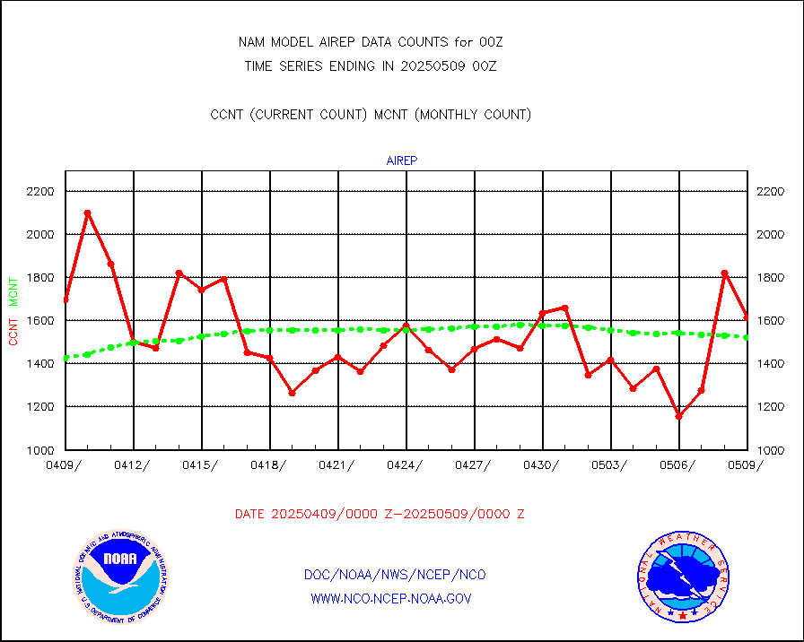
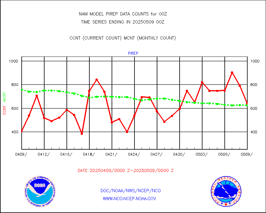
pirep |
Manual PIREP aircraft data (dcded from AIREP fmt) |
611 |
628 |
97.3 % |
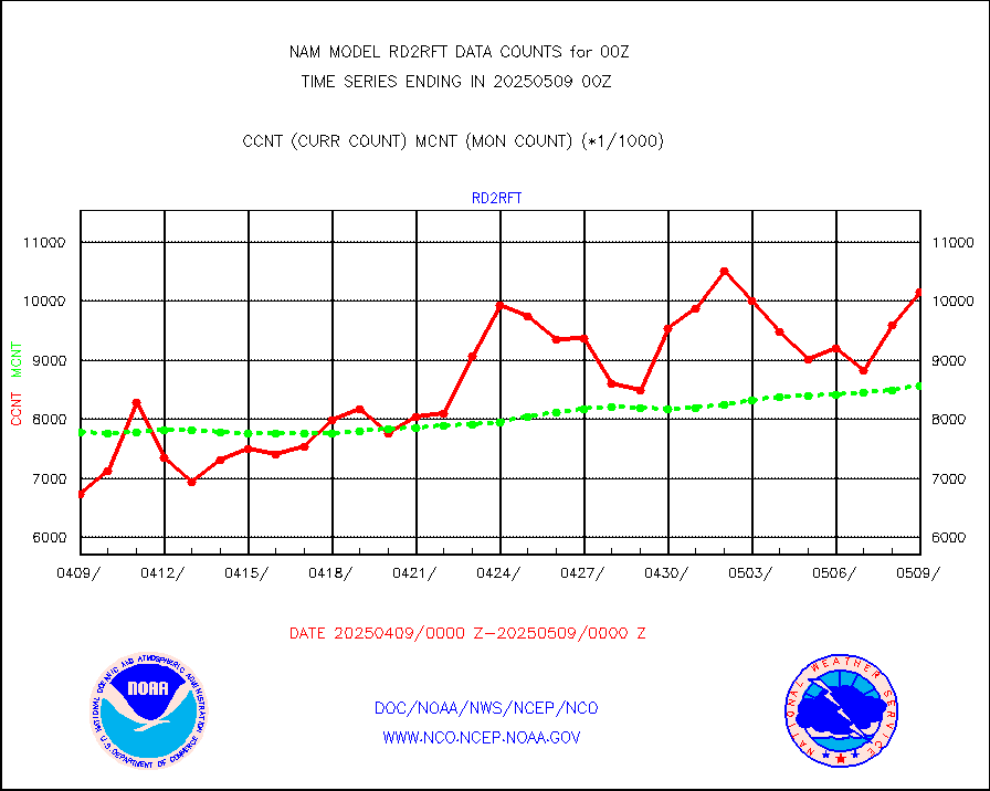
rd2rft |
NEXRAD reflectivity (Lvl 2 - GTS) |
8198046 |
7968750 |
102.9 % |
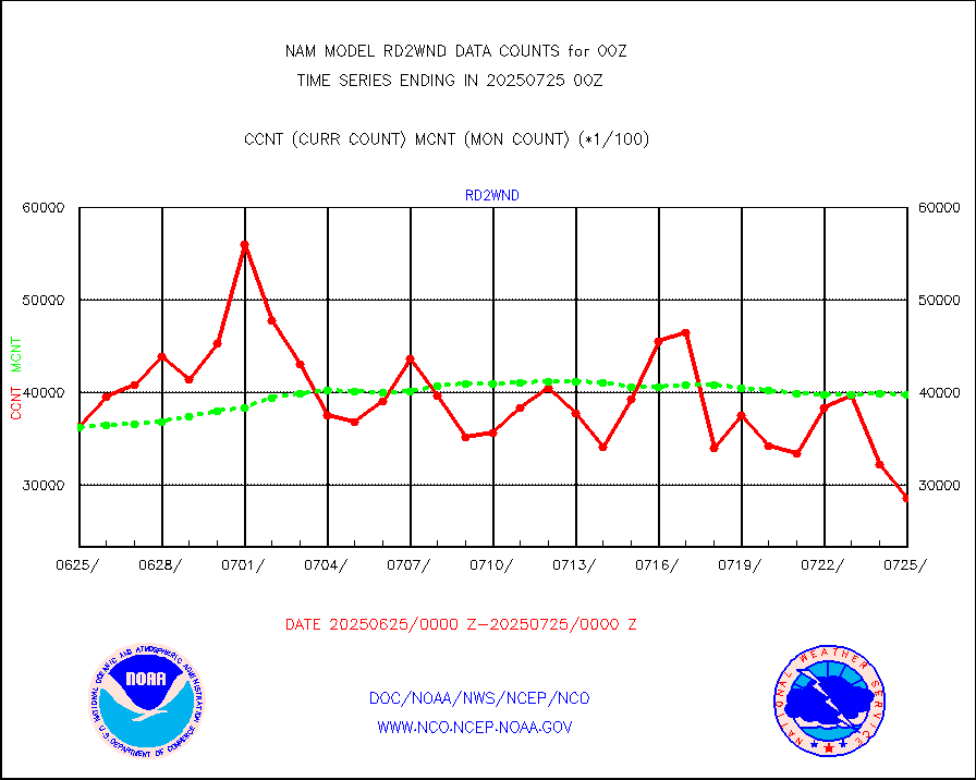
rd2wnd |
NEXRAD radial wind (Level 2 - GTS) |
3748686 |
3010839 |
124.5 % |
sevcsr |
METEOSAT-10 2nd Gen SEVIRI Clr Sky Radiance(proc) |
0 |
0 |
n/a |
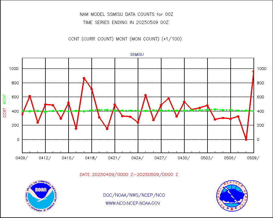
ssmisu |
DMSP SSM/IS 1C radiance data (Unified Pre-Proc.) |
30641 |
34842 |
87.9 % |
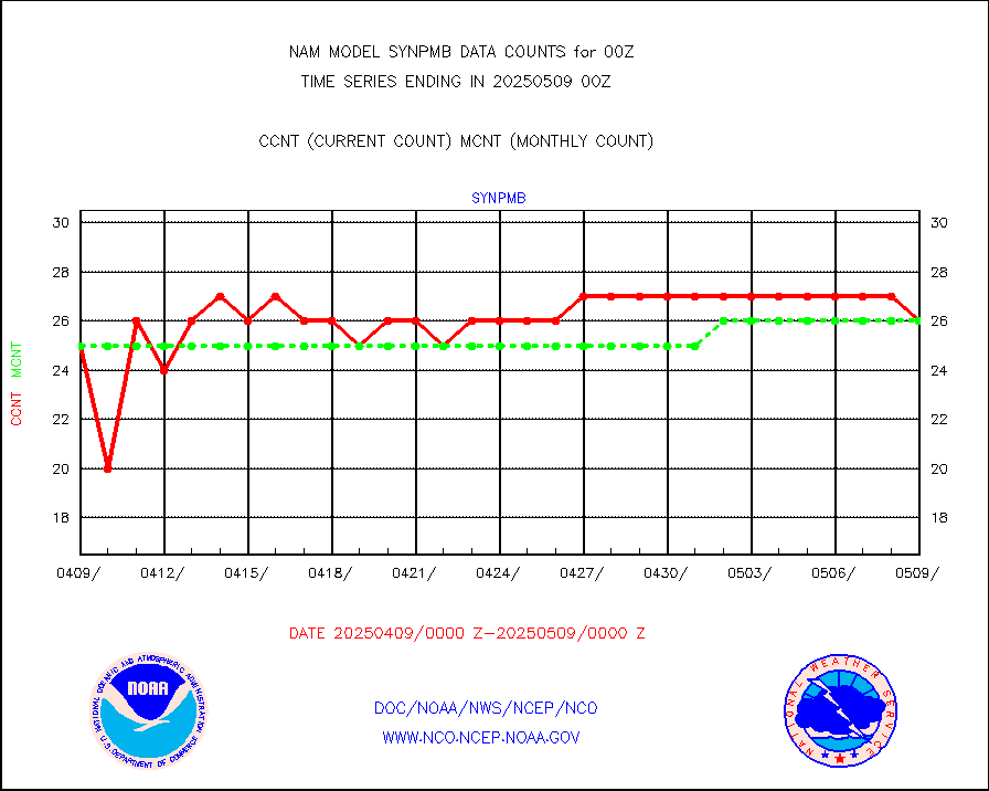
synpmb |
Synoptic - mobile manual & auto (decoded fr BUFR) |
0 |
0 |
n/a |
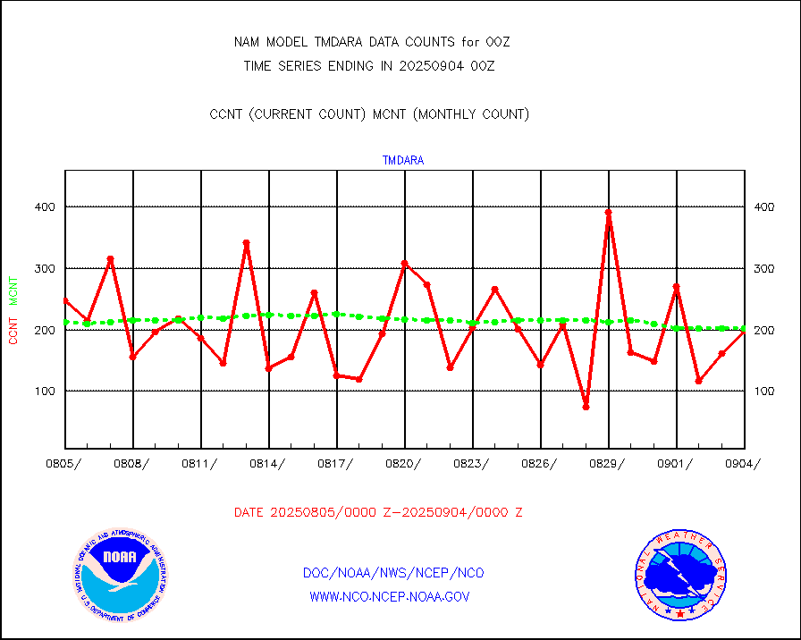
tmdara |
TAMDAR aircft data-all types(from Panasonic,BUFR) |
1194 |
1195 |
99.9 % |
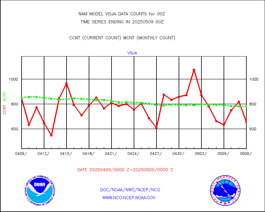
visja |
MTSAT/JMA visible derived cloud motion |
831 |
816 |
101.8 % |
vseunb |
METEOSAT/EUMETSAT visible drv cld motion NBseq |
0 |
0 |
n/a |


