| Critical Data with Normal Counts |
|---|
| Type | Description | Hourly Count | Monthly Average | Percent (%) of Monthly Mean | UTC Time Window |
1bamua |
NOAA 15-19 & METOP 1-2 AMSU-A NCEP-proc. br.temps |
62381 |
54970 |
113.5 % |
1720.00-1720.99 |
1bhrs4 |
NOAA 18-19 & METOP 1-2 HIRS-4 NCEP-proc. br.temps |
59242 |
44112 |
134.3 % |
1720.00-1720.99 |
1bmhs |
NOAA 18-19 & METOP 1-2 MHS NCEP-proces. br. temps |
357194 |
299927 |
119.1 % |
1720.00-1720.99 |
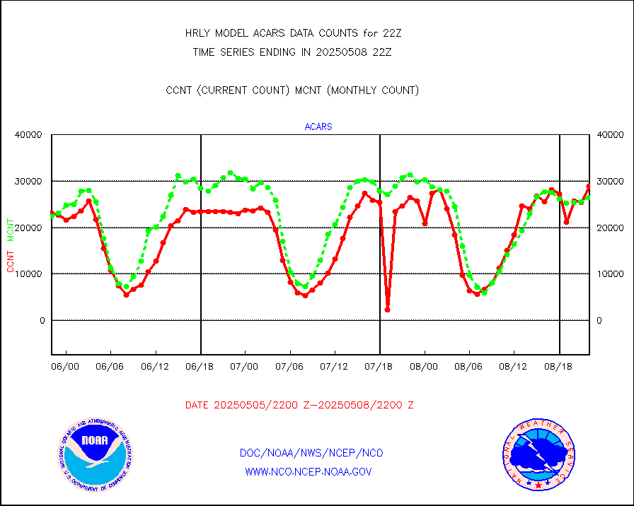
acars |
MDCRS ACARS acft data from ARINC(dcded from BUFR) |
23391 |
21542 |
108.6 % |
1721.50-1722.49 |
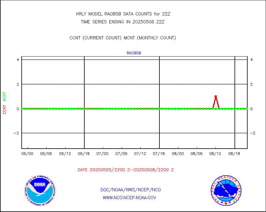
airep |
Manual AIREP aircraft data (dcded from AIREP fmt) |
111 |
390 |
28.5 % |
1721.50-1722.49 |
airsev |
AQUA AIRS/AMSU-A/HSB brightness temps- every FOV |
0 |
0 |
n/a |
1719.50-1720.49 |
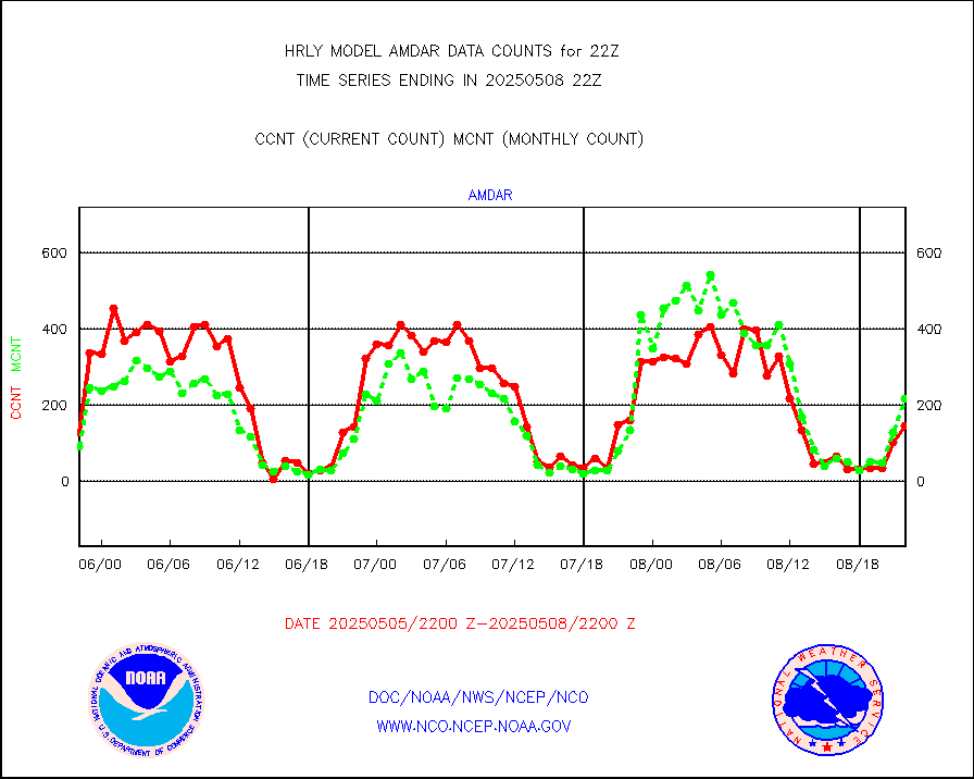
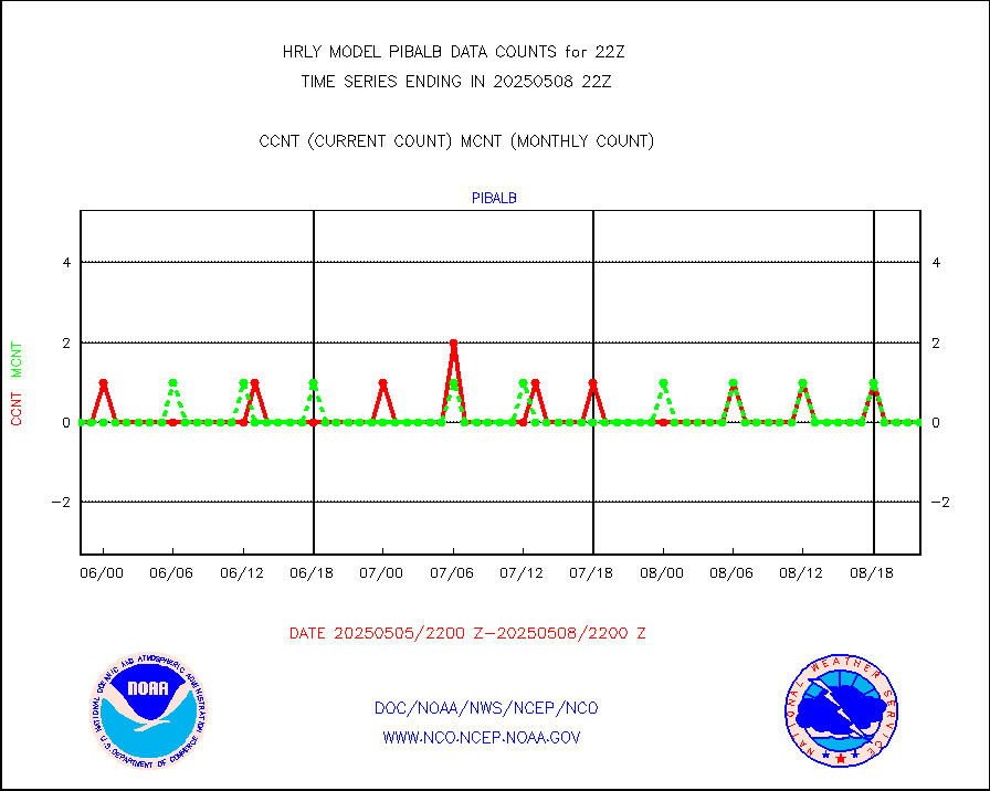
amdar |
AMDAR aircraft data (decoded from AMDAR format) |
129 |
169 |
76.3 % |
1721.50-1722.49 |
amdarb |
AMDAR aircraft data (decoded from BUFR) |
547 |
529 |
103.4 % |
1721.50-1722.49 |
ascat |
METOP 1-2 ASCAT products |
68712 |
32201 |
213.4 % |
1720.50-1721.49 |
atms |
NPP/NOAA-20 ATMS brightness temperatures |
271776 |
344890 |
78.8 % |
1720.50-1721.49 |
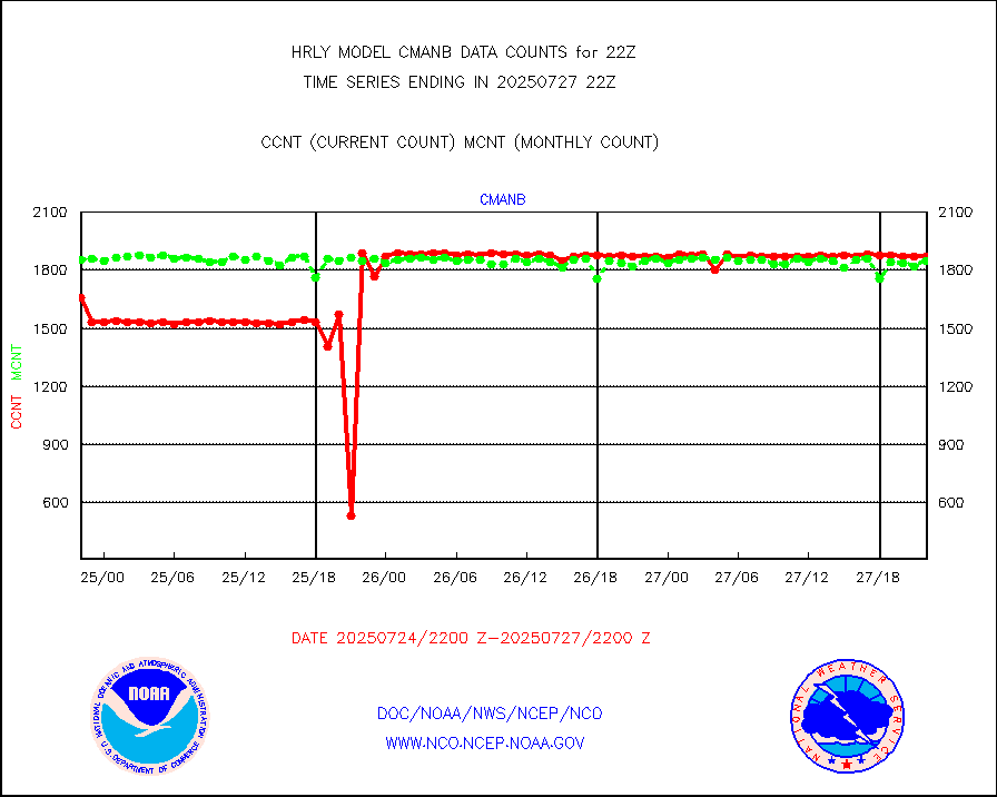
cmanb |
Surface Marine CMAN rpts decoded from BUFR format |
1800 |
1763 |
102.1 % |
1721.50-1722.50 |
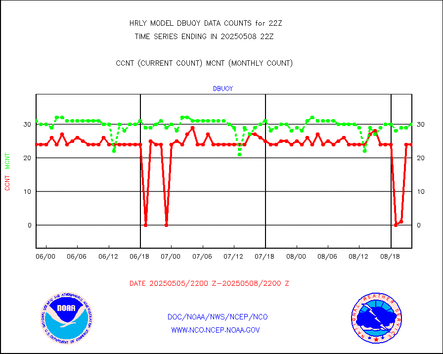
dbuoy |
Buoys decoded from FM-18 fmt (moored or drifting) |
3 |
32 |
9.4 % |
1721.50-1722.49 |
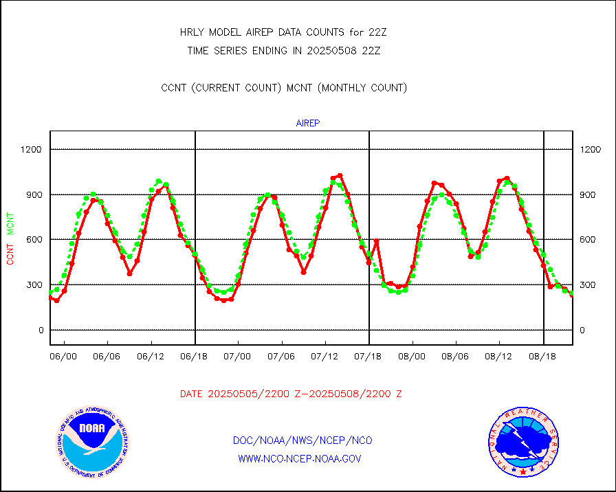
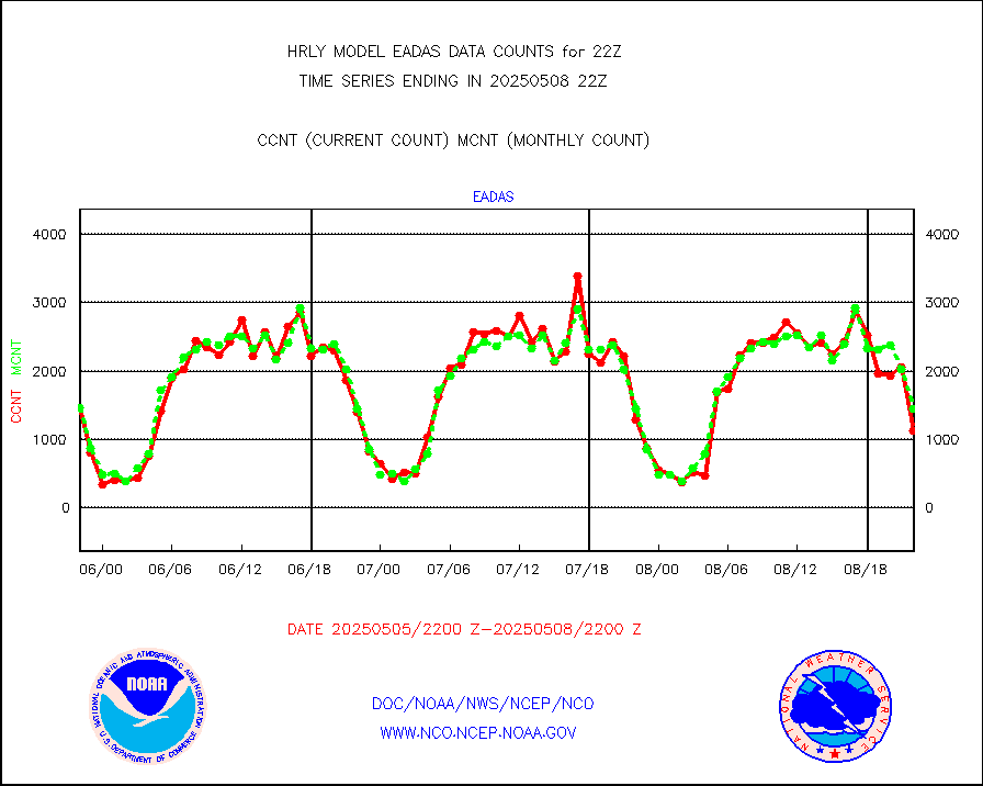
eadas |
E-AMDAR (European AMDAR acft decoded from BUFR) |
1336 |
1237 |
108.0 % |
1721.50-1722.49 |
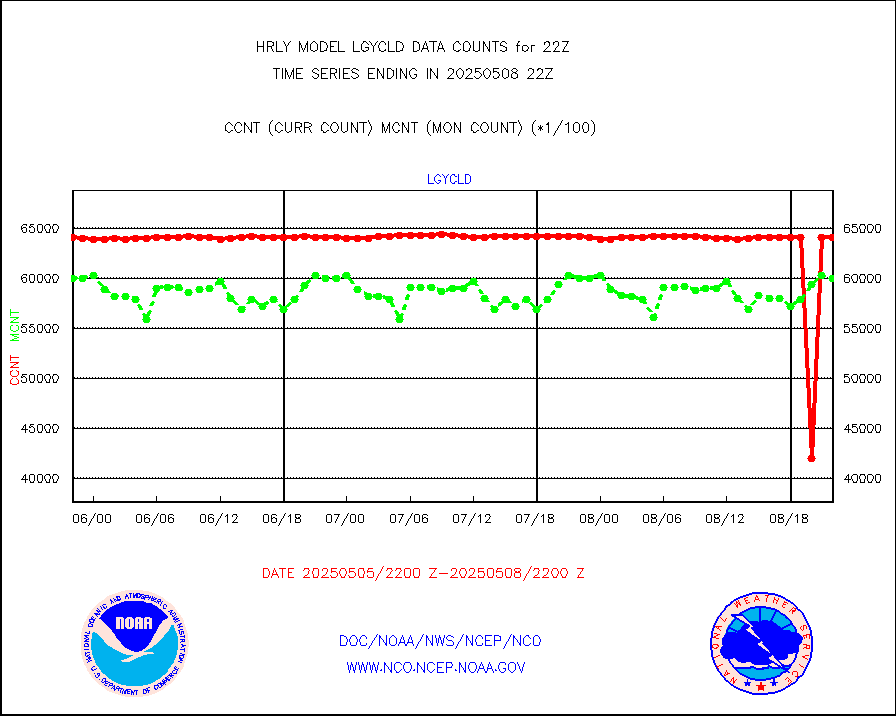
esamua |
NOAA 15-19 & METOP 1-2 AMSU-A proc btmps frm RARS |
31751 |
29600 |
107.3 % |
1721.50-1722.49 |
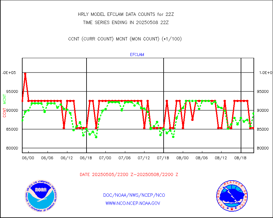
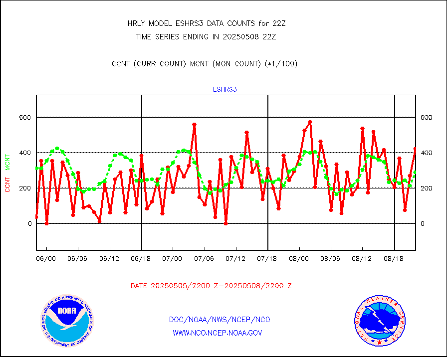
eshrs3 |
NOAA 15-19 & METOP 1-2 HIRS-3/4 pr btmps frm RARS |
83259 |
58742 |
141.7 % |
1721.50-1722.49 |
gnss |
Grnd-based Gbl Navigation Sat System (GNSS) data |
8174 |
7563 |
108.1 % |
1721.00-1721.99 |
gpsro |
GPS radio occultation data |
269 |
415 |
64.8 % |
1719.50-1720.49 |
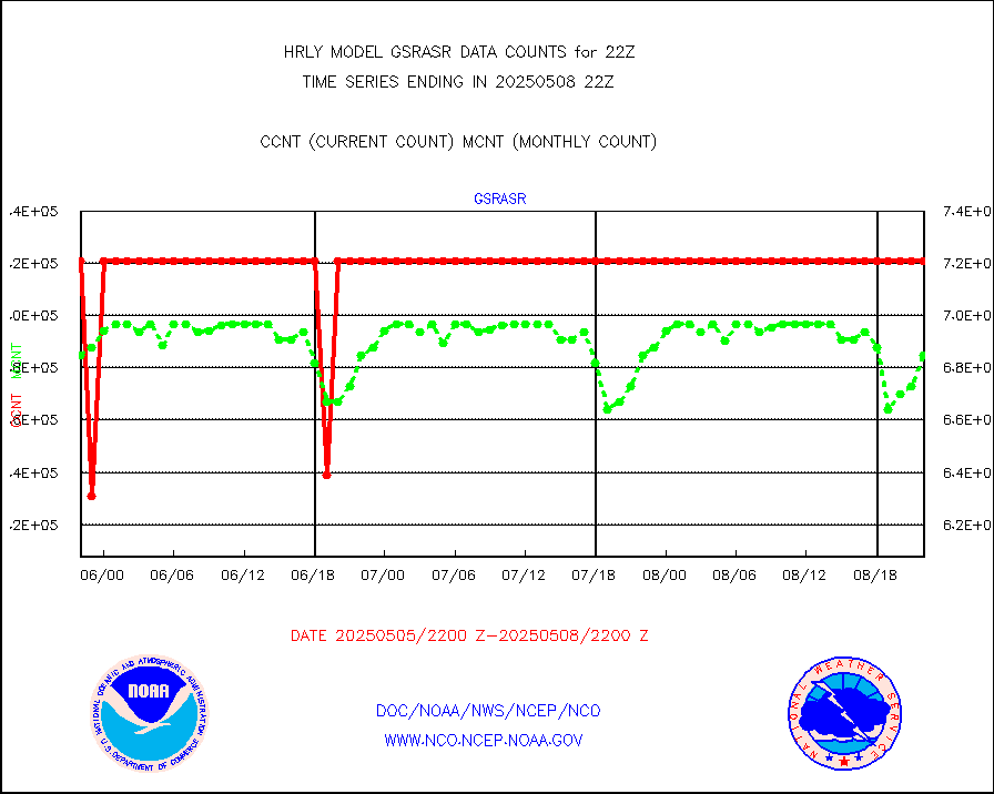
gsrasr |
GOES-16/17 All Sky Radiances (proc.) |
360476 |
352190 |
102.4 % |
1721.50-1722.49 |
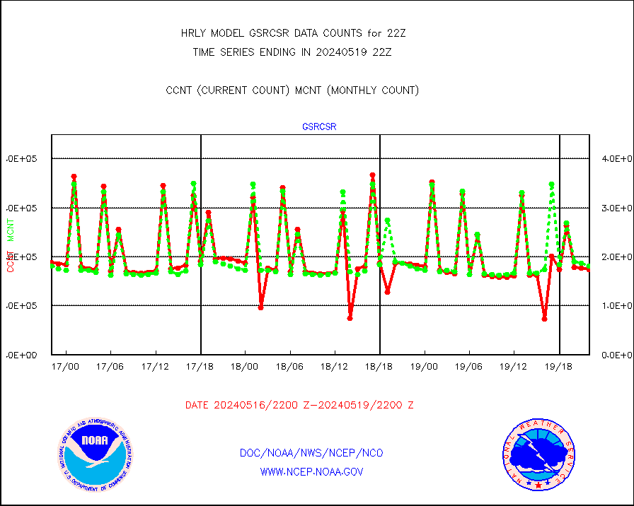
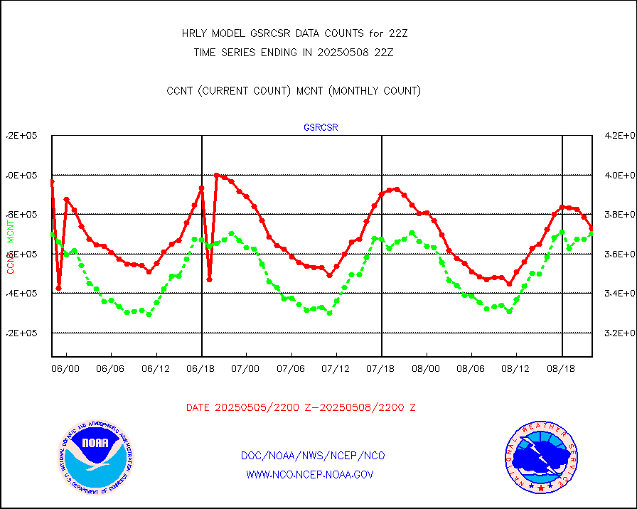
gsrcsr |
GOES-16/17 Clear Sky Radiances (proc.) |
189180 |
183463 |
103.1 % |
1721.50-1722.49 |
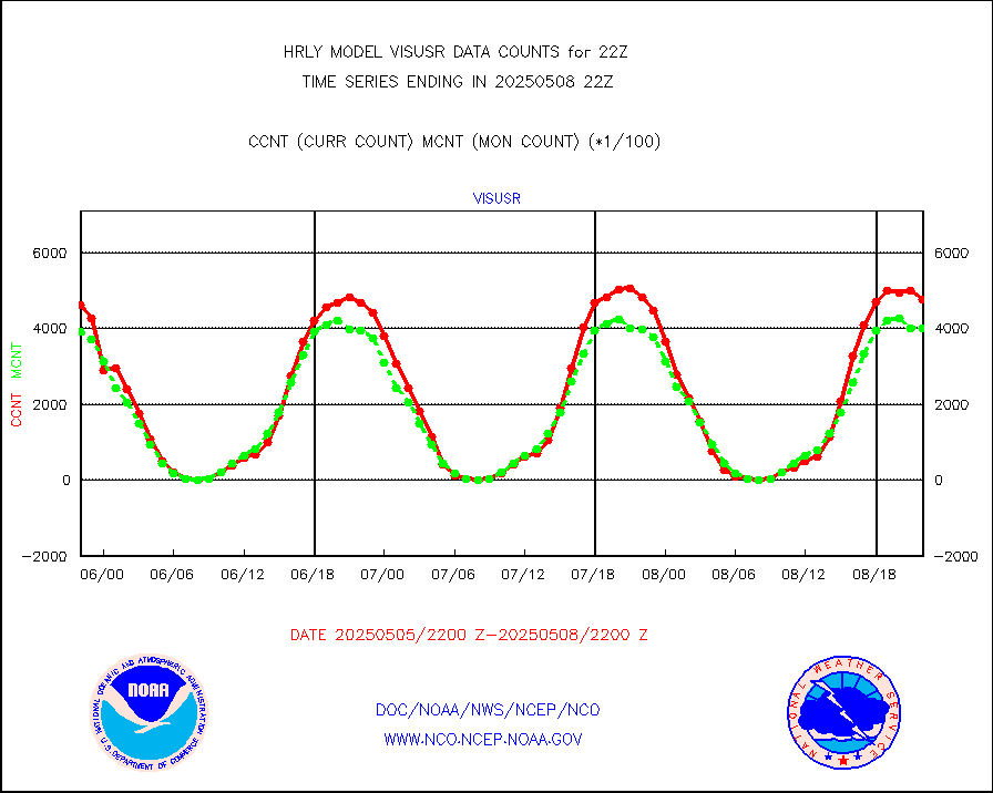
h20ja |
MTSAT/JMA water vapor imager derived cloud motion |
18072 |
17554 |
103.0 % |
1719.50-1720.49 |
h20mo |
MODIS (AQUA/TERRA) wvpr imager derived cld motion |
0 |
0 |
n/a |
1718.00-1718.99 |
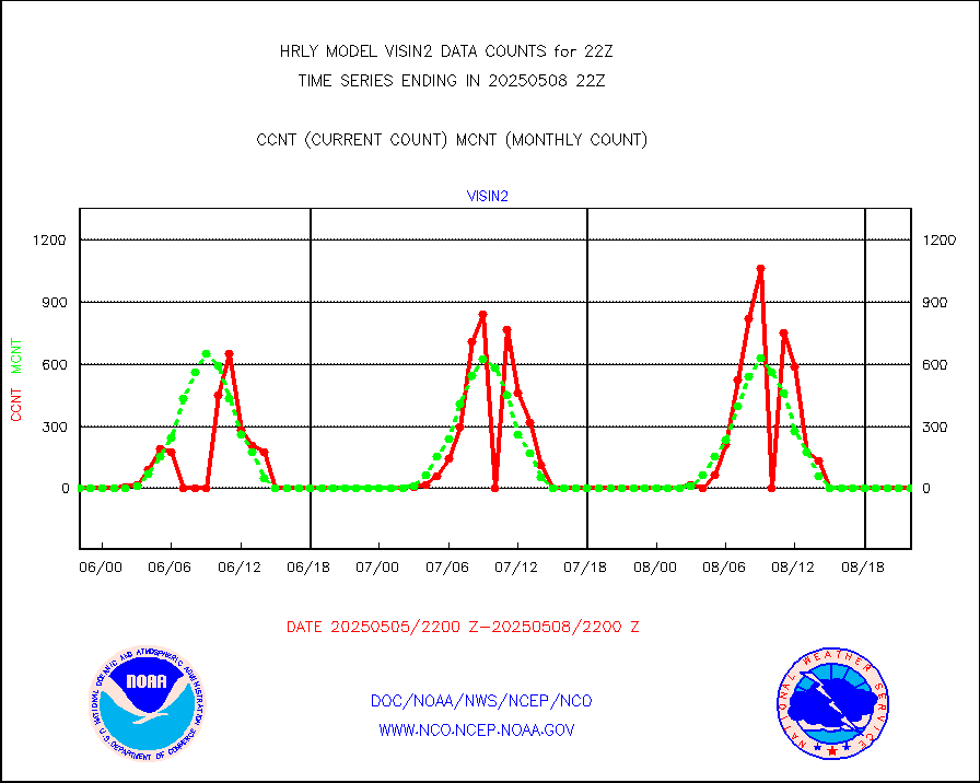
h2tusr |
GOES-16&up/NESDIS wv imgr/cld-top derived cld mtn |
30775 |
30460 |
101.0 % |
1721.00-1721.99 |
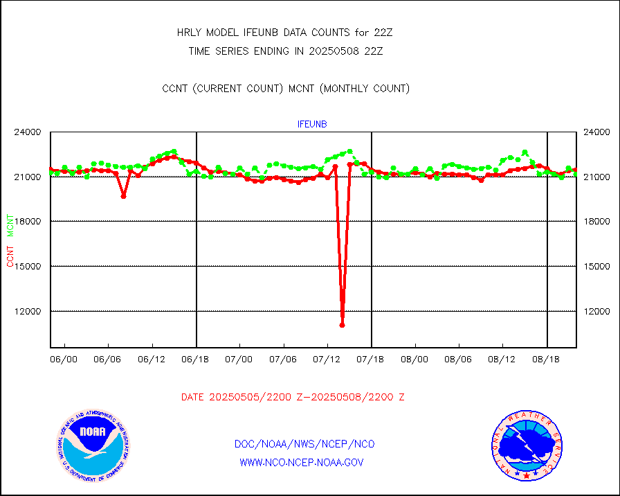
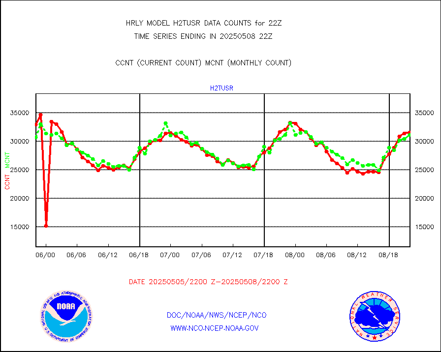
ifeunb |
METEOSAT/EUMETSAT ir lg-wave drv cld motion NBseq |
20220 |
22122 |
91.4 % |
1720.50-1721.49 |
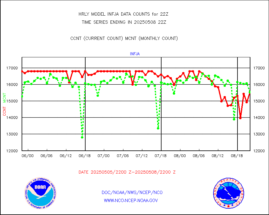
infja |
MTSAT/JMA infrared long-wave derived cloud motion |
14525 |
15239 |
95.3 % |
1719.50-1720.49 |
infmo |
MODIS (AQUA/TERRA) ir l-wave derived cloud motion |
0 |
0 |
n/a |
1718.00-1718.99 |
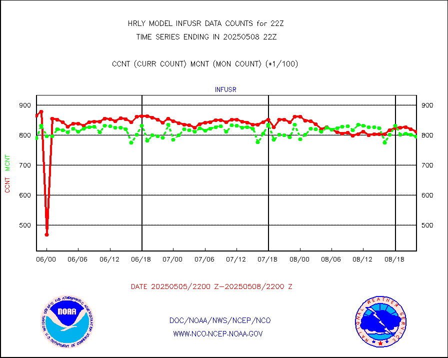
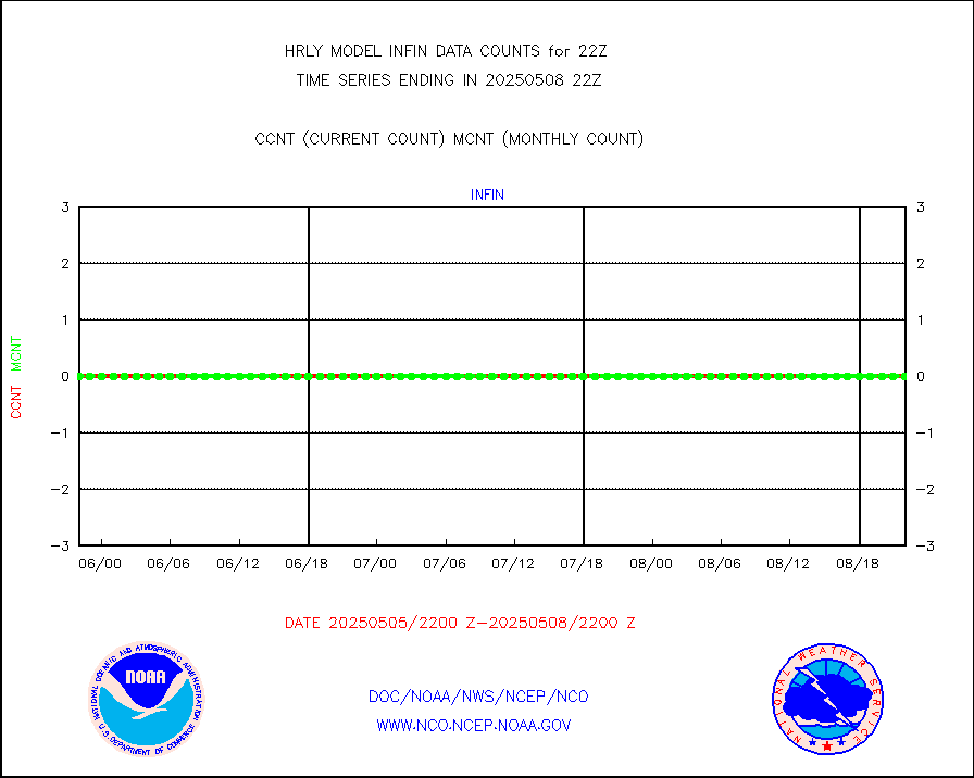
infusr |
GOES-16&up/NESDIS ir long-wave derived cld motion |
79119 |
82900 |
95.4 % |
1721.00-1721.99 |
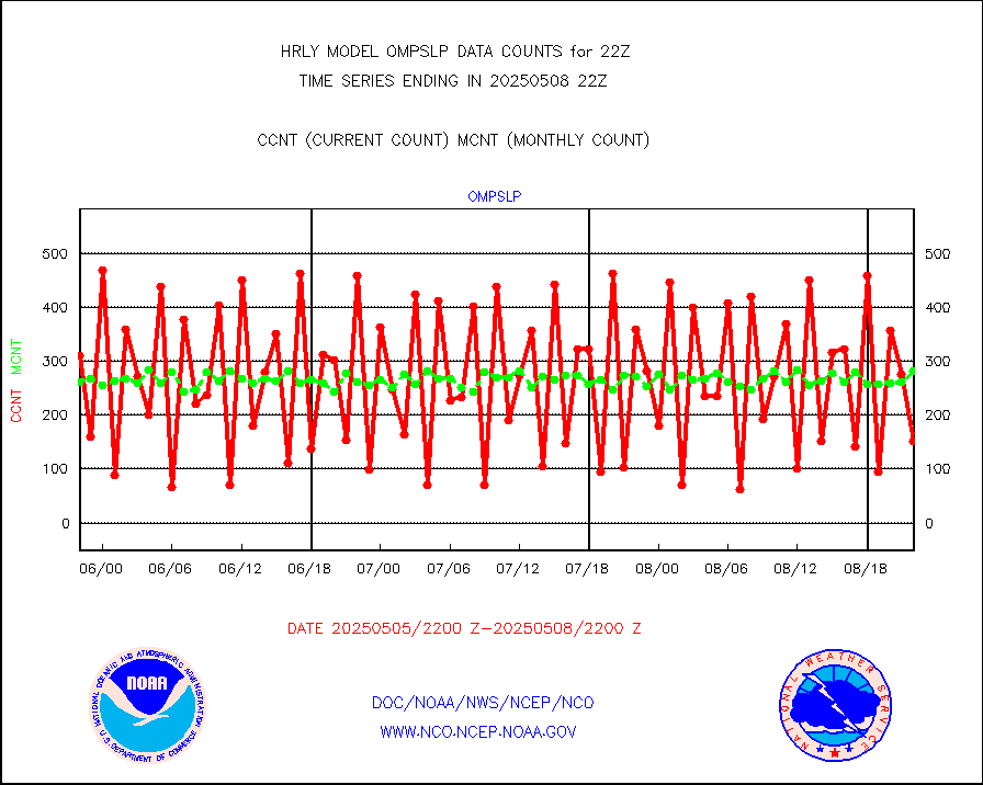
lgycld |
GOES/NASA(Langley) hi-res. (1x1 f-o-v) cloud data |
4170671 |
4153696 |
100.4 % |
1721.50-1722.49 |
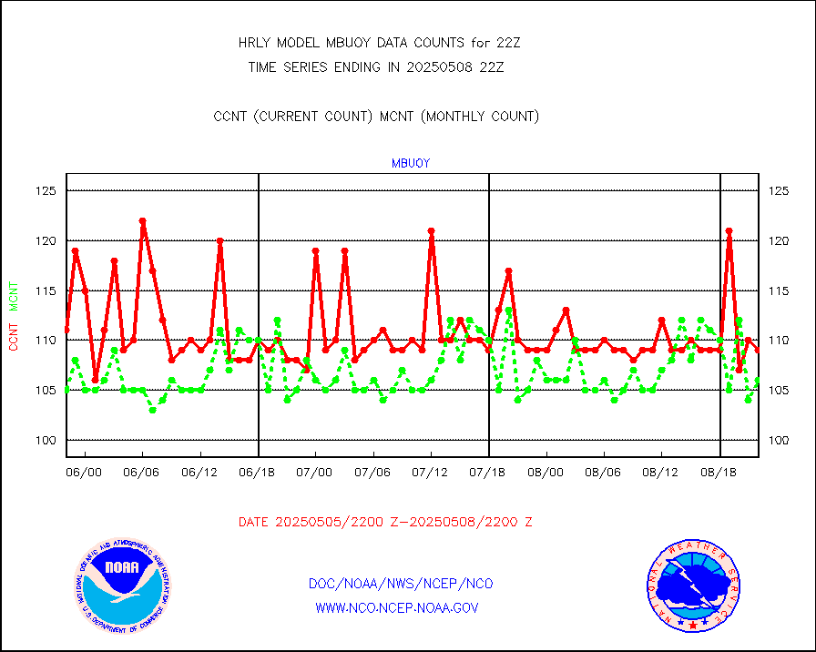
mbuoy |
Buoys decoded from FM-13 format (moored) |
94 |
112 |
83.9 % |
1721.50-1722.49 |
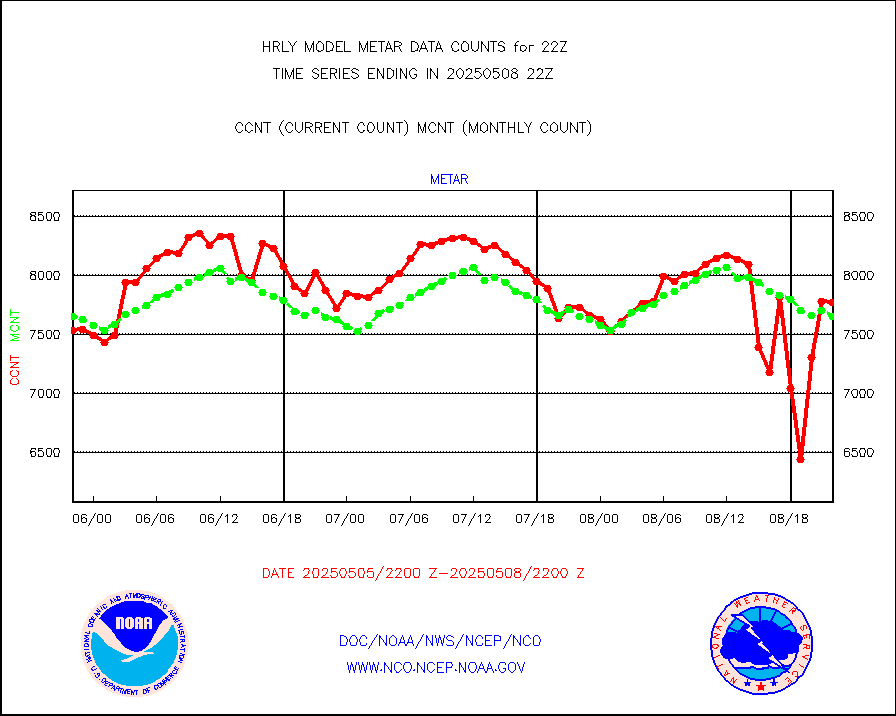
metar |
Aviation - METAR |
6619 |
7627 |
86.8 % |
1721.50-1722.49 |
mso470 |
Mesonet/MADIS Colorado E-470 (Interstate 470) |
18 |
21 |
85.7 % |
1721.50-1722.49 |
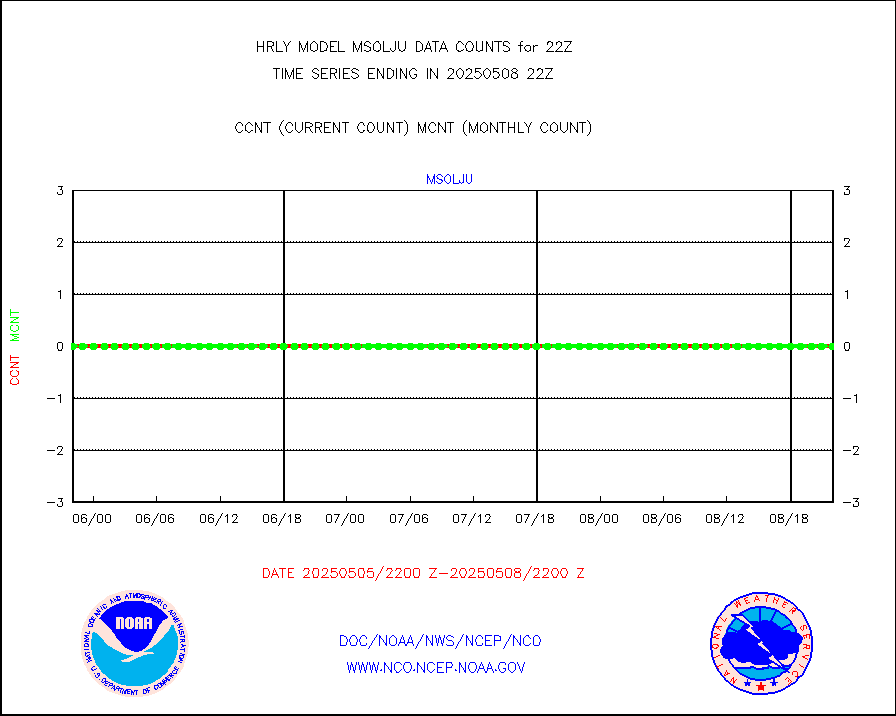
msoalk |
Mesonet/MADIS Alaska Department of Transportation |
108 |
110 |
98.2 % |
1721.50-1722.49 |
msoapg |
Mesonet/MADIS U.S. Army Aberdeen Proving Grounds |
0 |
0 |
n/a |
1721.50-1722.49 |
msoapr |
Mesonet/MADIS Citizen Weather Observers Program |
50171 |
46816 |
107.2 % |
1721.50-1722.49 |
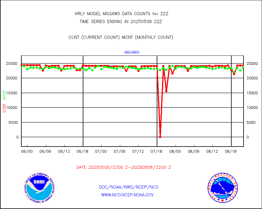
msoaws |
Mesonet/MADIS AWS Convergence Technologies, Inc. |
25461 |
25085 |
101.5 % |
1721.50-1722.49 |
msoawx |
Mesonet/MADIS "Anything Weather" |
0 |
0 |
n/a |
1721.50-1722.49 |
msocol |
Mesonet/MADIS Colorado Dept. of Transportation |
0 |
0 |
n/a |
1721.50-1722.49 |
msodcn |
Mesonet/MADIS DC Net |
0 |
0 |
n/a |
1721.50-1722.49 |
msoden |
Mesonet/MADIS Denver Urban Drainage & Flood Cntrl |
250 |
222 |
112.6 % |
1721.50-1722.49 |
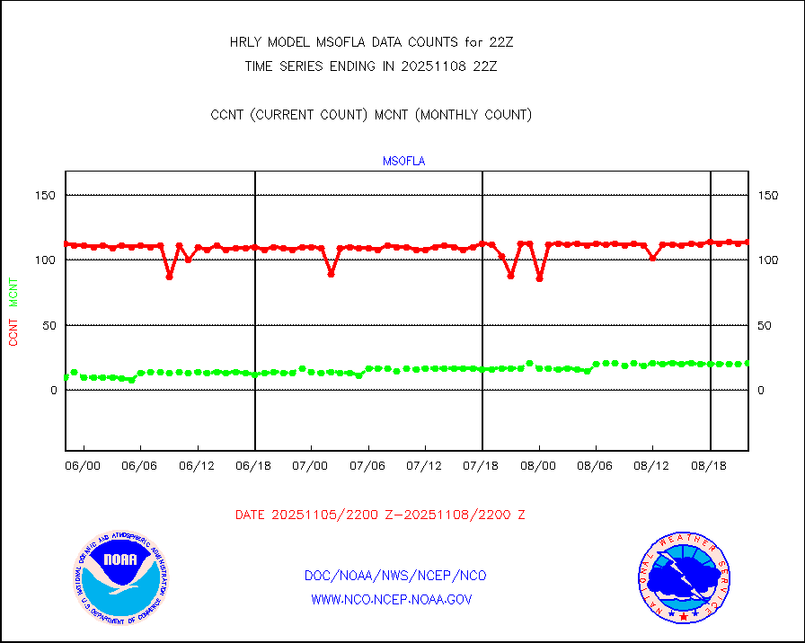
msofla |
Mesonet/MADIS Florida (FAWN & USF) |
4 |
4 |
100.0 % |
1721.50-1722.49 |
msoflt |
Mesonet/MADIS Florida Dept. of Transportation |
0 |
0 |
n/a |
1721.50-1722.49 |
msogeo |
Mesonet/MADIS Georgia Dept. of Transportation |
0 |
0 |
n/a |
1721.50-1722.49 |
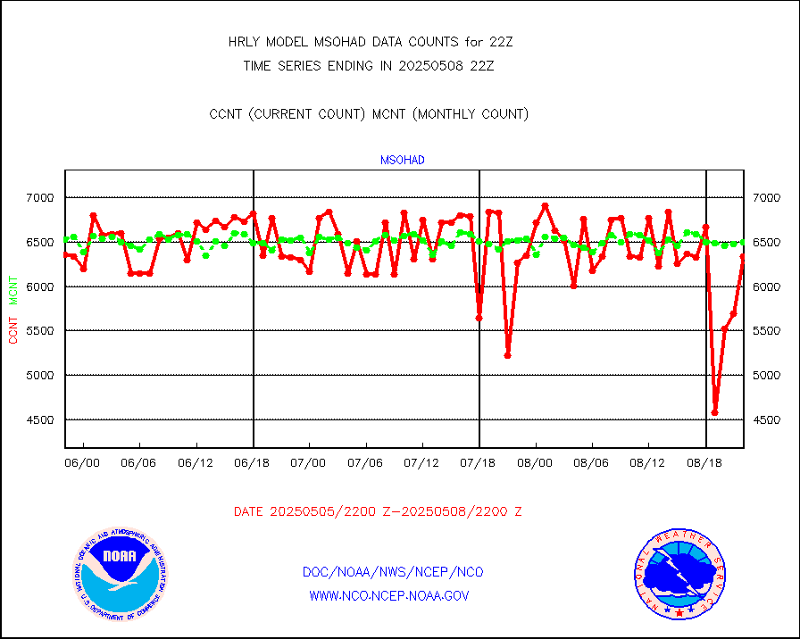
msohad |
Mesonet/MADIS NWS Hydromet Auto Data System(HADS) |
6906 |
6309 |
109.5 % |
1721.50-1722.49 |
msoien |
Mesonet/MADIS Iowa Environmental |
187 |
189 |
98.9 % |
1721.50-1722.49 |
msoind |
Mesonet/MADIS Indiana Dept. of Transportation |
0 |
0 |
n/a |
1721.50-1722.49 |
msoiow |
Mesonet/MADIS Iowa Department of Transportation |
0 |
0 |
n/a |
1721.50-1722.49 |
msokan |
Mesonet/MADIS Kansas Department of Transportation |
390 |
374 |
104.3 % |
1721.50-1722.49 |
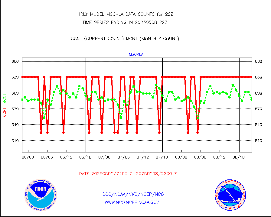
msokla |
Mesonet/MADIS Oklahoma Mesonet |
318 |
329 |
96.7 % |
1721.50-1722.49 |
msolju |
Mesonet/MADIS Louisiana State/Jackson State Univ. |
0 |
0 |
n/a |
1721.50-1722.49 |
msomca |
Mesonet/MADIS Missouri Commercial Agricult Wx Net |
285 |
275 |
103.6 % |
1721.50-1722.49 |
msomin |
Mesonet/MADIS Minnesota Dept. of Transportation |
0 |
0 |
n/a |
1721.50-1722.49 |
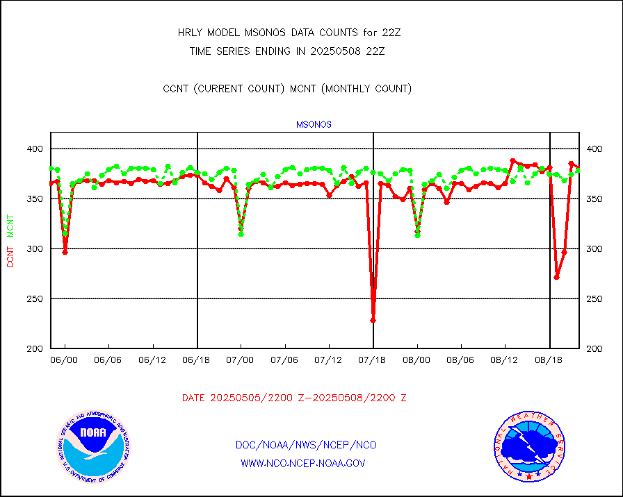
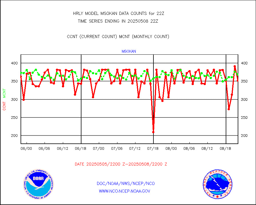
msonos |
Mesonet/MADIS NOS-Phys Oceanographic Realtime Sys |
370 |
361 |
102.5 % |
1721.50-1722.49 |
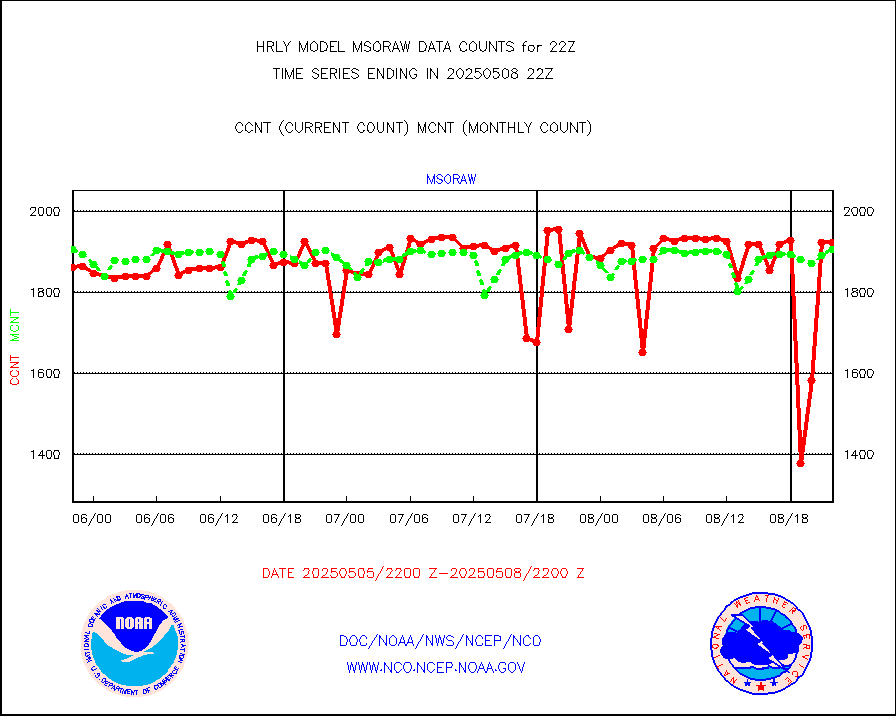
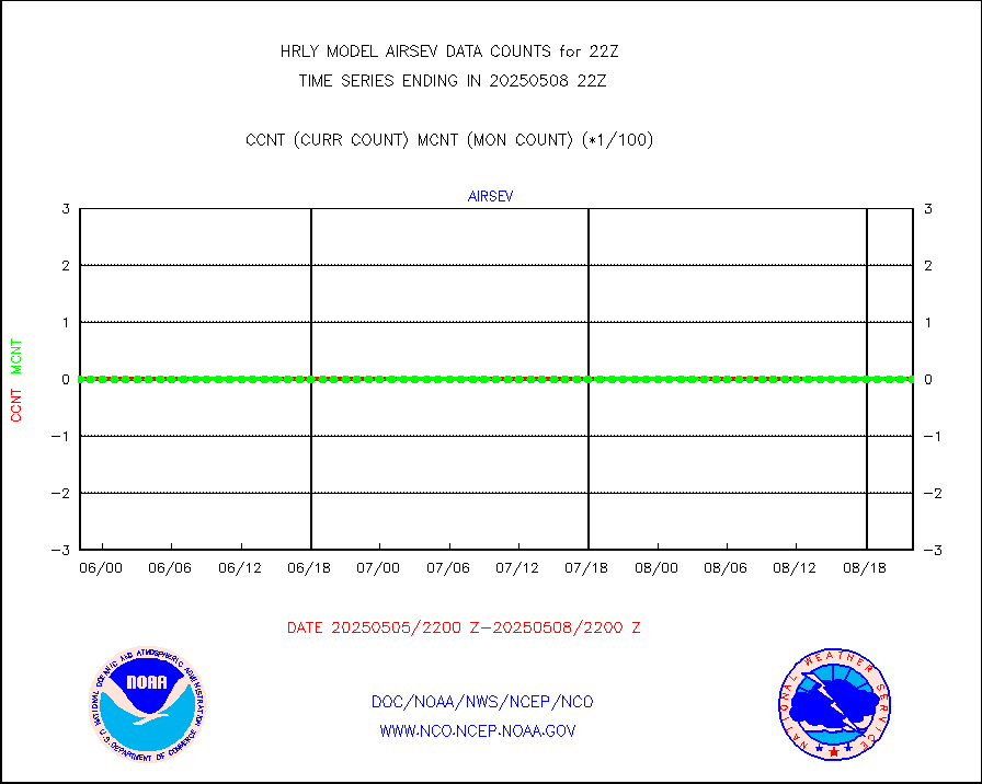
msoraw |
Mesonet/MADIS NFIC Remote Automated Wx Stns(RAWS) |
1914 |
1851 |
103.4 % |
1721.50-1722.49 |
msovir |
Mesonet/MADIS Virginia Dept. of Transportation |
236 |
235 |
100.4 % |
1721.50-1722.49 |
msowfy |
Mesonet/MADIS "Weather for You" |
0 |
0 |
n/a |
1721.50-1722.49 |
msowis |
Mesonet/MADIS Wisconsin Dept. of Transportation |
0 |
0 |
n/a |
1721.50-1722.49 |
msowst |
Mesonet/MADIS MesoWest (many subproviders) |
45836 |
45347 |
101.1 % |
1721.50-1722.49 |
msowtx |
Mesonet/MADIS West Texas |
5658 |
5622 |
100.6 % |
1721.50-1722.49 |
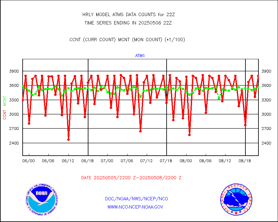
mtiasi |
METOP 1-2 IASI 1C radiance data (varbl. channels) |
99288 |
87238 |
113.8 % |
1720.00-1720.99 |
nxrdw |
NEXRAD Vel Azm Dsp(VAD) winds via radar coded msg |
0 |
0 |
n/a |
1721.50-1722.49 |
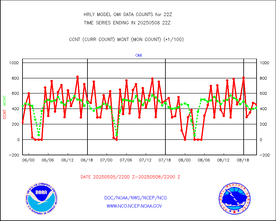
omi |
Aura Ozone Monitoring Instrument (OMI) data |
28860 |
46690 |
61.8 % |
1719.50-1720.49 |
osbuv8 |
NOAA 16-19 Solar Backscatter UV-2 rad frm V8 BUFR |
0 |
0 |
n/a |
1720.00-1720.99 |
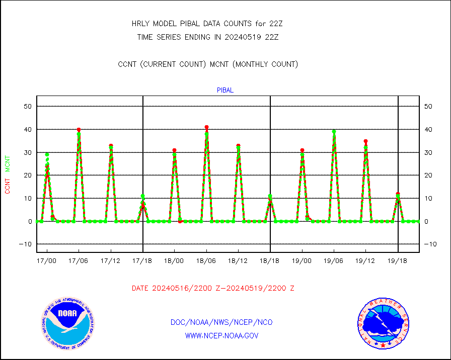
pibal |
PIBAL (from PILOT, PILOT SHIP, PILOT MOBIL) |
0 |
0 |
n/a |
1721.50-1722.49 |
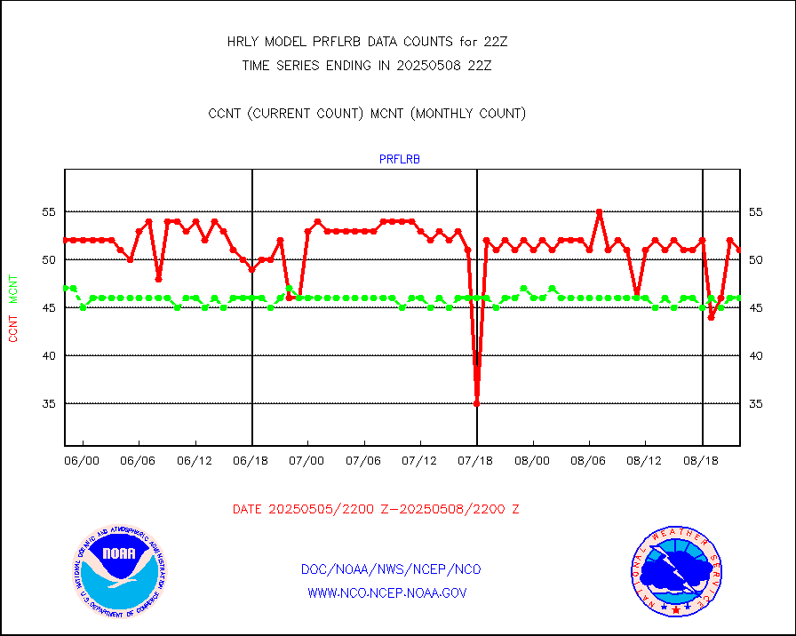
prflrb |
Multi-Agency Profiler (MAP) and SODAR winds |
44 |
40 |
110.0 % |
1721.50-1722.49 |
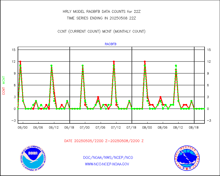
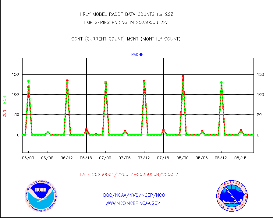
raobf |
Rawinsonde - fixed land (from TEMP or PILOT) |
0 |
0 |
n/a |
1721.50-1722.49 |
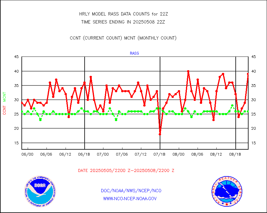
rass |
RASS temperatures (NOAA and Multi-Agency) |
30 |
23 |
130.4 % |
1721.50-1722.49 |
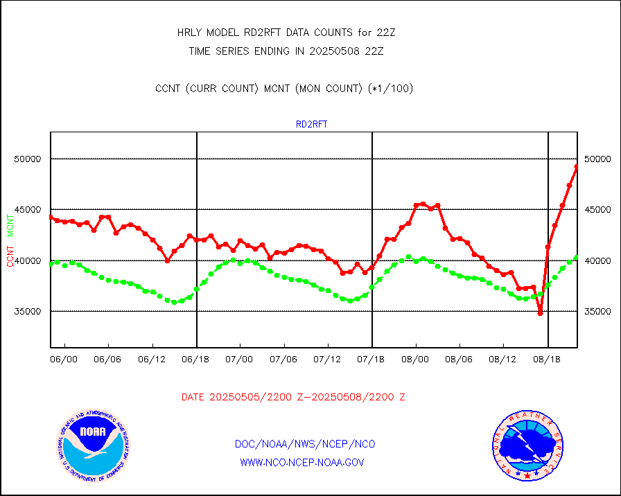
rd2rft |
NEXRAD reflectivity (Lvl 2 - GTS) |
3862471 |
3737463 |
103.3 % |
1721.50-1722.49 |
rd2wnd |
NEXRAD radial wind (Level 2 - GTS) |
1627522 |
1462796 |
111.3 % |
1721.50-1722.49 |
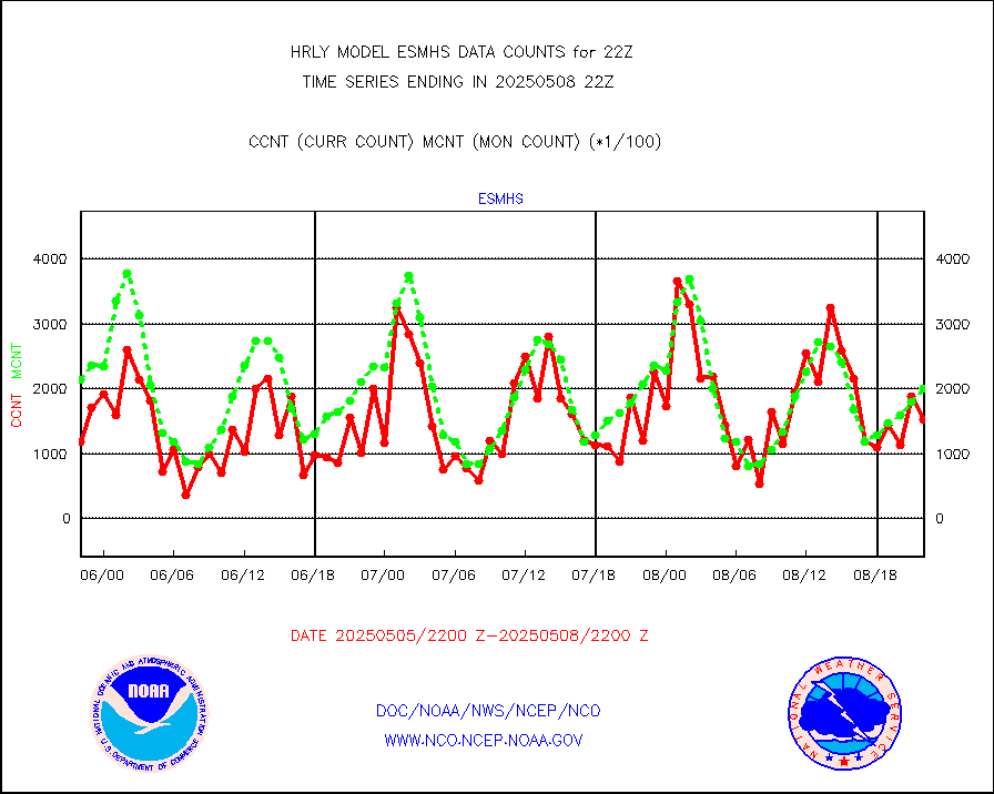
sevcsr |
METEOSAT-10 2nd Gen SEVIRI Clr Sky Radiance(proc) |
0 |
0 |
n/a |
1721.50-1722.49 |
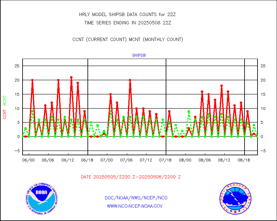
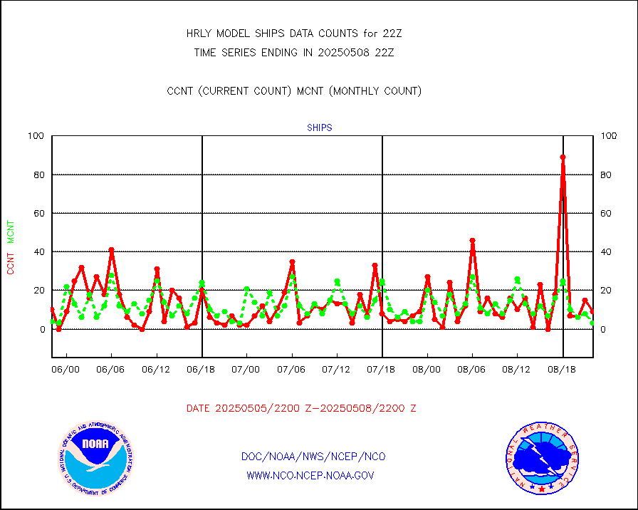
shipsb |
Ship - manual and automatic, restricted (BUFR) |
0 |
0 |
n/a |
1721.50-1722.50 |
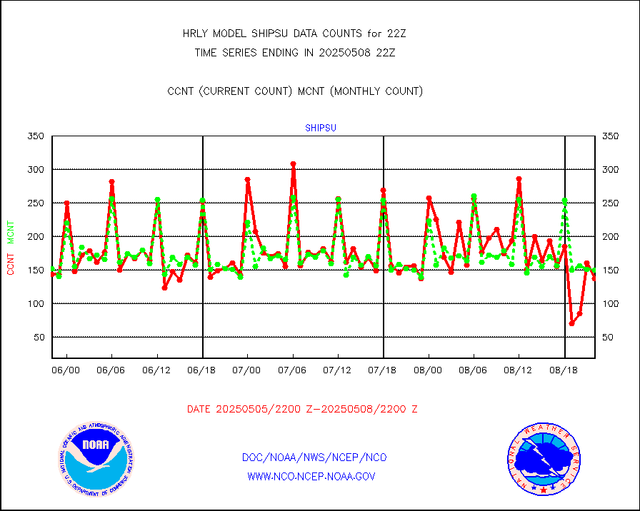
shipsu |
Ship - manual and automatic, unrestricted |
96 |
113 |
85.0 % |
1721.50-1722.50 |
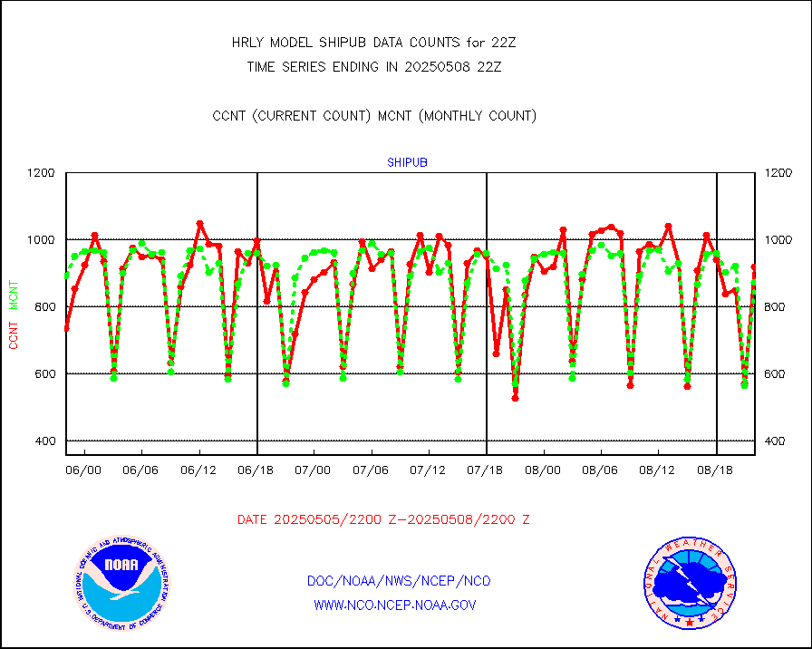
shipub |
Ship - manual and automatic, unrestricted (BUFR) |
731 |
756 |
96.7 % |
1721.50-1722.50 |
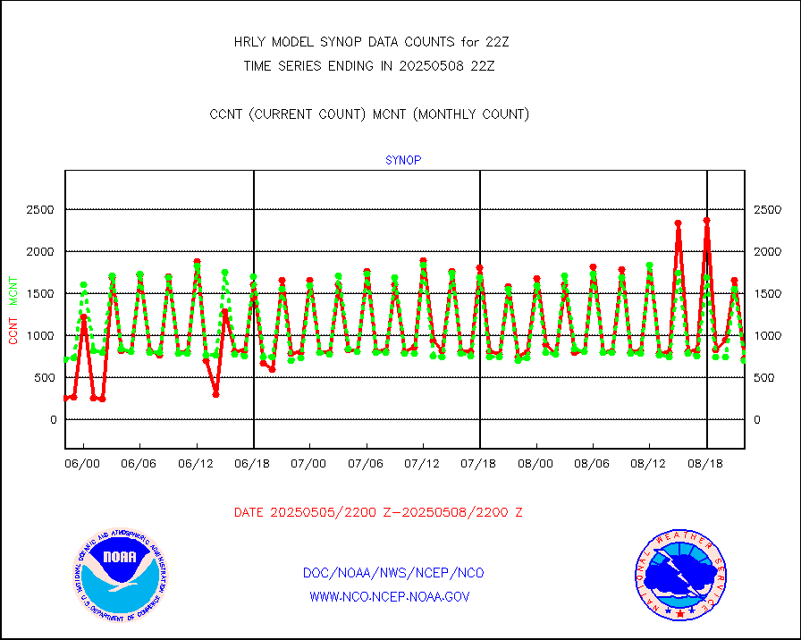
synop |
Synoptic - fixed manual and automatic |
225 |
846 |
26.6 % |
1721.50-1722.49 |
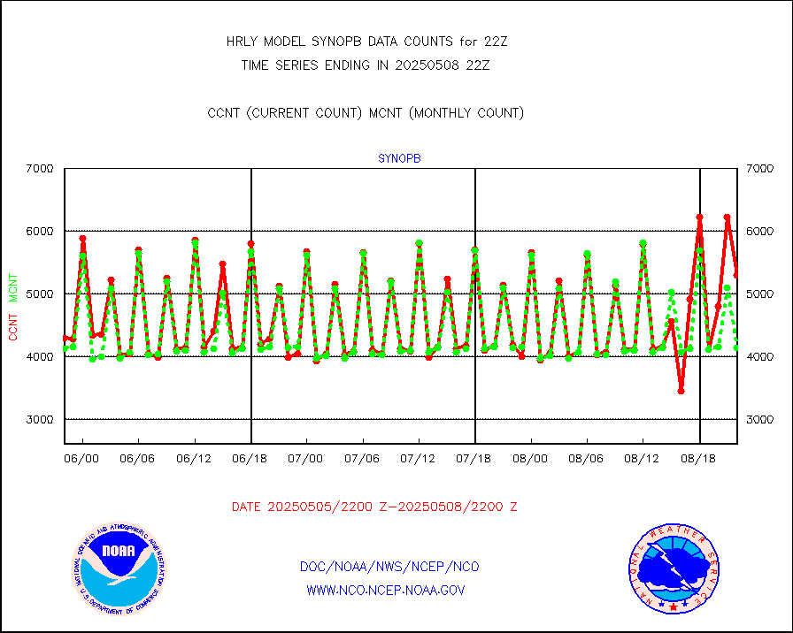
synopb |
Synoptic - fixed manual & auto (decoded fr BUFR) |
3320 |
4126 |
80.5 % |
1721.50-1722.49 |
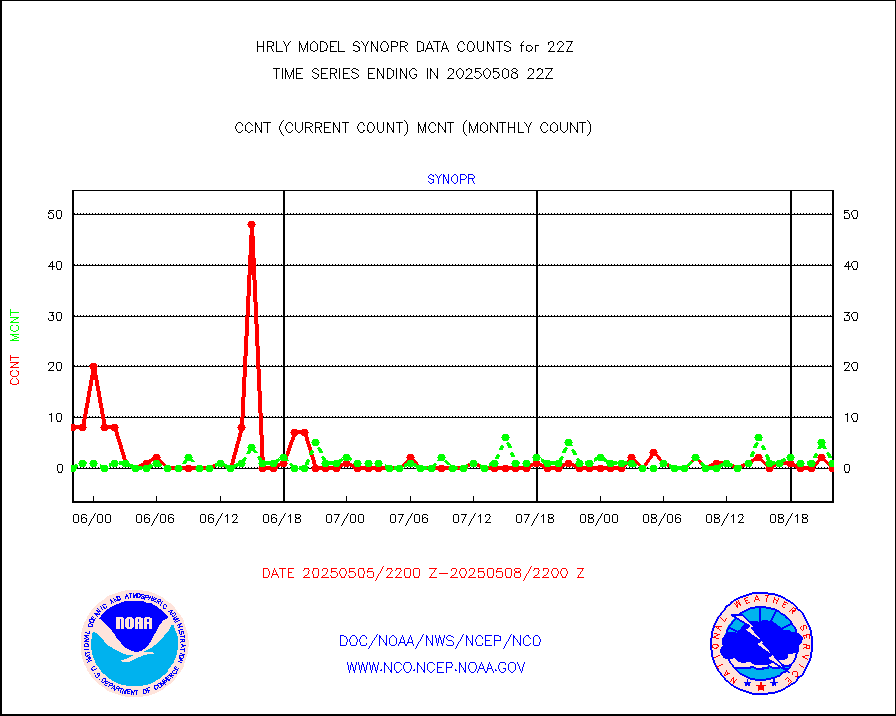
synopr |
Synoptic - restricted (WMO Res 40) manual & auto. |
8 |
0 |
n/a |
1721.50-1722.49 |
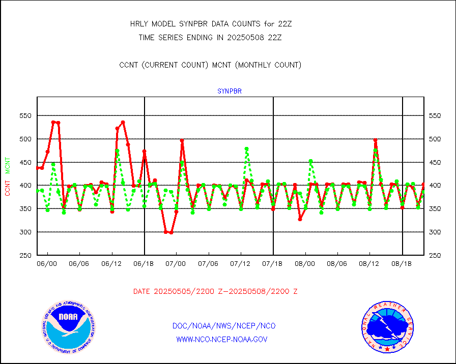
synpbr |
Synoptic - restricted (WMO Res 40)(decoded BUFR) |
540 |
397 |
136.0 % |
1721.50-1722.49 |
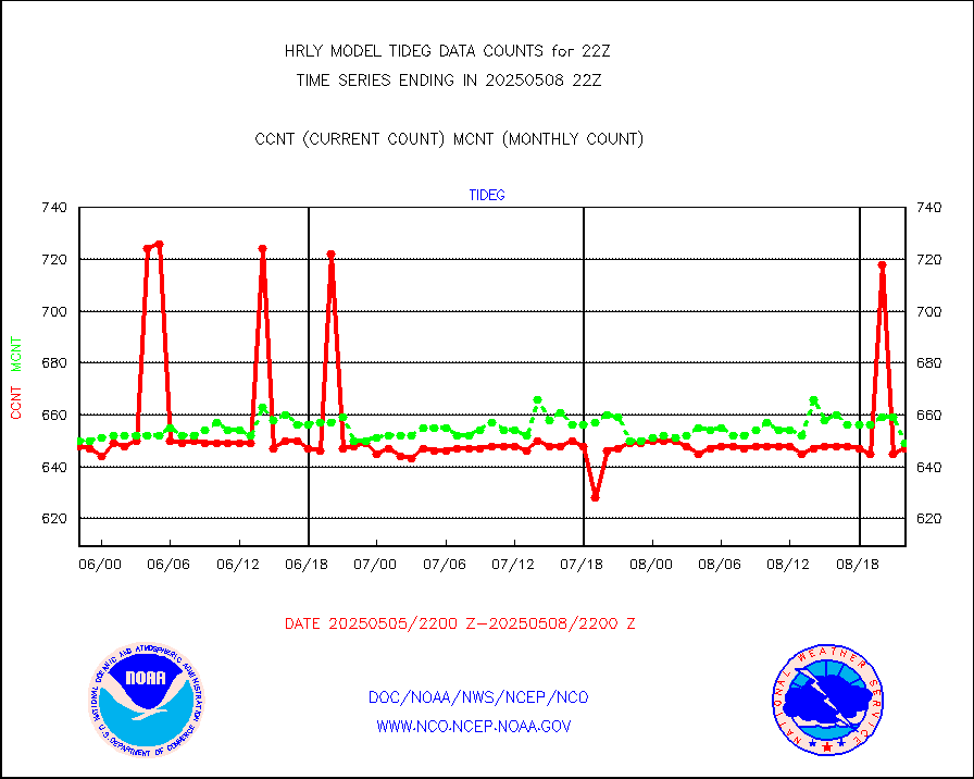
tideg |
Tide gauge reports decoded from CREX format |
638 |
631 |
101.1 % |
1721.00-1721.99 |
| Data Types of Opportunity with Normal Counts |
|---|
| Type | Description | Hourly Count | Monthly Average | Percent (%) of Monthly Mean | UTC Time Window |
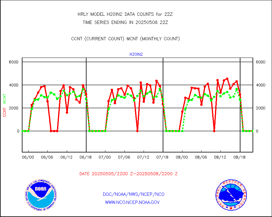
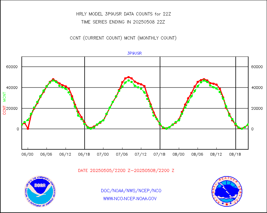
3p9usr |
GOES-16&up/NESDIS ir short-wv derived cld motion |
3024 |
3939 |
76.8 % |
1721.00-1721.99 |
acarsa |
MDCRS ACARS acft data (ARINC via AFWA)(AIREP fmt) |
0 |
0 |
n/a |
1721.50-1722.49 |
ahicsr |
Himawari Clear Sky Radiance |
0 |
0 |
n/a |
1721.00-1721.99 |
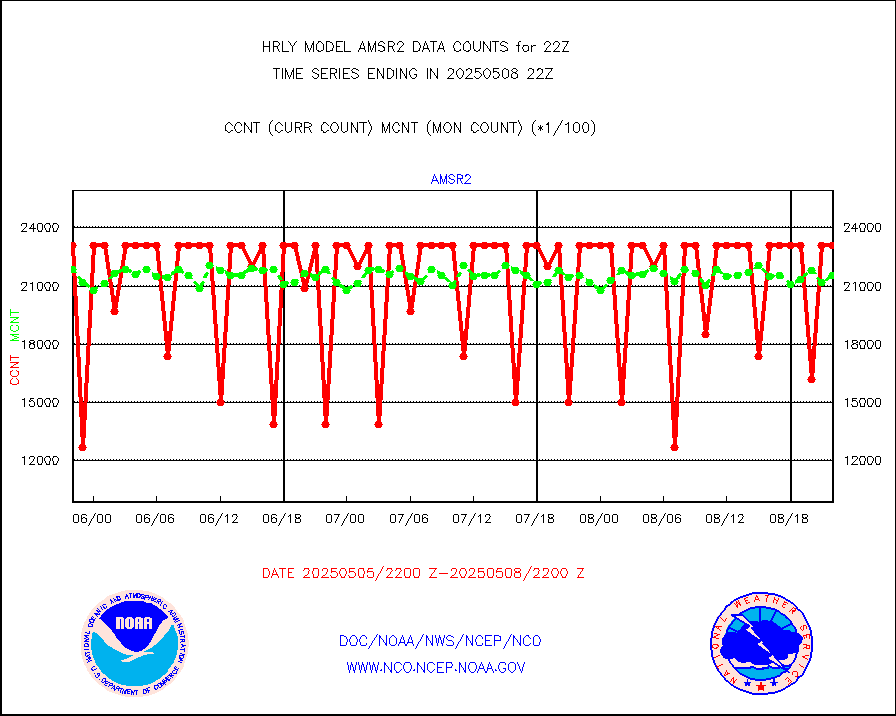
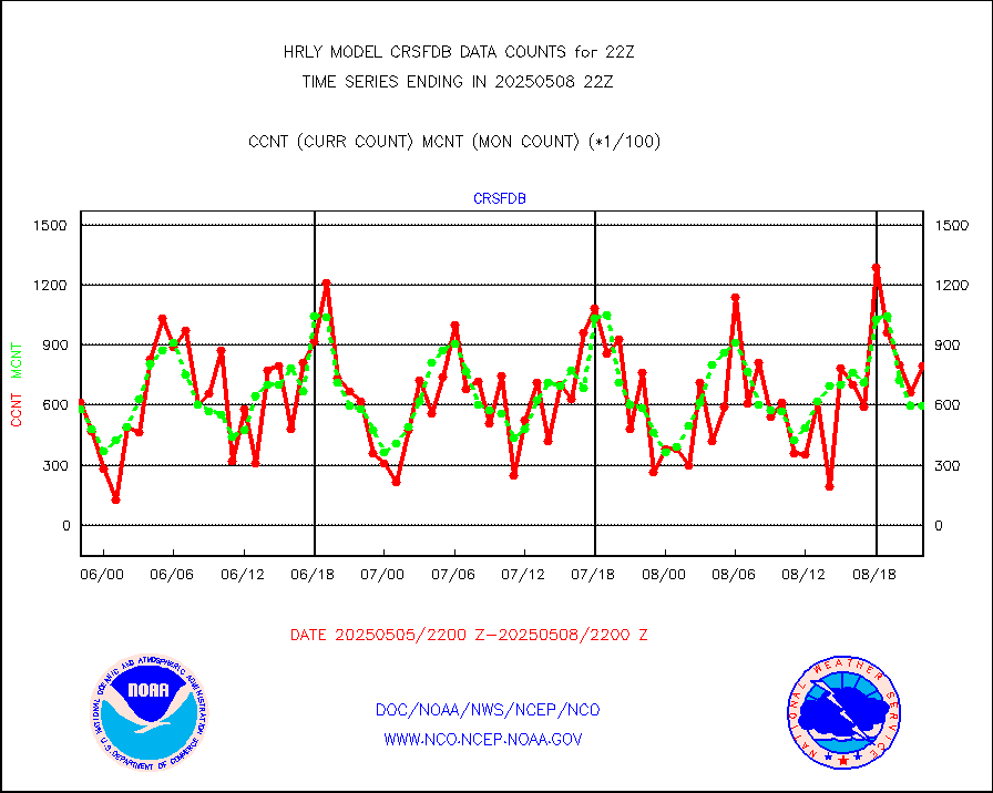
amsr2 |
GCOM-W AMSR2 1B brightness temperatures |
1435644 |
2121358 |
67.7 % |
1720.00-1720.99 |
atmsdb |
NPP/NOAA-20 ATMS bright. temps-direct b-cast SSEC |
92599 |
83277 |
111.2 % |
1720.50-1721.49 |
atovs |
POES/NESDIS - processed ATOVS soundings/radiances |
0 |
0 |
n/a |
1720.00-1720.99 |
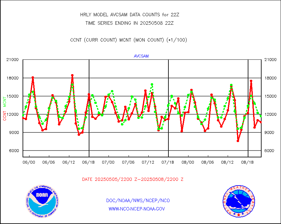
avcsam |
A.M.(N17,M2,M3) AVHRR GAC NCEP-proc clr&sea btmps |
1255495 |
1065026 |
117.9 % |
1719.50-1720.49 |
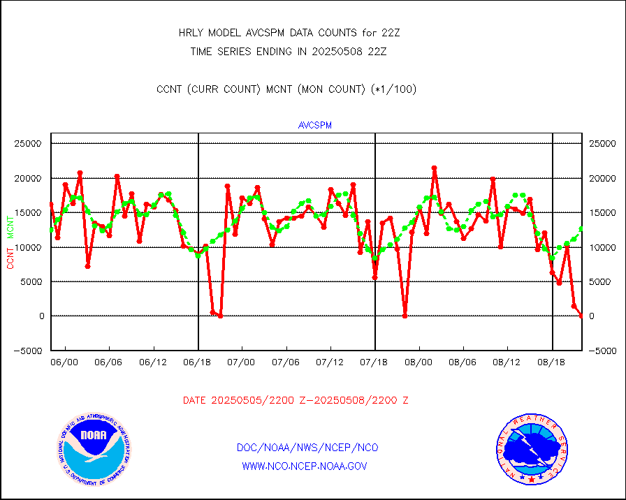
avcspm |
P.M.(N18-19) AVHRR GAC NCEP-proc clr & sea btemps |
1234448 |
1195401 |
103.3 % |
1719.50-1720.49 |
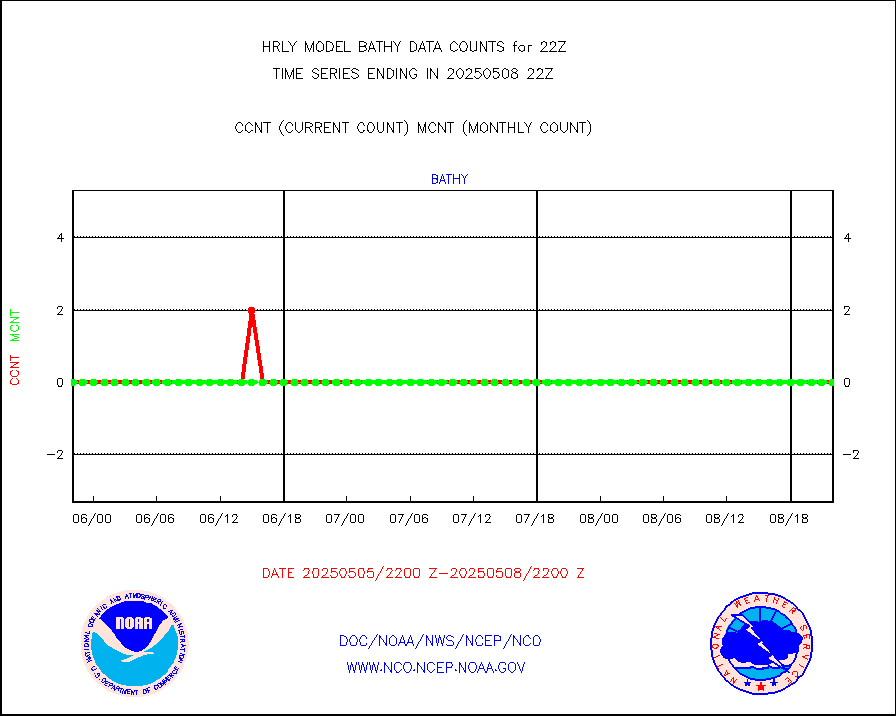
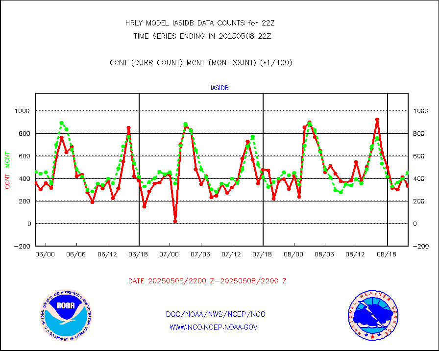
bathy |
eXpendable BathyThermograph, mooring (BATHY fmt) |
0 |
0 |
n/a |
1715.00-1715.99 |
coopmd |
Coop/MADIS NEPP & HCN-Modernization NOAA COOP Obs |
23 |
23 |
100.0 % |
1721.50-1722.49 |
crisf4 |
NPP/NOAA-20 CrIS full spctrl radn (431 ch subset) |
214146 |
227466 |
94.1 % |
1720.50-1721.49 |
crsfdb |
NPP/NOAA-20 CrIS full spctrl radn dir brdcst SSEC |
83160 |
64510 |
128.9 % |
1720.50-1721.49 |
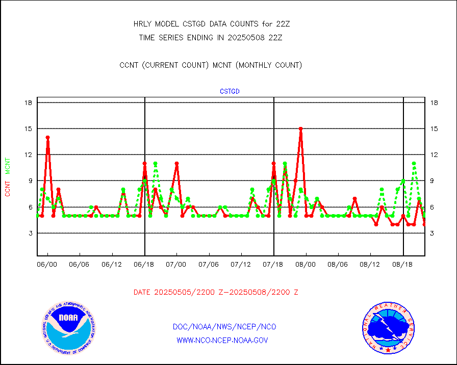
cstgd |
Coast Guard |
4 |
3 |
133.3 % |
1721.50-1722.50 |
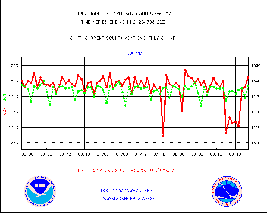
dbuoyb |
Drifting buoys (decoded from BUFR) |
1312 |
1427 |
91.9 % |
1721.50-1722.50 |
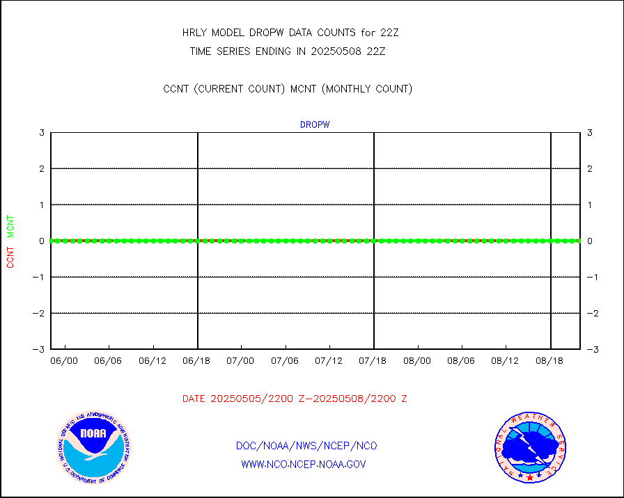
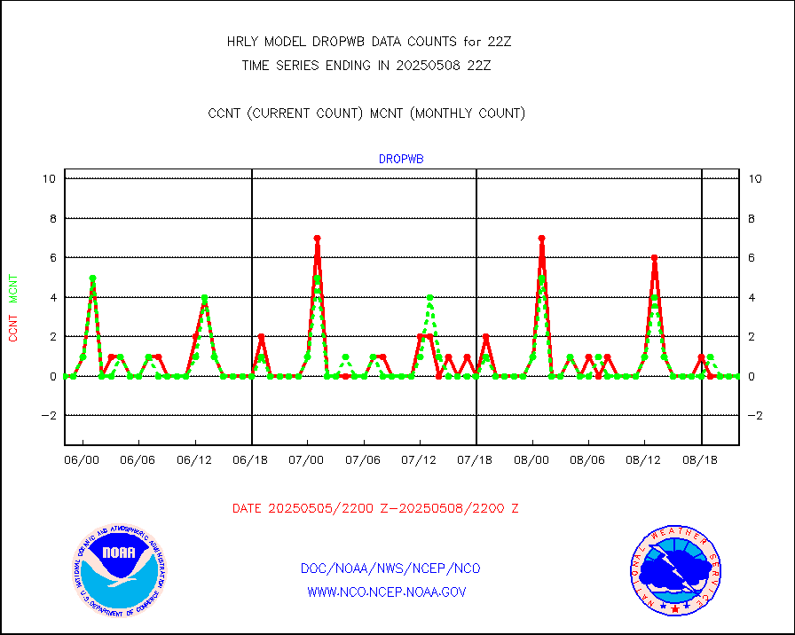
dropw |
Dropwinsonde (from TEMP DROP) |
0 |
0 |
n/a |
1721.50-1722.49 |
efclam |
GOES imager effective cloud amount data (U.Wisc.) |
8284928 |
8296765 |
99.9 % |
1721.50-1722.49 |
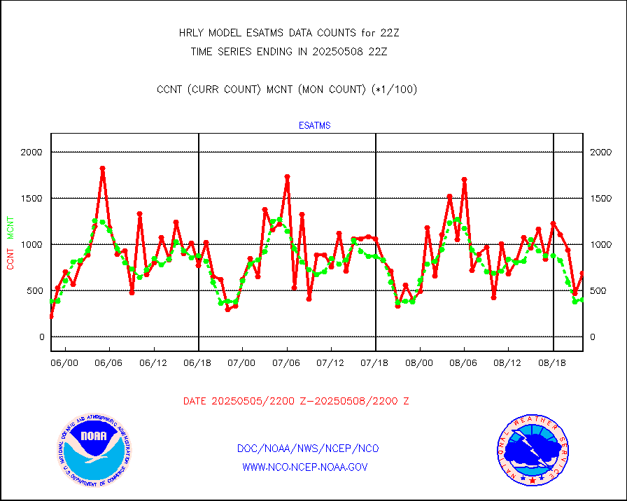
esatms |
NPP Adv. Tech. MW Sndr (ATMS) br. temps from RARS |
32256 |
45009 |
71.7 % |
1720.50-1721.49 |
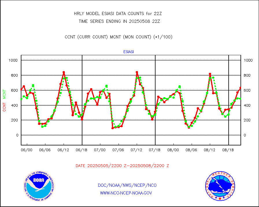
esiasi |
METOP 1-2 IASI 1C radiance data vbl chn from RARS |
48340 |
56534 |
85.5 % |
1721.00-1721.99 |
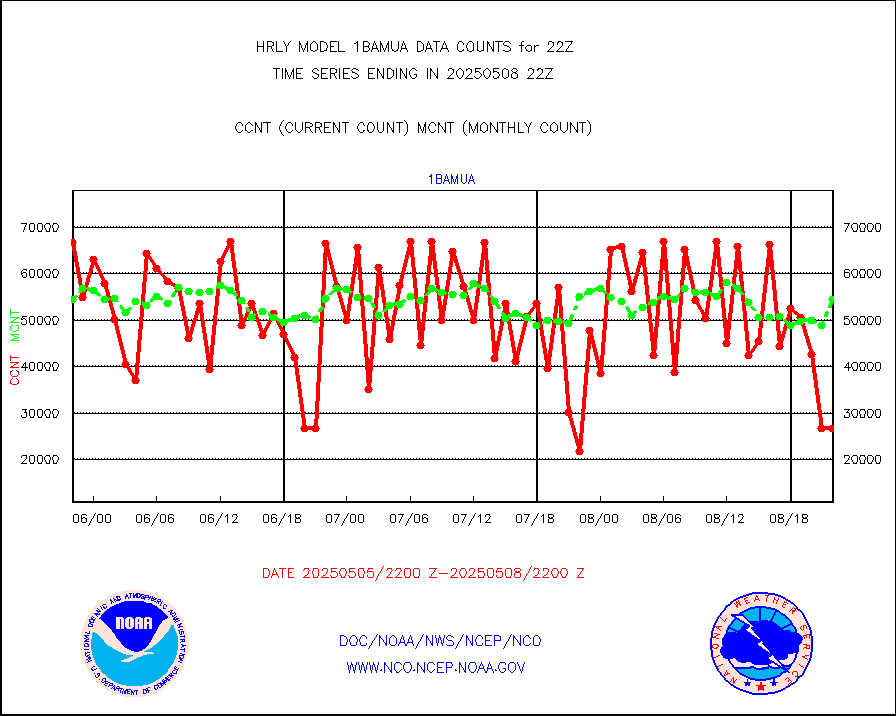
esmhs |
NOAA 18-19 & METOP 1-2 MHS proc. btemps from RARS |
249707 |
229338 |
108.9 % |
1721.50-1722.49 |
geoimr |
GOES/NESDIS (11x17 f-o-v) imager clear radiances |
0 |
0 |
n/a |
1721.00-1721.99 |
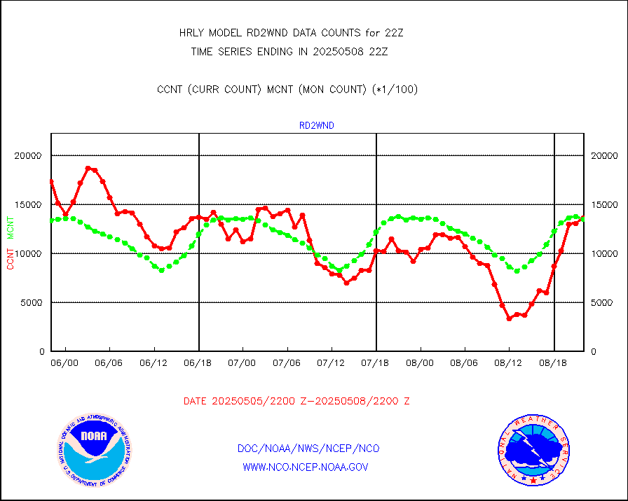
gome |
METOP 1-2 Global Ozone Monitoring Exp.-2 (GOME-2) |
13947 |
6553 |
212.8 % |
1720.50-1721.49 |
h20in2 |
INDIA SATWIND, INSAT WV channel |
0 |
0 |
n/a |
1721.00-1721.99 |
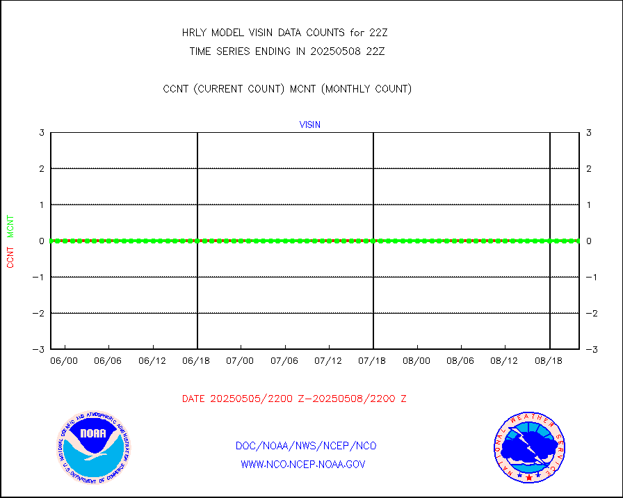
h2dusr |
GOES-16&up/NESDIS wv imgr/deep-lyr derivd cld mtn |
18965 |
16896 |
112.2 % |
1721.00-1721.99 |
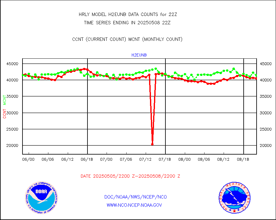
h2eunb |
METEOSAT/EUMETSAT wvpr imgr drv cld motion NBseq |
41374 |
42238 |
98.0 % |
1720.50-1721.49 |
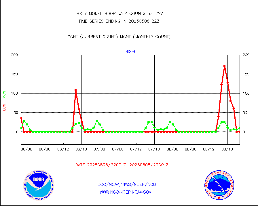
hdob |
High Density OBs from reconnaissance acft data |
0 |
17 |
0.0 % |
1721.50-1722.49 |
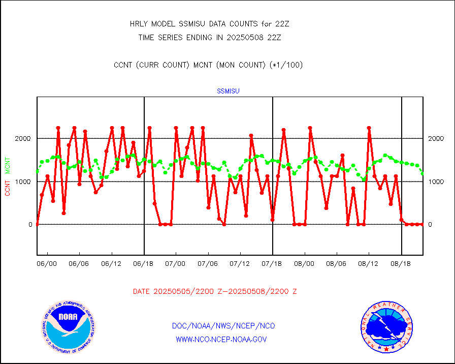
iasidb |
METOP 1-2 IASI 1C radiances-direct broadcast SSEC |
41233 |
33368 |
123.6 % |
1720.50-1721.49 |
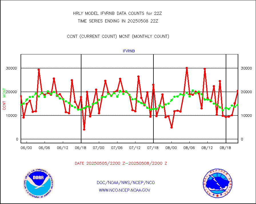
ifvrnb |
VIIRS (NPP/NOAA-20) ir lg-wv drv cloud motion(NB) |
9336 |
13667 |
68.3 % |
1718.00-1718.99 |
infav1 |
AVHRR (METOP) ir lg-wave derived cld motion |
0 |
0 |
n/a |
1721.50-1722.50 |
infin |
INSAT/KALPANA India ir lg-wave derived cld motion |
0 |
0 |
n/a |
1719.50-1720.49 |
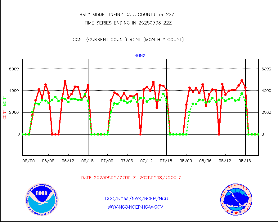
infin2 |
INDIA SATWIND, INSAT IR channel |
0 |
0 |
n/a |
1721.00-1721.99 |
kamdar |
Korean AMDAR aircraft data (decoded from BUFR) |
60 |
30 |
200.0 % |
1721.50-1722.49 |
lcman |
Land-based CMAN stations decoded from CMAN format |
72 |
81 |
88.9 % |
1721.50-1722.49 |
ltnglr |
LLDN Long-rng lightning from Vaisala via NOAAPORT |
158765 |
150121 |
105.8 % |
1721.50-1722.49 |
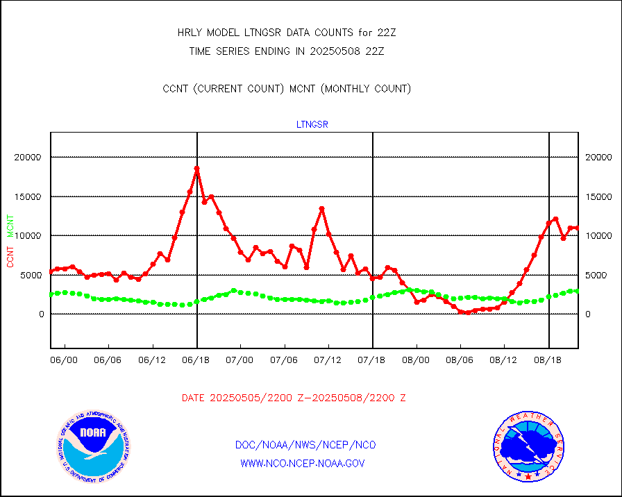
ltngsr |
NLDN Shrt-rng lightning from Vaisala via NOAAPORT |
1677 |
1643 |
102.1 % |
1721.50-1722.49 |
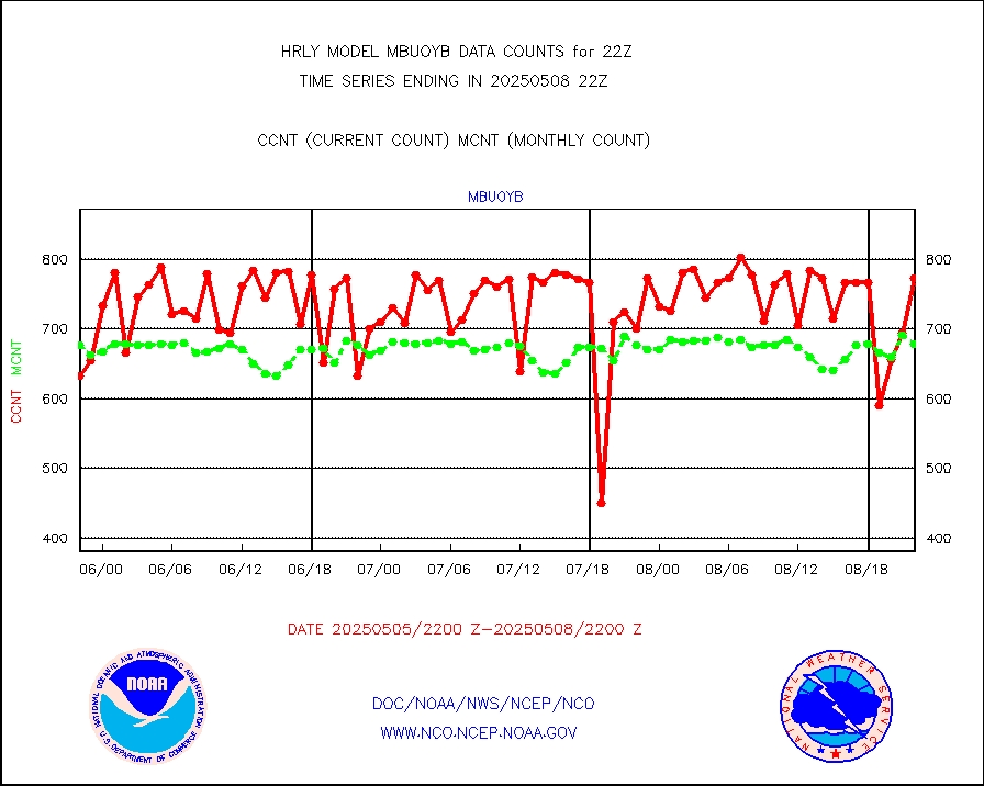
mbuoyb |
Moored buoys (decoded from BUFR) |
672 |
627 |
107.2 % |
1721.50-1722.50 |
mls |
Aura Microwave Limb Sounder (MLS) ozone data |
0 |
0 |
n/a |
1720.00-1720.99 |
msourb |
Mesonet/MADIS UrbaNet |
4187 |
4329 |
96.7 % |
1721.50-1722.49 |
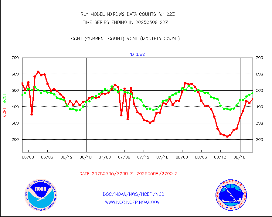
nxrdw2 |
NEXRAD Vel Azm Dsp(VAD) winds via Level 2 decoder |
536 |
515 |
104.1 % |
1721.50-1722.49 |
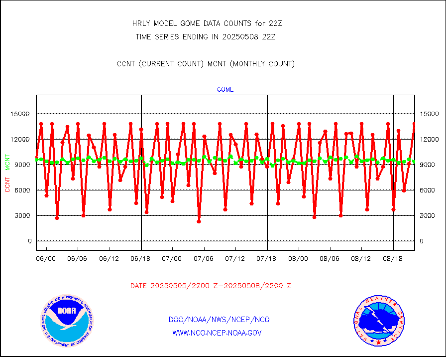
ompslp |
OMPS Limb Profiler ozone data (NPP) |
441 |
262 |
168.3 % |
1715.00-1715.99 |
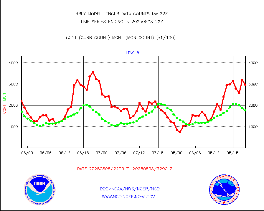
ompsn8 |
OMPS nadir profile ozone (Version 8 BUFR) |
586 |
470 |
124.7 % |
1720.00-1720.99 |
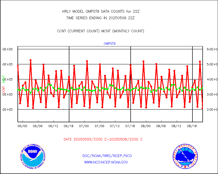
ompst8 |
OMPS total column ozone (Version 8 BUFR) |
333102 |
343571 |
97.0 % |
1720.00-1720.99 |
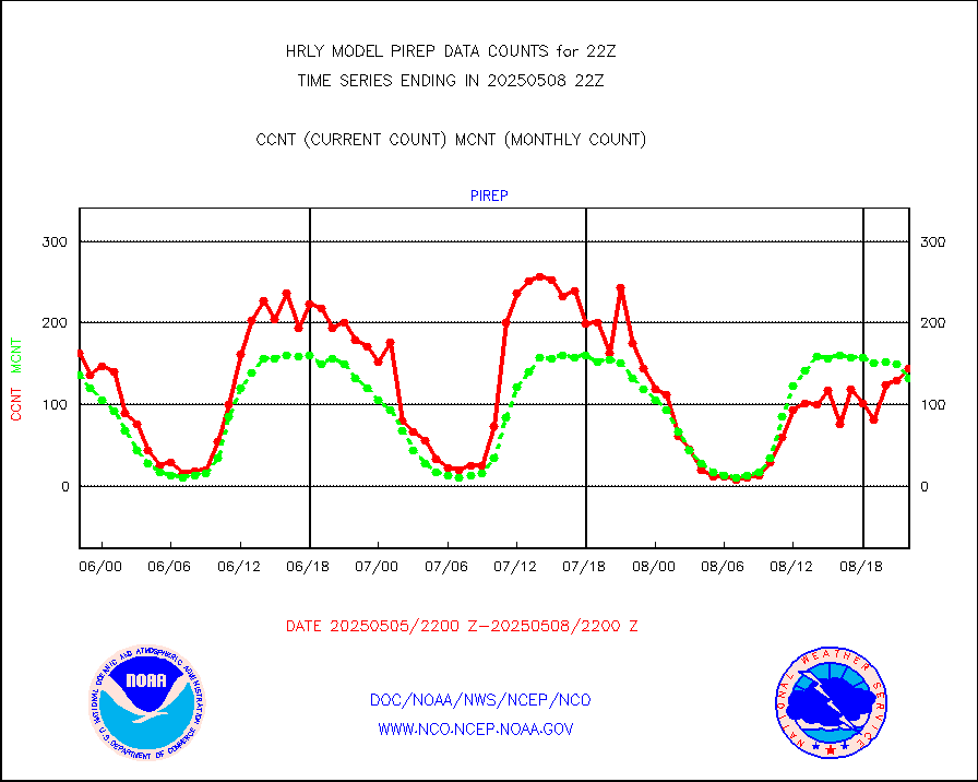
pirep |
Manual PIREP aircraft data (dcded from AIREP fmt) |
121 |
136 |
89.0 % |
1721.50-1722.49 |
prflrp |
Profilr winds from PIBAL (PILOT,PILOT SHIP/MOBIL) |
0 |
0 |
n/a |
1721.50-1722.49 |
raobm |
Rawinsonde - mobile land (from TEMP/PILOT MOBIL) |
0 |
0 |
n/a |
1721.50-1722.49 |
raobs |
Rawinsonde - ship (from TEMP SHIP, PILOT SHIP) |
0 |
0 |
n/a |
1721.50-1722.49 |
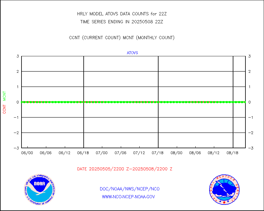
recco |
Flight level reconnaissance aircraft data |
0 |
0 |
n/a |
1721.50-1722.49 |
saphir |
Megha-Tropiques SAPHIR L1A2 brightness temps |
0 |
0 |
n/a |
1719.50-1720.49 |
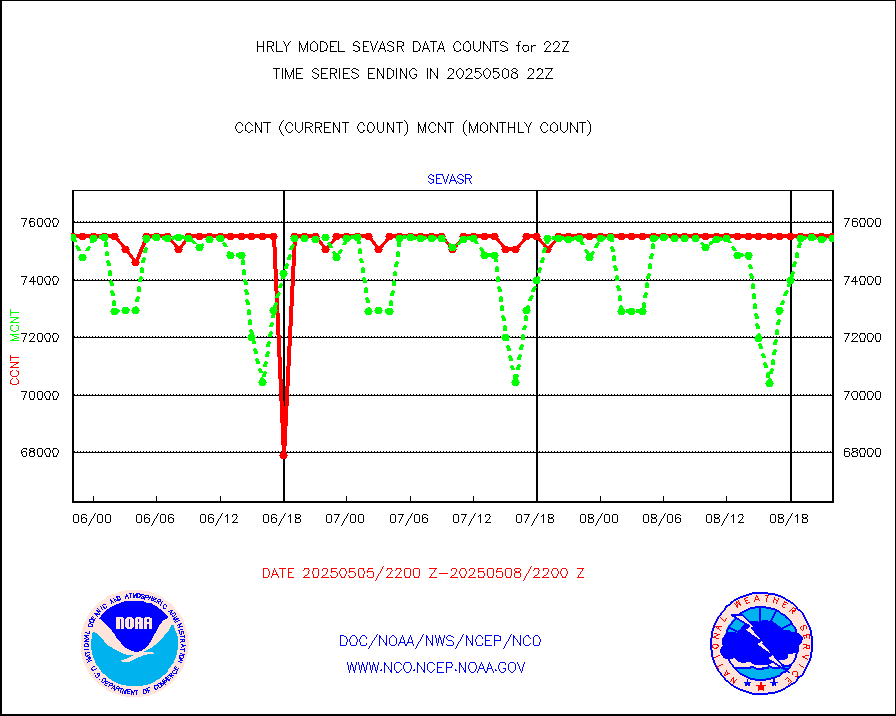
sevasr |
METEOSAT-10 2nd Gen SEVIRI All Sky Radiance(proc) |
75512 |
75438 |
100.1 % |
1721.50-1722.49 |
ships |
Ship - manual and automatic, restricted |
4 |
4 |
100.0 % |
1721.50-1722.49 |
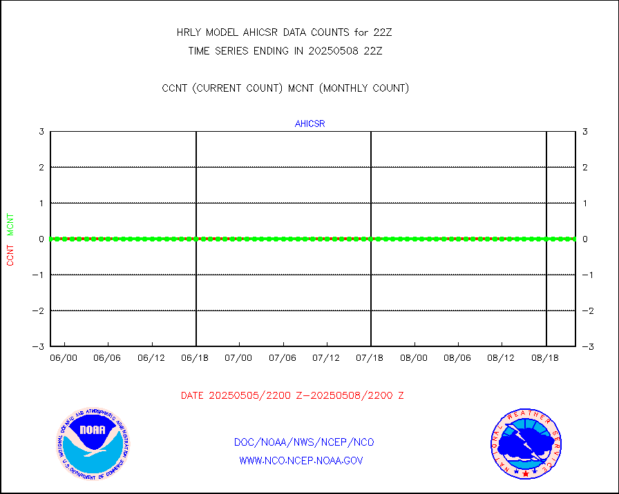
ssmisu |
DMSP SSM/IS 1C radiance data (Unified Pre-Proc.) |
21120 |
138540 |
15.2 % |
1720.50-1721.49 |
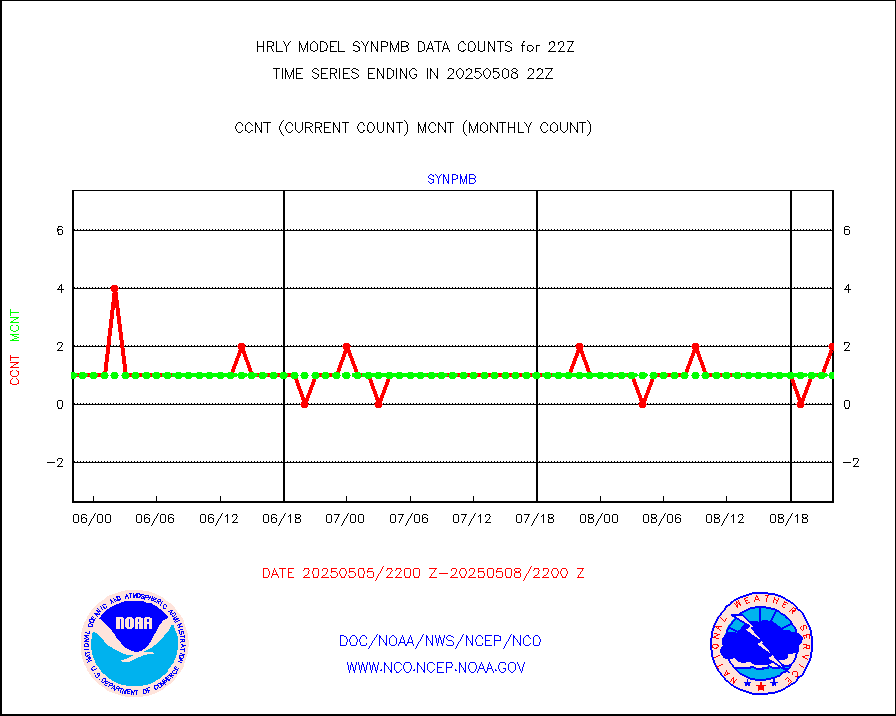
synpmb |
Synoptic - mobile manual & auto (decoded fr BUFR) |
0 |
1 |
0.0 % |
1721.50-1722.49 |
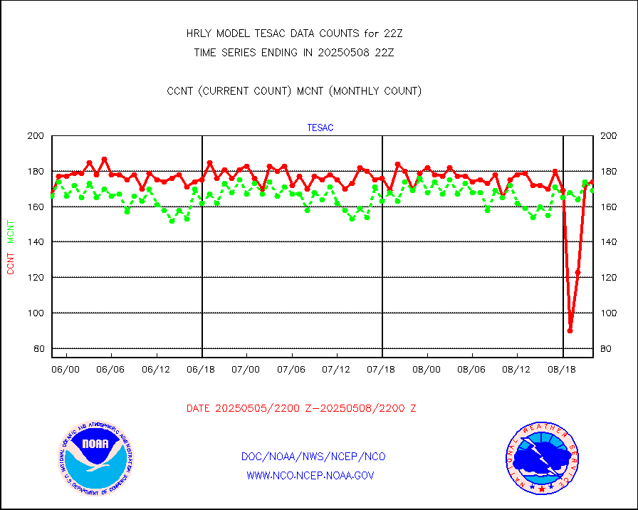
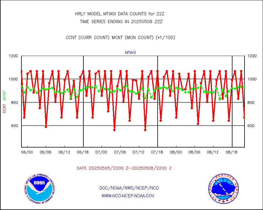
tesac |
CTD probe, Argo prflng float, mooring (TESAC fmt) |
182 |
157 |
115.9 % |
1721.50-1722.49 |
tmdara |
TAMDAR aircft data-all types(from Panasonic,BUFR) |
179 |
163 |
109.8 % |
1721.50-1722.49 |
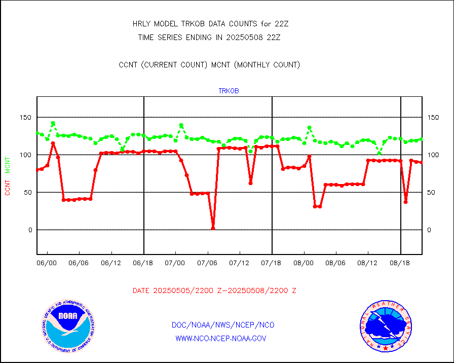
trkob |
ThermoSalinoGraph (TSG) TRACKOB format) |
60 |
52 |
115.4 % |
1720.50-1721.49 |
visin |
INSAT/KALPANA India visible derived cloud motion |
0 |
0 |
n/a |
1719.50-1720.49 |
visin2 |
INDIA SATWIND, INSAT VIS channel |
0 |
0 |
n/a |
1721.00-1721.99 |
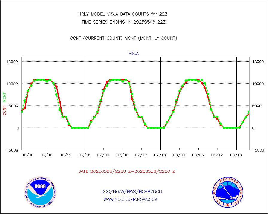
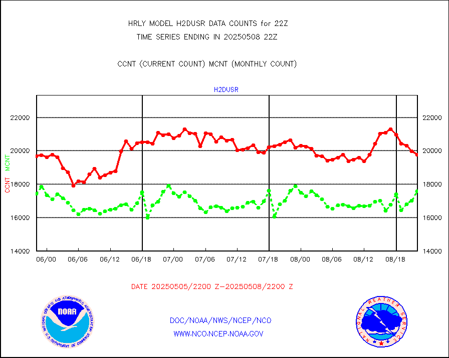
visja |
MTSAT/JMA visible derived cloud motion |
2891 |
3066 |
94.3 % |
1719.50-1720.49 |
visusr |
GOES-16&up/NESDIS visible derived cloud motion |
400577 |
390466 |
102.6 % |
1721.00-1721.99 |
vseunb |
METEOSAT/EUMETSAT visible drv cld motion NBseq |
392 |
1349 |
29.1 % |
1720.50-1721.49 |


