| Critical Data with Normal Counts |
|---|
| Type | Description | Hourly Count | Monthly Average | Percent (%) of Monthly Mean | UTC Time Window |
1bamua |
NOAA 15-19 & METOP 1-2 AMSU-A NCEP-proc. br.temps |
58343 |
55171 |
105.7 % |
2319.00-2319.99 |
1bhrs4 |
NOAA 18-19 & METOP 1-2 HIRS-4 NCEP-proc. br.temps |
59245 |
45984 |
128.8 % |
2319.00-2319.99 |
1bmhs |
NOAA 18-19 & METOP 1-2 MHS NCEP-proces. br. temps |
313392 |
298468 |
105.0 % |
2319.00-2319.99 |
acars |
MDCRS ACARS acft data from ARINC(dcded from BUFR) |
23506 |
22654 |
103.8 % |
2320.50-2321.49 |
airep |
Manual AIREP aircraft data (dcded from AIREP fmt) |
350 |
408 |
85.8 % |
2320.50-2321.49 |
airsev |
AQUA AIRS/AMSU-A/HSB brightness temps- every FOV |
0 |
0 |
n/a |
2318.50-2319.49 |
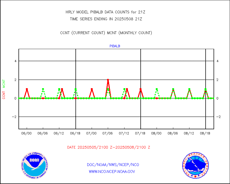
amdar |
AMDAR aircraft data (decoded from AMDAR format) |
149 |
82 |
181.7 % |
2320.50-2321.49 |
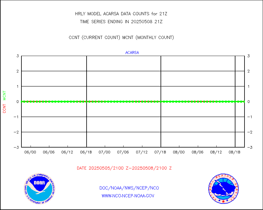
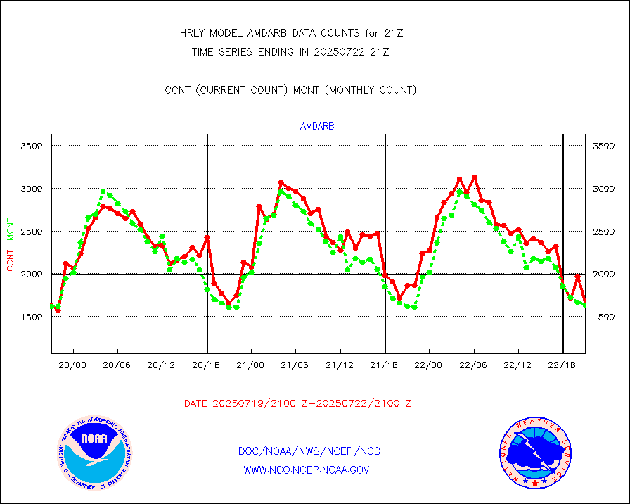
amdarb |
AMDAR aircraft data (decoded from BUFR) |
456 |
428 |
106.5 % |
2320.50-2321.49 |
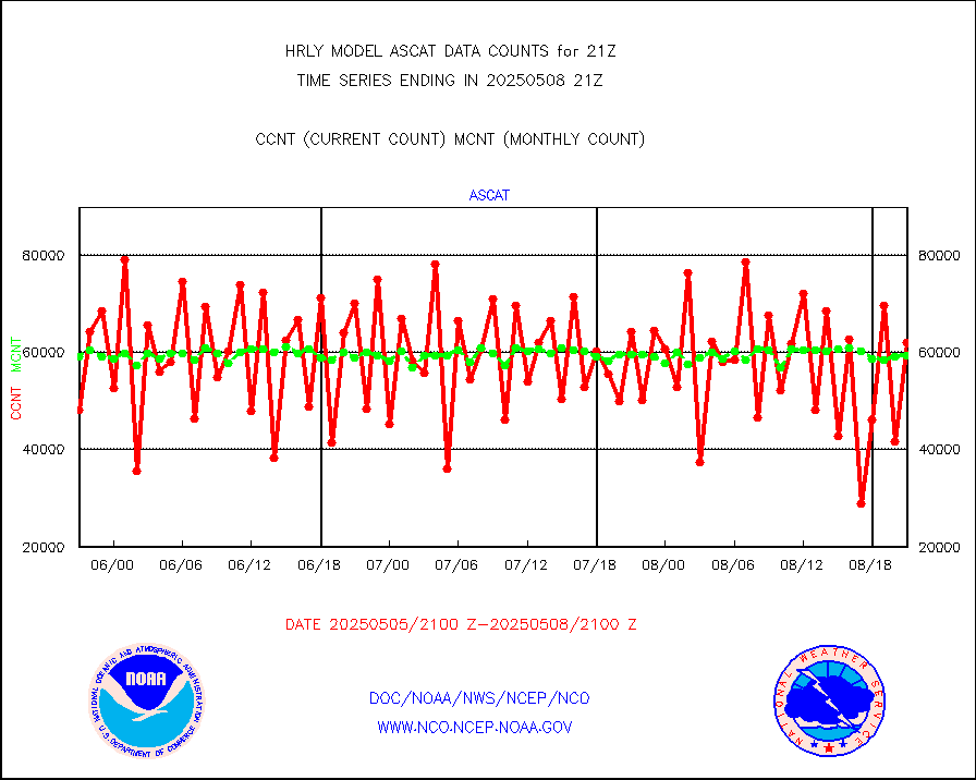
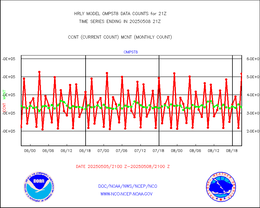
ascat |
METOP 1-2 ASCAT products |
38052 |
35473 |
107.3 % |
2319.50-2320.49 |
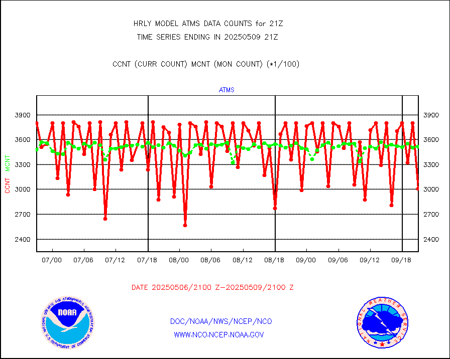
atms |
NPP/NOAA-20 ATMS brightness temperatures |
370848 |
347037 |
106.9 % |
2319.50-2320.49 |
camdar |
Canadian AMDAR aircraft data (decoded from BUFR) |
36 |
32 |
112.5 % |
2320.50-2321.49 |
cmanb |
Surface Marine CMAN rpts decoded from BUFR format |
1834 |
1753 |
104.6 % |
2320.50-2321.50 |
dbuoy |
Buoys decoded from FM-18 fmt (moored or drifting) |
45 |
31 |
145.2 % |
2320.50-2321.49 |
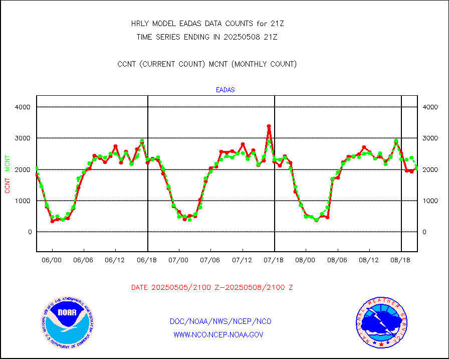
eadas |
E-AMDAR (European AMDAR acft decoded from BUFR) |
1257 |
1390 |
90.4 % |
2320.50-2321.49 |
esamua |
NOAA 15-19 & METOP 1-2 AMSU-A proc btmps frm RARS |
32212 |
26513 |
121.5 % |
2320.50-2321.49 |
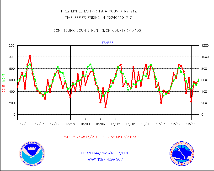
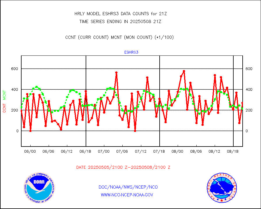
eshrs3 |
NOAA 15-19 & METOP 1-2 HIRS-3/4 pr btmps frm RARS |
72838 |
55416 |
131.4 % |
2320.50-2321.49 |
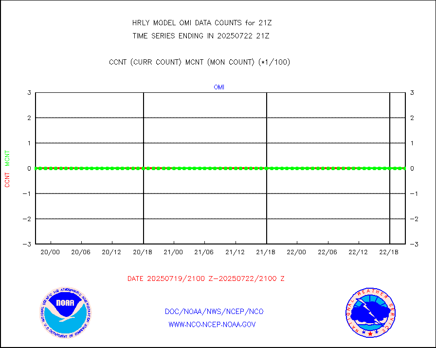
gnss |
Grnd-based Gbl Navigation Sat System (GNSS) data |
9649 |
8229 |
117.3 % |
2320.00-2320.99 |
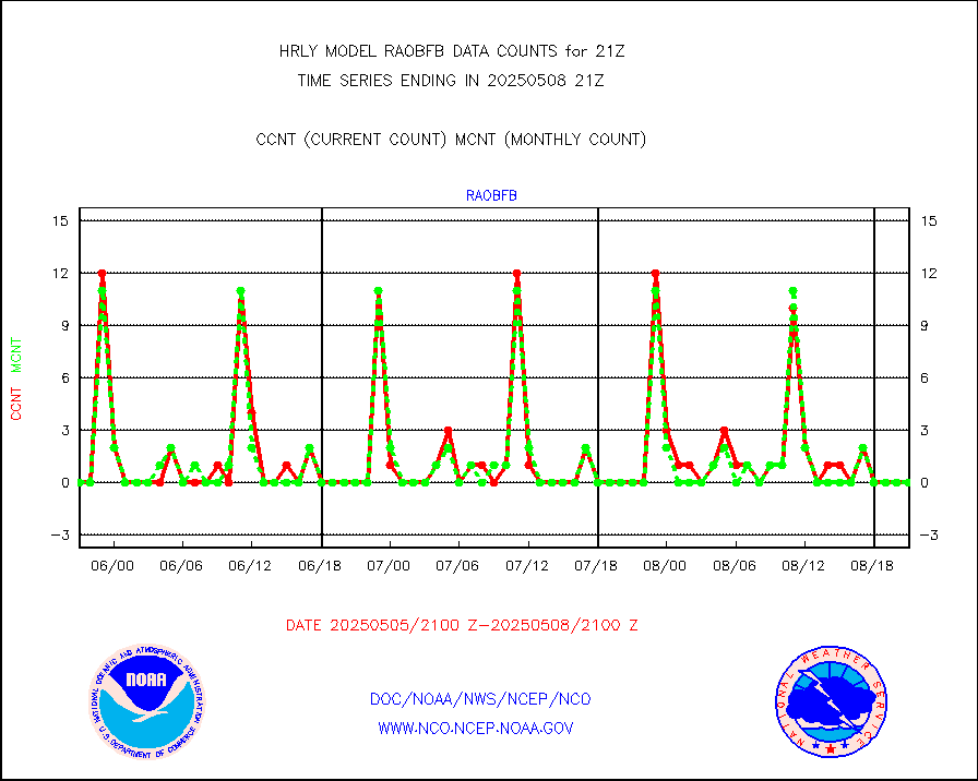
gpsro |
GPS radio occultation data |
320 |
415 |
77.1 % |
2318.50-2319.49 |
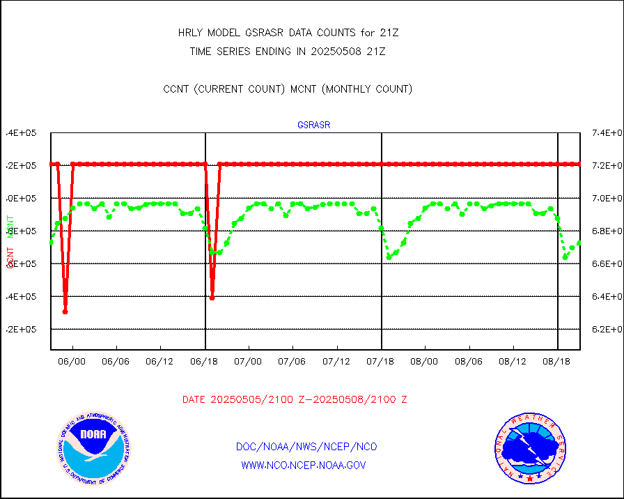
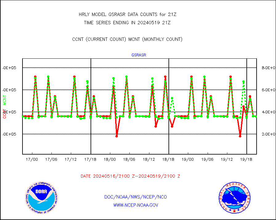
gsrasr |
GOES-16/17 All Sky Radiances (proc.) |
360476 |
357441 |
100.8 % |
2320.50-2321.49 |
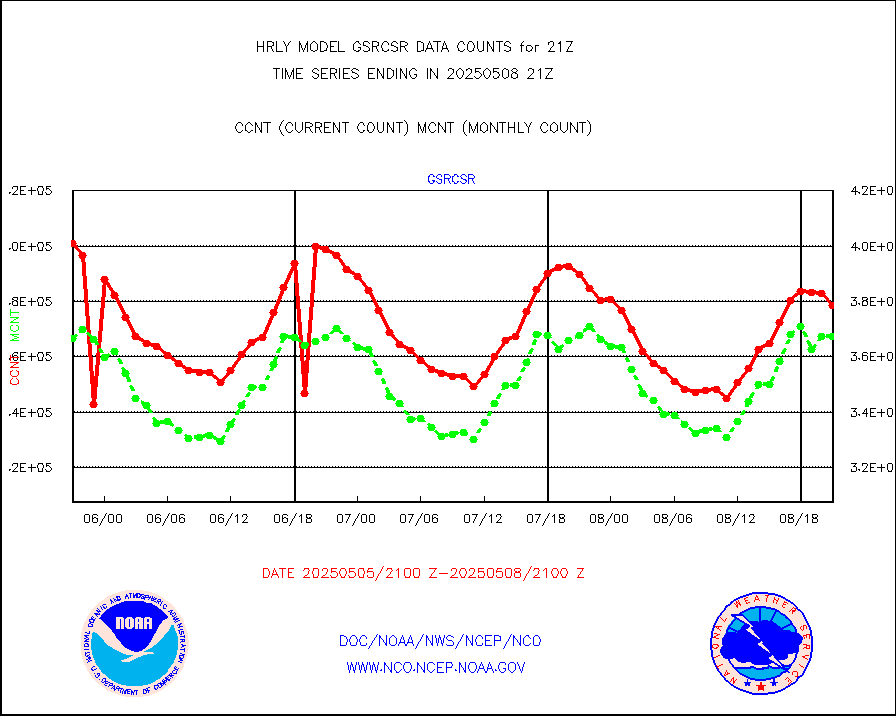
gsrcsr |
GOES-16/17 Clear Sky Radiances (proc.) |
202860 |
188606 |
107.6 % |
2320.50-2321.49 |
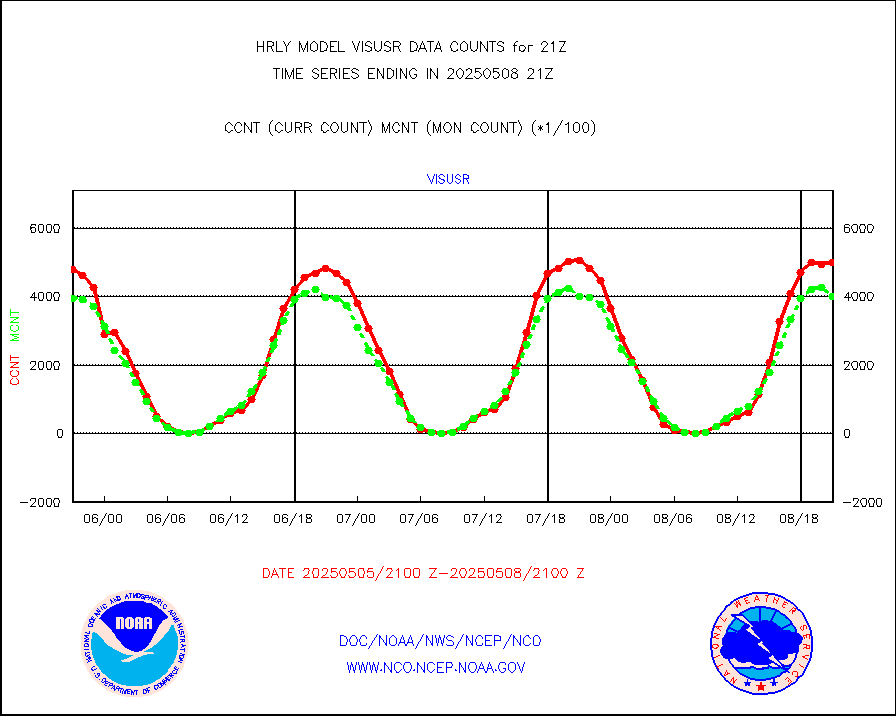
h20ja |
MTSAT/JMA water vapor imager derived cloud motion |
17144 |
18668 |
91.8 % |
2318.50-2319.49 |
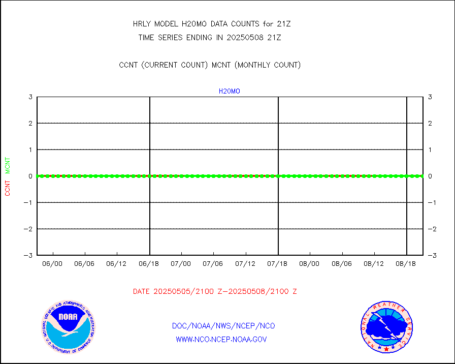
h20mo |
MODIS (AQUA/TERRA) wvpr imager derived cld motion |
0 |
0 |
n/a |
2317.00-2317.99 |
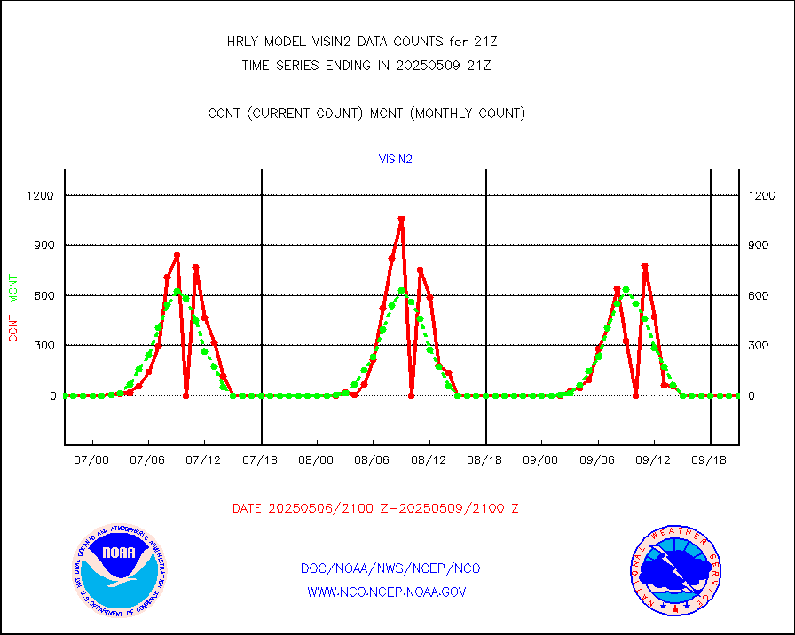
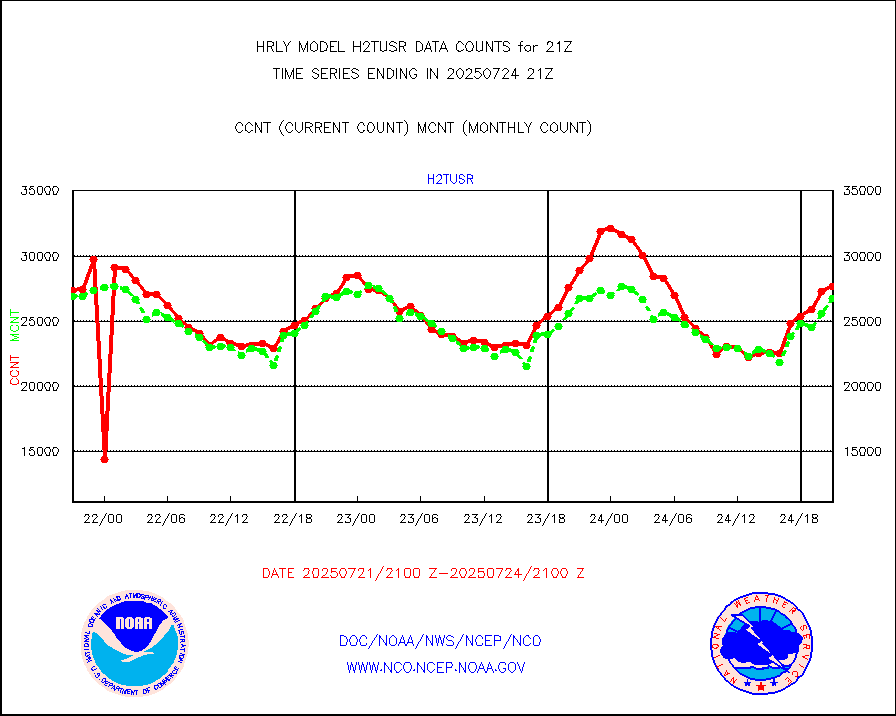
h2tusr |
GOES-16&up/NESDIS wv imgr/cld-top derived cld mtn |
29785 |
29743 |
100.1 % |
2320.00-2320.99 |
ifeunb |
METEOSAT/EUMETSAT ir lg-wave drv cld motion NBseq |
21975 |
21954 |
100.1 % |
2319.50-2320.49 |
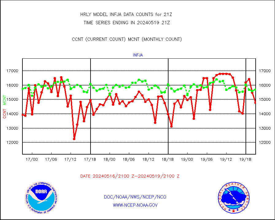
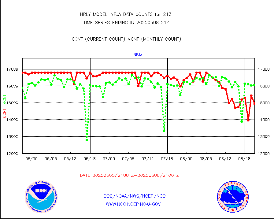
infja |
MTSAT/JMA infrared long-wave derived cloud motion |
15340 |
15549 |
98.7 % |
2318.50-2319.49 |
infmo |
MODIS (AQUA/TERRA) ir l-wave derived cloud motion |
0 |
0 |
n/a |
2317.00-2317.99 |
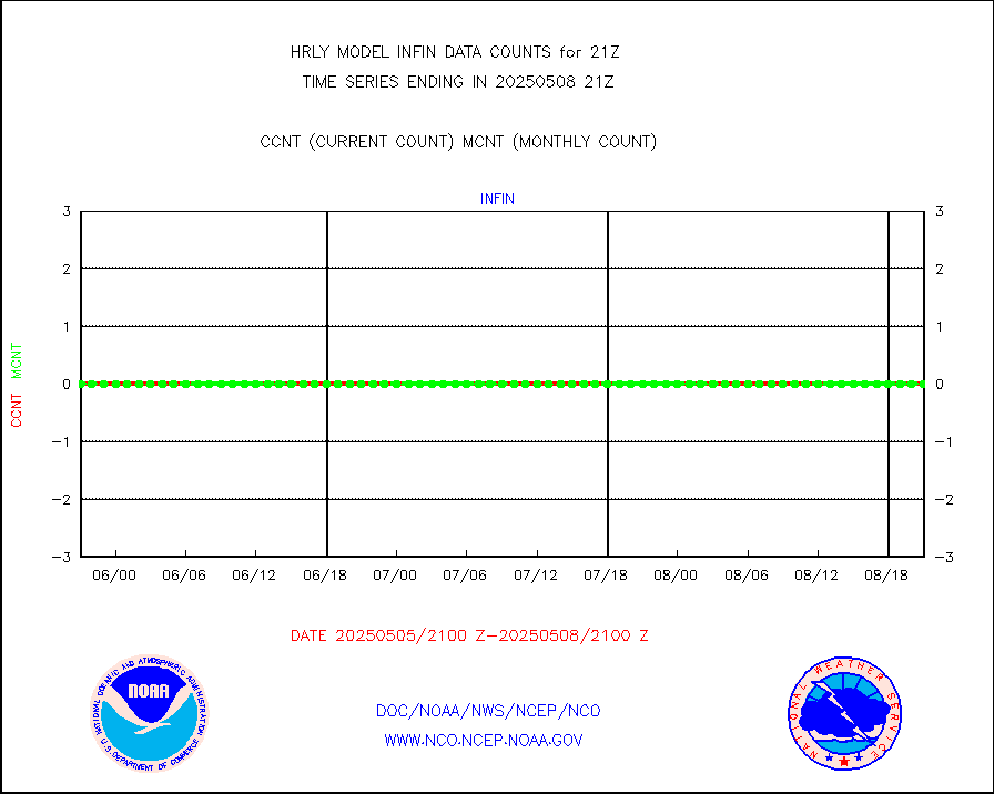
infusr |
GOES-16&up/NESDIS ir long-wave derived cld motion |
82429 |
82356 |
100.1 % |
2320.00-2320.99 |
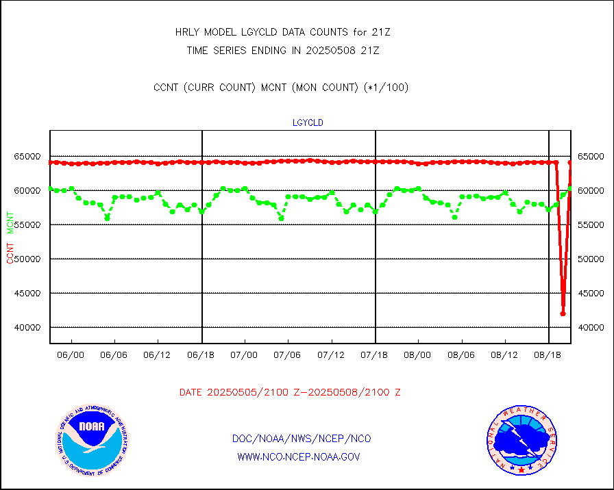
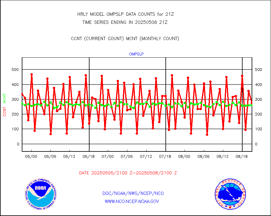
lgycld |
GOES/NASA(Langley) hi-res. (1x1 f-o-v) cloud data |
4185794 |
3678255 |
113.8 % |
2320.50-2321.49 |
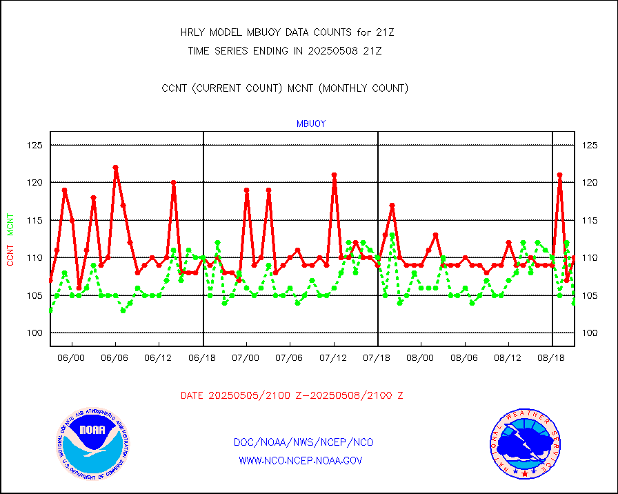
mbuoy |
Buoys decoded from FM-13 format (moored) |
115 |
119 |
96.6 % |
2320.50-2321.49 |
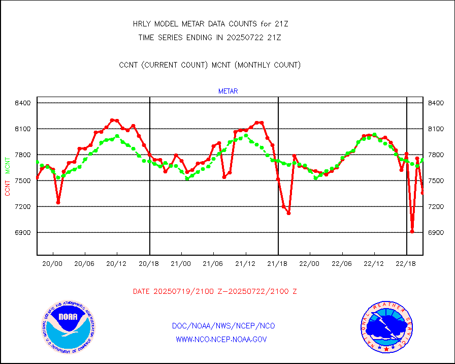
metar |
Aviation - METAR |
7637 |
7699 |
99.2 % |
2320.50-2321.49 |
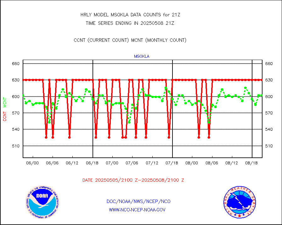
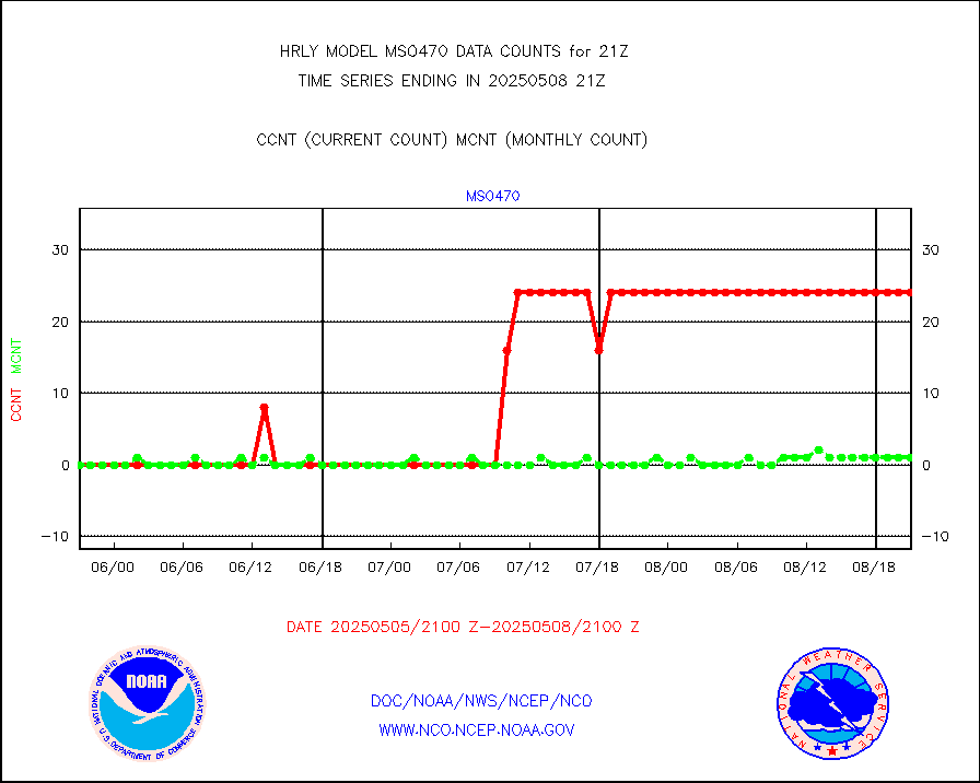
mso470 |
Mesonet/MADIS Colorado E-470 (Interstate 470) |
18 |
20 |
90.0 % |
2320.50-2321.49 |
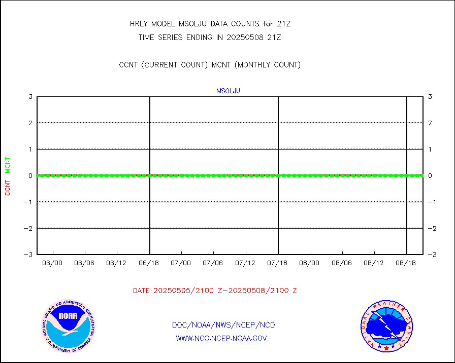
msoalk |
Mesonet/MADIS Alaska Department of Transportation |
106 |
105 |
101.0 % |
2320.50-2321.49 |
msoapg |
Mesonet/MADIS U.S. Army Aberdeen Proving Grounds |
0 |
0 |
n/a |
2320.50-2321.49 |
msoapr |
Mesonet/MADIS Citizen Weather Observers Program |
50029 |
46774 |
107.0 % |
2320.50-2321.49 |
msoaws |
Mesonet/MADIS AWS Convergence Technologies, Inc. |
26276 |
25378 |
103.5 % |
2320.50-2321.49 |
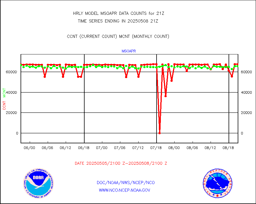
msoawx |
Mesonet/MADIS "Anything Weather" |
0 |
0 |
n/a |
2320.50-2321.49 |
msocol |
Mesonet/MADIS Colorado Dept. of Transportation |
0 |
0 |
n/a |
2320.50-2321.49 |
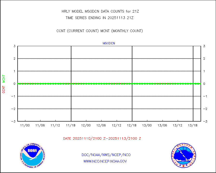
msodcn |
Mesonet/MADIS DC Net |
0 |
0 |
n/a |
2320.50-2321.49 |
msoden |
Mesonet/MADIS Denver Urban Drainage & Flood Cntrl |
250 |
229 |
109.2 % |
2320.50-2321.49 |
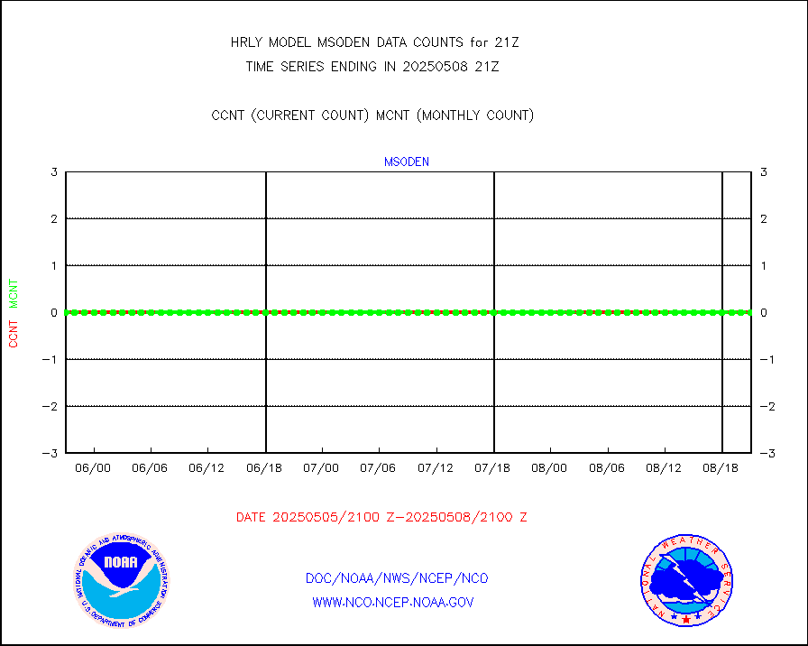
msofla |
Mesonet/MADIS Florida (FAWN & USF) |
4 |
4 |
100.0 % |
2320.50-2321.49 |
msoflt |
Mesonet/MADIS Florida Dept. of Transportation |
0 |
0 |
n/a |
2320.50-2321.49 |
msogeo |
Mesonet/MADIS Georgia Dept. of Transportation |
0 |
0 |
n/a |
2320.50-2321.49 |
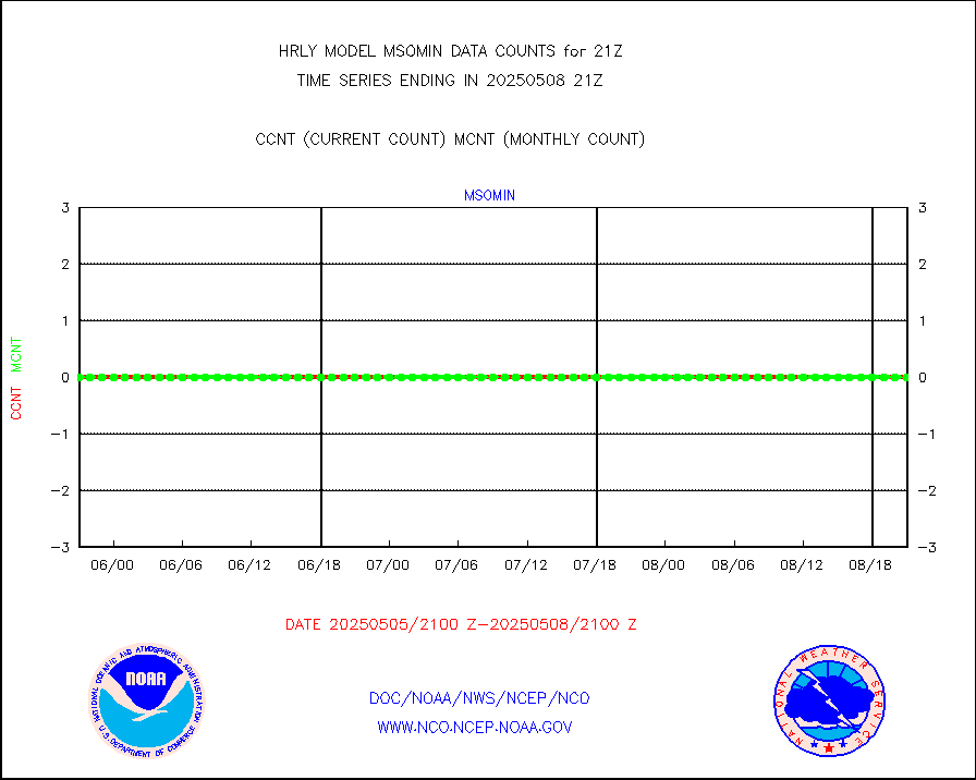
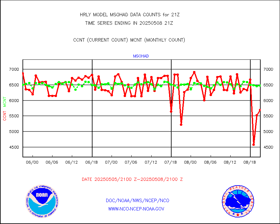
msohad |
Mesonet/MADIS NWS Hydromet Auto Data System(HADS) |
6798 |
6546 |
103.8 % |
2320.50-2321.49 |
msoien |
Mesonet/MADIS Iowa Environmental |
197 |
189 |
104.2 % |
2320.50-2321.49 |
msoind |
Mesonet/MADIS Indiana Dept. of Transportation |
0 |
0 |
n/a |
2320.50-2321.49 |
msoiow |
Mesonet/MADIS Iowa Department of Transportation |
0 |
0 |
n/a |
2320.50-2321.49 |
msokan |
Mesonet/MADIS Kansas Department of Transportation |
312 |
371 |
84.1 % |
2320.50-2321.49 |
msokla |
Mesonet/MADIS Oklahoma Mesonet |
318 |
329 |
96.7 % |
2320.50-2321.49 |
msolju |
Mesonet/MADIS Louisiana State/Jackson State Univ. |
0 |
0 |
n/a |
2320.50-2321.49 |
msomca |
Mesonet/MADIS Missouri Commercial Agricult Wx Net |
296 |
277 |
106.9 % |
2320.50-2321.49 |
msomin |
Mesonet/MADIS Minnesota Dept. of Transportation |
0 |
0 |
n/a |
2320.50-2321.49 |
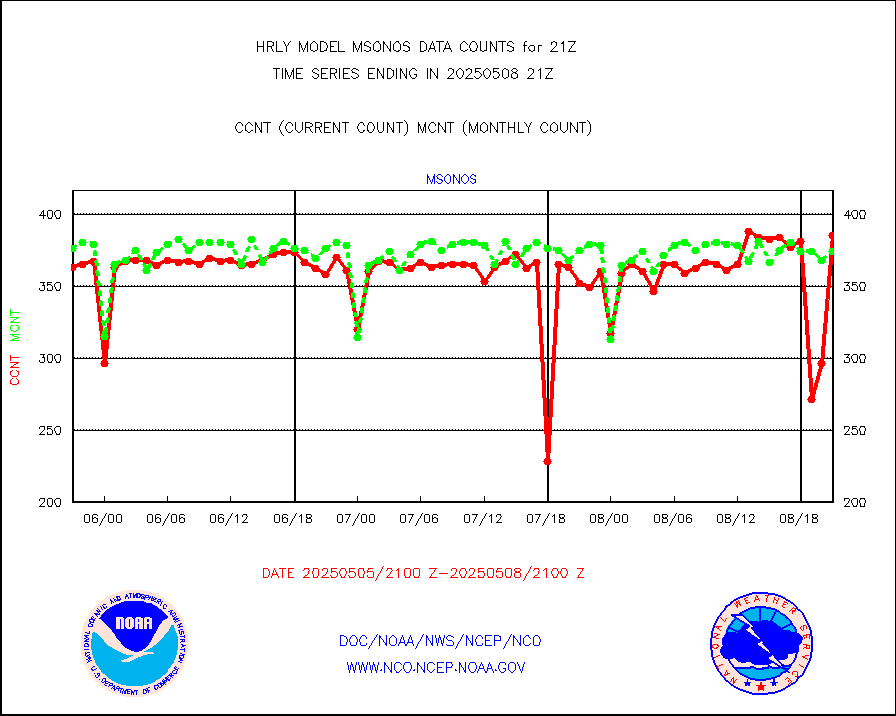
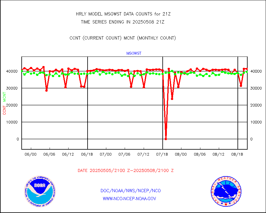
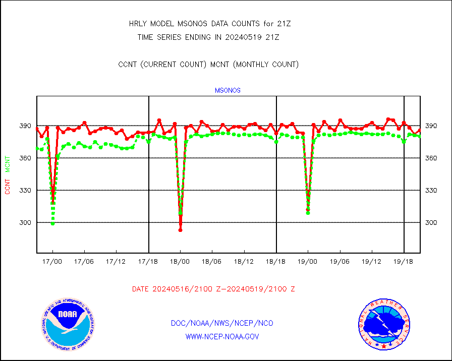
msonos |
Mesonet/MADIS NOS-Phys Oceanographic Realtime Sys |
380 |
362 |
105.0 % |
2320.50-2321.49 |
msoraw |
Mesonet/MADIS NFIC Remote Automated Wx Stns(RAWS) |
1938 |
1872 |
103.5 % |
2320.50-2321.49 |
msovir |
Mesonet/MADIS Virginia Dept. of Transportation |
234 |
236 |
99.2 % |
2320.50-2321.49 |
msowfy |
Mesonet/MADIS "Weather for You" |
0 |
0 |
n/a |
2320.50-2321.49 |
msowis |
Mesonet/MADIS Wisconsin Dept. of Transportation |
0 |
0 |
n/a |
2320.50-2321.49 |
msowst |
Mesonet/MADIS MesoWest (many subproviders) |
45364 |
46024 |
98.6 % |
2320.50-2321.49 |
msowtx |
Mesonet/MADIS West Texas |
5653 |
5633 |
100.4 % |
2320.50-2321.49 |
mtiasi |
METOP 1-2 IASI 1C radiance data (varbl. channels) |
83088 |
88094 |
94.3 % |
2319.00-2319.99 |
nxrdw |
NEXRAD Vel Azm Dsp(VAD) winds via radar coded msg |
0 |
0 |
n/a |
2320.50-2321.49 |
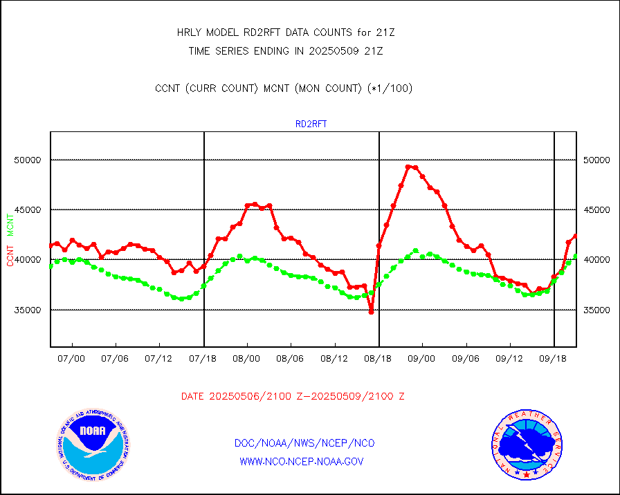
omi |
Aura Ozone Monitoring Instrument (OMI) data |
0 |
40368 |
0.0 % |
2318.50-2319.49 |
osbuv8 |
NOAA 16-19 Solar Backscatter UV-2 rad frm V8 BUFR |
0 |
0 |
n/a |
2319.00-2319.99 |
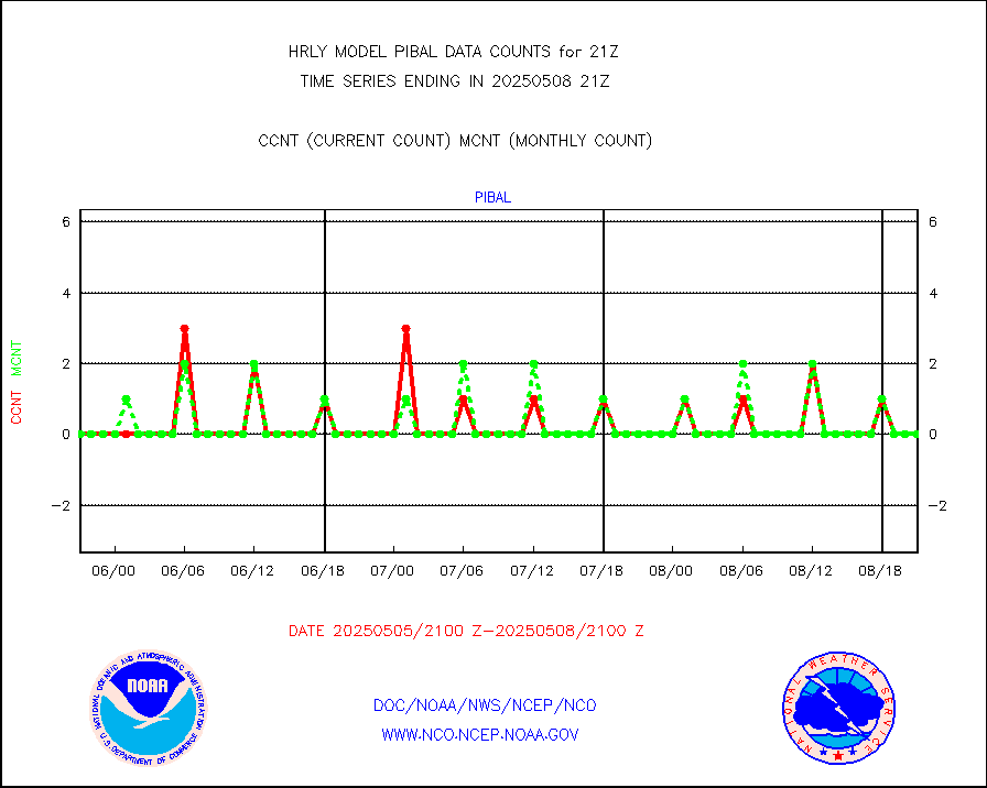
pibal |
PIBAL (from PILOT, PILOT SHIP, PILOT MOBIL) |
0 |
0 |
n/a |
2320.50-2321.49 |
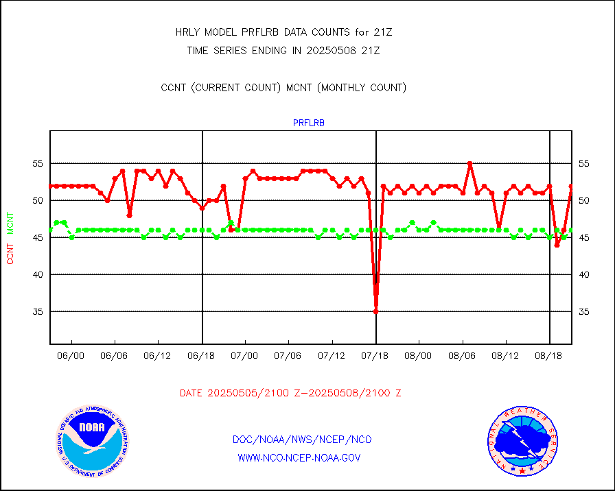
prflrb |
Multi-Agency Profiler (MAP) and SODAR winds |
44 |
40 |
110.0 % |
2320.50-2321.49 |
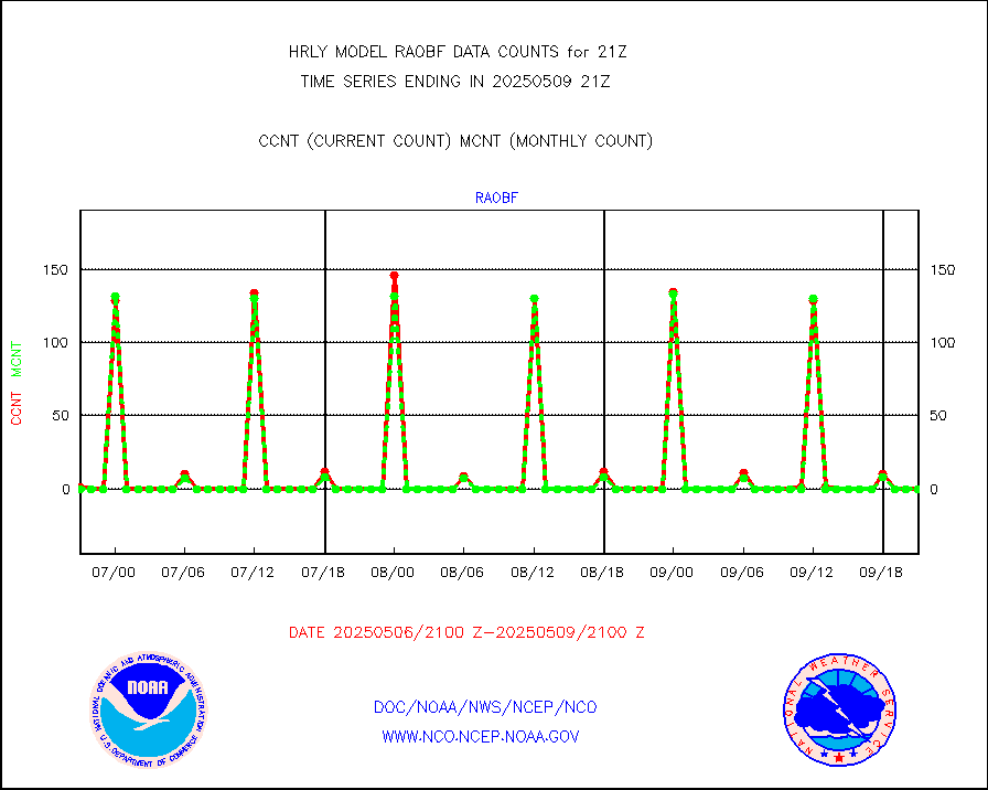
raobf |
Rawinsonde - fixed land (from TEMP or PILOT) |
0 |
0 |
n/a |
2320.50-2321.49 |
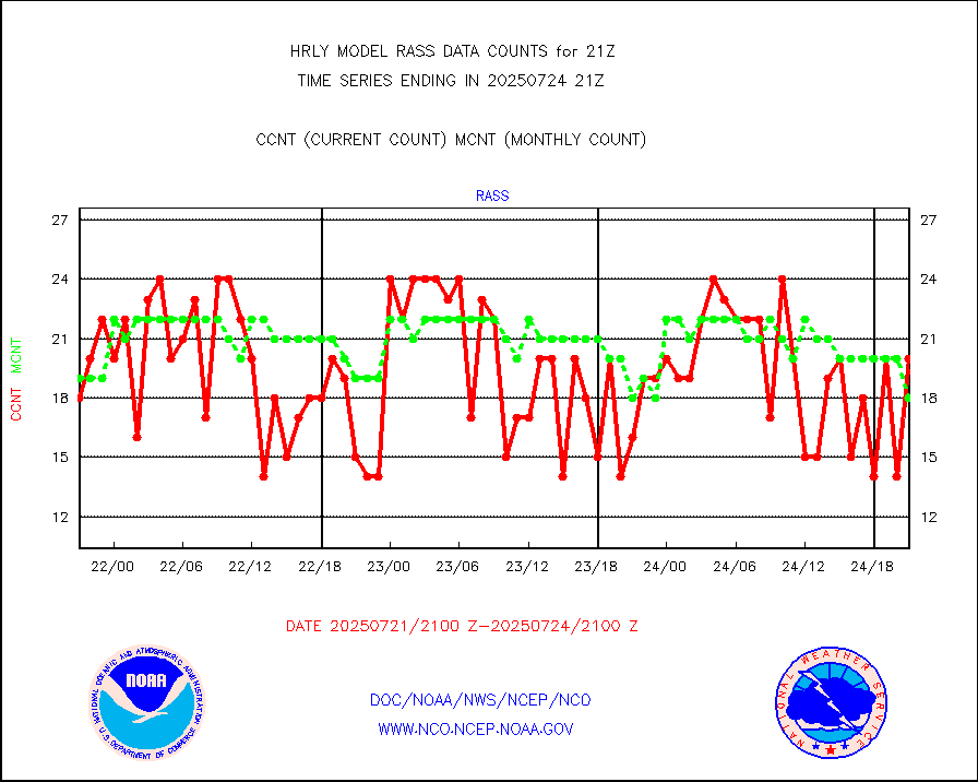
rass |
RASS temperatures (NOAA and Multi-Agency) |
26 |
25 |
104.0 % |
2320.50-2321.49 |
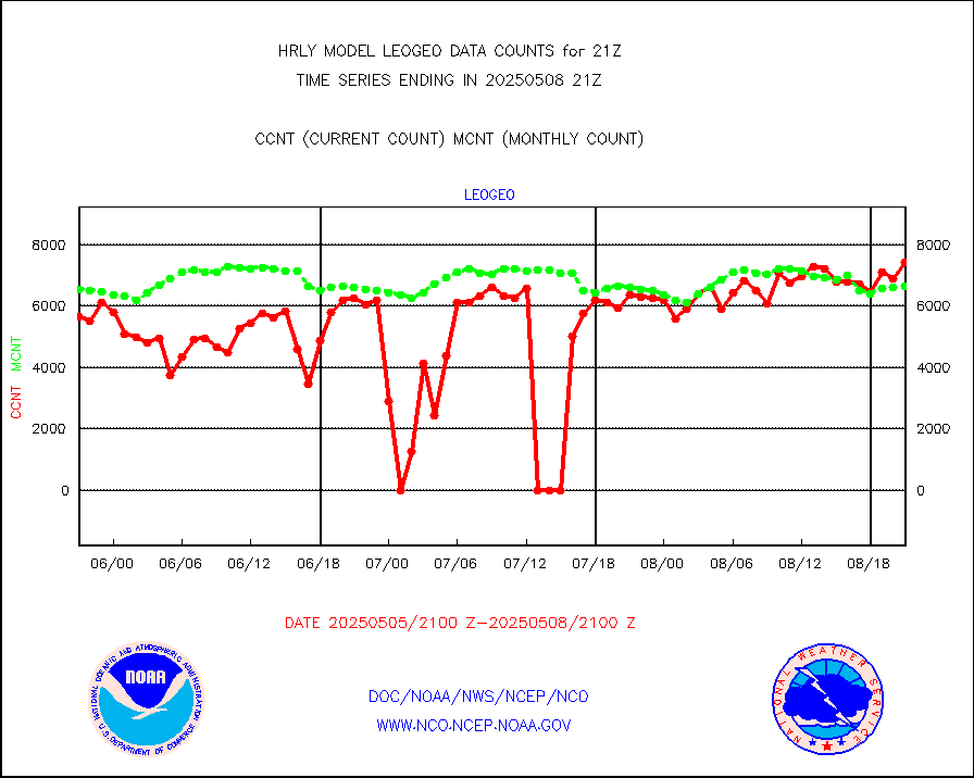
rd2rft |
NEXRAD reflectivity (Lvl 2 - GTS) |
3750423 |
3713876 |
101.0 % |
2320.50-2321.49 |
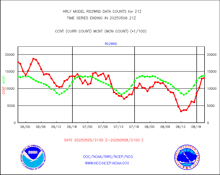
rd2wnd |
NEXRAD radial wind (Level 2 - GTS) |
1646184 |
1483950 |
110.9 % |
2320.50-2321.49 |
sevcsr |
METEOSAT-10 2nd Gen SEVIRI Clr Sky Radiance(proc) |
0 |
0 |
n/a |
2320.50-2321.49 |
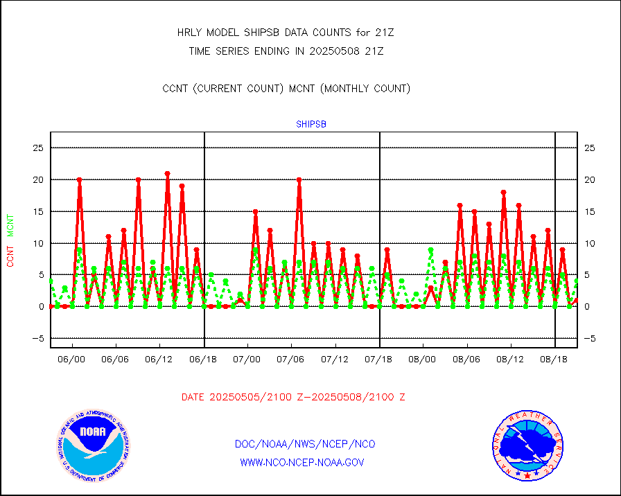
shipsb |
Ship - manual and automatic, restricted (BUFR) |
0 |
0 |
n/a |
2320.50-2321.50 |
shipsu |
Ship - manual and automatic, unrestricted |
121 |
114 |
106.1 % |
2320.50-2321.50 |
shipub |
Ship - manual and automatic, unrestricted (BUFR) |
425 |
447 |
95.1 % |
2320.50-2321.50 |
synop |
Synoptic - fixed manual and automatic |
1931 |
1880 |
102.7 % |
2320.50-2321.49 |
synopb |
Synoptic - fixed manual & auto (decoded fr BUFR) |
5069 |
5054 |
100.3 % |
2320.50-2321.49 |
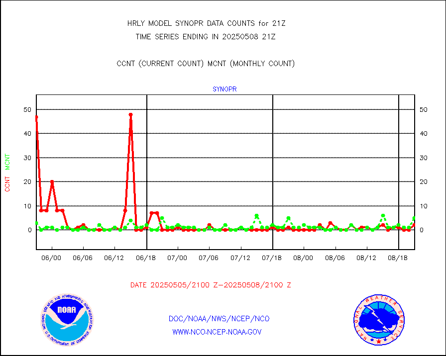
synopr |
Synoptic - restricted (WMO Res 40) manual & auto. |
1 |
4 |
25.0 % |
2320.50-2321.49 |
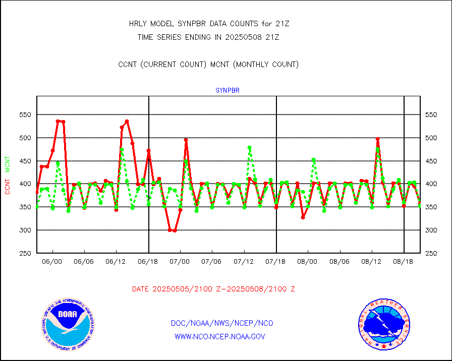
synpbr |
Synoptic - restricted (WMO Res 40)(decoded BUFR) |
348 |
361 |
96.4 % |
2320.50-2321.49 |
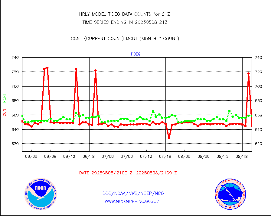
tideg |
Tide gauge reports decoded from CREX format |
643 |
633 |
101.6 % |
2320.00-2320.99 |
| Data Types of Opportunity with Normal Counts |
|---|
| Type | Description | Hourly Count | Monthly Average | Percent (%) of Monthly Mean | UTC Time Window |
3p9usr |
GOES-16&up/NESDIS ir short-wv derived cld motion |
1692 |
1177 |
143.8 % |
2320.00-2320.99 |
acarsa |
MDCRS ACARS acft data (ARINC via AFWA)(AIREP fmt) |
0 |
0 |
n/a |
2320.50-2321.49 |
ahicsr |
Himawari Clear Sky Radiance |
0 |
0 |
n/a |
2320.00-2320.99 |
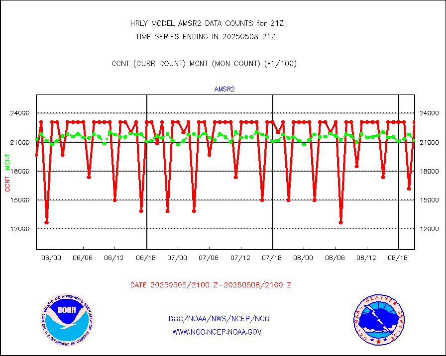
amsr2 |
GCOM-W AMSR2 1B brightness temperatures |
2254068 |
2051276 |
109.9 % |
2319.00-2319.99 |
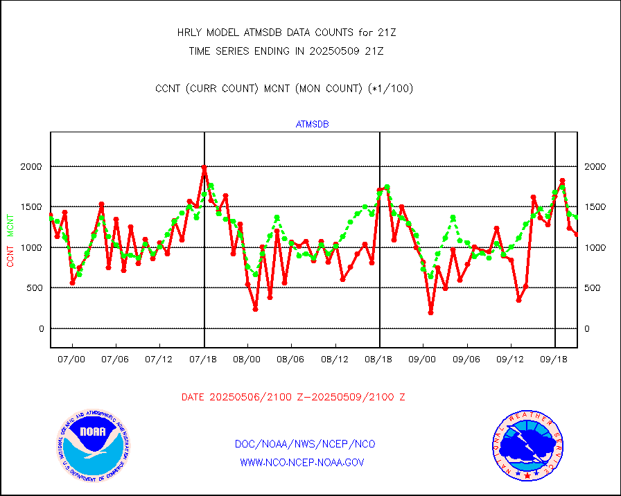
atmsdb |
NPP/NOAA-20 ATMS bright. temps-direct b-cast SSEC |
135343 |
99774 |
135.6 % |
2319.50-2320.49 |
atovs |
POES/NESDIS - processed ATOVS soundings/radiances |
0 |
0 |
n/a |
2319.00-2319.99 |
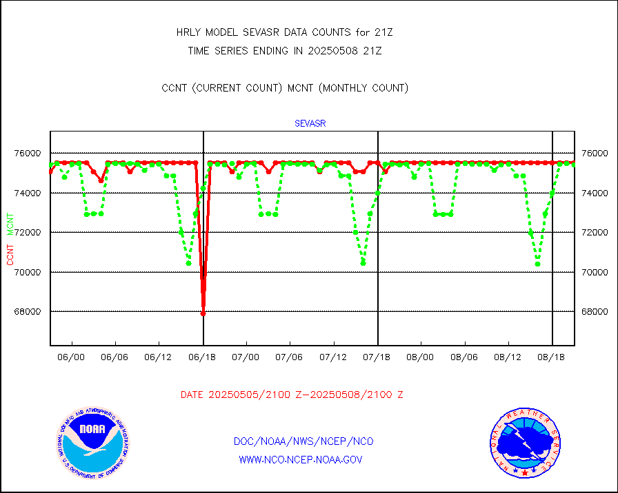
avcsam |
A.M.(N17,M2,M3) AVHRR GAC NCEP-proc clr&sea btmps |
1062457 |
1130383 |
94.0 % |
2318.50-2319.49 |
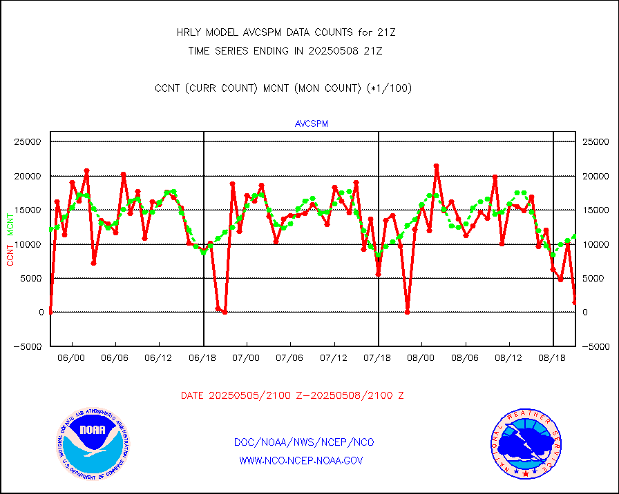
avcspm |
P.M.(N18-19) AVHRR GAC NCEP-proc clr & sea btemps |
1190214 |
1251152 |
95.1 % |
2318.50-2319.49 |
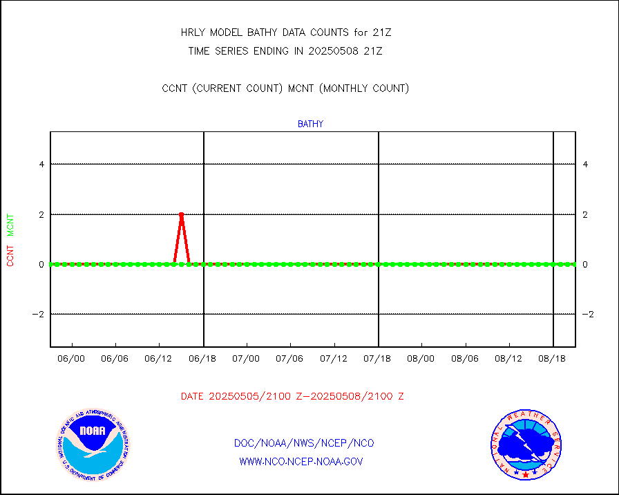
bathy |
eXpendable BathyThermograph, mooring (BATHY fmt) |
0 |
0 |
n/a |
2314.00-2314.99 |
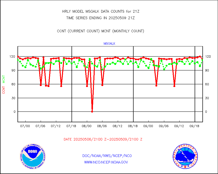
coopmd |
Coop/MADIS NEPP & HCN-Modernization NOAA COOP Obs |
27 |
24 |
112.5 % |
2320.50-2321.49 |
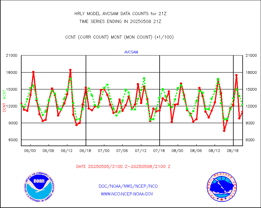
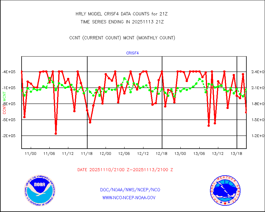
crisf4 |
NPP/NOAA-20 CrIS full spctrl radn (431 ch subset) |
212130 |
224445 |
94.5 % |
2319.50-2320.49 |
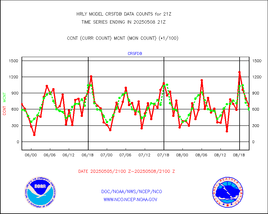
crsfdb |
NPP/NOAA-20 CrIS full spctrl radn dir brdcst SSEC |
72363 |
73783 |
98.1 % |
2319.50-2320.49 |
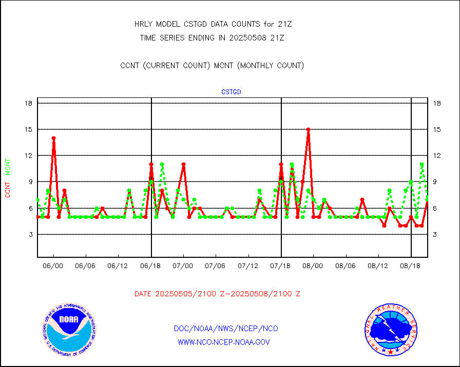
cstgd |
Coast Guard |
9 |
7 |
128.6 % |
2320.50-2321.50 |
dbuoyb |
Drifting buoys (decoded from BUFR) |
1402 |
1400 |
100.1 % |
2320.50-2321.50 |
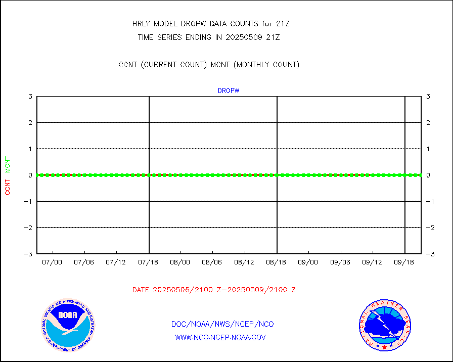
dropw |
Dropwinsonde (from TEMP DROP) |
0 |
0 |
n/a |
2320.50-2321.49 |
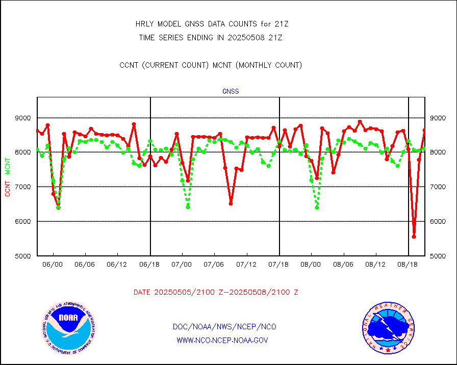
efclam |
GOES imager effective cloud amount data (U.Wisc.) |
8295001 |
8291514 |
100.0 % |
2320.50-2321.49 |
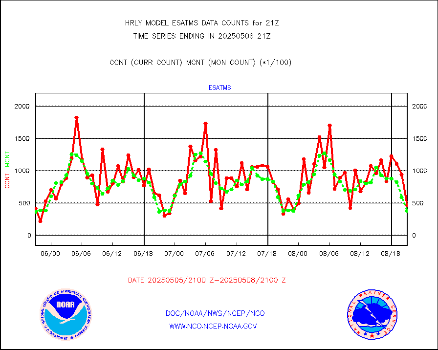
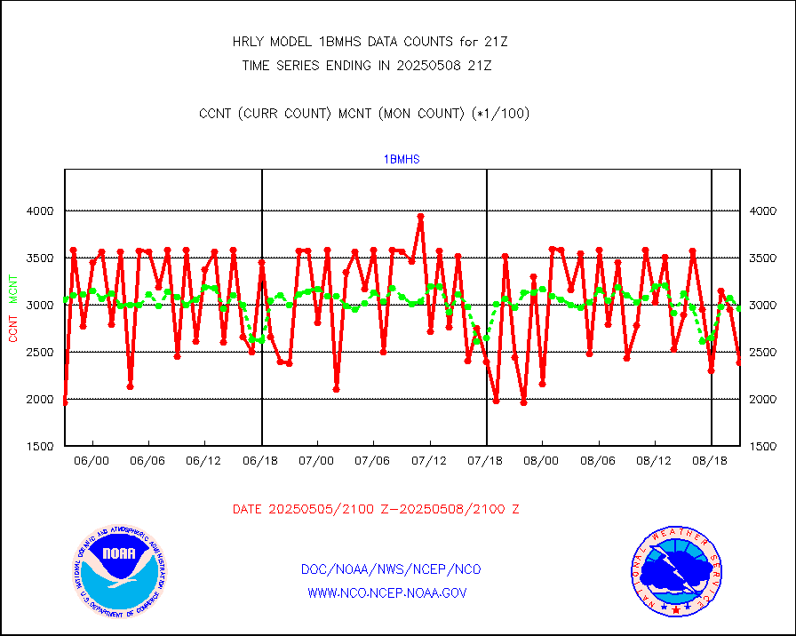
esatms |
NPP Adv. Tech. MW Sndr (ATMS) br. temps from RARS |
40320 |
40197 |
100.3 % |
2319.50-2320.49 |
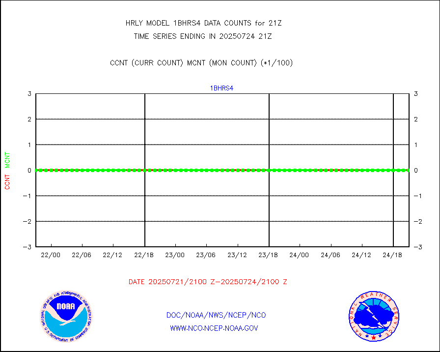
esiasi |
METOP 1-2 IASI 1C radiance data vbl chn from RARS |
52174 |
58875 |
88.6 % |
2320.00-2320.99 |
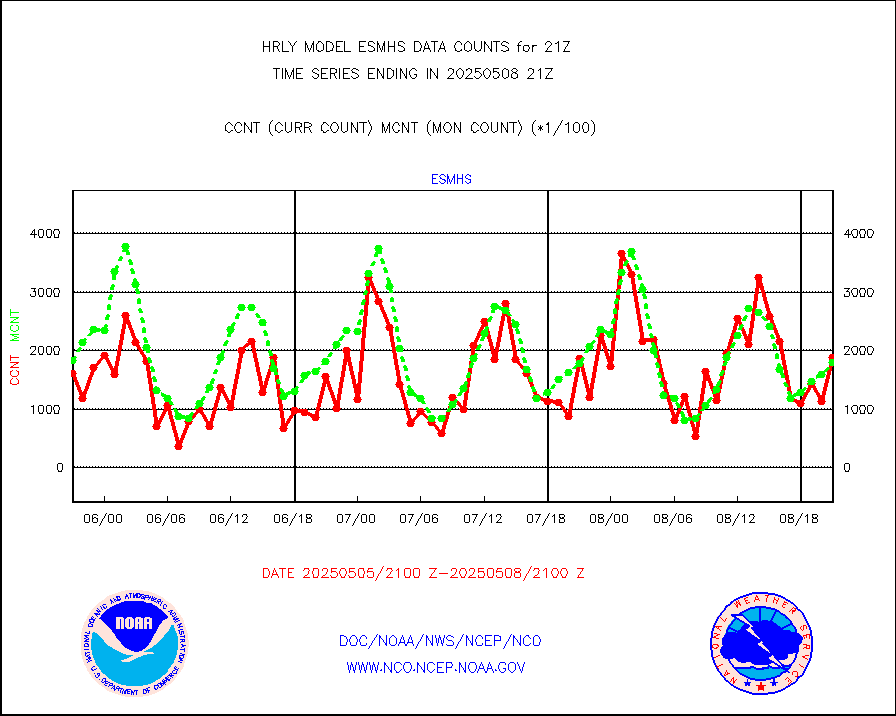
esmhs |
NOAA 18-19 & METOP 1-2 MHS proc. btemps from RARS |
262959 |
202127 |
130.1 % |
2320.50-2321.49 |
geoimr |
GOES/NESDIS (11x17 f-o-v) imager clear radiances |
0 |
0 |
n/a |
2320.00-2320.99 |
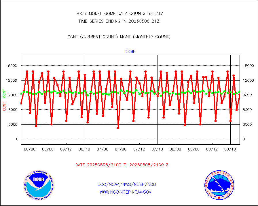
gome |
METOP 1-2 Global Ozone Monitoring Exp.-2 (GOME-2) |
336 |
6340 |
5.3 % |
2319.50-2320.49 |
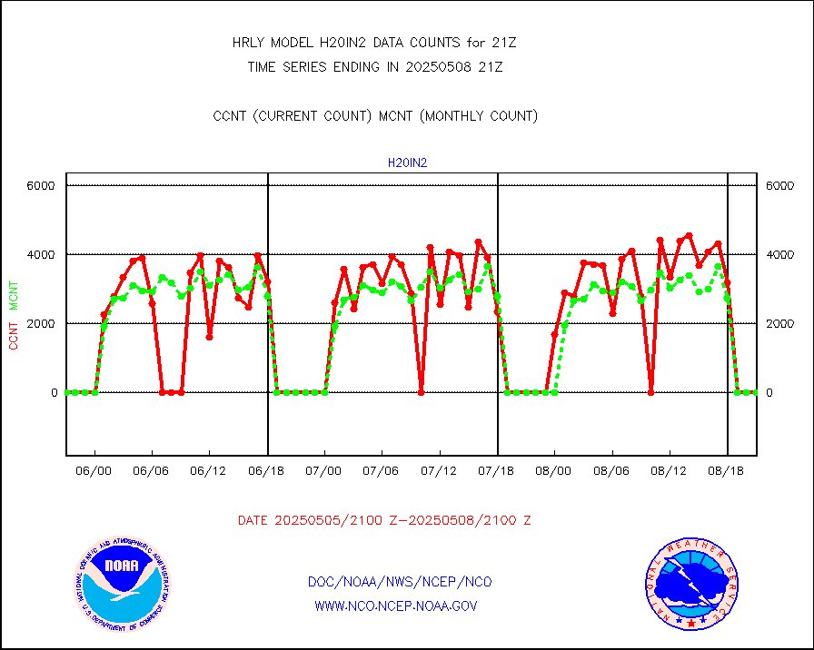
h20in2 |
INDIA SATWIND, INSAT WV channel |
0 |
0 |
n/a |
2320.00-2320.99 |
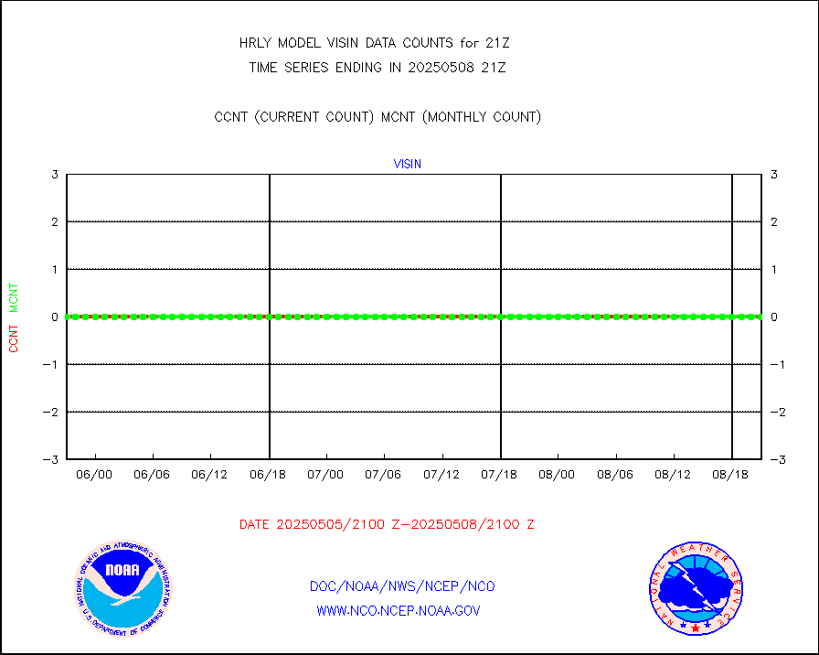
h2dusr |
GOES-16&up/NESDIS wv imgr/deep-lyr derivd cld mtn |
19975 |
17269 |
115.7 % |
2320.00-2320.99 |
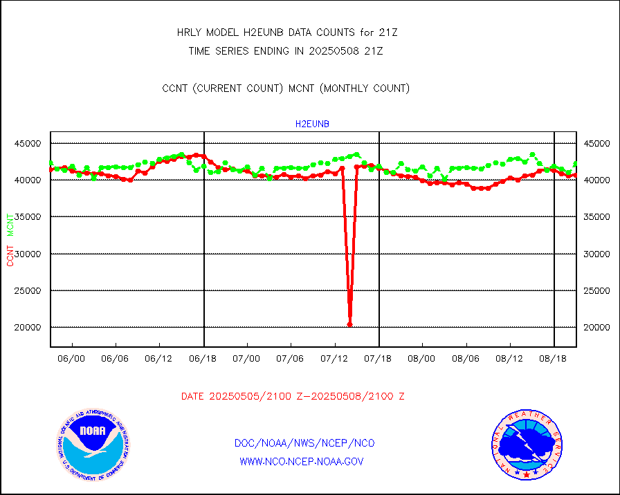
h2eunb |
METEOSAT/EUMETSAT wvpr imgr drv cld motion NBseq |
43318 |
42761 |
101.3 % |
2319.50-2320.49 |
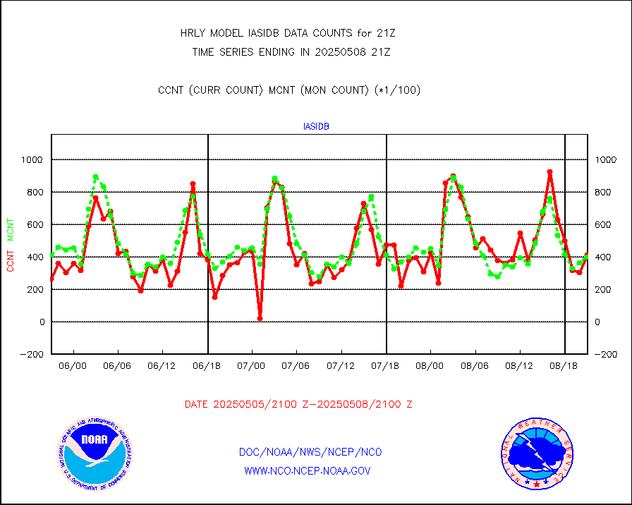
iasidb |
METOP 1-2 IASI 1C radiances-direct broadcast SSEC |
35324 |
28838 |
122.5 % |
2319.50-2320.49 |
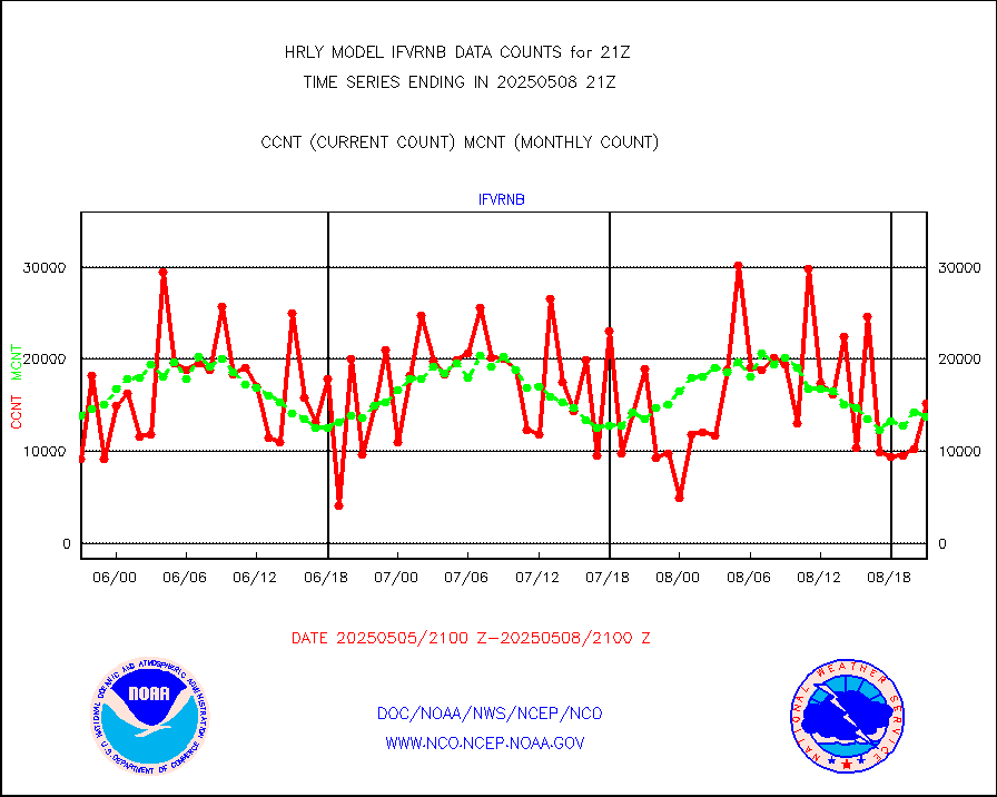
ifvrnb |
VIIRS (NPP/NOAA-20) ir lg-wv drv cloud motion(NB) |
15538 |
13408 |
115.9 % |
2317.00-2317.99 |
infav1 |
AVHRR (METOP) ir lg-wave derived cld motion |
0 |
0 |
n/a |
2320.50-2321.50 |
infin |
INSAT/KALPANA India ir lg-wave derived cld motion |
0 |
0 |
n/a |
2318.50-2319.49 |
infin2 |
INDIA SATWIND, INSAT IR channel |
0 |
0 |
n/a |
2320.00-2320.99 |
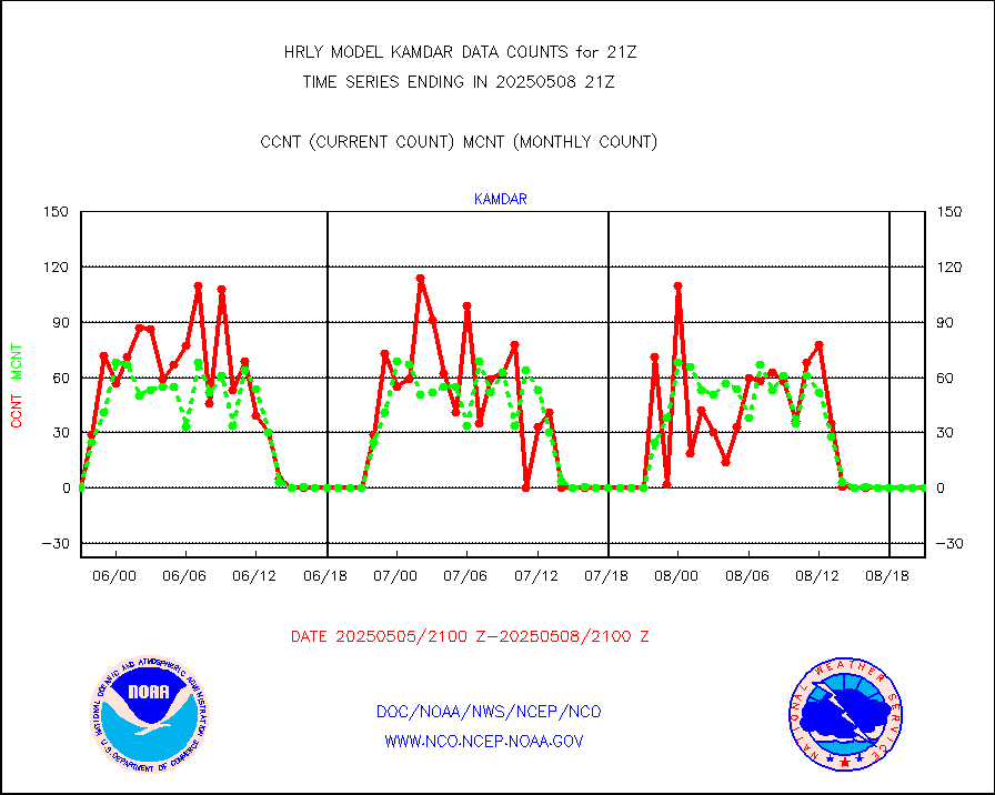
kamdar |
Korean AMDAR aircraft data (decoded from BUFR) |
0 |
0 |
n/a |
2320.50-2321.49 |
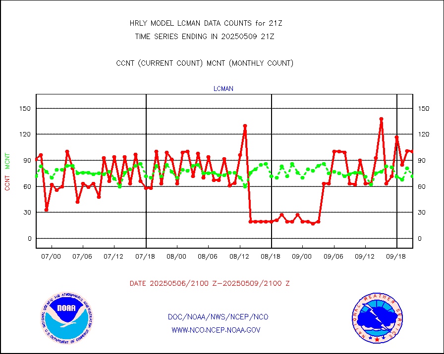
lcman |
Land-based CMAN stations decoded from CMAN format |
88 |
87 |
101.1 % |
2320.50-2321.49 |
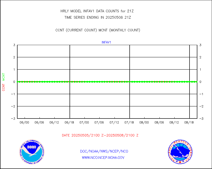
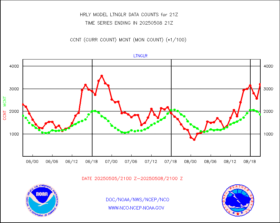
ltnglr |
LLDN Long-rng lightning from Vaisala via NOAAPORT |
103783 |
158122 |
65.6 % |
2320.50-2321.49 |
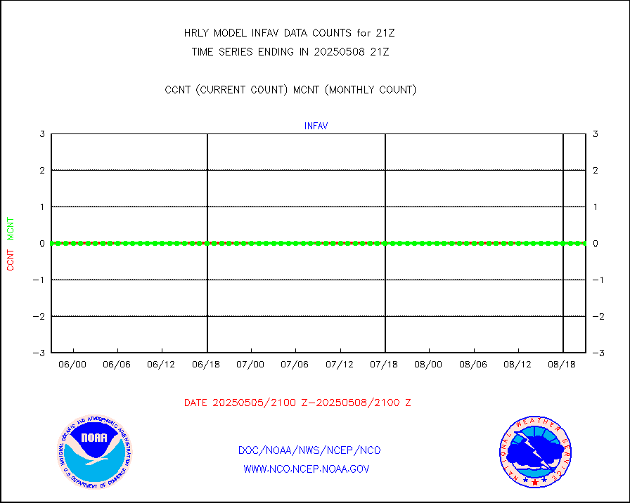
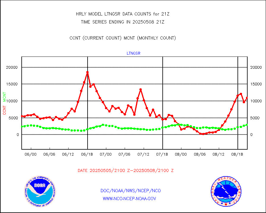
ltngsr |
NLDN Shrt-rng lightning from Vaisala via NOAAPORT |
451 |
1396 |
32.3 % |
2320.50-2321.49 |
mbuoyb |
Moored buoys (decoded from BUFR) |
721 |
635 |
113.5 % |
2320.50-2321.50 |
mls |
Aura Microwave Limb Sounder (MLS) ozone data |
0 |
0 |
n/a |
2319.00-2319.99 |
msourb |
Mesonet/MADIS UrbaNet |
4523 |
4341 |
104.2 % |
2320.50-2321.49 |
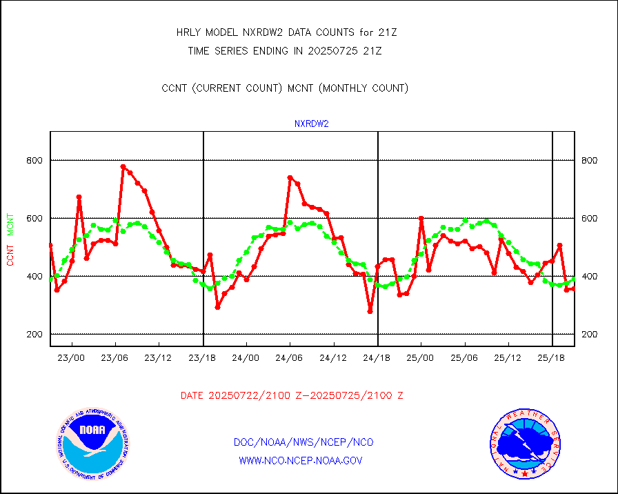
nxrdw2 |
NEXRAD Vel Azm Dsp(VAD) winds via Level 2 decoder |
565 |
509 |
111.0 % |
2320.50-2321.49 |
ompslp |
OMPS Limb Profiler ozone data (NPP) |
68 |
265 |
25.7 % |
2314.00-2314.99 |
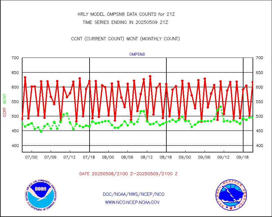
ompsn8 |
OMPS nadir profile ozone (Version 8 BUFR) |
521 |
537 |
97.0 % |
2319.00-2319.99 |
ompst8 |
OMPS total column ozone (Version 8 BUFR) |
354367 |
331000 |
107.1 % |
2319.00-2319.99 |
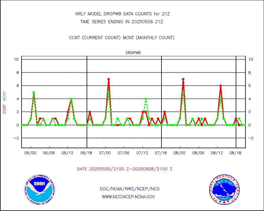
pirep |
Manual PIREP aircraft data (dcded from AIREP fmt) |
141 |
144 |
97.9 % |
2320.50-2321.49 |
prflrp |
Profilr winds from PIBAL (PILOT,PILOT SHIP/MOBIL) |
0 |
0 |
n/a |
2320.50-2321.49 |
raobm |
Rawinsonde - mobile land (from TEMP/PILOT MOBIL) |
0 |
0 |
n/a |
2320.50-2321.49 |
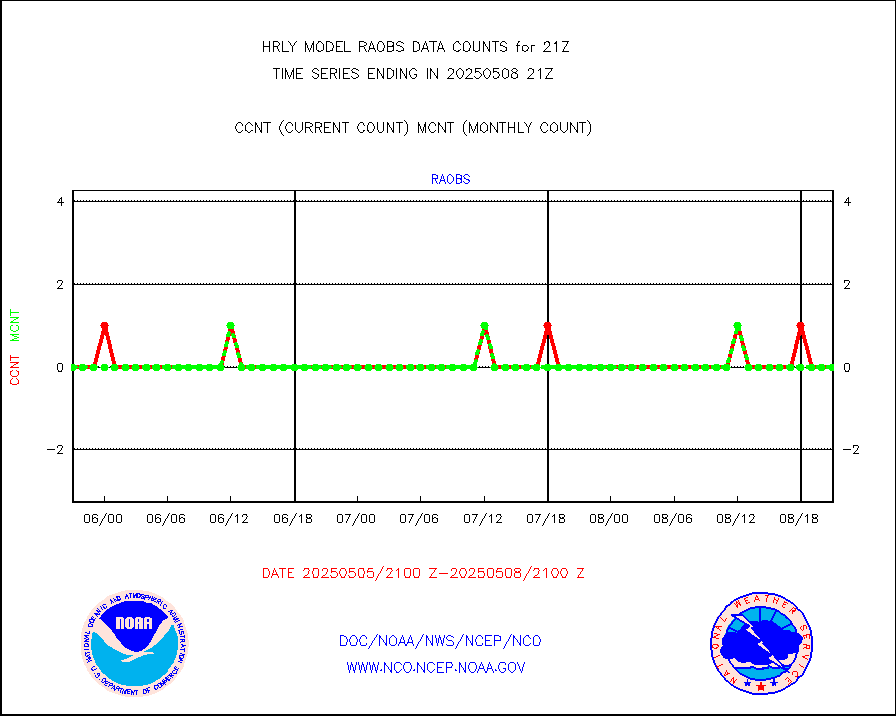
raobs |
Rawinsonde - ship (from TEMP SHIP, PILOT SHIP) |
0 |
0 |
n/a |
2320.50-2321.49 |
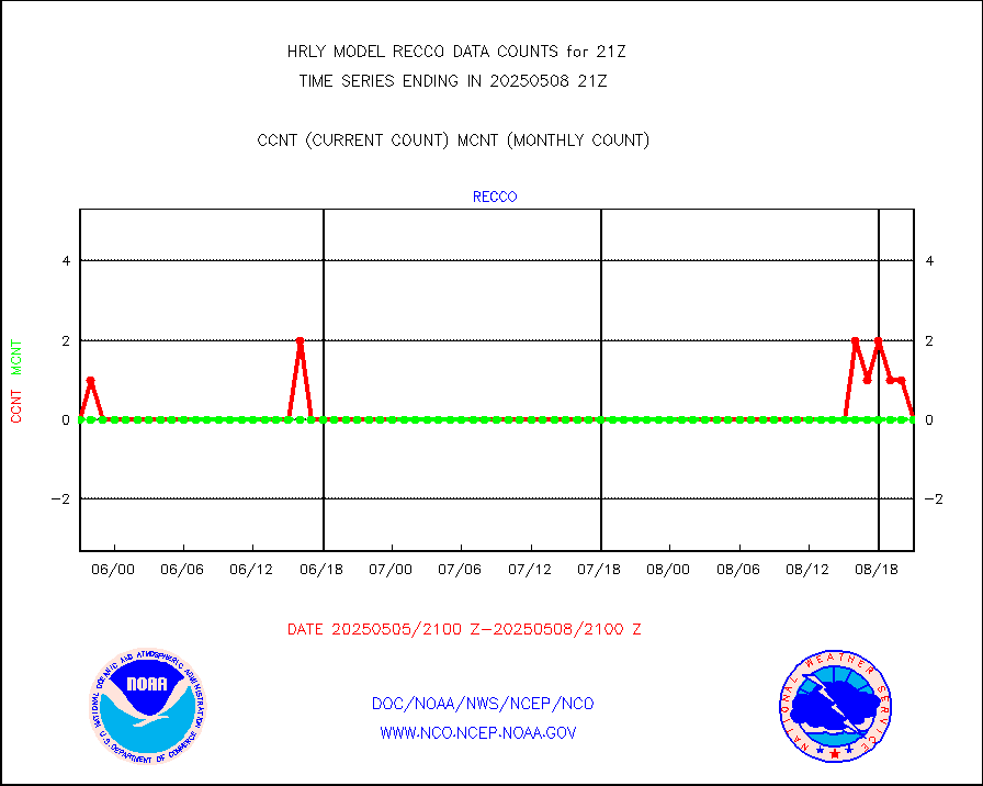
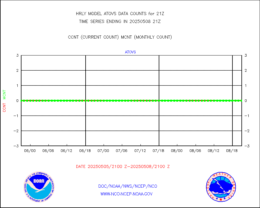
recco |
Flight level reconnaissance aircraft data |
0 |
0 |
n/a |
2320.50-2321.49 |
saphir |
Megha-Tropiques SAPHIR L1A2 brightness temps |
0 |
0 |
n/a |
2318.50-2319.49 |
sevasr |
METEOSAT-10 2nd Gen SEVIRI All Sky Radiance(proc) |
75050 |
75479 |
99.4 % |
2320.50-2321.49 |
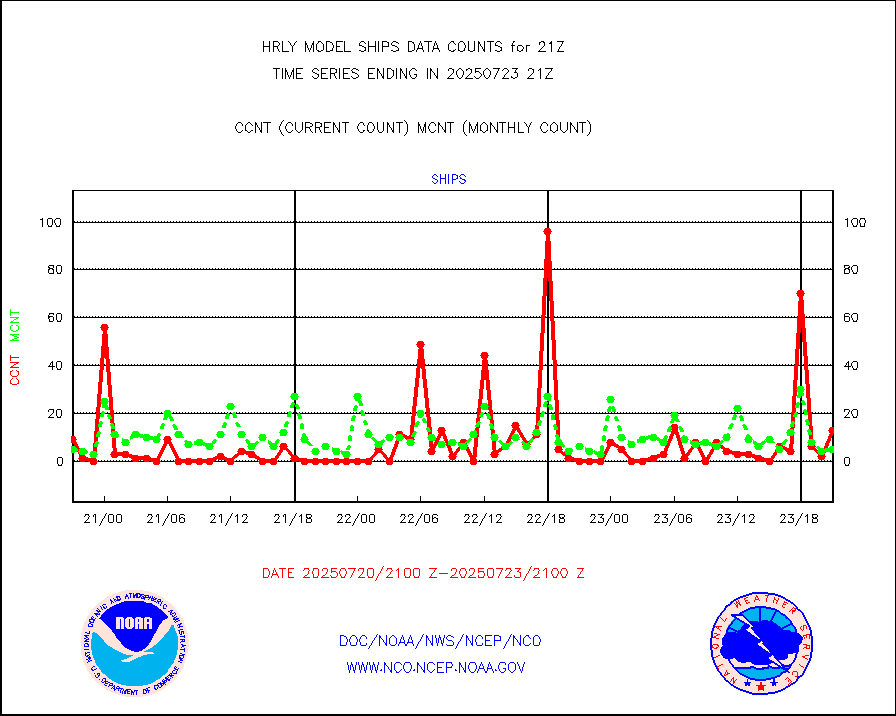
ships |
Ship - manual and automatic, restricted |
10 |
3 |
333.3 % |
2320.50-2321.49 |
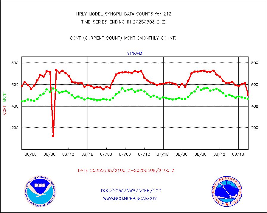
synopm |
Synoptic - mobile manual and automatic |
574 |
492 |
116.7 % |
2320.50-2321.49 |
synpmb |
Synoptic - mobile manual & auto (decoded fr BUFR) |
1 |
1 |
100.0 % |
2320.50-2321.49 |
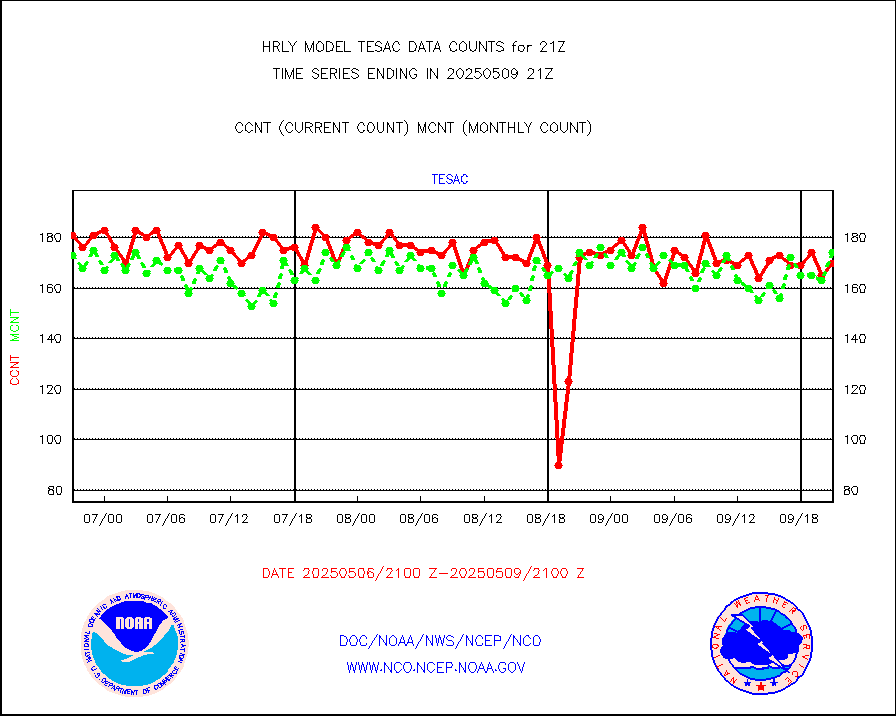
tesac |
CTD probe, Argo prflng float, mooring (TESAC fmt) |
206 |
169 |
121.9 % |
2320.50-2321.49 |
tmdara |
TAMDAR aircft data-all types(from Panasonic,BUFR) |
138 |
142 |
97.2 % |
2320.50-2321.49 |
visin |
INSAT/KALPANA India visible derived cloud motion |
0 |
0 |
n/a |
2318.50-2319.49 |
visin2 |
INDIA SATWIND, INSAT VIS channel |
0 |
0 |
n/a |
2320.00-2320.99 |
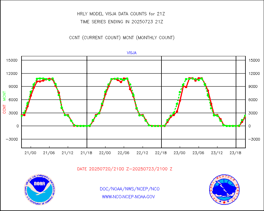
visja |
MTSAT/JMA visible derived cloud motion |
2475 |
2450 |
101.0 % |
2318.50-2319.49 |
visusr |
GOES-16&up/NESDIS visible derived cloud motion |
385517 |
420230 |
91.7 % |
2320.00-2320.99 |
vseunb |
METEOSAT/EUMETSAT visible drv cld motion NBseq |
5221 |
4820 |
108.3 % |
2319.50-2320.49 |


