| Critical Data with Normal Counts |
|---|
| Type | Description | Hourly Count | Monthly Average | Percent (%) of Monthly Mean | UTC Time Window |
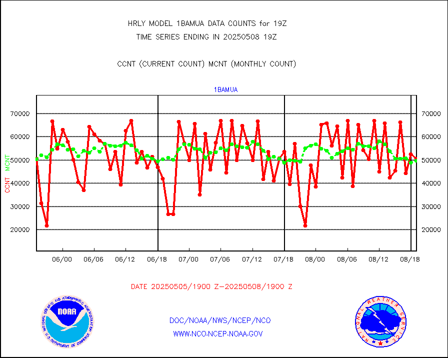
1bamua |
NOAA 15-19 & METOP 1-2 AMSU-A NCEP-proc. br.temps |
63130 |
54998 |
114.8 % |
1617.00-1617.99 |
1bhrs4 |
NOAA 18-19 & METOP 1-2 HIRS-4 NCEP-proc. br.temps |
59322 |
45249 |
131.1 % |
1617.00-1617.99 |
1bmhs |
NOAA 18-19 & METOP 1-2 MHS NCEP-proces. br. temps |
356704 |
302516 |
117.9 % |
1617.00-1617.99 |
airep |
Manual AIREP aircraft data (dcded from AIREP fmt) |
463 |
724 |
64.0 % |
1618.50-1619.49 |
airsev |
AQUA AIRS/AMSU-A/HSB brightness temps- every FOV |
0 |
0 |
n/a |
1616.50-1617.49 |
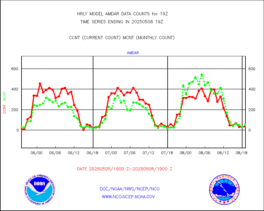
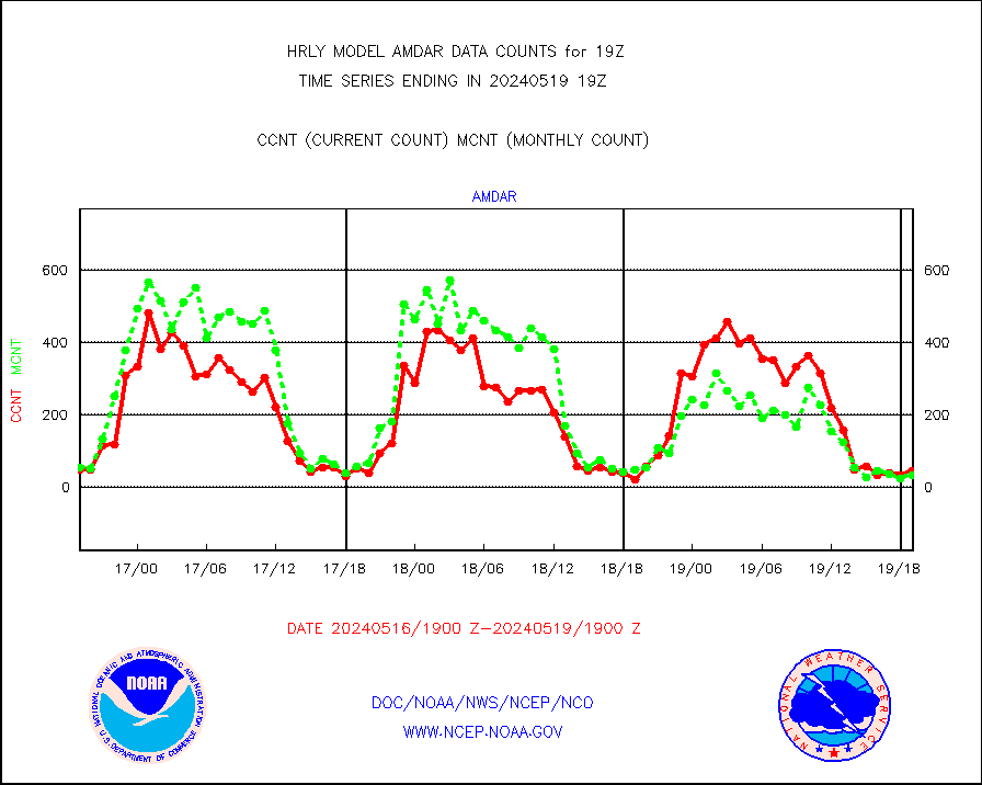
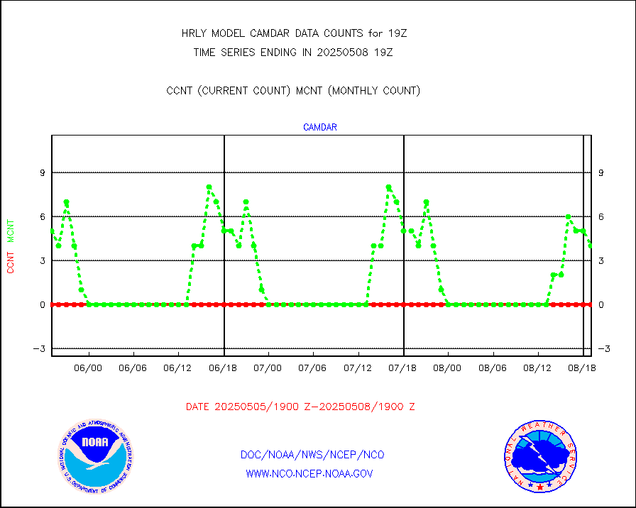
amdar |
AMDAR aircraft data (decoded from AMDAR format) |
52 |
35 |
148.6 % |
1618.50-1619.49 |
amdarb |
AMDAR aircraft data (decoded from BUFR) |
477 |
262 |
182.1 % |
1618.50-1619.49 |
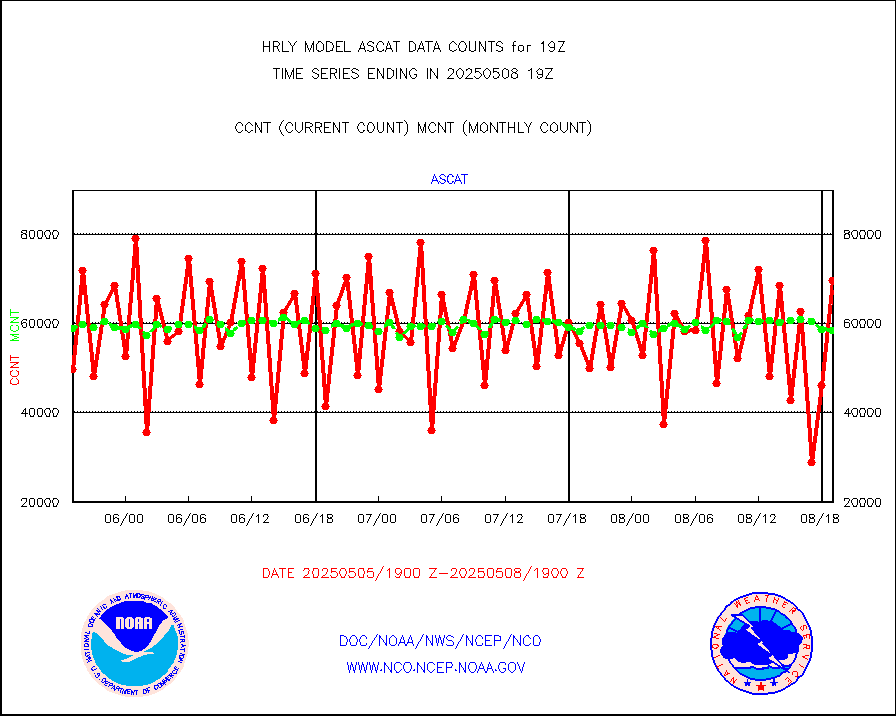
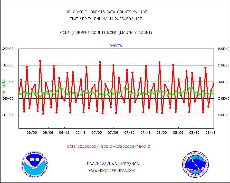
ascat |
METOP 1-2 ASCAT products |
49476 |
27716 |
178.5 % |
1617.50-1618.49 |
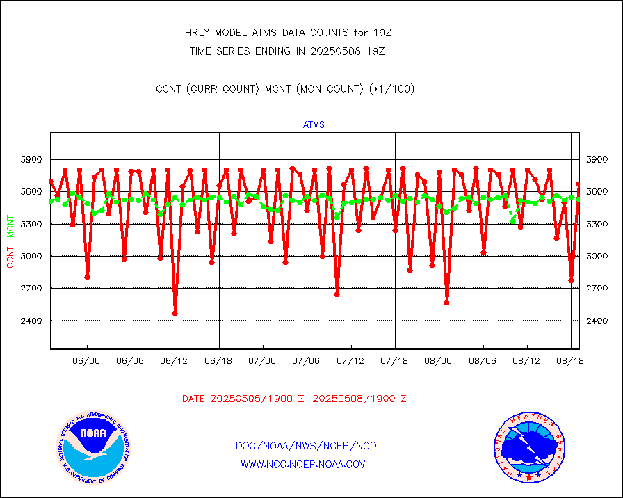
atms |
NPP/NOAA-20 ATMS brightness temperatures |
280800 |
340688 |
82.4 % |
1617.50-1618.49 |
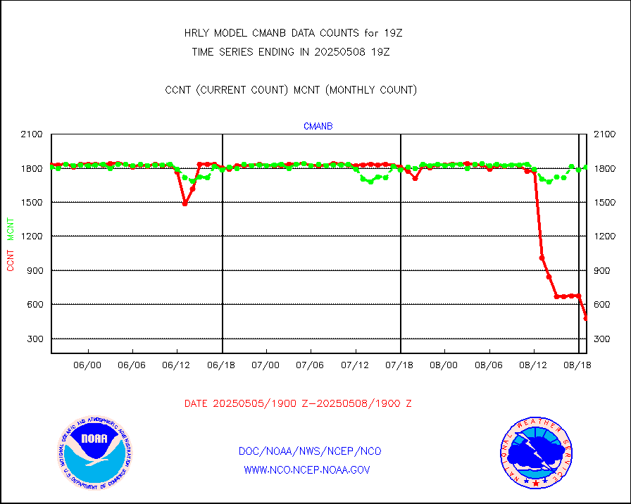
cmanb |
Surface Marine CMAN rpts decoded from BUFR format |
1628 |
1723 |
94.5 % |
1618.50-1619.50 |
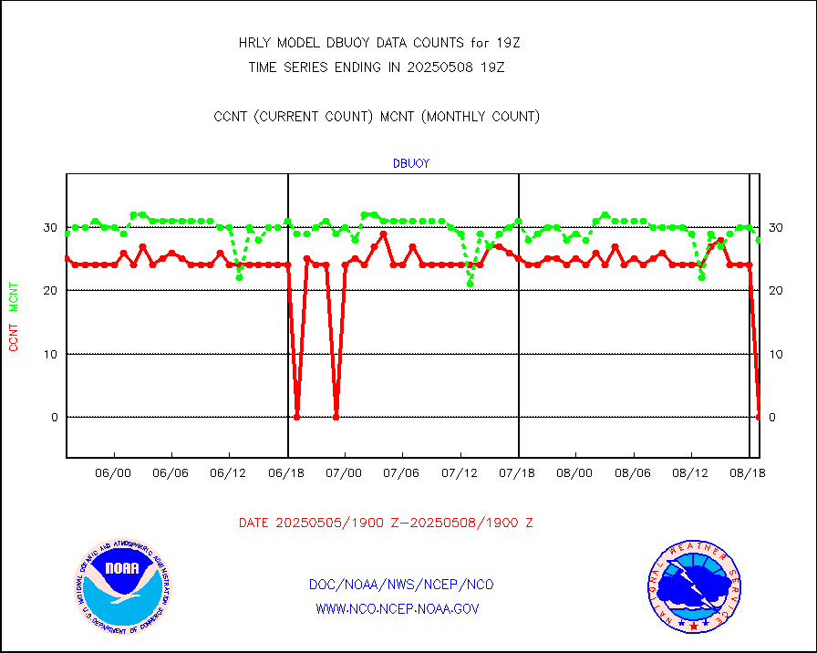
dbuoy |
Buoys decoded from FM-18 fmt (moored or drifting) |
42 |
30 |
140.0 % |
1618.50-1619.49 |
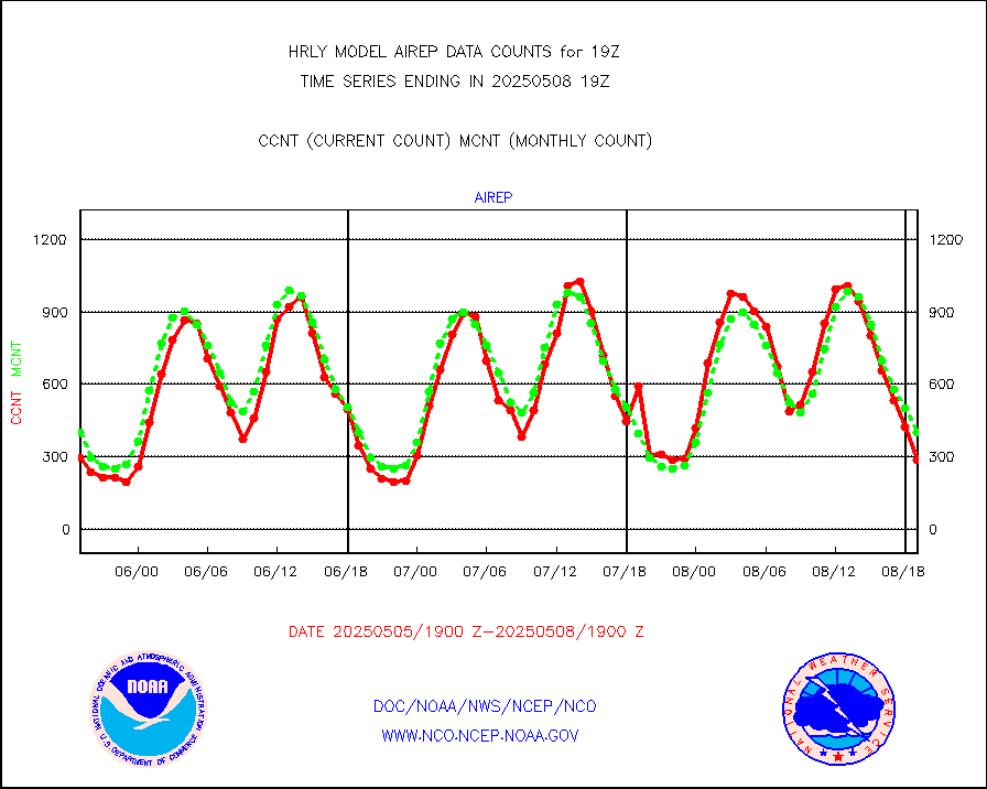
eadas |
E-AMDAR (European AMDAR acft decoded from BUFR) |
2125 |
1889 |
112.5 % |
1618.50-1619.49 |
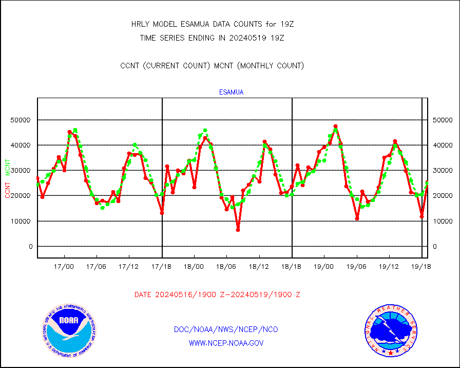
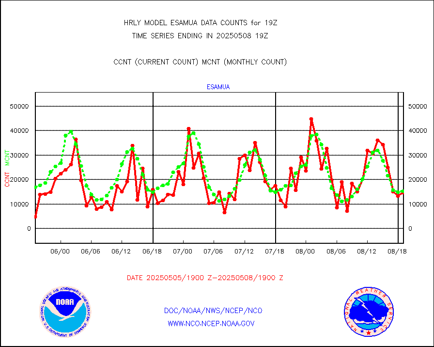
esamua |
NOAA 15-19 & METOP 1-2 AMSU-A proc btmps frm RARS |
28084 |
22311 |
125.9 % |
1618.50-1619.49 |
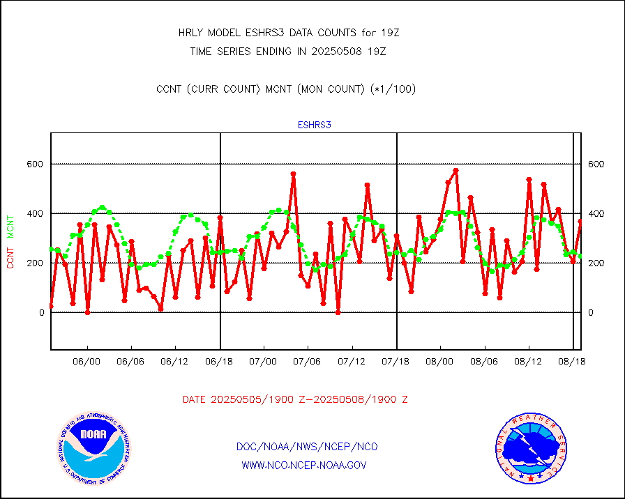
eshrs3 |
NOAA 15-19 & METOP 1-2 HIRS-3/4 pr btmps frm RARS |
64592 |
48911 |
132.1 % |
1618.50-1619.49 |
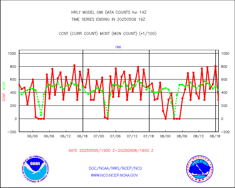
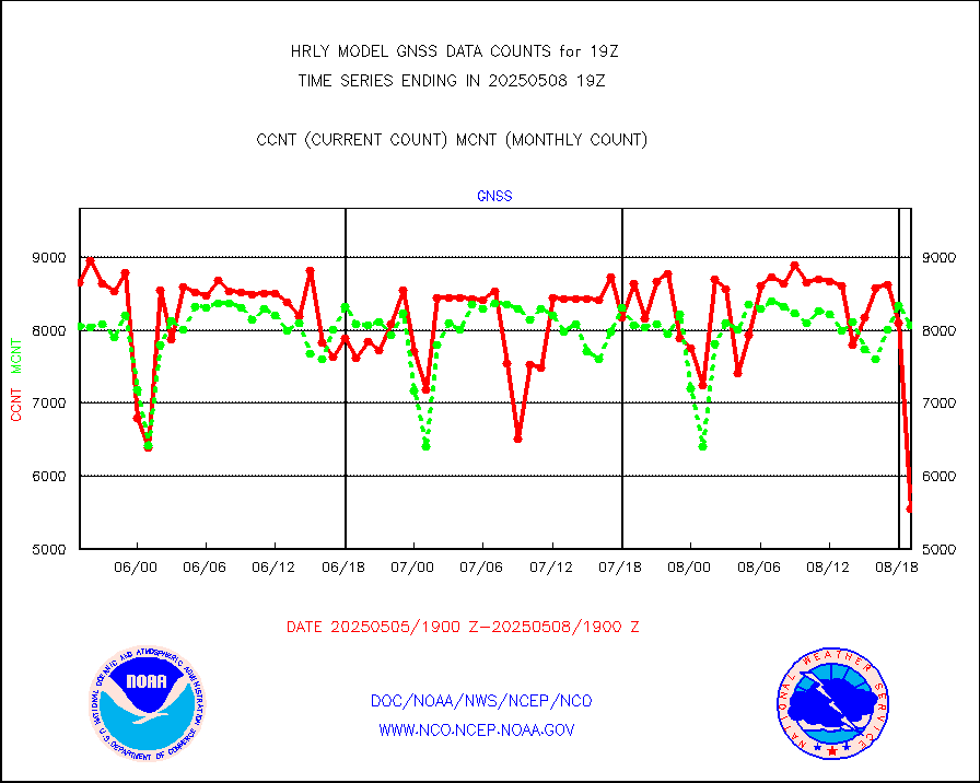
gnss |
Grnd-based Gbl Navigation Sat System (GNSS) data |
9703 |
7551 |
128.5 % |
1618.00-1618.99 |
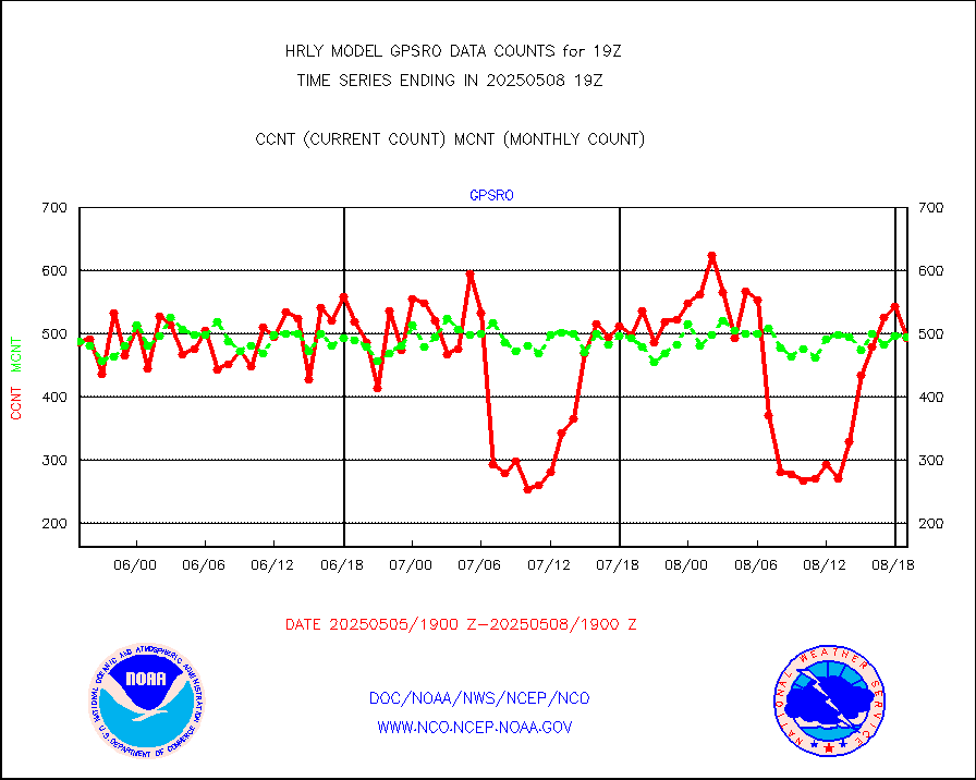
gpsro |
GPS radio occultation data |
427 |
416 |
102.6 % |
1616.50-1617.49 |
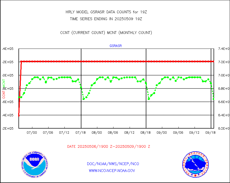
gsrasr |
GOES-16/17 All Sky Radiances (proc.) |
540342 |
507832 |
106.4 % |
1618.50-1619.49 |
gsrcsr |
GOES-16/17 Clear Sky Radiances (proc.) |
274338 |
267344 |
102.6 % |
1618.50-1619.49 |
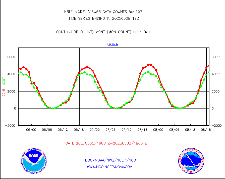
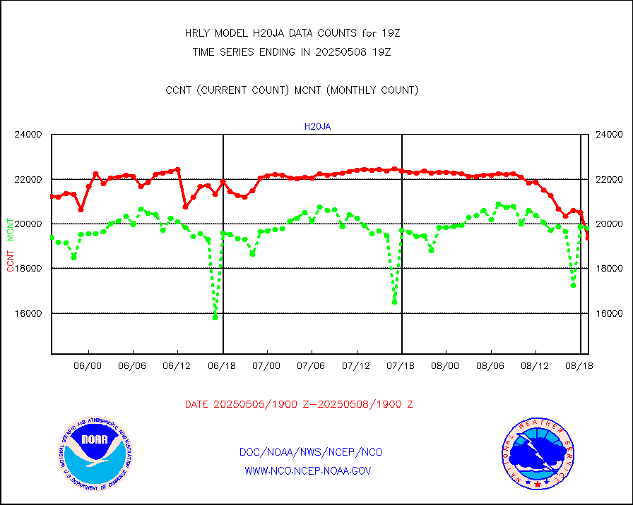
h20ja |
MTSAT/JMA water vapor imager derived cloud motion |
18747 |
18231 |
102.8 % |
1616.50-1617.49 |
h20mo |
MODIS (AQUA/TERRA) wvpr imager derived cld motion |
0 |
0 |
n/a |
1615.00-1615.99 |
h2tusr |
GOES-16&up/NESDIS wv imgr/cld-top derived cld mtn |
27840 |
27180 |
102.4 % |
1618.00-1618.99 |
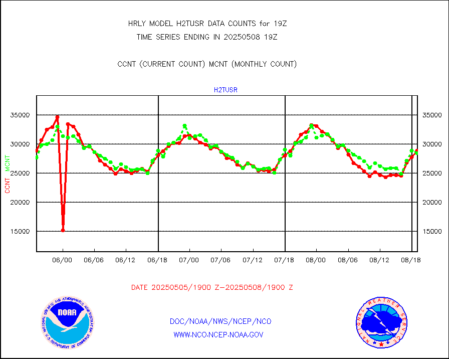
ifeunb |
METEOSAT/EUMETSAT ir lg-wave drv cld motion NBseq |
21565 |
22467 |
96.0 % |
1617.50-1618.49 |
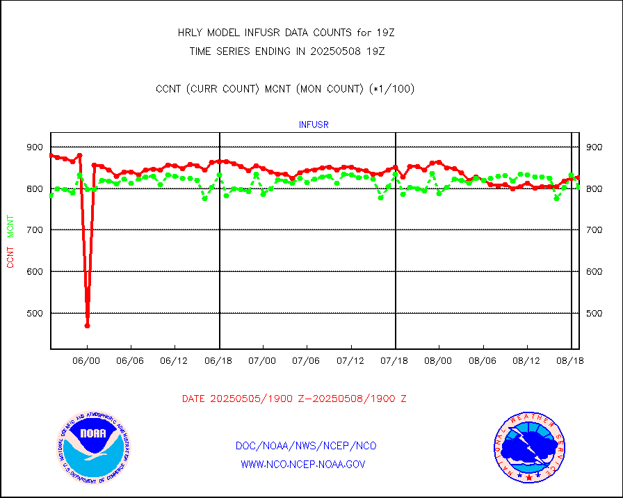
infja |
MTSAT/JMA infrared long-wave derived cloud motion |
15241 |
15840 |
96.2 % |
1616.50-1617.49 |
infmo |
MODIS (AQUA/TERRA) ir l-wave derived cloud motion |
0 |
0 |
n/a |
1615.00-1615.99 |
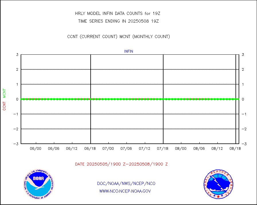
infusr |
GOES-16&up/NESDIS ir long-wave derived cld motion |
81270 |
80823 |
100.6 % |
1618.00-1618.99 |
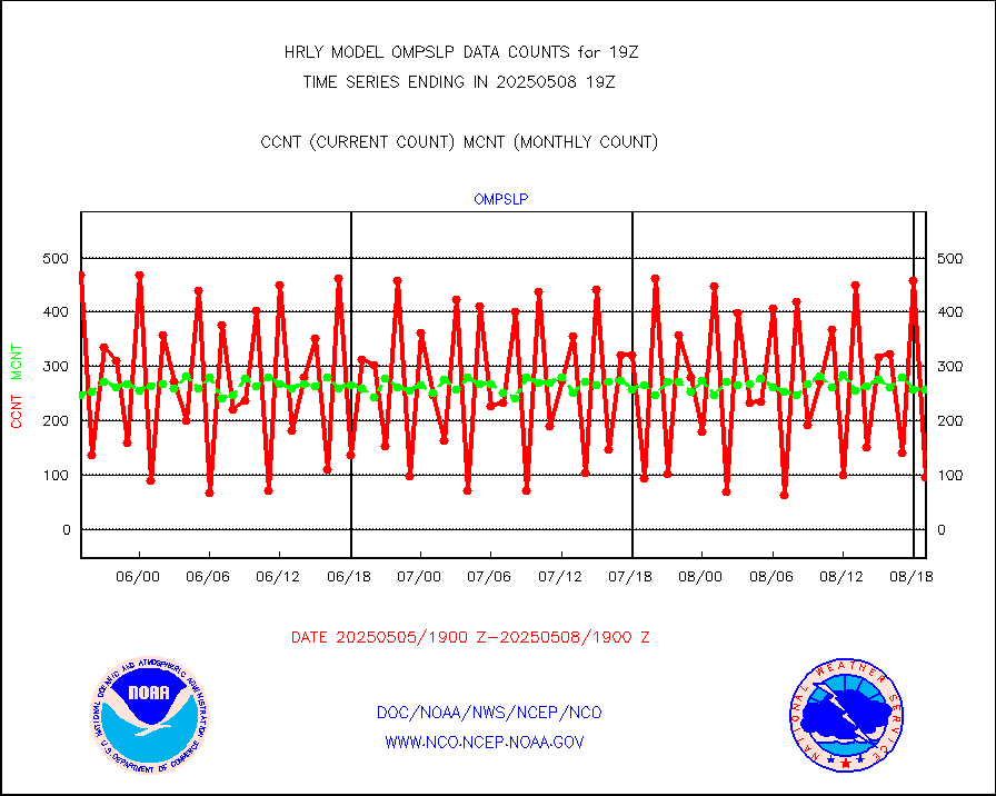
lgycld |
GOES/NASA(Langley) hi-res. (1x1 f-o-v) cloud data |
4163825 |
4088124 |
101.9 % |
1618.50-1619.49 |
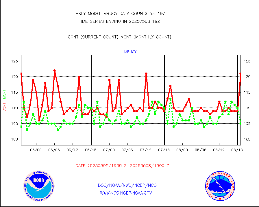
mbuoy |
Buoys decoded from FM-13 format (moored) |
145 |
122 |
118.9 % |
1618.50-1619.49 |
metar |
Aviation - METAR |
6982 |
7865 |
88.8 % |
1618.50-1619.49 |
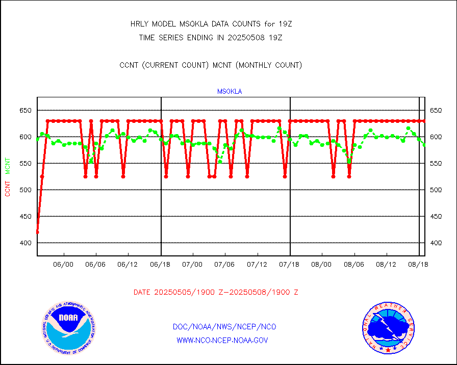
mso470 |
Mesonet/MADIS Colorado E-470 (Interstate 470) |
21 |
21 |
100.0 % |
1618.50-1619.49 |
msoalk |
Mesonet/MADIS Alaska Department of Transportation |
108 |
109 |
99.1 % |
1618.50-1619.49 |
msoapg |
Mesonet/MADIS U.S. Army Aberdeen Proving Grounds |
0 |
0 |
n/a |
1618.50-1619.49 |
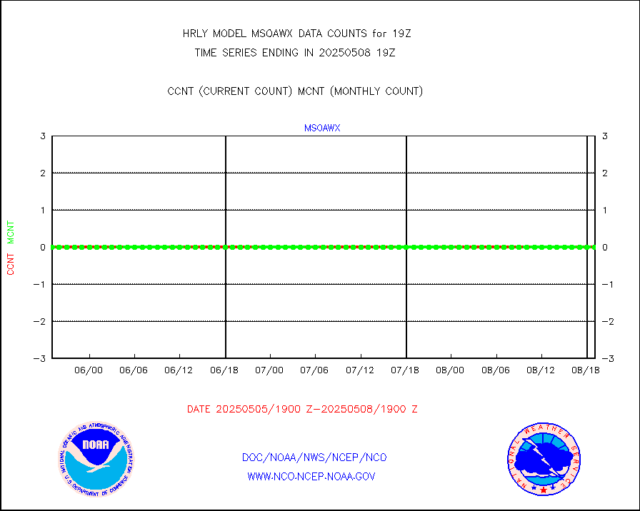
msoaws |
Mesonet/MADIS AWS Convergence Technologies, Inc. |
22809 |
25017 |
91.2 % |
1618.50-1619.49 |
msoawx |
Mesonet/MADIS "Anything Weather" |
0 |
0 |
n/a |
1618.50-1619.49 |
msocol |
Mesonet/MADIS Colorado Dept. of Transportation |
0 |
0 |
n/a |
1618.50-1619.49 |
msodcn |
Mesonet/MADIS DC Net |
0 |
0 |
n/a |
1618.50-1619.49 |
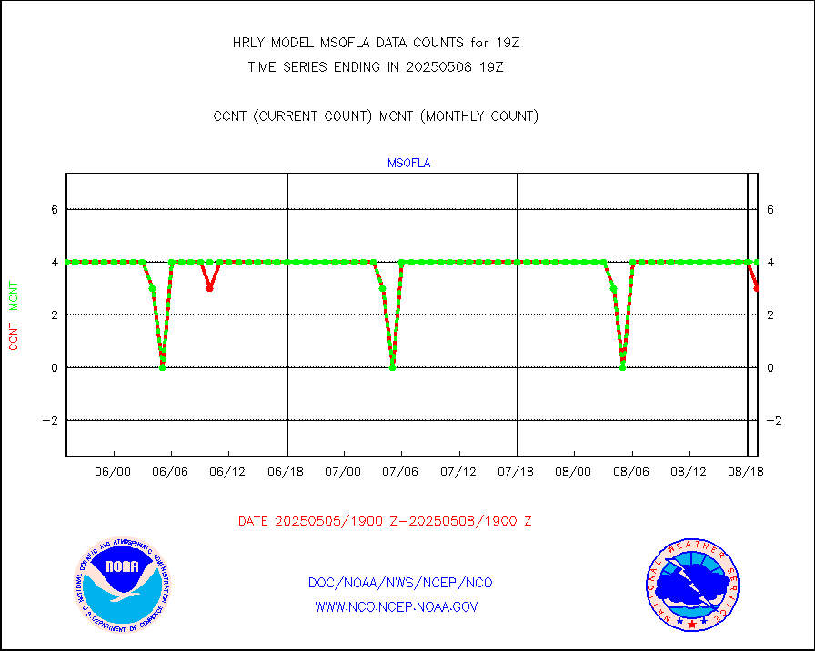
msofla |
Mesonet/MADIS Florida (FAWN & USF) |
4 |
4 |
100.0 % |
1618.50-1619.49 |
msoflt |
Mesonet/MADIS Florida Dept. of Transportation |
0 |
0 |
n/a |
1618.50-1619.49 |
msogeo |
Mesonet/MADIS Georgia Dept. of Transportation |
0 |
0 |
n/a |
1618.50-1619.49 |
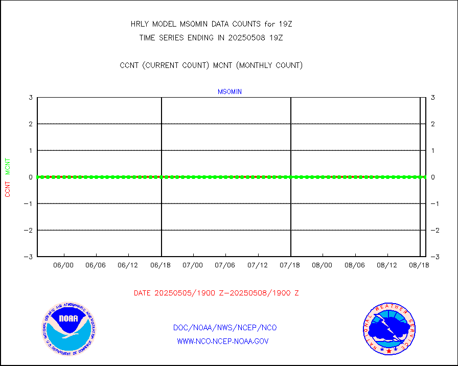
msohad |
Mesonet/MADIS NWS Hydromet Auto Data System(HADS) |
6258 |
6105 |
102.5 % |
1618.50-1619.49 |
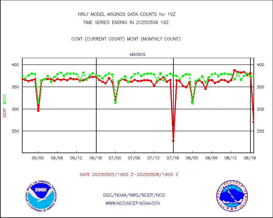
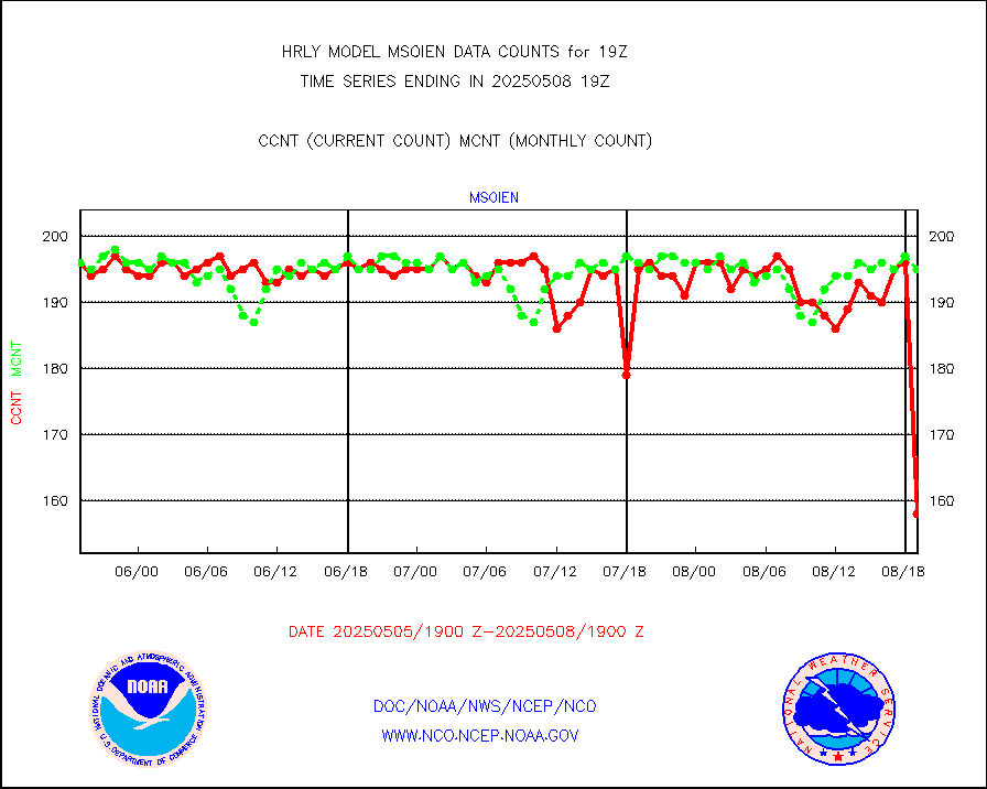
msoien |
Mesonet/MADIS Iowa Environmental |
187 |
190 |
98.4 % |
1618.50-1619.49 |
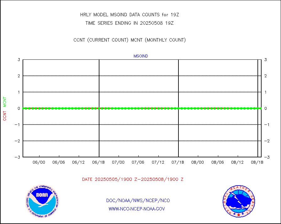
msoind |
Mesonet/MADIS Indiana Dept. of Transportation |
0 |
0 |
n/a |
1618.50-1619.49 |
msoiow |
Mesonet/MADIS Iowa Department of Transportation |
0 |
0 |
n/a |
1618.50-1619.49 |
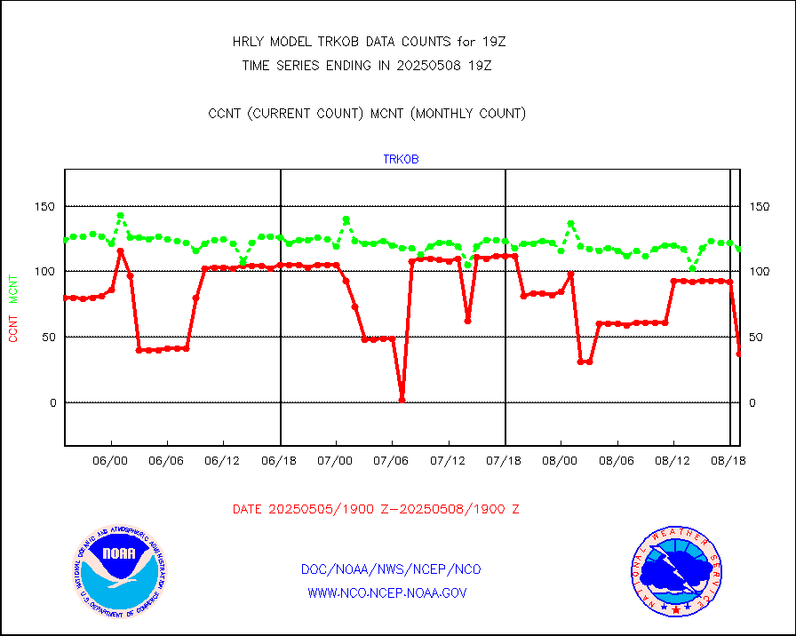
msokan |
Mesonet/MADIS Kansas Department of Transportation |
356 |
356 |
100.0 % |
1618.50-1619.49 |
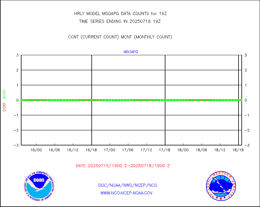
msokla |
Mesonet/MADIS Oklahoma Mesonet |
636 |
322 |
197.5 % |
1618.50-1619.49 |
msolju |
Mesonet/MADIS Louisiana State/Jackson State Univ. |
0 |
0 |
n/a |
1618.50-1619.49 |
msomca |
Mesonet/MADIS Missouri Commercial Agricult Wx Net |
256 |
272 |
94.1 % |
1618.50-1619.49 |
msomin |
Mesonet/MADIS Minnesota Dept. of Transportation |
0 |
0 |
n/a |
1618.50-1619.49 |
msoraw |
Mesonet/MADIS NFIC Remote Automated Wx Stns(RAWS) |
1816 |
1881 |
96.5 % |
1618.50-1619.49 |
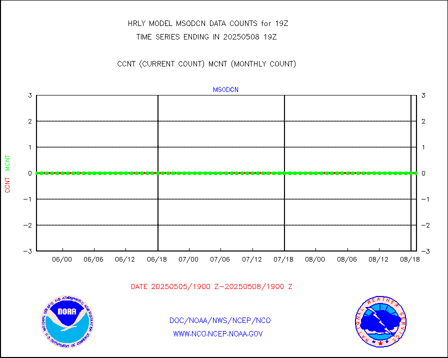
msovir |
Mesonet/MADIS Virginia Dept. of Transportation |
232 |
235 |
98.7 % |
1618.50-1619.49 |
msowfy |
Mesonet/MADIS "Weather for You" |
0 |
0 |
n/a |
1618.50-1619.49 |
msowis |
Mesonet/MADIS Wisconsin Dept. of Transportation |
0 |
0 |
n/a |
1618.50-1619.49 |
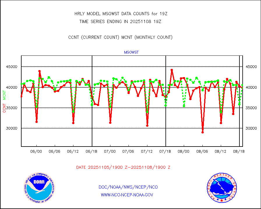
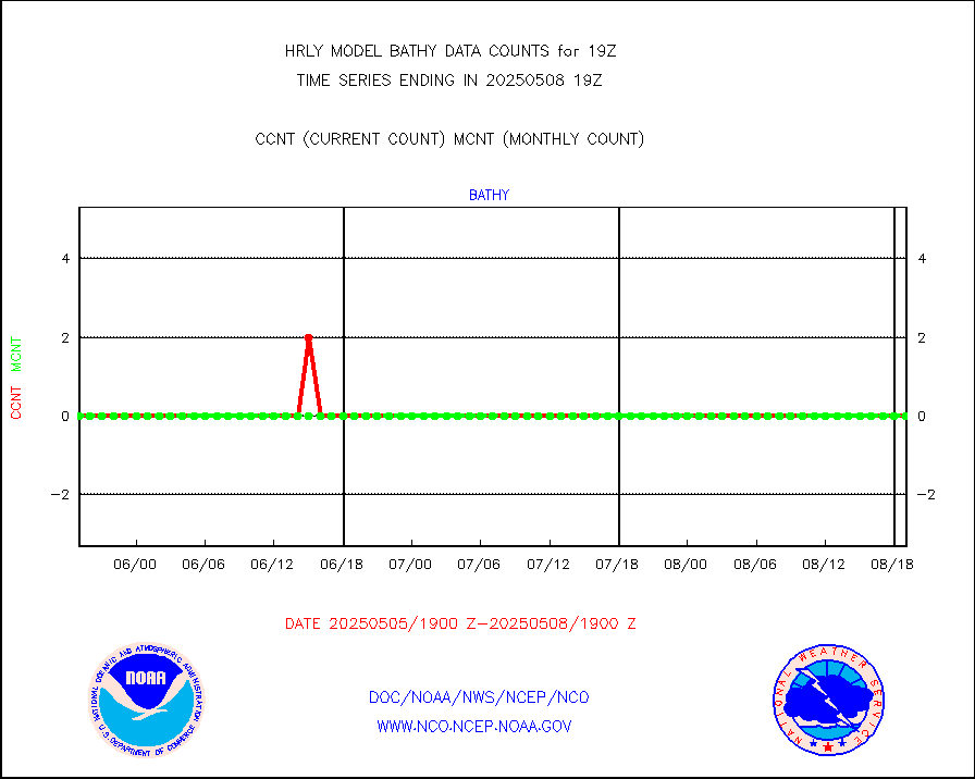
msowst |
Mesonet/MADIS MesoWest (many subproviders) |
45994 |
45664 |
100.7 % |
1618.50-1619.49 |
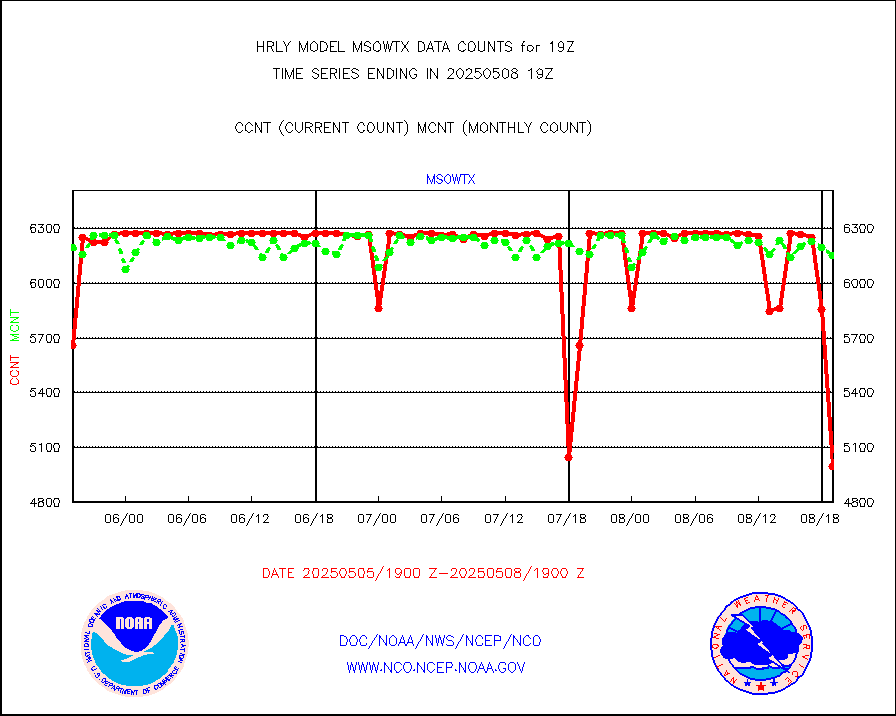
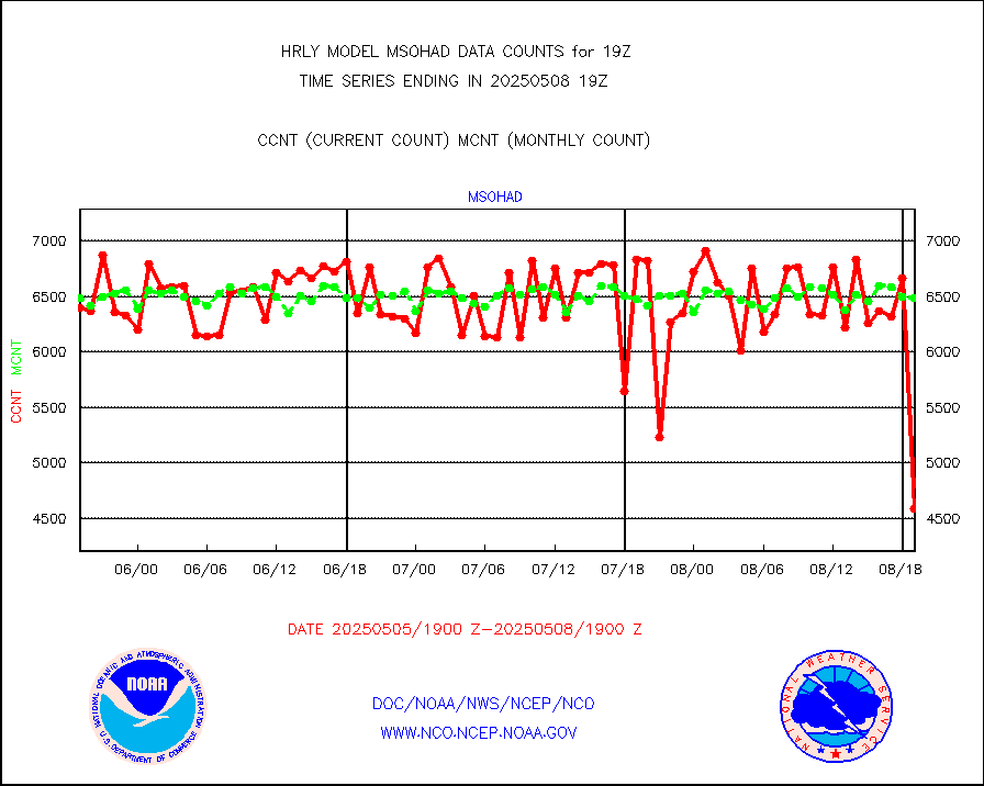
msowtx |
Mesonet/MADIS West Texas |
5612 |
5616 |
99.9 % |
1618.50-1619.49 |
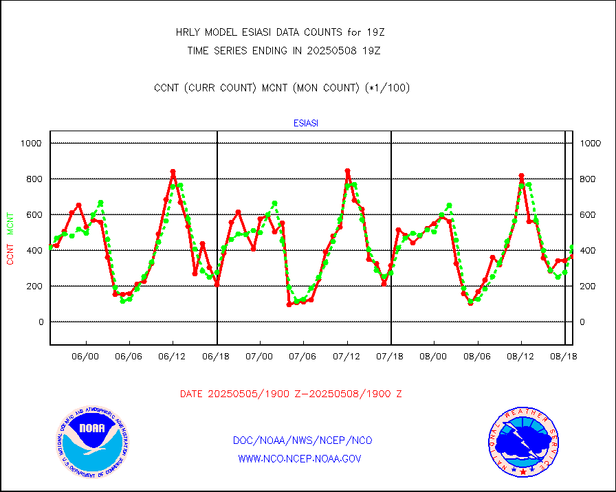
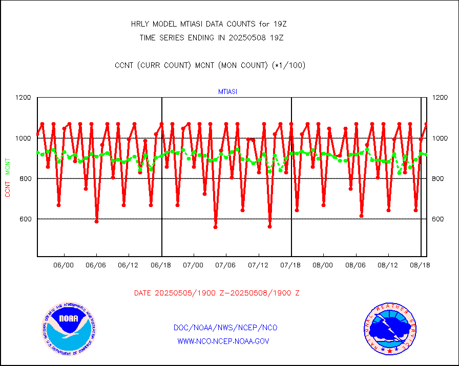
mtiasi |
METOP 1-2 IASI 1C radiance data (varbl. channels) |
97100 |
84938 |
114.3 % |
1617.00-1617.99 |
nxrdw |
NEXRAD Vel Azm Dsp(VAD) winds via radar coded msg |
0 |
0 |
n/a |
1618.50-1619.49 |
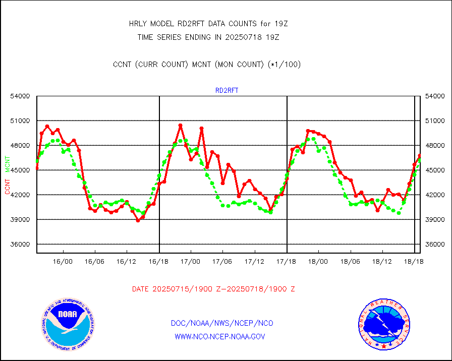
omi |
Aura Ozone Monitoring Instrument (OMI) data |
61740 |
40452 |
152.6 % |
1616.50-1617.49 |
osbuv8 |
NOAA 16-19 Solar Backscatter UV-2 rad frm V8 BUFR |
0 |
0 |
n/a |
1617.00-1617.99 |
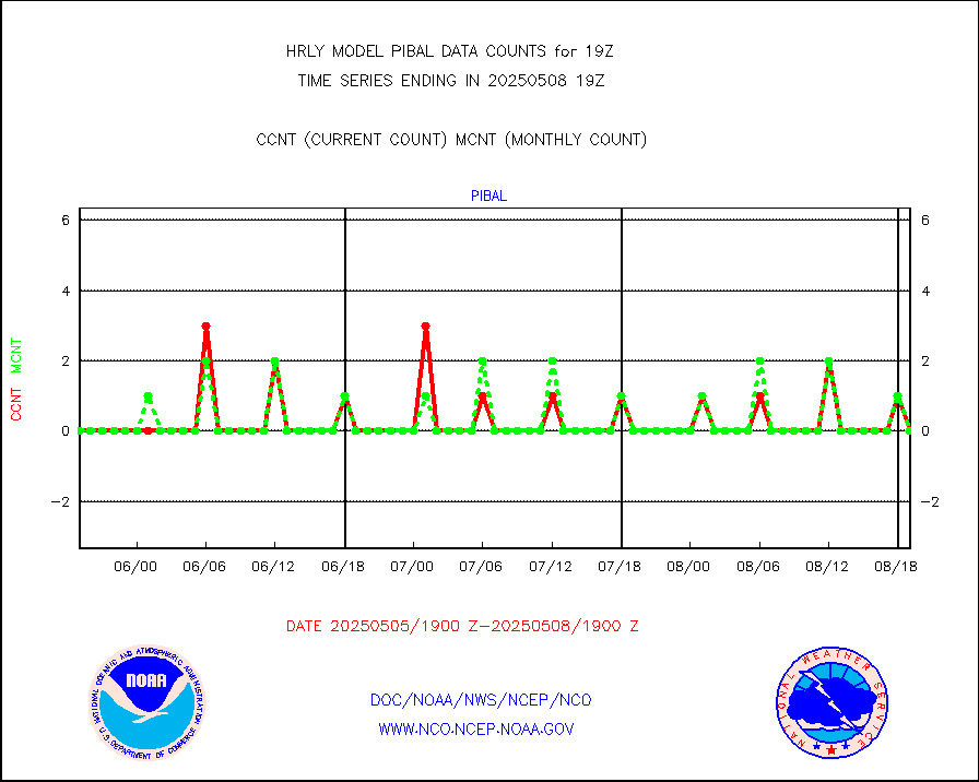
pibal |
PIBAL (from PILOT, PILOT SHIP, PILOT MOBIL) |
0 |
0 |
n/a |
1618.50-1619.49 |
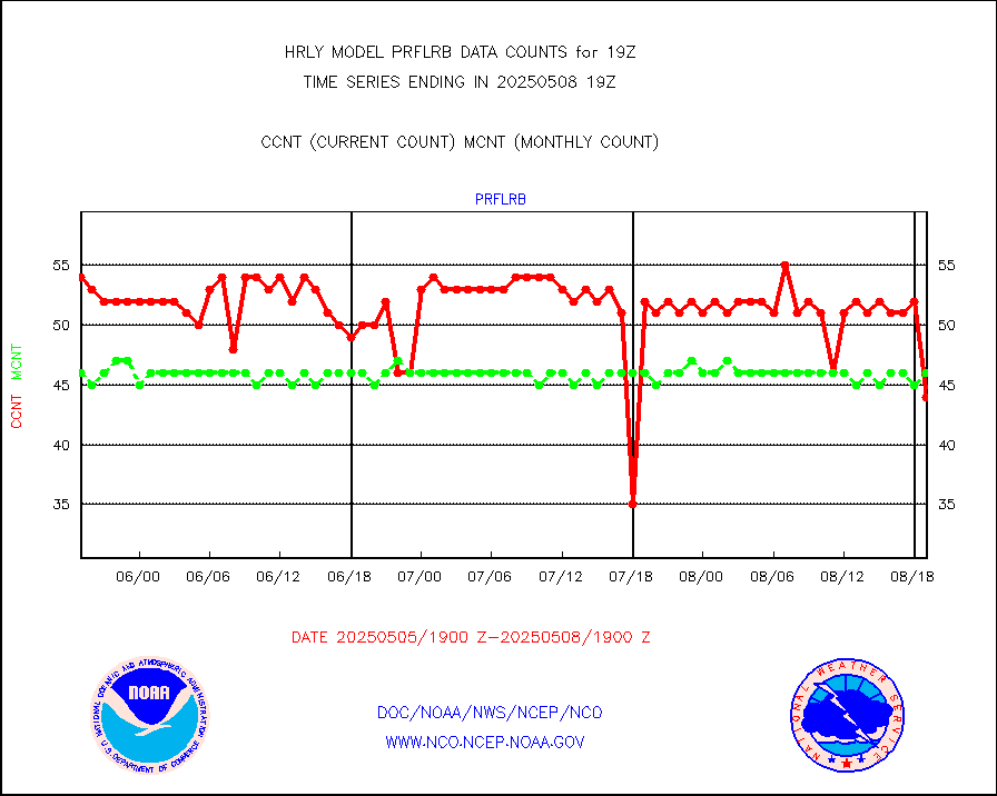
prflrb |
Multi-Agency Profiler (MAP) and SODAR winds |
31 |
40 |
77.5 % |
1618.50-1619.49 |
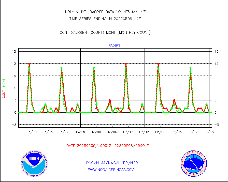
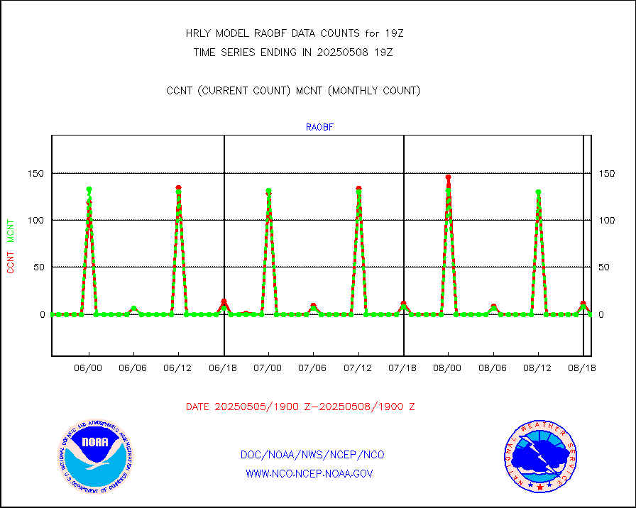
raobf |
Rawinsonde - fixed land (from TEMP or PILOT) |
0 |
0 |
n/a |
1618.50-1619.49 |
rass |
RASS temperatures (NOAA and Multi-Agency) |
12 |
23 |
52.2 % |
1618.50-1619.49 |
rd2rft |
NEXRAD reflectivity (Lvl 2 - GTS) |
3570814 |
3606560 |
99.0 % |
1618.50-1619.49 |
rd2wnd |
NEXRAD radial wind (Level 2 - GTS) |
1694721 |
1390392 |
121.9 % |
1618.50-1619.49 |
sevcsr |
METEOSAT-10 2nd Gen SEVIRI Clr Sky Radiance(proc) |
0 |
0 |
n/a |
1618.50-1619.49 |
shipsb |
Ship - manual and automatic, restricted (BUFR) |
0 |
1 |
0.0 % |
1618.50-1619.50 |
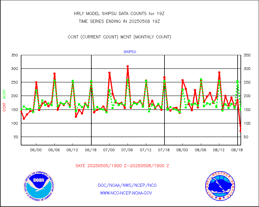
shipsu |
Ship - manual and automatic, unrestricted |
100 |
108 |
92.6 % |
1618.50-1619.50 |
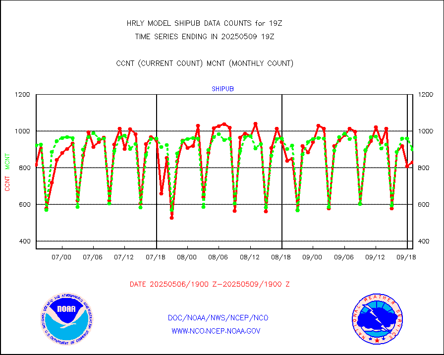
shipub |
Ship - manual and automatic, unrestricted (BUFR) |
707 |
809 |
87.4 % |
1618.50-1619.50 |
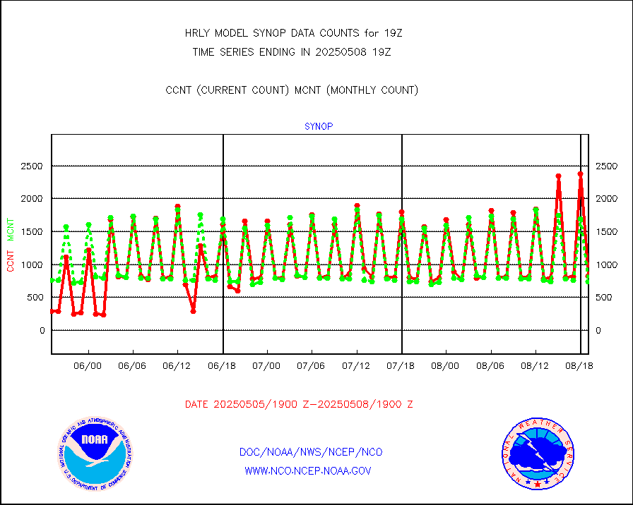
synop |
Synoptic - fixed manual and automatic |
880 |
860 |
102.3 % |
1618.50-1619.49 |
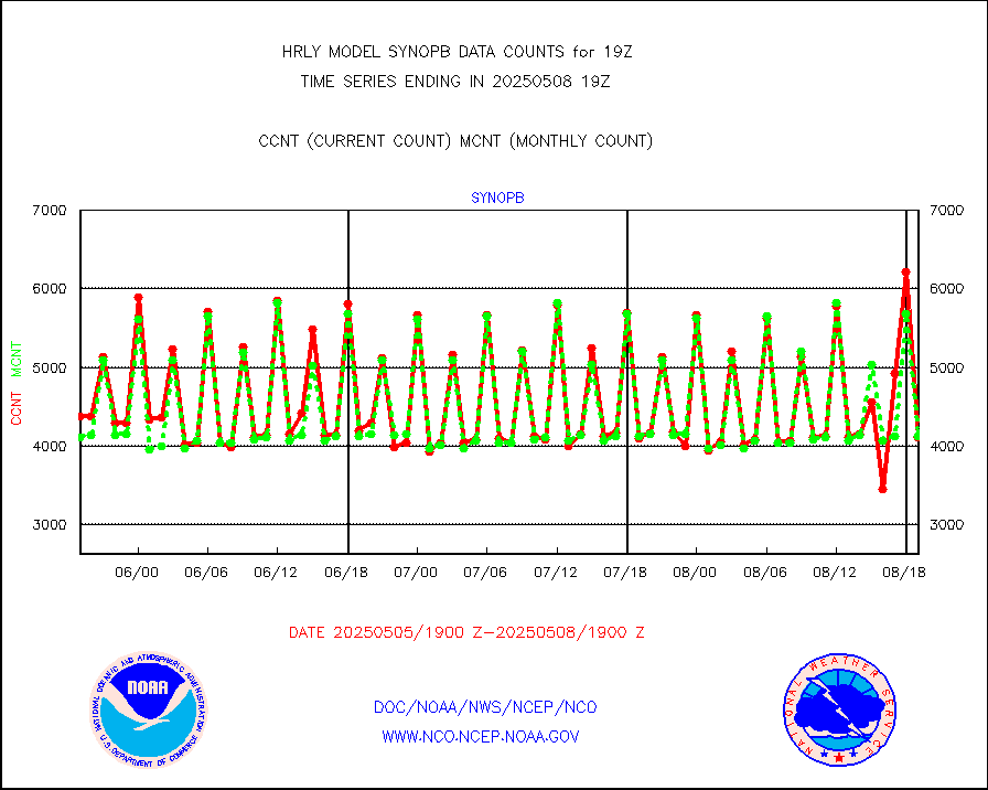
synopb |
Synoptic - fixed manual & auto (decoded fr BUFR) |
3082 |
4181 |
73.7 % |
1618.50-1619.49 |
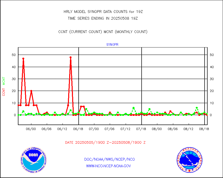
synopr |
Synoptic - restricted (WMO Res 40) manual & auto. |
0 |
0 |
n/a |
1618.50-1619.49 |
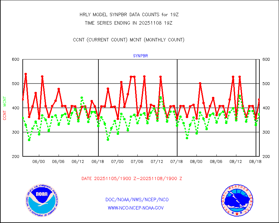
synpbr |
Synoptic - restricted (WMO Res 40)(decoded BUFR) |
396 |
403 |
98.3 % |
1618.50-1619.49 |
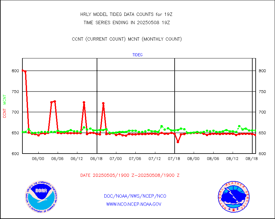
tideg |
Tide gauge reports decoded from CREX format |
635 |
630 |
100.8 % |
1618.00-1618.99 |
| Data Types of Opportunity with Normal Counts |
|---|
| Type | Description | Hourly Count | Monthly Average | Percent (%) of Monthly Mean | UTC Time Window |
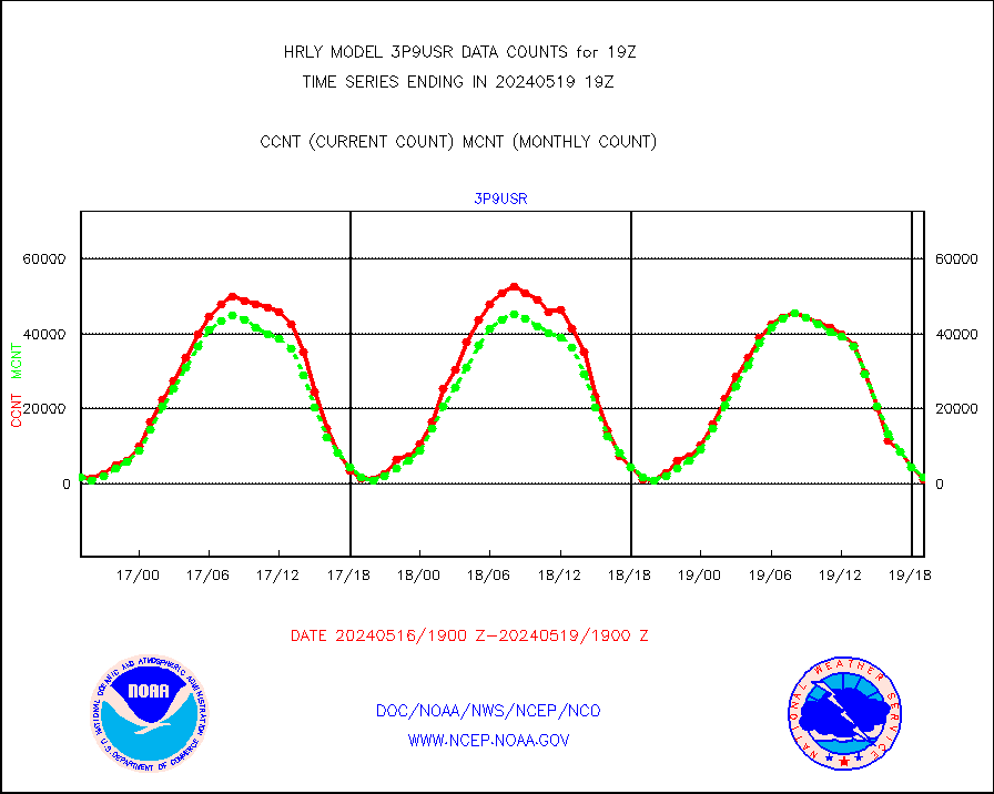
3p9usr |
GOES-16&up/NESDIS ir short-wv derived cld motion |
2105 |
1819 |
115.7 % |
1618.00-1618.99 |
acarsa |
MDCRS ACARS acft data (ARINC via AFWA)(AIREP fmt) |
0 |
0 |
n/a |
1618.50-1619.49 |
ahicsr |
Himawari Clear Sky Radiance |
0 |
0 |
n/a |
1618.00-1618.99 |
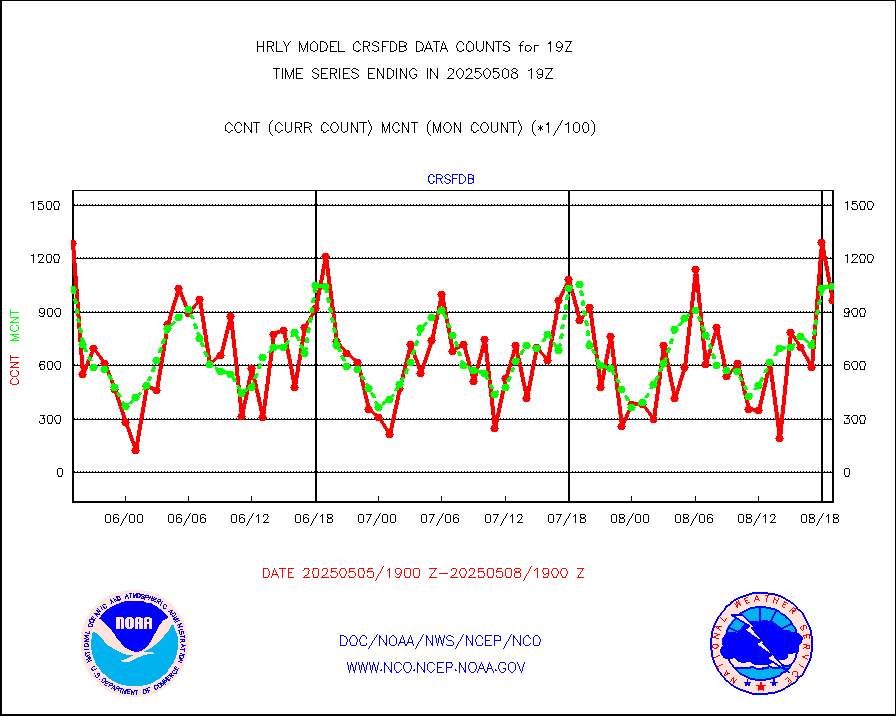
amsr2 |
GCOM-W AMSR2 1B brightness temperatures |
2309472 |
2056720 |
112.3 % |
1617.00-1617.99 |
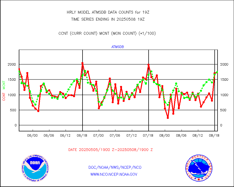
atmsdb |
NPP/NOAA-20 ATMS bright. temps-direct b-cast SSEC |
144345 |
145612 |
99.1 % |
1617.50-1618.49 |
atovs |
POES/NESDIS - processed ATOVS soundings/radiances |
0 |
0 |
n/a |
1617.00-1617.99 |
avcsam |
A.M.(N17,M2,M3) AVHRR GAC NCEP-proc clr&sea btmps |
1187754 |
1344004 |
88.4 % |
1616.50-1617.49 |
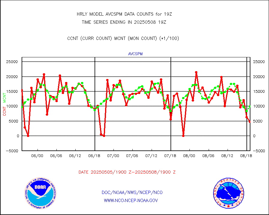
avcspm |
P.M.(N18-19) AVHRR GAC NCEP-proc clr & sea btemps |
1436022 |
1427772 |
100.6 % |
1616.50-1617.49 |
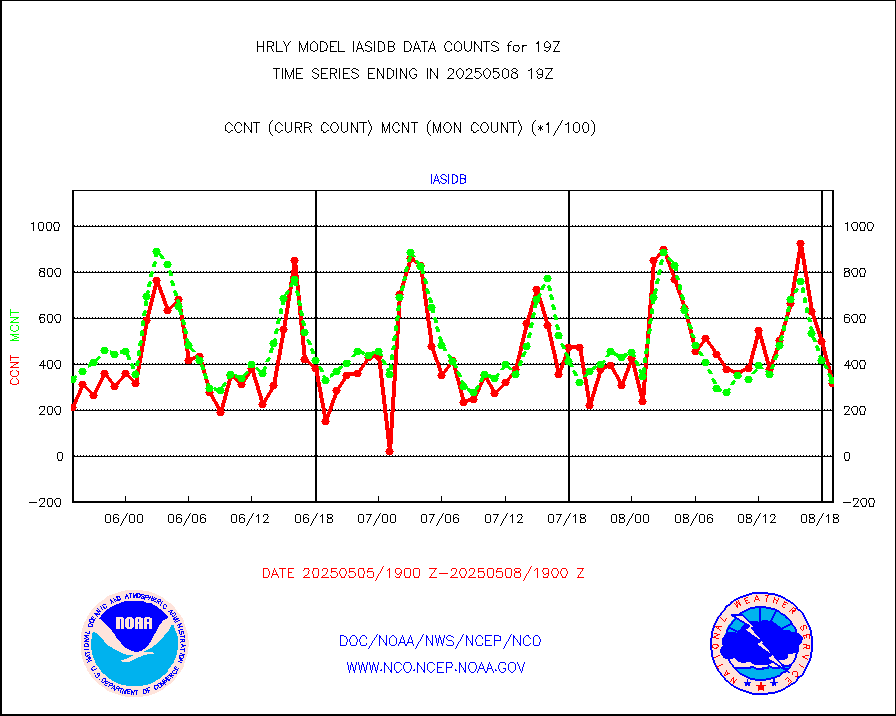
bathy |
eXpendable BathyThermograph, mooring (BATHY fmt) |
0 |
1 |
0.0 % |
1612.00-1612.99 |
coopmd |
Coop/MADIS NEPP & HCN-Modernization NOAA COOP Obs |
23 |
23 |
100.0 % |
1618.50-1619.49 |
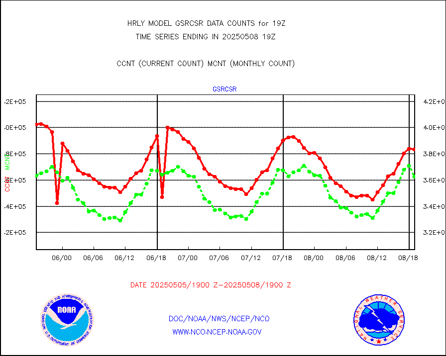
crisf4 |
NPP/NOAA-20 CrIS full spctrl radn (431 ch subset) |
196596 |
216161 |
90.9 % |
1617.50-1618.49 |
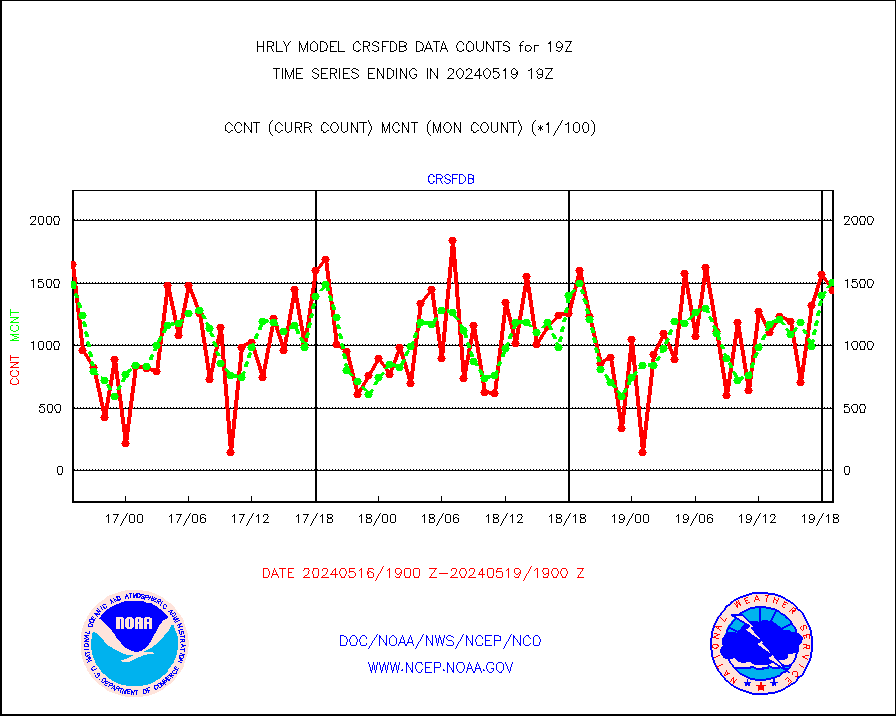
crsfdb |
NPP/NOAA-20 CrIS full spctrl radn dir brdcst SSEC |
165608 |
147244 |
112.5 % |
1617.50-1618.49 |
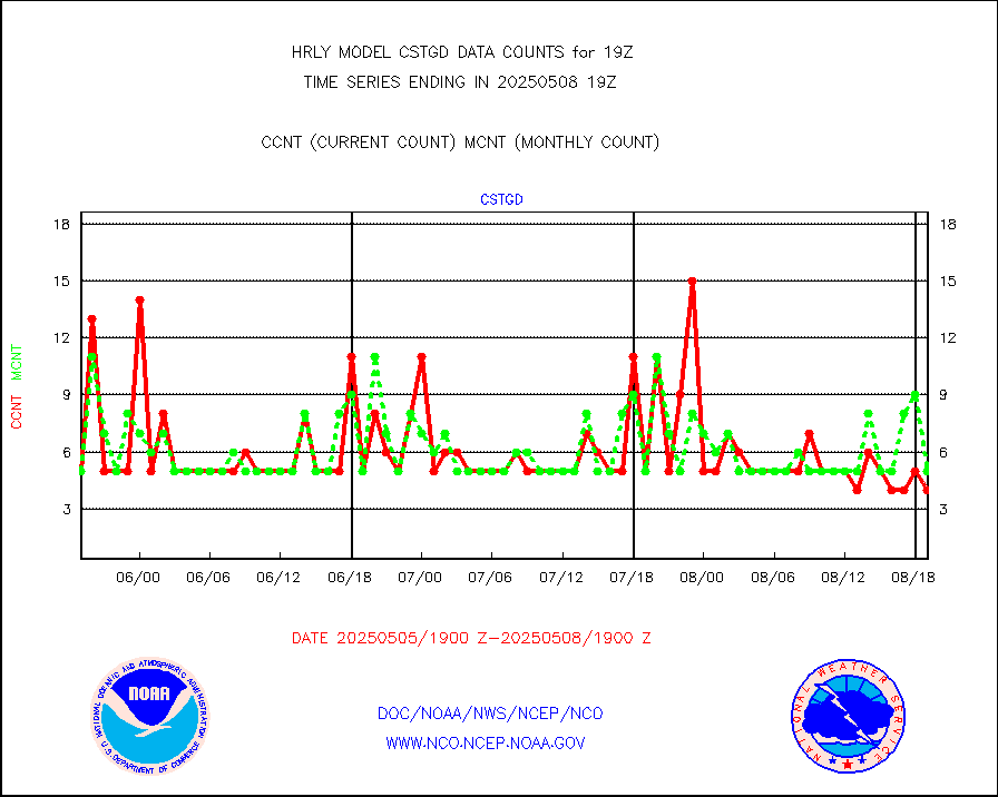
cstgd |
Coast Guard |
4 |
3 |
133.3 % |
1618.50-1619.50 |
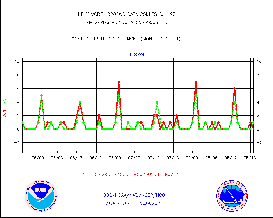
dropw |
Dropwinsonde (from TEMP DROP) |
0 |
0 |
n/a |
1618.50-1619.49 |
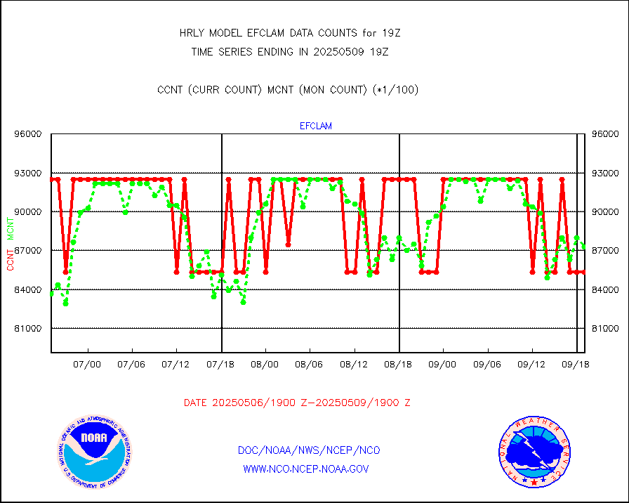
efclam |
GOES imager effective cloud amount data (U.Wisc.) |
8294533 |
8205912 |
101.1 % |
1618.50-1619.49 |
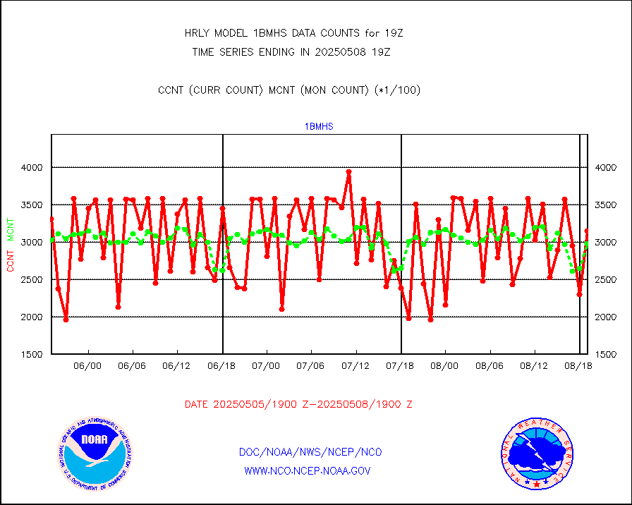
esatms |
NPP Adv. Tech. MW Sndr (ATMS) br. temps from RARS |
123264 |
89966 |
137.0 % |
1617.50-1618.49 |
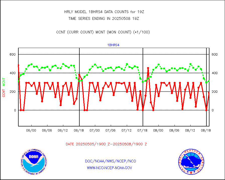
esiasi |
METOP 1-2 IASI 1C radiance data vbl chn from RARS |
53986 |
55808 |
96.7 % |
1618.00-1618.99 |
esmhs |
NOAA 18-19 & METOP 1-2 MHS proc. btemps from RARS |
222158 |
166683 |
133.3 % |
1618.50-1619.49 |
geoimr |
GOES/NESDIS (11x17 f-o-v) imager clear radiances |
0 |
0 |
n/a |
1618.00-1618.99 |
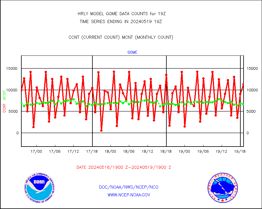
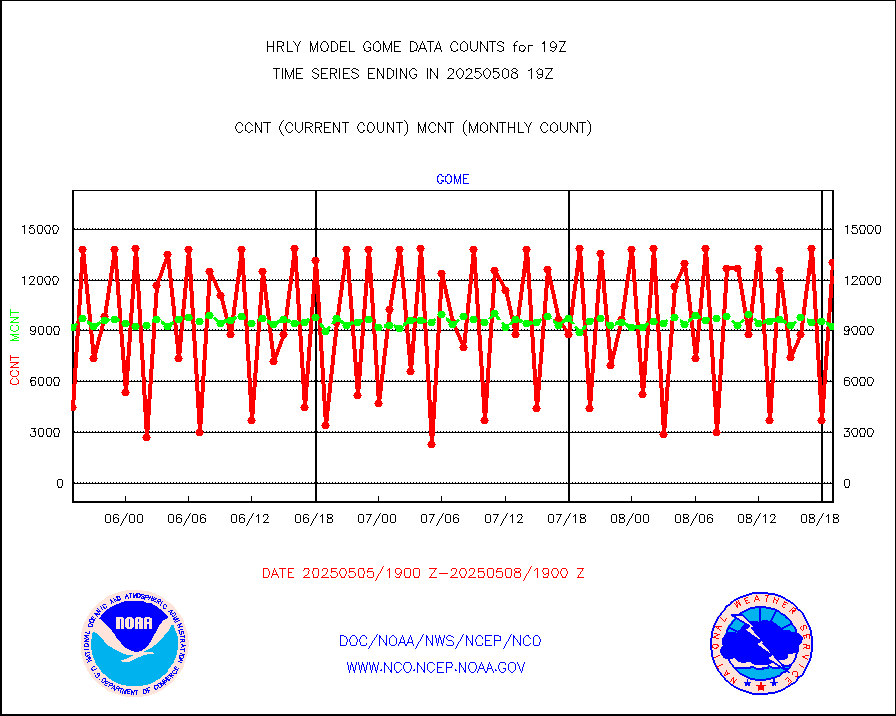
gome |
METOP 1-2 Global Ozone Monitoring Exp.-2 (GOME-2) |
13946 |
6202 |
224.9 % |
1617.50-1618.49 |
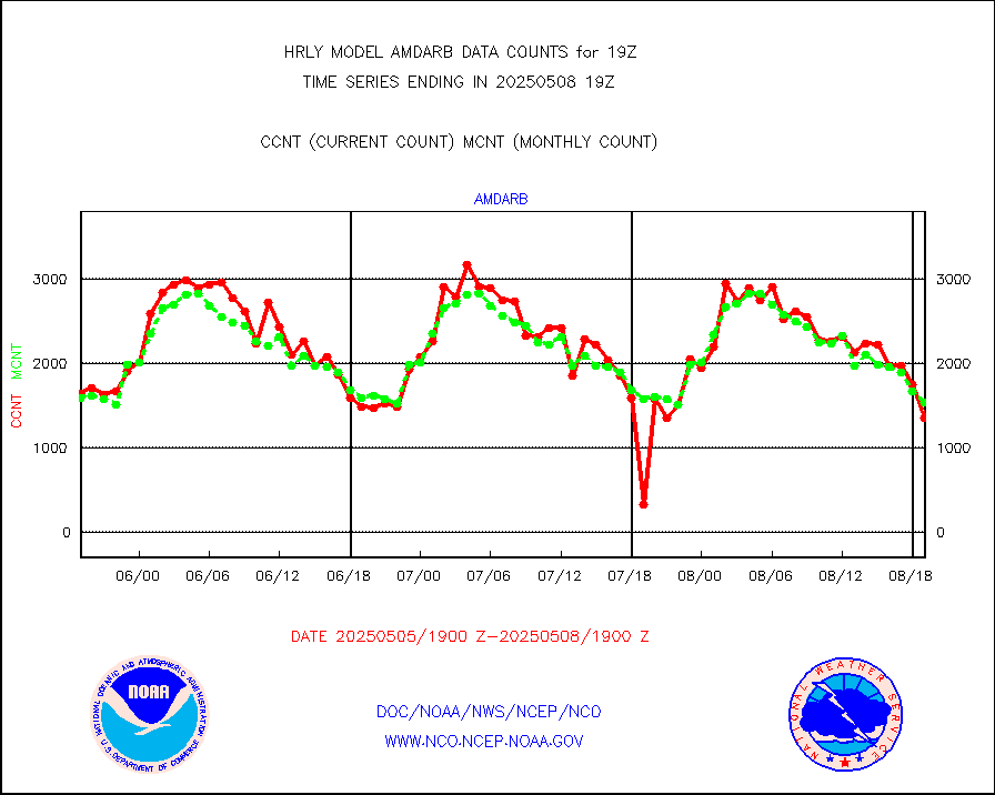
h20in2 |
INDIA SATWIND, INSAT WV channel |
0 |
0 |
n/a |
1618.00-1618.99 |
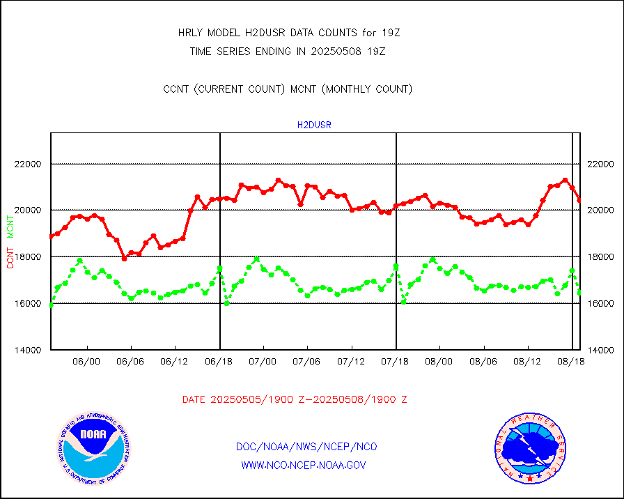
h2dusr |
GOES-16&up/NESDIS wv imgr/deep-lyr derivd cld mtn |
16501 |
15737 |
104.9 % |
1618.00-1618.99 |
h2eunb |
METEOSAT/EUMETSAT wvpr imgr drv cld motion NBseq |
42291 |
43032 |
98.3 % |
1617.50-1618.49 |
iasidb |
METOP 1-2 IASI 1C radiances-direct broadcast SSEC |
19027 |
21236 |
89.6 % |
1617.50-1618.49 |
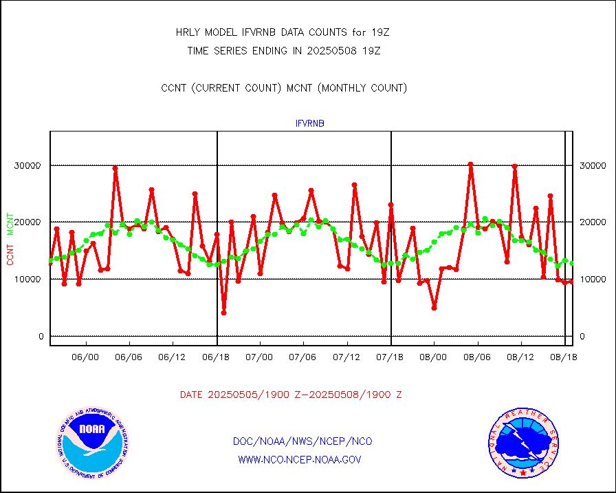
ifvrnb |
VIIRS (NPP/NOAA-20) ir lg-wv drv cloud motion(NB) |
12105 |
12023 |
100.7 % |
1615.00-1615.99 |
infav1 |
AVHRR (METOP) ir lg-wave derived cld motion |
0 |
0 |
n/a |
1618.50-1619.50 |
infin |
INSAT/KALPANA India ir lg-wave derived cld motion |
0 |
0 |
n/a |
1616.50-1617.49 |
infin2 |
INDIA SATWIND, INSAT IR channel |
0 |
0 |
n/a |
1618.00-1618.99 |
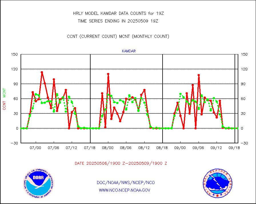
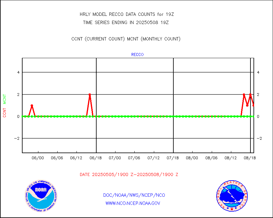
kamdar |
Korean AMDAR aircraft data (decoded from BUFR) |
0 |
1 |
0.0 % |
1618.50-1619.49 |
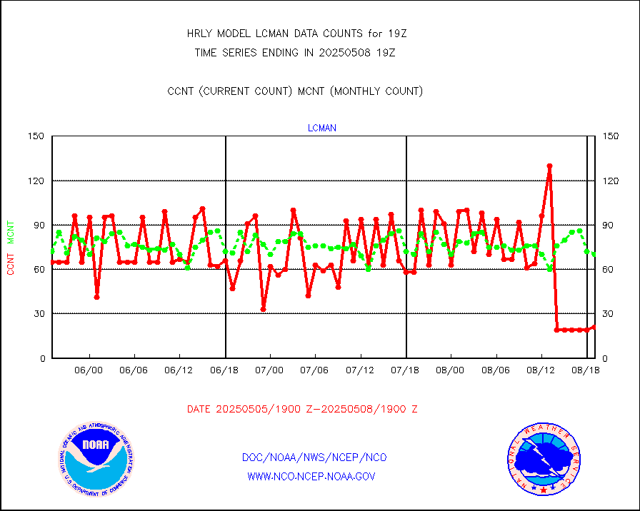
lcman |
Land-based CMAN stations decoded from CMAN format |
138 |
96 |
143.8 % |
1618.50-1619.49 |
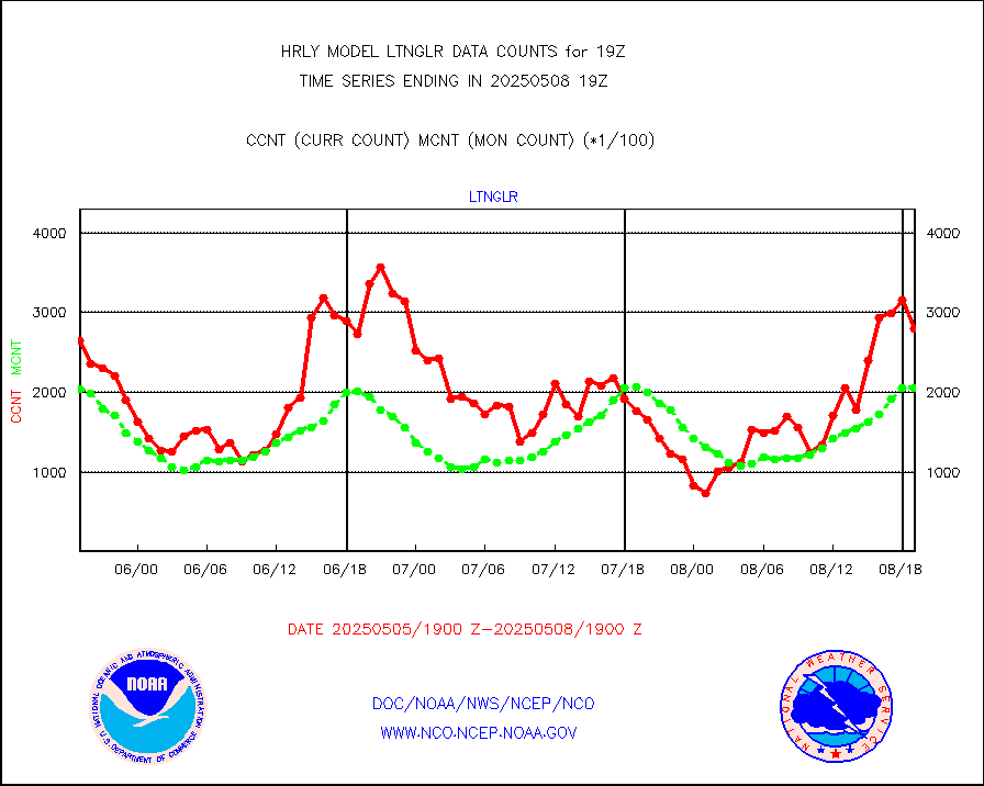
ltnglr |
LLDN Long-rng lightning from Vaisala via NOAAPORT |
200574 |
180378 |
111.2 % |
1618.50-1619.49 |
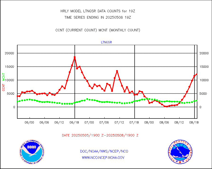
ltngsr |
NLDN Shrt-rng lightning from Vaisala via NOAAPORT |
2851 |
1677 |
170.0 % |
1618.50-1619.49 |
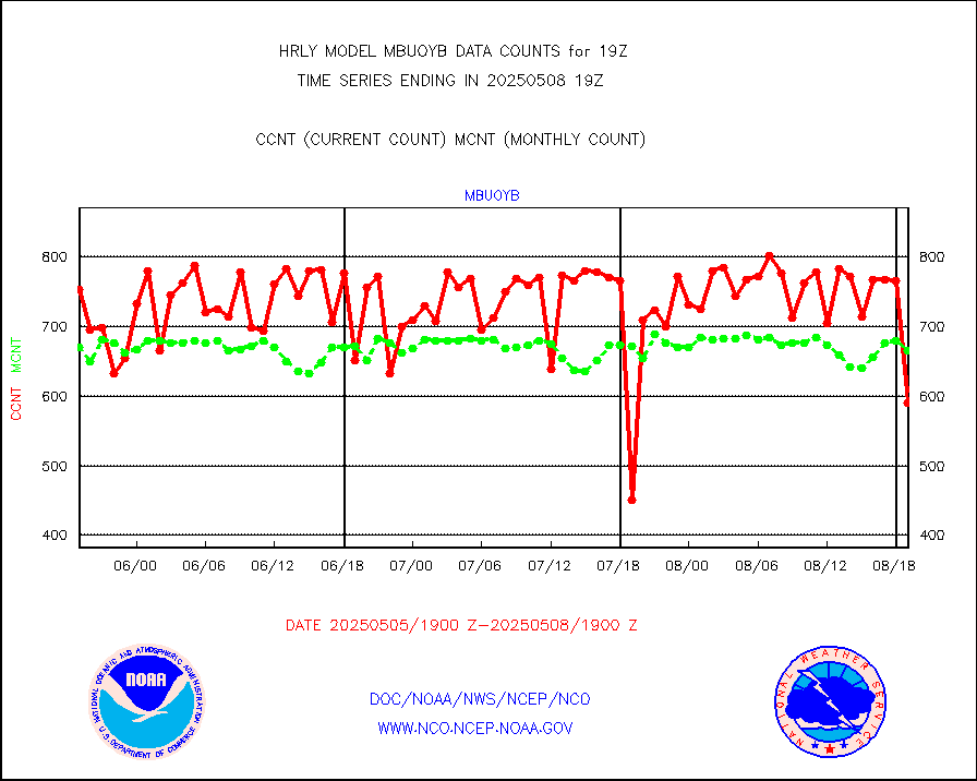
mbuoyb |
Moored buoys (decoded from BUFR) |
540 |
626 |
86.3 % |
1618.50-1619.50 |
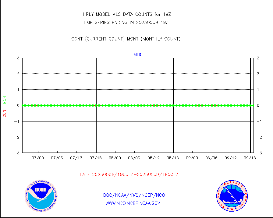
mls |
Aura Microwave Limb Sounder (MLS) ozone data |
0 |
0 |
n/a |
1617.00-1617.99 |
msourb |
Mesonet/MADIS UrbaNet |
2974 |
4382 |
67.9 % |
1618.50-1619.49 |
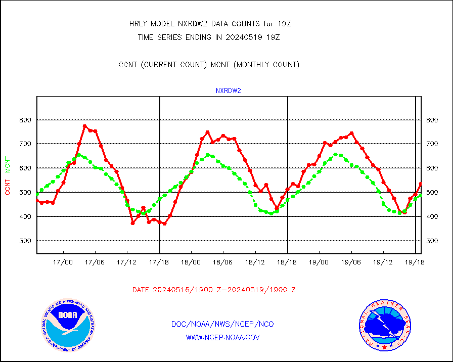
nxrdw2 |
NEXRAD Vel Azm Dsp(VAD) winds via Level 2 decoder |
559 |
482 |
116.0 % |
1618.50-1619.49 |
ompslp |
OMPS Limb Profiler ozone data (NPP) |
429 |
222 |
193.2 % |
1612.00-1612.99 |
ompsn8 |
OMPS nadir profile ozone (Version 8 BUFR) |
610 |
443 |
137.7 % |
1617.00-1617.99 |
ompst8 |
OMPS total column ozone (Version 8 BUFR) |
304298 |
328351 |
92.7 % |
1617.00-1617.99 |
pirep |
Manual PIREP aircraft data (dcded from AIREP fmt) |
124 |
161 |
77.0 % |
1618.50-1619.49 |
prflrp |
Profilr winds from PIBAL (PILOT,PILOT SHIP/MOBIL) |
0 |
0 |
n/a |
1618.50-1619.49 |
raobm |
Rawinsonde - mobile land (from TEMP/PILOT MOBIL) |
0 |
0 |
n/a |
1618.50-1619.49 |
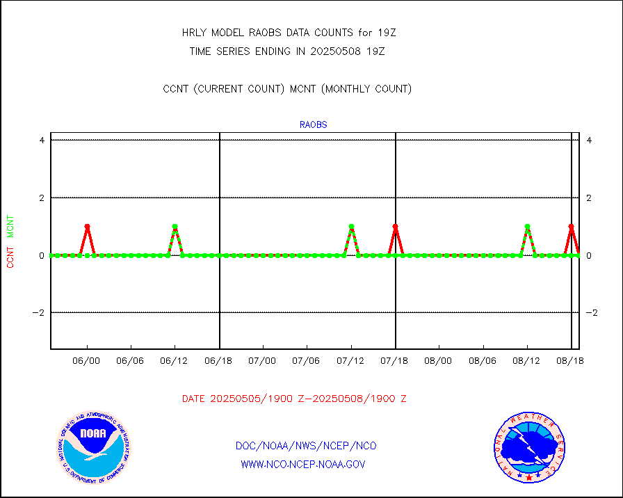
raobs |
Rawinsonde - ship (from TEMP SHIP, PILOT SHIP) |
0 |
0 |
n/a |
1618.50-1619.49 |
recco |
Flight level reconnaissance aircraft data |
0 |
0 |
n/a |
1618.50-1619.49 |
saphir |
Megha-Tropiques SAPHIR L1A2 brightness temps |
0 |
0 |
n/a |
1616.50-1617.49 |
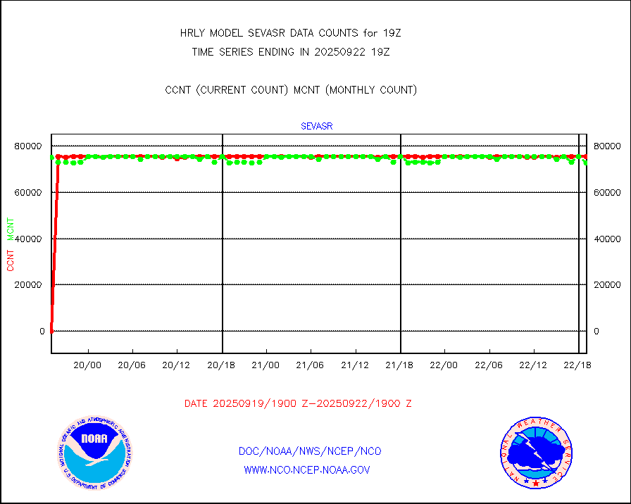
sevasr |
METEOSAT-10 2nd Gen SEVIRI All Sky Radiance(proc) |
75512 |
75498 |
100.0 % |
1618.50-1619.49 |
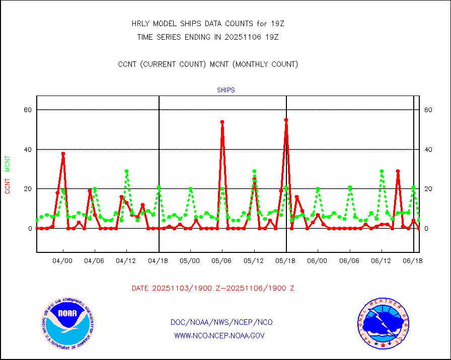
ships |
Ship - manual and automatic, restricted |
0 |
4 |
0.0 % |
1618.50-1619.49 |
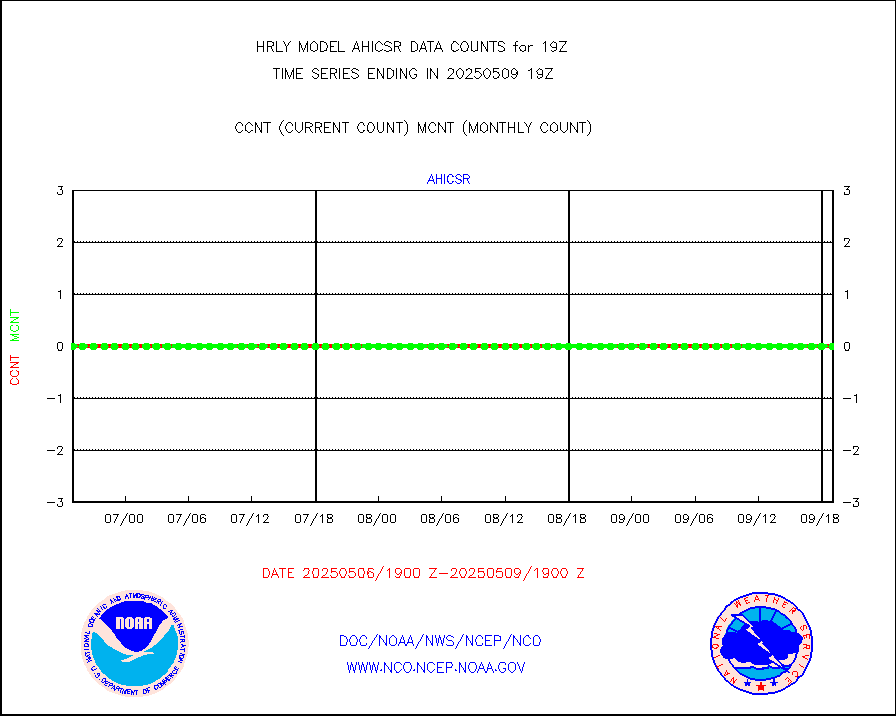
ssmisu |
DMSP SSM/IS 1C radiance data (Unified Pre-Proc.) |
225120 |
171317 |
131.4 % |
1617.50-1618.49 |
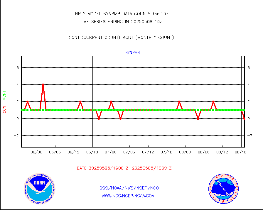
synpmb |
Synoptic - mobile manual & auto (decoded fr BUFR) |
1 |
1 |
100.0 % |
1618.50-1619.49 |
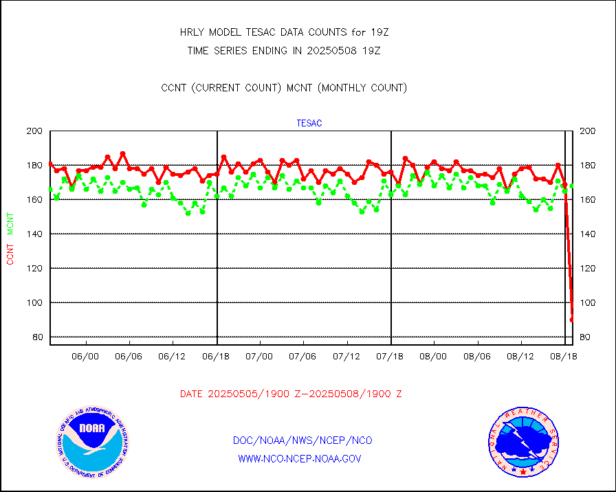
tesac |
CTD probe, Argo prflng float, mooring (TESAC fmt) |
185 |
164 |
112.8 % |
1618.50-1619.49 |
tmdara |
TAMDAR aircft data-all types(from Panasonic,BUFR) |
137 |
139 |
98.6 % |
1618.50-1619.49 |
trkob |
ThermoSalinoGraph (TSG) TRACKOB format) |
60 |
51 |
117.6 % |
1617.50-1618.49 |
visin |
INSAT/KALPANA India visible derived cloud motion |
0 |
0 |
n/a |
1616.50-1617.49 |
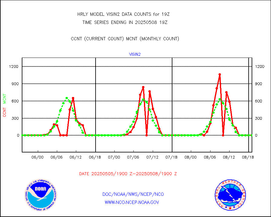
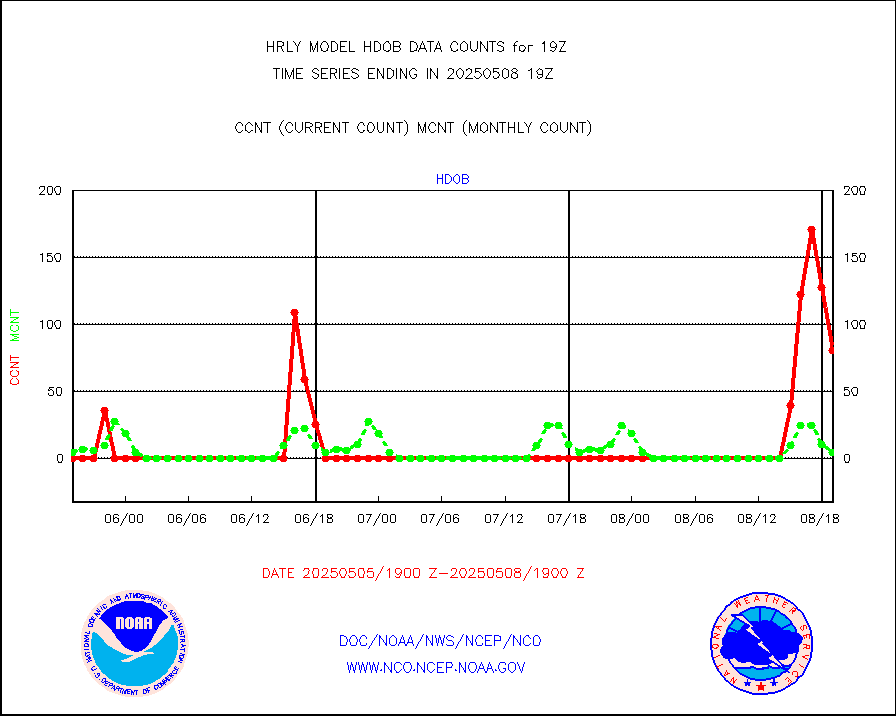
visin2 |
INDIA SATWIND, INSAT VIS channel |
0 |
0 |
n/a |
1618.00-1618.99 |
visja |
MTSAT/JMA visible derived cloud motion |
0 |
0 |
n/a |
1616.50-1617.49 |
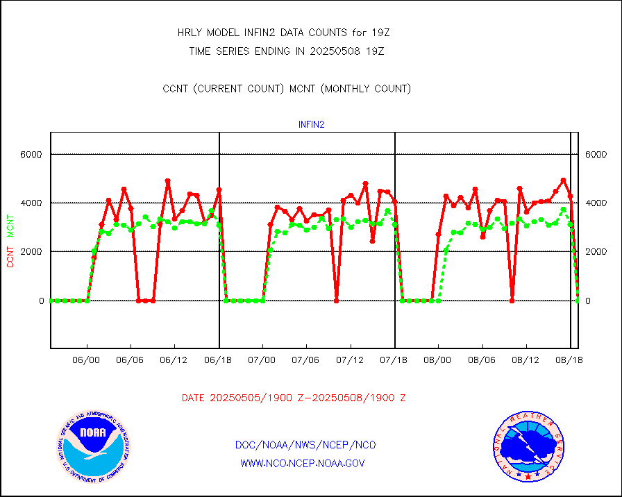
visusr |
GOES-16&up/NESDIS visible derived cloud motion |
392195 |
406223 |
96.5 % |
1618.00-1618.99 |
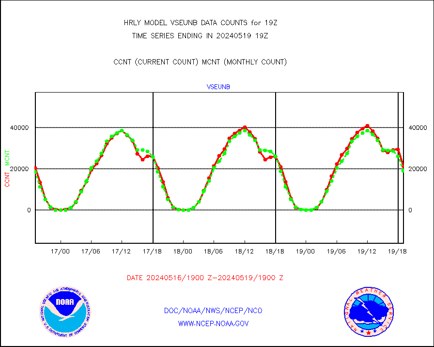
vseunb |
METEOSAT/EUMETSAT visible drv cld motion NBseq |
17408 |
18709 |
93.0 % |
1617.50-1618.49 |


