| Critical Data with Normal Counts |
|---|
| Type | Description | Hourly Count | Monthly Average | Percent (%) of Monthly Mean | UTC Time Window |
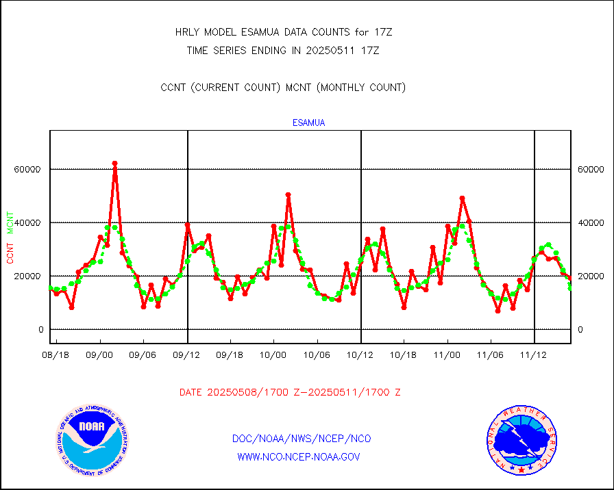
1bamua |
NOAA 15-19 & METOP 1-2 AMSU-A NCEP-proc. br.temps |
61748 |
55494 |
111.3 % |
1715.00-1715.99 |
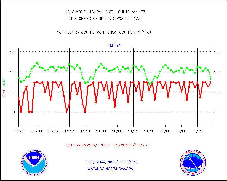
1bhrs4 |
NOAA 18-19 & METOP 1-2 HIRS-4 NCEP-proc. br.temps |
59245 |
45742 |
129.5 % |
1715.00-1715.99 |
1bmhs |
NOAA 18-19 & METOP 1-2 MHS NCEP-proces. br. temps |
356577 |
304408 |
117.1 % |
1715.00-1715.99 |
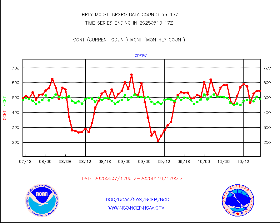
acars |
MDCRS ACARS acft data from ARINC(dcded from BUFR) |
24544 |
21538 |
114.0 % |
1716.50-1717.49 |
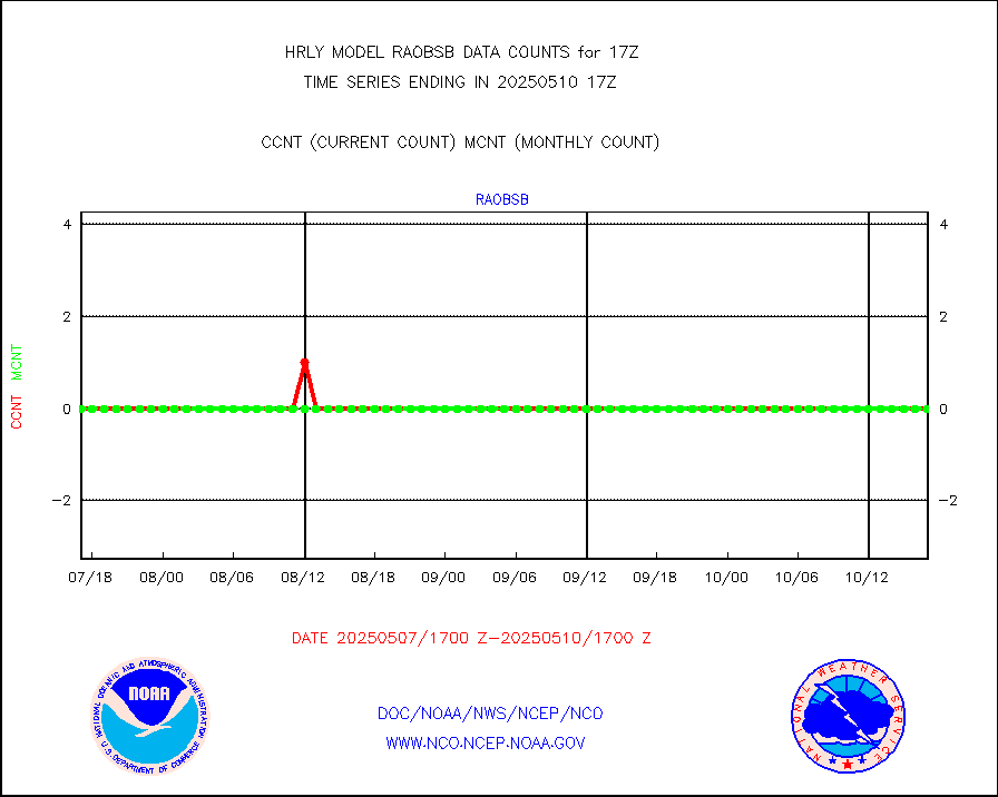
airep |
Manual AIREP aircraft data (dcded from AIREP fmt) |
403 |
908 |
44.4 % |
1716.50-1717.49 |
airsev |
AQUA AIRS/AMSU-A/HSB brightness temps- every FOV |
0 |
0 |
n/a |
1714.50-1715.49 |
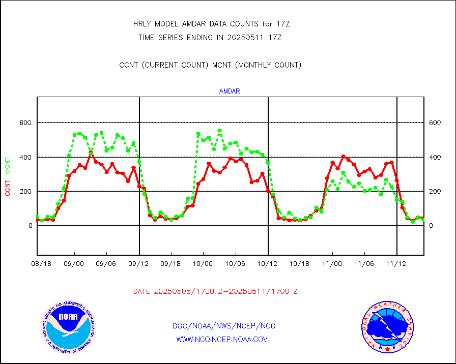
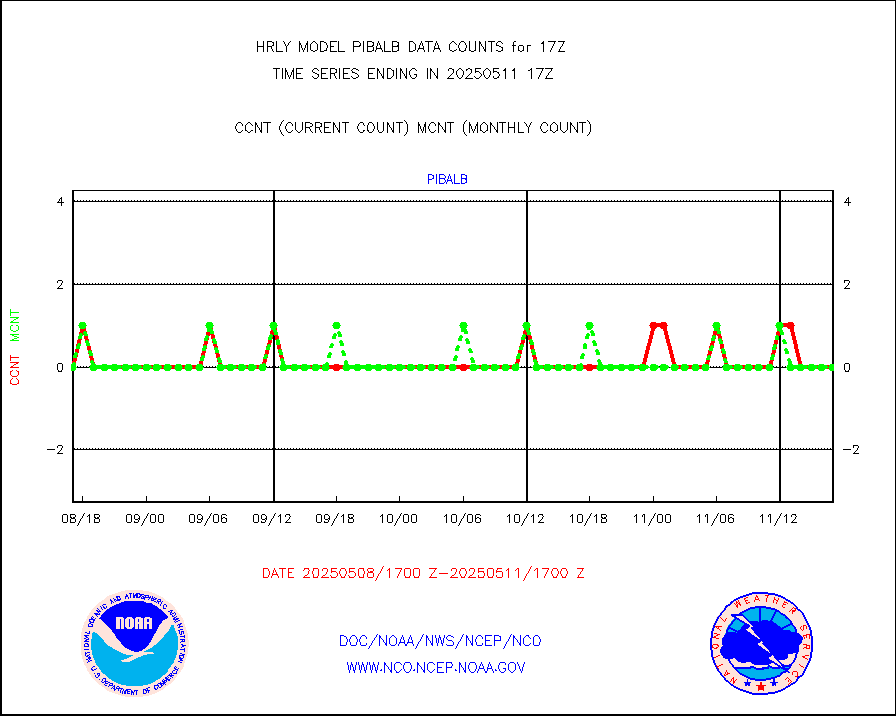
amdar |
AMDAR aircraft data (decoded from AMDAR format) |
33 |
35 |
94.3 % |
1716.50-1717.49 |
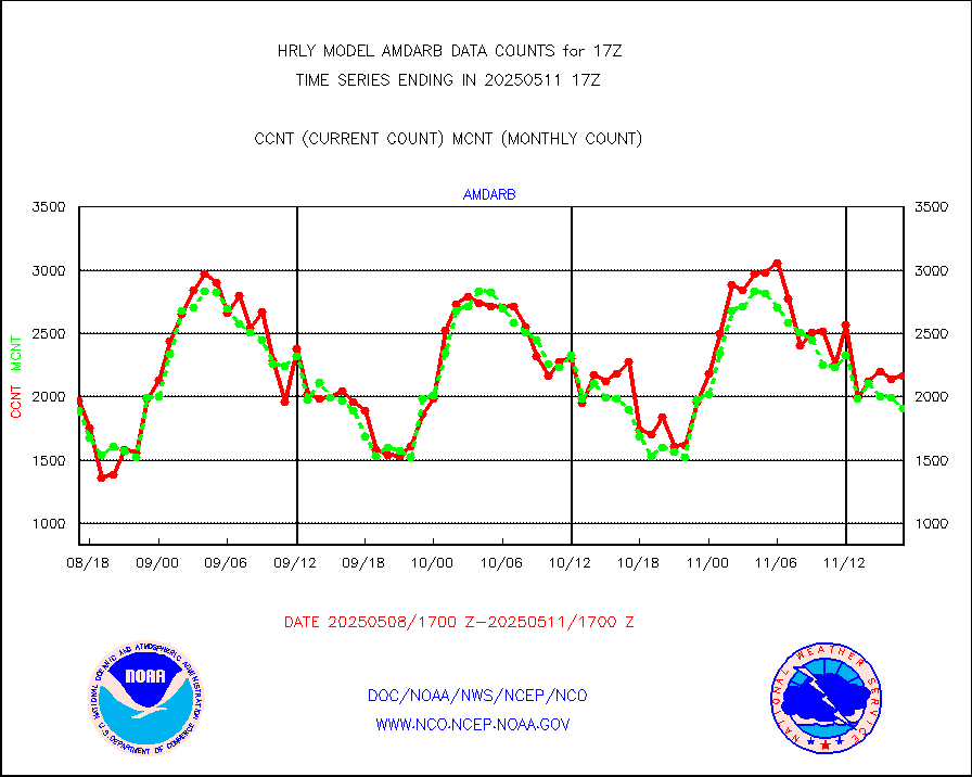
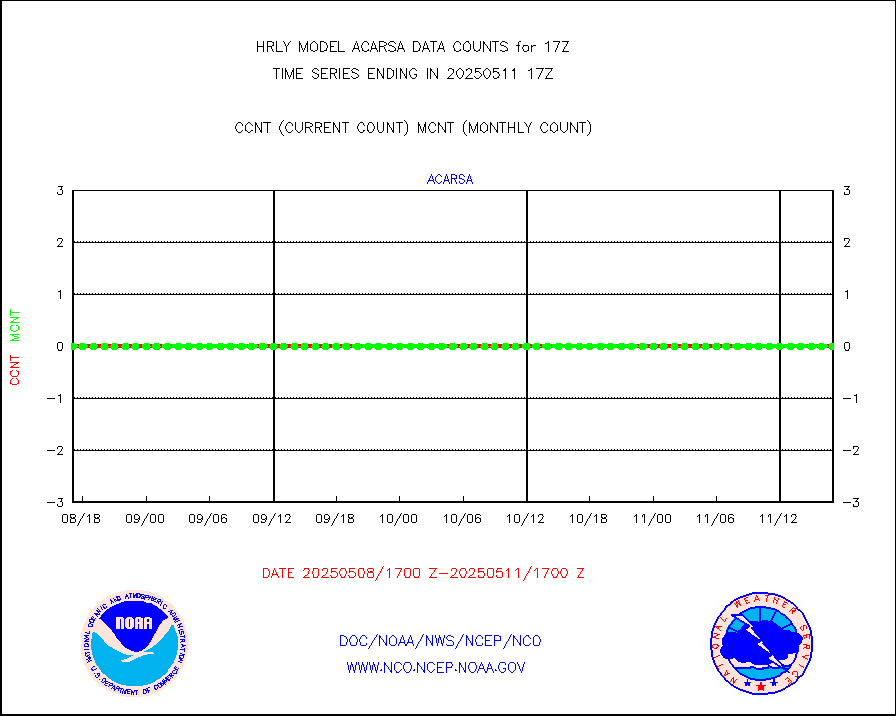
amdarb |
AMDAR aircraft data (decoded from BUFR) |
224 |
192 |
116.7 % |
1716.50-1717.49 |
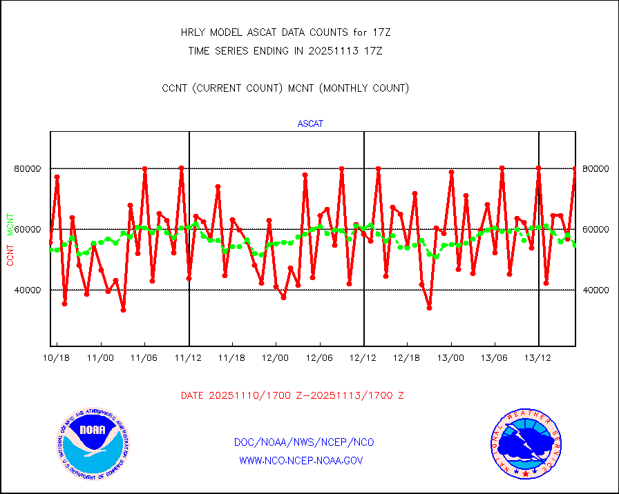
ascat |
METOP 1-2 ASCAT products |
71736 |
30608 |
234.4 % |
1715.50-1716.49 |
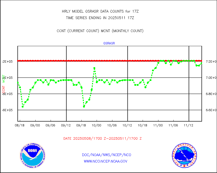
atms |
NPP/NOAA-20 ATMS brightness temperatures |
277056 |
334089 |
82.9 % |
1715.50-1716.49 |
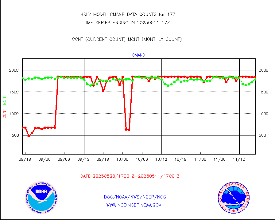
cmanb |
Surface Marine CMAN rpts decoded from BUFR format |
1817 |
1779 |
102.1 % |
1716.50-1717.50 |
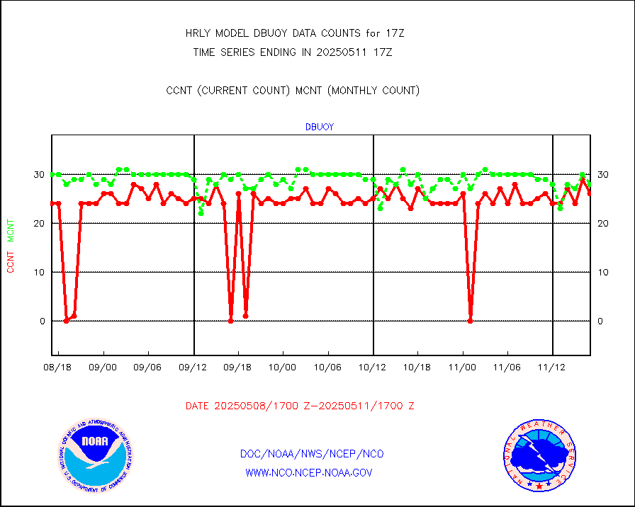
dbuoy |
Buoys decoded from FM-18 fmt (moored or drifting) |
0 |
1 |
0.0 % |
1716.50-1717.49 |
eadas |
E-AMDAR (European AMDAR acft decoded from BUFR) |
1819 |
2129 |
85.4 % |
1716.50-1717.49 |
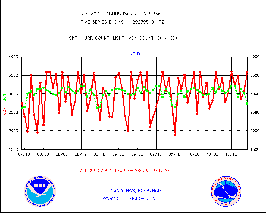
esamua |
NOAA 15-19 & METOP 1-2 AMSU-A proc btmps frm RARS |
24090 |
18471 |
130.4 % |
1716.50-1717.49 |
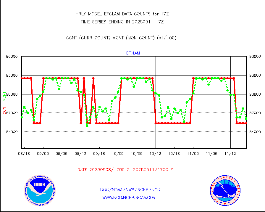
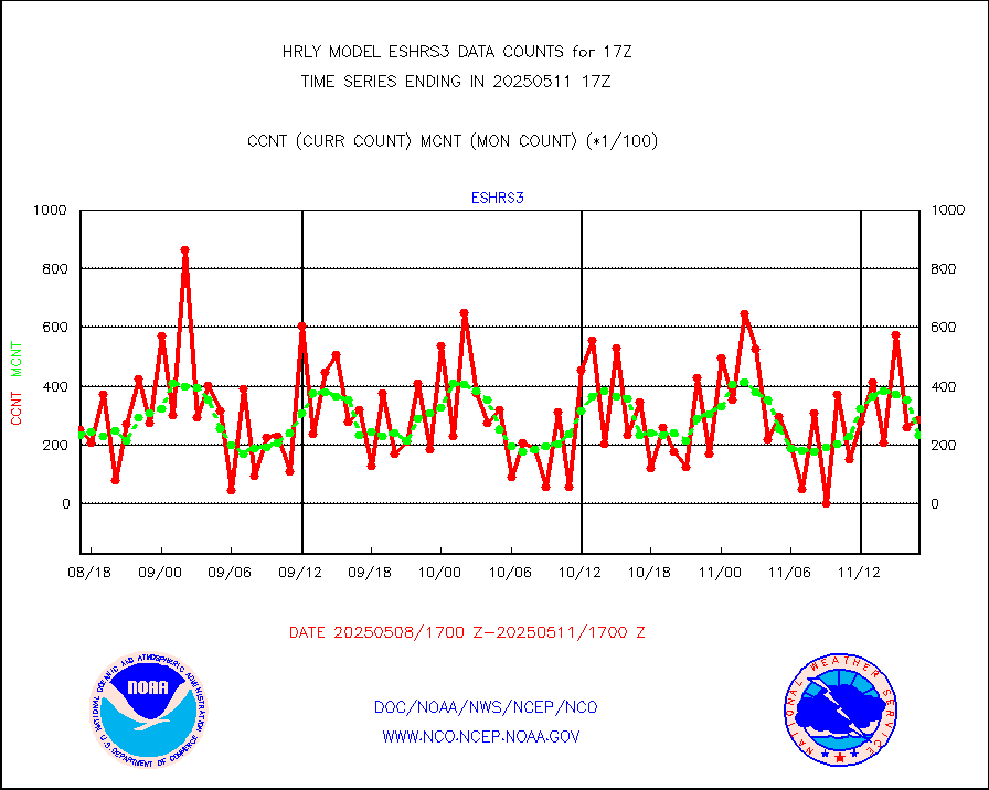
eshrs3 |
NOAA 15-19 & METOP 1-2 HIRS-3/4 pr btmps frm RARS |
64277 |
40386 |
159.2 % |
1716.50-1717.49 |
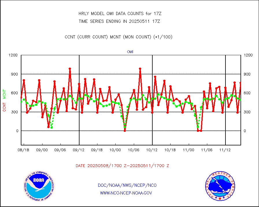
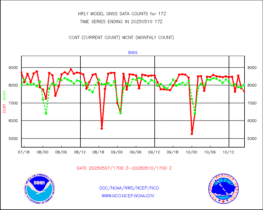
gnss |
Grnd-based Gbl Navigation Sat System (GNSS) data |
8876 |
7566 |
117.3 % |
1716.00-1716.99 |
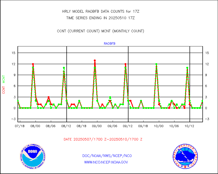
gpsro |
GPS radio occultation data |
386 |
403 |
95.8 % |
1714.50-1715.49 |
gsrasr |
GOES-16/17 All Sky Radiances (proc.) |
720952 |
678867 |
106.2 % |
1716.50-1717.49 |
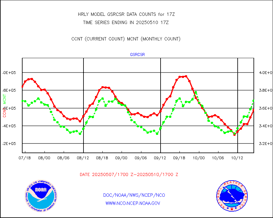
gsrcsr |
GOES-16/17 Clear Sky Radiances (proc.) |
360695 |
344291 |
104.8 % |
1716.50-1717.49 |
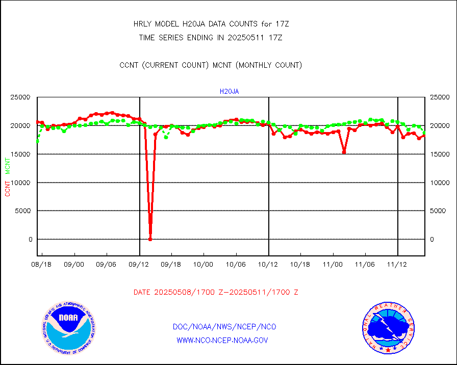
h20ja |
MTSAT/JMA water vapor imager derived cloud motion |
18613 |
13001 |
143.2 % |
1714.50-1715.49 |
h20mo |
MODIS (AQUA/TERRA) wvpr imager derived cld motion |
0 |
0 |
n/a |
1713.00-1713.99 |
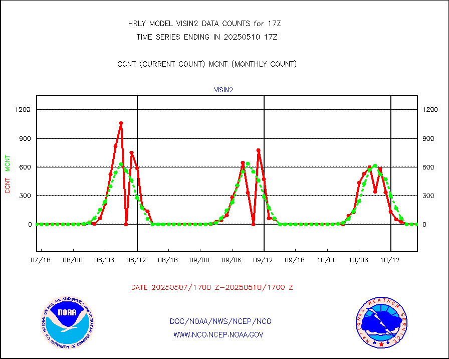
h2tusr |
GOES-16&up/NESDIS wv imgr/cld-top derived cld mtn |
27734 |
24890 |
111.4 % |
1716.00-1716.99 |
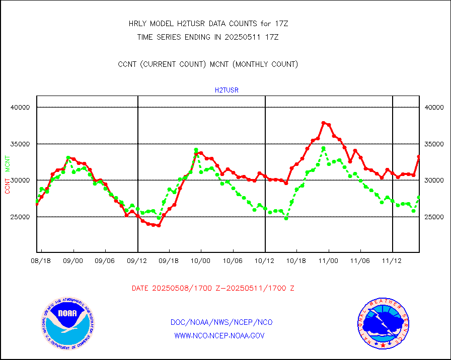
ifeunb |
METEOSAT/EUMETSAT ir lg-wave drv cld motion NBseq |
21374 |
22861 |
93.5 % |
1715.50-1716.49 |
infja |
MTSAT/JMA infrared long-wave derived cloud motion |
14420 |
10970 |
131.4 % |
1714.50-1715.49 |
infmo |
MODIS (AQUA/TERRA) ir l-wave derived cloud motion |
0 |
0 |
n/a |
1713.00-1713.99 |
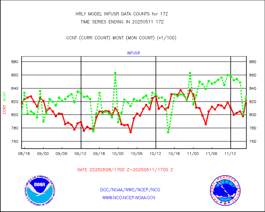
infusr |
GOES-16&up/NESDIS ir long-wave derived cld motion |
80886 |
78057 |
103.6 % |
1716.00-1716.99 |
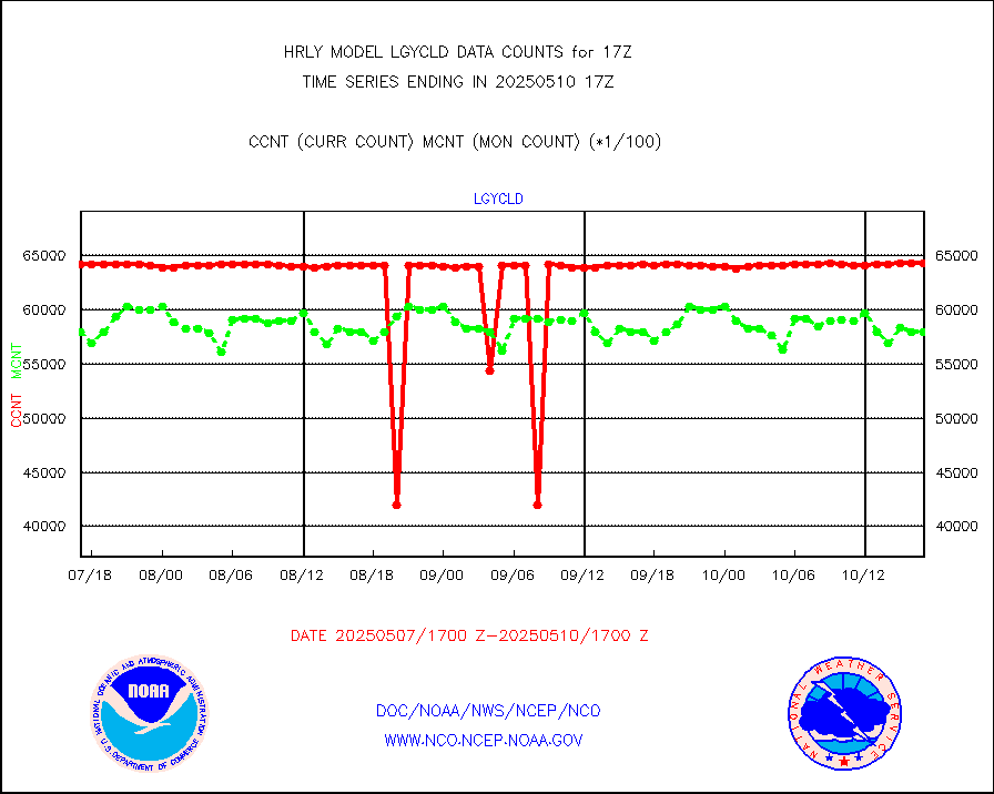
lgycld |
GOES/NASA(Langley) hi-res. (1x1 f-o-v) cloud data |
4170876 |
4110488 |
101.5 % |
1716.50-1717.49 |
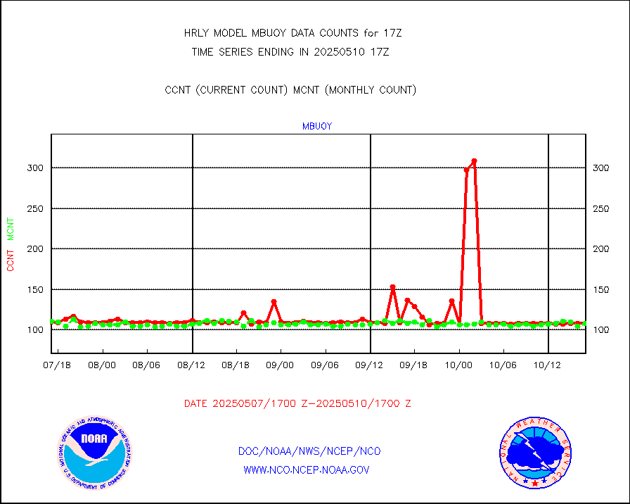
mbuoy |
Buoys decoded from FM-13 format (moored) |
99 |
117 |
84.6 % |
1716.50-1717.49 |
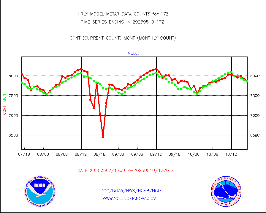
metar |
Aviation - METAR |
6769 |
7978 |
84.8 % |
1716.50-1717.49 |
mso470 |
Mesonet/MADIS Colorado E-470 (Interstate 470) |
21 |
21 |
100.0 % |
1716.50-1717.49 |
msoalk |
Mesonet/MADIS Alaska Department of Transportation |
109 |
110 |
99.1 % |
1716.50-1717.49 |
msoapg |
Mesonet/MADIS U.S. Army Aberdeen Proving Grounds |
0 |
0 |
n/a |
1716.50-1717.49 |
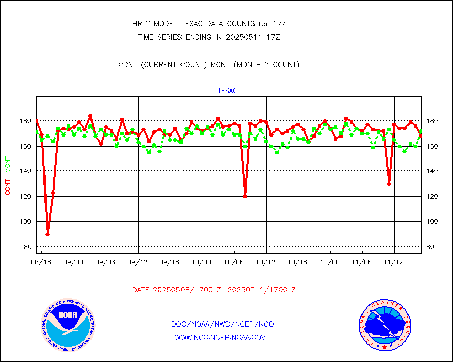
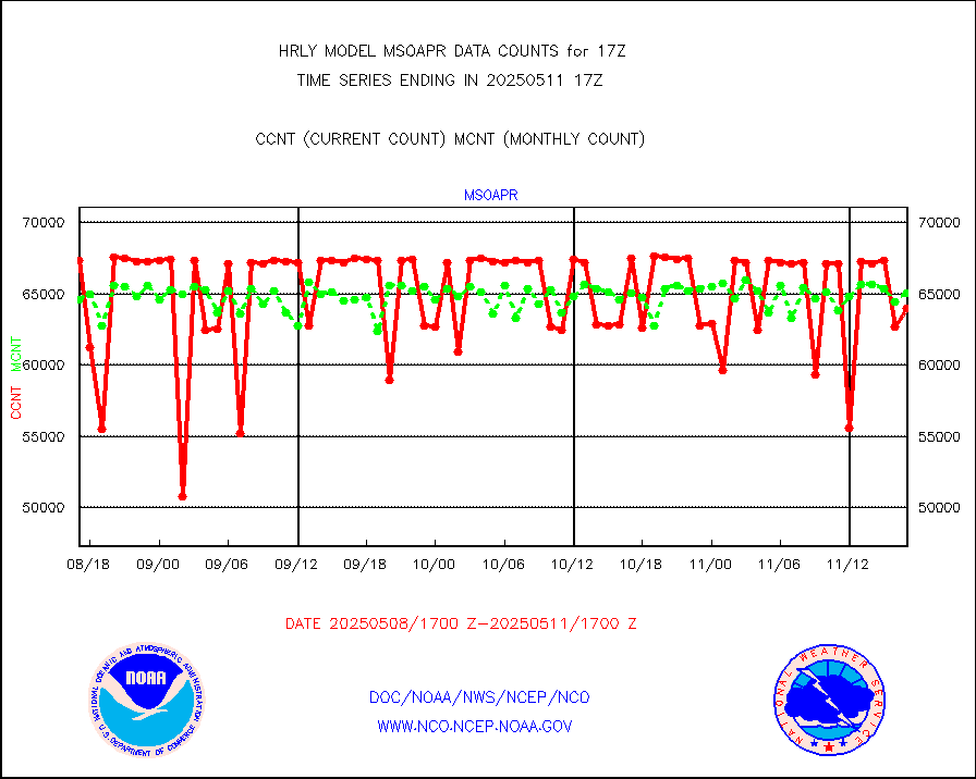
msoapr |
Mesonet/MADIS Citizen Weather Observers Program |
50277 |
48939 |
102.7 % |
1716.50-1717.49 |
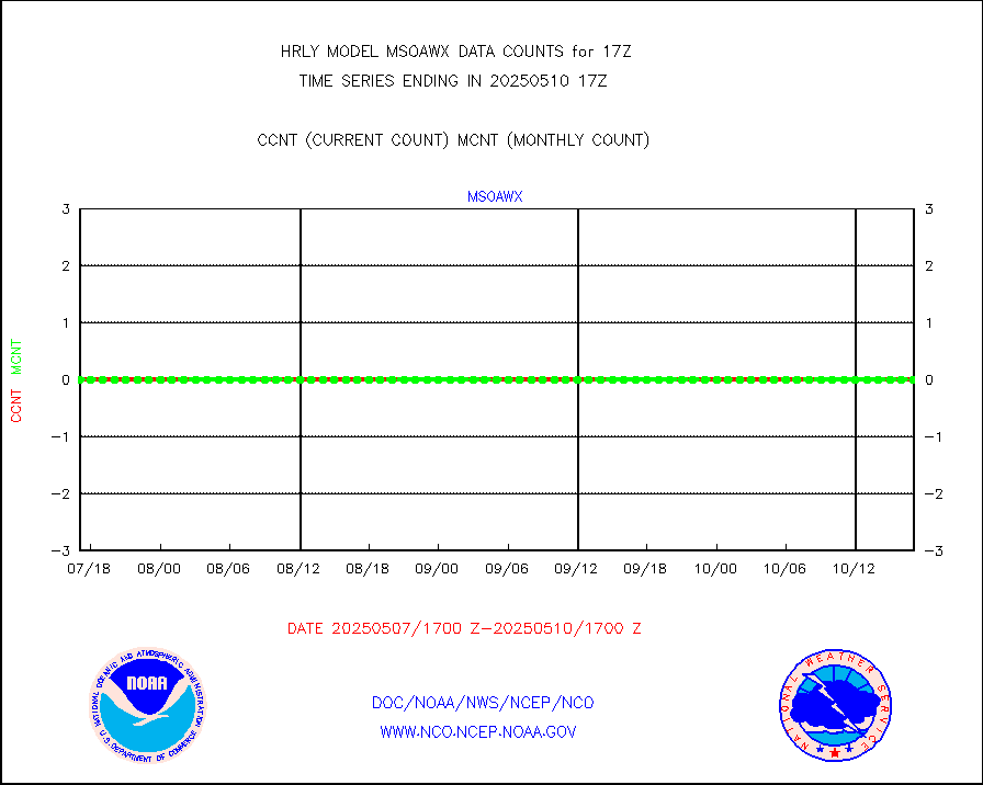
msoaws |
Mesonet/MADIS AWS Convergence Technologies, Inc. |
25228 |
25536 |
98.8 % |
1716.50-1717.49 |
msoawx |
Mesonet/MADIS "Anything Weather" |
0 |
0 |
n/a |
1716.50-1717.49 |
msocol |
Mesonet/MADIS Colorado Dept. of Transportation |
0 |
0 |
n/a |
1716.50-1717.49 |
msodcn |
Mesonet/MADIS DC Net |
0 |
0 |
n/a |
1716.50-1717.49 |
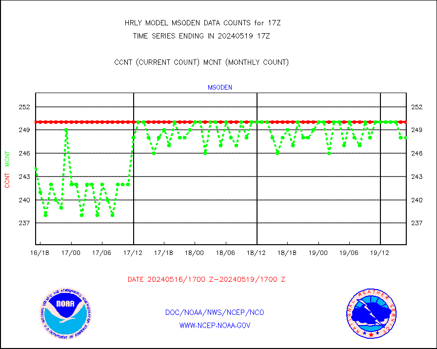
msoden |
Mesonet/MADIS Denver Urban Drainage & Flood Cntrl |
250 |
221 |
113.1 % |
1716.50-1717.49 |
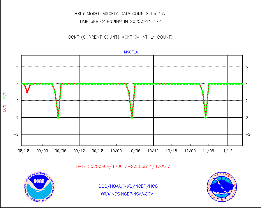
msofla |
Mesonet/MADIS Florida (FAWN & USF) |
4 |
4 |
100.0 % |
1716.50-1717.49 |
msoflt |
Mesonet/MADIS Florida Dept. of Transportation |
0 |
0 |
n/a |
1716.50-1717.49 |
msogeo |
Mesonet/MADIS Georgia Dept. of Transportation |
0 |
0 |
n/a |
1716.50-1717.49 |
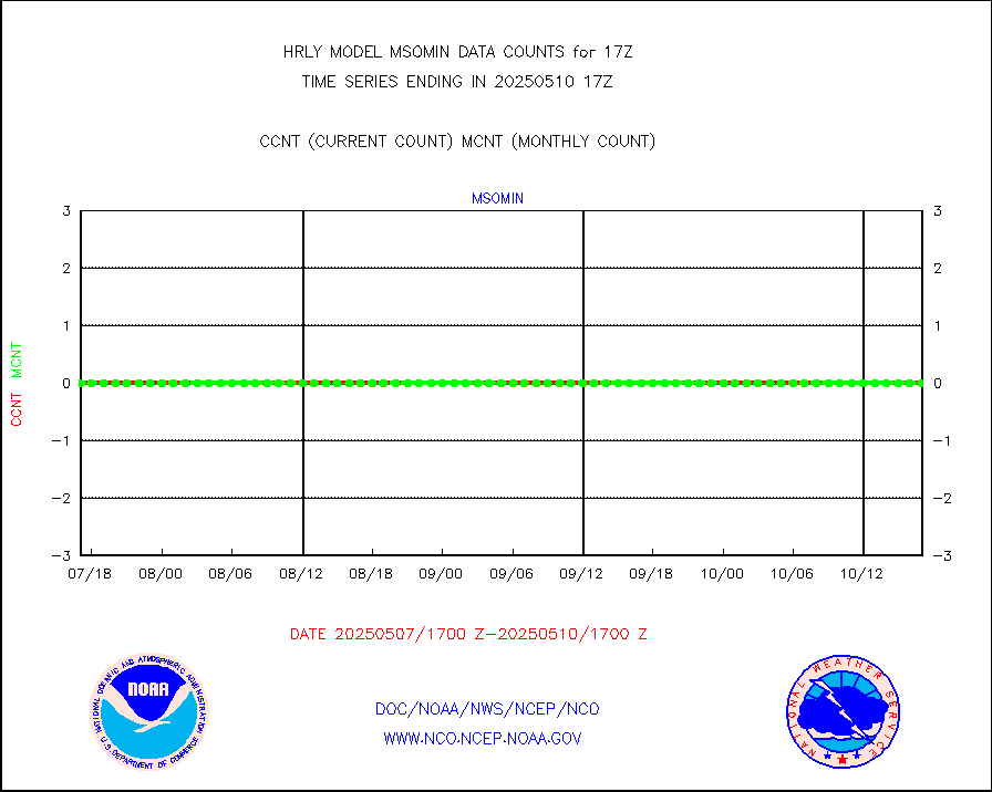
msohad |
Mesonet/MADIS NWS Hydromet Auto Data System(HADS) |
6764 |
6253 |
108.2 % |
1716.50-1717.49 |
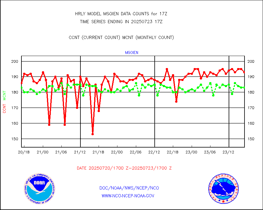
msoien |
Mesonet/MADIS Iowa Environmental |
186 |
189 |
98.4 % |
1716.50-1717.49 |
msoind |
Mesonet/MADIS Indiana Dept. of Transportation |
0 |
0 |
n/a |
1716.50-1717.49 |
msoiow |
Mesonet/MADIS Iowa Department of Transportation |
0 |
0 |
n/a |
1716.50-1717.49 |
msokan |
Mesonet/MADIS Kansas Department of Transportation |
356 |
342 |
104.1 % |
1716.50-1717.49 |
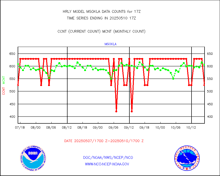
msokla |
Mesonet/MADIS Oklahoma Mesonet |
318 |
322 |
98.8 % |
1716.50-1717.49 |
msolju |
Mesonet/MADIS Louisiana State/Jackson State Univ. |
0 |
0 |
n/a |
1716.50-1717.49 |
msomca |
Mesonet/MADIS Missouri Commercial Agricult Wx Net |
290 |
269 |
107.8 % |
1716.50-1717.49 |
msomin |
Mesonet/MADIS Minnesota Dept. of Transportation |
0 |
0 |
n/a |
1716.50-1717.49 |
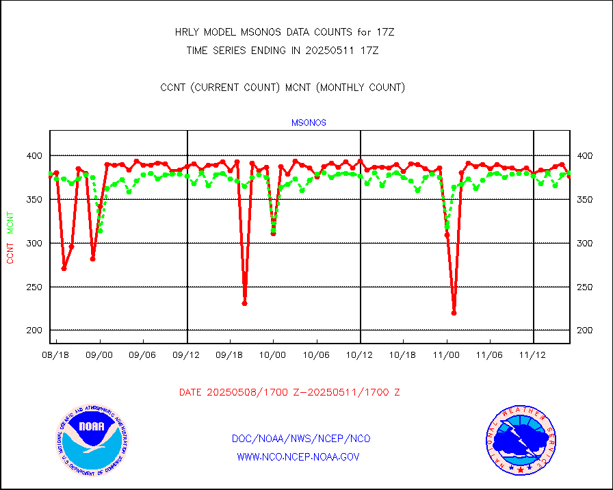
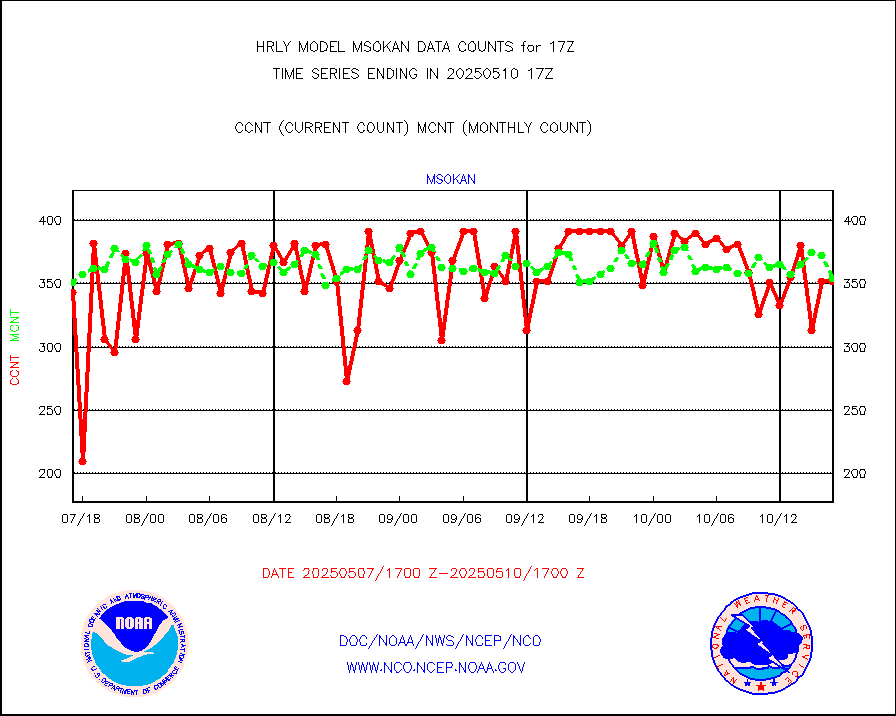
msonos |
Mesonet/MADIS NOS-Phys Oceanographic Realtime Sys |
375 |
352 |
106.5 % |
1716.50-1717.49 |
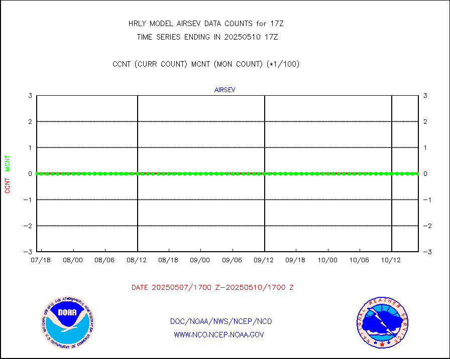
msoraw |
Mesonet/MADIS NFIC Remote Automated Wx Stns(RAWS) |
1910 |
1799 |
106.2 % |
1716.50-1717.49 |
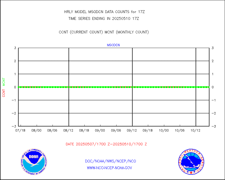
msovir |
Mesonet/MADIS Virginia Dept. of Transportation |
236 |
234 |
100.9 % |
1716.50-1717.49 |
msowfy |
Mesonet/MADIS "Weather for You" |
0 |
0 |
n/a |
1716.50-1717.49 |
msowis |
Mesonet/MADIS Wisconsin Dept. of Transportation |
0 |
0 |
n/a |
1716.50-1717.49 |
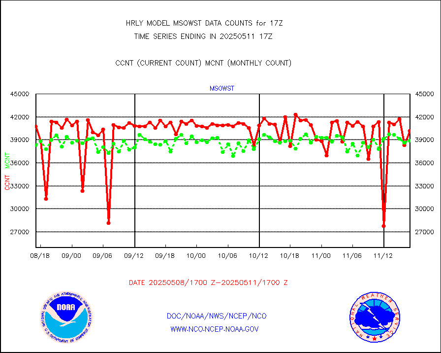
msowst |
Mesonet/MADIS MesoWest (many subproviders) |
45986 |
45588 |
100.9 % |
1716.50-1717.49 |
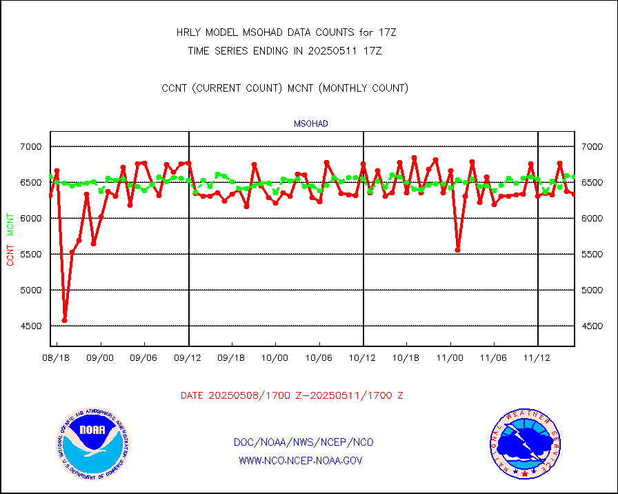
msowtx |
Mesonet/MADIS West Texas |
5653 |
5562 |
101.6 % |
1716.50-1717.49 |
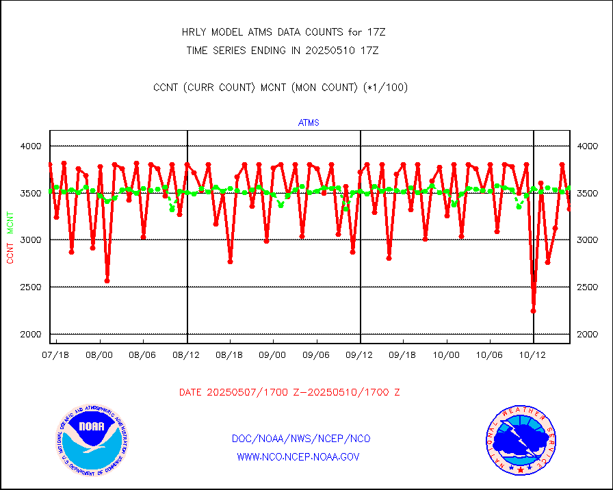
mtiasi |
METOP 1-2 IASI 1C radiance data (varbl. channels) |
58728 |
82026 |
71.6 % |
1715.00-1715.99 |
nxrdw |
NEXRAD Vel Azm Dsp(VAD) winds via radar coded msg |
0 |
0 |
n/a |
1716.50-1717.49 |
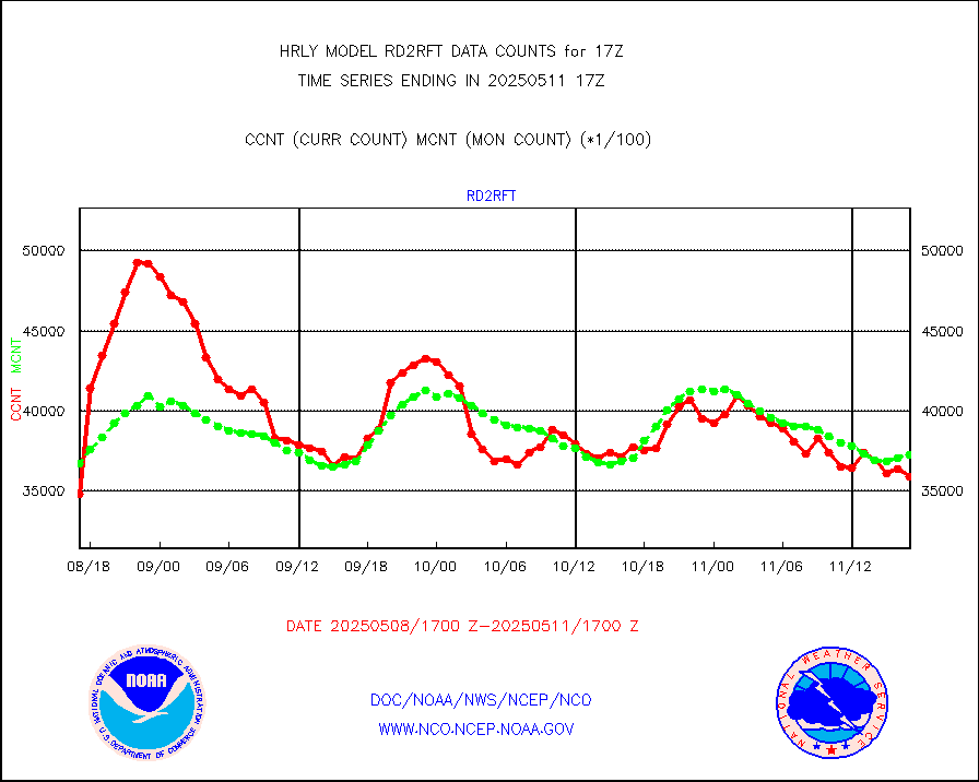
omi |
Aura Ozone Monitoring Instrument (OMI) data |
28800 |
54068 |
53.3 % |
1714.50-1715.49 |
osbuv8 |
NOAA 16-19 Solar Backscatter UV-2 rad frm V8 BUFR |
0 |
0 |
n/a |
1715.00-1715.99 |
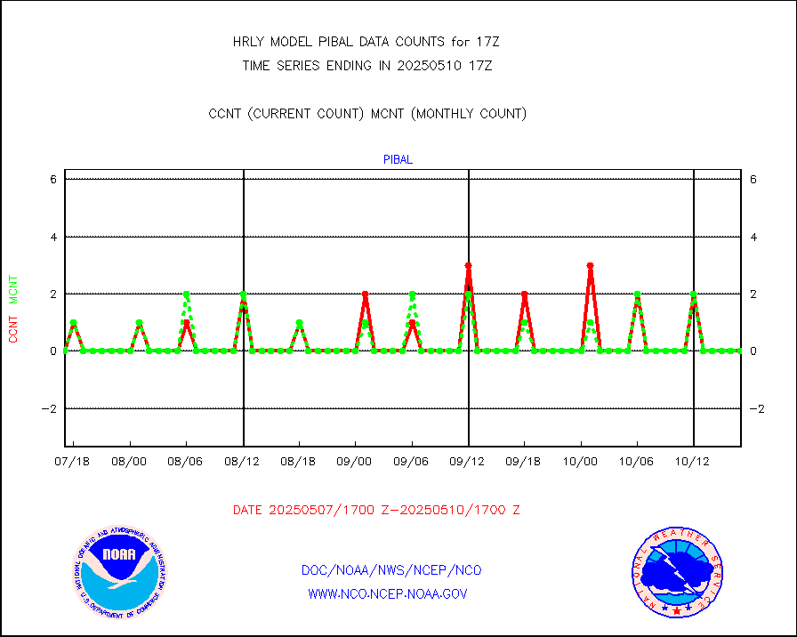
pibal |
PIBAL (from PILOT, PILOT SHIP, PILOT MOBIL) |
0 |
1 |
0.0 % |
1716.50-1717.49 |
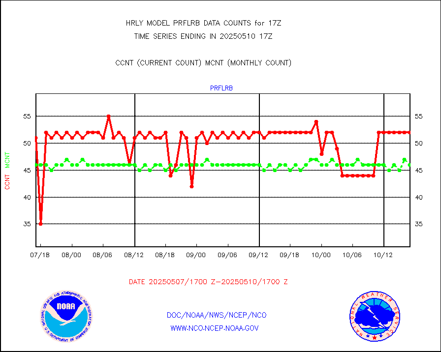
prflrb |
Multi-Agency Profiler (MAP) and SODAR winds |
44 |
39 |
112.8 % |
1716.50-1717.49 |
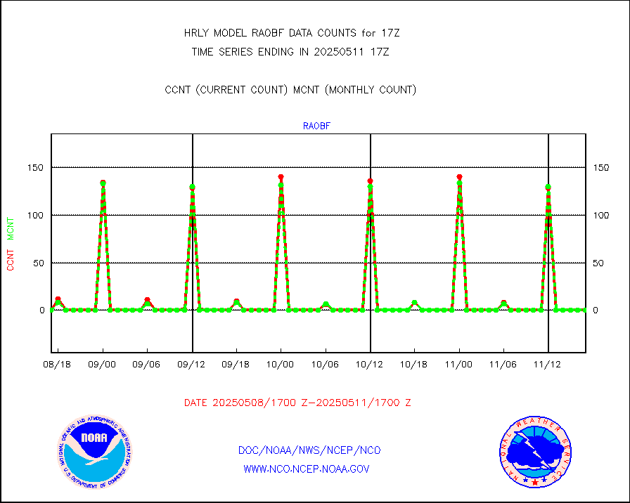
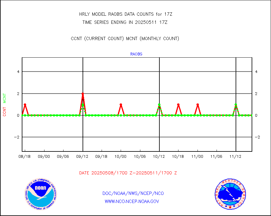
raobf |
Rawinsonde - fixed land (from TEMP or PILOT) |
0 |
0 |
n/a |
1716.50-1717.49 |
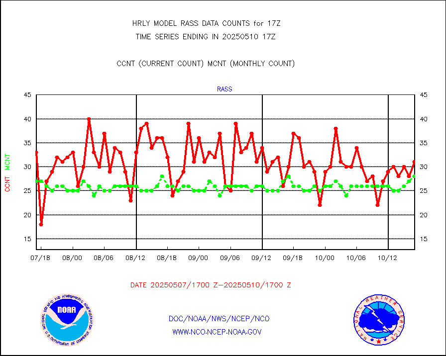
rass |
RASS temperatures (NOAA and Multi-Agency) |
30 |
23 |
130.4 % |
1716.50-1717.49 |
rd2rft |
NEXRAD reflectivity (Lvl 2 - GTS) |
3613171 |
3491699 |
103.5 % |
1716.50-1717.49 |
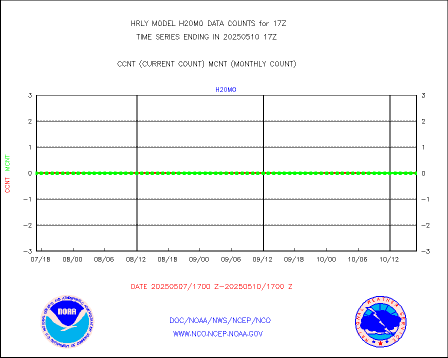
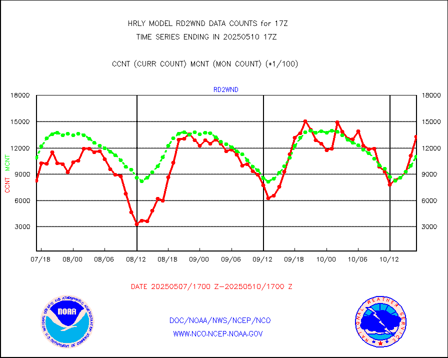
rd2wnd |
NEXRAD radial wind (Level 2 - GTS) |
1543683 |
1223933 |
126.1 % |
1716.50-1717.49 |
sevcsr |
METEOSAT-10 2nd Gen SEVIRI Clr Sky Radiance(proc) |
0 |
0 |
n/a |
1716.50-1717.49 |
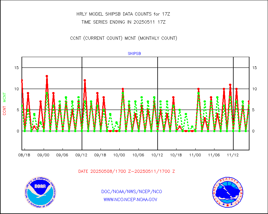
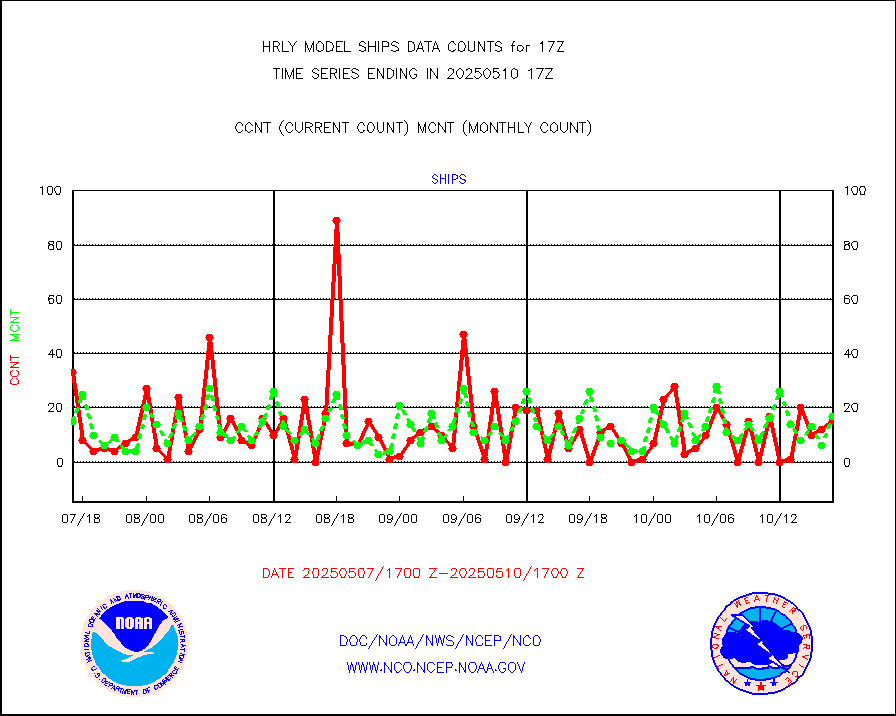
shipsb |
Ship - manual and automatic, restricted (BUFR) |
1 |
0 |
n/a |
1716.50-1717.50 |
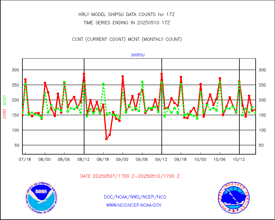
shipsu |
Ship - manual and automatic, unrestricted |
58 |
111 |
52.3 % |
1716.50-1717.50 |
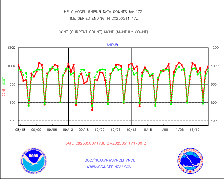
shipub |
Ship - manual and automatic, unrestricted (BUFR) |
771 |
791 |
97.5 % |
1716.50-1717.50 |
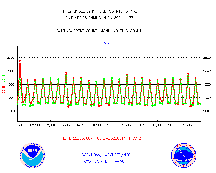
synop |
Synoptic - fixed manual and automatic |
330 |
872 |
37.8 % |
1716.50-1717.49 |
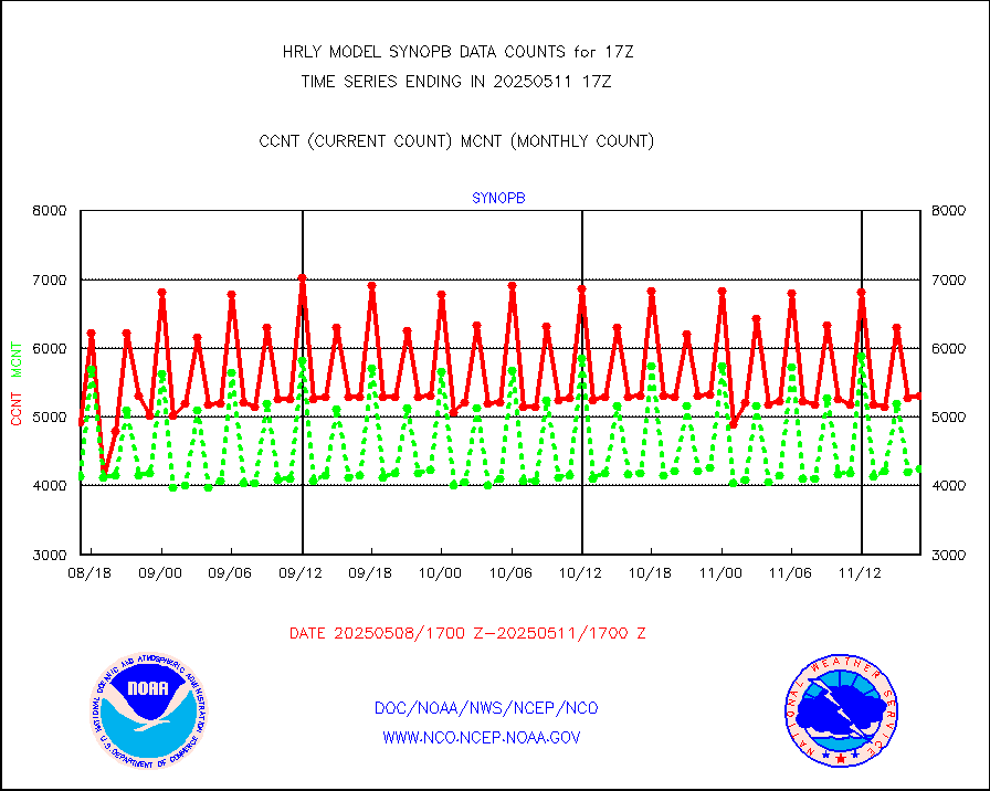
synopb |
Synoptic - fixed manual & auto (decoded fr BUFR) |
3138 |
4193 |
74.8 % |
1716.50-1717.49 |
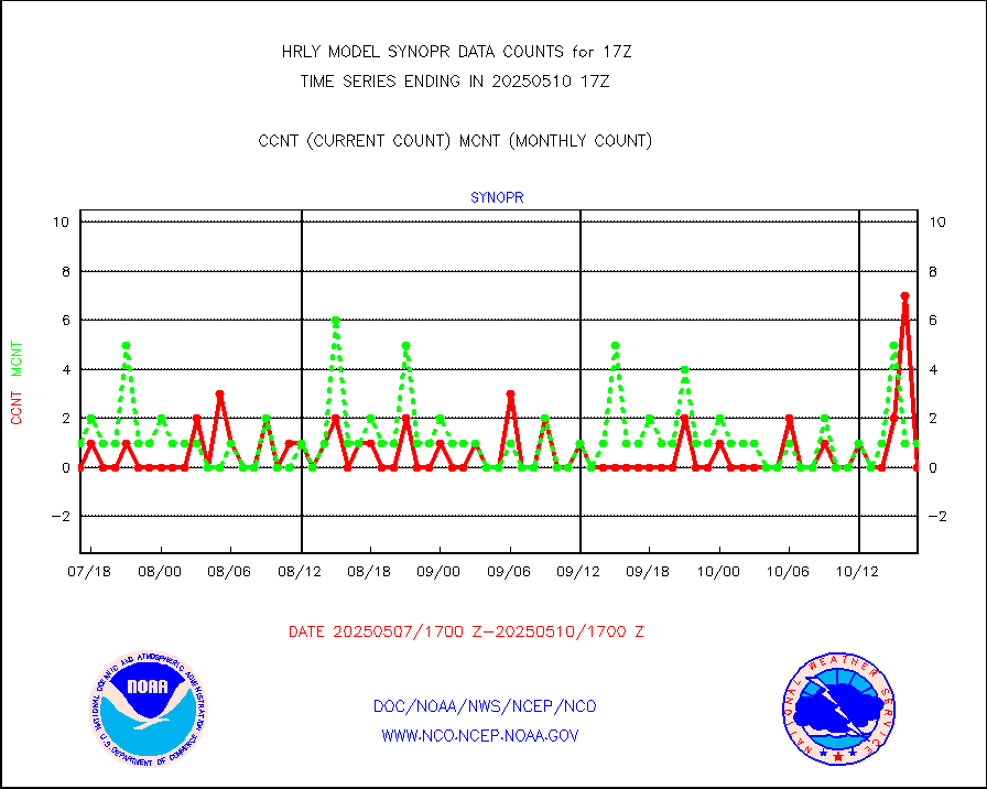
synopr |
Synoptic - restricted (WMO Res 40) manual & auto. |
8 |
1 |
800.0 % |
1716.50-1717.49 |
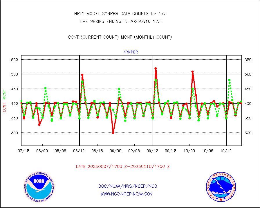
synpbr |
Synoptic - restricted (WMO Res 40)(decoded BUFR) |
540 |
398 |
135.7 % |
1716.50-1717.49 |
tideg |
Tide gauge reports decoded from CREX format |
638 |
631 |
101.1 % |
1716.00-1716.99 |
| Data Types of Opportunity with Normal Counts |
|---|
| Type | Description | Hourly Count | Monthly Average | Percent (%) of Monthly Mean | UTC Time Window |
3p9usr |
GOES-16&up/NESDIS ir short-wv derived cld motion |
10374 |
8500 |
122.0 % |
1716.00-1716.99 |
acarsa |
MDCRS ACARS acft data (ARINC via AFWA)(AIREP fmt) |
0 |
0 |
n/a |
1716.50-1717.49 |
ahicsr |
Himawari Clear Sky Radiance |
0 |
0 |
n/a |
1716.00-1716.99 |
amsr2 |
GCOM-W AMSR2 1B brightness temperatures |
1435644 |
2113452 |
67.9 % |
1715.00-1715.99 |
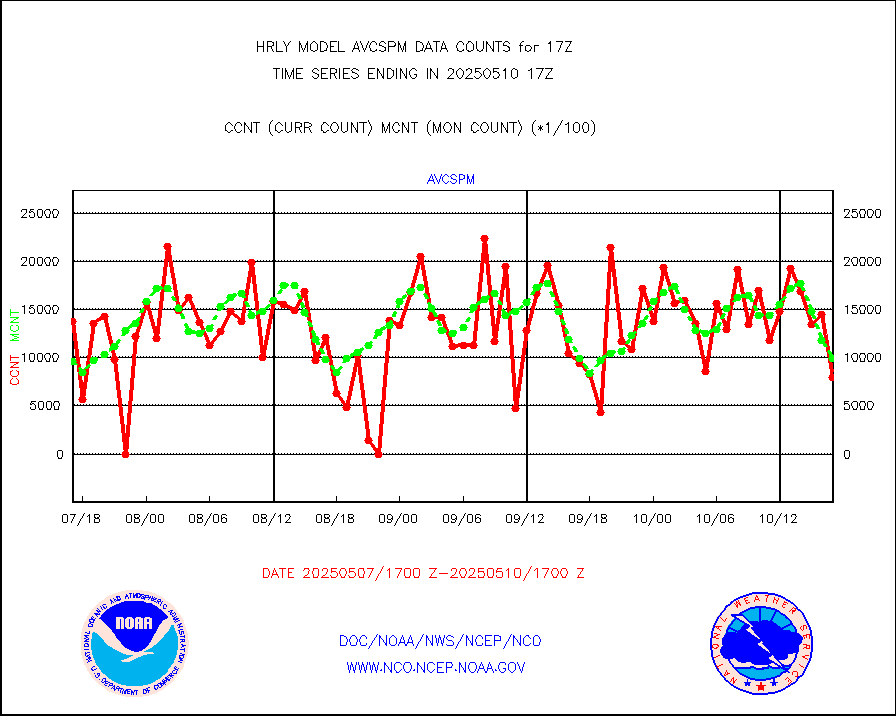
atmsdb |
NPP/NOAA-20 ATMS bright. temps-direct b-cast SSEC |
79927 |
111871 |
71.4 % |
1715.50-1716.49 |
atovs |
POES/NESDIS - processed ATOVS soundings/radiances |
0 |
0 |
n/a |
1715.00-1715.99 |
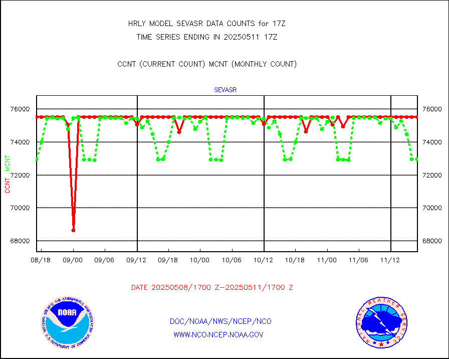
avcsam |
A.M.(N17,M2,M3) AVHRR GAC NCEP-proc clr&sea btmps |
1357358 |
1303954 |
104.1 % |
1714.50-1715.49 |
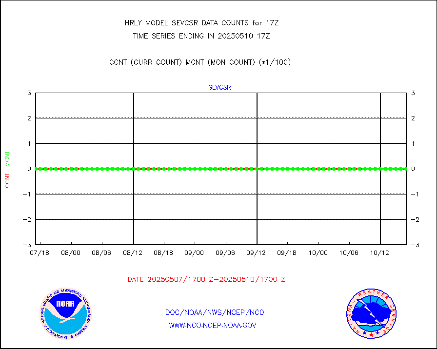
avcspm |
P.M.(N18-19) AVHRR GAC NCEP-proc clr & sea btemps |
1476312 |
1255488 |
117.6 % |
1714.50-1715.49 |
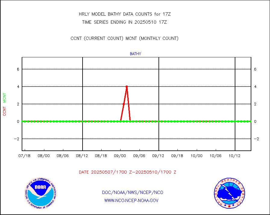
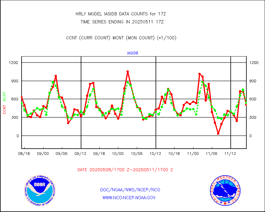
bathy |
eXpendable BathyThermograph, mooring (BATHY fmt) |
0 |
1 |
0.0 % |
1710.00-1710.99 |
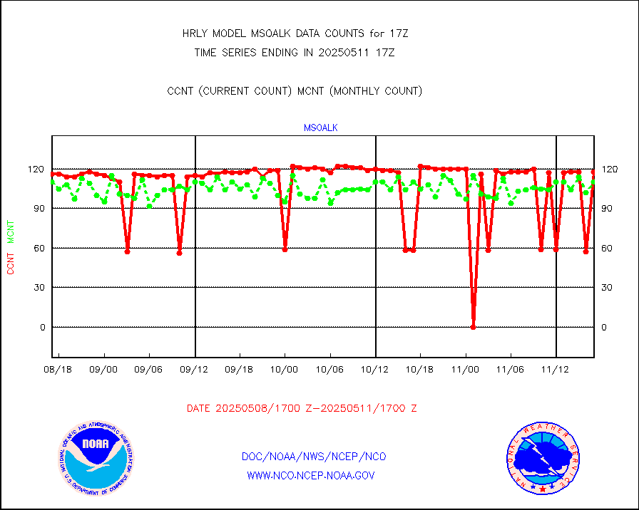
coopmd |
Coop/MADIS NEPP & HCN-Modernization NOAA COOP Obs |
23 |
22 |
104.5 % |
1716.50-1717.49 |
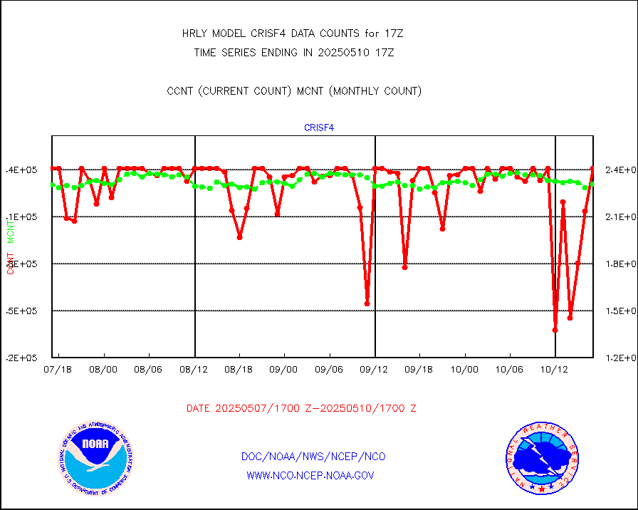
crisf4 |
NPP/NOAA-20 CrIS full spctrl radn (431 ch subset) |
185454 |
214486 |
86.5 % |
1715.50-1716.49 |
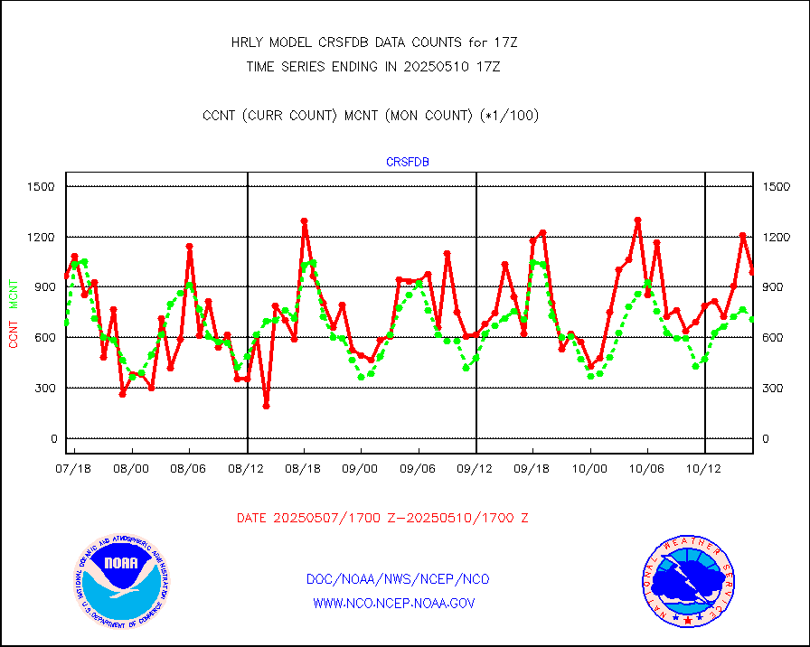
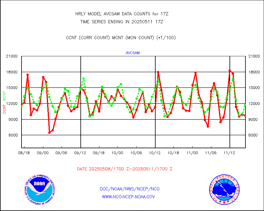
crsfdb |
NPP/NOAA-20 CrIS full spctrl radn dir brdcst SSEC |
107244 |
86193 |
124.4 % |
1715.50-1716.49 |
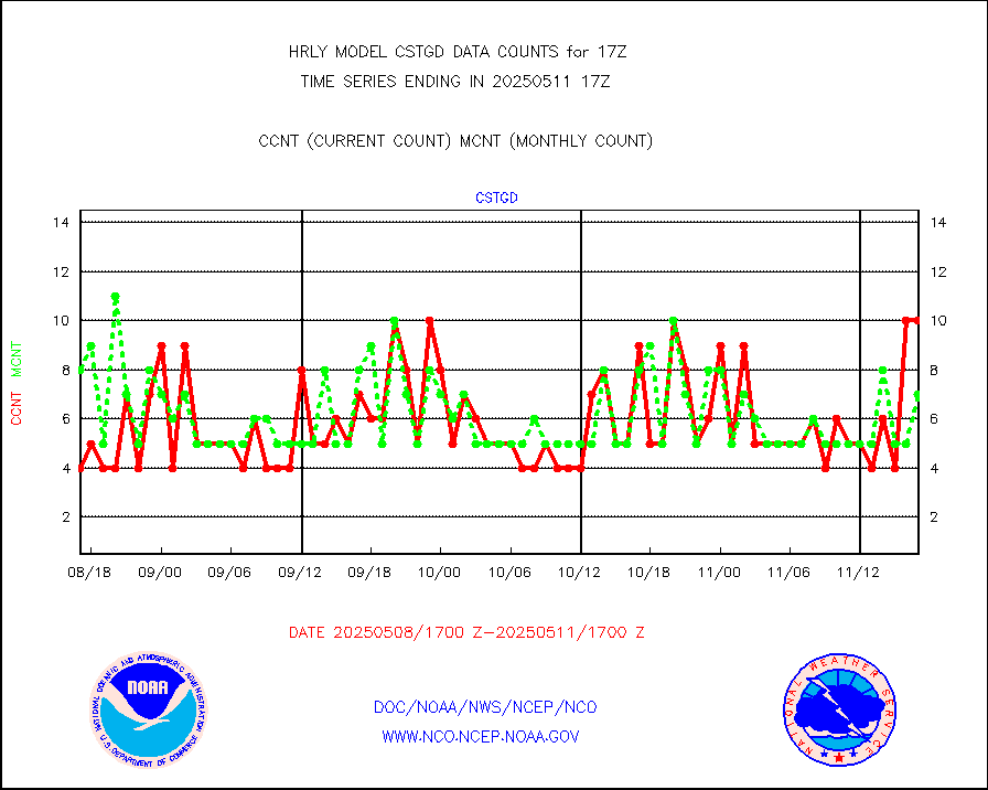
cstgd |
Coast Guard |
4 |
6 |
66.7 % |
1716.50-1717.50 |
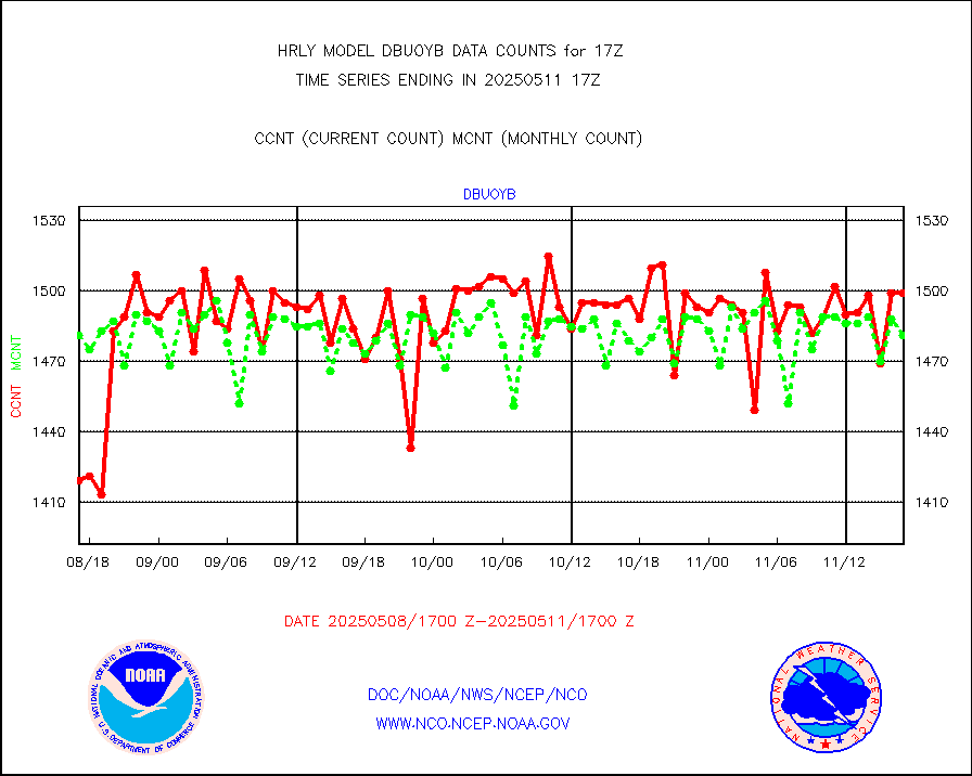
dbuoyb |
Drifting buoys (decoded from BUFR) |
1347 |
1439 |
93.6 % |
1716.50-1717.50 |
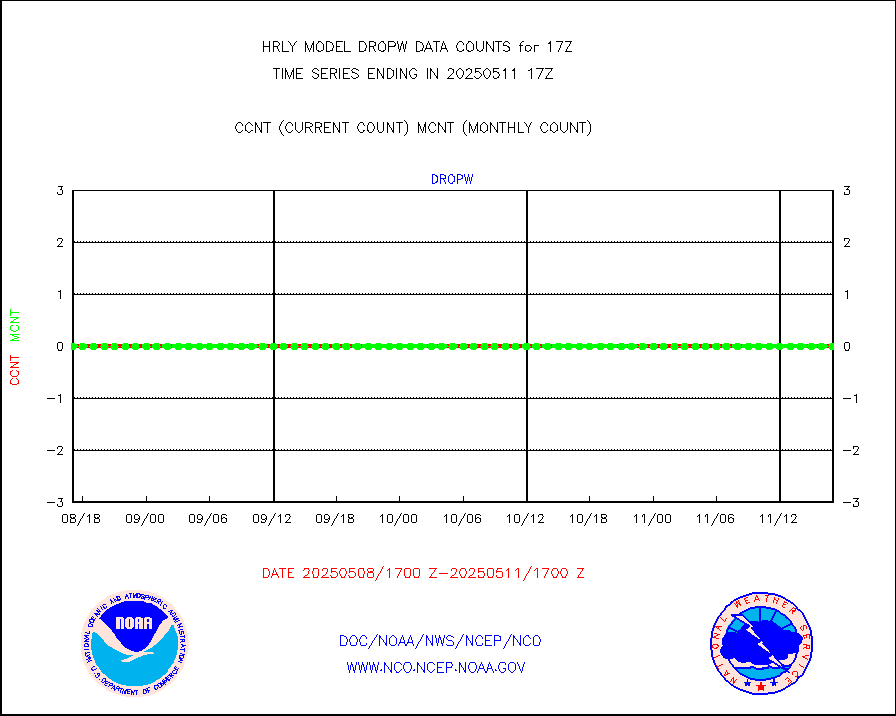
dropw |
Dropwinsonde (from TEMP DROP) |
0 |
0 |
n/a |
1716.50-1717.49 |
efclam |
GOES imager effective cloud amount data (U.Wisc.) |
8258299 |
8289145 |
99.6 % |
1716.50-1717.49 |
esatms |
NPP Adv. Tech. MW Sndr (ATMS) br. temps from RARS |
85248 |
86037 |
99.1 % |
1715.50-1716.49 |
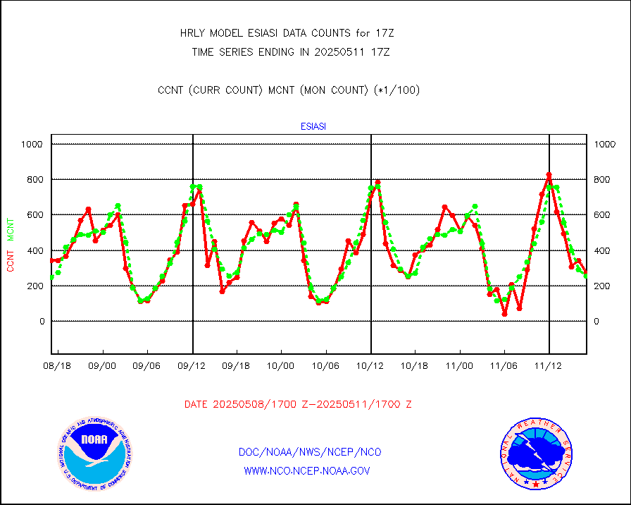
esiasi |
METOP 1-2 IASI 1C radiance data vbl chn from RARS |
40115 |
39909 |
100.5 % |
1716.00-1716.99 |
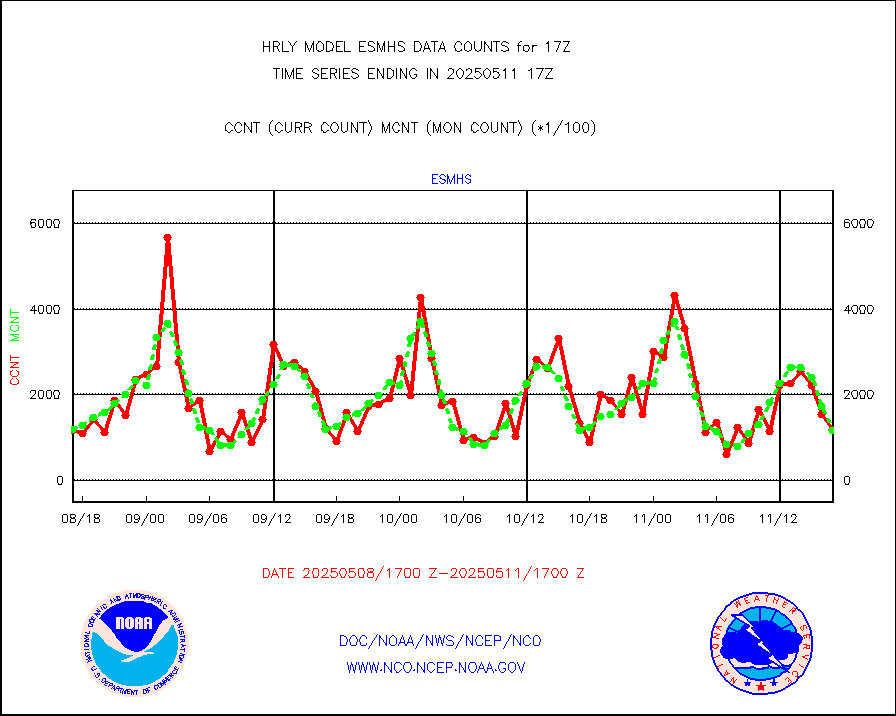
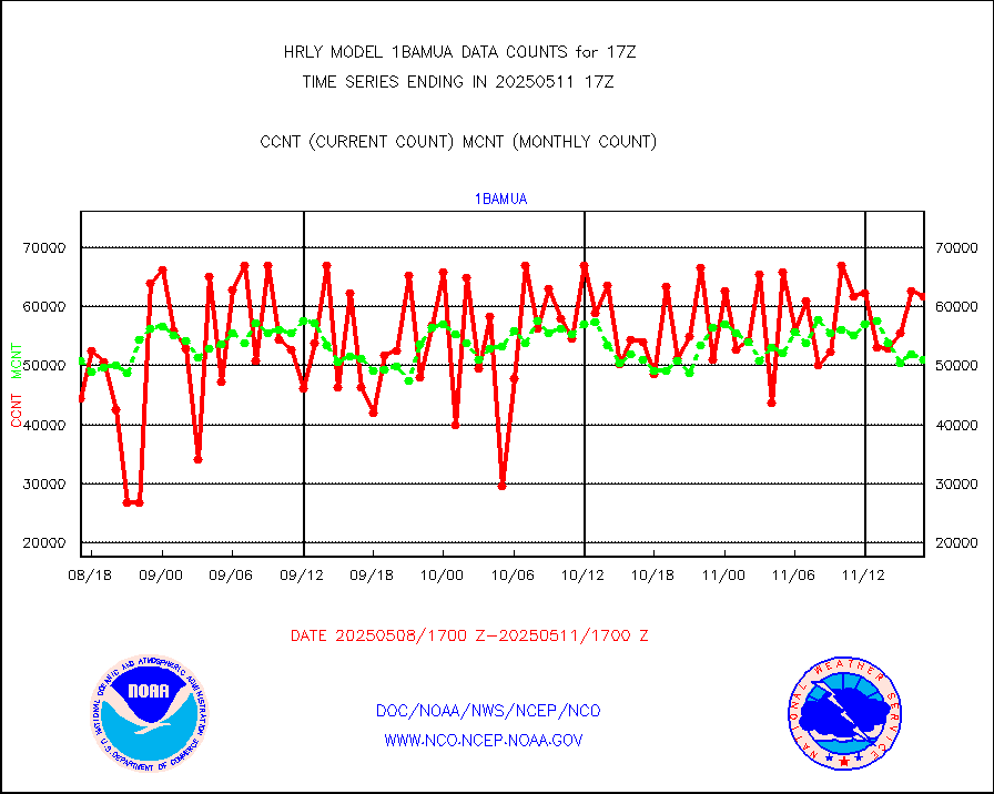
esmhs |
NOAA 18-19 & METOP 1-2 MHS proc. btemps from RARS |
179700 |
127915 |
140.5 % |
1716.50-1717.49 |
geoimr |
GOES/NESDIS (11x17 f-o-v) imager clear radiances |
0 |
0 |
n/a |
1716.00-1716.99 |
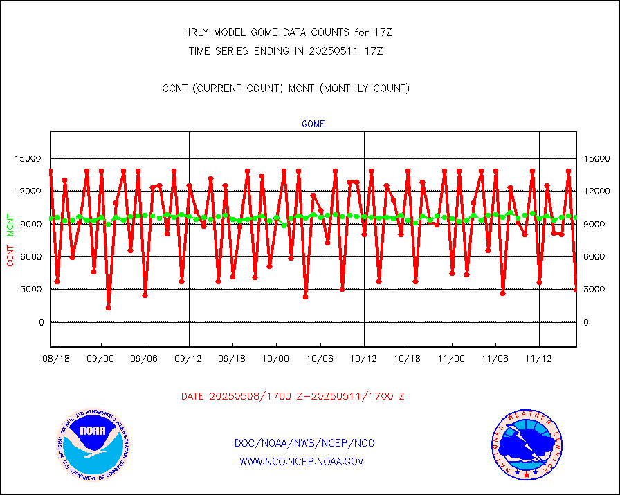
gome |
METOP 1-2 Global Ozone Monitoring Exp.-2 (GOME-2) |
13971 |
6948 |
201.1 % |
1715.50-1716.49 |
h2dusr |
GOES-16&up/NESDIS wv imgr/deep-lyr derivd cld mtn |
16354 |
15026 |
108.8 % |
1716.00-1716.99 |
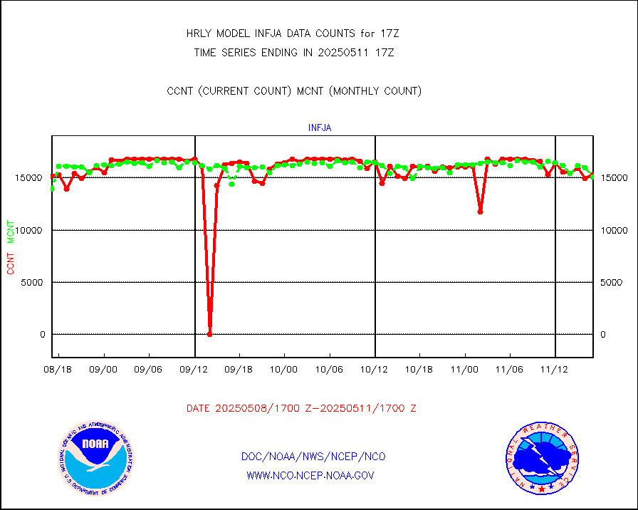
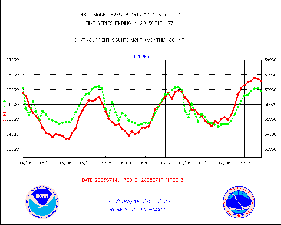
h2eunb |
METEOSAT/EUMETSAT wvpr imgr drv cld motion NBseq |
42445 |
43628 |
97.3 % |
1715.50-1716.49 |
iasidb |
METOP 1-2 IASI 1C radiances-direct broadcast SSEC |
39259 |
39237 |
100.1 % |
1715.50-1716.49 |
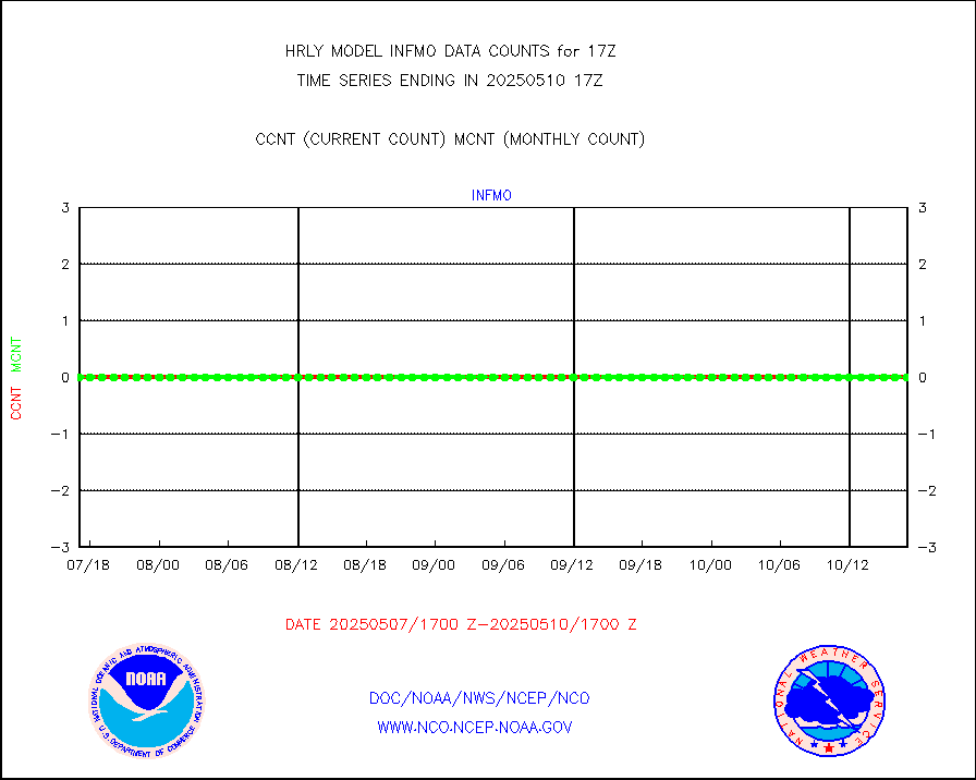
ifvrnb |
VIIRS (NPP/NOAA-20) ir lg-wv drv cloud motion(NB) |
12839 |
11131 |
115.3 % |
1713.00-1713.99 |
infav1 |
AVHRR (METOP) ir lg-wave derived cld motion |
0 |
0 |
n/a |
1716.50-1717.50 |
infin |
INSAT/KALPANA India ir lg-wave derived cld motion |
0 |
0 |
n/a |
1714.50-1715.49 |
kamdar |
Korean AMDAR aircraft data (decoded from BUFR) |
0 |
0 |
n/a |
1716.50-1717.49 |
lcman |
Land-based CMAN stations decoded from CMAN format |
72 |
89 |
80.9 % |
1716.50-1717.49 |
ltnglr |
LLDN Long-rng lightning from Vaisala via NOAAPORT |
191275 |
174445 |
109.6 % |
1716.50-1717.49 |
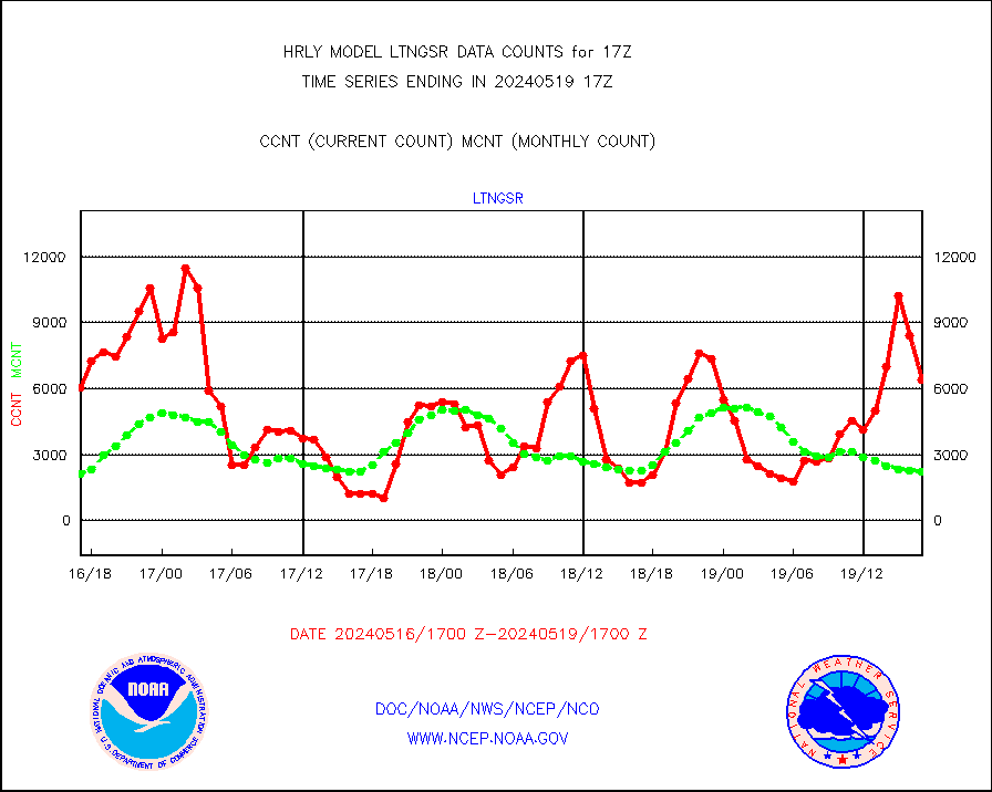
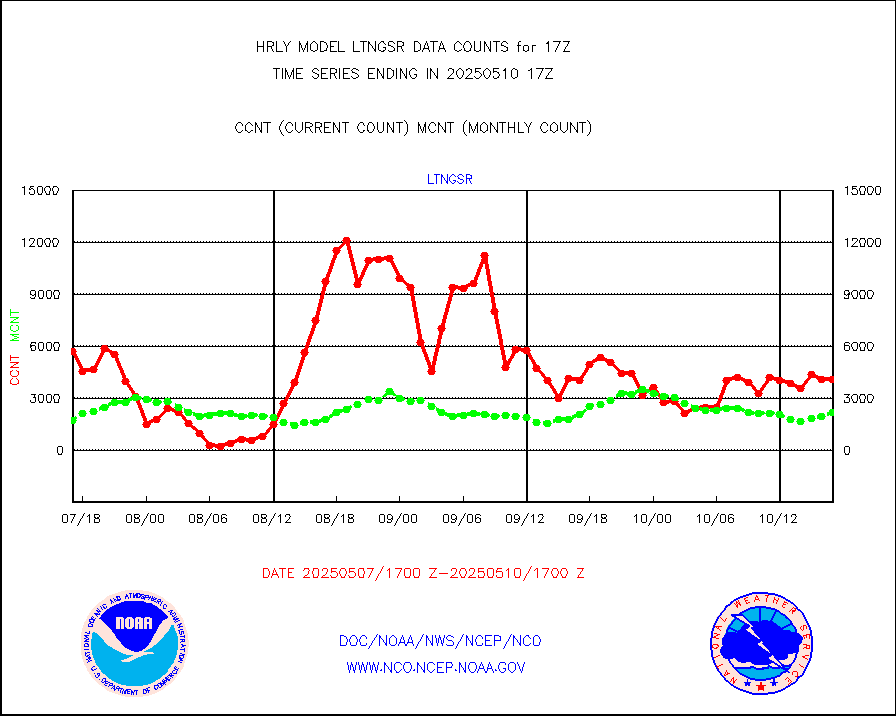
ltngsr |
NLDN Shrt-rng lightning from Vaisala via NOAAPORT |
632 |
1544 |
40.9 % |
1716.50-1717.49 |
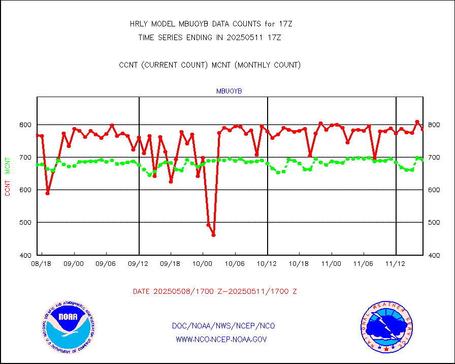
mbuoyb |
Moored buoys (decoded from BUFR) |
655 |
629 |
104.1 % |
1716.50-1717.50 |
mls |
Aura Microwave Limb Sounder (MLS) ozone data |
0 |
0 |
n/a |
1715.00-1715.99 |
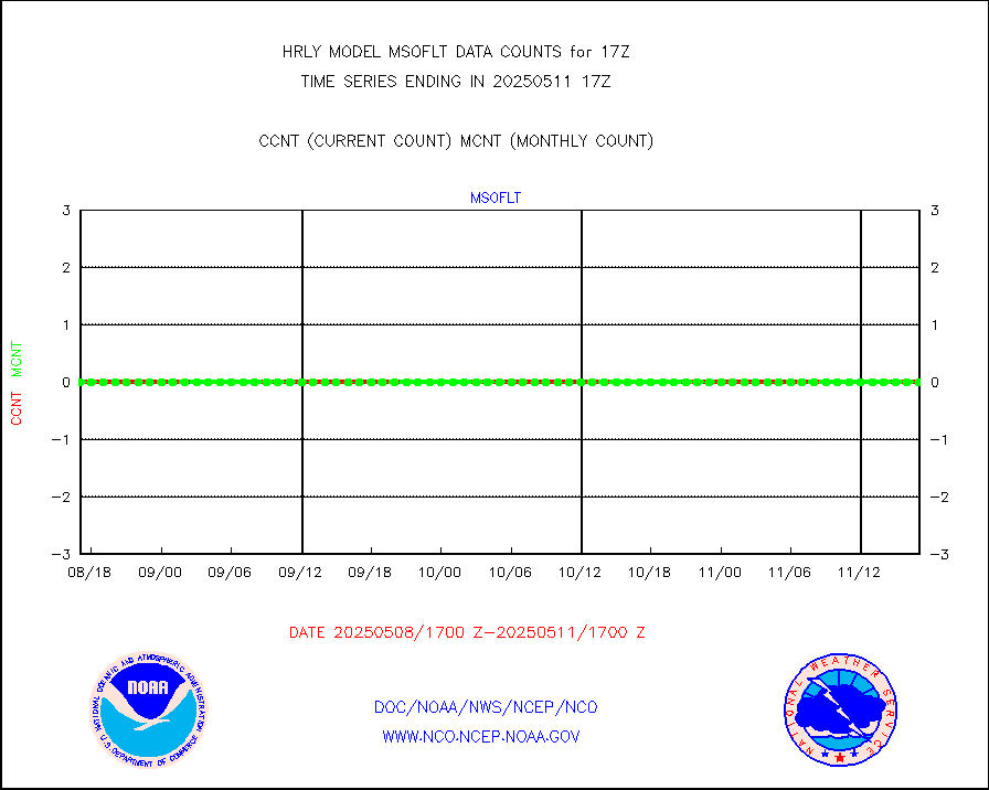
msourb |
Mesonet/MADIS UrbaNet |
4381 |
4374 |
100.2 % |
1716.50-1717.49 |
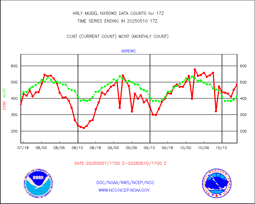
nxrdw2 |
NEXRAD Vel Azm Dsp(VAD) winds via Level 2 decoder |
473 |
441 |
107.3 % |
1716.50-1717.49 |
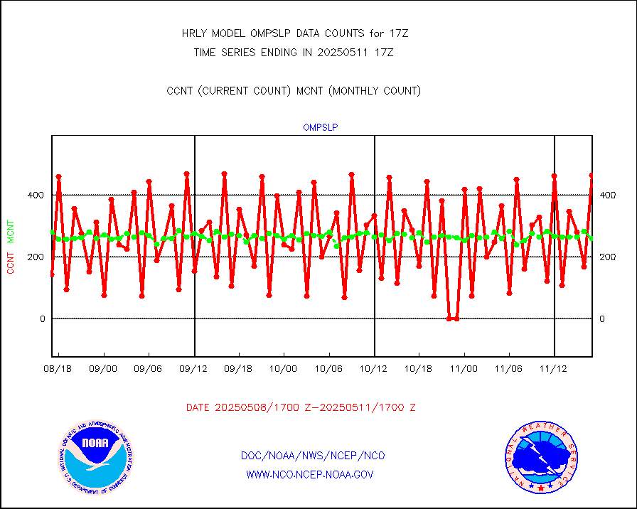
ompslp |
OMPS Limb Profiler ozone data (NPP) |
455 |
254 |
179.1 % |
1710.00-1710.99 |
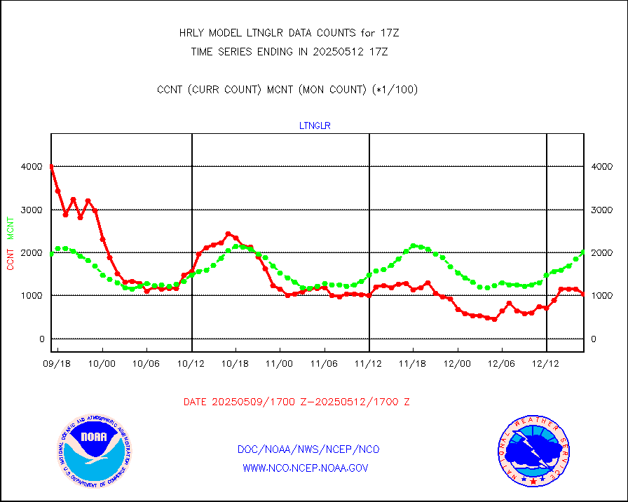
ompsn8 |
OMPS nadir profile ozone (Version 8 BUFR) |
608 |
456 |
133.3 % |
1715.00-1715.99 |
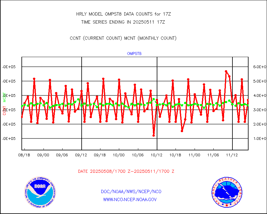
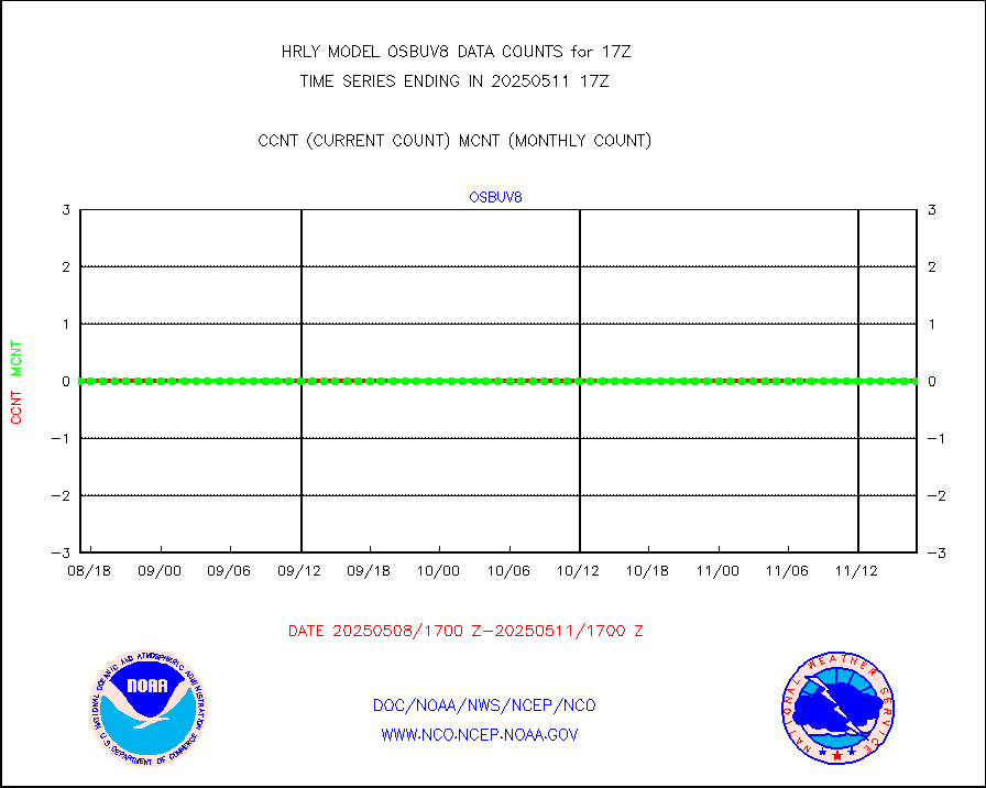
ompst8 |
OMPS total column ozone (Version 8 BUFR) |
303366 |
341623 |
88.8 % |
1715.00-1715.99 |
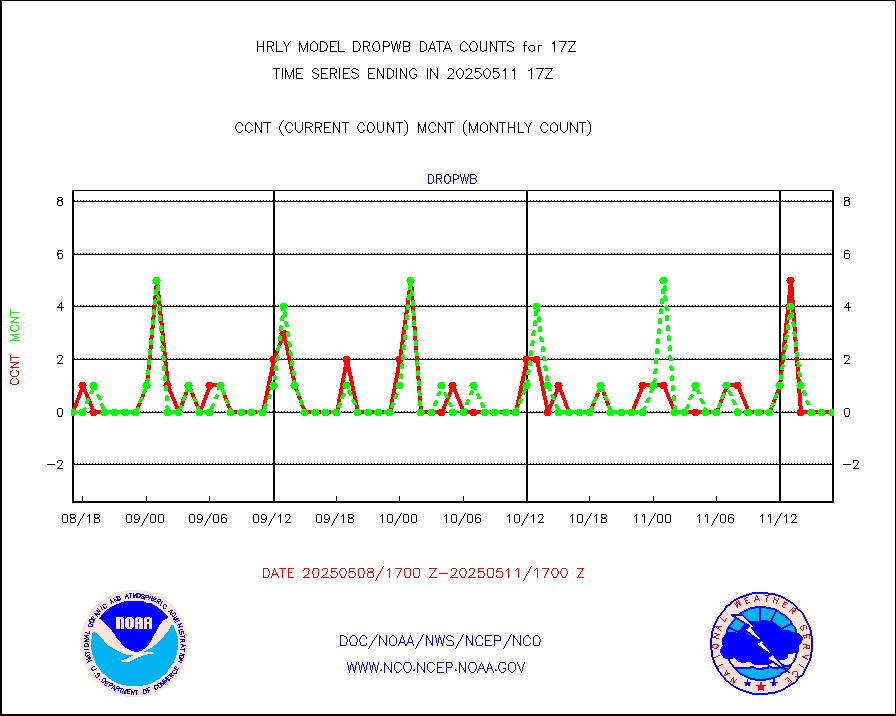
pirep |
Manual PIREP aircraft data (dcded from AIREP fmt) |
153 |
163 |
93.9 % |
1716.50-1717.49 |
prflrp |
Profilr winds from PIBAL (PILOT,PILOT SHIP/MOBIL) |
0 |
0 |
n/a |
1716.50-1717.49 |
raobm |
Rawinsonde - mobile land (from TEMP/PILOT MOBIL) |
0 |
0 |
n/a |
1716.50-1717.49 |
raobs |
Rawinsonde - ship (from TEMP SHIP, PILOT SHIP) |
0 |
0 |
n/a |
1716.50-1717.49 |
recco |
Flight level reconnaissance aircraft data |
0 |
0 |
n/a |
1716.50-1717.49 |
saphir |
Megha-Tropiques SAPHIR L1A2 brightness temps |
0 |
0 |
n/a |
1714.50-1715.49 |
sevasr |
METEOSAT-10 2nd Gen SEVIRI All Sky Radiance(proc) |
75512 |
75468 |
100.1 % |
1716.50-1717.49 |
ships |
Ship - manual and automatic, restricted |
9 |
3 |
300.0 % |
1716.50-1717.49 |
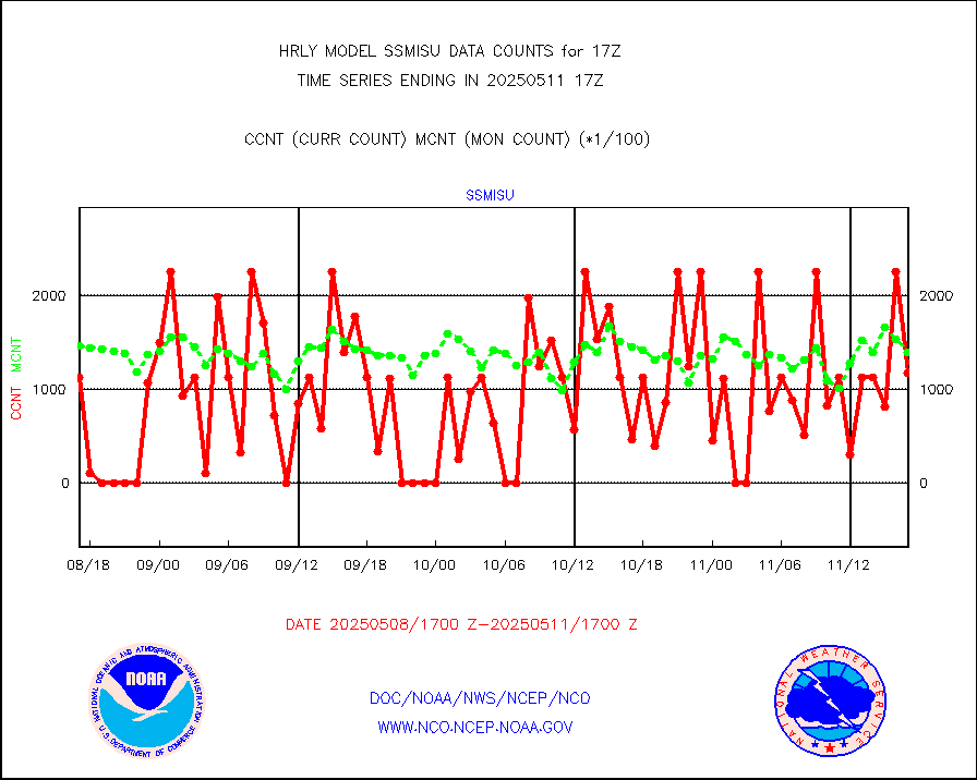
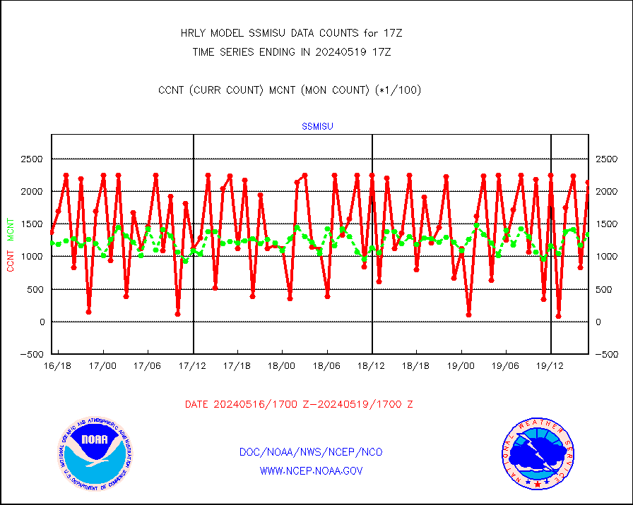
ssmisu |
DMSP SSM/IS 1C radiance data (Unified Pre-Proc.) |
18120 |
151530 |
12.0 % |
1715.50-1716.49 |
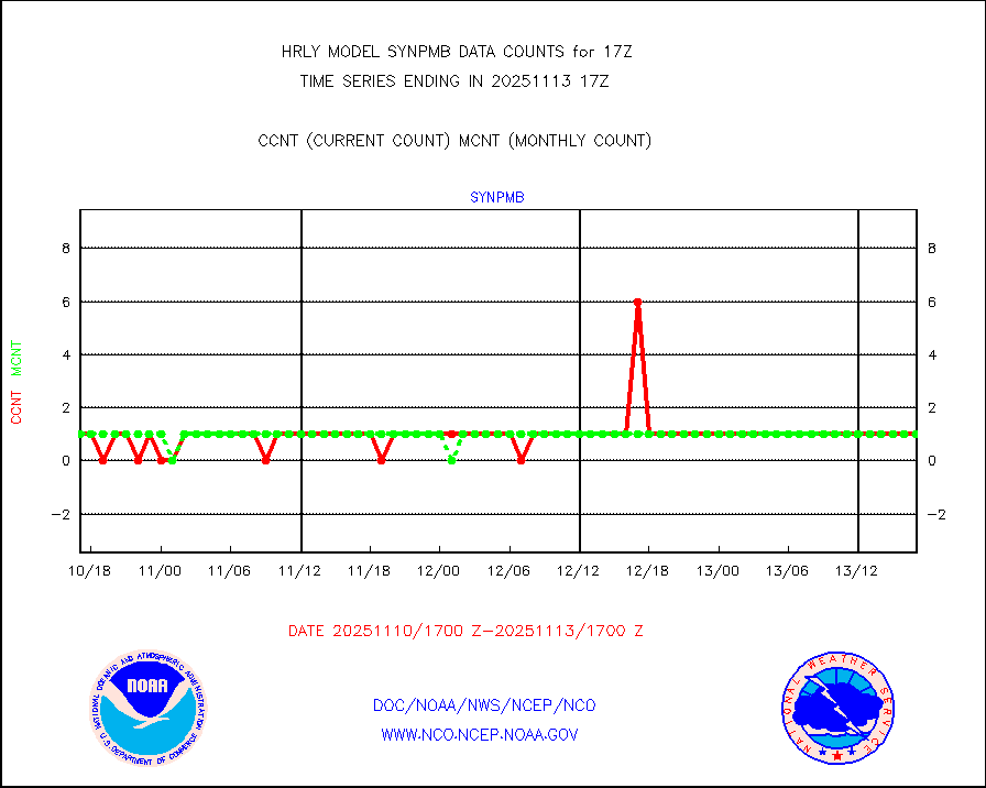
synpmb |
Synoptic - mobile manual & auto (decoded fr BUFR) |
0 |
1 |
0.0 % |
1716.50-1717.49 |
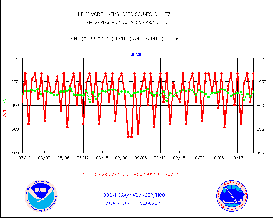
tesac |
CTD probe, Argo prflng float, mooring (TESAC fmt) |
171 |
169 |
101.2 % |
1716.50-1717.49 |
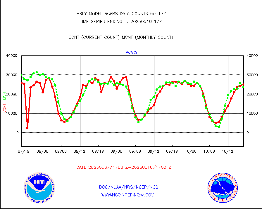
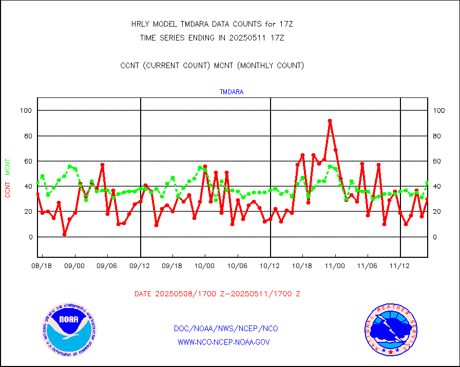
tmdara |
TAMDAR aircft data-all types(from Panasonic,BUFR) |
146 |
202 |
72.3 % |
1716.50-1717.49 |
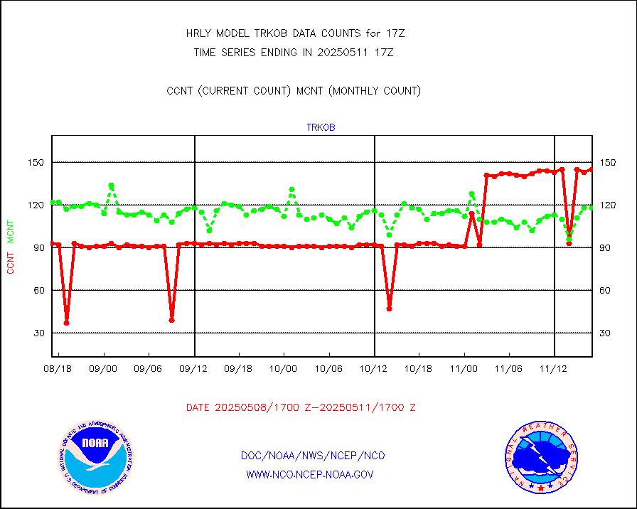
trkob |
ThermoSalinoGraph (TSG) TRACKOB format) |
60 |
52 |
115.4 % |
1715.50-1716.49 |
visin |
INSAT/KALPANA India visible derived cloud motion |
0 |
0 |
n/a |
1714.50-1715.49 |
visin2 |
INDIA SATWIND, INSAT VIS channel |
0 |
0 |
n/a |
1716.00-1716.99 |
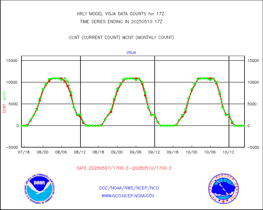
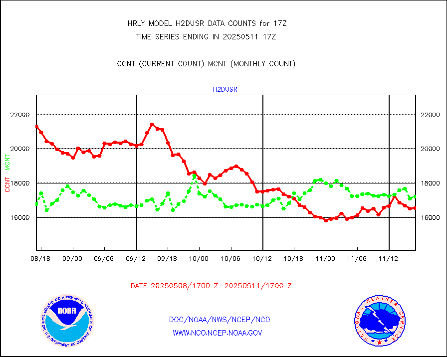
visja |
MTSAT/JMA visible derived cloud motion |
0 |
0 |
n/a |
1714.50-1715.49 |
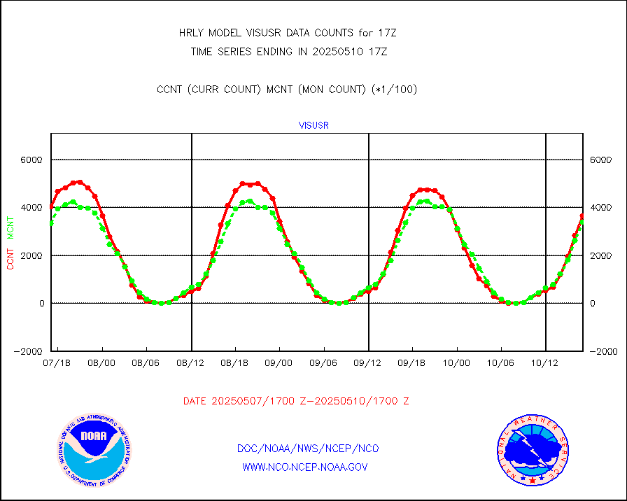
visusr |
GOES-16&up/NESDIS visible derived cloud motion |
325053 |
319838 |
101.6 % |
1716.00-1716.99 |
vseunb |
METEOSAT/EUMETSAT visible drv cld motion NBseq |
24531 |
26473 |
92.7 % |
1715.50-1716.49 |


