| Critical Data with Normal Counts |
|---|
| Type | Description | Hourly Count | Monthly Average | Percent (%) of Monthly Mean | UTC Time Window |
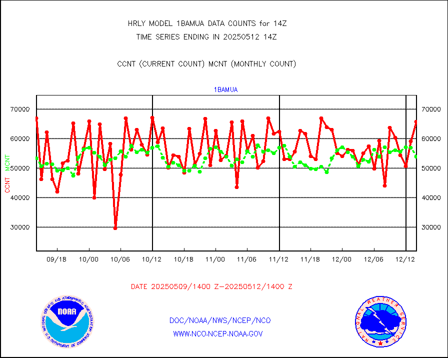
1bamua |
NOAA 15-19 & METOP 1-2 AMSU-A NCEP-proc. br.temps |
66451 |
54803 |
121.3 % |
1712.00-1712.99 |
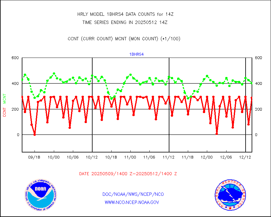
1bhrs4 |
NOAA 18-19 & METOP 1-2 HIRS-4 NCEP-proc. br.temps |
59186 |
45376 |
130.4 % |
1712.00-1712.99 |
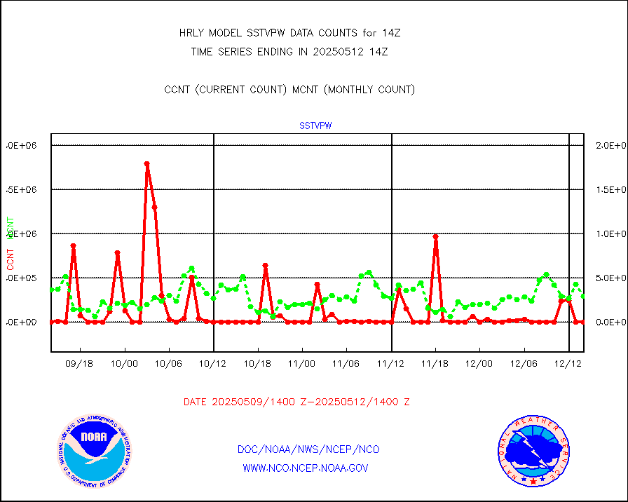
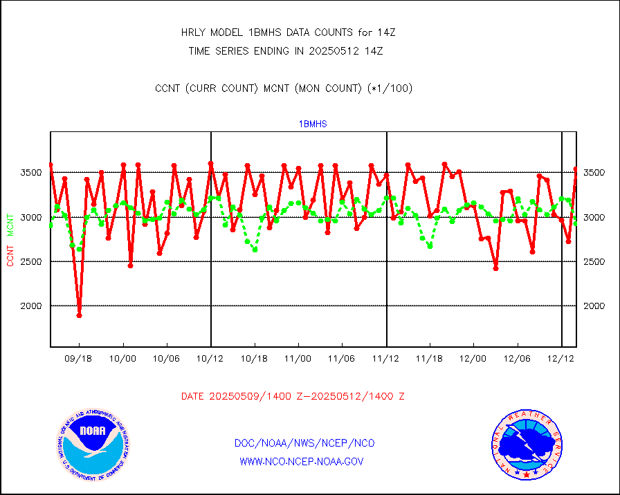
1bmhs |
NOAA 18-19 & METOP 1-2 MHS NCEP-proces. br. temps |
355856 |
304247 |
117.0 % |
1712.00-1712.99 |
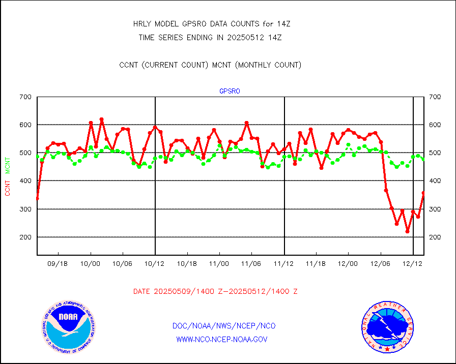
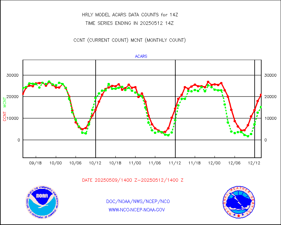
acars |
MDCRS ACARS acft data from ARINC(dcded from BUFR) |
19326 |
21524 |
89.8 % |
1713.50-1714.49 |
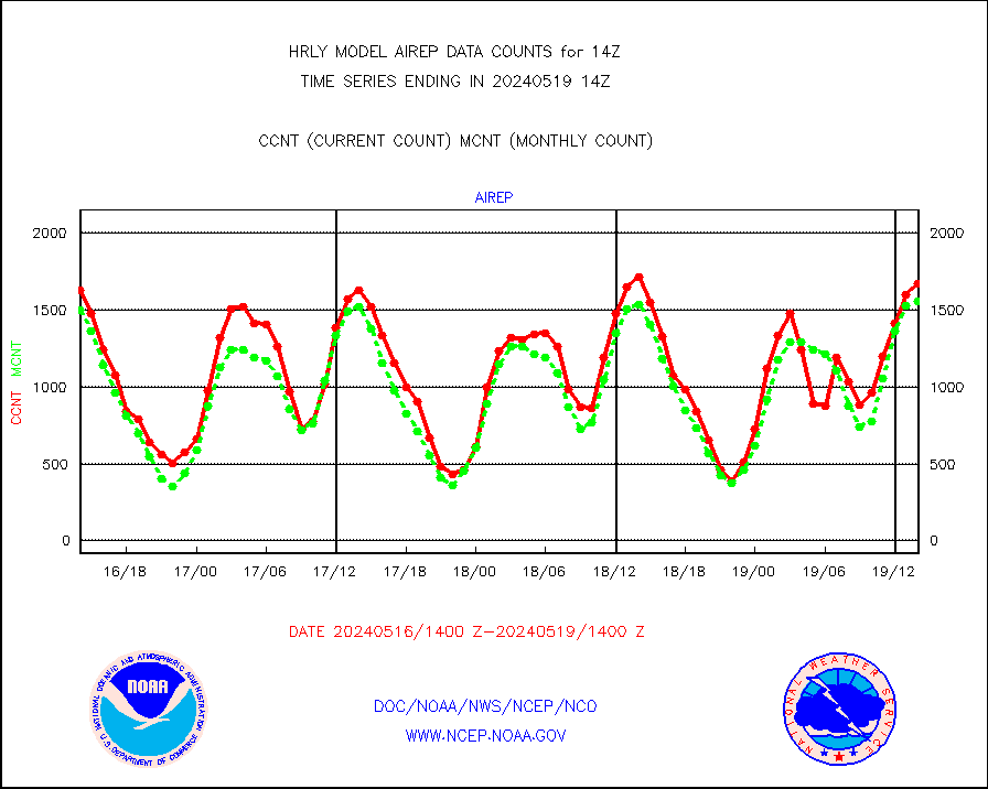
airep |
Manual AIREP aircraft data (dcded from AIREP fmt) |
1023 |
1349 |
75.8 % |
1713.50-1714.49 |
airsev |
AQUA AIRS/AMSU-A/HSB brightness temps- every FOV |
0 |
0 |
n/a |
1711.50-1712.49 |
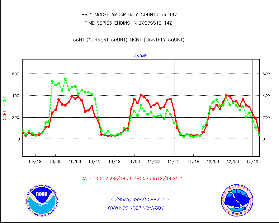
amdar |
AMDAR aircraft data (decoded from AMDAR format) |
93 |
43 |
216.3 % |
1713.50-1714.49 |
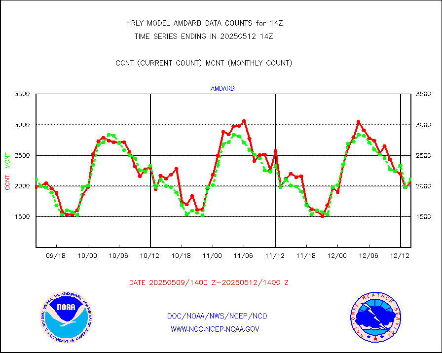
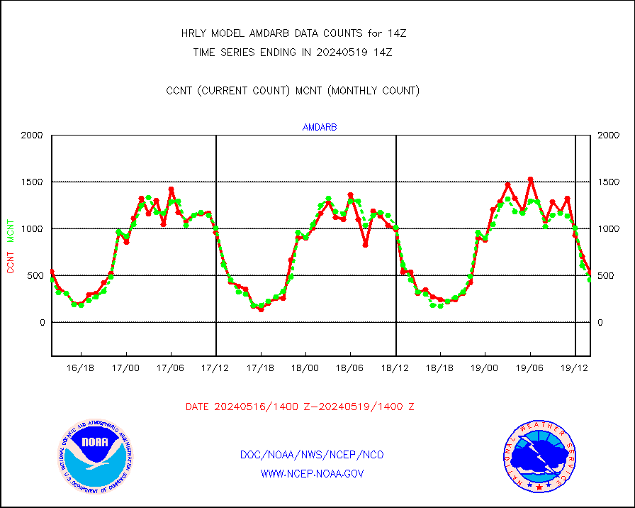
amdarb |
AMDAR aircraft data (decoded from BUFR) |
404 |
484 |
83.5 % |
1713.50-1714.49 |
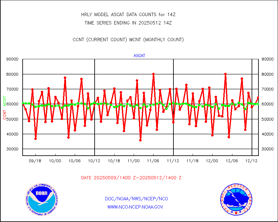
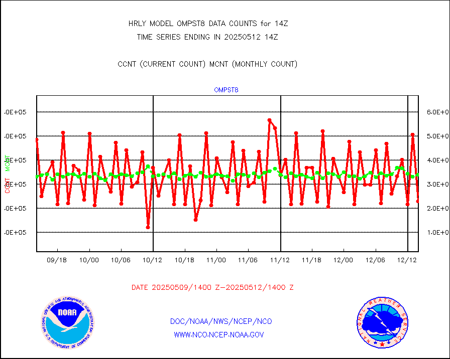
ascat |
METOP 1-2 ASCAT products |
62580 |
30871 |
202.7 % |
1712.50-1713.49 |
atms |
NPP/NOAA-20 ATMS brightness temperatures |
378144 |
343434 |
110.1 % |
1712.50-1713.49 |
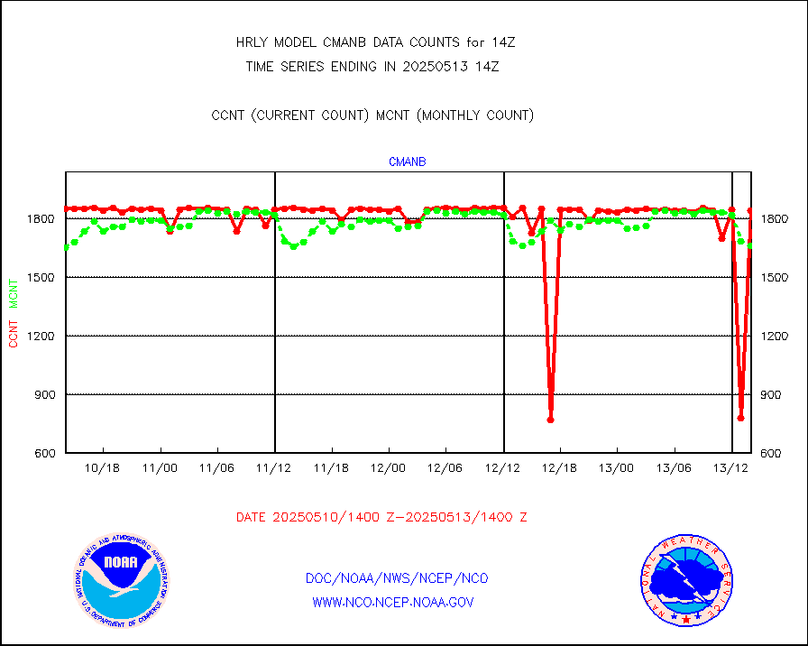
cmanb |
Surface Marine CMAN rpts decoded from BUFR format |
1842 |
1742 |
105.7 % |
1713.50-1714.50 |
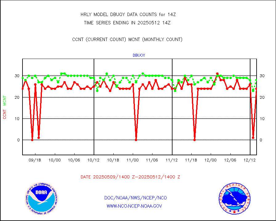
dbuoy |
Buoys decoded from FM-18 fmt (moored or drifting) |
0 |
22 |
0.0 % |
1713.50-1714.49 |
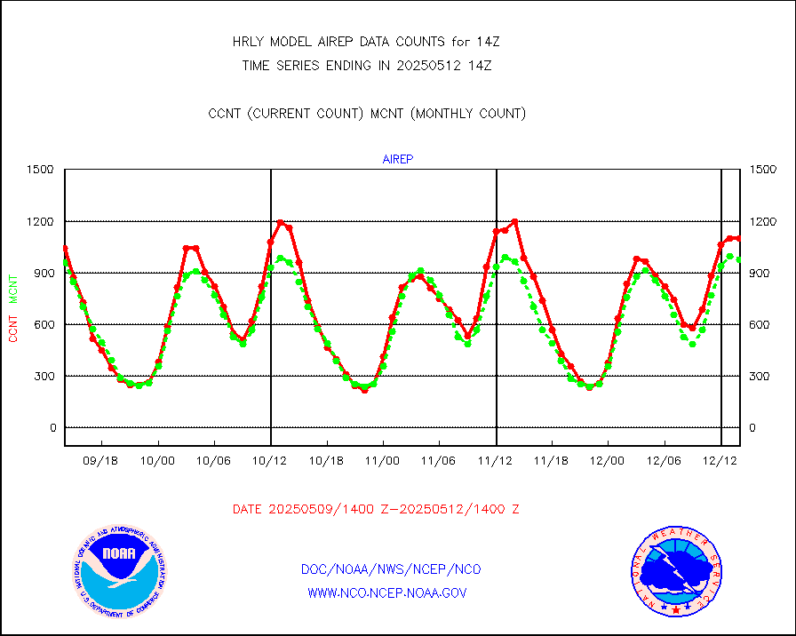
eadas |
E-AMDAR (European AMDAR acft decoded from BUFR) |
1991 |
1760 |
113.1 % |
1713.50-1714.49 |
esamua |
NOAA 15-19 & METOP 1-2 AMSU-A proc btmps frm RARS |
33760 |
38138 |
88.5 % |
1713.50-1714.49 |
eshrs3 |
NOAA 15-19 & METOP 1-2 HIRS-3/4 pr btmps frm RARS |
73538 |
77346 |
95.1 % |
1713.50-1714.49 |
gnss |
Grnd-based Gbl Navigation Sat System (GNSS) data |
9000 |
7502 |
120.0 % |
1713.00-1713.99 |
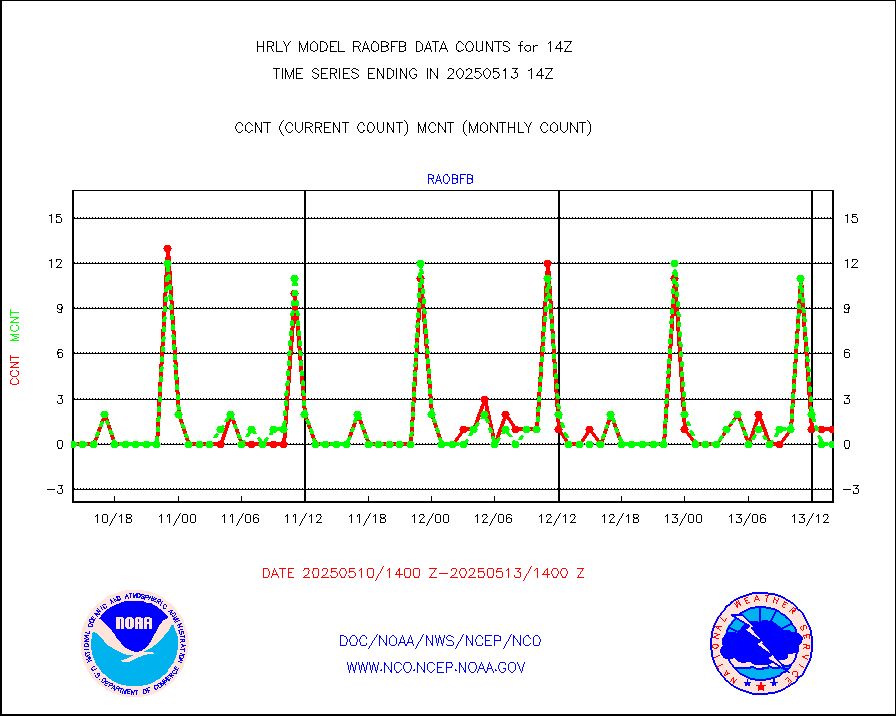
gpsro |
GPS radio occultation data |
362 |
419 |
86.4 % |
1711.50-1712.49 |
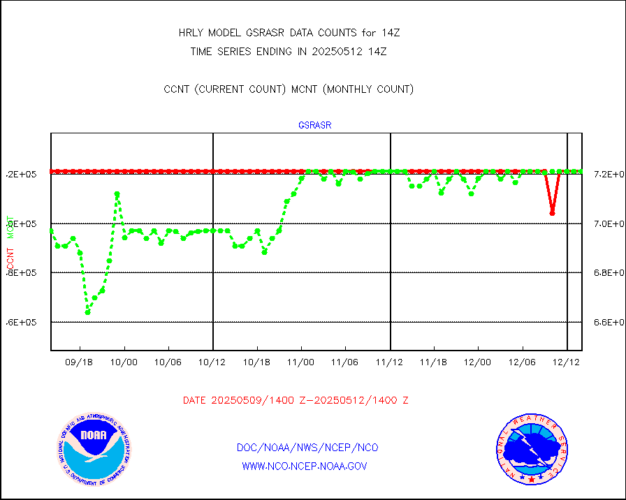
gsrasr |
GOES-16/17 All Sky Radiances (proc.) |
360476 |
360476 |
100.0 % |
1713.50-1714.49 |
gsrcsr |
GOES-16/17 Clear Sky Radiances (proc.) |
166298 |
170586 |
97.5 % |
1713.50-1714.49 |
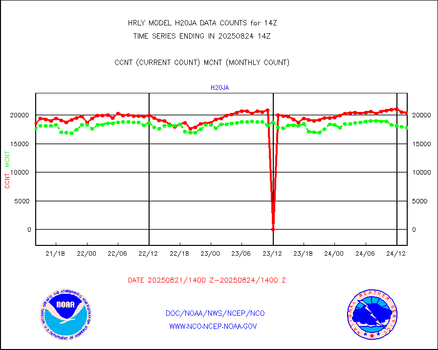
h20ja |
MTSAT/JMA water vapor imager derived cloud motion |
18590 |
18525 |
100.4 % |
1711.50-1712.49 |
h20mo |
MODIS (AQUA/TERRA) wvpr imager derived cld motion |
0 |
0 |
n/a |
1710.00-1710.99 |
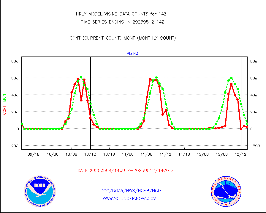
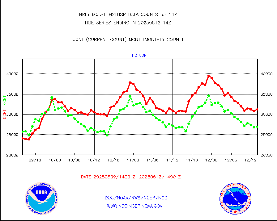
h2tusr |
GOES-16&up/NESDIS wv imgr/cld-top derived cld mtn |
26300 |
25049 |
105.0 % |
1713.00-1713.99 |
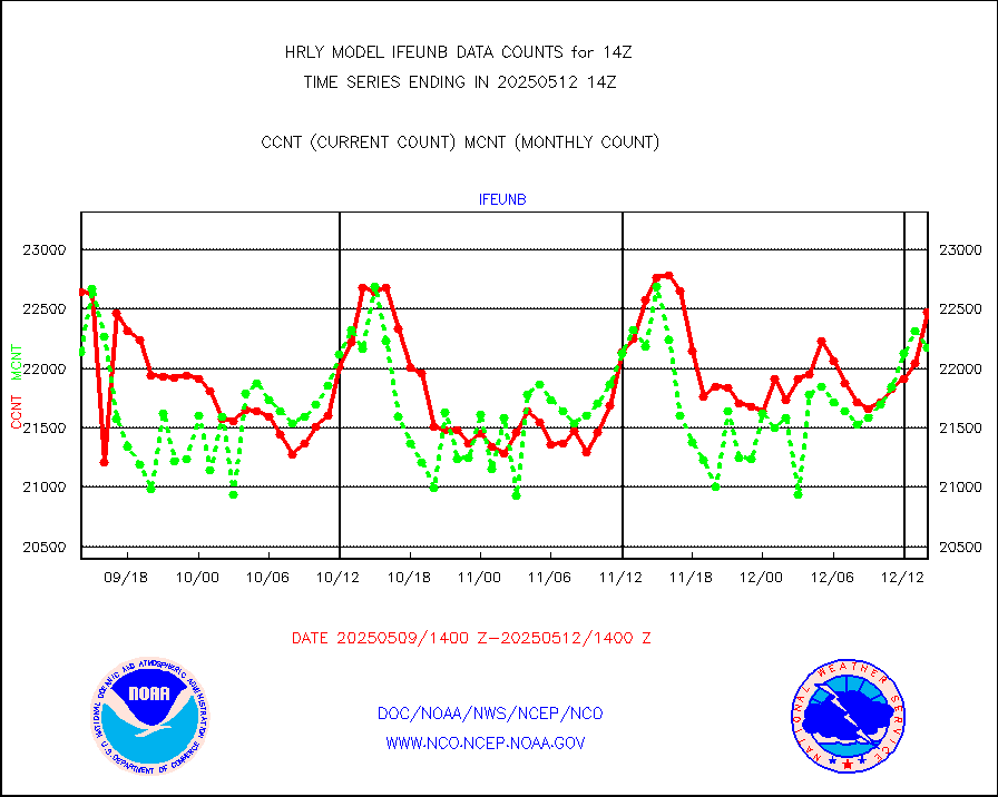
ifeunb |
METEOSAT/EUMETSAT ir lg-wave drv cld motion NBseq |
21514 |
23000 |
93.5 % |
1712.50-1713.49 |
infja |
MTSAT/JMA infrared long-wave derived cloud motion |
14508 |
16072 |
90.3 % |
1711.50-1712.49 |
infmo |
MODIS (AQUA/TERRA) ir l-wave derived cloud motion |
0 |
0 |
n/a |
1710.00-1710.99 |
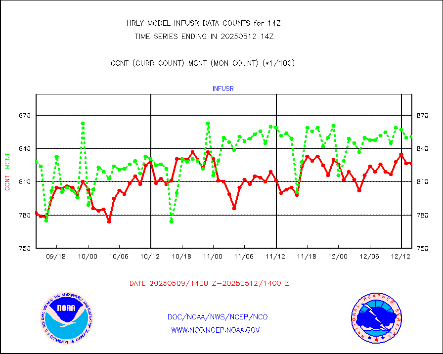
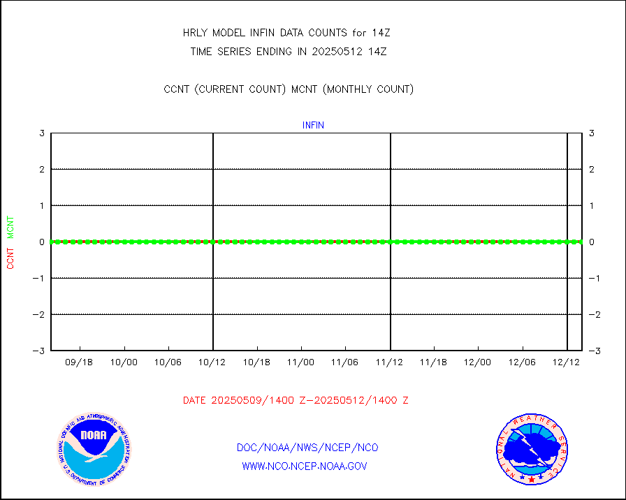
infusr |
GOES-16&up/NESDIS ir long-wave derived cld motion |
79460 |
81560 |
97.4 % |
1713.00-1713.99 |
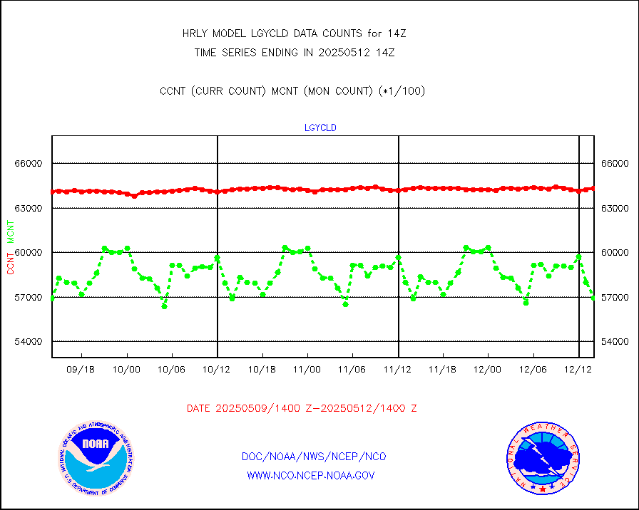
lgycld |
GOES/NASA(Langley) hi-res. (1x1 f-o-v) cloud data |
4169750 |
4163937 |
100.1 % |
1713.50-1714.49 |
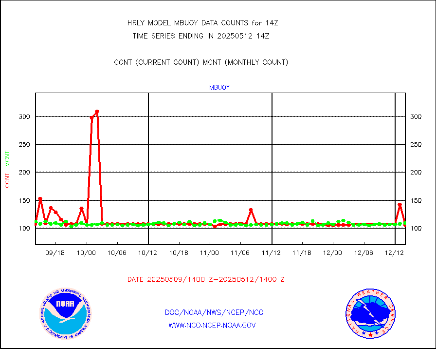
mbuoy |
Buoys decoded from FM-13 format (moored) |
99 |
125 |
79.2 % |
1713.50-1714.49 |
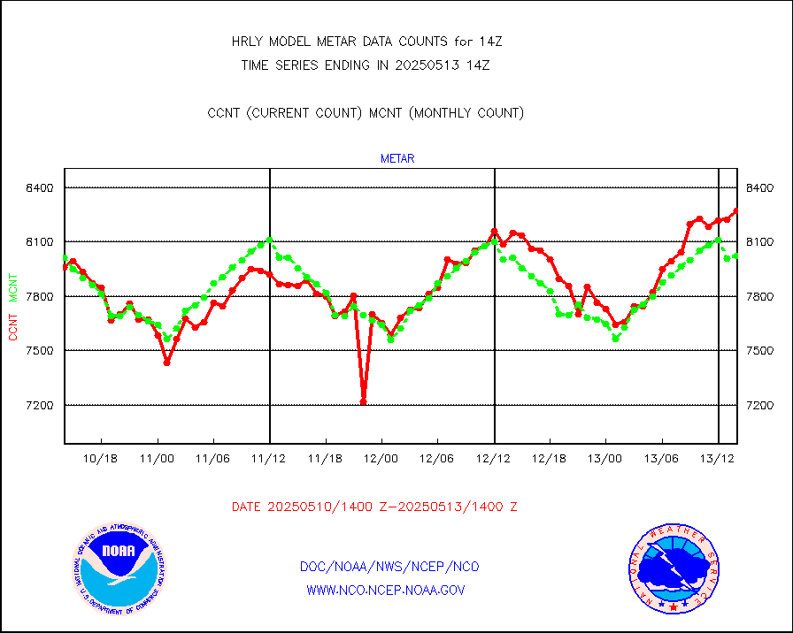
metar |
Aviation - METAR |
7192 |
8111 |
88.7 % |
1713.50-1714.49 |
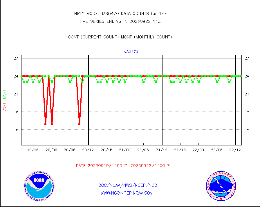
mso470 |
Mesonet/MADIS Colorado E-470 (Interstate 470) |
21 |
21 |
100.0 % |
1713.50-1714.49 |
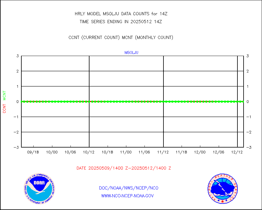
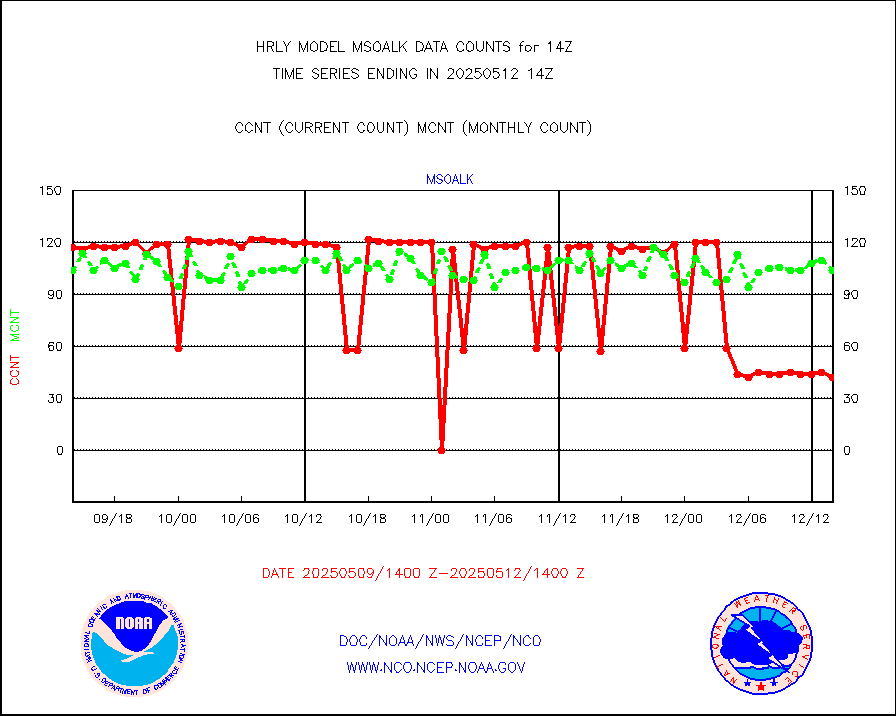
msoalk |
Mesonet/MADIS Alaska Department of Transportation |
107 |
108 |
99.1 % |
1713.50-1714.49 |
msoapg |
Mesonet/MADIS U.S. Army Aberdeen Proving Grounds |
0 |
0 |
n/a |
1713.50-1714.49 |
msoapr |
Mesonet/MADIS Citizen Weather Observers Program |
50307 |
48003 |
104.8 % |
1713.50-1714.49 |
msoaws |
Mesonet/MADIS AWS Convergence Technologies, Inc. |
25255 |
25307 |
99.8 % |
1713.50-1714.49 |
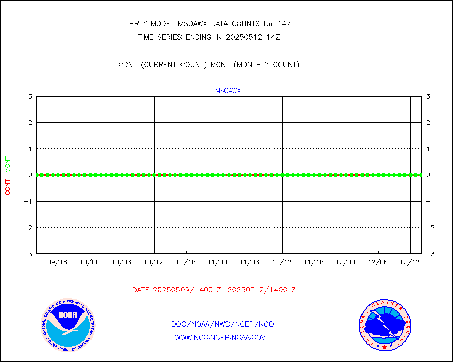
msoawx |
Mesonet/MADIS "Anything Weather" |
0 |
0 |
n/a |
1713.50-1714.49 |
msocol |
Mesonet/MADIS Colorado Dept. of Transportation |
0 |
0 |
n/a |
1713.50-1714.49 |
msodcn |
Mesonet/MADIS DC Net |
0 |
0 |
n/a |
1713.50-1714.49 |
msoden |
Mesonet/MADIS Denver Urban Drainage & Flood Cntrl |
250 |
232 |
107.8 % |
1713.50-1714.49 |
msofla |
Mesonet/MADIS Florida (FAWN & USF) |
4 |
4 |
100.0 % |
1713.50-1714.49 |
msoflt |
Mesonet/MADIS Florida Dept. of Transportation |
0 |
0 |
n/a |
1713.50-1714.49 |
msogeo |
Mesonet/MADIS Georgia Dept. of Transportation |
0 |
0 |
n/a |
1713.50-1714.49 |
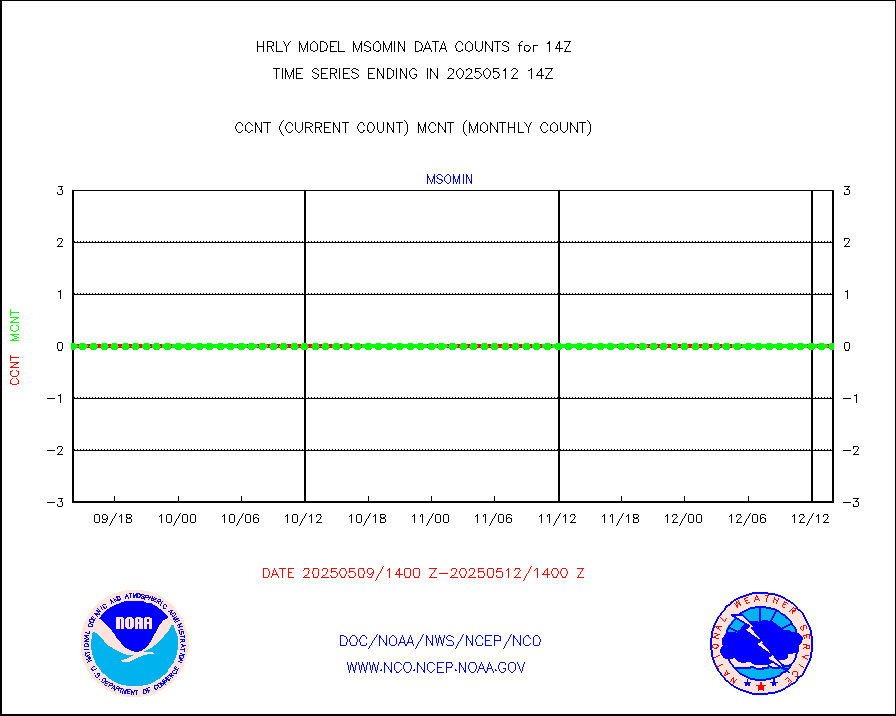
msohad |
Mesonet/MADIS NWS Hydromet Auto Data System(HADS) |
6863 |
6409 |
107.1 % |
1713.50-1714.49 |
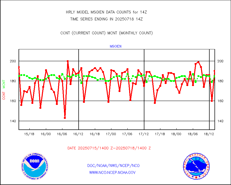
msoien |
Mesonet/MADIS Iowa Environmental |
187 |
190 |
98.4 % |
1713.50-1714.49 |
msoind |
Mesonet/MADIS Indiana Dept. of Transportation |
0 |
0 |
n/a |
1713.50-1714.49 |
msoiow |
Mesonet/MADIS Iowa Department of Transportation |
0 |
0 |
n/a |
1713.50-1714.49 |
msokan |
Mesonet/MADIS Kansas Department of Transportation |
351 |
361 |
97.2 % |
1713.50-1714.49 |
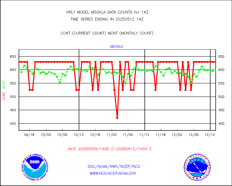
msokla |
Mesonet/MADIS Oklahoma Mesonet |
318 |
318 |
100.0 % |
1713.50-1714.49 |
msolju |
Mesonet/MADIS Louisiana State/Jackson State Univ. |
0 |
0 |
n/a |
1713.50-1714.49 |
msomca |
Mesonet/MADIS Missouri Commercial Agricult Wx Net |
291 |
275 |
105.8 % |
1713.50-1714.49 |
msomin |
Mesonet/MADIS Minnesota Dept. of Transportation |
0 |
0 |
n/a |
1713.50-1714.49 |
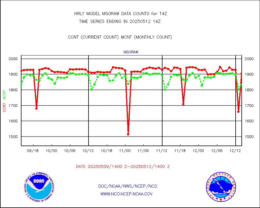
msoraw |
Mesonet/MADIS NFIC Remote Automated Wx Stns(RAWS) |
1905 |
1839 |
103.6 % |
1713.50-1714.49 |
msovir |
Mesonet/MADIS Virginia Dept. of Transportation |
236 |
227 |
104.0 % |
1713.50-1714.49 |
msowfy |
Mesonet/MADIS "Weather for You" |
0 |
0 |
n/a |
1713.50-1714.49 |
msowis |
Mesonet/MADIS Wisconsin Dept. of Transportation |
0 |
0 |
n/a |
1713.50-1714.49 |
msowst |
Mesonet/MADIS MesoWest (many subproviders) |
47435 |
45657 |
103.9 % |
1713.50-1714.49 |
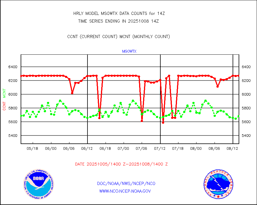
msowtx |
Mesonet/MADIS West Texas |
5618 |
5630 |
99.8 % |
1713.50-1714.49 |
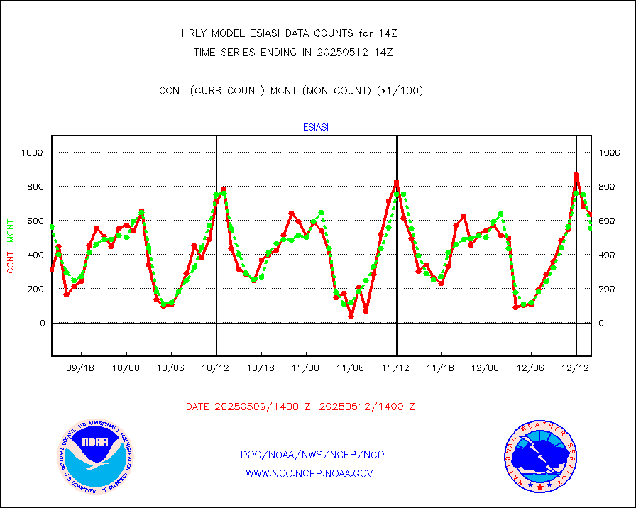
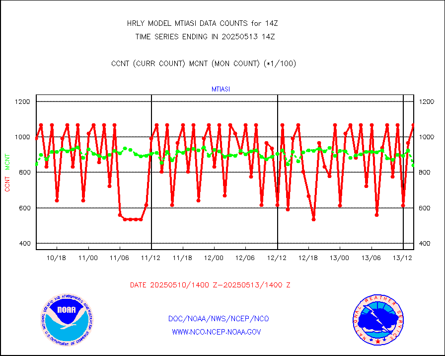
mtiasi |
METOP 1-2 IASI 1C radiance data (varbl. channels) |
106908 |
85474 |
125.1 % |
1712.00-1712.99 |
nxrdw |
NEXRAD Vel Azm Dsp(VAD) winds via radar coded msg |
0 |
0 |
n/a |
1713.50-1714.49 |
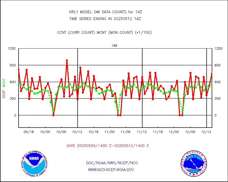
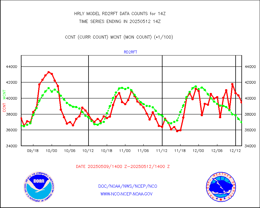
omi |
Aura Ozone Monitoring Instrument (OMI) data |
42240 |
56954 |
74.2 % |
1711.50-1712.49 |
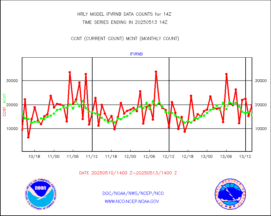
osbuv8 |
NOAA 16-19 Solar Backscatter UV-2 rad frm V8 BUFR |
0 |
0 |
n/a |
1712.00-1712.99 |
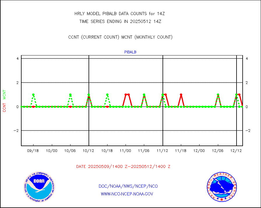
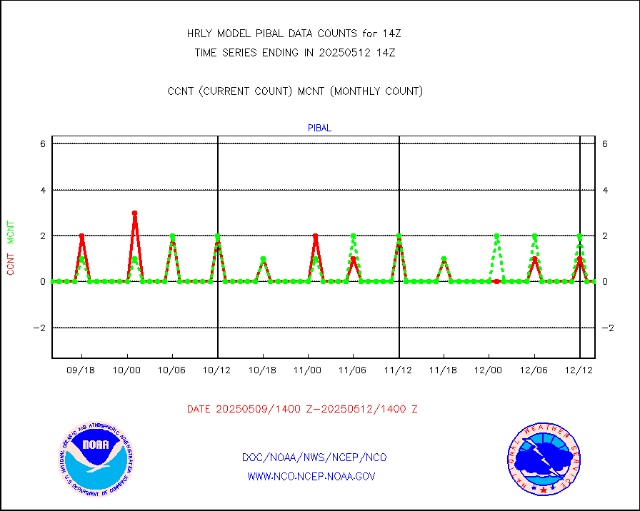
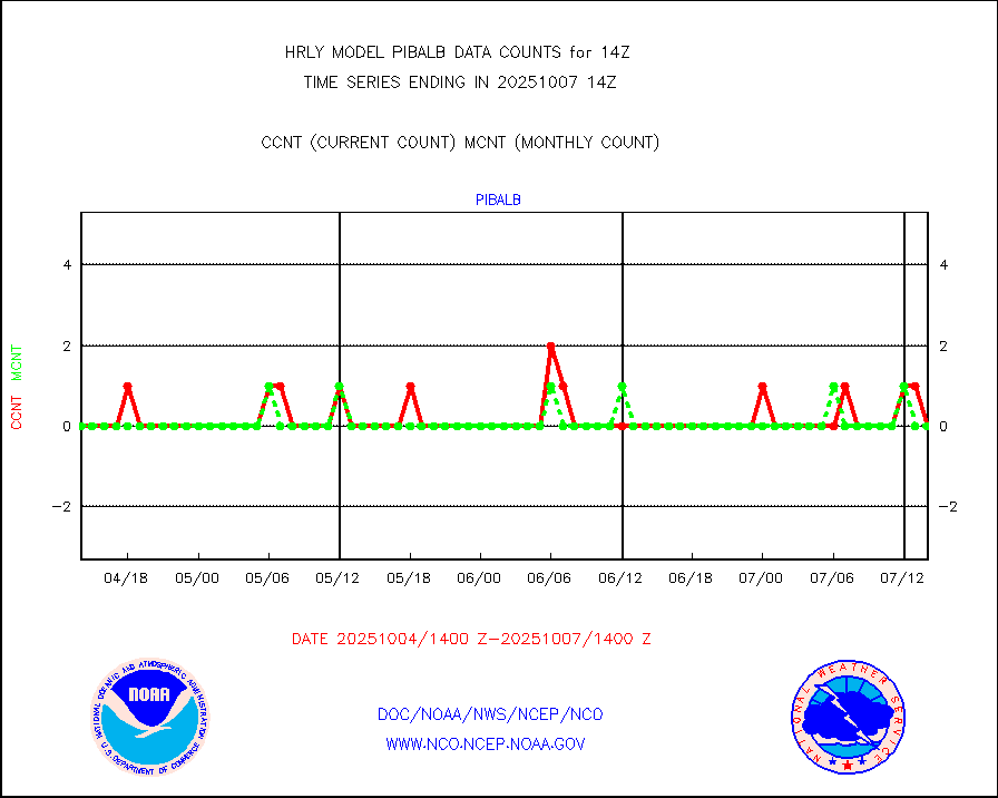
pibal |
PIBAL (from PILOT, PILOT SHIP, PILOT MOBIL) |
0 |
0 |
n/a |
1713.50-1714.49 |
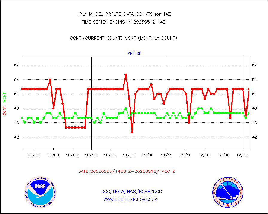
prflrb |
Multi-Agency Profiler (MAP) and SODAR winds |
44 |
39 |
112.8 % |
1713.50-1714.49 |
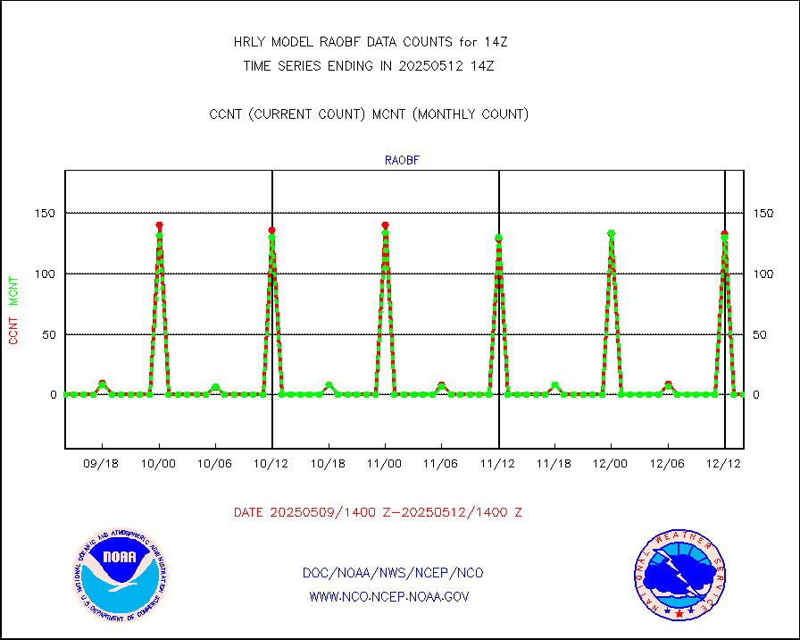
raobf |
Rawinsonde - fixed land (from TEMP or PILOT) |
0 |
0 |
n/a |
1713.50-1714.49 |
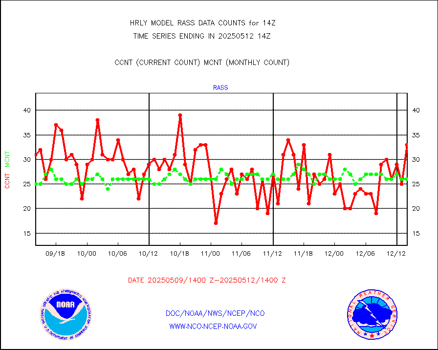
rass |
RASS temperatures (NOAA and Multi-Agency) |
26 |
23 |
113.0 % |
1713.50-1714.49 |
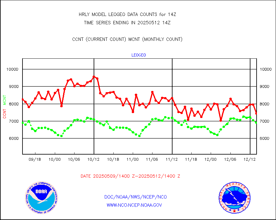
rd2rft |
NEXRAD reflectivity (Lvl 2 - GTS) |
3761645 |
3479037 |
108.1 % |
1713.50-1714.49 |
rd2wnd |
NEXRAD radial wind (Level 2 - GTS) |
1379787 |
979623 |
140.8 % |
1713.50-1714.49 |
sevcsr |
METEOSAT-10 2nd Gen SEVIRI Clr Sky Radiance(proc) |
0 |
0 |
n/a |
1713.50-1714.49 |
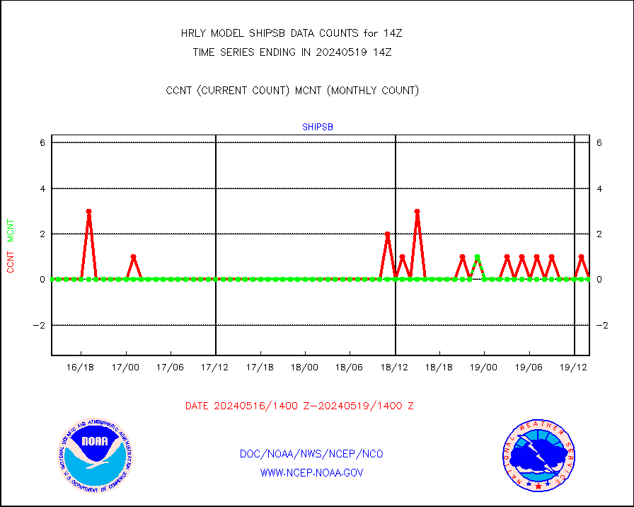
shipsb |
Ship - manual and automatic, restricted (BUFR) |
0 |
0 |
n/a |
1713.50-1714.50 |
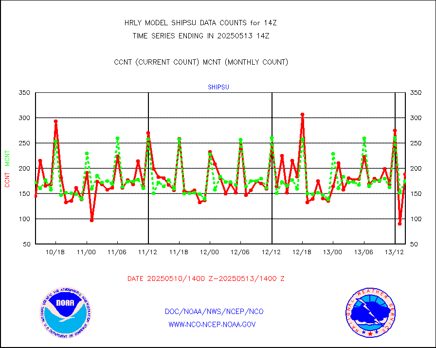
shipsu |
Ship - manual and automatic, unrestricted |
97 |
111 |
87.4 % |
1713.50-1714.50 |
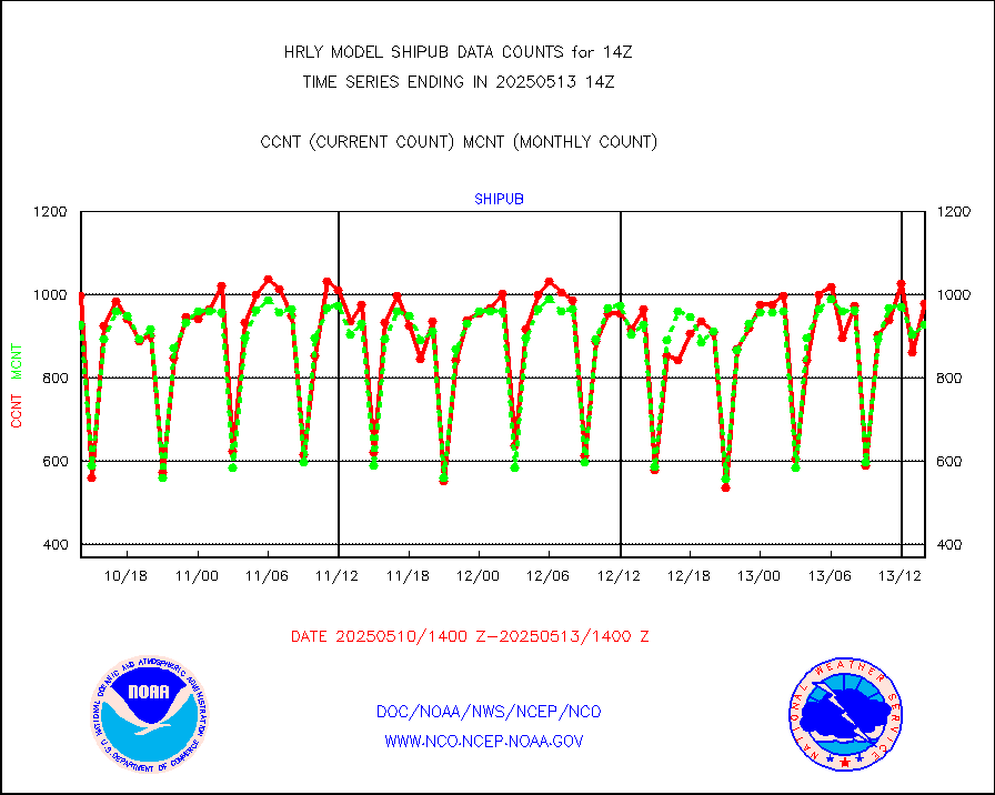
shipub |
Ship - manual and automatic, unrestricted (BUFR) |
790 |
794 |
99.5 % |
1713.50-1714.50 |
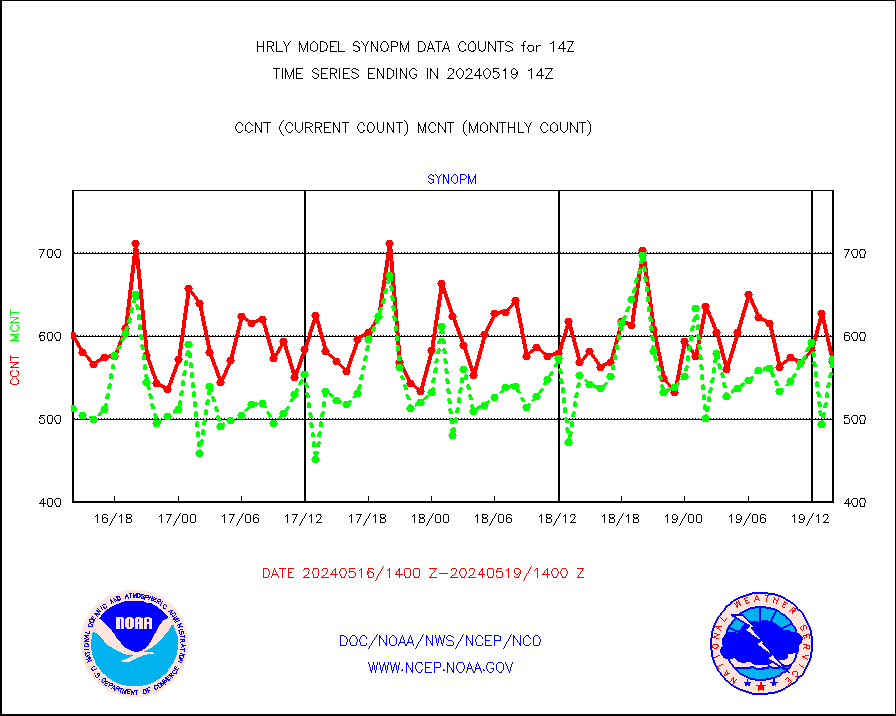
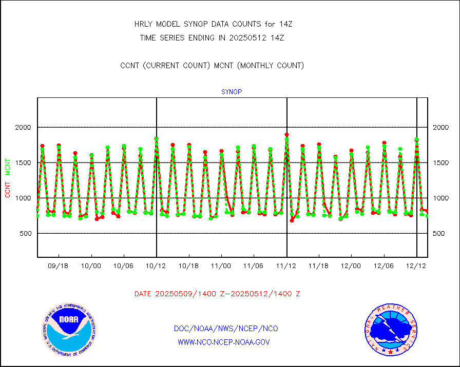
synop |
Synoptic - fixed manual and automatic |
791 |
855 |
92.5 % |
1713.50-1714.49 |
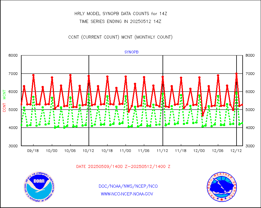
synopb |
Synoptic - fixed manual & auto (decoded fr BUFR) |
3208 |
4234 |
75.8 % |
1713.50-1714.49 |
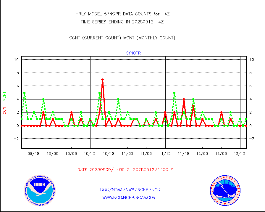
synopr |
Synoptic - restricted (WMO Res 40) manual & auto. |
5 |
1 |
500.0 % |
1713.50-1714.49 |
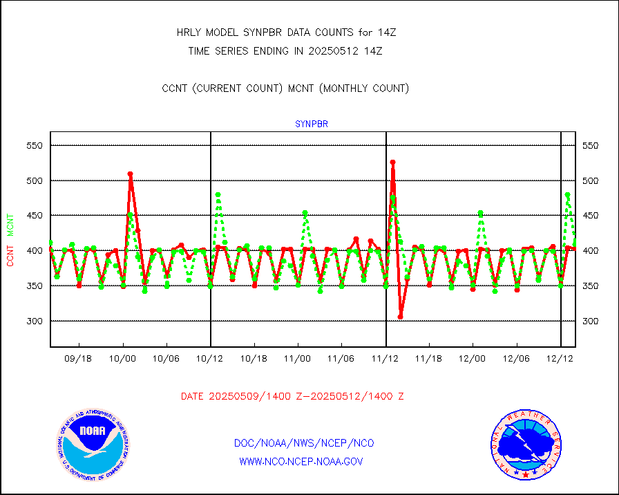
synpbr |
Synoptic - restricted (WMO Res 40)(decoded BUFR) |
397 |
412 |
96.4 % |
1713.50-1714.49 |
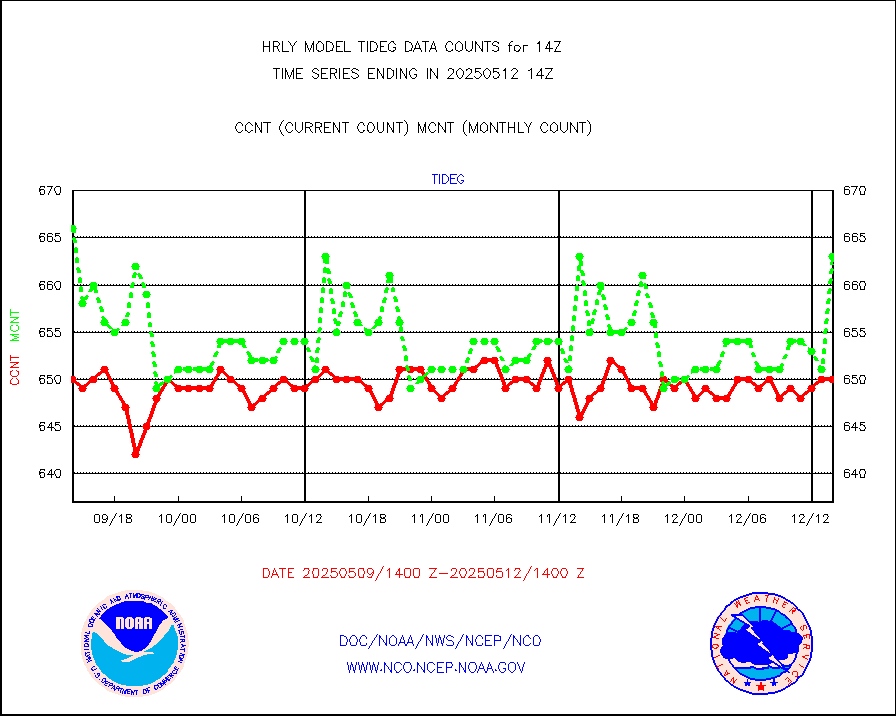
tideg |
Tide gauge reports decoded from CREX format |
642 |
630 |
101.9 % |
1713.00-1713.99 |
| Data Types of Opportunity with Normal Counts |
|---|
| Type | Description | Hourly Count | Monthly Average | Percent (%) of Monthly Mean | UTC Time Window |
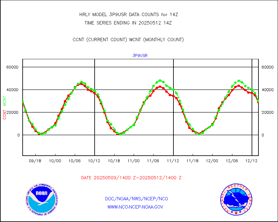
3p9usr |
GOES-16&up/NESDIS ir short-wv derived cld motion |
27656 |
27842 |
99.3 % |
1713.00-1713.99 |
acarsa |
MDCRS ACARS acft data (ARINC via AFWA)(AIREP fmt) |
0 |
0 |
n/a |
1713.50-1714.49 |
ahicsr |
Himawari Clear Sky Radiance |
0 |
0 |
n/a |
1713.00-1713.99 |
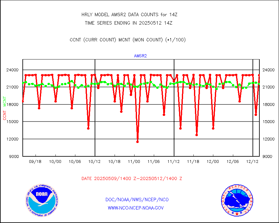
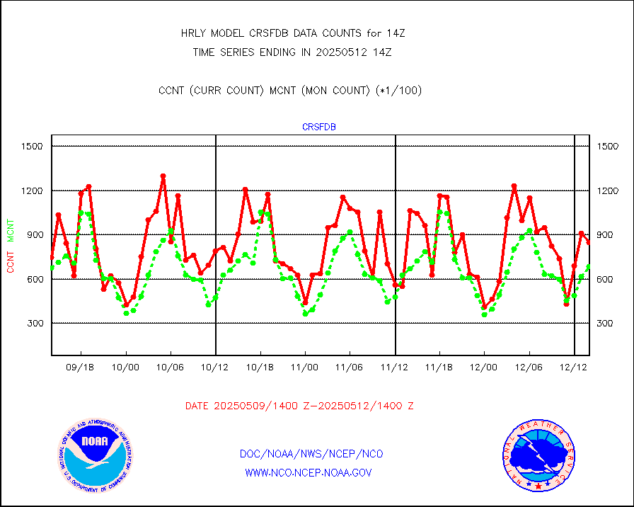
amsr2 |
GCOM-W AMSR2 1B brightness temperatures |
2309472 |
2092036 |
110.4 % |
1712.00-1712.99 |
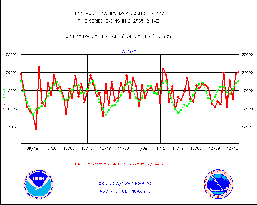
atmsdb |
NPP/NOAA-20 ATMS bright. temps-direct b-cast SSEC |
133879 |
109089 |
122.7 % |
1712.50-1713.49 |
atovs |
POES/NESDIS - processed ATOVS soundings/radiances |
0 |
0 |
n/a |
1712.00-1712.99 |
avcsam |
A.M.(N17,M2,M3) AVHRR GAC NCEP-proc clr&sea btmps |
1252145 |
1371117 |
91.3 % |
1711.50-1712.49 |
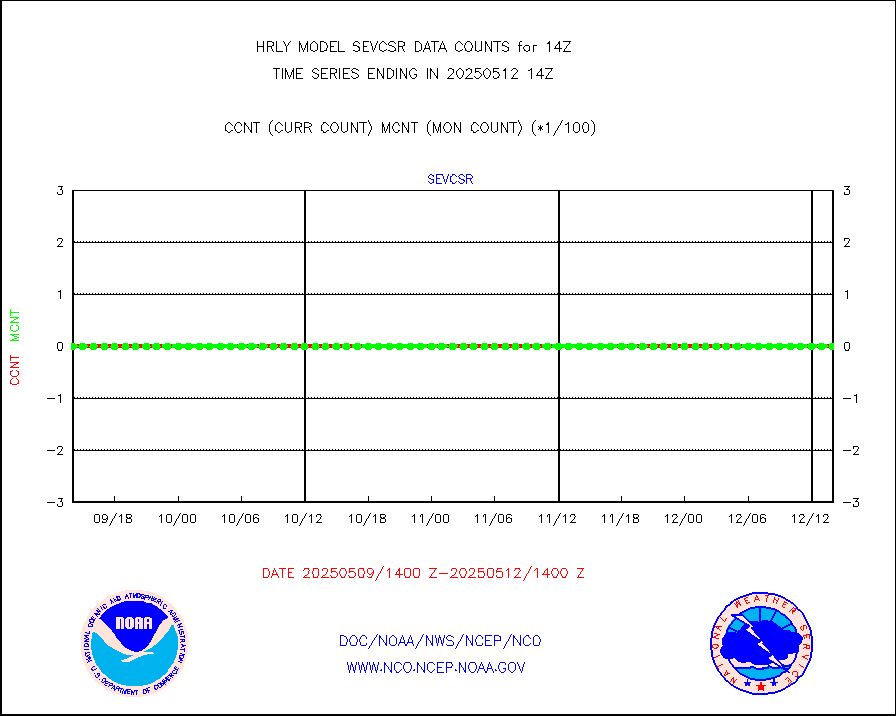
avcspm |
P.M.(N18-19) AVHRR GAC NCEP-proc clr & sea btemps |
1562548 |
1482377 |
105.4 % |
1711.50-1712.49 |
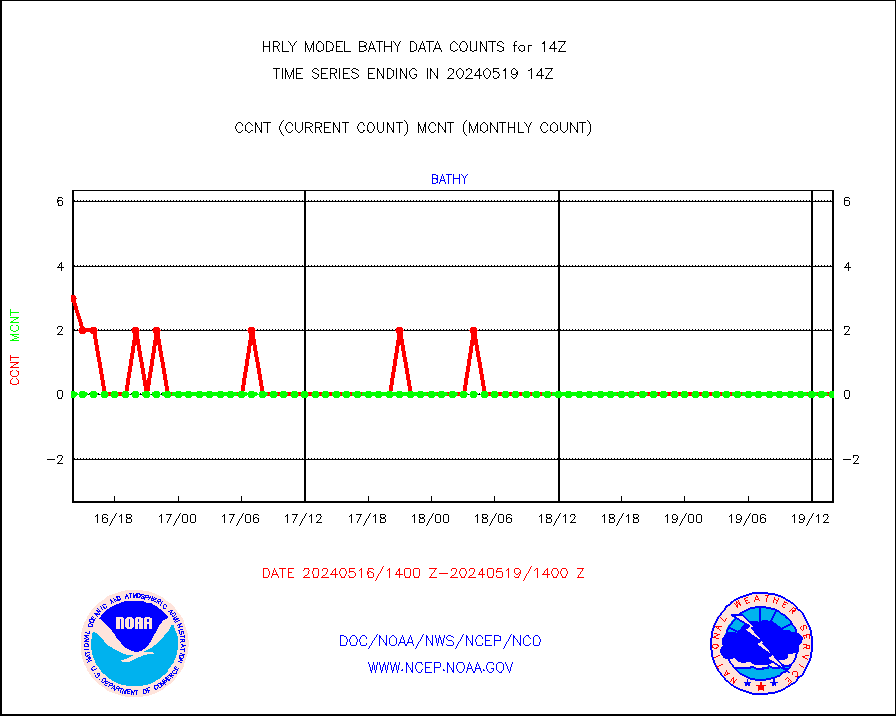
bathy |
eXpendable BathyThermograph, mooring (BATHY fmt) |
0 |
0 |
n/a |
1707.00-1707.99 |
coopmd |
Coop/MADIS NEPP & HCN-Modernization NOAA COOP Obs |
23 |
23 |
100.0 % |
1713.50-1714.49 |
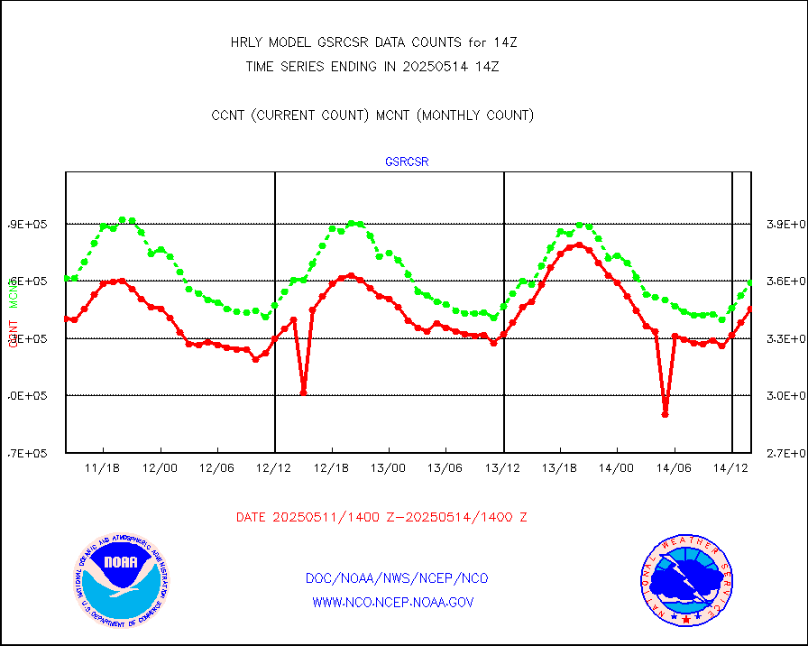
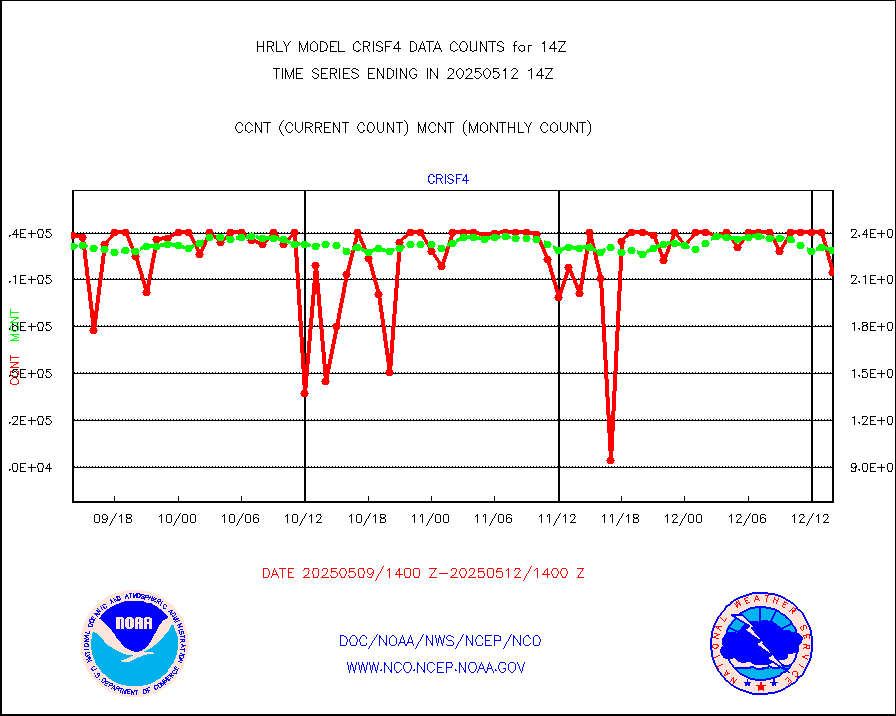
crisf4 |
NPP/NOAA-20 CrIS full spctrl radn (431 ch subset) |
228654 |
225257 |
101.5 % |
1712.50-1713.49 |
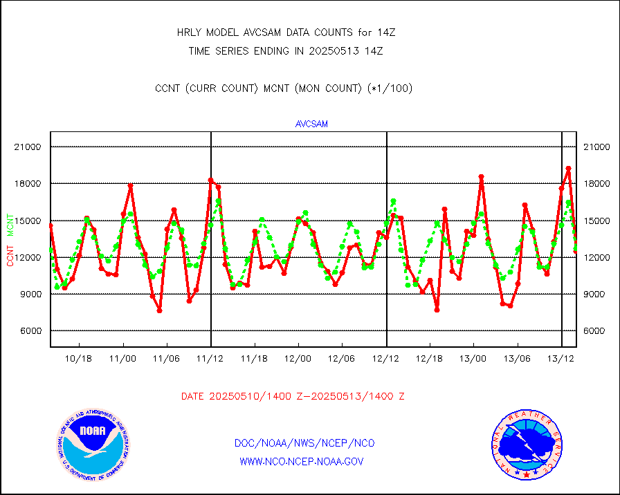
crsfdb |
NPP/NOAA-20 CrIS full spctrl radn dir brdcst SSEC |
110520 |
97009 |
113.9 % |
1712.50-1713.49 |
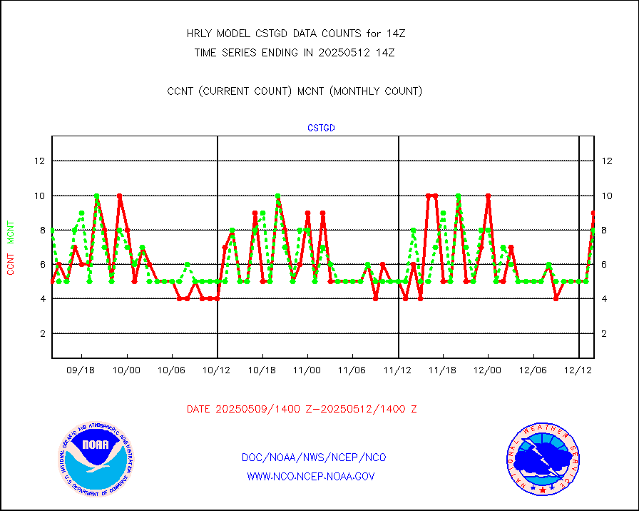
cstgd |
Coast Guard |
6 |
5 |
120.0 % |
1713.50-1714.50 |
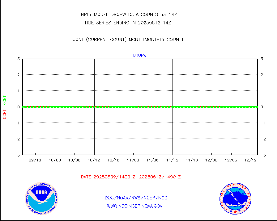
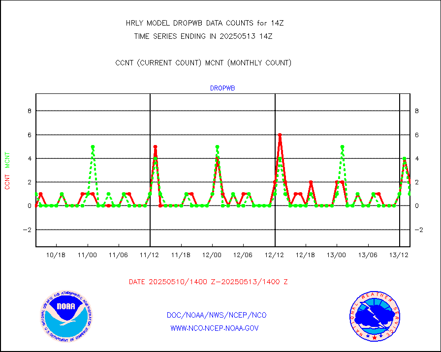
dropw |
Dropwinsonde (from TEMP DROP) |
0 |
0 |
n/a |
1713.50-1714.49 |
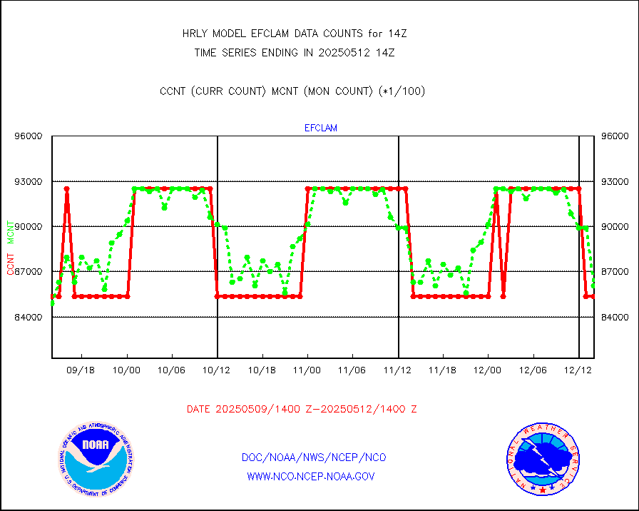
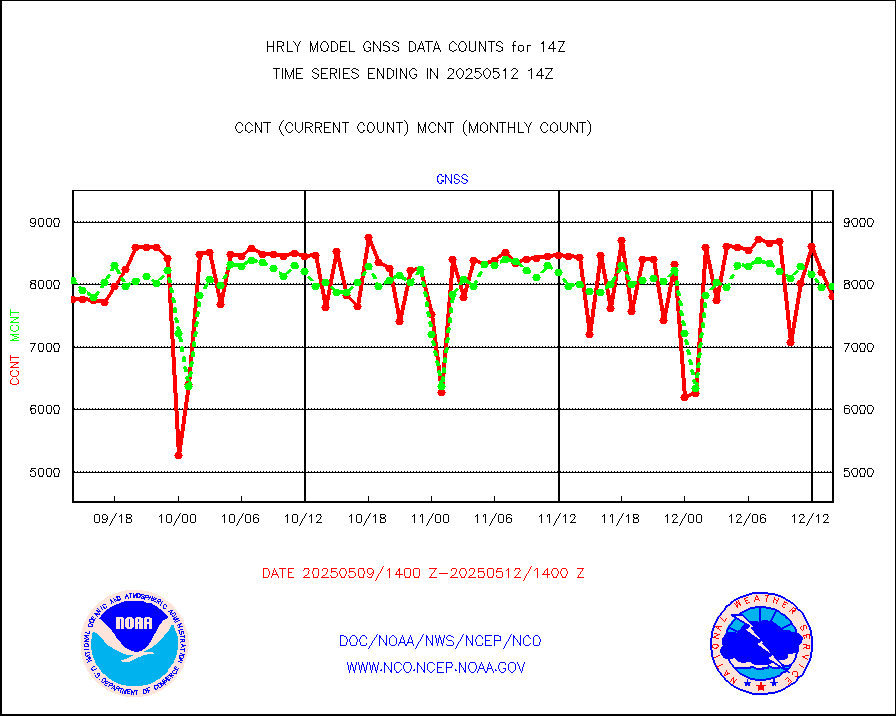
efclam |
GOES imager effective cloud amount data (U.Wisc.) |
8254321 |
8309864 |
99.3 % |
1713.50-1714.49 |
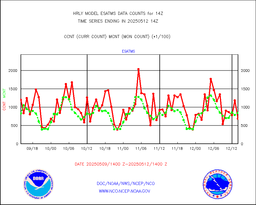
esatms |
NPP Adv. Tech. MW Sndr (ATMS) br. temps from RARS |
64945 |
75202 |
86.4 % |
1712.50-1713.49 |
esiasi |
METOP 1-2 IASI 1C radiance data vbl chn from RARS |
66072 |
78547 |
84.1 % |
1713.00-1713.99 |
esmhs |
NOAA 18-19 & METOP 1-2 MHS proc. btemps from RARS |
304752 |
296710 |
102.7 % |
1713.50-1714.49 |
geoimr |
GOES/NESDIS (11x17 f-o-v) imager clear radiances |
0 |
0 |
n/a |
1713.00-1713.99 |
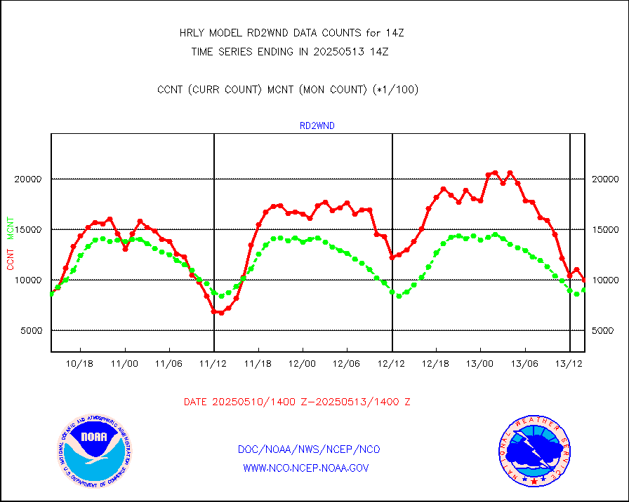
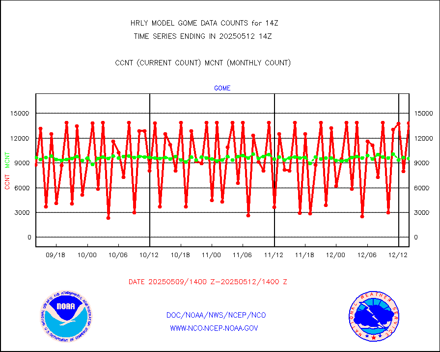
gome |
METOP 1-2 Global Ozone Monitoring Exp.-2 (GOME-2) |
10109 |
6882 |
146.9 % |
1712.50-1713.49 |
h2dusr |
GOES-16&up/NESDIS wv imgr/deep-lyr derivd cld mtn |
15511 |
15137 |
102.5 % |
1713.00-1713.99 |
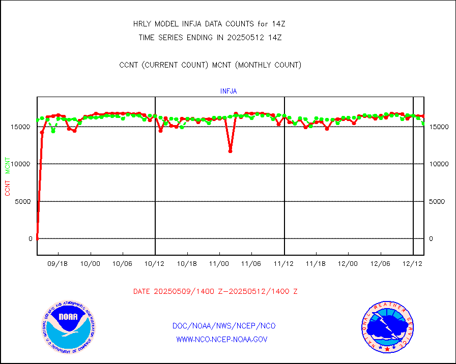
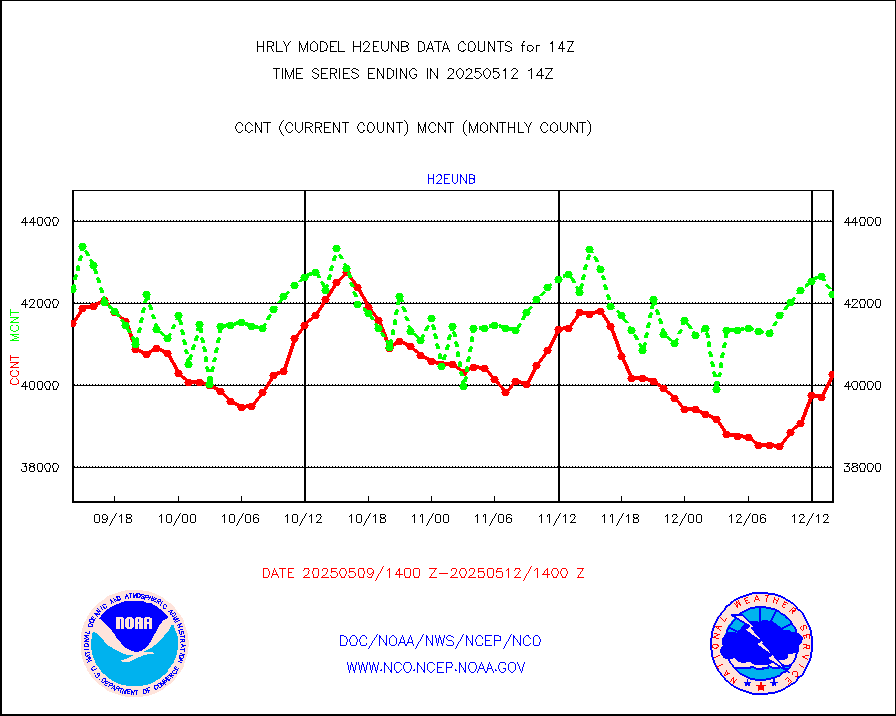
h2eunb |
METEOSAT/EUMETSAT wvpr imgr drv cld motion NBseq |
42484 |
43578 |
97.5 % |
1712.50-1713.49 |
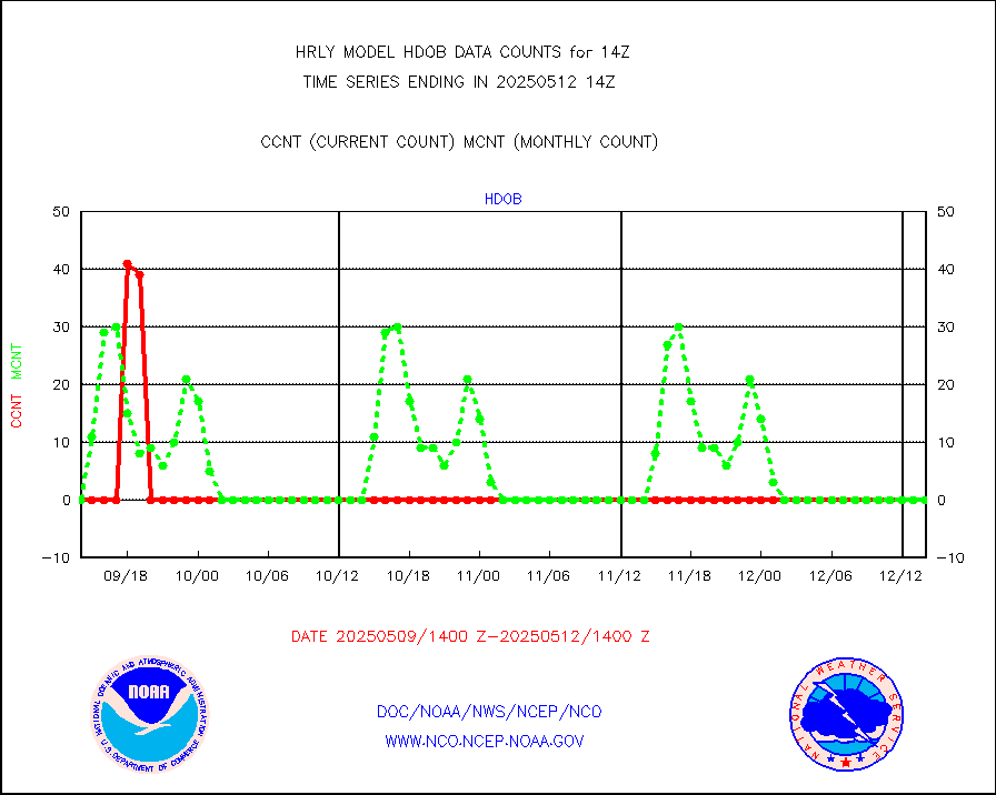
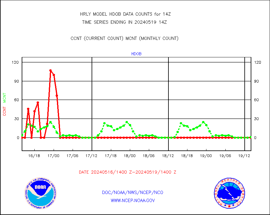
hdob |
High Density OBs from reconnaissance acft data |
81 |
0 |
n/a |
1713.50-1714.49 |
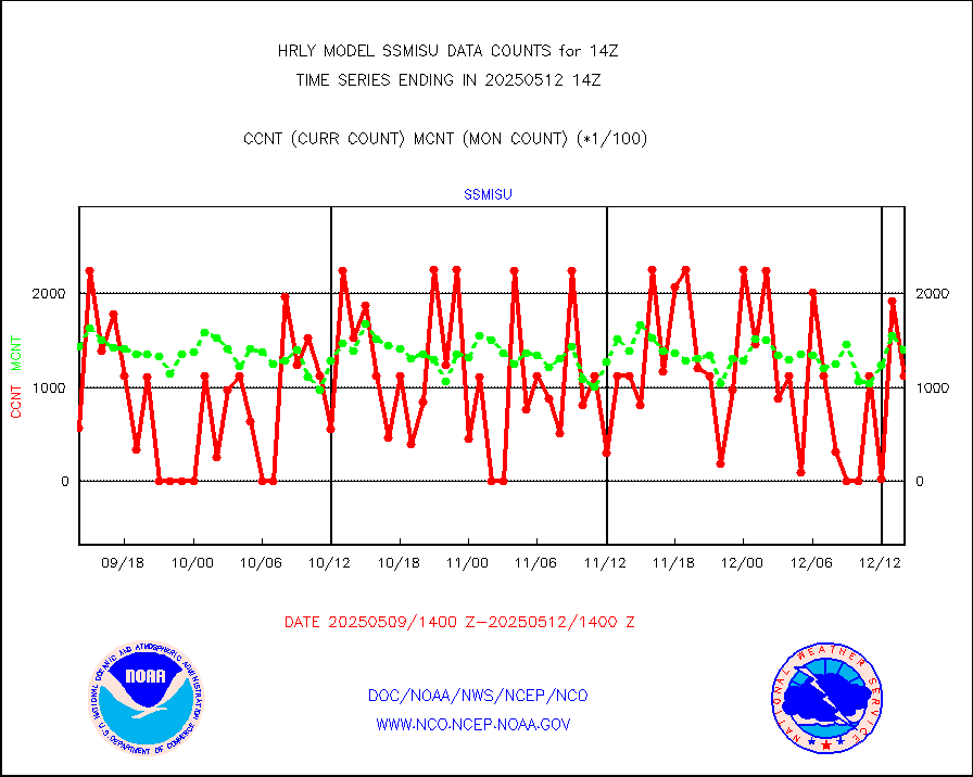
iasidb |
METOP 1-2 IASI 1C radiances-direct broadcast SSEC |
35111 |
34110 |
102.9 % |
1712.50-1713.49 |
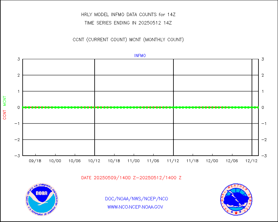
ifvrnb |
VIIRS (NPP/NOAA-20) ir lg-wv drv cloud motion(NB) |
10544 |
14743 |
71.5 % |
1710.00-1710.99 |
infav1 |
AVHRR (METOP) ir lg-wave derived cld motion |
0 |
0 |
n/a |
1713.50-1714.50 |
infin |
INSAT/KALPANA India ir lg-wave derived cld motion |
0 |
0 |
n/a |
1711.50-1712.49 |
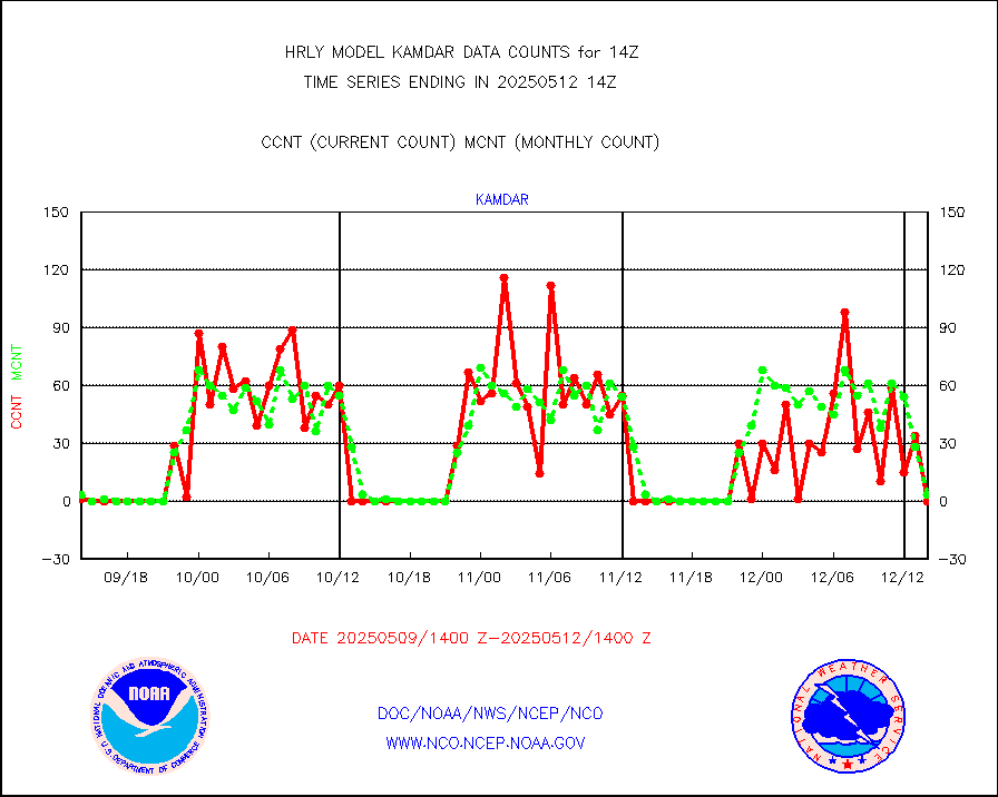
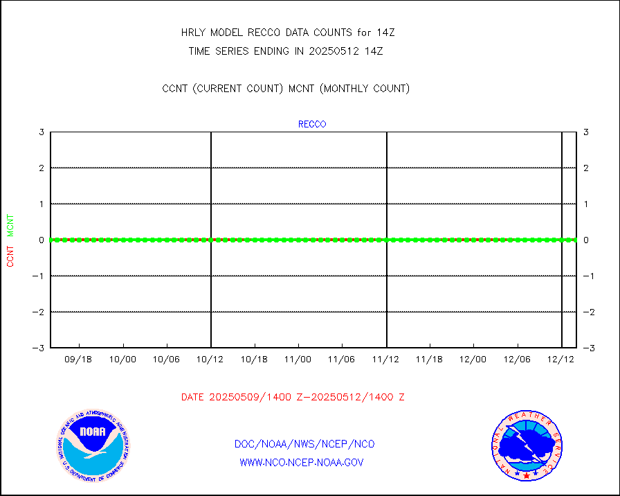
kamdar |
Korean AMDAR aircraft data (decoded from BUFR) |
0 |
4 |
0.0 % |
1713.50-1714.49 |
lcman |
Land-based CMAN stations decoded from CMAN format |
81 |
98 |
82.7 % |
1713.50-1714.49 |
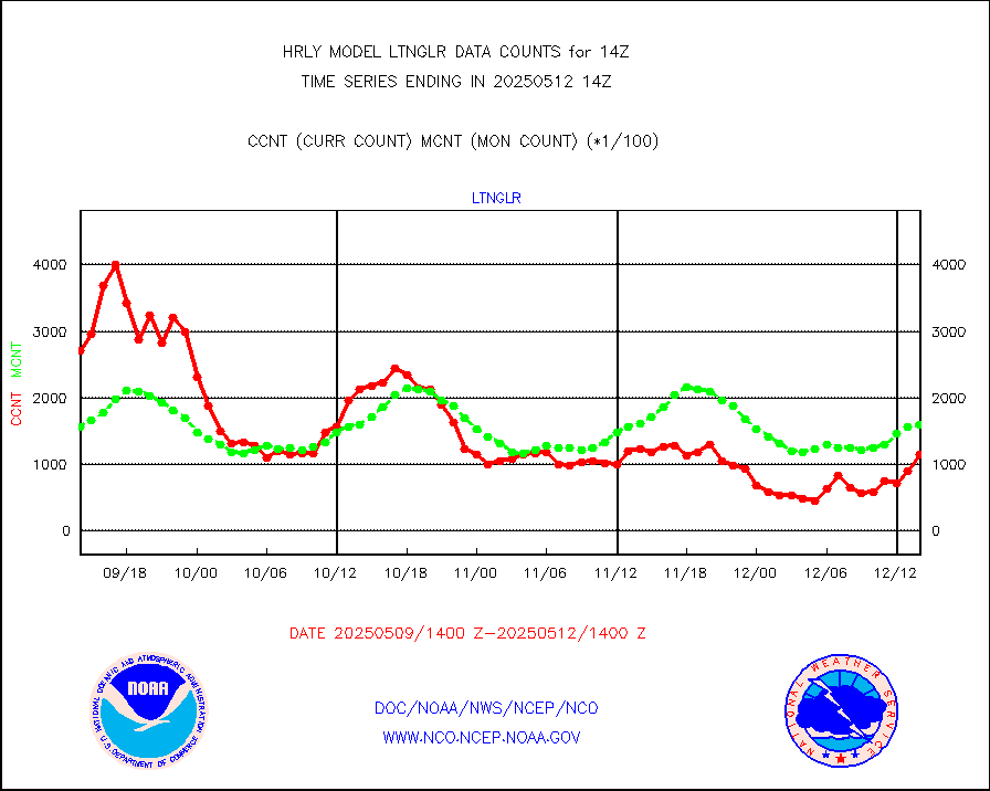
ltnglr |
LLDN Long-rng lightning from Vaisala via NOAAPORT |
188056 |
141484 |
132.9 % |
1713.50-1714.49 |
ltngsr |
NLDN Shrt-rng lightning from Vaisala via NOAAPORT |
730 |
1640 |
44.5 % |
1713.50-1714.49 |
mbuoyb |
Moored buoys (decoded from BUFR) |
615 |
611 |
100.7 % |
1713.50-1714.50 |
mls |
Aura Microwave Limb Sounder (MLS) ozone data |
0 |
0 |
n/a |
1712.00-1712.99 |
msourb |
Mesonet/MADIS UrbaNet |
4054 |
4396 |
92.2 % |
1713.50-1714.49 |
nxrdw2 |
NEXRAD Vel Azm Dsp(VAD) winds via Level 2 decoder |
497 |
415 |
119.8 % |
1713.50-1714.49 |
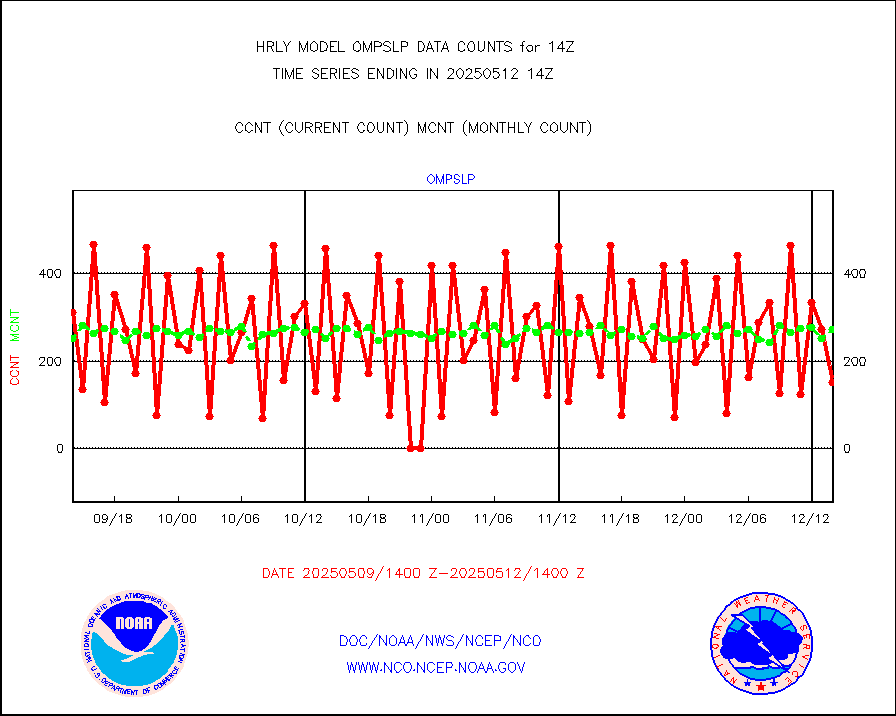
ompslp |
OMPS Limb Profiler ozone data (NPP) |
223 |
260 |
85.8 % |
1707.00-1707.99 |
ompsn8 |
OMPS nadir profile ozone (Version 8 BUFR) |
580 |
474 |
122.4 % |
1712.00-1712.99 |
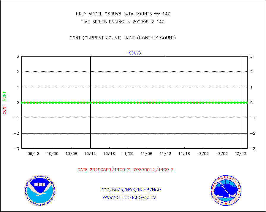
ompst8 |
OMPS total column ozone (Version 8 BUFR) |
218613 |
344307 |
63.5 % |
1712.00-1712.99 |
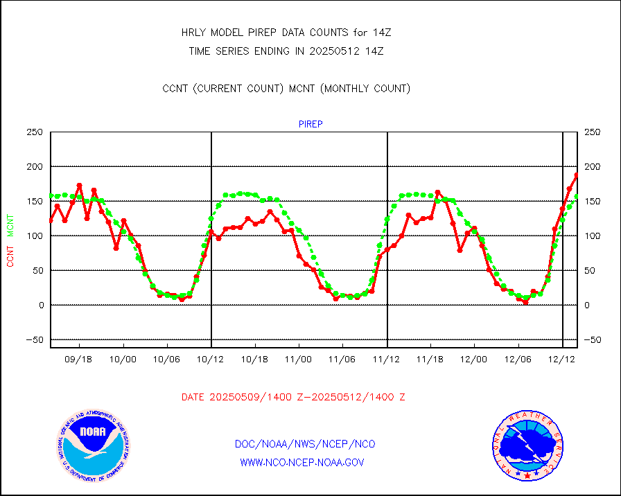
pirep |
Manual PIREP aircraft data (dcded from AIREP fmt) |
160 |
160 |
100.0 % |
1713.50-1714.49 |
prflrp |
Profilr winds from PIBAL (PILOT,PILOT SHIP/MOBIL) |
0 |
0 |
n/a |
1713.50-1714.49 |
raobm |
Rawinsonde - mobile land (from TEMP/PILOT MOBIL) |
0 |
0 |
n/a |
1713.50-1714.49 |
raobs |
Rawinsonde - ship (from TEMP SHIP, PILOT SHIP) |
0 |
0 |
n/a |
1713.50-1714.49 |
recco |
Flight level reconnaissance aircraft data |
0 |
0 |
n/a |
1713.50-1714.49 |
saphir |
Megha-Tropiques SAPHIR L1A2 brightness temps |
0 |
0 |
n/a |
1711.50-1712.49 |
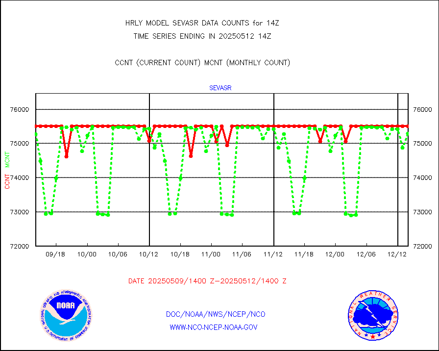
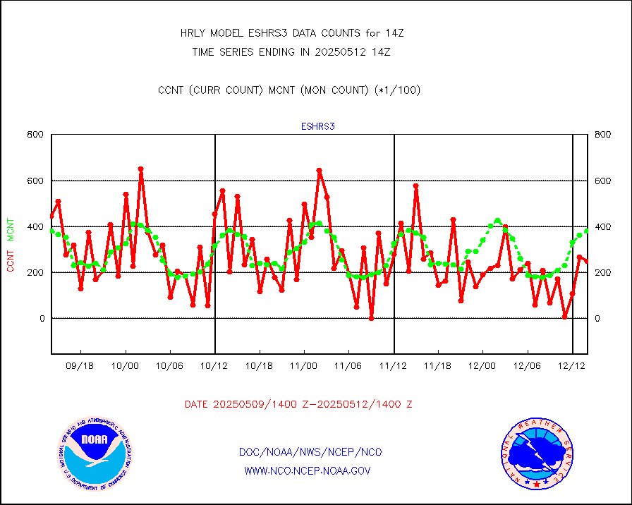
sevasr |
METEOSAT-10 2nd Gen SEVIRI All Sky Radiance(proc) |
75512 |
72907 |
103.6 % |
1713.50-1714.49 |
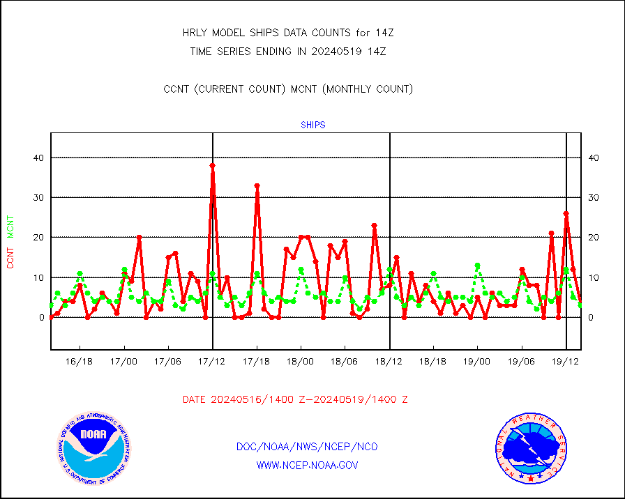
ships |
Ship - manual and automatic, restricted |
4 |
3 |
133.3 % |
1713.50-1714.49 |
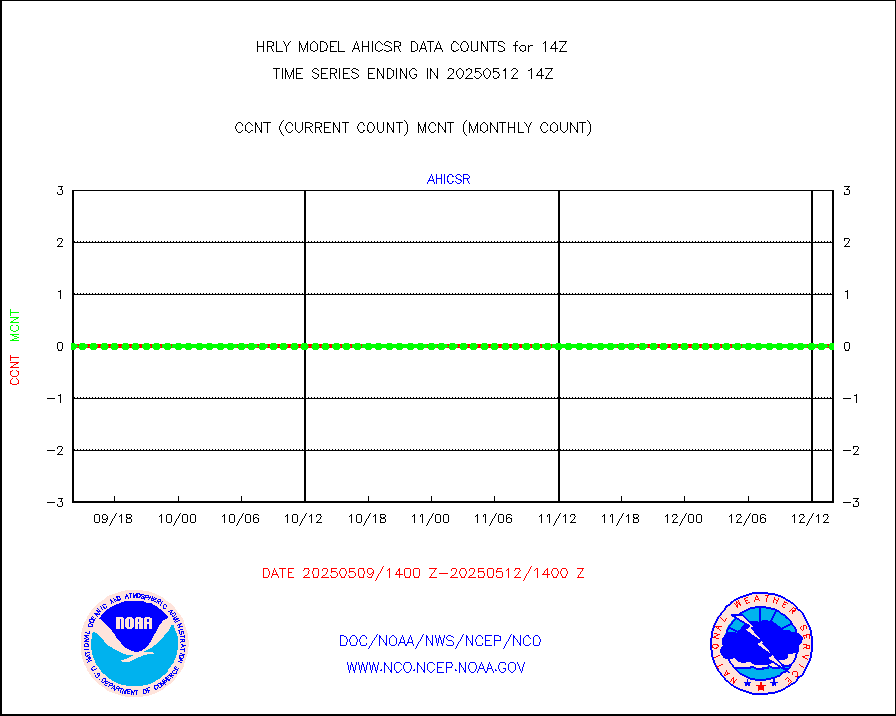
ssmisu |
DMSP SSM/IS 1C radiance data (Unified Pre-Proc.) |
224700 |
147739 |
152.1 % |
1712.50-1713.49 |
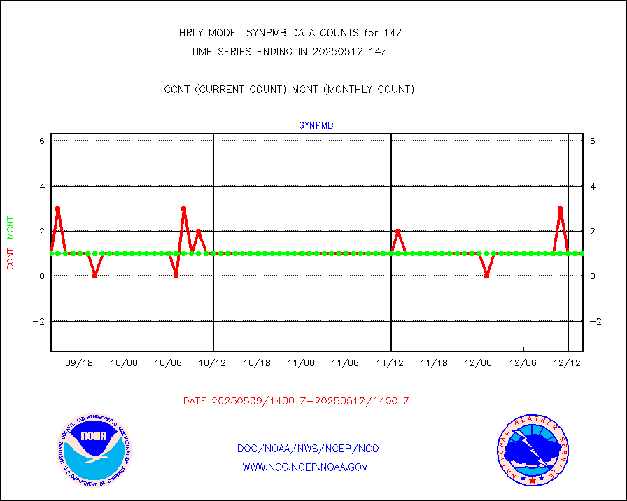
synpmb |
Synoptic - mobile manual & auto (decoded fr BUFR) |
0 |
1 |
0.0 % |
1713.50-1714.49 |
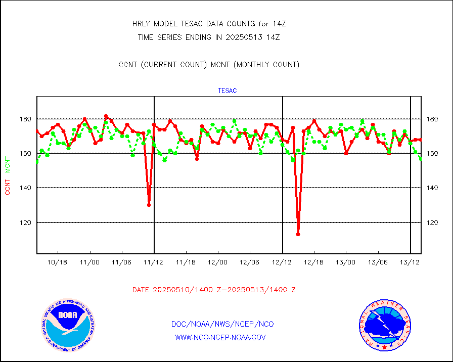
tesac |
CTD probe, Argo prflng float, mooring (TESAC fmt) |
174 |
164 |
106.1 % |
1713.50-1714.49 |
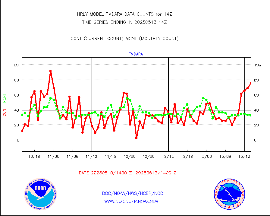
tmdara |
TAMDAR aircft data-all types(from Panasonic,BUFR) |
393 |
364 |
108.0 % |
1713.50-1714.49 |
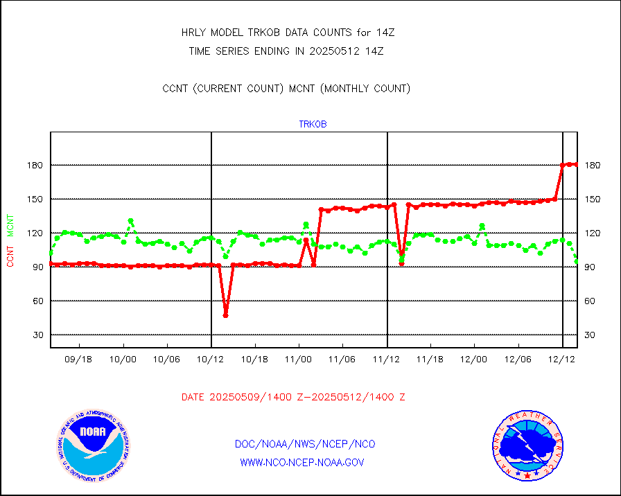
trkob |
ThermoSalinoGraph (TSG) TRACKOB format) |
64 |
54 |
118.5 % |
1712.50-1713.49 |
visin |
INSAT/KALPANA India visible derived cloud motion |
0 |
0 |
n/a |
1711.50-1712.49 |
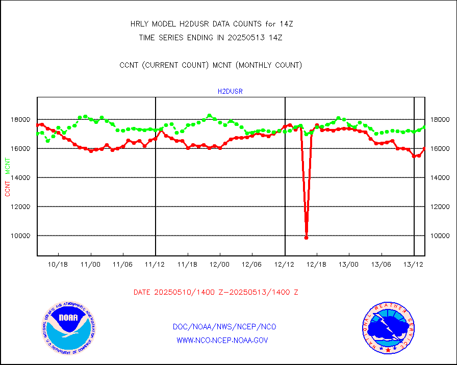
visja |
MTSAT/JMA visible derived cloud motion |
5 |
9 |
55.6 % |
1711.50-1712.49 |
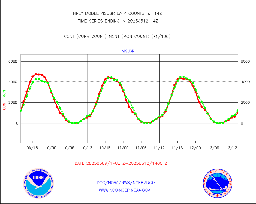
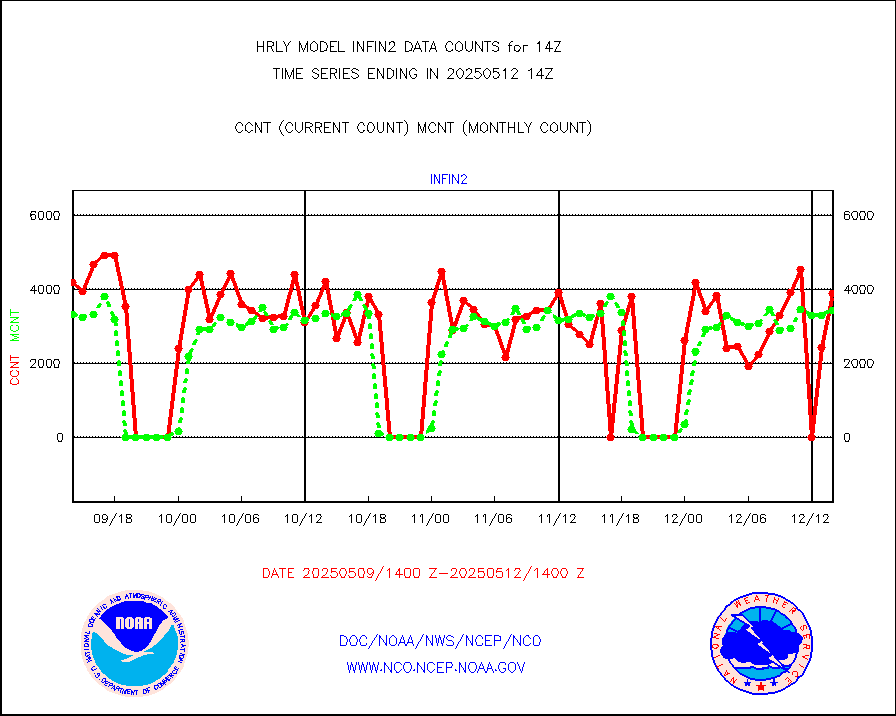
visusr |
GOES-16&up/NESDIS visible derived cloud motion |
129667 |
126581 |
102.4 % |
1713.00-1713.99 |
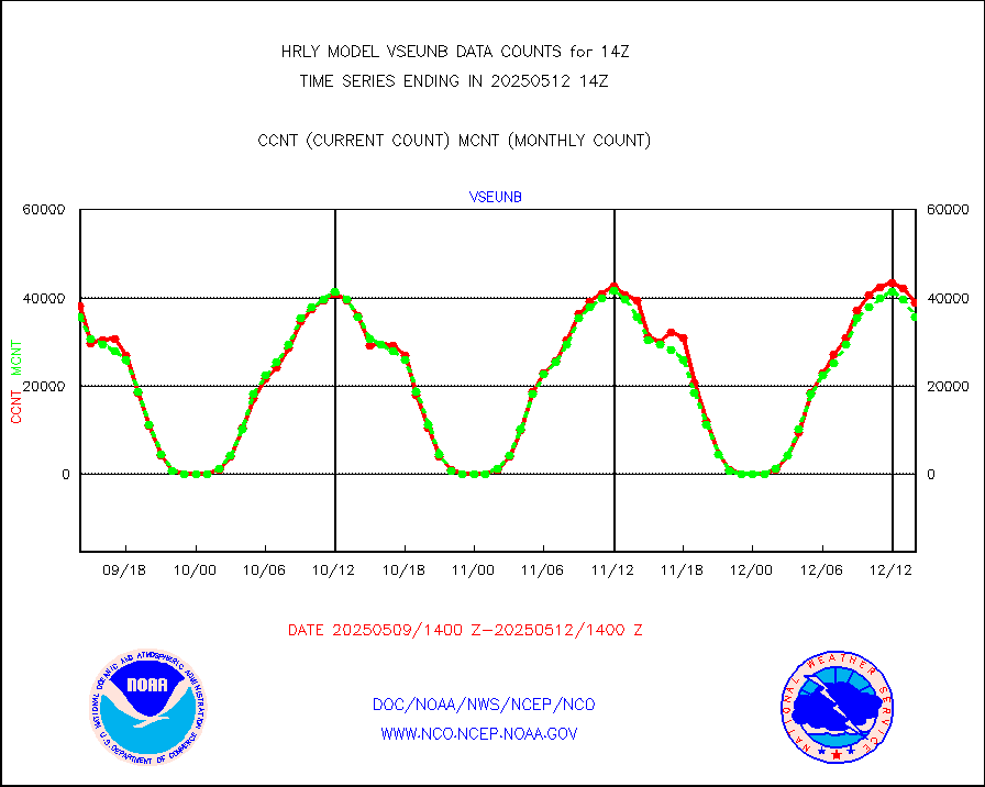
vseunb |
METEOSAT/EUMETSAT visible drv cld motion NBseq |
35516 |
33668 |
105.5 % |
1712.50-1713.49 |


