| Critical Data with Normal Counts |
|---|
| Type | Description | Hourly Count | Monthly Average | Percent (%) of Monthly Mean | UTC Time Window |
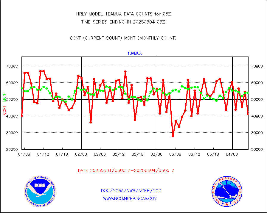
1bamua |
NOAA 15-19 & METOP 1-2 AMSU-A NCEP-proc. br.temps |
59529 |
53789 |
110.7 % |
1803.00-1803.99 |
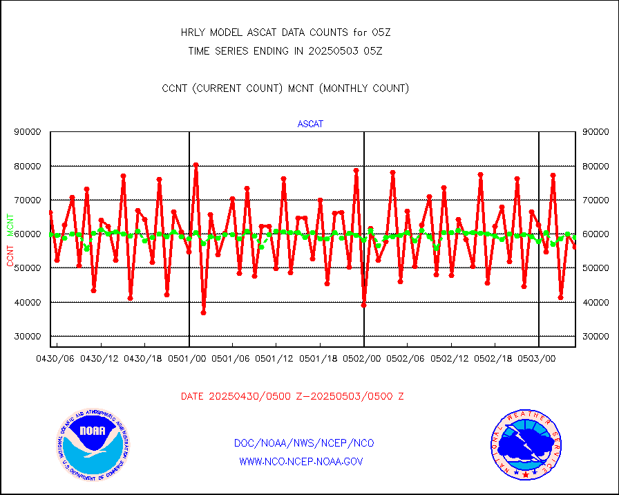
1bhrs4 |
NOAA 18-19 & METOP 1-2 HIRS-4 NCEP-proc. br.temps |
59245 |
45217 |
131.0 % |
1803.00-1803.99 |
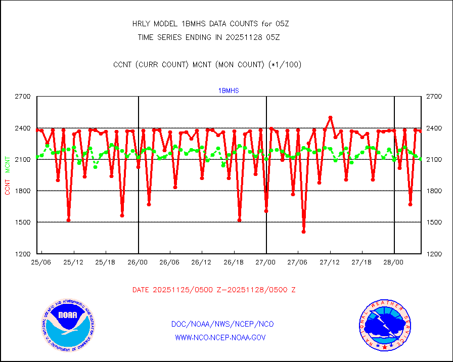
1bmhs |
NOAA 18-19 & METOP 1-2 MHS NCEP-proces. br. temps |
356446 |
303492 |
117.4 % |
1803.00-1803.99 |
acars |
MDCRS ACARS acft data from ARINC(dcded from BUFR) |
8421 |
13167 |
64.0 % |
1804.50-1805.49 |
airep |
Manual AIREP aircraft data (dcded from AIREP fmt) |
465 |
1133 |
41.0 % |
1804.50-1805.49 |
airsev |
AQUA AIRS/AMSU-A/HSB brightness temps- every FOV |
0 |
0 |
n/a |
1802.50-1803.49 |
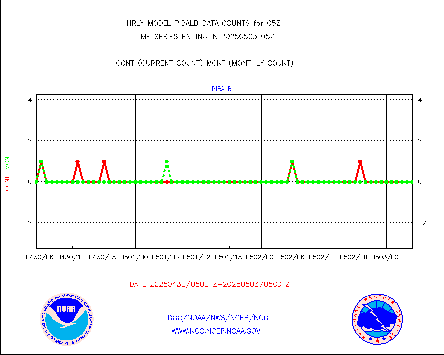
amdar |
AMDAR aircraft data (decoded from AMDAR format) |
285 |
524 |
54.4 % |
1804.50-1805.49 |
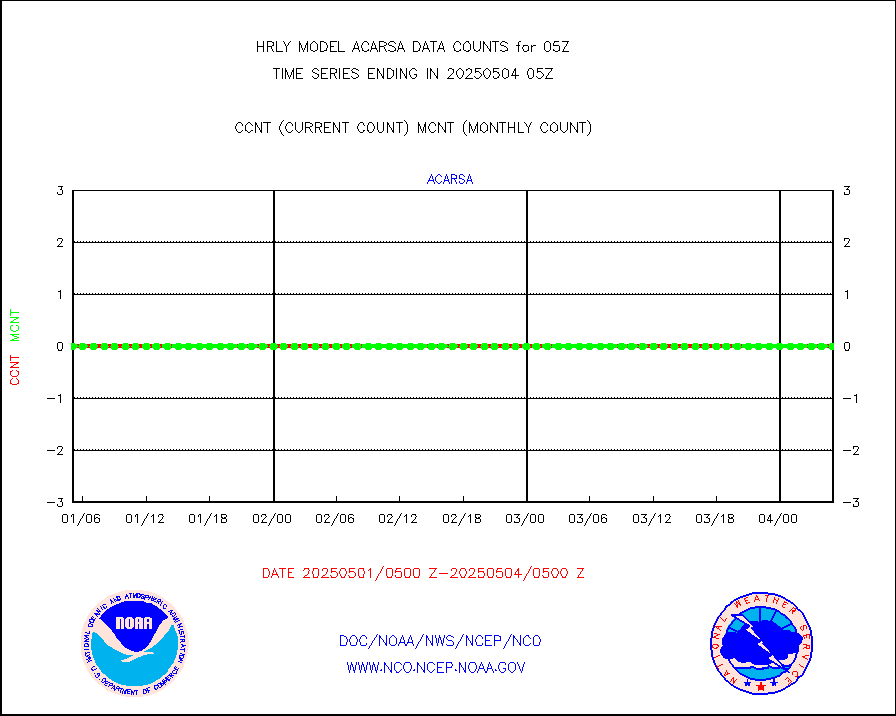
amdarb |
AMDAR aircraft data (decoded from BUFR) |
1063 |
1188 |
89.5 % |
1804.50-1805.49 |
ascat |
METOP 1-2 ASCAT products |
54180 |
29709 |
182.4 % |
1803.50-1804.49 |
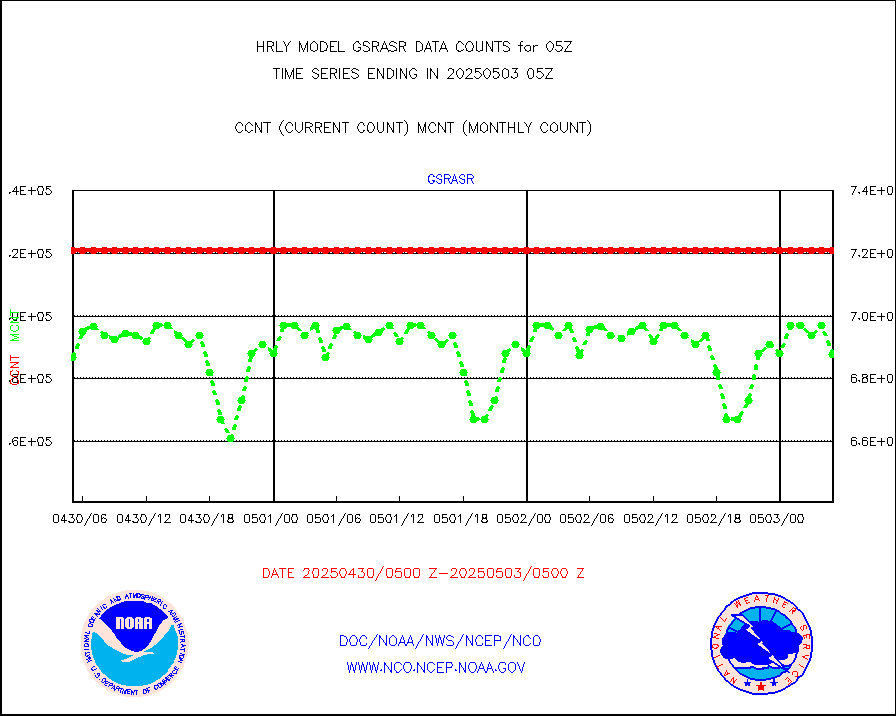
atms |
NPP/NOAA-20 ATMS brightness temperatures |
381024 |
344298 |
110.7 % |
1803.50-1804.49 |
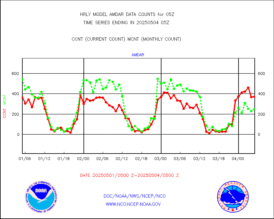
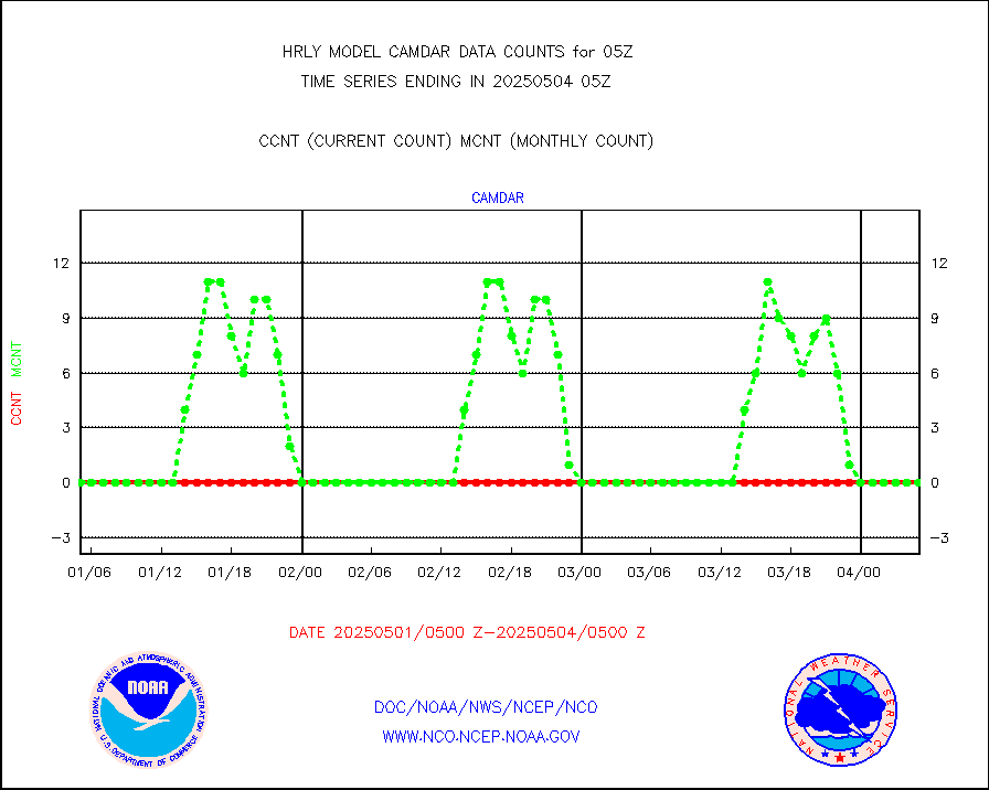
camdar |
Canadian AMDAR aircraft data (decoded from BUFR) |
0 |
0 |
n/a |
1804.50-1805.49 |
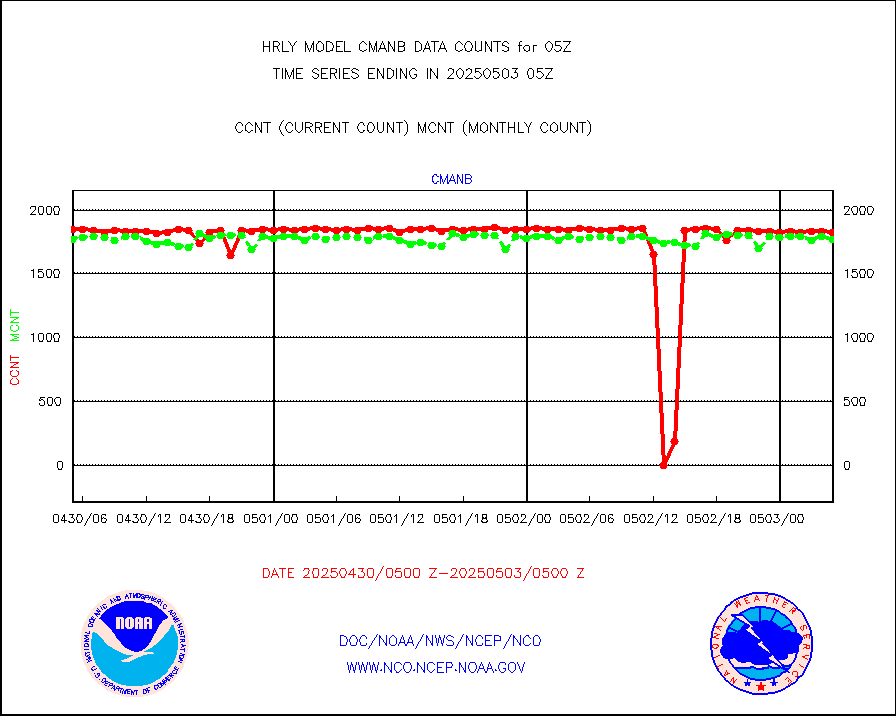
cmanb |
Surface Marine CMAN rpts decoded from BUFR format |
1819 |
1819 |
100.0 % |
1804.50-1805.50 |
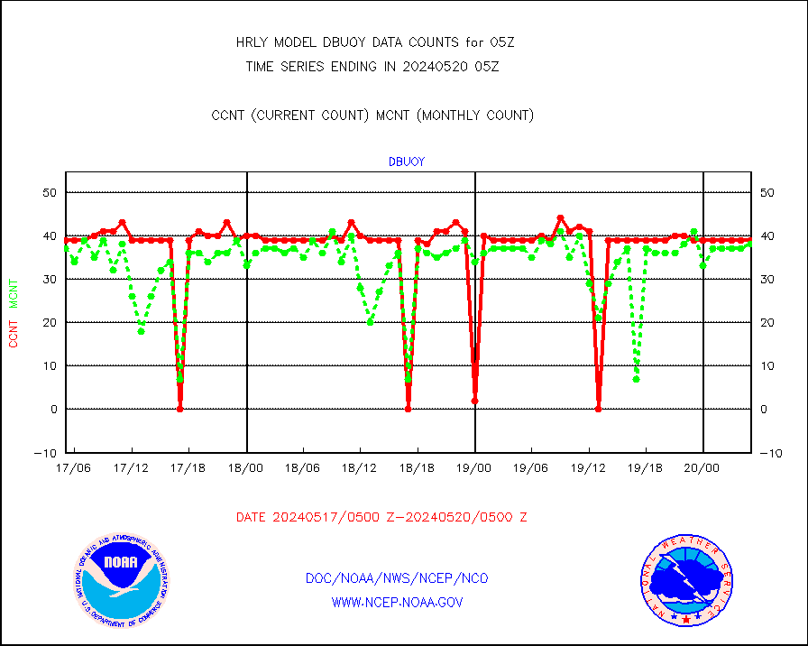
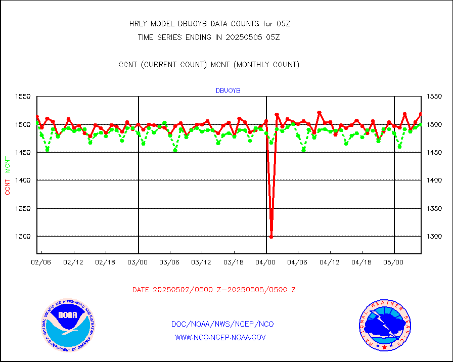
dbuoy |
Buoys decoded from FM-18 fmt (moored or drifting) |
40 |
31 |
129.0 % |
1804.50-1805.49 |
eadas |
E-AMDAR (European AMDAR acft decoded from BUFR) |
1644 |
1130 |
145.5 % |
1804.50-1805.49 |
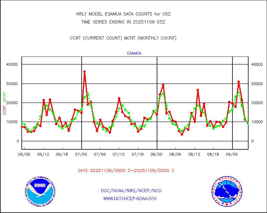
esamua |
NOAA 15-19 & METOP 1-2 AMSU-A proc btmps frm RARS |
23221 |
18512 |
125.4 % |
1804.50-1805.49 |
eshrs3 |
NOAA 15-19 & METOP 1-2 HIRS-3/4 pr btmps frm RARS |
65673 |
40747 |
161.2 % |
1804.50-1805.49 |
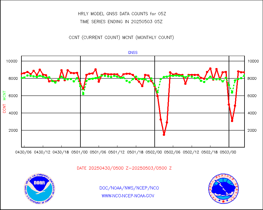
gnss |
Grnd-based Gbl Navigation Sat System (GNSS) data |
9425 |
7513 |
125.4 % |
1804.00-1804.99 |
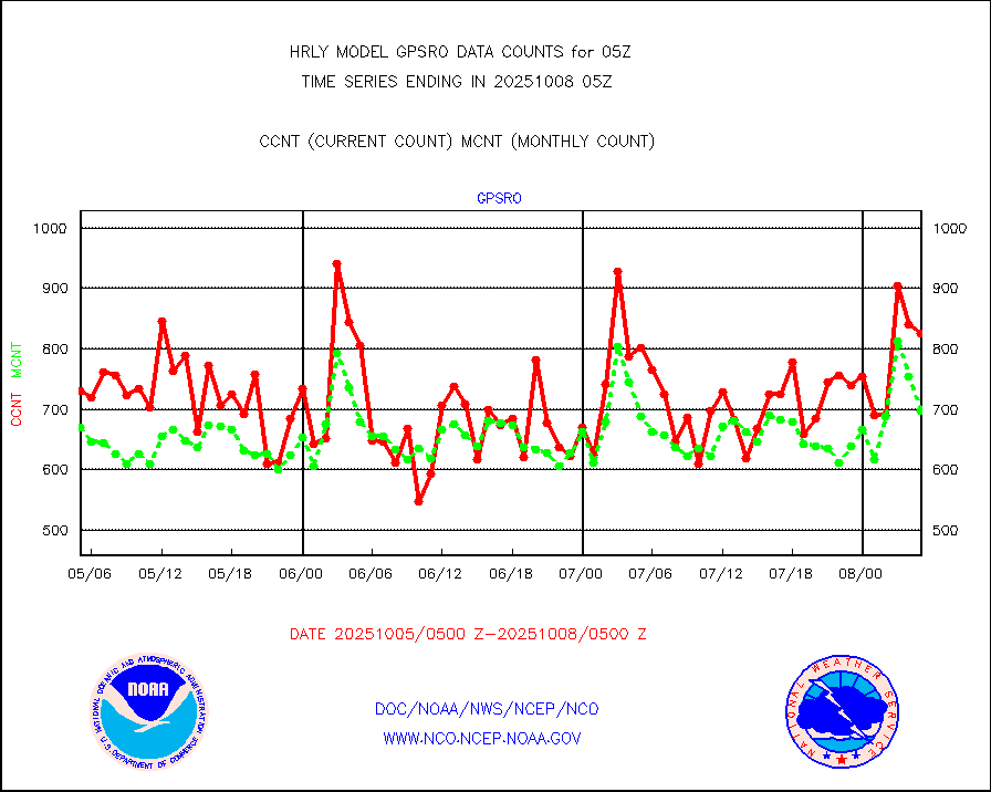
gpsro |
GPS radio occultation data |
436 |
399 |
109.3 % |
1802.50-1803.49 |
gsrasr |
GOES-16/17 All Sky Radiances (proc.) |
720952 |
711117 |
101.4 % |
1804.50-1805.49 |
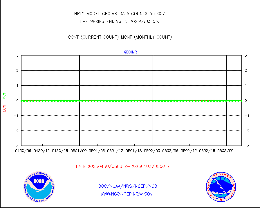
gsrcsr |
GOES-16/17 Clear Sky Radiances (proc.) |
337939 |
323071 |
104.6 % |
1804.50-1805.49 |
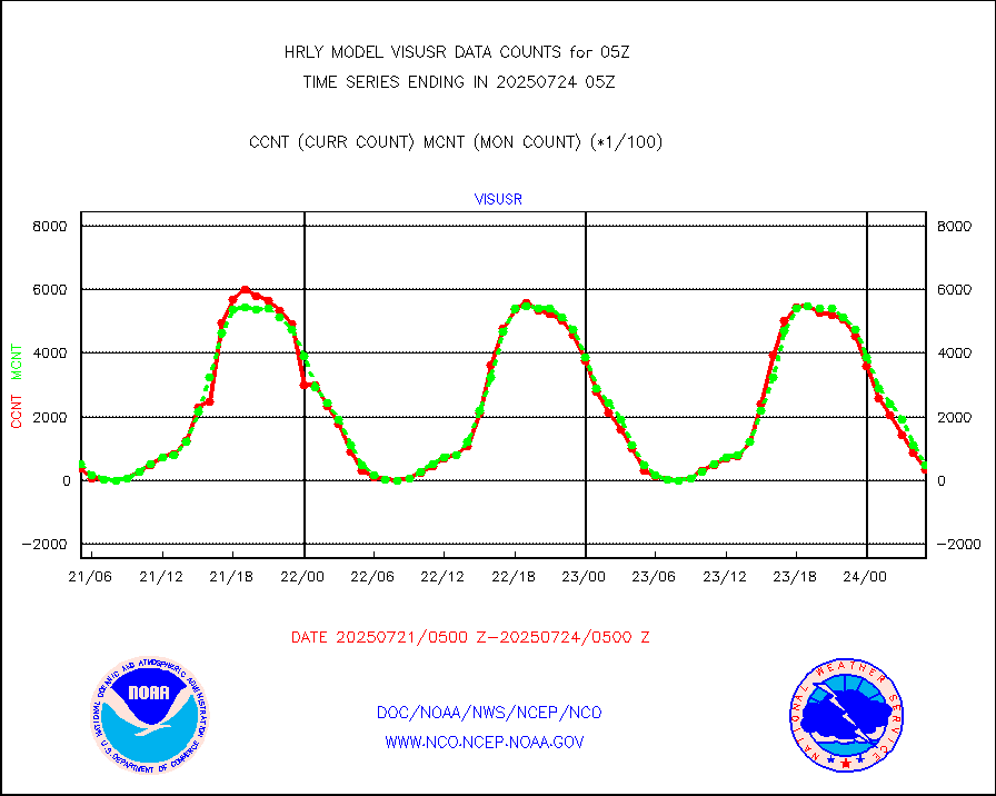
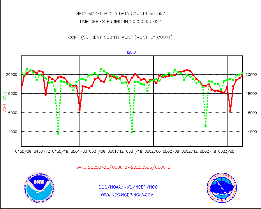
h20ja |
MTSAT/JMA water vapor imager derived cloud motion |
19953 |
18581 |
107.4 % |
1802.50-1803.49 |
h20mo |
MODIS (AQUA/TERRA) wvpr imager derived cld motion |
0 |
0 |
n/a |
1801.00-1801.99 |
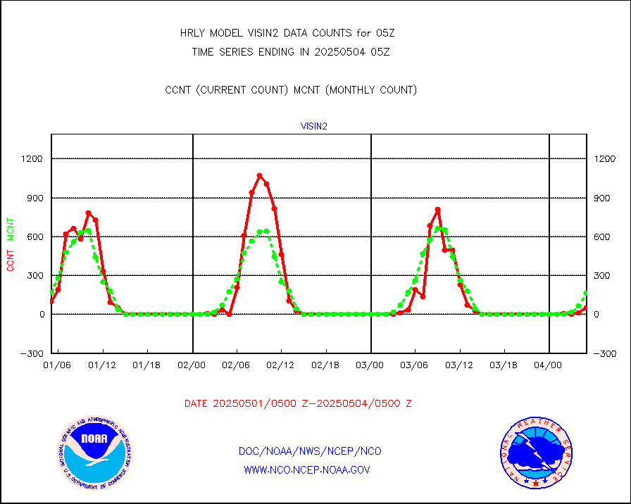
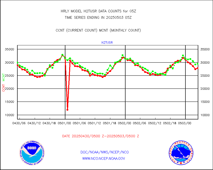
h2tusr |
GOES-16&up/NESDIS wv imgr/cld-top derived cld mtn |
27662 |
29351 |
94.2 % |
1804.00-1804.99 |
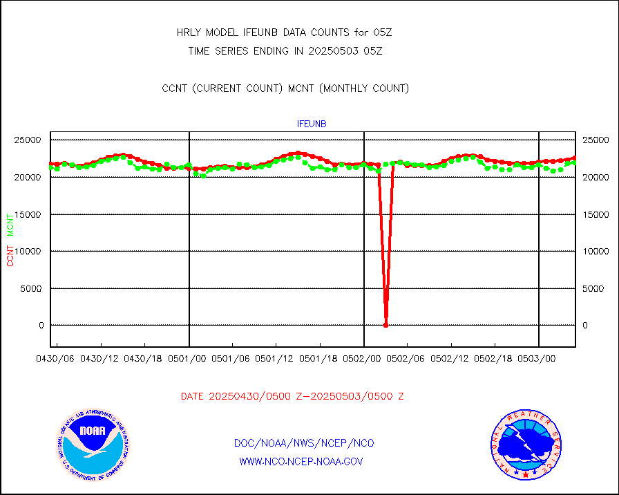
ifeunb |
METEOSAT/EUMETSAT ir lg-wave drv cld motion NBseq |
20098 |
22273 |
90.2 % |
1803.50-1804.49 |
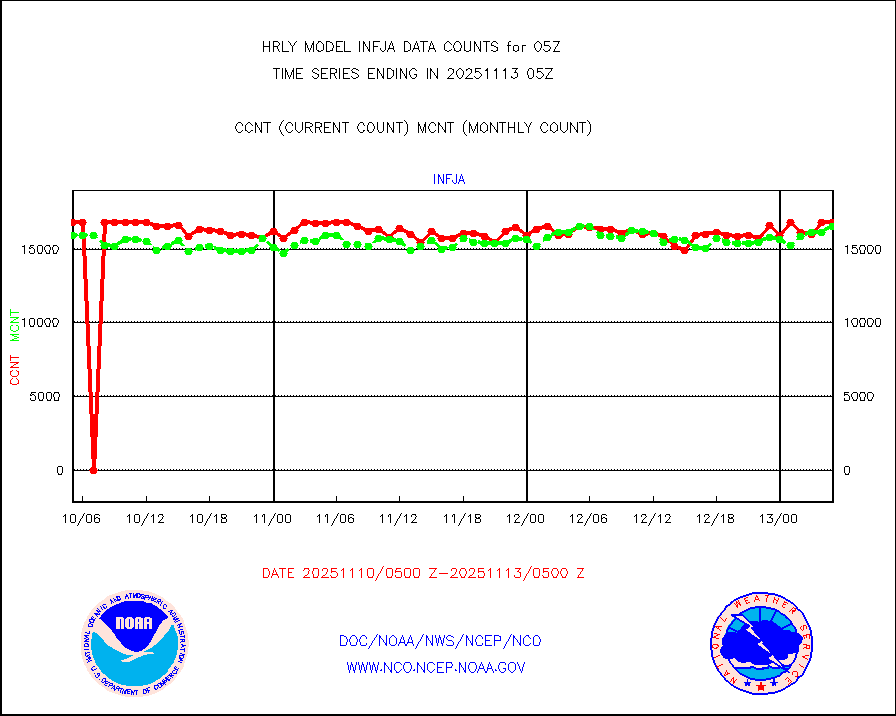
infja |
MTSAT/JMA infrared long-wave derived cloud motion |
14542 |
15435 |
94.2 % |
1802.50-1803.49 |
infmo |
MODIS (AQUA/TERRA) ir l-wave derived cloud motion |
0 |
0 |
n/a |
1801.00-1801.99 |
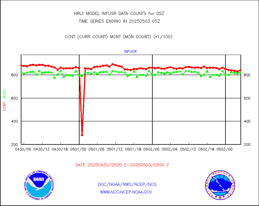
infusr |
GOES-16&up/NESDIS ir long-wave derived cld motion |
76768 |
82156 |
93.4 % |
1804.00-1804.99 |
lgycld |
GOES/NASA(Langley) hi-res. (1x1 f-o-v) cloud data |
4198276 |
4082195 |
102.8 % |
1804.50-1805.49 |
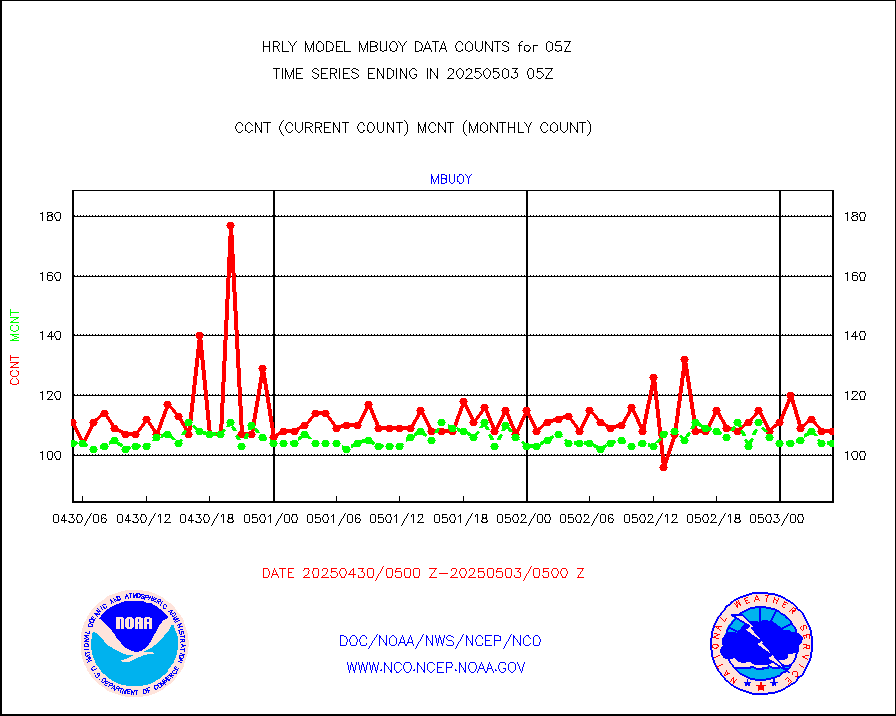
mbuoy |
Buoys decoded from FM-13 format (moored) |
95 |
111 |
85.6 % |
1804.50-1805.49 |
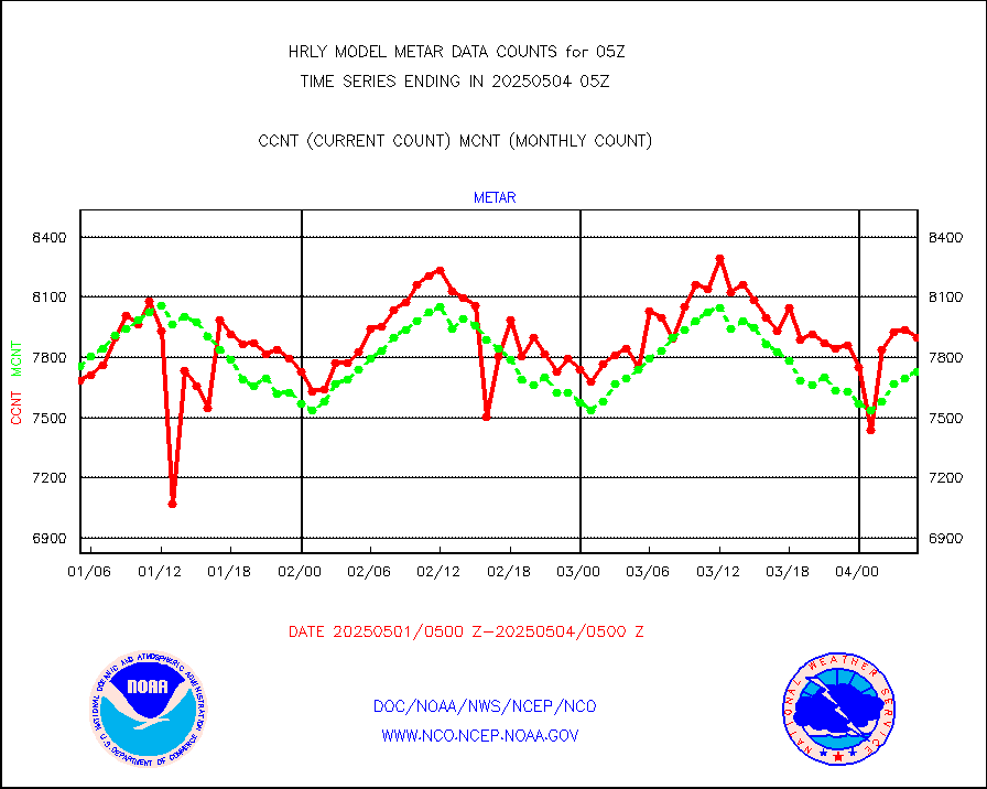
metar |
Aviation - METAR |
6792 |
7797 |
87.1 % |
1804.50-1805.49 |
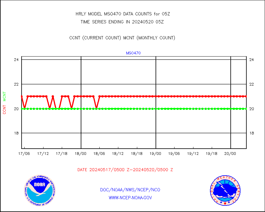
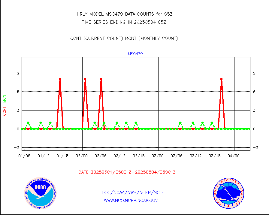
mso470 |
Mesonet/MADIS Colorado E-470 (Interstate 470) |
18 |
21 |
85.7 % |
1804.50-1805.49 |
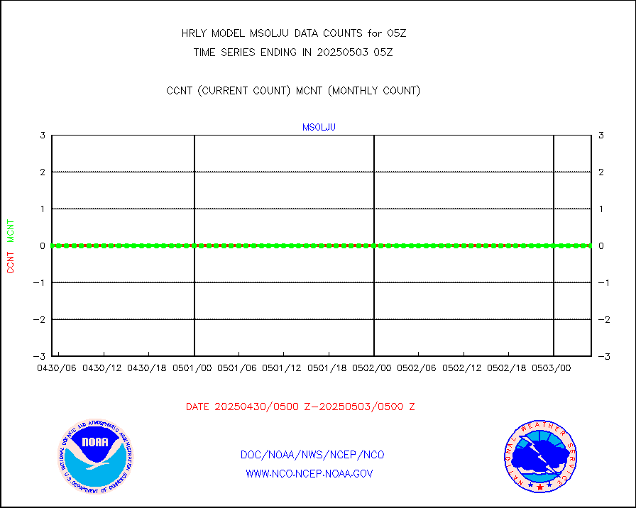
msoalk |
Mesonet/MADIS Alaska Department of Transportation |
106 |
107 |
99.1 % |
1804.50-1805.49 |
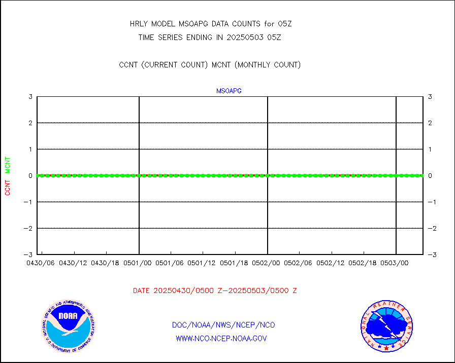
msoapg |
Mesonet/MADIS U.S. Army Aberdeen Proving Grounds |
0 |
0 |
n/a |
1804.50-1805.49 |
msoapr |
Mesonet/MADIS Citizen Weather Observers Program |
50160 |
46337 |
108.3 % |
1804.50-1805.49 |
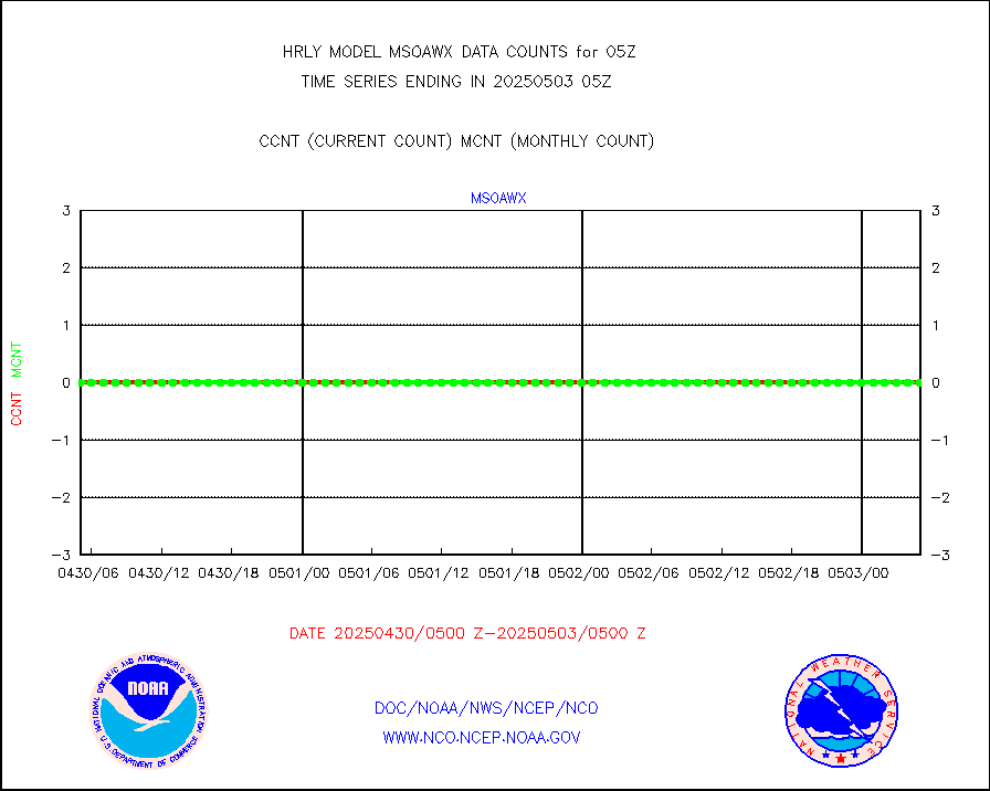
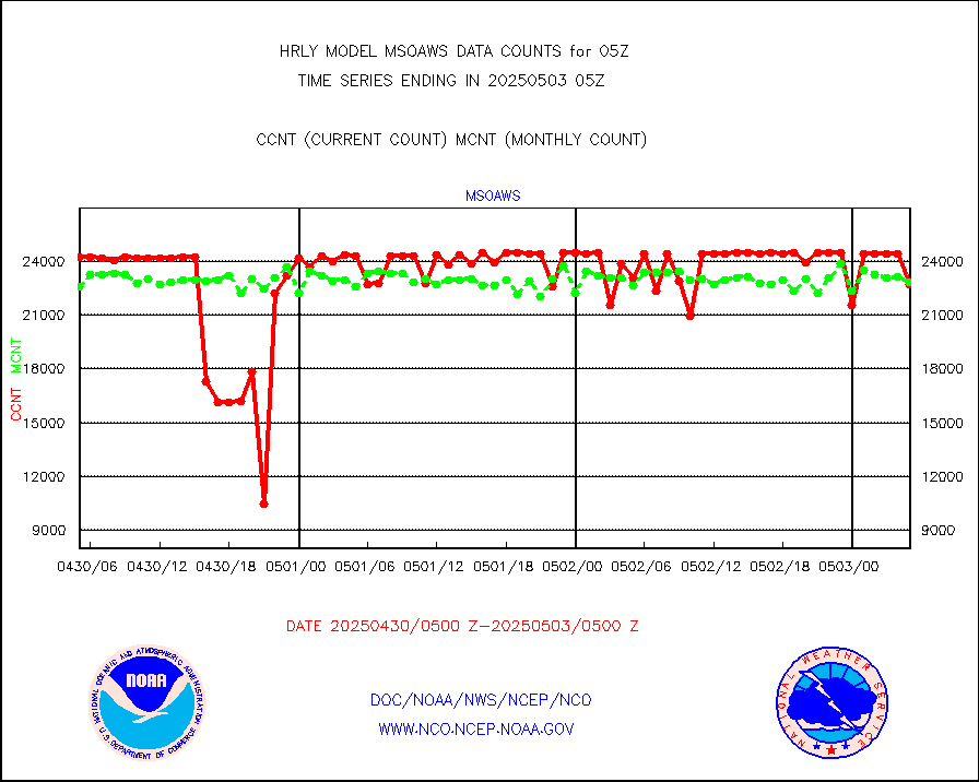
msoaws |
Mesonet/MADIS AWS Convergence Technologies, Inc. |
25978 |
25261 |
102.8 % |
1804.50-1805.49 |
msoawx |
Mesonet/MADIS "Anything Weather" |
0 |
0 |
n/a |
1804.50-1805.49 |
msocol |
Mesonet/MADIS Colorado Dept. of Transportation |
0 |
0 |
n/a |
1804.50-1805.49 |
msodcn |
Mesonet/MADIS DC Net |
0 |
0 |
n/a |
1804.50-1805.49 |
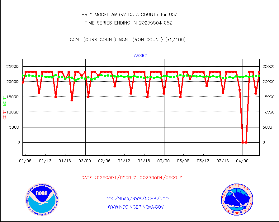
msoden |
Mesonet/MADIS Denver Urban Drainage & Flood Cntrl |
250 |
223 |
112.1 % |
1804.50-1805.49 |
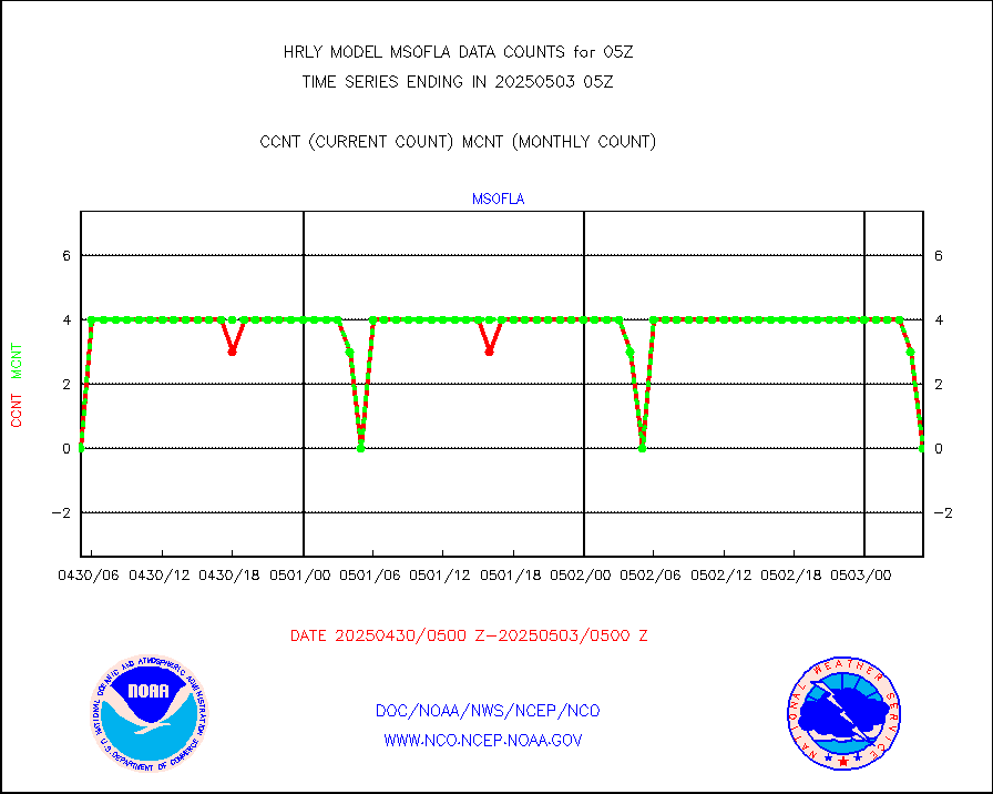
msofla |
Mesonet/MADIS Florida (FAWN & USF) |
0 |
0 |
n/a |
1804.50-1805.49 |
msoflt |
Mesonet/MADIS Florida Dept. of Transportation |
0 |
0 |
n/a |
1804.50-1805.49 |
msogeo |
Mesonet/MADIS Georgia Dept. of Transportation |
0 |
0 |
n/a |
1804.50-1805.49 |
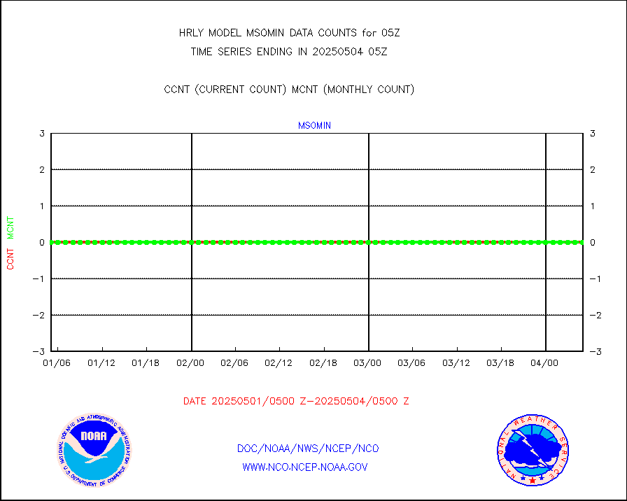
msohad |
Mesonet/MADIS NWS Hydromet Auto Data System(HADS) |
6831 |
6267 |
109.0 % |
1804.50-1805.49 |
msoien |
Mesonet/MADIS Iowa Environmental |
187 |
189 |
98.9 % |
1804.50-1805.49 |
msoind |
Mesonet/MADIS Indiana Dept. of Transportation |
0 |
0 |
n/a |
1804.50-1805.49 |
msoiow |
Mesonet/MADIS Iowa Department of Transportation |
0 |
0 |
n/a |
1804.50-1805.49 |
msokan |
Mesonet/MADIS Kansas Department of Transportation |
385 |
360 |
106.9 % |
1804.50-1805.49 |
msokla |
Mesonet/MADIS Oklahoma Mesonet |
318 |
329 |
96.7 % |
1804.50-1805.49 |
msolju |
Mesonet/MADIS Louisiana State/Jackson State Univ. |
0 |
0 |
n/a |
1804.50-1805.49 |
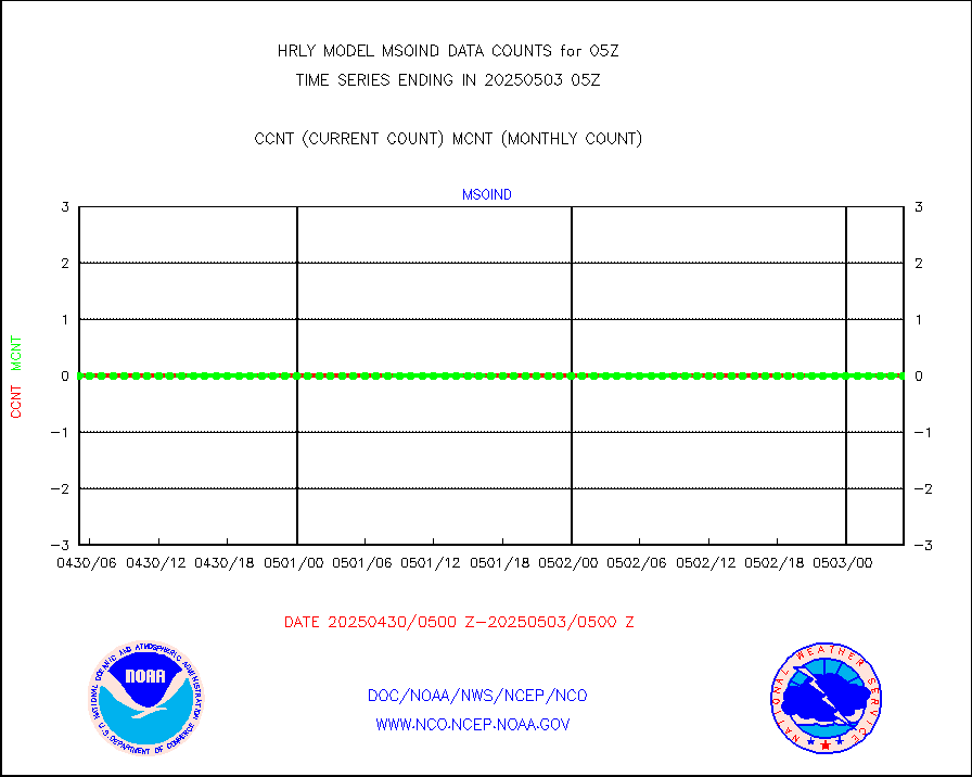
msomca |
Mesonet/MADIS Missouri Commercial Agricult Wx Net |
286 |
277 |
103.2 % |
1804.50-1805.49 |
msomin |
Mesonet/MADIS Minnesota Dept. of Transportation |
0 |
0 |
n/a |
1804.50-1805.49 |
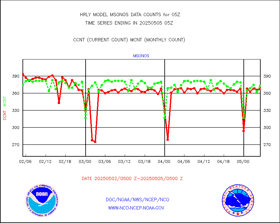
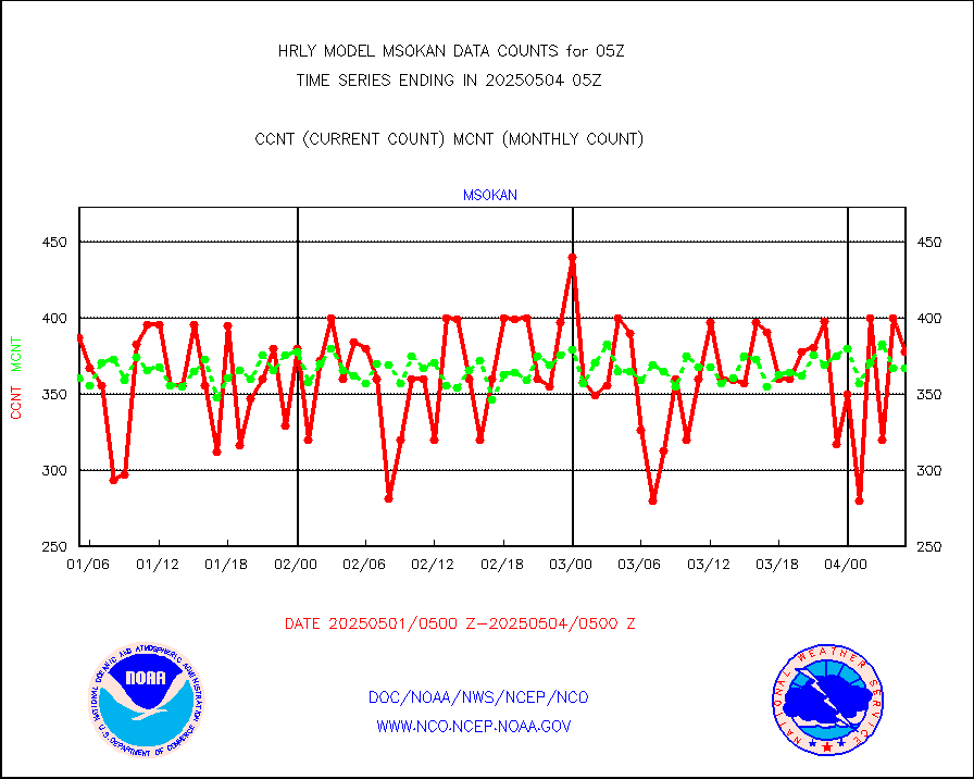
msonos |
Mesonet/MADIS NOS-Phys Oceanographic Realtime Sys |
377 |
366 |
103.0 % |
1804.50-1805.49 |
msoraw |
Mesonet/MADIS NFIC Remote Automated Wx Stns(RAWS) |
1894 |
1762 |
107.5 % |
1804.50-1805.49 |
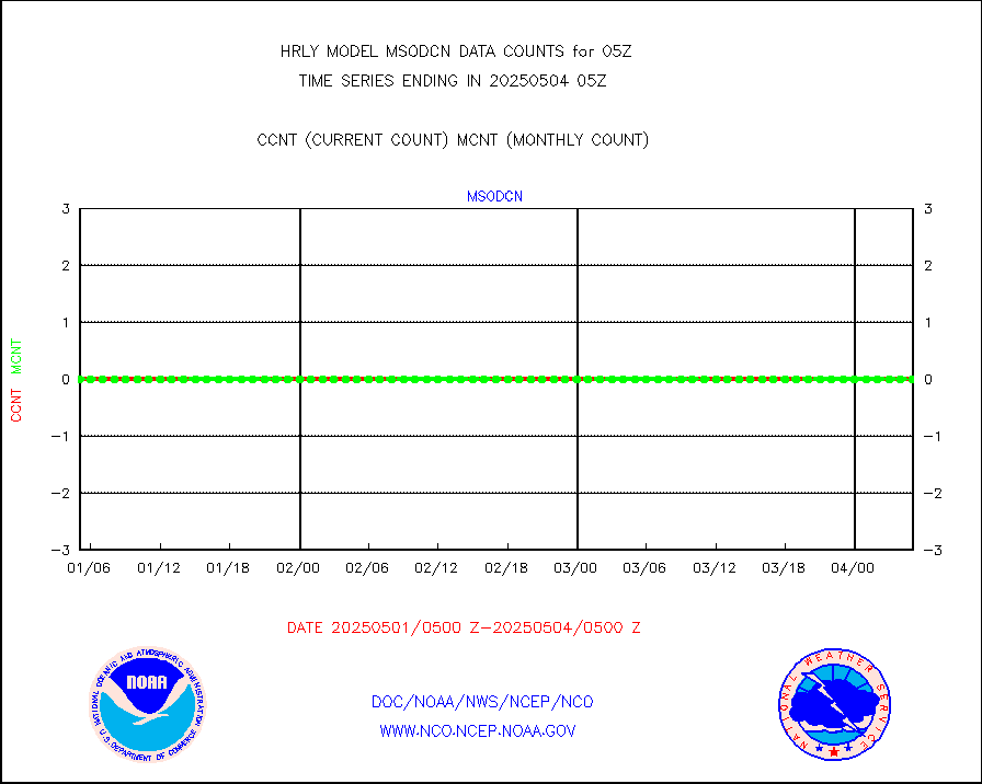
msovir |
Mesonet/MADIS Virginia Dept. of Transportation |
237 |
232 |
102.2 % |
1804.50-1805.49 |
msowfy |
Mesonet/MADIS "Weather for You" |
0 |
0 |
n/a |
1804.50-1805.49 |
msowis |
Mesonet/MADIS Wisconsin Dept. of Transportation |
0 |
0 |
n/a |
1804.50-1805.49 |
msowst |
Mesonet/MADIS MesoWest (many subproviders) |
46152 |
45710 |
101.0 % |
1804.50-1805.49 |
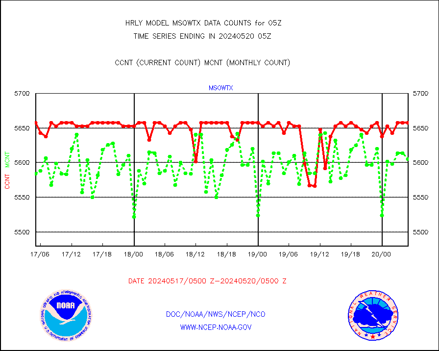
msowtx |
Mesonet/MADIS West Texas |
5658 |
5622 |
100.6 % |
1804.50-1805.49 |
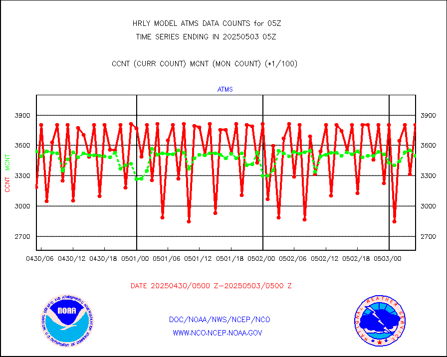
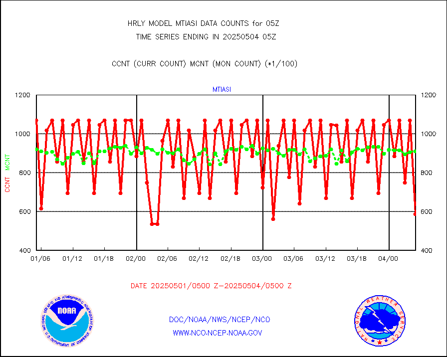
mtiasi |
METOP 1-2 IASI 1C radiance data (varbl. channels) |
104684 |
78820 |
132.8 % |
1803.00-1803.99 |
nxrdw |
NEXRAD Vel Azm Dsp(VAD) winds via radar coded msg |
0 |
0 |
n/a |
1804.50-1805.49 |
osbuv8 |
NOAA 16-19 Solar Backscatter UV-2 rad frm V8 BUFR |
0 |
0 |
n/a |
1803.00-1803.99 |
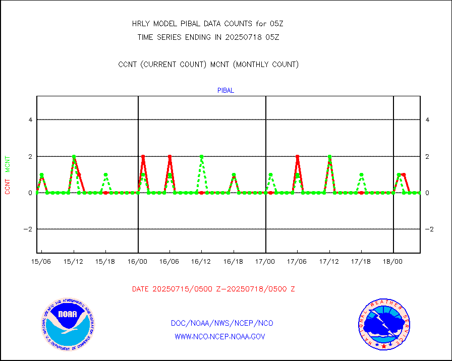
pibal |
PIBAL (from PILOT, PILOT SHIP, PILOT MOBIL) |
0 |
0 |
n/a |
1804.50-1805.49 |
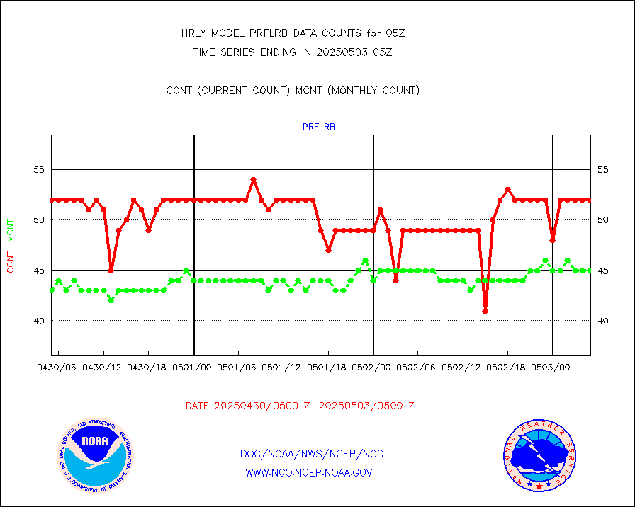
prflrb |
Multi-Agency Profiler (MAP) and SODAR winds |
44 |
39 |
112.8 % |
1804.50-1805.49 |
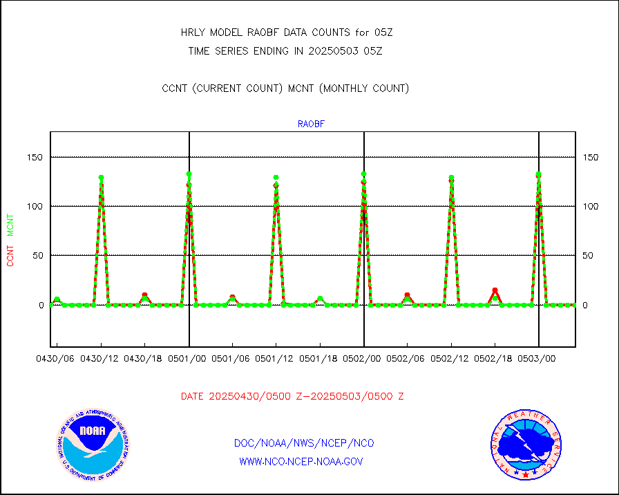
raobf |
Rawinsonde - fixed land (from TEMP or PILOT) |
0 |
0 |
n/a |
1804.50-1805.49 |
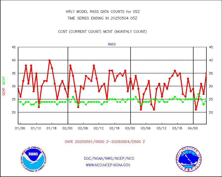
rass |
RASS temperatures (NOAA and Multi-Agency) |
32 |
24 |
133.3 % |
1804.50-1805.49 |
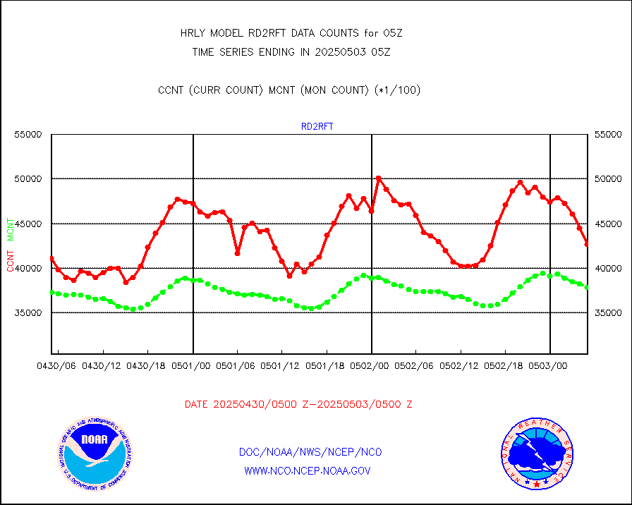
rd2rft |
NEXRAD reflectivity (Lvl 2 - GTS) |
3791883 |
3573185 |
106.1 % |
1804.50-1805.49 |
rd2wnd |
NEXRAD radial wind (Level 2 - GTS) |
1428724 |
1166647 |
122.5 % |
1804.50-1805.49 |
sevcsr |
METEOSAT-10 2nd Gen SEVIRI Clr Sky Radiance(proc) |
0 |
0 |
n/a |
1804.50-1805.49 |
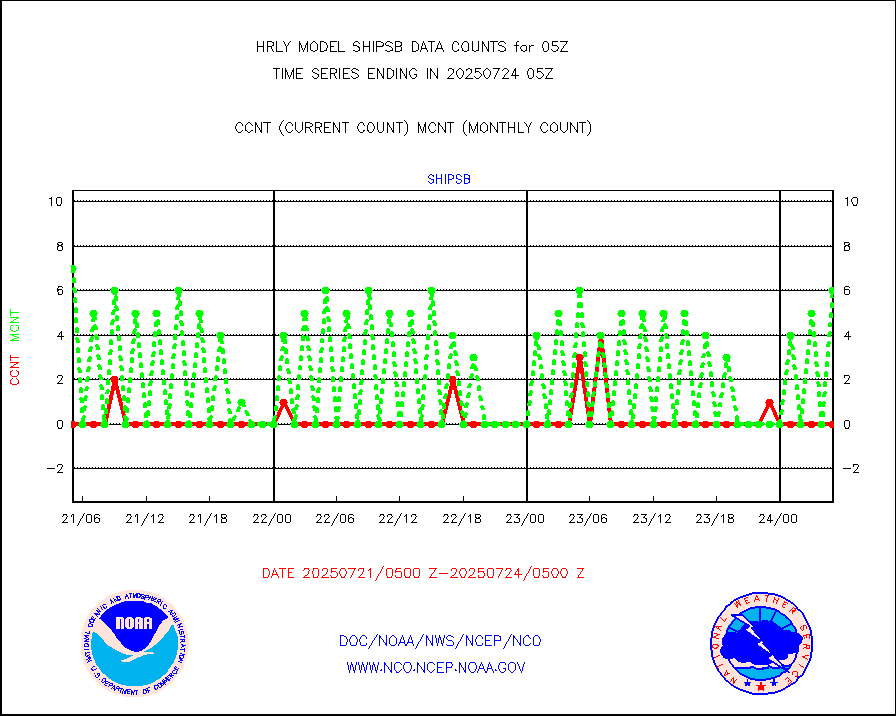
shipsb |
Ship - manual and automatic, restricted (BUFR) |
0 |
0 |
n/a |
1804.50-1805.50 |
shipsu |
Ship - manual and automatic, unrestricted |
86 |
114 |
75.4 % |
1804.50-1805.50 |
shipub |
Ship - manual and automatic, unrestricted (BUFR) |
861 |
828 |
104.0 % |
1804.50-1805.50 |
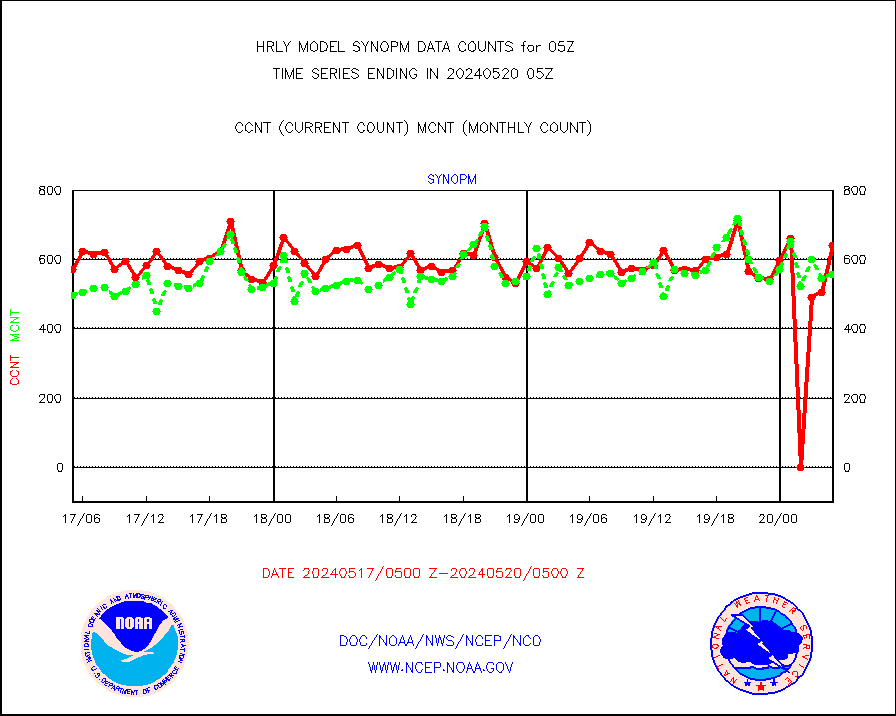
synop |
Synoptic - fixed manual and automatic |
112 |
859 |
13.0 % |
1804.50-1805.49 |
synopb |
Synoptic - fixed manual & auto (decoded fr BUFR) |
3353 |
4124 |
81.3 % |
1804.50-1805.49 |
synopr |
Synoptic - restricted (WMO Res 40) manual & auto. |
8 |
0 |
n/a |
1804.50-1805.49 |
synpbr |
Synoptic - restricted (WMO Res 40)(decoded BUFR) |
540 |
397 |
136.0 % |
1804.50-1805.49 |
tideg |
Tide gauge reports decoded from CREX format |
637 |
632 |
100.8 % |
1804.00-1804.99 |
| Data Types of Opportunity with Normal Counts |
|---|
| Type | Description | Hourly Count | Monthly Average | Percent (%) of Monthly Mean | UTC Time Window |
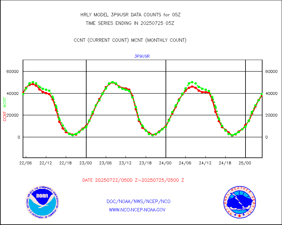
3p9usr |
GOES-16&up/NESDIS ir short-wv derived cld motion |
29107 |
36667 |
79.4 % |
1804.00-1804.99 |
acarsa |
MDCRS ACARS acft data (ARINC via AFWA)(AIREP fmt) |
0 |
0 |
n/a |
1804.50-1805.49 |
ahicsr |
Himawari Clear Sky Radiance |
0 |
0 |
n/a |
1804.00-1804.99 |
amsr2 |
GCOM-W AMSR2 1B brightness temperatures |
2309472 |
2199863 |
105.0 % |
1803.00-1803.99 |
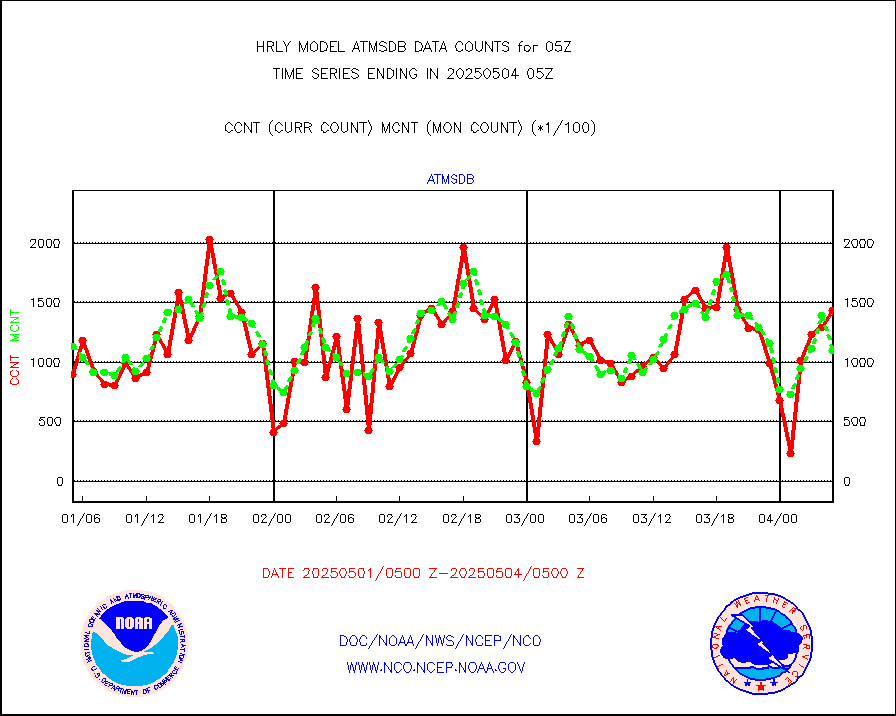
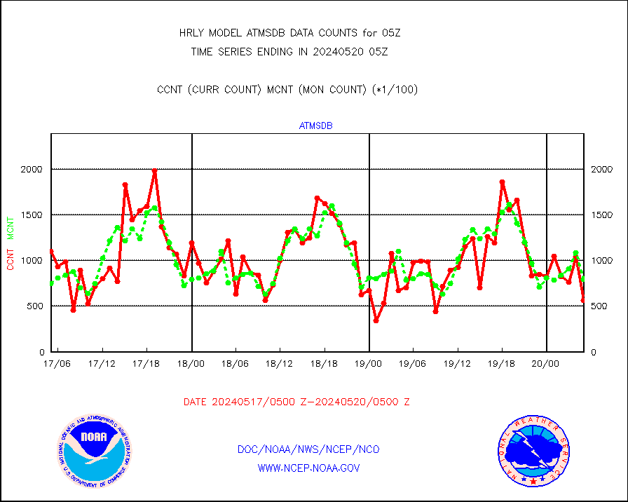
atmsdb |
NPP/NOAA-20 ATMS bright. temps-direct b-cast SSEC |
39025 |
69589 |
56.1 % |
1803.50-1804.49 |
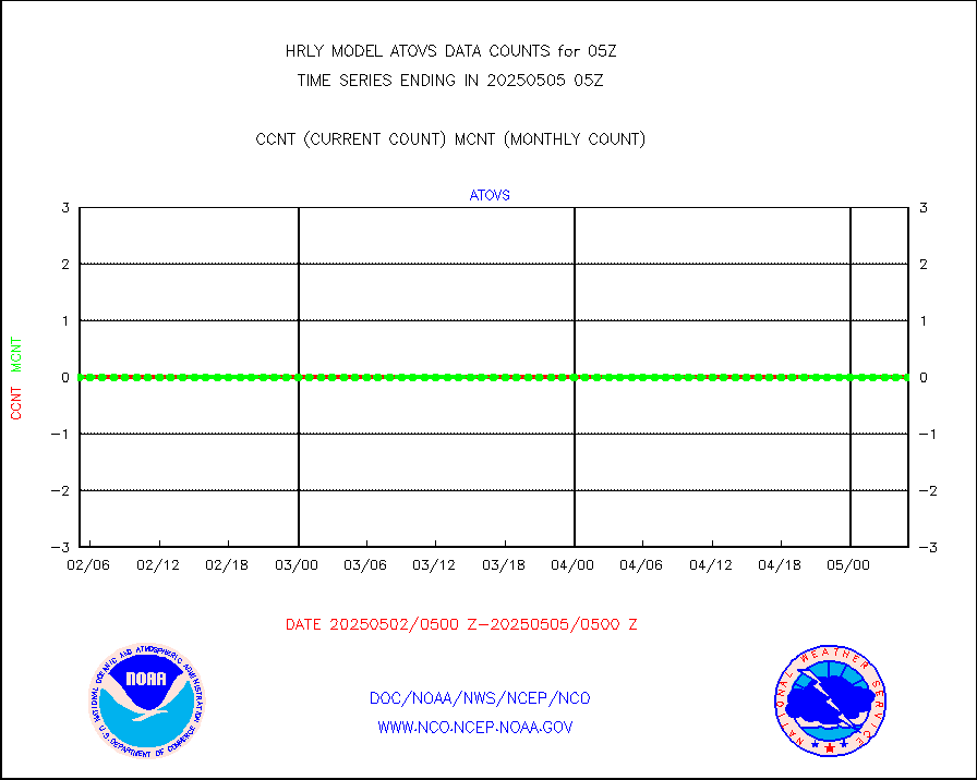
atovs |
POES/NESDIS - processed ATOVS soundings/radiances |
0 |
0 |
n/a |
1803.00-1803.99 |
avcsam |
A.M.(N17,M2,M3) AVHRR GAC NCEP-proc clr&sea btmps |
1243663 |
1232077 |
100.9 % |
1802.50-1803.49 |
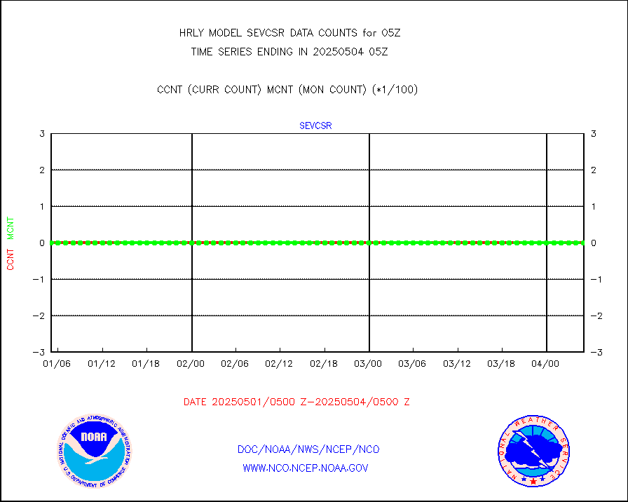
avcspm |
P.M.(N18-19) AVHRR GAC NCEP-proc clr & sea btemps |
1626226 |
1390194 |
117.0 % |
1802.50-1803.49 |
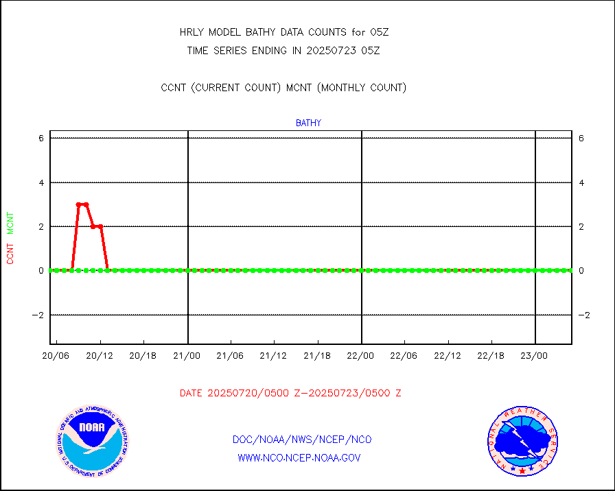
bathy |
eXpendable BathyThermograph, mooring (BATHY fmt) |
0 |
1 |
0.0 % |
1722.00-1722.99 |
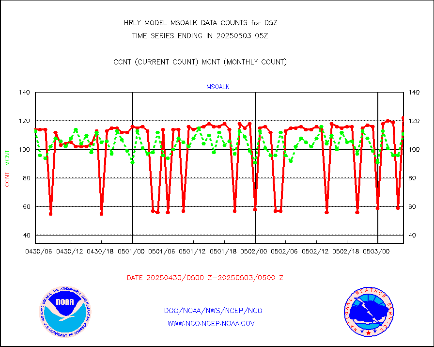
coopmd |
Coop/MADIS NEPP & HCN-Modernization NOAA COOP Obs |
23 |
23 |
100.0 % |
1804.50-1805.49 |
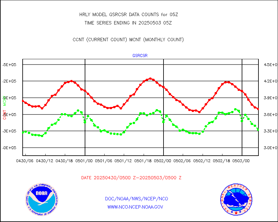
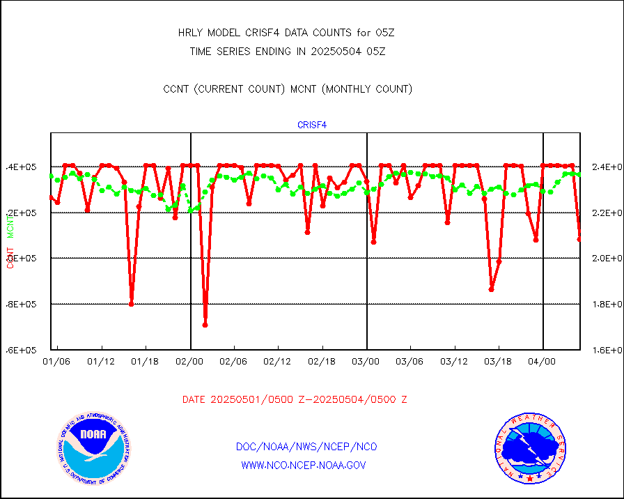
crisf4 |
NPP/NOAA-20 CrIS full spctrl radn (431 ch subset) |
193140 |
231042 |
83.6 % |
1803.50-1804.49 |
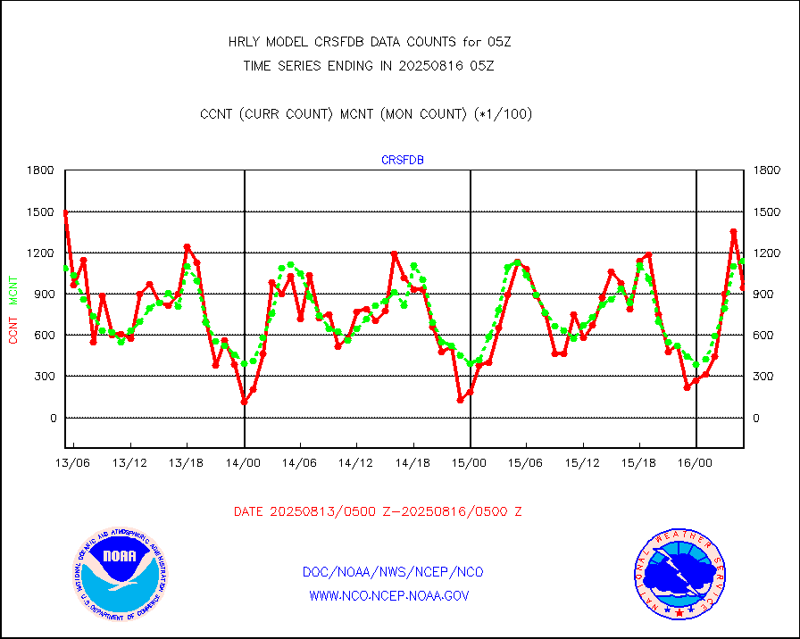
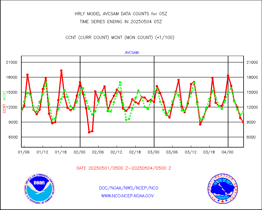
crsfdb |
NPP/NOAA-20 CrIS full spctrl radn dir brdcst SSEC |
118530 |
108461 |
109.3 % |
1803.50-1804.49 |
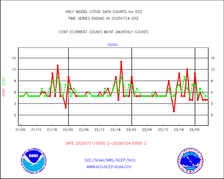
cstgd |
Coast Guard |
4 |
4 |
100.0 % |
1804.50-1805.50 |
dbuoyb |
Drifting buoys (decoded from BUFR) |
1358 |
1446 |
93.9 % |
1804.50-1805.50 |
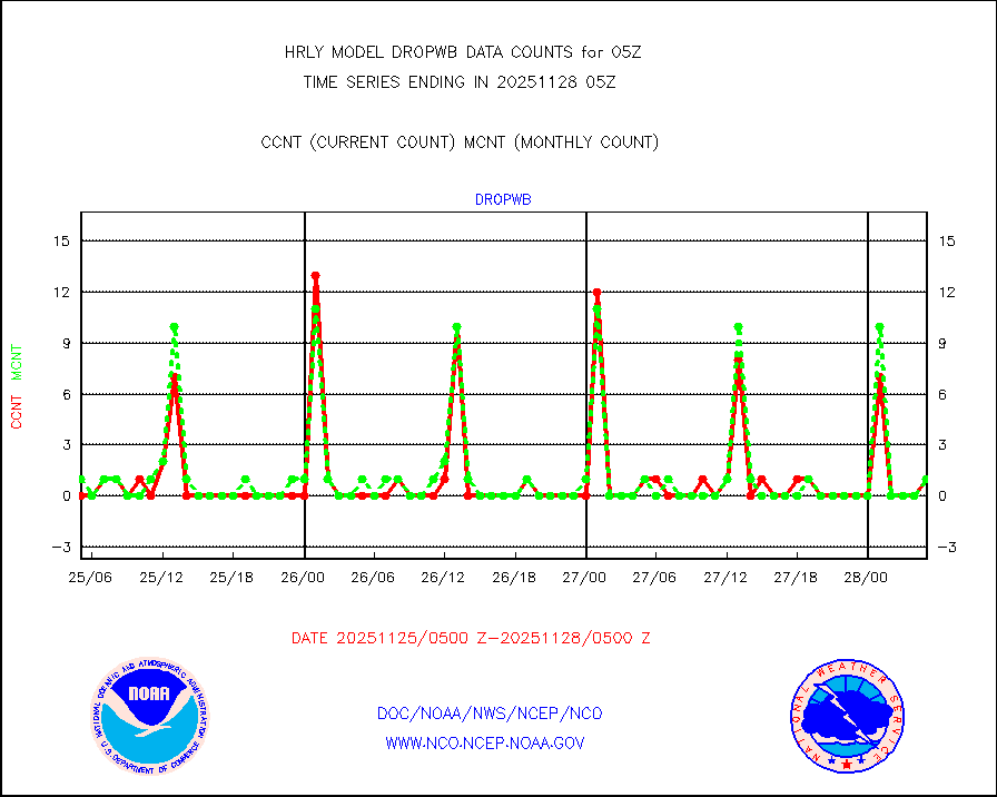
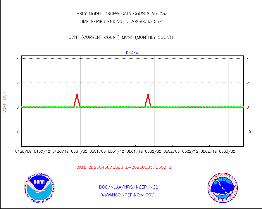
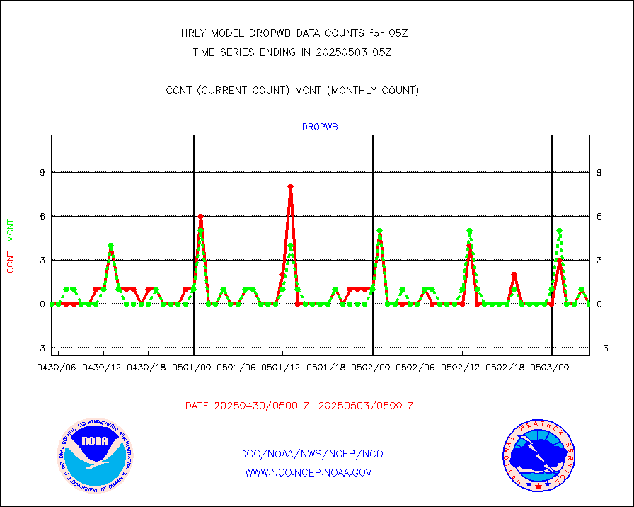
dropw |
Dropwinsonde (from TEMP DROP) |
0 |
0 |
n/a |
1804.50-1805.49 |
efclam |
GOES imager effective cloud amount data (U.Wisc.) |
8276571 |
8229183 |
100.6 % |
1804.50-1805.49 |
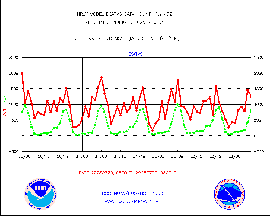
esatms |
NPP Adv. Tech. MW Sndr (ATMS) br. temps from RARS |
105409 |
128685 |
81.9 % |
1803.50-1804.49 |
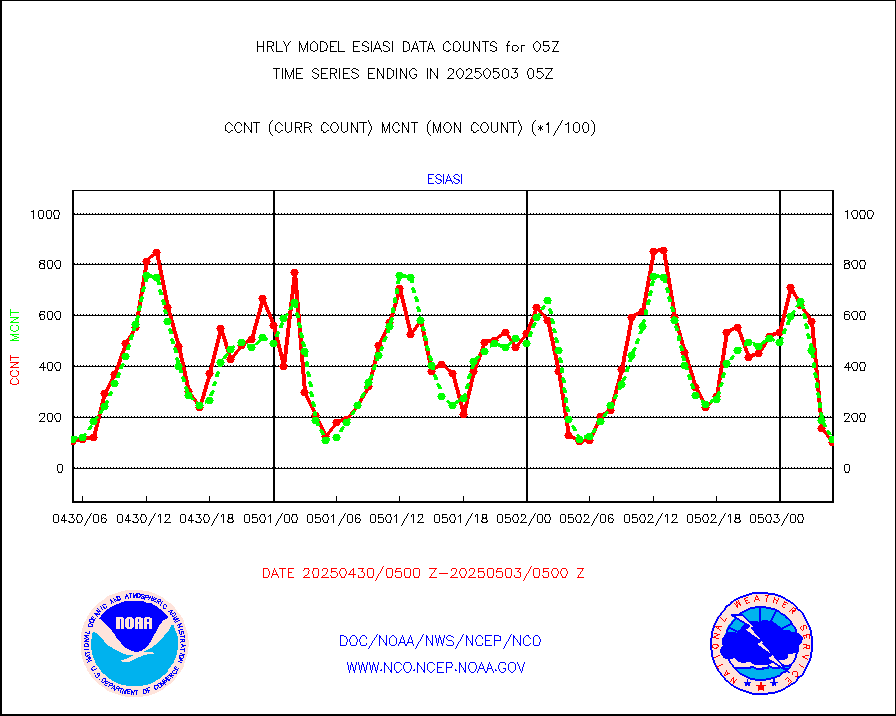
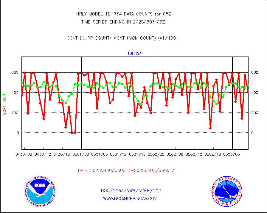
esiasi |
METOP 1-2 IASI 1C radiance data vbl chn from RARS |
19728 |
22012 |
89.6 % |
1804.00-1804.99 |
esmhs |
NOAA 18-19 & METOP 1-2 MHS proc. btemps from RARS |
161959 |
106198 |
152.5 % |
1804.50-1805.49 |
geoimr |
GOES/NESDIS (11x17 f-o-v) imager clear radiances |
0 |
0 |
n/a |
1804.00-1804.99 |
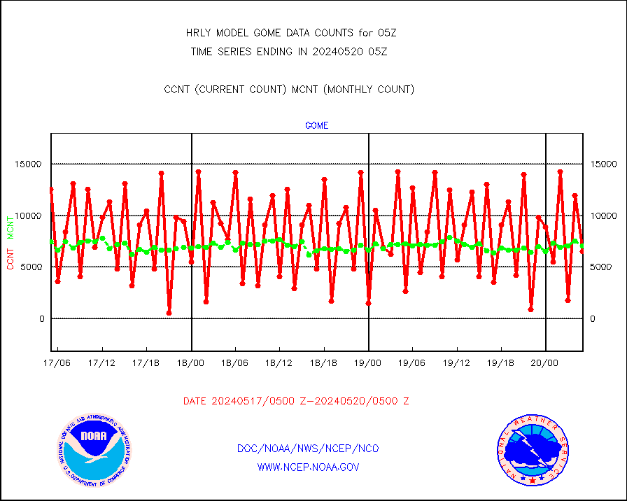
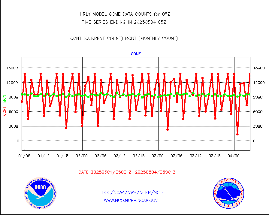
gome |
METOP 1-2 Global Ozone Monitoring Exp.-2 (GOME-2) |
12511 |
7150 |
175.0 % |
1803.50-1804.49 |
h2dusr |
GOES-16&up/NESDIS wv imgr/deep-lyr derivd cld mtn |
16836 |
14948 |
112.6 % |
1804.00-1804.99 |
h2eunb |
METEOSAT/EUMETSAT wvpr imgr drv cld motion NBseq |
41210 |
41833 |
98.5 % |
1803.50-1804.49 |
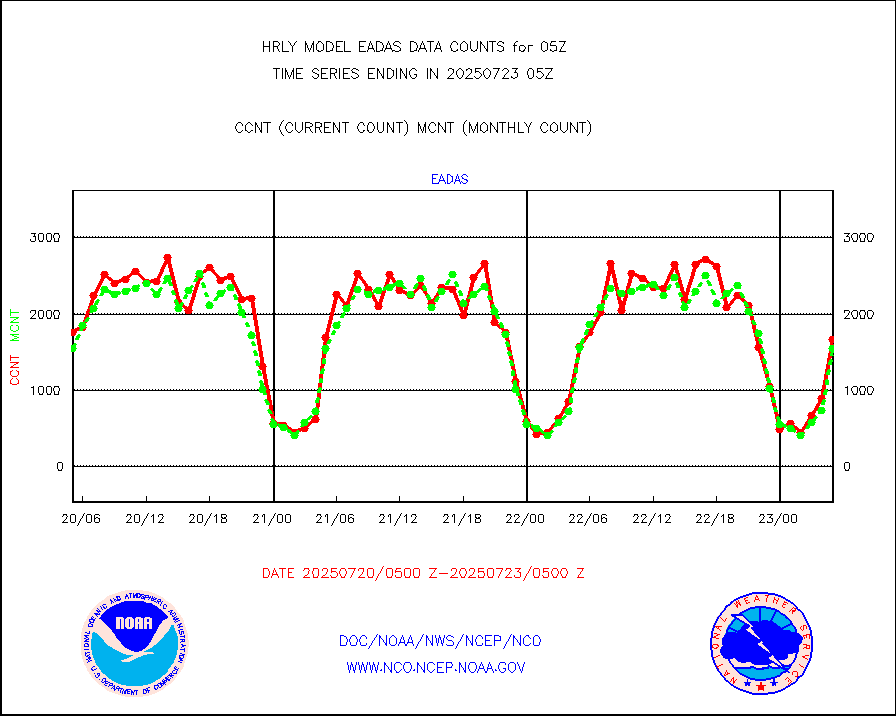
hdob |
High Density OBs from reconnaissance acft data |
0 |
0 |
n/a |
1804.50-1805.49 |
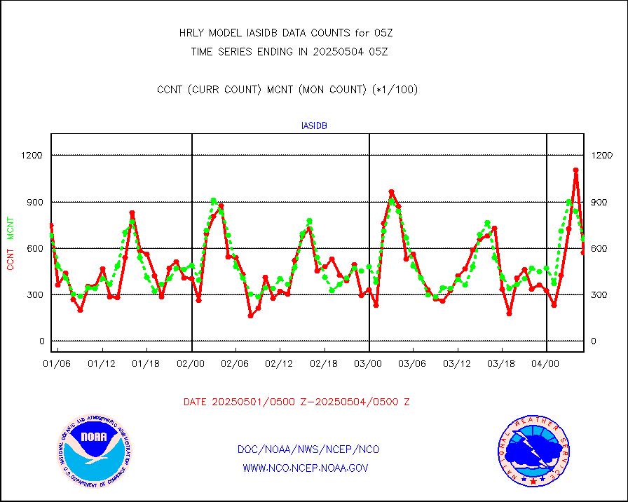
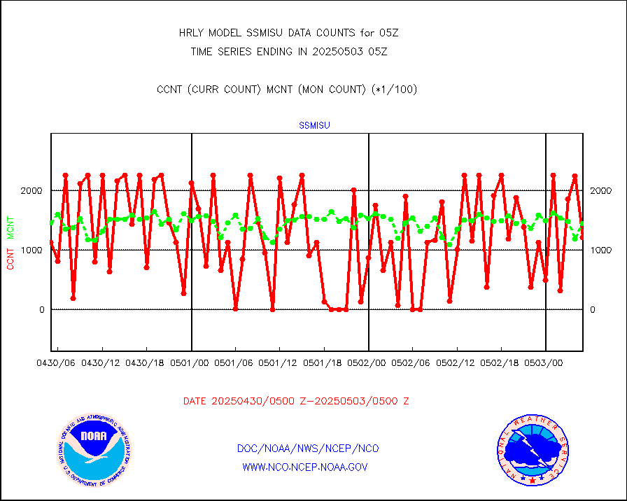
iasidb |
METOP 1-2 IASI 1C radiances-direct broadcast SSEC |
62436 |
50967 |
122.5 % |
1803.50-1804.49 |
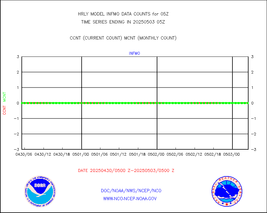
ifvrnb |
VIIRS (NPP/NOAA-20) ir lg-wv drv cloud motion(NB) |
18291 |
17898 |
102.2 % |
1801.00-1801.99 |
infav1 |
AVHRR (METOP) ir lg-wave derived cld motion |
0 |
0 |
n/a |
1804.50-1805.50 |
infin |
INSAT/KALPANA India ir lg-wave derived cld motion |
0 |
0 |
n/a |
1802.50-1803.49 |
kamdar |
Korean AMDAR aircraft data (decoded from BUFR) |
53 |
67 |
79.1 % |
1804.50-1805.49 |
lcman |
Land-based CMAN stations decoded from CMAN format |
74 |
76 |
97.4 % |
1804.50-1805.49 |
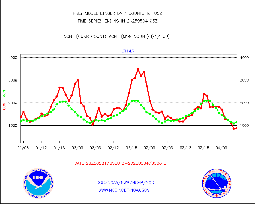
ltnglr |
LLDN Long-rng lightning from Vaisala via NOAAPORT |
107896 |
105467 |
102.3 % |
1804.50-1805.49 |
ltngsr |
NLDN Shrt-rng lightning from Vaisala via NOAAPORT |
942 |
1505 |
62.6 % |
1804.50-1805.49 |
mbuoyb |
Moored buoys (decoded from BUFR) |
630 |
621 |
101.4 % |
1804.50-1805.50 |
mls |
Aura Microwave Limb Sounder (MLS) ozone data |
0 |
0 |
n/a |
1803.00-1803.99 |
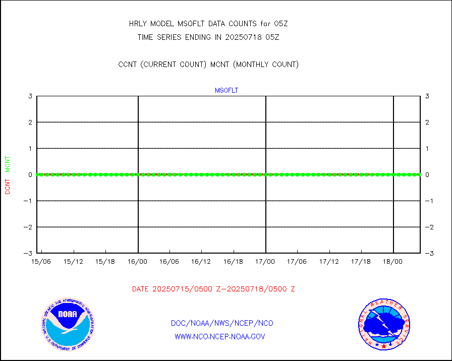
msourb |
Mesonet/MADIS UrbaNet |
4390 |
4300 |
102.1 % |
1804.50-1805.49 |
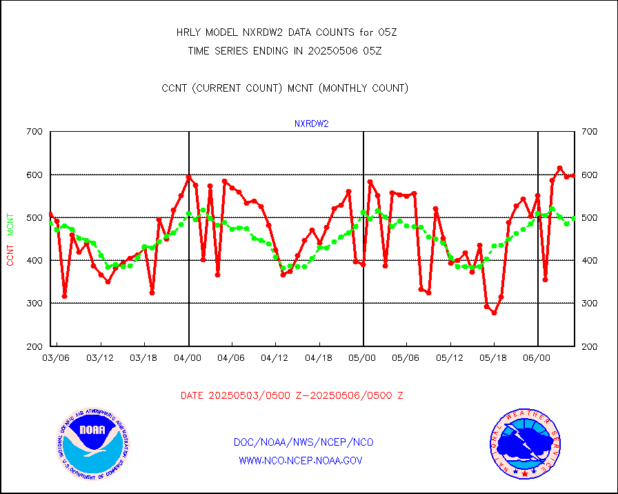
nxrdw2 |
NEXRAD Vel Azm Dsp(VAD) winds via Level 2 decoder |
578 |
505 |
114.5 % |
1804.50-1805.49 |
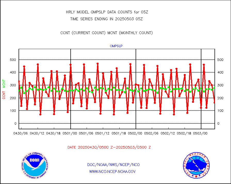
ompslp |
OMPS Limb Profiler ozone data (NPP) |
387 |
258 |
150.0 % |
1722.00-1722.99 |
ompsn8 |
OMPS nadir profile ozone (Version 8 BUFR) |
595 |
475 |
125.3 % |
1803.00-1803.99 |
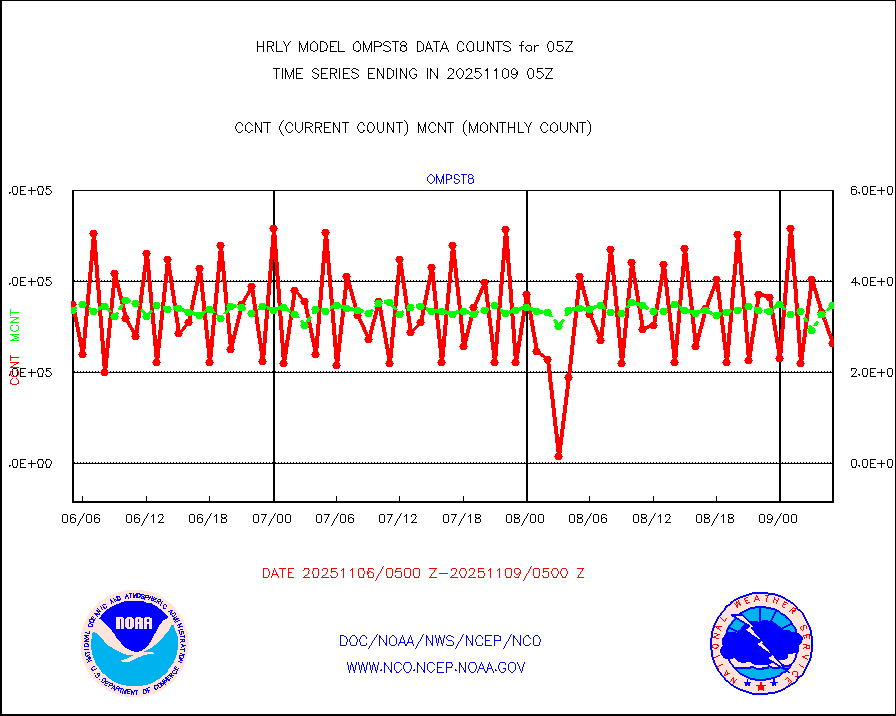
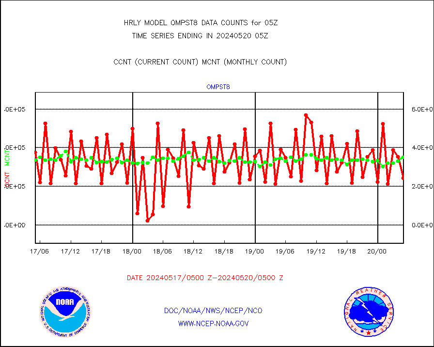
ompst8 |
OMPS total column ozone (Version 8 BUFR) |
225204 |
349576 |
64.4 % |
1803.00-1803.99 |
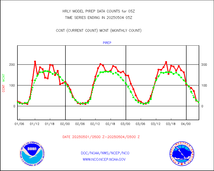
pirep |
Manual PIREP aircraft data (dcded from AIREP fmt) |
14 |
17 |
82.4 % |
1804.50-1805.49 |
prflrp |
Profilr winds from PIBAL (PILOT,PILOT SHIP/MOBIL) |
0 |
0 |
n/a |
1804.50-1805.49 |
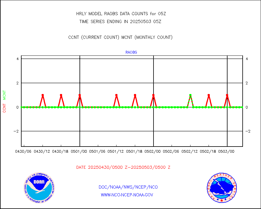
raobm |
Rawinsonde - mobile land (from TEMP/PILOT MOBIL) |
0 |
0 |
n/a |
1804.50-1805.49 |
raobs |
Rawinsonde - ship (from TEMP SHIP, PILOT SHIP) |
0 |
0 |
n/a |
1804.50-1805.49 |
recco |
Flight level reconnaissance aircraft data |
0 |
0 |
n/a |
1804.50-1805.49 |
saphir |
Megha-Tropiques SAPHIR L1A2 brightness temps |
0 |
0 |
n/a |
1802.50-1803.49 |
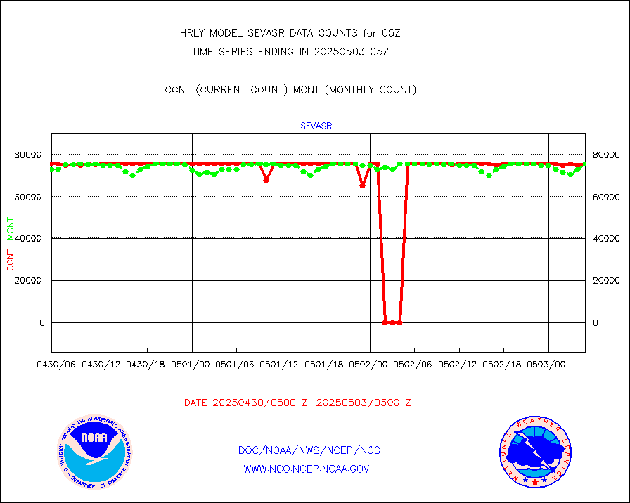
sevasr |
METEOSAT-10 2nd Gen SEVIRI All Sky Radiance(proc) |
75512 |
75379 |
100.2 % |
1804.50-1805.49 |
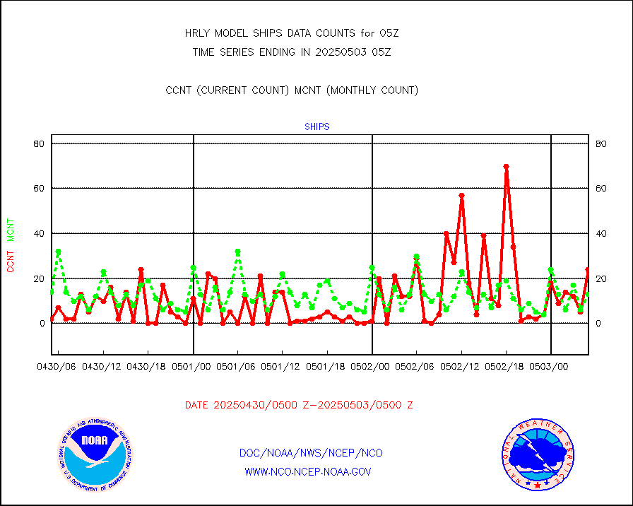
ships |
Ship - manual and automatic, restricted |
2 |
5 |
40.0 % |
1804.50-1805.49 |
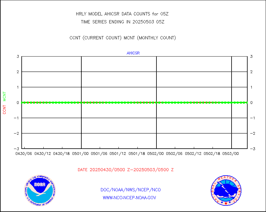
ssmisu |
DMSP SSM/IS 1C radiance data (Unified Pre-Proc.) |
224820 |
128212 |
175.4 % |
1803.50-1804.49 |
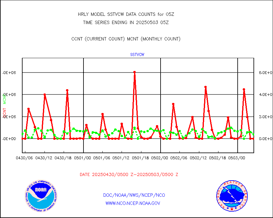
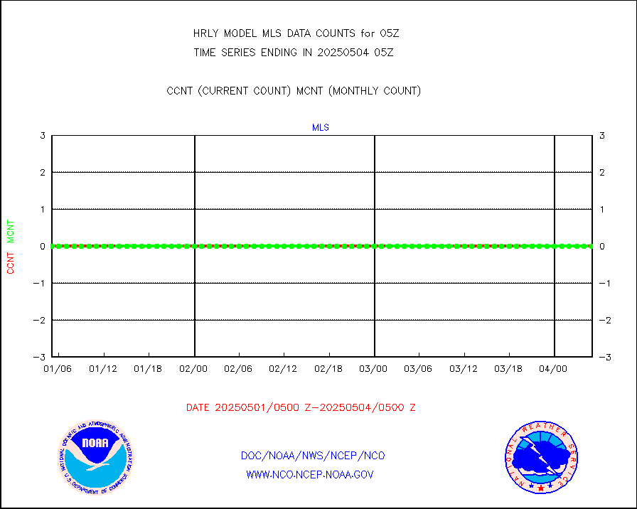
sstvcw |
NPP/NOAA-20 VIIRS SST - CLEAR & OVER WATER |
0 |
533353 |
0.0 % |
1804.50-1805.49 |
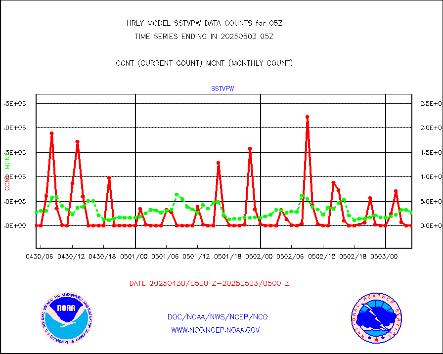
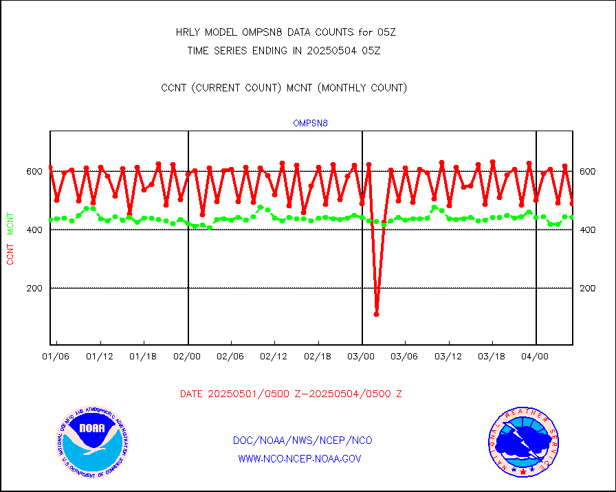
sstvpw |
NPP/NOAA-20 VIIRS SST - PROBABLY CLR & OVER WATER |
0 |
126998 |
0.0 % |
1804.50-1805.49 |
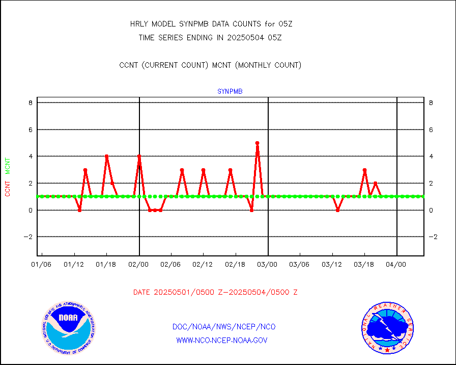
synpmb |
Synoptic - mobile manual & auto (decoded fr BUFR) |
1 |
1 |
100.0 % |
1804.50-1805.49 |
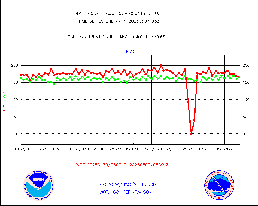
tesac |
CTD probe, Argo prflng float, mooring (TESAC fmt) |
186 |
168 |
110.7 % |
1804.50-1805.49 |
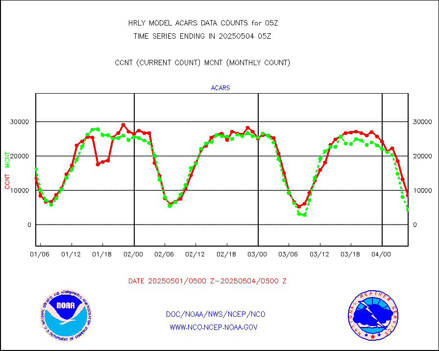
tmdara |
TAMDAR aircft data-all types(from Panasonic,BUFR) |
316 |
379 |
83.4 % |
1804.50-1805.49 |
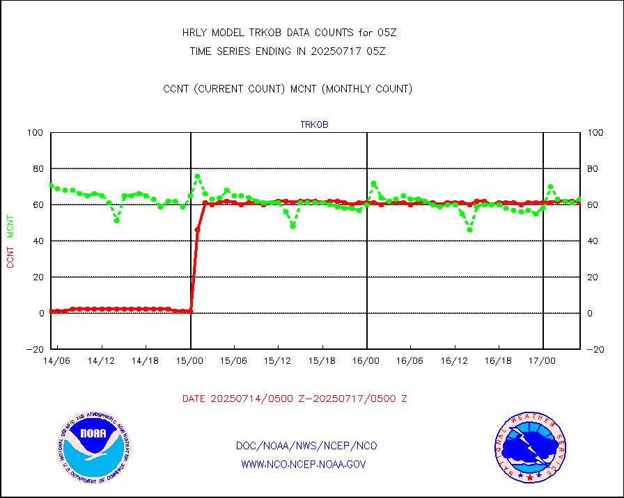
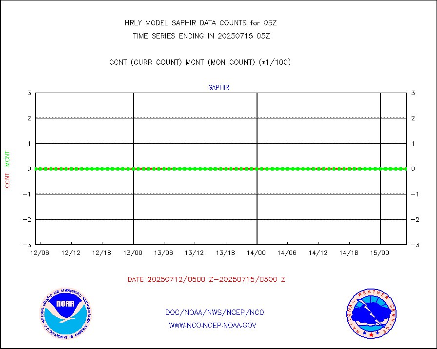
trkob |
ThermoSalinoGraph (TSG) TRACKOB format) |
60 |
54 |
111.1 % |
1803.50-1804.49 |
visin |
INSAT/KALPANA India visible derived cloud motion |
0 |
0 |
n/a |
1802.50-1803.49 |
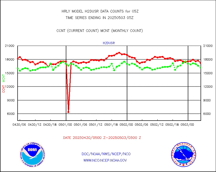
visja |
MTSAT/JMA visible derived cloud motion |
10560 |
10458 |
101.0 % |
1802.50-1803.49 |
visusr |
GOES-16&up/NESDIS visible derived cloud motion |
62170 |
46340 |
134.2 % |
1804.00-1804.99 |
vseunb |
METEOSAT/EUMETSAT visible drv cld motion NBseq |
16335 |
16290 |
100.3 % |
1803.50-1804.49 |


