| Critical Data with Normal Counts |
|---|
| Type | Description | Hourly Count | Monthly Average | Percent (%) of Monthly Mean | UTC Time Window |
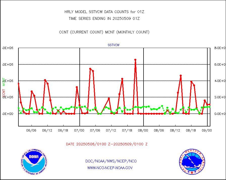
1bamua |
NOAA 15-19 & METOP 1-2 AMSU-A NCEP-proc. br.temps |
45185 |
53459 |
84.5 % |
2423.00-2423.99 |
1bhrs4 |
NOAA 18-19 & METOP 1-2 HIRS-4 NCEP-proc. br.temps |
41290 |
46963 |
87.9 % |
2423.00-2423.99 |
1bmhs |
NOAA 18-19 & METOP 1-2 MHS NCEP-proces. br. temps |
343721 |
297145 |
115.7 % |
2423.00-2423.99 |
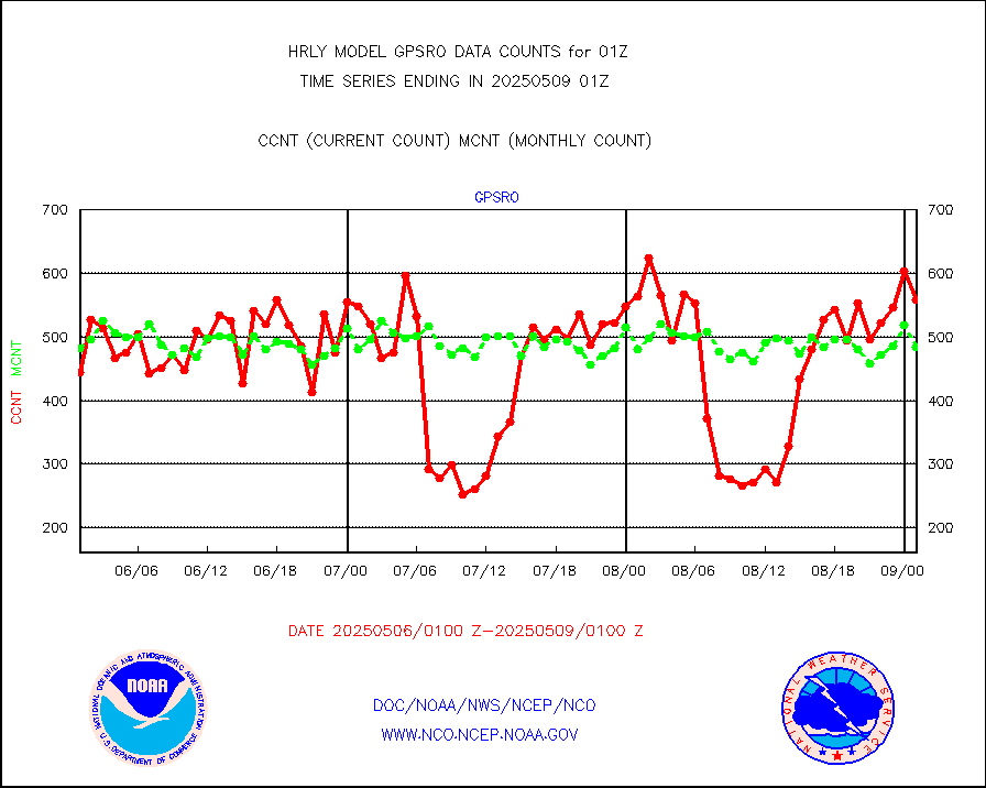
acars |
MDCRS ACARS acft data from ARINC(dcded from BUFR) |
23578 |
21154 |
111.5 % |
2500.50-2501.49 |
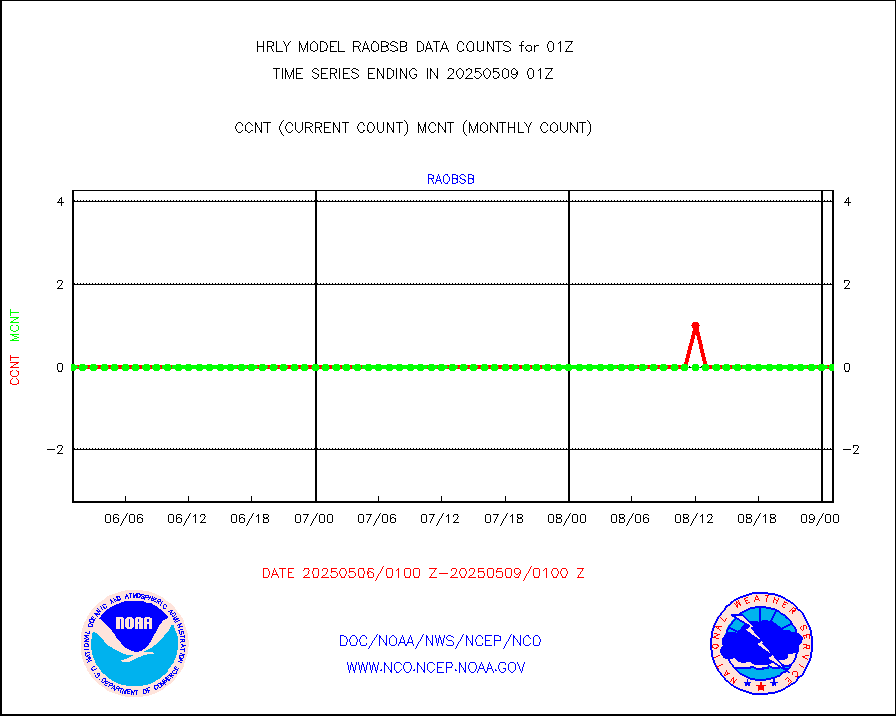
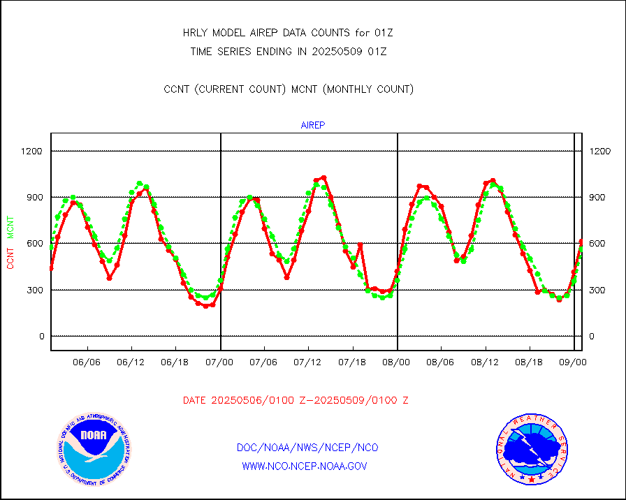
airep |
Manual AIREP aircraft data (dcded from AIREP fmt) |
1014 |
750 |
135.2 % |
2500.50-2501.49 |
airsev |
AQUA AIRS/AMSU-A/HSB brightness temps- every FOV |
0 |
0 |
n/a |
2422.50-2423.49 |
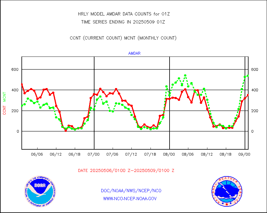
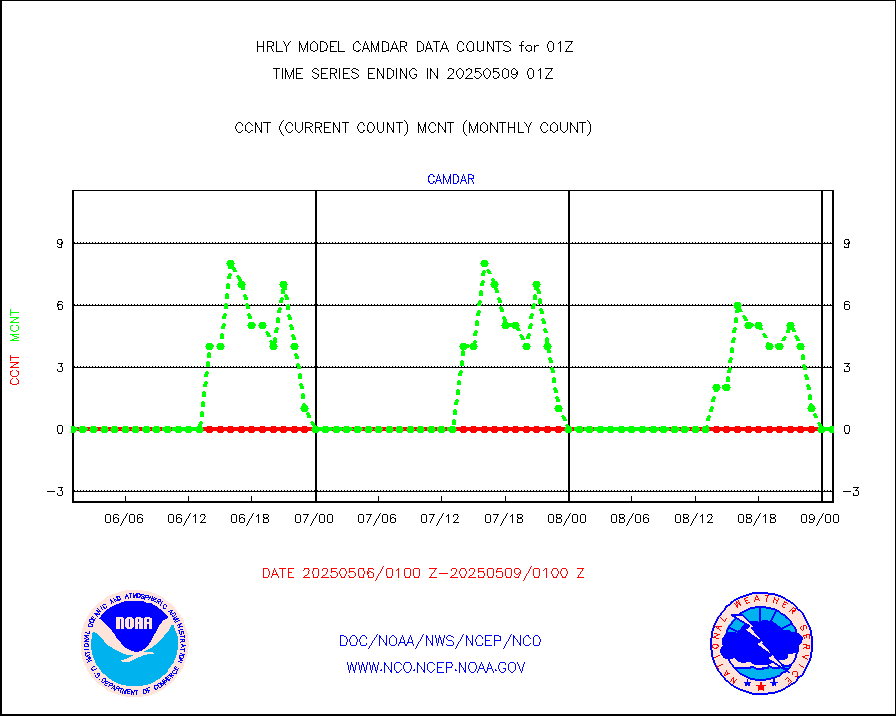
amdar |
AMDAR aircraft data (decoded from AMDAR format) |
421 |
476 |
88.4 % |
2500.50-2501.49 |
amdarb |
AMDAR aircraft data (decoded from BUFR) |
1115 |
1049 |
106.3 % |
2500.50-2501.49 |
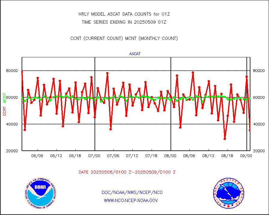
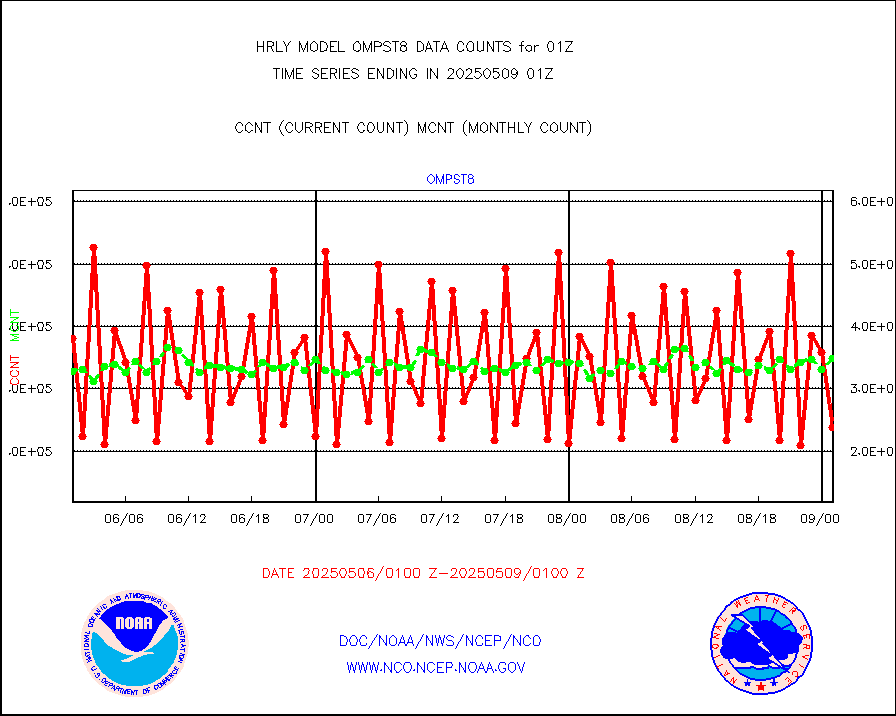
ascat |
METOP 1-2 ASCAT products |
55608 |
38493 |
144.5 % |
2423.50-2500.49 |
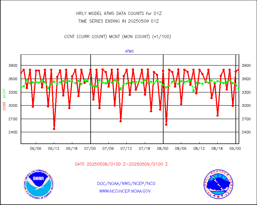
atms |
NPP/NOAA-20 ATMS brightness temperatures |
255552 |
335398 |
76.2 % |
2423.50-2500.49 |
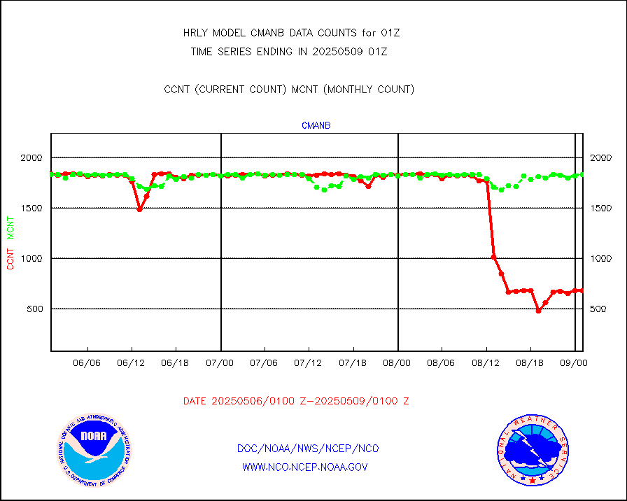
cmanb |
Surface Marine CMAN rpts decoded from BUFR format |
1831 |
1808 |
101.3 % |
2500.50-2501.50 |
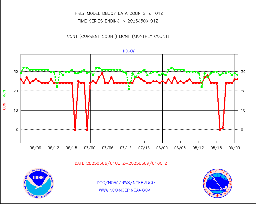
dbuoy |
Buoys decoded from FM-18 fmt (moored or drifting) |
42 |
32 |
131.2 % |
2500.50-2501.49 |
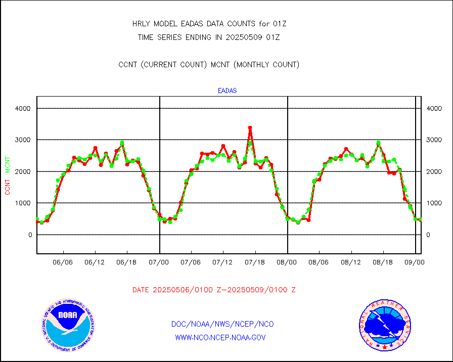
eadas |
E-AMDAR (European AMDAR acft decoded from BUFR) |
373 |
383 |
97.4 % |
2500.50-2501.49 |
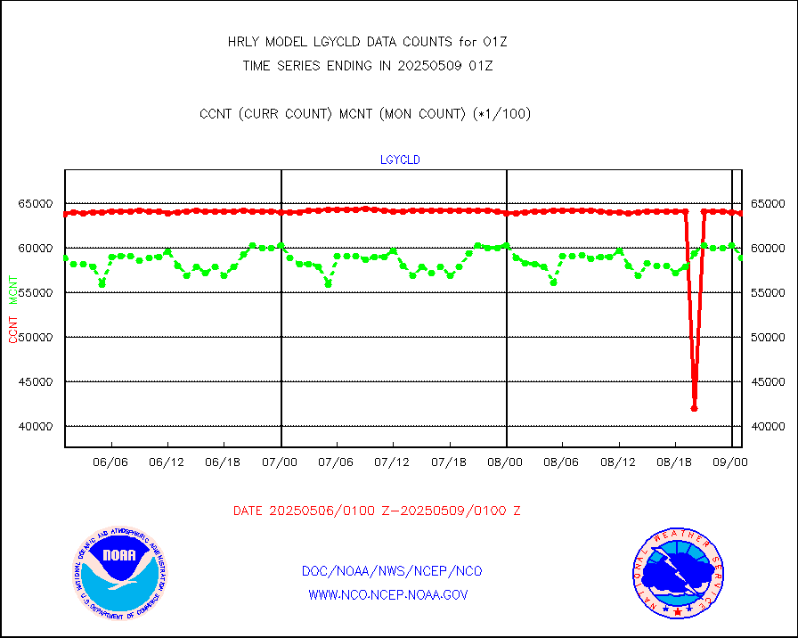
esamua |
NOAA 15-19 & METOP 1-2 AMSU-A proc btmps frm RARS |
48497 |
43037 |
112.7 % |
2500.50-2501.49 |
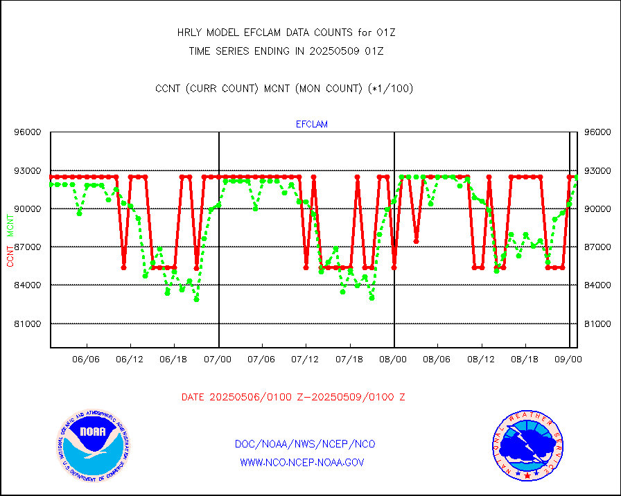
eshrs3 |
NOAA 15-19 & METOP 1-2 HIRS-3/4 pr btmps frm RARS |
81108 |
81233 |
99.8 % |
2500.50-2501.49 |
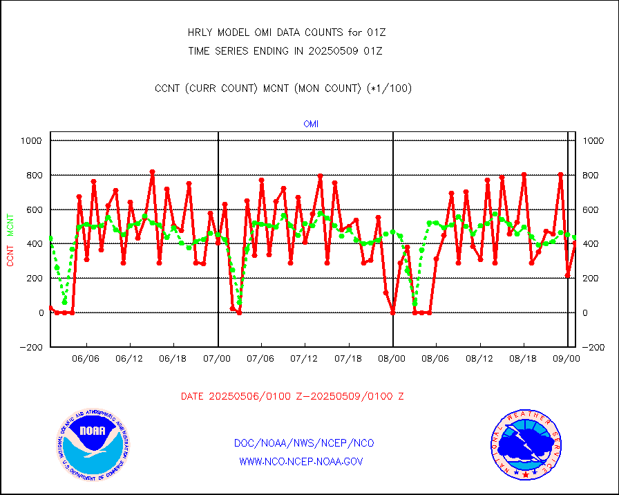
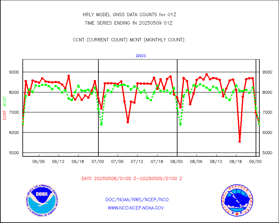
gnss |
Grnd-based Gbl Navigation Sat System (GNSS) data |
7014 |
6593 |
106.4 % |
2500.00-2500.99 |
gpsro |
GPS radio occultation data |
521 |
409 |
127.4 % |
2422.50-2423.49 |
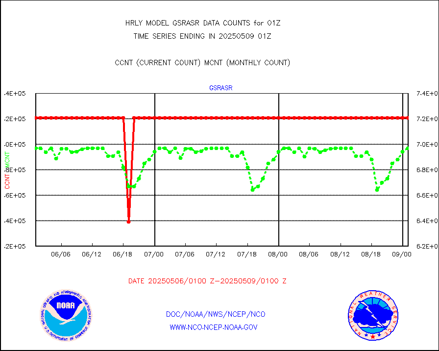
gsrasr |
GOES-16/17 All Sky Radiances (proc.) |
720952 |
709326 |
101.6 % |
2500.50-2501.49 |
gsrcsr |
GOES-16/17 Clear Sky Radiances (proc.) |
372697 |
352043 |
105.9 % |
2500.50-2501.49 |
h20ja |
MTSAT/JMA water vapor imager derived cloud motion |
18896 |
19149 |
98.7 % |
2422.50-2423.49 |
h20mo |
MODIS (AQUA/TERRA) wvpr imager derived cld motion |
0 |
0 |
n/a |
2421.00-2421.99 |
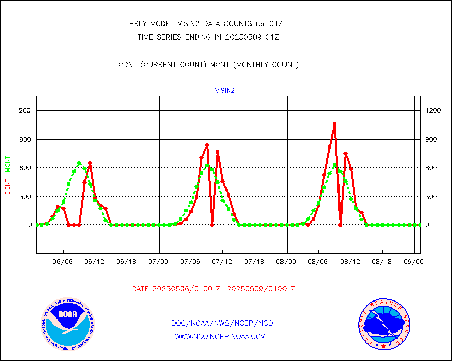
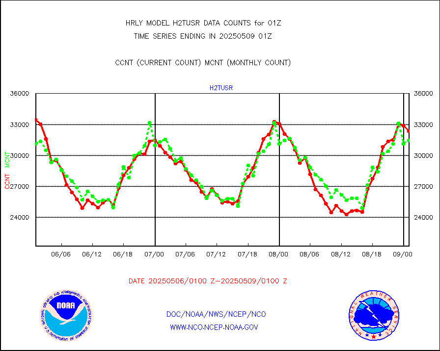
h2tusr |
GOES-16&up/NESDIS wv imgr/cld-top derived cld mtn |
29946 |
30007 |
99.8 % |
2500.00-2500.99 |
ifeunb |
METEOSAT/EUMETSAT ir lg-wave drv cld motion NBseq |
21938 |
20687 |
106.0 % |
2423.50-2500.49 |
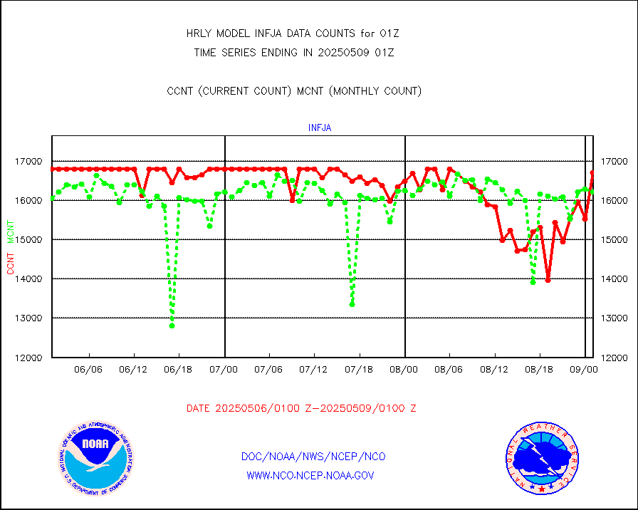
infja |
MTSAT/JMA infrared long-wave derived cloud motion |
16800 |
16002 |
105.0 % |
2422.50-2423.49 |
infmo |
MODIS (AQUA/TERRA) ir l-wave derived cloud motion |
0 |
0 |
n/a |
2421.00-2421.99 |
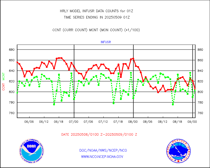
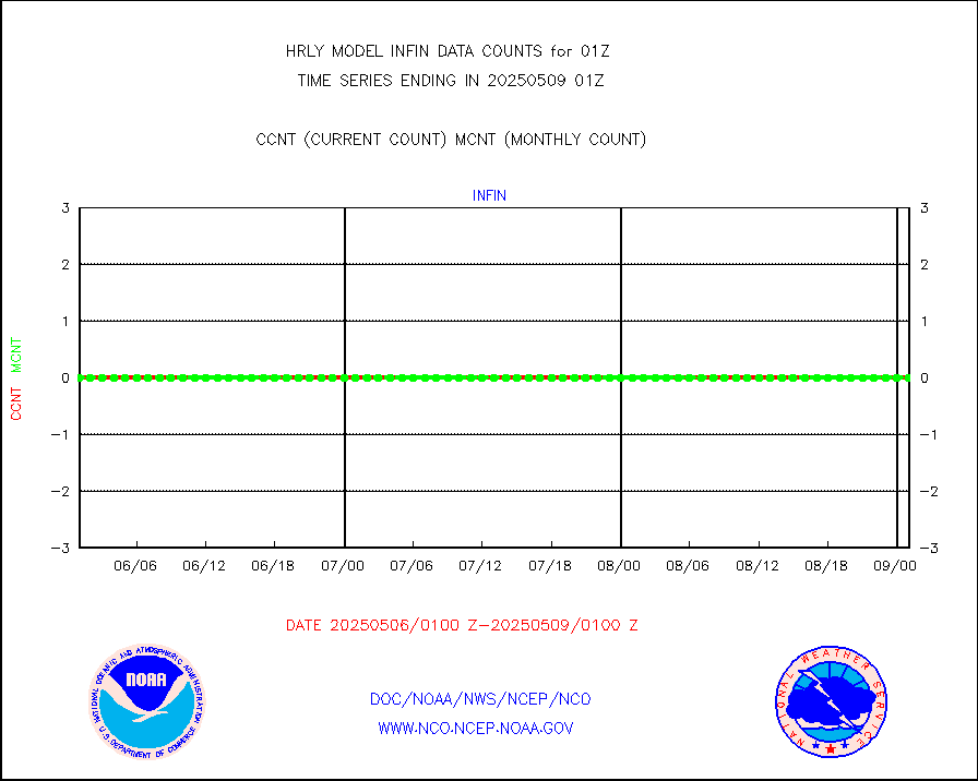
infusr |
GOES-16&up/NESDIS ir long-wave derived cld motion |
85089 |
81597 |
104.3 % |
2500.00-2500.99 |
lgycld |
GOES/NASA(Langley) hi-res. (1x1 f-o-v) cloud data |
4193982 |
3760317 |
111.5 % |
2500.50-2501.49 |
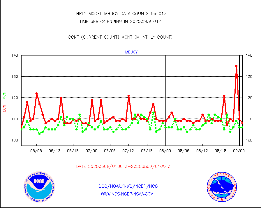
mbuoy |
Buoys decoded from FM-13 format (moored) |
117 |
112 |
104.5 % |
2500.50-2501.49 |
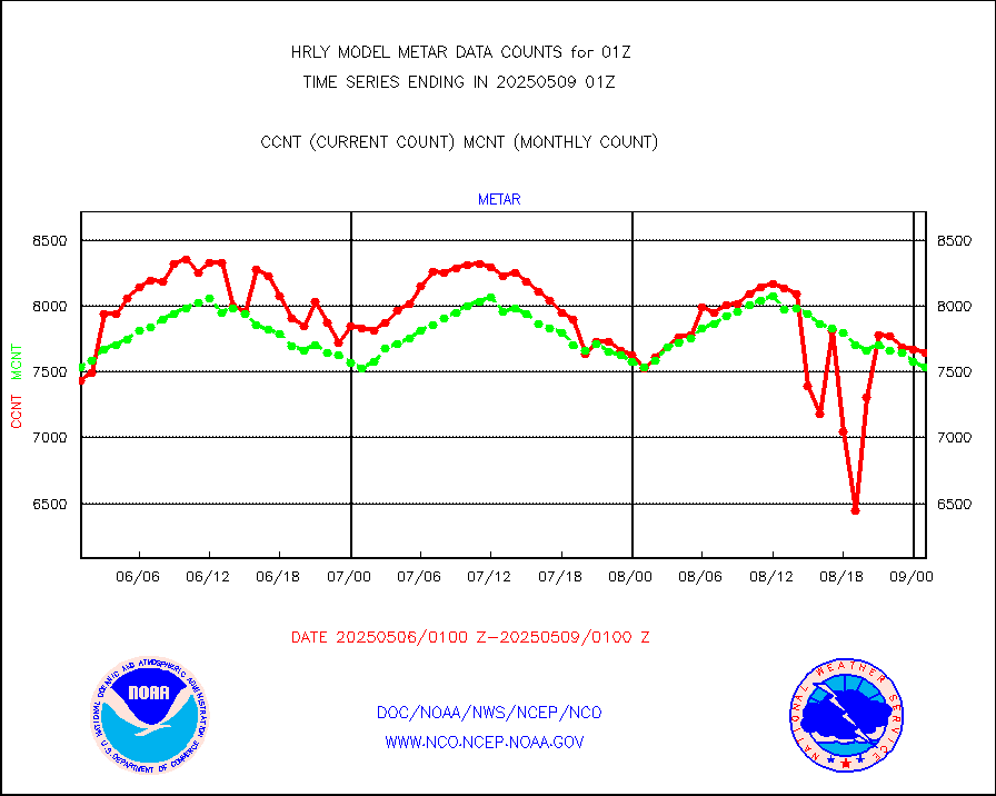
metar |
Aviation - METAR |
7437 |
7546 |
98.6 % |
2500.50-2501.49 |
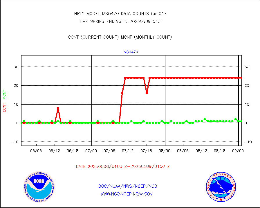
mso470 |
Mesonet/MADIS Colorado E-470 (Interstate 470) |
17 |
20 |
85.0 % |
2500.50-2501.49 |
msoalk |
Mesonet/MADIS Alaska Department of Transportation |
107 |
108 |
99.1 % |
2500.50-2501.49 |
msoapg |
Mesonet/MADIS U.S. Army Aberdeen Proving Grounds |
0 |
0 |
n/a |
2500.50-2501.49 |
msoapr |
Mesonet/MADIS Citizen Weather Observers Program |
50016 |
46314 |
108.0 % |
2500.50-2501.49 |
msoaws |
Mesonet/MADIS AWS Convergence Technologies, Inc. |
25980 |
25329 |
102.6 % |
2500.50-2501.49 |
msoawx |
Mesonet/MADIS "Anything Weather" |
0 |
0 |
n/a |
2500.50-2501.49 |
msocol |
Mesonet/MADIS Colorado Dept. of Transportation |
0 |
0 |
n/a |
2500.50-2501.49 |
msodcn |
Mesonet/MADIS DC Net |
0 |
0 |
n/a |
2500.50-2501.49 |
msoden |
Mesonet/MADIS Denver Urban Drainage & Flood Cntrl |
250 |
232 |
107.8 % |
2500.50-2501.49 |
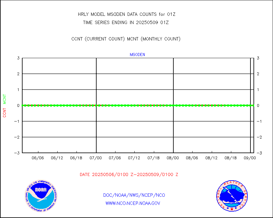
msofla |
Mesonet/MADIS Florida (FAWN & USF) |
4 |
4 |
100.0 % |
2500.50-2501.49 |
msoflt |
Mesonet/MADIS Florida Dept. of Transportation |
0 |
0 |
n/a |
2500.50-2501.49 |
msogeo |
Mesonet/MADIS Georgia Dept. of Transportation |
0 |
0 |
n/a |
2500.50-2501.49 |
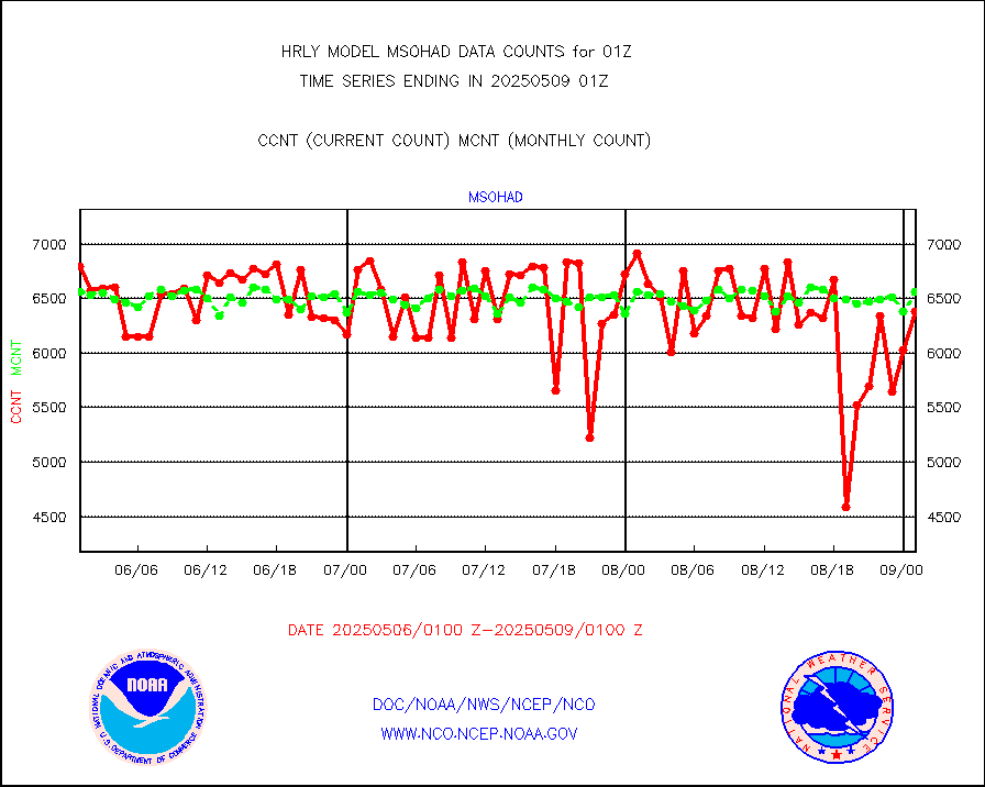
msohad |
Mesonet/MADIS NWS Hydromet Auto Data System(HADS) |
6927 |
6401 |
108.2 % |
2500.50-2501.49 |
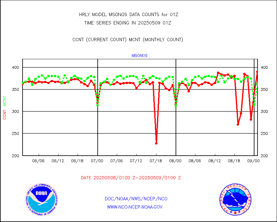
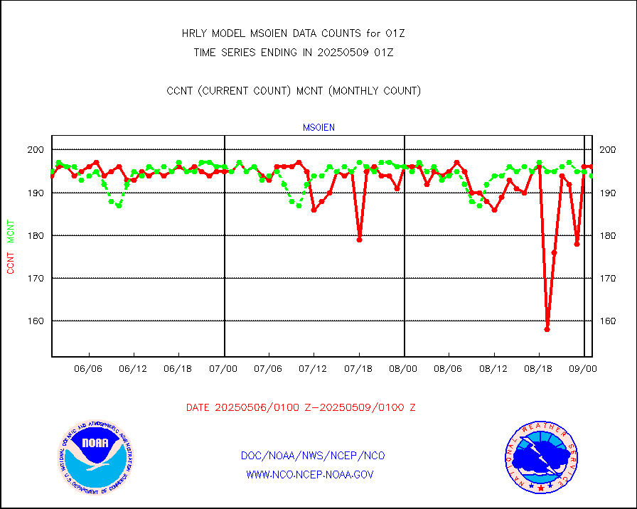
msoien |
Mesonet/MADIS Iowa Environmental |
196 |
186 |
105.4 % |
2500.50-2501.49 |
msoind |
Mesonet/MADIS Indiana Dept. of Transportation |
0 |
0 |
n/a |
2500.50-2501.49 |
msoiow |
Mesonet/MADIS Iowa Department of Transportation |
0 |
0 |
n/a |
2500.50-2501.49 |
msokan |
Mesonet/MADIS Kansas Department of Transportation |
32 |
374 |
8.6 % |
2500.50-2501.49 |
msokla |
Mesonet/MADIS Oklahoma Mesonet |
318 |
329 |
96.7 % |
2500.50-2501.49 |
msolju |
Mesonet/MADIS Louisiana State/Jackson State Univ. |
0 |
0 |
n/a |
2500.50-2501.49 |
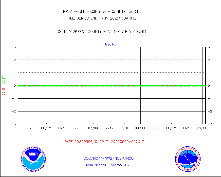
msomca |
Mesonet/MADIS Missouri Commercial Agricult Wx Net |
298 |
275 |
108.4 % |
2500.50-2501.49 |
msomin |
Mesonet/MADIS Minnesota Dept. of Transportation |
0 |
0 |
n/a |
2500.50-2501.49 |
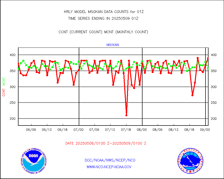
msonos |
Mesonet/MADIS NOS-Phys Oceanographic Realtime Sys |
378 |
354 |
106.8 % |
2500.50-2501.49 |
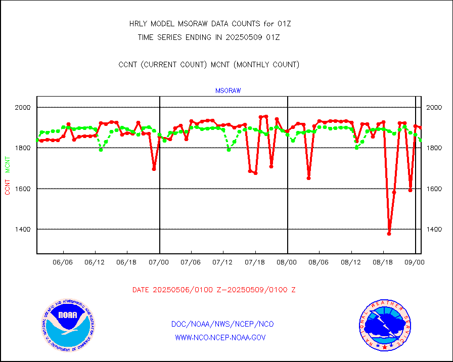
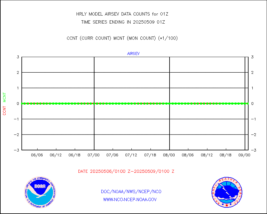
msoraw |
Mesonet/MADIS NFIC Remote Automated Wx Stns(RAWS) |
1846 |
1771 |
104.2 % |
2500.50-2501.49 |
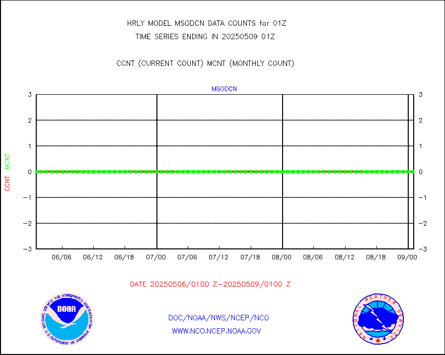
msovir |
Mesonet/MADIS Virginia Dept. of Transportation |
234 |
235 |
99.6 % |
2500.50-2501.49 |
msowfy |
Mesonet/MADIS "Weather for You" |
0 |
0 |
n/a |
2500.50-2501.49 |
msowis |
Mesonet/MADIS Wisconsin Dept. of Transportation |
0 |
0 |
n/a |
2500.50-2501.49 |
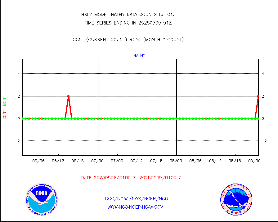
msowst |
Mesonet/MADIS MesoWest (many subproviders) |
45577 |
44230 |
103.0 % |
2500.50-2501.49 |
msowtx |
Mesonet/MADIS West Texas |
5653 |
5551 |
101.8 % |
2500.50-2501.49 |
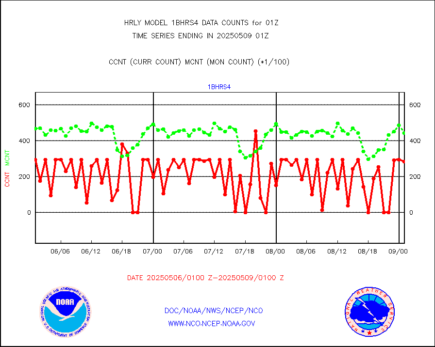
mtiasi |
METOP 1-2 IASI 1C radiance data (varbl. channels) |
106916 |
79201 |
135.0 % |
2423.00-2423.99 |
nxrdw |
NEXRAD Vel Azm Dsp(VAD) winds via radar coded msg |
0 |
0 |
n/a |
2500.50-2501.49 |
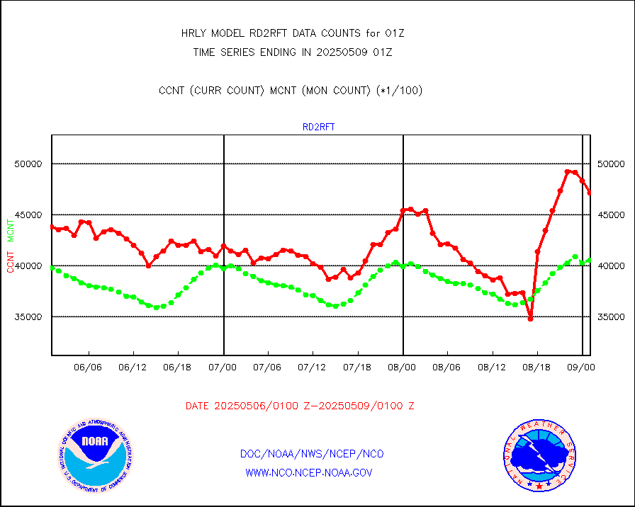
omi |
Aura Ozone Monitoring Instrument (OMI) data |
6420 |
45016 |
14.3 % |
2422.50-2423.49 |
osbuv8 |
NOAA 16-19 Solar Backscatter UV-2 rad frm V8 BUFR |
0 |
0 |
n/a |
2423.00-2423.99 |
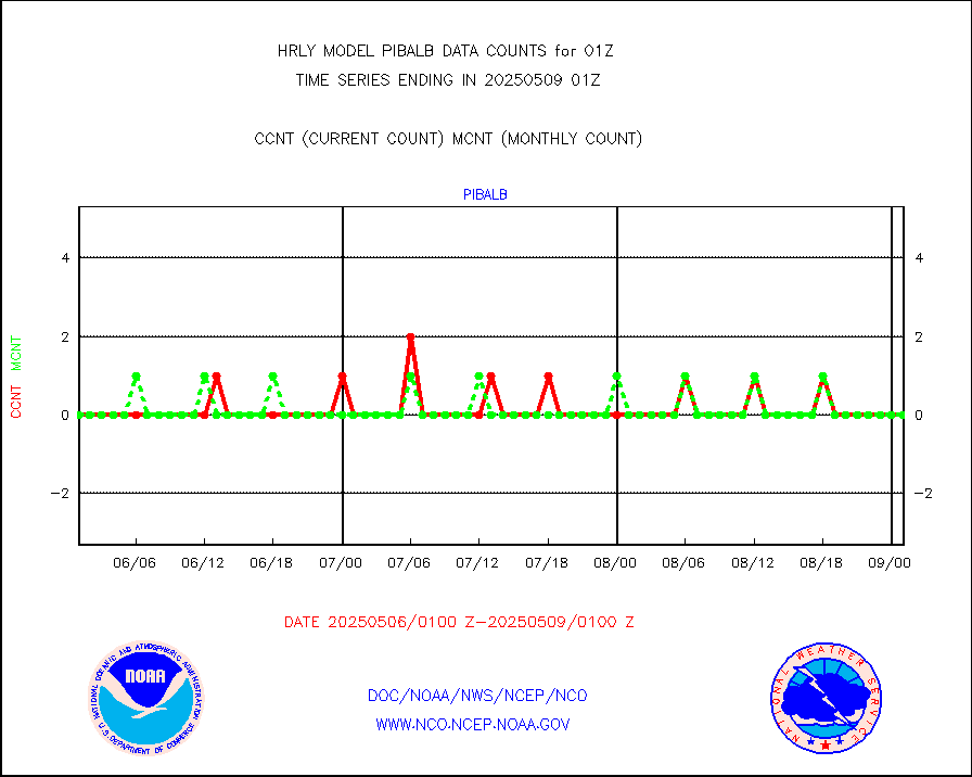
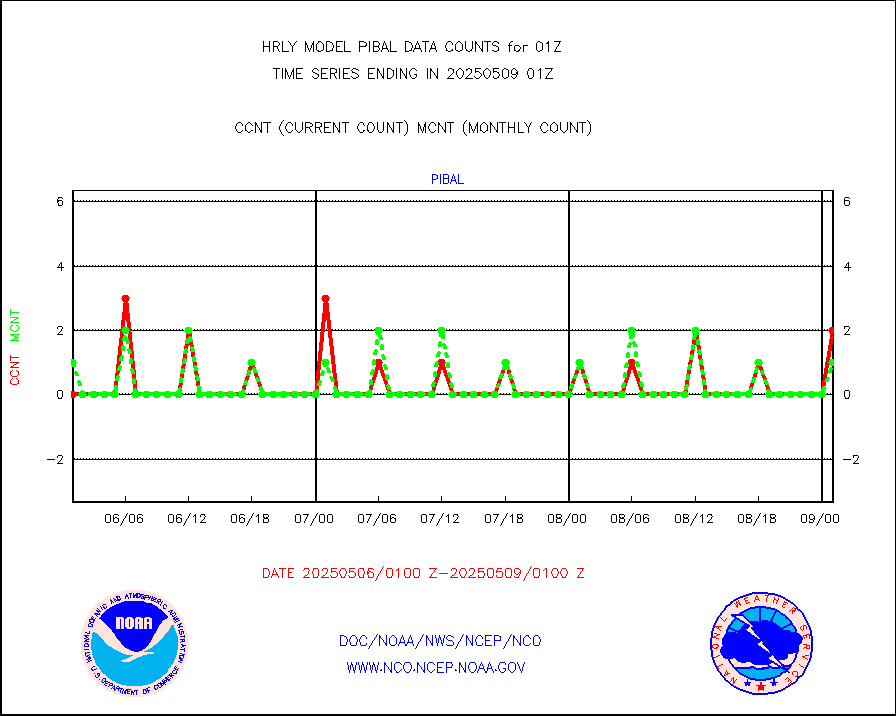
pibal |
PIBAL (from PILOT, PILOT SHIP, PILOT MOBIL) |
0 |
1 |
0.0 % |
2500.50-2501.49 |
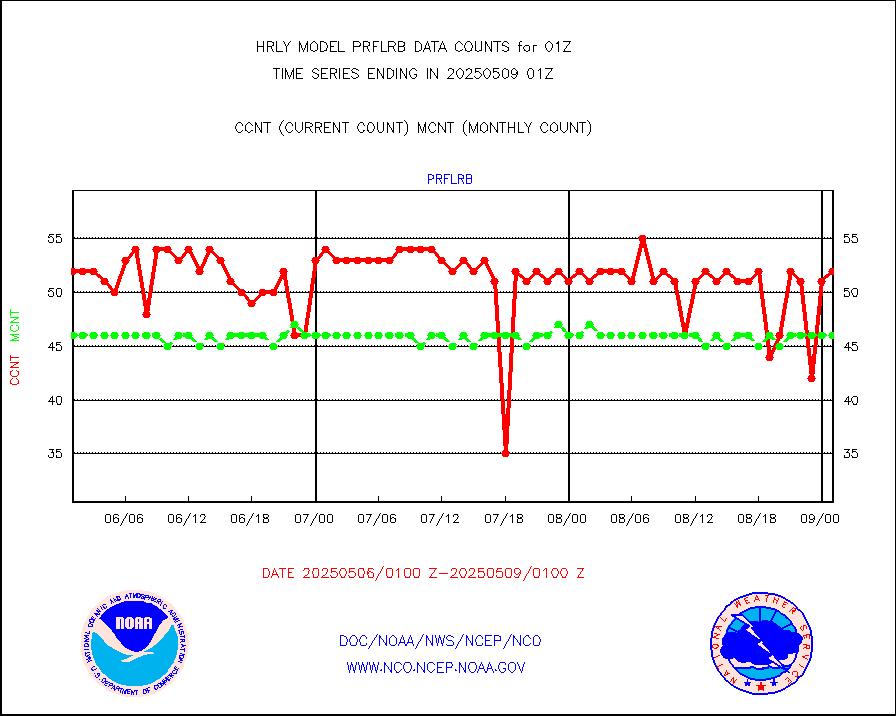
prflrb |
Multi-Agency Profiler (MAP) and SODAR winds |
51 |
40 |
127.5 % |
2500.50-2501.49 |
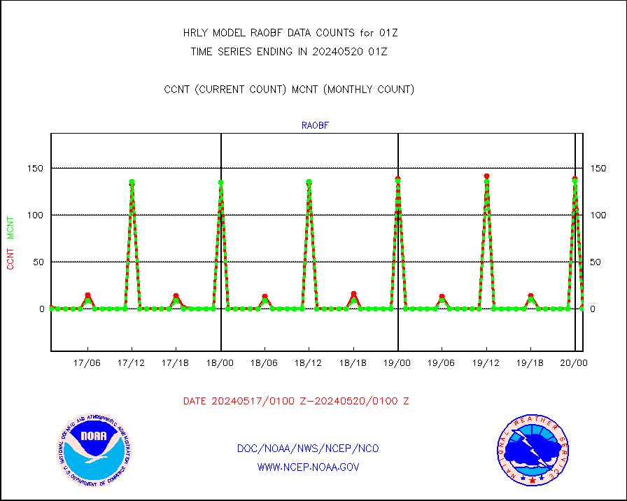
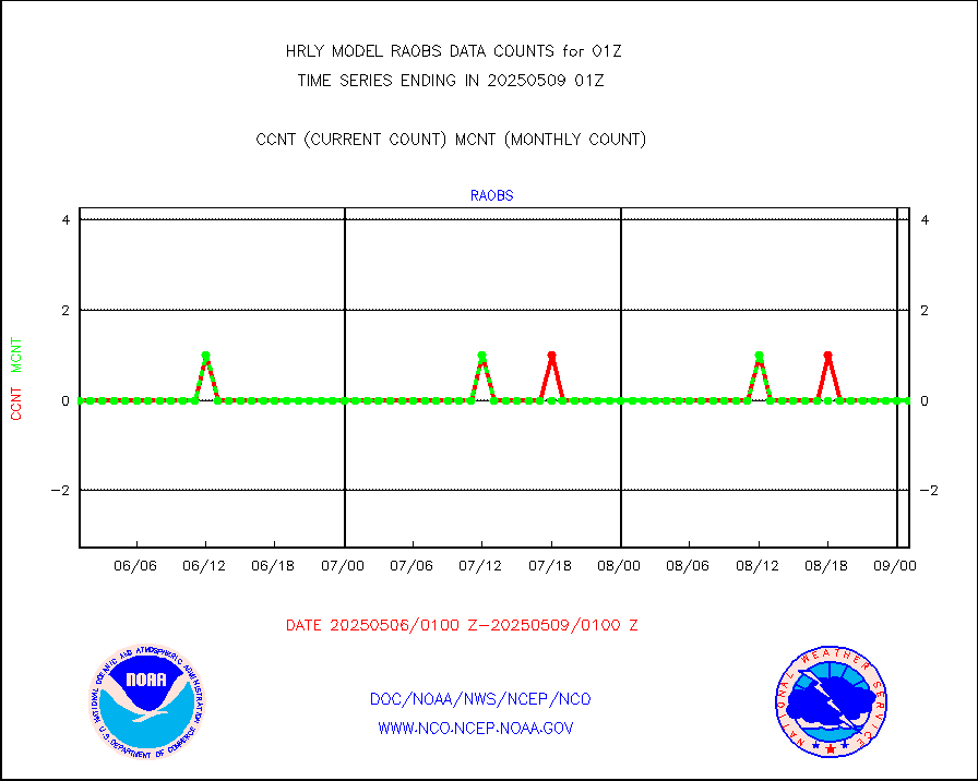
raobf |
Rawinsonde - fixed land (from TEMP or PILOT) |
0 |
0 |
n/a |
2500.50-2501.49 |
rass |
RASS temperatures (NOAA and Multi-Agency) |
25 |
27 |
92.6 % |
2500.50-2501.49 |
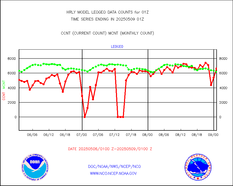
rd2rft |
NEXRAD reflectivity (Lvl 2 - GTS) |
3496238 |
3751059 |
93.2 % |
2500.50-2501.49 |
rd2wnd |
NEXRAD radial wind (Level 2 - GTS) |
1201096 |
1391497 |
86.3 % |
2500.50-2501.49 |
sevcsr |
METEOSAT-10 2nd Gen SEVIRI Clr Sky Radiance(proc) |
0 |
0 |
n/a |
2500.50-2501.49 |
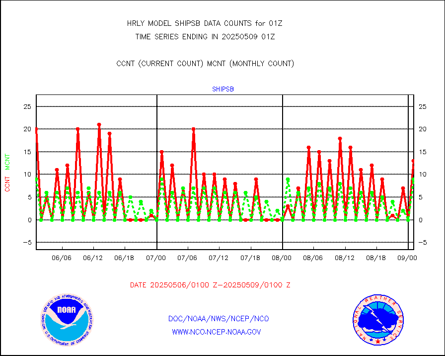
shipsb |
Ship - manual and automatic, restricted (BUFR) |
0 |
1 |
0.0 % |
2500.50-2501.50 |
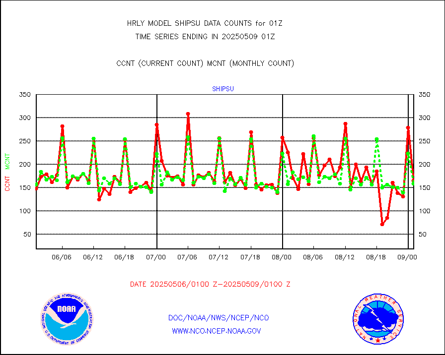
shipsu |
Ship - manual and automatic, unrestricted |
100 |
111 |
90.1 % |
2500.50-2501.50 |
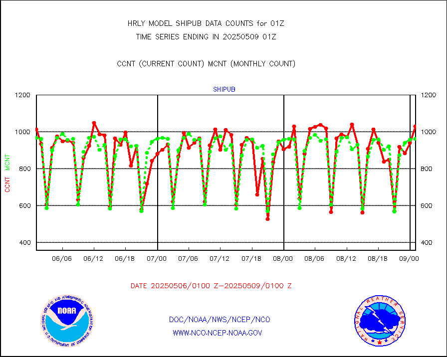
shipub |
Ship - manual and automatic, unrestricted (BUFR) |
779 |
824 |
94.5 % |
2500.50-2501.50 |
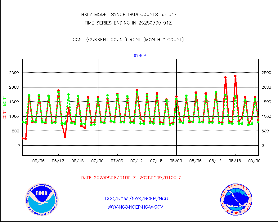
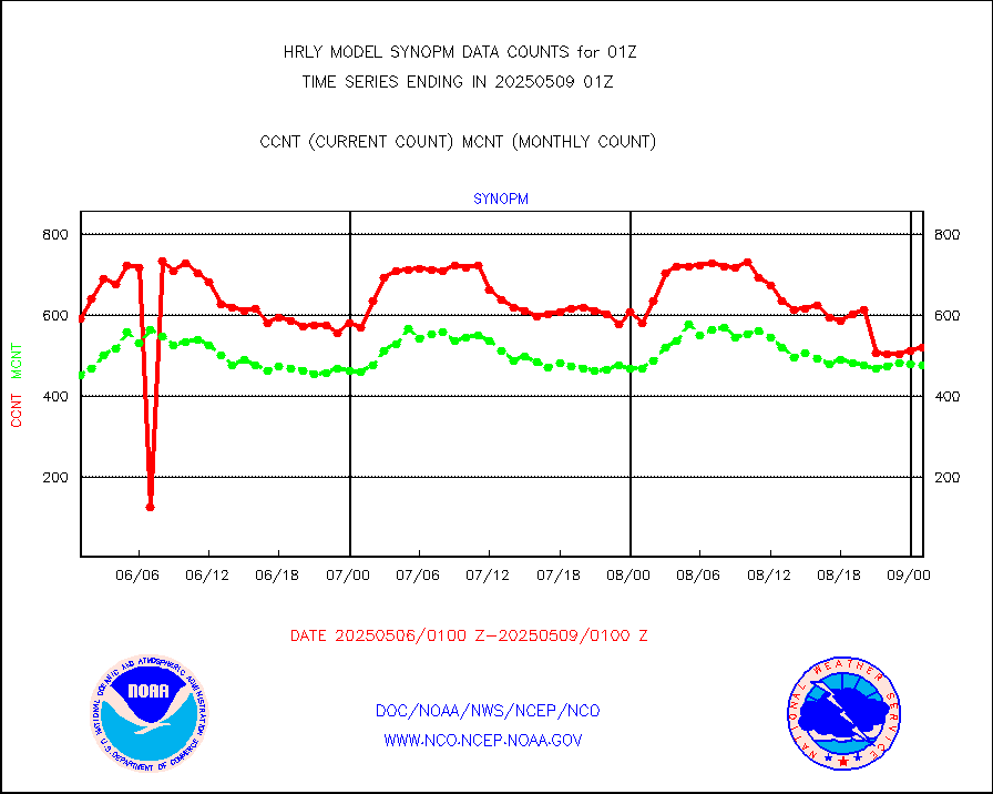
synop |
Synoptic - fixed manual and automatic |
855 |
811 |
105.4 % |
2500.50-2501.49 |
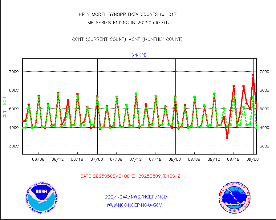
synopb |
Synoptic - fixed manual & auto (decoded fr BUFR) |
4099 |
3995 |
102.6 % |
2500.50-2501.49 |
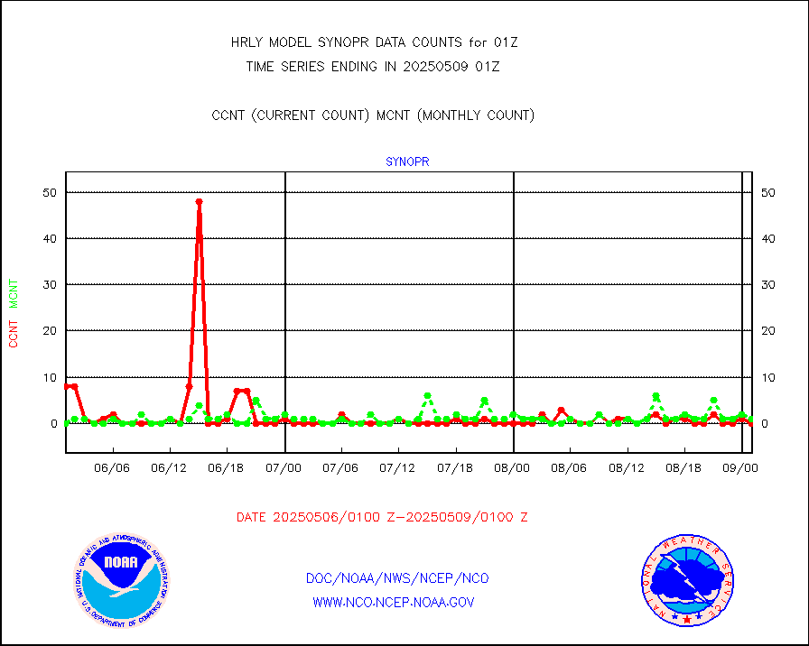
synopr |
Synoptic - restricted (WMO Res 40) manual & auto. |
0 |
1 |
0.0 % |
2500.50-2501.49 |
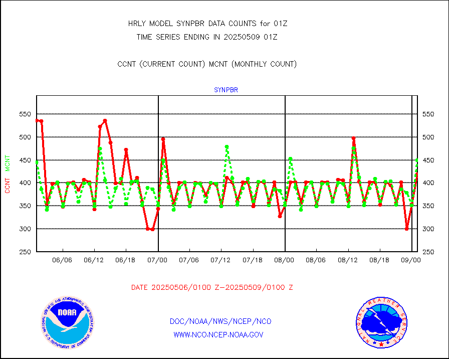
synpbr |
Synoptic - restricted (WMO Res 40)(decoded BUFR) |
397 |
414 |
95.9 % |
2500.50-2501.49 |
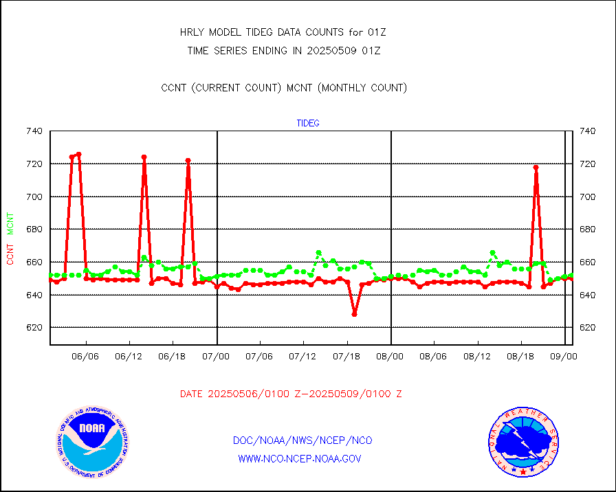
tideg |
Tide gauge reports decoded from CREX format |
643 |
633 |
101.6 % |
2500.00-2500.99 |
| Data Types of Opportunity with Normal Counts |
|---|
| Type | Description | Hourly Count | Monthly Average | Percent (%) of Monthly Mean | UTC Time Window |
3p9usr |
GOES-16&up/NESDIS ir short-wv derived cld motion |
16741 |
13143 |
127.4 % |
2500.00-2500.99 |
acarsa |
MDCRS ACARS acft data (ARINC via AFWA)(AIREP fmt) |
0 |
0 |
n/a |
2500.50-2501.49 |
ahicsr |
Himawari Clear Sky Radiance |
0 |
0 |
n/a |
2500.00-2500.99 |
amsr2 |
GCOM-W AMSR2 1B brightness temperatures |
2309472 |
2151879 |
107.3 % |
2423.00-2423.99 |
atmsdb |
NPP/NOAA-20 ATMS bright. temps-direct b-cast SSEC |
60576 |
72447 |
83.6 % |
2423.50-2500.49 |
atovs |
POES/NESDIS - processed ATOVS soundings/radiances |
0 |
0 |
n/a |
2423.00-2423.99 |
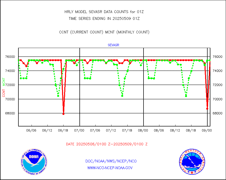
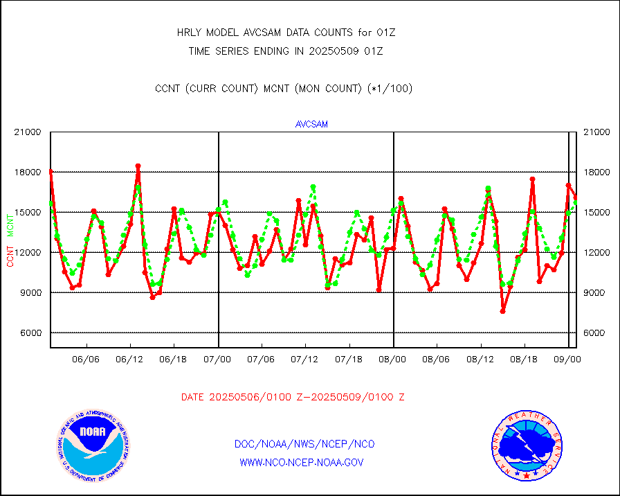
avcsam |
A.M.(N17,M2,M3) AVHRR GAC NCEP-proc clr&sea btmps |
1486392 |
1550156 |
95.9 % |
2422.50-2423.49 |
avcspm |
P.M.(N18-19) AVHRR GAC NCEP-proc clr & sea btemps |
1695333 |
1627168 |
104.2 % |
2422.50-2423.49 |
bathy |
eXpendable BathyThermograph, mooring (BATHY fmt) |
0 |
0 |
n/a |
2418.00-2418.99 |
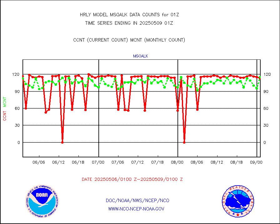
coopmd |
Coop/MADIS NEPP & HCN-Modernization NOAA COOP Obs |
27 |
24 |
112.5 % |
2500.50-2501.49 |
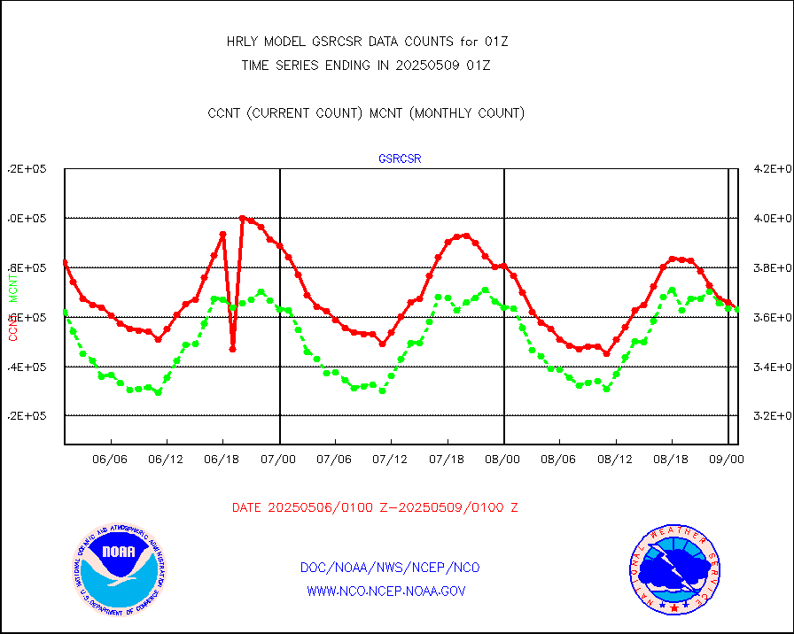
crisf4 |
NPP/NOAA-20 CrIS full spctrl radn (431 ch subset) |
224334 |
227146 |
98.8 % |
2423.50-2500.49 |
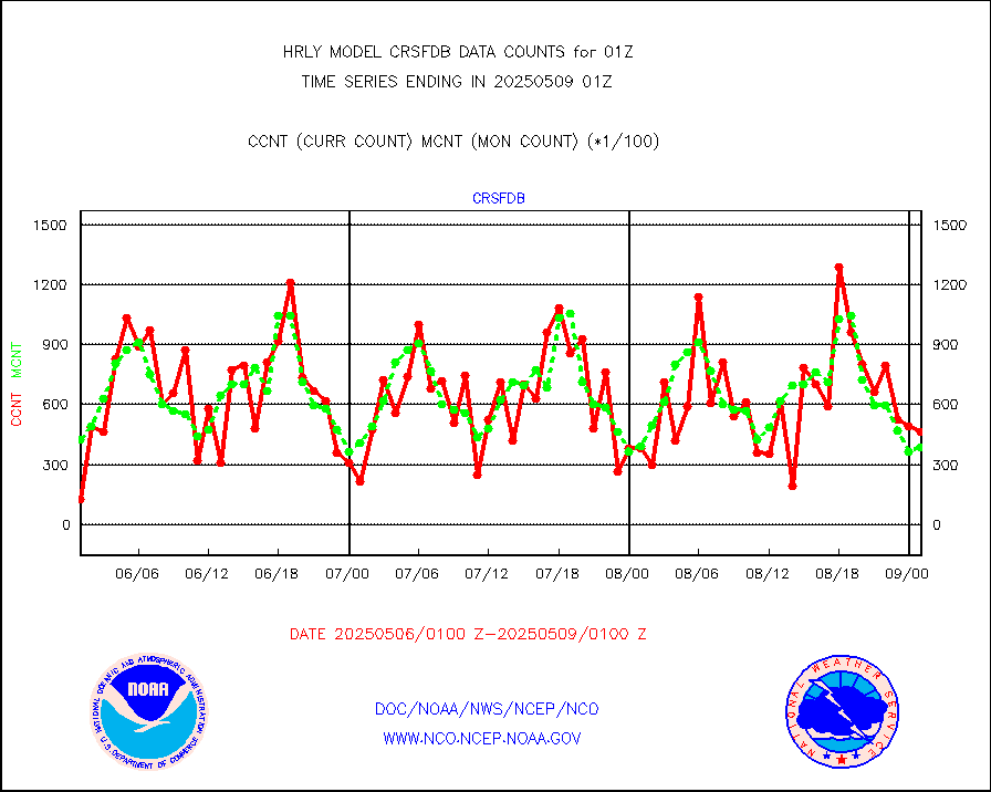
crsfdb |
NPP/NOAA-20 CrIS full spctrl radn dir brdcst SSEC |
91764 |
65818 |
139.4 % |
2423.50-2500.49 |
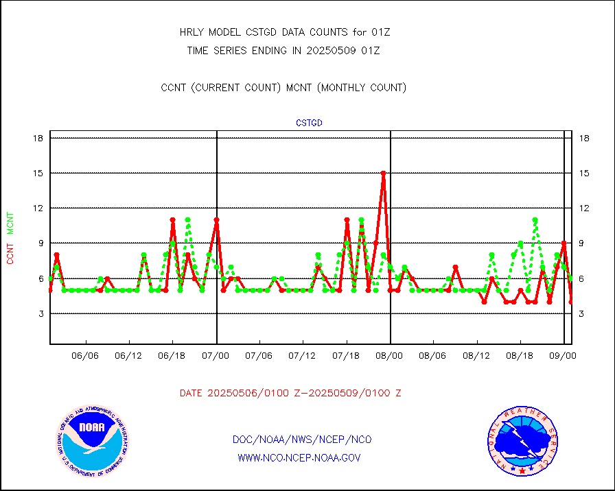
cstgd |
Coast Guard |
3 |
4 |
75.0 % |
2500.50-2501.50 |
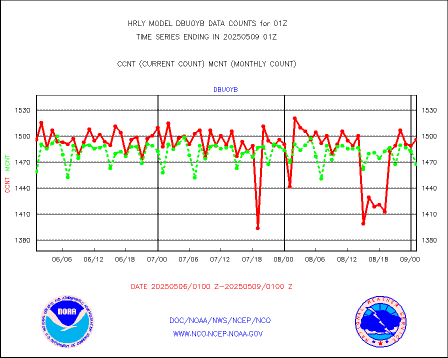
dbuoyb |
Drifting buoys (decoded from BUFR) |
1373 |
1403 |
97.9 % |
2500.50-2501.50 |
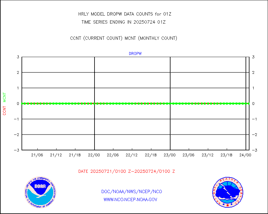
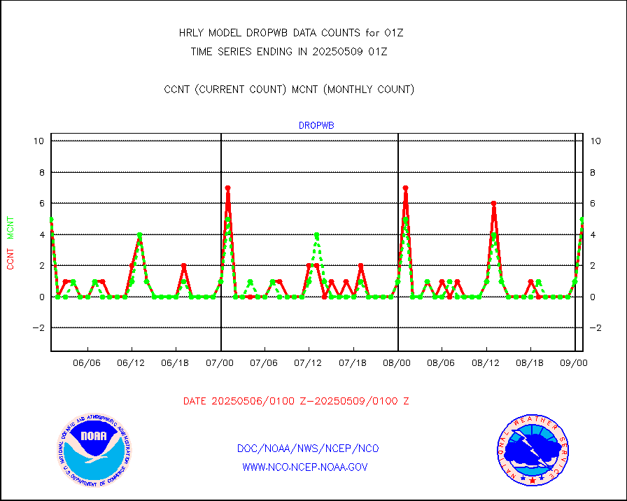
dropw |
Dropwinsonde (from TEMP DROP) |
0 |
0 |
n/a |
2500.50-2501.49 |
efclam |
GOES imager effective cloud amount data (U.Wisc.) |
8299557 |
8291576 |
100.1 % |
2500.50-2501.49 |
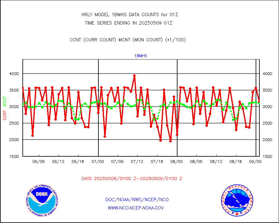
esatms |
NPP Adv. Tech. MW Sndr (ATMS) br. temps from RARS |
103428 |
67420 |
153.4 % |
2423.50-2500.49 |
esiasi |
METOP 1-2 IASI 1C radiance data vbl chn from RARS |
72660 |
71087 |
102.2 % |
2500.00-2500.99 |
esmhs |
NOAA 18-19 & METOP 1-2 MHS proc. btemps from RARS |
441979 |
348881 |
126.7 % |
2500.50-2501.49 |
geoimr |
GOES/NESDIS (11x17 f-o-v) imager clear radiances |
0 |
0 |
n/a |
2500.00-2500.99 |
gome |
METOP 1-2 Global Ozone Monitoring Exp.-2 (GOME-2) |
10039 |
7160 |
140.2 % |
2423.50-2500.49 |
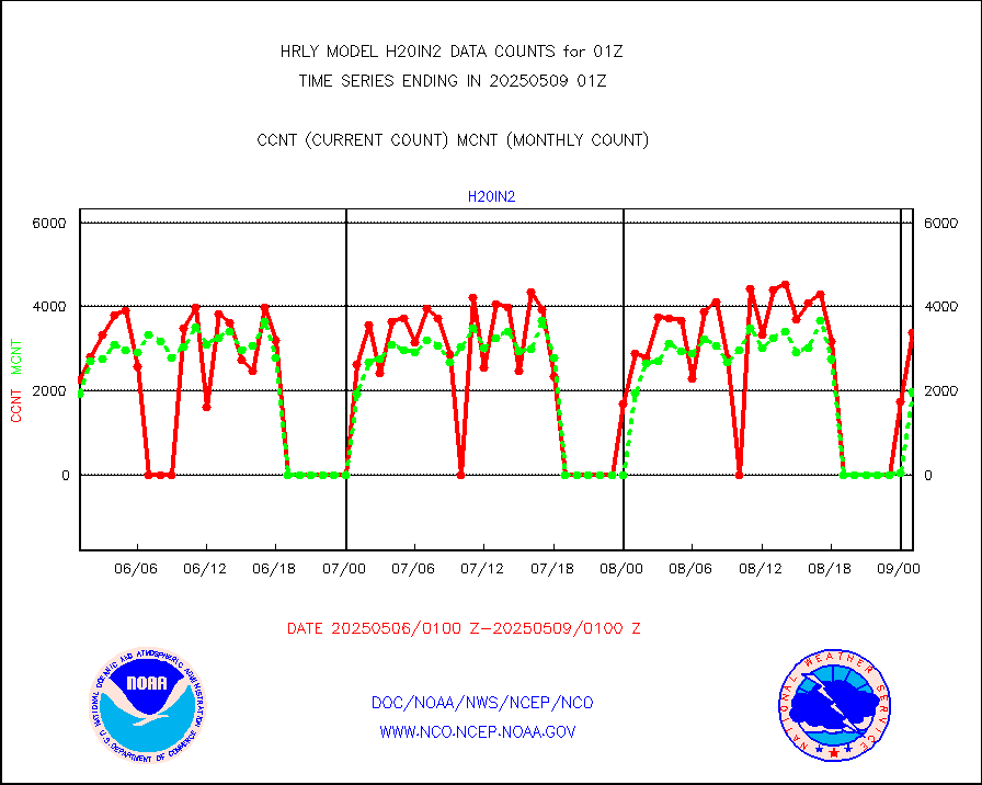
h20in2 |
INDIA SATWIND, INSAT WV channel |
2083 |
2836 |
73.4 % |
2500.00-2500.99 |
h2dusr |
GOES-16&up/NESDIS wv imgr/deep-lyr derivd cld mtn |
19332 |
16962 |
114.0 % |
2500.00-2500.99 |
h2eunb |
METEOSAT/EUMETSAT wvpr imgr drv cld motion NBseq |
42624 |
39761 |
107.2 % |
2423.50-2500.49 |
hdob |
High Density OBs from reconnaissance acft data |
46 |
10 |
460.0 % |
2500.50-2501.49 |
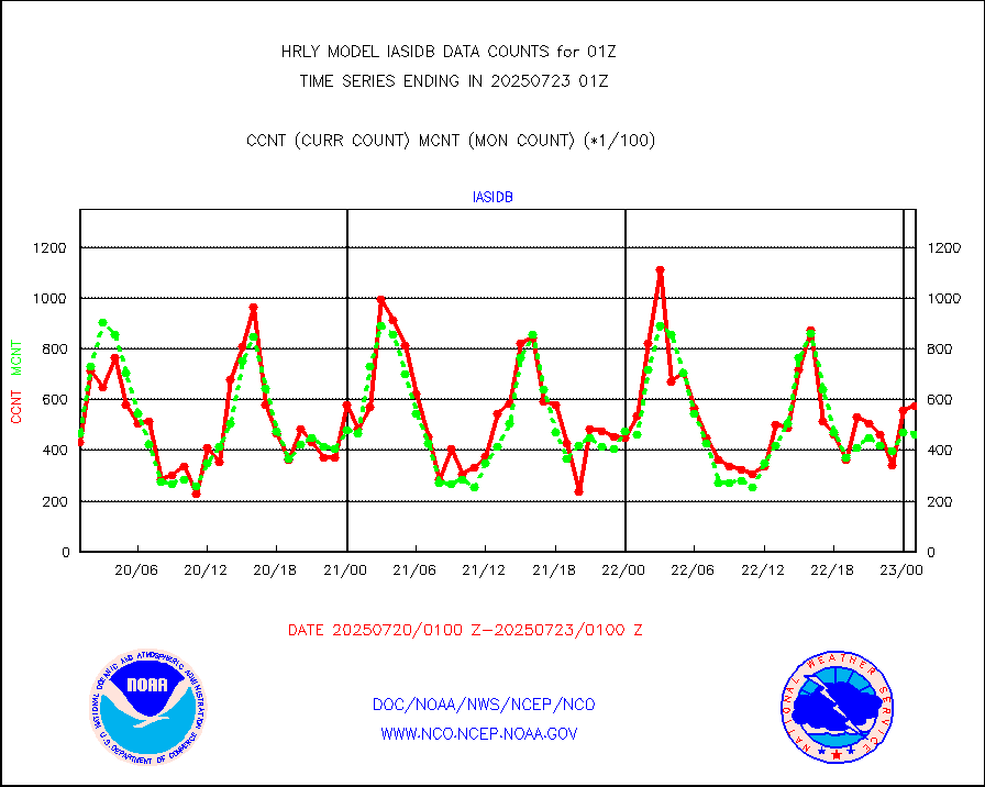
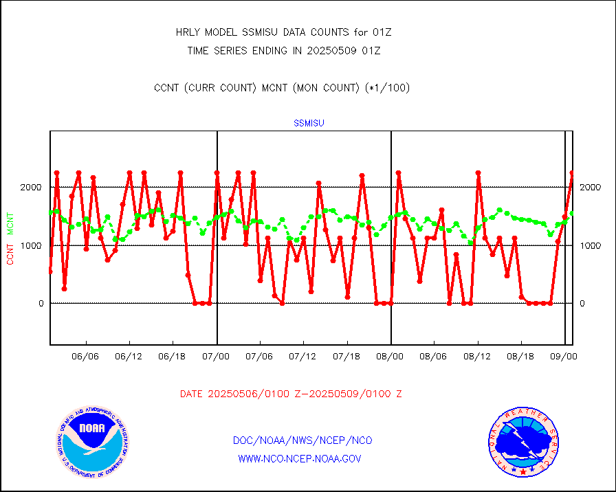
iasidb |
METOP 1-2 IASI 1C radiances-direct broadcast SSEC |
28680 |
25294 |
113.4 % |
2423.50-2500.49 |
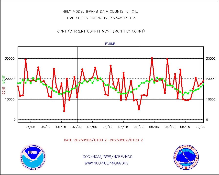
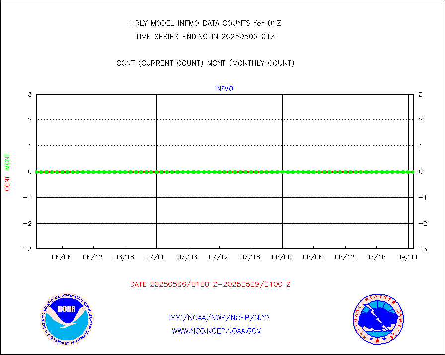
ifvrnb |
VIIRS (NPP/NOAA-20) ir lg-wv drv cloud motion(NB) |
9908 |
16952 |
58.4 % |
2421.00-2421.99 |
infav1 |
AVHRR (METOP) ir lg-wave derived cld motion |
0 |
0 |
n/a |
2500.50-2501.50 |
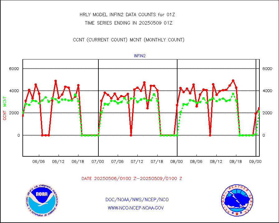
infin |
INSAT/KALPANA India ir lg-wave derived cld motion |
0 |
0 |
n/a |
2422.50-2423.49 |
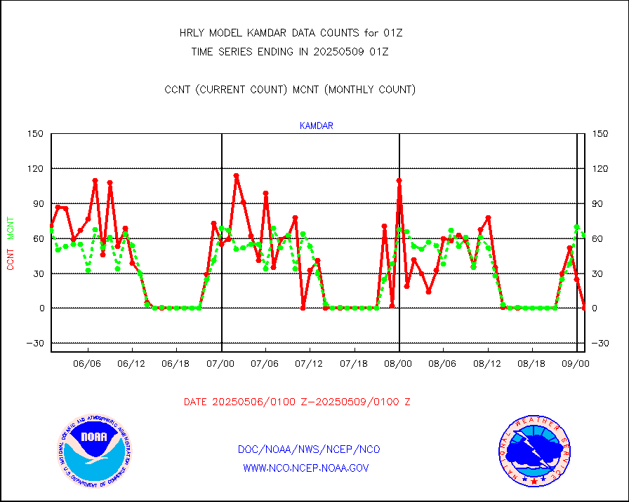
kamdar |
Korean AMDAR aircraft data (decoded from BUFR) |
78 |
79 |
98.7 % |
2500.50-2501.49 |
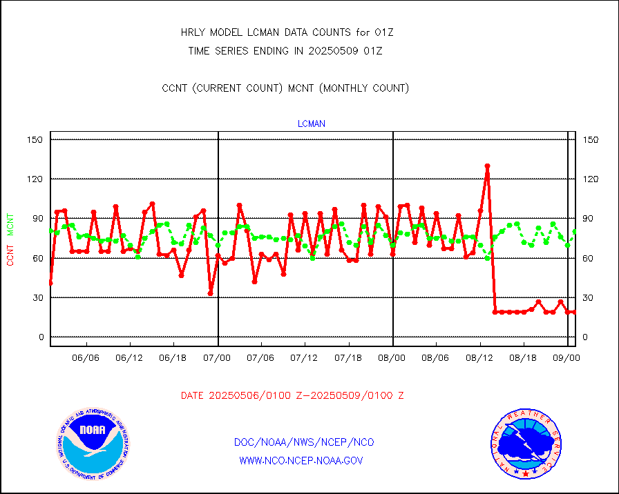
lcman |
Land-based CMAN stations decoded from CMAN format |
75 |
84 |
89.3 % |
2500.50-2501.49 |
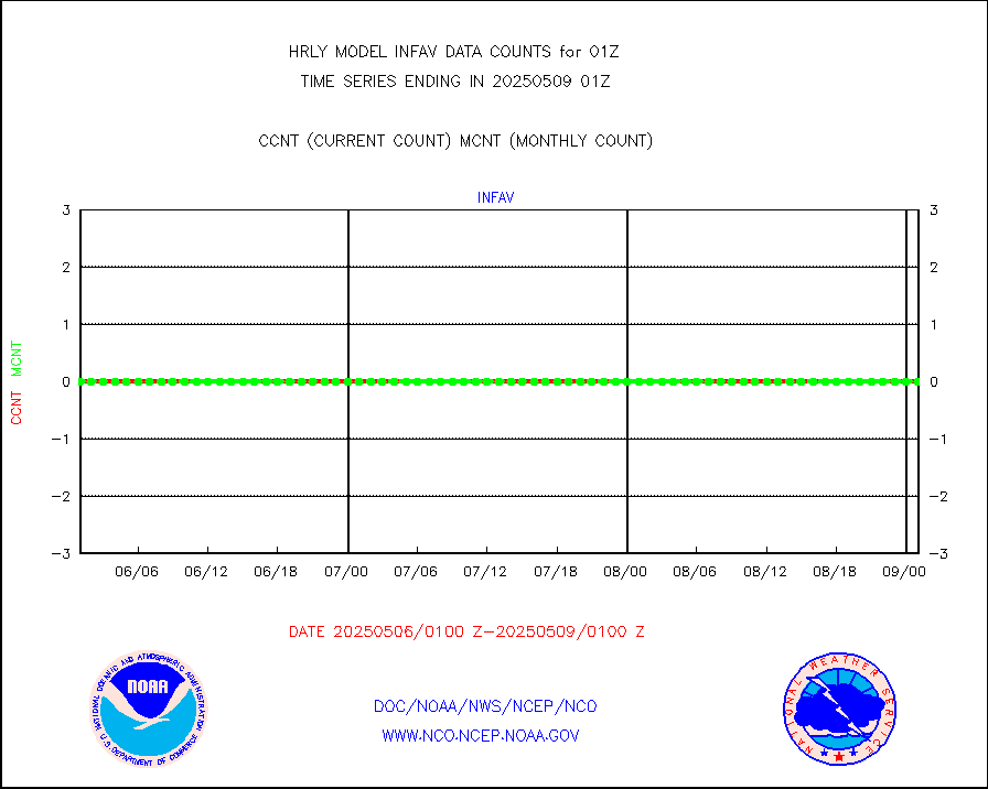
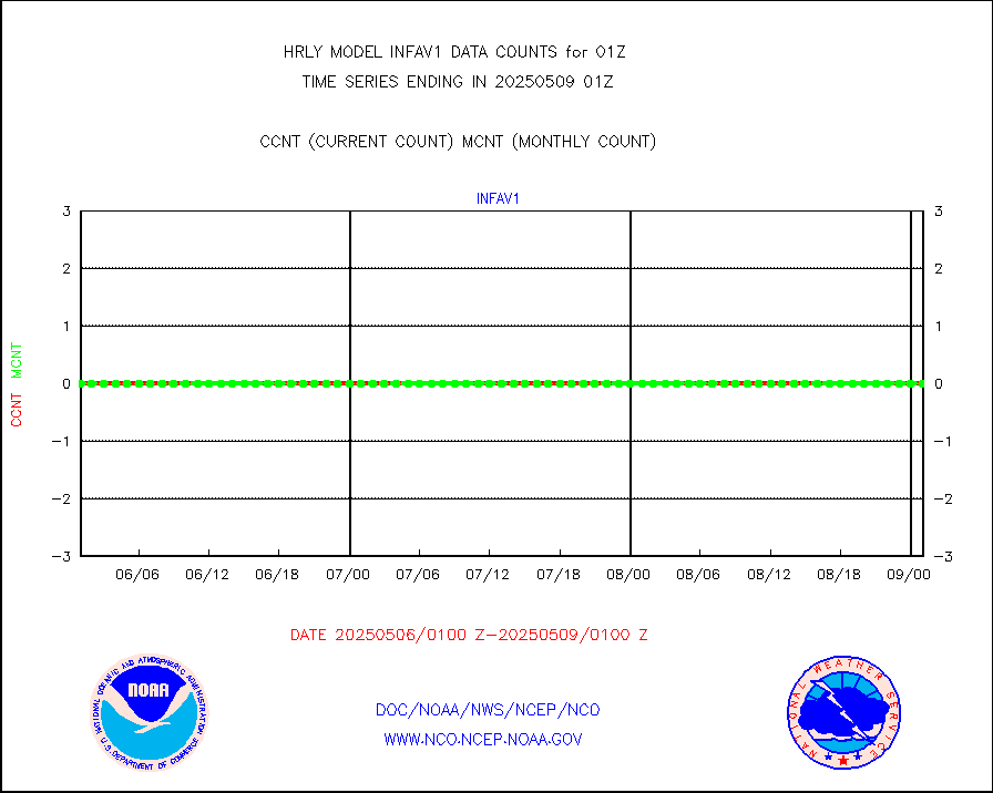
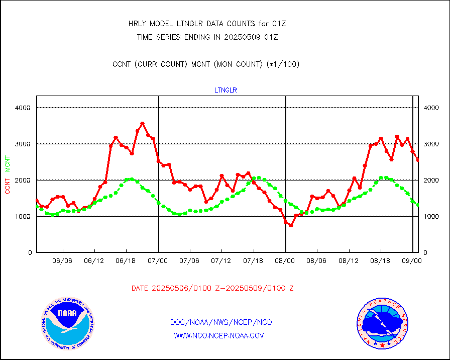
ltnglr |
LLDN Long-rng lightning from Vaisala via NOAAPORT |
86196 |
110373 |
78.1 % |
2500.50-2501.49 |
mbuoyb |
Moored buoys (decoded from BUFR) |
702 |
620 |
113.2 % |
2500.50-2501.50 |
mls |
Aura Microwave Limb Sounder (MLS) ozone data |
0 |
0 |
n/a |
2423.00-2423.99 |
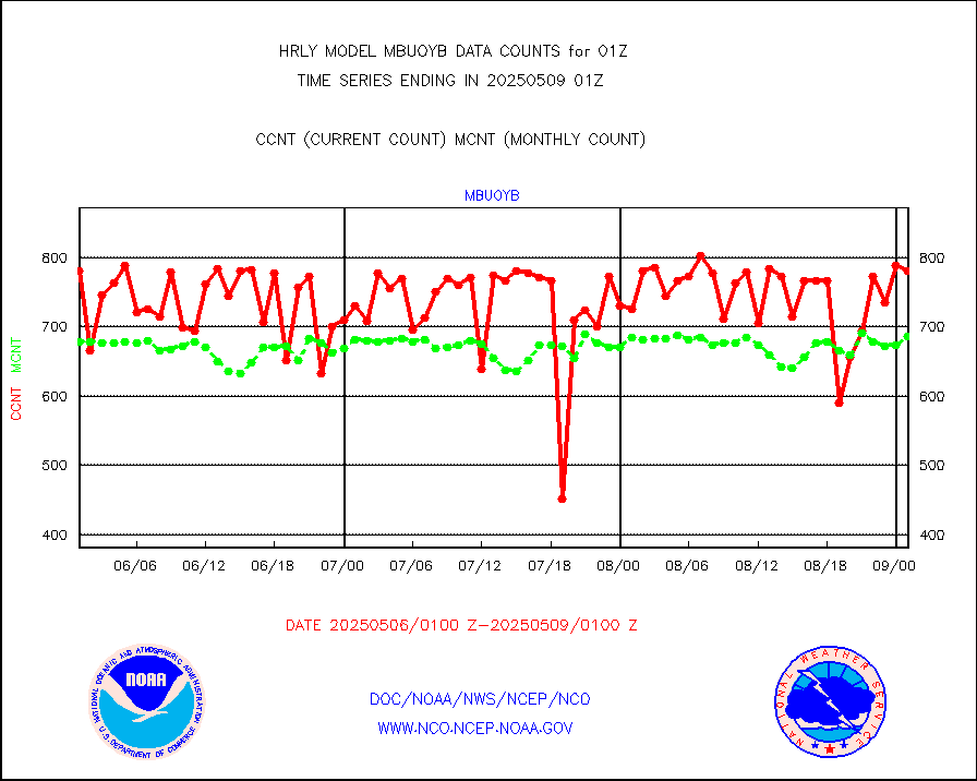
msourb |
Mesonet/MADIS UrbaNet |
4505 |
4340 |
103.8 % |
2500.50-2501.49 |
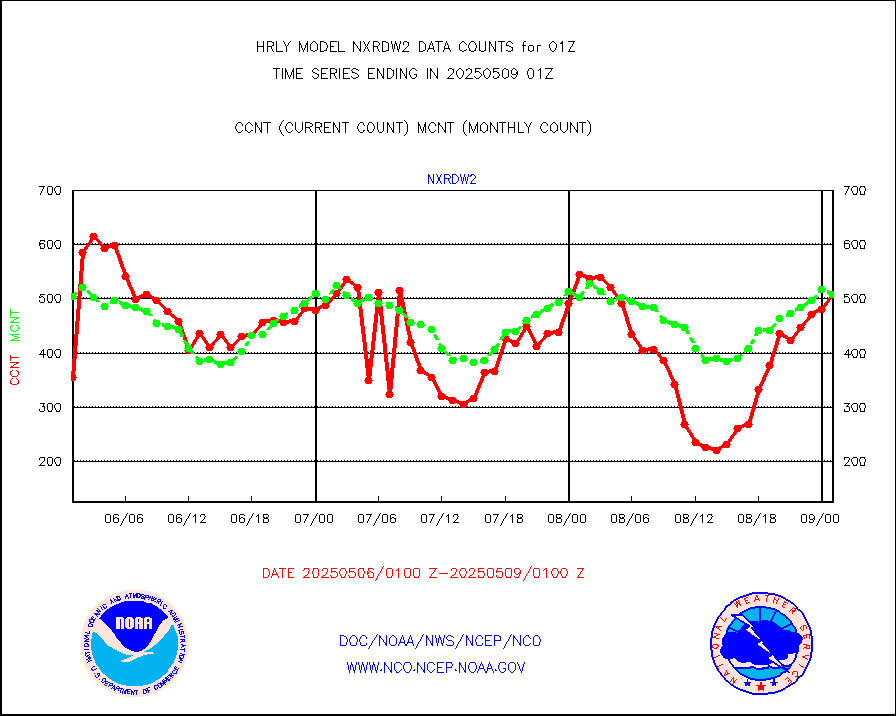
nxrdw2 |
NEXRAD Vel Azm Dsp(VAD) winds via Level 2 decoder |
560 |
552 |
101.4 % |
2500.50-2501.49 |
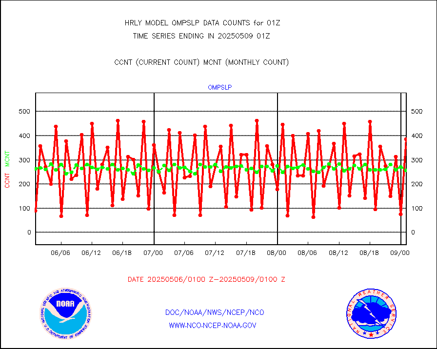
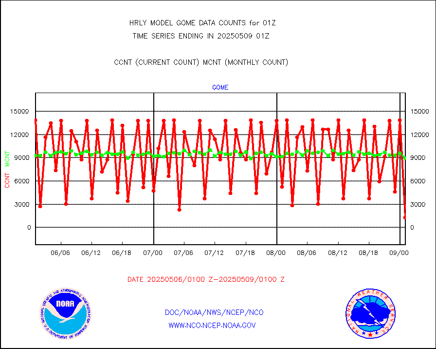
ompslp |
OMPS Limb Profiler ozone data (NPP) |
405 |
241 |
168.0 % |
2418.00-2418.99 |
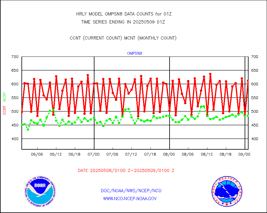
ompsn8 |
OMPS nadir profile ozone (Version 8 BUFR) |
575 |
538 |
106.9 % |
2423.00-2423.99 |
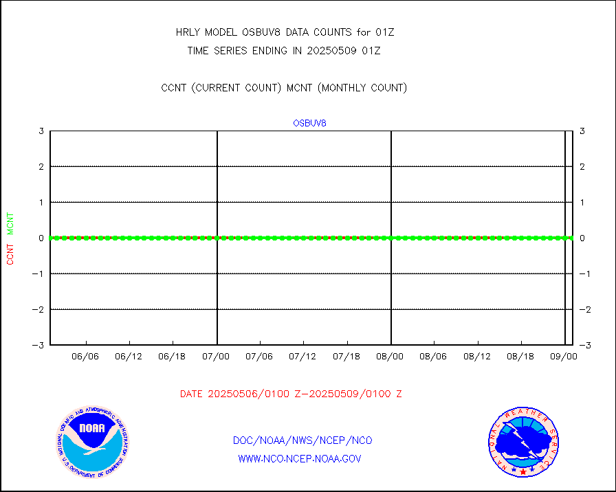
ompst8 |
OMPS total column ozone (Version 8 BUFR) |
269379 |
348484 |
77.3 % |
2423.00-2423.99 |
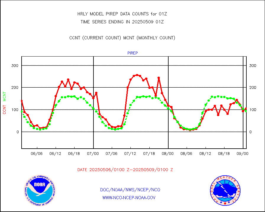
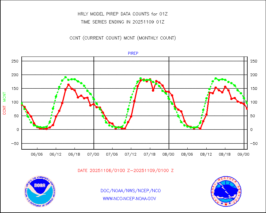
pirep |
Manual PIREP aircraft data (dcded from AIREP fmt) |
41 |
86 |
47.7 % |
2500.50-2501.49 |
prflrp |
Profilr winds from PIBAL (PILOT,PILOT SHIP/MOBIL) |
0 |
0 |
n/a |
2500.50-2501.49 |
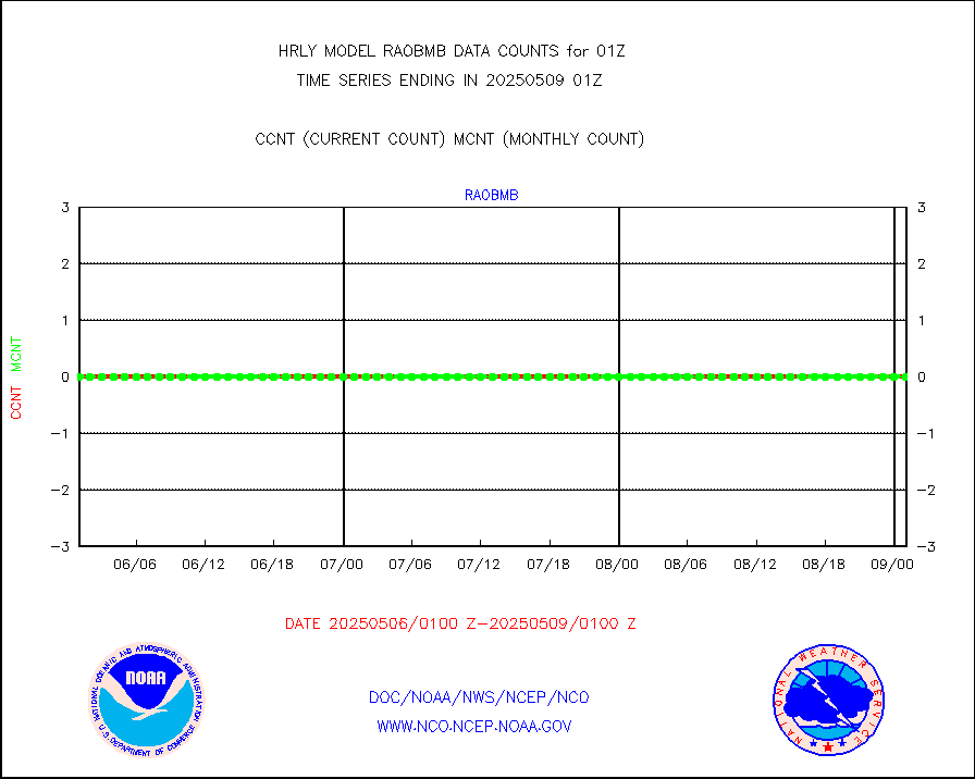
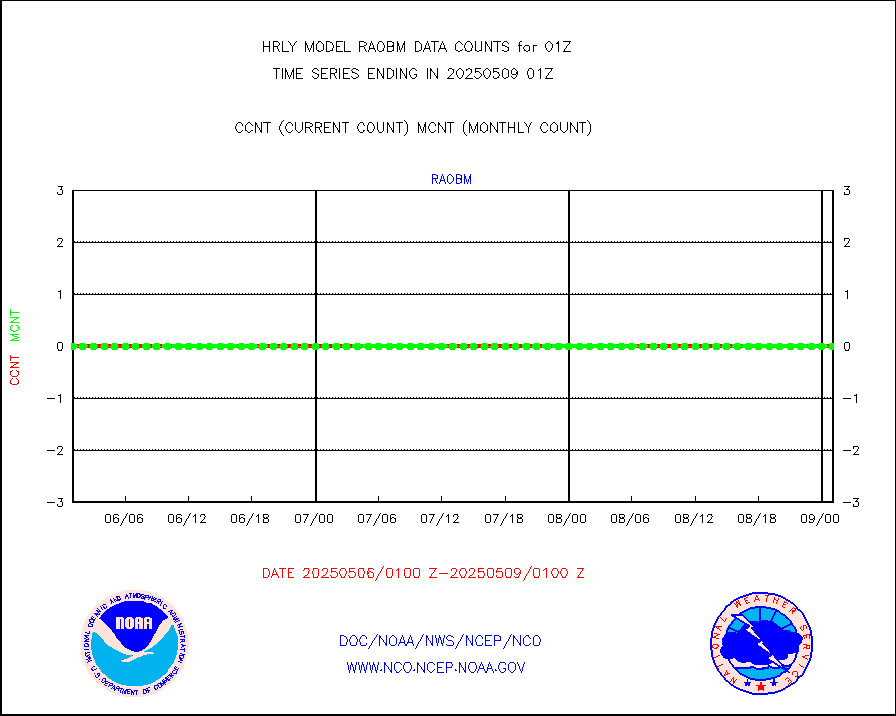
raobm |
Rawinsonde - mobile land (from TEMP/PILOT MOBIL) |
0 |
0 |
n/a |
2500.50-2501.49 |
raobs |
Rawinsonde - ship (from TEMP SHIP, PILOT SHIP) |
0 |
0 |
n/a |
2500.50-2501.49 |
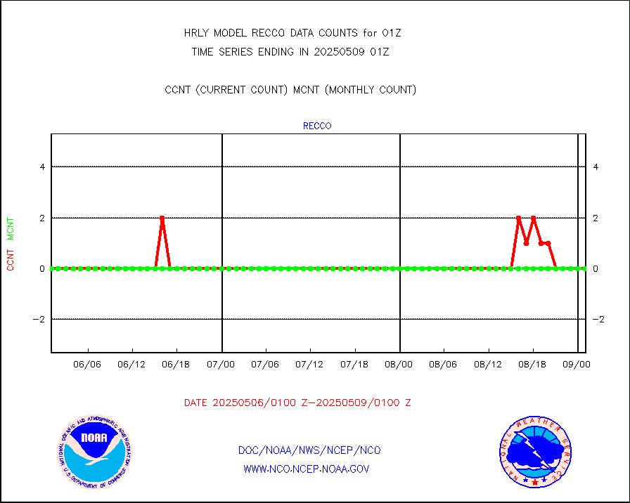
recco |
Flight level reconnaissance aircraft data |
1 |
0 |
n/a |
2500.50-2501.49 |
saphir |
Megha-Tropiques SAPHIR L1A2 brightness temps |
0 |
0 |
n/a |
2422.50-2423.49 |
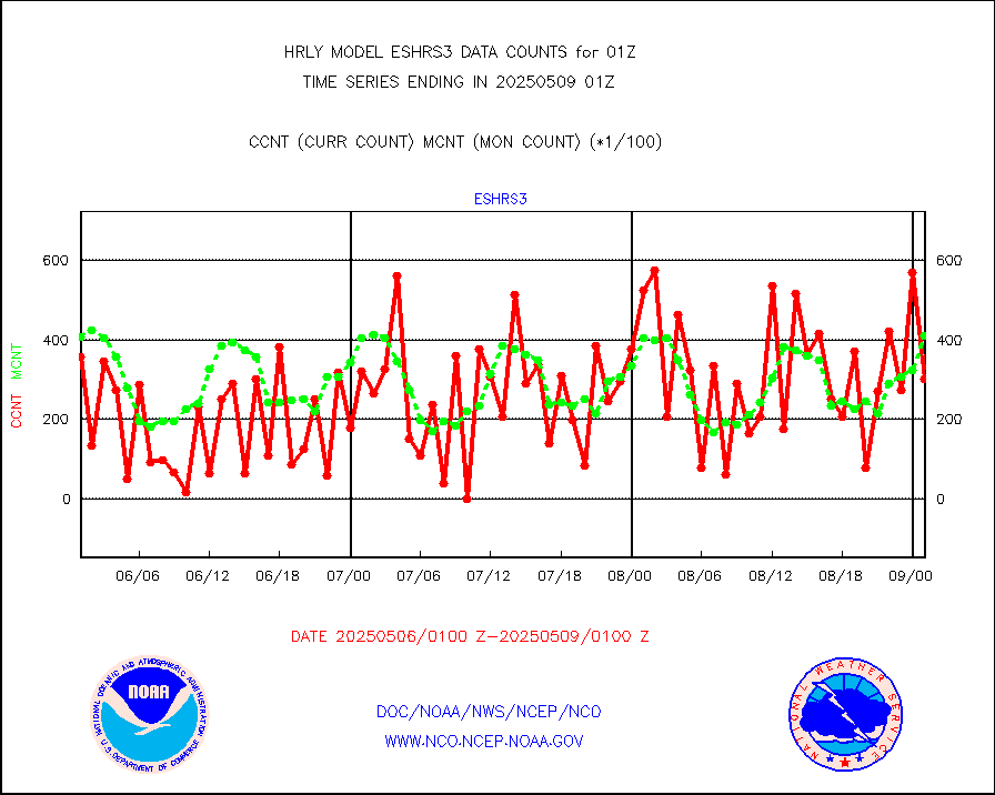
sevasr |
METEOSAT-10 2nd Gen SEVIRI All Sky Radiance(proc) |
75512 |
75498 |
100.0 % |
2500.50-2501.49 |
ships |
Ship - manual and automatic, restricted |
14 |
4 |
350.0 % |
2500.50-2501.49 |
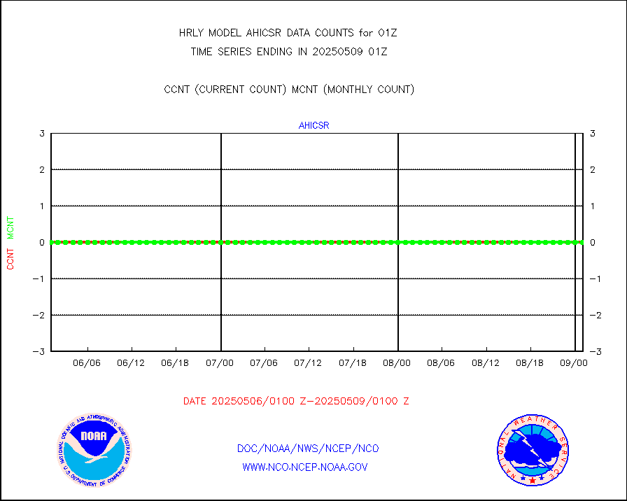
ssmisu |
DMSP SSM/IS 1C radiance data (Unified Pre-Proc.) |
76980 |
131766 |
58.4 % |
2423.50-2500.49 |
synopm |
Synoptic - mobile manual and automatic |
673 |
595 |
113.1 % |
2500.50-2501.49 |
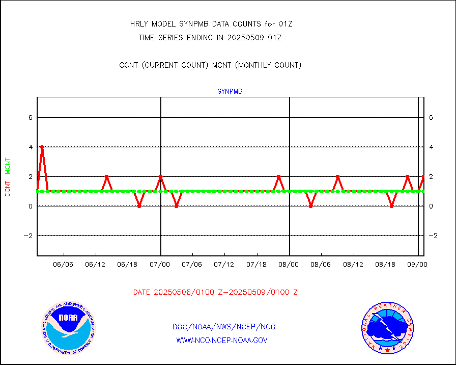
synpmb |
Synoptic - mobile manual & auto (decoded fr BUFR) |
1 |
1 |
100.0 % |
2500.50-2501.49 |
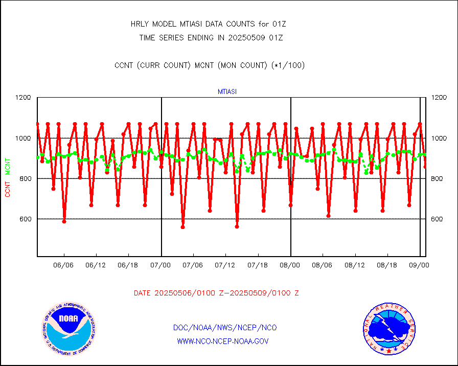
tesac |
CTD probe, Argo prflng float, mooring (TESAC fmt) |
203 |
172 |
118.0 % |
2500.50-2501.49 |
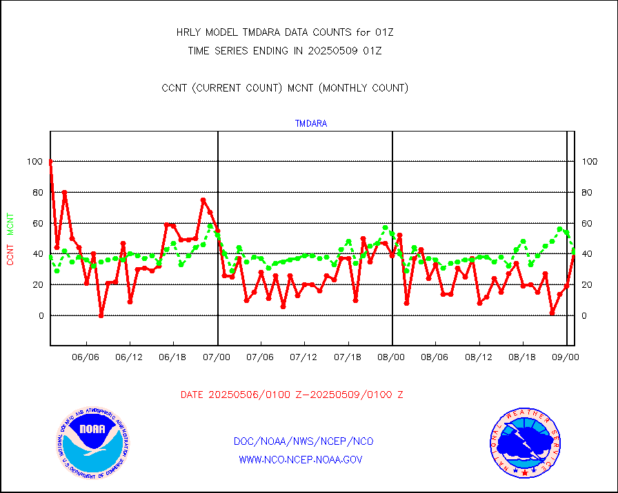
tmdara |
TAMDAR aircft data-all types(from Panasonic,BUFR) |
322 |
343 |
93.9 % |
2500.50-2501.49 |
visin |
INSAT/KALPANA India visible derived cloud motion |
0 |
0 |
n/a |
2422.50-2423.49 |
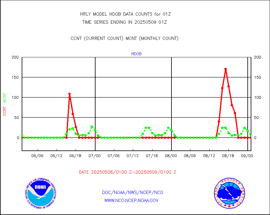
visin2 |
INDIA SATWIND, INSAT VIS channel |
0 |
0 |
n/a |
2500.00-2500.99 |
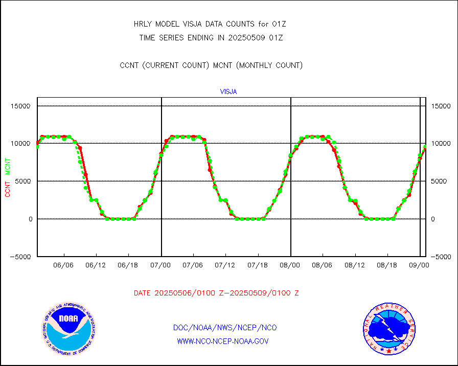
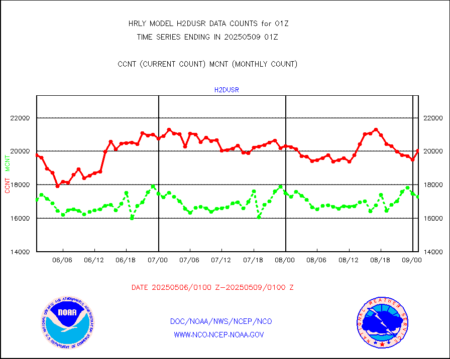
visja |
MTSAT/JMA visible derived cloud motion |
10741 |
9813 |
109.5 % |
2422.50-2423.49 |
visusr |
GOES-16&up/NESDIS visible derived cloud motion |
213041 |
246961 |
86.3 % |
2500.00-2500.99 |
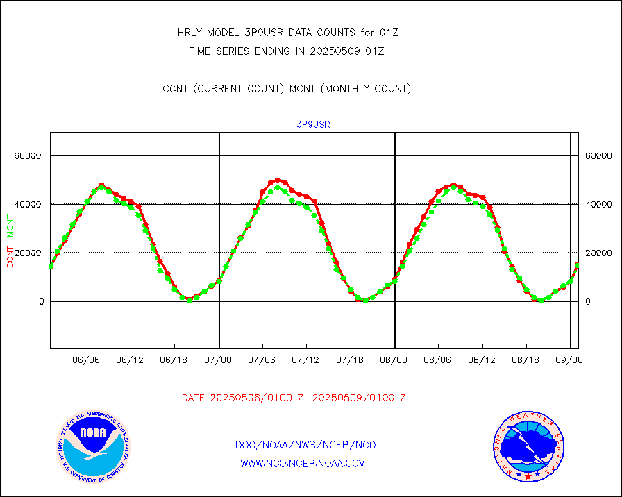
vseunb |
METEOSAT/EUMETSAT visible drv cld motion NBseq |
0 |
0 |
n/a |
2423.50-2500.49 |


