| Critical Data with Normal Counts |
|---|
| Type | Description | Hourly Count | Monthly Average | Percent (%) of Monthly Mean |
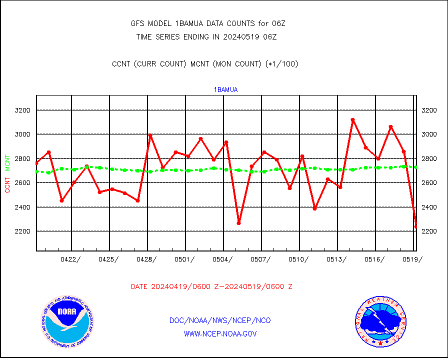
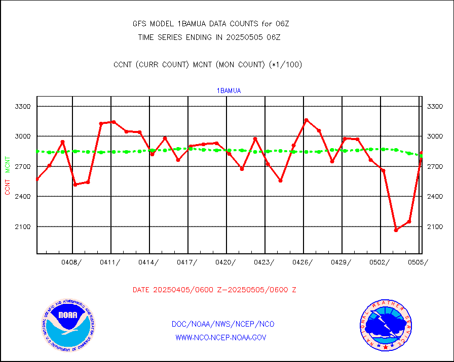
1bamua |
NOAA 15-19 & METOP 1-2 AMSU-A NCEP-proc. br.temps |
283916 |
268696 |
105.7 % |
1bhrs4 |
NOAA 18-19 & METOP 1-2 HIRS-4 NCEP-proc. br.temps |
211586 |
226712 |
93.3 % |
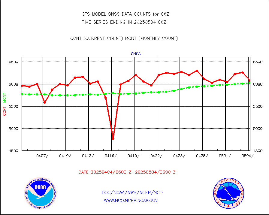
1bmhs |
NOAA 18-19 & METOP 1-2 MHS NCEP-proces. br. temps |
1612712 |
1532129 |
105.3 % |
ahicsr |
Himawari Clear Sky Radiance |
265205 |
262046 |
101.2 % |
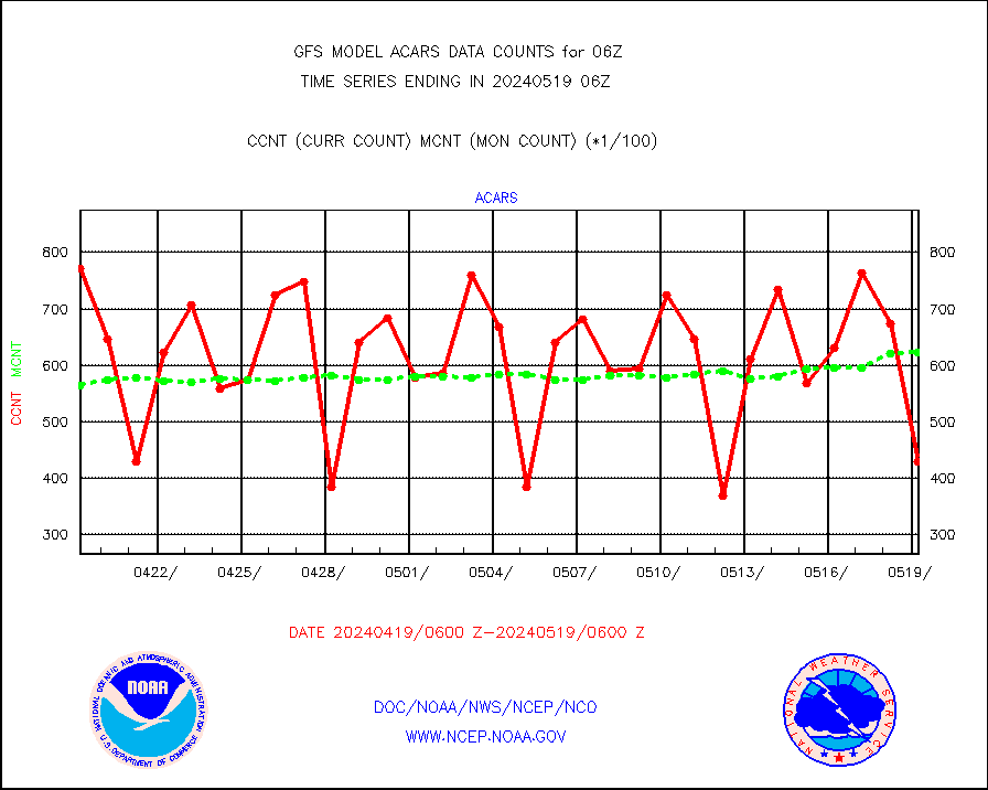
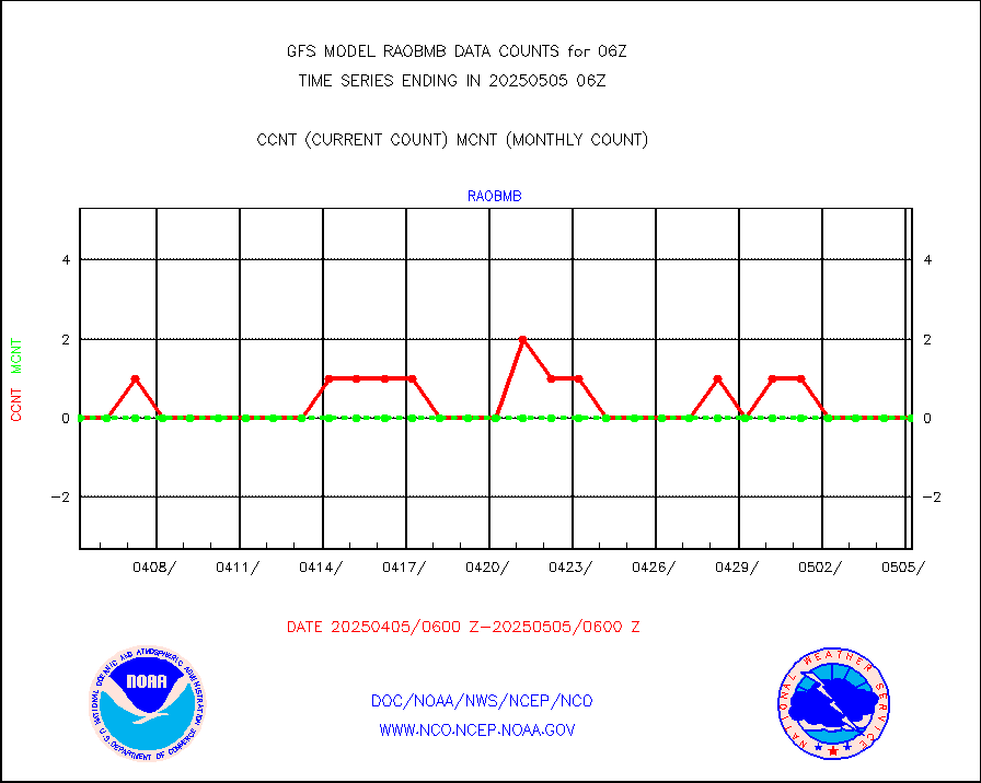
airep |
Manual AIREP aircraft data (dcded from AIREP fmt) |
4660 |
6655 |
70.0 % |
airsev |
AQUA AIRS/AMSU-A/HSB brightness temps- every FOV |
0 |
0 |
n/a |
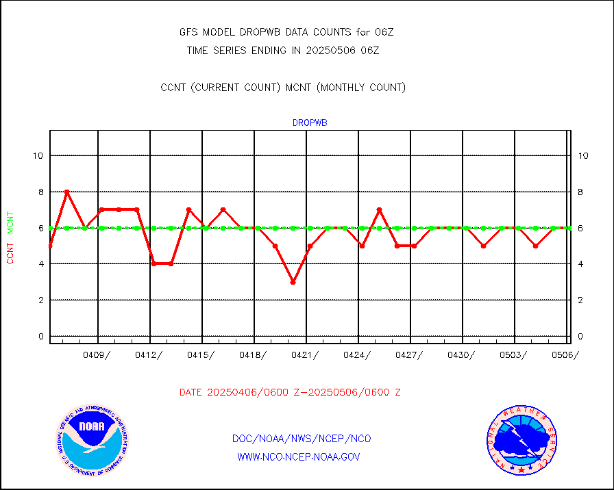
amdar |
AMDAR aircraft data (decoded from AMDAR format) |
4389 |
4327 |
101.4 % |
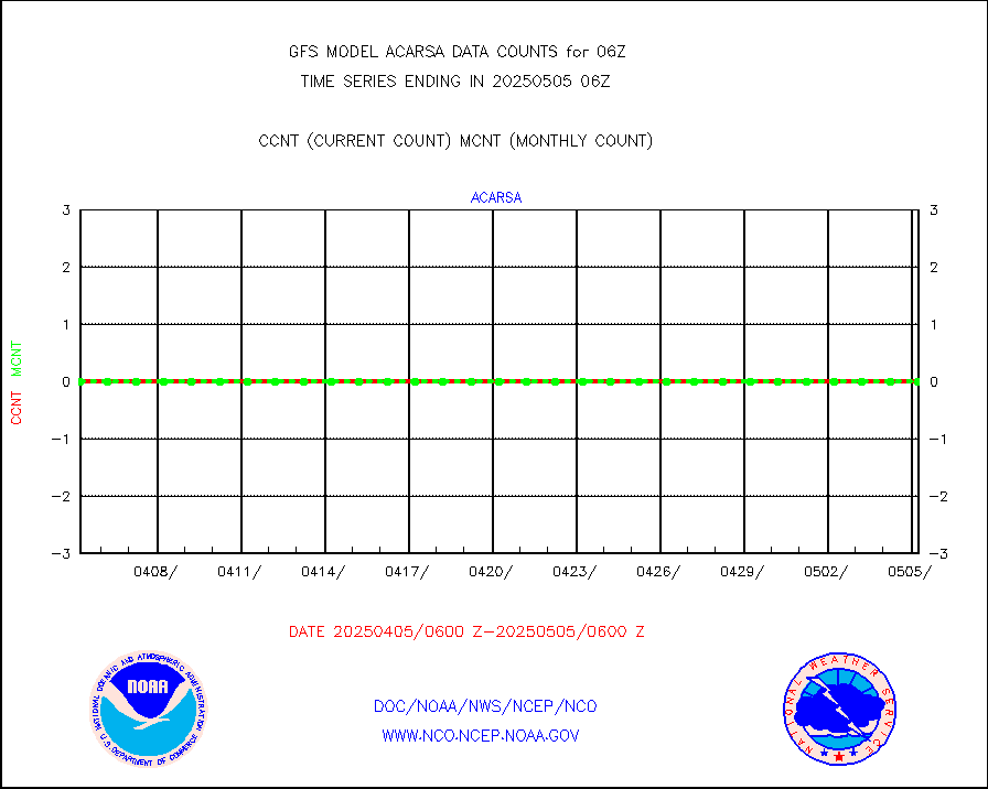
amdarb |
AMDAR aircraft data (decoded from BUFR) |
9923 |
9992 |
99.3 % |
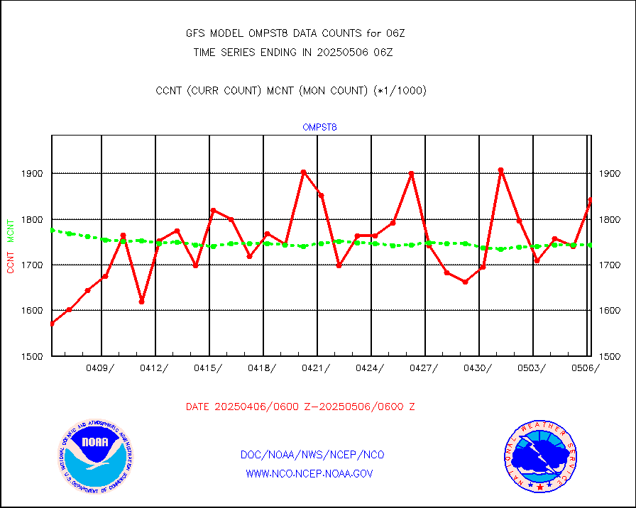
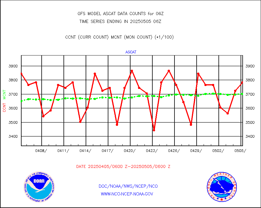
ascat |
METOP 1-2 ASCAT products |
326172 |
330070 |
98.8 % |
atms |
NPP/NOAA-20 ATMS brightness temperatures |
1906560 |
1944912 |
98.0 % |
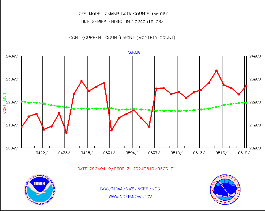
cmanb |
Surface Marine CMAN rpts decoded from BUFR format |
21567 |
22124 |
97.5 % |
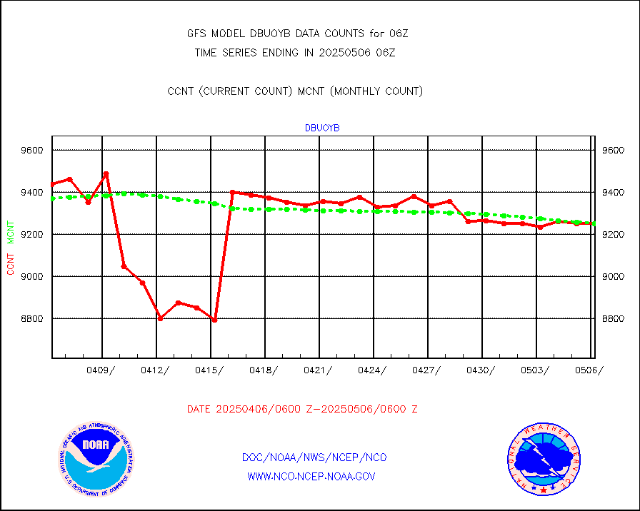
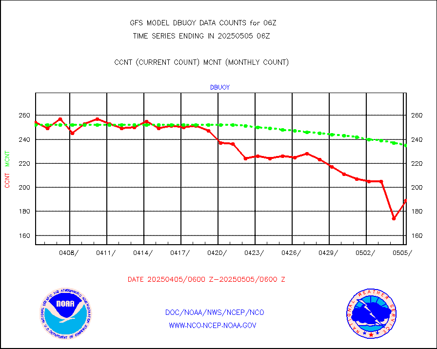
dbuoy |
Buoys decoded from FM-18 fmt (moored or drifting) |
248 |
264 |
93.9 % |
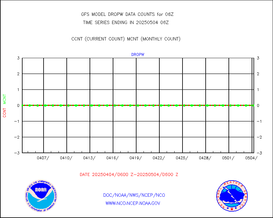
dropw |
Dropwinsonde (from TEMP DROP) |
0 |
0 |
n/a |
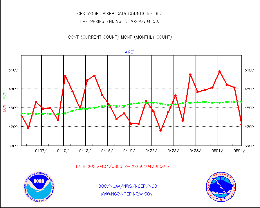
eadas |
E-AMDAR (European AMDAR acft decoded from BUFR) |
11832 |
10777 |
109.8 % |
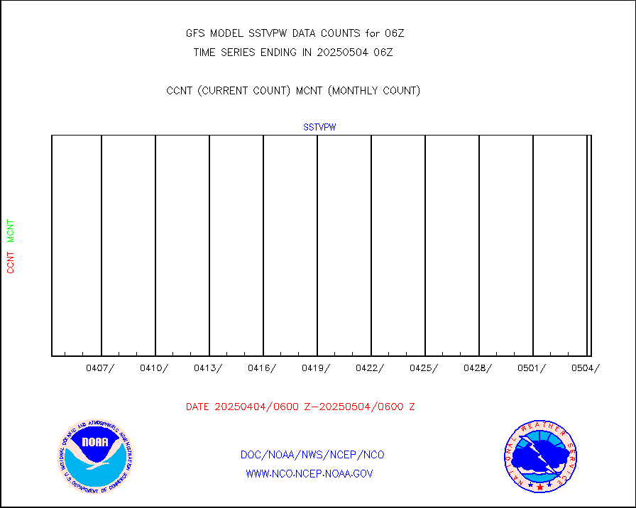
esamua |
NOAA 15-19 & METOP 1-2 AMSU-A proc btmps frm RARS |
155357 |
157557 |
98.6 % |
eshrs3 |
NOAA 15-19 & METOP 1-2 HIRS-3/4 pr btmps frm RARS |
438186 |
430882 |
101.7 % |
gpsro |
GPS radio occultation data |
2451 |
2212 |
110.8 % |
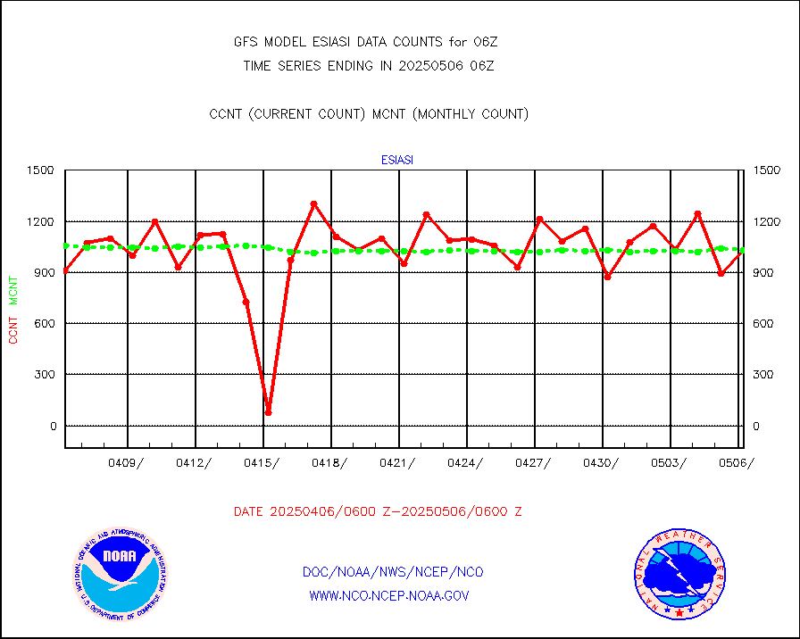
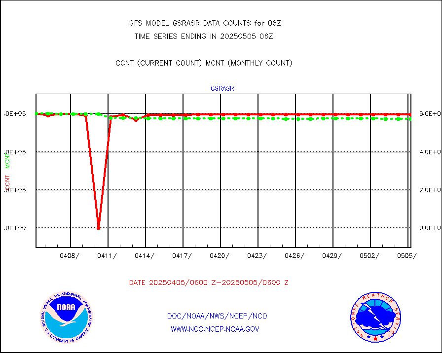
gsrasr |
GOES-16/17 All Sky Radiances (proc.) |
5939249 |
5997428 |
99.0 % |
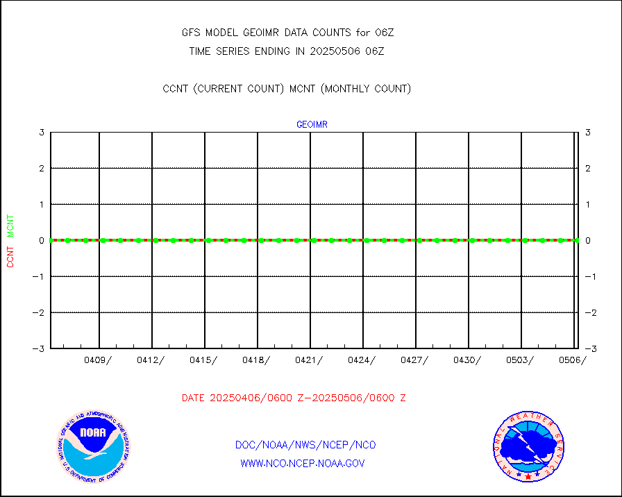
gsrcsr |
GOES-16/17 Clear Sky Radiances (proc.) |
2648317 |
2712087 |
97.6 % |
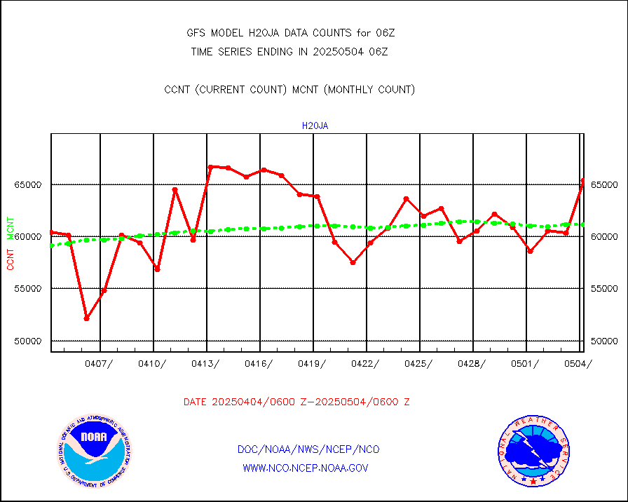
h20ja |
MTSAT/JMA water vapor imager derived cloud motion |
56428 |
58318 |
96.8 % |
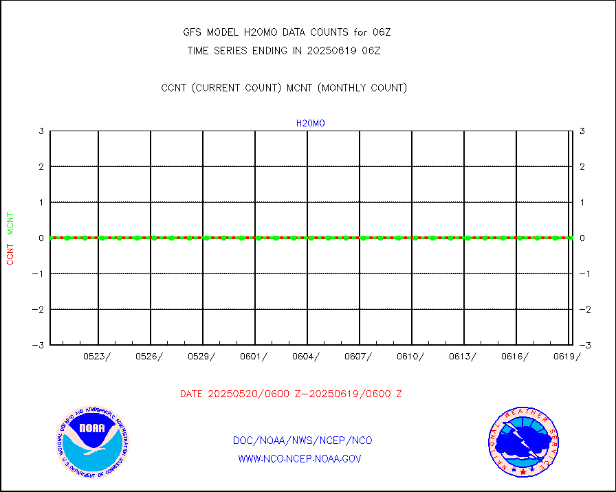
h20mo |
MODIS (AQUA/TERRA) wvpr imager derived cld motion |
0 |
0 |
n/a |
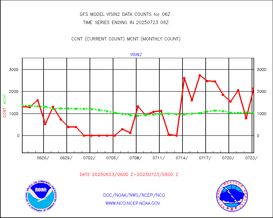
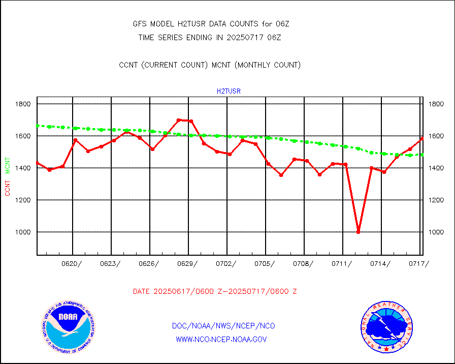
h2tusr |
GOES-16&up/NESDIS wv imgr/cld-top derived cld mtn |
164026 |
168874 |
97.1 % |
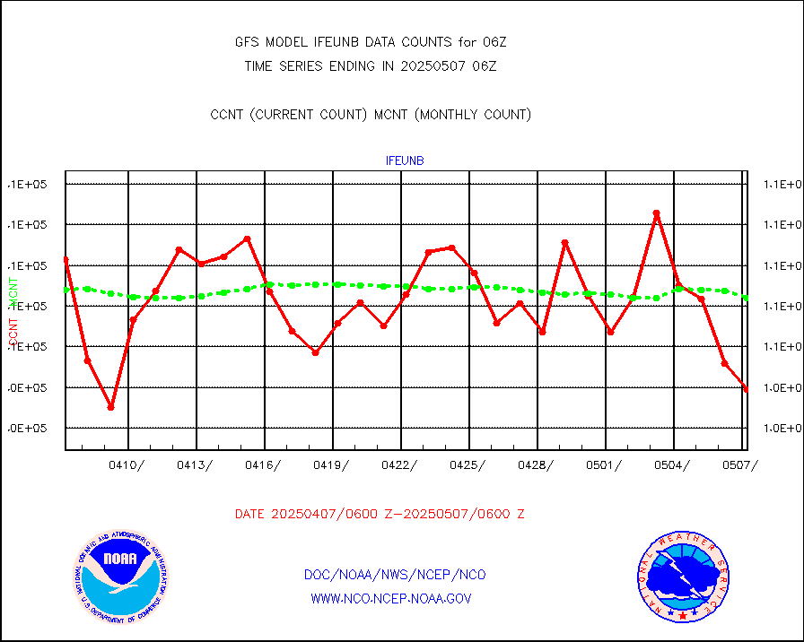
ifeunb |
METEOSAT/EUMETSAT ir lg-wave drv cld motion NBseq |
101274 |
110491 |
91.7 % |
infja |
MTSAT/JMA infrared long-wave derived cloud motion |
44601 |
49259 |
90.5 % |
infmo |
MODIS (AQUA/TERRA) ir l-wave derived cloud motion |
0 |
0 |
n/a |
infusr |
GOES-16&up/NESDIS ir long-wave derived cld motion |
457963 |
491947 |
93.1 % |
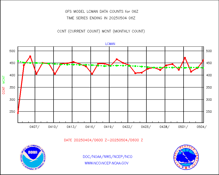
lcman |
Land-based CMAN stations decoded from CMAN format |
545 |
538 |
101.3 % |
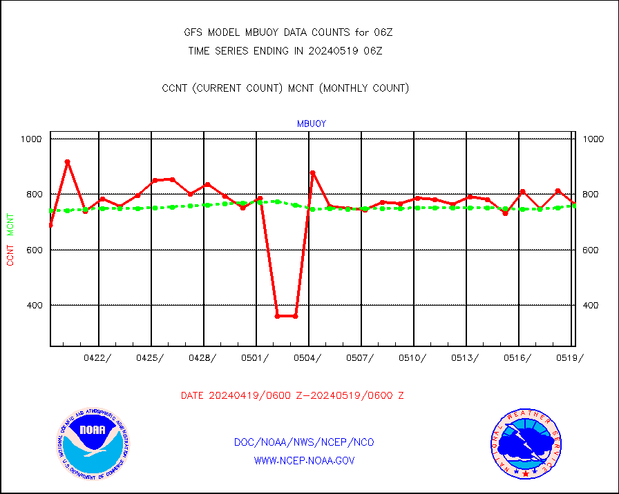
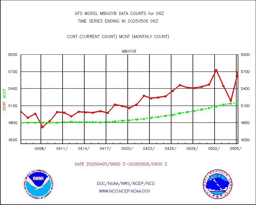
mbuoy |
Buoys decoded from FM-13 format (moored) |
624 |
750 |
83.2 % |
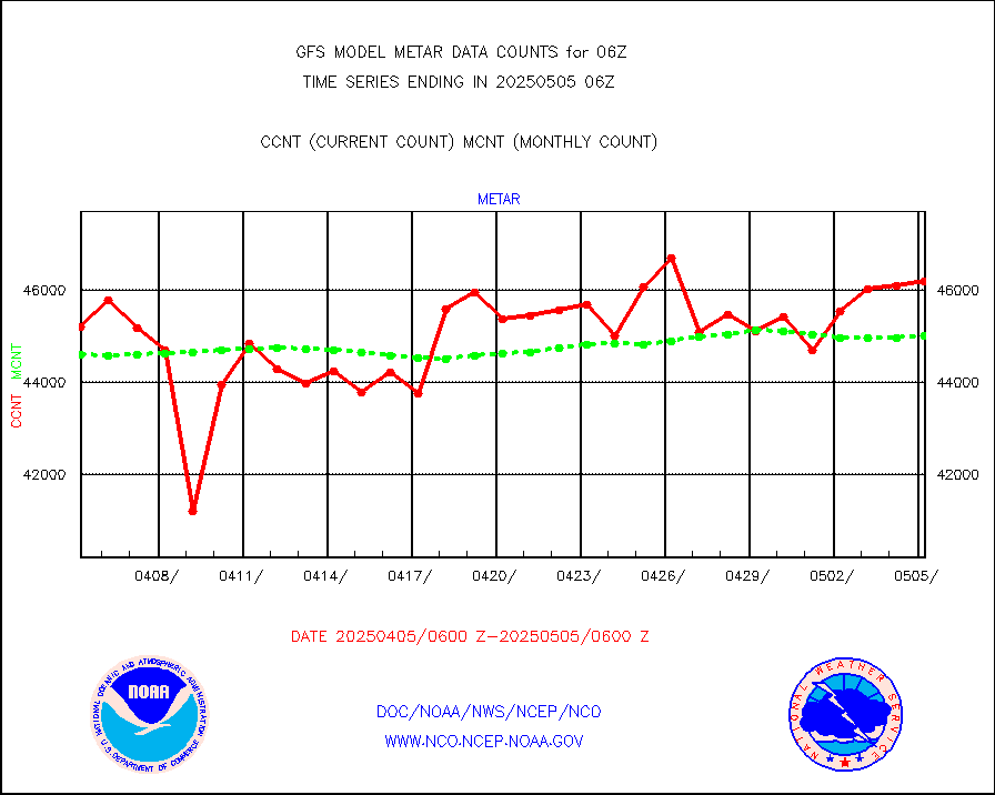
metar |
Aviation - METAR |
40552 |
45401 |
89.3 % |
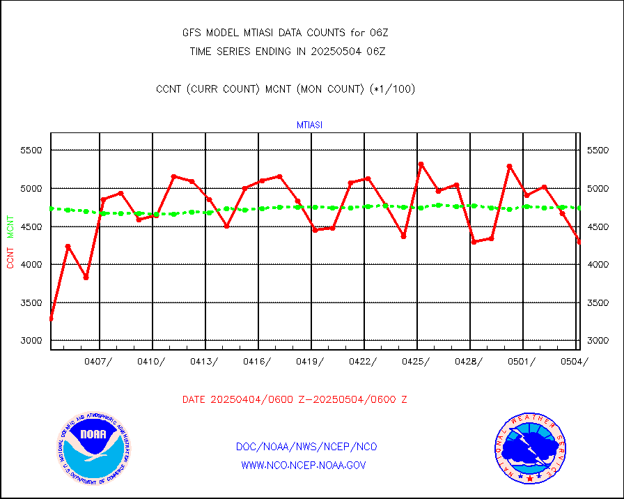
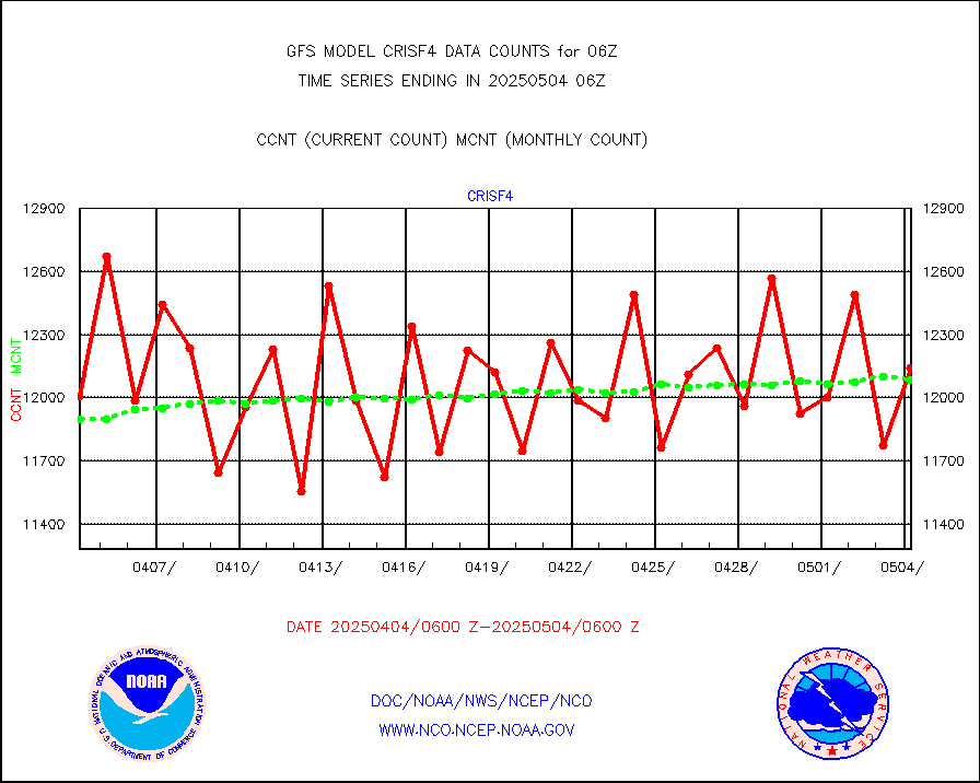
mtiasi |
METOP 1-2 IASI 1C radiance data (varbl. channels) |
429140 |
444363 |
96.6 % |
nxrdw |
NEXRAD Vel Azm Dsp(VAD) winds via radar coded msg |
0 |
0 |
n/a |
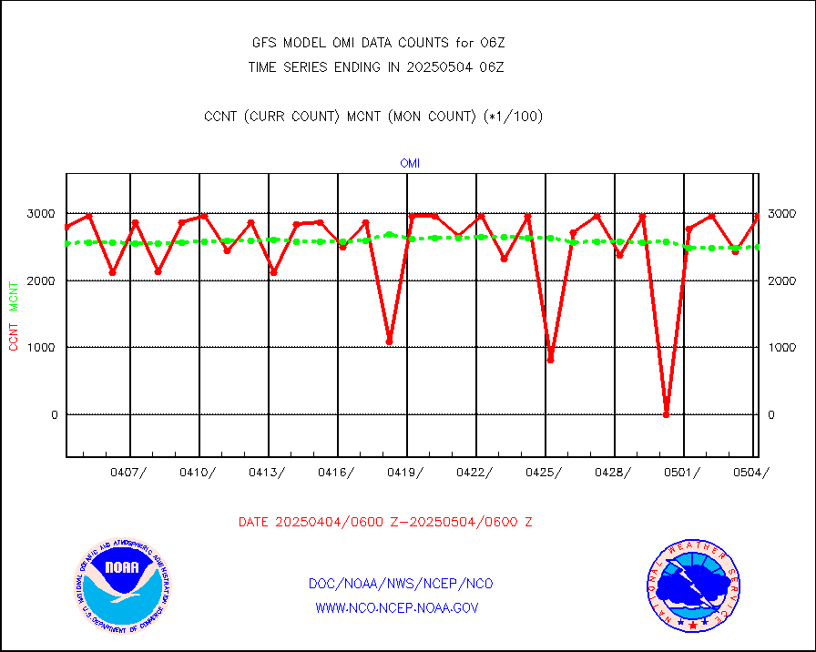
omi |
Aura Ozone Monitoring Instrument (OMI) data |
279422 |
245597 |
113.8 % |
osbuv8 |
NOAA 16-19 Solar Backscatter UV-2 rad frm V8 BUFR |
0 |
0 |
n/a |
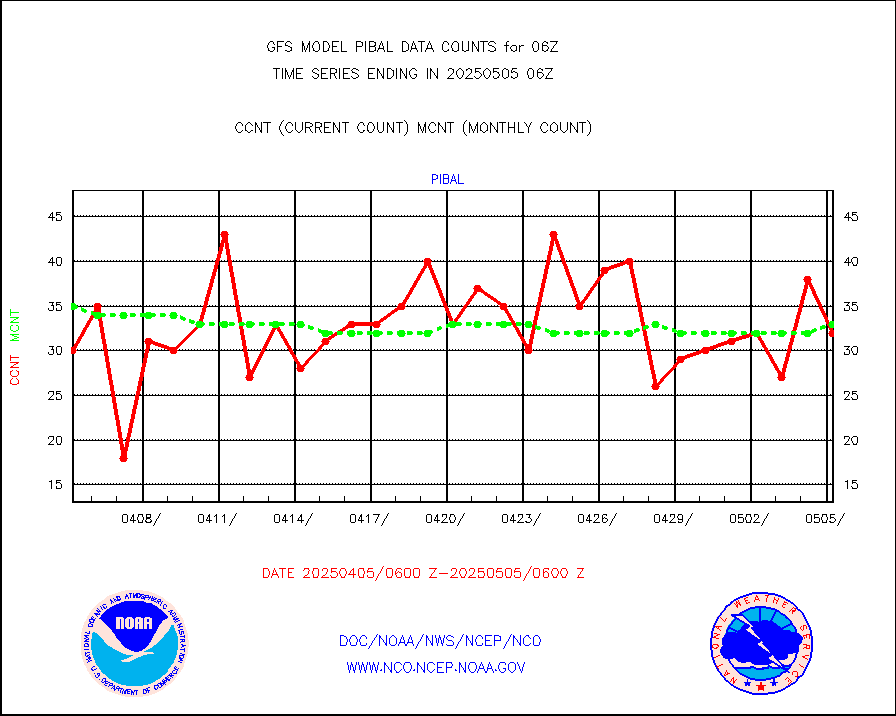
pibal |
PIBAL (from PILOT, PILOT SHIP, PILOT MOBIL) |
49 |
54 |
90.7 % |
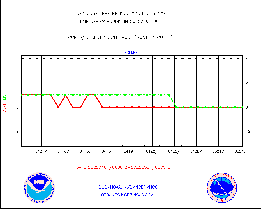
prflrp |
Profilr winds from PIBAL (PILOT,PILOT SHIP/MOBIL) |
0 |
1 |
0.0 % |
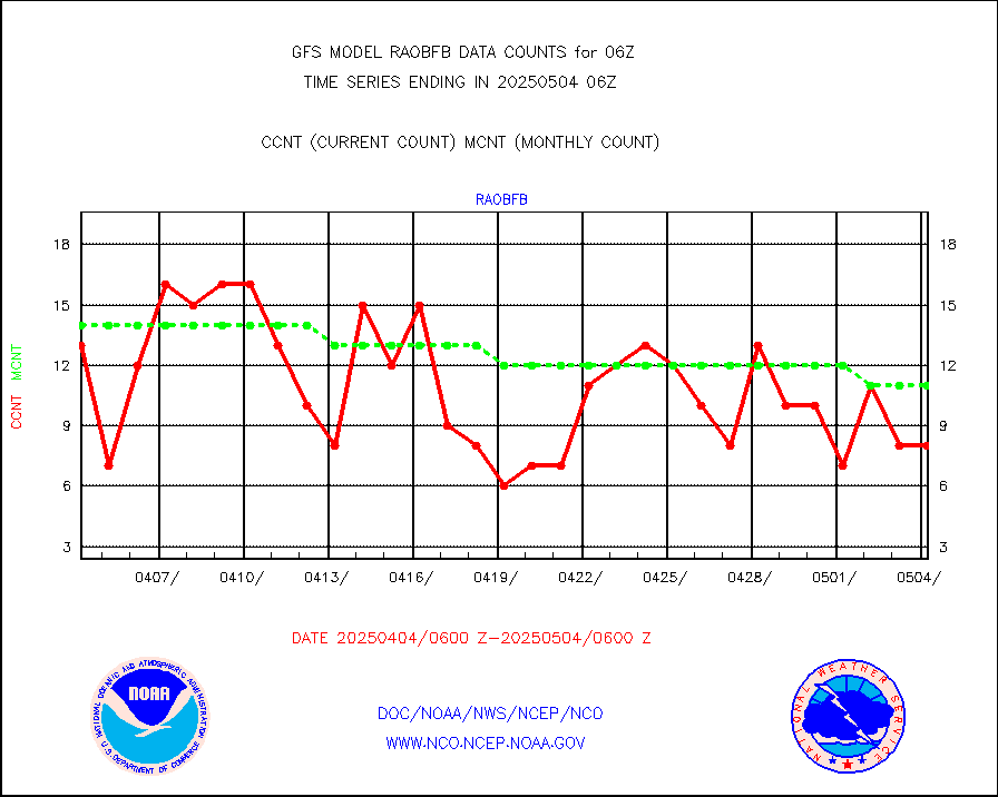
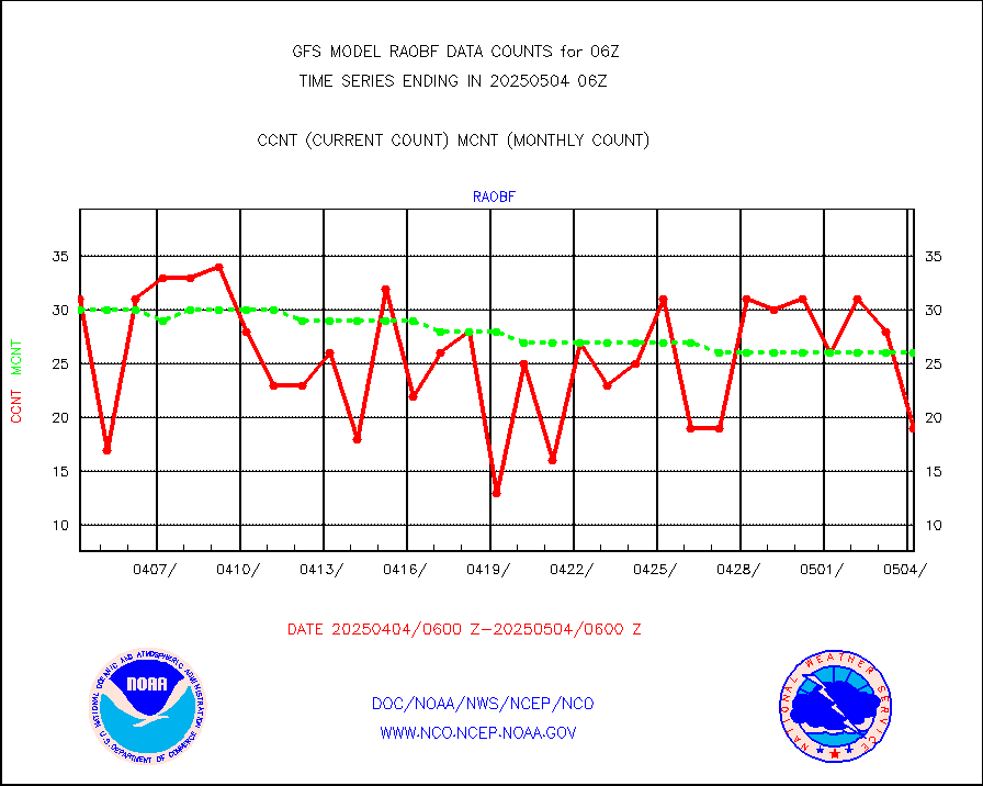
raobf |
Rawinsonde - fixed land (from TEMP or PILOT) |
39 |
32 |
121.9 % |
raobm |
Rawinsonde - mobile land (from TEMP/PILOT MOBIL) |
0 |
0 |
n/a |
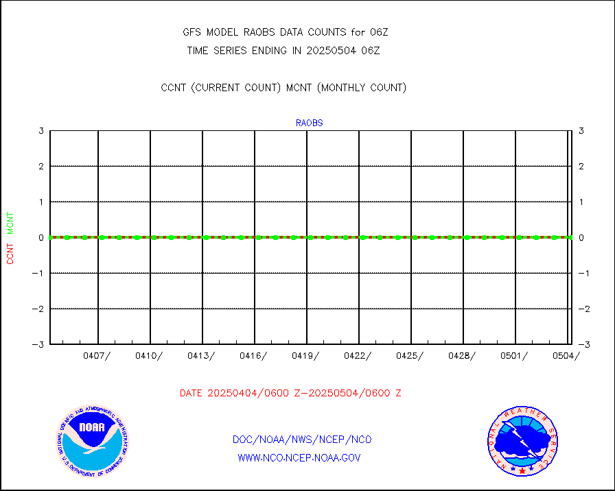
raobs |
Rawinsonde - ship (from TEMP SHIP, PILOT SHIP) |
0 |
0 |
n/a |
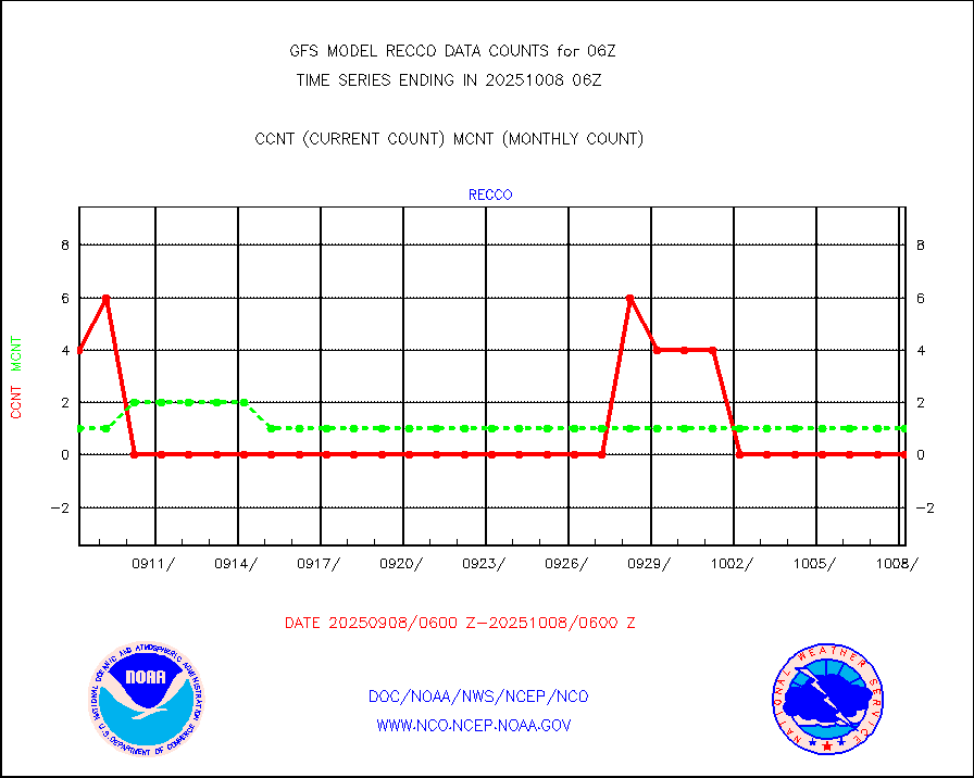
recco |
Flight level reconnaissance aircraft data |
0 |
0 |
n/a |
sevcsr |
METEOSAT-10 2nd Gen SEVIRI Clr Sky Radiance(proc) |
0 |
0 |
n/a |
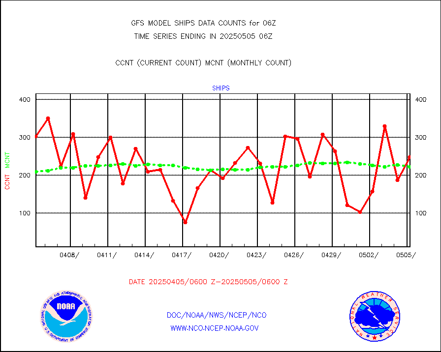
ships |
Ship - manual and automatic, restricted |
93 |
129 |
72.1 % |
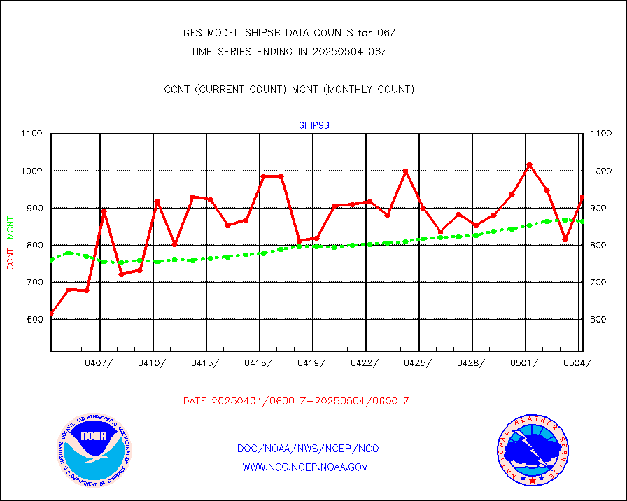
shipsb |
Ship - manual and automatic, restricted (BUFR) |
575 |
606 |
94.9 % |
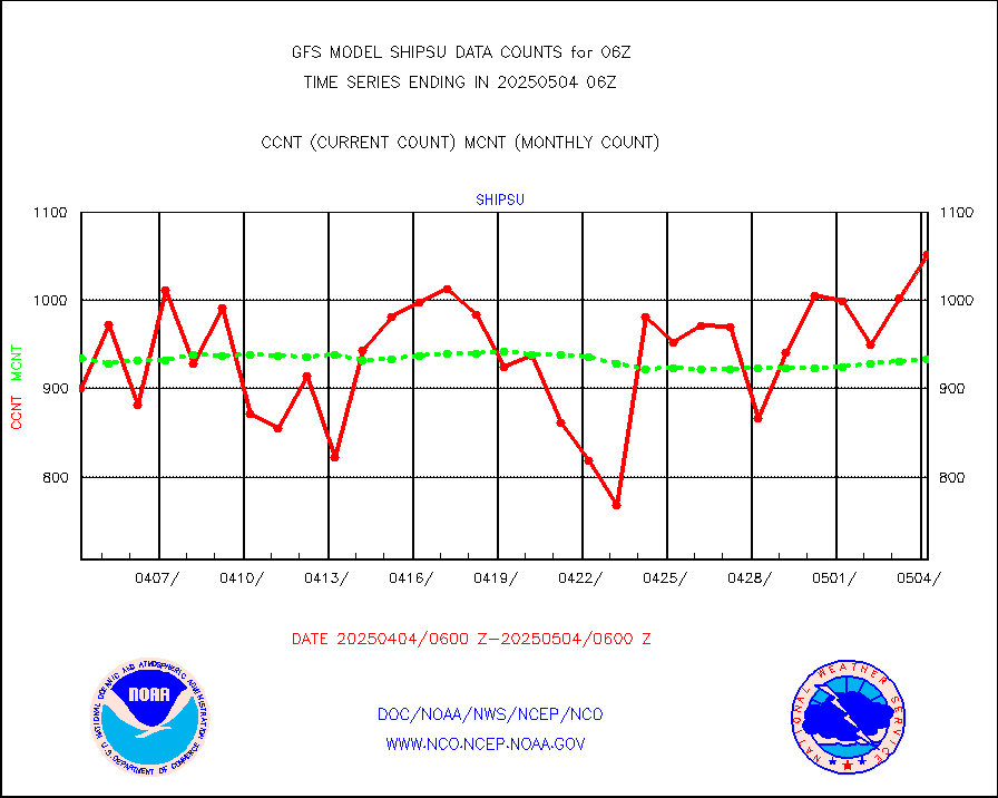
shipsu |
Ship - manual and automatic, unrestricted |
574 |
670 |
85.7 % |
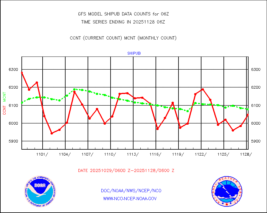
shipub |
Ship - manual and automatic, unrestricted (BUFR) |
5913 |
5765 |
102.6 % |
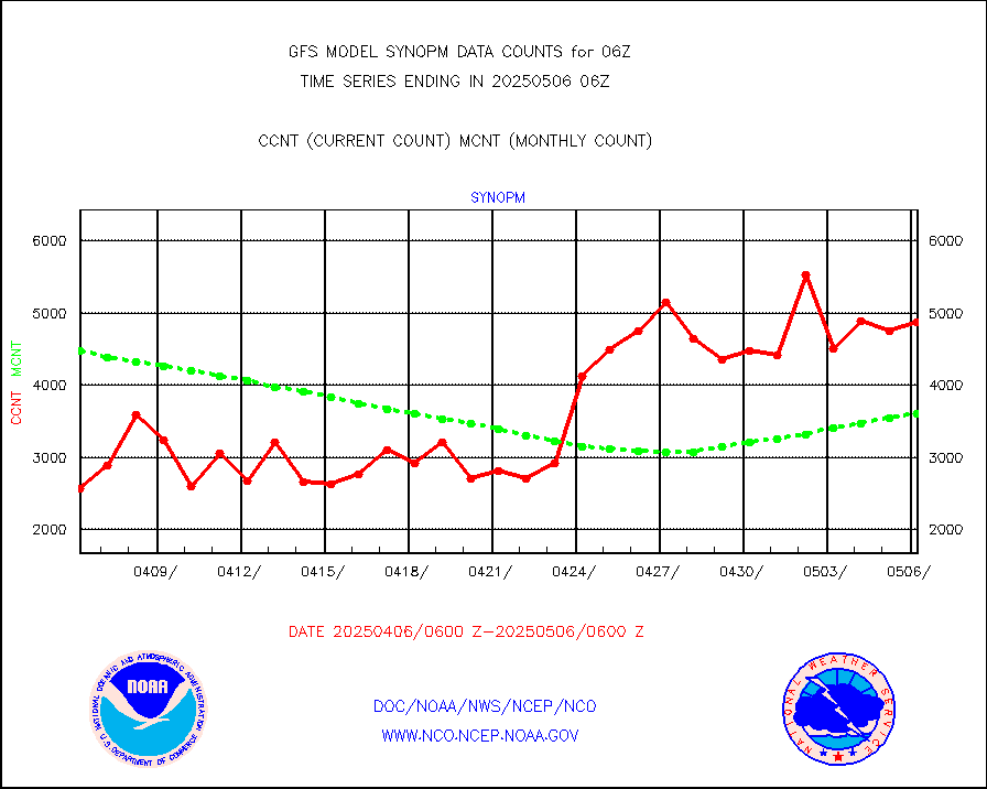
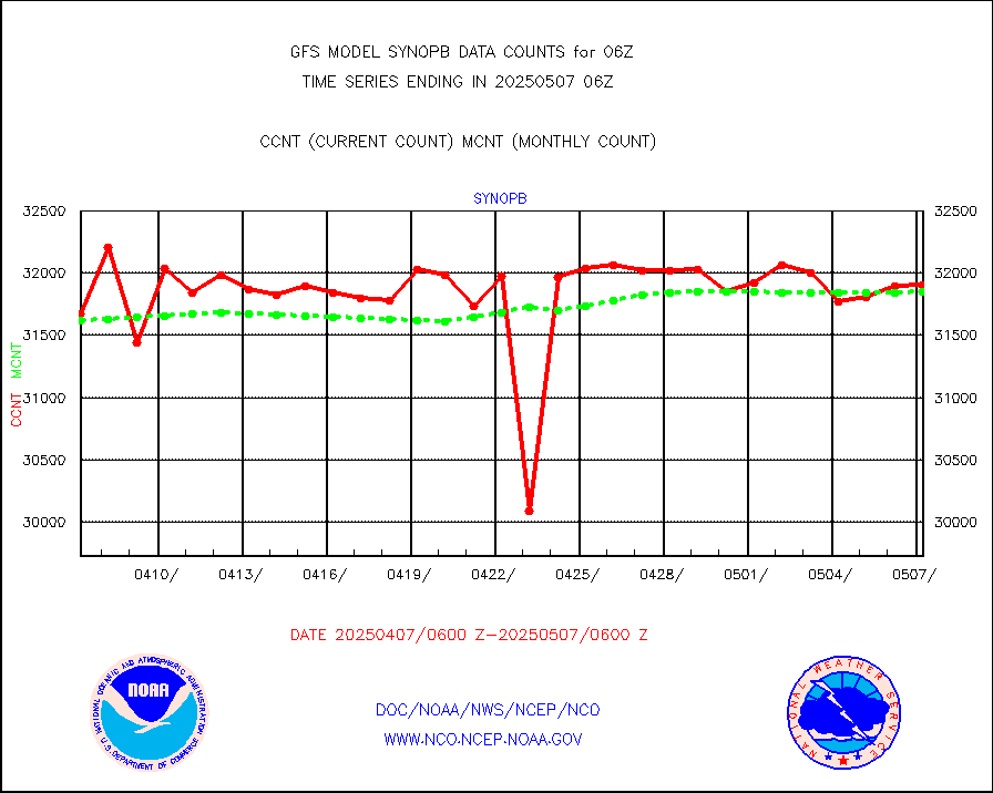
synopb |
Synoptic - fixed manual & auto (decoded fr BUFR) |
25190 |
31389 |
80.3 % |
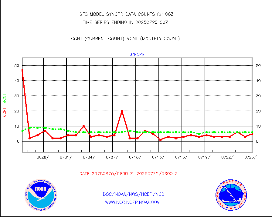
synopr |
Synoptic - restricted (WMO Res 40) manual & auto. |
3 |
7 |
42.9 % |
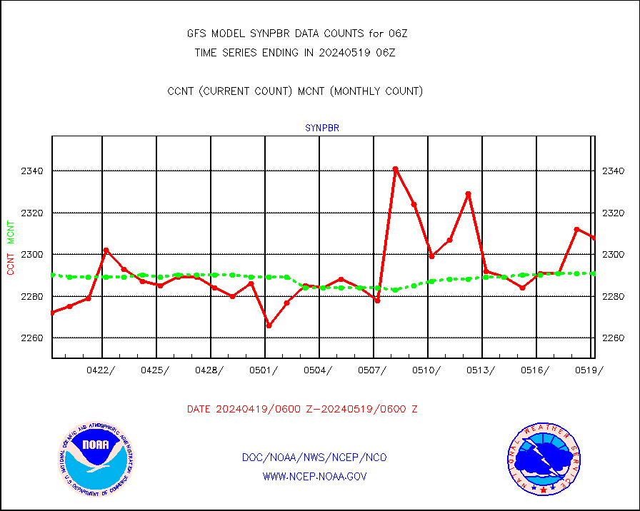
synpbr |
Synoptic - restricted (WMO Res 40)(decoded BUFR) |
2290 |
2289 |
100.0 % |
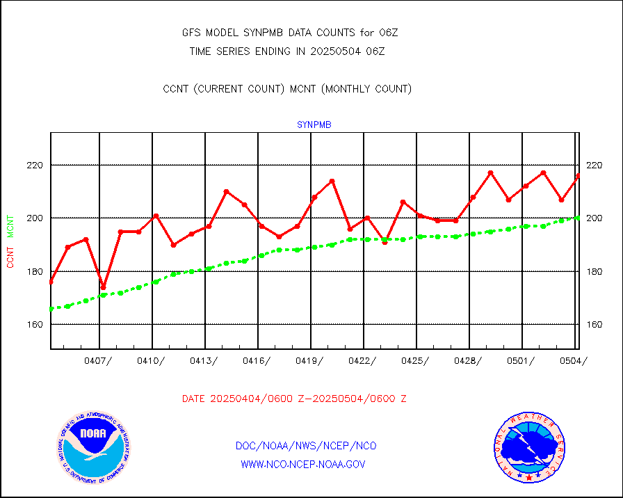
synpmb |
Synoptic - mobile manual & auto (decoded fr BUFR) |
19 |
28 |
67.9 % |
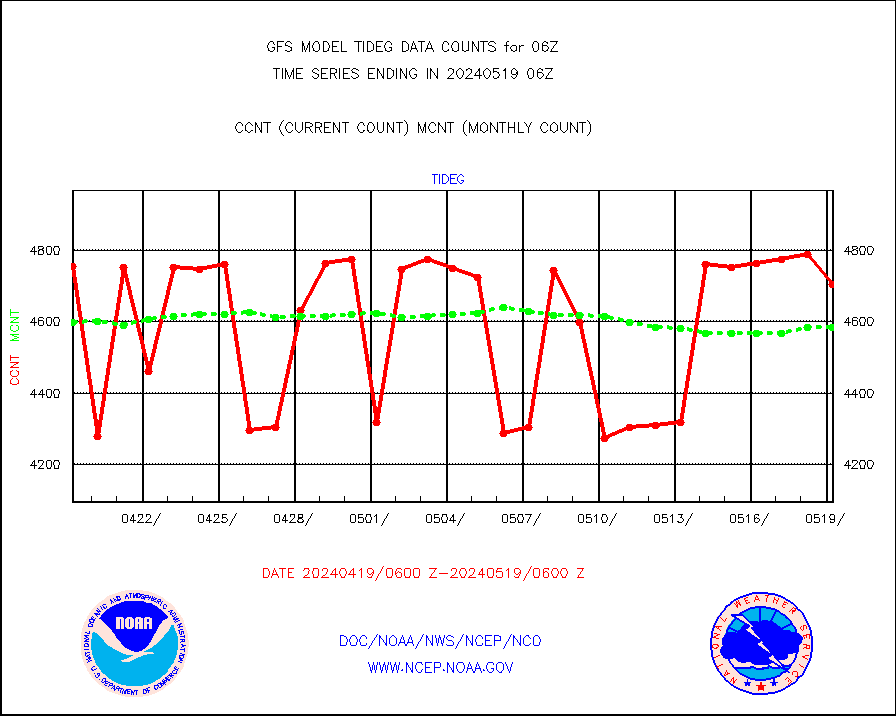
tideg |
Tide gauge reports decoded from CREX format |
4304 |
4605 |
93.5 % |
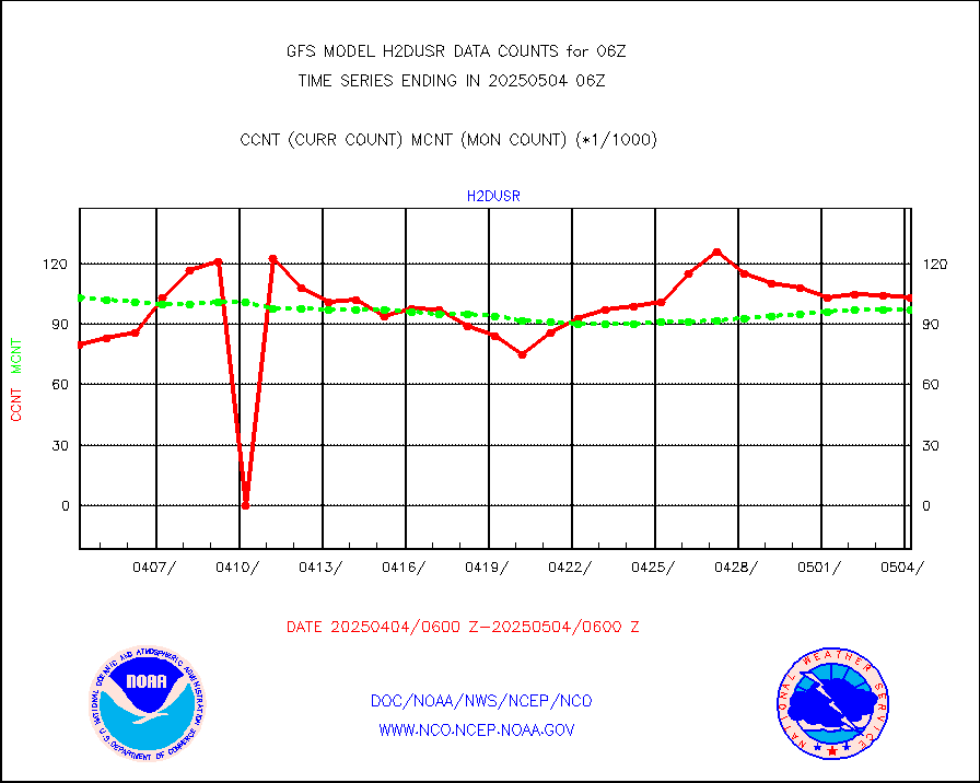
visja |
MTSAT/JMA visible derived cloud motion |
24010 |
28993 |
82.8 % |
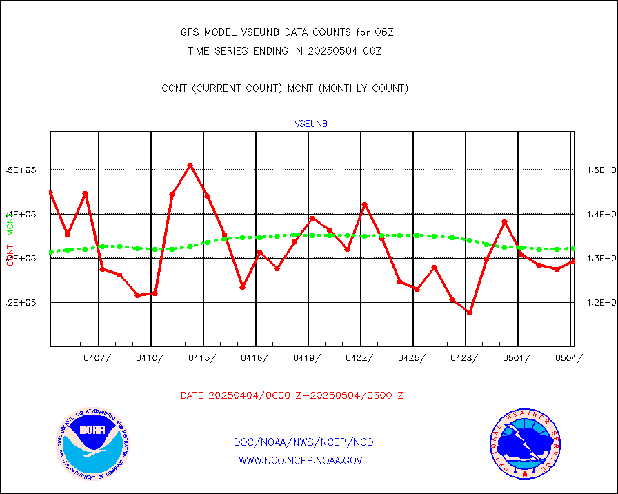
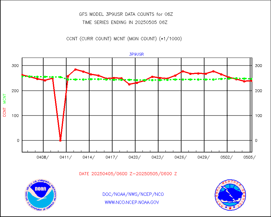
vseunb |
METEOSAT/EUMETSAT visible drv cld motion NBseq |
126945 |
123023 |
103.2 % |
| Data Types of Opportunity with Normal Counts |
|---|
| Type | Description | Hourly Count | Monthly Average | Percent (%) of Monthly Mean |
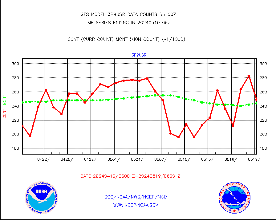
3p9usr |
GOES-16&up/NESDIS ir short-wv derived cld motion |
223163 |
244333 |
91.3 % |
acarsa |
MDCRS ACARS acft data (ARINC via AFWA)(AIREP fmt) |
0 |
0 |
n/a |
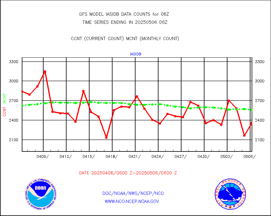
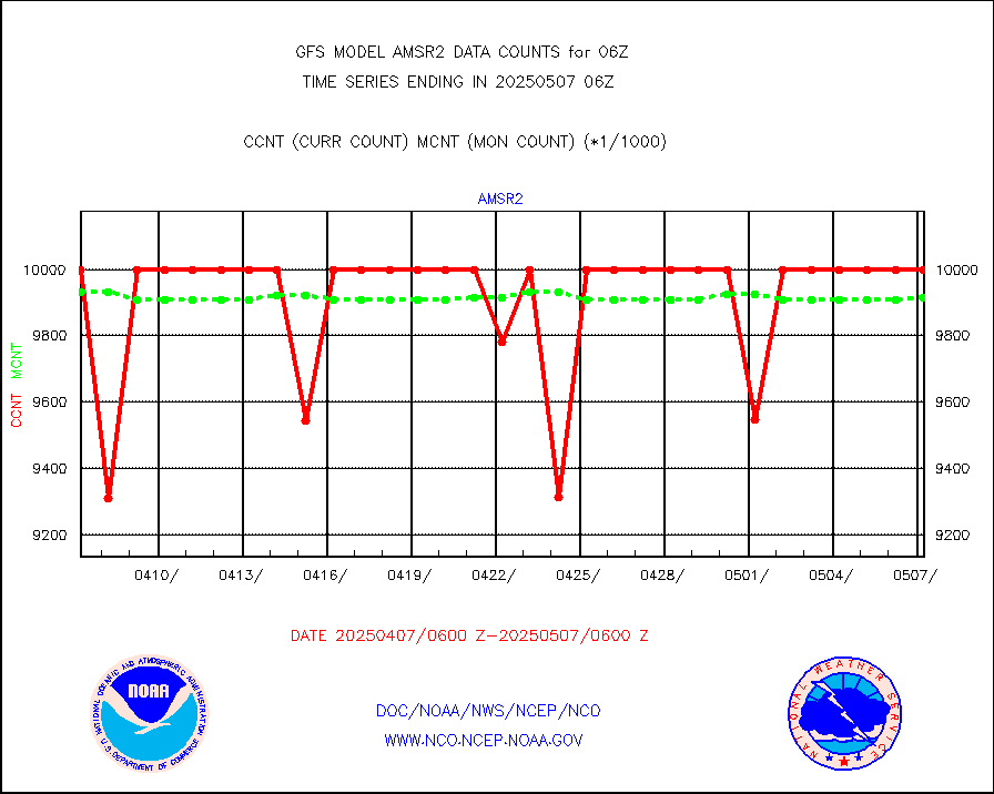
amsr2 |
GCOM-W AMSR2 1B brightness temperatures |
9999999 |
9861276 |
101.4 % |
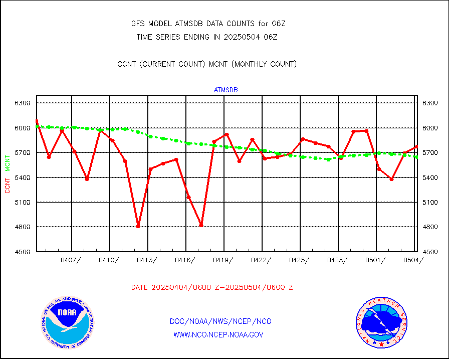
atmsdb |
NPP/NOAA-20 ATMS bright. temps-direct b-cast SSEC |
457969 |
429464 |
106.6 % |
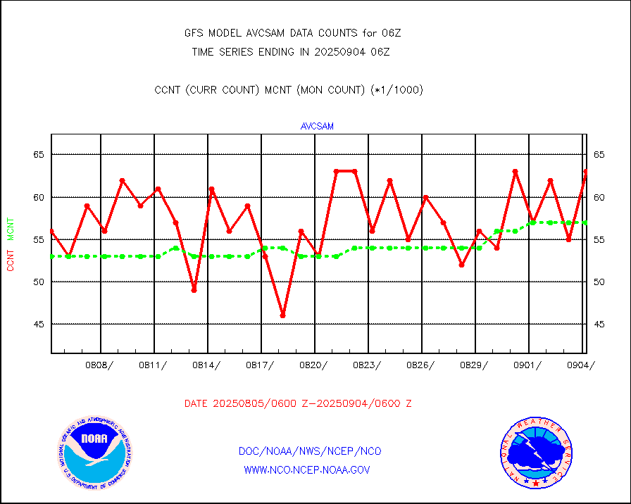
avcsam |
A.M.(N17,M2,M3) AVHRR GAC NCEP-proc clr&sea btmps |
6221125 |
6141752 |
101.3 % |
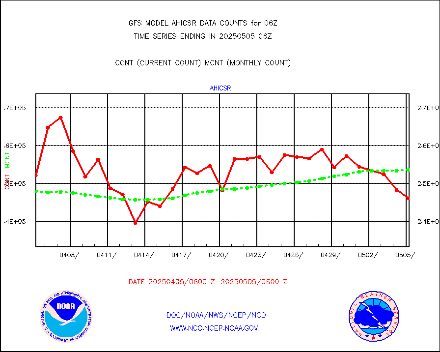
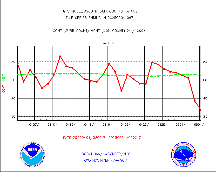
avcspm |
P.M.(N18-19) AVHRR GAC NCEP-proc clr & sea btemps |
5823884 |
6239602 |
93.3 % |
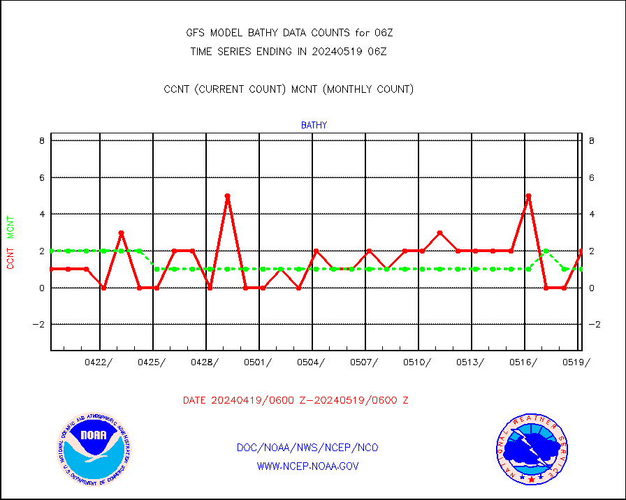
bathy |
eXpendable BathyThermograph, mooring (BATHY fmt) |
1 |
2 |
50.0 % |
camdar |
Canadian AMDAR aircraft data (decoded from BUFR) |
0 |
0 |
n/a |
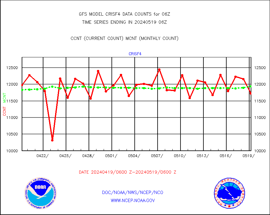
crisf4 |
NPP/NOAA-20 CrIS full spctrl radn (431 ch subset) |
1154556 |
1188234 |
97.2 % |
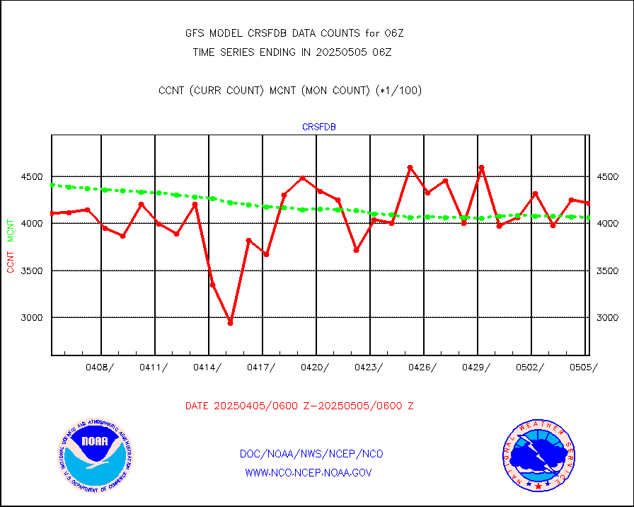
crsfdb |
NPP/NOAA-20 CrIS full spctrl radn dir brdcst SSEC |
574559 |
567693 |
101.2 % |
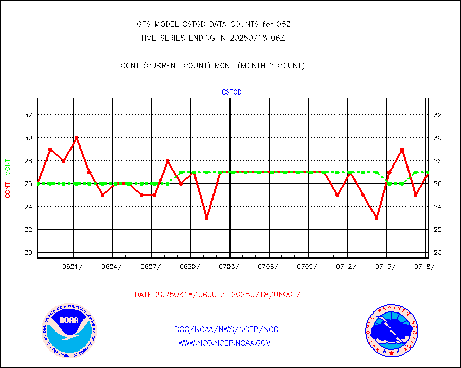
cstgd |
Coast Guard |
22 |
17 |
129.4 % |
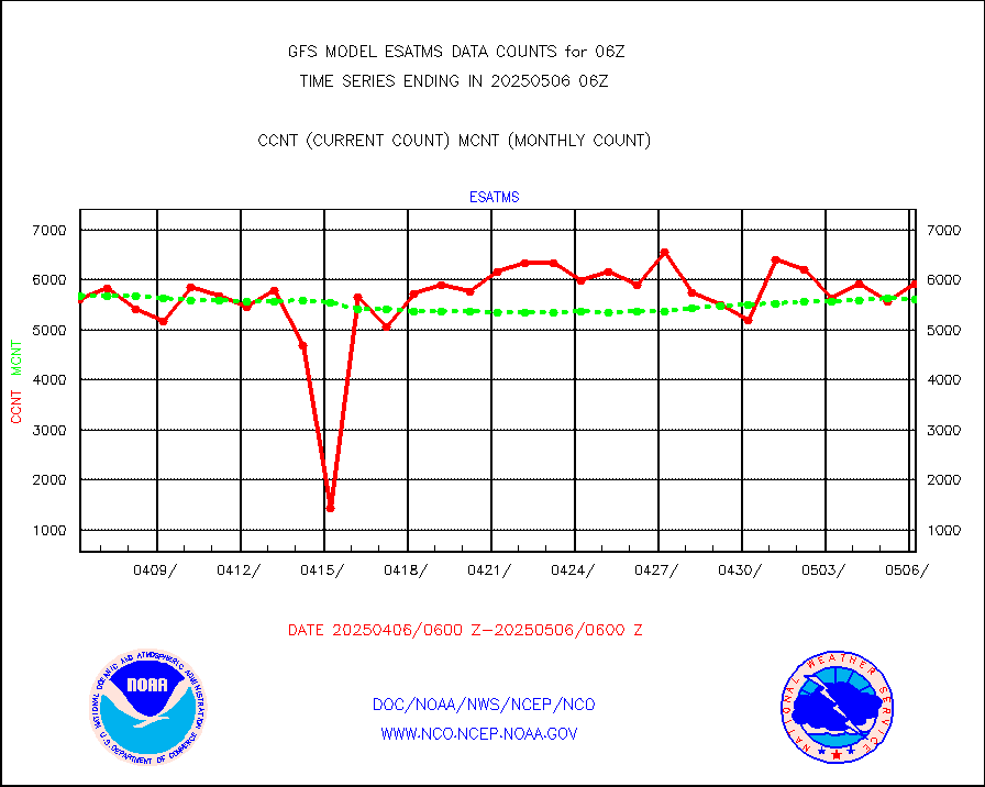
esatms |
NPP Adv. Tech. MW Sndr (ATMS) br. temps from RARS |
576160 |
565802 |
101.8 % |
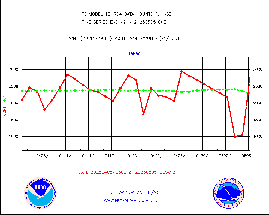
esiasi |
METOP 1-2 IASI 1C radiance data vbl chn from RARS |
161565 |
159302 |
101.4 % |
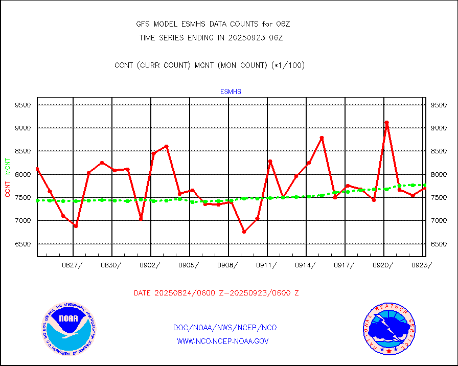
esmhs |
NOAA 18-19 & METOP 1-2 MHS proc. btemps from RARS |
1054376 |
1042308 |
101.2 % |
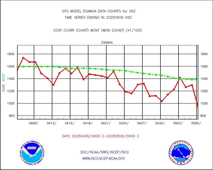
geoimr |
GOES/NESDIS (11x17 f-o-v) imager clear radiances |
0 |
0 |
n/a |
gmi1cr |
GPM GMI Level 1C-R brightness temperatures |
4652492 |
4581478 |
101.6 % |
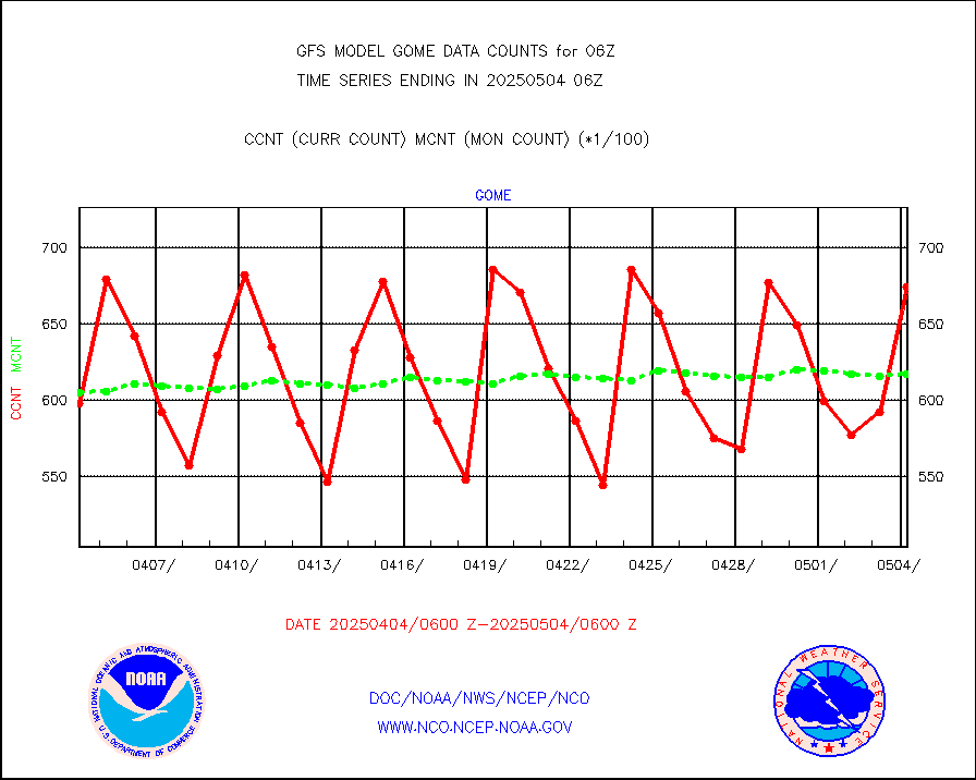
gnss |
Grnd-based Gbl Navigation Sat System (GNSS) data |
6098 |
4787 |
127.4 % |
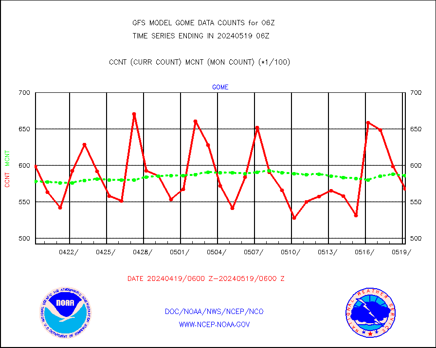
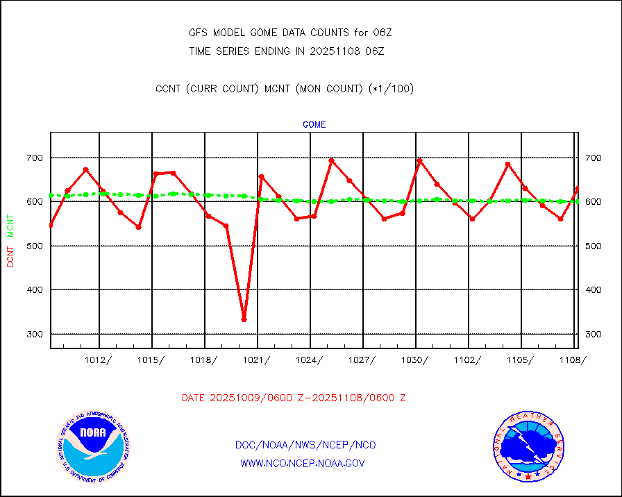
gome |
METOP 1-2 Global Ozone Monitoring Exp.-2 (GOME-2) |
56119 |
57484 |
97.6 % |
h20in |
INSAT/KALPANA India wvpr derived cloud motion |
0 |
0 |
n/a |
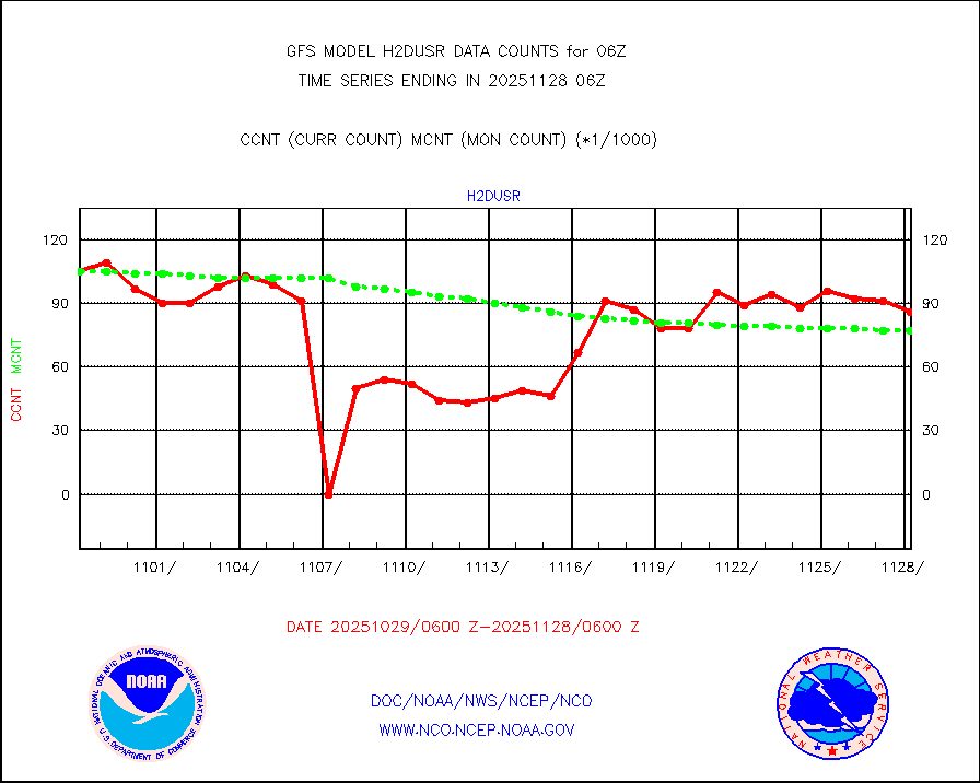
h2dusr |
GOES-16&up/NESDIS wv imgr/deep-lyr derivd cld mtn |
94607 |
87992 |
107.5 % |
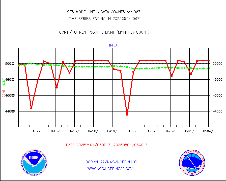
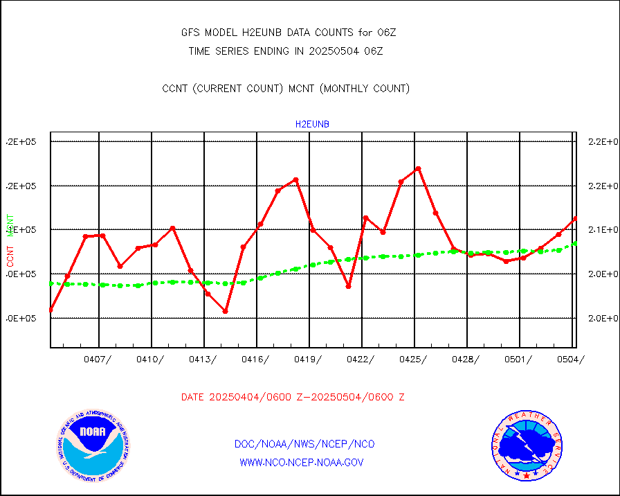
h2eunb |
METEOSAT/EUMETSAT wvpr imgr drv cld motion NBseq |
206967 |
209116 |
99.0 % |
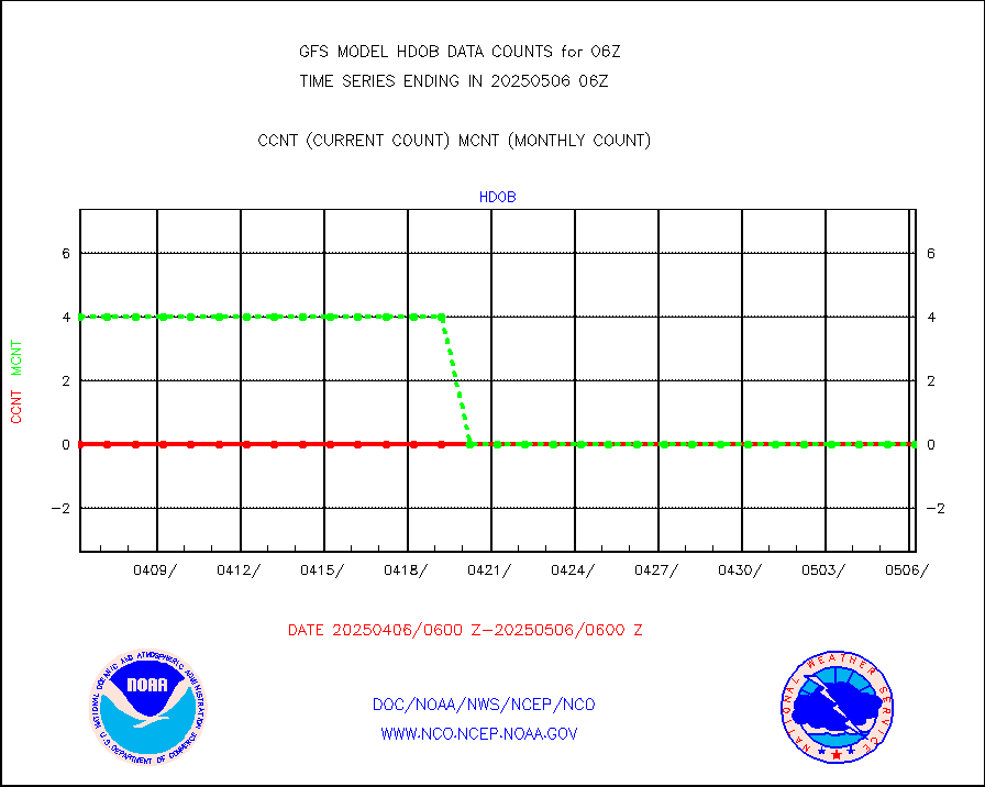
hdob |
High Density OBs from reconnaissance acft data |
0 |
0 |
n/a |
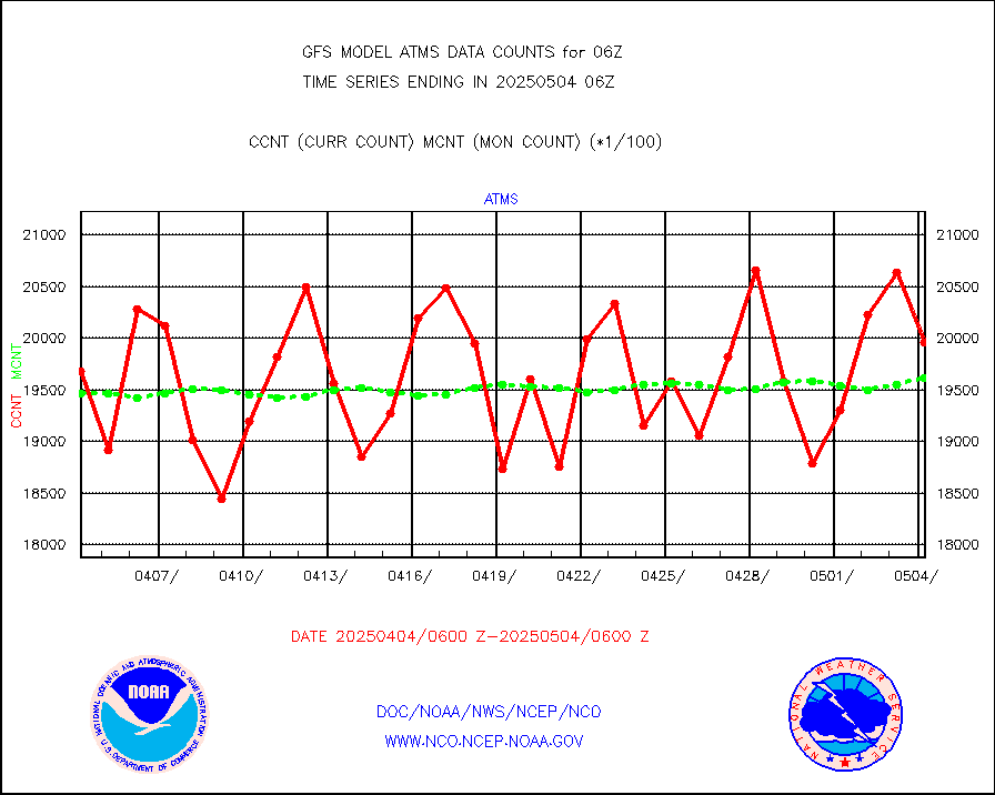
iasidb |
METOP 1-2 IASI 1C radiances-direct broadcast SSEC |
217123 |
186877 |
116.2 % |
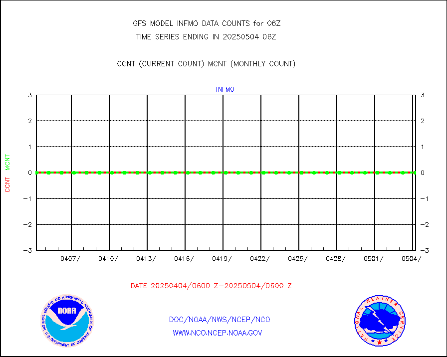
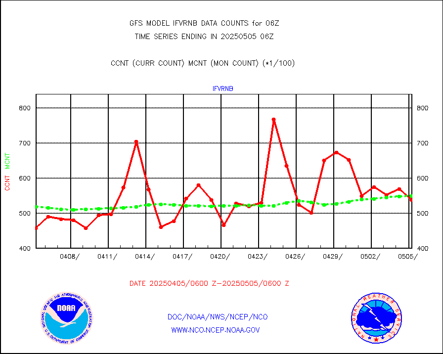
ifvrnb |
VIIRS (NPP/NOAA-20) ir lg-wv drv cloud motion(NB) |
53173 |
49630 |
107.1 % |
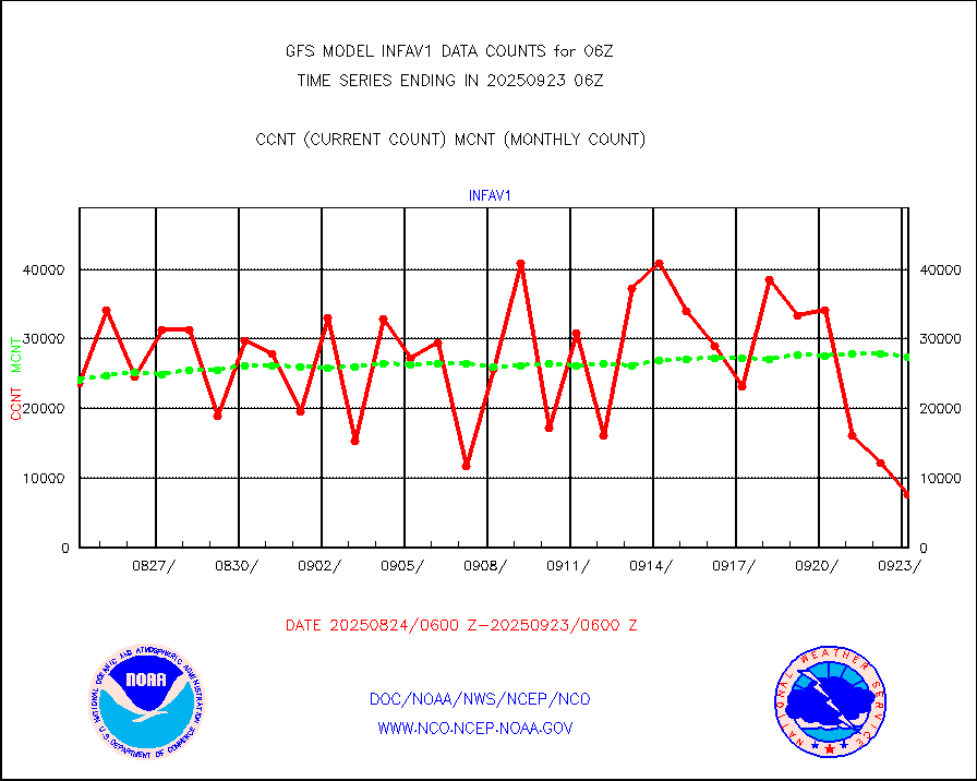
infav1 |
AVHRR (METOP) ir lg-wave derived cld motion |
23611 |
17077 |
138.3 % |
infin |
INSAT/KALPANA India ir lg-wave derived cld motion |
0 |
0 |
n/a |
kamdar |
Korean AMDAR aircraft data (decoded from BUFR) |
509 |
437 |
116.5 % |
mbuoyb |
Moored buoys (decoded from BUFR) |
4942 |
4794 |
103.1 % |
nxrdw2 |
NEXRAD Vel Azm Dsp(VAD) winds via Level 2 decoder |
4310 |
3458 |
124.6 % |
ompslp |
OMPS Limb Profiler ozone data (NPP) |
930 |
755 |
123.2 % |
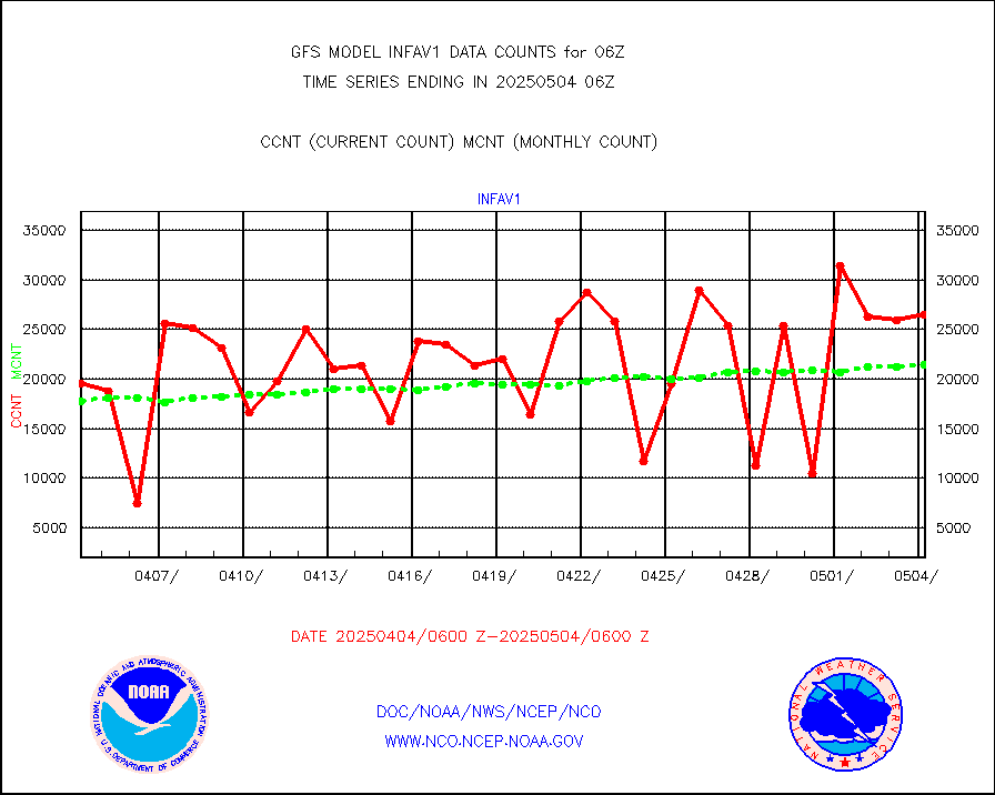
ompsn8 |
OMPS nadir profile ozone (Version 8 BUFR) |
2714 |
2419 |
112.2 % |
ompst8 |
OMPS total column ozone (Version 8 BUFR) |
1902625 |
1767861 |
107.6 % |
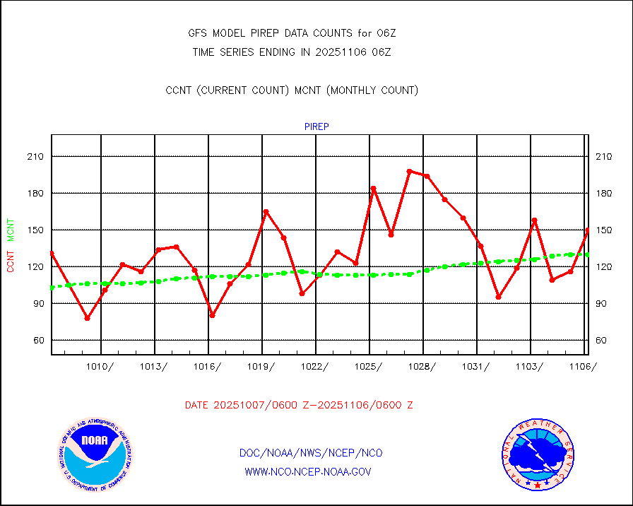
pirep |
Manual PIREP aircraft data (dcded from AIREP fmt) |
94 |
139 |
67.6 % |
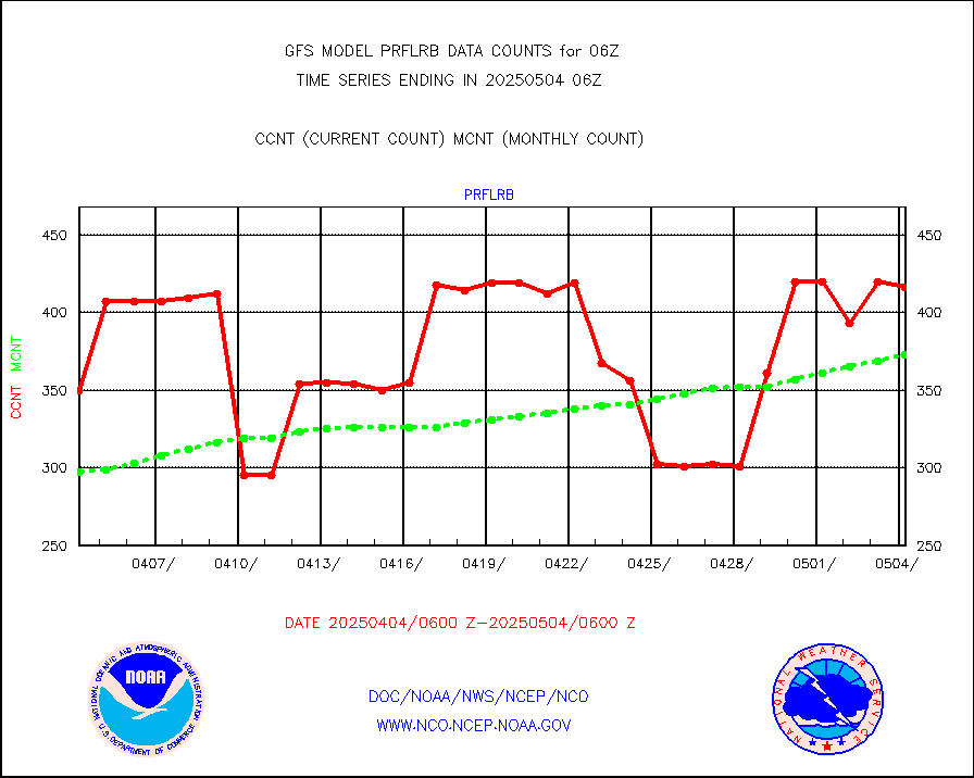
prflrb |
Multi-Agency Profiler (MAP) and SODAR winds |
242 |
322 |
75.2 % |
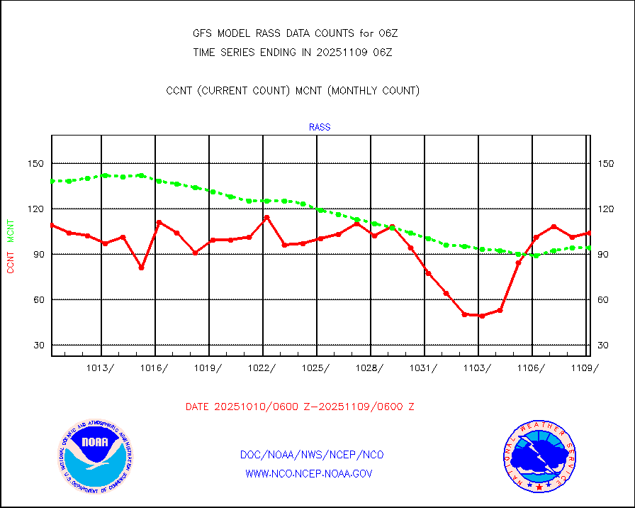
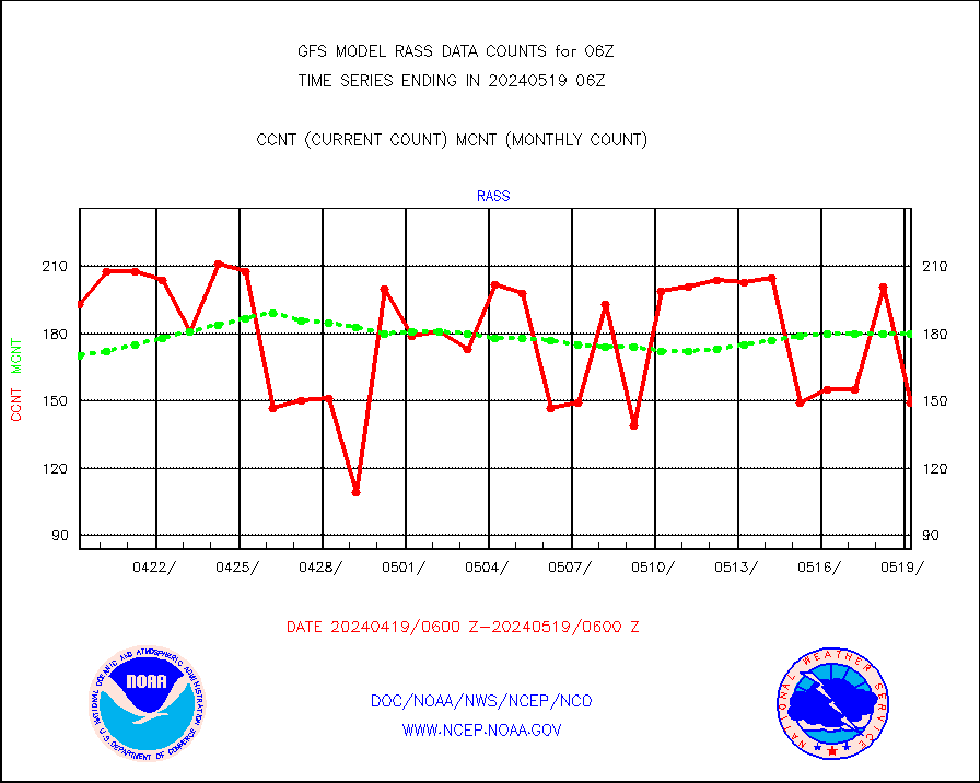
rass |
RASS temperatures (NOAA and Multi-Agency) |
149 |
166 |
89.8 % |
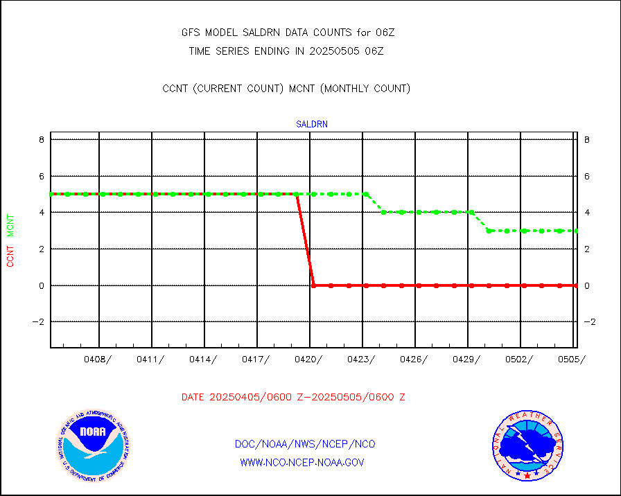
saldrn |
Surface Marine Saildrone (decoded from BUFR) |
5 |
5 |
100.0 % |
saphir |
Megha-Tropiques SAPHIR L1A2 brightness temps |
0 |
0 |
n/a |
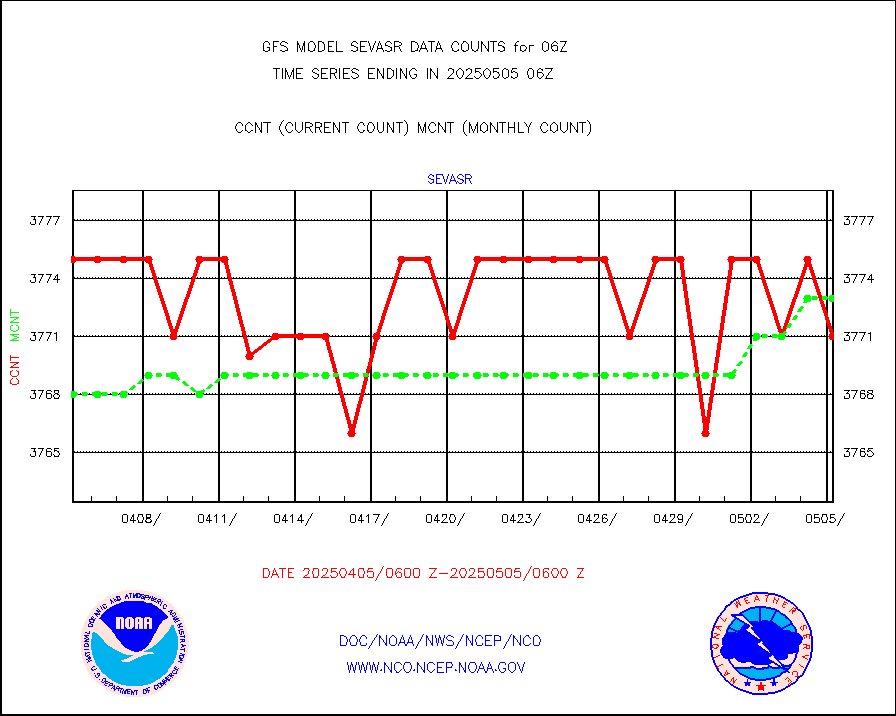
sevasr |
METEOSAT-10 2nd Gen SEVIRI All Sky Radiance(proc) |
377110 |
377252 |
100.0 % |
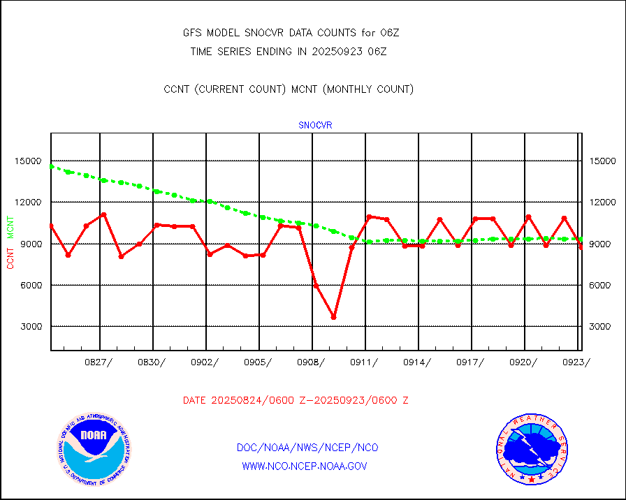
snocvr |
NOW COVER, DEPTH/DENSITY AND WATER EQUIVALENT |
22916 |
22535 |
101.7 % |
ssmisu |
DMSP SSM/IS 1C radiance data (Unified Pre-Proc.) |
860700 |
1009651 |
85.2 % |
sstvcw |
NPP/NOAA-20 VIIRS SST - CLEAR & OVER WATER |
9999999 |
7000009 |
142.9 % |
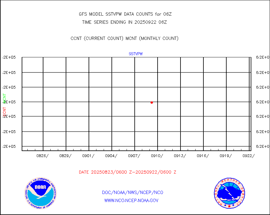
sstvpw |
NPP/NOAA-20 VIIRS SST - PROBABLY CLR & OVER WATER |
9999999 |
9999999 |
100.0 % |
subpfl |
Sub-surface float and glider profile (BUFR) |
31 |
61 |
50.8 % |
synop |
Synoptic - fixed manual and automatic |
7362 |
7818 |
94.2 % |
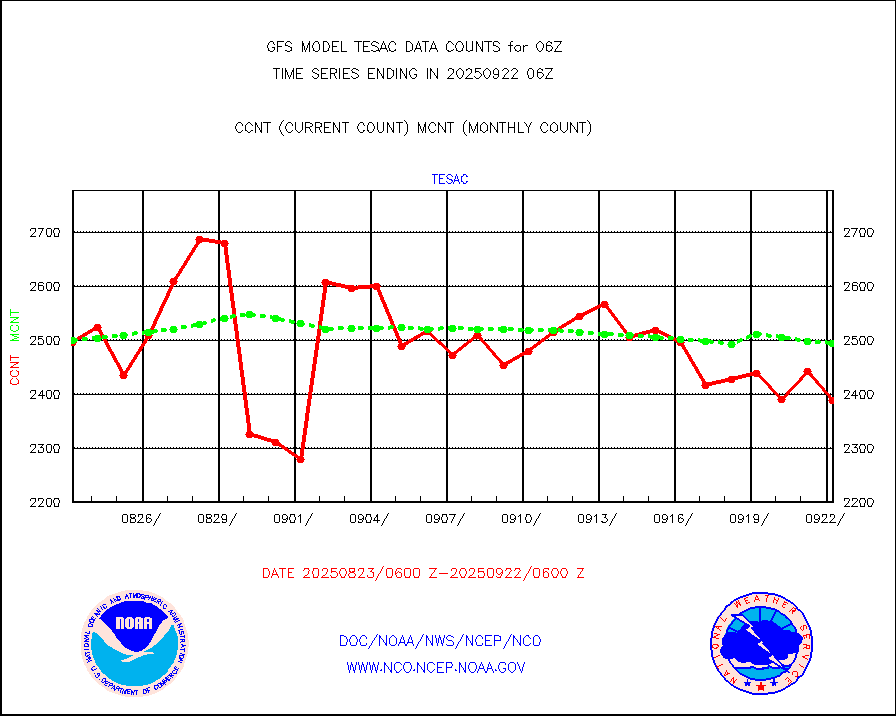
tesac |
CTD probe, Argo prflng float, mooring (TESAC fmt) |
1820 |
1841 |
98.9 % |
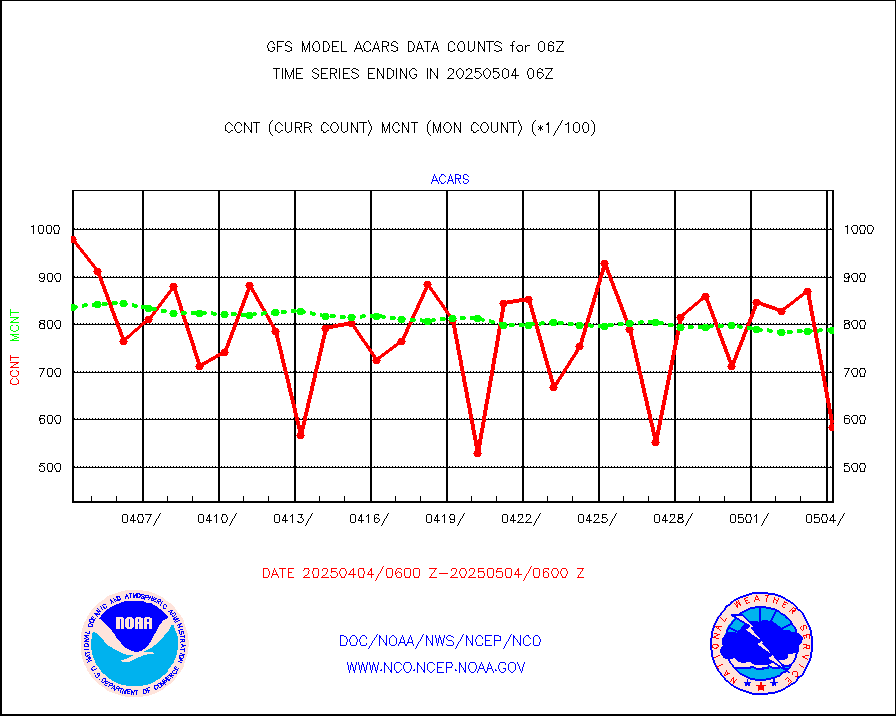
tmdara |
TAMDAR aircft data-all types(from Panasonic,BUFR) |
2509 |
2481 |
101.1 % |
trkob |
ThermoSalinoGraph (TSG) TRACKOB format) |
319 |
338 |
94.4 % |
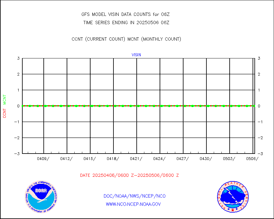
visin |
INSAT/KALPANA India visible derived cloud motion |
0 |
0 |
n/a |
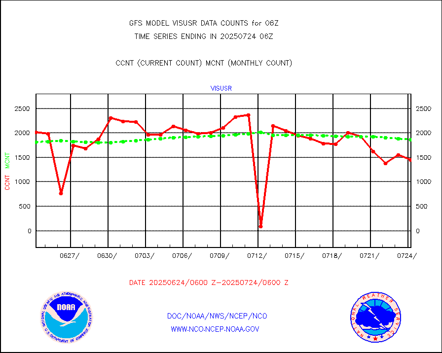
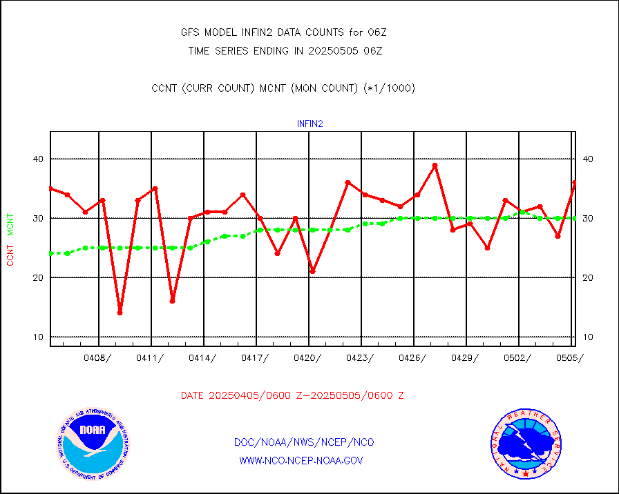
visusr |
GOES-16&up/NESDIS visible derived cloud motion |
201814 |
150320 |
134.3 % |


