| Critical Data with Normal Counts |
|---|
| Type | Description | Hourly Count | Monthly Average | Percent (%) of Monthly Mean |
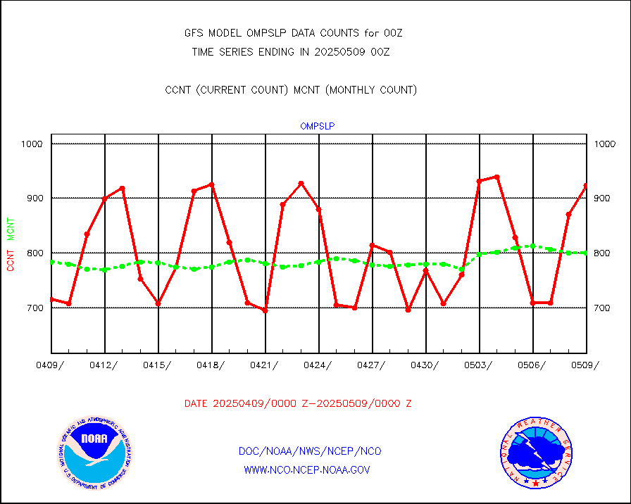
1bamua |
NOAA 15-19 & METOP 1-2 AMSU-A NCEP-proc. br.temps |
274758 |
270056 |
101.7 % |
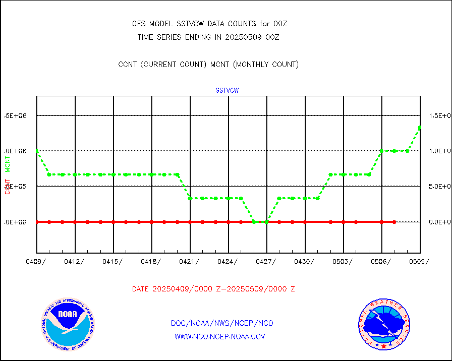
1bhrs4 |
NOAA 18-19 & METOP 1-2 HIRS-4 NCEP-proc. br.temps |
263946 |
228755 |
115.4 % |
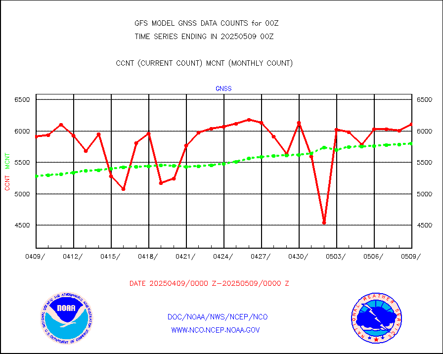
1bmhs |
NOAA 18-19 & METOP 1-2 MHS NCEP-proces. br. temps |
1764875 |
1569696 |
112.4 % |
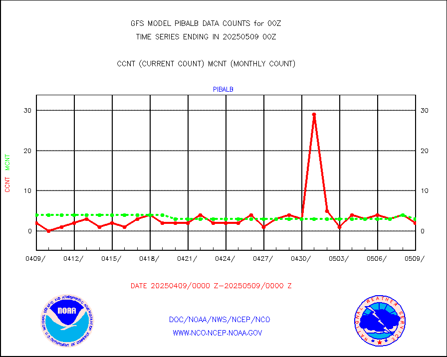
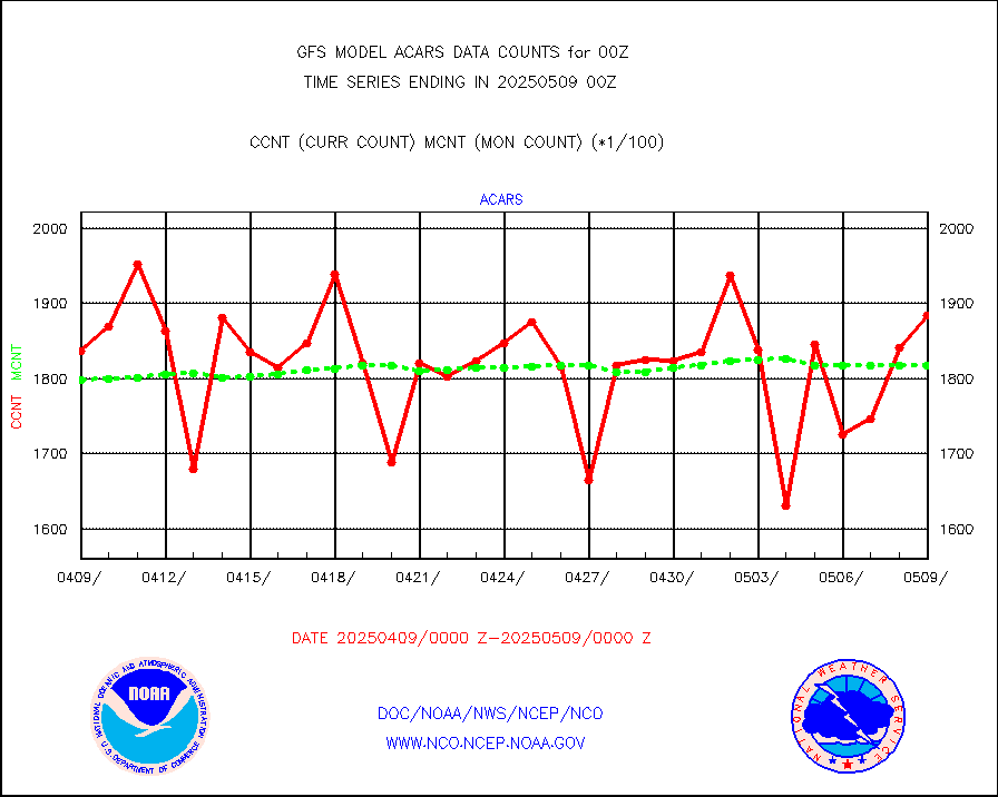
acars |
MDCRS ACARS acft data from ARINC(dcded from BUFR) |
159076 |
131673 |
120.8 % |
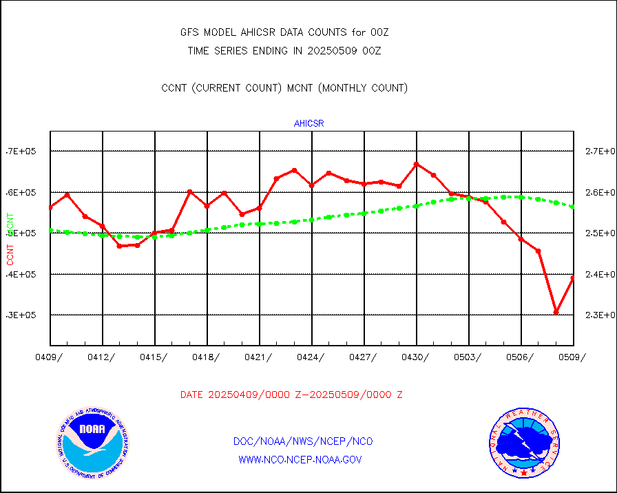
ahicsr |
Himawari Clear Sky Radiance |
262688 |
266724 |
98.5 % |
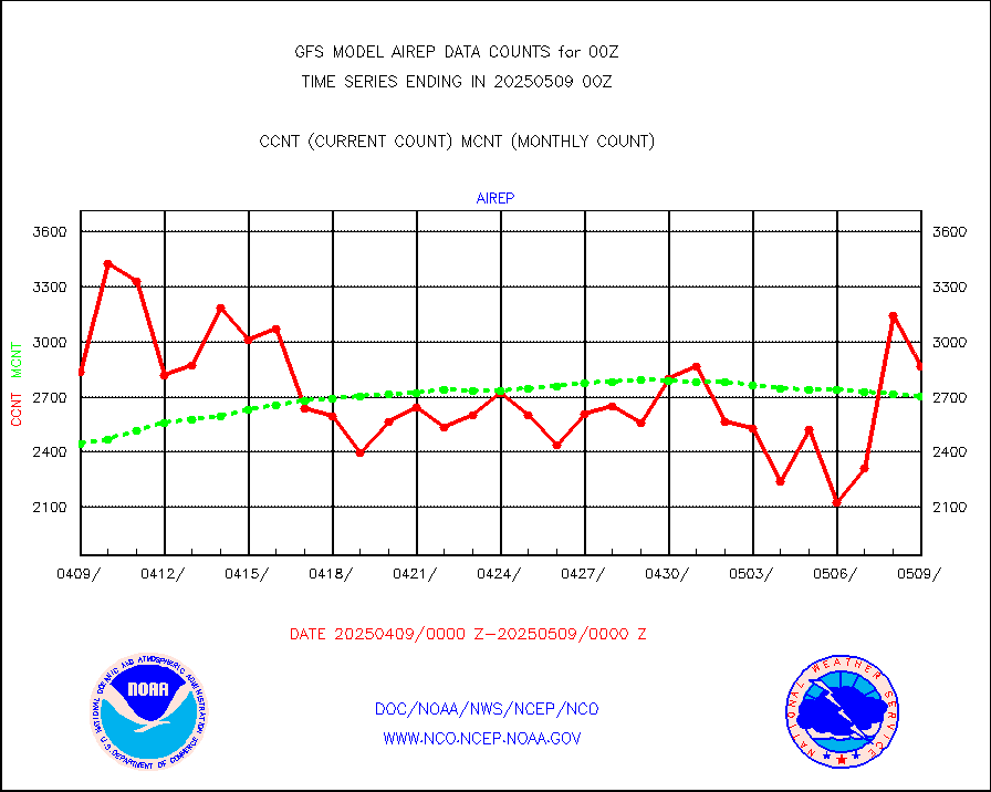
airep |
Manual AIREP aircraft data (dcded from AIREP fmt) |
4669 |
3831 |
121.9 % |
airsev |
AQUA AIRS/AMSU-A/HSB brightness temps- every FOV |
0 |
0 |
n/a |
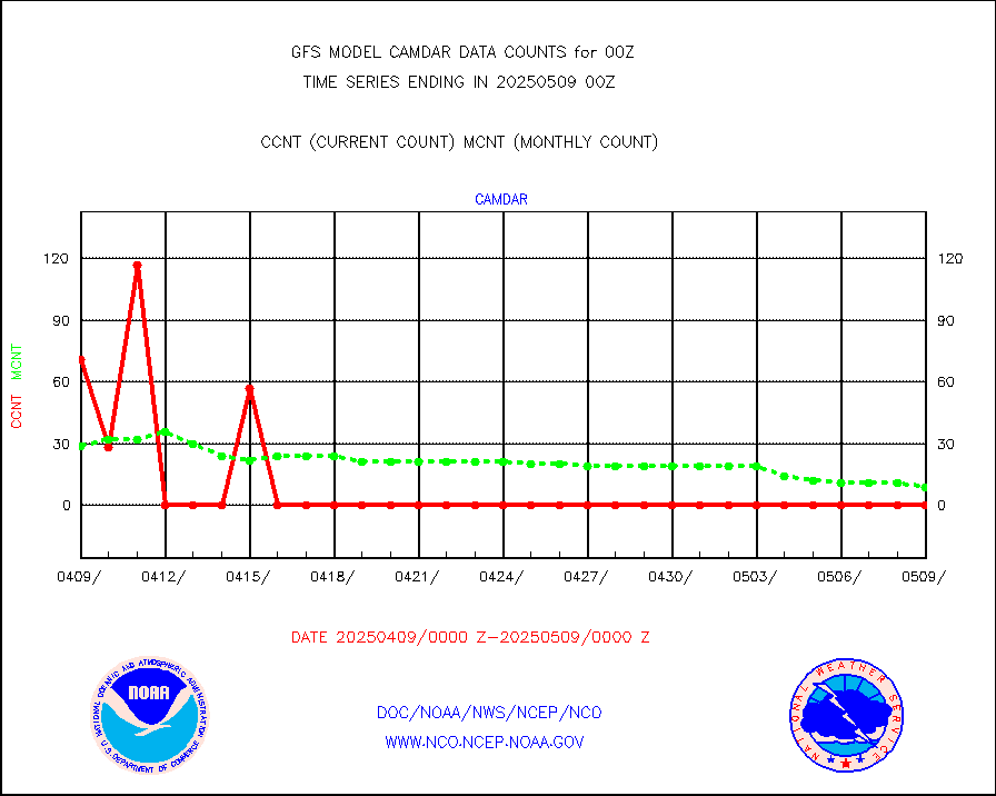
amdar |
AMDAR aircraft data (decoded from AMDAR format) |
3941 |
3683 |
107.0 % |
amdarb |
AMDAR aircraft data (decoded from BUFR) |
7554 |
7418 |
101.8 % |
ascat |
METOP 1-2 ASCAT products |
348936 |
340161 |
102.6 % |
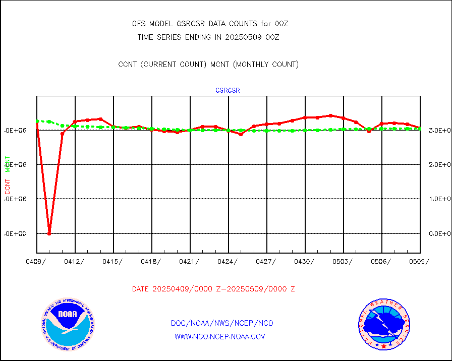
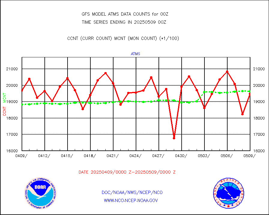
atms |
NPP/NOAA-20 ATMS brightness temperatures |
1924986 |
1939992 |
99.2 % |
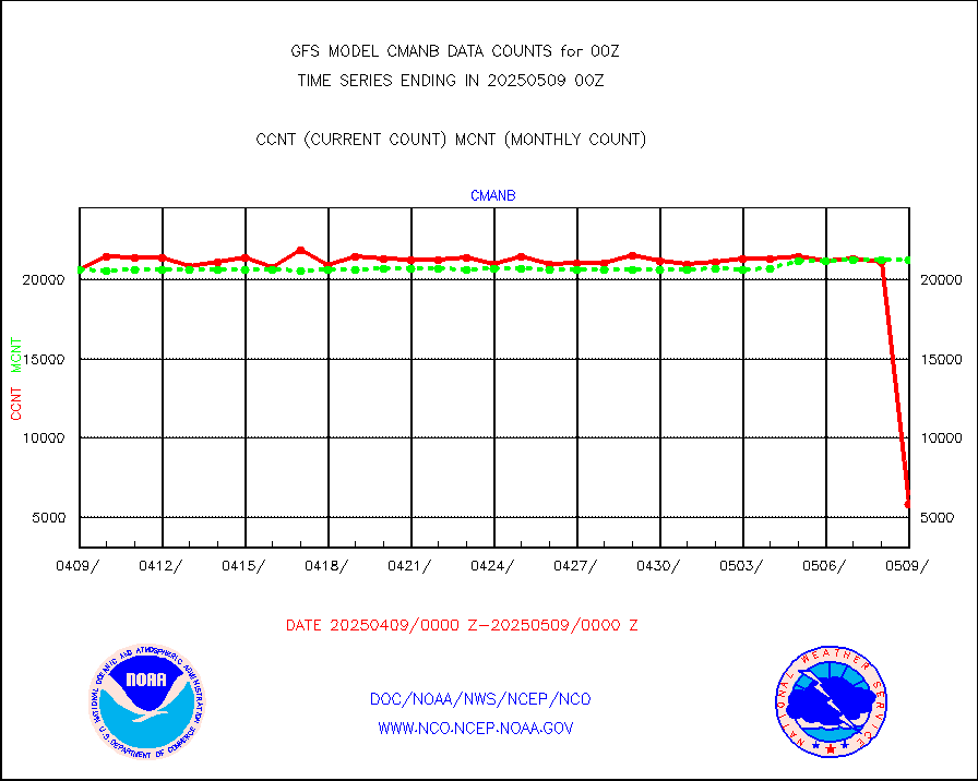
cmanb |
Surface Marine CMAN rpts decoded from BUFR format |
20943 |
21177 |
98.9 % |
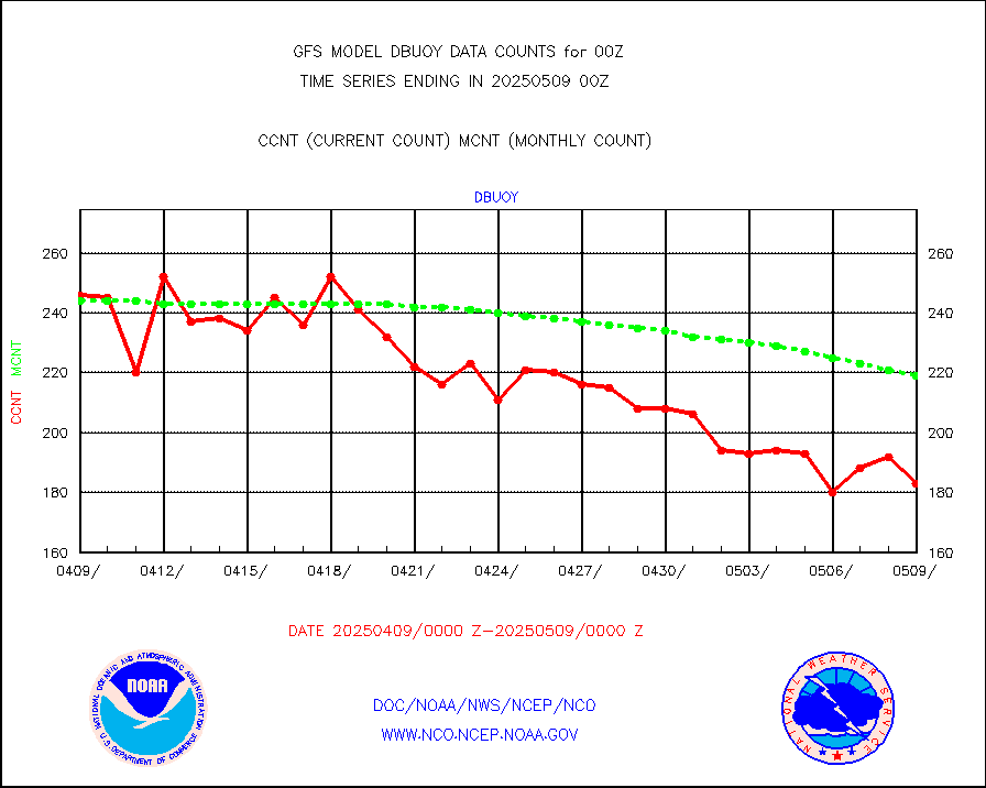
dbuoy |
Buoys decoded from FM-18 fmt (moored or drifting) |
295 |
282 |
104.6 % |
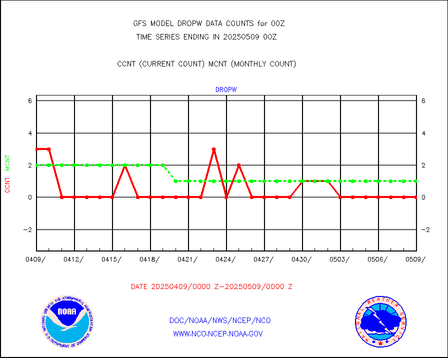
dropw |
Dropwinsonde (from TEMP DROP) |
0 |
1 |
0.0 % |
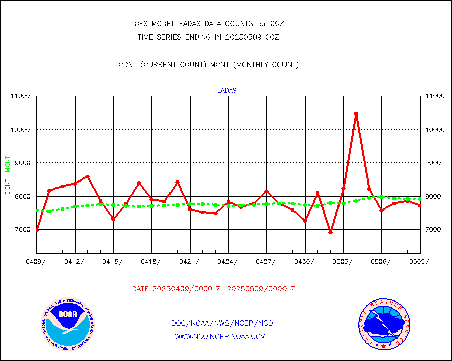
eadas |
E-AMDAR (European AMDAR acft decoded from BUFR) |
5748 |
5791 |
99.3 % |
esamua |
NOAA 15-19 & METOP 1-2 AMSU-A proc btmps frm RARS |
300550 |
272449 |
110.3 % |
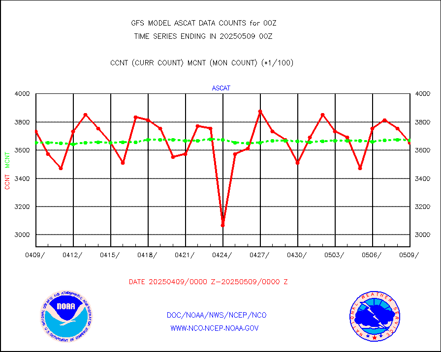
eshrs3 |
NOAA 15-19 & METOP 1-2 HIRS-3/4 pr btmps frm RARS |
679901 |
630773 |
107.8 % |
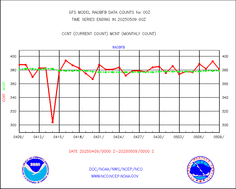
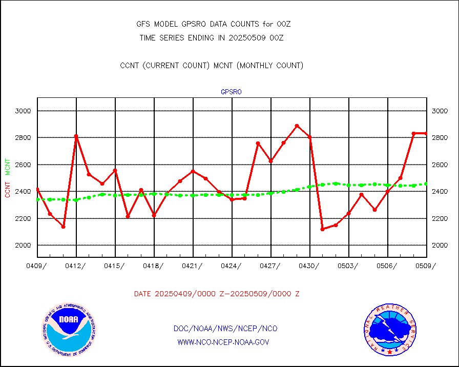
gpsro |
GPS radio occultation data |
2602 |
2090 |
124.5 % |
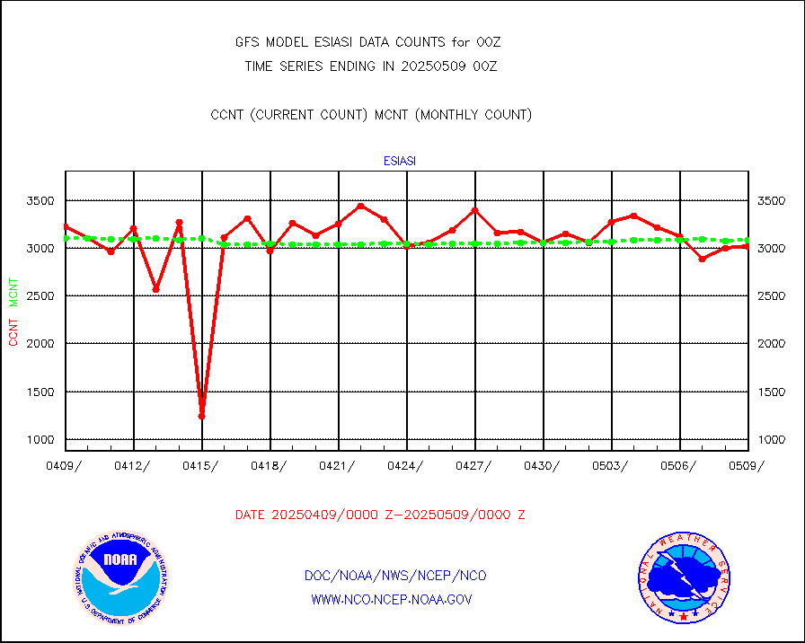
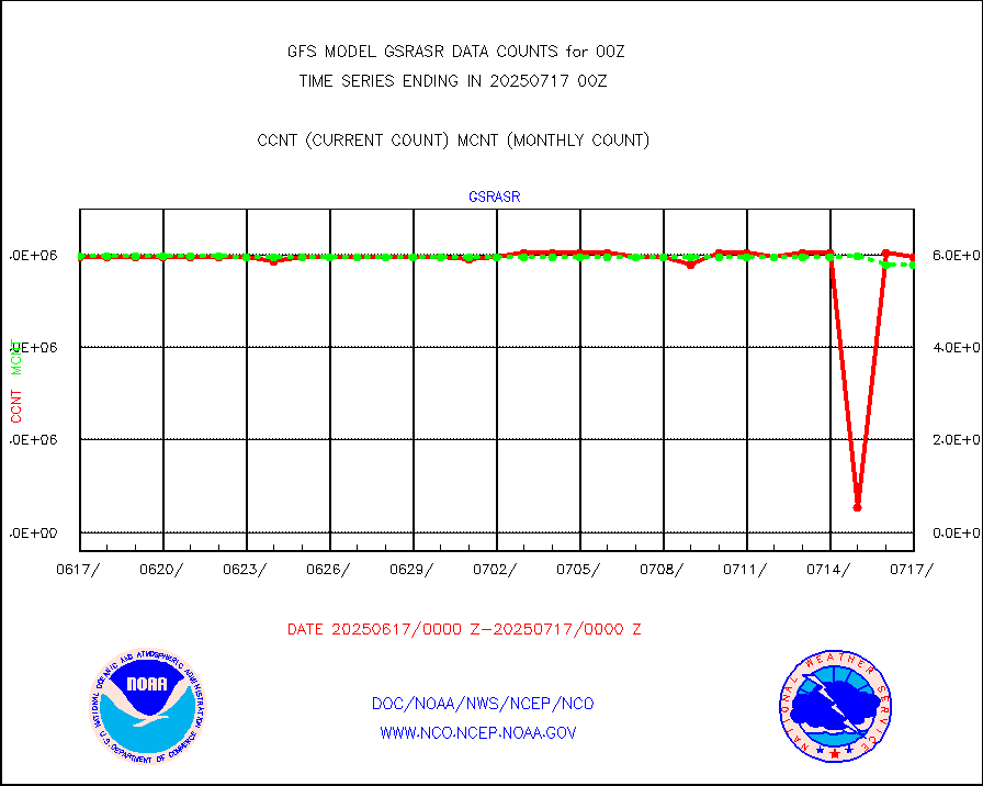
gsrasr |
GOES-16/17 All Sky Radiances (proc.) |
5947854 |
5941337 |
100.1 % |
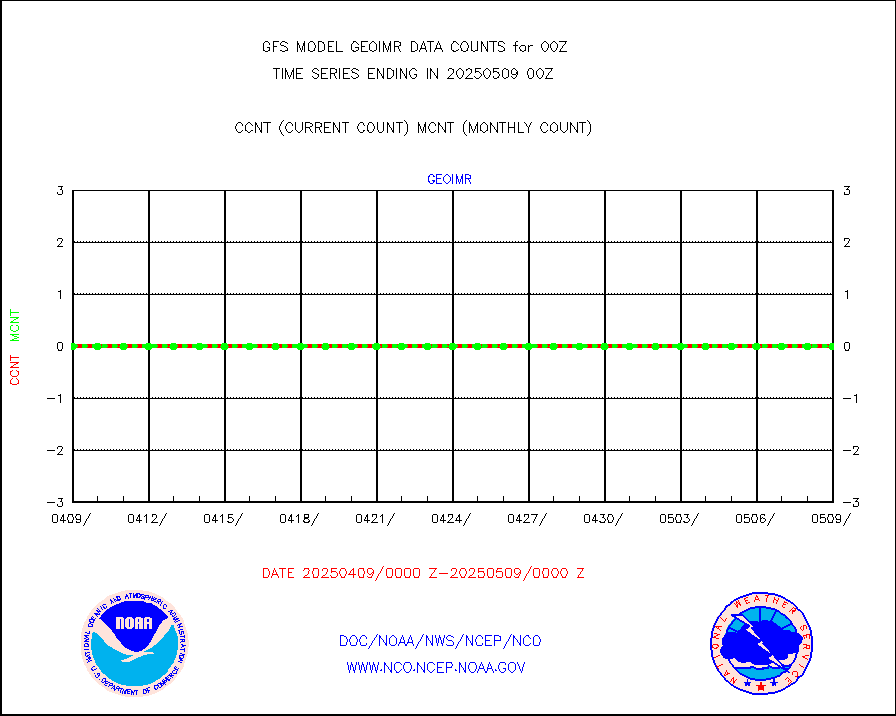
gsrcsr |
GOES-16/17 Clear Sky Radiances (proc.) |
3117566 |
2987872 |
104.3 % |
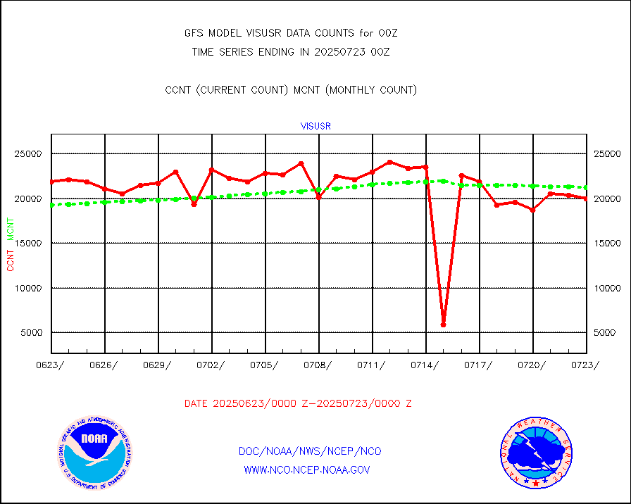
h20ja |
MTSAT/JMA water vapor imager derived cloud motion |
57747 |
57669 |
100.1 % |
h20mo |
MODIS (AQUA/TERRA) wvpr imager derived cld motion |
0 |
0 |
n/a |
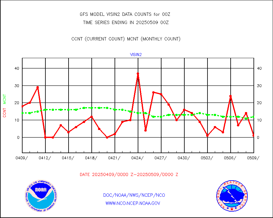
h2tusr |
GOES-16&up/NESDIS wv imgr/cld-top derived cld mtn |
179534 |
181175 |
99.1 % |
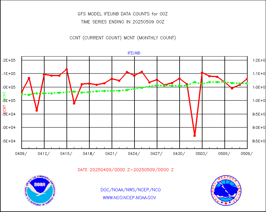
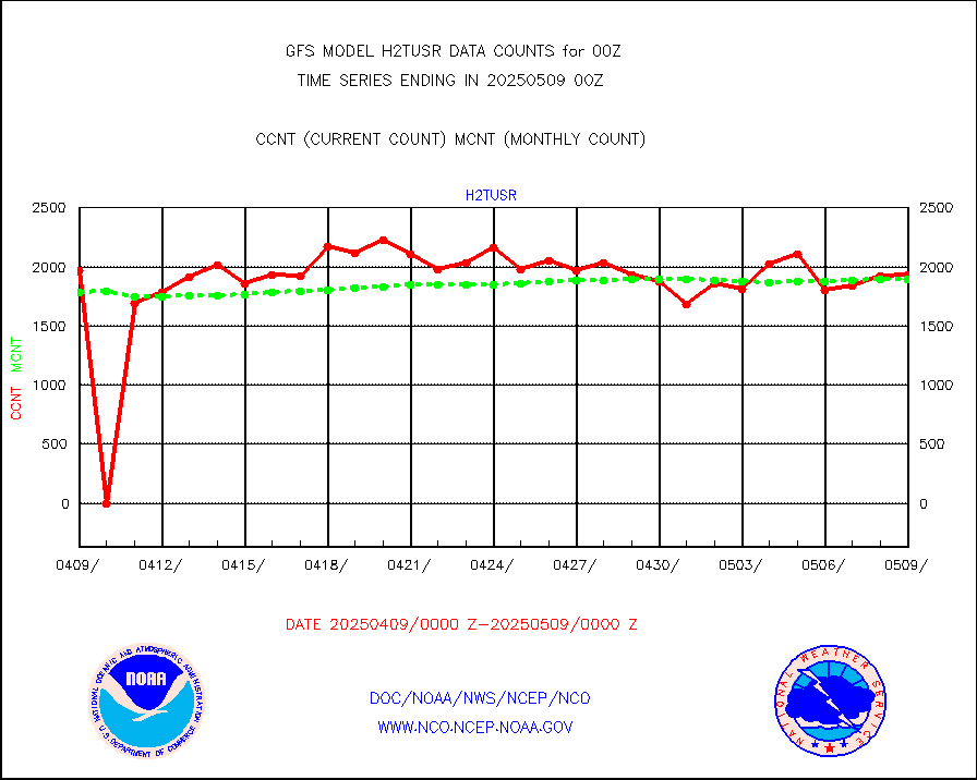
ifeunb |
METEOSAT/EUMETSAT ir lg-wave drv cld motion NBseq |
109615 |
107597 |
101.9 % |
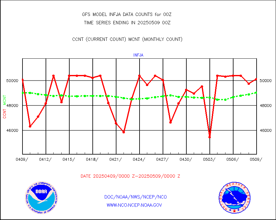
infja |
MTSAT/JMA infrared long-wave derived cloud motion |
50291 |
48097 |
104.6 % |
infmo |
MODIS (AQUA/TERRA) ir l-wave derived cloud motion |
0 |
0 |
n/a |
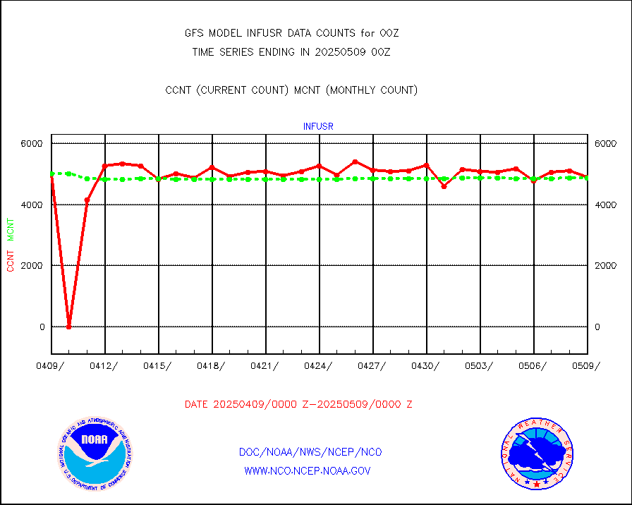
infusr |
GOES-16&up/NESDIS ir long-wave derived cld motion |
513752 |
494037 |
104.0 % |
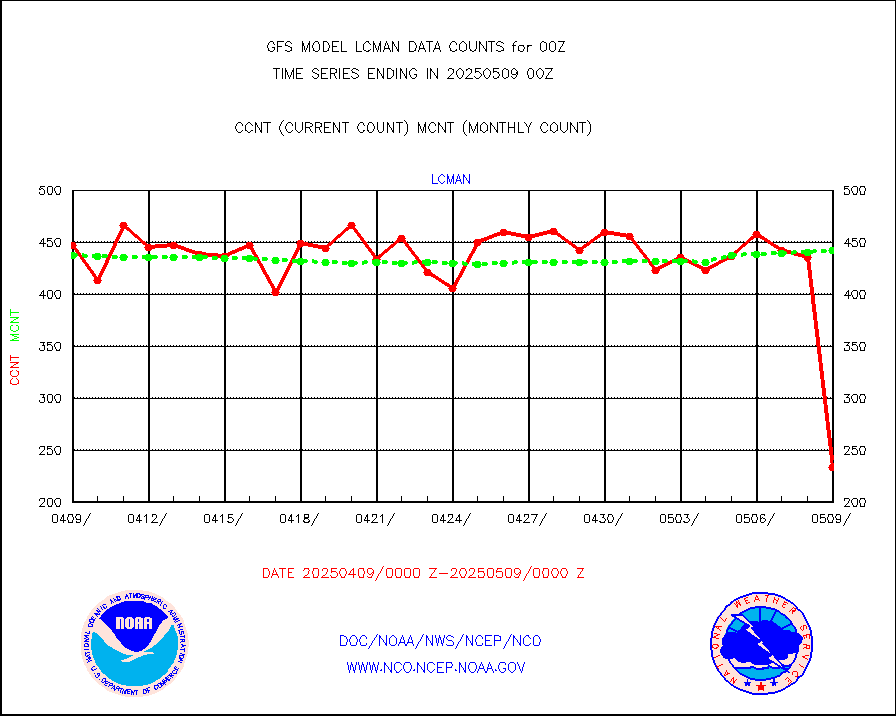
lcman |
Land-based CMAN stations decoded from CMAN format |
563 |
517 |
108.9 % |
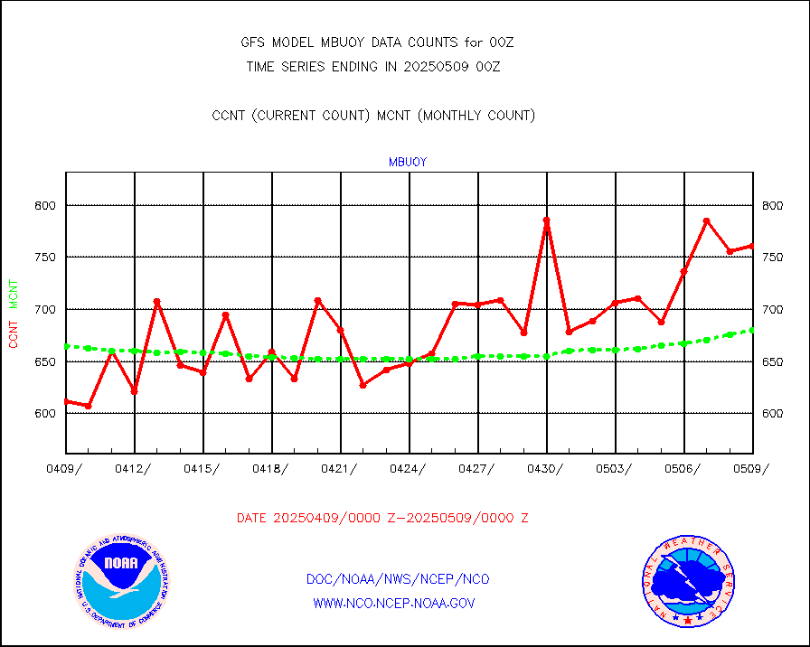
mbuoy |
Buoys decoded from FM-13 format (moored) |
805 |
745 |
108.1 % |
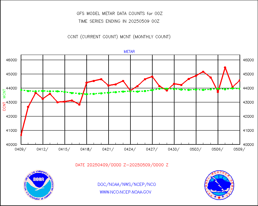
metar |
Aviation - METAR |
43476 |
43852 |
99.1 % |
mtiasi |
METOP 1-2 IASI 1C radiance data (varbl. channels) |
477836 |
452467 |
105.6 % |
nxrdw |
NEXRAD Vel Azm Dsp(VAD) winds via radar coded msg |
0 |
0 |
n/a |
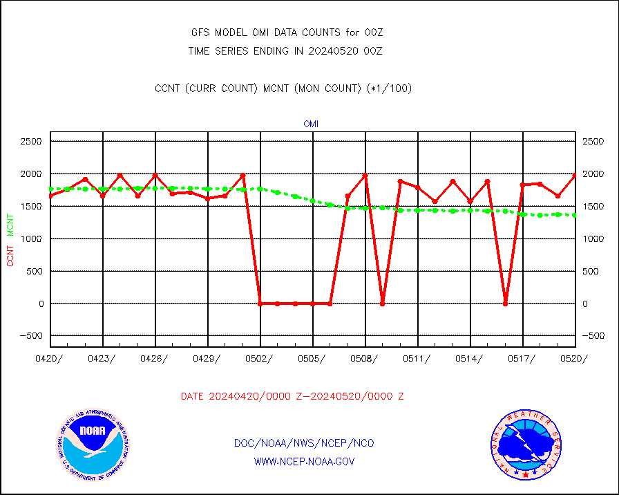
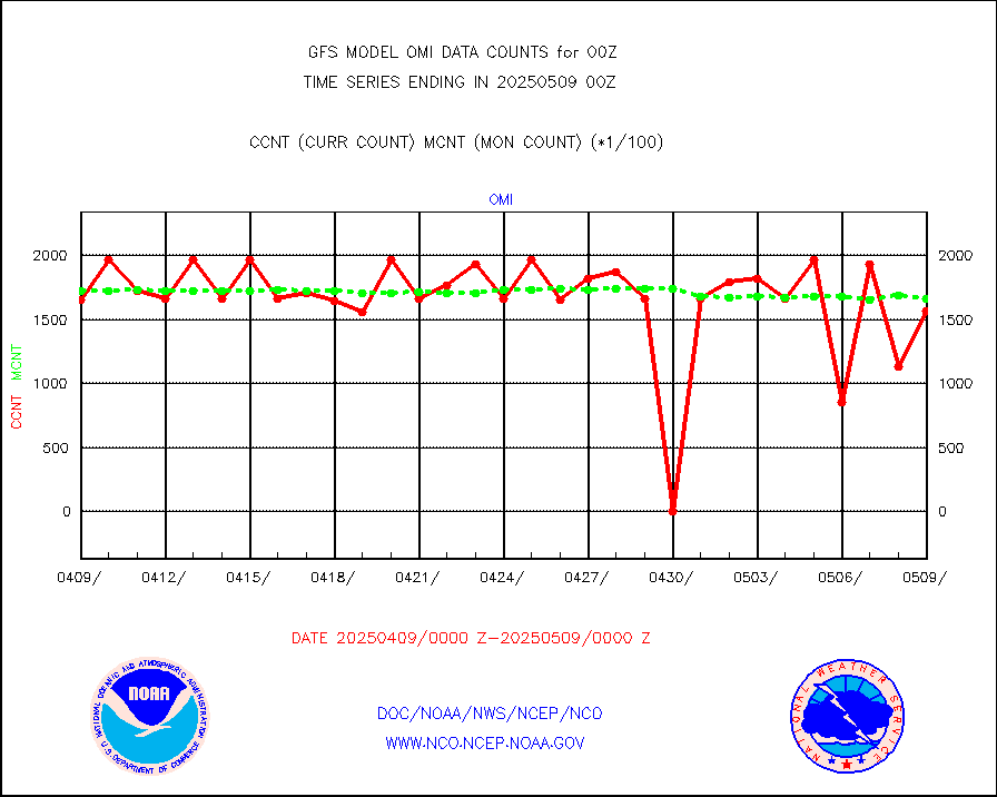
omi |
Aura Ozone Monitoring Instrument (OMI) data |
165601 |
176918 |
93.6 % |
osbuv8 |
NOAA 16-19 Solar Backscatter UV-2 rad frm V8 BUFR |
0 |
0 |
n/a |
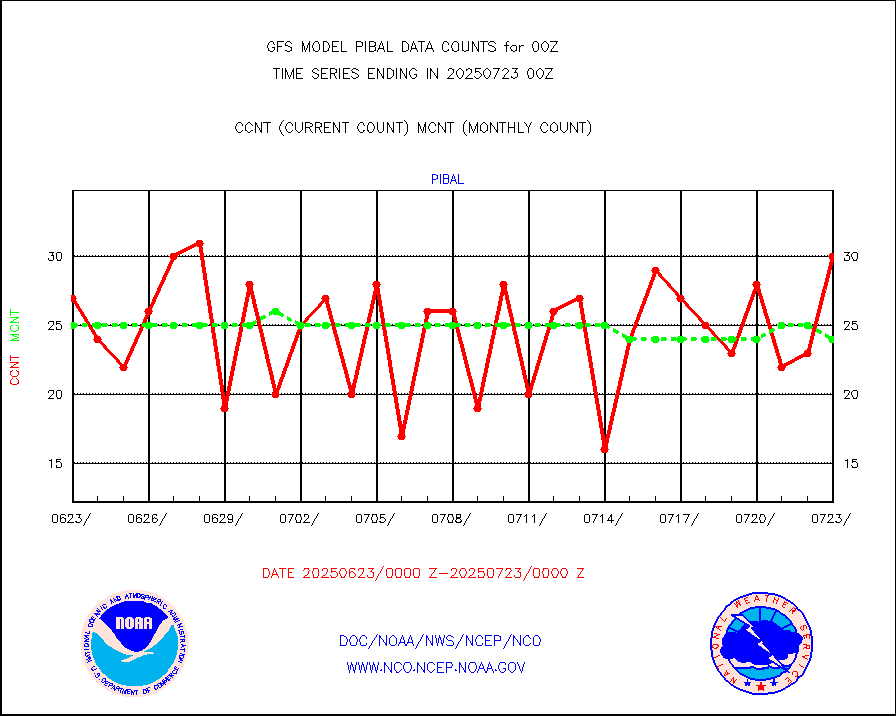
pibal |
PIBAL (from PILOT, PILOT SHIP, PILOT MOBIL) |
55 |
57 |
96.5 % |
prflrp |
Profilr winds from PIBAL (PILOT,PILOT SHIP/MOBIL) |
0 |
0 |
n/a |
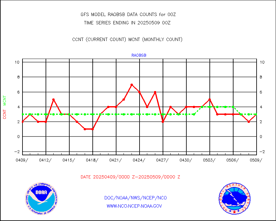
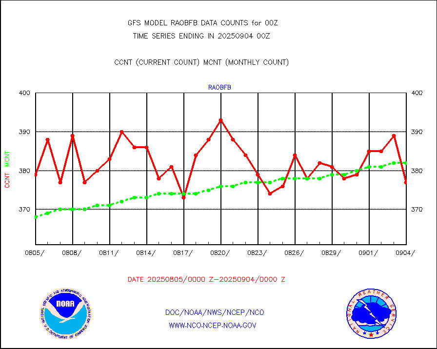
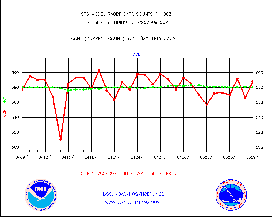
raobf |
Rawinsonde - fixed land (from TEMP or PILOT) |
595 |
595 |
100.0 % |
raobm |
Rawinsonde - mobile land (from TEMP/PILOT MOBIL) |
0 |
0 |
n/a |
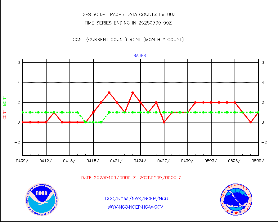
raobs |
Rawinsonde - ship (from TEMP SHIP, PILOT SHIP) |
1 |
0 |
n/a |
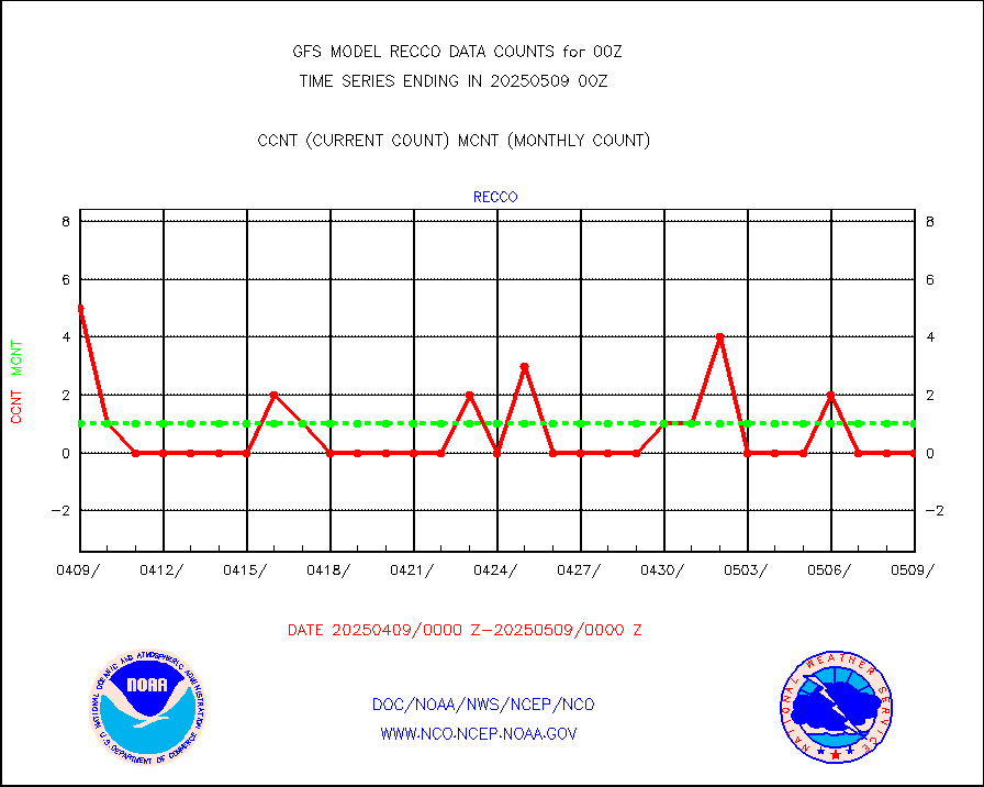
recco |
Flight level reconnaissance aircraft data |
6 |
2 |
300.0 % |
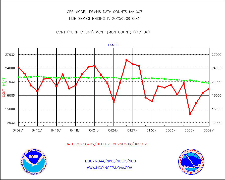
sevcsr |
METEOSAT-10 2nd Gen SEVIRI Clr Sky Radiance(proc) |
0 |
0 |
n/a |
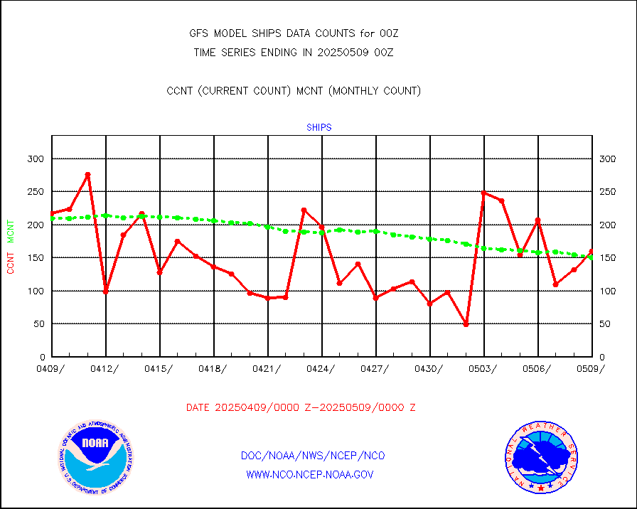
ships |
Ship - manual and automatic, restricted |
163 |
128 |
127.3 % |
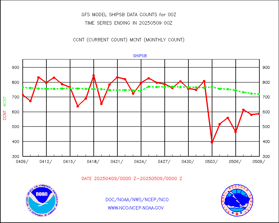
shipsb |
Ship - manual and automatic, restricted (BUFR) |
646 |
613 |
105.4 % |
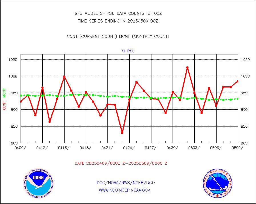
shipsu |
Ship - manual and automatic, unrestricted |
620 |
668 |
92.8 % |
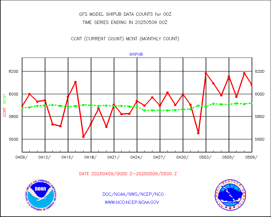
shipub |
Ship - manual and automatic, unrestricted (BUFR) |
5663 |
5763 |
98.3 % |
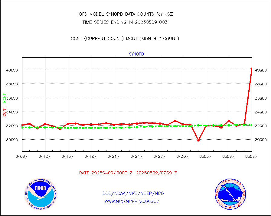
synopb |
Synoptic - fixed manual & auto (decoded fr BUFR) |
31538 |
30922 |
102.0 % |
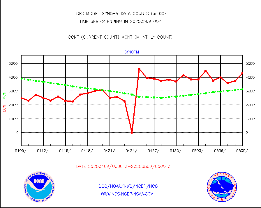
synopm |
Synoptic - mobile manual and automatic |
6047 |
4946 |
122.3 % |
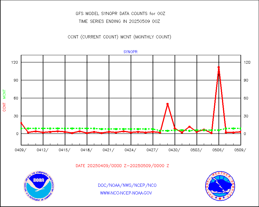
synopr |
Synoptic - restricted (WMO Res 40) manual & auto. |
2 |
9 |
22.2 % |
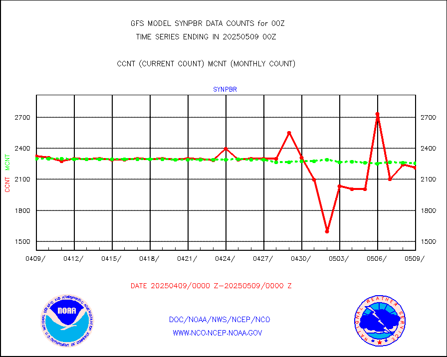
synpbr |
Synoptic - restricted (WMO Res 40)(decoded BUFR) |
2291 |
2308 |
99.3 % |
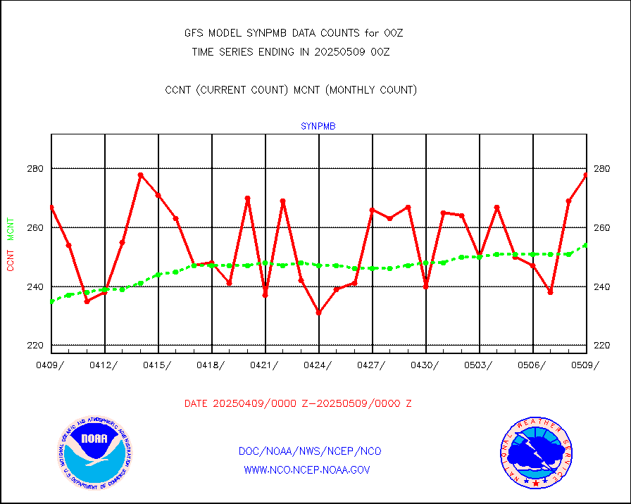
synpmb |
Synoptic - mobile manual & auto (decoded fr BUFR) |
63 |
62 |
101.6 % |
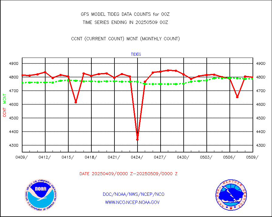
tideg |
Tide gauge reports decoded from CREX format |
4764 |
4648 |
102.5 % |
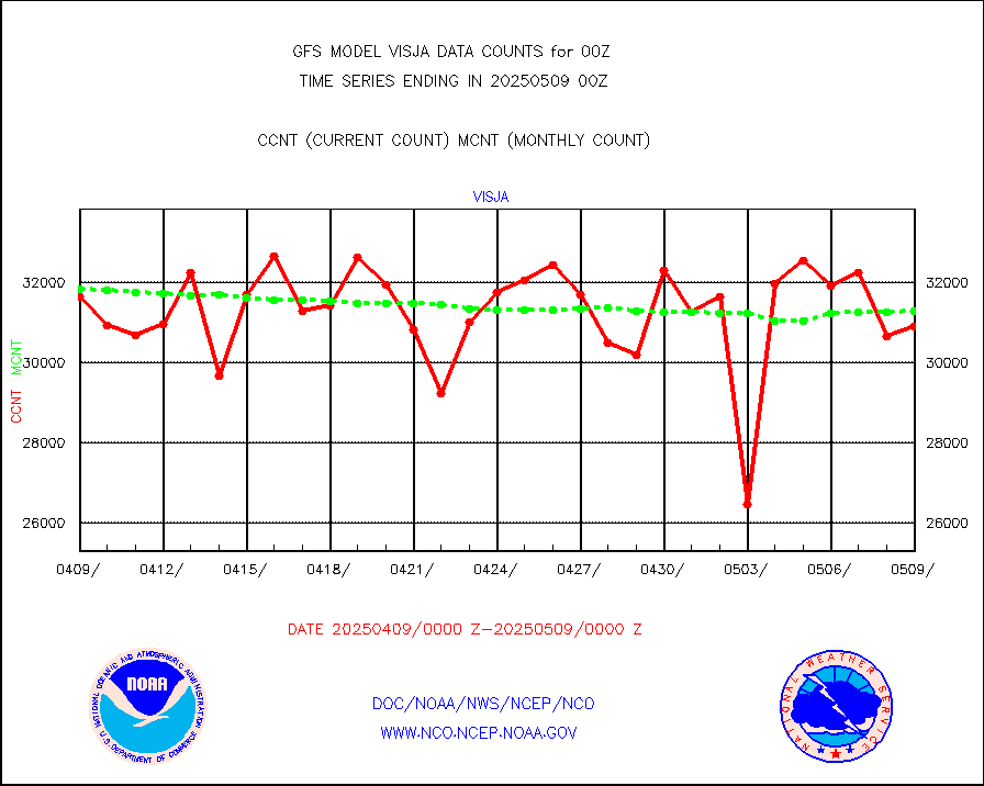
visja |
MTSAT/JMA visible derived cloud motion |
32581 |
31399 |
103.8 % |
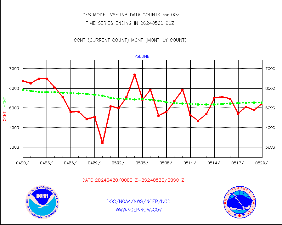
vseunb |
METEOSAT/EUMETSAT visible drv cld motion NBseq |
5554 |
5768 |
96.3 % |
| Data Types of Opportunity with Normal Counts |
|---|
| Type | Description | Hourly Count | Monthly Average | Percent (%) of Monthly Mean |
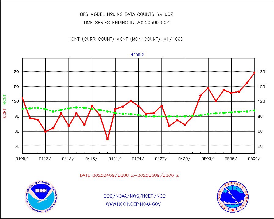
3p9usr |
GOES-16&up/NESDIS ir short-wv derived cld motion |
90643 |
76550 |
118.4 % |
acarsa |
MDCRS ACARS acft data (ARINC via AFWA)(AIREP fmt) |
0 |
0 |
n/a |
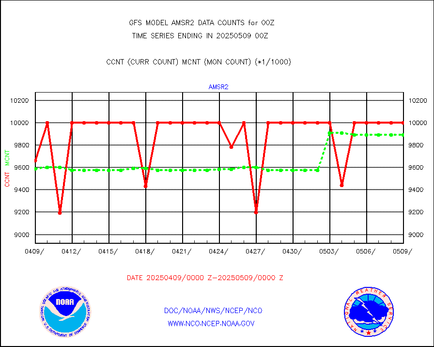
amsr2 |
GCOM-W AMSR2 1B brightness temperatures |
9999999 |
9831049 |
101.7 % |
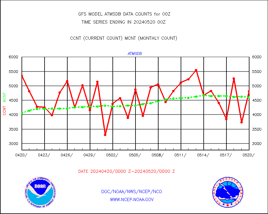
atmsdb |
NPP/NOAA-20 ATMS bright. temps-direct b-cast SSEC |
476892 |
421651 |
113.1 % |
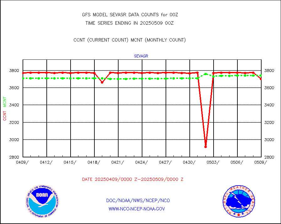
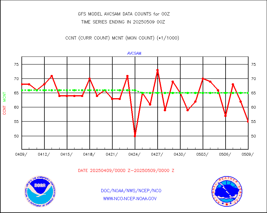
avcsam |
A.M.(N17,M2,M3) AVHRR GAC NCEP-proc clr&sea btmps |
7585302 |
6717720 |
112.9 % |
avcspm |
P.M.(N18-19) AVHRR GAC NCEP-proc clr & sea btemps |
7455359 |
6452172 |
115.5 % |
bathy |
eXpendable BathyThermograph, mooring (BATHY fmt) |
3 |
2 |
150.0 % |
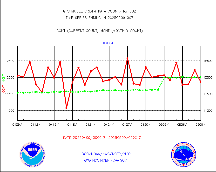
crisf4 |
NPP/NOAA-20 CrIS full spctrl radn (431 ch subset) |
1185876 |
1192896 |
99.4 % |
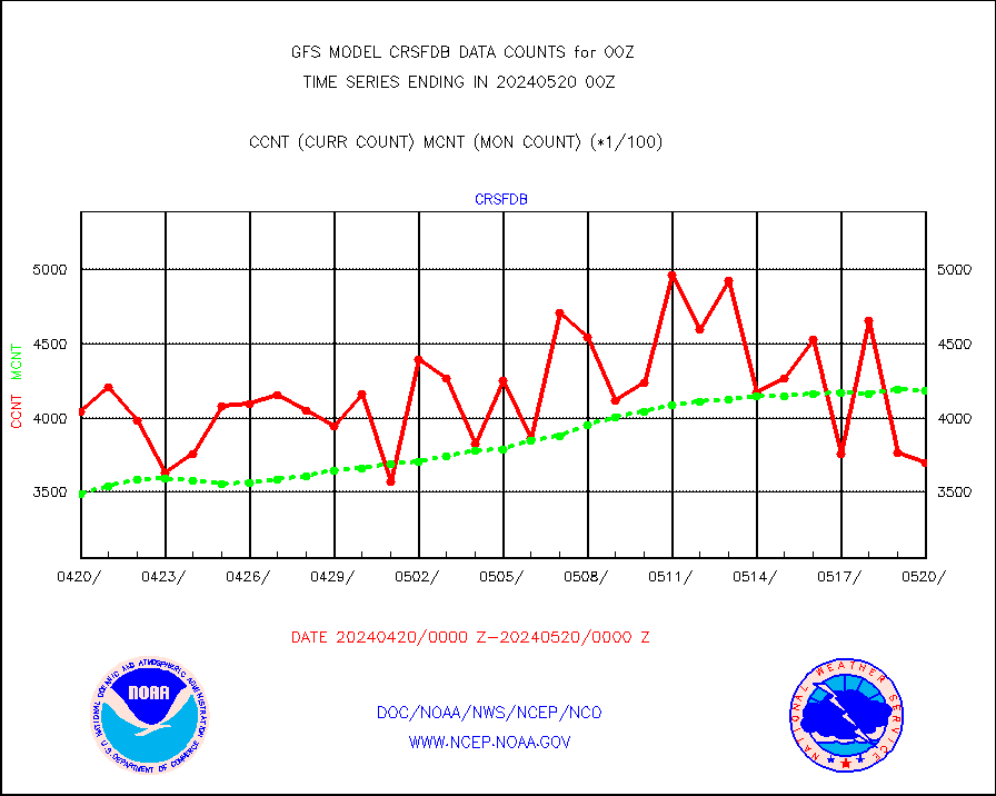
crsfdb |
NPP/NOAA-20 CrIS full spctrl radn dir brdcst SSEC |
408039 |
355420 |
114.8 % |
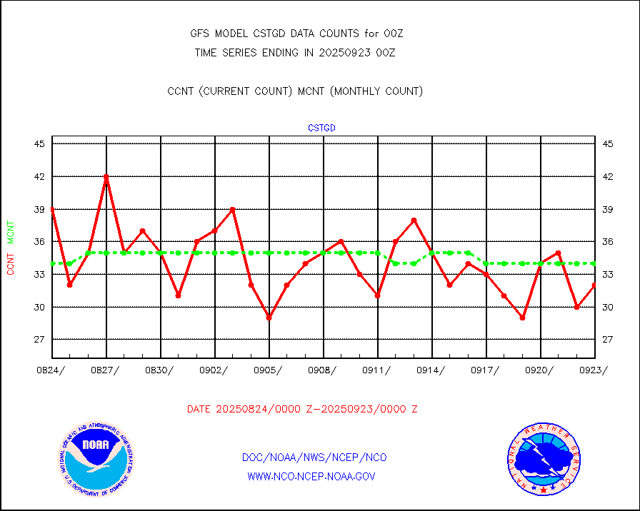
cstgd |
Coast Guard |
26 |
30 |
86.7 % |
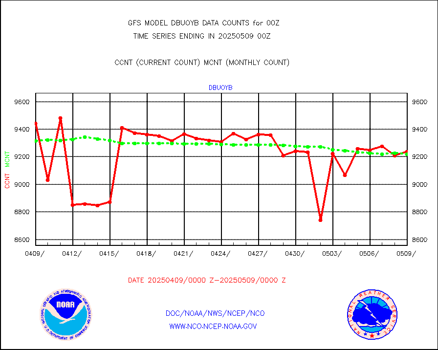
dbuoyb |
Drifting buoys (decoded from BUFR) |
8520 |
8670 |
98.3 % |
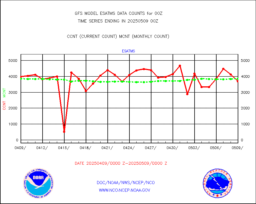
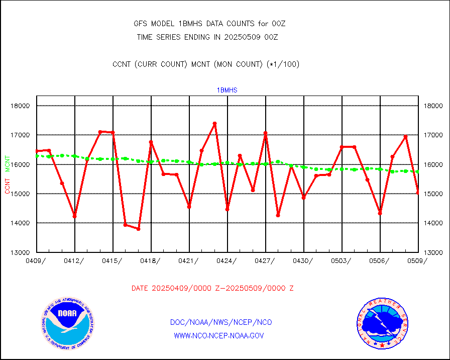
esatms |
NPP Adv. Tech. MW Sndr (ATMS) br. temps from RARS |
403884 |
365042 |
110.6 % |
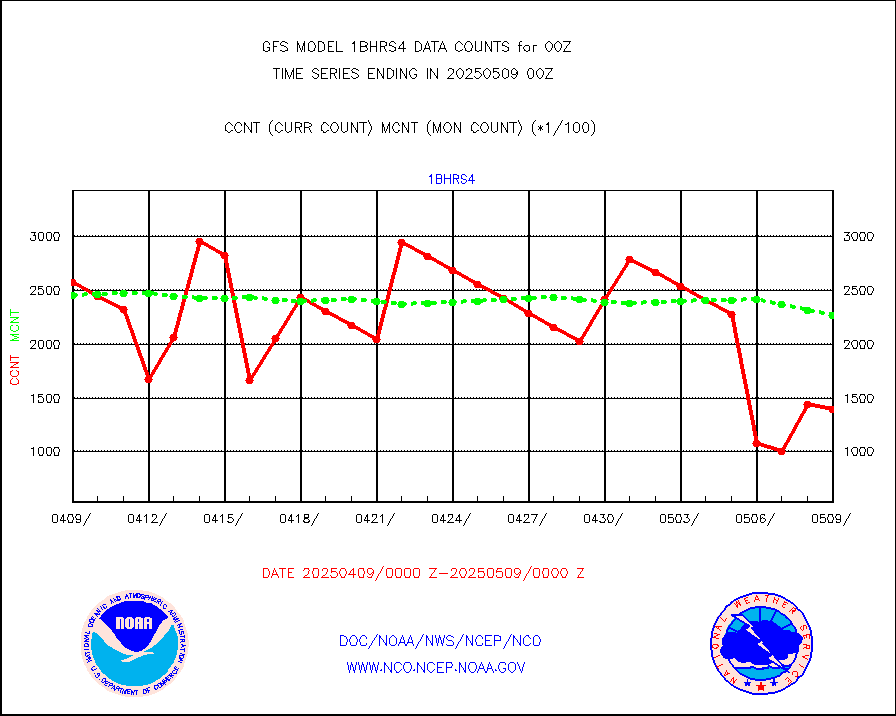
esiasi |
METOP 1-2 IASI 1C radiance data vbl chn from RARS |
392420 |
372395 |
105.4 % |
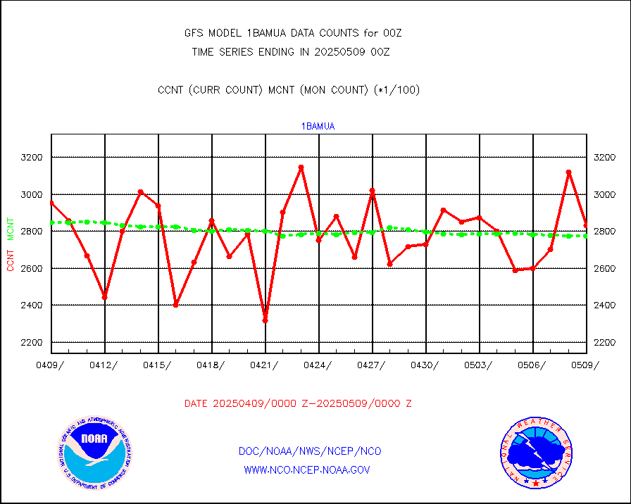
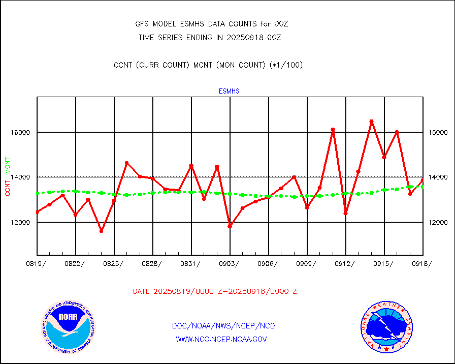
esmhs |
NOAA 18-19 & METOP 1-2 MHS proc. btemps from RARS |
2455314 |
2190555 |
112.1 % |
geoimr |
GOES/NESDIS (11x17 f-o-v) imager clear radiances |
0 |
0 |
n/a |
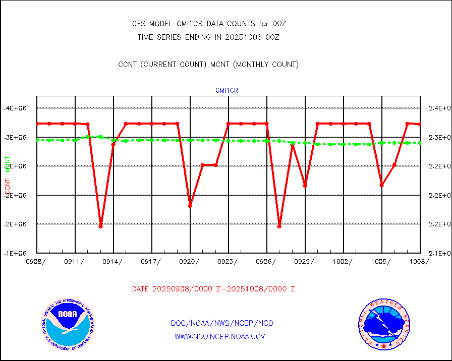
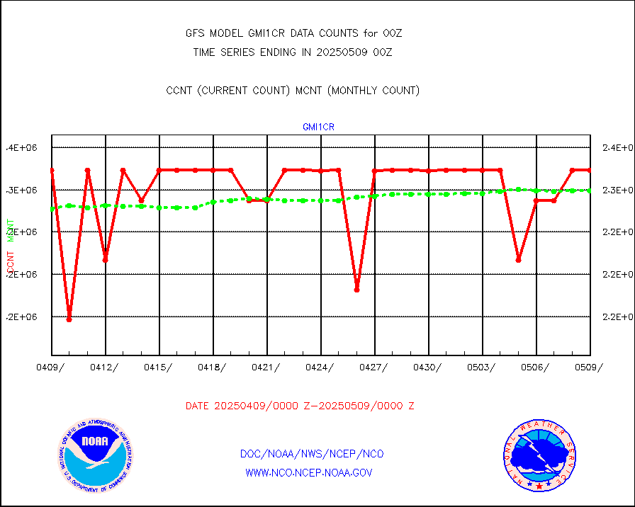
gmi1cr |
GPM GMI Level 1C-R brightness temperatures |
4652050 |
4534360 |
102.6 % |
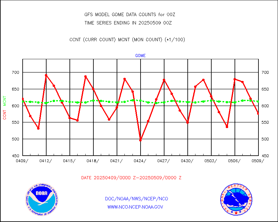
gnss |
Grnd-based Gbl Navigation Sat System (GNSS) data |
5270 |
4961 |
106.2 % |
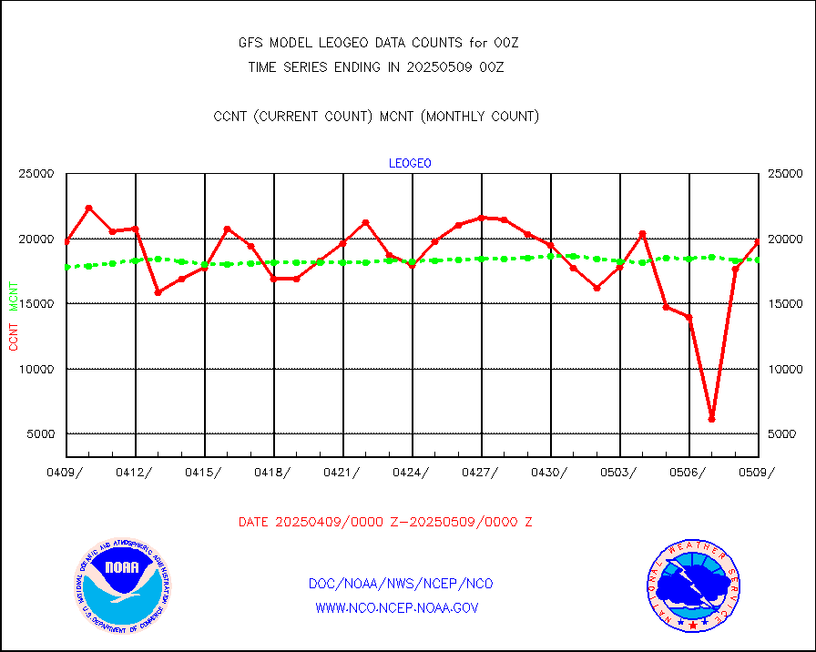
gome |
METOP 1-2 Global Ozone Monitoring Exp.-2 (GOME-2) |
66286 |
58738 |
112.9 % |
h20in |
INSAT/KALPANA India wvpr derived cloud motion |
0 |
0 |
n/a |
h20in2 |
INDIA SATWIND, INSAT WV channel |
6724 |
10440 |
64.4 % |
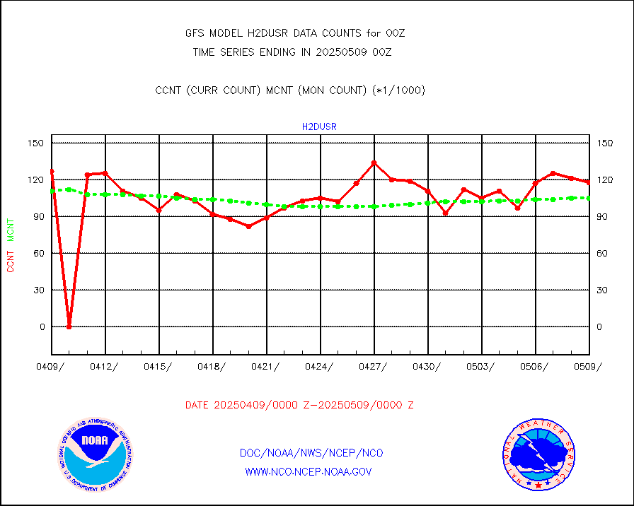
h2dusr |
GOES-16&up/NESDIS wv imgr/deep-lyr derivd cld mtn |
115667 |
102509 |
112.8 % |
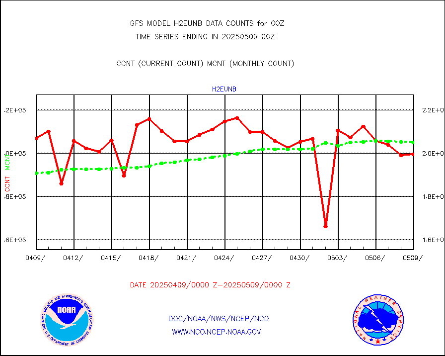
h2eunb |
METEOSAT/EUMETSAT wvpr imgr drv cld motion NBseq |
213634 |
208090 |
102.7 % |
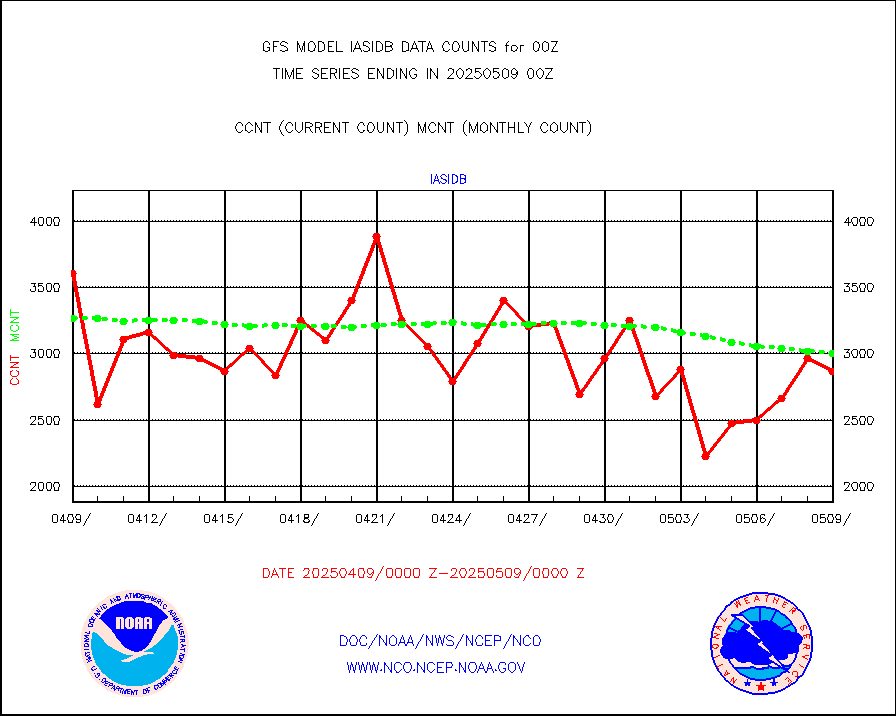
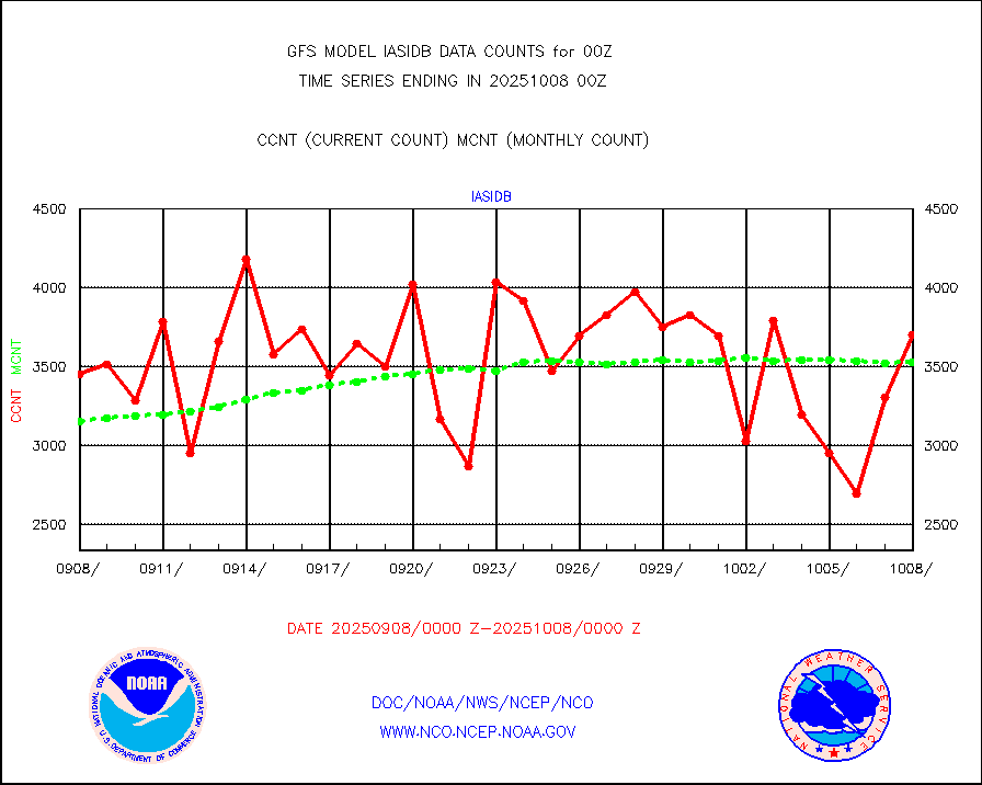
iasidb |
METOP 1-2 IASI 1C radiances-direct broadcast SSEC |
269298 |
246210 |
109.4 % |
ifvrnb |
VIIRS (NPP/NOAA-20) ir lg-wv drv cloud motion(NB) |
36696 |
45242 |
81.1 % |
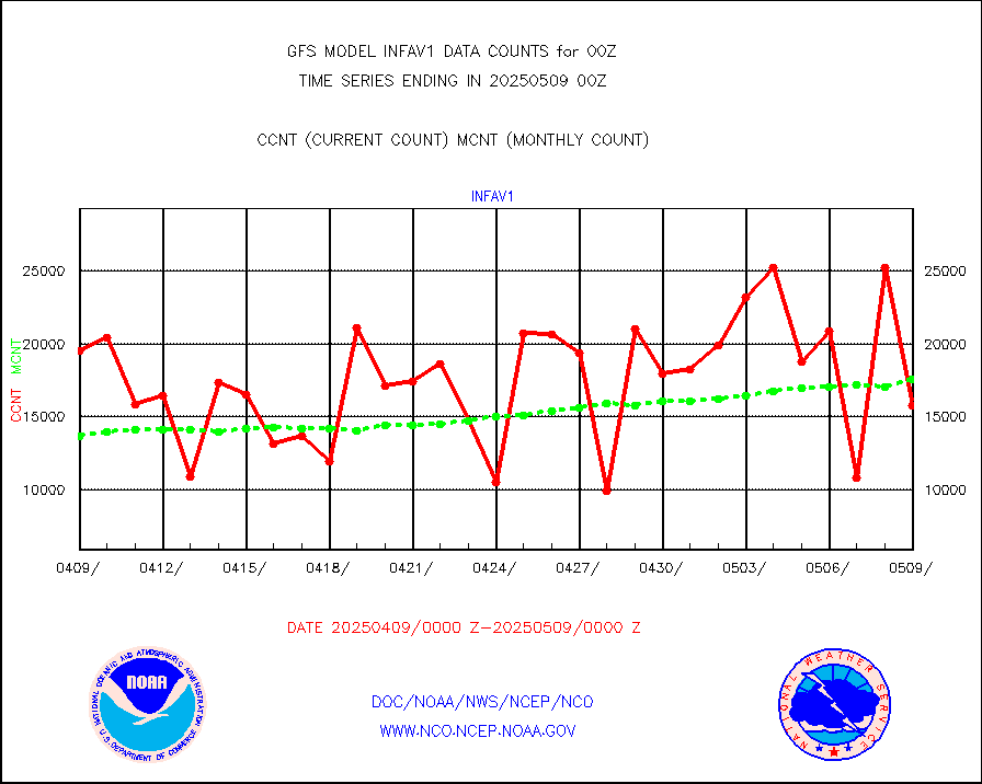
infav1 |
AVHRR (METOP) ir lg-wave derived cld motion |
13403 |
12952 |
103.5 % |
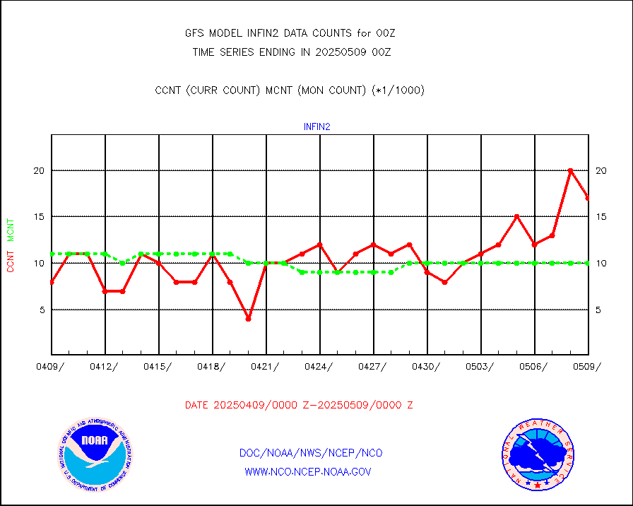
infin |
INSAT/KALPANA India ir lg-wave derived cld motion |
0 |
0 |
n/a |
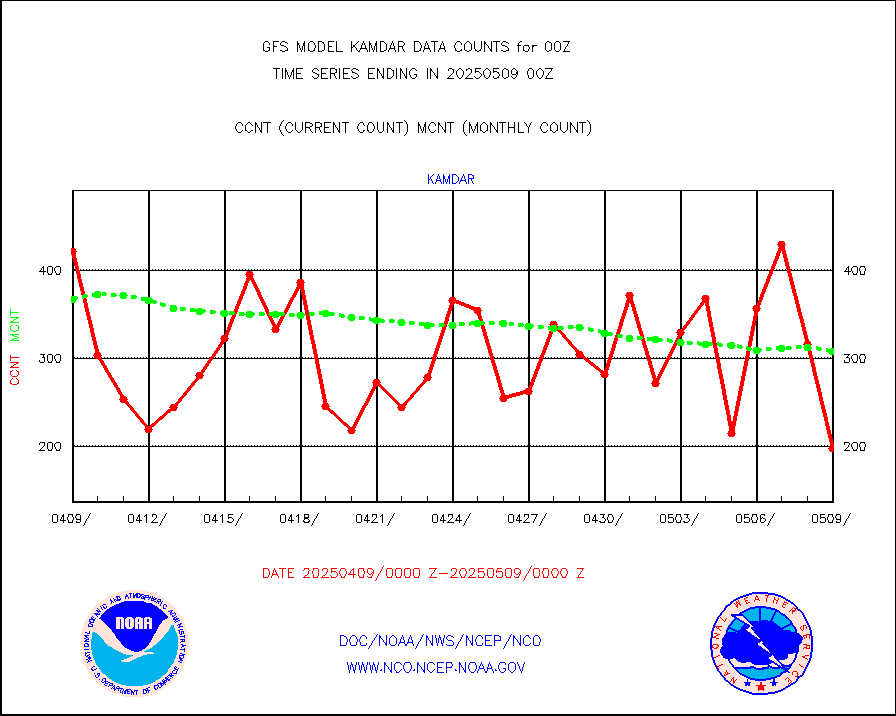
kamdar |
Korean AMDAR aircraft data (decoded from BUFR) |
382 |
370 |
103.2 % |
mbuoyb |
Moored buoys (decoded from BUFR) |
5352 |
4914 |
108.9 % |
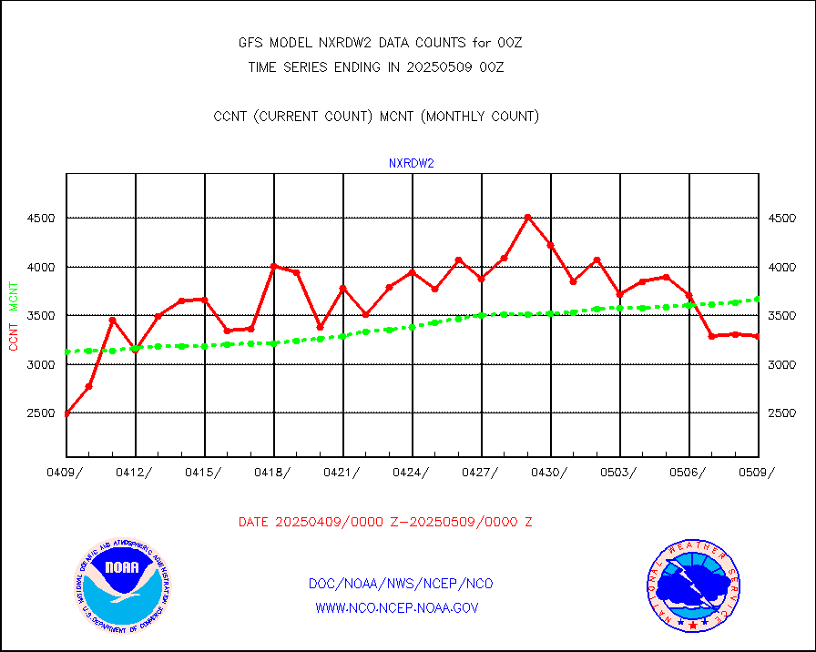
nxrdw2 |
NEXRAD Vel Azm Dsp(VAD) winds via Level 2 decoder |
3727 |
3758 |
99.2 % |
ompslp |
OMPS Limb Profiler ozone data (NPP) |
886 |
777 |
114.0 % |
ompsn8 |
OMPS nadir profile ozone (Version 8 BUFR) |
2823 |
2769 |
102.0 % |
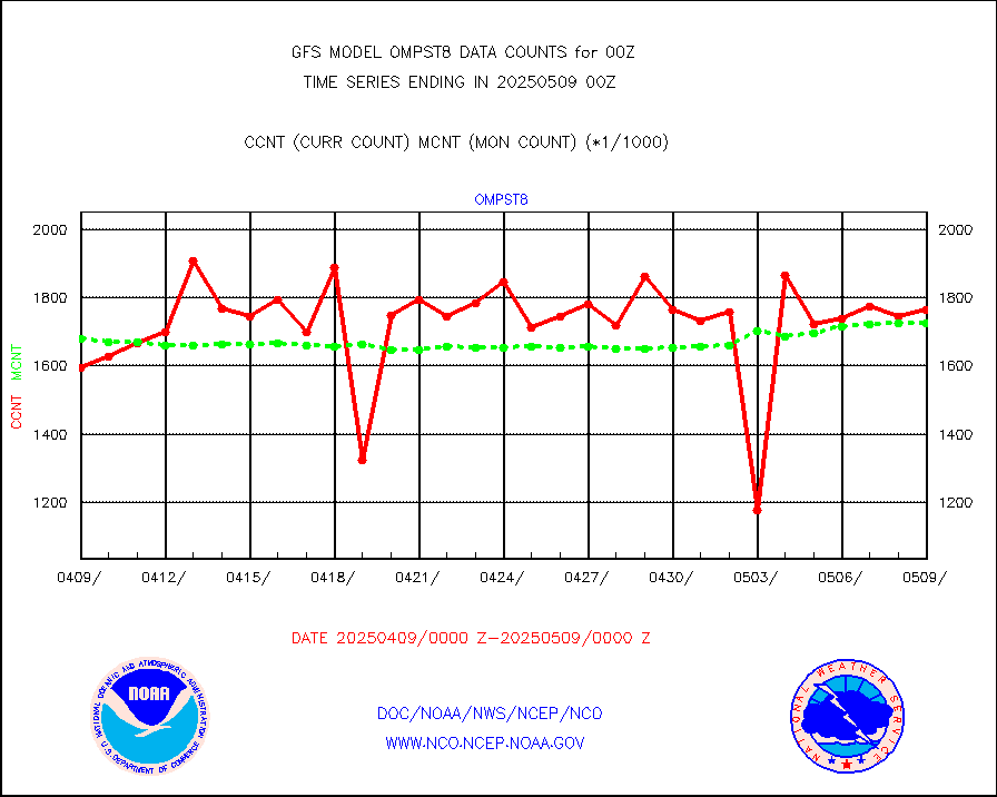
ompst8 |
OMPS total column ozone (Version 8 BUFR) |
1721755 |
1739663 |
99.0 % |
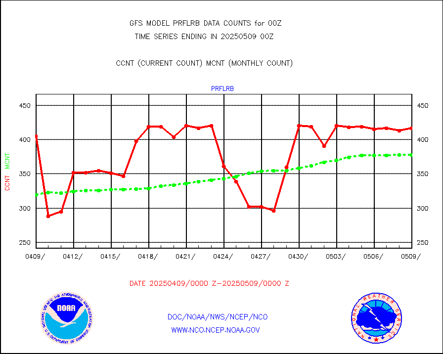
prflrb |
Multi-Agency Profiler (MAP) and SODAR winds |
396 |
321 |
123.4 % |
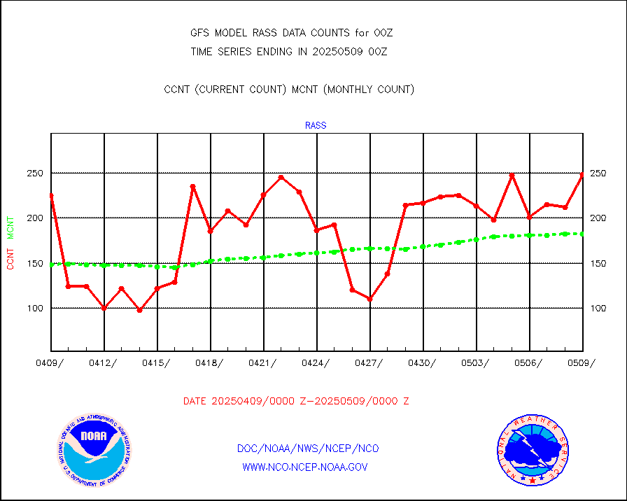
rass |
RASS temperatures (NOAA and Multi-Agency) |
208 |
187 |
111.2 % |
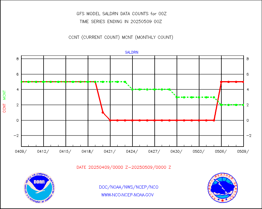
saldrn |
Surface Marine Saildrone (decoded from BUFR) |
5 |
5 |
100.0 % |
saphir |
Megha-Tropiques SAPHIR L1A2 brightness temps |
0 |
0 |
n/a |
sevasr |
METEOSAT-10 2nd Gen SEVIRI All Sky Radiance(proc) |
377560 |
377354 |
100.1 % |
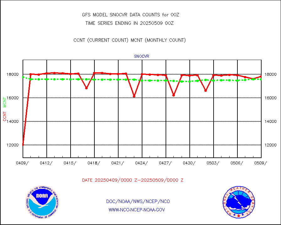
snocvr |
NOW COVER, DEPTH/DENSITY AND WATER EQUIVALENT |
18182 |
17723 |
102.6 % |
ssmisu |
DMSP SSM/IS 1C radiance data (Unified Pre-Proc.) |
1000081 |
971908 |
102.9 % |
sstvcw |
NPP/NOAA-20 VIIRS SST - CLEAR & OVER WATER |
9999999 |
9999999 |
100.0 % |
sstvpw |
NPP/NOAA-20 VIIRS SST - PROBABLY CLR & OVER WATER |
9999999 |
9999999 |
100.0 % |
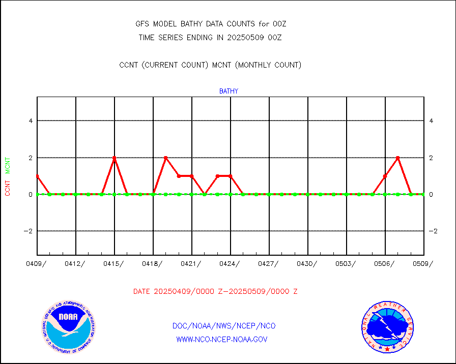
subpfl |
Sub-surface float and glider profile (BUFR) |
46 |
61 |
75.4 % |
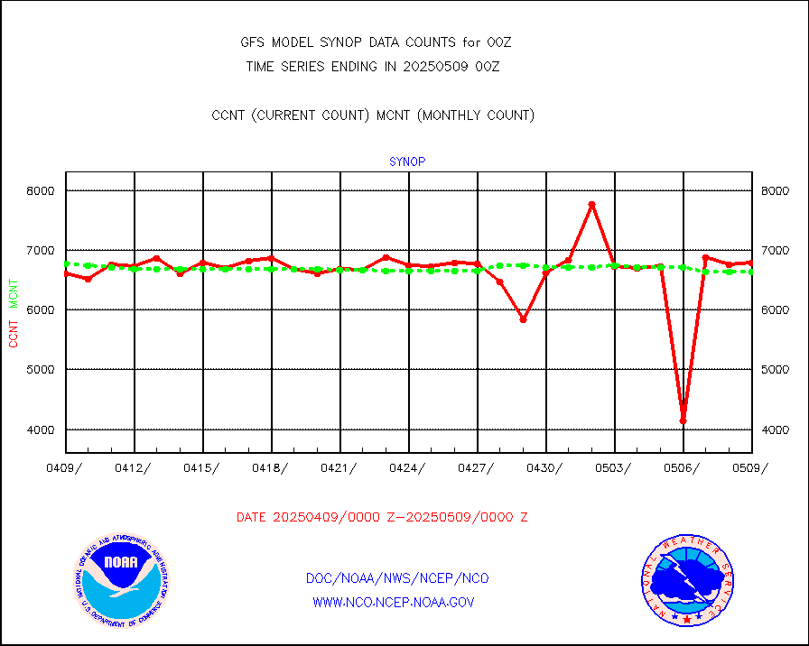
synop |
Synoptic - fixed manual and automatic |
7689 |
7436 |
103.4 % |
tesac |
CTD probe, Argo prflng float, mooring (TESAC fmt) |
2065 |
1816 |
113.7 % |
tmdara |
TAMDAR aircft data-all types(from Panasonic,BUFR) |
2019 |
1817 |
111.1 % |
visin |
INSAT/KALPANA India visible derived cloud motion |
0 |
0 |
n/a |
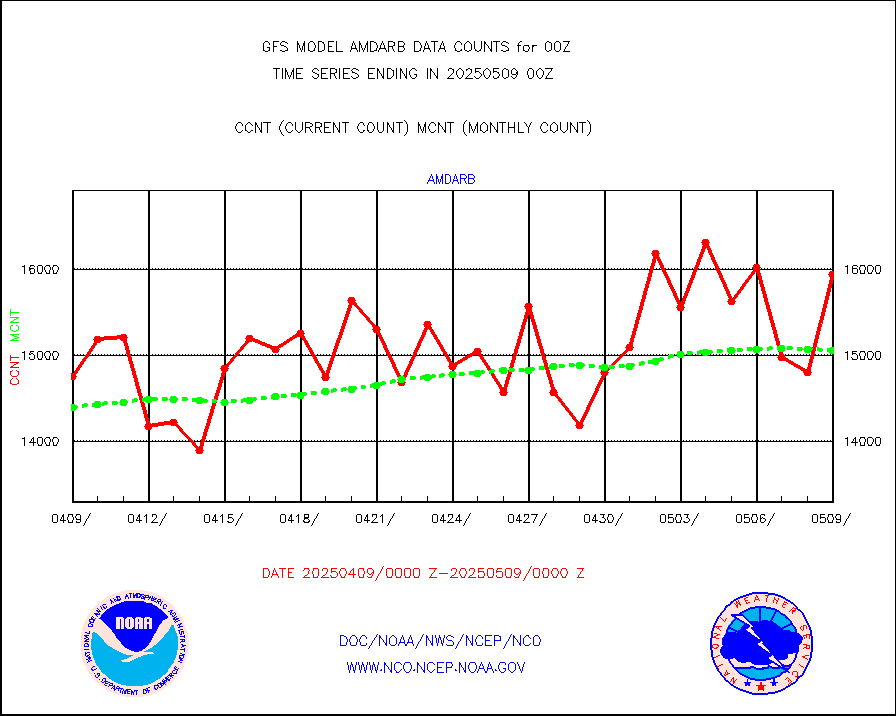
visin2 |
INDIA SATWIND, INSAT VIS channel |
9 |
20 |
45.0 % |
visusr |
GOES-16&up/NESDIS visible derived cloud motion |
1556253 |
1700280 |
91.5 % |


