| Critical Data with Normal Counts |
|---|
| Type | Description | Hourly Count | Monthly Average | Percent (%) of Monthly Mean |
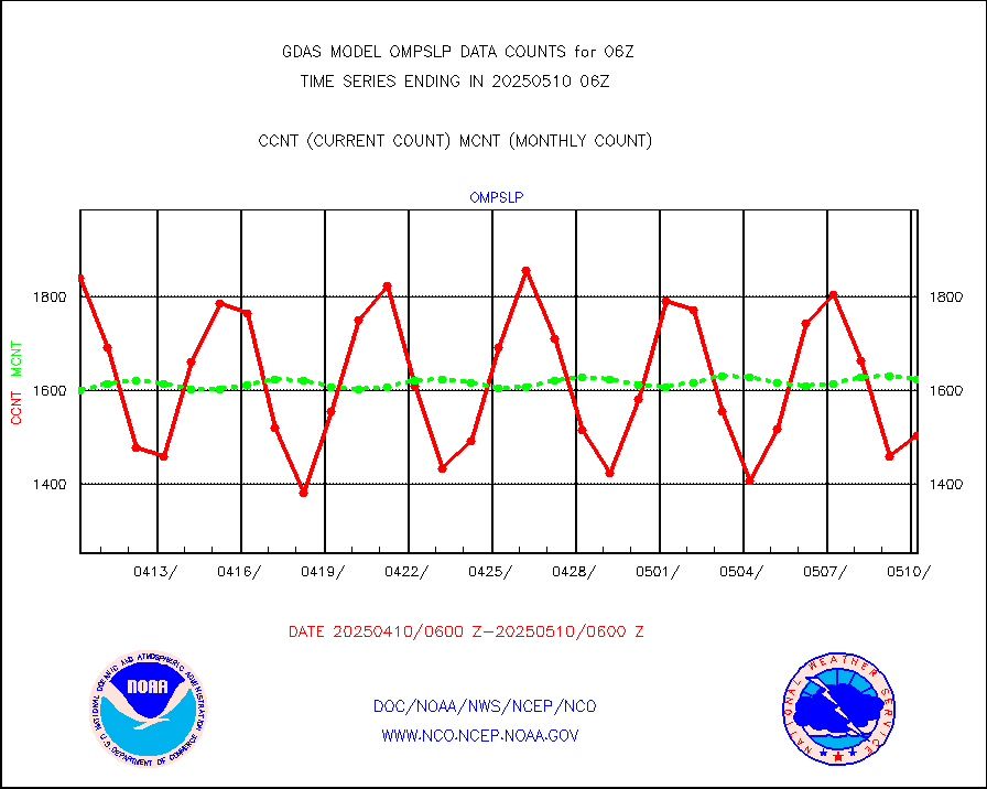
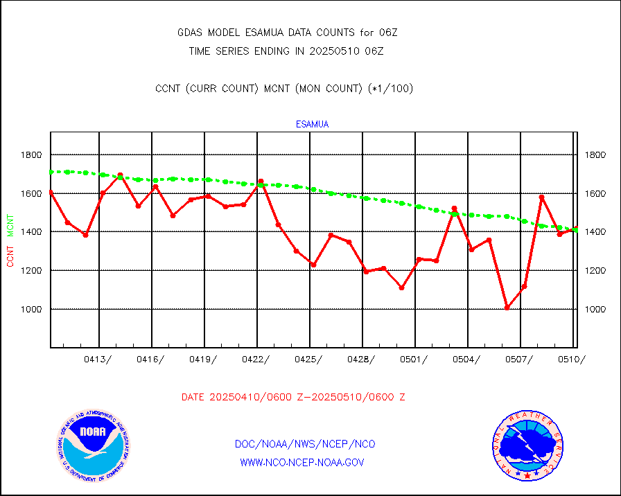
1bamua |
NOAA 15-19 & METOP 1-2 AMSU-A NCEP-proc. br.temps |
389930 |
380048 |
102.6 % |
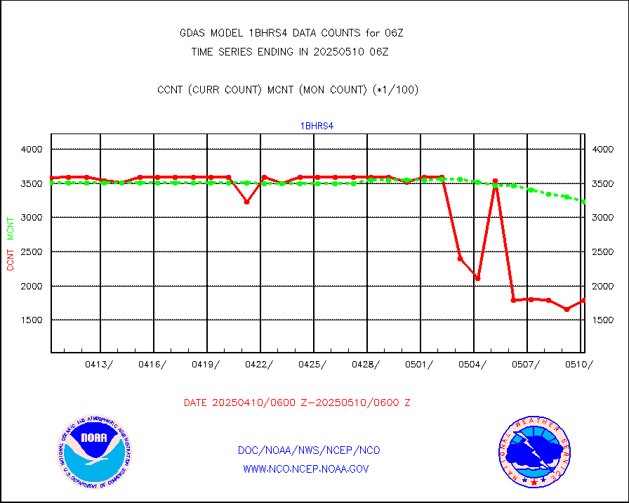
1bhrs4 |
NOAA 18-19 & METOP 1-2 HIRS-4 NCEP-proc. br.temps |
358960 |
336896 |
106.5 % |
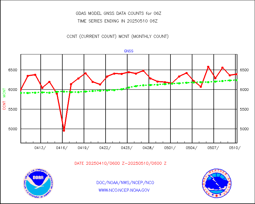
1bmhs |
NOAA 18-19 & METOP 1-2 MHS NCEP-proces. br. temps |
2039006 |
2094736 |
97.3 % |
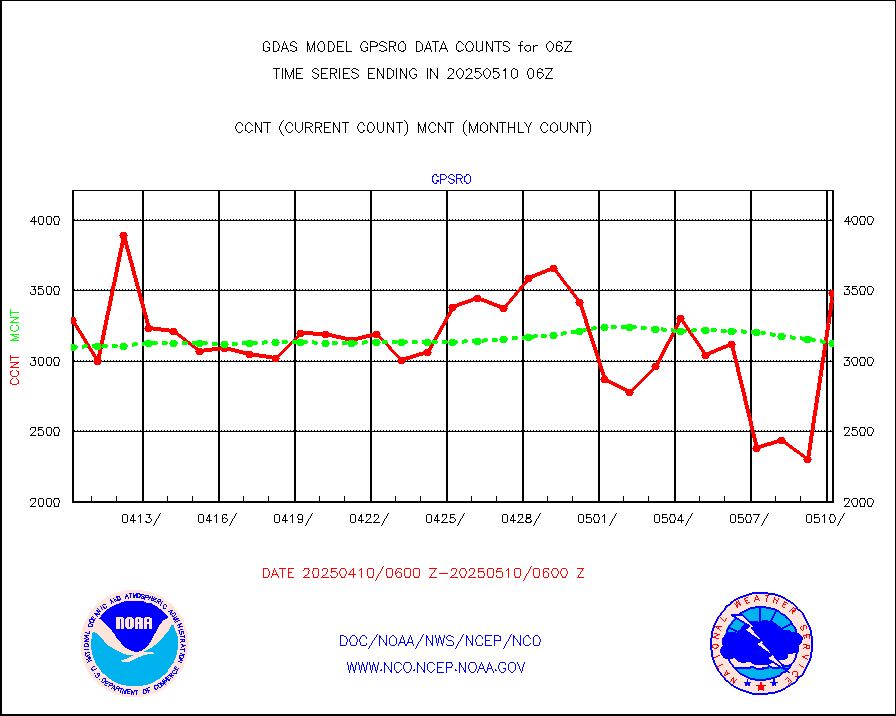
acars |
MDCRS ACARS acft data from ARINC(dcded from BUFR) |
75605 |
60041 |
125.9 % |
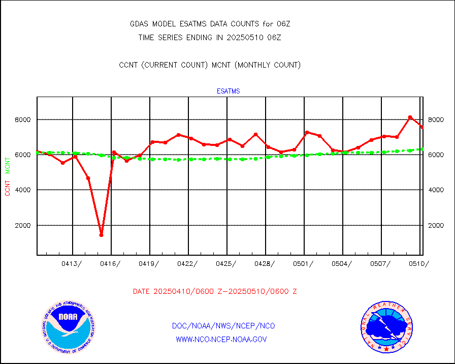
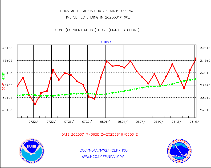
ahicsr |
Himawari Clear Sky Radiance |
312842 |
312577 |
100.1 % |
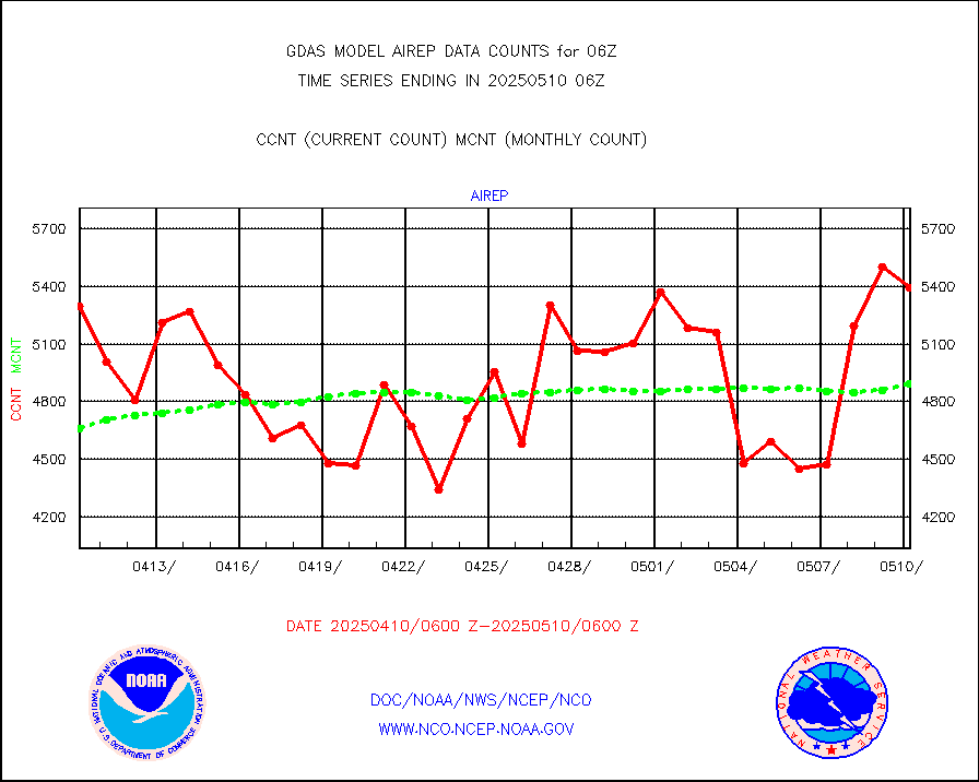
airep |
Manual AIREP aircraft data (dcded from AIREP fmt) |
6900 |
6965 |
99.1 % |
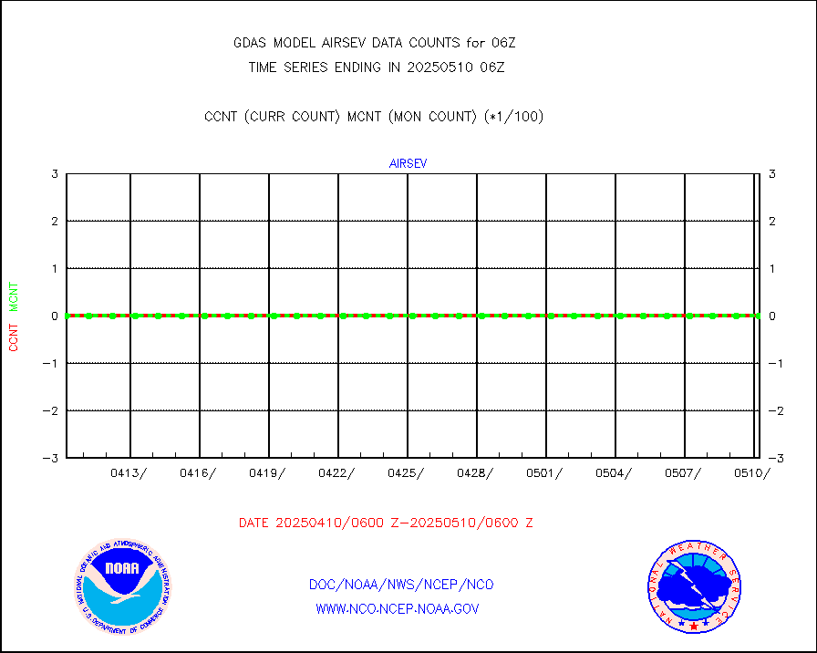
airsev |
AQUA AIRS/AMSU-A/HSB brightness temps- every FOV |
0 |
0 |
n/a |
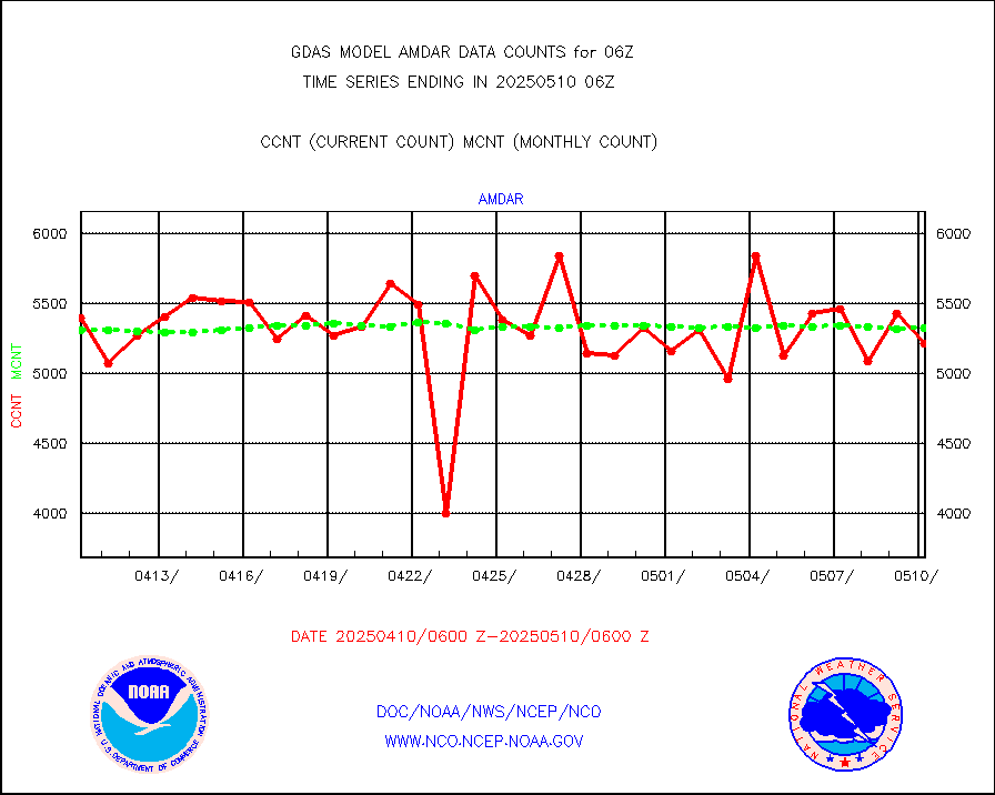
amdar |
AMDAR aircraft data (decoded from AMDAR format) |
5075 |
5429 |
93.5 % |
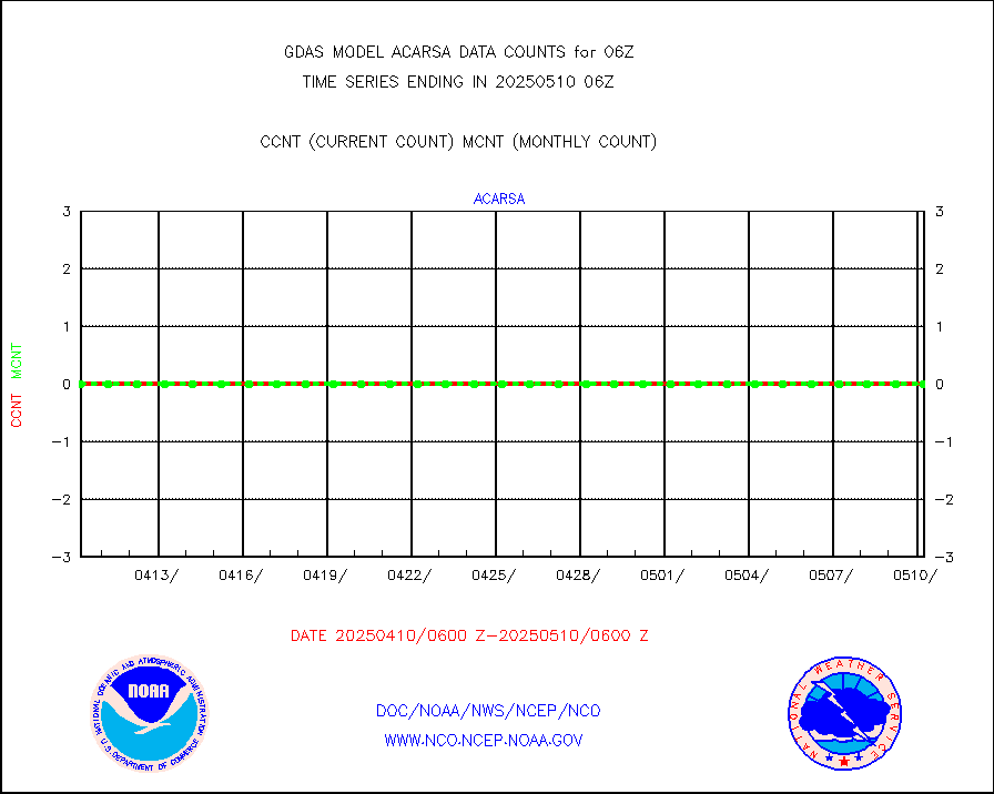
amdarb |
AMDAR aircraft data (decoded from BUFR) |
12332 |
11781 |
104.7 % |
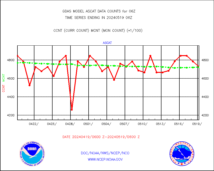
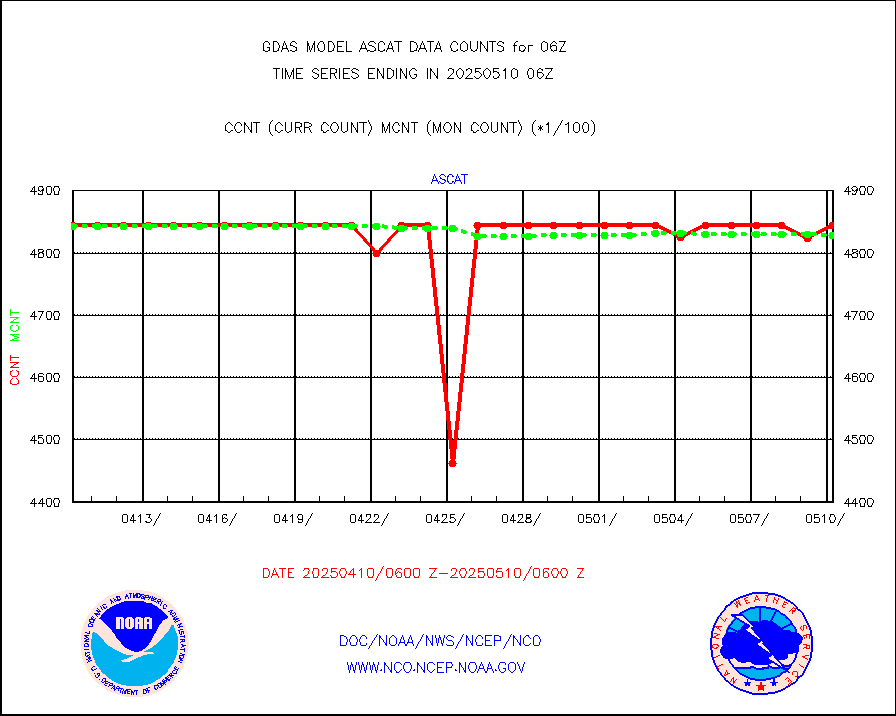
ascat |
METOP 1-2 ASCAT products |
467880 |
475903 |
98.3 % |
atms |
NPP/NOAA-20 ATMS brightness temperatures |
2319891 |
2316755 |
100.1 % |
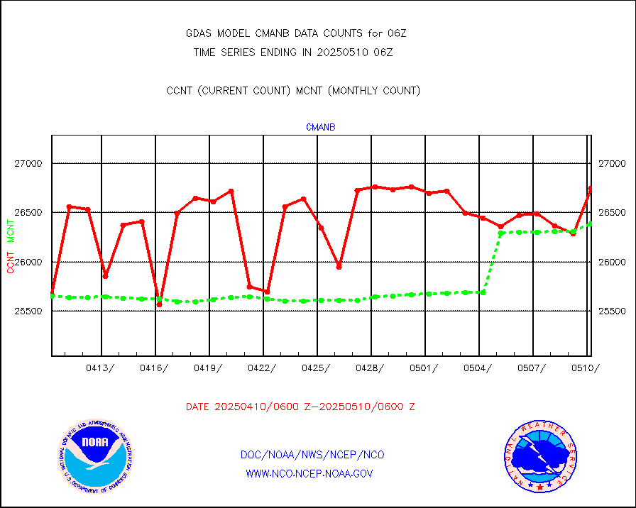
cmanb |
Surface Marine CMAN rpts decoded from BUFR format |
24390 |
25417 |
96.0 % |
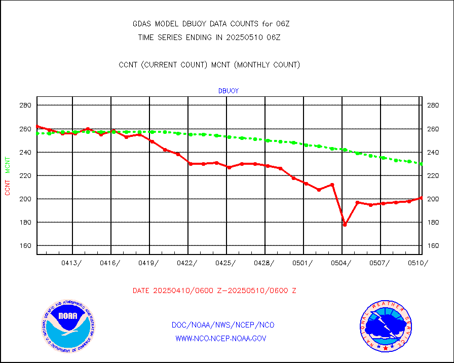
dbuoy |
Buoys decoded from FM-18 fmt (moored or drifting) |
274 |
273 |
100.4 % |
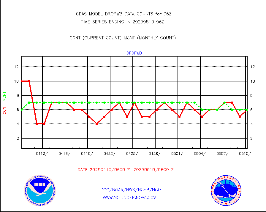
dropw |
Dropwinsonde (from TEMP DROP) |
0 |
0 |
n/a |
eadas |
E-AMDAR (European AMDAR acft decoded from BUFR) |
12984 |
13243 |
98.0 % |
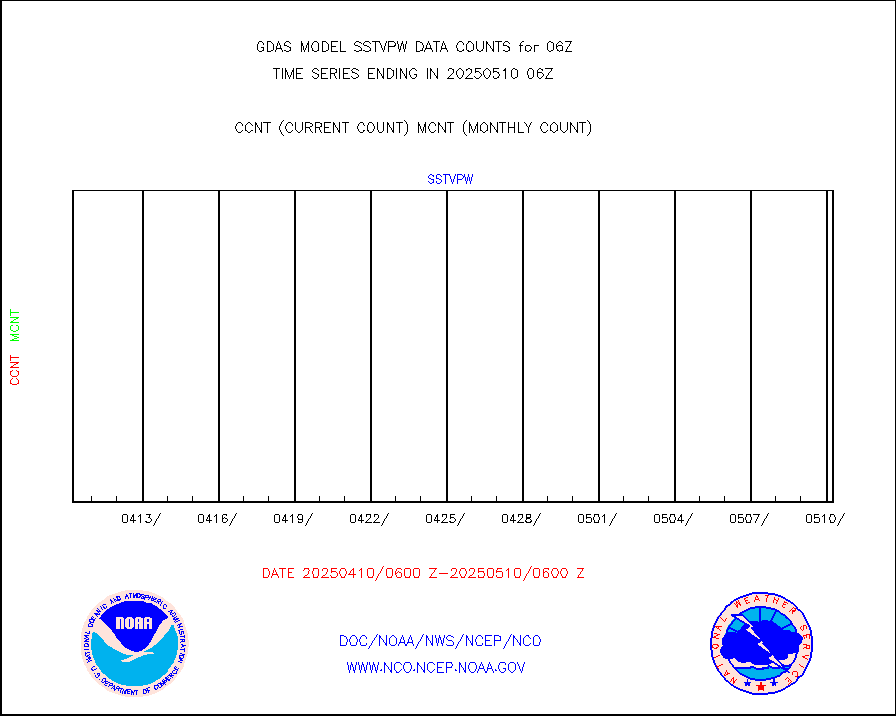
esamua |
NOAA 15-19 & METOP 1-2 AMSU-A proc btmps frm RARS |
178360 |
169644 |
105.1 % |
eshrs3 |
NOAA 15-19 & METOP 1-2 HIRS-3/4 pr btmps frm RARS |
553352 |
505951 |
109.4 % |
gpsro |
GPS radio occultation data |
3095 |
3007 |
102.9 % |
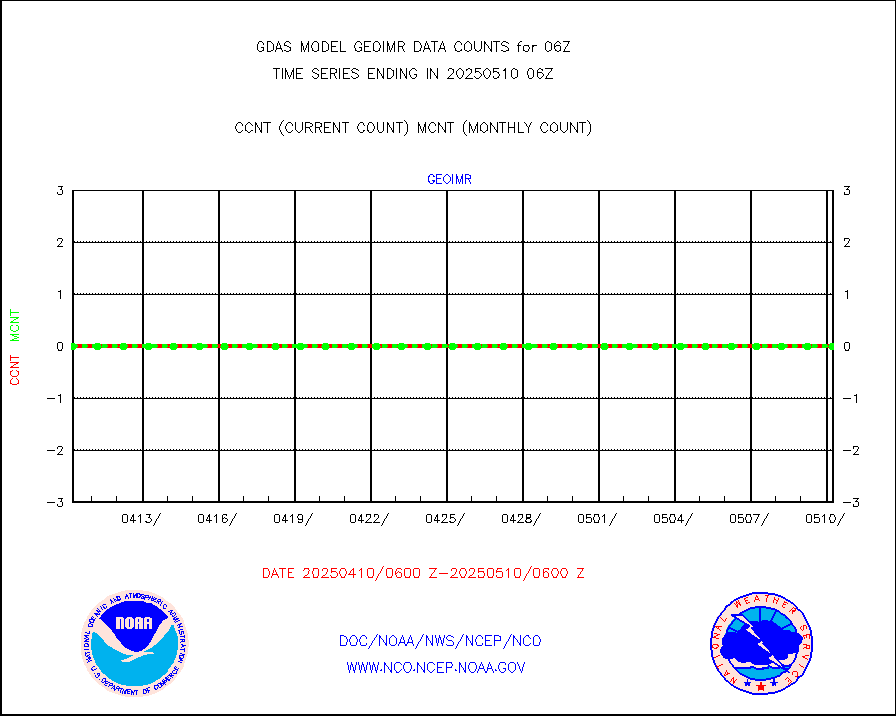
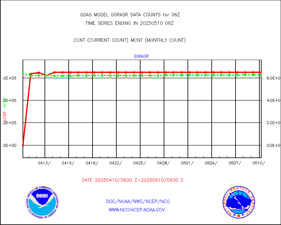
gsrasr |
GOES-16/17 All Sky Radiances (proc.) |
6412169 |
6450237 |
99.4 % |
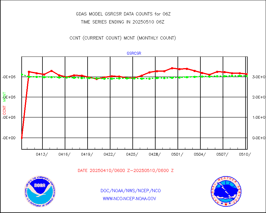
gsrcsr |
GOES-16/17 Clear Sky Radiances (proc.) |
3215874 |
2912263 |
110.4 % |
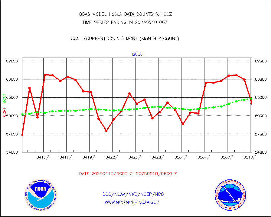
h20ja |
MTSAT/JMA water vapor imager derived cloud motion |
58645 |
59818 |
98.0 % |
h20mo |
MODIS (AQUA/TERRA) wvpr imager derived cld motion |
0 |
0 |
n/a |
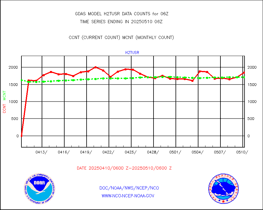
h2tusr |
GOES-16&up/NESDIS wv imgr/cld-top derived cld mtn |
162893 |
167551 |
97.2 % |
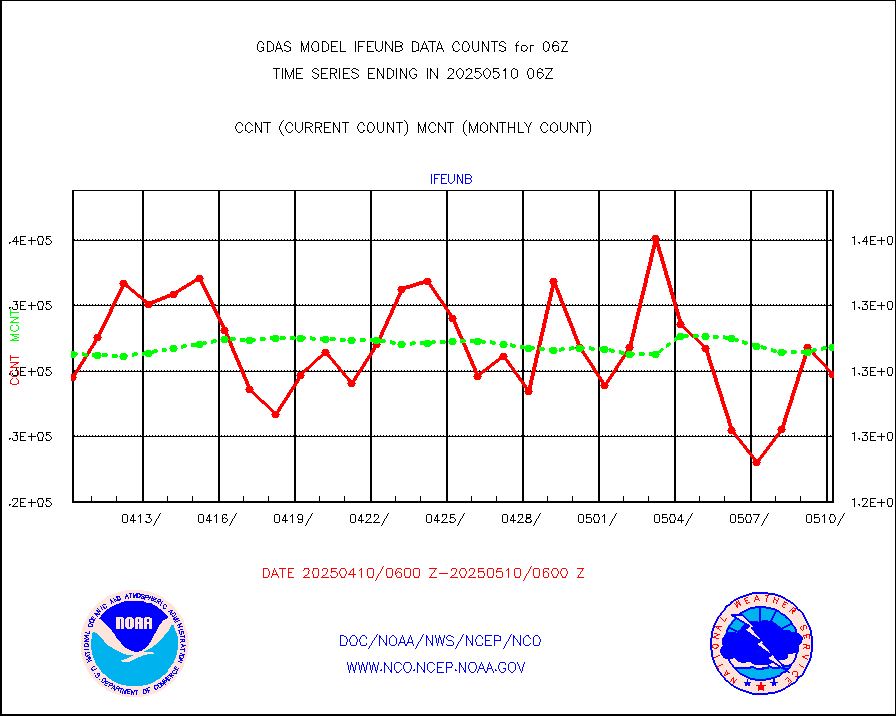
ifeunb |
METEOSAT/EUMETSAT ir lg-wave drv cld motion NBseq |
126094 |
131219 |
96.1 % |
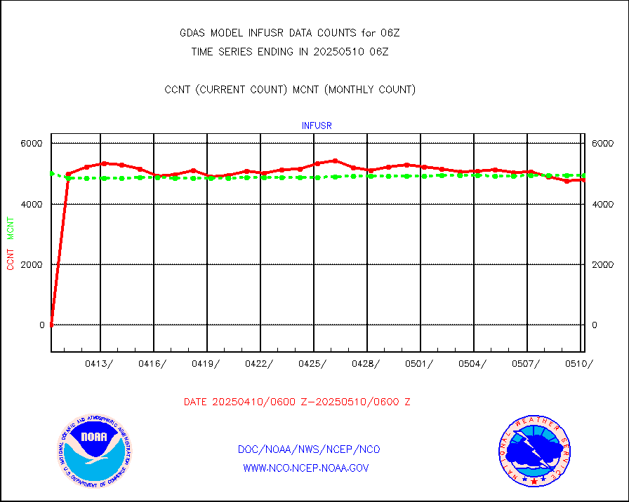
infja |
MTSAT/JMA infrared long-wave derived cloud motion |
50400 |
48527 |
103.9 % |
infmo |
MODIS (AQUA/TERRA) ir l-wave derived cloud motion |
0 |
0 |
n/a |
infusr |
GOES-16&up/NESDIS ir long-wave derived cld motion |
488097 |
491927 |
99.2 % |
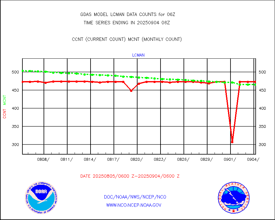
lcman |
Land-based CMAN stations decoded from CMAN format |
576 |
588 |
98.0 % |
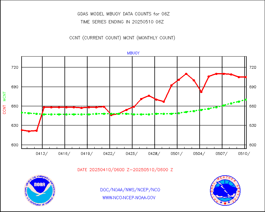
mbuoy |
Buoys decoded from FM-13 format (moored) |
765 |
723 |
105.8 % |
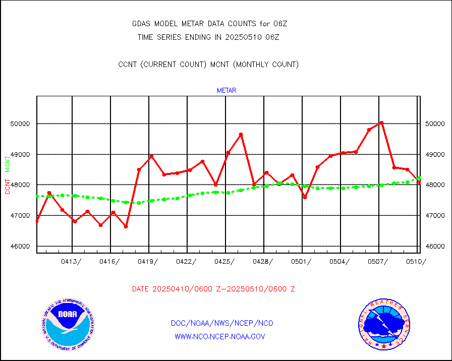
metar |
Aviation - METAR |
46518 |
47816 |
97.3 % |
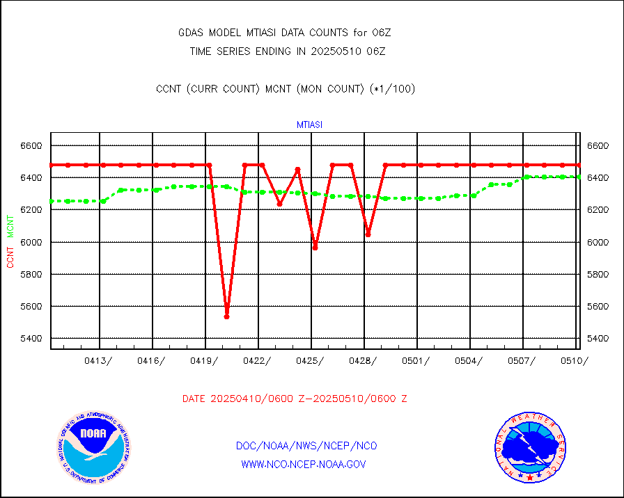
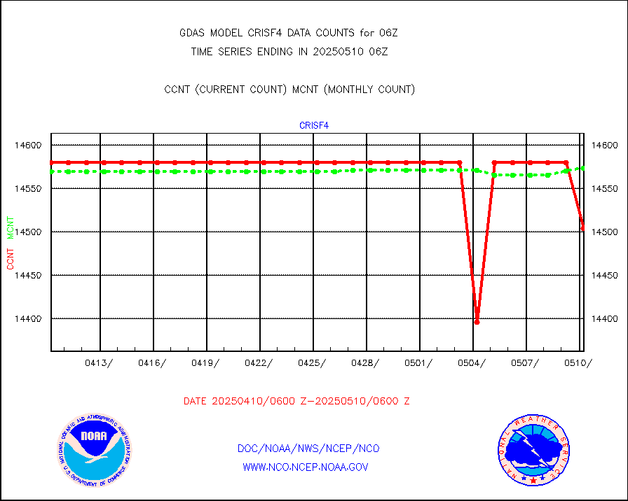
mtiasi |
METOP 1-2 IASI 1C radiance data (varbl. channels) |
585844 |
609818 |
96.1 % |
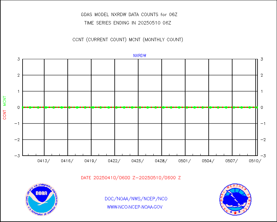
nxrdw |
NEXRAD Vel Azm Dsp(VAD) winds via radar coded msg |
0 |
0 |
n/a |
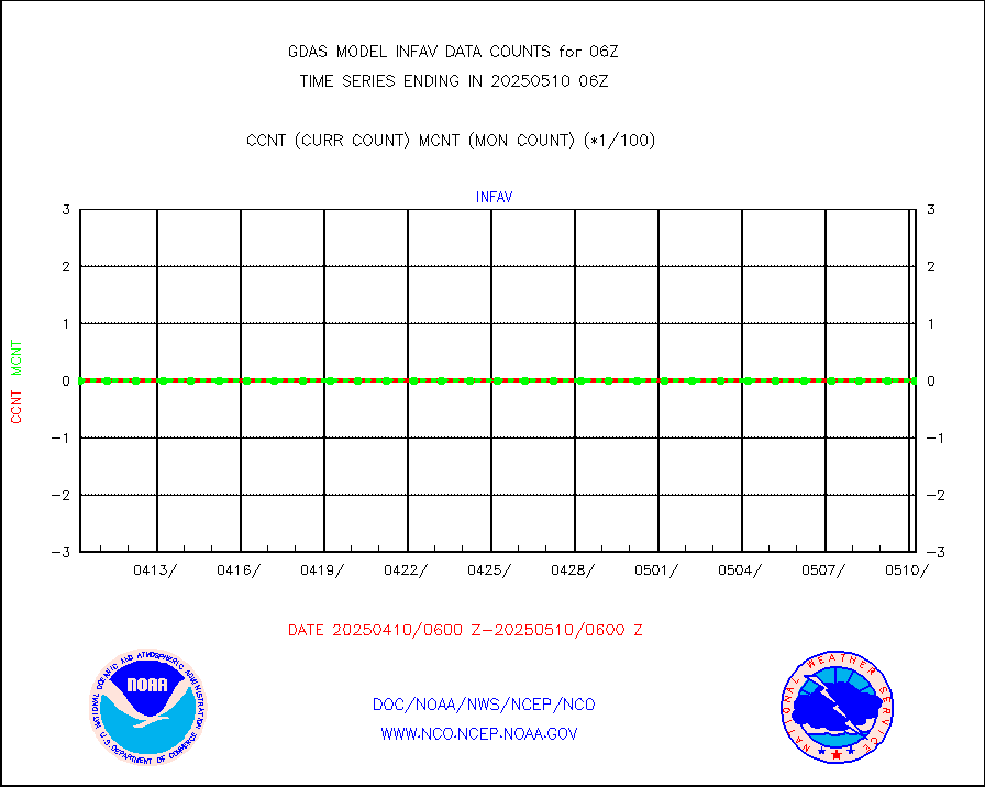
omi |
Aura Ozone Monitoring Instrument (OMI) data |
304984 |
335118 |
91.0 % |
osbuv8 |
NOAA 16-19 Solar Backscatter UV-2 rad frm V8 BUFR |
0 |
0 |
n/a |
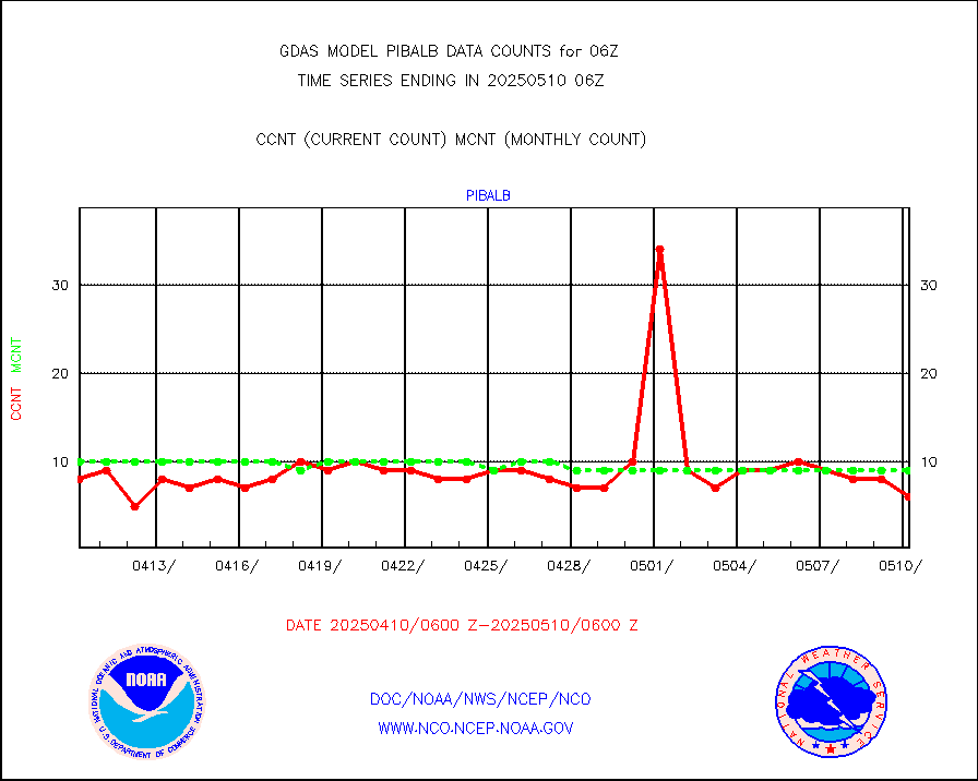
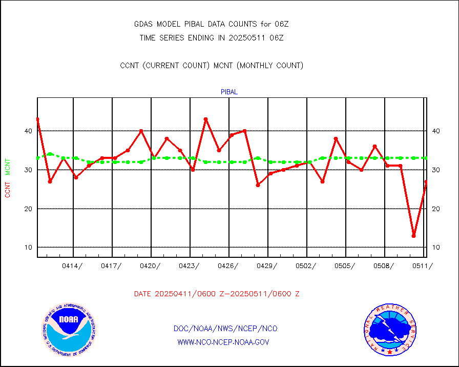
pibal |
PIBAL (from PILOT, PILOT SHIP, PILOT MOBIL) |
56 |
54 |
103.7 % |
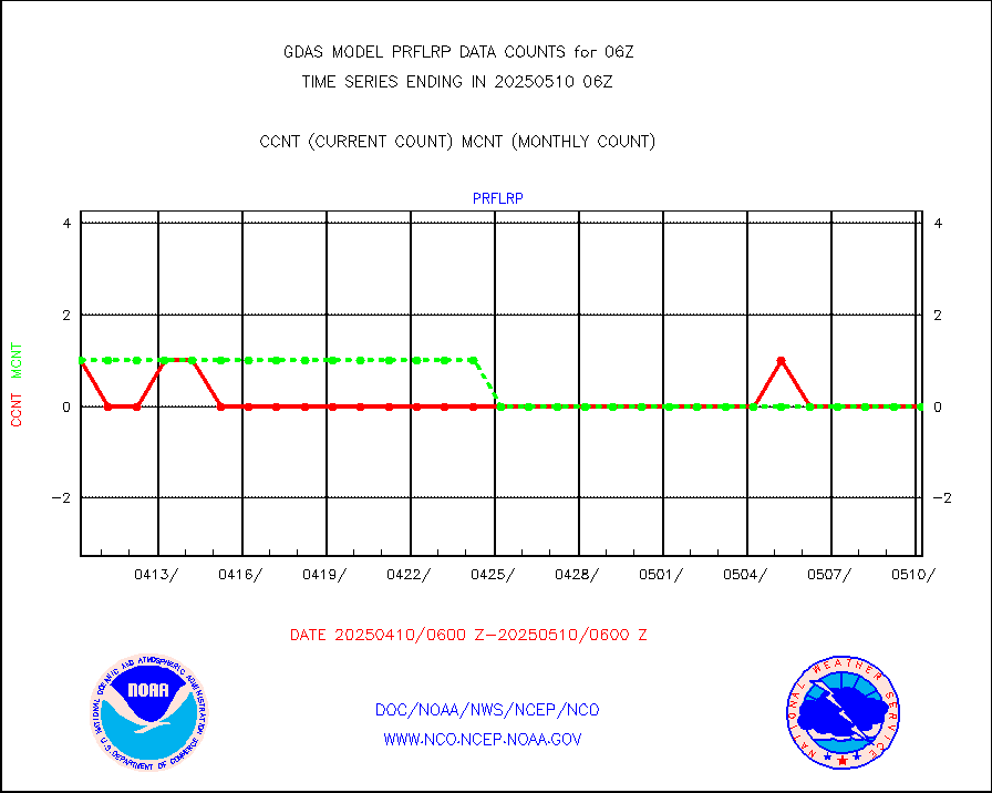
prflrp |
Profilr winds from PIBAL (PILOT,PILOT SHIP/MOBIL) |
1 |
1 |
100.0 % |
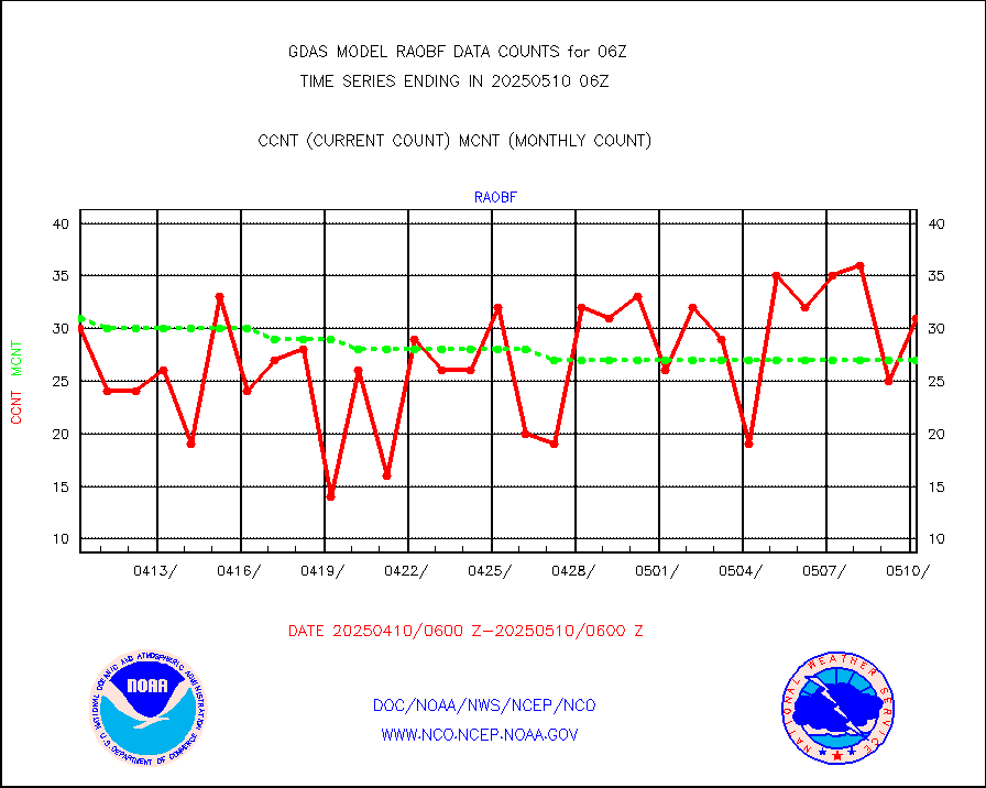
raobf |
Rawinsonde - fixed land (from TEMP or PILOT) |
32 |
32 |
100.0 % |
raobm |
Rawinsonde - mobile land (from TEMP/PILOT MOBIL) |
0 |
0 |
n/a |
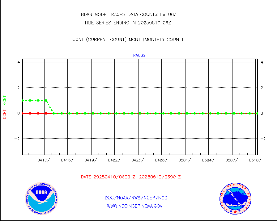
raobs |
Rawinsonde - ship (from TEMP SHIP, PILOT SHIP) |
0 |
0 |
n/a |
recco |
Flight level reconnaissance aircraft data |
0 |
0 |
n/a |
sevcsr |
METEOSAT-10 2nd Gen SEVIRI Clr Sky Radiance(proc) |
0 |
0 |
n/a |
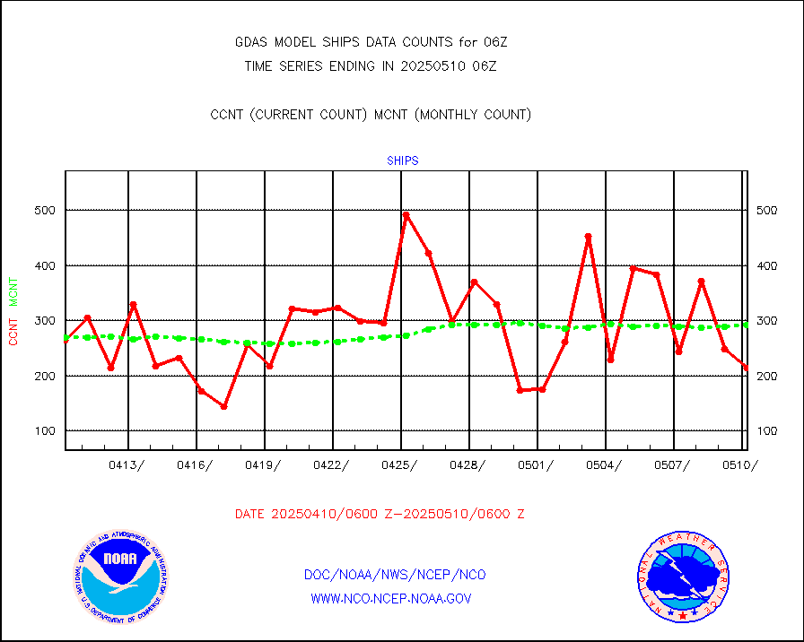
ships |
Ship - manual and automatic, restricted |
113 |
166 |
68.1 % |
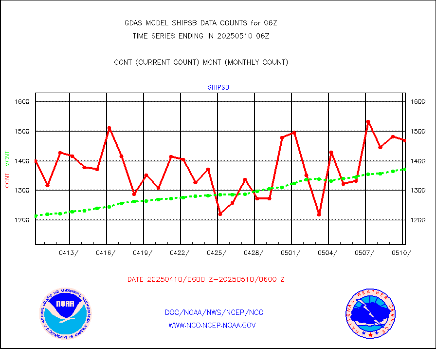
shipsb |
Ship - manual and automatic, restricted (BUFR) |
829 |
943 |
87.9 % |
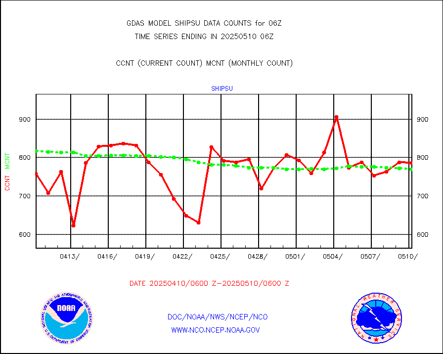
shipsu |
Ship - manual and automatic, unrestricted |
594 |
598 |
99.3 % |
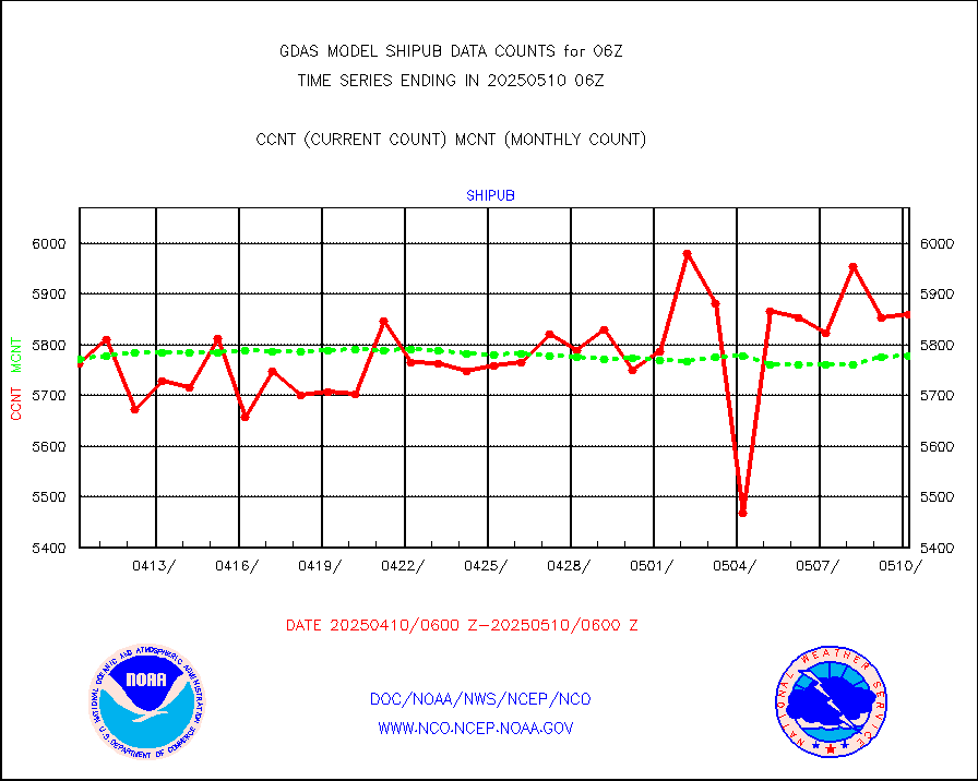
shipub |
Ship - manual and automatic, unrestricted (BUFR) |
5794 |
5716 |
101.4 % |
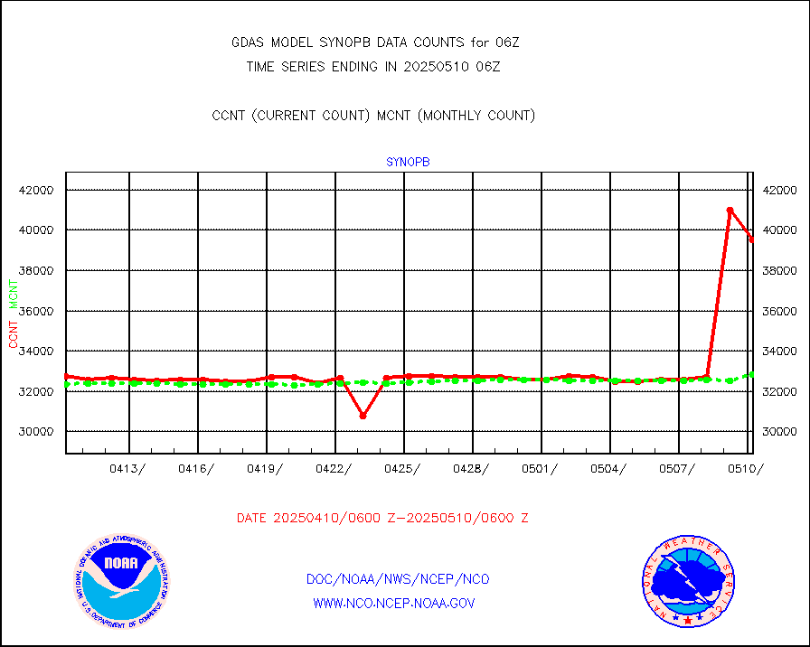
synopb |
Synoptic - fixed manual & auto (decoded fr BUFR) |
31903 |
31526 |
101.2 % |
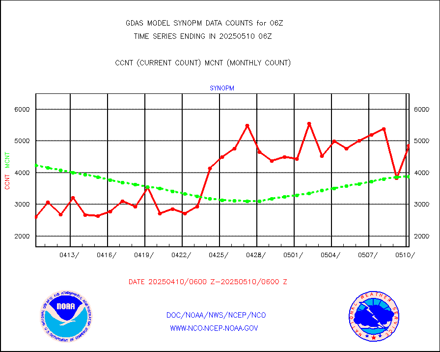
synopm |
Synoptic - mobile manual and automatic |
5886 |
5304 |
111.0 % |
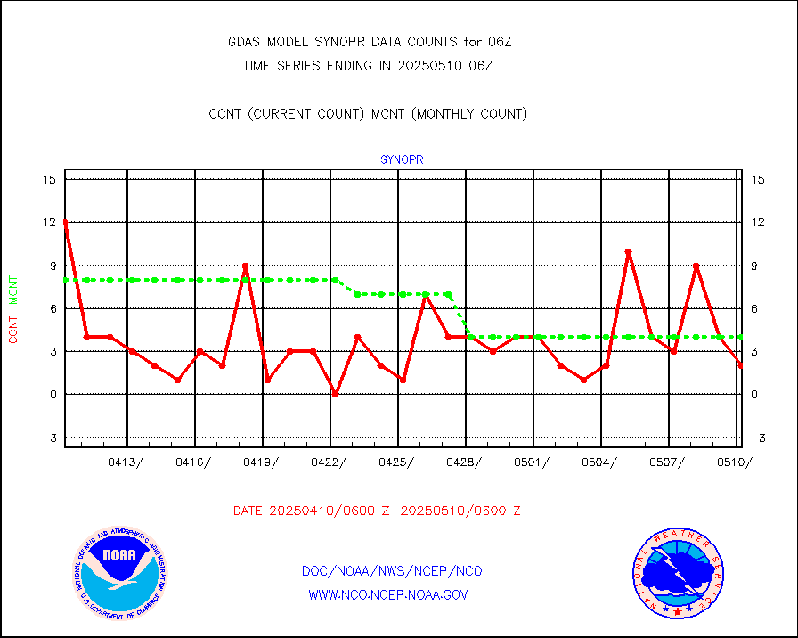
synopr |
Synoptic - restricted (WMO Res 40) manual & auto. |
3 |
7 |
42.9 % |
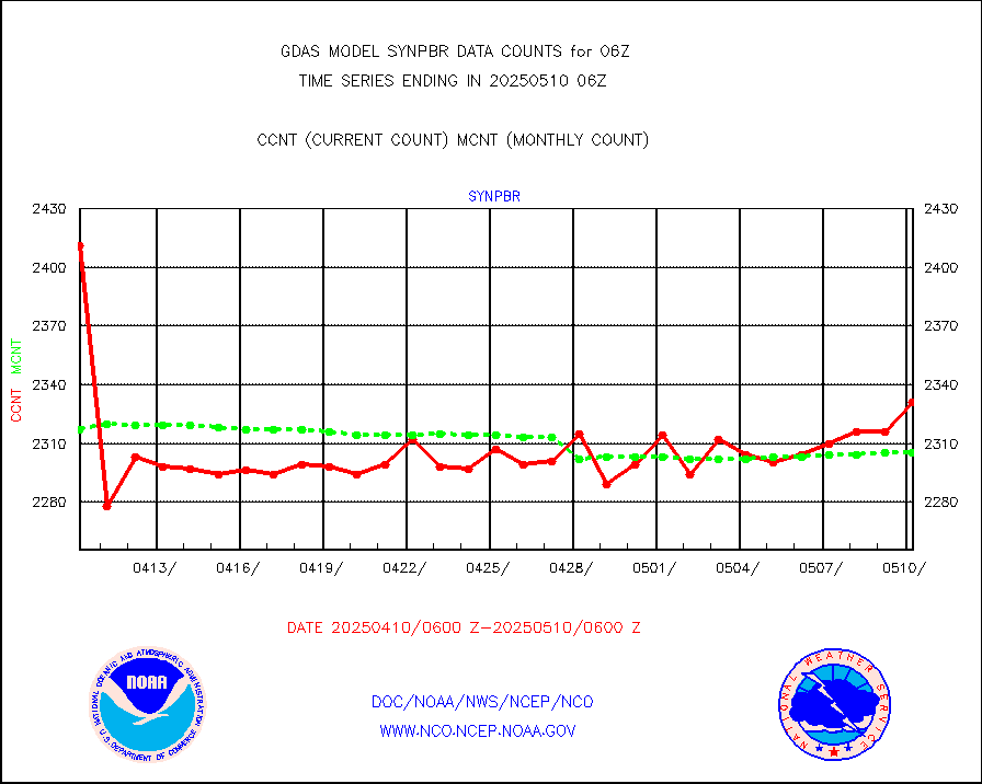
synpbr |
Synoptic - restricted (WMO Res 40)(decoded BUFR) |
2293 |
2291 |
100.1 % |
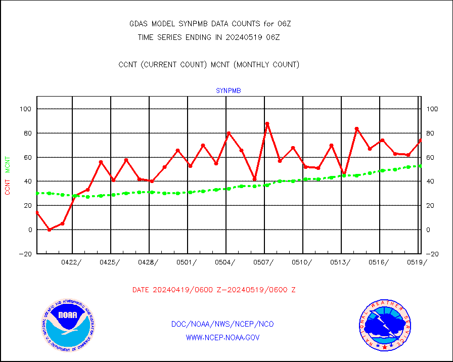
synpmb |
Synoptic - mobile manual & auto (decoded fr BUFR) |
33 |
27 |
122.2 % |
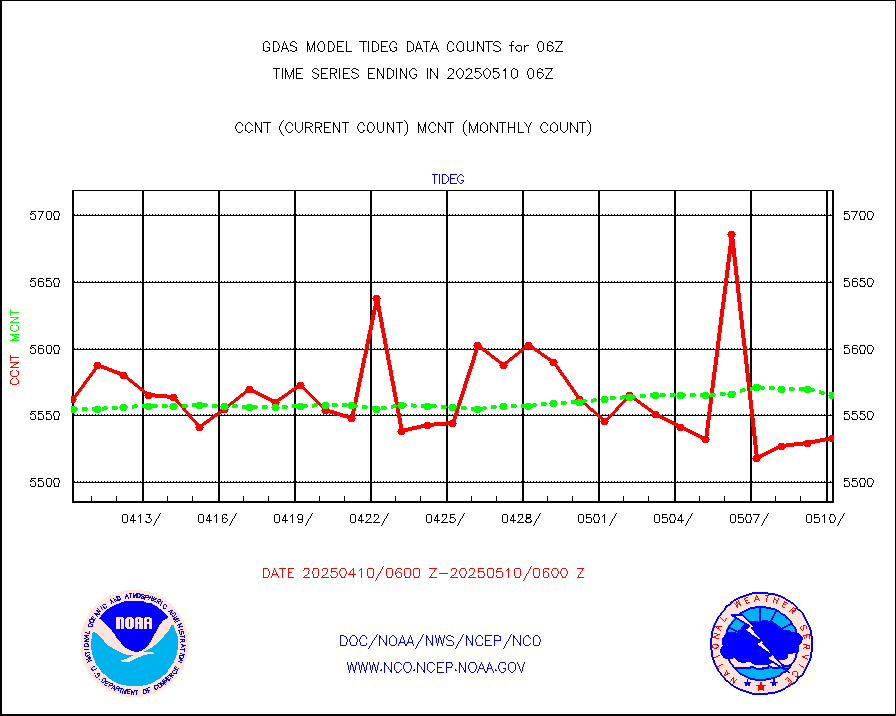
tideg |
Tide gauge reports decoded from CREX format |
5480 |
5421 |
101.1 % |
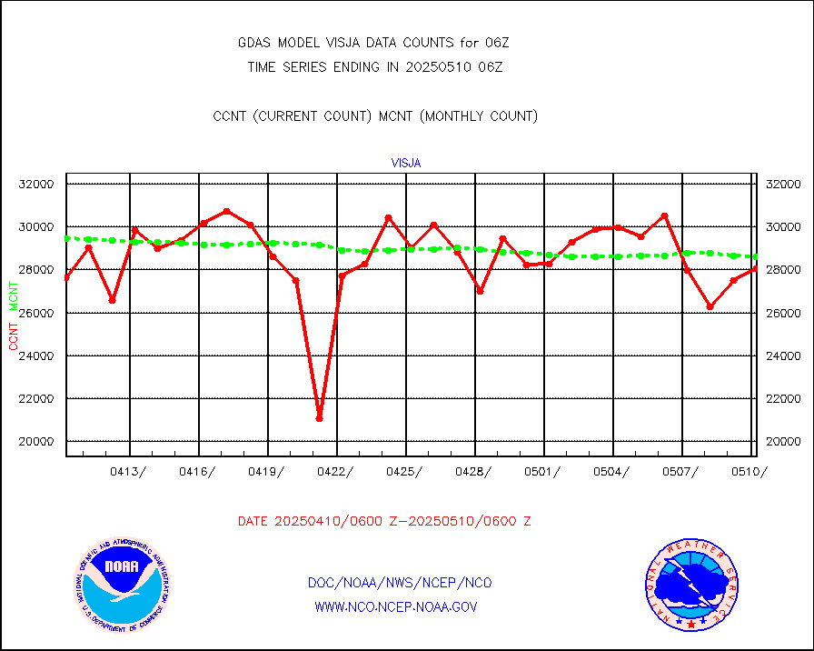
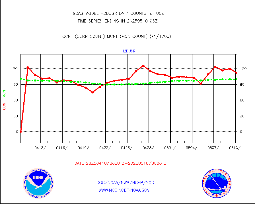
visja |
MTSAT/JMA visible derived cloud motion |
30334 |
28061 |
108.1 % |
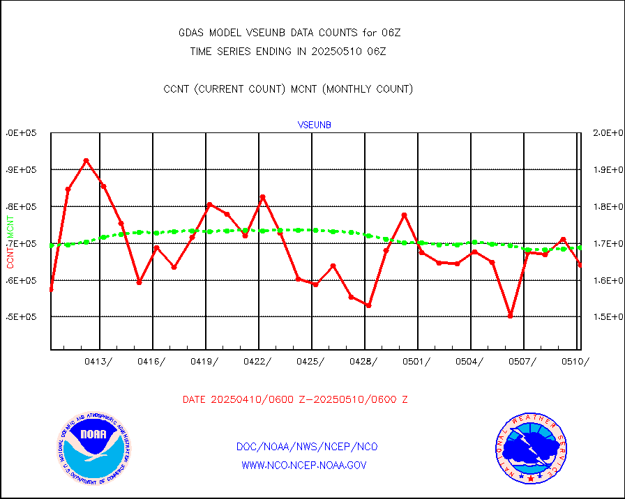
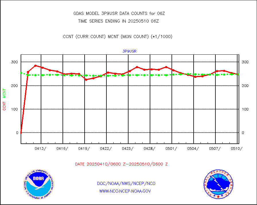
vseunb |
METEOSAT/EUMETSAT visible drv cld motion NBseq |
143331 |
151811 |
94.4 % |
| Data Types of Opportunity with Normal Counts |
|---|
| Type | Description | Hourly Count | Monthly Average | Percent (%) of Monthly Mean |
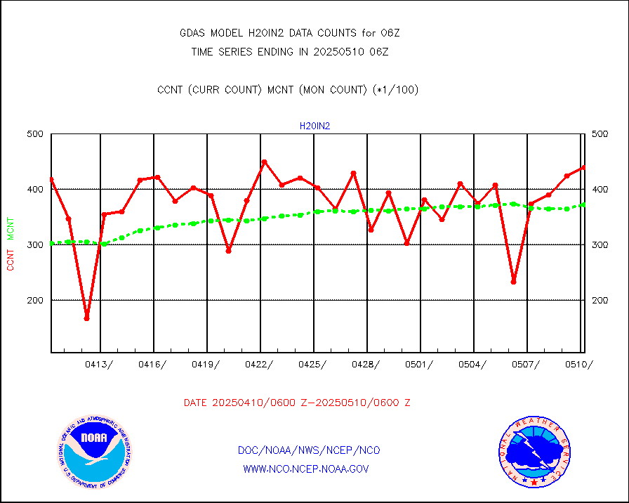
3p9usr |
GOES-16&up/NESDIS ir short-wv derived cld motion |
238152 |
248475 |
95.8 % |
acarsa |
MDCRS ACARS acft data (ARINC via AFWA)(AIREP fmt) |
0 |
0 |
n/a |
amsr2 |
GCOM-W AMSR2 1B brightness temperatures |
9999999 |
9999999 |
100.0 % |
atmsdb |
NPP/NOAA-20 ATMS bright. temps-direct b-cast SSEC |
472346 |
459782 |
102.7 % |
atovs |
POES/NESDIS - processed ATOVS soundings/radiances |
0 |
0 |
n/a |
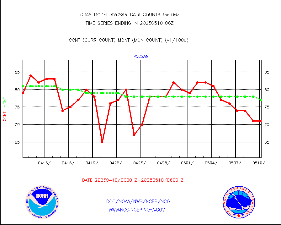
avcsam |
A.M.(N17,M2,M3) AVHRR GAC NCEP-proc clr&sea btmps |
7237000 |
7712474 |
93.8 % |
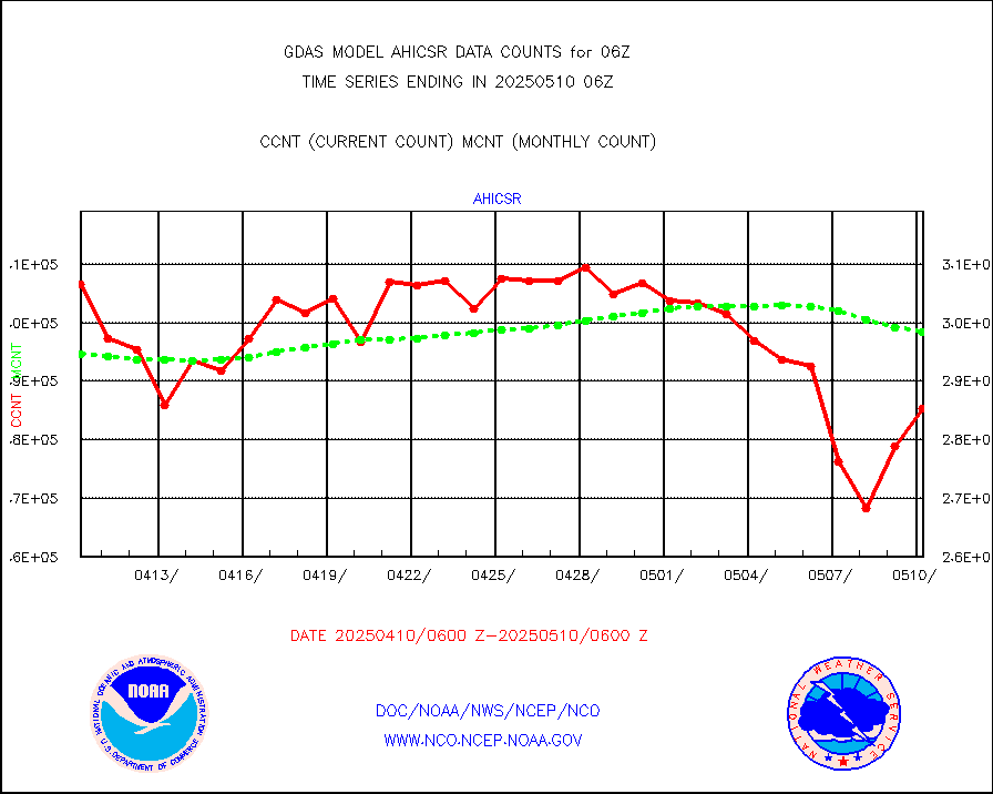
avcspm |
P.M.(N18-19) AVHRR GAC NCEP-proc clr & sea btemps |
9153864 |
8896359 |
102.9 % |
bathy |
eXpendable BathyThermograph, mooring (BATHY fmt) |
6 |
3 |
200.0 % |
camdar |
Canadian AMDAR aircraft data (decoded from BUFR) |
0 |
1 |
0.0 % |
crisf4 |
NPP/NOAA-20 CrIS full spctrl radn (431 ch subset) |
1454760 |
1457964 |
99.8 % |
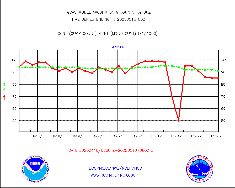
crsfdb |
NPP/NOAA-20 CrIS full spctrl radn dir brdcst SSEC |
704085 |
635619 |
110.8 % |
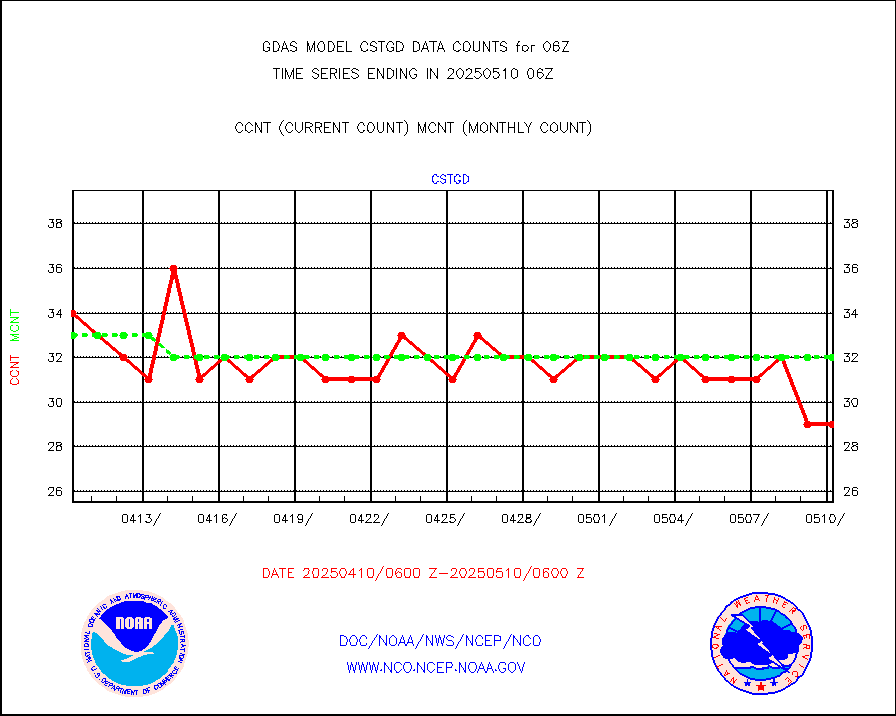
cstgd |
Coast Guard |
27 |
22 |
122.7 % |
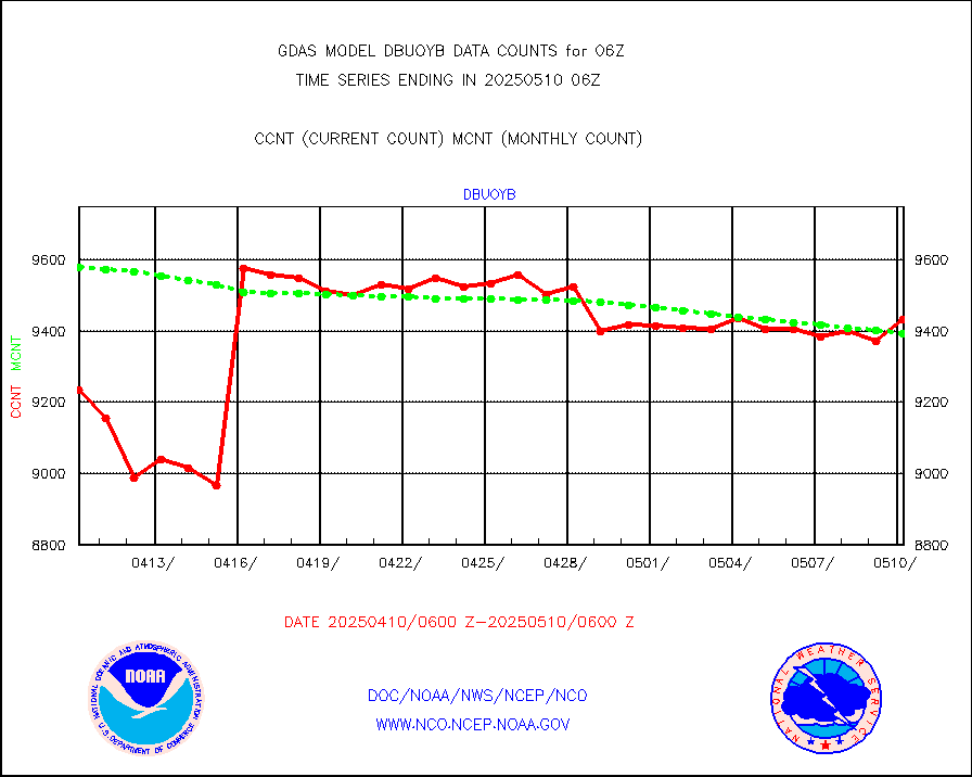
dbuoyb |
Drifting buoys (decoded from BUFR) |
8984 |
8894 |
101.0 % |
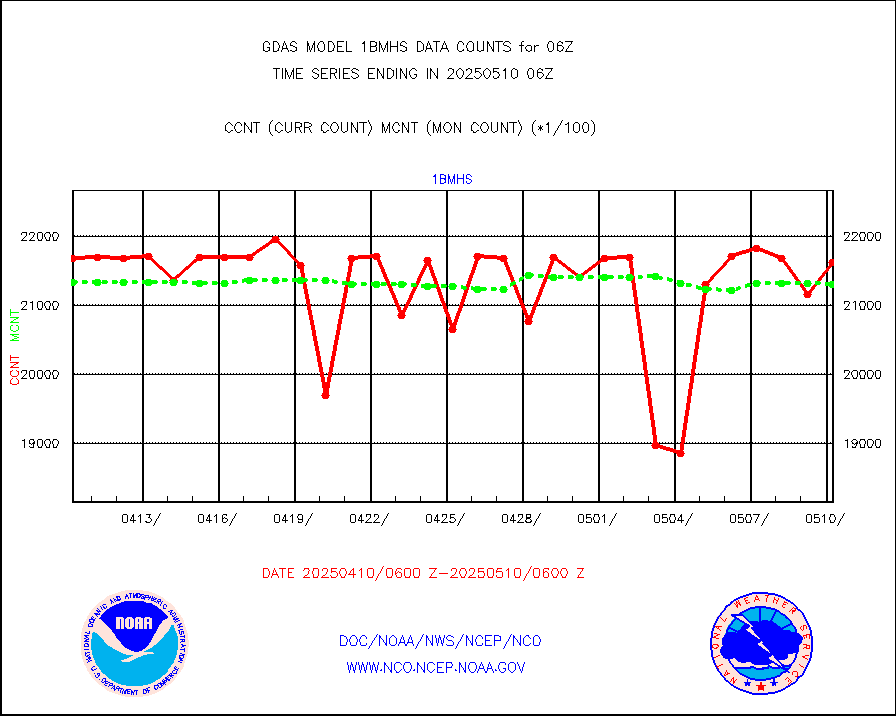
esatms |
NPP Adv. Tech. MW Sndr (ATMS) br. temps from RARS |
755467 |
621695 |
121.5 % |
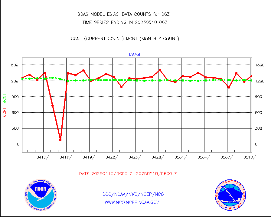
esiasi |
METOP 1-2 IASI 1C radiance data vbl chn from RARS |
158236 |
174722 |
90.6 % |
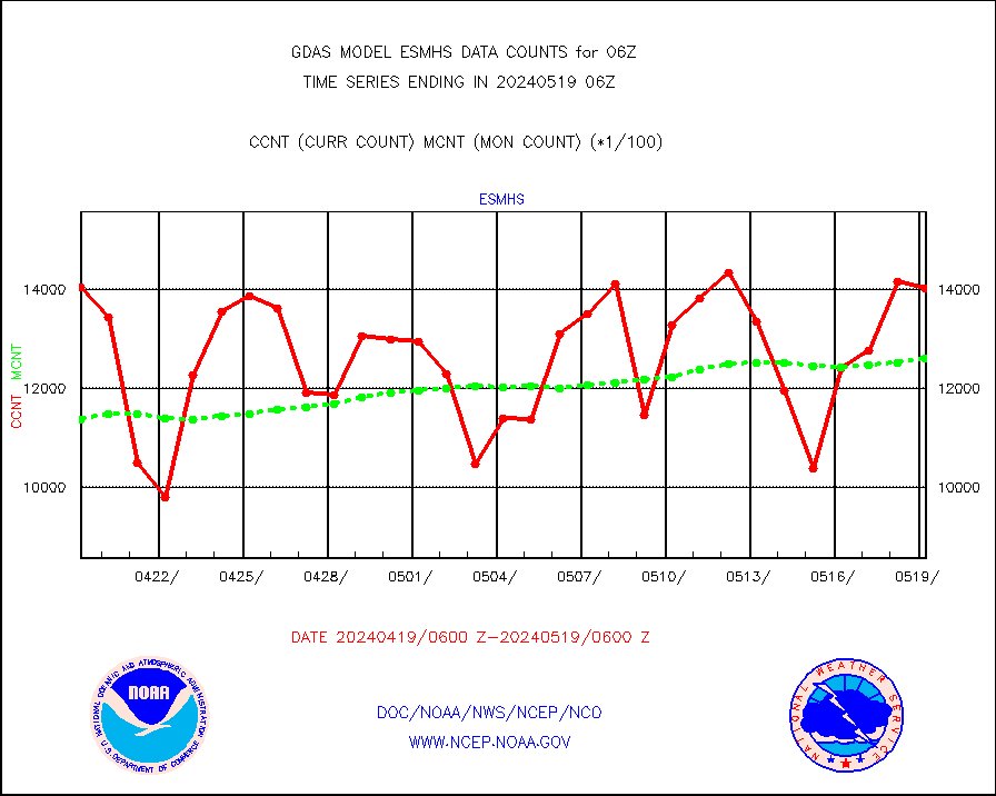
esmhs |
NOAA 18-19 & METOP 1-2 MHS proc. btemps from RARS |
1227992 |
1137907 |
107.9 % |
geoimr |
GOES/NESDIS (11x17 f-o-v) imager clear radiances |
0 |
0 |
n/a |
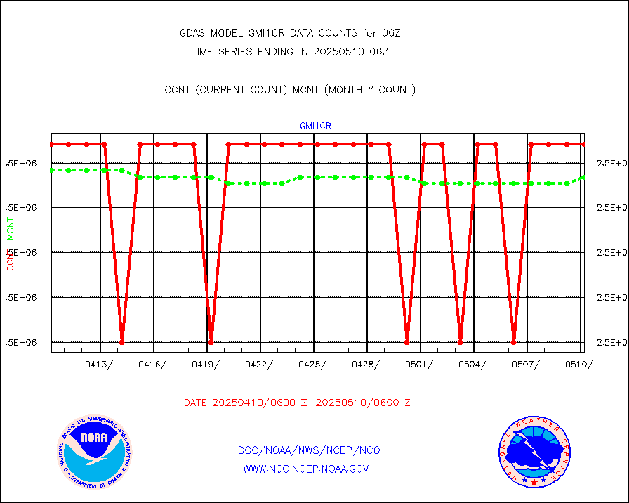
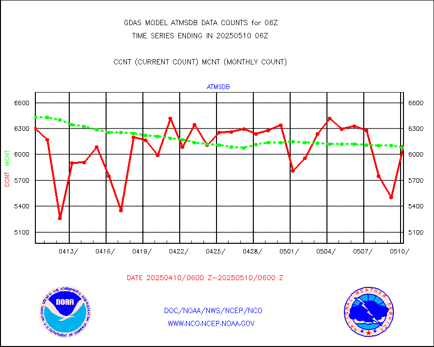
gmi1cr |
GPM GMI Level 1C-R brightness temperatures |
5083442 |
5083383 |
100.0 % |
gnss |
Grnd-based Gbl Navigation Sat System (GNSS) data |
6189 |
5225 |
118.4 % |
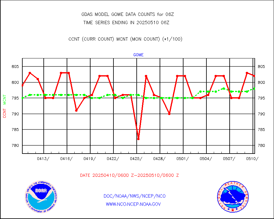
gome |
METOP 1-2 Global Ozone Monitoring Exp.-2 (GOME-2) |
80385 |
79825 |
100.7 % |
h20in |
INSAT/KALPANA India wvpr derived cloud motion |
0 |
0 |
n/a |
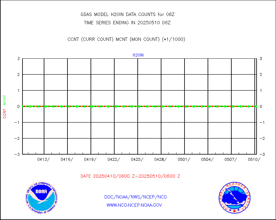
h2dusr |
GOES-16&up/NESDIS wv imgr/deep-lyr derivd cld mtn |
109312 |
91712 |
119.2 % |
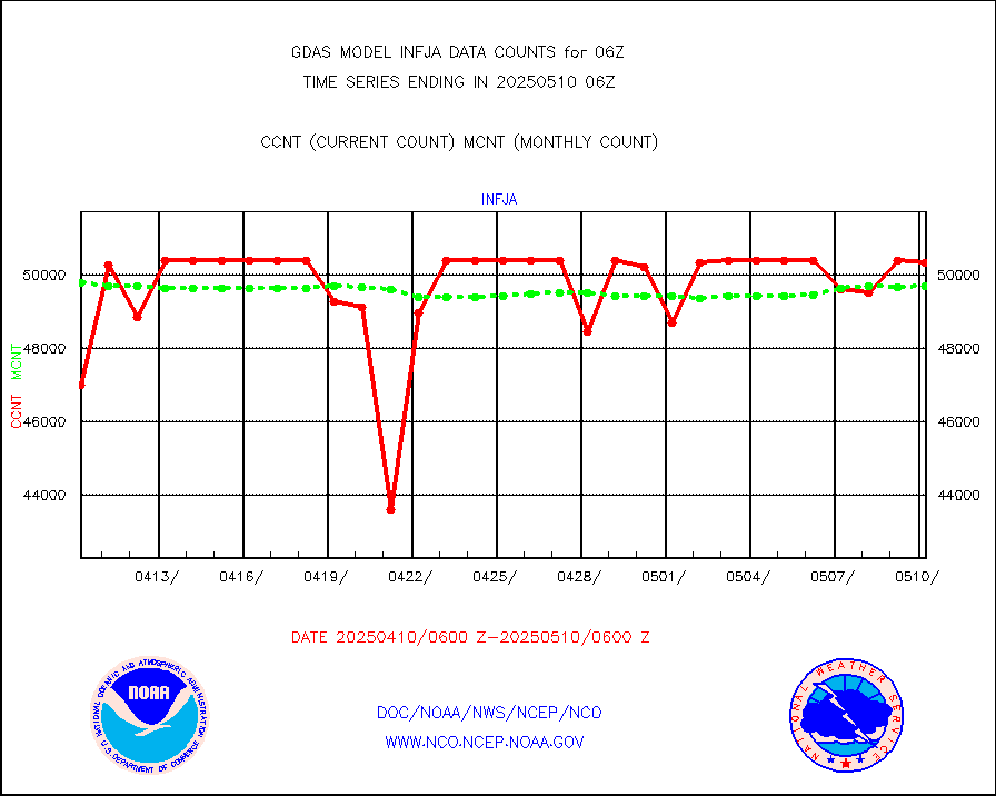
h2eunb |
METEOSAT/EUMETSAT wvpr imgr drv cld motion NBseq |
251666 |
253172 |
99.4 % |
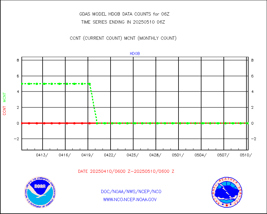
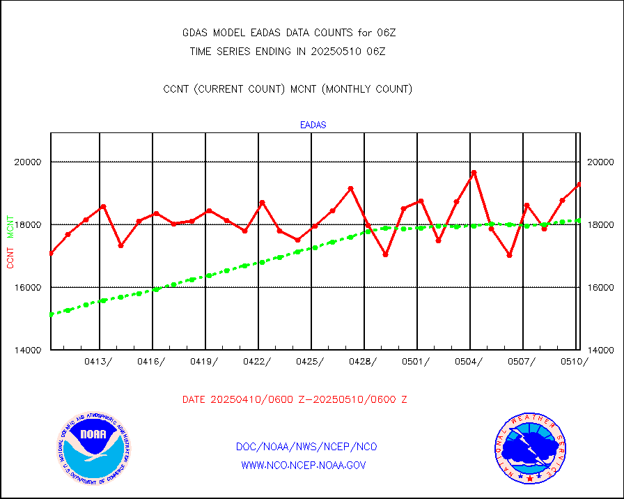
hdob |
High Density OBs from reconnaissance acft data |
0 |
0 |
n/a |
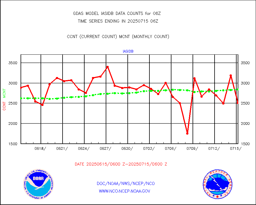
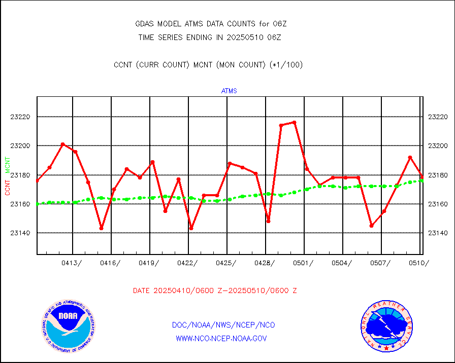
iasidb |
METOP 1-2 IASI 1C radiances-direct broadcast SSEC |
205420 |
198089 |
103.7 % |
ifvrnb |
VIIRS (NPP/NOAA-20) ir lg-wv drv cloud motion(NB) |
113131 |
102996 |
109.8 % |
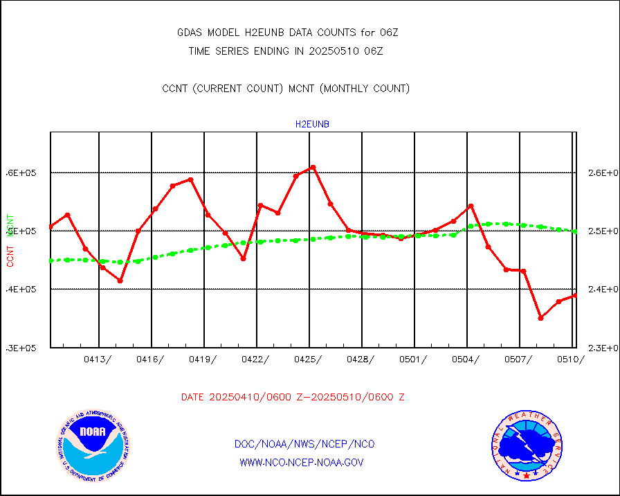
infav1 |
AVHRR (METOP) ir lg-wave derived cld motion |
39023 |
50151 |
77.8 % |
infin |
INSAT/KALPANA India ir lg-wave derived cld motion |
0 |
0 |
n/a |
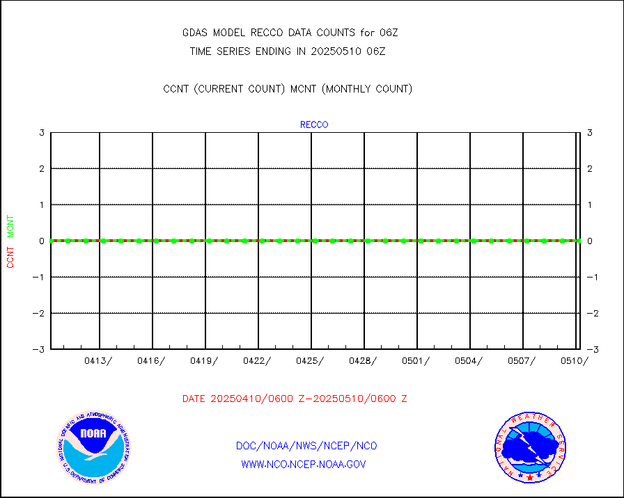
kamdar |
Korean AMDAR aircraft data (decoded from BUFR) |
574 |
523 |
109.8 % |
mbuoyb |
Moored buoys (decoded from BUFR) |
5775 |
5392 |
107.1 % |
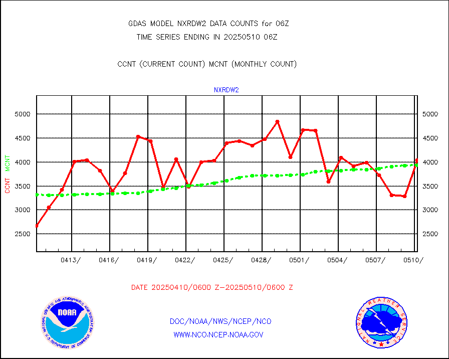
nxrdw2 |
NEXRAD Vel Azm Dsp(VAD) winds via Level 2 decoder |
4111 |
3799 |
108.2 % |
ompslp |
OMPS Limb Profiler ozone data (NPP) |
1778 |
1405 |
126.5 % |
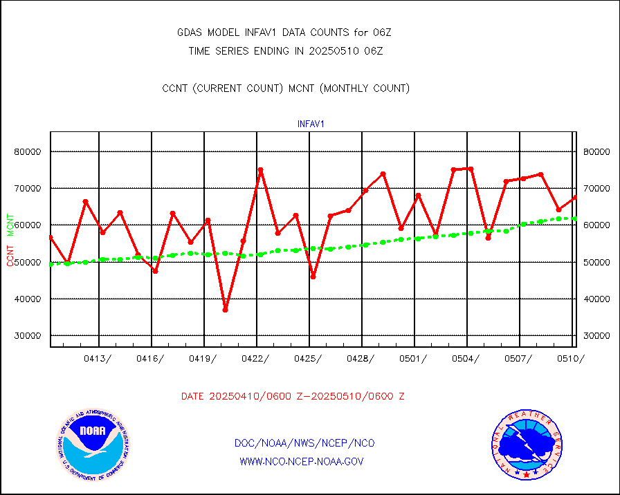
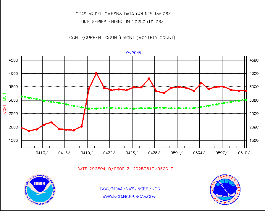
ompsn8 |
OMPS nadir profile ozone (Version 8 BUFR) |
3442 |
3243 |
106.1 % |
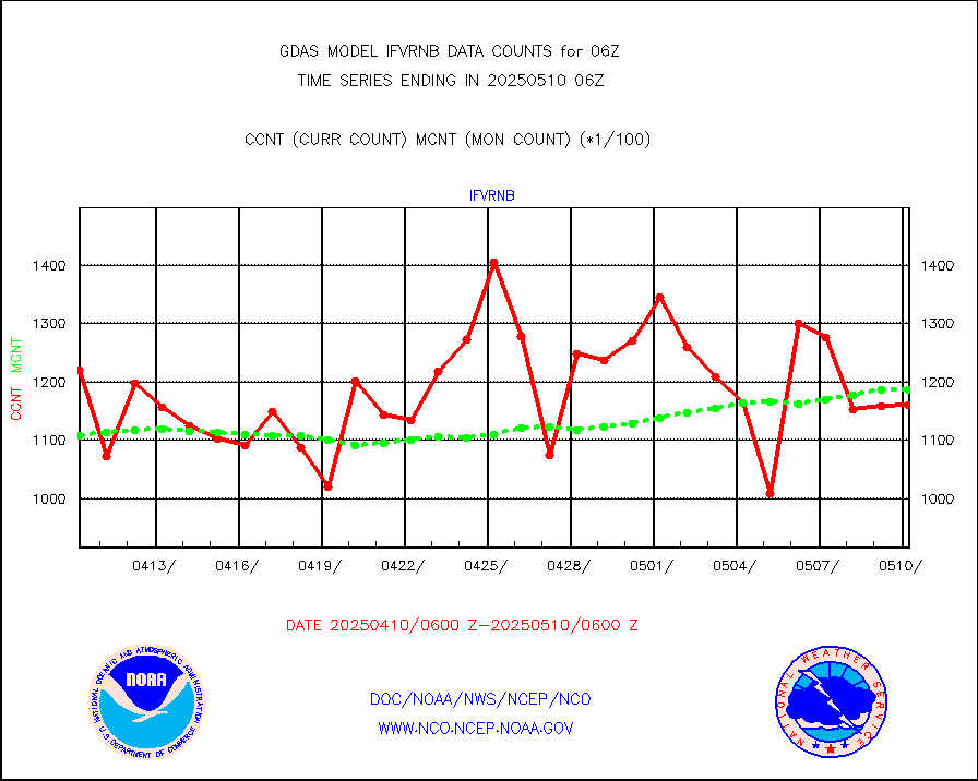
ompst8 |
OMPS total column ozone (Version 8 BUFR) |
2016276 |
2099331 |
96.0 % |
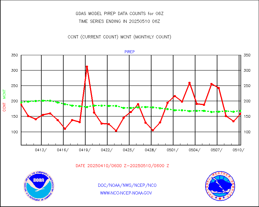
pirep |
Manual PIREP aircraft data (dcded from AIREP fmt) |
82 |
147 |
55.8 % |
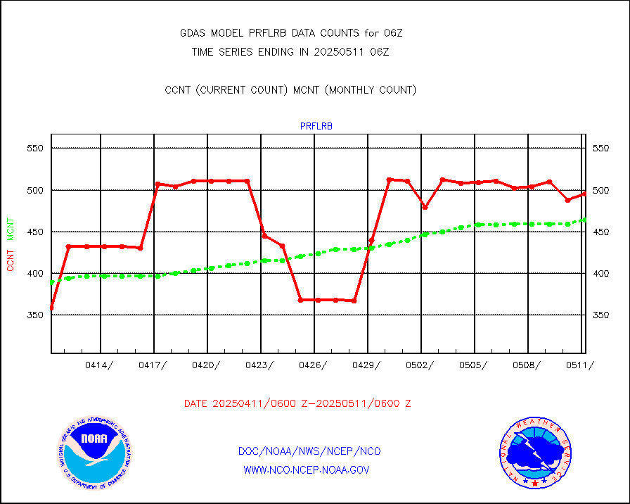
prflrb |
Multi-Agency Profiler (MAP) and SODAR winds |
432 |
388 |
111.3 % |
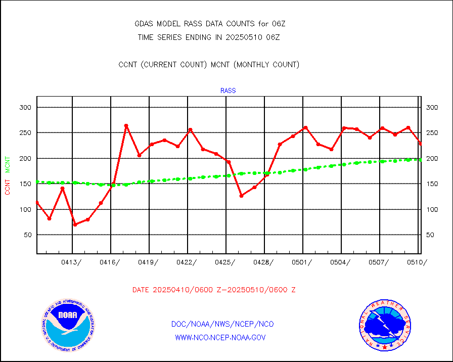
rass |
RASS temperatures (NOAA and Multi-Agency) |
198 |
194 |
102.1 % |
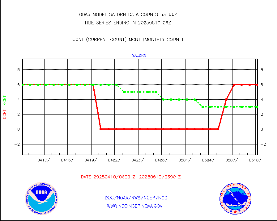
saldrn |
Surface Marine Saildrone (decoded from BUFR) |
6 |
6 |
100.0 % |
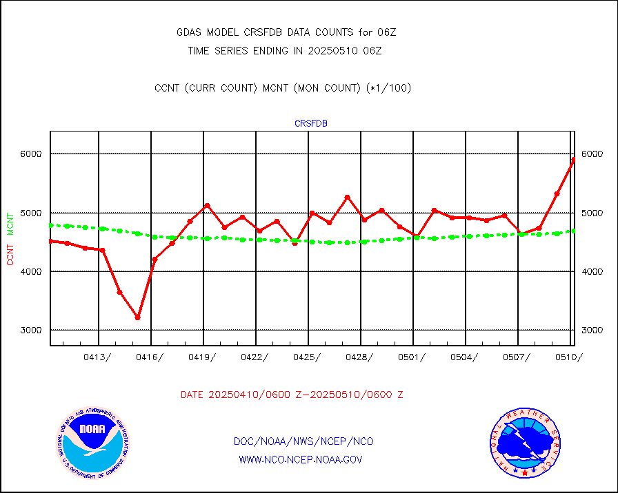
saphir |
Megha-Tropiques SAPHIR L1A2 brightness temps |
0 |
0 |
n/a |
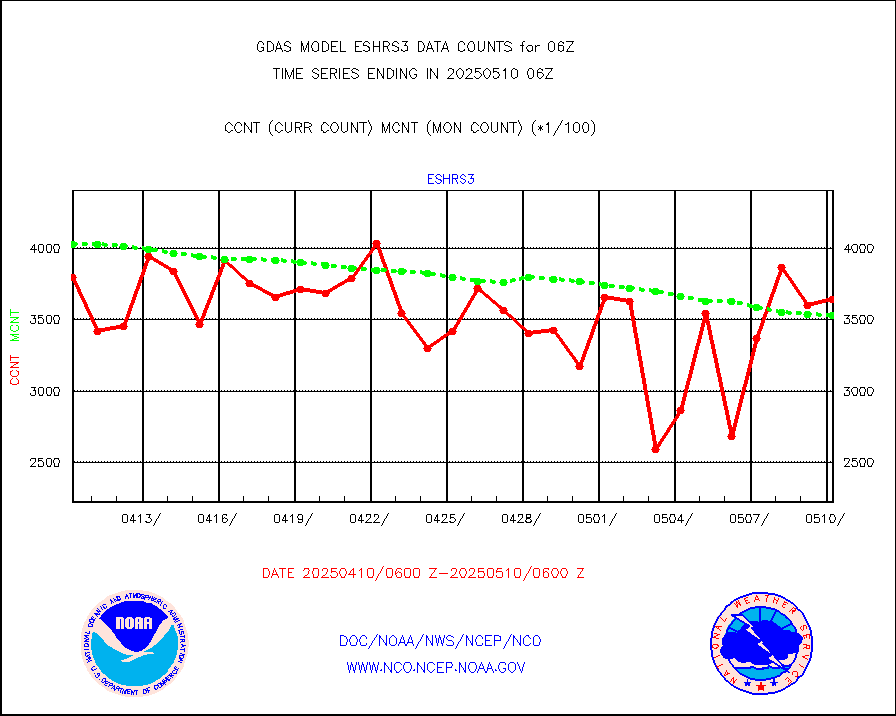
sevasr |
METEOSAT-10 2nd Gen SEVIRI All Sky Radiance(proc) |
452630 |
452671 |
100.0 % |
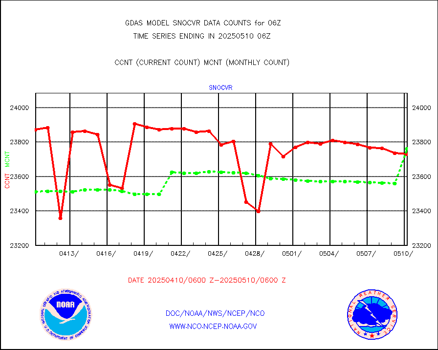
snocvr |
NOW COVER, DEPTH/DENSITY AND WATER EQUIVALENT |
19580 |
25616 |
76.4 % |
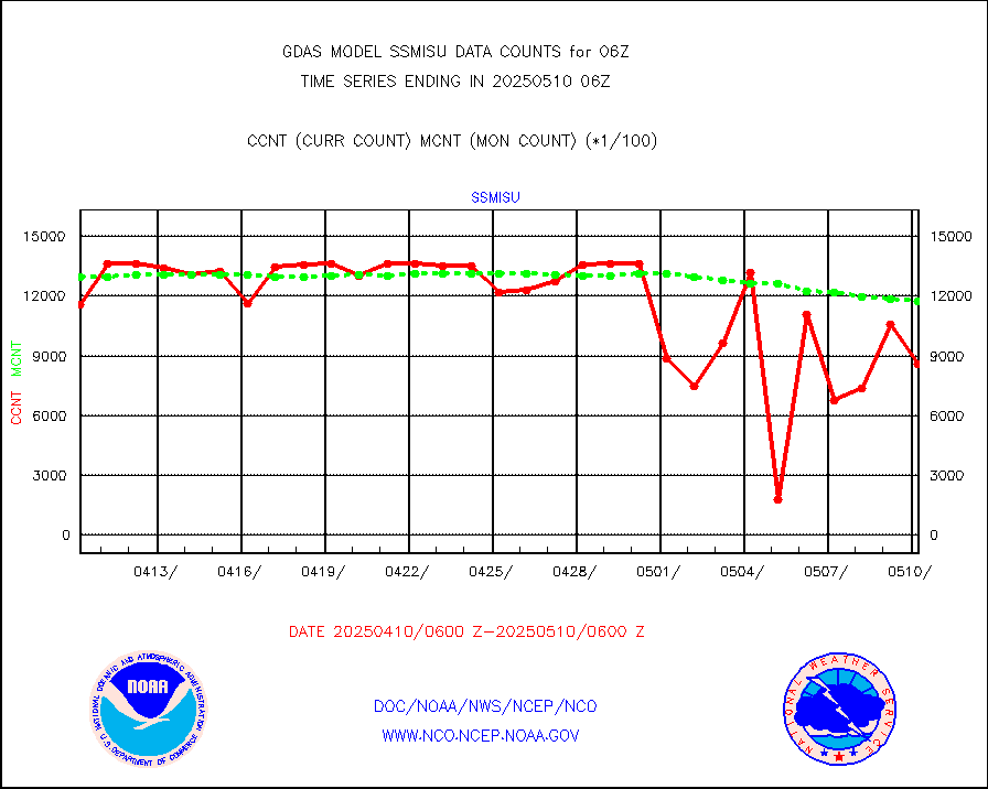
ssmisu |
DMSP SSM/IS 1C radiance data (Unified Pre-Proc.) |
1364580 |
1274204 |
107.1 % |
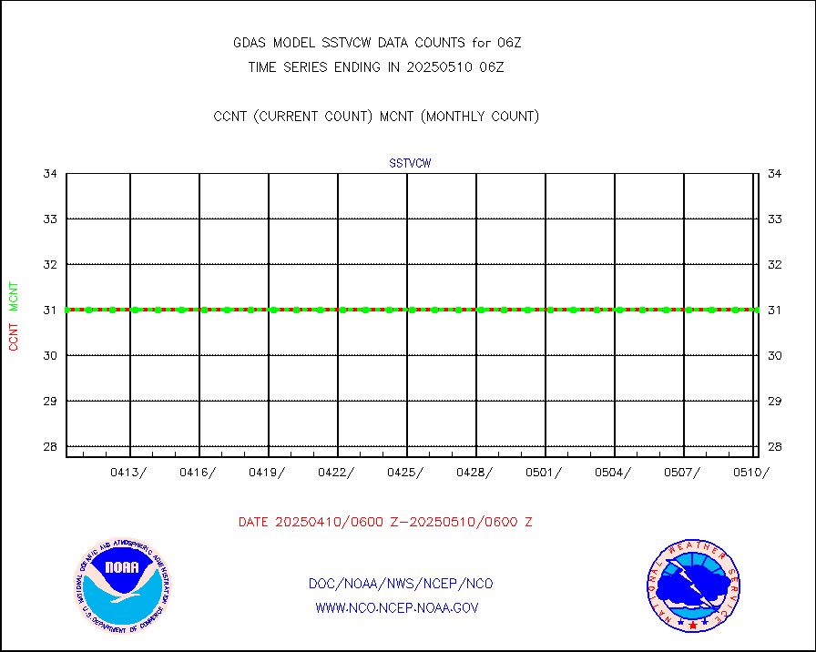
sstvcw |
NPP/NOAA-20 VIIRS SST - CLEAR & OVER WATER |
31 |
31 |
100.0 % |
sstvpw |
NPP/NOAA-20 VIIRS SST - PROBABLY CLR & OVER WATER |
9999999 |
9999999 |
100.0 % |
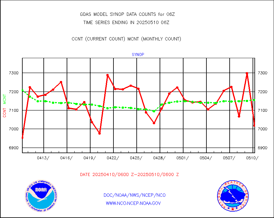
synop |
Synoptic - fixed manual and automatic |
8200 |
7837 |
104.6 % |
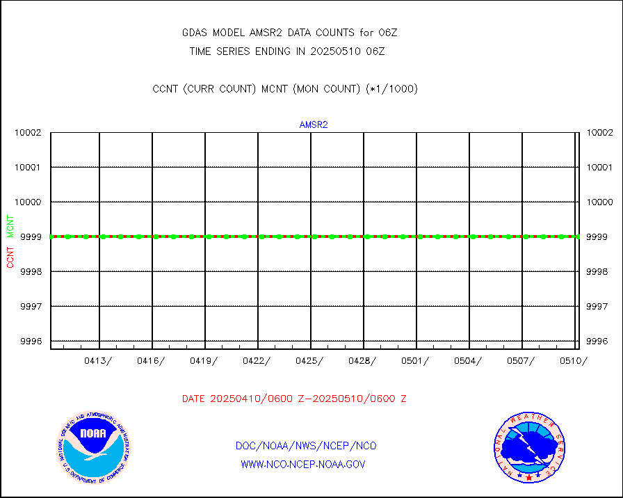
tesac |
CTD probe, Argo prflng float, mooring (TESAC fmt) |
2338 |
2275 |
102.8 % |
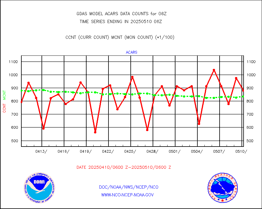
tmdara |
TAMDAR aircft data-all types(from Panasonic,BUFR) |
2669 |
2759 |
96.7 % |
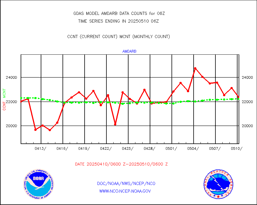
visin |
INSAT/KALPANA India visible derived cloud motion |
0 |
0 |
n/a |
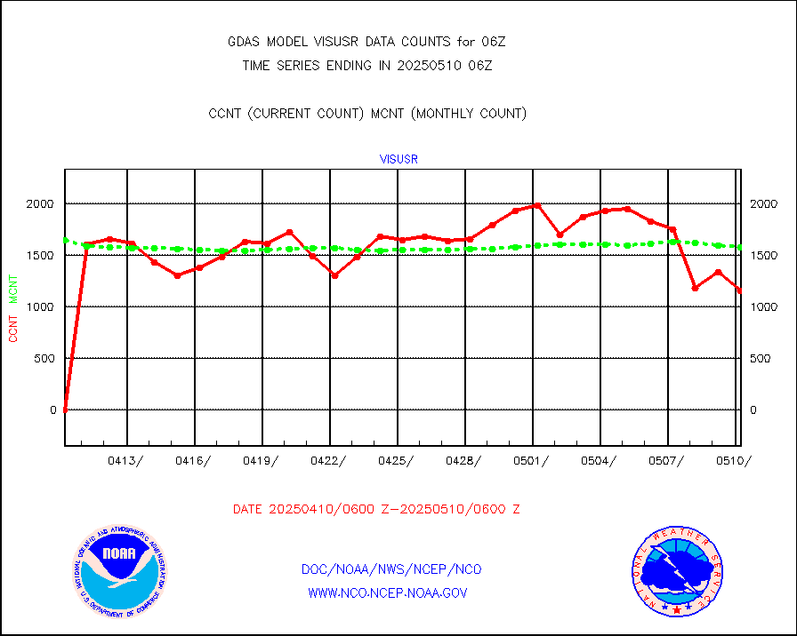
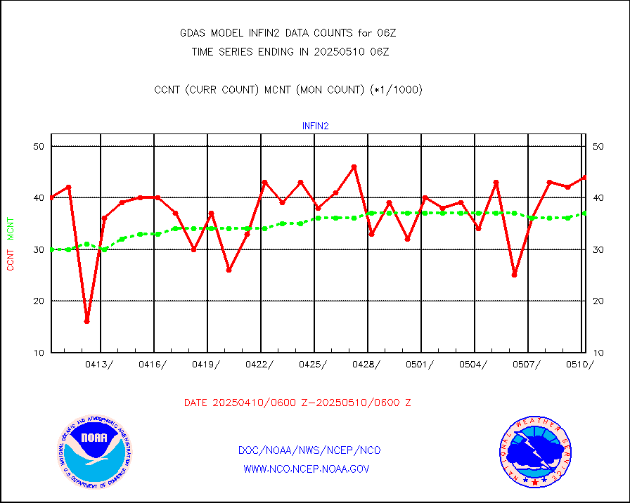
visusr |
GOES-16&up/NESDIS visible derived cloud motion |
128724 |
153934 |
83.6 % |


