| Critical Data with Normal Counts |
|---|
| Type | Description | Hourly Count | Monthly Average | Percent (%) of Monthly Mean |
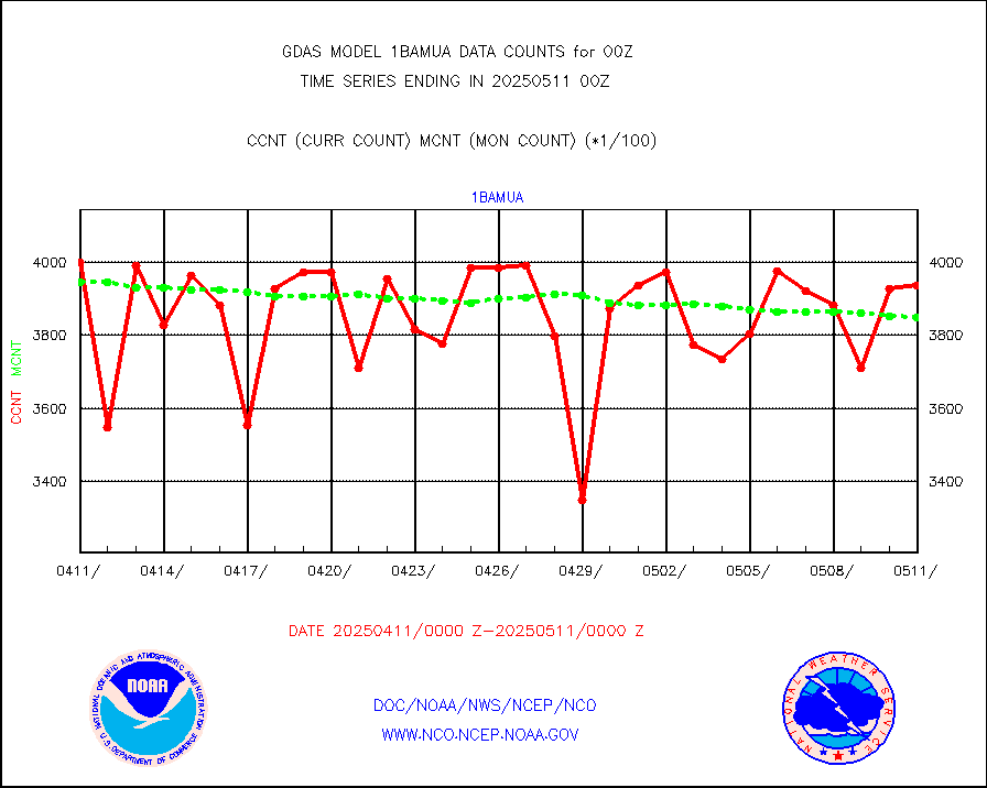
1bamua |
NOAA 15-19 & METOP 1-2 AMSU-A NCEP-proc. br.temps |
376617 |
380400 |
99.0 % |
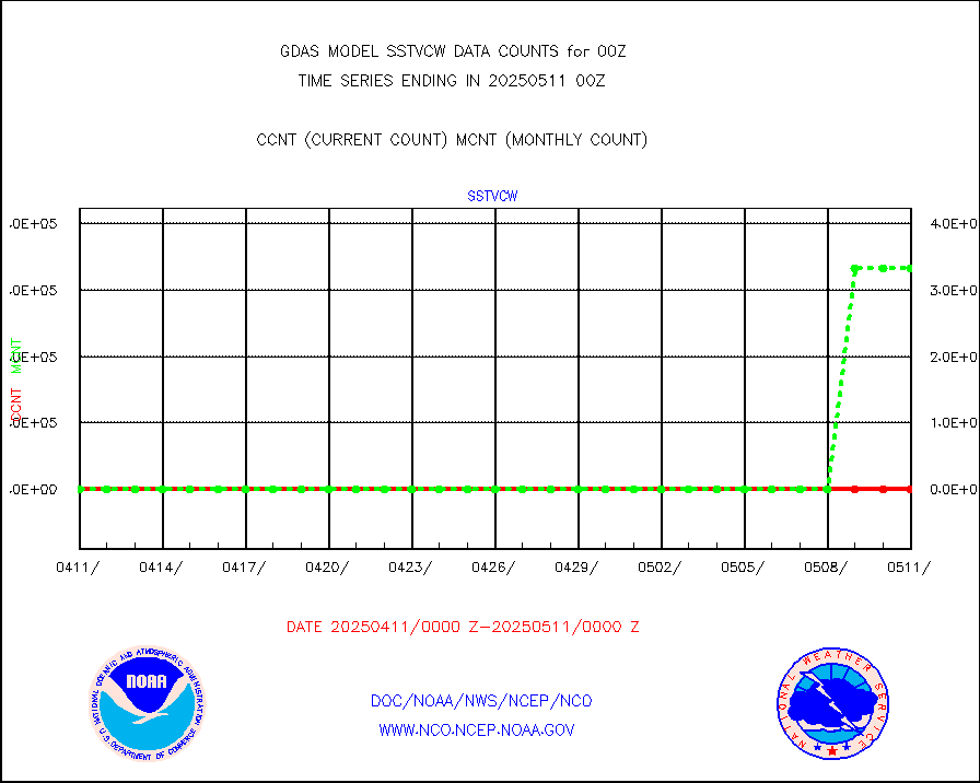
1bhrs4 |
NOAA 18-19 & METOP 1-2 HIRS-4 NCEP-proc. br.temps |
359128 |
343073 |
104.7 % |
1bmhs |
NOAA 18-19 & METOP 1-2 MHS NCEP-proces. br. temps |
2162243 |
2121621 |
101.9 % |
acars |
MDCRS ACARS acft data from ARINC(dcded from BUFR) |
174388 |
144224 |
120.9 % |
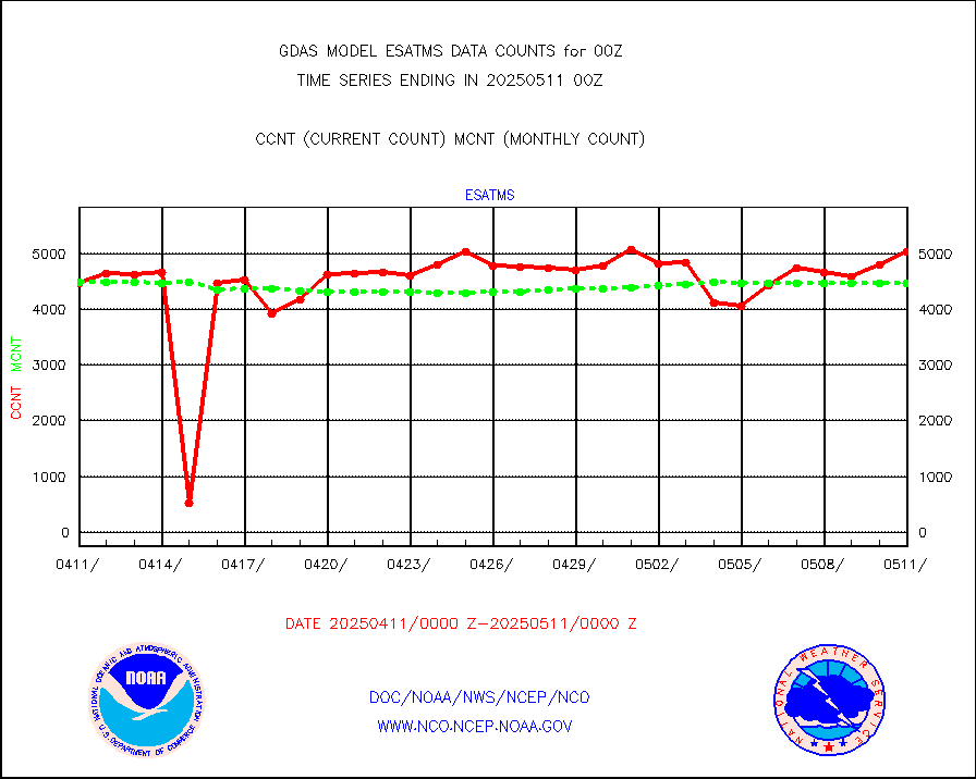
ahicsr |
Himawari Clear Sky Radiance |
315127 |
320191 |
98.4 % |
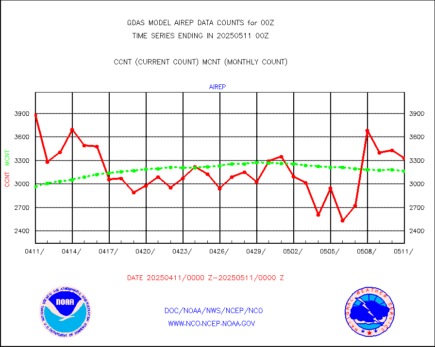
airep |
Manual AIREP aircraft data (dcded from AIREP fmt) |
5354 |
4557 |
117.5 % |
airsev |
AQUA AIRS/AMSU-A/HSB brightness temps- every FOV |
0 |
0 |
n/a |
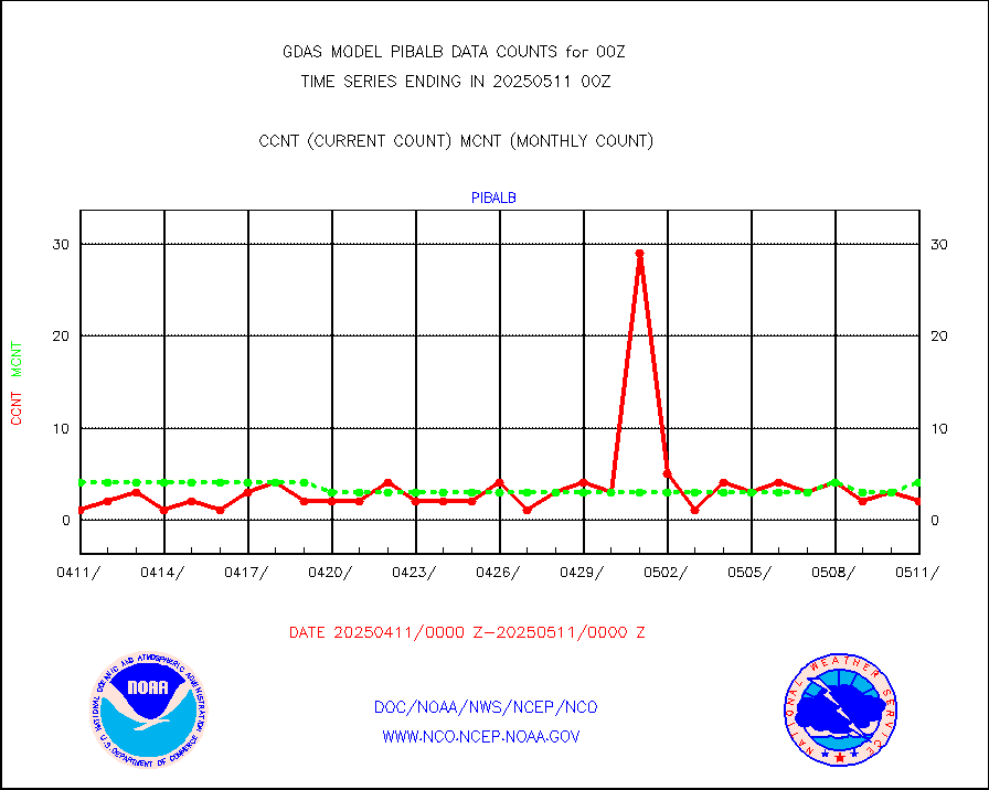
amdar |
AMDAR aircraft data (decoded from AMDAR format) |
5365 |
4938 |
108.6 % |
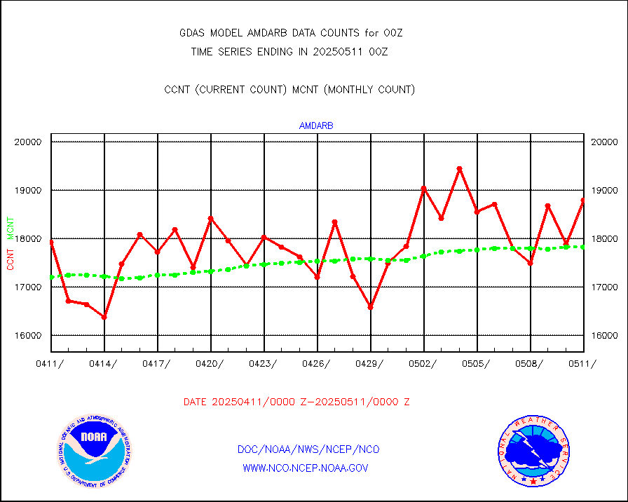
amdarb |
AMDAR aircraft data (decoded from BUFR) |
9622 |
9283 |
103.7 % |
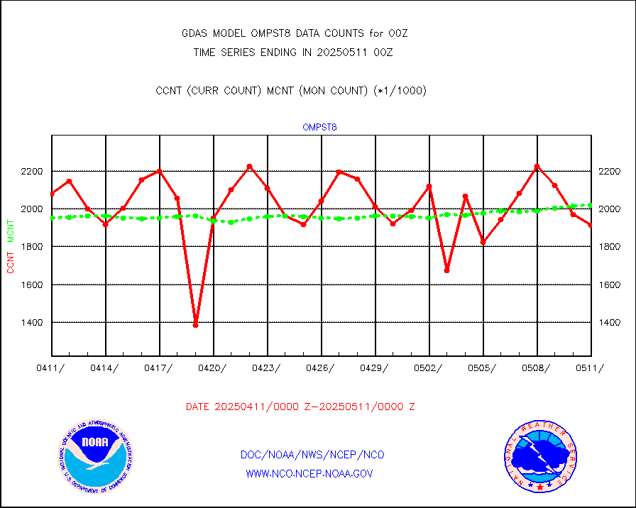
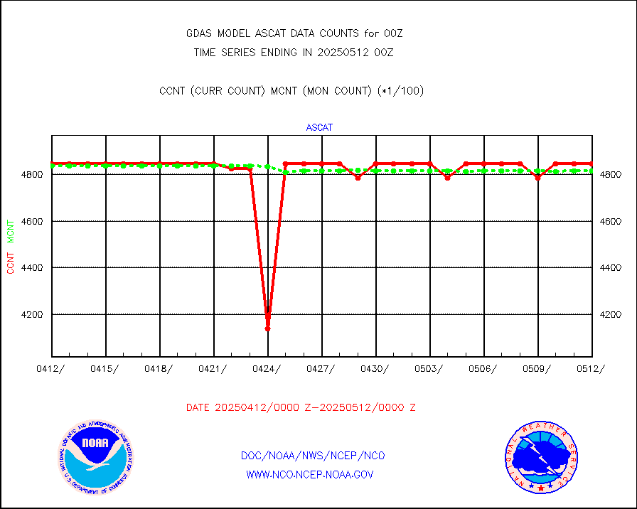
ascat |
METOP 1-2 ASCAT products |
470316 |
477595 |
98.5 % |
atms |
NPP/NOAA-20 ATMS brightness temperatures |
2317818 |
2317626 |
100.0 % |
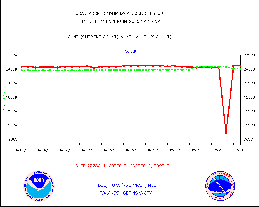
cmanb |
Surface Marine CMAN rpts decoded from BUFR format |
24382 |
24385 |
100.0 % |
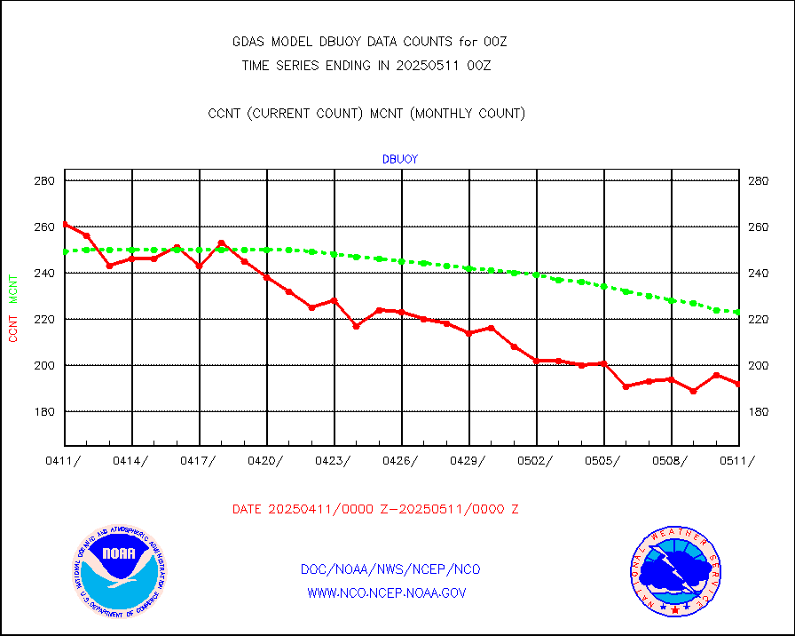
dbuoy |
Buoys decoded from FM-18 fmt (moored or drifting) |
296 |
286 |
103.5 % |
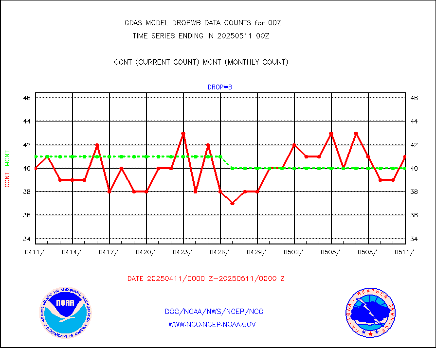
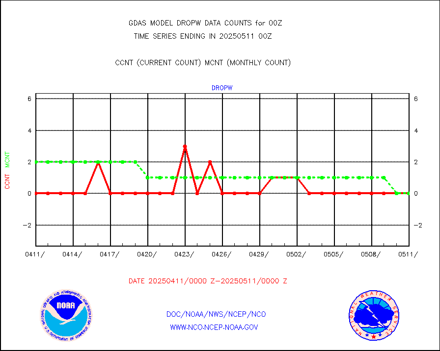
dropw |
Dropwinsonde (from TEMP DROP) |
0 |
1 |
0.0 % |
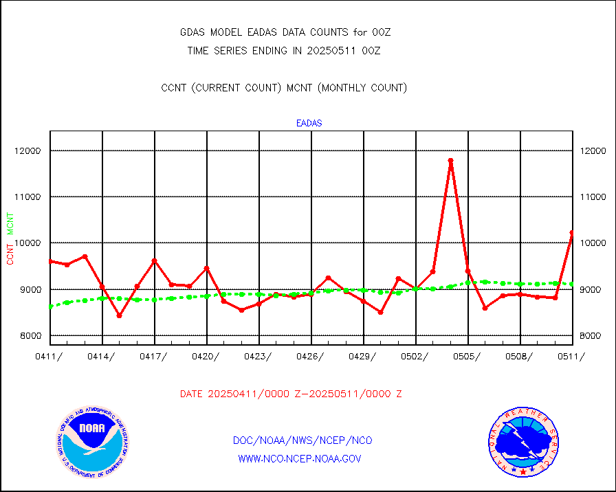
eadas |
E-AMDAR (European AMDAR acft decoded from BUFR) |
6684 |
6667 |
100.3 % |
esamua |
NOAA 15-19 & METOP 1-2 AMSU-A proc btmps frm RARS |
337840 |
302802 |
111.6 % |
eshrs3 |
NOAA 15-19 & METOP 1-2 HIRS-3/4 pr btmps frm RARS |
743709 |
736806 |
100.9 % |
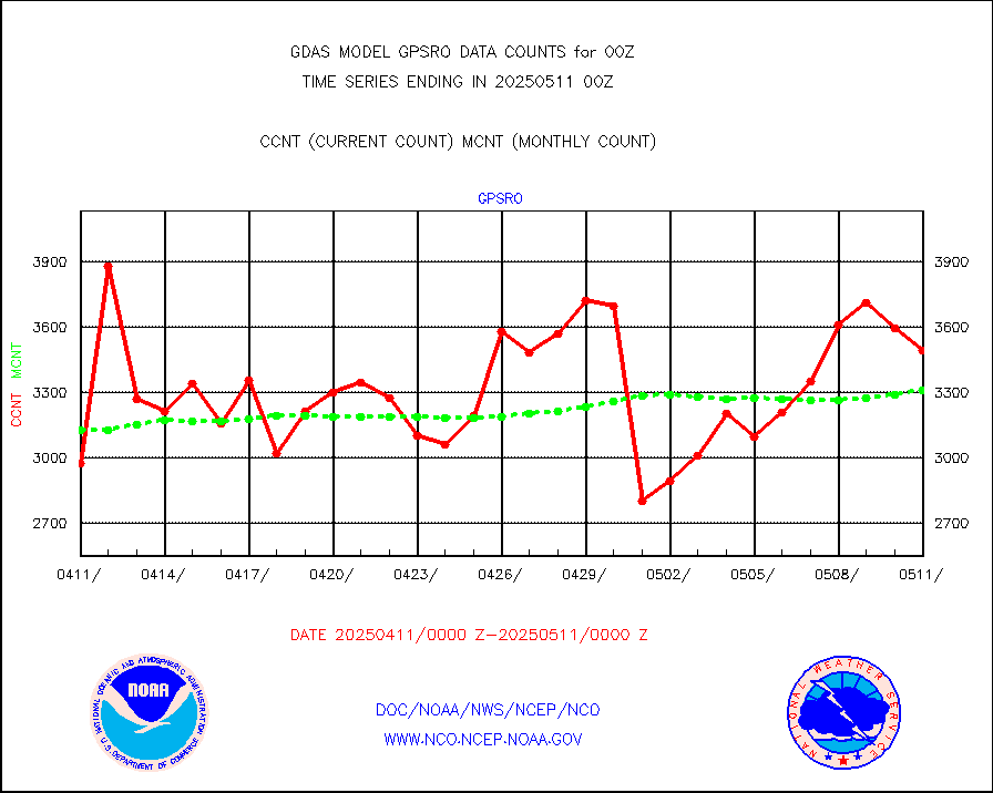
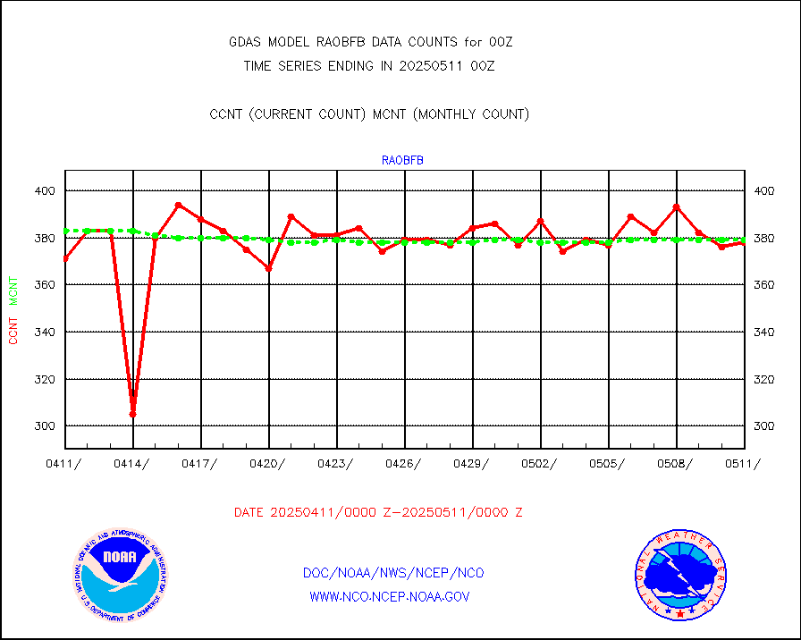
gpsro |
GPS radio occultation data |
3479 |
2879 |
120.8 % |
gsrasr |
GOES-16/17 All Sky Radiances (proc.) |
6398446 |
6385896 |
100.2 % |
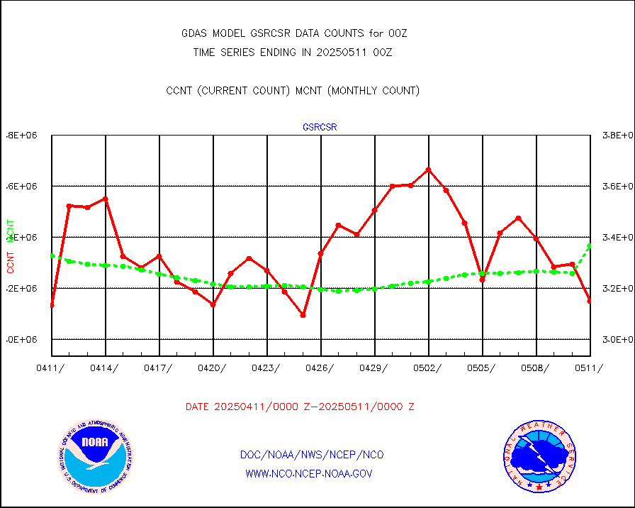
gsrcsr |
GOES-16/17 Clear Sky Radiances (proc.) |
3345470 |
3206964 |
104.3 % |
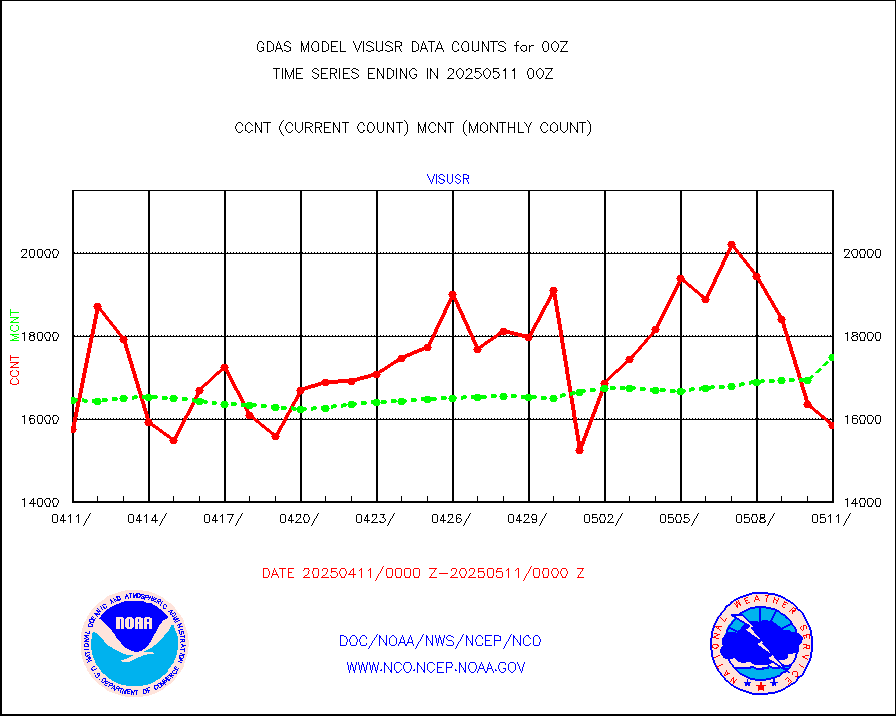
h20ja |
MTSAT/JMA water vapor imager derived cloud motion |
57747 |
57669 |
100.1 % |
h20mo |
MODIS (AQUA/TERRA) wvpr imager derived cld motion |
0 |
0 |
n/a |
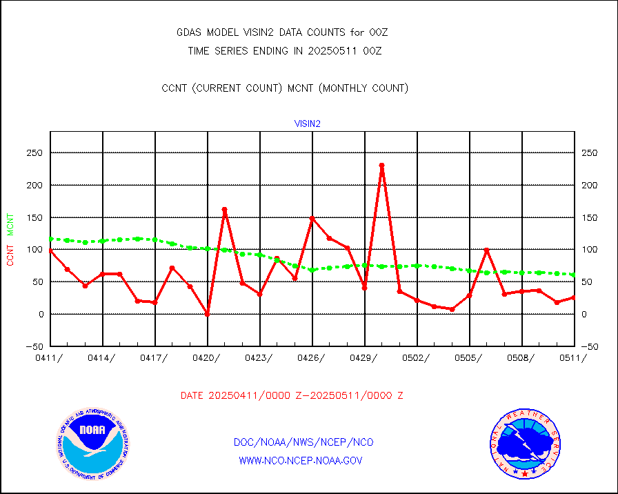
h2tusr |
GOES-16&up/NESDIS wv imgr/cld-top derived cld mtn |
179534 |
181175 |
99.1 % |
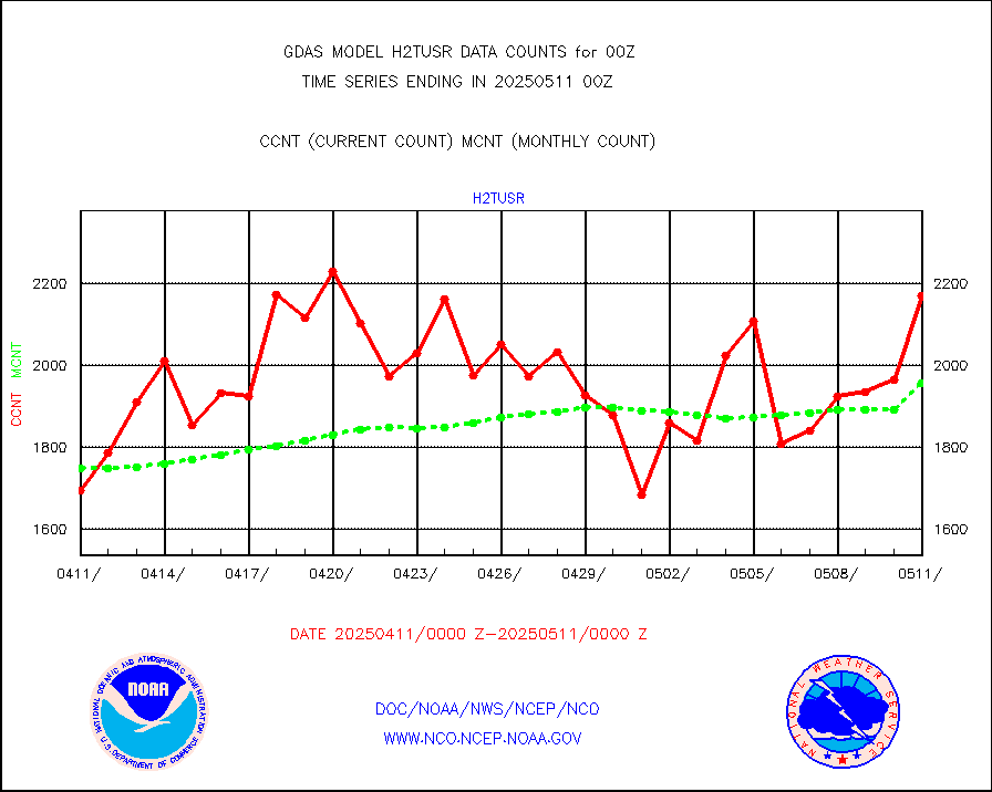
ifeunb |
METEOSAT/EUMETSAT ir lg-wave drv cld motion NBseq |
131705 |
129520 |
101.7 % |
infja |
MTSAT/JMA infrared long-wave derived cloud motion |
50291 |
48097 |
104.6 % |
infmo |
MODIS (AQUA/TERRA) ir l-wave derived cloud motion |
0 |
0 |
n/a |
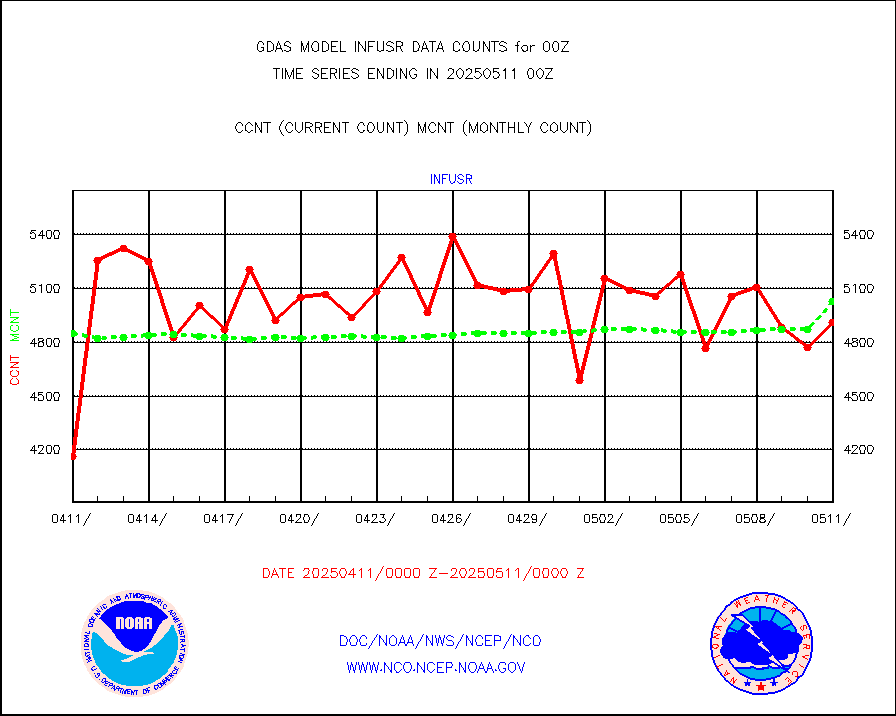
infusr |
GOES-16&up/NESDIS ir long-wave derived cld motion |
513752 |
494037 |
104.0 % |
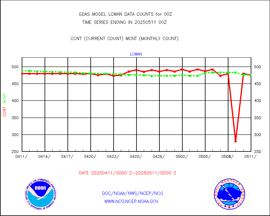
lcman |
Land-based CMAN stations decoded from CMAN format |
587 |
583 |
100.7 % |
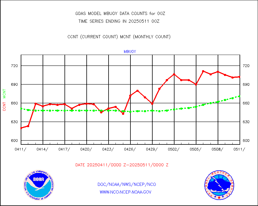
mbuoy |
Buoys decoded from FM-13 format (moored) |
765 |
726 |
105.4 % |
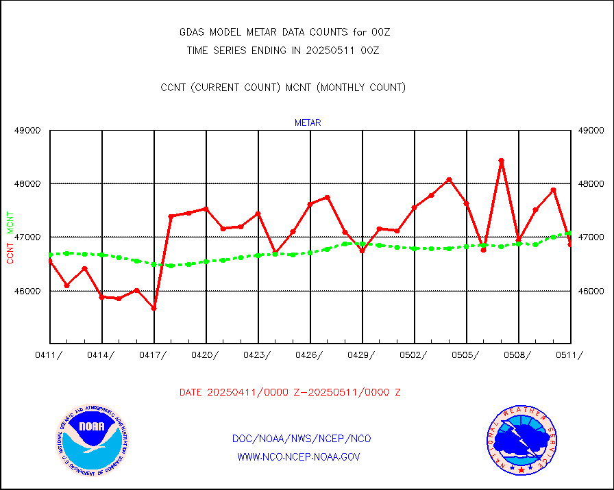
metar |
Aviation - METAR |
46307 |
46832 |
98.9 % |
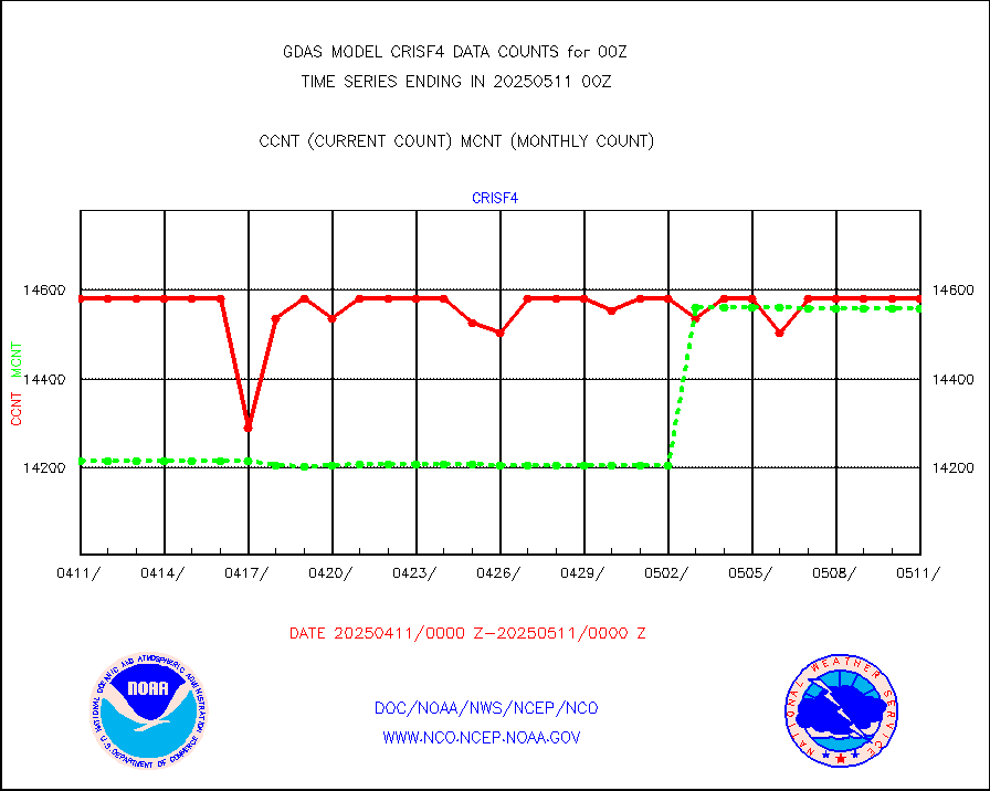
mtiasi |
METOP 1-2 IASI 1C radiance data (varbl. channels) |
648000 |
626031 |
103.5 % |
nxrdw |
NEXRAD Vel Azm Dsp(VAD) winds via radar coded msg |
0 |
0 |
n/a |
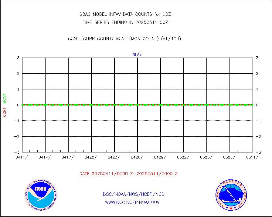
omi |
Aura Ozone Monitoring Instrument (OMI) data |
194401 |
266461 |
73.0 % |
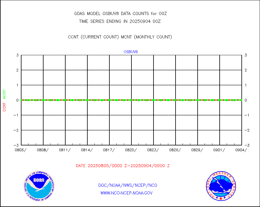
osbuv8 |
NOAA 16-19 Solar Backscatter UV-2 rad frm V8 BUFR |
0 |
0 |
n/a |
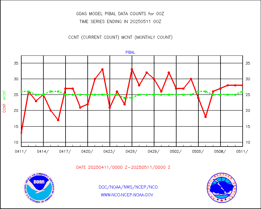
pibal |
PIBAL (from PILOT, PILOT SHIP, PILOT MOBIL) |
55 |
58 |
94.8 % |
prflrp |
Profilr winds from PIBAL (PILOT,PILOT SHIP/MOBIL) |
0 |
0 |
n/a |
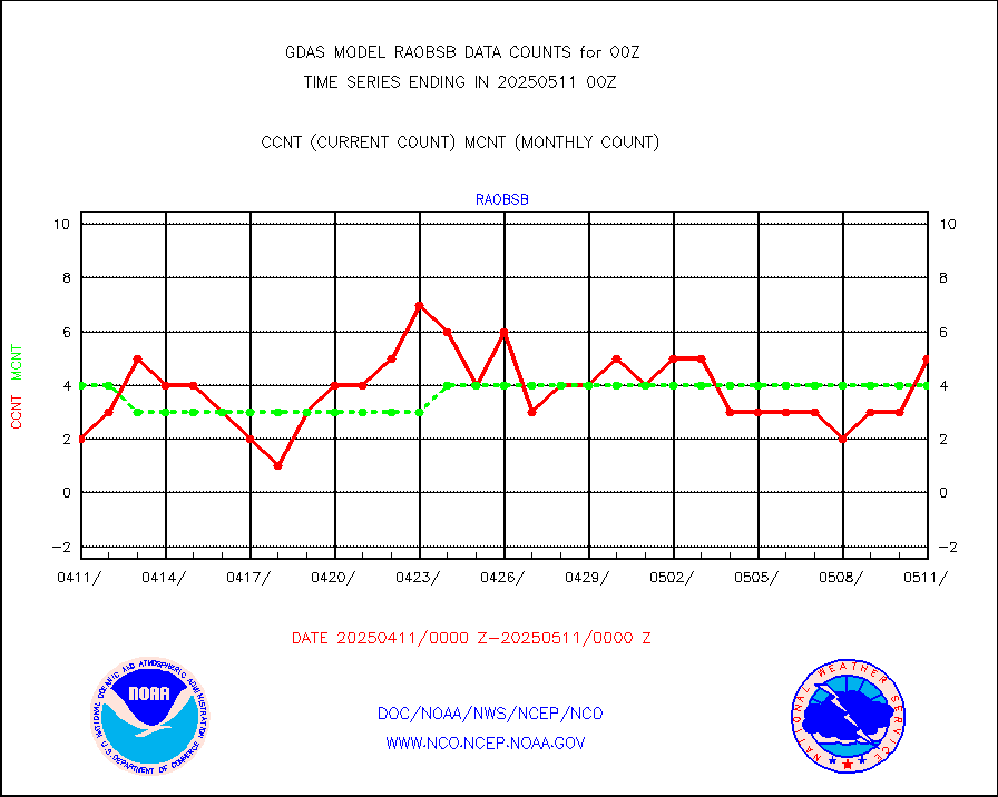
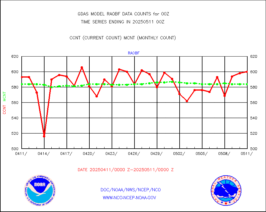
raobf |
Rawinsonde - fixed land (from TEMP or PILOT) |
604 |
600 |
100.7 % |
raobm |
Rawinsonde - mobile land (from TEMP/PILOT MOBIL) |
0 |
0 |
n/a |
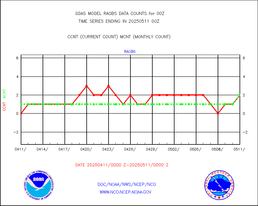
raobs |
Rawinsonde - ship (from TEMP SHIP, PILOT SHIP) |
1 |
0 |
n/a |
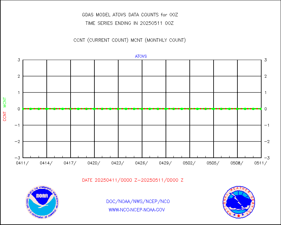
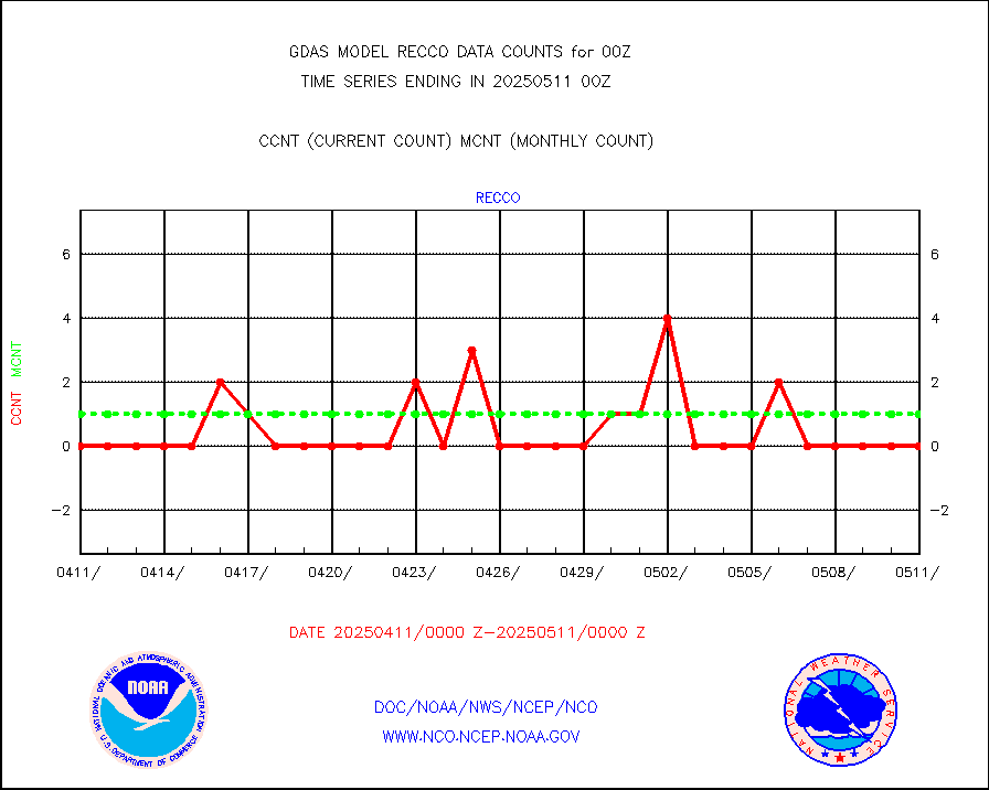
recco |
Flight level reconnaissance aircraft data |
6 |
2 |
300.0 % |
sevcsr |
METEOSAT-10 2nd Gen SEVIRI Clr Sky Radiance(proc) |
0 |
0 |
n/a |
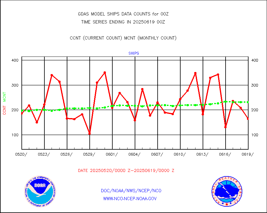
ships |
Ship - manual and automatic, restricted |
253 |
180 |
140.6 % |
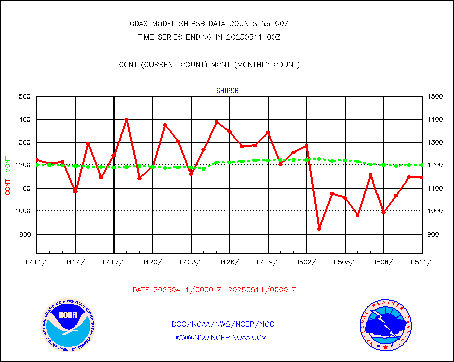
shipsb |
Ship - manual and automatic, restricted (BUFR) |
848 |
924 |
91.8 % |
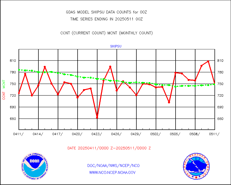
shipsu |
Ship - manual and automatic, unrestricted |
551 |
599 |
92.0 % |
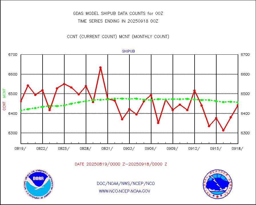
shipub |
Ship - manual and automatic, unrestricted (BUFR) |
5843 |
5731 |
102.0 % |
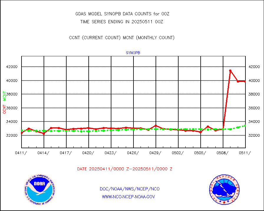
synopb |
Synoptic - fixed manual & auto (decoded fr BUFR) |
32204 |
31560 |
102.0 % |
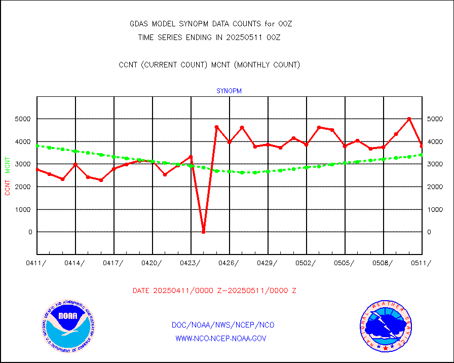
synopm |
Synoptic - mobile manual and automatic |
6161 |
5161 |
119.4 % |
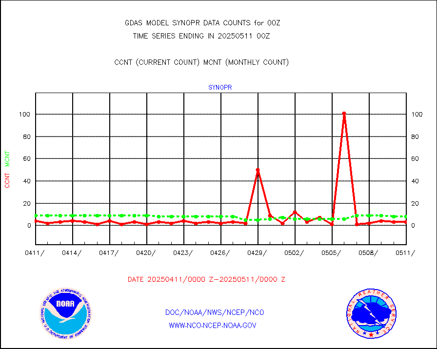
synopr |
Synoptic - restricted (WMO Res 40) manual & auto. |
2 |
5 |
40.0 % |
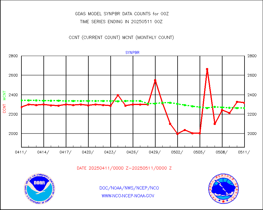
synpbr |
Synoptic - restricted (WMO Res 40)(decoded BUFR) |
2291 |
2284 |
100.3 % |
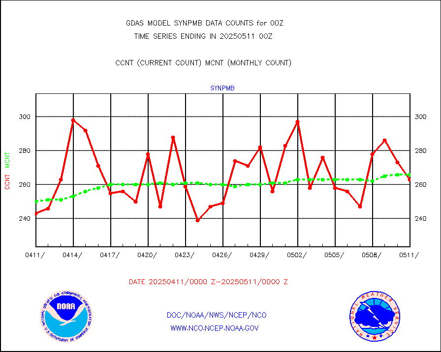
synpmb |
Synoptic - mobile manual & auto (decoded fr BUFR) |
69 |
64 |
107.8 % |
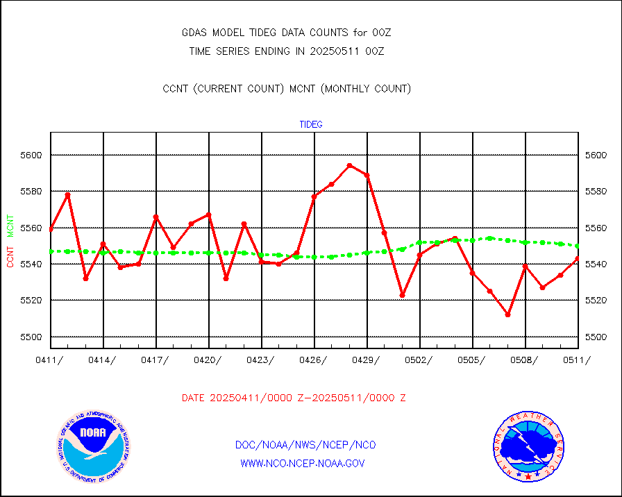
tideg |
Tide gauge reports decoded from CREX format |
5495 |
5426 |
101.3 % |
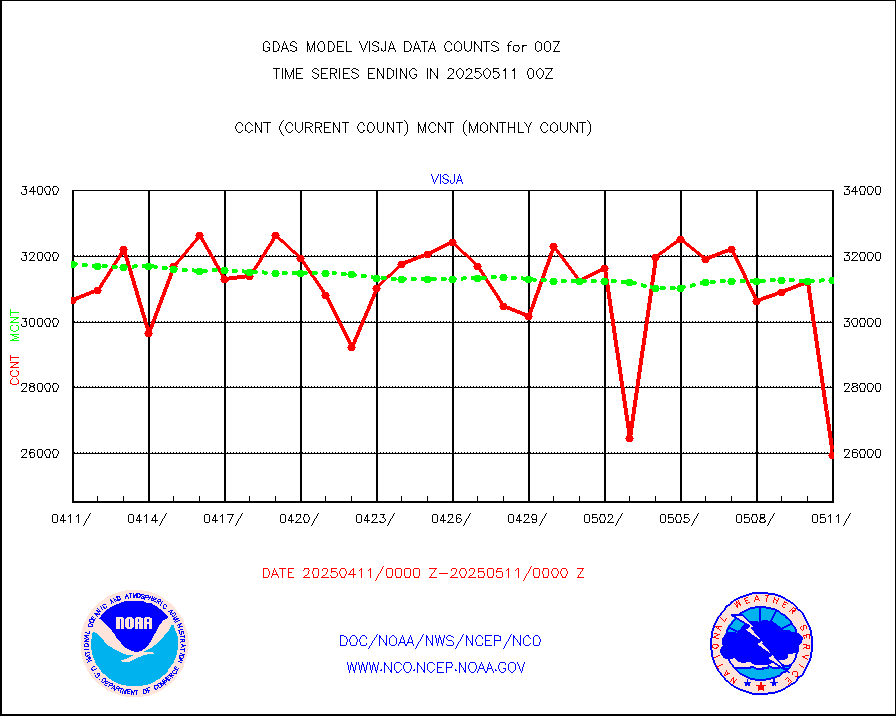
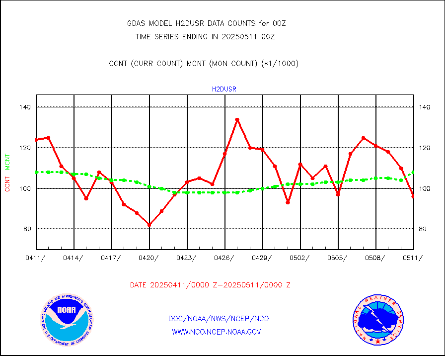
visja |
MTSAT/JMA visible derived cloud motion |
32581 |
31399 |
103.8 % |
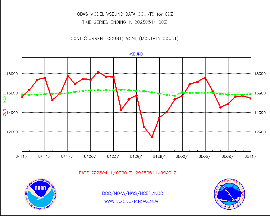
vseunb |
METEOSAT/EUMETSAT visible drv cld motion NBseq |
15402 |
14694 |
104.8 % |
| Data Types of Opportunity with Normal Counts |
|---|
| Type | Description | Hourly Count | Monthly Average | Percent (%) of Monthly Mean |
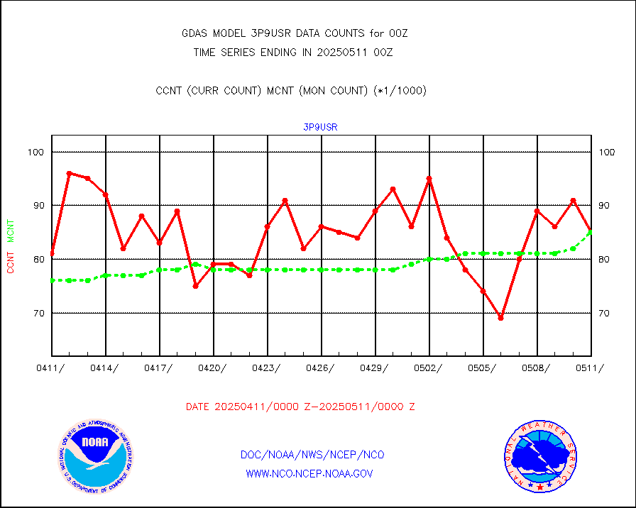
3p9usr |
GOES-16&up/NESDIS ir short-wv derived cld motion |
90643 |
76550 |
118.4 % |
acarsa |
MDCRS ACARS acft data (ARINC via AFWA)(AIREP fmt) |
0 |
0 |
n/a |
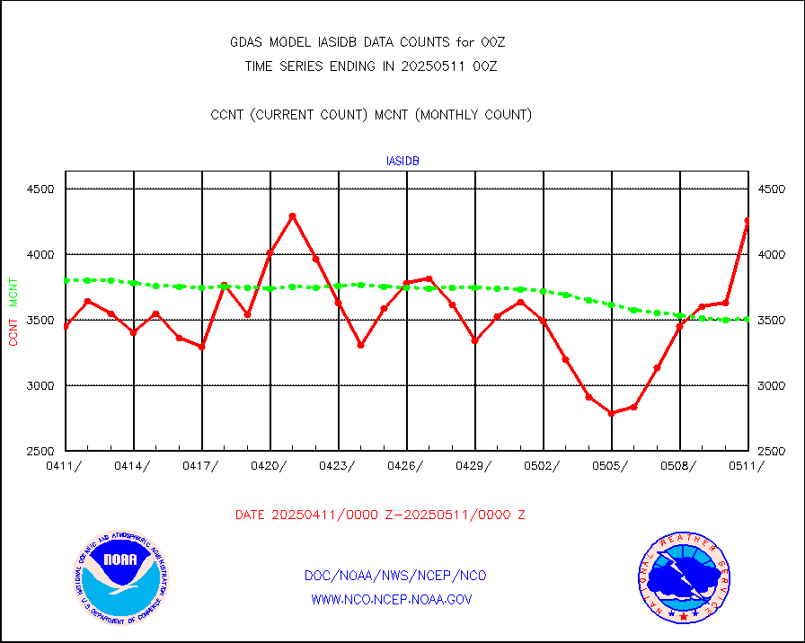
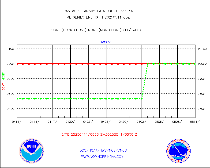
amsr2 |
GCOM-W AMSR2 1B brightness temperatures |
9999999 |
9999999 |
100.0 % |
atmsdb |
NPP/NOAA-20 ATMS bright. temps-direct b-cast SSEC |
543708 |
468532 |
116.0 % |
atovs |
POES/NESDIS - processed ATOVS soundings/radiances |
0 |
0 |
n/a |
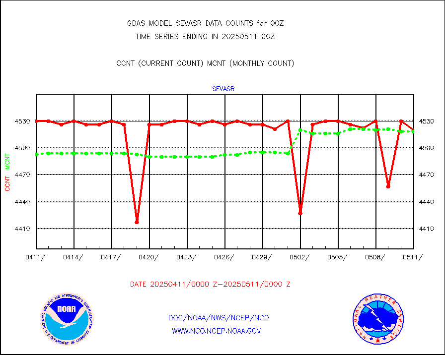
avcsam |
A.M.(N17,M2,M3) AVHRR GAC NCEP-proc clr&sea btmps |
8745330 |
8373030 |
104.4 % |
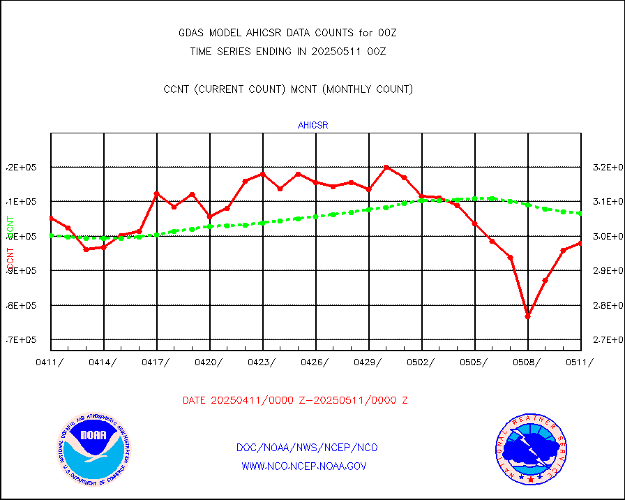
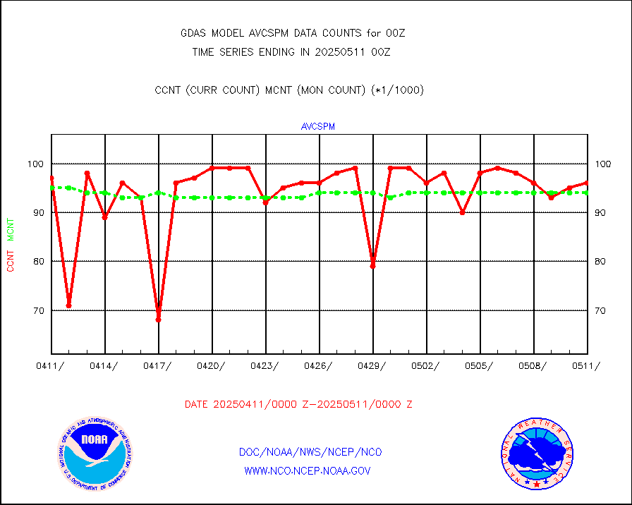
avcspm |
P.M.(N18-19) AVHRR GAC NCEP-proc clr & sea btemps |
9992852 |
9421054 |
106.1 % |
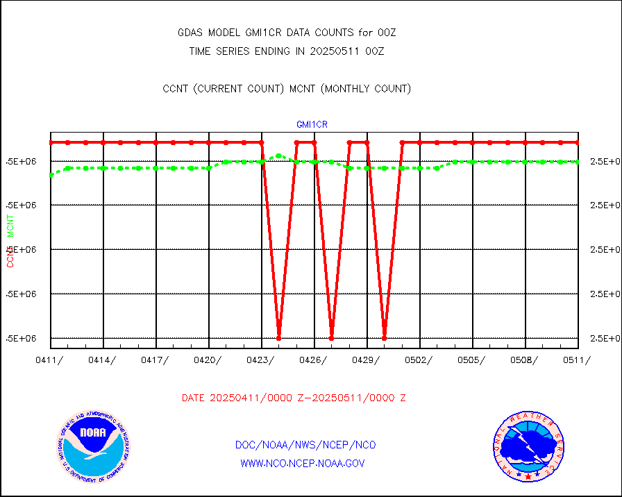
bathy |
eXpendable BathyThermograph, mooring (BATHY fmt) |
10 |
3 |
333.3 % |
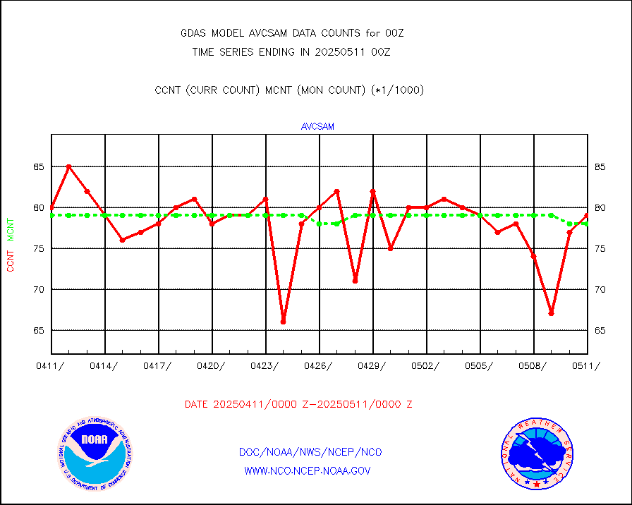
crisf4 |
NPP/NOAA-20 CrIS full spctrl radn (431 ch subset) |
1458000 |
1457748 |
100.0 % |
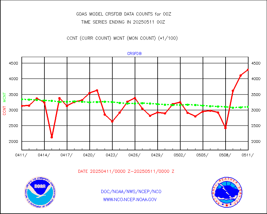
crsfdb |
NPP/NOAA-20 CrIS full spctrl radn dir brdcst SSEC |
456639 |
433844 |
105.3 % |
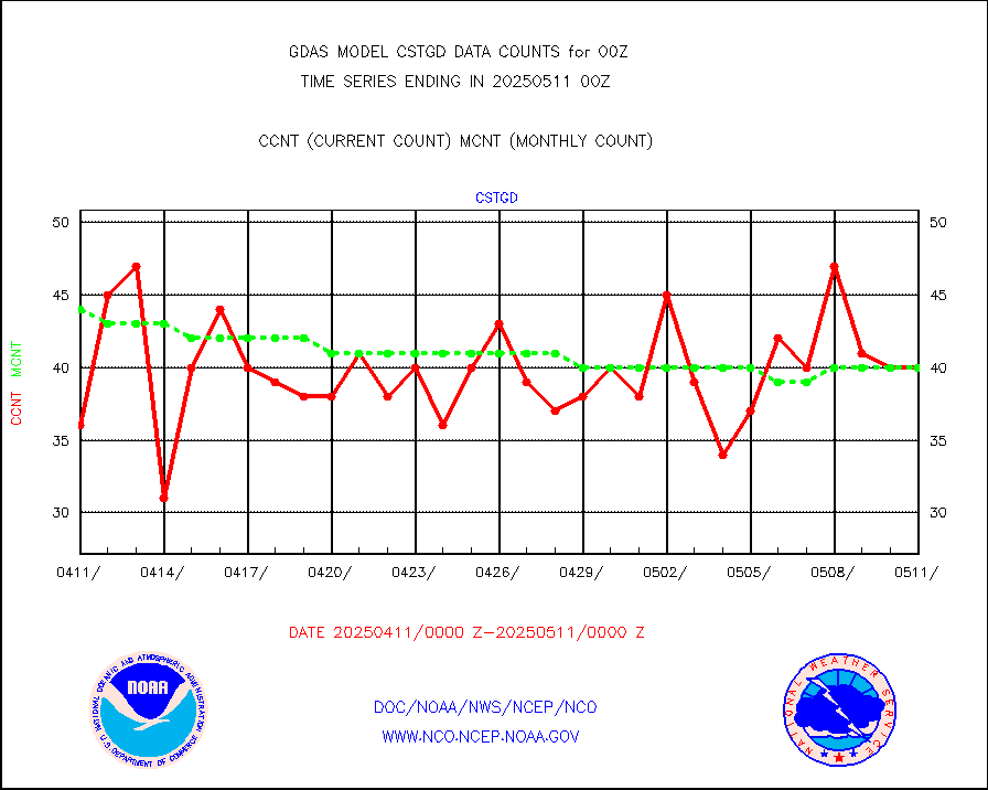
cstgd |
Coast Guard |
29 |
33 |
87.9 % |
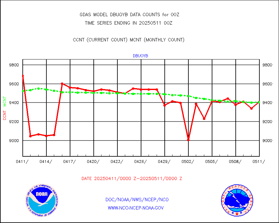
dbuoyb |
Drifting buoys (decoded from BUFR) |
8676 |
8821 |
98.4 % |
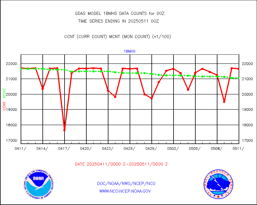
esatms |
NPP Adv. Tech. MW Sndr (ATMS) br. temps from RARS |
494979 |
419461 |
118.0 % |
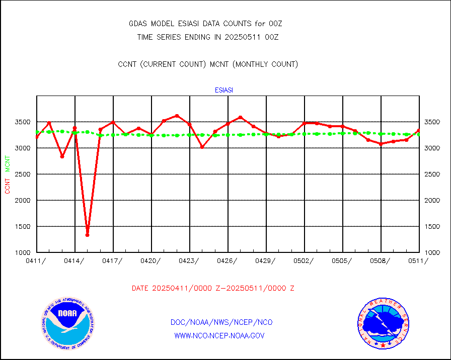
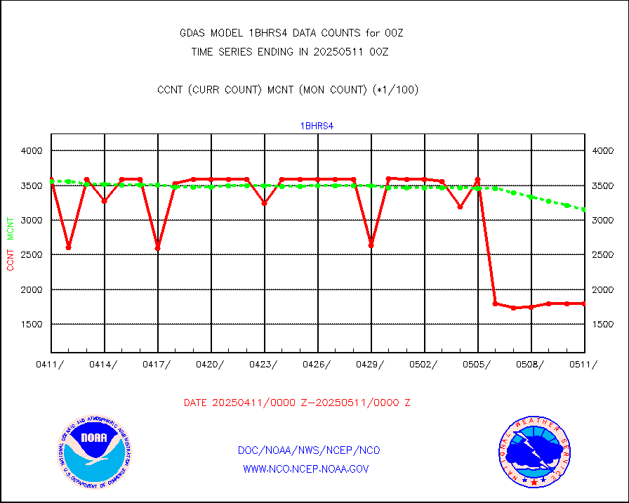
esiasi |
METOP 1-2 IASI 1C radiance data vbl chn from RARS |
440472 |
400271 |
110.0 % |
esmhs |
NOAA 18-19 & METOP 1-2 MHS proc. btemps from RARS |
2751430 |
2424501 |
113.5 % |
geoimr |
GOES/NESDIS (11x17 f-o-v) imager clear radiances |
0 |
0 |
n/a |
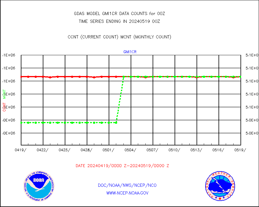
gmi1cr |
GPM GMI Level 1C-R brightness temperatures |
5083442 |
5048009 |
100.7 % |
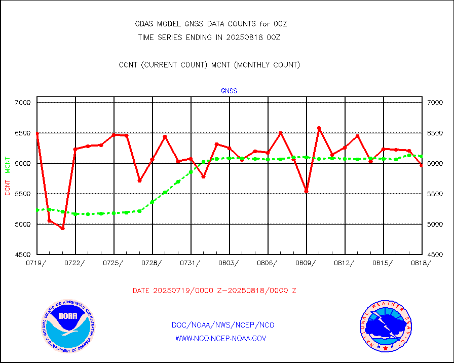
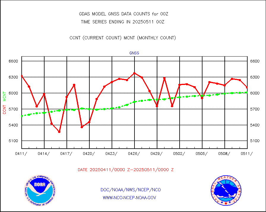
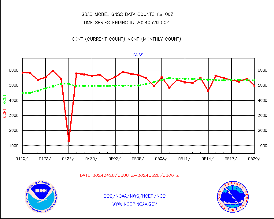
gnss |
Grnd-based Gbl Navigation Sat System (GNSS) data |
5422 |
5088 |
106.6 % |
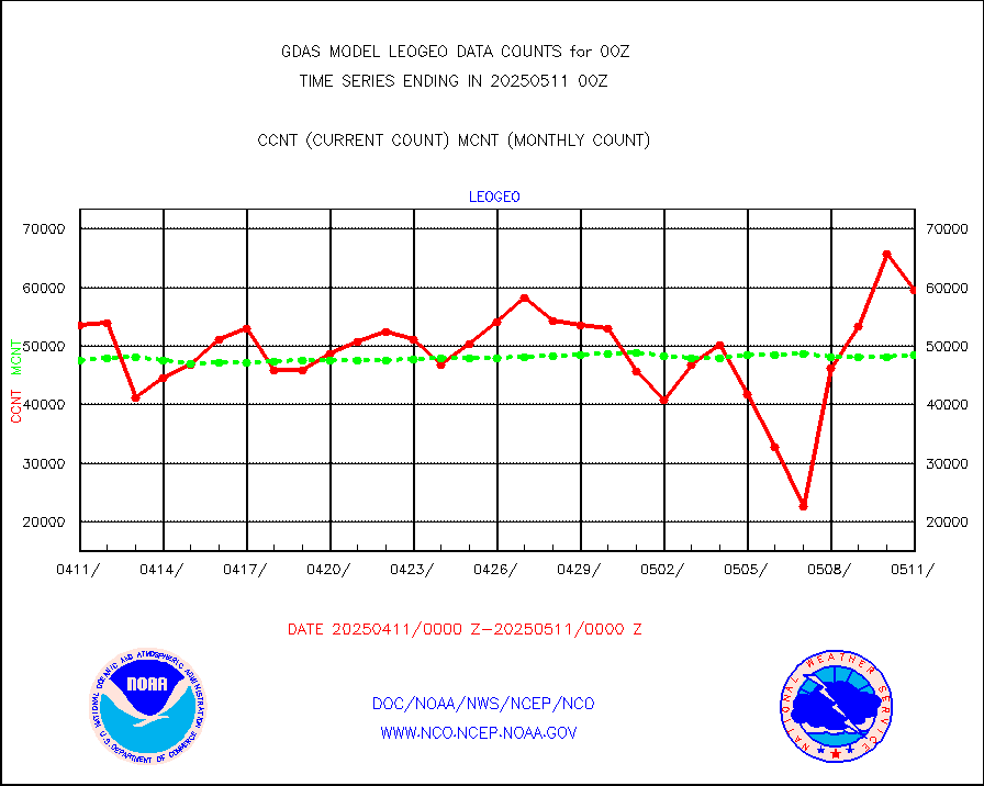
gome |
METOP 1-2 Global Ozone Monitoring Exp.-2 (GOME-2) |
80461 |
79838 |
100.8 % |
h20in |
INSAT/KALPANA India wvpr derived cloud motion |
0 |
0 |
n/a |
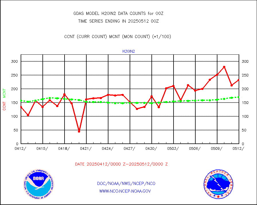
h20in2 |
INDIA SATWIND, INSAT WV channel |
19534 |
17521 |
111.5 % |
h2dusr |
GOES-16&up/NESDIS wv imgr/deep-lyr derivd cld mtn |
115667 |
102509 |
112.8 % |
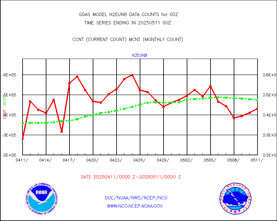
h2eunb |
METEOSAT/EUMETSAT wvpr imgr drv cld motion NBseq |
256140 |
250086 |
102.4 % |
iasidb |
METOP 1-2 IASI 1C radiances-direct broadcast SSEC |
324766 |
298749 |
108.7 % |
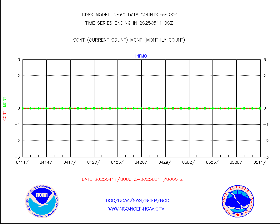
ifvrnb |
VIIRS (NPP/NOAA-20) ir lg-wv drv cloud motion(NB) |
100088 |
106155 |
94.3 % |
infav1 |
AVHRR (METOP) ir lg-wave derived cld motion |
40152 |
36692 |
109.4 % |
infin |
INSAT/KALPANA India ir lg-wave derived cld motion |
0 |
0 |
n/a |
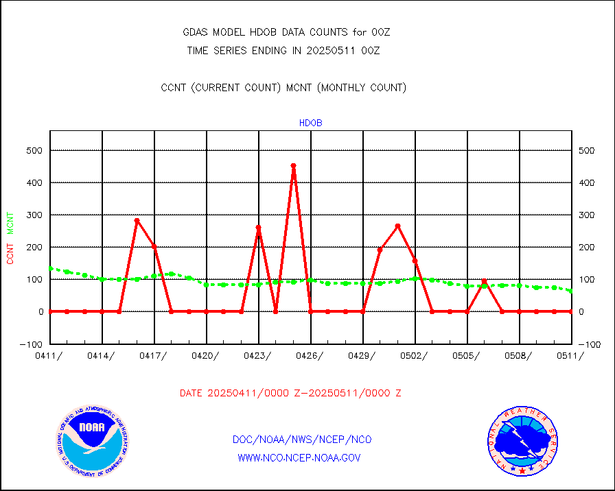
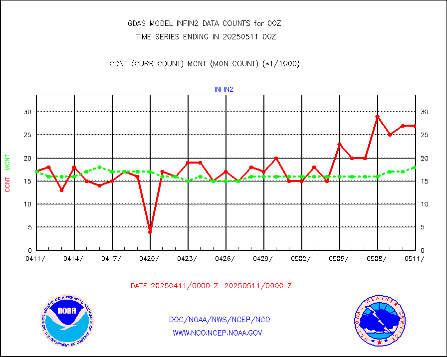
infin2 |
INDIA SATWIND, INSAT IR channel |
16580 |
18933 |
87.6 % |
kamdar |
Korean AMDAR aircraft data (decoded from BUFR) |
487 |
435 |
112.0 % |
mbuoyb |
Moored buoys (decoded from BUFR) |
6065 |
5449 |
111.3 % |
nxrdw2 |
NEXRAD Vel Azm Dsp(VAD) winds via Level 2 decoder |
4017 |
4005 |
100.3 % |
ompslp |
OMPS Limb Profiler ozone data (NPP) |
1635 |
1457 |
112.2 % |
ompsn8 |
OMPS nadir profile ozone (Version 8 BUFR) |
3452 |
3270 |
105.6 % |
ompst8 |
OMPS total column ozone (Version 8 BUFR) |
2152883 |
2017448 |
106.7 % |
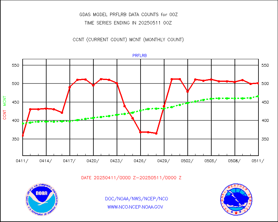
prflrb |
Multi-Agency Profiler (MAP) and SODAR winds |
480 |
390 |
123.1 % |
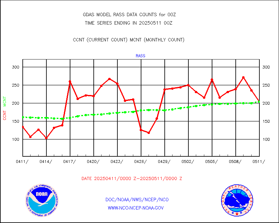
rass |
RASS temperatures (NOAA and Multi-Agency) |
225 |
202 |
111.4 % |
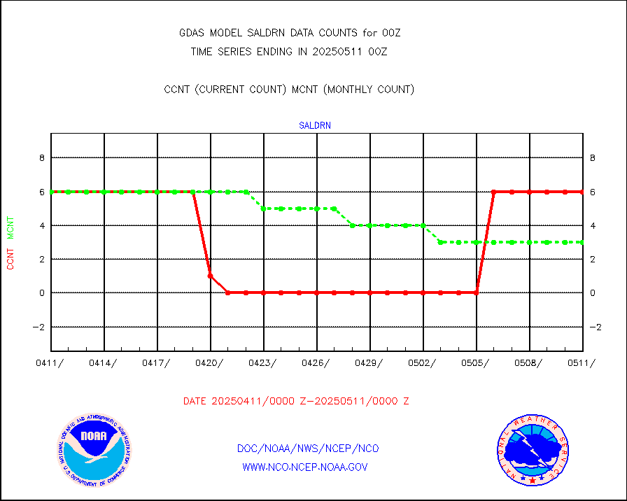
saldrn |
Surface Marine Saildrone (decoded from BUFR) |
6 |
6 |
100.0 % |
saphir |
Megha-Tropiques SAPHIR L1A2 brightness temps |
0 |
0 |
n/a |
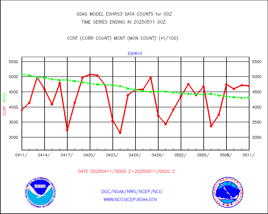
sevasr |
METEOSAT-10 2nd Gen SEVIRI All Sky Radiance(proc) |
452636 |
452851 |
100.0 % |
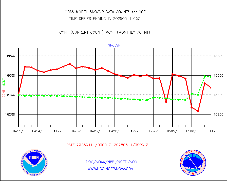
snocvr |
NOW COVER, DEPTH/DENSITY AND WATER EQUIVALENT |
19494 |
18873 |
103.3 % |
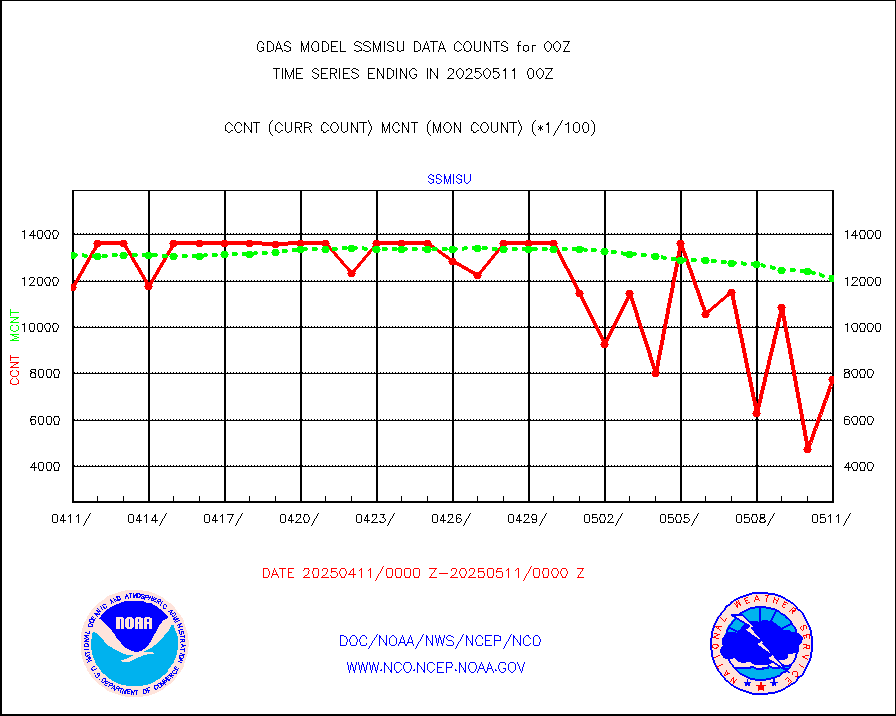
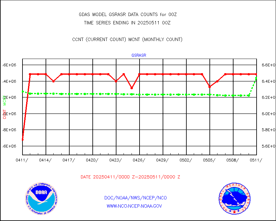
ssmisu |
DMSP SSM/IS 1C radiance data (Unified Pre-Proc.) |
1339081 |
1275332 |
105.0 % |
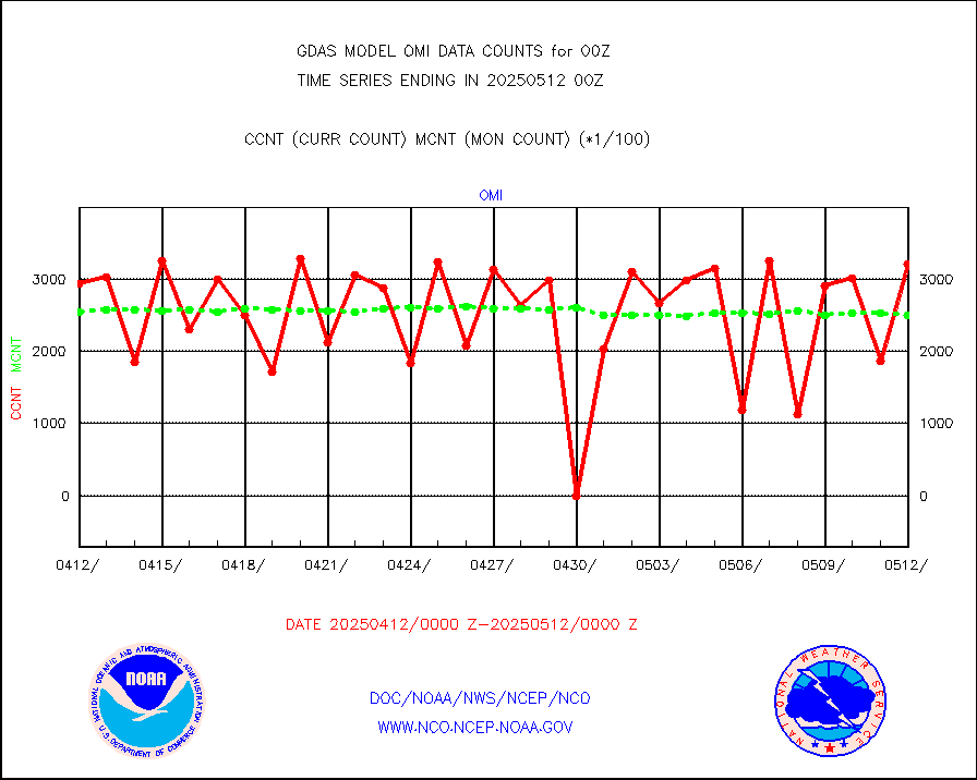
sstvcw |
NPP/NOAA-20 VIIRS SST - CLEAR & OVER WATER |
31 |
31 |
100.0 % |
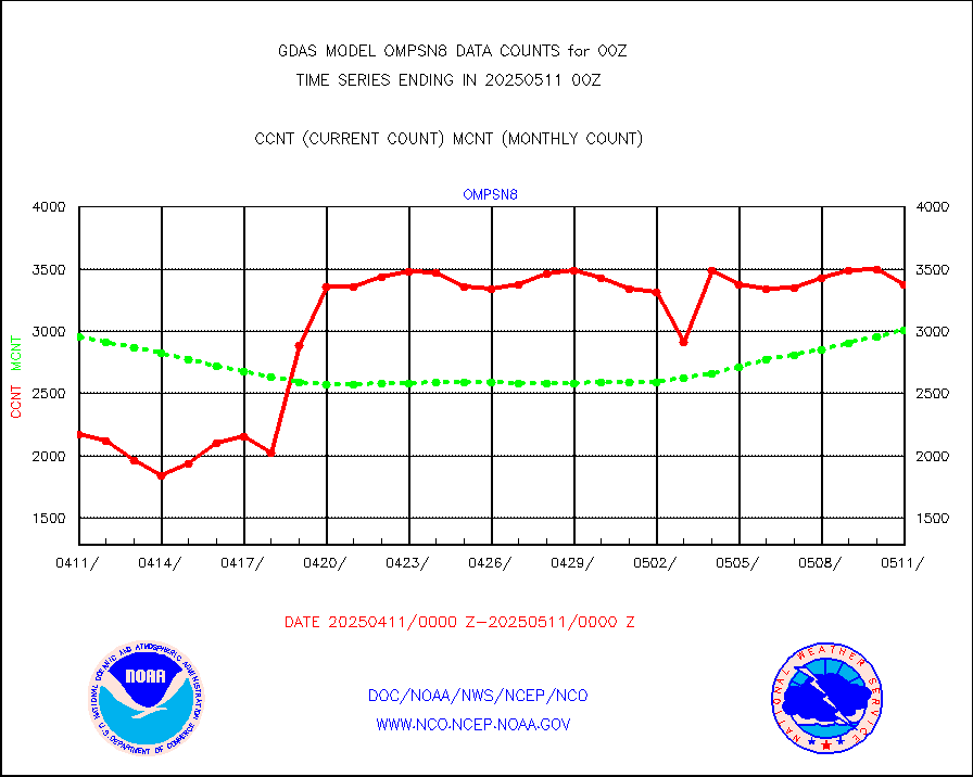
sstvpw |
NPP/NOAA-20 VIIRS SST - PROBABLY CLR & OVER WATER |
9999999 |
9999999 |
100.0 % |
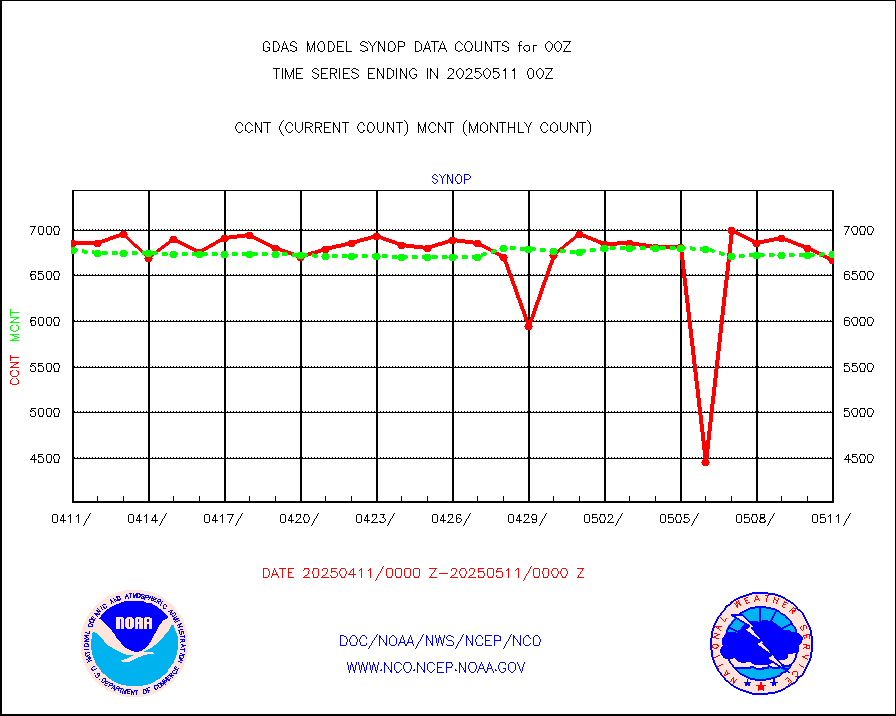
synop |
Synoptic - fixed manual and automatic |
7825 |
7677 |
101.9 % |
tesac |
CTD probe, Argo prflng float, mooring (TESAC fmt) |
2543 |
2224 |
114.3 % |
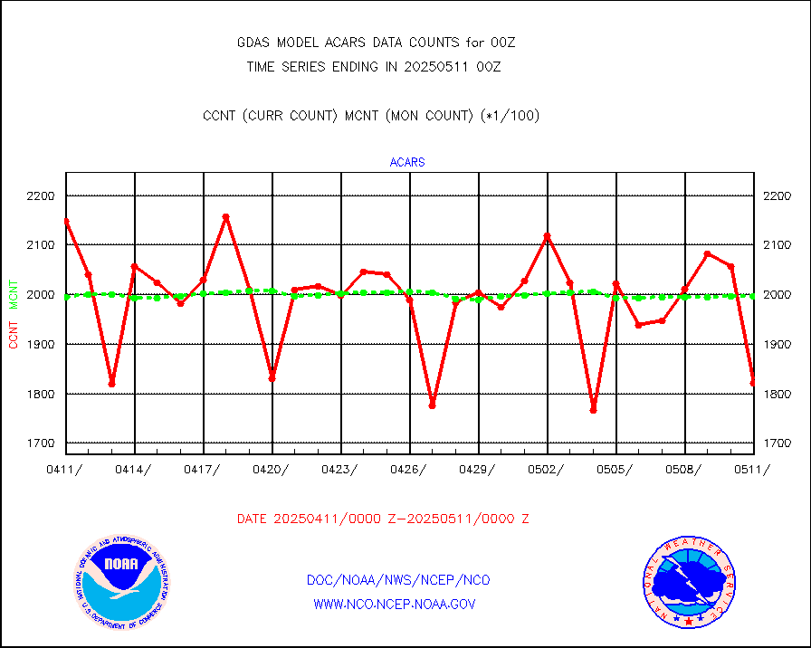
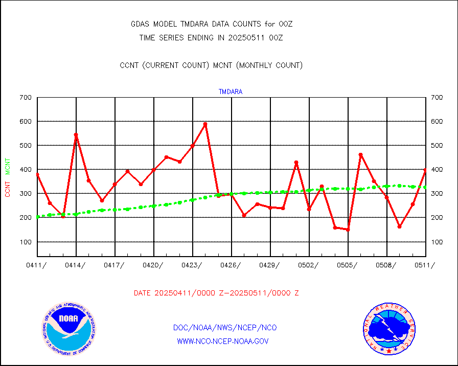
tmdara |
TAMDAR aircft data-all types(from Panasonic,BUFR) |
2238 |
2085 |
107.3 % |
visin |
INSAT/KALPANA India visible derived cloud motion |
0 |
0 |
n/a |
visin2 |
INDIA SATWIND, INSAT VIS channel |
182 |
124 |
146.8 % |
visusr |
GOES-16&up/NESDIS visible derived cloud motion |
1556253 |
1700280 |
91.5 % |


