| Critical Data with Normal Counts |
|---|
| Type | Description | Hourly Count | Monthly Average | Percent (%) of Monthly Mean | UTC Time Window |
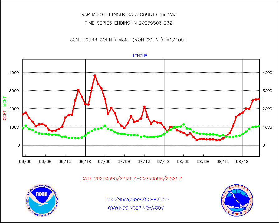
1bamua |
NOAA 15-19 & METOP 1-2 AMSU-A NCEP-proc. br.temps |
47561 |
43830 |
108.5 % |
1920.00-2001.99 |
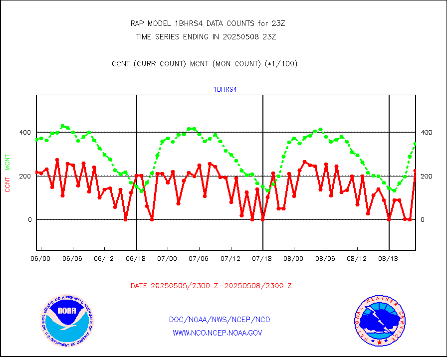
1bhrs4 |
NOAA 18-19 & METOP 1-2 HIRS-4 NCEP-proc. br.temps |
38465 |
36555 |
105.2 % |
1920.00-2001.99 |
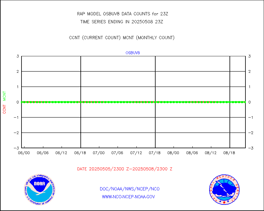
1bmhs |
NOAA 18-19 & METOP 1-2 MHS NCEP-proces. br. temps |
265858 |
246463 |
107.9 % |
1920.00-2001.99 |
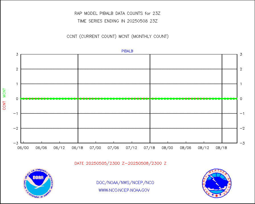
acars |
MDCRS ACARS acft data from ARINC(dcded from BUFR) |
82846 |
85588 |
96.8 % |
1919.75-2002.25 |
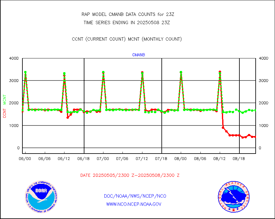
cmanb |
Surface Marine CMAN rpts decoded from BUFR format |
1666 |
1688 |
98.7 % |
1922.50-1923.50 |
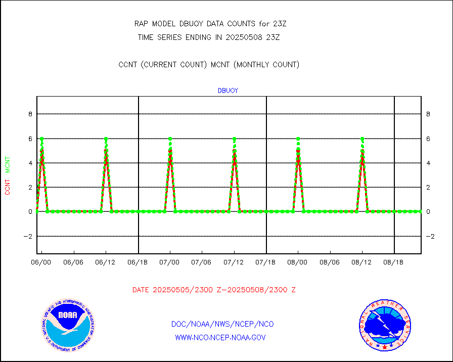
dbuoy |
Buoys decoded from FM-18 fmt (moored or drifting) |
0 |
0 |
n/a |
1922.50-1923.50 |
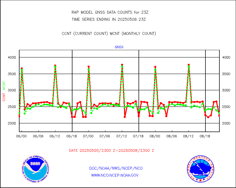
gnss |
Grnd-based Gbl Navigation Sat System (GNSS) data |
2272 |
2469 |
92.0 % |
1921.95-1922.05 |
h20mo |
MODIS (AQUA/TERRA) wvpr imager derived cld motion |
0 |
0 |
n/a |
1920.50-2001.50 |
infmo |
MODIS (AQUA/TERRA) ir l-wave derived cloud motion |
0 |
0 |
n/a |
1920.50-2001.50 |
lgycld |
GOES/NASA(Langley) hi-res. (1x1 f-o-v) cloud data |
3719253 |
3195629 |
116.4 % |
1922.50-1923.50 |
mbuoy |
Buoys decoded from FM-13 format (moored) |
67 |
61 |
109.8 % |
1922.50-1923.50 |
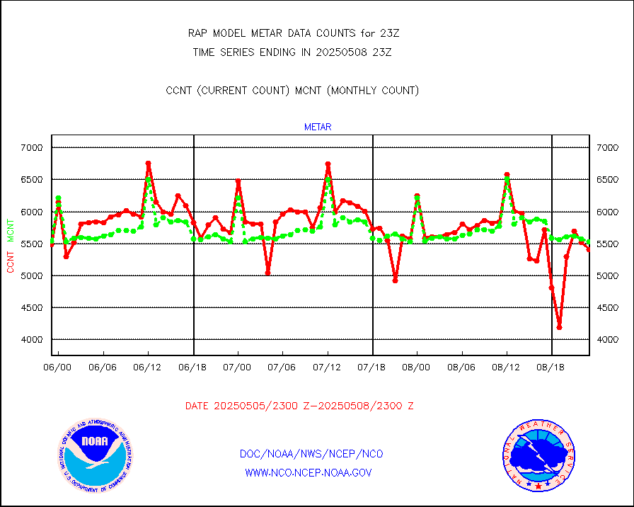
metar |
Aviation - METAR |
5583 |
5779 |
96.6 % |
1922.50-1923.50 |
nxrdw |
NEXRAD Vel Azm Dsp(VAD) winds via radar coded msg |
0 |
0 |
n/a |
1922.00-2000.00 |
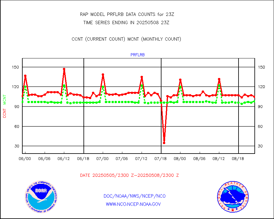
prflrb |
Multi-Agency Profiler (MAP) and SODAR winds |
72 |
84 |
85.7 % |
1921.50-2000.50 |
raobf |
Rawinsonde - fixed land (from TEMP or PILOT) |
0 |
1 |
0.0 % |
1922.00-2000.00 |
rass |
RASS temperatures (NOAA and Multi-Agency) |
20 |
21 |
95.2 % |
1922.50-1923.50 |
shipsb |
Ship - manual and automatic, restricted (BUFR) |
2 |
0 |
n/a |
1922.50-1923.50 |
shipsu |
Ship - manual and automatic, unrestricted |
44 |
55 |
80.0 % |
1922.50-1923.50 |
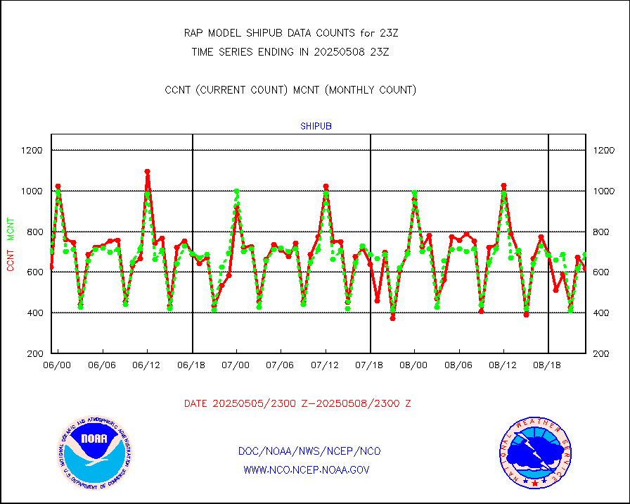
shipub |
Ship - manual and automatic, unrestricted (BUFR) |
679 |
620 |
109.5 % |
1922.50-1923.50 |
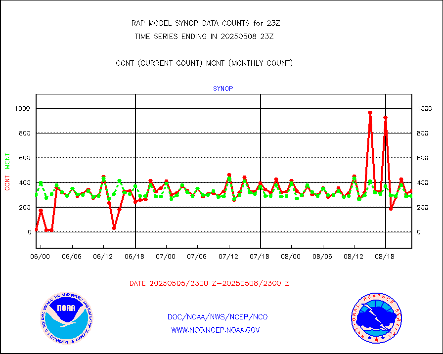
synop |
Synoptic - fixed manual and automatic |
302 |
309 |
97.7 % |
1922.50-1923.50 |
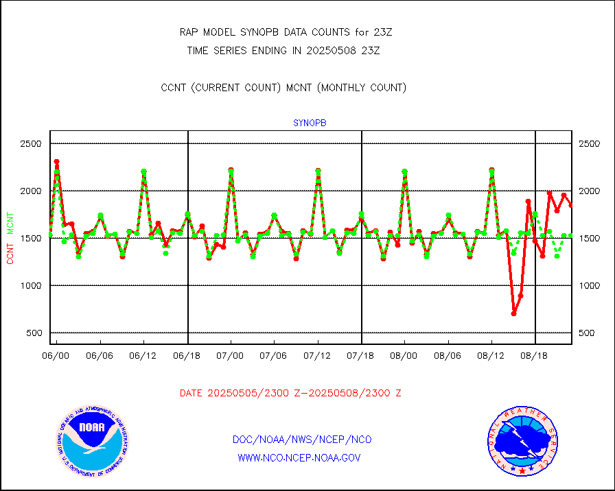
synopb |
Synoptic - fixed manual & auto (decoded fr BUFR) |
1711 |
1715 |
99.8 % |
1922.50-1923.50 |
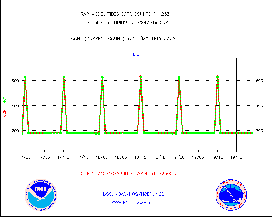
tideg |
Tide gauge reports decoded from CREX format |
182 |
180 |
101.1 % |
1922.50-1923.50 |
| Data Types of Opportunity with Normal Counts |
|---|
| Type | Description | Hourly Count | Monthly Average | Percent (%) of Monthly Mean | UTC Time Window |
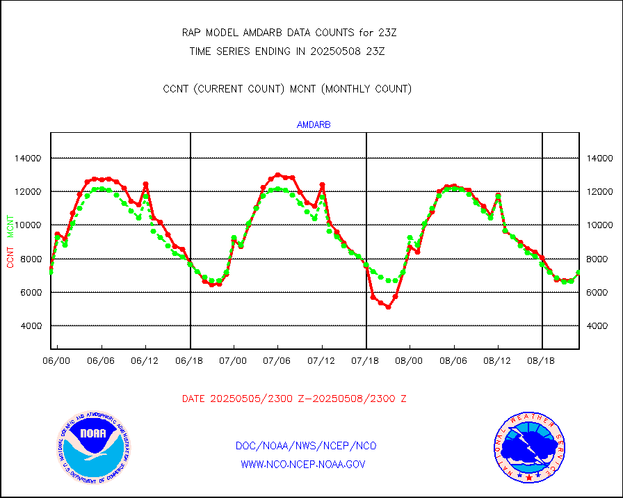
3p9usr |
GOES-16&up/NESDIS ir short-wv derived cld motion |
759 |
1695 |
44.8 % |
1922.00-1922.99 |
acarsa |
MDCRS ACARS acft data (ARINC via AFWA)(AIREP fmt) |
0 |
0 |
n/a |
1919.75-2002.25 |
airep |
Manual AIREP aircraft data (dcded from AIREP fmt) |
1987 |
1732 |
114.7 % |
1919.75-2002.25 |
airsev |
AQUA AIRS/AMSU-A/HSB brightness temps- every FOV |
0 |
0 |
n/a |
1920.00-2001.99 |
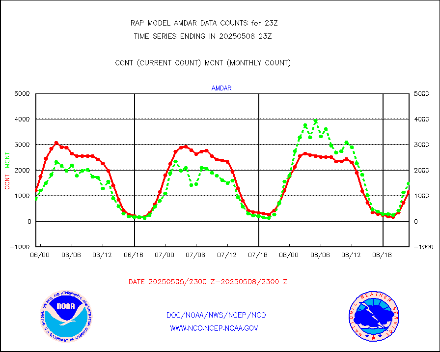
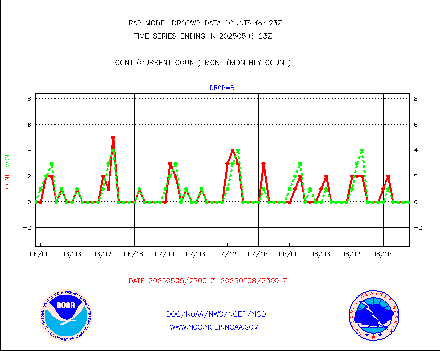
amdar |
AMDAR aircraft data (decoded from AMDAR format) |
1433 |
1109 |
129.2 % |
1919.75-2002.25 |
amdarb |
AMDAR aircraft data (decoded from BUFR) |
3198 |
2679 |
119.4 % |
1919.75-2002.25 |
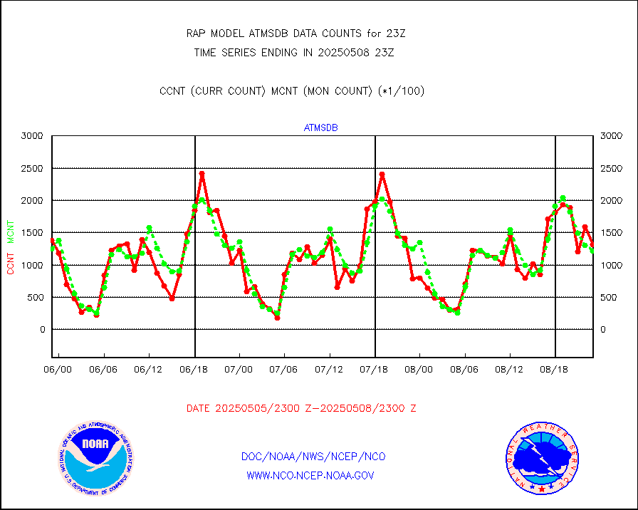
amsr2 |
GCOM-W AMSR2 1B brightness temperatures |
986834 |
593988 |
166.1 % |
1920.00-1920.99 |
ascat |
METOP 1-2 ASCAT products |
18025 |
21861 |
82.5 % |
1921.00-2001.00 |
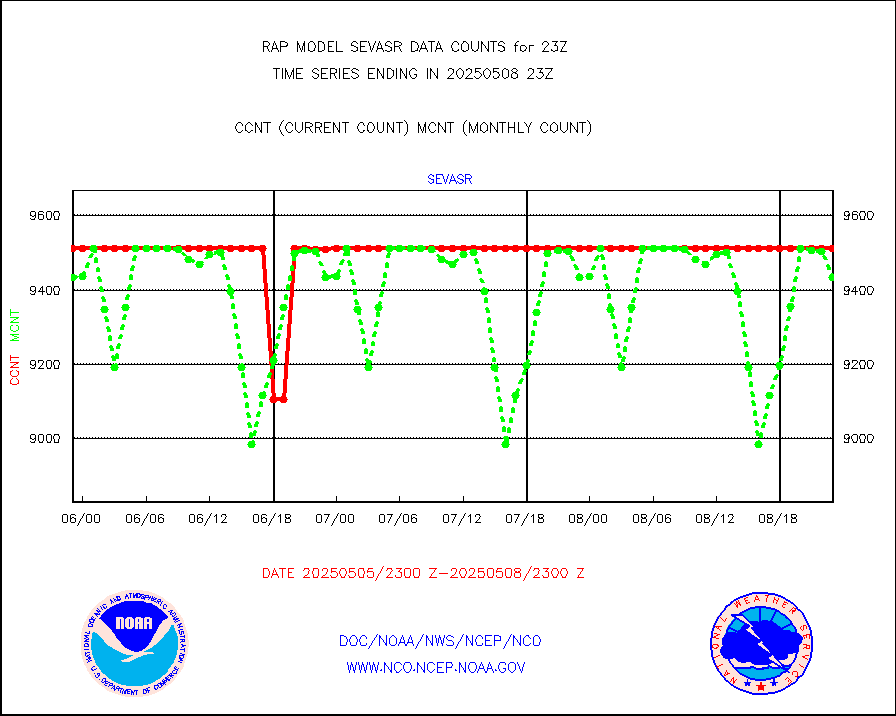
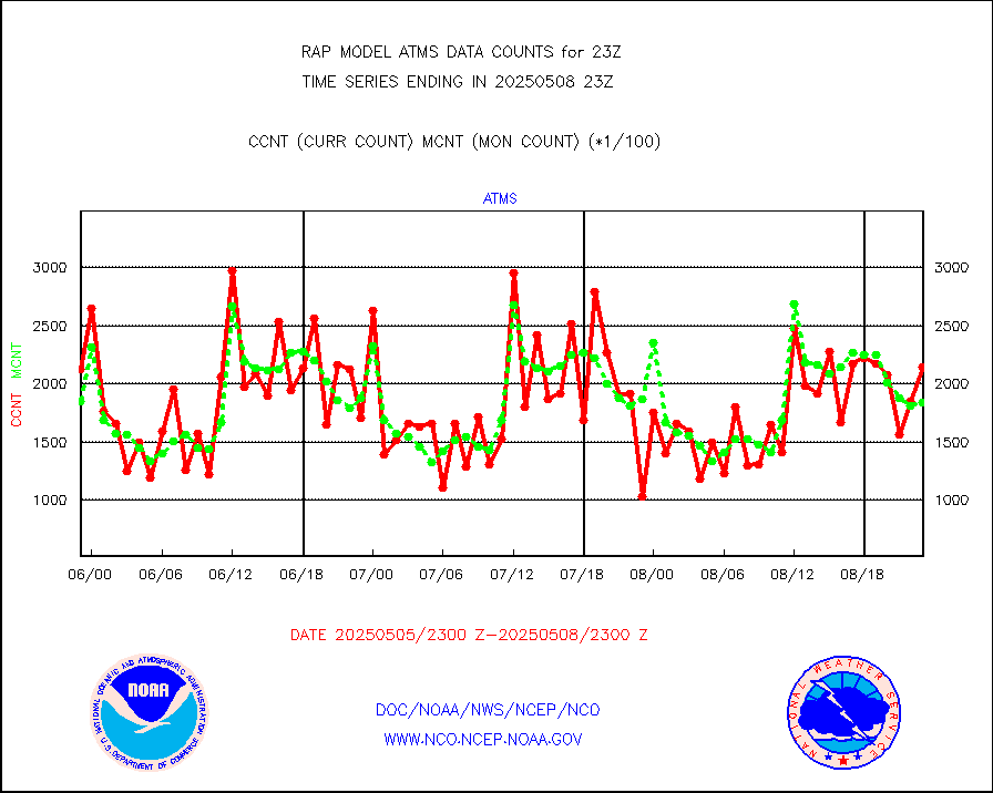
atms |
NPP/NOAA-20 ATMS brightness temperatures |
177176 |
170990 |
103.6 % |
1921.00-2000.99 |
atmsdb |
NPP/NOAA-20 ATMS bright. temps-direct b-cast SSEC |
110304 |
127870 |
86.3 % |
1921.00-2000.99 |
coopmd |
Coop/MADIS NEPP & HCN-Modernization NOAA COOP Obs |
27 |
27 |
100.0 % |
1922.50-1923.50 |
crisf4 |
NPP/NOAA-20 CrIS full spctrl radn (431 ch subset) |
99142 |
97712 |
101.5 % |
1921.00-2000.99 |
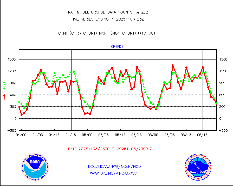
crsfdb |
NPP/NOAA-20 CrIS full spctrl radn dir brdcst SSEC |
77600 |
95148 |
81.6 % |
1921.00-2000.99 |
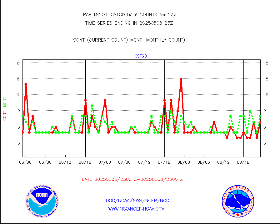
cstgd |
Coast Guard |
13 |
8 |
162.5 % |
1922.50-1923.50 |
dbuoyb |
Drifting buoys (decoded from BUFR) |
596 |
582 |
102.4 % |
1922.50-1923.50 |
dropw |
Dropwinsonde (from TEMP DROP) |
0 |
0 |
n/a |
1922.00-2000.00 |
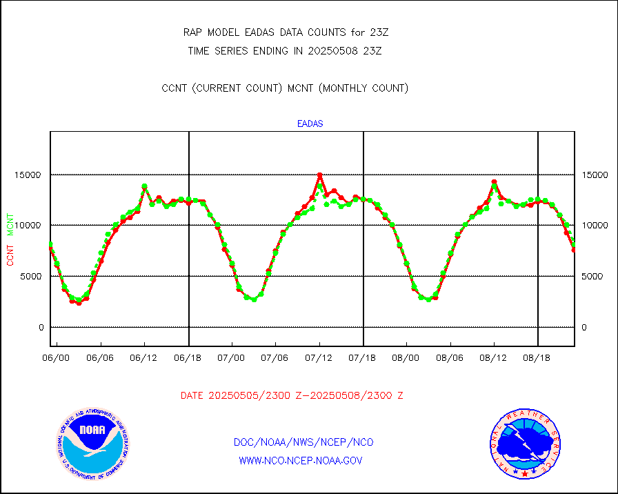
eadas |
E-AMDAR (European AMDAR acft decoded from BUFR) |
6596 |
6034 |
109.3 % |
1919.75-2002.25 |
esamua |
NOAA 15-19 & METOP 1-2 AMSU-A proc btmps frm RARS |
10726 |
12821 |
83.7 % |
1922.00-2000.00 |
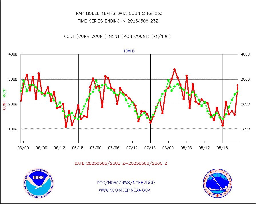
esatms |
NPP Adv. Tech. MW Sndr (ATMS) br. temps from RARS |
26019 |
30112 |
86.4 % |
1921.00-2000.99 |
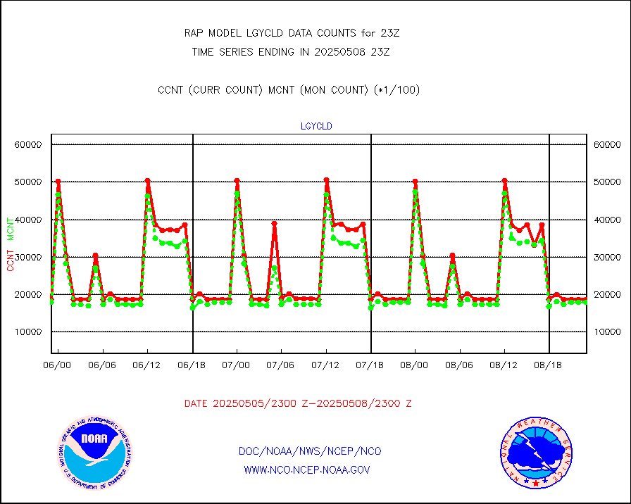
eshrs3 |
NOAA 15-19 & METOP 1-2 HIRS-3/4 pr btmps frm RARS |
23965 |
31255 |
76.7 % |
1922.00-2000.00 |
esiasi |
METOP 1-2 IASI 1C radiance data vbl chn from RARS |
98836 |
93985 |
105.2 % |
1921.00-2000.99 |
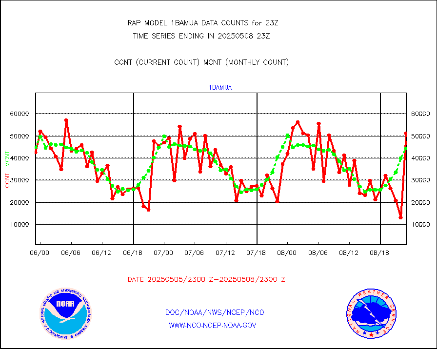
esmhs |
NOAA 18-19 & METOP 1-2 MHS proc. btemps from RARS |
86194 |
98342 |
87.6 % |
1922.00-2000.00 |
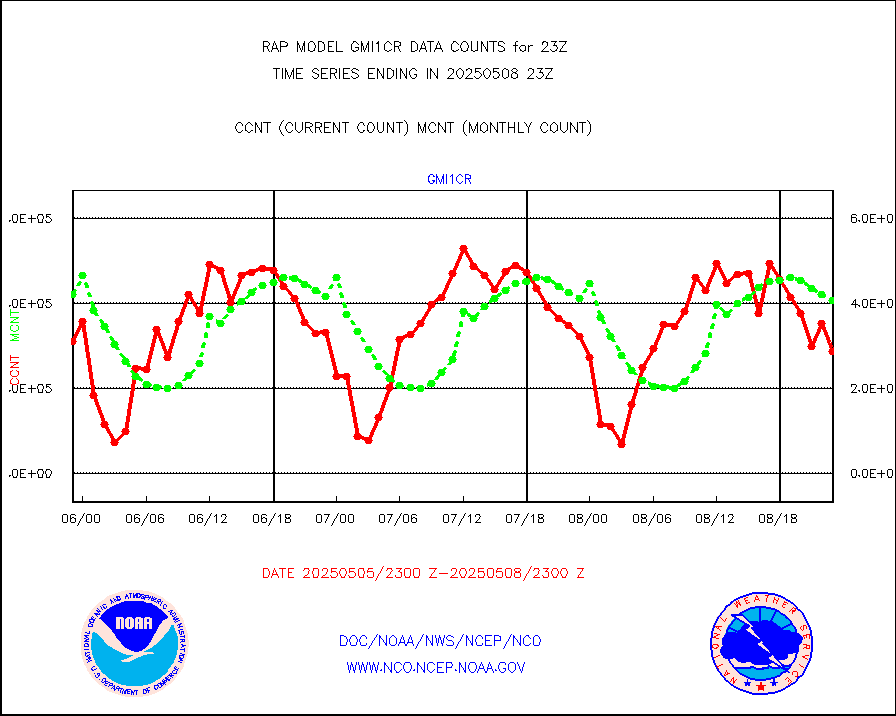
gmi1cr |
GPM GMI Level 1C-R brightness temperatures |
492032 |
881308 |
55.8 % |
1920.00-2001.99 |
gpsro |
GPS radio occultation data |
111 |
128 |
86.7 % |
1921.00-2000.99 |
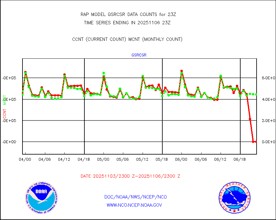
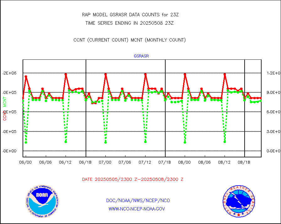
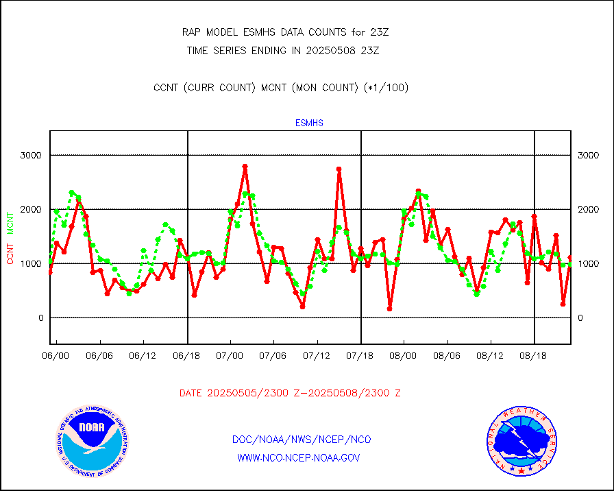
gsrasr |
GOES-16/17 All Sky Radiances (proc.) |
812097 |
787487 |
103.1 % |
1921.00-2000.99 |
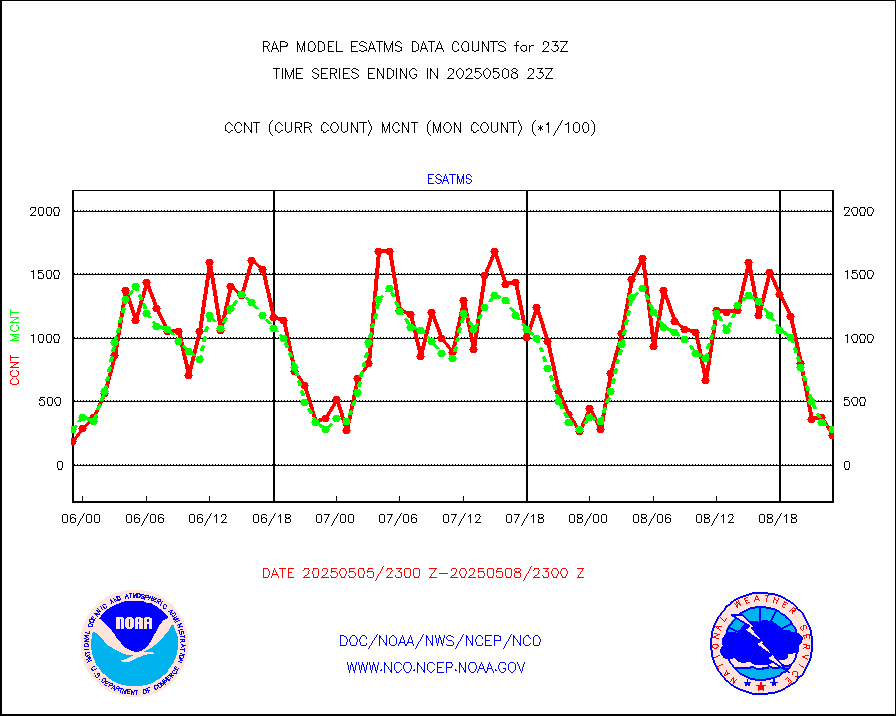
gsrcsr |
GOES-16/17 Clear Sky Radiances (proc.) |
355238 |
389939 |
91.1 % |
1921.00-2000.99 |
h20ja |
MTSAT/JMA water vapor imager derived cloud motion |
2698 |
3082 |
87.5 % |
1920.50-2001.50 |
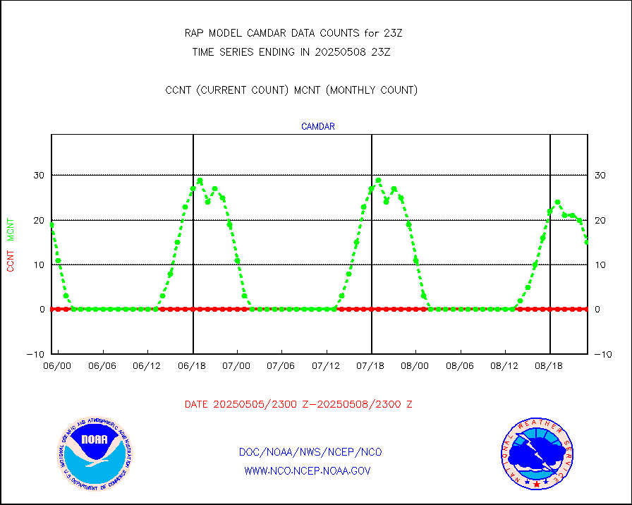
h2dusr |
GOES-16&up/NESDIS wv imgr/deep-lyr derivd cld mtn |
6628 |
7272 |
91.1 % |
1922.00-1922.99 |
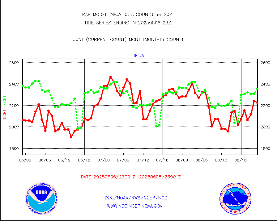
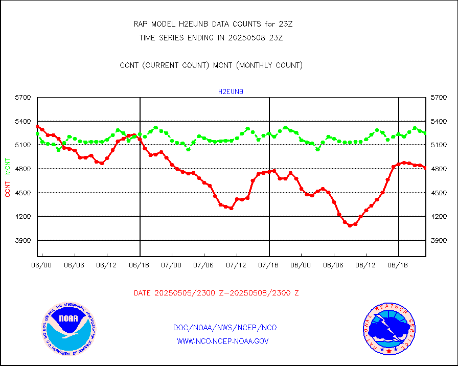
h2eunb |
METEOSAT/EUMETSAT wvpr imgr drv cld motion NBseq |
5693 |
5282 |
107.8 % |
1921.50-2000.49 |
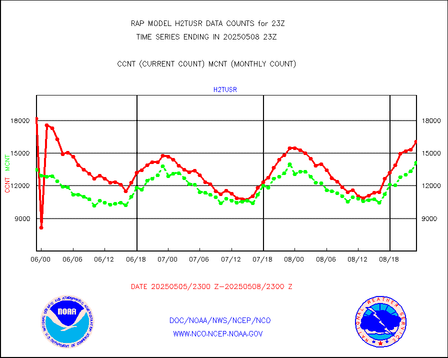
h2tusr |
GOES-16&up/NESDIS wv imgr/cld-top derived cld mtn |
17141 |
13452 |
127.4 % |
1922.00-1922.99 |
iasidb |
METOP 1-2 IASI 1C radiances-direct broadcast SSEC |
24383 |
23387 |
104.3 % |
1921.00-2000.99 |
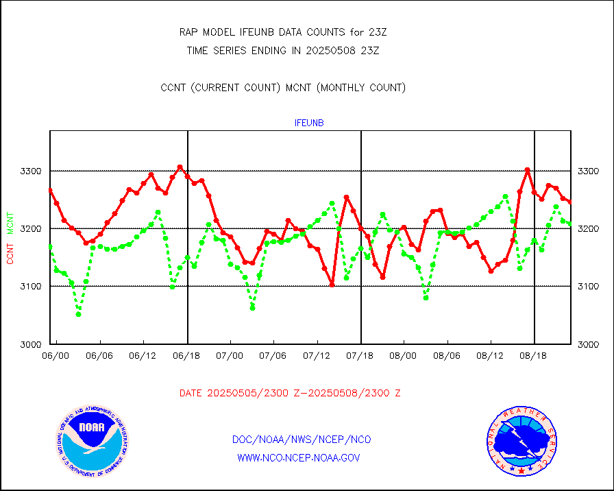
ifeunb |
METEOSAT/EUMETSAT ir lg-wave drv cld motion NBseq |
3313 |
3212 |
103.1 % |
1921.50-2000.49 |
ifvrnb |
VIIRS (NPP/NOAA-20) ir lg-wv drv cloud motion(NB) |
0 |
0 |
n/a |
1920.50-2001.50 |
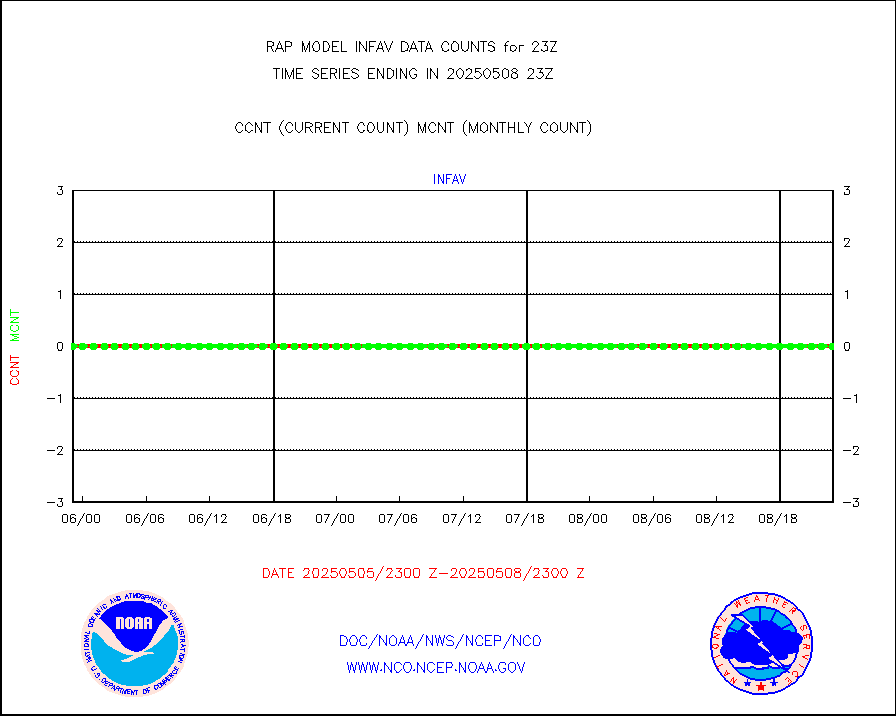
infav |
AVHRR (NOAA/METOP) ir lg-wave derived cld motion |
0 |
0 |
n/a |
1920.50-2001.50 |
infav1 |
AVHRR (METOP) ir lg-wave derived cld motion |
0 |
0 |
n/a |
1921.50-2000.49 |
infja |
MTSAT/JMA infrared long-wave derived cloud motion |
2378 |
2510 |
94.7 % |
1920.50-2001.50 |
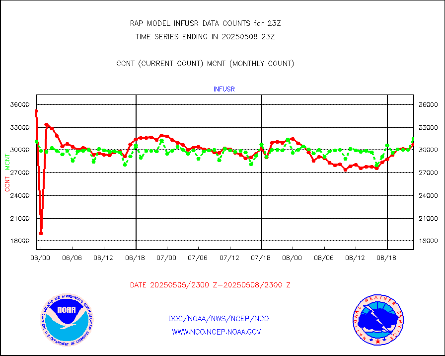
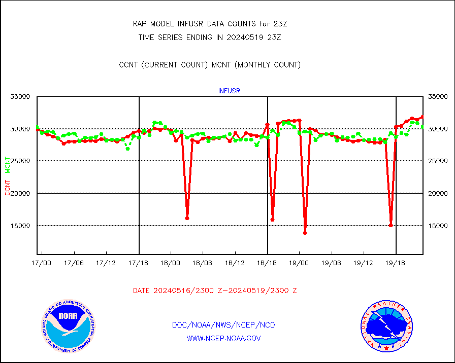
infusr |
GOES-16&up/NESDIS ir long-wave derived cld motion |
31904 |
30330 |
105.2 % |
1922.00-1922.99 |
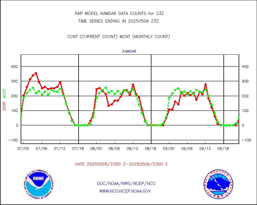
kamdar |
Korean AMDAR aircraft data (decoded from BUFR) |
81 |
97 |
83.5 % |
1919.75-2002.25 |
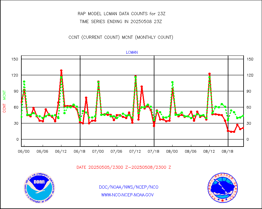
lcman |
Land-based CMAN stations decoded from CMAN format |
77 |
74 |
104.1 % |
1922.50-1923.50 |
ltnglr |
LLDN Long-rng lightning from Vaisala via NOAAPORT |
238030 |
148522 |
160.3 % |
1922.00-1923.50 |
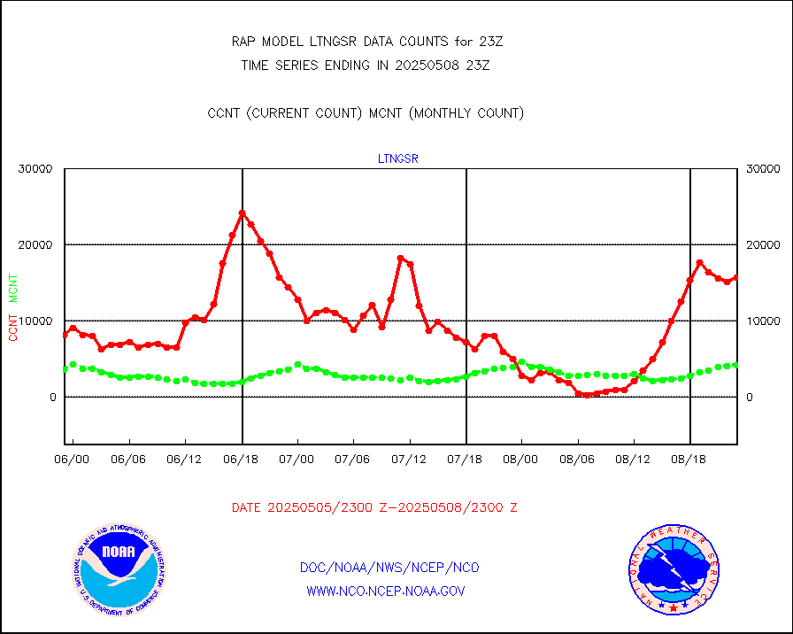
ltngsr |
NLDN Shrt-rng lightning from Vaisala via NOAAPORT |
18756 |
7022 |
267.1 % |
1922.00-1923.50 |
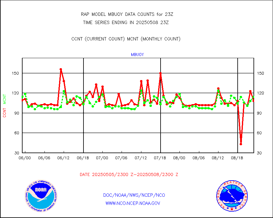
mbuoyb |
Moored buoys (decoded from BUFR) |
573 |
553 |
103.6 % |
1922.50-1923.50 |
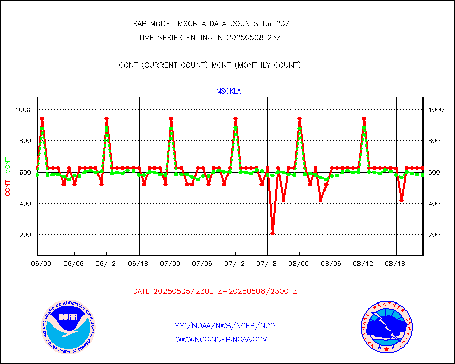
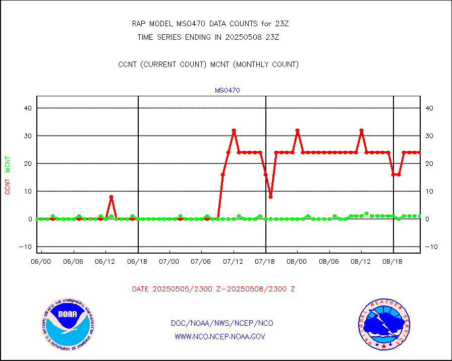
mso470 |
Mesonet/MADIS Colorado E-470 (Interstate 470) |
21 |
19 |
110.5 % |
1922.50-1923.50 |
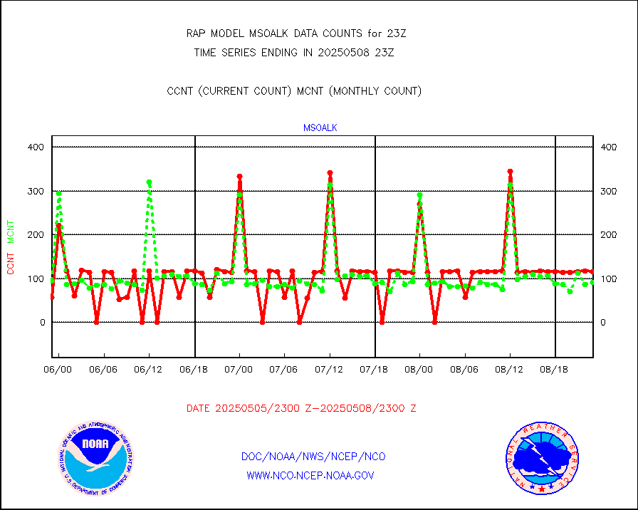
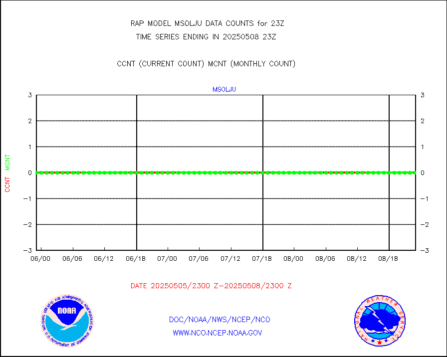
msoalk |
Mesonet/MADIS Alaska Department of Transportation |
106 |
103 |
102.9 % |
1922.50-1923.50 |
msoapg |
Mesonet/MADIS U.S. Army Aberdeen Proving Grounds |
0 |
0 |
n/a |
1922.50-1923.50 |
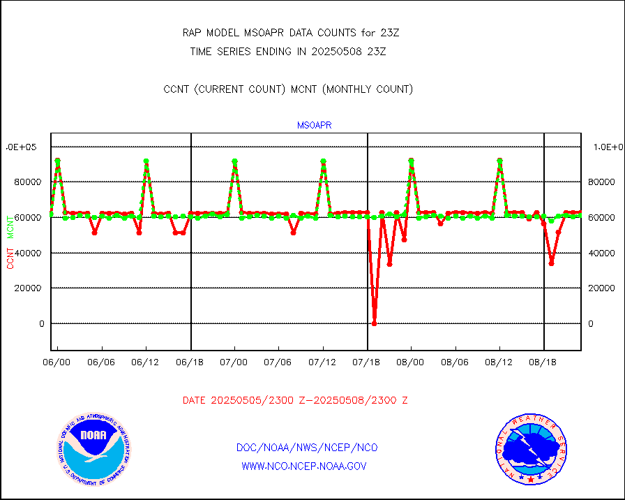
msoapr |
Mesonet/MADIS Citizen Weather Observers Program |
46380 |
45610 |
101.7 % |
1922.50-1923.50 |
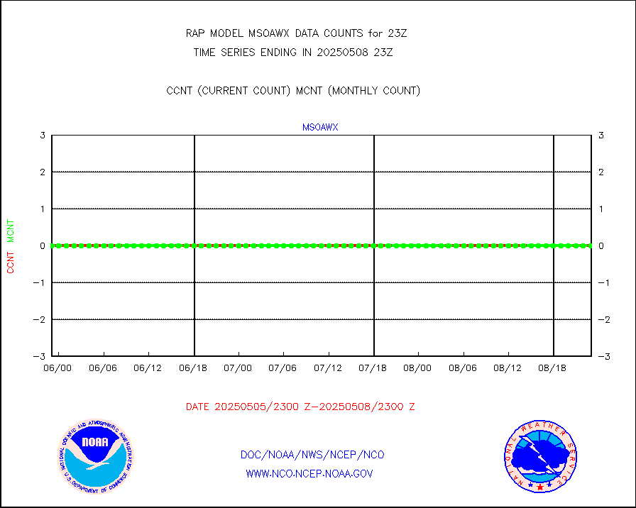
msoaws |
Mesonet/MADIS AWS Convergence Technologies, Inc. |
25553 |
24974 |
102.3 % |
1922.50-1923.50 |
msoawx |
Mesonet/MADIS "Anything Weather" |
0 |
0 |
n/a |
1922.50-1923.50 |
msocol |
Mesonet/MADIS Colorado Dept. of Transportation |
0 |
0 |
n/a |
1922.50-1923.50 |
msodcn |
Mesonet/MADIS DC Net |
0 |
0 |
n/a |
1922.50-1923.50 |
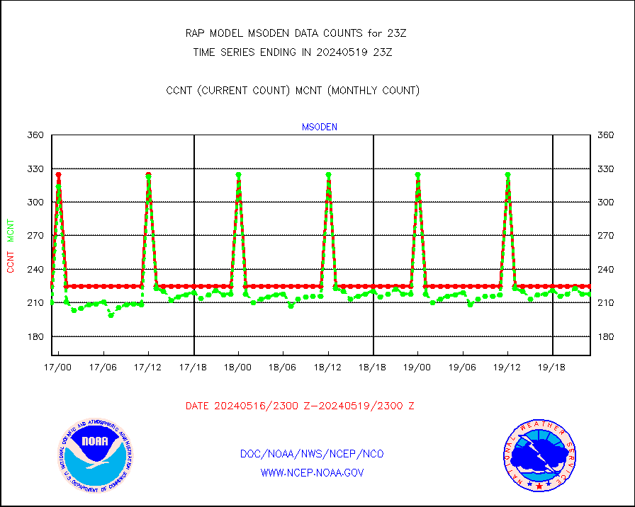
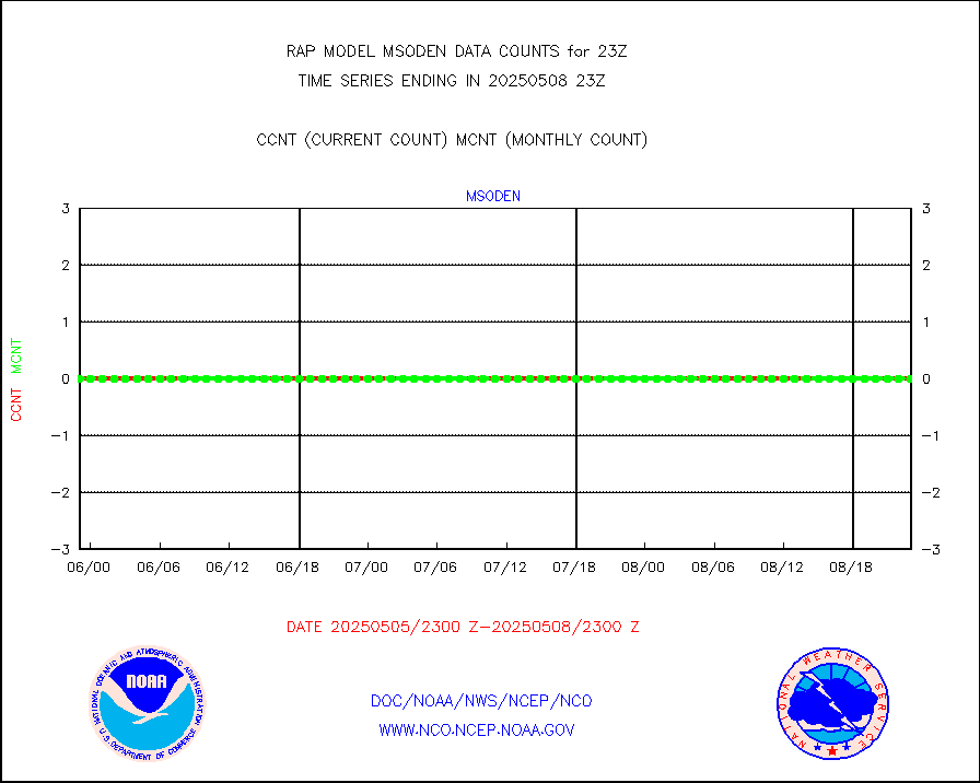
msoden |
Mesonet/MADIS Denver Urban Drainage & Flood Cntrl |
225 |
218 |
103.2 % |
1922.50-1923.50 |
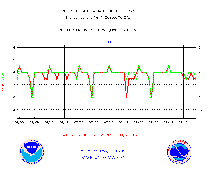
msofla |
Mesonet/MADIS Florida (FAWN & USF) |
3 |
3 |
100.0 % |
1922.50-1923.50 |
msoflt |
Mesonet/MADIS Florida Dept. of Transportation |
0 |
0 |
n/a |
1922.50-1923.50 |
msogeo |
Mesonet/MADIS Georgia Dept. of Transportation |
0 |
0 |
n/a |
1922.50-1923.50 |
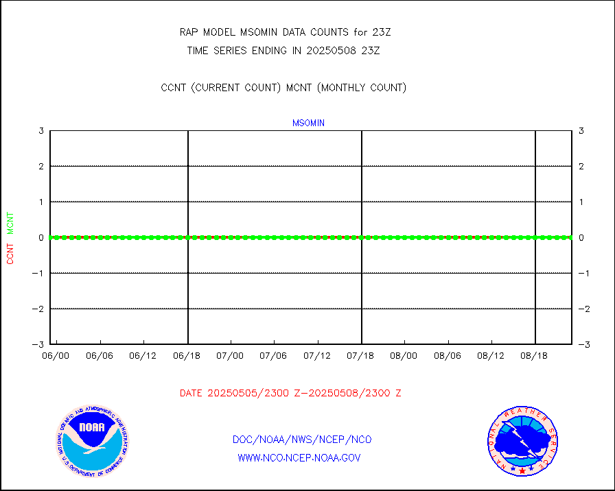
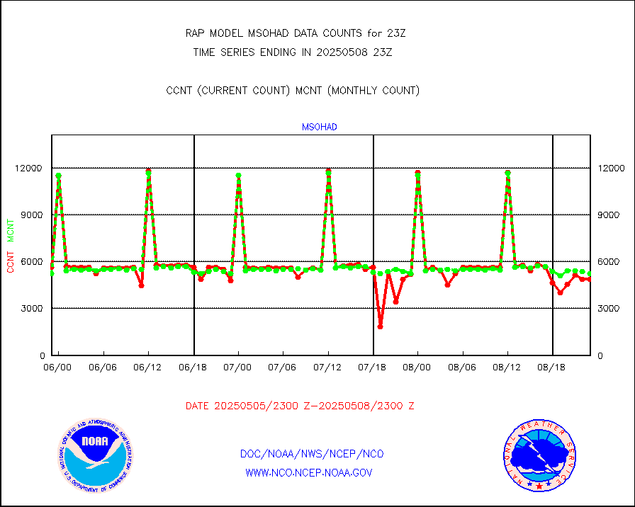
msohad |
Mesonet/MADIS NWS Hydromet Auto Data System(HADS) |
5685 |
5472 |
103.9 % |
1922.50-1923.50 |
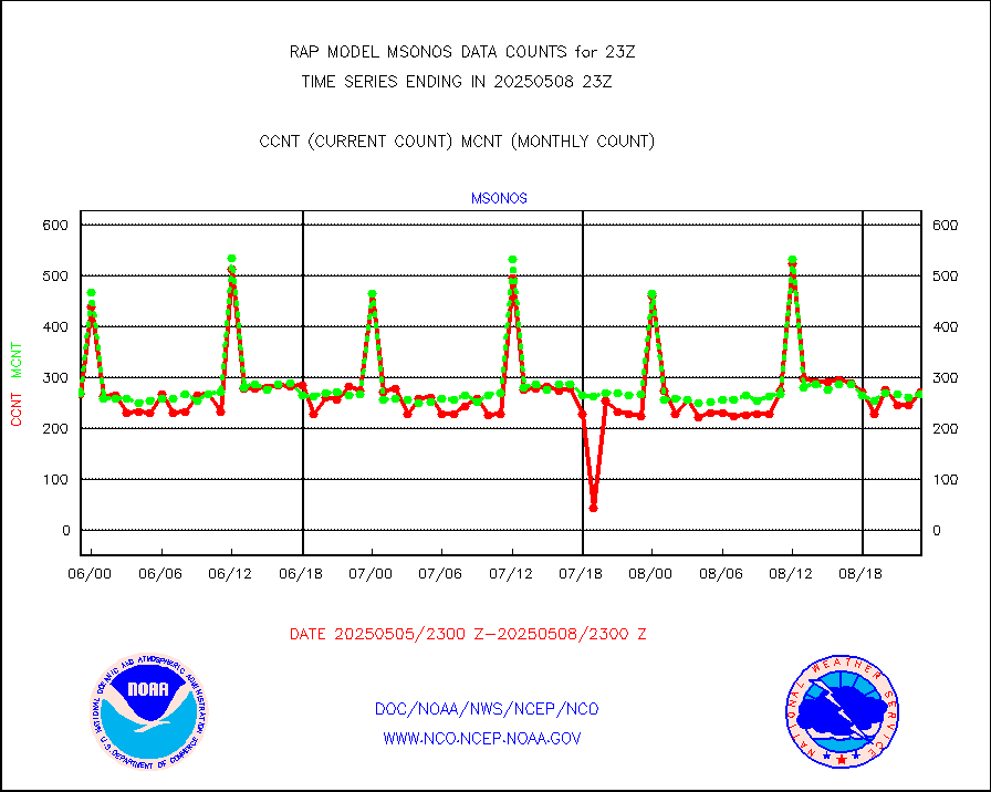
msoien |
Mesonet/MADIS Iowa Environmental |
168 |
165 |
101.8 % |
1922.50-1923.50 |
msoind |
Mesonet/MADIS Indiana Dept. of Transportation |
0 |
0 |
n/a |
1922.50-1923.50 |
msoiow |
Mesonet/MADIS Iowa Department of Transportation |
0 |
0 |
n/a |
1922.50-1923.50 |
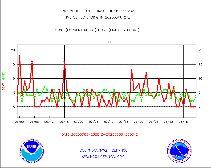
msokan |
Mesonet/MADIS Kansas Department of Transportation |
340 |
328 |
103.7 % |
1922.50-1923.50 |
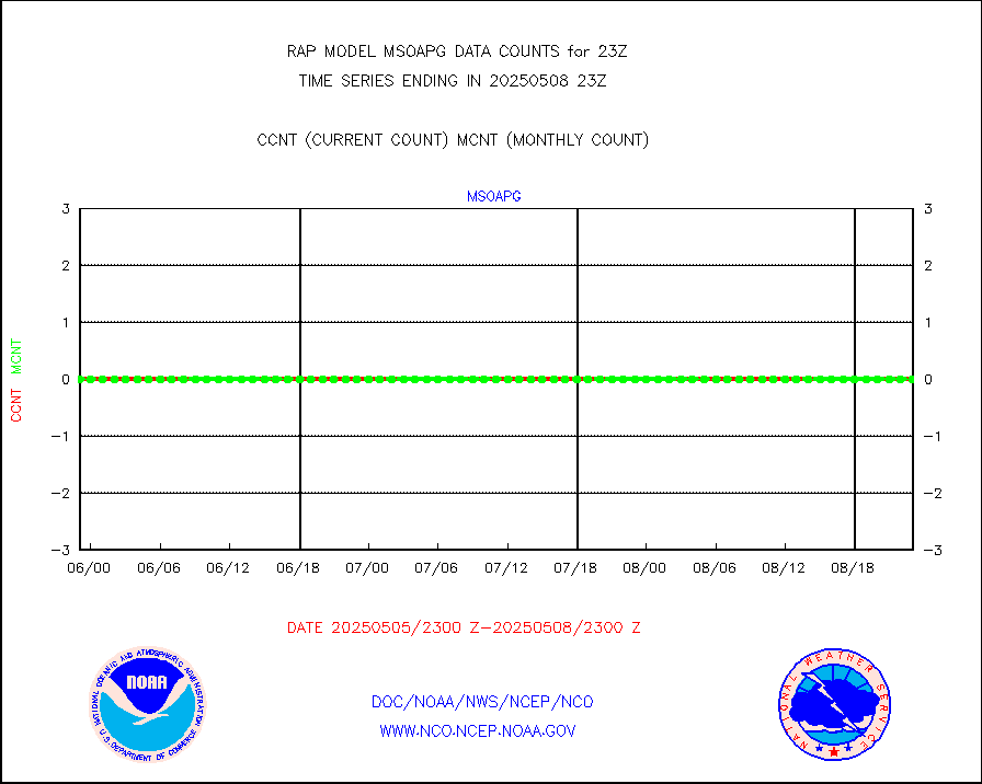
msokla |
Mesonet/MADIS Oklahoma Mesonet |
318 |
307 |
103.6 % |
1922.50-1923.50 |
msolju |
Mesonet/MADIS Louisiana State/Jackson State Univ. |
0 |
0 |
n/a |
1922.50-1923.50 |
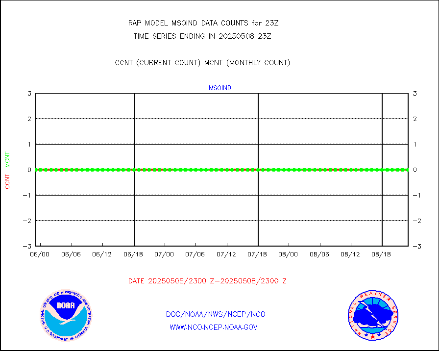
msomca |
Mesonet/MADIS Missouri Commercial Agricult Wx Net |
273 |
262 |
104.2 % |
1922.50-1923.50 |
msomin |
Mesonet/MADIS Minnesota Dept. of Transportation |
0 |
0 |
n/a |
1922.50-1923.50 |
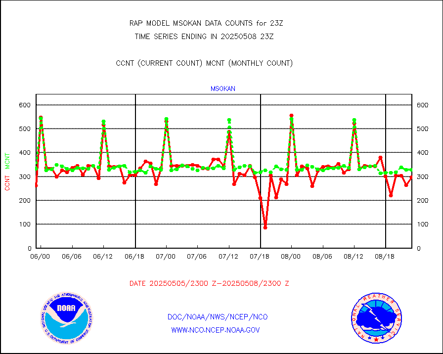
msonos |
Mesonet/MADIS NOS-Phys Oceanographic Realtime Sys |
290 |
286 |
101.4 % |
1922.50-1923.50 |
msoraw |
Mesonet/MADIS NFIC Remote Automated Wx Stns(RAWS) |
1714 |
1594 |
107.5 % |
1922.50-1923.50 |
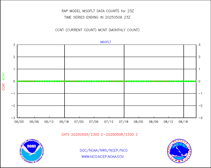
msourb |
Mesonet/MADIS UrbaNet |
3934 |
3898 |
100.9 % |
1922.50-1923.50 |
msovir |
Mesonet/MADIS Virginia Dept. of Transportation |
133 |
225 |
59.1 % |
1922.50-1923.50 |
msowfy |
Mesonet/MADIS "Weather for You" |
0 |
0 |
n/a |
1922.50-1923.50 |
msowis |
Mesonet/MADIS Wisconsin Dept. of Transportation |
0 |
0 |
n/a |
1922.50-1923.50 |
msowst |
Mesonet/MADIS MesoWest (many subproviders) |
41584 |
39767 |
104.6 % |
1922.50-1923.50 |
msowtx |
Mesonet/MADIS West Texas |
5043 |
4839 |
104.2 % |
1922.50-1923.50 |
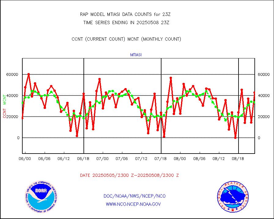
mtiasi |
METOP 1-2 IASI 1C radiance data (varbl. channels) |
37289 |
27374 |
136.2 % |
1921.00-2000.99 |
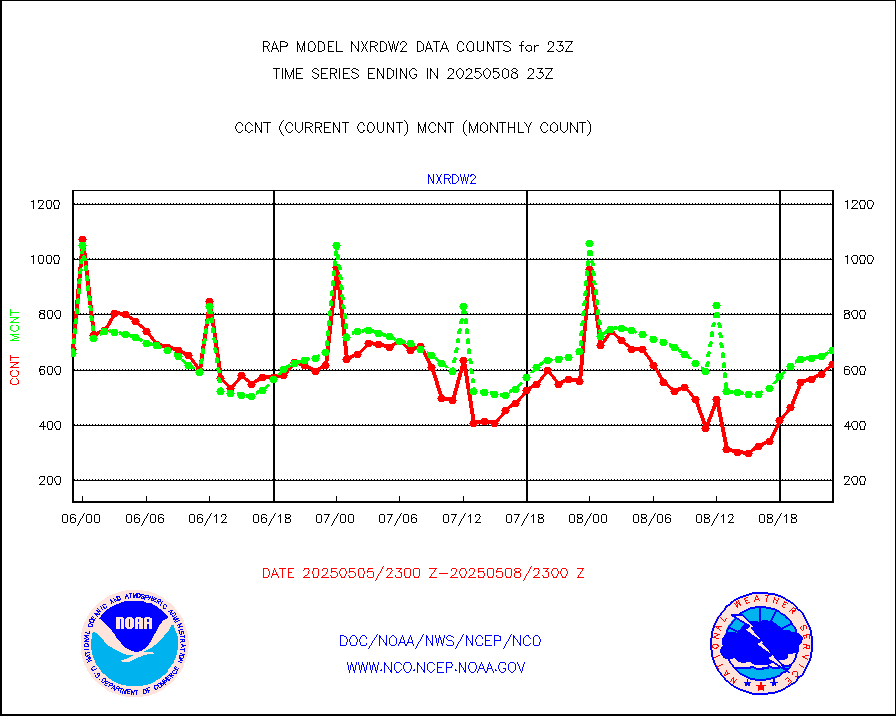
nxrdw2 |
NEXRAD Vel Azm Dsp(VAD) winds via Level 2 decoder |
799 |
739 |
108.1 % |
1922.00-2000.00 |
osbuv8 |
NOAA 16-19 Solar Backscatter UV-2 rad frm V8 BUFR |
0 |
0 |
n/a |
1921.00-1923.99 |
pibal |
PIBAL (from PILOT, PILOT SHIP, PILOT MOBIL) |
0 |
0 |
n/a |
1922.00-2000.00 |
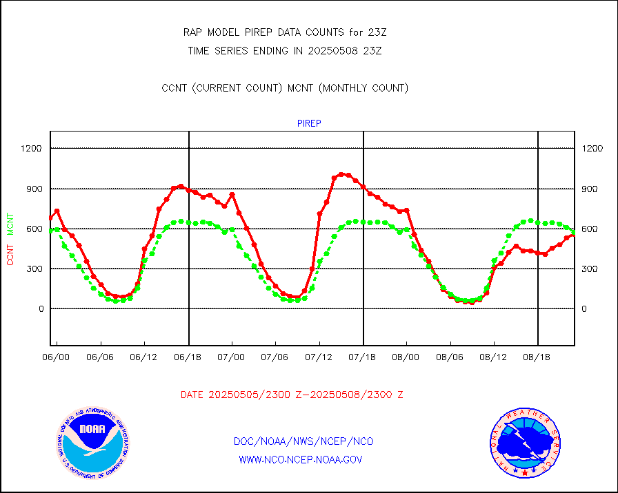
pirep |
Manual PIREP aircraft data (dcded from AIREP fmt) |
428 |
526 |
81.4 % |
1919.75-2002.25 |
prflrp |
Profilr winds from PIBAL (PILOT,PILOT SHIP/MOBIL) |
0 |
0 |
n/a |
1921.50-2000.50 |
raobm |
Rawinsonde - mobile land (from TEMP/PILOT MOBIL) |
0 |
0 |
n/a |
1922.00-2000.00 |
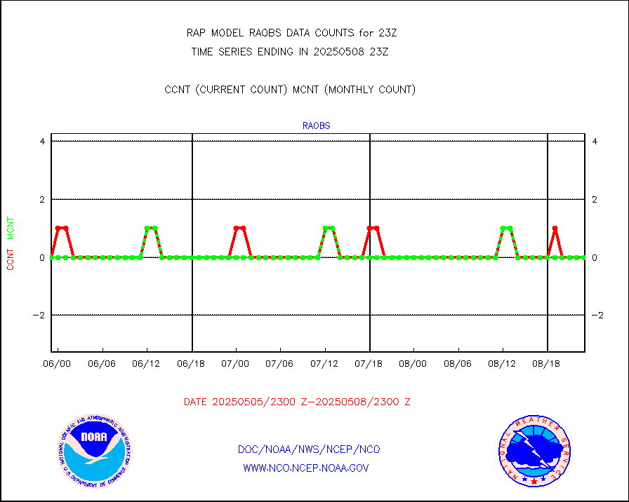
raobs |
Rawinsonde - ship (from TEMP SHIP, PILOT SHIP) |
0 |
0 |
n/a |
1922.00-2000.00 |
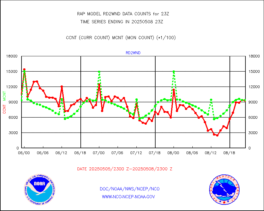
rd2wnd |
NEXRAD radial wind (Level 2 - GTS) |
1258544 |
1092032 |
115.2 % |
1922.50-1923.49 |
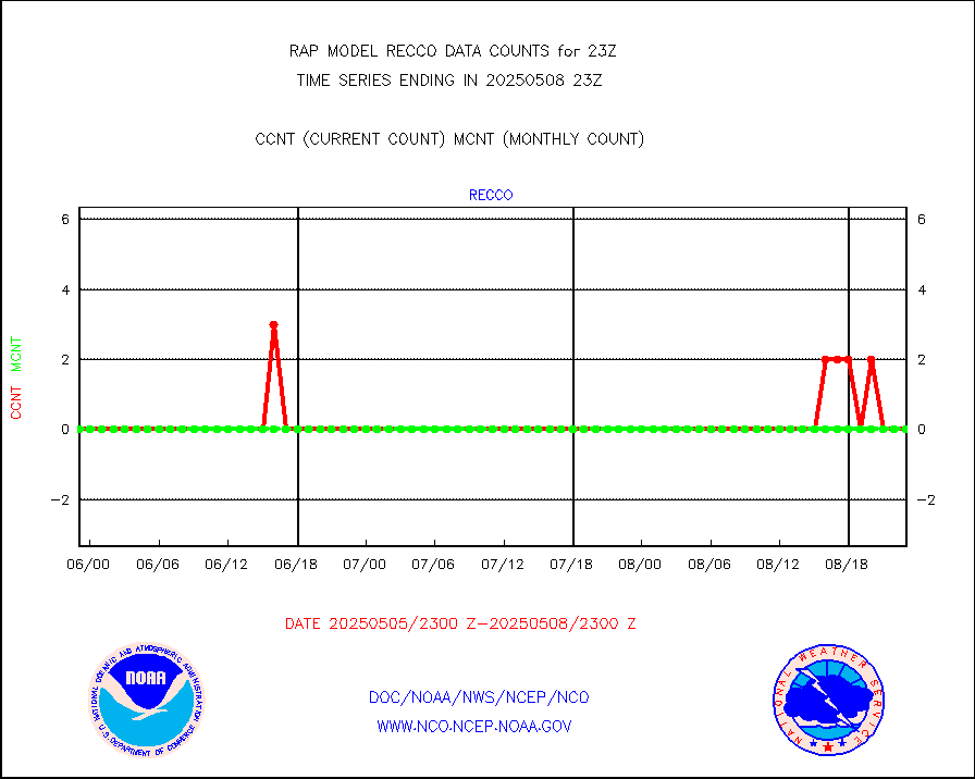
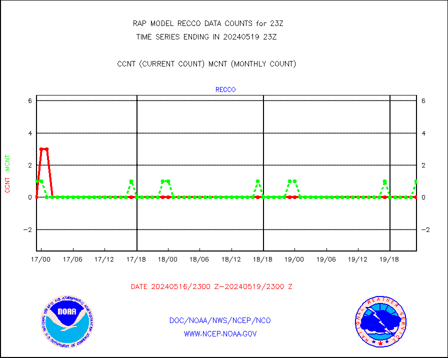
recco |
Flight level reconnaissance aircraft data |
0 |
1 |
0.0 % |
1922.00-2000.00 |
saldrn |
Surface Marine Saildrone (decoded from BUFR) |
2 |
2 |
100.0 % |
1921.00-2000.99 |
saphir |
Megha-Tropiques SAPHIR L1A2 brightness temps |
0 |
0 |
n/a |
1920.00-2001.99 |
sevasr |
METEOSAT-10 2nd Gen SEVIRI All Sky Radiance(proc) |
9512 |
9494 |
100.2 % |
1921.00-2000.99 |
sevcsr |
METEOSAT-10 2nd Gen SEVIRI Clr Sky Radiance(proc) |
0 |
0 |
n/a |
1921.00-2000.99 |
ships |
Ship - manual and automatic, restricted |
1 |
3 |
33.3 % |
1922.50-1923.50 |
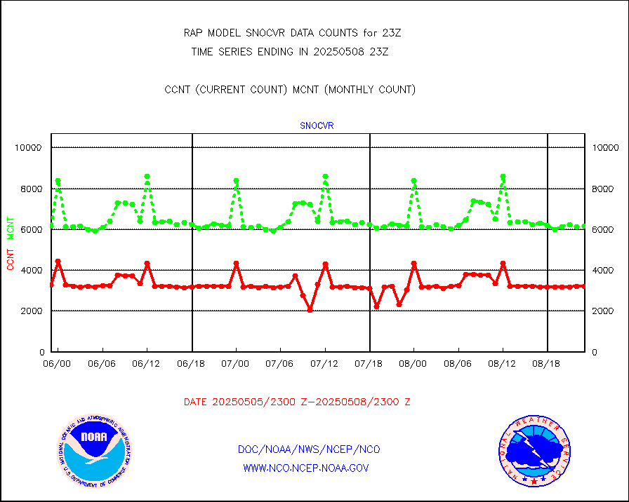
snocvr |
NOW COVER, DEPTH/DENSITY AND WATER EQUIVALENT |
3376 |
6719 |
50.2 % |
1921.00-2001.00 |
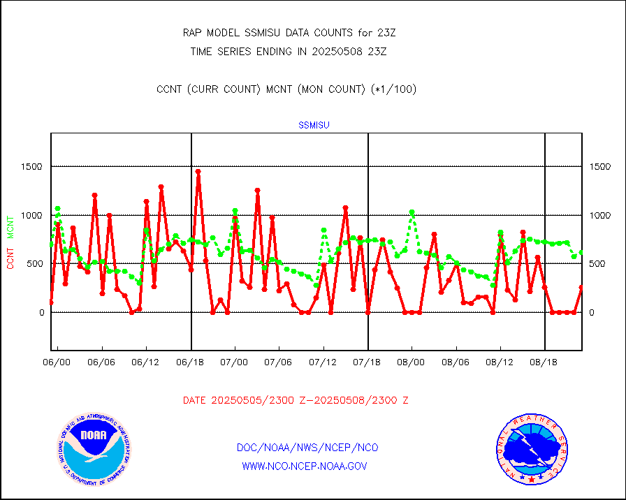
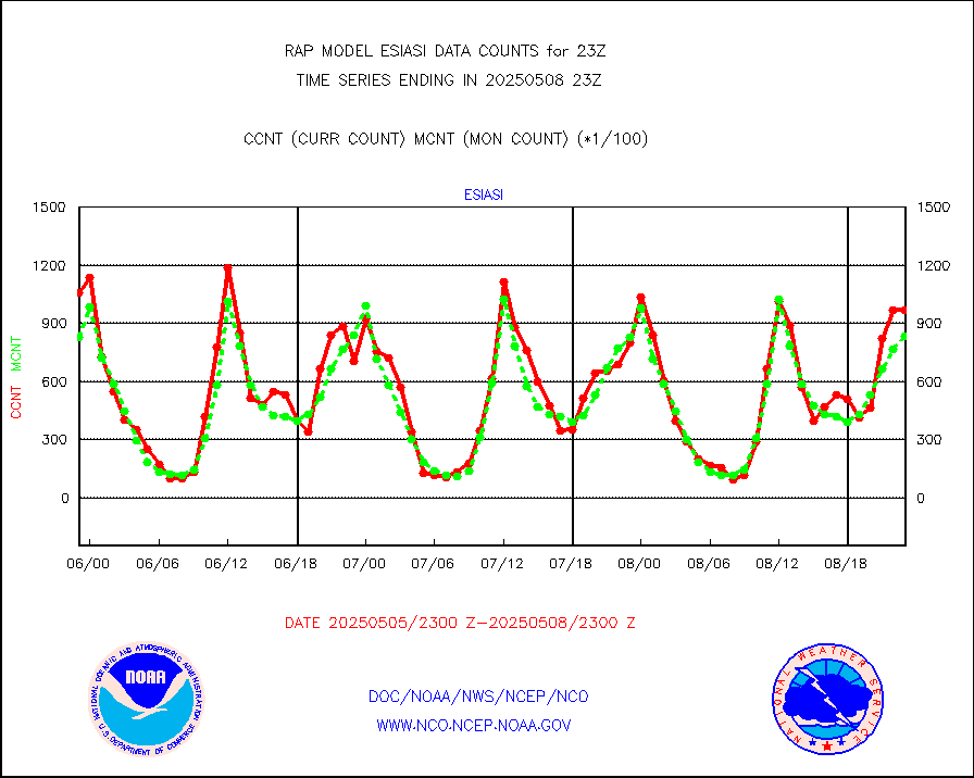
ssmisu |
DMSP SSM/IS 1C radiance data (Unified Pre-Proc.) |
36165 |
60140 |
60.1 % |
1921.00-2000.99 |
subpfl |
Sub-surface float and glider profile (BUFR) |
2 |
5 |
40.0 % |
1921.00-2000.99 |
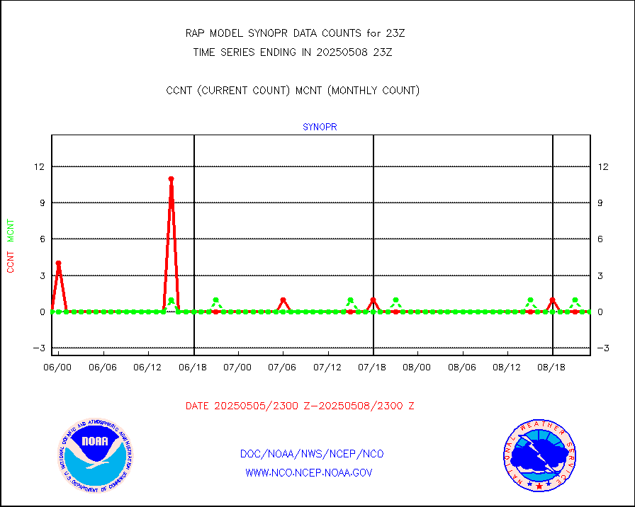
synopr |
Synoptic - restricted (WMO Res 40) manual & auto. |
0 |
0 |
n/a |
1922.50-1923.50 |
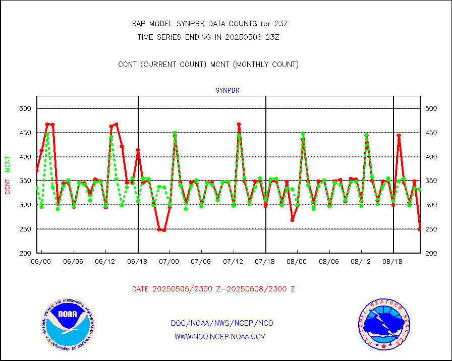
synpbr |
Synoptic - restricted (WMO Res 40)(decoded BUFR) |
353 |
351 |
100.6 % |
1922.50-1923.50 |
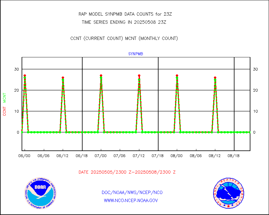
synpmb |
Synoptic - mobile manual & auto (decoded fr BUFR) |
0 |
0 |
n/a |
1922.50-1923.50 |
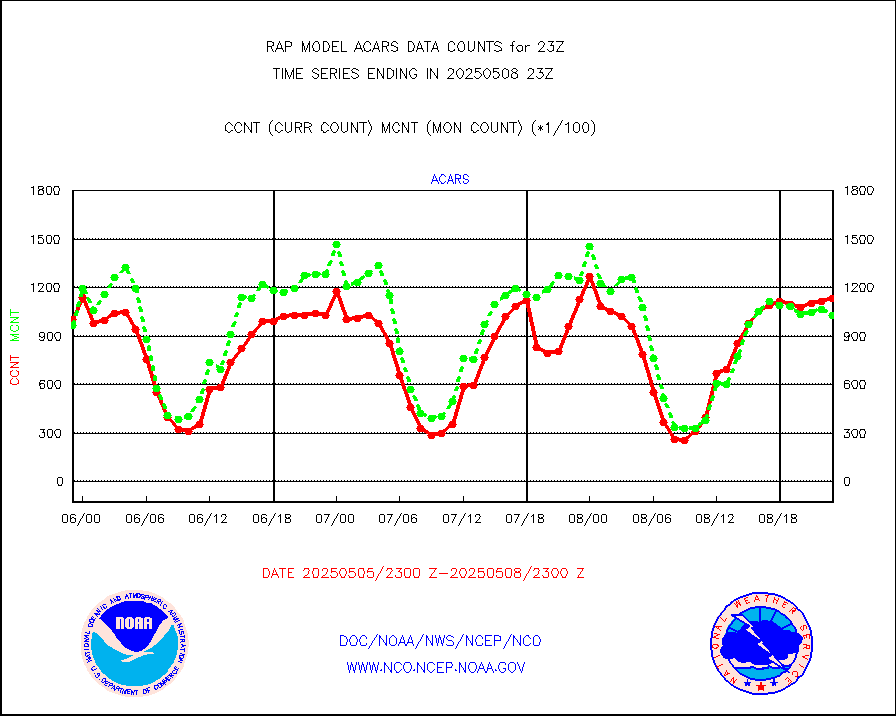
tmdara |
TAMDAR aircft data-all types(from Panasonic,BUFR) |
793 |
682 |
116.3 % |
1919.75-2002.25 |
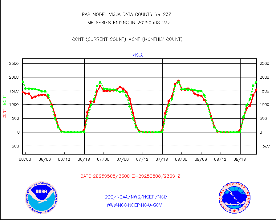
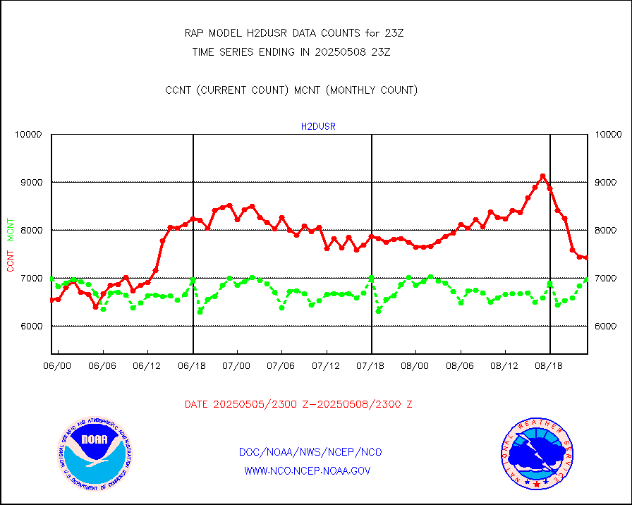
visja |
MTSAT/JMA visible derived cloud motion |
1631 |
1801 |
90.6 % |
1920.50-2001.50 |
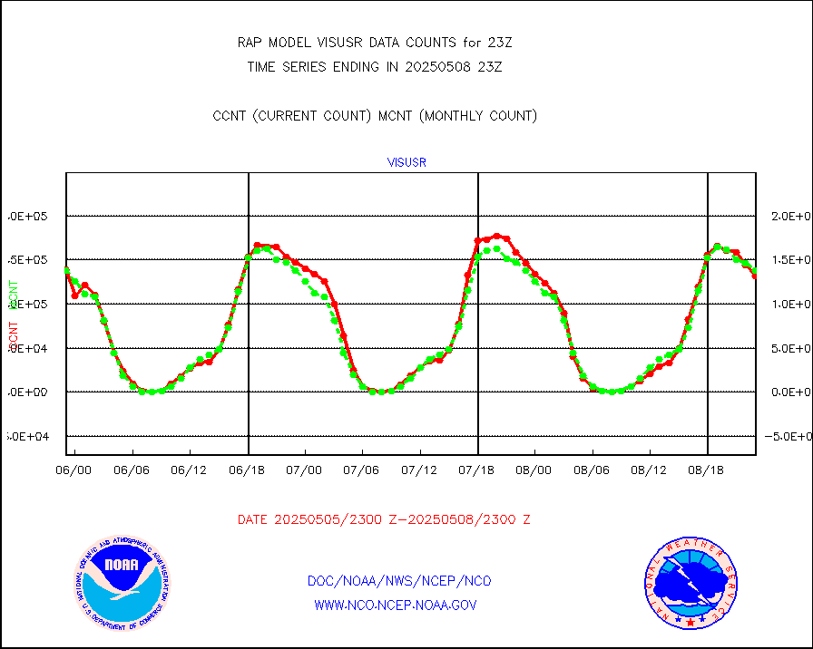
visusr |
GOES-16&up/NESDIS visible derived cloud motion |
132331 |
141071 |
93.8 % |
1922.00-1922.99 |
vseunb |
METEOSAT/EUMETSAT visible drv cld motion NBseq |
108 |
50 |
216.0 % |
1921.50-2000.49 |


