| Critical Data with Normal Counts |
|---|
| Type | Description | Hourly Count | Monthly Average | Percent (%) of Monthly Mean | UTC Time Window |
1bamua |
NOAA 15-19 & METOP 1-2 AMSU-A NCEP-proc. br.temps |
48162 |
39011 |
123.5 % |
1918.00-1923.99 |
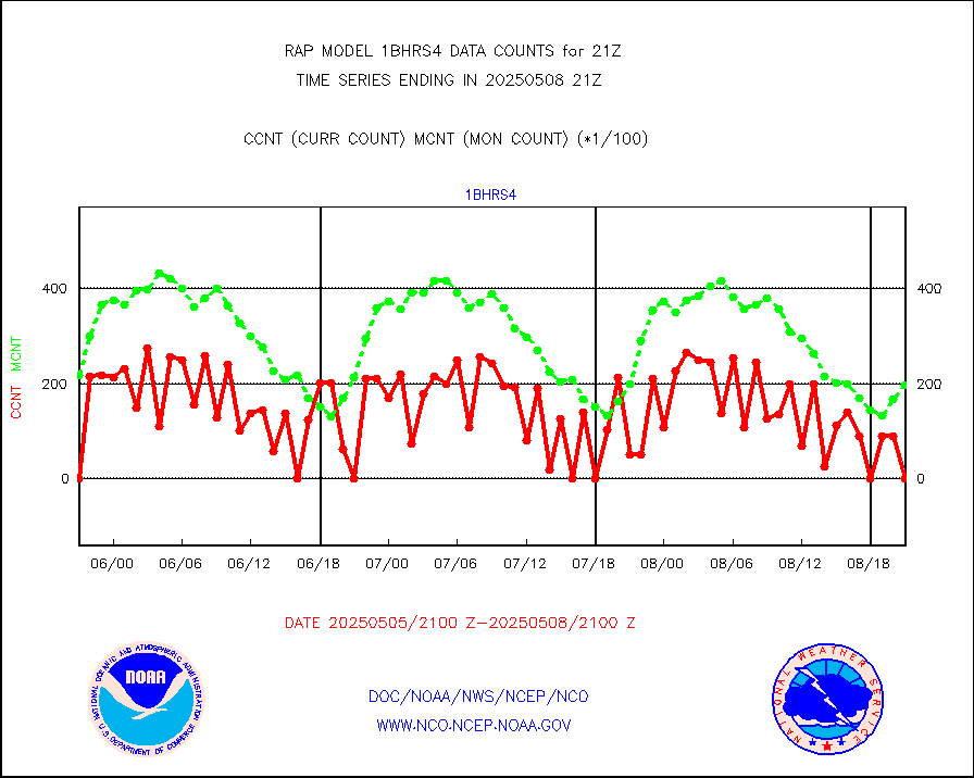
1bhrs4 |
NOAA 18-19 & METOP 1-2 HIRS-4 NCEP-proc. br.temps |
33166 |
29916 |
110.9 % |
1918.00-1923.99 |
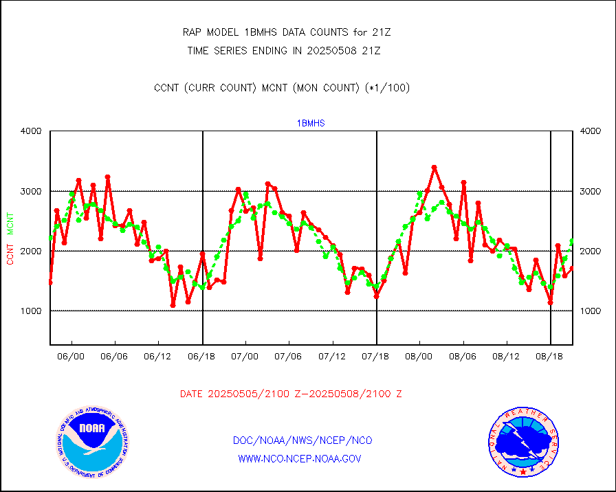
1bmhs |
NOAA 18-19 & METOP 1-2 MHS NCEP-proces. br. temps |
288454 |
227849 |
126.6 % |
1918.00-1923.99 |
acars |
MDCRS ACARS acft data from ARINC(dcded from BUFR) |
83452 |
77584 |
107.6 % |
1917.75-2000.25 |
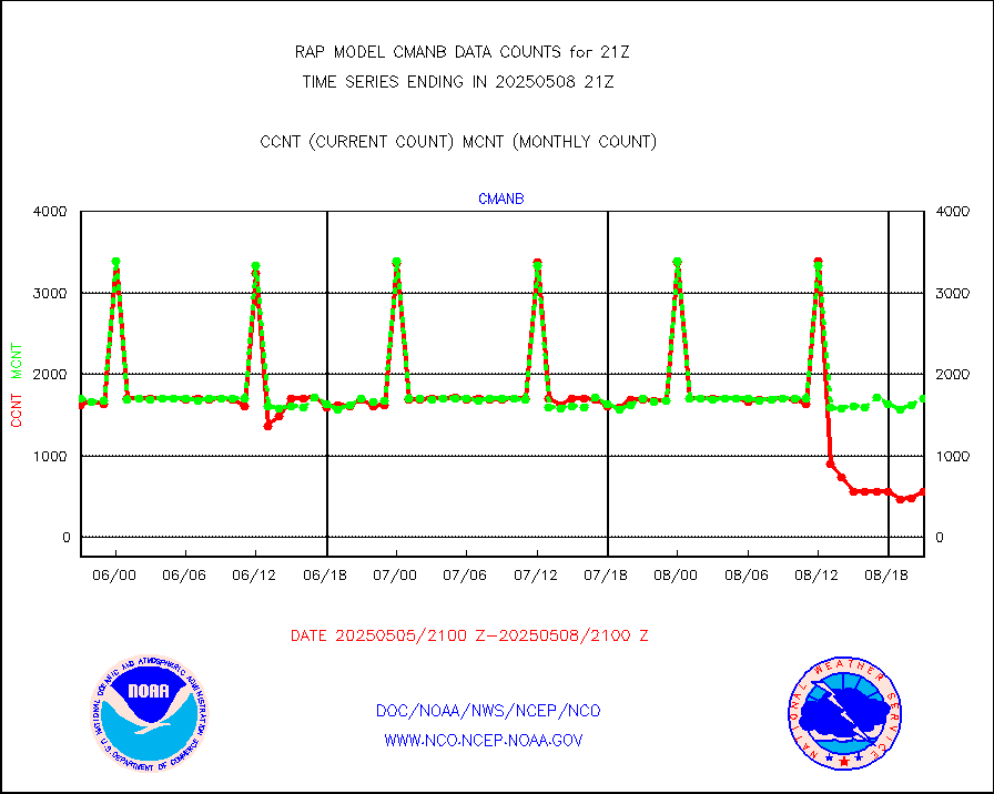
cmanb |
Surface Marine CMAN rpts decoded from BUFR format |
1718 |
1687 |
101.8 % |
1920.50-1921.50 |
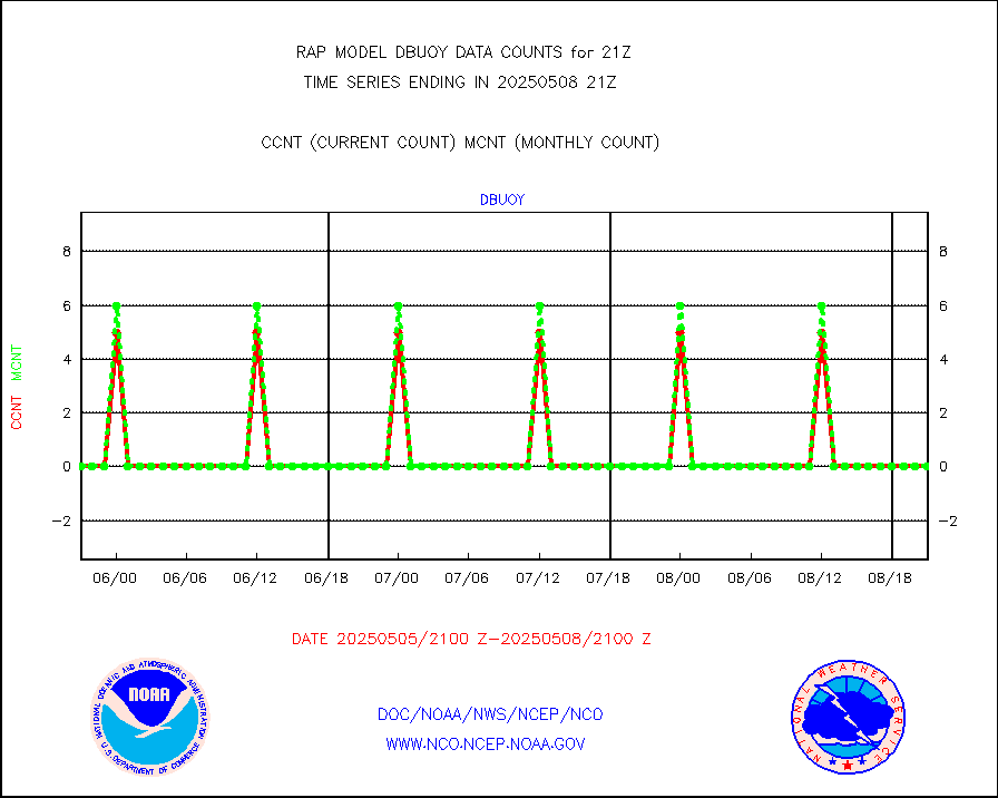
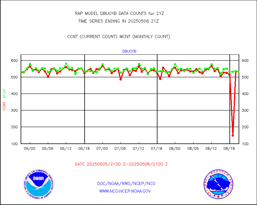
dbuoy |
Buoys decoded from FM-18 fmt (moored or drifting) |
0 |
0 |
n/a |
1920.50-1921.50 |
gnss |
Grnd-based Gbl Navigation Sat System (GNSS) data |
2280 |
2517 |
90.6 % |
1919.95-1920.05 |
h20mo |
MODIS (AQUA/TERRA) wvpr imager derived cld motion |
0 |
0 |
n/a |
1918.50-1923.50 |
infmo |
MODIS (AQUA/TERRA) ir l-wave derived cloud motion |
0 |
0 |
n/a |
1918.50-1923.50 |
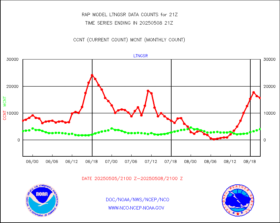
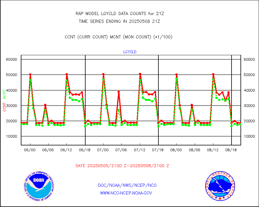
lgycld |
GOES/NASA(Langley) hi-res. (1x1 f-o-v) cloud data |
3722840 |
3170905 |
117.4 % |
1920.50-1921.50 |
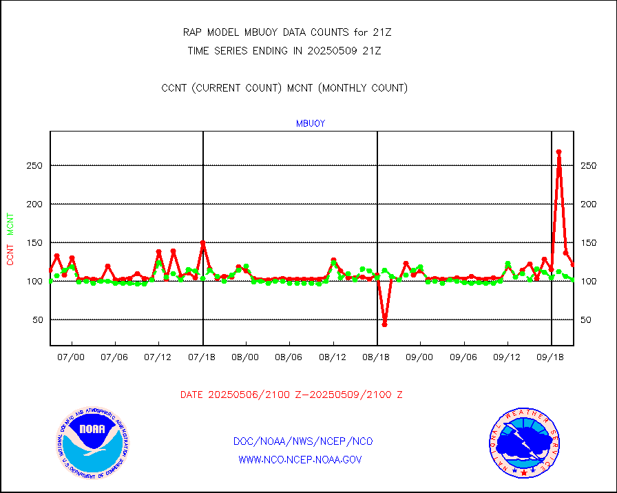
mbuoy |
Buoys decoded from FM-13 format (moored) |
67 |
60 |
111.7 % |
1920.50-1921.50 |
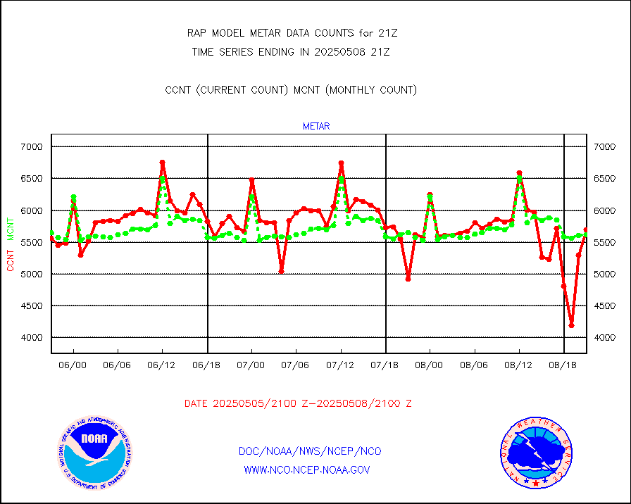
metar |
Aviation - METAR |
5634 |
5843 |
96.4 % |
1920.50-1921.50 |
nxrdw |
NEXRAD Vel Azm Dsp(VAD) winds via radar coded msg |
0 |
0 |
n/a |
1920.00-1922.00 |
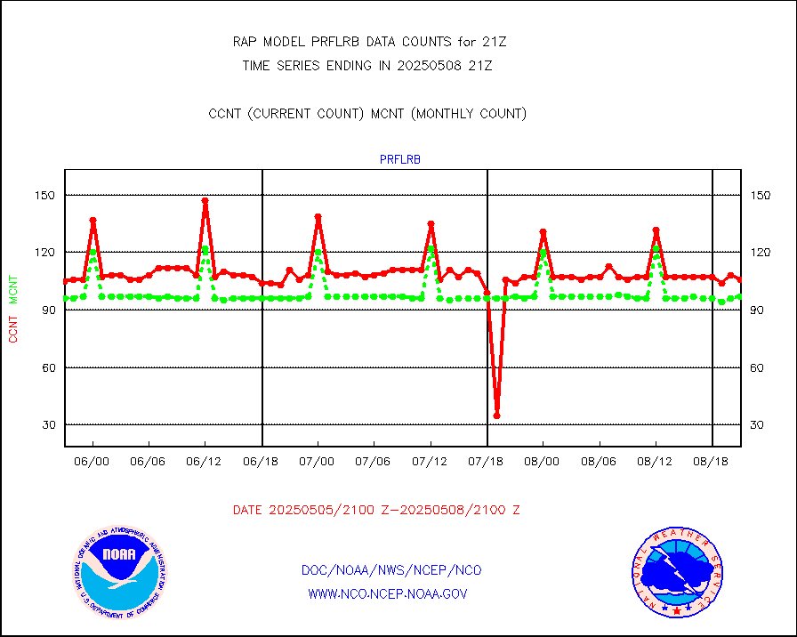
prflrb |
Multi-Agency Profiler (MAP) and SODAR winds |
72 |
84 |
85.7 % |
1919.50-1922.50 |
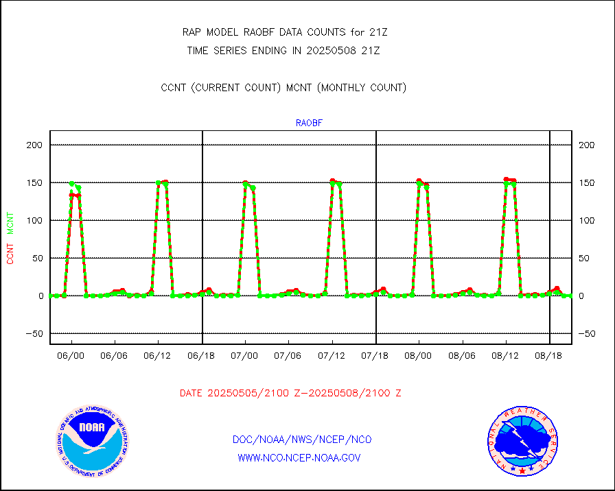
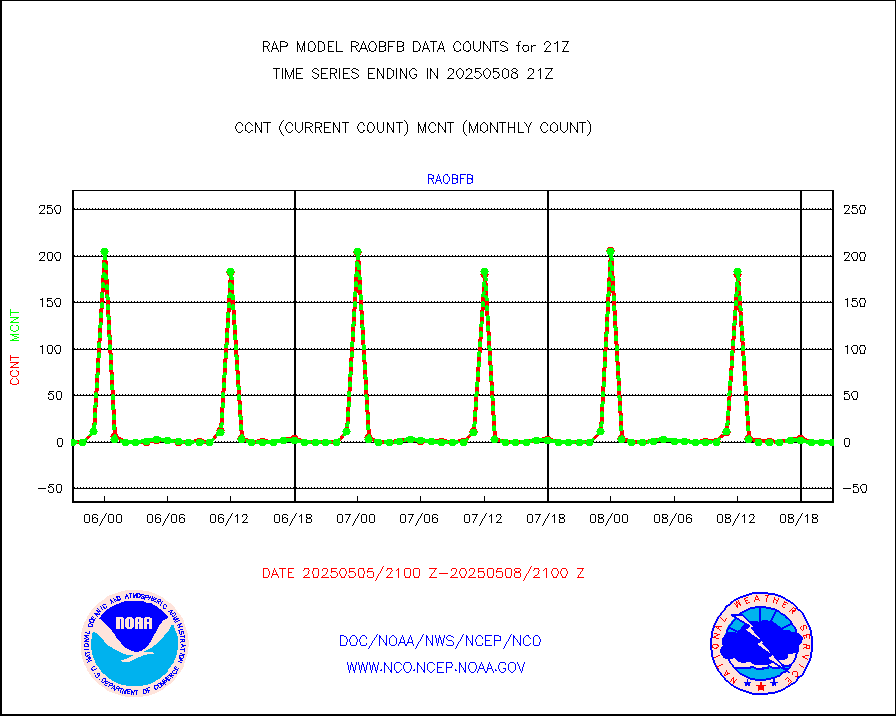
raobf |
Rawinsonde - fixed land (from TEMP or PILOT) |
1 |
0 |
n/a |
1920.00-1922.00 |
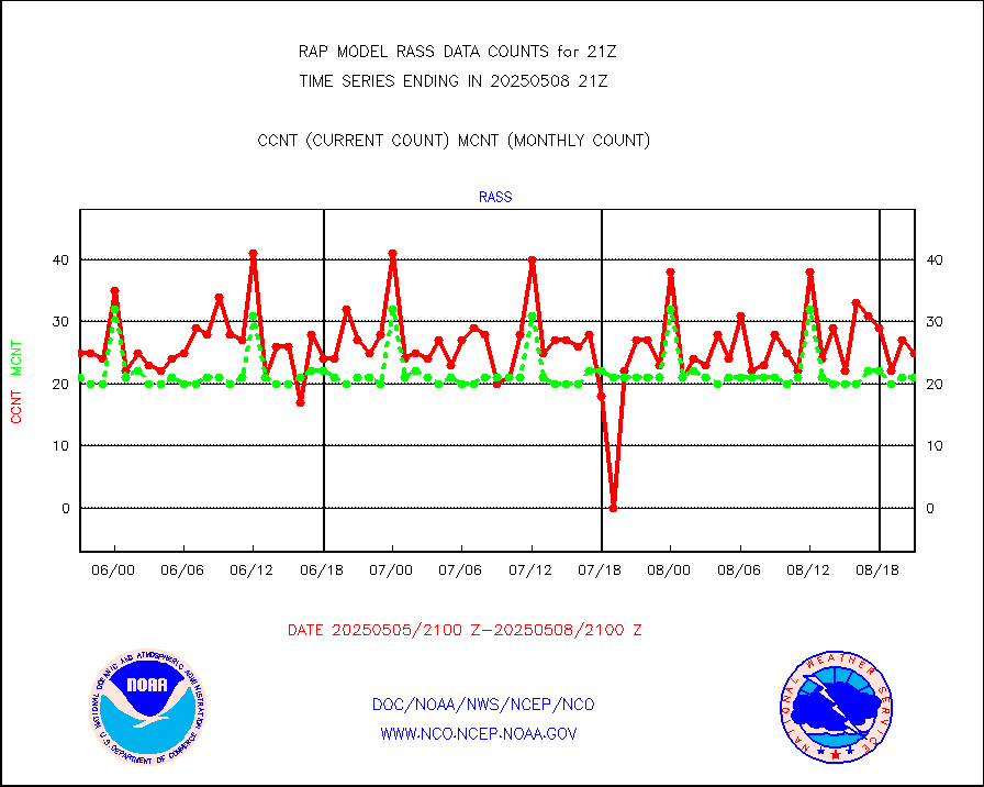
rass |
RASS temperatures (NOAA and Multi-Agency) |
17 |
22 |
77.3 % |
1920.50-1921.50 |
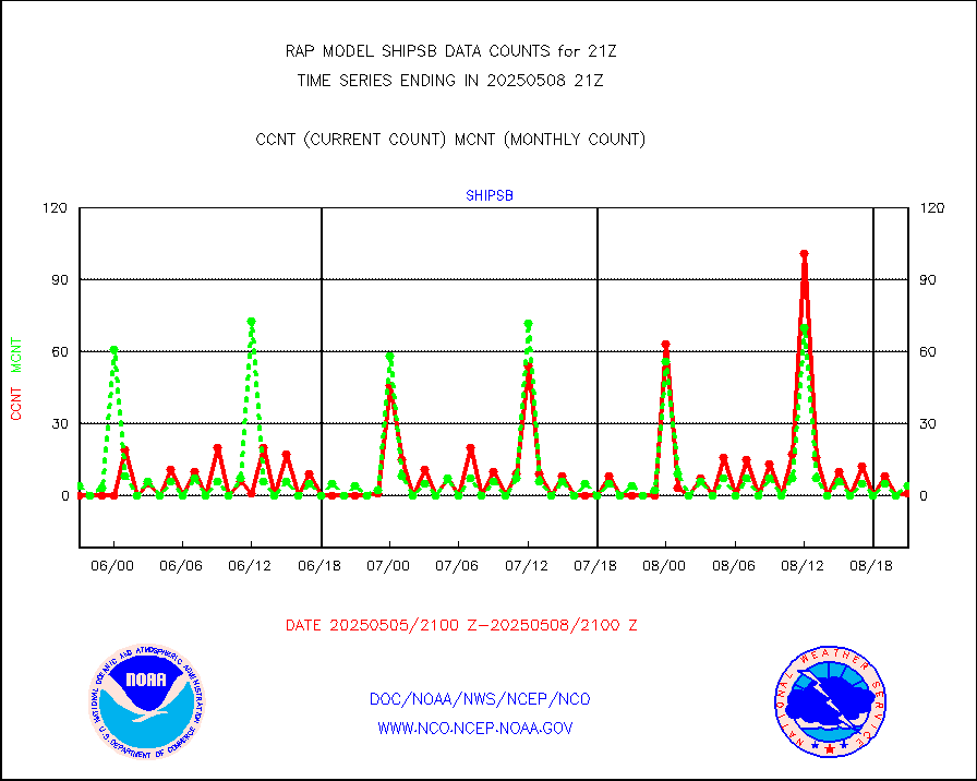
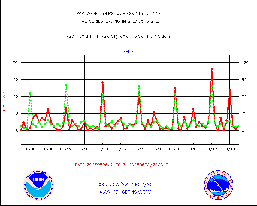
shipsb |
Ship - manual and automatic, restricted (BUFR) |
1 |
0 |
n/a |
1920.50-1921.50 |
shipsu |
Ship - manual and automatic, unrestricted |
75 |
60 |
125.0 % |
1920.50-1921.50 |
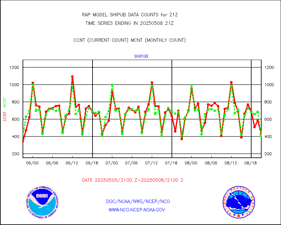
shipub |
Ship - manual and automatic, unrestricted (BUFR) |
225 |
288 |
78.1 % |
1920.50-1921.50 |
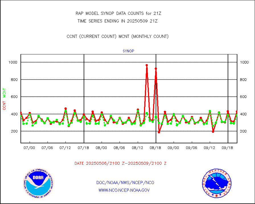
synop |
Synoptic - fixed manual and automatic |
490 |
522 |
93.9 % |
1920.50-1921.50 |
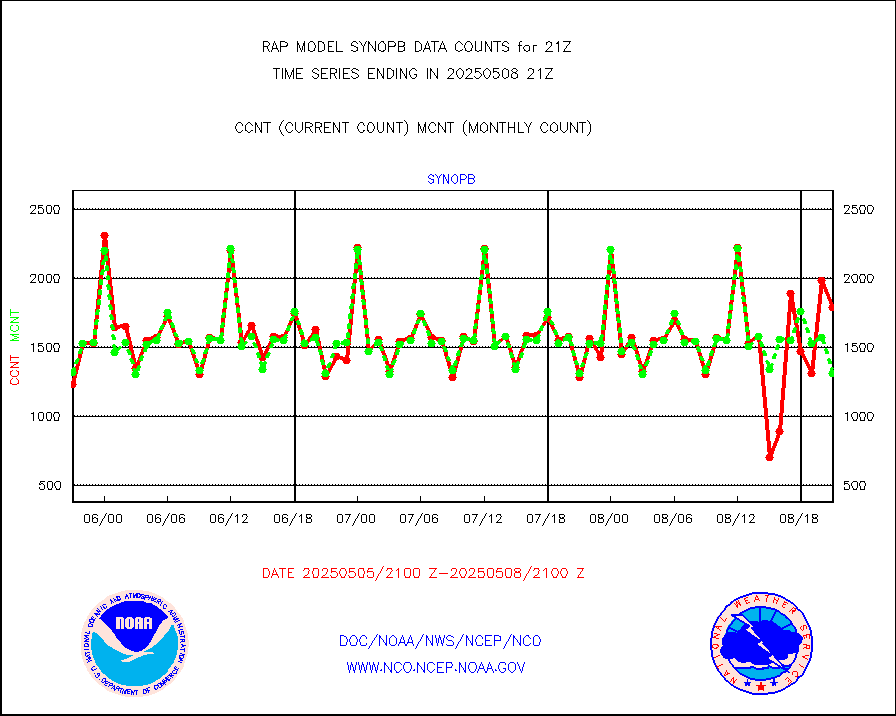
synopb |
Synoptic - fixed manual & auto (decoded fr BUFR) |
1389 |
1386 |
100.2 % |
1920.50-1921.50 |
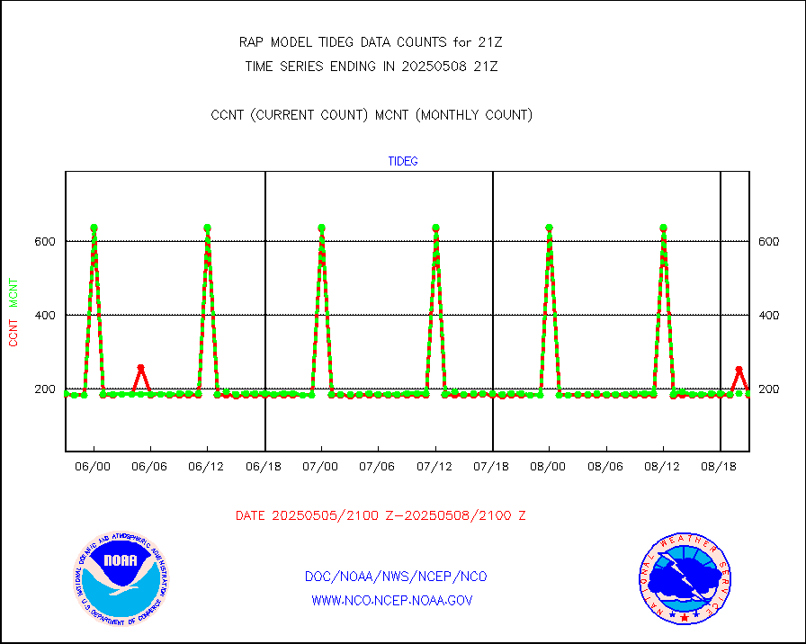
tideg |
Tide gauge reports decoded from CREX format |
181 |
180 |
100.6 % |
1920.50-1921.50 |
| Data Types of Opportunity with Normal Counts |
|---|
| Type | Description | Hourly Count | Monthly Average | Percent (%) of Monthly Mean | UTC Time Window |
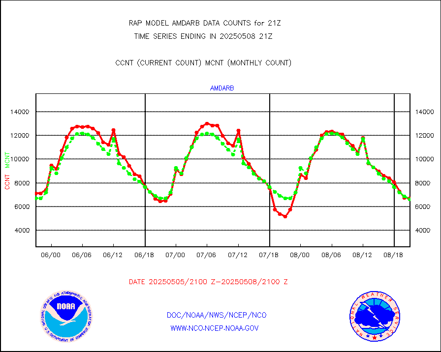
3p9usr |
GOES-16&up/NESDIS ir short-wv derived cld motion |
0 |
5 |
0.0 % |
1920.00-1920.99 |
acarsa |
MDCRS ACARS acft data (ARINC via AFWA)(AIREP fmt) |
0 |
0 |
n/a |
1917.75-2000.25 |
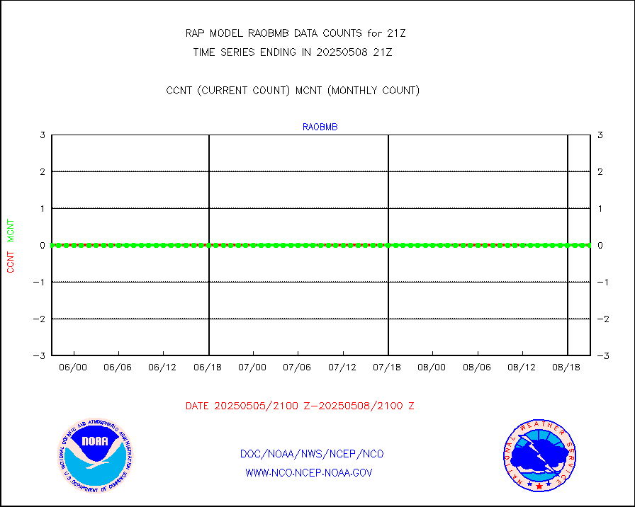
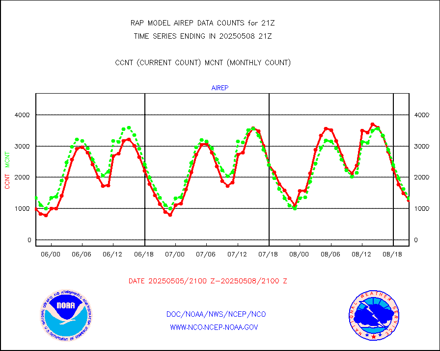
airep |
Manual AIREP aircraft data (dcded from AIREP fmt) |
2974 |
2494 |
119.2 % |
1917.75-2000.25 |
airsev |
AQUA AIRS/AMSU-A/HSB brightness temps- every FOV |
0 |
0 |
n/a |
1918.00-1923.99 |
amdar |
AMDAR aircraft data (decoded from AMDAR format) |
431 |
423 |
101.9 % |
1917.75-2000.25 |
amdarb |
AMDAR aircraft data (decoded from BUFR) |
1560 |
1324 |
117.8 % |
1917.75-2000.25 |
amsr2 |
GCOM-W AMSR2 1B brightness temperatures |
1148282 |
678049 |
169.4 % |
1918.00-1918.99 |
ascat |
METOP 1-2 ASCAT products |
39495 |
21787 |
181.3 % |
1919.00-1923.00 |
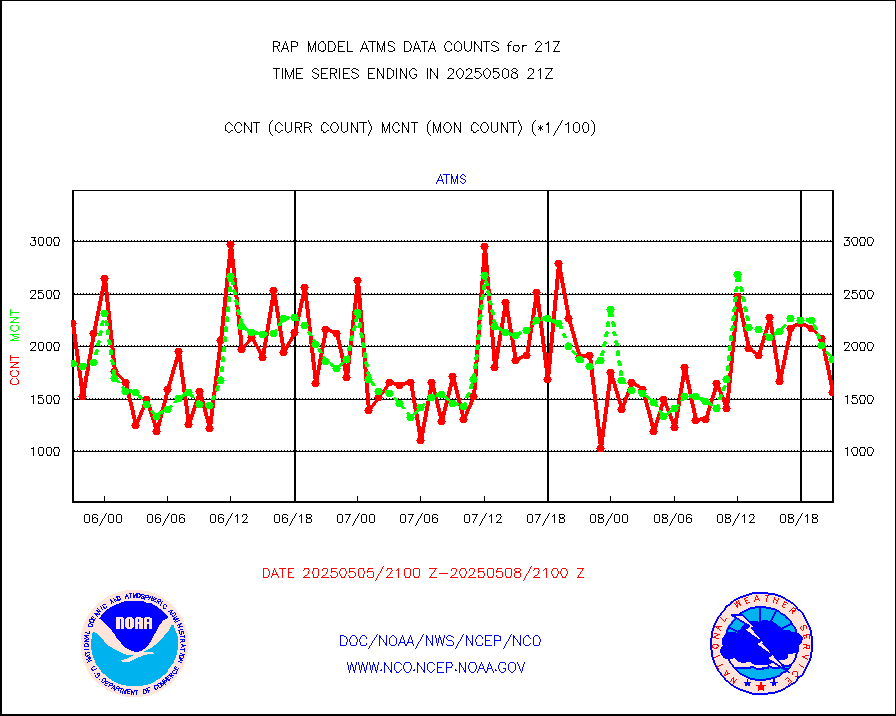
atms |
NPP/NOAA-20 ATMS brightness temperatures |
161498 |
174839 |
92.4 % |
1919.00-1922.99 |
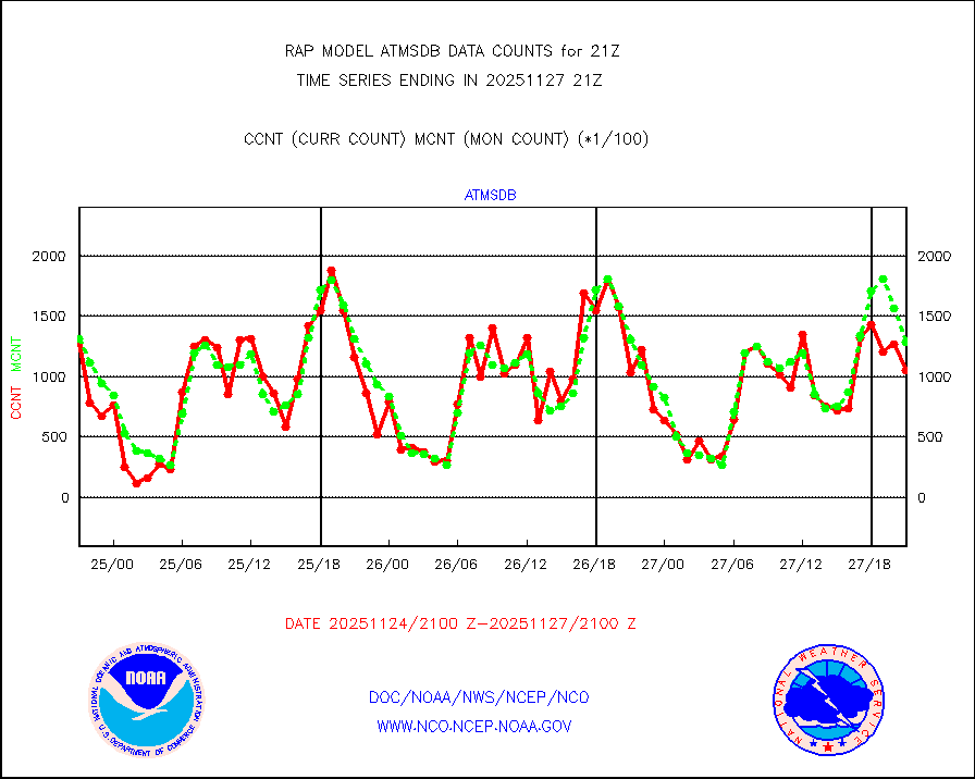
atmsdb |
NPP/NOAA-20 ATMS bright. temps-direct b-cast SSEC |
138157 |
149667 |
92.3 % |
1919.00-1922.99 |
coopmd |
Coop/MADIS NEPP & HCN-Modernization NOAA COOP Obs |
27 |
27 |
100.0 % |
1920.50-1921.50 |
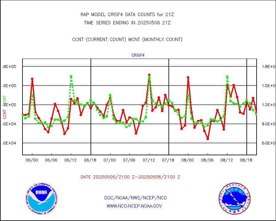
crisf4 |
NPP/NOAA-20 CrIS full spctrl radn (431 ch subset) |
109336 |
100136 |
109.2 % |
1919.00-1922.99 |
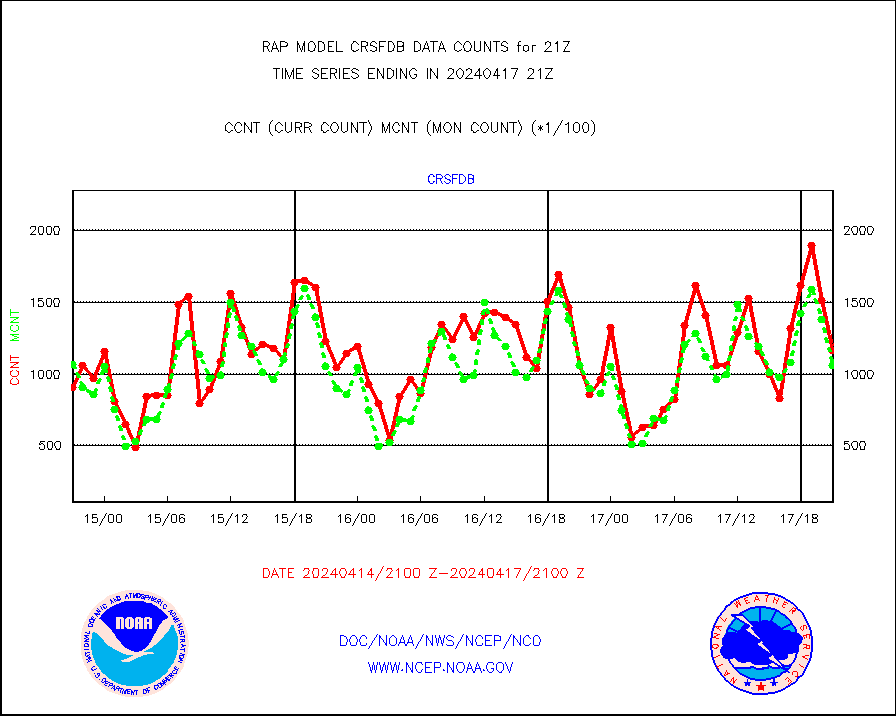
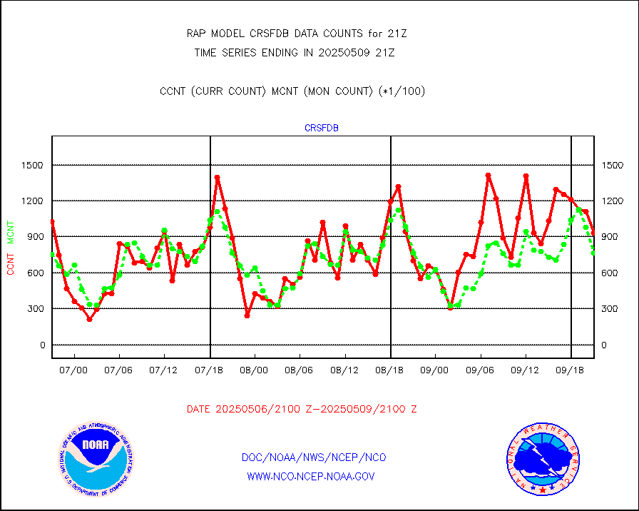
crsfdb |
NPP/NOAA-20 CrIS full spctrl radn dir brdcst SSEC |
112608 |
113848 |
98.9 % |
1919.00-1922.99 |
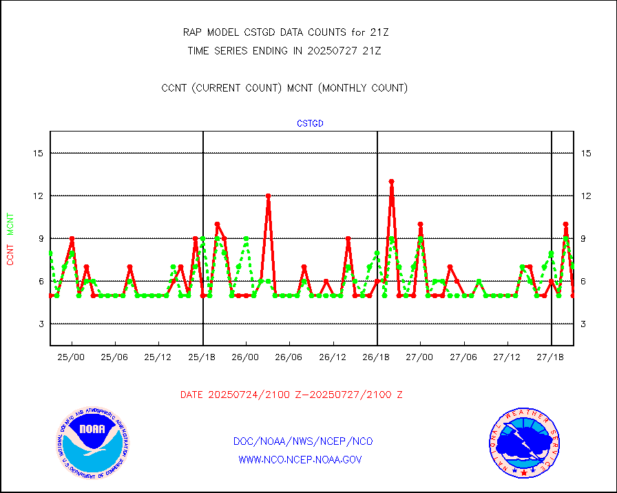
cstgd |
Coast Guard |
7 |
6 |
116.7 % |
1920.50-1921.50 |
dbuoyb |
Drifting buoys (decoded from BUFR) |
593 |
566 |
104.8 % |
1920.50-1921.50 |
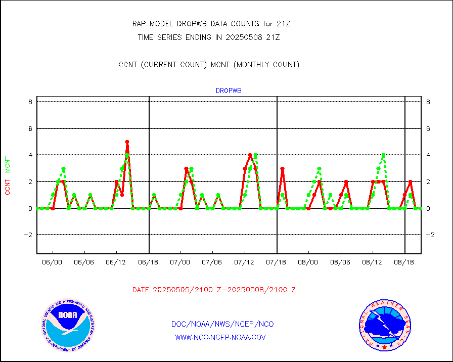
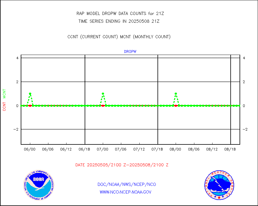
dropw |
Dropwinsonde (from TEMP DROP) |
0 |
0 |
n/a |
1920.00-1922.00 |
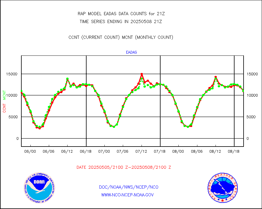
eadas |
E-AMDAR (European AMDAR acft decoded from BUFR) |
9629 |
8880 |
108.4 % |
1917.75-2000.25 |
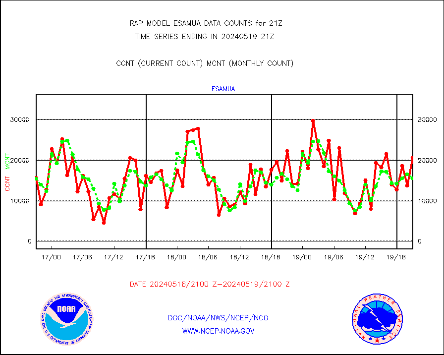
esamua |
NOAA 15-19 & METOP 1-2 AMSU-A proc btmps frm RARS |
20568 |
15586 |
132.0 % |
1920.00-1922.00 |
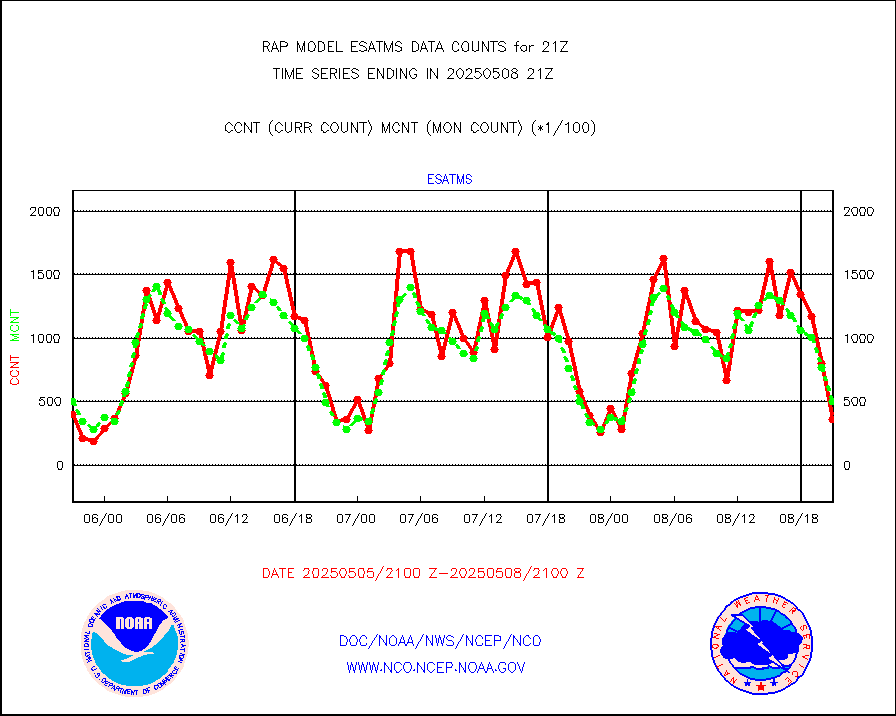
esatms |
NPP Adv. Tech. MW Sndr (ATMS) br. temps from RARS |
51998 |
51095 |
101.8 % |
1919.00-1922.99 |
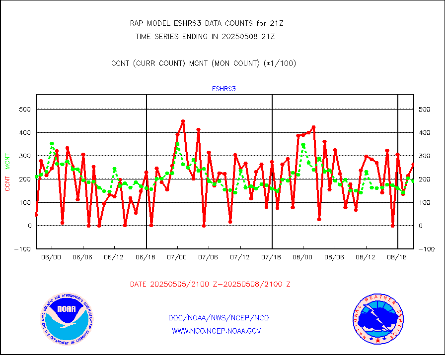
eshrs3 |
NOAA 15-19 & METOP 1-2 HIRS-3/4 pr btmps frm RARS |
45557 |
34888 |
130.6 % |
1920.00-1922.00 |
esiasi |
METOP 1-2 IASI 1C radiance data vbl chn from RARS |
77157 |
80811 |
95.5 % |
1919.00-1922.99 |
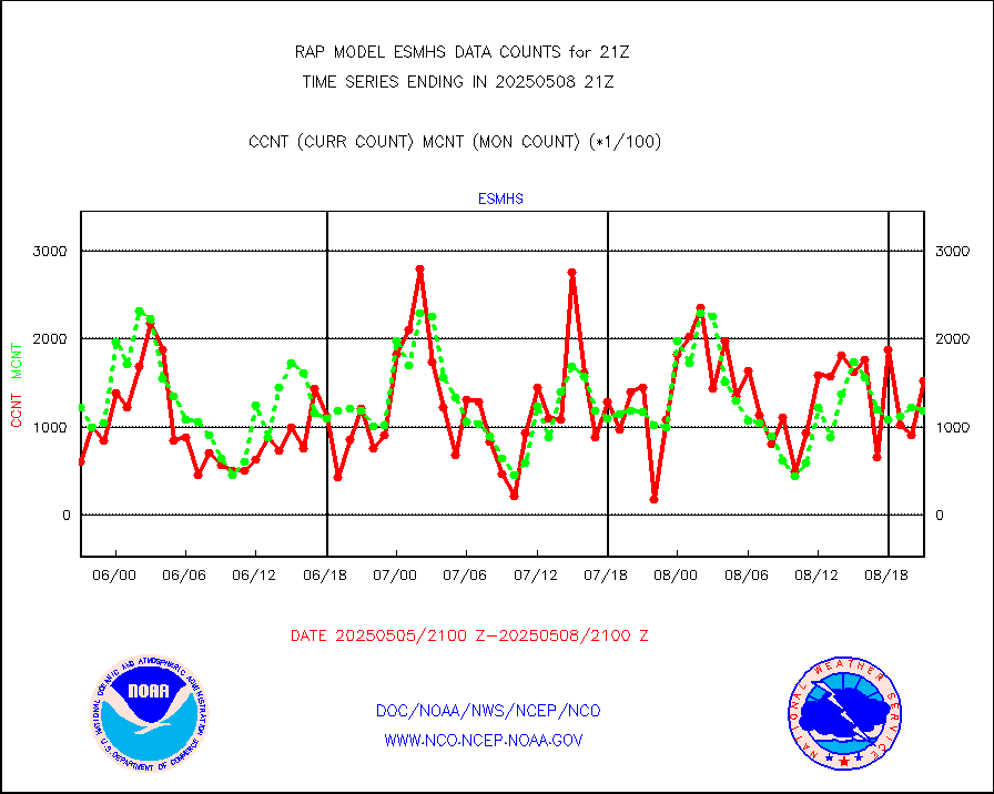
esmhs |
NOAA 18-19 & METOP 1-2 MHS proc. btemps from RARS |
145833 |
110254 |
132.3 % |
1920.00-1922.00 |
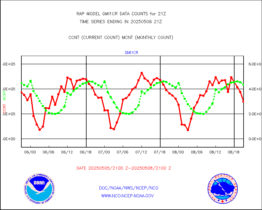
gmi1cr |
GPM GMI Level 1C-R brightness temperatures |
467118 |
824275 |
56.7 % |
1918.00-1923.99 |
gpsro |
GPS radio occultation data |
104 |
113 |
92.0 % |
1919.00-1922.99 |
gsrasr |
GOES-16/17 All Sky Radiances (proc.) |
812097 |
791147 |
102.6 % |
1919.00-1922.99 |
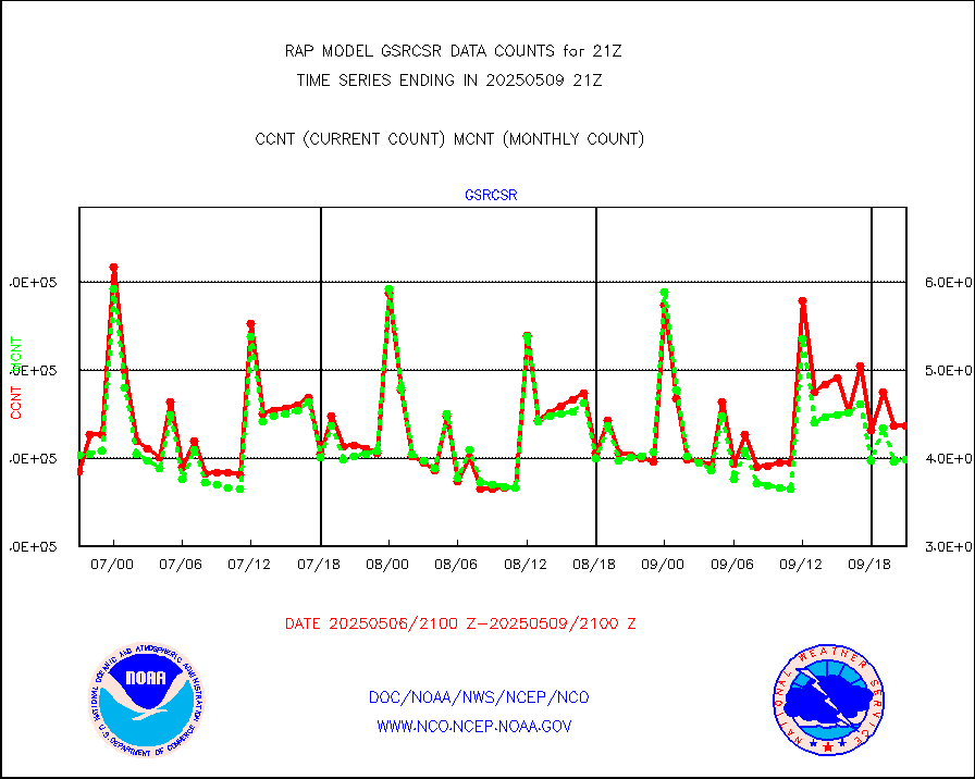
gsrcsr |
GOES-16/17 Clear Sky Radiances (proc.) |
365037 |
398300 |
91.6 % |
1919.00-1922.99 |
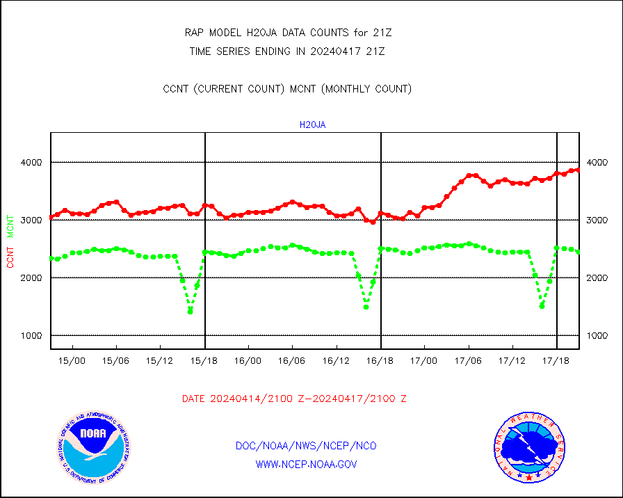
h20ja |
MTSAT/JMA water vapor imager derived cloud motion |
2830 |
3091 |
91.6 % |
1918.50-1923.50 |
h2dusr |
GOES-16&up/NESDIS wv imgr/deep-lyr derivd cld mtn |
6874 |
7513 |
91.5 % |
1920.00-1920.99 |
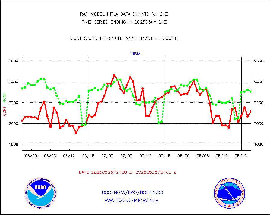
h2eunb |
METEOSAT/EUMETSAT wvpr imgr drv cld motion NBseq |
5847 |
5379 |
108.7 % |
1919.50-1922.49 |
h2tusr |
GOES-16&up/NESDIS wv imgr/cld-top derived cld mtn |
15850 |
13110 |
120.9 % |
1920.00-1920.99 |
iasidb |
METOP 1-2 IASI 1C radiances-direct broadcast SSEC |
60116 |
40671 |
147.8 % |
1919.00-1922.99 |
ifeunb |
METEOSAT/EUMETSAT ir lg-wave drv cld motion NBseq |
3404 |
3250 |
104.7 % |
1919.50-1922.49 |
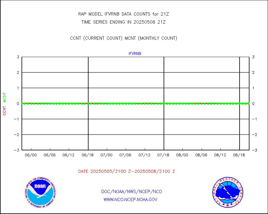
ifvrnb |
VIIRS (NPP/NOAA-20) ir lg-wv drv cloud motion(NB) |
0 |
0 |
n/a |
1918.50-1923.50 |
infav |
AVHRR (NOAA/METOP) ir lg-wave derived cld motion |
0 |
0 |
n/a |
1918.50-1923.50 |
infav1 |
AVHRR (METOP) ir lg-wave derived cld motion |
0 |
0 |
n/a |
1919.50-1922.49 |
infja |
MTSAT/JMA infrared long-wave derived cloud motion |
2380 |
2560 |
93.0 % |
1918.50-1923.50 |
infusr |
GOES-16&up/NESDIS ir long-wave derived cld motion |
31641 |
31019 |
102.0 % |
1920.00-1920.99 |
kamdar |
Korean AMDAR aircraft data (decoded from BUFR) |
0 |
0 |
n/a |
1917.75-2000.25 |
lcman |
Land-based CMAN stations decoded from CMAN format |
78 |
74 |
105.4 % |
1920.50-1921.50 |
ltnglr |
LLDN Long-rng lightning from Vaisala via NOAAPORT |
214870 |
133978 |
160.4 % |
1920.00-1921.50 |
ltngsr |
NLDN Shrt-rng lightning from Vaisala via NOAAPORT |
13752 |
5879 |
233.9 % |
1920.00-1921.50 |
mbuoyb |
Moored buoys (decoded from BUFR) |
612 |
564 |
108.5 % |
1920.50-1921.50 |
mso470 |
Mesonet/MADIS Colorado E-470 (Interstate 470) |
21 |
20 |
105.0 % |
1920.50-1921.50 |
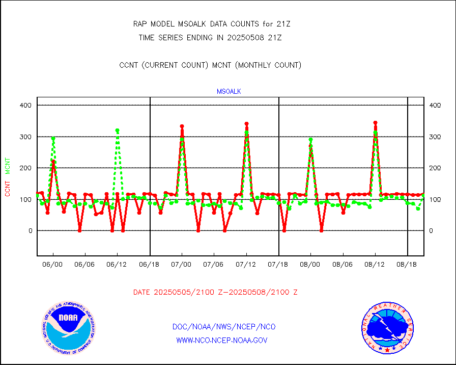
msoalk |
Mesonet/MADIS Alaska Department of Transportation |
109 |
101 |
107.9 % |
1920.50-1921.50 |
msoapg |
Mesonet/MADIS U.S. Army Aberdeen Proving Grounds |
0 |
0 |
n/a |
1920.50-1921.50 |
msoapr |
Mesonet/MADIS Citizen Weather Observers Program |
46509 |
45997 |
101.1 % |
1920.50-1921.50 |
msoaws |
Mesonet/MADIS AWS Convergence Technologies, Inc. |
25703 |
25846 |
99.4 % |
1920.50-1921.50 |
msoawx |
Mesonet/MADIS "Anything Weather" |
0 |
0 |
n/a |
1920.50-1921.50 |
msocol |
Mesonet/MADIS Colorado Dept. of Transportation |
0 |
0 |
n/a |
1920.50-1921.50 |
msodcn |
Mesonet/MADIS DC Net |
0 |
0 |
n/a |
1920.50-1921.50 |
msoden |
Mesonet/MADIS Denver Urban Drainage & Flood Cntrl |
225 |
223 |
100.9 % |
1920.50-1921.50 |
msofla |
Mesonet/MADIS Florida (FAWN & USF) |
3 |
3 |
100.0 % |
1920.50-1921.50 |
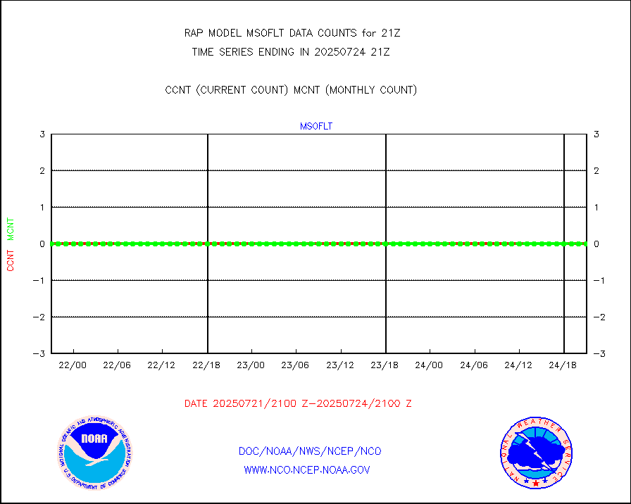
msoflt |
Mesonet/MADIS Florida Dept. of Transportation |
0 |
0 |
n/a |
1920.50-1921.50 |
msogeo |
Mesonet/MADIS Georgia Dept. of Transportation |
0 |
0 |
n/a |
1920.50-1921.50 |
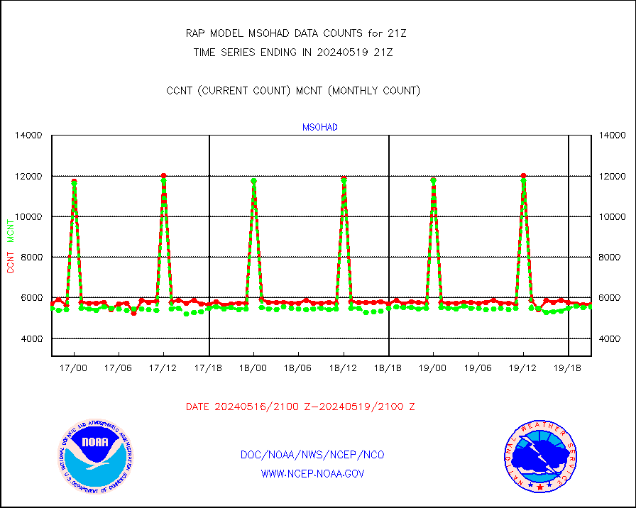
msohad |
Mesonet/MADIS NWS Hydromet Auto Data System(HADS) |
5658 |
5552 |
101.9 % |
1920.50-1921.50 |
msoien |
Mesonet/MADIS Iowa Environmental |
169 |
166 |
101.8 % |
1920.50-1921.50 |
msoind |
Mesonet/MADIS Indiana Dept. of Transportation |
0 |
0 |
n/a |
1920.50-1921.50 |
msoiow |
Mesonet/MADIS Iowa Department of Transportation |
0 |
0 |
n/a |
1920.50-1921.50 |
msokan |
Mesonet/MADIS Kansas Department of Transportation |
309 |
320 |
96.6 % |
1920.50-1921.50 |
msokla |
Mesonet/MADIS Oklahoma Mesonet |
318 |
322 |
98.8 % |
1920.50-1921.50 |
msolju |
Mesonet/MADIS Louisiana State/Jackson State Univ. |
0 |
0 |
n/a |
1920.50-1921.50 |
msomca |
Mesonet/MADIS Missouri Commercial Agricult Wx Net |
271 |
264 |
102.7 % |
1920.50-1921.50 |
msomin |
Mesonet/MADIS Minnesota Dept. of Transportation |
0 |
0 |
n/a |
1920.50-1921.50 |
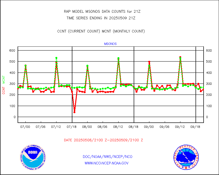
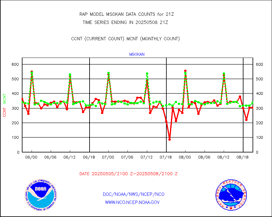
msonos |
Mesonet/MADIS NOS-Phys Oceanographic Realtime Sys |
291 |
283 |
102.8 % |
1920.50-1921.50 |
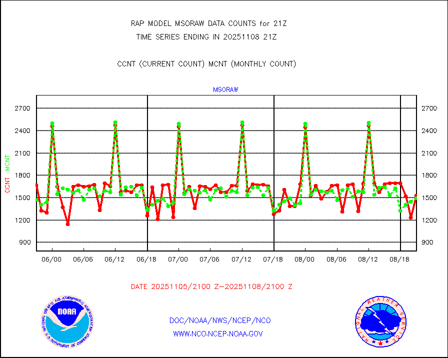
msoraw |
Mesonet/MADIS NFIC Remote Automated Wx Stns(RAWS) |
1715 |
1627 |
105.4 % |
1920.50-1921.50 |
msourb |
Mesonet/MADIS UrbaNet |
3936 |
3965 |
99.3 % |
1920.50-1921.50 |
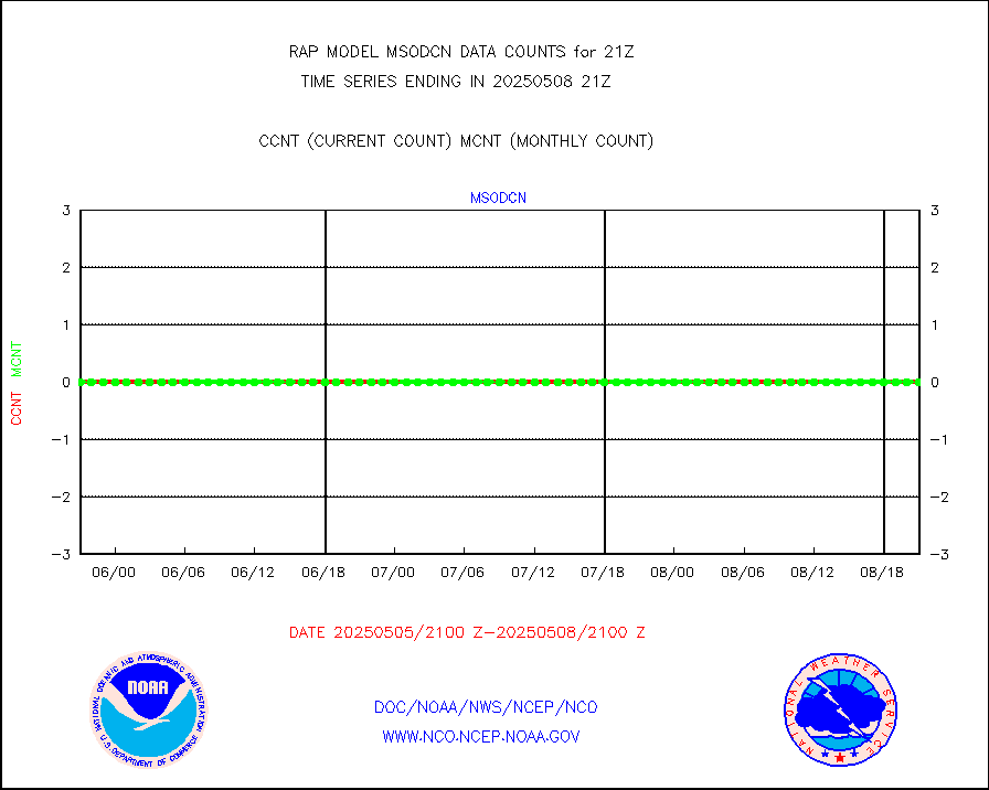
msovir |
Mesonet/MADIS Virginia Dept. of Transportation |
207 |
229 |
90.4 % |
1920.50-1921.50 |
msowfy |
Mesonet/MADIS "Weather for You" |
0 |
0 |
n/a |
1920.50-1921.50 |
msowis |
Mesonet/MADIS Wisconsin Dept. of Transportation |
0 |
0 |
n/a |
1920.50-1921.50 |
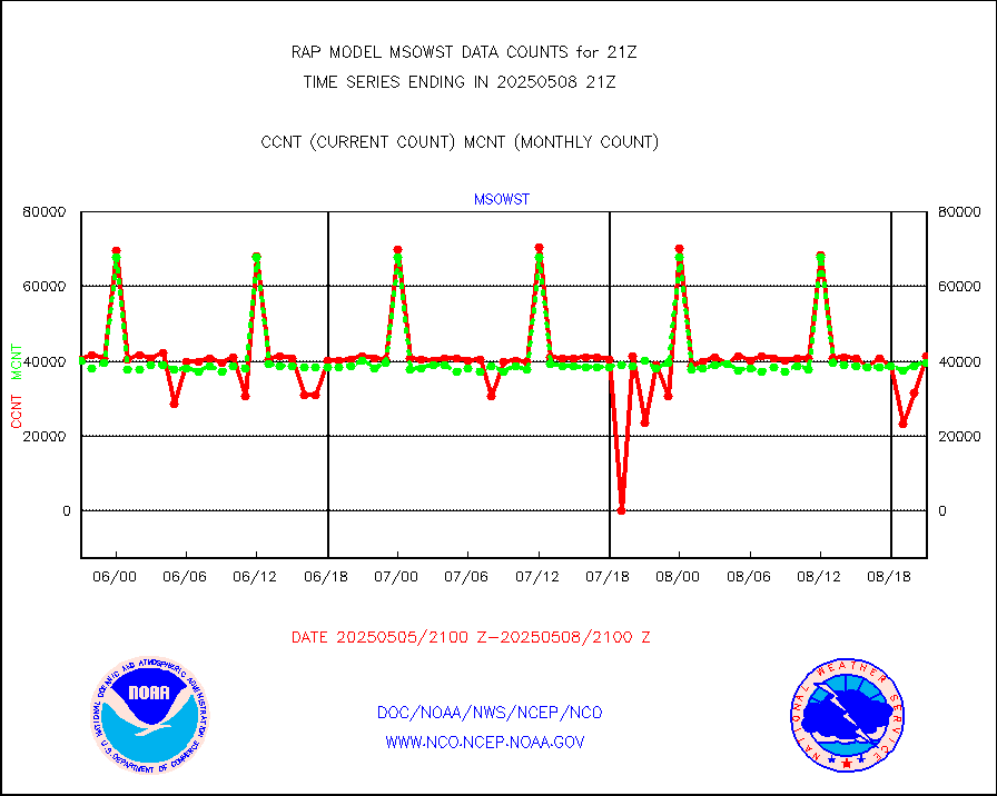
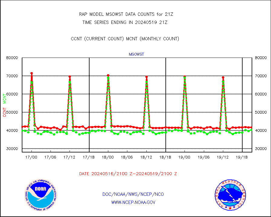
msowst |
Mesonet/MADIS MesoWest (many subproviders) |
41592 |
40349 |
103.1 % |
1920.50-1921.50 |
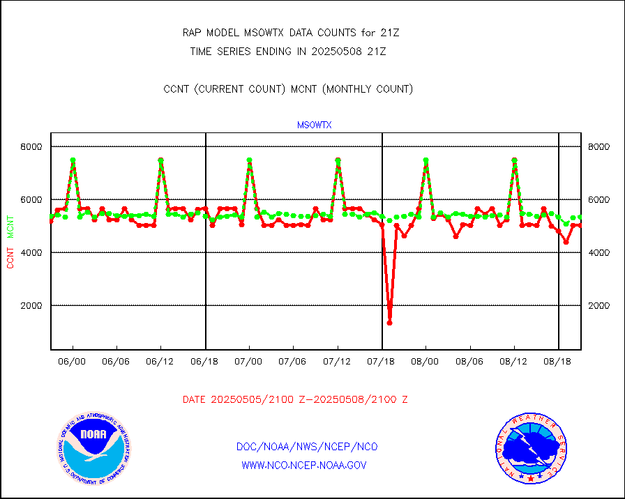
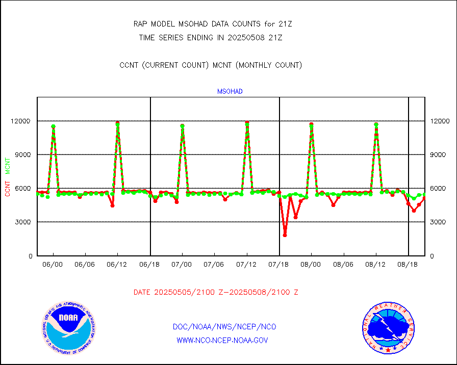
msowtx |
Mesonet/MADIS West Texas |
5033 |
4908 |
102.5 % |
1920.50-1921.50 |
mtiasi |
METOP 1-2 IASI 1C radiance data (varbl. channels) |
53435 |
23038 |
231.9 % |
1919.00-1922.99 |
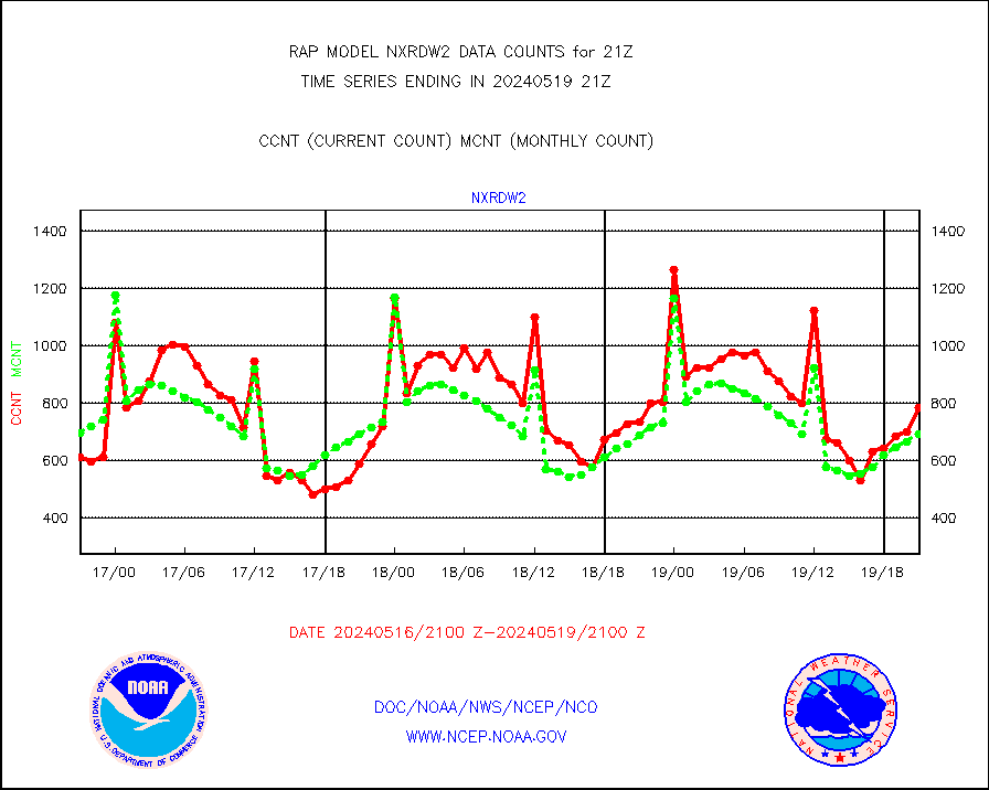
nxrdw2 |
NEXRAD Vel Azm Dsp(VAD) winds via Level 2 decoder |
784 |
694 |
113.0 % |
1920.00-1922.00 |
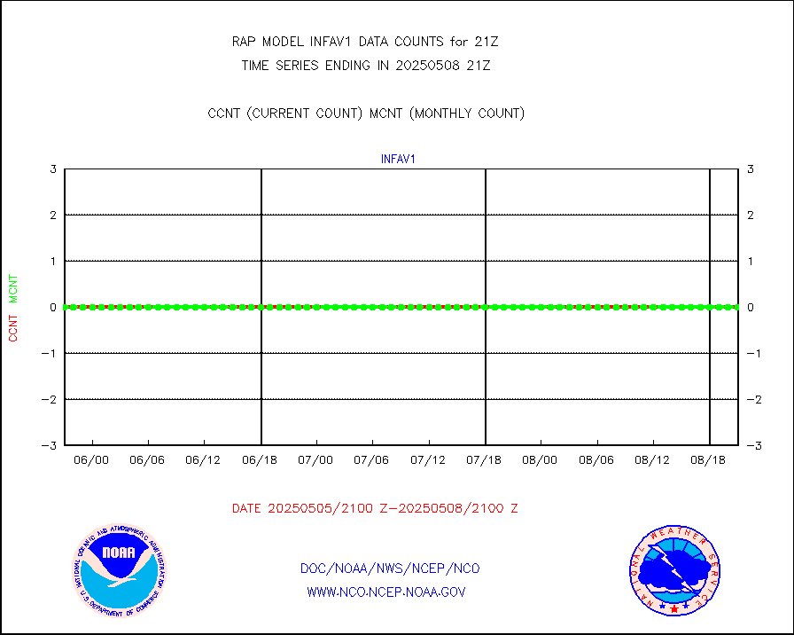
osbuv8 |
NOAA 16-19 Solar Backscatter UV-2 rad frm V8 BUFR |
0 |
0 |
n/a |
1919.00-1921.99 |
pibal |
PIBAL (from PILOT, PILOT SHIP, PILOT MOBIL) |
0 |
0 |
n/a |
1920.00-1922.00 |
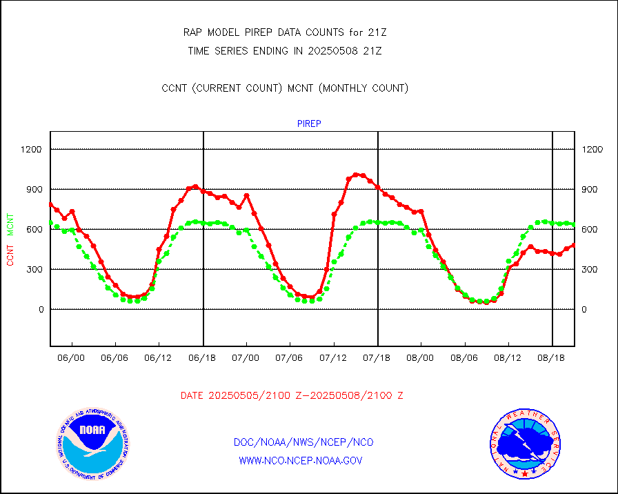
pirep |
Manual PIREP aircraft data (dcded from AIREP fmt) |
460 |
587 |
78.4 % |
1917.75-2000.25 |
prflrp |
Profilr winds from PIBAL (PILOT,PILOT SHIP/MOBIL) |
0 |
0 |
n/a |
1919.50-1922.50 |
raobm |
Rawinsonde - mobile land (from TEMP/PILOT MOBIL) |
0 |
0 |
n/a |
1920.00-1922.00 |
raobs |
Rawinsonde - ship (from TEMP SHIP, PILOT SHIP) |
0 |
0 |
n/a |
1920.00-1922.00 |
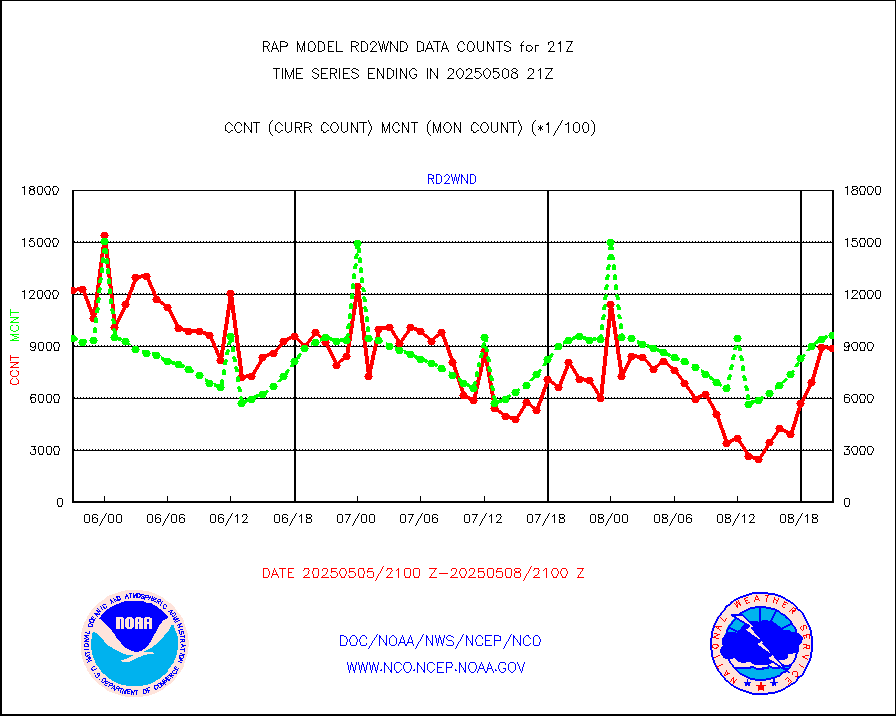
rd2wnd |
NEXRAD radial wind (Level 2 - GTS) |
1346383 |
1105417 |
121.8 % |
1920.50-1921.49 |
recco |
Flight level reconnaissance aircraft data |
0 |
0 |
n/a |
1920.00-1922.00 |
saldrn |
Surface Marine Saildrone (decoded from BUFR) |
2 |
2 |
100.0 % |
1919.00-1922.99 |
saphir |
Megha-Tropiques SAPHIR L1A2 brightness temps |
0 |
0 |
n/a |
1918.00-1923.99 |
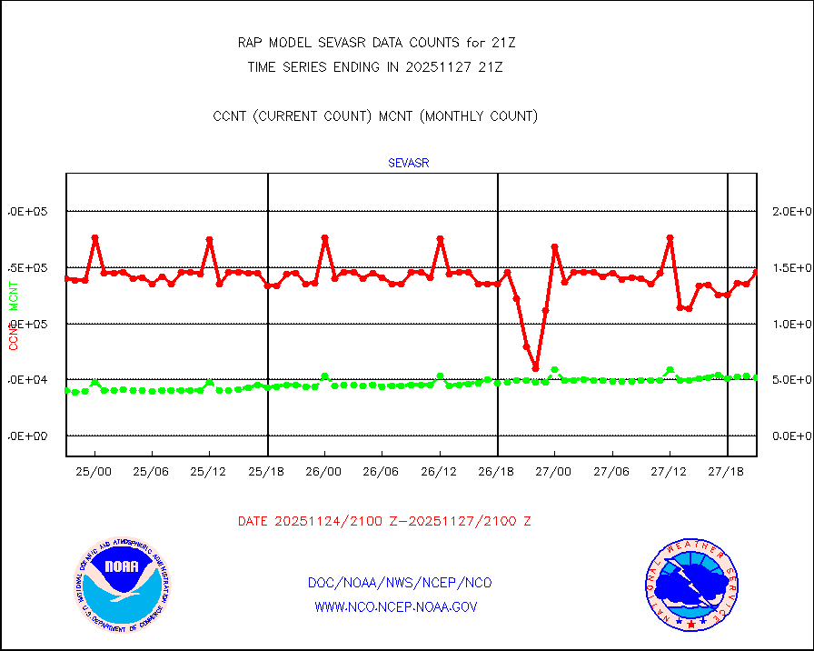
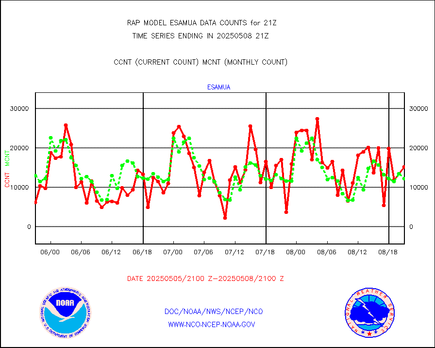
sevasr |
METEOSAT-10 2nd Gen SEVIRI All Sky Radiance(proc) |
9409 |
9491 |
99.1 % |
1919.00-1922.99 |
sevcsr |
METEOSAT-10 2nd Gen SEVIRI Clr Sky Radiance(proc) |
0 |
0 |
n/a |
1919.00-1922.99 |
ships |
Ship - manual and automatic, restricted |
0 |
4 |
0.0 % |
1920.50-1921.50 |
snocvr |
NOW COVER, DEPTH/DENSITY AND WATER EQUIVALENT |
3539 |
6998 |
50.6 % |
1919.00-1923.00 |
ssmisu |
DMSP SSM/IS 1C radiance data (Unified Pre-Proc.) |
25961 |
64234 |
40.4 % |
1919.00-1922.99 |
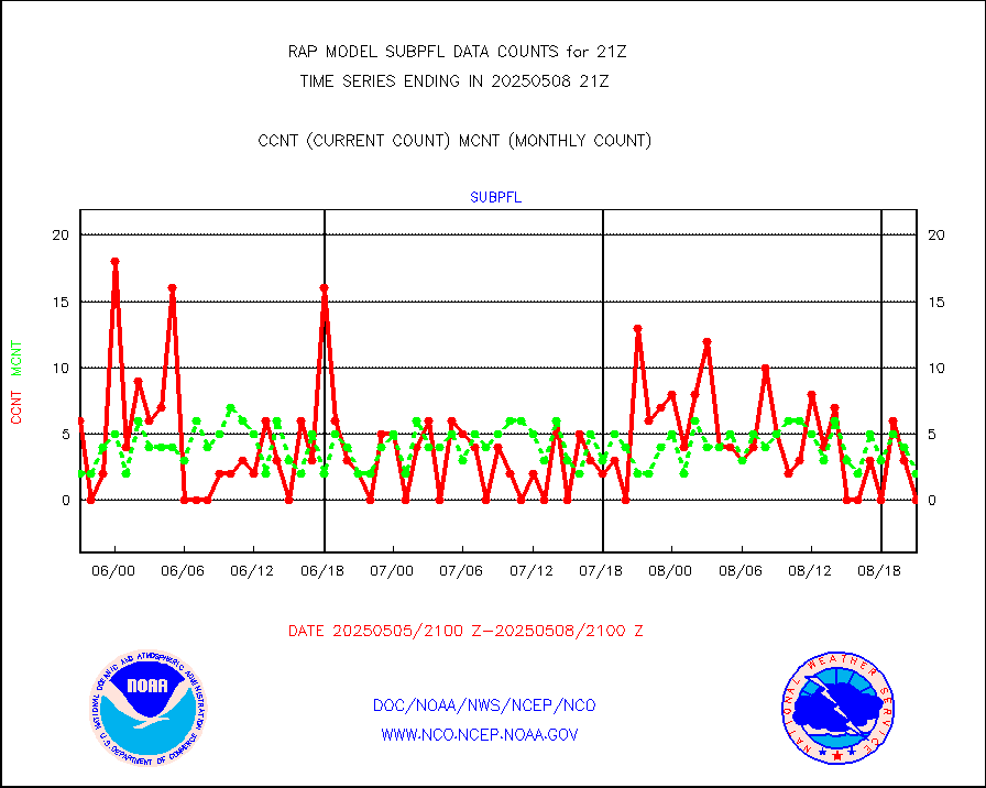
subpfl |
Sub-surface float and glider profile (BUFR) |
0 |
4 |
0.0 % |
1919.00-1922.99 |
synopr |
Synoptic - restricted (WMO Res 40) manual & auto. |
0 |
0 |
n/a |
1920.50-1921.50 |
synpbr |
Synoptic - restricted (WMO Res 40)(decoded BUFR) |
303 |
308 |
98.4 % |
1920.50-1921.50 |
synpmb |
Synoptic - mobile manual & auto (decoded fr BUFR) |
0 |
0 |
n/a |
1920.50-1921.50 |
tmdara |
TAMDAR aircft data-all types(from Panasonic,BUFR) |
632 |
542 |
116.6 % |
1917.75-2000.25 |
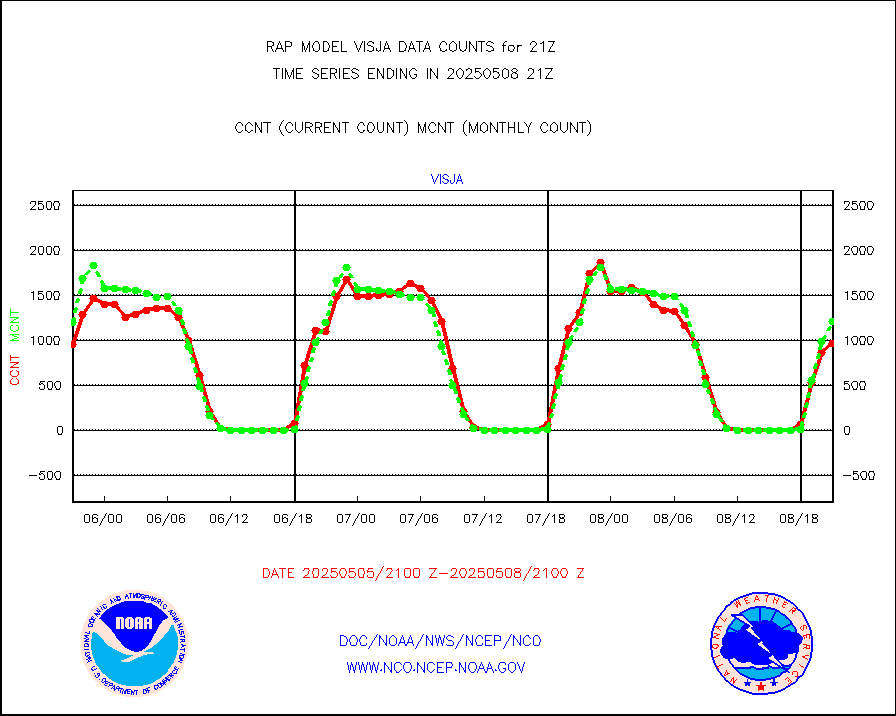
visja |
MTSAT/JMA visible derived cloud motion |
1238 |
1262 |
98.1 % |
1918.50-1923.50 |
visusr |
GOES-16&up/NESDIS visible derived cloud motion |
155652 |
169797 |
91.7 % |
1920.00-1920.99 |
vseunb |
METEOSAT/EUMETSAT visible drv cld motion NBseq |
3234 |
3291 |
98.3 % |
1919.50-1922.49 |


