| Critical Data with Normal Counts |
|---|
| Type | Description | Hourly Count | Monthly Average | Percent (%) of Monthly Mean | UTC Time Window |
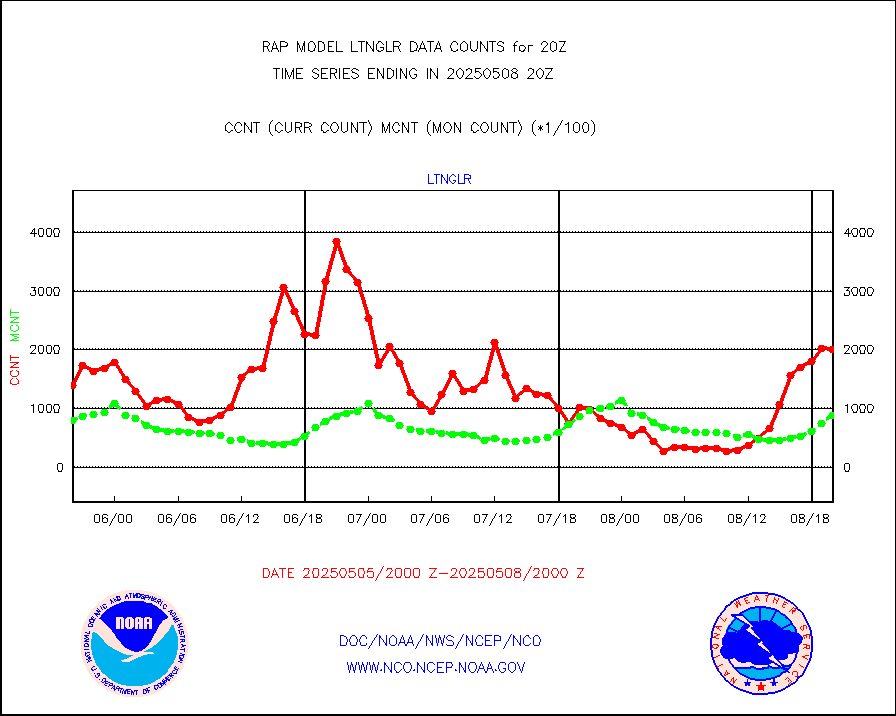
1bamua |
NOAA 15-19 & METOP 1-2 AMSU-A NCEP-proc. br.temps |
29480 |
34178 |
86.3 % |
1917.00-1922.99 |
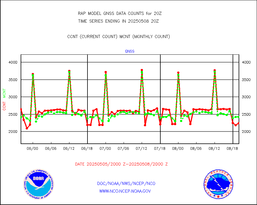
1bhrs4 |
NOAA 18-19 & METOP 1-2 HIRS-4 NCEP-proc. br.temps |
15134 |
26084 |
58.0 % |
1917.00-1922.99 |
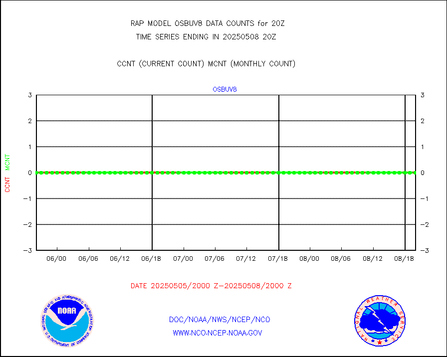
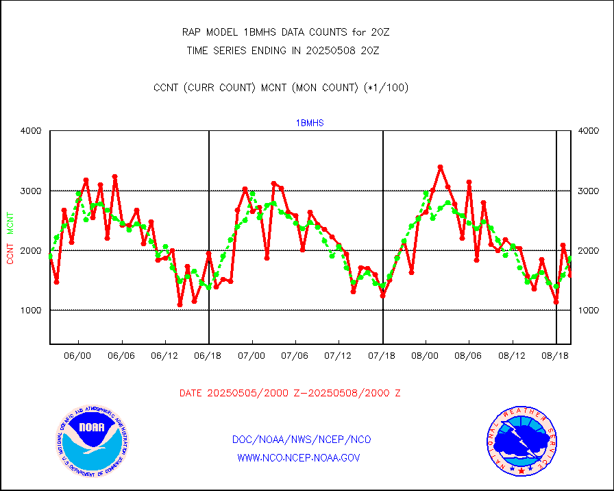
1bmhs |
NOAA 18-19 & METOP 1-2 MHS NCEP-proces. br. temps |
194712 |
196481 |
99.1 % |
1917.00-1922.99 |
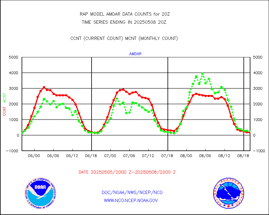
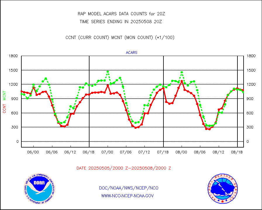
acars |
MDCRS ACARS acft data from ARINC(dcded from BUFR) |
83348 |
83463 |
99.9 % |
1916.75-1923.25 |
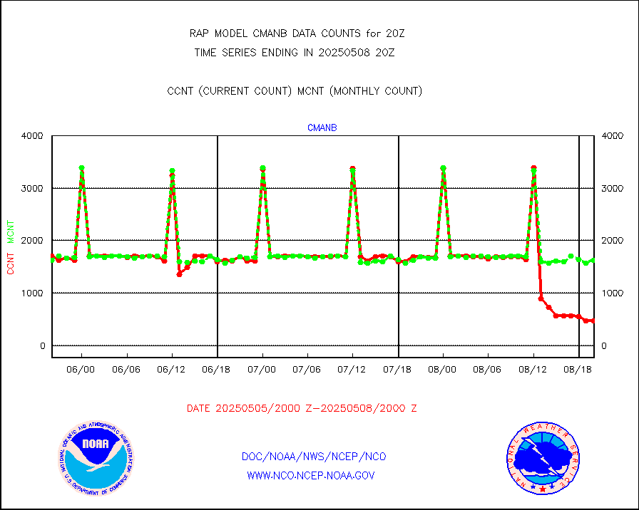
cmanb |
Surface Marine CMAN rpts decoded from BUFR format |
1692 |
1685 |
100.4 % |
1919.50-1920.50 |
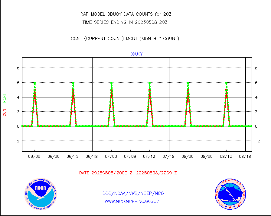
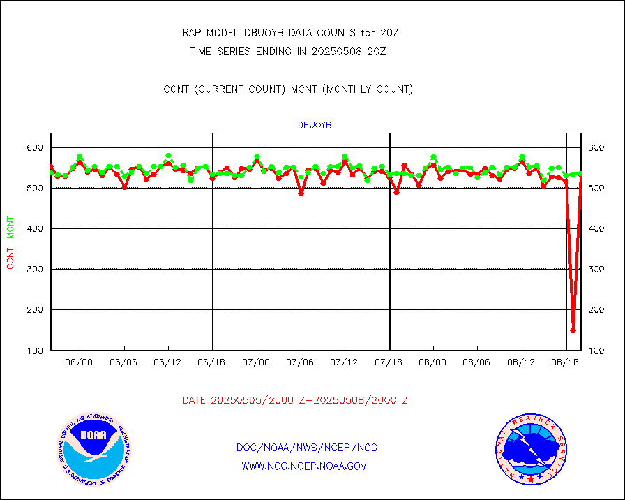
dbuoy |
Buoys decoded from FM-18 fmt (moored or drifting) |
0 |
1 |
0.0 % |
1919.50-1920.50 |
gnss |
Grnd-based Gbl Navigation Sat System (GNSS) data |
2240 |
2525 |
88.7 % |
1918.95-1919.05 |
h20mo |
MODIS (AQUA/TERRA) wvpr imager derived cld motion |
0 |
0 |
n/a |
1917.50-1922.50 |
infmo |
MODIS (AQUA/TERRA) ir l-wave derived cloud motion |
0 |
0 |
n/a |
1917.50-1922.50 |
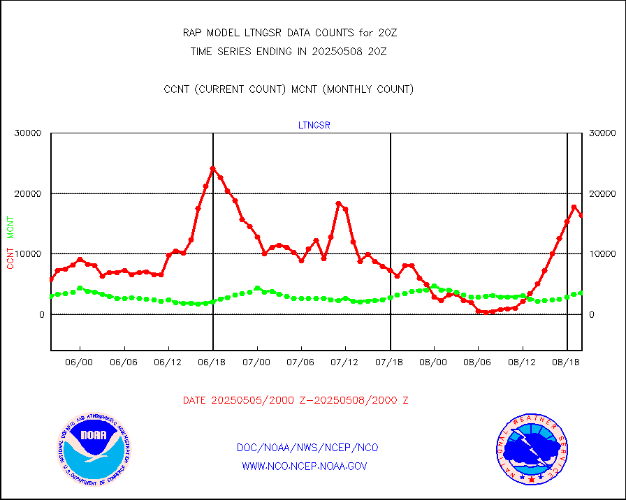
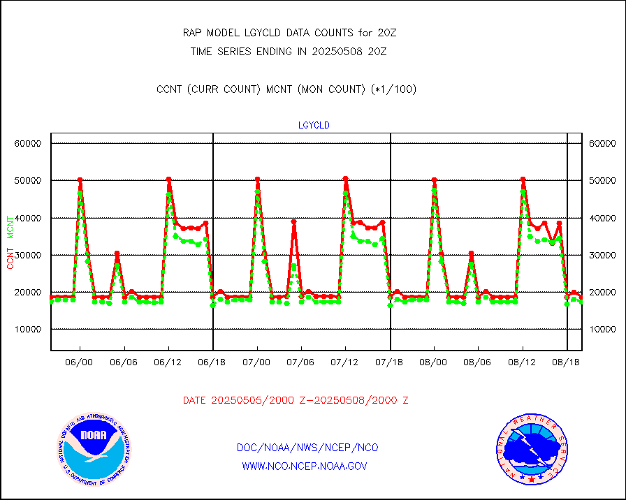
lgycld |
GOES/NASA(Langley) hi-res. (1x1 f-o-v) cloud data |
3725667 |
3105058 |
120.0 % |
1919.50-1920.50 |
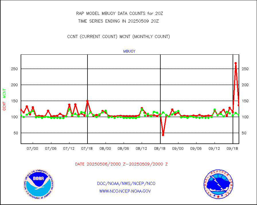
mbuoy |
Buoys decoded from FM-13 format (moored) |
59 |
51 |
115.7 % |
1919.50-1920.50 |
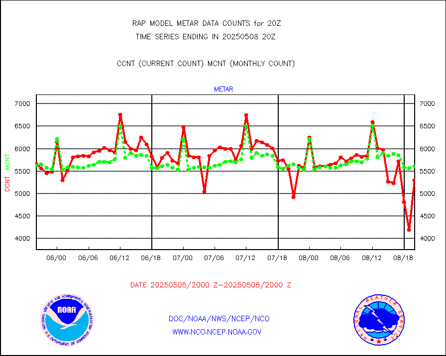
metar |
Aviation - METAR |
5595 |
5823 |
96.1 % |
1919.50-1920.50 |
nxrdw |
NEXRAD Vel Azm Dsp(VAD) winds via radar coded msg |
0 |
0 |
n/a |
1919.00-1921.00 |
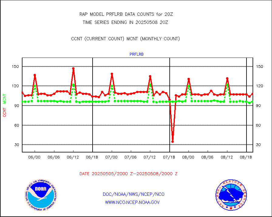
prflrb |
Multi-Agency Profiler (MAP) and SODAR winds |
72 |
85 |
84.7 % |
1918.50-1921.50 |
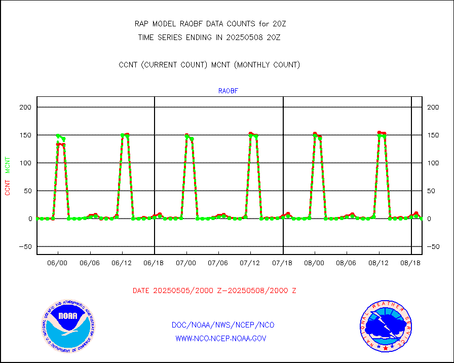
raobf |
Rawinsonde - fixed land (from TEMP or PILOT) |
0 |
1 |
0.0 % |
1919.00-1921.00 |
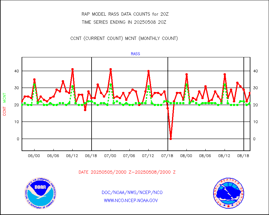
rass |
RASS temperatures (NOAA and Multi-Agency) |
20 |
21 |
95.2 % |
1919.50-1920.50 |
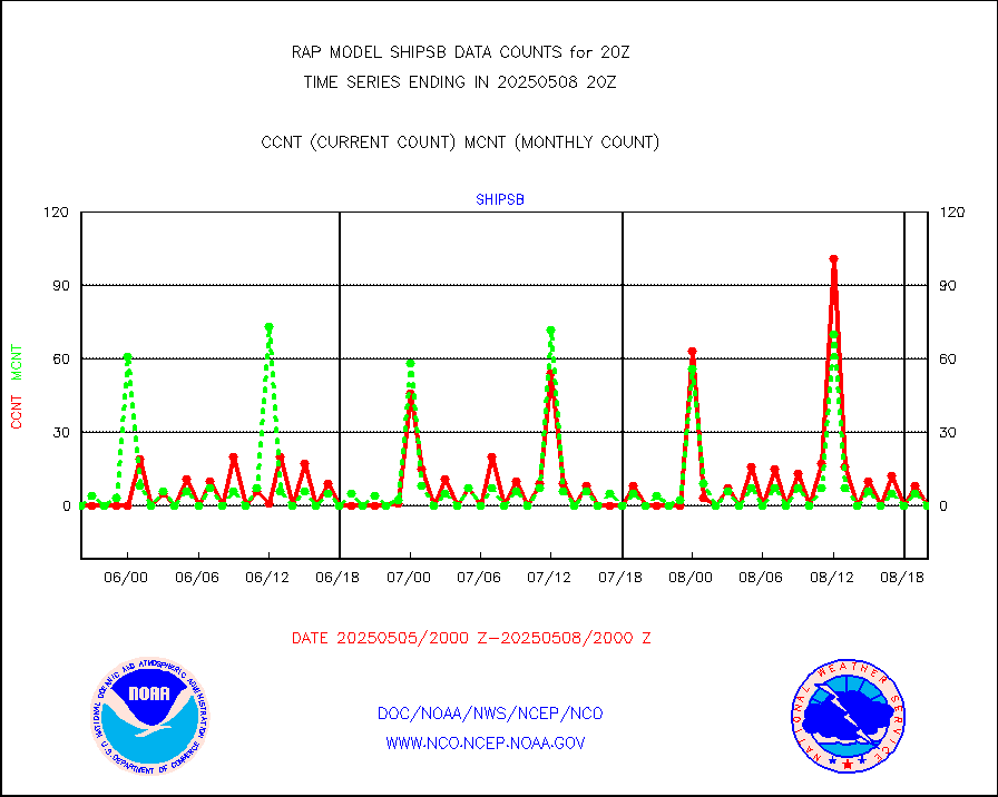
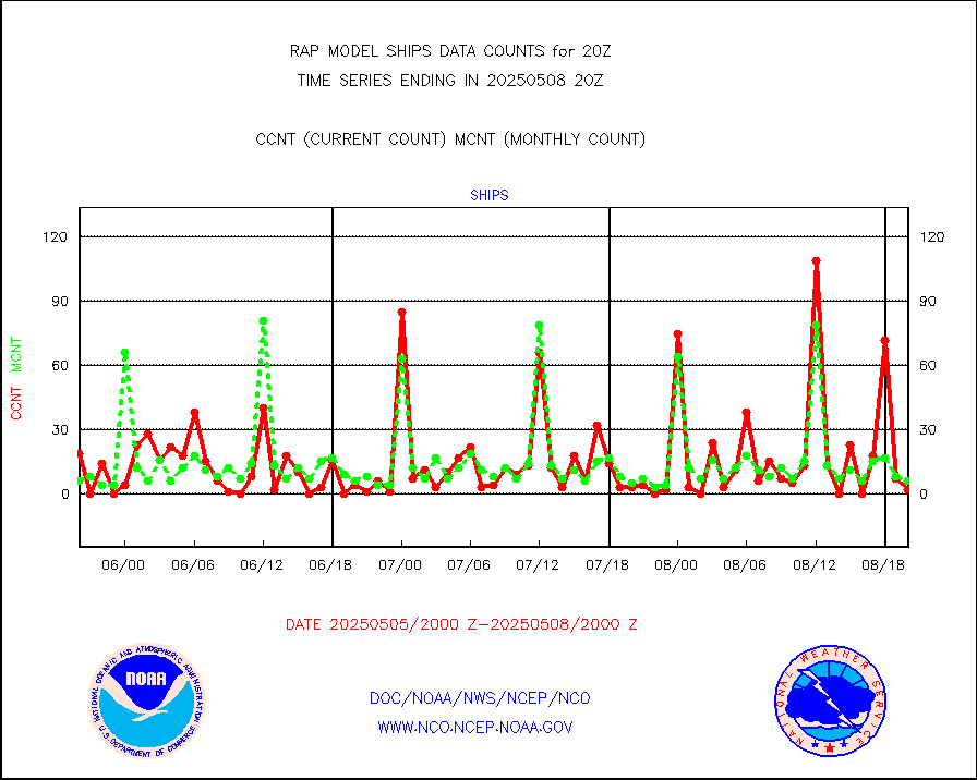
shipsb |
Ship - manual and automatic, restricted (BUFR) |
0 |
0 |
n/a |
1919.50-1920.50 |
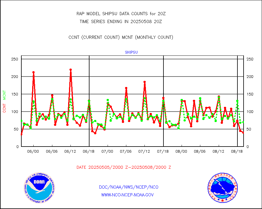
shipsu |
Ship - manual and automatic, unrestricted |
60 |
53 |
113.2 % |
1919.50-1920.50 |
shipub |
Ship - manual and automatic, unrestricted (BUFR) |
601 |
626 |
96.0 % |
1919.50-1920.50 |
synop |
Synoptic - fixed manual and automatic |
334 |
322 |
103.7 % |
1919.50-1920.50 |
synopb |
Synoptic - fixed manual & auto (decoded fr BUFR) |
1714 |
1675 |
102.3 % |
1919.50-1920.50 |
tideg |
Tide gauge reports decoded from CREX format |
181 |
180 |
100.6 % |
1919.50-1920.50 |
| Data Types of Opportunity with Normal Counts |
|---|
| Type | Description | Hourly Count | Monthly Average | Percent (%) of Monthly Mean | UTC Time Window |
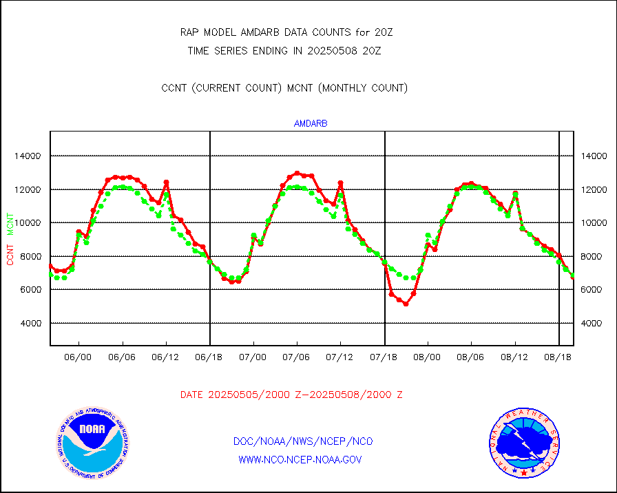
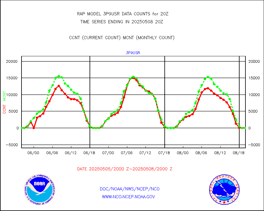
3p9usr |
GOES-16&up/NESDIS ir short-wv derived cld motion |
0 |
0 |
n/a |
1919.00-1919.99 |
acarsa |
MDCRS ACARS acft data (ARINC via AFWA)(AIREP fmt) |
0 |
0 |
n/a |
1916.75-1923.25 |
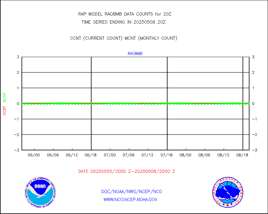
airep |
Manual AIREP aircraft data (dcded from AIREP fmt) |
3561 |
3015 |
118.1 % |
1916.75-1923.25 |
airsev |
AQUA AIRS/AMSU-A/HSB brightness temps- every FOV |
0 |
0 |
n/a |
1917.00-1922.99 |
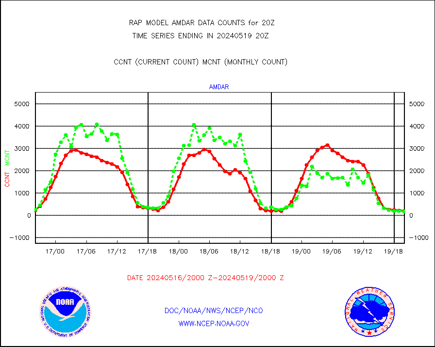
amdar |
AMDAR aircraft data (decoded from AMDAR format) |
203 |
169 |
120.1 % |
1916.75-1923.25 |
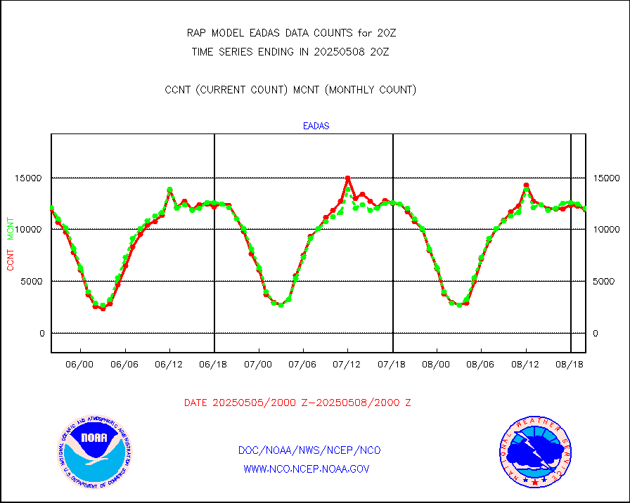
amdarb |
AMDAR aircraft data (decoded from BUFR) |
1075 |
1129 |
95.2 % |
1916.75-1923.25 |
amsr2 |
GCOM-W AMSR2 1B brightness temperatures |
988508 |
753502 |
131.2 % |
1917.00-1917.99 |
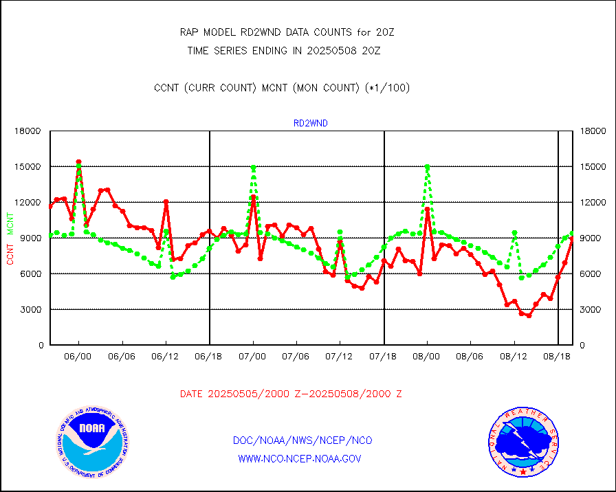
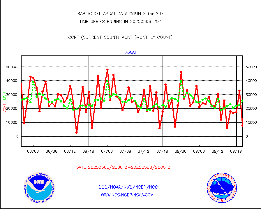
ascat |
METOP 1-2 ASCAT products |
20680 |
20112 |
102.8 % |
1918.00-1922.00 |
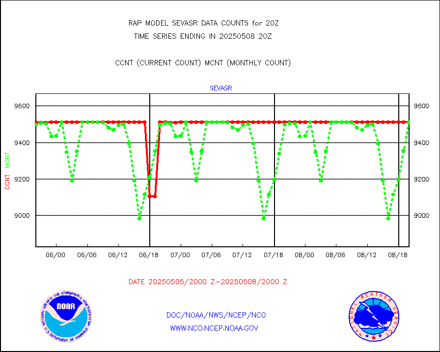
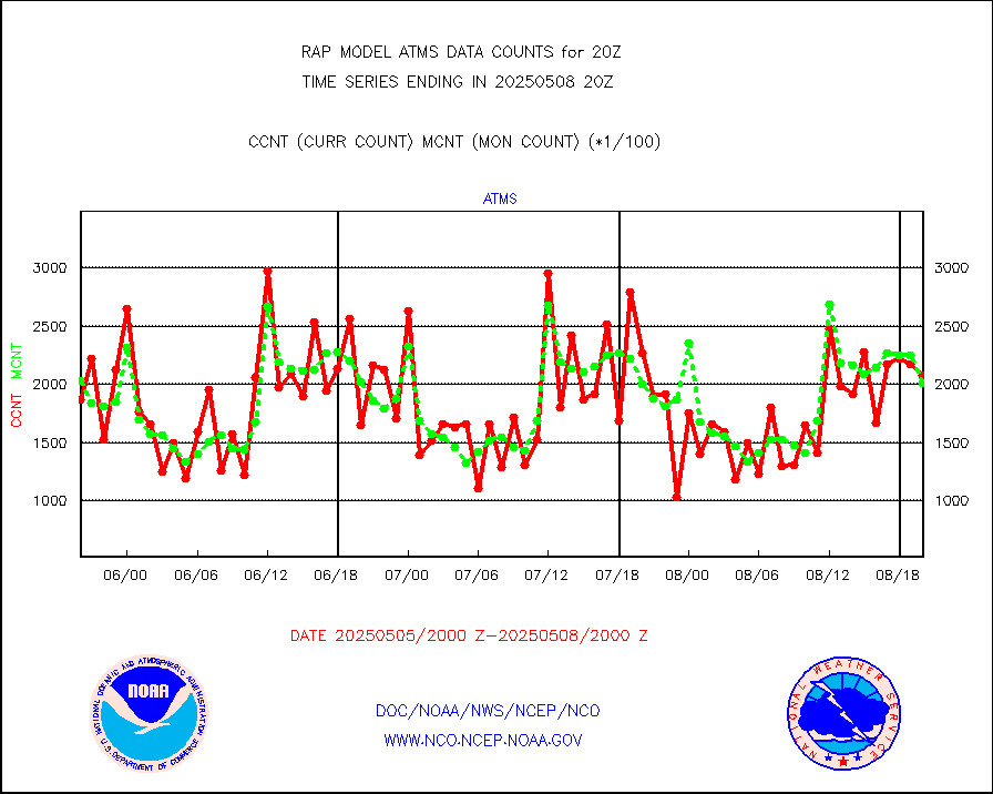
atms |
NPP/NOAA-20 ATMS brightness temperatures |
164395 |
200463 |
82.0 % |
1918.00-1921.99 |
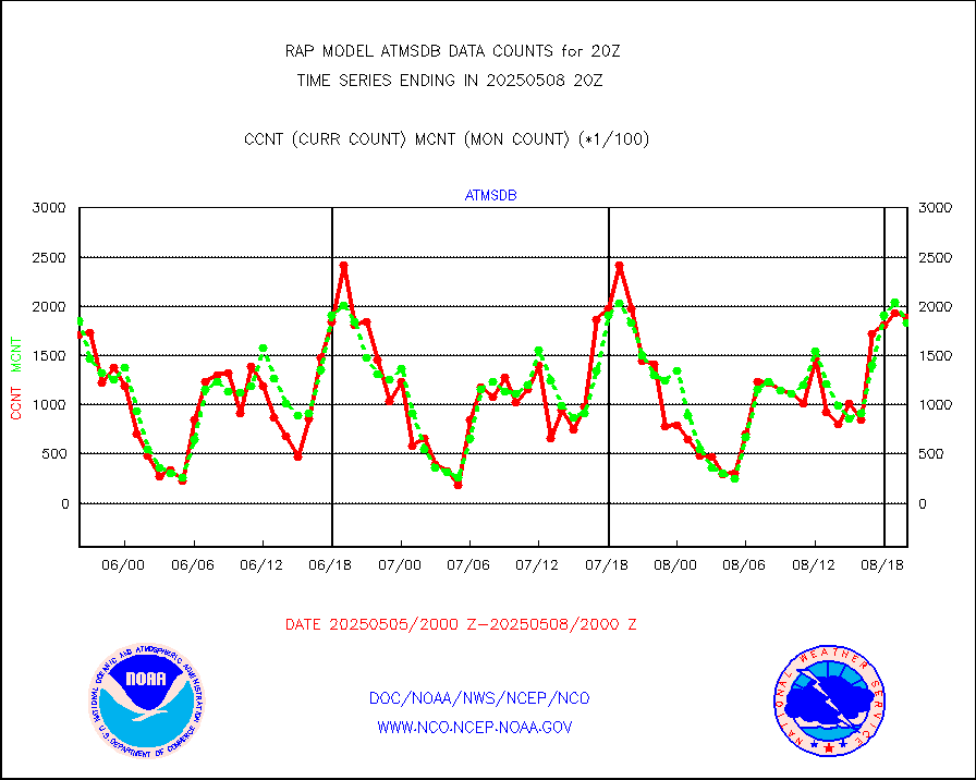
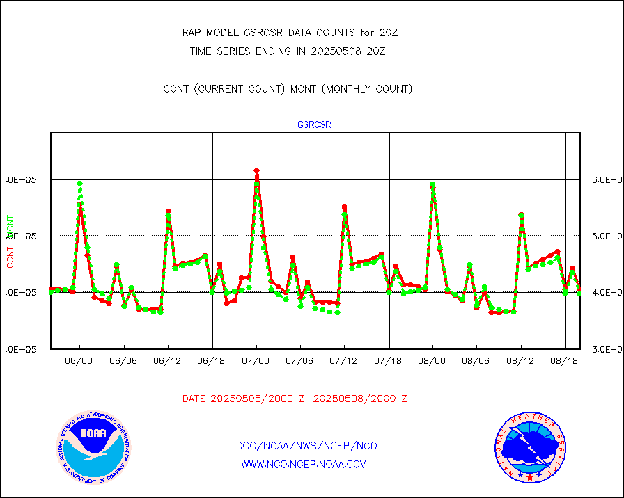
atmsdb |
NPP/NOAA-20 ATMS bright. temps-direct b-cast SSEC |
164221 |
180517 |
91.0 % |
1918.00-1921.99 |
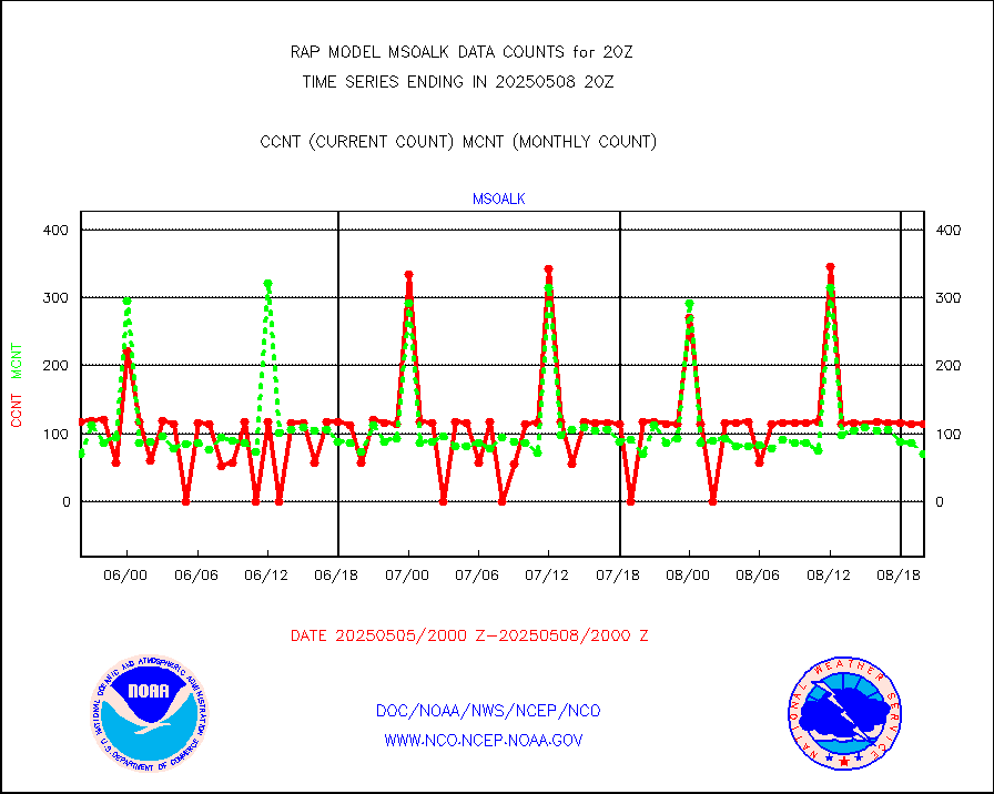
coopmd |
Coop/MADIS NEPP & HCN-Modernization NOAA COOP Obs |
27 |
27 |
100.0 % |
1919.50-1920.50 |
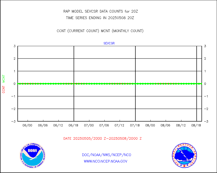
crisf4 |
NPP/NOAA-20 CrIS full spctrl radn (431 ch subset) |
116263 |
112468 |
103.4 % |
1918.00-1921.99 |
crsfdb |
NPP/NOAA-20 CrIS full spctrl radn dir brdcst SSEC |
147205 |
146412 |
100.5 % |
1918.00-1921.99 |
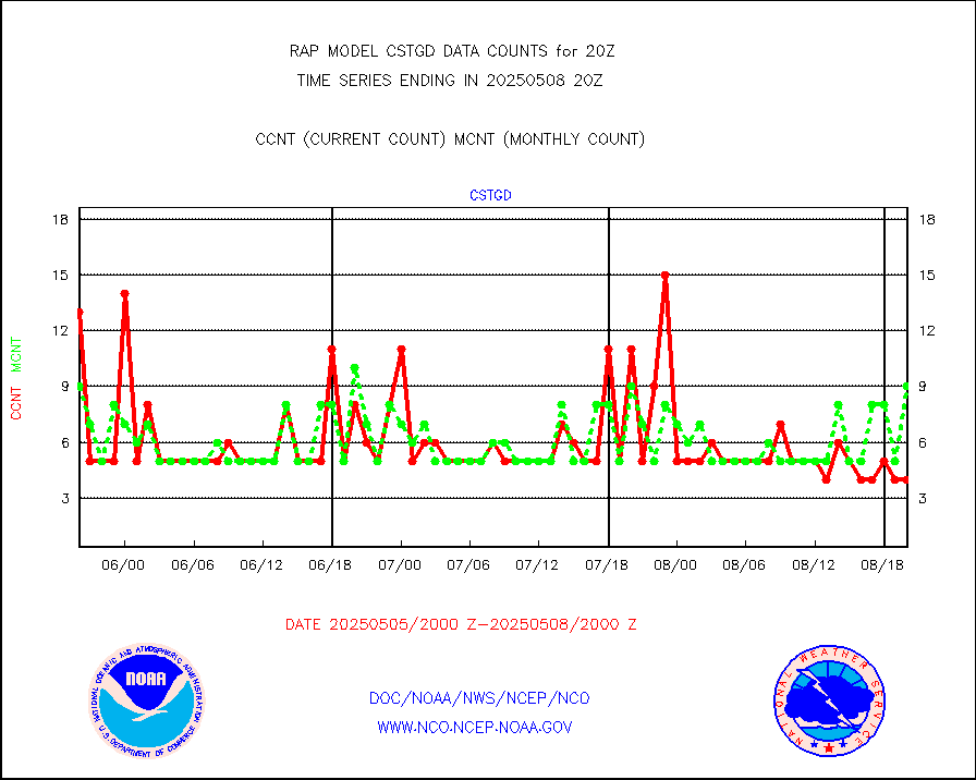
cstgd |
Coast Guard |
8 |
7 |
114.3 % |
1919.50-1920.50 |
dbuoyb |
Drifting buoys (decoded from BUFR) |
593 |
583 |
101.7 % |
1919.50-1920.50 |
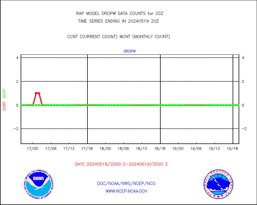
dropw |
Dropwinsonde (from TEMP DROP) |
0 |
0 |
n/a |
1919.00-1921.00 |
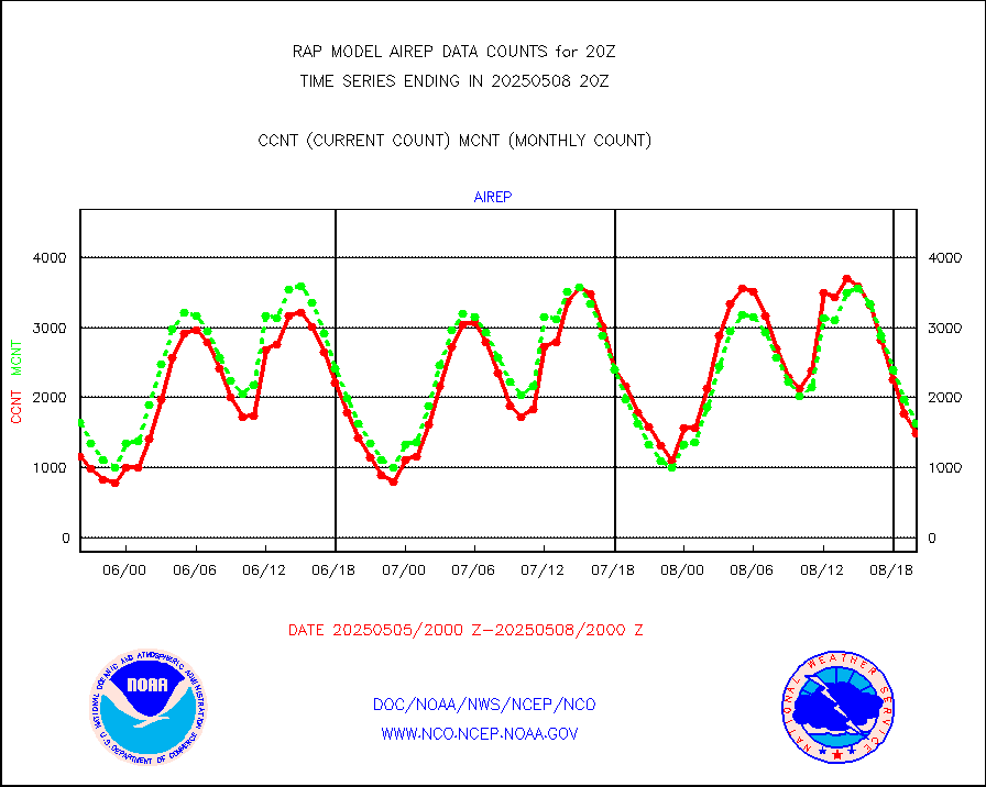
eadas |
E-AMDAR (European AMDAR acft decoded from BUFR) |
10467 |
9725 |
107.6 % |
1916.75-1923.25 |
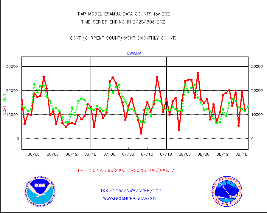
esamua |
NOAA 15-19 & METOP 1-2 AMSU-A proc btmps frm RARS |
13816 |
16579 |
83.3 % |
1919.00-1921.00 |
esatms |
NPP Adv. Tech. MW Sndr (ATMS) br. temps from RARS |
59574 |
79915 |
74.5 % |
1918.00-1921.99 |
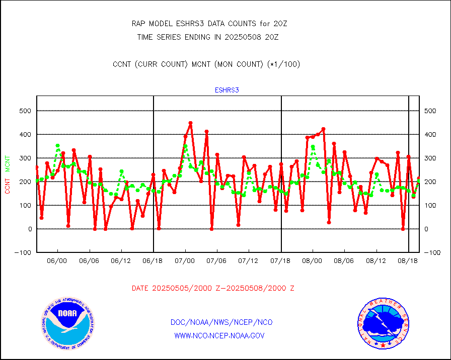
eshrs3 |
NOAA 15-19 & METOP 1-2 HIRS-3/4 pr btmps frm RARS |
21650 |
35320 |
61.3 % |
1919.00-1921.00 |
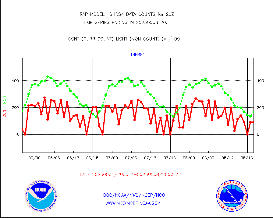
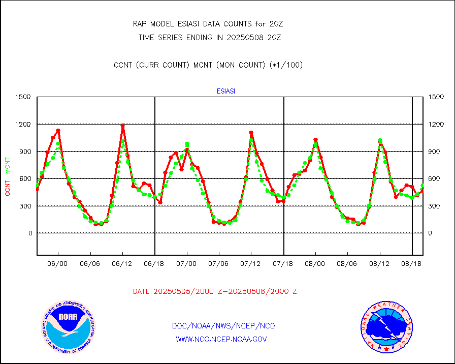
esiasi |
METOP 1-2 IASI 1C radiance data vbl chn from RARS |
85784 |
66703 |
128.6 % |
1918.00-1921.99 |
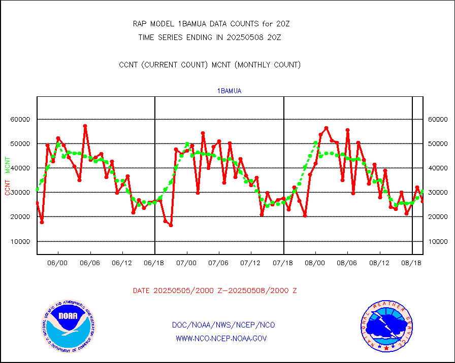
esmhs |
NOAA 18-19 & METOP 1-2 MHS proc. btemps from RARS |
101257 |
122173 |
82.9 % |
1919.00-1921.00 |
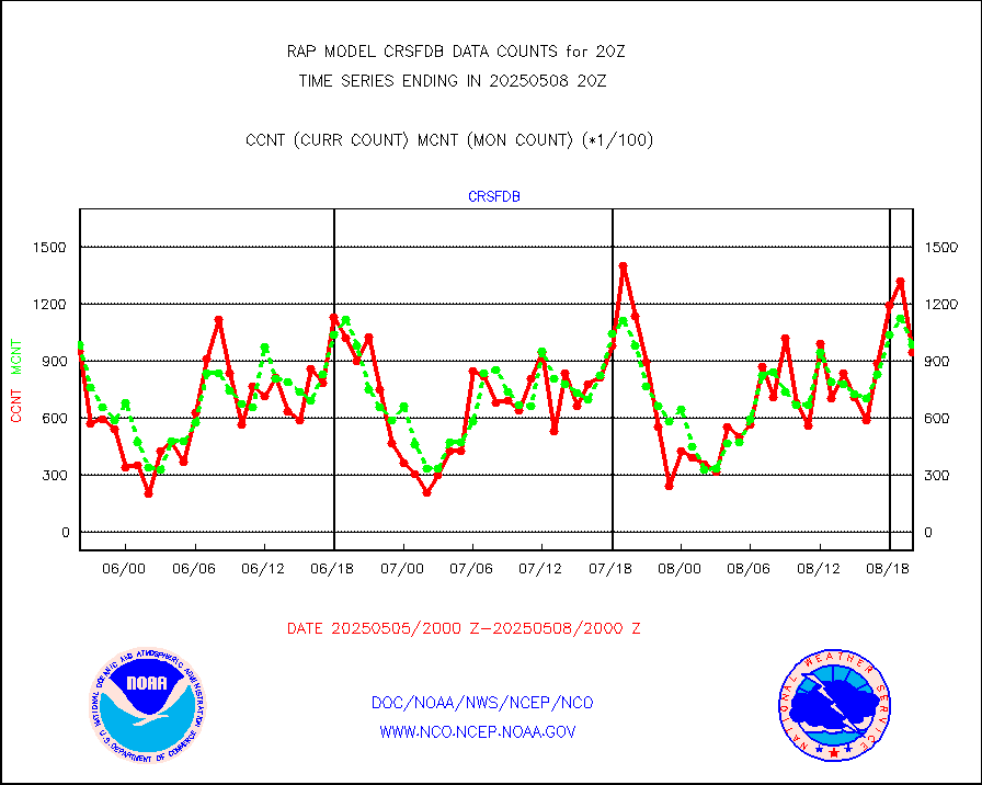
gmi1cr |
GPM GMI Level 1C-R brightness temperatures |
469686 |
784278 |
59.9 % |
1917.00-1922.99 |
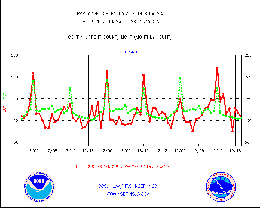
gpsro |
GPS radio occultation data |
106 |
105 |
101.0 % |
1918.00-1921.99 |
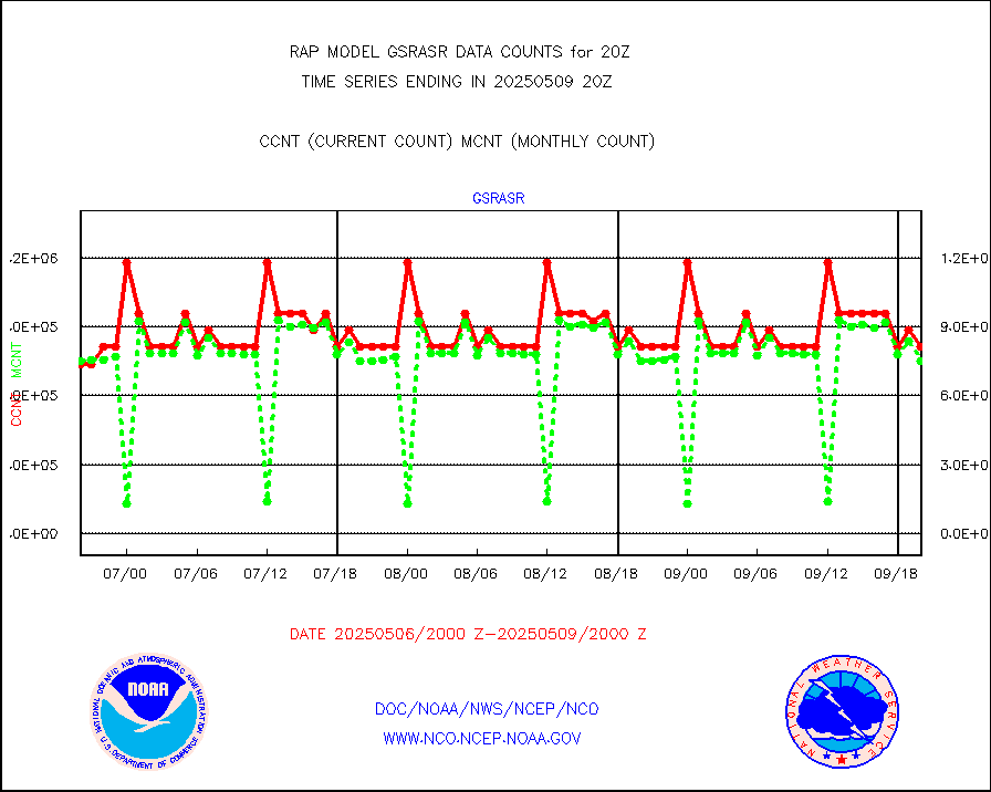
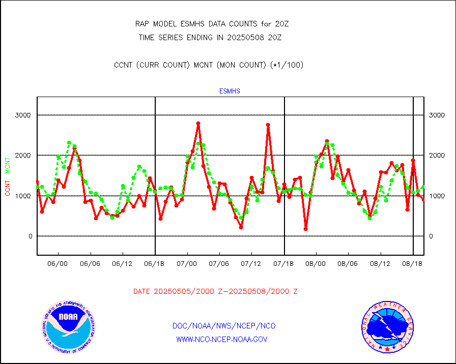
gsrasr |
GOES-16/17 All Sky Radiances (proc.) |
812097 |
782559 |
103.8 % |
1918.00-1921.99 |
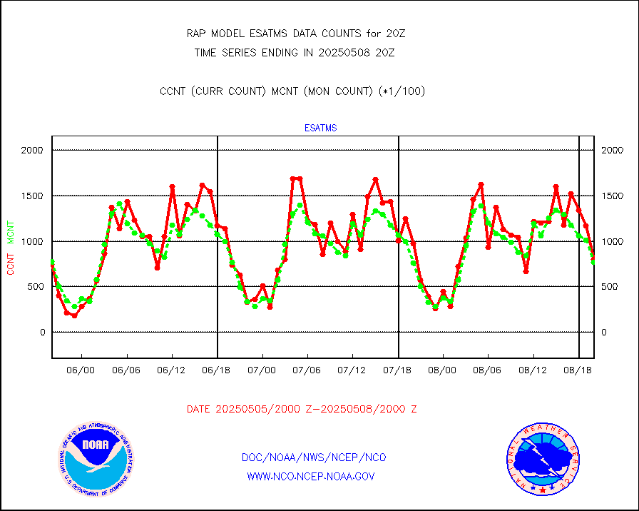
gsrcsr |
GOES-16/17 Clear Sky Radiances (proc.) |
366908 |
391597 |
93.7 % |
1918.00-1921.99 |
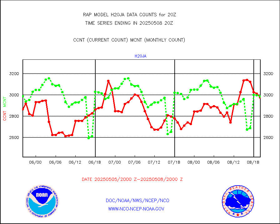
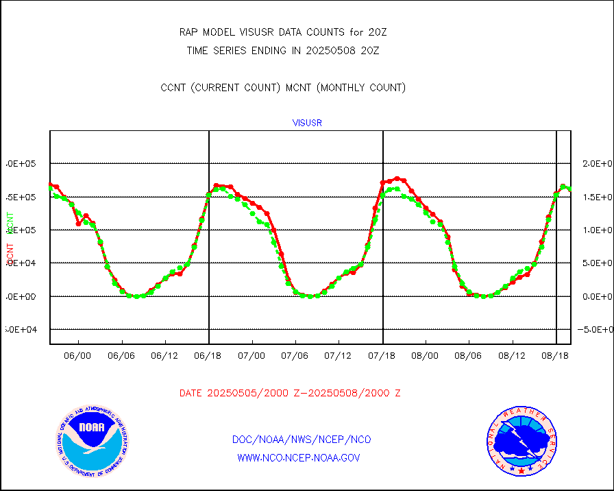
h20ja |
MTSAT/JMA water vapor imager derived cloud motion |
2850 |
3058 |
93.2 % |
1917.50-1922.50 |
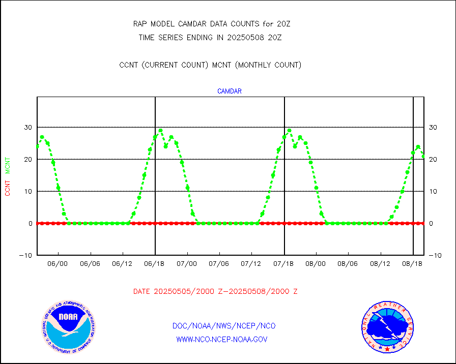
h2dusr |
GOES-16&up/NESDIS wv imgr/deep-lyr derivd cld mtn |
7105 |
7046 |
100.8 % |
1919.00-1919.99 |
h2eunb |
METEOSAT/EUMETSAT wvpr imgr drv cld motion NBseq |
5975 |
5399 |
110.7 % |
1918.50-1921.49 |
h2tusr |
GOES-16&up/NESDIS wv imgr/cld-top derived cld mtn |
15028 |
11662 |
128.9 % |
1919.00-1919.99 |
iasidb |
METOP 1-2 IASI 1C radiances-direct broadcast SSEC |
51869 |
46083 |
112.6 % |
1918.00-1921.99 |
ifeunb |
METEOSAT/EUMETSAT ir lg-wave drv cld motion NBseq |
3418 |
3273 |
104.4 % |
1918.50-1921.49 |
ifvrnb |
VIIRS (NPP/NOAA-20) ir lg-wv drv cloud motion(NB) |
0 |
0 |
n/a |
1917.50-1922.50 |
infav |
AVHRR (NOAA/METOP) ir lg-wave derived cld motion |
0 |
0 |
n/a |
1917.50-1922.50 |
infav1 |
AVHRR (METOP) ir lg-wave derived cld motion |
0 |
0 |
n/a |
1918.50-1921.49 |
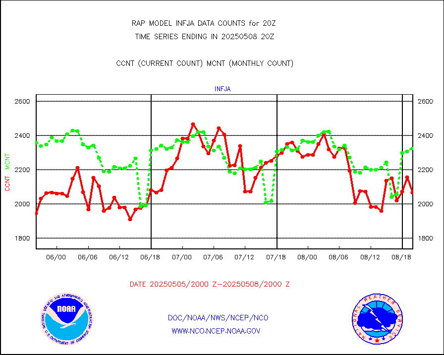
infja |
MTSAT/JMA infrared long-wave derived cloud motion |
2281 |
2551 |
89.4 % |
1917.50-1922.50 |
infusr |
GOES-16&up/NESDIS ir long-wave derived cld motion |
31191 |
29116 |
107.1 % |
1919.00-1919.99 |
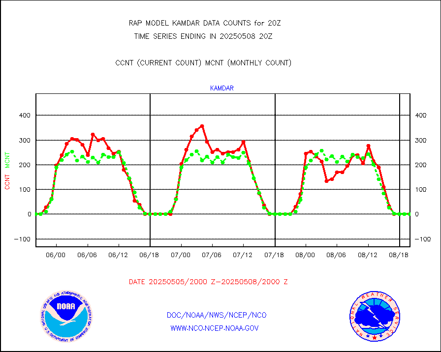
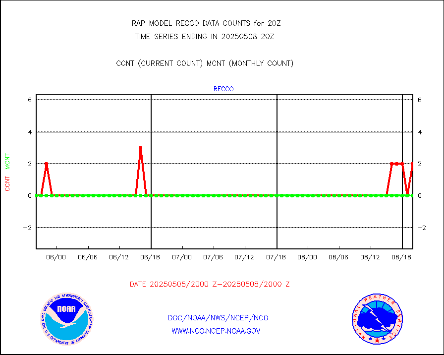
kamdar |
Korean AMDAR aircraft data (decoded from BUFR) |
0 |
1 |
0.0 % |
1916.75-1923.25 |
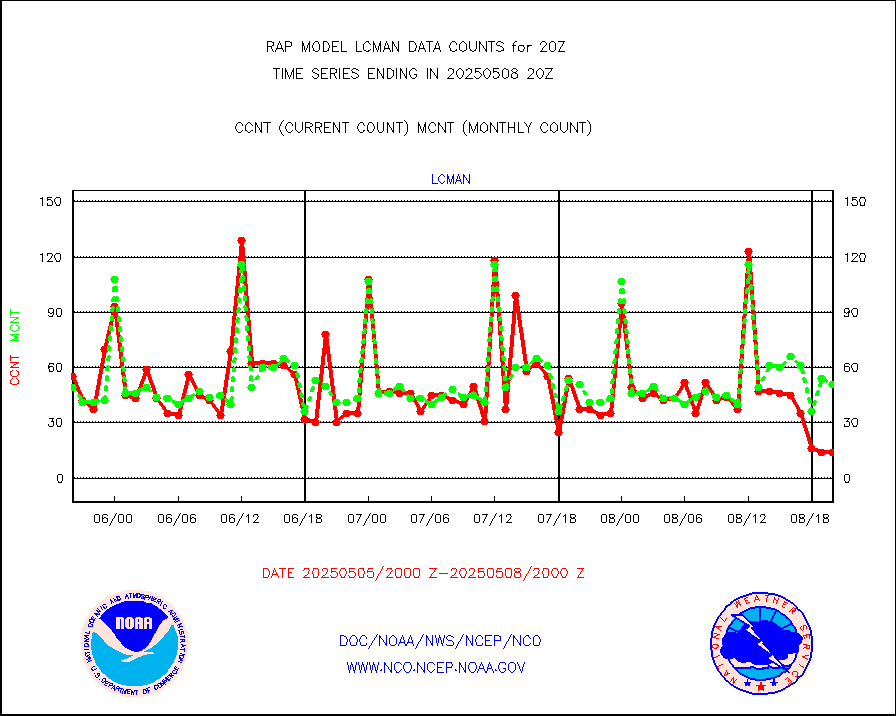
lcman |
Land-based CMAN stations decoded from CMAN format |
75 |
74 |
101.4 % |
1919.50-1920.50 |
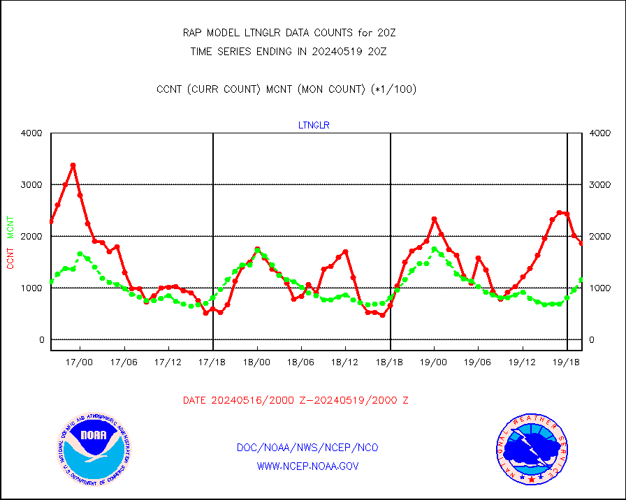
ltnglr |
LLDN Long-rng lightning from Vaisala via NOAAPORT |
186629 |
116584 |
160.1 % |
1919.00-1920.50 |
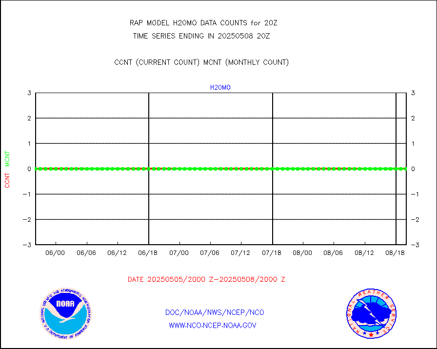
ltngsr |
NLDN Shrt-rng lightning from Vaisala via NOAAPORT |
12639 |
5002 |
252.7 % |
1919.00-1920.50 |
mbuoyb |
Moored buoys (decoded from BUFR) |
618 |
562 |
110.0 % |
1919.50-1920.50 |
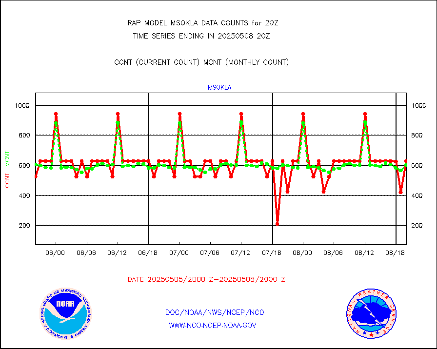
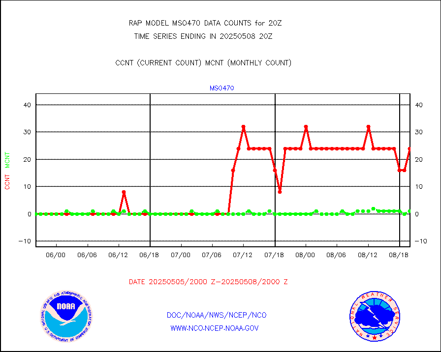
mso470 |
Mesonet/MADIS Colorado E-470 (Interstate 470) |
21 |
19 |
110.5 % |
1919.50-1920.50 |
msoalk |
Mesonet/MADIS Alaska Department of Transportation |
105 |
94 |
111.7 % |
1919.50-1920.50 |
msoapg |
Mesonet/MADIS U.S. Army Aberdeen Proving Grounds |
0 |
0 |
n/a |
1919.50-1920.50 |
msoapr |
Mesonet/MADIS Citizen Weather Observers Program |
43718 |
44610 |
98.0 % |
1919.50-1920.50 |
msoaws |
Mesonet/MADIS AWS Convergence Technologies, Inc. |
25432 |
25454 |
99.9 % |
1919.50-1920.50 |
msoawx |
Mesonet/MADIS "Anything Weather" |
0 |
0 |
n/a |
1919.50-1920.50 |
msocol |
Mesonet/MADIS Colorado Dept. of Transportation |
0 |
0 |
n/a |
1919.50-1920.50 |
msodcn |
Mesonet/MADIS DC Net |
0 |
0 |
n/a |
1919.50-1920.50 |
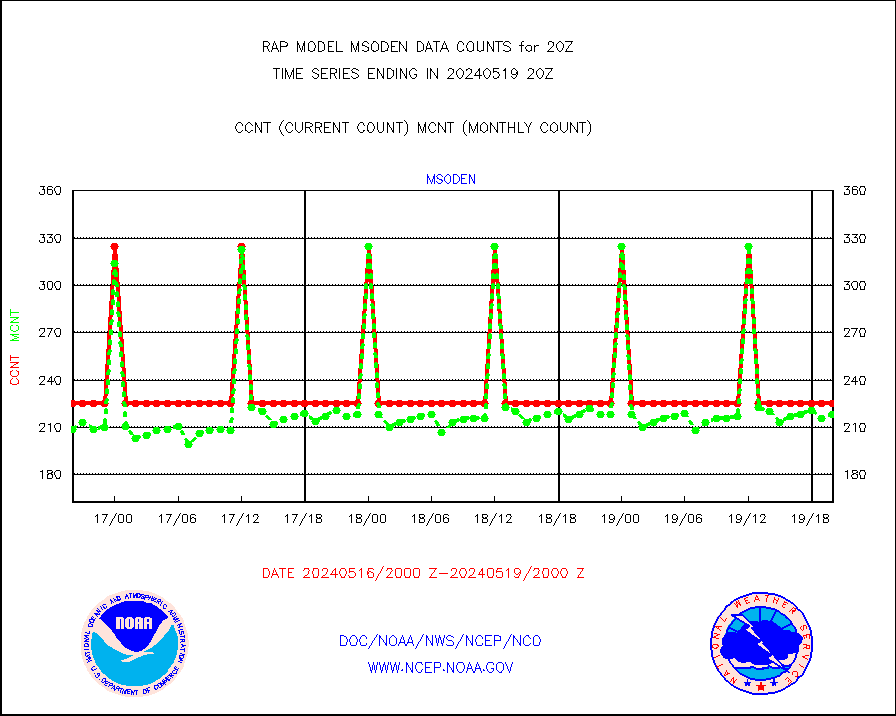
msoden |
Mesonet/MADIS Denver Urban Drainage & Flood Cntrl |
225 |
218 |
103.2 % |
1919.50-1920.50 |
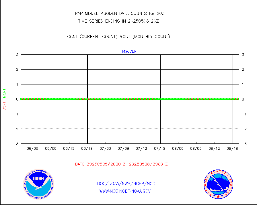
msofla |
Mesonet/MADIS Florida (FAWN & USF) |
3 |
3 |
100.0 % |
1919.50-1920.50 |
msoflt |
Mesonet/MADIS Florida Dept. of Transportation |
0 |
0 |
n/a |
1919.50-1920.50 |
msogeo |
Mesonet/MADIS Georgia Dept. of Transportation |
0 |
0 |
n/a |
1919.50-1920.50 |
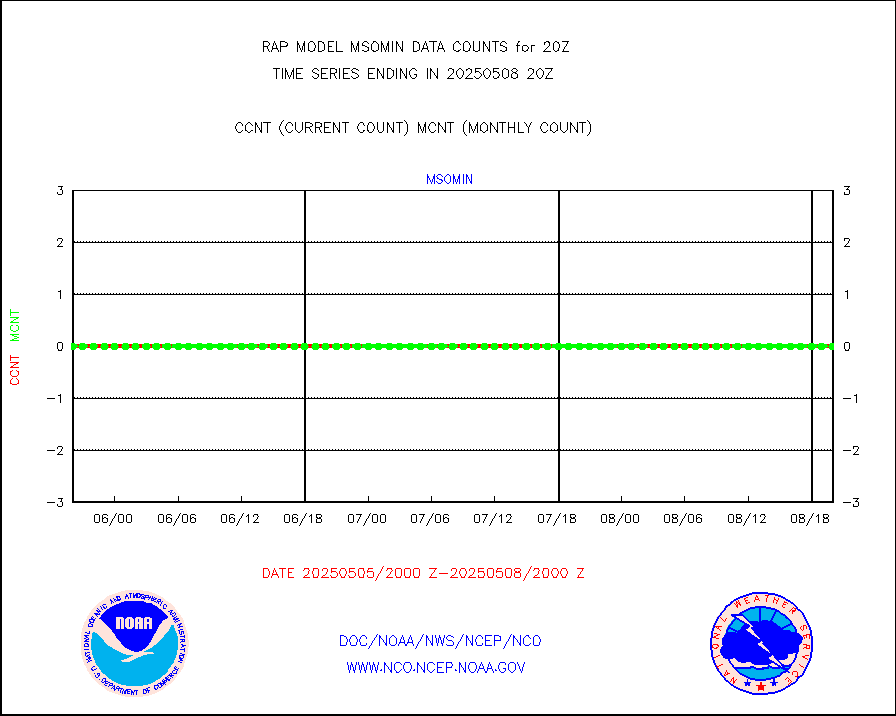
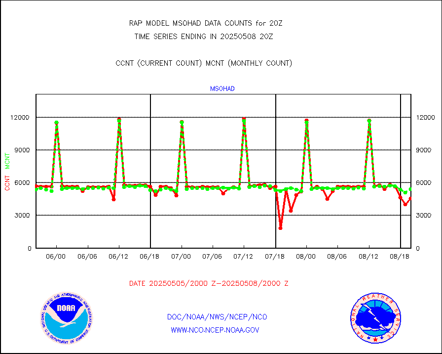
msohad |
Mesonet/MADIS NWS Hydromet Auto Data System(HADS) |
5673 |
5540 |
102.4 % |
1919.50-1920.50 |
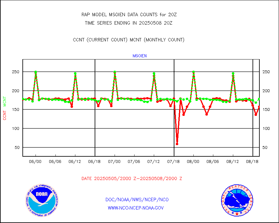
msoien |
Mesonet/MADIS Iowa Environmental |
171 |
167 |
102.4 % |
1919.50-1920.50 |
msoind |
Mesonet/MADIS Indiana Dept. of Transportation |
0 |
0 |
n/a |
1919.50-1920.50 |
msoiow |
Mesonet/MADIS Iowa Department of Transportation |
0 |
0 |
n/a |
1919.50-1920.50 |
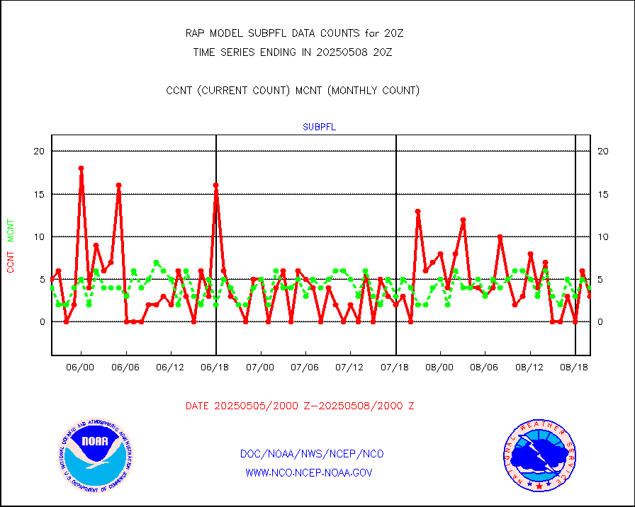
msokan |
Mesonet/MADIS Kansas Department of Transportation |
348 |
310 |
112.3 % |
1919.50-1920.50 |
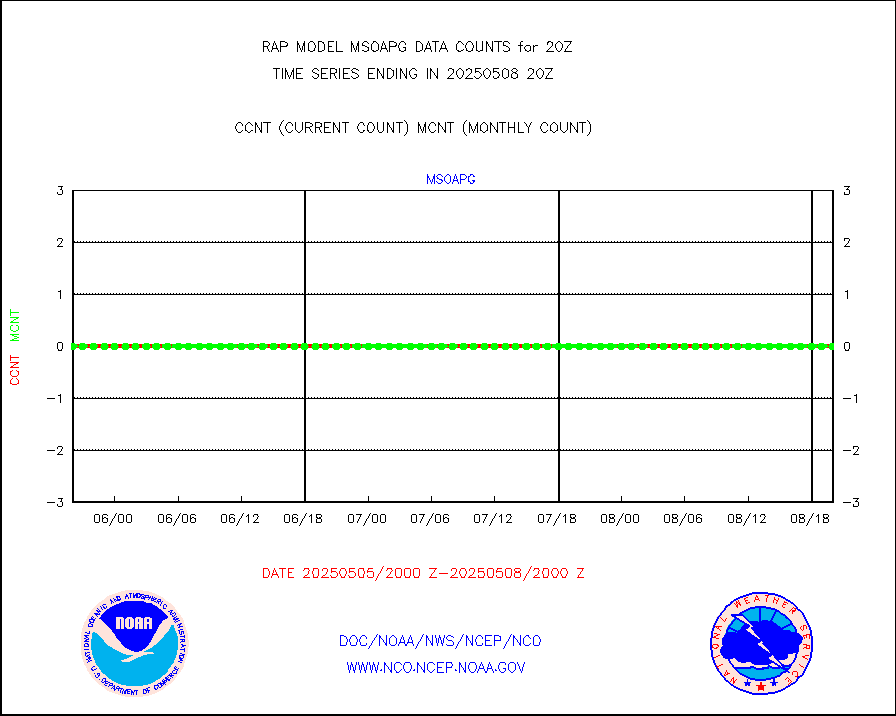
msokla |
Mesonet/MADIS Oklahoma Mesonet |
318 |
315 |
101.0 % |
1919.50-1920.50 |
msolju |
Mesonet/MADIS Louisiana State/Jackson State Univ. |
0 |
0 |
n/a |
1919.50-1920.50 |
msomca |
Mesonet/MADIS Missouri Commercial Agricult Wx Net |
272 |
264 |
103.0 % |
1919.50-1920.50 |
msomin |
Mesonet/MADIS Minnesota Dept. of Transportation |
0 |
0 |
n/a |
1919.50-1920.50 |
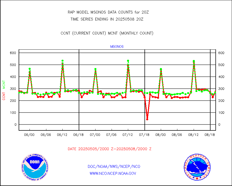
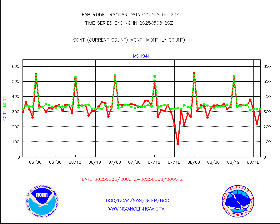
msonos |
Mesonet/MADIS NOS-Phys Oceanographic Realtime Sys |
285 |
282 |
101.1 % |
1919.50-1920.50 |
msoraw |
Mesonet/MADIS NFIC Remote Automated Wx Stns(RAWS) |
1633 |
1560 |
104.7 % |
1919.50-1920.50 |
msourb |
Mesonet/MADIS UrbaNet |
3940 |
3953 |
99.7 % |
1919.50-1920.50 |
msovir |
Mesonet/MADIS Virginia Dept. of Transportation |
204 |
229 |
89.1 % |
1919.50-1920.50 |
msowfy |
Mesonet/MADIS "Weather for You" |
0 |
0 |
n/a |
1919.50-1920.50 |
msowis |
Mesonet/MADIS Wisconsin Dept. of Transportation |
0 |
0 |
n/a |
1919.50-1920.50 |
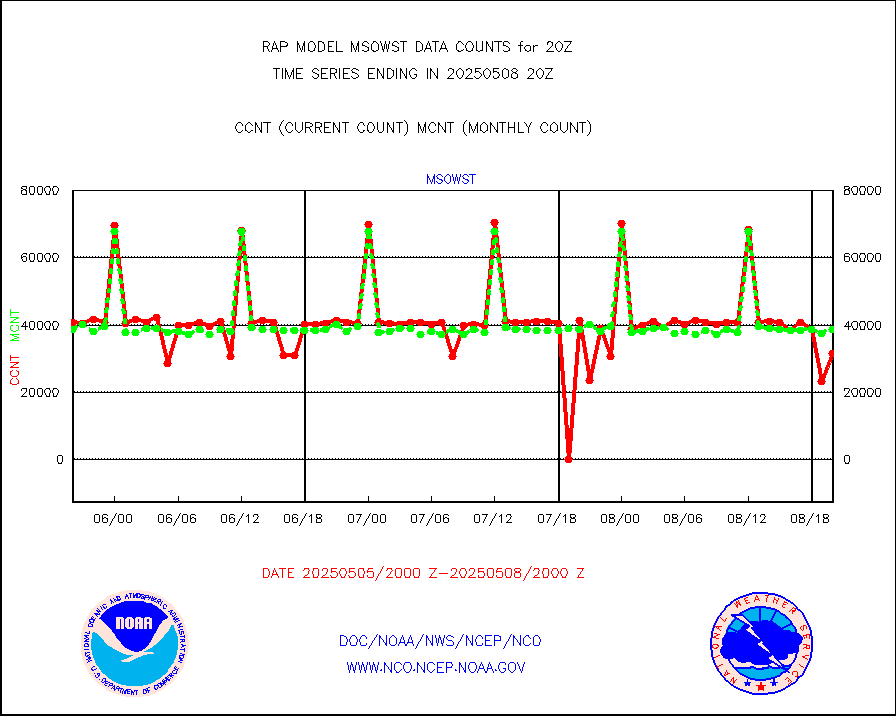
msowst |
Mesonet/MADIS MesoWest (many subproviders) |
41576 |
39694 |
104.7 % |
1919.50-1920.50 |
msowtx |
Mesonet/MADIS West Texas |
5038 |
4878 |
103.3 % |
1919.50-1920.50 |
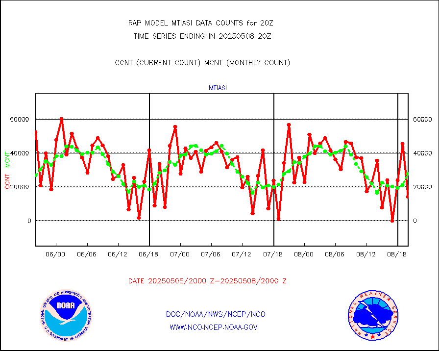
mtiasi |
METOP 1-2 IASI 1C radiance data (varbl. channels) |
22724 |
21490 |
105.7 % |
1918.00-1921.99 |
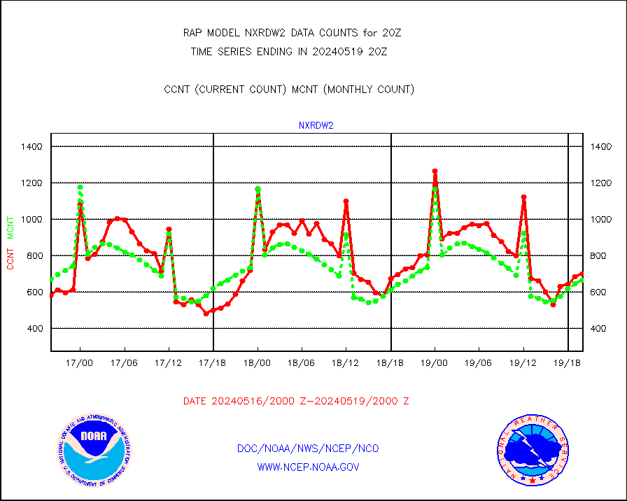
nxrdw2 |
NEXRAD Vel Azm Dsp(VAD) winds via Level 2 decoder |
701 |
664 |
105.6 % |
1919.00-1921.00 |
osbuv8 |
NOAA 16-19 Solar Backscatter UV-2 rad frm V8 BUFR |
0 |
0 |
n/a |
1918.00-1920.99 |
pibal |
PIBAL (from PILOT, PILOT SHIP, PILOT MOBIL) |
0 |
0 |
n/a |
1919.00-1921.00 |
pirep |
Manual PIREP aircraft data (dcded from AIREP fmt) |
458 |
603 |
76.0 % |
1916.75-1923.25 |
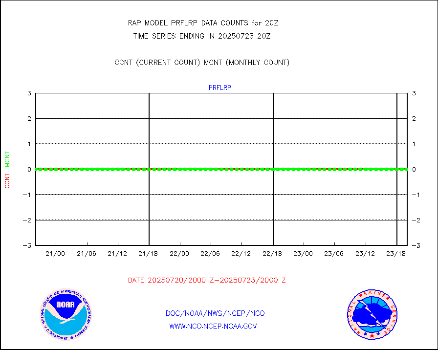
prflrp |
Profilr winds from PIBAL (PILOT,PILOT SHIP/MOBIL) |
0 |
0 |
n/a |
1918.50-1921.50 |
raobm |
Rawinsonde - mobile land (from TEMP/PILOT MOBIL) |
0 |
0 |
n/a |
1919.00-1921.00 |
raobs |
Rawinsonde - ship (from TEMP SHIP, PILOT SHIP) |
0 |
0 |
n/a |
1919.00-1921.00 |
rd2wnd |
NEXRAD radial wind (Level 2 - GTS) |
1127470 |
1056612 |
106.7 % |
1919.50-1920.49 |
recco |
Flight level reconnaissance aircraft data |
0 |
0 |
n/a |
1919.00-1921.00 |
saldrn |
Surface Marine Saildrone (decoded from BUFR) |
2 |
2 |
100.0 % |
1918.00-1921.99 |
saphir |
Megha-Tropiques SAPHIR L1A2 brightness temps |
0 |
0 |
n/a |
1917.00-1922.99 |
sevasr |
METEOSAT-10 2nd Gen SEVIRI All Sky Radiance(proc) |
9512 |
9506 |
100.1 % |
1918.00-1921.99 |
sevcsr |
METEOSAT-10 2nd Gen SEVIRI Clr Sky Radiance(proc) |
0 |
0 |
n/a |
1918.00-1921.99 |
ships |
Ship - manual and automatic, restricted |
0 |
3 |
0.0 % |
1919.50-1920.50 |
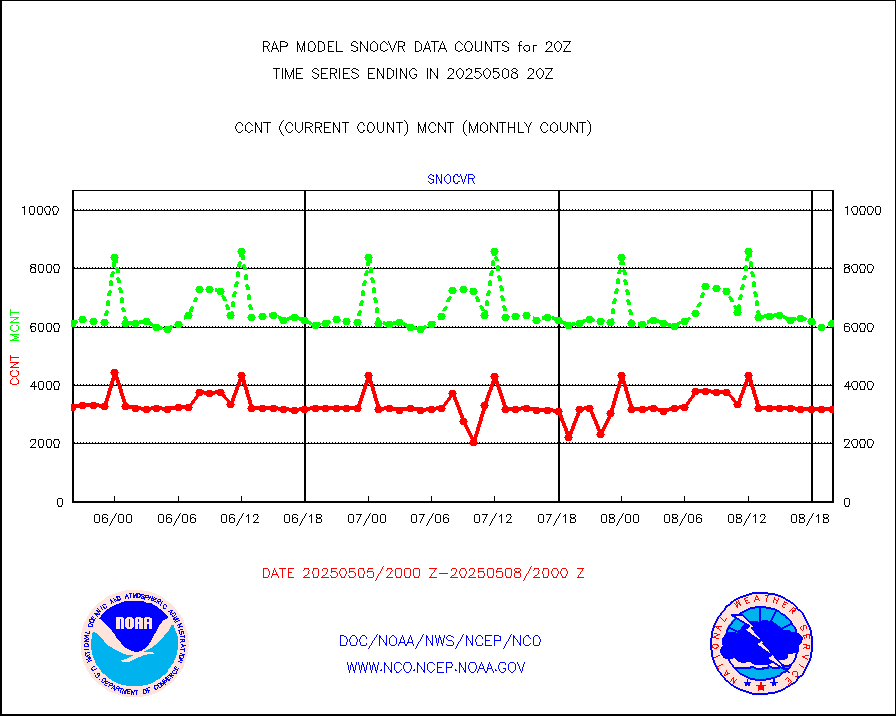
snocvr |
NOW COVER, DEPTH/DENSITY AND WATER EQUIVALENT |
3470 |
6755 |
51.4 % |
1918.00-1922.00 |
ssmisu |
DMSP SSM/IS 1C radiance data (Unified Pre-Proc.) |
147088 |
65385 |
225.0 % |
1918.00-1921.99 |
subpfl |
Sub-surface float and glider profile (BUFR) |
15 |
4 |
375.0 % |
1918.00-1921.99 |
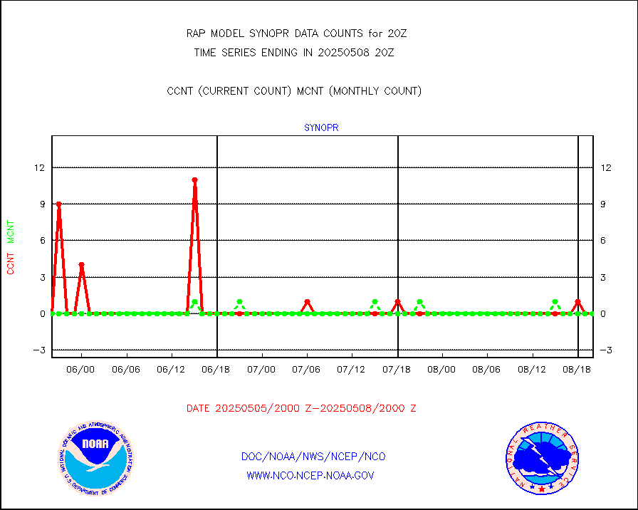
synopr |
Synoptic - restricted (WMO Res 40) manual & auto. |
0 |
0 |
n/a |
1919.50-1920.50 |
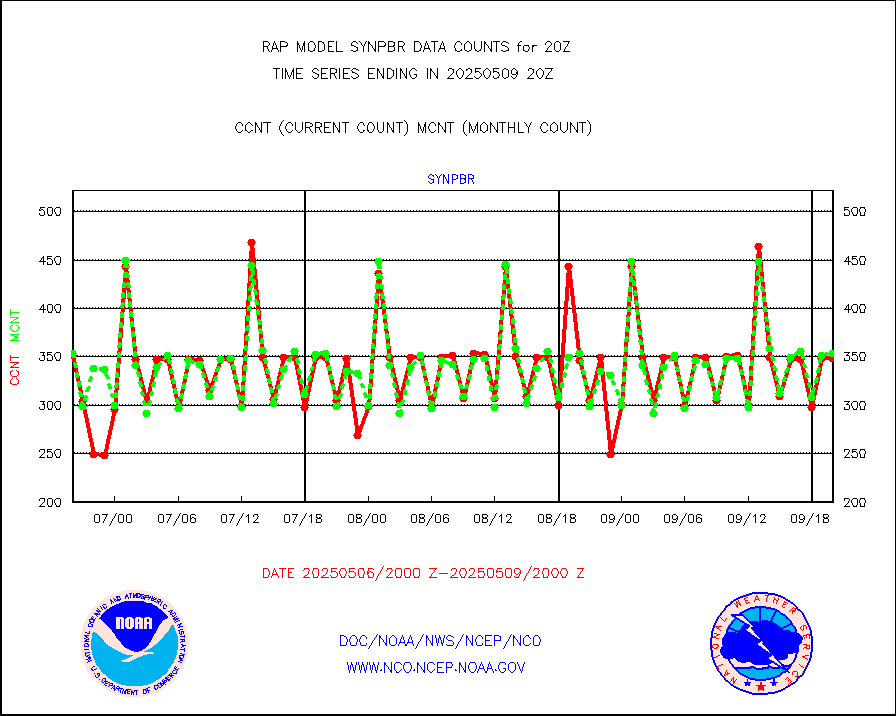
synpbr |
Synoptic - restricted (WMO Res 40)(decoded BUFR) |
344 |
350 |
98.3 % |
1919.50-1920.50 |
synpmb |
Synoptic - mobile manual & auto (decoded fr BUFR) |
0 |
0 |
n/a |
1919.50-1920.50 |
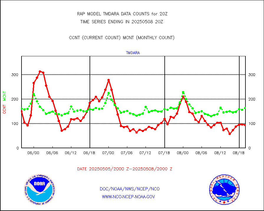
tmdara |
TAMDAR aircft data-all types(from Panasonic,BUFR) |
715 |
588 |
121.6 % |
1916.75-1923.25 |
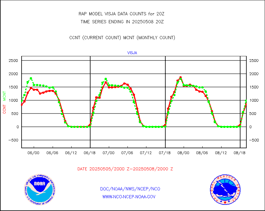
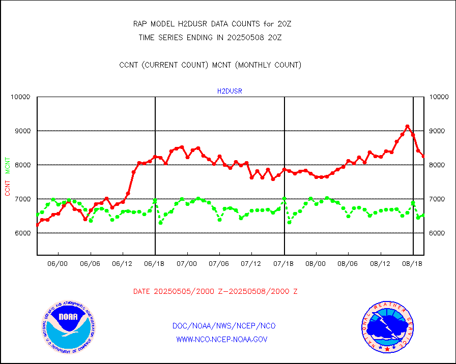
visja |
MTSAT/JMA visible derived cloud motion |
1249 |
1145 |
109.1 % |
1917.50-1922.50 |
visusr |
GOES-16&up/NESDIS visible derived cloud motion |
160407 |
164413 |
97.6 % |
1919.00-1919.99 |
vseunb |
METEOSAT/EUMETSAT visible drv cld motion NBseq |
6287 |
5825 |
107.9 % |
1918.50-1921.49 |


