| Critical Data with Normal Counts |
|---|
| Type | Description | Hourly Count | Monthly Average | Percent (%) of Monthly Mean | UTC Time Window |
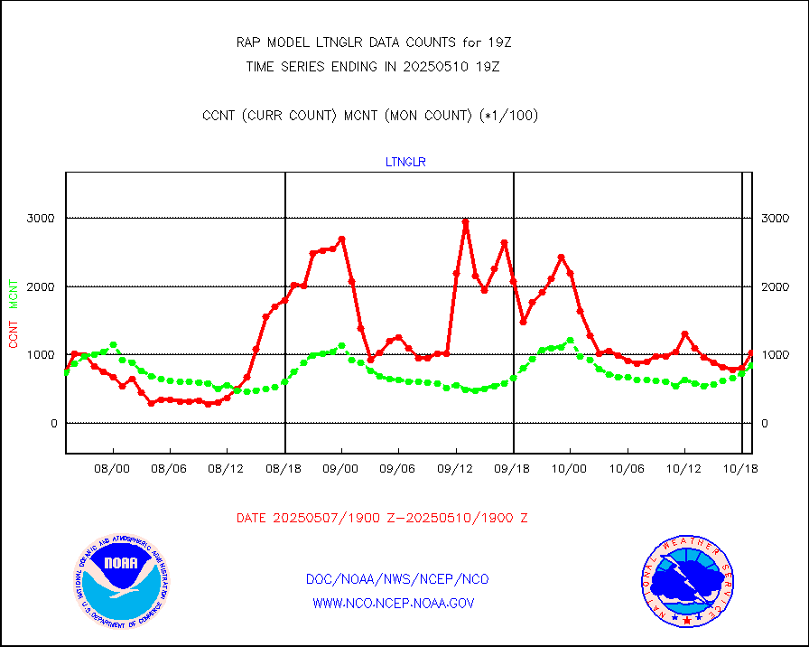
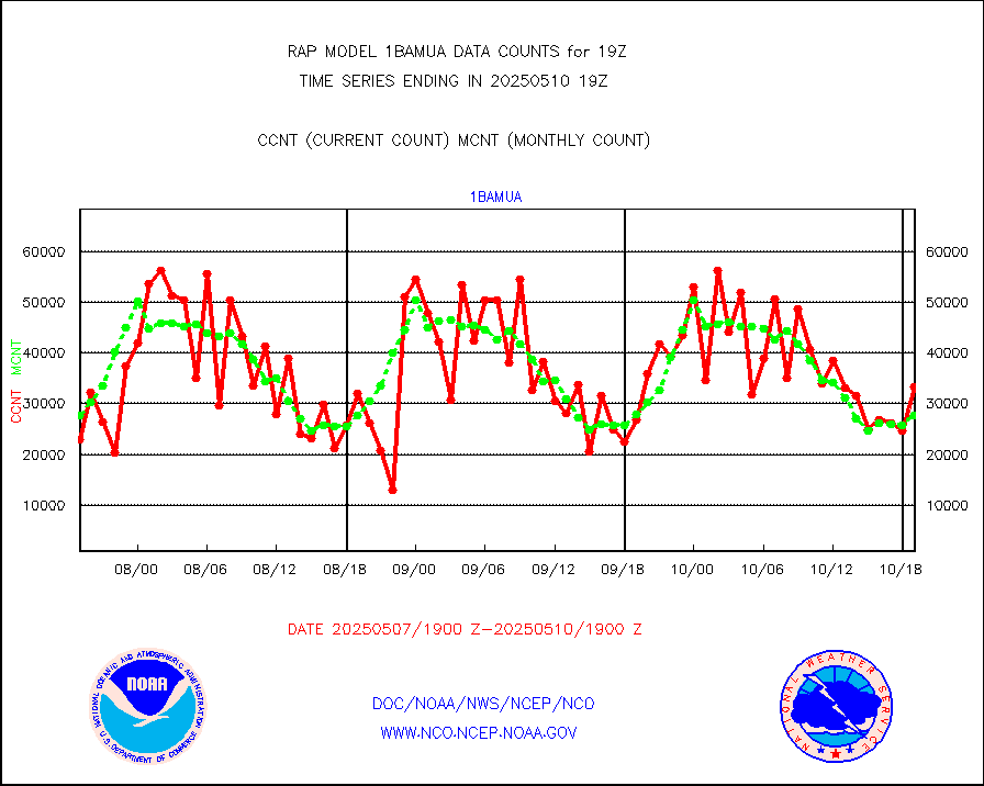
1bamua |
NOAA 15-19 & METOP 1-2 AMSU-A NCEP-proc. br.temps |
33947 |
29541 |
114.9 % |
1916.00-1921.99 |
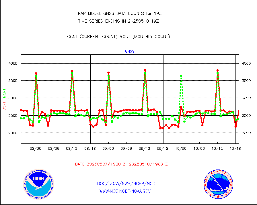
1bhrs4 |
NOAA 18-19 & METOP 1-2 HIRS-4 NCEP-proc. br.temps |
26915 |
22805 |
118.0 % |
1916.00-1921.99 |
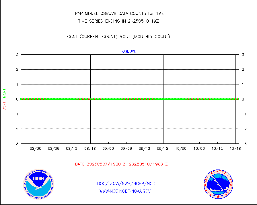
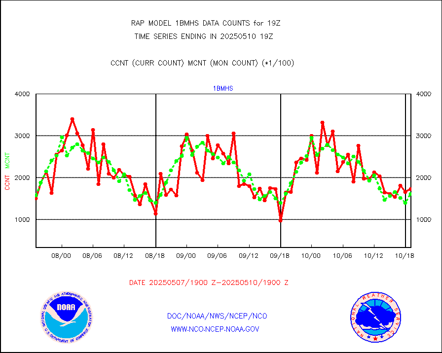
1bmhs |
NOAA 18-19 & METOP 1-2 MHS NCEP-proces. br. temps |
176987 |
162597 |
108.9 % |
1916.00-1921.99 |
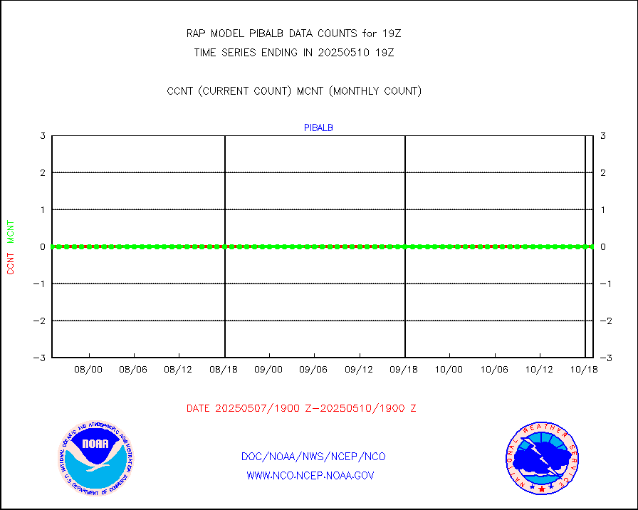
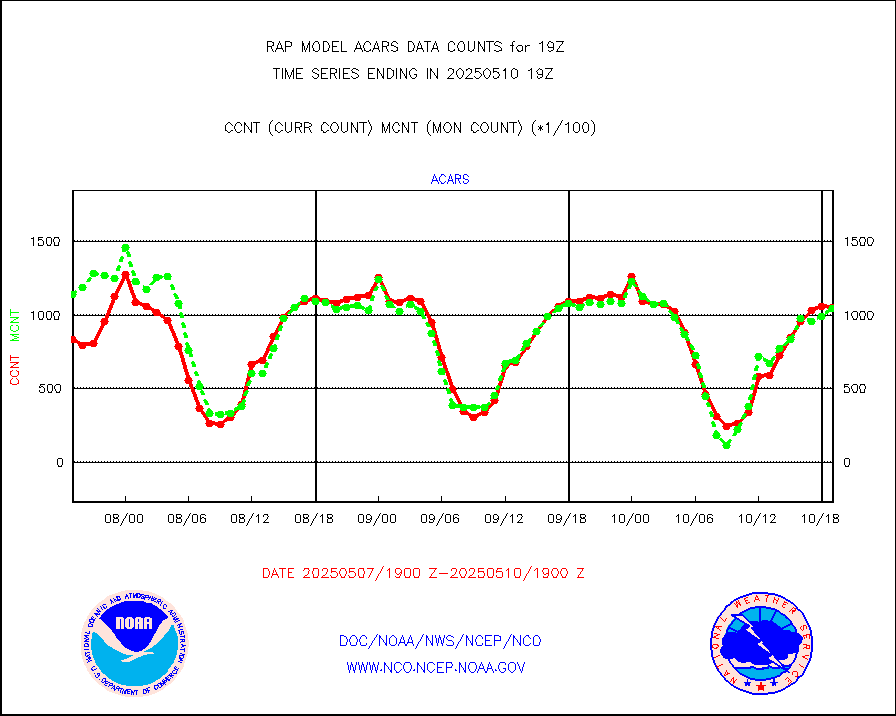
acars |
MDCRS ACARS acft data from ARINC(dcded from BUFR) |
83302 |
82709 |
100.7 % |
1915.75-1922.25 |
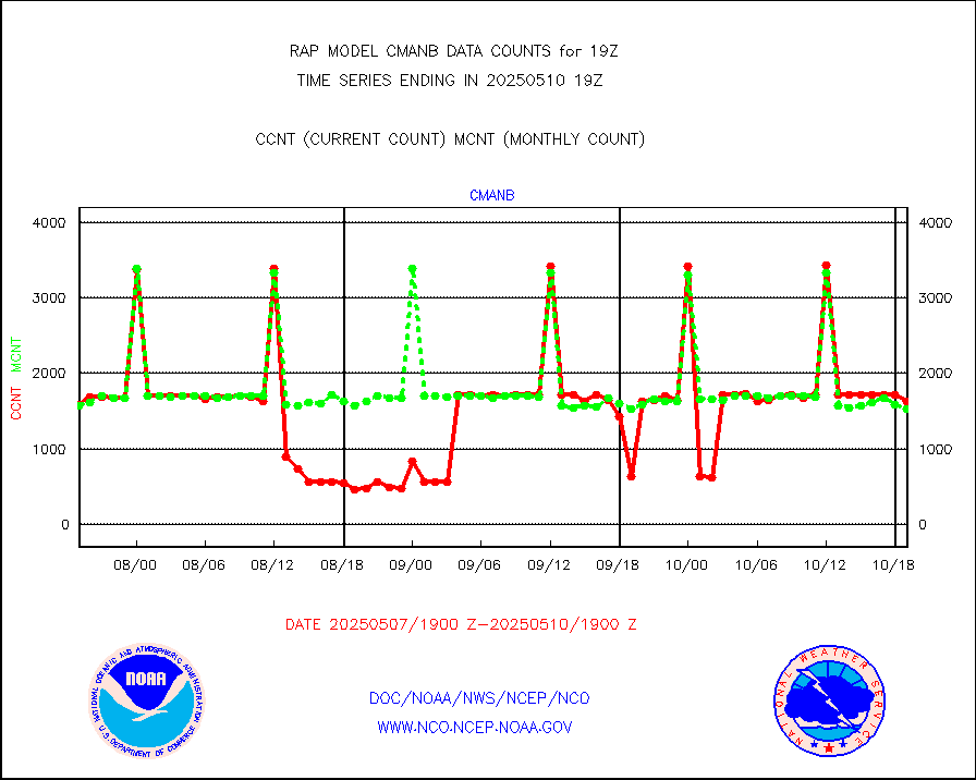
cmanb |
Surface Marine CMAN rpts decoded from BUFR format |
1613 |
1630 |
99.0 % |
1918.50-1919.50 |
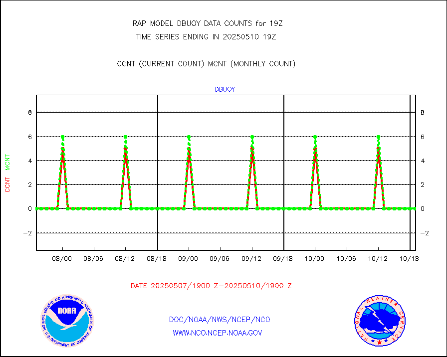
dbuoy |
Buoys decoded from FM-18 fmt (moored or drifting) |
0 |
0 |
n/a |
1918.50-1919.50 |
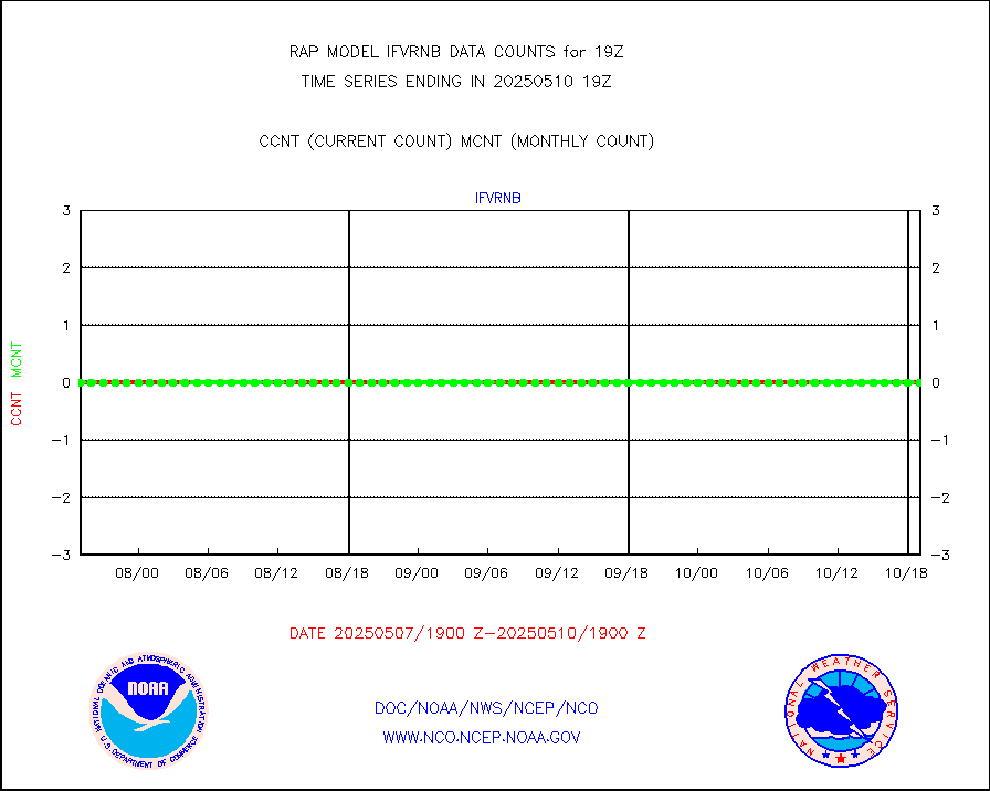
gnss |
Grnd-based Gbl Navigation Sat System (GNSS) data |
2527 |
2516 |
100.4 % |
1917.95-1918.05 |
h20mo |
MODIS (AQUA/TERRA) wvpr imager derived cld motion |
0 |
0 |
n/a |
1916.50-1921.50 |
infmo |
MODIS (AQUA/TERRA) ir l-wave derived cloud motion |
0 |
0 |
n/a |
1916.50-1921.50 |
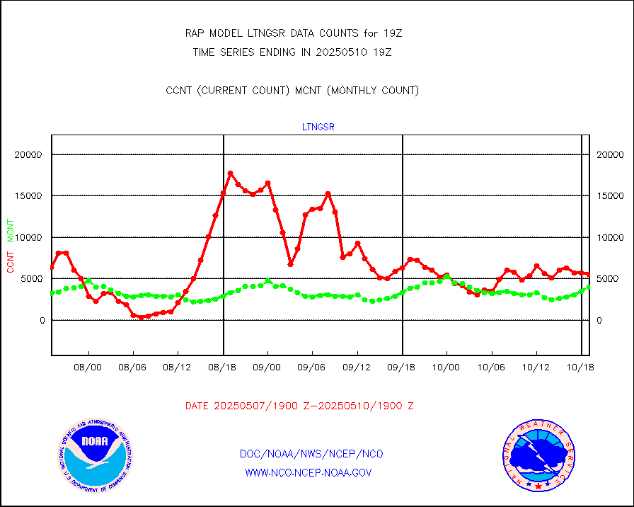
lgycld |
GOES/NASA(Langley) hi-res. (1x1 f-o-v) cloud data |
3727249 |
3079447 |
121.0 % |
1918.50-1919.50 |
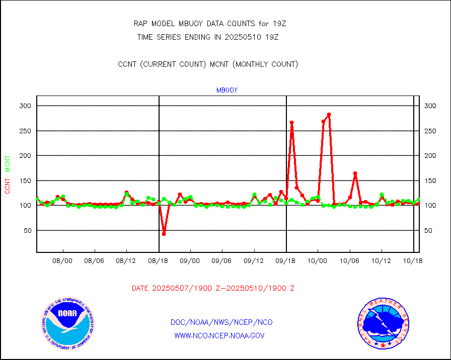
mbuoy |
Buoys decoded from FM-13 format (moored) |
63 |
61 |
103.3 % |
1918.50-1919.50 |
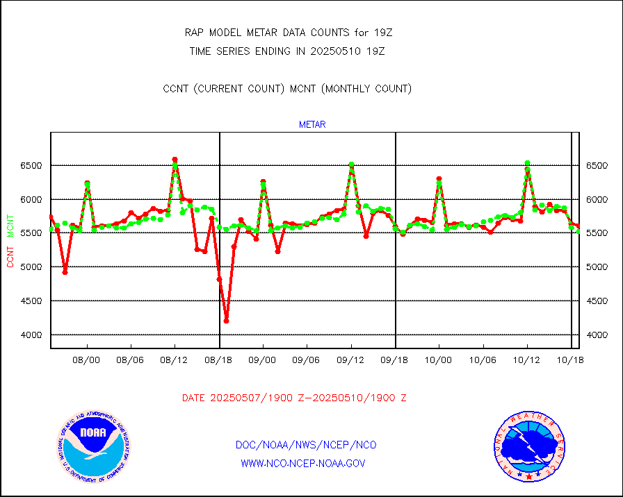
metar |
Aviation - METAR |
5618 |
5839 |
96.2 % |
1918.50-1919.50 |
nxrdw |
NEXRAD Vel Azm Dsp(VAD) winds via radar coded msg |
0 |
0 |
n/a |
1918.00-1920.00 |
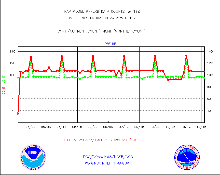
prflrb |
Multi-Agency Profiler (MAP) and SODAR winds |
72 |
84 |
85.7 % |
1917.50-1920.50 |
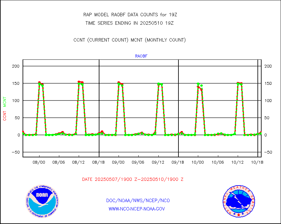
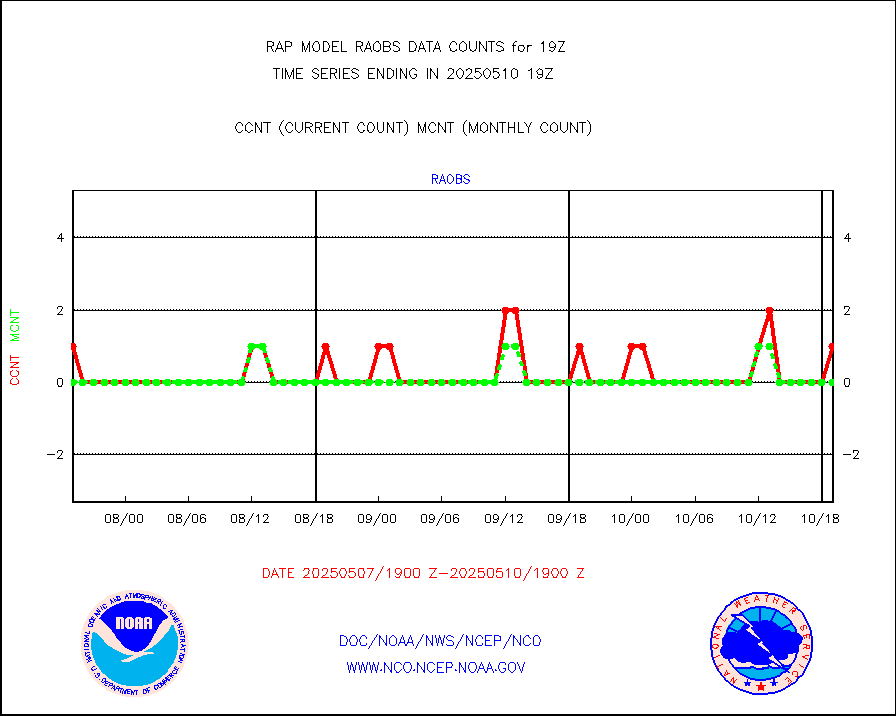
raobf |
Rawinsonde - fixed land (from TEMP or PILOT) |
3 |
5 |
60.0 % |
1918.00-1920.00 |
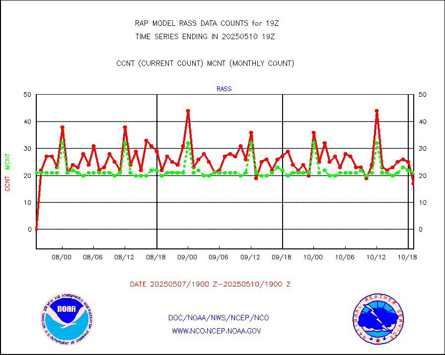
rass |
RASS temperatures (NOAA and Multi-Agency) |
17 |
20 |
85.0 % |
1918.50-1919.50 |
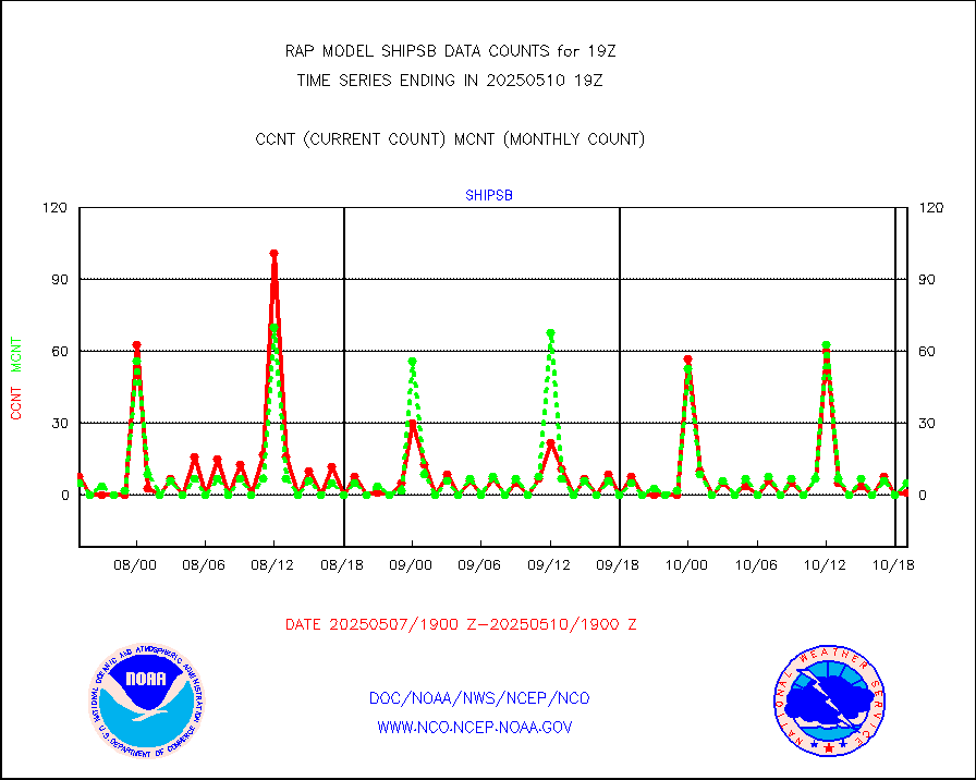
shipsb |
Ship - manual and automatic, restricted (BUFR) |
1 |
0 |
n/a |
1918.50-1919.50 |
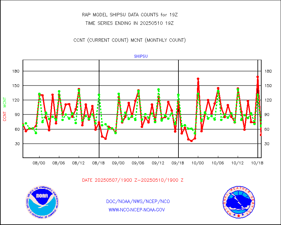
shipsu |
Ship - manual and automatic, unrestricted |
53 |
58 |
91.4 % |
1918.50-1919.50 |
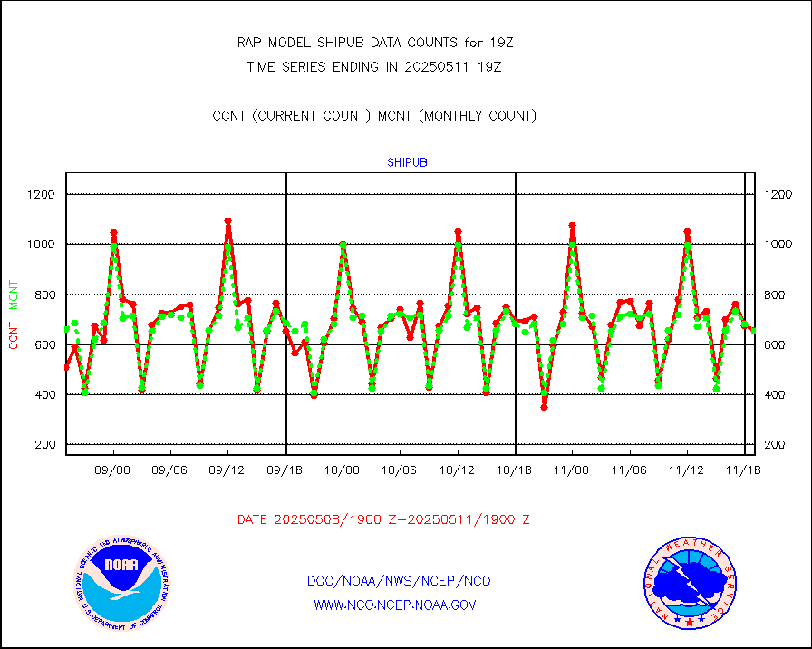
shipub |
Ship - manual and automatic, unrestricted (BUFR) |
586 |
610 |
96.1 % |
1918.50-1919.50 |
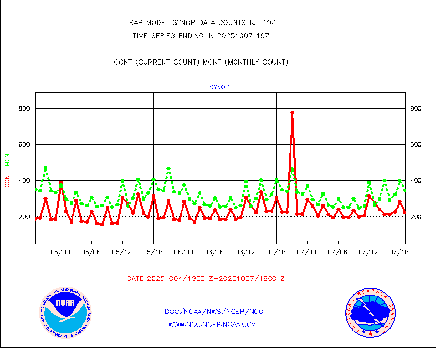
synop |
Synoptic - fixed manual and automatic |
323 |
332 |
97.3 % |
1918.50-1919.50 |
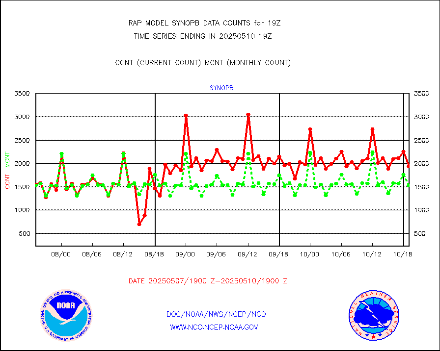
synopb |
Synoptic - fixed manual & auto (decoded fr BUFR) |
1706 |
1656 |
103.0 % |
1918.50-1919.50 |
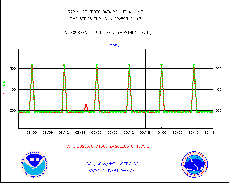
tideg |
Tide gauge reports decoded from CREX format |
181 |
180 |
100.6 % |
1918.50-1919.50 |
| Data Types of Opportunity with Normal Counts |
|---|
| Type | Description | Hourly Count | Monthly Average | Percent (%) of Monthly Mean | UTC Time Window |
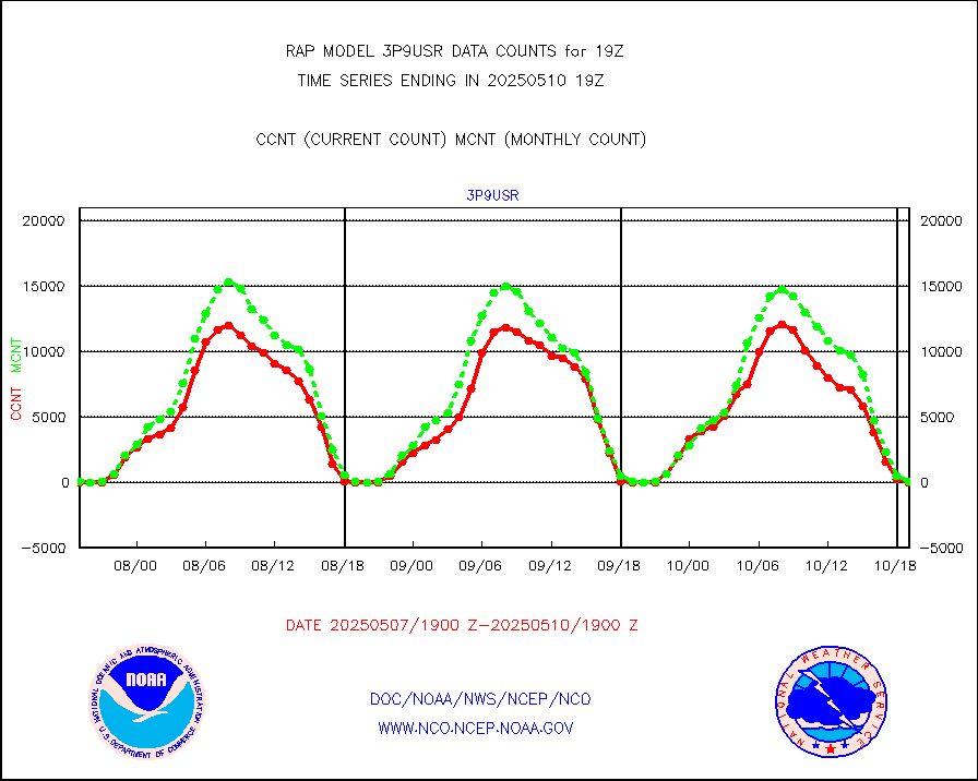
3p9usr |
GOES-16&up/NESDIS ir short-wv derived cld motion |
0 |
4 |
0.0 % |
1918.00-1918.99 |
acarsa |
MDCRS ACARS acft data (ARINC via AFWA)(AIREP fmt) |
0 |
0 |
n/a |
1915.75-1922.25 |
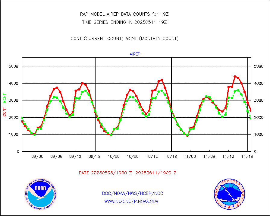
airep |
Manual AIREP aircraft data (dcded from AIREP fmt) |
4012 |
3581 |
112.0 % |
1915.75-1922.25 |
airsev |
AQUA AIRS/AMSU-A/HSB brightness temps- every FOV |
0 |
0 |
n/a |
1916.00-1921.99 |
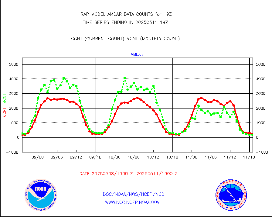
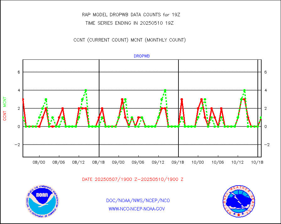
amdar |
AMDAR aircraft data (decoded from AMDAR format) |
220 |
197 |
111.7 % |
1915.75-1922.25 |
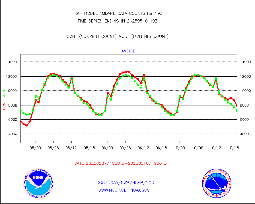
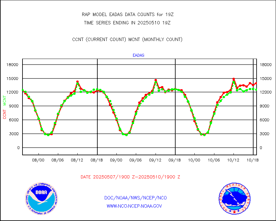
amdarb |
AMDAR aircraft data (decoded from BUFR) |
1136 |
1139 |
99.7 % |
1915.75-1922.25 |
amsr2 |
GCOM-W AMSR2 1B brightness temperatures |
220415 |
792984 |
27.8 % |
1916.00-1916.99 |
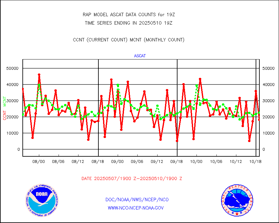
ascat |
METOP 1-2 ASCAT products |
6637 |
17412 |
38.1 % |
1917.00-1921.00 |
atms |
NPP/NOAA-20 ATMS brightness temperatures |
253886 |
221365 |
114.7 % |
1917.00-1920.99 |
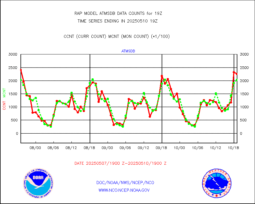
atmsdb |
NPP/NOAA-20 ATMS bright. temps-direct b-cast SSEC |
199209 |
197021 |
101.1 % |
1917.00-1920.99 |
coopmd |
Coop/MADIS NEPP & HCN-Modernization NOAA COOP Obs |
24 |
27 |
88.9 % |
1918.50-1919.50 |
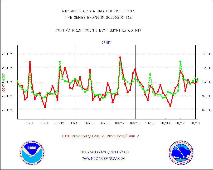
crisf4 |
NPP/NOAA-20 CrIS full spctrl radn (431 ch subset) |
138372 |
125787 |
110.0 % |
1917.00-1920.99 |
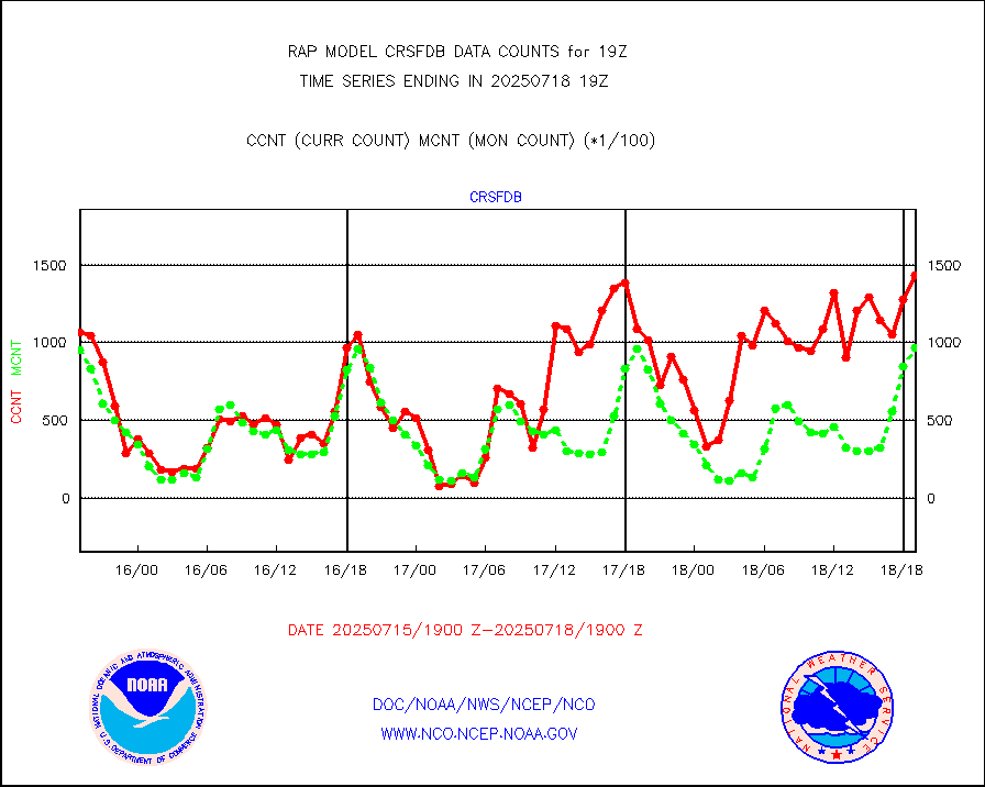
crsfdb |
NPP/NOAA-20 CrIS full spctrl radn dir brdcst SSEC |
179835 |
164921 |
109.0 % |
1917.00-1920.99 |
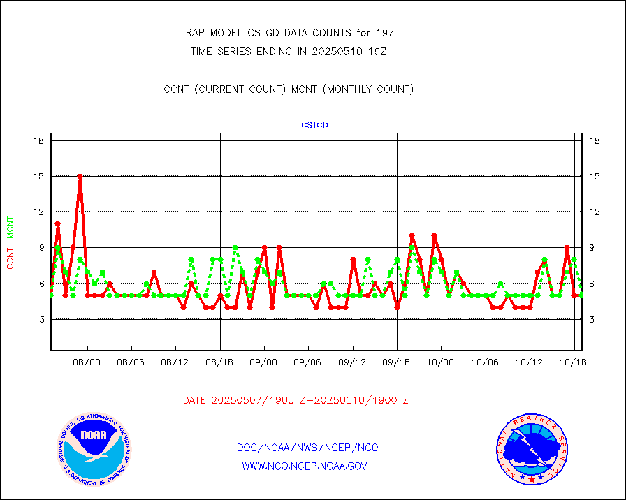
cstgd |
Coast Guard |
3 |
3 |
100.0 % |
1918.50-1919.50 |
dbuoyb |
Drifting buoys (decoded from BUFR) |
618 |
575 |
107.5 % |
1918.50-1919.50 |
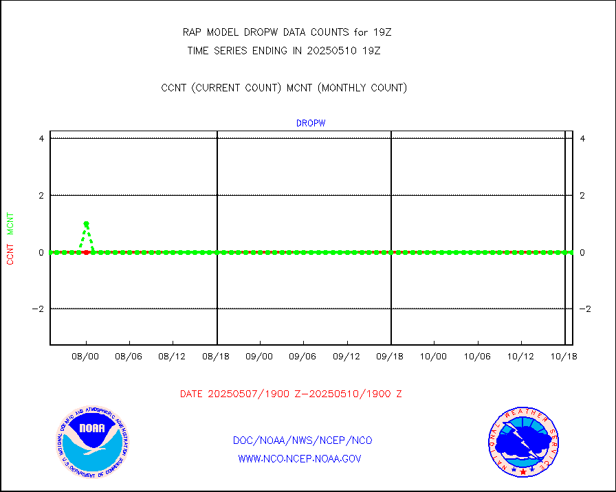
dropw |
Dropwinsonde (from TEMP DROP) |
0 |
0 |
n/a |
1918.00-1920.00 |
eadas |
E-AMDAR (European AMDAR acft decoded from BUFR) |
10353 |
9671 |
107.1 % |
1915.75-1922.25 |
esamua |
NOAA 15-19 & METOP 1-2 AMSU-A proc btmps frm RARS |
18604 |
15638 |
119.0 % |
1918.00-1920.00 |
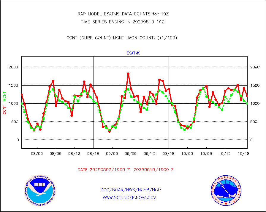
esatms |
NPP Adv. Tech. MW Sndr (ATMS) br. temps from RARS |
95162 |
105156 |
90.5 % |
1917.00-1920.99 |
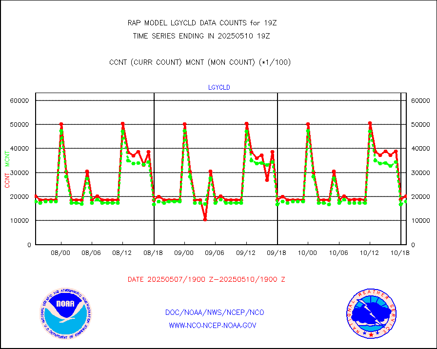
eshrs3 |
NOAA 15-19 & METOP 1-2 HIRS-3/4 pr btmps frm RARS |
48975 |
32580 |
150.3 % |
1918.00-1920.00 |
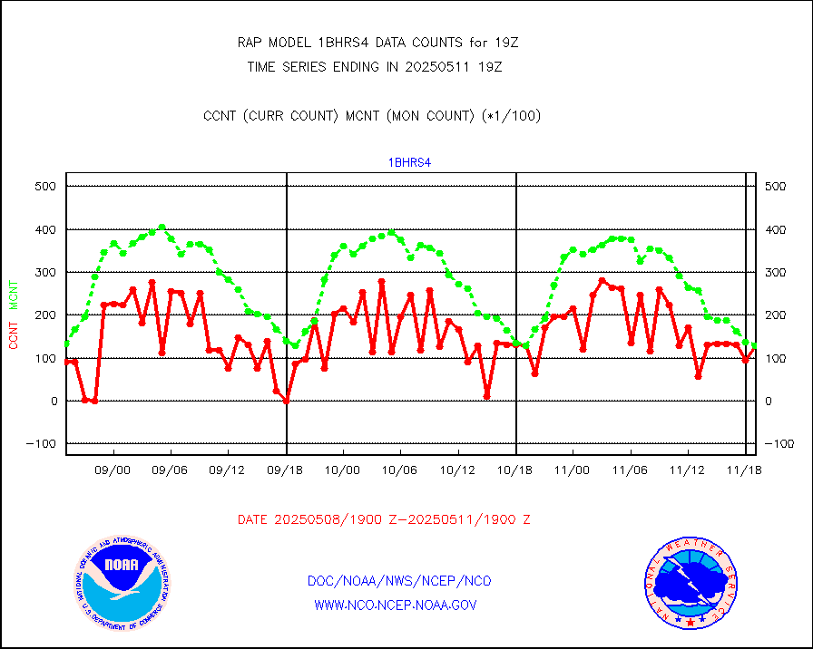
esiasi |
METOP 1-2 IASI 1C radiance data vbl chn from RARS |
67556 |
56463 |
119.6 % |
1917.00-1920.99 |
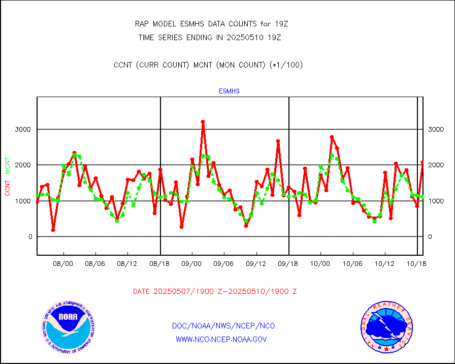
esmhs |
NOAA 18-19 & METOP 1-2 MHS proc. btemps from RARS |
142875 |
117973 |
121.1 % |
1918.00-1920.00 |
gmi1cr |
GPM GMI Level 1C-R brightness temperatures |
452008 |
737378 |
61.3 % |
1916.00-1921.99 |
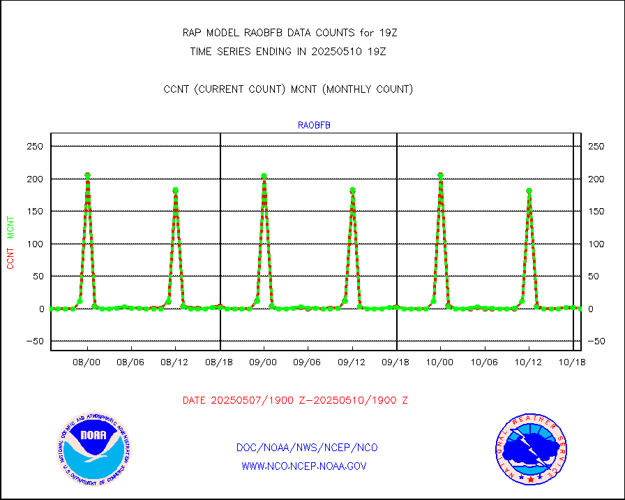
gpsro |
GPS radio occultation data |
117 |
104 |
112.5 % |
1917.00-1920.99 |
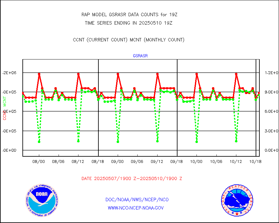
gsrasr |
GOES-16/17 All Sky Radiances (proc.) |
885924 |
852698 |
103.9 % |
1917.00-1920.99 |
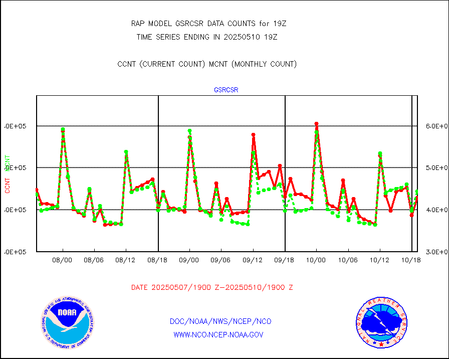
gsrcsr |
GOES-16/17 Clear Sky Radiances (proc.) |
399307 |
426401 |
93.6 % |
1917.00-1920.99 |
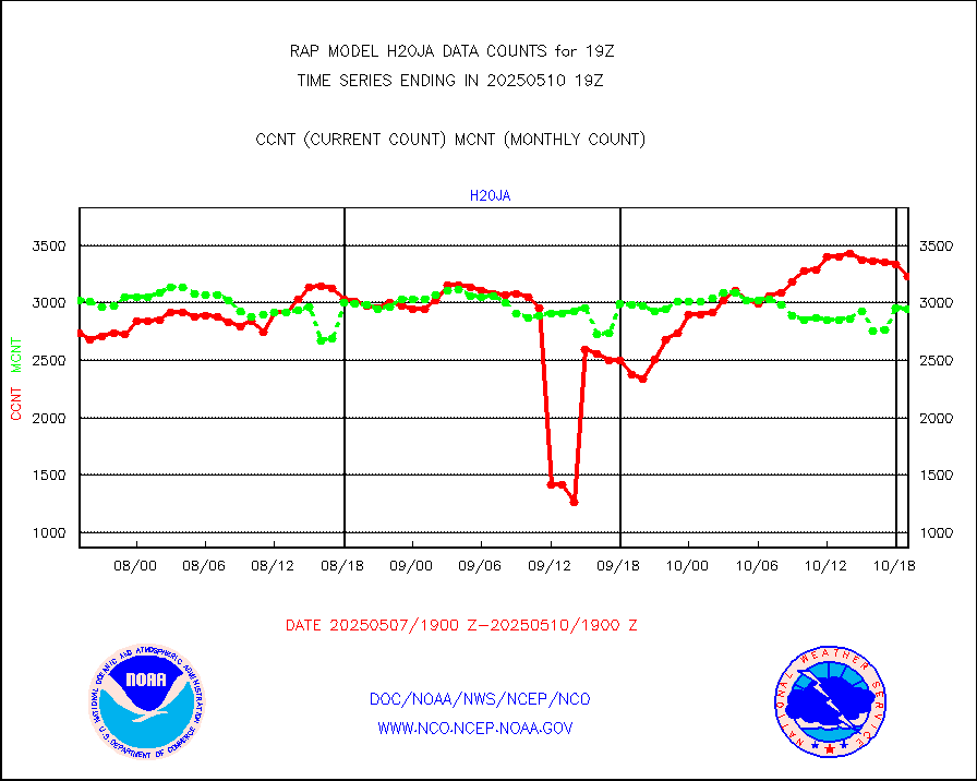
h20ja |
MTSAT/JMA water vapor imager derived cloud motion |
2887 |
3040 |
95.0 % |
1916.50-1921.50 |
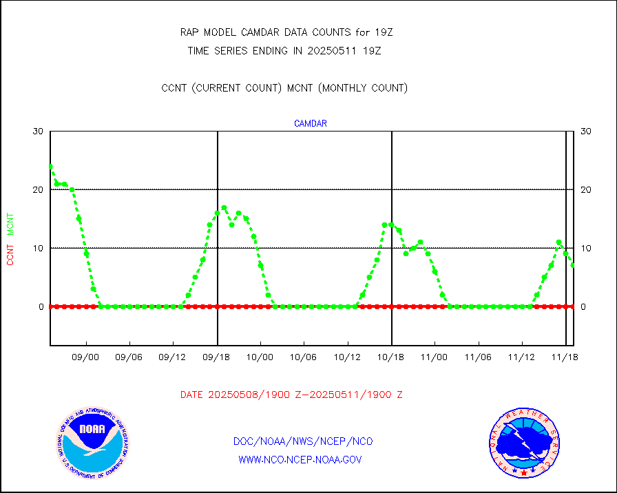
h2dusr |
GOES-16&up/NESDIS wv imgr/deep-lyr derivd cld mtn |
7310 |
7254 |
100.8 % |
1918.00-1918.99 |
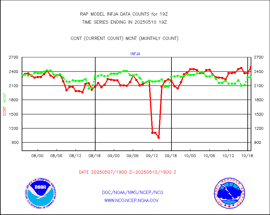
h2eunb |
METEOSAT/EUMETSAT wvpr imgr drv cld motion NBseq |
6008 |
5429 |
110.7 % |
1917.50-1920.49 |
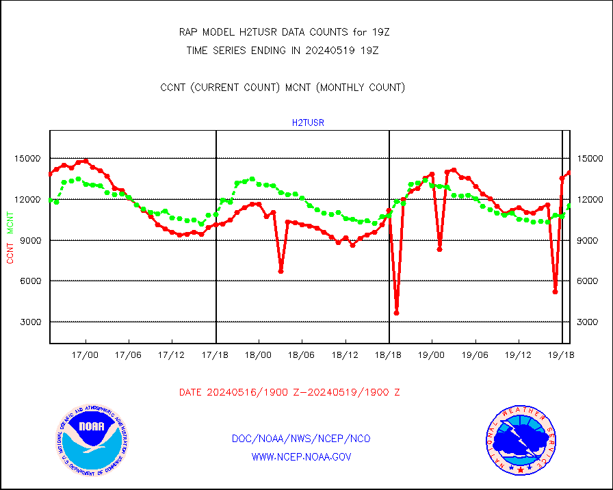
h2tusr |
GOES-16&up/NESDIS wv imgr/cld-top derived cld mtn |
13936 |
11569 |
120.5 % |
1918.00-1918.99 |
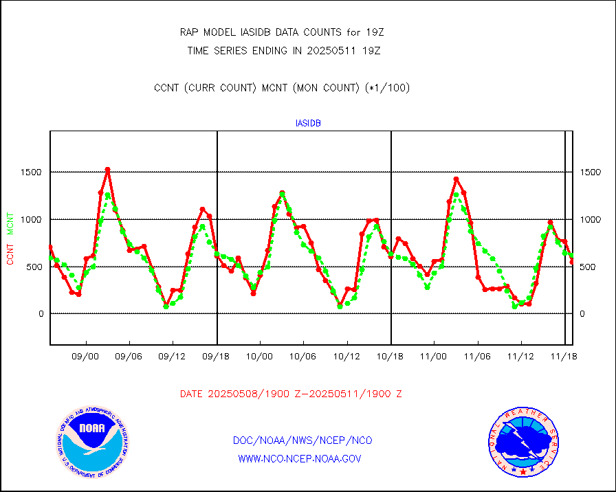
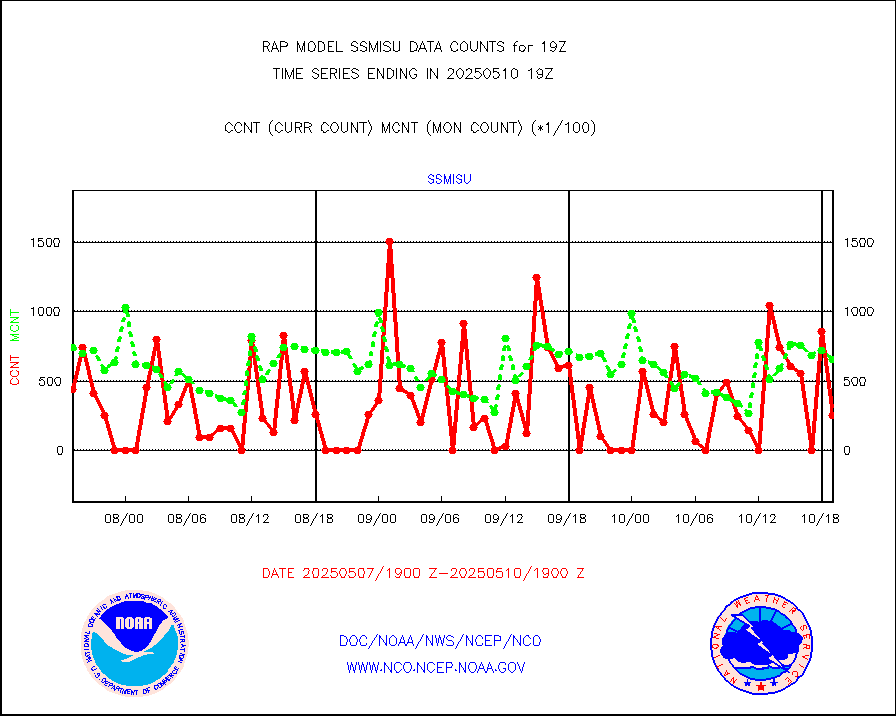
iasidb |
METOP 1-2 IASI 1C radiances-direct broadcast SSEC |
37609 |
49086 |
76.6 % |
1917.00-1920.99 |
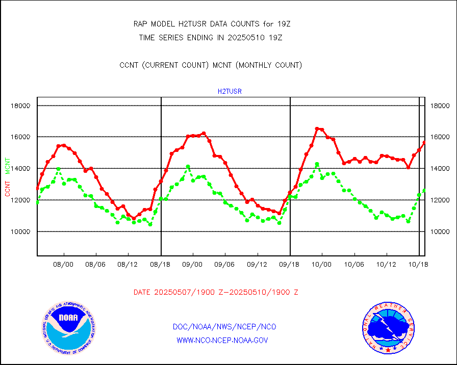
ifeunb |
METEOSAT/EUMETSAT ir lg-wave drv cld motion NBseq |
3398 |
3295 |
103.1 % |
1917.50-1920.49 |
ifvrnb |
VIIRS (NPP/NOAA-20) ir lg-wv drv cloud motion(NB) |
0 |
0 |
n/a |
1916.50-1921.50 |
infav |
AVHRR (NOAA/METOP) ir lg-wave derived cld motion |
0 |
0 |
n/a |
1916.50-1921.50 |
infav1 |
AVHRR (METOP) ir lg-wave derived cld motion |
0 |
0 |
n/a |
1917.50-1920.49 |
infja |
MTSAT/JMA infrared long-wave derived cloud motion |
2413 |
2529 |
95.4 % |
1916.50-1921.50 |
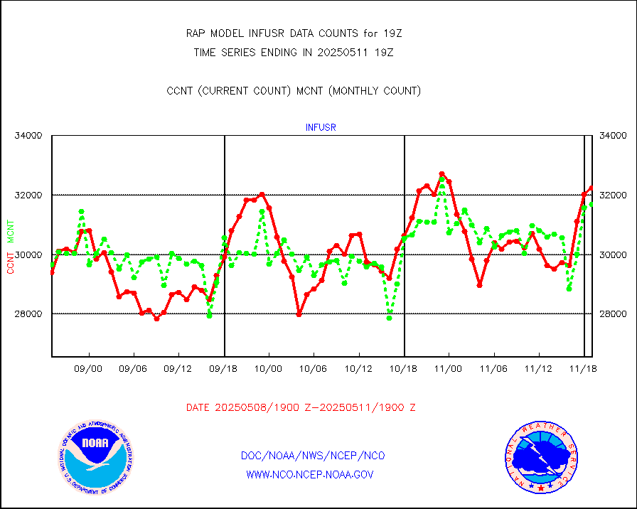
infusr |
GOES-16&up/NESDIS ir long-wave derived cld motion |
30494 |
29351 |
103.9 % |
1918.00-1918.99 |
kamdar |
Korean AMDAR aircraft data (decoded from BUFR) |
0 |
1 |
0.0 % |
1915.75-1922.25 |
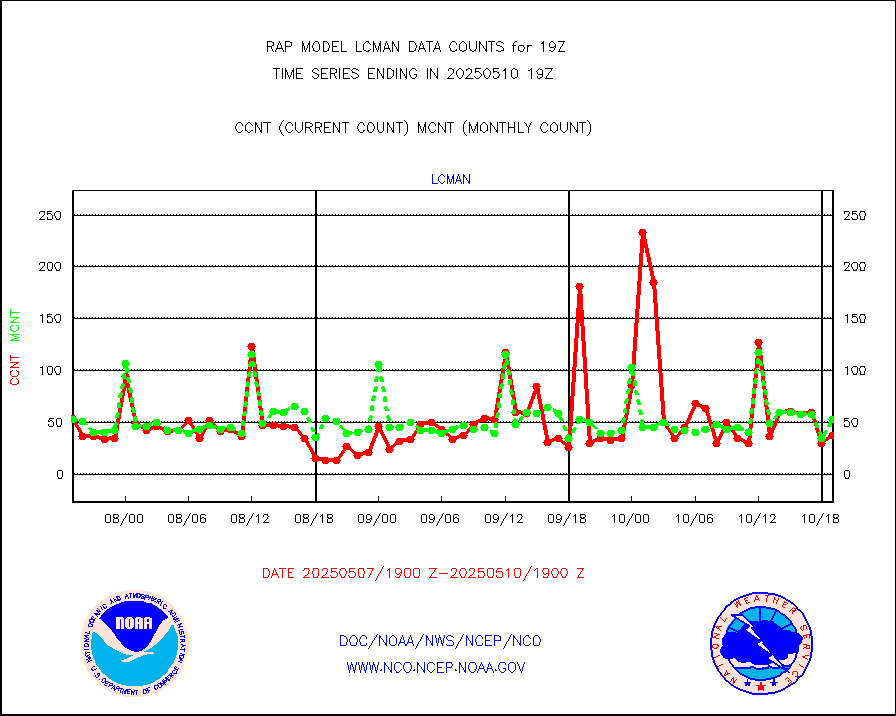
lcman |
Land-based CMAN stations decoded from CMAN format |
74 |
72 |
102.8 % |
1918.50-1919.50 |
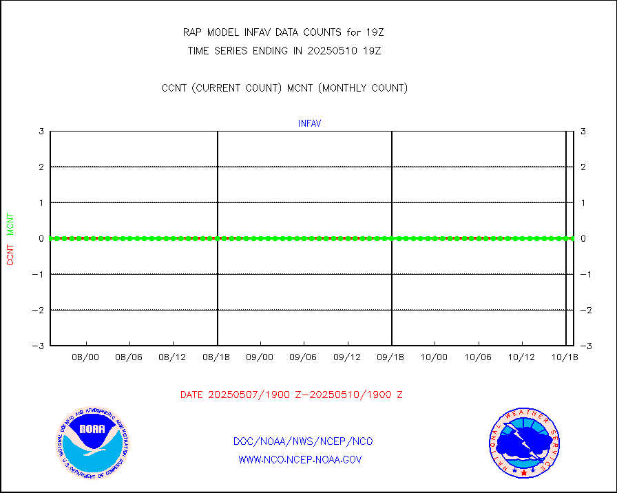
ltnglr |
LLDN Long-rng lightning from Vaisala via NOAAPORT |
201035 |
96393 |
208.6 % |
1918.00-1919.50 |
ltngsr |
NLDN Shrt-rng lightning from Vaisala via NOAAPORT |
10691 |
4263 |
250.8 % |
1918.00-1919.50 |
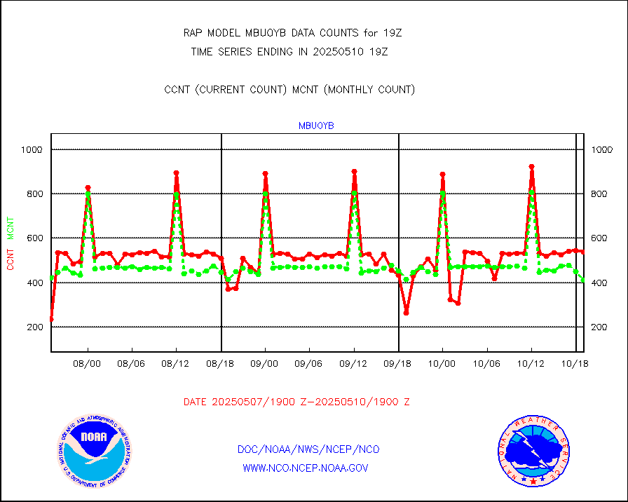
mbuoyb |
Moored buoys (decoded from BUFR) |
611 |
551 |
110.9 % |
1918.50-1919.50 |
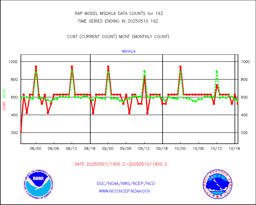
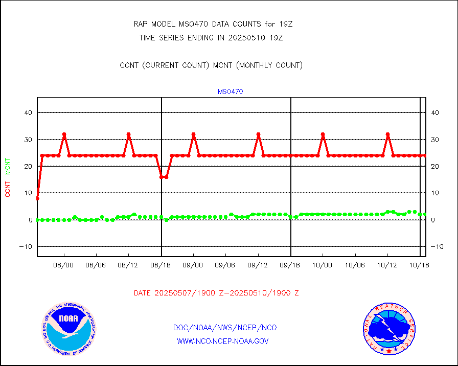
mso470 |
Mesonet/MADIS Colorado E-470 (Interstate 470) |
21 |
18 |
116.7 % |
1918.50-1919.50 |
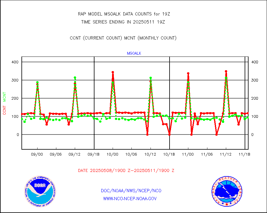
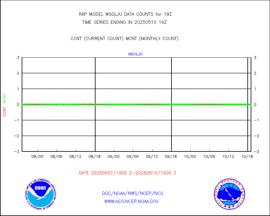
msoalk |
Mesonet/MADIS Alaska Department of Transportation |
110 |
106 |
103.8 % |
1918.50-1919.50 |
msoapg |
Mesonet/MADIS U.S. Army Aberdeen Proving Grounds |
0 |
0 |
n/a |
1918.50-1919.50 |
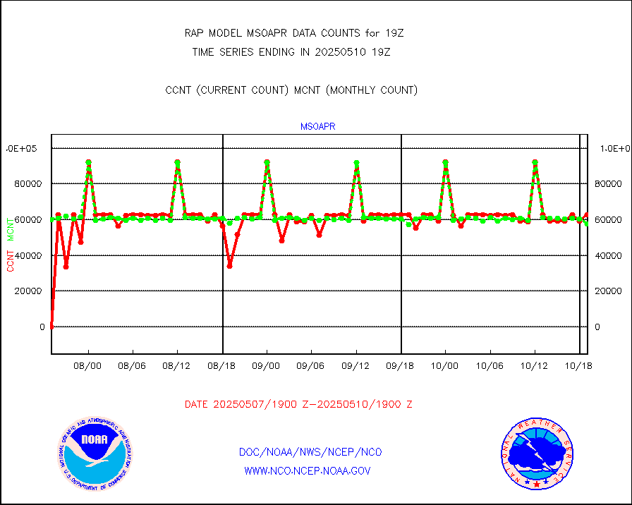
msoapr |
Mesonet/MADIS Citizen Weather Observers Program |
46356 |
46001 |
100.8 % |
1918.50-1919.50 |
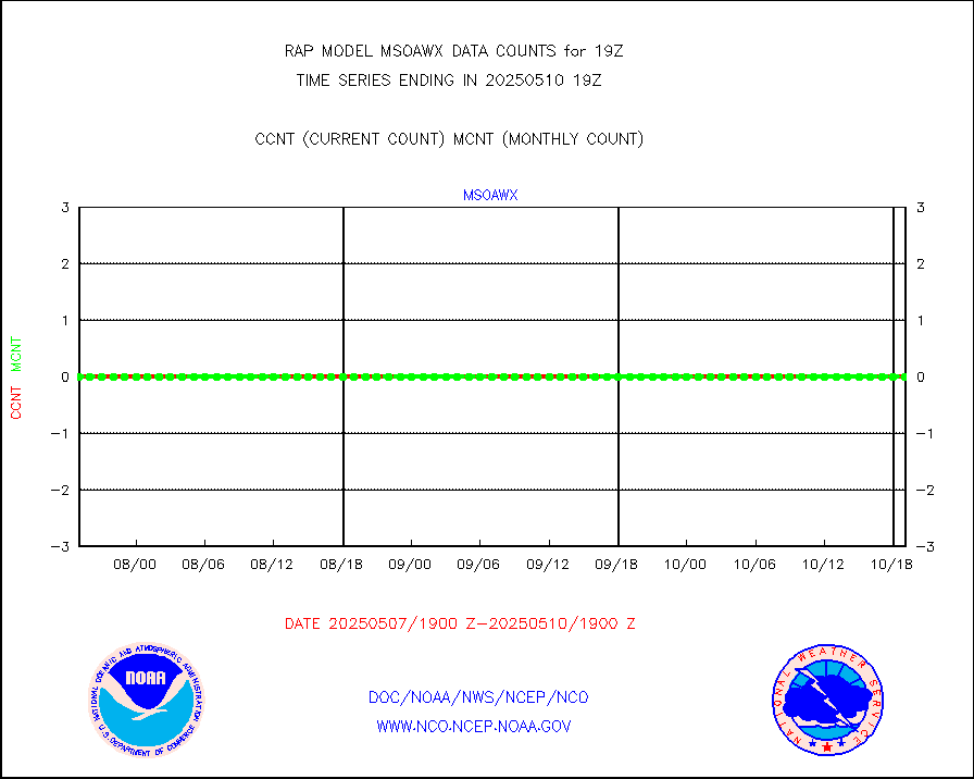
msoaws |
Mesonet/MADIS AWS Convergence Technologies, Inc. |
24826 |
25740 |
96.4 % |
1918.50-1919.50 |
msoawx |
Mesonet/MADIS "Anything Weather" |
0 |
0 |
n/a |
1918.50-1919.50 |
msocol |
Mesonet/MADIS Colorado Dept. of Transportation |
0 |
0 |
n/a |
1918.50-1919.50 |
msodcn |
Mesonet/MADIS DC Net |
0 |
0 |
n/a |
1918.50-1919.50 |
msoden |
Mesonet/MADIS Denver Urban Drainage & Flood Cntrl |
225 |
216 |
104.2 % |
1918.50-1919.50 |
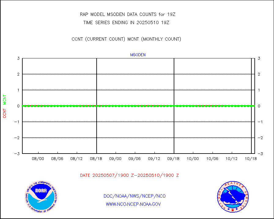
msofla |
Mesonet/MADIS Florida (FAWN & USF) |
4 |
3 |
133.3 % |
1918.50-1919.50 |
msoflt |
Mesonet/MADIS Florida Dept. of Transportation |
0 |
0 |
n/a |
1918.50-1919.50 |
msogeo |
Mesonet/MADIS Georgia Dept. of Transportation |
0 |
0 |
n/a |
1918.50-1919.50 |
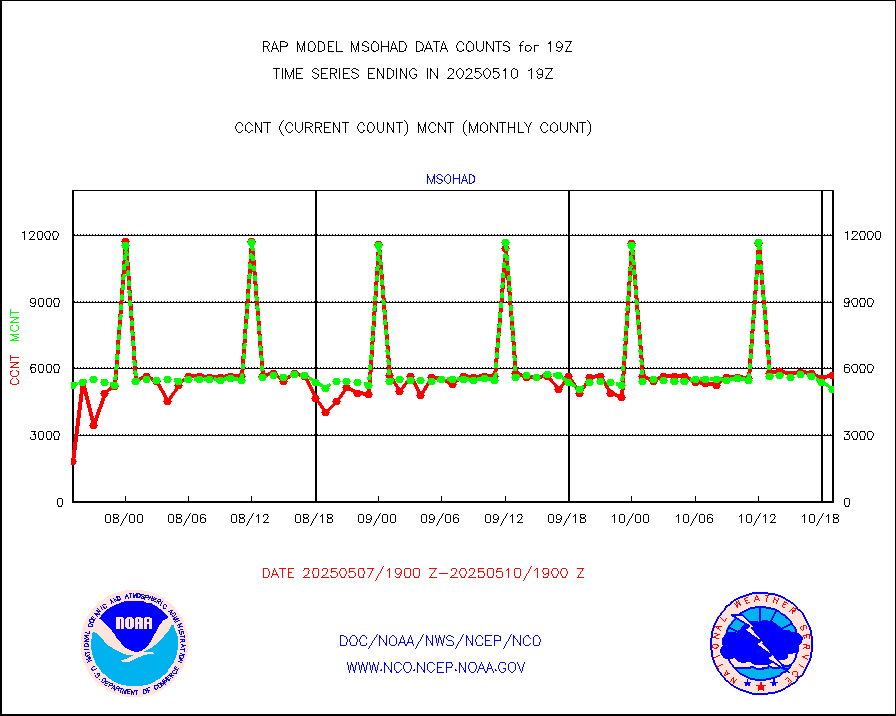
msohad |
Mesonet/MADIS NWS Hydromet Auto Data System(HADS) |
5707 |
5599 |
101.9 % |
1918.50-1919.50 |
msoien |
Mesonet/MADIS Iowa Environmental |
169 |
167 |
101.2 % |
1918.50-1919.50 |
msoind |
Mesonet/MADIS Indiana Dept. of Transportation |
0 |
0 |
n/a |
1918.50-1919.50 |
msoiow |
Mesonet/MADIS Iowa Department of Transportation |
0 |
0 |
n/a |
1918.50-1919.50 |
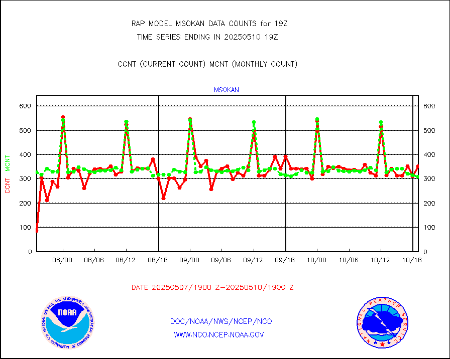
msokan |
Mesonet/MADIS Kansas Department of Transportation |
348 |
316 |
110.1 % |
1918.50-1919.50 |
msokla |
Mesonet/MADIS Oklahoma Mesonet |
318 |
318 |
100.0 % |
1918.50-1919.50 |
msolju |
Mesonet/MADIS Louisiana State/Jackson State Univ. |
0 |
0 |
n/a |
1918.50-1919.50 |
msomca |
Mesonet/MADIS Missouri Commercial Agricult Wx Net |
274 |
264 |
103.8 % |
1918.50-1919.50 |
msomin |
Mesonet/MADIS Minnesota Dept. of Transportation |
0 |
0 |
n/a |
1918.50-1919.50 |
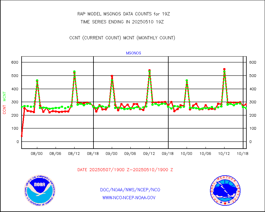
msonos |
Mesonet/MADIS NOS-Phys Oceanographic Realtime Sys |
295 |
286 |
103.1 % |
1918.50-1919.50 |
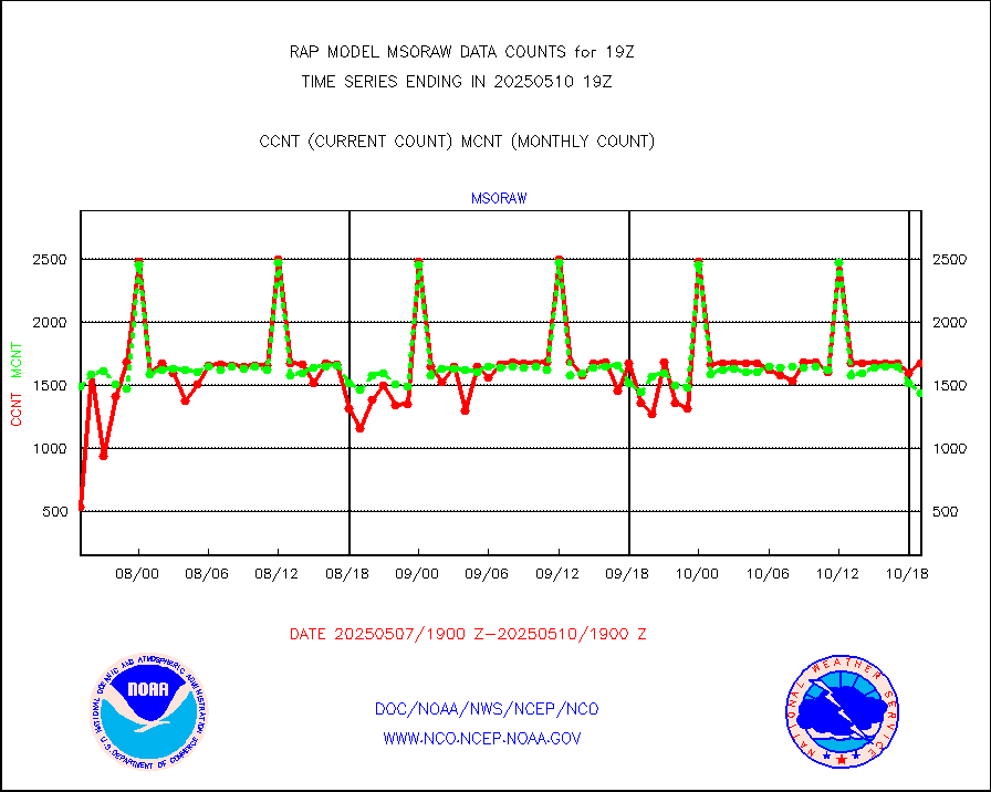
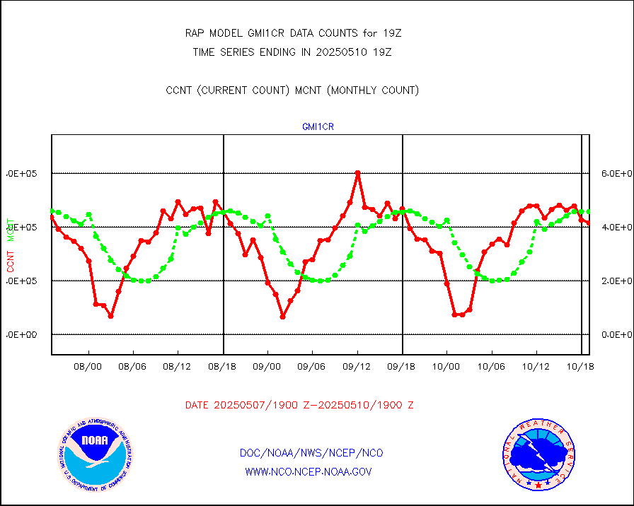
msoraw |
Mesonet/MADIS NFIC Remote Automated Wx Stns(RAWS) |
1719 |
1614 |
106.5 % |
1918.50-1919.50 |
msourb |
Mesonet/MADIS UrbaNet |
3930 |
3962 |
99.2 % |
1918.50-1919.50 |
msovir |
Mesonet/MADIS Virginia Dept. of Transportation |
207 |
225 |
92.0 % |
1918.50-1919.50 |
msowfy |
Mesonet/MADIS "Weather for You" |
0 |
0 |
n/a |
1918.50-1919.50 |
msowis |
Mesonet/MADIS Wisconsin Dept. of Transportation |
0 |
0 |
n/a |
1918.50-1919.50 |
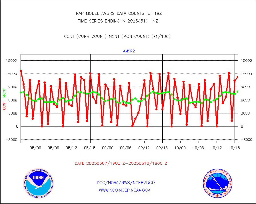
msowst |
Mesonet/MADIS MesoWest (many subproviders) |
41815 |
40091 |
104.3 % |
1918.50-1919.50 |
msowtx |
Mesonet/MADIS West Texas |
5233 |
4852 |
107.9 % |
1918.50-1919.50 |
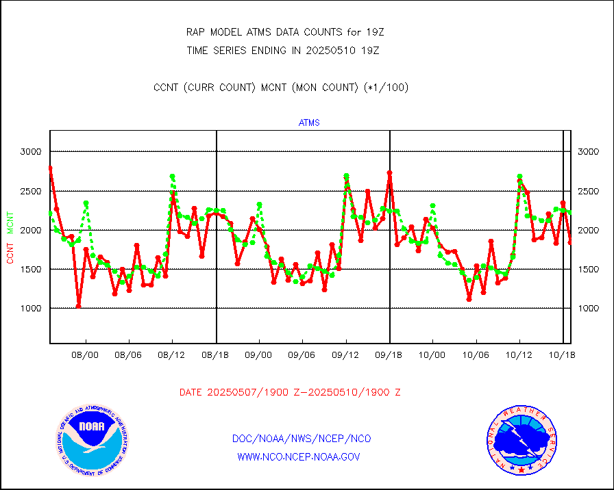
mtiasi |
METOP 1-2 IASI 1C radiance data (varbl. channels) |
609 |
15801 |
3.9 % |
1917.00-1920.99 |
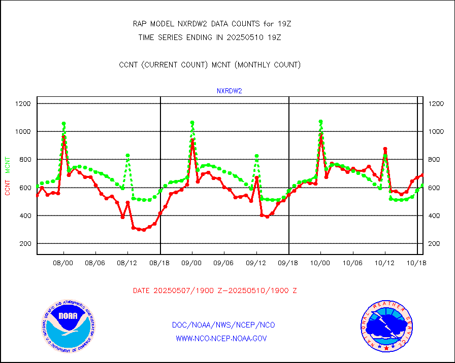
nxrdw2 |
NEXRAD Vel Azm Dsp(VAD) winds via Level 2 decoder |
686 |
648 |
105.9 % |
1918.00-1920.00 |
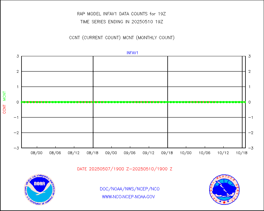
osbuv8 |
NOAA 16-19 Solar Backscatter UV-2 rad frm V8 BUFR |
0 |
0 |
n/a |
1917.00-1919.99 |
pibal |
PIBAL (from PILOT, PILOT SHIP, PILOT MOBIL) |
0 |
0 |
n/a |
1918.00-1920.00 |
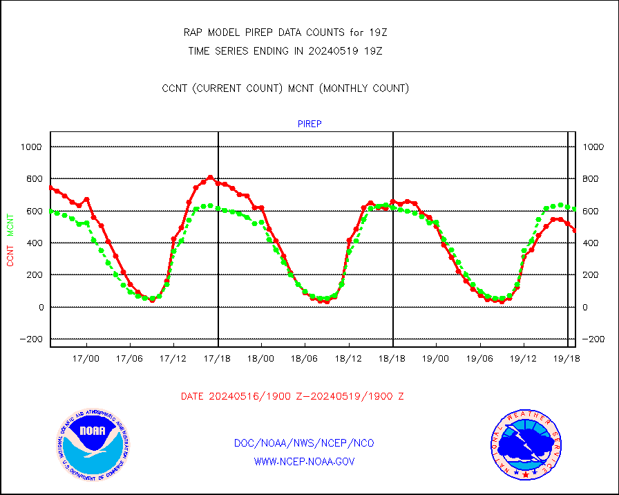
pirep |
Manual PIREP aircraft data (dcded from AIREP fmt) |
479 |
613 |
78.1 % |
1915.75-1922.25 |
prflrp |
Profilr winds from PIBAL (PILOT,PILOT SHIP/MOBIL) |
0 |
0 |
n/a |
1917.50-1920.50 |
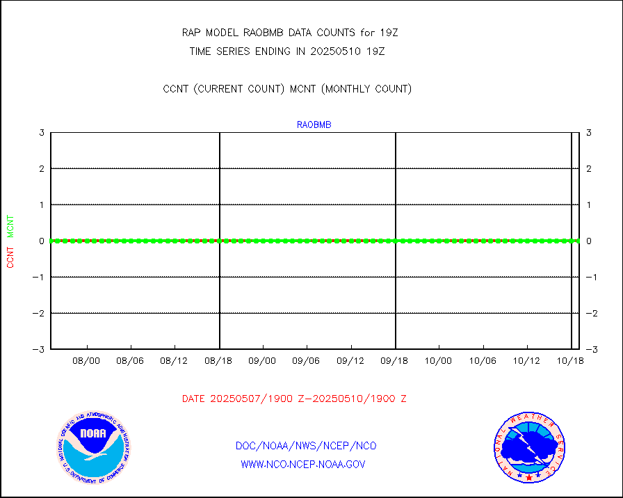
raobm |
Rawinsonde - mobile land (from TEMP/PILOT MOBIL) |
0 |
0 |
n/a |
1918.00-1920.00 |
raobs |
Rawinsonde - ship (from TEMP SHIP, PILOT SHIP) |
0 |
0 |
n/a |
1918.00-1920.00 |
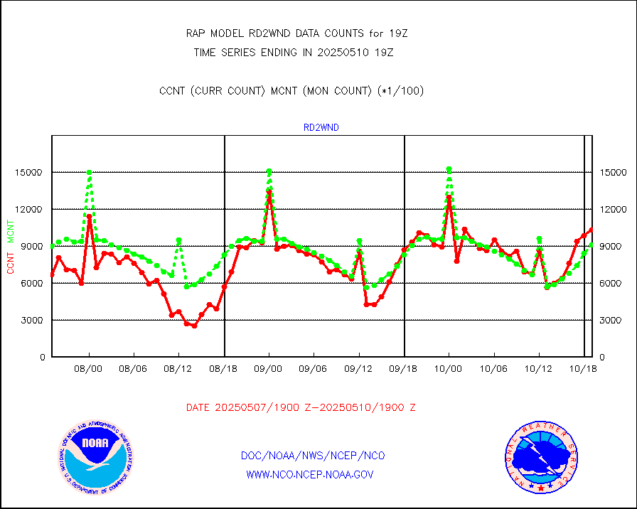
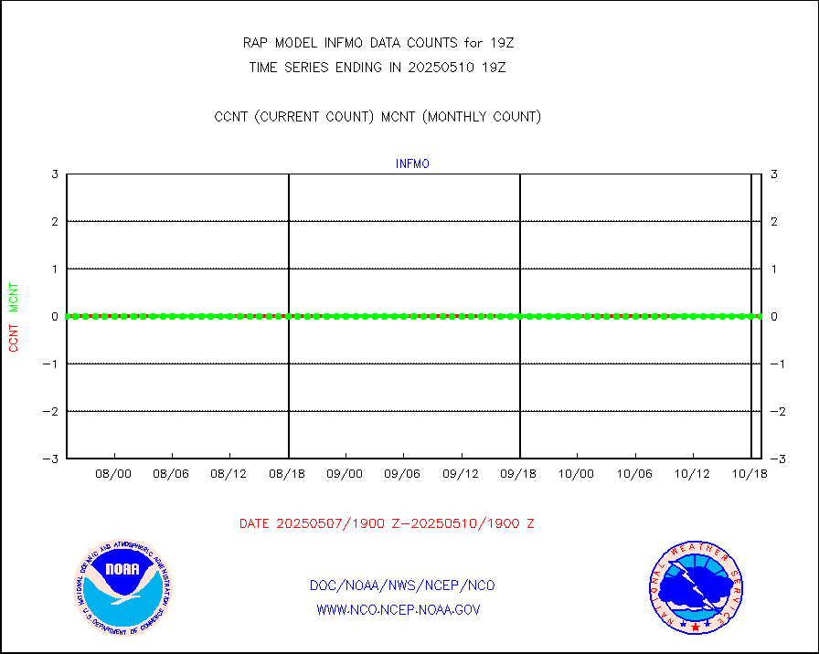
rd2wnd |
NEXRAD radial wind (Level 2 - GTS) |
1122495 |
1018856 |
110.2 % |
1918.50-1919.49 |
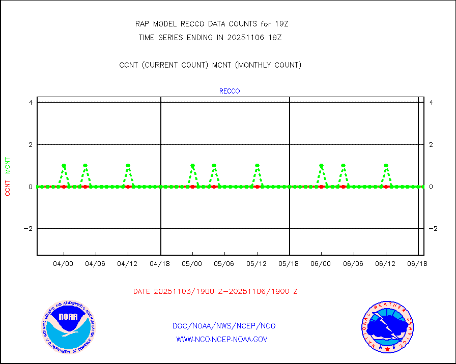
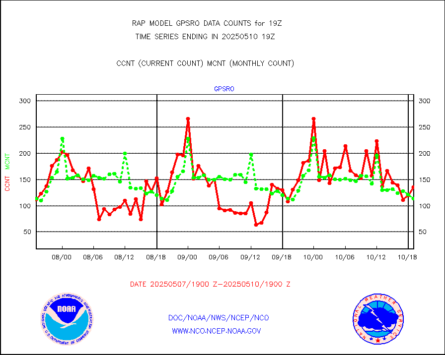
recco |
Flight level reconnaissance aircraft data |
0 |
0 |
n/a |
1918.00-1920.00 |
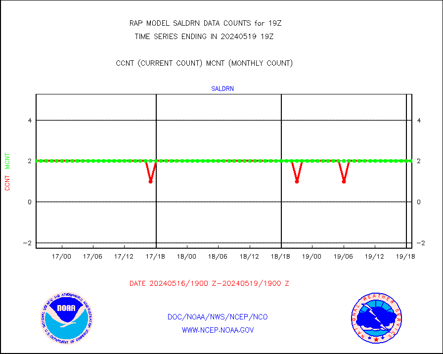
saldrn |
Surface Marine Saildrone (decoded from BUFR) |
2 |
2 |
100.0 % |
1917.00-1920.99 |
saphir |
Megha-Tropiques SAPHIR L1A2 brightness temps |
0 |
0 |
n/a |
1916.00-1921.99 |
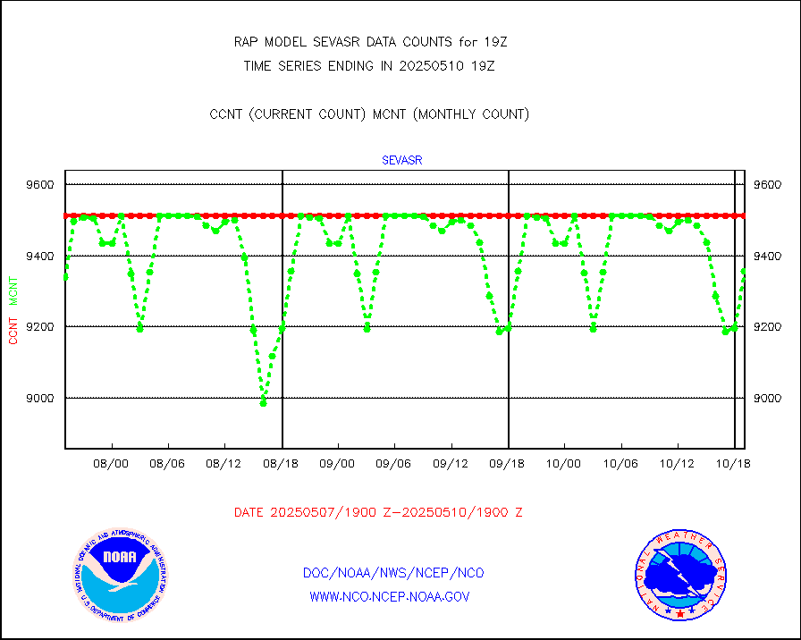
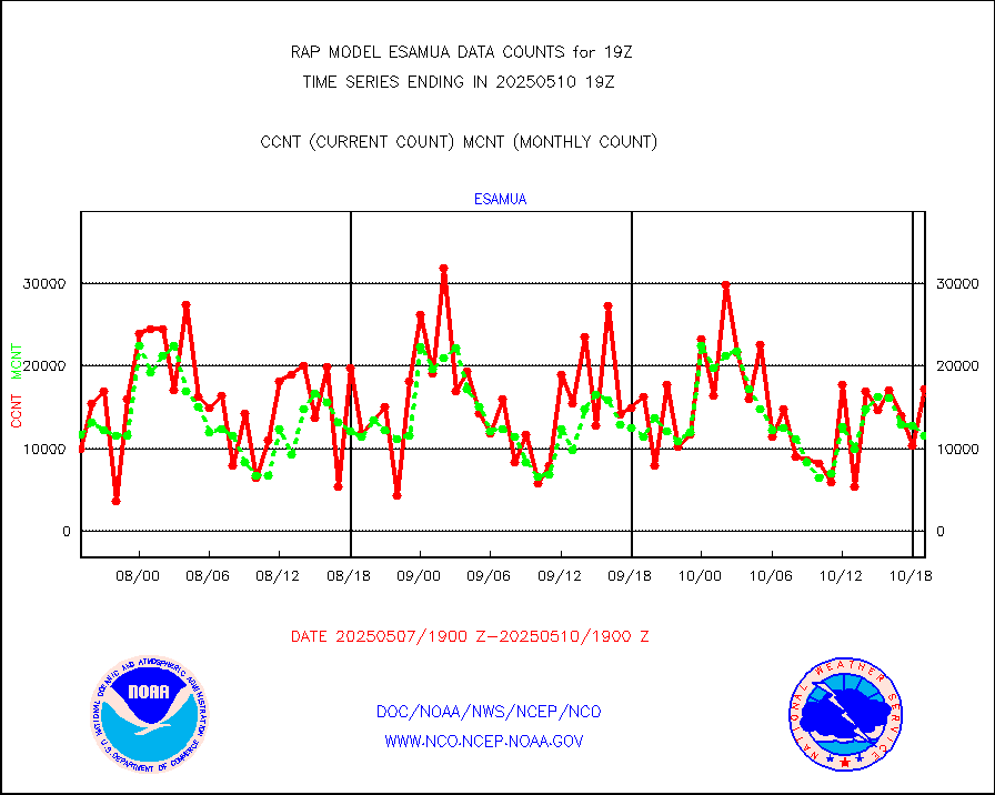
sevasr |
METEOSAT-10 2nd Gen SEVIRI All Sky Radiance(proc) |
9512 |
9506 |
100.1 % |
1917.00-1920.99 |
sevcsr |
METEOSAT-10 2nd Gen SEVIRI Clr Sky Radiance(proc) |
0 |
0 |
n/a |
1917.00-1920.99 |
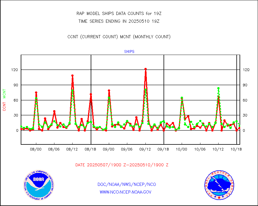
ships |
Ship - manual and automatic, restricted |
0 |
4 |
0.0 % |
1918.50-1919.50 |
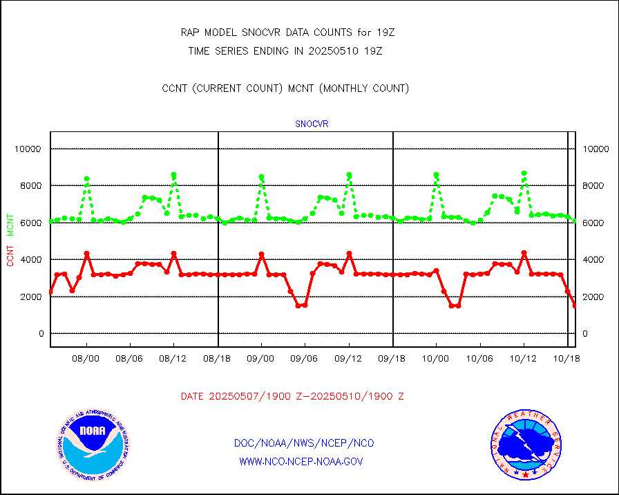
snocvr |
NOW COVER, DEPTH/DENSITY AND WATER EQUIVALENT |
3397 |
6731 |
50.5 % |
1917.00-1921.00 |
ssmisu |
DMSP SSM/IS 1C radiance data (Unified Pre-Proc.) |
52730 |
60015 |
87.9 % |
1917.00-1920.99 |
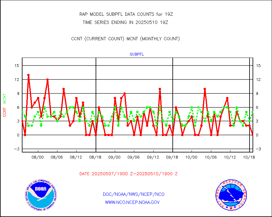
subpfl |
Sub-surface float and glider profile (BUFR) |
11 |
7 |
157.1 % |
1917.00-1920.99 |
synopr |
Synoptic - restricted (WMO Res 40) manual & auto. |
0 |
0 |
n/a |
1918.50-1919.50 |
synpbr |
Synoptic - restricted (WMO Res 40)(decoded BUFR) |
344 |
351 |
98.0 % |
1918.50-1919.50 |
synpmb |
Synoptic - mobile manual & auto (decoded fr BUFR) |
0 |
0 |
n/a |
1918.50-1919.50 |
tmdara |
TAMDAR aircft data-all types(from Panasonic,BUFR) |
746 |
676 |
110.4 % |
1915.75-1922.25 |
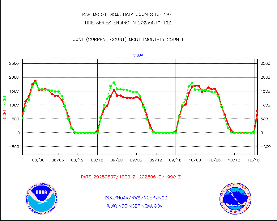
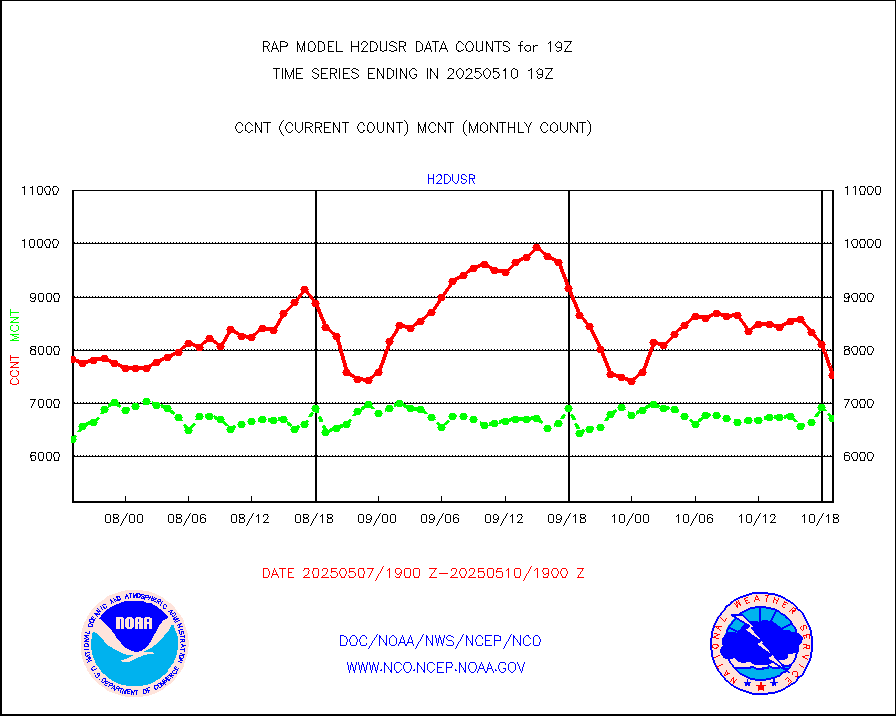
visja |
MTSAT/JMA visible derived cloud motion |
878 |
668 |
131.4 % |
1916.50-1921.50 |
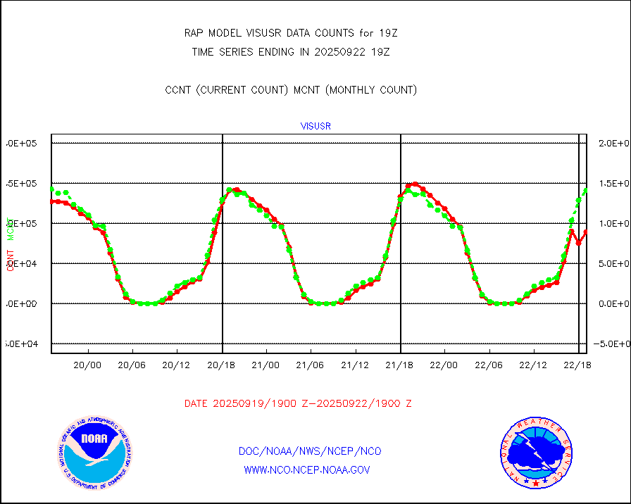
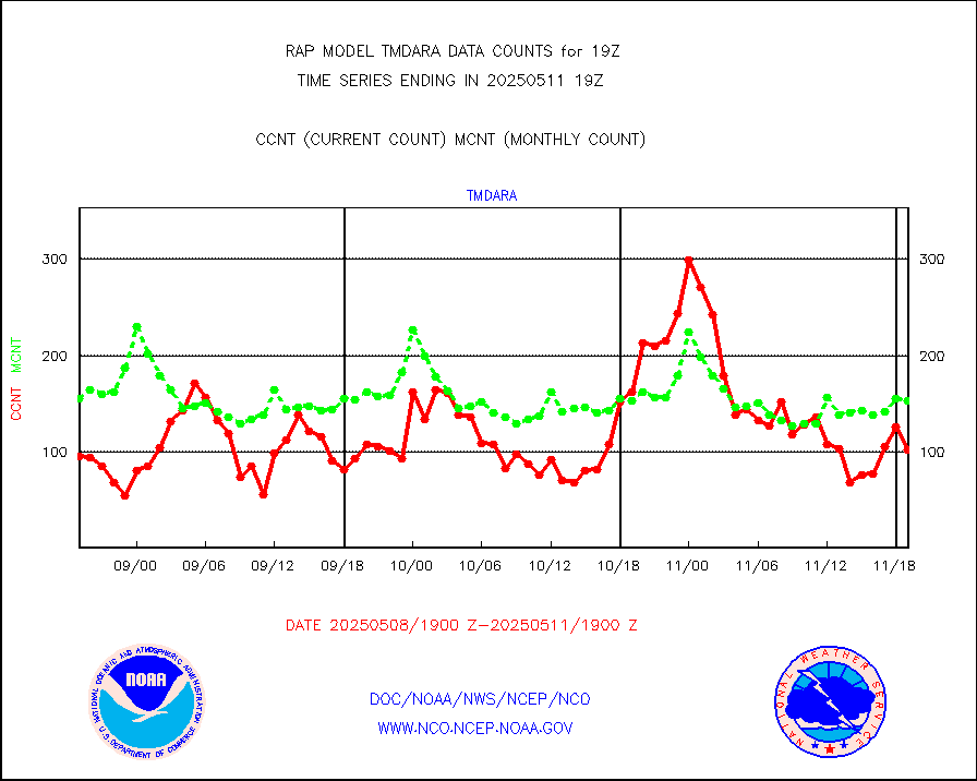
visusr |
GOES-16&up/NESDIS visible derived cloud motion |
166956 |
171901 |
97.1 % |
1918.00-1918.99 |
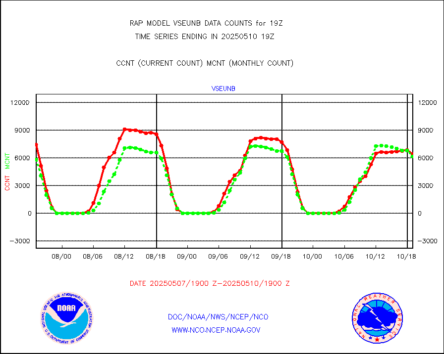
vseunb |
METEOSAT/EUMETSAT visible drv cld motion NBseq |
8164 |
7660 |
106.6 % |
1917.50-1920.49 |


