| Critical Data with Normal Counts |
|---|
| Type | Description | Hourly Count | Monthly Average | Percent (%) of Monthly Mean | UTC Time Window |
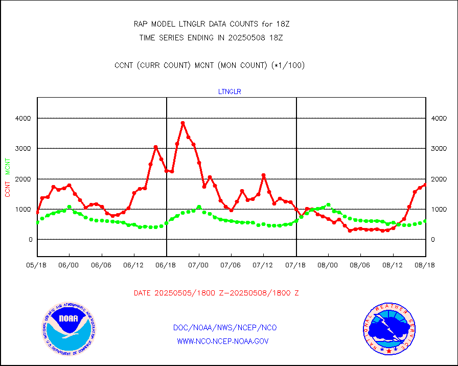
1bamua |
NOAA 15-19 & METOP 1-2 AMSU-A NCEP-proc. br.temps |
31301 |
26722 |
117.1 % |
1915.00-1920.99 |
1bhrs4 |
NOAA 18-19 & METOP 1-2 HIRS-4 NCEP-proc. br.temps |
24476 |
19814 |
123.5 % |
1915.00-1920.99 |
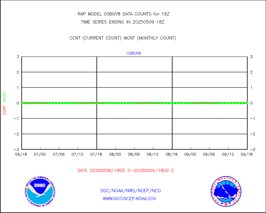
1bmhs |
NOAA 18-19 & METOP 1-2 MHS NCEP-proces. br. temps |
175944 |
146275 |
120.3 % |
1915.00-1920.99 |
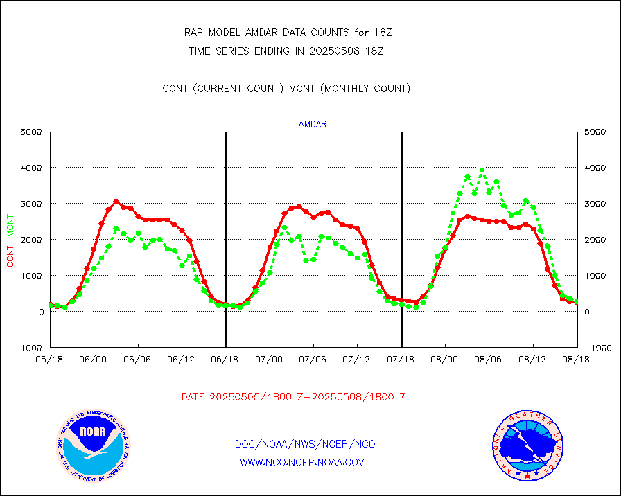
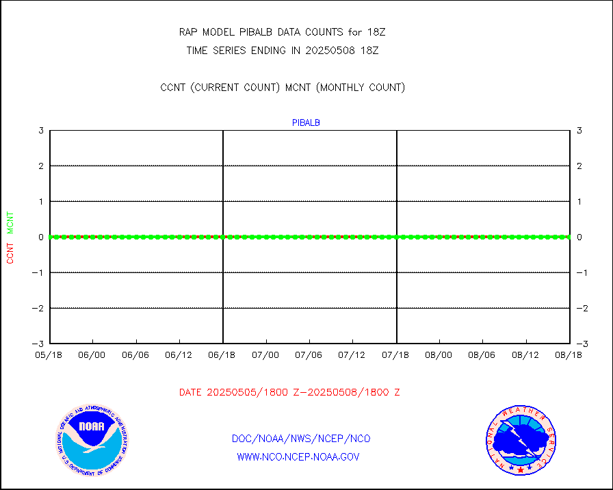
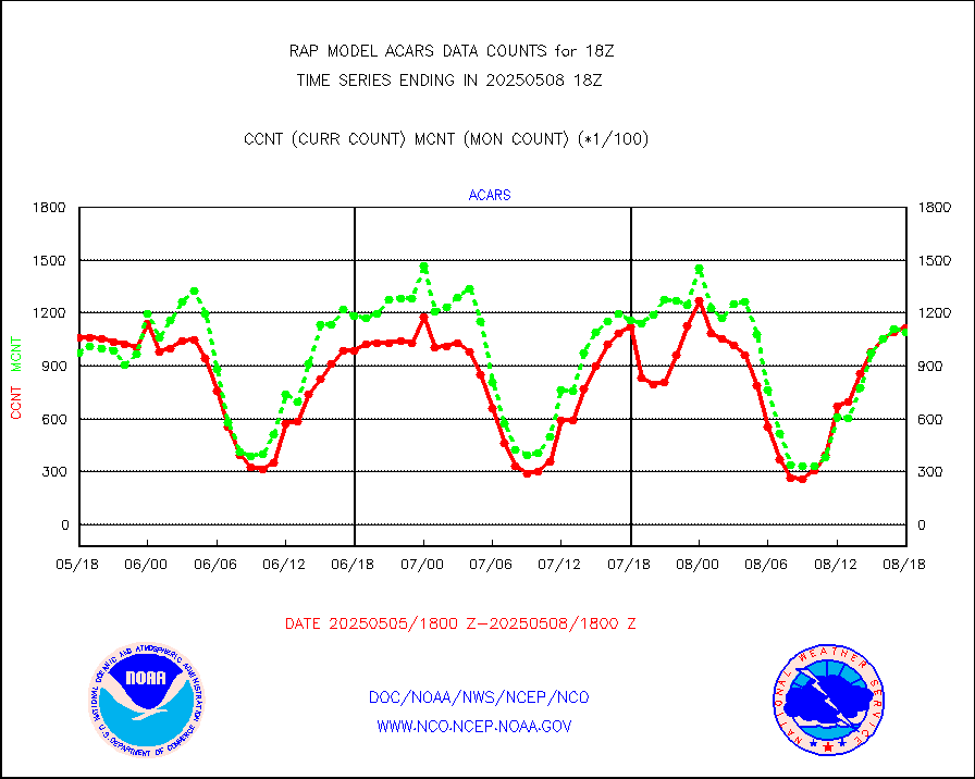
acars |
MDCRS ACARS acft data from ARINC(dcded from BUFR) |
82900 |
80523 |
103.0 % |
1914.75-1921.25 |
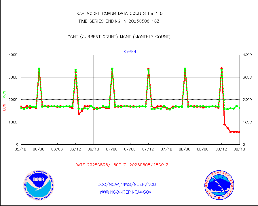
cmanb |
Surface Marine CMAN rpts decoded from BUFR format |
1722 |
1619 |
106.4 % |
1917.50-1918.50 |
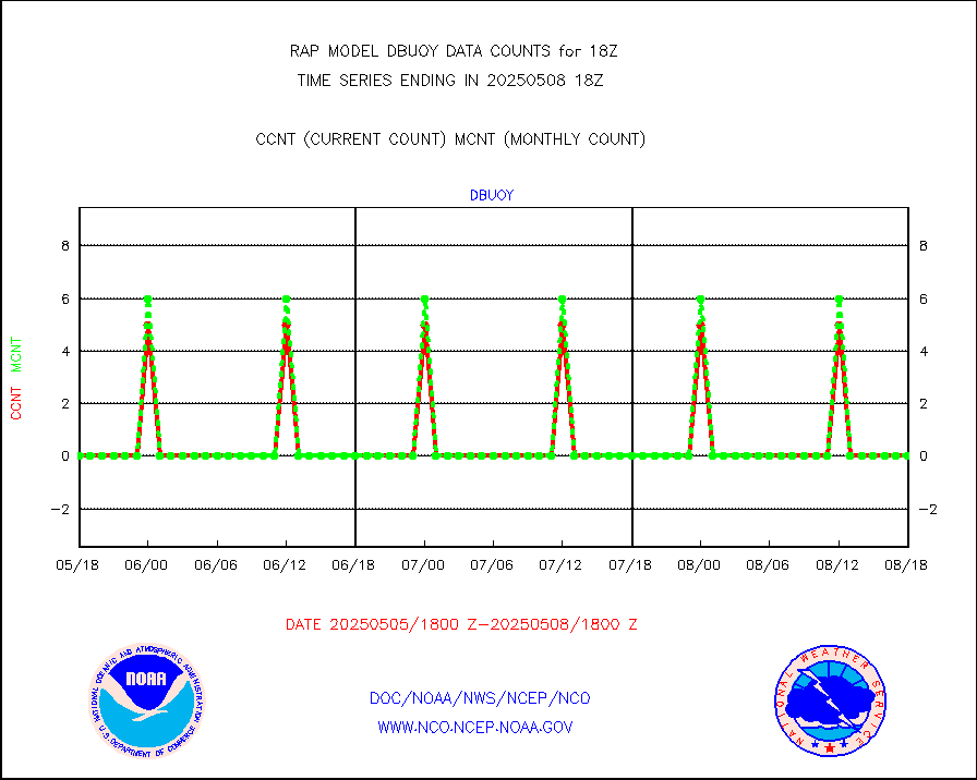
dbuoy |
Buoys decoded from FM-18 fmt (moored or drifting) |
0 |
0 |
n/a |
1917.50-1918.50 |
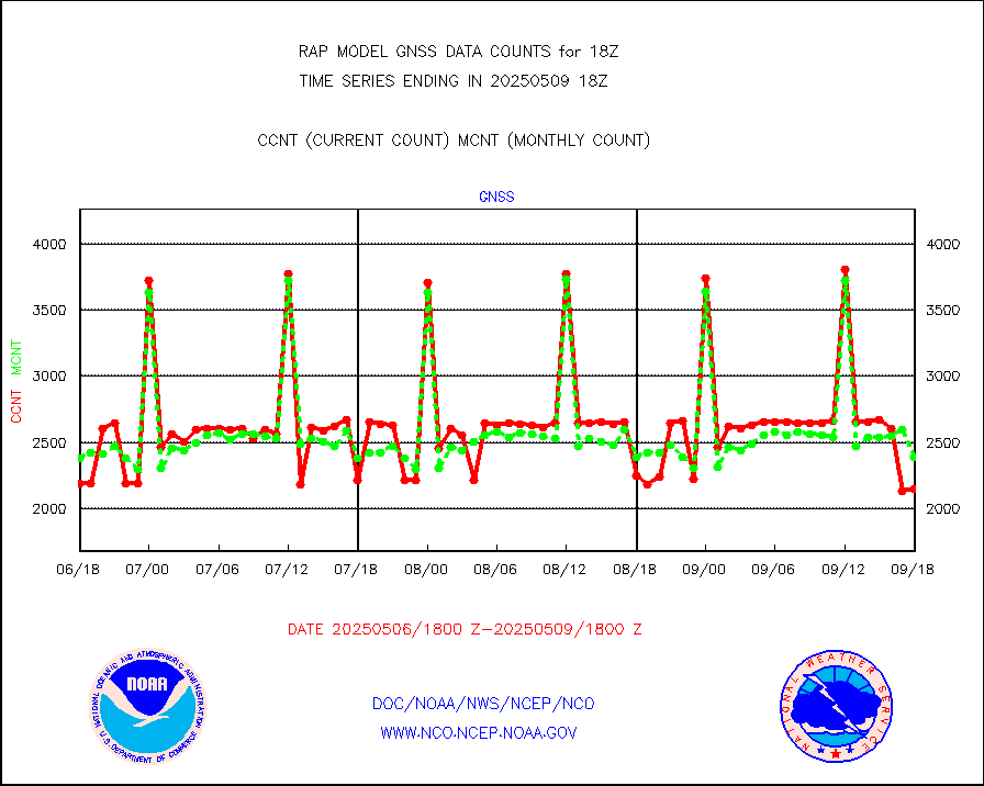
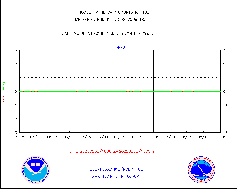
gnss |
Grnd-based Gbl Navigation Sat System (GNSS) data |
2609 |
2590 |
100.7 % |
1916.95-1917.05 |
h20mo |
MODIS (AQUA/TERRA) wvpr imager derived cld motion |
0 |
0 |
n/a |
1915.50-1920.50 |
infmo |
MODIS (AQUA/TERRA) ir l-wave derived cloud motion |
0 |
0 |
n/a |
1915.50-1920.50 |
lgycld |
GOES/NASA(Langley) hi-res. (1x1 f-o-v) cloud data |
3728546 |
3078132 |
121.1 % |
1917.50-1918.50 |
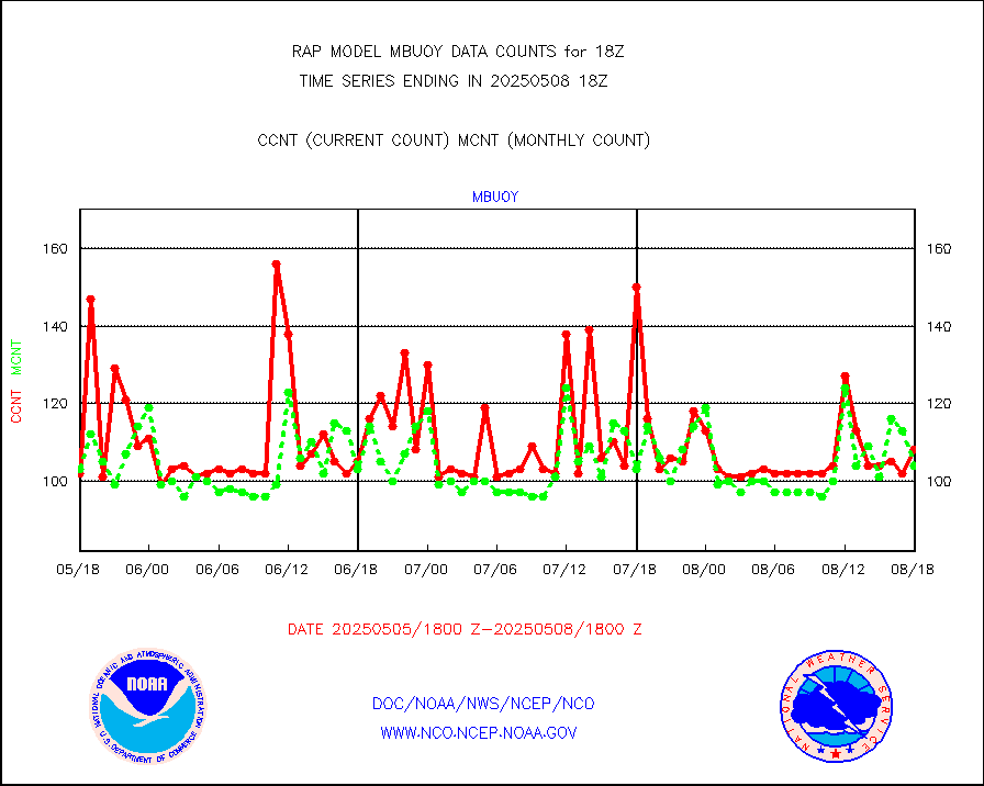
mbuoy |
Buoys decoded from FM-13 format (moored) |
54 |
58 |
93.1 % |
1917.50-1918.50 |
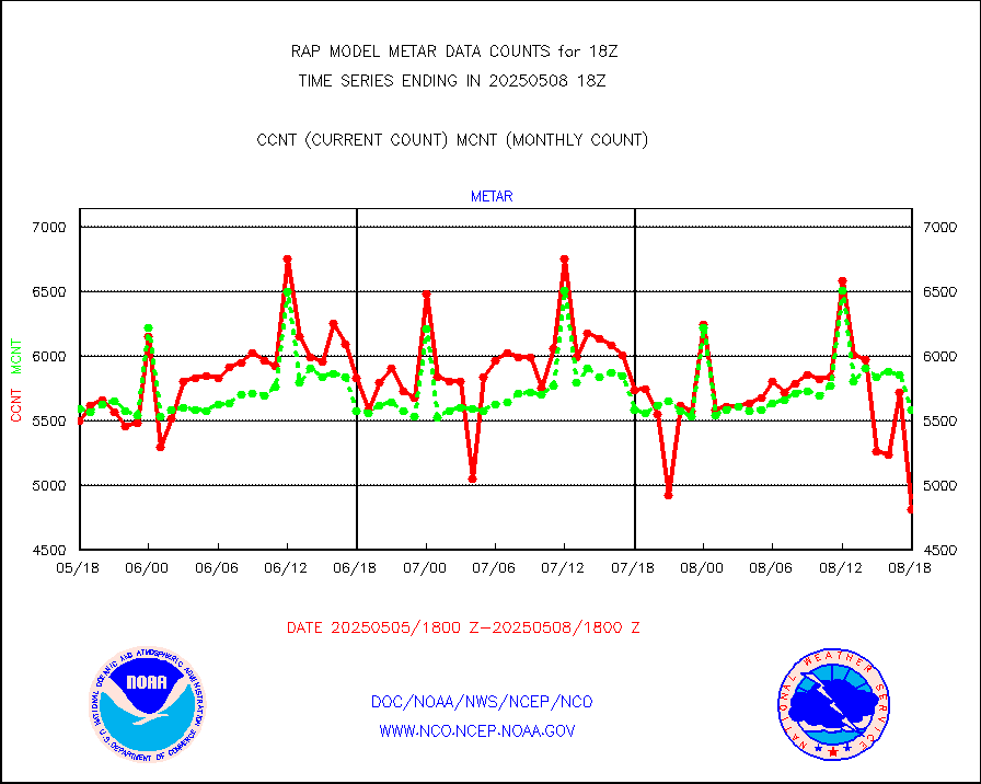
metar |
Aviation - METAR |
5640 |
5854 |
96.3 % |
1917.50-1918.50 |
nxrdw |
NEXRAD Vel Azm Dsp(VAD) winds via radar coded msg |
0 |
0 |
n/a |
1917.00-1919.00 |
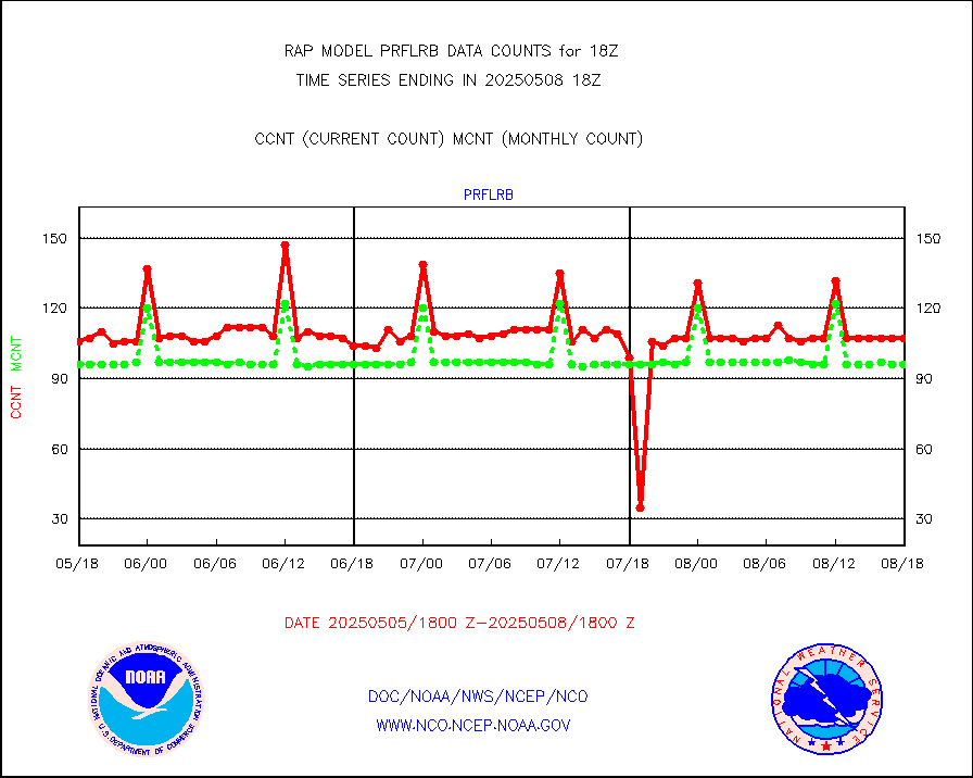
prflrb |
Multi-Agency Profiler (MAP) and SODAR winds |
72 |
85 |
84.7 % |
1916.50-1919.50 |
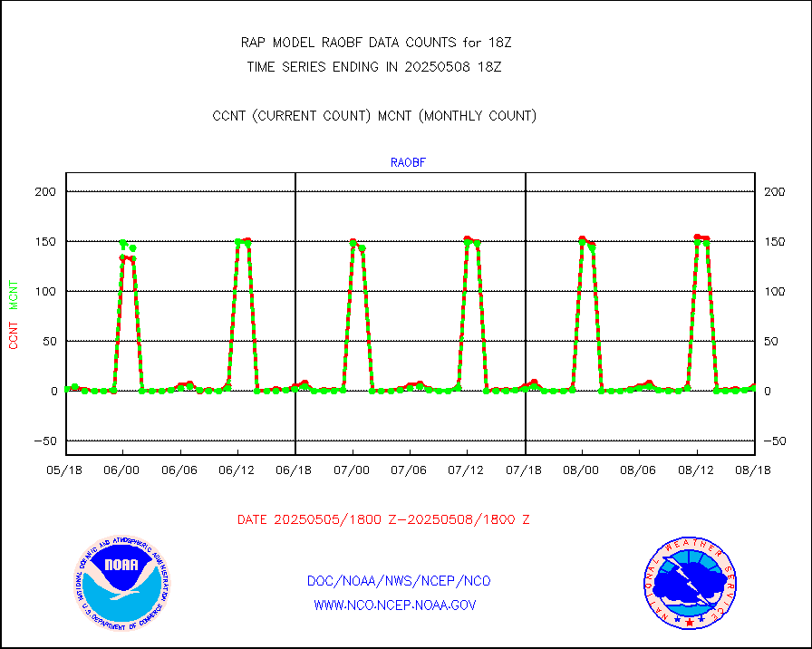
raobf |
Rawinsonde - fixed land (from TEMP or PILOT) |
1 |
3 |
33.3 % |
1917.00-1919.00 |
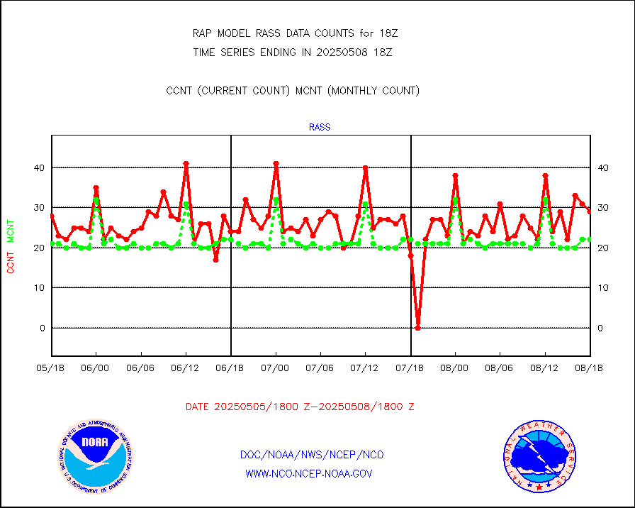
rass |
RASS temperatures (NOAA and Multi-Agency) |
20 |
21 |
95.2 % |
1917.50-1918.50 |
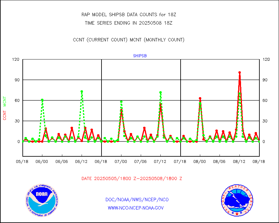
shipsb |
Ship - manual and automatic, restricted (BUFR) |
0 |
0 |
n/a |
1917.50-1918.50 |
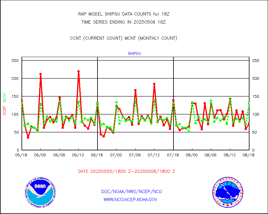
shipsu |
Ship - manual and automatic, unrestricted |
74 |
69 |
107.2 % |
1917.50-1918.50 |
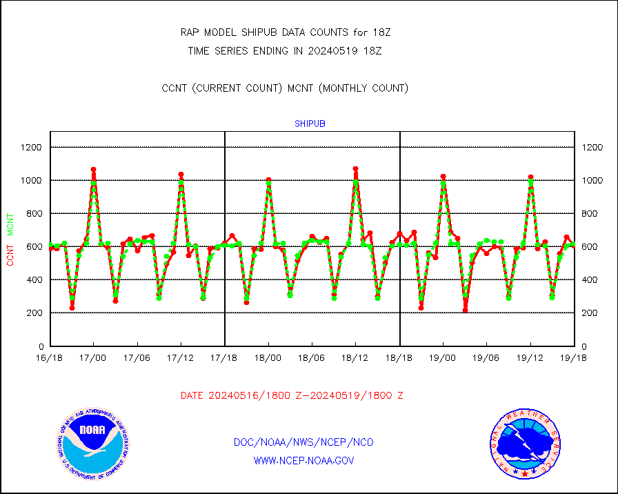
shipub |
Ship - manual and automatic, unrestricted (BUFR) |
606 |
620 |
97.7 % |
1917.50-1918.50 |
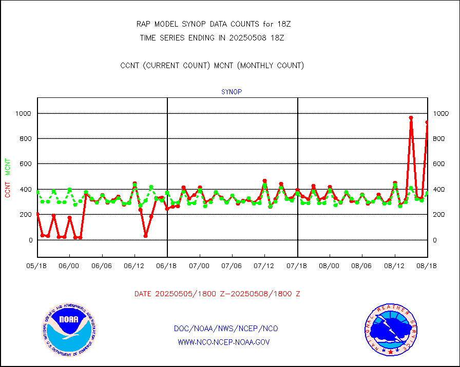
synop |
Synoptic - fixed manual and automatic |
500 |
566 |
88.3 % |
1917.50-1918.50 |
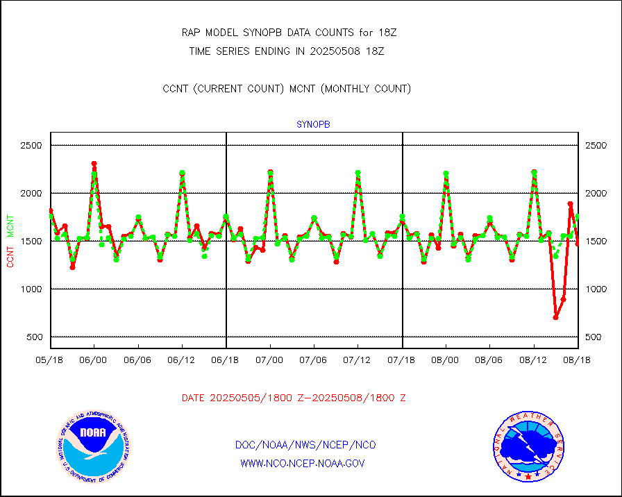
synopb |
Synoptic - fixed manual & auto (decoded fr BUFR) |
1857 |
1787 |
103.9 % |
1917.50-1918.50 |
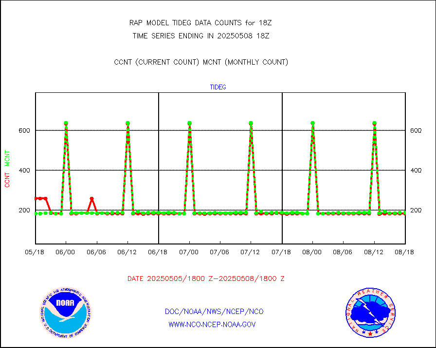
tideg |
Tide gauge reports decoded from CREX format |
182 |
180 |
101.1 % |
1917.50-1918.50 |
| Data Types of Opportunity with Normal Counts |
|---|
| Type | Description | Hourly Count | Monthly Average | Percent (%) of Monthly Mean | UTC Time Window |
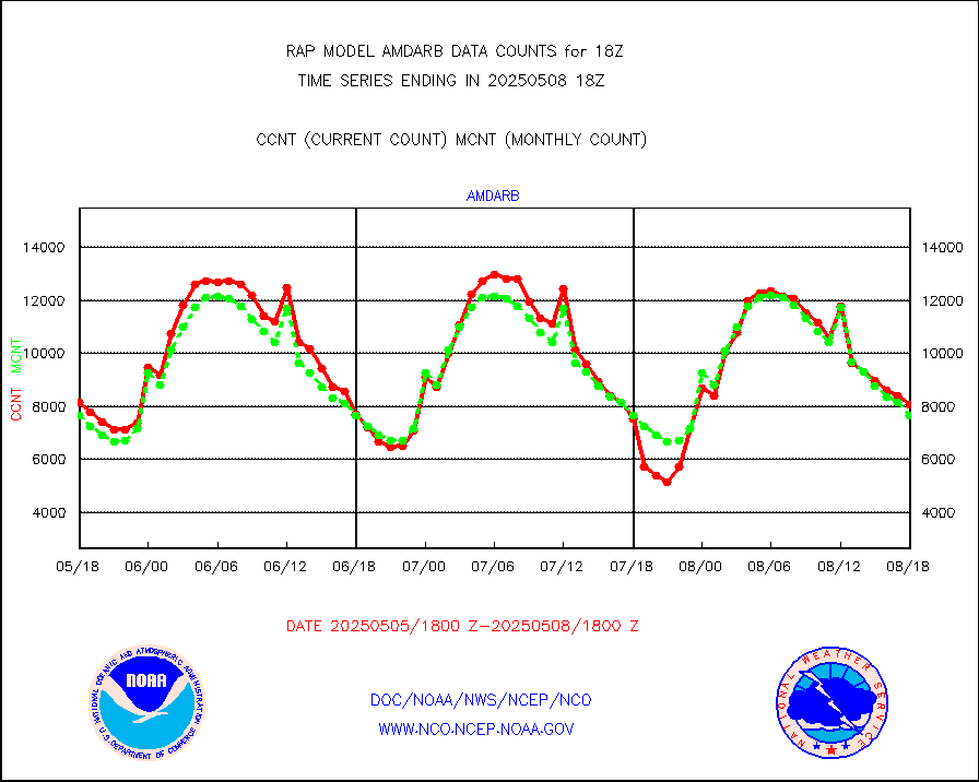
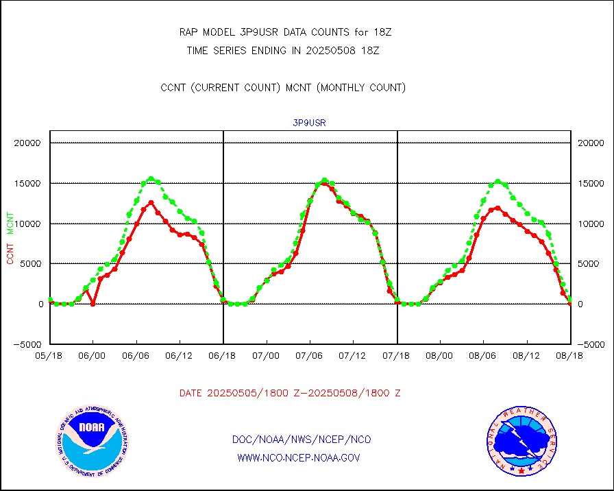
3p9usr |
GOES-16&up/NESDIS ir short-wv derived cld motion |
268 |
414 |
64.7 % |
1917.00-1917.99 |
acarsa |
MDCRS ACARS acft data (ARINC via AFWA)(AIREP fmt) |
0 |
0 |
n/a |
1914.75-1921.25 |
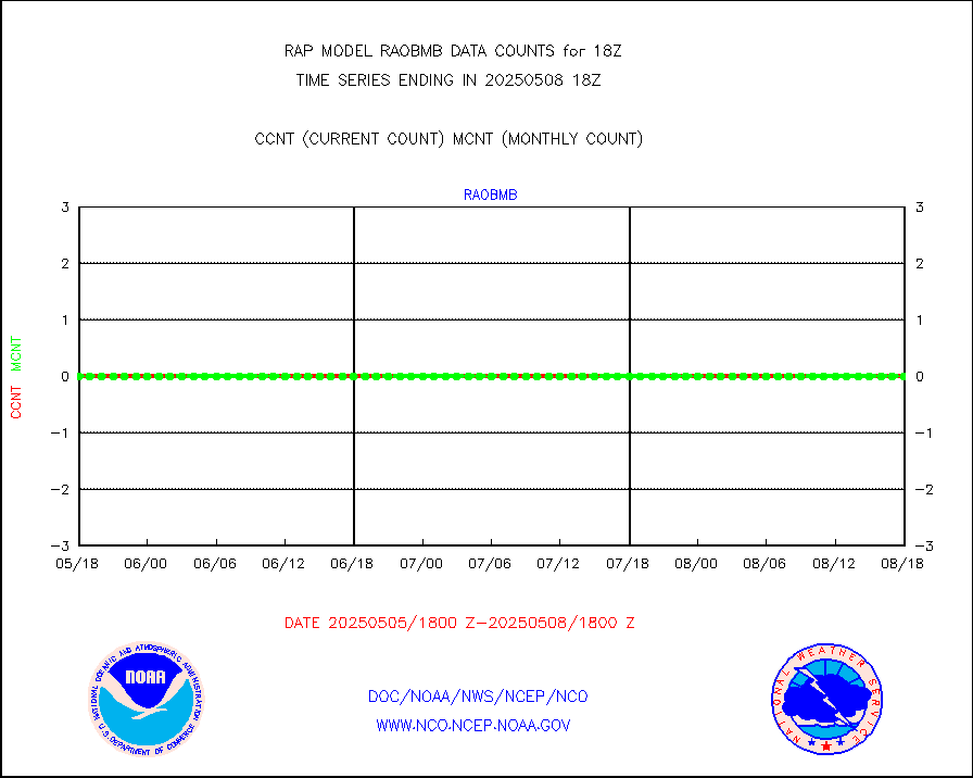
airep |
Manual AIREP aircraft data (dcded from AIREP fmt) |
4556 |
4212 |
108.2 % |
1914.75-1921.25 |
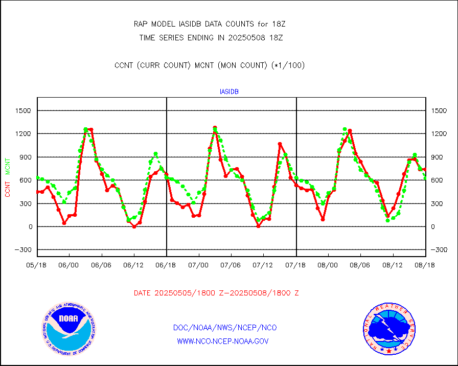
airsev |
AQUA AIRS/AMSU-A/HSB brightness temps- every FOV |
0 |
0 |
n/a |
1915.00-1920.99 |
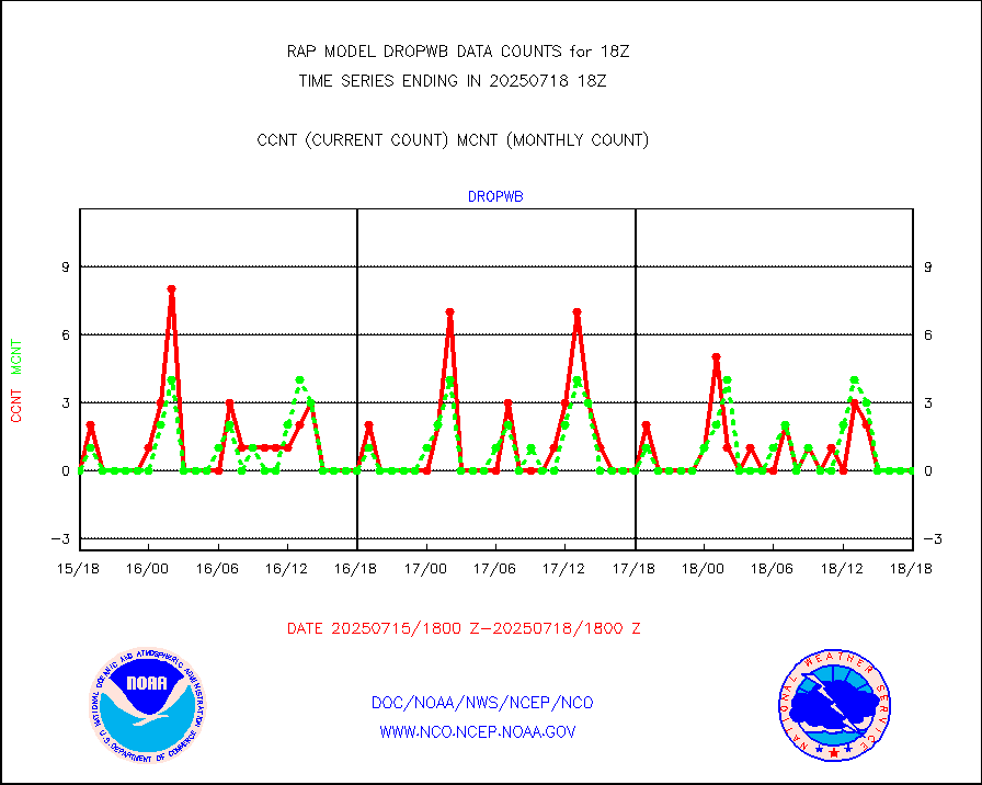
amdar |
AMDAR aircraft data (decoded from AMDAR format) |
244 |
203 |
120.2 % |
1914.75-1921.25 |
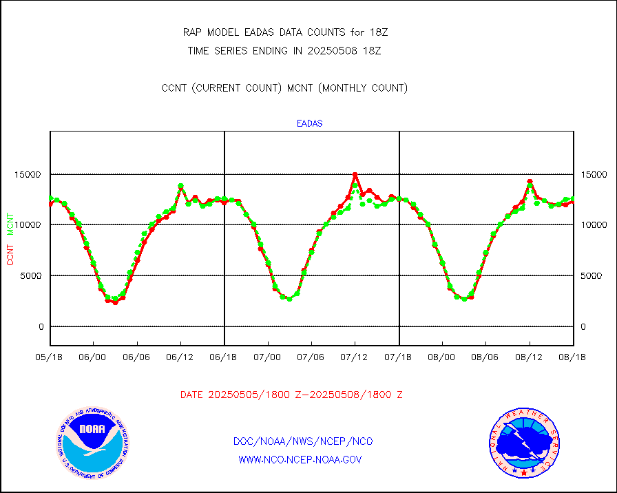
amdarb |
AMDAR aircraft data (decoded from BUFR) |
1196 |
1222 |
97.9 % |
1914.75-1921.25 |
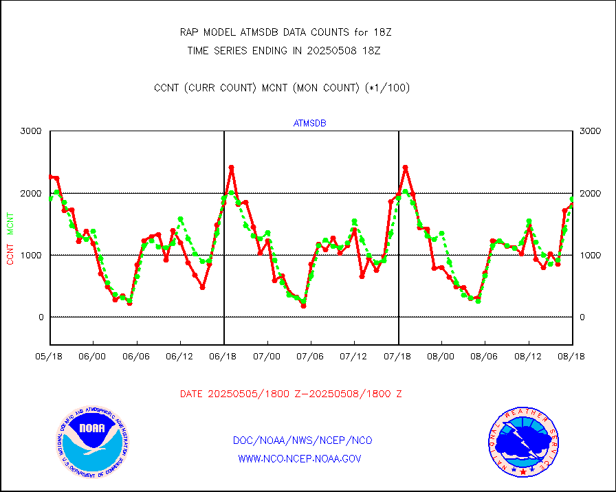
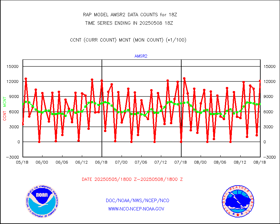
amsr2 |
GCOM-W AMSR2 1B brightness temperatures |
1219044 |
765593 |
159.2 % |
1915.00-1915.99 |
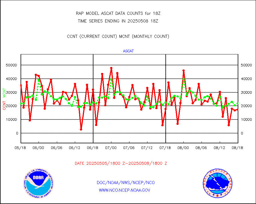
ascat |
METOP 1-2 ASCAT products |
17487 |
16269 |
107.5 % |
1916.00-1920.00 |
atms |
NPP/NOAA-20 ATMS brightness temperatures |
219500 |
232179 |
94.5 % |
1916.00-1919.99 |
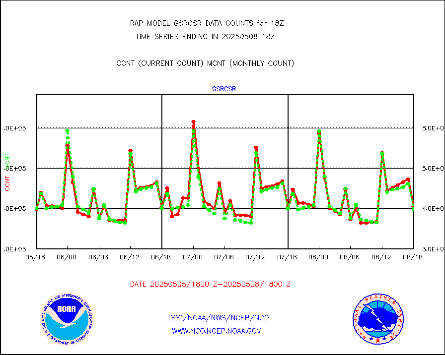
atmsdb |
NPP/NOAA-20 ATMS bright. temps-direct b-cast SSEC |
164056 |
180539 |
90.9 % |
1916.00-1919.99 |
coopmd |
Coop/MADIS NEPP & HCN-Modernization NOAA COOP Obs |
27 |
26 |
103.8 % |
1917.50-1918.50 |
crisf4 |
NPP/NOAA-20 CrIS full spctrl radn (431 ch subset) |
146064 |
127534 |
114.5 % |
1916.00-1919.99 |
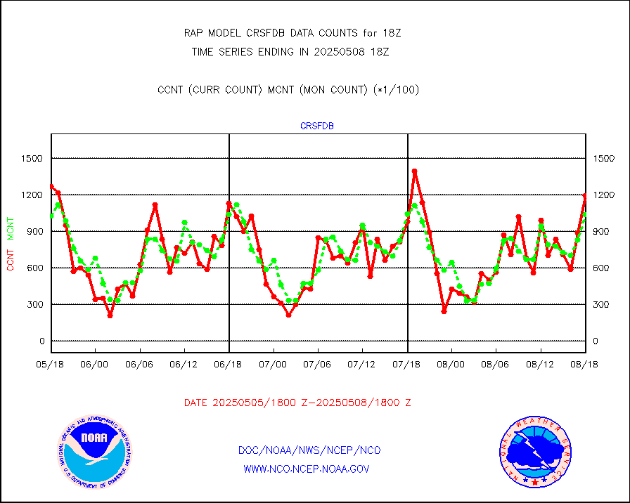
crsfdb |
NPP/NOAA-20 CrIS full spctrl radn dir brdcst SSEC |
164110 |
150629 |
108.9 % |
1916.00-1919.99 |
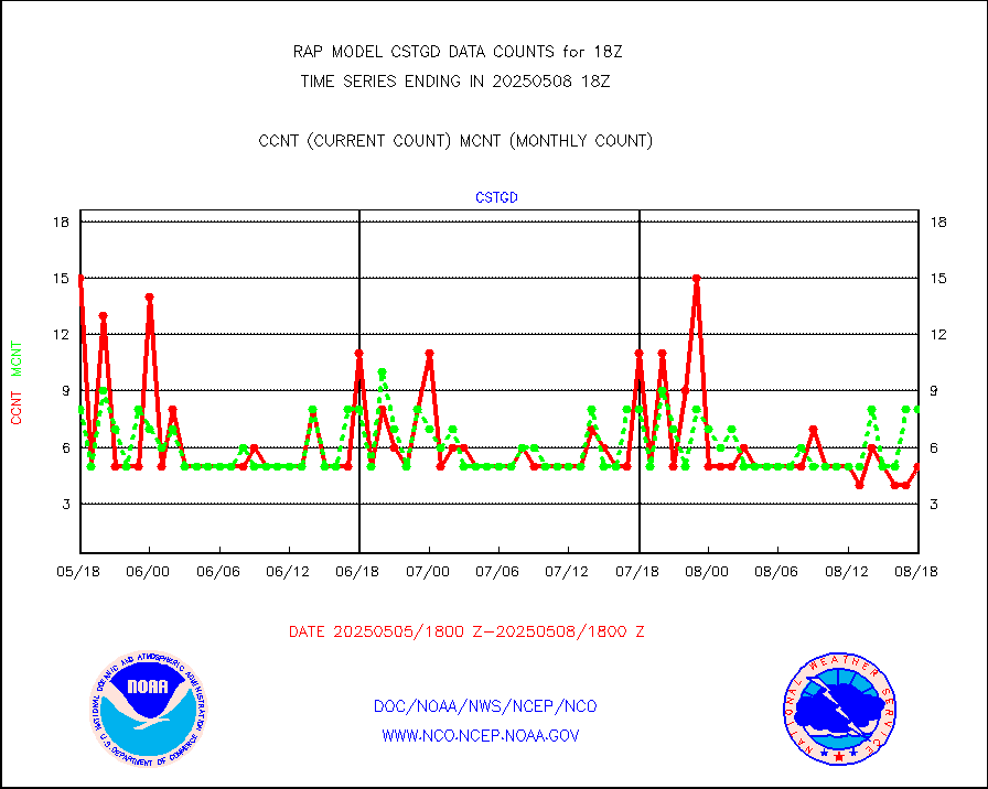
cstgd |
Coast Guard |
8 |
7 |
114.3 % |
1917.50-1918.50 |
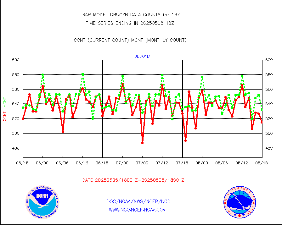
dbuoyb |
Drifting buoys (decoded from BUFR) |
598 |
575 |
104.0 % |
1917.50-1918.50 |
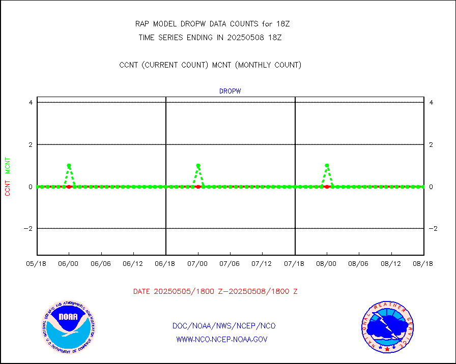
dropw |
Dropwinsonde (from TEMP DROP) |
0 |
0 |
n/a |
1917.00-1919.00 |
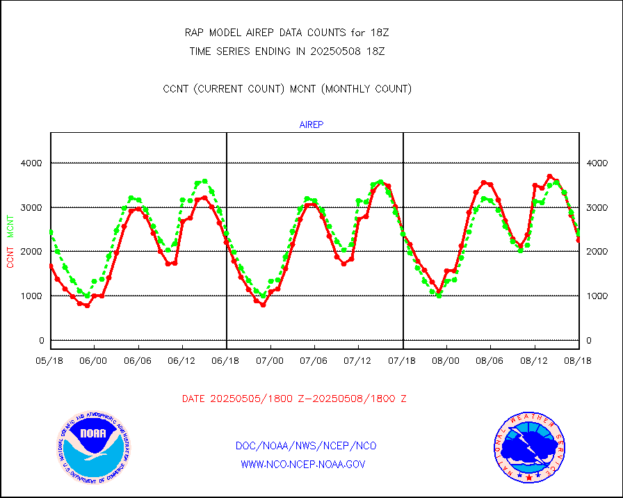
eadas |
E-AMDAR (European AMDAR acft decoded from BUFR) |
10189 |
9558 |
106.6 % |
1914.75-1921.25 |
esamua |
NOAA 15-19 & METOP 1-2 AMSU-A proc btmps frm RARS |
12779 |
14296 |
89.4 % |
1917.00-1919.00 |
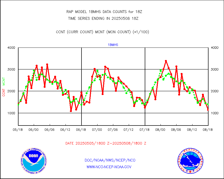
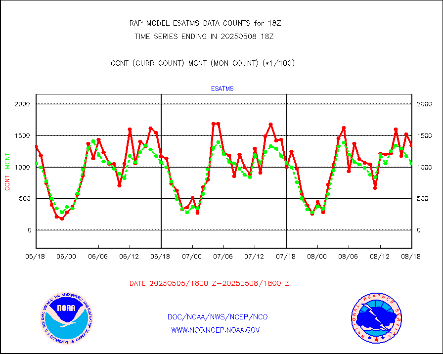
esatms |
NPP Adv. Tech. MW Sndr (ATMS) br. temps from RARS |
89398 |
112715 |
79.3 % |
1916.00-1919.99 |
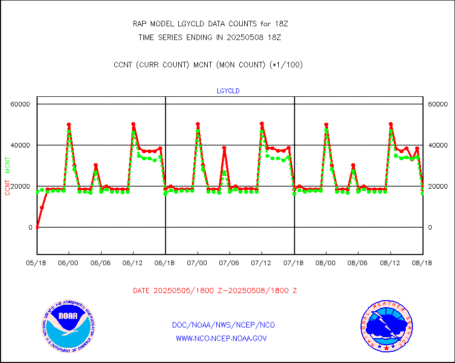
eshrs3 |
NOAA 15-19 & METOP 1-2 HIRS-3/4 pr btmps frm RARS |
20662 |
30475 |
67.8 % |
1917.00-1919.00 |
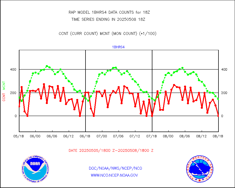
esiasi |
METOP 1-2 IASI 1C radiance data vbl chn from RARS |
65240 |
55538 |
117.5 % |
1916.00-1919.99 |
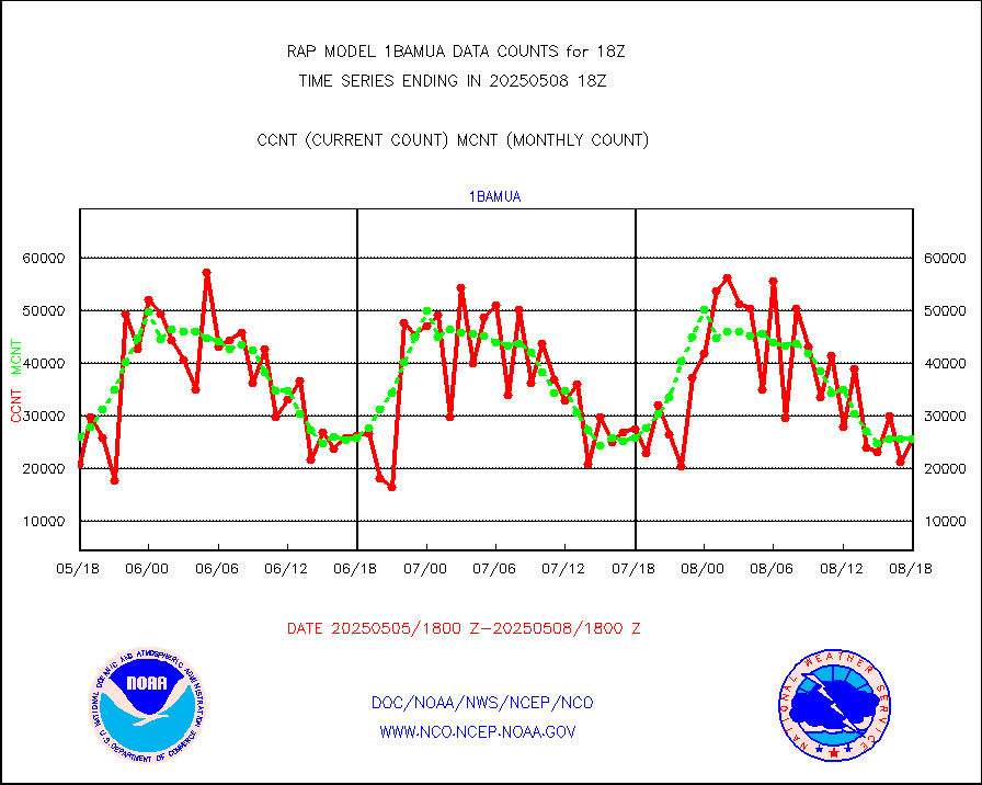
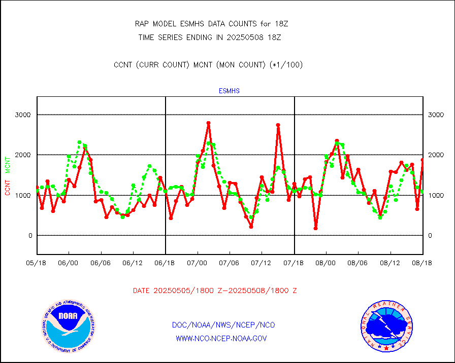
esmhs |
NOAA 18-19 & METOP 1-2 MHS proc. btemps from RARS |
140198 |
113897 |
123.1 % |
1917.00-1919.00 |
gmi1cr |
GPM GMI Level 1C-R brightness temperatures |
493681 |
634703 |
77.8 % |
1915.00-1920.99 |
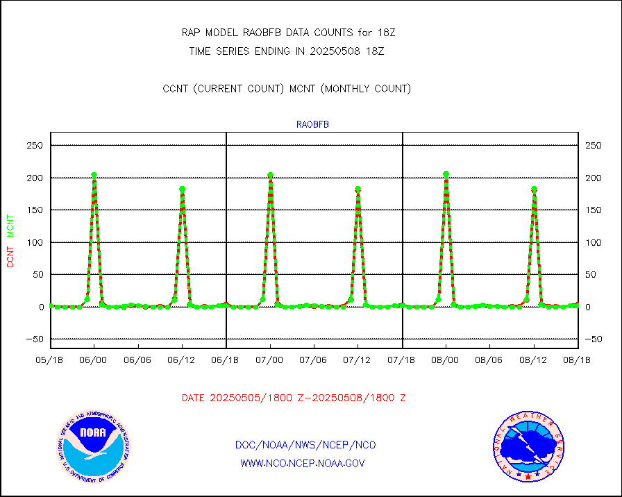
gpsro |
GPS radio occultation data |
129 |
106 |
121.7 % |
1916.00-1919.99 |
gsrasr |
GOES-16/17 All Sky Radiances (proc.) |
590487 |
771248 |
76.6 % |
1916.00-1919.99 |
gsrcsr |
GOES-16/17 Clear Sky Radiances (proc.) |
246237 |
383726 |
64.2 % |
1916.00-1919.99 |
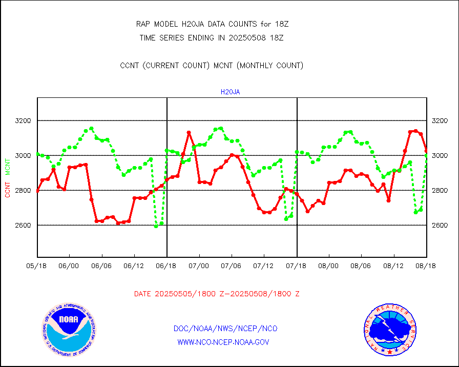
h20ja |
MTSAT/JMA water vapor imager derived cloud motion |
2865 |
3039 |
94.3 % |
1915.50-1920.50 |
h2dusr |
GOES-16&up/NESDIS wv imgr/deep-lyr derivd cld mtn |
7676 |
7324 |
104.8 % |
1917.00-1917.99 |
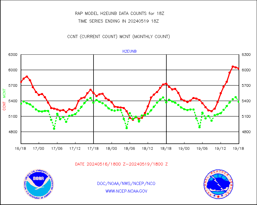
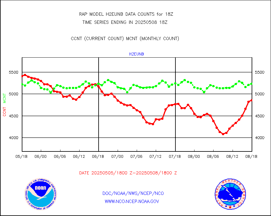
h2eunb |
METEOSAT/EUMETSAT wvpr imgr drv cld motion NBseq |
6029 |
5381 |
112.0 % |
1916.50-1919.49 |
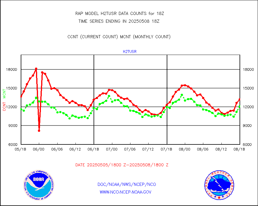
h2tusr |
GOES-16&up/NESDIS wv imgr/cld-top derived cld mtn |
13551 |
10759 |
126.0 % |
1917.00-1917.99 |
iasidb |
METOP 1-2 IASI 1C radiances-direct broadcast SSEC |
41383 |
46569 |
88.9 % |
1916.00-1919.99 |
ifeunb |
METEOSAT/EUMETSAT ir lg-wave drv cld motion NBseq |
3411 |
3254 |
104.8 % |
1916.50-1919.49 |
ifvrnb |
VIIRS (NPP/NOAA-20) ir lg-wv drv cloud motion(NB) |
0 |
0 |
n/a |
1915.50-1920.50 |
infav |
AVHRR (NOAA/METOP) ir lg-wave derived cld motion |
0 |
0 |
n/a |
1915.50-1920.50 |
infav1 |
AVHRR (METOP) ir lg-wave derived cld motion |
0 |
0 |
n/a |
1916.50-1919.49 |
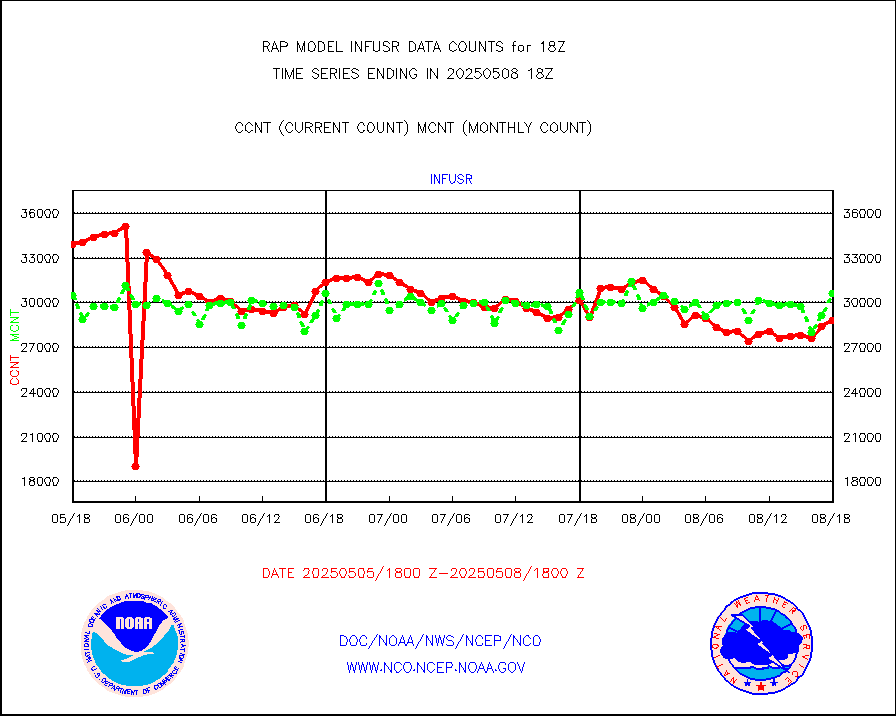
infja |
MTSAT/JMA infrared long-wave derived cloud motion |
2421 |
2510 |
96.5 % |
1915.50-1920.50 |
infusr |
GOES-16&up/NESDIS ir long-wave derived cld motion |
30316 |
28764 |
105.4 % |
1917.00-1917.99 |
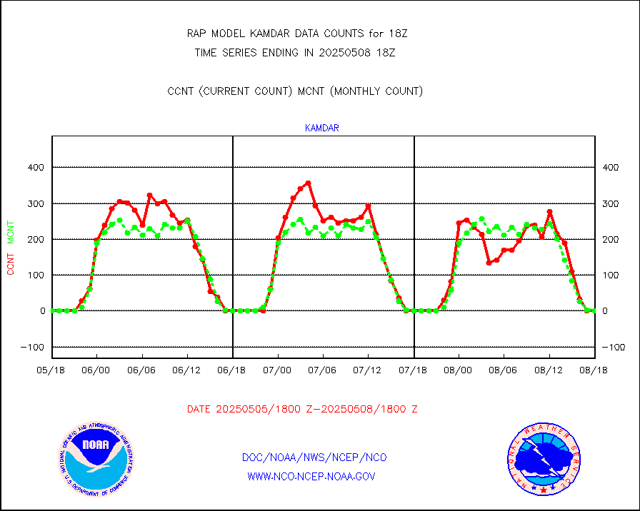
kamdar |
Korean AMDAR aircraft data (decoded from BUFR) |
0 |
2 |
0.0 % |
1914.75-1921.25 |
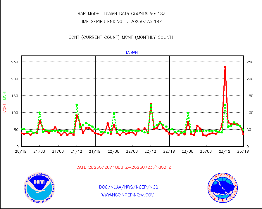
lcman |
Land-based CMAN stations decoded from CMAN format |
72 |
79 |
91.1 % |
1917.50-1918.50 |
ltnglr |
LLDN Long-rng lightning from Vaisala via NOAAPORT |
243606 |
80335 |
303.2 % |
1917.00-1918.50 |
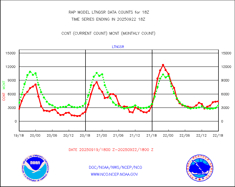
ltngsr |
NLDN Shrt-rng lightning from Vaisala via NOAAPORT |
10190 |
3498 |
291.3 % |
1917.00-1918.50 |
mbuoyb |
Moored buoys (decoded from BUFR) |
615 |
550 |
111.8 % |
1917.50-1918.50 |
mso470 |
Mesonet/MADIS Colorado E-470 (Interstate 470) |
21 |
19 |
110.5 % |
1917.50-1918.50 |
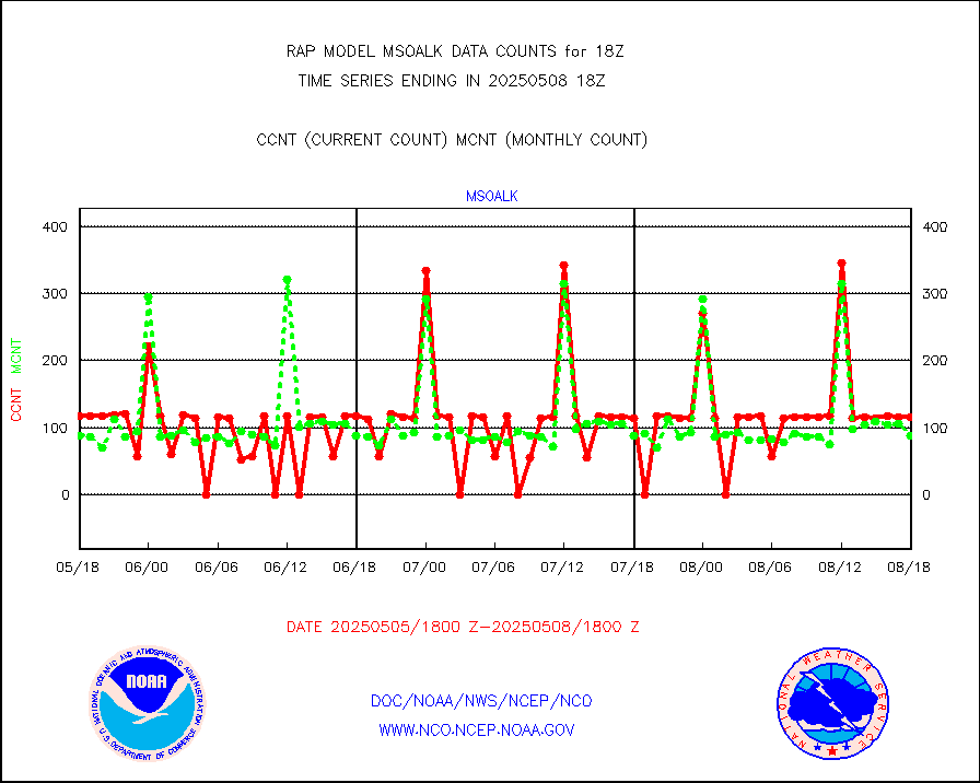
msoalk |
Mesonet/MADIS Alaska Department of Transportation |
109 |
106 |
102.8 % |
1917.50-1918.50 |
msoapg |
Mesonet/MADIS U.S. Army Aberdeen Proving Grounds |
0 |
0 |
n/a |
1917.50-1918.50 |
msoapr |
Mesonet/MADIS Citizen Weather Observers Program |
46457 |
45431 |
102.3 % |
1917.50-1918.50 |
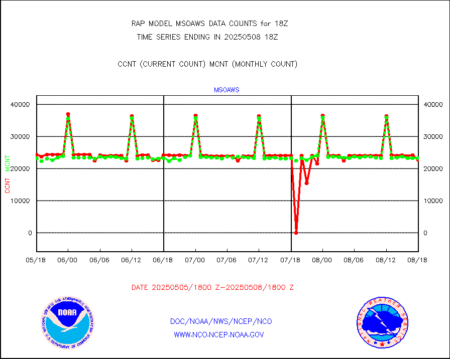
msoaws |
Mesonet/MADIS AWS Convergence Technologies, Inc. |
25581 |
25611 |
99.9 % |
1917.50-1918.50 |
msoawx |
Mesonet/MADIS "Anything Weather" |
0 |
0 |
n/a |
1917.50-1918.50 |
msocol |
Mesonet/MADIS Colorado Dept. of Transportation |
0 |
0 |
n/a |
1917.50-1918.50 |
msodcn |
Mesonet/MADIS DC Net |
0 |
0 |
n/a |
1917.50-1918.50 |
msoden |
Mesonet/MADIS Denver Urban Drainage & Flood Cntrl |
225 |
221 |
101.8 % |
1917.50-1918.50 |
msofla |
Mesonet/MADIS Florida (FAWN & USF) |
3 |
3 |
100.0 % |
1917.50-1918.50 |
msoflt |
Mesonet/MADIS Florida Dept. of Transportation |
0 |
0 |
n/a |
1917.50-1918.50 |
msogeo |
Mesonet/MADIS Georgia Dept. of Transportation |
0 |
0 |
n/a |
1917.50-1918.50 |
msohad |
Mesonet/MADIS NWS Hydromet Auto Data System(HADS) |
5773 |
5492 |
105.1 % |
1917.50-1918.50 |
msoien |
Mesonet/MADIS Iowa Environmental |
169 |
165 |
102.4 % |
1917.50-1918.50 |
msoind |
Mesonet/MADIS Indiana Dept. of Transportation |
0 |
0 |
n/a |
1917.50-1918.50 |
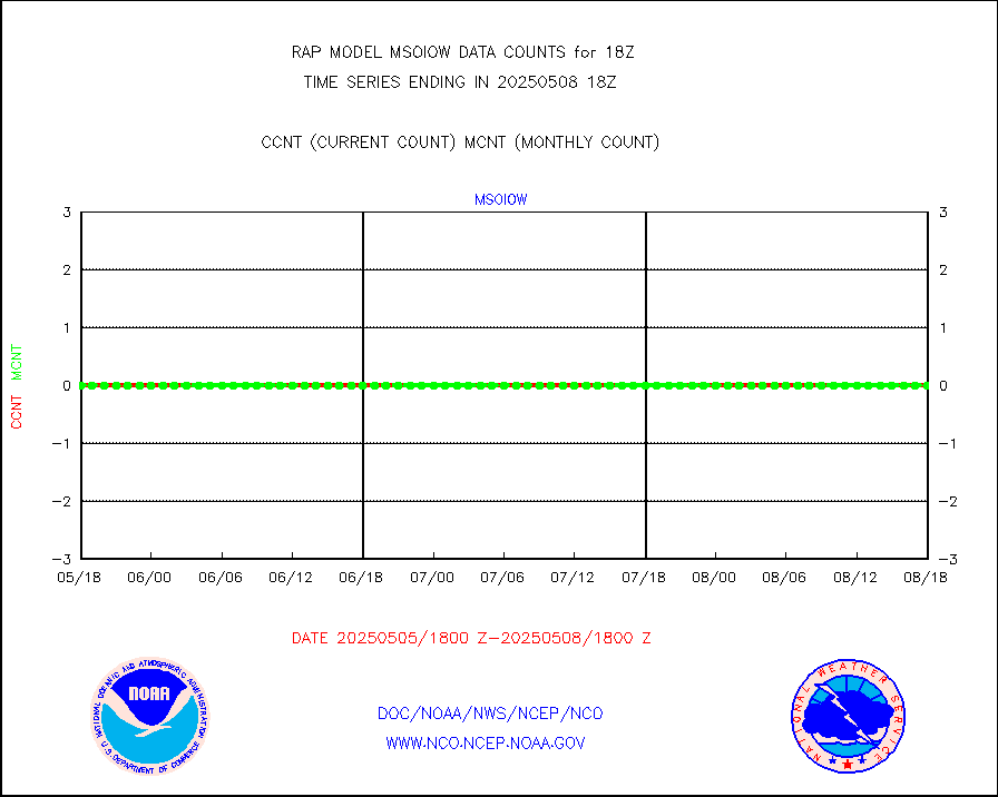
msoiow |
Mesonet/MADIS Iowa Department of Transportation |
0 |
0 |
n/a |
1917.50-1918.50 |
msokan |
Mesonet/MADIS Kansas Department of Transportation |
348 |
321 |
108.4 % |
1917.50-1918.50 |
msokla |
Mesonet/MADIS Oklahoma Mesonet |
318 |
318 |
100.0 % |
1917.50-1918.50 |
msolju |
Mesonet/MADIS Louisiana State/Jackson State Univ. |
0 |
0 |
n/a |
1917.50-1918.50 |
msomca |
Mesonet/MADIS Missouri Commercial Agricult Wx Net |
274 |
263 |
104.2 % |
1917.50-1918.50 |
msomin |
Mesonet/MADIS Minnesota Dept. of Transportation |
0 |
0 |
n/a |
1917.50-1918.50 |
msonos |
Mesonet/MADIS NOS-Phys Oceanographic Realtime Sys |
295 |
282 |
104.6 % |
1917.50-1918.50 |
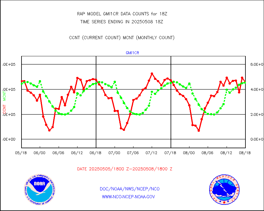
msoraw |
Mesonet/MADIS NFIC Remote Automated Wx Stns(RAWS) |
1710 |
1555 |
110.0 % |
1917.50-1918.50 |
msourb |
Mesonet/MADIS UrbaNet |
3945 |
3962 |
99.6 % |
1917.50-1918.50 |
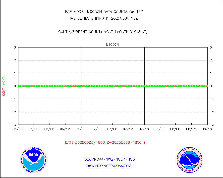
msovir |
Mesonet/MADIS Virginia Dept. of Transportation |
207 |
229 |
90.4 % |
1917.50-1918.50 |
msowfy |
Mesonet/MADIS "Weather for You" |
0 |
0 |
n/a |
1917.50-1918.50 |
msowis |
Mesonet/MADIS Wisconsin Dept. of Transportation |
0 |
0 |
n/a |
1917.50-1918.50 |
msowst |
Mesonet/MADIS MesoWest (many subproviders) |
41637 |
38885 |
107.1 % |
1917.50-1918.50 |
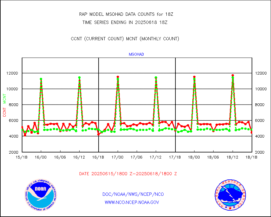
msowtx |
Mesonet/MADIS West Texas |
5033 |
4877 |
103.2 % |
1917.50-1918.50 |
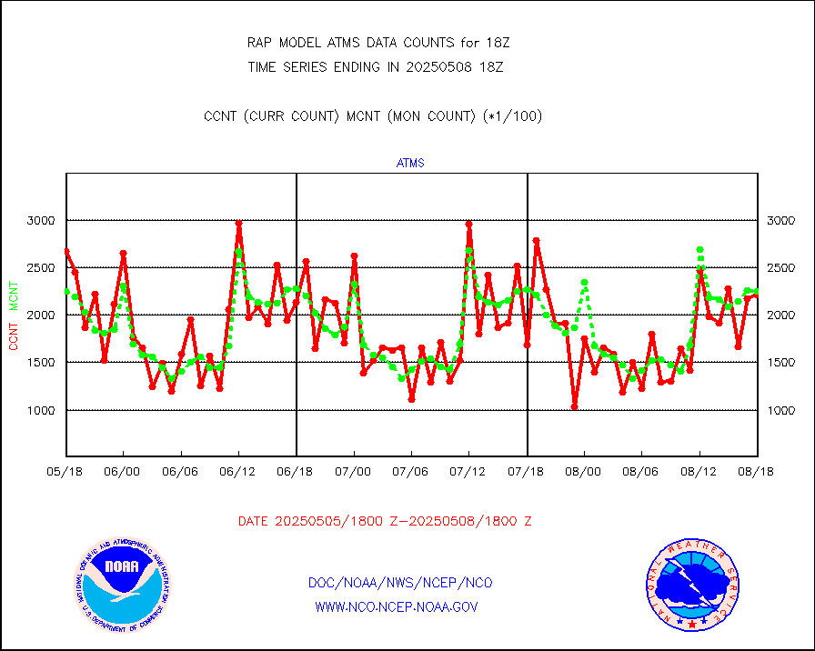
mtiasi |
METOP 1-2 IASI 1C radiance data (varbl. channels) |
24449 |
12704 |
192.5 % |
1916.00-1919.99 |
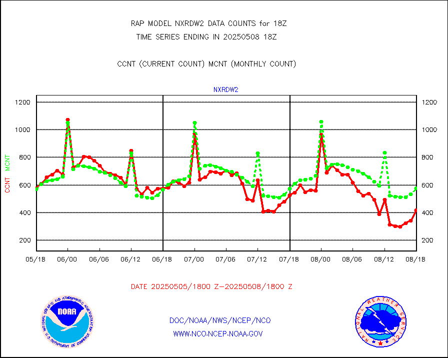
nxrdw2 |
NEXRAD Vel Azm Dsp(VAD) winds via Level 2 decoder |
644 |
619 |
104.0 % |
1917.00-1919.00 |
osbuv8 |
NOAA 16-19 Solar Backscatter UV-2 rad frm V8 BUFR |
0 |
0 |
n/a |
1916.00-1918.99 |
pibal |
PIBAL (from PILOT, PILOT SHIP, PILOT MOBIL) |
0 |
0 |
n/a |
1917.00-1919.00 |
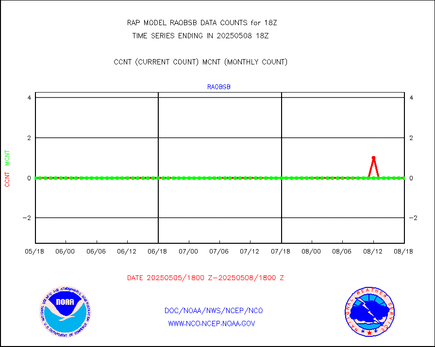
pirep |
Manual PIREP aircraft data (dcded from AIREP fmt) |
522 |
624 |
83.7 % |
1914.75-1921.25 |
prflrp |
Profilr winds from PIBAL (PILOT,PILOT SHIP/MOBIL) |
0 |
0 |
n/a |
1916.50-1919.50 |
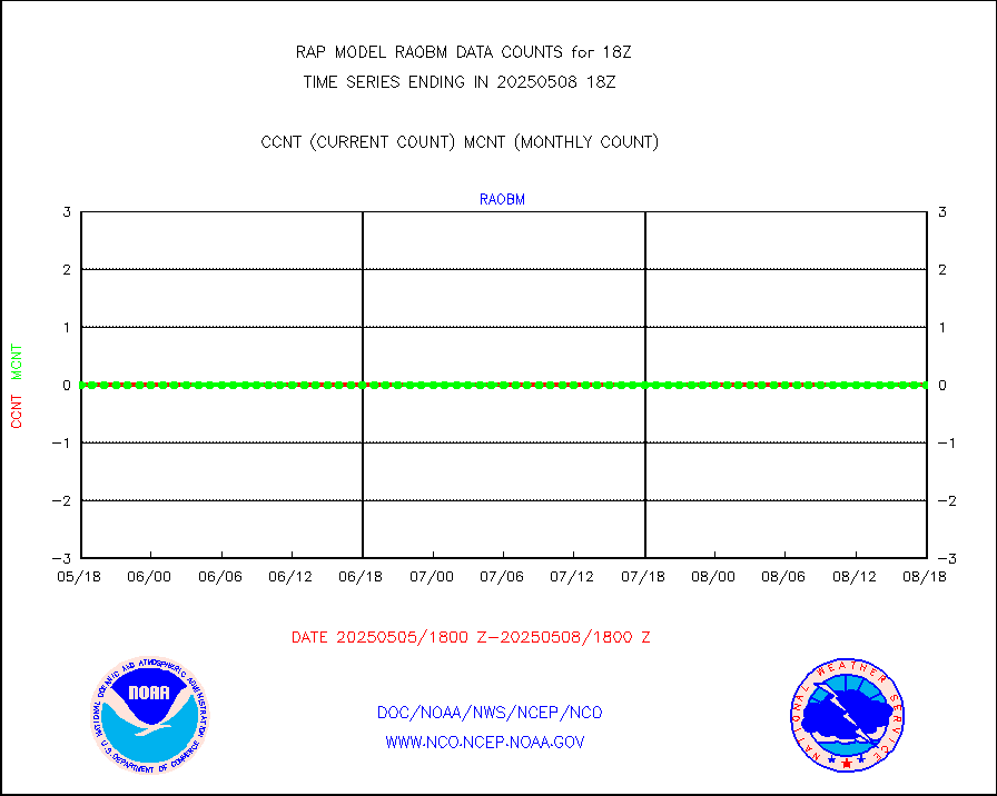
raobm |
Rawinsonde - mobile land (from TEMP/PILOT MOBIL) |
0 |
0 |
n/a |
1917.00-1919.00 |
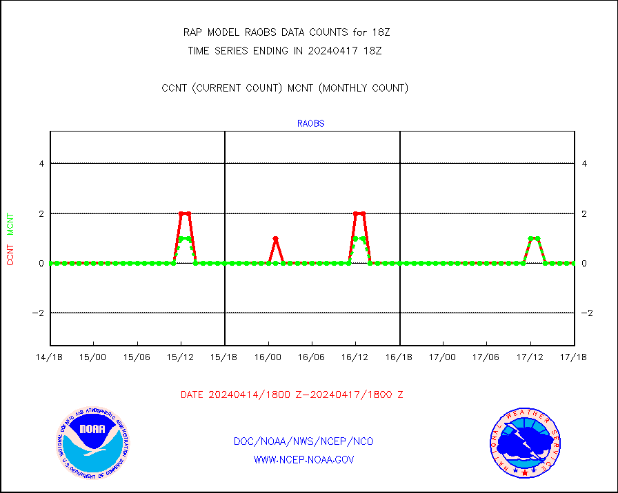
raobs |
Rawinsonde - ship (from TEMP SHIP, PILOT SHIP) |
0 |
0 |
n/a |
1917.00-1919.00 |
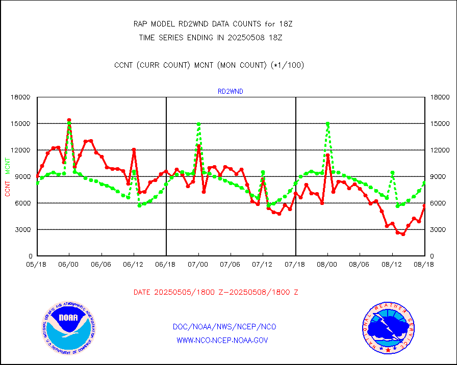
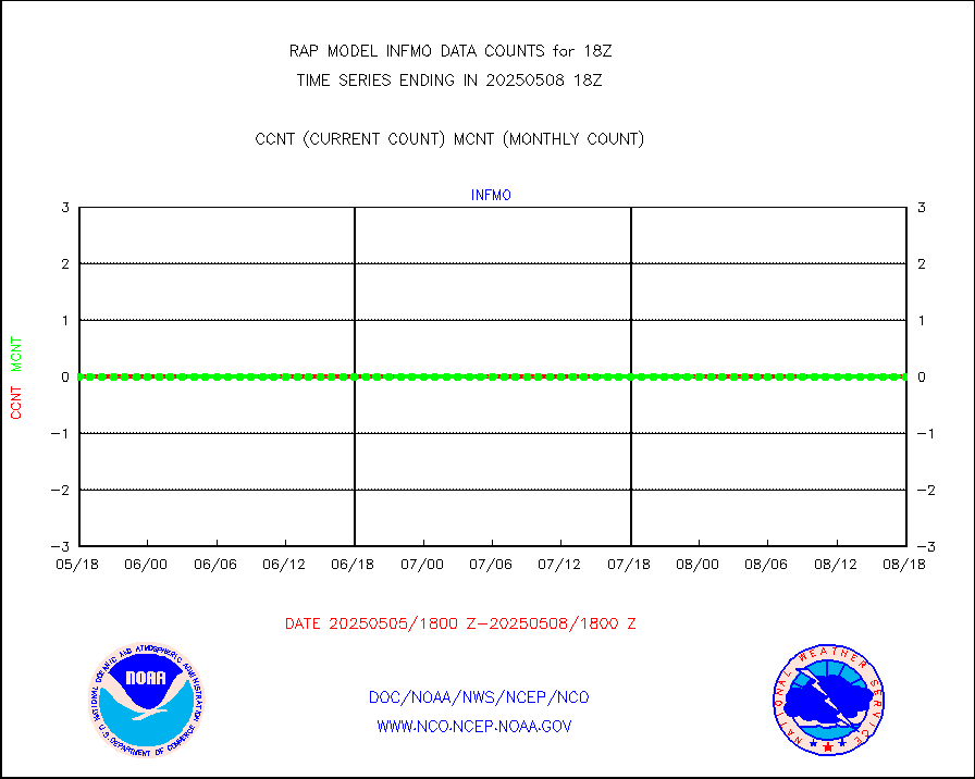
rd2wnd |
NEXRAD radial wind (Level 2 - GTS) |
1075392 |
969517 |
110.9 % |
1917.50-1918.49 |
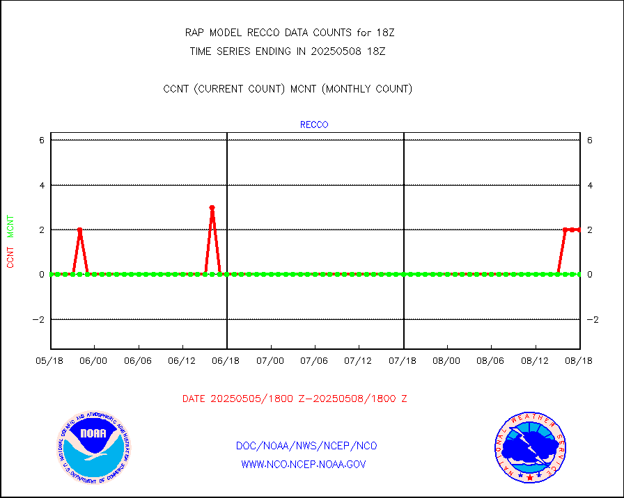
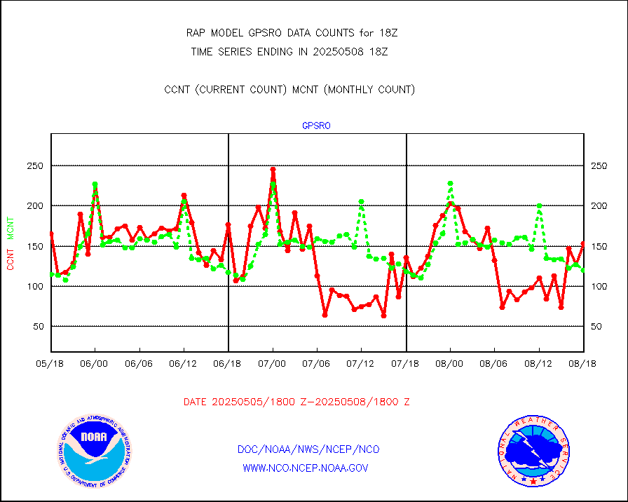
recco |
Flight level reconnaissance aircraft data |
0 |
0 |
n/a |
1917.00-1919.00 |
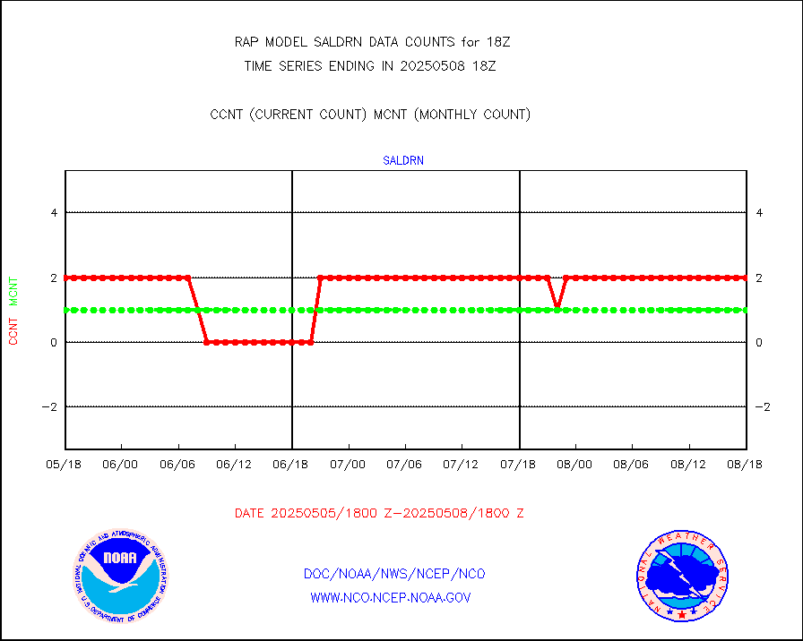
saldrn |
Surface Marine Saildrone (decoded from BUFR) |
2 |
2 |
100.0 % |
1916.00-1919.99 |
saphir |
Megha-Tropiques SAPHIR L1A2 brightness temps |
0 |
0 |
n/a |
1915.00-1920.99 |
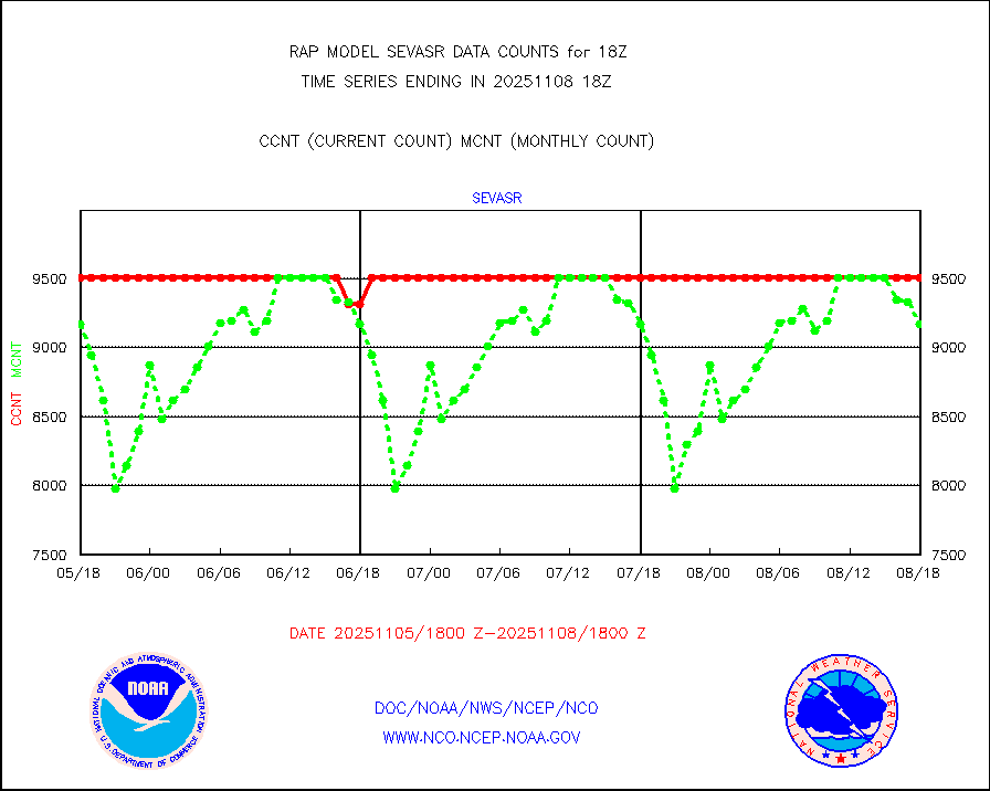
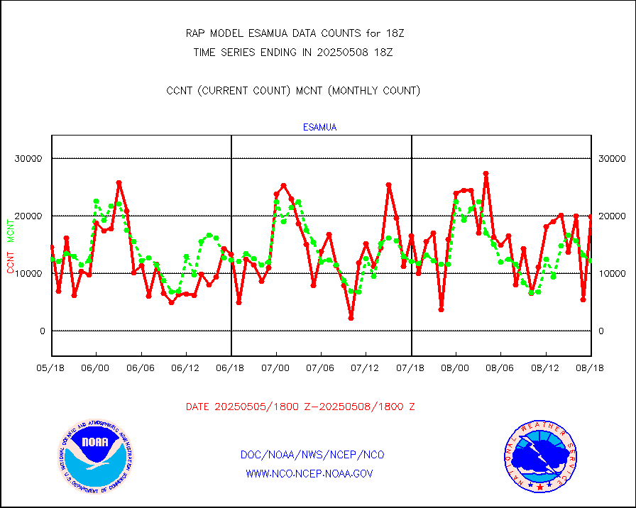
sevasr |
METEOSAT-10 2nd Gen SEVIRI All Sky Radiance(proc) |
9512 |
9511 |
100.0 % |
1916.00-1919.99 |
sevcsr |
METEOSAT-10 2nd Gen SEVIRI Clr Sky Radiance(proc) |
0 |
0 |
n/a |
1916.00-1919.99 |
ships |
Ship - manual and automatic, restricted |
1 |
5 |
20.0 % |
1917.50-1918.50 |
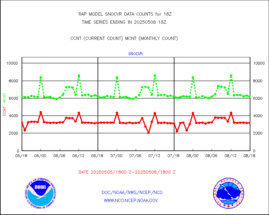
snocvr |
NOW COVER, DEPTH/DENSITY AND WATER EQUIVALENT |
3395 |
6894 |
49.2 % |
1916.00-1920.00 |
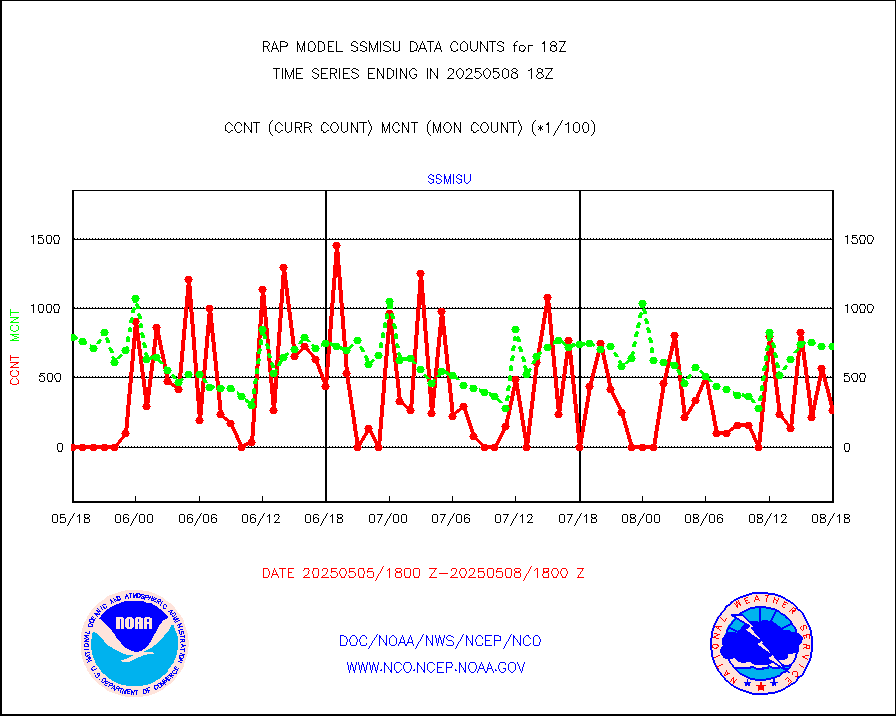
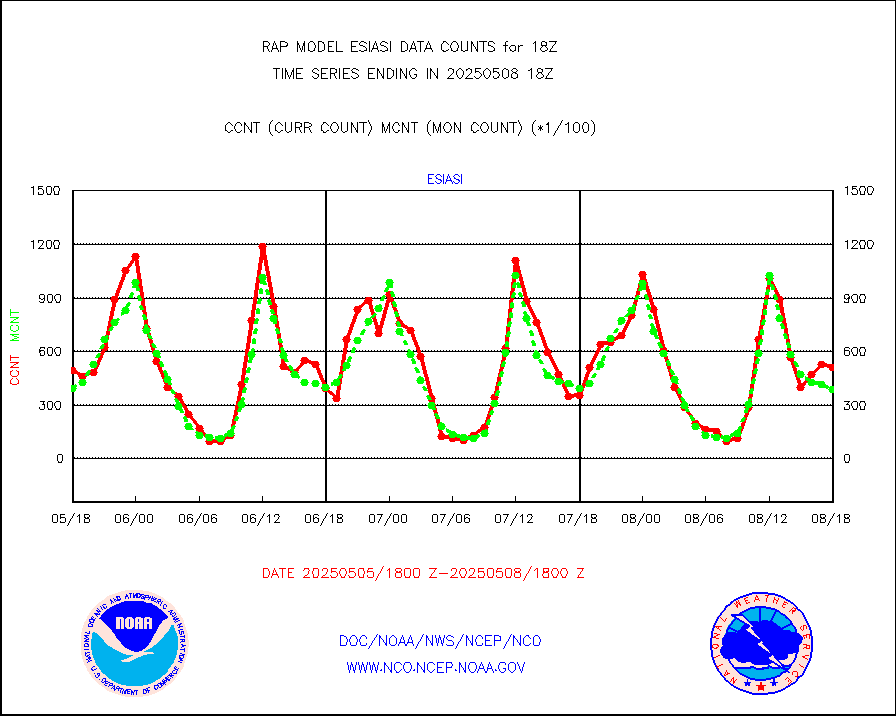
ssmisu |
DMSP SSM/IS 1C radiance data (Unified Pre-Proc.) |
18855 |
60444 |
31.2 % |
1916.00-1919.99 |
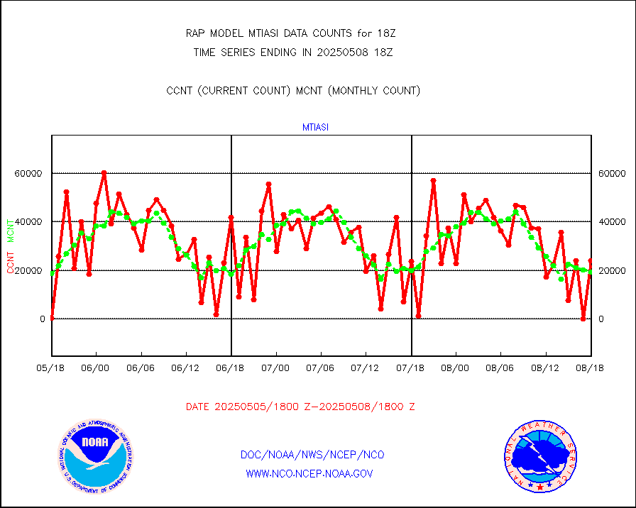
subpfl |
Sub-surface float and glider profile (BUFR) |
4 |
3 |
133.3 % |
1916.00-1919.99 |
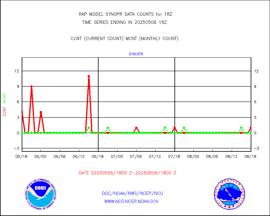
synopr |
Synoptic - restricted (WMO Res 40) manual & auto. |
0 |
0 |
n/a |
1917.50-1918.50 |
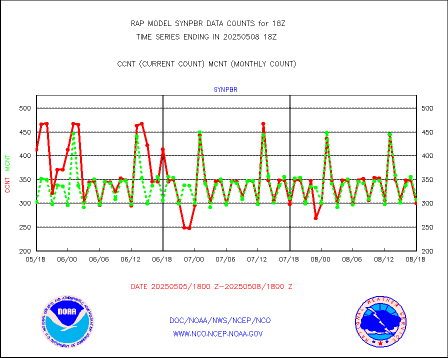
synpbr |
Synoptic - restricted (WMO Res 40)(decoded BUFR) |
297 |
302 |
98.3 % |
1917.50-1918.50 |
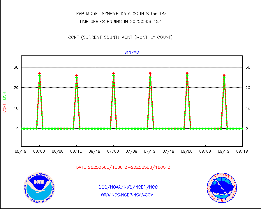
synpmb |
Synoptic - mobile manual & auto (decoded fr BUFR) |
0 |
0 |
n/a |
1917.50-1918.50 |
tmdara |
TAMDAR aircft data-all types(from Panasonic,BUFR) |
866 |
849 |
102.0 % |
1914.75-1921.25 |
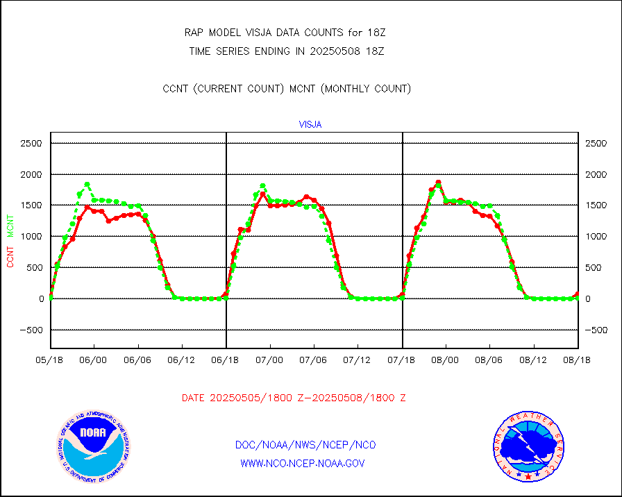
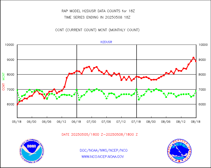
visja |
MTSAT/JMA visible derived cloud motion |
122 |
31 |
393.5 % |
1915.50-1920.50 |
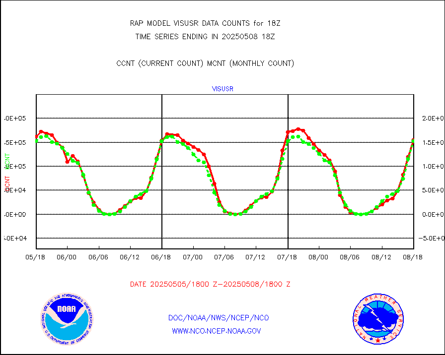
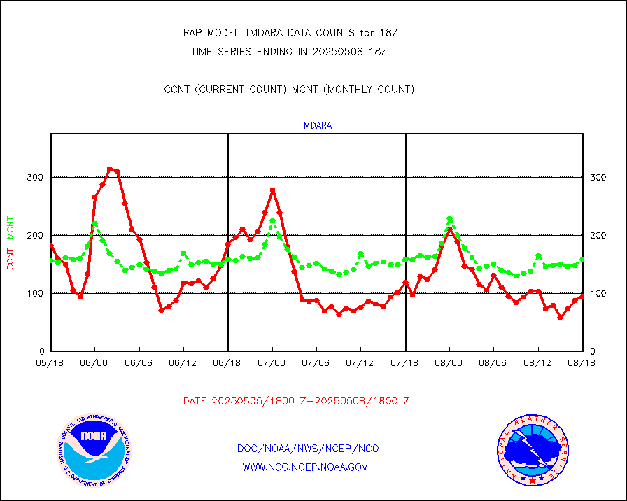
visusr |
GOES-16&up/NESDIS visible derived cloud motion |
156900 |
151641 |
103.5 % |
1917.00-1917.99 |
vseunb |
METEOSAT/EUMETSAT visible drv cld motion NBseq |
8255 |
7745 |
106.6 % |
1916.50-1919.49 |


