| Critical Data with Normal Counts |
|---|
| Type | Description | Hourly Count | Monthly Average | Percent (%) of Monthly Mean | UTC Time Window |
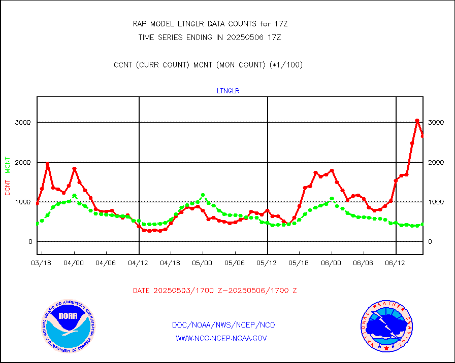
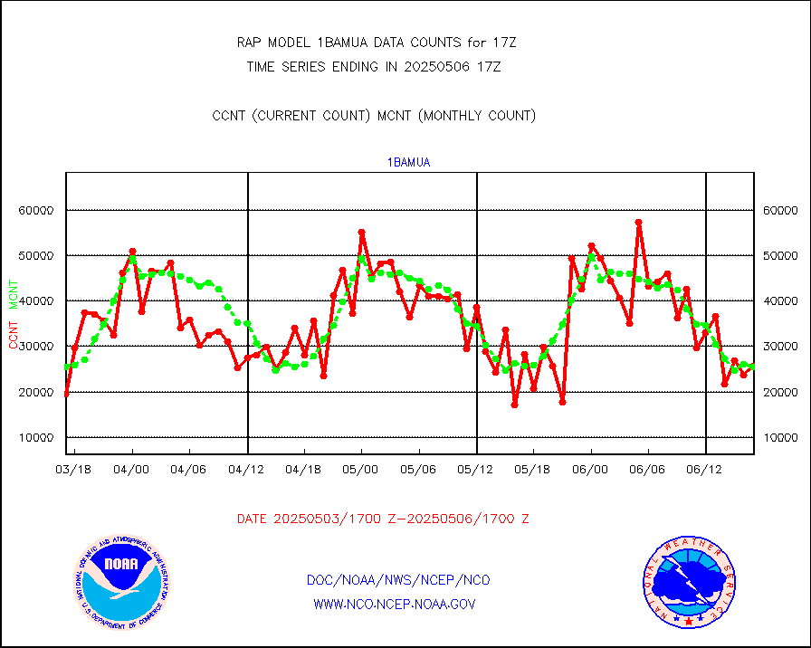
1bamua |
NOAA 15-19 & METOP 1-2 AMSU-A NCEP-proc. br.temps |
32468 |
27154 |
119.6 % |
1914.00-1919.99 |
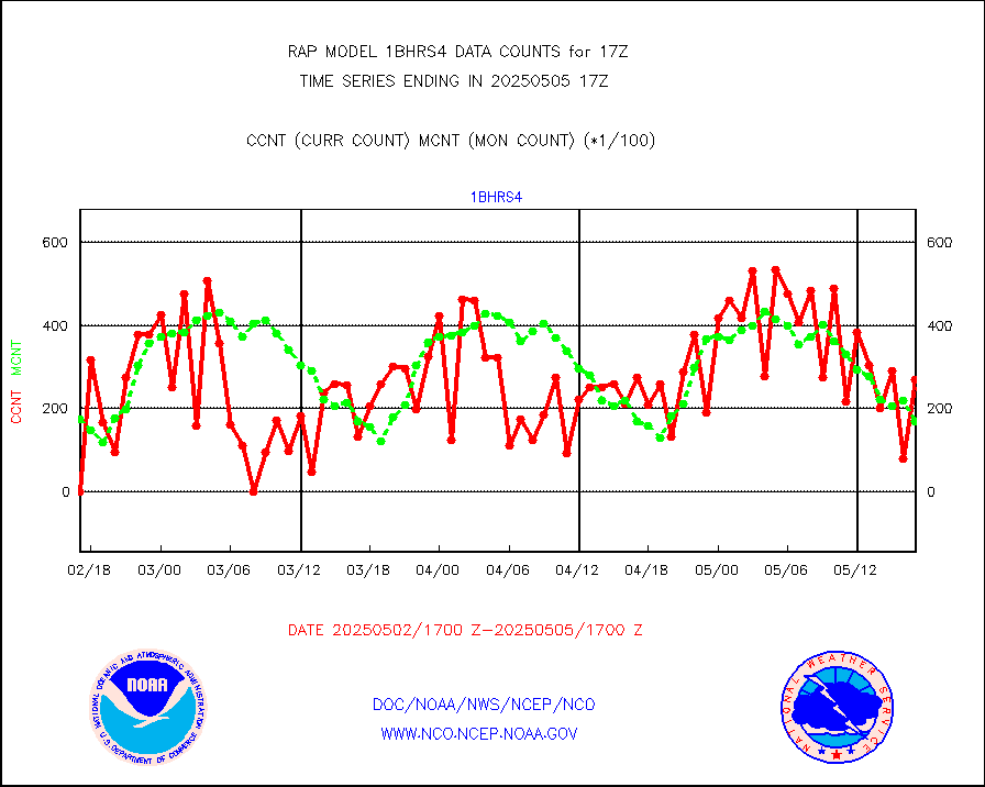
1bhrs4 |
NOAA 18-19 & METOP 1-2 HIRS-4 NCEP-proc. br.temps |
30536 |
21706 |
140.7 % |
1914.00-1919.99 |
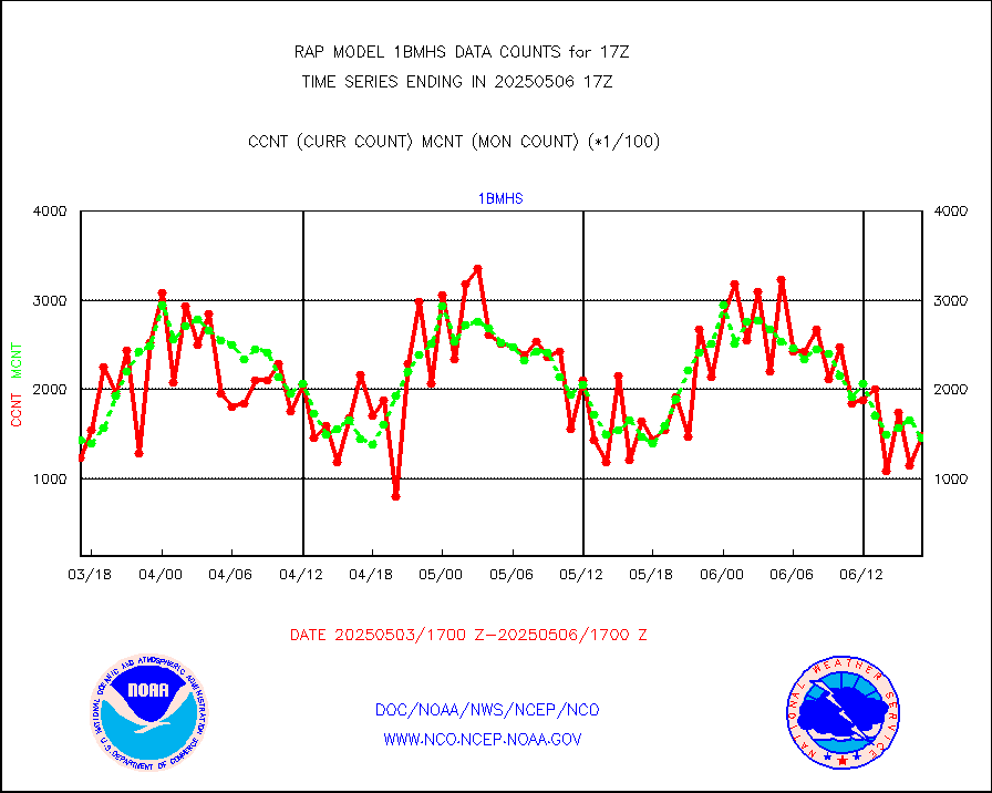
1bmhs |
NOAA 18-19 & METOP 1-2 MHS NCEP-proces. br. temps |
173200 |
159519 |
108.6 % |
1914.00-1919.99 |
acars |
MDCRS ACARS acft data from ARINC(dcded from BUFR) |
80613 |
75956 |
106.1 % |
1913.75-1920.25 |
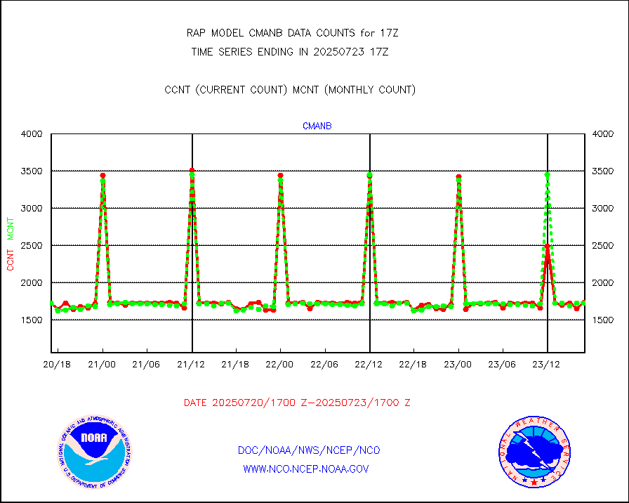
cmanb |
Surface Marine CMAN rpts decoded from BUFR format |
1725 |
1626 |
106.1 % |
1916.50-1917.50 |
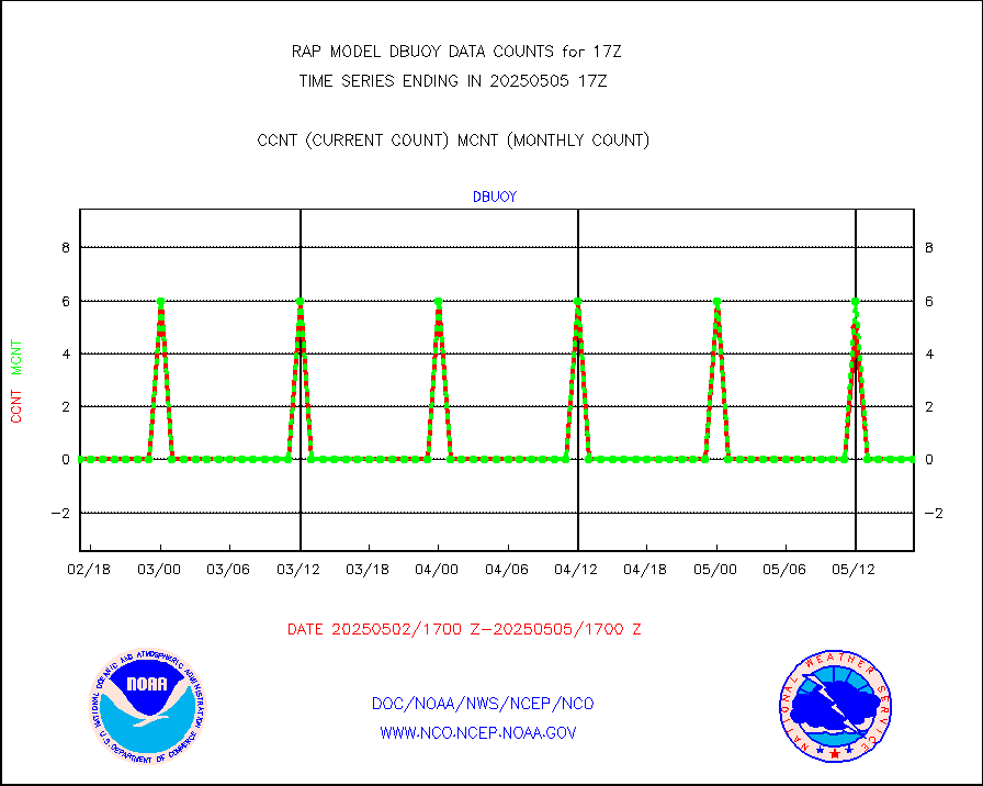
dbuoy |
Buoys decoded from FM-18 fmt (moored or drifting) |
0 |
0 |
n/a |
1916.50-1917.50 |
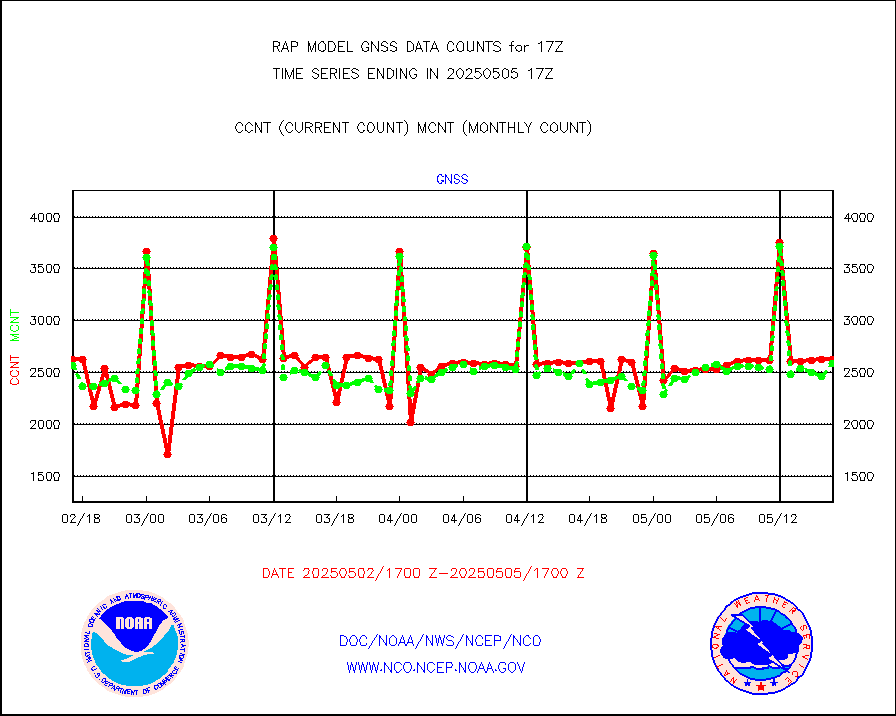
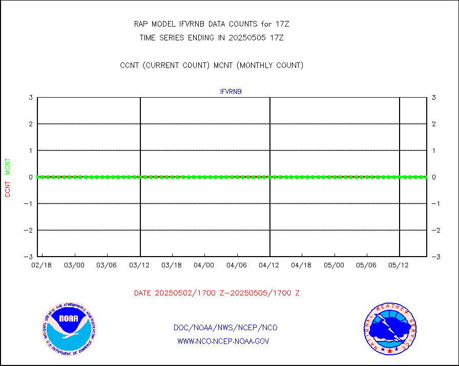
gnss |
Grnd-based Gbl Navigation Sat System (GNSS) data |
2599 |
2566 |
101.3 % |
1915.95-1916.05 |
h20mo |
MODIS (AQUA/TERRA) wvpr imager derived cld motion |
0 |
0 |
n/a |
1914.50-1919.50 |
infmo |
MODIS (AQUA/TERRA) ir l-wave derived cloud motion |
0 |
0 |
n/a |
1914.50-1919.50 |
lgycld |
GOES/NASA(Langley) hi-res. (1x1 f-o-v) cloud data |
3728438 |
3041765 |
122.6 % |
1916.50-1917.50 |
mbuoy |
Buoys decoded from FM-13 format (moored) |
86 |
65 |
132.3 % |
1916.50-1917.50 |
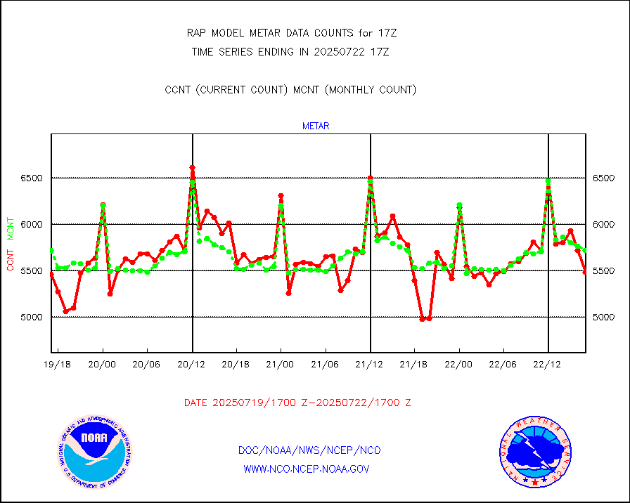
metar |
Aviation - METAR |
5755 |
5908 |
97.4 % |
1916.50-1917.50 |
nxrdw |
NEXRAD Vel Azm Dsp(VAD) winds via radar coded msg |
0 |
0 |
n/a |
1916.00-1918.00 |
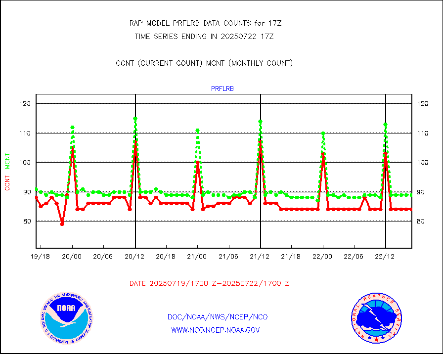
prflrb |
Multi-Agency Profiler (MAP) and SODAR winds |
72 |
84 |
85.7 % |
1915.50-1918.50 |
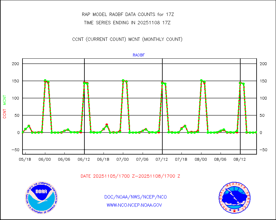
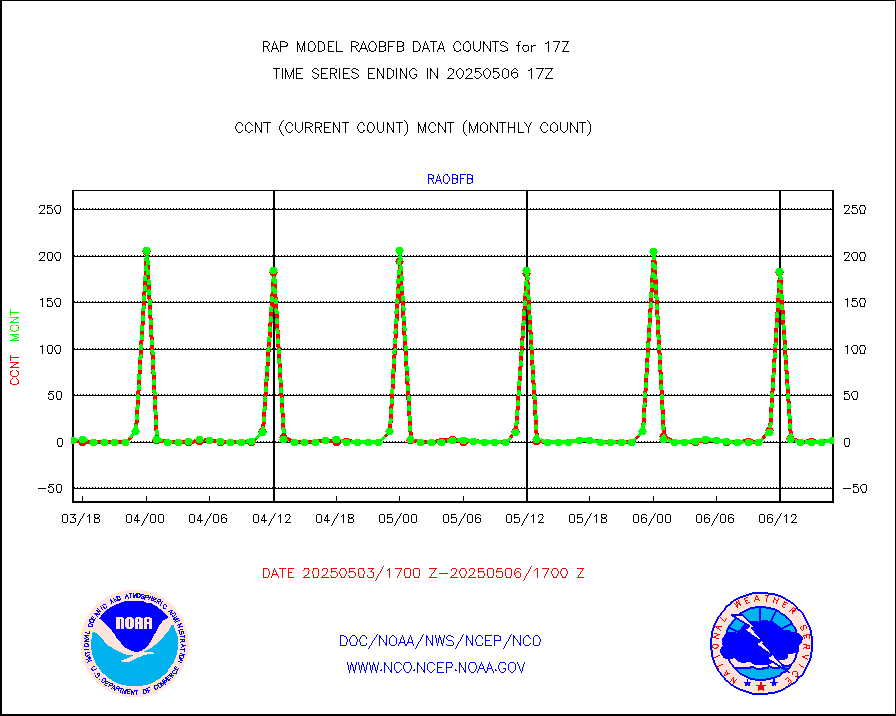
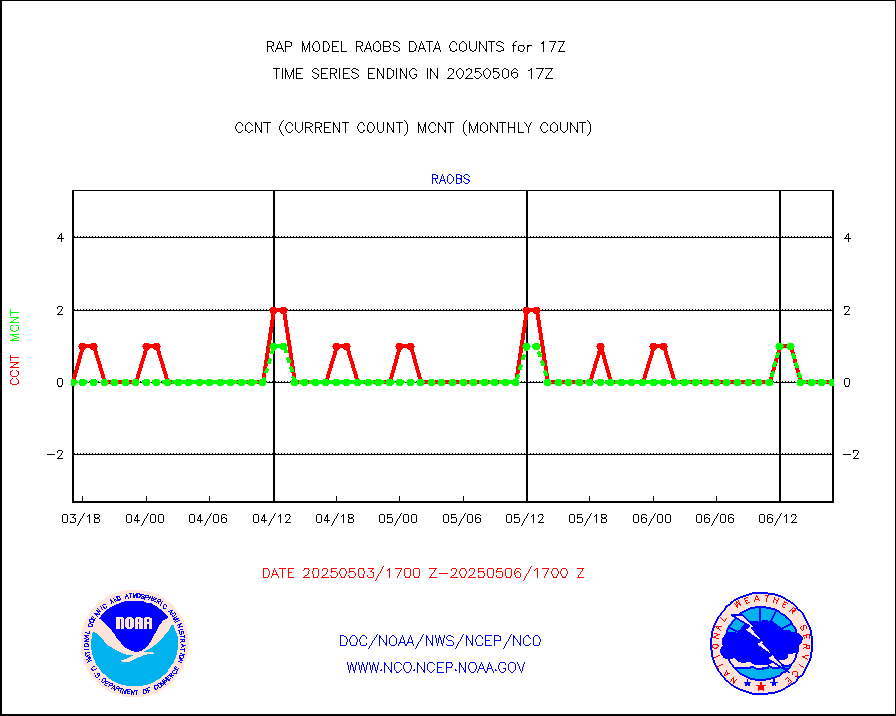
raobf |
Rawinsonde - fixed land (from TEMP or PILOT) |
0 |
1 |
0.0 % |
1916.00-1918.00 |
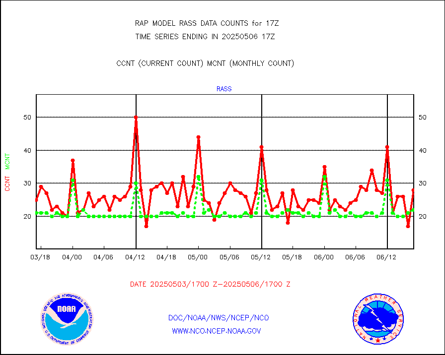
rass |
RASS temperatures (NOAA and Multi-Agency) |
20 |
21 |
95.2 % |
1916.50-1917.50 |
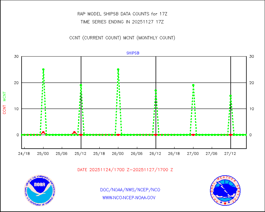
shipsb |
Ship - manual and automatic, restricted (BUFR) |
5 |
0 |
n/a |
1916.50-1917.50 |
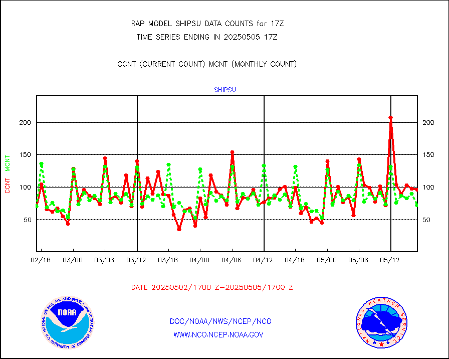
shipsu |
Ship - manual and automatic, unrestricted |
58 |
54 |
107.4 % |
1916.50-1917.50 |
shipub |
Ship - manual and automatic, unrestricted (BUFR) |
659 |
605 |
108.9 % |
1916.50-1917.50 |
synop |
Synoptic - fixed manual and automatic |
339 |
334 |
101.5 % |
1916.50-1917.50 |
synopb |
Synoptic - fixed manual & auto (decoded fr BUFR) |
1718 |
1699 |
101.1 % |
1916.50-1917.50 |
tideg |
Tide gauge reports decoded from CREX format |
182 |
181 |
100.6 % |
1916.50-1917.50 |
| Data Types of Opportunity with Normal Counts |
|---|
| Type | Description | Hourly Count | Monthly Average | Percent (%) of Monthly Mean | UTC Time Window |
3p9usr |
GOES-16&up/NESDIS ir short-wv derived cld motion |
1375 |
2063 |
66.7 % |
1916.00-1916.99 |
acarsa |
MDCRS ACARS acft data (ARINC via AFWA)(AIREP fmt) |
0 |
0 |
n/a |
1913.75-1920.25 |
airep |
Manual AIREP aircraft data (dcded from AIREP fmt) |
5222 |
4915 |
106.2 % |
1913.75-1920.25 |
airsev |
AQUA AIRS/AMSU-A/HSB brightness temps- every FOV |
0 |
0 |
n/a |
1914.00-1919.99 |
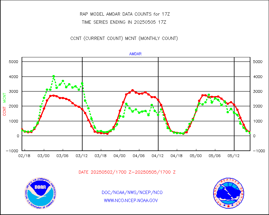
amdar |
AMDAR aircraft data (decoded from AMDAR format) |
272 |
244 |
111.5 % |
1913.75-1920.25 |
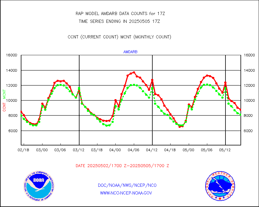
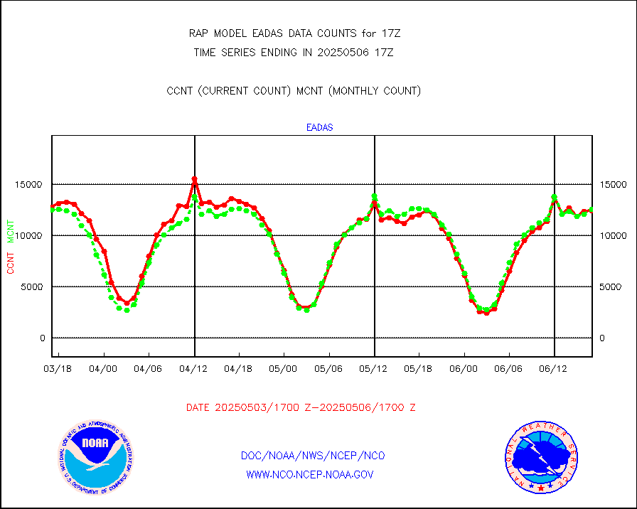
amdarb |
AMDAR aircraft data (decoded from BUFR) |
1783 |
1468 |
121.5 % |
1913.75-1920.25 |
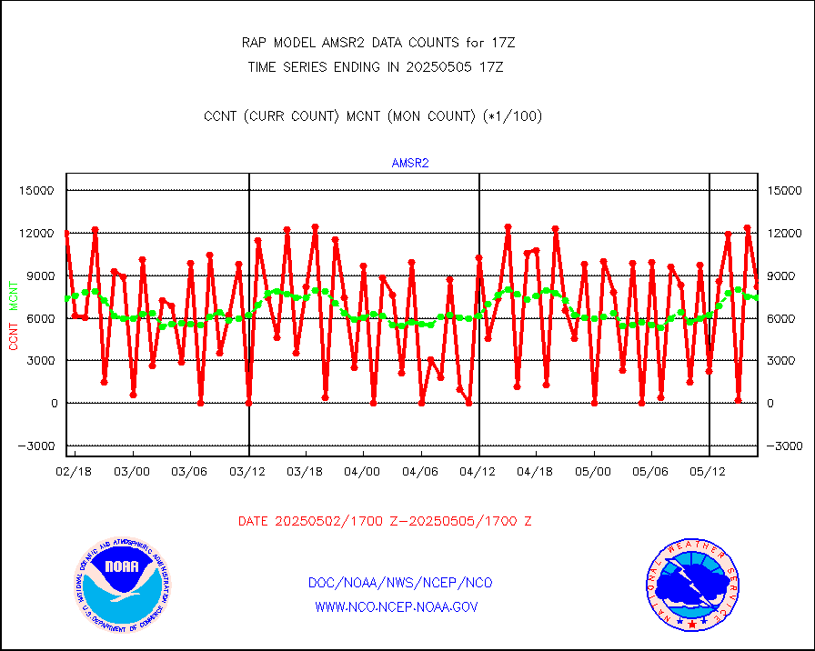
amsr2 |
GCOM-W AMSR2 1B brightness temperatures |
588686 |
733652 |
80.2 % |
1914.00-1914.99 |
ascat |
METOP 1-2 ASCAT products |
6246 |
15466 |
40.4 % |
1915.00-1919.00 |
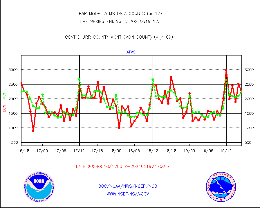
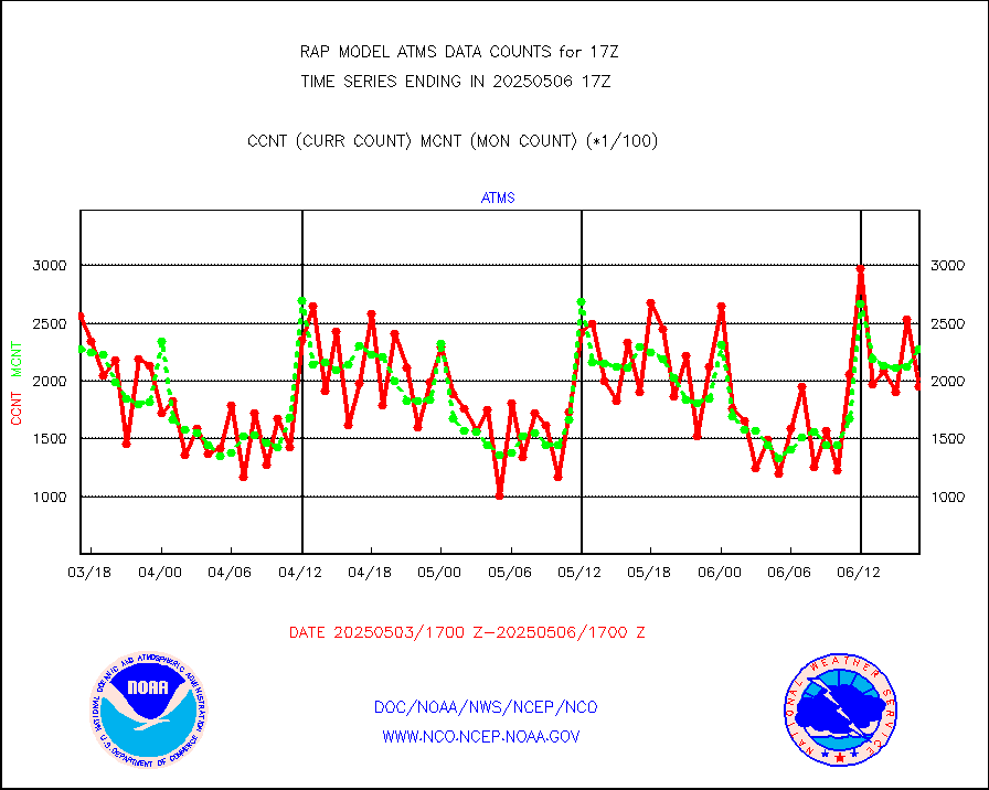
atms |
NPP/NOAA-20 ATMS brightness temperatures |
221879 |
223066 |
99.5 % |
1915.00-1918.99 |
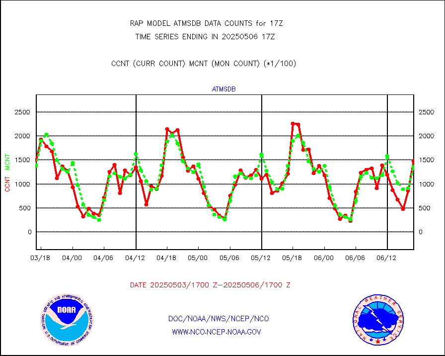
atmsdb |
NPP/NOAA-20 ATMS bright. temps-direct b-cast SSEC |
123291 |
129599 |
95.1 % |
1915.00-1918.99 |
coopmd |
Coop/MADIS NEPP & HCN-Modernization NOAA COOP Obs |
27 |
27 |
100.0 % |
1916.50-1917.50 |
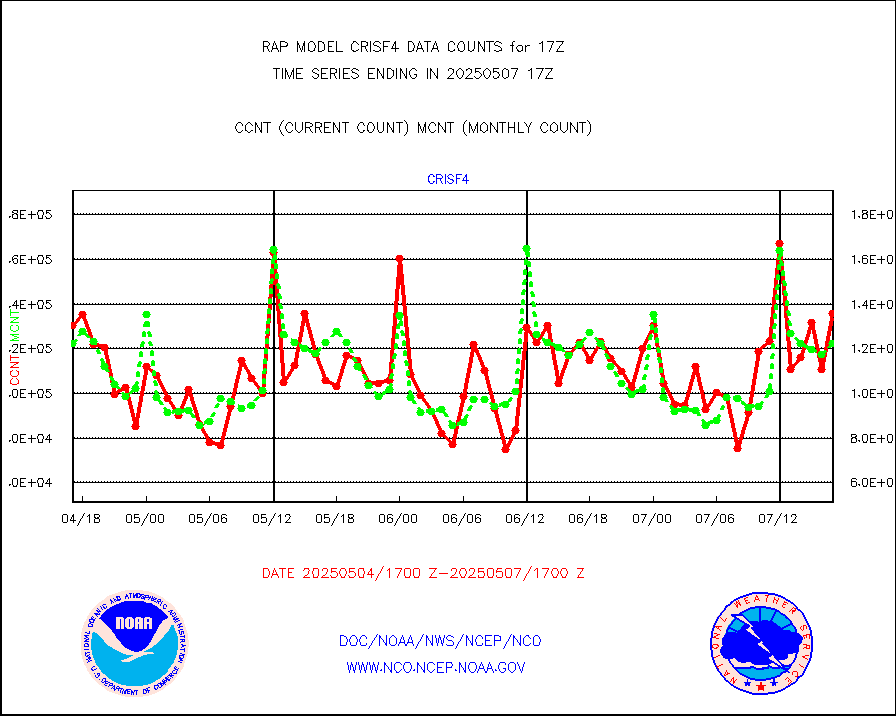
crisf4 |
NPP/NOAA-20 CrIS full spctrl radn (431 ch subset) |
117425 |
123804 |
94.8 % |
1915.00-1918.99 |
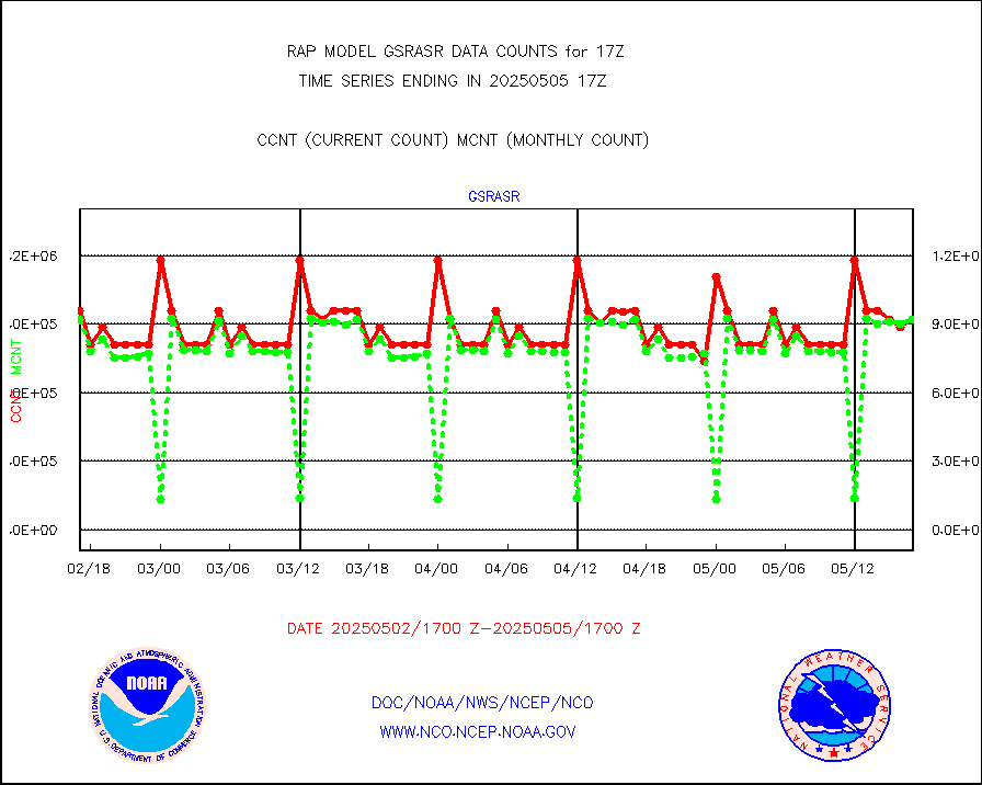
crsfdb |
NPP/NOAA-20 CrIS full spctrl radn dir brdcst SSEC |
108913 |
122265 |
89.1 % |
1915.00-1918.99 |
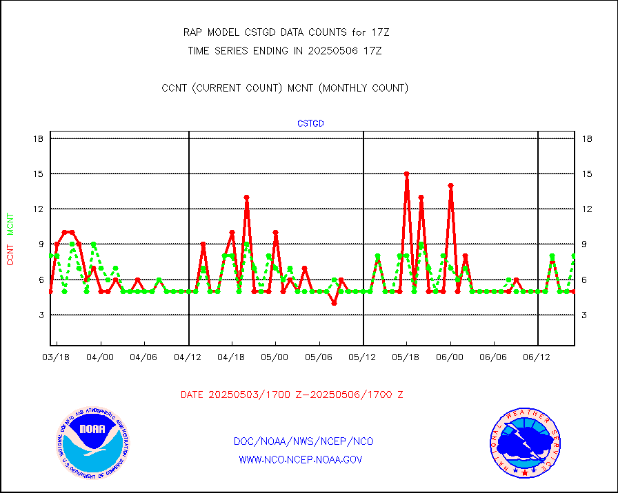
cstgd |
Coast Guard |
5 |
6 |
83.3 % |
1916.50-1917.50 |
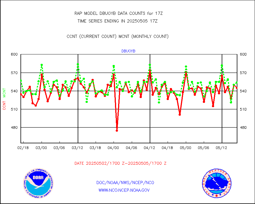
dbuoyb |
Drifting buoys (decoded from BUFR) |
621 |
577 |
107.6 % |
1916.50-1917.50 |
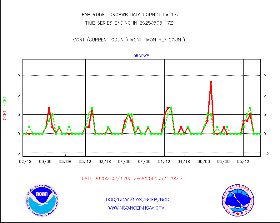
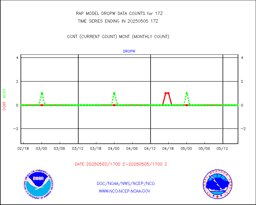
dropw |
Dropwinsonde (from TEMP DROP) |
0 |
0 |
n/a |
1916.00-1918.00 |
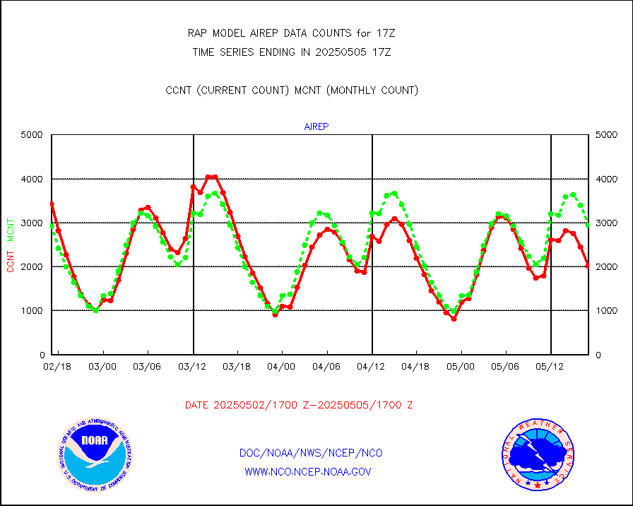
eadas |
E-AMDAR (European AMDAR acft decoded from BUFR) |
9750 |
9313 |
104.7 % |
1913.75-1920.25 |
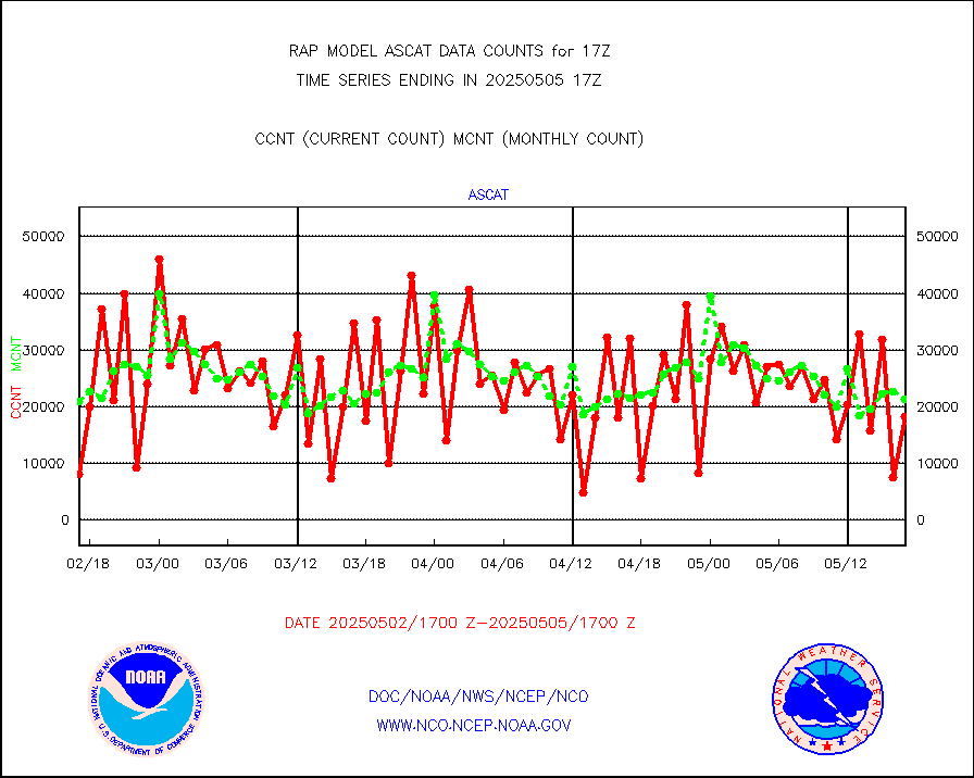
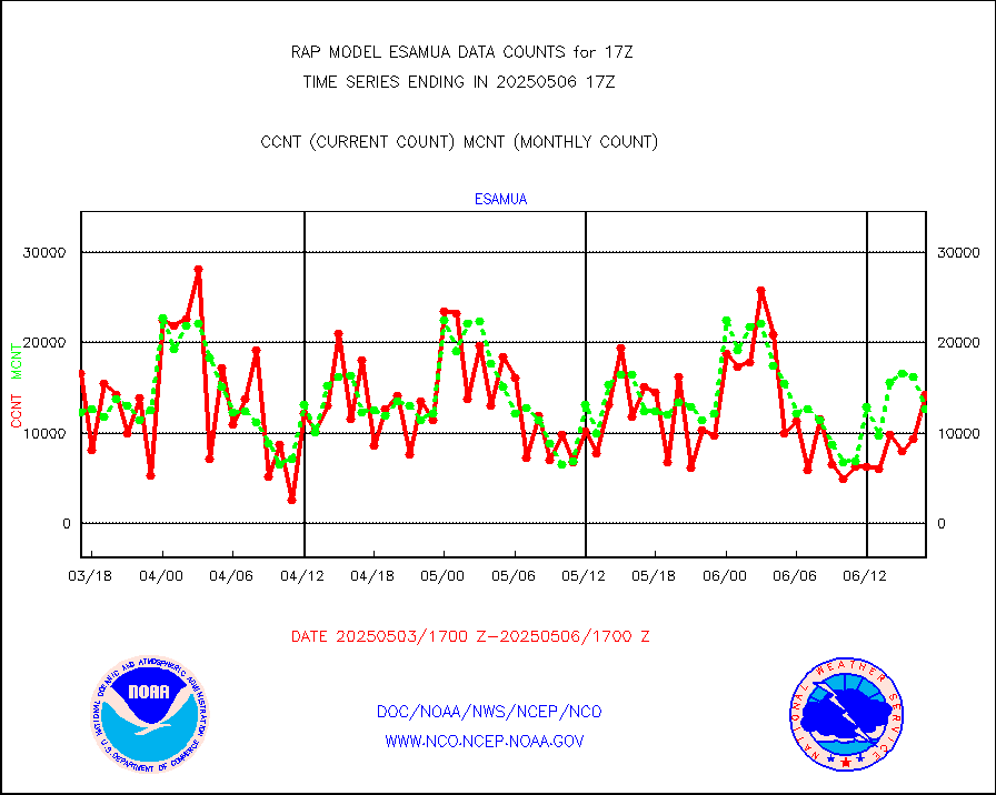
esamua |
NOAA 15-19 & METOP 1-2 AMSU-A proc btmps frm RARS |
13993 |
14400 |
97.2 % |
1916.00-1918.00 |
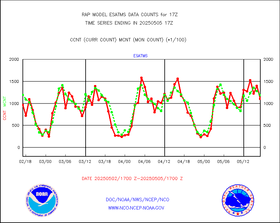
esatms |
NPP Adv. Tech. MW Sndr (ATMS) br. temps from RARS |
97195 |
126359 |
76.9 % |
1915.00-1918.99 |
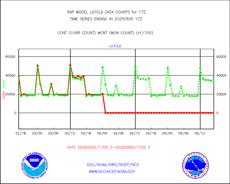
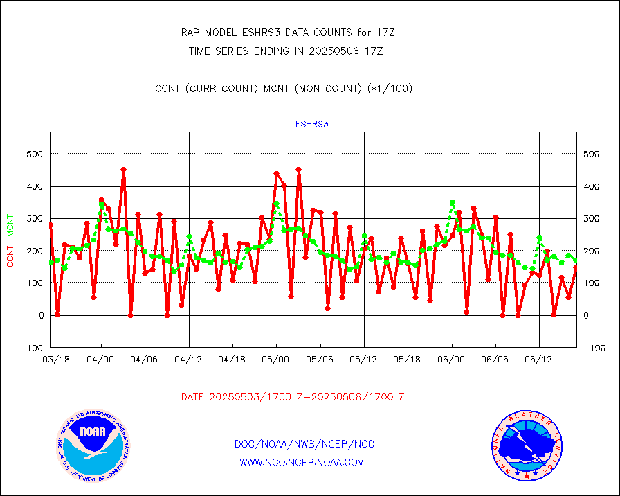
eshrs3 |
NOAA 15-19 & METOP 1-2 HIRS-3/4 pr btmps frm RARS |
33545 |
29253 |
114.7 % |
1916.00-1918.00 |
esiasi |
METOP 1-2 IASI 1C radiance data vbl chn from RARS |
50362 |
59131 |
85.2 % |
1915.00-1918.99 |
esmhs |
NOAA 18-19 & METOP 1-2 MHS proc. btemps from RARS |
101420 |
113233 |
89.6 % |
1916.00-1918.00 |
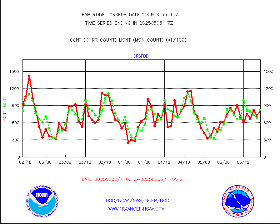
gmi1cr |
GPM GMI Level 1C-R brightness temperatures |
431817 |
545349 |
79.2 % |
1914.00-1919.99 |
gpsro |
GPS radio occultation data |
75 |
107 |
70.1 % |
1915.00-1918.99 |
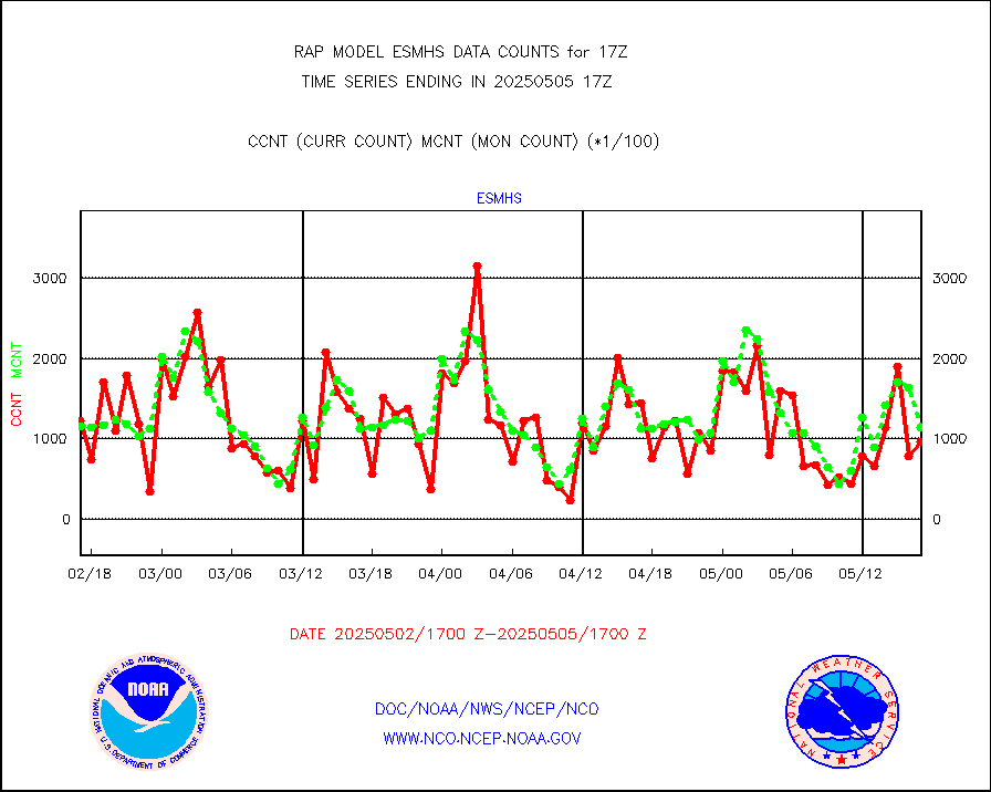
gsrasr |
GOES-16/17 All Sky Radiances (proc.) |
627336 |
915072 |
68.6 % |
1915.00-1918.99 |
gsrcsr |
GOES-16/17 Clear Sky Radiances (proc.) |
248264 |
443724 |
56.0 % |
1915.00-1918.99 |
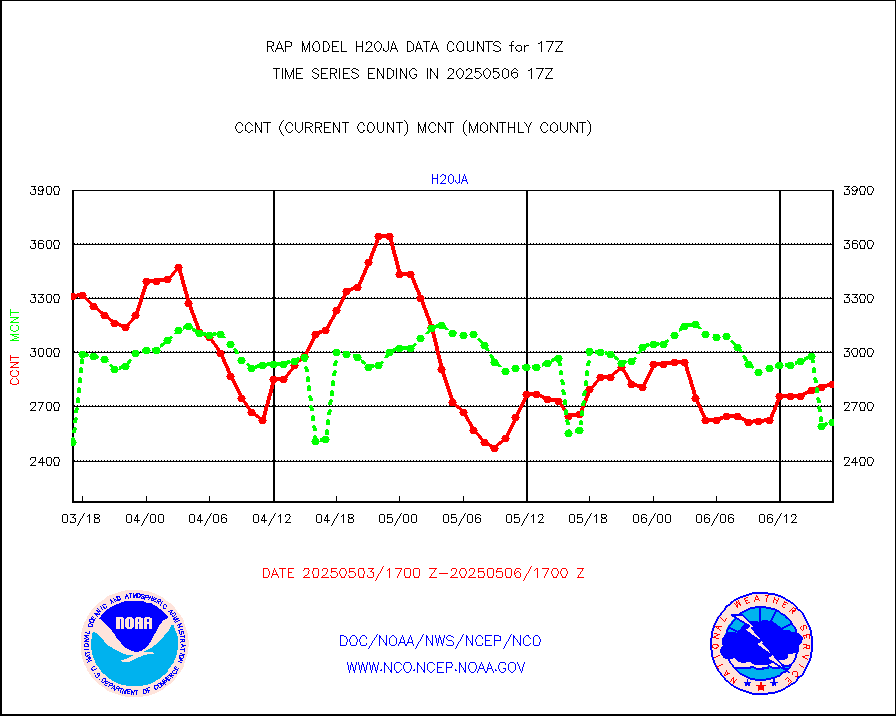
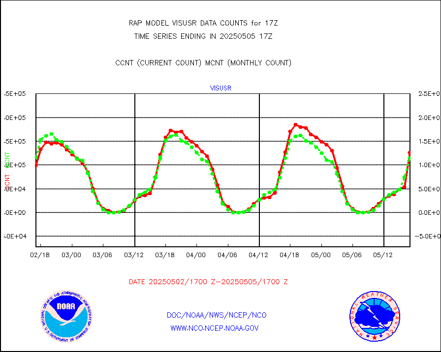
h20ja |
MTSAT/JMA water vapor imager derived cloud motion |
2725 |
3027 |
90.0 % |
1914.50-1919.50 |
h2dusr |
GOES-16&up/NESDIS wv imgr/deep-lyr derivd cld mtn |
2956 |
7227 |
40.9 % |
1916.00-1916.99 |
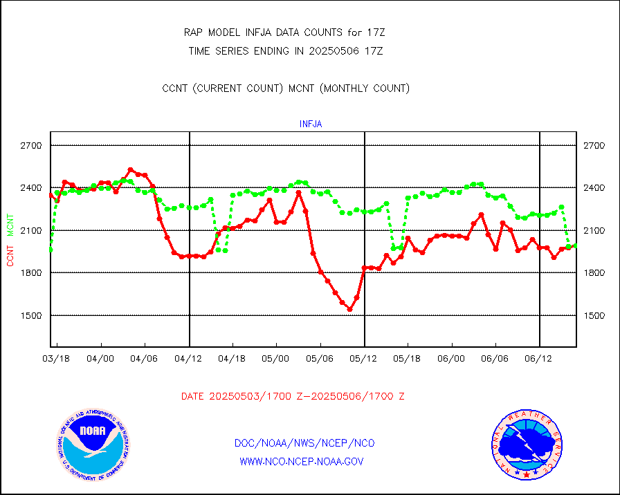
h2eunb |
METEOSAT/EUMETSAT wvpr imgr drv cld motion NBseq |
6051 |
5473 |
110.6 % |
1915.50-1918.49 |
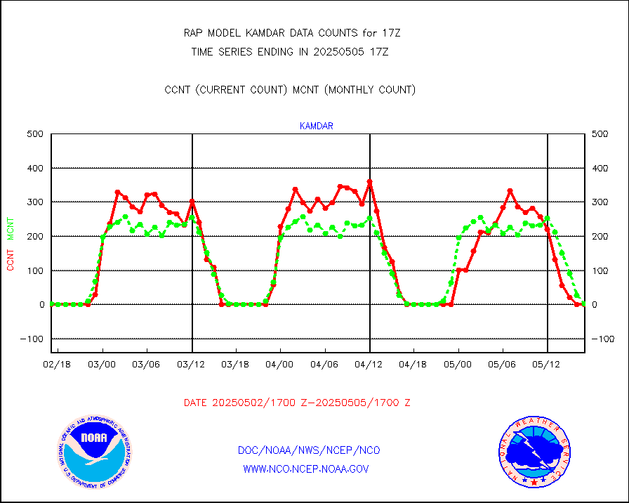
h2tusr |
GOES-16&up/NESDIS wv imgr/cld-top derived cld mtn |
5230 |
10830 |
48.3 % |
1916.00-1916.99 |
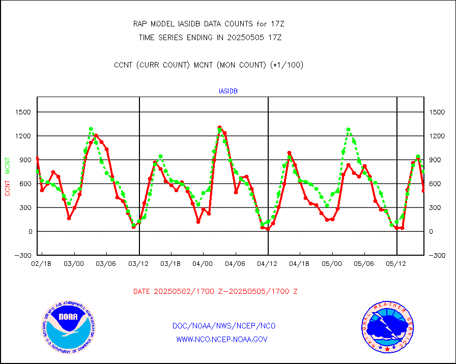
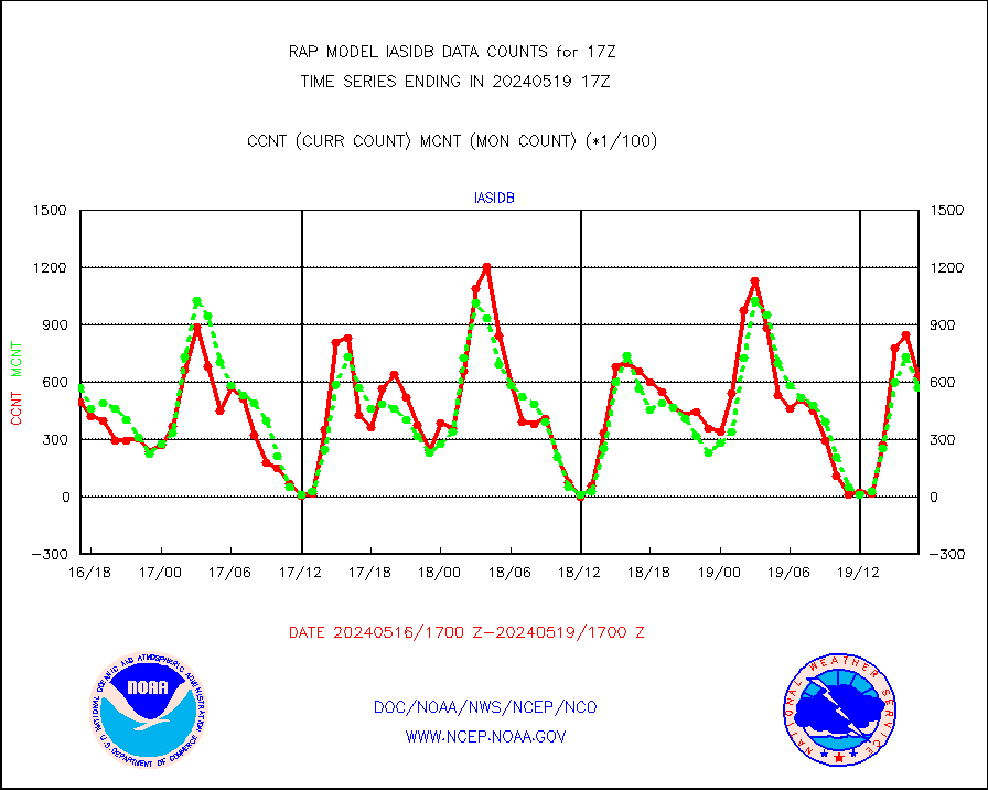
iasidb |
METOP 1-2 IASI 1C radiances-direct broadcast SSEC |
63029 |
57373 |
109.9 % |
1915.00-1918.99 |
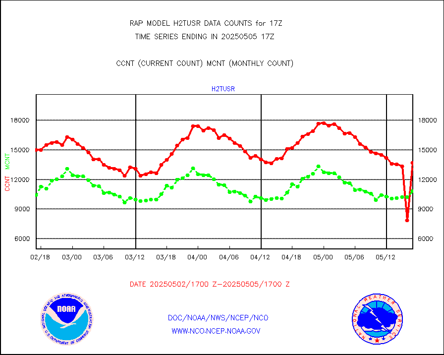
ifeunb |
METEOSAT/EUMETSAT ir lg-wave drv cld motion NBseq |
3434 |
3310 |
103.7 % |
1915.50-1918.49 |
ifvrnb |
VIIRS (NPP/NOAA-20) ir lg-wv drv cloud motion(NB) |
0 |
0 |
n/a |
1914.50-1919.50 |
infav |
AVHRR (NOAA/METOP) ir lg-wave derived cld motion |
0 |
0 |
n/a |
1914.50-1919.50 |
infav1 |
AVHRR (METOP) ir lg-wave derived cld motion |
0 |
0 |
n/a |
1915.50-1918.49 |
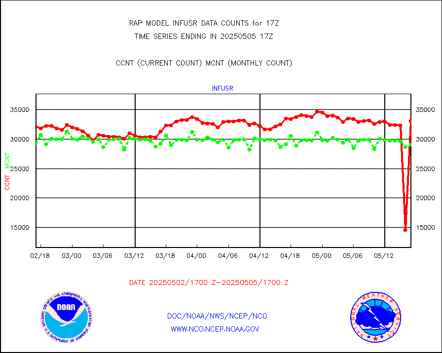
infja |
MTSAT/JMA infrared long-wave derived cloud motion |
2095 |
2479 |
84.5 % |
1914.50-1919.50 |
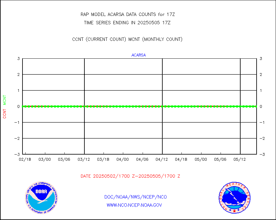
infusr |
GOES-16&up/NESDIS ir long-wave derived cld motion |
15045 |
29362 |
51.2 % |
1916.00-1916.99 |
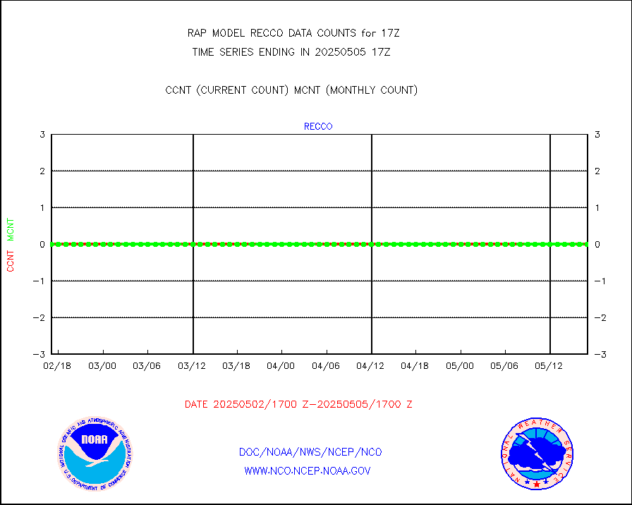
kamdar |
Korean AMDAR aircraft data (decoded from BUFR) |
0 |
5 |
0.0 % |
1913.75-1920.25 |
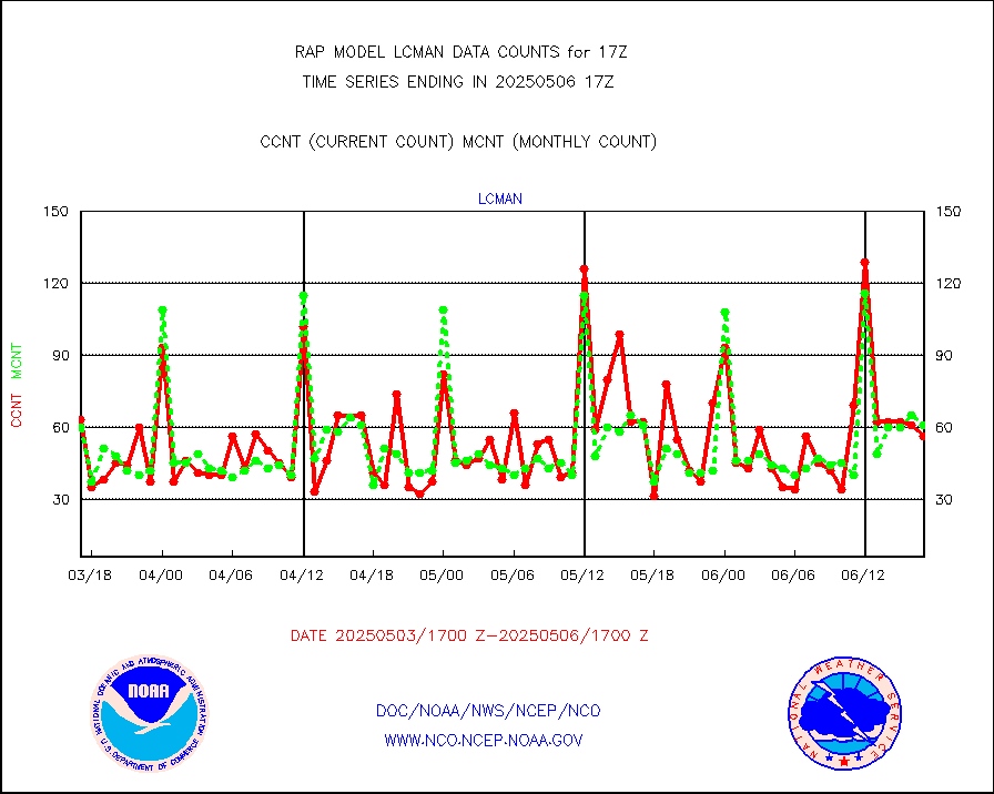
lcman |
Land-based CMAN stations decoded from CMAN format |
75 |
81 |
92.6 % |
1916.50-1917.50 |
ltnglr |
LLDN Long-rng lightning from Vaisala via NOAAPORT |
246286 |
69367 |
355.0 % |
1916.00-1917.50 |
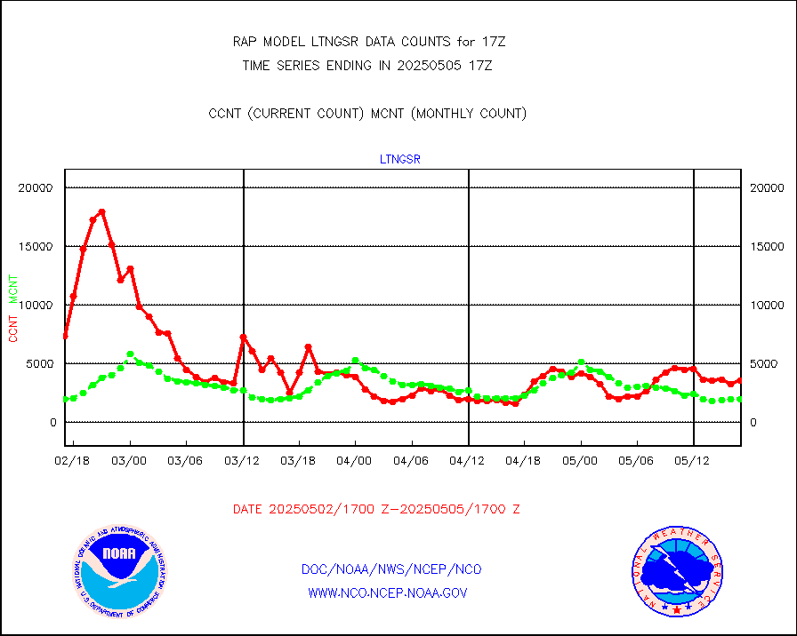
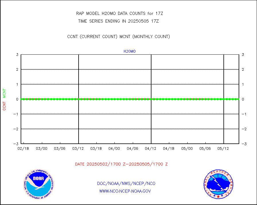
ltngsr |
NLDN Shrt-rng lightning from Vaisala via NOAAPORT |
9674 |
3188 |
303.5 % |
1916.00-1917.50 |
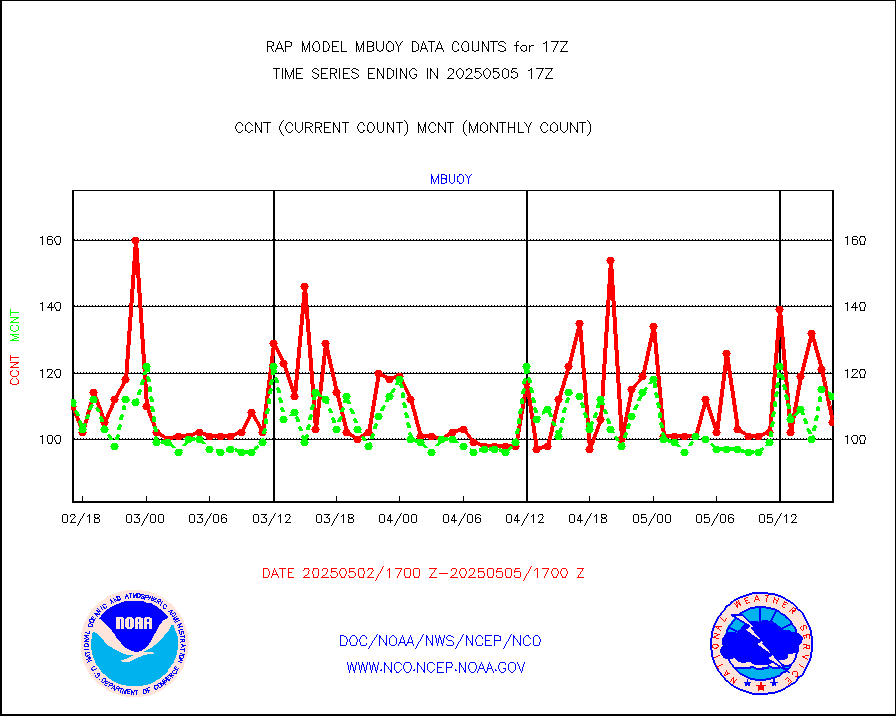
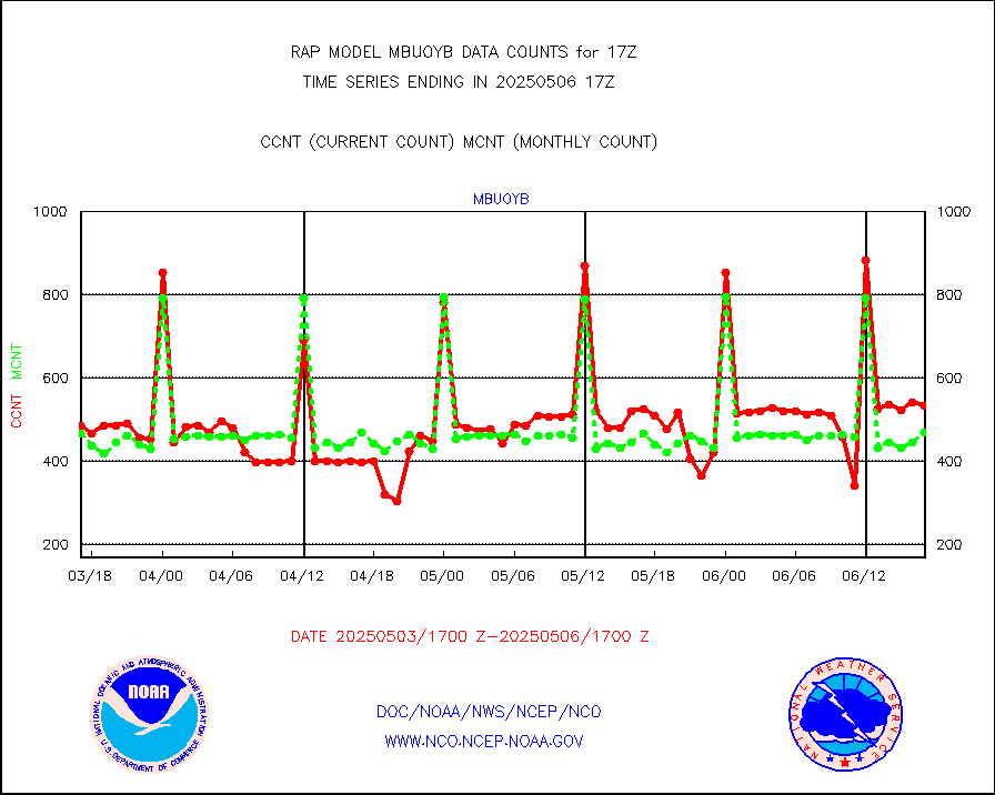
mbuoyb |
Moored buoys (decoded from BUFR) |
622 |
553 |
112.5 % |
1916.50-1917.50 |
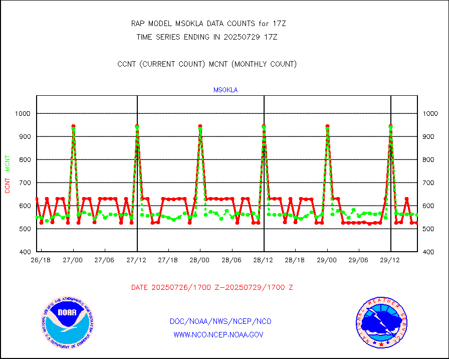
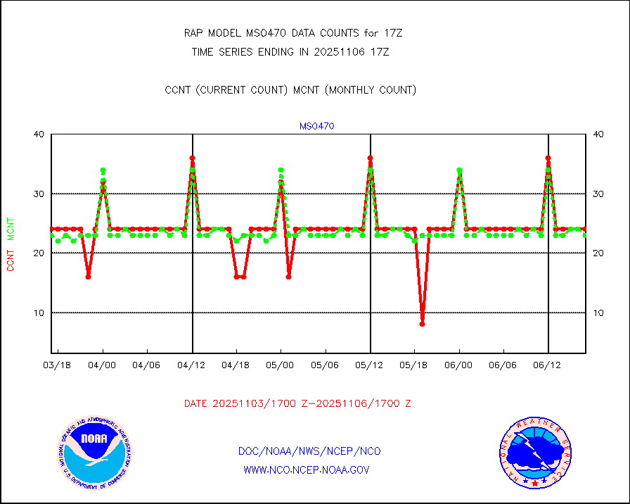
mso470 |
Mesonet/MADIS Colorado E-470 (Interstate 470) |
21 |
19 |
110.5 % |
1916.50-1917.50 |
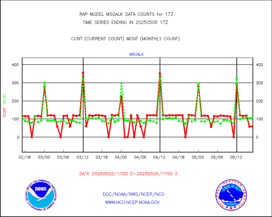
msoalk |
Mesonet/MADIS Alaska Department of Transportation |
108 |
108 |
100.0 % |
1916.50-1917.50 |
msoapg |
Mesonet/MADIS U.S. Army Aberdeen Proving Grounds |
0 |
0 |
n/a |
1916.50-1917.50 |
msoapr |
Mesonet/MADIS Citizen Weather Observers Program |
46301 |
45666 |
101.4 % |
1916.50-1917.50 |
msoaws |
Mesonet/MADIS AWS Convergence Technologies, Inc. |
25306 |
25684 |
98.5 % |
1916.50-1917.50 |
msoawx |
Mesonet/MADIS "Anything Weather" |
0 |
0 |
n/a |
1916.50-1917.50 |
msocol |
Mesonet/MADIS Colorado Dept. of Transportation |
0 |
0 |
n/a |
1916.50-1917.50 |
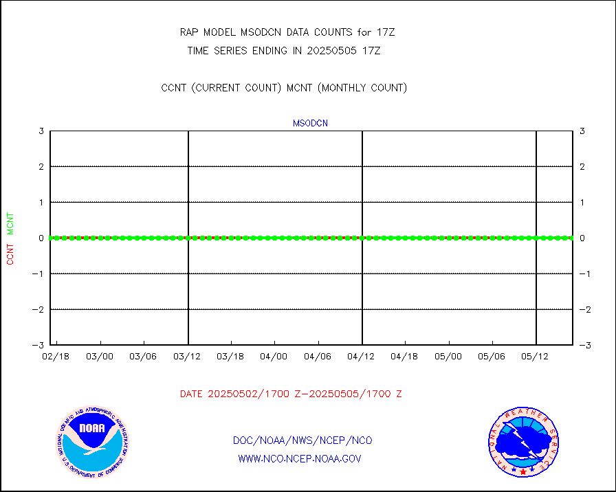
msodcn |
Mesonet/MADIS DC Net |
0 |
0 |
n/a |
1916.50-1917.50 |
msoden |
Mesonet/MADIS Denver Urban Drainage & Flood Cntrl |
225 |
218 |
103.2 % |
1916.50-1917.50 |
msofla |
Mesonet/MADIS Florida (FAWN & USF) |
3 |
3 |
100.0 % |
1916.50-1917.50 |
msoflt |
Mesonet/MADIS Florida Dept. of Transportation |
0 |
0 |
n/a |
1916.50-1917.50 |
msogeo |
Mesonet/MADIS Georgia Dept. of Transportation |
0 |
0 |
n/a |
1916.50-1917.50 |
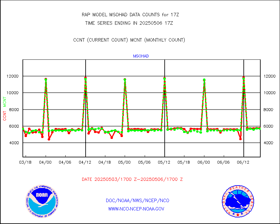
msohad |
Mesonet/MADIS NWS Hydromet Auto Data System(HADS) |
5869 |
5351 |
109.7 % |
1916.50-1917.50 |
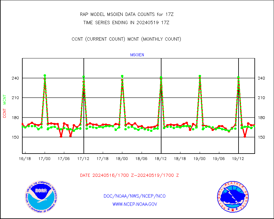
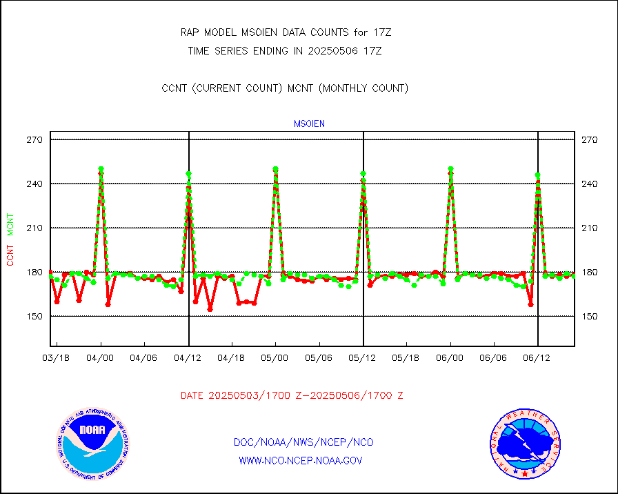
msoien |
Mesonet/MADIS Iowa Environmental |
168 |
167 |
100.6 % |
1916.50-1917.50 |
msoind |
Mesonet/MADIS Indiana Dept. of Transportation |
0 |
0 |
n/a |
1916.50-1917.50 |
msoiow |
Mesonet/MADIS Iowa Department of Transportation |
0 |
0 |
n/a |
1916.50-1917.50 |
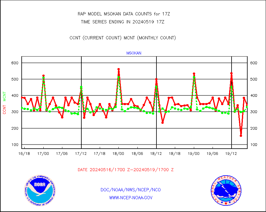
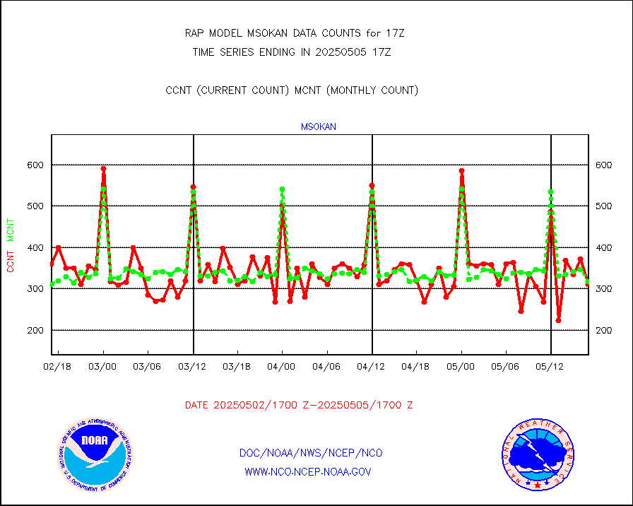
msokan |
Mesonet/MADIS Kansas Department of Transportation |
341 |
331 |
103.0 % |
1916.50-1917.50 |
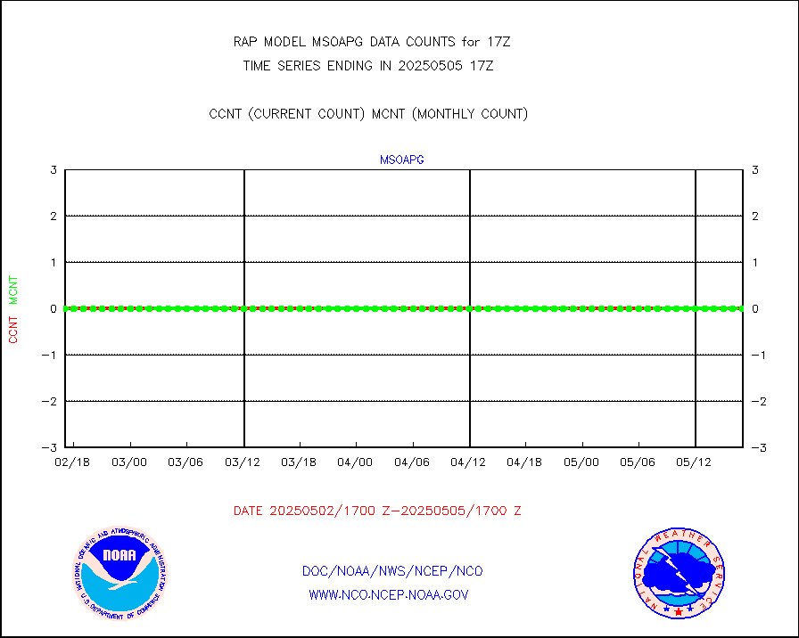
msokla |
Mesonet/MADIS Oklahoma Mesonet |
318 |
332 |
95.8 % |
1916.50-1917.50 |
msolju |
Mesonet/MADIS Louisiana State/Jackson State Univ. |
0 |
0 |
n/a |
1916.50-1917.50 |
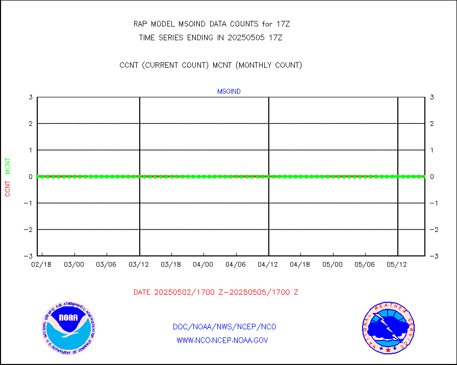
msomca |
Mesonet/MADIS Missouri Commercial Agricult Wx Net |
272 |
264 |
103.0 % |
1916.50-1917.50 |
msomin |
Mesonet/MADIS Minnesota Dept. of Transportation |
0 |
0 |
n/a |
1916.50-1917.50 |
msonos |
Mesonet/MADIS NOS-Phys Oceanographic Realtime Sys |
292 |
286 |
102.1 % |
1916.50-1917.50 |
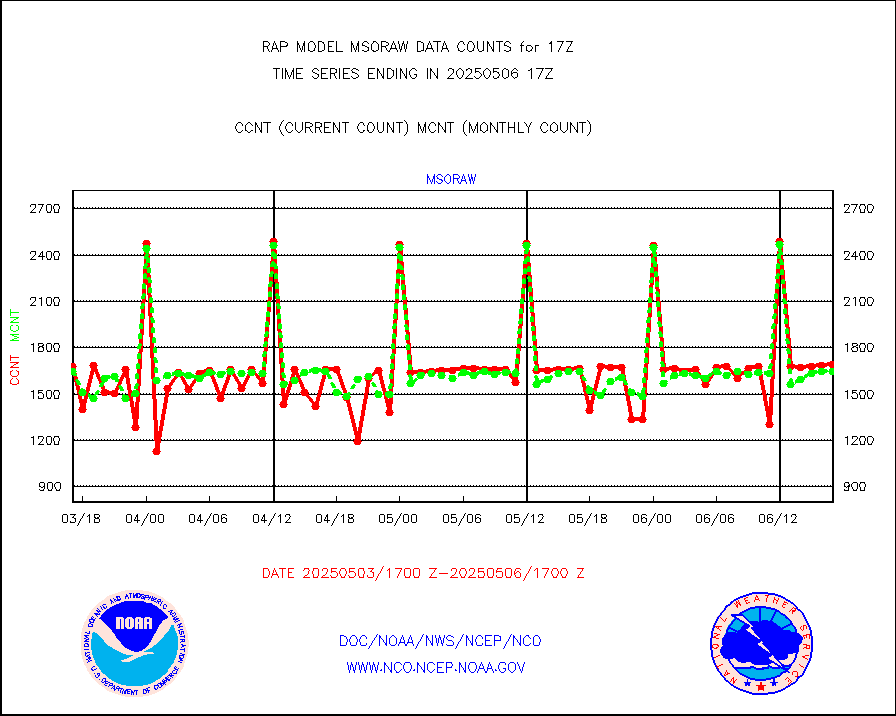
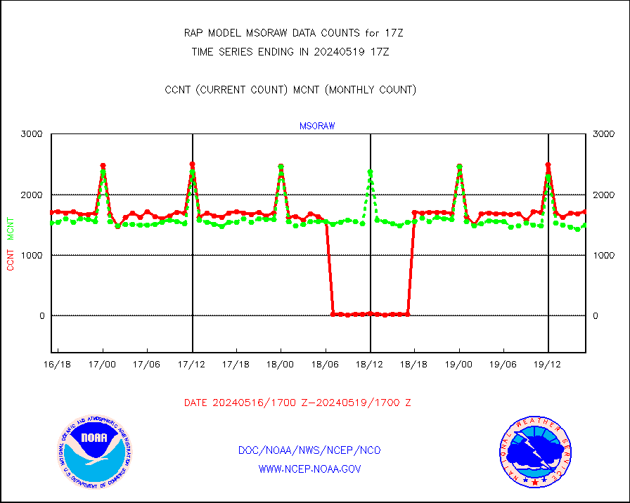
msoraw |
Mesonet/MADIS NFIC Remote Automated Wx Stns(RAWS) |
1716 |
1497 |
114.6 % |
1916.50-1917.50 |
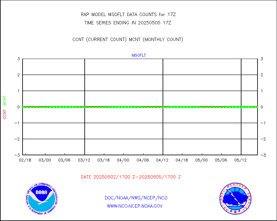
msourb |
Mesonet/MADIS UrbaNet |
3930 |
3965 |
99.1 % |
1916.50-1917.50 |
msovir |
Mesonet/MADIS Virginia Dept. of Transportation |
206 |
229 |
90.0 % |
1916.50-1917.50 |
msowfy |
Mesonet/MADIS "Weather for You" |
0 |
0 |
n/a |
1916.50-1917.50 |
msowis |
Mesonet/MADIS Wisconsin Dept. of Transportation |
0 |
0 |
n/a |
1916.50-1917.50 |
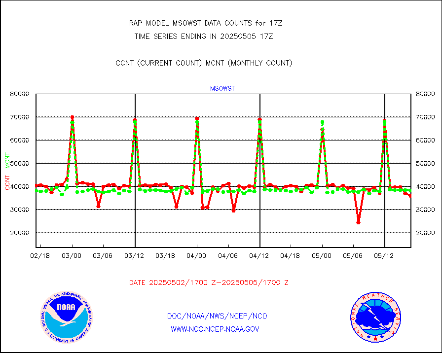
msowst |
Mesonet/MADIS MesoWest (many subproviders) |
41620 |
38815 |
107.2 % |
1916.50-1917.50 |
msowtx |
Mesonet/MADIS West Texas |
5038 |
4866 |
103.5 % |
1916.50-1917.50 |
mtiasi |
METOP 1-2 IASI 1C radiance data (varbl. channels) |
7936 |
14444 |
54.9 % |
1915.00-1918.99 |
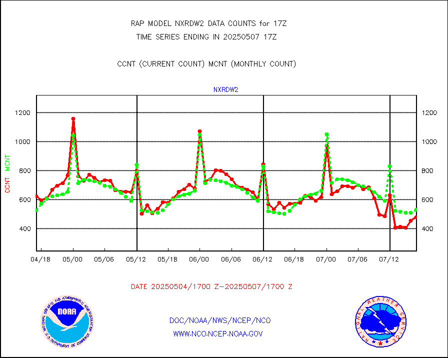
nxrdw2 |
NEXRAD Vel Azm Dsp(VAD) winds via Level 2 decoder |
631 |
578 |
109.2 % |
1916.00-1918.00 |
osbuv8 |
NOAA 16-19 Solar Backscatter UV-2 rad frm V8 BUFR |
0 |
0 |
n/a |
1915.00-1917.99 |
pibal |
PIBAL (from PILOT, PILOT SHIP, PILOT MOBIL) |
0 |
0 |
n/a |
1916.00-1918.00 |
pirep |
Manual PIREP aircraft data (dcded from AIREP fmt) |
545 |
637 |
85.6 % |
1913.75-1920.25 |
prflrp |
Profilr winds from PIBAL (PILOT,PILOT SHIP/MOBIL) |
0 |
0 |
n/a |
1915.50-1918.50 |
raobm |
Rawinsonde - mobile land (from TEMP/PILOT MOBIL) |
0 |
0 |
n/a |
1916.00-1918.00 |
raobs |
Rawinsonde - ship (from TEMP SHIP, PILOT SHIP) |
0 |
0 |
n/a |
1916.00-1918.00 |
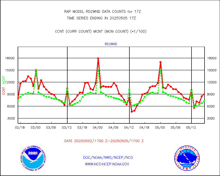
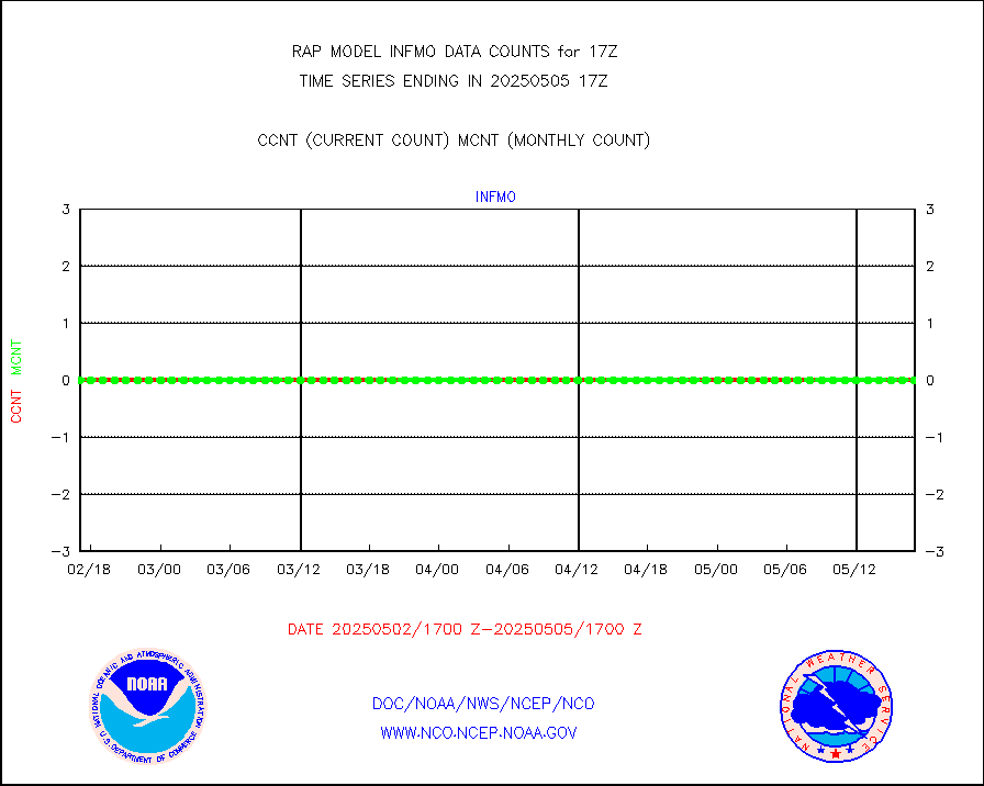
rd2wnd |
NEXRAD radial wind (Level 2 - GTS) |
985404 |
889929 |
110.7 % |
1916.50-1917.49 |
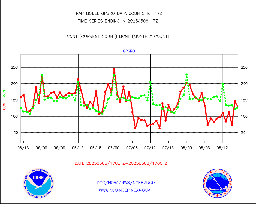
recco |
Flight level reconnaissance aircraft data |
0 |
1 |
0.0 % |
1916.00-1918.00 |
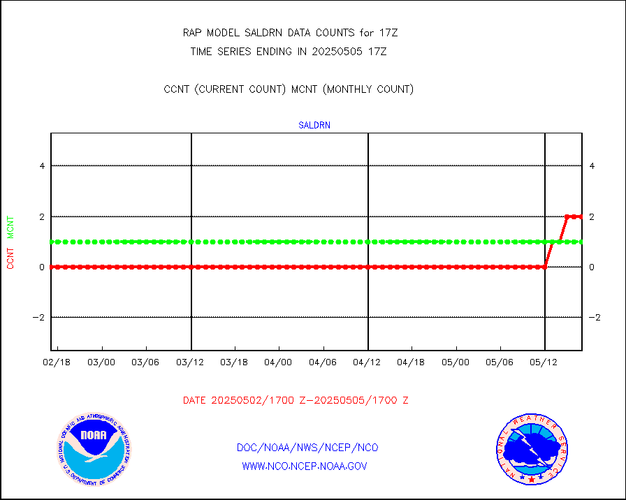
saldrn |
Surface Marine Saildrone (decoded from BUFR) |
2 |
2 |
100.0 % |
1915.00-1918.99 |
saphir |
Megha-Tropiques SAPHIR L1A2 brightness temps |
0 |
0 |
n/a |
1914.00-1919.99 |
sevasr |
METEOSAT-10 2nd Gen SEVIRI All Sky Radiance(proc) |
9512 |
9502 |
100.1 % |
1915.00-1918.99 |
sevcsr |
METEOSAT-10 2nd Gen SEVIRI Clr Sky Radiance(proc) |
0 |
0 |
n/a |
1915.00-1918.99 |
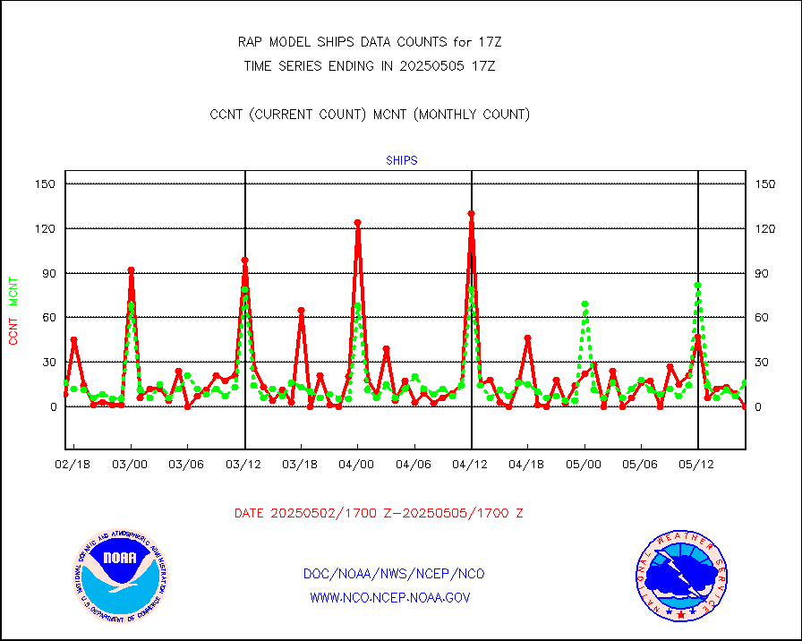
ships |
Ship - manual and automatic, restricted |
0 |
4 |
0.0 % |
1916.50-1917.50 |
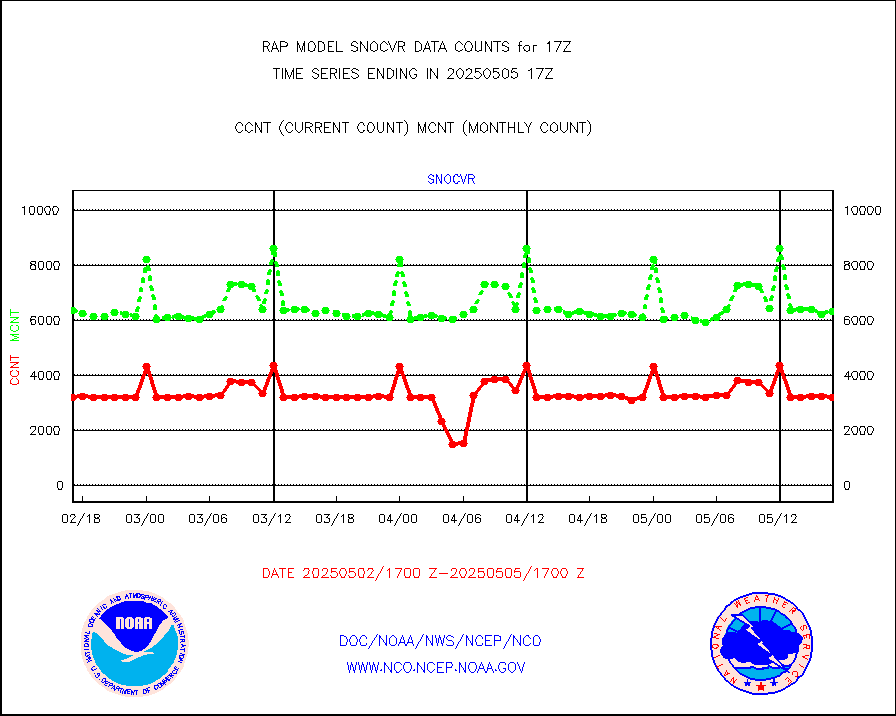
snocvr |
NOW COVER, DEPTH/DENSITY AND WATER EQUIVALENT |
3412 |
6829 |
50.0 % |
1915.00-1919.00 |
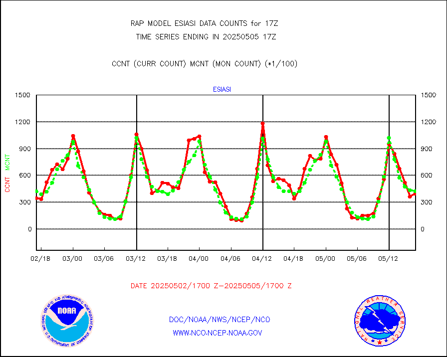
ssmisu |
DMSP SSM/IS 1C radiance data (Unified Pre-Proc.) |
107988 |
64040 |
168.6 % |
1915.00-1918.99 |
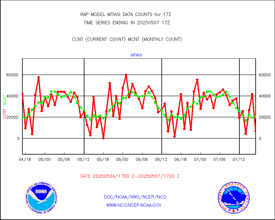
subpfl |
Sub-surface float and glider profile (BUFR) |
20 |
8 |
250.0 % |
1915.00-1918.99 |
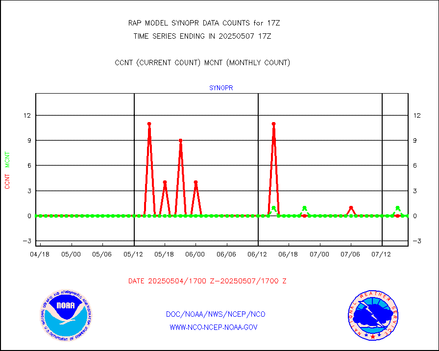
synopr |
Synoptic - restricted (WMO Res 40) manual & auto. |
0 |
0 |
n/a |
1916.50-1917.50 |
synpbr |
Synoptic - restricted (WMO Res 40)(decoded BUFR) |
344 |
348 |
98.9 % |
1916.50-1917.50 |
synpmb |
Synoptic - mobile manual & auto (decoded fr BUFR) |
0 |
0 |
n/a |
1916.50-1917.50 |
tmdara |
TAMDAR aircft data-all types(from Panasonic,BUFR) |
1022 |
1017 |
100.5 % |
1913.75-1920.25 |
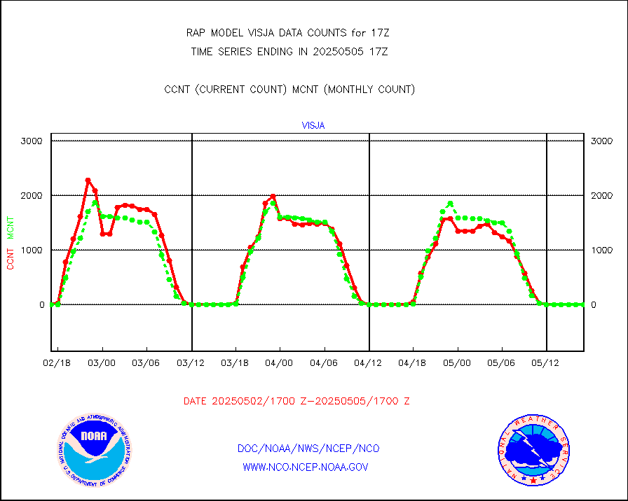
visja |
MTSAT/JMA visible derived cloud motion |
0 |
0 |
n/a |
1914.50-1919.50 |
visusr |
GOES-16&up/NESDIS visible derived cloud motion |
78935 |
121075 |
65.2 % |
1916.00-1916.99 |
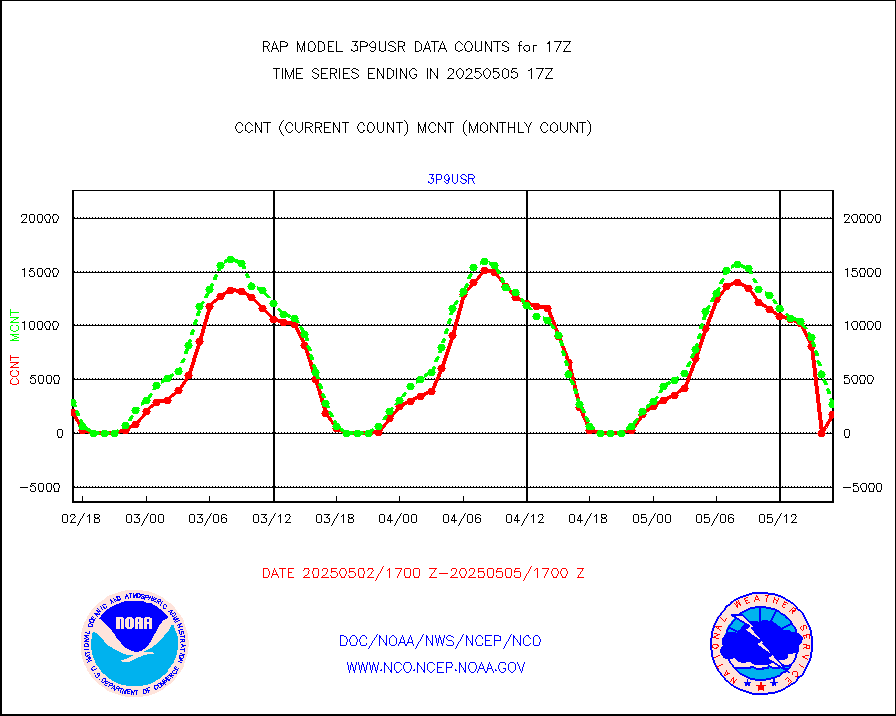
vseunb |
METEOSAT/EUMETSAT visible drv cld motion NBseq |
7855 |
7199 |
109.1 % |
1915.50-1918.49 |


