| Critical Data with Normal Counts |
|---|
| Type | Description | Hourly Count | Monthly Average | Percent (%) of Monthly Mean | UTC Time Window |
1bamua |
NOAA 15-19 & METOP 1-2 AMSU-A NCEP-proc. br.temps |
36703 |
27824 |
131.9 % |
1913.00-1918.99 |
1bhrs4 |
NOAA 18-19 & METOP 1-2 HIRS-4 NCEP-proc. br.temps |
28263 |
21454 |
131.7 % |
1913.00-1918.99 |
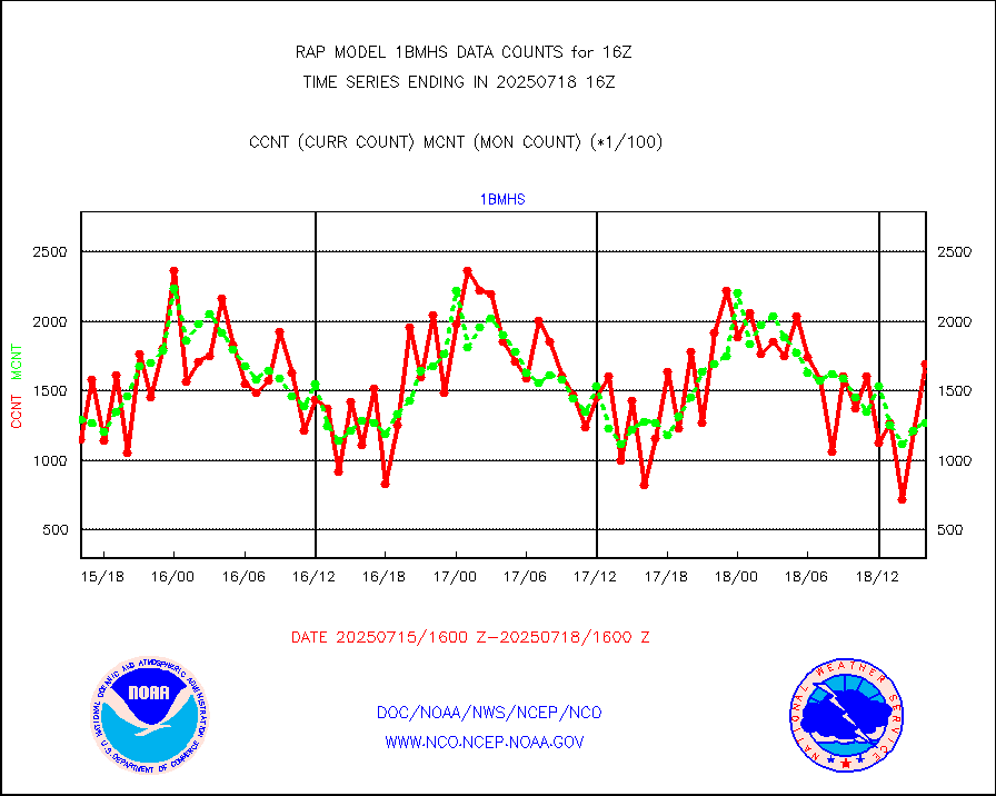
1bmhs |
NOAA 18-19 & METOP 1-2 MHS NCEP-proces. br. temps |
217718 |
162911 |
133.6 % |
1913.00-1918.99 |
acars |
MDCRS ACARS acft data from ARINC(dcded from BUFR) |
76672 |
72121 |
106.3 % |
1912.75-1919.25 |
cmanb |
Surface Marine CMAN rpts decoded from BUFR format |
1718 |
1582 |
108.6 % |
1915.50-1916.50 |
dbuoy |
Buoys decoded from FM-18 fmt (moored or drifting) |
4 |
0 |
n/a |
1915.50-1916.50 |
gnss |
Grnd-based Gbl Navigation Sat System (GNSS) data |
2428 |
2577 |
94.2 % |
1914.95-1915.05 |
h20mo |
MODIS (AQUA/TERRA) wvpr imager derived cld motion |
0 |
0 |
n/a |
1913.50-1918.50 |
infmo |
MODIS (AQUA/TERRA) ir l-wave derived cloud motion |
0 |
0 |
n/a |
1913.50-1918.50 |
lgycld |
GOES/NASA(Langley) hi-res. (1x1 f-o-v) cloud data |
3729635 |
2776921 |
134.3 % |
1915.50-1916.50 |
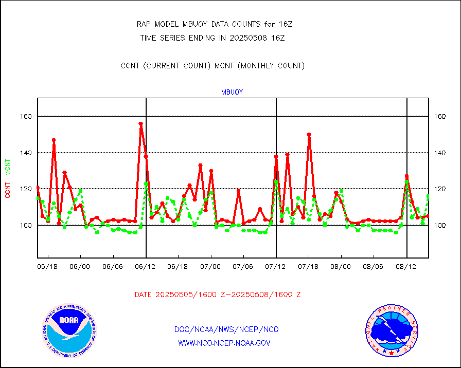
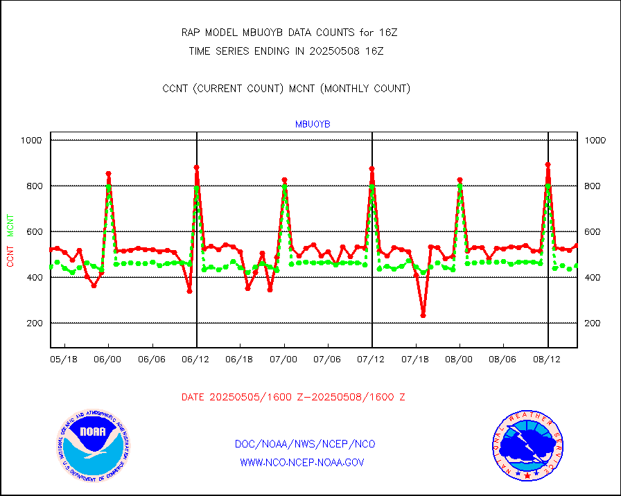
mbuoy |
Buoys decoded from FM-13 format (moored) |
48 |
86 |
55.8 % |
1915.50-1916.50 |
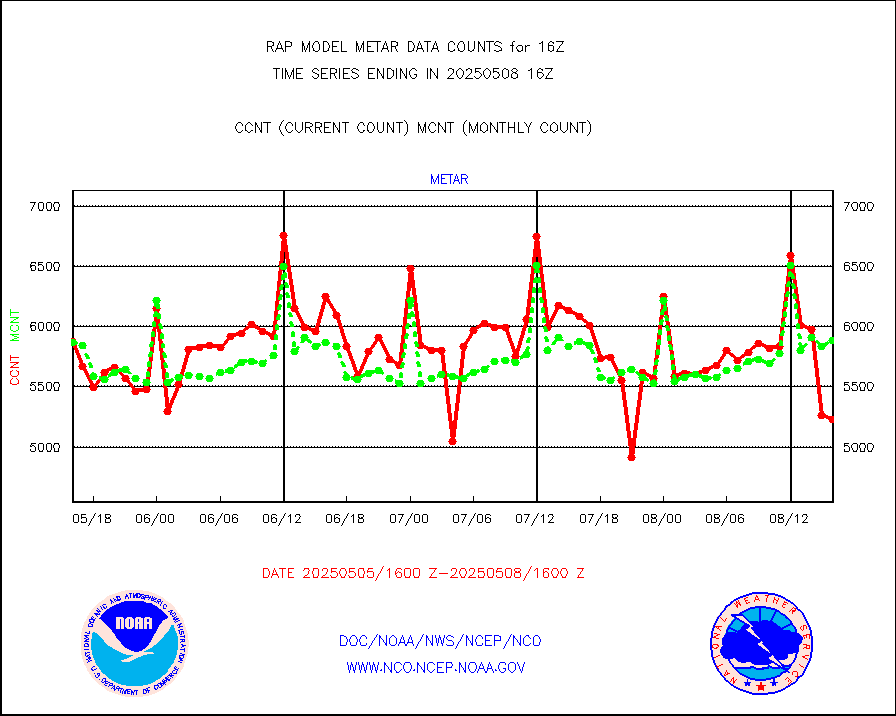
metar |
Aviation - METAR |
5704 |
5959 |
95.7 % |
1915.50-1916.50 |
nxrdw |
NEXRAD Vel Azm Dsp(VAD) winds via radar coded msg |
0 |
0 |
n/a |
1915.00-1917.00 |
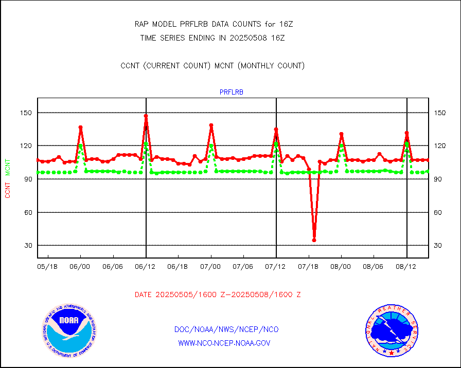
prflrb |
Multi-Agency Profiler (MAP) and SODAR winds |
72 |
83 |
86.7 % |
1914.50-1917.50 |
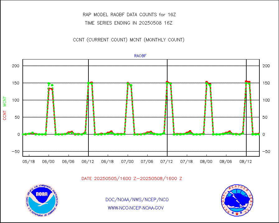
raobf |
Rawinsonde - fixed land (from TEMP or PILOT) |
1 |
1 |
100.0 % |
1915.00-1917.00 |
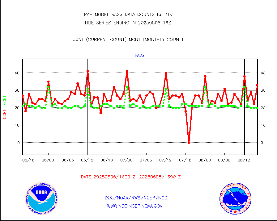
rass |
RASS temperatures (NOAA and Multi-Agency) |
20 |
21 |
95.2 % |
1915.50-1916.50 |
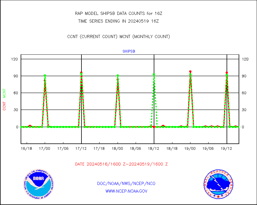
shipsb |
Ship - manual and automatic, restricted (BUFR) |
0 |
0 |
n/a |
1915.50-1916.50 |
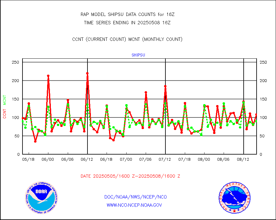
shipsu |
Ship - manual and automatic, unrestricted |
50 |
61 |
82.0 % |
1915.50-1916.50 |
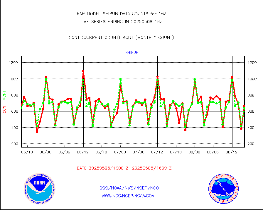
shipub |
Ship - manual and automatic, unrestricted (BUFR) |
559 |
533 |
104.9 % |
1915.50-1916.50 |
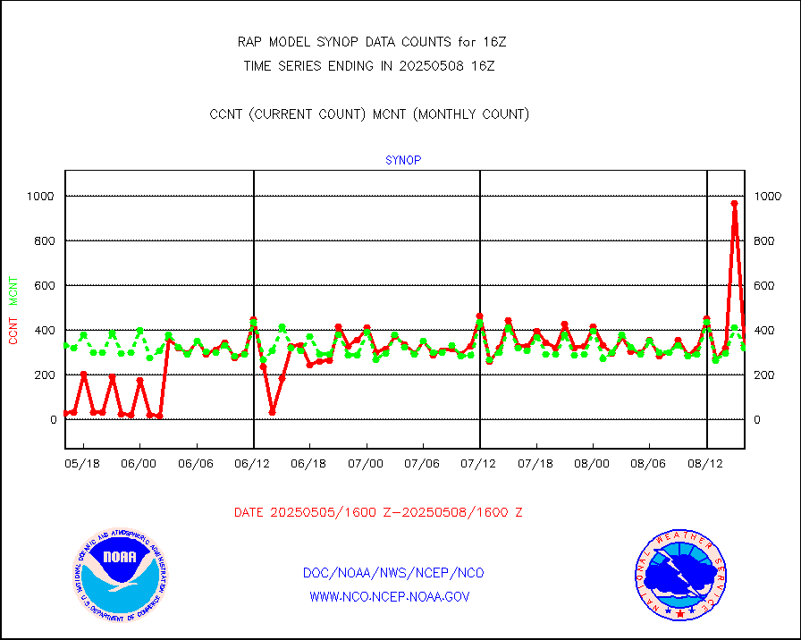
synop |
Synoptic - fixed manual and automatic |
341 |
334 |
102.1 % |
1915.50-1916.50 |
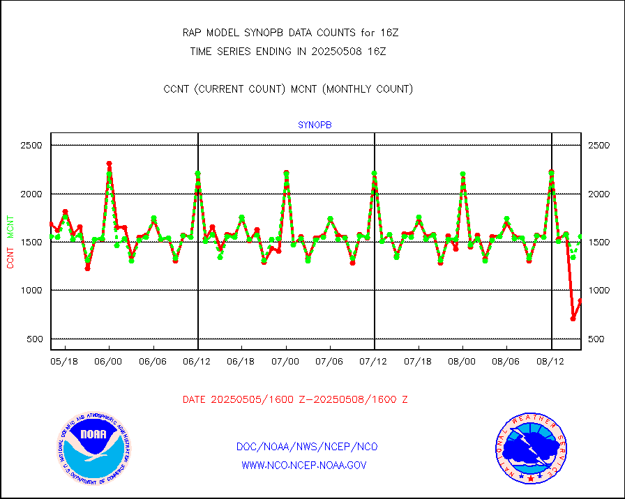
synopb |
Synoptic - fixed manual & auto (decoded fr BUFR) |
1727 |
1700 |
101.6 % |
1915.50-1916.50 |
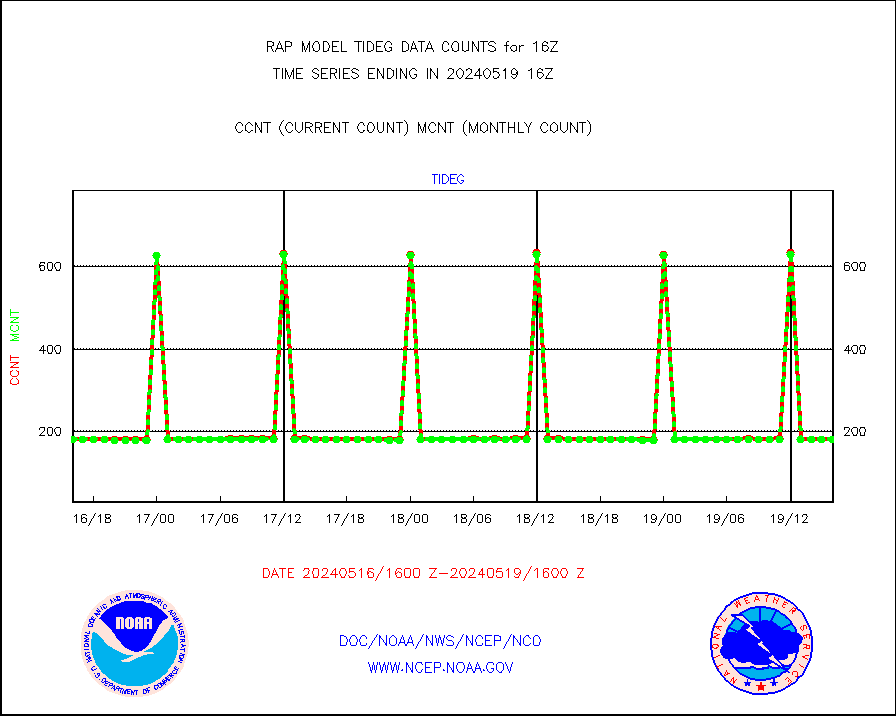
tideg |
Tide gauge reports decoded from CREX format |
182 |
181 |
100.6 % |
1915.50-1916.50 |
| Data Types of Opportunity with Normal Counts |
|---|
| Type | Description | Hourly Count | Monthly Average | Percent (%) of Monthly Mean | UTC Time Window |
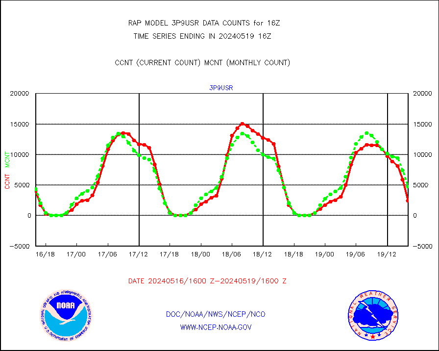
3p9usr |
GOES-16&up/NESDIS ir short-wv derived cld motion |
2444 |
4727 |
51.7 % |
1915.00-1915.99 |
acarsa |
MDCRS ACARS acft data (ARINC via AFWA)(AIREP fmt) |
0 |
0 |
n/a |
1912.75-1919.25 |
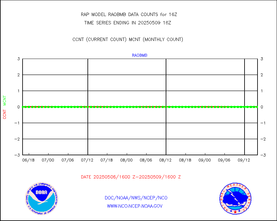
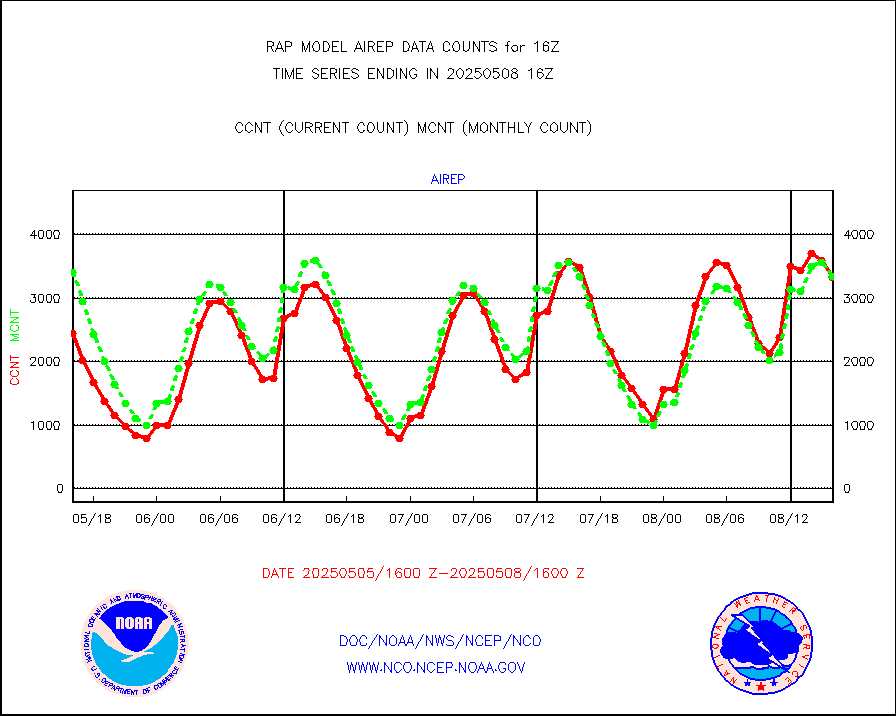
airep |
Manual AIREP aircraft data (dcded from AIREP fmt) |
5759 |
5450 |
105.7 % |
1912.75-1919.25 |
airsev |
AQUA AIRS/AMSU-A/HSB brightness temps- every FOV |
0 |
0 |
n/a |
1913.00-1918.99 |
amdar |
AMDAR aircraft data (decoded from AMDAR format) |
338 |
331 |
102.1 % |
1912.75-1919.25 |
amdarb |
AMDAR aircraft data (decoded from BUFR) |
2235 |
1931 |
115.7 % |
1912.75-1919.25 |
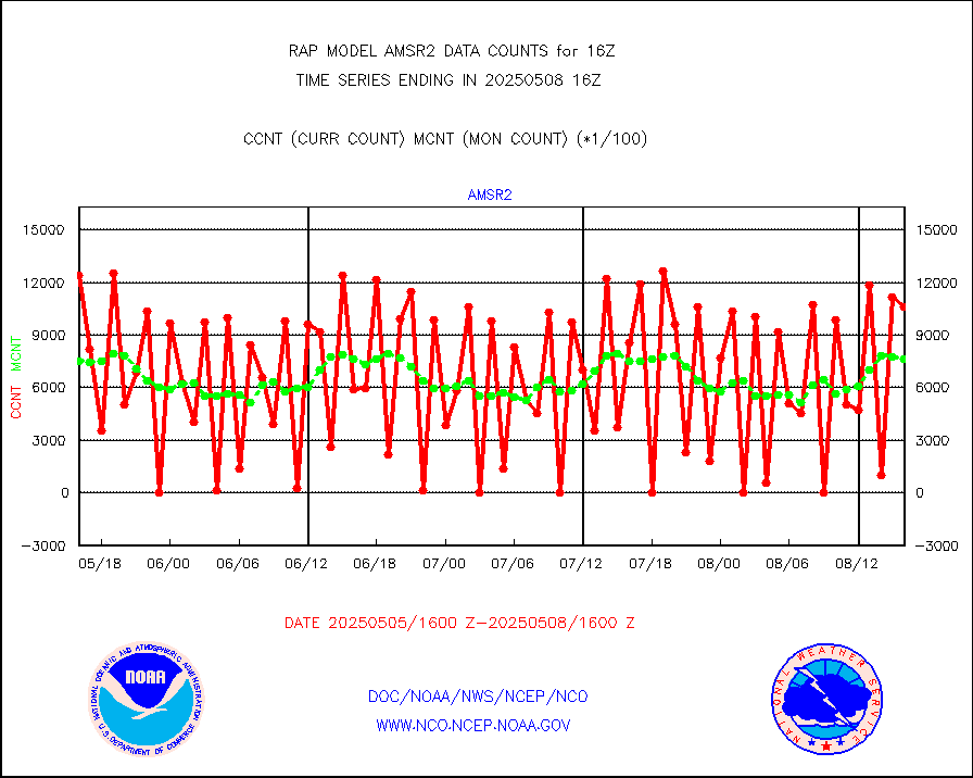
amsr2 |
GCOM-W AMSR2 1B brightness temperatures |
592996 |
733772 |
80.8 % |
1913.00-1913.99 |
ascat |
METOP 1-2 ASCAT products |
33390 |
17270 |
193.3 % |
1914.00-1918.00 |
atms |
NPP/NOAA-20 ATMS brightness temperatures |
251605 |
209557 |
120.1 % |
1914.00-1917.99 |
atmsdb |
NPP/NOAA-20 ATMS bright. temps-direct b-cast SSEC |
72098 |
89580 |
80.5 % |
1914.00-1917.99 |
coopmd |
Coop/MADIS NEPP & HCN-Modernization NOAA COOP Obs |
27 |
27 |
100.0 % |
1915.50-1916.50 |
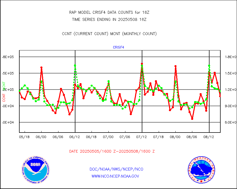
crisf4 |
NPP/NOAA-20 CrIS full spctrl radn (431 ch subset) |
108004 |
118418 |
91.2 % |
1914.00-1917.99 |
crsfdb |
NPP/NOAA-20 CrIS full spctrl radn dir brdcst SSEC |
75839 |
114528 |
66.2 % |
1914.00-1917.99 |
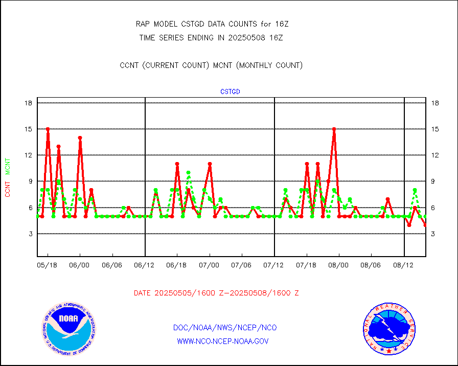
cstgd |
Coast Guard |
3 |
3 |
100.0 % |
1915.50-1916.50 |
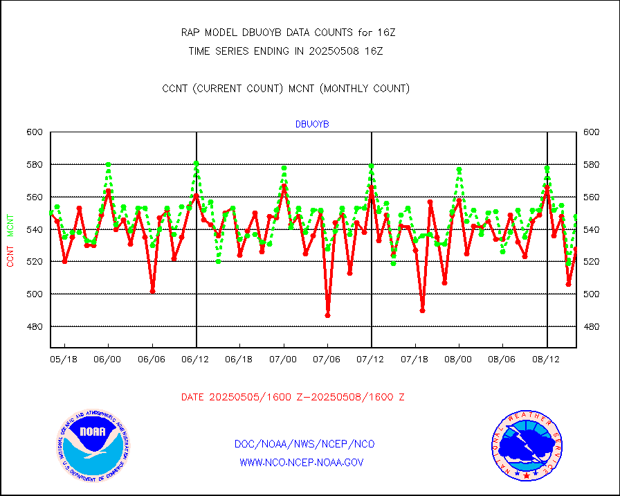
dbuoyb |
Drifting buoys (decoded from BUFR) |
605 |
581 |
104.1 % |
1915.50-1916.50 |
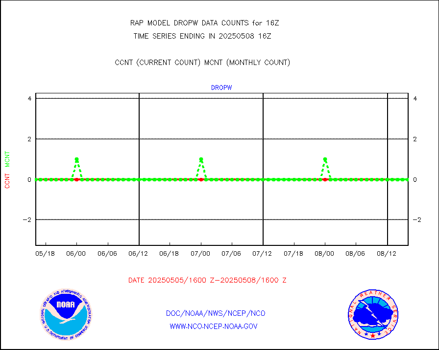
dropw |
Dropwinsonde (from TEMP DROP) |
0 |
0 |
n/a |
1915.00-1917.00 |
eadas |
E-AMDAR (European AMDAR acft decoded from BUFR) |
9615 |
9306 |
103.3 % |
1912.75-1919.25 |
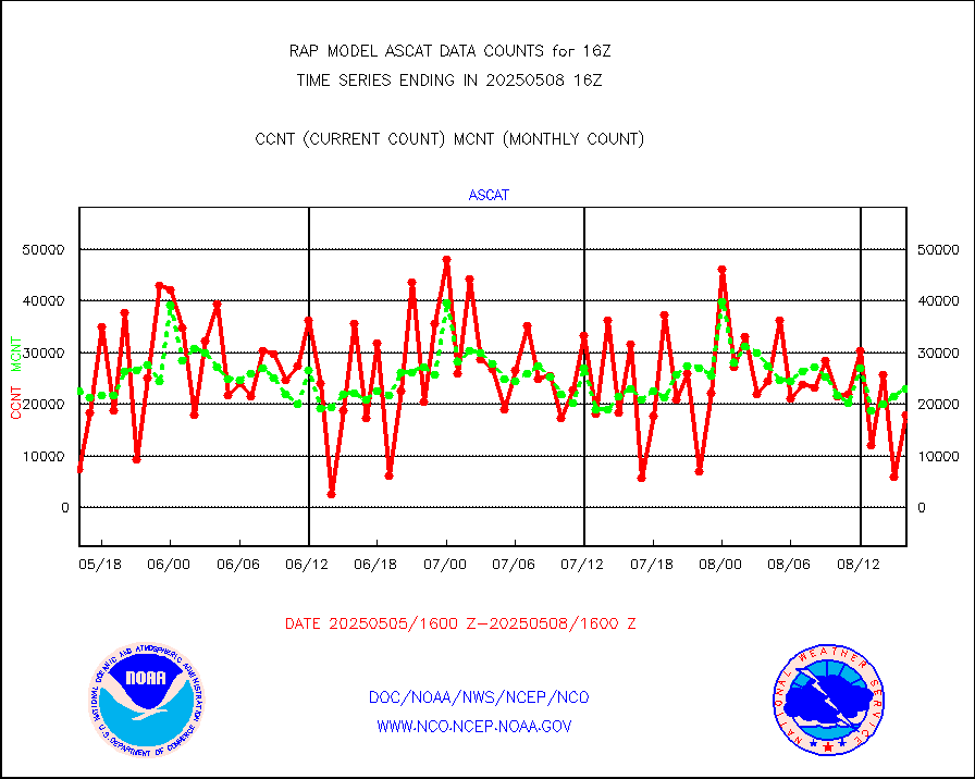
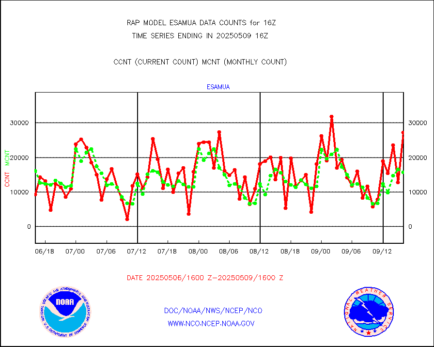
esamua |
NOAA 15-19 & METOP 1-2 AMSU-A proc btmps frm RARS |
21559 |
17181 |
125.5 % |
1915.00-1917.00 |
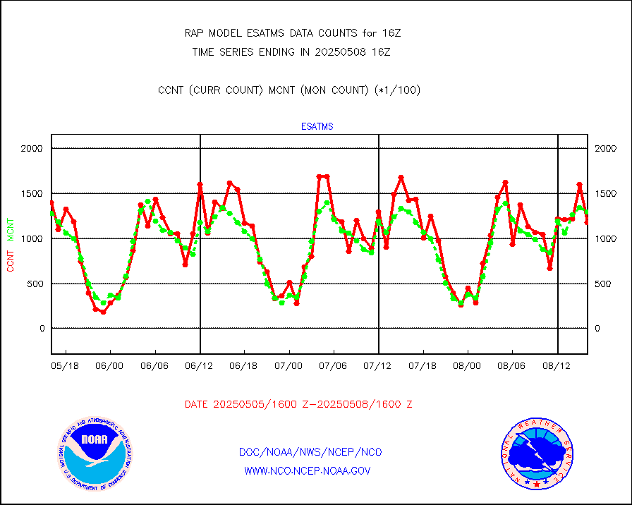
esatms |
NPP Adv. Tech. MW Sndr (ATMS) br. temps from RARS |
137828 |
141942 |
97.1 % |
1914.00-1917.99 |
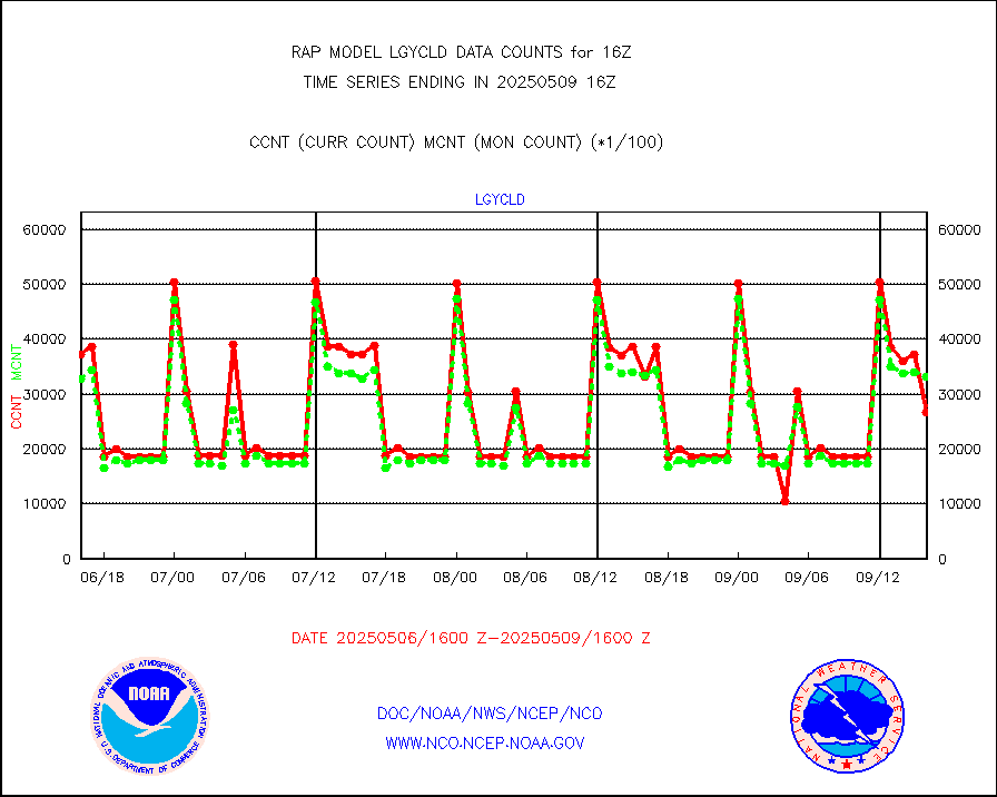
eshrs3 |
NOAA 15-19 & METOP 1-2 HIRS-3/4 pr btmps frm RARS |
41059 |
34793 |
118.0 % |
1915.00-1917.00 |
esiasi |
METOP 1-2 IASI 1C radiance data vbl chn from RARS |
64899 |
59881 |
108.4 % |
1914.00-1917.99 |
esmhs |
NOAA 18-19 & METOP 1-2 MHS proc. btemps from RARS |
205938 |
150226 |
137.1 % |
1915.00-1917.00 |
gmi1cr |
GPM GMI Level 1C-R brightness temperatures |
453174 |
459286 |
98.7 % |
1913.00-1918.99 |
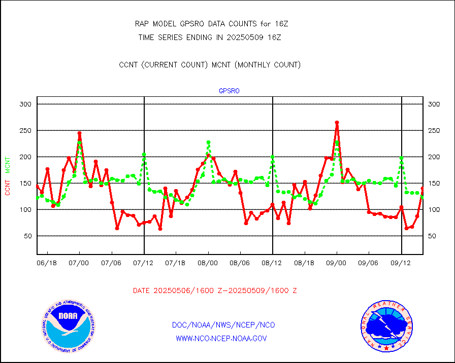
gpsro |
GPS radio occultation data |
128 |
109 |
117.4 % |
1914.00-1917.99 |
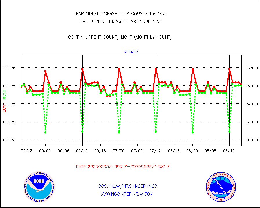
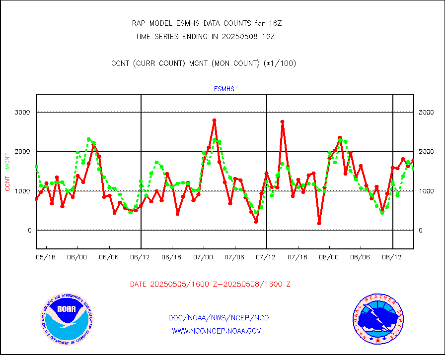
gsrasr |
GOES-16/17 All Sky Radiances (proc.) |
738227 |
789810 |
93.5 % |
1914.00-1917.99 |
gsrcsr |
GOES-16/17 Clear Sky Radiances (proc.) |
311080 |
372231 |
83.6 % |
1914.00-1917.99 |
h20ja |
MTSAT/JMA water vapor imager derived cloud motion |
2591 |
3007 |
86.2 % |
1913.50-1918.50 |
h2dusr |
GOES-16&up/NESDIS wv imgr/deep-lyr derivd cld mtn |
2709 |
7102 |
38.1 % |
1915.00-1915.99 |
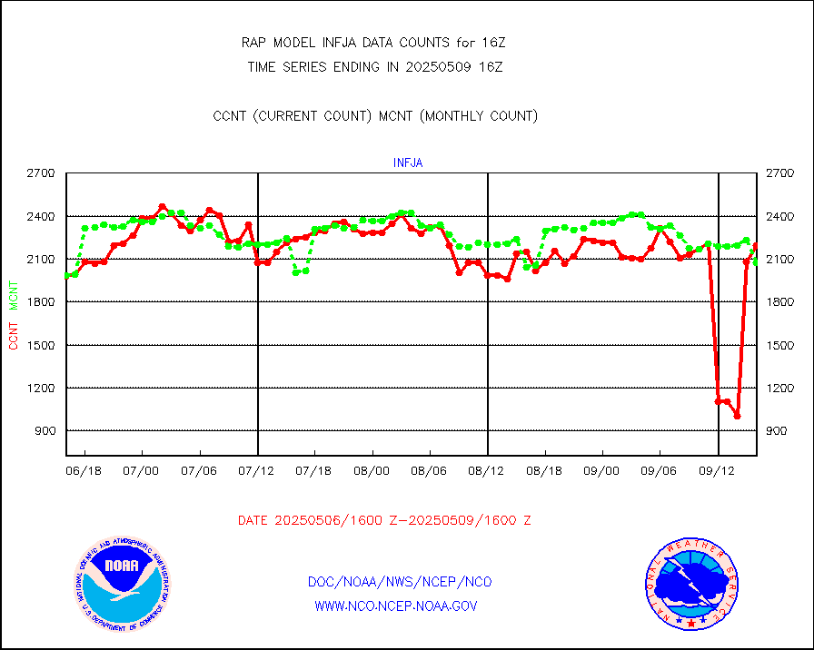
h2eunb |
METEOSAT/EUMETSAT wvpr imgr drv cld motion NBseq |
6069 |
5433 |
111.7 % |
1914.50-1917.49 |
h2tusr |
GOES-16&up/NESDIS wv imgr/cld-top derived cld mtn |
11595 |
10332 |
112.2 % |
1915.00-1915.99 |
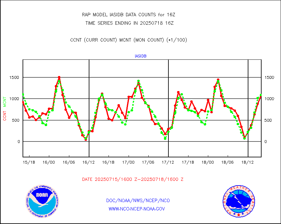
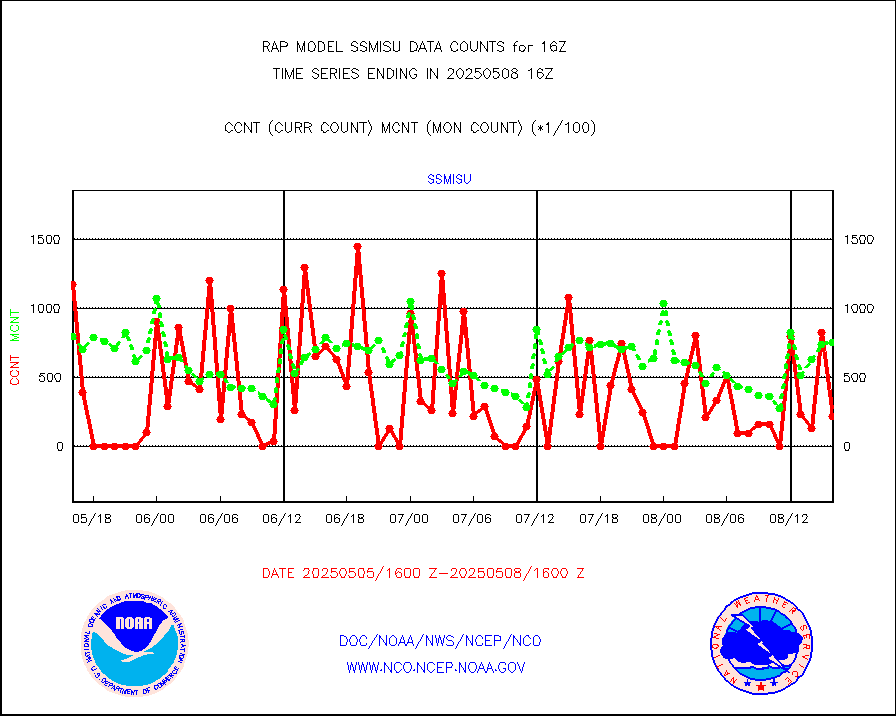
iasidb |
METOP 1-2 IASI 1C radiances-direct broadcast SSEC |
84705 |
73194 |
115.7 % |
1914.00-1917.99 |
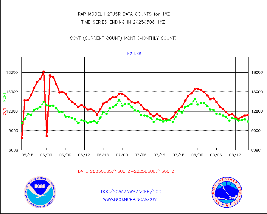
ifeunb |
METEOSAT/EUMETSAT ir lg-wave drv cld motion NBseq |
3408 |
3306 |
103.1 % |
1914.50-1917.49 |
ifvrnb |
VIIRS (NPP/NOAA-20) ir lg-wv drv cloud motion(NB) |
0 |
0 |
n/a |
1913.50-1918.50 |
infav |
AVHRR (NOAA/METOP) ir lg-wave derived cld motion |
0 |
0 |
n/a |
1913.50-1918.50 |
infav1 |
AVHRR (METOP) ir lg-wave derived cld motion |
0 |
0 |
n/a |
1914.50-1917.49 |
infja |
MTSAT/JMA infrared long-wave derived cloud motion |
1782 |
2458 |
72.5 % |
1913.50-1918.50 |
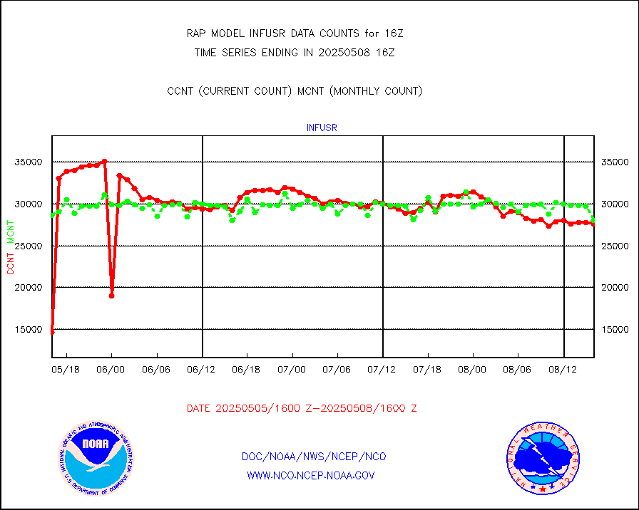
infusr |
GOES-16&up/NESDIS ir long-wave derived cld motion |
28302 |
27954 |
101.2 % |
1915.00-1915.99 |
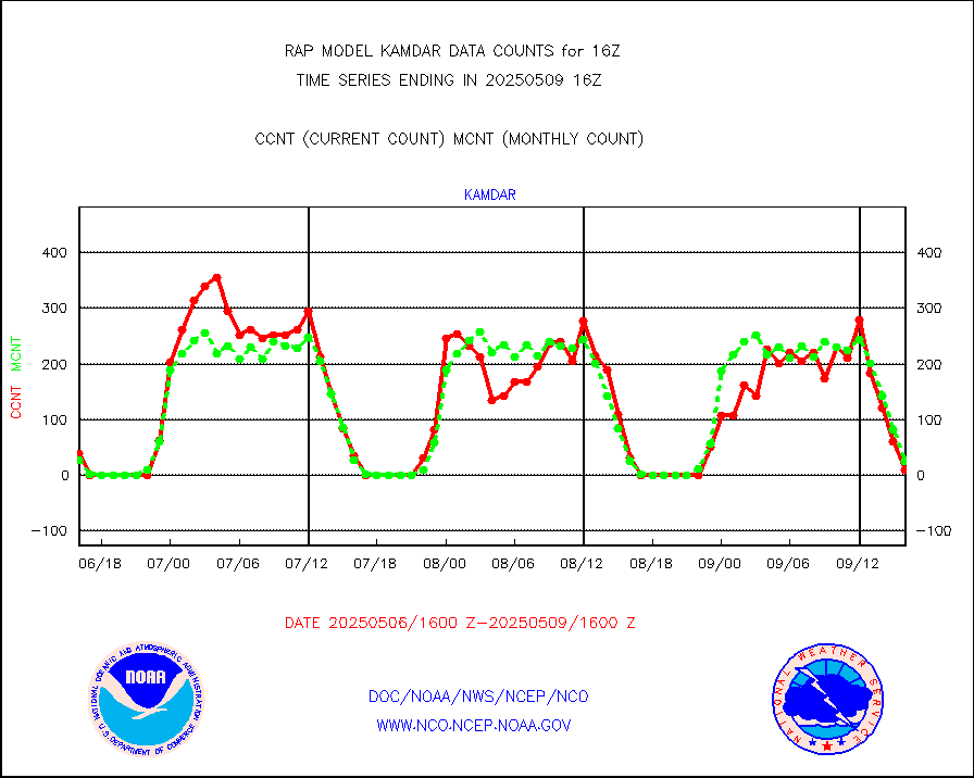
kamdar |
Korean AMDAR aircraft data (decoded from BUFR) |
47 |
18 |
261.1 % |
1912.75-1919.25 |
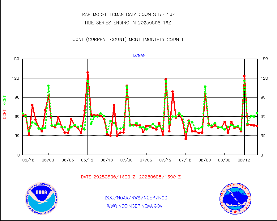
lcman |
Land-based CMAN stations decoded from CMAN format |
72 |
93 |
77.4 % |
1915.50-1916.50 |
ltnglr |
LLDN Long-rng lightning from Vaisala via NOAAPORT |
232202 |
69174 |
335.7 % |
1915.00-1916.50 |
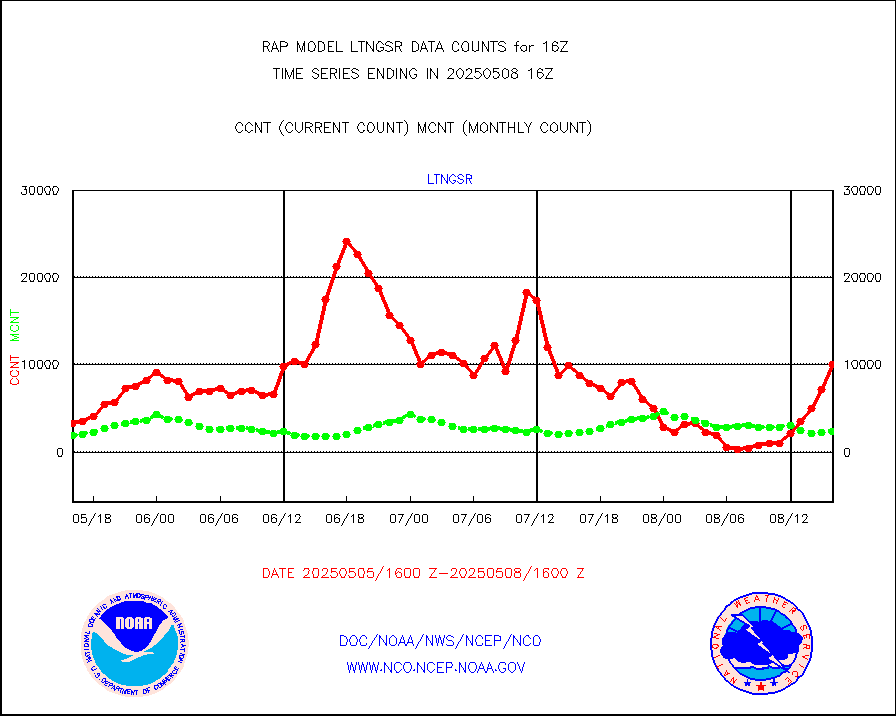
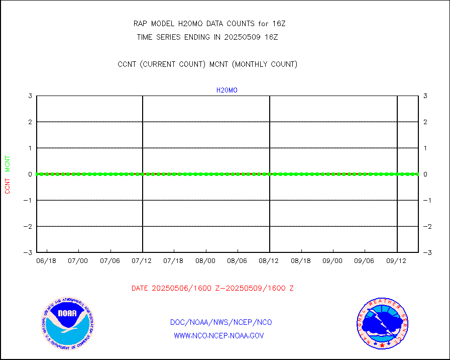
ltngsr |
NLDN Shrt-rng lightning from Vaisala via NOAAPORT |
13116 |
3350 |
391.5 % |
1915.00-1916.50 |
mbuoyb |
Moored buoys (decoded from BUFR) |
621 |
538 |
115.4 % |
1915.50-1916.50 |
mso470 |
Mesonet/MADIS Colorado E-470 (Interstate 470) |
21 |
18 |
116.7 % |
1915.50-1916.50 |
msoalk |
Mesonet/MADIS Alaska Department of Transportation |
104 |
104 |
100.0 % |
1915.50-1916.50 |
msoapg |
Mesonet/MADIS U.S. Army Aberdeen Proving Grounds |
0 |
0 |
n/a |
1915.50-1916.50 |
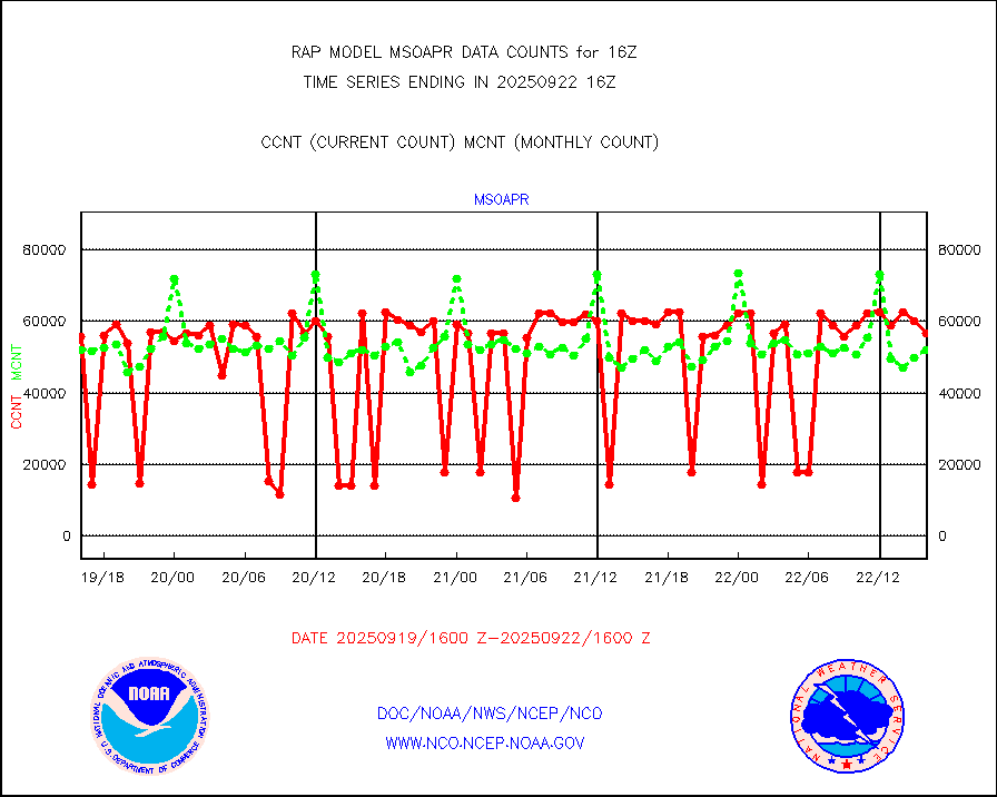
msoapr |
Mesonet/MADIS Citizen Weather Observers Program |
44840 |
45562 |
98.4 % |
1915.50-1916.50 |
msoaws |
Mesonet/MADIS AWS Convergence Technologies, Inc. |
24192 |
25701 |
94.1 % |
1915.50-1916.50 |
msoawx |
Mesonet/MADIS "Anything Weather" |
0 |
0 |
n/a |
1915.50-1916.50 |
msocol |
Mesonet/MADIS Colorado Dept. of Transportation |
0 |
0 |
n/a |
1915.50-1916.50 |
msodcn |
Mesonet/MADIS DC Net |
0 |
0 |
n/a |
1915.50-1916.50 |
msoden |
Mesonet/MADIS Denver Urban Drainage & Flood Cntrl |
225 |
217 |
103.7 % |
1915.50-1916.50 |
msofla |
Mesonet/MADIS Florida (FAWN & USF) |
3 |
3 |
100.0 % |
1915.50-1916.50 |
msoflt |
Mesonet/MADIS Florida Dept. of Transportation |
0 |
0 |
n/a |
1915.50-1916.50 |
msogeo |
Mesonet/MADIS Georgia Dept. of Transportation |
0 |
0 |
n/a |
1915.50-1916.50 |
msohad |
Mesonet/MADIS NWS Hydromet Auto Data System(HADS) |
5777 |
5308 |
108.8 % |
1915.50-1916.50 |
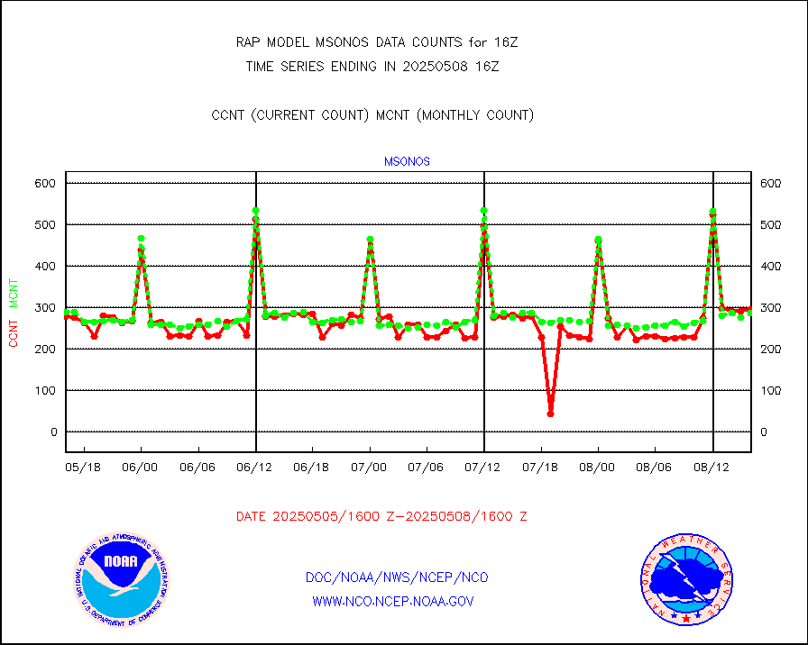
msoien |
Mesonet/MADIS Iowa Environmental |
168 |
164 |
102.4 % |
1915.50-1916.50 |
msoind |
Mesonet/MADIS Indiana Dept. of Transportation |
0 |
0 |
n/a |
1915.50-1916.50 |
msoiow |
Mesonet/MADIS Iowa Department of Transportation |
0 |
0 |
n/a |
1915.50-1916.50 |
msokan |
Mesonet/MADIS Kansas Department of Transportation |
386 |
305 |
126.6 % |
1915.50-1916.50 |
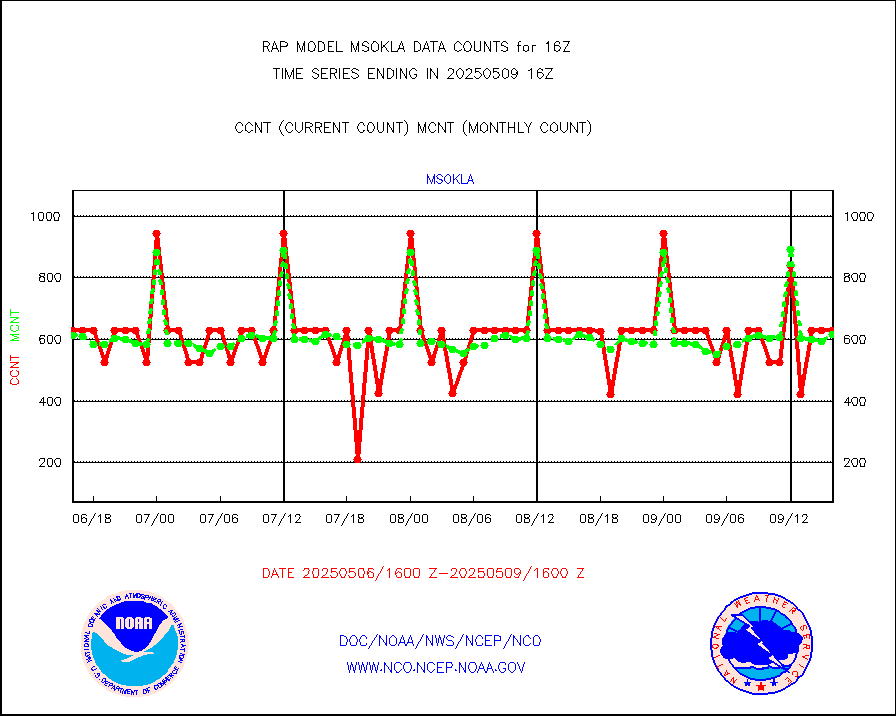
msokla |
Mesonet/MADIS Oklahoma Mesonet |
318 |
318 |
100.0 % |
1915.50-1916.50 |
msolju |
Mesonet/MADIS Louisiana State/Jackson State Univ. |
0 |
0 |
n/a |
1915.50-1916.50 |
msomca |
Mesonet/MADIS Missouri Commercial Agricult Wx Net |
272 |
260 |
104.6 % |
1915.50-1916.50 |
msomin |
Mesonet/MADIS Minnesota Dept. of Transportation |
0 |
0 |
n/a |
1915.50-1916.50 |
msonos |
Mesonet/MADIS NOS-Phys Oceanographic Realtime Sys |
297 |
286 |
103.8 % |
1915.50-1916.50 |
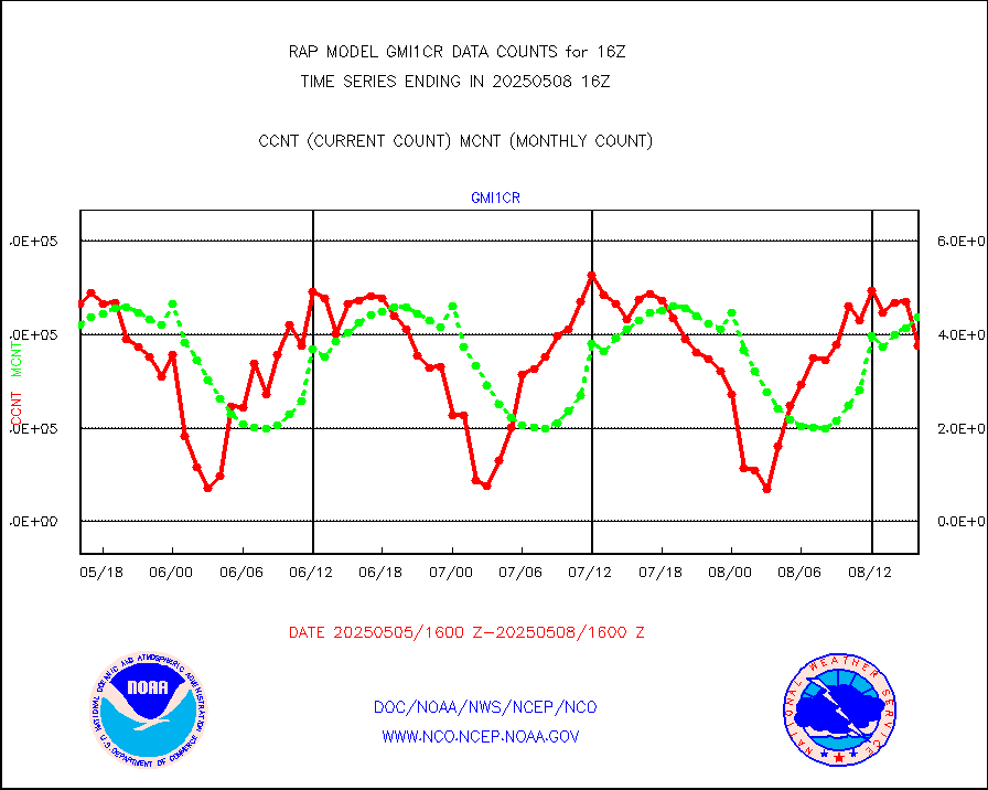
msoraw |
Mesonet/MADIS NFIC Remote Automated Wx Stns(RAWS) |
1677 |
1432 |
117.1 % |
1915.50-1916.50 |
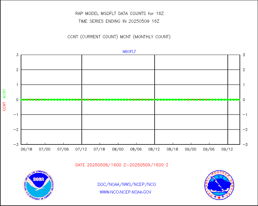
msourb |
Mesonet/MADIS UrbaNet |
3914 |
3958 |
98.9 % |
1915.50-1916.50 |
msovir |
Mesonet/MADIS Virginia Dept. of Transportation |
208 |
229 |
90.8 % |
1915.50-1916.50 |
msowfy |
Mesonet/MADIS "Weather for You" |
0 |
0 |
n/a |
1915.50-1916.50 |
msowis |
Mesonet/MADIS Wisconsin Dept. of Transportation |
0 |
0 |
n/a |
1915.50-1916.50 |
msowst |
Mesonet/MADIS MesoWest (many subproviders) |
41469 |
38563 |
107.5 % |
1915.50-1916.50 |
msowtx |
Mesonet/MADIS West Texas |
5043 |
4796 |
105.2 % |
1915.50-1916.50 |
mtiasi |
METOP 1-2 IASI 1C radiance data (varbl. channels) |
44119 |
14300 |
308.5 % |
1914.00-1917.99 |
nxrdw2 |
NEXRAD Vel Azm Dsp(VAD) winds via Level 2 decoder |
530 |
554 |
95.7 % |
1915.00-1917.00 |
osbuv8 |
NOAA 16-19 Solar Backscatter UV-2 rad frm V8 BUFR |
0 |
0 |
n/a |
1914.00-1916.99 |
pibal |
PIBAL (from PILOT, PILOT SHIP, PILOT MOBIL) |
0 |
0 |
n/a |
1915.00-1917.00 |
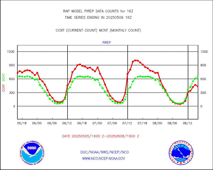
pirep |
Manual PIREP aircraft data (dcded from AIREP fmt) |
545 |
630 |
86.5 % |
1912.75-1919.25 |
prflrp |
Profilr winds from PIBAL (PILOT,PILOT SHIP/MOBIL) |
0 |
0 |
n/a |
1914.50-1917.50 |
raobm |
Rawinsonde - mobile land (from TEMP/PILOT MOBIL) |
0 |
0 |
n/a |
1915.00-1917.00 |
raobs |
Rawinsonde - ship (from TEMP SHIP, PILOT SHIP) |
0 |
0 |
n/a |
1915.00-1917.00 |
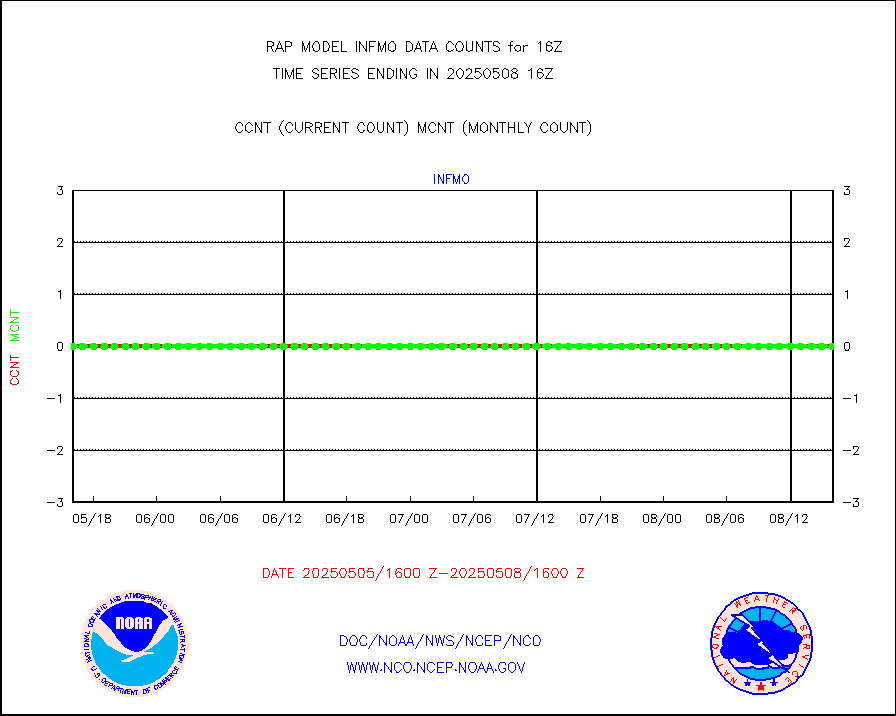
rd2wnd |
NEXRAD radial wind (Level 2 - GTS) |
745939 |
794488 |
93.9 % |
1915.50-1916.49 |
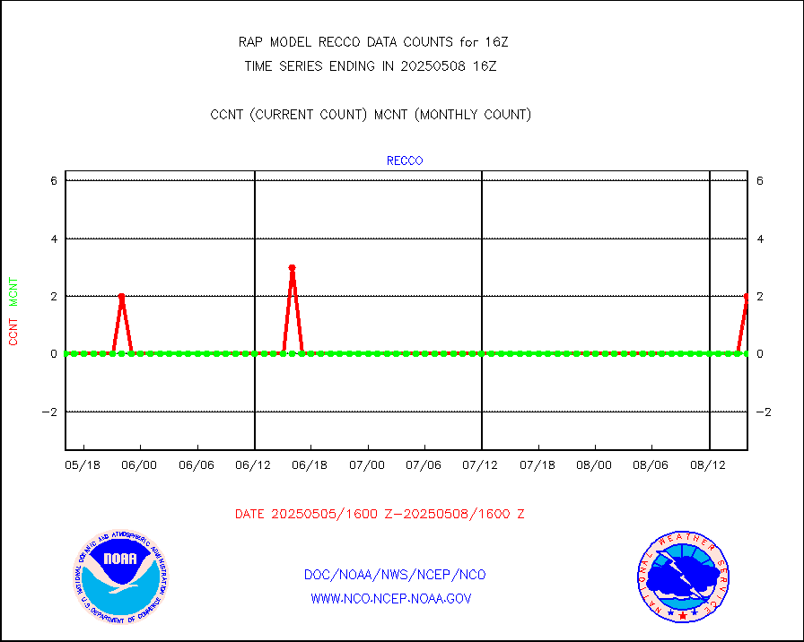
recco |
Flight level reconnaissance aircraft data |
0 |
0 |
n/a |
1915.00-1917.00 |
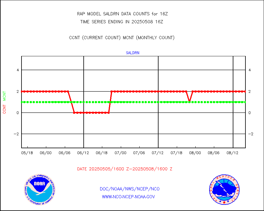
saldrn |
Surface Marine Saildrone (decoded from BUFR) |
2 |
2 |
100.0 % |
1914.00-1917.99 |
saphir |
Megha-Tropiques SAPHIR L1A2 brightness temps |
0 |
0 |
n/a |
1913.00-1918.99 |
sevasr |
METEOSAT-10 2nd Gen SEVIRI All Sky Radiance(proc) |
9512 |
9503 |
100.1 % |
1914.00-1917.99 |
sevcsr |
METEOSAT-10 2nd Gen SEVIRI Clr Sky Radiance(proc) |
0 |
0 |
n/a |
1914.00-1917.99 |
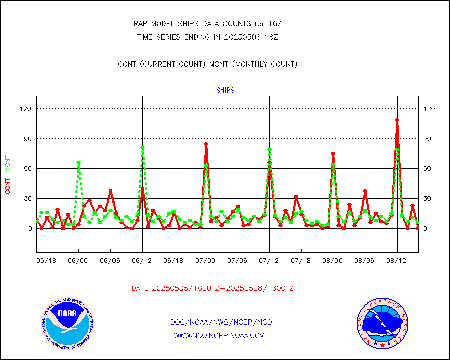
ships |
Ship - manual and automatic, restricted |
0 |
3 |
0.0 % |
1915.50-1916.50 |
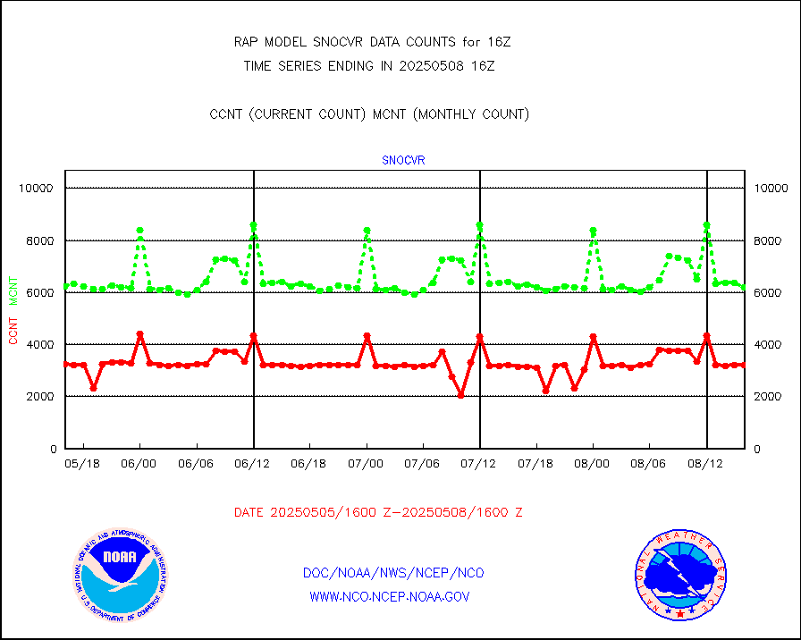
snocvr |
NOW COVER, DEPTH/DENSITY AND WATER EQUIVALENT |
3354 |
6882 |
48.7 % |
1914.00-1918.00 |
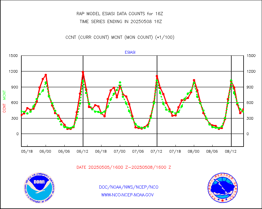
ssmisu |
DMSP SSM/IS 1C radiance data (Unified Pre-Proc.) |
12600 |
43419 |
29.0 % |
1914.00-1917.99 |
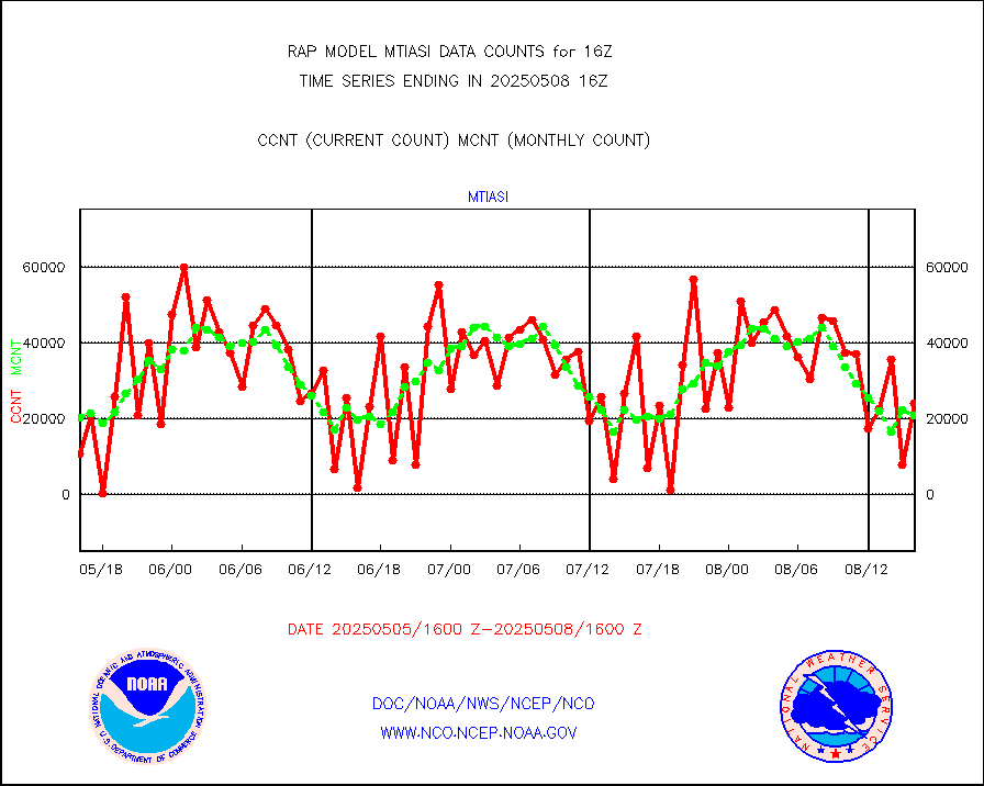
subpfl |
Sub-surface float and glider profile (BUFR) |
23 |
3 |
766.7 % |
1914.00-1917.99 |
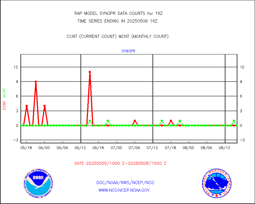
synopr |
Synoptic - restricted (WMO Res 40) manual & auto. |
0 |
0 |
n/a |
1915.50-1916.50 |
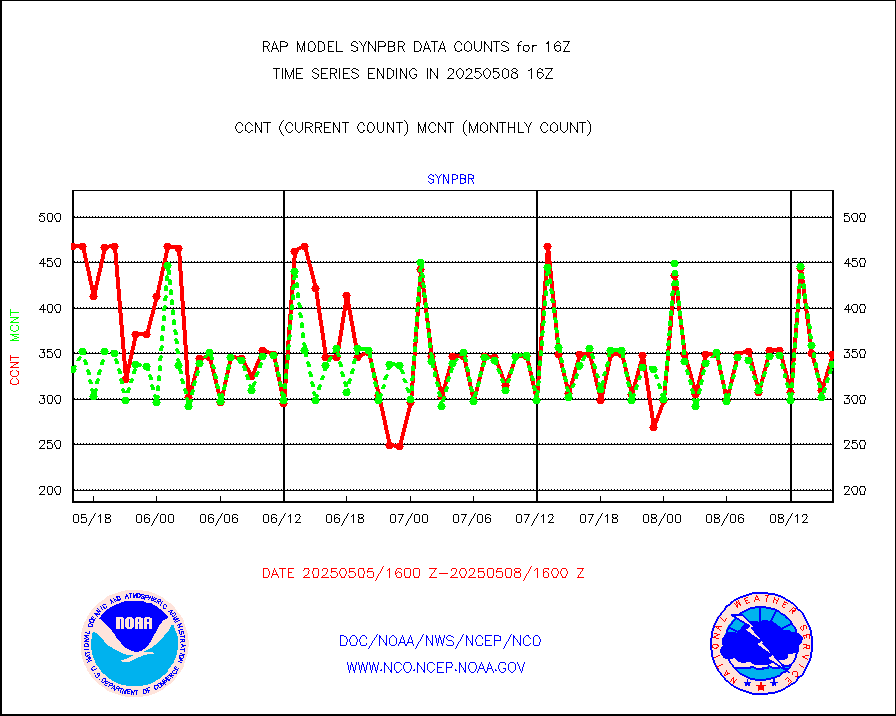
synpbr |
Synoptic - restricted (WMO Res 40)(decoded BUFR) |
344 |
345 |
99.7 % |
1915.50-1916.50 |
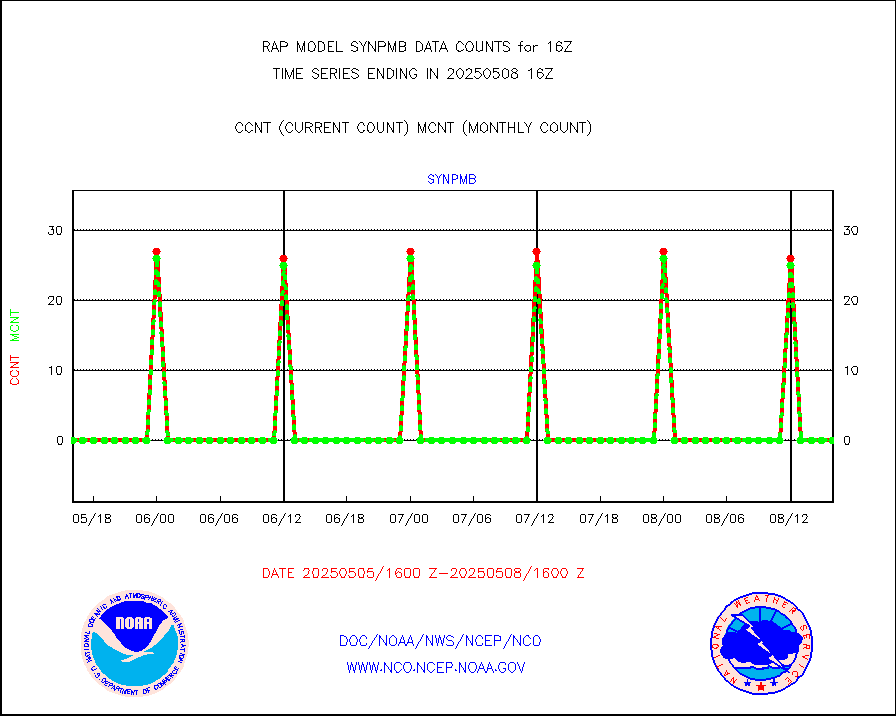
synpmb |
Synoptic - mobile manual & auto (decoded fr BUFR) |
0 |
0 |
n/a |
1915.50-1916.50 |
tmdara |
TAMDAR aircft data-all types(from Panasonic,BUFR) |
1113 |
1223 |
91.0 % |
1912.75-1919.25 |
visja |
MTSAT/JMA visible derived cloud motion |
0 |
0 |
n/a |
1913.50-1918.50 |
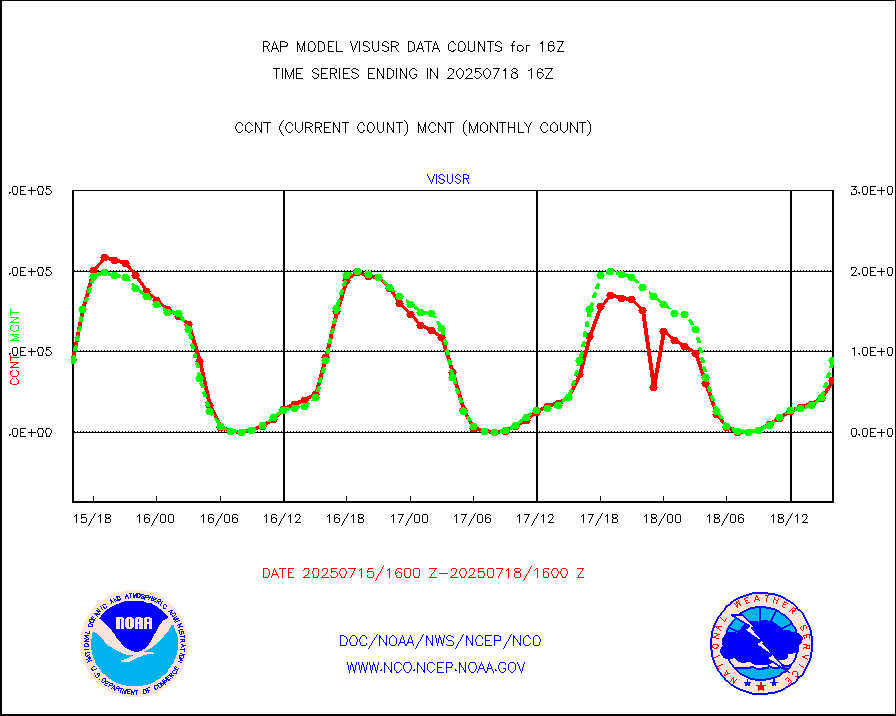
visusr |
GOES-16&up/NESDIS visible derived cloud motion |
94133 |
84596 |
111.3 % |
1915.00-1915.99 |
vseunb |
METEOSAT/EUMETSAT visible drv cld motion NBseq |
7555 |
6863 |
110.1 % |
1914.50-1917.49 |


