| Critical Data with Normal Counts |
|---|
| Type | Description | Hourly Count | Monthly Average | Percent (%) of Monthly Mean | UTC Time Window |
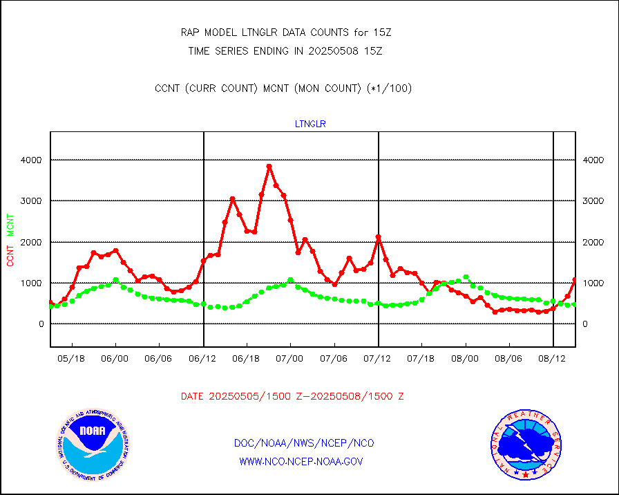
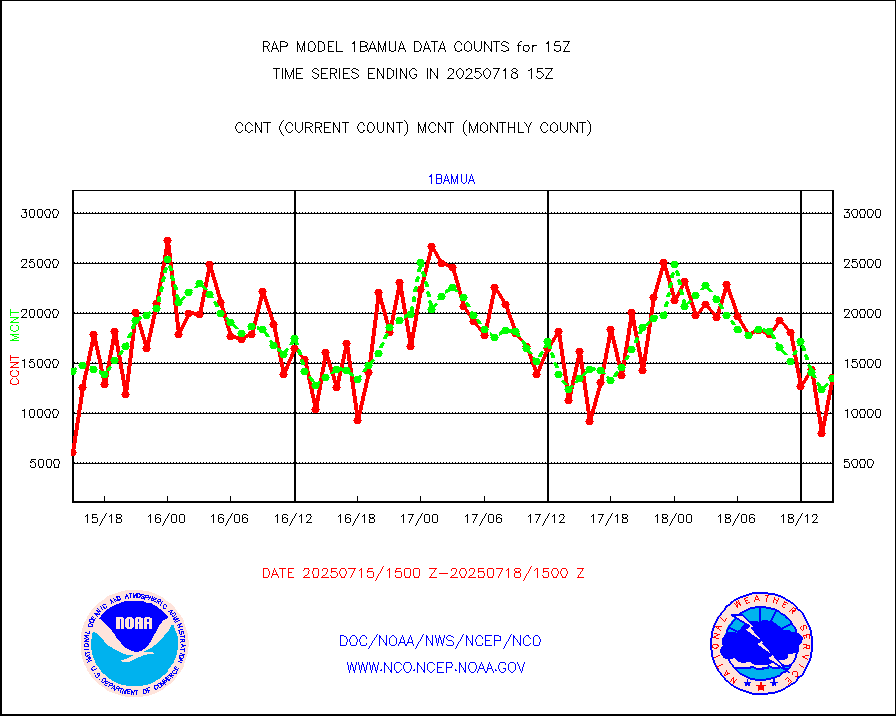
1bamua |
NOAA 15-19 & METOP 1-2 AMSU-A NCEP-proc. br.temps |
24639 |
27811 |
88.6 % |
1912.00-1917.99 |
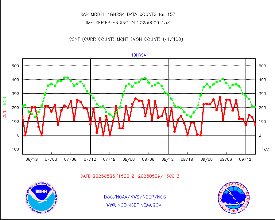
1bhrs4 |
NOAA 18-19 & METOP 1-2 HIRS-4 NCEP-proc. br.temps |
24287 |
22075 |
110.0 % |
1912.00-1917.99 |
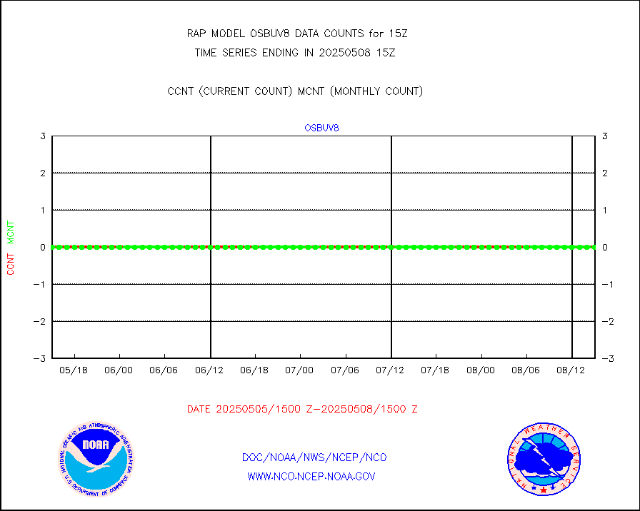
1bmhs |
NOAA 18-19 & METOP 1-2 MHS NCEP-proces. br. temps |
117014 |
157567 |
74.3 % |
1912.00-1917.99 |
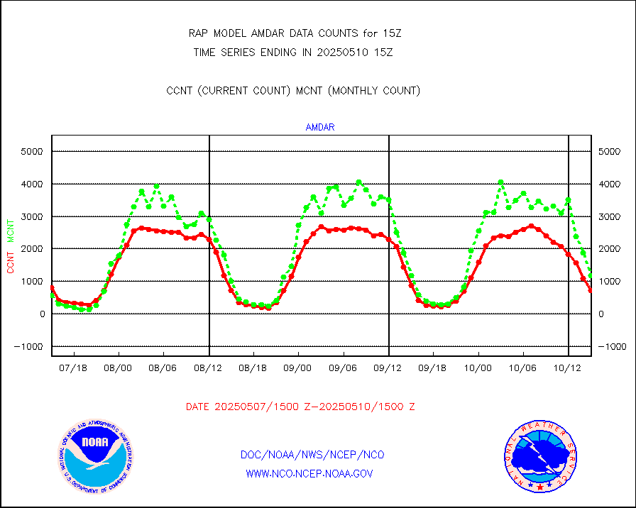
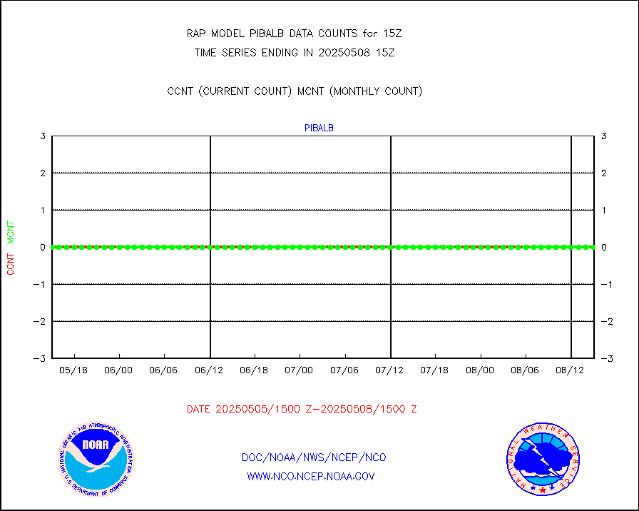
acars |
MDCRS ACARS acft data from ARINC(dcded from BUFR) |
67609 |
58010 |
116.5 % |
1911.75-1918.25 |
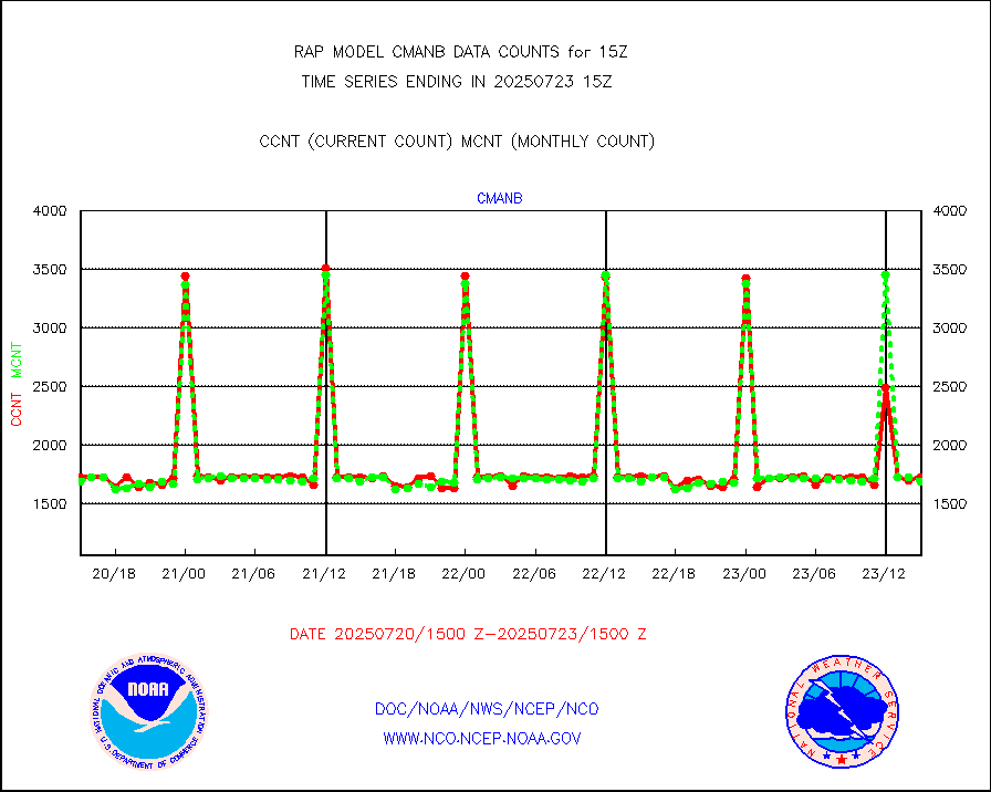
cmanb |
Surface Marine CMAN rpts decoded from BUFR format |
1676 |
1689 |
99.2 % |
1914.50-1915.50 |
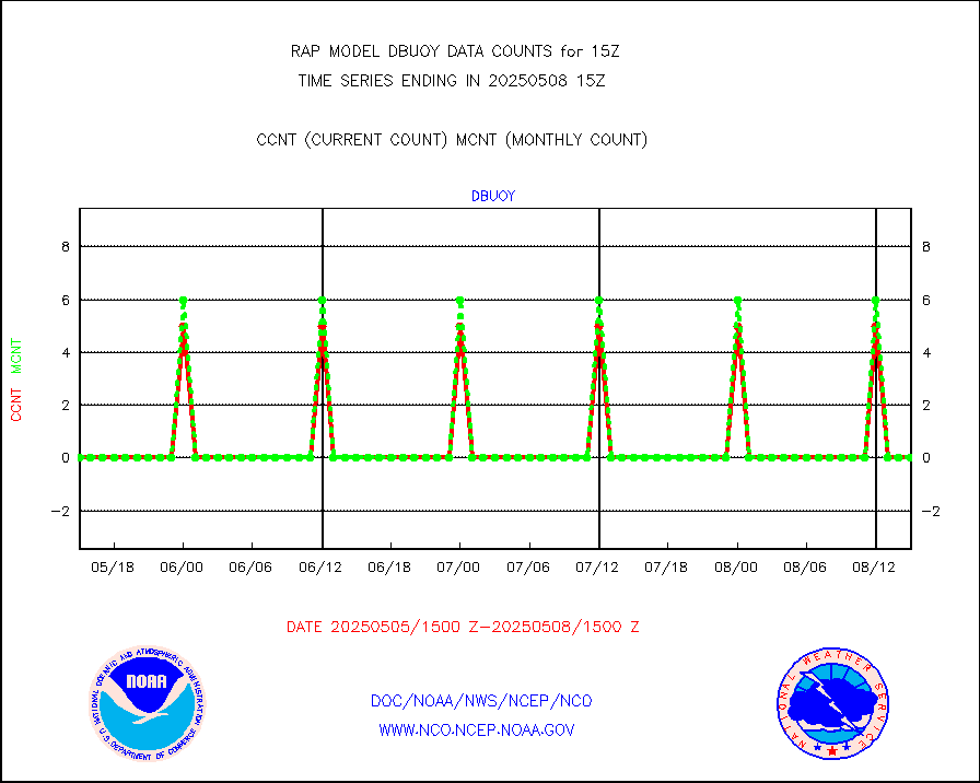
dbuoy |
Buoys decoded from FM-18 fmt (moored or drifting) |
4 |
0 |
n/a |
1914.50-1915.50 |
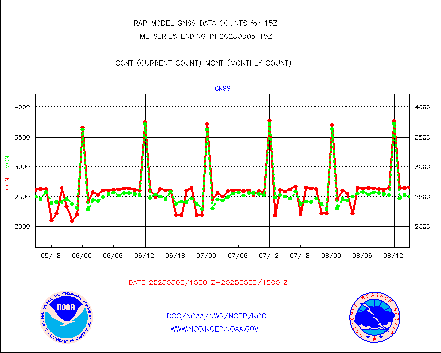
gnss |
Grnd-based Gbl Navigation Sat System (GNSS) data |
2527 |
2564 |
98.6 % |
1913.95-1914.05 |
h20mo |
MODIS (AQUA/TERRA) wvpr imager derived cld motion |
0 |
0 |
n/a |
1912.50-1917.50 |
infmo |
MODIS (AQUA/TERRA) ir l-wave derived cloud motion |
0 |
0 |
n/a |
1912.50-1917.50 |
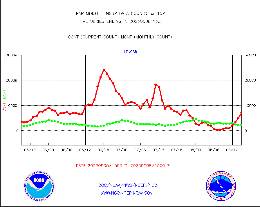
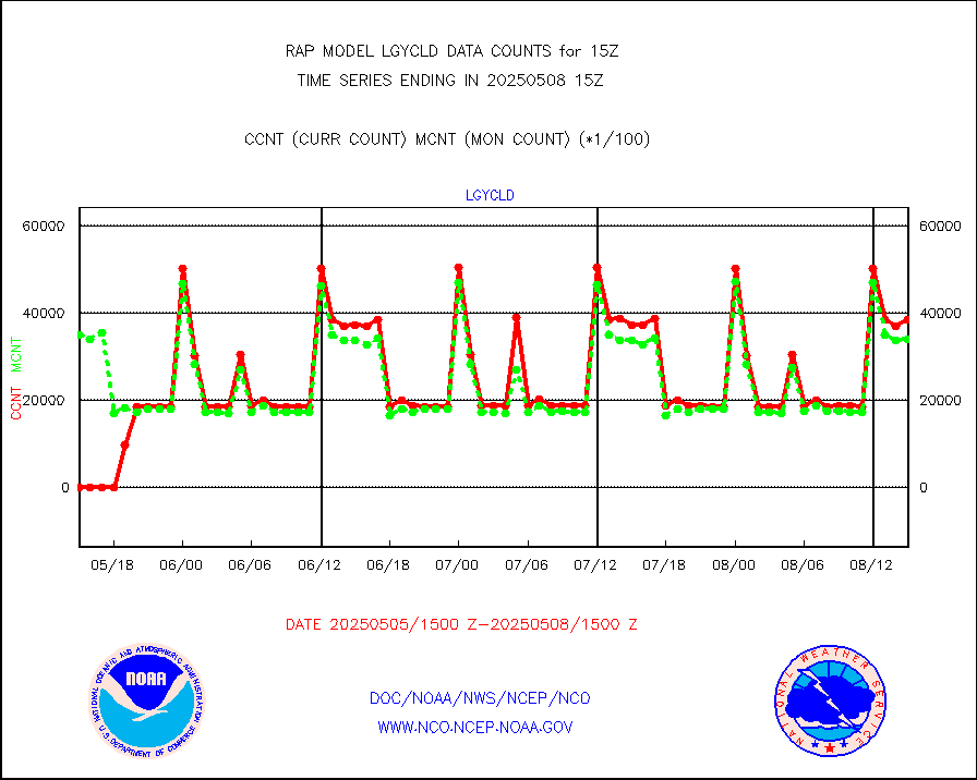
lgycld |
GOES/NASA(Langley) hi-res. (1x1 f-o-v) cloud data |
3734659 |
2896534 |
128.9 % |
1914.50-1915.50 |
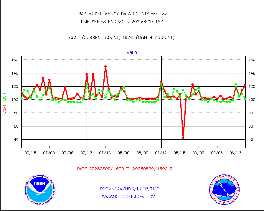
mbuoy |
Buoys decoded from FM-13 format (moored) |
45 |
61 |
73.8 % |
1914.50-1915.50 |
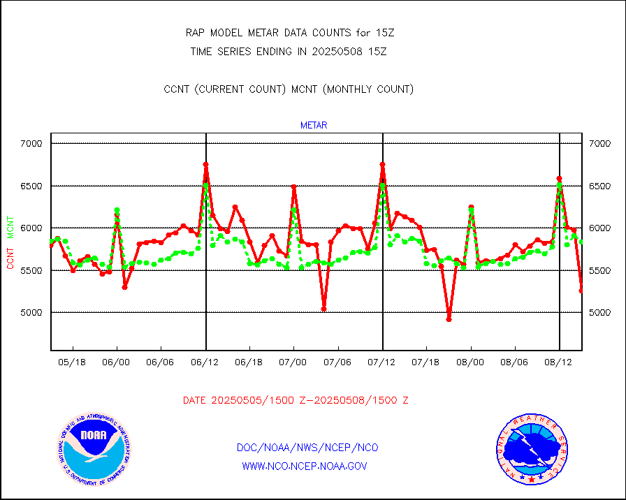
metar |
Aviation - METAR |
5740 |
5991 |
95.8 % |
1914.50-1915.50 |
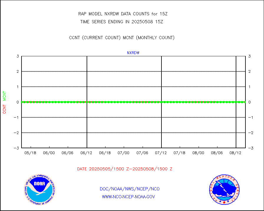
nxrdw |
NEXRAD Vel Azm Dsp(VAD) winds via radar coded msg |
0 |
0 |
n/a |
1914.00-1916.00 |
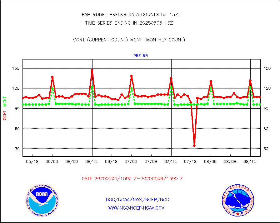
prflrb |
Multi-Agency Profiler (MAP) and SODAR winds |
72 |
84 |
85.7 % |
1913.50-1916.50 |
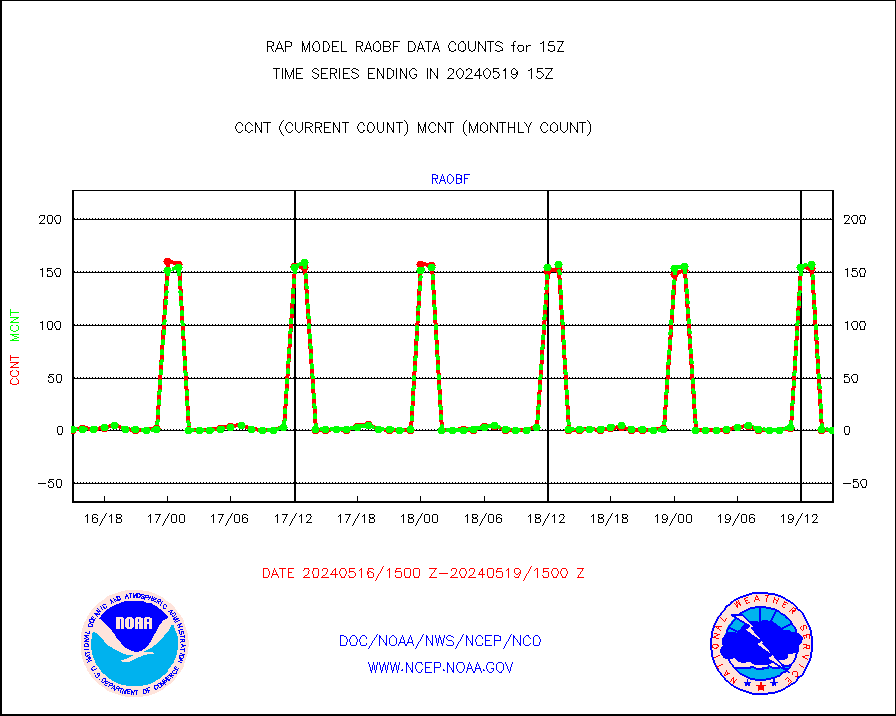
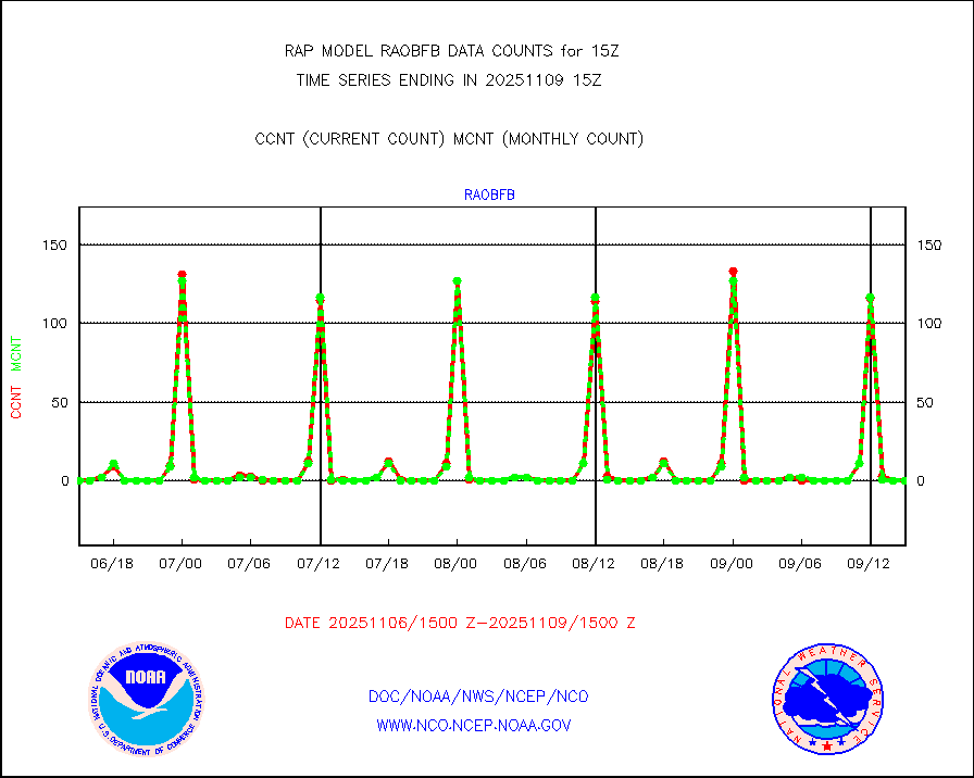
raobf |
Rawinsonde - fixed land (from TEMP or PILOT) |
0 |
0 |
n/a |
1914.00-1916.00 |
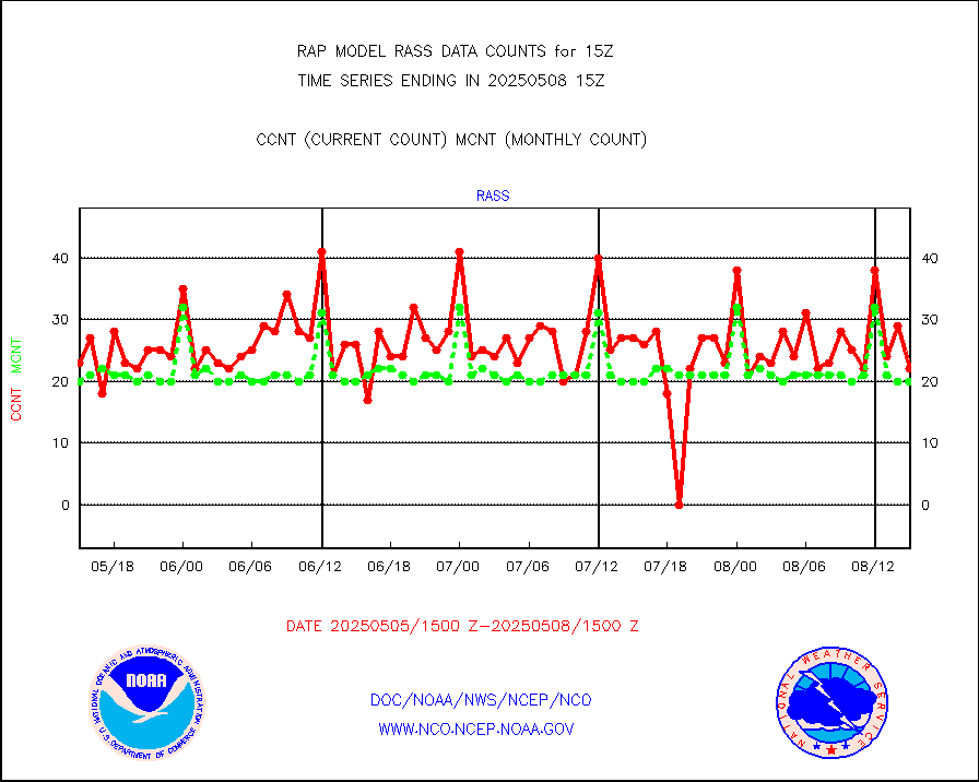
rass |
RASS temperatures (NOAA and Multi-Agency) |
20 |
22 |
90.9 % |
1914.50-1915.50 |
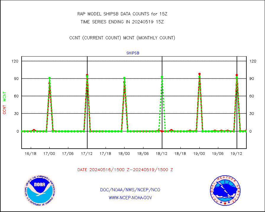
shipsb |
Ship - manual and automatic, restricted (BUFR) |
1 |
0 |
n/a |
1914.50-1915.50 |
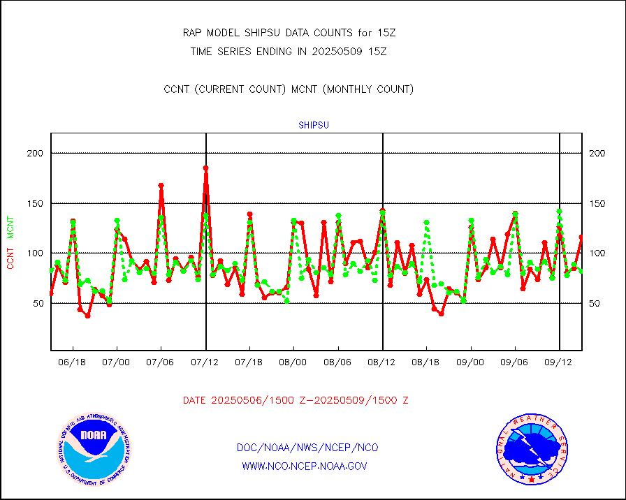
shipsu |
Ship - manual and automatic, unrestricted |
58 |
60 |
96.7 % |
1914.50-1915.50 |
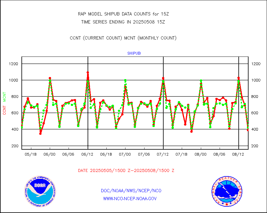
shipub |
Ship - manual and automatic, unrestricted (BUFR) |
305 |
293 |
104.1 % |
1914.50-1915.50 |
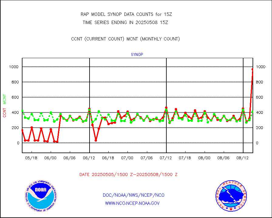
synop |
Synoptic - fixed manual and automatic |
503 |
523 |
96.2 % |
1914.50-1915.50 |
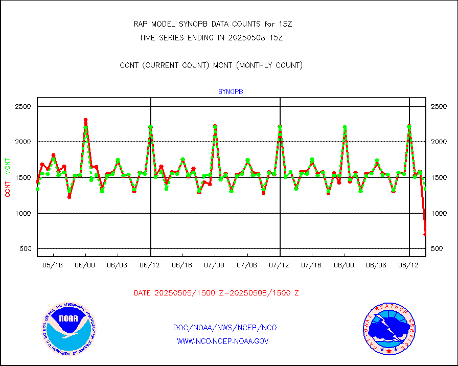
synopb |
Synoptic - fixed manual & auto (decoded fr BUFR) |
1395 |
1373 |
101.6 % |
1914.50-1915.50 |
tideg |
Tide gauge reports decoded from CREX format |
182 |
181 |
100.6 % |
1914.50-1915.50 |
| Data Types of Opportunity with Normal Counts |
|---|
| Type | Description | Hourly Count | Monthly Average | Percent (%) of Monthly Mean | UTC Time Window |
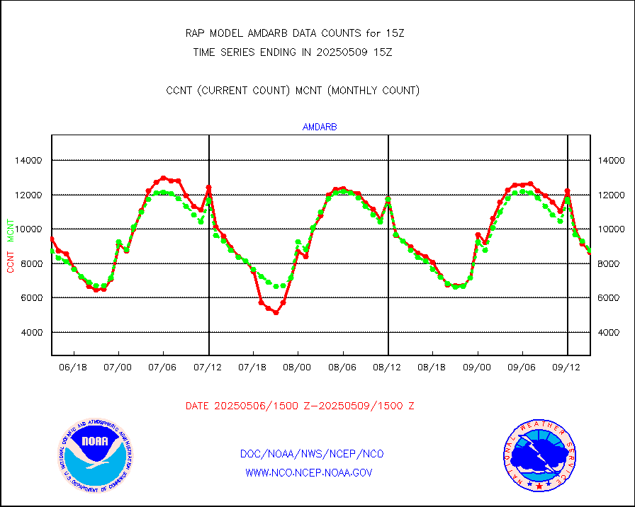
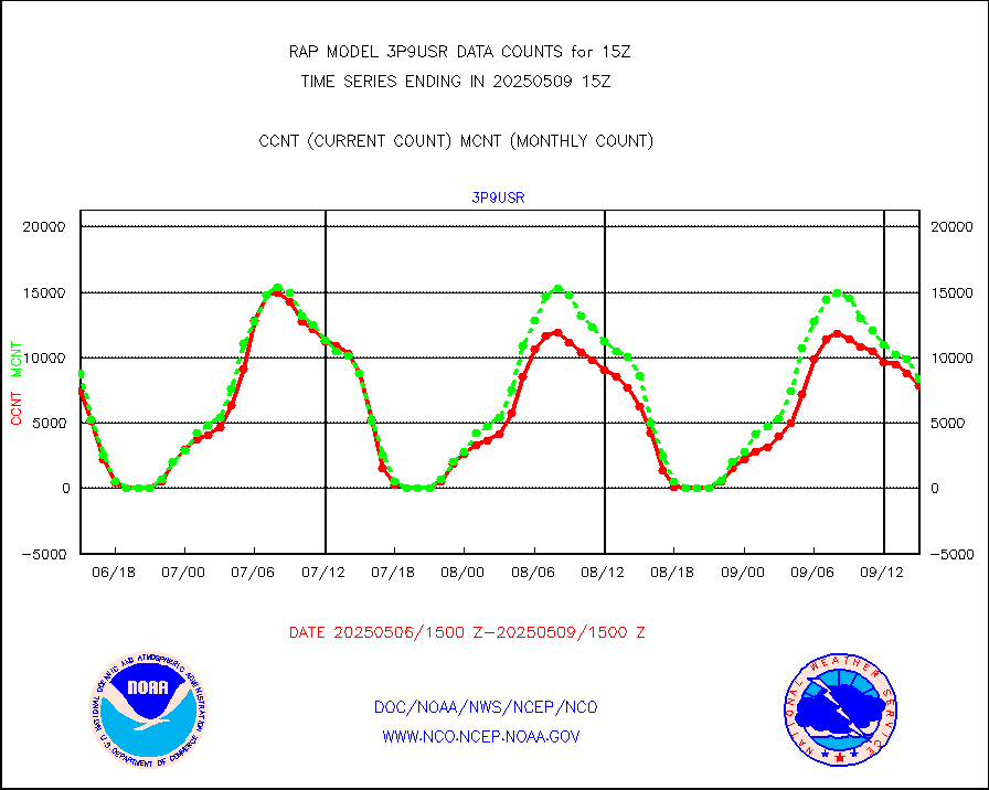
3p9usr |
GOES-16&up/NESDIS ir short-wv derived cld motion |
5908 |
7410 |
79.7 % |
1914.00-1914.99 |
acarsa |
MDCRS ACARS acft data (ARINC via AFWA)(AIREP fmt) |
0 |
0 |
n/a |
1911.75-1918.25 |
airep |
Manual AIREP aircraft data (dcded from AIREP fmt) |
6106 |
5671 |
107.7 % |
1911.75-1918.25 |
airsev |
AQUA AIRS/AMSU-A/HSB brightness temps- every FOV |
0 |
0 |
n/a |
1912.00-1917.99 |
amdar |
AMDAR aircraft data (decoded from AMDAR format) |
770 |
545 |
141.3 % |
1911.75-1918.25 |
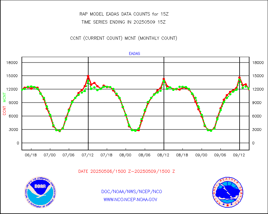
amdarb |
AMDAR aircraft data (decoded from BUFR) |
2995 |
2743 |
109.2 % |
1911.75-1918.25 |
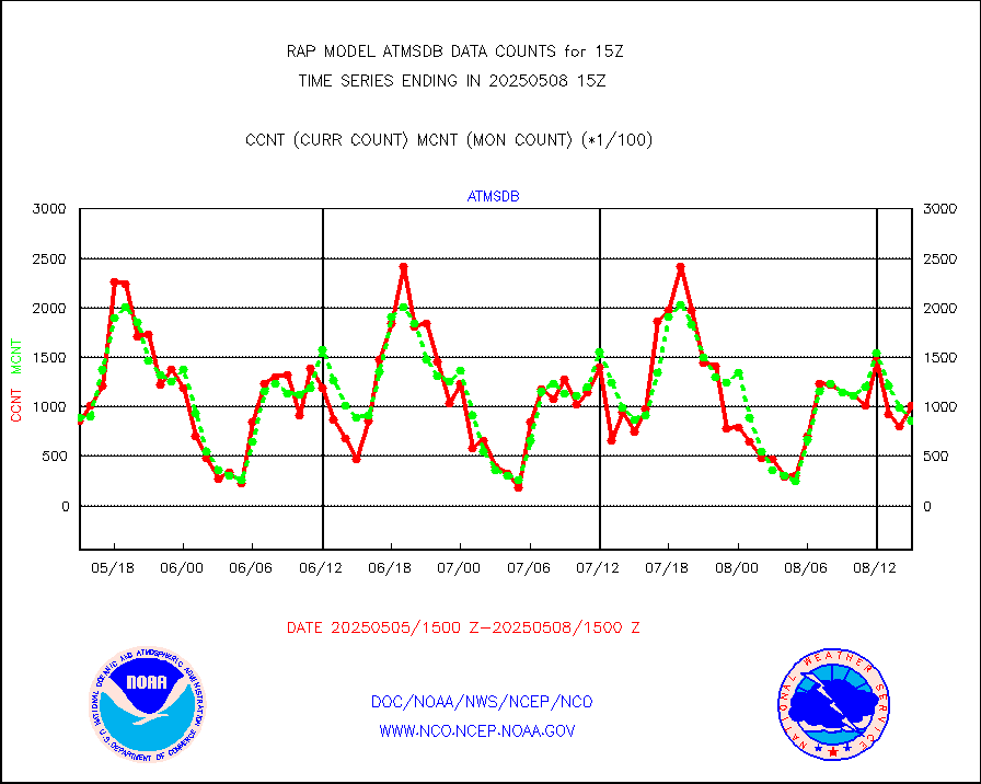
amsr2 |
GCOM-W AMSR2 1B brightness temperatures |
1238985 |
776849 |
159.5 % |
1912.00-1912.99 |
ascat |
METOP 1-2 ASCAT products |
18187 |
17700 |
102.8 % |
1913.00-1917.00 |
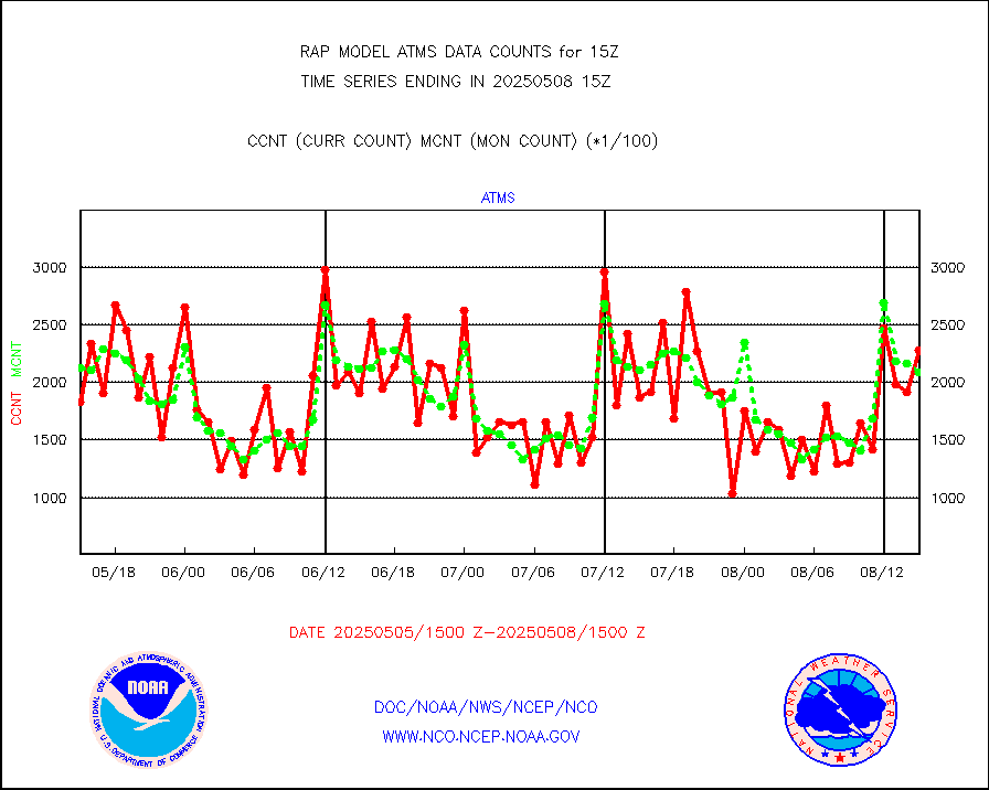
atms |
NPP/NOAA-20 ATMS brightness temperatures |
190355 |
205826 |
92.5 % |
1913.00-1916.99 |
atmsdb |
NPP/NOAA-20 ATMS bright. temps-direct b-cast SSEC |
54337 |
95162 |
57.1 % |
1913.00-1916.99 |
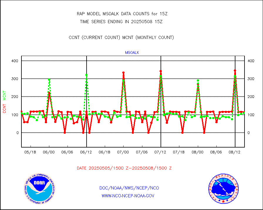
coopmd |
Coop/MADIS NEPP & HCN-Modernization NOAA COOP Obs |
27 |
26 |
103.8 % |
1914.50-1915.50 |
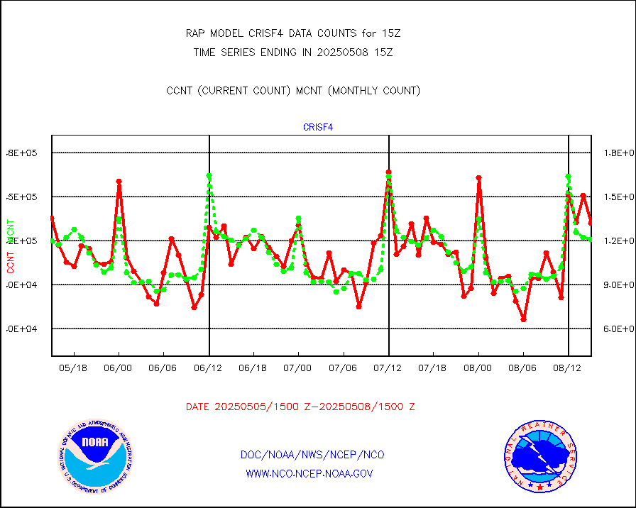
crisf4 |
NPP/NOAA-20 CrIS full spctrl radn (431 ch subset) |
107555 |
120683 |
89.1 % |
1913.00-1916.99 |
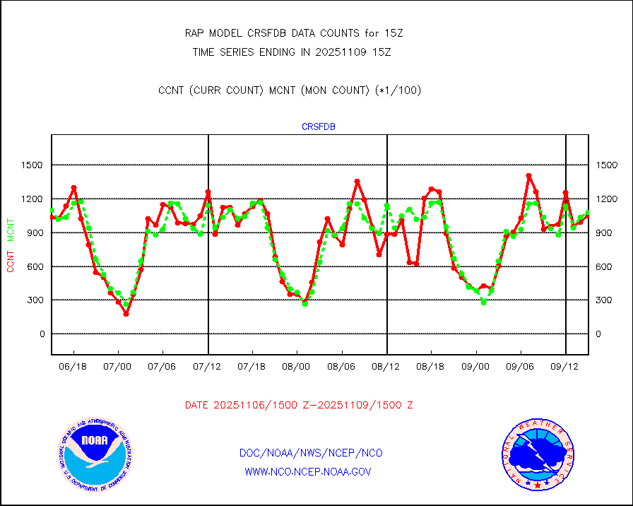
crsfdb |
NPP/NOAA-20 CrIS full spctrl radn dir brdcst SSEC |
100387 |
120846 |
83.1 % |
1913.00-1916.99 |
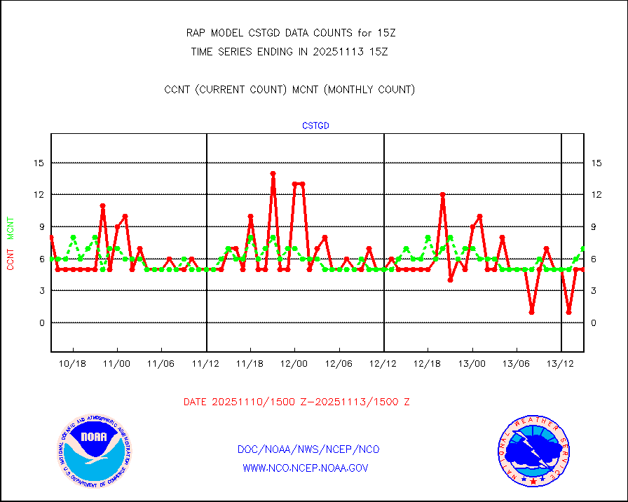
cstgd |
Coast Guard |
4 |
4 |
100.0 % |
1914.50-1915.50 |
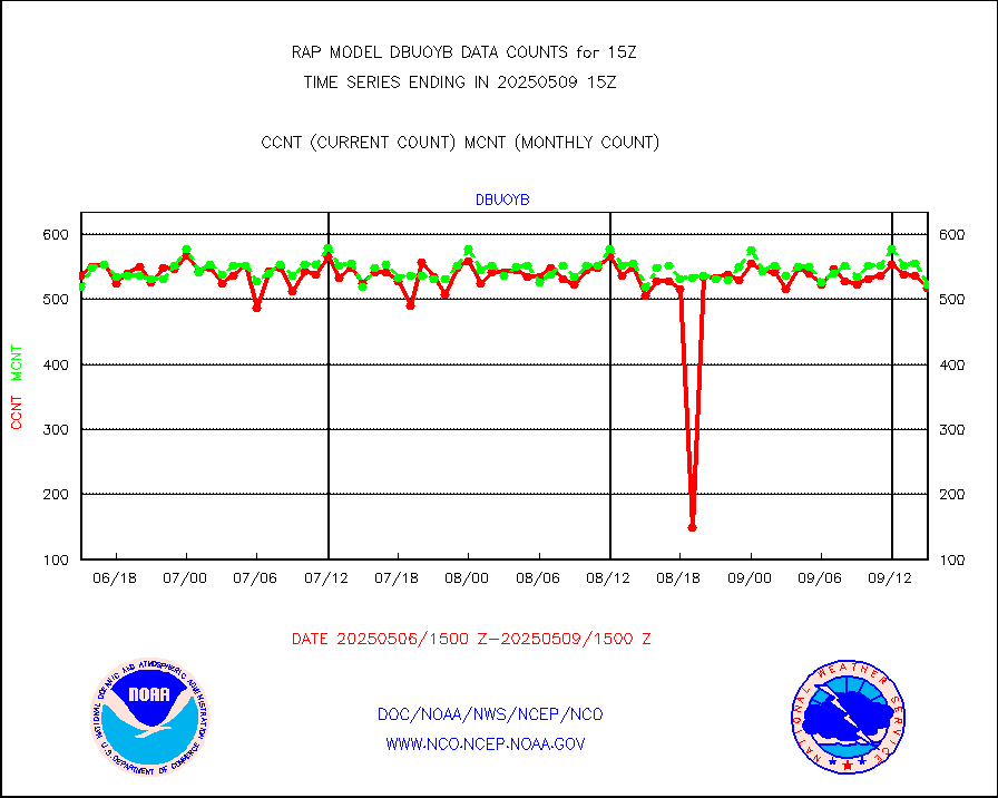
dbuoyb |
Drifting buoys (decoded from BUFR) |
611 |
571 |
107.0 % |
1914.50-1915.50 |
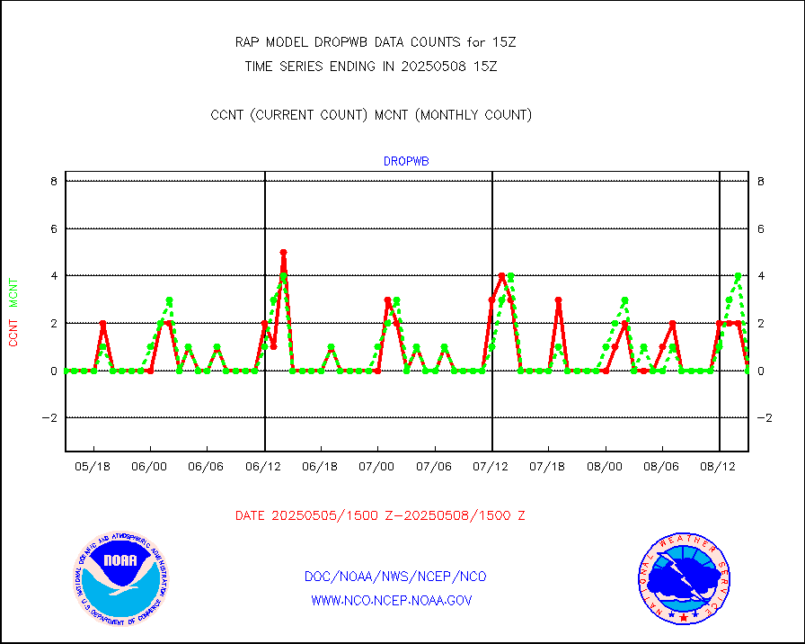
dropw |
Dropwinsonde (from TEMP DROP) |
0 |
0 |
n/a |
1914.00-1916.00 |
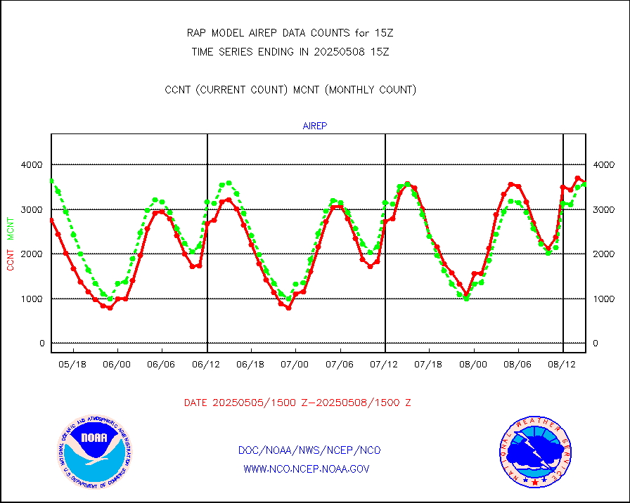
eadas |
E-AMDAR (European AMDAR acft decoded from BUFR) |
10033 |
9107 |
110.2 % |
1911.75-1918.25 |
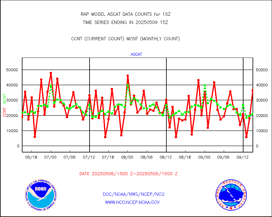
esamua |
NOAA 15-19 & METOP 1-2 AMSU-A proc btmps frm RARS |
18313 |
17300 |
105.9 % |
1914.00-1916.00 |
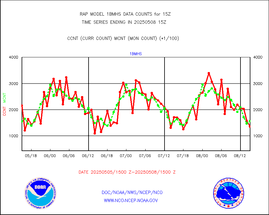
esatms |
NPP Adv. Tech. MW Sndr (ATMS) br. temps from RARS |
121100 |
143598 |
84.3 % |
1913.00-1916.99 |
eshrs3 |
NOAA 15-19 & METOP 1-2 HIRS-3/4 pr btmps frm RARS |
32135 |
35059 |
91.7 % |
1914.00-1916.00 |
esiasi |
METOP 1-2 IASI 1C radiance data vbl chn from RARS |
86848 |
59265 |
146.5 % |
1913.00-1916.99 |
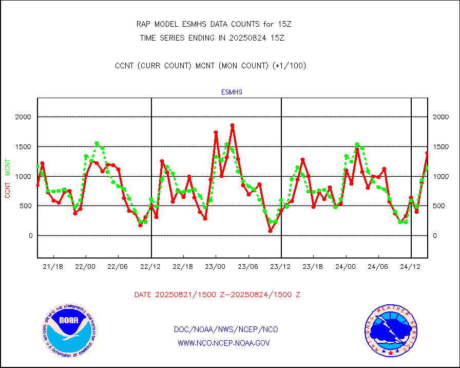
esmhs |
NOAA 18-19 & METOP 1-2 MHS proc. btemps from RARS |
157221 |
163229 |
96.3 % |
1914.00-1916.00 |
gmi1cr |
GPM GMI Level 1C-R brightness temperatures |
373305 |
425935 |
87.6 % |
1912.00-1917.99 |
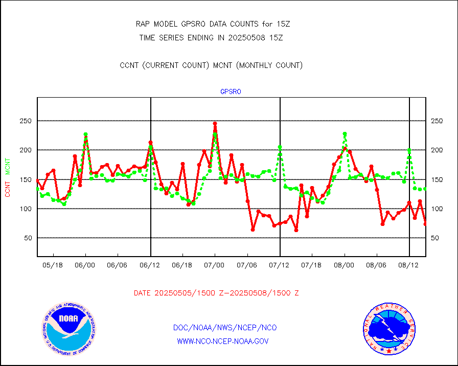
gpsro |
GPS radio occultation data |
115 |
110 |
104.5 % |
1913.00-1916.99 |
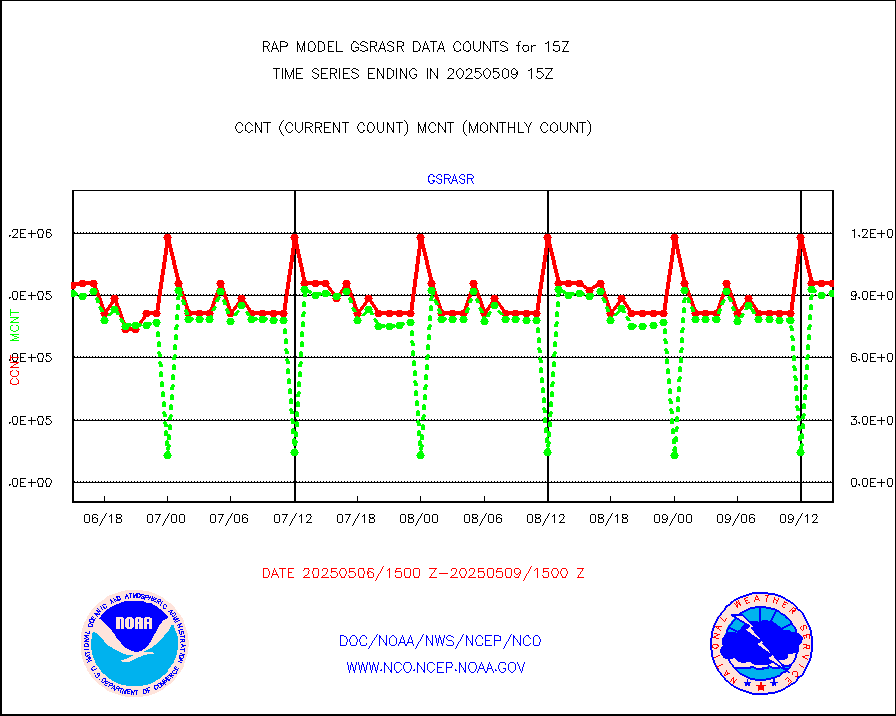
gsrasr |
GOES-16/17 All Sky Radiances (proc.) |
812097 |
794863 |
102.2 % |
1913.00-1916.99 |
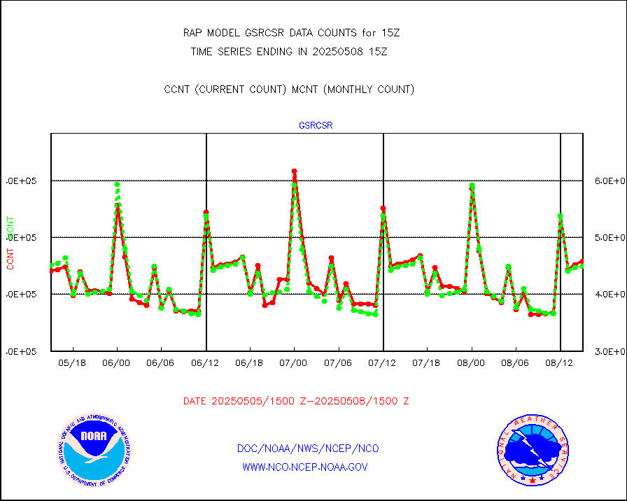
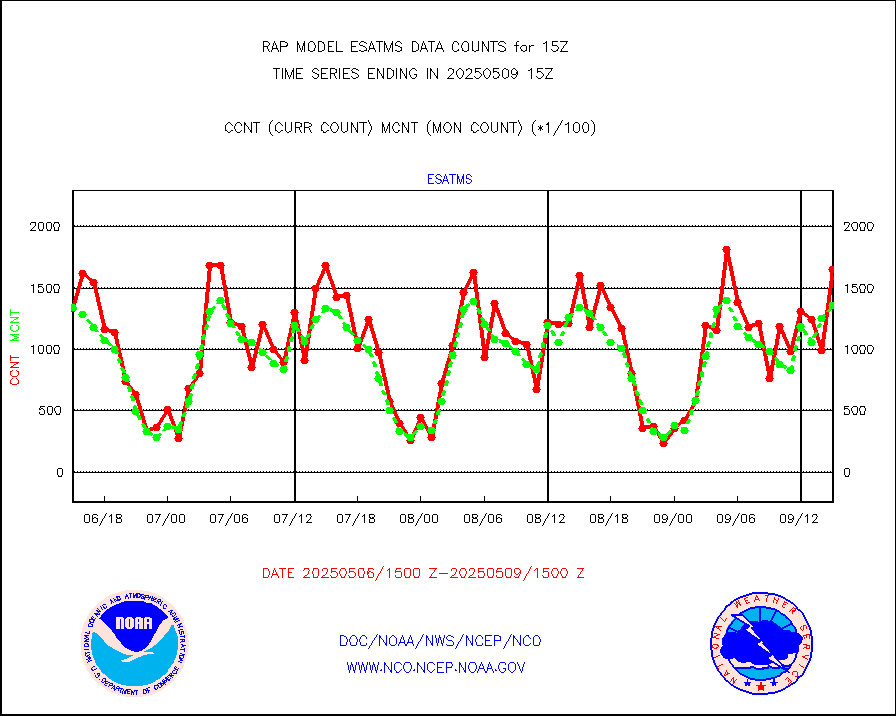
gsrcsr |
GOES-16/17 Clear Sky Radiances (proc.) |
347530 |
371076 |
93.7 % |
1913.00-1916.99 |
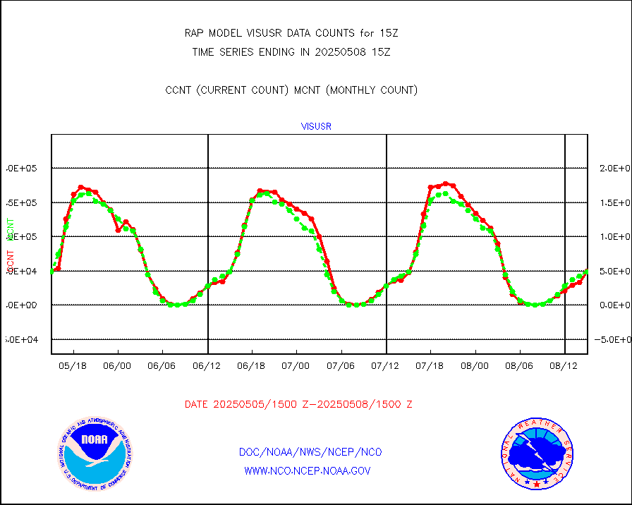
h20ja |
MTSAT/JMA water vapor imager derived cloud motion |
2630 |
2989 |
88.0 % |
1912.50-1917.50 |
h2dusr |
GOES-16&up/NESDIS wv imgr/deep-lyr derivd cld mtn |
7291 |
7244 |
100.6 % |
1914.00-1914.99 |
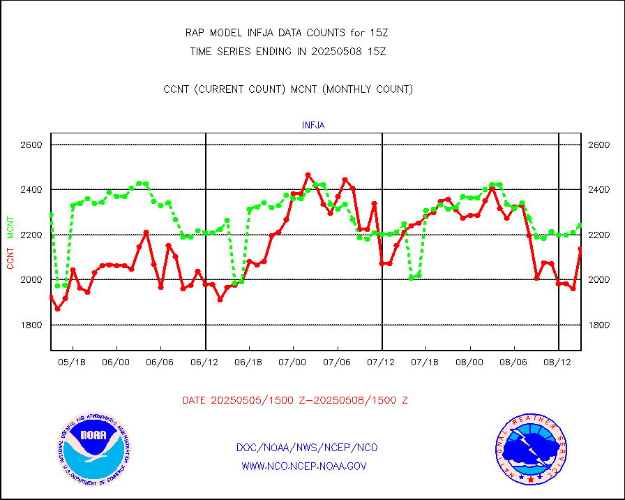
h2eunb |
METEOSAT/EUMETSAT wvpr imgr drv cld motion NBseq |
5953 |
5372 |
110.8 % |
1913.50-1916.49 |
h2tusr |
GOES-16&up/NESDIS wv imgr/cld-top derived cld mtn |
11352 |
10398 |
109.2 % |
1914.00-1914.99 |
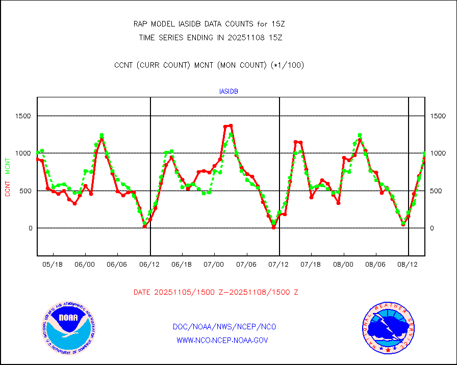
iasidb |
METOP 1-2 IASI 1C radiances-direct broadcast SSEC |
78163 |
59991 |
130.3 % |
1913.00-1916.99 |
ifeunb |
METEOSAT/EUMETSAT ir lg-wave drv cld motion NBseq |
3342 |
3301 |
101.2 % |
1913.50-1916.49 |
ifvrnb |
VIIRS (NPP/NOAA-20) ir lg-wv drv cloud motion(NB) |
0 |
0 |
n/a |
1912.50-1917.50 |
infav |
AVHRR (NOAA/METOP) ir lg-wave derived cld motion |
0 |
0 |
n/a |
1912.50-1917.50 |
infav1 |
AVHRR (METOP) ir lg-wave derived cld motion |
0 |
0 |
n/a |
1913.50-1916.49 |
infja |
MTSAT/JMA infrared long-wave derived cloud motion |
1956 |
2462 |
79.4 % |
1912.50-1917.50 |
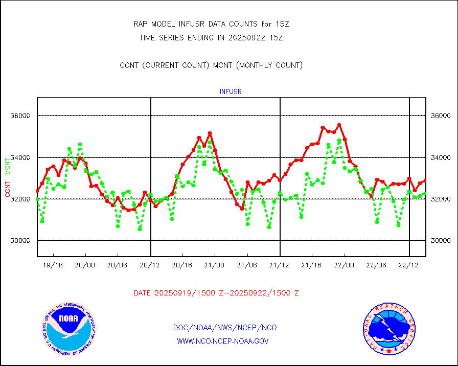
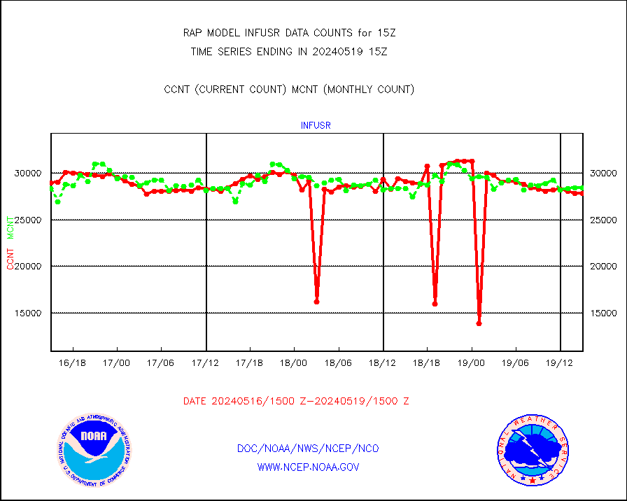
infusr |
GOES-16&up/NESDIS ir long-wave derived cld motion |
27854 |
28419 |
98.0 % |
1914.00-1914.99 |
kamdar |
Korean AMDAR aircraft data (decoded from BUFR) |
142 |
103 |
137.9 % |
1911.75-1918.25 |
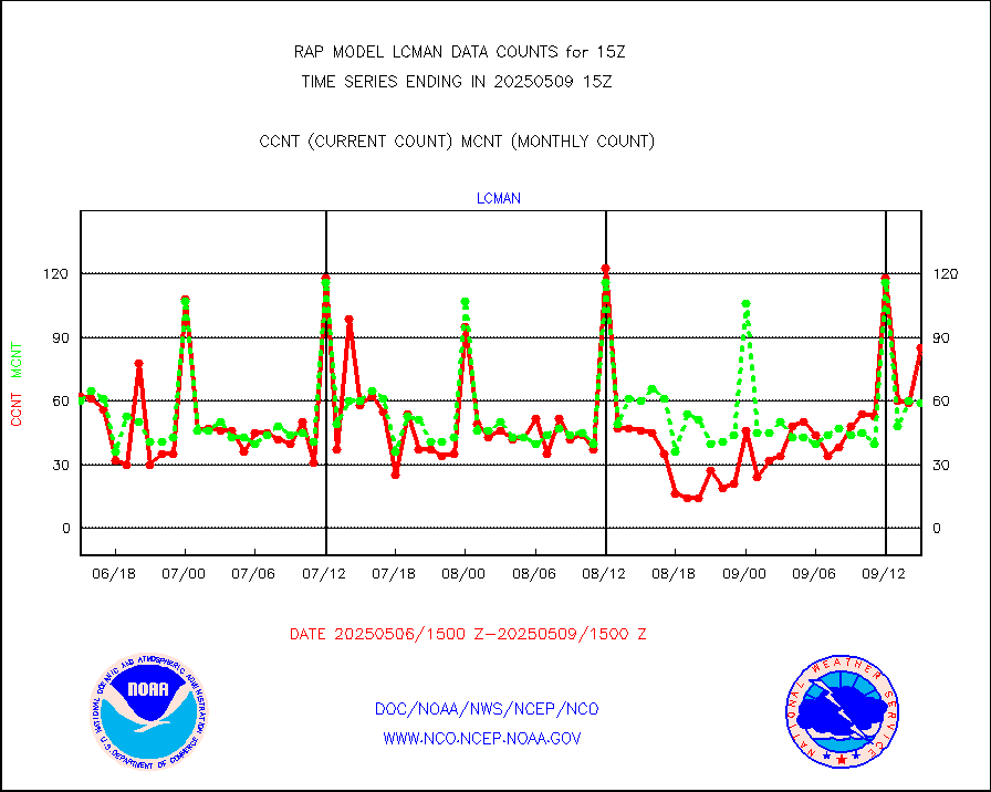
lcman |
Land-based CMAN stations decoded from CMAN format |
53 |
77 |
68.8 % |
1914.50-1915.50 |
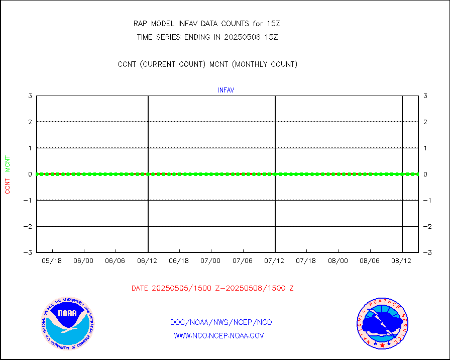
ltnglr |
LLDN Long-rng lightning from Vaisala via NOAAPORT |
195808 |
67631 |
289.5 % |
1914.00-1915.50 |
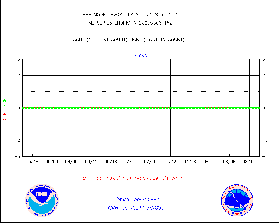
ltngsr |
NLDN Shrt-rng lightning from Vaisala via NOAAPORT |
14012 |
3460 |
405.0 % |
1914.00-1915.50 |
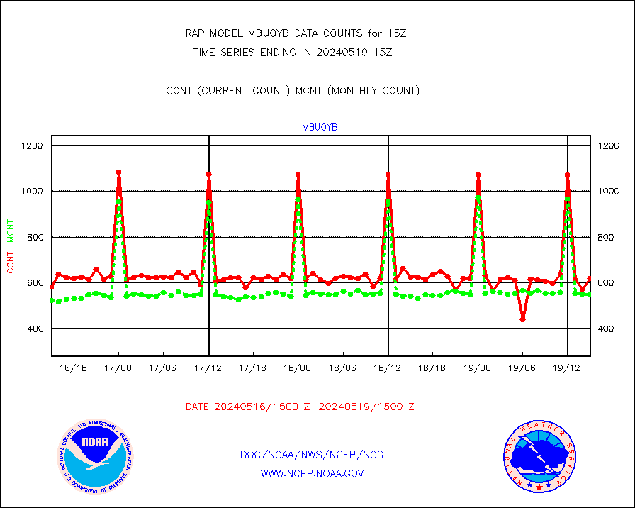
mbuoyb |
Moored buoys (decoded from BUFR) |
619 |
547 |
113.2 % |
1914.50-1915.50 |
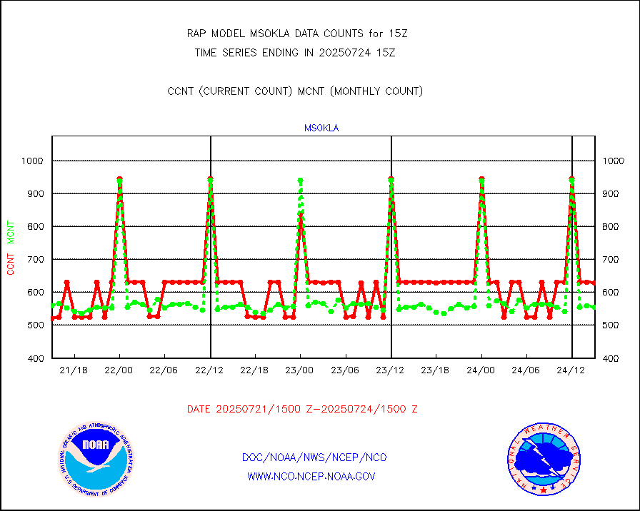
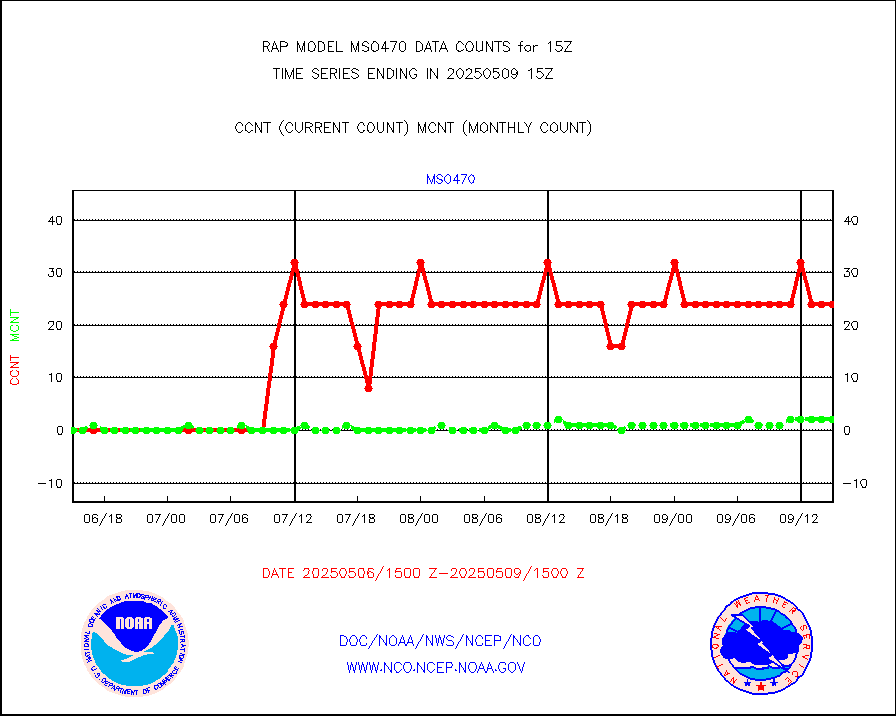
mso470 |
Mesonet/MADIS Colorado E-470 (Interstate 470) |
21 |
17 |
123.5 % |
1914.50-1915.50 |
msoalk |
Mesonet/MADIS Alaska Department of Transportation |
106 |
102 |
103.9 % |
1914.50-1915.50 |
msoapg |
Mesonet/MADIS U.S. Army Aberdeen Proving Grounds |
0 |
0 |
n/a |
1914.50-1915.50 |
msoapr |
Mesonet/MADIS Citizen Weather Observers Program |
41404 |
45084 |
91.8 % |
1914.50-1915.50 |
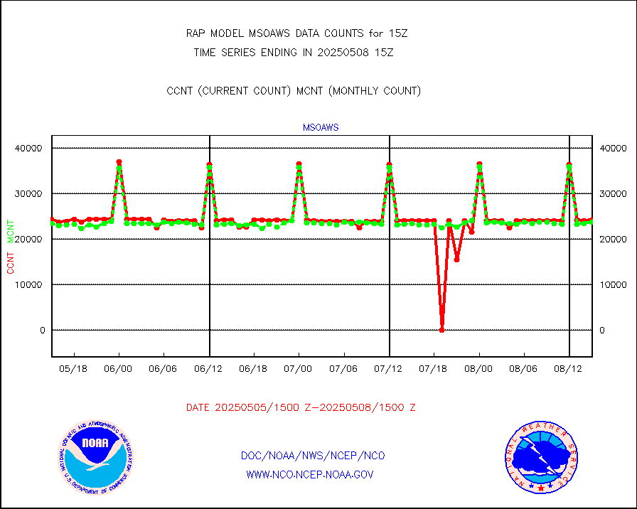
msoaws |
Mesonet/MADIS AWS Convergence Technologies, Inc. |
24827 |
25672 |
96.7 % |
1914.50-1915.50 |
msoawx |
Mesonet/MADIS "Anything Weather" |
0 |
0 |
n/a |
1914.50-1915.50 |
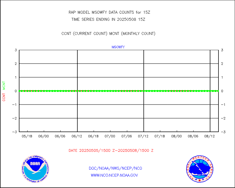
msocol |
Mesonet/MADIS Colorado Dept. of Transportation |
0 |
0 |
n/a |
1914.50-1915.50 |
msodcn |
Mesonet/MADIS DC Net |
0 |
0 |
n/a |
1914.50-1915.50 |
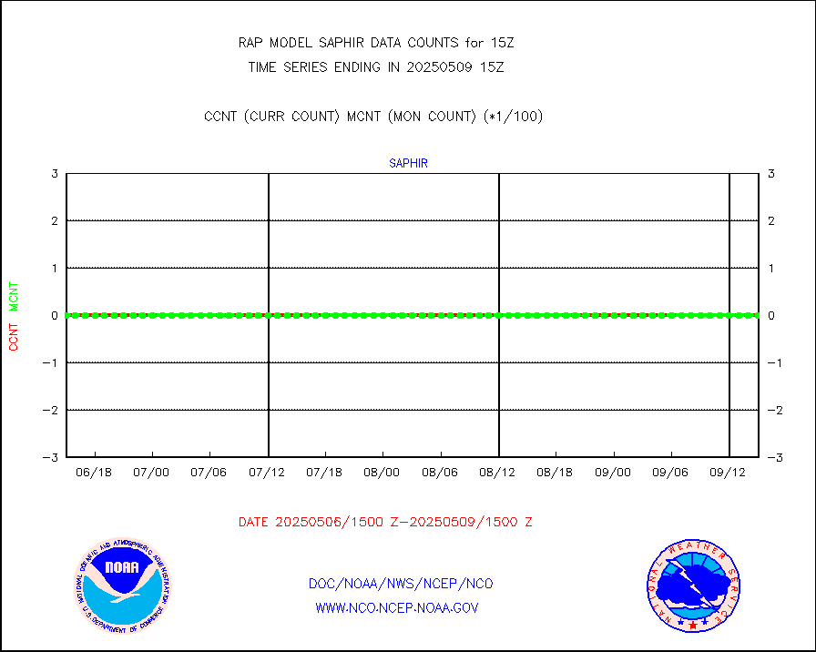
msoden |
Mesonet/MADIS Denver Urban Drainage & Flood Cntrl |
225 |
213 |
105.6 % |
1914.50-1915.50 |
msofla |
Mesonet/MADIS Florida (FAWN & USF) |
3 |
3 |
100.0 % |
1914.50-1915.50 |
msoflt |
Mesonet/MADIS Florida Dept. of Transportation |
0 |
0 |
n/a |
1914.50-1915.50 |
msogeo |
Mesonet/MADIS Georgia Dept. of Transportation |
0 |
0 |
n/a |
1914.50-1915.50 |
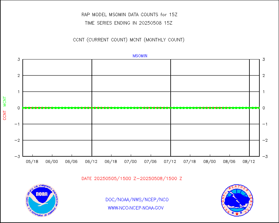
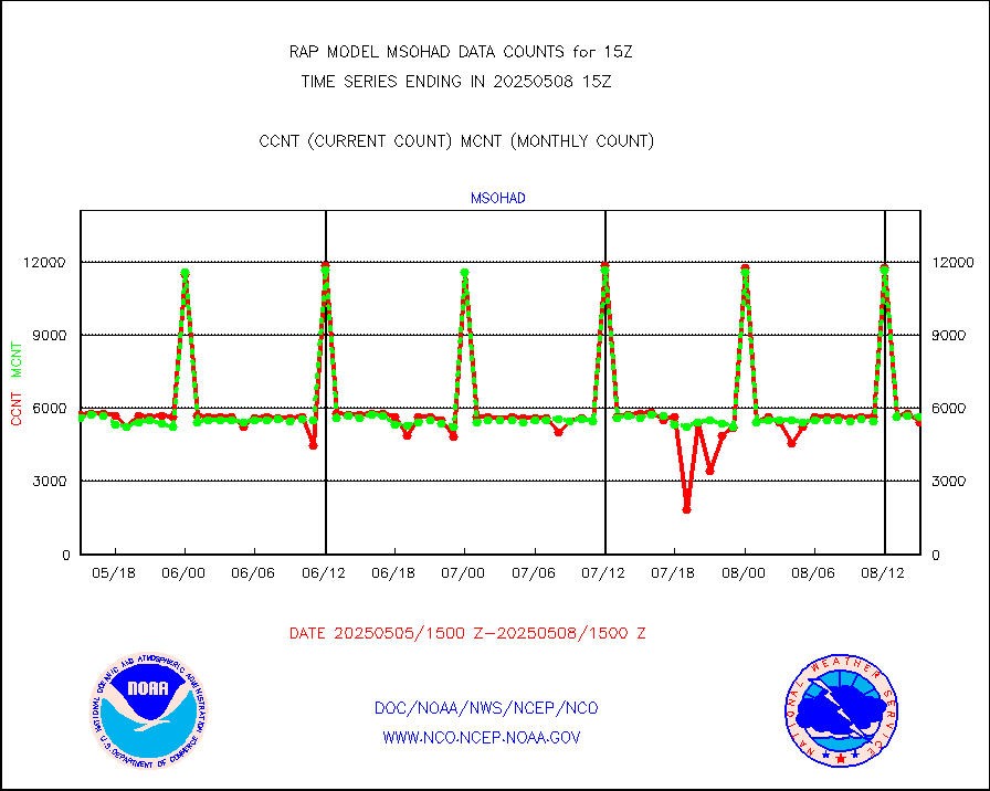
msohad |
Mesonet/MADIS NWS Hydromet Auto Data System(HADS) |
5868 |
5272 |
111.3 % |
1914.50-1915.50 |
msoien |
Mesonet/MADIS Iowa Environmental |
171 |
166 |
103.0 % |
1914.50-1915.50 |
msoind |
Mesonet/MADIS Indiana Dept. of Transportation |
0 |
0 |
n/a |
1914.50-1915.50 |
msoiow |
Mesonet/MADIS Iowa Department of Transportation |
0 |
0 |
n/a |
1914.50-1915.50 |
msokan |
Mesonet/MADIS Kansas Department of Transportation |
153 |
298 |
51.3 % |
1914.50-1915.50 |
msokla |
Mesonet/MADIS Oklahoma Mesonet |
318 |
325 |
97.8 % |
1914.50-1915.50 |
msolju |
Mesonet/MADIS Louisiana State/Jackson State Univ. |
0 |
0 |
n/a |
1914.50-1915.50 |
msomca |
Mesonet/MADIS Missouri Commercial Agricult Wx Net |
272 |
262 |
103.8 % |
1914.50-1915.50 |
msomin |
Mesonet/MADIS Minnesota Dept. of Transportation |
0 |
0 |
n/a |
1914.50-1915.50 |
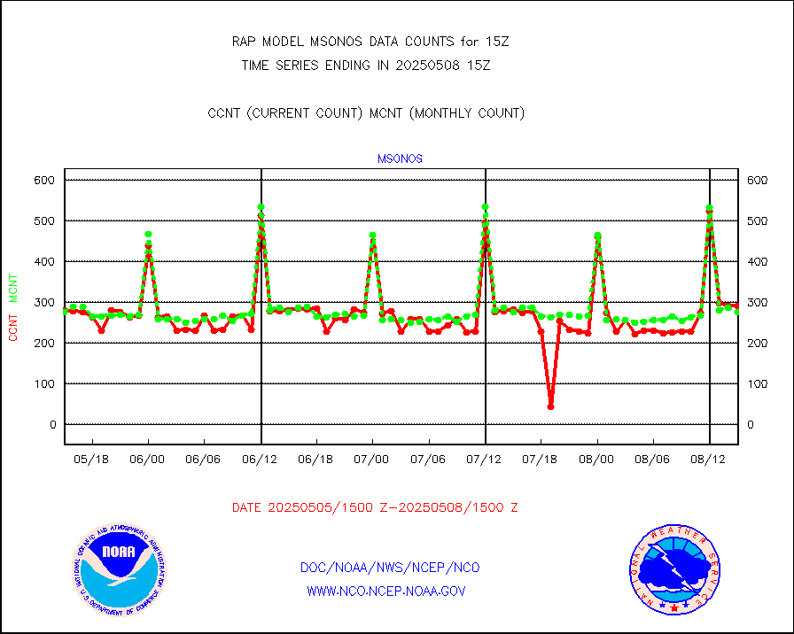
msonos |
Mesonet/MADIS NOS-Phys Oceanographic Realtime Sys |
300 |
284 |
105.6 % |
1914.50-1915.50 |
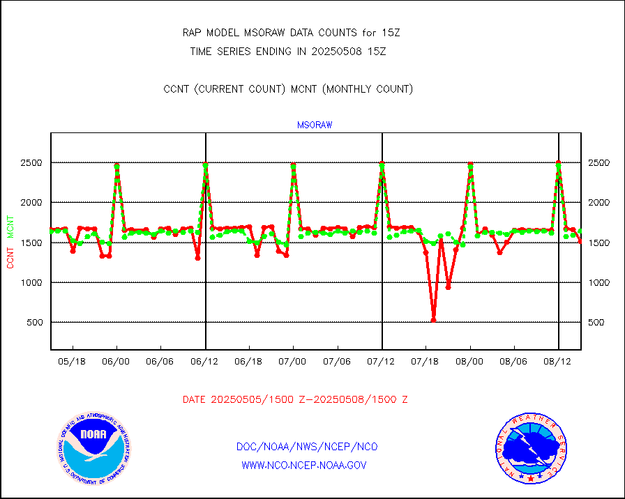
msoraw |
Mesonet/MADIS NFIC Remote Automated Wx Stns(RAWS) |
1696 |
1468 |
115.5 % |
1914.50-1915.50 |
msourb |
Mesonet/MADIS UrbaNet |
3938 |
3951 |
99.7 % |
1914.50-1915.50 |
msovir |
Mesonet/MADIS Virginia Dept. of Transportation |
205 |
228 |
89.9 % |
1914.50-1915.50 |
msowfy |
Mesonet/MADIS "Weather for You" |
0 |
0 |
n/a |
1914.50-1915.50 |
msowis |
Mesonet/MADIS Wisconsin Dept. of Transportation |
0 |
0 |
n/a |
1914.50-1915.50 |
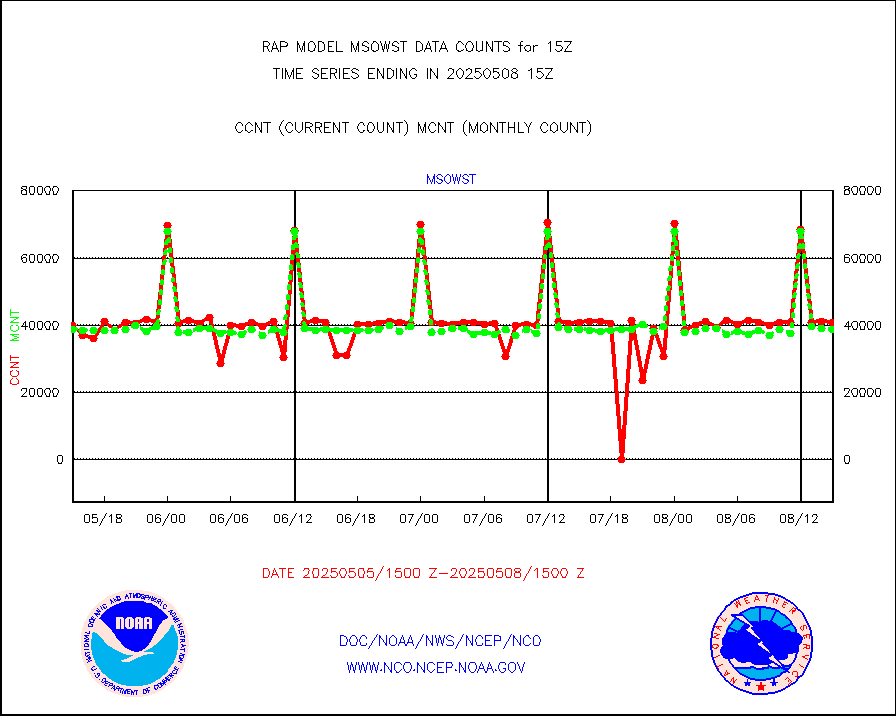
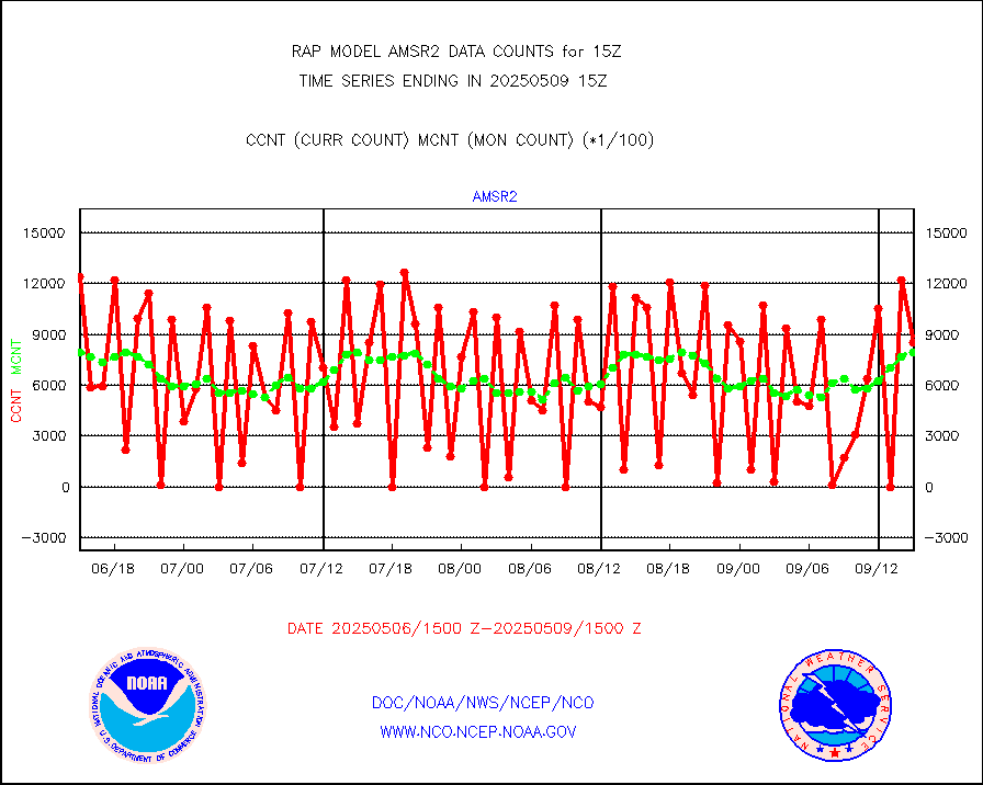
msowst |
Mesonet/MADIS MesoWest (many subproviders) |
41599 |
37987 |
109.5 % |
1914.50-1915.50 |
msowtx |
Mesonet/MADIS West Texas |
5043 |
4807 |
104.9 % |
1914.50-1915.50 |
mtiasi |
METOP 1-2 IASI 1C radiance data (varbl. channels) |
24522 |
17273 |
142.0 % |
1913.00-1916.99 |
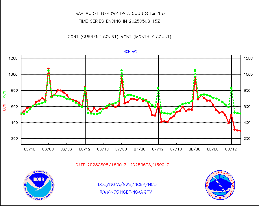
nxrdw2 |
NEXRAD Vel Azm Dsp(VAD) winds via Level 2 decoder |
599 |
548 |
109.3 % |
1914.00-1916.00 |
osbuv8 |
NOAA 16-19 Solar Backscatter UV-2 rad frm V8 BUFR |
0 |
0 |
n/a |
1913.00-1915.99 |
pibal |
PIBAL (from PILOT, PILOT SHIP, PILOT MOBIL) |
0 |
0 |
n/a |
1914.00-1916.00 |
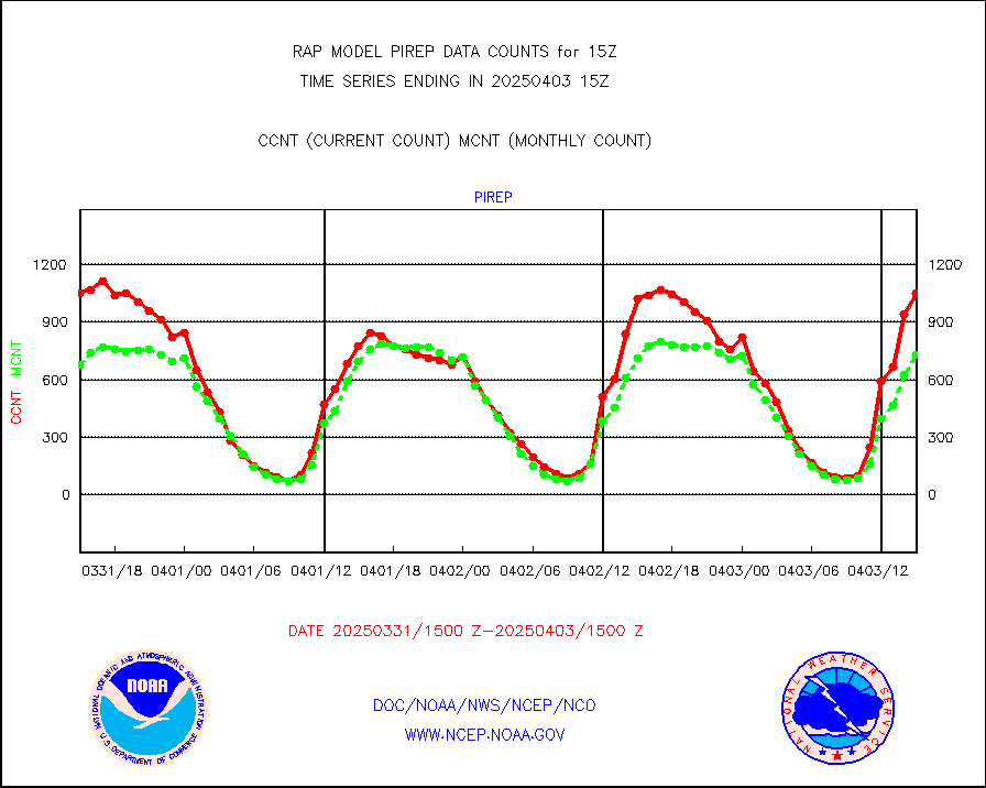
pirep |
Manual PIREP aircraft data (dcded from AIREP fmt) |
505 |
614 |
82.2 % |
1911.75-1918.25 |
prflrp |
Profilr winds from PIBAL (PILOT,PILOT SHIP/MOBIL) |
0 |
0 |
n/a |
1913.50-1916.50 |
raobm |
Rawinsonde - mobile land (from TEMP/PILOT MOBIL) |
0 |
0 |
n/a |
1914.00-1916.00 |
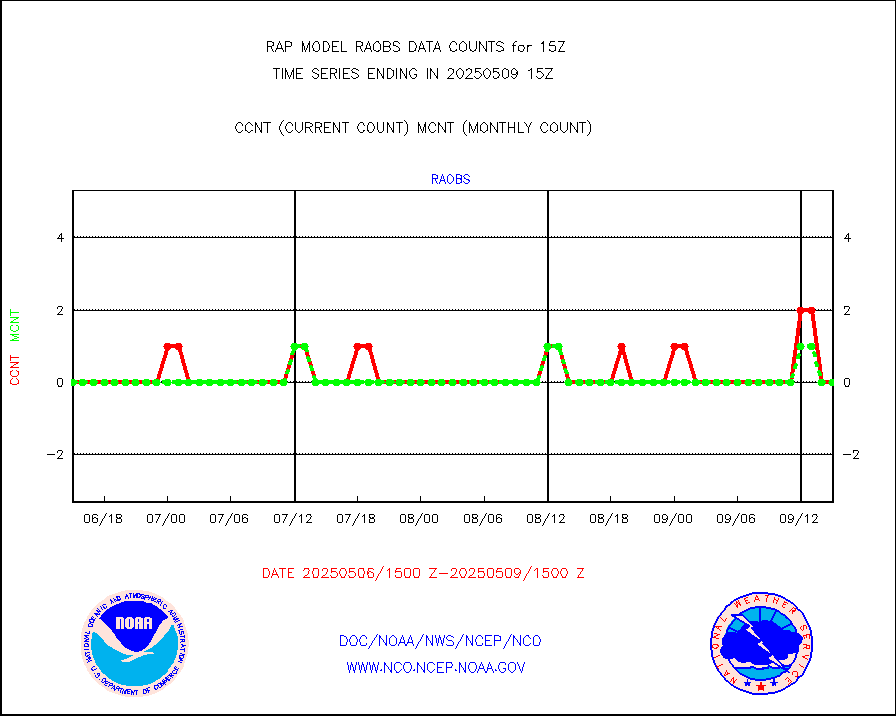
raobs |
Rawinsonde - ship (from TEMP SHIP, PILOT SHIP) |
0 |
0 |
n/a |
1914.00-1916.00 |
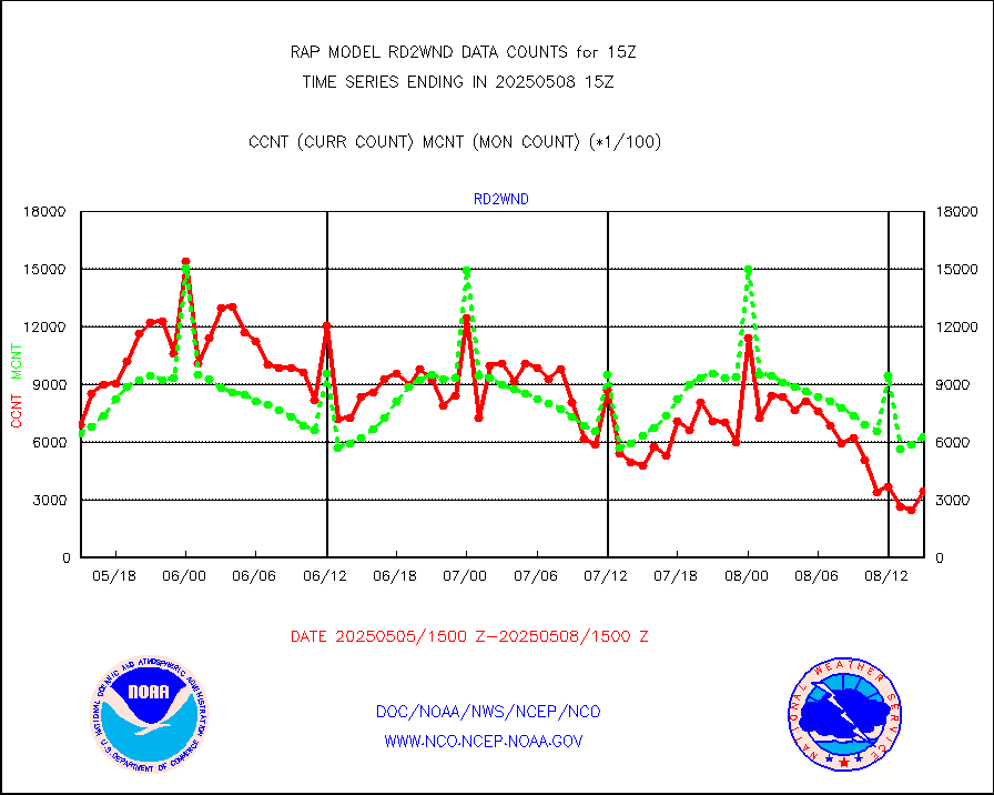
rd2wnd |
NEXRAD radial wind (Level 2 - GTS) |
740785 |
738403 |
100.3 % |
1914.50-1915.49 |
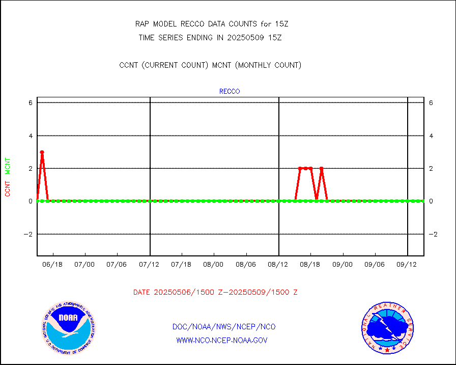
recco |
Flight level reconnaissance aircraft data |
0 |
0 |
n/a |
1914.00-1916.00 |
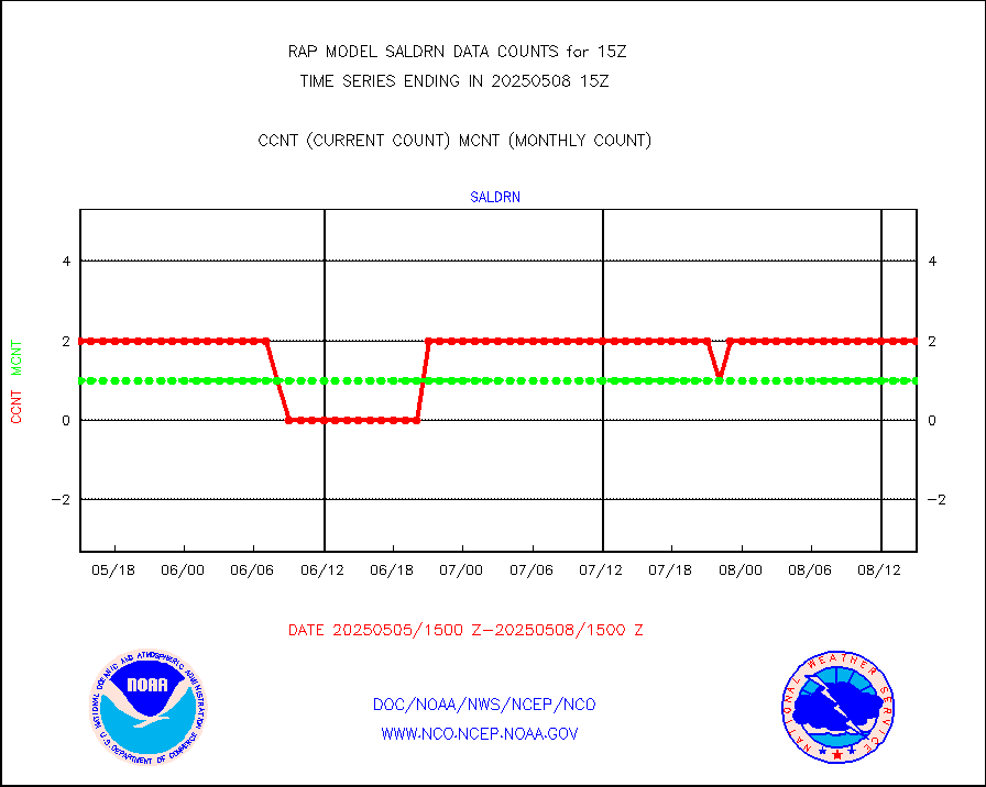
saldrn |
Surface Marine Saildrone (decoded from BUFR) |
2 |
2 |
100.0 % |
1913.00-1916.99 |
saphir |
Megha-Tropiques SAPHIR L1A2 brightness temps |
0 |
0 |
n/a |
1912.00-1917.99 |
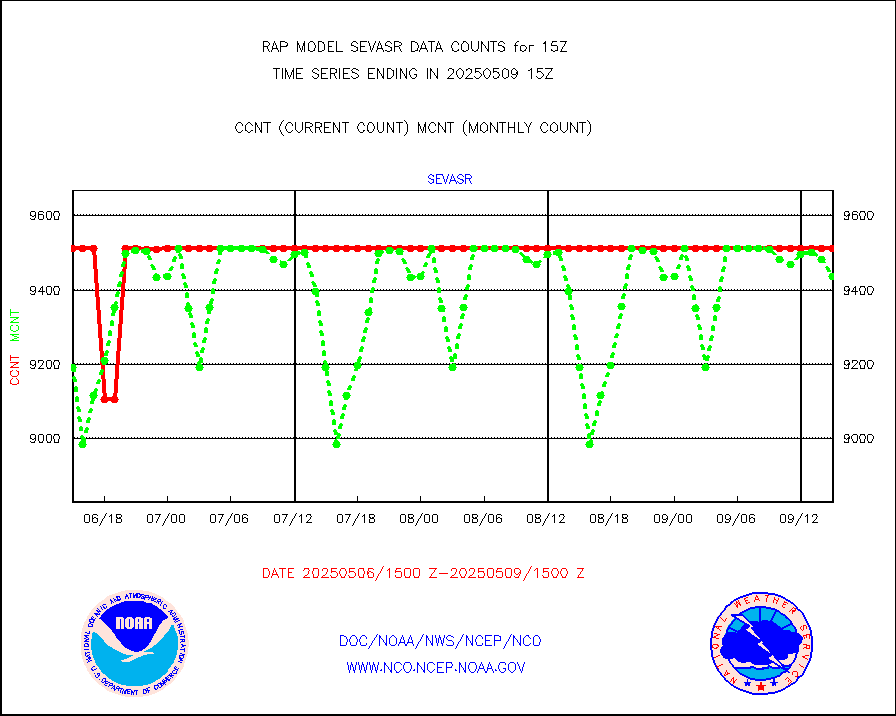
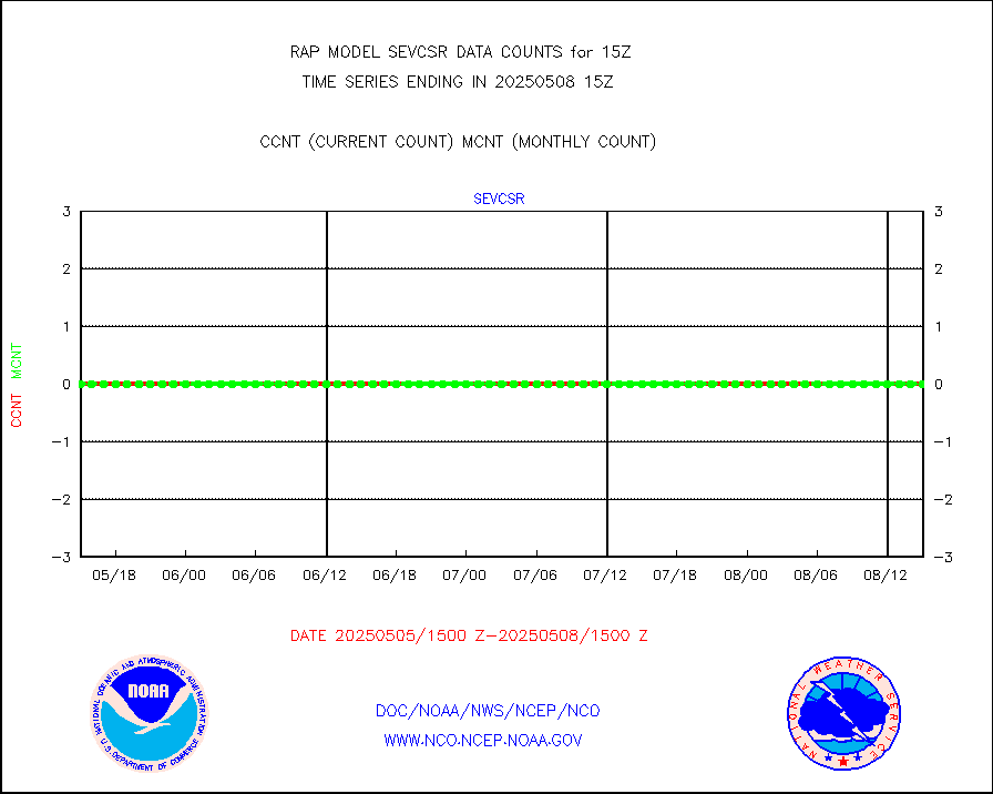
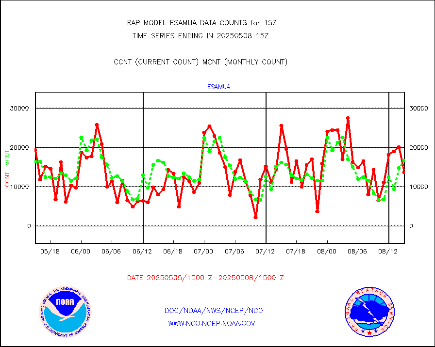
sevasr |
METEOSAT-10 2nd Gen SEVIRI All Sky Radiance(proc) |
9512 |
9511 |
100.0 % |
1913.00-1916.99 |
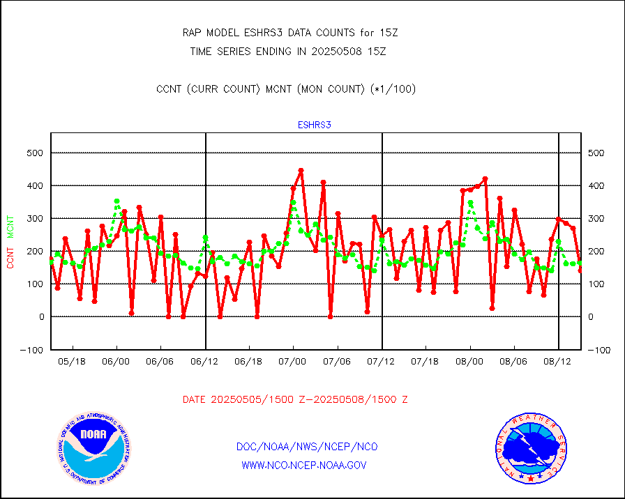
sevcsr |
METEOSAT-10 2nd Gen SEVIRI Clr Sky Radiance(proc) |
0 |
0 |
n/a |
1913.00-1916.99 |
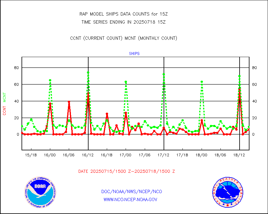
ships |
Ship - manual and automatic, restricted |
11 |
4 |
275.0 % |
1914.50-1915.50 |
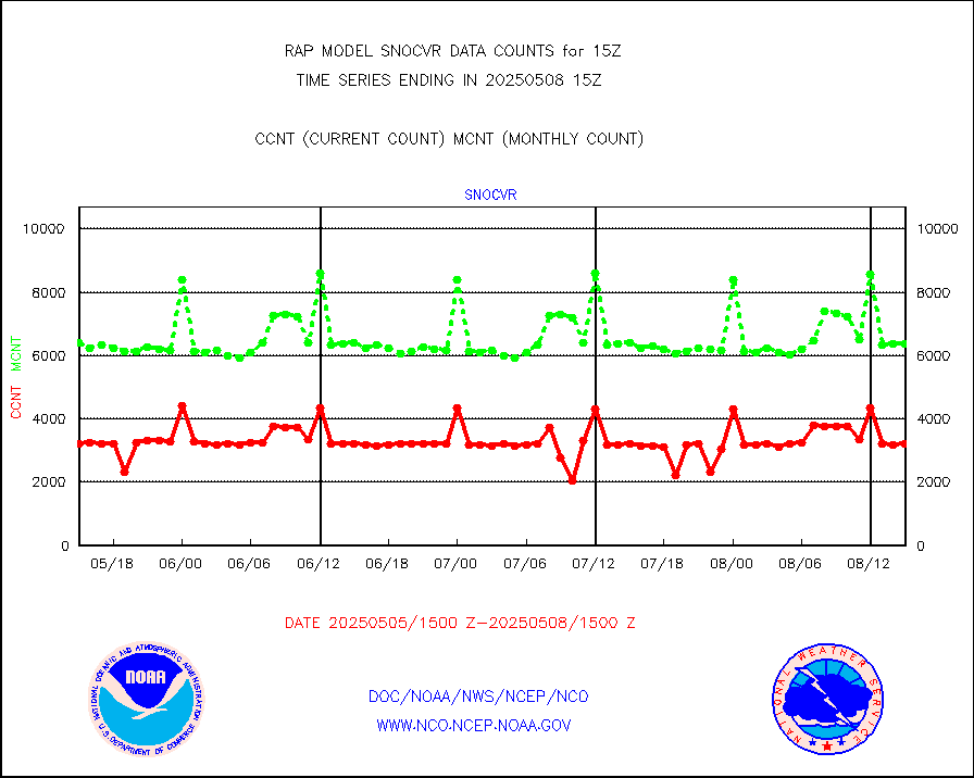
snocvr |
NOW COVER, DEPTH/DENSITY AND WATER EQUIVALENT |
3545 |
6806 |
52.1 % |
1913.00-1917.00 |
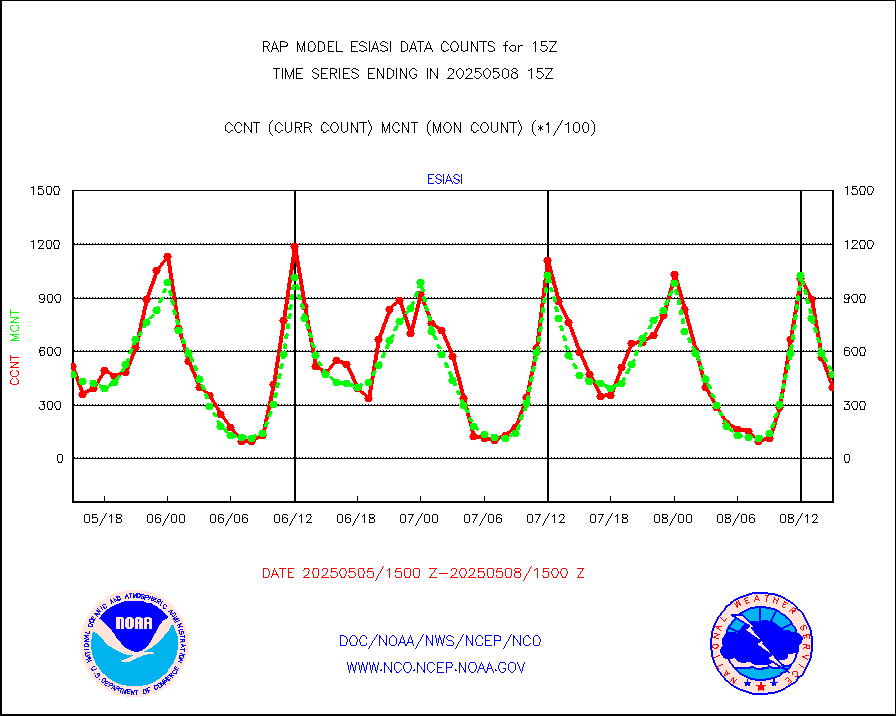
ssmisu |
DMSP SSM/IS 1C radiance data (Unified Pre-Proc.) |
123373 |
55480 |
222.4 % |
1913.00-1916.99 |
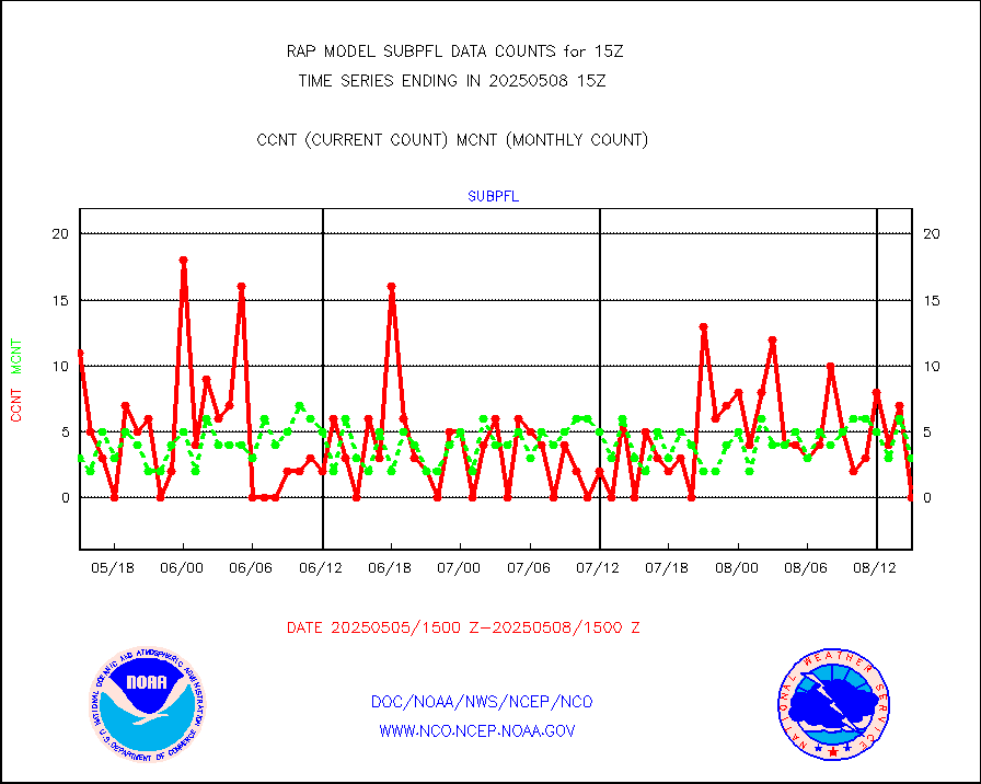
subpfl |
Sub-surface float and glider profile (BUFR) |
0 |
4 |
0.0 % |
1913.00-1916.99 |
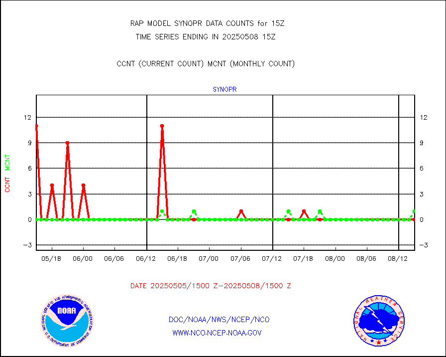
synopr |
Synoptic - restricted (WMO Res 40) manual & auto. |
0 |
0 |
n/a |
1914.50-1915.50 |
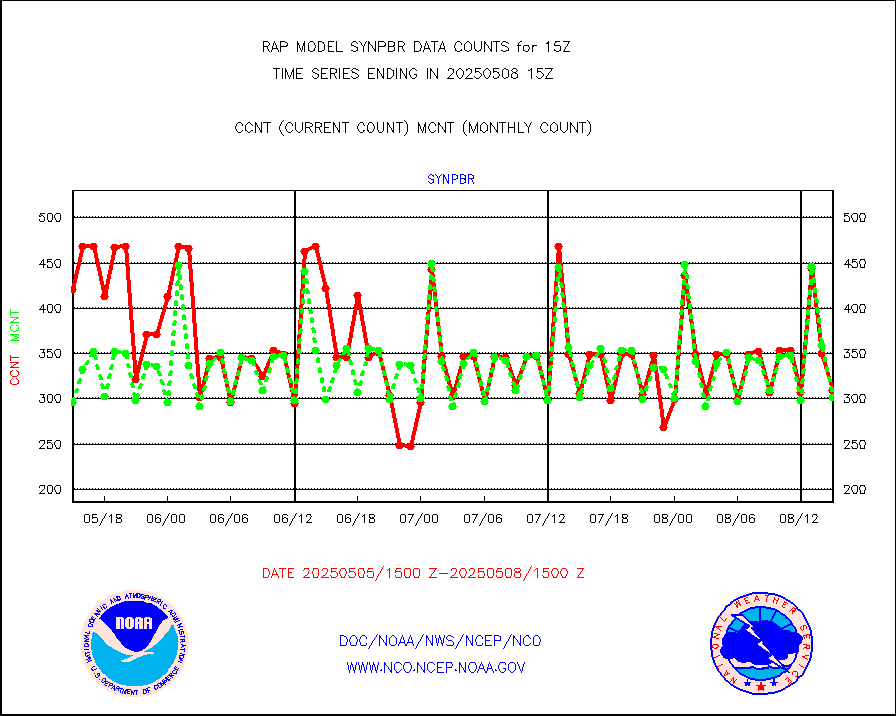
synpbr |
Synoptic - restricted (WMO Res 40)(decoded BUFR) |
305 |
306 |
99.7 % |
1914.50-1915.50 |
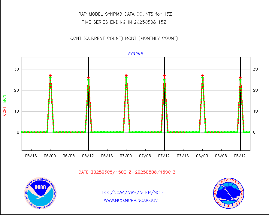
synpmb |
Synoptic - mobile manual & auto (decoded fr BUFR) |
0 |
0 |
n/a |
1914.50-1915.50 |
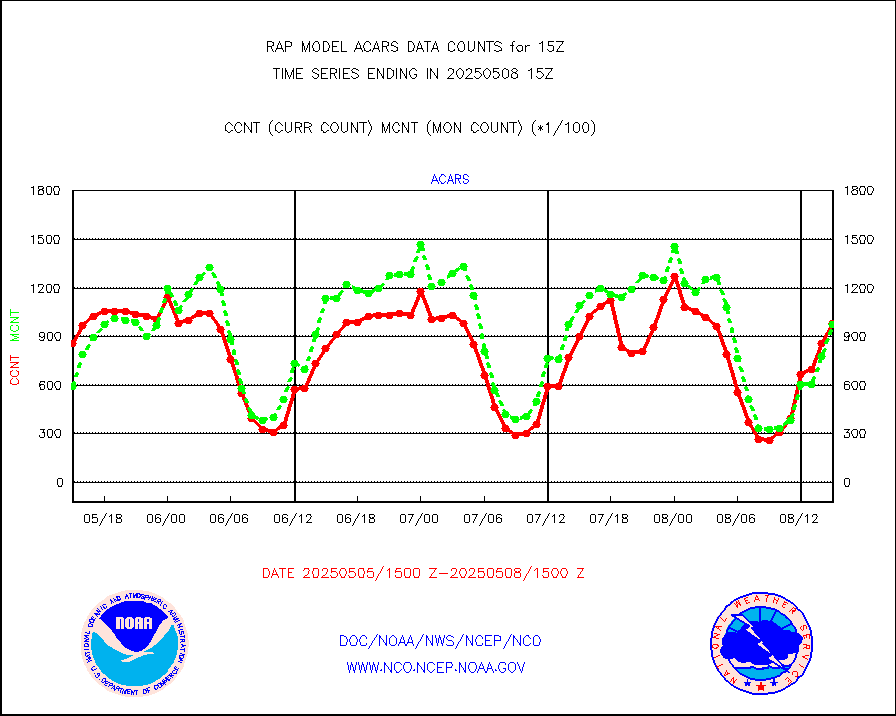
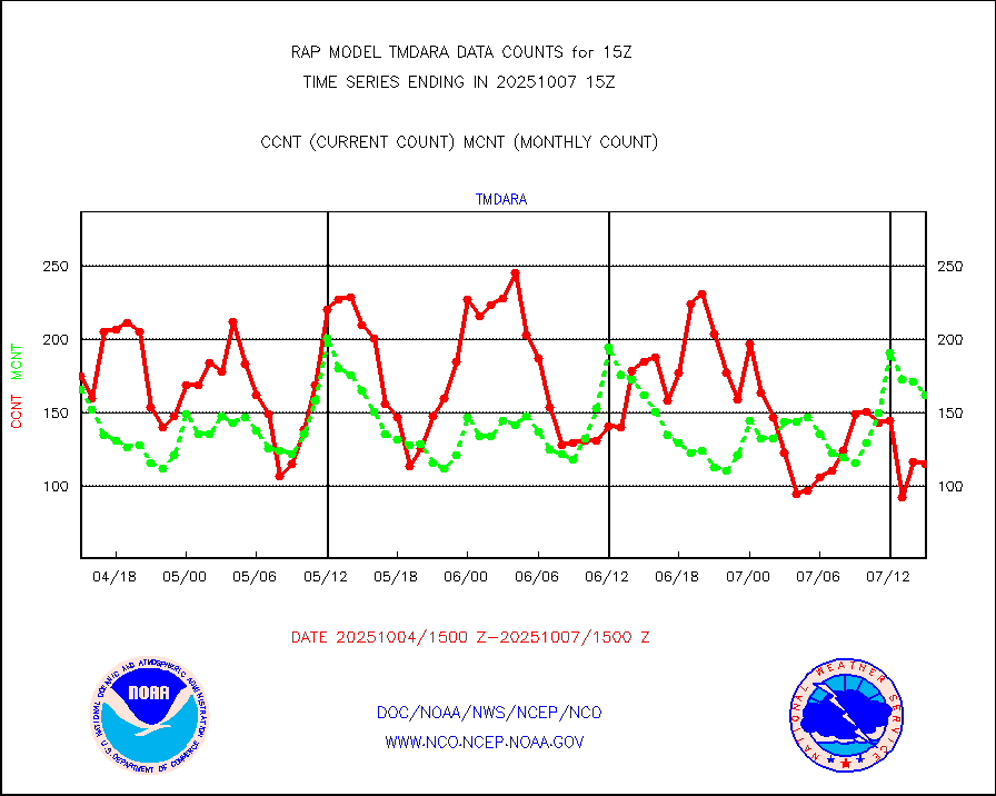
tmdara |
TAMDAR aircft data-all types(from Panasonic,BUFR) |
1240 |
1352 |
91.7 % |
1911.75-1918.25 |
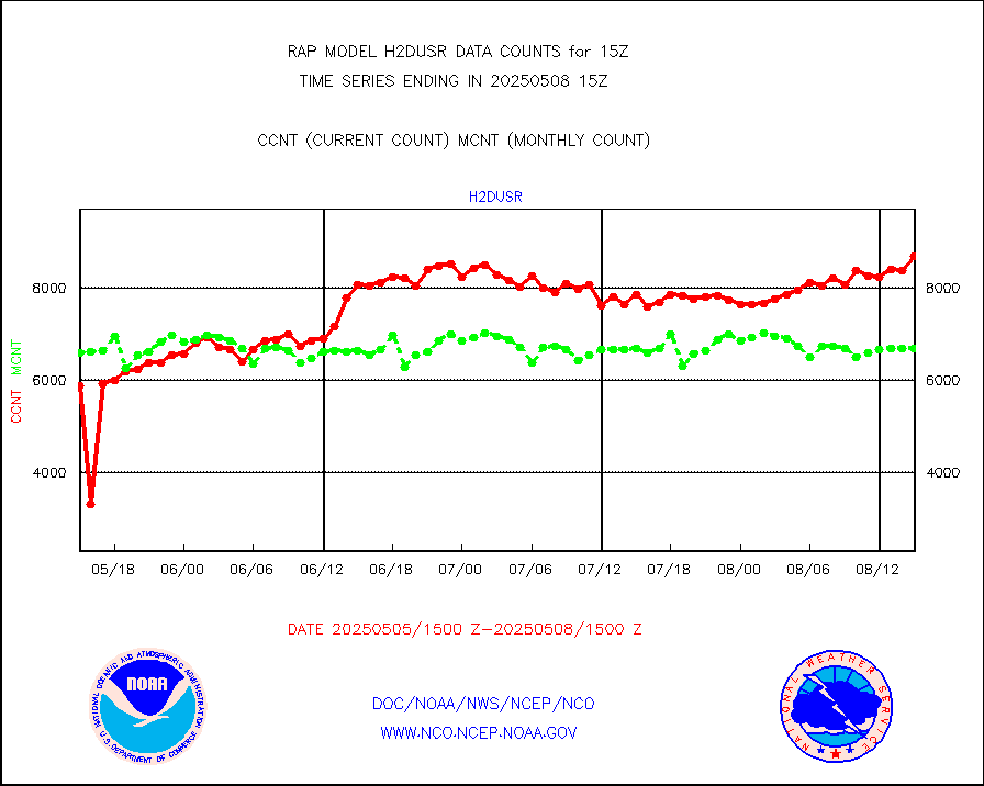
visja |
MTSAT/JMA visible derived cloud motion |
0 |
0 |
n/a |
1912.50-1917.50 |
visusr |
GOES-16&up/NESDIS visible derived cloud motion |
52944 |
45055 |
117.5 % |
1914.00-1914.99 |
vseunb |
METEOSAT/EUMETSAT visible drv cld motion NBseq |
7579 |
6933 |
109.3 % |
1913.50-1916.49 |


