| Critical Data with Normal Counts |
|---|
| Type | Description | Hourly Count | Monthly Average | Percent (%) of Monthly Mean | UTC Time Window |
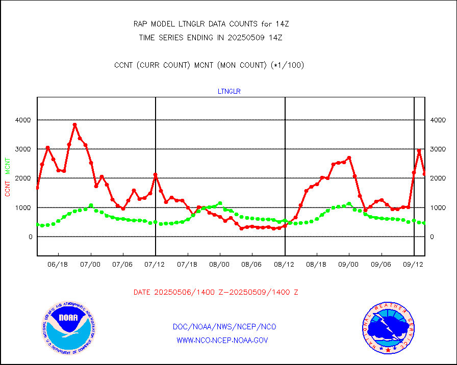
1bamua |
NOAA 15-19 & METOP 1-2 AMSU-A NCEP-proc. br.temps |
32435 |
27332 |
118.7 % |
1911.00-1916.99 |
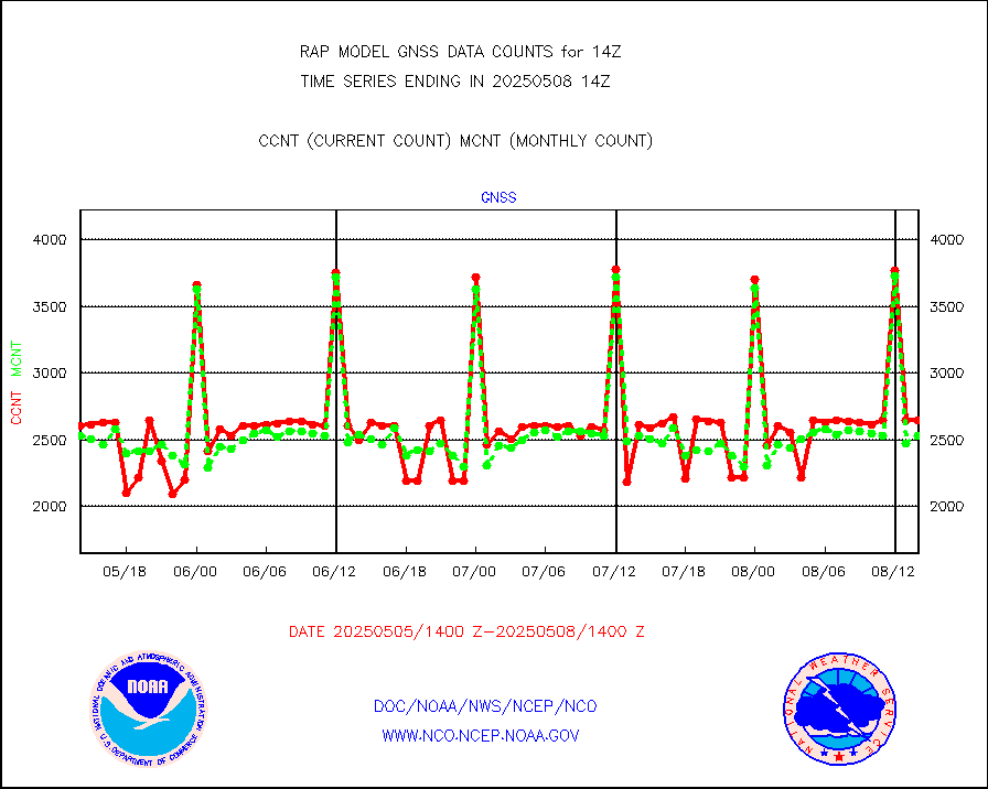
1bhrs4 |
NOAA 18-19 & METOP 1-2 HIRS-4 NCEP-proc. br.temps |
27845 |
22337 |
124.7 % |
1911.00-1916.99 |
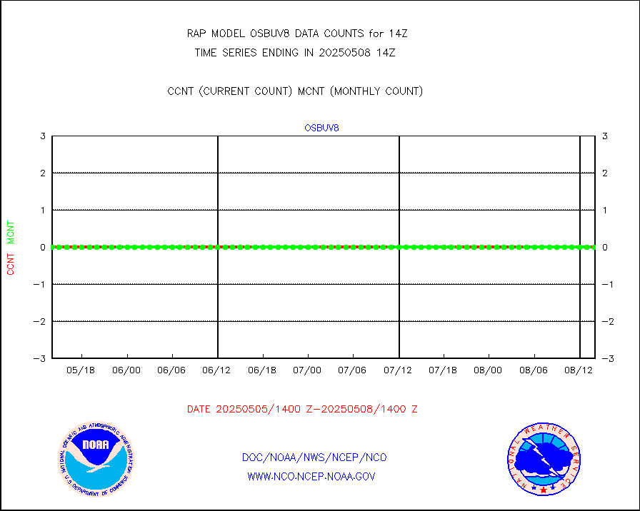
1bmhs |
NOAA 18-19 & METOP 1-2 MHS NCEP-proces. br. temps |
173093 |
151669 |
114.1 % |
1911.00-1916.99 |
acars |
MDCRS ACARS acft data from ARINC(dcded from BUFR) |
55994 |
53836 |
104.0 % |
1910.75-1917.25 |
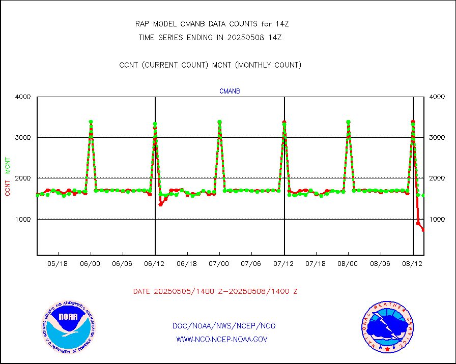
cmanb |
Surface Marine CMAN rpts decoded from BUFR format |
1576 |
1640 |
96.1 % |
1913.50-1914.50 |
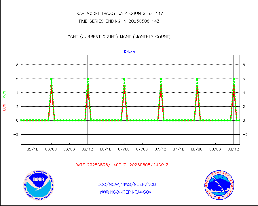
dbuoy |
Buoys decoded from FM-18 fmt (moored or drifting) |
0 |
1 |
0.0 % |
1913.50-1914.50 |
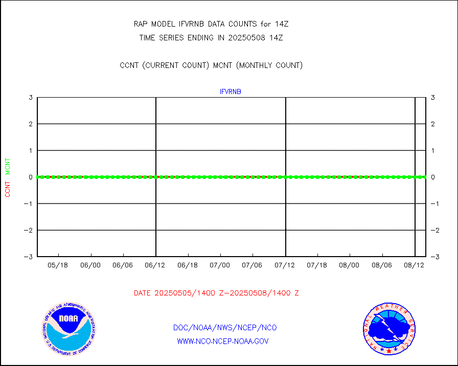
gnss |
Grnd-based Gbl Navigation Sat System (GNSS) data |
2587 |
2585 |
100.1 % |
1912.95-1913.05 |
h20mo |
MODIS (AQUA/TERRA) wvpr imager derived cld motion |
0 |
0 |
n/a |
1911.50-1916.50 |
infmo |
MODIS (AQUA/TERRA) ir l-wave derived cloud motion |
0 |
0 |
n/a |
1911.50-1916.50 |
lgycld |
GOES/NASA(Langley) hi-res. (1x1 f-o-v) cloud data |
3727927 |
2941194 |
126.7 % |
1913.50-1914.50 |
mbuoy |
Buoys decoded from FM-13 format (moored) |
92 |
66 |
139.4 % |
1913.50-1914.50 |
metar |
Aviation - METAR |
5774 |
6008 |
96.1 % |
1913.50-1914.50 |
nxrdw |
NEXRAD Vel Azm Dsp(VAD) winds via radar coded msg |
0 |
0 |
n/a |
1913.00-1915.00 |
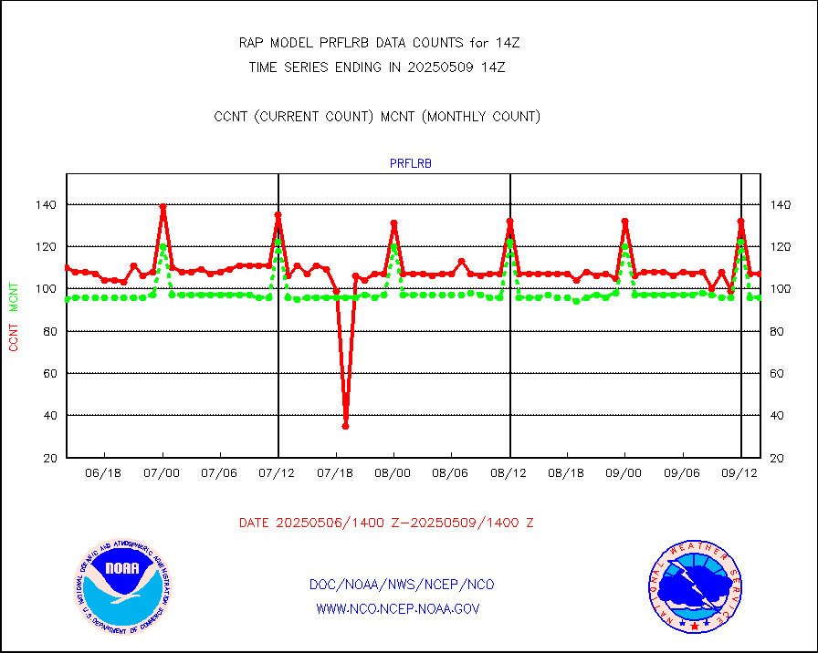
prflrb |
Multi-Agency Profiler (MAP) and SODAR winds |
72 |
84 |
85.7 % |
1912.50-1915.50 |
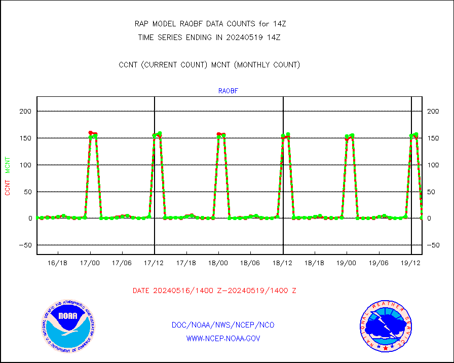
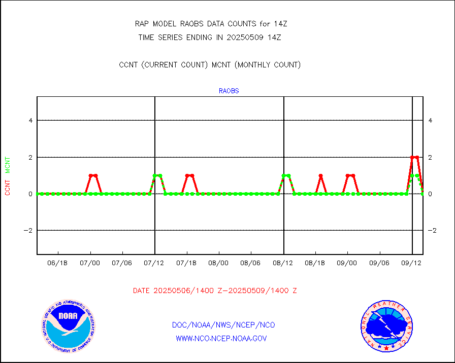
raobf |
Rawinsonde - fixed land (from TEMP or PILOT) |
0 |
1 |
0.0 % |
1913.00-1915.00 |
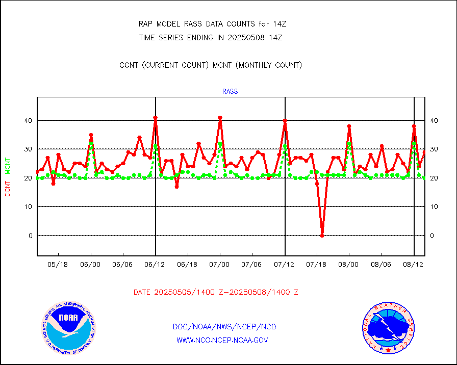
rass |
RASS temperatures (NOAA and Multi-Agency) |
20 |
21 |
95.2 % |
1913.50-1914.50 |
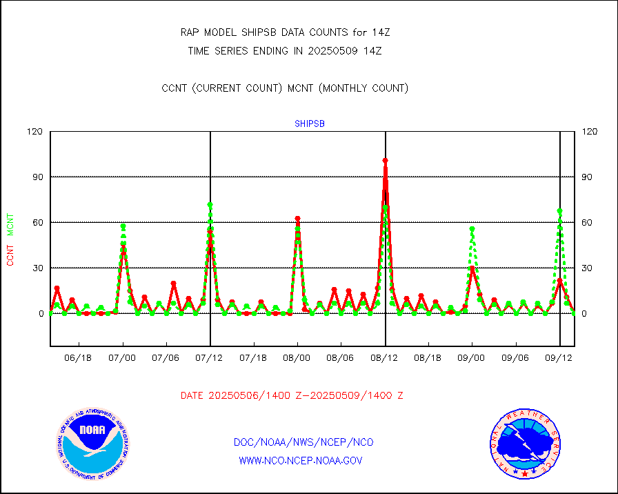
shipsb |
Ship - manual and automatic, restricted (BUFR) |
0 |
0 |
n/a |
1913.50-1914.50 |
shipsu |
Ship - manual and automatic, unrestricted |
67 |
56 |
119.6 % |
1913.50-1914.50 |
shipub |
Ship - manual and automatic, unrestricted (BUFR) |
632 |
606 |
104.3 % |
1913.50-1914.50 |
synop |
Synoptic - fixed manual and automatic |
334 |
336 |
99.4 % |
1913.50-1914.50 |
synopb |
Synoptic - fixed manual & auto (decoded fr BUFR) |
1729 |
1697 |
101.9 % |
1913.50-1914.50 |
tideg |
Tide gauge reports decoded from CREX format |
182 |
181 |
100.6 % |
1913.50-1914.50 |
| Data Types of Opportunity with Normal Counts |
|---|
| Type | Description | Hourly Count | Monthly Average | Percent (%) of Monthly Mean | UTC Time Window |
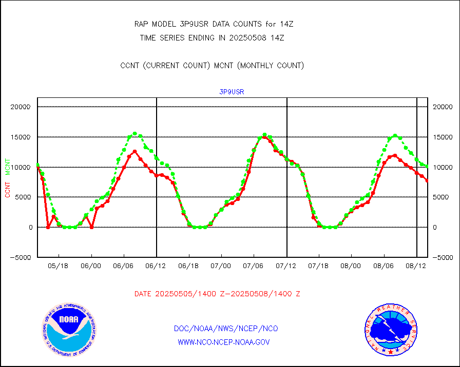
3p9usr |
GOES-16&up/NESDIS ir short-wv derived cld motion |
8153 |
9441 |
86.4 % |
1913.00-1913.99 |
acarsa |
MDCRS ACARS acft data (ARINC via AFWA)(AIREP fmt) |
0 |
0 |
n/a |
1910.75-1917.25 |
airep |
Manual AIREP aircraft data (dcded from AIREP fmt) |
5845 |
5373 |
108.8 % |
1910.75-1917.25 |
airsev |
AQUA AIRS/AMSU-A/HSB brightness temps- every FOV |
0 |
0 |
n/a |
1911.00-1916.99 |
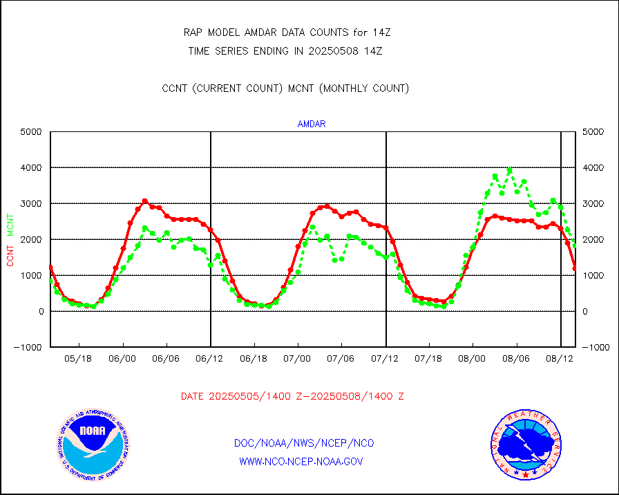
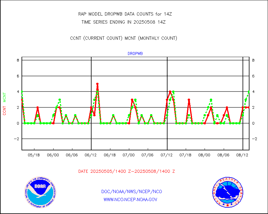
amdar |
AMDAR aircraft data (decoded from AMDAR format) |
1243 |
1145 |
108.6 % |
1910.75-1917.25 |
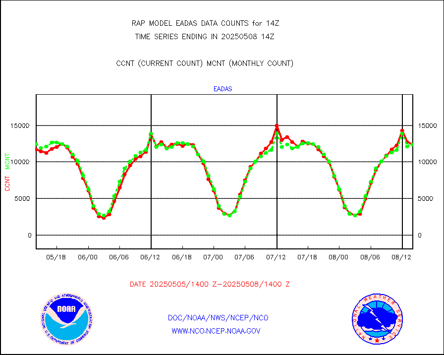
amdarb |
AMDAR aircraft data (decoded from BUFR) |
3986 |
3797 |
105.0 % |
1910.75-1917.25 |
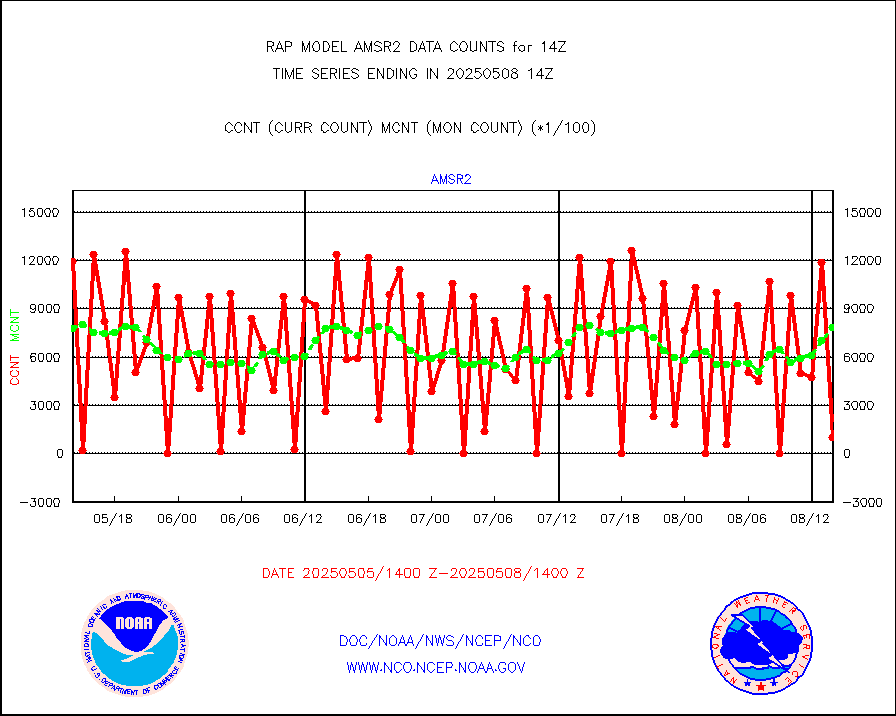
amsr2 |
GCOM-W AMSR2 1B brightness temperatures |
255974 |
736164 |
34.8 % |
1911.00-1911.99 |
ascat |
METOP 1-2 ASCAT products |
35251 |
14523 |
242.7 % |
1912.00-1916.00 |
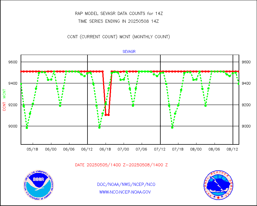
atms |
NPP/NOAA-20 ATMS brightness temperatures |
246240 |
210850 |
116.8 % |
1912.00-1915.99 |
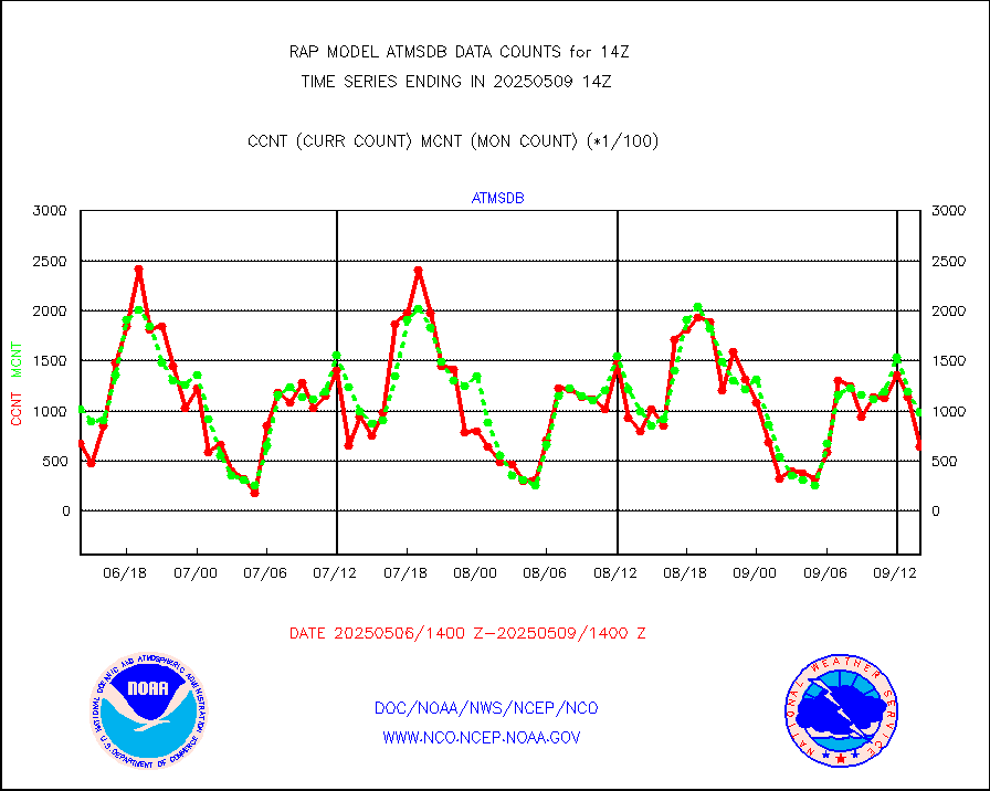
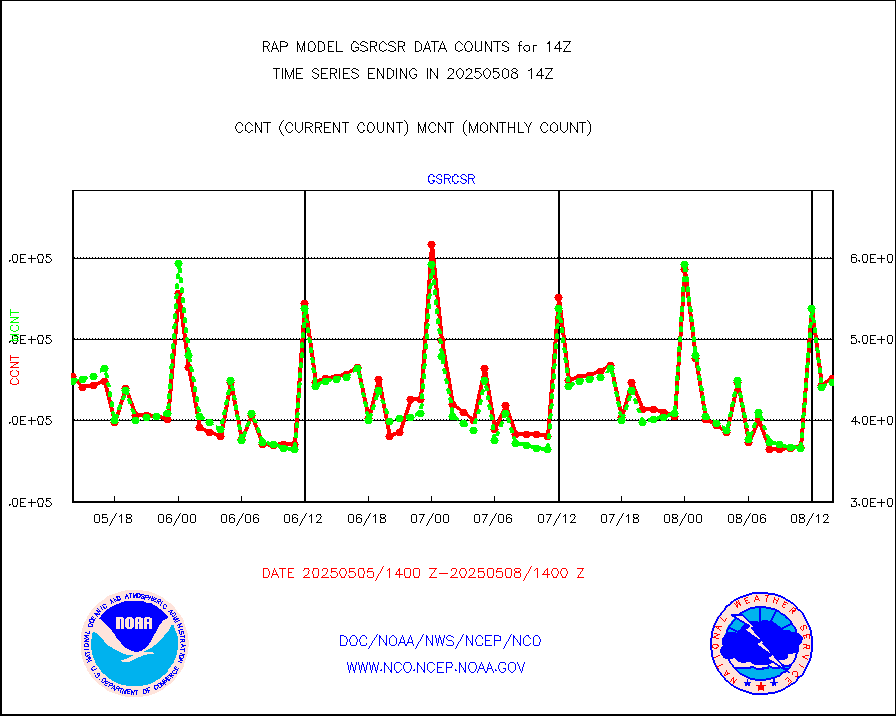
atmsdb |
NPP/NOAA-20 ATMS bright. temps-direct b-cast SSEC |
106532 |
122083 |
87.3 % |
1912.00-1915.99 |
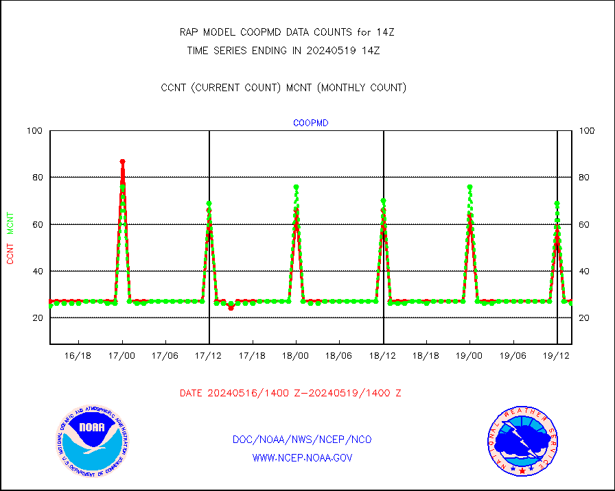
coopmd |
Coop/MADIS NEPP & HCN-Modernization NOAA COOP Obs |
27 |
26 |
103.8 % |
1913.50-1914.50 |
crisf4 |
NPP/NOAA-20 CrIS full spctrl radn (431 ch subset) |
129512 |
121141 |
106.9 % |
1912.00-1915.99 |
crsfdb |
NPP/NOAA-20 CrIS full spctrl radn dir brdcst SSEC |
126440 |
139406 |
90.7 % |
1912.00-1915.99 |
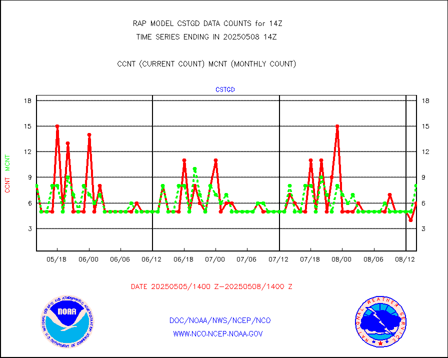
cstgd |
Coast Guard |
3 |
6 |
50.0 % |
1913.50-1914.50 |
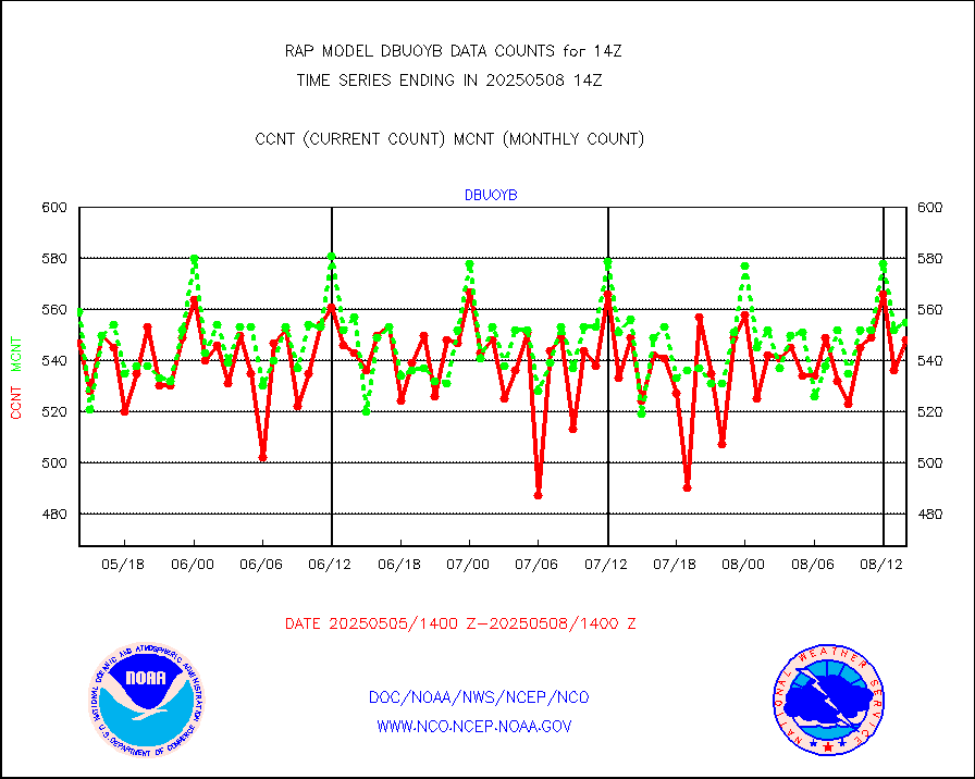
dbuoyb |
Drifting buoys (decoded from BUFR) |
605 |
575 |
105.2 % |
1913.50-1914.50 |
dropw |
Dropwinsonde (from TEMP DROP) |
0 |
0 |
n/a |
1913.00-1915.00 |
eadas |
E-AMDAR (European AMDAR acft decoded from BUFR) |
10136 |
9300 |
109.0 % |
1910.75-1917.25 |
esamua |
NOAA 15-19 & METOP 1-2 AMSU-A proc btmps frm RARS |
19434 |
13621 |
142.7 % |
1913.00-1915.00 |
esatms |
NPP Adv. Tech. MW Sndr (ATMS) br. temps from RARS |
119333 |
126925 |
94.0 % |
1912.00-1915.99 |
eshrs3 |
NOAA 15-19 & METOP 1-2 HIRS-3/4 pr btmps frm RARS |
46958 |
28797 |
163.1 % |
1913.00-1915.00 |
esiasi |
METOP 1-2 IASI 1C radiance data vbl chn from RARS |
91065 |
71506 |
127.4 % |
1912.00-1915.99 |
esmhs |
NOAA 18-19 & METOP 1-2 MHS proc. btemps from RARS |
178997 |
114805 |
155.9 % |
1913.00-1915.00 |
gmi1cr |
GPM GMI Level 1C-R brightness temperatures |
344428 |
396337 |
86.9 % |
1911.00-1916.99 |
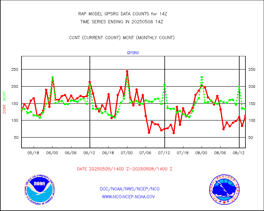
gpsro |
GPS radio occultation data |
162 |
112 |
144.6 % |
1912.00-1915.99 |
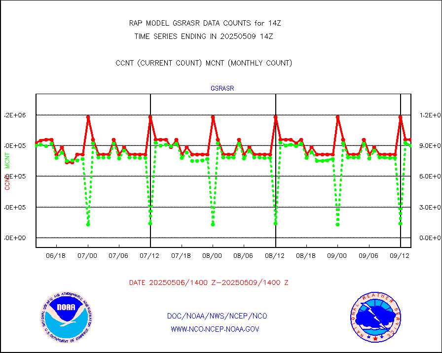
gsrasr |
GOES-16/17 All Sky Radiances (proc.) |
812097 |
798551 |
101.7 % |
1912.00-1915.99 |
gsrcsr |
GOES-16/17 Clear Sky Radiances (proc.) |
345012 |
369465 |
93.4 % |
1912.00-1915.99 |
h20ja |
MTSAT/JMA water vapor imager derived cloud motion |
2701 |
2997 |
90.1 % |
1911.50-1916.50 |
h2dusr |
GOES-16&up/NESDIS wv imgr/deep-lyr derivd cld mtn |
7548 |
7143 |
105.7 % |
1913.00-1913.99 |
h2eunb |
METEOSAT/EUMETSAT wvpr imgr drv cld motion NBseq |
5771 |
5298 |
108.9 % |
1912.50-1915.49 |
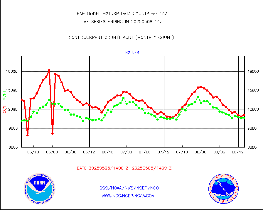
h2tusr |
GOES-16&up/NESDIS wv imgr/cld-top derived cld mtn |
11008 |
10335 |
106.5 % |
1913.00-1913.99 |
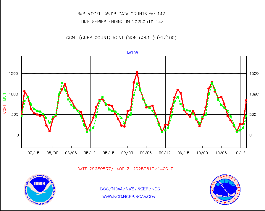
iasidb |
METOP 1-2 IASI 1C radiances-direct broadcast SSEC |
27271 |
25239 |
108.1 % |
1912.00-1915.99 |
ifeunb |
METEOSAT/EUMETSAT ir lg-wave drv cld motion NBseq |
3331 |
3296 |
101.1 % |
1912.50-1915.49 |
ifvrnb |
VIIRS (NPP/NOAA-20) ir lg-wv drv cloud motion(NB) |
0 |
0 |
n/a |
1911.50-1916.50 |
infav |
AVHRR (NOAA/METOP) ir lg-wave derived cld motion |
0 |
0 |
n/a |
1911.50-1916.50 |
infav1 |
AVHRR (METOP) ir lg-wave derived cld motion |
0 |
0 |
n/a |
1912.50-1915.49 |
infja |
MTSAT/JMA infrared long-wave derived cloud motion |
2277 |
2469 |
92.2 % |
1911.50-1916.50 |
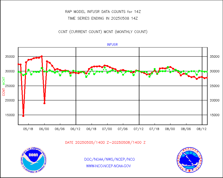
infusr |
GOES-16&up/NESDIS ir long-wave derived cld motion |
27844 |
28409 |
98.0 % |
1913.00-1913.99 |
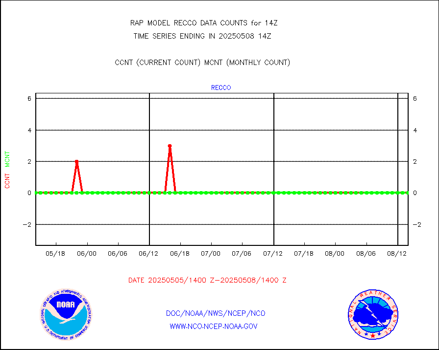
kamdar |
Korean AMDAR aircraft data (decoded from BUFR) |
215 |
151 |
142.4 % |
1910.75-1917.25 |
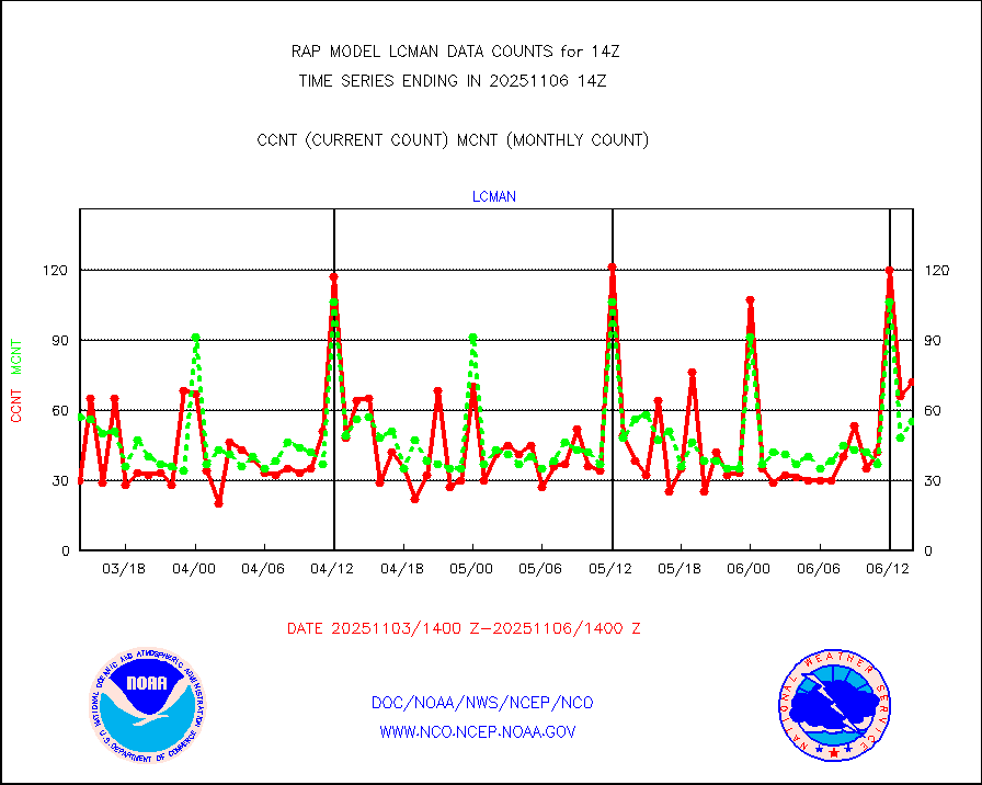
lcman |
Land-based CMAN stations decoded from CMAN format |
53 |
83 |
63.9 % |
1913.50-1914.50 |
ltnglr |
LLDN Long-rng lightning from Vaisala via NOAAPORT |
163975 |
72331 |
226.7 % |
1913.00-1914.50 |
ltngsr |
NLDN Shrt-rng lightning from Vaisala via NOAAPORT |
9311 |
3668 |
253.8 % |
1913.00-1914.50 |
mbuoyb |
Moored buoys (decoded from BUFR) |
572 |
550 |
104.0 % |
1913.50-1914.50 |
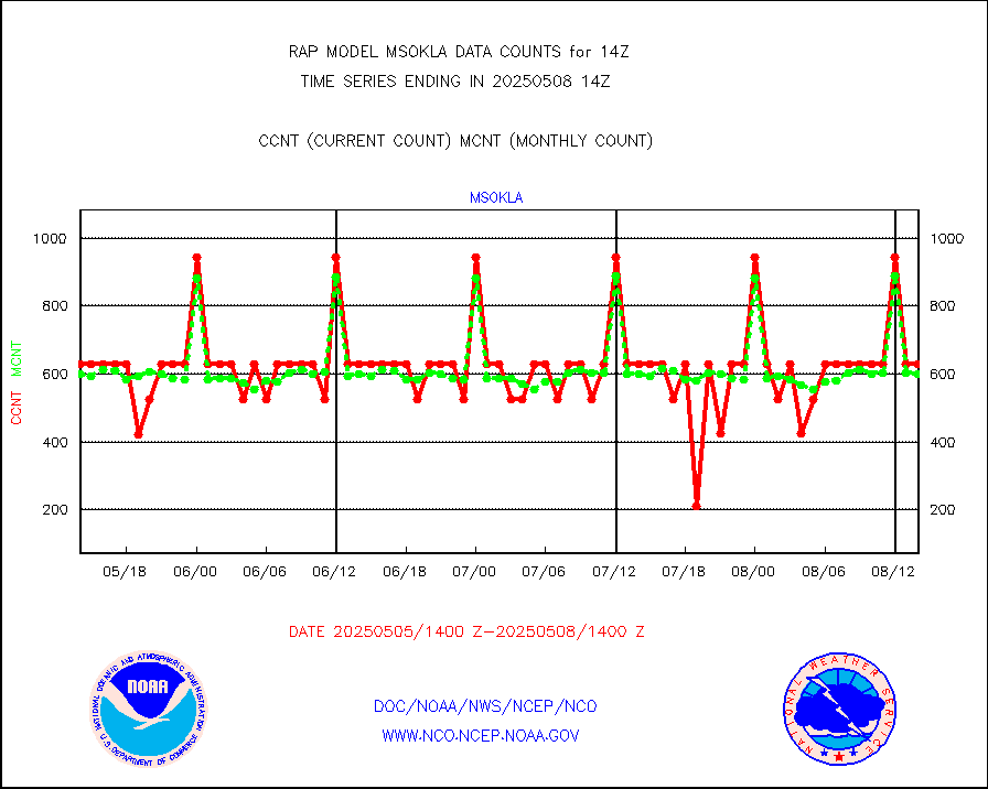
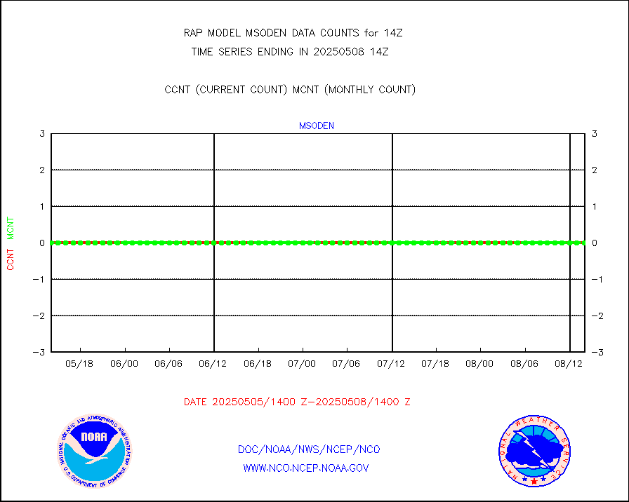
mso470 |
Mesonet/MADIS Colorado E-470 (Interstate 470) |
21 |
19 |
110.5 % |
1913.50-1914.50 |
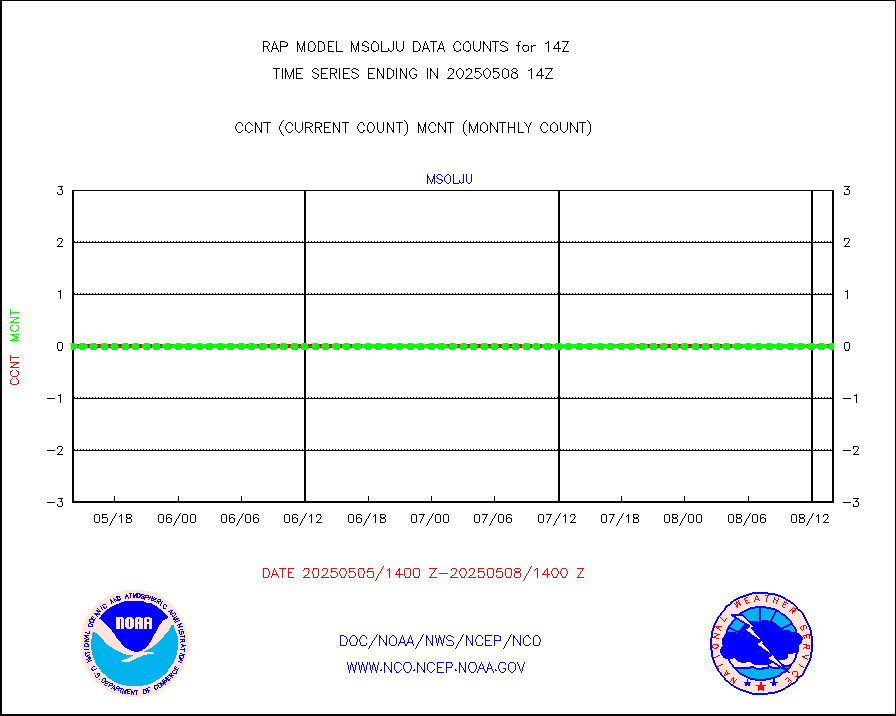
msoalk |
Mesonet/MADIS Alaska Department of Transportation |
110 |
102 |
107.8 % |
1913.50-1914.50 |
msoapg |
Mesonet/MADIS U.S. Army Aberdeen Proving Grounds |
0 |
0 |
n/a |
1913.50-1914.50 |
msoapr |
Mesonet/MADIS Citizen Weather Observers Program |
46303 |
45284 |
102.3 % |
1913.50-1914.50 |
msoaws |
Mesonet/MADIS AWS Convergence Technologies, Inc. |
25569 |
25497 |
100.3 % |
1913.50-1914.50 |
msoawx |
Mesonet/MADIS "Anything Weather" |
0 |
0 |
n/a |
1913.50-1914.50 |
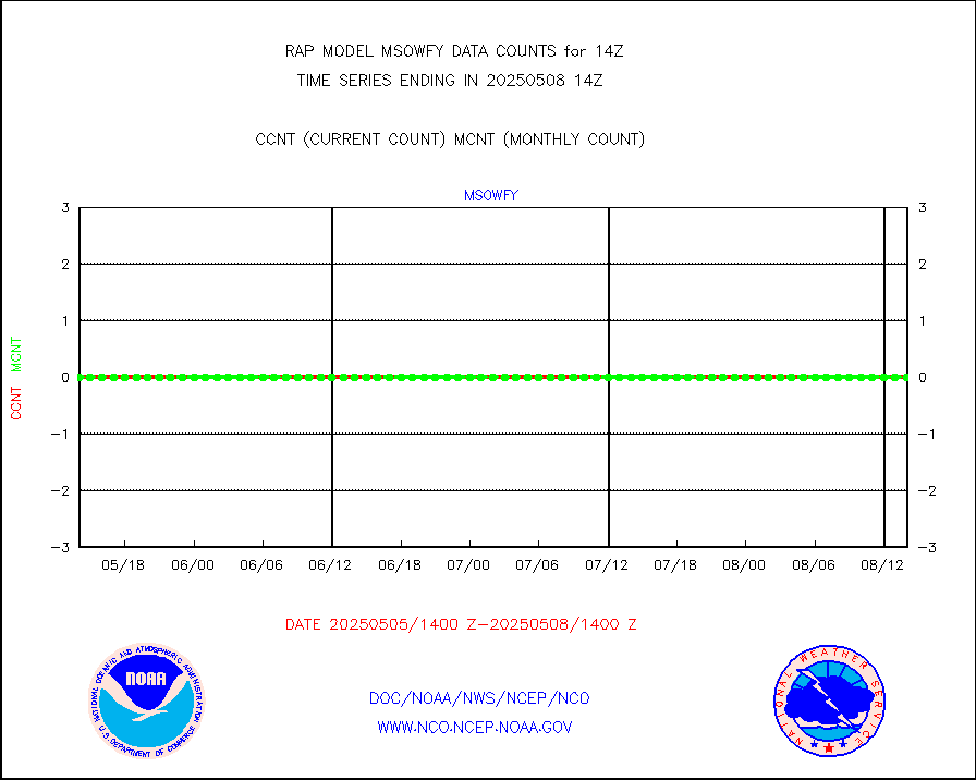
msocol |
Mesonet/MADIS Colorado Dept. of Transportation |
0 |
0 |
n/a |
1913.50-1914.50 |
msodcn |
Mesonet/MADIS DC Net |
0 |
0 |
n/a |
1913.50-1914.50 |
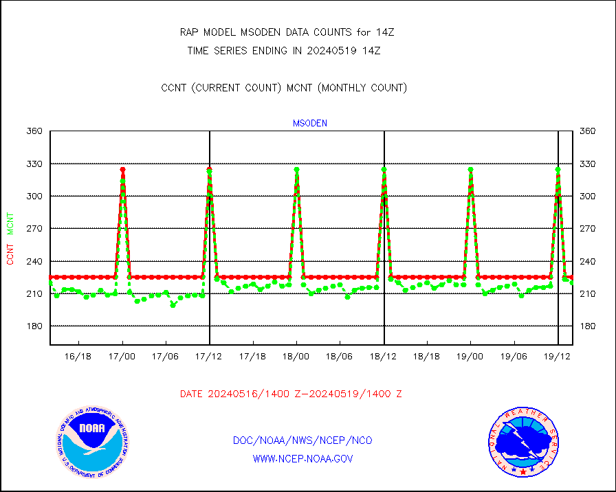
msoden |
Mesonet/MADIS Denver Urban Drainage & Flood Cntrl |
225 |
220 |
102.3 % |
1913.50-1914.50 |
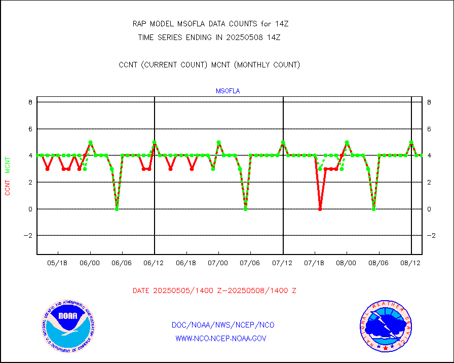
msofla |
Mesonet/MADIS Florida (FAWN & USF) |
3 |
3 |
100.0 % |
1913.50-1914.50 |
msoflt |
Mesonet/MADIS Florida Dept. of Transportation |
0 |
0 |
n/a |
1913.50-1914.50 |
msogeo |
Mesonet/MADIS Georgia Dept. of Transportation |
0 |
0 |
n/a |
1913.50-1914.50 |
msohad |
Mesonet/MADIS NWS Hydromet Auto Data System(HADS) |
5414 |
5500 |
98.4 % |
1913.50-1914.50 |
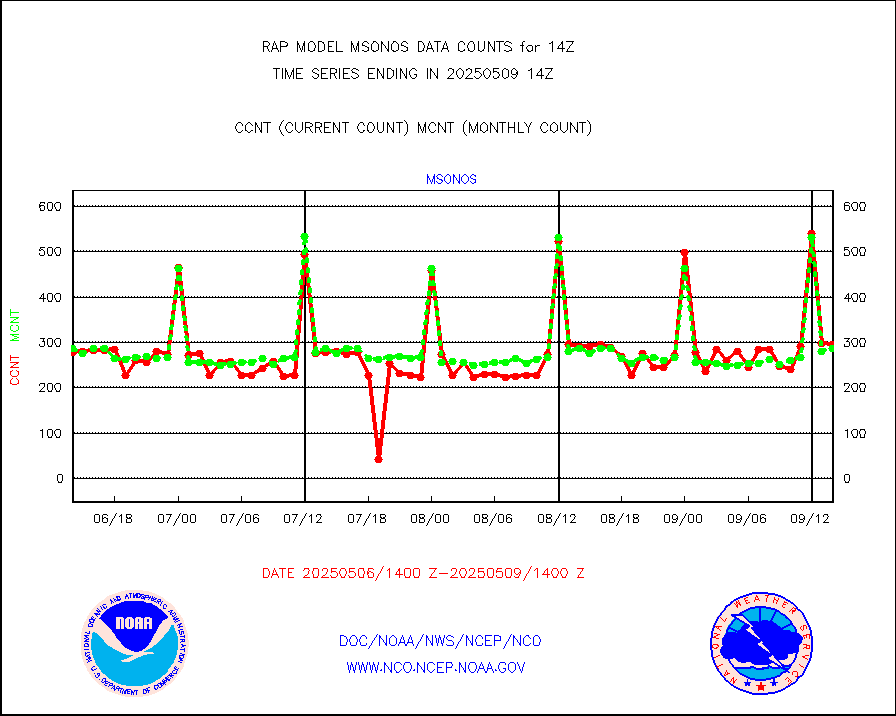
msoien |
Mesonet/MADIS Iowa Environmental |
151 |
166 |
91.0 % |
1913.50-1914.50 |
msoind |
Mesonet/MADIS Indiana Dept. of Transportation |
0 |
0 |
n/a |
1913.50-1914.50 |
msoiow |
Mesonet/MADIS Iowa Department of Transportation |
0 |
0 |
n/a |
1913.50-1914.50 |
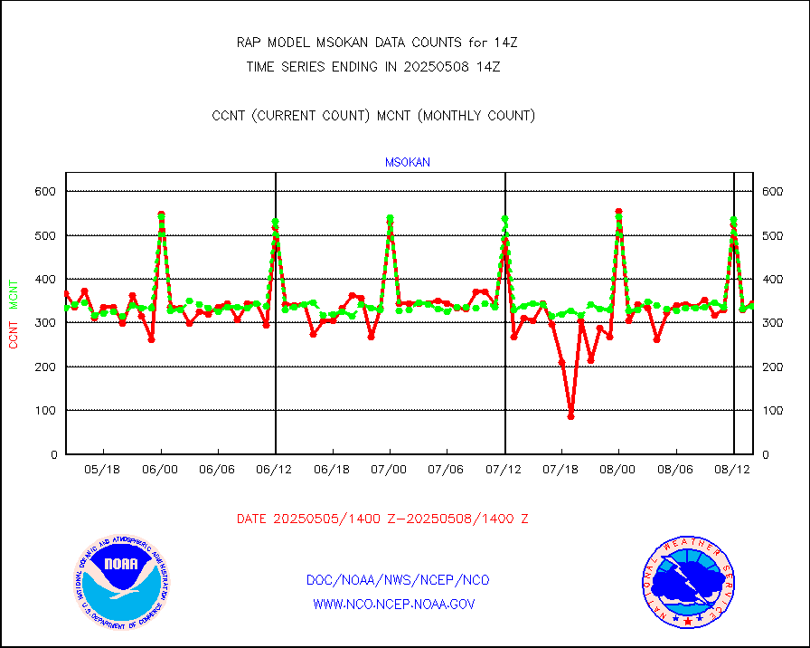
msokan |
Mesonet/MADIS Kansas Department of Transportation |
340 |
316 |
107.6 % |
1913.50-1914.50 |
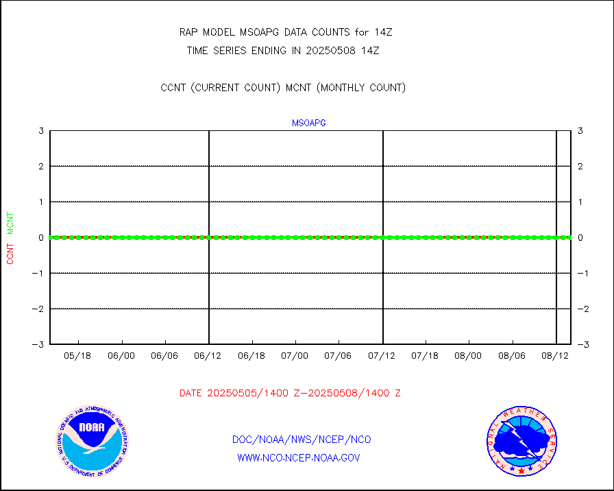
msokla |
Mesonet/MADIS Oklahoma Mesonet |
318 |
318 |
100.0 % |
1913.50-1914.50 |
msolju |
Mesonet/MADIS Louisiana State/Jackson State Univ. |
0 |
0 |
n/a |
1913.50-1914.50 |
msomca |
Mesonet/MADIS Missouri Commercial Agricult Wx Net |
249 |
262 |
95.0 % |
1913.50-1914.50 |
msomin |
Mesonet/MADIS Minnesota Dept. of Transportation |
0 |
0 |
n/a |
1913.50-1914.50 |
msonos |
Mesonet/MADIS NOS-Phys Oceanographic Realtime Sys |
291 |
285 |
102.1 % |
1913.50-1914.50 |
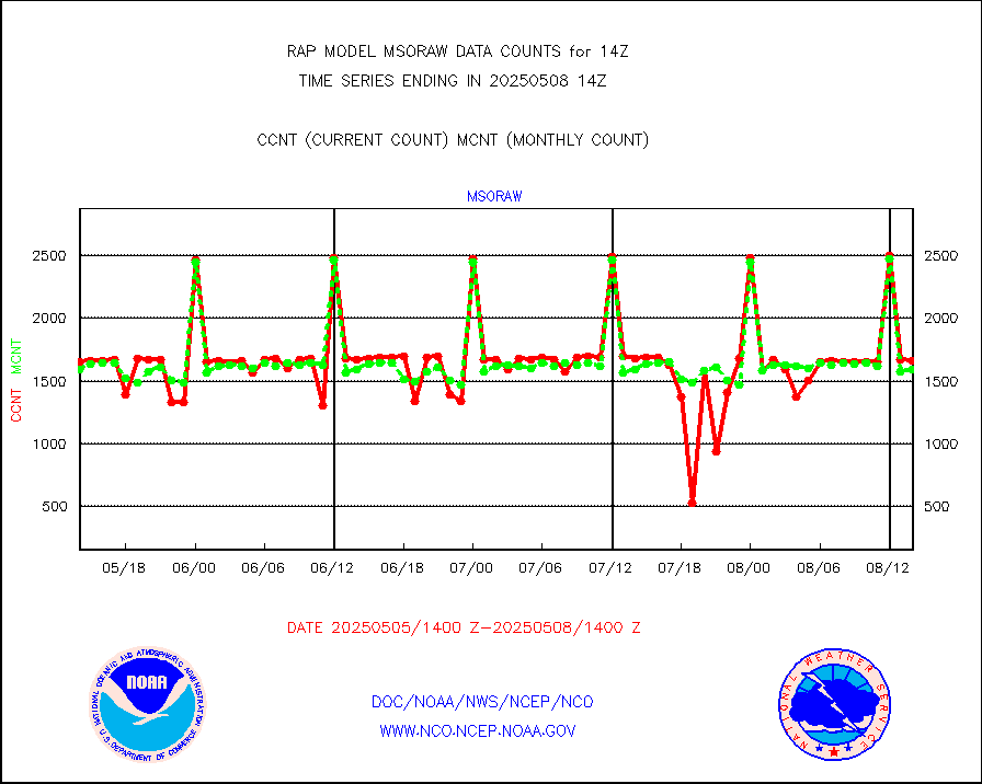
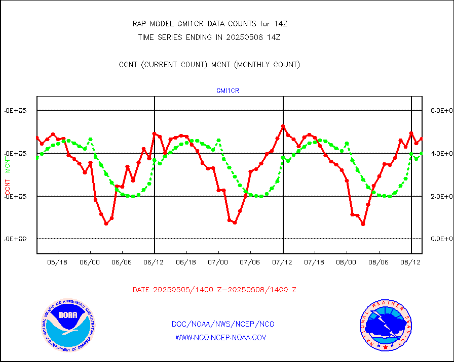
msoraw |
Mesonet/MADIS NFIC Remote Automated Wx Stns(RAWS) |
1624 |
1497 |
108.5 % |
1913.50-1914.50 |
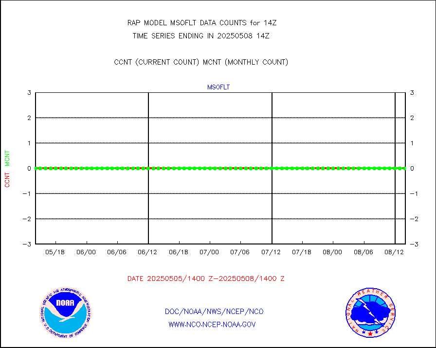
msourb |
Mesonet/MADIS UrbaNet |
3940 |
3950 |
99.7 % |
1913.50-1914.50 |
msovir |
Mesonet/MADIS Virginia Dept. of Transportation |
207 |
226 |
91.6 % |
1913.50-1914.50 |
msowfy |
Mesonet/MADIS "Weather for You" |
0 |
0 |
n/a |
1913.50-1914.50 |
msowis |
Mesonet/MADIS Wisconsin Dept. of Transportation |
0 |
0 |
n/a |
1913.50-1914.50 |
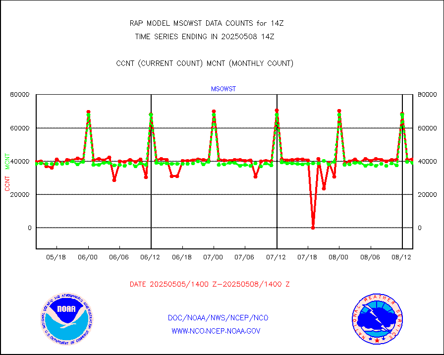
msowst |
Mesonet/MADIS MesoWest (many subproviders) |
40777 |
38966 |
104.6 % |
1913.50-1914.50 |
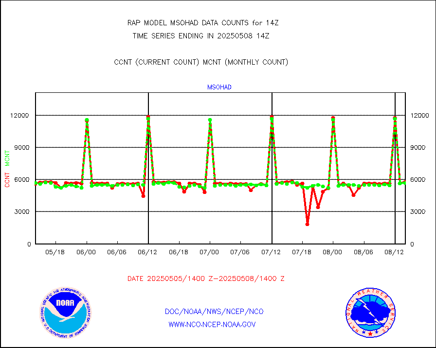
msowtx |
Mesonet/MADIS West Texas |
4633 |
4863 |
95.3 % |
1913.50-1914.50 |
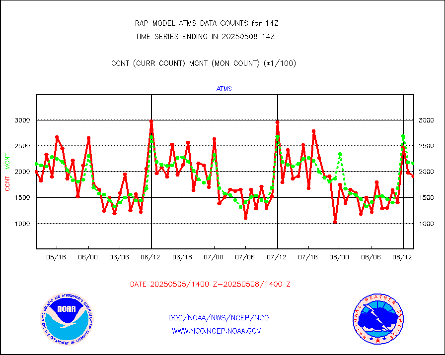
mtiasi |
METOP 1-2 IASI 1C radiance data (varbl. channels) |
5522 |
15590 |
35.4 % |
1912.00-1915.99 |
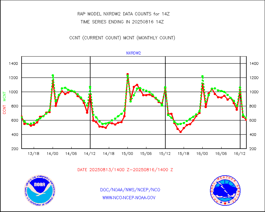
nxrdw2 |
NEXRAD Vel Azm Dsp(VAD) winds via Level 2 decoder |
662 |
566 |
117.0 % |
1913.00-1915.00 |
osbuv8 |
NOAA 16-19 Solar Backscatter UV-2 rad frm V8 BUFR |
0 |
0 |
n/a |
1912.00-1914.99 |
pibal |
PIBAL (from PILOT, PILOT SHIP, PILOT MOBIL) |
0 |
0 |
n/a |
1913.00-1915.00 |
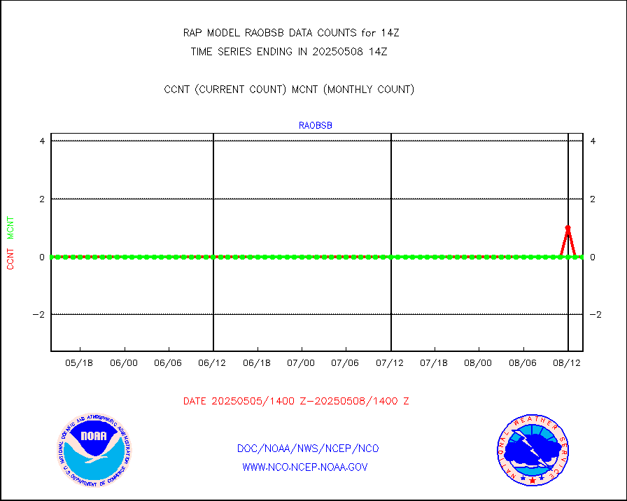
pirep |
Manual PIREP aircraft data (dcded from AIREP fmt) |
447 |
546 |
81.9 % |
1910.75-1917.25 |
prflrp |
Profilr winds from PIBAL (PILOT,PILOT SHIP/MOBIL) |
0 |
0 |
n/a |
1912.50-1915.50 |
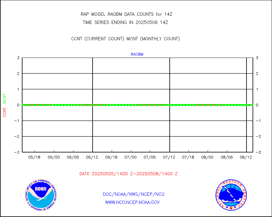
raobm |
Rawinsonde - mobile land (from TEMP/PILOT MOBIL) |
0 |
0 |
n/a |
1913.00-1915.00 |
raobs |
Rawinsonde - ship (from TEMP SHIP, PILOT SHIP) |
0 |
0 |
n/a |
1913.00-1915.00 |
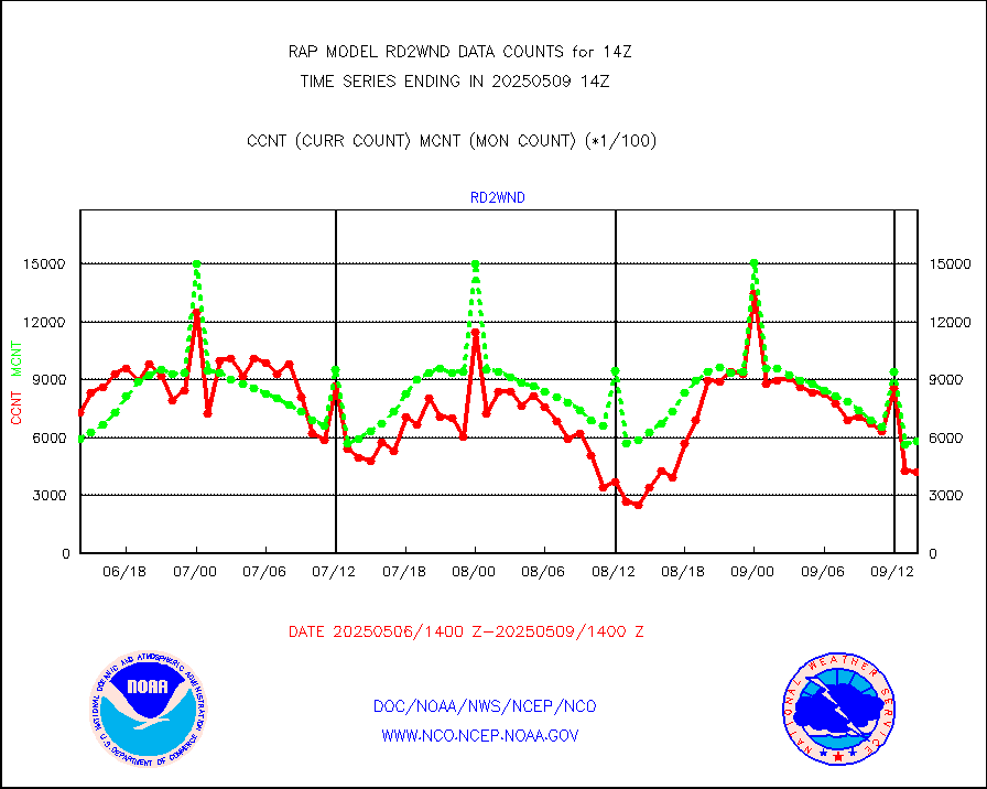
rd2wnd |
NEXRAD radial wind (Level 2 - GTS) |
845493 |
717806 |
117.8 % |
1913.50-1914.49 |
recco |
Flight level reconnaissance aircraft data |
0 |
0 |
n/a |
1913.00-1915.00 |
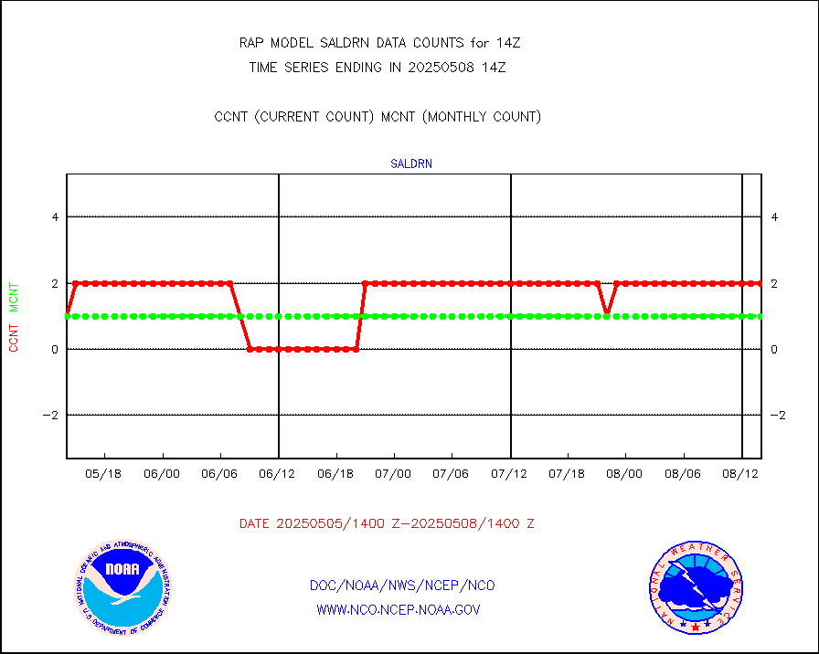
saldrn |
Surface Marine Saildrone (decoded from BUFR) |
2 |
2 |
100.0 % |
1912.00-1915.99 |
saphir |
Megha-Tropiques SAPHIR L1A2 brightness temps |
0 |
0 |
n/a |
1911.00-1916.99 |
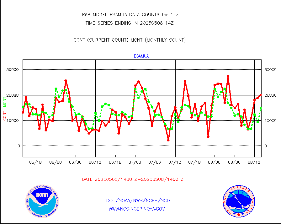
sevasr |
METEOSAT-10 2nd Gen SEVIRI All Sky Radiance(proc) |
9512 |
9512 |
100.0 % |
1912.00-1915.99 |
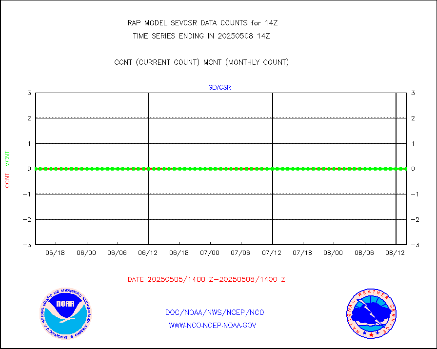
sevcsr |
METEOSAT-10 2nd Gen SEVIRI Clr Sky Radiance(proc) |
0 |
0 |
n/a |
1912.00-1915.99 |
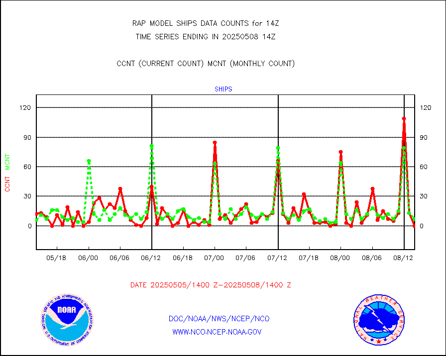
ships |
Ship - manual and automatic, restricted |
2 |
2 |
100.0 % |
1913.50-1914.50 |
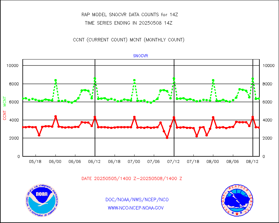
snocvr |
NOW COVER, DEPTH/DENSITY AND WATER EQUIVALENT |
3366 |
6839 |
49.2 % |
1912.00-1916.00 |
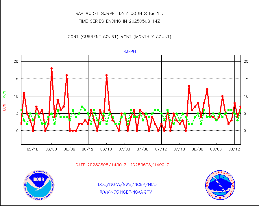
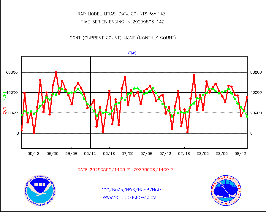
subpfl |
Sub-surface float and glider profile (BUFR) |
18 |
12 |
150.0 % |
1912.00-1915.99 |
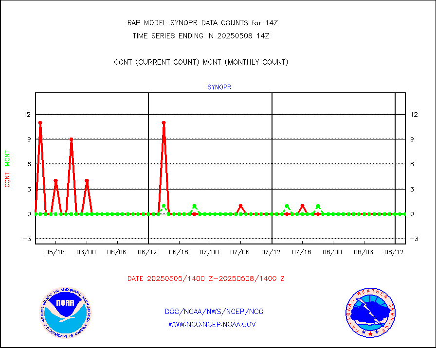
synopr |
Synoptic - restricted (WMO Res 40) manual & auto. |
0 |
0 |
n/a |
1913.50-1914.50 |
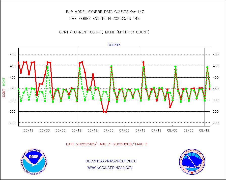
synpbr |
Synoptic - restricted (WMO Res 40)(decoded BUFR) |
346 |
346 |
100.0 % |
1913.50-1914.50 |
synpmb |
Synoptic - mobile manual & auto (decoded fr BUFR) |
0 |
0 |
n/a |
1913.50-1914.50 |
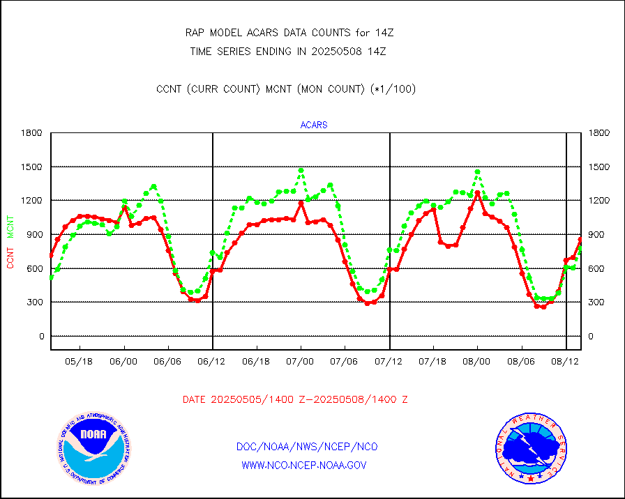
tmdara |
TAMDAR aircft data-all types(from Panasonic,BUFR) |
1193 |
1395 |
85.5 % |
1910.75-1917.25 |
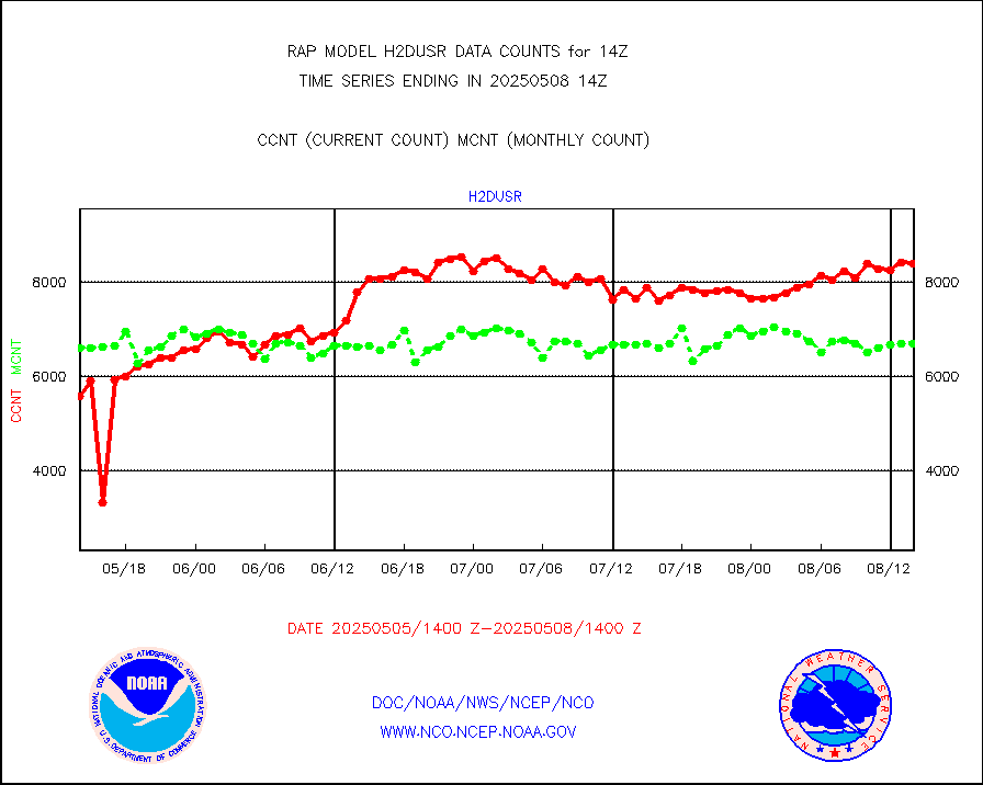
visja |
MTSAT/JMA visible derived cloud motion |
0 |
0 |
n/a |
1911.50-1916.50 |
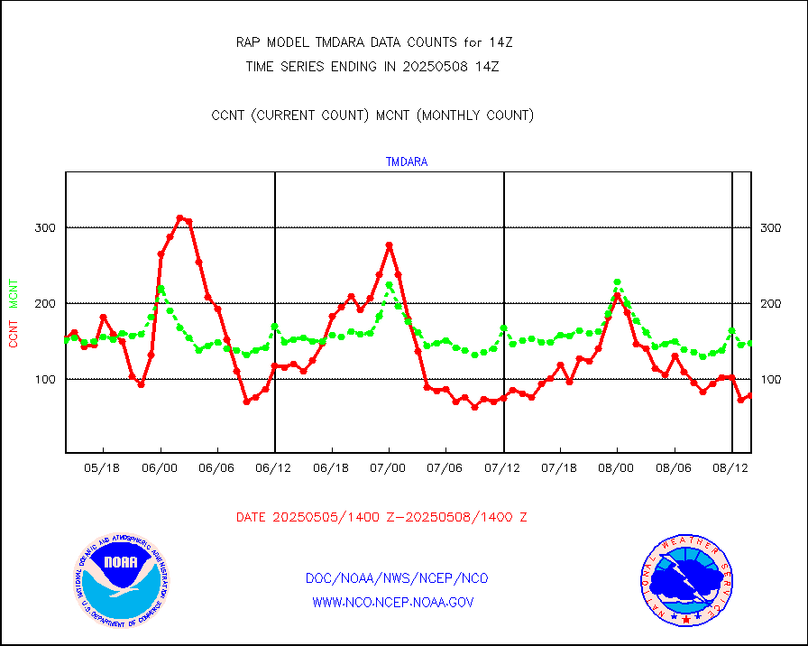
visusr |
GOES-16&up/NESDIS visible derived cloud motion |
30493 |
34531 |
88.3 % |
1913.00-1913.99 |
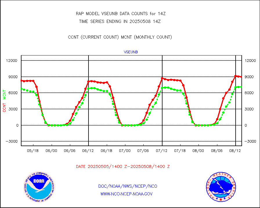
vseunb |
METEOSAT/EUMETSAT visible drv cld motion NBseq |
7789 |
7079 |
110.0 % |
1912.50-1915.49 |


