| Critical Data with Normal Counts |
|---|
| Type | Description | Hourly Count | Monthly Average | Percent (%) of Monthly Mean | UTC Time Window |
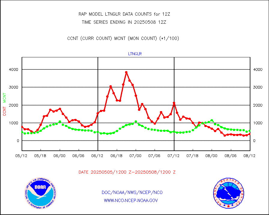
1bamua |
NOAA 15-19 & METOP 1-2 AMSU-A NCEP-proc. br.temps |
36342 |
33056 |
109.9 % |
1909.00-1914.99 |
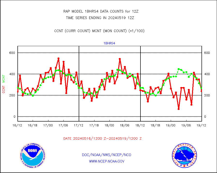
1bhrs4 |
NOAA 18-19 & METOP 1-2 HIRS-4 NCEP-proc. br.temps |
24072 |
26766 |
89.9 % |
1909.00-1914.99 |
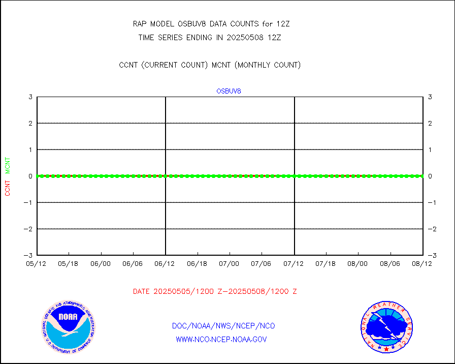
1bmhs |
NOAA 18-19 & METOP 1-2 MHS NCEP-proces. br. temps |
201456 |
201138 |
100.2 % |
1909.00-1914.99 |
acars |
MDCRS ACARS acft data from ARINC(dcded from BUFR) |
34061 |
26274 |
129.6 % |
1908.75-1915.25 |
camdar |
Canadian AMDAR aircraft data (decoded from BUFR) |
0 |
41 |
0.0 % |
1908.75-1915.25 |
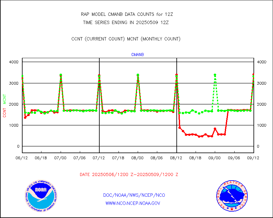
cmanb |
Surface Marine CMAN rpts decoded from BUFR format |
3492 |
3436 |
101.6 % |
1911.50-1912.50 |
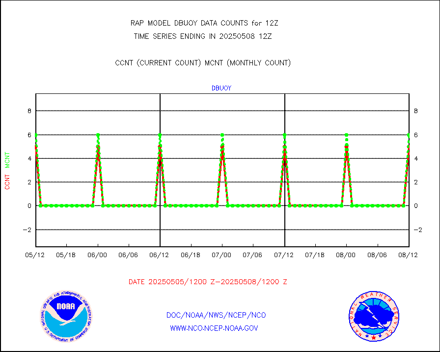
dbuoy |
Buoys decoded from FM-18 fmt (moored or drifting) |
4 |
4 |
100.0 % |
1911.50-1912.50 |
gnss |
Grnd-based Gbl Navigation Sat System (GNSS) data |
3799 |
3690 |
103.0 % |
1910.95-1911.05 |
h20mo |
MODIS (AQUA/TERRA) wvpr imager derived cld motion |
0 |
0 |
n/a |
1910.50-1913.50 |
infmo |
MODIS (AQUA/TERRA) ir l-wave derived cloud motion |
0 |
0 |
n/a |
1910.50-1913.50 |
lgycld |
GOES/NASA(Langley) hi-res. (1x1 f-o-v) cloud data |
3720155 |
3105552 |
119.8 % |
1911.50-1912.50 |
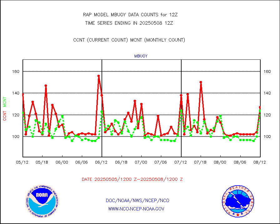
mbuoy |
Buoys decoded from FM-13 format (moored) |
136 |
139 |
97.8 % |
1911.50-1912.50 |
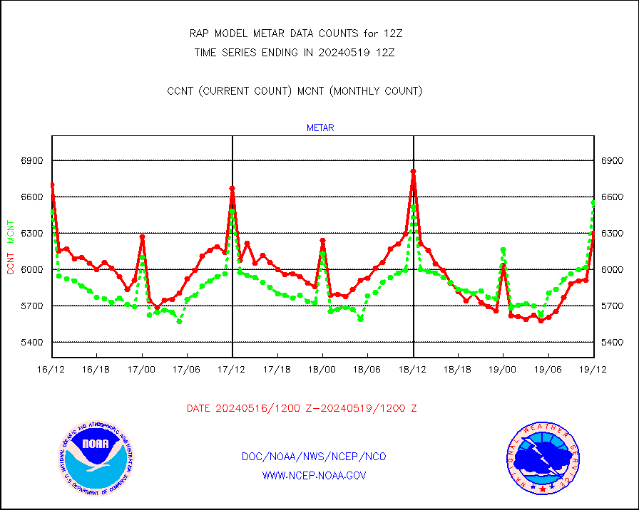
metar |
Aviation - METAR |
6299 |
6551 |
96.2 % |
1911.50-1912.50 |
nxrdw |
NEXRAD Vel Azm Dsp(VAD) winds via radar coded msg |
0 |
0 |
n/a |
1911.00-1913.00 |
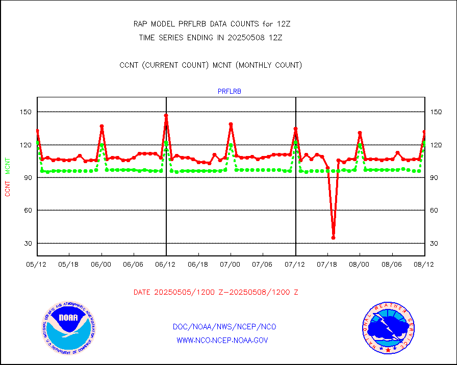
prflrb |
Multi-Agency Profiler (MAP) and SODAR winds |
89 |
107 |
83.2 % |
1910.50-1913.50 |
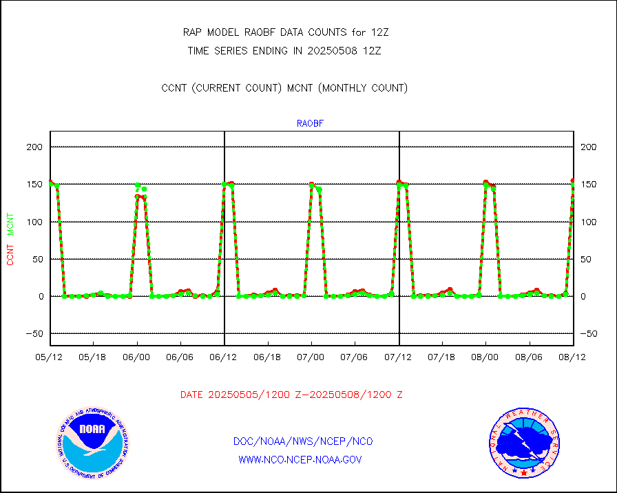
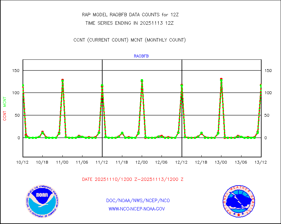
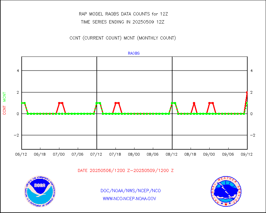
raobf |
Rawinsonde - fixed land (from TEMP or PILOT) |
155 |
155 |
100.0 % |
1911.00-1913.00 |
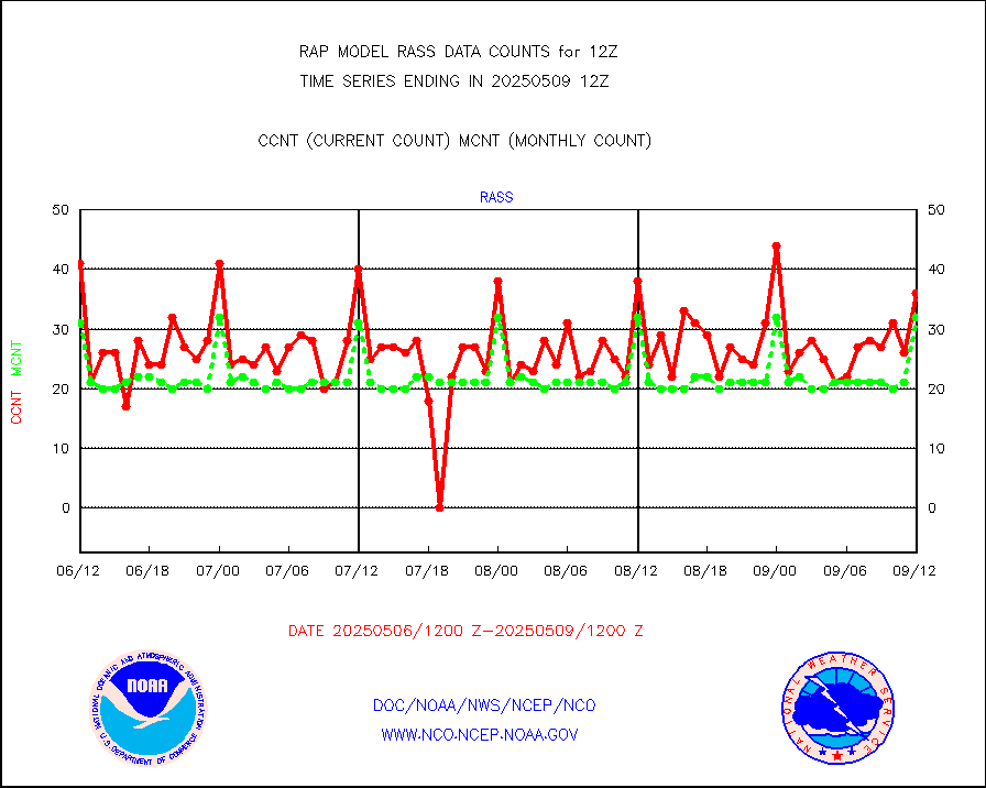
rass |
RASS temperatures (NOAA and Multi-Agency) |
29 |
33 |
87.9 % |
1911.50-1912.50 |
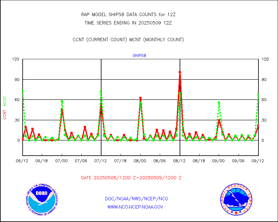
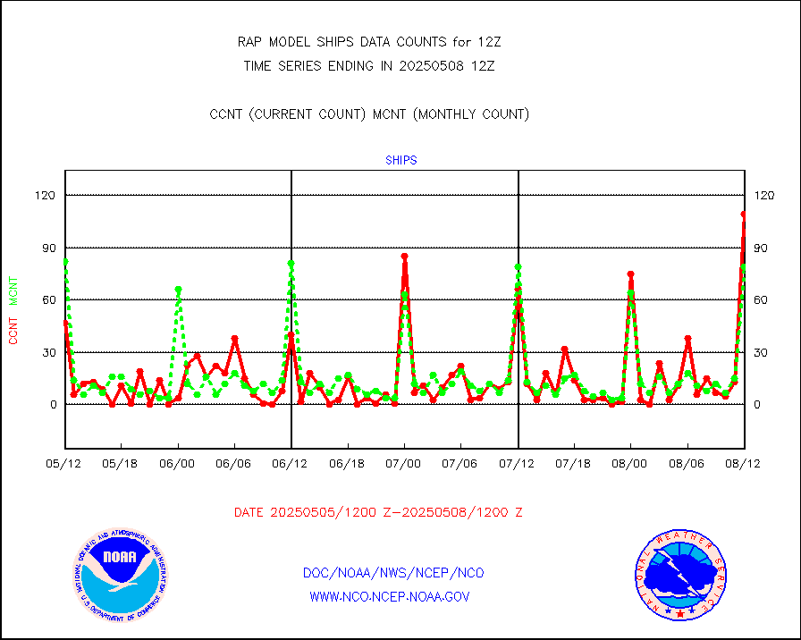
shipsb |
Ship - manual and automatic, restricted (BUFR) |
96 |
92 |
104.3 % |
1911.50-1912.50 |
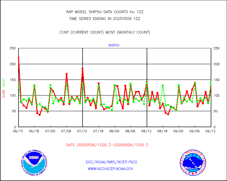
shipsu |
Ship - manual and automatic, unrestricted |
109 |
92 |
118.5 % |
1911.50-1912.50 |
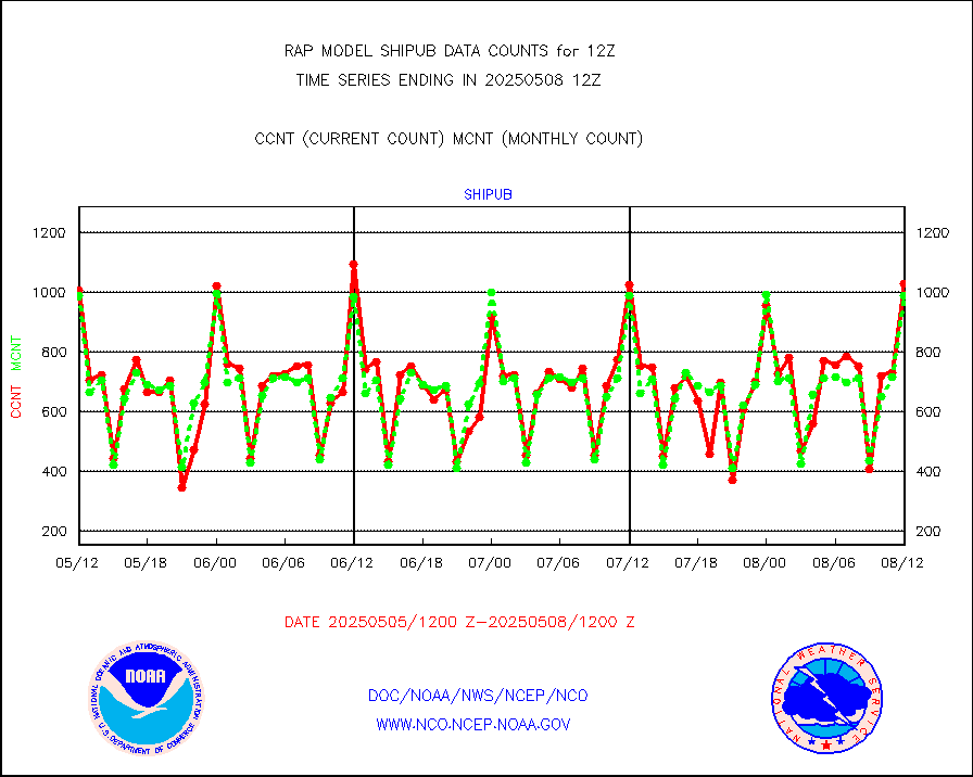
shipub |
Ship - manual and automatic, unrestricted (BUFR) |
1023 |
997 |
102.6 % |
1911.50-1912.50 |
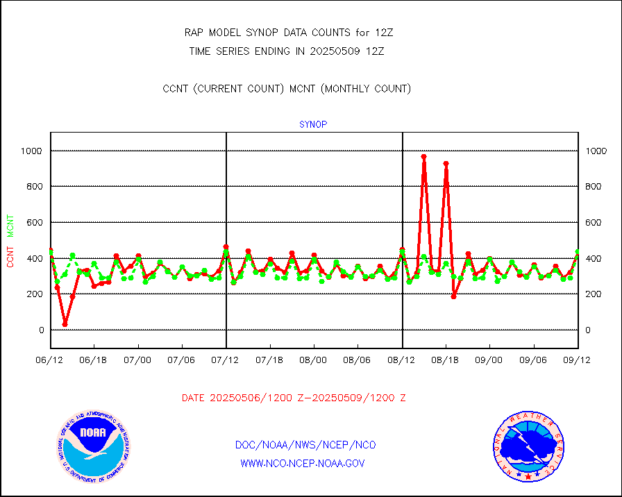
synop |
Synoptic - fixed manual and automatic |
535 |
550 |
97.3 % |
1911.50-1912.50 |
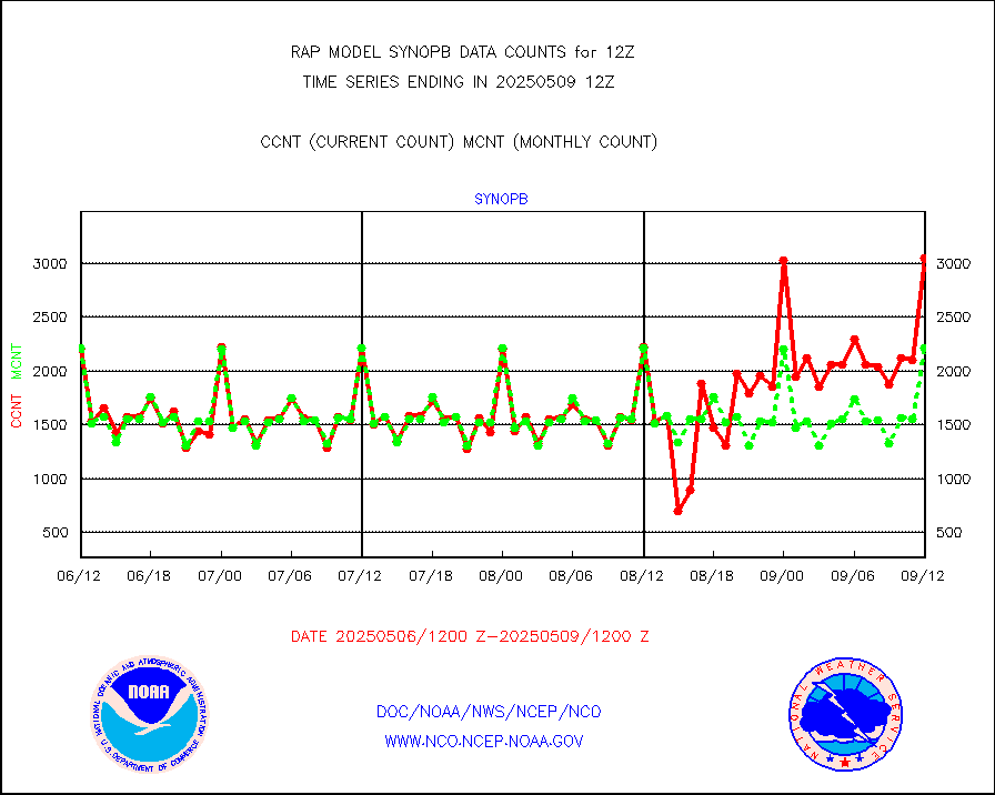
synopb |
Synoptic - fixed manual & auto (decoded fr BUFR) |
1984 |
2059 |
96.4 % |
1911.50-1912.50 |
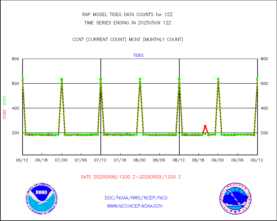
tideg |
Tide gauge reports decoded from CREX format |
635 |
630 |
100.8 % |
1911.50-1912.50 |
| Data Types of Opportunity with Normal Counts |
|---|
| Type | Description | Hourly Count | Monthly Average | Percent (%) of Monthly Mean | UTC Time Window |
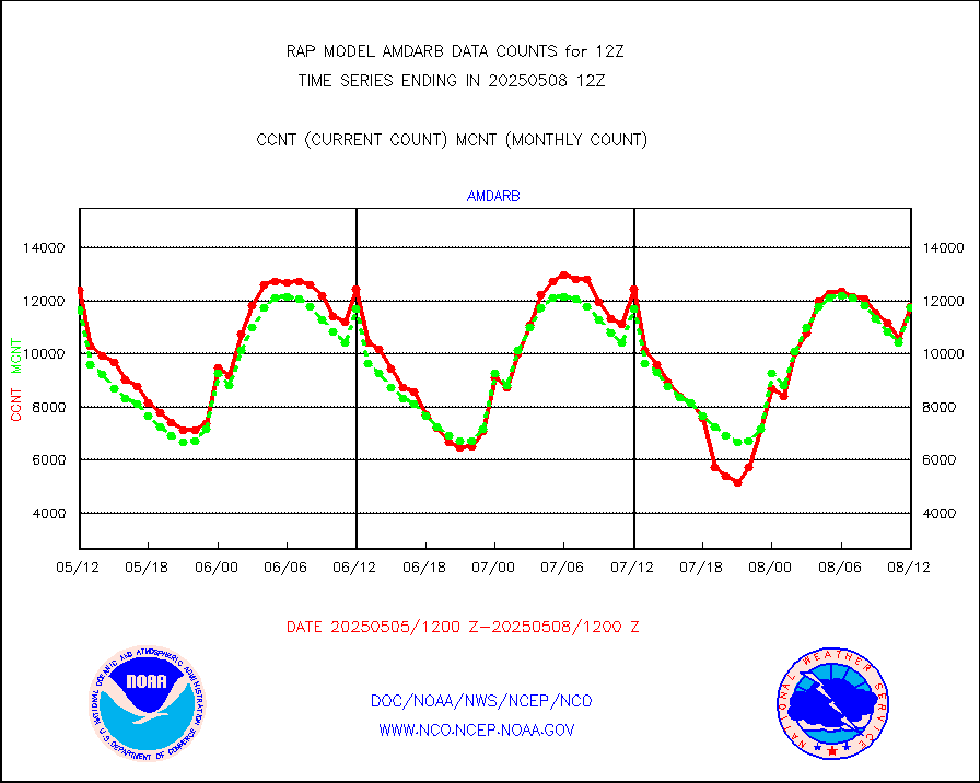
3p9usr |
GOES-16&up/NESDIS ir short-wv derived cld motion |
9761 |
10110 |
96.5 % |
1911.00-1911.99 |
acarsa |
MDCRS ACARS acft data (ARINC via AFWA)(AIREP fmt) |
0 |
0 |
n/a |
1908.75-1915.25 |
airep |
Manual AIREP aircraft data (dcded from AIREP fmt) |
5158 |
4600 |
112.1 % |
1908.75-1915.25 |
airsev |
AQUA AIRS/AMSU-A/HSB brightness temps- every FOV |
0 |
0 |
n/a |
1909.00-1914.99 |
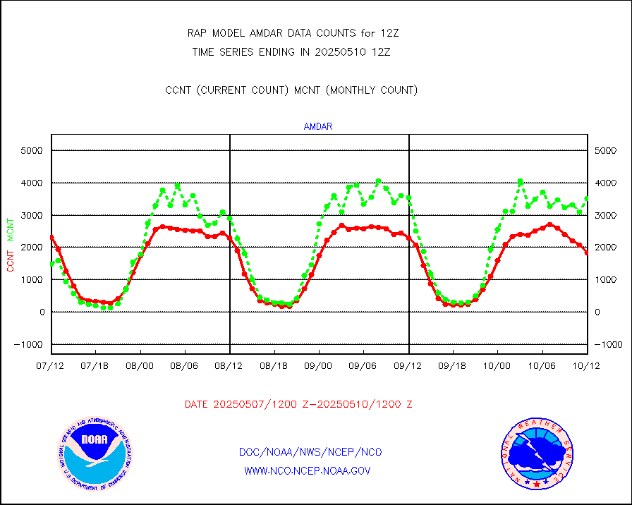
amdar |
AMDAR aircraft data (decoded from AMDAR format) |
2253 |
1462 |
154.1 % |
1908.75-1915.25 |
amdarb |
AMDAR aircraft data (decoded from BUFR) |
6403 |
6235 |
102.7 % |
1908.75-1915.25 |
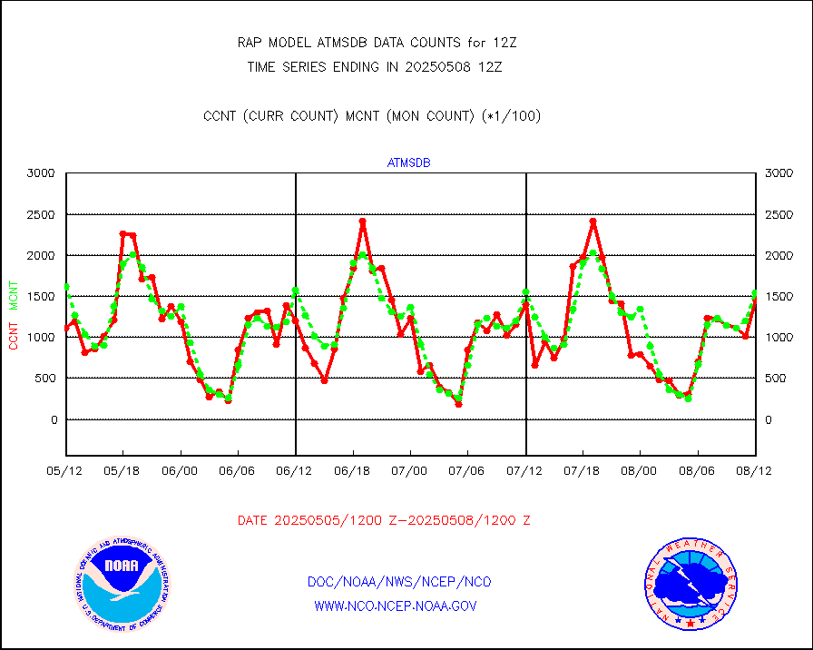
amsr2 |
GCOM-W AMSR2 1B brightness temperatures |
956912 |
589020 |
162.5 % |
1909.00-1909.99 |
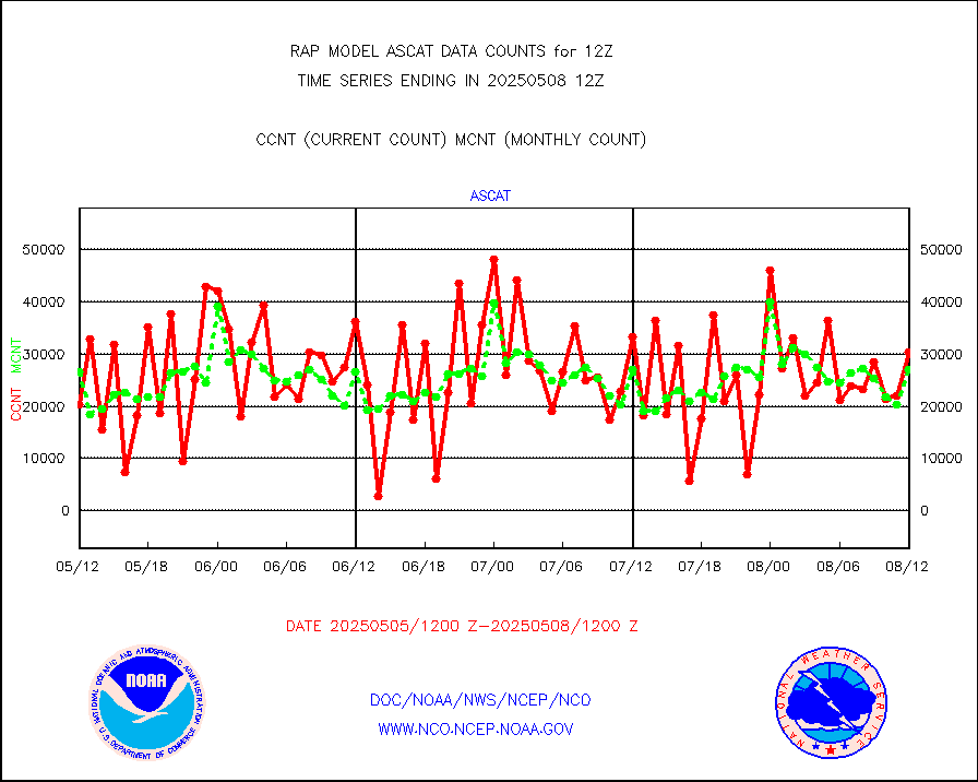
ascat |
METOP 1-2 ASCAT products |
33091 |
24812 |
133.4 % |
1910.00-1914.00 |
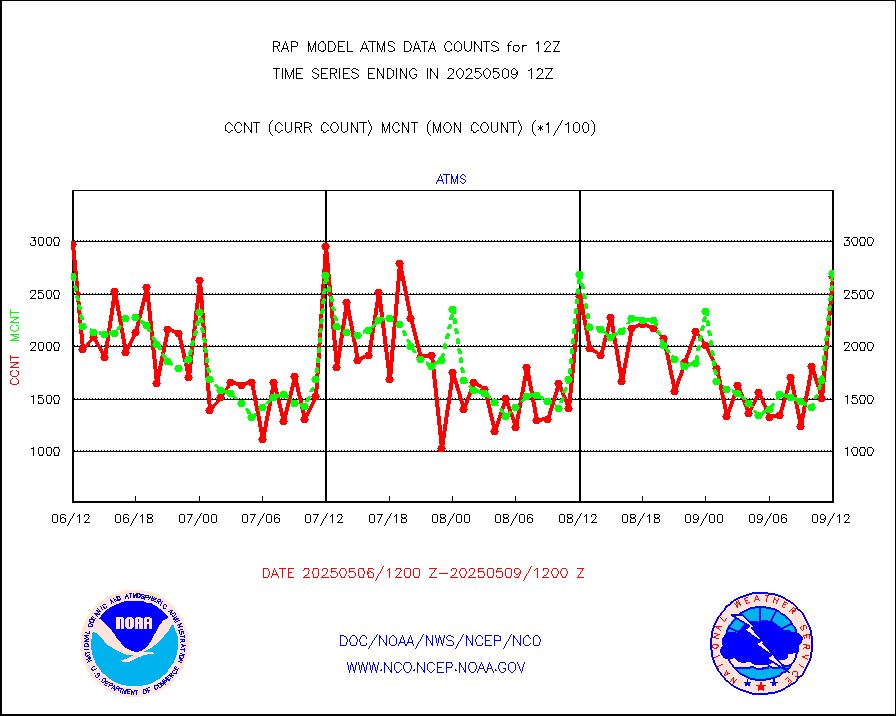
atms |
NPP/NOAA-20 ATMS brightness temperatures |
298131 |
264792 |
112.6 % |
1910.00-1913.99 |
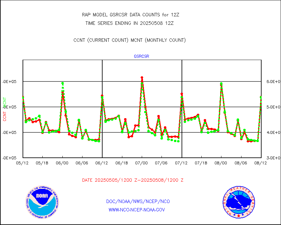
atmsdb |
NPP/NOAA-20 ATMS bright. temps-direct b-cast SSEC |
131816 |
175404 |
75.1 % |
1910.00-1913.99 |
coopmd |
Coop/MADIS NEPP & HCN-Modernization NOAA COOP Obs |
59 |
69 |
85.5 % |
1911.50-1912.50 |
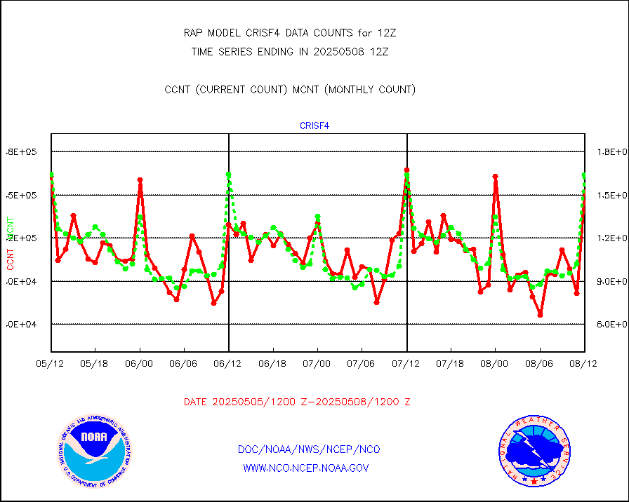
crisf4 |
NPP/NOAA-20 CrIS full spctrl radn (431 ch subset) |
154246 |
163245 |
94.5 % |
1910.00-1913.99 |
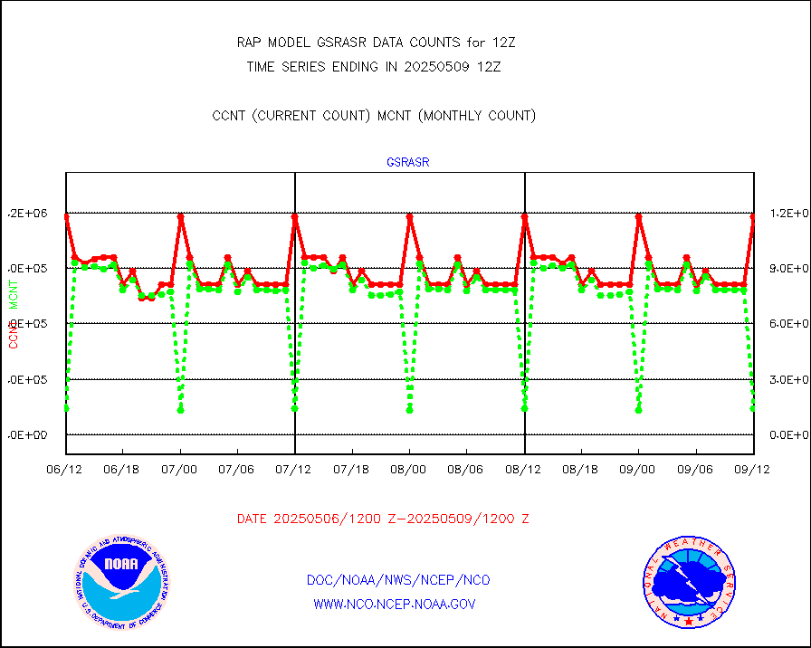
crsfdb |
NPP/NOAA-20 CrIS full spctrl radn dir brdcst SSEC |
125987 |
172924 |
72.9 % |
1910.00-1913.99 |
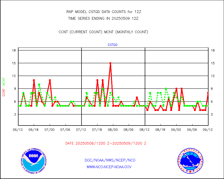
cstgd |
Coast Guard |
4 |
4 |
100.0 % |
1911.50-1912.50 |
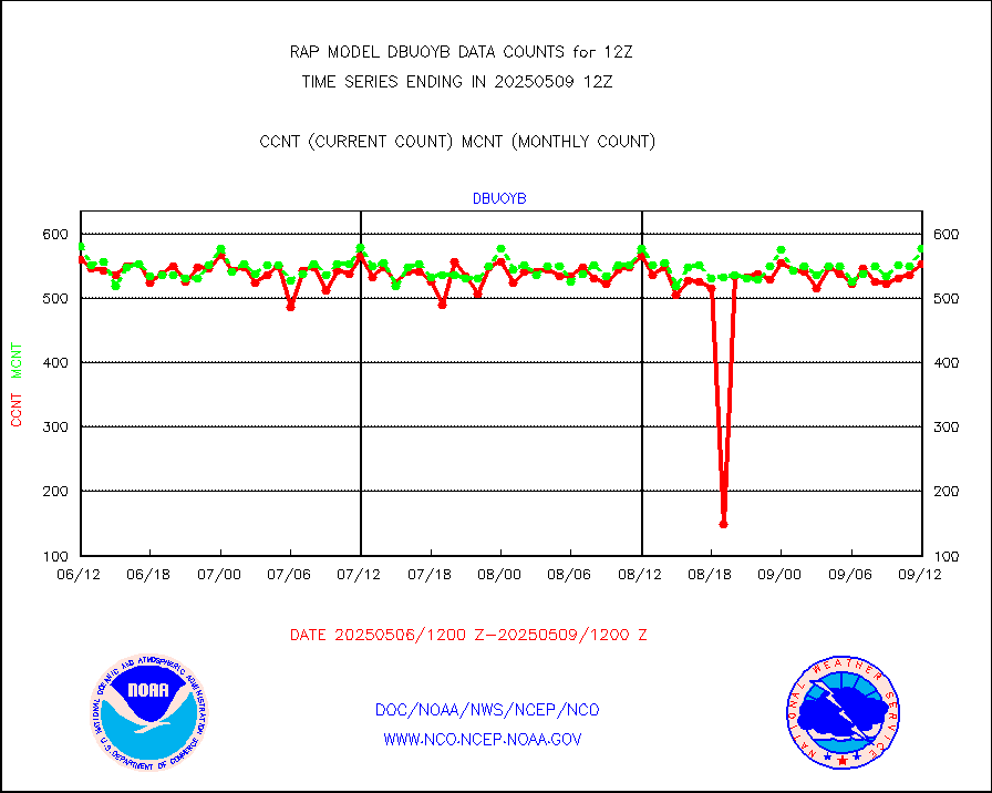
dbuoyb |
Drifting buoys (decoded from BUFR) |
652 |
608 |
107.2 % |
1911.50-1912.50 |
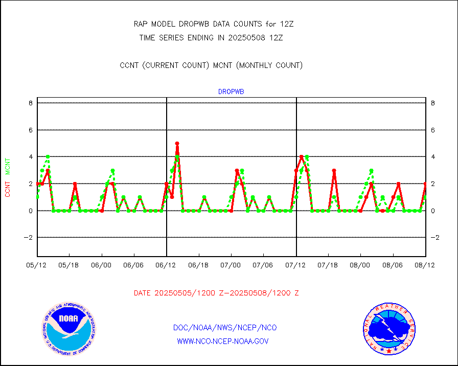
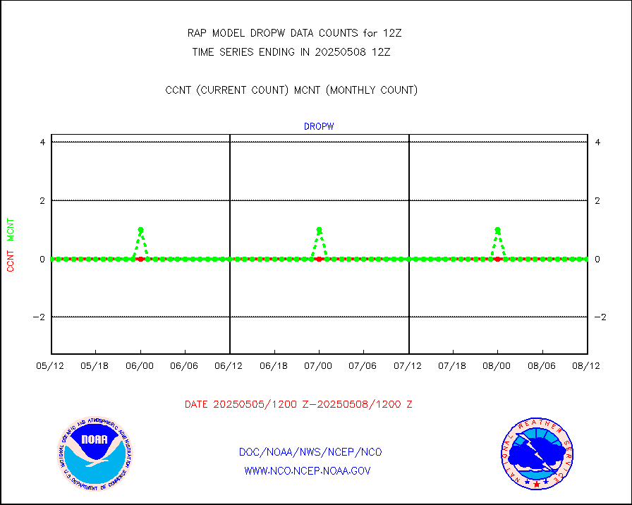
dropw |
Dropwinsonde (from TEMP DROP) |
0 |
0 |
n/a |
1911.00-1913.00 |
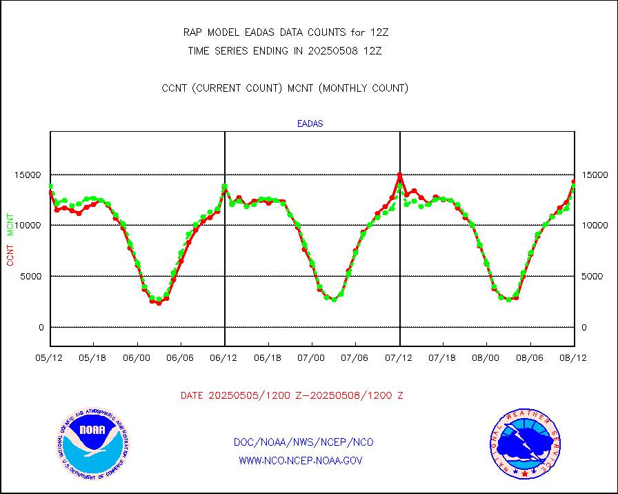
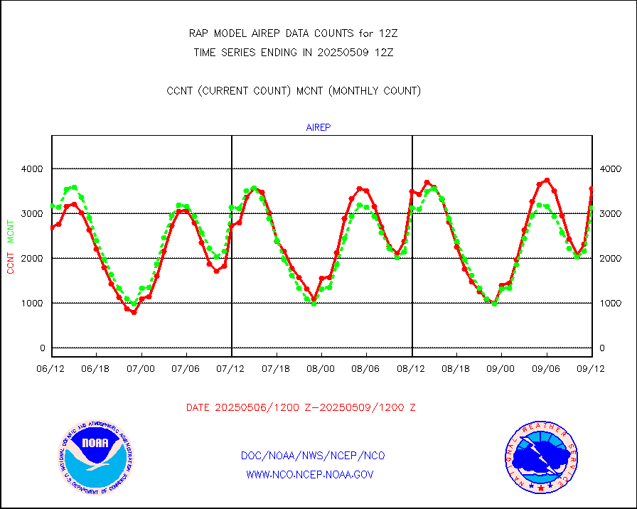
eadas |
E-AMDAR (European AMDAR acft decoded from BUFR) |
11052 |
10728 |
103.0 % |
1908.75-1915.25 |
esamua |
NOAA 15-19 & METOP 1-2 AMSU-A proc btmps frm RARS |
15150 |
14032 |
108.0 % |
1911.00-1913.00 |
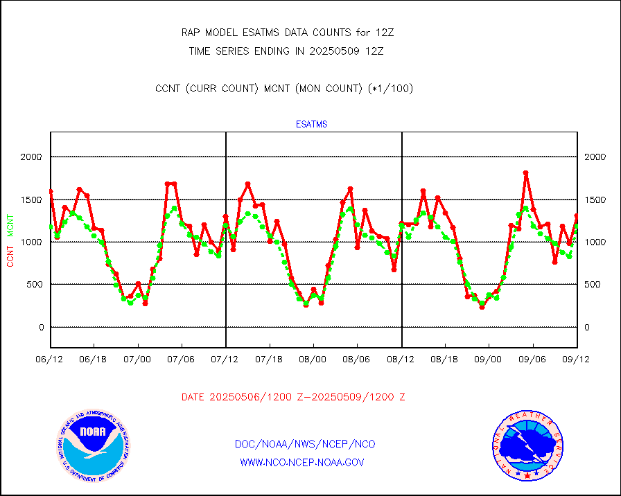
esatms |
NPP Adv. Tech. MW Sndr (ATMS) br. temps from RARS |
151956 |
121177 |
125.4 % |
1910.00-1913.99 |
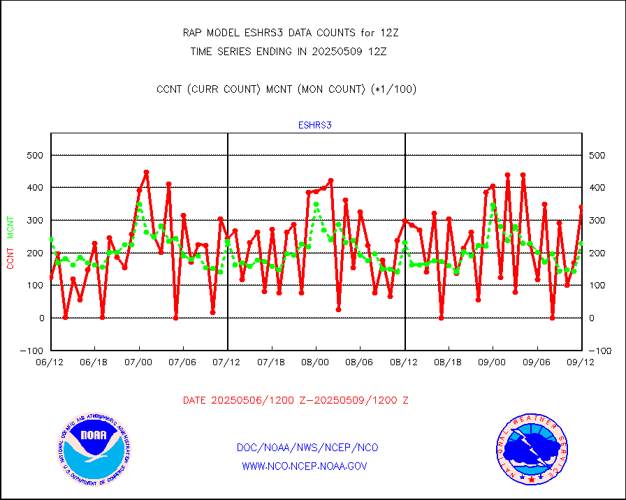
eshrs3 |
NOAA 15-19 & METOP 1-2 HIRS-3/4 pr btmps frm RARS |
35048 |
33945 |
103.2 % |
1911.00-1913.00 |
esiasi |
METOP 1-2 IASI 1C radiance data vbl chn from RARS |
119696 |
114036 |
105.0 % |
1910.00-1913.99 |
esmhs |
NOAA 18-19 & METOP 1-2 MHS proc. btemps from RARS |
125043 |
99278 |
126.0 % |
1911.00-1913.00 |
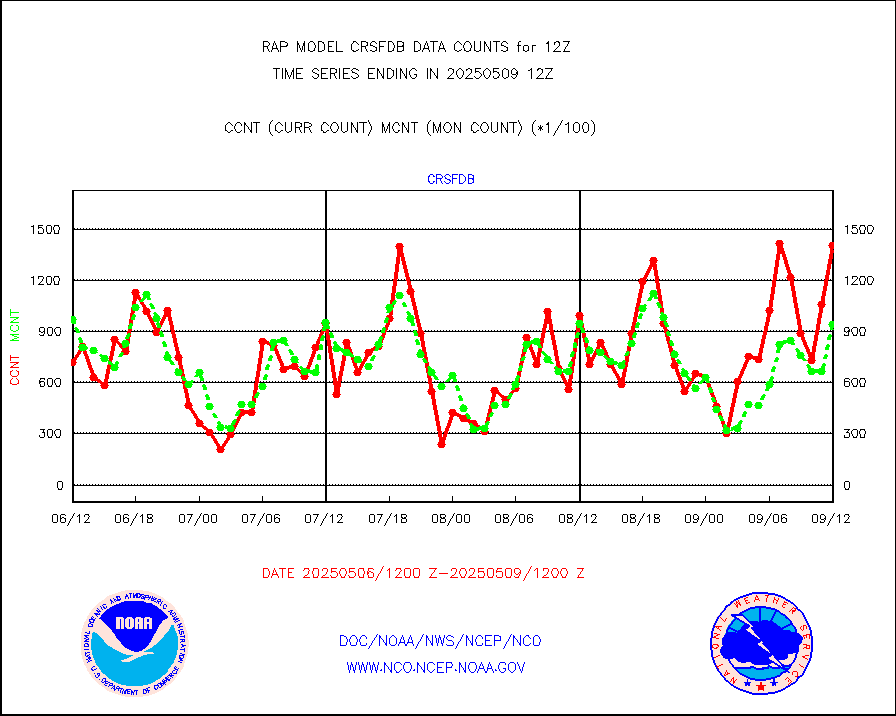
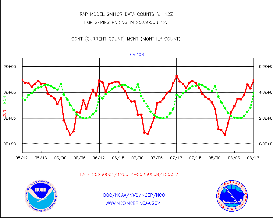
gmi1cr |
GPM GMI Level 1C-R brightness temperatures |
394174 |
477908 |
82.5 % |
1909.00-1914.99 |
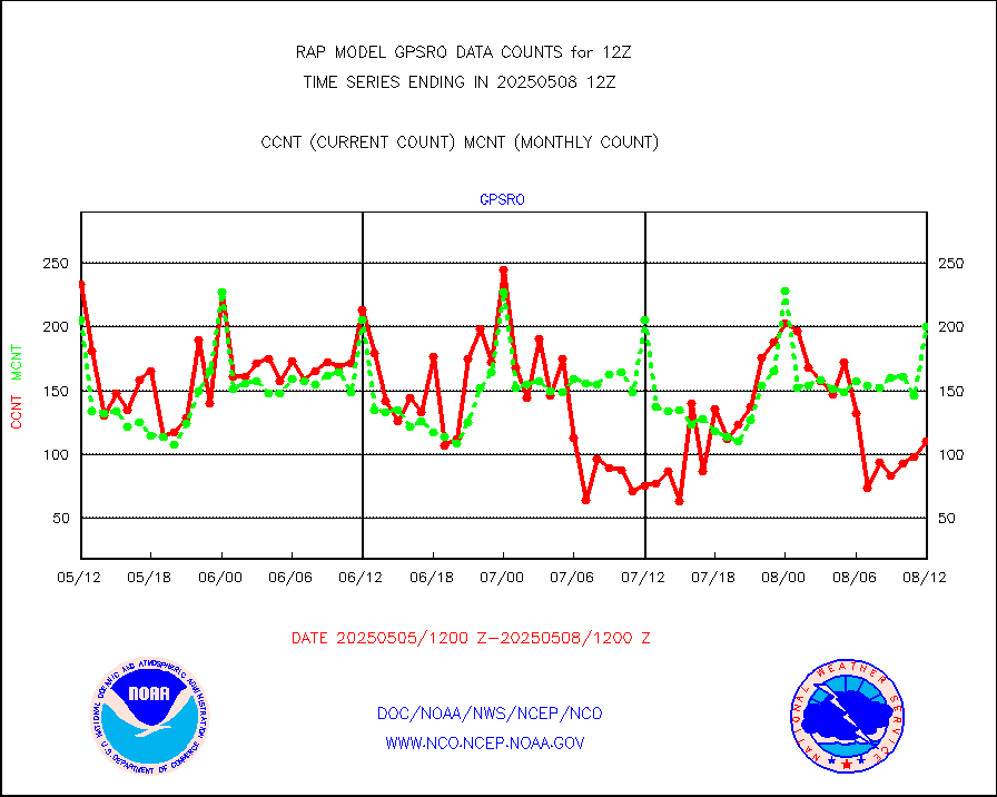
gpsro |
GPS radio occultation data |
221 |
175 |
126.3 % |
1910.00-1913.99 |
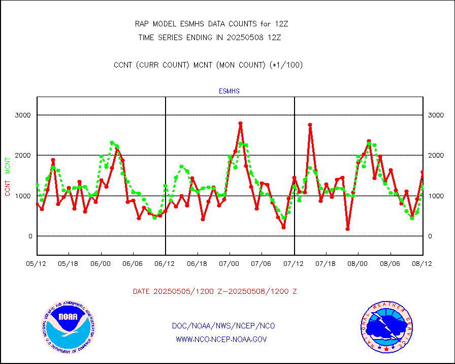
gsrasr |
GOES-16/17 All Sky Radiances (proc.) |
1181232 |
1163991 |
101.5 % |
1910.00-1913.99 |
gsrcsr |
GOES-16/17 Clear Sky Radiances (proc.) |
493176 |
529436 |
93.2 % |
1910.00-1913.99 |
h20ja |
MTSAT/JMA water vapor imager derived cloud motion |
2788 |
3014 |
92.5 % |
1910.50-1913.50 |
h2dusr |
GOES-16&up/NESDIS wv imgr/deep-lyr derivd cld mtn |
7273 |
7015 |
103.7 % |
1911.00-1911.99 |
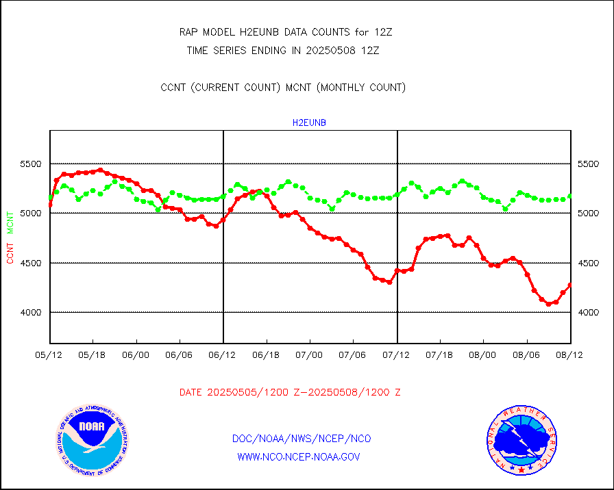
h2eunb |
METEOSAT/EUMETSAT wvpr imgr drv cld motion NBseq |
5547 |
5162 |
107.5 % |
1910.50-1913.49 |
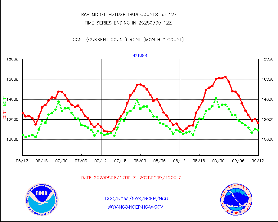
h2tusr |
GOES-16&up/NESDIS wv imgr/cld-top derived cld mtn |
11373 |
10545 |
107.9 % |
1911.00-1911.99 |
iasidb |
METOP 1-2 IASI 1C radiances-direct broadcast SSEC |
1983 |
868 |
228.5 % |
1910.00-1913.99 |
ifeunb |
METEOSAT/EUMETSAT ir lg-wave drv cld motion NBseq |
3254 |
3253 |
100.0 % |
1910.50-1913.49 |
ifvrnb |
VIIRS (NPP/NOAA-20) ir lg-wv drv cloud motion(NB) |
0 |
0 |
n/a |
1910.50-1913.50 |
infav |
AVHRR (NOAA/METOP) ir lg-wave derived cld motion |
0 |
0 |
n/a |
1910.50-1913.50 |
infav1 |
AVHRR (METOP) ir lg-wave derived cld motion |
0 |
0 |
n/a |
1910.50-1913.49 |
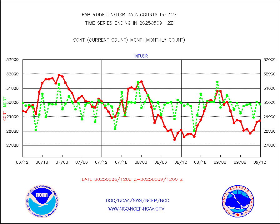
infja |
MTSAT/JMA infrared long-wave derived cloud motion |
2298 |
2446 |
93.9 % |
1910.50-1913.50 |
infusr |
GOES-16&up/NESDIS ir long-wave derived cld motion |
28251 |
28224 |
100.1 % |
1911.00-1911.99 |
kamdar |
Korean AMDAR aircraft data (decoded from BUFR) |
319 |
290 |
110.0 % |
1908.75-1915.25 |
lcman |
Land-based CMAN stations decoded from CMAN format |
138 |
131 |
105.3 % |
1911.50-1912.50 |
ltnglr |
LLDN Long-rng lightning from Vaisala via NOAAPORT |
121925 |
91537 |
133.2 % |
1911.00-1912.50 |
ltngsr |
NLDN Shrt-rng lightning from Vaisala via NOAAPORT |
6710 |
4651 |
144.3 % |
1911.00-1912.50 |
mbuoyb |
Moored buoys (decoded from BUFR) |
1072 |
966 |
111.0 % |
1911.50-1912.50 |
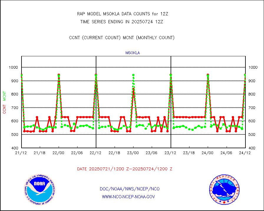
mso470 |
Mesonet/MADIS Colorado E-470 (Interstate 470) |
28 |
28 |
100.0 % |
1911.50-1912.50 |
msoalk |
Mesonet/MADIS Alaska Department of Transportation |
328 |
308 |
106.5 % |
1911.50-1912.50 |
msoapg |
Mesonet/MADIS U.S. Army Aberdeen Proving Grounds |
0 |
0 |
n/a |
1911.50-1912.50 |
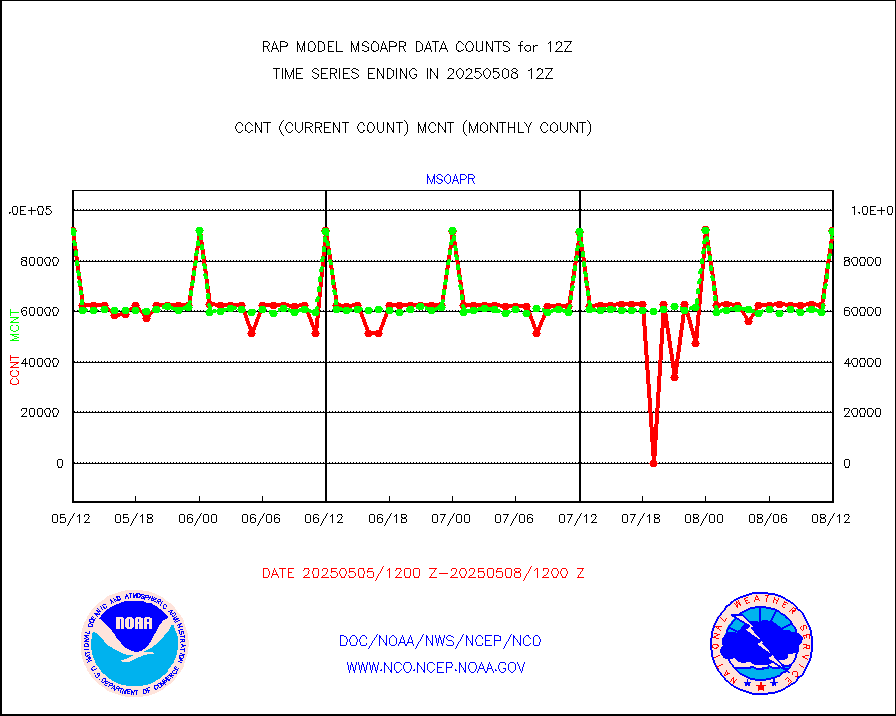
msoapr |
Mesonet/MADIS Citizen Weather Observers Program |
67519 |
67721 |
99.7 % |
1911.50-1912.50 |
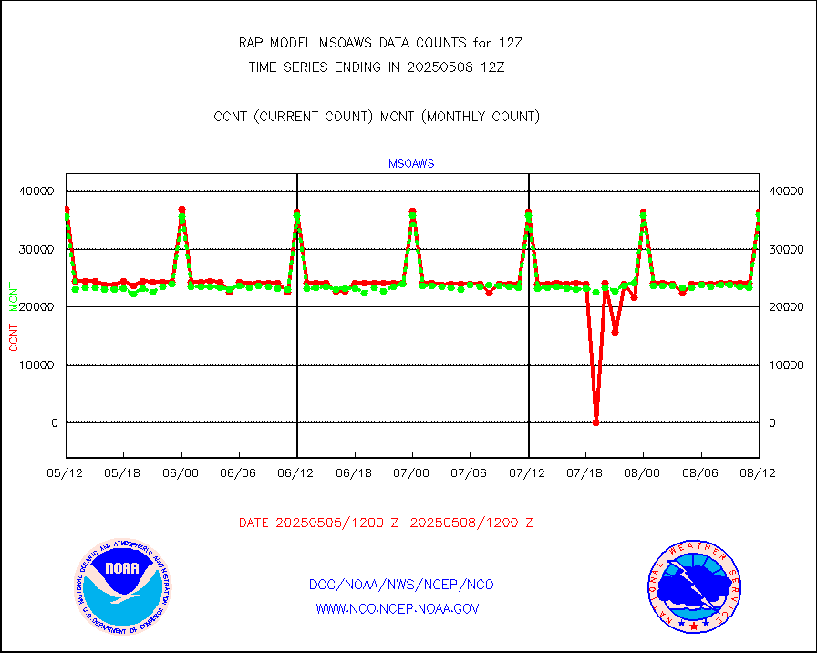
msoaws |
Mesonet/MADIS AWS Convergence Technologies, Inc. |
38547 |
38925 |
99.0 % |
1911.50-1912.50 |
msoawx |
Mesonet/MADIS "Anything Weather" |
0 |
0 |
n/a |
1911.50-1912.50 |
msocol |
Mesonet/MADIS Colorado Dept. of Transportation |
0 |
0 |
n/a |
1911.50-1912.50 |
msodcn |
Mesonet/MADIS DC Net |
0 |
0 |
n/a |
1911.50-1912.50 |
msoden |
Mesonet/MADIS Denver Urban Drainage & Flood Cntrl |
325 |
325 |
100.0 % |
1911.50-1912.50 |
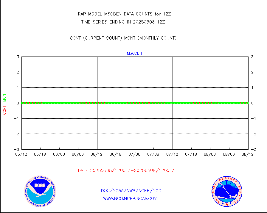
msofla |
Mesonet/MADIS Florida (FAWN & USF) |
5 |
5 |
100.0 % |
1911.50-1912.50 |
msoflt |
Mesonet/MADIS Florida Dept. of Transportation |
0 |
0 |
n/a |
1911.50-1912.50 |
msogeo |
Mesonet/MADIS Georgia Dept. of Transportation |
0 |
0 |
n/a |
1911.50-1912.50 |
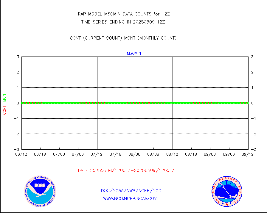
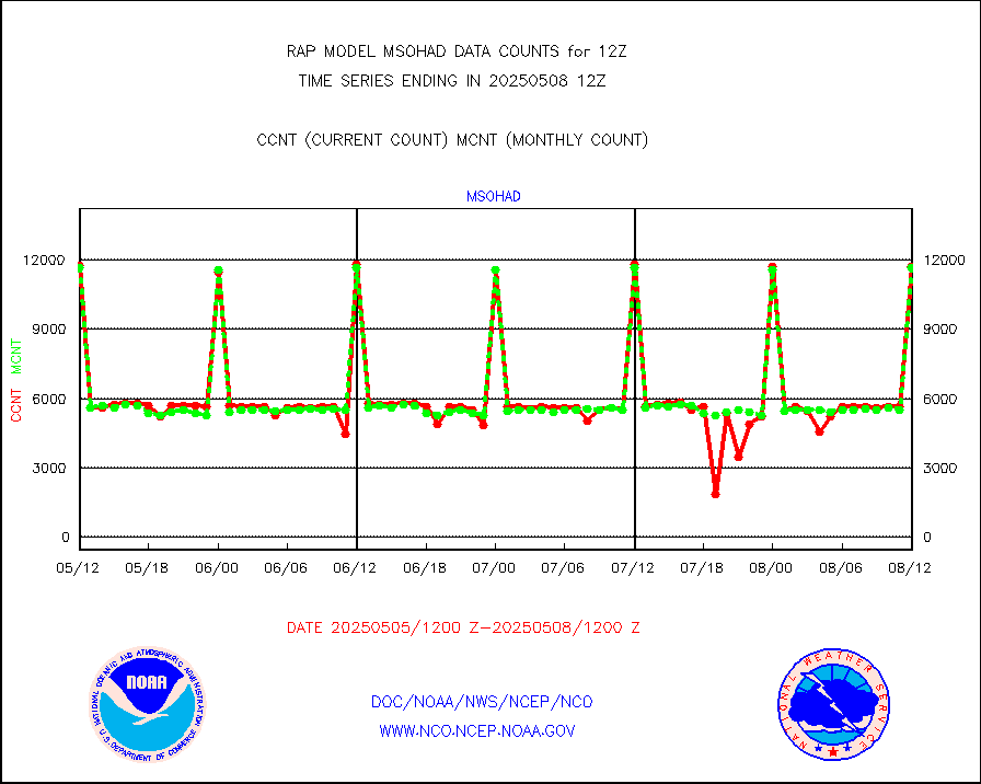
msohad |
Mesonet/MADIS NWS Hydromet Auto Data System(HADS) |
12005 |
11776 |
101.9 % |
1911.50-1912.50 |
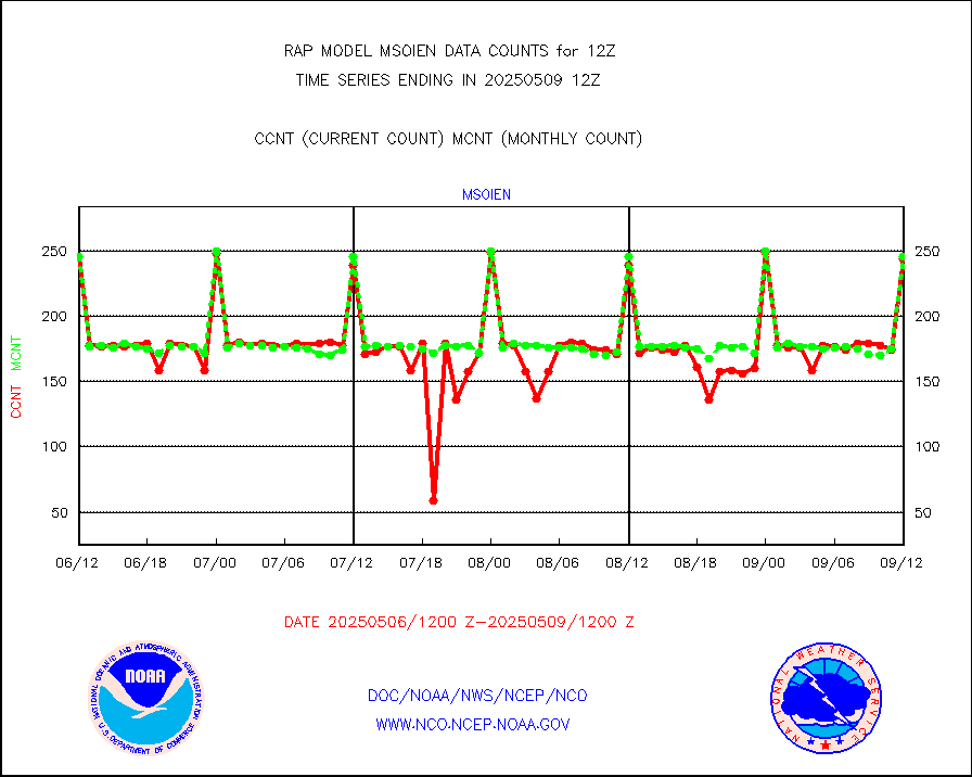
msoien |
Mesonet/MADIS Iowa Environmental |
240 |
241 |
99.6 % |
1911.50-1912.50 |
msoind |
Mesonet/MADIS Indiana Dept. of Transportation |
0 |
0 |
n/a |
1911.50-1912.50 |
msoiow |
Mesonet/MADIS Iowa Department of Transportation |
0 |
0 |
n/a |
1911.50-1912.50 |
msokan |
Mesonet/MADIS Kansas Department of Transportation |
536 |
453 |
118.3 % |
1911.50-1912.50 |
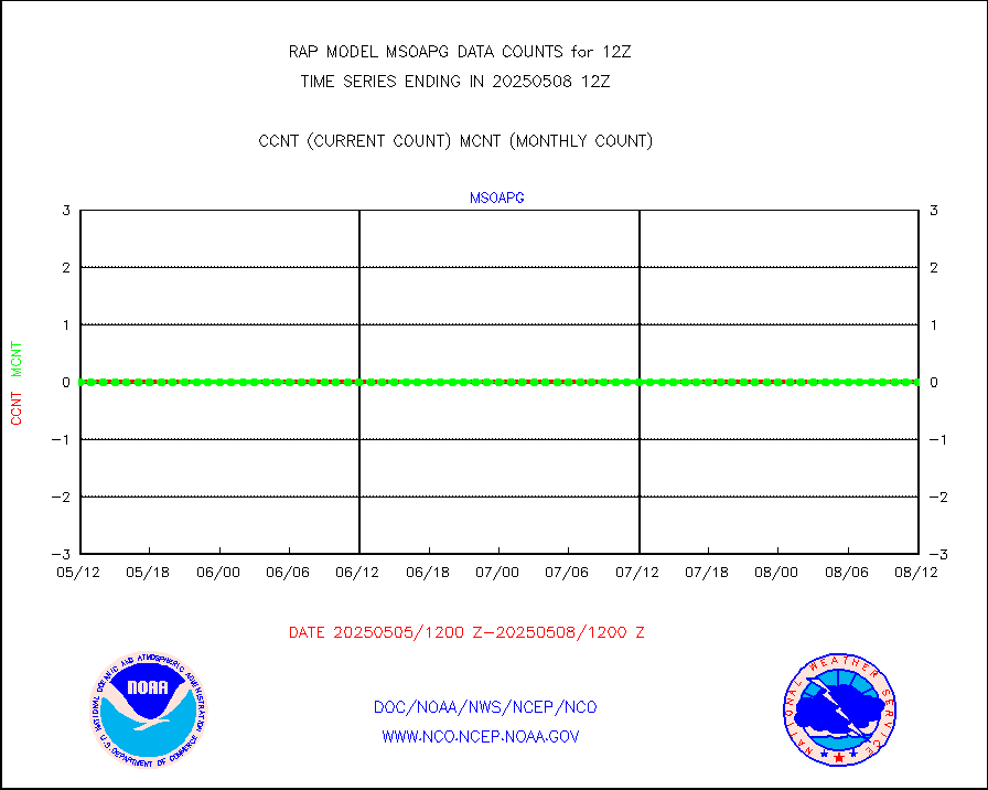
msokla |
Mesonet/MADIS Oklahoma Mesonet |
424 |
435 |
97.5 % |
1911.50-1912.50 |
msolju |
Mesonet/MADIS Louisiana State/Jackson State Univ. |
0 |
0 |
n/a |
1911.50-1912.50 |
msomca |
Mesonet/MADIS Missouri Commercial Agricult Wx Net |
349 |
357 |
97.8 % |
1911.50-1912.50 |
msomin |
Mesonet/MADIS Minnesota Dept. of Transportation |
0 |
0 |
n/a |
1911.50-1912.50 |
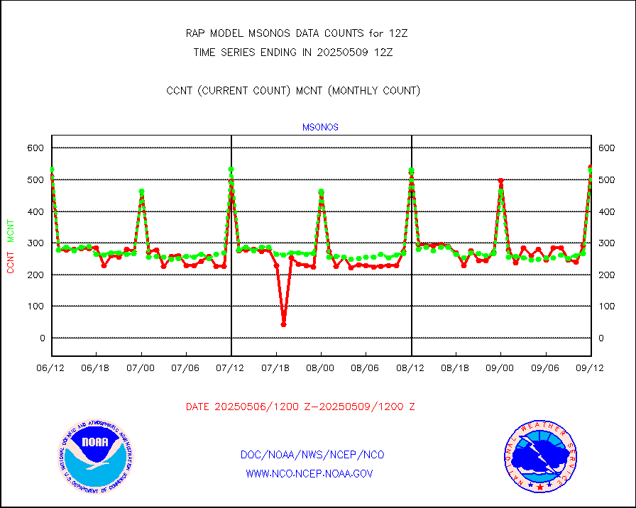
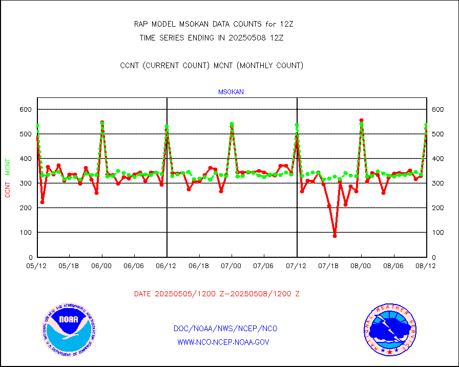
msonos |
Mesonet/MADIS NOS-Phys Oceanographic Realtime Sys |
540 |
532 |
101.5 % |
1911.50-1912.50 |
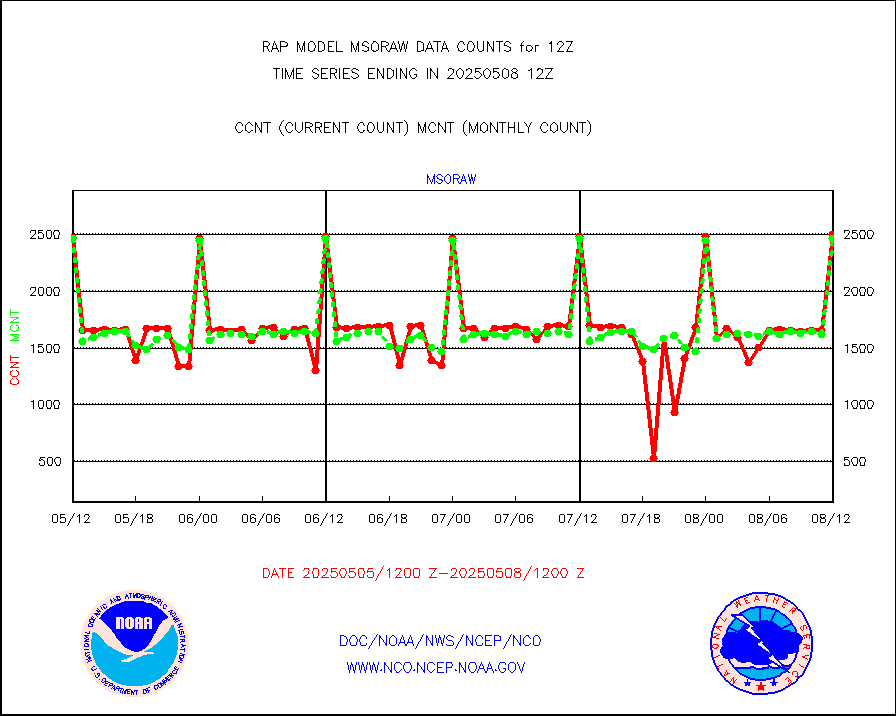
msoraw |
Mesonet/MADIS NFIC Remote Automated Wx Stns(RAWS) |
2498 |
2295 |
108.8 % |
1911.50-1912.50 |
msourb |
Mesonet/MADIS UrbaNet |
5218 |
5227 |
99.8 % |
1911.50-1912.50 |
msovir |
Mesonet/MADIS Virginia Dept. of Transportation |
304 |
335 |
90.7 % |
1911.50-1912.50 |
msowfy |
Mesonet/MADIS "Weather for You" |
0 |
0 |
n/a |
1911.50-1912.50 |
msowis |
Mesonet/MADIS Wisconsin Dept. of Transportation |
0 |
0 |
n/a |
1911.50-1912.50 |
msowst |
Mesonet/MADIS MesoWest (many subproviders) |
69172 |
66784 |
103.6 % |
1911.50-1912.50 |
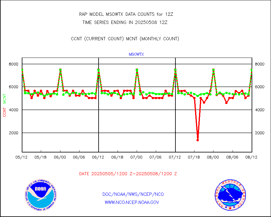
msowtx |
Mesonet/MADIS West Texas |
7493 |
7484 |
100.1 % |
1911.50-1912.50 |
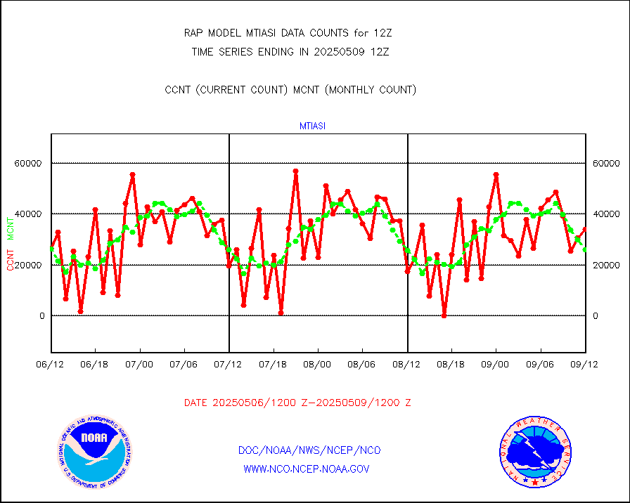
mtiasi |
METOP 1-2 IASI 1C radiance data (varbl. channels) |
19032 |
23215 |
82.0 % |
1910.00-1913.99 |
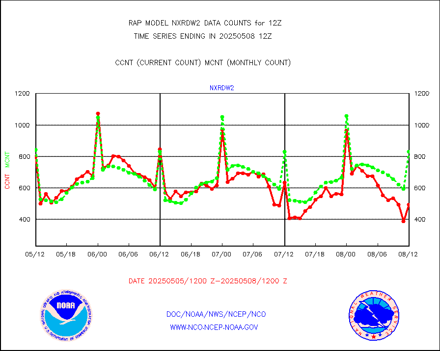
nxrdw2 |
NEXRAD Vel Azm Dsp(VAD) winds via Level 2 decoder |
1123 |
925 |
121.4 % |
1911.00-1913.00 |
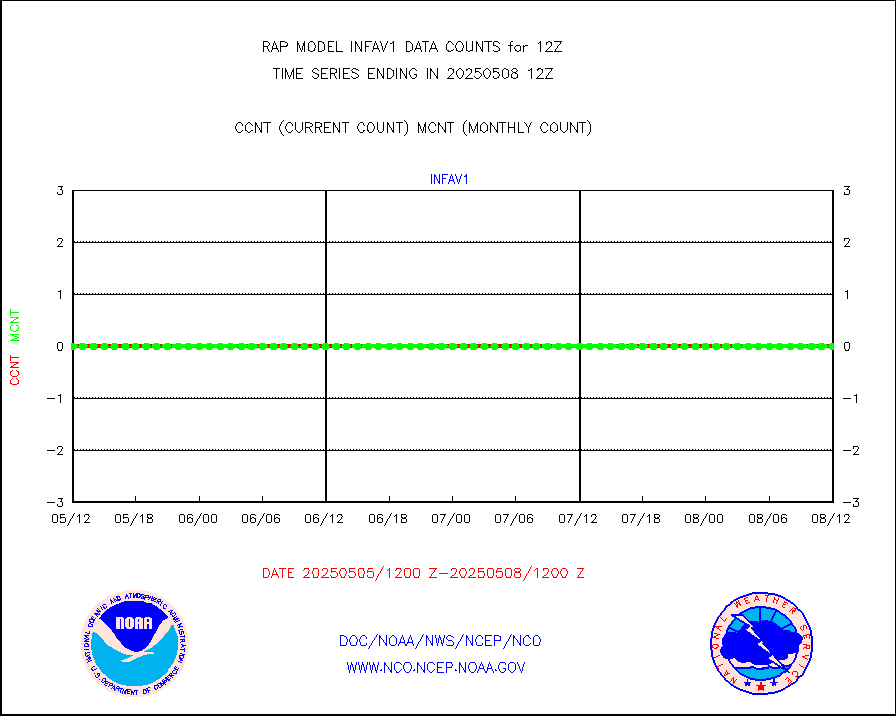
osbuv8 |
NOAA 16-19 Solar Backscatter UV-2 rad frm V8 BUFR |
0 |
0 |
n/a |
1910.00-1912.99 |
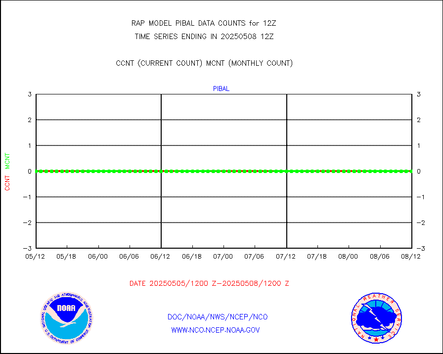
pibal |
PIBAL (from PILOT, PILOT SHIP, PILOT MOBIL) |
0 |
0 |
n/a |
1911.00-1913.00 |
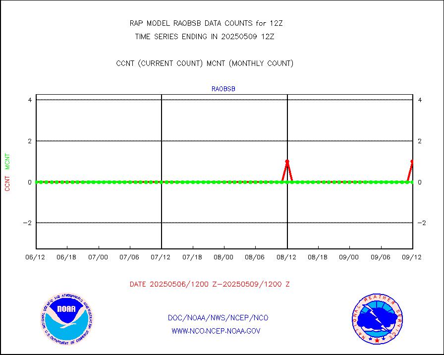
pirep |
Manual PIREP aircraft data (dcded from AIREP fmt) |
313 |
352 |
88.9 % |
1908.75-1915.25 |
prflrp |
Profilr winds from PIBAL (PILOT,PILOT SHIP/MOBIL) |
0 |
0 |
n/a |
1910.50-1913.50 |
raobm |
Rawinsonde - mobile land (from TEMP/PILOT MOBIL) |
0 |
0 |
n/a |
1911.00-1913.00 |
raobs |
Rawinsonde - ship (from TEMP SHIP, PILOT SHIP) |
1 |
2 |
50.0 % |
1911.00-1913.00 |
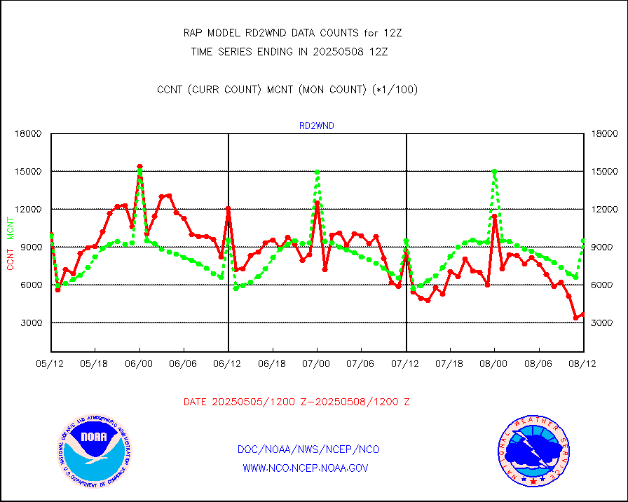
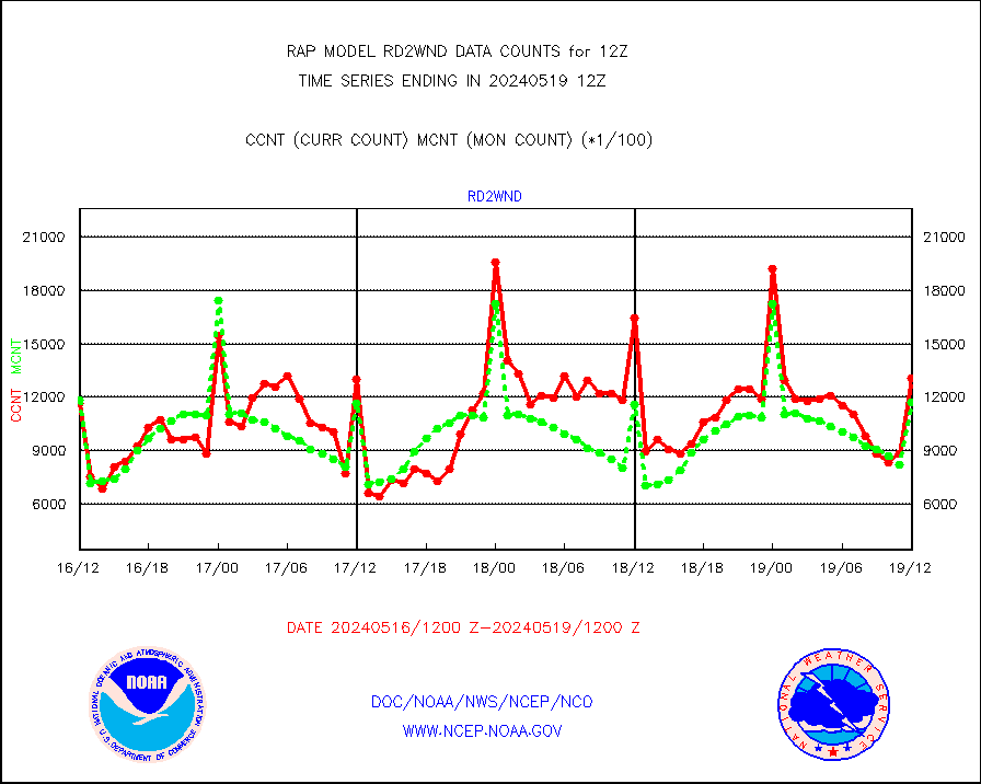
rd2wnd |
NEXRAD radial wind (Level 2 - GTS) |
1304915 |
1173488 |
111.2 % |
1911.50-1912.49 |
recco |
Flight level reconnaissance aircraft data |
0 |
0 |
n/a |
1911.00-1913.00 |
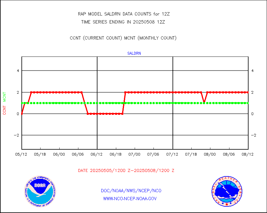
saldrn |
Surface Marine Saildrone (decoded from BUFR) |
2 |
2 |
100.0 % |
1910.00-1913.99 |
saphir |
Megha-Tropiques SAPHIR L1A2 brightness temps |
0 |
0 |
n/a |
1909.00-1914.99 |
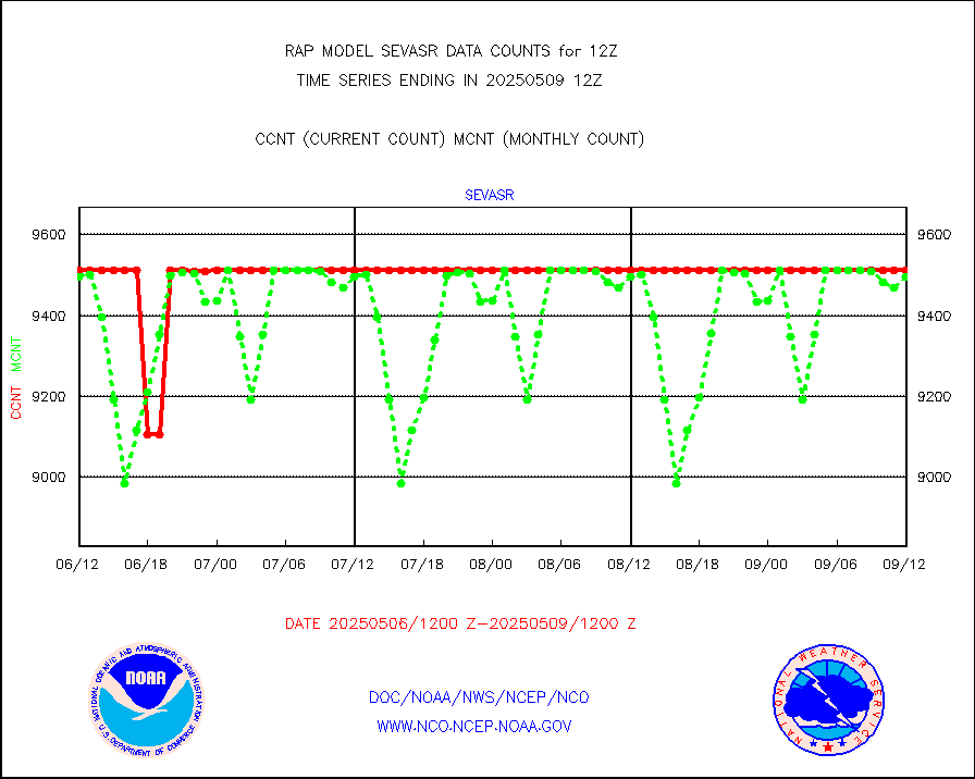
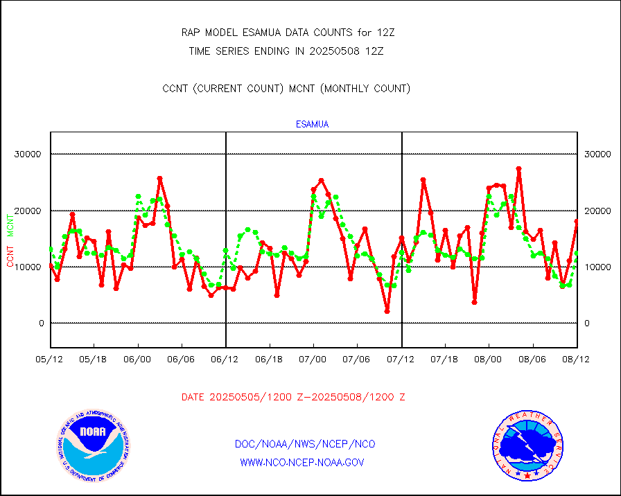
sevasr |
METEOSAT-10 2nd Gen SEVIRI All Sky Radiance(proc) |
9512 |
9505 |
100.1 % |
1910.00-1913.99 |
sevcsr |
METEOSAT-10 2nd Gen SEVIRI Clr Sky Radiance(proc) |
0 |
0 |
n/a |
1910.00-1913.99 |
ships |
Ship - manual and automatic, restricted |
15 |
25 |
60.0 % |
1911.50-1912.50 |
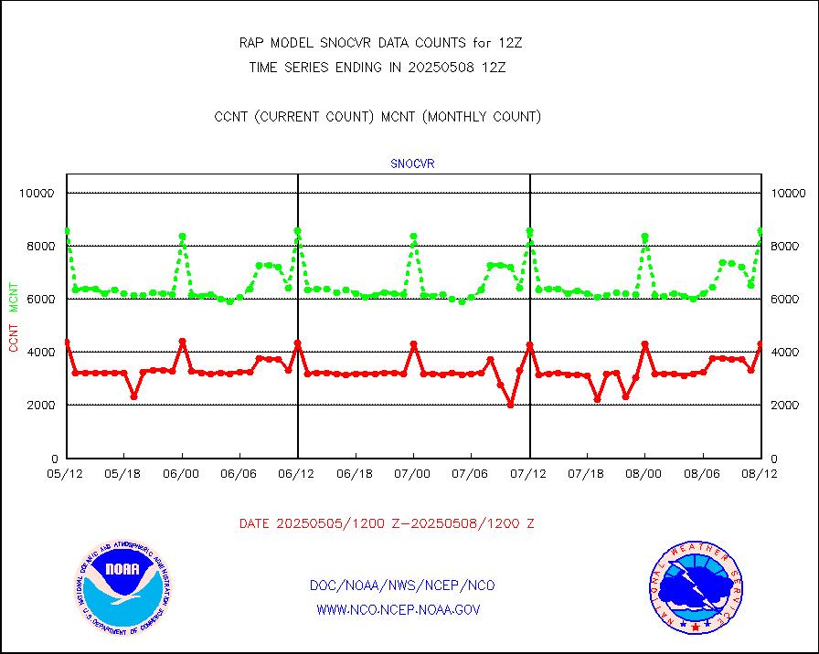
snocvr |
NOW COVER, DEPTH/DENSITY AND WATER EQUIVALENT |
4707 |
8571 |
54.9 % |
1910.00-1914.00 |
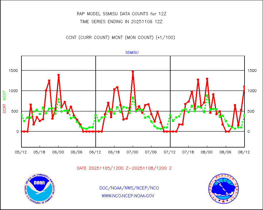
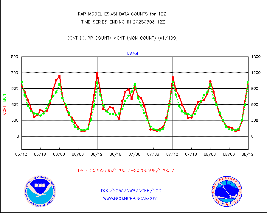
ssmisu |
DMSP SSM/IS 1C radiance data (Unified Pre-Proc.) |
71928 |
62222 |
115.6 % |
1910.00-1913.99 |
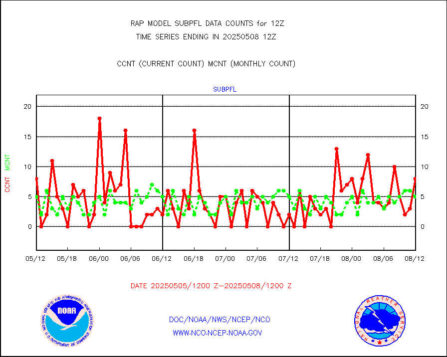
subpfl |
Sub-surface float and glider profile (BUFR) |
9 |
17 |
52.9 % |
1910.00-1913.99 |
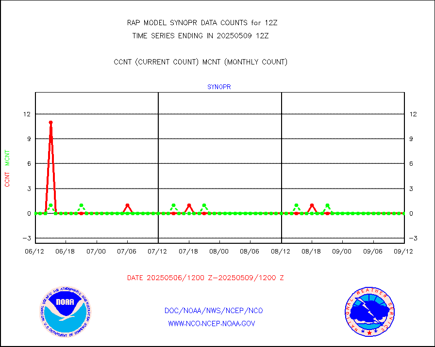
synopr |
Synoptic - restricted (WMO Res 40) manual & auto. |
0 |
0 |
n/a |
1911.50-1912.50 |
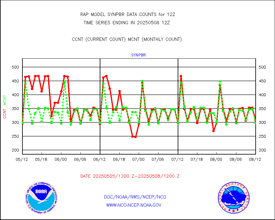
synpbr |
Synoptic - restricted (WMO Res 40)(decoded BUFR) |
301 |
299 |
100.7 % |
1911.50-1912.50 |
synpmb |
Synoptic - mobile manual & auto (decoded fr BUFR) |
0 |
0 |
n/a |
1911.50-1912.50 |
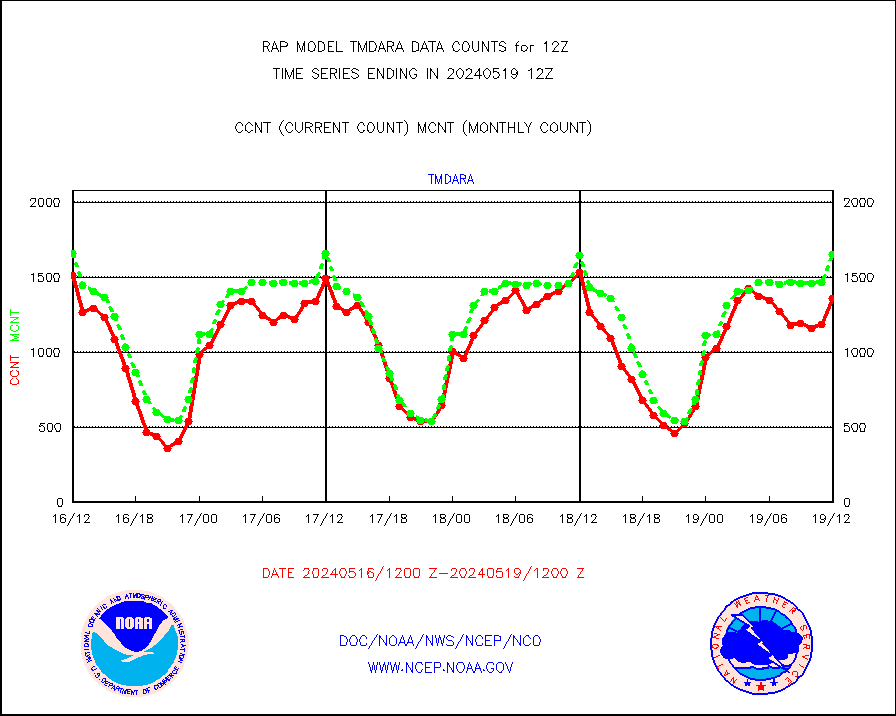
tmdara |
TAMDAR aircft data-all types(from Panasonic,BUFR) |
1356 |
1651 |
82.1 % |
1908.75-1915.25 |
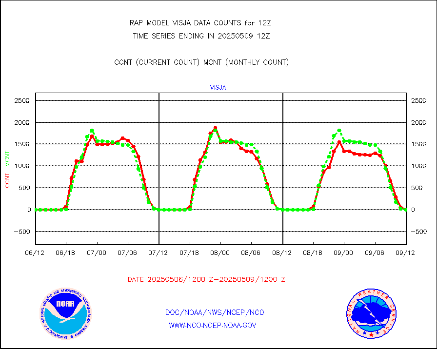
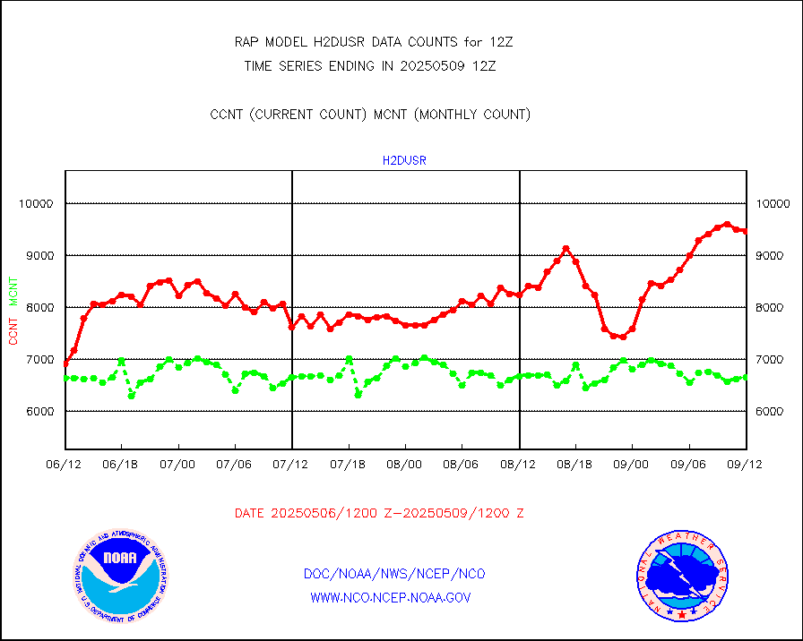
visja |
MTSAT/JMA visible derived cloud motion |
0 |
0 |
n/a |
1910.50-1913.50 |
visusr |
GOES-16&up/NESDIS visible derived cloud motion |
17989 |
24385 |
73.8 % |
1911.00-1911.99 |
vseunb |
METEOSAT/EUMETSAT visible drv cld motion NBseq |
8128 |
7129 |
114.0 % |
1910.50-1913.49 |


