| Critical Data with Normal Counts |
|---|
| Type | Description | Hourly Count | Monthly Average | Percent (%) of Monthly Mean | UTC Time Window |
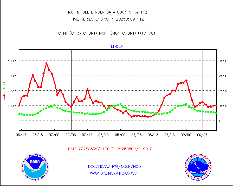
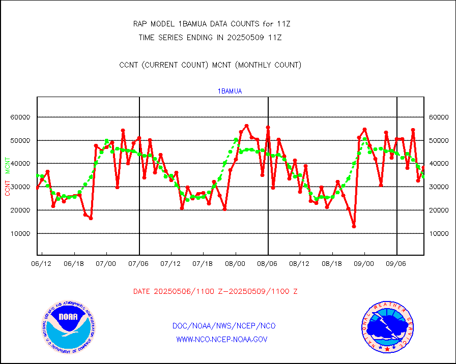
1bamua |
NOAA 15-19 & METOP 1-2 AMSU-A NCEP-proc. br.temps |
37617 |
33960 |
110.8 % |
1908.00-1913.99 |
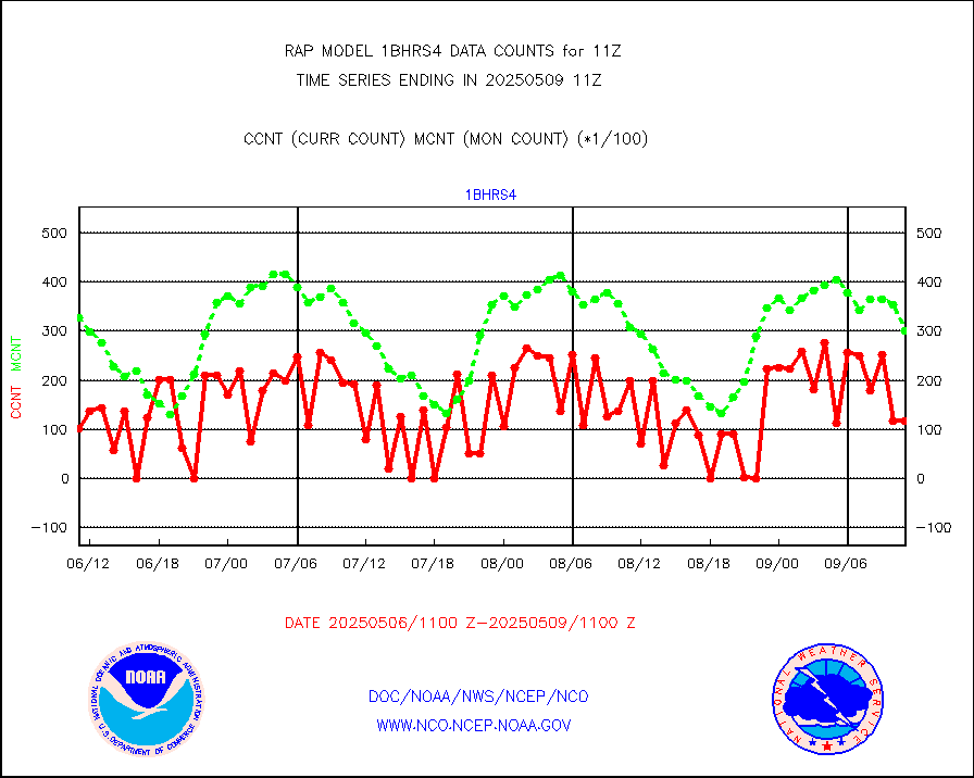
1bhrs4 |
NOAA 18-19 & METOP 1-2 HIRS-4 NCEP-proc. br.temps |
35001 |
31455 |
111.3 % |
1908.00-1913.99 |
1bmhs |
NOAA 18-19 & METOP 1-2 MHS NCEP-proces. br. temps |
211956 |
191517 |
110.7 % |
1908.00-1913.99 |
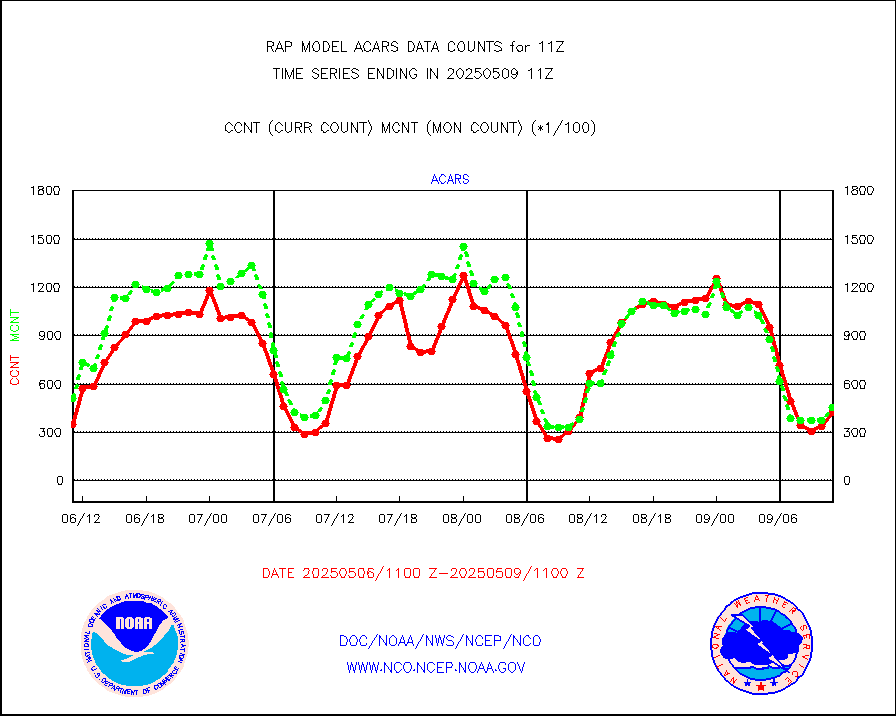
acars |
MDCRS ACARS acft data from ARINC(dcded from BUFR) |
16220 |
6785 |
239.1 % |
1907.75-1914.25 |
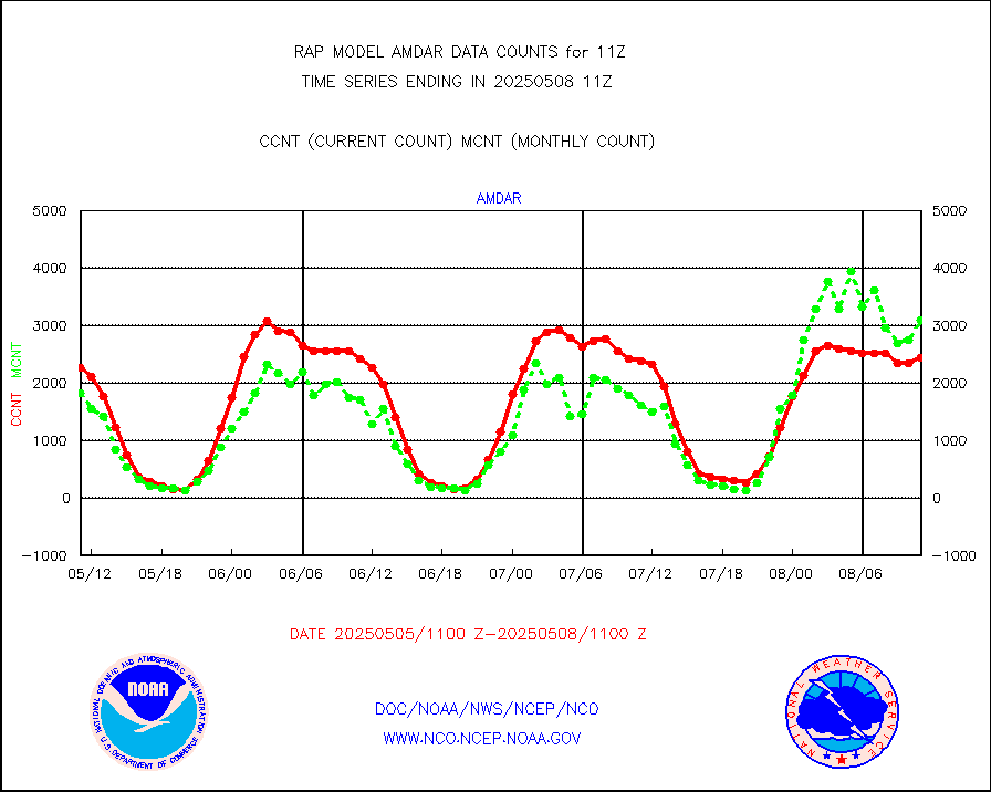
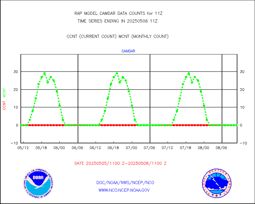
camdar |
Canadian AMDAR aircraft data (decoded from BUFR) |
0 |
4 |
0.0 % |
1907.75-1914.25 |
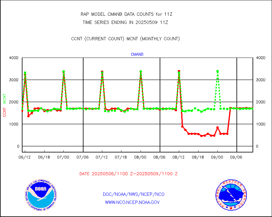
cmanb |
Surface Marine CMAN rpts decoded from BUFR format |
1725 |
1699 |
101.5 % |
1910.50-1911.50 |
dbuoy |
Buoys decoded from FM-18 fmt (moored or drifting) |
0 |
1 |
0.0 % |
1910.50-1911.50 |
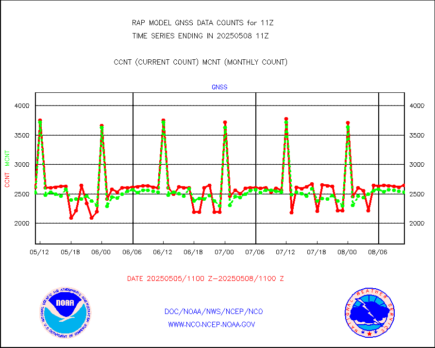
gnss |
Grnd-based Gbl Navigation Sat System (GNSS) data |
2599 |
2617 |
99.3 % |
1909.95-1910.05 |
h20mo |
MODIS (AQUA/TERRA) wvpr imager derived cld motion |
0 |
0 |
n/a |
1908.50-1913.50 |
infmo |
MODIS (AQUA/TERRA) ir l-wave derived cloud motion |
0 |
0 |
n/a |
1908.50-1913.50 |
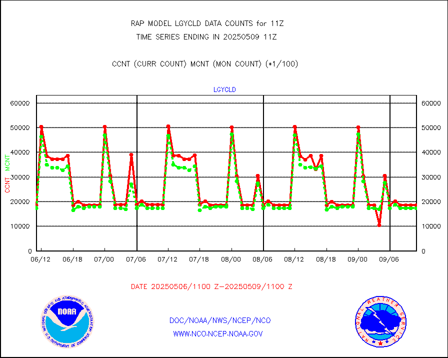
lgycld |
GOES/NASA(Langley) hi-res. (1x1 f-o-v) cloud data |
3732111 |
3111470 |
119.9 % |
1910.50-1911.50 |
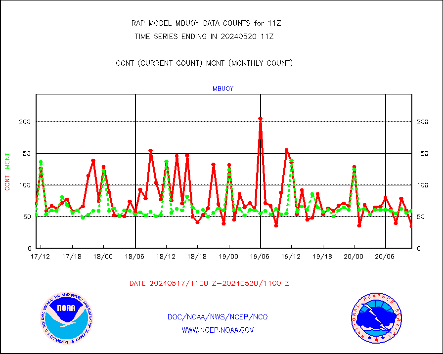
mbuoy |
Buoys decoded from FM-13 format (moored) |
156 |
55 |
283.6 % |
1910.50-1911.50 |
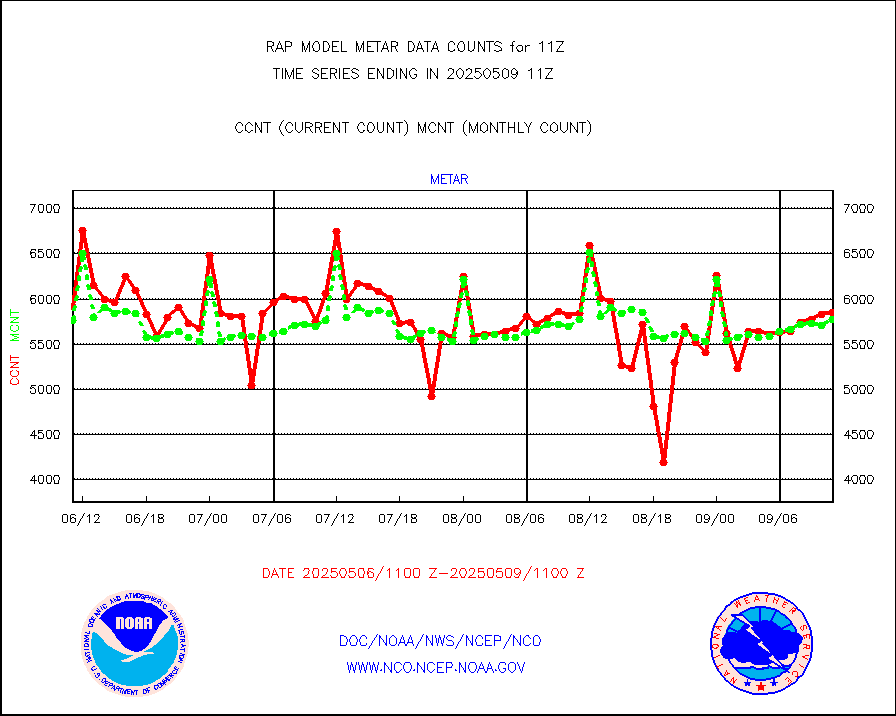
metar |
Aviation - METAR |
5909 |
6020 |
98.2 % |
1910.50-1911.50 |
nxrdw |
NEXRAD Vel Azm Dsp(VAD) winds via radar coded msg |
0 |
0 |
n/a |
1910.00-1912.00 |
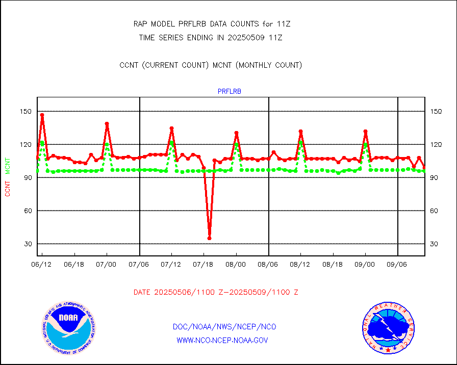
prflrb |
Multi-Agency Profiler (MAP) and SODAR winds |
72 |
83 |
86.7 % |
1909.50-1912.50 |
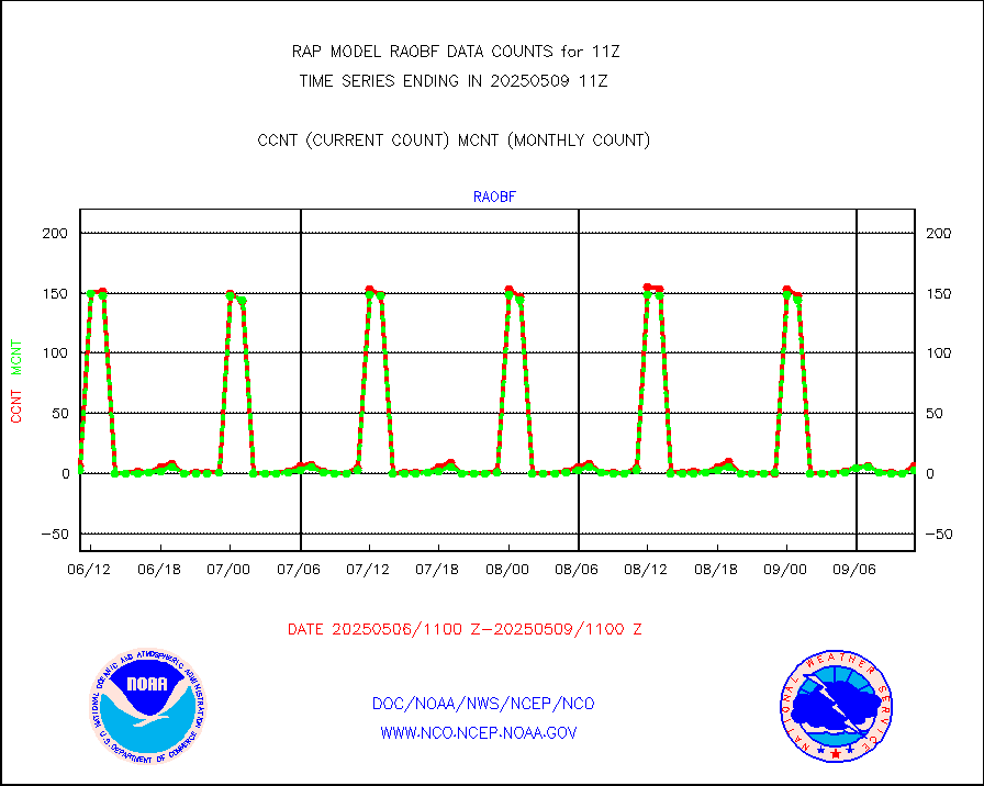
raobf |
Rawinsonde - fixed land (from TEMP or PILOT) |
2 |
3 |
66.7 % |
1910.00-1912.00 |
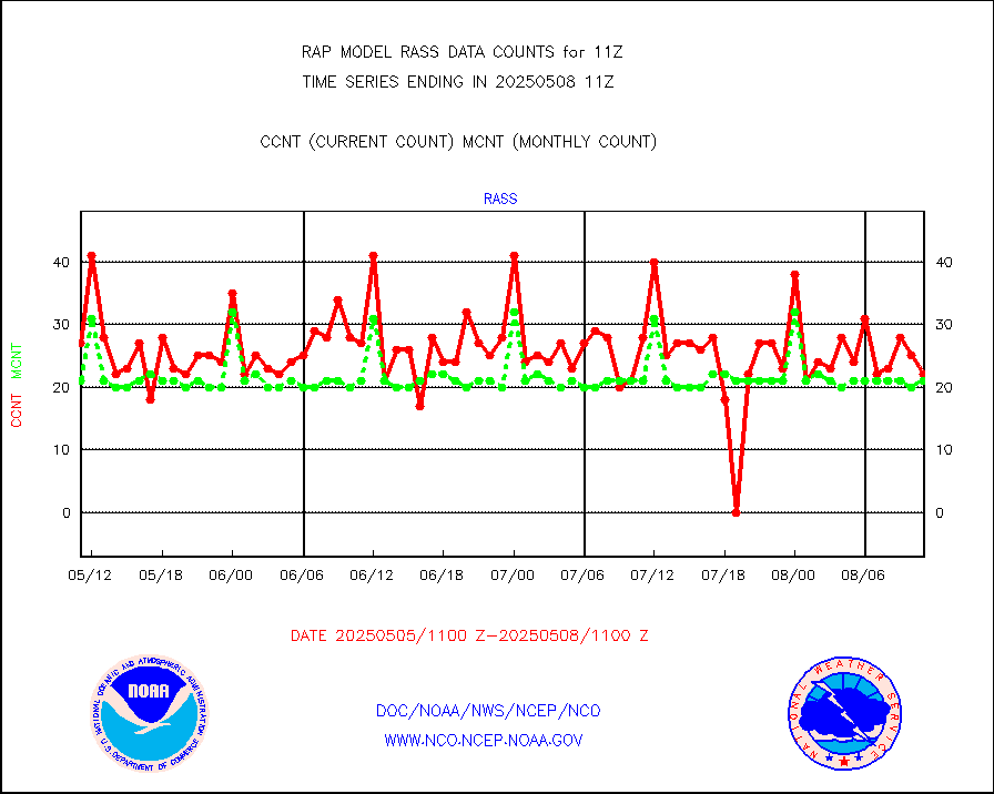
rass |
RASS temperatures (NOAA and Multi-Agency) |
17 |
21 |
81.0 % |
1910.50-1911.50 |
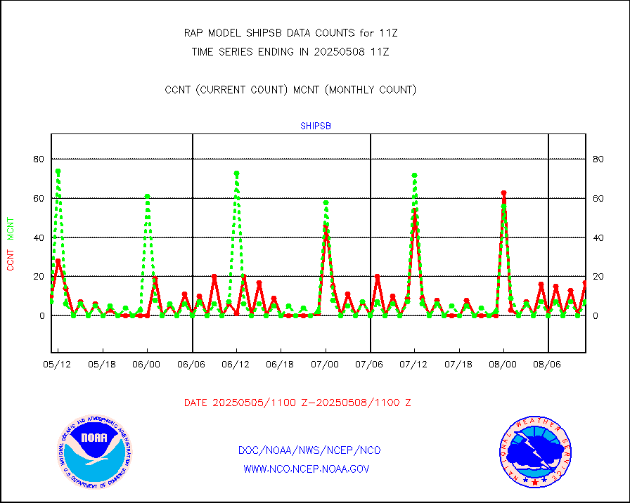
shipsb |
Ship - manual and automatic, restricted (BUFR) |
0 |
0 |
n/a |
1910.50-1911.50 |
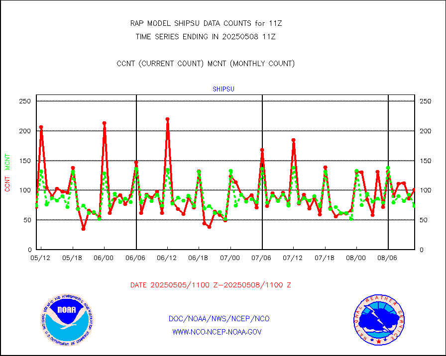
shipsu |
Ship - manual and automatic, unrestricted |
112 |
53 |
211.3 % |
1910.50-1911.50 |
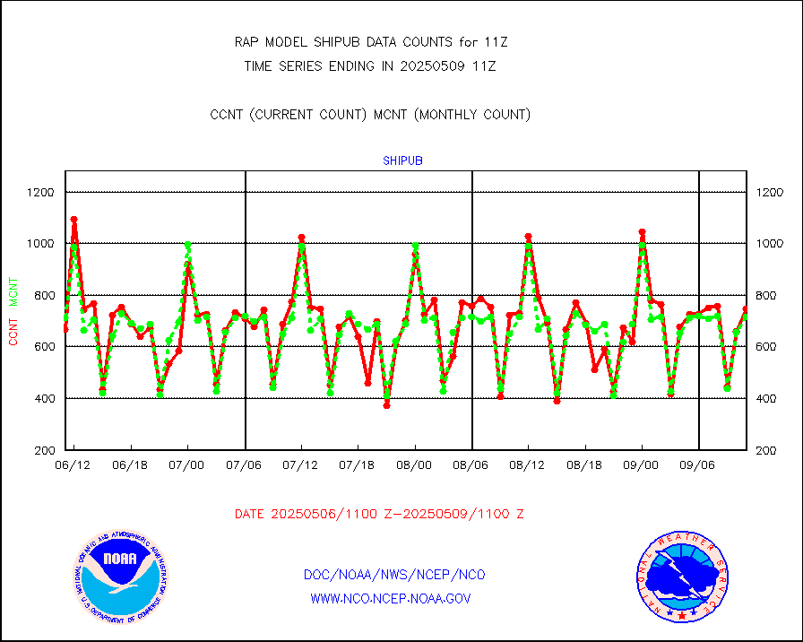
shipub |
Ship - manual and automatic, unrestricted (BUFR) |
595 |
622 |
95.7 % |
1910.50-1911.50 |
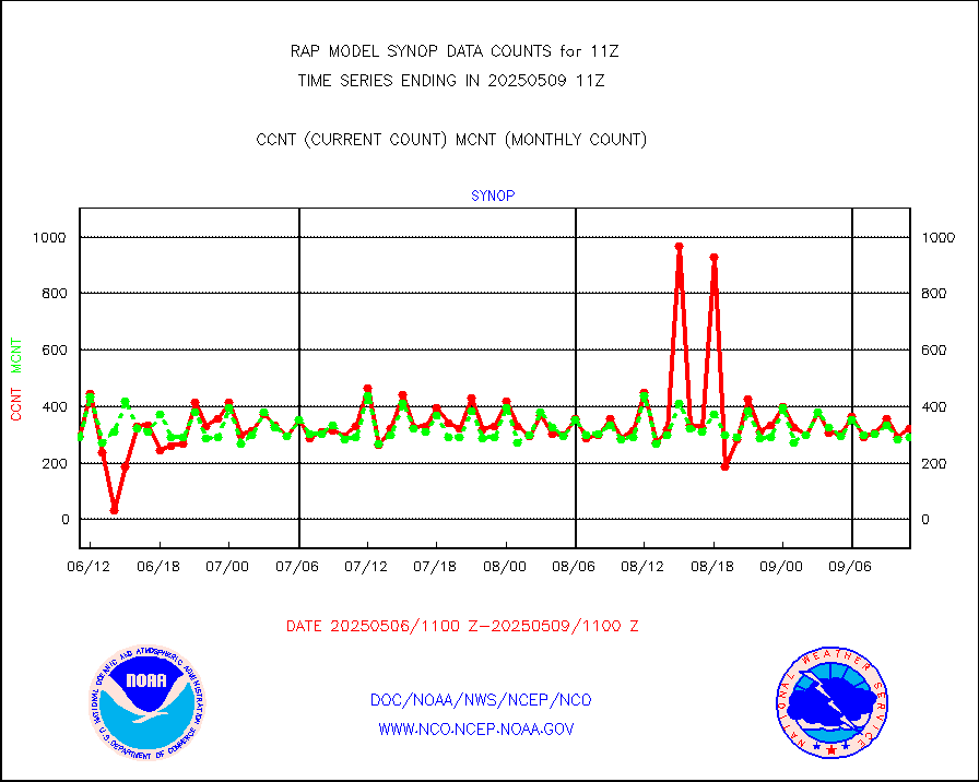
synop |
Synoptic - fixed manual and automatic |
309 |
312 |
99.0 % |
1910.50-1911.50 |
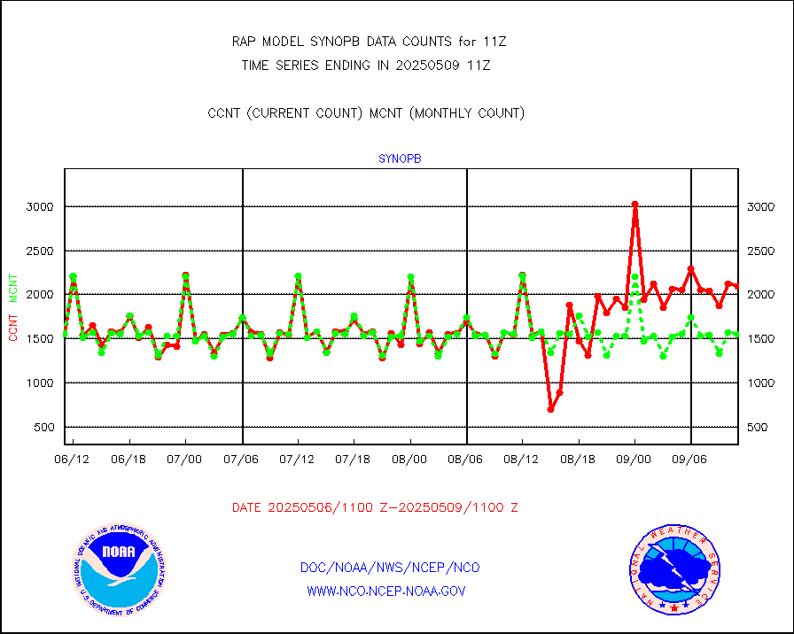
synopb |
Synoptic - fixed manual & auto (decoded fr BUFR) |
1672 |
1680 |
99.5 % |
1910.50-1911.50 |
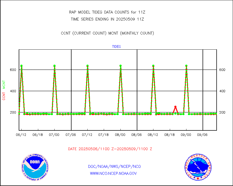
tideg |
Tide gauge reports decoded from CREX format |
183 |
181 |
101.1 % |
1910.50-1911.50 |
| Data Types of Opportunity with Normal Counts |
|---|
| Type | Description | Hourly Count | Monthly Average | Percent (%) of Monthly Mean | UTC Time Window |
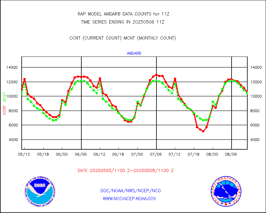
3p9usr |
GOES-16&up/NESDIS ir short-wv derived cld motion |
10905 |
10861 |
100.4 % |
1910.00-1910.99 |
acarsa |
MDCRS ACARS acft data (ARINC via AFWA)(AIREP fmt) |
0 |
0 |
n/a |
1907.75-1914.25 |
airep |
Manual AIREP aircraft data (dcded from AIREP fmt) |
3867 |
3282 |
117.8 % |
1907.75-1914.25 |
airsev |
AQUA AIRS/AMSU-A/HSB brightness temps- every FOV |
0 |
0 |
n/a |
1908.00-1913.99 |
amdar |
AMDAR aircraft data (decoded from AMDAR format) |
2420 |
1704 |
142.0 % |
1907.75-1914.25 |
amdarb |
AMDAR aircraft data (decoded from BUFR) |
6085 |
5692 |
106.9 % |
1907.75-1914.25 |
amsr2 |
GCOM-W AMSR2 1B brightness temperatures |
30283 |
537466 |
5.6 % |
1908.00-1908.99 |
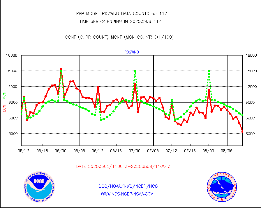
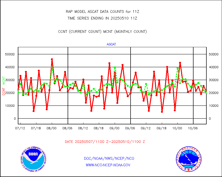
ascat |
METOP 1-2 ASCAT products |
18337 |
17265 |
106.2 % |
1909.00-1913.00 |
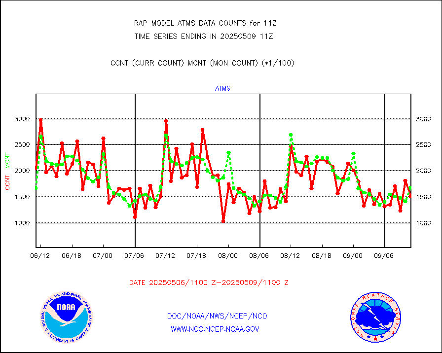
atms |
NPP/NOAA-20 ATMS brightness temperatures |
201578 |
168376 |
119.7 % |
1909.00-1912.99 |
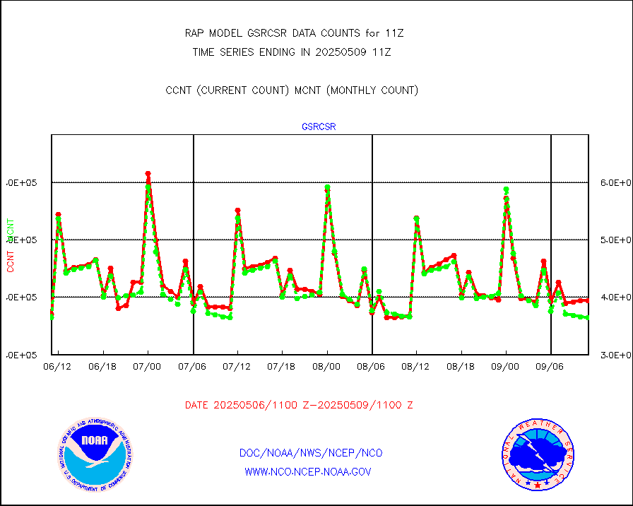
atmsdb |
NPP/NOAA-20 ATMS bright. temps-direct b-cast SSEC |
132480 |
119754 |
110.6 % |
1909.00-1912.99 |
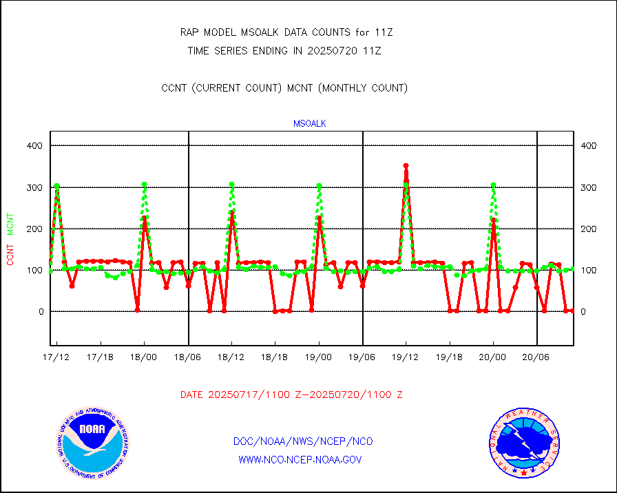
coopmd |
Coop/MADIS NEPP & HCN-Modernization NOAA COOP Obs |
27 |
27 |
100.0 % |
1910.50-1911.50 |
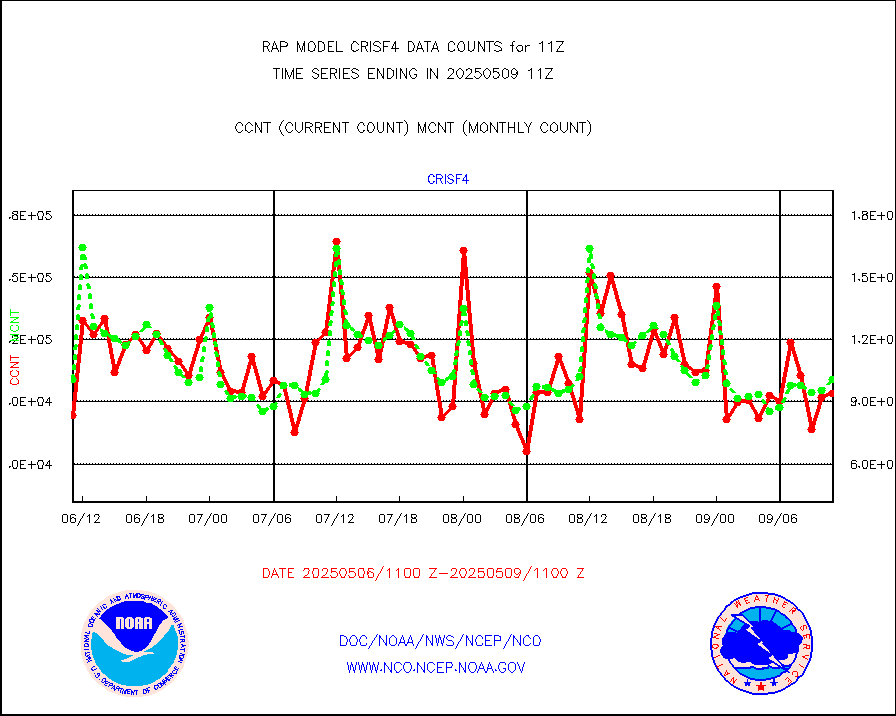
crisf4 |
NPP/NOAA-20 CrIS full spctrl radn (431 ch subset) |
75184 |
97713 |
76.9 % |
1909.00-1912.99 |
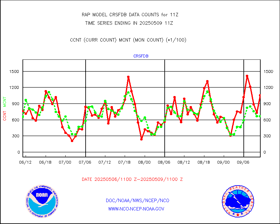
crsfdb |
NPP/NOAA-20 CrIS full spctrl radn dir brdcst SSEC |
109137 |
115697 |
94.3 % |
1909.00-1912.99 |
cstgd |
Coast Guard |
3 |
4 |
75.0 % |
1910.50-1911.50 |
dbuoyb |
Drifting buoys (decoded from BUFR) |
611 |
582 |
105.0 % |
1910.50-1911.50 |
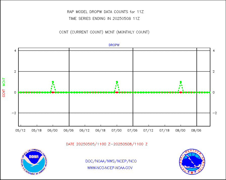
dropw |
Dropwinsonde (from TEMP DROP) |
0 |
0 |
n/a |
1910.00-1912.00 |
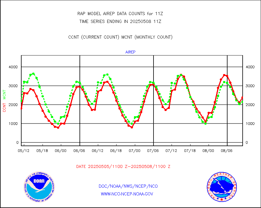
eadas |
E-AMDAR (European AMDAR acft decoded from BUFR) |
8995 |
9084 |
99.0 % |
1907.75-1914.25 |
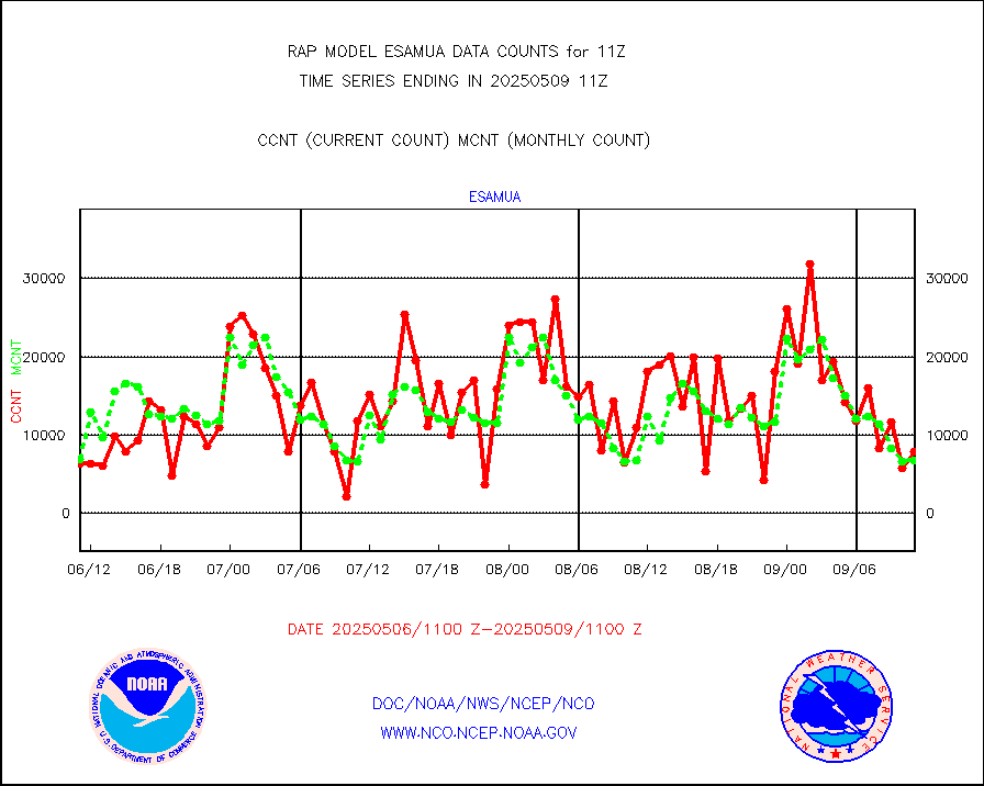
esamua |
NOAA 15-19 & METOP 1-2 AMSU-A proc btmps frm RARS |
9288 |
8534 |
108.8 % |
1910.00-1912.00 |
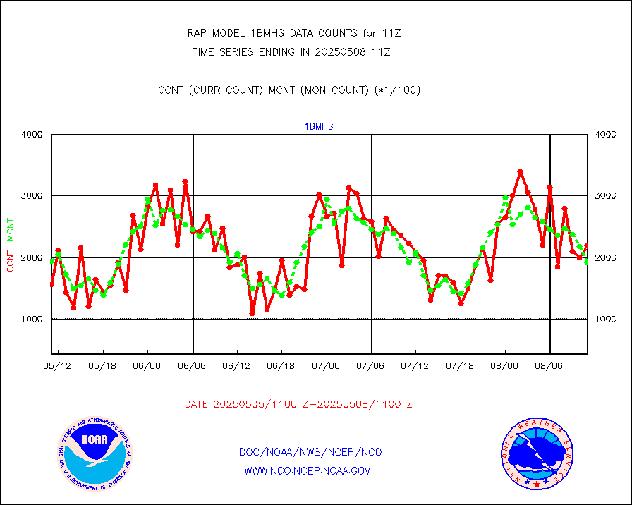
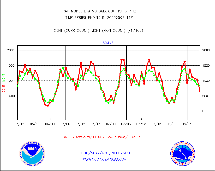
esatms |
NPP Adv. Tech. MW Sndr (ATMS) br. temps from RARS |
104491 |
86878 |
120.3 % |
1909.00-1912.99 |
eshrs3 |
NOAA 15-19 & METOP 1-2 HIRS-3/4 pr btmps frm RARS |
25958 |
21488 |
120.8 % |
1910.00-1912.00 |
esiasi |
METOP 1-2 IASI 1C radiance data vbl chn from RARS |
62842 |
63378 |
99.2 % |
1909.00-1912.99 |
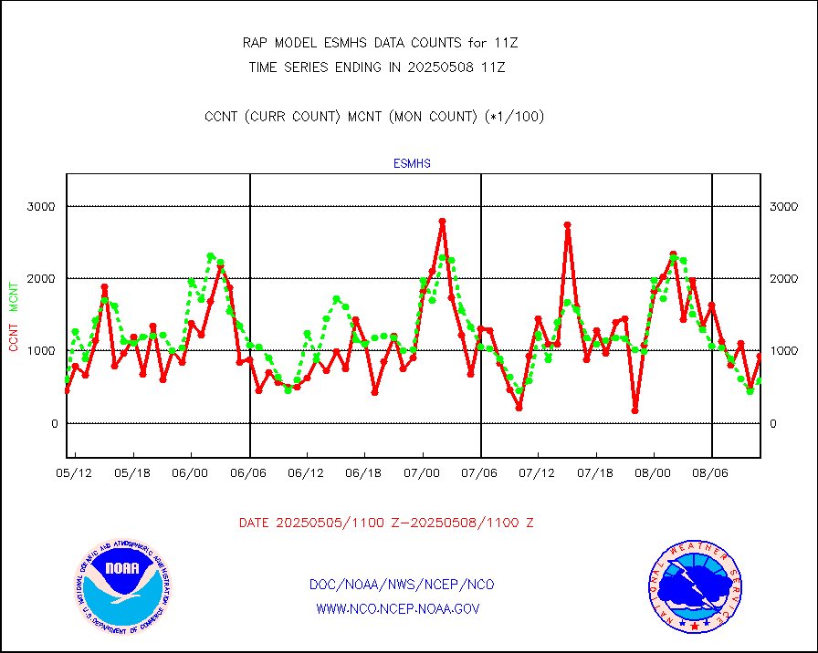
esmhs |
NOAA 18-19 & METOP 1-2 MHS proc. btemps from RARS |
102627 |
67336 |
152.4 % |
1910.00-1912.00 |
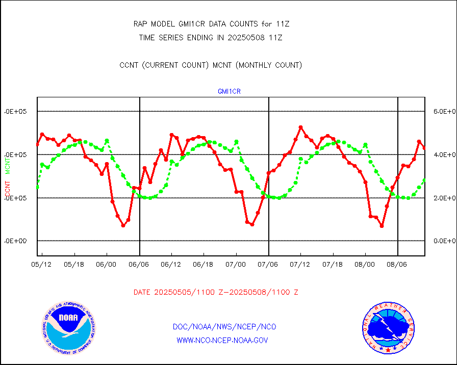
gmi1cr |
GPM GMI Level 1C-R brightness temperatures |
191032 |
441372 |
43.3 % |
1908.00-1913.99 |
gpsro |
GPS radio occultation data |
147 |
122 |
120.5 % |
1909.00-1912.99 |
gsrasr |
GOES-16/17 All Sky Radiances (proc.) |
812097 |
809606 |
100.3 % |
1909.00-1912.99 |
gsrcsr |
GOES-16/17 Clear Sky Radiances (proc.) |
338330 |
361473 |
93.6 % |
1909.00-1912.99 |
h20ja |
MTSAT/JMA water vapor imager derived cloud motion |
2830 |
3005 |
94.2 % |
1908.50-1913.50 |
h2dusr |
GOES-16&up/NESDIS wv imgr/deep-lyr derivd cld mtn |
7274 |
6950 |
104.7 % |
1910.00-1910.99 |
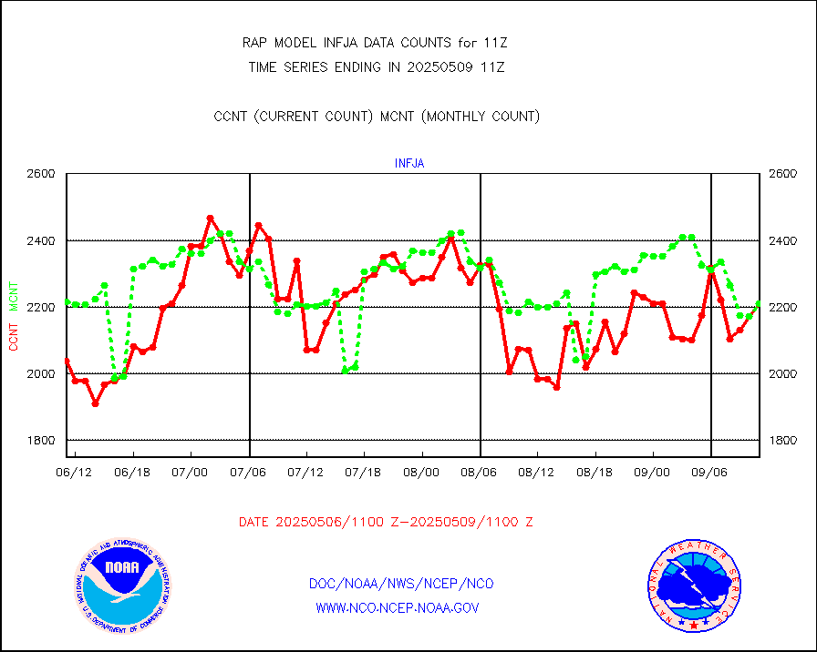
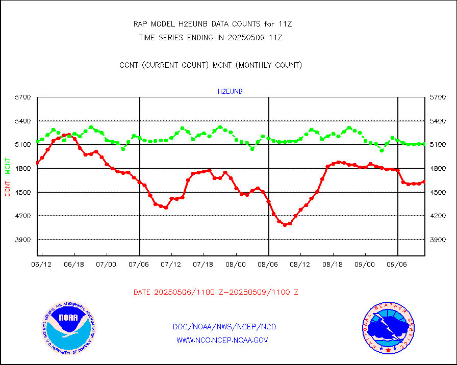
h2eunb |
METEOSAT/EUMETSAT wvpr imgr drv cld motion NBseq |
5377 |
5135 |
104.7 % |
1909.50-1912.49 |
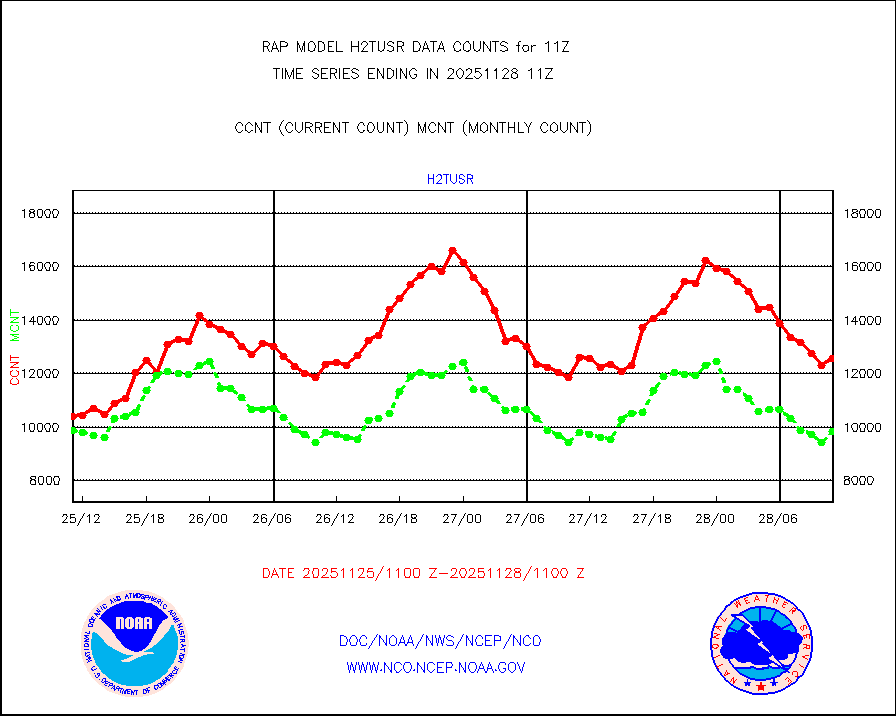
h2tusr |
GOES-16&up/NESDIS wv imgr/cld-top derived cld mtn |
11212 |
11002 |
101.9 % |
1910.00-1910.99 |
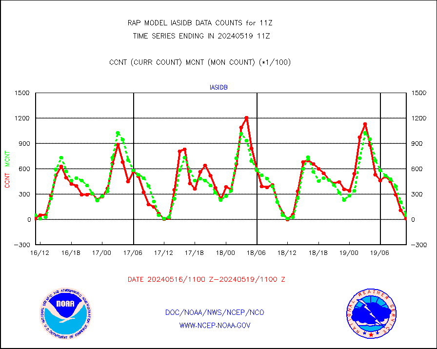
iasidb |
METOP 1-2 IASI 1C radiances-direct broadcast SSEC |
1091 |
5161 |
21.1 % |
1909.00-1912.99 |
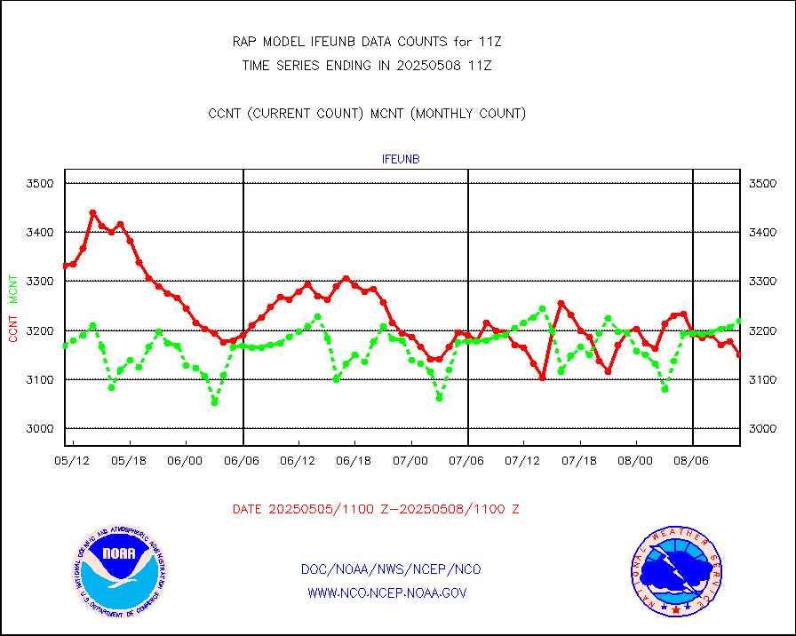
ifeunb |
METEOSAT/EUMETSAT ir lg-wave drv cld motion NBseq |
3257 |
3243 |
100.4 % |
1909.50-1912.49 |
ifvrnb |
VIIRS (NPP/NOAA-20) ir lg-wv drv cloud motion(NB) |
0 |
0 |
n/a |
1908.50-1913.50 |
infav |
AVHRR (NOAA/METOP) ir lg-wave derived cld motion |
0 |
0 |
n/a |
1908.50-1913.50 |
infav1 |
AVHRR (METOP) ir lg-wave derived cld motion |
0 |
0 |
n/a |
1909.50-1912.49 |
infja |
MTSAT/JMA infrared long-wave derived cloud motion |
2245 |
2442 |
91.9 % |
1908.50-1913.50 |
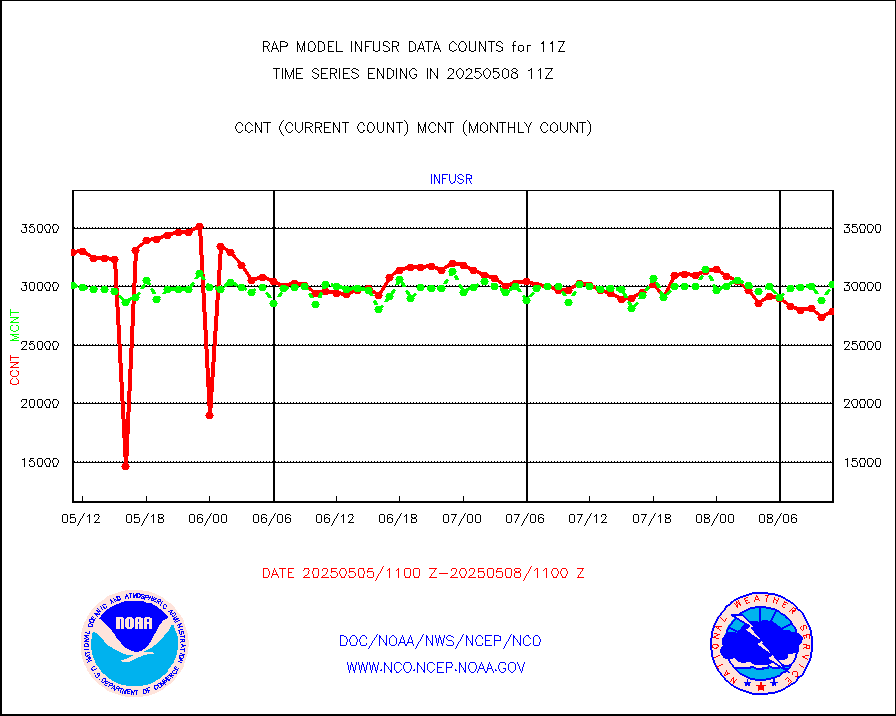
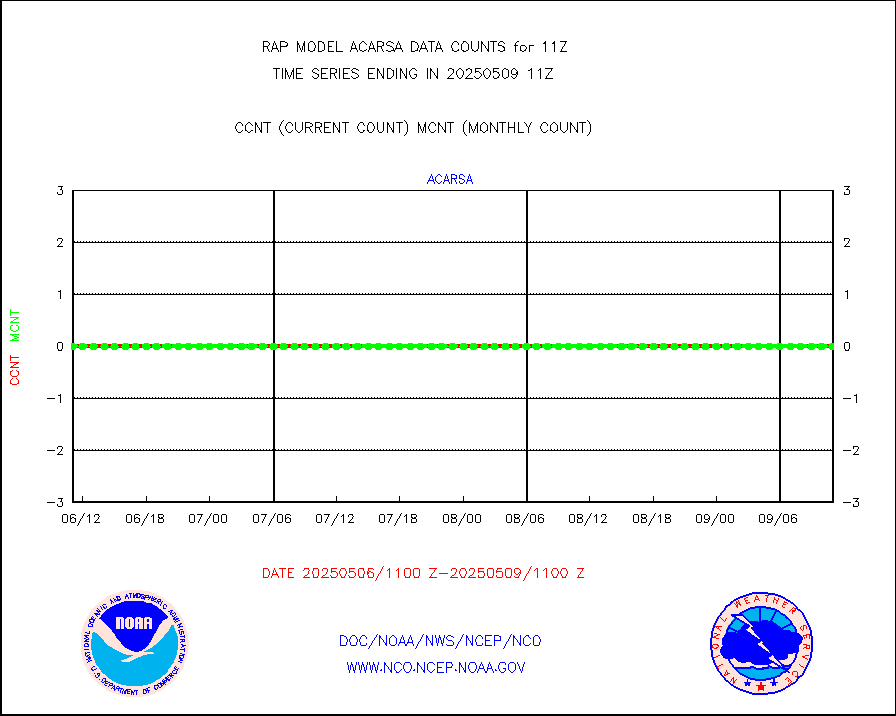
infusr |
GOES-16&up/NESDIS ir long-wave derived cld motion |
28205 |
29261 |
96.4 % |
1910.00-1910.99 |
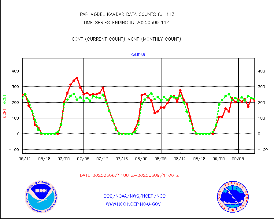
kamdar |
Korean AMDAR aircraft data (decoded from BUFR) |
271 |
267 |
101.5 % |
1907.75-1914.25 |
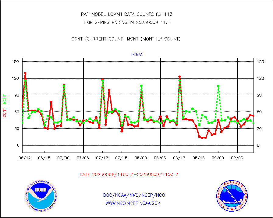
lcman |
Land-based CMAN stations decoded from CMAN format |
75 |
69 |
108.7 % |
1910.50-1911.50 |
ltnglr |
LLDN Long-rng lightning from Vaisala via NOAAPORT |
102315 |
86436 |
118.4 % |
1910.00-1911.50 |
ltngsr |
NLDN Shrt-rng lightning from Vaisala via NOAAPORT |
6259 |
4655 |
134.5 % |
1910.00-1911.50 |
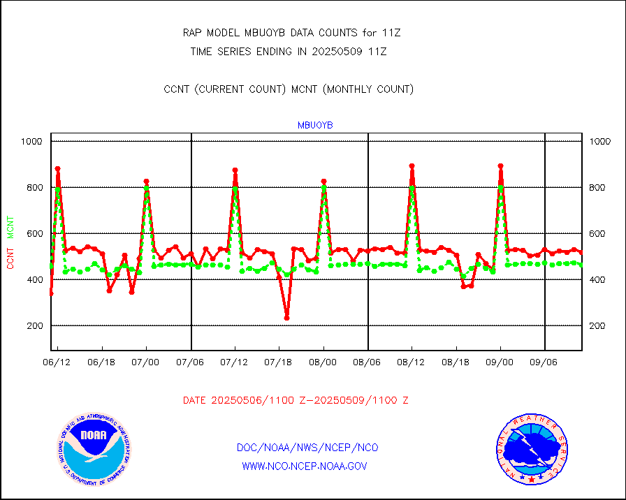
mbuoyb |
Moored buoys (decoded from BUFR) |
634 |
557 |
113.8 % |
1910.50-1911.50 |
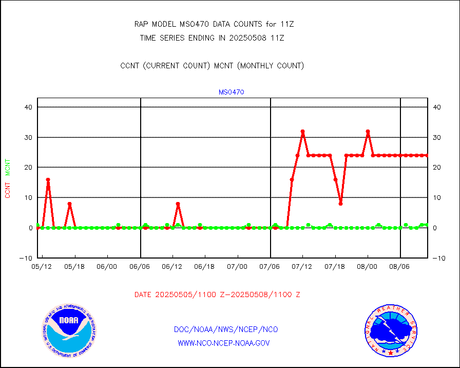
mso470 |
Mesonet/MADIS Colorado E-470 (Interstate 470) |
21 |
18 |
116.7 % |
1910.50-1911.50 |
msoalk |
Mesonet/MADIS Alaska Department of Transportation |
108 |
98 |
110.2 % |
1910.50-1911.50 |
msoapg |
Mesonet/MADIS U.S. Army Aberdeen Proving Grounds |
0 |
0 |
n/a |
1910.50-1911.50 |
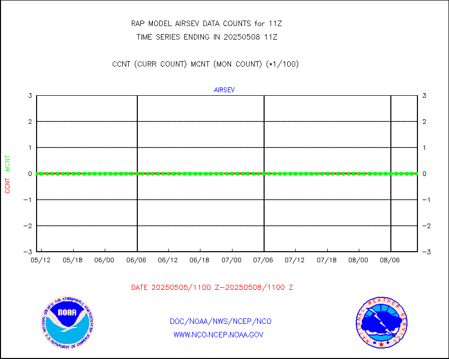
msoapr |
Mesonet/MADIS Citizen Weather Observers Program |
41069 |
45472 |
90.3 % |
1910.50-1911.50 |
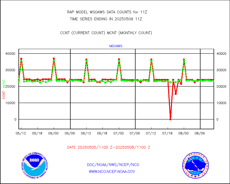
msoaws |
Mesonet/MADIS AWS Convergence Technologies, Inc. |
24440 |
25526 |
95.7 % |
1910.50-1911.50 |
msoawx |
Mesonet/MADIS "Anything Weather" |
0 |
0 |
n/a |
1910.50-1911.50 |
msocol |
Mesonet/MADIS Colorado Dept. of Transportation |
0 |
0 |
n/a |
1910.50-1911.50 |
msodcn |
Mesonet/MADIS DC Net |
0 |
0 |
n/a |
1910.50-1911.50 |
msoden |
Mesonet/MADIS Denver Urban Drainage & Flood Cntrl |
225 |
217 |
103.7 % |
1910.50-1911.50 |
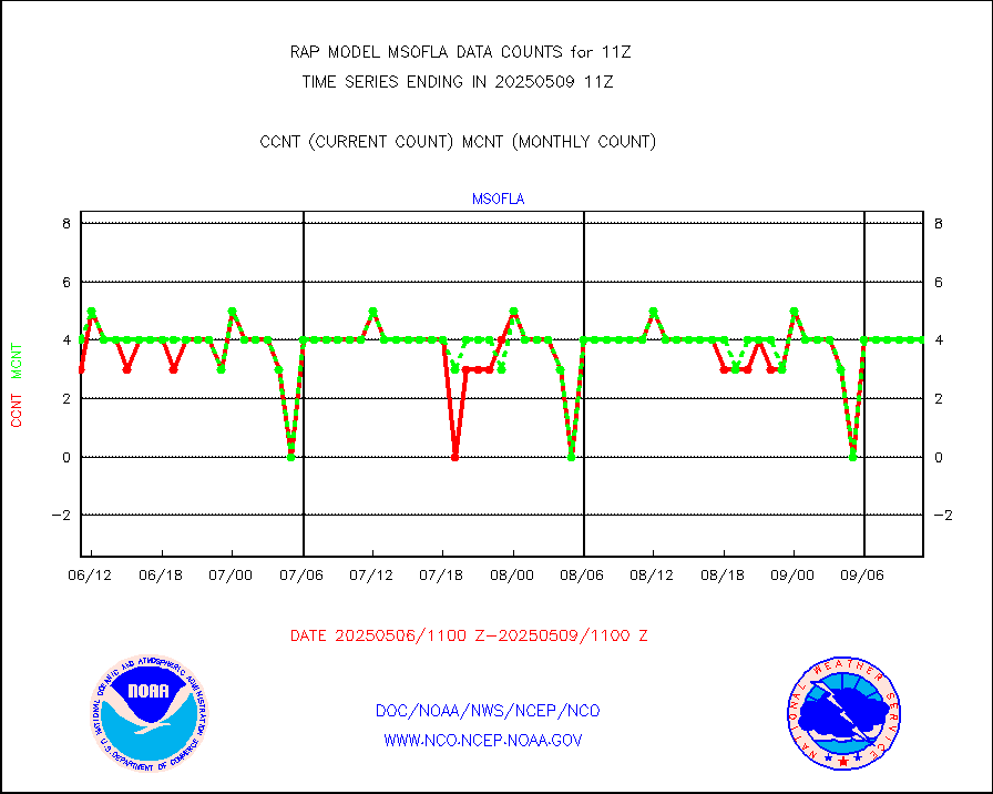
msofla |
Mesonet/MADIS Florida (FAWN & USF) |
3 |
3 |
100.0 % |
1910.50-1911.50 |
msoflt |
Mesonet/MADIS Florida Dept. of Transportation |
0 |
0 |
n/a |
1910.50-1911.50 |
msogeo |
Mesonet/MADIS Georgia Dept. of Transportation |
0 |
0 |
n/a |
1910.50-1911.50 |
msohad |
Mesonet/MADIS NWS Hydromet Auto Data System(HADS) |
5711 |
5475 |
104.3 % |
1910.50-1911.50 |
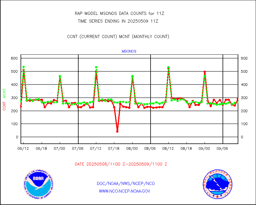
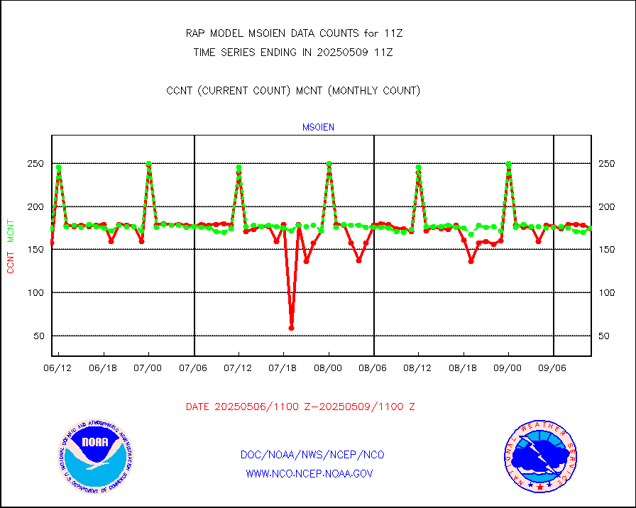
msoien |
Mesonet/MADIS Iowa Environmental |
168 |
163 |
103.1 % |
1910.50-1911.50 |
msoind |
Mesonet/MADIS Indiana Dept. of Transportation |
0 |
0 |
n/a |
1910.50-1911.50 |
msoiow |
Mesonet/MADIS Iowa Department of Transportation |
0 |
0 |
n/a |
1910.50-1911.50 |
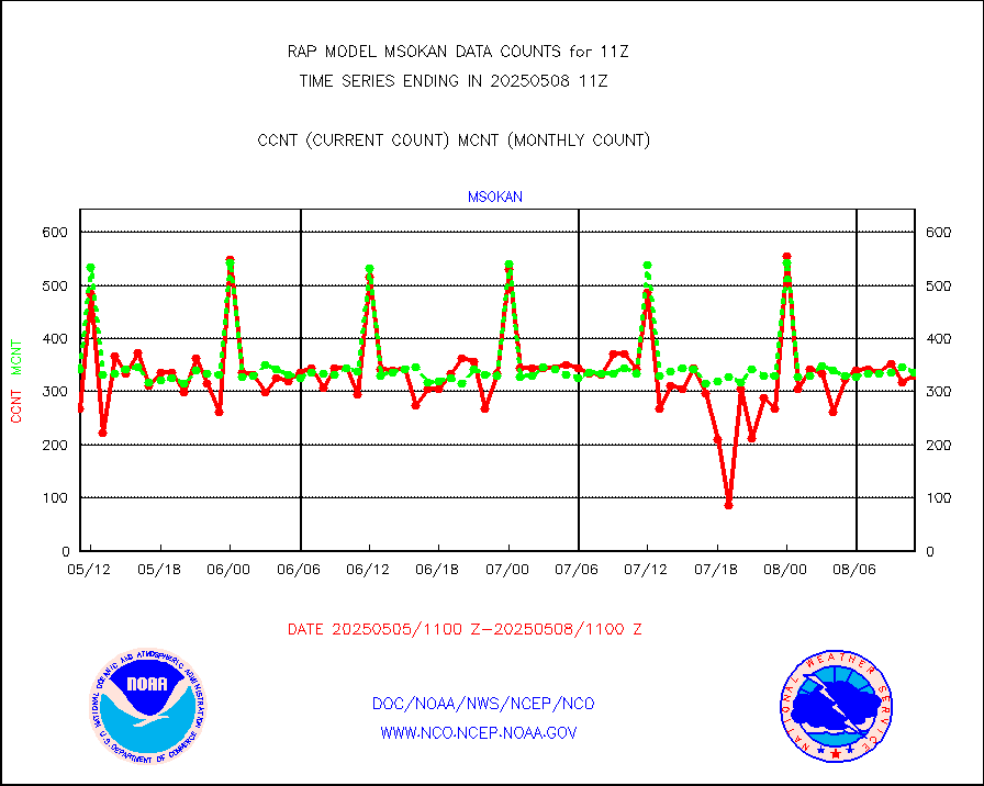
msokan |
Mesonet/MADIS Kansas Department of Transportation |
348 |
290 |
120.0 % |
1910.50-1911.50 |
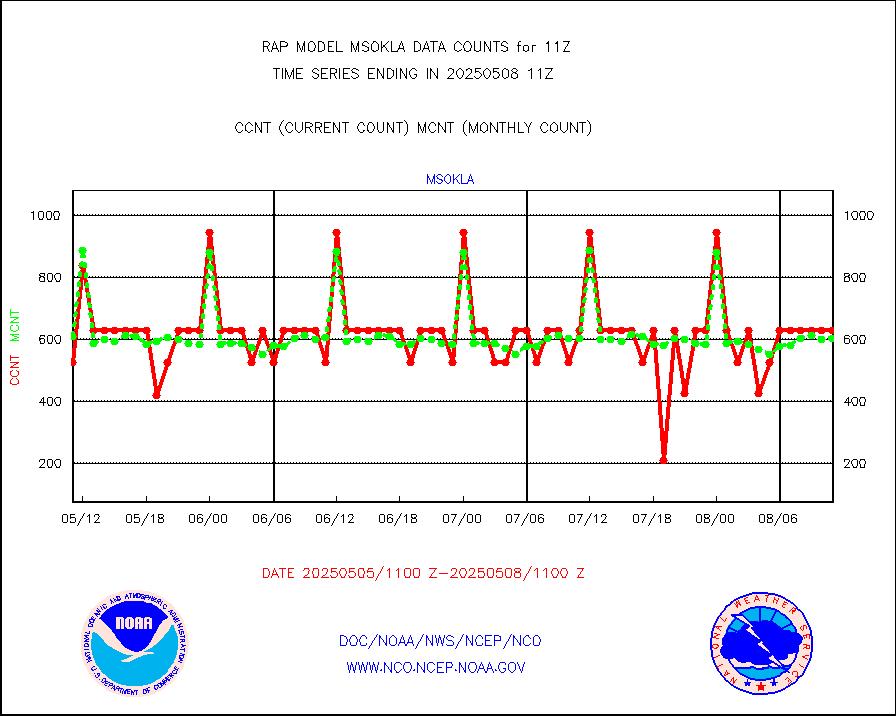
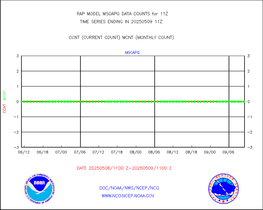
msokla |
Mesonet/MADIS Oklahoma Mesonet |
318 |
318 |
100.0 % |
1910.50-1911.50 |
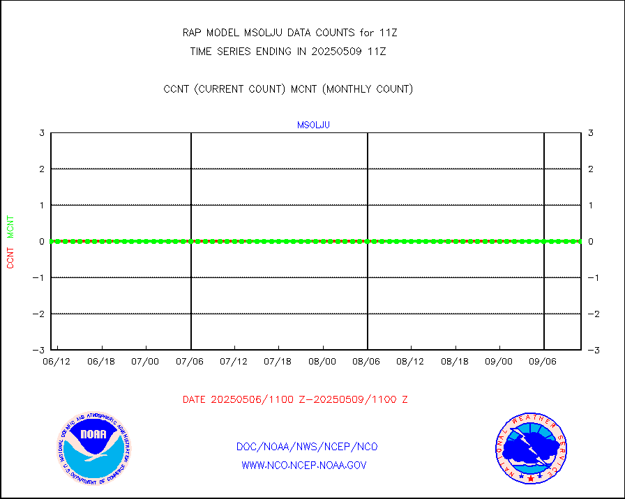
msolju |
Mesonet/MADIS Louisiana State/Jackson State Univ. |
0 |
0 |
n/a |
1910.50-1911.50 |
msomca |
Mesonet/MADIS Missouri Commercial Agricult Wx Net |
263 |
261 |
100.8 % |
1910.50-1911.50 |
msomin |
Mesonet/MADIS Minnesota Dept. of Transportation |
0 |
0 |
n/a |
1910.50-1911.50 |
msonos |
Mesonet/MADIS NOS-Phys Oceanographic Realtime Sys |
295 |
284 |
103.9 % |
1910.50-1911.50 |
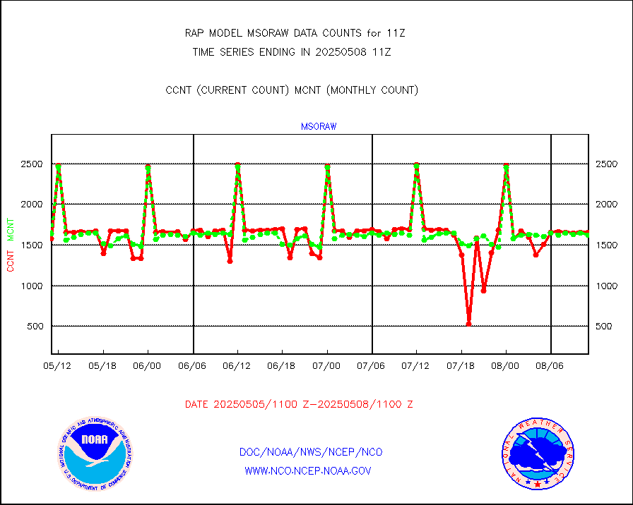
msoraw |
Mesonet/MADIS NFIC Remote Automated Wx Stns(RAWS) |
1705 |
1482 |
115.0 % |
1910.50-1911.50 |
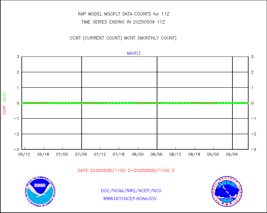
msourb |
Mesonet/MADIS UrbaNet |
3943 |
3951 |
99.8 % |
1910.50-1911.50 |
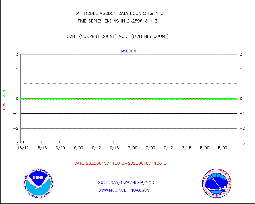
msovir |
Mesonet/MADIS Virginia Dept. of Transportation |
208 |
224 |
92.9 % |
1910.50-1911.50 |
msowfy |
Mesonet/MADIS "Weather for You" |
0 |
0 |
n/a |
1910.50-1911.50 |
msowis |
Mesonet/MADIS Wisconsin Dept. of Transportation |
0 |
0 |
n/a |
1910.50-1911.50 |
msowst |
Mesonet/MADIS MesoWest (many subproviders) |
41049 |
38550 |
106.5 % |
1910.50-1911.50 |
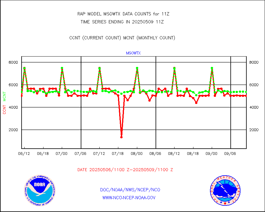
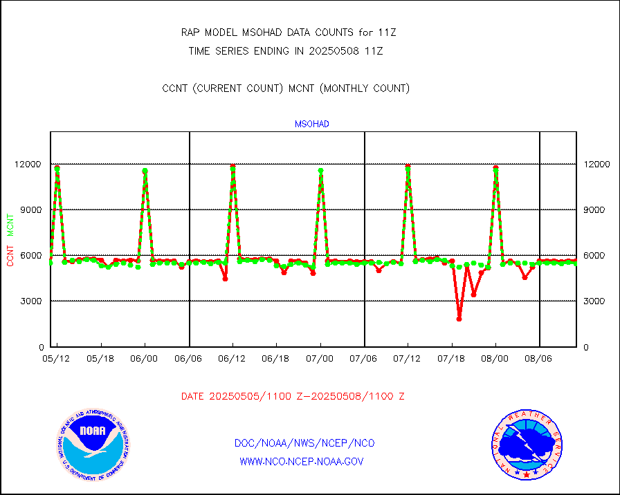
msowtx |
Mesonet/MADIS West Texas |
4951 |
4806 |
103.0 % |
1910.50-1911.50 |
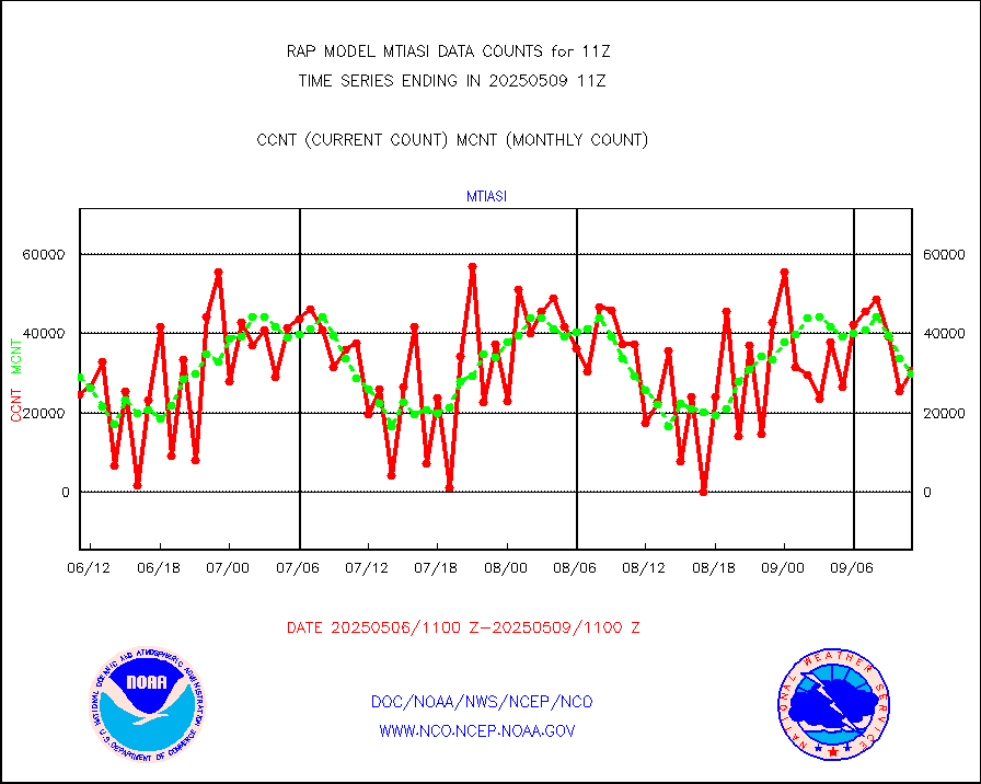
mtiasi |
METOP 1-2 IASI 1C radiance data (varbl. channels) |
25281 |
27718 |
91.2 % |
1909.00-1912.99 |
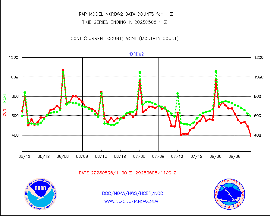
nxrdw2 |
NEXRAD Vel Azm Dsp(VAD) winds via Level 2 decoder |
800 |
692 |
115.6 % |
1910.00-1912.00 |
osbuv8 |
NOAA 16-19 Solar Backscatter UV-2 rad frm V8 BUFR |
0 |
0 |
n/a |
1909.00-1911.99 |
pibal |
PIBAL (from PILOT, PILOT SHIP, PILOT MOBIL) |
0 |
0 |
n/a |
1910.00-1912.00 |
pirep |
Manual PIREP aircraft data (dcded from AIREP fmt) |
122 |
141 |
86.5 % |
1907.75-1914.25 |
prflrp |
Profilr winds from PIBAL (PILOT,PILOT SHIP/MOBIL) |
0 |
0 |
n/a |
1909.50-1912.50 |
raobm |
Rawinsonde - mobile land (from TEMP/PILOT MOBIL) |
0 |
0 |
n/a |
1910.00-1912.00 |
raobs |
Rawinsonde - ship (from TEMP SHIP, PILOT SHIP) |
0 |
0 |
n/a |
1910.00-1912.00 |
rd2wnd |
NEXRAD radial wind (Level 2 - GTS) |
883204 |
817432 |
108.0 % |
1910.50-1911.49 |
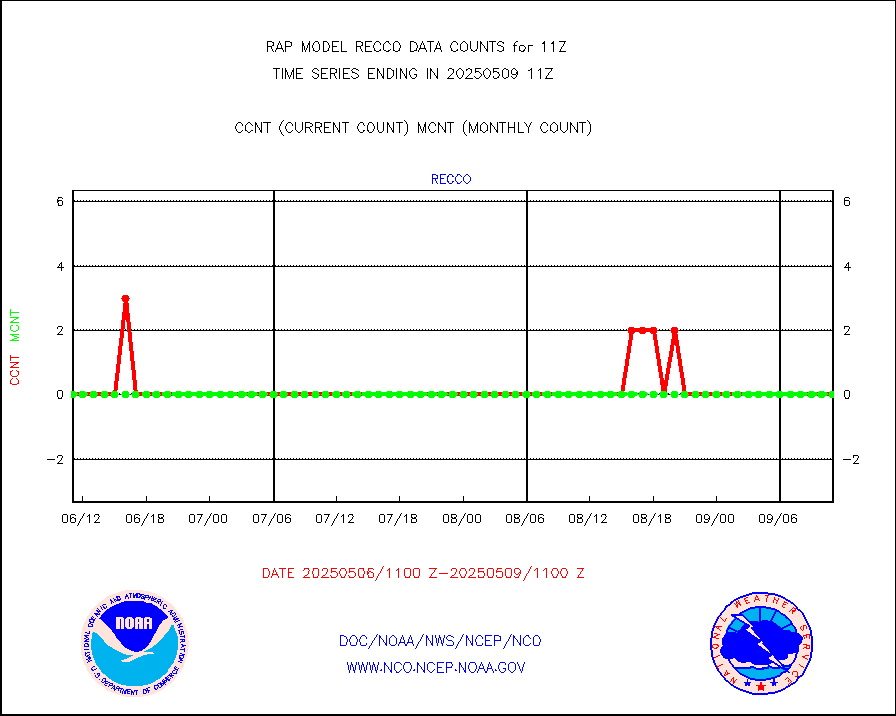
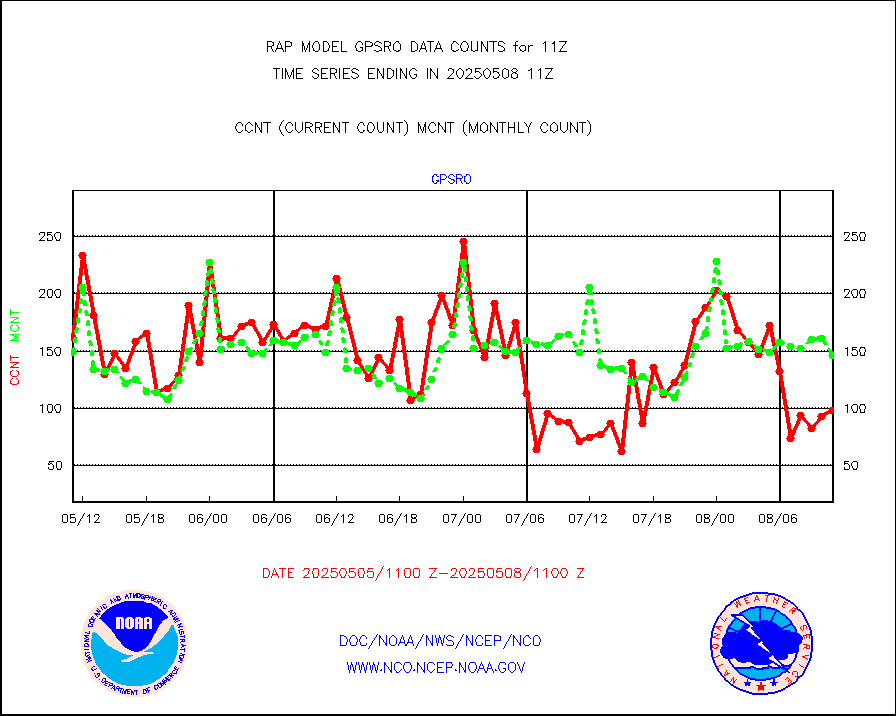
recco |
Flight level reconnaissance aircraft data |
0 |
0 |
n/a |
1910.00-1912.00 |
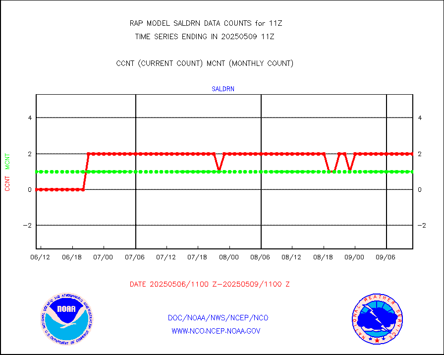
saldrn |
Surface Marine Saildrone (decoded from BUFR) |
2 |
2 |
100.0 % |
1909.00-1912.99 |
saphir |
Megha-Tropiques SAPHIR L1A2 brightness temps |
0 |
0 |
n/a |
1908.00-1913.99 |
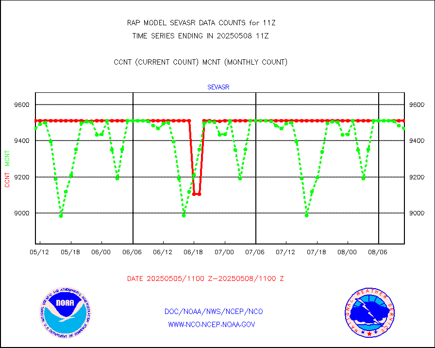
sevasr |
METEOSAT-10 2nd Gen SEVIRI All Sky Radiance(proc) |
9512 |
9497 |
100.2 % |
1909.00-1912.99 |
sevcsr |
METEOSAT-10 2nd Gen SEVIRI Clr Sky Radiance(proc) |
0 |
0 |
n/a |
1909.00-1912.99 |
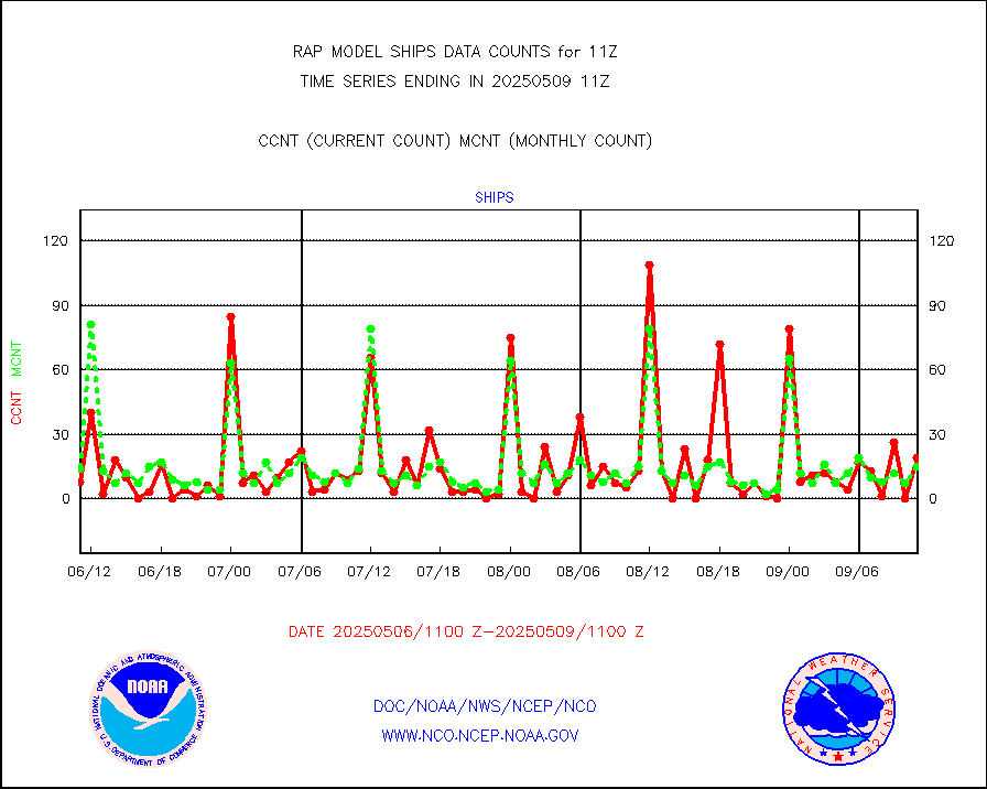
ships |
Ship - manual and automatic, restricted |
0 |
4 |
0.0 % |
1910.50-1911.50 |
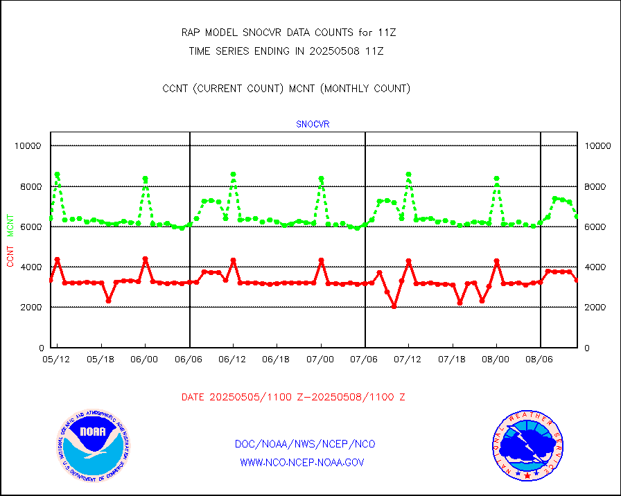
snocvr |
NOW COVER, DEPTH/DENSITY AND WATER EQUIVALENT |
3741 |
7390 |
50.6 % |
1909.00-1913.00 |
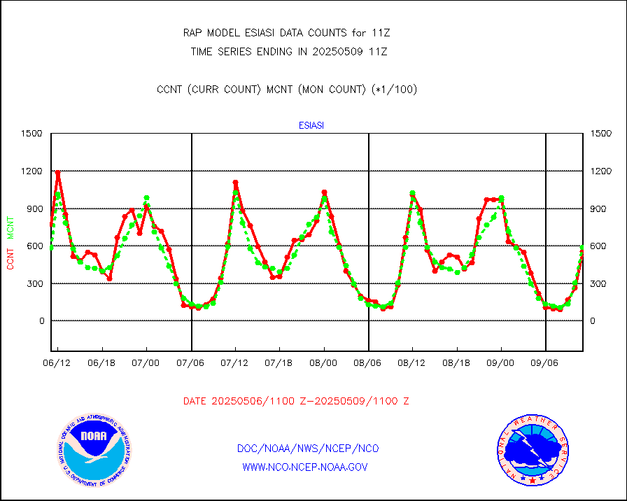
ssmisu |
DMSP SSM/IS 1C radiance data (Unified Pre-Proc.) |
0 |
28689 |
0.0 % |
1909.00-1912.99 |
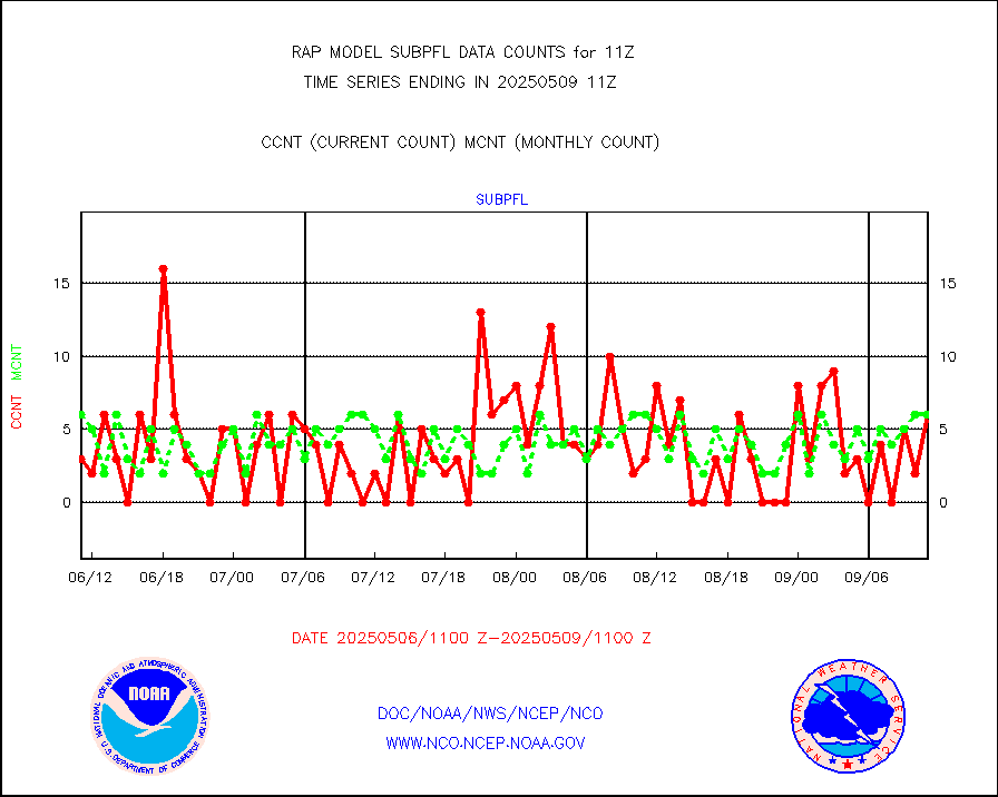
subpfl |
Sub-surface float and glider profile (BUFR) |
24 |
18 |
133.3 % |
1909.00-1912.99 |
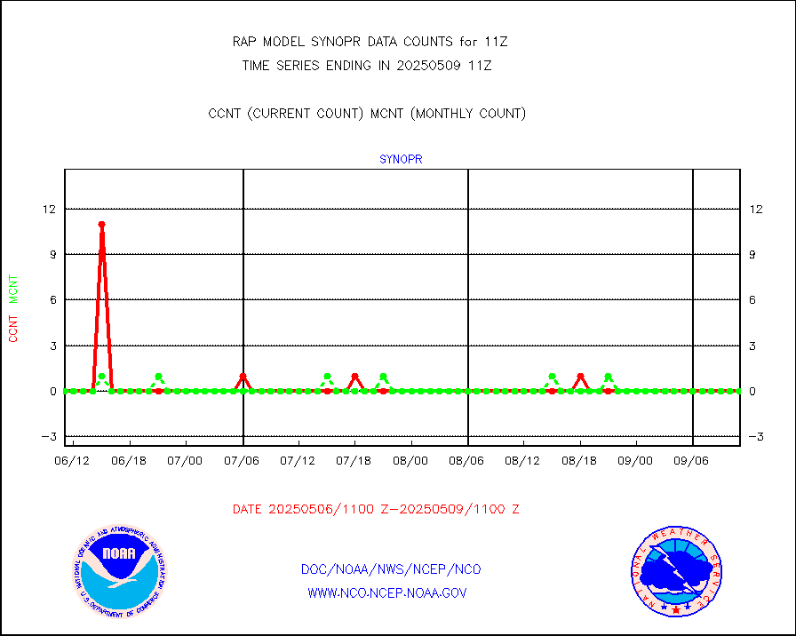
synopr |
Synoptic - restricted (WMO Res 40) manual & auto. |
0 |
0 |
n/a |
1910.50-1911.50 |
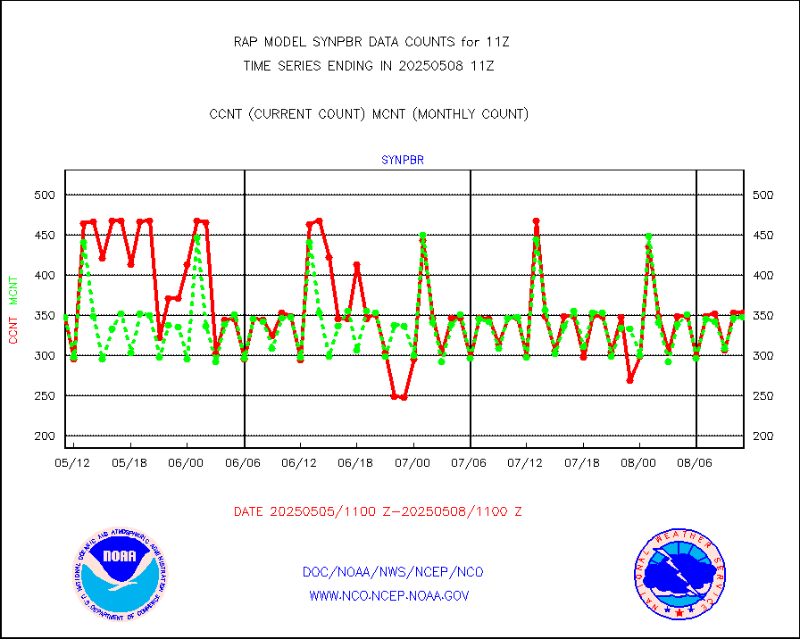
synpbr |
Synoptic - restricted (WMO Res 40)(decoded BUFR) |
346 |
347 |
99.7 % |
1910.50-1911.50 |
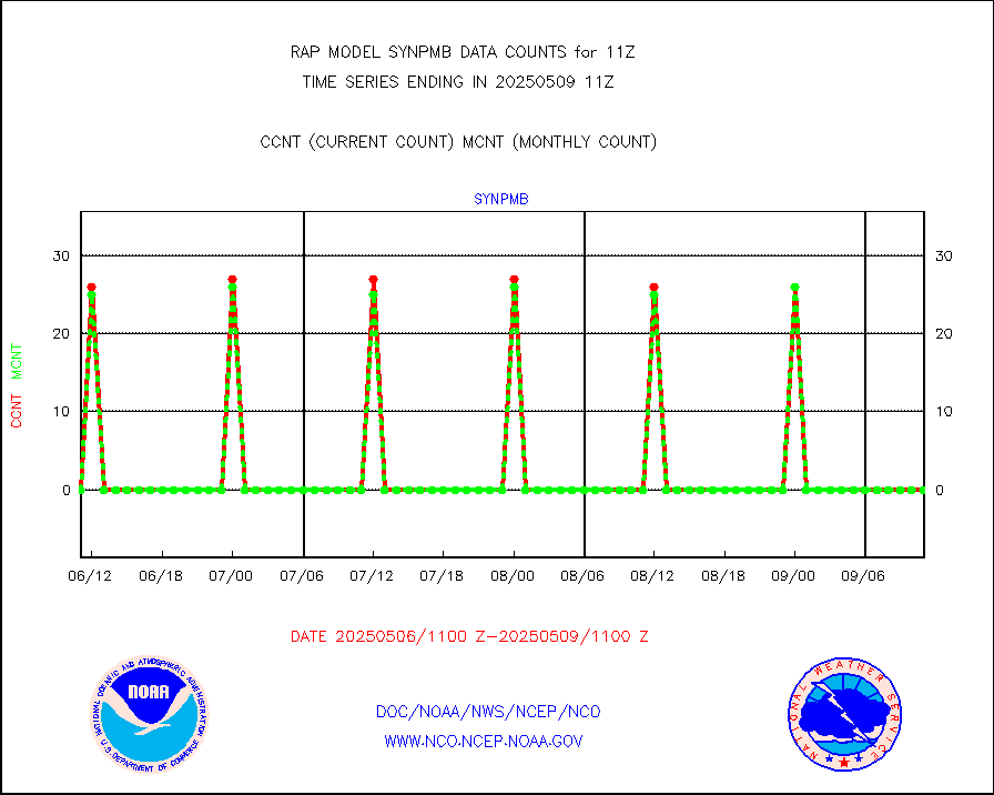
synpmb |
Synoptic - mobile manual & auto (decoded fr BUFR) |
0 |
0 |
n/a |
1910.50-1911.50 |
tmdara |
TAMDAR aircft data-all types(from Panasonic,BUFR) |
1187 |
1467 |
80.9 % |
1907.75-1914.25 |
visja |
MTSAT/JMA visible derived cloud motion |
73 |
43 |
169.8 % |
1908.50-1913.50 |
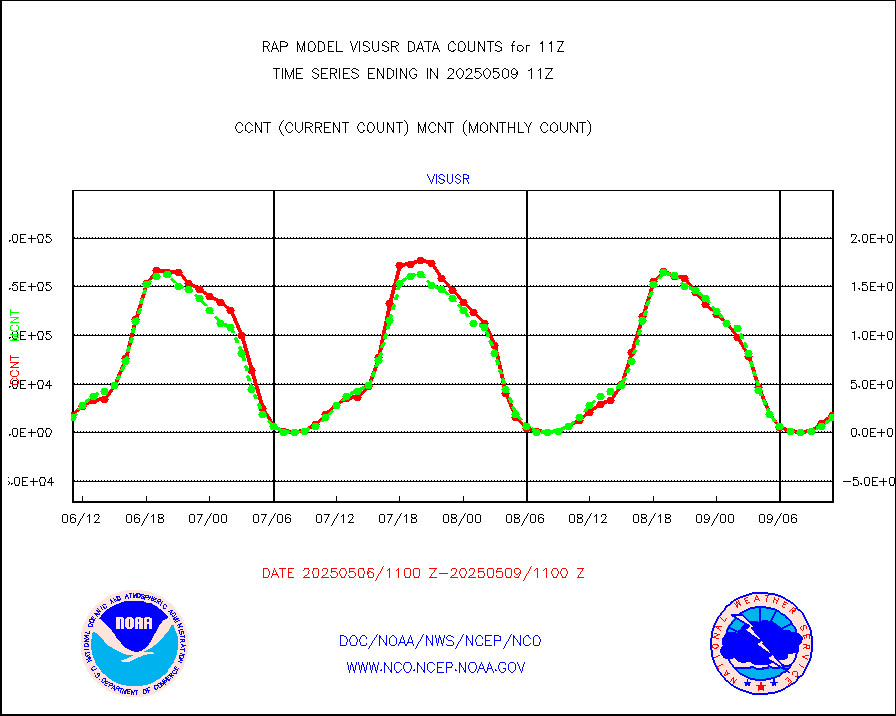
visusr |
GOES-16&up/NESDIS visible derived cloud motion |
11008 |
16248 |
67.7 % |
1910.00-1910.99 |
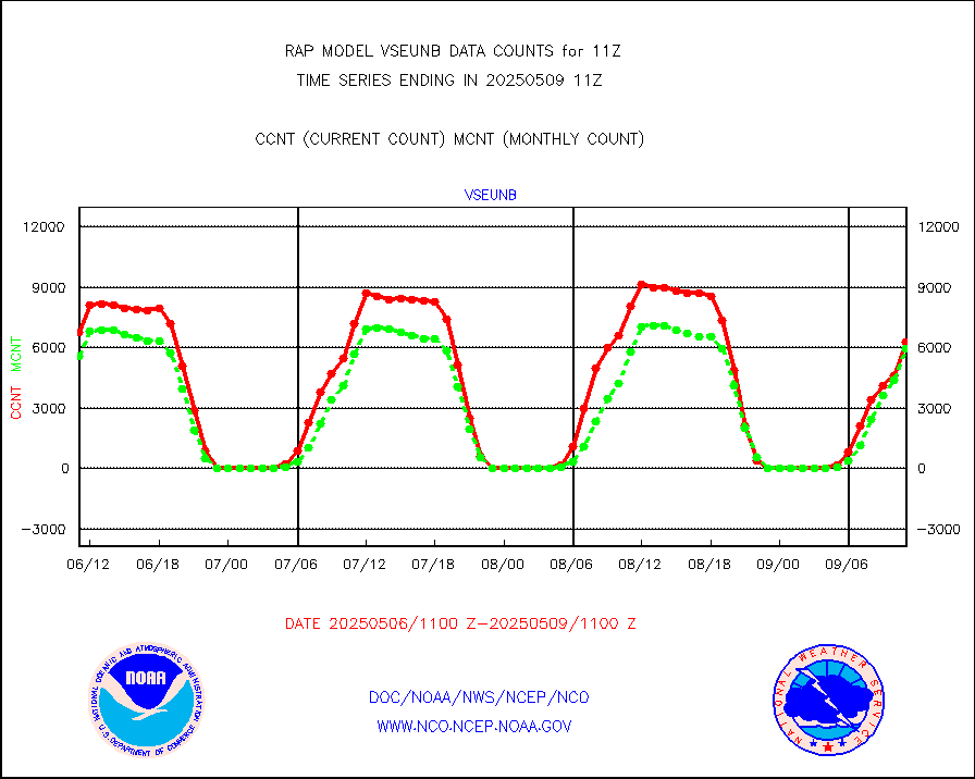
vseunb |
METEOSAT/EUMETSAT visible drv cld motion NBseq |
7005 |
6076 |
115.3 % |
1909.50-1912.49 |


