| Critical Data with Normal Counts |
|---|
| Type | Description | Hourly Count | Monthly Average | Percent (%) of Monthly Mean | UTC Time Window |
1bamua |
NOAA 15-19 & METOP 1-2 AMSU-A NCEP-proc. br.temps |
37368 |
38936 |
96.0 % |
1907.00-1912.99 |
1bhrs4 |
NOAA 18-19 & METOP 1-2 HIRS-4 NCEP-proc. br.temps |
35061 |
36229 |
96.8 % |
1907.00-1912.99 |
1bmhs |
NOAA 18-19 & METOP 1-2 MHS NCEP-proces. br. temps |
203802 |
224901 |
90.6 % |
1907.00-1912.99 |
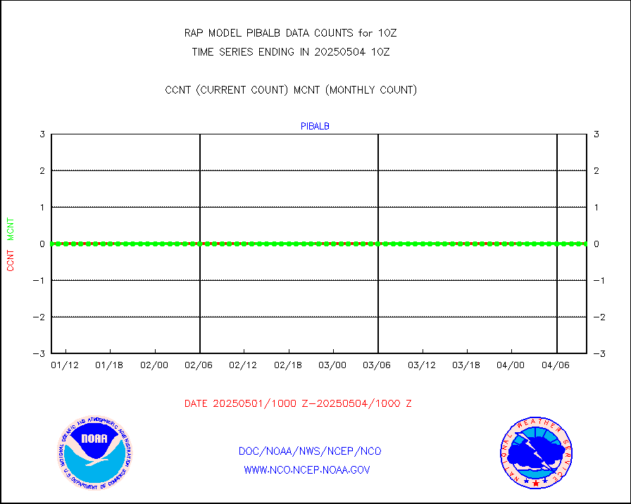
acars |
MDCRS ACARS acft data from ARINC(dcded from BUFR) |
11661 |
4710 |
247.6 % |
1906.75-1913.25 |
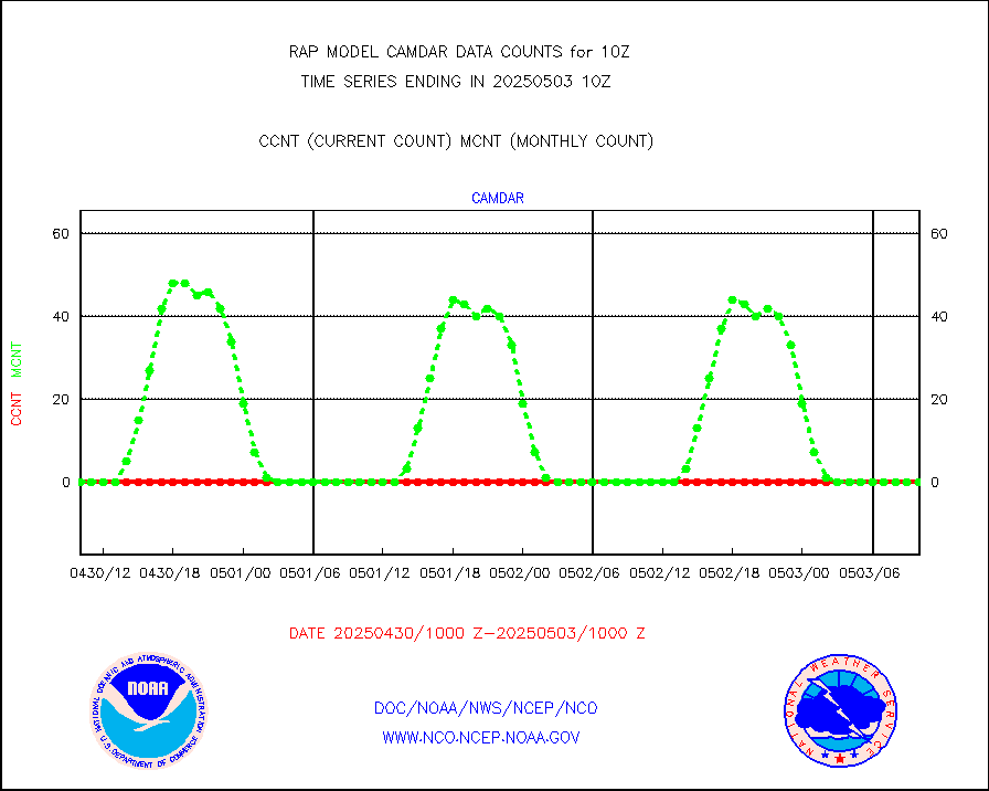
camdar |
Canadian AMDAR aircraft data (decoded from BUFR) |
0 |
0 |
n/a |
1906.75-1913.25 |
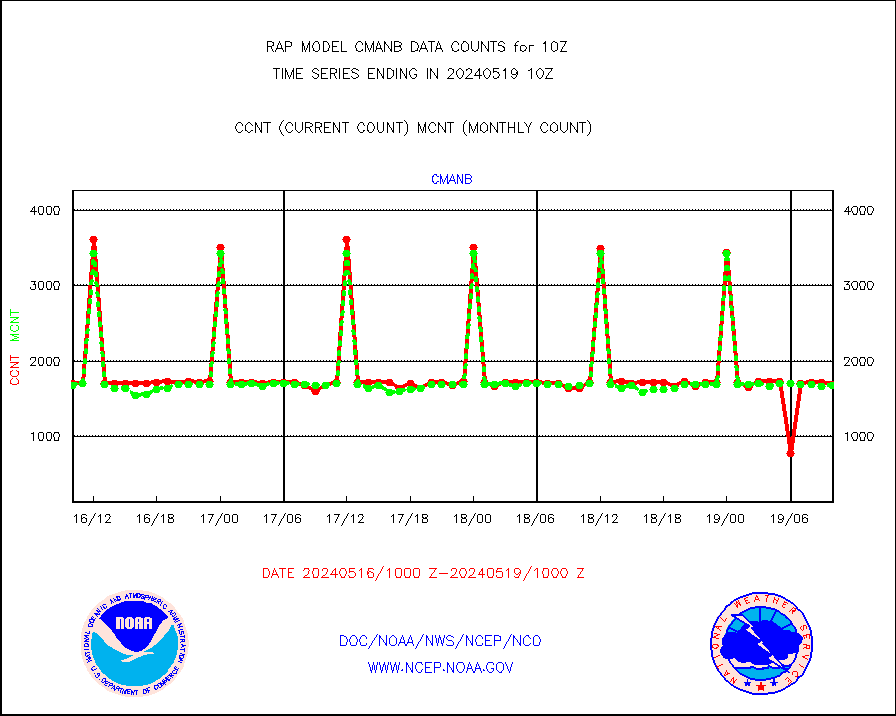
cmanb |
Surface Marine CMAN rpts decoded from BUFR format |
1691 |
1676 |
100.9 % |
1909.50-1910.50 |
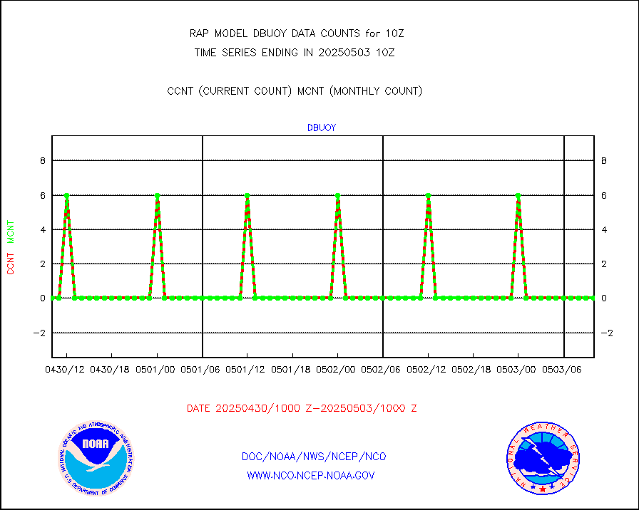
dbuoy |
Buoys decoded from FM-18 fmt (moored or drifting) |
0 |
0 |
n/a |
1909.50-1910.50 |
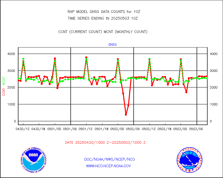
gnss |
Grnd-based Gbl Navigation Sat System (GNSS) data |
2529 |
2620 |
96.5 % |
1908.95-1909.05 |
h20mo |
MODIS (AQUA/TERRA) wvpr imager derived cld motion |
0 |
0 |
n/a |
1907.50-1912.50 |
infmo |
MODIS (AQUA/TERRA) ir l-wave derived cloud motion |
0 |
0 |
n/a |
1907.50-1912.50 |
lgycld |
GOES/NASA(Langley) hi-res. (1x1 f-o-v) cloud data |
3739518 |
3114904 |
120.1 % |
1909.50-1910.50 |
mbuoy |
Buoys decoded from FM-13 format (moored) |
88 |
54 |
163.0 % |
1909.50-1910.50 |
metar |
Aviation - METAR |
5904 |
5999 |
98.4 % |
1909.50-1910.50 |
nxrdw |
NEXRAD Vel Azm Dsp(VAD) winds via radar coded msg |
0 |
0 |
n/a |
1909.00-1911.00 |
prflrb |
Multi-Agency Profiler (MAP) and SODAR winds |
75 |
84 |
89.3 % |
1908.50-1911.50 |
raobf |
Rawinsonde - fixed land (from TEMP or PILOT) |
0 |
0 |
n/a |
1909.00-1911.00 |
rass |
RASS temperatures (NOAA and Multi-Agency) |
14 |
20 |
70.0 % |
1909.50-1910.50 |
shipsb |
Ship - manual and automatic, restricted (BUFR) |
0 |
0 |
n/a |
1909.50-1910.50 |
shipsu |
Ship - manual and automatic, unrestricted |
41 |
56 |
73.2 % |
1909.50-1910.50 |
shipub |
Ship - manual and automatic, unrestricted (BUFR) |
590 |
541 |
109.1 % |
1909.50-1910.50 |
synop |
Synoptic - fixed manual and automatic |
311 |
300 |
103.7 % |
1909.50-1910.50 |
synopb |
Synoptic - fixed manual & auto (decoded fr BUFR) |
1674 |
1676 |
99.9 % |
1909.50-1910.50 |
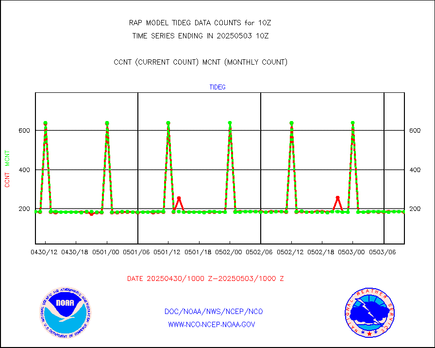
tideg |
Tide gauge reports decoded from CREX format |
182 |
180 |
101.1 % |
1909.50-1910.50 |
| Data Types of Opportunity with Normal Counts |
|---|
| Type | Description | Hourly Count | Monthly Average | Percent (%) of Monthly Mean | UTC Time Window |
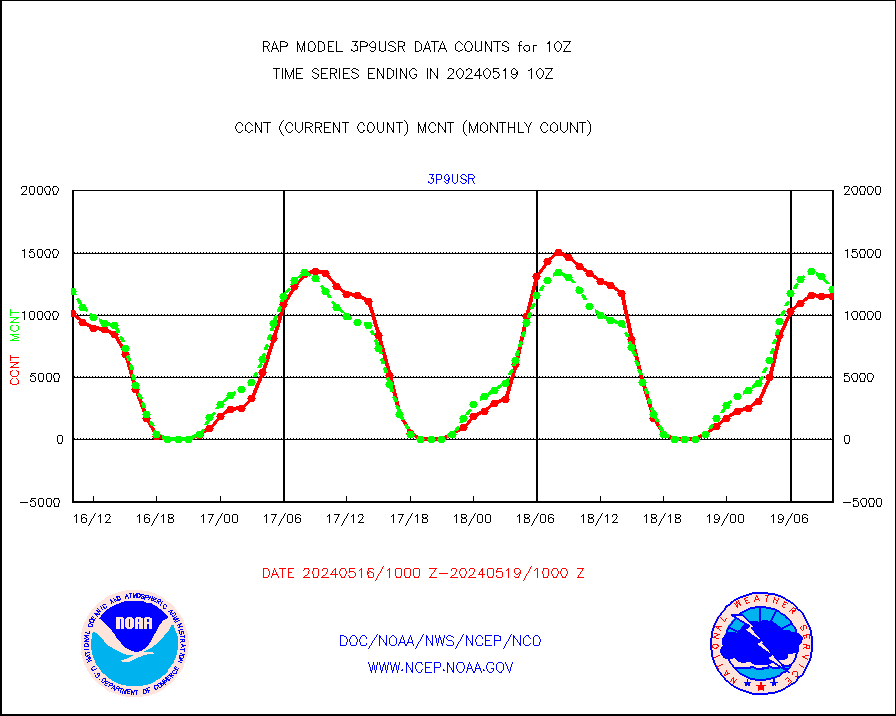
3p9usr |
GOES-16&up/NESDIS ir short-wv derived cld motion |
11528 |
12107 |
95.2 % |
1909.00-1909.99 |
acarsa |
MDCRS ACARS acft data (ARINC via AFWA)(AIREP fmt) |
0 |
0 |
n/a |
1906.75-1913.25 |
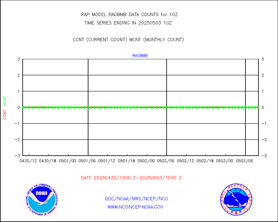
airep |
Manual AIREP aircraft data (dcded from AIREP fmt) |
3845 |
3276 |
117.4 % |
1906.75-1913.25 |
airsev |
AQUA AIRS/AMSU-A/HSB brightness temps- every FOV |
0 |
0 |
n/a |
1907.00-1912.99 |
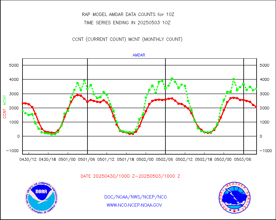
amdar |
AMDAR aircraft data (decoded from AMDAR format) |
2417 |
2069 |
116.8 % |
1906.75-1913.25 |
amdarb |
AMDAR aircraft data (decoded from BUFR) |
5904 |
5730 |
103.0 % |
1906.75-1913.25 |
amsr2 |
GCOM-W AMSR2 1B brightness temperatures |
979629 |
607177 |
161.3 % |
1907.00-1907.99 |
ascat |
METOP 1-2 ASCAT products |
17350 |
19138 |
90.7 % |
1908.00-1912.00 |
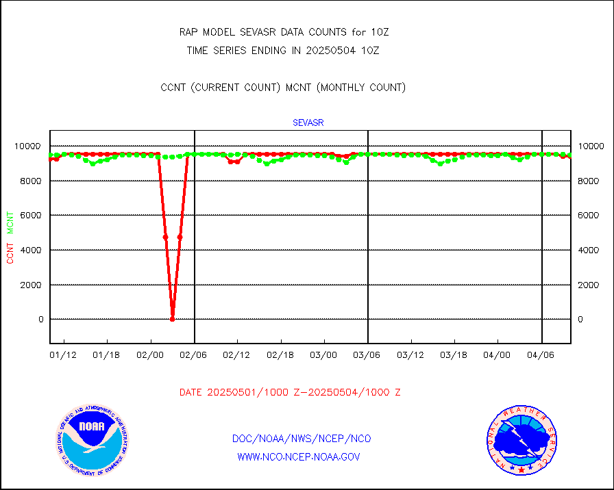
atms |
NPP/NOAA-20 ATMS brightness temperatures |
142984 |
145774 |
98.1 % |
1908.00-1911.99 |
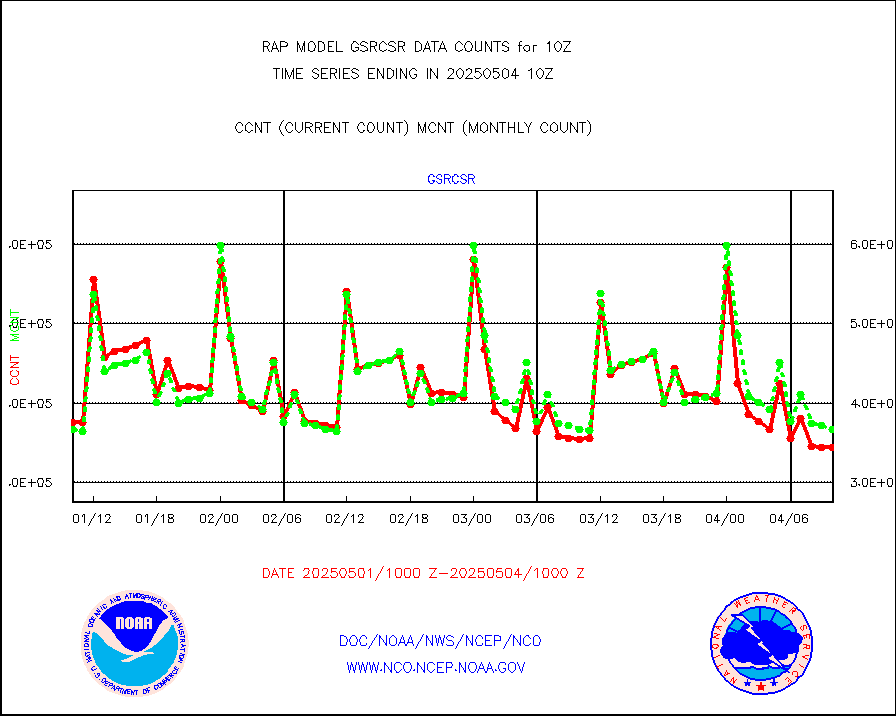
atmsdb |
NPP/NOAA-20 ATMS bright. temps-direct b-cast SSEC |
94944 |
110612 |
85.8 % |
1908.00-1911.99 |
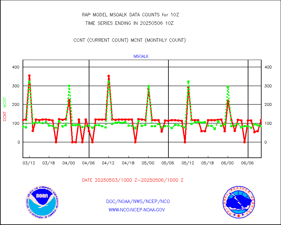
coopmd |
Coop/MADIS NEPP & HCN-Modernization NOAA COOP Obs |
27 |
27 |
100.0 % |
1909.50-1910.50 |
crisf4 |
NPP/NOAA-20 CrIS full spctrl radn (431 ch subset) |
74819 |
92700 |
80.7 % |
1908.00-1911.99 |
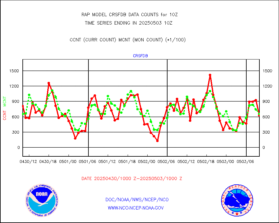
crsfdb |
NPP/NOAA-20 CrIS full spctrl radn dir brdcst SSEC |
101433 |
112097 |
90.5 % |
1908.00-1911.99 |
cstgd |
Coast Guard |
3 |
3 |
100.0 % |
1909.50-1910.50 |
dbuoyb |
Drifting buoys (decoded from BUFR) |
604 |
580 |
104.1 % |
1909.50-1910.50 |
dropw |
Dropwinsonde (from TEMP DROP) |
0 |
0 |
n/a |
1909.00-1911.00 |
eadas |
E-AMDAR (European AMDAR acft decoded from BUFR) |
9046 |
8912 |
101.5 % |
1906.75-1913.25 |
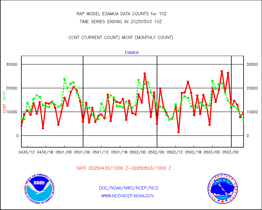
esamua |
NOAA 15-19 & METOP 1-2 AMSU-A proc btmps frm RARS |
6874 |
7587 |
90.6 % |
1909.00-1911.00 |
esatms |
NPP Adv. Tech. MW Sndr (ATMS) br. temps from RARS |
77252 |
92585 |
83.4 % |
1908.00-1911.99 |
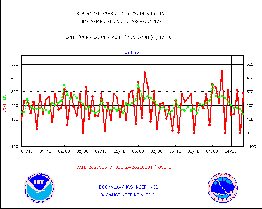
eshrs3 |
NOAA 15-19 & METOP 1-2 HIRS-3/4 pr btmps frm RARS |
17288 |
20887 |
82.8 % |
1909.00-1911.00 |
esiasi |
METOP 1-2 IASI 1C radiance data vbl chn from RARS |
27385 |
31641 |
86.5 % |
1908.00-1911.99 |
esmhs |
NOAA 18-19 & METOP 1-2 MHS proc. btemps from RARS |
16765 |
52330 |
32.0 % |
1909.00-1911.00 |
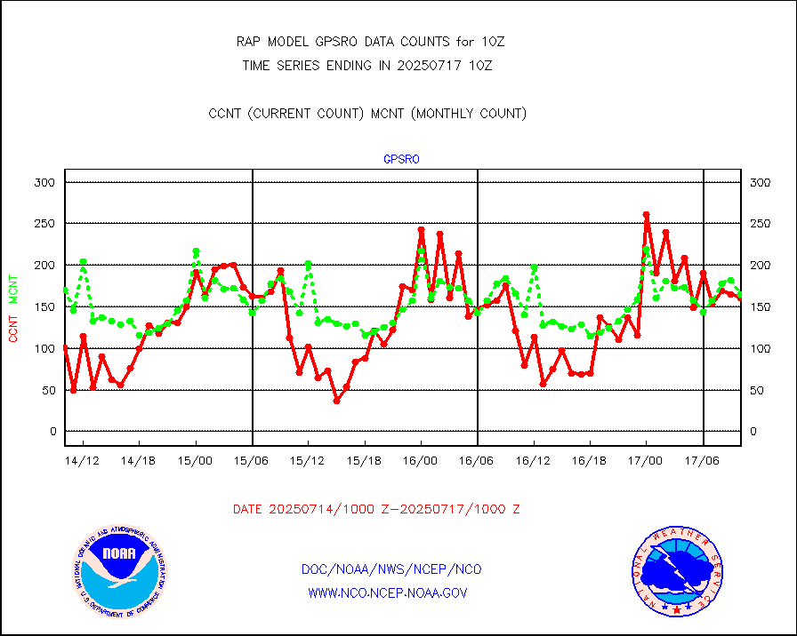
gpsro |
GPS radio occultation data |
148 |
118 |
125.4 % |
1908.00-1911.99 |
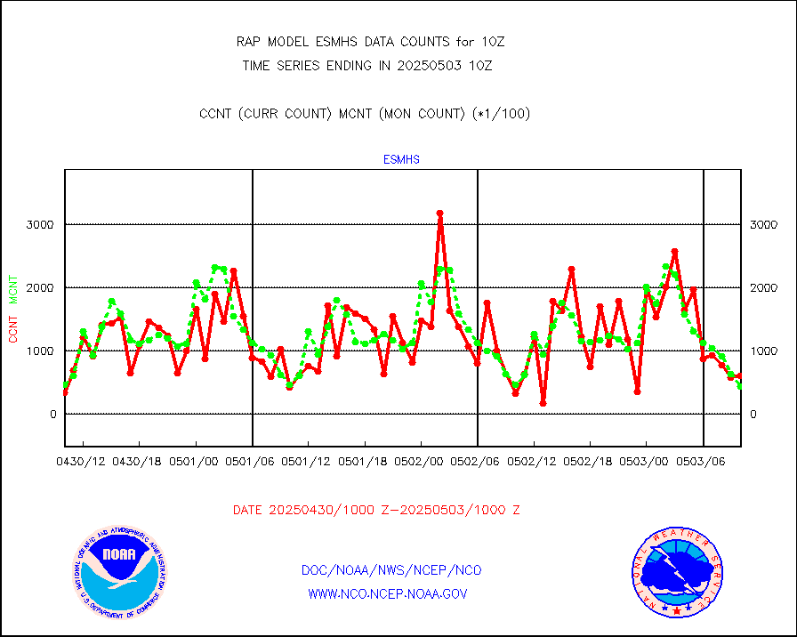
gsrasr |
GOES-16/17 All Sky Radiances (proc.) |
812097 |
812065 |
100.0 % |
1908.00-1911.99 |
gsrcsr |
GOES-16/17 Clear Sky Radiances (proc.) |
341460 |
362717 |
94.1 % |
1908.00-1911.99 |
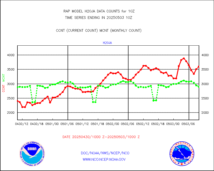
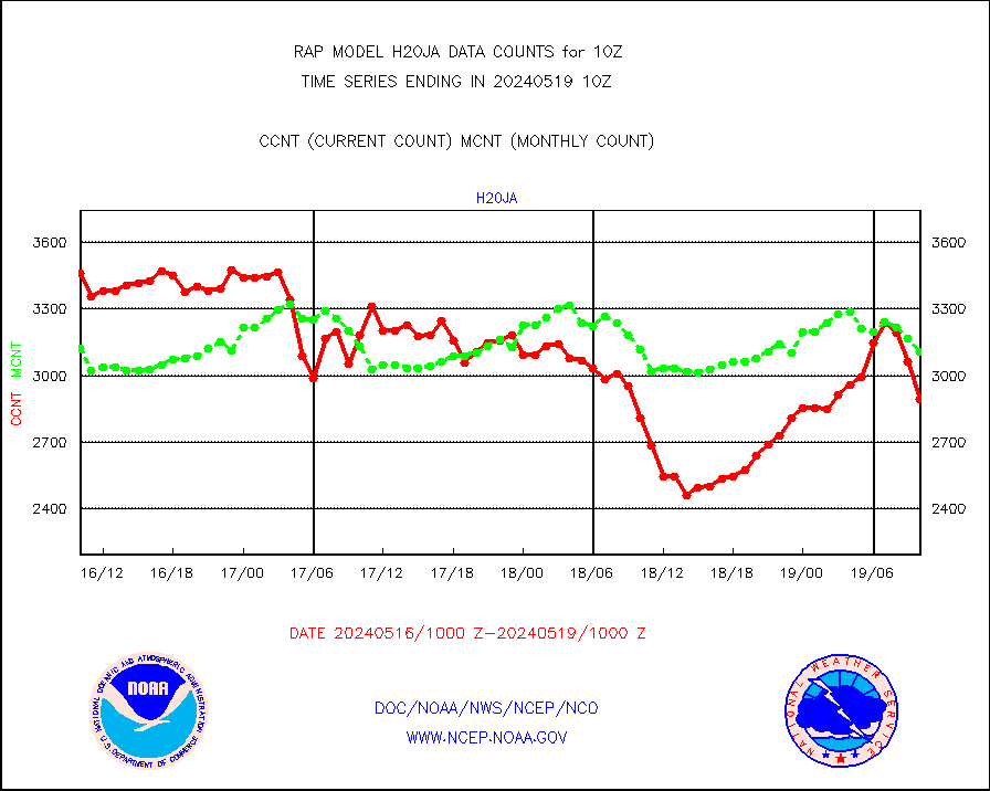
h20ja |
MTSAT/JMA water vapor imager derived cloud motion |
2895 |
3106 |
93.2 % |
1907.50-1912.50 |
h2dusr |
GOES-16&up/NESDIS wv imgr/deep-lyr derivd cld mtn |
7286 |
6965 |
104.6 % |
1909.00-1909.99 |
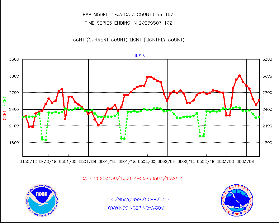
h2eunb |
METEOSAT/EUMETSAT wvpr imgr drv cld motion NBseq |
5251 |
5123 |
102.5 % |
1908.50-1911.49 |
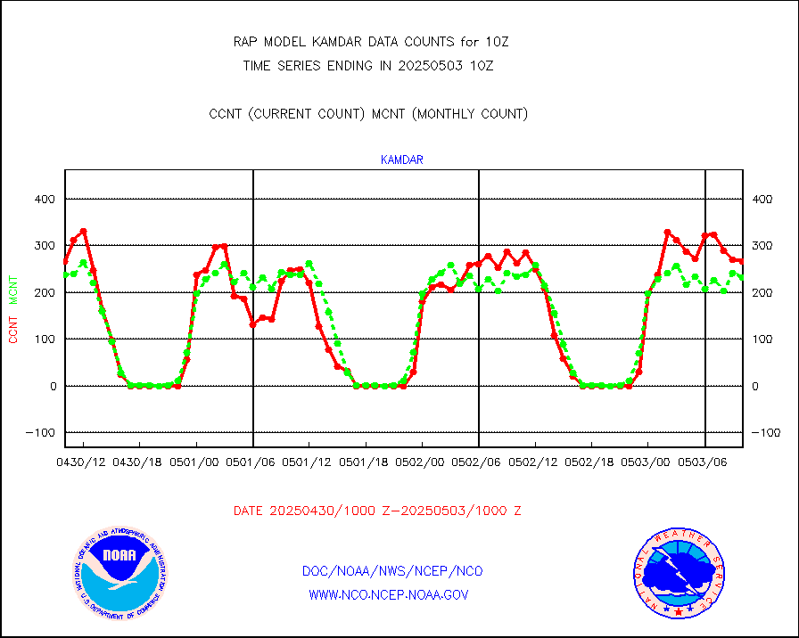
h2tusr |
GOES-16&up/NESDIS wv imgr/cld-top derived cld mtn |
10949 |
10851 |
100.9 % |
1909.00-1909.99 |
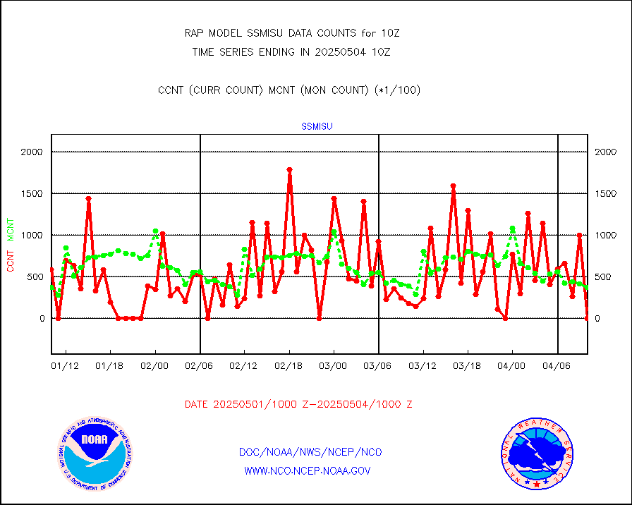
iasidb |
METOP 1-2 IASI 1C radiances-direct broadcast SSEC |
10810 |
20874 |
51.8 % |
1908.00-1911.99 |
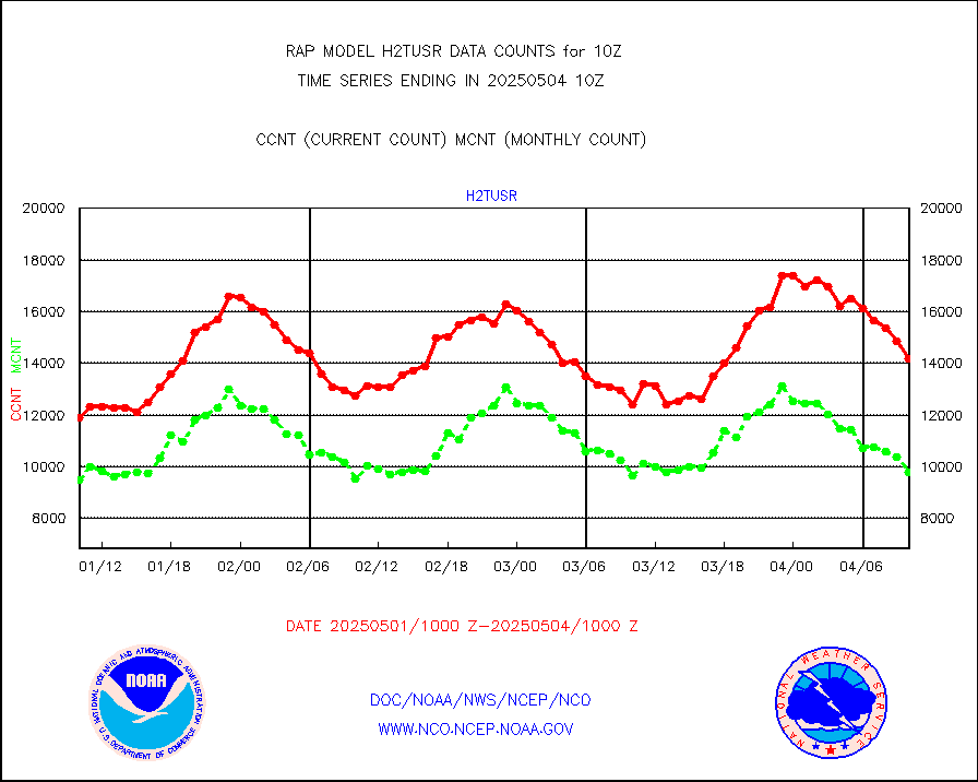
ifeunb |
METEOSAT/EUMETSAT ir lg-wave drv cld motion NBseq |
3281 |
3235 |
101.4 % |
1908.50-1911.49 |
ifvrnb |
VIIRS (NPP/NOAA-20) ir lg-wv drv cloud motion(NB) |
0 |
0 |
n/a |
1907.50-1912.50 |
infav |
AVHRR (NOAA/METOP) ir lg-wave derived cld motion |
0 |
0 |
n/a |
1907.50-1912.50 |
infav1 |
AVHRR (METOP) ir lg-wave derived cld motion |
0 |
0 |
n/a |
1908.50-1911.49 |
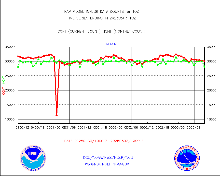
infja |
MTSAT/JMA infrared long-wave derived cloud motion |
2421 |
2527 |
95.8 % |
1907.50-1912.50 |
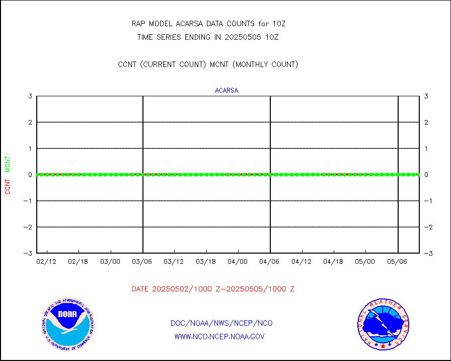
infusr |
GOES-16&up/NESDIS ir long-wave derived cld motion |
28044 |
28841 |
97.2 % |
1909.00-1909.99 |
kamdar |
Korean AMDAR aircraft data (decoded from BUFR) |
117 |
234 |
50.0 % |
1906.75-1913.25 |
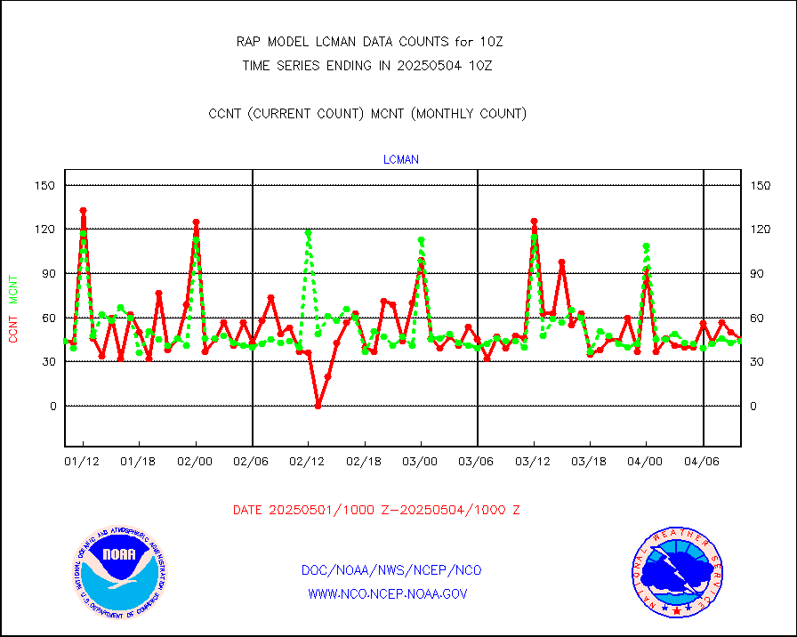
lcman |
Land-based CMAN stations decoded from CMAN format |
41 |
69 |
59.4 % |
1909.50-1910.50 |
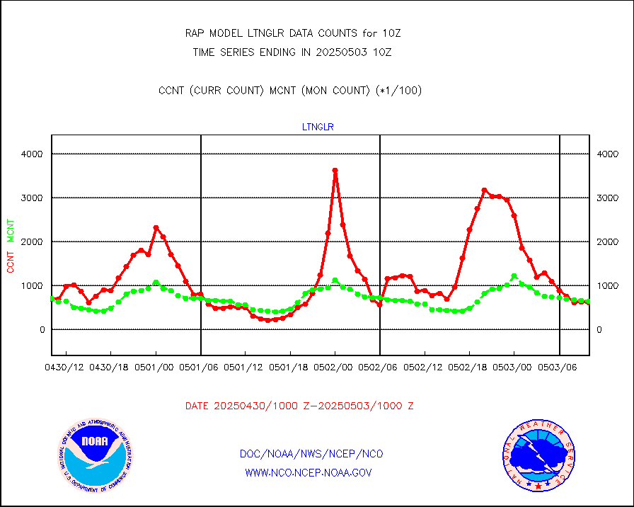
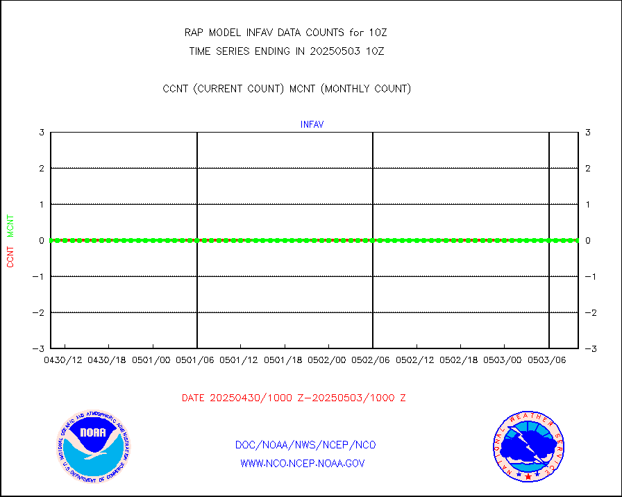
ltnglr |
LLDN Long-rng lightning from Vaisala via NOAAPORT |
91701 |
80602 |
113.8 % |
1909.00-1910.50 |
ltngsr |
NLDN Shrt-rng lightning from Vaisala via NOAAPORT |
5323 |
4449 |
119.6 % |
1909.00-1910.50 |
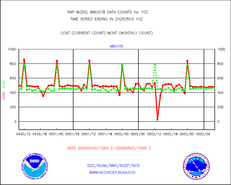
mbuoyb |
Moored buoys (decoded from BUFR) |
598 |
553 |
108.1 % |
1909.50-1910.50 |
mso470 |
Mesonet/MADIS Colorado E-470 (Interstate 470) |
21 |
18 |
116.7 % |
1909.50-1910.50 |
msoalk |
Mesonet/MADIS Alaska Department of Transportation |
107 |
100 |
107.0 % |
1909.50-1910.50 |
msoapg |
Mesonet/MADIS U.S. Army Aberdeen Proving Grounds |
0 |
0 |
n/a |
1909.50-1910.50 |
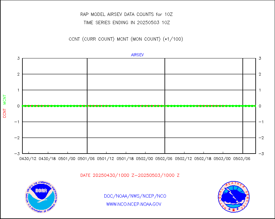
msoapr |
Mesonet/MADIS Citizen Weather Observers Program |
43117 |
45583 |
94.6 % |
1909.50-1910.50 |
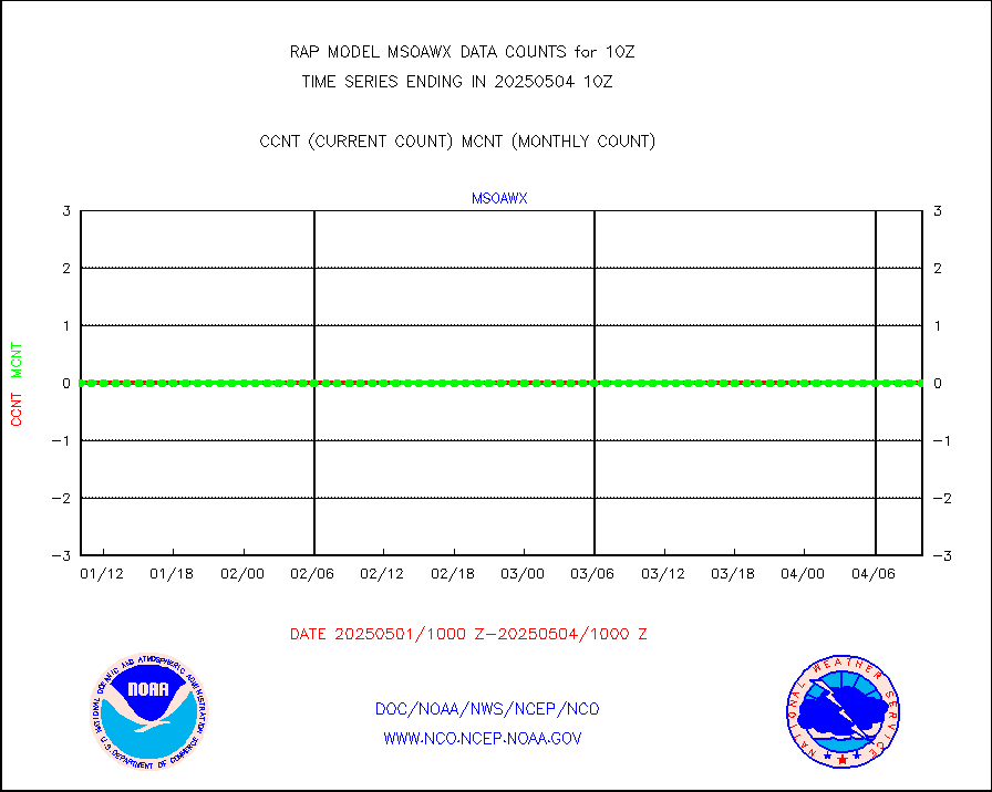
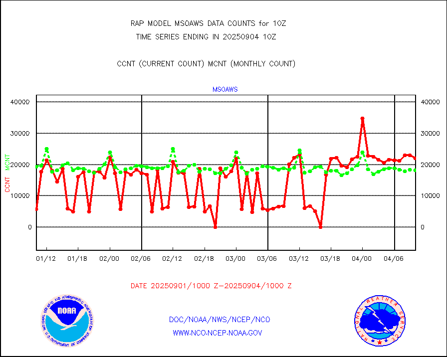
msoaws |
Mesonet/MADIS AWS Convergence Technologies, Inc. |
23880 |
25503 |
93.6 % |
1909.50-1910.50 |
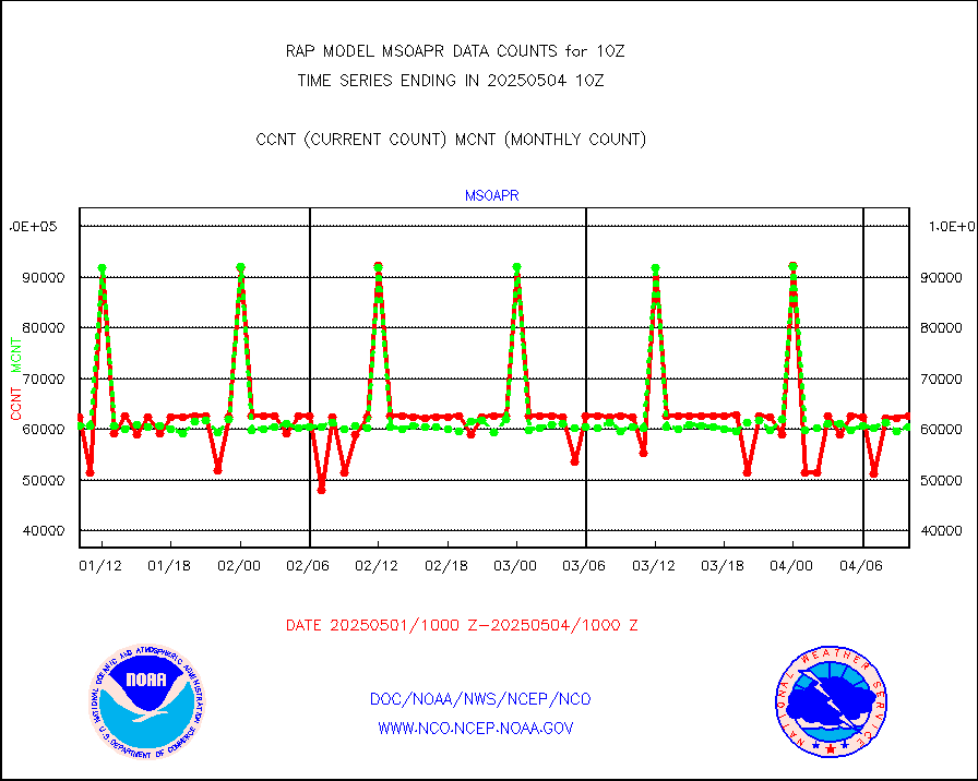
msoawx |
Mesonet/MADIS "Anything Weather" |
0 |
0 |
n/a |
1909.50-1910.50 |
msocol |
Mesonet/MADIS Colorado Dept. of Transportation |
0 |
0 |
n/a |
1909.50-1910.50 |
msodcn |
Mesonet/MADIS DC Net |
0 |
0 |
n/a |
1909.50-1910.50 |
msoden |
Mesonet/MADIS Denver Urban Drainage & Flood Cntrl |
225 |
216 |
104.2 % |
1909.50-1910.50 |
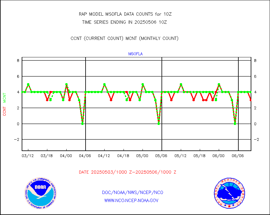
msofla |
Mesonet/MADIS Florida (FAWN & USF) |
3 |
3 |
100.0 % |
1909.50-1910.50 |
msoflt |
Mesonet/MADIS Florida Dept. of Transportation |
0 |
0 |
n/a |
1909.50-1910.50 |
msogeo |
Mesonet/MADIS Georgia Dept. of Transportation |
0 |
0 |
n/a |
1909.50-1910.50 |
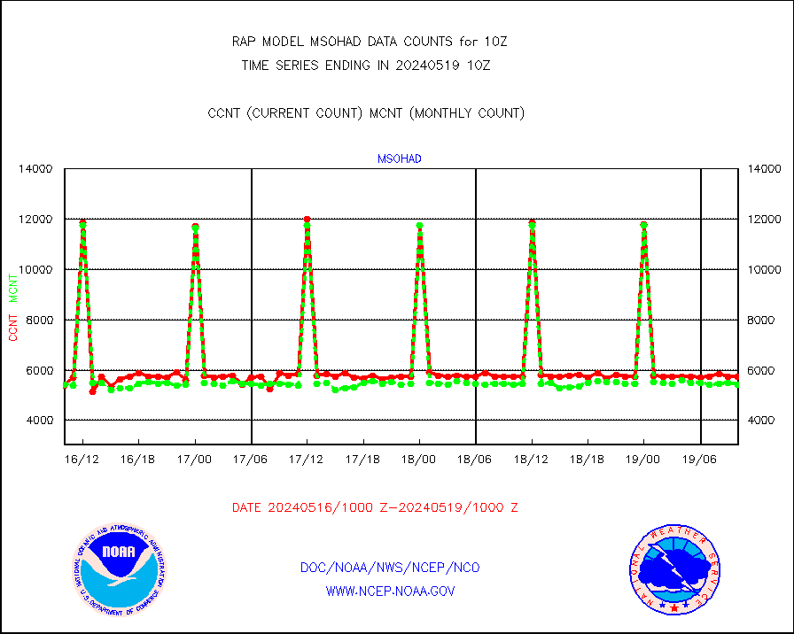
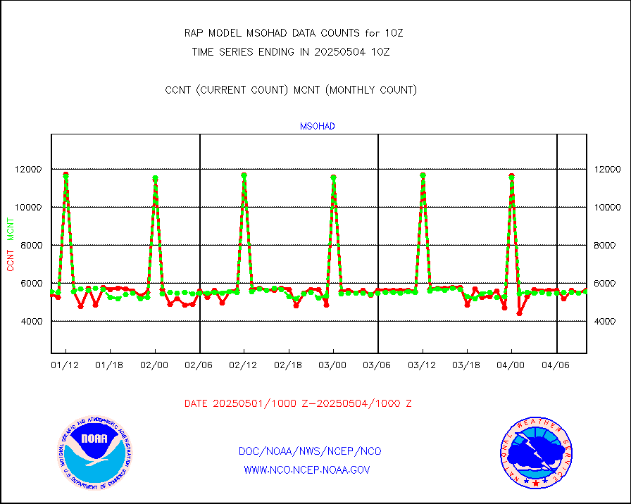
msohad |
Mesonet/MADIS NWS Hydromet Auto Data System(HADS) |
5728 |
5432 |
105.4 % |
1909.50-1910.50 |
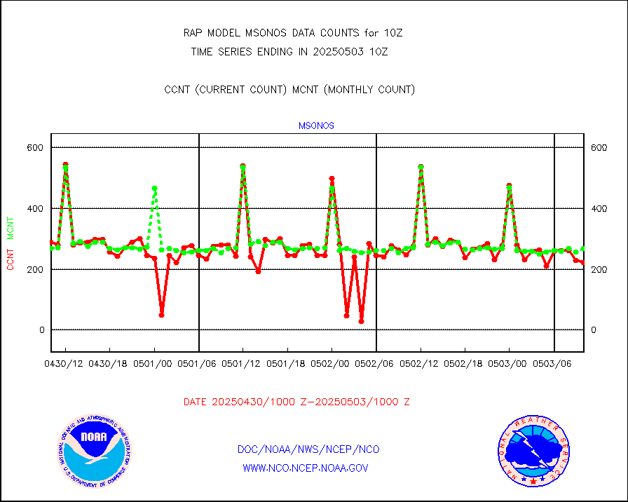
msoien |
Mesonet/MADIS Iowa Environmental |
164 |
163 |
100.6 % |
1909.50-1910.50 |
msoind |
Mesonet/MADIS Indiana Dept. of Transportation |
0 |
0 |
n/a |
1909.50-1910.50 |
msoiow |
Mesonet/MADIS Iowa Department of Transportation |
0 |
0 |
n/a |
1909.50-1910.50 |
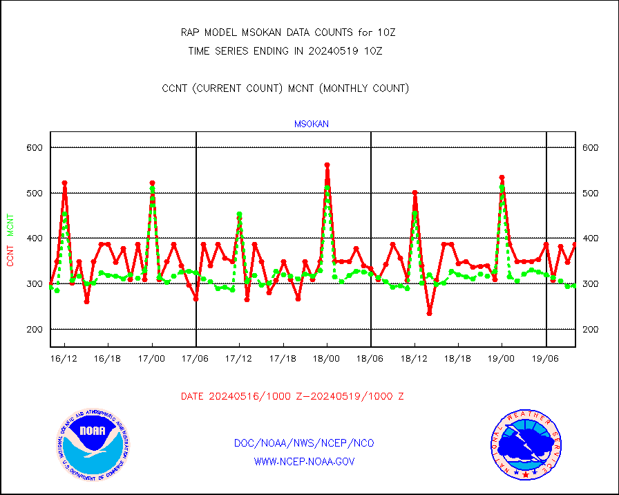
msokan |
Mesonet/MADIS Kansas Department of Transportation |
387 |
295 |
131.2 % |
1909.50-1910.50 |
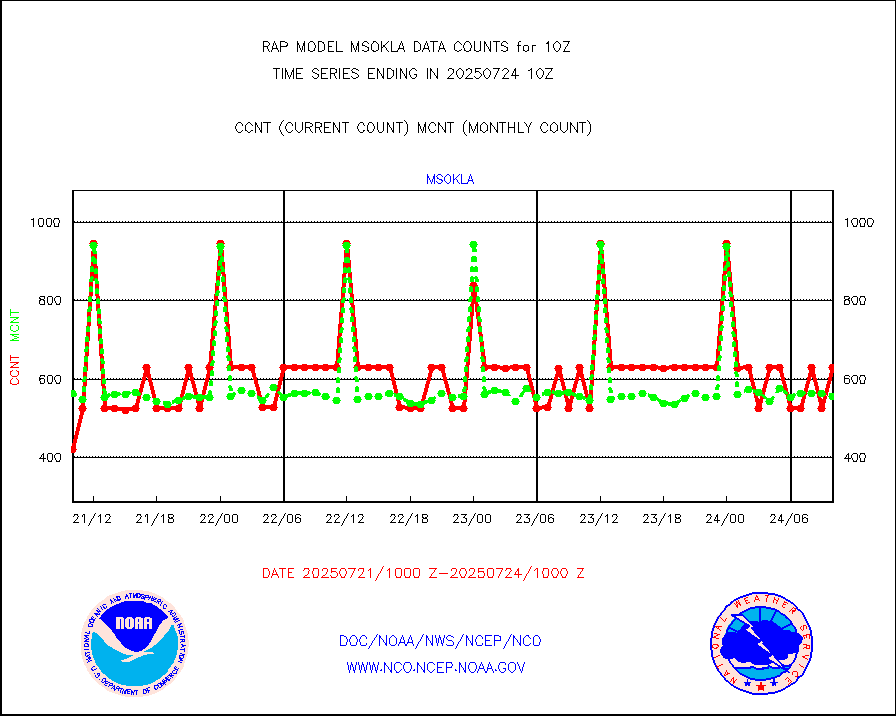
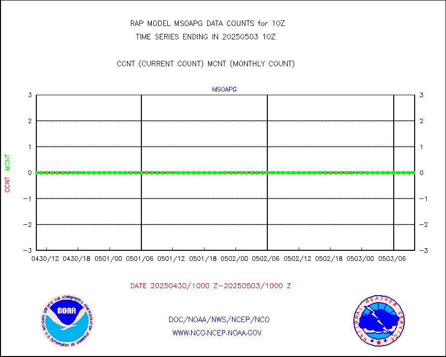
msokla |
Mesonet/MADIS Oklahoma Mesonet |
318 |
318 |
100.0 % |
1909.50-1910.50 |
msolju |
Mesonet/MADIS Louisiana State/Jackson State Univ. |
0 |
0 |
n/a |
1909.50-1910.50 |
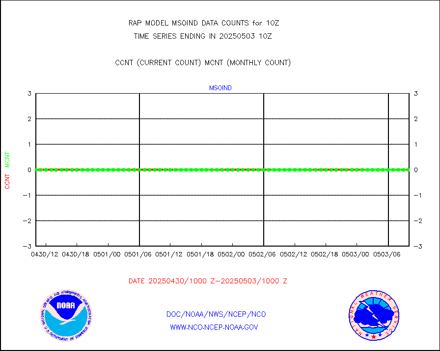
msomca |
Mesonet/MADIS Missouri Commercial Agricult Wx Net |
263 |
260 |
101.2 % |
1909.50-1910.50 |
msomin |
Mesonet/MADIS Minnesota Dept. of Transportation |
0 |
0 |
n/a |
1909.50-1910.50 |
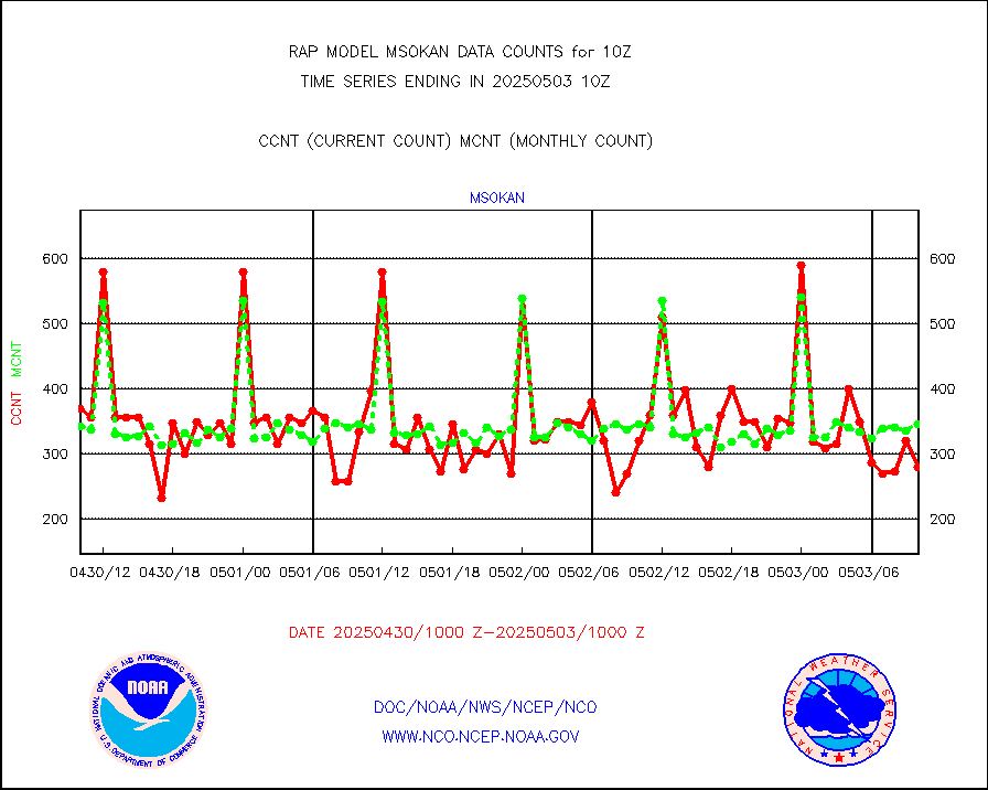
msonos |
Mesonet/MADIS NOS-Phys Oceanographic Realtime Sys |
294 |
285 |
103.2 % |
1909.50-1910.50 |
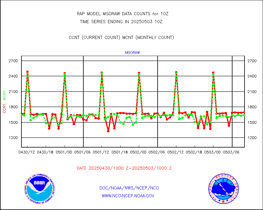
msoraw |
Mesonet/MADIS NFIC Remote Automated Wx Stns(RAWS) |
1717 |
1502 |
114.3 % |
1909.50-1910.50 |
msourb |
Mesonet/MADIS UrbaNet |
3924 |
3934 |
99.7 % |
1909.50-1910.50 |
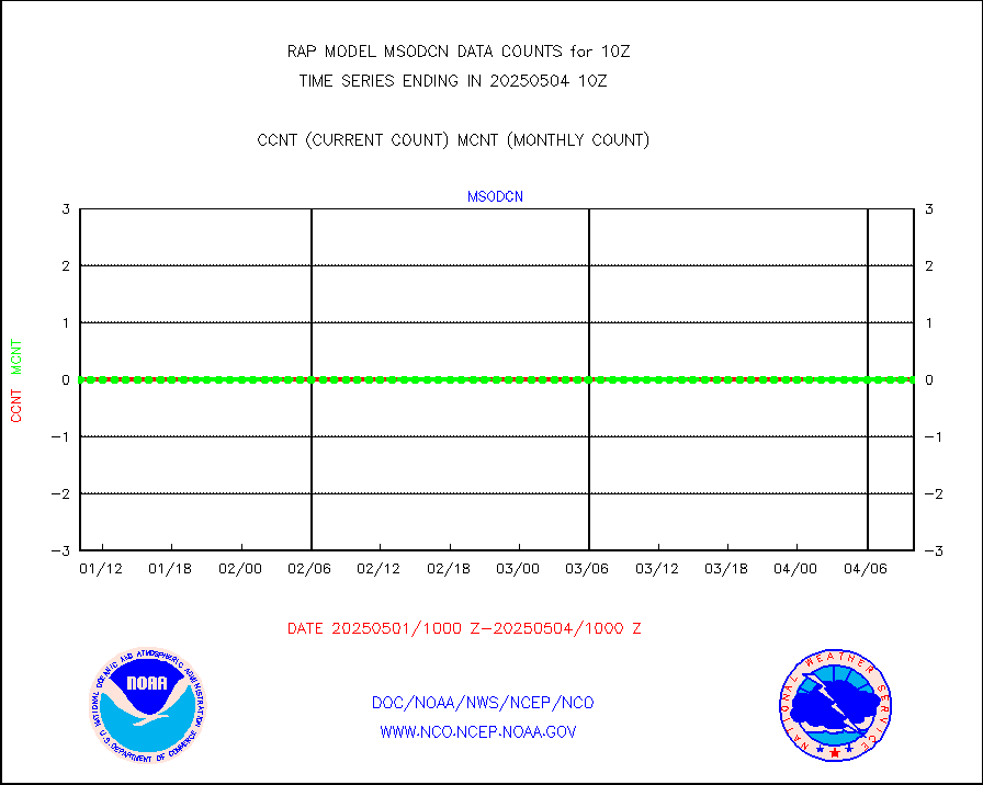
msovir |
Mesonet/MADIS Virginia Dept. of Transportation |
207 |
225 |
92.0 % |
1909.50-1910.50 |
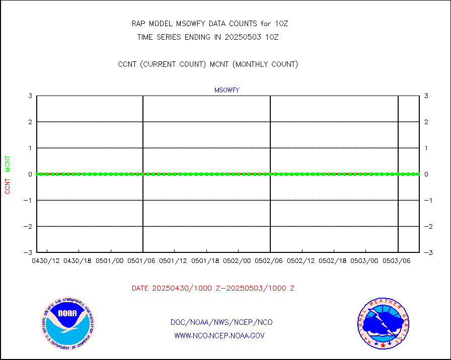
msowfy |
Mesonet/MADIS "Weather for You" |
0 |
0 |
n/a |
1909.50-1910.50 |
msowis |
Mesonet/MADIS Wisconsin Dept. of Transportation |
0 |
0 |
n/a |
1909.50-1910.50 |
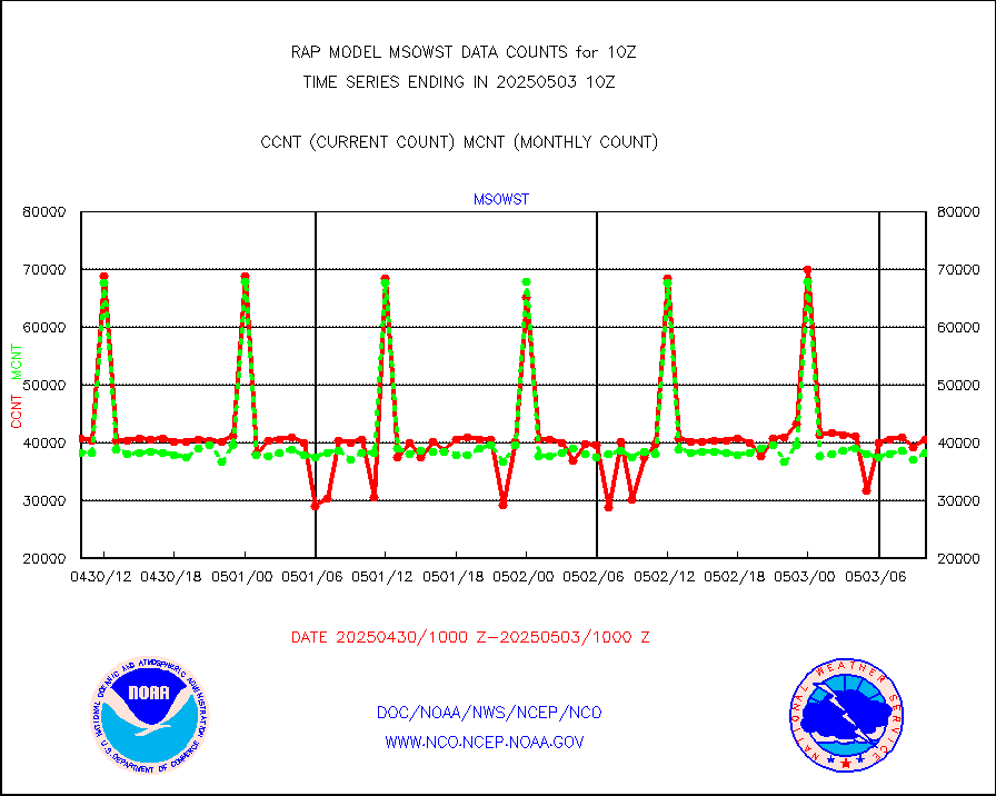
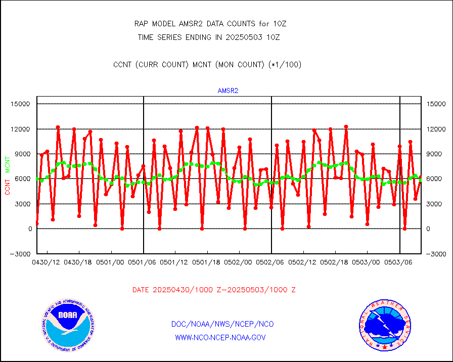
msowst |
Mesonet/MADIS MesoWest (many subproviders) |
41371 |
39247 |
105.4 % |
1909.50-1910.50 |
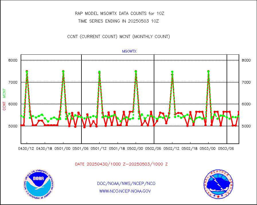
msowtx |
Mesonet/MADIS West Texas |
4962 |
4798 |
103.4 % |
1909.50-1910.50 |
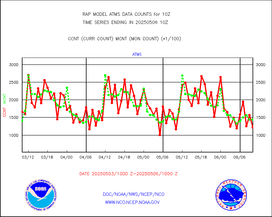
mtiasi |
METOP 1-2 IASI 1C radiance data (varbl. channels) |
36072 |
29816 |
121.0 % |
1908.00-1911.99 |
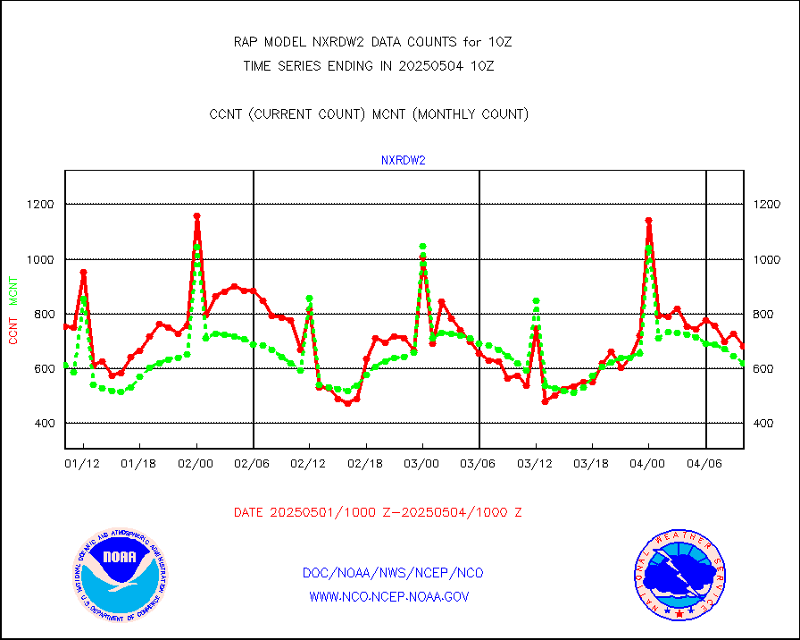
nxrdw2 |
NEXRAD Vel Azm Dsp(VAD) winds via Level 2 decoder |
823 |
730 |
112.7 % |
1909.00-1911.00 |
osbuv8 |
NOAA 16-19 Solar Backscatter UV-2 rad frm V8 BUFR |
0 |
0 |
n/a |
1908.00-1910.99 |
pibal |
PIBAL (from PILOT, PILOT SHIP, PILOT MOBIL) |
0 |
0 |
n/a |
1909.00-1911.00 |
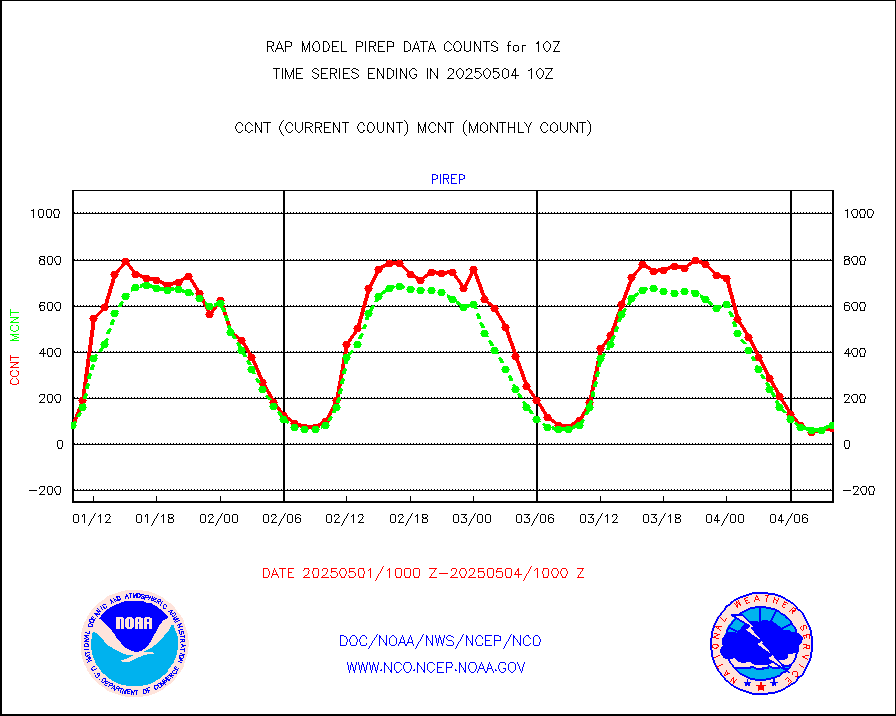
pirep |
Manual PIREP aircraft data (dcded from AIREP fmt) |
56 |
70 |
80.0 % |
1906.75-1913.25 |
prflrp |
Profilr winds from PIBAL (PILOT,PILOT SHIP/MOBIL) |
0 |
0 |
n/a |
1908.50-1911.50 |
raobm |
Rawinsonde - mobile land (from TEMP/PILOT MOBIL) |
0 |
0 |
n/a |
1909.00-1911.00 |
raobs |
Rawinsonde - ship (from TEMP SHIP, PILOT SHIP) |
0 |
0 |
n/a |
1909.00-1911.00 |
rd2wnd |
NEXRAD radial wind (Level 2 - GTS) |
831820 |
866023 |
96.1 % |
1909.50-1910.49 |
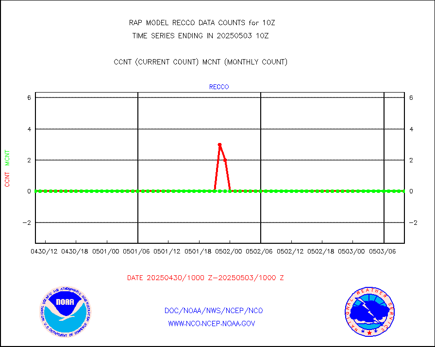
recco |
Flight level reconnaissance aircraft data |
0 |
0 |
n/a |
1909.00-1911.00 |
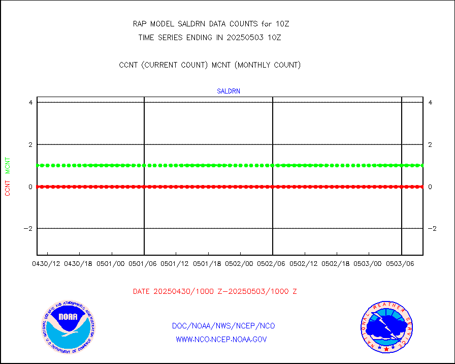
saldrn |
Surface Marine Saildrone (decoded from BUFR) |
2 |
2 |
100.0 % |
1908.00-1911.99 |
saphir |
Megha-Tropiques SAPHIR L1A2 brightness temps |
0 |
0 |
n/a |
1907.00-1912.99 |
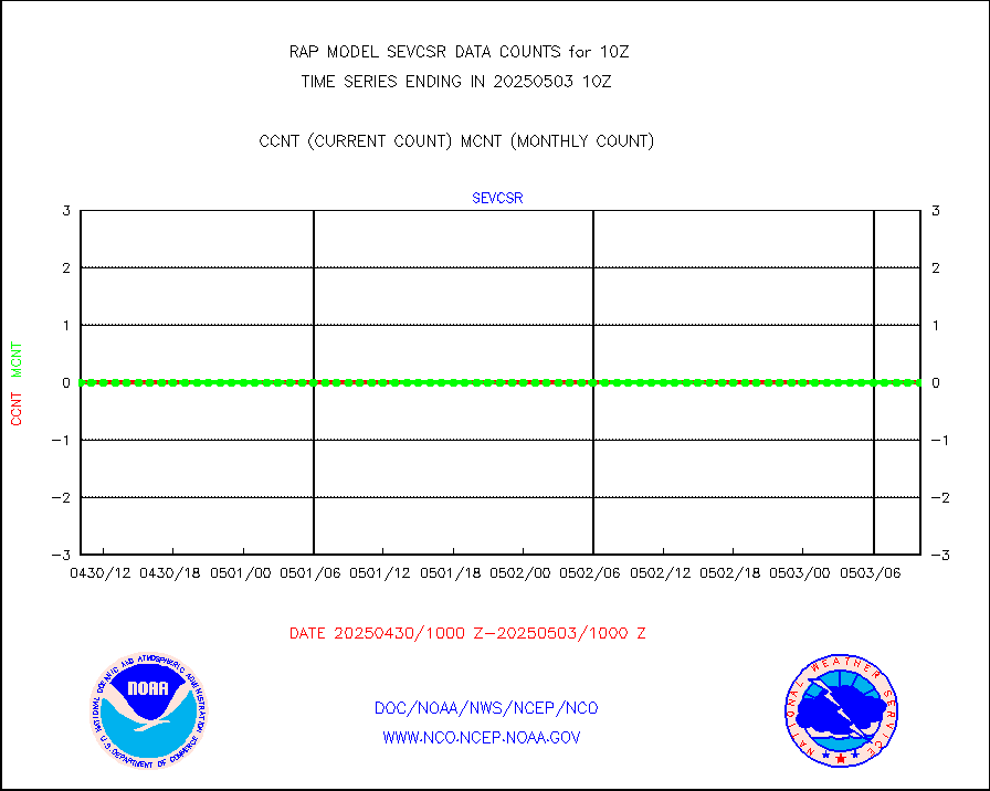
sevasr |
METEOSAT-10 2nd Gen SEVIRI All Sky Radiance(proc) |
9512 |
9496 |
100.2 % |
1908.00-1911.99 |
sevcsr |
METEOSAT-10 2nd Gen SEVIRI Clr Sky Radiance(proc) |
0 |
0 |
n/a |
1908.00-1911.99 |
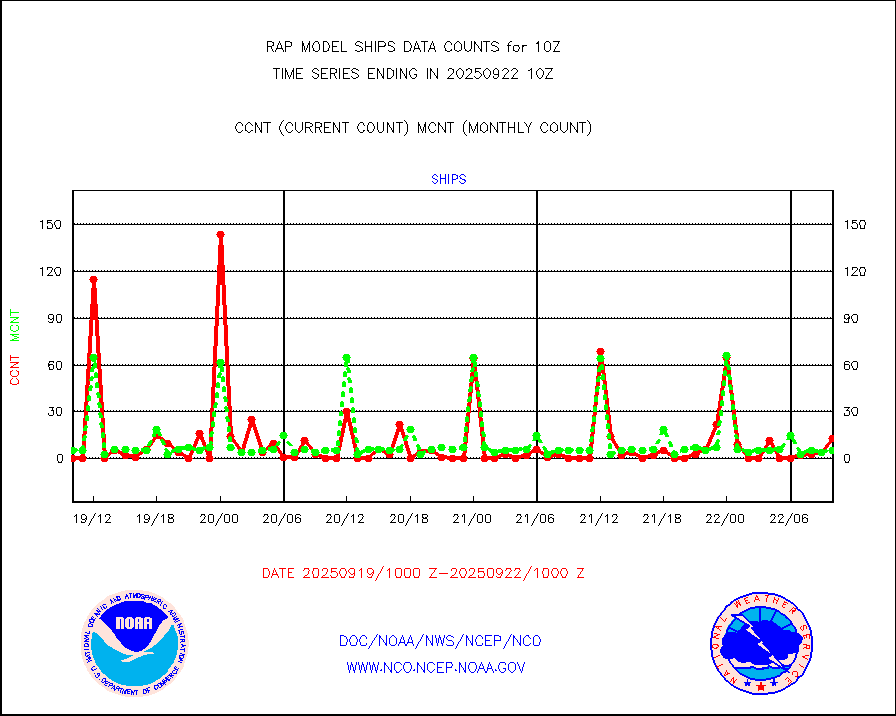
ships |
Ship - manual and automatic, restricted |
19 |
3 |
633.3 % |
1909.50-1910.50 |
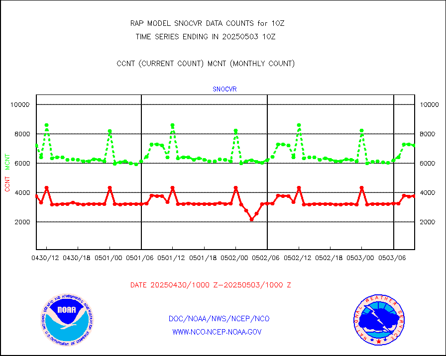
snocvr |
NOW COVER, DEPTH/DENSITY AND WATER EQUIVALENT |
4081 |
7468 |
54.6 % |
1908.00-1912.00 |
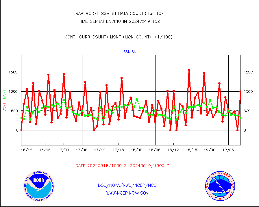
ssmisu |
DMSP SSM/IS 1C radiance data (Unified Pre-Proc.) |
100485 |
32158 |
312.5 % |
1908.00-1911.99 |
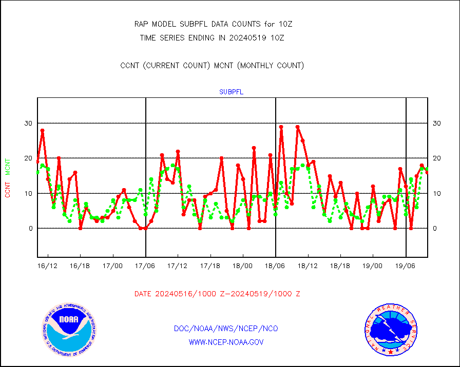
subpfl |
Sub-surface float and glider profile (BUFR) |
16 |
17 |
94.1 % |
1908.00-1911.99 |
synopr |
Synoptic - restricted (WMO Res 40) manual & auto. |
0 |
0 |
n/a |
1909.50-1910.50 |
synpbr |
Synoptic - restricted (WMO Res 40)(decoded BUFR) |
344 |
344 |
100.0 % |
1909.50-1910.50 |
synpmb |
Synoptic - mobile manual & auto (decoded fr BUFR) |
0 |
0 |
n/a |
1909.50-1910.50 |
tmdara |
TAMDAR aircft data-all types(from Panasonic,BUFR) |
1160 |
1455 |
79.7 % |
1906.75-1913.25 |
visja |
MTSAT/JMA visible derived cloud motion |
390 |
237 |
164.6 % |
1907.50-1912.50 |
visusr |
GOES-16&up/NESDIS visible derived cloud motion |
6285 |
6831 |
92.0 % |
1909.00-1909.99 |
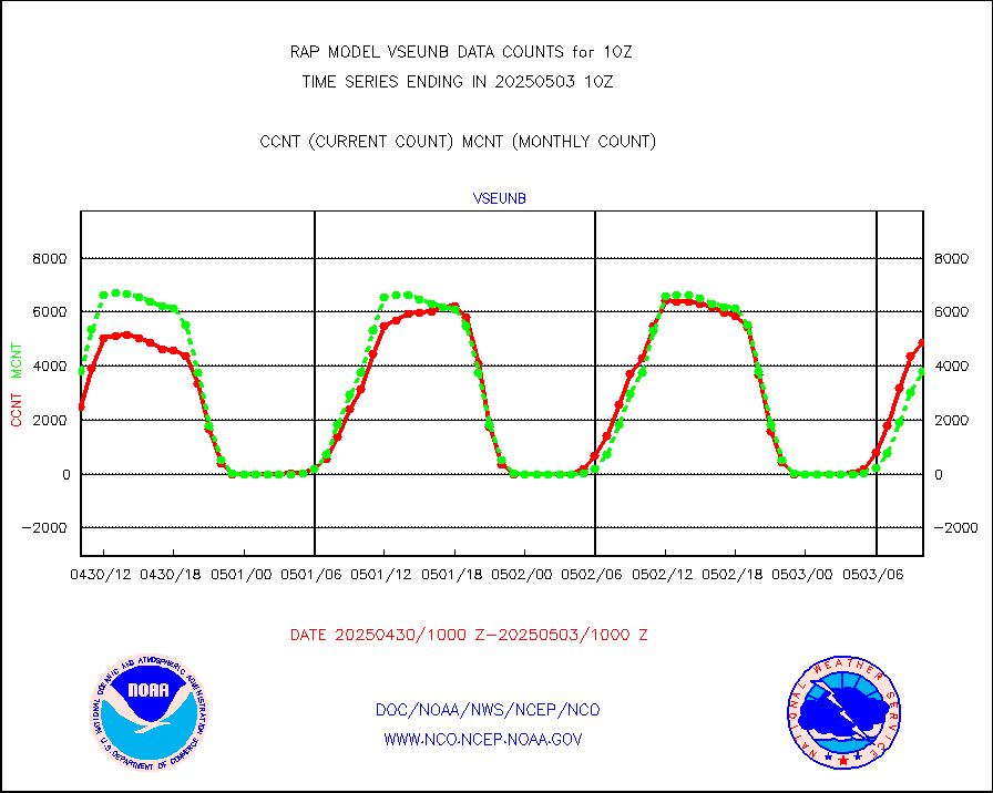
vseunb |
METEOSAT/EUMETSAT visible drv cld motion NBseq |
5641 |
4741 |
119.0 % |
1908.50-1911.49 |


